
What You Missed
Summer 2007
Summer 2007
![]()
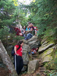
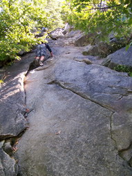
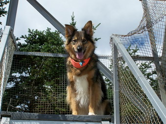
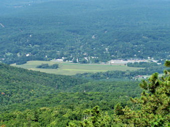
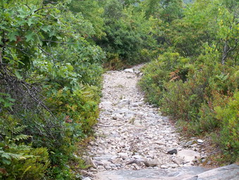
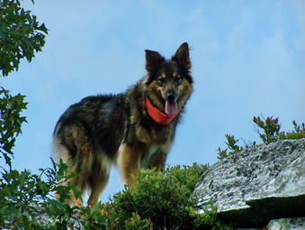
![]() On Friday, Sept 21st I had the chance to accompany the Liberty SCIL Team on their first competition. Their assignment was to climb Slide Mountain while performing certain tasks. My thanks to Mrs. Stolow their regular coach for allowing me this opportunity. The weather was VERY foggy in the morning as I drove to school but the temperature was already in the high 60's or low 70's. I left my plans and materials for the day and then assembled the team and headed for the bus. Soon the ten students and myself were on our way to the Slide Mt parking area to meet the teams from all the other Sullivan County schools in head to head competition! All the students seemed appropriately attired. Most also had a small pack with materials for their academic tasks, food for lunch and water. I, of course, was carrying my Atmos 50 with 6 liters of water, first aid supplies, rope, a windbreaker, waterproof jacket, spare clothing, food, a camera, and other necessary items. We got their just before 9:00 AM and the students received the descriptions of their tasks. They divided the tasks among them and we headed out at 9:08 AM.
On Friday, Sept 21st I had the chance to accompany the Liberty SCIL Team on their first competition. Their assignment was to climb Slide Mountain while performing certain tasks. My thanks to Mrs. Stolow their regular coach for allowing me this opportunity. The weather was VERY foggy in the morning as I drove to school but the temperature was already in the high 60's or low 70's. I left my plans and materials for the day and then assembled the team and headed for the bus. Soon the ten students and myself were on our way to the Slide Mt parking area to meet the teams from all the other Sullivan County schools in head to head competition! All the students seemed appropriately attired. Most also had a small pack with materials for their academic tasks, food for lunch and water. I, of course, was carrying my Atmos 50 with 6 liters of water, first aid supplies, rope, a windbreaker, waterproof jacket, spare clothing, food, a camera, and other necessary items. We got their just before 9:00 AM and the students received the descriptions of their tasks. They divided the tasks among them and we headed out at 9:08 AM.
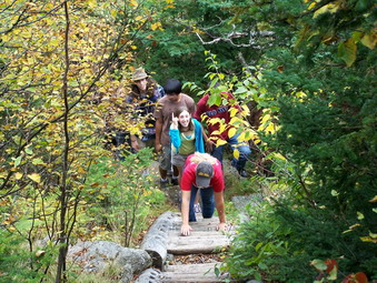
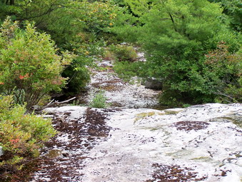
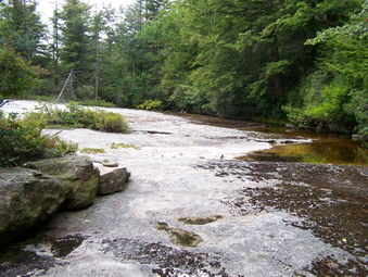
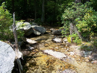
 The Neversink was dry as it has been this summer and we were soon ascending the first part of the trail. After some time walking the group decided to stop for a rest and to get some work done. We had passed one group and another was just ahead. This scenario would repeat itself several times during the hike. Matt, Vito and Angelee had been working on a Shakespearean sonnet as they walked. I was surprised to find out that most students in the group knew the rhyming scheme and that the sonnet should be in iambic pentameter! They wanted to include stanzas that reflected their surroundings but included elements of tragedy and romance. Elana was pouring over a list of frequently misspelled words trying to find the 25 words that were actually wrong. Sarah was concentrating on memorizing "The Highwayman" by Alfred Noyse. Some in the group were surprised I knew many of the verses as it had been turned into a folk song. Ashley was busy braiding a lanyard putting her 4H camp experiences to good use. John, Sam, Jose and Leila were all working on various SAT problems that had to be solved. They had come prepared with paper, pen AND graphing calculator. After a short break, we hurried on our way arriving at the turn UP Slide Mountain. My job was to keep the group on task and to act as "tour guide".
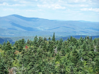
 We began the ascent up Slide at a rapid pace with Matt at the head of the group setting a quick pace. We stopped several times to rest and work and were passed by several groups that we would later pass again. The students worked on their tasks and asked for assistance or approval from the others when needed. After pausing near the 3500 foot mark, we pressed on to the summit. I informed the students when we got to the section that flattens that the steepest part was over and they seemed happy! As the Curtis-Ormsbee cutoff I directed the team to continue on ahead. We stopped briefly at the lookout although their was still too much haze to see much. Just before the summit a member of the Tri-Valley team raced by us going DOWN the mountain. Somehow one team member had become lost. Having all your members at the top was one of the requirements before handing in your completed work! Soon we arrived at the summit and then at the rock outcropping. The teams that had started ahead of us had claimed various areas to complete their work and no team had turned in their completed materials. The group knew that their score would incorporate their time and the tasks they were working on.
 I as a little bored waiting for them to finish so I shouldered my pack and headed back down the trail to find the Eldred team. This team had started just after us but was nowhere to be seen. As I walked down the trail I met some stragglers from the various teams making their way toward the top but no one was from Eldred. I met the coordinator from Monticello who said they were coming but walking VERY slowly and stopping frequently. Their coach had stayed a the parking area and they lacked someone to keep them moving! We walked together until we finally found them below the Curtis-Ormsbee cutoff. We informed them that it was after noon and that they needed to get to the summit to complete their work and turn it in to be scored. We returned with them to the summit. I found my team had already turned in their material and were waiting for the results. I suggested that we might go down to the spring and that there were rock scrambles that they might enjoy. This seemed to be a popular idea and our entire team plus some members from other schools decided to go.
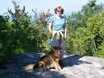
 We began the descent and many of the students were impressed by the steepness of some of the areas and the views that appeared as we descended. Elana asked at one point how we would get back UP. I do NOT believe that my response about "an elevator" was appreciated. Soon we were climbing down the wooden ladders to the spring. The view of Cornell was still shrouded in haze but impressed the students. The spring was running nicely and better than any other time this summer. Vito seemed disappointed that there wasn't more to see but a spring is ... a spring! We took a drink and then started back UP. As we climbed the stairs the way back became clear to Elana and the others. No one had a real problem scrambling over the rocks and most enjoyed this physical challenge. Back a the top the scoring was almost complete and we had to wait only a few minutes for the results. We were second to Tri-Valley by only 3 points! I did feel a little sorry for the other team. Apparently Tri-Valley was no academically inclined girls OR their girls aren't physically in shape to hike. Their school had sent a team of 10 boys!
 After the announcement and some congratulations we headed back down the mountain. Soon, Matt and Sam disappeared, descending at a fierce pace. The rest of the team followed with all of us anxious to get back to the bus. The weather cleared and the dark clouds that had formed at the summit disappeared. The temperature was much warmer and the humidity high. Matt and Sam waited for the rest of the team at around 3500 feet and then continued down the trail. Everyone seemed to make the turns correctly and we were soon back at the bus. We returned to the school after a brief stop for refreshments at a local deli. All the students said they enjoyed the experience. I enjoyed being with this group immensely and hope we can repeat this or a similar adventure at some time in the future. The Liberty High School Hiking Club has a nice ring to it!
![]()
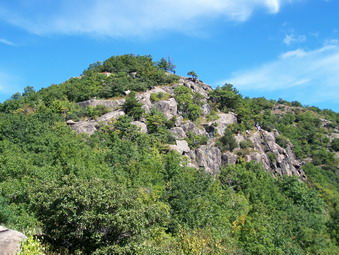
![]() On Sunday, Sept 16th the weather forecast was for a clear but partly cloudy day with temperatures no higher than the mid 60's. It sounded like a PERFECT day for hiking. I convinced my wife we should head for the Eastern Hudson Highlands and Breakneck Ridge. When we left Livingston Manor, the sky fog was just lifting and the sky was almost cloudless but hazy. We crossed the Newburgh-Beacon Bridge and headed south on 9D not knowing exactly where to we were going. After a few miles, we began to see cars parked along the road and then a parking lot appeared. The lot was full and several large groups of people were assembling. A few spots were open on the opposite side of the road so I continued down 9D looking for a place to turn around. We passed through a tunnel underneath the railroad tracks. The hiking guide books mention this tunnel so I knew we were in the right place. We turned around, went back through the tunnel and parked on the side of the road.
On Sunday, Sept 16th the weather forecast was for a clear but partly cloudy day with temperatures no higher than the mid 60's. It sounded like a PERFECT day for hiking. I convinced my wife we should head for the Eastern Hudson Highlands and Breakneck Ridge. When we left Livingston Manor, the sky fog was just lifting and the sky was almost cloudless but hazy. We crossed the Newburgh-Beacon Bridge and headed south on 9D not knowing exactly where to we were going. After a few miles, we began to see cars parked along the road and then a parking lot appeared. The lot was full and several large groups of people were assembling. A few spots were open on the opposite side of the road so I continued down 9D looking for a place to turn around. We passed through a tunnel underneath the railroad tracks. The hiking guide books mention this tunnel so I knew we were in the right place. We turned around, went back through the tunnel and parked on the side of the road.
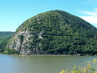
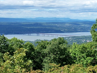
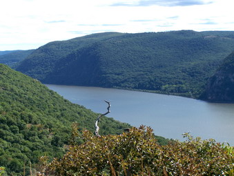
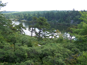
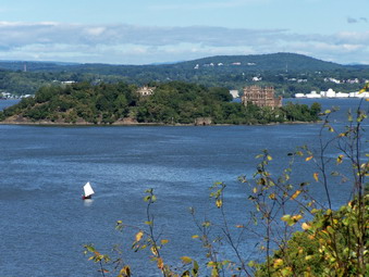 We got our gear out the car, put Sheba on her leash and headed with all the other hikers toward the tunnel. Just before the tunnel we crossed the road and headed up an unmarked trail to a rocky outcropping. Here we got our first look at the views that would dominate much of the hike. The Hudson River was laid out below us! Across the river was the imposing prominence of Storm King Mountains. Further north was Bannerman Island with the castle ruins. Downriver the Military Academy at West Point was just visible. The far shore was occupied by marinas and oil storage tanks. Nearby hills and far away mountains were spread throughout the view. Some barges, sailboats and motor boats plied the waters. A group leader was telling her group about Bannerman Island and the hike ahead of them.
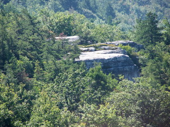
 All the guidebooks had talked about the steepness of this hike and how challenging it was. Nothing quite prepared be for what lay ahead! After a short walk uphill through some woods, the real climb began. The Breakneck Ridge Trail certainly lives up to its name. The trail ascend from the river at and elevation of no more than 150 feet to over 1100 feet in about a half mile! This is by far the steepest climb I have ever attempted. There are areas that are so steep they fall just short of technical climbing or bouldering. Other areas are challenging but more manageable. I began to wonder if Sheba would be able to make all the ascents. I should have been more concerned about myself and my wife. Sheba's only real difficulty was that she had to remain on the leash most of the time. There were several large groups of people, many smaller groups and some solo hikers. We would trade positions with these other hikers several times during the day.
 We climbed for a while stopping occasionally to enjoy the view and take pictures. Sheba waited but not patiently! Several people were amazed at her climbing abilities and one hiker called her "Intrepid!" After one particularly difficult and long section, I though we were at the top since the trail seemed to level. This was an illusion that was to repeat itself three or four times! Many areas had very difficult climbs flanked by easier ways to ascend. "Easier" is a relative term and does not mean any of the climbing was easy. I began to appreciate the cautions about not hiking this trail when it was wet or windy or icy! Finally, after several "false" summits we were at the top of the most difficult climbs. It had taken less than an hour, it seemed like much longer and it was GREAT! We stopped to eat our lunch in an area overlooking the river before continuing on.
 After the long, difficult climb the rest of the trail seems almost tame. This does not mean that the trail remained level for the rest of the hike or that the walking was easy. Several times the trail descends only to climb to the next level. We continued on the white blazed Breakneck Ridge Trail until the red blazes of the Breakneck Trail Bypass appeared on the left. This is the first cutoff and leads to the Wilkinson memorial Trail and back down to the river. We decided to continue on the Breakneck Ridge Trail. I knew that the South Beacon Fire Tower, my personal objective, was probably too far away for the day's hike. I intended to hike to Sunset Point then turn around and take the Wilkinson Memorial Trail back.
 The trails in some areas are poorly marked and are crisscrossed by unmarked trails and woods roads. it is EXTREMELY important to know your route or have maps. Both would be a good idea! Getting to Sunset Point required us to hike up some more as this area is the highest point on our hike. At the top a wooden observation deck looks out over the river. After a short break, we retraced our steps back down to where the blue trail had branched off. In only a few hundred feet the yellow blazes of the Wilkinson Memorial Trail head off to the left. We turned off behind a large group of Japanese hikers. They were hiking at about our speed or a little slower. We stayed behind them until they stopped for a rest and then left them behind. The Wilkinson Memorial Trail is not as steep as the Breakneck Ridge Trail but still must descend back to the river. Its length and the numerous switchbacks help moderate the descent. The trail has a few ups but goes mostly down until the climb up Sugarloaf Mountain. This isn't much compared to the climb earlier in the day but is enough at the end of a challenging hike.
 Sugarloaf Mountain offers the last spectacular views of the Hudson River. These views aren't much different than those from the ascent but are still breathtaking. The trail descends SHARPLY from this point with several difficult areas. It then becomes easier but continues to lead down toward the river. More switchbacks and the meandering nature of the trail help keep the descent manageable. The loose, dry earth and loose talus capped by acorns and a few dead leaves make keeping you footing a difficult task. Soon glimpses of the road and the river peek through the trees and the trail suddenly ends at 9D less than a half mile above the tunnel. Neither trail head is marked! We turned left on the road and walked on the shoulder back to the car. The hike was the MOST CHALLENGING six miles I had ever done. It took five hours but included over 2500 feet of vertical ascent with a maximum elevation of less than 1300 feet.
![]()
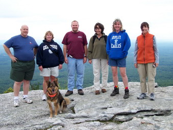
![]() On Friday, Sept 14th my school closed for the Jewish New Year and I was free to hike. I had planned for a long time to hike with a group of people from the Liberty faculty and staff. I met six other people at the school and we drove to Sam's Point parking at 10:00 AM. The weather forecast was for cloudy weather all day but when we left Liberty it almost looked like rain was in the air. The sky looked no better at Sam's Point but we were not deterred. We began our hike by walking up to Sam's Point and taking in the view. Despite the cloudy skies there was plenty to see and everyone seemed eager to press on.
On Friday, Sept 14th my school closed for the Jewish New Year and I was free to hike. I had planned for a long time to hike with a group of people from the Liberty faculty and staff. I met six other people at the school and we drove to Sam's Point parking at 10:00 AM. The weather forecast was for cloudy weather all day but when we left Liberty it almost looked like rain was in the air. The sky looked no better at Sam's Point but we were not deterred. We began our hike by walking up to Sam's Point and taking in the view. Despite the cloudy skies there was plenty to see and everyone seemed eager to press on.
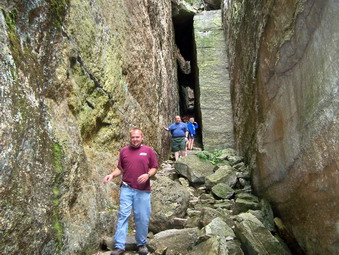 We left Sam's Point and headed for Ice Caves Road. Most people had never been to Sam's Point or had visited so long ago that they did not remember much. The road down to the Ice Caves is very eroded but it was dry and a relatively easy walk. At the Ice Caves we began our decent. At least one in the party was quite tall and we were careful to keep low since several areas are a tight squeeze. The rock in places were wet which also required some careful maneuvering. Everyone was impressed by the magnificent formations formed as the rocks split away from the surrounding bedrock to form these tectonic caverns.
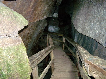 There is one spot where Sheba CAN get around the ladder which ascends to the next level but where I always give her help. After a short walk we were at the door to the Ice Caves. It was cool inside but we did not spot the ice! The solar-powered, motion-detecting lights illuminated our way as we hiked through on the boardwalks. We emerged by climbing a short ladder near the end. Here we were able to get a good view of the valley below and the escarpment ridges to the north. They looked VERY far away but I knew that's where I was going when I after I split with the group. When we were rested, we walked back up Ice Caves Road to the area where the Verkeerder Kill Trail branches off to the right. I gave the group several choices and they decided to walk up to the loop road and around Lake Maratanza.
 At the loop road we turned right and started around the lake. When the lake came into view, most were surprised that the water level was SOS low. I informed them that it had actually risen some since my last visit! We continued to walk until we reached the High Point Carriageway. Here Sheba and I bid our companions farewell as they returned to the parking area and we continued on to High Point. Along the way we again met a worker from the Nature Conservancy widening the carriageway. There was also a rustic wooden bench installed in an area that was a nice view out over the valley. Sheba and I made good time and turned right at the High Point Trail. Shortly we were standing on High Point looking out over the surrounding valley and ridges. The wind had picked up and the weather was not improving but I decided to keep with my original plan to hike the loop across the escarpment, down to the falls and back to the car.
 We followed the trail down off High Point and along the rocky ledges of the escarpment. At one point we encountered a small green snake which stayed motionless as I snapped several portraits. The trail can be damp in places but every place I remember as wet was completely dry. We did meet several sets of hikers coming from the opposite direction. The wind on the exposed escarpment ledges was brisk. The trail wanders along these exposed ledges and then cuts back into the pine barrens. In places, there are some rather steep ascents and descents over these rocky outcroppings. We continued walking until we were at the junction of the High point Trail and the Long Path. Here, the Long Path goes left to Lake Awosting and beyond. We turned right and headed toward Verkeerder Kill Falls.
 The amount of water going over the falls had actually decreased since the last time I had been there! I made a note to return to this and several other falls after the next set of heavy rain storms. Maybe next spring will provide the water volume that turns these drizzles into proper cascades! Sheba and I continued on the trail back to Ice Caves Road. This trail always seems long without much scenery. We did "meet" one couple enjoying a short break together! Several other hikers passed us on the way down to the falls. At the Ice Caves Road we turned right AGAIN. I wanted to do a sort of two loop hike and go back to the parking area via the High Point Carriageway. This was strictly to get in more miles! I also though it would make a neat looking route on the GPS! We continued our hike around the lake and back to the parking area on the High Point Carriageway. At some point the weather had cleared some on this walk was very pleasant. We did 10.65 miles in 5 hours and 15 minutes with a total of 1415 feet of vertical climb.
![]() On Thursday, Sept 13th my school closed for the Jewish New Year and I was free to hike. I had planned for a long time to do a longer hike since the opportunities now are fewer and farther between. However, I started running again and it has felt good! I am 30 pounds lighter since last winter and very strong from hiking. The mistake I made was going from no running to running 6 miles and more at a clip! I am now nursing a left ankle with Achilles tendonitis. My dog is losing the pad on her right hind foot which happens occasionally and it makes the foot tender. Neither Sheba nor I wanted to completely give up on the day so we headed for Balsam Lake Mountain. I intended to do both Balsam Lake and Graham.
On Thursday, Sept 13th my school closed for the Jewish New Year and I was free to hike. I had planned for a long time to do a longer hike since the opportunities now are fewer and farther between. However, I started running again and it has felt good! I am 30 pounds lighter since last winter and very strong from hiking. The mistake I made was going from no running to running 6 miles and more at a clip! I am now nursing a left ankle with Achilles tendonitis. My dog is losing the pad on her right hind foot which happens occasionally and it makes the foot tender. Neither Sheba nor I wanted to completely give up on the day so we headed for Balsam Lake Mountain. I intended to do both Balsam Lake and Graham.
 When we parked at 11:40, there were two cars in the lot and we started out immediately. We made quite a pair as I could feel the stiffness in my left ankle and Sheba was walking on her tiptoes to avoid landing on the sore pad of her foot. As we get into the hike my ankle seemed to loosen up a little but was still sore. We didn't hurry but made the first cutoff in about 20 minutes and turned up the mountain. This didn't bother me too much unless I flexed my foot too much. By this time I had decided to only do Balsam Lake even if I felt good coming down the other side. Graham for September would have to wait! As we approached the area just before the spring we met to male hikers coming down. They were from Rock Hill and we stopped to talk for a few minutes. They asked about the trail for Graham and made nice comments about my dog! Just below the spring we met to women hiking down and exchanged greetings as we passed.
 We didn't set any records getting to the top but we weren't slow either and the tower was soon in sight. I went up to take some pictures. It was EXTREMELY clear at the top with almost no haze. The summit of Graham was clearly visible and with my camera I could see part of the ruins. The views to distant peaks and down into the valleys were superb. When I came down from the tower we had a snack and a drink and then started down the other side. I was cautious on the descent. My ankle didn't seem to be worse but it wasn't any better either. We were back at the car by 2:40 PM. Three hours for a little over 4 miles seemed slow but we had our reasons and we spent quite a bit of time at the top. By the time I drove home, my ankle wasn't hurting at all! I hope it continues to improve. Tomorrow we are hiking with a group of staff members from Liberty schools at Sam's Point.
![]()
![]() On Monday, Sept 3rd my wife and I both had the day off and we decided to take the dog and hike together somewhere. I wanted to go back to Sam's Point and find Napanoch Point, Jacob's Ladder, and Panther Rock. I also wanted to try hiking back on the Berrypicker's Trail. We got a relatively early start and were parked by 9:15 AM with only 4 other cars. In my quest for the perfect hiking pants, I was wearing my Mountain Hardwear Canyon Pants. We headed up the Loop Road to the west side of Lake Maratanza. At the north end of the lake we turned left onto the High Point Carriageway and headed toward High Point. When we reached the junction with the High Point Trail, we stayed left on the carriageway and took the same path I had taken on Friday.
On Monday, Sept 3rd my wife and I both had the day off and we decided to take the dog and hike together somewhere. I wanted to go back to Sam's Point and find Napanoch Point, Jacob's Ladder, and Panther Rock. I also wanted to try hiking back on the Berrypicker's Trail. We got a relatively early start and were parked by 9:15 AM with only 4 other cars. In my quest for the perfect hiking pants, I was wearing my Mountain Hardwear Canyon Pants. We headed up the Loop Road to the west side of Lake Maratanza. At the north end of the lake we turned left onto the High Point Carriageway and headed toward High Point. When we reached the junction with the High Point Trail, we stayed left on the carriageway and took the same path I had taken on Friday.
 We crossed the marshy, wet area as the carriageway descended and turned right at the Smiley Carriageway. Now we concentrated on finding Napanoch Point! Exactly where it is and how to get there are not clear. From the trail my wife spotted a rock ledge through the trees. We walked up the carriageway several hundred feet and then began to see suggestions of trails through the brush to our left. We followed a path which didn't seem to lead anywhere. I took a turn which suddenly revealed a wider path that lead directly to the rock ledge. The search for Napanoch Point was worth it. Several rock ledges gave a magnificent view down into the valley and out toward the surrounding hills. There was some haze but the view was still dramatic. We made our way back to the main carriageway.
 Flushed with success we started to look for side trail to Jacob's Ladder and Panther Rock. Neither of these destinations show up much in the guidebooks or on Internet searches! We took the first side path that we found and soon found the remains of some buildings. These may have been blueberry picker's huts or a hunting camp. The trails around this area all seemed to dead end so we walked back to the main carriageway and tried the next side trail. We turned left and were rewarded with a prominent path complete with stone cairns. We followed this path for more than half a mile until it appeared to be going in the wrong direction. We turned around and AGAIN headed back to the main carriageway! (When I downloaded the GPS route and compared it to the maps, I became convinced that we would have found what we were looking for in only a few hundred feet! Oh well, this gives us a reason to go back!)
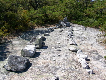 In a short distance we arrived at the buckets on the bushes that indicate the start of the Berrypicker's Trail. We turned right here and began to climb slightly until we reached an open rock area. We stopped here for lunch and a drink before continuing on. I had never hiked this trail before and was not expecting much over its 2 mile length. The trail ascends, sometimes gently and sometimes steeply, through the Badlands toward High Point. It is an interesting combination of open rock face, pine barrens and mixed hardwood forest complete with waist high ferns. On the open rock faces stone cairns and paint blazes mark the way. Various hikers have also taken the time to arrange rocks in fanciful designs. The trail also has some nice views as it winds its way toward the High Point Trail.
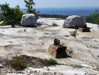 Where the trail ends near High Point, is an open rock ledge with steel attachments in the rock. This is all that remains of the old lookout/fire tower that once stood here. It is also a good place to take a rest and admire the view. We got on the High Point Trail and walked for about 15 minutes to High Point and then turned around and hiked back to where we started. At this point we turned left and followed the High Point Trail down to the High Point Carriageway. I had though about going all the way out on the High Point Trail to the Falls or at least walking down the Loop Road to the east side of the lake passed Sam's Point. I gave up this idea since Cindy seemed REALLY tired and was beginning to drag! We walked back down the High Point Carriageway to the Loop Road and retraced our steps to the car. The entire 11.5 mile hike had taken 6 hours which was more than enough on a day when the temperature was 80+ degrees!
![]()
![]() On Friday, Aug 31st I had thought about finishing the Catskill 3500 list for August by bushwhacking Rocky and Lone. After my last effort at bushwhacking Big Indian and Fir, I decided that peakbagging is rewarding but not always fun. I was more in the mood for fun an this day! In addition, the weather forecast was uncertain and bushwhacking peaks in the rain and lightning is not the smartest thing to do. After Wednesday's hike from Sam's Point Preserve to Minnewaska Park, I was even more anxious to do the "big loop" through these two parks. Sheba and I arrived at Sam's Point at about 10:15 AM. I had delayed a little to let the weather clear. It didn't work! When we parked the air temperature was 67, the sky was completely overcast and the air was VERY humid. I parked outside the gate since I wasn't sure what time we would return.
On Friday, Aug 31st I had thought about finishing the Catskill 3500 list for August by bushwhacking Rocky and Lone. After my last effort at bushwhacking Big Indian and Fir, I decided that peakbagging is rewarding but not always fun. I was more in the mood for fun an this day! In addition, the weather forecast was uncertain and bushwhacking peaks in the rain and lightning is not the smartest thing to do. After Wednesday's hike from Sam's Point Preserve to Minnewaska Park, I was even more anxious to do the "big loop" through these two parks. Sheba and I arrived at Sam's Point at about 10:15 AM. I had delayed a little to let the weather clear. It didn't work! When we parked the air temperature was 67, the sky was completely overcast and the air was VERY humid. I parked outside the gate since I wasn't sure what time we would return.
 My plan was to walk up the Loop Road to the east and north of Lake Maratanza and then pick up the High Point Carriageway. I would then continue of the carriageway where the High Point Trail breaks right to go up to High Point. I planned to take this carriageway until it ended at the Smiley Carriageway in the Minnewaska Park after Napanoch Point. By turning right on the Smiley Carriageway we would end up at Lake Awosting. From here we could follow the Lake Awosting Carriageway around the lake counter clockwise. At the southwest end of the lake we would pick up the Long Path and follow this passed Mud Pond to Verkeerder Kill Falls. From the falls the Long Path leads to Ice Caves Road, back to the Loop Road, passed Sam's Point and back to the parking area. I estimated that this "big loop" would be just less than 15 miles and that we could average a little under 3 miles per hour with stops!
 Sheba and I got on the trail after checking with the park attendant concerning my plan. She assured me that I could take the High Point Carriageway to the Smiley Carriageway and that this WOULD bring me to Lake Awosting. Sheba and I moved VERY quickly on the wide road up to Lake Maratanza. I had decided to make no side trips along the way since my main objective was to complete a loop. We turned left off the Loop Road just after the TV and radio towers. We had not seen any other hikers at this point. As we continued on the High Point Carriageway, we both began to hear a noise that to me sounded like a vacuum cleaner. The noise grew louder until I saw a truck with the Nature Conservancy logo on the side. Further down the path, I saw another truck with several workers near it. Apparently they were cutting some of the brush along the path with a brush hog or weed whacker! This was what was making the noise. I was not sure why they were doing this but I said "Hello" and we walked on by. It took us less than an hour to reach the point where the trail goes up to High Point.
 We did not take the High Point Trail but continued on the High Point Carriageway. This trail is NOT maintained and does NOT resemble the other carriageways in either park. It is narrow for the first part with bushes closing in over the trail. In many places, the footing is unstable with many rocks littering the pathway. The trail descends from High Point gradually at first and then more steeply. At one low point there is a swampy area where the trail is a sea of dark black mud. Sheba and I skirted this area by bushwhacking a little where it seemed others had done the same. The trail also crosses the headwaters of some unnamed tributary of Rondout Creek but this was virtually dry. We had to pay close attention to where we going since the path is NOT MARKED. In some areas it is hard to tell what is the High Point Carriageway, what is dry creek bed and what is a pathway made by other explorers. The trail starts to rise as it approaches Napanoch Point. Suddenly, we arrived at a T. I was a little surprised but the map clearly showed we were at the Smiley Carriageway.
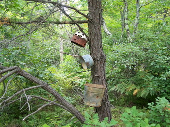 At this point we turned right since turning left eventually leads to Ellenville. The Smiley Carriageway looks much more like the rest of the carriageways in Minnewaska Park. It is wide and fairly well-maintained in most places with only a few blowdowns in places. We arrived at Napanoch Point soon after we turned. At one time this may have been a good lookout but now the vegetation blocks and view. The carriageway turns sharply right here. In less than a half mile, a wide trail turns left and leads to Panther Rock and Jacob's Ladder. I considered a visit to these two landmarks but decided to leave them for a later hike. It was around noon when we ran across the next trail junction. This junction was marked by three blue blazes on the rock and several old pots hanging on a tree. This is the "beginning" of the Berrypicker's Trail that leads back to High Point. This would be an alternate route to the High Point Carriageway and I made a note to take it next time for some variety.
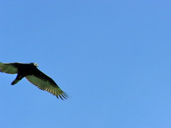
 In places the Smiley Carriageway crosses other woods roads or trails and I had to pay close attention to the maps to make sure we did not stray in the wrong direction. The path starts to descend toward the upper end of Stony Kill. It becomes very rocky as it descends and a few views open up. On this day any views were hidden by the haze hanging over everything! We soon arrived at the Stony Kill but this was hardly noticeable. The stream was almost dry with only a few pools and a little running water! From here we continued on toward Fly Brook. As we descended toward Fly Brook, We kept hearing the most raucous bird calls in the trees around us. The birds remained hidden until just before the stream crossing. At this point I saw the culprits were turkey vultures apparently nesting in the trees. In this area the Stony Kill Carriageway continues on toward Stony Kill Falls. We turned right and crossed Fly Brook which had some water in it. This areas was interesting with broad, open rock shelves and features that hinted at a greater volume of water!
 There were several turnoffs from the carriageway as well approached Lake Awosting and we took what looked like the path that would get us to the ranger cabin. We made good choices and arrived at the cabin at around 1:15 PM or 3 hours into the hike. We rested briefly on the cabin steps to eat lunch and get a drink. The sun began to peak through the clouds. At this point I began to think about what route to take back. I knew that there was a decision point just above the Falls. At this point the Long Path continues on to the falls and back toward Ice Caves Road. This is the path we took on our Wednesday hike only two days before. The other alternative was to follow the High Point Trail along the ridges to High Point and then back to the High Point Carriageway and Loop Road. This would add between 1.5 and 2.0 miles to the hike. I decided to wait until we got there to make that decision. We continued around to the southwest end of the lake on the Lake Awosting Carriageway. After the sharp turn at the end of the lake the carriageway rises. A "path" leads off to the right just after some cliffs. This path was once marked with the aqua blazes of the Long Path now painted over. After just a few hundred feet this path intersects the Long Path where we turned right toward Mud Pond.
 We were hiking very quickly now since the weather had turned cloudy again and the mist was getting even heavier. We had explored this path extensively on Wednesday and I had taken pictures on that day when the conditions were better. I told Sheba to follow the trail and I followed Sheba. We arrived at Mud Pond by 2:00 PM and I estimated we would be at the trail junction by 2:15. We continued our quick pace along the spine of rock that ascends to the trail junction above the Falls. We arrived at around 2:20 and I had to make a decision. My GPS read over 9 miles, a light rain or heavy mist prevailed and I did not want to spoil the fun of the hike by getting wet. I decided to continue on down to the Falls and follow the original plan. We descended the Long Path and shortly arrived a the Verkeerder Kill Falls and crossed over to the other side. The path that lies between the Verkeerder Kill Falls and Ice Caves Road is NOT my favorite! It twists and turns and has many uneven rocks along the way. At one point, as I was following Sheba, the dog turned and came back to me. This always means that there are people on the trail and we stopped to talk to a young couple headed for the Verkeerder Kill Falls.
 By 3:00 PM we were finally at Ice Caves Road and we headed for the Loop Road that would take us passed Sam's Point and back to the car. Along the way we met another young couple. We stopped to talk to them about the trails and the ecology of the area. As we talked a family passed us. This made only the fourth group of people we had encountered! After finishing our conversation, we continued on the road, passed Sam's Point and down to the Conservation Center. We were back at the car by 3:30 PM. We covered just over 13 miles in 5 hours and 15 minutes. I also left plenty of side trips and trail variations for next time!
![]()
![]() On Wednesday, Aug 29th I was scheduled to teach a class for coaches at 5:00 PM. Usually I just hang out on days like this but I didn't want to waste the majority of the day. I decided to go to Sam's Point to check out the Long Path from Sam's Point to Lake Awosting in the Minnewaska Preserve. I had wanted to hike between these two areas for some time. By the time I arrived at 9:45 AM I had already decided that I didn't have enough time to try and attempt the loop using the Smiley Carriageway. I wasn't sure of the location of this path or how well it is marked. I decided just to do and out and back using the Long Path and adding miles if I wanted at Sam's Point. Several people and online accounts promised that the Long Path was now open and remarked from Verkeerder Kill Falls passed Mud Pond to Lake Awosting. I wanted to check it out for myself. The weather was partly sunny but warm with temperatures in the low 80's and high humidity. In my quest for the perfect hiking pants, I was wearing my Mountain Hardwear Destination Pants.
On Wednesday, Aug 29th I was scheduled to teach a class for coaches at 5:00 PM. Usually I just hang out on days like this but I didn't want to waste the majority of the day. I decided to go to Sam's Point to check out the Long Path from Sam's Point to Lake Awosting in the Minnewaska Preserve. I had wanted to hike between these two areas for some time. By the time I arrived at 9:45 AM I had already decided that I didn't have enough time to try and attempt the loop using the Smiley Carriageway. I wasn't sure of the location of this path or how well it is marked. I decided just to do and out and back using the Long Path and adding miles if I wanted at Sam's Point. Several people and online accounts promised that the Long Path was now open and remarked from Verkeerder Kill Falls passed Mud Pond to Lake Awosting. I wanted to check it out for myself. The weather was partly sunny but warm with temperatures in the low 80's and high humidity. In my quest for the perfect hiking pants, I was wearing my Mountain Hardwear Destination Pants.
 Sheba and I hiked rapidly up passed Sam's Point to Ice Caves Road. We turned right and after only .1 miles left on the Long Path. The trail to the Verkeerder Kill Falls is not one of my favorites because of the number of rocks but we made it to the Verkeerder Kill Falls very quickly. There was even less water going over the Verkeerder Kill Falls than the last time we were there! Crossing the Verkeerder Kill was easy and we stayed on the Long Path as it winds its way up to the High Point Ridge. The climb is steep but short. At the top the High Point Trail turns left but we followed the Long Path to the right. The markings were clear with some showing fresh paint and there were stone cairns along the way. The Long Path follows a ridge of rock and slowly descends toward Mud Pond. The views aren't spectacular in most places and I was simply looking to make the best time possible on the way out. I decided to take pictures on the way back if time allowed.
 We reached an area where it was obvious that the blazes for the Long Path had been painted over and new ones had later been placed. This was thee area closed by the previous private land owner. My GPS told me that I was near Mud Pond but I could not see it. I chalked this up to another landmark that would be hidden in the dense forest. Just before turning to the left and descending I caught a glimpse of a small, secluded body of water. This was Mud Pond. It had some cliffs on the far side and was not much more interesting than many of the ponds I had visited. Still, it was the first time I had seen this pond AND I suspect not many others get to see it because of its remote location. We descended to the level of the pond walking along the northern shore just out of sight of the water. At one point a boardwalk appeared to allow the crossing of Fly Brook. This was not necessary since the brook was nearly dry due to the lack of rain all summer. The trail continued passed the northeastern end of the pond and I decided I would try to stop by there on the way back.
 The trail continues to winds its way toward Lake Awosting and begins to climb to reach the higher elevations around the lake. Soon the trail emerges from the forest onto a rock ledge that offers views back to Sam's Point and limited glimpses of Lake Awosting. Sheba and I sat in the same spot we had visited with Cindy only a short time before. We ate lunch and got a drink. I got out the camera and took some pictures. As we started the return trip I kept the camera out to take pictures on the way back. We stopped in several places along the edge of the pond to take in the views and so that I could snap some photos. In between photo sessions we moved very quickly and were soon back at the point where the Long Path and High Point Trail meet. Here I noticed several birds riding the air current above us. I took several pictures of them as they swooped VERY CLOSE to our location. Later inspection showed these graceful creatures to be turkey vultures!
 We walked down the trail to the Verkeerder Kill Falls and I took some pictures from the south rim of the chasm. The Verkeerder Kill Falls are ALMOST DRY and the Verkeerder Kill has little water in it ant any point. As we continued on the path back to Ice Caves Road, we met several groups of people; some more talkative than others. I told several people that the Verkeerder Kill Falls were almost dry but that the view was worth the trip. When we got back onto the loop road, I realized just how hot and humid it was! We hurried back to the parking area making it at around 2:00 PM. We made the 9 mile trip in about 4 hours and 15 minutes with GENEROUS amounts of time for pictures and conversation.
![]() On Sunday, Aug 26th my wife and I decided to take a hike after church. Just as we were ready to leave, the ambulance pager sounded and I had to take and hour and a half out of our hiking time. When I returned, we had a limited amount of time left. The original plan was to go to Sam's Point but we revised that plan. We decided to go somewhere closer. The choices were Trout Pond, Balsam Lake, Big Pond or Alder Lake. We decided on Alder Lake since we had not been there together for some time. The Alder Creek Road is paved until it ends and is in good shape. Cross Mountain Road is unpaved dirt and is VERY rough and rocky. We took the SUV and I would be reluctant to take my Eclipse over this short piece into the Alder Lake Parking Area. We parked at 2:05 PM in a very crowded parking area and headed for the lake. We intended to hike to the Beecher Lake vista or as far as we could get.
On Sunday, Aug 26th my wife and I decided to take a hike after church. Just as we were ready to leave, the ambulance pager sounded and I had to take and hour and a half out of our hiking time. When I returned, we had a limited amount of time left. The original plan was to go to Sam's Point but we revised that plan. We decided to go somewhere closer. The choices were Trout Pond, Balsam Lake, Big Pond or Alder Lake. We decided on Alder Lake since we had not been there together for some time. The Alder Creek Road is paved until it ends and is in good shape. Cross Mountain Road is unpaved dirt and is VERY rough and rocky. We took the SUV and I would be reluctant to take my Eclipse over this short piece into the Alder Lake Parking Area. We parked at 2:05 PM in a very crowded parking area and headed for the lake. We intended to hike to the Beecher Lake vista or as far as we could get.
There were some other dogs near the lake so we put a leash on Sheba and quickly headed down the trail on the left side of the lake. We noticed that some bushes had been pulled down and there was a LARGE amount of bear scat on the trail! We quickly arrived at the other end of the lake and took the Millbrook Ridge Trail toward Balsam Lake Mountain. This trail rises continuously passing Alder Creek which flows on the right. The creek was flowing well this day from the rains the previous week. The weather was warm and it was pretty humid but it didn't seem too bad as we hiked. Areas of the trail were a little wet and muddy in places but nothing that couldn't be walked around. As we arrived at the lean-to and the beaver meadow, the skies clearer some and the sun began to peak through.
After the beaver meadow, there are several wet areas with plenty of nettles. The trail then climbs more steeply in several places as it gets closer to the high point of the Millbrook Ridge. This high point is over 3400 feet according to several different GPS readings. That makes it close to another 3500 foot peak in the Catskills! We arrived at the top of the ridge at about 4:00 PM and decided it was a good time to turn around and head back. We didn't hurry on the way back but we didn't dawdle either. We were back at the parking area by 5:30 PM after covering the 7 mile distance.
![]() On Friday, Aug 24th the skies were overcast, a heavy fog hung close to the ground and the mist in the air was so heavy it was almost like rain. The weather forecasters were split on whether or not it would rain or clear during the day. I decided not to "waste" the day and to go hiking. I decided to try and "bag" Big Indian and Fir for August. I knew when I headed out that this wouldn't be easy. Everything in the forest would be wet from the recent rains, there was no sun to help in navigation, and it would likely rain at some point. Nevertheless, off we went to the Biscuit Brook Parking Area for what would turn out to be quite and adventure! We parked at 9:15 AM and were soon in the woods. In my quest for the perfect hiking pants, I was wearing my Campmor Trekmor Pants.
On Friday, Aug 24th the skies were overcast, a heavy fog hung close to the ground and the mist in the air was so heavy it was almost like rain. The weather forecasters were split on whether or not it would rain or clear during the day. I decided not to "waste" the day and to go hiking. I decided to try and "bag" Big Indian and Fir for August. I knew when I headed out that this wouldn't be easy. Everything in the forest would be wet from the recent rains, there was no sun to help in navigation, and it would likely rain at some point. Nevertheless, off we went to the Biscuit Brook Parking Area for what would turn out to be quite and adventure! We parked at 9:15 AM and were soon in the woods. In my quest for the perfect hiking pants, I was wearing my Campmor Trekmor Pants.
The first part of the hike is a trail and an old woods road. It was wet but the vegetation on the trail is minimal. I was surprised that it wasn't muddier and that some of the small streams weren't a little higher. After slipping on several rocks and roots, it became clear that this would be the order of the day. I decided to bushwhack Fir first to get that out of the way and then follow the Catskill Divide over to Big Indian. I had done this in the winter in reverse but had followed someone's footprints in the snow and the vegetation was considerably less. I did remember it as being relatively easy. That well may have been my first mistake of many for the day. We hiked to the lean-to and crossed the stream just after that. Here is where I usually head up to Fir so we entered the woods. After only a short distance I was soaked from the water on all the surrounding plants. In addition, the day was getting hotter and more humid. I couldn't tell if it was raining or whether the drops of water were just falling off the trees.
I knew I needed to head north to get to Fir which meant staying to the "left". I specifically warn people in the description of the hike to Fir on this site NOT to stray too far east since Spruce Mountain is near. After a short distance a small ravine lay ahead of us with a stream running through it. This was NOT what I expected. We climbed down into the stream bed and I took a compass reading. We were headed south not north! This was so unexpected that I doubted by readings. We climbed up the opposite bank and I hunted around for a trail or herd path but none was obvious. At this point I decided that I was so turned around that the ONLY thing to do was to go back to the main trail. Back down into the ravine we went. At this point I told Sheba to take us back the way we came. Specifically I told her "Trail". I really didn't think she would be able to do this so I was surprised when she confidentially started off with and obvious purpose. I checked the GPS several times and watched for broken vegetation and familiar "landmarks". Sheba led me directly back to the main path without hesitation!
Back on the path I realized my mistake. Every time there was on opening in the forest I turned to the right. I THOUGHT I corrected this by a corresponding turn to the left but it was not enough! My GPS track clearly showed my direction of travel was nearly due east until I turned south. At this point I was glad to be on the path and decided to go to Big Indian first. I figured that way I could at least get ONE peak and come back another day for Fir. The hike on the trail was SO EASY compared to my short bushwhack that my mood improved. The water crossing over Biscuit Brook was actually quite easy and the rest of the hike was uneventful. Around 11:00 AM the sun started to peak through the clouds. Shortly after that the mist burned away and the skies cleared! We were just about to the 3500 foot sign at this point. My mood improved considerably and I began to think about walking the Divide to Fir after Big Indian. This could very well have been my next big mistake.
The herd path to Big Indian is now very well defined except for some blowdowns which obscure it in places. A stone cairn on the main trail marks the best path. I followed Sheba up to the canister. She somehow knew that we needed to stop even though the path continues. I signed in and made the fateful decision to go to Fir. My clothes were already wet but my feet were getting amp which I did not expect. I was wearing my Asolo Fugitives which are supposed to be Waterproof with a Goretex membrane. The proper way to get to Fir is to walk southwest off the end of the Big Indian ridge and STAY ON THE CATSKILL DIVIDE. I knew that getting off the Divide meant dropping down into areas that would need to be climbed out of later. We started off with me using the sun as a guide. After a short distance it was clear that I had made ANOTHER MISTAKE. I was too far to my left and off the Divide! I took another compass reading and looked a the GPS. It was clear that I need to headed MUCH further to my right which meant traversing and even climbing some back toward the Divide. We did this and the going was incredibly tough! After a while I picked up a herd path that seemed to be going in the right direction and followed that for awhile.
I had marked a waypoint for the middle of the Divide at its lowest point and we headed that way. In several places there were cliffs in the way. I decided that they weren't very high and it was better to descend them directly rather than to work around them. After several slips and falls we were near the point I had marked. As we continued it became clear that I had made ANOTHER MISTAKE. Of course, bushwhacking is an art not a science and since there is no trail to follow there are many ways to get to the same place. Most people are careful to choose the easiest way! I somehow had chosen a direct route and took us up and over a small ridge. This was unnecessary so I headed a little more to my left and started to climb Fir.
Since I had strayed off the Divide, the climb up Fir was further and steeper than it needed to be. Cliffs in several areas proved challenging. Soon a herd path appeared and we followed this on and off toward the top. Near the top the terrain levels off and crisscrossing paths confuse the issue. I headed for the highest spot marked on the GPS. As I got near this area things started to look familiar and I walked right to the canister! Things were looking up, a little. We still had to descend through the wetness to the trail back to the parking area. I knew that walking almost directly toward the sun would get me where I wanted to go so I tried to keep that in mind. The descent wasn't all that easy. I was tired by this time and I started to get muscle cramps. I was wet and a quick inspection showed numerous cuts and scratches which are pretty typical of a tough bushwhack. My feet were soaked by now and I could feel "hot spots" developing. There wasn't much to do but continue. I got to an area that looked like a clear path to the main trail but it was FILLED with nettles. I decided to traverse this area and find another way down. Near the end I headed directly for Biscuit Brook and hit the trail a little further north than I had planned. This was okay with me since walking the trail seemed SO EASY.
On the way back I slipped a couple of times from not paying attention. Various body parts were competing for attention so I ignored them. The walk back from the lean-to is ALWAYS TOO LONG. The trail cuts back and forth a couple of times making it that much longer. Eventually I saw the trail register and the road. The distance was right around 9 miles but it had taken just short of 7 hours! I was wearing my Asolo Fugitive hiking boots. At the car, I removed my boots and my feet were a mess. I have already emailed Asolo asking them what WATERPROOF means. I love the boots in all other ways but having wet feet really makes for a lousy hike. I must say that I felt good about meeting and defeating the challenges even though many of them were set up by my errors. I had though about doing Rocky and Lone on Saturday. They will have to wait until my feet are better. I think Saturday will be a day of rest.
![]()
![]() On Wednesday, Aug 22nd I was scheduled to teach a class for coaches at 5:00 PM. Usually I just hang out on days like this but I didn't want to waste the majority of the day. I decided to hike a route close to home that I had never done. I chose to try the Long Pond Beaverkill Trail to the Mongaup Hardenburgh Trail to the Mongaup Willowemoc Trail. This makes a loop which I judged to be about 9 miles. Most of the loop looked to be relatively flat with a few steeper areas on the Mongaup Hardenburgh trail as it passes over the Mongaup Mountains. The weather was overcast with a foggy haze hanging near the ground in the morning. Despite the unsettled look of the sky, or what I could see of it, the weather report called for only a SLIGHT chance of showers in the morning. The temperatures were in the high 50's or low 60's when I started out.
On Wednesday, Aug 22nd I was scheduled to teach a class for coaches at 5:00 PM. Usually I just hang out on days like this but I didn't want to waste the majority of the day. I decided to hike a route close to home that I had never done. I chose to try the Long Pond Beaverkill Trail to the Mongaup Hardenburgh Trail to the Mongaup Willowemoc Trail. This makes a loop which I judged to be about 9 miles. Most of the loop looked to be relatively flat with a few steeper areas on the Mongaup Hardenburgh trail as it passes over the Mongaup Mountains. The weather was overcast with a foggy haze hanging near the ground in the morning. Despite the unsettled look of the sky, or what I could see of it, the weather report called for only a SLIGHT chance of showers in the morning. The temperatures were in the high 50's or low 60's when I started out.
 We drove down DeBruce Road and turned left on Flugertown Road in Willowemoc. I continued on this road until it turned to gravel and then dirt. When I couldn't get any further I parked and we got out the car. we headed up the road although I wasn't sure exactly where the trail was. When I got to the private property signs I knew that I was already on Basily Road where I did NOT want to be. We walked back to the car and a little further down the road. We explored one area but could not find the trail. About this time my mistake dawned on me! We got back into the car and drove back toward Willowemoc to an area where we had hiked before. We parked here, about 2.4 miles in from DeBruce Road, got out of the car and walked down the road. Almost immediately the red blazed Long Pond Beaverkill Trail cam up on the right side of the road. There were also yellow blazes from the Mongaup Willowemoc Trail.
 We set off up the trail and after about .5 miles we were at the point where the two trails split. We followed the Long pond Beaverkill Trail to the right. This trail wanders back and forth and up and down as it makes its way toward the Mongaup Hardenburgh Trail which crosses the Mongaup Mountains ridge. Near the ridge it climbs some but is otherwise pretty tame. The trail seems to get little traffic. There are several large blowdowns, some of which seem new and some very old. There are a few areas of nettles but the briars are the real challenge! Several areas have briar patches that are thick and tall. The only way to get through is to push your way through or use a stick to beat the brush. This slowed us down considerably and as more time passed I wondered if I would be done in time for my 5:00 PM class!
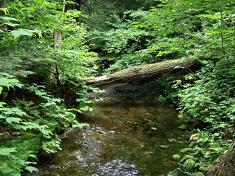 After about 2.5 miles on the Long Pond Beaverkill Trail, we came to the junction with the Mongaup Hardenburgh Trail and turned left. This trail is a little more traveled but very poorly marked. Although I knew at all times we were on the right trail, the blue markers were few and far between. This trail has more areas of descent and ascent than the one we had been on. Some areas are even a little steep as the trail ascends Mongaup Mountain and then drops toward Mongaup Pond. The recent rains had made some of the flat areas on top very muddy. The descents also had slippery areas with some hidden under loose dirt and briar patches. As we descended the lower part of the this trail, we began to really pick up speed and my doubts about the time began to lessen. We passed one family going back down the mountain. They had not made it to the top but I told them there wasn't much to see. After 3.4 miles, we were at the upper end of Mongaup Pond where the blue trail bears right. We headed left on a wide snowmobile trail looking for the yellow markers of the Mongaup Willowemoc Trail.
 Since we had never been on this trail before, it was hard to know what the yellow trail would look like. It seemed to me on the map that we should cross three small streams and then find the trail on the left. After crossing the third bridge, there was no yellow trail. We continued and found a fourth bridge and the yellow trail as a wide, well-marked path right after the bridge. This trail is also a snowmobile trail so it is wide and clear of most vegetation. It also descends for almost the entire length and had no major climbs. Glancing at my watch put ALL doubts about returning on time to rest. There are several bridges along the way. The most notable crosses Butternut Creek which was running pretty well from the recent rains. In 2.8 miles we were back at the trail junction with the Long Pond Beaverkill Trail. In half a mile we were back at the car. We did 9.5 miles in 3.5 hours leaving time to spare for a snack and shower before class.
![]()
![]() On Monday, Aug 20th I headed for Sugarloaf, one of the five peaks I still need to complete August. The weather was cloudy and cool with the air temperature in the high 50's when I we parked at the Roaring Kill Parking Area in Elka Park. There was no rain in the forecast but I did not expect the temperature to rise much during the day. The cool temperatures are better for hiking but sunlight always improves my mood. There was no one parked when we started our hike. My plan was to go up to Pecoy Notch and to go up and back down Sugarloaf. I then planned to see how I felt but I had little doubt that I would climb Twin also. Sheba seemed fresh so we got started immediately.
On Monday, Aug 20th I headed for Sugarloaf, one of the five peaks I still need to complete August. The weather was cloudy and cool with the air temperature in the high 50's when I we parked at the Roaring Kill Parking Area in Elka Park. There was no rain in the forecast but I did not expect the temperature to rise much during the day. The cool temperatures are better for hiking but sunlight always improves my mood. There was no one parked when we started our hike. My plan was to go up to Pecoy Notch and to go up and back down Sugarloaf. I then planned to see how I felt but I had little doubt that I would climb Twin also. Sheba seemed fresh so we got started immediately.
 The Roaring Kill Trail ends after only a sort distance when it meets the Pecoy Notch Trail. We turned left to go up to the notch. The trail rises gradually at first and passes through a hemlock forest as it parallels a small stream. The trail passes the lower end of an active beaver pond at one point. Due to the recent rain the pond was higher than usual. The trail was partly under water and the rest was a wet and muddy mess. I managed to avoid most of the muck but Sheba had black mud more than halfway up her leg. The trail after this rises more seriously and passes over large rocks in a few spots. One area is particularly rich in the remains of bluestone quarries and the talus from the mountain slope. Here there is a good view of Kaaterskill High Peak and Roundtop as well as Twin Mountain. Various visitors have piled the stones to make fanciful designs such as thrones and tables. We stopped here to take some pictures and then pushed on. We were soon at the notch where we turned right to go up Sugarloaf.
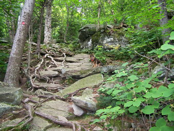 The climb up Sugarloaf from Pecoy Notch is often steep and is not easy. Several areas require rock scrambling skills and the ability to scale nearly vertical terrain. As we neared the top the trail leveled some and views over to Twin Mountain revealed themselves. I stopped to take some pictures of that mountain and the valley and hills beyond. After a little more climbing the trail remains almost levels with a few ascents to reach the summit of Sugarloaf. There are really no views from the top so we continued a little ways down the other side. Shortly after the summit, just as the trail starts to descend, there is a side trail on the left with a marked campsite. We took his trail and arrived at a nice lookout. It was noon so we stopped to get a snack and take some pictures. We returned to the main trail and retraced our tracks down the mountain. Going down may be physically easier most of the time but you need to pay attention since a wrong step can be dangerous!
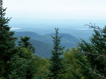 Once back at Pecoy Notch, we continued straight ahead on the Devil's Path toward the western summit of Twin Mountain. This climb is truly taxing! The trail starts up almost immediately and NEVER relents until just near the top. MANY areas have tricky rock scrambles that require a strong upper AND lower body. One of these climbs is a little too much for Sheba and I always give her a boost. This time she negotiated most of these areas only asking for help in one place! Where there are no major boulders there is loose gravel to add to the fun. Near the top is a large rock overhang that offers protection from the elements when needed. The trail passes to the right of the "cave" through a narrow space between the rock of the mountain and large pieces that have separated. We climb through here and then continued on to the highest point on Twin Mountain. I stopped to take pictures. Most of the mountains and valleys in the distance were shrouded in a haze. The sun did come out briefly and my mood improved but the view did not.
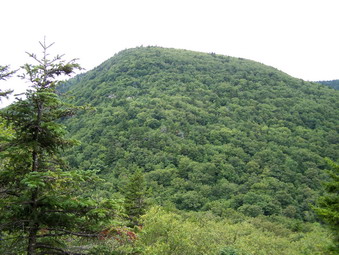 At this point we continued to the eastern peak of Twin Mountain since the view there is the one I remember best and the trip is short. No matter what the maps say we walked between the two peaks in 15 minutes! I had forgotten that there is a significant drop to a small Col between the two peaks. The climb to the eastern peak is slight but the return trip to the western summit is a little harder. At the eastern summit the trail passes over an open rock shelf. The views from here are spectacular when the weather is nice. Today they were obscured by haze and the overcast weather. Overlook Mountain with its TV antennae and fire tower is clearly visible in the east. The higher summit of Twin Mountain and Sugarloaf can be seen to the west. We got a snack, I took pictures and then we returned the way we had come.
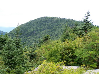 From this point on Sheba and I descended as fast as we could to get back to the Notch. The descent is faster than coming up but MUCH more dangerous. A loss of concentration and one false step usually mean falling or banging into the unforgiving rock. At he Notch we turned right to descend the mile and a half to the car. The way back is easier since it is all downhill and the way is not so steep. We didn't stop at all on the way back except for Sheba to rinse her muddy paws. The way back usually seems long but went very fast today. We were back at the car by 3:30 PM after covering almost 8 miles!
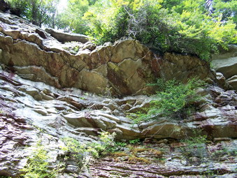
![]()
![]() On Sunday, Aug 19th I had planned to do the bushwhack to Rocky and Lone. I need only five peaks to "complete" August and am anxious to get them done. Cindy wanted to come along and was not thrilled about a bushwhack. We decided to go to Minnewaska and hike out to Lake Awosting. We got some bagels at Peez Leweez and headed for Minnewaska. It was about 10:30 AM when we got to the park. The upper lot was already full and the one below it was getting there! There were people EVERYWHERE walking, hiking, biking and generally milling about. Cindy and I decided to get on the Upper Awosting Carriageway and walk as fast as we could. We knew that we could out hike anyone hiking or walking. We also decided to get off the carriageways and onto some rugged trails as quickly as we could. We passed several groups stretched across the wide carriageway making their way slowly somewhere. One group of bikers rode by suggesting we put Sheba on a leash. I suggested they put a sounding device on their machines as required by law. We passed these three within half a mile when they became tired.
On Sunday, Aug 19th I had planned to do the bushwhack to Rocky and Lone. I need only five peaks to "complete" August and am anxious to get them done. Cindy wanted to come along and was not thrilled about a bushwhack. We decided to go to Minnewaska and hike out to Lake Awosting. We got some bagels at Peez Leweez and headed for Minnewaska. It was about 10:30 AM when we got to the park. The upper lot was already full and the one below it was getting there! There were people EVERYWHERE walking, hiking, biking and generally milling about. Cindy and I decided to get on the Upper Awosting Carriageway and walk as fast as we could. We knew that we could out hike anyone hiking or walking. We also decided to get off the carriageways and onto some rugged trails as quickly as we could. We passed several groups stretched across the wide carriageway making their way slowly somewhere. One group of bikers rode by suggesting we put Sheba on a leash. I suggested they put a sounding device on their machines as required by law. We passed these three within half a mile when they became tired.
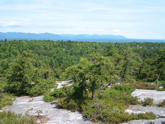 As we approached Litchfield Ledge, we decided to turn right and take the Long Path toward Rainbow Falls. This was a short walk but it did get us away from other people. The "falls" were barely a trickle falling from the ledge above to the talus slope below. We continued on the Long Path along the base of the cliff for less than a mile until it ascended steeply to the ridge. On the ridge their were several nice views back to Litchfield Ledge. We walked over to the other side of the ridge along the Long Path. We took in the views of the mountains in the distance and then continued down the rock face along the trail. The Long Path makes a sharp left at the Peters Kill and soon joins the Lower Awosting Carriageway. We turned left to head back toward the Upper Awosting Carriageway and Lake Awosting. We stopped for a minute at the ranger's cabin. I had the idea that we might try to walk the Smiley Carriageway or the Long Path to Sam's Point Preserve. The Smiley Carriageway seemed to be clear and wide for some distance our decision was to continue on around the lake since the hike would already be over 10 miles!
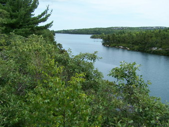 We rounded the western end of the lake and started to climb on the carriageway. After a short distance, we turned right on a path that was once marked with the aqua blazes of the Long Path. This path leads up to the Long Path. At this point we turned right and walked along the ledges above the western end of the lake. We took in the view of Sam's Point as we sat and ate lunch. After our break, we turned and headed east on the Long Path. The aqua blazes can sometimes be a distance apart and may be on a tree or on the rocks. The Long Path passes by the Murray Hill lookout and then descends a bit and splits with trails going both left and right. I decided to go to the right and we passed by several nice viewpoints. I soon decided that this branch of the trail was descending into Spruce Glen. We did NOT want to go that way so we retraced our steps and got back on the Long Path.
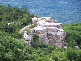 The Long Path twists and turns and passes by Margaret Cliff offering MORE views of Castle and Hamilton Points. After this, the Long Path descends sharply and passes over a jumble of rocks and tree trunks. We worked our way over this area carefully and back onto a better trail. At this point a trail to the Awosting Reserve continues straight ahead and the Long Path turns left into the woods. We made the turn and continued on the Long Path until a trail turns to the left to the Wolf's Jaws. We crossed the small stream and headed for the Tunnel. The Tunnel was dry and we quickly worked our way through this covered crack between the rocks. The Long Path continues up toward the Hamilton Point Carriageway. At this junction we turned right on the carriageway and headed back toward Minnewaska. The Long Path turns left into the woods after several hundred feet. It approaches the base of the cliff that is Castle Point. Here the Path climbs steeply up the face of Castle Point. Sheba has no trouble until near the top where two short but vertical ascents bother her. I boosted her up both of these and we were on Castle Point
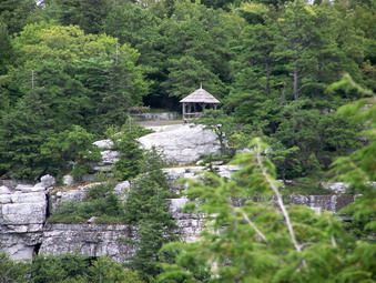 We stopped at Castle Point to get a drink, enjoy in the views and take some pictures. From here, we took the Castle Point Carriageway back toward Minnewaska. Along the way we stopped several times at various lookouts but tried to keep moving. We arrived back at Minnewaska at 4:30 PM. The hike was about 11 miles and we covered it in 6 hours.
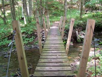
![]()
![]() On Friday, Aug 17th I had not hiked in 2 days and was ready to hit the trails. I decided to go to Rider Hollow and hike Balsam from that side. Getting there proved to be the first challenge since RT 206 out of Roscoe is still closed from the June flooding. I decided to take the Beaverkill Valley Road to Little Pond and then the Barkaboom Road to RT 30. From 30 I took the Millbrook Arena Road to Dry Brook Road and started looking for Rider Hollow Road. This road is NOT MARKED and the only road I could find was Todd Mountain Road marked as Route 49A. I turned here and soon ran into some bridge construction. I asked the road crew where Rider Hollow was and they assured me I was on the right road. They were WRONG! When I got to Belleayre Ski Area, I knew I was wrong and turned around. Back at the construction, I decided to turn right off of Todd Mountain Road and the embarrassed road crew concurred! The road I turned onto was STILL NOT MARKED as Rider Hollow Road but it was the correct road. This seemed strange since the Town of Hardenburgh Town Hall is on this road. Like most roads to trail heads, the road narrows and becomes rough pavement and then dirt. I persisted and it paid off as we arrived at the parking area at about 2:20 PM.
On Friday, Aug 17th I had not hiked in 2 days and was ready to hit the trails. I decided to go to Rider Hollow and hike Balsam from that side. Getting there proved to be the first challenge since RT 206 out of Roscoe is still closed from the June flooding. I decided to take the Beaverkill Valley Road to Little Pond and then the Barkaboom Road to RT 30. From 30 I took the Millbrook Arena Road to Dry Brook Road and started looking for Rider Hollow Road. This road is NOT MARKED and the only road I could find was Todd Mountain Road marked as Route 49A. I turned here and soon ran into some bridge construction. I asked the road crew where Rider Hollow was and they assured me I was on the right road. They were WRONG! When I got to Belleayre Ski Area, I knew I was wrong and turned around. Back at the construction, I decided to turn right off of Todd Mountain Road and the embarrassed road crew concurred! The road I turned onto was STILL NOT MARKED as Rider Hollow Road but it was the correct road. This seemed strange since the Town of Hardenburgh Town Hall is on this road. Like most roads to trail heads, the road narrows and becomes rough pavement and then dirt. I persisted and it paid off as we arrived at the parking area at about 2:20 PM.
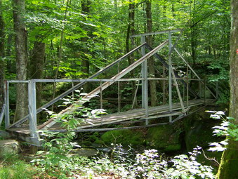 I decided to use the Rider Hollow Trail for the ascent to the Col and then Mine Hollow Trail to return making a loop out of the hike. The Rider Hollow Trail is beautiful near the bottom and starts off almost flat with only a slight incline. A wooden bridge makes the first crossing of Todd Creek and then the trail winds its way along the creek until the junction with the Mine Hollow Trail. Here we turned to the right to stay on the Rider Hollow Trail and crossed an interesting steel bridge over the same creek. There were several tents in the woods just after the bridge but no one seemed to be home. In about half a mile we passed by the unoccupied lean-to. At this point the trail begins to ascend more steeply and get more "interesting".
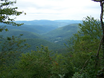 The trail passes through some nice piney forests and follows the ravine created by the creek. It reminded me a lot of the ascent from McKinley Hollow on the other side of the mountain. The trail crosses and recrosses the creek and some small tributaries but there are no more bridges. Some of these crossing might be a problem with higher water levels. An abundance of nettles and briars close in on the trail in several places. Some areas of the trail become very steep with rock scrambles in some places and loose rock in others. As we got near the top of the climb the trail leveled out some and we were soon at the Col between Balsam and Eagle. We turned left and headed up Balsam. This trail is familiar and offers nothing memorable. There are some steep areas with some scrambling but no viewpoints are available.
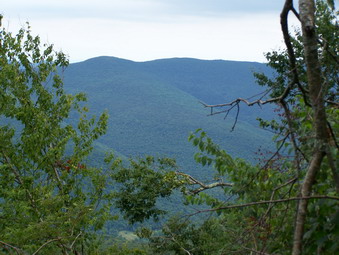 I had never hiked passed the top of Balsam so this hike was a new experience as Sheba and I pressed on after the summit. The map showed a lookout and I kept seeing short side trails that promised a view but delivered nothing! Just when I was about to give up an obvious and well-used side trail led off to the right. The views from here were nice and unexpected. We stopped for a drink and snack and I took some pictures. We descended Balsam into the Col between Balsam and Belleayre. The Mine Hollow Trail was soon in site on the left. I decided that I needed a little longer hike. We had just been up to Belleayre but had not hiked the part of the Pine Hill West Branch Trail from Belleayre to Balsam. Sheba and I continued straight ahead and on to Belleayre Mountain. The climb was easy in most spots and we were soon at the field that marks the highest spot on Belleayre. We turned around and headed back to the Mine Hollow Trail.
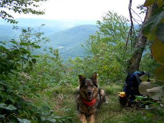 We turned right onto Mine Hollow this time and descended QUICKLY. This trail may be the easiest way up and down this area. The trail is wider and flatter in most places and the nettles are almost nonexistent. I jogged a good part of the way down. We met a group of four young men coming up. They had no packs or other equipment. They asked me if they were almost at the end of the trail. I advised them to hike to the Belleayre ski slopes to get the best view. Sheba and I continued on down the trail which has only one small water crossing without a bridge. We finished the 6.5 miles in just over 3 hours.
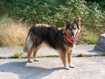
![]()
![]() On Tuesday, Aug 14th I planned to hike Balsam Mountain from Lost Clove after summer school. The weather prediction did not indicate rain any the skies were clear with only a few clouds. The temperature was in the high 60's or low 70's and not very humid. I got out of the house late and by the time I was on the road I knew I wouldn't be at the parking area until after 2:30. I decided to start the hike and see how things went. The other option was to skip Balsam this day and go on to Belleayre Mountain and the ski area. I had not been there but people had told me it had some nice views.
On Tuesday, Aug 14th I planned to hike Balsam Mountain from Lost Clove after summer school. The weather prediction did not indicate rain any the skies were clear with only a few clouds. The temperature was in the high 60's or low 70's and not very humid. I got out of the house late and by the time I was on the road I knew I wouldn't be at the parking area until after 2:30. I decided to start the hike and see how things went. The other option was to skip Balsam this day and go on to Belleayre Mountain and the ski area. I had not been there but people had told me it had some nice views.
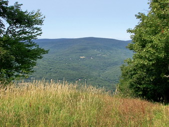 The parking area was easy to find of the right of Lost Clove Road just before the road dead ends. I noticed that the trail crossed private property for some distance before entering the forest preserve. We entered the woods on a nice flat, green trail and within a few hundred feet turned onto an old woods road. The road was wide with little vegetation and VERY STEEP. I should not have been surprised at the grade of the trail since the trail up to the Col at McKinley Hollow is equally challenging. However, this trail was unrelenting! It continued to ascend without moderating the grade for about a mile when it leveled out a little. After less than .5 miles, the trail enters the forest preserve at the junction with the Pine Hill West Branch Trail. We turned left here to head toward Belleayre.
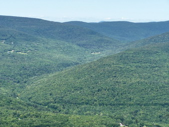 After .4 miles, we arrived at a lean-to with a picnic table outside. The trail alternated between short, steep climbs and flatter areas. Another .5 miles brought us to the summit of Belleayre Mountain. There wasn't much to see as the high point is in a field with no view. The Pine Hill West Branch Trail continues to the left and goes on to Balsam, Eagle, Big Indian and eventually to the Biscuit Brook Parking Area. I decided to tale the red marked Belleayre Ridge Trail to the ski slopes. In .25 miles the Cathedral Glen trail branches off to the right. This trail looked to be unused. Descriptions in most books describe it as a beautiful hike down to Pine Hill village and I added it to the long list of trails I want to hike. After another .25 miles, another lean-to appeared on the right. A half mile more and we were at the ski slopes.
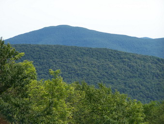 There was nobody at the ski slopes at all. Everything was quiet and the views were beautiful if a little hazy. We walked from slope to slope looking down the ski runs and ski lifts. I took pictures of the surrounding hills as we walked. We went out as far as the last ski slope, Deer Run, and then turned around and came back to the lodge. The porch on the front of the lodge has great views of Balsam Mountain and the surrounding valleys. At this point we turned around and headed back toward the car. The descent was quick and a little scary in some spots. We finished the 7 mile hike is just over three hours which I thought quick especially since I had stopped so much at the top to snap photos.
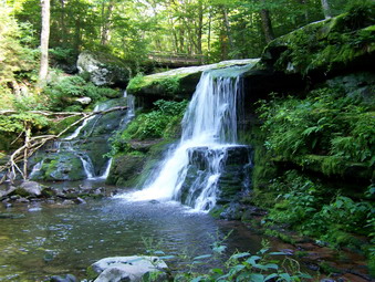
![]()
![]() On Monday, Aug 13th I planned to hike Sugarloaf after summer school. The weather prediction did not indicate rain but did specify partly cloudy skies. The temperature was in the high 70's and not very humid. I got out of the house as early as possible. On the drive it was clear that Sugarloaf was a little further than I wanted to go. In addition, when I do one peak on the Devil's Path I always like to throw in at least one other. I decided to "bag" Westkill since I had not done this peak in August. We were in the Spruceton parking lot at around 2:15 and got started at a quick pace right away.
On Monday, Aug 13th I planned to hike Sugarloaf after summer school. The weather prediction did not indicate rain but did specify partly cloudy skies. The temperature was in the high 70's and not very humid. I got out of the house as early as possible. On the drive it was clear that Sugarloaf was a little further than I wanted to go. In addition, when I do one peak on the Devil's Path I always like to throw in at least one other. I decided to "bag" Westkill since I had not done this peak in August. We were in the Spruceton parking lot at around 2:15 and got started at a quick pace right away.
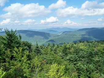 We arrived at the falls in about 20 minutes to find a little more water in the Westkill than the last time we visited. I took a few pictures but this was basically a peak-bagging day so we moved on. The trail was damp in some places and muddy in others. This made the footing tricky at times requiring some care. The nettles were in fine array in several places along the path and one or two always seem to get me no matter what I do. We kept moving and the sky kept getting darker. At one point rain started to fall! I knew that I would finish the hike at this point NO MATTER THE WEATHER. I just hoped we would not get too wet. And then...the rain stopped.
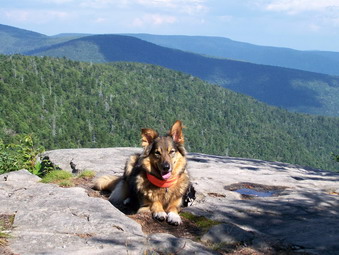 We climbed to the Buck Ridge lookouts and passed them quickly to go on to the summit. Here we turned around, went back to the lookouts and paused briefly. The sky remained cloudy with a haze hanging over the surrounding mountains. There were a couple of nice views of the Devil's Path with billowing and stratified clouds hanging low. After a drink, a snack and a few pictures we were on our way gain. We were back down at the car in under 3 hours for the 6.7 miles hike!
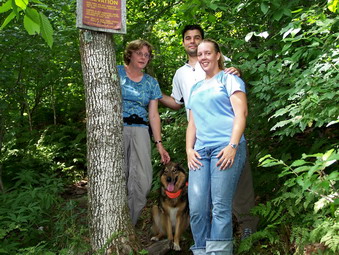
![]()
![]() On Sunday, Aug 12th we decided to take a walk after church. Cindy, Karl, Kathleen and I went to Balsam Lake Mountain to get in a hike together. Of course, we took Sheba! The weather was cooler and the hike went quickly. We didn't see a single hiker along the way! Even though we were walking, talking and not really hurrying we made it to the cutoff up to Balsam Lake Mountain in just about the same time Sheba and I usually make it. From here we slowed down a little as we climbed the steep side of the mountain. The spring was flowing nicely as we neared the top and Sheba got a drink. We paused briefly to get a picture by the 3500 foot sign.
On Sunday, Aug 12th we decided to take a walk after church. Cindy, Karl, Kathleen and I went to Balsam Lake Mountain to get in a hike together. Of course, we took Sheba! The weather was cooler and the hike went quickly. We didn't see a single hiker along the way! Even though we were walking, talking and not really hurrying we made it to the cutoff up to Balsam Lake Mountain in just about the same time Sheba and I usually make it. From here we slowed down a little as we climbed the steep side of the mountain. The spring was flowing nicely as we neared the top and Sheba got a drink. We paused briefly to get a picture by the 3500 foot sign.
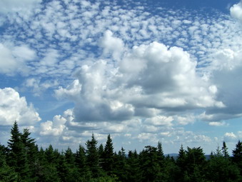 At the summit Karl and I climbed the tower to the top to take in the view. There was very little haze as the view was expansive as usual. Graham Mountain was clearly visible since it is he closest to Balsam Lake. All he other mountains were out there since you can see 33 of the remaining 34 peaks from this vantage point. Kathleen came up to take a peek and even Sheba ascended part way. Cindy elected to lie on a big rock, rest and watch the clouds roll by. After a little while we packed up and headed down the easier side of the mountain. At the trail junction we turned right and headed back to the car. A nice, short hike of 4 miles before Karl and Kathleen returned to Virginia.
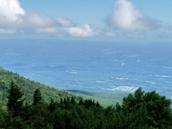
![]()
![]() On Saturday, Aug 11th my son Karl was up from Virginia. I had planned all week to hike the Blackhead, Black Dome and Thomas Cole and he was up for it. We got a later start than planned arriving at the Batavia Kill Parking Area at about 9:45. On the way to the parking area, the weather had seemed unsettled as the storm that had been in the area Thursday and Friday cleared out. By the time we were on the trail the clouds were lifting and the sun was coming out. It looked like it would be a good day to hike as the temperature had cooled at least 10 degrees from earlier in the week.
On Saturday, Aug 11th my son Karl was up from Virginia. I had planned all week to hike the Blackhead, Black Dome and Thomas Cole and he was up for it. We got a later start than planned arriving at the Batavia Kill Parking Area at about 9:45. On the way to the parking area, the weather had seemed unsettled as the storm that had been in the area Thursday and Friday cleared out. By the time we were on the trail the clouds were lifting and the sun was coming out. It looked like it would be a good day to hike as the temperature had cooled at least 10 degrees from earlier in the week.
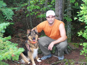 There was a little water on the trail as we hiked on The Black Dome Range Trail toward the junction of the Batavia Kill Trail. The creeks were all still very low. At the trail junction we decided to bear left on the Batavia Kill Trail and approach Blackhead from the steeper side. The trail slowly ascends through some dark forests until after less than a mile it joins the Escarpment Trail. We turned right here and began the 1100 foot ascent of Blackhead! The trail is only 1 mile to the top so the going is pretty steep at times. We made the top quickly guided on the trail dog Sheba. The Escarpment Trail heads south from here so we turned right on the Blackhead Mountain Trail toward Black Dome Mountain. On the descent I took some pictures and after only .6 miles we were in the col. There were some people camped here and they had two Huskies. Sheba and these dogs made friends right away and we talked to the owners briefly.
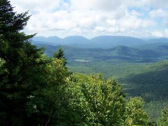 We continued straight ahead on the Black Dome Range Trail toward Black Dome Mountain. We climbed the trail which is rather steep at times pausing at several viewpoints to take pictures. After .6 miles we were at the top of the mountain and the rocky ledge which acts as a viewpoint. After a quick stop for drinks and pictures we were back on the Black Dome Ridge Trail headed for Thomas Cole. The walk to Thomas Cole is just over a mile. Along the way there are suggestions of viewpoints and areas where people have made side trail. These all lead nowhere and there is little to see except the surrounding forest. After summiting we turned around and retraced our steps back to Black Dome. We again met the two dogs headed toward us and, after a slight delay, there masters. We again stopped to talk and then continued down Black Dome.
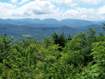 At the Col we followed the Black Dome Ridge Trail and turned left at Lockwood Gap to follow the trail back down to the parking area. This trail switches back several times which makes the descent longer but easier. We were back in the parking lot in no time and on our way home. The weather had cleared considerably as we hiked and the familiar hike was made better by having Karl along. The entire hike was 6.75 miles but the rugged peaks made it seem longer.
![]() On Thursday, Aug 9th Jack Strassman and I planned hike at Trout Pond. When Jack arrived at my house at 3:30 PM it was already starting to become overcast. The weather report was for possibly HEAVY rain and thunderstorms. Despite this, Jack seemed ready to go so we put Sheba in the car and headed out. We parked at the top of Russell Brook Road and headed toward the trail head. At the register we went straight ahead to Trout. We were walking at a good pace and talking so the time passed quickly. At Trout the weather still looked unsettled but we decided to go on around. We hiked up over Cherry Ridge without any problem and headed for Mud Pond. At Mud Pond we turned left on the snowmobile trail to go back to the car. We were back at the register in less than two hours after covering 5.8 miles. We hiked back up the road to the car and set off back to Livingston Manor. As we were driving rain began to fall on the windshield but did not persist. I hope Jack and I can get a few others to join us next time!
On Thursday, Aug 9th Jack Strassman and I planned hike at Trout Pond. When Jack arrived at my house at 3:30 PM it was already starting to become overcast. The weather report was for possibly HEAVY rain and thunderstorms. Despite this, Jack seemed ready to go so we put Sheba in the car and headed out. We parked at the top of Russell Brook Road and headed toward the trail head. At the register we went straight ahead to Trout. We were walking at a good pace and talking so the time passed quickly. At Trout the weather still looked unsettled but we decided to go on around. We hiked up over Cherry Ridge without any problem and headed for Mud Pond. At Mud Pond we turned left on the snowmobile trail to go back to the car. We were back at the register in less than two hours after covering 5.8 miles. We hiked back up the road to the car and set off back to Livingston Manor. As we were driving rain began to fall on the windshield but did not persist. I hope Jack and I can get a few others to join us next time!
![]()
![]() On Tuesday, Aug 7th I planned to take Sheba and hike Graham Mountain for August. When I arrived home, I looked at my grid and I had already done Graham in August! I changed plans and decided to bag two peaks, Peekamoose and Table, from the Peekamoose side. I packed up, took the dog and we were on our way. As I was driving down DeBruce Rd., I realized that I was going the wrong way to go to Peekamoose! I altered my plans again and decided to park at the Denning trail head and hike from there. This wasn't a bad idea since I would get to see the work that had been done on the bridge by the ADK and the new project they had started. I knew the whole hike was close to 9 miles and that we would have to move quickly.
On Tuesday, Aug 7th I planned to take Sheba and hike Graham Mountain for August. When I arrived home, I looked at my grid and I had already done Graham in August! I changed plans and decided to bag two peaks, Peekamoose and Table, from the Peekamoose side. I packed up, took the dog and we were on our way. As I was driving down DeBruce Rd., I realized that I was going the wrong way to go to Peekamoose! I altered my plans again and decided to park at the Denning trail head and hike from there. This wasn't a bad idea since I would get to see the work that had been done on the bridge by the ADK and the new project they had started. I knew the whole hike was close to 9 miles and that we would have to move quickly.
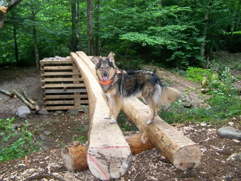 We parked at 2:05 PM with one other car in the lot and got started right away. The register said that a group of three had signed in yesterday and were going to Table to camp. I though maybe they would use the lean-to and that we would meet them coming down the trail at some point. About a mile up the trail we DID meet them. The two men and a young woman were stopped. From talking to them I found out that they had entered the wrong date in the register and were, in fact, just starting their hike. The young woman was smoking a cigarette! They had gotten less than a mile before stopping! I didn't give them much hope of making the Table lean-to before dark at that rate. Sheba and I wished them luck and head up the trail.
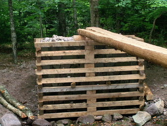 As we approached the bridge it didn't look like much had been done. I was hoping for a guide rail or rope but I guess that wasn't in the plans. The work that had been done WAS helpful. The logs are now at the same level and seem to have the same flex. On the far end an access "ramp" makes it easier to get on and off the bridge. What surprised me the most was the construction further up the trail! The group had constructed a new bridge across the East Branch of the Neversink completely from scratch! I don't know if it will really be needed but this feat is impressive. The result is much like the one over Deer Shanty. Sheba and I continued our hike. When time is limited, I have instituted a new "Look but don't touch!" policy. I will look around me at the trail and beautiful forest. I will take a look at the viewpoints. I will NOT touch my camera until we are on the way back.
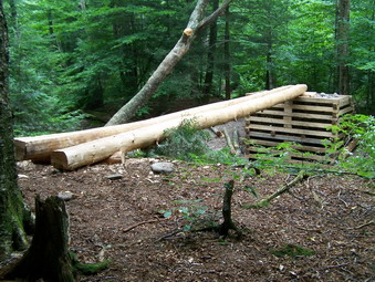 The trail up Table can be annoying at times. I really isn't that steep and is in pretty good condition. There are several viewpoints which afford good looks at the surrounding mountains on a clear day. What I don't like is that TWICE the trail ascends small hills only to drop again before the next one. I don't like going DOWN to go back UP! We moved quickly and were at the summit of Table in about 1 hour 40 minutes. I ALWAYS suggest bagging Peekamoose and Table together since the distance between then is less than a mile and the drop is small. We were on Peekamoose in 20 minutes or a total of 2 hours from parking. The trip back took the same amount of time. On the way back down to the car we stopped at the lookouts but the haze was too thick to see anything. I was expecting to meet the three campers but we didn't see them until we got to the camping area just after the bridges! This was as far as they had gotten and they were setting up camp. Sheba and I stopped at the bridges for a snack and so that I could take some pictures. Even with the stops we were back at the parking area before 6:00 PM. We finished the 8.6 miles in less than 4 hours!
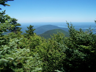
![]()
![]() On Sunday, Aug 5th I had planned to take Sheba and hike the Blacks since I had not done them in August. The hike over Plateau yesterday WAS strenuous but slow so I though a quicker hike might be nice. However, my friend John was preaching in church and Krista wanted me to go to lunch with her. These are the kind of "interruptions" in my plans that don't bother me anymore. I went to church AND lunch and then grabbed Sheba and headed for Slide Mountain. My grid showed I needed Slide and Cornell in August and I though I would have enough time for both. We parked at 1:00 PM. There were only a few cars in the lot. We started hiking immediately.
On Sunday, Aug 5th I had planned to take Sheba and hike the Blacks since I had not done them in August. The hike over Plateau yesterday WAS strenuous but slow so I though a quicker hike might be nice. However, my friend John was preaching in church and Krista wanted me to go to lunch with her. These are the kind of "interruptions" in my plans that don't bother me anymore. I went to church AND lunch and then grabbed Sheba and headed for Slide Mountain. My grid showed I needed Slide and Cornell in August and I though I would have enough time for both. We parked at 1:00 PM. There were only a few cars in the lot. We started hiking immediately.
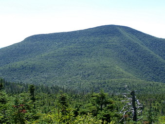 I decided to go as fast as we could out only stopping for a drink here and there. I would take no pictures until the return trip. I expected most of the people signed into the register to be returning. I was wrong! Just before 3500 feet we passed a young man and woman resting on the way up. Just above the 3500 foot level, we met a forest ranger coming down and talking to an older couple. We passed two more young women on the way up. At the top were two young men and a young woman. I talked to them about going down to the spring to see the view of Cornell. They said they might do that after their friends caught up. Sheba and I had gotten to the summit of Slide in LESS THAN ONE HOUR. THIS WAS A NEW PERSONAL BEST FOR US!
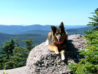 I knew time was short so we started down the rocky slope toward the spring. Sheba went to the spring to get a drink while I continued on down. Sheba caught up and took the lead. There are at least three major drops that have to be negotiated on the way down to the col. These same drops become climbs on the way back. Sheba has seen them all before and does a GREAT JOB going both ways. We walked passed the unoccupied campsites and through the Col at a rapid pace. As we started to ascend Cornell we met two young children who proved to be the scouting party for their family. The climb up to Cornell is filled with roots and rocks. Some you can go around and others you have to go over or through. Near the top are several nearly vertical climbs that make me remove my pack. Sheba is always waiting at the top!
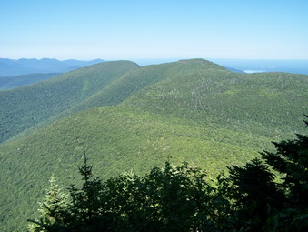 We continued on to the top of the mountain and to the viewpoint. The lookout gives a nice view of Wittenberg and the Ashokan Reservoir. The view was exceptionally clear with less haze than I had seen in some time. We ate a snack and took a drink. I snapped some photos and kept the camera handy for the viewpoints on the way back. As we turned back toward Slide we stopped at two of the three "levels" that afford a view of Slide and other surrounding mountains. Each lookout gives a slightly different angle and level. After that it was a scurry back down into the col and up Slide. We met the family again on the second and longest ascent. They were resting so I wished them a good day as we passed them. At the final vertical wall I almost took a video of Sheba going up. Unless you actually see her run up this cliff, it is hard to believe.
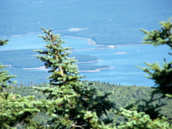 We continued our climb up to the spring and then to the wooden ladders on Slide. From the top of the last ladder I took some pictures looking back at Cornell. When we got back to the top of Slide, we stopped briefly so that I could take some pictures. The Ashokan was clearly visible as was Cornell with Wittenberg behind it. The weather was so perfect, the colors so beautiful and the mountain top so peaceful that I wanted to stay. I kept the camera ready to take a last set of pictures at the lookout on the right of the trail on our descent. From this point down we moved quickly and so no more hikers. The 8.5 mile round trip had taken just 5 hours. I don't think we could have done it much quicker especially with the stops for pictures.
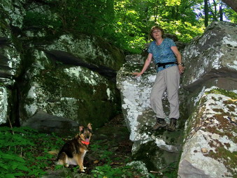
![]()
![]() On Saturday, Aug 4th I had planned to take Sheba and hike the new trail that has been created to relocate the Long Path in the area of Plateau Mountain. After this I planned to continue on to Sugarloaf since I needed both of these mountains in August. The Long Path comes up from the south through Silver Notch and then out onto Route 214 before turning onto the Devil's Path at Devil's Tombstone Campgrounds. The new trail takes the Long Path up southwestern shoulder of Plateau and to the Devil's Path. This avoids the road walking. At the last minute my wife decided to come along. Although she doesn't hike quite as fast uphill as the dog and I, we are ALWAYS glad to have her. We started, as always, a little later than I wanted and parked at the top of Notch Inn Road at about 10:15.
On Saturday, Aug 4th I had planned to take Sheba and hike the new trail that has been created to relocate the Long Path in the area of Plateau Mountain. After this I planned to continue on to Sugarloaf since I needed both of these mountains in August. The Long Path comes up from the south through Silver Notch and then out onto Route 214 before turning onto the Devil's Path at Devil's Tombstone Campgrounds. The new trail takes the Long Path up southwestern shoulder of Plateau and to the Devil's Path. This avoids the road walking. At the last minute my wife decided to come along. Although she doesn't hike quite as fast uphill as the dog and I, we are ALWAYS glad to have her. We started, as always, a little later than I wanted and parked at the top of Notch Inn Road at about 10:15.
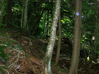 We immediately had some problems as there are NO MARKERS at all. There is nothing to mark the parking area and no trail markers once you park. We decided to follow some faint aqua blazes up and old road. We continued for some minutes and then the we noticed the blazes had stopped! We were ready to turn around when we noticed that the aqua blazes were painted over with brown paint. This indicated that the Long Path had once come through the area but had now been rerouted. This was consistent with my understanding of the new trail so we continued. After about .5 miles, a new sign indicated a trail to the left clearly marked with blue circles. It said "Devil's Path: 2.9 miles"! The first part of the trail ascends a rather steep area but there are MANY switchbacks to moderate the incline. The trail passes through some nice evergreen and hardwood forests along the way. Several areas have large boulders and rock ledges which vary the scenery and the terrain. There are a few areas where we could catch glimpses of the mountains.
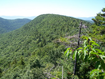 The trail continues to ascend to 3400 feet and then descends into a little Col. I wasn't at all sure we were on the right trail although I could hardly imagine where we would have gone wrong! I was put off by the descent even though the maps and my GPS seemed to indicate we were headed the right way. Just after the Col the trail starts to ascend the shoulder of Plateau and does so rather steeply in places. The payoff are the viewpoints and lookout along the way. Each one seems to be better than the last with a slightly different view! The weather was warm and humid so we took it slow and stopped for drinks frequently. We kept Sheba well hydrated since there were no water sources along the way! Soon the trail flattened and I saw the sign for the Devil's Path.
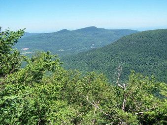 On the Devil's Path we turned right to hike to the summit of Plateau. Sheba and I left Cindy at the summit and continued down to the lookout over Sugarloaf. I had long ago given up the idea of doing Sugarloaf but I wanted to take some pictures from this lookout. The views from the rock were spectacular with very little haze. Sugarloaf, Kaaterskill and Round Top were all easy to spot. As I snapped some photos a hawk flew across the sky and I snapped its picture as well. We didn't stay long and quickly walked back to meet Cindy. We decided to continue on the Devil's Path and to descend to Route 214 at Notch Lake. This would give us an opportunity to do a loop and to get some views of Hunter.
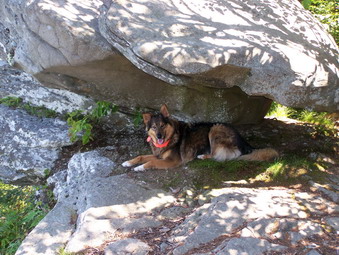 Most of the walk along the Plateau is almost flat with a slight downhill grade. It is long and pretty uneventful since there are few opportunities for getting view. Near the far end of the plateau is a nice viewpoint into the valleys and surrounding hills. Here we met a couple that we had encountered earlier on the trail. We stopped to talk to them for some time. Just before the descent to Notch Lake is a large rock ledge that looks out over Stony Clove and Hunter Mountain. Today the view was fairly clear and we stopped to talk to two young men who had just arrived before us. We then started the relatively short but VERY STEEP descent. We passed by a rock overhang that forms a sort of cave. Sheba cannot resist investigating these areas. Further down we met a couple coming up and assured them that the steep climb would come to an end. The trail has several sharp switchbacks which makes the steep climb possible.
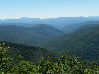 A little more than halfway down we met three young boys. One asked how far we thought it was to the Mink Hollow lean-to. I showed him on the GPS and the map that it was still some distance. He told us that his parents were a little further down the hill. His parents, in fact, were a lot further down the hill. They did not realize just how far they still had to go UP and the distance they still had to cover to the lean-to. We wished them a good time and then continued on down. The last family of four we met was very near the bottom and on the way up. They had a pug in tow and Sheba made friends. We only talked for a minute and then got going again. Within a few minutes we could here the traffic on 214. Shortly after that we were on the road. We quickened our pace on the smooth, downhill grade to Notch Inn Road. the hill back to the car seemed long. We covered 8.2 miles in about six hours which included MANY stops along the way.
![]() On Thursday, Aug 2nd I wanted to get some exercise so I took Sheba and headed for the Frick-Hodge Pond area. We started up the Flynn Trail to the junction with Big Rock Trail. At this point we turned right and followed the snowmobile trail to Mongaup Pond. The first part of the trail is a little steep but the last is ALL downhill and goes quickly. Once on the loop road at Mongaup Pond we jogged to the entrance booth. We tried to visit with my daughter Krista but she was busy checking people in for campsites. Sheba and I walked out the pockmarked access road back to Mongaup Road. At the junction of the two roads we walked down to the creek that is the outlet of Mongaup Pond. After this we walked back to the car. We had a nice 6 mile hike.
On Thursday, Aug 2nd I wanted to get some exercise so I took Sheba and headed for the Frick-Hodge Pond area. We started up the Flynn Trail to the junction with Big Rock Trail. At this point we turned right and followed the snowmobile trail to Mongaup Pond. The first part of the trail is a little steep but the last is ALL downhill and goes quickly. Once on the loop road at Mongaup Pond we jogged to the entrance booth. We tried to visit with my daughter Krista but she was busy checking people in for campsites. Sheba and I walked out the pockmarked access road back to Mongaup Road. At the junction of the two roads we walked down to the creek that is the outlet of Mongaup Pond. After this we walked back to the car. We had a nice 6 mile hike.
![]()
![]() On Tuesday, July 31st I wanted to get one more 3500 for the month of July. Big Indian was on the list and pretty close to home so I decided to do it after summer school. By the time Sheba and I parked it was already 2:15 PM which is late but not too late. I knew we would have to move quickly so we got on the trail and headed out. The weather was hot and very humid. The first part of the trail to the lean-to starts gradually and then climbs through a rock strewn field. A few nettles dotted the landscape as we ascended the hill. At the top of the first ascent there is a long gradual descent on an old woods road that skirts the Frost Valley property until the side trail to the lean-to. Areas of the trail were muddy with some standing surface water and some running streams. We stopped briefly at the lean-to and then continued on toward the Biscuit Brook crossing.
On Tuesday, July 31st I wanted to get one more 3500 for the month of July. Big Indian was on the list and pretty close to home so I decided to do it after summer school. By the time Sheba and I parked it was already 2:15 PM which is late but not too late. I knew we would have to move quickly so we got on the trail and headed out. The weather was hot and very humid. The first part of the trail to the lean-to starts gradually and then climbs through a rock strewn field. A few nettles dotted the landscape as we ascended the hill. At the top of the first ascent there is a long gradual descent on an old woods road that skirts the Frost Valley property until the side trail to the lean-to. Areas of the trail were muddy with some standing surface water and some running streams. We stopped briefly at the lean-to and then continued on toward the Biscuit Brook crossing.
Crossing Biscuit Brook can be a challenge when the water is high since there is no bridge. Today it was just a matter of finding a few stepping stones since the water level was low despite recent thunderstorms. The trail parallels the brook for a while and gains some elevation. There are wet, swampy areas along the way rife with nettles and briars. Areas of the trail have many rocks that make the footing tricky. Slowly the trail gains elevation with some rather steep places and then level areas. Last time was on the trail it had a lot of blowdown that required some inconvenient detours. Many thanks to whoever was responsible for clearing all but one large log making the trip MUCH easier! At one point the trail rises sharply and then cuts back and forth several times. Glimpses of some of the surrounding mountains are barely visible through the vegetation. At this point the trail levels and, at one point, the sign for 3500 feet appears on a flat area of the trail.
A little further on the trail rises to its highest point, flattens and then begins to descend. The summit for Big Indian is off the trail to the right. I always seem to cut up too early and miss the herd path. This time I stayed on the main path longer and found a very prominent and promising herd path which ... gave out after several hundred feet. I resorted to my usual bushwhacking technique! I always head up until there is no more up and I always go in a straight line. I ended up meeting another herd path and walked about 50 feet directly to the canister! After signing in we turned around and followed the herd path back down. The most prominent path started going a little to far to the right so I headed left and soon was back on the main trail. The hike up is always longer than I remember but the hike back is EVEN LONGER. This was NOT a picture taking excursion or a site-seeing trip. We made the 7.8 miles in exactly 4 hours with only a few stops.
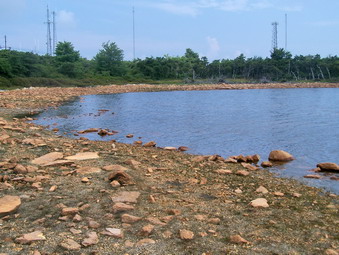
![]()
![]() On Sunday, July 29th the weather prediction again was for thunderstorms in the afternoon. I decided to go to Sam's Point sine I hadn't been there in some time. My intention was to do the entire loop up to High Point, over to the Verkeerder Kill Falls, the Ice caves and then Sam's Point and back. Sheba and I arrived at about 10:15 AM under VERY ominous skies. We headed out quickly to make the most of the hike before the rains came as I was sure they would. We made good time up toward High point stopping at Lake Maratanza to get some pictures. I was not prepared for what I saw at the lake. The water level was down significantly and I was able to walk out to an area normally covered by several feet of water! Back on the path we headed left instead of going around the lake.
On Sunday, July 29th the weather prediction again was for thunderstorms in the afternoon. I decided to go to Sam's Point sine I hadn't been there in some time. My intention was to do the entire loop up to High Point, over to the Verkeerder Kill Falls, the Ice caves and then Sam's Point and back. Sheba and I arrived at about 10:15 AM under VERY ominous skies. We headed out quickly to make the most of the hike before the rains came as I was sure they would. We made good time up toward High point stopping at Lake Maratanza to get some pictures. I was not prepared for what I saw at the lake. The water level was down significantly and I was able to walk out to an area normally covered by several feet of water! Back on the path we headed left instead of going around the lake.
 I decided to go out to Indian Rock and see all the sites. The boardwalk was unnecessary since there was no water. Everything was SO DRY I wondered what would happened if someone accidentally dropped a match. The path to Indian Rock has been cut out and is easily negotiated. Last time I was there you had to push your way through the encroaching vegetation. The views were too hazy to take many pictures of the surrounding mountains and valleys. I took a few snapshots and then headed back. We turned left on the main carriageway and headed up to High Point. I forgot that to get there you have to hook around from in back. There is also a short but steep climb over some loose rock.
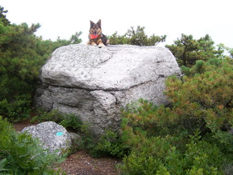 On the path to High Point I followed the red paint marks which, at times, was not easy. We quickly made our way to our destination which is marked by a USGS seal. At this point I was sure that we were about to get a storm. I don't mind getting wet but walking the expose rock escarpment in a lightning storm seemed foolish. I was equally sure that if I returned the way we had come the weather would clear. We turned around and the storm held off. At the lake we headed left around the far side. This gave us a different view of the lake and a chance to head down to the falls or the caves. On this side of the lake there were quite a few people picking blueberries. Despite their efforts there were still many left to ripen for other pickers. When we got to the road down to the caves, we turned left and then left again to the Verkeerder Kill Falls.
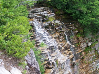 The path down to the falls drops several hundred feet. Some of the path is an easy walk over cushioned pine needles. Most of it is a torturous walk over stones. The good part was that they were dry and the footing was much better than it has been in the past. As I approached the Verkeerder Kill Falls, I could hear the water. When we got to the Verkeerder Kill Falls, I was surprised to see only a trickle in the Verkeerder Kill. Almost no water was going over the falls. I was able to stand in an area that is usually 12 to 18 inches under water and take pictures. After a brief rest for a snack and water, I decided to head back the way we had come. On the way back we met several groups going down to the Verkeerder Kill Falls. I advised them that there was not much water but that the walk was still worth it.
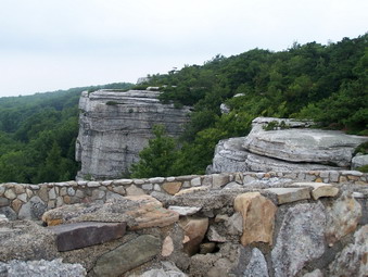 I decided that I did not want to go to the caves. We were up to almost 12 miles and Sheba has trouble negotiating some of the ladders around the caves. On the way back we stopped by Sam's Point. The views were not spectacular due to the ever present haze. I was surprised that two single engine airplanes ventured out with the low ceiling and limited visibility. Back at the car I checked the GPS and saw we had averaged over 3 mph including our stops!
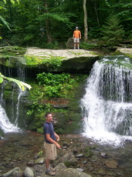
![]()
![]() On Saturday, July 28th the weather prediction called for a greater than 50% chance of severe thunderstorms in the afternoon. In the morning we got a short, but brief, intense thunderstorm right over Livingston Manor. The lightning flashed and the thunder rolled from hill to hill. It was all over in 20 minutes and the skies cleared. We got a late start after visiting with some family passing through town. I decided to take Karl, Kurt, Cindy and Sheba to Westkill since I had not done it in July and neither Karl nor Kurt had been to the summit. We parked on the Spruceton Road and were on the trail at 12:25; a late start indeed.
On Saturday, July 28th the weather prediction called for a greater than 50% chance of severe thunderstorms in the afternoon. In the morning we got a short, but brief, intense thunderstorm right over Livingston Manor. The lightning flashed and the thunder rolled from hill to hill. It was all over in 20 minutes and the skies cleared. We got a late start after visiting with some family passing through town. I decided to take Karl, Kurt, Cindy and Sheba to Westkill since I had not done it in July and neither Karl nor Kurt had been to the summit. We parked on the Spruceton Road and were on the trail at 12:25; a late start indeed.
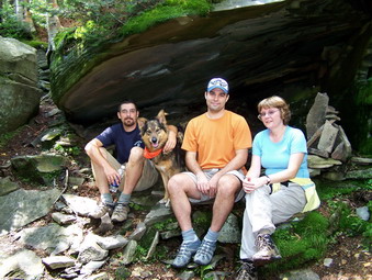 The trip up the Old Spruceton Road to Diamond Notch Falls went quickly. It was obvious that the rain the day and night before had added significant runoff volume to the Westkill. The water was rushing all along the trail. The volume of water over the falls was as high as I have seen it in some time. We took some pictures at the falls and then resumed out trek. The rain had made many of the rocks along the path slippery and, in a few places, there were patches of nettles. Some areas were damp and muddy. The climb up to the first false summit was uneventful. The weather was warm and very humid so we stopped several times to get a drink.
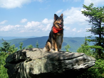 The trail levels after the first false summit and then actually goes down before rising again toward the Buck Ridge Lookouts. Along the way a "cave" or rock overhand makes a nice place to relax for a moment. I was still concerned about the weather although the sky was only partly cloudy. I also wanted to get home before 6:00 PM so we pushed on. After a gentle uphill course the mountain rises steeply to the Buck Ridge lookouts. Despite the haze the views were, as always, interesting with the Hunter Mountain fire tower clearly visible. We took some time to appreciate the views and take some pictures. The boys and I headed for the summit just .1 miles further up the trail. When we returned, we all headed down the mountain led by Cindy. My wife climbs a little slower than I do but can descend with the best of them. The GPS said about 6 miles when we got back to the car. I think it was longer. We took just about 4 hours including ALL the stops!
![]() On Friday, July 27th Kurt and Karl were both up from Virginia so we decided to get in a quick hike before dinner. Kurt didn't have any hiking shoes so we headed for Morgan Outdoors to get a pair. He has a wide foot so most shoes don't fit well. He settled on a pair of Merrell Chameleons which fit like a slipper but are not waterproof. I'll have to try to find a bargain on a pair of wide, Goretex boots on line! The skies were cloudy and thunderstorms were in the prediction for the entire weekend. We decided to go anyway. The boys were impressed by the new bridge. After signing in at the register we headed up the steeper trail to Mud Pond. From there we turned right and hiked over the hill to Trout Pond. The skies began to get darker and we heard rumbles of thunder. From Trout Pond we hurried back toward the car. As we were climbing the hill from the trail head to the parking area, darkness surrounded us and the wind started to blow. In a few more steps the rain hit us, a few drops at first and then the cloudburst! In a few minutes we were soaked and in a few more we were at the car and the sun was out. We made the 6 mile circuit in under 2 hours. It was great to hike with both my sons again. The weather prediction for Saturday isn't good but we'll have to see what it looks like when we get up.
On Friday, July 27th Kurt and Karl were both up from Virginia so we decided to get in a quick hike before dinner. Kurt didn't have any hiking shoes so we headed for Morgan Outdoors to get a pair. He has a wide foot so most shoes don't fit well. He settled on a pair of Merrell Chameleons which fit like a slipper but are not waterproof. I'll have to try to find a bargain on a pair of wide, Goretex boots on line! The skies were cloudy and thunderstorms were in the prediction for the entire weekend. We decided to go anyway. The boys were impressed by the new bridge. After signing in at the register we headed up the steeper trail to Mud Pond. From there we turned right and hiked over the hill to Trout Pond. The skies began to get darker and we heard rumbles of thunder. From Trout Pond we hurried back toward the car. As we were climbing the hill from the trail head to the parking area, darkness surrounded us and the wind started to blow. In a few more steps the rain hit us, a few drops at first and then the cloudburst! In a few minutes we were soaked and in a few more we were at the car and the sun was out. We made the 6 mile circuit in under 2 hours. It was great to hike with both my sons again. The weather prediction for Saturday isn't good but we'll have to see what it looks like when we get up.
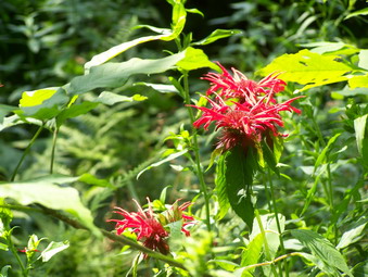
![]()
![]() On Thursday, July 26th I came home from school wanting to get in a hike. I hadn't been to Alder Lake or the Ridge Vista in some time so I grabbed the dog and headed out! The road into Alder Lake needs work! There are large ruts and ridges and rocks sticking up but I took it slow. There were several other cars in the parking area but most were enjoying the "beach" on the lake and not hiking. Sheba and I walked around the lake to the inlet end and jumped on the trail to Balsam Lake. This hike is always a little more challenging and longer than I remember!
On Thursday, July 26th I came home from school wanting to get in a hike. I hadn't been to Alder Lake or the Ridge Vista in some time so I grabbed the dog and headed out! The road into Alder Lake needs work! There are large ruts and ridges and rocks sticking up but I took it slow. There were several other cars in the parking area but most were enjoying the "beach" on the lake and not hiking. Sheba and I walked around the lake to the inlet end and jumped on the trail to Balsam Lake. This hike is always a little more challenging and longer than I remember!
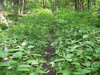 Despite some rain Alder Creek was very low although the running water made a pleasant sound as we walked along. In several spot the nettles were growing high and were very green. They seem to be unaffected by the dry weather and only require a little water and some sun. I managed to avoid getting "stung". We passed the first beaver meadow and climbed the hill to the second where the lean-to is located. I walked to the edge of the meadow to take some pictures. The green of the vegetation and the blue of the sky were pretty but I think this area is more beautiful in the fall. The last beaver meadow was also interesting but we pushed on as fast as we could go.
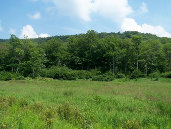 The trail after the beaver meadows winds its way through some damp areas and then climbs for some time. When the climbing is finally done, the elevation is over 3400 feet! Any views from this ridge area are blocked by the leaves. We crossed the short, flat area and descended into the area between the two higher points on the ridge. This final part of the trail ALWAYS deceives me! It is longer than I remember and winds back and forth as it ascends to the Ridge Vista overlooking Beecher Lake. We followed the trail until I though I had missed the viewpoint. This is impossible since it is right on the trail and soon we had arrived! The views down to the monastery are largely occluded by the vegetation. There was a haze handing over even the closer mountains. I took some pictures but didn't expect much
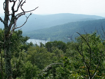 After a SHORT stop, we turned around to retrace our tracks to the car. The return trip is mostly downhill and usually goes VERY quickly. This day was no exception. On the way down we passed another hiker, the only other one we saw this day. He was headed up the trail we had just come down. He had all his camping gear packed and I suggested the Balsam Lake lean-to as a possible camping spot. He agreed and we part ways. I wondered how he would make it through the nettles with shorts and no shirt. The entire 8.6 mile trip was under 4 hours with several stops for pictures.
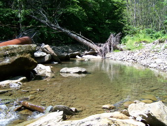
![]()
![]() On Tuesday, July 24th I came home from school wanting to get in a hike before I had to go to an evening meeting. I decided to take Sheba and go to Trout Pond. My intention was to try to cross Russell Brook at the far end and do the entire loop. The last time I was down to this area the water was much too high to even try to cross. In addition, getting down Russell Brook Road is no longer easy because of the many washed out areas that have completely eliminated the road. Sheba and I picked our way down the road carefully and the trip seemed long but not too difficult. I was surprised to find the culvert pipe all the way over on the other "shore" and not spanning the brook. I chose an area slightly upstream to cross and managed to get across with no problem.
On Tuesday, July 24th I came home from school wanting to get in a hike before I had to go to an evening meeting. I decided to take Sheba and go to Trout Pond. My intention was to try to cross Russell Brook at the far end and do the entire loop. The last time I was down to this area the water was much too high to even try to cross. In addition, getting down Russell Brook Road is no longer easy because of the many washed out areas that have completely eliminated the road. Sheba and I picked our way down the road carefully and the trip seemed long but not too difficult. I was surprised to find the culvert pipe all the way over on the other "shore" and not spanning the brook. I chose an area slightly upstream to cross and managed to get across with no problem.
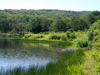
From here Sheba and I started a fast walk up the hilly trail. From this end of the trail there is a significant elevation gain climbing toward Mud Pond. The trail was damp in places with several wet spots. These were home to a nice crop of nettles that have overgrown the unused trail! We continued on passed the small beaver pond and up the hill toward Mud Pond. The final part of the approach to Mud Pond was VERY wet and I was glad I had my Asolo Fugitives which shed water well. At Mud Pond we turned left up the hill toward Trout Pond. Along the way there weren't many surprises except for an occasional deer and some partridge. We crested the hill and started to descend toward the Trout Pond inlet and the lean-tos.
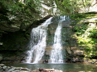 At Trout Pondwe continued on the trail without stopping. Passing the outlet we noticed some young people having a "good time" by the outlet. There yelling and splashing in the water served only to disturb the otherwise quiet hike. As we approached the register I decided to go to the falls to take a few pictures. I seem to do this every other time I am at Trout Pond. I just can't resist the waterfalls. This time I went to the base of the lower falls to take some shot. I then climbed the right side of the falls, took some more pictures and then went to the upper falls. I decided to descend into the "hole" below the lower falls even though there wasn't much water. This proved to be a little harder than I though but Sheba and I made it without a problem. I took some pictures and then climbed out of the hole. Back on the road we headed for the car to complete our 7.5 mile hike.
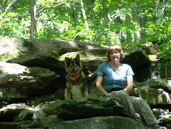
![]()
![]() On Sunday, July 22nd my wife and I headed for North South Lake Campgrounds to hike to Stoppel Point. We parked at the Schutt Road parking area at around 11:15 and headed out on the Rock Shelter Trail. The weather was clear and warm and the humidity high. Like so many of the other trails, this one was barely damp in the places that are normally a sea of mud. The first part of the Rock Shelter has a lot a rocks, big and small, to walk over but is relatively flat. After that it ascends gently through hardwood forest as it heads toward the Mary's Glen Trail. At the Mary's Glen Trail we turned left.
On Sunday, July 22nd my wife and I headed for North South Lake Campgrounds to hike to Stoppel Point. We parked at the Schutt Road parking area at around 11:15 and headed out on the Rock Shelter Trail. The weather was clear and warm and the humidity high. Like so many of the other trails, this one was barely damp in the places that are normally a sea of mud. The first part of the Rock Shelter has a lot a rocks, big and small, to walk over but is relatively flat. After that it ascends gently through hardwood forest as it heads toward the Mary's Glen Trail. At the Mary's Glen Trail we turned left.
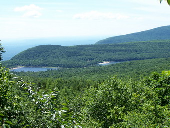 The lower parts of Mary's Glen ascends over a series of rocks that are often covered with running water. Little was in evidence this which made the walk easier. This trail has no special features or viewpoints to mention but seemed a little longer than I remembered. After a while it intersects the Escarpment Trail above Badman Cave. This is where the fun begins! The Escarpment trail almost immediately begins to climb over a jumble of rocks and ledges. There are some short but interesting rock scrambles. After this area the trail levels slightly and Newman's Ledge appears on the right. This is the first viewpoint and only hints at what can be seen from further up the trail.
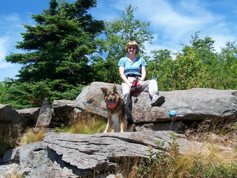 We continued to ascend the Escarpment Trail until the rock ledges of North Point. All of us got up and over the ledges to this wonderful lookout. We stopped at the first viewpoint to look around. We got a snack and a drink and I took some pictures of the lakes and the surrounding hills. The Hudson River is visible but like most other times I have been up to North Point, the views in the distance are obscured by haze. Last time we were on this trail we found that there are some even better or at least different views at several levels on up the trail. We headed toward North Mountain stopping several times along the way. Soon we entered uncharted territory where we had never been before. The trail levels some after North Point since North Mountain is not much higher. Also the trail passes by but not over the highest part of the mountain.
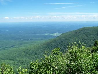 After North Mountain the trail begins to pass through more evergreen forest and you start to gain elevation. As we neared Stoppel Point there were several steep areas some of which required scrambling. Just when I thought that we would never get to Stoppel Point the rocky ledge was right before us. We stopped here for a brief break and I took some pictures. AFTER I put the camera away, Cindy motioned for me to look overhead. A raptor was riding the air currents less than 20 feet above me! By the time I got the camera out he was gone. I waited for his return but to no avail.
 We decided to walk to the plane crash on the other side of the plateau. On the way back we stopped briefly at the lookout on the right side of the trail. From that point on we descended quickly passing North Mountain and North Point. By this time there were a few people at each location. We reversed our course back to the car. We covered almost 8 miles in around 4 hours with a good amount of time for stops.
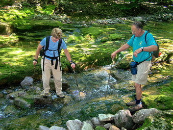
![]()
![]() On Saturday, July 21st I got the chance to go on a Catskill 3500 Club hike with Harry Rampe and five other hikers. The plan was to meet at the Denning parking area at 8:00 AM to get an early start. We would then use the Pine Hill East Branch Trail until the junction with the Peekamoose Table Trail. After crossing Deer Shanty Brook we would use the Fisherman's Path along the East Branch of the Neversink until we turned to go up Lone or Rocky. Some people were a little late in arriving but its hard to blame those that are driving from Albany or Long Island! We set off just before 8:30 AM. I noticed that an ADK group was signed into the trail register for bridge work. I wondered if we could still use the bridge and what improvements they were planning.
On Saturday, July 21st I got the chance to go on a Catskill 3500 Club hike with Harry Rampe and five other hikers. The plan was to meet at the Denning parking area at 8:00 AM to get an early start. We would then use the Pine Hill East Branch Trail until the junction with the Peekamoose Table Trail. After crossing Deer Shanty Brook we would use the Fisherman's Path along the East Branch of the Neversink until we turned to go up Lone or Rocky. Some people were a little late in arriving but its hard to blame those that are driving from Albany or Long Island! We set off just before 8:30 AM. I noticed that an ADK group was signed into the trail register for bridge work. I wondered if we could still use the bridge and what improvements they were planning.
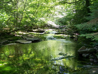 We walked and talked as we hiked along the trails and were soon at the Deer Shanty Bridge. The crew was working an the improvements and had separated the two logs. After some talk, we walked across the wider of the two logs using the cable the crew had erected for guidance. Sheba used the narrow log! We continued on the trail and across the East Branch where other crew members were hard at work. A little more trail walking brought us to the Fisherman's Path where we turned left. The path is very obvious and winds its way along both sides of the river. We crossed and recrossed where it looked like the path on the side we were on would be too steep or was overgrown. The water is very low and the crossing were not too much of a problem. There are some very nice places to camp along the way and we did see one couple cooking a meal. From a beaver meadow on the path Harry pointed to a high spot on the shoulder of Slide that is a nice place to camp. Further on are some areas where the river has cut into the rocks and is just beautiful.
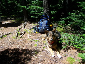 After a little less than three miles, we turned right away from the river and started up Rocky. This requires some careful choices to find the easiest path possible without going too far afield. I was ahead with Harry scouting the path and Sheba, I though, was bringing up the rear with the last hikers. After about half a mile we stopped and Sheba was nowhere to be found. I hadn't realized she had disappeared while I was talking. I started back down our route calling her name. The longer I called the more worried I became. I went back up toward the group to see of she was there but they had not seen her! I told them to go on and I headed back down the path again calling for my dog. As I got almost to the river Sheba showed up trotting toward me. I HAVE NOT BEEN THAT HAPPY IN SOME TIME! She did not explain what she had done. I explained to her carefully that she had me worried sick and should NEVER do that again. For the rest of the hike she stayed by my side, slightly behind or slightly ahead.
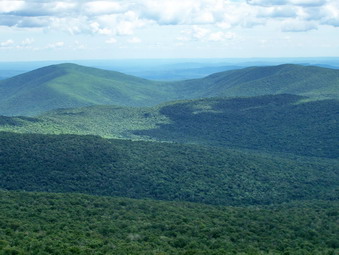 I decided that we could probably catch the group at the canister on Rocky so we took off at our fast pace. I basically ignored finding the easy path and just head up and south or southeast. Nearing the top I heard some voices and saw what I though was our group. It turned out to be two other men descending from Rocky. Sheba and I pressed on through some DENSE spruce. I heard voices and found the group at the canister. After a rest period, we continued on. The hike down toward Lone is full of rocks and fallen trees which make it difficult to find a path and make much headway. We did eventually break out into more open forest but that immediately disappeared. As we approached Lone, it was obvious that there were several vertical or very steep rock ledges to work around. I personally enjoy this adventure and took the point to scout the best way. I found several "creases" in the ledges and kept working upwards. The terrain finally leveled some and I found a clear herd path that meandered upwards. This path lead directly to the canister! We all signed in and then turned left or south on a path to a viewpoint. The viewpoint is a small rock ledge where only two people can stand but it has some excellent views. Rocky, Table and Peekamoose are all visible in the foreground. We spent some time here and then headed down off Lone.
 This, again, is a true bushwhack where the rule of the day is try to find the easiest path but don't be surprised if there isn't one! I headed down and tried to keep going east or to my left. I was trying to get over to Donovan Brook which is an easier way to get down to the river. I didn't get far enough east despite my best efforts. After a long, difficult descent we were at the river. We were considerably further upstream than we would have liked but at least we were back on a path. We stepped up our pace and followed roughly the same route we had taken out. The bridge crew was hard at work and had the logs back together. The lack of any cable or handhold seemed daunting to some at first but we all made it across. We were now on a trail and our cars were calling. By the time we got to the parking lot it was after 5:00 PM. We had hiked about 10 miles in 8.5 hours. This is typical of bushwhacking with a group. I can go faster by myself but being with others is more fun!
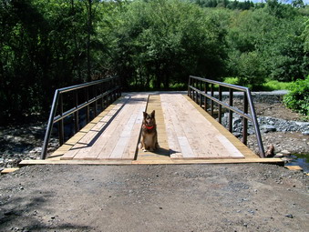
![]()
![]() On Friday, July 20th I wanted to get some exercise even though the skies were getting darker all the time and the prediction was for rain. Sheba and I headed for Trout Pond and the skies over Roscoe looked even more ominous. As we drove up Morton Hill Road toward the parking area at the top of Russell Brook Road, the skies cleared to blue with only a few clouds. I was aware of the unpredictability of this kind of weather and wanted to get a quick hike in without getting soaked!
On Friday, July 20th I wanted to get some exercise even though the skies were getting darker all the time and the prediction was for rain. Sheba and I headed for Trout Pond and the skies over Roscoe looked even more ominous. As we drove up Morton Hill Road toward the parking area at the top of Russell Brook Road, the skies cleared to blue with only a few clouds. I was aware of the unpredictability of this kind of weather and wanted to get a quick hike in without getting soaked!
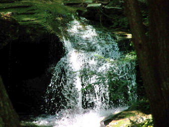 From a previous trip I was aware that the DEC had contracted for the bridge near the falls to be replaced. The steel skeleton was there the last time we hiked. This time the bridge was decked and completed. The temporary steel plates across the brook had been removed and things looked at lot better. I still question the need for such a robust bridge. I signed us in at the register and we headed up toward Trout Pond. We continued on around walking very quickly. The weather was threatening but we made it back to the register without getting wet. Not wanting to tempt fate, I took only a few pictures of the falls on the way out. Another quick but satisfying 2 hour walk with the dog covering 6 miles!
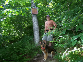
![]()
![]() On Tuesday, July 17th I got the chance to introduce another person to the joys of Catskill hiking. Jack Strassman is my principal at Liberty High School. We met at my house and drove to the Balsam Lake Mountain parking area with Sheba in the back. There were no other cars in the parking lot and we got on the trail at about 3:15. Jack has been running and working out and seemed to be handling the trail well until we turned up the steep side of Balsam Lake. We slowed down a little here since nothing quite prepares you for the experience of you first 3500.
On Tuesday, July 17th I got the chance to introduce another person to the joys of Catskill hiking. Jack Strassman is my principal at Liberty High School. We met at my house and drove to the Balsam Lake Mountain parking area with Sheba in the back. There were no other cars in the parking lot and we got on the trail at about 3:15. Jack has been running and working out and seemed to be handling the trail well until we turned up the steep side of Balsam Lake. We slowed down a little here since nothing quite prepares you for the experience of you first 3500.
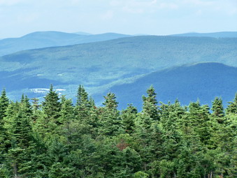 We made good progress up the steep slope and stopped for a short time at the 3500 foot mark and at the spring. We continued on up to the top of the climb where the trail levels. From here we increased our pace and were soon at the tower. We were the only people around so I left Sheba on the ground and headed up the tower. There was haze in the distance but the views were impressive as always. Jack seemed to appreciate the panoramic splendor. After returning to the ground, we headed down the other side of the mountain and back to the car completing our 4 mile trip. Jack said that he liked it enough to go again.
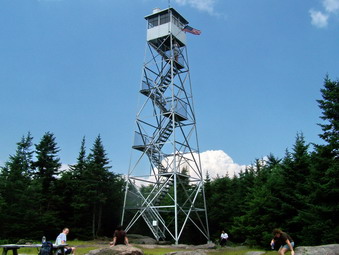
![]() On Sunday, July 15th I wanted a quick hike after church. The weather looked like it might rain and rain was in the forecast. I decided to do Balsam Lake, the closest 35 to my house, since I had not done it in July! On the way up the Beaverkill Road I saw the biggest 10-point whitetail deer I have ever seen! Sheba and I arrived at the parking area at 1:55 to find several cars in the lot. One truck was from New Jersey Search and Rescue. Several volunteers from this organization man the Balsam Lake Fire Tower. When I signed in at the register, I saw it was Rich Roller and his girlfriend.
On Sunday, July 15th I wanted a quick hike after church. The weather looked like it might rain and rain was in the forecast. I decided to do Balsam Lake, the closest 35 to my house, since I had not done it in July! On the way up the Beaverkill Road I saw the biggest 10-point whitetail deer I have ever seen! Sheba and I arrived at the parking area at 1:55 to find several cars in the lot. One truck was from New Jersey Search and Rescue. Several volunteers from this organization man the Balsam Lake Fire Tower. When I signed in at the register, I saw it was Rich Roller and his girlfriend.
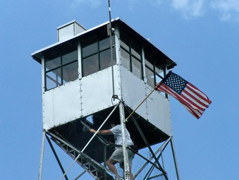 I wanted to get up and down before the rain so Sheba and I pushed ourselves. We were at the trail cutoff in 15 minutes and made the tower in 40 minutes! Along the way we met one person coming down and another going up a the top several people were enjoying the view from the tower or relaxing before heading back. The only disadvantage to taking Sheba along is that I cannot go up the tower if other people are present. I would have liked to see the view but I have seen it before and the day was cloudy. I took a picture of the tower and headed down the other side.
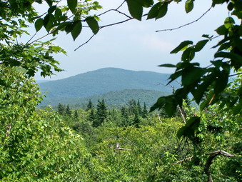 I stopped by the cabin to talk to Rich's girlfriend. She is also part of the Search and Rescue Team. We talked some about that topic and then switched to hiking. We shared several stories about hikes and routes. Sheba became impatient and we were off again. On the way down a view of Graham Mountain opened up so I took a picture. The trip back seems shorter every time I hike it. The rain held off and the sky actually brightened as we approached the parking area. We did our 4 miles in around 2 hours!
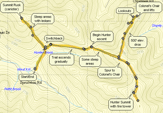
![]() On Saturday, July 14th I had planned to do some longer hike as I normally do. The problem was that I have been doing these longer hikes a lot lately! I had just completed both the Blacks and the Devil's Path in June and wanted to leave a little more time before a repeat performance in July. I decided to go to Spruceton and try a combination of Rusk, Hunter, Southwest Hunter and Westkill. I knew I probably would not get them ALL in especially with two bushwhacks on the list and planned to take one at a time! I had some chores to do in the morning which could not be done before 8:00 AM and so we got a late start. Sheba and I got to the parking area and 10:15 AM and there were already a few cars there. A group was just starting out but their shorts made it clear they were NOT going to bushwhack Rusk. Within minutes of arriving we were off headed for the switchback on the Spruceton Trail and the cutoff for Rusk Mountain. The map above shows the entire route that we used.
On Saturday, July 14th I had planned to do some longer hike as I normally do. The problem was that I have been doing these longer hikes a lot lately! I had just completed both the Blacks and the Devil's Path in June and wanted to leave a little more time before a repeat performance in July. I decided to go to Spruceton and try a combination of Rusk, Hunter, Southwest Hunter and Westkill. I knew I probably would not get them ALL in especially with two bushwhacks on the list and planned to take one at a time! I had some chores to do in the morning which could not be done before 8:00 AM and so we got a late start. Sheba and I got to the parking area and 10:15 AM and there were already a few cars there. A group was just starting out but their shorts made it clear they were NOT going to bushwhack Rusk. Within minutes of arriving we were off headed for the switchback on the Spruceton Trail and the cutoff for Rusk Mountain. The map above shows the entire route that we used.
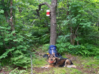 At the switchback on the Spruceton Trail we turned northwest (left) and crossed Hunter Brook with no problem. There was barely a trickle of water flowing over the rocks. At this point a small tributary comes down the mountain. We stayed to the east of this dry rock bed although in the past I have walk directly up and down it. At first the going was real-time easy. Later, the slope is MUCH steeper and the blowdown and other vegetation much thicker. Where the sunlight can get through, the nettles have grown to new heights and are flourishing! Many times going toward the light spelled disaster! There is really no trick to this bushwhack except heading UP and then DOWN! Near the top we had to negotiate around several rocky areas and ledges. When we finally got to the top, we wander some since the canister was not at the highest point marked on my GPS. Eventually we found the canister in a small "clearing" on a herd path. It was painted red. We took a break and then started back down. I was not sure whether it was better to follow the same path as I used on the way up or hit the drainage channel. I noticed that Sheba seemed to have a plan so I followed her. Sheba followed the EXACT path down that we had come up. I knew this since I could see the path through the nettles and places where I had fallen. The GPS also confirmed this. Whenever I though Sheba was a little off track I looked at the GPS and she was right.
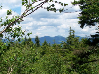 When we returned to the Spruceton Trail, we turned left and began the gradual uphill walk to the point where the Spruceton Trail to Hunter leaves the Old Spruceton Road. It seemed like a long walk but we were soon there we stopped for a snack and a drink and then started up the trail. I was still tired from Rusk and the sign that proclaimed 1110 feet elevation gain in 1.7 miles was not too encouraging. Some of places on the initial climb are steep, the ground is still very dry and there are a lot of loose rocks. This makes for some nasty hiking conditions but I recovered some by the time we reached the spring. Sheba got a drink and we took some pictures before continuing. In just .3 miles we were at the Colonel's Chair trail. By this time I knew that I just didn't have the heart to try any more peaks. I did promise myself that I would go out to the Colonel's Chair since I had been passed the trail many times without venturing.
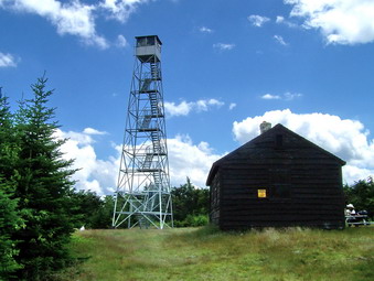 In about another mile we were within shouting distance of the tower. I knew this since I could hear people talking and a dog barking. On the way we passed several hikers coming down and a trail runner. Some places near the top are a little steep but they alternate with flat areas. We visited the lookout just before the top and then pressed on to the tower. There were several groups of there and one large black dog. Sheba tried to make friends but the other dog bared its teeth. The one drawback of bringing Sheba is that I cannot ascend any towers when people or people with dogs are around. I consider this a small price to pay. We continued on toward the Becker Hollow Trail to see what shape it was in. I hoped by the time I returned the people with the unfriendly dog would be gone. When we returned, they were still there and we headed back down the Spruceton Trail.
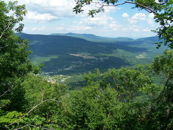 At the yellow-blazed spur to the Colonel's Chair we turned and began our descent. This trail starts as a tangle of roots and rocks. I wasn't clear HOW FAR it descended until I looked on the map and determined it was between 400 and 500 feet over a mile. I decided to continue and soon the trail becomes a dirt road. Trails with colored placards and numbers branch off this road. They are used for hiking and biking in the summer and for snow shoeing in the winter. After a short walk a space opened to the left. I examined the area and found it to be a stone quarry. A little further on the right I noticed what looked like a viewpoint and was surprised to find a sculpture of Rip VanWinkle. The viewpoint looks out on the surrounding hills and down into the valley that holds the Village of Hunter.
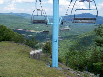 As we continued back on the road a radio tower appeared and just after that the first of several ski lifts. The views from this area are breathtaking. I stood at the top of several ski lifts and ski slopes looking down into the valleys below. I don't think any pictures can really capture what I saw. I took many pictures down the slopes and of the surrounding hills. I also shot some photos down into the village. After we had exhausted every possible vantage point, it was time to climb back to the main trail. This was a significant climb but it went quickly. This side trip was well worth the extra effort. Sheba and I were back at the car after a little less than 7 hours of hiking around 11 miles.
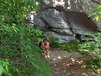
![]() On Thursday, July 12th I wanted to hike after summer school but was tired of the flat walks that I usually use. I decided to try Giant Ledge and Panther since the weather was fine and the forecast favorable. I came home, changed, packed up, grabbed the dog and left. We parked at about 2:15 PM and there were several cars and a few people in the lot. We got right on the trail and the register showed three or four groups still hiking. The showers of the days before were the result of a cold front and the weather was cooler and less humid than earlier in the week. I knew we were moving but I was surprised to find we got to the trail junction in 15 minutes! We were really moving although I didn't feel rushed.
On Thursday, July 12th I wanted to hike after summer school but was tired of the flat walks that I usually use. I decided to try Giant Ledge and Panther since the weather was fine and the forecast favorable. I came home, changed, packed up, grabbed the dog and left. We parked at about 2:15 PM and there were several cars and a few people in the lot. We got right on the trail and the register showed three or four groups still hiking. The showers of the days before were the result of a cold front and the weather was cooler and less humid than earlier in the week. I knew we were moving but I was surprised to find we got to the trail junction in 15 minutes! We were really moving although I didn't feel rushed.
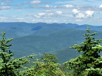 As we turned at the trail junction, we met our first group of people headed down from the Ledges. Sheba and I turned and kept up our pace even through the steeper parts of the trail. We met one women along the way and talked to her until she stopped at the spring. We continued and met two boys on point for a family of five. As we neared the first viewpoint we heard a lot of yelling. I listened to make sure it was not a cry for help. It was a rather small group of obnoxious children who didn't know that many people hike for the quiet "noise" of the woods. We bypassed this spot and headed for another. We stopped at one ledge and I took some pictures. There was some haze but less than the last few times I had been on Giant Ledge. As we passed another viewpoint a young women was relaxing. We said hello and then pushed on.
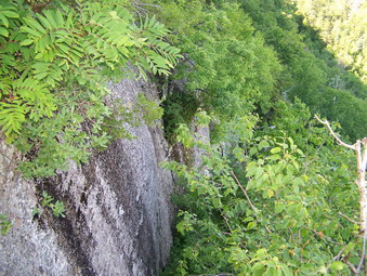 I didn't expect to find many more people as we descended into the col between the Ledges and Panther. The ascent up Panther is steep in places but the distance to get to it is short so I usually feel fresh. On one of the steeper parts we met another hiker coming down. We exchanged some thoughts with him and then were off again. Near the top of Panther the blowdown has been cleared from the path but the destruction is evident. We stopped at the summit to get a drink and take a few pictures and then turned around. We kept a quick pace down the trail until the Ledges. Here we met the young women from before and another women just getting ready to return. I stopped to take some pictures of Panther and other surrounding mountains. I also shot some along the Ledges. At the next viewpoint we met the man we had first seen on Panther. He must have taken a LONG rest. I took some more pictures and left before he did. On the way down we caught and passed the two young women. The whole 5.7 mile trip took us less than 3 hours!
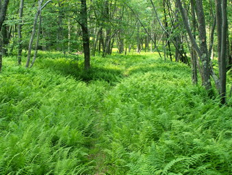
![]()
![]() On Tuesday, July 10th I wanted to take a quick walk after summer school. I had actually planned to do Giant Ledge and Panther Mountain but the weather prediction had been changed to include possible violent thunderstorms. I thought it was better to stay nearer to home and chose the long route around Frick Pond and Hodge Pond. Sheba and I arrived at the parking area and 1:15 and immediately started out on the Frick Pond Trail. At Frick Pond we went left and followed the Quick Lake Trail to Iron Wheel junction and then on to Junkyard Junction. Here we turned right on the Flynn Trail and headed for Hodge Pond. These trails are always wet but today they were only damp in places. There was a decent swarm of mosquitoes that insisted on biting me. About halfway up the Quick trail I had enough and applied some of the new Ultrathon. From this point on NO MOSQUITOES LANDED on any part of me where I had applied the repellent!
On Tuesday, July 10th I wanted to take a quick walk after summer school. I had actually planned to do Giant Ledge and Panther Mountain but the weather prediction had been changed to include possible violent thunderstorms. I thought it was better to stay nearer to home and chose the long route around Frick Pond and Hodge Pond. Sheba and I arrived at the parking area and 1:15 and immediately started out on the Frick Pond Trail. At Frick Pond we went left and followed the Quick Lake Trail to Iron Wheel junction and then on to Junkyard Junction. Here we turned right on the Flynn Trail and headed for Hodge Pond. These trails are always wet but today they were only damp in places. There was a decent swarm of mosquitoes that insisted on biting me. About halfway up the Quick trail I had enough and applied some of the new Ultrathon. From this point on NO MOSQUITOES LANDED on any part of me where I had applied the repellent!
 At Hodge Pond we turned left to go around the pond to get the maximum distance possible. This trail is clearly marked as a jeep trail on the GPS maps. On the other side of the pond we went left and climbed a short hill to the Beech Mountain Trail which is marked as Beech Mountain Road on the maps. In a short while this rejoins the Flynn Trail which leads directly back to the car. At the junction with Big Rock Trail, Sheba came back to stand by me. This usually means people are approaching. In this case, I saw a small, spotted fawn running away from us down the Flynn Trail. What a dog! We continued on down the trail and back to the parking lot. We covered nearly 6 miles in around 2 hours and 15 minutes although it did not seem like we were rushing.
![]()
![]() On Sunday, July 8th Cindy and I decided to see if we could get up Morton Hill Road to Trout Pond. We ate at Peez Leweez as usual, grabbed Sheba and then headed for Trout Pond arriving at the upper parking area at about 1:15. The road was in good shape showing no effects from the recent flooding in Colchester. Work is still continuing on the bridge replacement at the beginning of the trail. There is no a large steel frame erected and in place near the site of the old bridge. It is VERY impressive and MUCH larger than the old bridge. The bridge only requires decking and grading for the proper access but I don't know what other work is intended.
On Sunday, July 8th Cindy and I decided to see if we could get up Morton Hill Road to Trout Pond. We ate at Peez Leweez as usual, grabbed Sheba and then headed for Trout Pond arriving at the upper parking area at about 1:15. The road was in good shape showing no effects from the recent flooding in Colchester. Work is still continuing on the bridge replacement at the beginning of the trail. There is no a large steel frame erected and in place near the site of the old bridge. It is VERY impressive and MUCH larger than the old bridge. The bridge only requires decking and grading for the proper access but I don't know what other work is intended.
 We decided to walk the trail to Trout Pond first which makes the beginning of the hike only slightly uphill and the end of the hike all downhill. It does make the middle part a little more challenging. On the way up the trail we began to notice a series of large trees uprooted on both sides of the trail. These were all new and some were twisted and snapped off. This continued the entire way to Trout Pond. Perhaps this is some evidence of the storm that dumped 6 to 8 inches of rain on the Town of Colchester! At the pond there was one group camping on the far side. The pond still showed signs of beaver activity but the water level was down due to the lack of rain. Crossing the inlet barely required the stepping stones.
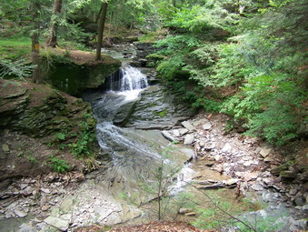 We headed up the trail and over Cherry Ridge toward Mud Pond. The day was warm but beautiful with birds singing everywhere. At Mud Pond we took the let and headed back toward the trail register. The trail is normally wet in places but this time was dry for almost the entire length. We cross Russell Brook on the makeshift metal plates and headed back up Russell Brook road. I stopped to take some pictures of the upper falls and an evergreen tree that seemed to be the victim of a recent lightning strike. We finished the 6 mile hike in under 2 and half hours which is our usual pace.
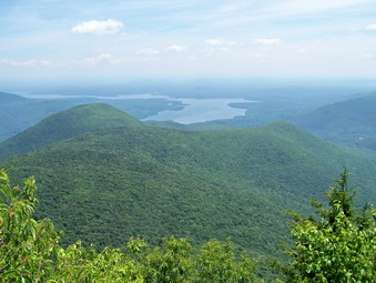
![]()
![]() On Saturday, July 7th I wanted to do something LONG but closer to home. I was thinking of doing the Burroughs Loop AGAIN but I really dislike the Woodland Valley side of Wittenberg. It always seems so long coming up from the Valley. I though about reversing the loop which I had never done. I settled on the idea of hiking from the Slide Parking Area to Wittenberg and back! I calculated about 11 miles and five peaks. I had never gone from Slide through to Wittenberg and this sounded like a long and challenging approach. I was concerned about getting myself and Sheba DOWN some of the steeper places that we have come UP in the past. We arrived in the parking area at 9:30 AM to find a larger number of cars and a big group of people. As we were getting ready to hike, the group got in some cars and left! We never saw them again!
On Saturday, July 7th I wanted to do something LONG but closer to home. I was thinking of doing the Burroughs Loop AGAIN but I really dislike the Woodland Valley side of Wittenberg. It always seems so long coming up from the Valley. I though about reversing the loop which I had never done. I settled on the idea of hiking from the Slide Parking Area to Wittenberg and back! I calculated about 11 miles and five peaks. I had never gone from Slide through to Wittenberg and this sounded like a long and challenging approach. I was concerned about getting myself and Sheba DOWN some of the steeper places that we have come UP in the past. We arrived in the parking area at 9:30 AM to find a larger number of cars and a big group of people. As we were getting ready to hike, the group got in some cars and left! We never saw them again!
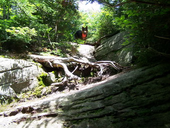 My first big surprise came after I signed in at the register and headed for the West Branch of the Neversink. I though that it might be a little high to cross after the last few days of rain. It was TOTALLY dry! Not a drop of water anywhere. The small tributary up the path was following but it was easy to step across the stones. Most of the water we found anywhere on the hike was simply pooled on the surface from the rains or surface runoff. Even the spring on Slide which is normally reliable was almost dry. This emphasizes that it has been a dry spring and summer so far in the mountains! As we made the turn onto the woods road that leads to the trail up slide, we met our first group of hikers. This turned out to be the first of MANY! All three mountains had people all over them going in both directions. I saw more people on this one hike than I have seen all season.
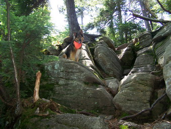 Sheba and I didn't really hurry but we were at the top of Slide in an hour and fifteen minutes. Above 3700 feet there was still evidence of the April storms that caused so much devastation in their wake. All the branches and trees that blocked the trail have been cleared to the side but the dead vegetation serves as a grim reminder. There is now a hint of a view to your left all the way up the trail. We passed a summer ranger at the very top of Slide near the anchor for the old fire tower. Another hiker was in the cleared, grassy area near the rocky outcropping at the lookout. I exchanged a quick greeting with both of them. It was possible to see some views from the lookout but just barely. We quickly headed down the other side of Slide toward the spring.
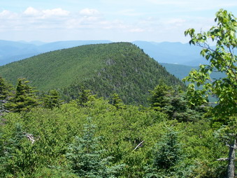 This part of the trail is also cleared and there were no obstructions down to the spring. Sheba adapted well to descending the wooden steps and handled some of the steeper, shorter drops well. At the spring we ran into a group of three young men trying to get some water out of the spring. There wasn't much to be had but Sheba got a quick drink. We talked for a minute and then Sheba and I headed on down into the col between Slide and Cornell. Along the way there are some very steep areas but Sheba managed to go around these, run down them or jump. In most cases she was at the bottom waiting for me. We could here what sounded like hikers ahead of us but didn't see anyone. There were only a few damp areas in the col and some wetter spots on the ascent up Cornell. No one was camped at the designated areas. As we started to ascend Cornell we did catch up to a father and twos sons. They also had there golden retriever along but Sheba said hello and we passed by quickly.
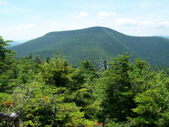 Near the top of this ascent is a rather long drop coming from the other direction. I was wondering how I would make it up and was also concerned about the dog. My reservations were misplaced as both of us made it up quickly. We walked out to the lookout on Cornell and met another hiker who had come up from Slide. He was getting ready to return while we pushed on to Wittenberg. We got a quick snack and drink and left just as the group we had met on the way up approached. In a few minutes we faced our big test of the day. This is an almost vertical "chimney" on the other side of Cornell. Sheba had scrambled UP this with relative ease this time. When we got to this formation, I went down the side were a narrow ledge and short drop offer an alternative way down. I tried very hard to encourage Sheba in every way to come down the crack in the rock but she refused. I walked away thinking she would follow but that did not work. I offered to help but she refused. At some point a group of four young men and women arrived and offered some help but I told them I hoped to find another way. After they passed, I climbed back to the top and threw a dog biscuit down. This was all the encouragement Sheba needed and she scrambled after the bone and then to the bottom. I went back down and we were on our way to Wittenberg
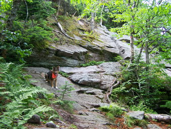 The distance to Wittenberg is less than a mile and the descent and subsequent ascent fairly easy. There area areas that are almost flat punctuated by a few short scrambles. Along the way we met another man hiking solo. We quickly made it to Wittenberg where there must have been more than a dozen hikers relaxing. The view was good if a little hazy and the sun was warm but not oppressive. Sheba and I both had a drink and a snack. I took quite a few pictures. A very nice women offered us each a cookie which we accepted. After this brief pause, we turned around and headed back toward Cornell. The first part of the return trip is pretty easy until the vertical chimney on Cornell. We both got up this with no problem and assisted a group behind us. We stopped again only briefly at the lookout on Cornell and took some pictures before pressing on.
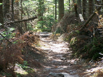 On the Slide side of Cornell I took some pictures as the day was about as clear as it gets. Sheba hesitated on one of the jumps down but I helped her and we were off. The descent into the col was easy and we were soon headed up Slide. Here we met a group of three people with climbing gear. They had hoped to climb at Giant Ledge but found the cliffs too overgrown. Now they were headed for Wittenberg to see if there was a place to climb. We continued up Slide with both of us having quite a bit of energy left. The few steep ascents did not seem to be a problem and we were soon at the spring which we bypassed. Sheba found a way to climb the wooden steps without a problem and we got through the rest of the scrambles quickly. At the lookout there was one hiker seemingly asleep so I took a few pictures and we headed down. Going down slide we met two or three more groups coming up. At the lookout on the way down we met a young couple and the girl swore that her mother had a dog just like Sheba. I didn't tell her there was NO dog just like Sheba! We caught up to the group doing the loop about halfway down Slide and escorted them to the parking area. They had no map so I described how to get back to Woodland Valley. We were back at almost exactly 4:30 making it a 7 hour trip for 10 miles. That seems slow but we spent plenty of time talking and taking pictures!
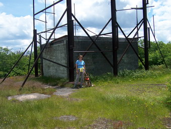
![]()
![]() On Tuesday, July 3rd I went to school early in the morning to get my room ready for summer school. This took a little longer than I thought. When I got home, I decided to do a more "local" hike and chose Graham and Balsam Lake. My wife decided to come along and we headed up the Beaverkill Road and parked at around 11:15. My plan was to hike Graham first and then Balsam Lake on the way back. The weather was partly sunny and in the high 60's or low 70's. We got started right away on the blue-blazed Dry Brook Trail and made good time to the first and then second junction with the red-blazed Balsam Lake Trail.
On Tuesday, July 3rd I went to school early in the morning to get my room ready for summer school. This took a little longer than I thought. When I got home, I decided to do a more "local" hike and chose Graham and Balsam Lake. My wife decided to come along and we headed up the Beaverkill Road and parked at around 11:15. My plan was to hike Graham first and then Balsam Lake on the way back. The weather was partly sunny and in the high 60's or low 70's. We got started right away on the blue-blazed Dry Brook Trail and made good time to the first and then second junction with the red-blazed Balsam Lake Trail.
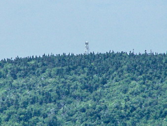 Just passed the second trail junction is an obvious path that leads to Graham Mountain. Since this mountain is on private land very little has been done to clear any of the blowdown that obscures the path. Most of these areas now have walkarounds to avoid them. In several places the trail has been obscured for some distance so we had to be careful to stay on the main path. Sheba helps a lot since she can usually find the path. The path to Graham actually descends before gently climbing again. As we neared the base of the mountain the climb became steeper and steeper. All the areas that are normally wet were only damp and the damp areas were dry. The final climb was difficult since there were a lot of branches and vegetation growing across the path.
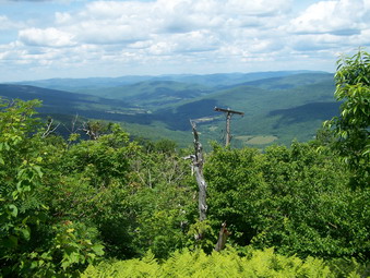 After a last push up the steep and overgrown path, we reached the top in about 2 hours and 15 minutes. The views were as usual although the tower on Balsam Lake was more clearly visible. The black flies were thick especially when we stopped. We got a drink, ate a snack, took some pictures and started back. After a short walk down the slope, we stopped at a lookout on the right on the path and took some pictures. By the time we fought our way to the bottom of the path, both of use were tired. We decided that Balsam Lake is close enough that we would leave it for another day. We finished a little less than 8 miles in four and a half hours with plenty of time for breaks.
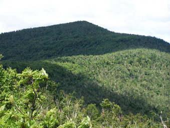
![]()
![]() On Monday, July 2nd I wanted to try to hike Windham from the Big Hollow Rd parking area. My wife and I had tried this several times and were defeated. It also looked like a more interesting approach than from Peck Road. Sheba and I got in the car and headed out DeBruce Road. As we were going down the hill passed Round Pond, I saw a large shaggy ... bear in the road. He was young, probably last year's cub, and ran down the road and then up into the woods. What a way to start! parked at Big Hollow around 10:15 and found only one car in the lot. We headed right out and had no trouble crossing the small tributary to Batavia Kill. We kept a quick pace up to the Escarpment Trail and then turned left toward Burnt Knob. The climb up Burnt Knob went fast and we were soon at the lookout. I took no pictures since I have taken MANY from the same spot.
On Monday, July 2nd I wanted to try to hike Windham from the Big Hollow Rd parking area. My wife and I had tried this several times and were defeated. It also looked like a more interesting approach than from Peck Road. Sheba and I got in the car and headed out DeBruce Road. As we were going down the hill passed Round Pond, I saw a large shaggy ... bear in the road. He was young, probably last year's cub, and ran down the road and then up into the woods. What a way to start! parked at Big Hollow around 10:15 and found only one car in the lot. We headed right out and had no trouble crossing the small tributary to Batavia Kill. We kept a quick pace up to the Escarpment Trail and then turned left toward Burnt Knob. The climb up Burnt Knob went fast and we were soon at the lookout. I took no pictures since I have taken MANY from the same spot.
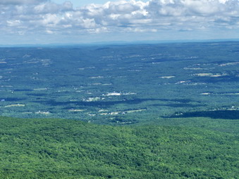 We walked across Burnt Knob and started down the other side. A brief glimpse of Windham was all we could see through the leaves. The descent was steep but short and the trail continued to rise and fall with one more short descent to the col between Burnt Knob and Windham. Along the way a distinct path to the right caught my eye and I took it to find a large, open rock ledge. The views from this ledge to the north and northeast were spectacular! I found myself wishing that I could really distinguish the buildings and peaks in the distance. Since Windham is the northernmost Catskill peak, these mountains were much farther north and east. Along the way we met a young couple coming from the Peck Road access. They were attempting to do an 18 mile loop over Windham and the Blacks and then by road back to their car. They seemed to know what they were doing so I wished them good luck!
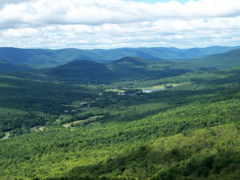 The ascent up Windham appeared daunting at first until I realized that there were a number of switchbacks and that the trail avoided climbing over the numerous rocky ledges. As I neared the top another lookout appeared right off the trail to the right. I continued on and another lookout appeared. I was still not at the top so I continued on to the place so designated by my GPS. I now realize that I had missed the best part of Windham when I came up from the Peck Road approach. I had stopped at the highest point and though that there were no really views! I turned around and went back to both lookouts to be treated to some of the nicest views in the Catskills! The scenery was similar to the lookout where I had stopped along the trail but the higher elevation made it even more dramatic. We ate some lunch and had a drink. I took a LOT of pictures and then we turned around to retrace our steps.
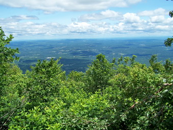 When we arrived at the Black Dome trail that would lead us back to the car, we both had some energy left so I decided to go up and over Acra Point to the Batavia Kill Trail on the other side and then back to the car. I remember this route as being long and tiring from our snowshoe excursion this passed winter. This time it was actually rather short and easy! At the trail junction I went straight ahead on the Escarpment Trail and headed toward Blackhead Mountain. I had not been on this part of the trail for a long time and very quickly wondered if I had made a mistake. This part of the Escarpment Trail begins to ascend almost immediately. It does level out after the first ascent and then becomes VERY STEEP. It rises around 1300 feet in less than one mile. Sheba had little trouble because, although it is steep, the trail never really becomes vertical. It is, however, unrelenting until you reach the top.
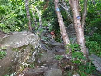 Near the top of the trail I heard voices and called the dog to stay near me. As we got to the summit we again met the same young couple we had met before! Sheba and I had hiked all the way up to Windham and back and had still caught up with them. It was midafternoon, so after a quick drink Sheba and I continued. The couple said that they would be continuing on their 18 mile adventure. I wondered about the advisability of their plan since they still had two major peaks, the hike out to Barnum Road and a long road walk to go! Sheba and I too the Blackhead Mountain Trail toward Lockwood Gap stopping just briefly to get some pictures of Black Dome and the surrounding valley. Once at the gap we hurried down the trail to get back to the car in about 5 and a half hours for the 11 mile journey.
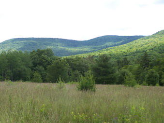
![]()
![]() On Sunday, July 1st we checked out of the Winwood Inn by 10:00 AM. We all were driving separate cars which allowed the others to return home and rest. I, however, had read about Colgate Lake and Stoppel Point in several guide books and wanted to do this hike. I estimated that it would be around 12 miles but that much of it was flat with a gentle rise. The only downer was that I didn't have Sheba along! Since I had not been to this location before, it took me a little time to find the third parking lot. This lot was the one on the left immediately after Colgate Lake. The lake was closed and it looked like MAJOR work was being done to refit the dam and landscape some of the surrounding area. When I parked there was one other car in the lot. The windows were open and somebody was inside taking a nap..I hope. I went to the gate at the end of the parking lot and immediately saw the yellow trail markers of the Colgate Lake Trail. This is an interesting name since the trail goes AWAY from Colgate Lake!
On Sunday, July 1st we checked out of the Winwood Inn by 10:00 AM. We all were driving separate cars which allowed the others to return home and rest. I, however, had read about Colgate Lake and Stoppel Point in several guide books and wanted to do this hike. I estimated that it would be around 12 miles but that much of it was flat with a gentle rise. The only downer was that I didn't have Sheba along! Since I had not been to this location before, it took me a little time to find the third parking lot. This lot was the one on the left immediately after Colgate Lake. The lake was closed and it looked like MAJOR work was being done to refit the dam and landscape some of the surrounding area. When I parked there was one other car in the lot. The windows were open and somebody was inside taking a nap..I hope. I went to the gate at the end of the parking lot and immediately saw the yellow trail markers of the Colgate Lake Trail. This is an interesting name since the trail goes AWAY from Colgate Lake!
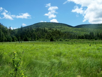 For several miles this trail virtually flat and consists of different woods roads connected by trails. The trail starts at the gate in the parking area and then meanders through a meadow with nice views of the surrounding hills. The weather was mostly sunny with only a few puffy clouds in the sky. The trail winds its way around Lake Capra, an inholding, and passed another unnamed body of water. After about two and a half miles a short trail lead off to the left and I took it. The trail open to a beaver meadow after only a few feet. The beaver meadow was beautiful and I think the mountain I saw must have been Blackhead. The contrasts of the colors was stunning! Just passed this area is an active beaver pond and the trail goes around the pond. The appearance of the pond is almost southern with trees hanging low and mossy hanging from the trees. Further up the trail are some paths off to the right. I took one of these and then made my own when it gave out. I was rewarded by a small waterfall with a pool at its base. The weather has been so dry that ether was hardly any water going over the falls but this secluded area has still pretty.
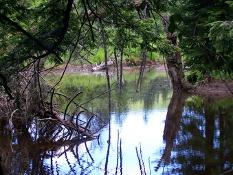 From this point on the trail begins to ascend but very gently toward Dutcher's Notch. The remaining distance is just a little over two miles. This route served as the best way for the settlers of the Jewett Valley to go to the markets in Catskill. I noticed immediately that the terrain was more rugged with large boulders and rock walls on both sides. To the right is the escarpment and to the immediate left is a deep ravine. Further to the left is another prominent ridge of land. The area is beautiful but offers no views of the surrounding countryside even as I approached the Notch. At the Notch there is a four-way intersection. The Dutcher's Notch Trail goes straight ahead. The blue-blazed Escarpment Trail turns left toward Windham or right toward Stoppel Point. We turned right.
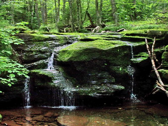 The climb begins almost immediately as you ascend from the Notch to the Escarpment. This trail is above and roughly parallel for a short while to the Colgate Lake Trail that I was on to get to the Notch. After a short distance, the trail flattens and then rolls up and down for some time. There is always a hint of a view especially on the left but nothing actually presents itself until after a little over a mile. Here is a large rock shelf some call Milt's Lookout. This viewpoint offers a panoramic view to the north and northeast. The day has a little hazy and it hard for me to identify the clusters of building and the mountains I saw in the distance. I did see an elongated body of water which I believe was the Hudson. The trail remains level for a short distance and then begins to climb up to Stoppel Point which at 3420 feet is nearly another 3500 foot peak!
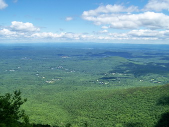 The climb isn't very long but is steep in places. I was fooled several times into thinking that the climb ahead would be very steep. In these instances, the trail made use of switchbacks to avoid directly assaulting the steepest areas. As I neared the top of the climb, the wreckage of a two-seater Piper Cub came into view. Unlike other Catskill wrecks which require careful searching, this one is right on the left of the trail. There is a lot of the plane remaining but I did not see any evidence of an engine. The history of the wreck is recorded on the NTSB website. After taking some pictures, we continue on up to the plateau that is Stoppel Point. There is a small lookout on the right of the trail near the high point mark on my GPS. When I reached the high point on the GPS, there were still no significant views that I had read about in the guidebooks. I decided to continue for a short distance.
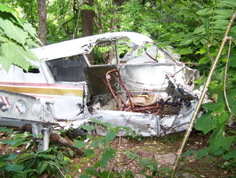 I was very glad I decided to continue since I quickly came upon a DEC signpost another open rock ledge with more views of the surrounding valley. Again, the haze made it hard to distinguish what I was seeing in the distance. I talked to two young men who had hiked up from North South Lake. I let them know about the plane crash. After a short picture break, Sheba and I turned around and headed back the way we had come. The trip back was uneventful and we kept a rapid pace. We covered between 10 and 11 miles in 5 hours and 15 minutes total time. The hiking time was quite a bit shorter on the way back since the picture breaks were many on the way out!
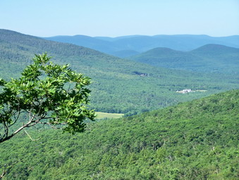
![]()
![]() On Saturday, June 30th we were staying at the Winwood Inn in Windham for Karl's wedding. One option for a morning activity was a short hike. I chose to take some family members up to Acra Point and Burnt Knob. The hike was planned to be short and easy but scenic to accommodate a few people who were not in the best hiking shape. As it turned out these people slept in and did NOT come on the hike. The weather was beautiful and we started off at about 8:!5 from the hotel. We were at the trailhead and hiking before 9:00 AM. The crossing of the Batavia Kill tributary was easy and the Black Dome Trail had been cleared of all blowdowns. We made quick work of the hike to the Escarpment Trail where we turned right toward Acra Point.
On Saturday, June 30th we were staying at the Winwood Inn in Windham for Karl's wedding. One option for a morning activity was a short hike. I chose to take some family members up to Acra Point and Burnt Knob. The hike was planned to be short and easy but scenic to accommodate a few people who were not in the best hiking shape. As it turned out these people slept in and did NOT come on the hike. The weather was beautiful and we started off at about 8:!5 from the hotel. We were at the trailhead and hiking before 9:00 AM. The crossing of the Batavia Kill tributary was easy and the Black Dome Trail had been cleared of all blowdowns. We made quick work of the hike to the Escarpment Trail where we turned right toward Acra Point.
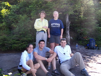 We quickly scaled the trail to the viewpoints just before Acra Point. There were some steep places but nothing too hard. The view down the Black Dome Valley was beautiful and the Blackhead Range is always impressive. Today I felt you could almost reach out and touch those mountains they seemed so close! We spent some time relaxing, taking pictures and talking before heading back. Most of the group elected to go back to the parking area but Karl and I headed for Burnt Knob. This was mostly to add a little time to the hike since the views from the lookout there are very much the same as from Acra Point.
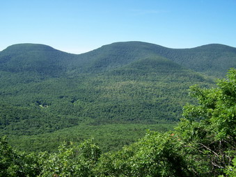 Karl and I moved quickly up the Escarpment Trail through the steeper section and a switchback. There are some pretty nice views along the way but some are blocked by leaves now on the trees. We made the top of the trail and headed left on the short spur to the lookout. The view was nice and we were surprised when a golden retriever showed up to say hello. The owner followed very shortly coming from the direction on Windham. He said they had just seen a bear and headed off with his dog. After a few more minutes Karl and I retraced our steps back down to the junction with the Black Dome Trail and then to the car. We spent a little less than two hours hiking 3 miles but it was fun being with him before his wedding!
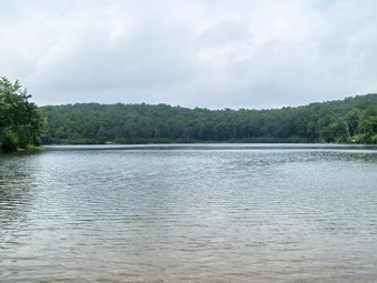
![]()
![]() On Thursday, June 28th thunderstorms were predicted all day but I wanted to get and do a short hike. My sons were home and Karl had "errands" to do for his Saturday wedding. Kurt was game for a walk so we decided to go to Frick and Hodge ponds. We got started a little after noon since they didn't get in from Virginia until 2:15 AM. It looked like most of the showers were sliding to the south and I judged it worth the risk.
On Thursday, June 28th thunderstorms were predicted all day but I wanted to get and do a short hike. My sons were home and Karl had "errands" to do for his Saturday wedding. Kurt was game for a walk so we decided to go to Frick and Hodge ponds. We got started a little after noon since they didn't get in from Virginia until 2:15 AM. It looked like most of the showers were sliding to the south and I judged it worth the risk.
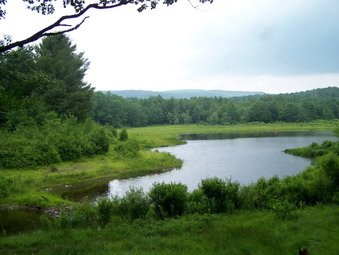 We parked and started walking up the Flynn Trail toward Hodge Pond. The grass was very wet from the rain and I was surprised that my new Merrell Mid Wrap XCR were allowing some water to get through to my feet. Kurt was wearing a pair on trail running shows and his feet were soaked in minutes. We quickly came to the top of the Flynn Trail at the junction with Big Rock and continued straight ahead toward the pond. Just before the downhill to the pond we bore to the right toward the Sullivan County High Point. At the junction with the trail that leads down to Hodge we turned left and continue down to the outlet end of the pond. We didn't try the loop around the pond since the skies were still cloudy and our time limited. We stopped for some pictures at Hodge and then picked up the Flynn Trail back to the Big Rock junction
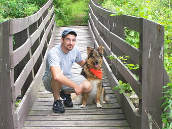 At the junction we turned right onto Big Rock and then walked down the long hill to Times Square. Here we turned left and headed for Frick. Since Frick Pond is not visible from the trail, we walked down to the pond. The dog got a drink and got wet. I took some pictures. We went back the way we had come and then walked back to the parking area. Rain threatened for the whole two hours but we stayed dry for the 6.5 mile hike.
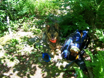
![]()
![]() On Tuesday, June 26th I had almost decided to take it easy and do some chores around the house. A look at the prediction of storms for the next few days changed my mind. I didn't want to drive too far so Sheba and I headed for McKinley Hollow to hike Eagle and Balsam. There were two things I remembered about this hike that proved to be true. The trail up to the col is VERY STEEP. There is nothing interesting about the peaks at all! The only reason to climb these mountains is to say that you did it.
On Tuesday, June 26th I had almost decided to take it easy and do some chores around the house. A look at the prediction of storms for the next few days changed my mind. I didn't want to drive too far so Sheba and I headed for McKinley Hollow to hike Eagle and Balsam. There were two things I remembered about this hike that proved to be true. The trail up to the col is VERY STEEP. There is nothing interesting about the peaks at all! The only reason to climb these mountains is to say that you did it.
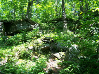 We got out of the car an immediately crossed the stream on a bridge. The red blazed trail leads up to the Col between the two mountains. The first water crossing had large stones that were dry and it was easy to step from one to the other to cross. Many of the rocks along the trail were damp from the heavy dew and fog. This meant slip-sliding was the rule of the day. In just over half a mile we were at the lean-to. Just passed the lean-to the trail turns left and crosses the stream again. This is VERY POORLY marked and overgrown with nettles. Be sure to make this turn. From this point the trail ascends through fields of nettles! The trail is not too popular so some of the nettles grow right on the trail. In addition, the trail becomes VERY STEEP at times. The thought of abandoning the whole hike always crosses my mind! There is a nice brook in the ravine next to the trail.
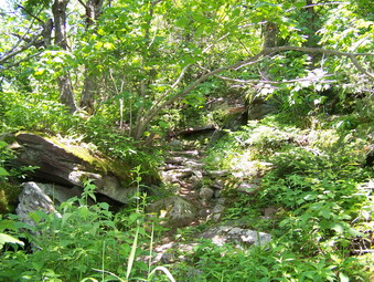 As we got near the top of the trail it levels off as it approaches the col. I looked up at one point to see a small black bear walking down the trail toward us. Sheba stood her ground and started a primal growl I had never heard before. The bear stopped and then bolted away as Sheba began to bark. Sheba obeyed me and did NOT follow or approach the bear. This was the most exciting part of the trip! At the col I decided to turn left and do Eagle first. There is not much to tell about the trip out. It is around two miles of walking. There is a slight ascent of Haynes Mountain at 3420 feet and then a drop into the col between the two. The ascent up Eagle has a few climbs over rocks but nothing very exciting. The highest point on Eagle appears to be off the trail to the right. I followed the informal paths made by hikers until my GPS said that I was at the highest spot. It looked a lot like every other place around me!
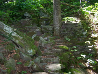 Back on the main trail we stopped for a few pictures, a snack and a drink. On the way down Eagle I heard some crashing in the brush off to our left. It was another and much LARGER bear ... headed in the opposite direction. A couple of barks from Sheba encouraged it to keep going. The trip back to the col was quicker but we were both tired. I almost called it a day but remembered that the .65 miles to Balsam aren't very difficult. He kept going straight up the trail to Balsam and then turned around and walked back to the col. The turned left and headed back to the parking area. Almost 9 miles in a little over 5 hours satisfied me!
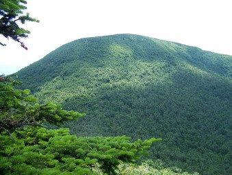
![]()
![]() On Monday, June 25th I wanted to back up the long hike from the day before with another challenging hike that included several peaks but covered less distance. I chose to hike Black Dome, Thomas Cole and Blackhead. These peaks are numbers 3, 4 and 5 in elevation in the Catskills! Sheba and I didn't get started as early as I hoped and got to the Big Hollow parking area just before 10:00 AM. I just wasn't really awake and had nagging aches and pains from the day before. I hoped these would resolve themselves as we hiked. The day was warmer than the previous day and more humid. From the parking area we walked up the road and got on the Batavia Kill Trail for a short distance to the junction with the Black Dome Trail. I hadn't been up these peaks on that trail for a while. I wanted the quickest way to bag these peaks and doing a "T" up this trail is it! The Batavia Kill Trail is often wet with both standing and running water. Today it was mostly dry.
On Monday, June 25th I wanted to back up the long hike from the day before with another challenging hike that included several peaks but covered less distance. I chose to hike Black Dome, Thomas Cole and Blackhead. These peaks are numbers 3, 4 and 5 in elevation in the Catskills! Sheba and I didn't get started as early as I hoped and got to the Big Hollow parking area just before 10:00 AM. I just wasn't really awake and had nagging aches and pains from the day before. I hoped these would resolve themselves as we hiked. The day was warmer than the previous day and more humid. From the parking area we walked up the road and got on the Batavia Kill Trail for a short distance to the junction with the Black Dome Trail. I hadn't been up these peaks on that trail for a while. I wanted the quickest way to bag these peaks and doing a "T" up this trail is it! The Batavia Kill Trail is often wet with both standing and running water. Today it was mostly dry.
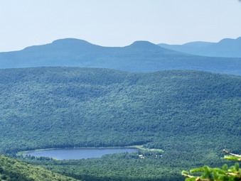 The Black Dome trail starts as a wide trail with many loose rocks. It becomes progressively steeper with few level spots to help catch your breath. Above the spring the trail narrows and these are fewer loose rocks. As you ascend a series of switchbacks moderates the steepness of the climb but adds distance to your hike. As you turn on the first switchback the silhouette of Blackhead rises immediately in front of you. Whenever I see the outline of this mountain my first thought is, "I'm going to hike THAT!" The switchbacks carry the trail up to the col between Blackhead and Black Dome. I decided this time to do Black Dome and Thomas Cole first. We turned right a the col and began the ascent of Black Dome
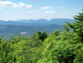 This trail has a little bit of everything! There are very few flat spots. There are areas of loose dirt to slip and slide on. There are narrow places where you can barely fit your feet side by side. There are short, steep rock scrambles. The reward for your trouble is a beautiful viewpoint over Blackhead and the Black Dome Valley on your way up. At the top another rock ledge offers spectacular views to the south and a nice place to stop for water, a snack and pictures. We stopped briefly and then pressed on to Thomas Cole.
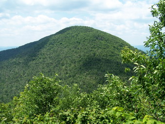 The descent into the col isn't very steep and the drop is barely enough to classify the two peaks as separate. The horizontal separation is less than a mile. The climb up to Thomas Cole also isn't too challenging. The trail between Black Dome and Thomas Cole still has quite a bit of blowdown. Some has been cut but much still lies in the trail. Hikers have rerouted the trail to avoid the largest and most annoying of these. As you descend into the col from either direction glimpses of the mountain ahead that you are about to climb come into view. There are also hints at the mountains and valleys on either side of the trail. The views are never good enough to take a picture or get a real idea of what is out there. From the top of Thomas Cole we retraced our steps to Black Dome. The descent into the col from Black Dome is exciting especially if you fail to pay attention to your footing!
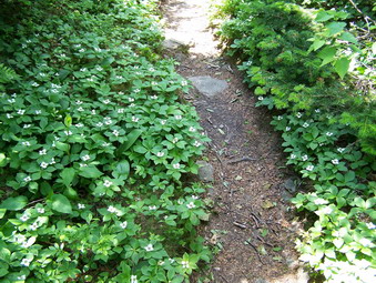 As I said before, Blackhead always seems imposing to me. We started up the trail which is initially not too steep. This doesn't last long! The trail grows steeper and in several areas there are open rock faces to climb over. There are at least three places on this ascent where you can stop and look back at Black Dome and the other surrounding peaks. You can also look down into the valleys and the gaps or notches between the mountains. Even on a clear day there always seems to be a haze on the mountains giving them an almost surreal or ethereal look. We continued on up to the very top of Blackhead where the escarpment trail branches off. Like so many summits there is no view so we turned around and headed DOWN! Along the trail were patches of what I believe are white trillium. This was an unexpected pleasure at this elevation.
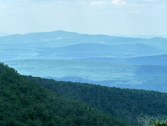 Going back down the steep Black Dome trail with its loose rocks and dirt was almost as hard as coming up. The walk passed without any mishaps. We covered the 7 miles in less than five hours. I didn't feel bad about the slower pace given the hike the day before and the difficulty of the peaks! I think tomorrow I will be hiking or flat hiking somewhere to try out some new shows!
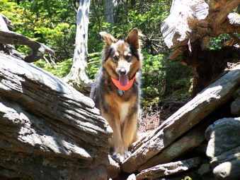
![]()
![]() On Sunday, June 24th I knew I was going to get a late start after church. I also knew that these are some of the longest days of the year and I would easily have light until 8:00 PM. I came home, got changed grabbed the pack and Sheba and headed for Indian Head. I wanted to hike Indian Head and Twin and maybe throw in Sugarloaf if time permitted. The weather was overcast and isolated showers were a possibility. We parked on Prediger Road which wasn't easy since there were at least 8 cars in the this small space. I parked on the corner of a driveway off the road and asked a gentleman tending a garden if I could park there. He replied that as long as I had asked it was OK. He also said that he had heard rumors that a plans for a parking area were underway for this popular trailhead. When I opened the trunk I got a surprise. All the water had leaked out of my Camelbak leaving me two three liters short and with a wet trunk and pack. I looked for holes or a poor seal at the mouth. Then I remembered that the last time this happened I had laid the pack on the bite valve in my haste. I vowed to put the lock on the Camelbak and pay more attention to what I was doing next time.
On Sunday, June 24th I knew I was going to get a late start after church. I also knew that these are some of the longest days of the year and I would easily have light until 8:00 PM. I came home, got changed grabbed the pack and Sheba and headed for Indian Head. I wanted to hike Indian Head and Twin and maybe throw in Sugarloaf if time permitted. The weather was overcast and isolated showers were a possibility. We parked on Prediger Road which wasn't easy since there were at least 8 cars in the this small space. I parked on the corner of a driveway off the road and asked a gentleman tending a garden if I could park there. He replied that as long as I had asked it was OK. He also said that he had heard rumors that a plans for a parking area were underway for this popular trailhead. When I opened the trunk I got a surprise. All the water had leaked out of my Camelbak leaving me two three liters short and with a wet trunk and pack. I looked for holes or a poor seal at the mouth. Then I remembered that the last time this happened I had laid the pack on the bite valve in my haste. I vowed to put the lock on the Camelbak and pay more attention to what I was doing next time.
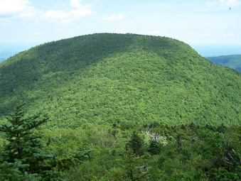 We got right on the trail starting just before 1:00 PM. My intention was to hike up to Jimmy Dolan Notch and then to Indian Head and Twin. After that, I was going to come back to the Notch or continue over Sugarloaf and walk the roads back to the car. We really moved up the Notch trail aided by the fact that it was very dry. I have been on this trail when it was impossible to hike the trail sine it was more like a stream. Today the trail was only damp in spots and easy to follow. We turned left at the Notch onto the Devil's Path and attacked the short but steep climb up to the summit. Part way up Sheba got ahead and I heard other hikers coming down. Someone exclaimed "Look who's here!" It was Harry Rampe with a small group of hikers from the 3500 Club. Sheba and I continued to the top. There is no view from the summit and the lookout is pretty far down the other side so we turned around and went back to the Notch.
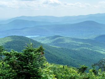 We started up Twin with the sky starting to show more clouds. Some of the clouds were pretty black. After two different hikes in rain storms, I found that getting wet in a torrential downpour with lightning splitting the sky was not much fun. I kept an eye on the sky and continued to move quickly up to the first summit. The view from here is always spectacular and today was no different. A family from the Bruderhof was stopped at the top. Sheba and I ate a snack and I took some pictures before continuing on to the higher, western peak of Twin.
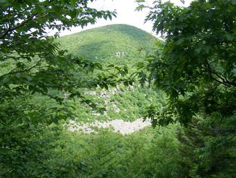 The view from the western peak was also nice and the sky had not gotten any darker. I decided to put the camera away since it slows me down. I also decided that although Sugarloaf seemed a ways off we would try it. We hurried down the western slope of Twin passed the "cave". Hurrying here isn't easy since there are several steep descents over bare rock faces. There are also near vertical drops that challenge both man and dog! We blew through Pecoy Notch and headed up Sugarloaf. This was a long climb with many short but steep areas. The skies darkened again as did my mood. We made the top of Sugarloaf and decided NOT to go to the lookout over Plateau. We had been there a few weeks before and still had some distance to cover to get back to the car.
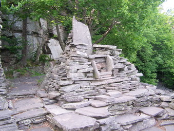 On the way back to Pecoy Notch we met a couple hiking up. After leaving them, the skies seemed to brighten which helped lift my spirits. Sheba isn't discouraged by any of this and just keeps walking! The trail down from Pecoy Notch to the Roaring Kill parking area is littered with rocks any one of which can turn an ankle. Even though we were moving fast I avoided any mishaps and we were soon at the end of the trail. Unfortunately, the car was on Prediger Road and I estimated that was at least 3 miles away. We headed right on Roaring Kill Road, turned left on Dale Lane and then right on Platte Clove. Walking the roads takes a lot less time than the trails but is harder on the feet. Sheba stayed glued to my right heel as I sued the command "With!" to remind her to stay there. We completed just under 11 miles in just over 5 hours. Devil's Path! One day! No sweat!
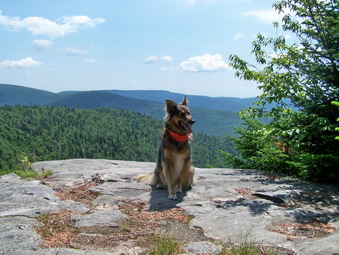
![]()
![]() On Thursday, June 21st I wanted to get away from Livingston Manor. I took Sheba to hike the western end of the Devil's Path over Westkill Mountain. I am still entertaining the idea of hiking the Devil's Path in one day this summer and thought I should check out this end of the trail. I had never been through to Westkill from this end. I had used this trail as a starting point for bushwhacking North Dome and Sherrill. At the start I wasn't sure whether we would retrace our steps back to the car, continue on over Hunter to make a loop or just walk Spruceton Road back to the car. Thundershowers were again predicted for the afternoon and I knew this would effect my decision. When we started at 9:15 AM the weather was perfect; sunny but cool.
On Thursday, June 21st I wanted to get away from Livingston Manor. I took Sheba to hike the western end of the Devil's Path over Westkill Mountain. I am still entertaining the idea of hiking the Devil's Path in one day this summer and thought I should check out this end of the trail. I had never been through to Westkill from this end. I had used this trail as a starting point for bushwhacking North Dome and Sherrill. At the start I wasn't sure whether we would retrace our steps back to the car, continue on over Hunter to make a loop or just walk Spruceton Road back to the car. Thundershowers were again predicted for the afternoon and I knew this would effect my decision. When we started at 9:15 AM the weather was perfect; sunny but cool.
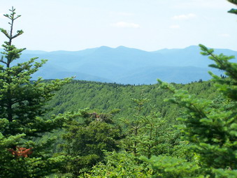 The first bit of the trail is pretty steep up to the trail register. It then flattens some but climbs continuously for about 1.5 miles. At this point the Devil's Path turns sharply to the right or east and begins to climb to the western summit of Westkill. At this point you can turn right as I have at times and start a bushwhack of North Dome. This is not for the faint of heart since it involves crossing a wide and often VERY wet swamp. The nettles are thick and the mosquitoes thicker! The Devil's Path in this area was wet and is always damp. Several smaller feeder spring form small flows of water that sometimes flow right down the trail. Since this area gets less traffic the nettles and briars have a good chance to get a hold and grow over the trail.
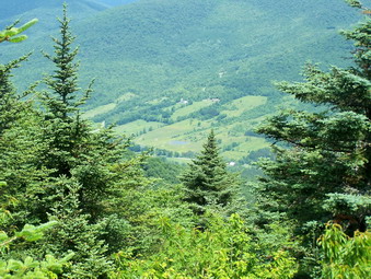 The ascent of the western summit is steep at times and then moderates. If you look over your shoulder, you can get glimpses of a view at several points near the top but none is open enough to really see back to North Dome. After the summit, there is a drop into a col between the two summits. This drop is steep in places but not very far. The walk in the col seems long but is realistically not very far. The climb to the higher, eastern peak has its moments but overall is easily negotiated. The distance between the two peaks is about two miles. We found the trail still had quite a few obstacles from the April storms. Some had been cut down but left in the path. Some of the larger blowdowns now have a new path around them. I tried to clear some of this off the path. The summit of Westkill is the only one in the Catskills marked with its own sign.
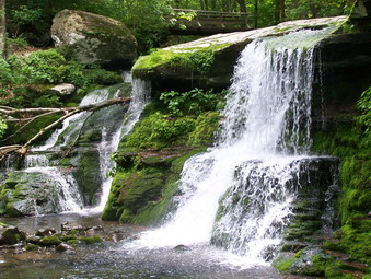 Less than a quarter mile on down the trail are the Buck Ridge lookouts. These are always worth a prolonged stop as they offer around a 270 degree view of the other peaks and the valleys below. What you don't see from these lookouts is much civilization. There is an occasional house or cabin but not much else! We stayed long enough to take some pictures and get a bite to eat and then were off. The sky was still clear with only a few clouds. The temperature was cool but perfect for hiking. We descended down the eastern slope navigating through the few steeper portions and passed the rock overhang that makes up "the cave". The descent seemed to go quickly and we were soon at the Diamond Notch Falls.
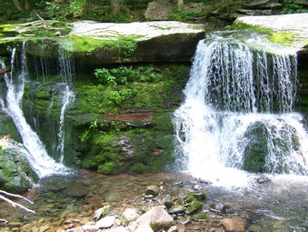 I spent some time at the falls taking pictures. I climbed down to the base of the falls on both sides and took pictures from the bridge as well. There was a fair amount of water going over the falls and this made it more interesting than in the past. At this point the skies were beginning to cloud up and I had to make a decision. I felt GREAT and Sheba seemed fresh. I really wanted to go for Hunter but I really didn't want to get wet. I knew if I decided to do Hunter it would pour and if I just walked back to the car it would be nice. I decided, after some time, to walk the road back to the car. Although it is flat, the walk id almost four miles and we needed to make good time. As we walked, the skies became cloudier and it began to sprinkle. We walked out of the rain back into sunny skies...for a short time. Within half a mile of our destination the skies became black and there was thunder. With less than a quarter mile to go, it began to pour and Sheba and I ran the last bit to the car. We got in just as it really started to rain. We were wet but had hiked almost 11 miles in just about 5 and a half hours! Next time I'll include Hunter to make it between 16 and 17 miles! Next is the Devil's Path in one day!!