
Catskill Trails
Besides the thirty-five 3500 foot peaks in the Catskills, there are many other smaller mountains to climb. In addition, there are hundreds of miles of trails to hike. There are also MANY other places to hike also. I have divided the Trails section into list of All Trail, the Catskills, the Shawangunks, Bear Mt/Harriman, East Hudson, West Hudson, New Jersey and Other Trails. The All Trails list includes over 400 different trails and may load slowly on your computer. The "divided" list should load more quickly.
You can view all the Catskill Trails here.
Clicking on ![]() will bring up an index of trails. Clicking on
will bring up an index of trails. Clicking on ![]() will return you to the top of the page.
will return you to the top of the page.
Acra Point Loop
| Quick Look | ||||
|---|---|---|---|---|
| Difficulty | Round trip | Total climb | Internet Maps | |
| 5.1 mi | 1100 ft | AllTrails | ||
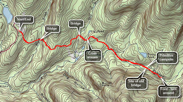
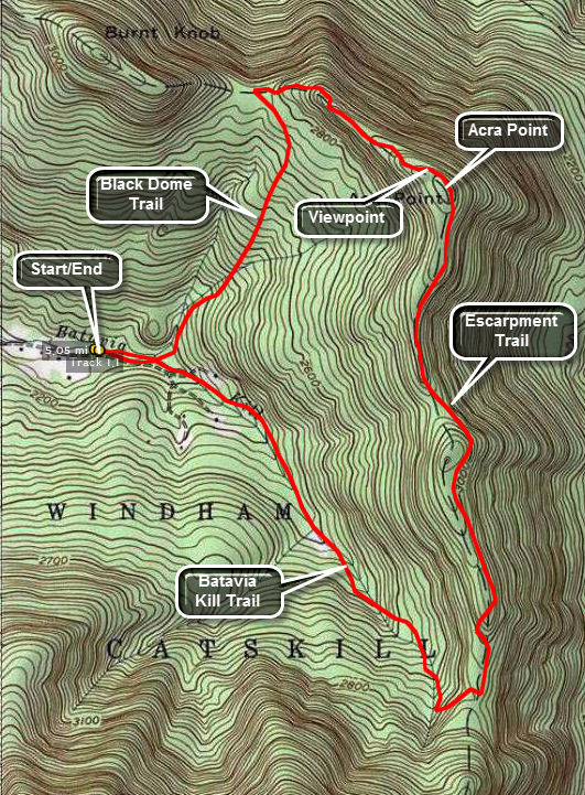 Park at trail head parking area on Black Dome or Big Hollow Road. Be aware that past a certain point this road is considered seasonal and may not be plowed or maintained. During the winter the trailhead parking is almost never plowed and parking is limited along the shoulders of the road. The trail head is just BEFORE the parking area on the right. Find the red-blazed Black Dome Trail
and immediately cross the Batavia Kill on a bridge. After a short walk, re-cross the Batavia Kill and continue on the trail for about 1.1 miles. This second crossing has no bridge and can be tricky at times! Look over your shoulder occasionally to see the imposing presence of Blackhead, Black Dome and Thomas Cole Mountains. This walk winds its way upward through mixed hardwood and spruce forest until it meets the blue-blazed Escarpment Trail.
Park at trail head parking area on Black Dome or Big Hollow Road. Be aware that past a certain point this road is considered seasonal and may not be plowed or maintained. During the winter the trailhead parking is almost never plowed and parking is limited along the shoulders of the road. The trail head is just BEFORE the parking area on the right. Find the red-blazed Black Dome Trail
and immediately cross the Batavia Kill on a bridge. After a short walk, re-cross the Batavia Kill and continue on the trail for about 1.1 miles. This second crossing has no bridge and can be tricky at times! Look over your shoulder occasionally to see the imposing presence of Blackhead, Black Dome and Thomas Cole Mountains. This walk winds its way upward through mixed hardwood and spruce forest until it meets the blue-blazed Escarpment Trail.
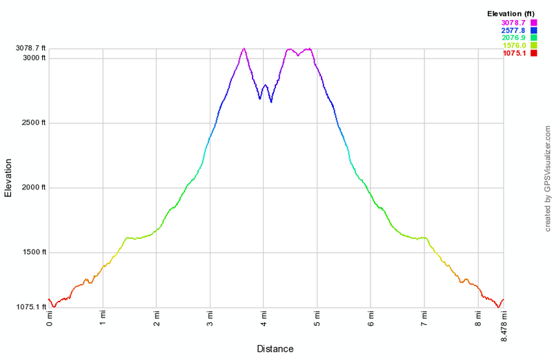
Turn right on The Escarpment Trail and head toward Acra Point. The terrain now is more rugged and steeper. There is a hint of views to both the north and south on both sides of the trail but they are not clear. Walk off the trail on the left to get a view to the north toward Albany or wait until just after the top of Acra Point. After about .7 miles you will be at the summit of Acra Point. The best views to the south and west are from a lookout BEFORE the summit. The path is well-traveled and is easy to find. When you walk out onto the rock shelf, you are treated to a spectacular view of the three mountains and the Camel's Hump. The views down the Black Dome Valley to the west are also excellent. From here you can also see Burnt Knob and behind and to the right Windham Mountain.
Continue on the Escarpment Trail for another 1.75 miles. The trail skirts a hill nearly as high as Acra. Views to the north from the trail continue to be elusive.The trail descends but has several short ascents before it heads down to meet the Batavia Kill Trail. The Escarpment Trail continues up over Blackhead Mountain. As you descend the trail toward the Batavia Kill Trail junction it looks very much as if you MUST ascend this mountain! Turn right on the yellow-blazed Batavia Kill Trail to return to the parking area. This trail goes on for about 1 mile and ends. Be sure to turn right and follow the red-blazed Black Dome Trail and the signs to the parking area about .6 miles away. If you turn left, you will be climbing to the col between Blackhead and Black Dome! Bridges span the widest and deepest water crossings near the end of the trail. There is also evidence of a dam and the foundations of a mill on the Batavia Kill.
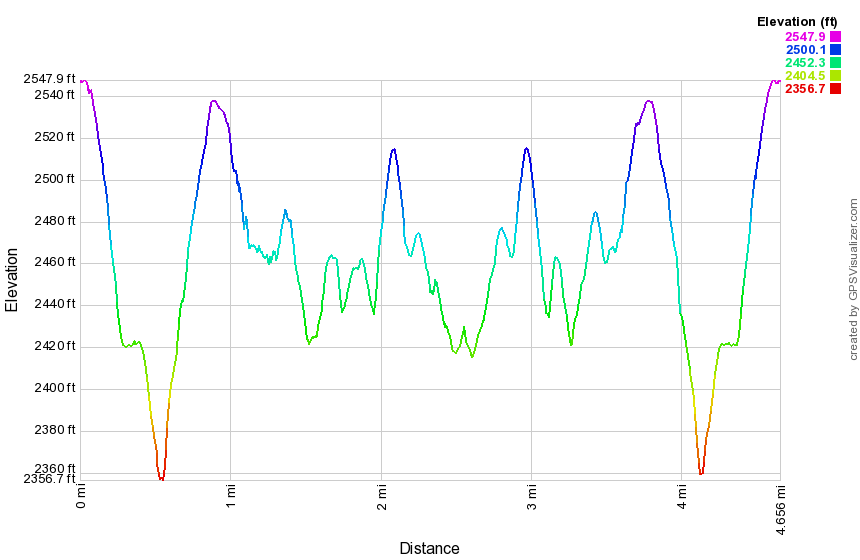
 (The image at the left shows the profile of the hike. Remember that all vertical profiles are relative!)
Acra Point and Burnt Knob
| Quick Look | ||||
|---|---|---|---|---|
| Difficulty | Round trip | Total climb | Internet Maps | |
| 4.2 mi | 1320 ft | AllTrails | ||
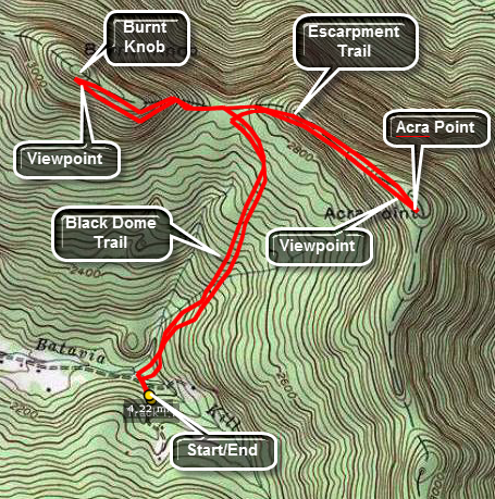 Park at trail head parking area on Black Dome or Big Hollow Road. Be aware that past a certain point this road is considered seasonal and may not be plowed or maintained. During the winter
the trailhead parking is almost never plowed and parking is limited along the shoulders of the road. The trail head is just BEFORE the parking area on the right. Find the red-blazed Black Dome Trail
and immediately cross the Batavia Kill on a bridge. After a short walk, re-cross the Batavia Kill and continue on the trail for about 1.1 miles. This second crossing has no bridge and can be tricky at times! Look over your shoulder occasionally to see the imposing presence of Blackhead, Black Dome and Thomas Cole Mountains. This walk winds its way
upward through mixed hardwood and spruce forest until it meets the blue-blazed Escarpment Trail.
Park at trail head parking area on Black Dome or Big Hollow Road. Be aware that past a certain point this road is considered seasonal and may not be plowed or maintained. During the winter
the trailhead parking is almost never plowed and parking is limited along the shoulders of the road. The trail head is just BEFORE the parking area on the right. Find the red-blazed Black Dome Trail
and immediately cross the Batavia Kill on a bridge. After a short walk, re-cross the Batavia Kill and continue on the trail for about 1.1 miles. This second crossing has no bridge and can be tricky at times! Look over your shoulder occasionally to see the imposing presence of Blackhead, Black Dome and Thomas Cole Mountains. This walk winds its way
upward through mixed hardwood and spruce forest until it meets the blue-blazed Escarpment Trail.
Turn right on The Escarpment Trail and head toward Acra Point. The terrain now is more rugged and steeper. There is a hint of views to both the north and south on both sides of the trail but they are not clear. Walk off the trail on the left to get a view to the north toward Albany or wait until just after the top of Acra Point. After about .7 miles you will be at the summit of Acra Point. The best views to the south and west are from a lookout BEFORE the summit. The path is well-traveled and is easy to find. When you walk out onto the rock shelf, you are treated to a spectacular view of the three mountains and the Camel's Hump. The views down the Black Dome Valley to the west are also excellent. From here you can also see Burnt Knob and behind and to the right Windham Mountain.
Retrace your steps back down to the junction of the Black Dome Trail and the Escarpment Trail. Continue straight ahead toward Burnt Knob. The summit is only about .5 miles from the trail junction but it is eroded and steep in some places. During the winter the snow conditions may make it almost impossible to negotiate. The best views are on the left of the trail just BEFORE the summit. Several short spur trails lead out to viewpoints. If you continue passed the summit you will descend slightly. Just before a steeper descent on the way to Windham High Peak look ahead for a nice view of this peak. The view is better in fall and winter when there are few leaves on the trees. Turn around and retrace your path back to the trail junction. Turn right to go back to the car.
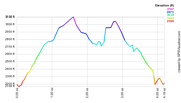 (The image at the left shows the profile of the hike. Remember that all vertical profiles are
relative!)
(The image at the left shows the profile of the hike. Remember that all vertical profiles are
relative!)
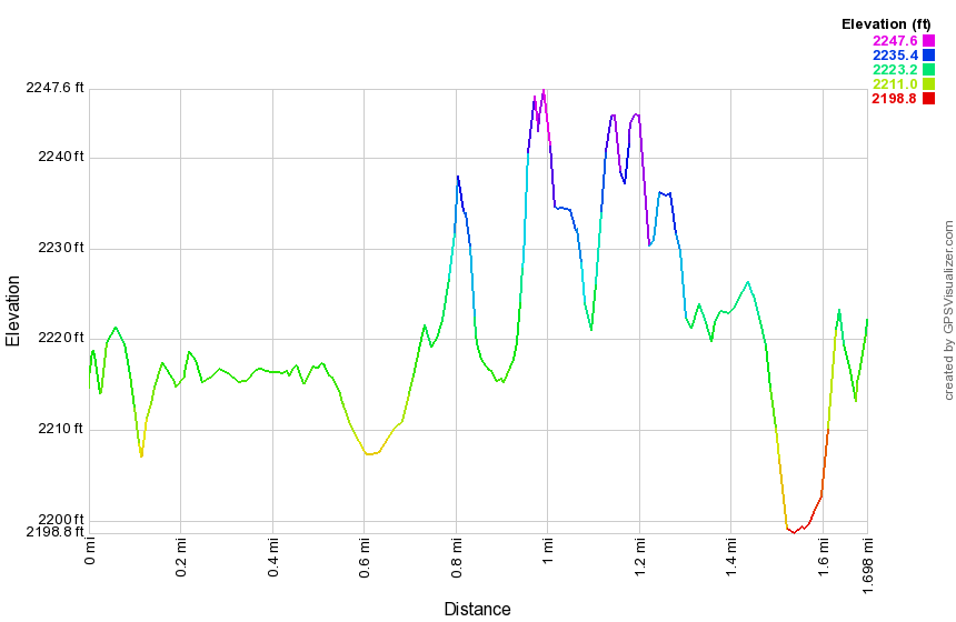
Alder Lake: Around Lake Clockwise
| Quick Look | ||||
|---|---|---|---|---|
| Difficulty | Round trip | Total climb | Internet Maps | |
| 1.7 mi. | 145 ft. | AllTrails | ||
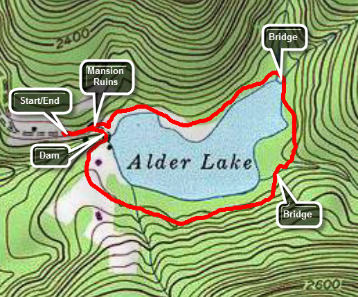 Take the Beaverkill Road from Livingston Manor and drive for about twenty minutes to the Alder Creek Road. Alder Creek Road is a left turn off the Beaverkill Road about two miles after it makes a sharp right turn near the Barkaboom Road that goes to the Little Pond State Campgrounds. Go to the end of Alder Creek Road and turn right into the access road to Alder Lake. Bearing left will take you over to the Millbrook-Arena Road on Cross Mountain Road. Park in the parking lot and walk toward the lake passing the stonework which is all that remains of the Coykendall Mansion. Walk down the left side of the "lawn" and follow the trail around the lake. There are several places to walk out to the shore of the lake. Directly across the lake is Cradle Rock Ridge. At .8 miles the Millbrook Ridge Trail turns left. Stay on the main trail around the lake and cross the bridge that spans Alder Creek. Stay on the woods road and follow the blazes as they guide you around the lake. The trail is sited away from the lakeshore and you will see primitive campsites between you and the water. As you near the southern end of the lake you will break out into an open area. Walk to the dam and cross over to the other side. Walk up the path toward the remains of the mansion and back to the parking area.
 (The image at the left shows the profile of the hike.)
Alder Lake: Around Lake Counterclockwise
| Quick Look | ||||
|---|---|---|---|---|
| Difficulty | Round trip | Total climb | Internet Maps | |
| 1.8 mi. | 145 ft. | AllTrails | ||
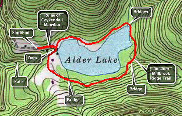 Take the Beaverkill Road from Livingston Manor and drive for about twenty minutes to the Alder Creek Road. Alder Creek Road is a left turn off the Beaverkill Road about two miles after it makes a sharp right turn near the Barkaboom Road that goes to the Little Pond State Campgrounds. Go to the end of Alder Creek Road and turn right into the access road to Alder Lake. Bearing left will take you over to the Millbrook-Arena Road on Cross Mountain Road. Park in the parking lot and walk toward the lake passing the stonework which is all that remains of the Coykendall Mansion. Walk down the right side of the "lawn" and turn right to walk over the dam. Follow the trail around the lake in a counterclockwise direction. Stay on the woods road and follow the blazes as they guide you around the lake. The trail is sited away from the lakeshore and you will see primitive campsites between you and the water. There are several places to walk out to the shore of the lake. Just before the junction with the Millbrook Ridge Trail on the right you will cross the bridge over Alder Creek. At the junction stay on the main trail around the lake and cross the two bridges that span two other inlet streams. Walk along the north shore of the lake on a flat trail. Directly across the lake is Cradle Rock Ridge. As you near the western end of the lake you will be back at the "lawn". Walk up the path toward the remains of the mansion and back to the parking area.
 (The image at the left shows the profile of the hike.)
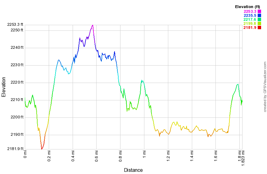
Alder Lake: Beaver Meadow Lake Loop
| Quick Look | ||||
|---|---|---|---|---|
| Difficulty | Round trip | Total climb | Internet Maps | |
| 4.9 mi. | 770 ft. | AllTrails | ||
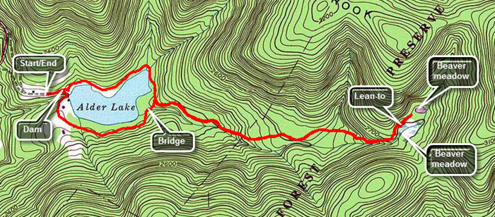 Take the Beaverkill Road from Livingston Manor and drive for about twenty minutes to the Alder Creek Road. Alder Creek Road is a left turn off the Beaverkill Road about two miles after it makes a sharp right turn near the Barkaboom Road that goes to the Little Pond State Campgrounds. Go to the end of Alder Creek Road and turn right into the access road to Alder Lake. Bearing left will take you over to the Millbrook-Arena Road on Cross Mountain Road. Park in the parking lot and walk toward the lake passing the stonework which is all that remains of the Coykendall Mansion. Walk down the left side of the "lawn" and follow the trail around the lake. There are several places to walk out to the shore of the lake. Directly across the lake is Cradle Rock Ridge. At .8 miles turn left on the Millbrook Ridge Trail that continues all the way to Balsam Lake Mountain. The trail can be wet and muddy in places and there may be some blowdowns to contend with. For the next 1.5 miles the trail climbs and then levels off several times. The elevation gain is several hundred feet but the grade is never more than 12% and averages around 6%. There isn't too much to see along the way but the trail parallels Alder Creek which generates a pleasant sound on most days. Along the way there are several beaver meadows including one at the lean-to. Arrive at the lean-to at about 2.4 miles. Walking down to the beaver meadow in front of the lean-to leads to a nice view. Walk back up to the main trail and turn right. Walk another .1 miles for a view of another beaver meadow right on the trail. Turn around and head back the way you came. At 4 miles turn left on the loop trail around Alder Lake to complete the loop around the lake. Continue to follow the trail as it empties out into a small field near the dam. Walk to the dam and cross it. Walk back up to the parking area to your car.
 (The image at the left shows the profile of the hike.)
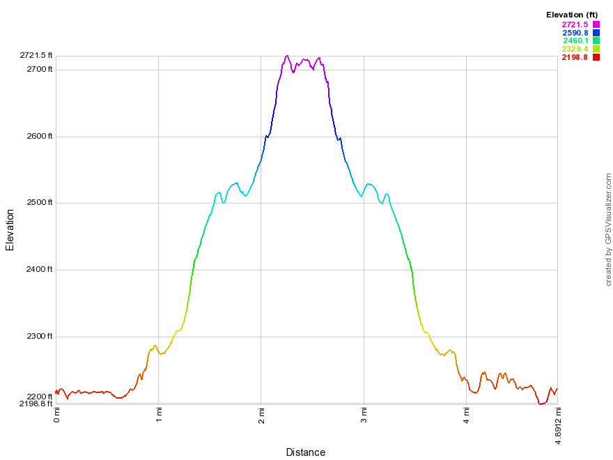
Alder Lake: Beaver Meadow Lean-to (out and back)
| Quick Look | ||||
|---|---|---|---|---|
| Difficulty | Round trip | Total climb | Internet Maps | |
| 4.8 mi. | 690 ft. | AllTrails | ||
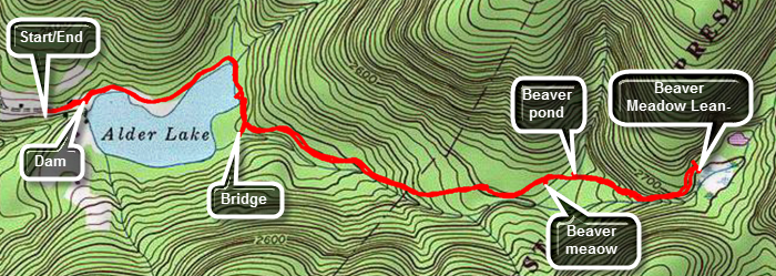 Take the Beaverkill Road from Livingston Manor and drive for about twenty minutes to the Alder Creek Road. Alder Creek Road is a left turn off the Beaverkill Road about two miles after it makes a sharp right turn near the Barkaboom Road that goes to the Little Pond State Campgrounds. Go to the end of Alder Creek Road and turn right into the access road to Alder Lake. Bearing left will take you over to the Millbrook-Arena Road on Cross Mountain Road. Park in the parking lot and walk toward the lake passing the stonework which is all that remains of the Coykendall Mansion. Walk down the left side of the "lawn" and follow the trail around the lake. There are several places to walk out to the shore of the lake. Directly across the lake is Cradle Rock Ridge. At .8 miles turn left on the Millbrook Ridge Trail that continues all the way to Balsam Lake Mountain. The trail can be wet and muddy in places and there may be some blowdowns to contend with. For the next 1.5 miles the trail climbs and then levels off several times. The elevation gain is several hundred feet but the grade is never more than 12% and averages around 6%. There isn't too much to see along the way but the trail parallels Alder Creek which generates a pleasant sound on most days. Along the way there are several beaver meadows including one at the lean-to. Arrive at the lean-to at about 2.4 miles. Walking down to the beaver meadow in front of the lean-to leads to a nice view. Walk back up to the main trail and turn left and head back the way you came. At 4 miles turn right on the loop trail around Alder Lake to retrace your route to the parking area. Continue to follow the trail as it empties out into a small field near the dam and spillway for the lake. Walk back up the hill to the parking area and your car.
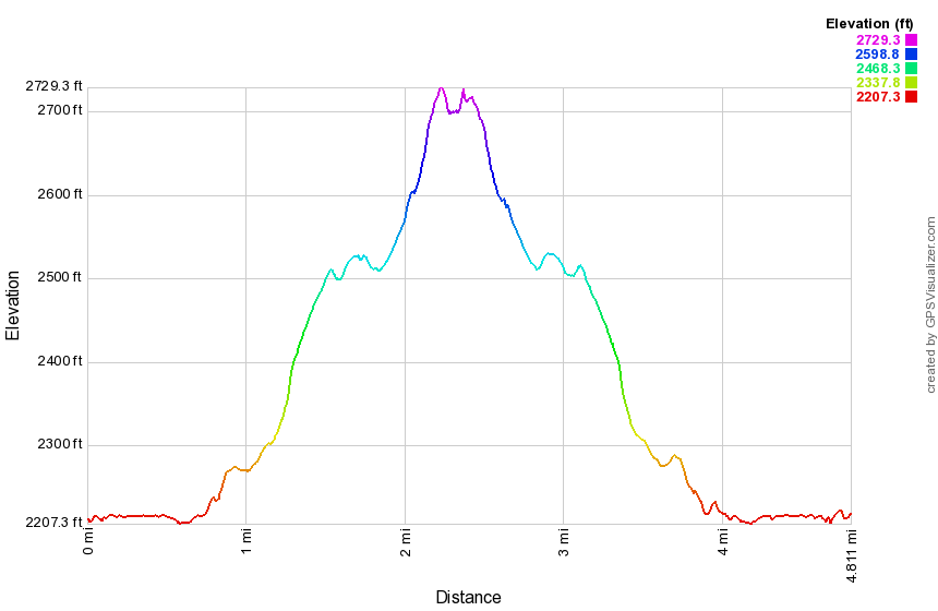 (The image at the left shows the profile of the hike.)
Alder Lake to Big Pond (out and back)
| Quick Look | ||||
|---|---|---|---|---|
| Difficulty | Round trip | Total climb | Internet Maps | |
| 5.9 mi. | 1392 ft. | AllTrails | ||
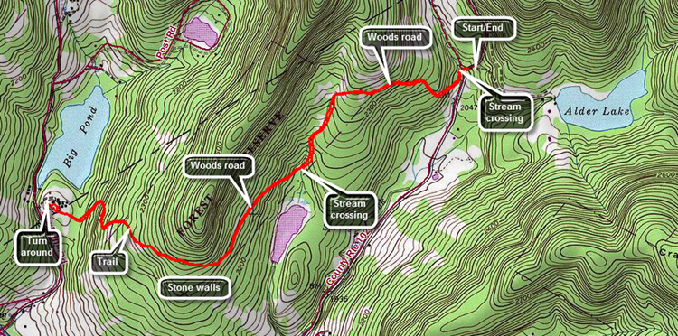 Take the Beaverkill Road from Livingston Manor and drive for about twenty minutes to the Alder Creek Road. Alder Creek Road is a left turn off the Beaverkill Road about two miles after it makes a sharp right turn near the Barkaboom Road that goes to the Little Pond State Campgrounds. Go to the end of Alder Creek Road and turn right into the access road to Alder Lake. Bearing left will take you over to the Millbrook-Arena Road on Cross Mountain Road. Park just before the gate into Alder Lake. Parking in the lot at Alder Lake will increase the length of the hike slightly but is preferable when the gate is open and the road is in good condition. Begin by walking down the road to where the trail enters the woods at the entrance to the Cross Mountain Hunting Camp. The first obstacle is crossing Alder Creek can be a little high when it rains. Start to hike along a broad woods road which is marked with red blazes. Over the next half mile gain about 300 feet climbing to the shoulder of a ridge. The trail is easy to follow but watch for the posted signs on either side of the state land. From the ridge start to descend on the same woods road to a small stream. The descent is almost a mirror image of the ascent as the trail drops about 300 feet in half a mile. As the trail approaches the stream, the trail markers indicate a slight turn to the west off the woods road and across the stream. There is very large open area just below the stream crossing which you Mayan to investigate. Cross the stream as the trail begins follow another well-defined woods road. Climb to the shoulder of another ridge gaining 200 feet over the next half mile. At 1.8 miles the trail turns to the west heading directly toward Big Pond. At 2 miles begin a .75 mile descent losing over 400 feet as the trail heads toward Big Pond. As you approach Big Pond, you will pass through a nice stand of evergreen trees and the trail makes a few turns. As the trail nears the upper perking area at Big Pond, there is a stone retaining wall on the right side of the trail. The front of the wall is only 18 inches high but one side is about 3 feet and has a pipe coming out of it. This remains a mystery. Hike out to the parking area and sign the register before turning around to start back. On the walk back notice an extensive network of stone walls in the area if you did not see them on the way out. The walls were on both sides of the trail and, in some places, the trail crossed the walls. The work it took to collect the stones and the skill needed to turn them into stone walls that have stood for so many years is truly impressive! Continue to reface your steps crossing Alder Creek and walking back on the road to your car.
 (The image at the left shows the profile of the hike.)
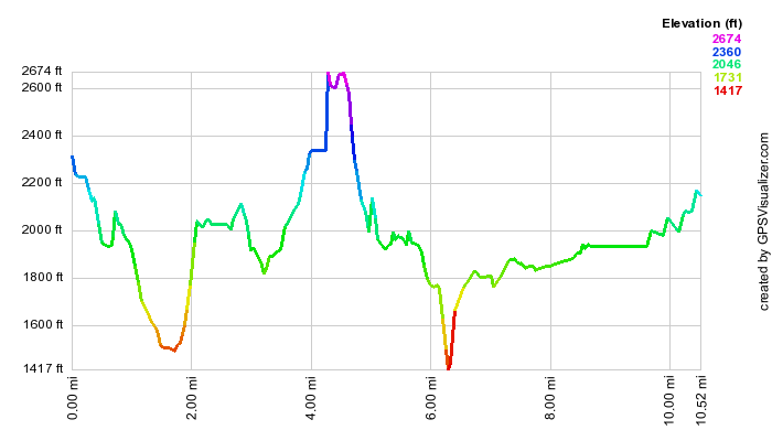
Alder Lake: Bushwhack
| Quick Look | ||||
|---|---|---|---|---|
| Difficulty | Round trip | Total climb | Internet Maps | |
| 10.3 mi. | 2143 ft. | AllTrails | ||
_map.png) Take the Beaverkill Road from Livingston Manor and drive for about twenty minutes to the Alder Creek Road. Alder Creek Road is a left turn off the Beaverkill Road about two miles after it makes a sharp right turn near the Barkaboom Road that goes to the Little Pond State Campgrounds. Go to the end of Alder Creek Road and turn right into the access road to Alder Lake. Bearing left will take you over to the Millbrook-Arena Road on Cross Mountain Road. Park in the parking lot and walk back down the driveway/access road to a woods road that turns left up to another small parking area and then continues parallel to Cross Mountain Road for some distance. When the woods road begins to dip down to Cross Mountain Road, turn UP the hill and find your route to the top. You may find all woods roads along the way so feel free to explore. There are several different places where the ground levels and then continues up again. Eventually you will be on flatter ground near the summit where you will find some ledges. Walking along the ledges may reveal some glimpses over to Barkaboom Mountain. Walk around on the relatively flat summit and you may find a cairn that looks like it once marked property lines. When you are done on the top, turn south to head back to the parking area. Again, woods roads can be found but this area is full of prickers and the open woods roads allow them to grow more easily. The first part of the descent is gentle but then becomes very steep. Wander round to find your best route down. Watch for glimpses of Alder lake as you descend back to the parking area.
Take the Beaverkill Road from Livingston Manor and drive for about twenty minutes to the Alder Creek Road. Alder Creek Road is a left turn off the Beaverkill Road about two miles after it makes a sharp right turn near the Barkaboom Road that goes to the Little Pond State Campgrounds. Go to the end of Alder Creek Road and turn right into the access road to Alder Lake. Bearing left will take you over to the Millbrook-Arena Road on Cross Mountain Road. Park in the parking lot and walk back down the driveway/access road to a woods road that turns left up to another small parking area and then continues parallel to Cross Mountain Road for some distance. When the woods road begins to dip down to Cross Mountain Road, turn UP the hill and find your route to the top. You may find all woods roads along the way so feel free to explore. There are several different places where the ground levels and then continues up again. Eventually you will be on flatter ground near the summit where you will find some ledges. Walking along the ledges may reveal some glimpses over to Barkaboom Mountain. Walk around on the relatively flat summit and you may find a cairn that looks like it once marked property lines. When you are done on the top, turn south to head back to the parking area. Again, woods roads can be found but this area is full of prickers and the open woods roads allow them to grow more easily. The first part of the descent is gentle but then becomes very steep. Wander round to find your best route down. Watch for glimpses of Alder lake as you descend back to the parking area.
_gra.png) (The image at the left shows the profile of the hike.)
(The image at the left shows the profile of the hike.)
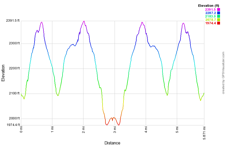
Alder Lake: Little Pond Loop
| Quick Look | ||||
|---|---|---|---|---|
| Difficulty | Round trip | Total climb | Internet Maps | |
| 10.3 mi. | 2143 ft. | AllTrails | ||
 Take the Beaverkill Road from Livingston Manor and drive for about twenty minutes to the Alder
Creek Road. Alder Creek Road is a left turn off the Beaverkill Road about two miles after it makes
a sharp right turn near the Barkaboom Road that goes to the Little Pond State Campgrounds. Go to
the end of Alder Creek Road and turn right into the access road to Alder Lake. Bearing left will take you over to the Millbrook-Arena Road on Cross Mountain Road. Park in the parking lot and walk back down the driveway/access road and cross Alder Creek Road. Finding the red-blazed
Touch-Me-Not Trail can be tricky and once found it can be hard to follow in places as it is NOT clearly marked. The trail rises and falls over
the shoulders of several mountains. After 3.5 miles you arrive at the Big Pond trail head parking area on the Barkaboom Rd. Walk down the access road to the main road.
Turn right on the road and follow it for a short distance then make a left up into the woods. After
another .75 miles, you will be near the top of Touch-Me-Not Mountain. At this point turn left and hike
1.15 miles to Little Pond Campgrounds on the blue Campgrounds Trail. This descent is a steep, at times, but
short. Walk .85 miles down the access road/driveway to the Barkaboom Road and make a right.
Walk a short distance to the Beaverkill Road and turn left. Walk on the Beaverkill Road for about
1.4 miles and make a left on Alder Creek Road. Alder Lake parking is about 2.5 miles away at the end
of the road.
Take the Beaverkill Road from Livingston Manor and drive for about twenty minutes to the Alder
Creek Road. Alder Creek Road is a left turn off the Beaverkill Road about two miles after it makes
a sharp right turn near the Barkaboom Road that goes to the Little Pond State Campgrounds. Go to
the end of Alder Creek Road and turn right into the access road to Alder Lake. Bearing left will take you over to the Millbrook-Arena Road on Cross Mountain Road. Park in the parking lot and walk back down the driveway/access road and cross Alder Creek Road. Finding the red-blazed
Touch-Me-Not Trail can be tricky and once found it can be hard to follow in places as it is NOT clearly marked. The trail rises and falls over
the shoulders of several mountains. After 3.5 miles you arrive at the Big Pond trail head parking area on the Barkaboom Rd. Walk down the access road to the main road.
Turn right on the road and follow it for a short distance then make a left up into the woods. After
another .75 miles, you will be near the top of Touch-Me-Not Mountain. At this point turn left and hike
1.15 miles to Little Pond Campgrounds on the blue Campgrounds Trail. This descent is a steep, at times, but
short. Walk .85 miles down the access road/driveway to the Barkaboom Road and make a right.
Walk a short distance to the Beaverkill Road and turn left. Walk on the Beaverkill Road for about
1.4 miles and make a left on Alder Creek Road. Alder Lake parking is about 2.5 miles away at the end
of the road.
 (The image at the left shows the profile of the hike. The highest point is near the summit of Touch-Me-Not Mountain. The lowest spot is the junction of the Barkaboom and Beaverkill Roads.)
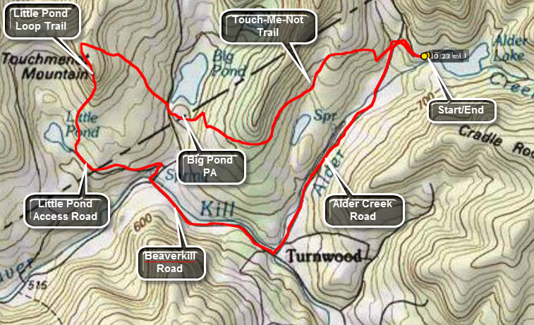
Alder Lake: Millbrook Ridge
| Quick Look | ||||
|---|---|---|---|---|
| Difficulty | Round trip | Total climb | Internet Maps | |
| 9.1 mi. | 1960 ft. | AllTrails | ||
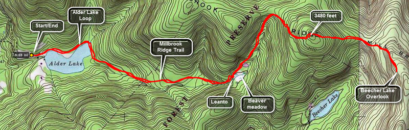
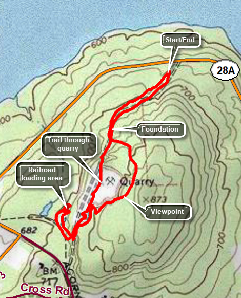
I had lived in Livingston Manor for 25 years before I managed to visit Alder Lake. Several people had told me how beautiful it is but I just hadn't made it there. The lake IS very pretty and is frequented by many people. Campsites dot the entire perimeter of the lake. The Alder Lake Loop Trail is about 1.6 miles and suitable for beginners with only a slight rise on one side. The hikes to the Beecher Lake overlook or to Balsam Lake Mountain on the other hand have several steep areas and can be quite a challenge. The distances, 8 and 13 miles respectively, may also be daunting for some. The map above shows the out and back route from Alder Lake along Millbrook Ridge to the Beecher Lake overlook. I have labeled some of the points of interest along the way. The Beecher Lake overlook is beautiful with a nice view of the lake and the Zen Buddhist monastery that is on its shores.
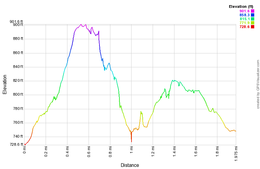
Take the Beaverkill Road from Livingston Manor and drive for about twenty minutes to the Alder Creek Road. Alder Creek Road is a left turn off the Beaverkill Road about two miles after it makes a sharp right turn near the Barkaboom Road that goes to the Little Pond State Campgrounds. Go to the end of Alder Creek Road and turn right into the access road to Alder Lake. Park in the parking lot and walk to the lake. The Coykendall Mansion house that stood on the grounds has been removed by New York State as they did not have the money to maintain or restore it. Now only the stone work remains. As you walk toward the lake you stay to the left on the red Alder Lake loop trail. After about .8 miles on this trail the yellow Millbrook Ridge trail breaks off heading east. The trail ascends very gently and after about 1.5 miles on the trail you arrive at the Beaver Meadow lean-to and spring. There once was a large beaver pond here but it is now being reclaimed and forming a meadow.
Back on the trail you will pass another pond on your right after which the trail climbs more steeply. After about 1.35 miles you are at the highest point on the ridge (3480 ft). The trail then descends slightly before another ascent to the overlook; a distance of another 1.1 miles. Along the Wat the trail does not head directly east but loops north and then southeast back t the viewpoint. The overlook has been obscured by the trees that have grown up over the years and it is easier to get a view when there are no leaves on the trees. The return trip simply reverses your trip out. When you get to the Alder Lake loop trail, you can go the other way around to add a little variety.
 (The image shows the vertical profile of the entire out and back route.)
Andes Rail Trail (Complete)
| Quick Look | ||||
|---|---|---|---|---|
| Difficulty | Round trip | Total climb | Internet Maps | |
| 3.7 mi. | 735 ft. | AllTrails | ||
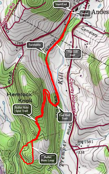 The trailhead for the Andes Rail Trail is located at 266 Depot St, Andes, NY. One way to get there is to drive north on Tremperskill Road ROM where Route 30 crosses the Pepacton Reservoir at the Dunraven Bridge. When the road ends in Andes, turn left and drive less than a quarter mile to the sign that says "Andes Rail Trail" on the left. You may also follow Route 28 from the Margaretville area. In Andes when Route 28 turns right to head north, continue straight ahead for another quarter mile to the sign that says "Andes Rail Trail" on the left. There isn't really much of a parking area but try to park by the gate leaving enough for someone to open the gate if they needed to do so. Start your by walking through the gate to the Andes Depot which was constructed in 1907 and was donated by the Decker family. A kiosk near the depot explains a little about the rail trail which follows the railroad bed of the Delaware and Northern Railroad. Shortly after the depot, there is a wooden walkway that spans the only really wet spot on the trail. A little after that there is an open spot with a nice view down the Tremperskill. At this point there is a "high road" and a "low road" with the suggestion that the high road be used when the main trail is muddy. This occurs several other places along the trail. Hiked under the trees for a short time before coming to another nice view and an interpretive sign. The sign explains that the foundation is the remains of the Andes turntable that was used to turn engines around. No pictures exist of the original structure but it was called an "Armstrong turntable" since the engineer and fireman had to use their "strong arms" to pivot the engine! Enter the woods again and cross a small bridge. There are regular "bumps" on the trail which are the railroad ties which were not been removed. A couple of ties are exposed along the way. Another interpretive sign explains that there had been two trestles on the rail line in the area. Both had been featured in movies from the early 20th century! After walking a little farther, the flat rail trail ends and the Bullet Hole Spur Trail begins. Continued on the trail which immediately begins to climb and the easy walking ends. A major switchback takes the trail north before heading south again with the trail always climbing. The trail passes through some hardwoods and then enters a hemlock forest as it climbs to the shoulder of Hemlock Knoll. There are some interesting rock formations along the way. Continue until the trail comes to a stone wall with a break that allows a view of the surrounding hills which is not impressive but pretty. Pass over the stone wall where it has been turned into steps and come to the loop at the end of the Bullet Hole Spur Trail. Continue straight ahead and walk through a planted red pine plantation. The trail eventually joins a woods road that parallels the Temperskill. The loop is only half a mile long and soon you will be back at the point where it started. Retrace your steps back to the car.
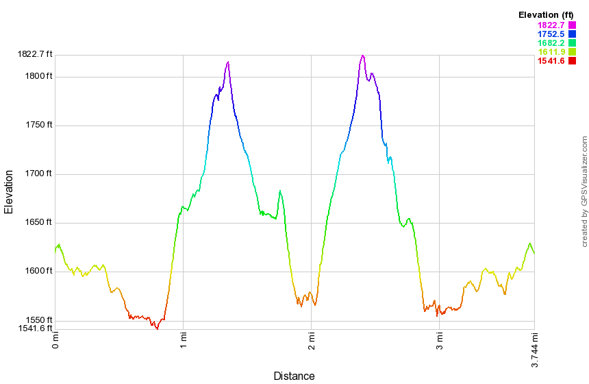 (The image shows the vertical profile of the entire out and back route.)
Angel Falls
| Quick Look | ||||
|---|---|---|---|---|
| Difficulty | Round trip | Total climb | Internet Maps | |
| 0.6 mi. | 137 ft. | AllTrails | ||
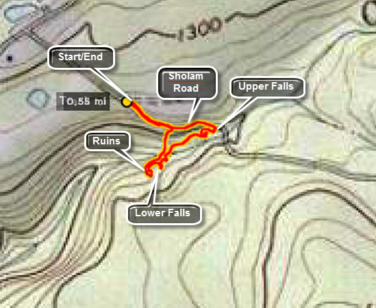 Turn onto Route 55A from Route 55 just east of the TriValley School in Grahamsville. Take the first right hand turn as Route 55A continues around the Rondout Reservoir. Drive for a little over 4 miles and turn left on Yaegerville Road just before Route 55A crosses a creek on a bridge. After 1.2 miles turn right on Sholam Road which is now a DEAD END. Park at the end of the paved road near the power right-of-way but avoid parking on private property or blocking the private driveway. The DEP signs are confusing with some saying TRESPASSING and others inviting hikers to hike. Walk down the old road which is now crumbling. This road stays above the streambed for Trout Creek until it reaches the upper falls. You may walk to the stream above the falls before following the informal path that parallels the stream. Some paths lead down to the streambed to points that give excellent views of the upper falls. These paths are DANGEROUS under the best conditions! Continue on the informal paths which parallel the stream until you get to the area of the lower falls. The lower falls do not have a drop as high as the upper falls but they are beautiful in their own way. Walk to the rock shelf that allows access to the top of the lower falls to take some pictures. Continue along the creek and observe the stone foundations built next to the falls. Walk out to the stream bed using great caution to get a glimpse of the lower falls. When you are finished, head up the steep bank back to the old road and your car.
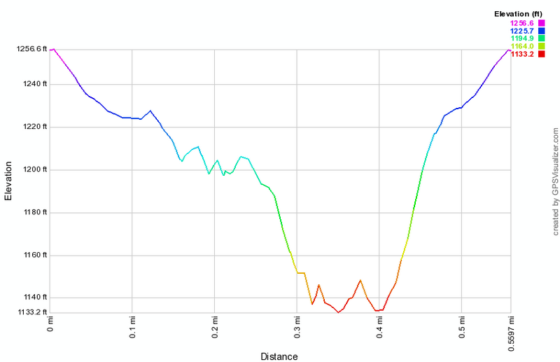 (The image shows the vertical profile of the entire out and back route.)
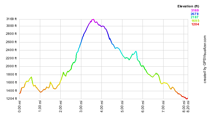
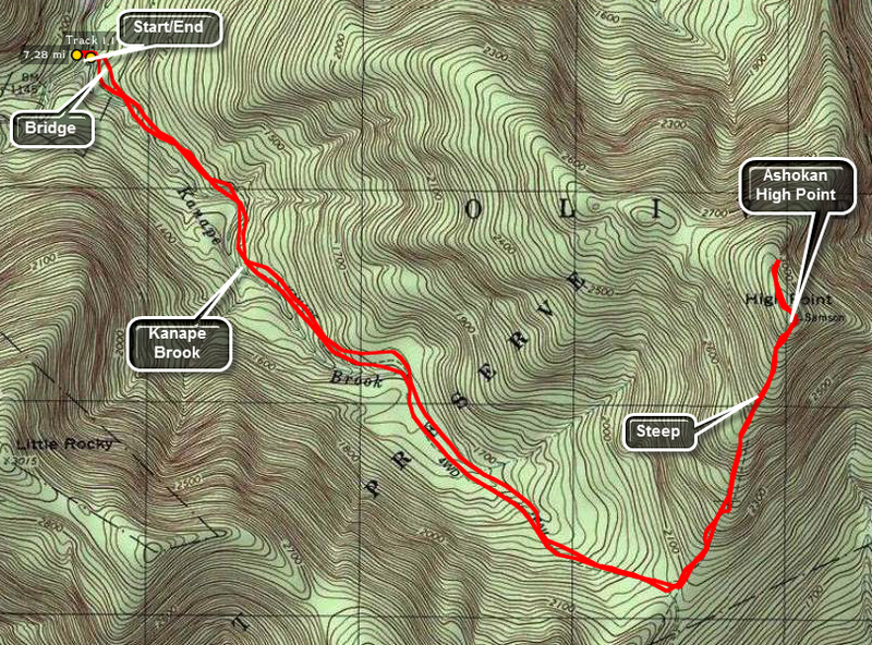
Ashokan High Point: Kanape Brook Loop
| Quick Look | ||||
|---|---|---|---|---|
| Difficulty | Round trip | Total climb | Internet Maps | |
| 9.1 mi. | 2370 ft. | AllTrails | ||
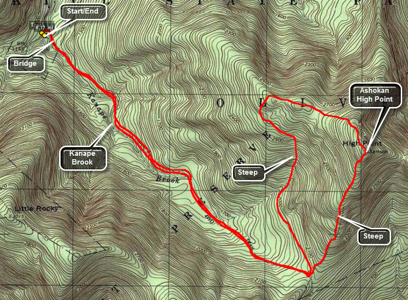
Park at the Kanape Brook PA trailhead on the Peekamoose Road. Walk across the road and toward the Kanape Brook to pick up the trail. The first 2.7 miles is a rather gentle uphill walk. Much of the first part of the trail parallels Kanape Brook which can be heard as you walk along the trail. Several small bridges and culverts cross tributaries which increase the volume of the brook. The trail here is a wide road typical of logging or quarrying roads that run throughout the Catskills. At the 2.7 mile mark make a pronounced left. The trail now narrows to a footpath but is marked and well-worn. You are immediately faced with a choice! The trail straight ahead continues upward for about 1 mile to the Ashokan High Point. This trail gains about 1000 feet over the mile and there are several steep areas. Most of these five areas have stone steps which make the climb easier. The trail to the left is longer but generally easier to climb. This 2.5 mile trail meanders up to the High Point. Stay to the right and ascend the steeper path using the other trail to descend forming a loop. Once at the High Point itself you have a beautiful view of the mountains and valleys directly to the east. Depending on the foliage cover, you may be able to see a hint of the reservoir a little farther north or to the left as you gaze from the lookout. A little farther to the north and west the trail opens into several fields and can become hard to follow. Some visitors have built a fire circle surrounded by stone chairs. Walking to the north and east side of the field gives you a spectacular view of the Ashokan Reservoir. The view is NOT clear and is blocked by trees making the best viewing times when the leaves are not on the trees. Turning your gaze a little more to the north and west reveals the Burrough's Range with the unmistakable outline of Wittenberg, Cornell, and Slide Mountains. After taking in the view, head to the left of the fireplace and follow a path into the woods to pick up the trail again. This 2.5 mile trail meanders down from the High Point back to the trail junction where you met it the first time. There are several steep and rocky areas to negotiate. Along the way there is at least one prominent path leading northwest but seemingly into nowhere. When the trail bends sharply to the left you can head southwest on a bushwhack which is steep in many places but will cut some distance off your return trip. Back at the trail junction it is only a matter of following the main trail back to the car.
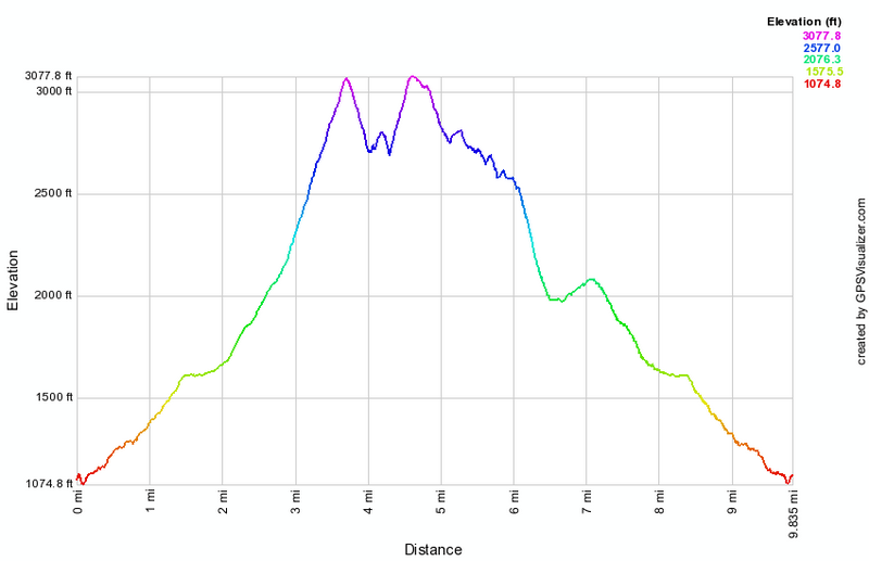
 (The image at the left shows the profile of the loop hiking route. Remember that all vertical profiles are relative!)
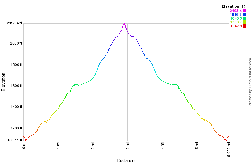
Ashokan High Point: Kanape Brook Trail (only)
| Quick Look | ||||
|---|---|---|---|---|
| Difficulty | Round trip | Total climb | Internet Maps | |
| 5.5 mi. | 1055 ft. | AllTrails | ||
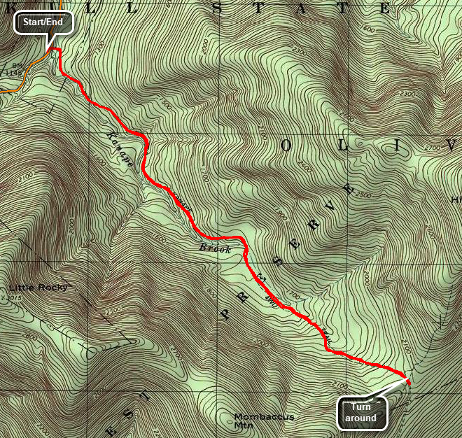
Park at the Kanape Brook PA trailhead on the Peekamoose Road. Walk across the road and toward the Ashokan to pick up the trail. The first 2.7 miles is a rather gentle uphill walk. Much of the first part of the trail parallels Kanape Brook which can be heard as you walk along the trail. Several small bridges and culverts cross tributaries which increase the volume of the brook. The trail here is a wide road typical of logging or quarrying roads that run throughout the Catskills. Shortly after getting on the trail watch for a stone refining wall on the left side of the trail. A little farther along is a spring and cistern also on the left side of the trail. At the 2.7 miles the trail makes a pronounced left for the last mile to the High Point. This trail is steep at about 21%. For this hike turn around and retrace your path back to your car.
 (The image at the left shows the profile of the out and back hiking route. Remember that all vertical profiles are relative!)
Ashokan High Point: Kanape Brook Out and Back
| Quick Look | ||||
|---|---|---|---|---|
| Difficulty | Round trip | Total climb | Internet Maps | |
| 7.3 mi. | 2140 ft. | AllTrails | ||
Park at the Kanape Brook PA trailhead on the Peekamoose Road. Walk across the road and toward the
Ashokan to pick up the trail. The first 2.7 miles is a rather gentle uphill walk. Much of the first
part of the trail parallels Kanape Brook which can be heard as you walk along the trail. Several
small bridges and culverts cross tributaries which increase the volume of the brook. The trail hear
is a wide road typical of logging or quarrying roads that run throughout the Catskills. At the 2.7 mile
mark make a pronounced left. The trail now narrows to a footpath but is marked and well-worn. You are
immediately faced with a choice! The trail straight ahead continues upward fro about 1 mile to the
Ashokan High Point. This trail gains about 1000 feet over the mile and there are several steep areas.
Most of these areas have stone steps which make the climb easier. The trail to the left is longer but
generally easier to climb. This 2.5 mile trail meanders up to the High Point. Once at the High Point
itself you have a beautiful view of the mountains and valleys directly to the east. Depending on the
foliage cover, you may be able to see a hint of the reservoir a little farther north or to the
left as you gaze from the lookout. A little farther to the north and west the trail opens into several
fields and can become hard to follow. Some visitors have built a fire circle surrounded by stone
chairs. Walking to the north and east side of the field gives you a spectacular view of the
Ashokan Reservoir. The view is NOT clear and is blocked by trees making the best viewing times when
the leaves are not on the trees. Turning your gaze a little more to the north and west reveals
the Burrough's Range with the unmistakable outline of Wittenberg, Cornell, and Slide Mountains. To get back to your car turn around and retrace your path back to the parking area. The out and back allows a quick descent of the steeper sections for those who don't mind this sort of thing.
 (The image at the left shows the profile of the out and back hiking route. Remember that all vertical profiles are relative!)
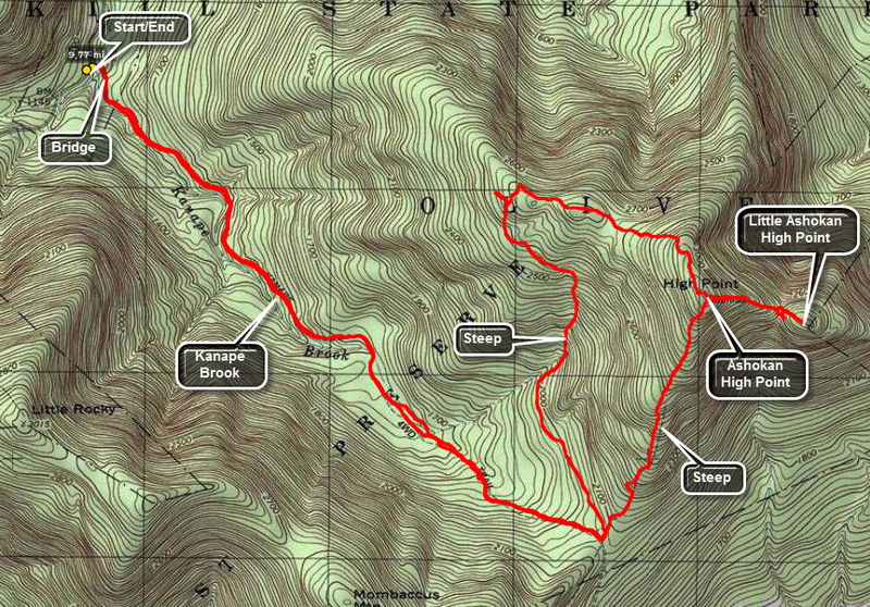
Ashokan High Point and Little Ashokan: Kanape Brook Loop
| Quick Look | ||||
|---|---|---|---|---|
| Difficulty | Round trip | Total climb | Internet Maps | |
| 9.8 mi. | 2820 ft. | AllTrails | ||
Park at the Kanape Brook PA trailhead on the Peekamoose Road. Walk across the road and toward the Ashokan to pick up the trail. The first 2.7 miles is a rather gentle uphill walk. Much of the first part of the trail parallels Kanape Brook which can be heard as you walk along the trail. Several small bridges and culverts cross tributaries which increase the volume of the brook. The trail here is a wide road typical of logging or quarrying roads that run throughout the Catskills. At the 2.7 mile mark make a pronounced left. The trail now narrows to a footpath but is marked and well-worn. You are immediately faced with a choice! The trail straight ahead continues upward fro about 1 mile to the Ashokan High Point. This trail gains about 1000 feet over the mile and there are several steep areas. Most of these areas have stone steps which make the climb easier. The trail to the left is longer but generally easier to climb. Once at the High Point itself you have a beautiful view of the mountains and valleys directly to the east. Depending on the foliage cover, you may be able to see a hint of the reservoir a little farther north or to the left as you gaze from the lookout.
From the High Point you may be able to see a path directly down between some of the rocks or a path further on leading down. This is the way to Little Ashokan High Point. The walk is about .5 miles and there is drop of about 350 feet to the lowest point before climbing back up to Little Ashokan. Whether or not you can find the path is not too important. just walk in the general direction and watch for the numerous steep areas and actual cliffs. Little Ashokan is filled with blueberry and huckleberry bushes which can make walking interesting unless you are on show shoes. Near the highest point are several flat rocks that make a good viewpoint back to the High Point and over to the Mombaccus-Little Rocky ridge. Dropping down a little to some lower paths and walking around to the left offers some more views but the reservoir is hard to see unless the leaves are off the trees. Views may be possible but unobstructed views for photography are few. After wandering around some, head back to the High Point more or less the way you came. From the High Point continue on the main trail. In a short distance on the left you may get some views in a small clearing. A little farther to the north and west the trail opens into several fields and can become hard to follow. Some visitors have built a fire circle surrounded by stone chairs. Walking to the north and east side of the field gives you a view of the Ashokan Reservoir. The view is NOT clear and is blocked by trees making the best viewing times when the leaves are not on the trees. Turning your gaze a little more to the north and west reveals the Burrough's Range with the unmistakable outline of Wittenberg, Cornell, and Slide Mountains. After taking in the view, head to the left of the fireplace and follow a path into the woods to pick up the trail again. This 2.5 mile trail meanders down from the High Point back to the trail junction where you met it the first time. There are several steep and rocky areas to negotiate. Along the way there is at least one prominent path leading northwest but seemingly into nowhere. When the trail bends sharply to the left you can head southwest on a bushwhack which is steep in many places but will cut some distance off your return trip. Back at the trail junction it is only a matter of following the main trail back to the car.
 (The image at the left shows the profile of the loop hiking route. Remember that all vertical profiles are relative!)
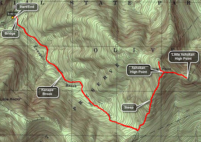
Ashokan High Point and Little Ashokan: Kanape Brook Out and Back
| Quick Look | ||||
|---|---|---|---|---|
| Difficulty | Round trip | Total climb | Internet Maps | |
| 8.5 mi. | 2717 ft. | AllTrails | ||
Park at the Kanape Brook PA trailhead on the Peekamoose Road. Walk across the road and toward the Ashokan to pick up the trail. The first 2.7 miles is a rather gentle uphill walk. Much of the first part of the trail parallels Kanape Brook which can be heard as you walk along the trail. Several small bridges and culverts cross tributaries which increase the volume of the brook. The trail here is a wide road typical of logging or quarrying roads that run throughout the Catskills. At the 2.7 mile mark make a pronounced left. The trail now narrows to a footpath but is marked and well-worn. You are immediately faced with a choice! The trail straight ahead continues upward fro about 1 mile to the Ashokan High Point. This trail gains about 1000 feet over the mile and there are several steep areas. Most of these areas have stone steps which make the climb easier. The trail to the left is longer but generally easier to climb. Once at the High Point itself you have a beautiful view of the mountains and valleys directly to the east. Depending on the foliage cover, you may be able to see a hint of the reservoir a little farther north or to the left as you gaze from the lookout.
From the High Point you may be able to see a path directly down between some of the rocks or a path further on leading down. This is the way to Little Ashokan High Point. The walk is about .5 miles and there is drop of about 350 feet to the lowest point before climbing back up to Little Ashokan. Whether or not you can find the path is not too important. just walk in the general direction and watch for the numerous steep areas and actual cliffs. Little Ashokan is filled with blueberry and huckleberry bushes which can make walking interesting unless you are on show shoes. Near the highest point are several flat rocks that make a good viewpoint back to the High Point and over to the Mombaccus-Little Rocky ridge. Dropping down a little to some lower paths and walking around to the left offers some more views but the reservoir is hard to see unless the leaves are off the trees. Views may be possible but unobstructed views for photography are few. After wandering around some, head back to the High Point more or less the way you came. From the High Point continue on the main trail. In a short distance on the left you may get some views in a small clearing. A little farther to the north and west the trail opens into several fields and can become hard to follow. Some visitors have built a fire circle surrounded by stone chairs. Walking to the north and east side of the field gives you a view of the Ashokan Reservoir. The view is NOT clear and is blocked by trees making the best viewing times when the leaves are not on the trees. Turning your gaze a little more to the north and west reveals the Burrough's Range with the unmistakable outline of Wittenberg, Cornell, and Slide Mountains. After taking in the view, turn around and retrace your steps following the route you took on the ascent back to your car at the parking area.
 (The image at the left shows the profile of the loop hiking route. Remember that all vertical profiles are relative!)
Ashokan Quarry (DEP)
| Quick Look | ||||
|---|---|---|---|---|
| Difficulty | Round trip | Total climb | Internet Maps | |
| 2.0 mi. | 280 ft. | AllTrails | ||
 From the intersection of Routes 28A and 28 near Boiceville turn south near Onteora High School on Route 28A. Drive 7.8 miles to the parking lot on the left. The parking lot is very well done and can accommodate at least 10 cars. Walk out the back of the parking area near the kiosk to get on the trail. The first part of the trail is covered in angular stones which may be uncomfortable. Just before the first trail junction at .3 miles, there is an interesting foundation on the left side of the trail. Most stone foundations are laid up from field stone but this one was obviously constructed of quarried stone. Turn left at the first trail junction and start a slight uphill walk. At about .6 miles there is a nice viewpoint. There are views to the north and west and into the quarry below. The Yale Quarry was used to obtain stone for the building of the dam for the Ashokan Reservoir. Continued on the trail along the top of the quarry. The trail drops down to another level. Survey the quarry floor below and notice the small pond which has formed there. Follow the trail along the edge of the quarry and then around the end as it drops down toward the quarry floor. At .9 miles, turn left on a spur trail that runs down to a stone loading platform and some other interesting ruins. The quarried stone was loaded onto railroad cars to be transported to the site of the dam. Walk back up to the main trail and turn left. Almost immediately the trail comes to the floor of the quarry. From here you can get a closer look at the vernal pond and the high "walls" that were formed as the stone was removed. After this the trail passes through an area where there are piles of discarded stone and the dust formed as the stone was quarried. Continued along the trail where there may be fewer markers . Just before the first trail junction there is a large stone massif on the right side of the trail. Continue straight ahead to walk back to the parking area.
 (The image at the left shows the profile of the hike. Remember that all vertical profiles are relative!)
Balsam Lake Mt to Alder Lake
| Quick Look | ||||
|---|---|---|---|---|
| Difficulty | Round trip | Total climb | Internet Maps | |
| 7.8 mi. | 2630 ft. | AllTrails | ||
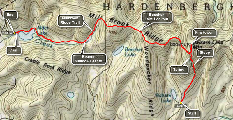
Park at the trailhead at the end of the Beaverkill Road. The public road dead ends at this spot and a private road continues to the Balsam Lake Lodge. There are several choices to make when climbing this mountain. Find the blue-blazed Dry Brook Ridge Trail and hike about .9 miles. At this point turn left on the red-blazed Balsam Lake Trail. The climb is rather steep but after about .85 miles you will be at the summit. As you climb, you will see the trail to the Balsam Lake Mt lean-to on the left after about .5 miles. Walk another .1 miles and there will be an obvious piped spring on the right. Just above the spring the trail levels. Continue for another .2 miles and you will see the yellow-blazed Millbrook Ridge Trail to Alder Lake on the left. Continue for another .15 miles to the fire tower. The fire tower at the top offers a spectacular view in all directions. Balsam Lake Mountain is the westernmost in the Catskill Park and the tower offers an unhindered 360 degree view. Thirty-three of the other 34 peaks are visible with only Thomas Cole, hiding behind Hunter Mt., out of view.
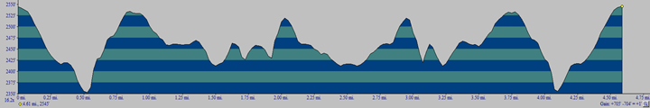
Turn back on the Balsam Lake Mt. trail to the Millbrook Ridge Trail and turn right. This trail descends for a while and then ascends again. After 1.95 miles there is a lookout over Beecher Lake. There is a Zen Monastery on the shore. In another 1.1 miles including a short climb you will be at the highest point on the ridge. The elevation here is 3480 feet which means that it is one large boulder away from being another Catskill 35! In 1.35 miles you will be at the Beaver Meadow lean-to and spring. Several of these "beaver meadows" can be found along the trail and they all offer a home to a variety of wildlife. A walk of about 1.5 miles will bring you to the red-blazed Alder Lake Trail. Turn left or right and walk .8 miles to the Alder Lake parking area.
At Alder Lake you can reverse your steps and hike back to Balsam Lake. This makes for a LONG 15 mile hike. It may be more enjoyable to hike with a friend and leave a car at both trailheads. You could, of course, reverse this hike which would give a slightly different perspective. At Alder Lake be sure to look at the remains of the mansion built by shipping tycoon Samuel Coykendall. New York State recently removed all but the stonework after determining it would be impossible to restore the once stately edifice.
 (The image at the left shows the profile of the hike. Remember that all vertical profiles are relative!)
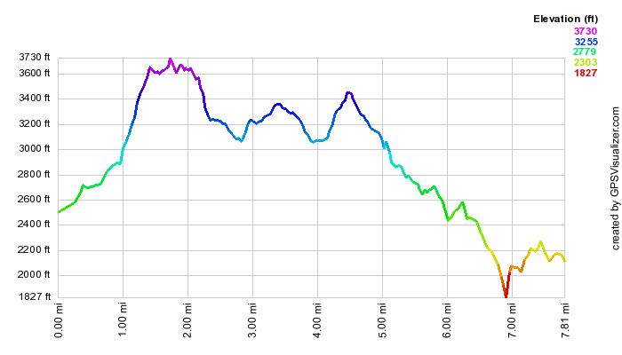
Balsam Lake Mt and Vly Pond
| Quick Look | ||||
|---|---|---|---|---|
| Difficulty | Round trip | Total climb | Internet Maps | |
| 7.5 mi. | 2900 ft. | AllTrails | ||
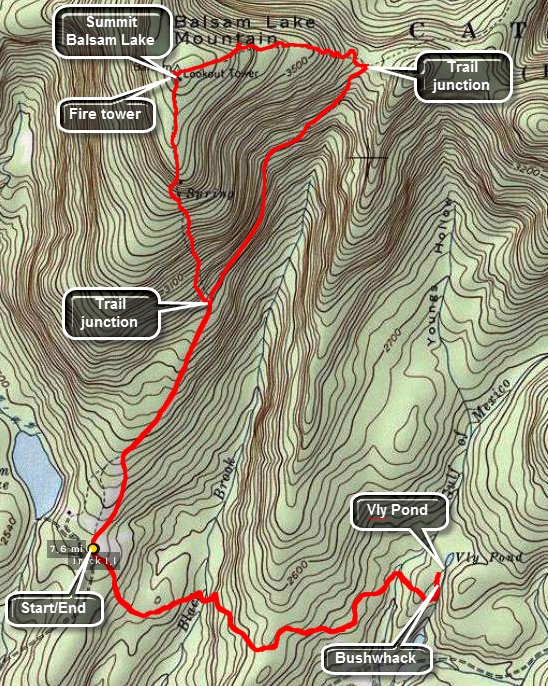
Park at the trailhead at the end of the Beaverkill Road. The public road dead ends at this spot and a private road continues to the Balsam Lake Lodge. There are several choices to make when climbing this mountain. Find the blue-blazed Dry Brook Ridge Trail and hike about .9 miles. At this point turn left on the red-blazed Balsam Lake Trail. The climb is rather steep but after about .85 miles you will be at the summit. As you climb, you will see the trail to the Balsam Lake Mt lean-to on the left after about .5 miles. Walk another .1 miles and there will be an obvious piped spring on the right. Just above the spring the trail levels. Continue for another .2 miles and you will see the yellow-blazed Millbrook Ridge Trail to Alder Lake on the left. Continue for another .15 miles to the fire tower. The fire tower at the top offers a spectacular view in all directions. Balsam Lake Mountain is the westernmost in the Catskill Park and the tower offers an unhindered 360 degree view. Thirty-three of the other 34 peaks are visible with only Thomas Cole, hiding behind Hunter Mt., out of view.
Continue your hike down the back side of Balsam Lake. At the trail junction turn right to return to your car. DO NOT get in your car. Walk to the other side of the parking area and pick up the Hardenburgh Trail to Vly Pond.
 (The image below shows the profile of the hike. Remember that all vertical profiles are relative!)
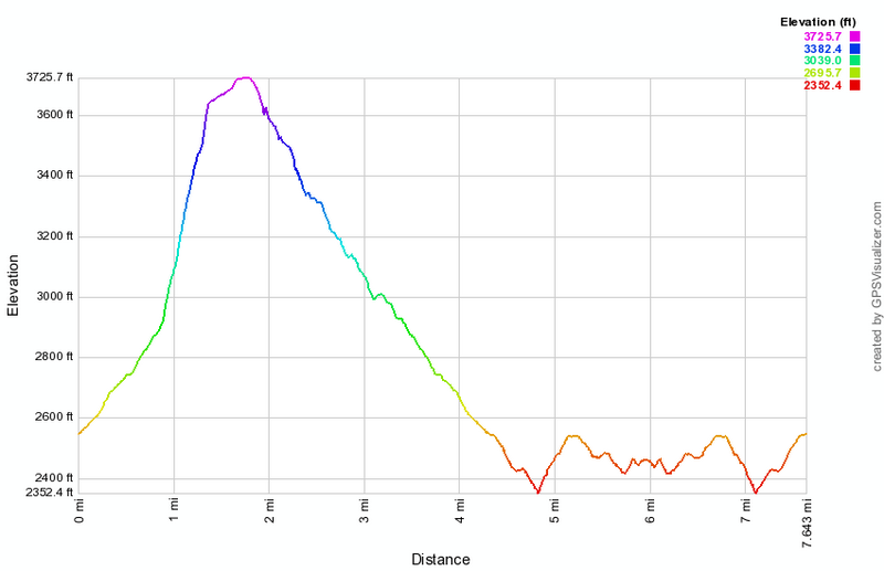
Balsam Lake to Beaverkill (Vly Pond)
| Quick Look | ||||
|---|---|---|---|---|
| Difficulty | Round trip | Total climb | Internet Maps | |
| 4.7 mi. | 840 ft. | AllTrails | ||
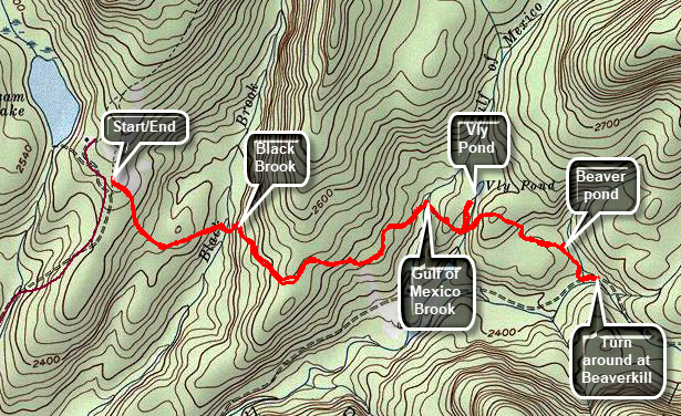
From Livingston Manor head toward Roscoe on Old Rt 17. Turn right on the Beaverkill Road and continue north through Lew Beach and Turnwood. Continue to the end of the road and park in the parking area on the right side of the road. The Neversink Hardenburgh Trail is at the back right corner of the parking area. The first half mile of the trail loses about 200 feet to a bridge that crosses Black Brook. From Black Brook the trail climbs gaining back the elevation that was lost over .35 miles. The trail rolls a little and then descends to Gulf of Mexico Brook. At 1.5 miles the trail crosses the outlet stream from Vly Pond. Turn left here and bushwhack a few hundred feet upstream to the pond. Looking from the beaver dam toward the upper end of the pond reveals Doubletop in the background. Return to the main trail and turn left on the main trail. From the Vly outlet brook the trail climbs some and then starts to drop down. At 2.3 miles there is a small body of water on the left side of the trail. Followed the path to the little pond and then walk back out to the main trail. Turn left and continue on the main trail. At 2.5 miles cross a small stream and almost immediately the Beaverkill appears. The trail turns left and parallels the stream. When you are satisfied, turn around and retrace your route to the parking area.
 (The image below shows the profile of the hike. Remember that all vertical profiles are relative!)
Balsam Lake to Beaverkill Ford
| Quick Look | ||||
|---|---|---|---|---|
| Difficulty | Round trip | Total climb | Internet Maps | |
| 6.1 mi. | 1000 ft. | AllTrails | ||
From Livingston Manor head toward Roscoe on Old Rt 17. Turn right on the Beaverkill Road and continue north through Lew Beach and Turnwood. Continue to the end of the road and park in the parking area on the right side of the road. The Neversink Hardenburgh Trail is at the back right corner of the parking area. The first half mile of the trail loses about 200 feet to a bridge that crosses Black Brook. From Black Brook the trail climbs gaining back the elevation that was lost over .35 miles. The trail rolls a little and then descends to Gulf of Mexico Brook. At 1.5 miles the trail crosses the outlet stream from Vly Pond. From the Vly outlet brook the trail climbs some and then starts to drop down. At 2.3 miles there is a small body of water on the left side of the trail. At 2.5 miles cross a small stream and almost immediately the Beaverkill appears. Turn left and walk along the stream which parallels the stream. The trail follows a wide woods road along the Beaverkill. At 2.8 miles there is a primitive campsite on the left side of the trail with a fire ring and some benches. In this area a bridge used to span the stream. There are no remaining pieces of the bridge but the spot is very obvious. The trail continues but the woods road ends. The trail moves away from the edge of the stream before coming back down to the water. The trail crosses the river at a ford at 3 miles. Turn around and retrace your route back to the parking area.
 (The image below shows the profile of the hike. Remember that all vertical profiles are relative!)
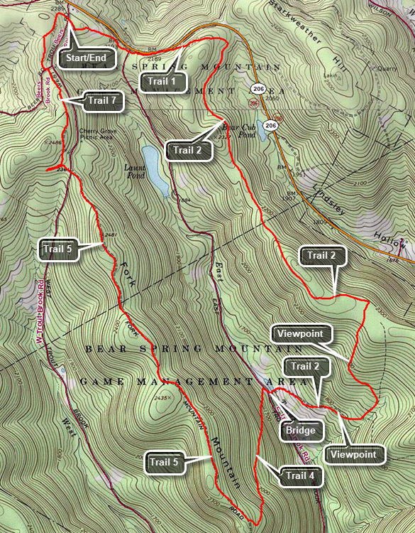
Bear Spring: Central Loop
| Quick Look | ||||
|---|---|---|---|---|
| Difficulty | Round trip | Total climb | Internet Maps | |
| 9.3 mi. | 1600 ft. | AllTrails | ||
 Caution: The trails at Bear Spring State Park are primarily constructed for horses and snowmobiles. The wide well-kept trails are easy to walk but poorly marked. You cannot really get lost but you can wander around a lot.
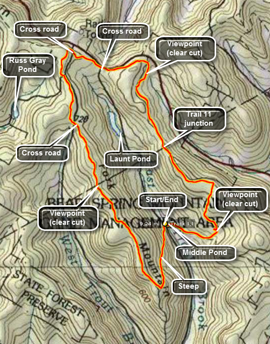
Take County Route 206 to the top of Bear Spring Mountain near Walton, NY. Turn onto East Trout Brook Road and drive south. Pass Launt Pond on your right and then drive 1.3 miles further. Park on the left side of the road in the parking area. Cross the road to get on trail 4 to the Fork Mountain ridge. The trail rises 750 feet from the road to the ridge over 1.2 miles. At the top of the ridge turn right or northwest to hike along the Fork Mountain Ridge. A little more than 2 miles into the hike and you will be at the first of three clear cut areas on the hike. No one has been able to tell me the reason for theses clear cuts but they are all done with state approval. The trail continues northwest over a few bumps and at 3.3 miles into the hike you cross West Trout Brook Road to continue on the trail. Continue almost directly north now toward Route 206 and cross the road again to walk through the main parking area. Follow the trail through the woods and out across a field. Look for the opening directly across the field. The trail parallels Route 206, crosses East Trout Brook Road and then ascends slightly before dropping to Wilson Hollow Road. This woods road is a grassy track and has never been paved but shows up on many maps with the same prominence as Route 206! At this point you will be at were at the second and largest clear cut area. Follow Wilson Hollow Road along the large clear cut area before the road entered the woods. Watch for Trail 11 on the right at about 6.8 miles into the hike. This trail leads back down to East Trout Brook Road and to another trail that will take you back to your car. It is an alternative route. Continue on the main trail/road passing another trail down within .6 miles of Trail 11. Continue to the McCoy Hill Shortcut at 7.7 miles. This trail turns right and runs along the edge of a field before descending through the forest to the last clear cut. Watch for a short path to the right that leads to a small field with a view over the clear cut and across to Fork Mountain. A little further down another trail comes in from the left. Stay on the main trail passing a pond and two final trail junctions before arriving at Middle Pond on East Trout Brook. Walk over the bridge and up to your car.
 (The image at the left shows the profile of the hike. Remember that all vertical profiles are relative!)
Bear Spring: Central and Eastern Ridge Loop
| Quick Look | ||||
|---|---|---|---|---|
| Difficulty | Round trip | Total climb | Internet Maps | |
| 9.3 mi. | 1515 ft. | AllTrails | ||
 Caution: The trails at Bear Spring State Park are primarily constructed for horses and snowmobiles. The wide well-kept trails are easy to walk but poorly marked. You cannot really get lost but you can wander around a lot.
Take County Route 206 to the top of Bear Spring Mountain near Walton, NY. Turn onto West Trout Brook Road and park in the lot on the left side of the road just above the state DPW facility. Cross the road to get on Trail 7. Follow that trail until it crosses Beers Brook Road at .5 miles. Walk to the left on the road and pick up the trail again. At 1.1 miles the trail comes to a T. Turn left and walk out to cross West Trout Brook Road to Trail 5. Follow Trail 5 for 2.45 miles as it heads south and rolls over some small hills. After Fork Mountain the trail descends some. At 3.6 miles turn left on Trail 4 which descends steeply for .9 miles to East Trout Brook Road. This trail may not be well-maintained. At the bottom of the descent cross the road and pick up Trail 2 in the parking lot. Walk down the hill to the bridge that crosses the dam that impounds Middle Pond. Continue uphill on Trail 2 watching for some nice views down the valley on the right of the trail. At 5.2 miles Trail 2 heads to the right. Stay left to pick up Trail 3 up the hill. This is a long climb and some nice views appear just before the trail enters the woods. Trail 3 levels at the top of the hill and passes along the edge of a field. At the T, turn left to again pick up Trail 2 which travels along the eastern ridge. The trail rolls some over 2.7 miles heading toward Route 206. At about 7.3 miles there is an old clear cut on the right but it is now grown in so that there aren't many views. At 8.1 miles turn left on Trail 1 and make a short ascent. Where the trail splits stay right on Trail 1 which descends to East Trout Brook Road. Cross the road and continue uphill through the woods. The trail crosses a field and there may not be much of a path through the field. Watch for the point where the trail enters the woods on the other side of the field. Follow Trail 1 through the woods to the parking area.
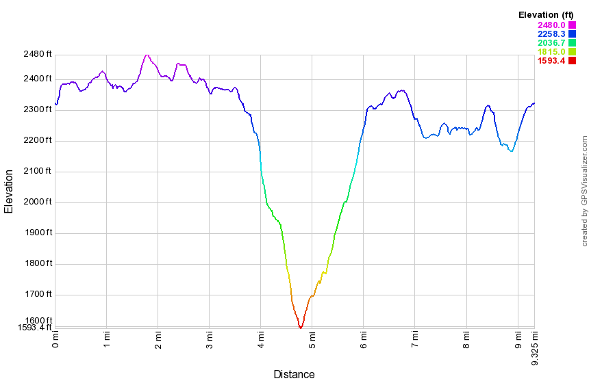 (The image at the left shows the profile of the hike. Remember that all vertical profiles are relative!)
Bear Spring: East Road Loop from Route 206
| Quick Look | ||||
|---|---|---|---|---|
| Difficulty | Round trip | Total climb | Internet Maps | |
| 4.4 mi. | 940 ft. | AllTrails | ||
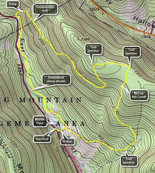 Caution: The trails at Bear Spring State Park are primarily constructed for horses and snowmobiles. The wide well-kept trails are easy to walk but poorly marked. You cannot really get lost but you can wander around a lot.
Take County Route 206 to the top of Bear Spring Mountain near Walton, NY. Near the top of the mountain turn south on East Trout Brook Road. Drive 2.2 miles to the parking pulloff on the left for Middle Pond. Head down the trail to the pond and cross the bridge. Start up the trail toward McCoy Hill and then turn left on an unmarked path. At .4 miles the trail breaks out into a field. Follow the edge of the field along the brook and look for game paths as you bushwhack along the creek parallel to East Trout Brook Road. Your route may vary slightly from mine but as long as you stay between the brook and the rising land on the right you will be OK. There are a few wet spots to cross and you may chose to cross the tributaries to the main brook in some places. At about 1.3 miles you should catch a glimpse of the parking area. Cross one final stream crossing to get to the lot. Head across the parking area to the gate and start up the snowmobile trail. The first part of the trail is very steep averaging a 20% grade but only for about .15 miles. At 1.5 miles the trail turns southeast but continues to climb for the next .5 miles at about a 10% grade. At 2 miles the trail stops climbing and actually descends slightly before flattening out and following the contour of the hill for .4 miles. At 2.4 miles the trail begins to climb again and shortly after turns sharply to the left heading north. This only lasts for about .3 miles when it intersects the "main" trail on the ridge. Turn right to follow the trail toward the McCoy Hill Cutoff. The trail is mostly flat to the next junction. At 2.95 miles turn right onto the McCoy Hill Cutoff and walk along the edge of the field heading toward the woods on the other side. Head down the hill toward Middle Pond. The next 1.25 miles are all downhill at a comfortable 10% grade. There is an open area on the right with some nice views of the valley. At 3.8 miles the main trail comes in from the left but continue straight ahead down the hill. There is a small pond on the left with some more nice views. Cross the bridge at Middle Pond and walk the hill to the car in the parking area.
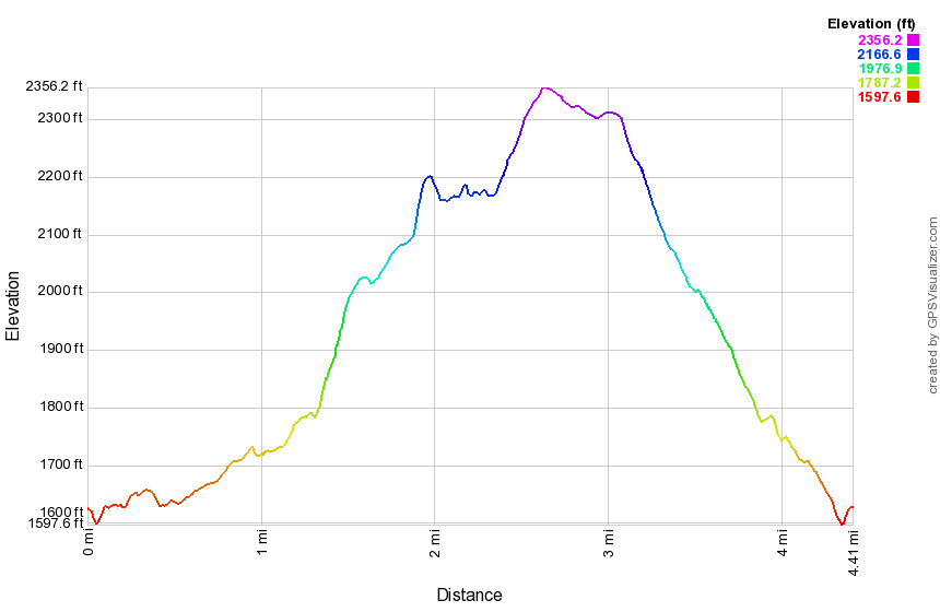 (The image at the left shows the profile of the hike. Remember that all vertical profiles are relative!)
Bear Spring: East Road Loop from Route 206
| Quick Look | ||||
|---|---|---|---|---|
| Difficulty | Round trip | Total climb | Internet Maps | |
| 6.9 mi. | 1013 ft. | AllTrails | ||
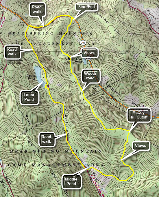 Caution: The trails at Bear Spring State Park are primarily constructed for horses and snowmobiles. The wide well-kept trails are easy to walk but poorly marked. You cannot really get lost but you can wander around a lot.
Take County Route 206 to the top of Bear Spring Mountain near Walton, NY. Park in the bus turnaround just south of East Trout Brook Road. Hike a little north on Route 206 and then turn left onto a woods road that is also a snowmobile and hiking trail. The trails in the Bear Spring WMA are truly multi-use and are frequently used by people riding horses. Continued to walk straight ahead along the road just above a clear cut area. Smaller trees and brush along the edge of the road may block the best views of the valley and the hills on the other side. You may get some glimpses through the brush and the only way to get a good view is to fight through the brush and briars to the edge of the clear cut area. Continue on the main trail walking into an area with trees on both sides. The trail starts to climb a little and at 1.4 miles and 2.0 miles trails on the right descend from the ridge to the parking area just south of Launt Pond on East Trout Brook Road. At 2.3 miles turn right and walk on the edge of a filed down the McCoy Hill Cutoff. It is a long descent toward a nice viewpoint on the right. When the trail opens up at the viewpoint, you may be able to get views down the valley to the south and across to the Fork Mountain Ridge to the west. Continue down the hill skirting another clear cut area on the right. At 3.2 miles you will have descended to a trail junction and a nice view of the trees on top of the ridge above the clear cut. Continue to descend on the trail toward Middle Pond. Along the way there are several nice views to the south and west to the Fork Mountain Ridge. At Middle Pond walk across the bridge at the outlet end over the spillway and out to East Trout Brook Road. Turn right on the road and get ready to regain the elevation lost in descending from the ridge. The road walk is easier than the trail and at 5.2 miles you will come to the southern end of Launt Pond after having already gained 300 feet of elevation back. Walk over to the outlet to the pond which is a very popular camping, swimming and boating destination in the summer. Walk back out to the road to continue your hike. At 6.2 miles you will be at Route 206 after gaining over 600 feet. Just before the road is a trail on the right. The road is easier to walk than the trail but the trail is safer! Turn right to walk back to the car to complete the hike.
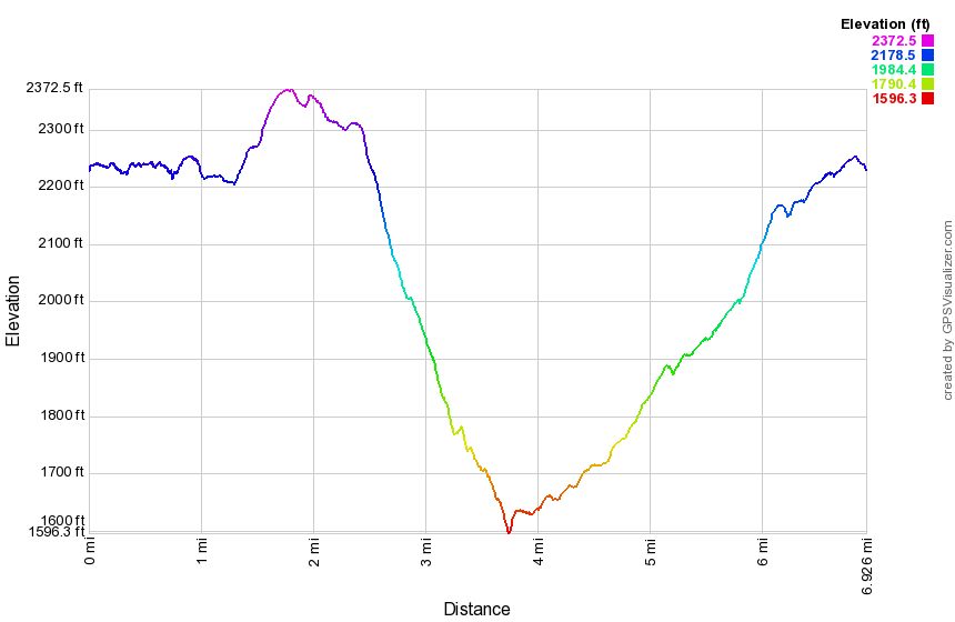 (The image at the left shows the profile of the hike. Remember that all vertical profiles are relative!)
Bear Spring: East Trout Brook Loop
| Quick Look | ||||
|---|---|---|---|---|
| Difficulty | Round trip | Total climb | Internet Maps | |
| 6.3 mi. | 1262 ft. | AllTrails | ||
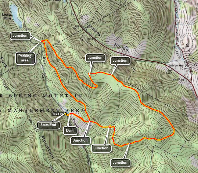 Caution: The trails at Bear Spring State Park are primarily constructed for horses and snowmobiles. The wide well-kept trails are easy to walk but poorly marked. You cannot really get lost but you can wander around a lot.
Take County Route 206 to the top of Bear Spring Mountain near Walton, NY. Turn right on East trout Brook Road and drive south. Pass Launt pond on your right and then drive 1.3 miles further. Park on the left side of the road in the parking area. Walk down the wide path/road and across the dam that creates a small pond. Continue straight ahead up the hill on the wide grassy snowmobile/horse trail. The trail climbs steadily now toward the ridge. At .35 miles a trail marked "New Trail" comes in on the left. Continue straight ahead to .68 miles. You will be in an area that has been clear cut, one of several in the park. Turn right and continue climbing until the trail junction at 1.23 miles. Turn left up the hill to the ridge. The climb ends at 1.61 miles into the hike. The trail now "rolls" along the ridge and starts a turn from east to northwest at about 1.85 miles. At 3.0 miles pass by a turn to the left through a field. This trail leads back to the trail junction at the base of the clear cut and is a good "early out". Continue to 3.33 miles and turn left down another wide trail. This trail initially heads south but them goes through a switchback that again turns northwest. The trail loses 715 feet to a parking area on East Trout Brook Road at 4.6 miles. You can walk the road south from here to your car. Make a sharp left turn onto a trail marked "New Trail" to avoid the road walk. This trail heads southeast for 1.3 miles until it reaches the trail junction at 5.9 miles you passed earlier. The trail is longer than the road walk and does ascend briefly in a few spots. Turn right and walk back to the dam and across the top to your car.
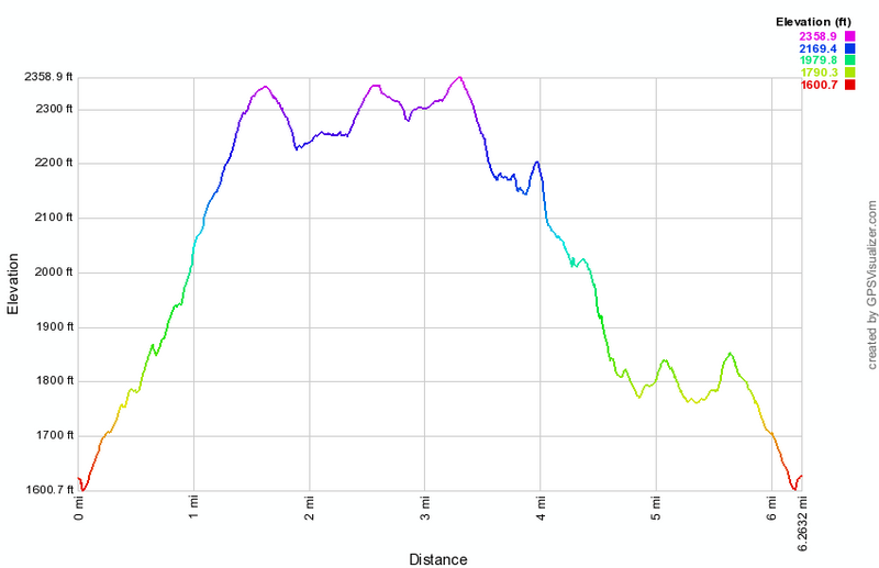 (The image at the left shows the profile of the hike. Remember that all vertical profiles are relative!)
Bear Spring: Eastern Trails
| Quick Look | ||||
|---|---|---|---|---|
| Difficulty | Round trip | Total climb | Internet Maps | |
| 7.6 mi. | 1253 ft. | AllTrails | ||
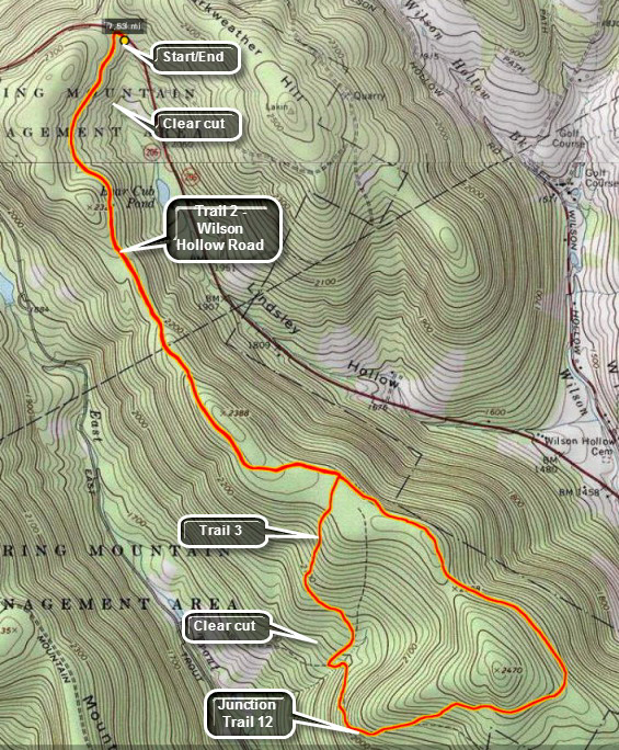 Caution: The trails at Bear Spring State Park are primarily constructed for horses and snowmobiles. The wide well-kept trails are easy to walk but poorly marked. You cannot really get lost but you can wander around a lot.
Take County Route 206 to the top of Bear Spring Mountain near Walton, NY. Park in the large pull off on the left hand side of the road just before the turn onto East Trout Brook Road. To start the hike, walk up the road to a wide woods road with a gate on your left. This is Wilson Hollow Road which is also Trail 2 on the horse trails map of the area. As you walk in on this wide trail, you will immediacies notice a clear cut area extending more than half a mile on your left. The trail will continue to rise a little as you walk with no steep uphill or downhill section. in the first 3 miles. At 1.3 miles Trail 11 will enter from the right as it climbs the ridge from just south of Launt Pond on East Trout Brook Road. At 2.3 miles Trail 3 joins from the right. This is where you will return after the loop. At this point the trail descends a little and then climbs slightly. Along the way the trail heads more to the southeast and a snowmobile trail comes in on the left from Downsville. Soon the trail begins to head down until at around 4 miles Trail 12 comes in from the left. Continue to bear to the right and follow Trail 2 as it continues to the lowest point on the hike, the junction with Trail 3 at 4.5 miles. Turn right here on Trail 3 to walk back up to the ridge to the area you passed earlier. At this point in the hike you may think you are in the wrong place but what your are looking at is ANOTHER clear cut area. After the turn Trail 3 climbs to a field that looks down over the clear cut area but also looks down the hollow for some good photographic opportunities. Continue on Trail 3 until it meets Trail 2 back on the ridge about 5.3 miles into the hike. Turn left and follow Wilson Hollow Road for the next 2.3 miles back to the car.
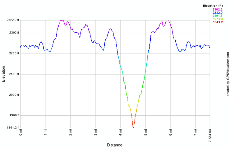 (The image at the left shows the profile of the hike. Remember that all vertical profiles are relative!)
Bear Spring: Eastern Trails (Clockwise)
| Quick Look | ||||
|---|---|---|---|---|
| Difficulty | Round trip | Total climb | Internet Maps | |
| 7.6 mi. | 1053 ft. | AllTrails | ||
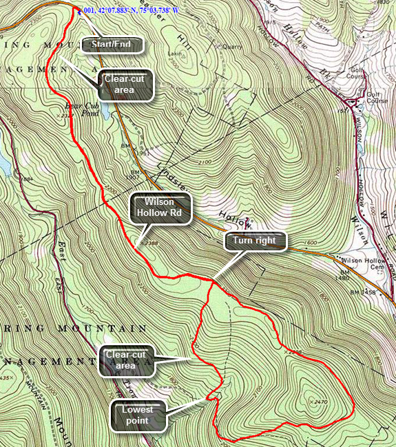 Caution: The trails at Bear Spring State Park are primarily constructed for horses and snowmobiles. The wide well-kept trails are easy to walk but poorly marked. You cannot really get lost but you can wander around a lot.
Take County Route 206 to the top of Bear Spring Mountain near Walton, NY. Park in the large pull off on the left hand side of the road just before the turn onto East Trout Brook Road. To start the hike, walk up the road to a wide woods road with a gate on your left. This is Wilson Hollow Road which is also Trail 2 on the horse trails map of the area. As you walk in on this wide trail, you will immediacies notice a clear cut area extending more than half a mile on your left. The trail will continue to rise a little as you walk with no steep uphill or downhill section. in the first 3 miles. At 1.3 miles Trail 11 will enter from the right as it climbs the ridge from just south of Launt Pond on East Trout Brook Road. At 2.3 miles Trail 3 joins from the right. Turn to the right here and walk along the edge of the field until the trail enters the woods. At this point the trail descends almost 500 feet to the lowest point on the hike. On the way down the trail there is a nice lookout into the valley below. At the bottom of the descent turn left to start to loop around and back up to the ridge heading mostly east. Of course, the payment for a descent is an ascent back to the ridge. In just about a mile you will regain the elevation you lost on the way down. Along the way you will pass a sign on a snowmobile trail to the right that says "Downsville". Continue to walk the woods road east. At about 4.2 miles the trail turns northwest to circle the summit of a hill on your left and head back toward the parking area. From the point of the turn back to the trail junction where you turned right earlier is about 1.15 miles. When you arrive back at the junction, you will know exactly how far you have to go to get back! The hike back along Wilson Hollow road is 2.2 miles and is mostly downhill.
 (The image at the left shows the profile of the hike. Remember that all vertical profiles are relative!)
Bear Spring: Eastern Trails from trailhead
| Quick Look | ||||
|---|---|---|---|---|
| Difficulty | Round trip | Total climb | Internet Maps | |
| 7.6 mi. | 1253 ft. | AllTrails | ||
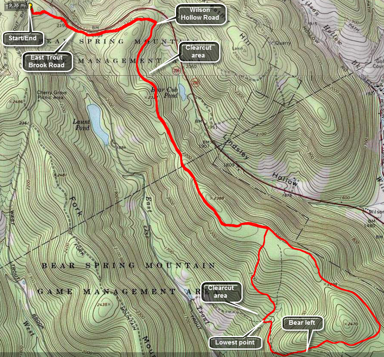 Caution: The trails at Bear Spring State Park are primarily constructed for horses and snowmobiles. The wide well-kept trails are easy to walk but poorly marked. You cannot really get lost but you can wander around a lot.
Take County Route 206 to the top of Bear Spring Mountain near Walton, NY. Turn onto West Trout Brook Road and park at the main trailhead parking on the left hand side of the road. To start the hike, get on the trail just to the left of the information kiosk. These trails are for horseback riding and are not marked like hiking trails.Continue on this trail through a field and down a hill to where the trail crosses East Trout Brook Road. Continue across and bear left where the trail splits. Ascend a hill to another trail junction on the other side. Turn left and walk down the hill to a woods road. This is Wilson Hollow Road which is also Trail 2 on the horse trails map of the area. As you walk in on this wide trail, you will immediacies notice a clear cut area extending more than half a mile on your left. The trail will continue to rise a little as you walk with no steep uphill or downhill section. in the first 3 miles. At 2.25 miles Trail 11 will enter from the right as it climbs the ridge from just south of Launt Pond on East Trout Brook Road. At 3.1 miles Trail 3 joins from the right. Turn here and skirt the edge of a field before entering the woods and heading downhill. For .8 miles the trail loses 460 feet to the lowest point on the hike. Another clearcut area will appear on the right as you near the end of this section. There are some nice vies down the valley. At the bottom of the hill turn left and start to climb back up to the ridge. In a little more than half a mile the trail splits and you should continue by bearing left up to the ridge. The trail makes an abrupt change in direction from east to northwest and at 6.3 miles you will be back to where you started the loop. Follow Wilson Hollow Road back almost to Route 206. Turn left up the hill and follow your route back to the main trailhead.
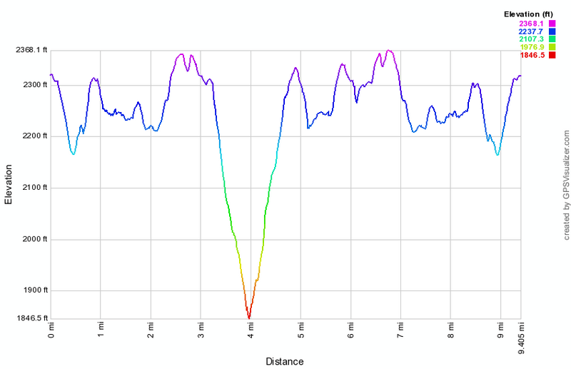 (The image at the left shows the profile of the hike. Remember that all vertical profiles are relative!)
Bear Spring: Launt Pond Loop (long)
| Quick Look | ||||
|---|---|---|---|---|
| Difficulty | Round trip | Total climb | Internet Maps | |
| 5.9 mi. | 1027 ft. | AllTrails | ||
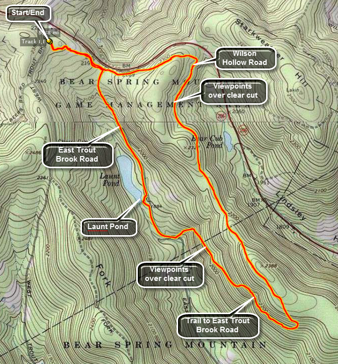 Caution: The trails at Bear Spring State Park are primarily constructed for horses and snowmobiles. The wide well-kept trails are easy to walk but poorly marked. You cannot really get lost but you can wander around a lot.
Take County Route 206 to the top of Bear Spring Mountain near Walton, NY. Turn onto West Trout Brook Road and park at the main trailhead parking on the left hand side of the road. To start the hike, get on the trail just to the left of the information kiosk. These trails are for horseback riding and are not marked like hiking trails.Continue on this trail through a field and down a hill to where the trail crosses East Trout Brook Road. Continue across and bear left where the trail splits. Ascend a hill to another trail junction on the other side. Turn left and walk down the hill to a woods road. This is Wilson Hollow Road which is also Trail 2 on the horse trails map of the area. As you walk in on this wide trail, you will immediacies notice a clear cut area extending more than half a mile on your left. The trail will continue to rise a little as you walk with no steep uphill or downhill section. in the first 3 miles. At 2.25 miles Trail 11 will enter from the right as it climbs the ridge from just south of Launt Pond on East Trout Brook Road. At 2.85 miles another woods road joins from the right. Turn right here walk down the trail to a nearly 180 degree turn at 3.0 miles. As you continue on this trail, a break in the trees on the left reveals another clearcut area. The trail ends, after 1.4 miles and a drop of 550 feet, at a parking area on East Trout Brook Road just south of Launt Pond. Turn right and walk .3 miles up to the pond. This is a favorite picnic and boating area during the season. Head back out to the road and turn left. Walk about a mile north on the road and gain around 300 feet. As you near Route 206, you will see the trail that you used to cross the road earlier in the hike. Turn left and follow your path from earlier back to the car.
 (The image at the left shows the profile of the hike. Remember that all vertical profiles are relative!)
Bear Spring: Launt Pond Loop (short)
| Quick Look | ||||
|---|---|---|---|---|
| Difficulty | Round trip | Total climb | Internet Maps | |
| 4.0 mi. | 630 ft. | AllTrails | ||
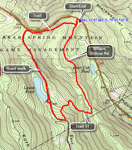 Caution: The trails at Bear Spring State Park are primarily constructed for horses and snowmobiles. The wide well-kept trails are easy to walk but poorly marked for hiking. You cannot really get lost but you can wander around a lot.
Take County Route 206 to nearly the top of Bear Spring Mountain near Walton, NY. Pull off the road to the large parking area on the left just before East Trout Brook Road. To start the hike, walk west along the shoulder of Route 206 to the woods road or trail on the left. This is Wilson Hollow Road which is also Trail 2 on the horse trails map of the area. As you walk in on this wide trail, you will immediately notice a clear cut area extending more than half a mile on your left. The trail will continue to rise a little as you walk with no steep uphill or downhill section. At around 1.3 miles Trail 11 will be on the right as it climbs the ridge from just south of Launt Pond on East Trout Brook Road.Turn right on this trail and descend 430 feet over the next .7 miles to a parking area on East Trout Brook Road. Turn right on the road and hike .3 miles north to Launt Pond. The pond has a dam at the outlet end and is a pretty spot to stop in any season. During the summer, there is a beach for swimming and canoe and kayak rental. Across the road from the pond is a camping area. After looking around, get back on the road and walk 1 mile north where the trail crosses just short of Route 206. Turn right on the trail and stay left at the fork. Walk over a hill and down the other side to Wilson Hollow Road. Turn left and walk back out to your car.
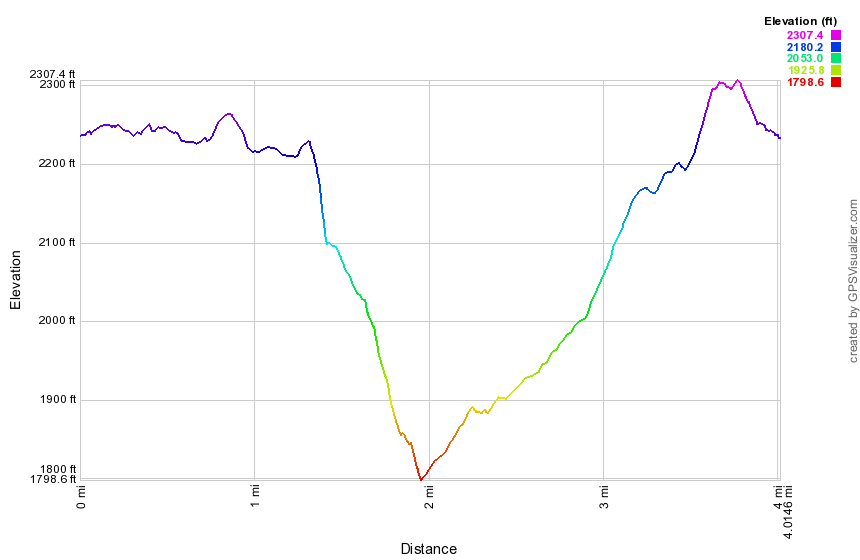 (The image at the left shows the profile of the hike. Remember that all vertical profiles are relative!)
Bear Spring: Northeastern Trails
| Quick Look | ||||
|---|---|---|---|---|
| Difficulty | Round trip | Total climb | Internet Maps | |
| 6.0 mi. | 1100 ft. | AllTrails | ||
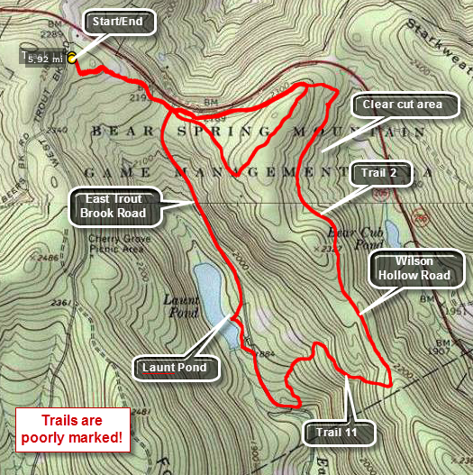 Caution: The trails at Bear Spring State Park are primarily constructed for horses and snowmobiles. The wide well-kept trails are easy to walk but poorly marked. You cannot really get lost but you can wander around a lot. This hike is the result of some wandering.
Take County Route 206 to the top of Bear Spring Mountain near Walton, NY. Turn into the park on West Bear trout Brook Road which is the main entrance. Only a few hundred feet in there will be a large trail head parking area on the left. There is a large hand-painted wooden sign that shows the numbers horse trails. Memorize it since the copies, if there are any, at he trail junctions are useless. Note also that there are many additional trails and roads that form loops and are not shown on any maps.
Exit the parking area on the trail to the left of the sign which should be Trail 2. Almost immediately you will be at an open field with no clues where to go. Walk straight across the field to the trail on the other side. At .5 miles you will cross East Trout Brook Road and immediately be confronted with three possible trails. Bear to the left and up the hill. At 1.0 mile there will be a trail junction which is almost a T with no signs. Turn right to continue with this description or left which is the "correct" way to go. Bearing left the trail ascends to the top of a little plateau with open forest. The trail heads southwest but then turns northwest and descends right back to East Trout Brook Road. Walk .8 miles down the road to Launt Pond. Although this is a road walk the pond is beautiful and well worth the trip. Launt Pond is not on any of the main trails but can be reached by spur trails. After spending some time at the pond, walk down the road about .3 miles to the next big parking area on the left. Just before the parking area enter the woods on Trail 11. Trail 11 winds back and forth but travels mostly east and up to meet Wilson Hollow Road which is part of Trail 2. Turn left or north and follow the wide road for about 1.2 miles at which point you will be within sight of Route 206. As you approach this area you will see a large clear cut area on the left. Turn left up the hill and make the first right. If this looks familiar, it should. This is the area where you made a short loop earlier. Head back to the parking area on Trail 2 which is only 1`.1 miles away. Other loops are possible using Trail 2 which extends much farther south.
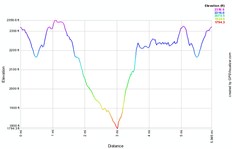 (The image at the left shows the profile of the hike. Remember that all vertical profiles are relative!)
Bear Spring: Ridge Loop
| Quick Look | ||||
|---|---|---|---|---|
| Difficulty | Round trip | Total climb | Internet Maps | |
| 8.9 mi. | 1447 ft. | AllTrails | ||
_map.png) Caution: The trails at Bear Spring State Park are primarily constructed for horses and snowmobiles. The wide well-kept trails are easy to walk but poorly marked. You cannot really get lost but you can wander around a lot.
Caution: The trails at Bear Spring State Park are primarily constructed for horses and snowmobiles. The wide well-kept trails are easy to walk but poorly marked. You cannot really get lost but you can wander around a lot.Take County Route 206 to the top of Bear Spring Mountain near Walton, NY. At the top of the hill turn onto West Trout Brook Road and drive south a short distance to the large parking area on the left. Walk just less than a mile south on West Trout Brook Road and turn left onto the trail that runs over Fork Mountain. This is the central ridge of the three at the park and serves as part of the Finger Lakes Trail. The walk SSE on the trail for another 2.4 miles until Trail 4 turns left off the ridge. The walk along the ridge rolls some but does not gain or lose much elevation. Trail 4 is steep and drops 655 feet in less than a mile. The trail ends at East Trout Brook Road. Cross the road to the parking lot and then walk down the trail to Middle Pond. Approach Middle Pond quietly as you may spot a blue heron, a beaver or other wildlife. Walk straight ahead and up the hill on the trail. At 4.6 miles a trail appears on the left but you should continue up the hill to 4.9 miles where the trail splits. Notice the large clear cut area on the left as there are several in the area. Keep to the left to take the McCoy Hill Cutoff to the top of the eastern ridge. There is at least one viewpoint along the way and at 5.7 miles you will walk through a field to meet the trail along the eastern ridge. Turn left on this trail and walk along the ridge. At 6.0 miles a wide woods road heads back down off the ridge to East Trout Brook Road. Further along at 6.6 miles, another trail heads down to the camping area at Launt Pond. Continue straight ahead and at 7.2 miles another large clear cut area will appear on your right. Another clear cut is visible on the hillside across Route 206. At 7.8 miles turn right and walk up a short hill. Bear right at the first form and walk up a little and then down to East Trout Brook Road. The final .4 miles is uphill and crosses a large field before you are back at the parking area.
_gra.png) (The image below shows the profile of the hike. Remember that all vertical profiles are relative!)
(The image below shows the profile of the hike. Remember that all vertical profiles are relative!)
Bear Spring: Southeastern Trails
| Quick Look | ||||
|---|---|---|---|---|
| Difficulty | Round trip | Total climb | Internet Maps | |
| 6.2 mi. | 1475 ft. | AllTrails | ||
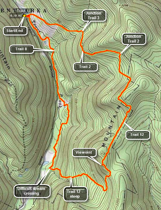 Caution: The trails at Bear Spring State Park are primarily constructed for horses and snowmobiles. The wide well-kept trails are easy to walk but poorly marked. You cannot really get lost but you can wander around a lot. This hike is the result of some wandering.
Take County Route 206 to the top of Bear Spring Mountain near Walton, NY. Turn onto East Trout Brook Road which is a paved road that connects to Trout Brook Road and Route 30 at Shinhopple. Drive south on the road for about 2.2 miles passing Launt Pond on your right. Park at the roadside pulloff near Middle Pond. There will be a dam and bridge at the outlet of the pond which will allow you to cross East Trout Brook. You may also drive north on Trout Brook Road from Route 30 in Shinhopple. Bear right where West and East Trout Brook Roads separate. The parking area will be about 2.2 miles from where the roads diverge. It may be possible to park at the large parking area where the two roads separate but crossing East Trout Brook in this area on Trail 8 can be difficult in all but the driest times. There is no bridge!
After crossing the bridge at Middle Pond turn right and follow Trail 8 as it roughly parallels the creek.
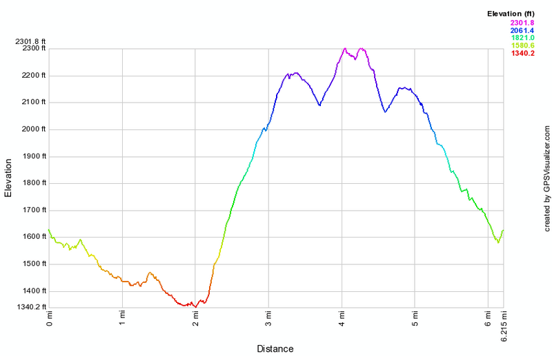 (The image below shows the profile of the hike. Remember that all vertical profiles are relative!)
Bear Spring: Southeastern Trails (clockwise)
| Quick Look | ||||
|---|---|---|---|---|
| Difficulty | Round trip | Total climb | Internet Maps | |
| 5.8 mi. | 1270 ft. | AllTrails | ||
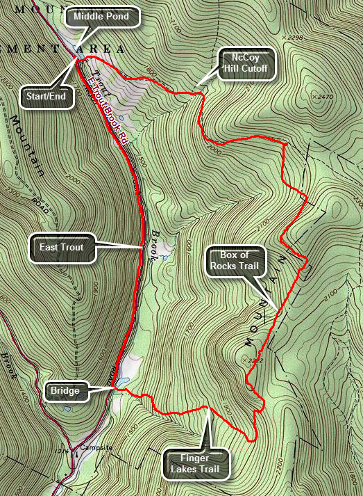 Caution: The trails at Bear Spring State Park are primarily constructed for horses and snowmobiles. The wide well-kept trails are easy to walk but poorly marked. You cannot really get lost but you can wander around a lot. This hike is the result of some wandering.
Take County Route 206 to the top of Bear Spring Mountain near Walton, NY. Turn onto East Trout Brook Road which is a paved road that connects to Trout Brook Road and Route 30 at Shinhopple. Drive south on the road for about 2.2 miles passing Launt Pond on your right. Park at the roadside pulloff near Middle Pond. There will be a dam and bridge at the outlet of the pond which will allow you to cross East Trout Brook. Continue straight ahead and almost immediately start to climb the hill toward the McCoy Hill Cutoff. Ignore the side trails on the left and at .7 miles turn right where the trail splits. Follow the wide horse trail as it heads south while continuing to climb toward the ridge. The trail surface is very level which make sit easy to walk. At 1.2 miles the trail splits again. Stay to the right to continue east and southeast. At 1.4 mile follow the trail as it turns south and begins to snake along the ridge. At his point there is a "Danger! Keep Out!" sign on the trail straight ahead which is another good reason to turn right! After descending for a short distance, the trail again heads up the ridge and slightly to the east. At 2.1 miles you will still be headed south and will hit the highest point on the hike at 2300 feet. After the high point, start to descend and head southwest. At 2.5 mile you should pick up Finger Lakes Trail blazes as it comes up from East Trout Brook Road. Hike up the last hill in front of you and at 2.85 miles start a descent still heading south. At 3.2 miles turn sharply right or to the west and begin a .75 mile descent to East Trout Brook losing 625 feet in the process. Most of the trail down is old woods road or new logging road so the walk was pretty easy. The trail parallels a small stream. At 4 miles you will be in a field near East Trout Brook. You may turn right and follow the trail back to the car but it is often very wet. If you walk slightly to the left of the small pond, you can cross a bridge to East Trout Brook Road and hike back on the road. This is not quite as scenic as the trail but MUCH easier (an drier) walking. Walk the 1.7 miles back to the car gaining 300 feet in the process.
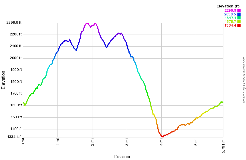 (The image below shows the profile of the hike. Remember that all vertical profiles are relative!)
Bear Spring: Trail 4
| Quick Look | ||||
|---|---|---|---|---|
| Difficulty | Round trip | Total climb | Internet Maps | |
| 1.9 mi. | 690 ft. | AllTrails | ||
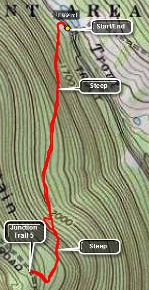 Caution: The trails at Bear Spring State Park are primarily constructed for horses and snowmobiles. The wide well-kept trails are easy to walk but poorly marked. You cannot really get lost but you can wander around a lot.
Take County Route 206 to the top of Bear Spring Mountain near Walton, NY and watch for East Trout Brook Road on your left. Turn left on East Trout Brook Road heading south and passing Launt Pond on your right. After 2.2 miles park on the left side of the road in the parking area near Middle Pond. Cross the road and head up Trail 4 to the junction with Trail 5 on the ridge. UP is the operative word since Trail 4 is pro ably the steepest trail in the park. It only gains 690 feet but it does so in about 1 mile. Ignore the trail head signs that say .6 miles since a careful inspection will show this is "as the crow flies". The trail is steep with some very steep sections and near the top there is a switchback on the horse trail. Just before the junction with Trail 5 on the ridge is a sharp right turn. Once you are on top you can simply walk back to the car or make this part of a longer or MUCH longer loop.
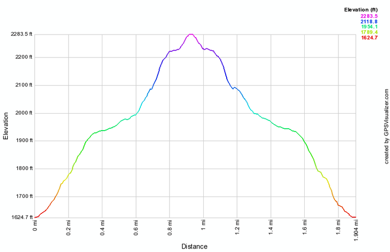
(The image above shows the profile of the hike. Remember that all vertical profiles are relative!)
Bear Spring: Trout Brook
| Quick Look | ||||
|---|---|---|---|---|
| Difficulty | Round trip | Total climb | Internet Maps | |
| 3.7 mi. | 527 ft. | AllTrails | ||
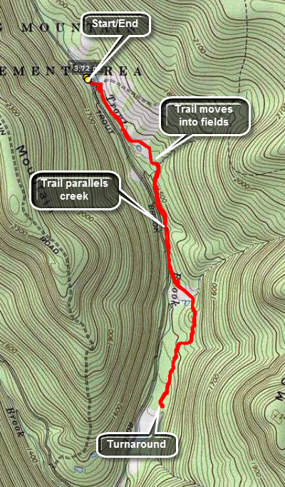 Caution: The trails at Bear Spring State Park are primarily constructed for horses and snowmobiles. The wide well-kept trails are easy to walk but poorly marked. You cannot really get lost but you can wander around a lot.
Take County Route 206 to the top of Bear Spring Mountain near Walton, NY and watch for East Trout Brook Road on your left. Turn left on East Trout Brook Road heading south and passing Launt Pond on your right. After 2.2 miles park on the left side of the road in the parking area near Middle Pond. Walk down to the dam and then turn right on the trail. The trail parallels Trout Creek for most of its length but moves away through fields and forest in places. The trail can be very wet at times. Walk as far as you like and then turn around to return. There are a number of ways to extend the distance and difficulty of the hike.
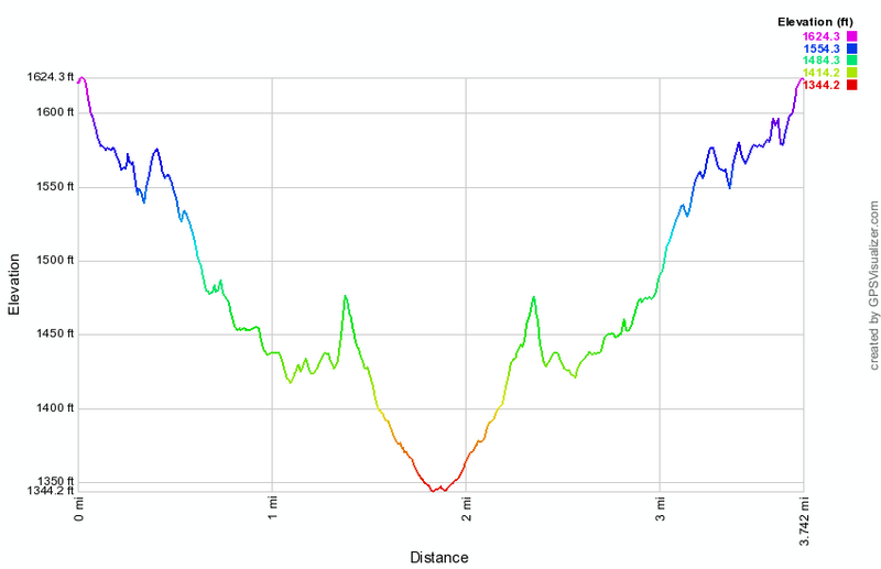
(The image above shows the profile of the hike. Remember that all vertical profiles are relative!)
Bear Spring: Western Loop
| Quick Look | ||||
|---|---|---|---|---|
| Difficulty | Round trip | Total climb | Internet Maps | |
| 12.2 mi. | 2100 ft. | AllTrails | ||
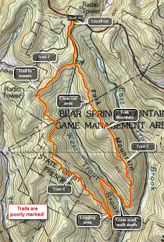 Caution: The trails at Bear Spring State Park are primarily constructed for horses and snowmobiles. The wide well-kept trails are easy to walk but poorly marked. You cannot really get lost but you can wander around a lot.
Take County Route 206 to the top of Bear Spring Mountain near Walton, NY. Turn into the park on West Bear trout Brook Road which is the main entrance. Only a few hundred feet in there will be a large trail head parking area on the left. There is a large hand-painted wooden sign that shows the numbers horse trails. Memorize it since the copies, if there are any, at he trail junctions are useless. Note also that there are many additional trails and roads that form loops and are not shown on any maps.
Exit the parking area on the trail across the road which should be Trail 7. Within .5 miles you will cross Beers Brook Road and the trail continues on the other side as it parallels West Trout Brook Road. The trail is wide open and grassy and wanders back and forth across the ridge and generally gains a little elevation. At 1.1 miles the trail bears to the right and continues until it meets the trail to the Houck Mountain towers at about 2.2 miles. Turn left and walk a short distance to the next junction and turn right staying on the horse trail marked with the blue horse trail markers. There are few markers that designate the trail numbers and at some point Trail 7 changes to Trail 6 at least according to the sign back at trail head. As you walk along the ridge for the next 3.25 miles to the south and then southeast, you may begin to wonder if you are going the right way. At the and of the ridge the trail starts to descend for about .45 miles to a switchback almost 6 miles into the hike! After the switchback, walk about .8 miles to the next switchback and then another ,5 miles to West Trout Brook Road. You will be about 7.3 miles into the hike and will have dropped almost 1000 feet from the ridge. Cross the road and walk a little to the right to continue on Trail 6. Now its time to regain that 1000 feet you dropped!
From the road the trail ascends briefly and then drops through a stand of spruce trees before climbing again to a trail junction within .35 miles of the road. Finally a trail that is clearly marked! Turn left on Trail 5 and start to climb over 900 feet for the next 1.3 miles. After this there are still some ups and downs but the trail remains relatively flat as it passes Fork Mountain at 9.5 miles into the hike. At 10 miles the trail starts to descend. Along the trail at about 10.4 miles you will pass a clear cut area to the left of the trail. Somewhere around 11 miles Trail 5 ends at West Trout Brook Road. You can walk the road back to the car or cross over to get back on Trail 7 and retrace your earlier route back to the car which is only a mile away.
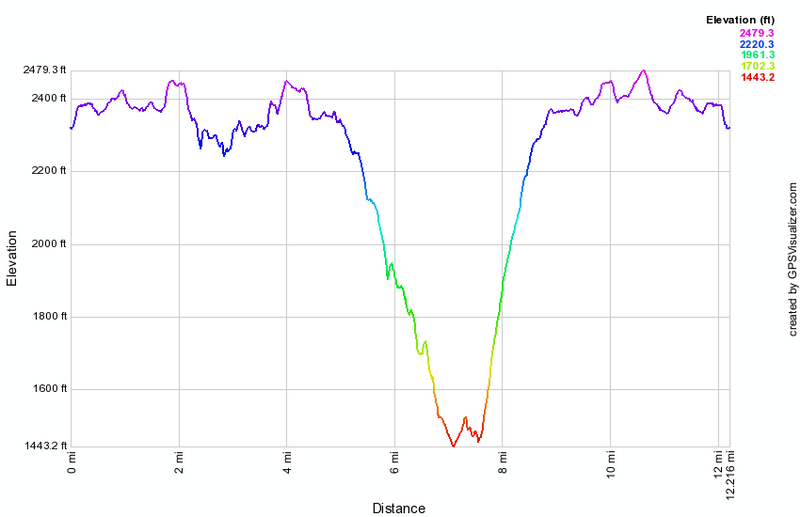 (The image at the left shows the profile of the hike. Remember that all vertical profiles are relative!)
Beaverkill Campgrounds
| Quick Look | ||||
|---|---|---|---|---|
| Difficulty | Round trip | Total climb | Internet Maps | |
| 2.8 mi. | 225 ft. | Alltrails | ||
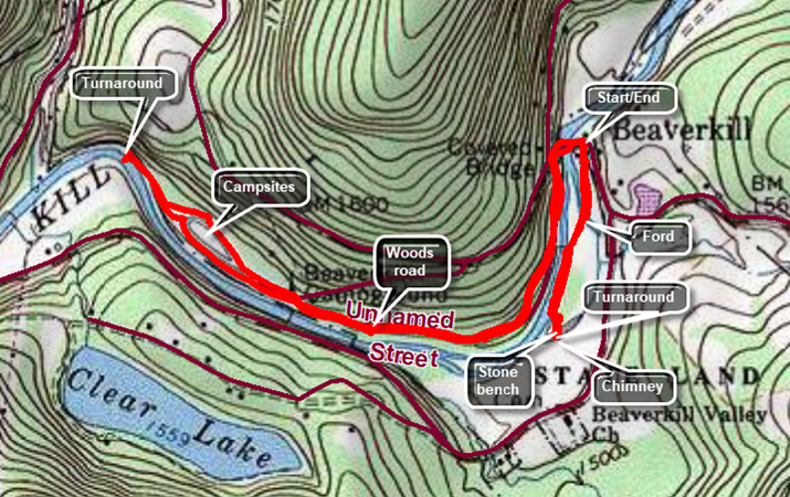 Drive north on the Beaverkill Road from Old Route 17 between Livinston Manor and Roscoe. Turn left on Campsite Road and drive to the parking area near the Beaverkill Covered Bride. Walk across the bridge and turn left on a woods road just after crossing the bridge. Walk along the woods road that parallels the river. You will begin to see several buildings that are the bathrooms for now-abandoned campsites. After about .7 miles, continue to walk west and northwest on the paved roads that serve the active campsites. You may walk passed the last campsite on a path until it ends. From the end of the path you can see the river disappear around a bend. Walk back along the same route retracing your steps to the parking area. Walk out the back of the parking area passing the bathhouse on the left. Note the concrete paving in an old streambed. At one time the river split and the water here was quite deep. This was the ford to get to the campsites on the other side. Continue to walk on the path along the river where there were once campsites. The path ends with a massive stone bench. To the left and ahead of the bench is an old wellhead. Across a small stream is an interesting chimney. Return to the parking area and your car by simply reversing your route
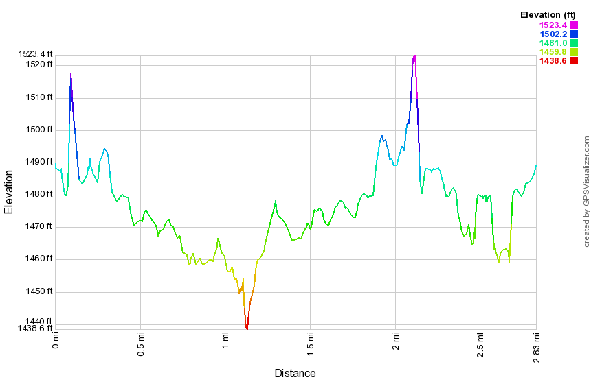
(The image above shows the profile of the hike. Remember that all vertical profiles are relative!)
Beaverkill Headwaters from Wild Meadow Road
| Quick Look | ||||
|---|---|---|---|---|
| Difficulty | Round trip | Total climb | Internet Maps | |
| 5.7 mi. | 643 ft. | AllTrails | ||
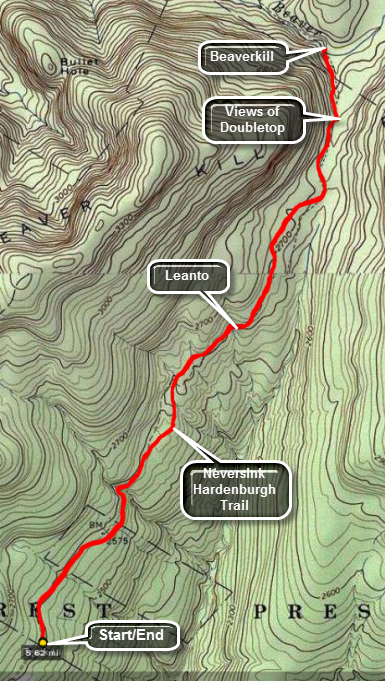 As you walk the first part of this route you will hear the waters of Fall Brook flowing roughly south. Once you get to the wetlands near the end the water will start to flow west with water feeding in from runoff from Doubletop. The headwaters of the Beaverkill are a little further north on the slopes of this mountain. The trail where it meets the Beaverkill has been eroded and crossing can be challenging even in drier weather.
Park at the end of Black Bear Road (Wild Meadow Road) in the snowplow turnaround as long as there is no snow! Walk down the road which serves as the beginning of the yellow Neversink Hardenburgh Trail in this area. Walk by the hunting camp and continue on the trail on the other side. The trail can be very wet in places. Cross over a brook and head up a little gaining some elevation. The Fall Brook lean-to is about 1.7 miles into the hike. After passing the lean-to, a swampy area appeared on the right of the trail which leads into a series of beaver ponds and beaver meadows. Doubletop Mountain is in the background. This area is the headwaters of Fall Brook which runs south and the Beaverkill which runs north and west. The trail parallels the Beaverkill for a short distance and then ENDS at the edge of the stream. Linger for some time to take some pictures and dip a toe in one of the best trout streams in the United States. When you are done, turn around and retrace your route to the car.
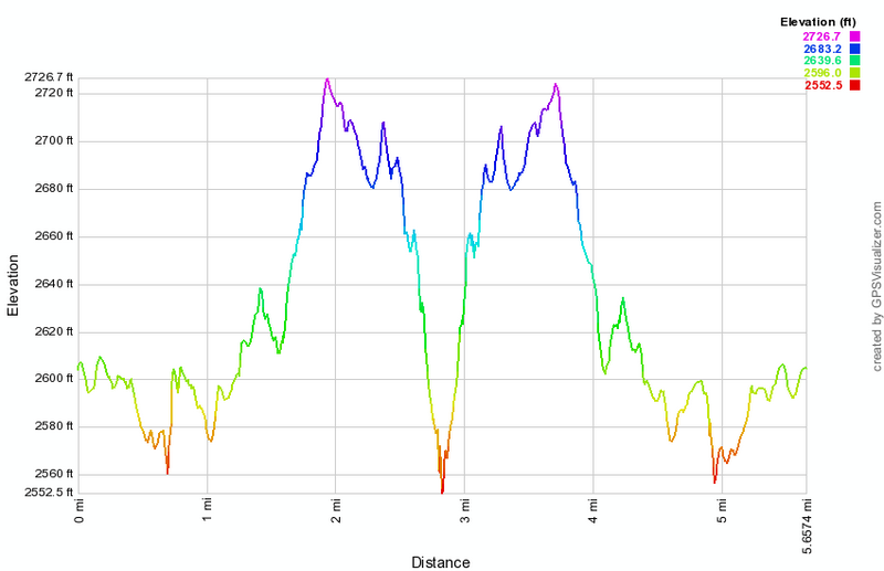
(The image above shows the profile of the hike. Remember that all vertical profiles are relative!)
Beech Hill Road to Little Pond
| Quick Look | ||||
|---|---|---|---|---|
| Difficulty | Round trip | Total climb | Internet Maps | |
| 4.1 mi. | 920 ft. | AllTrails | ||
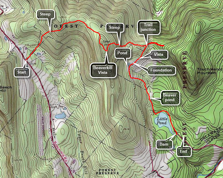
This hike is 4.1 miles with a few very steep climbs. As presented it is a one-way hike although it could be done as an 8 mile out and back. Head toward Lew Beach on the Beaverkill Road from Livingston Manor. Pass through Lew Beach toward Turnwood. Watch for a left hand turn with a road sign for Beech Hill Road. Drive up the road for about 2.6 miles and park at the parking area on the right. The hike to the Beaverkill Vista viewpoint is only 1.5 miles but a good part of it is steep. A .4 mile section in the middle ascends at a grade of 26% before it finally levels off. The first part of the trail is flat and actually descends a little and it almost always wet. At about .25 miles into the hike the trail starts to ascend and gains 575 feet over the next .5 miles. After this point the trail flattens out and rolls a little along the way to the viewpoint. At .85 miles you may notice what looks like a road off the trail on the left. I don't know much about it but it does look very much like a road. Continue without much change in elevation to 1.25 miles where the trail ascends again and then drops a little to the vista at 1.5 miles. Enjoy the view from the flat rock. Immediately below is Little Pond with Touch-Me-Not Mountain to the left. Continue on the trail as it descends the east side of Cabot Mountain. This side is even steeper than the ascent on the west. The .4 miles of the descent averages a 22% grade but small sections have a 38% grade. At the bottom of the descent the trail levels. This are is often wet and can be a sea of nettles at times. Continue to follow the trail to the junction with the yellow Little Pond Trail at 2.1 miles. Turn right on this trail as it gently descends toward Little Pond. At 2.3 miles the trail passes through an open area with views of the ridges and valleys to the east. A little further along is an old foundation on the left and a pond on the right. Continue on the trail as it follows a woods road. After a short distance, the trail turns left of the road. The trail descends to a large beaver pond and the follows a stream out to the shore of Little Pond. Turn left on the trail that loops around the pond. As you approach the parking area, stay to the right and walk to the dam which has a small bridge. This give a nice view of the pond with Cabot Mountain behind it. Walk to the parking area to a car to give you a ride back to Beech Hill.
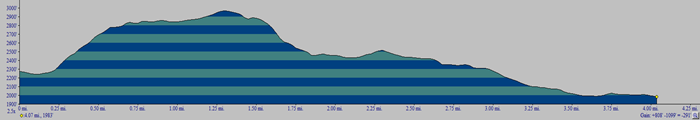 (The image at the left shows the profile of the out and back hike. )
Beer Mountain (Livingston Manor)
| Quick Look | ||||
|---|---|---|---|---|
| Difficulty | Round trip | Total climb | Internet Maps | |
| 1.9 mi. | 450 ft. | AllTrails | ||
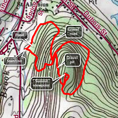
Beer Mountain is the hill behind the Upward Brewery in Livingston Manor. The property was originally purchase by a wealthy developer who hoped to build a casino on top of the hill. Those plans fell through as did the developer's fortune. Eventually, a group of businessmen bought the land and built the brewery. There is a small pond on the property and it is nicely landscaped. The owners also enhanced the hiking trails on the property they are open to the public although I am sure the brewery would appreciate a purchase! Head south from the traffic light in Livingston Manor for about half a mile heading toward Shandelee. Turn left at the sign for the brewery just before Treyz Hill Road. Park in a space in one on the parking lots. Walk toward the hill with the brewery on your right toward the dirt path and signs where the trails begin. Start up the hill. At the trail junction, continue straight ahead. The trail soon flattens and goes through a switchback as it works its way toward the top of the hill. You will break out of the trees onto a gravel road that was built for construction vehicles to work on top of the hill. Continue straight ahead on the road to the summit of Beer Mountain. A little farther along is an area where the red shale has been removed to help build the road. Near the summit the trail continues straight ahead. Turn left to walk to the clearing at the top. The summit has a large fire pit and some picnic tables. There are limited views from the summit. Walk back to where the trail continues down the back side of the hill. This section is downhill for .35 miles and loses over 200 feet at an 11% grade. The trail has quite a few loose rocks and slippery pine needles. Near the bottom of the descent watch for a tree trunk that spans the trail about 6 feet above the ground. At the end of the descent the trail begins to ascend again. The ascent is less than a quarter mile but there is a 15% grade. The trail begins to descend to the point where you started the final ascent to the summit earlier. Turn right on the gravel road and begin to descend the gravel road. Eventually, the trail flattens as it returns to the grounds of the brewery. Walk passed the pond and back to your car.
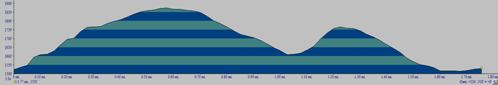 (The image at the left shows the profile of the out and back hike. )
Belleayre Mt: Ski Area from Giggle Hollow
| Quick Look | |||||
|---|---|---|---|---|---|
| Difficulty | Round trip | Total climb | Internet Maps | ||
| 8.0 mi. | 2335 ft. | AllTrails | |||
 Access for the beginning of the hike is from Route 28 near Pine Hill. Watch for a sign on the south side of the road for Belleayre Beach. Turn on the access road and drive to the covered bridge. If Belleayre Beach is open, drive across the bridge and park in the first parking area on the right near the pavilions. If the area is closed, park on the gravel area on the side of access road. Walk across the bridge to the parking area near the pavilions. The blue blazed Giggle Hollow Trail leaves the upper end of the area near the pavilions heading south. Just at the start of the hike the trail passes under some railroad tracks. The trail starts to climb almost immediately and continues for its entire length of 1.8 miles gaining 1355 feet for an average 14% grade. It is steep at times and then levels until it is steep again. The trail does follow an old woods road for most of its length which makes the going easier. The trail initial heads southwest but at 1.1 miles it starts a switch back to the southeast and then another at 1.5 miles so that it is heading west. The trail is not always well marked or trimmed especially as it hears the junction with the blue blazed Pine Hill-West Branch Trail. Turn left at the end of the trail heading west toward the Belleayre summit at 2.8 miles. At 2.4 miles a lean-to is located on the right of the trail. At 2.8 miles the Pine Hill-West Branch Trail turns south toward Balsam Mountain. This was once the site of a fire tower and the remains of the anchors can be seen. There is also a USGS marker to mark the summit. Walk straight ahead to pick up the red blazed Belleayer Ridge Trail that continues northwest to the ski area. The trail ascend a little and then is flat. At 3.25 miles there is another shelter on the right of the trail. When you reach the ski area, you will see the concession stand straight ahead at 3.8 miles. There are views here to the west, southwest and south. You should walk over to the other side of the ridge where there are views down to Pine Hill and across the valley to the mountains beyond. You will also see one or more ski lifts and the ski patrol building. To return start to walk back the way you came but stay to the left on a gravel road that heads down the mountain parallel to the trail but slightly farther north. Where the road makes a sharp left turn continue straight ahead to the Cathedral Brook ski slope where the Cathedral Glen Trail is located. The trail is marked with blue blazes along the side of the slope and is very steep averaging a 21% grade for some distance. When in doubt always bear to the right as you descend. Eventually the trail enters the forest where there is an "out of Bounds" sign for skiers. At this point the trail is more of a trail and parallels a stream. The trail passes through some big evergreen trees as it levels near its end. At 6.1 miles the trail ends at some railroad tracks. Turn right and walk out the track for .6 miles to the streets of Pine Hill. Walk straight ahead off the tracks and turn left on mill street and then right on Bonnie View Avenue. At the next intersection turn right on Main Street. Continue on Main Street until just before it start up to Route 28. Stay to the right on Lake Street and follow it to the dead end. Turn right and walk across a bridge to the other side of the stream. Walk to the pond where you may choose to walk to the left or right around the pond. Walk to the parking area where you parked or across the covered bridge to your car.
 (The image at the left is the vertical profile for the out and back hike.)
Belleayre Mt: Ski Area from Lost Clove
| Quick Look | |||||
|---|---|---|---|---|---|
| Difficulty | Round trip | Total climb | Internet Maps | ||
| 6.7 mi. | 2245 ft. | AllTrails | |||
 Get on Route 47, the road that runs from Big Indian on Route 28 to Claryville. Turn onto Lost Clove Road just outside the village of Big Indian. Continue for 1.5 miles on Lost Clove Road until the designated parking area on the right. The road dead ends just after this. Walk straight ahead from the parking area onto the red blazed trail. This trail is an easement on private land so stay on the trail at all times. The trail climbs 1300 feet in the next 1.3 miles! It is very steep at times and just steep at others. The trail does follow an old woods road for most of its length which makes the going easier. Some areas have loose stone which makes the footing tricky.
After 1.3 miles the trail enters the forest preserve and shortly after that ends at the blue blazed Pine Hill West Branch Trail. Turn left on this trail. The walking gets easier and a lean-to will be on the right after only .3 miles. Continue passed the lean-to for about .5 miles to the summit of Belleayre Mountain. At this point the Pine Hill West Branch trail turns south toward Balsam Mountain. Walk over the summit, through the field and slightly to your right, and pick up the red blazed Belleayre Ridge Trail. After about .3 miles, there is another lean-to on the right. Just before the lean-to the Cathedral Glen Trail turns to the right. This trail leads down through the ski slopes to the railroad tracks in Pine Hill.
Continue straight ahead on the Belleayre Ridge Trail. The signs for the various ski slopes will start to appear and then ahead will be the lifts and Sunset Lodge. You can continue straight ahead and walk all the way out to Deer Run, the last lift and ski slope on the ridge. Along the way enjoy the view down the slopes into the valley and across to the opposite hills. Be sure to walk around to the "front" of the lodge which offers a nice view of Balsam Mountain. return be retracing the path you used to ascend the mountain.
 (The image at the left is the vertical profile for the out and back hike.)
Berry Brook Rd to Beech Hill Rd
| Quick Look | ||||
|---|---|---|---|---|
| Difficulty | Round trip | Total climb | Internet Maps | |
| 5.7 mi. | 1934 ft. | AllTrails | ||
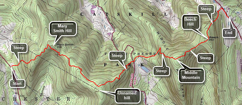
This hike is one way from Berry Brook Road to Beech Hill Road. This requires a car at Beech Hill Road and a car or a drop off at Berry Brook Road. From Livingston Manor, drive north on Old Rt 17 to Beaverkill Road on the right. Drive north on Beaverkill Road through the hamlet of Lew Beach. Turn left on Beech Hill Road, the first left after passing through Lew Beach, and drive 2.5 miles to the trailhead for the Touch-Me-Not Trail on the right. Park one car here. Drive back down Beech Hill Road to Beaverkill Road and turn right. Drive back towards Livingston Manor To Campground Road. Turn right and drive to the T in the road. Turn right and drive down to the Beaverkill State Campgrounds. Drive through the Beaverkill Covered Bridge and follow the road until it meets Berry Brook Road. Bear left and drive3.5 miles to the trailhead on the right. Find the trail register and turn right on the Mary Smith Trail which is part of the Finger Lakes Trail. The first part of the trail is an easement across private property so stay on the trail. The trail heads northeast toward Mary Smith Hill. Over the next half mile it gains 500 feet for an average grade of 20%. Within this section some parts approach a 30% grade! Pass over the top of a small hill and descended the other side before starting the climb to the shoulder of Mary Smith Hill. At .9 miles you will finish the climb as the trail turns 90 degrees and starts heading southwest. It passes by the summit of Mary Smith Hill and continues to descend until it starts up to the top of the next hill. The trail rolls a little but at 1.5 miles you will begin the climb in earnest. The trail passes by the summit of an unnamed hill at 2.2 miles and starts a long descent. Initially the descent is moderate and there is even a flat area but at 2.7 miles that changes. Over the next .4 miles you will lose 480 feet of elevation without any switchbacks to moderate the descent. This is an average of a 23% grade and continues to Mary Smith Hill Road at the bottom. Cross the road to begin the next section of trail. The sign says it is 2 miles to Beech Hill Road which seems reasonable but signs can be deceiving. After walking a short distance you will come to an interesting stone wall. After that the climb begins passing through an area that is normally wet. You are heading east and will come to a short but steep climb up what almost looks like steps. The grade is 32% but near the top there is an interesting set of ledges. There are also some outcroppings that very clearly show sedimentary layers. The climb isn't over and for the next .35 miles you will gain 400 feet at about a 20% grade. After the summit of Middle Mountain the trail descends about 300 feet to the col between Middle Mountain and Beech Hill. Now there is a short ascent of 150 feet to the top of Beech Hill after which it is all downhill. In .6 miles you will descend 500 feet to a dirt road. Turn right and walk out the dirt road to Beech Hill Road. Turn right and walk down the road to your car.
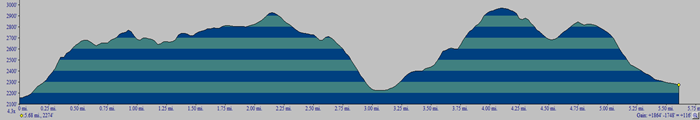 (The image at the left shows the profile of the loop hiking route. Remember that all vertical profiles are relative!)
Berry Brook Rd to Little Spring Brook
| Quick Look | ||||
|---|---|---|---|---|
| Difficulty | Round trip | Total climb | Internet Maps | |
| 4.6 mi. | 1205 ft. | AllTrails | ||
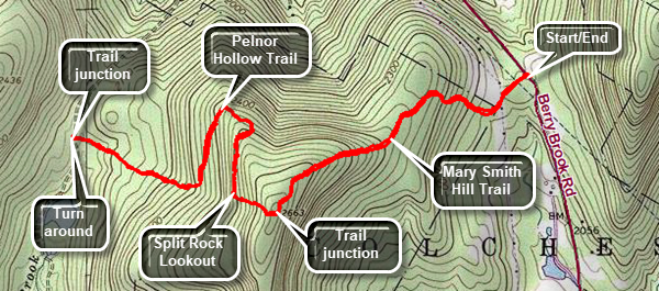
From Livingston Manor, drive north on Old Rt 17 to Beaverkill Road on the right. Drive north on Beaverkill Road through the hamlet of Lew Beach. Turn left on Beech Hill Road, the first left after passing through Lew Beach, and drive 2.5 miles to the trailhead for the Touch-Me-Not Trail on the right. Park one car here. Drive back down Beech Hill Road to Beaverkill Road and turn right. Drive back towards Livingston Manor To Campground Road. Turn right and drive to the T in the road. Turn right and drive down to the Beaverkill State Campgrounds. Drive through the Beaverkill Covered Bridge and follow the road until it meets Berry Brook Road. Bear left and drive 3.5 miles to the trailhead on the right. Find the trail register and turn left on the Mary Smith Trail which is part of the Finger Lakes Trail. Cross the road and walk through a stand of tree to a power line right of way. Bare slightly to the left and watch for a sign directing you through some grass and weeds back into the forest. The trail begins to ascend through hardwood forest passing by some impressive rock formations. Over .9 miles the trail gains 500 feet to a junction with the red blazed Pelnor Hollow Trail. Turn right and get ready to descend 165 feet in .13 miles over a 23% grade to the Split Rock Lookout. The lookout has limited views to the south and west. Continue on the FLT/Pelnor Hollow Trail heading north, then west and then south. The trail continues to descend and at 1.9 miles turns WNW toward the junction with the Little Spring Brook Trail and Campbell Mountain Trail. Some areas of the trail may be eroded. As you near the trail junction, the trail moves into an evergreen for with red pines that appear they were planted. It also becomes wetter and covered in grass. At 2.3 miles you will come to the trail junction. Turn around and retrace your route back to the parking area.
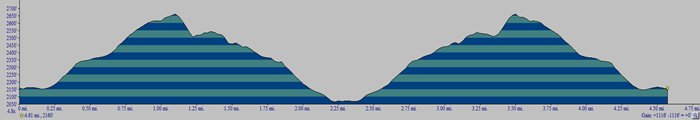 (The image at the left shows the profile of the loop hiking route. Remember that all vertical profiles are relative!)
Big Pond: Around the Pond
| Quick Look | ||||
|---|---|---|---|---|
| Difficulty | Round trip | Total climb | Internet Maps | |
| 3.8 mi. | 750 ft. | AllTrails | ||
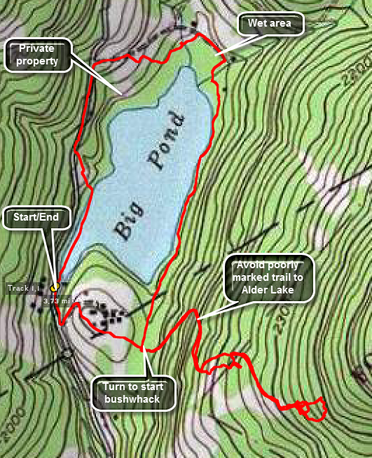 Take the Beaverkill Road from Livingston Manor and drive for about twenty minutes to the junction of Beaverkill Road and Barkaboom Road. Turn left toward the Little Pond Campgrounds. Continue passed the turn to the campgrounds on the left. Watch for a sign for the parking area for Big Pond on the right. If you get to Big Pond, you should turn around and take the first turn on the left! Park in the parking area and look for the trail register. The trail is poorly marked in places so keep an eye out for the trail markers at all times. When thee trail ahead starts the first climb turn off to the left and begin to bushwhack around the pond. On the north end and west side you will find some woods roads that lead out to Barkaboom Road. You may walk the road back to the car or walk back into the woods.
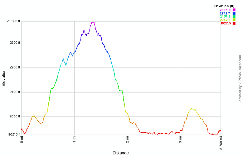
(The image above shows the profile of the hike.)
Big Pond to Alder Lake
| Quick Look | ||||
|---|---|---|---|---|
| Difficulty | Round trip | Total climb | Internet Maps | |
| 6.3 mi. | 1530 ft. | AllTrails | ||
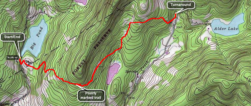 Take the Beaverkill Road from Livingston Manor and drive for about twenty minutes to the junction of Beaverkill Road and Barkaboom Road. Turn left toward the Little Pond Campgrounds. Continue passed the turn to the campgrounds on the left. Watch for a sign for the parking area for Big Pond on the right. If you get to Big Pond, you should turn around and take the first turn on the left! Park in the parking area and look for the trail register. The trail is poorly marked in places so keep an eye out for the trail markers at all times. There are some short climbs but the trail skirts most of the tops of the hills. Once you get to Alder Creek Road you may turn around or extend the hike by walking over to Alder Lake. You may even decide to walk around the lake and beyond!
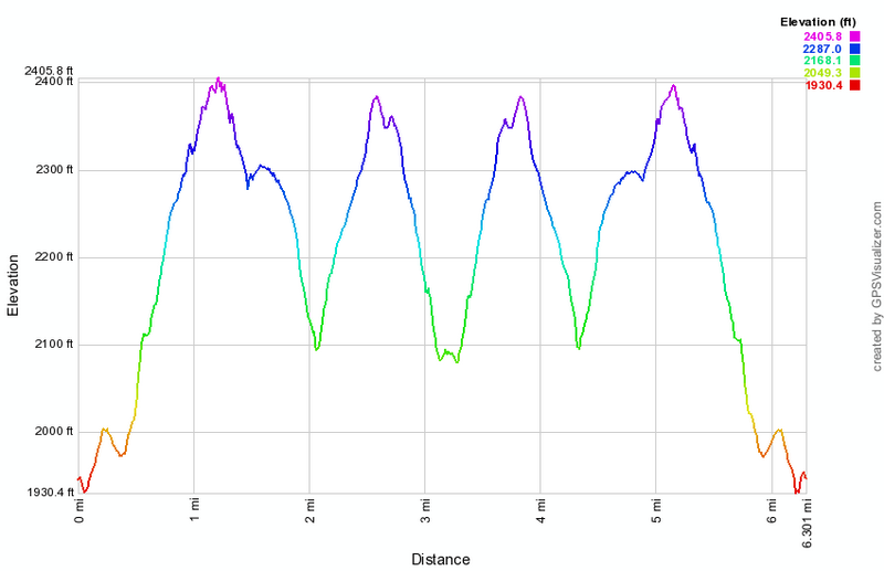 (The image at the left shows the profile of the hike.)
Big Pond to Alder Lake (complete)
| Quick Look | ||||
|---|---|---|---|---|
| Difficulty | Round trip | Total climb | Internet Maps | |
| 6.7 mi. | 1530 ft. | AllTrails | ||
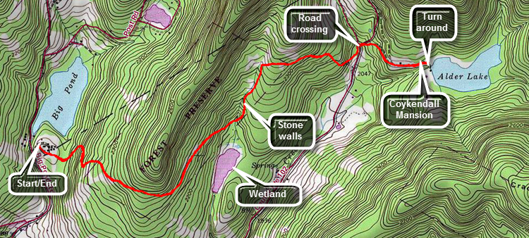 Drive north on Old Route 17 from Livingston Manor toward Roscoe. Turn right on Beaverkill Road and head toward Lew Beach. Drive through the hamlet of Lew Beach and continue on to Turnwood. As the Beaverkill Road makes a turn to the right, continue straight ahead on Barkaboom Road toward Big Pond. After less than a mile, turn right into the upper parking area for Big Pond and park in the lot.The trail starts by the trail register in the upper right corner of the lot. Although the trail has several ups and downs, it is sited so that it travels around the higher ridges in the area and sticks to the lower spots on the shoulders of those ridge. Just after the start of the hike begin to ascend along a woods road and continue to walk uphill through a pine forest. The trail had not been maintained for some years but in the Fall of 2015 a group from the Catskill Mountain Club worked on it to put it in good shape. Parts of the trail may have nettles and briars which grow quickly in season. There may be a few large blowdowns but these are usually easy to avoid or easy to climb over. At about a mile begin to descend on another woods road to an area that was once a small pond but is now mostly wetlands. Along the way note the many stonewalls and a few foundations in the area. At 1.75 miles there is a small stream which dries up rather quickly as it connects two wetland areas. Cross the stream and begin to ascend to the shoulder of another ridge from the low wetlands. At 2.2 miles the trail turns right heading east toward Alder Lake. Shortly after that begin to descend for .6 miles to Alder Creek. Cross Alder Creek which may be as easy as simply walking across in the dry seasons or may require you to look for some stepping stones when there has been a heavy rain. Cross Alder Creek Roadand continue straight ahead toward the lake on the access road. Walk through the parking area passing the remains of the Coykendall Mansion> After taking a look at the lake from the "lawn" turn around and retrace your route back to the Big Pond Parking area. Big Pond is several hundred feet below Alder Lake in elevation so the return trip may seem easier.
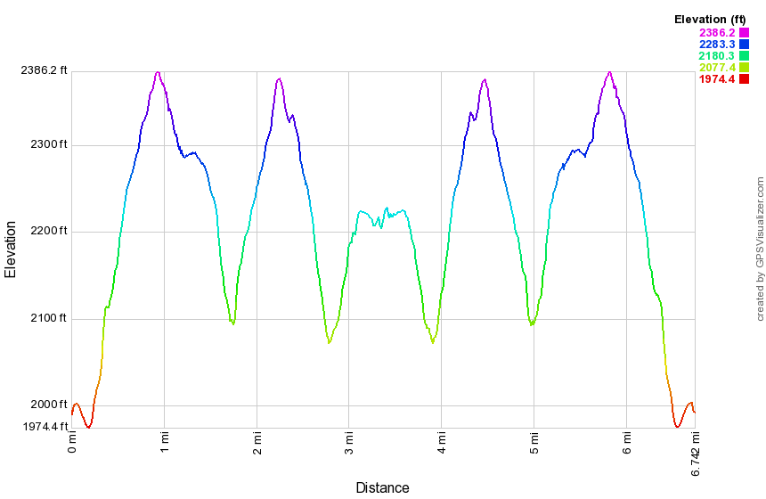 (The image at the left shows the profile of the hike.)
Big Pond to Cabot Mt (road loop)
| Quick Look | ||||
|---|---|---|---|---|
| Difficulty | Round trip | Total climb | Internet Maps | |
| 6.0 mi. | 1605 ft. | AllTrails | ||
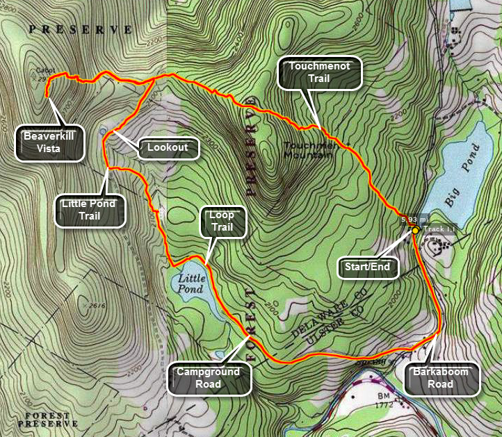 Take the Beaverkill Road from Livingston Manor and drive for about twenty minutes to the intersection
with Barkaboom Rd. Drive up the Barkaboom Rd for less than a mile and park at the forest preserve
parking area. Walk down the access road and up Barkaboom Road for a short distance. The trail begins
on the left and this is where the register is located. In the summer of 2006, there was a sign warning
that the trail was closed at the other end. After bushwhacking the Catskill 35's, I didn't think this
would be much of a problem and I never found the "closed" trail. After another .75 miles, you reach the
top of Touch-Me-Not Mountain. At this point turn right and stay on the red blazed trail. After .5 miles
this intersects with the yellow blazed Little Pond Trail. Stay on the red trail and get ready to climb!
Cabot Mt is only 2970' high but the ascent is somewhat steep. The Beaverkill Vista gives a beautiful
if somewhat restricted view of the Beaverkill valley. Turn around and descend Cabot. This time turn left
on the Little Pond Trail which leads to the campground access road. Follow this road out to the bathrooms
and main buildings. At this point you may take the blue Campground Trail 1.15 miles until it meets the
red Touch-Me-Not Trail. Retrace your steps back to your car at Big Pond. You may also walk .85 miles out
the Little Pond Campgrounds access road and turn left on Barkaboom Road. After .5 miles you will be back
at the car.
Take the Beaverkill Road from Livingston Manor and drive for about twenty minutes to the intersection
with Barkaboom Rd. Drive up the Barkaboom Rd for less than a mile and park at the forest preserve
parking area. Walk down the access road and up Barkaboom Road for a short distance. The trail begins
on the left and this is where the register is located. In the summer of 2006, there was a sign warning
that the trail was closed at the other end. After bushwhacking the Catskill 35's, I didn't think this
would be much of a problem and I never found the "closed" trail. After another .75 miles, you reach the
top of Touch-Me-Not Mountain. At this point turn right and stay on the red blazed trail. After .5 miles
this intersects with the yellow blazed Little Pond Trail. Stay on the red trail and get ready to climb!
Cabot Mt is only 2970' high but the ascent is somewhat steep. The Beaverkill Vista gives a beautiful
if somewhat restricted view of the Beaverkill valley. Turn around and descend Cabot. This time turn left
on the Little Pond Trail which leads to the campground access road. Follow this road out to the bathrooms
and main buildings. At this point you may take the blue Campground Trail 1.15 miles until it meets the
red Touch-Me-Not Trail. Retrace your steps back to your car at Big Pond. You may also walk .85 miles out
the Little Pond Campgrounds access road and turn left on Barkaboom Road. After .5 miles you will be back
at the car.
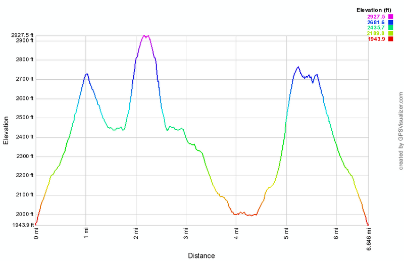 (The image at the left shows the profile of the hike. The highest point is the summit of Cabot Mountain. The lowest spot is the junction of the access road and Barkaboom Road.)
Big Pond to Cabot Mt (trail loop)
| Quick Look | ||||
|---|---|---|---|---|
| Difficulty | Round trip | Total climb | Internet Maps | |
| 6.6 mi. (east side of Little Pond) 6.6 mi. (west side of Little Pond) |
2260 ft. | AllTrails | ||
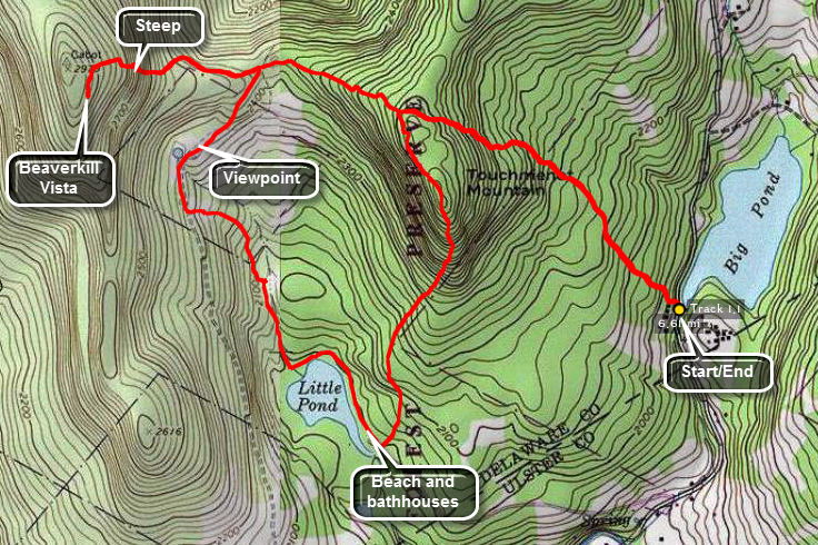 Take the Beaverkill Road from Livingston Manor and drive for about twenty minutes to the intersection
with Barkaboom Rd. Drive up the Barkaboom Rd for less than a mile and park at the forest preserve
parking area. Walk down the access road and up Barkaboom Road for a short distance. The trail begins
on the left and this is where the register is located. In the summer of 2006, there was a sign warning
that the trail was closed at the other end. After bushwhacking the Catskill 35's, I didn't think this
would be much of a problem and I never found the "closed" trail. After another .75 miles, you reach the
top of Touch-Me-Not Mountain. At this point turn right and stay on the red blazed trail. After .5 miles
this intersects with the yellow blazed Little Pond Trail. Stay on the red trail and get ready to climb!
Cabot Mt is only 2970' high but the ascent is somewhat steep. The Beaverkill Vista gives a beautiful
if somewhat restricted view of the Beaverkill Valley with Little Pond below. Turn around and descend Cabot. Turn right
on the Little Pond Trail which leads to the campgrounds. Along the way there is a nice viewpoint about a quarter mile after the trail junction. The field has an old foundation and a small pond. I always think this would be a great place to have a cabin except for the long hike to get there! As you descend from this viewpoint there may be a few small streams to cross. There is also a beaver meadow on the left of the trail. When you get to the Loop Trail around Little Pond, you may turn left or right. Turning to the right allows you to circle Little Pond and adds .2 miles to the trip. Follow the loop trail to the bathrooms and main buildings. At this point find the blue Campground Trail behind the bathrooms. This trail is steep in places as it climb
Mountain for about 1.15 miles until it meets the
red Touch-Me-Not Trail. Turn right and retrace your steps back to your car at Big Pond. From the bathrooms you may also walk .85 miles out
the Little Pond Campgrounds access road and turn left on Barkaboom Road. After .5 miles you will be back
at the car.
Take the Beaverkill Road from Livingston Manor and drive for about twenty minutes to the intersection
with Barkaboom Rd. Drive up the Barkaboom Rd for less than a mile and park at the forest preserve
parking area. Walk down the access road and up Barkaboom Road for a short distance. The trail begins
on the left and this is where the register is located. In the summer of 2006, there was a sign warning
that the trail was closed at the other end. After bushwhacking the Catskill 35's, I didn't think this
would be much of a problem and I never found the "closed" trail. After another .75 miles, you reach the
top of Touch-Me-Not Mountain. At this point turn right and stay on the red blazed trail. After .5 miles
this intersects with the yellow blazed Little Pond Trail. Stay on the red trail and get ready to climb!
Cabot Mt is only 2970' high but the ascent is somewhat steep. The Beaverkill Vista gives a beautiful
if somewhat restricted view of the Beaverkill Valley with Little Pond below. Turn around and descend Cabot. Turn right
on the Little Pond Trail which leads to the campgrounds. Along the way there is a nice viewpoint about a quarter mile after the trail junction. The field has an old foundation and a small pond. I always think this would be a great place to have a cabin except for the long hike to get there! As you descend from this viewpoint there may be a few small streams to cross. There is also a beaver meadow on the left of the trail. When you get to the Loop Trail around Little Pond, you may turn left or right. Turning to the right allows you to circle Little Pond and adds .2 miles to the trip. Follow the loop trail to the bathrooms and main buildings. At this point find the blue Campground Trail behind the bathrooms. This trail is steep in places as it climb
Mountain for about 1.15 miles until it meets the
red Touch-Me-Not Trail. Turn right and retrace your steps back to your car at Big Pond. From the bathrooms you may also walk .85 miles out
the Little Pond Campgrounds access road and turn left on Barkaboom Road. After .5 miles you will be back
at the car.
 (The image at the left shows the profile of the hike. The highest point is the summit of Cabot Mountain.)
Big Pond to Little Pond (road loop)
| Quick Look | ||||
|---|---|---|---|---|
| Difficulty | Round trip | Total climb | Internet Maps | |
| 4.8 mi. (west side of Little Pond) | 997 ft. | AllTrails | ||
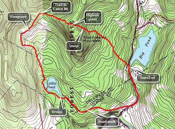 Take the Beaverkill Road from Livingston Manor and drive for about twenty minutes to the intersection with Barkaboom Rd. Drive up the Barkaboom Rd for less than a mile and park at the parking area near Big Pond. Walk across the road to the where the trail starts just north of the parking area. The first part of the trail is an old woods road and it is pretty easy to follow. The trail register is a short distance off the road. The first mile of the trail gains about 775 feet with an average grade of 15%. Some places are almost flat which means there are a few steeper places. The blazing of the trail has been extremely poor with most blazes placed too far apart. None of the turns are properly marked. When there is no snow on the ground the trail is usually easy to spot. In a few places the trail travels along the side of the hill and this can make for some tricky footing when the trail is wet or snow covered. This trail also can be covered in nettles when they are in season. The highest point on the trail is the shoulder of Touch-Me-Not Mountain. After a slight descent turn right on the yellow loop trail around Little Pond. The loop trail is very popular with campers during the season but the marking is no better than the trail from Big Pond. At 1.6 miles you will have descended through some interesting rock formations and be at the cutoff to Cabot Mountain. Continued your hike by bearing left to stay on the loop trail. At 1.8 miles you will arrive in the clearing that acts as a viewpoint. It is hard to see Little Pond from this lookout since the trees have grown up. There is also a small foundation of a long-forgotten homestead cabin. Continue to walk out a woods road from the clearing now heading south and in a few hundred feet turn left to head south to the northern shore of Little Pond. At the pond turn right to walk around the western shore of Little Pond. The view of the pond from the boat launch area is very nice with Touch-Me-Not Mountain directly across the water. Watch for a trail that turns left off the campsite road and heads to the bridge at the outlet of Little Pond. Cross the bridge and walk to the parking area. Turn right and walk on the road to the gatehouse. Walk a little less than a mile down to Barkaboom Road and turn left to hike up the road back to Big Pond where your car is parked.
 (The image shows the profile of the hike. The highest point is the shoulder of Touch-Me-Not Mountain.)
Big Pond to Touchmenot Mt
| Quick Look | ||||
|---|---|---|---|---|
| Difficulty | Round trip | Total climb | Internet Maps | |
| 2.4 mi. | 916 ft. | AllTrails | ||
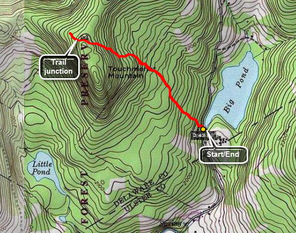 Take the Beaverkill Road from Livingston Manor and drive for about twenty minutes to the intersection
with Barkaboom Rd. Drive up the Barkaboom Rd for less than a mile and park at the forest preserve
parking area. Walk down the access road and up Barkaboom Road for a short distance. The trail begins
on the left and this is where the register is located. In the summer of 2006, there was a sign warning
that the trail was closed at the other end. After bushwhacking the Catskill 35's, I didn't think this
would be much of a problem and I never found the "closed" trail. After another .75 miles, you reach the
top of Touch-Me-Not Mountain. At this point turn right and stay on the red blazed trail. After .5 miles
this intersects with the yellow blazed Little Pond Trail. Stay on the red trail and get ready to climb!
Cabot Mt is only 2970' high but the ascent is somewhat steep. The Beaverkill Vista gives a beautiful
if somewhat restricted view of the Beaverkill valley. Turn around and descend Cabot. This time turn left
on the Little Pond Trail which leads to the campground access road. Follow this road out to the bathrooms
and main buildings. At this point you may take the blue Campground Trail 1.15 miles until it meets the
red Touch-Me-Not Trail. Retrace your steps back to your car at Bog Pond. You may also walk .85 miles out
the Little Pond Campgrounds access road and turn left on Barkaboom Road. After .5 miles you will be back
at the car.
Take the Beaverkill Road from Livingston Manor and drive for about twenty minutes to the intersection
with Barkaboom Rd. Drive up the Barkaboom Rd for less than a mile and park at the forest preserve
parking area. Walk down the access road and up Barkaboom Road for a short distance. The trail begins
on the left and this is where the register is located. In the summer of 2006, there was a sign warning
that the trail was closed at the other end. After bushwhacking the Catskill 35's, I didn't think this
would be much of a problem and I never found the "closed" trail. After another .75 miles, you reach the
top of Touch-Me-Not Mountain. At this point turn right and stay on the red blazed trail. After .5 miles
this intersects with the yellow blazed Little Pond Trail. Stay on the red trail and get ready to climb!
Cabot Mt is only 2970' high but the ascent is somewhat steep. The Beaverkill Vista gives a beautiful
if somewhat restricted view of the Beaverkill valley. Turn around and descend Cabot. This time turn left
on the Little Pond Trail which leads to the campground access road. Follow this road out to the bathrooms
and main buildings. At this point you may take the blue Campground Trail 1.15 miles until it meets the
red Touch-Me-Not Trail. Retrace your steps back to your car at Bog Pond. You may also walk .85 miles out
the Little Pond Campgrounds access road and turn left on Barkaboom Road. After .5 miles you will be back
at the car.
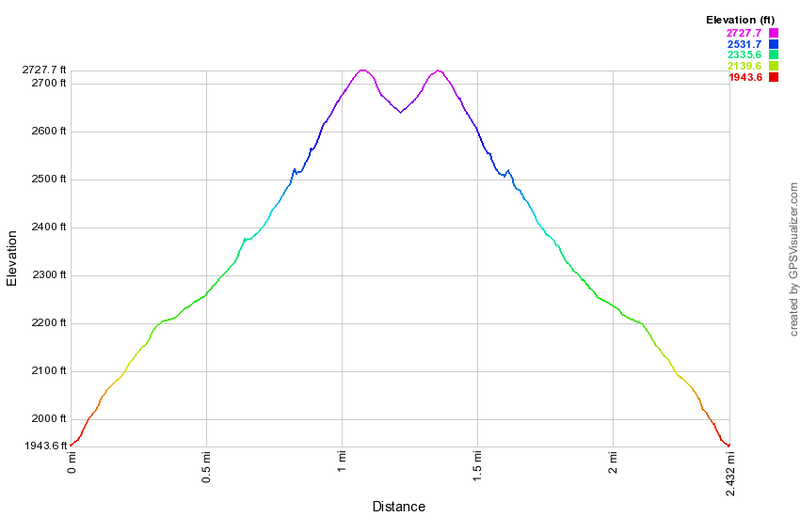 (The image at the left shows the profile of the hike.)
Bramley Mountain (Glen Burnie Road)
| Quick Look | ||||
|---|---|---|---|---|
| Difficulty | Round trip | Total climb | Internet Maps | |
| 2.9 mi. | 920 ft. | AllTrails | ||
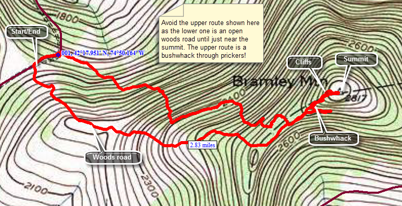 From Delhi, NY head north and east on Route 10. In East Delhi cross the river at the Fitches Covered Bridge and turn left on County Route 18. After about 2 miles turn right on Glen Burnie Road and start to look for DEP signs. After a little over .5 miles there will be a woods road on the left with a gate and some room to pull over on the side of the road. DO NOT park here and take this road. Drive a little further and you will find found another woods road with another pulloff on the left. This woods road will lead almost directly to the summit of Bramley Mountain. Follow the road fro about 1.1 miles and you will find that if you continue straight ahead the road will skirt the summit. You will have to bushwhack to your left to get to the summit. The prickers here can be rather thick at times! When you run into some cliffs find a way through them and walk the short distance to the summit. You will find the piers for the firetower are still in place and a USGS marker is located nearby. Walk south to s lookout with limited views. When you are ready, return the way you came.
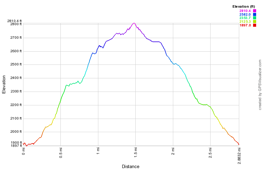 (The image at the left shows the profile of the hike. Remember that all vertical profiles are relative!)
Bramley Mountain: New Trails
| Quick Look | ||||
|---|---|---|---|---|
| Difficulty | Round trip | Total climb | Internet Maps | |
| 3.7 mi. | 950 ft. | AllTrails | ||
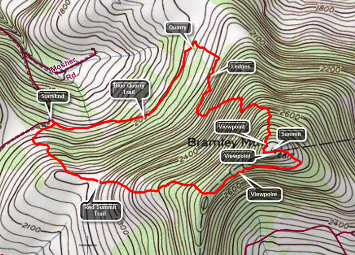 From Delhi, NY head north and east on Route 10. In East Delhi cross the river at the Fitches Covered Bridge and turn left on County Route 18. After about 2 miles turn right on Glen Burnie Road and start to look for DEP signs. After a little over .5 miles there will be a woods road on the left with a gate and some room to pull over on the side of the road. There is a trail kiosk near the gate. Park here to begin your hike with a choice of trails.
The red Summit Trail goes to the right directly to the summit over 1.8 miles.The blue Quarry Trail goes straight ahead and passes through a quarry before wending its way to the summit over 2.1 miles. Walk straight ahead on the blue Quarry Trail which follows a woods road that is very open but can be damp and muddy in some places. At about .8 miles the trail passes through the quarry and splits with blue markers going both left and right. Head to the right as the trail enters the woods and immediately turns almost 180 degrees. The trail alternates between paralleling the ridge and then heading up the mountain several times before making the final ascent. Eventually the trail turns and begins a steady climb up to the summit. It passes by several interesting ledges and rock formations. There are numerous switchbacks which make the walk longer but mitigate some of the steeper climbs. Near the top the trail passes around and through some rock ledges and the trail crew has expertly created some steps out of natural materials. Near the top at about 1.9 miles and just before the summit is a nice viewpoint with a stone bench. Turn left here and follow the trail too the summit which is only a few hundred feet away. Over the 1.1 miles from the quarry the trail gains 770 feet with and overall average grade of 13% despite the many switchbacks. At the summit you will notice the concrete pilings for the fire tower. There is also a lookout to the south and southeast and the Pisgahs near Andes are clearly visible. They were once the site of a ski area. Return to the summit and walk in the direction that the arrow points to follow markers for the red Summit Trail that will return you to the parking area. The Summit Trail starts out as wide woods road but at .15 miles from the summit a sign clearly indicates a right turn. The trail follows another woods road that is more open but is often covered in long grass. Along the ridge there is a nice view off to the left. Continue to follow the woods road as it entered the woods. As the trail approaches the road it turns right and enters the woods to start downhill to the car. This part of the trail is soft and easy walking but only lasts .15 miles until you are back at the parking area.
From Delhi, NY head north and east on Route 10. In East Delhi cross the river at the Fitches Covered Bridge and turn left on County Route 18. After about 2 miles turn right on Glen Burnie Road and start to look for DEP signs. After a little over .5 miles there will be a woods road on the left with a gate and some room to pull over on the side of the road. There is a trail kiosk near the gate. Park here to begin your hike with a choice of trails.
The red Summit Trail goes to the right directly to the summit over 1.8 miles.The blue Quarry Trail goes straight ahead and passes through a quarry before wending its way to the summit over 2.1 miles. Walk straight ahead on the blue Quarry Trail which follows a woods road that is very open but can be damp and muddy in some places. At about .8 miles the trail passes through the quarry and splits with blue markers going both left and right. Head to the right as the trail enters the woods and immediately turns almost 180 degrees. The trail alternates between paralleling the ridge and then heading up the mountain several times before making the final ascent. Eventually the trail turns and begins a steady climb up to the summit. It passes by several interesting ledges and rock formations. There are numerous switchbacks which make the walk longer but mitigate some of the steeper climbs. Near the top the trail passes around and through some rock ledges and the trail crew has expertly created some steps out of natural materials. Near the top at about 1.9 miles and just before the summit is a nice viewpoint with a stone bench. Turn left here and follow the trail too the summit which is only a few hundred feet away. Over the 1.1 miles from the quarry the trail gains 770 feet with and overall average grade of 13% despite the many switchbacks. At the summit you will notice the concrete pilings for the fire tower. There is also a lookout to the south and southeast and the Pisgahs near Andes are clearly visible. They were once the site of a ski area. Return to the summit and walk in the direction that the arrow points to follow markers for the red Summit Trail that will return you to the parking area. The Summit Trail starts out as wide woods road but at .15 miles from the summit a sign clearly indicates a right turn. The trail follows another woods road that is more open but is often covered in long grass. Along the ridge there is a nice view off to the left. Continue to follow the woods road as it entered the woods. As the trail approaches the road it turns right and enters the woods to start downhill to the car. This part of the trail is soft and easy walking but only lasts .15 miles until you are back at the parking area.
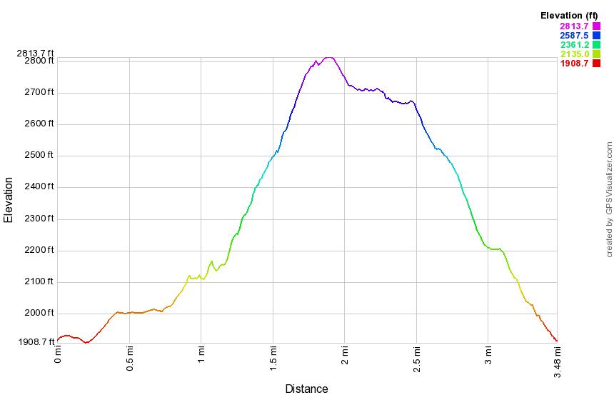 (The image at the left shows the profile of the hike. Remember that all vertical profiles are relative!)
Brock Mountain to Berry Brook Rd
| Quick Look | ||||
|---|---|---|---|---|
| Difficulty | Round trip | Total climb | Internet Maps | |
| 6.4 mi. | 1824 ft. | AllTrails | ||
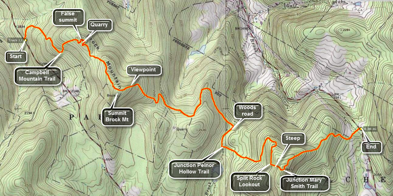 This is a one way hike that requires a car shuttle or you will have to double the distance. Another option is to have someone pick you up at the other end. Head out of Roscoe on Route 206. Turn right on Berry Brook Road just after the county line and drive for around 8 miles to the trail head parking on the right. Drop one car here and continue on Berry Brook Road to Route 30 on the Pepacton Reservoir. Turn left and continue around the reservoir to the junction with Route 206/Route 7. Turn left and drive 2.2 miles to a small parking area on the right side of the road. Park here and cross the road to pick up the blue-blazed Campbell Mountain Trail.
The trail is a wide woods road at the beginning and stays this way for most of its length. There is an immediate ascent through hardwood forest. Hiking this trail can be a real pain or a great pleasure depending on the trail maintenance. This trail is part of the Finger Lakes Trail system and is maintained by their volunteers. Blowdowns can be a problem but the bigger problem is the dense stands of prickers that can obscure the trail. For the first .5 miles the trail gains 450 feet with a few short but steep climbs. After that, it goes through the first of several switchbacks to give hikers a rest before gaining another 230 feet over the next .4 miles. At about 1 mile you reach the false summit of Brock Mountain which, on many maps and GPS units, is marked as Brock Mountain. In this area you may begin to notice piles of rock that do not look natural. There is a rather large quarry off the trail to the left. You may be able to find a woods road that leads to it but the bushwhack is easy. You will see piles of rock and a large and deep pit. When you have explored, work your way back up out of the pit and back to the trail. Back on the trail it is time to tackle the rest of the ascent up the "real" Brock Mountain. After a slight descent from the false summit, the trail ascends about 300 feet to the top of Brock Mountain at about 1.9 miles into the hike. The trail does not actually pass over the highest point on the mountain where there is purported to be a USGS benchmark but it tops out at about 2440 feet. As you start down the other side of Brock Mountain there will be a rather steep descent. Many of the trees are dead and this allows for some interesting views of the valley with another ridge beyond. Continue the hike over trail but be careful to pay close attention to where you are hiking! There are numerous paths and woods roads that cut across the main trail and the trail markers can be few and far between. At about 2.4 miles the trail heads north and then southeast after a short distance. This prominent switchback is not shown on the NYNJTC maps and can be a little confusing. At 3 miles the trail turns almost 90 degrees to the right and heads northeast. Shortly after this, at 3.3 miles, there is another 90 degrees turn to the right and the trail heads southeast. In both cases there are snowmobile trails or woods roads in the area of the turns. There are really no views along the way but the woods can be pretty in any season. In some places there are stone walls and the hint of a foundation. At 3.85 there is another 90 degree turn to the right onto an old road which is eroded but very recognizable with stone walls on both sides. The is a slight uphill but the trail is mostly level for the next .3 miles. At this point the Campbell Mountain Trail ends. To the right is the Little Spring Brook Trail that leads out to Route 206. Turn left onto the Pelnor Hollow Trail. In the next 1 mile the trail climbs over 400 feet through mixed hardwood and evergreen forest. There are some steeper climbs in places along this stretch. Near the top of this climb the trail levels and your reward is the Split Rock Lookout. At the lookout there is a large boulder and an area where part of the bedrock has separated. The views to the west are very good but there isn't much to see other than trees and mountains except for one house on the far ridge. The lookout is about 5.2 miles into the hike. From the lookout the trail ascends for about .1 miles at a 26% grade. This isn't very far but it looks like a WALL from the bottom. At 5.3 miles, turn left on the red Mary Smith Trail as the Pelnor Hollow Trail continues straight ahead. The Mary Smith Trail is an almost continuous downhill to Berry Brook Road. There are a few tricky descent through rocks and around trees. After 1.1 miles and a drop of over 500 feet you should be back at the car. When you come out of the woods and cross the power line right-of-way, watch for the point where the trail reenters the woods on the other side.
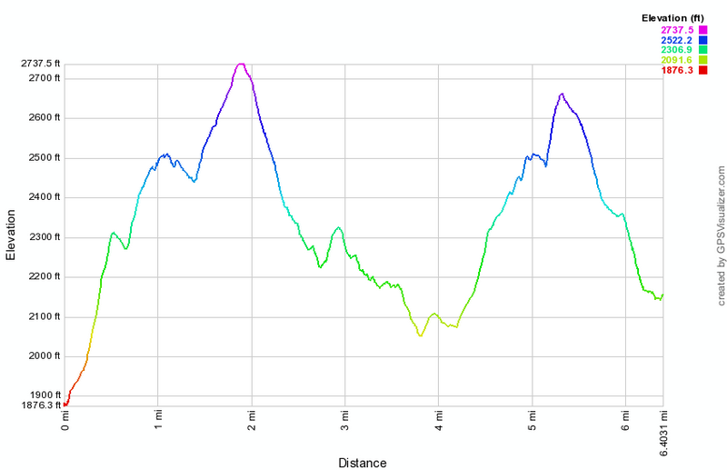 (The image at the left shows the profile of the hike. Remember that all vertical profiles are relative!)
Burnt Knob
| Quick Look | ||||
|---|---|---|---|---|
| Difficulty | Round trip | Total climb | Internet Maps | |
| 3.8 mi | 1330 ft | AllTrails | ||
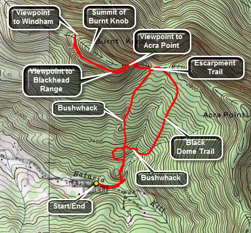 Park at trail head parking area on Black Dome or Big Hollow Road. Be aware that past a certain
point this road is considered seasonal and may not be plowed or maintained. During the winter
the trailhead parking is almost never plowed and parking is limited along the shoulders of the road.
The trail head is just BEFORE the parking area on the right. Find the red-blazed Black Dome Trail
and immediately cross the Batavia Kill on a bridge. After a short walk, re-cross the Batavia Kill
and continue on the Trail for about 1.1 miles. Look over your shoulder occasionally to see the
imposing presence of Blackhead, Black Dome and Thomas Cole Mountains. This walk winds its way
upward through mixed hardwood and spruce forest until it meets the blue-blazed Escarpment Trail.
Park at trail head parking area on Black Dome or Big Hollow Road. Be aware that past a certain
point this road is considered seasonal and may not be plowed or maintained. During the winter
the trailhead parking is almost never plowed and parking is limited along the shoulders of the road.
The trail head is just BEFORE the parking area on the right. Find the red-blazed Black Dome Trail
and immediately cross the Batavia Kill on a bridge. After a short walk, re-cross the Batavia Kill
and continue on the Trail for about 1.1 miles. Look over your shoulder occasionally to see the
imposing presence of Blackhead, Black Dome and Thomas Cole Mountains. This walk winds its way
upward through mixed hardwood and spruce forest until it meets the blue-blazed Escarpment Trail.
When the streams are running high, you may be unable to make the second crossing after the bridge without running the risk of getting very wet at the beginning of the hike! The map shown was created at such a time. It shows a bushwhack route up the west side of the stream. The bushwhack meets the Escarpment Trail just west of the "official" point which is marked by a sign.
Turn left on The Escarpment Trail and head toward Burnt Knob. The terrain now is more rugged and steeper. There is a hint of views to both the north and south on both sides of the trail but they are not clear. The final ascent onto Burnt Knob is a little steep requiring some help from your poles or surrounding roots and trees. At the top of this short but steep ascent there is a nice view to the north of the valley and a view to the east toward Acra Point. Continue on this trail for a short distance until a short spur leads of to the right. This viewpoint offers an unobstructed view of the Black Dome Valley, Acra Point and the Blackhead Range. This is a good place to stop and enjoy a snack and the view. This area is only about .35 miles from the junction with the Black Dome trail and less if you did the bushwhack.
Continue on for another .35 miles until the trail starts to descend. From here you can see Windham mountain and get some views to the south. Return by retracing your path on the trail or the bushwhack. You can return on the Black Dome Trail even if you bushwhacked up. Before the first water crossing, turn right or west for a short distance until you come to the Batavia Kill. Cross here and walk up to the top of the ridge. You should find the track of your bushwhack up. Follow this track to bushwhack back to the trail register and the parking area.
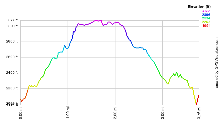 (The image at the left shows the profile of the hike. Remember that all vertical profiles are
relative!)
(The image at the left shows the profile of the hike. Remember that all vertical profiles are
relative!)
Burnt Knob and Acra Point
| Quick Look | ||||
|---|---|---|---|---|
| Difficulty | Round trip | Total climb | Internet Maps | |
| 6.5 mi | 1730 ft | AllTrails | ||
_map.png) Park at trail head parking area on Black Dome or Big Hollow Road. Be aware that past a certain
point this road is considered seasonal and may not be plowed or maintained. During the winter
the trailhead parking is almost never plowed and parking is limited along the shoulders of the road.
The trail head is just BEFORE the parking area on the left. Find the red-blazed Black Dome Trail
and immediately cross the Batavia Kill on a bridge. Immediately re-cross the Batavia Kill
and continue on the trail for about 1.1 miles where you will meet the blue Escarpment Trail. When the streams are running high, you may be unable to make the second crossing after the bridge without running the risk of getting very wet at the beginning of the hike! Look over your shoulder occasionally to see the
imposing presence of Blackhead, Black Dome and Thomas Cole Mountains.
Park at trail head parking area on Black Dome or Big Hollow Road. Be aware that past a certain
point this road is considered seasonal and may not be plowed or maintained. During the winter
the trailhead parking is almost never plowed and parking is limited along the shoulders of the road.
The trail head is just BEFORE the parking area on the left. Find the red-blazed Black Dome Trail
and immediately cross the Batavia Kill on a bridge. Immediately re-cross the Batavia Kill
and continue on the trail for about 1.1 miles where you will meet the blue Escarpment Trail. When the streams are running high, you may be unable to make the second crossing after the bridge without running the risk of getting very wet at the beginning of the hike! Look over your shoulder occasionally to see the
imposing presence of Blackhead, Black Dome and Thomas Cole Mountains.
Turn left on The Escarpment Trail and head toward Burnt Knob. The terrain now is more rugged and steeper. There is a hint of views to both the north and south on both sides of the trail but they are not clear. The final ascent onto Burnt Knob is a little steep requiring some help from your poles or surrounding roots and trees. At the top of this short but steep ascent there is a nice view to the north of the valley and a view to the east toward Acra Point. Continue on this trail for a short distance until a short spur leads of to the left at about 1.4 miles. This viewpoint offers an unobstructed view of the Black Dome Valley, Acra Point and the Blackhead Range. This is a good place to stop and enjoy a snack and the view. From this viewpoint start your bushwhack to the top of the ridge by heading straight up the spur trail and climbing UP. The bushwhack up and along the ridge to the highest point is only about .3 miles. From the top head southwest and DOWN until you meet the Escarpment Trail. Turn left to head east toward Acra Point. Pass by the turn to the parking area on The Black Dome Trail and continue up the hill to the east. At about 2.7 miles watch for a spur trail to the right which leads to another nice lookout. This one looks down the Black Dome valley and has a great view of the Blackhead Range. Spend some time here and then go back to the Escarpment Trail and turn right to walk another .5 miles to the highest spot on Acra Point. Continue along the trail to 4.9 miles where you will meet the Batavia Kill Trail. Along the way there are several ups and downs. Turn right at the trail junction to get back to your car. This last part is 1.6 miles but it is all downhill!
_gra.png) (The image at the left shows the profile of the hike. Remember that all vertical profiles are relative!)
(The image at the left shows the profile of the hike. Remember that all vertical profiles are relative!)
Cabot Mountain from Beech Hill Road
| Quick Look | ||||
|---|---|---|---|---|
| Difficulty | Round trip | Total climb | Internet Maps | |
| 3.2 mi. | 917 ft. | AllTrails | ||
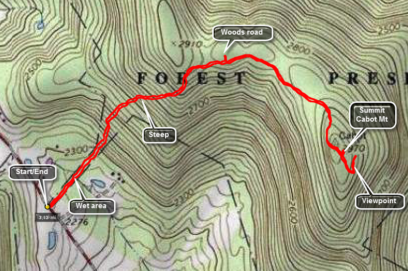
Head toward Lew Beach on the Beaverkill Road from Livingston Manor. Pass through Lew Beach toward Turnwood. Watch for a right hand turn with a road sign for Beech Hill Road. Drive up the road for about 2.6 miles and park at the parking area on the right. The hike to the Beaverkill Vista viewpoint and back is only be about 3 miles but part of it is steep. The first part of the trail is flat and actually descends a little and it almost always wet. At about .25 miles into the hike the trail starts to ascend and gains 575 feet over the next .5 miles. The grade is around 25% in most places! After this point the trail flattens out and rolls a little along the way to the viewpoint. At .85 miles you may notice what looks like a road off the trail on the left. I don't know much about it but it does look very much like a road. Continue without much change in elevation to 1.25 miles where the trail ascends again and then drops a little to the vista at 1.6 miles. Turn around to retrace your steps back to the car. The challenge on the way back is to descend safely on the steeper slopes but the return is almost always faster. We were back at the car by 2:40 PM having covered 3.2 miles in just under 2 hours. The trip up took 1 hour and 10 minutes. The return journey was completed in 45 minutes.
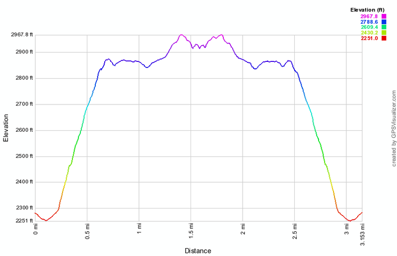 (The image at the left shows the profile of the out and back hike. )
Cabot Mountain from Big Pond (out and back)
| Quick Look | ||||
|---|---|---|---|---|
| Difficulty | Round trip | Total climb | Internet Maps | |
| 4.4 mi. | 1635 ft. | AllTrails | ||
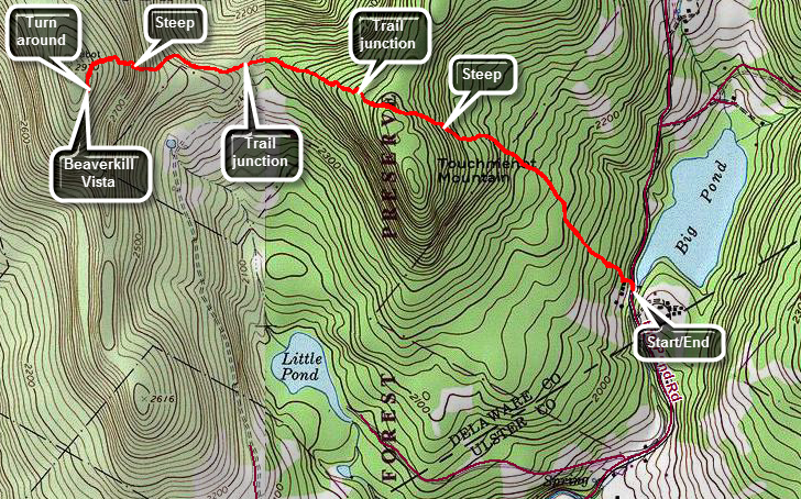
Head toward Lew Beach on the Beaverkill Road from Livingston Manor. Pass through Lew Beach toward Turnwood. Where the Beaverkill Road turns to the right just before the Turnwood Store, turn left on Barkaboom Road and drive a short distance to the parking area on the right just before Big Pond. Cross the road and start up the trail which is well marked and maintained. The trail starts rising right from the road and continues to gain elevation for just over one mile to the highest point on Tocuh-Me-Not Mountain gaining almost 800 feet along the way. Continue over the highest point on Touch-Me-Not Mountain to the trail junction with the Campground Trail. Stay to the right on the Touch-Me-Not Trail and continue to descend to about 1.6 miles where the trail meets the Little Pond Loop Trail on the left. At the junction continue straight ahead on the Touch-Me-Not Trail and prepare for the climb up Cabot Mountain. Walk along a fairly flat section of trail toward Cabot Mountain until at 1.8 miles the trail turns a little to the left and starts the ascent up Cabot Mountain. This area is often covered in nettles when they are in season! Soon you will be climbing the steep sections that pass through several different rock formations. There are several parts to the climb and each is tricky in its own way. Over the next .4 miles the trail gains 470 feet of elevation at an average grade of 24%. After the last section, the trail flattens as it follows a plateau to the Beaverkill Vista at 2.2 miles. Spend some time at the vista and the turn around and return the way you came. If you wish there are other variations on the hike which can be found elsewhere in these trail descriptions.
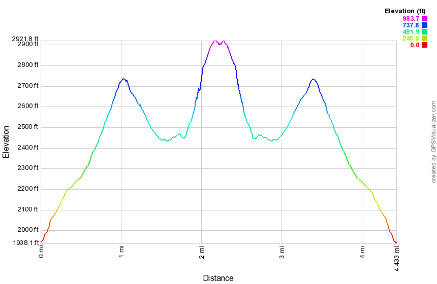 (The image at the left shows the profile of the out and back hike. )
Campbell Brook: Campbell Brook Loop
| Quick Look | ||||
|---|---|---|---|---|
| Difficulty | Round trip | Total climb | Internet Maps | |
| 7.5 mi. | 1622 ft. | AllTrails | ||
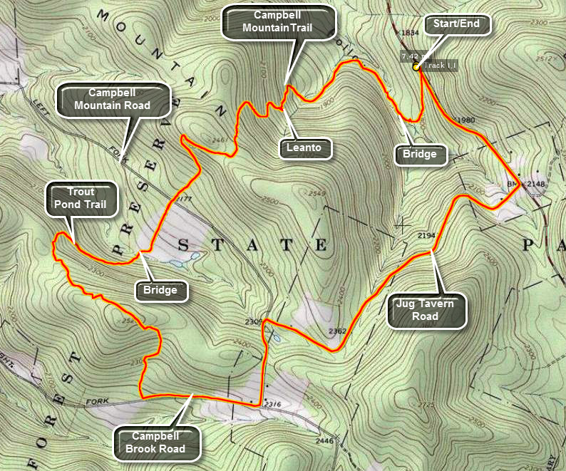
Head out of Roscoe on Route 206. As you crest Cat Hollow and start down the other side, there is a small parking area on the left side of the road after Jug Tavern Road. Park here and sign in at the trail registry. Walk down the woods road and cross a small brook which may be high when there has been significant rain or snow melt. In this area are several old foundations to explore. Walk along the trail by the brook and cross on the footbridge. The trail now begins to ascend Campbell Mountain and can be wet with running water. At about 1.2 miles there is a sharp turn or switchback to the left but it is well marked. The trail continues to ascend rather steeply and at 1.3 miles is a lean-to with privy. The highest point on the trail (2430 feet) is reached at around 1.9 miles. Continue on down the other side of the hill to Campbell Brook Road at 2.4 miles. Cross the road here and pick up the Trout Pond Trail on the other side. The trail continues to descend until you cross the bridge over Campbell Brook at 2.75 miles.From there it is a 1 mile climb to the highest point on the hike at 2510 feet. Head down the other side to Campbell Brook Road at 4.3 miles. From here it is a 3.2 mile road walk back to the car. Turn left on Campbell Brook Road. Make the next left onto Campbell Mountain Road. Turn right at the next intersection on Jug Tavern Road. Stay on Jug Tavern until it meets Route 206. Turn left and walk .7 miles downhill back to the car.
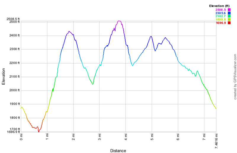 (The image at the left shows the profile of the out and back hike. )
Campbell Brook: Campbell Mountain Loop
| Quick Look | ||||
|---|---|---|---|---|
| Difficulty | Round trip | Total climb | Internet Maps | |
| 5.2 mi. | 1130 ft. | AllTrails | ||
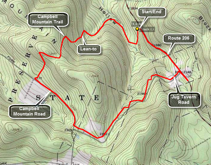
Head out of Roscoe on Route 206. As you crest Cat Hollow and start down the other side, there is a small parking area on the left side of the road after Jug Tavern Road. Park here and sign in at the trail register. Walk down the woods road and cross a small brook which may be high when there has been significant rain or snow melt. In this area are several old foundations to explore. Walk along the trail by the brook and cross on the footbridge. The trail now begins to ascend Campbell Mountain and can be wet with running water. At about 1.2 miles there is a sharp turn or switchback to the left but it is well marked. The trail continues to ascend rather steeply and at 1.3 miles is a lean-to with privy. The highest point on the trail (2430 feet) is reached at around 1.9 miles. Continue on the trail as you descend to Campbell Mountain Road. Turn left on Campbell Mountain Road and walk slightly uphill .7 miles toward the intersection with Jug Tavern Road. At the intersection turn left and continue to hike toward Route 206. There are a few hunting cabins and second homes along the road and several permanent dwellings. After about 1.5 miles turn left on Route 206 and hike downhill to complete the loop.
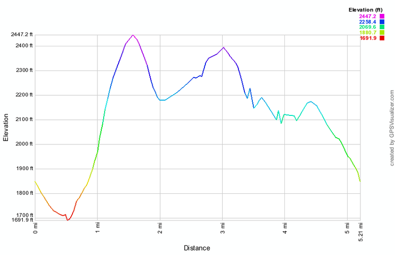
(The image at the left shows the profile of the out and back hike. )
Campbell Brook: Campbell Mountain Out and Back
| Quick Look | ||||
|---|---|---|---|---|
| Difficulty | Round trip | Total climb | Internet Maps | |
| 5.0 mi. | 1270 ft. | AllTrails | ||
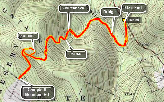
Head out of Roscoe on Route 206. As you crest Cat Hollow and start down the other side, there is
a small parking area on the left side of the road after Jug Tavern Road. Park here and sign in at the trail registry. Walk down the woods road and cross a small brook which may be high when there has been significant rain or snow melt. In this area are several old foundations to explore. Walk along the trail by the brook and cross on the footbridge. The trail now begins to ascend Campbell Mountain and can be wet with running water. At about 1.2 miles there is a sharp turn or switchback to the left but it is well marked. The trail continues to ascend rather steeply and at 1.3 miles is a lean-to with privy. The highest point on the trail (2430 feet) is reached at around 1.9 miles. You can turn around now or walk down to "tag" Campbell Brook Road. This is another .6 miles downhill which you must climb on the return trip. You can also continue and fashion a loop out of the trails and back roads in the area.
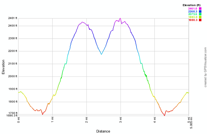 (The image at the left shows the profile of the out and back hike. )
Campbell Brook: Trout Pond to Route 206
| Quick Look | ||||
|---|---|---|---|---|
| Difficulty | Round trip | Total climb | Internet Maps | |
| 12.4 mi. | 2700 ft. | AllTrails | ||
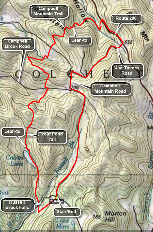 About half of this hike is on trails and the other half on back roads. Even the roads are scenic so
you don't lose much walking along them. The initial part is the same as the Trout Pond hike.
About half of this hike is on trails and the other half on back roads. Even the roads are scenic so
you don't lose much walking along them. The initial part is the same as the Trout Pond hike.
Turn left on Morton Hill Road on Route 206 just after the Rockland flats. Bear right up Morton Hill
Road until you see a parking area on the left near the sign indicates Russell Brook Road is closed.
Park here and hike down Russell Brook Road half a mile to the actual trail head. Go over the bridge and
look to your right to see a beautiful waterfall. Explore this area if you like. Back on the trail you
may go to the left or right. Go to the right and walk another 1.5 miles to the head of Trout Pond. The
trail is a gentle uphill all the way with the last quarter mile along the edge of the lake. At the
head of the lake the trail branches right to Campbell Brook. Bear right on stay on the blue-blazed
Trout Pond Trail. This trail continues for another 3.1 miles. On the way you pass over the shoulders
of two unnamed mountains. Campbell Brook and Campbell Mountain Roads are the low points in between.
The trail goes on for another 1.9 miles and up and down another mountain until it meets Route 206.
Turn right on Route 206 and walk .7 miles up the hill until you turn right on Jug Tavern Road.
After walking 1.8 miles along Jug Tavern make a left onto Campbell Brook Road. Continue walking
on this road for 3.15 miles back to the car. Campbell Brook changes to Morton Hill Road after a short
distance but there are no turns.
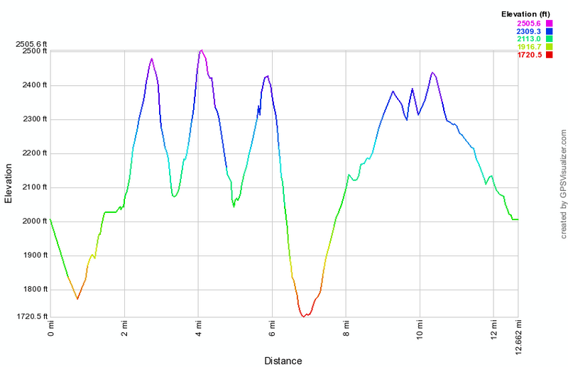 (The image below shows the profile of the hike. The vertical ascents and descent are not as
pronounced as shown here since they are exaggerated by the overall distance. The first low point is
the trail head register at Russell Brook. The second is at the base of the climb up to Route 206.
You can see that Morton Hill Road is downhill all the way!)
(The image below shows the profile of the hike. The vertical ascents and descent are not as
pronounced as shown here since they are exaggerated by the overall distance. The first low point is
the trail head register at Russell Brook. The second is at the base of the climb up to Route 206.
You can see that Morton Hill Road is downhill all the way!)
Campbell Mountain: Trout Pond to Campbell Mountain Road
| Quick Look | ||||
|---|---|---|---|---|
| Difficulty | Round trip | Total climb | Internet Maps | |
| 5.1 mi. | 1320 ft. | AllTrails | ||
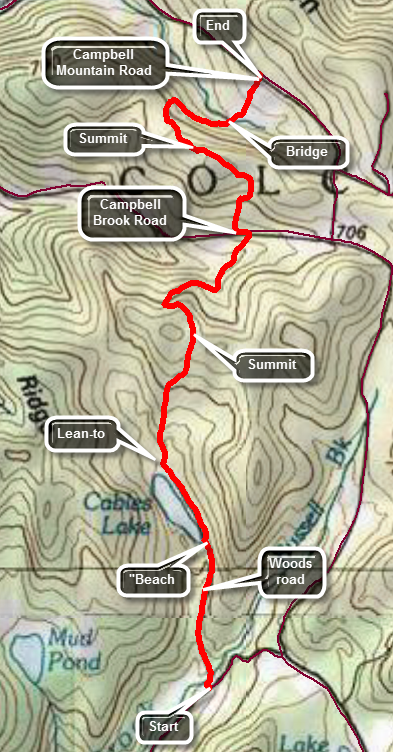 A car spot for this hike is best as it is 5.1 miles one way although an out and back or a loop is certainly possible.
Drive north from Roscoe of Route 206. After cresting the top of Cat Hollow, watch for Jug Tavern Road in the left. Turn left and drive to the end of Jug Tavern Road where it intersects Campbell Mountain Road. Turn right on Campbell Mountain Road and drive about a mile to where the trail crosses the road. Park one car in the small pulloff here. Jump in the other car and drive back out the way you came to Route 206. Turn right and rive back toward Roscoe. Turn right on Morton Hill Road just before the county line and a bridge over the river. Bear right up Morton Hill Road until you see Russell Brook Road on the left. The road is passable from late spring through late fall but is rough. Drive down the road to the lower parking area. From the parking area walk down the wide woods road and cross the bridge over Russell Brook. Look to your right to see a beautiful waterfall. Explore this area if you like. Back on the trail bear right up the hill toward Trout Pond. Walk up the trail for about 1.25 miles to the outlet of Trout Pond. You may walk over to the water and take in the beauty of the pond. Continue on the trail for another .25 miles to the head of the lake. There is one lean-to straight ahead and another on a hill to the left. The trail branching to the right is the one to Campbell Brook Road. Bear right on stay on the blue-blazed
Trout Pond Trail. This trail continues for 1.8 miles passing over the shoulder of an unnamed mountain before descending toward Campbell Brook Road. The trail heads north and the ascent and descent is nearly symmetrical. At 3.2 miles the trail meets Campbell Brook Road and turns left for a few hundred feet on the road before turning right again into the forest. The next part of the trail is not used very much and may be poor blazed and maintained. In the next .5 miles you will gain 335 feet at about a 12% grade to the top of another unnamed hill. From here the trail begins to descend winding from north to northwest before turning east and then northeast as it approached Campbell Mountain Road. From the top of the hill the trail descends until just before the road where there is a slight assent.
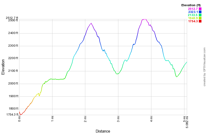 (The image below shows the profile of the hike. The vertical ascents and descent are not as
pronounced as shown here since they are exaggerated by the overall distance. The first low point is
the trail head register at Russell Brook. The second is at the base of the climb up to Route 206.
You can see that Morton Hill Road is downhill all the way!)
(The image below shows the profile of the hike. The vertical ascents and descent are not as
pronounced as shown here since they are exaggerated by the overall distance. The first low point is
the trail head register at Russell Brook. The second is at the base of the climb up to Route 206.
You can see that Morton Hill Road is downhill all the way!)
Campbell Mountain: Campbell Mountain Road to Trout Pond
| Quick Look | ||||
|---|---|---|---|---|
| Difficulty | Round trip | Total climb | Internet Maps | |
| 5.6 mi. | 1040 ft. | AllTrails | ||
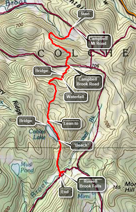 A car spot for this hike is best as it is 5.6 miles one way although an out and back or a loop is certainly possible.
Drive north from Roscoe on Route 206. Just after the Roscoe Nursing Home, turn left on Morton Hill Road. Drive to Russell Brook Road and turn left. Drive down the road to the large parking area. Park one car here. (Russell Brook Road has seasonal maintenance and may be impassable. It is possible to park on the side of Morton Hill Road near the intersection with Russell Brook Road. DO NOT park in the "lot" at the top as this is private property.) Drive back out Russell Brook Road to Morton Hill Road. Turn left and drive to Campbell Mountain Road on the right. Turn right and continue past Jug Tavern Road on the right. Drive to the spot where the trail crosses the road and there is a small parking area. The first .3 miles of the trail drops downhill heading southwest. The trail can often be wet and muddy. At .3 miles the trail begins to climb and turns west. At .75 miles the trail heads south and then southeast. The trail follows old woods roads for almost its entire length and has been eroded by water in may places. At 1.4 miles you will reach the top of the hill and begin a descent. At 1.5 miles the trail heads south toward Campbell Brook Road. The last few hundred feet of the trail is usually wet. At the road turn left and walk a short distance to the point where the trail enters the woods on the right. Descend for about .3 miles to a bridge over a stream. As you begin to ascend the hill, there is a stream to the left of the trail with a nice waterfall when the water is flowing. The trail is sited along an old woods road which was been highly eroded so that it has high sides. Walking on this trail almost has the feel of walking in a canal! The trail turns west in a switchback up the mountain until at 2.9 miles it heads south. At 3 miles the trails tops the hill and passed by a snowmobile trail on the left. Continued down the hill and you will see the water of Trout Pond and the lower lean-to. You may want to walk over to the lean-to to take a break. The bridge over the inlet stream has a nice view of the pond or you can walk out to the shore. Head down the trail to the outlet end of the lake. At the outlet end of the lake, it is worth visiting the "beach" for another view of the pond. The main trail descends toward Russell Brook and can be wet at times. After passing the trail register and trail junction, there is a path on the left which leads to Russell Brook Falls. It is a short walk to the lower falls and it might be the highlight of the hike. Informal paths lead down the streambed and uphill to a viewpoint over the upper falls. When you are back on the main trail, cross the bridge over Russell Brook and walk uphill to the car you left earlier in the parking lot.
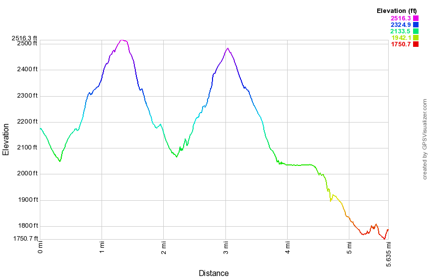 (The image below shows the profile of the hike. The vertical ascents and descent are not as pronounced as shown here since they are exaggerated by the overall distance.)
Cannonsville Bypass on the FLT
| Quick Look | ||||
|---|---|---|---|---|
| Difficulty | Round trip | Total climb | Internet Maps | |
| 4.6 mi. | 590 ft. | AllTrails | ||
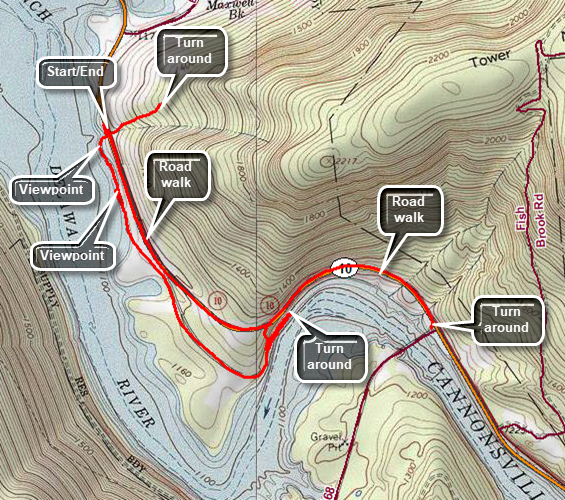 The Finger Lakes Trail is a primitive footpath that starts in Allegheny State Park on the New York - Pennsylvania border and extends 576.5 miles to end in the Catskill Park at the beginning of the Table Peekamoose Trail off the Phoenicia East Branch Trail near the Denning trailhead. There are other side trails which increase the length of the trail system. Four hundred miles of this trail is also part of the Scenic North Country Trail. The Finger Lakes Trail Conference celebrated its 50th Anniversary on June 2, 2012. To commemorate the occasion the Conference set up a series of hikes that would cover the entire length of the trail. Hikes varied in length and difficulty from 4 to 14 miles. The last section is the one described here and is mostly a road walk from The parking area on Black Bear Road (Wild Meadow Road) near Round Pond to the eastern terminus of the trail 1.2 miles from the Denning trailhead.
Take State Route 17 (I86) to exit 87A for Cadosia and find Route 268 north toward Route 10 and the Cannonsville Reservoir. Cross the Apex Bridge and turn 1.7 miles to a small parking pulloff on the left side of the road just after the Finger Lakes Trail bypass intersects the road. Walk back to the east and turn left into the woods on the FLT Bypass trail. This trail may be eroded and poorly marked with faded paint blazes. In .25 miles the trail gains 220 feet on an 18% grade to the intersection with the main FLT. Turn around and walk back down to the road. Cross the road to stay on the bypass trail that runs along the edge of the reservoir. The trail can be poorly maintained with branches across the trail in some places and thick stands of nettles and briars in others. In a short distance the trail reaches the shore of the reservoir. To the west and north are Clabber Peak, Little Clabber and Speedwell. In about .5 miles the trail joins the old path of Route 10. Turn right and walk down toward the water. Watch for the point where the road disappears beneath the water. Turne around and begin to follow the trail which follows the old route of the road. The trail runs through a gravel storage area and then continues along the old road. It passes through some grassy and open areas and then enters the woods. At about 1.6 miles from the road, the trail turns left up the bank. Continue along the road without making the turn. You will pass some cliffs and areas where the edge of the road drops straight down to the water. After less than a quarter mile the road ends. Turn around and walk back to the marked trail. Turn right and walk up the bank to Route 10 following the trail. Turn right and walk along the road to the Apex Bridge parking area. Turn around and walk 1.7 miles back to your car.
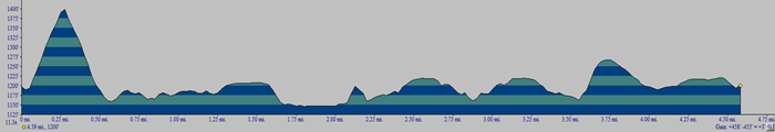 (The image below shows the profile of the hike. The initial vertical ascent and descent smooth out the profile for the rest of the hike.)
Catskill Scenic Trail: Bloomville
| Quick Look | ||||
|---|---|---|---|---|
| Difficulty | Round trip | Total climb | Internet Maps | |
| 5.5 mi. | 280 ft. | AllTrails | ||
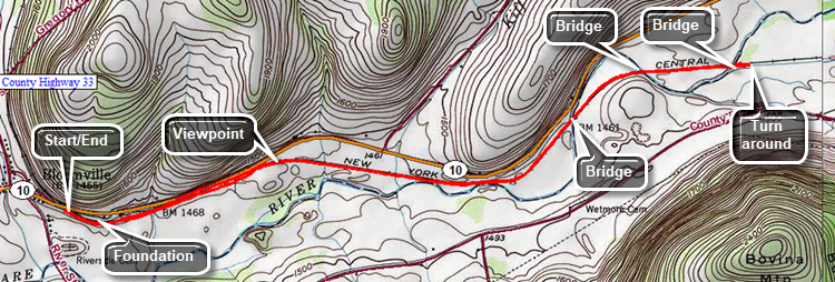
The Catskill Scenic Trail is a rail trail that follows the route of the old O&W and other lines for 19 miles from Bloomville to Grand Gorge. The parking area for the Bloomville trailhead is just east of Bloomville on Route 10. For the most part it is hard packed with some cinder and some short grass here and there. After a short distance, a large, round foundation appears on the left of the trail. A little farther along is a stone marker and next to it a metal housing. Continue on the trail which is mostly shaded until at .75 miles it breaks out into an open field. This continues for some distance. After passing across the field the trail crosses a small stream on a bridge where some trees give a little shade. At 1.6 miles the West Branch of the Delaware River comes close to the trail. At 2 miles cross the first bridge over the river. The builders used the original train bridge as a support structure but built a new treadway and handrails on top of it. At 2.35 miles cross another bridge and another at 2.7 miles. After walking a little farther, turn around and begin the walk back to the parking area. You may, of course, vary the length as you like.
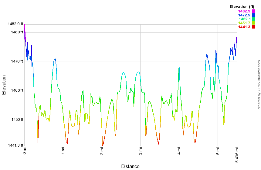
(The image at the left shows the profile of the hike. Remember that all vertical profiles are relative!)
Catskill Scenic Trail: Hobart to Grand Gorge
| Quick Look | ||||
|---|---|---|---|---|
| Difficulty | Round trip | Total climb | Internet Maps | |
| 10.7 mi. | 392 ft. | AllTrails | ||
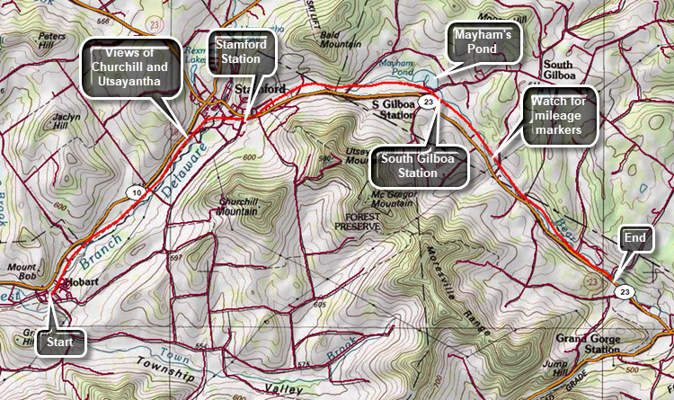
Note: This hike is 10.7 miles ONE WAY. You will want to spot a car or arrange a ride unless you want to walk 21.4 miles! The Catskill Scenic Trail is a rail trail that follows the route of the old O&W and other lines for 19 miles from Bloomville to Grand Gorge. Drive north on Route 10 from Delhi for 17 miles to hobart. Turn right on CR-18 and drive across a beautiful stone bridge over the West Branch of the Delaware River. Park in the bank parking lot on the right on Railroad Avenue. Be sure you are not taking up a space that would be used by customers on a business day. The trail crosses Railroad Avenue and heads northeast through town and the Hobart Industrial Park. For the most part the trail is hard packed dirt with some cinder and some short grass here and there. The trail is wide and flat for its entire length but does gain some elevation on this section before descending toward Grand Gorge. The elevation gain is barely noticeable in all but a few locations. There is some beautiful countryside along the way with some farms and farm animals. Watch for views of a mountain range on the right side of the trail. The mountain with the towers is Utsayantha which overlooks Stamford. In addition to the communications towers, there is a fire tower and the Churchill Education Center. Slightly southeast of Utsaynatha and more in the foreground is Churchill Mountain. Both of these are on the Catskill Highest Hundred list. As you continue the hike, you will enter Stamford and pass by the Stamford Railroad Station which now acts as the headquarters for the Stanford Historical Society and the Catskill Scenic Trail. There are signs which indicate the distance to Grand Gorge but some of them seem to disagree. As you leave Stamford, you will see a series of walkways over and around a wetland. Signs indicate that this was part of a Stamford park.Watch for concrete mile markers along the trail. which have a "K" and a number indicating the miles to Kingston, NY. At 6.7 miles Mayham Pond will be on the left or north side of the trail. It is hard to get a clear shot of the pond but it is a pretty spot. Continue along the trail as it turns east instead of northeast. At 10.0 miles cross Bruce Pond Road where a sign announces ".7 miles to Grand Gorge". At 10.7 miles the trail intersects Route 23 with just enough room to park one car.
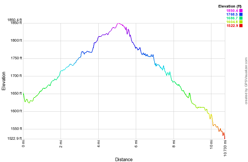
(The image at the left shows the profile of the hike. Remember that all vertical profiles are relative!)
Catskill Scenic Trail: Roxbury to Grand Gorge
| Quick Look | ||||
|---|---|---|---|---|
| Difficulty | Round trip | Total climb | Internet Maps | |
| 14.0 mi. | 670 ft. | AllTrails | ||
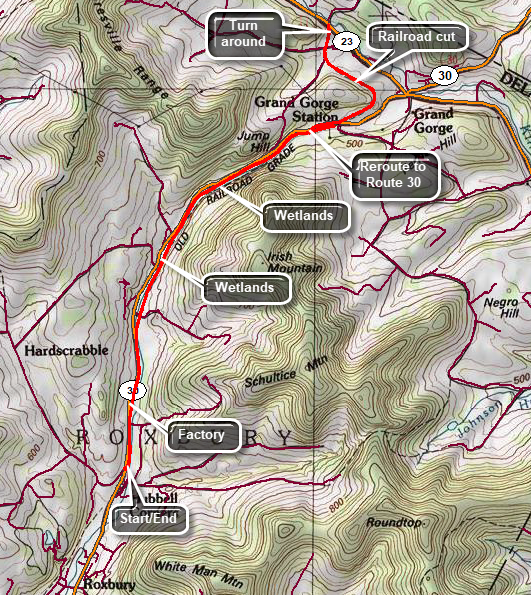
Note: This hike is 14.0 miles out and back. You may want to spot a car or arrange a ride to avoid the somewhat boring out and back. Watch for a beaver pond Behind the Firestone dealership as you approach Grand Gorge. Use Route 30 as a reroute. The Catskill Scenic Trail is a rail trail that follows the route of the old O&W and other lines for 19 miles from Bloomville to Grand Gorge. Drive north on Route 30 from Maragretville to Roxbury. Drive through Roxbury and Hubble Corners to Hardscrabble Road on the right. Park here and cross the road to get on the trail heading north toward Grand Gorge. The trail is wide and flat and there are no major "features". You will pass by Schultice and Irish Mountain on your right which are both on the Catskill Highest Hundred list. The water that appears on the left is part of the "Headwater of the East Branch of the Delaware River". As you approach Grand Gorge the trail crosses Route 30 to head toward Route 23. At one point it passes through a nice railroad cut. There are one or two bridges along the way. There are Laos some piles of rails and at least on pile of ties. Once you reach Route 23, turn around and walk back to your car or use the car you have spotted to avoid the long walk back.
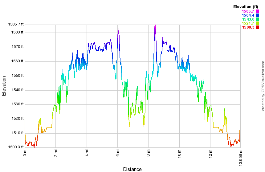
(The image at the left shows the profile of the hike. Remember that all vertical profiles are relative!)
Catskill Scenic Trail: South Kortright toward Bloomville
| Quick Look | ||||
|---|---|---|---|---|
| Difficulty | Round trip | Total climb | Internet Maps | |
| 5.0 mi. | 150 ft. | AllTrails | ||
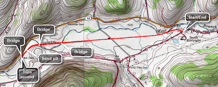
The Catskill Scenic Trail is a rail trail that follows the route of the old O&W and other lines for 19 miles from Bloomville to Grand Gorge. Drive north on Route 10 from Delhi for 13 miles to South Kortright. Turn right on CR-18 and drive across a beautiful stone bridge over the West Branch of the Delaware River. At the end of the road, turn right and pass by the South Kortright Cemetery on the right. The trail crosses CR-18 just after the cemetery. There is no parking area for the section from South Kortright to Hobart at the point where the trail crosses CR-18. You may find parking in South Kortright or you can try parking along the road where the trail crosses CR-18 just west of the South Kortright Cemetery. For the most part the trail is hard packed with some cinder and some short grass here and there. Start your hike by heading west on the trail passing through the backyards of some South Kortright homes. The trail is wide and flat for its entire length and this section is very flat. Continue to walk along the trail passing from trees to open farmland and back into sections passing through forest. After crossing three bridges turn around and start back for the car. Watch for a sand and gravel pit on the right side of the trail. It is worth a quick look. The river parallels the trail and can be quite different depending on the level of the water.
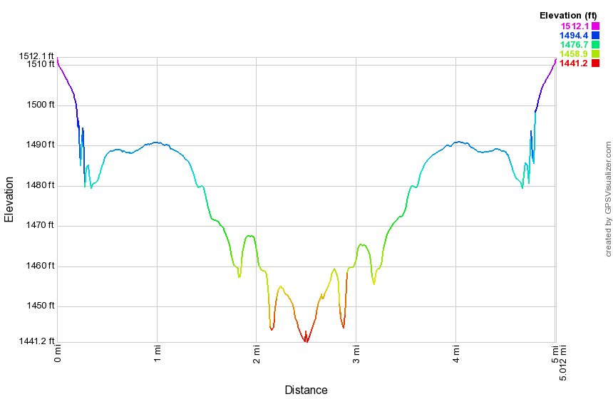
(The image at the left shows the profile of the hike. Remember that all vertical profiles are relative!)
Catskill Scenic Trail: South Kortright to Hobart
| Quick Look | ||||
|---|---|---|---|---|
| Difficulty | Round trip | Total climb | Internet Maps | |
| 8.1 mi. | 290 ft. | AllTrails | ||
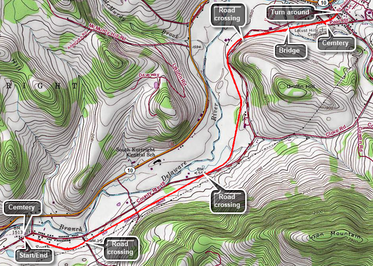
The Catskill Scenic Trail is a rail trail that follows the route of the old O&W and other lines for 19 miles from Bloomville to Grand Gorge. Drive north on Route 10 from Delhi for 13 miles to South Kortright. Turn right on CR-18 and drive across a beautiful stone bridge over the West Branch of the Delaware River. At the end of the road, turn right and pass by the South Kortright Cemetery on the right. The trail crosses CR-18 just after the cemetery. There is no parking area for the section from South Kortright to Hobart at the point where the trail crosses CR-18. You may find parking in South Kortright or you can try parking along the road where the trail crosses CR-18 just west of the South Kortright Cemetery. For the most part the trail is hard packed with some cinder and some short grass here and there. Start your hike by heading east on the trail passing through the backyards of some South Kortright homes. The trail is wide and flat for its entire length but does game some elevation on this section. The elevation gain is barely noticeable in all but a few locations. At one point there is a small, fenced-in area with miniature horses and other horses across the trail. At .5 miles the trail crosses Madison Hill Road and continues on the other side. At 1.8 miles the trail crosses CR-18 on a diagonal and parallels the road briefly. At 2.8 miles the trail again comes close to CR-18. The trail crosses a farm driveway and then again crosses CR-18 at 3.2 miles. At 3.6 miles cross the first substantial bridge over Town Brook. Continued on the trail to Hobart where the trail crosses several streets and leads to Railroad Avenue. Turn around here and start the "back" part of the out and back. On the way back, you may want to turn left on Pearl Street and visit the Locust Hill Cemetery. It is large and has some interesting markers. Back on the trail continue your hike back to the car. When you return to the start, you may want to visit the South Kortright Cemetery and the duck pond next to it.
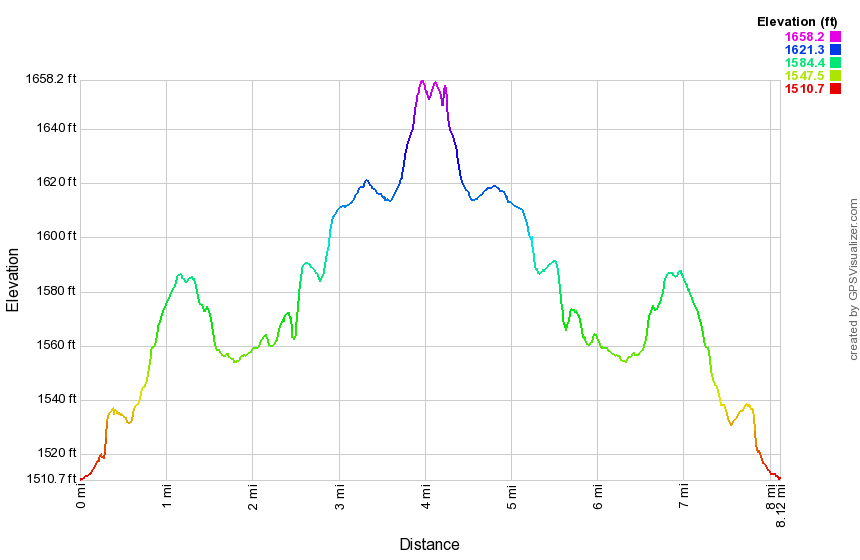
(The image at the left shows the profile of the hike. Remember that all vertical profiles are relative!)
Colgate Lake to Stoppel Point
| Quick Look | |||||
|---|---|---|---|---|---|
| Difficulty | Round trip | Total climb | Internet Maps | ||
| 11.9 mi. | 1947 ft. | AllTrails | |||
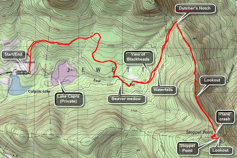
Take Route 23C north from Route 23A in Tannersville. Stay on this road until it crests the hill at Onteora Park and passes the stone church at the top. Stop here for some very nice views of the Devil's Path. Continue down the other side of the hill to East Jewett. Turn onto CR 78 which should have a sign for Colgate Lake. Pass Colgate Lake on the right and park at the DEC parking area on the left. The gate marks the beginning of the yellow-blazed Colgate Lake Trail. The trail starts through a meadow with some nice views of the surrounding mountains. After about a quarter of a mile it enters the woods. The trail is mostly flat and winds its way in back of Lake Capra which is a privately owned inholding in the Catskill Park. There are several bridges of different types over various bodies of running water.
Along the trail watch for a beaver meadow on the left at about 2.5 miles. Walk out to the beaver meadow which was once a beaver pond. There is a nice view of Blackhead Mountain from here and the meadow itself is pretty. Just passed the meadow is a beaver pond and the trail skirts this area. A little further at about 3.1 miles is another meadow with another great view of Blackhead Mountain. A few hundred feet up the trail you can cut into the woods on several informal trails or you can make your own. There is a nice small, secluded waterfall here. Back on the main trail it is another 2.3 miles to the junction of the trail with the Escarpment Trail. This last part of the walk is more uphill as you ascend to Dutcher's Notch. You will be walking between the Escarpment on your right and another ridge on your left. On your immediate left is a deep ravine. The terrain is rugged and beautiful but offers no views.
At the junction with the blue-blazed Escarpment Trail, turn right and be prepared to climb. The trail takes you up to the Escarpment which was on your right as you were coming up the Colgate Lake trail. The trail climbs some but is not too steep. Once on the Escarpment the trail is mostly flat until Stoppel Point. All along the trail you can see that you are on a ridge and that there might be interesting views especially on your left. Keep walking and wait for some real viewpoints! At 1.2 miles is a great lookout right on the trail with views to the north and northeast. Back on the trail the climbing gets steeper now as you begin to ascend to Stoppel Point. In a little less than a mile you will find the wreckage of a two-seater Piper Cub right on the trail on the left. Passed the wreck only a few hundred feet is a lookout to the south and west.
Keep walking on the trail and pass the point where your GPS might indicate the location of Stoppel Point. Walk until you find a DEC signpost and a GREAT lookout to the north and northeast. To get back just retrace your steps. Another option is to park a car at the Schutt Road parking area near North South Lake State Campgrounds. You can then walk through over North Mountain and North Point and experience the rest of the lower end of the Escarpment Trail.
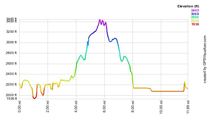
(The image at the left is the vertical profile for the out and back hike so it has a symmetrical appearance. )
Colonel's Chair
| Quick Look (Spruceton Trail) | |||||
|---|---|---|---|---|---|
| Difficulty | Round trip | Total climb | Internet Maps | ||
| 9.0 mi. | 2907 ft. | AllTrails | |||
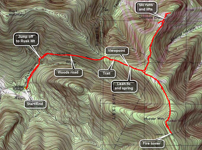 I have included the summit of Hunter Mountain on the map and profile. You can cut some time, distance and elevation by avoiding the climb to the peak. However, once you are as far as the Colonel's Chair Spur Trail the peak of Hunter is only a mile and a quarter further. The peak is the second highest in the Catskill's. It also has a fire tower which offers a spectacular view of most of the other peaks on a clear day.
Park at the large trailhead parking lot near the end of the Spruceton Road. This is the first of three parking lots and each is smaller than the previous. Find the blue-blazed Spruceton Trail which starts as a wide, gated road which follows Hunter Brook. After crossing a small bridge across the brook, you will come to a hairpin turn to the right. Look to your right as you ascend this trail for imposing views of West Kill. After 1.7 miles, the trail turns right off the road but remains fairly wide and well kept. In the winter water from the spring can overflow the trail forming ice flows that can be dangerous. In the other seasons this spring may cause the trail to be muddy. At the spring is a nice lookout which offers views of Rusk Mountain, West Kill, and, farther off, North dome and Sherrill.
Only .3 miles beyond the spring is the Colonel's Chair spur trail blazed in yellow. This trail descends almost 500 feet over 1.1 miles and ends up at the top of the Hunter Mountain ski area. Several areas are steep and, of course, must be ascended on the way back. As you walk you will notice colored and numbered trails. These are used for snowshoeing and mountain biking. Stay on the main trail which turns into a dirt road. You will pass on open area on your left which is a stone quarry. A little further on the right is a lookout and a sculpture of Rip VanWinkle. If you miss this, you can follow the signs from the ski lifts. Stay on the trail until you start to see ski lifts. At this point you can walk around to the top of the various lifts and slopes. The views of the surrounding mountains and those in the distance are beautiful. There are also great views of the village of Hunter in the valley below. Reverse your steps to climb back up to the main trail. At this point you can turn left to the summit of Hunter Mountain or right to get back to the parking area.
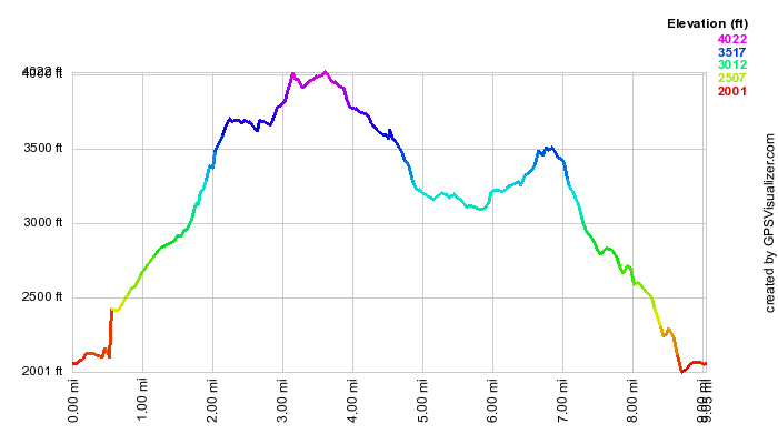
(The image at the left is the vertical profile for the hike.)
Conklin Hill Bushwhack
| Quick Look | ||||
|---|---|---|---|---|
| Difficulty | Round trip | Total climb | Internet Maps | |
| 3.1 mi. | 470 ft. | AllTrails | ||
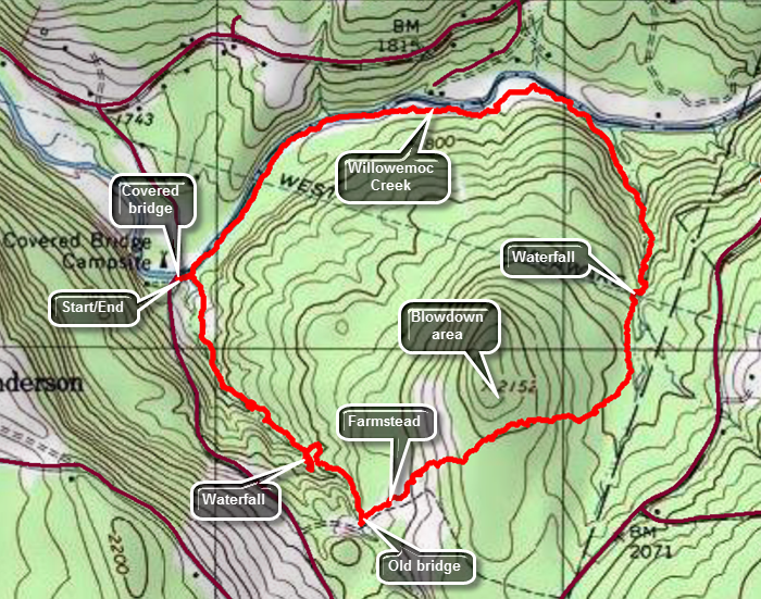 This hike is a bushwhack which follows some informal paths and woods roads. Much of it Laos follows two unnamed intermittent streams and the Willowemoc Creek. Because it is a bushwhack there are many possible routes. Make sure you have map and compass with you. From the caboose near the exit 96 exchange in Livingston Manor, drive 7.3 miles east on DeBruce Road. The road changes to Willowemoc Road after passing through Debruce. Turn right on Conklin Hill Road and drive through the covered bridge across the Willowemoc Creek. Park in the spaces just after the bridge on the left. Cross the small stream in front of your car and then turn right to hike south along the eastern bank of the stream. Follow the stream for about .7 miles passing several nice waterfalls along the stream. At .7 miles there will be the abutments for a bridge across the stream. About a quarter mile farther up the stream is another water fall. Turn left and head east-northeast through what was once a farm. You may see the foundation of the farmhouse and a little farther up a slope the remains of the barn. There are cement feed troughs with stalls for 16 cows. Continue to head east-northeast into an evergreen forest. The trees are tall and straight red pines planted by the CCC in the 1930's. You may begin to see a hill ahead or a little to the left. The trees on the hilltop were flattened by the storms from Hurricane Sandy. Walk up to the shoulder of the hill to get a good look and the continue in the direction you were going. Descend through some dense brush and small trees and work over or around some blowdowns. In a short distance the ground levels and there is a wetter area with beautiful moss. Around 1.4 miles you will find another small stream. Turn north to follow the unnamed stream which starts out very small. Continue to walk north and downstream as the volume of water begins to grow. You will be on the western side of the stream but at 1.5 miles there will be a rather impressive waterfall. Cross the top of the falls and work your way down the eastern side of the stream with the waterfall on your left. You may want to go down into the stream bed. Continue along the eastern bank of the stream watching for areas of cliffs and ledges. At 1.95 miles the stream ends at the Willowemoc Creek. Walk along the creek bed for a short distance to a nice area of exposed rock where you can walk out and see up and down the creek. Walk along the creek bed until it appears you will run out of walking space. Head up the bank and walk the path along the northern side of the Willowemoc. Some cabins and houses begin to appear on the other side and the path along the stream is very clear in most places. Soon the covered bridge will appear across the stream. You will come to the brook you crossed earlier. Cross the brook and walk up to your car.
 (The image below shows the profile of the hike. Remember that all vertical profiles are relative!)
Crystal Lake
| Quick Look | ||||
|---|---|---|---|---|
| Difficulty | Round trip | Total climb | Internet Maps | |
| 2.9 mi. | 410 ft. | AllTrails | ||
 This area is a small New York State Wild Forest area between Roscoe and Fremont Center. Get on County Route 93. About halfway between the Roscoe and Fremont center watch for Tennanah Lake Road which heads north from CR 93. After the turn the parking area will be a short distance on the left. Depending on the season you may be able to drive up the access road and park in the small parking area. In the winter you will have to park on the side of the road as there is no maintenance.
 (The image below shows the profile of the hike. Remember that all vertical profiles are relative!)
Delhi Trails: Delhi Rail Trail
| Quick Look | ||||
|---|---|---|---|---|
| Difficulty | Round trip | Total climb | Internet Maps | |
| 3.9 mi. | 270 ft. | AllTrails | ||
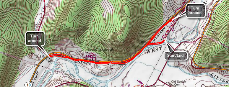
From the college in the village of Delhi find Sherwood Drive to the right of the shopping center. As the road makes a sharp left turn, continue straight ahead into the parking lot. Walk uphill on the path that accesses the actual rail trail after about .25 miles. Turn left and to walk the longer section of the trail first. The surface is firm and usually dry in most places. Most of the first part of the trail is shaded by trees but parallels Route 10 so there is always the noise of traffic. The first part of the trail also parallels the West Branch of the Delaware River but at around half a mile the river swings south and away from the trail. The trail crosses at least two driveways or access roads but the trail on the other side is always easy to find. At one point the trail leaves the woods and opens up along the edge of a field. There are usually some nice views of the surrounding hills. The trail then reenters the woods. In most places there is a high bank on the right side of the trail from Route 10 but in other spots there is also a high bank on the left side of the trail. The walk is very flat and at just under 1.5 miles it meets Route 10. Turn around to head back. At 2.75 miles the access path will be on the right. Continue straight ahead to walk the other section of the trail heading east. This part of the trail is also flat and well-maintained. There isn't much to see and there are several access roads that cross the trail. After walking .4 miles from the access path, the trail seems to go to the right. After this point the trail is overgrown with weeds. Turn around and walk back to the access path, turn left and walk back to the parking area.

(The image at the left shows the profile of the hike. Remember that all vertical profiles are relative!)
Delhi Trails: Lennox Forest
| Quick Look | ||||
|---|---|---|---|---|
| Difficulty | Round trip | Total climb | Internet Maps | |
| 1.9 mi. | 585 ft. | AllTrails | ||
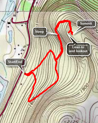
From the college in the village of Delhi find Sherwood Drive to the right of the shopping center. At the end of the road turn right on Arbor Hill Road. Drive 2.3 miles to the parking area for Lennox Memorial Forest on the left. From the parking area walk around the gate and up the hill. At the first trail junction, turn right and walk uphill heading south. The woods road will make a sharp left turn and will continue uphill and north. There are not very many markings on the trails. If you come to a junction and one trail looks well-maintain and the other overgrown take the former. At .65 miles turn right at the trail junction and get ready for a challenging uphill climb to the summit of the mountain. The trail starts off heading north but circles around at the top so that the final climb to the summit is toward the south. There is a Provo and some open space at the top of the mountain. Watch for a short trail that leads to the right and won to a lean-to and what was once a lookout. The lookout is overgrown and there is no view when leaves are on the trees. Turn around and walk back down the hill to the trail junction. Turn right and follow the trail back down to the gate and the parking area.
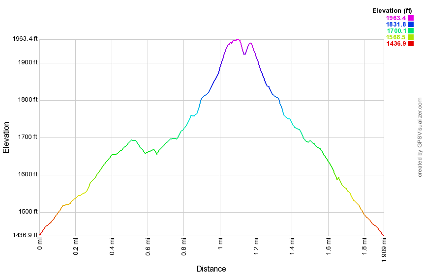
(The image at the left shows the profile of the hike. Remember that all vertical profiles are relative!)
Delhi Trails: Sheldon Loop
| Quick Look | ||||
|---|---|---|---|---|
| Difficulty | Round trip | Total climb | Internet Maps | |
| 4.6 mi. | 1585 ft. | AllTrails | ||
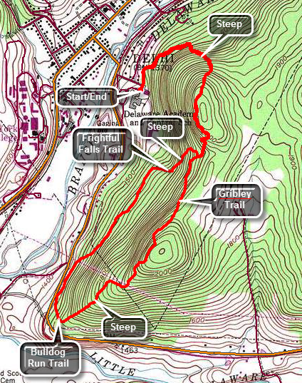
In the village of Delhi, turn onto Route 28 south and drive to Sheldon Drive which is a left turn just before the school on the left. Drive to the end of Sheldon Drive and park in one of the school lots. The beginning of the trail is not clearly marked from the parking area but it is near the community garden. The entire trail system is marked with black arrows on a yellow background with no change in markers for the three different trails. The trail climbs starting at the parking area but at about .4 miles there is a "wall". Over the next .3 miles the trail gains 455 feet making the average grade 28%! The trails are wide woods roads and but the steepness of the trails makes them a little beyond the ability of most beginners. The trail begins by heading to the northeast but as it began to climb to the top of the ridge it turns to the south. The walk is through pleasant hardwood forests and at about .75 miles the trail levels off briefly at the top of the ridge. The Gribley Trail now starts a short but steep descent from one hilltop before a short but steep ascent to the next. Along the way the Frightful Falls Trail comes up on the right as it ascends from below. At 1.6 miles the trail is back on top of a hill and at the highest point on the hike. The trail description mentions viewpoints but there are none that are open. Almost immediately the trail begins to descend from the high point losing over 500 feet as it heads southwest off the ridge. At 2.3 miles there is a power line right-of-way with some views down into the valley. Just before this area, there is a trail junction where the Gribley Trail ends and the Bulldog Run Trail begins. The trails are marked with only one color so it is difficult to make these distinctions. From the right-of-way the trail continues to descend as it turns almost 180 degrees to head northeast. The trail parallels Route 28 for some distance ascending as it progresses. At about 3 miles the Bulldog Run Trail turns off to the left as it headed down to Route 28 and the Immanuel Lutheran Church. Continue straight ahead on the Frightful Fall Trail which ascends to the ridge to the Gribley Trail. The trail ascends to the ridge heading east or northeast and gains 285 feet in the process for an average 18% grade. At 3.5 miles turn left on the Gribley Trail and take note of a bluestone quarry. The Gribley Trail continues to ascend to the top of the ridge gaining another 170 feet. Walk across the top of the ridge and then start back down to the parking area. The descent of this steep area can be even more challenging than the ascent! Continue to follow the trail back to your car.
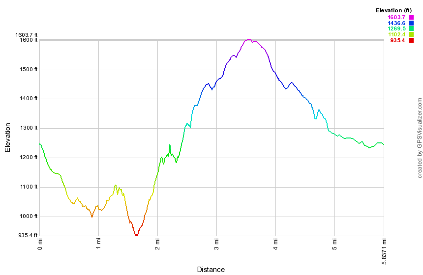
(The image at the left shows the profile of the hike. Remember that all vertical profiles are relative!)
Delhi Trails: Smith Pond
| Quick Look | ||||
|---|---|---|---|---|
| Difficulty | Round trip | Total climb | Internet Maps | |
| 2.2 mi. | 260 ft. | AllTrails | ||
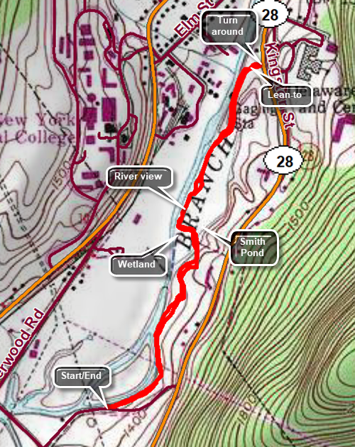
The Smith Pond Trail is now closed from the Southern trailhead to the footbridge due to a landowner's decision to withdraw permission to hike. Hikers should now park On Sheldon Drive, walk down to Route 28, turn left and walk about .1 miles to the trailhead on the right. The walk out and back to the Smith Pond Bridge is about 1 miles. The Catskill Mountain Club plans to remove the southern trailhead kiosk and reroute the trail.
From the college in the village of Delhi find Sherwood Drive to the right of the shopping center. At the end of the road turn left on Arbor Hill Road. Drive .2 miles and park on the left side of the road near the kiosk for the Smith Pond Trail. It can be tricky to follow the orange disks as they sometimes branch off the prominent trail to avoid wet areas. The trail wanders up and down through grassy areas in many places and that grass may or may not be cut. At .1 miles the first deviation from the main trail occurs as the orange disks stray off to the left to avoid a wet area. This trail is not well marked and may not be trimmed so you may continue on the main trail. At about .5 miles the trail descends to a wetland. There is a bridge here that overlooks Smith Pond. Continue on trail as it crosses the wetland and begins to follow along the bank of the West Branch of the Delaware River. A little farther along the trail splits and then reunites within less than 100 feet. It then follows the edge of a field before climbing a little hill headed toward Route 28. Just before the end of the trail at the road is a lean-to on the right side of the trail. The lean-to does not appear to be used much except as a substrate for graffiti. Turn around at the road and retrace your path back to the parking area.
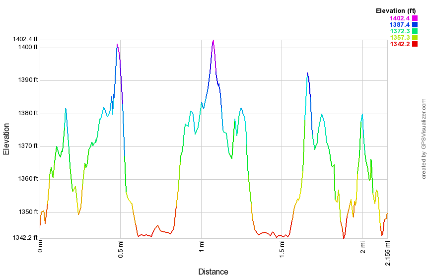
(The image at the left shows the profile of the hike. Remember that all vertical profiles are relative!)
Delhi Trails: West Branch Preserve (all trails)
| Quick Look | ||||
|---|---|---|---|---|
| Difficulty | Round trip | Total climb | Internet Maps | |
| 2.9 mi. | 990 ft. | AllTrails | ||
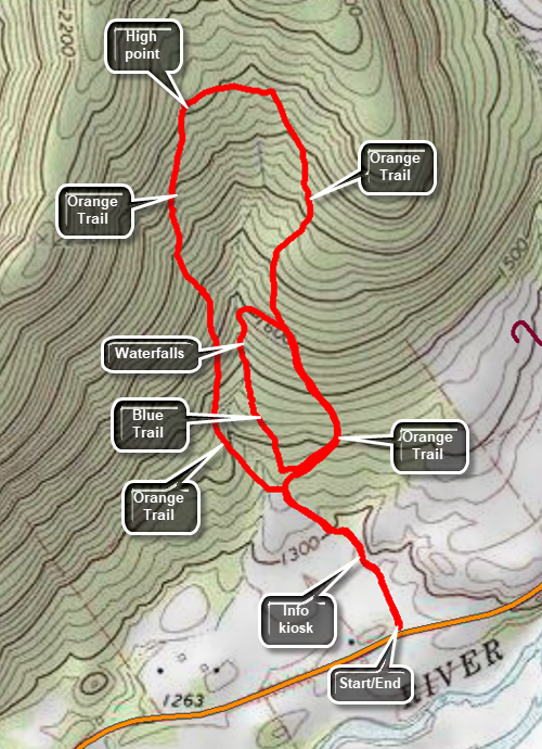
From the college in the village of Delhi drive about 10 miles west along Route 10 and look for a small parking area on the right side of the road. There is a sign which says "West Branch Preserve - Nature Conservancy". There are two trails here and a kiosk a short distance from the parking area shows a map. The orange trail makes a large loop and is about two miles long. It has some significant elevation gains and passes through primarily hardwood forest. The blue trail itself is about .45 miles but a loop including this trail is about 1.4 miles. This trail parallels an intermittent stream and is surrounded by evergreen trees. It is possible to hike a loop including both trails or a loop that includes either one of the trails. This description includes both trails in one hike.
From the parking area hike on the wide, grassy trail for about .3 miles to the trail junction passing a kiosk with information and maps along the way. Turn left on the orange trail. The trail was is now much more like a forest trail. Cross a small stream which may be easy or more difficult depending on the water levels. The trail may have a few sticks and blowdowns but it is easy to walk around them. Follow the well-worn trail bed and the orange markers. The trail heads north for .7 miles gaining 670 feet on an 18% grade. After a total of one mile on the trail, there is a high point and the trail turns east. In another .15 miles, the trail turns south and starts a long descent. The trail continues to descend at a slightly shallower grade than the ascent. At 1.65 miles the blazes for the blue trail come in from the right. Continue south on the orange trail until at 2 miles where the blue trail starts. Turn right and follow the trail which immediately begins an ascent. Continued on the trail watching for a series of small waterfalls at about 2.2 miles. At 2.25 miles the blue trail turns east, hits a high point and then intersects the orange trail at 2.35 miles. Turn right and retrace your steps down the orange trail. This time stay straight at the junctions and walk back out to your car.
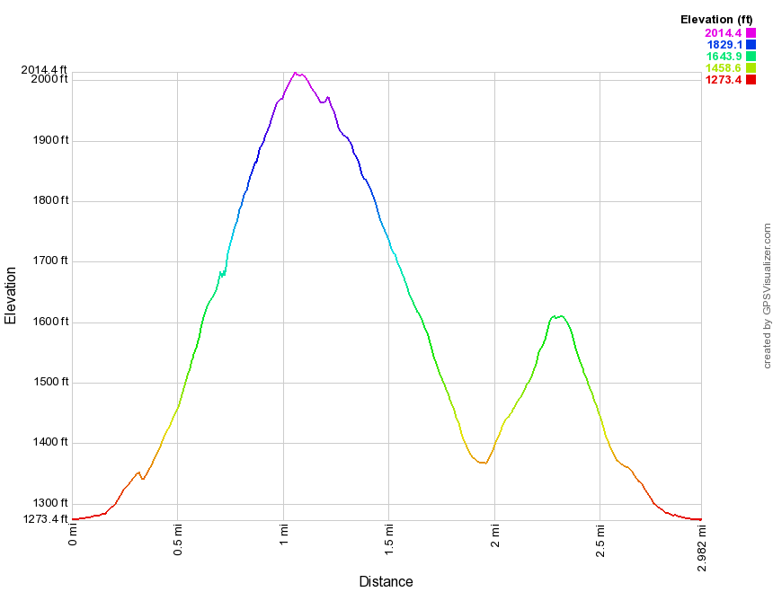
(The image at the left shows the profile of the hike. Remember that all vertical profiles are relative!)
Delhi Trails: West Branch Rail Trail
| Quick Look | ||||
|---|---|---|---|---|
| Difficulty | Round trip | Total climb | Internet Maps | |
| 5.1 mi. | 300 ft. | AllTrails | ||
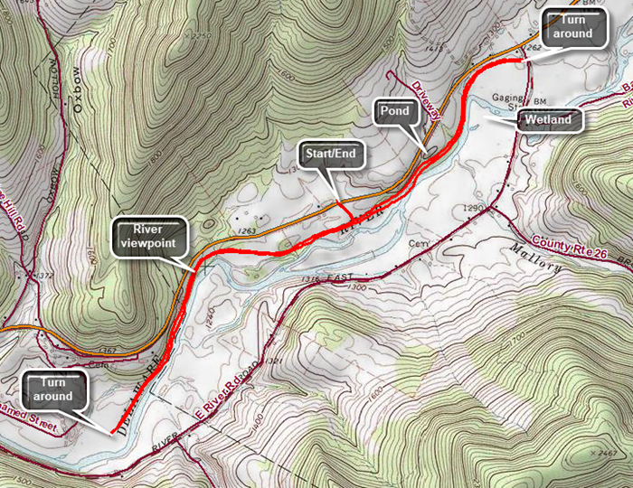
From the college in the village of Delhi drive about 10 miles west along Route 10 and look for a small parking area on the right side of the road. There is a sign which says "West Branch Preserve - Nature Conservancy". The access to the rail trail is across Route 10 on a path mowed through the field. This trail extends both south and north from the access path. Both directions are out and back. This description includes hiking both ways.
From the parking area on Route 10, cross the road and hike on the wide, grassy trail for about .1 miles to the intersection with the rail trail. Turn right and walk south on the wide and grassy rail trail. The river on the left of the trail is the West Branch of the Delaware River. Watch for opportunities for views down to the river and to the hills beyond. There is at least one rapids along the way. The trail dead ends after 1.5 miles behind the county landfill. Turn around and walk back to the access path. Continue north on the rail trail. The river and wetlands are on the right side. In several, paces high banks are found on both sides of the trail. As you near the end of this section of trail there is a frog pond on the left side of the trail. The trail ends at mile 3.9 on Route 26. Turn around and walk back to the access path. Turn right on the path and walk back to the parking area.
(The image at the left shows the profile of the hike. Remember that all vertical profiles are relative!)
Delhi Trails: West Branch Rail Trail (out and Back)
| Quick Look | ||||
|---|---|---|---|---|
| Difficulty | Round trip | Total climb | Internet Maps | |
| 4.8 mi. | 200 ft. | AllTrails | ||
From the college in the village of Delhi drive about 9 miles west along Route 10 to the blinking traffic light. Turn left and park in the small lot on the right side of the road. There are signs here for the snowmobile trail and the rail trail.
From the parking area, get on the trail and begin the out and back hike along the almost completely flat rail trail. All along the trail watch for opportunities for views down to the river and to the hills beyond. Shortly after getting on the trail there is a depression on the right side of the trail. When there has been sufficient rain, this area will be a frog pond. In drier times it will be a mud flat. At 1 mile a trail leads off to the right across a field to the parking for the West Branch Preserve on Route 10. Continue on the trail to 1.6 miles where a short spur trail leads down to the river bank. A short distance along the main trail is a viewpoint down to a small rapids on the river and across to the hills beyond. From this point the trail continues another .85 miles where it dead ends at the Delaware County Landfill. Turn around and retrace your route back to the parking area.
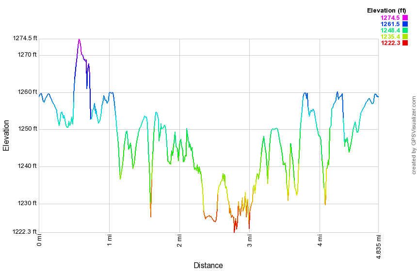
(The image at the left shows the profile of the hike. Remember that all vertical profiles are relative!)
Denman Mountain Loop
| Quick Look | ||||
|---|---|---|---|---|
| Difficulty | Round trip | Total climb | Internet Maps | |
| 6.4 mi. | 950 ft. | AllTrails | ||
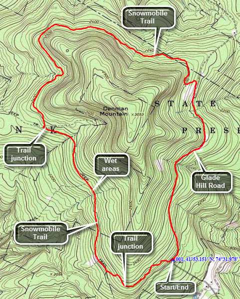
Turn onto Moore Hill Road just east of the TriValley School in Grahamsville, NY. Head north staying on Moore Hill Road for about 3 miles. Park in the parking lot at the corner of Moore Hill and Glade Hill Roads. The road straight ahead is not maintained in the winter but the lot is also always plowed. Walk across the road and onto the snowmobile trail which begins a slight ascent up a shoulder of Denman Mountain but soon levels off> It descends to a trail junction at about .5 miles. A left turn at this junction leads back out to Moore Hill Road and the road that cuts over to Denman Mountain Road. Turn right to stay on the trail around the mountain. At .85 miles there will be a path or woods road on the left that leads down to some interesting stone foundations. The road is lined with stone walls on either side. The snowmobile trail continues to descend for the next mile but is always lower than the mountain on the right. Since the trail is lower, the water draining from the higher terrain makes the trail very wet in places depending on the season. At about 1.95 miles there is the ruins of a house or cabin on the right side of the trail. You have been heading mostly north but the road for your return is to the east. At 2.15 miles there is another trail junction where you should turn right and then bear to the left. For the next 1.2 miles the trail wanders back and forth and up and down but always around the mountain. Finally, at about 3.3 miles the trail turns in an easterly direction and heads directly for the road. For the next 1.5 miles the trail undulates up and down but always heads east. At 4.8 miles, you should hit the road and turn right to head south and back to the parking area. There are some interesting cliffs and one large boulder right next to the road. The road continues heading south and mostly descends with a few ups and downs until you are back at the parking area.

(The image at the left shows the profile of the hike. Remember that all vertical profiles are relative!)
Diamond Notch Trail
| Quick Look | ||||
|---|---|---|---|---|
| Difficulty | Round trip | Total climb | Internet Maps | |
| 4.0 mi. | 1340 ft. | AllTrails | ||
From Phoenicia follow Route 214 north to Lainsville. Turn left on Diamond Notch Road. The first part of the road is paved and even the gravel section after that is in good shape. When you reach the end of the road, continue up the grass and dirt track to the parking area. This portion of the road is at least .5 miles but may be longer and it certainly seems longer! The road is very uneven with large rocks sticking up and is only one vehicle wide. . Drive slowly and avoid the rocks to make it to the parking area. The first part of the trail seems well-used and is rather well-maintained as it passes along Hollow Tree Brook. Several spots along the trail have small cascades and falls when there is enough water in the brook. The trail becomes extremely rough trail with many rocks as you continue to ascend. At one point the trail turns to the right as it crosses a streambed and ascends a set of rock steps. The trail gains 1000 feet in elevation over 1.4 miles to Diamond Notch. At this point there is an open spot that gives limited views down the notch to the south. Walk a little farther on the trail and it levels out some and passes between the Westkill Ridge on the left and another on the right. There is a deep gorge on the left of the trail and the area is similar to Dutcher's Notch in the Blackhead Range. Begin to descend over a very rocky trail heading toward Diamond Notch Falls. Pass the Diamond Notch lean-to on the right side of the trail. Within only .5 miles you can see the bridge above Diamond Notch Falls. Walk across the bridge and down the steep bank on the left to get to the base of the falls. The falls are best when there is a good volume of water in the Westkill. When you are ready, turn around and reverse your route back to the parking area.
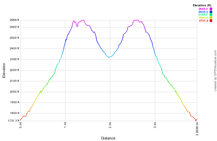
(The image at the left shows the profile of the hike. Remember that all vertical profiles are relative!)
Dry Brook: German Hollow
| Quick Look | ||||
|---|---|---|---|---|
| Difficulty | Round trip | Total climb | Internet Maps | |
| 3.3 mi. | 1425 ft. | AllTrails | ||
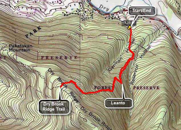
There are several different ways to access this area from the Margaretville and Arkville areas. The German Hollow Trail comes up to the Dry Brook Ridge trail from a side road off the Dry Brook Road. In Arkville turn south on Dry Brook Road. Watch for Chris Long Road on the right. Go to the end of the road and turn around. Park on the right side of the road opposite a house. There is room for two cars at most. The yellow German Hollow trail is a wide woods road to the Dry Brook Ridge trail and is about 1.6 miles long. The German Hollow lean-to is, at present, buried underneath several large trees that have crushed it! Once on the ridge you can turn around or hike the Ridge Trail to the Penguin Rocks.
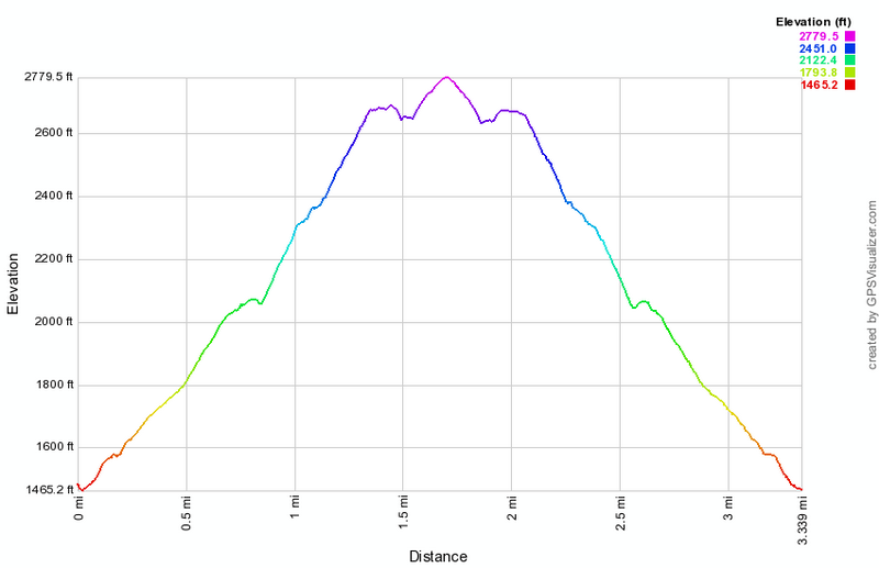 (The image below shows the profile of the hike. Remember that all vertical profiles are relative!)
Dry Brook: German Hollow to Lookouts
| Quick Look | ||||
|---|---|---|---|---|
| Difficulty | Round trip | Total climb | Internet Maps | |
| 7.1 mi. | 2240 ft. | AllTrails | ||
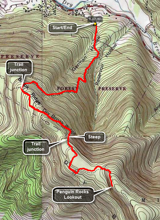
There are several different ways to access this area from the Margaretville and Arkville areas. The German Hollow Trail comes up to the Dry Brook Ridge trail from a side road off the Dry Brook Road. In Arkville turn south on Dry Brook Road. Watch for Chris Long Road on the right. Go to the end of the road and turn around. Park on the right side of the road opposite a house. There is room for two cars at most. The yellow German Hollow trail is a wide woods road to the Dry Brook Ridge trail and is about 1.6 miles long. The German Hollow lean-to is, at present, buried underneath several large trees that have crushed it! Once on the ridge you can turn left on the Dry Brook Ridge Trail. Walk about a mile to the junction with the Huckleberry Loop Trail gaining about 300 feet along the way. Stay on the Dry Brook Ridge Trail for another mile and gain 225 feet until a short side trail leads to thee lookouts over the Pepacton Reservoir. .

(The image above shows the profile of the hike. Remember that all vertical profiles are relative!)
Dry Brook: Hill Rd to Viewpoints
| Quick Look | ||||
|---|---|---|---|---|
| Difficulty | Round trip | Total climb | Internet Maps | |
| 5.75 mi. | 1663 ft. | AllTrails | ||
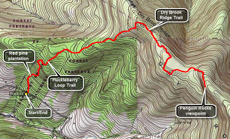
There are several different ways to access this area from the Margaretville and Arkville areas. The Dry Brook Trail starts near the Agway store in Margaretville and proceeds over Pakatakan Mountain and to the viewpoints. The German Hollow Trail comes up to the Dry Brook Ridge trail from a side road off the Dry Brook Road. This route follows the upper Huckleberry Loop Trail from the Hill Road parking area. There are also two parking areas on Huckleberry Brook Road that can be used.
From Routes 28 and 30 in Margaretville get on Southside Road. You may also use BWS Route 10 if you are coming from the Pepacton Reservoir to the west. Watch for the turn onto Huckleberry Brook Road. It is about 2 miles from Margaretville and less than a mile from the junction of BWS Route 10 with Routes 28 and 30. After turning onto Huckleberry Road, watch for the turn onto Hill Road about a quarter mile up on the right. Continue on Hill Road for a little over 1 mile until you see signs for "wild forest". The parking area will be on the right and is small with only enough room for a few cars. This should not be a problem since this route is not as popular as it should be.
After parking, cross the road and sign into the register. The trail ascends not too steeply through a pine plantation where the trees are evenly spaced. The trail is wide as it overlaps an old woods road. The floor is covered with pine needles which makes it cushioned and easy to walk on. The pine plantation slowly gives way to hardwoods and then leads into more pines. At times the trail narrows as it leaves the meandering woods road. In places it is narrow enough to have briars and nettles in the trail! After a little more than 1.5 miles the trail ends at the blue Dry Brook Trail. Turning left will take to Margaretville so turn right to continue toward the viewpoints.
The trail on the ridge is relatively flat with several small ascents and descents. There are a few parts that pass by some large rocks but without any real "scrambles". After about 1.3 miles of walking, hints of a view appear on the right. Don't stop here since the lookouts are just ahead. The first lookout is a rock shelf with several levels. There are views from all levels but the ones from the lower levels are the least obstructed. The views ate to the west over Cold Spring Hollow and the Pepacton Reservoir. The trick is to hike this route on a clear day with little humidity so that the haze does not cloud the view. You may now walk another .7 miles the another set of viewpoints and the highest point on the ridge. The views aren't much different than the ones you have just taken in so you may want to immediately turn back and make your way back to the car. The trail back can be descended quickly especially after the turn onto the Huckleberry Loop Trail.
 (The image at the left shows the profile of the hike. Remember that all vertical profiles are
relative!)
(The image at the left shows the profile of the hike. Remember that all vertical profiles are
relative!)
Dry Brook: Huckleberry Loop (complete)
| Quick Look | ||||
|---|---|---|---|---|
| Difficulty | Round trip | Total climb | Internet Maps | |
| 11.2 mi. | 2940 ft. | AllTrails | ||
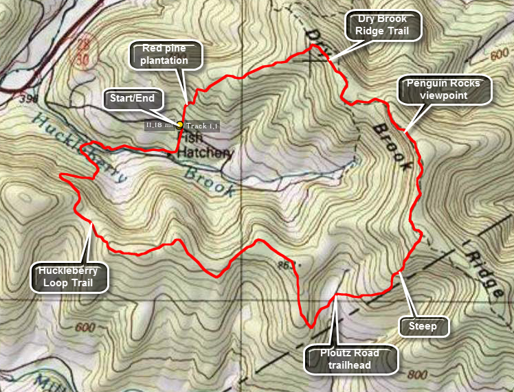
There are several different ways to access this loop hike area from the Margaretville and Arkville areas. The Huckleberry Loop Trail crosses Hill Road and runs along Huckleberry Brook Road. There is a parking area on Hill Road and two on Huckleberry Brook Road. There is also a parking areas on Ploutz Road of the Millbrook Road but Ploutz Road is poorly maintained. This route starts at the Hill Road parking area and heads south to the lower Huckleberry Loop Trail first and then proceeds up Dry Brook Ridge in a counterclockwise direction.
From Routes 28 and 30 in Margaretville get on Southside Road. You may also use BWS Route 10 if you are coming from the Pepacton Reservoir to the west. Watch for the turn onto Huckleberry Brook Road. It is about 2 miles from Margaretville and less than a mile from the junction of BWS Route 10 with Routes 28 and 30. After turning onto Huckleberry Road, watch for the turn onto Hill Road about a quarter mile up on the right. Continue on Hill Road for a little over 1 mile until you see signs for "wild forest". The parking area will be on the right and is small with only enough room for a few cars. From the parking area walk up the road a few feet and turn right into the woods on the red Huckleberry Loop Trail.
Walk .3 miles south on the trail to the upper parking area on Huckleberry Brook Road. Bear right near the road, walk through a small open area and cross the bridge to the road. Walk west on the road for .8 miles to the lower parking area. Just passed the parking area on the left is a bridge over Huckleberry Brook. Sign the register here and get ready to start climbing right away. The trail soon merges with an old woods road and follows it until about .4 miles after the bridge. At this point it turns again and starts to climb the ridge. Be careful to make the turn to the right as the road continues straight ahead. For the next .85 miles the trail switches back several times as it climbs to the ridge line. Watch for some very large and very old hardwood and softwood trees. In addition, there are some impressive rock formation that show exceptionally clear sedimentary layers. At this point the trail begins to deteriorate. If you are lucky, someone will have cut down some of the briars, brush and undergrowth but the going will still be tough! For the next 3.5 miles you will have to hack your way through raspberry canes, briars, nettles, ferns and various bushes. You will do this without being able to see the rocks and fallen trees under foot that will trip you up. You will also be treated to several ascents and descents of small hills on your way to the parking area on Plover Road.
When you get to the trailhead on Plowboy Road you will have hiked about .4 miles but it will feel like half again as much distance. To get to Ploutz Road you will have dropped down from the ridge and then ascended to about 2400 feet. What awaits you is another 5 miles of hiking which starts with an ascent to the top of Dry Brook Ridge at almost 3500 feet. Walk across the road to the parking area and continue on the red trail. The trail now ascends for a little over a mile to the ridge. The ascent starts and ends easily but the parts in between can be steep at times! At the ridge the trail flattens and in about .35 miles you will reach the junction with the blue Dry Brook Ridge Trail. Turn left toward Margaretville and walk for about .8 miles to a viewpoint over Cold Spring Hollow and the Pepacton Reservoir. Another .7 miles of walking brings another set of lookouts with much the same view. Continue on the trail for another 1 mile until the junction with the red Huckleberry loop trail. Turn left on the trail and hike 1.55 miles back to the parking area on Hill Road. This descent is rather and you can make good time walking downhill. The trail descends not too steeply first through hardwoods and then narrows in several places as it leaves the meandering woods road. In these places some briars and nettles may encroach on the trail. After some more hard woods the trail merges with and stays on an old woods road that runs through a pine plantation where the trees are evenly spaced. The trail is wide as it overlaps an old woods road. The floor is covered with pine needles which makes it cushioned and easy to walk on. In at least one spot are some old foundations and in others stone walls.
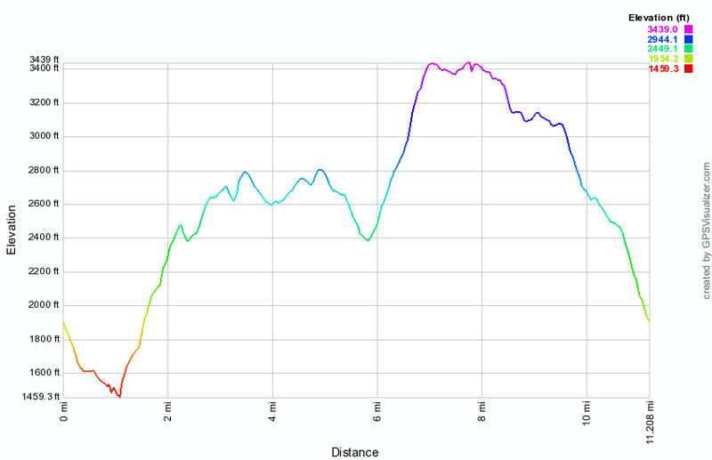 (The image at the left shows the profile of the hike. Remember that all vertical profiles are
relative!)
(The image at the left shows the profile of the hike. Remember that all vertical profiles are
relative!)
Dry Brook: From Margaretville Trailhead
| Quick Look | ||||
|---|---|---|---|---|
| Difficulty | Round trip | Total climb | Internet Maps | |
| 7.0 mi. | 2065 ft. | AllTrails | ||
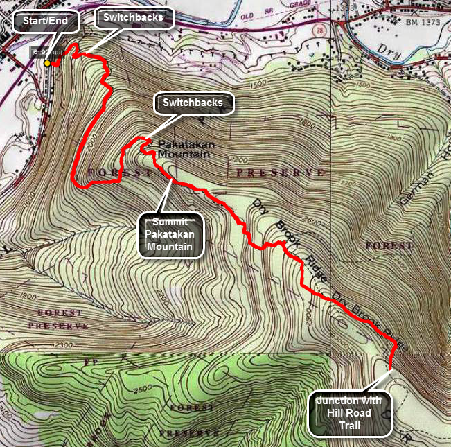
This route starts at the Millbrook Trailhead and ends at the junction with the trail from Hill Road. Of, course, the hike could easily be extend by continuing out to the lookouts and beyond! In Margaretville get on Southside Road which runs parallel to Route 28 and head northeast. Park in the parking area alongside the road just after Fair St on the left. The trail starts across the road. The first 1.7 miles of the trail climbs Pakatakan Mountain and is wide woods road most of the way. A direct route up the mountain would be very steep so there are several switchbacks which also help to avoid some rather nice ledges and cliffs. The overall route shows a grade of about 12% but there are some short stretches that are around 20%! After the summit, your climb is still not over as Dry Brook Ridge is at a higher elevation. At about 2.6 miles the German Hollow Trail comes in from Arkville on the left. From German Hollow the trail climbs for another .5 miles when in inexplicably drops about 100 feet! From this point the trail turns almost due south and climbs nearly 200 feet in a little over .1 miles to Dry Brook Ridge. This is almost a 30% grade and you will feel it! To return to your car simply retrace your path. The Penguin Rocks viewpoint is only another mile along the ridge. The trail wanders back and forth and does gain an additional 225 feet of elevation but this can be a welcome respite from the steep ascent and subsequent descent of the ridge.
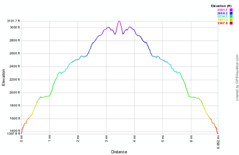
(The image at the left shows the profile of the hike. Remember that all vertical profiles are relative!)
Dry Brook: From Millbrook Trailhead
| Quick Look | ||||
|---|---|---|---|---|
| Difficulty | Round trip | Total climb | Internet Maps | |
| 6.2mi. | 1630 ft. | AllTrails | ||
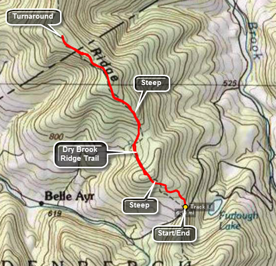
This route starts at the Millbrook Trailhead and ends at the junction with the Huckleberry Loop Trail. The hike could be extended since another 1.3 miles will bring you to the Penguin Rocks lookout. You could also hike through to another trail head if you spot a car. The trail is deceptive since the elevation is gained over about three miles. However, the trail rises to 3460 feet and is #37 on the CHH list.
Get on the New York City road that leaves Margaretville and passes long the south side of the Pepacton Reservoir. After about 3.5 miles, watch for the Millbrook Arena Road on the left. Turn here and drive about 9.5 miles to the Millbrook trail head on the left. Park to begin your hike. Once you are on the Dry Brook Ridge Trail the hike is very straight forward as long as you stay on the marked trail. The trail starts up almost immediately over a small hill gaining 440 feet in the first .7 miles. It then drops almost 300 feet in the next .5 miles before starting up to the ridge. In the next mile the trail ascends to the ridge gaining 680 feet before leveling off at the top. For the next .9 miles the trail drops about 100 feet only to regain that elevation to the junction with the Huckleberry Loop trail coming up to the ridge from the west.
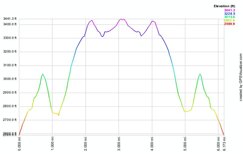 (The image below shows the profile of the hike. Remember that all vertical profiles are
relative!)
(The image below shows the profile of the hike. Remember that all vertical profiles are
relative!)
Dry Brook: Viewpoints from Millbrook Trailhead
| Quick Look | ||||
|---|---|---|---|---|
| Difficulty | Round trip | Total climb | Internet Maps | |
| 9.4 mi. | 22440 ft. | AllTrails | ||
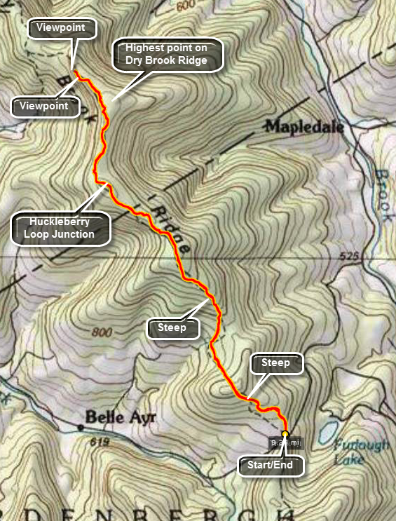
This route starts at the Millbrook Trailhead and is an out and back to the viewpoints over the Pepacton Reservoir. You could also hike through to another trail head if you spot a car. The trail is deceptive since the elevation is gained over about three miles. However, the trail rises to 3460 feet and is #37 on the CHH list. To get to the very highest point on the ridge you will have to bushwhack slightly to the north of the trail.
Get on the New York City road, Route 9/10, that leaves Route 28 just west of Margaretville and passes long the south side of the Pepacton Reservoir. After about 3.5 miles, watch for the Millbrook Arena Road on the left. Turn here and drive about 9.5 miles to the Millbrook trailhead on the left. Park to begin your hike. Once you are on the Dry Brook Ridge Trail the hike is very straight forward as long as you stay on the marked trail. The trail starts up almost immediately over a small hill gaining 440 feet in the first .7 miles. It then drops almost 300 feet in the next .5 miles before starting up to the ridge. In the next mile the trail ascends to the ridge gaining 680 feet before leveling off at the top. For the next .9 miles the trail drops about 100 feet only to regain that elevation to the junction with the Huckleberry Loop trail coming up to the ridge from the west. Continue passed this point for another 1.4 miles and you will arrive at the best lookout over the reservoir at 4.7 miles into the hike. Before this lookout there are several others but this one is the best. When you are done, turn around and follow your route back to the car.
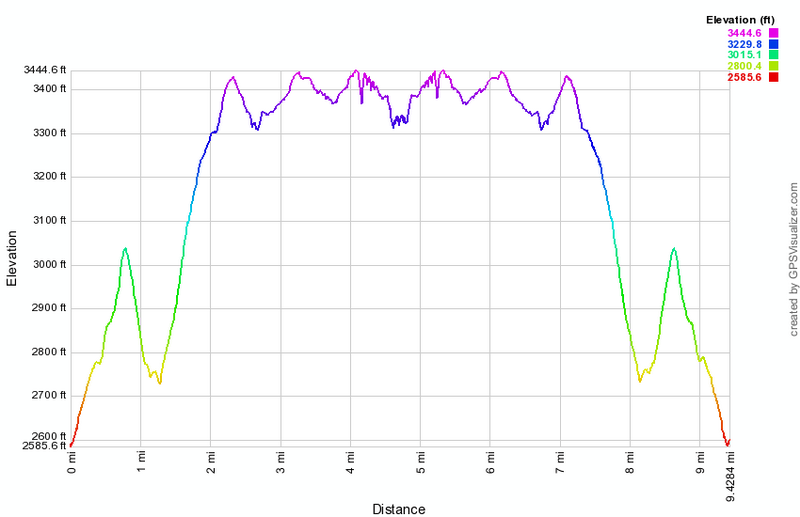 (The image below shows the profile of the hike. Remember that all vertical profiles are
relative!)
(The image below shows the profile of the hike. Remember that all vertical profiles are
relative!)
Dry Brook: From Ploutz Road Trailhead
| Quick Look | ||||
|---|---|---|---|---|
| Difficulty | Round trip | Total climb | Internet Maps | |
| 5.5 mi. | 1380 ft. | AllTrails | ||
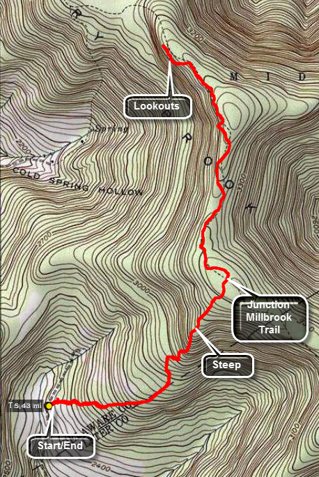
This route starts at the Ploutz Road Trailhead on the Huckleberry Loop Trail and ends at the Penguin Rocks lookout. The trail rises to 3460 feet on Dry Brook Ridge which is #37 on the CHH list.
Get on the New York City road that leaves Margaretville and passes long the south side of the Pepacton Reservoir. After about 3.5 miles, watch for the Millbrook Arena Road on the left. Turn here and drive about 6.5 miles to Ploutz Road on the left. This road is ROUGH but there is a small trail head parking area on the right as you drive up the road. Park here to begin your hike. The trail is a no nonsense affair that goes directly up to the ridge. In 1.25 miles it gains over 1000 feet and then virtually levels off on the ridge. Just out of the parking area you will cross over two parallel stone walls. These walls delineate a lane that probably lead from a barn to a pasture. Turn left along this lane and you will see that it opens into a large area bounded by stone walls. Trees have grown up in the pasture but it purpose is clear. At the top of the ridge the Huckleberry Loop Trail intersect the Dry Brook Ridge Trail. Turn left and walk about 1.4 miles to the lookouts. There are several different lookouts. The best is the last from this direction. There is a large stone ledge with several levels. The views into the hollow and over to the Pepacton are unobstructed. The only problem is a persistent haze in the valleys. Retrace your path back to the parking area.
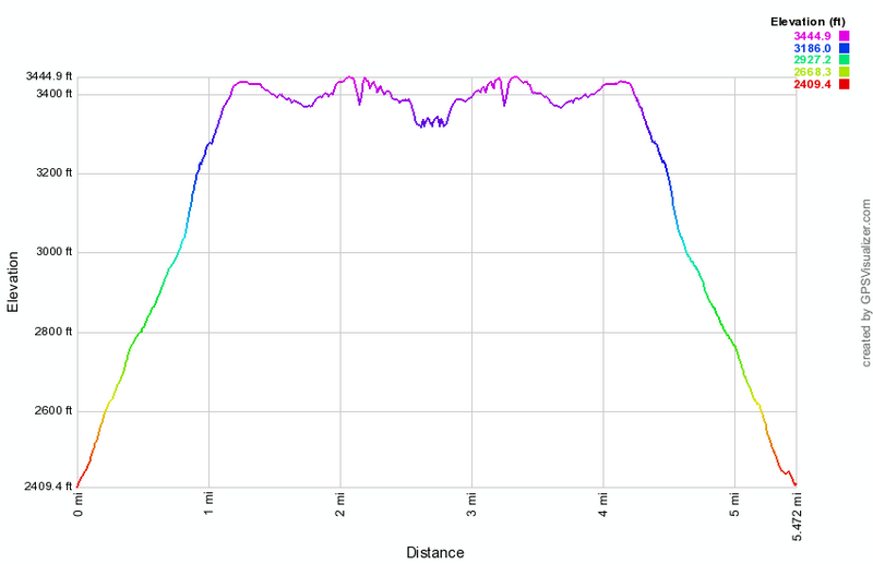
(The image above shows the profile of the hike. Remember that all vertical profiles are relative!)
Dry Brook: From Southside Trailhead
| Quick Look | ||||
|---|---|---|---|---|
| Difficulty | Round trip | Total climb | Internet Maps | |
| 9.3 mi. | 2525 ft. | AllTrails | ||
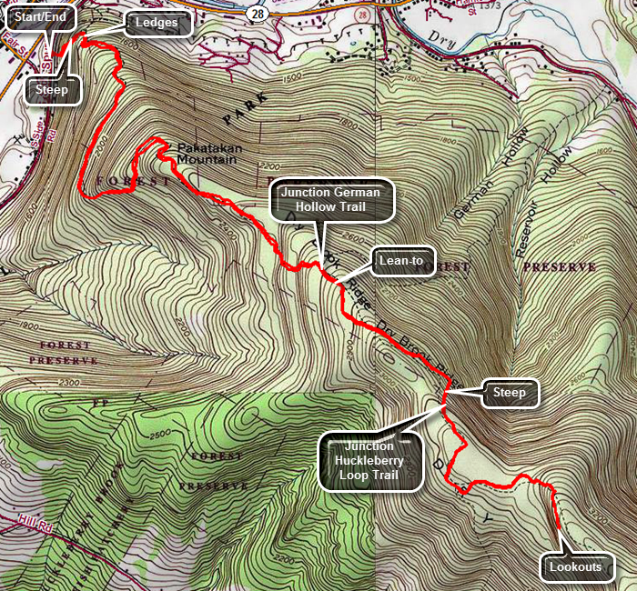
Travel west from Margaretville on Route 28. Turn left on BWS 10 and then immediately turn left on Southside Drive. Continue on this road until you pass fair Street on the left and see a "Dead End" sign. Just a little farther down the road on the right is the trailhead with room to park a couple of cars on the other side of the road. Turn around and park your car off the road just across from the trailhead. Cross the road to begin your hike as the trail starts climbing immediately gaining 525 feet in .65 miles for an average of a 15% grade. This would be much steeper but there is a series of switchbacks as the trail heads east along old woods roads. Watch for the very impressive and interesting rock ledges all along the first part of the trail. At .65 miles the trail turns south to travel along the west side of Pakatakan Mountain. At .75 miles the trail stays mostly on contour for a little while and then starts to climb again but more gently. At 1.15 miles the trail turns east and begins a steeper climb until 1.35 miles where it begins to head north still climbing but more moderately. At 1.5 miles the trail levels a little and then went through some turns which eventually result in a southeast heading for some time starting at 1.8 miles. Just after 2 miles, the trail passes by the summit of Patatakan Mountain at around 2500 feet and continues to rise toward Dry Brook Ridge. At 2.7 miles the German Hollow Trail comes in from the left. Not long after the German Hollow Trail junction is a "Lean-to" sign and the path to the German Hollow lean-to. The next section of the trail is one of the most frustrating in the Catskills. You reach a high point at 3.2 miles and then begin to descend on the trail which hugs the side of the hill. The trail loses 120 feet of elevation in the next .25 miles. At the bottom of the descent the trail turns right heading south and in .15 miles gains over 200 feet at a 26% grade. At the top of the climb is the trail junction with the Huckleberry Loop Trail that ascends from Hill Road. Continue straight ahead toward the lookouts which are about a mile away. The first .7 miles are relative flat with a series of short but steep climbs over the last .3 miles leading to the open rock face that makes up the lookouts. The lookouts give a greater than 180 degree view to the east, south and west including the Pepacton Reservoir. After taking in these views, get back on the main Dry Brook Ridge Trail and retrace your route to the car.
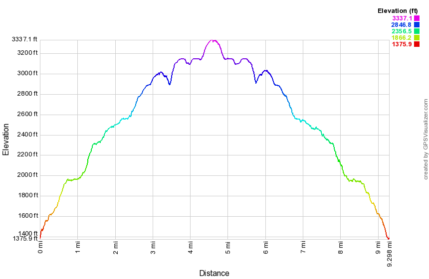
(The image above shows the profile of the hike. Remember that all vertical profiles are relative!)
Frick Pond (Clockwise)
| Quick Look | ||||
|---|---|---|---|---|
| Difficulty | Round trip | Total climb | Internet Maps | |
| 2.2 mi. | 200 ft. | AllTrails | ||
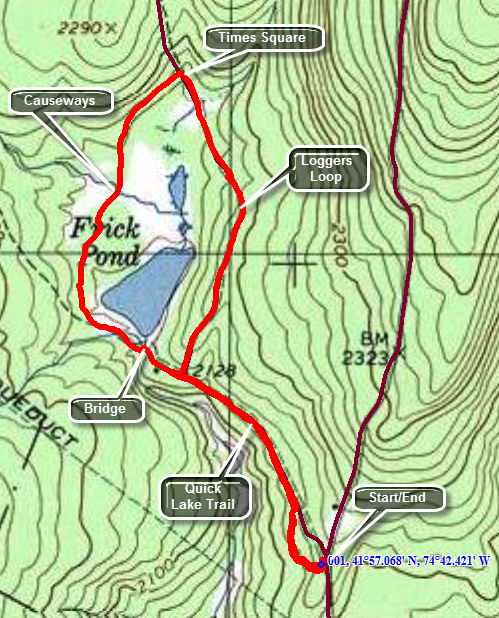 The area around Frick Pond, Hodge Pond and Quick Lake is covered with trails. There are numerous
possibilities for short of long hikes. The area is "relatively" flat and there are no "views".
There is, however, some beautiful scenery.
The area around Frick Pond, Hodge Pond and Quick Lake is covered with trails. There are numerous
possibilities for short of long hikes. The area is "relatively" flat and there are no "views".
There is, however, some beautiful scenery.
Take DeBruce Road from Livingston Manor for about six miles then turn left on Mongaup Rd. Where the road splits bear left on Beech Mountain Rd. and park in the parking lot on the left. Find the red-blazed Quick Lake Trail and follow it for .5 miles to the junction with the yellow-blazed Logger's Loop. Turn left to stay on the Quick Lake Trail. You will cross over the bridge at the outlet to Frick Pond. This is a beautiful spot to take pictures in all four seasons and under most lighting conditions. Continue around the pond and at about .7 miles there will be a trail junction. Bear to the right and walk around the "back" of the pond on an unnamed trail. You will cross over several wooden "bridges" or "causeways" over running water and marshy areas. BE CAREFUL as these wooden bridges are usually in the shade, grow moss readily and can be VERY SLIPPERY. After another .5 miles of walking you will be at Times Square, a four way trail junction. Turn right on the yellow Loggers Loop Trail and continue to circle Frick Pond. At 1.75 miles you will have completed the loop. Turn left and follow the red Quick Lake Trail back to your car.
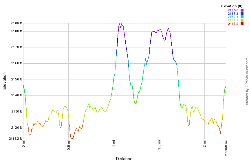
(The image below shows the profile of the hike. Remember that all vertical profiles are relative!)
Frick Pond (Counterclockwise)
| Quick Look | ||||
|---|---|---|---|---|
| Difficulty | Round trip | Total climb | Internet Maps | |
| 2.2 mi. | 160 ft. | AllTrails | ||
The area around Frick Pond, Hodge Pond and Quick Lake is covered with trails. There are numerous possibilities for short of long hikes. The area is "relatively" flat and there are no "views". There is, however, some beautiful scenery.
Take DeBruce Road from Livingston Manor for about six miles then turn left on Mongaup Rd. Where the road splits bear left on Beech Mountain Rd. and park in the parking lot on the left. Find the red-blazed Quick Lake Trail and follow it for .5 miles to the junction with the yellow-blazed Logger's Loop. Turn right to get on the Loggers Loop. The trail rises briefly and then descends gently to a four-way junction called Times Square. Turn left at Times Square on the Big Rock Trail which will take you around the north and west side of the pond. You will cross over several wooden "bridges" or "causeways" over running water and marshy areas. BE CAREFUL as these wooden bridges are usually in the shade, grow moss readily and can be VERY SLIPPERY. After passing over these bridges the Big Rock Trail ends at the Quick Lake Trail. Turn left on the Quick Lake Trail and continue to the bridge over the outlet stream to Frick Pond. This is a great place to stop and take some pictures of the pond. To the right is a high hill called Flynn's Point which is the highest point in Sullivan County. Continue to follow the Quick Lake Trail up a hill to Gravestone Junction. Continue straight ahead back to the trail register. At the register bear right on the Quick Lake Trail back to the parking area.
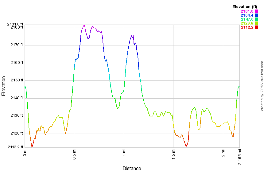
(The image below shows the profile of the hike. Remember that all vertical profiles are relative!)
Frick Pond: Quick Lake, Logger's Loop and Big Rock Trails
| Quick Look | ||||
|---|---|---|---|---|
| Difficulty | Round trip | Total climb | Internet Maps | |
| 3.9 mi. | 400 ft. | AllTrails | ||
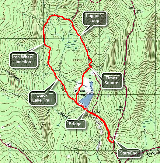 The area around Frick Pond, Hodge Pond and Quick Lake is covered with trails. There are numerous possibilities for short of long hikes. The area is "relatively" flat and there are no "views". There is, however, some beautiful scenery.
Take DeBruce Road from Livingston Manor for about six miles then turn left on Mongaup Rd. Where the road splits bear left on Beech Mountain Rd. and park in the parking lot on the left. Find the red-blazed Quick Lake Trail and follow it for .5 miles to the junction with the yellow-blazed Logger's Loop. Turn left to stay on the Quick Lake Trail. You will cross over the bridge at the outlet to Frick Pond. This is a beautiful spot to take pictures in all four seasons and under most lighting conditions. Continue around the pond and at about .7 miles there will be a trail junction. Bear to the left to stay on the red Quick Lake Trail start to walk slightly uphill toward Iron Wheel Junction. You will walk through a "spruce tunnel" and cross a small stream. At 1.5 miles you will be at Iron Wheel junction. Turn right on the yellow blazed Logger's Loop and head towards Times Square, a four way trail junction. The trail has a very gentle uphill and begins to swing to the east to start the loop back. At 1.85 miles you will reach the northern apex of the loop and start east and south. The trail now is mostly downhill with a few "bumps". At 2.7 miles you will arrive at Times Square where you should turn right on the yellow Blazed Big Rock Trail and walk around the "back" of the pond. You will cross over several wooden "bridges" or "causeways" over running water and marshy areas. BE CAREFUL as these wooden bridges are usually in the shade, grow moss readily and can be VERY SLIPPERY. Turn left at the next trail junction on the Quick Lake Trail and follow your path from earlier along the Quick Lake Trail back to your car.
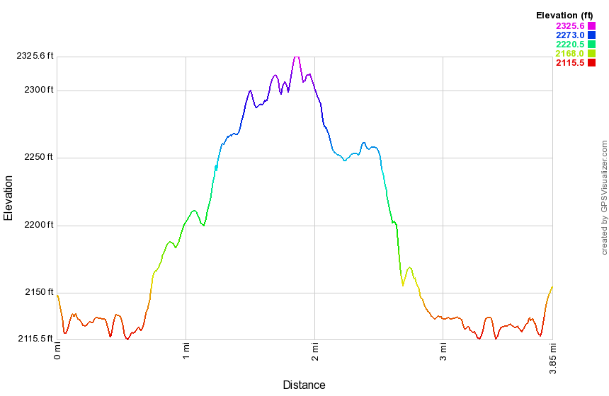 (The image below shows the profile of the hike. Remember that all vertical profiles are relative!)
Frick Pond: Quick Lake, Big Rock, and Logger's Loop Trails
| Quick Look | ||||
|---|---|---|---|---|
| Difficulty | Round trip | Total climb | Internet Maps | |
| 3.9 mi. | 400 ft. | AllTrails | ||
The area around Frick Pond, Hodge Pond and Quick Lake is covered with trails. There are numerous
possibilities for short of long hikes. The area is "relatively" flat and there are no "views".
There is, however, some beautiful scenery.
Take DeBruce Road from Livingston Manor for about six miles then turn left on Mongaup Rd. Where the road splits bear left on Beech Mountain Rd. and park in the parking lot on the left. Find the red-blazed Quick Lake Trail and follow it for .5 miles to the junction with the yellow-blazed Logger's Loop. Turn left to stay on the Quick Lake Trail. You will cross over the bridge at the outlet to Frick Pond. This is a beautiful spot to take pictures in all four seasons and under most lighting conditions. Continue around the pond and at about .7 miles there will be a trail junction. Bear to the right and walk around the "back" of the pond on the yellow blazed Big Rock Trail. You will cross over several wooden "bridges" or "causeways" over running water and marshy areas. BE CAREFUL as these wooden bridges are usually in the shade, grow moss readily and can be VERY SLIPPERY. After another .5 miles of walking you will be at Times Square, a four way trail junction. Turn left on the yellow Loggers Loop Trail and walk up a hill continuing on the Logger's Loop. At 2.4 miles you will be at Iron Wheel Junction. Turn left on the red blazed Quick Lake Trail to head back toward Frick Pond. At 3.2 miles you will have looped back to the trail around the back of Frick Pond. Continue straight ahead and cross the bridge over the Frick Pond outlet. Follow The Quick Lake trail back to the parking area.
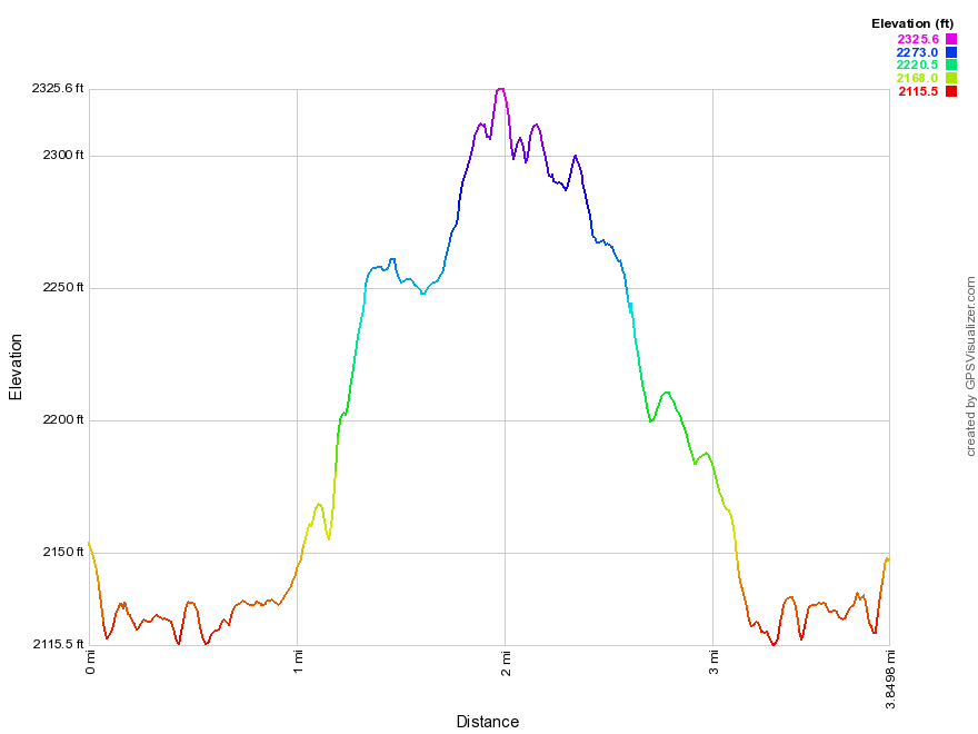 (The image below shows the profile of the hike. Remember that all vertical profiles are relative!)
Frick Pond: Quick Lake, Big Rock and Flynn Trails
| Quick Look | ||||
|---|---|---|---|---|
| Difficulty | Round trip | Total climb | Internet Maps | |
| 4.0 mi. | 775 ft. | AllTrails | ||
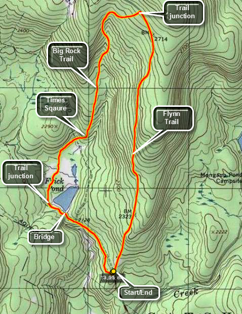 The area around Frick Pond, Hodge Pond and Quick Lake is covered with trails. There are numerous
possibilities for short of long hikes. The area is "relatively" flat and there are no "views".
There is, however, some beautiful scenery.
The area around Frick Pond, Hodge Pond and Quick Lake is covered with trails. There are numerous
possibilities for short of long hikes. The area is "relatively" flat and there are no "views".
There is, however, some beautiful scenery.
Take DeBruce Road from Livingston Manor for about six miles then turn left on Mongaup Rd. Where the road
splits bear left on Beech Mountain Rd. and park in the parking lot on the left. Find the red-blazed
Quick Lake trail and follow it for .5 miles to the junction with the yellow-blazed Logger's Loop.
Turn left to stay on the Quick Lake Trail. You will cross over the bridge at the outlet to Frick Pond. This is a beautiful spot to take pictures in all four seasons and under most lighting conditions. Continue around the pond and at about .7 miles there will be a trail junction. Bear to the right and walk around the "back" of the pond on an unnamed trail. You will cross over several wooden "bridges" or "causeways" over running water and marshy areas. BE CAREFUL as these wooden bridges are usually in the shade, grow moss readily and can be VERY SLIPPERY. After another .5 miles of walking you will be at Times Square, a four way trail junction. Continue straight ahead on the Big Rock Trail. This is the most challenging part of the hike at the trail gains about 650 feet of elevation over the next 1.1 miles. At the highest point on the Big Rock Trail there is a trail junction with the Flynn Trail. Turning left will take you to Hodge Pond. Turn right to go down the Flynn Trail and back to your car. The walk is about 1.7 miles but it is all down hill. When you approach the gate at the bottom of the trail, continue to follow the trail to the left into the woods. The cabin straight ahead is private property and may be occupied.
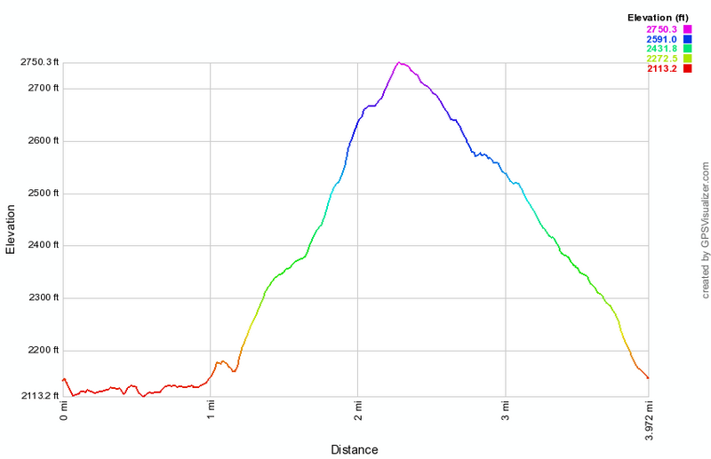
(The image above shows the profile of the hike. Remember that all vertical profiles are relative!)
Frick Pond: Flynn, Big Rock and Quick Lake Trails
| Quick Look | ||||
|---|---|---|---|---|
| Difficulty | Round trip | Total climb | Internet Maps | |
| 4.0 mi. | 747 ft. | AllTrails | ||
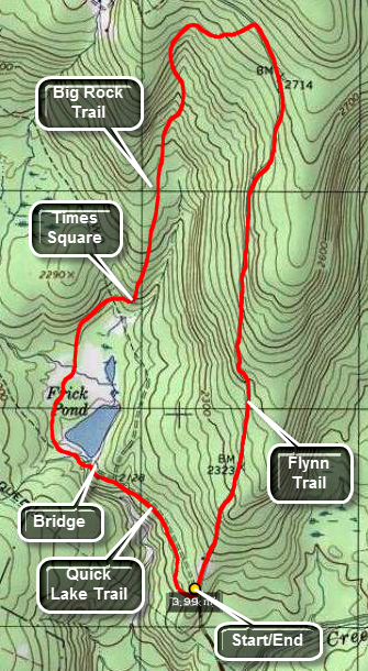 The area around Frick Pond, Hodge Pond and Quick Lake is covered with trails. There are numerous possibilities for short of long hikes. The area is "relatively" flat and there are no "views".
There is, however, some beautiful scenery.
The area around Frick Pond, Hodge Pond and Quick Lake is covered with trails. There are numerous possibilities for short of long hikes. The area is "relatively" flat and there are no "views".
There is, however, some beautiful scenery.
Take DeBruce Road from Livingston Manor for about six miles then turn left on Mongaup Rd. Where the road splits bear left on Beech Mountain Rd. and park in the parking lot on the left. Walk across the road to pick up the Flynn Trail. The cabin straight ahead on the road is private property and may be occupied. The hike up the Flynn Trail is 1.7 miles that is all uphill. The elevation gain to the junction with the Big Rock Trail is around 600 feet so the grade is not too great. Turn left at the top of the Flynn Trail and head down the Big Rock Trail to the four-way trail junction called Times Square. The distance is about 1.1 miles with a drop of around 580 feet. Continue straight ahead on the Big Rock Trail around the "back" of Frick Pond. This trail has several wooden bridges and walkways that can be slick when wet. From Times Square to the bridge at the outlet of Frick Pond is about .6 miles and is almost flat. From the bridge walk up the hill to the right to Gravestone Junction. Stay to the right here to walk the trail which becomes a woods road and leads back to the trail register. At the trail register turn right to stay on the trail and arrive back at the parking area.
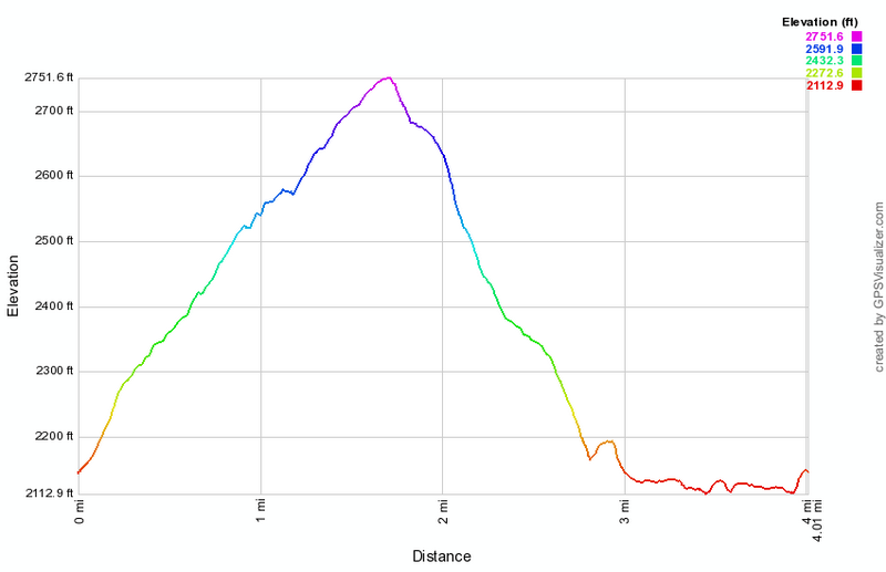
(The image above shows the profile of the hike. Remember that all vertical profiles are relative!)
Frick Pond: Flynn, Big Rock, Loggers Loop and Quick Lake Trails (short)
| Quick Look | ||||
|---|---|---|---|---|
| Difficulty | Round trip | Total climb | Internet Maps | |
| 4.0 mi. | 705 ft. | AllTrails | ||
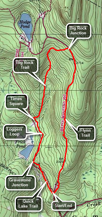 The area around Frick Pond, Hodge Pond and Quick Lake is covered with trails. There are numerous possibilities for short of long hikes. The area is "relatively" flat and there are no "views". There is, however, some beautiful scenery.
Take DeBruce Road from Livingston Manor for about six miles then turn left on Mongaup Rd. Where the road splits bear left on Beech Mountain Rd. and park in the parking lot on the left. Walk across the road to pick up the Flynn Trail. The cabin straight ahead on the road is private property and may be occupied. The hike up the Flynn Trail is 1.7 miles that is all uphill. The elevation gain to the junction with the Big Rock Trail is around 600 feet so the grade is not too great. Turn left at the top of the Flynn Trail and head down the Big Rock Trail to the four-way trail junction called Times Square. The distance is right around 1.1 miles with a drop of around 580 feet. Turn left on the yellow Logger's Loop Trail to head toward Gravestone Junction. This section is about .6 miles and starts with a slight uphill. At Gravestone junction turn left on the red blazed Quick Lake Trail. At the trail register you may turn right to stay on the trail or continue straight ahead on the woods road. Both ways lead to the parking areas.
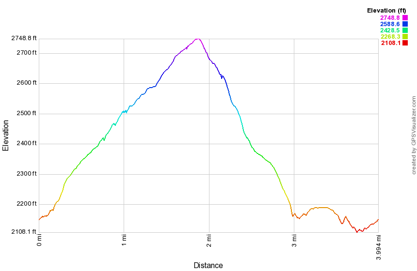
(The image above shows the profile of the hike. Remember that all vertical profiles are relative!)
Frick Pond: Logger's Loop Clockwise
| Quick Look | ||||
|---|---|---|---|---|
| Difficulty | Round trip | Total climb | Internet Maps | |
| 3.7 mi. | 408 ft. | AllTrails | ||
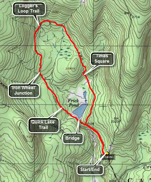 The area around Frick Pond, Hodge Pond and Quick Lake is covered with trails. There are numerous possibilities for short of long hikes. The area is "relatively" flat and there are no "views". There is, however, some beautiful scenery.
Take DeBruce Road from Livingston Manor for about six miles then turn left on Mongaup Rd. Where the road splits bear left on Beech Mountain Rd. and park in the parking lot on the left. Find the red-blazed Quick Lake Trail which leaves the back of the larger parking lot. At the first junction turn left onto a woods road at the trail register. Continue about .4 miles to the junction with the yellow-blazed Logger's Loop. Stay to the left here to go to Frick Pond which is just .1 miles away. Follow the Quick Lake Trail over the bridge and bear left at the next trail junction to stay of red Quick Lake Trail. At about 1.5 miles you will be at Iron Wheel Junction which is marked by a set of ... iron wheels. The Quick Lake Trail turns left here and heads toward Hodge Pond. Turn right on the yellow Logger's Loop Trail. The trail ascends slightly and then begins a descent to Times Square at 2.75 miles. The name indicates that many trails cross at this point. Continue straight ahead on the Logger's Loop Trail which will bring you back to the trail junction near Frick Pond at 3.3 miles. Walk back out the way you came on the red Quick Lake Trail which will bring you back to the parking area.
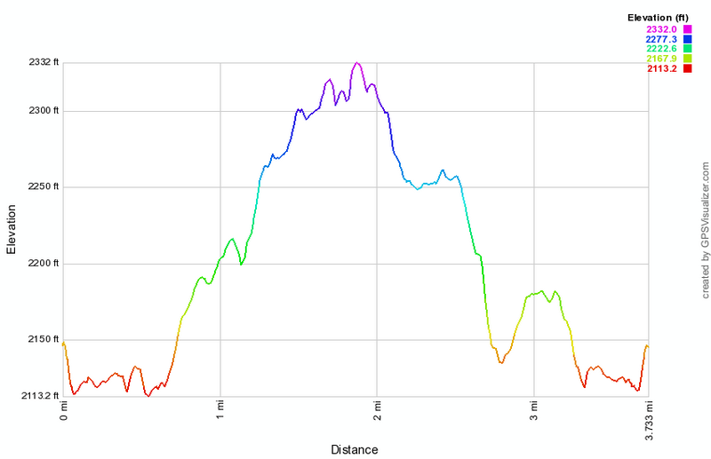
(The image shows the profile of the hike. Remember that all vertical profiles are relative! This image suggests some rugged and steep ascents and descents but the trail is really rather FLAT.)
Frick Pond: Logger's Loop Counterclockwise
| Quick Look | ||||
|---|---|---|---|---|
| Difficulty | Round trip | Total climb | Internet Maps | |
| 3.7 mi. | 408 ft. | AllTrails | ||
The area around Frick Pond, Hodge Pond and Quick Lake is covered with trails. There are numerous possibilities for short of long hikes. The area is "relatively" flat and there are no "views". There is, however, some beautiful scenery.
Take DeBruce Road from Livingston Manor for about six miles then turn left on Mongaup Rd. Where the road splits bear left on Beech Mountain Rd. and park in the parking lot on the left. Find the red-blazed Quick Lake Trail which leaves the back of the larger parking area. At the first junction turn left onto a woods road at the trail register. Continue about .4 miles to the junction with the yellow-blazed Logger's Loop. Turn right here and walk to Times Square, a junction of several trails, at 1 mile. Continue straight across the intersection to stay on the yellow Logger's Loop heading northwest. The trail will head uphill slightly and begin to loop around until you are walking south toward Iron Wheel Junction. Arrive at Iron Wheel Junction at 2.2 miles and turn left on the red Quick Lake Trail to head back toward Frick Pond. At 3 miles you will be at another trail junction. Turn right to head toward the outlet of Frick Pond. Cross the bridge and walk to the right up the small hill. At the next trail junction continue straight ahead to the trail register. Turn right and walk back to the parking area.
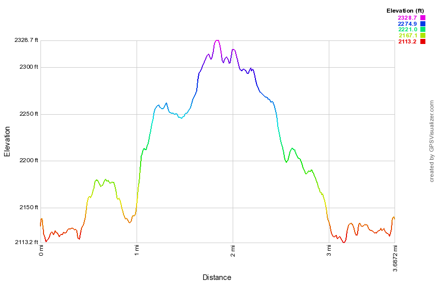
(The image shows the profile of the hike. Remember that all vertical profiles are relative! This image suggests some rugged and steep ascents and descents but the trail is really rather FLAT.)
Frick Pond: Loggers Loop, Big Rock and Flynn Trails
| Quick Look | ||||
|---|---|---|---|---|
| Difficulty | Round trip | Total climb | Internet Maps | |
| 3.9 mi. | 720 ft. | AllTrails | ||
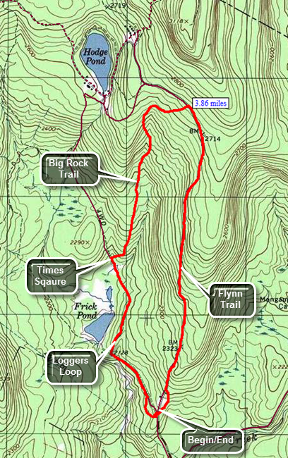 The area around Frick Pond, Hodge Pond and Quick Lake is covered with trails. There are numerous possibilities for short of long hikes. The area is "relatively" flat and there are no "views". There is, however, some beautiful scenery.
Take DeBruce Road from Livingston Manor for about six miles then turn left on Mongaup Rd. Where the road splits bear left on Beech Mountain Rd. and park in the parking lot on the left. Find the red-blazed Quick Lake Trail at the back of the larger parking area and follow it for .5 miles to the junction with the yellow-blazed Logger's Loop. Turn right onto the Loggers Loop and start to walk to Times Square. The first part of this trail is slightly uphill but then descends to a four-way trail junction called, Times Square. The area around Times Square can be wet but there is usually a way to avoid the worst area. Turn right and start up the yellow blazed Big Rock Trail which is well-drained with few wet or muddy areas. The distance from Times Square to the Flynn Trail is 1.1 miles and gains just under 600 feet in elevation. The average grade is less than 10% but seems steep in comparison to the flatter trails in the area. At the top of the hill is the Flynn Trail. Turn right to head back to the car on the Flynn Trail. which is downhill for 1.7 miles to the parking area. At the gate, turn left to finish the hike on the Flynn Trail and avoid the private property around the cabin.
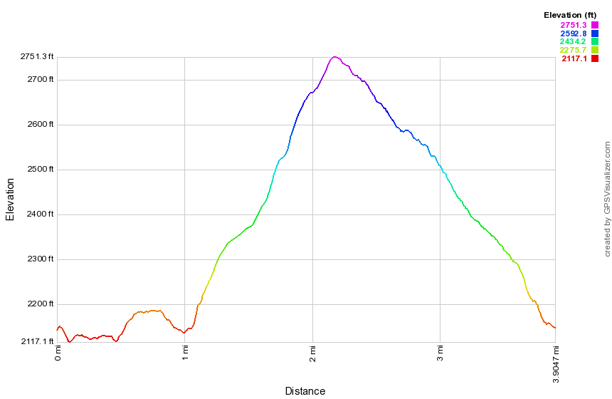
(The image shows the profile of the hike. Remember that all vertical profiles are relative!)
Frick Pond: Flynn, Big Rock, Quick Lake and Logger's Loop Trails
| Quick Look | ||||
|---|---|---|---|---|
| Difficulty | Round trip | Total climb | Internet Maps | |
| 5.6 mi. | 908 ft. | AllTrails | ||
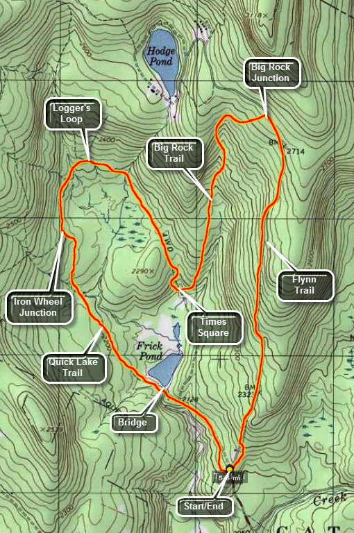 The area around Frick Pond, Hodge Pond and Quick Lake is covered with trails. There are numerous possibilities for short of long hikes. The area is "relatively" flat and there are no "views". There is, however, some beautiful scenery.
Take DeBruce Road from Livingston Manor for about six miles then turn left on Mongaup Rd. Where the road
splits bear left on Beech Mountain Rd. and park in the parking lot on the left. Cross the road and start up the blue Flynn Trail which rises continuously but gently to a junction with the Big Rock Trail at 1.7 miles. The overall elevation gain is about 600 feet but the grade is less than 7%. At the junction turn left on the red Big Rock Trail which is also a snowmobile trail. The trail heads east for .25 miles and then turns south continuing to descend a total of 585 feet over another .9 miles. At 2.85 miles into the hike the trail meets Time Square, a trail junction with trails in four different directions. Turn right on the yellow Logger's Loop which starts and ascent to the northwest. The trail turns west at 3.5 miles and then turns south until it meets the Quick Lake trail at Iron Wheel Junction 4.1 miles into the hike. Turn left on the Quick Lake Trail heading south and then southeast toward the bridge across the outlet of Frick Pond at 5.0 miles. Along the way the trail crosses a small stream in the woods and then passes through a "spruce tunnel". The bridge at the outlet end of Frick Pond is a good spot to stop and take some pictures of this pretty pond. The mountain to the right is Flynn's Point the high point in Sullivan County. Continue up the hill on the red Quick Lake Trail to Gravestone Junction and back to the parking area.
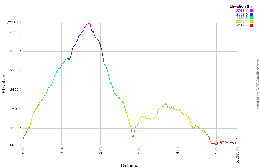
(The image above shows the profile of the hike. Remember that all vertical profiles are relative!)
Frick Pond: Quick Lake, Loggers Loop, Big Rock and Flynn Trails
| Quick Look | ||||
|---|---|---|---|---|
| Difficulty | Round trip | Total climb | Internet Maps | |
| 5.6 mi. | 908 ft. | AllTrails | ||
 The area around Frick Pond, Hodge Pond and Quick Lake is covered with trails. There are numerous possibilities for short of long hikes. The area is "relatively" flat and there are no "views". There is, however, some beautiful scenery.
Take DeBruce Road from Livingston Manor for about six miles then turn left on Mongaup Rd. Where the road splits bear left on Beech Mountain Rd. and park in the parking lot on the left. Find the red-blazed Quick Lake trail and follow it for .5 miles to the junction with the yellow-blazed Logger's Loop. Turn left to stay on the Quick Lake Trail. You will cross over the bridge at the outlet to Frick Pond. This is a beautiful spot to take pictures in all four seasons and under most lighting conditions. Continue around the pond and at about .7 miles there will be a trail junction. Bear to the left on the Quick Lake Trail and continue to follow it through the "spruce tunnel" and across the little stream through the woods. The trail meets the Logger's Loop at Iron Wheel Junction 1.5 miles into the hike. Follow the yellow Logger's Loop as it heads north and then east finishing up on a descent to the south toward Times Square, The trail meets others at Times Square at 2.75 miles. Turn left and get ready for an ascent on the Big Rock Trail. The trail heads NNE ascending 500 feet over .85 miles and then turning east. It intersects the Flynn Trail at 3.85 miles at the highest point on the hike. Turn right on the blue Flynn Trail and enjoy a 1.7 mile descent back to the parking area as the trail drops 600 feet. As the trail nears the gate at the end of the old Beech Mountain Road turn left following the Flynn Trail through the woods to avoid the private property around the cabin.
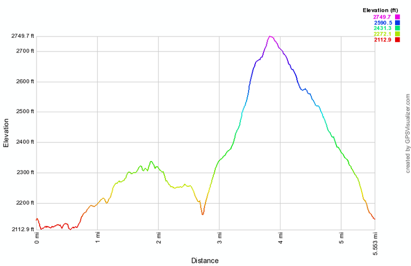
(The image above shows the profile of the hike. Remember that all vertical profiles are relative!)
Frick and Hodge Ponds: Big Rock, Flynn and Quick Lake Trails
| Quick Look | ||||
|---|---|---|---|---|
| Difficulty | Round trip | Total climb | Internet Maps | |
| 7.3 mi. | 1130 ft. | AllTrails | ||
_map.png) The area around Frick Pond, Hodge Pond and Quick Lake is covered with trails. There are numerous possibilities for short of long hikes. The area is "relatively" flat and there are no "views". There is, however, some beautiful scenery.
The area around Frick Pond, Hodge Pond and Quick Lake is covered with trails. There are numerous possibilities for short of long hikes. The area is "relatively" flat and there are no "views". There is, however, some beautiful scenery.
Take DeBruce Road from Livingston Manor for about six miles then turn left on Mongaup Rd. Where the road splits bear left on Beech Mountain Rd. and park in the parking lot on the left. Find the Quick Lake Trail which leaves the back right corner of the larger parking area. Follow this out to the register box where you should turn left to continue on the Quick Lake Trail. At the first trail junction bear left and walk down to the bridge across the outlet from Frick Pond. Continue on around the pond and bear right at the next junction so that you wrap around the "back" of Frick Pond. Continue on this trail to Times Square, a junction with trails in all 4 cardinal directions. Walk straight ahead and start UP the Big Rock Trail which gains 600 feet in a little over a mile and meets the Flynn Trail. Turn left on the Flynn Trail and follow it .7 miles down to Hodge Pond. There is a woods road that branches to the right along the way but you should avoid this. From Hodge Pond turn right to walk up a hill and around the pond counterclockwise of a jeep road. Watch for the Flynn Trail as it branches off from the northwest corner of the pond. Turn right to follow the Flynn Trail for about .5 miles to Junkyard Junction where you should turn left to get on the Quick Lake Trail which will take you back to the parking area. In 1.4 miles a snowmobile trail will branch to the right. Stay on the Quick Lake Trail for another .2 miles to Iron Wheel Junction. The Logger's Loop is straight ahead but you should turn right to follow the Quick Lake trail back to the outlet of Frick Pond in about 1 mile. From the bridge at the outlet end of Frick Pond follow the Quick Lake Trail up the hill to Gravestone Junction. Stay to the right on the Quick Lake Trail to walk .5 miles back to the parking area.
_gra.png)
(The image above shows the profile of the hike. Remember that all vertical profiles are relative!)
Frick and Hodge Ponds: Big Loop
| Quick Look | ||||
|---|---|---|---|---|
| Difficulty | Round trip | Total climb | Internet Maps | |
| 8.5 mi. | 1260 ft. | AllTrails | ||
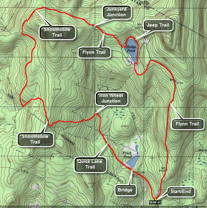 The area around Frick Pond, Hodge Pond and Quick Lake is covered with trails. There are numerous possibilities for short of long hikes. The area is "relatively" flat and there are no "views". There is, however, some beautiful scenery.
Take DeBruce Road from Livingston Manor for about six miles then turn left on Mongaup Rd. Where the road splits bear left on Beech Mountain Rd. and park in the parking lot on the left. Find the red-blazed Quick Lake trail and follow it for .5 miles to the junction with the yellow-blazed Logger's Loop. Turn left to stay on the Quick Lake Trail. Cross the bridge over the Frick Pond outlet and continue around the pond. At the next trail unction bear left to stay on the Quick Lake Trail to Iron Wheel Junction. After 1.5 miles, turn left at Iron Wheel junction to stay on the Quick Lake Trail. The Logger's Loop heads to the right here. At the next junction bear left off the Quick Lake Trail and onto a snowmobile trail. This trail at first heads west and crests a hill at 2.2 miles. After this the trail begins to drop and turns to head almost due north. Continue to follow the main snowmobile trail and ignore the many side trails and paths. At about 3.9 miles the snowmobile trail intersects the Quick Lake Trail at Coyote Junction. Turn right and follow the red-blazed Quick Lake Trail for 1.1 miles to Junkyard Junction where the Flynn Trail begins. Continue straight ahead on the Flynn Trail passing a gate and walking almost to the shore of Hodge Pond.When you reach the trail around the pond, turn left and follow the jeep trail around the back of the pinto the outlet. Continue straight ahead to pick up the Flynn Trail and walk up the hill passing a woods road on the left. Walk passed another gate and at 6.9 miles reach a four-way intersection with a snowmobile trail on the left and the Big Rock Trail on the right. Continue straight ahead staying on the Flynn Trail to the parking area. From the junction the distance is 1.7 miles and it is almost all downhill. Near the end of the hike turn left at the last gate to avoid walking passed the cabin on private property.
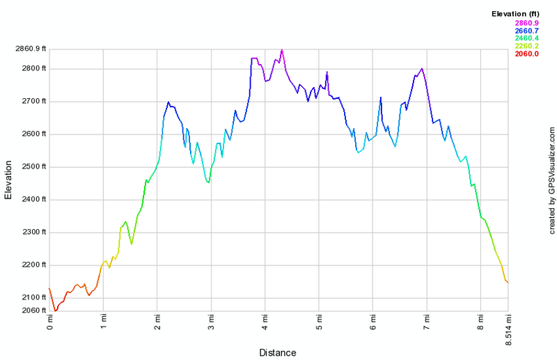
(The image above shows the profile of the hike. Remember that all vertical profiles are relative!)
Frick and Hodge Ponds: Quick Lake, Big Rock and Flynn Trails
| Quick Look | ||||
|---|---|---|---|---|
| Difficulty | Round trip | Total climb | Internet Maps | |
| 6.0 mi. | 900 ft. | AllTrails | ||
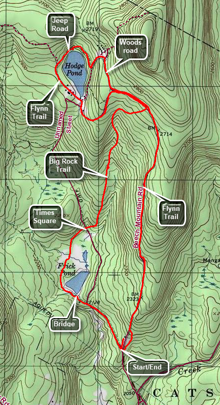 The area around Frick Pond, Hodge Pond and Quick Lake is covered with trails. Some are hiking trails while others are snowmobile trails or woods roads. There are numerous possibilities for short or long hikes. The area is "relatively" flat and there are no "views". There is, however, some beautiful scenery with two small ponds.
Take DeBruce Road from Livingston Manor for about six miles then turn left on Mongaup Rd. Where the road splits bear left on Beech Mountain Rd. and park in the parking lot on the left. Find the red-blazed Quick Lake trail and follow it for .5 miles to the junction with the yellow-blazed Logger's Loop at Gravestone Junction. Turn left to stay on the Quick Lake Trail. Walk down the hill to Frick Pond and across the bridge. At the next trail junction at .7 miles bear right on the Big Rock Trail toward Times Square. At Times Square, continue straight ahead on the Big Rock Trail. This trail rises almost 600 feet over 1.1 miles to the junction with the Flynn Trail. Turn left and continue on the flat part of the Flynn Trail to the junction with a woods road. Stay to the left and descend to the clearing at the outlet end of Hodge Pond. Walk over to the shore if you like but return to the Flynn Trail to walk along the west side of Hodge Pond. At 3.3 miles the Flynn Trail turns left up a hill. Turn right on a jeep road that goes around the upper end of the pond. At the next junction, turn left and walk up the hill to a woods road. Turn right and walk back to the Flynn Trail. Turn left on the Flynn Trail and walk back to the junction with the Big Rock Trail. Continue straight ahead on the Flynn Trail. Walk 1.7 miles mostly downhill and back to the parking area.
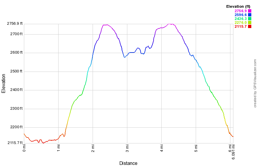
(The image shows the profile of the hike. Remember that all vertical profiles are relative!)
Frick and Hodge Ponds: Flynn and Quick Lake Trail
| Quick Look | ||||
|---|---|---|---|---|
| Difficulty | Round trip | Total climb | Internet Maps | |
| 6.4 mi. | 920 ft. | AllTrails | ||
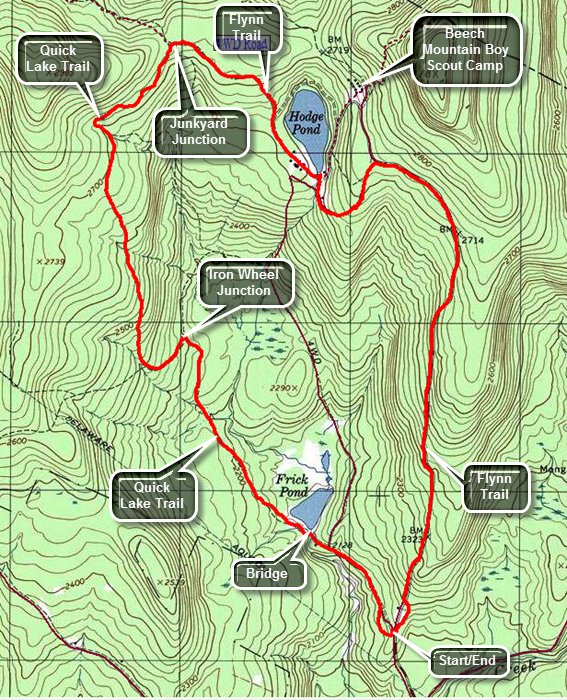 The area around Frick Pond, Hodge Pond and Quick Lake is covered with trails. Some are hiking trails while others are snowmobile trails or woods roads. There are numerous possibilities for short or long hikes. The area is "relatively" flat and there are no "views". There is, however, some beautiful scenery with two small ponds.
Take DeBruce Road from Livingston Manor for about six miles then turn left on Mongaup Rd. Where the road splits bear left on Beech Mountain Rd. and park in one of the parking lots on the left. Cross the road to find the blue blazed Flynn Trail which heads up the hill through the woods to avoid the cabin which is private property. Walk 1.7 miles uphill to the junction with the Big Rock Trail on the left and the snowmobile trail from Mongaup Pond on the right. Continue straight ahead on the Flynn Trail. At 2 miles there is another trail junction with a woods road going off to the right. Stay to the left and follow the Flynn Trail down to the shores of Hodge Pond. The trail turns left just before you get to the pond but you will probably want to walk straight ahead and investigate the pond. Follow the Flynn Trail across the outlet stream of the pond. At 2.8 miles bear to the left to continue to follow the Flynn Trail. Going straight ahead will take you around the back of the pond on an old jeep road. Walk up the hill to a gate and bear to the left following the Flynn Trail. At 3.3 miles you will be at Junkyard Junction where the Flynn Trail ends at the red blazed Quick Lake Trail. Turn left on the Quick Lake Trail and walk mostly downhill for 1.6 miles to Iron Wheel Junction at 4.9 miles. The yellow blazed Logger's Loop continues straight ahead. Turn right to stay on the Quick Lake Trail. Walk another .8 miles to 5.75 miles and another trail junction. To the left a trail goes around the back of Frick Pond and ends up at Times Square, a four-way trail junction. Continue straight ahead following the Quick Lake Trail to the bridge across the outlet of Frick Pond. As you stand on the bridge the mountain in the background to the right is Beech Mountain, the highest point in Sullivan County at 3118 feet. Continue on the trail climbing a small hill and passing the Logger's Loop on the left. Continue another .4 miles back to the car. When you pass the trail register, be sure to turn right and follow the Quick Lake Trail back to the parking area. The woods road that continues straight ahead leads to private property.
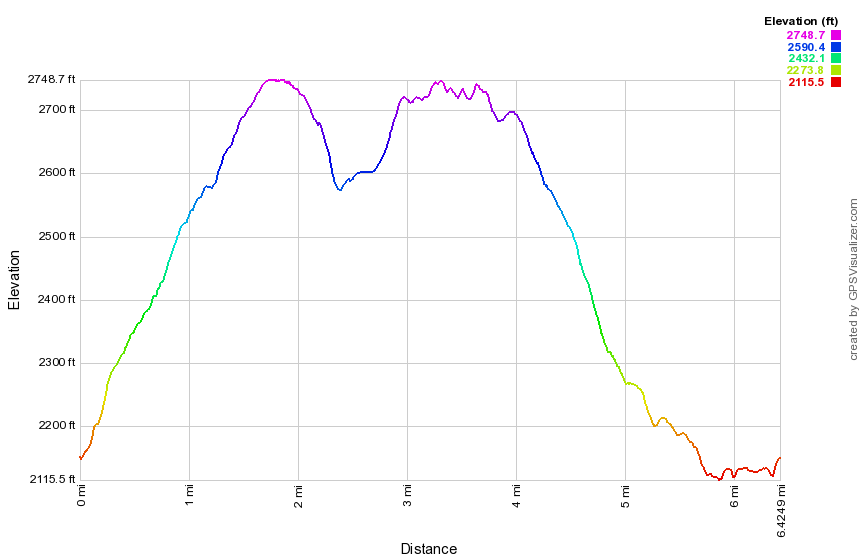
(The image shows the profile of the hike. Remember that all vertical profiles are relative!)
Frick and Hodge Ponds: Quick Lake and Flynn Trails
| Quick Look | ||||
|---|---|---|---|---|
| Difficulty | Round trip | Total climb | Internet Maps | |
| 6.4 mi. | 920 ft. | AllTrails | ||
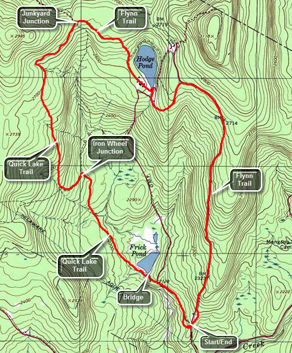 The area around Frick Pond, Hodge Pond and Quick Lake is covered with trails. Some are hiking trails while others are snowmobile trails or woods roads. There are numerous possibilities for short or long hikes. The area is "relatively" flat and there are no "views". There is, however, some beautiful scenery with two small ponds.
Take DeBruce Road from Livingston Manor for about six miles then turn left on Mongaup Rd. Where the road splits bear left on Beech Mountain Rd. and park in the parking lot on the left. Find the red-blazed Quick Lake trail and follow it for .5 miles to the junction with the yellow-blazed Logger's Loop. Turn left to stay on the Quick Lake Trail. Walk down the hill to Frick Pond and across the bridge. At the next trail junction at .7 miles bear left on the Quick Lake Trail toward Iron Wheel Junction. At 1.5 miles turn left to stay on the Quick Lake Trail. This is Iron Wheel Junction and the yellow blazed Loggers Loop turns right. Continue to walk uphill on the Quick Lake Trail to Junkyard Junction at 3.1 miles. Turn right here to get on the blue blazed Flynn Trail. Walk another .5 miles passing through a gate and down to a trail that circles Hodge Pond. Turning left here will take you around the back of the pond on an old jeep trail. Turn right to stay on the Flynn trail and walk to 3.9 miles crossing the outlet of Hodge Pond. Turn to the right and walk uphill on the Flynn Trail passing another woods road that goes off to the left at 4.4 miles. Continue to walk to 4.7 miles where there is a four-way intersection with a snowmobile trail on the left and the Big Rock Trail on the right. Continue straight ahead on the Flynn Trail. Walk another 1.7 miles back to your car. Near the end of the woods road that makes up much of the Flynn Trail there is a gate. Turn left at the gate to stay on the trail and avoid the cabin which is private property.
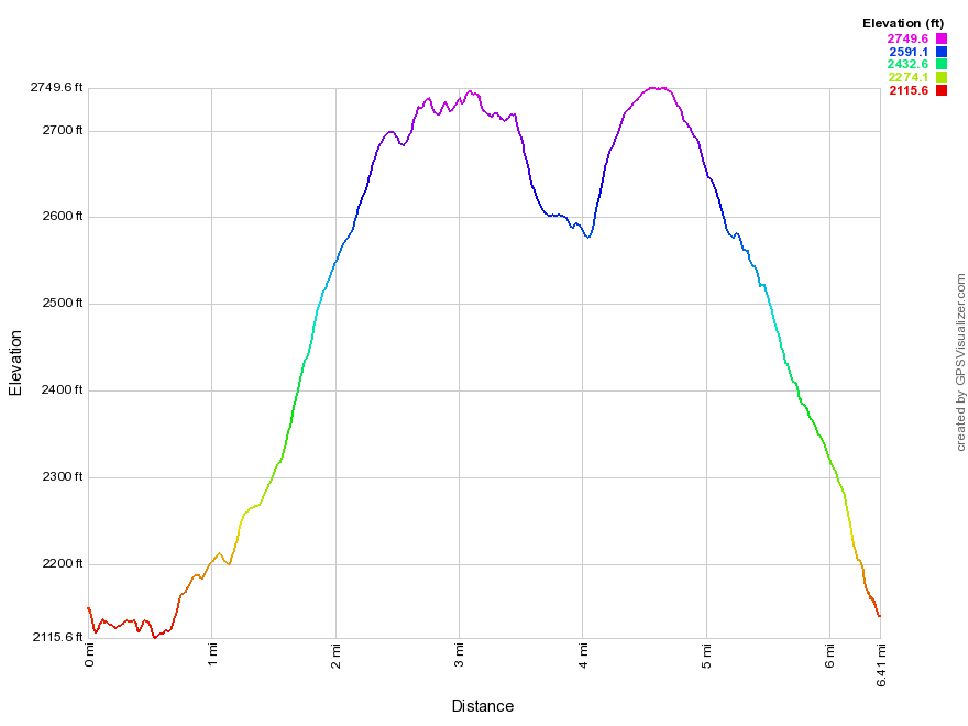
(The image shows the profile of the hike. Remember that all vertical profiles are relative!)
Frick and Hodge Ponds: Quick Lake, Big Rock and Flynn Trails
| Quick Look | ||||
|---|---|---|---|---|
| Difficulty | Round trip | Total climb | Internet Maps | |
| 6.0 mi. | 900 ft. | AllTrails | ||
The area around Frick Pond, Hodge Pond and Quick Lake is covered with trails. Some are hiking trails while others are snowmobile trails or woods roads. There are numerous possibilities for short or long hikes. The area is "relatively" flat and there are no "views". There is, however, some beautiful scenery with two small ponds.
Take DeBruce Road from Livingston Manor for about six miles then turn left on Mongaup Rd. Where the road splits bear left on Beech Mountain Rd. and park in the parking lot on the left. Find the red-blazed Quick Lake trail and follow it for .5 miles to the junction with the yellow-blazed Logger's Loop at Gravestone Junction. Turn left to stay on the Quick Lake Trail. Walk down the hill to Frick Pond and across the bridge. At the next trail junction at .7 miles bear right on the Big Rock Trail toward Times Square. At Times Square, continue straight ahead on the Big Rock Trail. This trail rises almost 600 feet over 1.1 miles to the junction with the Flynn Trail. Turn left and continue on the flat part of the Flynn Trail to the junction with a woods road. Stay to the left and descend to the clearing at the outlet end of Hodge Pond. Walk over to the shore if you like but return to the Flynn Trail to walk along the west side of Hodge Pond. At 3.3 miles the Flynn Trail turns left up a hill. Turn right on a jeep road that goes around the upper end of the pond. At the next junction, turn left and walk up the hill to a woods road. Turn right and walk back to the Flynn Trail. Turn left on the Flynn Trail and walk back to the junction with the Big Rock Trail. Continue straight ahead on the Flynn Trail. Walk 1.7 miles mostly downhill and back to the parking area.
(The image shows the profile of the hike. Remember that all vertical profiles are relative!)
Frick and Hodge Ponds: Big Rock, Logger's Loop, Quick Lake and Flynn Trails
| Quick Look | ||||
|---|---|---|---|---|
| Difficulty | Round trip | Total climb | Internet Maps | |
| 6.9 mi. | 860 ft. | AllTrails | ||
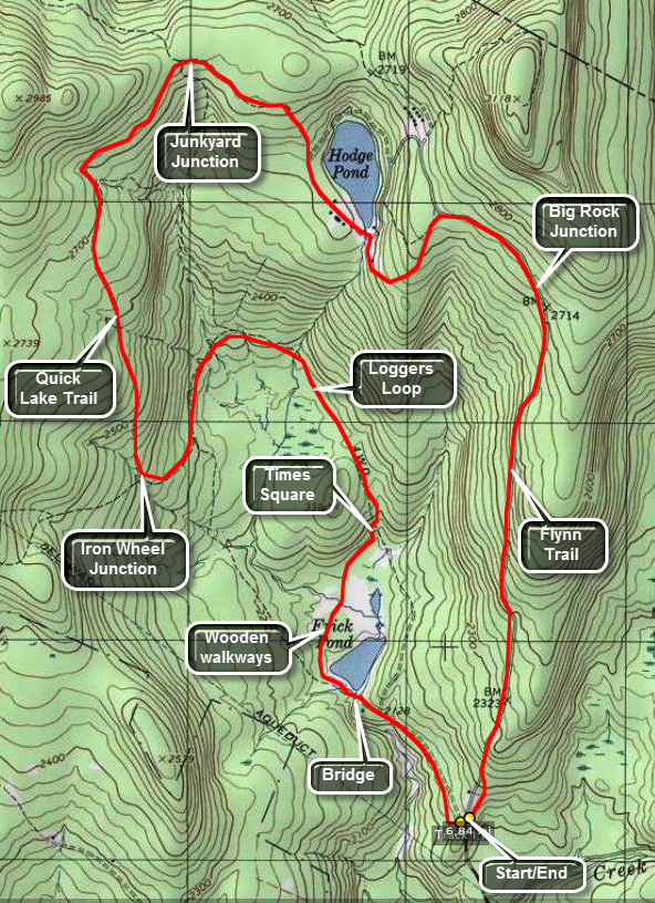 The area around Frick Pond, Hodge Pond and Quick Lake is covered with trails. There are numerous possibilities for short of long hikes. The area is "relatively" flat and there are no "views". There is, however, some beautiful scenery.
Take DeBruce Road from Livingston Manor for about six miles then turn left on Mongaup Rd. Where the road splits bear left on Beech Mountain Rd. and park in the parking lot on the left. From the larger parking lot find the Quick Lake Trail to walk out toward Hodge Pond. At the first junction bear left to Frick Pond and cross over the bridge at the outlet to the pond. At the next junction the Quick Lake Trail bears left. Bear right around the back of the pond. You will encounter some wooden walkways that can be very slippery even when there is no ice. The next junction is Times Square at about 1.0 mile into the hike. Turn left on the yellow Logger's Loop Trail to begin an a gentle ascent over the next 1.2 miles. At 2.25 miles you will be at Iron Wheel Junction where you will continue straight ahead on the red Quick Lake Trail. Over the next 1.5 miles you will gain about 435 feet in elevation to Junkyard Junction at the 3.7 mile mark. None of the climbing is very steep but it is continuous. At Junkyard Junction turn right on the blue Flynn Trail which is mostly flat with a descent ear the end. At the yellow gate bear to the right in the Flynn Trail and walk down to near the shore of Hodge Pond. Turn right and follow the Flynn Trail to the outlet end of Hodge Pond at about 4.5 miles. You may turn left and go around the back of the pond which has some nice views and adds only a little mileage to the hike. From the outlet continue on the Flynn Trail as it climbs to the highest point on the hike at the Big Rock Junction at the 5.2 mile mark. Continue straight ahead on the Flynn Trail which goes back DOWN to the parking area. Near the end of the trail just before the iron gate turn left into the woods and stay on the Flynn Trail. This avoids a small cabin which is usually occupied.
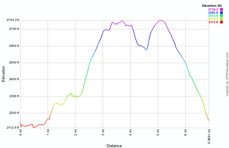
(The image above shows the profile of the hike. Remember that all vertical profiles are relative!)
Frick and Hodge Ponds: Flynn, Quick Lake, Logger's Loop and Big Rock Trails
| Quick Look | ||||
|---|---|---|---|---|
| Difficulty | Round trip | Total climb | Internet Maps | |
| 7.0 mi. | 915 ft. | AllTrails | ||
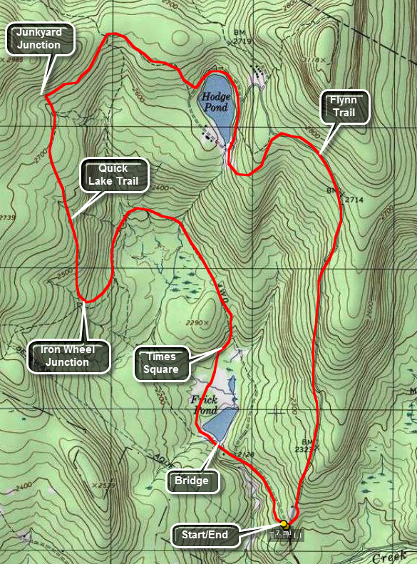 The area around Frick Pond, Hodge Pond and Quick Lake is covered with trails. There are numerous
possibilities for short of long hikes. The area is "relatively" flat and there are no "views".
There is, however, some beautiful scenery.
The area around Frick Pond, Hodge Pond and Quick Lake is covered with trails. There are numerous
possibilities for short of long hikes. The area is "relatively" flat and there are no "views".
There is, however, some beautiful scenery.
Take DeBruce Road from Livingston Manor for about six miles then turn left on Mongaup Rd. Where the road
splits bear left on Beech Mountain Rd. and park in the parking lot on the left. Walk across the road to find the blue Flynn Trail. This trail begins to gain elevation immediately until you reach the Big Rock Trail junction at 1.7 miles. Continue straight ahead and then bear left at the next intersection to head down to Hodge Pond at 2.3 miles. Walk to the right of the pond and up a hill on an unmarked jeep trail. Continue around the back of the lake and watch for the blue markings of the Flynn Train appear on your right at about 2.85 miles.Turn right on the Flynn Trail and walk to Junkyard Junction at 3.4 miles. Turn left on the red Quick Lake Trail which begins a long descent to Iron Wheel Junction at 4.8 miles. Continue your hike by walking straight ahead on the yellow Logger's Loop which descends to Times Square at 6.0 miles. Turn right to walk around the back of Frick Pond over a series of wooden walkways. The walkways pass over some very wet areas and are a great help but they can be VERY slippery. At the end of this short trail you will be back on the red Quick Lake trail and should turn left to the out let of Frick Pond at 6.6 Miles. From the bridge over the outlet turn right up the hill to follow the Quick Lake Trail back to your car. Just after the trail register be sure to turn right as the way straight ahead may take you to a private cabin.
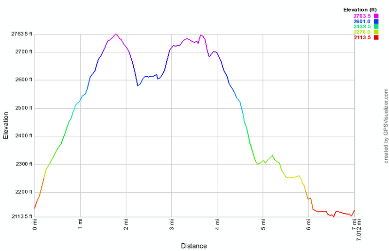
(The image above shows the profile of the hike. Remember that all vertical profiles are relative!)
Frick and Hodge Ponds: Quick Lake and Flynn Trails (back)
| Quick Look | ||||
|---|---|---|---|---|
| Difficulty | Round trip | Total climb | Internet Maps | |
| 6.7 mi. | 1000 ft. | AllTrails | ||
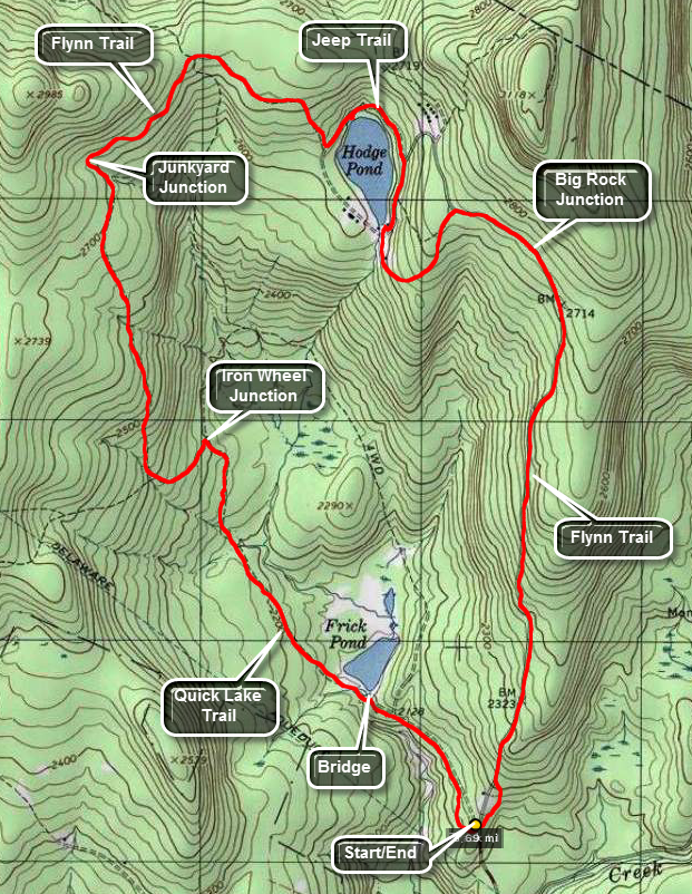 The area around Frick Pond, Hodge Pond and Quick Lake is covered with trails. There are numerous
possibilities for short of long hikes. The area is "relatively" flat and there are no "views".
There is, however, some beautiful scenery.
The area around Frick Pond, Hodge Pond and Quick Lake is covered with trails. There are numerous
possibilities for short of long hikes. The area is "relatively" flat and there are no "views".
There is, however, some beautiful scenery.
Take DeBruce Road from Livingston Manor for about six miles then turn left on Mongaup Rd. Where the road
splits bear left on Beech Mountain Rd. and park in the parking lot on the left. Find the red-blazed
Quick Lake trail and follow it for .5 miles to the junction with the yellow-blazed Logger's Loop.
Turn left to stay on the Quick Lake Trail. After .25 miles the Big Rock Trail will branch to the right.
Stay on the Quick Lake trail for another .85 miles to Iron Wheel Junction. Logger's Loop is to the right. Turn left to stay on the Quick Lake Trail for another 1.6 miles to Junkyard Junction. Now turn right onto the blue-blazed Flynn Trail. As you approach Hodge Pond, you may turn left and walk around the back of the pond to walk to the outlet in .6 miles Take some time to look at all the little "wonders of nature" the pond has to offer. Face the pond at the outlet and turn 180 degrees to continue on the Flynn Trail. Walk .7 miles and the Big Rock Trail will come in on your right. Continue
on the Flynn Trail for 1.7 miles until you are back at the Frick Pond Parking Area.
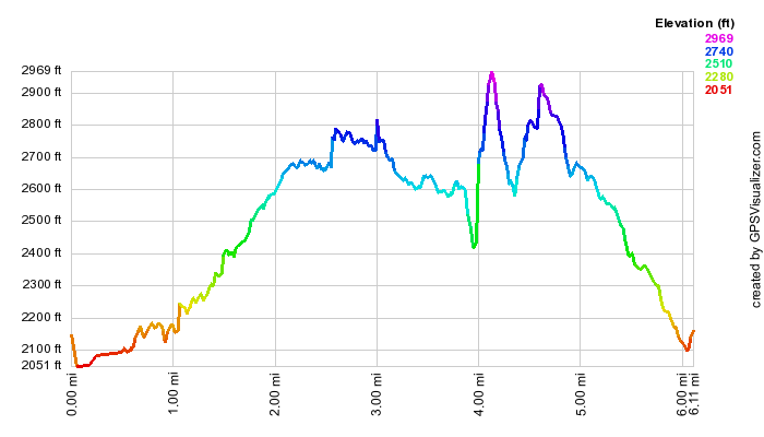
(The image above shows the profile of the hike. Remember that all vertical profiles are relative!)
Frick and Hodge Ponds: Quick Lake and Flynn Trails (front)
| Quick Look | ||||
|---|---|---|---|---|
| Difficulty | Round trip | Total climb | Internet Maps | |
| 6.1 mi. | 879 ft. | AllTrails | ||
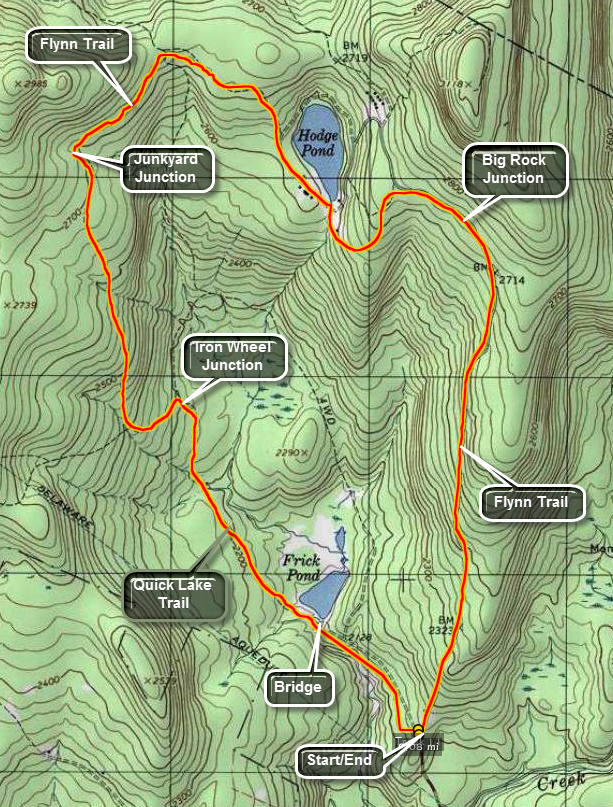 The area around Frick Pond, Hodge Pond and Quick Lake is covered with trails. There are numerous
possibilities for short of long hikes. The area is "relatively" flat and there are no "views".
There is, however, some beautiful scenery.
The area around Frick Pond, Hodge Pond and Quick Lake is covered with trails. There are numerous
possibilities for short of long hikes. The area is "relatively" flat and there are no "views".
There is, however, some beautiful scenery.
Take DeBruce Road from Livingston Manor for about six miles then turn left on Mongaup Rd. Where the road
splits bear left on Beech Mountain Rd. and park in the parking lot on the left. Find the red-blazed
Quick Lake trail and follow it for .5 miles to the junction with the yellow-blazed Logger's Loop.
Turn left to stay on the Quick Lake Trail. After .25 miles the Big Rock Trail will branch to the right.
Stay on the Quick Lake trail for another .85 miles to Iron Wheel Junction. Logger's Loop is to the right. Turn left to stay on the Quick Lake Trail for another 1.6 miles to Junkyard Junction. Now turn
right onto the blue-blazed Flynn Trail. As you approach Hodge Pond, turn right and you will be at the outlet after .4 miles. Take some time to look at all the little "wonders of nature" the pond has to offer. Face the pond at the outlet and turn 180 degrees to continue on the Flynn Trail. Walk .7 miles and the Big Rock Trail will come in on your right. Continue
on the Flynn Trail for 1.7 miles until you are back at the Frick Pond Parking Area.

(The image above shows the profile of the hike. Remember that all vertical profiles are relative!)
Frick and Hodge Ponds: Quick Lake and Flynn Trails (jeep trail)
| Quick Look | ||||
|---|---|---|---|---|
| Difficulty | Round trip | Total climb | Internet Maps | |
| 6.4 mi. | 925 ft. | AllTrails | ||
 The area around Frick Pond, Hodge Pond and Quick Lake is covered with trails. There are numerous possibilities for short of long hikes. The area is "relatively" flat and there are no "views". There is, however, some beautiful scenery.
Take DeBruce Road from Livingston Manor for about six miles then turn left on Mongaup Rd. Where the road splits bear left on Beech Mountain Rd. and park in the parking lot on the left. Find the red-blazed Quick Lake trail and follow it for .5 miles to the junction with the yellow-blazed Logger's Loop. Turn left to stay on the Quick Lake Trail. After .25 miles a trail will branch to the right. Stay on the Quick Lake trail for another .85 miles to Iron Wheel Junction. The Logger's Loop is to the right. Turn left to stay on the Quick Lake Trail for another 1.6 miles to Junkyard Junction. Now turn right onto the blue-blazed Flynn Trail. As you approach Hodge Pond, turn left to walk around the back of the pond on an old jeep road. On the other side of the road at about 4 miles turn left and walk up the hill. At the next junction turn right and follow the woods road back out to the Flynn Trail. At 4.4 miles turn left on the Flynn Trail. By 4.7 miles you will be at the junction with the Big Rock Trail on the right and a snowmobile trail on the left. Continue on the Flynn Trail for 1.7 miles until you are back at the Frick Pond Parking Area.

(The image above shows the profile of the hike. Remember that all vertical profiles are relative!)
Frick and Hodge Ponds: Mongaup Pond
| Quick Look | ||||
|---|---|---|---|---|
| Difficulty | Round trip | Total climb | Internet Maps | |
| 7.6 mi. | 1150 ft. | AllTrails | ||
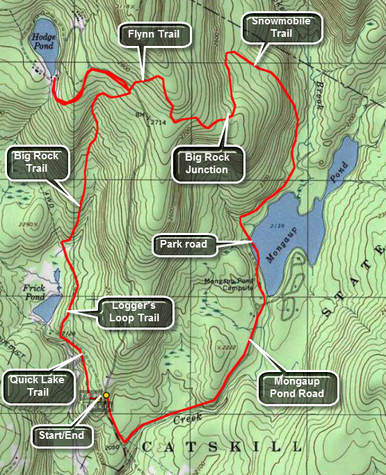 The area around Frick Pond, Hodge Pond and Quick Lake is covered with trails. There are numerous
possibilities for short of long hikes. The area is "relatively" flat and there are no "views".
There is, however, some beautiful scenery.
The area around Frick Pond, Hodge Pond and Quick Lake is covered with trails. There are numerous
possibilities for short of long hikes. The area is "relatively" flat and there are no "views".
There is, however, some beautiful scenery.
Take DeBruce Road from Livingston Manor for about six miles then turn left on Mongaup Rd. Where the road
splits bear left on Beech Mountain Rd. and park in the parking lot on the left. Find the red-blazed
Quick Lake trail and follow it for .5 miles to the junction with the yellow-blazed Logger's Loop.
If you turn left here, Frick pond is just .1 miles. Turn right on Logger's Loop and follow it for
.55 miles to Times Square. The name indicates that many trails cross at this point. Turn right here
onto the yellow-blazed Big Rock Trail. Continue on this trail for 1.1 miles until it crosses the
blue-blazed Flynn Trail. Several areas on Big Rock have significant but not severe climbs. Turn left
on the Flynn Trail and hike .45 miles to Hodge Pond. From here retrace the last .45 miles on the Flynn
Trail until the intersection with Big Rock Trail. Turn left onto the snowmobile trail and get ready for
a short climb. This trail meanders for about 2.3 miles until it intersects the paved Loop Road at the
Mongaup Pond State Campsite. Turn right on the loop road and walk about .75 miles to the gatehouse.
Walk out the access road for about 1.1 miles and make a right on Beech Mountain Road. After .3 miles,
you will be back at the Frick Pond Parking area.
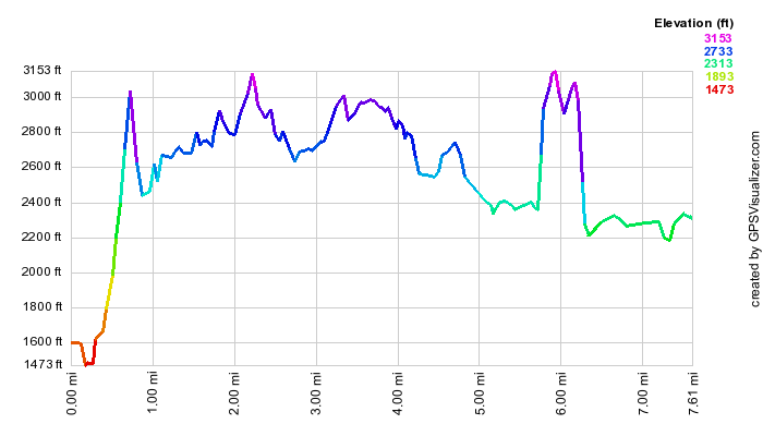
(The image above shows the profile of the hike. Remember that all vertical profiles are relative!)
Frick and Mongaup Ponds: Road Loop Clockwise
| Quick Look | ||||
|---|---|---|---|---|
| Difficulty | Round trip | Total climb | Internet Maps | |
| 7.0 mi. | 1100 ft. | AllTrails | ||
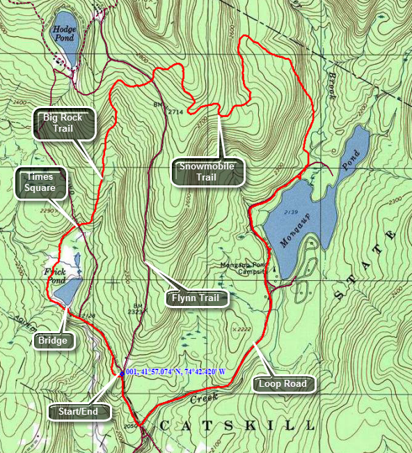 The area around Frick Pond, Hodge Pond and Quick Lake is covered with trails. There are numerous
possibilities for short of long hikes. The area is "relatively" flat and there are no "views".
There is, however, some beautiful scenery.
The area around Frick Pond, Hodge Pond and Quick Lake is covered with trails. There are numerous
possibilities for short of long hikes. The area is "relatively" flat and there are no "views".
There is, however, some beautiful scenery.
Take DeBruce Road from Livingston Manor for about six miles then turn left on Mongaup Rd. Where the road
splits bear left on Beech Mountain Rd. and park in the parking lot on the left. Find the red-blazed
Quick Lake trail and follow it for .5 miles to the junction with the yellow-blazed Logger's Loop.
Turn left here and walk to Frick Pond which is just .1 miles away. Cross the bridge at the outlet to Frick Pond. At the next trail junction bear right to go around the pond on the yellow-blazed trail. Walk to the next trail junction which is called Times Square as several trails cross here. You will be about 1.2 miles into the hike. Continue straight ahead on the Big Rock Trail and get ready for an ascent to the Flynn Trail. Over the next the next 1.1 miles you will gain 580 feet to the junction with the Flynn Trail. Continue straight ahead on the snowmobile trail and gain another 150 to the top of the hill and a long descent. The trail now heads south then east and then north before turning southeast and then south until it meets the loop road at Mongaup Pond. When you reach the loop road you will be at 4.6 miles and will have lost 735 feet from the top of the hill. Turn right ion the loop road and head toward the entrance to the campgrounds about a mile away. Walk out the road for 1.1 miles to the intersection with Beech Mountain Road. Turn right and head up a small hill and back to your car.

(The image above shows the profile of the hike. Remember that all vertical profiles are relative!)
Frick and Mongaup Ponds: Road Loop Counterclockwise
| Quick Look | ||||
|---|---|---|---|---|
| Difficulty | Round trip | Total climb | Internet Maps | |
| 7.0 mi. | 1100 ft. | AllTrails | ||
The area around Frick Pond, Hodge Pond and Quick Lake is covered with trails. There are numerous
possibilities for short of long hikes. The area is "relatively" flat and there are no "views".
There is, however, some beautiful scenery.
Take DeBruce Road from Livingston Manor for about six miles then turn left on Mongaup Rd. Where the road splits bear left on Beech Mountain Rd. and park in the parking lot on the left. Walk back down Beech Mountain Road toward the intersection with the road to Mongaup Pond. Turn left and walk mostly uphill and parallel to the outlet stream from the pond. At the park entrance, walk through the entrance and stay left to take the road on the west side of the pond. About a quarter mile from the entrance there is an observation deck on the right with nice views of the pond. Continue on the road and in a short distance there is another nice place to take pictures on the pond. There is a bench here if you want to relax and take a break. Back on the road walk a few hundred feet up the road and turn left onto an access road and then quickly left again onto the snowmobile trail. The trail in this area passes by a swampy area and is often wet with numerous insects. At 2.7 miles the trail begins to head northwest instead of north and then the climb begins. At 3.3 miles the trail makes a sharp turn and starts heading south but continues to climb. Another turn at 3.7 miles sends you eastward toward the Flynn Trail. At 4.1 miles the trail turns north continuing its meanders. At 4.5 miles two things happen as the trail turns east again and finally reaches the high point on the hike. You will have ascended over 700 feet in 1.8 miles! Continue over the top and down to the junction with the Flynn and Big Rock Trails. Continue straight ahead on the Big Rock Trail. There are three places where the trail drops quickly and then levels off. The last place brings you to Times Square where the Logger's Loop and Big Rock Trail cross. This area is almost always wet. Walk straight across Time Square to continue on the Big Rock Trail around the back of Frick Pond. This trail can be wet in places. Cross two bridges across the inlet stream, After the bridges there are some wooden walkways which are slippery when wet. These walkways are in bad shape as the support underneath them continues to rot away. My concerns to the DEC have so far gone unanswered. Without these walkways the hike would be considerably less enjoyable! Arrive at the end of the Big Rock Trail at the Quick Lake Trail and turn left to head toward the bridge at the outlet of Frick Pond. When you arrive at the bridge, take some time to enjoy a beautiful scene. The highest ground in the distance and on the right is Flynn's Point which may be the highest point in Sullivan County. When you are done, head up the hill and out the Quick Lake Trail to the car. At Gravestone Junction simply continue straight ahead on the red blazed Quick Lake Trail. The trail may be wet in some places but should be easy to walk around. At the register, turn right and walk out the Quick Lake Trail to the larger parking area and back to your car.
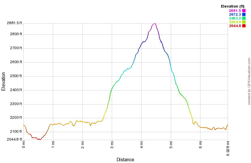
(The image above shows the profile of the hike. Remember that all vertical profiles are relative!)
Frick and Mongaup Ponds: Quick Lake, Logger's Loop and Big Rock Trails
| Quick Look | ||||
|---|---|---|---|---|
| Difficulty | Round trip | Total climb | Internet Maps | |
| 8.5 mi. | 1260 ft. | AllTrails | ||
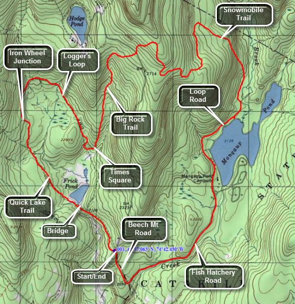 The area around Frick Pond, Hodge Pond and Quick Lake is covered with trails. There are numerous
possibilities for short of long hikes. The area is "relatively" flat and there are no "views".
There is, however, some beautiful scenery.
The area around Frick Pond, Hodge Pond and Quick Lake is covered with trails. There are numerous
possibilities for short of long hikes. The area is "relatively" flat and there are no "views".
There is, however, some beautiful scenery.
Take DeBruce Road from Livingston Manor for about six miles then turn left on Mongaup Rd. Where the road
splits bear left on Beech Mountain Rd. and park in the parking lot on the left. Find the red-blazed
Quick Lake trail and follow it for .5 miles to the junction with the yellow-blazed Logger's Loop.
Turn left here and go to the bridge at the outlet Frick Pond. Cross the bridge and bear to the left at the trail junction to stay on the Quick Lake Trail. Continue on the Quick Lake trail to Iron Wheel Junction at 1.5 miles into the hike. Turn to the right to get on the yellow-blazed Logger's Loop Trail. The trail rolls some with a descent near the end. After 1.2 miles, you will be at Times Square. Turn left here at start up the Big Rock Trail which ascends 600 feet in 1.1 miles until it meets the Flynn Trail. Continue straight ahead on the snowmobile trail and continue your ascent to the highest point on the hike at about 2850 feet. The snowmobile trail now descends to the shore on Mongaup Pond. The distance "as the crow flies" is less than a mile but the trail is routed to avoid ledges that a snowmobile could not negotiate. Over 1.9 miles the trail drops about 700 feet. Turn right on the loop road and walk a mile to the gatehouse. Walk 1.1 miles to the junction with Beech Mountain road. Turn right and walk .25 miles back to the car.
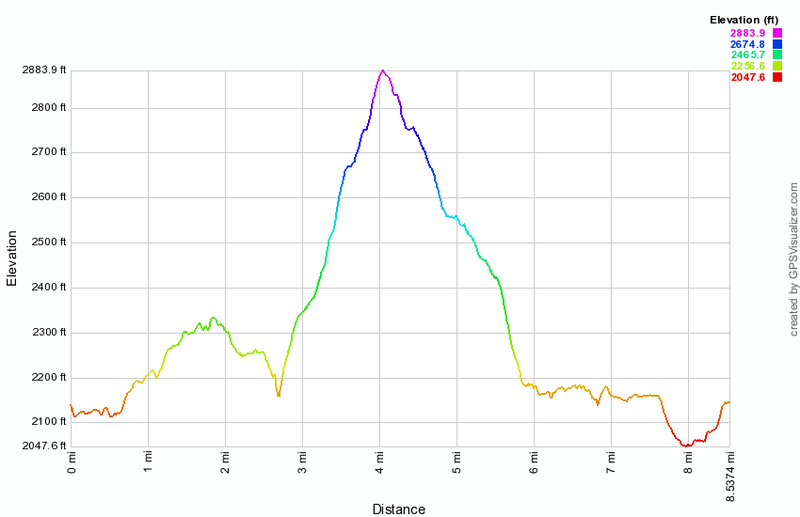
(The image shows the profile of the hike. Remember that all vertical profiles are relative!)
Frick and Mongaup Ponds: Quick Lake, Logger's Loop, Big Rock and Snowmobile Trails
| Quick Look | ||||
|---|---|---|---|---|
| Difficulty | Round trip | Total climb | Internet Maps | |
| 10.6 mi. | 1922 ft. | AllTrails | ||
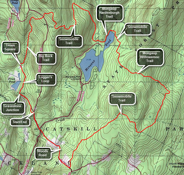 The area around Frick Pond, Hodge Pond and Quick Lake is covered with trails. There are numerous possibilities for short of long hikes. The area is "relatively" flat and there are no "views". There is, however, some beautiful scenery.
Take DeBruce Road from Livingston Manor for about six miles then turn left on Mongaup Rd. Where the road splits bear left on Beech Mountain Rd. and park in the parking lot on the left. Find the red-blazed Quick Lake trail and follow it for .5 miles to the junction with the yellow-blazed Logger's Loop. At Gravestone Junction turn right to walk the Logger's Loop to Times Square. Turn right to take the Big Rock Trail up to the junction with the Flynn Trail. The hike up the hill is about 1.1 miles and gains 600 feet. At the Flynn Trail continue straight ahead on the snowmobile trail as it heads liver to Mongaup Pond. The first part of the snowmobile trail gains some elevation to a high point. The 2.25 mile walk to Mongaup Pond is mostly downhill after cresting the hill. There isn't much to see along the way but the walk is pleasant enough. You will arrive at the loop road at about 4.3 miles. Turn left to walk the road to the blue Mongaup Hardenburgh Trail marked after a short distance by a sign. Turn left to follow the trail north around the upper part of the pond. At the head end of the pond the Mongaup Hardenburgh Trail turns slightly left to head north toward Hardenburgh and the Beaverkill Road. Stay on the path around the pond which is also a snowmobile trail. Walked about half a mile on a slight uphill to the junction with the yellow. Mongaup Willowemoc Trail. This trail starts out pretty flat but in a very short distance ascends and the descends a hill. At 6.5 miles arrive at Butternut Junction where the Mongaup Willowemoc Trail continues southeast to Willowemoc. Turn right on the snowmobile trail which is named the Azeala Loop. It heads mostly southwest and back toward the Mongaup Road. This trail meanders back and forth and is fairly long. Keep hiking as the trail turns one way and then the other. After hiking 2.9 miles from Butternut Junction you will arrive at a woods road that was once a public road between the Mongaup Road and Terwilliger Road. Turn right and begin hiking downhill for the next .8 miles. Downhill should be fun and relaxing but numerous rocks and washouts along the trail made this downhill harder. Cross the small bridge that spans Mongaup Creek, and walk out to the road and up Beech Mountain Road back to your car.

(The image the profile of the hike. Remember that all vertical profiles are relative!)
Friday View
| Quick Look | ||||
|---|---|---|---|---|
| Difficulty | Round trip | Total climb | Internet Maps | |
| 2.3 mi. | 1500 ft. | AllTrails | ||
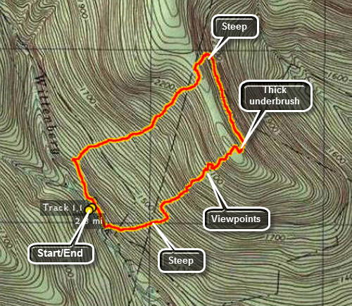 From Grahamsville, turn onto Route 52A near the TriValley School. Stay on the road until the hamlet of Sundown where
the road turns left. Bear to the right on Peekamoose Rd. and continue on the road looking for Moonhaw Rd.
on the left. From Route 28, turn west on Route 28A and then head south. Turn right and head west on Watson Hollow Road, the road that goes to Peekamoose and Sundown. Watch for Moonhaw Road on the right after about mile. Turn onto Moonhaw Rd. and drive to the end. Park on the right just before the gates to the private driveway.
From Grahamsville, turn onto Route 52A near the TriValley School. Stay on the road until the hamlet of Sundown where
the road turns left. Bear to the right on Peekamoose Rd. and continue on the road looking for Moonhaw Rd.
on the left. From Route 28, turn west on Route 28A and then head south. Turn right and head west on Watson Hollow Road, the road that goes to Peekamoose and Sundown. Watch for Moonhaw Road on the right after about mile. Turn onto Moonhaw Rd. and drive to the end. Park on the right just before the gates to the private driveway.
Since this is a bushwhack all the way your route may vary. From the parking area, cross Wittenberg Brook and turn right to walk parallel to the brook on a woods road for about .1 miles. Turn left and UP the mountain. The climb will be steep no matter what route you pick and there will be some rock scrambles and some ledges to negotiate. As you climb be sure to stop occasionally and look behind you for views of Friday and Balsam Cap. You may even get a view of the cabin on the shoulder of Friday. Your views will depend on the season and the leaf coverage. As you near the top of the unnamed mountain the underbrush gets VERY thick. It is almost impossible to push across the ridge to the northwest. Continue north or a little northeast to drop down off the ridge. You may find a woods road or path on the other side. Walk about .4 miles or so and then head back up and over the ridge in a generally southwest direction. long this walk you may have views of Samuel's Point. As you hit the top of the ridge push back through the brush and head for the edge of the ledges. Start to work your way down the hill north of your ascent route. This route is less steep and has less brush. You may find a woods road or two along the way. Once you are near Wittenberg Brook turn left or southeast to follow the brook back to the parking area.
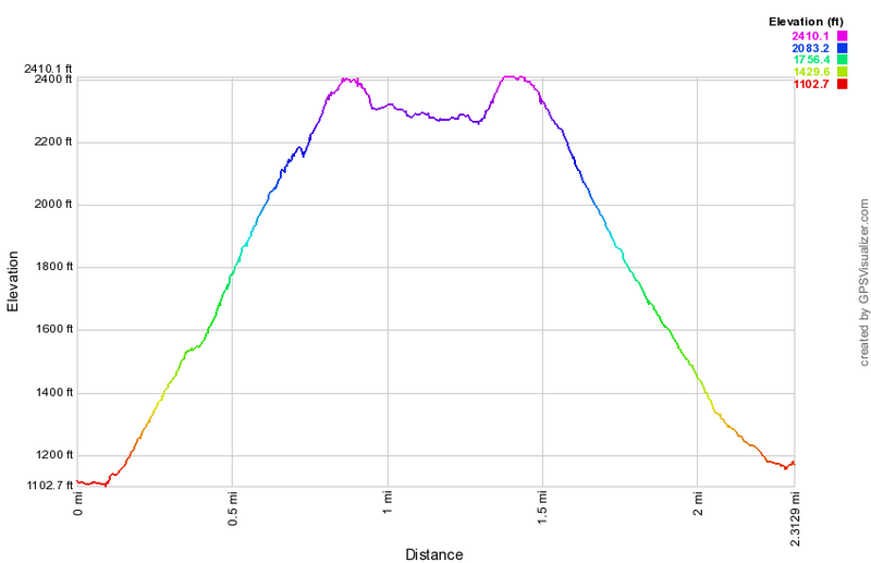
(The image at the left shows the profile of the hike.)
Giant Ledge
| Quick Look | ||||
|---|---|---|---|---|
| Difficulty | Round trip | Total climb | Internet Maps | |
| 3.2 mi. | 1190 ft. | AllTrails | ||
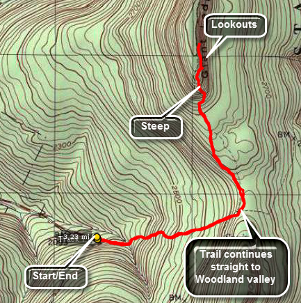 Park at the trailhead on the Frost Valley Road just after Winisook Lake on the hairpin turn. Find
the yellow-blazed Phoenicia-East Branch trail and hike .65 miles to the blue-blazed Giant Ledge -
Panther Mountain Trail. This ascent is rather gradual with a few short, steep areas thrown in. After
about .75 miles, you reach Giant Ledge. Here there are a series of ledges that look to the east and
offer a view of Wittenberg and Slide. The return hike simply reverses the trip out. The total distance
is just over 3 miles making it perfect to get into shape.
Park at the trailhead on the Frost Valley Road just after Winisook Lake on the hairpin turn. Find
the yellow-blazed Phoenicia-East Branch trail and hike .65 miles to the blue-blazed Giant Ledge -
Panther Mountain Trail. This ascent is rather gradual with a few short, steep areas thrown in. After
about .75 miles, you reach Giant Ledge. Here there are a series of ledges that look to the east and
offer a view of Wittenberg and Slide. The return hike simply reverses the trip out. The total distance
is just over 3 miles making it perfect to get into shape.
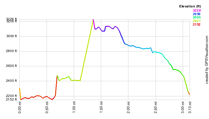
(The image below shows the profile of the hike. This profile only reflects the hike out to Giant Ledge. The hike back is the same only in reverse; descending rather than ascending.)
Giant Ledge with bushwhack
| Quick Look | ||||
|---|---|---|---|---|
| Difficulty | Round trip | Total climb | Internet Maps | |
| 4.5 mi. | 1437 ft. | AllTrails | ||
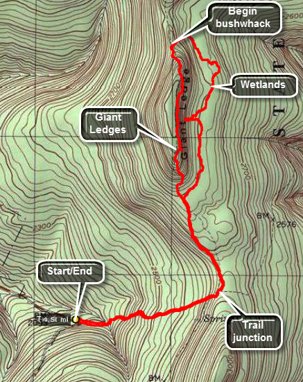 Park at the trailhead on the Frost Valley Road just after Winisook Lake on the hairpin turn. Find
the yellow-blazed Phoenicia-East Branch trail and hike .65 miles to the blue-blazed Giant Ledge -
Panther Mountain Trail. This ascent is rather gradual with a few short, steep areas thrown in. After
about .75 miles, you reach Giant Ledge. Here there are a series of ledges that look to the east and
offer a view of Wittenberg and Slide. Continue on the trail until you are in the col, the lowest point between Giant Ledge and Panther. Turn right to begin your bushwhack and walk down the slope to an area of flat ground at the base of the ridges. This is an interesting place to explore. There are several wetlands areas that are interesting. You can work your way up to the base of the cliffs and even climb up on the debris below. Keep heading on a course parallel to the cliffs and you will soon be back on the main trail back to the car. . The total distance
is just over 4.5 miles making it perfect to get into shape.
Park at the trailhead on the Frost Valley Road just after Winisook Lake on the hairpin turn. Find
the yellow-blazed Phoenicia-East Branch trail and hike .65 miles to the blue-blazed Giant Ledge -
Panther Mountain Trail. This ascent is rather gradual with a few short, steep areas thrown in. After
about .75 miles, you reach Giant Ledge. Here there are a series of ledges that look to the east and
offer a view of Wittenberg and Slide. Continue on the trail until you are in the col, the lowest point between Giant Ledge and Panther. Turn right to begin your bushwhack and walk down the slope to an area of flat ground at the base of the ridges. This is an interesting place to explore. There are several wetlands areas that are interesting. You can work your way up to the base of the cliffs and even climb up on the debris below. Keep heading on a course parallel to the cliffs and you will soon be back on the main trail back to the car. . The total distance
is just over 4.5 miles making it perfect to get into shape.
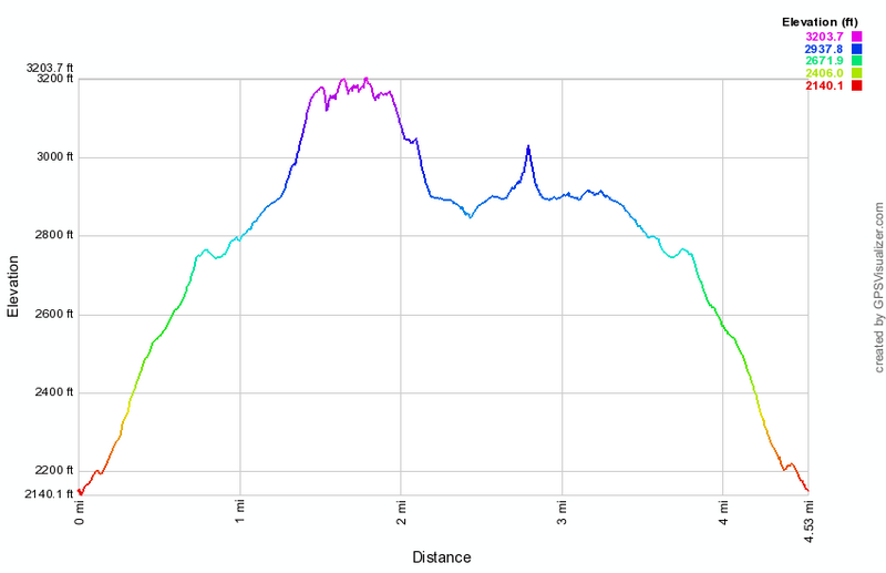
(The image below shows the profile of the hike.)
Giggle Hollow
| Quick Look | ||||
|---|---|---|---|---|
| Difficulty | Round trip | Total climb | Internet Maps | |
| 5.2 mi. | 1575 ft. | AllTrails | ||
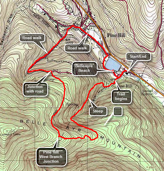 From Route 28 turn west on Friendship Road just southeast of Pine Hill. Drive to the covered bridge. If the gate is open, drive across and park in the lot near the top of the hill. If the gate is closed, park on Friendship Road southeast of the access road across the bridge. Walk across the bridge and up the access road to where the road turns right. Continue straight ahead to an area that had a pavilion. Walk to the back of the area where there is a register box at the beginning of the trail which is blazed accessional with blue discs. There are also signs indicating distances to various points. The trail passes directly under railroad tracks that run across a bridge.As you start up the trail realize that UP is the most important word since for the next .9 miles the trail follows a woods roads to the southwest averaging a 20% grade. The trail is marked as unmaintained on the maps and this is a good description. The woods road is rocky and a layer of slippery leaves can add to the difficulty of the climb. The blue trail markers are few and are often missing when another trail or road branches off. There can be quite a bit of blowdown on the trail which can be navigated around but certainly doesn't add to the enjoyment of the experience. At 1.1 miles the trail turns 90 degree to the left to head southeast. The trail continues to climb but at a gentler grade to 1.5 miles where it turns to the west. The grade now is more shallow at this point. After about .25 miles the trail opens up and the area may be filled with briars. It is difficult to tell where the trail goes but look carefully ahead to find the next blue marker. Keep heading west to find the trail junction. Turn right and head down the Pine Hill West Branch Trail toward Pine Hill. For the next .9 miles follow the trail as it heads north and down the mountain. At just passed 3 miles the trail meets a dirt road. Turn left onto the road to follow it west as it continues to descend. At 3.4 miles the road turns to the northeast and at 3.7 miles the paved road known as Woodchuck Hollow Road begins. Watch for a gated road or driveway on the right complete with stone pillars. Walk under the railroad bridge on Mill Street.Turn right on Bonnieview Avenue and then right onto Main Street. It is only a short walk down Main Street to Lake Street. At the end of Lake Street walk passed the gate and onto the road that leads back to Belleayre Beach. After a short walk the lake comes into view with a white sand beach and small building. Visit the beach if you would like then walk across the parking lot to complete the loop. Follow the road won the hill to the left and across the covered bridge to your car.
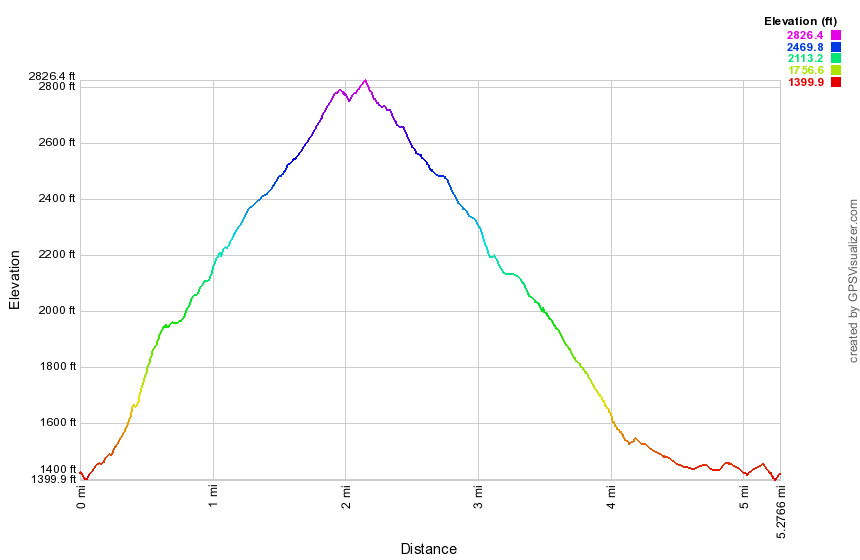
(The image below shows the profile of the hike.)
Hickok Brook Loop
| Quick Look | ||||
|---|---|---|---|---|
| Difficulty | Round trip | Total climb | Internet Maps | |
| 3.8 mi | 350 ft | AllTrails | ||
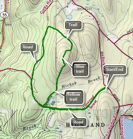
Drive south on Route 55 toward Eldred. Turn left at the light in Eldred on CR-32 (Proctor Road) and drive 1.45 miles to Barker Road on the right. Turn right on Barker Road and drive .6 miles to the parking area on the right. The parking area is marked with the typical yellow on brown sign. Park in the lot. Start the hike by walking on the gravel road heading first southwest and then west. At .7 miles a road will turn off to the left. Continue straight ahead and at .8 miles turn right on a road that becomes a yellow-blazed trail. The trail passes by a pond and you may want to pause for a moment to take in the site. Continue on the yellow trail walking uphill just slightly. When you reach 1.35 miles, you will see a "Private Property" sign. Look carefully to you left to find a blue-blazed trail that avoid the private property. The blue trail lasts only .25 miles before it rejoins the woods road that was the yellow trail. You may or may not see markers here but stay on the woods road and bear left. At 2 miles the trail meets the gravel road. Turn left and walk the road back to where you turned off the road earlier in the hike at about 3 miles. Continue on the road to walk the .8 miles back to your car. There are some side paths in the area and one other road but they hold nothing of interest except solitude.
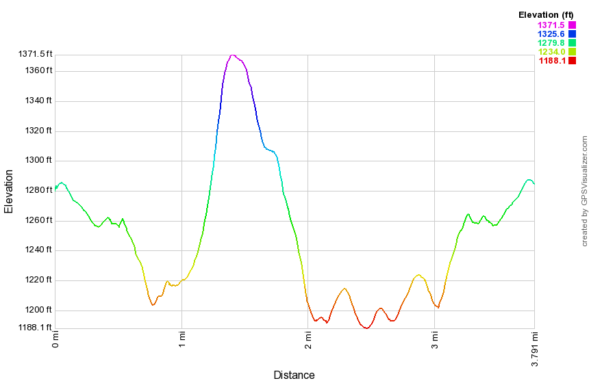
(The image at the left shows the profile of the hike. Remember that all vertical profiles are relative!)
High Falls (Frost Valley)
| Quick Look | ||||
|---|---|---|---|---|
| Difficulty | Round trip | Total climb | Internet Maps | |
| 4.7 mi | 915 ft | AllTrails | ||
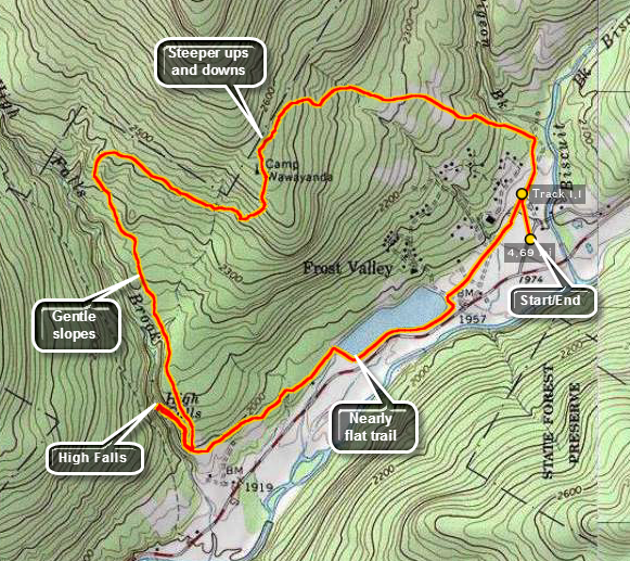
From the north or south use Ulster County Route 47, the Frost Valley Road, to drive to the Frost Valley YMCA Camp. The entire camp is private property that guests may hike without a fee. If you are not a guest, you may be asked to pay a day use fee. Obtain a trail map at the office. Walk the camp roads toward Lake Cole and pick up the blue Lake Cole Trail that passes between the lake and the main road. Walk to the end of Lake Cole and over the bridge across the dam. Pick up the yellow High Falls Trail and bear to the right where it splits. do NOT turn onto the red Line Shack Trail. The yellow High falls Trail ends at the blue Spring Ridge Trail but a path leads down to the falls which has an observation platform. If you are only interested in the falls, return the way you came. Walk back up the hill to the trail junction and turn left on the blue Spring Ridge Trail. Where the blue trail turns to the right bear to the left on the yellow Panhandle Trail. This is the first trail that gains any elevation as the rest are almost flat. The Panhandle Trail loops around to meet the red Line Shack Trail. When the blue Rocky Road Trail branches off to the left follow it downhill until it intersects the red Perimeter trail near the camp. Find some camp roads that will give you the most direct route back to your car.

(The image at the left shows the profile of the hike. Remember that all vertical profiles are relative!)
Hodge Pond (Quick Lake, Logger's Loop, Big Rock, and Flynn Trails)
| Quick Look | ||||
|---|---|---|---|---|
| Difficulty | Round trip | Total climb | Internet Maps | |
| 5.1 mi. | 850 ft. | AllTrails | ||
 The area around Frick Pond, Hodge Pond and Quick Lake is covered with trails. There are numerous
possibilities for short of long hikes. The area is "relatively" flat and there are no "views".
There is, however, some beautiful scenery.
The area around Frick Pond, Hodge Pond and Quick Lake is covered with trails. There are numerous
possibilities for short of long hikes. The area is "relatively" flat and there are no "views".
There is, however, some beautiful scenery.
Take DeBruce Road from Livingston Manor for about six miles then turn left on Mongaup Rd. Where the road
splits bear left on Beech Mountain Rd. and park in the parking lot on the left. Find the red-blazed
Quick Lake trail and follow it for .5 miles to the junction with the yellow-blazed Logger's Loop.
If you turn left here, Frick pond is just .1 miles. Turn right on Logger's Loop and follow it for
.55 miles to Times Square. The name indicates that many trails cross at this point. Turn right here
onto the yellow-blazed Big Rock Trail. Continue on this trail for 1.1 miles until it crosses the
blue-blazed Flynn Trail. Several areas on Big Rock have significant but not severe climbs. Turn left
on the Flynn Trail and hike .45 miles to Hodge Pond. From here you can continue on the Flynn Trail until
it meets the Quick Lake Trail. At this point turn left and hike back to Frick Pond. This adds quite
a bit to the distance! Retrace the last .45 miles on the Flynn Trail until the intersection with Big Rock
Trail. Continue straight ahead for 1.7 miles to the parking area.
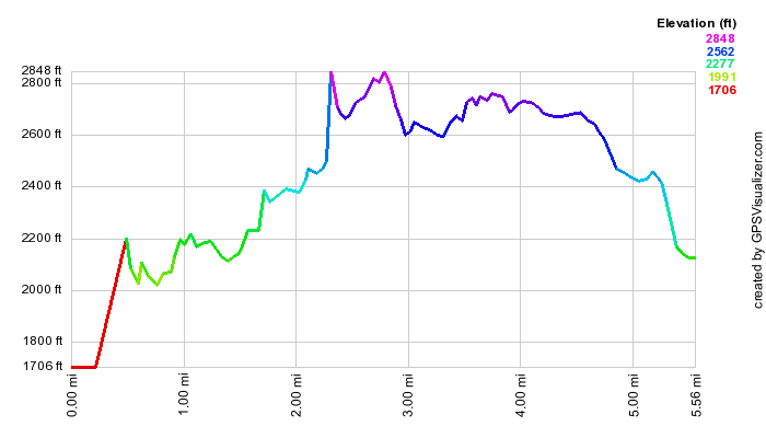
(The image above shows the profile of the hike. Remember that all vertical profiles are relative!)
Hodge Pond (Flynn Trail)
| Quick Look | ||||
|---|---|---|---|---|
| Difficulty | Round trip | Total climb | Internet Maps | |
| 4.9 mi. | 800 ft. | AllTrails | ||
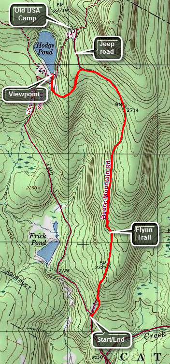 The area around Frick Pond, Hodge Pond and Quick Lake is covered with trails. There are numerous possibilities for short of long hikes. The area is "relatively" flat and there are no "views". There is, however, some beautiful scenery.
Take DeBruce Road from Livingston Manor for about six miles then turn left on Mongaup Rd. Where the road splits bear left on Beech Mountain Rd. and park in the parking lot on the left. Cross the road to get on the blue blazed Flynn Trail. Walk through the woods until the trail meets a woods road and turn right. This is the old Beech Mountain Road which led to the Beech Mountain Boy Scout Camp. Walk uphill on this wide road for 1.7 miles to the junction with the Big Rock Trail on the left. Continue straight ahead on the Flynn Trail. After passing through a yellow gate, you will be on property owned by the Open Spaces Institute which allows hikers to cross their property. At the next intersection bear left to continue down to Hodge Pond on the Flynn Trail. The Flynn Trail turns left and crosses the outlet stream. Walk straight ahead to the shores of Hodge Pond. Take in the beauty of this secluded pond before turning around a retracing your route back to your car. There are many other possible ways to get back to the parking area and moist are longer than simply retracing your steps. Make up your own hike or see some of the others on this site.

(The image above shows the profile of the hike. Remember that all vertical profiles are relative!)
Hodge Pond Loop (Flynn and Jeep Trails)
| Quick Look | ||||
|---|---|---|---|---|
| Difficulty | Round trip | Total climb | Internet Maps | |
| 5.7 mi. | 820 ft. | AllTrails | ||
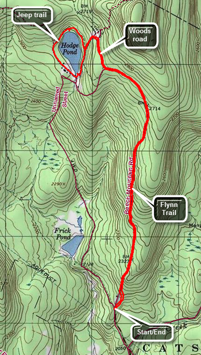 The area around Frick Pond, Hodge Pond and Quick Lake is covered with trails. There are numerous possibilities for short of long hikes. The area is "relatively" flat and there are no "views". There is, however, some beautiful scenery.
Take DeBruce Road from Livingston Manor for about six miles then turn left on Mongaup Rd. Where the road splits bear left on Beech Mountain Rd. and park in the parking lot on the left. Cross the road to the start of the blue Flynn Trail. Walk the trail until it meets a woods road which is the extension of the Beech Mountain Road. Turn right and walk uphill to the junction with the Big Rock Trail on the left and the snowmobile trail on the right at 1.7 miles. Walk straight ahead staying on the Flynn Trail. Pass through the gate which marks the beginning of the Open Spaces Institute property around Hodge Pond. At the next trail junction the Flynn Trail turns left. Turn right to stay on the old Beech Mountain Road heading for site of the Beech Mountain Boy Scout Camp. At the next junction turn left to walk down toward Hodge Pond. At the next junction turn right to get on the jeep trail that goes around the back of the pond. As you warp around the pond the jeep trail will meet the Flynn Trail at 2.75 miles. Bear to the left on the blue Flynn Trail to complete your loop around Hodge Pond. You will pass through a clearing and then come to another clearing with HodgPond to the left. Continue straight ahead and then turn left on the jeep trail. Walk up the hill that you descended earlier. Turn right at the top and then left when you reach the next intersection WI the Flynn Trail. Turn left on the Flynn Trail and walk to the junction with the Big Rock Trail. Continue straight ahead on the Flynn Trail for a 1.7 mile walk downhill and back to the parking area.
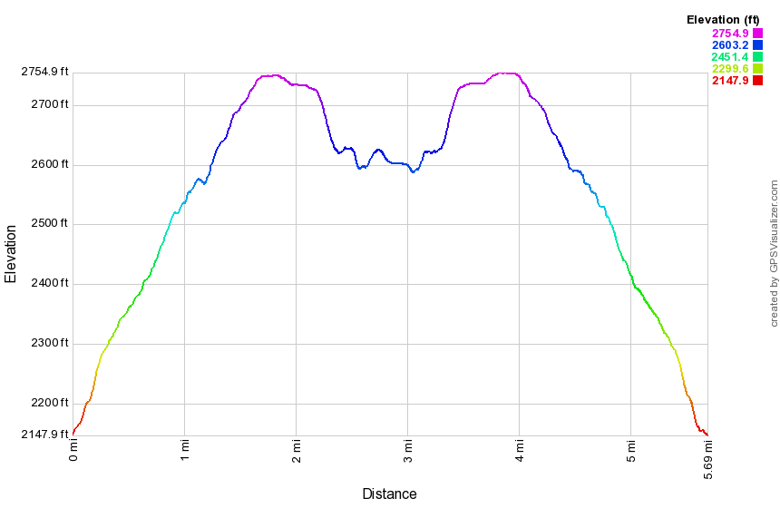
(The image above shows the profile of the hike. Remember that all vertical profiles are relative!)
Hodge Pond Loop (Flynn Trail)
| Quick Look | ||||
|---|---|---|---|---|
| Difficulty | Round trip | Total climb | Internet Maps | |
| 5.9 mi. | 930 ft. | AllTrails | ||
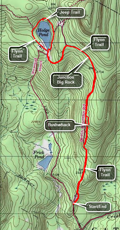 The area around Frick Pond, Hodge Pond and Quick Lake is covered with trails. There are numerous possibilities for short of long hikes. The area is "relatively" flat and there are no "views". There is, however, some beautiful scenery.
Take DeBruce Road from Livingston Manor for about six miles then turn left on Mongaup Rd. Where the road splits bear left on Beech Mountain Rd. and park in the parking lot on the left. Cross the road to the start of the blue Flynn Trail. Walk the trail until it meets a woods road which is the extension of the Beech Mountain Road. Turn right and walk uphill to the junction with the Big Rock Trail on the left and the snowmobile trail on the right at 1.7 miles. Walk straight ahead staying on the Flynn Trail. Pass through the gate which marks the beginning of the Open Spaces Institute property around Hodge Pond. At the next trail junction the Flynn Trail turns left. Turn left to stay on the Flynn Trail heading for Hodge Pond. The Flynn Trail will break out into a clearing at the outlet end of Hodge Pond at 2.4 miles. After spending some time at Hodge Pond, walk to the right of the pond and along the east side on an old jeep trail. Walk around the pond to the point where the jeep trail meets the Flynn Trail. Turn left and follow the Flynn Trail back to the clearing at the outlet end of Hodge Pond. Turn right and walk up the hill. Bear to the right and follow the Flynn Trail back to the junction with the Big Rock Trail. Continue straight ahead through the junction and back down the Flynn Trail toward the parking area. As you approach the gate, be sure to bear to the left on the Flynn Trail to avoid the private property around the cabin.
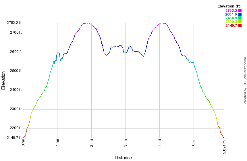
(The image shows the profile of the hike. Remember that all vertical profiles are relative!)
Hodge and Frick Ponds (Flynn and Quick Lake Trails)
| Quick Look | ||||
|---|---|---|---|---|
| Difficulty | Round trip | Total climb | Internet Maps | |
| 6.4 mi. | 950 ft. | AllTrails | ||
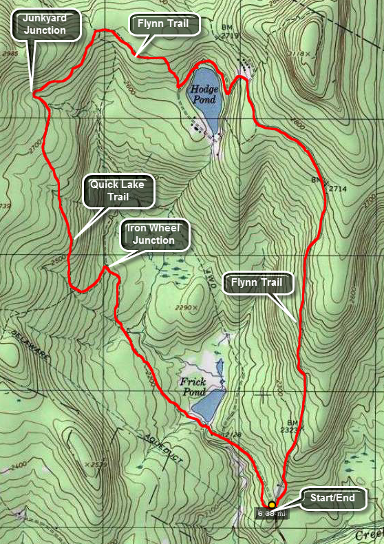 The area around Frick Pond, Hodge Pond and Quick Lake is covered with trails. There are numerous
possibilities for short of long hikes. The area is "relatively" flat and there are no "views".
There is, however, some beautiful scenery.
The area around Frick Pond, Hodge Pond and Quick Lake is covered with trails. There are numerous
possibilities for short of long hikes. The area is "relatively" flat and there are no "views".
There is, however, some beautiful scenery.
Take DeBruce Road from Livingston Manor for about six miles then turn left on Mongaup Rd. Where the road
splits bear left on Beech Mountain Rd. and park in the parking lot on the left. Find the blue-blazed
Flynn Trail across the road and follow it for 1.7 miles to the junction with the Big Rock Trail. Continue straight ahead toward Hodge Pond. In a short distance a woods road bears to the right. You may continue straight ahead on the trail to the pond. Bear right and then take the next left down toward Hodge Pond. Take the next right to walk around the back of the pond. The next right will put you back on the Flynn Trail. Continue on the Flynn Trail to Junkyard Junction where the Flynn Trail ends at the Quick Lake Trail turn left and stay on the Quick Lake trail for 2.1 miles to the bridge at the outlet of Frick Pond. Along the way you will pas through Iron Wheel Junction. Here the yellow-blazed Logger's Loop Trail goes straight ahead. Bear to the right to stay on the red-blazed Quick Lake Trail. After walking over the bridge at Frick Pond continue for about another .5 miles back to the parking area.
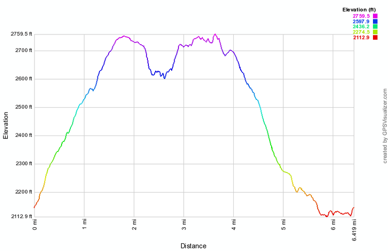 (The image below shows the profile of the hike. Remember that all vertical profiles are relative!)
Hodge and Frick Ponds: Flynn and Quick Lake Trail
| Quick Look | ||||
|---|---|---|---|---|
| Difficulty | Round trip | Total climb | Internet Maps | |
| 6.4 mi. | 920 ft. | AllTrails | ||
The area around Frick Pond, Hodge Pond and Quick Lake is covered with trails. Some are hiking trails while others are snowmobile trails or woods roads. There are numerous possibilities for short or long hikes. The area is "relatively" flat and there are no "views". There is, however, some beautiful scenery with two small ponds.
Take DeBruce Road from Livingston Manor for about six miles then turn left on Mongaup Rd. Where the road splits bear left on Beech Mountain Rd. and park in one of the parking lots on the left. Cross the road to find the blue blazed Flynn Trail which heads up the hill through the woods to avoid the cabin which is private property. Walk 1.7 miles uphill to the junction with the Big Rock Trail on the left and the snowmobile trail from Mongaup Pond on the right. Continue straight ahead on the Flynn Trail. At 2 miles there is another trail junction with a woods road going off to the right. Stay to the left and follow the Flynn Trail down to the shores of Hodge Pond. The trail turns left just before you get to the pond but you will probably want to walk straight ahead and investigate the pond. Follow the Flynn Trail across the outlet stream of the pond. At 2.8 miles bear to the left to continue to follow the Flynn Trail. Going straight ahead will take you around the back of the pond on an old jeep road. Walk up the hill to a gate and bear to the left following the Flynn Trail. At 3.3 miles you will be at Junkyard Junction where the Flynn Trail ends at the red blazed Quick Lake Trail. Turn left on the Quick Lake Trail and walk mostly downhill for 1.6 miles to Iron Wheel Junction at 4.9 miles. The yellow blazed Logger's Loop continues straight ahead. Turn right to stay on the Quick Lake Trail. Walk another .8 miles to 5.75 miles and another trail junction. To the left a trail goes around the back of Frick Pond and ends up at Times Square, a four-way trail junction. Continue straight ahead following the Quick Lake Trail to the bridge across the outlet of Frick Pond. As you stand on the bridge the mountain in the background to the right is Beech Mountain, the highest point in Sullivan County at 3118 feet. Continue on the trail climbing a small hill and passing the Logger's Loop on the left. Continue another .4 miles back to the car. When you pass the trail register, be sure to turn right and follow the Quick Lake Trail back to the parking area. The woods road that continues straight ahead leads to private property.
(The image shows the profile of the hike. Remember that all vertical profiles are relative!)
Hodge and Frick Ponds (Flynn, Big Rock and Quick Lake Trails)
| Quick Look | ||||
|---|---|---|---|---|
| Difficulty | Round trip | Total climb | Internet Maps | |
| 6.0 mi. | 912 ft. | AllTrails | ||
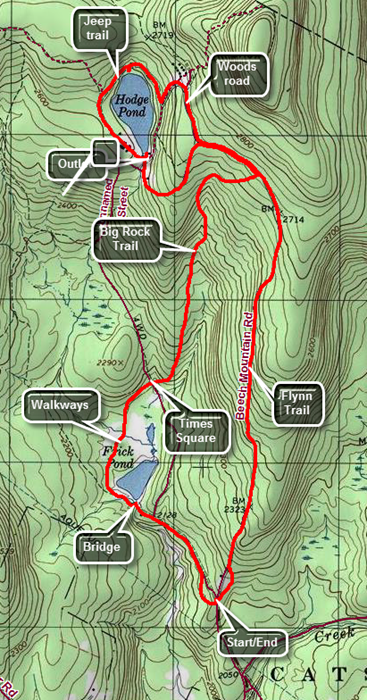 The area around Frick Pond, Hodge Pond and Quick Lake is covered with trails. There are numerous possibilities for short of long hikes. The area is "relatively" flat and there are no "views". There is, however, some beautiful scenery.
Take DeBruce Road from Livingston Manor for about six miles then turn left on Mongaup Rd. Where the road splits bear left on Beech Mountain Rd. and park in the parking lot on the left. Find the blue-blazed Flynn Trail across the road and follow it for 1.7 miles to the junction with the Big Rock Trail. Continue straight ahead toward Hodge Pond. In a short distance a woods road bears to the right. Bear to the right on the woods road and at the next trail junction turn left and walk down toward Hodge pond. At the next intersection turn right on a jeep trail around the back of the pond. When you hit the blue blazed Flynn Trail again, tune left to continue around the pond. When you reach the clearing at yen outlet end of the pond, turn left and walk to the shore of the pond for a break. Turn around and walk straight ahead for the opening in the trees where you will pick up the Flynn Trail again. Walk up the hill and back along the flat part of the Flynn Trail through the gate to the junction with the Big Rock Trail. At this point you will have hiked 3.8 miles. Turn right and hike downhill on the Big Rock trail for 1.1 miles to Times Square. Continue straight ahead on the Big Rock Trail around the north end of the pond and then down the west side. You will walk over some wooden bridges and walkways that can be slippery when wet. When you reach the red blazed Quick Lake Trail turn left and hike to the bridge over the outlet of Frick Pond. This is a good place to observe the pond. Continue your hike by walking up the hill to Gravestone Junction where you will continue straight ahead on the Quick Lake Trail. This part of the hike is emotively flat but may be wet and muddy. At the trail register box, turn right to stay on the Quick Lake trail which will take you to the larger of the two parking areas.
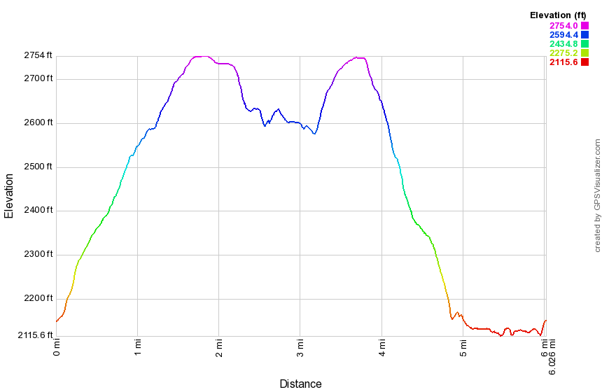 (The image below shows the profile of the hike. Remember that all vertical profiles are relative!)
Hodge and Frick Ponds (Flynn, Jeep, Big Rock and Quick Lake Trails)
| Quick Look | ||||
|---|---|---|---|---|
| Difficulty | Round trip | Total climb | Internet Maps | |
| 5.5 mi. | 850 ft. | AllTrails | ||
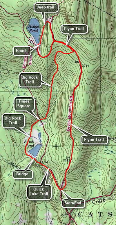 The area around Frick Pond, Hodge Pond and Quick Lake is covered with trails. There are numerous possibilities for short of long hikes. The area is "relatively" flat and there are no "views". There is, however, some beautiful scenery.
Take DeBruce Road from Livingston Manor for about six miles then turn left on Mongaup Rd. Where the road splits bear left on Beech Mountain Rd. and park in the parking lot on the left. Find the blue-blazed Flynn Trail across the road and follow it for 1.7 miles to the junction with the Big Rock Trail. Continue straight ahead toward Hodge Pond. In a short distance a woods road bears to the right. Continue straight ahead on the Flynn Trail which will bring you to a clearing at the outlet end of Hodge Pond. Walk over to the shore if you wish. When you are ready to continue, walk up the hill on the east side of the pond bearing right where the trail splits. At the top of the hill, turn right to walk out to the Flynn Trail. Turn left on the Flynn Trail to head back to the junction with the Big Rock Trail. Turn right and hike downhill on the Big Rock trail for 1.1 miles to Times Square. Continue straight ahead on the Big Rock Trail around the north end of the pond and then down the west side. You will walk over some wooden bridges and walkways that can be slippery when wet. When you reach the red blazed Quick Lake Trail turn left and hike to the bridge over the outlet of Frick Pond. This is a good place to observe the pond. Continue your hike by walking up the hill to Gravestone Junction where you will continue straight ahead on the Quick Lake Trail. This part of the hike is mostly flat but may be wet and muddy. At the trail register box, turn right to stay on the Quick Lake trail which will take you to the larger of the two parking areas.
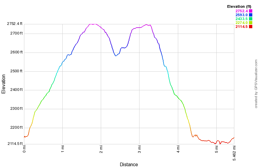 (The image below shows the profile of the hike. Remember that all vertical profiles are relative!)
Hodge and Frick Ponds (Flynn, Big Rock and Quick Lake Trails - Hodge Loop)
| Quick Look | ||||
|---|---|---|---|---|
| Difficulty | Round trip | Total climb | Internet Maps | |
| 6.3 mi. | 935 ft. | AllTrails | ||
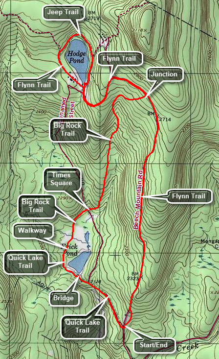 The area around Frick Pond, Hodge Pond and Quick Lake is covered with trails. There are numerous possibilities for short of long hikes. The area is "relatively" flat and there are no "views". There is, however, some beautiful scenery.
Take DeBruce Road from Livingston Manor for about six miles then turn left on Mongaup Rd. Where the road splits bear left on Beech Mountain Rd. and park in the parking lot on the left. Find the blue-blazed Flynn Trail across the road and follow it for 1.7 miles to the junction with the Big Rock Trail. Continue straight ahead toward Hodge Pond. In a short distance a woods road bears to the right. Bear to the left on the Flynn Trail and walk down to the field at the outlet end of Hodge Pond. Visit the shores of the pond. When you are finished walk to the right and up a hill on the jeep trail that goes around the back of the pond. When you reach the blue blazed Flynn Trail again, turn left to continue around the pond. When you reach the clearing at the outlet end of the pond, turn right and walk to the opening in the trees where you will continue on the Flynn Trail. Walk up the hill and back along the flat part of the Flynn Trail through the gate to the junction with the Big Rock Trail. At this point you will have hiked 4.1 miles. Turn right and hike downhill on the Big Rock trail for 1.1 miles to Times Square. Continue straight ahead on the Big Rock Trail around the north end of the pond and then down the west side. You will walk over some wooden bridges and walkways that can be slippery when wet. When you reach the red blazed Quick Lake Trail turn left and hike to the bridge over the outlet of Frick Pond. This is a good place to observe the pond. Continue your hike by walking up the hill to Gravestone Junction where you will continue straight ahead on the Quick Lake Trail. This part of the hike is relatively flat but may be wet and muddy. At the trail register box, turn right to stay on the Quick Lake Trail or continue straight ahead on the woods road. Both ways will lead you to the two parking areas.
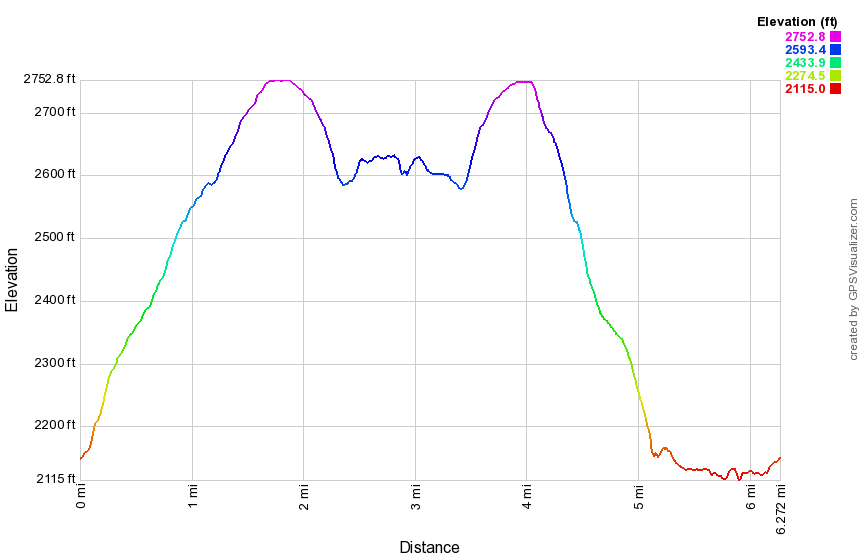 (The image below shows the profile of the hike. Remember that all vertical profiles are relative!)
Hodge and Frick Ponds (Flynn, Big Rock, Logger's Loop and Quick Lake Trails)
| Quick Look | ||||
|---|---|---|---|---|
| Difficulty | Round trip | Total climb | Internet Maps | |
| 7.7 mi. | 1105 ft. | AllTrails | ||
 The area around Frick Pond, Hodge Pond and Quick Lake is covered with trails. There are numerous possibilities for short of long hikes. The area is "relatively" flat and there are no "views". There is, however, some beautiful scenery.
Take DeBruce Road from Livingston Manor for about six miles then turn left on Mongaup Rd. Where the road splits bear left on Beech Mountain Rd. and park in the parking lot on the left. Find the blue-blazed Flynn Trail across the road and follow it for 1.7 miles to the junction with the Big Rock Trail. Continue straight ahead toward Hodge Pond. In a short distance a woods road bears to the right. Bear to the right on the woods road and at the next trail junction turn left and walk down toward Hodge pond. At the next intersection turn right on a jeep trail around the back of the pond. When you hit the blue blazed Flynn Trail again, turn left to continue around the pond. When you reach the clearing at the outlet end of the pond, turn left and walk to the shore of the pond for a break. Turn around and walk straight ahead for the opening in the trees where you will pick up the Flynn Trail again. Walk up the hill and back along the flat part of the Flynn Trail through the gate to the junction with the Big Rock Trail. At this point you will have hiked 3.8 miles. Turn right and hike downhill on the Big Rock trail for 1.1 miles to Times Square. Turn right on the Logger's Loop and begin to hike uphill. The trail flattens and then undulates some for a total of 1.25 miles. You will be at Iron Wheel Junction after hiking a total of 6.25 miles. Turn left on the Quick Lake Trail and get ready for a mostly downhill walk. The trail can be wet at times and you will have to cross a small stream in the woods. At 7 miles the Big Rock Trail will come in from the left. Continue on the Quick Lake Trail by bearing right. At 7.2 miles you will cross a bridge over the outlet stream from Frick Pond. Continue up the hill to Gravestone Junction. Stay straight ahead on the Quick Lake Trail which will bring you back to your car in the parking area.
 (The image below shows the profile of the hike. Remember that all vertical profiles are relative!)
Hodge and Frick (Logger's Loop, Big Rock, Flynn and Quick Lake Trails)
| Quick Look | ||||
|---|---|---|---|---|
| Difficulty | Round trip | Total climb | Internet Maps | |
| 6.3 mi. | 973 ft. | AllTrails | ||
 The area around Frick Pond, Hodge Pond and Quick Lake is covered with trails. There are numerous possibilities for short of long hikes. The area is "relatively" flat and there are no "views". There is, however, some beautiful scenery.
Take DeBruce Road from Livingston Manor for about six miles then turn left on Mongaup Rd. Where the road splits bear left on Beech Mountain Rd. and park in the smaller parking lot on the right. Walk out the back of the parking area on a woods road to the trail register. Pick up the Quick Lake Trail from the register to Gravestone Junction where the trail splits. Turn right on the Loggers Loop and begin to walk the trail toward Times Square at 1 mile. Turn right on the Big Rock Trail and climb 600 feet in 1.1 miles to the Flynn Trail. Turn left on the Flynn Trail and awl the flat trail to the next trail junction Bear left to stay on the Flynn Trail and walk downhill to the clearing at the outlet end of Hodge Pond. Walk over to the shore if you wish and then walk back to the Flynn
Trail which follows the western shore of the Pond. When the trail splits and the Flynn trail bears left, stay right and follow the jeep trail around the north side of Hodge Pond. You may walk down the informal paths to the shores of the pond for a nice view. Continue on the jeep trail and up a small hill. Turn left on the woods road and walk up a steep but short hill to what was once the Beech Mountain Road. Turn right and walk back to the Flynn Trail. Turn left and walk the flat trail back to the junction with the Big Rock Trail. Turn right and descend the Big Rock Trail to Fumes Square. Continue straight ahead on the Big Rock Trail and around to the west side of Frick Pond. Walk through a forest of large evergreens and over two bridges. Continue over the wooden walkways until the Big Rock Trail ends at the Quick Lake Trail. Turn left and walk the Quick Lake Trail to the bridge at the outlet of Frick Pond. Cross the bridge and walk up the hill to continue on the Quick Lake trail back to the parking areas.
 (The image below shows the profile of the hike. Remember that all vertical profiles are relative!)
Hodge and Frick (Logger's Loop, Quick Lake, Flynn, Big Rock Trails)
| Quick Look | ||||
|---|---|---|---|---|
| Difficulty | Round trip | Total climb | Internet Maps | |
| 7.8 mi. | 1102 ft. | AllTrails | ||
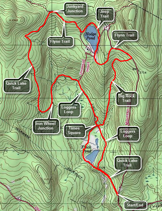 The area around Frick Pond, Hodge Pond and Quick Lake is covered with trails. There are numerous possibilities for short of long hikes. The area is "relatively" flat and there are no "views". There is, however, some beautiful scenery.
Take DeBruce Road from Livingston Manor for about six miles then turn left on Mongaup Rd. Where the road splits bear left on Beech Mountain Rd. and park in the smaller parking lot on the right. Walk out the back of the parking area on a woods road to the trail register. Pick up the Quick Lake Trail from the register to Gravestone Junction where the trail splits. Turn right on the Loggers Loop and begin to walk the trail toward Times Square at 1 mile. Continue straight ahead on the yellow Loggers Loop as it climbs uphill and heads north then northwest for about .85 miles gaining 195 feet. Crest a small hill and then walk the rest of the way downhill slightly to Iron Wheel Junction at 2.2 miles. At the trail junction continue straight ahead toward Junkyard Junction beginning a long and uphill climb. The trail climbs about 500 feet in 1.6 miles as it heads primarily north. At 3.3 miles the trail turns northeast and continues uphill to Junkyard Junction. At 3.8 miles reach the junction and turn right on the Flynn Trail heading southeast toward Hodge Pond. After passing through the gate, walk downhill toward the shore of Hodge Pond. Turn left to follow the jeep trail around the head end of the pond. After a short walk, turn right and walk down to the edge of the water for a nice view of Hodge Pond. Walk back up Ti the jeep trail and turn right to continue down the trail and woods road to the outlet end of Hodge Pond. This is also a nice place to stop for a rest and a view. After viewing the pond, turn completely around and walk toward the Flynn Trail where it enters the woods and heads up the hill. This half mile stretch gains only 150 feet but can be tiring. At the top of the hill at 5.3 miles turn right to stay on the Flynn Trail as it heads toward the junction with the Big Rock Trail. This section of the trail is very flat. Turn right at 5.6 miles and start down the Big Rock Trail heading west to 5.8 miles where the trail turns south. In the 1.1 miles from the junction with the Flynn Trail to Times Square the Big Rock Trail drops 600 feet. At 5.6 miles pass straight through Times Square continuing on the Big Rock Trail around the back of Frick Pond. The trail passes over two bridges and a series of wooden walkways that can be slippery when wet. Continue to the end of the big Rock Trail and turned left on the Quick Lake Trail. It is a short hike to the bridge over the outlet stream at Frick Pond. This is a nice viewpoint. Head up the hill to Gravestone Junction. At the junction stay right on the Quick Lake Trail and walk back to you car.
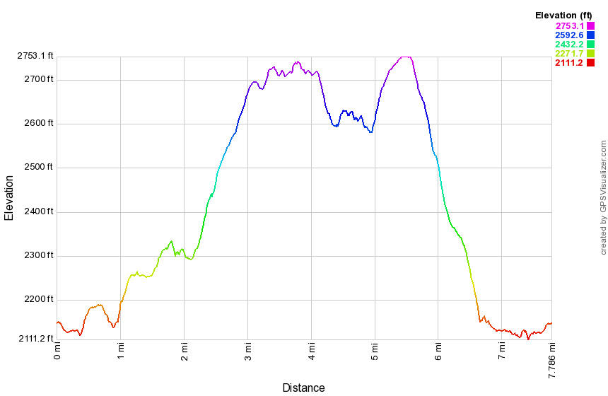 (The image below shows the profile of the hike. Remember that all vertical profiles are relative!)
Hodge and Frick Ponds (Lookout - Flynn and Quick Lake Trails)
| Quick Look | ||||
|---|---|---|---|---|
| Difficulty | Round trip | Total climb | Internet Maps | |
| 7.7 mi. | 1285 ft. | AllTrails | ||
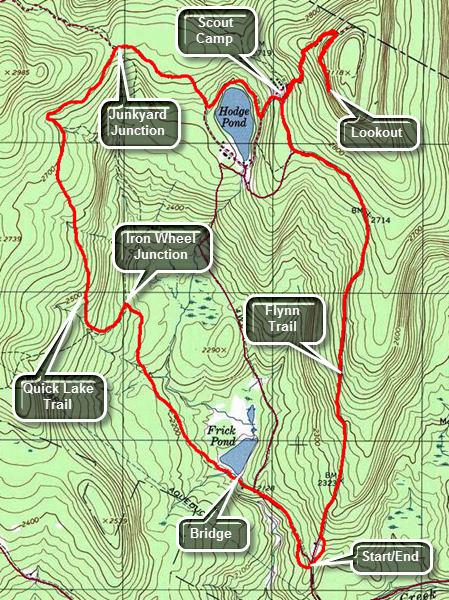 The area around Frick Pond, Hodge Pond and Quick Lake is covered with trails. There are numerous
possibilities for short of long hikes. The area is "relatively" flat and there are no "views".
There is, however, some beautiful scenery.
The area around Frick Pond, Hodge Pond and Quick Lake is covered with trails. There are numerous
possibilities for short of long hikes. The area is "relatively" flat and there are no "views".
There is, however, some beautiful scenery.
Take DeBruce Road from Livingston Manor for about six miles then turn left on Mongaup Rd. Where the road
splits bear left on Beech Mountain Rd. and park in the parking lot on the left. Find the blue-blazed
Flynn Trail across the road and follow it for 1.7 miles to the junction with the Big Rock Trail. Continue straight ahead toward Hodge Pond. In a short distance a woods road bears to the right. You may continue straight ahead on the trail to the pond. Bear right and then at the next junction continue straight ahead and up the hill on a woods road. At about 2.7 miles watch for a trail that goes to the right as the road turns to the left. This area is above the spring house on the right of the road and is unmarked but very clear. Walk about a quarter mile to the large rock shelf that acts as a lookout over Hodge Pond. Trees have grown up to block the lookout so the best view is when there are no leaves on those trees. Turn around and follow your route back to the spot where you went straight ahead on the woods road up the hill. You will see some cabins on the right which are the remains of the Beech Mountain Boy Scout Camp. Continue straight ahead and take the next right that leads down toward Hodge Pond. Take the next right to walk around the back of the pond on an old Jeep trail. The next right will put you back on the Flynn Trail. Continue on the Flynn Trail to Junkyard Junction where the Flynn Trail ends at the Quick Lake Trail. Turn left and stay on the Quick Lake trail for 2.1 miles to the bridge at the outlet of Frick Pond. Along the way you will pass through Iron Wheel Junction. Here the yellow-blazed Logger's Loop Trail goes straight ahead. Bear to the right to stay on the red-blazed Quick Lake Trail. After walking over the bridge at Frick Pond continue for about another .5 miles back to the parking area.
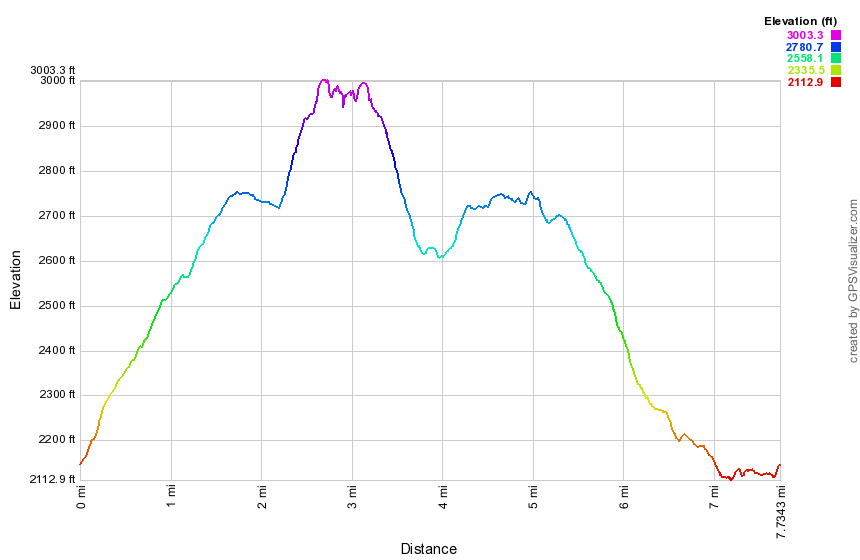 (The image below shows the profile of the hike. Remember that all vertical profiles are relative!)
Hodge and Frick Ponds (Lookout Loop - Flynn and Quick Lake Trails)
| Quick Look | ||||
|---|---|---|---|---|
| Difficulty | Round trip | Total climb | Internet Maps | |
| 8.1 mi. | 1330 ft. | AllTrails | ||
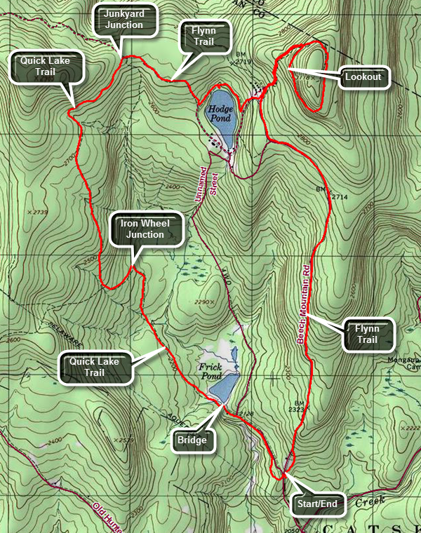 The area around Frick Pond, Hodge Pond and Quick Lake is covered with trails. There are numerous possibilities for short of long hikes. The area is "relatively" flat and there are no "views". There is, however, some beautiful scenery.
Take DeBruce Road from Livingston Manor for about six miles then turn left on Mongaup Rd. Where the road splits bear left on Beech Mountain Rd. and park in the parking lot on the left. Find the blue-blazed Flynn Trail across the road and follow it for 1.7 miles to the junction with the Big Rock Trail. Continue straight ahead toward Hodge Pond. In a short distance a woods road bears to the right. Bear right and then at the next junction continue straight ahead and up the hill on a woods road. At about 2.7 miles watch for a trail that goes to the right as the road turns to the left. This area is above the spring house on the right of the road and is unmarked but very clear. Walk about a quarter mile to the large rock shelf that acts as a lookout over Hodge Pond. From the lookout continue on the woods road around the higher ground on your left. This higher ground is Flynn's Point on Beech Mountain and is the highest point in Sullivan County at 3118 feet. Continue to circle Beech Mountain until you are back at the dirt road where you should turn left and walk back down the hill to the turn down to Hodge Pond. Turn right at 4 miles and walk down toward the pond. As you near the shore, turn right on the jeep road that goes around the upper end of the pond. At the next trail junction, turn right to hike up the blue-blazed Flynn Trail. Hiked up the hill and pass through the gate where the Flynn Trail turns to the left. This part of the trail is flat and often muddy. At 5 miles arrive at Junkyard Junction where the Flynn Trail ends. Turne left on the red blazed Quick Lake Trail to start back toward the parking area. The hike back to the car is mostly downhill! At 6.6 miles you will be at Iron Wheel Junction which is marked by...a set of iron wagon wheels. The yellow blazed Logger's Loop continues straight ahead. Turn right to stay on the Quick Lake Trail. Hike down the a small stream and walking through the "Spruce tunnel". Pass the junction with the yellow blazed Big Rock Trail on the left and arrive at the bridge across the outlet of Frick Pond at 7.5 miles. Cross the bridge and walk up the hill to Gravestone Junction. Continue straight ahead toward the parking lot. Follow the Quick Lake Trail to the register where you should turn right to get back to your car.
 (The image below shows the profile of the hike. Remember that all vertical profiles are relative!)
Hodge and Frick Ponds (Flynn, Jeep and Quick Lake Trails)
| Quick Look | ||||
|---|---|---|---|---|
| Difficulty | Round trip | Total climb | Internet Maps | |
| 6.4 mi. | 950 ft. | AllTrails | ||
The area around Frick Pond, Hodge Pond and Quick Lake is covered with trails. There are numerous
possibilities for short of long hikes. The area is "relatively" flat and there are no "views".
There is, however, some beautiful scenery.
Take DeBruce Road from Livingston Manor for about six miles then turn left on Mongaup Rd. Where the road
splits bear left on Beech Mountain Rd. and park in the parking lot on the left. Find the blue-blazed
Flynn Trail across the road and follow it for 1.7 miles to the junction with the Big Rock Trail. Continue straight ahead toward Hodge Pond. In a short distance a woods road bears to the right. You may continue straight ahead on the trail to the pond. Bear right and then take the next left down toward Hodge Pond. Take the next right to walk around the back of the pond. The next right will put you back on the Flynn Trail. Continue on the Flynn Trail to Junkyard Junction where the Flynn Trail ends at the Quick Lake Trail turn left and stay on the Quick Lake trail for 2.1 miles to the bridge at the outlet of Frick Pond. Along the way you will pas through Iron Wheel Junction. Here the yellow-blazed Logger's Loop Trail goes straight ahead. Bear to the right to stay on the red-blazed Quick Lake Trail. After walking over the bridge at Frick Pond continue for about another .5 miles back to the parking area.
(The image below shows the profile of the hike. Remember that all vertical profiles are
relative!)
Hodge and Frick Ponds (Flynn and Quick Lake Trails)
| Quick Look | ||||
|---|---|---|---|---|
| Difficulty | Round trip | Total climb | Internet Maps | |
| 6.3 mi. | 910 ft. | AllTrails | ||
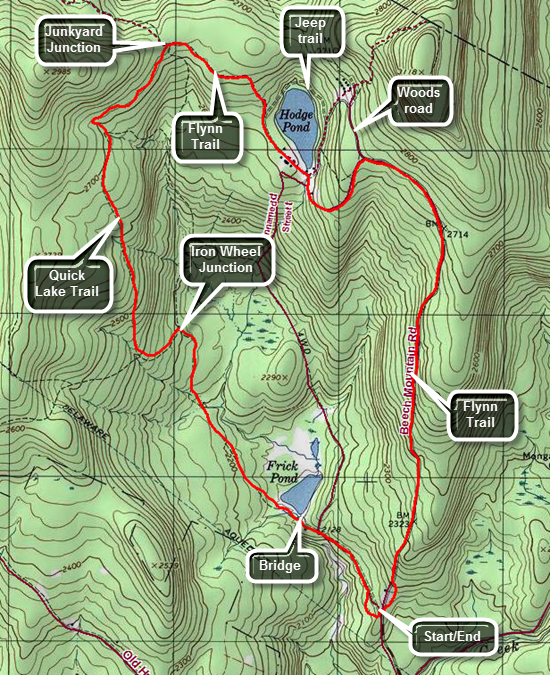 The area around Frick Pond, Hodge Pond and Quick Lake is covered with trails. There are numerous possibilities for short of long hikes. The area is "relatively" flat and there are no "views". There is, however, some beautiful scenery.
Take DeBruce Road from Livingston Manor for about six miles then turn left on Mongaup Rd. Where the road splits bear left on Beech Mountain Rd. and park in the parking lot on the left. Find the blue-blazed Flynn Trail across the road and follow it for 1.7 miles to the junction with the Big Rock Trail. Continue straight ahead toward Hodge Pond. In a short distance a woods road bears to the right. Continue straight ahead on the trail to the pond. Walk down the hill on the Flynn Trail to Hodge Pond. The trail turns left and crosses the outlet stream. You may want to walk over to the shores of the pond and relax for a few minutes. Continue on the blue Flynn Trail along the western edge of Hodge Pond. Watch for the blazes as they bear to the left at a junction with a jeep trail that continues around the back of the pond. Follow the blue blazes of the Flynn trail up the hill to a gate. Follow the trail as it turns left here and continues to Junkyard Junction. At Junkyard Junction the Flynn Trail ends at the Quick Lake Trail. Turn left and stay on the Quick Lake Trail for 1.6 miles until you get to Iron Wheel Junction where you will see ...a set of iron wagon wheels. The yellow Logger's Loop continues straight ahead. Turn right to stay on the red Quick Lake Trail. You will continue to hike mostly downhill and will cross a small stream in the woods. Pass by the next trail junction with the yellow Big Rock Trail. Cross the outlet of Frick Pond on a bridge. This is another nice place to stop for a few minutes. Continue up the hill following the Quick Lake Trail and passing by Gravestone Junction, an intersection with the yellow Logger's Loop. At the trail register turn right and walk out to the parking area on the Quick Lake Trail.
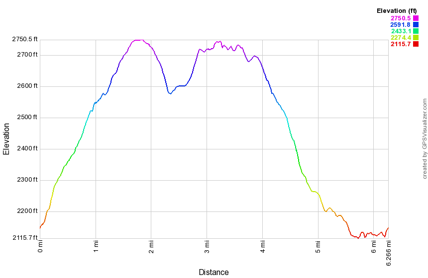 (The image below shows the profile of the hike. Remember that all vertical profiles are relative!)
Hodge and Frick Ponds (Flynn, Big Rock and Quick Lake Trails)
| Quick Look | ||||
|---|---|---|---|---|
| Difficulty | Round trip | Total climb | Internet Maps | |
| 5.6 mi. | 950 ft. | AllTrails | ||
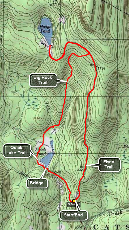 The area around Frick Pond, Hodge Pond and Quick Lake is covered with trails. There are numerous
possibilities for short of long hikes. The area is "relatively" flat and there are no "views".
There is, however, some beautiful scenery.
The area around Frick Pond, Hodge Pond and Quick Lake is covered with trails. There are numerous
possibilities for short of long hikes. The area is "relatively" flat and there are no "views".
There is, however, some beautiful scenery.
Take DeBruce Road from Livingston Manor for about six miles then turn left on Mongaup Rd. Where the road splits bear left on Beech Mountain Rd. and park in the parking lot on the left. Find the blue-blazed Flynn Trail across the road and follow it for 1.7 miles to the junction with the Big Rock Trail. Continue straight ahead toward Hodge Pond. In a short distance a woods road bears to the right. You may continue straight ahead on the trail to the pond. If you bear right, then take the next left and walk down toward Hodge Pond bearing to your left. Return the way you came to the Big Rock Trail junction. Turn right and head down the big Rock Trail to Times Square. Continue straight ahead around the back of Frick Pond. There are several wooden bridges and walkways here that can be very slippery when wet. Make a left on the Quick Lake Trail to continue around the pond. You will cross the bridge over the out let of the pond. Head up the small hill and bear right at the trail junction to get back to the parking area.
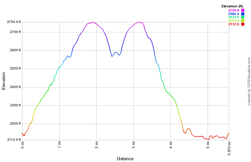 (The image below shows the profile of the hike. Remember that all vertical profiles are relative!)
Hodge and Frick Ponds: Beech Mt BSA Camp (Flynn, Big Rock and Quick Lake Trails)
| Quick Look | ||||
|---|---|---|---|---|
| Difficulty | Round trip | Total climb | Internet Maps | |
| 6.2 mi. | 980 ft. | AllTrails | ||
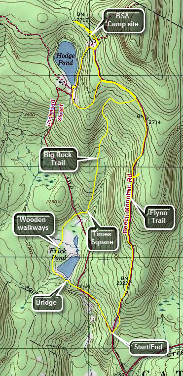 The area around Frick Pond, Hodge Pond and Quick Lake is covered with trails. There are numerous possibilities for short or long hikes. The area is "relatively" flat and there are no "views". There is, however, some beautiful scenery.
Take DeBruce Road from Livingston Manor for about six miles then turn left on Mongaup Rd. Where the road splits bear left on Beech Mountain Rd. and park in the parking lot on the left. Cross the road and start out on the Flynn Trail as it passes trough the woods to avoid the private property around the cabin. At the end of the trail turn right on the woods road that is the Flynn Trail. Walk up the trail for 1.7 miles gaining 650 feet along the way. At 1.1 miles you may want to walk off the trail to the right to an open area that covers several acres. The area has a thin layer of dirt over bedrock but there is no indication of how it formed. There is a woods road that runs from the Flynn Trail which was once Beech Mountain Road to the south ends of this area. Some people have suggested that dirt and gravel was taken from this area when the road was built. Return to the main Flynn Trail and turn right to continue on the trail. At 1.7 miles you will be at a four-way trail junction with the snowmobile trail from Mongaup Pond on the right and the Big Rock Trail on the left. Continue straight ahead on the Flynn Trail heading toward Hodge Pond. At the next trail junction stay right to walk on the woods road heading toward the site of the old Beech Mountain Boy Scout Camp. In about half a mile pass the left turn down to Hodge Pond. Stay on the road to a Y where and stay left to get to the camp site. Walk off the road to the left to inspect some of the remaining buildings. Walk back out to the road, turn right and walk to the road down to Hodge Pond. Turn right to walk downhill toward the water and turn left on the road around the pond. Walk down to the open area at the outlet end of the pond. Turn around and walk south into the woods on the Flynn Trail heading up the hill. At the next trail junction bear right and walk the Flynn Trail to the trail junction with the Big Rock Trail. Turn right to head down the Big Rock Trail to Times Square. The walk downhill is 1.1 miles and drops 600 feet to Times Square. Continue straight ahead on the Big Rock Trail around the north and west side of Frick Pond. Continue on the trail passing over the two small bridges that carry the trail over the inlet streams. Pass under some evergreen trees and cross the long wooden walkways. Follow the Big Rock Trail to the junction with the Quick Lake Trail and turn left. Walk over the bridge at the outlet of Frick Pond. Walk up the hill to Gravestone Junction and continue straight ahead on the Quick Lake Trail. Pass the trail register and continue on the woods road back to the car.
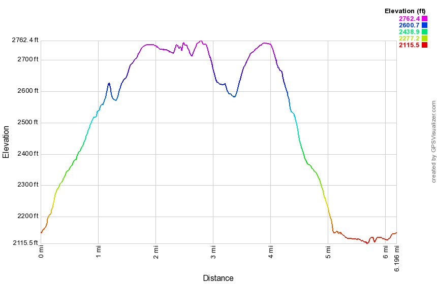
(The image above shows the profile of the hike. Remember that all vertical profiles are relative!)
Hodge Pond: Logger's Loop, Big Rock, Flynn and Quick Lake Trails
| Quick Look | ||||
|---|---|---|---|---|
| Difficulty | Round trip | Total climb | Internet Maps | |
| 7.5 mi. | 1110 ft. | AllTrails | ||
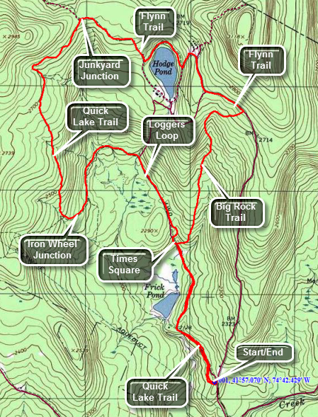 The area around Frick Pond, Hodge Pond and Quick Lake is covered with trails. There are numerous possibilities for short of long hikes. The area is relatively flat and there are only a few views. There is some beautiful scenery.
Take DeBruce Road from Livingston Manor for about six miles then turn left on Mongaup Rd. Where the road splits bear left on Beech Mountain Rd. and park in the parking lot on the left. Find the red-blazed Quick Lake Trail out of the main parking area. As you come out of the woods by the trail register, turn left on the woods road. After walking about .5 miles, you will be at a fork in the trail. Bear right onto the yellow-blazed Loggers Loop trail and head toward Times Square. At the trail junction known as Times Square, about 1 mile from the parking area, turn right on the red-blazed Big Rock Trail and get ready for a 1.1 mile climb of 600 feet to the junction with the Flynn Trail. Turn left on the blue-blazed Flynn Trail to head toward Hodge Pond. You will walk passed a gate on the trail and will arrive at another fork in the trail at about 2.4 miles. Bear to the right and walk a short distance to the area of the old Beech Mountain Boy Scout Camp where you will see some old buildings just ahead. Turn left and walk down to the jeep trail around Hodge Pond. Turn right and walk around the back of the pond. The next right will put you back on the blue-blazed Flynn Trail. Walk up a small hill and away from the pond to another gate. Walk passed the gate on the Flynn Trail until the trail ends where it meets the red-blazed Quick lake trail at Junkyard Junction. You will be about 3.7 miles into the hike. Turn left and walk down the Quick Lake trail until you get to Iron Wheel Junction at about 5.25 miles. Continue straight ahead on the yellow-blazed Loggers Loop. This trail continues mostly downhill and back to Times Square at about 6.5 miles. Continue straight ahead and retrace your earlier route to get back to the car.
 (The image below shows the profile of the hike. Remember that all vertical profiles are relative!)
Hodge Pond: Logger's Loop, Quick Lake and Flynn Trails
| Quick Look | ||||
|---|---|---|---|---|
| Difficulty | Round trip | Total climb | Internet Maps | |
| 7.3 mi. | 1010 ft. | AllTrails | ||
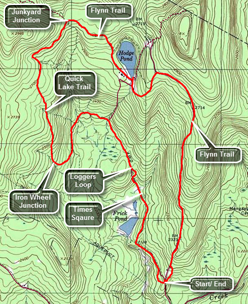 The area around Frick Pond, Hodge Pond and Quick Lake is covered with trails. There are numerous possibilities for short of long hikes. The area is relatively flat and there are only a few views. There is some beautiful scenery.
Take DeBruce Road from Livingston Manor for about six miles then turn left on Mongaup Rd. Where the road splits bear left on Beech Mountain Rd. and park in the parking lot on the left. Find the red-blazed Quick Lake Trail out of the main parking area. As you come out of the woods by the trail register, turn left on the woods road. After walking about .5 miles, you will be at a fork in the trail. Bear right onto the yellow-blazed Loggers Loop trail and head toward Times Square. At the trail junction known as Times Square, about 1 mile from the parking area, continue straight ahead on the Loggers Loop. The trail continues north and then begins to loop west before heading south to Iron Wheel junction at 2.3 miles. Continue straight ahead on the Quick Lake Trail and begin along climb toward Junkyard Junction at 3.9 miles. The trail heads north and the northeast to the junction with the Flynn Trail. Turn right on the Flynn Trail which is mostly flat until you are near Hodge Pond. Turn right and cloning on the Flynn Trail to the outlet of Hodge Pond at 4.8 miles. Bear to the right at the open field to stay on the Flynn Trail and get ready for one more climb. At 5.5 miles the Big Rock Trail comes in from the right and a snowmobile trail is on the left. Continue straight ahead for another 1.7 miles to the parking area. This part of the trail is all downhill. Near the end there is a gate. Bear to the left at the gate to continue on the trail and to avoid the private property around the cabin.
 (The image shows the profile of the hike. Remember that all vertical profiles are relative!)
Hodge Pond Lookout: Flynn Trail (out and back)
| Quick Look | ||||
|---|---|---|---|---|
| Difficulty | Round trip | Total climb | Internet Maps | |
| 5.8 mi. | 1020 ft. | AllTrails | ||
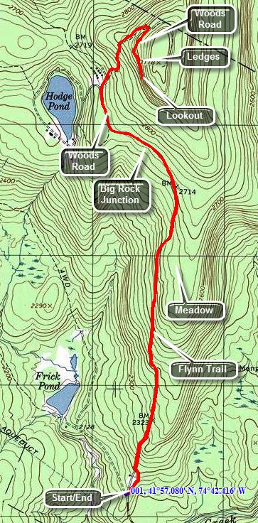 The area around Frick Pond, Hodge Pond and Quick Lake is covered with trails. There are numerous possibilities for short of long hikes. The area is relatively flat and there are only a few views. There is some beautiful scenery.
Take DeBruce Road from Livingston Manor for about six miles then turn left on Mongaup Rd. Where the road splits bear left on Beech Mountain Rd. and park in the parking lot on the left. Find the blue-blazed Flynn Trail across the road and follow it for 1.7 miles to the junction with the Big Rock Trail. Continue straight ahead toward Hodge Pond. In a short distance a woods road bears to the right. Bear right on the woods road. Shortly a trail will turn left and go down to Hodge Pond. Continue straight ahead and pass another woods road on the left. This road continues out to Shin Creek Road in Lew Beach. At this junction are some old cabins that are all that remains of the Beech Mountain Boy Scout Camp. Continue straight ahead and up the hill for about .5 miles. At 2.7 miles into the hike a woods road turns sharply to the right, climbs briefly and then levels off. Take this turn and continue walking until a large, pointed rock appears on the right. Walk just past the rock to a ledge that overlooks Hodge Pond and the hills to the west. By this time you will have hiked 2.9 miles. If you climb the ledges behind the lookout, you will be at the highest point in Sullivan County at just over 3100 feet. When you have taken in the site turns around and retrace your steps to the car. There are, of course, many other possible return routes that take in both Hodge and Frick Ponds.
 (The image below shows the profile of the hike. Remember that all vertical profiles are relative!)
Hodge Pond Lookouts: Flynn Trail (counterclockwise loop)
| Quick Look | ||||
|---|---|---|---|---|
| Difficulty | Round trip | Total climb | Internet Maps | |
| 6.1 mi. | 1080 ft. | AllTrails | ||
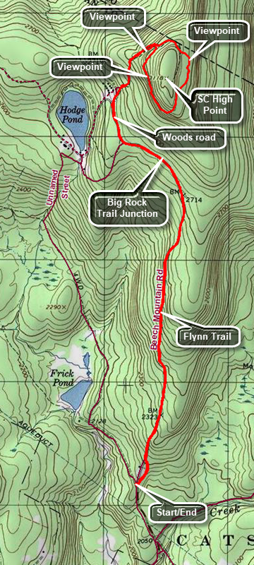 The area around Frick Pond, Hodge Pond and Quick Lake is covered with trails. There are numerous possibilities for short of long hikes. The area is relatively flat and there are only a few views. There is some beautiful scenery.
Take DeBruce Road from Livingston Manor for about six miles then turn left on Mongaup Rd. Where the road splits bear left on Beech Mountain Rd. and park in the parking lot on the left. Find the blue-blazed Flynn Trail across the road and follow it for 1.7 miles to the junction with the Big Rock Trail. Continue straight ahead toward Hodge Pond. In a short distance a woods road bears to the right. Bear right on the woods road. Shortly a trail will turn left and go down to Hodge Pond. Continue straight ahead and pass another woods road on the left. This road continues out to Shin Creek Road in Lew Beach. At this junction there were some old cabins that were part of the Beech Mountain Boy Scout Camp. These cabins were leveled in 2021 by the Beaverkill Land Trust. Continue straight ahead and up the hill for about .4 miles where there is a viewpoint to the west on the left side of the road. Continue a short distance on the woods road and at 2.7 miles into the hike a woods road turns sharply to the right. Take this turn and climb briefly. The path levels off and continues to a large, pointed rock on the right. Walk just past the rock to a ledge that overlooks Hodge Pond and the hills to the west. By this time you will have hiked 2.9 miles. When you are done turn around and look at the ledges behind the lookout. Atop these ledges is the summit of Beech Mountain, the highest point in Sullivan County at 3118 feet. Continue of the woods road to walk around the base of the summit of Beech Mountain in a counterclockwise direction. There are some interesting ledges and cliffs on the east side of the mountain on your left. When the road splits stay to the right and continue to a lookout with a clear view to the east. You will be able to see many of the3500 foot peaks of the Catskills. Continue on the woods road passing a herd path to Mongaup Mountain on the right. Ascend a small hill and continue to the point where the woods road meets the road where you started the loop. Bear right and start the long descent back to the junction by the former Boy Scout camp. Walk straight ahead to the junction with the Flynn Trail. Turn left and walk the Flynn Trail back to the parking area.
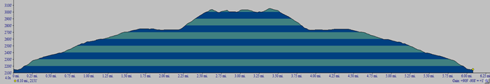 (The image below shows the profile of the hike. Remember that all vertical profiles are relative!)
Hodge Pond Lookouts: Flynn Trail (loop with SC high point)
| Quick Look | ||||
|---|---|---|---|---|
| Difficulty | Round trip | Total climb | Internet Maps | |
| 6.5 mi. | 1180 ft. | AllTrails | ||
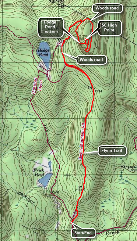 The area around Frick Pond, Hodge Pond and Quick Lake is covered with trails. There are numerous possibilities for short of long hikes. The area is relatively flat and there are only a few views. There is some beautiful scenery.
Take DeBruce Road from Livingston Manor for about six miles then turn left on Mongaup Rd. Where the road splits bear left on Beech Mountain Rd. and park in the parking lot on the left. Find the blue-blazed Flynn Trail across the road and follow it for 1.7 miles to the junction with the Big Rock Trail. Continue straight ahead toward Hodge Pond. In a short distance a woods road bears to the right. Bear right on the woods road. Shortly a trail will turn left and go down to Hodge Pond. Continue straight ahead and pass another woods road on the left. This road continues out to Shin Creek Road in Lew Beach. At this junction are some old cabins that are all that remains of the Beech Mountain Boy Scout Camp. Continue straight ahead and up the hill for about .4 miles where there is a viewpoint to the west. Continue a short distance on the woods road and at 2.7 miles into the hike a woods road turns sharply to the right. Take this turn and climb briefly. The path levels off and continues to a large, pointed rock on the right. Walk just past the rock to a ledge that overlooks Hodge Pond and the hills to the west. By this time you will have hiked 2.9 miles. When you are done turn around and look for a way to climb the ledges behind the lookout. Once at the top look for the highest point you can find which will be the highest point in Sullivan County at 3118 feet. Find a way to walk back down off the top of Beech Mountain to the woods road. Turn left and walk around Beech Mountain counterclockwise. There are some interesting ledges and cliffs on the east side of the mountain. If you walk off the road into the woods to the east, you may be able to find a lookout with a clear view. Walk back to the woods road and continue to the point where the woods road meets the road you walked up. Turn left and walk up a hill and then start the long descent back to the junction by the Boy Scout camp. Walk straight ahead to the junction with the Flynn Trail. Turn left and walk the Flynn Trail back to the parking area.
 (The image below shows the profile of the hike. Remember that all vertical profiles are relative!)
Hodge Pond: Lookout and Pond (Flynn Trail)
| Quick Look | ||||
|---|---|---|---|---|
| Difficulty | Round trip | Total climb | Internet Maps | |
| 6.4 mi. | 1180 ft. | AllTrails | ||
![]() The area around Frick Pond, Hodge Pond and Quick Lake is covered with trails. There are numerous possibilities for short of long hikes. The area is relatively flat and there are only a few views. There is some beautiful scenery.
The area around Frick Pond, Hodge Pond and Quick Lake is covered with trails. There are numerous possibilities for short of long hikes. The area is relatively flat and there are only a few views. There is some beautiful scenery.
Take DeBruce Road from Livingston Manor for about six miles then turn left on Mongaup Rd. Where the road splits bear left on Beech Mountain Rd. and park in the parking lot on the left. Find the blue-blazed Flynn Trail across the road and follow it for 1.7 miles to the junction with the Big Rock Trail. Continue straight ahead toward Hodge Pond. In a short distance a woods road bears to the right. Bear right on the woods road. Shortly a trail will turn left and go down to Hodge Pond. Continue straight ahead and pass another woods road on the left. This road continues out to Shin Creek Road in Lew Beach. At this junction are some old cabins that are all that remains of the Beech Mountain Boy Scout Camp. Continue straight ahead and up the hill for about .5 miles. At 2.7 miles into the hike a woods road turns sharply to the right, climbs briefly and then levels off. Take this turn and continue walking until a large, pointed rock appears on the right. Walk just past the rock to a ledge that overlooks Hodge Pond and the hills to the west. By this time you will have hiked 2.9 miles. If you climb the ledges behind the lookout, you will be at the highest point in Sullivan County at just over 3100 feet. When you have taken in the sigh, walk the wood road back to the dirt road. Turn left and walk back down the hill skipping the first left turn and taking the next. Walk down the woods road toward Hodge Pond. Bear left and walk to the field at the south end of Hodge Pond. Walk over to the edge of the pond if you like. It is a nice spot to relax for a few minutes. When you are ready, turn around 1rr80 degrees and head south on the Flynn Trail. Climb a short hill to the junction where you turned right of the Flynn Trail some time before. Continue on the Flynn Trail back to the airing area.
 (The image below shows the profile of the hike. Remember that all vertical profiles are relative!)
Hodge Pond Lookout Loop (Flynn, Big Rock and Quick Lake Trails)
| Quick Look | ||||
|---|---|---|---|---|
| Difficulty | Round trip | Total climb | Internet Maps | |
| 6.8 mi. | 1125 ft. | AllTrails | ||
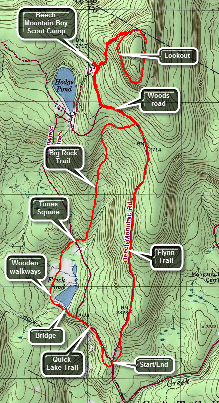 The area around Frick Pond, Hodge Pond and Quick Lake is covered with trails. There are numerous possibilities for short of long hikes. The area is relatively flat and there are only a few views. There is some beautiful scenery.
Take DeBruce Road from Livingston Manor for about six miles then turn left on Mongaup Rd. Where the road splits bear left on Beech Mountain Rd. and park in the parking lot on the left. Find the blue-blazed Flynn Trail across the road and follow it for 1.7 miles to the junction with the Big Rock Trail. Continue straight ahead toward Hodge Pond. In a short distance a woods road bears to the right. Bear right on the woods road. Shortly a trail will turn left and go down to Hodge Pond. Continue straight ahead and pass another woods road on the left. This road continues out to Shin Creek Road in Lew Beach. At this junction are some old cabins that are all that remains of the Beech Mountain Boy Scout Camp. Continue straight ahead and up the hill for about .5 miles. At 2.7 miles into the hike a woods road or trail turns sharply to the right, climbs briefly and then levels off. Take this turn and continue walking until a large, pointed rock appears on the right. Walk just past the rock to a ledge that overlooks Hodge Pond and the hills to the west. By this time you will have hiked 2.8 miles. After enjoying the view, get back on the trail and continue around the hill. This hill is Flynn's Point and may be the highest spot in Sullivan County. Bear to the left when the trail splits and at 3.4 miles you will be back on the dirt road that you walked up. Turn left and continue back to the junction with the Big Rock Trail at 4.6 miles. Turn right on the Big Rock Trail and walk downhill for 1.1 miles losing almost 600 feet along the way. At Times Square continue straight ahead to walk around the back of Frick Pond. Here is a nice spruce tunnel and some wooden walkways. Be careful on the walkways as they are VERY SLIPPERY when wet. Turn left at the next trail junction and walk to the bridge across the outlet of Frick Pond. Continue on the trail up a small hill to Gravestone Junction. Continue straight ahead to the trail register on the Quick Lake Trail. Turn right here and walk back to the parking area.
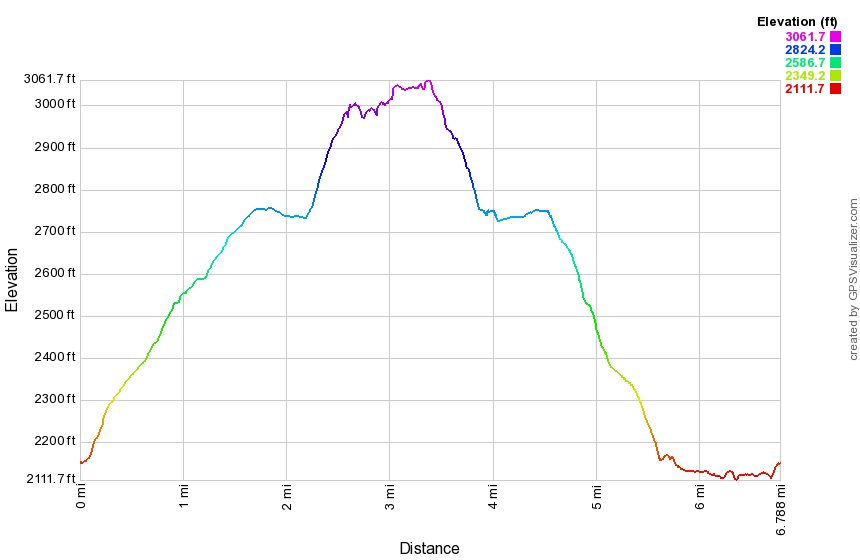 (The image below shows the profile of the hike. Remember that all vertical profiles are relative!)
Hodge Pond Lookout and Frick Pond (features)
| Quick Look | ||||
|---|---|---|---|---|
| Difficulty | Round trip | Total climb | Internet Maps | |
| 7.5 mi. | 1390 ft. | AllTrails | ||
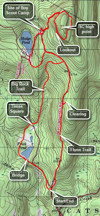 The area around Frick Pond, Hodge Pond and Quick Lake is covered with trails. There are numerous possibilities for short of long hikes. The area is relatively flat and there are only a few views. There is some beautiful scenery.
Take DeBruce Road from Livingston Manor for about six miles then turn left on Mongaup Rd. Where the road splits bear left on Beech Mountain Rd. and park in the parking lot on the left. Find the blue-blazed Flynn Trail across the road and follow it for 1.7 miles to the junction with the Big Rock Trail. At 1.1 miles there is a path to the right which leads to an interesting clearing. The clearing may have been formed when dirt from the area was used to construct Beech Mountain Road to the Beech Mountain Boy Scout Camp. Continue straight ahead toward Hodge Pond. In a short distance a woods road bears to the right. Bear right on the woods road. Shortly a trail will turn left and go down to Hodge Pond. Continue straight ahead to another woods road on the left. This road continues out to Shin Creek Road in Lew Beach. At this junction there were some old cabins that were all that remained of the Beech Mountain Boy Scout Camp. You can visit the area if you wish. Continue straight ahead and up the hill for about .5 miles. Watch for a spring house on the right. Where the road turns sharply to the right there is a lookout on the left. Just after the lookout is a path on the right side of the road. Continue to the top of the hill on the road and start down the other side of the hill. There is a nice lookout to the Burroughs Range on the left side of the road. Continue on the road and walk up to another woods road of path that forms a loop around Beech Mountain. The highest point on this mountain is Flynn's Point, the high point of Sullivan County. Stay to the left to walk clockwise around the mountain watching for some interesting ledges and boulders. At 3.5 miles there is a lookout to the west over Hodge Pond on the left of the trail. Be careful if you walk out onto the flat rock that makes up this viewpoint. Get back on the path and continue in a clockwise direction back to the road. Turn left and walk back down the dirt road to a path on the right just passed the road that runs out to Shin Creek. Turn right on this road which leads down to Hodge Pond. At the next junction stay to the left and walk on the woods road to the clearing at the southern end of Hodge Pond. Walk over to the shore of Hodge Pond to take in the beauty of the pond. When you are done, turn around and walk to where the Flynn Trail enters the woods. Walk up the hill to the junction with the woods road. Stay to the right on the Flynn Trail and walk back to the junction with the Big Rock Trail at 5.3 miles. Turn right on the Big Rock Trail and walk downhill for 1.1 miles losing almost 600 feet along the way. At Times Square continue straight ahead to walk around the back of Frick Pond. There may be a few wet or muddy spots but there is a nice spruce tunnel and some wooden walkways. Be careful on the walkways as they are VERY SLIPPERY when wet. Turn left at the trail junction with the Quick Lake Trail. Walk to the bridge across the outlet of Frick Pond which is a nice place to take a quick break before retuning to your car. Continue on the trail up a small hill to Gravestone Junction. Continue straight ahead to the trail register on the Quick Lake Trail watching for the memorial marker on the right that gives the junction its name. At the trail register, turn right here and walk back to the parking area.
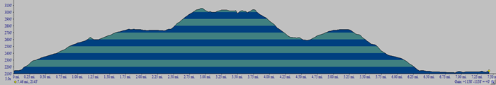 (The image below shows the profile of the hike. Remember that all vertical profiles are relative!)
Hodge Pond: Shin Creek
| Quick Look | ||||
|---|---|---|---|---|
| Difficulty | Round trip | Total climb | Internet Maps | |
| 4.0 mi. | 680 ft. | AllTrails | ||
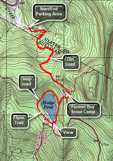 The area around Frick Pond, Hodge Pond and Quick Lake is covered with trails. There are numerous possibilities for short of long hikes. The area is relatively flat and there are only a few views. There is some beautiful scenery.
Drive north on Old Route 17 from Livingston Manor toward Roscoe. Turn right on the Beaverkill Road and drive north to the four corners just after the Beaverkill Valley fire house. Turn right on Shin Creek Road and drive 4 miles to a seasonal maintenance road on the right. Shin Creek Road is very rough in places and becomes narrow. Drive up the dirt road for about .3 miles to a large parking lot on the left side of the road just before a gate. The road heads southeast and climbs about 460 feet in 1.5 miles. A stream paralleled the road for part of the way. At 1.5 miles the road levels off and passes the former site of the Beech Mountain Boy Scout Camp. Walk to the road junction and turn right. Pass by a road on the right and turn right at the next road that leads downhill toward the shore of Hodge Pond. Take the next road to the right which loops around the back of Hodge Pond. When you reach the blue blazed Flynn Trail, turn left and continue along the west side of the pond. When you come out of the woods, walk across the field and back into the woods. At the clearing at the outlet end of Hodge Pond, take some time to walk to the shores of the pod and enjoy the view. When you are done, walk to the trail that ascends a hill on the eastern side of the pond. You will recognize the next trail junction. Stay to the right and climb the hill. At the next trail junction turn left, skip the next left, and the turn left on the road back to the car. Follow the road downhill and back to the car.
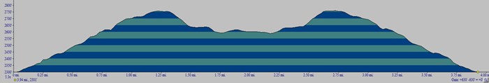 (The image below shows the profile of the hike. Remember that all vertical profiles are relative!)
Hodge Pond Lookouts: Shin Creek clockwise
| Quick Look | ||||
|---|---|---|---|---|
| Difficulty | Round trip | Total climb | Internet Maps | |
| 4.3 mi. | 920 ft. | AllTrails | ||
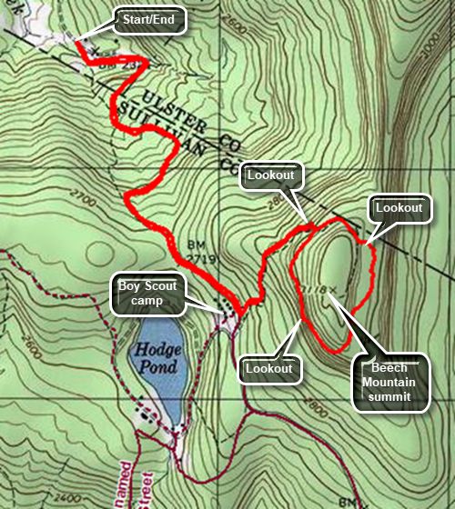 The area around Frick Pond, Hodge Pond and Quick Lake is covered with trails. There are numerous possibilities for short of long hikes. The area is relatively flat and there are only a few views. There is some beautiful scenery.
Drive north on Old Route 17 from Livingston Manor toward Roscoe. Turn right on the Beaverkill Road and drive north to the four corners just after the Beaverkill Valley fire house. Turn right on Shin Creek Road and drive 4 miles to a seasonal maintenance road on the right. Shin Creek Road is very rough in places and becomes narrow. Drive up the dirt road for about .3 miles to a large parking lot on the left side of the road just before a gate. The road heads southeast and climbs about 460 feet in 1.15 miles. A stream parallels the road for part of the way. At 1.5 miles the road levels off and passes the former site of the Beech Mountain Boy Scout Camp. Walk to the road junction and turn left. Walk up the hill toward the summit of Beech Mountain, the highest point in Sullivan County. At 1.65 miles the road makes a sharp right turn. Just after the turn a trail turns off to the right. Bear to the left and continue uphill briefly. The road then descends and turns rig before opening into a clearing. The views to the east take in the Burroughs Range and the Devil's Path. Continue along the path and up a slight incline to the woods road that circles Beech Mountain. Turn left and walk clockwise on the trail until at 2.3 miles you arrive at a west facing lookout over Hodge Pond. Continue along the trail back to the woods road you ascended on the way out. Turn left and walk down the road to the trail junction at the base of the hill. Turn right and follow the road downhill back to the car.
 (The image below shows the profile of the hike. Remember that all vertical profiles are relative!)
Huckleberry Point
| Quick Look | ||||
|---|---|---|---|---|
| Difficulty | Round trip | Total climb | Internet Maps | |
| 4.4 miles | 1165 ft. | AllTrails | ||
Turn onto Bloomer Rd. off Route 23A just west of Tannersville. At the Y in the road bear left onto Platte Clove Rd. Continue on this road passed the Platte Clove Community and the Platte Kill Preserve. Turn into the parking lot for Kaaterskill High Peak on your left. You may also access Platte Clove Road from the east in West Saugerties. Be aware that this road is "limited maintenance" and may be "closed" from late fall to early spring. At the parking area Look for the aqua-blazed Long Path or the darker blue markers. The "trail" here is really a very wide woods road that is traveled by local landowners. It is wide and easy to follow but may be rocky and muddy in places. Continue to follow the markers for about 1.05 miles where the yellow Huckleberry Point Trail goes off to the right. Turn here and continue on the trail.
The initial part of this trail passes through and area that has stone piles and some deteriorated foundations which are evidence of how the land was once settled. At about .35 miles into the trail cross a small stream which can be high after heavy rains. The trail now begins to roll significantly with several ascents and descents. None of these are long or steep but they may surprise you. The trail also passes through a variety of hardwoods, evergreens and bushes. Several time you may think you are at the Point. After about 1 mile, the trail ends and you will be at Huckleberry Point. A series of rock ledges give views south the Overlook and Plattekill Mountains. The fire tower and TV antennae on Overlook can be seen. To the west is a view deep into Platte Clove. Looking down from these dizzying heights also reveals more of the Clove. To the east are views of the Hudson River. You may climb down the rock ledges for different views. Be careful since a fall from this elevation could be hazardous to your health. Some of the ledges are narrow with loose rock and little to hold onto. There is an informal trail that works its way to the east but few viewpoints are open. After enjoying all the views turn around and reverse your route back to the car.
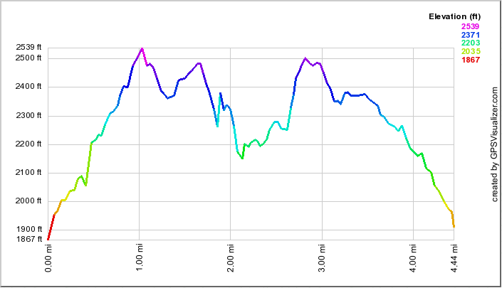
(The image at the left shows the profile of the hike. Remember that all vertical profiles are relative! Although this profile looks menacing, the elevation gains are seldom more than 50 ft!)
Huggins Lake
| Quick Look | ||||
|---|---|---|---|---|
| Difficulty | Round trip | Total climb | Internet Maps | |
| 3.6 mi. | 900 ft. | AllTrails | ||
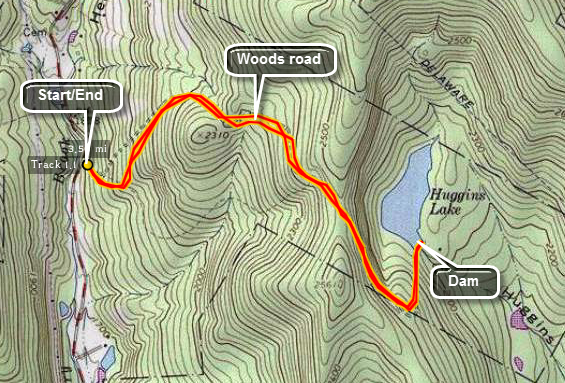 Head north from Livingston Manor on the Beaverkill Road. Watch for the signs for the Beaverkill State Campsites and turn left on Campsite Road. At the bottom of the hill turn right to go down to the river. Cross the Beaverkill on the historic covered Bridge. The road will intersect Berry Brook Road. Turn right on Berry Brook Road and drive 2 miles north to the parking area on the right. The trail is not marked but travels its entirety along a woods road. The walk is easy and the lake is in a pretty setting. The road rises gently for 1.2 miles and then turns to drop down to the lake. Walk to the dam for a good look at the lake. Snakes like to sun themselves on the concrete dam. There are informal paths around the lake which you can explore before returning to the parking area.
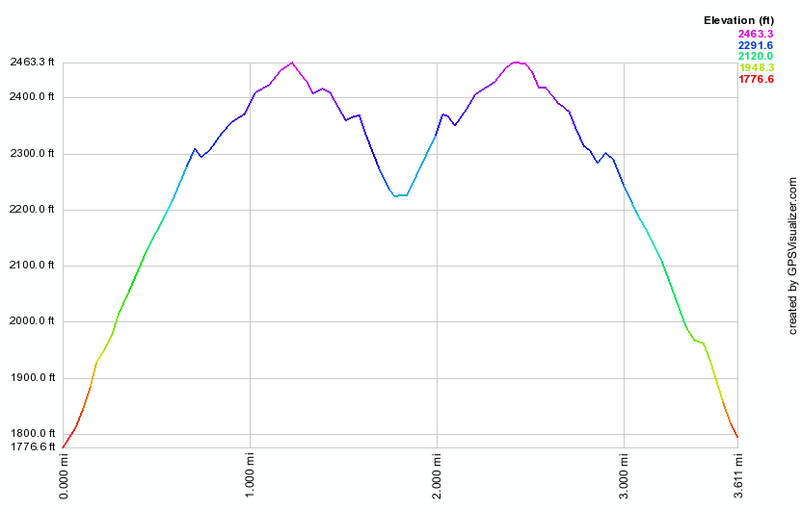 (The image below shows the profile of the hike. Remember that all vertical profiles are
relative!)
(The image below shows the profile of the hike. Remember that all vertical profiles are
relative!)
Huggins Lake Bushwhack
| Quick Look | ||||
|---|---|---|---|---|
| Difficulty | Round trip | Total climb | Internet Maps | |
| 4.0 mi. | 955 ft. | AllTrails | ||
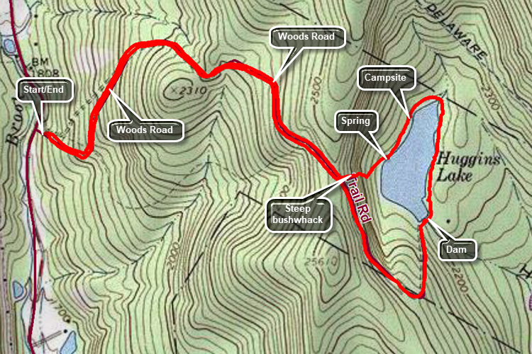 Head north from Livingston Manor on the Beaverkill Road. Watch for the signs for the Beaverkill State Campsites and turn left on Campsite Road. At the bottom of the hill turn right to go down to the river. Cross the Beaverkill on the historic covered Bridge. The road will intersect Berry Brook Road. Turn right on Berry Brook Road and drive 2 miles north to the parking area on the right. The trail is not marked but travels along a woods road to the lake. The walk out on the woods road is relatively easy and the lake is in a pretty setting. The road rises gently for 1.2 miles and then turns to drop down to the lake. Walk to the dam for a good look at the lake. Snakes like to sun themselves on the concrete dam. When you are don at the dam, start around the lake on some informal paths. At point you may have to bushwhack. Stay as close to the shore as you can. As you round the northern end the shoreline heads southwest. You will find a spring with a manmade box outlining it. Just after this spring turn right up the hill and get ready for a steep climb heading west. This is a bushwhack so your experience may vary but the climb is about .12 miles with a gain of 200 feet. This means the climb averages a 30% to 35% grade! At the top of the hill you should be able to walk right out to the trail. Turn right and walk back to the parking area on the woods road.
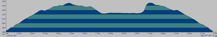 (The image below shows the profile of the hike. Remember that all vertical profiles are relative!)
Huntersfield and Ashland Pinnacle (Partridge Rd)
| Quick Look | ||||
|---|---|---|---|---|
| Difficulty | Round trip | Total climb | Internet Maps | |
| 7.2 mi. | 1876 ft. | AllTrails | ||
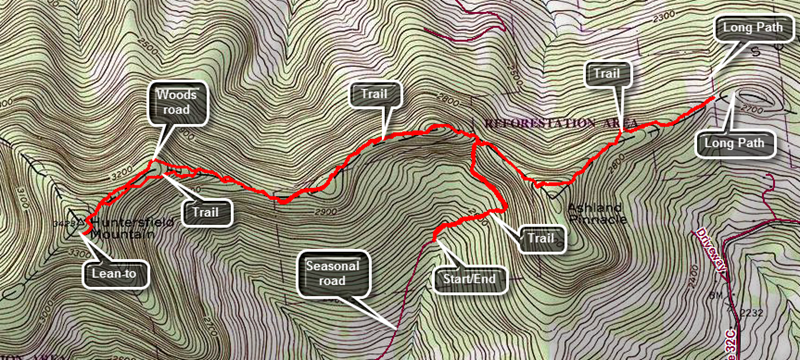 From Route 23 in Prattsville turn north on Washington Street which is Route 10. Continue east for about 6.5 miles to Partridge Road, Turn left and head north on the paved road. The road turns to rough pavement and then gravel but never deteriorates to the point that a car would not be able to make the trip. After 1.6 miles, the road comes to a dead end in a rather large parking area. The trail is obvious and leaves the north end of the parking area as a woods road with yellow blazes. The yellow blazes seem to follow the woods road up toad the ridge but the markers are few and far between. The trail is marked for no motorized vehicles but there are obvious ATV trails. Simply follow the woods road and ATV tracks as they lead up to the ridge. The initial heading is northeast but at .3 miles the trail levels off and begins heading northwest and then north to the ridge at .65 miles. The yellow trail ends here. Turn left to follow the red blazes west as the trail continues to climb until about .9 miles. After coming to the top of a small hill start to descend the other side. You may find the aqua blazes of the Long Path in some place as this was once part of that trail. The trail rolls as it drops a little and then comes to the top of another small hill at 1.3 miles. The trail follows the ridge line and is sited mostly along wide woods roads which makes walking pretty easy. At 1.75 miles the trail, for some reason, veers right into the woods and then rejoins the woods road about 100 feet ahead. Continue to follow the woods road but be careful at about 1.9 miles as the trail turns left off the woods road but the turn is not well marked. This again appears to be for no reason as it rejoins the same woods road 2.35 miles! At 2.45 miles there is a junction with a yellow spur trail to the lean-to. Turn left and head over to the lean-to. There is a viewpoint cut out in front of the lean-to looking south to the Catskills. Head back along the yellow trail and watch for a viewpoint on the right that looks east toward Ashland Pinnacle. The bench that once stood here has rotted away. Return to the trail and turn east on the red trail to return the way you came. You should be able to make good time as you are mostly descending. You will "roll" over the hills you encountered on the trip out and at 4.4 miles you will be at the junction with the trail back to the car. Continue straight ahead on the red trail. Over the next quarter mile the trail ascends to the shoulder of Ashland Pinnacle along a woods road. Immediately after this point the trail begins to descend and drops off the ridge a little. It soon regains the ridge and over .8 miles drops 340 feet of elevation. At 5.5 miles the trail comes to a clearing where the Long Path comes in from the east and turns north to drop of the ridge to South Mountain Road. Turn around and head back the way you came climbing a little at first. When you reach the yellow trail back to the car at 6.6 miles, turn left and follow your route back to the car.
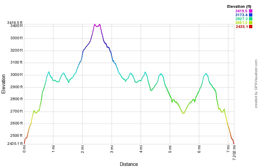 (The image below shows the profile of the hike. Remember that all vertical profiles are
relative!)
(The image below shows the profile of the hike. Remember that all vertical profiles are
relative!)
Jensen Ledges (Long Eddy)
| Quick Look | ||||
|---|---|---|---|---|
| Difficulty | Round trip | Total climb | Internet Maps | |
| 6.0 mi. | 730 ft. | AllTrails | ||
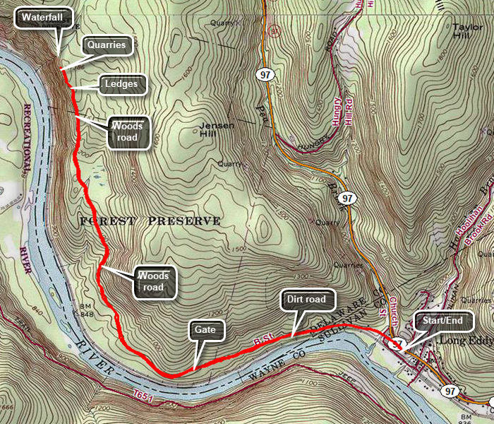 CAUTION: The area of the Ledges and the waterfall can be dangerous! Pay attention to where you are and do not go to close to the edge of the Ledges or the stream. People have been seriously injured and killed in this area.
Drive to Long Eddy on Route 97. Park at the Basket Historical Society on the west side of the road across from the Post Office. Walk north briefly on Route 97 and turn left on Kinney Road. Continue straight ahead as Kinney Road becomes Acid Factory Road. Walk 1 mile along Te dirt road to a gate. After the gate, the trail begins and stays on a woods road. Until 1.6 miles the trail is relatively flat with the Delaware River and the train tracks on the left. At 1.6 miles the trail begins to climb at about an 8% grade. The trail levels and then gains elevation again until it levels at 2.7 miles near the highest point on the trail. When the trail splits, bear left and you will be at the Ledges at 2.9 miles. Enjoy the view and then continue to walk along the path that parallels the edge of the ledges. Within a few hundred feet, there will be a bluestone quarry and many left over stones which some visitors have fashioned into "furniture" and cairns. Walking another short distance will bring you to the edge of a stream where a water fall cascades down to the river. When you have finished exploring, taking pictures and enjoying the views, turn around and follow the route back to the car.
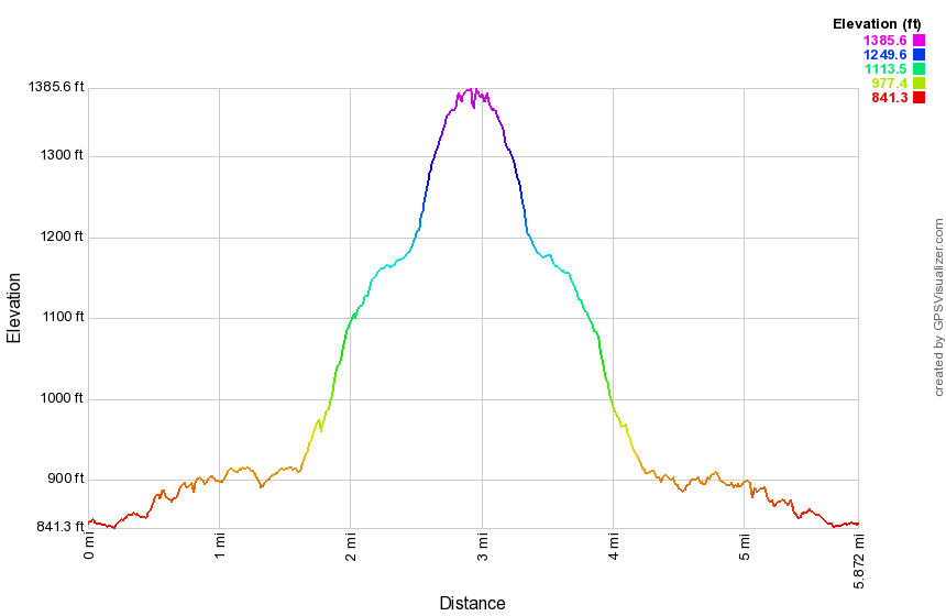 (The image at the left shows the profile of the hike. Remember that all vertical profiles are relative!)
Jensen Ledges (Lordville)
| Quick Look | ||||
|---|---|---|---|---|
| Difficulty | Round trip | Total climb | Internet Maps | |
| 2.7 mi. | 688 ft. | AllTrails | ||
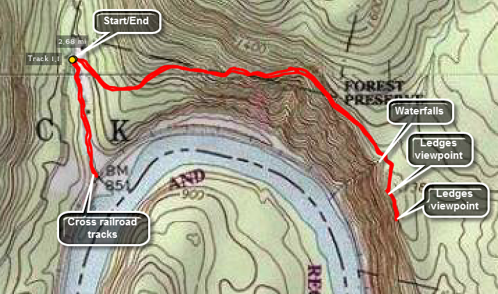
CAUTION: The area of the Ledges and the waterfall can be dangerous! Pay attention to where you are and do not go to close to the edge of the Ledges or the stream. People have been seriously injured and killed in this area.
From Route 97 near Hancock, NY turn south on Lordville Road near Somerset Lake. The road heads south to the Delaware River and crosses to Equinunk, PA. Just before the bridge crossing turn left on Bouchouxville Road. This dirt road becomes narrow and very rough but ends in a small parking area. From the parking area get on the woods road that heads east and up the ridge. As you climb, keep looking to your right for some views down to the river. After walking only .9 miles, you will cross a small stream that cascades down the ledges and empties into the river. If there is enough water volume, it is worth working your way down the side of the falls to get some pictures. Back on the main trail, cross the brook and walk a few hundred feet before turning right and walking out to the first viewpoint. At this viewpoint, you will have beautiful views down to the river and beyond. This area has a HUGE rock cairn that sits atop a "pile" of laid up stone! There may also be some stone "furniture" just behind the viewpoint is the remains of a stone quarry. Walk a little further east and there is another viewpoint. Retrace yours steps back down to the car. Walk along the trail down to the river along a private property easement. At the railroad tracks cross carefully and walk down to the river. After taking pictures, return to the car.
 (The image at the left shows the profile of the hike. Remember that all vertical profiles are relative!)
Jockey Hill
| Quick Look | ||||
|---|---|---|---|---|
| Difficulty | Round trip | Total climb | Internet Maps | |
| 5.7 mi. | 662 ft. | AllTrails | ||
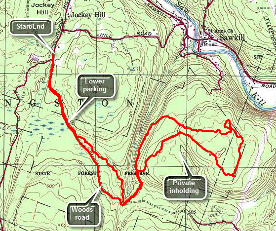 Bluestone State Forest is near Kingston. There are two sets of trails in the area that are used for both hiking and mountain biking. There are three trail loops near Onteora Lake and another set of trails just east of Onteora Lake on Jockey Hill. Drive west on Route 28 from Kingston watching for Morey Hill Road on the right. Turn right on Morey Hill Road. Drive north until Morey Hill Road meets Sawkill Road. Turn right and watch for Jockey Hill Road on the right. Turn right to head south on Jockey Hill Road. Bear left when the road seems to split and you will be at the end of the paved road in what looks like a dead end. You may park on the side of the road or in the cul-de-sac. You may also continue on the dirt and gravel road marked Woods Road as this leads to the lower parking area and is NOT a private road. (The distance given here are from the upper parking area.) Walk down Woods Road about .5 miles to the lower parking area. Continue straight ahead and out the far end of the parking area passing a gate. This is where the yellow blazes start. The trail followed the woods roads to about .7 miles or .15 miles from the lower parking area. Here the trail turns left into the woods. The trail parallels the road through mixed evergreen and hardwood forests for the next .65 miles rolling some but mostly descending. At 1.3 miles the trail turns left 90 degrees changing from southeast to northeast. The hiking now is mostly through hardwood forest and at 1.6 miles the trail splits to the start of the loop. Stay to the left and descend slightly before turning east at 2.0 miles and beginning a climb. The climb looks impressive on a contour profile but it lasts only to about 2.6 miles and gains just 175 feet! At this point the trail does a funny little loop to the north to avoid a rather steep descent over some rocks. Soon you will be headed south to about 3.2 miles. At his point another trail or road goes off to the left. It is important to follow the blazes since there are many of these woods roads and paths that cross the blazed trail. The trail turns west first heading northwest and then southwest to walk around a small private inholding. At 3.4 miles the trail passes over the highest elevation on the hike at 600 feet. From here it begins to descend until you are back at the start of the loop at 4.2 miles. Continue to follow the blazes or hike out to the road at 4.5 miles. Walking the road back offers a different experience. It is about .75 miles back to the lower parking area and then another .5 miles back to your car.
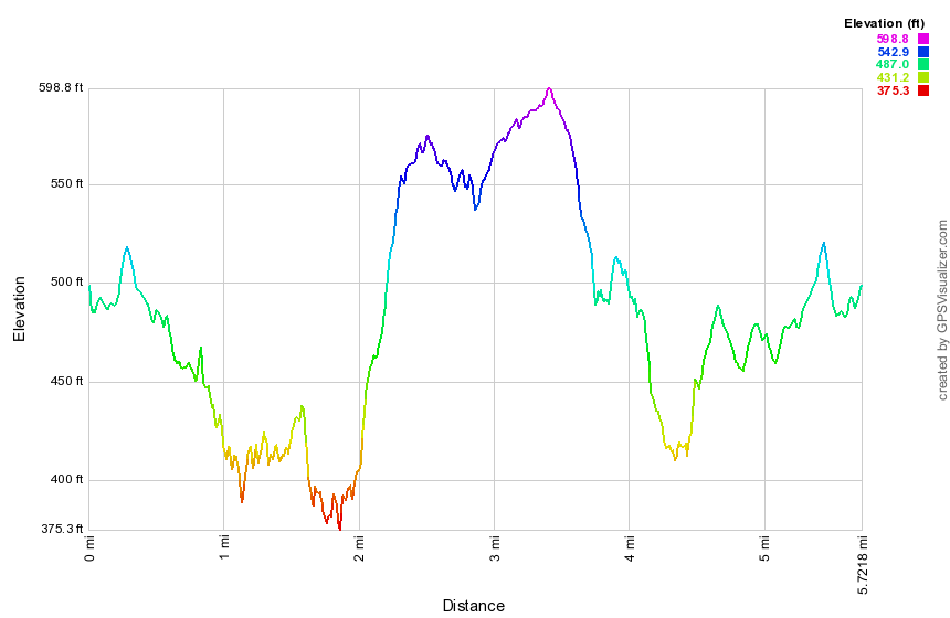 (The image at the left shows the profile of the hike. Remember that all vertical profiles are relative!)
Kelly Hollow
| Quick Look | ||||
|---|---|---|---|---|
| Difficulty | Round trip | Total climb | Internet Maps | |
| 3.7 mi. | 667 ft. | AllTrails | ||
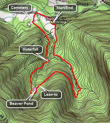 From NYC Route 9/10 on the south side of the Pepacton Reservoir take the Millbrook Arena Road southeast for about 5 miles. Watch for the trailhead sign for Kelly Hollow on the right. Pull into the small lot and park. The trail begins at the back of the parking area just beyond the kiosk. The entire trail network is marked as a cross country ski trail with yellow markers. As you enter the forest, follow the yellow markers to the left. This trail heads south and southeast for about 1.2 miles gaining some elevation as you go. The trail parallels a brook which may be almost dry or a rushing torrent depending on the season. This part of the trail is mostly a wide woods road. At 1.2 miles the trail turns almost 180 degrees and heads north and then southwest until about 2 miles. The overall effect takes you west but avoids an ascent and descent over a shoulder of Millbrook Ridge. This part of the trail is more trail than road and leads to an area where there is lean-to. At the lean-to is a pit privy and a beaver pond. After the lean-to, the trail loops around the pond and then heads south back to the Millbrook Road. This part of the trail is again a woods road in most places and parallels a branch of the stream. In one area a nice waterfall depends largely on seasonal rainfall. Just before you get to the road there will be a historic cemetery on your left. Walk out to the road and turn right. Walk about .25 miles back to the parking area. The whole trip is under 4 miles. There is a route marked "Short Loop".
(The map at the right shows the parking area and the hiking route in clockwise direction.)
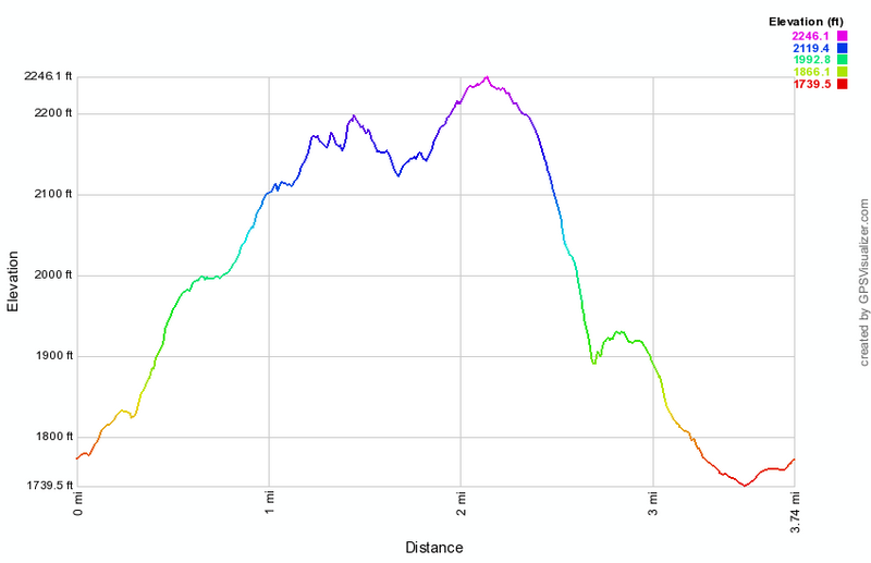 (The image below shows the profile of the hike. Remember that all vertical profiles are relative!)
Kelly Hollow and Millbrook Ridge
| Quick Look | ||||
|---|---|---|---|---|
| Difficulty | Round trip | Total climb | Internet Maps | |
| 5.6 mi. | 1705 ft. | AllTrails | ||
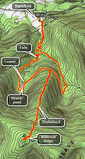 From NYC Route 9/10 on the south side of the Pepacton Reservoir take the Millbrook Arena Road southeast for about 5 miles. Watch for the trailhead sign for Kelly Hollow on the right. Pull into the small lot and park. The trail begins at the back of the parking area just beyond the kiosk. The entire trail network is marked as a cross country ski trail with yellow markers. Start to the left up the more eastern trail which eventually leads to the beaver pond. The trail crosses a small stream and then passes through a gate as it follows an old woods road. After only .3 miles a road heads down toward the stream. It is not a marked trail but follow it down to the stream bed. There are unmarked paths on both sides of the stream. You can cross to the other side depending on the height and width of the water. Walk up the near side and take some pictures if you like. In some places the path may be almost blocked by trees and debris but you can find a way around them in each case. At about .8 miles, you may see a falls ahead and one on a small tributary to the left. Walk across the stream which will be smaller now and then walk over to the tributary to the falls. Walk back to the main stream where the falls forms a lower, smaller drop and an upper, higher drop. Shortly after this you will find a bridge across the stream that is part of the short loop. Take the trail up to the western branch of the main trail and start southwest and then south toward the beaver pond. The trail gains some elevation as it goes. The pond has a substantial dam and a beaver lodge. There is a lean-to with a privy near the outlet. Head down the trail toward the parking area and look for some nice view to the west of the hills beyond. On the right a hill or ridge rises from the trail. This is Millbrook Ridge that separates Kelly Hollow from the area near Alder Lake! Turn right or south-southwest and start UP the hill. The climb to the top of the ridge is about 1 mile but there is an 1100 foot elevation gain! There are at least three places where the land levels making you believe you are at the top. Sadly there mare few views along the way and the summit is a broad wooded plateau without much to see. At the top Alder lake will be to the southwest with Beecher Lake to the southeast. One at the top turn around and follow your route back to the main trail. Turn right on the main trail and walk back to the parking area. The trail crosses the stream again and then passes through several groves of large evergreen trees.
(The map at the right shows the parking area and the hiking route in anticlockwise direction.)
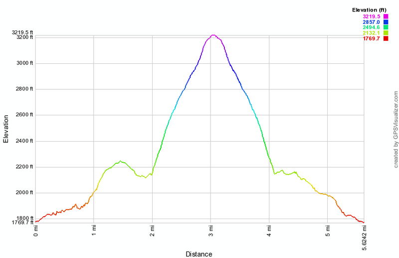 (The image below shows the profile of the hike. Remember that all vertical profiles are relative!)
Kelly Hollow Figure 8
| Quick Look | ||||
|---|---|---|---|---|
| Difficulty | Round trip | Total climb | Internet Maps | |
| 4.3 mi. | 670 ft. | AllTrails | ||
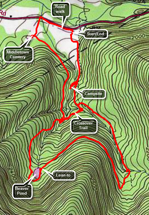 From NYC Route 9/10 on the south side of the Pepacton Reservoir take the Millbrook Arena Road southeast for about 5 miles. Watch for the trailhead sign for Kelly Hollow on the right. Pull into the small lot and park. The trail begins at the back of the parking area just beyond the kiosk. The entire trail network is marked as a cross country ski trail with yellow markers. Start to the left up the more eastern trail which eventually leads to the beaver pond. The trail crosses a small stream and then passes through a gate as it follows an old woods road. After only .3 miles a road heads down toward the stream to a designated campsite which is worth checking out for subsequent adventures. Walk back up to the main trail and turn right. A short distance up the trail is a trail on the right that crosses over to the western section of the trail. Turn right and walk across the bridge and up the hill to the main trail. Turn left on this branch of the main trail and start southwest and then south toward the beaver pond. The trail gains some elevation as it goes. The pond once had a substantial dam and a beaver lodge but the beavers are gone and the pond will soon be a beaver meadow. Continue to walk around the pond to the lean-to and privy near the outlet. Take a moment if you wish to enjoy the quiet solitude. When you are ready get back on the main trail and head down the trail toward the parking area and look for some nice view to the west of the hills beyond. On the right a hill or ridge rises from the trail. This is Millbrook Ridge that separates Kelly Hollow from the area near Alder Lake! You will pass through some tall pine trees on the way back toward the parking area. Watch for the left turn onto the crossover trail you used before. Turn left on this trail and walk down across the bridge and up the hill on the other side. This time turn right on the main trail to walk downhill. With a little more than a half mile you will see a cemetery on the left. This is the Middletown Cemetery and there are several gravestone with special markers designated the interred as Civil War veterans. One grave has a marker indicating the deceased had fought in the Revolution and had died in 1792! After looking around, continue out the access road to Millbrook Road. Turn right and walk the final .3 miles back to the access road to the parking area on the right.
(The map at the right shows the parking area and the hiking route in anticlockwise direction.)
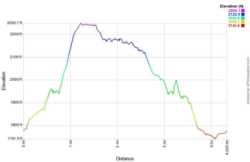 (The image below shows the profile of the hike. Remember that all vertical profiles are relative!)
Lake Superior State Park
| Quick Look | ||||
|---|---|---|---|---|
| Difficulty | Round trip | Total climb | Internet Maps | |
| 4.2 mi. | 432 ft. | AllTrails | ||
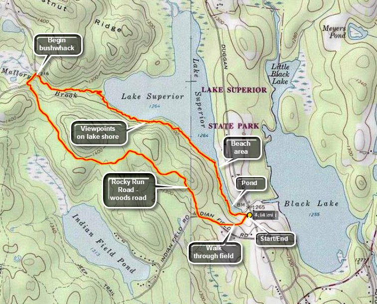 From Route 17B between Monticello and Fosterdale or County Route 55 between White Lake and Eldred turn on Dr. Duggan Road. From 17B the parking area will be passed the main entrance for Lake Superior State Park and on your right. From 55 the parking area will be before the main entrance for Lake Superior State Park and on your left. Park and walk to the left of the pavilion and into a field at the top of the hill. Walk across the field to Indian Field Road and turn right. There will be POSTED signs on your left but none on the right. Watch for POSTED signs to appear on your right and turn into the woods on a woods road just before the signs start. This is the Rocky Run Road which is part of the old Newburgh-Cochecton Turnpike. Walk along the wide woods road keeping the POSTED signs on your left for about 2 miles to the paved Pucky Huddle Road. Turn right on the road and walk several hundred feet to where Mallory Brook crosses under the road. The rest of the hike is a bushwhack down the brook and along the lake shore. You may return the way you came on the woods road or continue on the "whack".
Walk along the brook on the left side since the right has some rather steep cliffs in places. You may find a woods road or a path to use. Cross the brook before you get to the lakeshore as it begins to get wider there. Walk along the sore of the lake remembering to stop to take pictures when you like. You may find several places where people have pulled up a boat and camped. The stands of laurel near the lake may be thick and hard to push through at times so just walk further away from the shore. As you work your way closer to the outlet, you will see the beach on the opposite shore. You will also find more defined paths to walk on. At the outlet of the lake continue on the path that parallels the swampy brook that connects Lake Superior to the small pond where you parked. Keep an eye out for blue heron and beavers. You have the opportunity to take the "low road" around the shore of the pond or the "high road" on the ridge above the pond. Once at the dam at the lower end of the pond you will be a stone's throw from the parking area and your car.
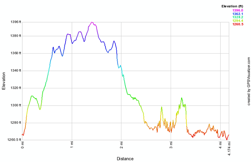 (The image at the left shows the profile of the hike. Remember that all vertical profiles are relative!)
Lake Superior State Park
| Quick Look | ||||
|---|---|---|---|---|
| Difficulty | Round trip | Total climb | Internet Maps | |
| 4.4 mi. | 355 ft. | AllTrails | ||
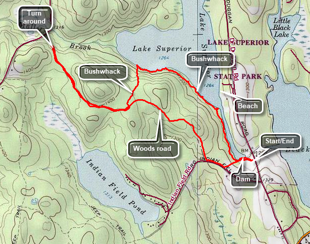 From Route 17B between Monticello and Fosterdale or County Route 55 between White Lake and Eldred turn on Dr. Duggan Road. From 17B the parking area will be passed the main entrance for Lake Superior State Park and on your right. From 55 the parking area will be before the main entrance for Lake Superior State Park and on your left. Park and walk to the left of the pavilion and into a field at the top of the hill. Walk across the field to Indian Field Road and turn right. There will be POSTED signs on your left but none on the right. Watch for POSTED signs to appear on your right and turn into the woods on a woods road just before the signs start. This is the Rocky Run Road which is part of the old Newburgh-Cochecton Turnpike. Walk along the wide woods road keeping the POSTED signs on your left for about 2 miles where the state land ends and private property begins. Turn around and walk back about .8 miles. Pick a spot and head north and slightly downhill toward the lakeshore. At times you may have to work your way through laurel or thick brush. Once at the shore turn right and walk along the shore of the lake remembering to stop to take pictures when you like. You may find several places where people have pulled up a boat and camped. The stands of laurel near the lake may be thick and hard to push through at times so just walk further away from the shore. As you work your way closer to the outlet, you will see the beach on the opposite shore. You will also find more defined paths to walk on. At the outlet of the lake continue on the path that parallels the swampy brook that connects Lake Superior to the small pond where you parked. Keep an eye out for blue heron and beavers. Also watch for some very large ant hills! You have the opportunity to take the "low road" around the shore of the pond or the "high road" on the ridge above the pond. Once at the dam at the lower end of the pond you will be a stone's throw from the parking area and your car.
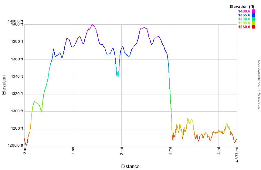 (The image at the left shows the profile of the hike. Remember that all vertical profiles are relative!)
Little Pond Loop (from Barkaboom Road)
| Quick Look | ||||
|---|---|---|---|---|
| Difficulty | Round trip | Total climb | Internet Maps | |
| 2.8 mi. | 330 ft. | AllTrails | ||
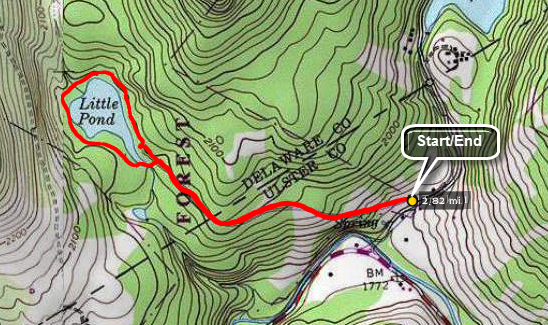 Take the Beaverkill Road from Livingston Manor and drive for about twenty minutes to the intersection
with Barkaboom Rd. Drive up the Barkaboom Rd and park near the start of the access road to Little Pond State Park. When the park is open, be careful not to block the entrance. During the winter, parking here is not a problem as long as it is plowed and you do not block the access for snow plowing. Walk up the access road and around the pond on the hiking trail in either direction. Walk back down the access road to the car.
Take the Beaverkill Road from Livingston Manor and drive for about twenty minutes to the intersection
with Barkaboom Rd. Drive up the Barkaboom Rd and park near the start of the access road to Little Pond State Park. When the park is open, be careful not to block the entrance. During the winter, parking here is not a problem as long as it is plowed and you do not block the access for snow plowing. Walk up the access road and around the pond on the hiking trail in either direction. Walk back down the access road to the car.
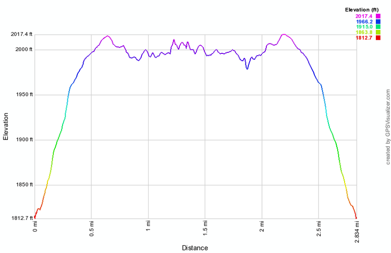 (The image below shows the profile of the hike. Remember that all vertical profiles are relative!)
Little Pond Loop Around Pond (from parking area)
| Quick Look | ||||
|---|---|---|---|---|
| Difficulty | Round trip | Total climb | Internet Maps | |
| .9 mi. | 65 ft. | AllTrails | ||
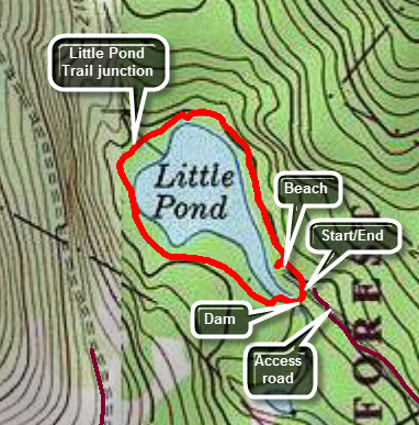 From Livingston Manor, NY drive north on Old RT 17 for 1.3 miles to the Beaverkill Road on the right. Turn right on the Beaverkill Road and drive 10.8 miles to the intersection with Barkaboom Road on the left. Drive up the Barkaboom Rd to the access road for Little Pond State Campgrounds on the left. Turn left and follow the access road to the gatehouse. Pay the day use fee and park in the parking area near the bathhouses. To start the hike walk toward the bathhouses to pick up the trail that runs along the eastern shore of the pond. This path is paved in places and covered with crushed stone the rest of the way. Continue to follow this path visiting the beach or lookout platform if you want. As you near the upper outlet end of the pond you will cross several bridges over some streams. You will also find the yellow blazed Little Pond Trail which turns to the right. Stay to the left and continue around the pond until the path turns slightly to the left and crosses the outlet dam. There is a nice view of the pond and Cabot Mountain from the walkway over the dam. Continue a little farther until you are back at your car. NOTE: When the campgrounds are closed, you may park at the bottom of the access road just off Barkaboom Road. This will add almost 2 miles to your hike. The road is a long uphill on the way in but all downhill on the return trip.
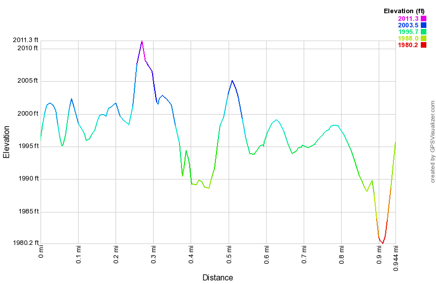 (The image below shows the profile of the hike. Remember that all vertical profiles are relative!)
Little Pond to Berry Brook Road
| Quick Look | ||||
|---|---|---|---|---|
| Difficulty | Round trip | Total climb | Internet Maps | |
| 10.4 mi. | 3150 ft. | AllTrails | ||
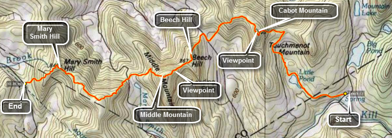 From Roscoe, drive north on Route 206 for about 3 miles. Turn right on Berry Brook/Holiday Brook Road and rive another 7.5 miles to the parking area for the Mary Smith Trail on the right. Leave one car here then drive to the end of the road and turn right on Route 30. When Route 30, turns left and crosses the bridge, turn right on the NYC roads. Drive about 2 miles and then turn right on Barkaboom Road. Drive almost to the end of Barkaboom Road to the access road for the Little Pond State Campsites. Park near the start of the access road to Little Pond State Campsites when the campsites are closed. When the campsites are open, drive up to the campsites, pay the fee and park in the lot.This description includes mileages from the beginning of the access road. Subtract 1 mile if you park in the parking area at the campsites.
From the bathrooms at the campsite walk on the loop trail on the north side of the lake to the head or inlet end of the lake. Turn right on the yellow Little Pond trail and walk 1.2 miles to the junction with the red Touch-Me-Not Trail. There is a nice viewpoint near the top of the Little Pond Trail. There is the foundation of an old house in this area and it seems this would be a beautiful spot to have a house although the access would be difficult! At the junction with the red Touch-Me-Not Trail turn left to climb Cabot Mountain. In the spring, summer and fall this climb is punctuated by nettles and prickers. In the winter, there is usually a lot of snow or a layer of thick ice. Eventually you will run out of "up" and you will be on the flat part of the trail that winds across the top of Cabot. At 3.6 miles there is a viewpoint on the left over Little Pond. You will have already gained 1150 feet from the car with the 480 feet over the last .5 miles on the climb up Cabot. The average grade in this climb is 25%!
Walk across the flat area on Cabot and then begin the first descent. After the first short descent, we walk across another flat area and then began the long, steep descent to Beech Hill Road. From the highest point on Cabot Mountain you will have hiked 1.25 miles and dropped 700 feet! You will now be 4.7 miles into the hike and should turn right and walk .2 miles on Beech Hill Road. Turn left on a private road and walk a short distance before turning left up the trail. You are now on the Middle Mountain Trail and climbing up Beech Hill. Many times on the hike you will climb to the "top" of a hill only to find that it is a false summit and there is more climbing to do. The walk up Beech Hill is like this with a little rise just before the actual summit. The walk from the private road to the summit of Beech Hill is about .6 miles and gains about 460 feet along the way. You will now descend Beech Hill so that you can ascend Middle Mountain! It is about .7 miles between the two summits but you drop 150 feet to then climb 280 feet to get to the top of Middle Mountain. At this point you will have hiked 6.25 miles and are ready for the descent down Middle Mountain to parking area on Mary Smith Hill Road. The descent down Middle Mountain is about 1 mile and you drop 730 feet to the parking area.
You are now ready to start the last section of the trail having already hiked 7.25 miles. The first .4 miles of the Mary Smith Trail averages a 24% grade gaining 480 feet. You will continue the climb to near the top of an unnamed hill that is higher than Mary Smith Hill. The trail actually never hits the top of this hill but travels along the north shoulder but still gets above 2900 feet. The summit of the hill is well over 2900 feet making it almost as high as Cabot and Middle Mountains! From the high point descend a little over 250 feet over the next mile to the base of Mary Smith Hill which is your last major climb. At about 9.3 miles you may want to stop at the Middle Mountain Lookout for some nice views.You will next hit the highest point of 2700 feet on Mary Smith Hill with only a downhill portion to complete the hike. At the bottom of the descent you are only .25 miles from the parking area. Although the drive back to your other car is annoying, at least you are driving and not walking!
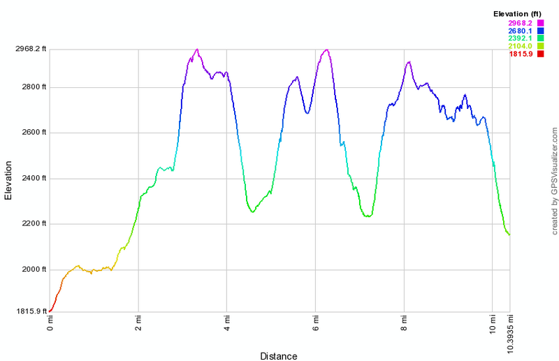 (The image at the left shows the profile of the hike. Remember that all vertical profiles are relative!)
Little Pond Vista Loop
| Quick Look | ||||
|---|---|---|---|---|
| Difficulty | Round trip | Total climb | Internet Maps | |
| 3.3 mi. | 830 ft. | AllTrails | ||
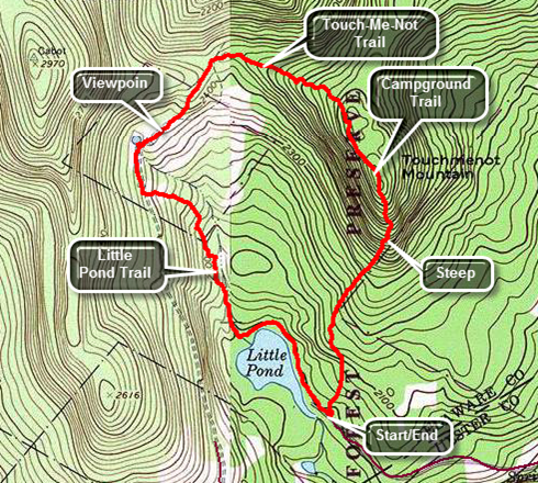 From Livingston Manor, drive toward on Old Route 17. Turn right on the Beaverkill Road and drive 10.5 miles to the Barkaboom Road. Bear left and in a few hundred feet turn left on the access road to Little Pond State Campgrounds. Drive to the gatehouse, pay the $6 day use fee and park in the parking area.
From the parking area walk passed the bathrooms at the campsite and walk on the loop trail on the east side of the lake to the head or inlet end of the lake. The walk is only .5 miles. Turn right on the yellow Little Pond Trail and walk 1.2 miles to the junction with the red Touch-Me-Not Trail. The Little Pond Trail opens into a filed at 1.3 miles. This is the site of an old homestead. There is a pond to the left of the trail and a little farther along a foundation. There is a nice viewpoint as the trail rises. At the junction with the red Touch-Me-Not Trail turn right and walk east .5 miles to the junction with the blue Campground Trail at 2.15 miles. The trail climbs 280 feet and there are several interesting passages over and between large rocks. At the trail junction bear right on the blue Campground Trail to return to the parking area. The trail gains a little elevation and then starts to descend. In about .8 miles the trail loses 780 feet averaging an 18% grade. Several areas are much steeper and care should be taken especially if the trail is wet or covered in ice or snow.
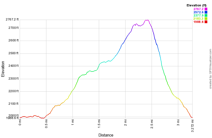 (The image at the left shows the profile of the hike. Remember that all vertical profiles are relative!)
Little Pond Vista Loop and Cabot Mountain
| Quick Look | ||||
|---|---|---|---|---|
| Difficulty | Round trip | Total climb | Internet Maps | |
| 4.6 mi. | 1405 ft. | AllTrails | ||
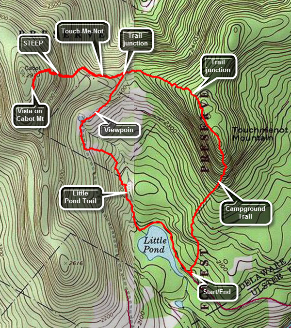 From Livingston Manor, drive toward on Old Route 17. Turn right on the Beaverkill Road and drive 10.5 miles to the Barkaboom Road. Bear left and in a few hundred feet turn left on the access road to Little Pond State Campgrounds. Drive to the gatehouse, pay the day use fee and park in the parking area.
From the parking area walk passed the bathrooms at the campsite and walk on the loop trail on the east side of the lake to the head or inlet end of the lake. The walk is only .5 miles. Turn right on the yellow Little Pond Trail and walk 1.3 miles to an area where the trail open out into a field with a nice view (vista) of the valley below and the surrounding hills. There is a small pond on the left and the foundation of an old farmhouse on the right. Continue to the junction with the red Touch-Me-Not Trail at 1.7 miles. At the junction with the red Touch-Me-Not Trail turn left and follow the red blazes to the base of Cabot Mountain. The climb up Cabot is very steep in places and there can be loose rock and dirt which makes the ascent more difficult. From the start of the climb to the end is only .3 miles but the elevation gain is 450 feet which means the ascent averages about 27%. Follow the red markers up through the rocks and across a more level space to the last short ascent. Walk the level area to the Beaverkill Vista. This rock outcrop gives a nice view of Little Pond below. After taking in the view retrace your steps back down the mountain to the trail junction.CAUTION: The return trip down the mountain can be more challenging than the climb! From the junction with the Little Pond Trail continue straight ahead to follow the Touch-Me-Not Trail for .5 miles to the junction with the blue Campground Trail at 3.5 miles. In this short distance the Touch-Me-Not Trail climbs 280 feet and you will find several interesting passages over and between large rocks. At the trail junction bear right on the blue Campground Trail to return to the parking area. The trail gains a little elevation and then starts to descend. In about .8 miles the trail loses 780 feet averaging an 18% grade. Several areas are much steeper and care should be taken especially if the trail is wet or covered in ice or snow. The trail exits the forest just behind the bathhouses and the parking lot where you left your car. NOTE: This route works equally well in reverse!
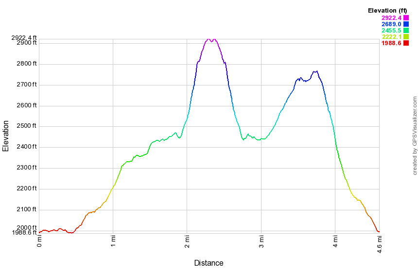 (The image at the left shows the profile of the hike. Remember that all vertical profiles are relative!)
Long Path: Woodland Valley to Phoenicia
| Quick Look | ||||
|---|---|---|---|---|
| Difficulty | Round trip | Total climb | Internet Maps | |
| 7.1 mi. | 2180 ft. | AllTrails | ||
 The Long Path currently extends from Fort Lee, NJ to John Thatcher park near Albany, NY. Plans exist to continue the trail north to Lake Placid. In someplace the trail contains long walks on public roads. Efforts are being made to relocate these sections to existing trails or to create new trails. The section represented here is not complete yet. It will extend from near the junction of the trail to Terrace Mountain on the Wittenberg Trail over Cross Mountain, Mount Pleasant, and Rohmer Mountain to Phoenicia.
Park at the Woodland Valley Campsites on Woodland Valley Road being sure to pay the parking fee during the season. Head across the road to the bridge that crosses the creek. Be ready for an immediate climb as you make your way up the trail to Wittenberg Mountain. Over the next 1.9 miles from the bridge you will gain almost 1400 feet before the trail begins to level off. Even after the trail is no longer climbing continuously there will be several ups and downs. At 2.5 miles you will be at the junction with the trail to Terrace Mountain and a lean-to to the left. Turn right and walk about .2 miles to a large tree across the trail which has been cut and the center section moved. Look into the woods on your left for orange flagging. Once the trail is completed it will extend out to the main trail and be prominently marked. Follow the flagging for as far as you like and then turn around. The flagging may change to pink in wetlands areas. Pink flagging may also lead to a trail crew camp. If you park a car at the other end of the trail you should be able to follow the flagging through to Route 28 near Phoenicia. This is a bushwhack for much of the way so be prepared with maps and compass. During the summer of 2013 you may meet crews from the trail conference who are working to complete this project by the fall of 2013.
 (The image at the left shows the profile of the out and back hike. Remember that all vertical profiles are relative!)
Long Pond: Basily Road from Flugertown Rd
| Quick Look | ||||
|---|---|---|---|---|
| Difficulty | Round trip | Total climb | Internet Maps | |
| 6.0 mi. | 578 ft. | AllTrails | ||
 The area around Long Pond has several snowmobile trails that are ideal for hiking. They are wide and
well maintained being free from blow downs. I am looking forward to snow shoeing this area during the
winter. There are several options for longer or shorter hikes.
The area around Long Pond has several snowmobile trails that are ideal for hiking. They are wide and
well maintained being free from blow downs. I am looking forward to snow shoeing this area during the
winter. There are several options for longer or shorter hikes.
Take DeBruce Road from Livingston Manor for about nine miles then turn left on Flugertown Rd. just passed the hamlet of Willowemoc. The parking area for Long Pond is about 1 mile up on the right. The road is well paved. The first part of the trail is a short ascent. It looks a LOT steeper on the profile below than it really is! After about a mile, you can turn right and walked down to the pond. This is the nicest view of the pond that is right on the trail. Another .25 miles will bring you to a T. Left goes out to Flugertown Rd. and right leads to the lean-to and the other trails. If you like, turn right and walk about .65 miles to the lean-to. If you are so inclined, skip the lean-to and go straight ahead. After about a mile the trail intersect Basily Road. Turn left and follow the road. At the next intersection continue straight ahead and down a hill. Do NOT turn right as this leads toward Black Bear Road at Round Pond. After about half a mile you will be at the beaver pond. If the pond is low enough continue on and make a left onto Flugertown Road at the intersection. Follow this back to the parking area. If the pond is too high, turn around and retrace your steps to the car. Several variations are available.
 (The image at the left shows the profile of the hike. Remember that all vertical profiles are
relative! This trail does have a little climb at the beginning and a slight descent at the end but the
rest is almost flat!)
(The image at the left shows the profile of the hike. Remember that all vertical profiles are
relative! This trail does have a little climb at the beginning and a slight descent at the end but the
rest is almost flat!)
Long Pond: Basily Road to Flugertown Road Loop
| Quick Look | ||||
|---|---|---|---|---|
| Difficulty | Round trip | Total climb | Internet Maps | |
| 6.0 mi. | 597 ft. | AllTrails | ||
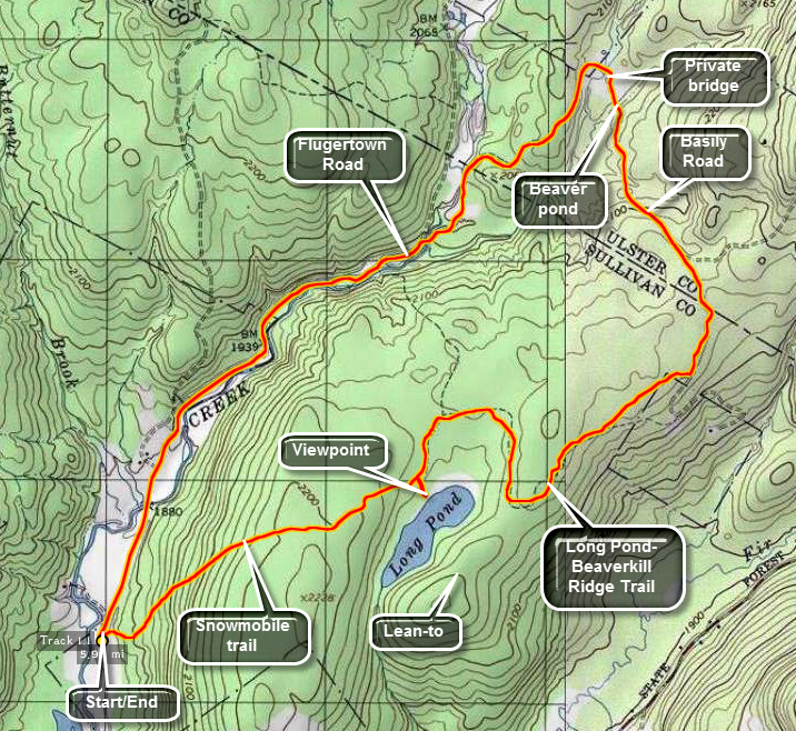 The area around Long Pond has several snowmobile trails that are ideal for hiking. They are wide and
well maintained being free from blow downs. There are several options for longer or shorter hikes.
The area around Long Pond has several snowmobile trails that are ideal for hiking. They are wide and
well maintained being free from blow downs. There are several options for longer or shorter hikes.
Take DeBruce Road from Livingston Manor for about nine miles then turn left on Flugertown Rd. just passed the hamlet of Willowemoc. The parking area for Long Pond is about 1 mile up on the right. The road is well paved. The first part of the trail is a short ascent. It looks a LOT steeper on the profile below than it really is! After about a mile, you can turn right and walked down to the pond. This is the nicest view of the pond that is right on the trail. Another .25 miles will bring you to a T. Left goes out to Flugertown Rd. and right leads to the lean-to and the other trails. If you like, turn right and walk about .65 miles to the lean-to. If you are so inclined, skip the lean-to and go straight ahead. After about a mile the trail intersect Basily Road. Turn left and follow the road. At the next intersection continue straight ahead and down a hill. So NOT turn right as this leads toward Black Bear Road at Round Pond. After about half a mile you will be at the beaver pond. Cross the shallow water here in any way you like. Walking across the dam may work. At this point you may well be on private land. Head for the bridge across the field. The bridge is actually private and you should cross at the "ford" just to the left of the bridge. The water here is a little wider and deeper than at the beaver pond! After crossing the creek. stay on Basily Road which at this point is unpaved. It is a little over two miles back to the parking area. Eventually Basily becomes Flugertown and the road is paved. Several pull-offs and small parking areas mark places where the snowmobile trails intersect the road.
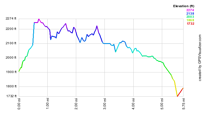 (The image at the left shows the profile of the hike. Remember that all vertical profiles are
relative! This trail does have a little climb at the beginning and a slight descent at the end but the
rest is almost flat!)
(The image at the left shows the profile of the hike. Remember that all vertical profiles are
relative! This trail does have a little climb at the beginning and a slight descent at the end but the
rest is almost flat!)
Long Pond: Figure 8 (road)
| Quick Look | ||||
|---|---|---|---|---|
| Difficulty | Round trip | Total climb | Internet Maps | |
| 7.2 mi. | 760 ft. | AllTrails | ||
 The area around Long Pond has several snowmobile trails that are ideal for hiking. They are wide and well maintained being free from blow downs. There are several options for longer or shorter hikes.
Take DeBruce Road from Livingston Manor for about nine miles then turn left on Flugertown Rd. just passed the hamlet of Willowemoc. The parking area for Long Pond is about 1 mile up on the right. The road is well paved. The first part of the hike is a road walk on Flugertown Road on a paved section for about .5 miles and then on a gravel road for another mile. After 1.5 miles, turn right on the trail which is, at first, marked as a snowmobile trail. Cross over a bridge and then another bridge before starting a short but steep climb. The trail heads south for about a half mile to a trail junction. The trail is often wet and muddy even in relatively dry weather. At the trail junction, turn left an follow the snowmobile trail. At 2.6 miles a trail to the right leads to a lean-to. Continue on the main trail until it meets a woods road at 3.3 miles. Turn left on Basily Road as it heads north before crossing a stream at 4.2 miles. The stream comes out of a beaver pond and is present all year round. At this point the route crosses private land belonging to the Peters Hunting Camp. It seems that the camp will allow most people to pass through their land but permission should be obtained from the owners. Continue on the road crossing the private bridge or fording Willowemoc Creek if it is low enough. Continue of the dirt and gravel road as it makes a sharp turn to the left, ascends briefly and the descends as it follows the creek heading southwest. At 5.25 miles, turn left on the snowmobile trail where you turned earlier. Again, cross the two bridges and climb the hill. At the trail junction at 5.9 miles, turn right on the trail heading southwest. After .2 miles, a short spur trail to the left leads down to the shores of Long Pond. Watch for red-winged blackbirds that frequent the pond. Return to the main trail and turn left continuing southwest. The trail rolls some but is mostly flat and can have wet and muddy spots. At 6.6 miles the trail begins a short but steep descent back to the parking area.
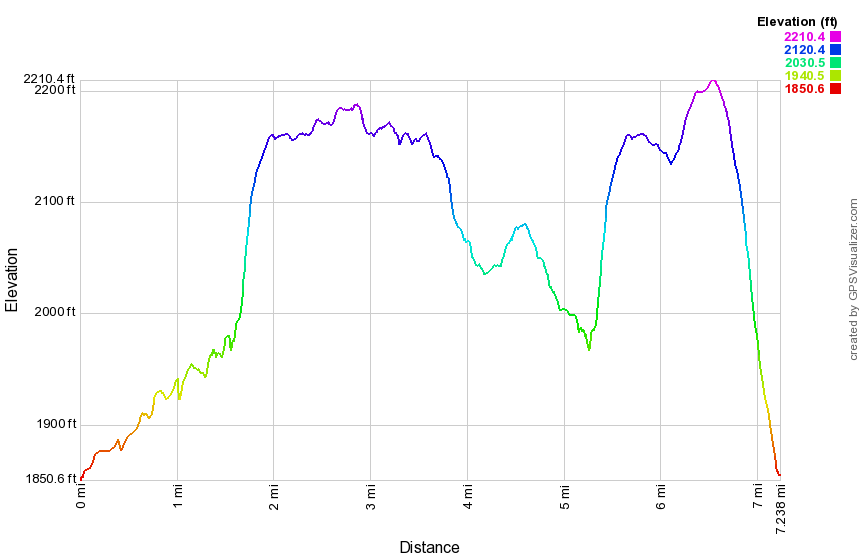 (The image at the left shows the profile of the hike. Remember that all vertical profiles are relative!)
Long Pond: Figure 8 (trail)
| Quick Look | ||||
|---|---|---|---|---|
| Difficulty | Round trip | Total climb | Internet Maps | |
| 7.2 mi. | 760 ft. | AllTrails | ||
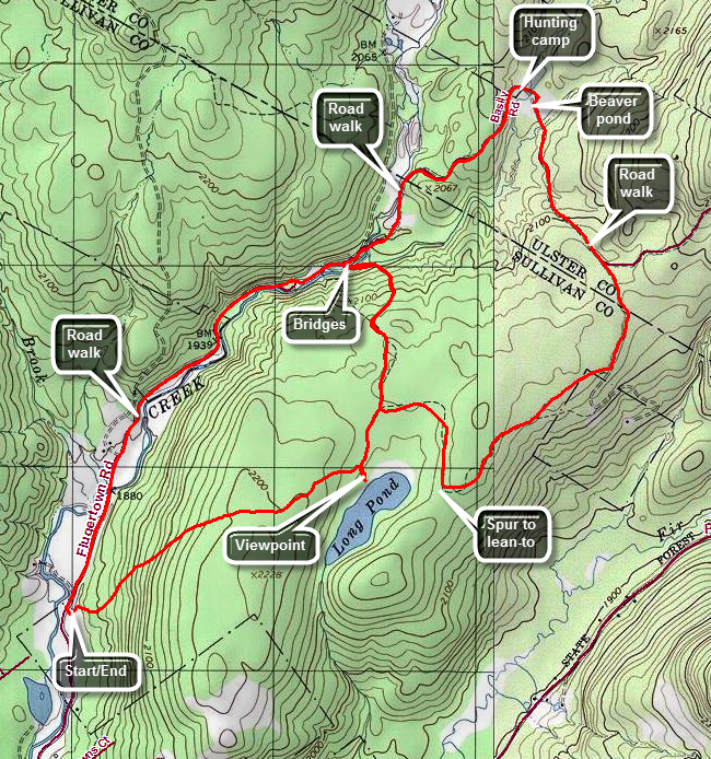 The area around Long Pond has several snowmobile trails that are ideal for hiking. They are wide and well maintained being free from blow downs. There are several options for longer or shorter hikes.
Take DeBruce Road from Livingston Manor for about nine miles then turn left on Flugertown Rd. just passed the hamlet of Willowemoc. The parking area for Long Pond is about 1 mile up on the right. The road is well paved. The first part of the trail is a short ascent. It looks a LOT steeper on the profile below than it really is! After about a mile, turn right and walk down to the pond. This is the nicest view of the pond that is right on the trail. Another .25 miles will bring you to a T at 1.3 miles. Turn left to hike out to the road as part of the figure 8 loops. This part of the trail is relatively flat and there usually are some large muddy areas along the way. At 1.6 miles the trail begins to descend to cross a long bridge across a stream. Continue on the trail crossing another ridge and arriving at Flugertown Road at 2.0 miles. Turn right and begin to hike toward Basily Road as it goes from pavement to dirt. The road gains a little elevation along the way it breaks out of the woods near the Peter's Hunting Camp. Continue on the road to where a private bridge crosses the stream. The hunting camp allows hikers to cross the bridge and their land as long as they stay on the trail. Skirt the edge of the tilled ground and fields and head toward the beaver pond. When the beavers have been at work and the road can be more of a stream than a road. Stay to the right and stay dry by using the small footbridge. Continue on the road on the other side to complete the upper loop. The road continues to gain elevation and at 3.6 miles stay to the right as Basily Road headed left to Wild Meadow Road. Shortly after this turn right into the woods on the snowmobile and hiking trail. This part of the trail is pretty flat which means that standing water causes some muddy areas. At 4.6 miles pass the spur trail on the left to the lean-to. Continue on the main trail passing areas where there is sometimes more mud. At 5.0 miles you will be back at the first trail junction where you started the figure 8 earlier. Turn right and again follow the trail toward Flugertown Road. Continue out to the road and turn left to head back to the car. The road goes from gravel to paved to well paved. At 7.15 miles turn left into the parking area.
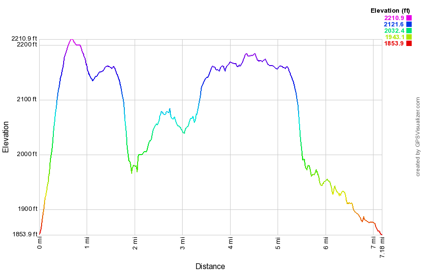 (The image at the left shows the profile of the hike. Remember that all vertical profiles are relative! This trail does have a little climb at the beginning and a slight descent at the end but the rest is almost flat!)
Long Pond: Flugertown Road to Basily Road Loop
| Quick Look | ||||
|---|---|---|---|---|
| Difficulty | Round trip | Total climb | Internet Maps | |
| 6.0 mi. | 562 ft. | AllTrails | ||
_map.png) The area around Long Pond has several snowmobile trails that are ideal for hiking. They are wide and
well maintained being free from blow downs. There are several options for longer or shorter hikes.
The area around Long Pond has several snowmobile trails that are ideal for hiking. They are wide and
well maintained being free from blow downs. There are several options for longer or shorter hikes.
Take DeBruce Road from Livingston Manor for about nine miles then turn left on Flugertown Rd. just passed the hamlet of Willowemoc. The parking area for Long Pond is about 1 mile up on the right. The road is well paved. Start by walking out of the parking area and turning right to head north on Flugertown Road passing by some open fields and some streams that cross the road. The road changes from pavement to gravel and at 1.6 miles a snowmobile trail to the right leads to Long Pond. In this same area the Willowemoc-Hardenburgh Trail meets the road. Continue on the road and at some point the name officially changes to Basily Road. At 2.4 miles the road descends and turns right to cross a creek on a private bridge near the Peter's hunting camp. The owners have opened the bridge to hiking and snowmobile traffic so please respect their property. Cross the field and head toward the swampy area and beaver pond on the other side. Around 3.1 miles Basily Road bears left but you should bear right on a snowmobile trail. A little further along at 3.5 miles a road continues straight ahead but you should follow the snowmobile trail by bearing to the right. A spur trail to the Long Pond lean-to branches to the left at 4.2 miles. You may visit the lean-to but there are no views. To get the best views of the pond turn left on an unmarked path at 4.8 miles and walk down to the shores of the pond. The north end of the pond has some of the oldest bogs in the Catskills approaching 14,000 years. During the spring and summer winged blackbirds can be seen in the reeds. Back on the main trail walk up a short hill and then down the hill to your car. This last 1.2 miles section goes quickly.
_gra.png) (The image at the left shows the profile of the hike. Remember that all vertical profiles are relative!)
(The image at the left shows the profile of the hike. Remember that all vertical profiles are relative!)
Long Pond: Black Bear to Flugertown
| Quick Look | ||||
|---|---|---|---|---|
| Difficulty | Round trip | Total climb | Internet Maps | |
| 4.9 mi. | 532ft. | AllTrails | ||
 The area around Long Pond has several snowmobile trails that are ideal for hiking. They are wide and
well maintained being free from blow downs. There are several options for longer or shorter hikes.
The area around Long Pond has several snowmobile trails that are ideal for hiking. They are wide and
well maintained being free from blow downs. There are several options for longer or shorter hikes.
This hike requires two cars OR you make park a car at either end and double the mileage! Take DeBruce Road from Livingston Manor for about fourteen miles then turn left on Black Bear Rd. near Round Pond. The parking area is up the hill on the right. The first part of the hike is on Basily Road which is seasonally maintained. After about 1.15 miles the road turns into a woods road which is also a snowmobile trail. From this point on the walking is almost flat or downhill! At about 2 miles into the hike you will come to a T. Turn left at the T and the woods road become more of a trail. At 2.15 miles there is a spur trail to thee left that goes to the lean-to. At 3.55 miles there will be a trail junction. Bearing right will take you out to Flugertown Road and back to your car. Bear left and continue on the trail to the parking area on Flugertown Road.
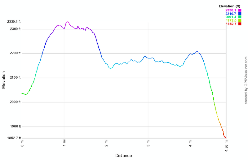 (The image at the left shows the profile of the hike. Remember that all vertical profiles are
relative! This trail does have a little climb at the beginning and a slight descent at the end but the
rest is almost flat!)
(The image at the left shows the profile of the hike. Remember that all vertical profiles are
relative! This trail does have a little climb at the beginning and a slight descent at the end but the
rest is almost flat!)
Long Pond: Flugertown Rd to Mongaup Pond Loop
| Quick Look | ||||
|---|---|---|---|---|
| Difficulty | Round trip | Total climb | Internet Maps | |
| 9.8 mi. | 2210 ft. | AllTrails | ||
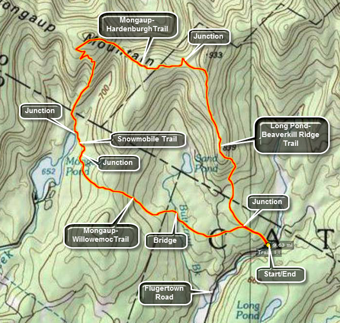 Take DeBruce Road from Livingston Manor for about nine miles then turn left on Flugertown Rd. just
passed the hamlet of Willowemoc. After 1.3 miles, the road turns to gravel. Go another 1.1 miles and park somewhere along the edge of the road. There are no formal parking areas here but there are enough areas to park a few cars. The trail begins on the left side of the road. Depending on where you parked, you may have to walk one way or the other to find the trail. The trail begins as a gradual uphill through some pine forest and after .5 miles the red marked Long Pond Beaverkill trail goes to the right and the yellow marked Mongaup Willowemoc trail heads left. The latter is the shorter way to Mongaup and by far the easier walk.
Take DeBruce Road from Livingston Manor for about nine miles then turn left on Flugertown Rd. just
passed the hamlet of Willowemoc. After 1.3 miles, the road turns to gravel. Go another 1.1 miles and park somewhere along the edge of the road. There are no formal parking areas here but there are enough areas to park a few cars. The trail begins on the left side of the road. Depending on where you parked, you may have to walk one way or the other to find the trail. The trail begins as a gradual uphill through some pine forest and after .5 miles the red marked Long Pond Beaverkill trail goes to the right and the yellow marked Mongaup Willowemoc trail heads left. The latter is the shorter way to Mongaup and by far the easier walk.
Turn right on the red marked trail. This trail wanders back and forth and up and down through hardwood forest and pine trees. Several areas are almost completely overgrown with briars making it slow going and difficult at times. There are a few areas of nettles. During wetter times the trail sports several muddy areas. About halfway up the trail to the Mongaup Hardenburgh Trail, you will pass Sand Pond on your right. You will never know it though since the trail has no views at all. The trail begins an ascent near its end to gain elevation to the Mongaup Ridge. After about 3 miles, the trail ends on the Mongaup Ridge at the blue marked Mongaup Hardenburgh Trail. Turn left here toward Mongaup Pond Campsites.
This trail is a little more used but the markers are few and far between. Also, there are several steep descents and ascents along the way as the trail ascends the various Mongaup Mountains. There are even several switchbacks! At 6.1 miles, the trail turns right at Mongaup Pond. Turn left here on the wide snowmobile trail. Cross four wooden bridges. After the fourth look for the well-marked yellow-blazed Mongaup Willowemoc Trail on your right. Turn here. This is also a snowmobile trail so it is wide and fairly well groomed with some blowdowns across the path in some areas. At abut 1.7 miles a large wooden bridge crosses Butternut Creek. This creek flows well even in drier weather and has some beautiful areas along its banks. From this point it is about 1.1 miles back to the junction with the Long Pond Beaverkill Trail. On the way several woods roads and trail cross the one you are on. Ignore these and stay on the yellow marked trail. At the trail junction, turn right and hike the .5 miles back to the car.
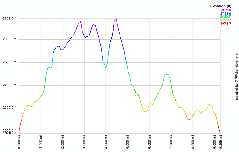 (The image at the left shows the profile of the hike. Remember that all vertical profiles are
relative!)
(The image at the left shows the profile of the hike. Remember that all vertical profiles are
relative!)
Long Pond: Flugertown Rd to Mongaup Pond One Way
| Quick Look | ||||
|---|---|---|---|---|
| Difficulty | Round trip | Total climb | Internet Maps | |
| 8.6 mi. | 1800 ft. | AllTrails | ||
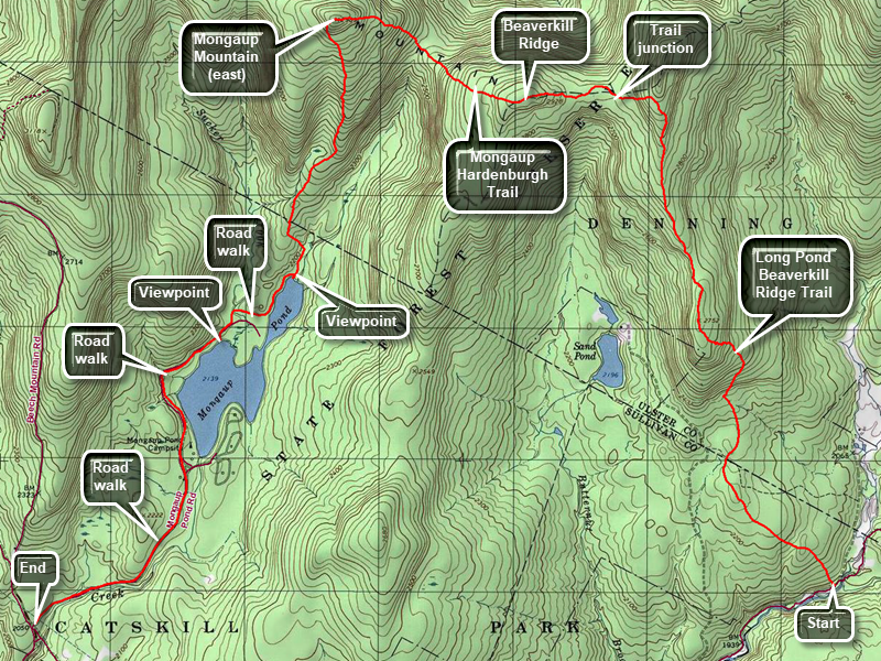 This route requires a car spot at Mongaup Pond and a drop off at Long Pond
Take DeBruce Road from Livingston Manor for six miles then turn left on Mongaup Road. Drive to where the road splits and stay right. Park one car on the right side of the road in the small pulloff. Drive back out to DeBruce Road, turn left and drive about 3 miles to Flugertown Rd. just passed the hamlet of Willowemoc and turn left. After 1.3 miles, the road turns to gravel. Go another 1.1 miles to where the Long Pond Beaverkill Ridge Trail meets the road on the left. Have your ride drop you here. The trail begins as a gradual uphill through some pine forest and after .5 miles the red marked Long Pond Beaverkill trail goes to the right and the yellow marked Mongaup Willowemoc trail heads left. The latter is the shorter way to Mongaup and by far the easier walk.
Turn right on the red marked trail. This trail wanders back and forth and up and down through hardwood forest and pine trees. Several areas are almost completely overgrown with briars and bush making it slow going and difficult at times. There are a few areas of nettles. During wetter times the trail sports several muddy areas. There may also be blowdowns along the way and the trail may be poorly marked. About halfway up the trail to the Mongaup Hardenburgh Trail, you will pass Sand Pond on your left. You will never know it though since the trail has no views at all. The trail begins an ascent near its end to gain elevation to the Beaverkill Ridge. After 2.9 miles, the trail ends on the Beaverkill Ridge at the blue marked Mongaup Hardenburgh Trail. Turn left here toward Mongaup Pond Campsites.
This trail is a little more used but the markers are few and far between. Also, there are several steep descents and ascents along the way as the trail ascends some bumps on the Beaverkill Ridge with the final ascent being the steepest up the easternmost Mongaup Mountain. At the top of the mountain the trail turns south and starts to descend to Mongaup Pond. There are even several switchbacks along the way! At 6.1 miles, the trail turns right at Mongaup Pond and continues out to the campground road. Turn right on the road and continue to follow the roads around the west side of the pond and out to the campground entrance. From here walk 1.1 miles out the access road to where you parked your car.
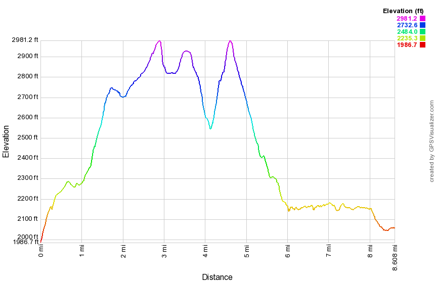 (The image at the left shows the profile of the hike. Remember that all vertical profiles are relative!)
Long Pond: Flugertown Rd to Mongaup Pond Loop (clockwise)
| Quick Look | ||||
|---|---|---|---|---|
| Difficulty | Round trip | Total climb | Internet Maps | |
| 9.8 mi. | 2225 ft. | AllTrails | ||
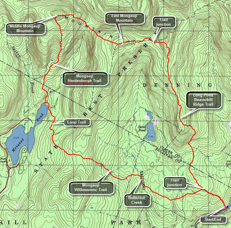 Take DeBruce Road from Livingston Manor for about nine miles then turn left on Flugertown Rd. just passed the hamlet of Willowemoc. After 1.3 miles, the road turns to gravel. Go another 1.1 miles and park somewhere along the edge of the road. There are no formal parking areas here but there are enough areas to park a few cars. The trail begins on the left side of the road. Depending on where you parked, you may have to walk one way or the other to find the trail. The trail begins as a gradual uphill through some pine forest and after .5 miles the red marked Long Pond Beaverkill Trail goes to the right and the yellow marked Mongaup Willowemoc trail heads left. The latter is the shorter way to Mongaup and by far the easier walk.
Turn left on the yellow marked trail. The hiking trail in this area is also a snowmobile trail so it is wide and well-maintained with no blowdowns to block your path. Soon you will cross the private road to Sand Pond and then hit a low point as you crossed Butternut Creek, the outlet to Sand Pond. Walk along the creek for a short distance and then cross one of the sturdy bridges at around 1.5 miles. After the creek, the trail begins an ascent of over 400 feet before descending to the shores of Mongaup Pond. There are some rocky sections along the way. A hike of 3.2 miles brings you to the trail around Mongaup Pond where you should turn right to head toward the upper end of the pond and the Mongaup Hardenburgh Trail. The trail around the pond is always wet and usually muddy in spots. After about .5 miles watch for the blue Mongaup Hardenburgh Trail on your right. The Mongaup Hardenburgh Trail ascends the Mongaup Mountains and the climb is interesting in spots. The first part of the trail to Middle Mongaup Mountain is well marked and maintained. For 1.5 miles the trail heads almost directly north gaining over 800 feet to the top of Middle Mongaup Mountain. There are some steep but short climbs along the way but at 5.1 miles you will be at the summit which is just under 3000 feet. When you start down the other side of the mountain and you may notice that the trail is less distinct, less well marked and that there are quite a few blowdowns on the trail. After descending over 400 feet and you will regain almost all of that to reach the top of East Mongaup Mountain at 6.2 miles. There is another short descent and ascent to get to the trail junction with the Long Pond Trail back to the car. At 6.9 miles look for the turn which has no sign and only some faded red markers. Once you turn onto the Long Pond Trail you may find that there had been little maintenance on the trail in some time. There are some major blockages and some areas have few markers to guide the way. Any area exposed to sun will have untamed prickers in a tangled mass across the trail. In several places the blowdowns and the poor marking combine to make the trail hard to follow. Some parts of the trail become more like a bushwhack! From trail junction to trail junction you drop 850 feet in 2.5 miles. When you hit the junction with the Mongaup Willowemoc Trail, turn left to descend the last .5 miles back to Flugertown Road.
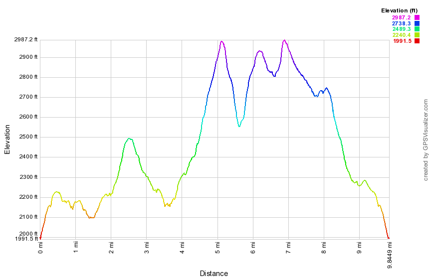 (The image at the left shows the profile of the hike. Remember that all vertical profiles are relative!)
Long Pond: Flugertown Rd to Round Pond
| Quick Look | ||||
|---|---|---|---|---|
| Difficulty | Round trip | Total climb | Internet Maps | |
| 10.4 mi. | 855 ft. | AllTrails | ||
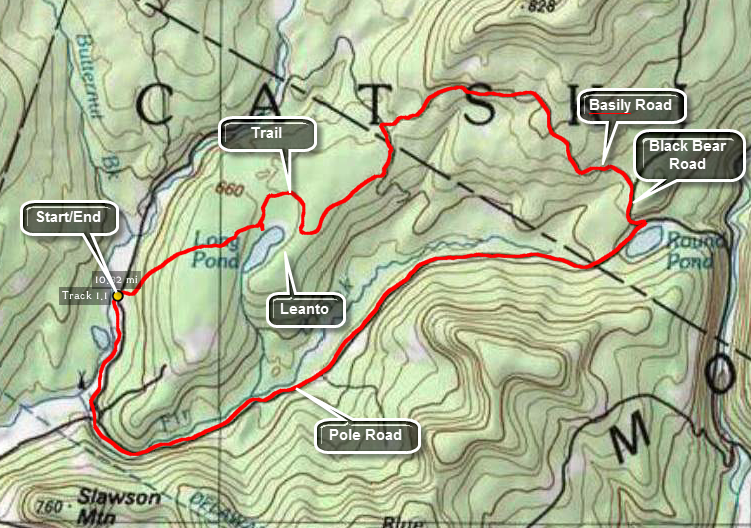 Take DeBruce Road from Livingston Manor for about nine miles then turn left on Flugertown Rd. just passed the hamlet of Willowemoc. Drive up the road and watch for the trailhead Parking area on the right. Get on the snowmobile and cross a bridge. The trail rises for the first .6 miles and then drops slightly until, at 1 mile there is a short side trail to the right. Walk down to Long Pond to see a small but pretty pond. The north end of the pond has some of the oldest bogs in the Catskills dating back 14,000 years to the time the last glacier receded. Back on the main trail walk another .2 miles to the junction with the red Long Pond-Beaverkill Range Trail. The trail flattens out and at 2.5 miles the trail meets a woods road. Around 2.9 Niles the trail turns right as it meets Basily Road. The trail on Basily Road rises slightly and then, at .3 miles, begins a serious drop down to a trail head on Black Bear (Wild Meadow) Road. At the road make a right and continue down to Pole Road at 5.4 miles. Turn right on Pole Road and begin a long 4.1 mile walk back to Flugertown Road. Turn right on Flugertown Road and walk .85 miles back to the car.
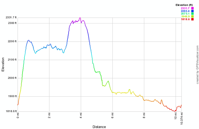 (The image at the left shows the profile of the hike. Remember that all vertical profiles are
relative!)
(The image at the left shows the profile of the hike. Remember that all vertical profiles are
relative!)
Long Pond: Flugertown Rd
| Quick Look | ||||
|---|---|---|---|---|
| Difficulty | Round trip | Total climb | Internet Maps | |
| 5.0 mi. | 476 ft. | AllTrails | ||
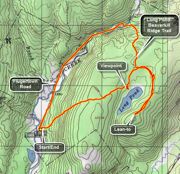 The area around Long Pond has several snowmobile trails that are ideal for hiking. They are wide and
well maintained being free from blow downs. I am looking forward to snow shoeing this area during the
winter. There are several options for longer or shorter hikes.
The area around Long Pond has several snowmobile trails that are ideal for hiking. They are wide and
well maintained being free from blow downs. I am looking forward to snow shoeing this area during the
winter. There are several options for longer or shorter hikes.
Take DeBruce Road from Livingston Manor for about nine miles then turn left on Flugertown Rd. just
passed the hamlet of Willowemoc. The parking area for Long Pond is about 1 mile up on the right. The
road is well paved. The first part of the trail is a short ascent. It looks a LOT steeper on the
profile below than it really is! After about a mile, you can turn right and walked down to the pond.
This is the nicest view of the pond that is right on the trail. Another .25 miles will bring you to
a T. Left goes out to Flugertown Rd. and right leads to the lean-to and the other trails. Turn right
and walk about .65 miles to the lean-to. Be sure to make the turn onto the spur trail to the lean-to.
It is clearly marked but missing it leads to a VERY long walk. After the lean-to, retrace your steps to
the T and continue straight ahead for about .6 miles to the road. The trail winds some but is well marked
and is downhill all the way. Take a left on Flugertown Rd. and walk the 1.5 miles back to the car.
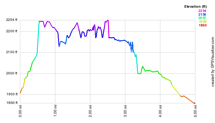 (The image below shows the profile of the hike. Remember that all vertical profiles are
relative! This trail does have a little climb at the beginning and a slight descent at the end but the
rest is almost flat!)
(The image below shows the profile of the hike. Remember that all vertical profiles are
relative! This trail does have a little climb at the beginning and a slight descent at the end but the
rest is almost flat!)
Long Pond: Lollipop Loop
| Quick Look | ||||
|---|---|---|---|---|
| Difficulty | Round trip | Total climb | Internet Maps | |
| 6.3 mi. | 770 ft. | AllTrails | ||
 The area around Long Pond has several snowmobile trails that are ideal for hiking. They are wide and well maintained being free from blow downs. Snowshoeing during the winter is a pleasure since the trail are well packed in most places. There are several options for longer or shorter hikes.
Take DeBruce Road from Livingston Manor for about nine miles then turn left on Flugertown Road just passed the hamlet of Willowemoc. The parking area for Long Pond is about 1 mile up on the right. The road is well paved to this point but not far beyond there is a "Seasonal Maintenance" sign. The first part of the trail is a short ascent. It looks a LOT steeper on the
profile below than it really is! After about a mile, you can turn right and walked down to the pond. This is the nicest view of the pond that is right on the trail. Another .25 miles will bring you to a T trail junction. Turn left and walk north toward the road. The trail descends almost 200 feet along the way which means some more uphills on the return trip. Descend to the bridges across the streams and follow one of the paths out to Flugertown Road. During the winter the road will be covered in ice and snow. In the other seasons it is a dirt and gravel road with a few pullouts to park your car. Turn right to start the loop part of the hike. In the next .75 miles gain a little over 100 feet until you are at a spot on the road overlooking the Peters Hunting Camp. The hunting camp is private property but they generously allow hikers and snowmobilers to use their bridge and cross their property. Be respectful of their land so that they will continue to allow this privilege. Continue down the road and cross the bridge changing direction from northeast to almost due south. A little further on, cross a small bridge over the outlet of a beaver pond. At 3.6 miles the road splits with Basily Road heading left toward Wild Meadow Road and Round Pond. Head right to continue on Basily Road. At the 4 mile point turn right following the Long Pond Trail that completes the loop and takes you back to the parking area. Continue to hike southwest and at 4.6 miles pass the trail to the lean-to on the left. At 5.1 miles you will complete the loop by arriving at the trail junction where you turned to start the loop. All that remains is to hike back to the car by reversing your route from earlier. Hike uphill a little passing the turn to Long Pond and at 5.7 miles reach the top of the descent back to the parking area. Hike another .6 miles back to the car.
 (The image shows the profile of the hike. Remember that all vertical profiles are relative! This trail does have a little climb at the beginning and the a descent of the same hill at the end!)
Long Pond: Long Pond Beaverkill Ridge Trail (Out and Back)
| Quick Look | ||||
|---|---|---|---|---|
| Difficulty | Round trip | Total climb | Internet Maps | |
| 6.1 mi. | 1180 ft. | AllTrails | ||
 The area around Long Pond has several snowmobile trails that are ideal for hiking. They are wide and well maintained being free from blow downs. Snowshoeing during the winter is a pleasure since the trail are well packed in most places. There are several options for longer or shorter hikes.
Take DeBruce Road from Livingston Manor for about nine miles then turn left on Flugertown Road just passed the hamlet of Willowemoc. Drive 2.4 miles on Flugertown Road. After crossing a small bridge, park in one of the spots on the right of the road. To begin the hike, walk back down the road a few hundred feet and turn right on the trail. The trail climbs a little and then descends only to climb again to the trail junction at .4 miles. At .4 miles turn right to stay on the Long Pond-Beaverkill Ridge Trail. The red trail markers can be hard to find at times as the trail is not used as often as others. At 1.25 miles the rail turns right along the base of the ridge. Shortly after this the trail crosses from the Willowemoc Wild Forest into the Big Indian Wilderness but, more importantly, it begin to climb. Over the next .5 miles it gains 400 feet with an average of a 15% grade. At 1.6 miles the trail turns almost due west and then at 1.7 miles it heads north. At 1.8 miles the trail hits a high point and starts a little descent to 2.1 miles where it starts to climb again. Over the next .8 miles the trail continues to ascend always heading north. The grade averages only 6% but the walk can seem long. After 3 miles the trail ends at the junction with the Mongaup Hardenburgh Trail. To finish the hike, turn around and retrace your steps. Be careful on the descents which can be steep in places with some loose rocks.
 (The image shows the profile of the hike. Remember that all vertical profiles are relative! This trail does have a little climb at the beginning and the a descent of the same hill at the end!)
Long Pond: Out and Back
| Quick Look | ||||
|---|---|---|---|---|
| Difficulty | Round trip | Total climb | Internet Maps | |
| 2.3 mi. | 430 ft. | AllTrails | ||
 The area around Long Pond has several snowmobile trails that are ideal for hiking. They are wide and well maintained being free from blow downs. Snowshoeing during the winter is a pleasure since the trail are well packed in most places. There are several options for longer or shorter hikes.
Take DeBruce Road from Livingston Manor for about nine miles then turn left on Flugertown Road just passed the hamlet of Willowemoc. The parking area for Long Pond is about 1 mile up on the right. The road is well paved to this point but not far beyond there is a "Seasonal Maintenance" sign. Start the hike by walking over the bridge and up the hill on the snowmobile and hiking trail. The first part of the trail is a short ascent. It looks a LOT steeper on the profile below than it really is! After about a mile, turn right and walk down to the pond. This is the nicest view of the pond that is right on the trail. When you are done, walk back up to the main trail and turn left. Retrace your steps to the car enjoying the long downhill!
 (The image shows the profile of the hike. Remember that all vertical profiles are relative!)
Long Pond: Short Loop
| Quick Look | ||||
|---|---|---|---|---|
| Difficulty | Round trip | Total climb | Internet Maps | |
| 3.5 mi. | 405 ft. | AllTrails | ||
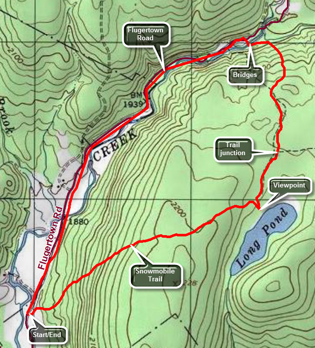 The area around Long Pond has several snowmobile trails that are ideal for hiking. They are wide and well maintained being free from blow downs. Snowshoeing during the winter is a pleasure since the trail are well packed in most places. There are several options for longer or shorter hikes.
Take DeBruce Road from Livingston Manor for about nine miles then turn left on Flugertown Road just passed the hamlet of Willowemoc. The parking area for Long Pond is about 1 mile up on the right. The road is well paved to this point but not far beyond there is a "Seasonal Maintenance" sign. Start the hike by walking over the bridge and up the hill on the snowmobile and hiking trail. The first part of the trail is a short ascent. It looks a LOT steeper on the profile below than it really is! After about a mile, turn right and walk down to the pond. This is the nicest view of the pond that is right on the trail. Another .25 miles will bring you to a T trail junction. Turn left and walk north toward the road. The trail descends almost 200 feet along the way. Descend to the bridges across the streams and follow one of the paths out to Flugertown Road. During the winter the road will be covered in ice and snow. In the other seasons it is a dirt and gravel road with a few pullouts to park cars. Turn left to start the loop back to the parking area. Since the road is lightly traveled it is almost like walking on a nice flat trail but watch out for the occasional car. The walk back along the road is a little more than 1.5 miles and goes very quickly.
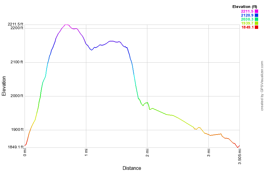 (The image shows the profile of the hike. Remember that all vertical profiles are relative!)
Mary Smith: Berry Brook Road to Mary Smith Hill Road
| Quick Look | ||||
|---|---|---|---|---|
| Difficulty | Round trip | Total climb | Internet Maps | |
| 6.3 mi. | 1949 ft. | AllTrails | ||
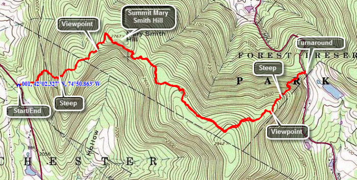 Head north on the Beaverkill Road for about 5.2 miles and turn left on Campsite Road. At the fork in the road bear right and cross the Beaverkill Covered Bridge. At the intersection with Berry Brook Road turn right and drive another 3.7 miles to the parking area on the right. The first .6 miles of the trail are pretty steep gaining a little over 500 feet. The surface has some loose rocks which can slip underfoot. After climbing to the top of the first, unnamed hill you will descend a little before starting up Mary Smith Hill. At .9 miles the trail makes a sharp right turn swinging from ENE to SE and then ascending Mary Smith Hill. You will walk through several areas where you pass between or climb over large rocks. Just before the top of Mary Smith Hill there is a lookout which has a limited view to the south. Continue on the main trail little farther along the trail to the top of the next unnamed hill. As you continue on the trail to Mary Smith Road you will drop 685 feet in less than a mile. If you have a car waiting on Mary Smith Hill Road, you will not have to deal with the return climb. If you are doing and out and back hike be ready to climb back up the hill from Mary Smith Hill Road on your way back to your car on Berry Brook Road.
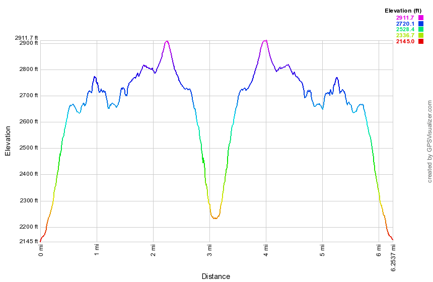
(The image at the left shows the profile of the hike.)
Mary Smith: Mary Smith Hill Road to Berry Brook Road
| Quick Look | ||||
|---|---|---|---|---|
| Difficulty | Round trip | Total climb | Internet Maps | |
| 6.3 mi. | 1949 ft. | AllTrails | ||
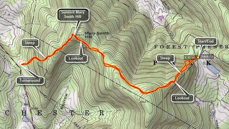 Turn onto Mary Smith Hill Road in the hamlet of Lew Beach. Travel for about 2.5 miles and park at the
parking area on the right. Do NOT be fooled! The road narrows and changes to dirt but IS passable. Get
on the red blazed Mary Smith Trail across the road. Be prepared to climb some rather steep terrain in
the first half to three quarters of a mile. At the half mile point is a nice lookout to the south.
Continue on to the maximum elevation on the trail at a little over 2900 feet. This hill has no name.
Descend into a col and then climb to the top of Mary Smith Hill. Here there is another lookout to
the south. Continue down the other side of Mary Smith Hill to the parking area on Berry Brook Road.
There are some interesting rock formations along the way and at least one rather steep descent.
In the summer, the trail is overgrown with briars. The briars coupled with nettles make the trip over
the hill unpleasant if not impossible. At Berry Brook Road turn around and retrace your steps. The
round trip is 6.6 miles by the signs and 6.3 miles by my GPS.
Turn onto Mary Smith Hill Road in the hamlet of Lew Beach. Travel for about 2.5 miles and park at the
parking area on the right. Do NOT be fooled! The road narrows and changes to dirt but IS passable. Get
on the red blazed Mary Smith Trail across the road. Be prepared to climb some rather steep terrain in
the first half to three quarters of a mile. At the half mile point is a nice lookout to the south.
Continue on to the maximum elevation on the trail at a little over 2900 feet. This hill has no name.
Descend into a col and then climb to the top of Mary Smith Hill. Here there is another lookout to
the south. Continue down the other side of Mary Smith Hill to the parking area on Berry Brook Road.
There are some interesting rock formations along the way and at least one rather steep descent.
In the summer, the trail is overgrown with briars. The briars coupled with nettles make the trip over
the hill unpleasant if not impossible. At Berry Brook Road turn around and retrace your steps. The
round trip is 6.6 miles by the signs and 6.3 miles by my GPS.
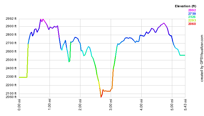
(The image at the left shows the profile of the hike.)
Mary Smith: Berry Brook to Split Rock
| Quick Look | ||||
|---|---|---|---|---|
| Difficulty | Round trip | Total climb | Internet Maps | |
| 2.6 mi. | 760 ft. | AllTrails | ||
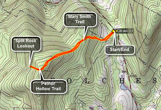 This short hike doesn't gain much elevation but leads to a nice lookout and an interesting rock formation.
Head out of Roscoe on Route 206. Turn right on Berry Brook Road just after the county line and drive for around 8 miles to the trail head parking on the right. Cross the road to get on the Mary Smith Trail heading west southwest. After about .1 miles on a woods road, you will cross a power line right-of-way. Watch for the trail as it continues through a grassy area and into the woods. The trail ascends some until about .45 miles when it levels off if only briefly. In only .2 miles the trail again ascends for the next .5 miles to 1.15 miles where it meets the Pelnor Hollow Trail. Turn right and after a short distance you will be faced with a VERY STEEP downhill section. At 1.3 miles you will arrive at the Split Rock Lookout with some great views to the west. Notice the house across the way on the ridge. When you have taken in the view, return the way you came. This time the steep downhill is a steep uphill!
 (The image at the left shows the profile of the hike. Remember that all vertical profiles are
relative!)
(The image at the left shows the profile of the hike. Remember that all vertical profiles are
relative!)
Middle Mountain Trail: Mary Smith to Beech Hill
| Quick Look | ||||
|---|---|---|---|---|
| Difficulty | Round trip | Total climb | Internet Maps | |
| 4.2 mi. | 1750 ft. | AllTrails | ||
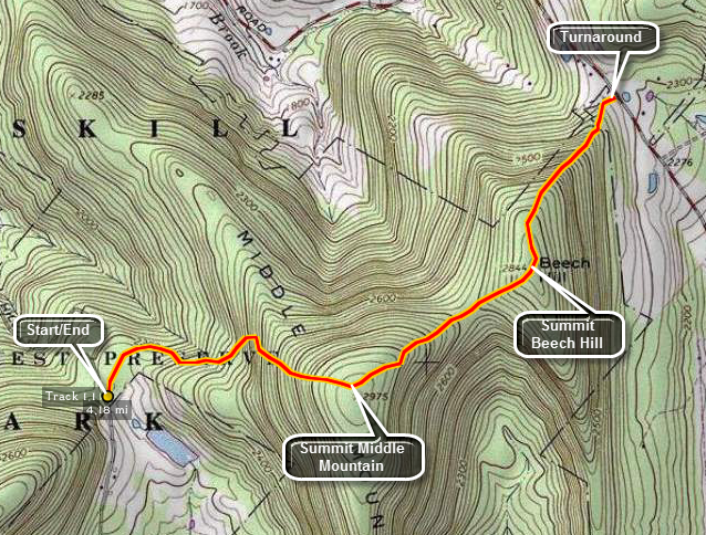
Turn onto Mary Smith Hill Road in the hamlet of Lew Beach. Travel for about 2.5 miles and park at the parking area on the right. Do NOT be fooled! The road narrows and changes to dirt but IS passable. Get on the red blazed Middle Mountain trail. Be prepared to climb! This isn't a 3500 and it is only 4.2 miles round trip but there is some climbing to do. About a miles walk brings you to the top of Middle Mountain at 2975 feet. There is nothing much to see here but .1 miles further on is a BEAUTIFUL view. Continue on the same trail for a little less than a mile to Beech Hill. There is a descent and ascent between the two hills. Another half mile will put you on Beech Hill Road. Return to your car by reversing the hike.
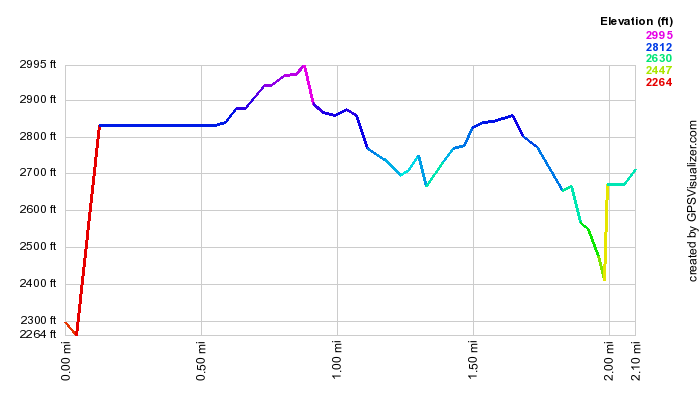 (The image below shows the profile of the loop hiking route. Remember that all vertical profiles are
relative!)
(The image below shows the profile of the loop hiking route. Remember that all vertical profiles are
relative!)
Middle Mountain Trail: Mary Smith Hill Road to Cabot Mt
| Quick Look | ||||
|---|---|---|---|---|
| Difficulty | Round trip | Total climb | Internet Maps | |
| 7.8 mi. | 2660 ft. | AllTrails | ||
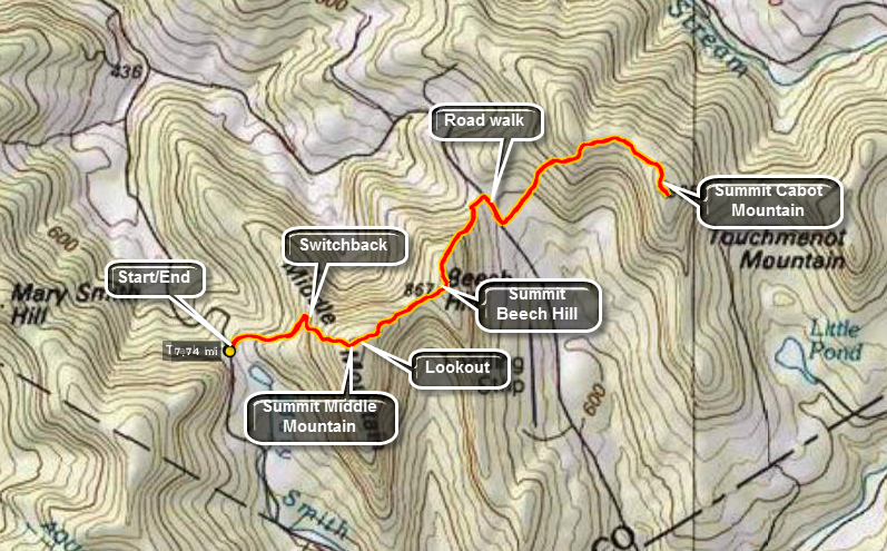
Turn onto Mary Smith Hill Road in the hamlet of Lew Beach. Travel for about 2.5 miles and park at the parking area on the right. Do NOT be fooled! The road narrows and changes to dirt but IS passable. From the parking area get on the red blazed Middle Mountain trail. Be prepared to climb! This isn't a 3500 but it is a true Catskills trail with rocks, roots, prickers, nettles, damp places, wet spots and blowdown! The climb up Middle Mountain gets steep in a few places and there are several large trees across the trail and many smaller branches. Between .5 miles and .6 miles the trail winds its way up over a rocky patch. At the top of the climb the trail levels and makes a big switchback before heading back toward the summit. From the summit of Middle Mountain the trail loses almost 300 feet to the col with Beech Hill. The climb to Beech Hill isn't long but can be tiring. In .6 miles the trail drops over 500 feet and ends on a small private road. Turn right on the road and walk out to Beech Hill Road. Turn right at the end of the road and walk to the trail head for the Touch Me Not Trail to Cabot Mountain. You now have to walk 2.5 miles over hilly, rough trail. The hike up Cabot starts along a woods road with POSTED signs on both sides. The first .25 miles aren't bad but then the trail gets serious. The trail gets steep in spots. In .5 miles the trail ascends about 600 feet and then levels off for a pleasant walk of .35 miles to the last climb. Ascend another 125 feet over the next .3 miles to get to the summit before turning around to walk back. The hike back is a matter of reversing course along the same trails. You get a break hiking down Cabot Mountain and then walking along a relatively flat area to the foot of Beech Hill. At the foot of Beech Hill you will be 6.2 miles into the hike. Start the climb up Beech Hill and then head down Beech Hill to the col with Middle Mountain. Continue up to the highest point the trail reaches on Middle Mountain and soon you will be going down Middle Mountain, through the switchback, over the rocks and toward the parking area.
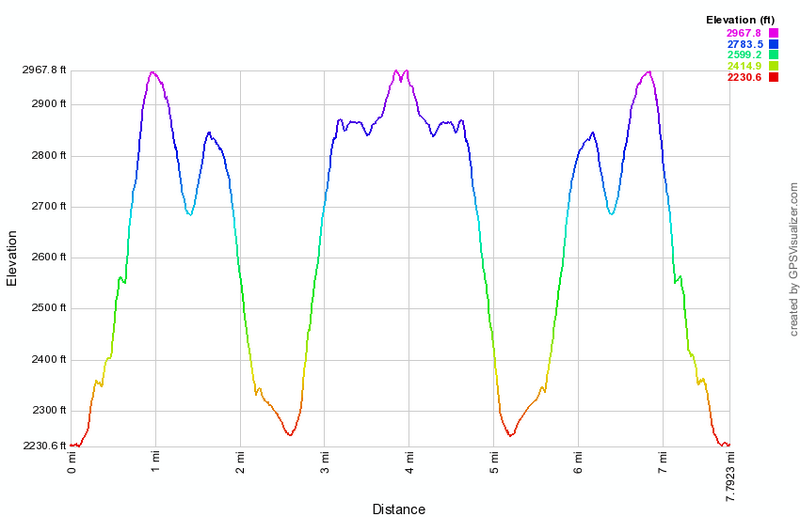 (The image at the left shows the profile of the loop hiking route. Remember that all vertical profiles are
relative!)
(The image at the left shows the profile of the loop hiking route. Remember that all vertical profiles are
relative!)
Mink Hollow Trail
| Quick Look | ||||
|---|---|---|---|---|
| Difficulty | Round trip | Total climb | Internet Maps | |
| 5.0 mi. | 1185 ft. | AllTrails | ||
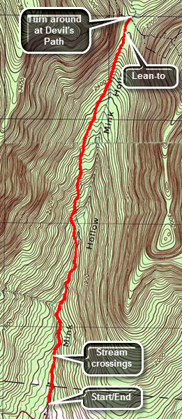
Drive along Route 28 to Mount Tremper. Turn north on Route 212 and follow it to Lake Hill just before Cooper Lake. Turn north onto Mink Hollow Road and drive to the parking area at the end. The road is paved to the parking area.Walk out of the parking area and up the road until the trail veers to the right. Follow the blazes as the trail gets pretty rocky and crosses over several streambeds. At about .5 miles the trail seems to become wider and is clear of rocks but soon you will be again walking along the bank of the stream where the trail has been eroded to only a narrow track. After this, you will again be on very rocky ground following the dark blue blazes. The blazes can be few and far between in some spots and at one point the trail seems to split and there is a blaze on tree that sits right in the middle without indicating a turn. Stay to the right and you will pick up the trail as it begins to climb more steeply. The rocks may have quite a bit of moss which makes getting a good footing important. The hike is 2.3 miles of ascent up to the Devil's Path and gains 1120 feet over the 2.3 miles. The trail begins to level off near the Mink Hollow lean-to. Walk it to the Devil'S Path at 2.5 miles to complete the "out" part of the hike. Turned around and retrace your route back to the parking area.
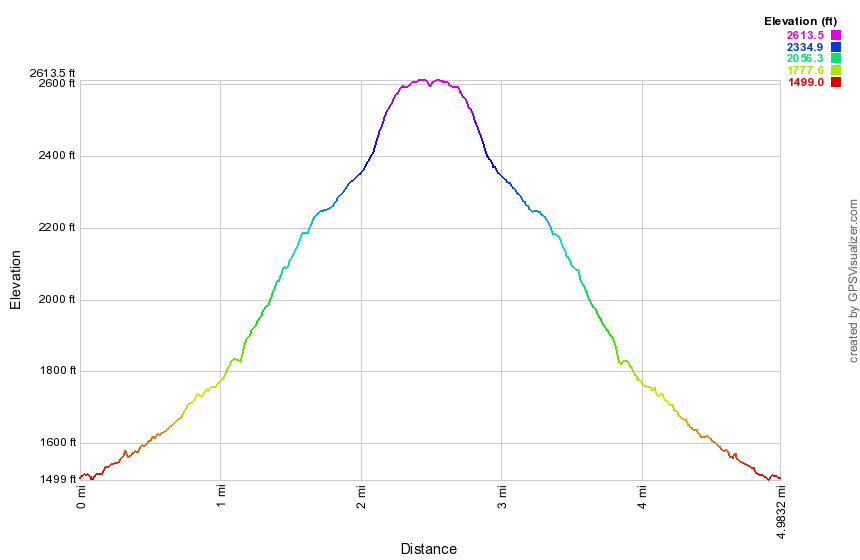
(The image at the left shows the profile of the hike. Remember that all vertical profiles are relative!)
Mongaup Hardenburgh Trail from Beaverkill
| Quick Look | ||||
|---|---|---|---|---|
| Difficulty | Round trip | Total climb | Internet Maps | |
| 7.7 mi. | 2022 ft. | AllTrails | ||
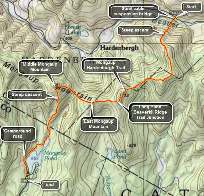 Take the Beaverkill Rd. toward the Lew Beach and Turnwood area. Keep driving even when the road turns
to gravel and dirty. After about 30 minutes you will see the Zen Monastery on the left. After this
is the parking area for Cradle Rock Ridge on the right. Continue on until you see the small parking area
for the Mongaup Hardenburgh Trail on the Right. Park your car and sign in at the register. The hike through
to Mongaup Pond is about 6.5 miles. You, of course, can turn around at any point and return to your car. You
can park another car at the end of the trail at the Mongaup Campgrounds. Just after the trail register you
cross the Beaverkill on a rather unique steel cable suspension bridge. The bridge has wooden decking which
is showing its age but still seems safe. You now begin a long and sometimes challenging ascent of the
Beaverkill ridge. The highest point on the ridge is almost 3200 feet! The trail offers very few views
of the valleys surrounding the ridge. After about two miles the trail opens up into a small clearing.
Walk to the left of the trail to a rock ledge. The views to the east are the only ones you will find
on this hike! As you continue you will descend the Beaverkill Ridge and then ascend east Mongaup Mountain.
At the three mile mark just before this ascent a red marked trail to Long Pond branches to the left. There
are no signs to mark this trail but the markers are clear. After ascending east Mongaup you descend quite
a bit before ascending Middle Mongaup Mountain. At this point you may decide to go off trail for less than
half a mile to ascend the main summit of Mongaup Mountain. The trail continues down now to the state
campgrounds. At the T-junction at Mongaup Pond turn right and stay on the blue trail until you reach the
loop road. Turning right is the shortest way to the park entrance. After less than a mile, you will see
the main buildings.
Take the Beaverkill Rd. toward the Lew Beach and Turnwood area. Keep driving even when the road turns
to gravel and dirty. After about 30 minutes you will see the Zen Monastery on the left. After this
is the parking area for Cradle Rock Ridge on the right. Continue on until you see the small parking area
for the Mongaup Hardenburgh Trail on the Right. Park your car and sign in at the register. The hike through
to Mongaup Pond is about 6.5 miles. You, of course, can turn around at any point and return to your car. You
can park another car at the end of the trail at the Mongaup Campgrounds. Just after the trail register you
cross the Beaverkill on a rather unique steel cable suspension bridge. The bridge has wooden decking which
is showing its age but still seems safe. You now begin a long and sometimes challenging ascent of the
Beaverkill ridge. The highest point on the ridge is almost 3200 feet! The trail offers very few views
of the valleys surrounding the ridge. After about two miles the trail opens up into a small clearing.
Walk to the left of the trail to a rock ledge. The views to the east are the only ones you will find
on this hike! As you continue you will descend the Beaverkill Ridge and then ascend east Mongaup Mountain.
At the three mile mark just before this ascent a red marked trail to Long Pond branches to the left. There
are no signs to mark this trail but the markers are clear. After ascending east Mongaup you descend quite
a bit before ascending Middle Mongaup Mountain. At this point you may decide to go off trail for less than
half a mile to ascend the main summit of Mongaup Mountain. The trail continues down now to the state
campgrounds. At the T-junction at Mongaup Pond turn right and stay on the blue trail until you reach the
loop road. Turning right is the shortest way to the park entrance. After less than a mile, you will see
the main buildings.
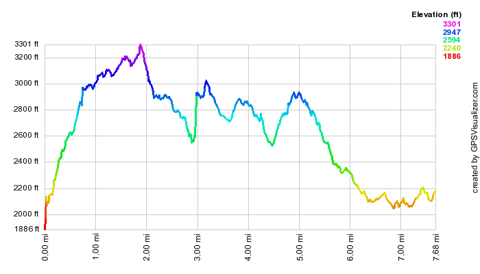 (The image at the left shows the profile of the hike. Remember that all vertical profiles are
relative!)
(The image at the left shows the profile of the hike. Remember that all vertical profiles are
relative!)
Mongaup Hardenburgh Trail from Mongaup to Long Pond Beaverkill Ridge Junction
| Quick Look | ||||
|---|---|---|---|---|
| Difficulty | Round trip | Total climb | Internet Maps | |
| 8.1 mi. | 1925 ft. | AllTrails | ||
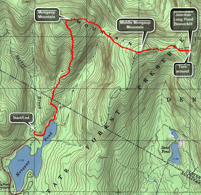 From Livingston Manor drive out the DeBruce Road about 6 miles to Mongaup Road. Turn left and continued up the road to the point where it splits. Stay right on Mongaup Pond Road to head for the campgrounds. At the campgrounds, pull over and park on the right. Ask the attendant if you can park near the trailhead in the field by campsite 161. Pay the entrance fee and follow the attendant's instructions for parking. Walk back out to the road and turn left. Watch for the trail which goes off to the left after only a tenth of a mile. There is no sign for the trail but it is marked with blue trail markers. Follow the trail as it follows the shore of the pond with glimpses of the water along the way. At about .4 miles at the northern end of the pond, turn left just before the bridge to start the climb up Mongaup Mountain. You will gain 830 feet over 1.5 miles with an average grade of 11%. At the top of the mountain the trail turns from heading north to southeast and east. From the top of Mongaup Mountain you will descend 385 feet of .5 miles for an average grade of 15%. Almost immediately the trail begin the climb up Middle Mongaup Mountain. Again the distance is about .5 miles and the elevation gain is 370 feet. There is a short flat area at the top of Middle Mongaup before another descent on the other side. This descent is short and leads to another for a long time area before the final climb to the trail junction on Beaverkill Ridge. The final climb is short but steep with some parts coming close to a 30% grade. When you reach the junction, turn around and follow the same route in reverse back to your car.
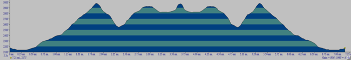 (The image at the left shows the profile of the hike. Remember that all vertical profiles are
relative!)
(The image at the left shows the profile of the hike. Remember that all vertical profiles are
relative!)
Mongaup Pond
| Quick Look | ||||
|---|---|---|---|---|
| Difficulty | Round trip | Total climb | Internet Maps | |
| 3.0 mi. | 235 ft. | AllTrails | ||
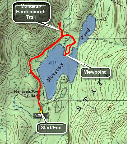 This hike can be easy or difficult depending on the conditions. In two feet of fresh snow the going is tough. Under most other conditions it is an easy walk. Park at the "beach" Parking area at Mongaup Pond or outside the gatehouse when the park is closed. Walk the park roads in clockwise direction around the entire pond or walk as far as you can go and turn around.
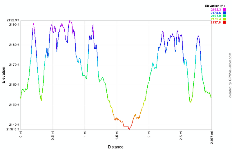
(The image above shows the profile of the hike. Remember that all vertical profiles are relative!)
Mongaup Pond Loop (snowmobile)
| Quick Look | ||||
|---|---|---|---|---|
| Difficulty | Round trip | Total climb | Internet Maps | |
| 5.7 mi. | 570 ft. | AllTrails | ||
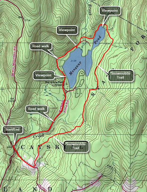 From the hamlet of DeBruce drive north on Mongaup Pond Road. Continue to where the road splits and stay to the right. Park in the small pulloff on the right just after the turn. Walk on the road back toward the intersection and turn left on a woods road that heads down to the stream. Cross the creek on the small "bridge" that is still present and begin to climb a little hill. After .4 miles turn left on the snowmobile trail which can be hard to find as this is not a well-traveled route. The first part of this trail passes through some pines and is usually relatively dry. As you continue to walk the trail may become wet and muddy. This problem is caused by the cliffs and ledges to the right which drain onto the trail and then to a swampy area on the left of the trail. At 1.95 miles the trail turns to the right. To the left is a short trail that runs out to the campgrounds. Turn right and get ready for some more potentially wet areas. Continue to 2.6 miles where the Mongaup Willowemoc Trail comes in from the right. Walk straight ahead and downhill toward the head end of the pond. The trail crosses four different bridges and at 3.1 miles arrives at the junction with the Mongaup Hardenburgh Trail on the right. There is a nice view of the pond from the shore. Continue around the pond on the trail. Walk out to the road and turn right to walk on the campgrounds road along the west side of the pond. toward the point where the snowmobile trail climbs the hill to the Flynn Trail. At 3.7 miles walk off the road to the left to a bench near the shore of pond. The views from here are slightly different than from the head of the pond. Walk back out to the road and continue to walk south on the road. The boat launch is at about 4.4 miles and you may choose to stop or pass by. Again continue on the road passing the bathrooms and pavilions and heading toward the park entrance at 4.6 miles. The walk back to the car along Mongaup Road can be pleasing as it runs parallel to the stream. The first part of the walk undulates a little but the second part is mostly downhill. After about 1.1 miles, you will be back at your car.
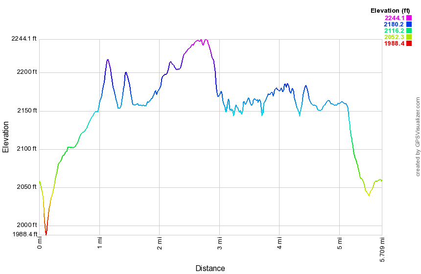
(The image above shows the profile of the hike. Remember that all vertical profiles are relative!)
Mongaup Pond Snowmobile Loop
| Quick Look | ||||
|---|---|---|---|---|
| Difficulty | Round trip | Total climb | Internet Maps | |
| 8.1 mi. | 1200 ft. | AllTrails | ||
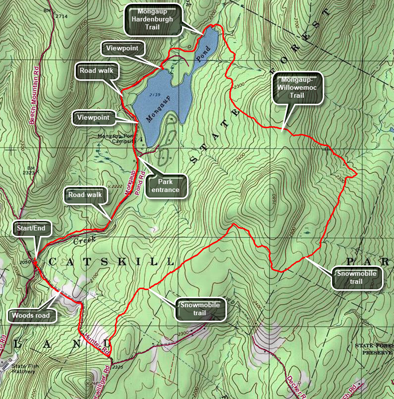 From the hamlet of DeBruce drive north on Mongaup Pond Road. Continue to where the road splits and stay to the right. Park in the small pulloff on the right just after the turn. Walk on the road back toward the intersection and turn left on a woods road that heads down to the stream. Cross the creek on the small "bridge" that is still present and begin to climb a little hill. At the trail junction at .4 miles continue straight ahead. Descend to a swampy area and then ascend another hill for .5 miles. This woods road is rocky and can be wet at times. At 1 mile turn left on the snowmobile trail and walk through and open area that has many ferns in season. The trail then enters the forest. The trail heads northeast and starting at 1.4 miles goes uphill for 1.3 miles turning sharply southeast at 2.35 miles. From the top of the hill begin to descend following the trail as it again turns northeast at 2.9 miles. The total descent is about 1.2 miles and 360 vertical feet which is a gentle grade. At 3.8 miles there is a trail junction. Turn left on the Mongaup Willowemoc Trail and almost immediately begin a .5 mile climb heading northwest. At the top of the hill, start downhill for .65 miles to the junction with a snowmobile trail. Head north and continue walking downhill crossing three or four bridges. At 5.5 miles you will be at the junction with the Mongaup Hardenburgh Trail. Continue around the pond on the trail to the campsite loop road. Turn right to walk out to the main road around the pond. Turn right on the road. In a short distance there is a small bench near the shore of the pond which is a nice viewpoint. Continue on the road walking south along the west side of the pond. There is an observation deck and boat launch which also provides a nice viewpoint. Continue along the road to the park entrance and walk about 1.1 miles on the road back to your car.
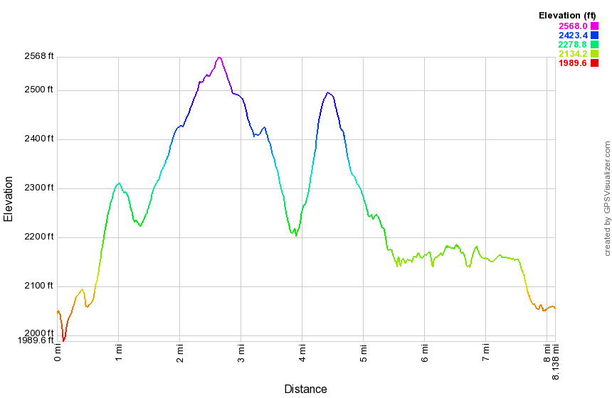
(The image above shows the profile of the hike. Remember that all vertical profiles are relative!)
Mongaup Pond: Flynn Trail, Snowmobile Trail, Campground Roads
| Quick Look | ||||
|---|---|---|---|---|
| Difficulty | Round trip | Total climb | Internet Maps | |
| 6.4 mi. | 960 ft. | AllTrails | ||
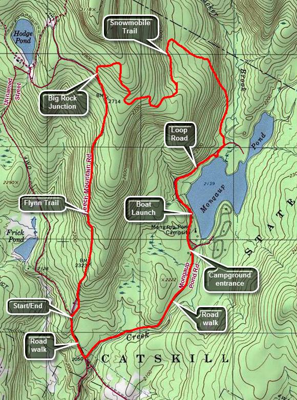 From Livingston Manor head out the DeBruce Road for about 6 miles. Turn left on the Mongaup Road and drive to the intersection with Beech Mountain Road. Stay left toward Frick Pond and park in one of the lots. Cross the road and start your hike on the Flynn Trail. At the end of the woods trail turn right on the woods road which was once an extension of Beech Mountain Road. Start to climb the Flynn Trail heading towards the junction with the Big Rock Trail at 1.7 miles. This is a four-way junction with the Flynn Trail continuing straight ahead and the Big Rock Trail turning to the left. Turn right on the snowmobile trail and climb another hill to the highest point on the hike at 2880 feet. You will now have climbed 735 feet from the parking area and most of the rest of the hike is downhill or flat. The snowmobile trail wanders a little but is all downhill. At 3.1 miles it finally turns southeast and then south toward Mongaup Pond. Just before reaching the pond it becomes more of a woods road and flattens out with a swamp on the left. When you meet the campground roads turn right and walk out to the main loop road. Turn right on the main loop road and walk south along the east shore of Mongaup Pond. There are several places to walk over to the shore including observation deck at 4.75 miles. As you continue on the road, you will come to the main parking area and the bathhouses. Be sure to walk straight ahead toward the entrance to the campgrounds. Pass through the entrance and start walking on the access road. Walk 1.1 miles mostly downhill or flat to the intersection with Beech Mountain Road. Turn right and walk a little more than a quarter mile uphill back to your car.
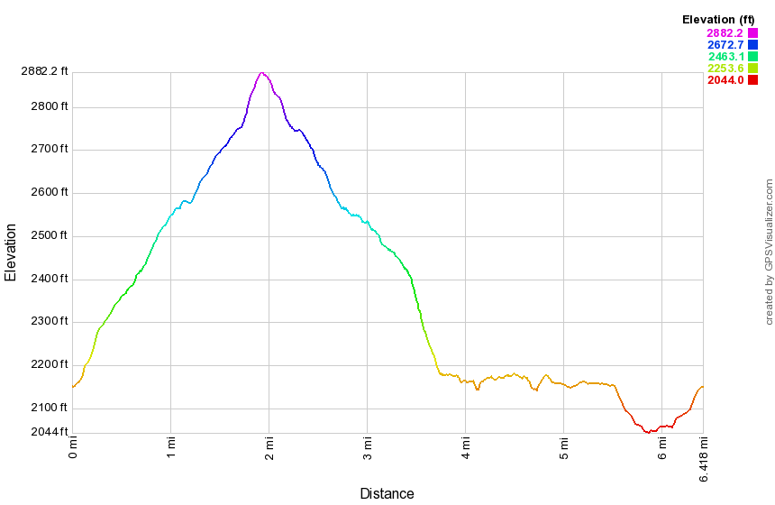
(The image above shows the profile of the hike. Remember that all vertical profiles are relative!)
Mongaup Pond: Flynn Trail, Snowmobile Trails, Mongaup Pond Road
| Quick Look | ||||
|---|---|---|---|---|
| Difficulty | Round trip | Total climb | Internet Maps | |
| 7.3 mi. | 1030 ft. | AllTrails | ||
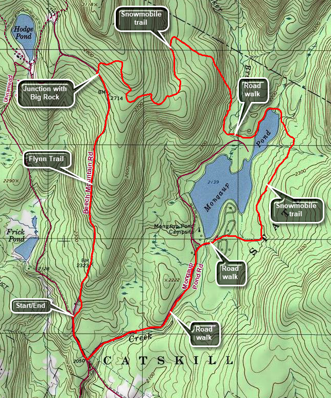 From Livingston Manor head out the DeBruce Road for about 6 miles. Turn left on the Mongaup Road and drive to the intersection with Beech Mountain Road. Stay left toward Frick Pond and park in one of the lots. Cross the road and start your hike on the Flynn Trail. At the end of the woods trail turn right on the woods road which was once an extension of Beech Mountain Road. Start to climb the Flynn Trail heading towards the junction with the Big Rock Trail at 1.7 miles. This is a four-way junction with the Flynn Trail continuing straight ahead and the Big Rock Trail turning to the left. Turn right on the snowmobile trail and climb another hill to the highest point on the hike at 2880 feet. You will now have climbed 735 feet from the parking area and most of the rest of the hike is downhill or flat. The snowmobile trail wanders a little but is all downhill. At 3.1 miles it finally turns southeast and then south toward Mongaup Pond. Just before reaching the pond it becomes more of a woods road and flattens out with a swamp on the left. When you meet the campground roads turn left and walk .15 miles watching for the beginning of the blue Mongaup Hardenburgh Trail on your left. Turn left on the trail and walk north along the western shore of the upper part of Mongaup Pond. At 4.4 the Mongaup Hardenburgh Trail turns left. Continue straight ahead on the snowmobile trail which gains some elevation and passes over three bridges. This part of the trail can be wet. The Mongaup Willowemoc Trail will come in from the left at 4.8 miles. Continue straight ahead on the snowmobile trail which can be muddy at times. At 5.5 miles the snowmobile trail turns left to head for Mongaup Falls. Continue straight ahead crossing a stream and a marshy area to arrive at campsite 38. Walk to the road and bear left to find the main loop road. Turn left and walk out passed the day-use area to the entrance. Pass through the entrance to the campground and begin the return trip to the parking area on Mongaup Pond Road. Walk 1.2 miles mostly downhill or flat to the intersection with Beech Mountain Road. Turn right and walk a little more than a quarter mile uphill back to your car.
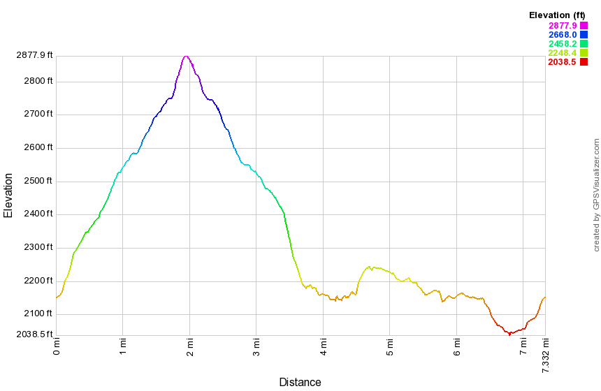
(The image above shows the profile of the hike. Remember that all vertical profiles are relative!)
Mongaup Pond: Snowmobile and Flynn Trail
| Quick Look | ||||
|---|---|---|---|---|
| Difficulty | Round trip | Total climb | Internet Maps | |
| 7.8 mi. | 1150 ft. | AllTrails | ||
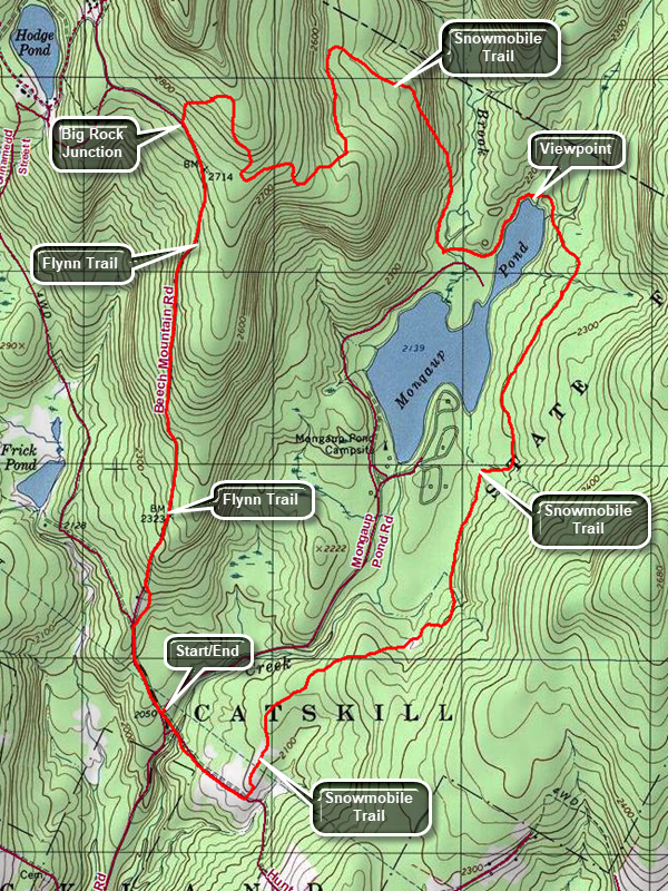 From the hamlet of DeBruce drive north on Mongaup Pond Road. Continue to where the road splits and stay to the right. Park in the small pulloff on the right just after the turn. Walk on the road back toward the intersection and turn left on a woods road that heads down to the stream. Cross the creek on the small "bridge" that is still present and begin to climb a little hill. After .4 miles turn left on the snowmobile trail which can be hard to find as this is not a well-traveled route. The first part of this trail passes through some pines and is usually relatively dry. As you continue to walk the trail may become wet and muddy. This problem is caused by the cliffs and ledges to the right which drain onto the trail and then to a swampy area on the left of the trail. At 1.95 miles the trail turns to the right. To the left is a short trail that runs out to the campgrounds. Turn right and get ready for some more potentially wet areas. Continue to 2.6 miles where the Mongaup Willowemoc Trail comes in from the right. Walk straight ahead and downhill toward the head end of the pond. The trail crosses four different bridges and at 3.1 miles arrives at the junction with the Mongaup Hardenburgh Trail on the right. There is a nice view of the pond from the shore. Continue around the pond on the trail. Walk out to the road and turn right to walk on the campgrounds road along the west side of the pond. After only a tenth if a mile, turn right where there are snowmobile trail markers. The snowmobile trail meanders for 1.8 miles starting out to the northwest, then heading due south before turning west and then north again to the highest point on the hike. In the process it gains over 700 feet and averages a 7.5% grade with some much steeper spots. The trail is eroded and covered in sticks and rocks which make walking difficult. At 5.5 miles you will be at the highest point with an elevation of 2880 feet. From here it is a short walk downhill to the Flynn Trail at the junction with the Big Rock Trail. Turn left on the Flynn Trail and start downhill back to you car. The 1.7 miles hike to the Frick Pond parking area is all downhill or flat. Toward the end of the trail there is a gate marking private property. Walk off the woods road and follow the Flynn Trail into the woods to avoid the private property around the cabin. At the Frick Pond parking area turn left and hike down Beech Mountain Road for .3 miles back to you car.
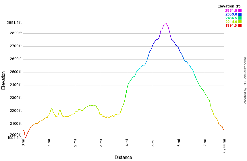
(The image above shows the profile of the hike. Remember that all vertical profiles are relative!)
Mongaup Pond: Flynn Trail and Ledges
| Quick Look | ||||
|---|---|---|---|---|
| Difficulty | Round trip | Total climb | Internet Maps | |
| 3.8 mi. | 675 ft. | AllTrails | ||
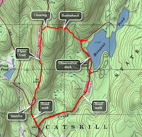 From Livingston Manor head out the DeBruce Road for about 6 miles. Turn left on the Mongaup Road and drive to the intersection with Beech Mountain Road. Stay left toward Frick Pond and park in one of the lots. Cross the road and start your hike on the Flynn Trail. At the end of the woods trail turn right on the woods road which was once an extension of Beech Mountain Road. Start to climb the Flynn Trail to the spot where there is a clearing a little off the trail on the right at 1.15 miles. Turn into the woods and walk up to the clearing. Walk across the clearing heading east and southeast to enter the woods heading in the same direction. In less than a quarter mile from the clearing you will encounter the first series of ridges. Find a path to descend through them. Just before you start down, look ahead and you may be able to see the water of Mongaup Pond about .25 miles away. The grade is pretty steep averaging about 18%. Work your way down through another level of ledges and continue to descend heading east and southeast. Watch for an overgrown woods road heading southeast and follow it. The road parallels a drainage which normally conducts water down toward the pond. Soon you will be at the loop road around the pond. Turn right on the road and walk .3 miles to the observation deck and boat launch. Continue the hike by walking along the shore or the road and out the access road to the campground entrance. Walk Mongaup Road for 1.1 miles to the intersection with Beech Mountain Road. Turn right and walk uphill .3 miles back to the car.
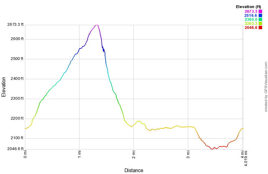
(The image above shows the profile of the hike. Remember that all vertical profiles are relative!)
Mongaup Pond: Flynn and Snowmobile Trails
| Quick Look | ||||
|---|---|---|---|---|
| Difficulty | Round trip | Total climb | Internet Maps | |
| 8.1 mi. | 1190 ft. | AllTrails | ||
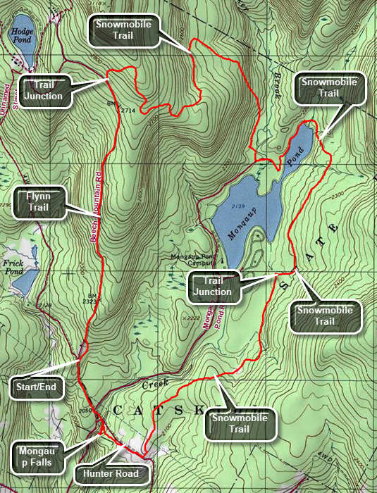 From Livingston Manor head out the DeBruce Road for about 6 miles. Turn left on the Mongaup Road and drive to the intersection with Beech Mountain Road. Stay left toward Frick Pond and park in one of the lots. Cross the road and start your hike on the Flynn Trail. At the end of the woods trail turn right on the woods road which was once an extension of Beech Mountain Road. Start to climb the Flynn Trail heading towards the junction with the Big Rock Trail at 1.7 miles. This is a four-way junction with the Flynn Trail continuing straight ahead and the Big Rock Trail turning to the left. Turn right on the snowmobile trail and climb another hill to the highest point on the hike at 2880 feet. You will now have climbed 735 feet from the parking area and most of the rest of the hike is downhill or flat. The snowmobile trail wanders a little but is all downhill. At 3.1 miles it finally turns southeast and then south toward Mongaup Pond. Just before reaching the pond it becomes more of a woods road and flattens out with a swamp on the left. When you meet the campground roads turn left and walk on the road to a T. Turn left and walk along the road until you see a sign on the right for the blue trail. The trail leads to the shore of the pond. Walk along the shore of the pond on the trail to the very head end of the pond where the trail turns left and heads for Hardenburgh. Continue around the pond on the snowmobile trails and walk up a small hill. After crossing four bridges, you will come to a junction with the Mongaup Willowemoc Trail on the left at 5 miles. Continue straight ahead on the snowmobile trail until another junction at 5.75 miles. Turn left to stay on the snowmobile trail which runs between a swamp area on the right and some ledges on the left. Stay on the snowmobile trail for about 1.5 miles when it meets the old Hunter Road. Walk downhill until jut before the "bridge" over the creek. Turn left and walk along the creek on an informal path to see the upper and lower drops of Mongaup Falls. Retrace your route back to the bridge and turn left to walk up the hill to the road. Walk across the intersection and up the hill on Beech Mountain Road to the parking area and your car.
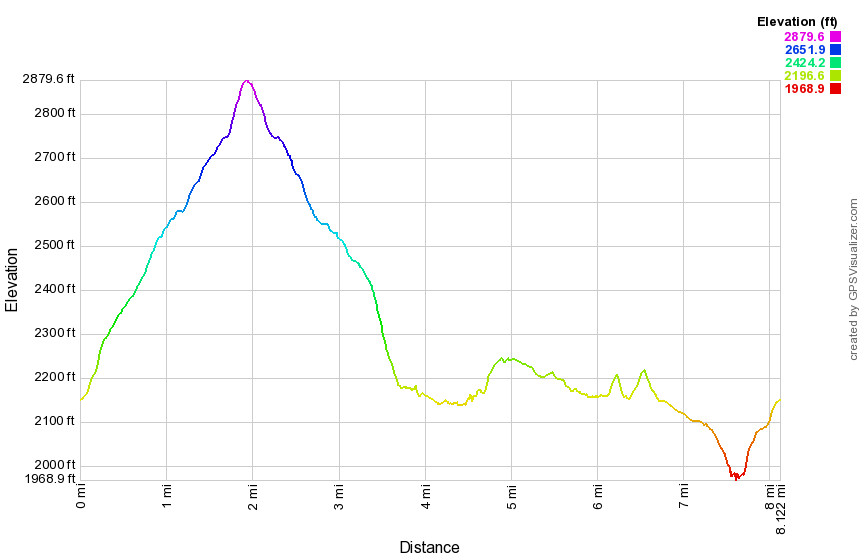
(The image above shows the profile of the hike. Remember that all vertical profiles are relative!)
Mongaup Pond Loop
| Quick Look | ||||
|---|---|---|---|---|
| Difficulty | Round trip | Total climb | Internet Maps | |
| 3.3 mi. | 310 ft. | AllTrails | ||
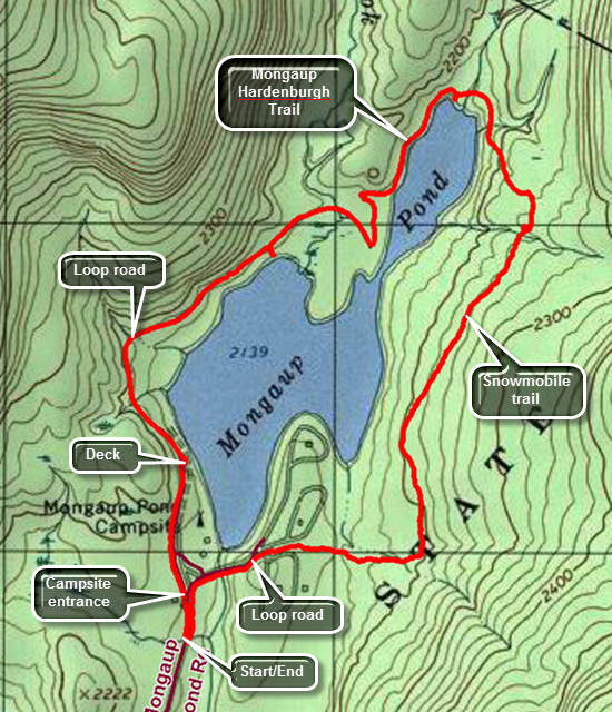 From Livingston Manor head out the DeBruce Road for about 6 miles. Turn left on the Mongaup Road and drive to the intersection with Beech Mountain Road. Stay right toward Mongaup Pond and in a mile pull over and parked in the small parking area just before the entrance to the campgrounds. Walk through the gate and stay to the left to walk along the paved loop road on the western side of the pond. At .35 miles the there is an observation deck and boat ramp you may want to visit. Continue north on the road. You will find walking the road very easy even though it rolls just slightly. At just less than a mile there is a bench at the edge of the pond which has some nice views. Walk back out to the loop road to continue the hike following it as it curves to the right until there is a T at 1.25 miles. Turn left and follow the road until the sign for the Mongaup Hardenburgh Trail appears on the right at 1.4 miles. Turn right to follow the blue-blazed trail along the west side of the much smaller upper pond. At 1.7 miles the trail turns left to head for Hardenburgh. You may want to walk down to the edge of the pond to take in the view. Instead of following the trail, we continue straight ahead over a bridge on a snowmobile trail around the north end of the pond and south along the eastern shore. The snowmobile trail is not as well maintained as the hiking trail. It is often wet with interspersed areas of mud. At 1.7 miles begin the only assent on the hike which lasts for only .3 miles and gains less than 100 feet. The trail crosses several bridges and at 2.2 miles comes to the junction with the Mongaup Willowemoc Trail. Turning left here leads to Flugertown Road near Long Pond. Continue straight ahead on the snowmobile trail. The trail begins to descend and at 2.8 miles turns due west. Around 2.9 miles a snowmobile trail branches off to the left heading toward Mongaup Falls. Continue straight ahead toward one of the campsite loops. The trail here is often flooded from a blocked culvert and crossing the stream where it narrows is the best idea. The trail leads to a campsite loop road at just over 3 miles. Walk toward the pond passing by campsite 38 to a road intersection. Immediately to the left is the loop road to another campsite. Pass up this road and continued on to the main loop road. Turn left to head back to the car. In minutes you will be at the entrance to the park and your car.
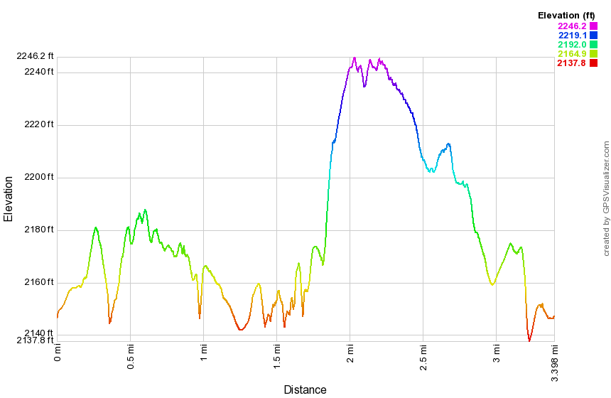
(The image above shows the profile of the hike. Remember that all vertical profiles are relative!)
Mongaup Pond Ledges: Down to the Pond
| Quick Look | ||||
|---|---|---|---|---|
| Difficulty | Round trip | Total climb | Internet Maps | |
| 7.0 mi. | 1422 ft. | AllTrails | ||
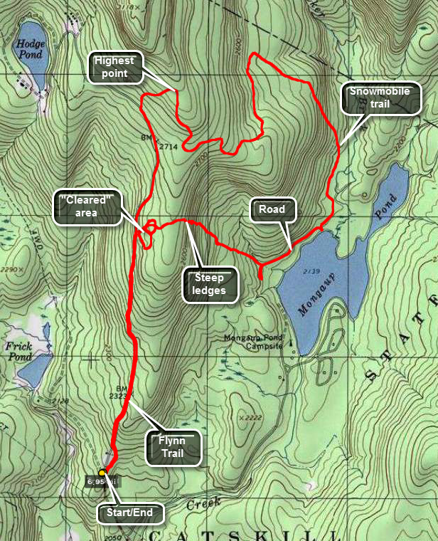 From Livingston Manor take DeBruce Road toward Round Pond. At about 6 miles turn left on Mongaup Road. Where the road splits bear to the left and park at the parking area for Frick Pond. Walk across the road to the beginning of the blue blazed Flynn Trail. Walk through a short section of trail in the woods before the trail breaks out onto a wide woods road. At about 1 mile look for a pile of logs on the right. Walk around the logs and head through the woods to an interesting open area. The area seems to be a bog on top of bedrock! The mosses here are typical of bogs but it doesn't seem possible that they would develop here. Explore this area an notice to the southeast a road that leads back down to the pile of logs. From this point on the hike is a bushwhack until you arrive at Mongaup Pond so directions and mileages will vary. Head to the east of the cleared area and through the woods. After a short walk, you will begin to encounter some impressive ledges. There are several way to get down through the ledges just continue to head east. Take your time to explore this area as it in very interesting. The drop in elevation is around 500 feet in half a mile. Eventually you will be on the road that runs around Mongaup Pond. Turn left and walk about .4 miles on the road. Watch for signs for a snowmobile trail as the road turns to the right. Get on the snowmobile trail and continue to follow it as it will lead back to the Flynn Trail. The first part of this trail runs along the edge of a swamp and is usually wet. Of course, you will have to regain the elevation you lost coming down the ledges! The trail begins to climb at around 3.2 miles. Over the next 1.8 miles the trail rises around 700 feet to an elevation of 2880 feet before descending back to the Flynn Trail. At about 5.3 miles you will be at the intersection of the snowmobile trail, the Flynn Trail and the Big Rock Trail. Turn left on the Flynn Trail which now descends 600 feet over the next 1.7 miles to the parking area.
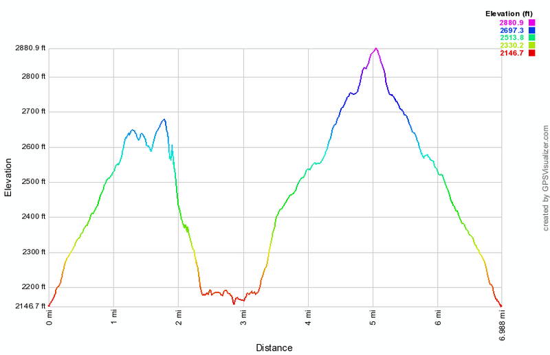
(The image at the left shows the profile of the hike. Remember that all vertical profiles are relative!)
Mongaup Pond Ledges: Up from the Pond
| Quick Look | ||||
|---|---|---|---|---|
| Difficulty | Round trip | Total climb | Internet Maps | |
| 6.4 mi. | 1280 ft. | AllTrails | ||
_map.png) From Livingston Manor take DeBruce Road toward Round Pond. At about 6 miles turn left on Mongaup Road. Where the road splits bear to the left and park at the parking area for Frick Pond. Walk across the road to the beginning of the blue blazed Flynn Trail. Walk 1.7 miles to the junction of the Flynn Trail, the Big Rock Trail and a snowmobile trail. Along the way watch for a pile of logs and a slight clearing off the trail on your right. This will be your return point on the way back. Turn right on the snowmobile trail and climb for another .25 miles to the top of the hill. From here the trail descends for about 2 miles to the loop road at Mongaup Pond State Campsites. The actual distance from the top of the hill to the pond is only .8 miles but the trail meanders considerably. As it nears the pond there is a swampy area to the right and water running off the hill can make the trail very wet. At the loop road turn right and walk along the road for about .5 miles before turning into the woods to head west on a bushwhack back to the Flynn Trail. There is a woods road here to follow for a while but it tends to angle north and you want to head west to the ledges. As you approach the ledges there will be obvious places to climb up through them. When you are near the top, head west to a large clearing just off the Flynn Trail near that pile of logs from earlier in the hike. The area seems to be a bog on top of bedrock! The mosses here are typical of bogs but it doesn't seem possible that they would develop here. Explore this area an notice to the southeast a road that leads back down to the pile of logs. You may follow the road or head directly west to the Flynn Trail. Turn left on the Flynn Trail and walk about 1.2 miles back to your car.
From Livingston Manor take DeBruce Road toward Round Pond. At about 6 miles turn left on Mongaup Road. Where the road splits bear to the left and park at the parking area for Frick Pond. Walk across the road to the beginning of the blue blazed Flynn Trail. Walk 1.7 miles to the junction of the Flynn Trail, the Big Rock Trail and a snowmobile trail. Along the way watch for a pile of logs and a slight clearing off the trail on your right. This will be your return point on the way back. Turn right on the snowmobile trail and climb for another .25 miles to the top of the hill. From here the trail descends for about 2 miles to the loop road at Mongaup Pond State Campsites. The actual distance from the top of the hill to the pond is only .8 miles but the trail meanders considerably. As it nears the pond there is a swampy area to the right and water running off the hill can make the trail very wet. At the loop road turn right and walk along the road for about .5 miles before turning into the woods to head west on a bushwhack back to the Flynn Trail. There is a woods road here to follow for a while but it tends to angle north and you want to head west to the ledges. As you approach the ledges there will be obvious places to climb up through them. When you are near the top, head west to a large clearing just off the Flynn Trail near that pile of logs from earlier in the hike. The area seems to be a bog on top of bedrock! The mosses here are typical of bogs but it doesn't seem possible that they would develop here. Explore this area an notice to the southeast a road that leads back down to the pile of logs. You may follow the road or head directly west to the Flynn Trail. Turn left on the Flynn Trail and walk about 1.2 miles back to your car.
_gra.png) (The image below shows the profile of the hike. Remember that all vertical profiles are relative!)
(The image below shows the profile of the hike. Remember that all vertical profiles are relative!)
Mongaup Pond: Mongaup Falls Loop
| Quick Look | ||||
|---|---|---|---|---|
| Difficulty | Round trip | Total climb | Internet Maps | |
| 8.2 mi. | 1290 ft. | AllTrails | ||
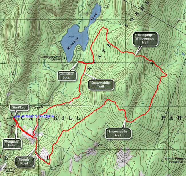 From Livingston Manor take DeBruce Road toward Round Pond. At about 6 miles turn left on Mongaup Road. Where the road splits bear to the right and park in the small pulloff just past the intersection. Walk down the woods road to the stream and cross on the "bridge". Continue straight ahead on the woods road for about .4 miles and then turn left on the snowmobile trail. The trail rolls some but is mostly flat. It runs near the stream at points and can be very wet as water runs down from the ledges on the right. At about 2 miles a trail will lead out to one of the campsite loops at Mongaup State Campgrounds where you may want to take a rest. Back on the main snowmobile trail walk about .7 miles and watch for the yellow Mongaup Willowemoc hiking trail on the right. Turn here and start the first real climb of the hike ascending 260 feet over the next .7 miles as you climb the ridge that surrounds the pond. From the top of the ridge you will then descend the other side of the ridge. In another .6 miles, about 4.2 miles into the hike, turn right on the snowmobile trail to head southwest. This trail climbs about 400 feet over the next 1.2 miles to the shoulder of a hill on the east side of the pond. From that point the trail mostly descends with a few slight climbs over the next 1.7 miles where it meets the woods road you were on at the beginning of the hike. Turn right to head northwest fro about a mile until you are back at the main road. Just before crossing the "bridge", walk downstream until you get to a nice falls. There are several different viewpoints for this two-tiered cascade and it is well worth the short trip.
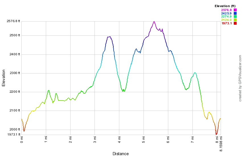 (The image at the left shows the profile of the hike. Remember that all vertical profiles are relative!)
Mongaup Pond: Mongaup Falls Big Loop (counterclockwise)
| Quick Look | ||||
|---|---|---|---|---|
| Difficulty | Round trip | Total climb | Internet Maps | |
| 7.9 mi. | 1250 ft. | AllTrails | ||
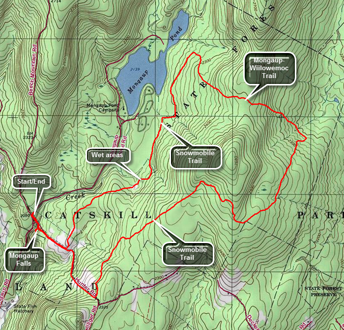 From Livingston Manor take DeBruce Road toward Round Pond. At about 6 miles turn left on Mongaup Road. Where the road splits bear to the right and park in the small pulloff just past the intersection. Walk down the woods road to the stream and cross on the "bridge". At .4 miles pass by a snowmobile trail that you will use on the return trip. There is a short descent followed by a climb on a rocky woods road toward Terwilliger Road. At 1 mile turn left as the snowmobile trail where it turns into the woods. The trail drops a little as it heads northeast and then at 1.4 miles it begins to climb again. At 2.35 miles the trail heads southeast to reach the highest point on the trail at 2.7 miles. From here the trail begins to descend and at 2.9 miles the trail again turns northeast and continues dropping in elevation. At 3.8 miles you will reach the Mongaup Willowemoc Trail. Turn left and start heading northwest as you start climbing again over some rocky terrain until the top of a hill at 4.5 miles. Start to descend the other side. and continue the descent until at 5.2 miles the Mongaup Willowemoc Trail ends at a snowmobile trail. Turn left on the snowmobile trail and head southwest. This trail can be very wet in places as it is lower than the land to the east and water drains from the higher land. Continue to walk southwest passing over two small hills. At 7.35 miles arrive at the junction with the snowmobile trail from the start of the hike. Turn right and start to walk downhill and northwest back toward the car. As you approach the small bridge over the stream turn off to the left and walk to Mongaup Falls. The falls has two levels and is well worth the trip. Walk back to the main trail, cross the bridge and walk back up the woods road to the main road and your car.
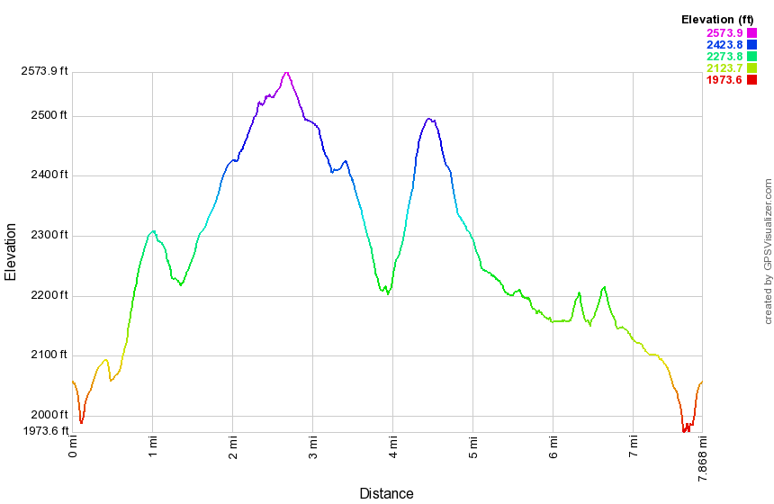 (The image at the left shows the profile of the hike. Remember that all vertical profiles are relative!)
Mongaup Pond: Three Ponds (Frick, Hodge, Mongaup)
| Quick Look | ||||
|---|---|---|---|---|
| Difficulty | Round trip | Total climb | Internet Maps | |
| 9.4 mi. | 1265 ft. | AllTrails | ||
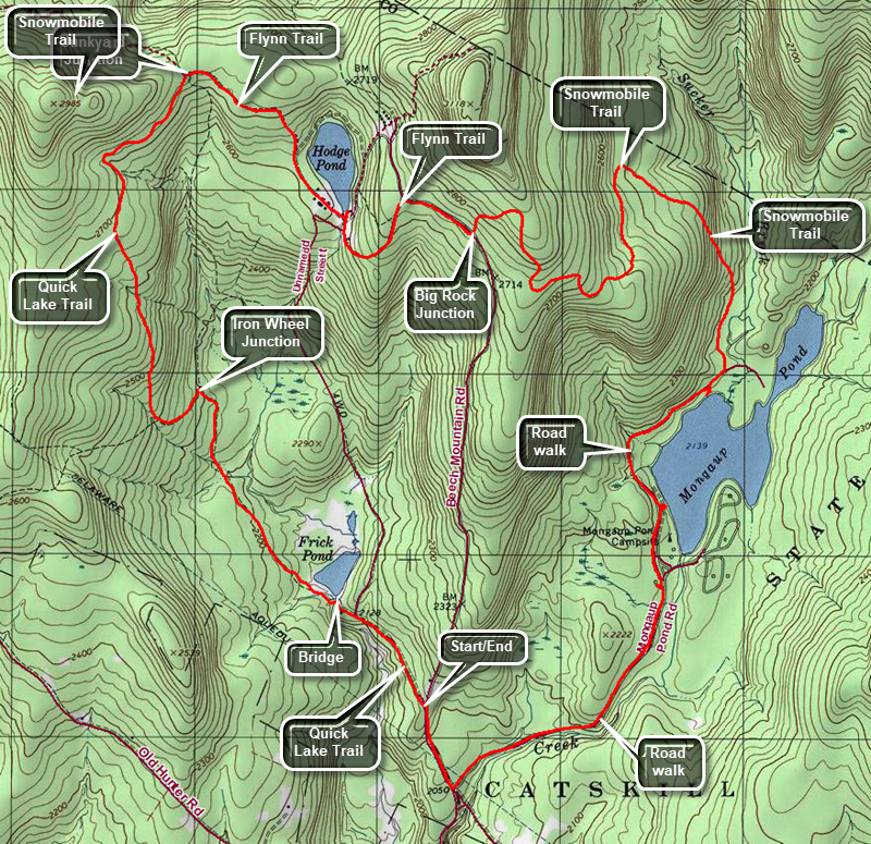 From Livingston Manor head out the DeBruce Road for about 6 miles. Turn left on the Mongaup Road and drive to the intersection with Beech Mountain Road. Stay left toward Frick Pond and park in one of the lots. To start the hike, leave the back of the small lot on a woods road which meets the Quick Lake Trail at the trail register or leave the back of the large lot on the red-blazed Quick Lake Trail. Follow the Quick Lake Trail to Gravestone Junction. Stay left on the Quick Lake Trail and walk down the hill to the bridge across the outlet stream of Frick Pond. This is a nice viewpoint to Beech Mountain on the right which is the highest point in Sullivan County. Continue across the bridge to the junction with the Big Rock Trail. Stay left on the Quick Lake Trail walking through a spruce "tunnel" and crossing a small stream. After 1.5 miles, the Quick Lake Trail turns left at Ironwheel Junction. Continue to follow the trail as it heads north and uphill turning northeast at 2.6 miles and reaching Junkyard Junction at 3.1 miles. The Quick Lake Trail goes to the left at this junction. Turn right on the blue-blazed Flynn Trail which is fairly flat and can be very wet at times. Follow the trail south southeast to a point near the shore of Hodge Pond at 3.6 miles. Follow the Flynn Trail as it turns more south along the western shore of the pond. The first field that you reach was the site of the dining hall for the Beech Mountain Boy Scout Camp. Follow the trail as it passes beneath some trees and comes out into a field at the outlet end of Hodge Pond. Take a break by the pond if you like and then return to the point where the Flynn Trail enters the trees and starts up the hill. At the top of then hill, bear right to stay on the Flynn Trail. Pass through the gate to the intersection with the Big Rock Trail on the right. Turn left on the snowmobile trail and walk to the highest point on the hike. From here the rest of the hike is downhill or gently rolling. Mongaup Pond is south-southwest of the trail junction but the snowmobile trail meanders quite a bit and even heads north before finally joining the loop roads at the campgrounds. Bear to the right on the loop road and walk out to the main campground road. Yarn right on the main road. After a short distance, walk off the road on a path to the left which goes the a bench on the shore of the pond. When you are done, return to the road heading in the same direction you were going. In another .6 miles there is a viewing platform and boat ramp. Continue on the main road toward the park entrance and then out Mongaup Pond Road toward the intersection with Beech Mountain Road. The walk to the intersection is 1.1 miles. Turn right on Beech Mountain Road and walk .3 miles uphill to your car.
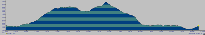
(The image above shows the profile of the hike. Remember that all vertical profiles are relative!)
Mongaup Flugertown Loop
| Quick Look | ||||
|---|---|---|---|---|
| Difficulty | Round trip | Total climb | Internet Maps | |
| 12.1 mi. | 2290 ft. | AllTrails | ||
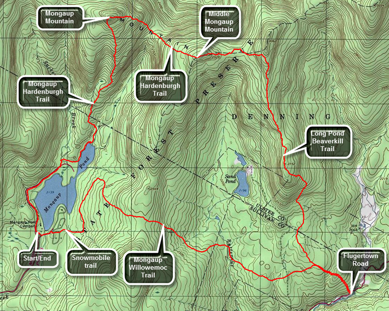 From Livingston Manor take DeBruce Road toward Round Pond. At about 6 miles turn left on Mongaup Road. Where the road splits bear to the left and drive to the entrance of Mongaup State Campgrounds. During the camping season you will have to pay the day use fee but outside of the seasons parking is free. Start hiking on the loop road on the east side of the pond. Turn right off the loop road at Area B and find the connector trail at Campsite 38. (Maps of the campsites are available at the park office.) At the end of the connector turn left or north on the main snowmobile trail. Continue walking north to about 1.1 miles to the junction with the yellow Mongaup Willowemoc Trail. Turn right and start to climb away from the pond. Over the next .7 miles you will gain about 270 feet to the highest point on the trail and then began descending. At 2.75 miles the trail will have descended 390 feet and crosses Butternut Creek, the outlet to Sand Pond, on a bridge. The trail parallels the creek for a short distance and at 3.5 miles crosses the access road to Sand Pond which is a private inholding. The trail has been heading southeast and east but at this point the it turns slightly northeast to meet the Long Pond Beaverkill Ridge Trail at 3.8 miles. Continue straight ahead to walk down to Flugertown Road to complete the Mongaup Willowemoc Trail. If you do not "need" to hike this part of the trail, simply turn left on the Long Pond Beaverkill Ridge Trail. At Flugertown Road turn around and start back up to the trail junction.Flugertiwn Road is the lowest point on the hike and the hike back to the junction ascends 250 feet over half a mil. At 4.8 miles turn right on the Long Pond Beaverkill Ridge Trail and start to head almost due north for 2.5 miles climbing all for most of the trip. The trail is not widely traveled and may not be clearly marked or properly maintained is places. There are several places where very large trees have fallen across the trail and hikers have worked their way around them essentially rerouting the trail. At 7.3 miles the trail ascends to the Beaverkill Ridge at just under 3000 feet of elevation. Turn left on the blue Mongaup Hardenburgh Trail and continue west along the ridge.The trail ascends Middle Mongaup Mountain at 8 miles and with a few limited viewpoints along the way. The descent is steep and can be difficult when it is slippery. In .6 miles you will drop 370 feet to the Col with West Mongaup Mountain with a steep but short climb to the summit. In .5 miles the trail gains 420 feet and just after the summit it turns south and slightly west to head toward Mongaup Pond. Over the 1.5 miles from the summit the drop is 820 feet to the northern shore of Mongaup Pond. The last .2 miles pass along a stream and through some pine trees. Turn right and hike along a wide trail running along the western shore of the upper section of the pond. You will come out on a road that loops through some campsites. From here it is a short walk out to the "main" road. Turn right to continue south toward the parking area eventually turning left to get back to your car.
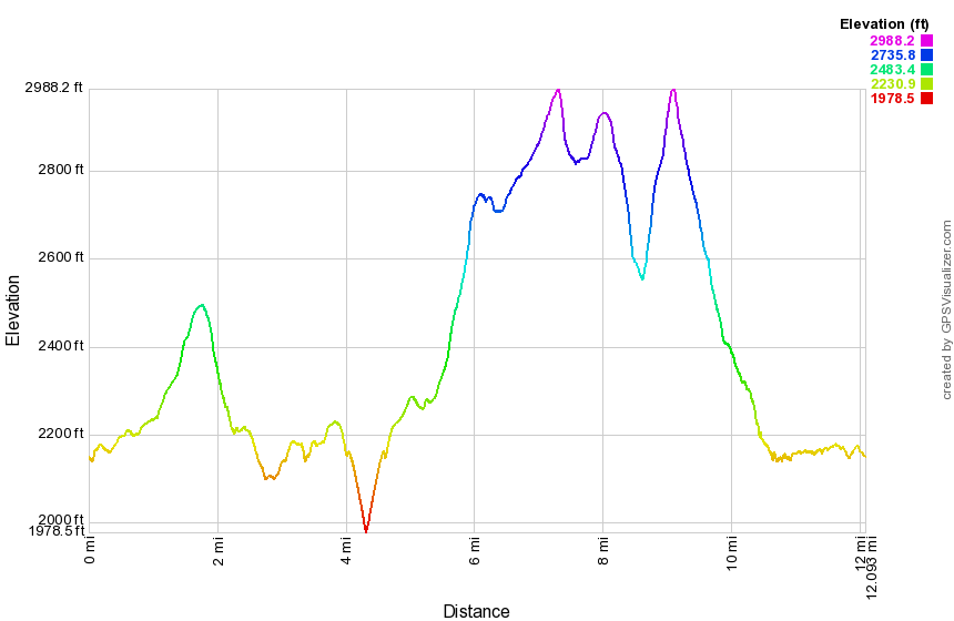 (The image at the left shows the profile of the hike. Remember that all vertical profiles are relative!)
Mongaup Wetlands
| Quick Look | ||||
|---|---|---|---|---|
| Difficulty | Round trip | Total climb | Internet Maps | |
| 8.2 mi. | 1111 ft. | AllTrails | ||
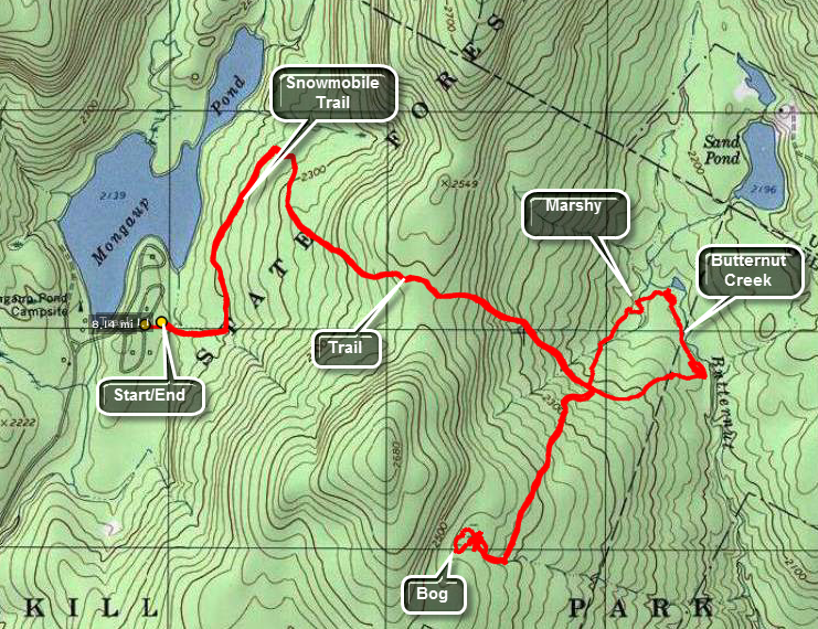 This hike takes in some of the wetlands east of Mongaup Pond. Some of these are being studied by Dr. Mike Kudish as a part of his ongoing project to understand the development of the Catskill forests. The first part of the hike is on snowmobile trail from Mongaup State Park and then on blazed hiking trails. Eventually you must strike out into the woods to get to the two wetlands areas. Your path during the bushwhack may vary significantly from this one.
The easiest way to do this particular hike is to ask the attendant at the gatehouse if you can park at campsite 34 on the east side of the campgrounds. From here find the snowmobile trail that leaves the campsite and walk east and then north. At about .8 miles watch for the yellow Mongaup Willowemoc Trail on the right. Turn on this trail and walk for about 1.3 miles to where a bridge crosses a small creek. There Rae several of these so watch your mileage. If you arrive at Butternut Junction, you have gone too far. Walk about .7 miles southwest and you should be in the area of a small marsh. Walk to the marsh. Walk around the marsh. Inspect the marsh. When done, return to the main trail. Turn left on the main trail and then almost immediately strike off the trail in a northeast direction. A walk of about .25 miles will put you on the "shores" of Butternut Creek which acts as the outlet to Sand Pond. Cross the wetlands and walk downstream along the creek for about .5 miles where you should find the Mongaup Willowemoc Trail again. Turn right and follow your route back to the car.
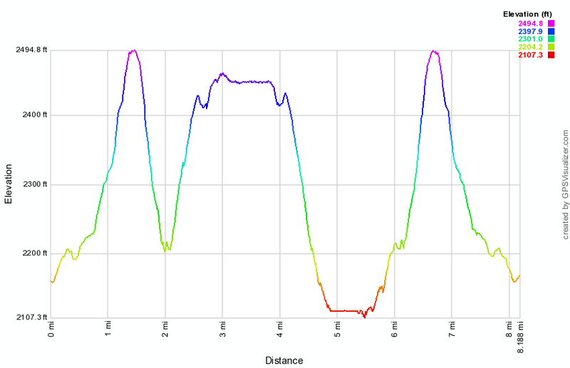 (The image at the left shows the profile of the hike. Remember that all vertical profiles are
relative!)
(The image at the left shows the profile of the hike. Remember that all vertical profiles are
relative!)
Mount Tobias
| Quick Look | ||||
|---|---|---|---|---|
| Difficulty | Round trip | Total climb | Internet Maps | |
| 2.3 mi. | 700 ft. | AllTrails | ||
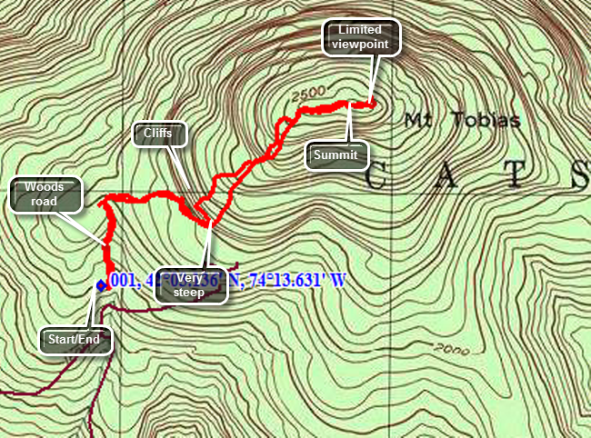 From the junction of Route 28A and 28 just south of Boiceville drive north 1.1 miles and turn right on Winnie Rd. Drive to the end of road and turn right on the Mount Tremper-Wittenberg Road. Drive .2 miles and turn left on Abbey Road which ascends Mount Tobias. Drive about 2.5 miles and watch for a rutted and eroded access road on your left. There is no sign on the road but there is a parking area big enough for a few cars if you can negotiate the "driveway". Park and start your hike on the woods road that leaves the parking area to the north. After only about .25 miles you will notice that the road continues to the north but that Mount Tobias is to the ENE. Turn in that direction and walk a short distance to find some interesting cliffs. Walk to the right at the base of the cliffs until you can find a good place to start up the steep hill. The steep Apr continues for about .5 miles until you reach a flatter part near the summit. The highest point is marked by a cairn and is about a .2 mile walk along relatively flat ground. Clear views are difficult to come by but there are views through the trees at several points on the summit. Return the way you came.
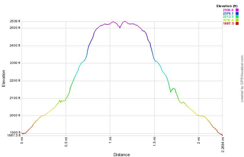 (The image at the left shows the profile of the hike. Remember that all vertical profiles are
relative!)
(The image at the left shows the profile of the hike. Remember that all vertical profiles are
relative!)
Mud Pond (Complete Loop)
| Quick Look | ||||
|---|---|---|---|---|
| Difficulty | Round trip | Total climb | Internet Maps | |
| 6.0 mi. | 1130 ft. | AllTrails | ||
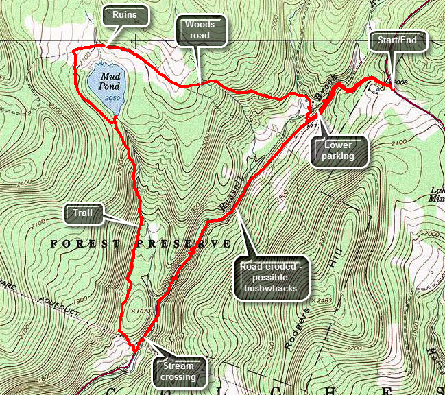 This is one of our favorite trails when we just want to hike. It has several variations for distance and
difficulty. Like most trails, hiking one way is different than hiking in the other direction. We have
take this route more than a dozen times this season and it is interesting to watch the changing
seasons. It is unfortunate that Russell Brook Road is closed due to the frequent floods that have
washed out the road.
This is one of our favorite trails when we just want to hike. It has several variations for distance and
difficulty. Like most trails, hiking one way is different than hiking in the other direction. We have
take this route more than a dozen times this season and it is interesting to watch the changing
seasons. It is unfortunate that Russell Brook Road is closed due to the frequent floods that have
washed out the road.
Turn left on Morton Hill Road on Route 206 just after the Rockland Flats. Bear right up Morton Hill
Road until you see a parking area on the left near the sign indicates Russell Brook Road is closed.
Park here on the side of the road and hike down Russell Brook Road .5 miles to the actual trail head.
Walk down Russell Brook Road .6 miles to lower trailhead parking area. Along the way take a peek at Russell Brook Falls on your right. Continue straight ahead on the road which has been devastated by several floods and is closed just passed the main parking area. When you reach the large boulders that act as a roadblock continue hiking to the first of several deep cuts across the road caused by the erosion of water running off the ridge on the left. Walk through the first and then another larger cut. At about 1.5 miles the road had been completely eroded by the stream. Climb the bank, walk around the eroded area and then slide back down to the road. Continue to hike along the road which is very overgrown with weeds and brush and has a few major blowdowns. At 2.0 miles cross the stream on the stepping stones when the water level is so low. When the water is higher you may have to 1look upstream or downstream for a better crossing or take your shoes off and wade across. In another .2 miles cross under the power lines and turn right on the trail. The trail begins with a short but somewhat steep ascent but then levels off some as it passes by a beaver pond. The trail is not used too much and may need maintenance including additional trail markers which can be very scarce in some areas. Pass by a beaver pond on the left as the trail remains level for some time following the base of a ridge. At about 2.9 miles the trail begins to climb and ascends for .5 miles and gains 375 feet. The trail is parallel to the stream that flows out of Mud Pond. As you near the top of the hill you can see Mud Pond through the trees. Find a path to the pond or just head off through the woods to the clearing near the outlet. This is a nice place to stop for a drink and a snack. Get back on the trail and at 4.0 miles follow the hiking trail as it turns right. A snowmobile trail goes off to the left here. Continue on the trail which follows an old woods road. Watch for some stone foundations on the right from farms that were on this area in the early 20th century. Pass the left turn to the trail around Trout Pond at 4.4 miles. Walk up the short hill and then start down the other side. By the time you reach the trail register box you will have lost the 375 feet of elevation you gained walking up the hill to Mud Pond. Just passed the register box is an impressive area of Japanese knotweed which gets larger every year. Russell Brook Falls is to your left along a short path. The falls are well worth the trip especially if the water is high. It is a short walk out to the parking area and the final part of the hike is to walk back up Russell Brook Road to the car.
 (The image at the left shows the profile of the hike.)
Mud and Trout Ponds (Campbell Brook snowmobile)
| Quick Look | ||||
|---|---|---|---|---|
| Difficulty | Round trip | Total climb | Internet Maps | |
| 8.3 mi. | 1585 ft. | AllTrails | ||
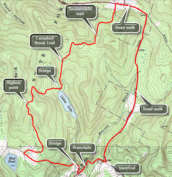
In Roscoe head north on Route 206 to Morton Hill Road just passed the Roscoe Nursing Home. Turn left on Morton Hill Road and drive to the intersection with Russell Brook Road. Park on the left side of the road to avoid trespassing on private property. Start the hike by walking down Russell Brook Road. The walk down Russell Brook Road to the lower parking area is very enjoyable. You will pass the upper falls on your right and should be able to gauge whether a trip to the falls will be worthwhile. Once you are in the lower lot, turn right onto the trail that goes down to the bridge across Russell Brook. Walk to the trail junction and bear to the left to pass by the large campsite on the right as you head up the hill. The hill is about .8 miles and gains around 400 feet which is enough to work up a sweat. At the next trail junction, turn right to head to Trout Pond. Over the next 1.2 miles the trail gains another 400 feet rising to almost 2500 feet in elevation to the shoulder of Cherry Ridge. From that point head downhill for the next .8 miles losing 460 feet in the process until you are at the bridge across the inlet stream to Trout Pond. Continue over the bridge and passed the lower lean-to on the left. Turn left on the Campbell Brook Trail. Over the next .8 miles of trail you will gain back 430 feet of elevation and will be nearing the junction of the hiking and snowmobile trails. Turn right on the snowmobile trail as it begins to climb a little more than the hiking trail. The trail begins to follow the edge of the hill so for the first .3 miles it heads almost due east. At 4.6 miles the trail turns north. Walk another .3 miles continuing along the edge of the ridge. At 4.9 miles begin to descend heading east and then due north to intersect Campbell Brook Road near the junction with Morton Hill Road. Turn right on Campbell Brook Road and walk about .1 miles to Morton Hill Road. Continued straight ahead to follow the road back to the car.
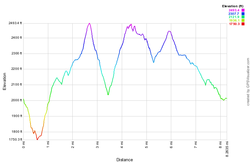
(The image at the left shows the profile of the hike. Remember that all vertical profiles are relative!)
Mud Pond (out and back) and Trout Pond (loop)
| Quick Look | ||||
|---|---|---|---|---|
| Difficulty | Round trip | Total climb | Internet Maps | |
| 8.8 mi. | 1630 ft. | AllTrails | ||
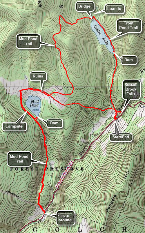
In Roscoe head north on Route 206 to Morton Hill Road just passed the Roscoe Nursing Home. Turn left on Morton Hill Road and drive to the intersection with Russell Brook Road. Turn left and drive down the road to the parking area at the end of the passable road. Leave the parking area on the trail that goes down to the bridge across Russell Brook. Walk to the trail junction and bear to the left to pass by the large campsite on the right as you head up the hill. The hill is about .8 miles and gains around 400 feet which is enough to work up a sweat. At the next trail junction, continue straight ahead on the Mud Pond Trail. As you walk on the trail, watch for the ruins of some farm buildings on the left. The next section of trail is usually wet and can be very muddy. At 1.4 miles the trail turns 90 degrees to the left to head south along the west shore of Mud Pond. There are several campsites on the left side of the trail and at 1.85 miles there is a spur trail to the left which goes to a designated campsite at the outlet dam for Mud Pond. Continue straight ahead down the hill watching for some cascades in the outlet stream in the left. The trail will level and pass by a beaver pond on the right. Shortly after the pond, the trail again descends. This time the trail ends on what was once Russell Brook Road. Turn around and walk back up the hill you just descended! This time turn right at the top of the hill and walk out to Mud Pond. After a brief rest, turn around and walk back out to the main trail. Turn right, slog through the mud to the trail junction at 5.25 miles. Turn left to stay on the Mud Pond Trail. The trail ascends 1.1 miles gaining 400 feet at a moderate 6% grade. The trail begins to descend and at 6.6 miles it turns right to head east toward Trout Pond. At the pond cross the bridge over the inlet stream and turn right on the Trout Pond Trail to walk south along the east side of Trout Pond. You may want to stop of the "beach" at the outlet end. Continue on the main trail to the trail register and junction. Turn left on the next path that leads to Russell Brook Falls. Walk out toward the falls and down the bank to get to the stream bed. This gives you the best view of the falls. When you are done, turn around and walk back out to the main trail. Turn left, cross the bridge and walk back up to the parking area.
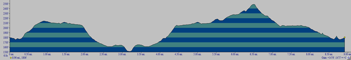
(The image at the left shows the profile of the hike. Remember that all vertical profiles are relative!)
Neversink Unique Area: Cold Spring Road
| Quick Look | ||||
|---|---|---|---|---|
| Difficulty | Round trip | Total climb | Internet Maps | |
| 5.7 mi. | 822 ft. | AllTrails | ||
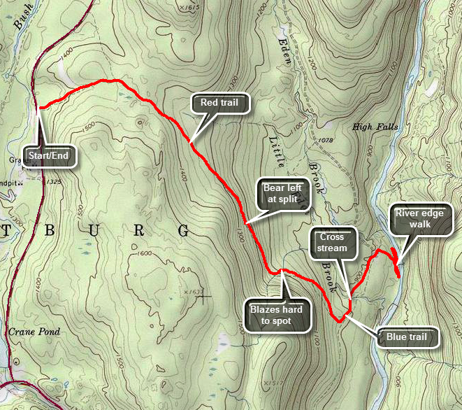
From Broadway in Monticello, NY turn onto St. John Street. Drive 7.45 miles from Broadway to the parking area on the left with a typical yellow on brown sign. The sign indicates that this parking area would allow access to the Neversink Unique Area. The trail leaves the parking area and is well worn but you may not see any blazes. Within a few hundred feet there is a trail register and red blazes begin to appear. Walk slightly uphill for .4 miles to the point where another trail comes in from the left. This trail is almost completely overgrown and has not been used for some time. Continue to walk along the wide marked trail until at .55 miles the trail begins to descend which continues for some time. At 1.1 miles the trail may be wet and muddy for about a quarter of a mile. There may be several blowdowns along the way. Continue downhill and bear left and downhill when the trail splits at 1.4 miles. The trail begins to get very rocky but is still easy to follow. At 1.7 miles you will come to an open area and the blazes seem to disappear! Look to the left as the trail bends downhill at this point. Looking back at the trees behind you may help as blazes may be on the other side of the trees. The trail continues to head south following a woods road until at 2.1 miles it ends at a jeep road with blue markers. Turn left and watch out for wet and muddy areas. The trail continues downhill until at 2.3 miles you will come to Little Eden Brook. Cross the brook using stepping stones or a log. The trail levels off a little and at 2.6 miles a marker on a stake indicates a turn to the right toward the river. A wide jeep road continues straight ahead and also turns up the hill to the left. Turn right and walk along the road downhill and toward the river. The trail begins to parallel the river and there is a good place to walk down to the river's edge at 2.75 miles. There are several other places where you may walk down to the river. Head back up to the trail and walk back the way you came. Watch for a sign on a tree a little off the trail toward the river. The sign says "Unsafe Bridge" and "Scheduled for Demolition". The floods damaged the bridge and it was removed. Work your way down a trail to the river's edge once again. Work your way upstream along the shore to a place where you can see that the river splits upstream and the land along the river becomes too narrow to walk. Return along the river's edge to the path up to the trail.Walked back up to the point where you turned down to the river. Turn left and walk back to the red trail crossing Little Eden Brook again. Turn right on the red trail and begin a long uphill trek back to the parking area. At 3.9 miles you will be in the area where the trail markers were difficult to follow on the way out. Continue following the trail and the markers which are much clearer on the way back than the way out. Continue to hike uphill on the trail passing through the wet and muddy area. Pass the "other" trail at 5.3 miles and continue back to the parking area and your car.
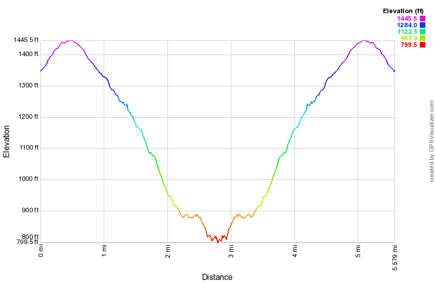
(The image above shows the profile of the hike. Remember that all vertical profiles are relative!)
Neversink Unique Area: Denton and Mullet Falls (counterclockwise)
| Quick Look | ||||
|---|---|---|---|---|
| Difficulty | Round trip | Total climb | Internet Maps | |
| 4.6 mi. | 930 ft. | AllTrails | ||
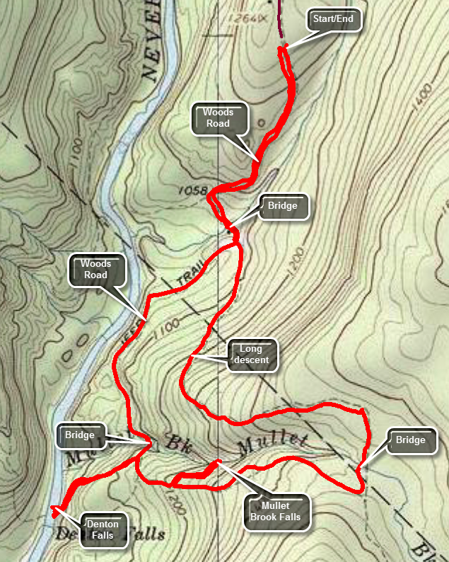
Take the Rock Hill exit 109 off State Route 17 and turn right. Drive south on Katrina Falls Road. Park in the small parking area at the end of the road. Walk through the gate and onto the woods road which is the blue trail that parallels the Neversink River. A spur trail to the river goes right at .5 miles but stay to the left crossing a bridge over Wolf Creek. At the top of the hill turn right to start the loop in a counterclockwise direction. The trail rolls some and the begins a gentle climb passing another spur trail to the river at 1.2 miles. At 1.35 miles cross a bridge over Mullet Brook and walk uphill to the spur trail down to Denton Falls at 1.4 miles. Walk down the spur trail to the river being careful to follow the sparse and widely spaced yellow blazes. At 1.7 miles you can descend to some rock on the edge of the river. Be careful since the water can be swift and the rocks slippery! When you are ready walk back up the spur trail to the main trail. Turn right on the main trail and bear left at the next junction to stay on the main trail. The trail to the right at this junction leads over 2 miles downstream to High falls. The trail now starts an ascent to the highest point on the hike. At 2.1 miles a spur trail to Mullet Brook Falls leads to the left. Turn here and walk .15 miles to the falls. After exploring the falls, walk back up the spur trail and turn left to ascend to the upper bridge over Mullet Brook. The trail has been heading east for some time but at 2.9 miles turns left and heads north crossing the brook at 3 miles. At 3.2 miles you will have pass through the highest point on the hike and will be at a trail junction. Bearing right here leads out to the Wolf Lake Multiple Use Area. Bear left heading west and start down the hill back to the trail junction above the Wolf Lake Creek bridge. From the top of the hill to the junction the trail drops over 400 feet in .85 miles turning north at around 3.6 miles. At 4 miles you will be back at the trail junction with the main trail. Bear to the right and walk back over the bridge and up the hill to the parking area.
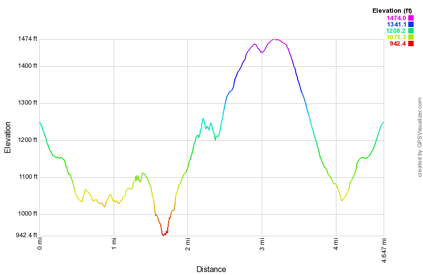
(The image above shows the profile of the hike. Remember that all vertical profiles are relative!)
Neversink Unique Area: Mullet and Denton Falls (clockwise)
| Quick Look | ||||
|---|---|---|---|---|
| Difficulty | Round trip | Total climb | Internet Maps | |
| 4.6 mi. | 900 ft. | AllTrails | ||
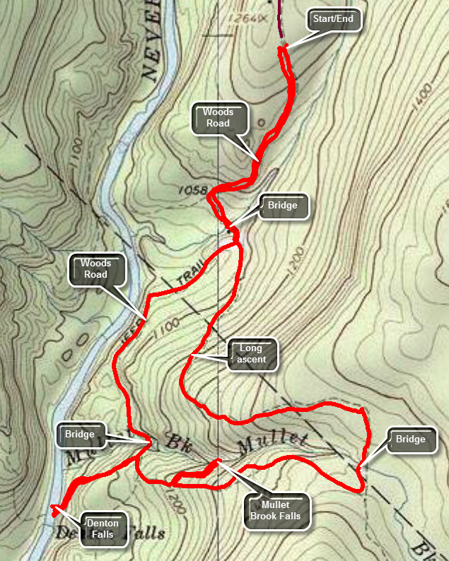
Take the Rock Hill exit 109 off State Route 17 and turn right. Drive south on Katrina Falls Road. Park in the small parking area at the end of the road. Walk through the gate and onto the woods road which is the blue trail that parallels the Neversink River. A spur trail to the river goes right at .6 miles but stay to the left crossing a bridge over Wolf Creek. Turn left to start the loop in a clock wise direction. The trail starts out flat but soon begins to climb. Over the next .9 miles gain almost 400 feet over a gentle but persistent ascent, At 1.6 miles there is another trail junction. The trail to the left leads out to the Wolf Lake Multiple Use Area. Turn right to continue on the main trail which from this point on is mostly flat or downhill. After making the turn, the trail heads south and soon crosses Mullet Brook on the upper bridge. As the trail descends the hill toward the Neversink Gorge, watch for the short spur trail to the right which goes down to Mullet Brook Falls at 2.25 miles. Turn right and walk down to the falls. If you decide to walk out onto the rocks below the falls, be careful of your footing as the mist from the falls can make the rocks slippery at any time but especially during the colder months. Head back out to the main trail and turn right. At 2.6 miles there is a junction with the trail to the left that leads to High Falls. Turn right and almost immediately turn left on the spur trail down to Denton Falls on the Neversink. The trail is about .3 miles and loses 180 feet. If you chose to walk out onto the rocks near the falls, be careful since the are often wet and slippery and can be icy during the winter. Start back up the hill to the main trail turning left at the top to head for the lower bridge on Mullet Brook. This bridge may be in disrepair so be VERY careful crossing it. It is not clear if the DEC intends to repair the bridge, construct a new one or remove it entirely! Continue your hike on the main trail as it stays level for a long time and even descends a little as you pass the trail junction where you started the loop earlier. At 4 miles cross the bridge over Wolf Brook and continue on the main trail as it ascends UP the hill to the parking area.
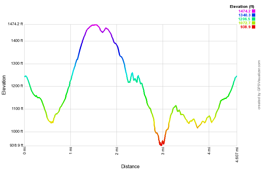
(The image above shows the profile of the hike. Remember that all vertical profiles are relative!)
Neversink Unique Area: Denton and Mullet Falls (Wolf Lake)
| Quick Look | ||||
|---|---|---|---|---|
| Difficulty | Round trip | Total climb | Internet Maps | |
| 5.8 mi. | 1060 ft. | AllTrails | ||
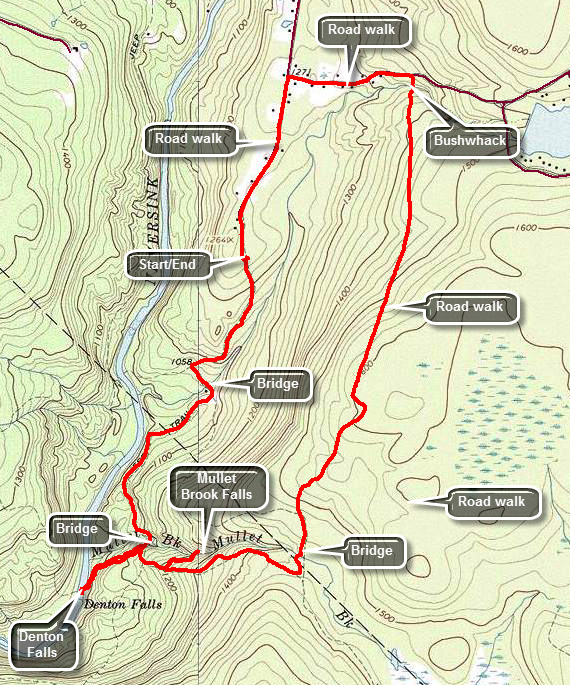
Take the Rock Hill exit off State Route 17 and turn right. Drive south on Katrina Falls Road. Park in the small parking area at the end of the road. Walk through the gate and onto the woods road which is the blue trail that parallels the Neversink River. A spur trail to the river goes right at .6 miles but stay to the left crossing a bridge over Wolf Creek. Another trail goes to the left at .7 miles but stay on the blue trail which will bring you to another bridge at just under 1.4 miles. This bridge crosses Mullet Brook downstream of the falls. At about 1.4 miles another yellow spur trail heads right down to the river. This trail is .3 miles but steep in places and leads down to Denton Falls. After taking in the view at the falls, get back on the main trail and turn right. Within a few feet, is the next trail junction. The right fork goes to High Falls which is over 2 miles away and adds over 4 miles to the hike. The left fork would allow us to complete the loop without the added distance. After a brief discussion, we both decided to skip High Falls as it is not much different than Denton Falls. Head left to start to loop back to the parking area. After a short uphill of less than .1 miles, turn left onto the yellow spur trail that leads to Mullet Brook Falls. Descend to the falls over the .15 mile trail. Walk back to the main trail and turn left to continue the loop. Walk uphill for the next .5 miles to where the trail levels some and then makes a sharp left turn. There are several others paths in the area so be careful to follow the trail markers. At just less than 3 miles, cross Mullet Brook again on a bridge further upstream than the falls. At 3.1 miles the main trail turns to the left. Continue straight ahead on the yellow spur trail. After .5 miles, arrive at a parking area near Wolf Lake. The road from the parking lot is absolutely straight heading north toward Wolf Lake Road. As you walk along the road a powerline appears from the east and turns north along the road. The road turns right to head to Wolf Lake. Continue on the right-of-way on a short bushwhack to the road. Cross a brook just before the road and then turn left and walk the .5 miles out to Katrina Falls road. Turn left and walk the final .7 miles to the car.

(The image above shows the profile of the hike. Remember that all vertical profiles are relative!)
Neversink Unique Area: Mullet and Denton Falls (from Wolf Lake parking)
| Quick Look | ||||
|---|---|---|---|---|
| Difficulty | Round trip | Total climb | Internet Maps | |
| 4.3 mi. | 886 ft. | AllTrails | ||
Take the Rock Hill exit off State Route 17 and turn right. Drive south on Katrina Falls Road to just before the Dead End sign. Turn left on Wolf Lake Road and after a short distance turn right on the gravel access road. Parking at the lower parking area is probably safest but there is a long, boring hike up the gravel road to the actual trail. Drive up the gravel road but be prepared for some washouts along the way. Park in the small parking area at the end of the road. Find the yellow blazed trail at the end of the road. The hike in on the side trail is only .6 miles and it is downhill. This means the return trip to the car will be uphill at the end of the hike! After about .6 miles you will arrive at the junction with the red trail. Turn left and walk along the trail until at .7 miles you cross the upper bridge over Mullet Brook. Follow the trail as it makes a sharp right turn and heads downhill. At 1.25 miles the yellow blazed spur trail to Mullet Brook Falls turns right. The spur trail is less than .2 miles and you will soon be at the base of the falls. The falls are always nice but are a more impressive site after a rain storm has swollen the creek. Be careful if you choose to walk out on the rocks to the base of the falls! The rocks can be very slippery from the spray from the falls. Head back out to the main trail and turn right to walk downhill to the junction where the red trail meets the blue trail at 1.6 miles. The blue trail stretches from the Katrina Falls parking area all the way south to High Falls where it ends. Future plans may included blazing this trail farther south along existing woods roads to reach the southern part of the Neversink Unique Area. Turn right on the blue trail and then almost immediately turned left on the yellow spur trail to Denton Falls. Continue down the yellow trail to the river . The trail is about .3 miles long but over that length it loses 175 feet to the lowest point on the hike at the Neversink River. At the river, you may walk out onto the rocks to get various views. When the water is lower it is possible to work your way along the rocks so that you can stand facing the falls. Be careful as the wet and mossy rocks can be very slippery. After taking in the views, walk up the bank and head up the yellow trail back to the blue trail. Turn left to continue around the loop. Take care when you cross the lower bridge over Mullet Brook as it can be slippery. Continue to hike the blue trail until at 2.9 miles you come to the trail junction where the blue trail bends to the left and the red trail begins. Turn right on the red trail and head back to your car. Be prepared for an uphill trip! The trail heads south and then at about 3.4 miles turns to the east. At 3.8 miles you will be back at the trail junction with the yellow trail to the Wolf Lake parking area. You will have gained over 400 feet in .9 miles. The climb is never steep but it is continuous. Turn left on the yellow trail and continue to climb back toward the parking area gaining another 140 feet over the half mile back to the car.
(The image above shows the profile of the hike. Remember that all vertical profiles are relative!)
Neversink Unique Area: High Falls
| Quick Look | ||||
|---|---|---|---|---|
| Difficulty | Round trip | Total climb | Internet Maps | |
| 7.8 mi. | 1608 ft. | AllTrails | ||
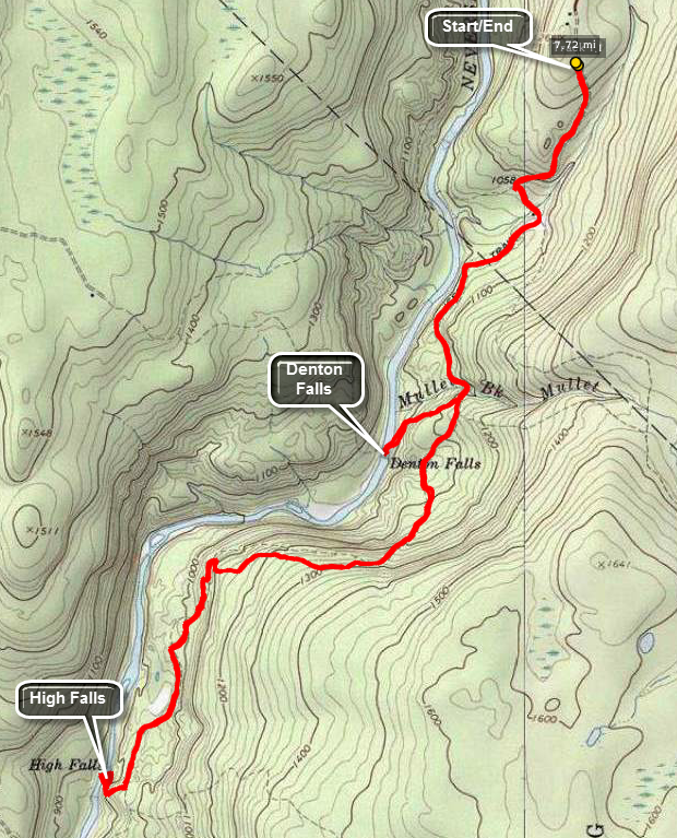
Take the Rock Hill exit off State Route 17 and turn right. Drive south on Katrina Falls Road. Park in the small parking area at the end of the road. Walk through the gate and onto the woods road which is the blue trail that parallels the Neversink River. A spur trail to the river goes right at .6 miles and another trail goes to the left at .7 miles. Stay on the blue trail for about 1.4 miles until another yellow spur trail heads right down to the river. This trail is .3 miles but steep in places and leads down to Denton Falls. After taking in the view at the falls, get back on the main trail. From this point on the trail is more of a trail as the woods road heads left but you will stay right following the blue blazes. At 2.7 miles the trail climbs to the highest point on the hike and then descends to 4.0 miles where a short yellow spur trail leads down to High Falls. When you have completed your exploration of the falls retrace your route back to the car.
(The image above shows the profile of the hike. Remember that all vertical profiles are relative!)
Neversink Unique Area: Loop
| Quick Look | ||||
|---|---|---|---|---|
| Difficulty | Round trip | Total climb | Internet Maps | |
| 10.2 mi. | 1945 ft. | AllTrails | ||
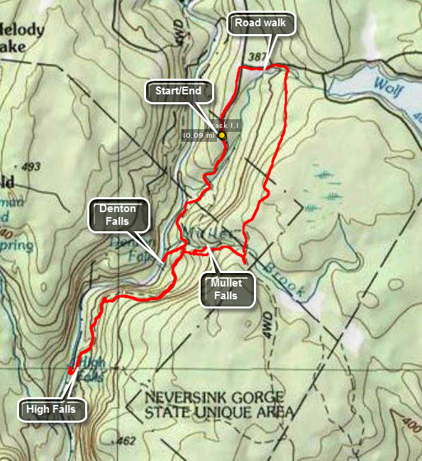
Take the Rock Hill exit off State Route 17. Drive south on Katrina Falls road. Park in the small parking area at the end of the road. Walk through the gate and onto the woods road which is the blue trail that parallels the Neversink River. A spur trail to the river goes right at .6 miles and another trail goes to the left at .7 miles. Stay on the blue trail for about 1.4 miles until another yellow spur trail heads right down to the river. This trail is .3 miles but steep in places and leads down to Denton Falls. After taking in the view at the falls, get back on the main trail. From this point on the trail is more of a trail as the woods road heads left but you will stay right following the blue blazes. At 2.7 miles the trail climbs to the highest point on the hike and then descends to 4.0 miles where a short yellow spur trail leads down to High Falls. When you have completed your exploration of the falls retrace your route back to the trail junction near Denton Falls. Turn right on the red trail to begin a loop. After only a few hundred feet take the yellow spur trail to the left that goes down to Mullet Brook Falls. The trail is less than .2 miles but the falls, when there has been some rain, is very pretty. Walk back to the red trail and turn left to continue the loop. The trail gains some elevation until at 7 miles it intersects a woods road. Be sure to turn left here or you will be headed south into uncharted territory. In about .3 miles the red trail turns left. Continue straight ahead on the woods road to a parking area at about 8 miles. Walk down the dirt road until the road turns right towards Wolf Lake. Walk straight ahead on the power line right-of-way and cross a little stream to get to Wolf Lake Road. Turn left on the road and walk to Katrina Falls Road. Turn left on Katrina Falls Road to get back to the parking area. The whole road walk is about a mile.
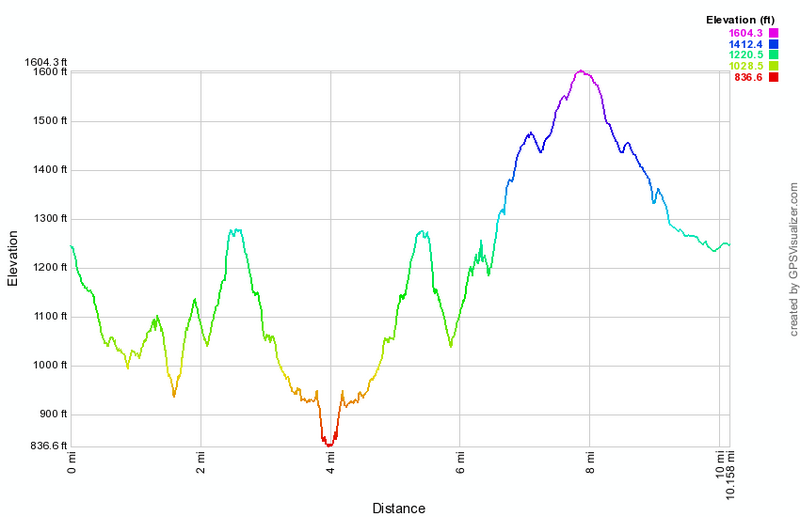 (The image at the left shows the profile of the hike. Remember that all vertical profiles are relative!)
Neversink Unique Area: Middle
| Quick Look | ||||
|---|---|---|---|---|
| Difficulty | Round trip | Total climb | Internet Maps | |
| 10.3 mi. | 1885 ft. | AllTrails | ||
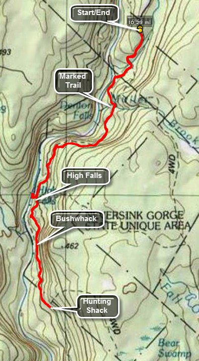
Take the Rock Hill exit off State Route 17. Drive south on Katrina Falls road. Park in the small parking area at the end of the road. Walk through the gate and onto the woods road which is the blue trail that parallels the Neversink River. A spur trail to the river goes right at .6 miles and another trail goes to the left at .7 miles. Stay on the blue trail for about 3.4 miles until a yellow spur trail heads right down to High Falls. When you have completed your exploration of the falls return to the main trail. The blue blazed trail ends here and any further exploration to the south will be a bushwhack. In some places there seem to be roads or trails but this can be confusing since many lead nowhere. Careful exploration will allow you to find a woods road that leads to the "southern" part of the Neversink Unique Area. Once you find the woods road, the hike is about 1.75 miles to an old hunting camp. There are several woods roads that cross the one you are hiking but stay generally straight. of course, if you stray, you can simply turn around and hike back the way you came. There is a dirt road at the hunting shack and this is as good a place as any to stop. If you have more time or want to do a car spot, you could do part or all of the southern loop. When done, return the same way you came.
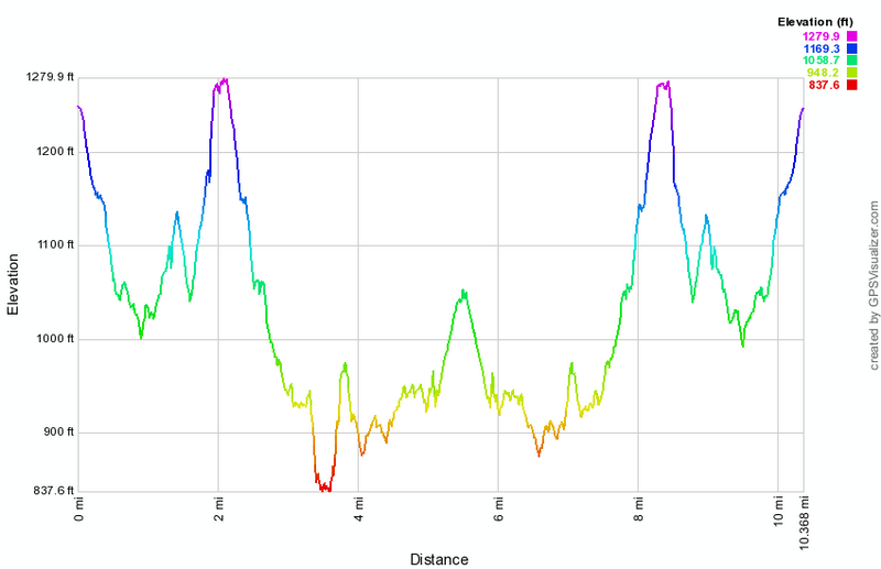
(The image above shows the profile of the hike. Remember that all vertical profiles are relative!)
Neversink Unique Area: Mullet Falls Loop
| Quick Look | ||||
|---|---|---|---|---|
| Difficulty | Round trip | Total climb | Internet Maps | |
| 4.1 mi. | 850 ft. | AllTrails | ||
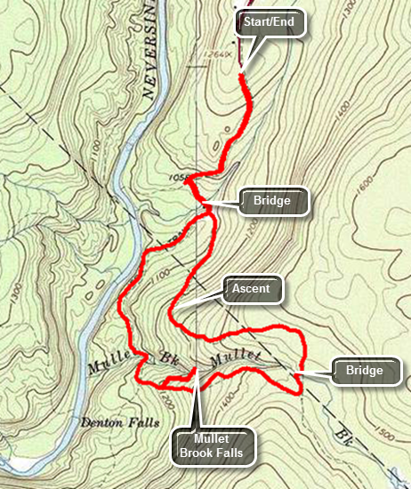
Take the Rock Hill exit off State Route 17. Drive south on Katrina Falls road. Park in the small parking area at the end of the road. Walk through the gate and onto the woods road which is the blue trail that parallels the Neversink River. A spur trail to the river goes right at about .5 miles. After crossing Wolf Brook on a small wooden bridge the trail splits. Stay left and walk through some evergreens mixed with hardwoods. Over the next .75 miles the trail ascends to the top of a ridge and then levels out at 1.4 miles. The trail rolls a little and makes a sweeping right turn to the south at 1.5 miles. At 1.7 miles you will cross Mullet Falls Brook well above the falls on a wooden bridge. At 1.75 miles be sure to follow the main trail as it turns right and heads west. The trail descends now and at 2.3 miles a spur trail heads off to the right. Turn right on this trail and walk less than a quarter mile to the falls. When you are in front of the falls, you are facing east so the best time to be there to take pictures is in the early morning before the sun rises over the ridge or in the afternoon when the sun is behind you. The water falls about 20 feet in a nice pool below. When you are ready turn around and walk back to the main trail. Turn right and stay on the main trail as it turns right at 2.75 miles. At 3.5 miles you will be back at the intersection where you bore to the left to start the loop. Walk the final .6 miles uphill back to the car.
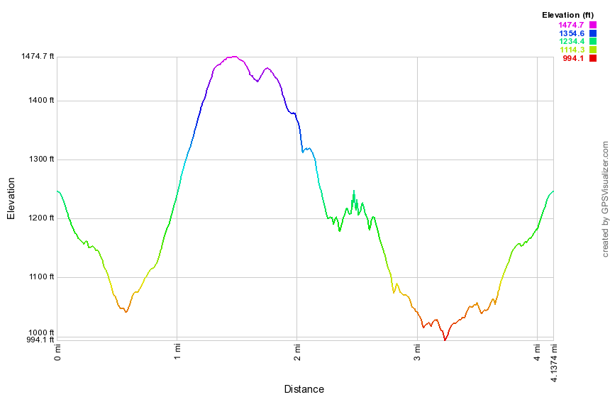 (The image at the left shows the profile of the hike. Remember that all vertical profiles are relative!)
Neversink Unique Area: Mullet and High Falls Loop
| Quick Look | ||||
|---|---|---|---|---|
| Difficulty | Round trip | Total climb | Internet Maps | |
| 8.1 mi. | 1766 ft. | AllTrails | ||
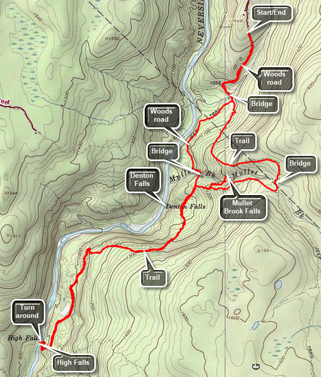
Take the Rock Hill exit off State Route 17. Drive south on Katrina Falls road. Park in the small parking area at the end of the road. Walk through the gate and onto the woods road which is the blue trail that parallels the Neversink River. A spur trail to the river goes right at about .5 miles. After crossing Wolf Brook on a small wooden bridge the trail splits. Stay left and walk through some evergreens mixed with hardwoods. Over the next .75 miles the trail ascends to the top of a ridge and then levels out at 1.4 miles. The trail rolls a little and makes a sweeping right turn to the south at 1.5 miles. At 1.7 miles you will cross Mullet Falls Brook well above the falls on a wooden bridge. At 1.75 miles be sure to follow the main trail as it turns right and heads west. The trail descends now and at 2.3 miles a spur trail heads off to the right. Turn right on this trail and walk less than a quarter mile to the falls. When you are in front of the falls, you are facing east so the best time to be there to take pictures is in the early morning before the sun rises over the ridge or in the afternoon when the sun is behind you. The water falls about 20 feet in a nice pool below. When you are ready turn around and walk back to the main trail. Turn right and stay on the main trail until it splits at 2.7 miles. Turn left on the red trail that parallels the river to High Falls. This trail is more trail than road and may have brush encroaching on the trail and occasional blowdowns. The trail rolls some but at 3.3 miles it descends 2.4 miles to the Neversink River. Depending on the water level you may be able to walk out onto the rock shelf that faces the falls for the best view. When you are ready, retrace your route back to the trail junction. Continue straight ahead to get back to the parking area. There is a yellow spur trail to Denton Falls on the left just after the trail junction. You will cross a bridge over Mullet Brook and walk another .7 miles back to the intersection where you bore to the left to start the loop. Walk the final .6 miles uphill back to the car.
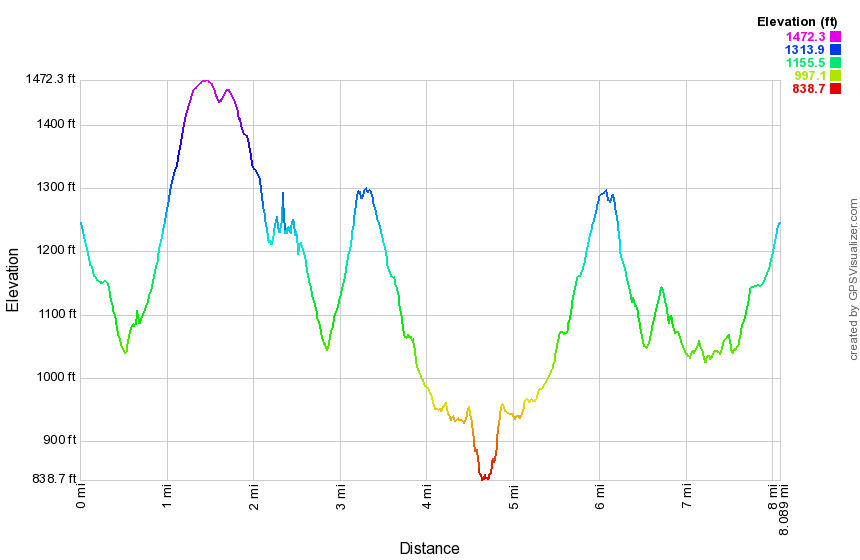 (The image at the left shows the profile of the hike. Remember that all vertical profiles are relative!)
Neversink Unique Area: Neversink River out and back)
| Quick Look | ||||
|---|---|---|---|---|
| Difficulty | Round trip | Total climb | Internet Maps | |
| 1.4 mi. | 292 ft. | AllTrails | ||
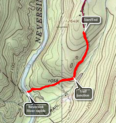
Take the Rock Hill exit off State Route 17. Drive south on Katrina Falls road. Park in the small parking area at the end of the road. Walk through the gate and onto the woods road which is the blue trail that parallels the Neversink River. Walk downhill to the first trail junction at .6 miles and turn right on the yellow blazed spur trail. This trail is about .25 miles and leads down to a nice rapids on the river. Take some time to enjoy the water but know that it is NOT safe to swim here. When you are done, turn around and retrace your steps back to the parking area.
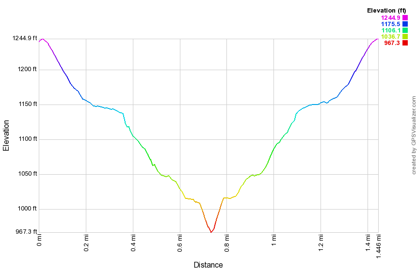
(The image above shows the profile of the hike. Remember that all vertical profiles are relative!)
Neversink Unique Area: North (clockwise)
| Quick Look | ||||
|---|---|---|---|---|
| Difficulty | Round trip | Total climb | Internet Maps | |
| 6.0 mi. | 1240 ft. | AllTrails | ||
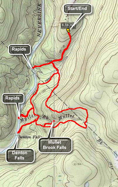
Take the Rock Hill exit 109 off State Route 17 and turn right. Drive south on Katrina Falls Road. Park in the small parking area at the end of the road. Walk through the gate and onto the woods road which is the blue trail that parallels the Neversink River. A spur trail to the river goes right at .6 miles but stay to the left crossing a bridge over Wolf Creek. Turn left to start the loop in a clockwise direction. The trail starts out flat but soon begins to climb. Over the next .9 miles gain almost 400 feet over a gentle but persistent ascent. At 1.6 miles there is another trail junction. The trail to the left leads out to the Wolf Lake Multiple Use Area. Turn right to continue on the main trail which from this point on is mostly flat or downhill. After making the turn, the trail heads south and soon crosses Mullet Brook on the upper bridge. As the trail descends the hill toward the Neversink Gorge, watch for the short spur trail to the right which goes down to Mullet Brook Falls at 2.25 miles. Turn right and walk down to the falls. If you decide to walk out onto the rocks below the falls, be careful of your footing as the mist from the falls can make the rocks slippery at any time but especially during the colder months. Head back out to the main trail and turn right. At 2.6 miles there is a junction with the trail to the left that leads to High Falls. Turn right and almost immediately turn left on the spur trail down to Denton Falls on the Neversink. The trail is about .3 miles and loses 180 feet. If you chose to walk out onto the rocks near the falls, be careful since the are often wet and slippery and can be icy during the winter. Start back up the hill to the main trail turning left at the top to head for the lower bridge on Mullet Brook. At 3.5 miles turn left on a spur trail that leads .25 miles down to the river. After inspecting the rapids on the river, turn around and return to the main trail and turn left on the main trail. Continue your hike on the main trail as it stays level for a long time and even descends a little as you pass the trail junction where you started the loop earlier. At 4 miles cross the bridge over Wolf Brook and continue on the main trail to the junction at 4.6 miles. Turn left and walk .25 miles down to the river. You may walk along the shore for some distance. When you are done exploring, return to the spur trail and walk back to the main trail. Turn left and follow the trail as it ascends up the hill to the parking area.
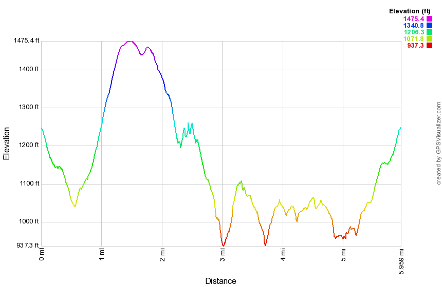
(The image above shows the profile of the hike. Remember that all vertical profiles are relative!)
Neversink Unique Area: North
| Quick Look | ||||
|---|---|---|---|---|
| Difficulty | Round trip | Total climb | Internet Maps | |
| 5.6 mi. | 1240 ft. | AllTrails | ||
Take the Rock Hill exit off State Route 17. Drive south on Katrina Falls road. Park in the small parking area at the end of the road. Walk through the gate and onto the woods road which is the blue trail that parallels the Neversink River. A spur trail to the river goes right at .6 miles and another trail goes to the left at .7 miles. Stay on the blue trail for about 1.2 miles until another yellow spur trail heads right down to the river. This trail is .25 miles and leads down to a nice rapids on the river. Go back to the main trail and walk about .2 miles to another yellow spur trail on the right. This trail is .3 miles long but steep in places and leads down to Denton Falls. After taking in the view at the falls, get back on the main trail and walk to a trail junction where the blue trail bears right. Bear left on the red trail to begin a loop. After only a few hundred feet take the yellow spur trail to the left that goes down to Mullet Brook Falls. The trail is less than .2 miles but the falls, when there has been some rain, is very pretty. Walk back to the red trail and turn left to continue the loop. The trail gains some elevation until at 3.4 miles it intersects a woods road. Be sure to turn left here or you will be headed south into uncharted territory. In about .3 miles the red trail turns left again and follows a woods road. Hike for another mile and you will be back at the junction with the blue trail where you should turn right. In just over .1 miles another yellow spur trail turns left and goes .25 miles down to the river. Follow this trail and then return the same way. Reverse your route to get back to the car.

(The image above shows the profile of the hike. Remember that all vertical profiles are relative!)
Neversink Unique Area: North to South
| Quick Look | ||||
|---|---|---|---|---|
| Difficulty | Round trip | Total climb | Internet Maps | |
| 8.0 mi. | 1360 ft. | AllTrails | ||
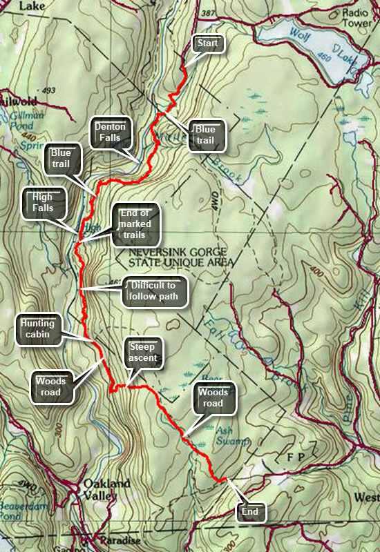
This hike requires a car spot at the Skinner's Road trailhead unless you want to hike over 16 miles out and back! Take the Rock Hill exit off State Route 17. Drive south on Katrina Falls Road to the dead end. Park in the small parking area at the end of the road. Walk through the gate and onto the woods road which is the blue trail and parallels the Neversink River. A spur trail to the river goes right at .6 miles and another trail goes to the left at .7 miles. Stay on the blue trail and in about 1.4 miles another yellow spur trail heads right down to the river to Denton Falls. Walk passed this trail to a junction. Bear right on the blue trail heading for High Falls. From this point on the trail is more of a trail than a woods road. At 2.0 miles the trail climbs to Aa high point and then descends some before ascending slightly to 3.35 miles where a short yellow spur trail leads down to High Falls. Continue passed this trail on a woods road that starts out looking much like the rest of the woods roads you have been on. For the next mile you will have to try to stay on the woods road that will lead you through this area. Staying close to the ridge that rises to the left seems to help. At around 4.6 miles you should cross a stream nears it head at which point the road becomes more distinct. If you run into the stream further downstream, walk up the bank or the bed until you find the road. Continue to follow this prominent road to a dilapidated hunter's cabin at about 5 miles. The road splits here with the left taking you up the ridge. Continue to the right along a well-define road to the next left turn at 5.7 miles. Turn left here on "Peterson's Turnpike" and climb for .5 miles gaining 450 feet at a 17% grade. At the top of the ridge the road turns southeast and levels. The rest of the hike is flat or downhill. Pass by Bear Swamp on the left at 6.6 miles and Ash Swap at 7.3 miles. When you enter the clearing bear to the left and continue out to the trailhead and downhill.
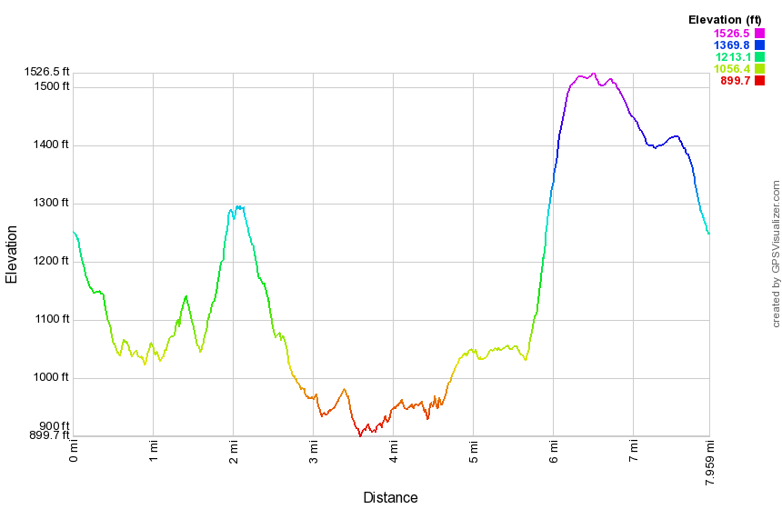
(The image at the left shows the profile of the hike. Remember that all vertical profiles are relative!)
Neversink Unique Area: South
| Quick Look | ||||
|---|---|---|---|---|
| Difficulty | Round trip | Total climb | Internet Maps | |
| 6.6 mi. | 985 ft. | AllTrails | ||
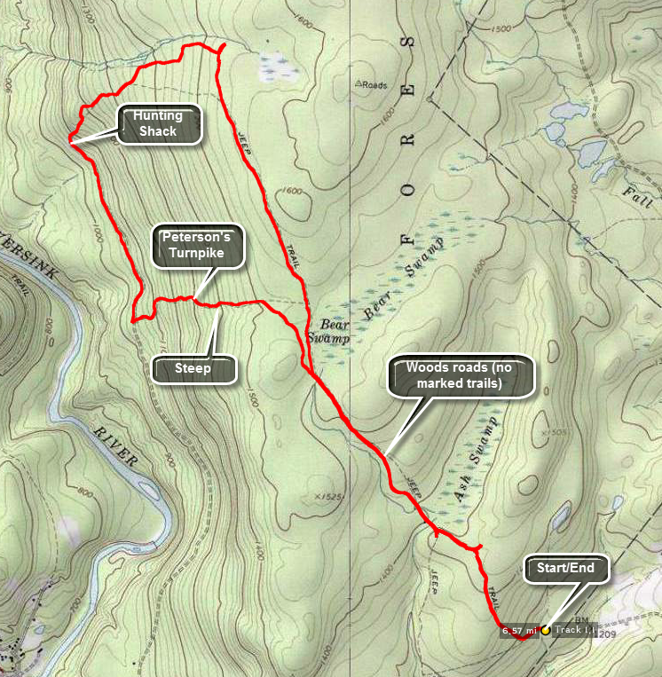
Take the Wurtsboro exit off State Route 17. Drive south on Route 209 to Westerbrookville. Turn right on Pine Kill Road until David Rhodes Road appears on the left. Turn left over the small bridge and up a hill. Turn left on Skinner Road which starts as a paved road and slowly deteriorates to a DIRT TRACK. Make sure you have a high clearance vehicle and four wheel drive in all but the driest conditions. Park in the small parking area at the end of the road being careful to avoid a large rock that can hide in the tall grass. There are NO TRAILS in this area although there is a register box. Your hike will be along woods roads for the entire length but most are unmarked and it is possible to make "wrong" turns. Just out of the parking area woods road bears to the right and heads northwest for about 2.7 miles along a ridge. At this point the road seems to split. One branch continues staring ahead toward the northern part of the Neversink Unique Area. Turn left as that branch of the road descend almost 500 feet in the next .85 miles to a hunting shack. At the hunting shack turn left on another road. Walk along this road for .7 miles at which point another road heads to the left and UP the ridge. In .6 miles the steep climb gains nearly 500 feet back to the ridge. Continue along the road for about .4 miles and at 5.25 miles you should be back at the woods road to the parking area.
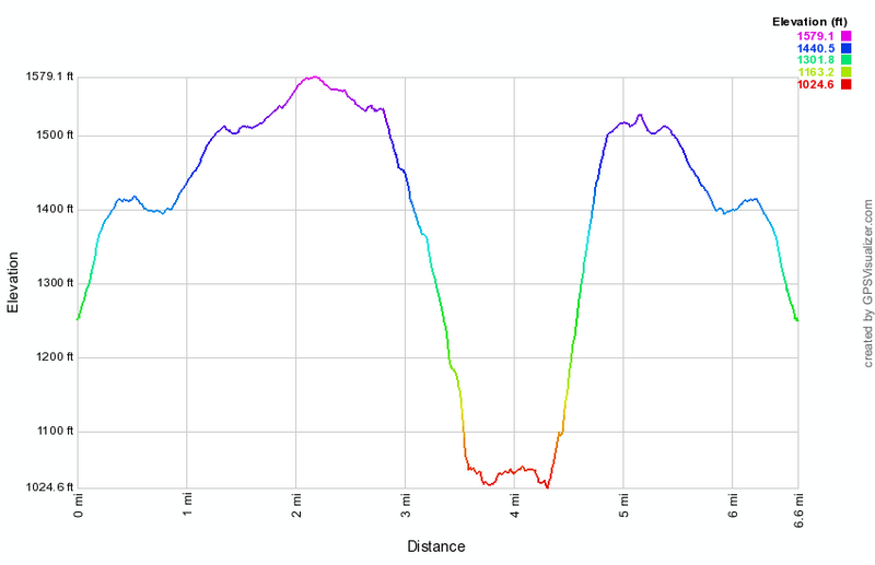
(The image at the left shows the profile of the hike. Remember that all vertical profiles are relative!)
Neversink Unique Area: Three Falls
| Quick Look | ||||
|---|---|---|---|---|
| Difficulty | Round trip | Total climb | Internet Maps | |
| 8.8 mi. | 1986 ft. | AllTrails | ||
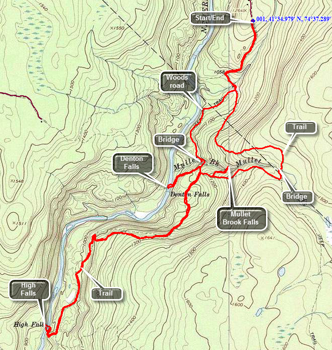
Take the Rock Hill exit off State Route 17. Drive south on Katrina Falls road. Park in the small parking area at the end of the road. Walk through the gate and onto the woods road which is the blue trail that parallels the Neversink River. A spur trail to the river goes right at .6 miles and another trail goes to the left at .7 miles. Stay on the blue trail for about 1.4 miles until another yellow spur trail heads right down to the river. This trail is .3 miles but is steep in places and leads down to Denton Falls. After taking in the view at the falls, get back on the main trail. From this point on the trail is more of a trail as the woods road heads left but you will stay right following the blue blazes. At 2.7 miles the trail climbs to the highest point on the hike and then descends to 4.0 miles where a short yellow spur trail leads down to High Falls. When you have completed your exploration of the falls retrace your route back to the trail junction near Denton Falls. Turn right on the red trail to begin a loop. After only a few hundred feet take the yellow spur trail to the left that goes down to Mullet Brook Falls. The trail is less than .2 miles but the falls, when there has been some rain, is very pretty. Walk back to the red trail and turn left to continue the loop. The trail gains some elevation until at 7 miles it intersects a woods road. Be sure to turn left here or you will be headed south into uncharted territory. In about .3 miles the red trail turns left. Another trail continues straight ahead to a parking area near Wolf Lake. Continue on the red trail as it heads downhill and eventually meets the blue trail at 8.2 miles. Turn right here to head back up the hill to the parking area after crossing Wolf Brook.
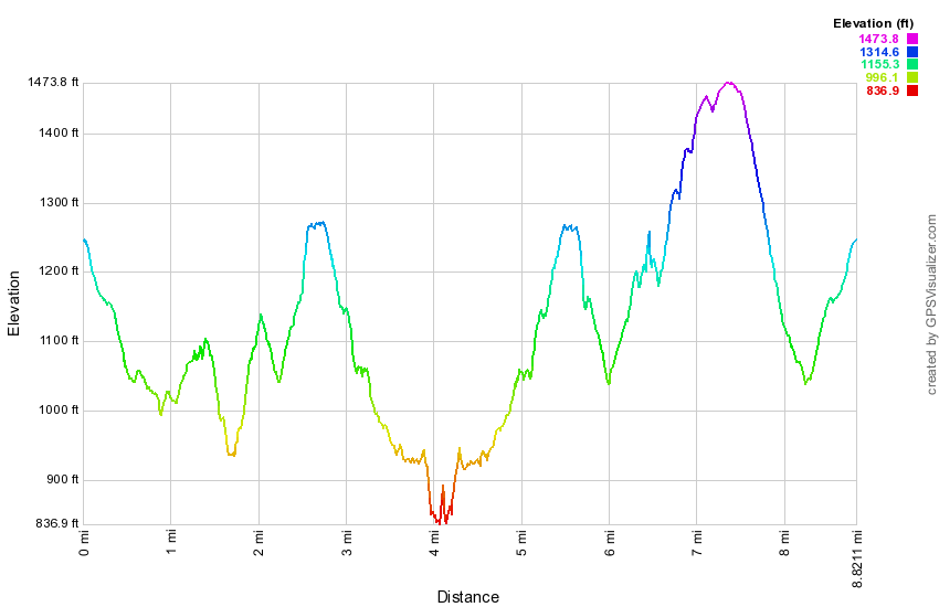 (The image at the left shows the profile of the hike. Remember that all vertical profiles are relative!)
Neversink Unique Area: Three Falls (Wolf Lake)
| Quick Look | ||||
|---|---|---|---|---|
| Difficulty | Round trip | Total climb | Internet Maps | |
| 7.7 mi. | 1680 ft. | AllTrails | ||
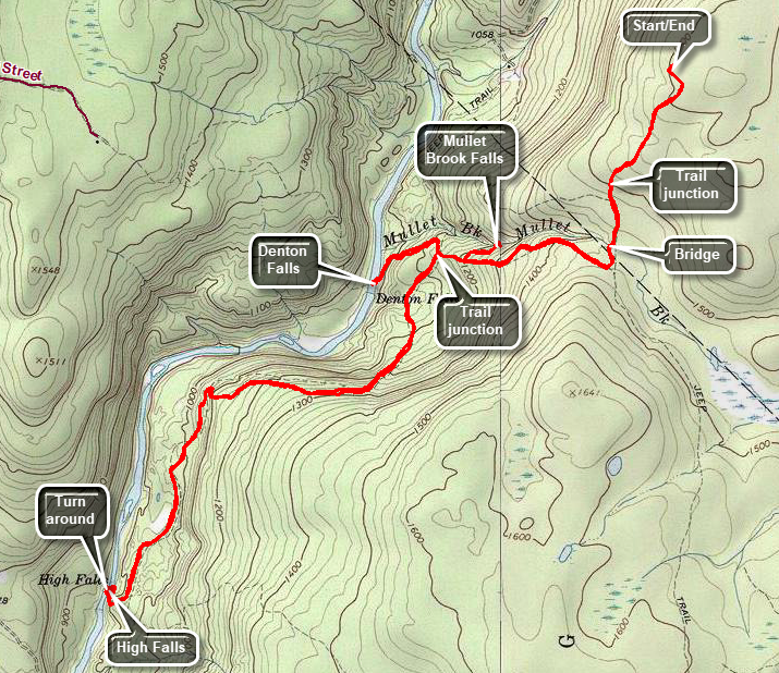
Take the Rock Hill exit off State Route 17. Drive south on Katrina Falls Road. Just before the dead end, turn left on Wolf Lake Road and drive to the Wolf Lake Multiple Use Area parking lot on the right. Drive through the gate and continue on the Powerline Access Road. Park at the end of the road in the small parking area. Walk out the back of the parking area on the yellow trail. The first .6 miles of the trail is a spur trail that connects the parking area with the main trail system. The trail is all downhill at the beginning of the hike and all uphill at the end. At the junction turn left to begin your hike down to Mullet Brook Falls. At .7 miles cross the bridge over Mullet Brook. Just after the stream the trail turns sharply to the right and begins heading west as it continues to descend. You will reach the spur trail to Mullet Brook Falls at 1.25 miles. Turn right to begin the short walk to the falls. The trail ends at the falls which depend greatly on the amount of rain that has fallen. When you are finished admiring t5he falls, turn around and walk back out to the main trail. Turn right and walk to the next trail junction at 1.65 miles. Turn left and start toward High Falls on the main Neversink River. The distance to the falls is a little over 2 miles and can be challenging although the destination is worth the trip. High Falls is only slightly higher and more impressive than Denton Falls and the latter is just off the main trail. The first .2 miles of the trail are a slight downhill followed by .35 miles of uphill. The trail levels briefly and then begins the long descent to the river. Over the next 1.35 miles you will drop almost 500 feet to the edge of the river. Along the way the trail meanders back and forth to mitigate what would otherwise be a steep descent on the way out and an equally steep climb on the way back. At 2.7 miles the trail makes a turn to the left and followed the river as it starts to flow almost due south. As you approached the last and steepest descent to the river a path goes off to the left. This path leads to informal paths and trails that continue south along the river to a parking area and trailhead near Westerbrookville. The distance to the southern parking area is another 4.7 miles with other routes possible. Some tentative plans to connect and expand the trail system have been around for a while but nothing has come of them. Worked your way down to the falls and along the edge of the river on the rocks if it is safe. Get your fill of the falls and then head back up the trail in the opposite direction. At 5.7 miles you will be back at the trail junction with the main loop trail. Turn left to walk to the spur trail to the falls. Turn left on the spur trail and walk downhill to the falls. There are several points where the trail is usually damp but you may find a mud pit in wetter weather. There are also several highly eroded areas with protruding tree roots and rocks. Work your way down to the river's edge and along the rocks to a point in front of the falls. Take in your third falls of the day before packing up and returning up the hill to the main trail. At the top of the hill turn right on the main trail and stay left at the next trail junction. From the junction with the trail to High Falls to the junction with the spur trail to the parking area is 1.1 miles uphill gaining 550 feet. Turn right on the yellow spur trail to the car and walk the last half mile uphill back to the parking area.
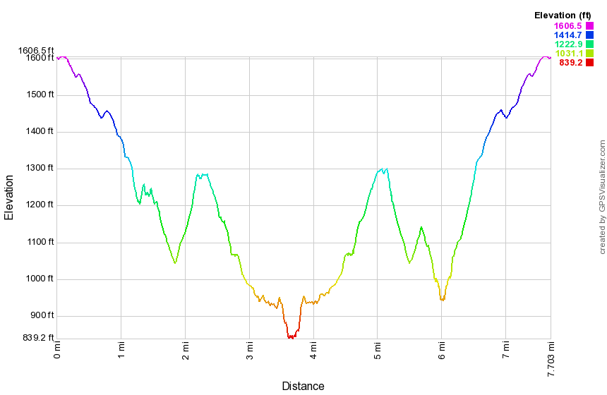 (The image at the left shows the profile of the hike. Remember that all vertical profiles are relative!)
North Lake South Lake: Escarpment Trail to Catskill Mountain House
| Quick Look | ||||
|---|---|---|---|---|
| Difficulty | Round trip | Total climb | Internet Maps | |
| 6.2 mi. | 1193 ft. | AllTrails | ||
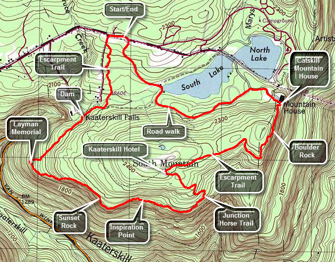 The hiking trails around the North Lake South Lake Campgrounds may be the most scenic in the Catskills.
As you hike the Escarpment Trail the history and the views just seem to get better with every passing
mile. Many spots have names like Inspiration Point and Artist's Rock. Even places that aren't
named have beautiful views of the Hudson River and surrounding countryside.
The hiking trails around the North Lake South Lake Campgrounds may be the most scenic in the Catskills.
As you hike the Escarpment Trail the history and the views just seem to get better with every passing
mile. Many spots have names like Inspiration Point and Artist's Rock. Even places that aren't
named have beautiful views of the Hudson River and surrounding countryside.
Turn north on North Lake Road (CR 18) from Rt 23A in the town of Haines Falls. After about 1 mile, turn right on Scutt Road just before the entrance to the state campgrounds. Turn right into the parking area. Walk across Scutt Road to the beginning of the blue marked Escarpment Trail. Several different trails intersect the Escarpment Trail at different places. Some of these trails are horse trails or snowmobile trails and not all are well marked. After 1.2 miles of descent, the trail turns sharply left and ascends. At this bend is the Layman Monument erected to a fire fighter who perished fighting a forest fire in 1900. There is a limited view from this spot that hints at what is to come. In just over half a mile the trail passes by Sunset Rock (South) and just beyond that Inspiration Point. This part of the trail is a constant ascent but not a steep one. These two lookouts have some nice views of Kaaterskill Clove and the mountains on the other side. Kaaterskill High Peak and Round Top are just across the clove and farther to the north the ski slopes on Hunter Mountain are visible. You can also see a number of houses that seem to hang on the side of the mountain across the clove. This is Twilight Park. A careful look to the east along the Clove reveals a glint of water; the Hudson River. The trail continues its ascent and in less than a mile turns sharply left to ascend South Mountain at about 2.6 miles. The trail straight ahead is a horse trail that leads down to the Palenville Overlook. Near the top of South Mountain is the site of the Kaaterskill House, one of the many hotels and rooming houses that were so prevalent throughout the Catskills. At this point the Escarpment Trail turns sharply right. To see the Site of the Kaaterskill House, turn left on the red marked Scutt Road Trail and explore the are to find what is left of the foundation. Retrace your steps and get back on the Escarpment Trail. The trail has several ups and downs and at one point makes a sharp right and heads toward Split Rock and Boulder Rock. Be sure to stay on the blue trail. A red trail continues straight ahead and cuts out both of these sites. These two rocks are DEFINITELY worth the extra time. At Split Rock the trail passes by several places where large pieces of rock have split off the main formation. Boulder Rock is a large boulder just sitting on a rocky shelf. This site gives the first and one of the best views of the Hudson River. Continuing downhill the trail now leads to the site of the Catskill Mountain House where a large boarding house once stood overlooking the Hudson. There is now an open field and a sign commemorating the structure. The views are fantastic and many people like to picnic here or just sit and enjoy the views. For those who want to hike less, parking is available at North Lake Beach and the walk is less than half a mile up a very gradual incline. The trail continues down to the lake and through several picnic areas skirting the eastern end of the campgrounds. To complete this hike continue down the access road to a parking area. Turn left and walk out the access road to the parking area. Continue to walk the park roads always bearing to the right to walk around South Lake. The road will cross over the dam at the southern end of South Lake. Continue on the road up the hill bearing to the left to the entrance to the park. Walk out the entrance and turn left on Scutt Road. Walk down the road to the parking area on the right.
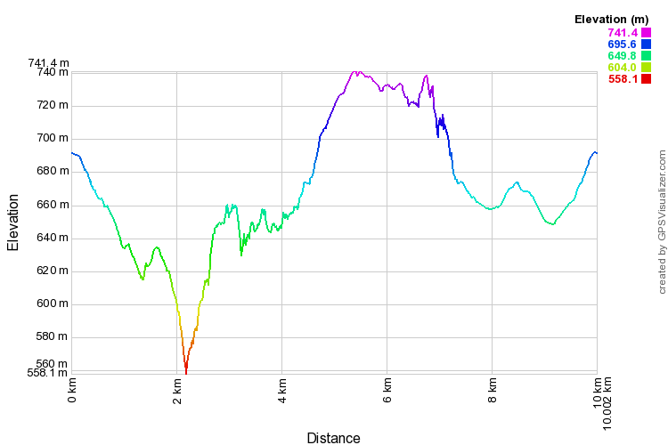 (The image at the left shows the profile of the hike. Remember that all vertical profiles are
relative!)
(The image at the left shows the profile of the hike. Remember that all vertical profiles are
relative!)
North Lake South Lake: Escarpment, Mary's Glen, Rock Shelter Trails
| Quick Look | ||||
|---|---|---|---|---|
| Difficulty | Round trip | Total climb | Internet Maps | |
| 9.4 mi. | 2030 ft. | AllTrails | ||
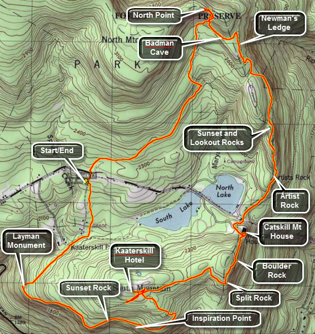 The hiking trails around the North Lake South Lake Campgrounds may be the most scenic in the Catskills.
As you hike the Escarpment Trail the history and the views just seem to get better with every passing
mile. Many spots have names like Inspiration Point and Artist's Rock. Even places that aren't
named have beautiful views of the Hudson River and surrounding countryside.
The hiking trails around the North Lake South Lake Campgrounds may be the most scenic in the Catskills.
As you hike the Escarpment Trail the history and the views just seem to get better with every passing
mile. Many spots have names like Inspiration Point and Artist's Rock. Even places that aren't
named have beautiful views of the Hudson River and surrounding countryside.
Turn north on Rt 18 from Rt 23A in the town of Haines Falls. After about 1 mile, turn right on Schutt Road just before the entrance to the state campgrounds. Turn left into the parking area. Walk across Schutt Road to the beginning of the blue marked Escarpment Trail. Several different trails intersect the Escarpment Trail at different places. Some of these trails are horse trails of snowmobile trails and not all are well marked. After 1.2 miles of descent, the trail turns sharply left and ascends. At this bend is the Layman Monument erected to a fire fighter who perished fighting a forest fire in 1900. There is a limited view from this spot that hints at what is to come. In just over half a mile the trail passes by Sunset Rock (South) and just beyond that Inspiration Point. This part of the trail is a constant ascent but not a steep one. These two lookouts have some nice views of Kaaterskill Clove and the mountains on the other side. A careful look to the east along the Clove reveals a glint of water; the Hudson River. The trail continues its ascent and in less than a mile turns sharply left to ascend South Mountain. Near the top of South Mountain is the site of the Kaaterskill House, one of the many hotels and rooming houses that were so prevalent throughout the Catskills. At this point the Escarpment Trail turns sharply right. To see the Site of the Kaaterskill House, turn left on the red marked Schutt Road trail. Retrace your steps and get back on the Escarpment Trail. The trail has several ups and downs and at one point makes a sharp right and heads toward Split Rock and Boulder Rock. Be sure to stay on the blue trail. A red trail continues straight ahead and cuts out both of these sites. These two rocks are DEFINITELY worth the extra time. At Split Rock the trail passes by several places where large pieces of rock have split of the main formation. Boulder Rock is a large boulder just sitting on a rocky shelf. This site gives the first and one of the best views of the Hudson River. Continuing downhill the trail now leads to the site of the Catskill Mountain House. Where a large boarding house once stood overlooking the Hudson, there is now an open field and a sign commemorating the structure. The views are fantastic and many people like to picnic here or just sit and enjoy the views. For those who want to hike less, parking is available at North Lake Beach and the walk is less than half a mile up a very gradual incline. The trail continues down to the lake and through several picnic areas skirting the eastern end of the campgrounds. At this point it starts and ascent that will total 450 feet. Most areas are gentle but several are short but steep. Artist's Rock is about .75 miles from the Catskill Mountain House site and offers excellent, unobstructed views of the Hudson and the small towns below. In a little more than a half mile, a yellow marked trail hooks back around to Sunset Rock (North) and Lookout Rock. The views of the two lakes from here are beautiful! This area also offers an opportunity to climb to the area without using the trail. Several chimneys and cracks provide short but challenging climbs. Back on the trail another .2 miles leads to Newman's Ledge with more great views of the Hudson River Valley. The trail has been ascend sing sharply for some time since Artist's Rock and continues to do so. Hike .6 more miles and Find Badman Cave at the junction with the Rock Shelter Trail. The "cave" is more like Badman Overhanging Rock Shelter. The Escarpment Trail Ascends sharply here and the levels off some. In .7 miles there is a junction with the Mary's Glen Trail. Turn left staying on the Escarpment trail toward North Point. The hike to the Point is only .3 miles but some of it is very steep with some rock scrambles. Once on North Point you will know that your work was worth it. From this high point you can see spectacular views of the Hudson River and the surrounding communities. Return to the junction with the Mary's Glen Trail and turn right. This trail descends for .8 miles. At the junction with the Rock Shelter trail turn right on the yellow marked Rock Shelter Trail. The 1.3 mile walk back to the car is punctuated by rocks and roots without many views.
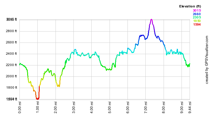 (The image at the left shows the profile of the hike. Remember that all vertical profiles are
relative!)
(The image at the left shows the profile of the hike. Remember that all vertical profiles are
relative!)
North South Lake: Escarpment Loop Anticlockwise (No North Point)
| Quick Look | ||||
|---|---|---|---|---|
| Difficulty | Round trip | Total climb | Internet Maps | |
| 12.5 mi. | 2575 ft. | AllTrails | ||
_map.png) The hiking trails around the North Lake South Lake Campgrounds may be the most scenic in the Catskills.
As you hike the Escarpment Trail the history and the views just seem to get better with every passing
mile. Many spots have names like Inspiration Point and Artist's Rock. Even places that aren't
named have beautiful views of the Hudson River and surrounding countryside.
The hiking trails around the North Lake South Lake Campgrounds may be the most scenic in the Catskills.
As you hike the Escarpment Trail the history and the views just seem to get better with every passing
mile. Many spots have names like Inspiration Point and Artist's Rock. Even places that aren't
named have beautiful views of the Hudson River and surrounding countryside.
Turn north on Rt 18 from Rt 23A in the town of Haines Falls. After about 1 mile, turn right on Schutt Road just before the entrance to the state campgrounds. Turn left into the parking area. Walk across Schutt Road to the beginning of the blue marked Escarpment Trail. Several different trails intersect the Escarpment Trail at different places. Some of these trails are horse trails of snowmobile trails and not all are well marked. After 1.2 miles of descent, the trail turns sharply left and ascends. At this bend is the Layman Monument erected to a fire fighter who perished fighting a forest fire in 1900. There is a limited view from this spot that hints at what is to come. In just over half a mile the trail passes by Sunset Rock (South) and just beyond that Inspiration Point. This part of the trail is a constant ascent but not a steep one. These two lookouts have some nice views of Kaaterskill Clove and the mountains on the other side. A careful look to the east along the Clove reveals a glint of water; the Hudson River. The trail continues its ascent and in less than a mile turns sharply left to ascend South Mountain. Straight ahead at this point, a horse trail descends toward the Palenville Lookout. This is a steep trail but the lookout is worth the effort. The horse trail follows the ledges for some time until at about 3.9 miles it turns sharply left to descend to the level below. After a steep but short descent be sure to turn right and walk out to the lookout at about 4.5 miles. There are several viewpoints here with some giving a better view back up Kaaterskill Clove and others a view down to Palenville and out over the Hudson River. After you have rested and taken pictures retrace your steps all the way back to the Escarpment Trail. Make a right to walk up toward South Mountain. Near the top of South Mountain is the site of the Kaaterskill House, one of the many hotels and rooming houses that were so prevalent throughout the Catskills.
At this point the Escarpment Trail turns sharply right. The trail has several ups and downs and at one point makes a sharp right and heads toward Split Rock and Boulder Rock. Be sure to stay on the blue trail. A red trail continues straight ahead and cuts out both of these sites. These two rocks are DEFINITELY worth the extra time. At Split Rock the trail passes by several places where large pieces of rock have split of the main formation. Boulder Rock is a large boulder just sitting on a rocky shelf. This site gives the first and one of the best views of the Hudson River. Continuing downhill the trail now leads to the site of the Catskill Mountain House. Where a large boarding house once stood overlooking the Hudson, there is now an open field and a sign commemorating the structure. The views are fantastic and many people like to picnic here or just sit and enjoy the views. For those who want to hike less, parking is available at North Lake Beach and the walk is less than half a mile up a very gradual incline. The trail continues down to the lake and through several picnic areas skirting the eastern end of the campgrounds. At this point it starts and ascent that will total 450 feet. Most areas are gentle but several are short but steep. Artist's Rock is about .75 miles from the Catskill Mountain House site and offers excellent, unobstructed views of the Hudson and the small towns below. In a little more than a half mile, at 9.4 miles into the hike, a yellow marked trail hooks back around to Sunset Rock (North) and Lookout Rock. The views of the two lakes from here are beautiful! This area also offers an opportunity to climb to the area without using the trail. Several chimneys and cracks provide short but challenging climbs. Back on the trail another .2 miles leads to Newman's Ledge with more great views of the Hudson River Valley. The trail has been ascending sharply for some time since Artist's Rock and continues to do so. Hike .6 more miles and find Badman Cave at the junction with the Rock Shelter Trail. The "cave" is more like Badman Overhanging Rock Shelter. The Escarpment Trail ascends sharply here and the yellow Rock Shelter Trail branches to the left. Turn left on the Rock Shelter Trail. At about 11.0 miles make a sharp right and then a quick left to stay on the Rock Shelter Trail. Along this trail you may find several small waterfalls in wetter weather. In the winter the ledges are often covered in ice. After the turns, there is about a 1.4 mile walk back to the car which is punctuated by rocks and roots without many views.
_gra.png) (The image at the left shows the profile of the hike. Remember that all vertical profiles are relative!)
(The image at the left shows the profile of the hike. Remember that all vertical profiles are relative!)
North Lake South Lake: Escarpment Clockwise Loop
| Quick Look | ||||
|---|---|---|---|---|
| Difficulty | Round trip | Total climb | Internet Maps | |
| 7.7 mi. | 1603 ft. | AllTrails | ||
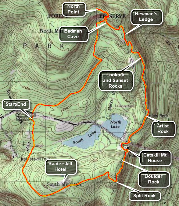 The hiking trails around the North Lake South Lake Campgrounds may be the most scenic in the Catskills.
As you hike the Escarpment Trail the history and the views just seem to get better with every passing
mile. Many spots have names like Inspiration Point and Artist's Rock. Even places that aren't
named have beautiful views of the Hudson River and surrounding countryside.
The hiking trails around the North Lake South Lake Campgrounds may be the most scenic in the Catskills.
As you hike the Escarpment Trail the history and the views just seem to get better with every passing
mile. Many spots have names like Inspiration Point and Artist's Rock. Even places that aren't
named have beautiful views of the Hudson River and surrounding countryside.
Turn north on Rt 18 from Rt 23A in the town of Haines Falls. After about 1 mile, turn right on Schutt Road just before the entrance to the state campgrounds. Turn left into the parking area. Walk up Schutt Road and across Route 18 to pick up the yellow Rock Shelter Trail. Walk through the woods and over roots and rocks for 1.3 miles. Turn left on the red Mary's Glen Trail and climb just less than 2 miles to the blue Escarpment Trail. Turn left and continue to climb to North Point. It is only .25 miles but requires some rock scrambling in places to get up to several fantastic lookouts over the lakes and across to the Hudson River. When you have taken in the view, climb back down the Escarpment Trail but continue straight ahead at the trail junction. At 3.25 miles Badman Cave will be just off the trail on your right. A little further on at 3.4 miles you will be at Newman's Ledge. Just passed this point a short yellow spur trail leads up to Lookout Rock and Sunset Rock. These viewpoint offer great views over the Hudson and the two lakes, respectively. Back on the main trail at 4.3 miles you will pass by Artist Rock and then begin to descend to a parking area for the beach at the east end of North Lake. A slight climb places you in an open field with expansive views of the Hudson River. This was once the site of the Catskill Mountain House. After admiring the view and indulging in some thoughts about the past, get back on the Escarpment Trail and head for Boulder Rock and Split Rock at around 5.4 miles. Continue on the Escarpment Trail until the junction at 6.3 miles. Here the Escarpment trail turns left at you should go straight ahead on the red Schutt Road Trail. This trail ends after less than a mile at the Escarpment Trail.unr right and walk to Schutt Road. Cross the road to the parking area.
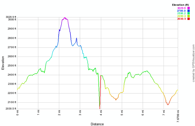 (The image at the left shows the profile of the hike. Remember that all vertical profiles are
relative!)
(The image at the left shows the profile of the hike. Remember that all vertical profiles are
relative!)
North South Lake: Kaaterskill and Bastion Falls Loop
| Quick Look | ||||
|---|---|---|---|---|
| Difficulty | Round trip | Total climb | Internet Maps | |
| 3.5 mi. | 1125 ft. | AllTrails | ||
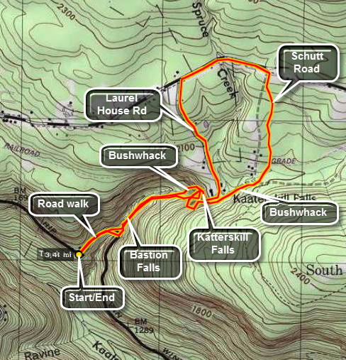 Bastion and Kaaterskill Falls are a popular destination for sightseers in the Catskills. Kaaterskill Falls may be the highest falls in New York State. Even when the volume of water is low both falls are pretty. The parking area for the falls is on Route 23A just east of Haines Falls and west of Palenville. The parking area is small compared to the amount of people who want to use it especially on the weekends. From the parking area walk down the road toward the east. BE CAREFUL as you walk down the road because many of the drivers are not! In a short distance a stone bridge crosses Spruce Creek.Turn left an step over or under the guard rail. The falls next to the road are Bastion Falls. Depending on the water level you may be able to walk down to the creek bed and look upstream. The trail continues up the creek for about .5 miles to the base of Kaaterskill Falls. The lower and upper falls comprise a drop of about 260 feet. The formal trail ends at this point but many informal paths continue to the top of the falls.
The first climb intersects a horizontal trail that leads to the amphitheater between the two falls. Turn left on this path but be careful as you approach the area between the falls. This area is often VERY wet and the rocks can be VERY slippery. The climb to the top of the falls is STEEP and eroded and very difficult at times. At the top of the falls there are great views down to the pool at the bottom of the falls and down the clove formed by Spruce Creek. At any point you can reverse your path back to the car. At the top of the falls you may also be able to cross over to the other side which offers different views. Many times the water is too high to cross.
Continue on up along Spruce Creek for about .75 miles to the main road into North South Lake Campgrounds. As you walk you will find some of the trails at the campgrounds. Walk along the road the road for about .5 miles and turn left on Laurel House Road. Walk .6 miles down Laurel House Road to the parking area at the dead end. Walk along any of the paths to the top of the falls. At one time the Laurel House stood near the end of the road overlooking the falls. Follow one of the informal paths along the "right" rim of the falls and begin a STEEP and sometimes difficult descent down the west side of the creek. If you stay near the creek, you will be able to find a path to the area between the falls. Keep descending and find an area to cross the creek. This is never particularly safe but will not be possible when the water is high! After crossing the creek, use the trail to return to Route 23A and to your car.
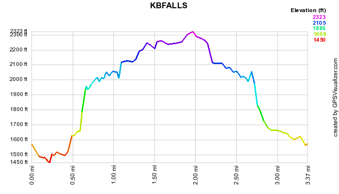 (The image at the left shows the profile of the hike. Remember that all vertical profiles are
relative!)
(The image at the left shows the profile of the hike. Remember that all vertical profiles are
relative!)
North South Lake: Kaaterskill and Bastion Falls (Laurel House)
| Quick Look | ||||
|---|---|---|---|---|
| Difficulty | Round trip | Total climb | Internet Maps | |
| 2.6 mi. | 1165 ft. | AllTrails | ||
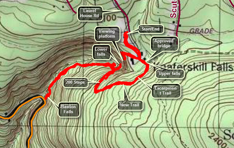 Bastion and Kaaterskill Falls are a popular destination for sightseers in the Catskills. Kaaterskill Falls may be the highest falls in New York State. Even when the volume of water is low both falls are pretty. The main parking area for the falls is on Route 23A just east of Haines Falls and west of Palenville. The parking area is small compared to the amount of people who want to use it especially on the weekends. Another parking area is at the end of Laurel House Road which is a right hand turn off the access road to North South Lake State Campgrounds. This is a newer lot constructed in 2016 and allows much safer access to the falls area. Trails constructed in 2015 and 2016 lead to a viewing platform over the upper falls and clove. A trail finished in 2016 allows hikers to hike along the Escarpment Trail and then descend to the lower falls using the trail and a 200 stone step staircase. There is even access to the pool at the base of the upper falls. Caution: The falls area has been the site of numerous injuries and deaths! It is important that visitors wear appropriate hiking footwear and obey the signs that indicate dangerous areas. Mist people who fall do not survive. Most fatalities and injuries are the result of unwise decisions made by the deceased.
From the parking area walk down the yellow trail and continue to follow it to the viewing platform. When you are done admiring the view from the platform, walk back up the trail and watch for a path to the right at .4 miles that leads down to Spruce Creek. As of August 5, 2016, there is no bridge in place but the creek is easily forded in low water conditions by hopping from stone to stone. A 120 foot bridge is planned for installation before the end of 2016. After crossing the stream walk to the right if the old bridge and up to the blue Escarpment Trail. Turn right on the trail and follow it until yellow blazes appear on the right at about .6 miles. Follow this trail down the steep bank being careful to watch your footing. Several switchbacks mitigate the steep grade and you will soon reach a 200 stone step staircase installed by an ADK crew. At about .9 miles a path to the pool below the upper falls leads to the right. This path can be very slippery so watch your footing. DO NOT use any other informal or unmarked paths as they cause erosion and are not safe. The path end at the pool and allows a close-up view of the upper falls and a beautiful view down the clove. Return to the main trail and continue down the steps to the viewpoint below the lower falls. From this viewpoint it is possible to see both the upper and lower falls from several angles. When you are done viewing the beauty of the falls, continue on the main trail as it parallels the creek and heads down to Route 23A. Although there is less danger of falling and sustaining a serious injury, be careful as you hike because the trail is very uneven. When you reach Route 23A, you will be at Bastion Falls which is easily visible from the road. More than one visitor has made the mistake of thinking these falls are Kaaterskill Falls! When the water volume is high, Bastion falls can be a roaring cascade but it is pretty even during dry spells. Turn around at 1.5 miles and get ready for the return climb since the change in elevation from Bastion falls to the parking area is 650 feet! When you cross Spruce Creek, continue up the path to the trail. Turn right and walk the trail back to the parking area.
 (The image at the left shows the profile of the hike. Remember that all vertical profiles are relative!)
North South Lake: Kaaterskill and Bastion Falls Out and Back
| Quick Look | ||||
|---|---|---|---|---|
| Difficulty | Round trip | Total climb | Internet Maps | |
| 1.5 mi. | 370 ft. | AllTrails | ||
 Bastion and Kaaterskill Falls are a popular destination for sightseers in the Catskills. Kaaterskill Falls may be the highest falls in New York State. Even when the volume of water is low both falls are pretty. The parking area for the falls is on Route 23A just east of Haines Falls and west of Palenville. The parking area is small compared to the amount of people who want to use it especially on the weekends. From the parking area walk down the road toward the east. BE CAREFUL as you walk down the road because many of the drivers are not! In a short distance a stone bridge crosses Spruce Creek. Turn left and step over the guard rail. The falls next to the road are Bastion Falls. Depending on the water level you may be able to walk down to the creek bed and look upstream. The trail continues up the creek for about .5 miles to the base of Kaaterskill Falls. The lower and upper falls comprise a drop of about 260 feet. The formal trail ends at this point but many informal paths continue to the top of the falls. The informal paths are TOO DANGEROUS to climb and many people have been injured and several have lost their lives. DO NOT climb beyond the fencing that is now in place! When you are done enjoying the falls, turn around and retrace your steps to the car. If you would like a view from the top of the falls, drive west on Route 23 and turn right onto the road to the North South Lake Campgrounds. Watch for Laurel House Road on the right just before the entrance to the campgrounds. Drive to the end of the road and park in the lot. The trail to the top of the falls leads out of the back of the parking area. The trail to the right is a rail trail and the map is on the signboard in the kiosk.
 (The image at the left shows the profile of the hike. Remember that all vertical profiles are
relative!)
(The image at the left shows the profile of the hike. Remember that all vertical profiles are
relative!)
North Lake South Lake: Lake Loop (Counterclockwise)
| Quick Look | ||||
|---|---|---|---|---|
| Difficulty | Round trip | Total climb | Internet Maps | |
| 4.2 mi. | 315 ft. | AllTrails | ||
 The hiking trails around the North Lake South Lake Campgrounds may be the most scenic in the Catskills. The yellow loop trail around both lakes may seem easy but it has some terrific views of the lake and the surrounding mountains.
Turn north on Rt 18 from Rt 23A in the town of Haines Falls. After about 1 mile, turn right on Schutt Road just before the entrance to the state campgrounds. Turn right into the parking area. Walk across Schutt Road to pick up the Blue Escarpment Trail. There are a lot of rock and roots to step around and the trail can be very wet in places. Cross the old railroad bed and descend to cross two streams on bridges. At the trail junction turn left on a ski trail and walk out to the loop road. Turn left and walk on the loop road down to the dam at the south end of South Lake. Walked to the right of the dam to get on the yellow trail. The trail is cut through the woods and there are many roots to trip over. Followed one of the paths down to the lake shore to get a nice look from water level. Continue on the yellow trail until you reach the first beach near the north end of South Lake at 1.7 miles. Follow the trail through the beach area passing the buildings and walk up the stairs. Stay to the left to find the yellow blazes. Just .1 miles from the beach is a point of land that juts out into the water. This is the area that separates the two lakes and there are nice views in both directions as well as across the lake. Back on the trail follow a walkway or road along the shore of North Lake to the beach at North Lake at 2.2 miles. Continue on around the lake for a new set of views. From 1.8 miles back to the dam at 3.5 miles the trail follows roads or paths. It is easy walking with very few ups or downs. Walk back to the dam to complete the loop. At this point you may retrace your route from earlier or use the park roads to get back to your car. Turn around at the dam and head back the way you just came passing kiosk and sign on the right. The hike back from the dam is only about .75 miles.
 (The image at the left shows the profile of the hike. Remember that all vertical profiles are
relative!)
(The image at the left shows the profile of the hike. Remember that all vertical profiles are
relative!)
North Lake South Lake: North Point and Ashley Falls
| Quick Look | ||||
|---|---|---|---|---|
| Difficulty | Round trip | Total climb | Internet Maps | |
| 5.6 mi. | 1068 ft. | AllTrails | ||
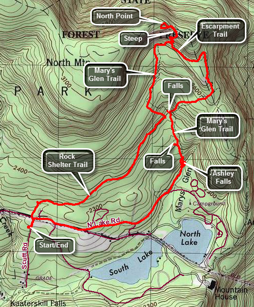 The hiking trails around the North Lake South Lake Campgrounds may be the most scenic in the Catskills. As you hike the Escarpment Trail the history and the views just seem to get better with every passing mile. Many spots have names like Inspiration Point and Artist's Rock. Even places that aren't named have beautiful views of the Hudson River and surrounding countryside.
Turn north on Rt 18 from Rt 23A in the town of Haines Falls. After about 1 mile, turn right on Schutt Road just before the entrance to the state campgrounds. Turn right into the parking area. Walk up Schutt Road and cross the main road to the campgrounds to the start of the yellow Rock Shelter trail. This may be one of my least favorite trails since it winds its way over rocks and roots for about 1.3 miles to the red Mary Glen Trail. There isn't much to see along the trail. Turn left on the Mary's Glen trail toward North Point. This trail ascends for about .8 miles to join the blue Escarpment Trail near North Point. The hike to the Point is only .3 miles but some of it is very steep with some rock scrambles. Once on North Point you will know that your work was worth it. From this high point you can see spectacular views of the Hudson River and the surrounding communities. North Point has at least three different "levels" and the best view may be from the highest one. Reverse your path and return the .3 miles back to the junction with Mary's Glen Trail.
This time stay on the Escarpment Trail by bearing left and in about .7 miles descend a rock slope to the trail junction with the Rock Shelter trail. On your right will be Badman's Cave which is more of a rock overhang than a cave. Turn right on the Rock Shelter Trail and walk downhill .4 miles back to the junction with the Mary's Glenn Trail. Right at the junction there is a seasonal waterfall to the right which comes off the ledges. Turn right and flow the blazes of the Mary's Glen Trail downhill. Watch for more seasonal waterfalls to the right of the trail. The real prize is Ashley Falls and you will arrive at the top of the falls at about 4.2 miles just before you cross a log bridge over the stream. You may get some views from the top before crossing the bridge and starting down the trail toward the bottom of the falls. As you descend there are several paths to the left that allow you to get some different views of the falls. At the vase of the trail a yellow spur goes to the left to the base of the falls. Note that Ashley falls despite its impressive height may be completely dry when there has been no rain! Walk back to the Mary's Glen Trail and continue out to the park road at 4.5 miles. Turn right and walk the paved park roads back to the main gate. Turn left on Scutt Road and walk back to the car. The walk on the road is about 1.1 miles.
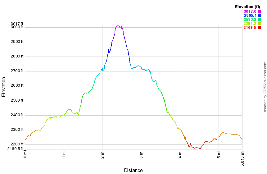 (The image at the left shows the profile of the hike. Remember that all vertical profiles are
relative!)
(The image at the left shows the profile of the hike. Remember that all vertical profiles are
relative!)
North Lake South Lake:
North Point, Stoppel Point, Escarpment Trail, Palenville Lookout
| Quick Look | ||||
|---|---|---|---|---|
| Difficulty | Round trip | Total climb | Internet Maps | |
| 14.4 mi. | 3000 ft. | AllTrails | ||
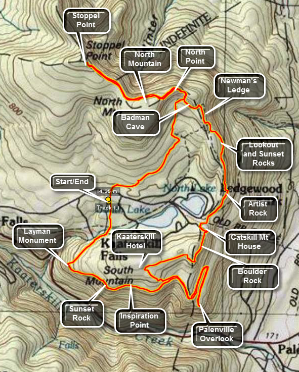 The hiking trails around the North Lake South Lake Campgrounds may be the most scenic in the Catskills.
As you hike the Escarpment Trail the history and the views just seem to get better with every passing
mile. Many spots have names like Inspiration Point and Artist's Rock. Even places that aren't
named have beautiful views of the Hudson River and surrounding countryside.
The hiking trails around the North Lake South Lake Campgrounds may be the most scenic in the Catskills.
As you hike the Escarpment Trail the history and the views just seem to get better with every passing
mile. Many spots have names like Inspiration Point and Artist's Rock. Even places that aren't
named have beautiful views of the Hudson River and surrounding countryside.
Turn north on Rt 18 from Rt 23A in the town of Haines Falls. After about 1 mile, turn right on Schutt Road just before the entrance to the state campgrounds. Turn left into the parking area. Walk up Schutt Road and cross the main road to the campgrounds to the start of the yellow Rock Shelter trail. This may be one of my least favorite trails since it winds its way over rocks and roots for about 1.3 miles to the red Mary Glen Trail. There isn't much to see along the trail. Turn left on the Mary's Glen trail toward North Point. This trail ascends for about .8 miles to join the blue Escarpment Trail near North Point. The hike to the Point is only .3 miles but some of it is very steep with some rock scrambles. Once on North Point you will know that your work was worth it. From this high point you can see spectacular views of the Hudson River and the surrounding communities. North Point has at least three different "levels" and the best view may be from the highest one. Stay on the Escarpment Trail as it levels off slightly and passes by North Mountain. The trail rolls some before climbing to Stoppel Point after about 1.8 miles. Stopple Point offers great views to the northeast and on a clear day buildings in Albany are visible. Continue on for less than a mile to a plane crash on the right side of the trail and watch for another lookout to the south on the right side of the trail as you return. From Stopple Point reverse your path and return 1.8 miles to North Point and the .3 miles back to the junction with Mary's Glen Trail.
This time stay on the Escarpment Trail and in about .7 miles descend a rock slope to the trail junction with the Rock Shelter trail. On your right will be Badman cave which is more of a rock overhang than a cave. Stay on the Escarpment trail by bearing to the left and pass by a small swampy area on the right of the trail. In about .5 miles you will be at Newman's Ledge which offers now limited views. From Newman's Ledge the trail descends steeply for a bit. Watch for a yellow spur trail to the right which leads to Lookout Point and Sunset Rock North. The views of the two lakes from Sunset Rock are beautiful! Lookout Point offers more views of the Hudson to the east. This area also offers an opportunity to climb to the area without using the trail. Several chimneys and cracks provide short but challenging climbs. Return to the main trail and pass under several rock overhangs along the base of the lookouts you just visited. In .5 miles you will be at Artist Rock. This viewpoint offers spectacular views of the Hudson Valley and is often used by photographers and artists. The trail continues to descend to the beach and parking area at the extreme east end of North Lake. Go through the parking lot and head toward the iron gate to stay on the Escarpment Trail and ascend the .25 miles to the site of the former Catskill Mountain House where a large boarding house once stood overlooking the Hudson. There is now an open field and a sign commemorating the structure. The views are fantastic and many people like to picnic here or just sit and enjoy the views. It is easy to see why this was such a popular Catskill destination with a cog railway and road for carriages.
In about .5 miles the Escarpment trail bears left to go toward Boulder Rock and Split Rock. DO NOT take the red cutoff trail or you will miss these two sights. Boulder Rock is a large boulder just sitting on a rocky shelf. This site gives one of the best views of the Hudson River. At Split Rock the trail passes by several places where large pieces of rock have split of the main bedrock formation. Continue on for about .7 miles to the junction with the Schutt road trail near the site of the former Kaaterskill Hotel. This was another popular hotel and boarding house that once stood in the area. Turn sharply left to descend on the Escarpment Trail for about .4 miles. Here the Escarpment Trail meets the Harding Road Trail and a horse trail. Turn left on the Harding Road and horse trail to start the hike to the Palenville Lookout. When the Harding Road Trail turns right DO NOT follow it but stay on the horse trail. There will be few marking on the horse trail so follow it carefully. When the trail splits follow the fork to the right. The trail is flat is places and then descends. It starts out heading northeast but then bends southeast before turning northeast again! After .8 miles, there is a switchback that sends you southwest and descends VERY STEEPLY. At the base of this switchback the trail splits. Make a SHARP RIGHT here to head toward the Palenville Lookout! In another .5 miles you will descend again to the Lookout. The views from here are phenomenal. To the right you can see Kaaterskill High Peak and Round top and up into Kaaterskill Clove. Straight out from the lookout is the Hudson while looking left gives you a view more toward the north. Laid out below, so close you could almost reach out and touch it, is the small town of Palenville. Hikers have used some of the local flagstones to build several chairs on the lookout. A few informal paths lead northeast along the escarpment but none have better views that right at the lookout. Retrace your steps for about 1.3 miles back to the Escarpment Trail.
After walking along the path bounded by laurel for about .8 miles you will be at Inspiration Point with a further .2 miles putting you at Sunset Rock South. Both of these viewpoint offer great views across Kaaterskill Clove and down into the clove itself. The high Peak and Round Top are right across from these lookouts. The houses of Twilight Park seems to had on the edge of the mountain. From Sunset Rock the trail starts to descend for about .5 miles with some descents being steep. The trail then turn sharply right to head back to the Schutt Road lot. At this bend is a stone monument with a plaque commemorating the death of a firefighter who was killed fighting a fire in the early 20th century. From the Layman Memorial the trail ascends and then flattens. It passes by several side trail. Stay on the Escarpment Trail for 1.2 miles and cross Schutt Road to get back to the car. This 15 mile hike is long (obviously) with several challenging ascent and descents. However, once you have done this hike there isn't much around North South Lake that you have missed!
 (The image at the left shows the profile of the hike. Remember that all vertical profiles are
relative!)
(The image at the left shows the profile of the hike. Remember that all vertical profiles are
relative!)
North South Lake: Palenville Lookout
| Quick Look | ||||
|---|---|---|---|---|
| Difficulty | Round trip | Total climb | Internet Maps | |
| 7.8 mi. | 1300 ft. | AllTrails | ||
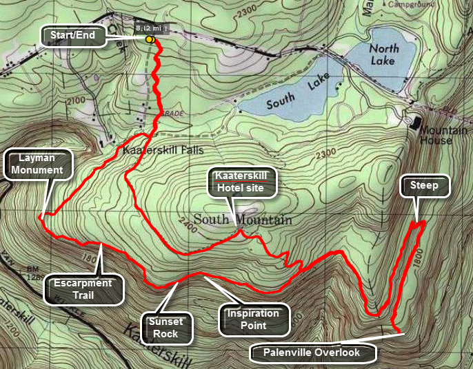 The hiking trails around the North Lake South Lake Campgrounds may be the most scenic in the Catskills.
As you hike the Escarpment Trail the history and the views just seem to get better with every passing
mile. Many spots have names like Inspiration Point and Artist's Rock. Even places that aren't
named have beautiful views of the Hudson River and surrounding countryside.
The hiking trails around the North Lake South Lake Campgrounds may be the most scenic in the Catskills.
As you hike the Escarpment Trail the history and the views just seem to get better with every passing
mile. Many spots have names like Inspiration Point and Artist's Rock. Even places that aren't
named have beautiful views of the Hudson River and surrounding countryside.
Turn north on Rt 18 from Rt 23A in the town of Haines Falls. After about 1 mile, turn right on Schutt Road just before the entrance to the state campgrounds. Turn left into the parking area. Walk across Schutt Road to the beginning of the blue marked Escarpment Trail. Several different trails intersect the Escarpment Trail at different places. Some of these trails are horse trails of snowmobile trails and not all are well marked.
Stay on the blue Escarpment trail for about .65 miles as it descends slightly and crosses an old railroad grade. Cross a bridge and then make a quick left on the a right onto the red Schutt Road Trail. Stay on this trail for about .25 miles and then turn onto a yellow trail on the right. Continue on the yellow trail for .35 miles before turn left on the blue Escarpment Trail. In about .35 miles you will be at Sunset Point which is marked with a sign. Another .35 miles brings you to a sign that announces Inspiration Point. In about .55 miles the Escarpment Trail turns sharply left and the red Harding Road Trail continues straight ahead. Walk on the Harding Road trail for several hundred feet until it turns right in a near 180 degree bend and head DOWN.
At this point continue ahead on the horse trail for .85 miles as it winds and switchbacks its way down. At the base of a steep, short hill turn right and walk .55 miles out to the Palenville Lookout. After taking in the sights retrace your steps back to where you took the right and turn right. Walk along the horse trail for .8 miles looking for some trail up to the higher levels. At this point a snowmobile trail heads up toward the beach area of North Lake. From hear walk .15 miles up to the empty field that was the site of the Catskill mountain House. Retrace your steps back to the roads that loop around the lakes and turn left to follow the roads .6 miles to the west, outlet end of South Lake. Take in the view and then continue .5 miles back to the gatehouse. Walk .1 miles out passed the gatehouse and turn left on Schutt Road. Walk .15 miles down Schutt Road and back to the car.
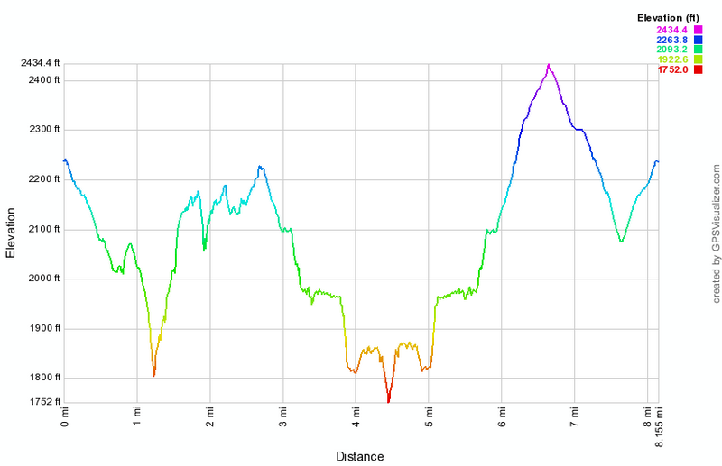 (The image at the left shows the profile of the hike. Remember that all vertical profiles are relative!)
North South Lake: Palenville Lookout (Big Loop)
| Quick Look | ||||
|---|---|---|---|---|
| Difficulty | Round trip | Total climb | Internet Maps | |
| 7.9 mi. | 1195 ft. | AllTrails | ||
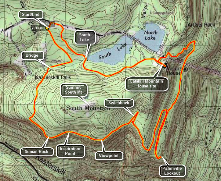 The hiking trails around the North Lake South Lake Campgrounds may be the most scenic in the Catskills.
As you hike the Escarpment Trail the history and the views just seem to get better with every passing
mile. Many spots have names like Inspiration Point and Artist's Rock. Even places that aren't
named have beautiful views of the Hudson River and surrounding countryside.
The hiking trails around the North Lake South Lake Campgrounds may be the most scenic in the Catskills.
As you hike the Escarpment Trail the history and the views just seem to get better with every passing
mile. Many spots have names like Inspiration Point and Artist's Rock. Even places that aren't
named have beautiful views of the Hudson River and surrounding countryside.
Turn north on Rt 18 from Rt 23A in the town of Haines Falls. After about 1 mile, turn right on Schutt Road just before the entrance to the state campgrounds. Turn left into the parking area. Walk across Schutt Road to the beginning of the blue marked Escarpment Trail. Several different trails intersect the Escarpment Trail at different places. Some of these trails are horse trails of snowmobile trails and not all are well marked.
Stay on the blue Escarpment trail for about .65 miles as it descends slightly and crosses an old railroad grade. Cross a bridge and then make a quick left on the a right onto the red Schutt Road Trail. Stay on this trail for about .25 miles and then turn onto a yellow trail on the right. Continue on the yellow trail for .35 miles before turn left on the blue Escarpment Trail. In about .35 miles you will be at Sunset Point which is marked with a sign. Another .35 miles brings you to a sign that announces Inspiration Point. In about .55 miles the Escarpment Trail turns sharply left and the red Harding Road Trail continues straight ahead. Walk on the Harding Road trail for several hundred feet until it turns right in a near 180 degree bend and head DOWN.
At this point continue ahead on the horse trail for .85 miles as it winds and switchbacks its way down. At the base of a steep, short hill turn right and walk .55 miles out to the Palenville Lookout. After taking in the sights retrace your steps back to where you took the right and turn right. Walk along the horse trail for .8 miles looking for some trail up to the higher levels. At this point a snowmobile trail heads up toward the beach area of North Lake. From hear walk .15 miles up to the empty field that was the site of the Catskill mountain House. Retrace your steps back to the roads that loop around the lakes and turn left to follow the roads .6 miles to the west, outlet end of South Lake. Take in the view and then continue .5 miles back to the gatehouse. Walk .1 miles out passed the gatehouse and turn left on Schutt Road. Walk .15 miles down Schutt Road and back to the car.
 (The image at the left shows the profile of the hike. Remember that all vertical profiles are
relative!)
(The image at the left shows the profile of the hike. Remember that all vertical profiles are
relative!)
North South Lake: Palenville Lookout (Sleepy Hollow)
| Quick Look | ||||
|---|---|---|---|---|
| Difficulty | Round trip | Total climb | Internet Maps | |
| 8.8 mi. | 2007 ft. | AllTrails | ||
 The hiking trails around the North Lake South Lake Campgrounds may be the most scenic in the Catskills.
As you hike the Escarpment Trail the history and the views just seem to get better with every passing
mile. Many spots have names like Inspiration Point and Artist's Rock. Even places that aren't
named have beautiful views of the Hudson River and surrounding countryside.
The hiking trails around the North Lake South Lake Campgrounds may be the most scenic in the Catskills.
As you hike the Escarpment Trail the history and the views just seem to get better with every passing
mile. Many spots have names like Inspiration Point and Artist's Rock. Even places that aren't
named have beautiful views of the Hudson River and surrounding countryside.
This hike requires two cars for a car shuttle or you will have to double the mileage! Turn north on White Road just west of Palenville on Route 23A. Bear left and park one car in the parking area. Drive back down White Road to Route 23A and turn left. Take the next left on Bogart Road Drive to the junction with Mountain House road and turn left. Drive to the gate and park on the side of the road but DO NOT block the gate. Get on the wide woods road that leads up to the escarpment. The first 1 mile of the hike parallels Stony Brook and there are numerous falls and rapids along the way. Many of these falls are on private property. At 1 mile the trail turns to the left and crosses Stony Brook on a bridge. At this point there is a rock upstream from the bridge that, in the Legend of Sleepy Hollow, was Rip Van Winkle's resting place. This was also the site of the Rip Van Winkle house. The trail now heads generally south with one large switchback as it continues its ascent for the next 1.9 miles. Watch to your left along the way for several nice viewpoints. At 3.3 miles the trail crosses of right-of-way which was originally cut for the Otis Elevating Railway. The railway hauled passengers from the valley to the Catskill Mountain House. This area of the trail is often VERY wet. At 3.8 miles there is a trail junction and you should continue straight ahead to go to the Palenville Lookout which is about a .5 mile walk. At the main part of the lookout there is the remains of a foundation and some stone furniture that hikers have constructed. The view from here is outstanding particularly on a clear day. Palenville is just below but you can see out to the Hudson and beyond. You may walk along the escarpment to the left for some additional views. When you are ready, walk back up the trail and turn on the path to the left that takes you out to another lookout. This viewpoint better allows you to look back up Kaaterskill Clove. Back on the main trail walk to the trail junction, turn left and get ready for a short but steep ascent that approaches a 30% grade! The horse trail will continue to climb for the next .85 miles to a trail junction. Turn left on Harding Road. This road was constructed to bring materials to the plateau to build the Kaaterskill Hotel owned by George Harding. This road props 00 feet over the next 2.4 Niles and has several switchbacks that were needed to allow horse drawn wagons to make the grade. Watch to your right along the way for viewpoints. There is at least one stream crossing but you will not get your feet wet. At the end of the road a short trail takes you the additional .5 miles to the parking area.
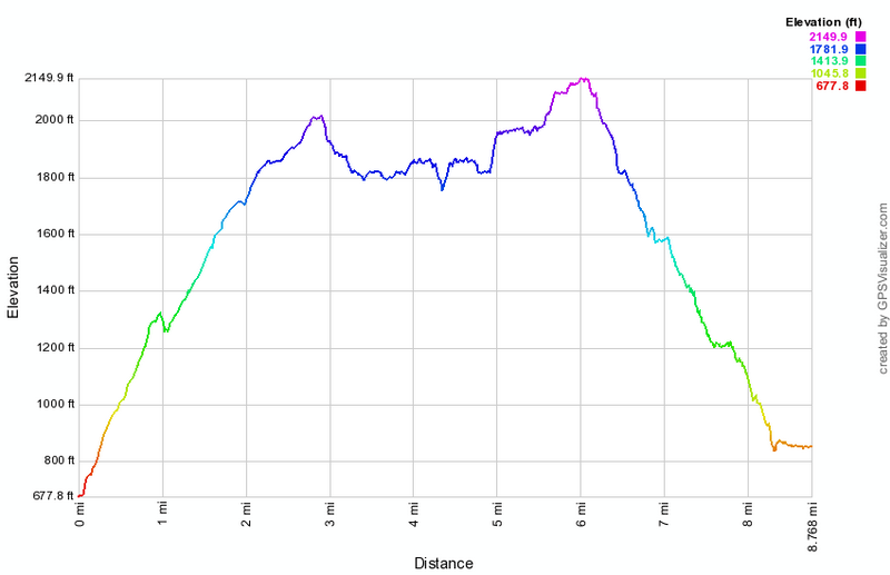 (The image at the left shows the profile of the hike. Remember that all vertical profiles are relative!)
North South Lake: Stoppel Point
| Quick Look | ||||
|---|---|---|---|---|
| Difficulty | Round trip | Total climb | Internet Maps | |
| 7.6 mi. | 1496 ft. | AllTrails | ||
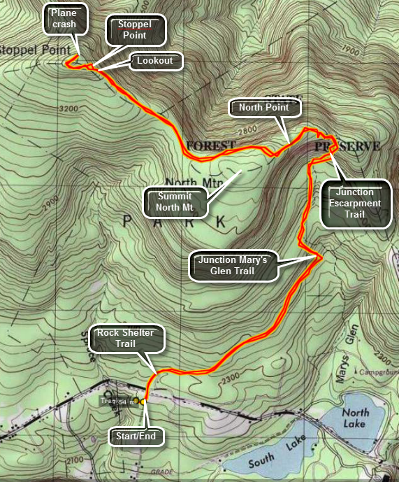 The hiking trails around the North Lake South Lake Campgrounds may be the most scenic in the Catskills.
As you hike the Escarpment Trail the history and the views just seem to get better with every passing
mile. Many spots have names like Inspiration Point and Artist's Rock. Even places that aren't
named have beautiful views of the Hudson River and surrounding countryside. There are many combinations of paths that
can ;lead to Stopple Point. This path is the shortest and most direct.
The hiking trails around the North Lake South Lake Campgrounds may be the most scenic in the Catskills.
As you hike the Escarpment Trail the history and the views just seem to get better with every passing
mile. Many spots have names like Inspiration Point and Artist's Rock. Even places that aren't
named have beautiful views of the Hudson River and surrounding countryside. There are many combinations of paths that
can ;lead to Stopple Point. This path is the shortest and most direct.
Turn north on Rt 18 from Rt 23A in the town of Haines Falls. After about 1 mile, turn right on Schutt Road just before the entrance to the state campgrounds. Turn right into the parking area. Walk up Schutt Road and across CR-18 to the yellow marked Rock Shelter Trail. Follow this trail for 1.3 miles where it intersects the Mary's Glen Trail. Turn left and follow the Mary's Glen Trail .8 miles to the blue blazed Escarpment Trail. Turn left on the Escarpment Trail toward North Point. Be prepared to CLIMB as you ascend .2 miles to North Point. Take in the views of the lakes and campgrounds below. Stay on the Escarpment Trail as it rises for another .35 miles to an area near the summit of North Mountain. Continue on the Escarpment Trail for another 1.4 miles to an open rock ledge which is Stoppel Point. Enjoy the views to the north and east before turning around and retracing your steps. If you want, continue on the Escarpment Trail for another .5 miles to the wreckage of an old airplane before turning around.
 (The image below shows the profile of the hike. Remember that all vertical profiles are
relative!)
(The image below shows the profile of the hike. Remember that all vertical profiles are
relative!)
Onteora Lake
| Quick Look | ||||
|---|---|---|---|---|
| Difficulty | Round trip | Total climb | Internet Maps | |
| 7.1 mi. | 884 ft. | AllTrails | ||
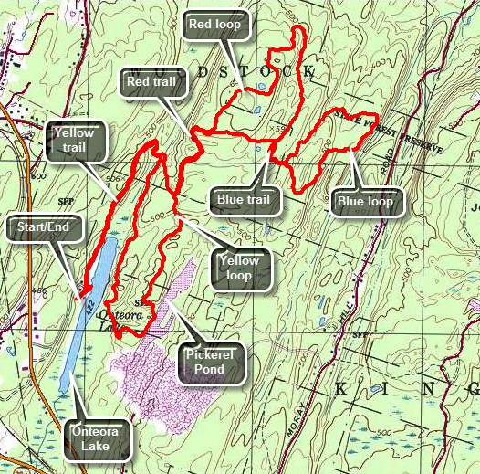 Bluestone State Forest is near Kingston. There are two sets of trails in the area that are used for both hiking and mountain biking. There are three trail loops near Onteora Lake and another set of trails just east of Onteora Lake on Jockey Hill. Drive west on Route 28 from Kingston. The parking area is clearly marked on the right with a sign for Onteora Lake. Drive through the gate at the far end of the upper parking area to get to the lower lot. Begin your hike by heading out on the yellow trail which starts north on the west side of the lake. The first part of the trail has been made handicapped accessible and has a few picnic tables. The trail then shifts to a woods road which begins to get rocky pretty quickly. At .7 miles the trail turns around the north end of the lake and changes from northeast to almost due south. At .8 miles the yellow trail splits. Stay to the left. At .9 miles turn left at the junction with the red trail to begin the red loop. All three loops are "lollipops" with a "handle" that leads in to the loop and then back out again. At 1.3 miles you will be at the point where the red loop starts. Stay left as the trail climbs from the point where the red trail starts and reaches the highest point on the hike at 1.6 miles. Along the way the trail has some ups and downs but only gains a little over 200 feet from the point where the yellow loops splits. There are no real views along the way but the trail passes through some boulders and is generally fun to hike. The blazes are spaced a little farther apart than usual but this may be because it is maintained by the mountain bike club and they move a little faster than hikers. As you continue on the red loop the trail gets considerably rockier and more narrow in some areas. There are a few blowdowns across the trail. Some are low enough to jump on a bike but others require dismounting. At 2 miles the red loop makes a turn and heads south climbing another hill. At 2.5 miles the blue trail appears on the left. Turn here to access the blue trail loop. The handle of this trail is the shortest and in about .15 miles the trail splits to begin the loop. Stay to the left immediately dropping about 100 feet as you head north and east. At 3.1 miles the trail turns southeast to loop back to where the blue trail started and gains the elevation lost at the beginning. The blue trail is by far the rockiest of the three trails and has areas where even the most experienced mountain biker would have problems. Once you are back at the trail junction with the red trail continue almost straight ahead to get back onto the red trail. DO NOT turn left on the well-used path as it is not part of the blazed loops. The red trail goes east for about .25 miles to the point where the red trail splits. Turn left and follow the handle .4 miles southwest back to the yellow trail. Turn left on the yellow trail which heads southwest for about .6 miles to the shores of Pickerel Pond. This pond is more interesting in some ways than Onteora Lake. The yellow trail follows the western shore of the pond for a short distance and then turns west at 5.3 miles to cross over to the eastern shore of Onteora Lake. Once on the shore of the lake the trail heads northeast for.7 miles back to the point where the yellow trail splits. The trail is sited on a ridge that runs along the eastern shore and does not offer many views. The trail rolls up and down a little and at one point passes between some rocks and up an incline. At 5.6 miles turn left to head back to the parking area on the yellow trail retracing your path from earlier. Watch for obvious signs of bluestone quarrying.
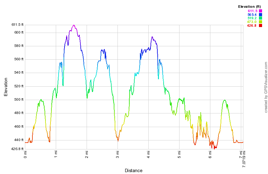 (The image at the left shows the profile of the hike. Remember that all vertical profiles are
relative!)
(The image at the left shows the profile of the hike. Remember that all vertical profiles are
relative!)
Otter Falls
| Quick Look | ||||
|---|---|---|---|---|
| Difficulty | Round trip | Total climb | Internet Maps | |
| 2.0 mi. | 320 ft. | AllTrails | ||
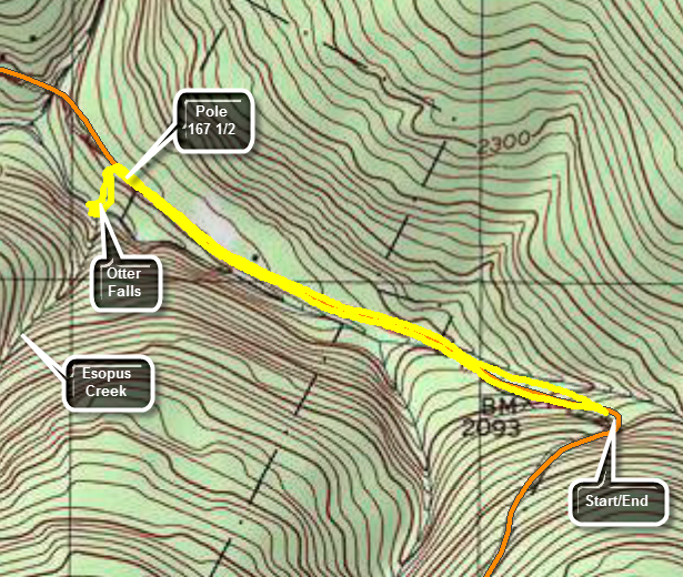 Otter Falls is located on as stream labeled as Esopus Creek on most maps which seems to originate at Winnisook Lake. marshal's has a TOTAL drop of about 0 feet as the water flows over the rocks into a pool below which is 6' to 8' deep even in dry conditions. The safest and best way to get to Otter Falls is to park at the trailhead for Giant Ledge on Route 47. Walk downhill and north on Route 47 toward Big Indian for about .85 miles. Check the labels on the telephone poles for the number 167 1/2. There are POSTED signs along the left side of the road and the maple trees are connected by plastic tubing indicating a substantial sugaring operation. Around .75 miles the POSTED signs give way to State Forest Preserve signs. A short distance further is Pole 167 1/2 and just a little farther along is a rather well-defined leading into the woods on the left. The path remains easy to follow although it is unmarked as it heads west into the woods and toward the stream for about 600 feet. When you get to the stream feel free to explore and enjoy the cool water. When you are finished, retrace your route back to the car.
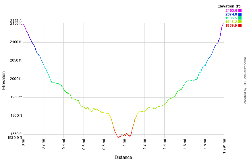 (The image at the left shows the profile of the hike. Remember that all vertical profiles are relative!)
Overlook Mountain: Kaaterskill PA
| Quick Look | ||||
|---|---|---|---|---|
| Difficulty | Round trip | Total climb | Internet Maps | |
| 10.6 mi. | 2236 ft. | AllTrails | ||
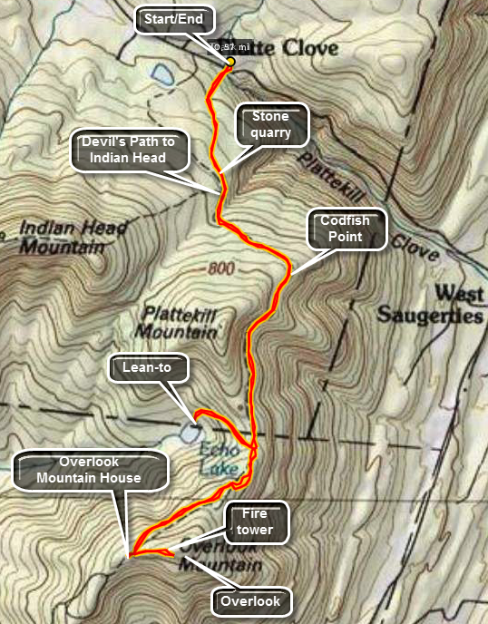 There are two trails that lead to Overlook Mountain and the sites found there. One trail comes up from
Meads Road and is about 5 miles or less round trip. This trail is actually an access road to the
WTZA-TV transmission tower and the state fire tower at the top of the mountain. The trail described
Here starts at or near the Kaaterskill PA and then continues across The Catskill Center Platte Clove
Preserve. This trail is almost 11 miles long round trip but offers the opportunity to visit
Echo Lake.
There are two trails that lead to Overlook Mountain and the sites found there. One trail comes up from
Meads Road and is about 5 miles or less round trip. This trail is actually an access road to the
WTZA-TV transmission tower and the state fire tower at the top of the mountain. The trail described
Here starts at or near the Kaaterskill PA and then continues across The Catskill Center Platte Clove
Preserve. This trail is almost 11 miles long round trip but offers the opportunity to visit
Echo Lake.
In Tannersville, find Platte Clove Road. Travel along this road until you find a pull-off on the
right for the Catskill Center Platte Clove Preserve. Parking here is limited. If there are no spaces,
continue for a short distance and turn into the Kaaterskill parking area on the left. Sign in at the trail
register. The first feature of the trail you will notice is a reconstruction of a post and tenon bridge
across the creek. The Catskill Center has provided "labels" for some of the trees and handy signs to
explain the role of the bluestone quarries in this area. After about a mile the red-blazed Devil's
Path begins on the left. Continue straight ahead on the blue-blazed Overlook Trail. In just .2 miles
you will be at the Devil's Kitchen lean-to. Another 2 miles brings you to the turn-off to Echo Lake.
This spur trail is blazed in yellow and is about .6 miles long. The descent and subsequent ascent
is steep and rocky. Echo Lake is a beautiful, natural lake surrounded by mountains. There is a lean-to
on the shore. Continue another 1.5 miles to the ruins of the Overlook Mountain Mountain House and the
WTZA-TV tower. The ruins are interesting and only the stone building blocks remain. A trail continues
.5 miles up to the Overlook Fire Tower. This tower sits on a prominent rock plateau. It offers
spectacular views of the Ashokan Reservoir, the Mountain House ruins and the surrounding hills and
valleys. Try to pick a clear day to that your view and the pictures you take are not cloudy by the haze
that can hang in the air. Return the same way you came for a round-trip of just under 11 miles.
 (The image at the left shows the profile of the hike. Remember that all vertical profiles are
relative!)
(The image at the left shows the profile of the hike. Remember that all vertical profiles are
relative!)
Overlook Mountain: Meades Mountain Road
| Quick Look | ||||
|---|---|---|---|---|
| Difficulty | Round trip | Total climb | Internet Maps | |
| 4.7 mi. | 1409 ft. | AllTrails | ||
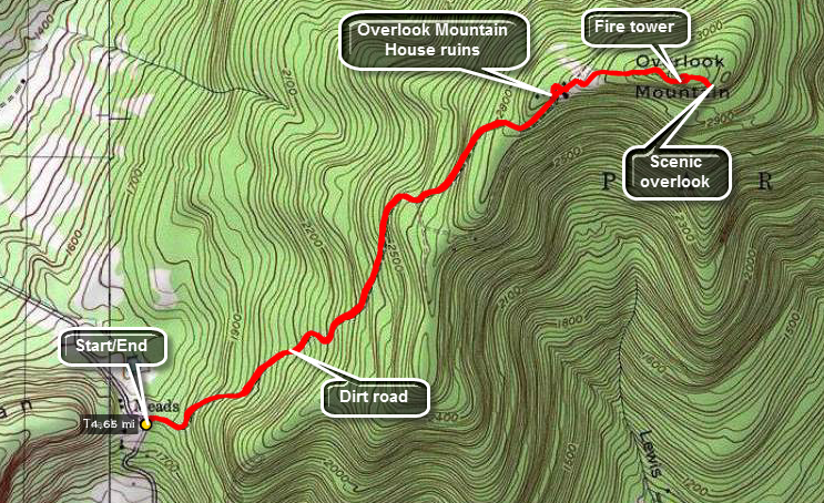 There are two trails that lead to Overlook Mountain and the sites found there. One trail comes up from
Meads Road and is about 5 miles or less round trip. This trail is actually an access road to the
WTZA-TV transmission tower and the state fire tower at the top of the mountain. The trail described
Here starts at or near the Kaaterskill PA and then continues across The Catskill Center Platte Clove
Preserve. This trail is almost 11 miles long round trip but offers the opportunity to visit
Echo Lake.
There are two trails that lead to Overlook Mountain and the sites found there. One trail comes up from
Meads Road and is about 5 miles or less round trip. This trail is actually an access road to the
WTZA-TV transmission tower and the state fire tower at the top of the mountain. The trail described
Here starts at or near the Kaaterskill PA and then continues across The Catskill Center Platte Clove
Preserve. This trail is almost 11 miles long round trip but offers the opportunity to visit
Echo Lake.
Finding the trailhead for the Meades Mountain Road route may be the hardest part of the hike. Head south and east from Phoenicia on Route 28. In about 4 miles turn east on Route 212. Route 212 heads generally east. Just passed Cooper's Lake turn left on Church Road. At the T turn left and then turn/bear right on Meades Mountain Road which may also be marked McDaniel Road. Drive for about 2.5 miles until a parking area appears on the left. Park your car and get on the access road to the tower. After walking about 1.75 miles on the road, the ruins of the Overlook Mountain House will be straight ahead. Look around the ruins. When done continue on the trail on the other side. The trail from Platte Clove and Echo lake will come in on the left. In about .4 miles you will be at the cabin. Turn left to go to the fire tower. On the way back walk behind the cabin and walk to the viewpoint that give Overlook Mountain its name. Follow the road back to your car.
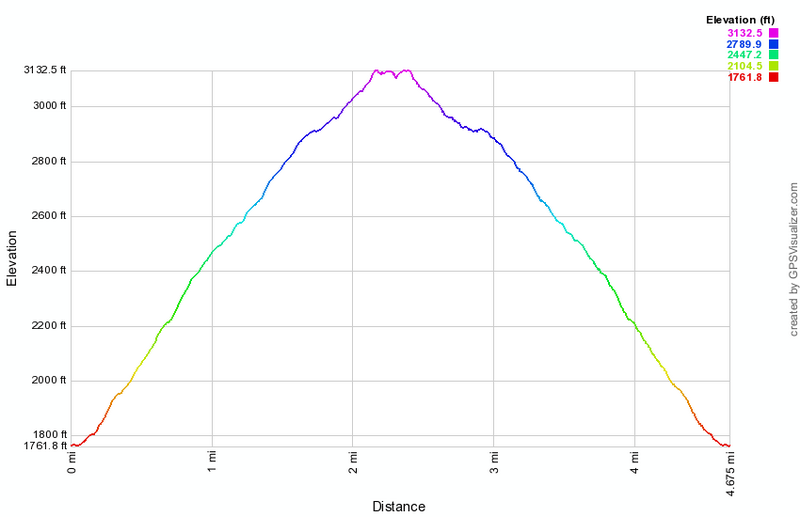 (The image at the left shows the profile of the hike. Remember that all vertical profiles are
relative!)
(The image at the left shows the profile of the hike. Remember that all vertical profiles are
relative!)
Palmer Hill
| Quick Look | ||||
|---|---|---|---|---|
| Difficulty | Round trip | Total climb | Internet Maps | |
| 3.3 mi. | 630 ft. | AllTrails | ||
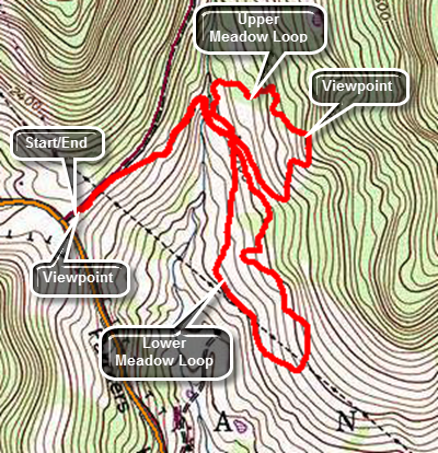
Exit Route 17 at Roscoe and head north on Route 206 to the Pepacton Reservoir. Turn right at the T on Route 30 and follow it all the way to Route 28. Turn left toward Andes and soon you will be climbing Palmer Hill. Watch for Finkle Road on the right and pull into the parking area. The view from the parking area is great. A signboard shows a picture of the view with all the peaks and hills labeled. All the peaks from Balsam Lake and Graham through Doubletop and Balsam are visible. The trail leaves the far end of the parking area and the first half mile descends to a small brook. The trail passes through wide corridors which have been mowed through the grass and then enters the woods on an old road. Just after the brook crossing are the foundations from a farm and then the first trail junction. The trail junction is sort of a "times square" since at this point you can choose to do the upper meadow or lower meadow or any combination. For some it is better to get the climbing in at the beginning of the hike and so turn left to start to the upper meadow. The trail shortly enters the woods and begins a half mile ascent to the highest point on the hike. The vertical gain is only about 250 feet and the average grade is around 9%. There are a few steeper areas which are between 15% and 20% for short distances. Along the way there are some nice stone walls as you loop in a clockwise direction. At the high point there is a field with some since views of the surrounding hills. The trail then begins to descend for about .4 miles back to the trail junction losing around 200 feet. Turn left at the junction and almost immediately bear right at another split in the trail. Continue to descend through paths mowed through the fields. At 1.85 miles you will hit the lowest spot on the hike and walk beneath some powerlines for a short distance. You will leave and then rejoin the powerlines. At 2.1 miles you will complete the turn and start back toward the trail junction. The route roughly parallels your path on the way out but winds through the trees with a few ups and downs. By 2.75 miles you will be back at the trail junction. Continue back up the woods road and to the car.
 (The image below shows the profile of the hike. Remember that all vertical profiles are
relative!)
(The image below shows the profile of the hike. Remember that all vertical profiles are
relative!)
Parksville Rail Trail Loop
| Quick Look | ||||
|---|---|---|---|---|
| Difficulty | Round trip | Total climb | Internet Maps | |
| 2.8 mi. | 230 ft. | AllTrails | ||
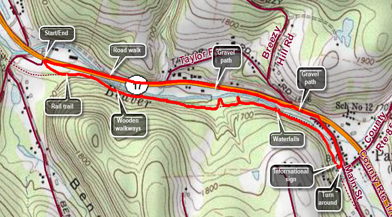
Exit Route 17 at exit 98 Parksville and proceed through the first four way intersection to the second. Turn left and drive on Old Route 17 for about 1.4 mils. Park in the parking area on the left just before Fox Mountain Road. Start your hike on the gravel covered rail trail that runs between the Little Beaverkill on the left and State Route 17 on the right. This trail follows the route of the O&W Railroad which played an interesting and historic role in Sullivan County history. The trail is almost completely flat and passes over several bridges and wooden walkways. There are many opportunities to walk down to the stream bed to take pictures. About 2/3 of the way along the trail there is a nice falls which can be viewed from high on the trail or by working your way down to the stream bed. At the end of the trail is a small garden o n the right with a sign that explains the history of the railroad and Parksville. Turn left and then left again on Main Street. Walk on Main Street until it meets Old Route 17. Turn left and walk on the gravel path through two parking areas. At the second parking area the gravel path ends. Walk on the shoulder of the road back to your car
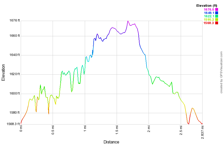 (The image shows the profile of the hike. Remember that all vertical profiles are relative!)
Parksville Rail Trail Out and Back (Fox Mt)
| Quick Look | ||||
|---|---|---|---|---|
| Difficulty | Round trip | Total climb | Internet Maps | |
| 2.6 mi. | 230 ft. | AllTrails | ||
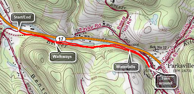
Exit Route 17 at exit 98 Parksville and proceed through the first four way intersection to the second. Turn left and drive on Old Route 17 for about 1.4 mils. Park in the parking area on the left just before Fox Mountain Road. Start your hike on the gravel covered rail trail that runs between the Little Beaverkill on the left and State Route 17 on the right. This trail follows the route of the O&W Railroad which played an interesting and historic role in Sullivan County history. The trail is almost completely flat and passes over several bridges and wooden walkways. There are many opportunities to walk down to the stream bed to take pictures. About 2/3 of the way along the trail there is a nice falls which can be viewed from high on the trail or by working your way down to the stream bed. At the end of the trail is a small garden on the right with a sign that explains the history of the railroad and Parksville. To return to your car just turn around and hike back along the trail.
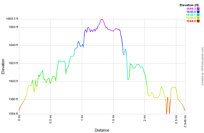 (The image shows the profile of the hike. Remember that all vertical profiles are relative!)
Parksville Rail Trail Out and Back (Parksville)
| Quick Look | ||||
|---|---|---|---|---|
| Difficulty | Round trip | Total climb | Internet Maps | |
| 2.8 mi. | 230 ft. | AllTrails | ||
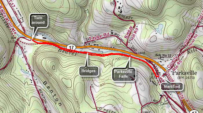
Exit Route 17 at exit 98 Parksville and proceed to the first four way intersection. Turn left and park along the side of the street where space is available. As an alternative drive through the first intersection to the second and park in the larger lot on the right. Walk from here to the trailhead. Start your hike on the gravel covered rail trail that runs between the Little Beaverkill on the right and State Route 17 on the left. At the beginning of the trail is a small garden on the left with a sign that explains the history of the railroad and Parksville. The trail follows the route of the O&W Railroad which played an interesting and historic role in Sullivan County history. The trail is almost completely flat and at .4 miles you will come to Parksville Falls. You can carefully walk down to the stream bed above and below the falls to get a clear view. At .8 miles the trail passes over several bridges and wooden walkways. Just after the walkways is a nice view upstream on the Little Beaverkill. There are many opportunities to walk down to the stream bed to take pictures. You may find some markers left over from the railroad days. At the end of the trail is the western parking area for the rail trail. To return to your car just turn around and hike back along the trail.
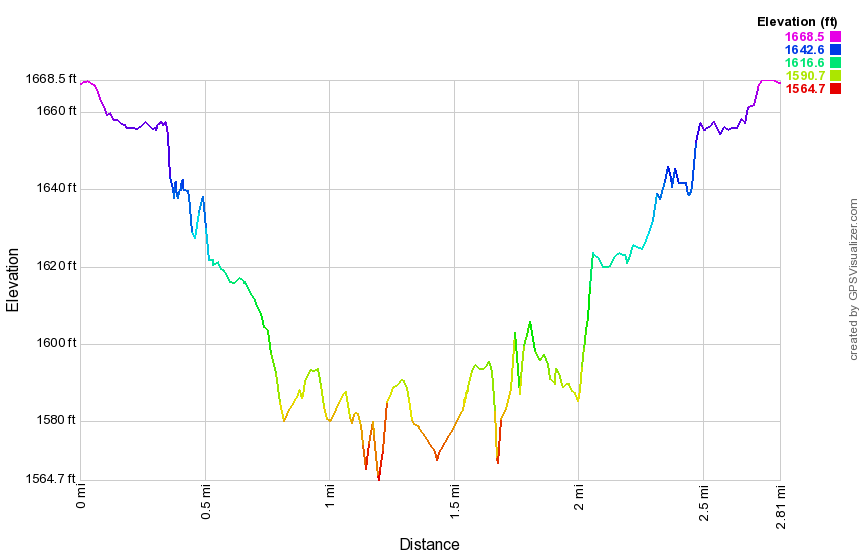 (The image shows the profile of the hike. Remember that all vertical profiles are relative!)
Parksville Rail Trail (Old Liberty Rd)
| Quick Look | ||||
|---|---|---|---|---|
| Difficulty | Round trip | Total climb | Internet Maps | |
| 3.4 mi. | 230 ft. | AllTrails | ||
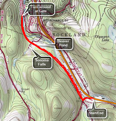
Exit Route 17 at exit 98 Parksville and proceed to the second four way intersection. Turn left and continue along Service Road to the parking lot across from the gas station near Fox Mountain Road. Begin your hike by exiting the parking lot and turning left and the left again on Fox Mountain Road. Walk under State Route 17 and over the bridge that span a small stream, the Little Beaverkill. Hop over the guard rail on the right to start out on a well-defined path. Watch on your right for what remains of the trestle that carried trains over the stream. Walk up a small cline to the main railroad bed. The trail is very obvious and is flat and extends for some distance. As you walk, you may find some "treasures" of past years including a Volkswagon Bug on the right side of the trail. When you come to the gate across the trail at about 1 mile, simply walk around the end and continue to walk along the trail parallel to the river. Watch for a small pond on the right with a red building with all the windows boarded up. At 1.3 miles there will be a driveway on the left which leads to Sonoma Falls. This is private property so DO NOT HIKE without permission. Some local business people bought the property and built a cider mill and market. They took the time to construct some hiking trails along the stream. There are at least five different falls which increase in height as you continue upstream. The main building is still intact with the original lettering. There is also a stock pond on the property. A trail extends along the left side of the stream from which you can get a good view of most of the falls. Continue straight ahead on the main trail which intersects Old Liberty Road about .4 miles from Sonoma Falls where there is a gate. Look to your left as you walk to see the rock cuts that allowed the railroad to pass through. The trail continues passed this point as it parallels the road on the left side. The trail comes to another trestle that passes over Old Liberty Road near the intersection with Dahlia Road. Another trestle carried the tracks over the river to the other side. A project is the planning stage to connect all the sections of rail trail so that they are continuous from Parksville to Livingston Manor.
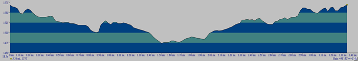 (The image shows the profile of the hike. Remember that all vertical profiles are relative!)
Parksville Rail Trail to Sonoma Falls
| Quick Look | ||||
|---|---|---|---|---|
| Difficulty | Round trip | Total climb | Internet Maps | |
| 4.0 mi. | 335 ft. | AllTrails | ||
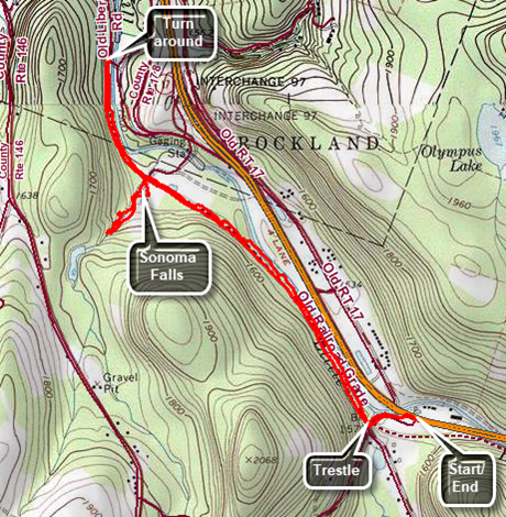
Exit Route 17 at exit 98 Parksville and proceed to the second four way intersection. Turn left and continue along Service Road to the parking lot across from the gas station near Fox Mountain Road. Begin your hike by exiting the parking lot and turning left and the left again on Fox Mountain Road. Walk under State Route 17 and over the bridge that span a small stream, the Little Beaverkill. Hop over the guard rail on the right to start out on a well-defined path. Watch on your right for what remains of the trestle that carried trains over the stream. Walk up a small cline to the main railroad bed. The trail is very obvious and is flat and extends for some distance. As you walk, you may find some "treasures" of past years including a Volkswagon Bug on the right side of the trail. When you come to the gate across the trail at about 1 mile, simply walk around the end and continue to walk along the trail parallel to the river. Watch for a small pond on the right with a red building with all the windows boarded up. At 1.3 miles there will be a driveway on the left which leads to Sonoma Falls. This is private property but it is difficult to find out who owns it as none of the signs have a name of a telephone number. The town supervisors for Liberty and Rockland believe it is acceptable to walk around the property. At one time there was a campground on the property. Some local business people bought the property and built a cider mill and market. They took the time to construct some hiking trails along the stream. There are at least five different falls which increase in height as you continue upstream. The main building is still intact with the original lettering. There is also a stock pond on the property. A trail extends along the left side of the stream from which you can get a good view of most of the falls. When you are done, return to the main trail and turn left. The trail intersects Old Liberty Road about .4 miles from Sonoma Falls where there is a gate. Look to your left as you walk to see the rock cuts that allowed the railroad to pass through. The trail continues passed this point as it parallels the road on the left side. The trail comes to another trestle that passes over Old Liberty Road near the intersection with Dahlia Road. Another trestle carried the tracks over the river to the other side. A project is the planning stage to connect all the sections of rail trail so that they are continuous from Parksville to Livingston Manor.
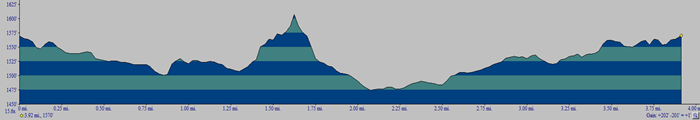 (The image shows the profile of the hike. Remember that all vertical profiles are relative!)
Pelnor Hollow: Pelnor Hollow Road and Little Spring Brook Trails
| Quick Look | ||||
|---|---|---|---|---|
| Difficulty | Round trip | Total climb | Internet Maps | |
| 5.8 mi. | 1287 ft. | AllTrails | ||
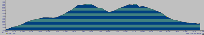 This hike requires a carspot and shuttle. There is no parking at the end of Pelnor Hollow Road. Areas of these trails may not be well-maintained or well marked.
From Livingston Manor, drive west on State Route 17 and get off at Exit 94 for Roscoe. Follow Route 206 north through Roscoe and Rockland heading toward Downsville. Just before starting up Brock Mountain turn right on Little Spring Brook Road and drive to the parking area at the end. Drop a car here and drive back out Little Spring Brook Road. Turn left on Route 206 and, after a short distance left, on Beaverkill Valley Road. Pass Prince Hall and the Craige Claire iron bridge. Watch for Pelnor Hollow Road on the left right after Dundas Castle. Turn left and rive to the end of the road passing many "No Parking" and "Keep Out" signs to make you feel welcome. After about a mile, the road effectively ends at a gate. This is where your hike begins and where the driver should drop you off. DO NOT park a car in this area as it is private property. It is best to have someone drop you at the end of the road. If you must park, find a wide place along the road further down the hill. Although the road continues after the gate, it is NOT RECOMMENDED that you attempt to drive it.
Stay on the road which is an easement through private property. The road may be wet and muddy in places and is eroded with rocks in many spots. Pass over two bridges that cross small streams. After a short walk you will arrive at the cabin on the left side of the trail which is the last building on the road. There are state land signs just after the cabin. The road deteriorates but is still passable and leads to a wide spot in the trail where the road definitely ends. A sign indicates that the lean-to is .5 miles up the trail. The trail narrows from woods road width to trail width as it enters a hardwood forest. The walk to the lean-to may seem longer than a half mile but the trail flattens. At 1.5 miles there is a lean-to on the left of the trail. A sign at the lean-to indicates distances which is unusual out in the middle of nowhere. Continue passed the lean-to and begin a climb up one of two hills on the Pelnor Hollow Trail. Sections of this trail may be poorly maintained with patches of briars. The trail may also be poorly blazed. From the lean-to the walk is about .8 miles to the top of the hill gaining around 470 feet. Watch for some interesting glacial erratics and rock formations along the trail. You will now descend briefly before climbing the next hill. The walk from hilltop to hilltop is about 1.35 miles. In this area, at about 3.8 miles, you will find the junction with the red-blazed Mary Smith Trail. Turn left to continue on the Pelnor Hollow Trail.
Over the next .15 miles the trail drops 160 feet to Split Rock Lookout. The grade is 21% and requires some careful foot placement so carefully descend. The trail loops north to avoid a ravine or hollow and then comes back to the south. Over the next miles the trail descends 470 feet. Although the grade is only 9%, there are some steeper places and it can be tricky when the numerous rocks are wet. The trail eventually flattens and passed through a pine plantation before ending at a trail junction with the Campbell Mountain Trail and the Little Spring Brook Trail. Take a look at the signs here. The DEC has been known to post signs with errors but the ones here are ridiculous. The signs give incorrect trail names and incorrect distances. For seasoned hikers they may not be a problem but for those new to hiking this area they are completely confusing. Turn left of the Little Spring Brook Trail and start to walk down the woods road toward the pond. At the upper end of the pond the trail can disappear as the pond has gotten larger over the years since the trail was marked. Watch for a path along the right side of the pond and follow it. If you lose the path, simply continue to skirt the pond. You may want to walk down to the shore of the pond as it is a beautiful place. Continue to follow the path or make your own until you pass the mouth of the outlet end of the pond and the stone wall. There are some beautiful stone walls and a large culvert to take the brook beneath what once was a much larger road. Once you walk over the culvert the trail follows the old road which is very eroded. The trail should be to the left of the brook. The trail can be wet as the brook spreads out in places. The trail is very rocky which makes it difficult to hike. Continue out the trail and a short stretch of road to where your car is parked.
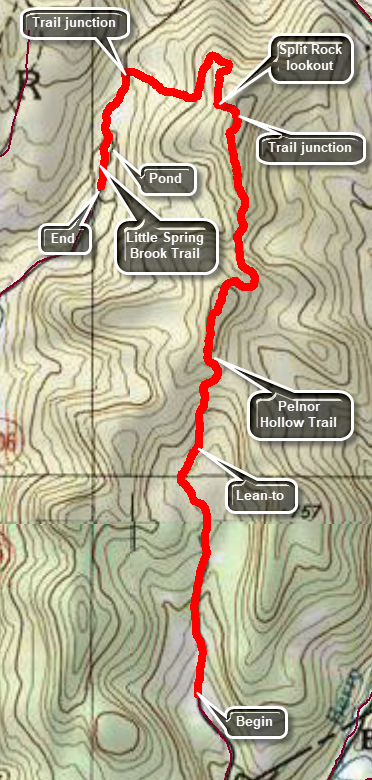 (The image shows the profile of the hike. Remember that all vertical profiles are relative!)
Pelnor Hollow: Pelnor Hollow Road to Mary Smith Hill Road
| Quick Look | ||||
|---|---|---|---|---|
| Difficulty | Round trip | Total climb | Internet Maps | |
| 8.0 mi. | 2278 ft. | AllTrails | ||
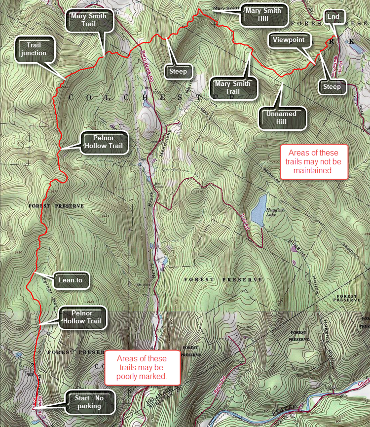 This hike requires a carspot and shuttle. There is no parking at the end of Pelnor Hollow Road. Areas of these trails may not be well-maintained or well marked.
From Livingston Manor, drive north on Old Route 17 toward Roscoe. Turned right on the Beaverkill Road and drive north to Lew Beach> Turn left on Mary Smith Hill Road just passed the firehouse. After a few miles, the paving ends and the road becomes packed dirt. After 3 miles, there is a small parking area on the right where the trail crosses the road. Park one car here. Drive back down Mary Smith Hill Road to the Beaverkill Road and turn right. Drive back to the Beaverkill Campground Road and turn right. Where the road splits at the bottom of the hill, turn left on Carigie Claire Road until it passes over the iron bridge and meets Beaverkill Valley Road. Turn right and drive until Pelnor Hollow Road appears on the left. Turn left and begin the uphill drive on a dirt road. After about a mile, the road effectively ends at a gate. This is where your hike begins and where the driver should drop you off. DO NOT park a car in this area s it is private property. It is best to have someone drop you at the end of the road. If you must park, find a wide place along the road further down the hill. Although the road continues after the gate, it is NOT RECOMMENDED that you attempt to drive it.
Stay on the road which is an easement through private property. The road Amy be wet and muddy in places and is eroded with rocks in many spots. Pass over two bridges that cross small streams. After a short walk you will arrive at the cabin on the left side of the trail which is the last building on the road. There are state land signs just after the cabin. The road deteriorates but is still passable and leads to a wide spot in the trail where the road definitely ends. A sign indicates that the lean-to is .5 miles up the trail. The trail narrows from woods road width to trail width as it enters a hardwood forest. The walk to the lean-to may seem longer than a half mile but the trail flattens. At 1.5 miles there is a lean-to on the left of the trail. A sign at the lean-to indicates distances which is unusual out in the middle of nowhere. Continue passed the lean-to and begin a climb up one of two hills on the Pelnor Hollow Trail. Sections of this trail may be poorly maintained with patches of briars. The trail may also be poorly blazed. From the lean-to the awl is about a mile to the top of the hill gaining around 500 feet. Watch for some interesting glacial erratics and rock formations along the trail. You will now descend briefly before climbing the next hill. The walk from Hilltop to hilltop is about 1.4 miles. In this area you will find the junction with the red-blazed Mary Smith Trail. Turn right on this trail.
The trail is mostly downhill for 1.1 miles to Berry Brook Road. It may be wet and muddy in spots and there are some interesting twists and turns. You will walk out of the woods to a power line right-of-way. Cross the right-of-way and head a little to the left to pick up the trail on the other side. Walk out to the road and immediately cross following the trail into the woods. The trail almost immediately begins to climb and the climb gets steeper. The trail has some very steep areas but a few switchbacks help mediate the climb. There are some massive boulders and other rock formations along the trail. For about .4 miles the grade is 20% and then the trail levels some. At 5.9 miles you will be at the highest point of the trail on Mary Smith Hill. Now you will begin to descend and then hike through a trail section that rolls a little along the ridge. At 7.1 miles you will be at the top of an unnamed hill which is about 150 feet higher than Mary Smith Hill. From this point it is downhill all the way but the downhill is steep. From the top of the hill descend to a viewpoint at 7.5 miles which has a view to the south. From the viewpoint the descent lasts only .4 miles but loses 500 feet on a 23% grade. At the bottom of the descent is a primitive camping area, fire ring and the parking lot with your car.
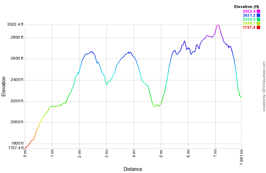 (The image below shows the profile of the hike. Remember that all vertical profiles are relative!)
Pelnor Hollow: Pelnor Hollow Road to Lean-to
| Quick Look | ||||
|---|---|---|---|---|
| Difficulty | Round trip | Total climb | Internet Maps | |
| 4.0 mi. | 830 ft. | AllTrails | ||
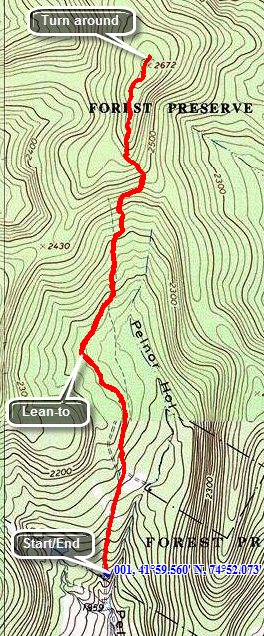 This short hike doesn't gain much elevation but leads to a nice, secluded lean-to.
Head out of Roscoe on Route 206. Turn right on Berry Brook Road just after the county line and drive for around 3 miles. Turn left on Pelnor Hollow Road. Pelnor Hollow Road turns to a dirt road quickly and soon becomes a "track" which is barely passable by car. The road functionally ends at a small cabin on the left. You may turn around at the cabin and back up the road to park. Be aware that this is probably NOT a good idea. There area two alternatives to driving this part of the road and parking at the end. You may try to get permission to park from the homeowner just before the dirt road ends. Another possibility is to park further down the road and walk the extra mile or so up the track and passed the cabin.
From the last cabin on the road walk slightly uphill on a wide woods road which travels through mostly hardwood forest with a couple of open spots. After about .3 miles a sign shows .5 miles to the lean-to. Continued to hike until the lean-to appears on the left of the trail at just less than 1 mile. You may continue on the trail but be aware that in pricker season this can be a bloody affair. The trail is not well maintained and although the terrain is not difficult the briars can be deadly. In late fall and winter the going is considerably easier and many choices are possible. The junction with the Mary Smith Trail is about 2.3 miles away. At that junction it is possible to turn right on the Mary Smith Trail and hike about 1.2 miles to Berry Brook road. You can also hike a short distance to the Spilt Rock Lookout. Beyond the lookout is the junction with the Spring Brook Trail or the opportunity to hike through to Route 206. How far you want to go just depends on you.
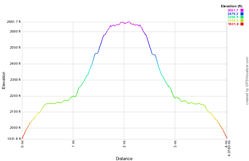 (The image below shows the profile of the hike. Remember that all vertical profiles are relative!)
Pelnor Hollow: Mary Smith Trailhead to Lean-to
| Quick Look | ||||
|---|---|---|---|---|
| Difficulty | Round trip | Total climb | Internet Maps | |
| 7.2 mi. | 1844 ft. | AllTrails | ||
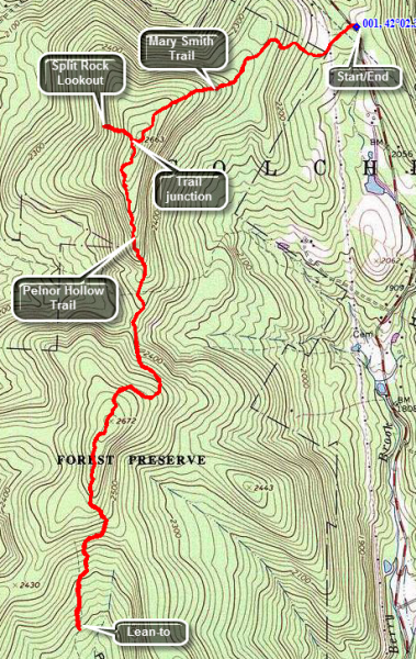
Head north from Roscoe on Route 206. Turn right on Berry Brook Road just after the county line and drive for around 8 miles to the trail head parking on the right. Cross the road to get on the Mary Smith Trail heading west southwest. After about .1 miles on a woods road, you will cross a power line right-of-way. Watch for the trail as it continues through a grassy area and into the woods. The trail ascends some until about .45 miles when it levels off if only briefly. In only .2 miles the trail again ascends for the next .5 miles to 1.15 miles where it meets the Pelnor Hollow Trail. At this point you may choose to turn left and go directly to the lean-to or you may visit the Split Rock Lookout. To visit the lookout turn right and after a short distance you will be faced with a VERY STEEP downhill section. At 1.3 miles you will arrive at the Split Rock Lookout with some great views to the west. Notice the house across the way on the ridge. When you have taken in the view, return the way you came to the trail junction and continue straight ahead. The hike to the lean-to is a pleasant walk through hardwood forest. There are some limited views of other ridges but none that allow photography. You will be treated to a large number of glacial erratics along the way. The prickers in spring and summer can be fierce so this hike is better left to late fall or winter. You will hike down from the trail junction losing about 300 feet before climbing the next hill and then hiking down to the Lena-to losing 465 feet. The total distance to the lean-to from the trail junction is 2.3 miles. Retrace your steps back to the junction with the Mary Smith Trail. Turn right and hike the 1.2 miles back to the car.
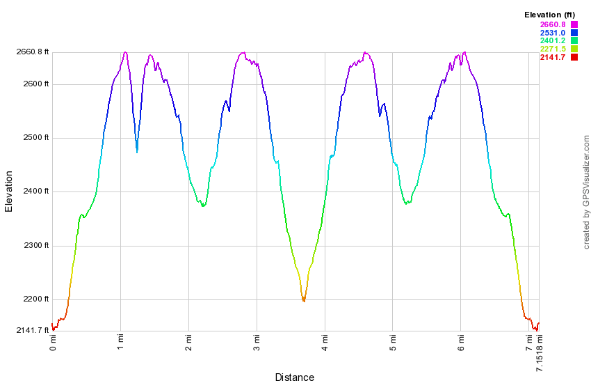 (The image below shows the profile of the hike. Remember that all vertical profiles are
relative!)
(The image below shows the profile of the hike. Remember that all vertical profiles are
relative!)
Platte Clove Preserve: The Falls
| Quick Look | ||||
|---|---|---|---|---|
| Difficulty | Round trip | Total climb | Internet Maps | |
| 2.0 mi. | 300 ft. | AllTrails | ||
This short hike doesn't gain much elevation but leads to a series of falls in Platte Clove. Park at the Platte Clove Preserve "cabin" on Platte Clove Road just west of the Kaaterskill High Peak parking area. Walk toward the cabin and down the road next to it. Follow the trail down to the stream bed. It is steep in places but the distance is minimal. At the dead end you will be looking at Plattekill Falls. The .2 mile walk brings you to one of the most beautiful falls in the Catskills. The "look" of the falls varies during each season so visit at least four times! Walk back up the path to the cabin but continue to walk passed on the trail. The falls below the king post bridge is Old Mill Falls. You may observe the falls from the near side or cross over the bridge to see it from the far shore. Taking pictures from the rocks downstream from the falls allows some great shots but BE CAREFUL on the slippery rocks!
Poet's Ledge and Wildcat Falls
| Quick Look | |||||
|---|---|---|---|---|---|
| Difficulty | Round trip | Total climb | Internet Maps | ||
| 7.1 mi. | 2386 ft. | AllTrails | |||
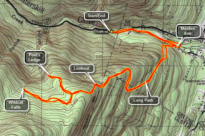
This trail is part of the Long Path stretching from Fort Lee, NJ to Thacher Park near Albany. Poet's Ledge and Wildcat Falls are two point of interest on the trail. Beyond Wildcat Falls is Buttermilk Falls. The trail leads to the snowmobile trail that run around Kaaterskill High Peak and Round Top. A bushwhack from the snowmobile trail leads up to the High Peak.
Take Route 23A from Palenville toward Haines Falls if you are coming from the east or from Haines Falls to Palenville if coming from the west. Park on the north side of 23A near Palenville near where the road cross Kaaterskill Creek. Walk on the road to the east and cross over to a "street" that goes to the right just before the road crosses the creek. Watch for the aqua blazes of the Long Path. This street is now blocked and closed to traffic. It has been overgrown with vegetation and only the paved surface here and there separates it from any other trail. On the other end of this short path you will be back on paved road. The blazes will continue for a short distance and the direct you to turn up a short street/driveway. Blue markers now appear in addition to the blaze. After a few feet, the trail turns onto a woods road and into the forest.
The path ascends on the wood road, leveling at times, but always continuing upward. After less than a mile, the trail again cuts right and starts serious climb up! The trail has several switchbacks and there are hints of views to the right. Continue on this trail which levels at times and then becomes much steeper. in about 1.25 miles there is an obvious lookout to the right. The lookout gives a glimpse of the Clove below and the mountains to the north. Continue on the main path for another half mile. At this point a sign points to a yellow spur trail that DESCENDS to Poet's Ledge. The descent is worth it since the view is very nice. As you descend you will pass a large, flat expanse of rock with several fire circles. There is a view from here but this is NOT Poet's Ledge. After another short descent through some rocks you will be on the Ledge.
The Ledge gives an unobstructed view of Kaaterskill Clove and Route 23A below. To the left is South Mountain and the Escarpment Trail. On the right looming above the Ledge is Kaaterskill High Peak. The Ledge is at 2200 feet but the mountain is another 1400 feet of vertical gain. After visiting Poet's Ledge and returning to the main trail you may retrace your steps to the car. You may also choose to visit Wildcat Falls, Buttermilk Falls and the High Peak itself.
 (The image at the left is the vertical profile for the out and back hike so it has a symmetrical appearance.
)
(The image at the left is the vertical profile for the out and back hike so it has a symmetrical appearance.
)
Pratt's Rock
| Quick Look | ||||
|---|---|---|---|---|
| Difficulty | Round trip | Total climb | Internet Maps | |
| 1.0 mi. | 330 ft. | AllTrails | ||
Prattsville is a wide spot in the road just east of Grand Gorge. The area has some nice hiking trails including the Long Path over Huntersfield Mountain and a park containing Pratts Rock. Pratt was a local businessman and politician. He commissioned a stone cutter to carve various images in a rocky cliff. These images are still there and are very interesting. The view from the top of Pratts Rock is equally impressive. There are several ways to find the parking area. Drive north for 15 miles west from Hunter on Route 23A and Route 23. The parking area is on the right. Drive 10.6 miles west on Route 23 from the village of Windham. The parking area will be on the right. Drive 5.4 miles southeast on Route 23 from the junction of Route 30 and Route 23 in Grand Gorge. The parking are will be on the left.
From the parking area hike up to the information kiosk and then through the park. The trail is marked and at some point you should be able to see the cliffs with their whitewashed images through the trees. Stay on the trail as it winds around behind the "rock". Shortly you will be on the viewpoint above the images. The views here are magnificent particularly those down to Schoharie Creek and across the valley. You may walk along the edge of the cliffs as more viewpoints at different angles lie along this path. When you have had enough, you may continue straight ahead and inspect some small "caves" in the cliffs at the top. From here you can drop down a short, steep path that warps around to the front of Pratt Rock. You may also double back the way you came and follow another, more gentle path down to the viewing area below the images. From the images a trail leads back down into the park and to the parking area.
 (The image at the left shows the profile of the hike. Remember that all vertical profiles are relative!)
Pratt Rock extended
| Quick Look | ||||
|---|---|---|---|---|
| Difficulty | Round trip | Total climb | Internet Maps | |
| 3.2 mi. | 1100 ft. | AllTrails | ||
Prattsville is a wide spot in the road just east of Grand Gorge. The area has some nice hiking trails including the Long Path over Huntersfield Mountain and a park containing Pratts Rock. Pratt was a local businessman and politician. He commissioned a stone cutter to carve various images in a rocky cliff. These images are still there and are very interesting. The view from the top of Pratts Rock is equally impressive. There are several ways to find the parking area. Drive north for 6 miles from the junction of Route 23A and Route 42 west of Hunter. Turn right on Route 23 and drive for .5 miles. The parking area is on the left. Drive 9 miles west on Route 23 from the village of Windham. the parking area will be on the right. Drive 14 miles on Route 23 from the junction of Route 30 and Route 23 in Grand Gorge. Turn left in Prattsville to stay on Route 23. The parking are will be on the left after .5 miles.
From the parking area hike up to the information kiosk and then through the park. The trail is marked and at some point you should be able to see the cliffs with their whitewashed images through the trees. Stay left at the first trail junction as the trail winds around behind the "rock". There is a short but steep uphill. Shortly you will be on the viewpoint above the stone carvings. The views here are magnificent particularly those down to the Schoharie Creek and across the valley. Walk along the edge of the cliffs as more viewpoints at different angles lie along this path. The rest of this hike is on some unmarked paths and woods roads with a little bushwhack thrown in. Watch for some paths ahead of you that follow along the base of some low cliffs. At some point find a path to the top of these rocks. Walk the path along the edge of the cliffs which become higher generally headed east. There are several more viewpoints along the way. There is a woods road on the left that heads northeast and then north and intersects a power line right-of-way. You may choose to bushwhack to the top of the ridge on the east side of the road. There is no view from this ridge but there are some more impressive cliffs and rock overhangs. When you intersect the power line right-of-way, turn right and ascend to the top of the ridge heading east. You may descend some from the top of the ridge. Turn around when you feel like it and follow the woods road and paths back to the area of Pratt Rock. From here you can drop down a short, steep path that wraps around to the front of Pratt Rock. You may also continue along the cliffs to the first viewpoint. If you go a little farther, you will find an informal path on the left that leads down to the carvings. From the carvings a trail leads back down into the park and to the parking area.
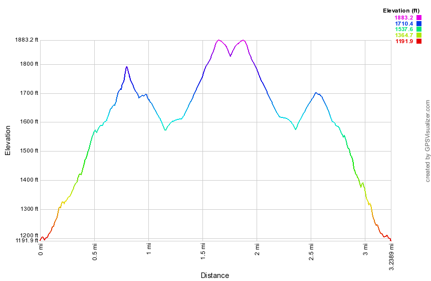 (The image at the left shows the profile of the hike. Remember that all vertical profiles are relative!)
Quick Lake from Frick Pond
| Quick Look | ||||
|---|---|---|---|---|
| Difficulty | Round trip | Total climb | Internet Maps | |
| 13.7 mi. | 2400 ft. | AllTrails | ||
_map.png) The area around Frick Pond, Hodge Pond and Quick Lake is covered with trails. There are numerous possibilities for short of long hikes. The area is "relatively" flat and there are no "views". There is, however, some beautiful scenery.
The area around Frick Pond, Hodge Pond and Quick Lake is covered with trails. There are numerous possibilities for short of long hikes. The area is "relatively" flat and there are no "views". There is, however, some beautiful scenery.
Take DeBruce Road from Livingston Manor for about six miles then turn left on Mongaup Rd. Where the road splits bear left on Beech Mountain Rd. and park in the parking lot on the left. Find the red-blazed Quick Lake trail and follow it for .5 miles to the junction with the yellow-blazed Logger's Loop. Bear left and walk down the hill to the outlet of Frick Pond where you should cross the stream on the bridge. At the next trail junction bear right on the Quick Lake trail. At 1.5 miles you will be at Iron Wheel Junction where the Logger's Loop Trail turns right. Stay on the Quick Lake Trail by bearing left and walk up the hill about .2 miles to a junction with a snowmobile trail. Turn left here for the fastest route to Quick Lake. It is possible to continue north to Junkyard Junction and then turn left on the Quick Lake Trail but this adds distance to an already long hike! The rest of your hike will alternate between snowmobile trail and the Quick Lake Trail. At some points the signs and blazes are confusing but as long as you are headed generally north and west toward Quick Lake you will get there. Follow the snowmobile trail until about 4.3 miles where you will meet the Quick Lake trail again. Turn left here and follow the Quick Lake trail as you now turn west toward Quick Lake. Stay on the trail until about 6.3 miles where the trail turns right and heads north to make a big loop before heading south to the lake. At this point continue on the snowmobile trail as it starts a long descent to Quick Lake. Near the lake you will again pick up the Quick Lake Trail. Visit the lean-to by Quick Lake and take some pictures. The "lake" is very low at times and is rather small. When you are ready, retrace your route back to the car. You may want to try some variations but remember that the route described here is already over 13 miles long!
_gra.png) (The image at the left shows the profile of the hike. Remember that all vertical profiles are relative!)
(The image at the left shows the profile of the hike. Remember that all vertical profiles are relative!)
Quick Lake Trail to Quick Lake
| Quick Look | ||||
|---|---|---|---|---|
| Difficulty | Round trip | Total climb | Internet Maps | |
| 14.3 mi. | 2200 ft. | AllTrails | ||
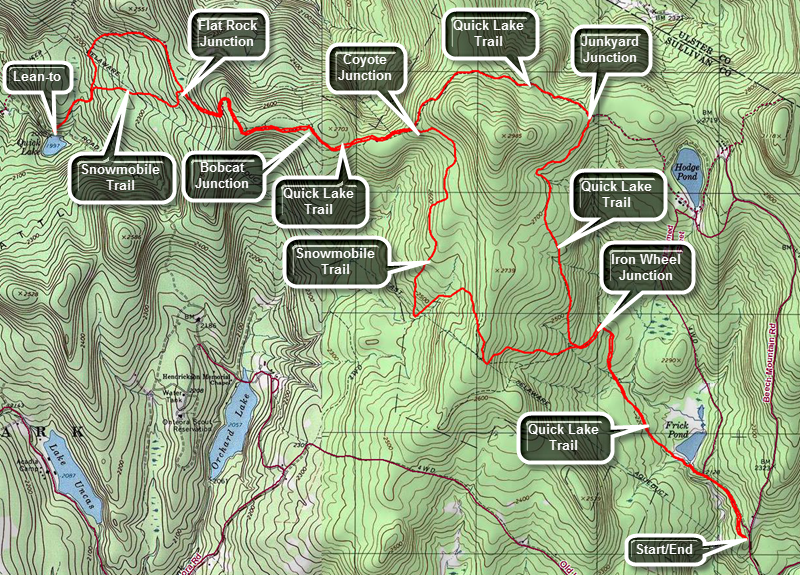 The area around Frick Pond, Hodge Pond and Quick Lake is covered with trails. There are numerous possibilities for short of long hikes. The area is "relatively" flat and there are no "views". There is, however, some beautiful scenery.
Take DeBruce Road from Livingston Manor for about six miles then turn left on Mongaup Rd. Where the road splits bear left on Beech Mountain Rd. and park in the parking lot on the left. Find the red-blazed Quick Lake trail and follow it for .5 miles to the junction with the yellow-blazed Logger's Loop. Bear left and walk down the hill to the outlet of Frick Pond where you should cross the stream on the bridge. At the next trail junction bear right on the Quick Lake trail. At 1.5 miles you will be at Iron Wheel Junction where the Logger's Loop Trail turns right. Stay on the Quick Lake Trail by bearing left and walk up hill to Junkyard Junction at 3.1 miles. Turn left to follow the red-blazed Quick Lake Trail toward Coyote Junction. At 4.3 miles you will arrive at Coyote Junction where a snowmobile trail comes in from the left. Continue through this junction staying on the hiking trail and heading toward Bobcat Junction. At 4.9 miles you will be at Bobcat Junction where the snowmobile trail turns right. Bear left staying on the hiking trail heading for Flat Rock Junction at 5.8 miles. The trail to this point has been a gentle uphill followed by some rolling sections. At 5.5 miles the trail begin to descend all the way to Quick Lake. In 1.7 miles the trail loses 675 feet which must be ascended on the way back! Flat Rock Junction can be confusing since the snowmobile trail crosses the hiking trail making it a four-way junction. Continue straight across the junction on the Quick Lake Trail and continue your descent. At 6.8 miles a snowmobile merges from the left with the hiking trail and both continue another .4 miles to Quick Lake. When you arrive at Quick Lake, watch for the lean-to on the left well above the water. Turn left onto the side trail to walk to the lean-to. The volume of Quick Lake is generally low and in the spring, summer and early fall it is a haven for insects.
When you are done, turn around and hike .4 miles back uphill to the point where're trail splits. Stay right to hike the snowmobile trail for some variety. The trail continues uphill to 8.1 miles where it meets the Quick Lake trail. Bear slightly right on the Quick Lake Trail and retrace your route back to Bobcat Junction. Bear right at Bobcat Junction and head toward Coyote Junction. You will be at Coyote Junction at 9.56 miles. Bear right onto the snowmobile trail which begins to descend. Over the next Over the next 1.1 miles you will head south while dropping 390 feet in elevation. The trail then turns east before turning south and then east again. You are now descending to the Quick Lake trail at 12.1 miles. Turn right and follow the trail back to Iron Wheel Junction at 12.4 miles. Turn right and retrace your route back through the spruce tunnel to the bridge at the outlet to Frick Pond. Walk up the hill to Gravestone junction and continue straight ahead to the trail register. Turn right and walk back out to the parking lot.
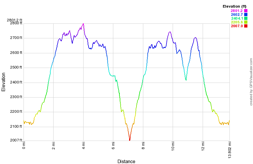 (The image at the left shows the profile of the hike. Remember that all vertical profiles are relative!)
Rehor Road Parcel (Long Loop)
| Quick Look | ||||
|---|---|---|---|---|
| Difficulty | Round trip | Total climb | Internet Maps | |
| 6.5 mi. | 1437 ft. | AllTrails | ||
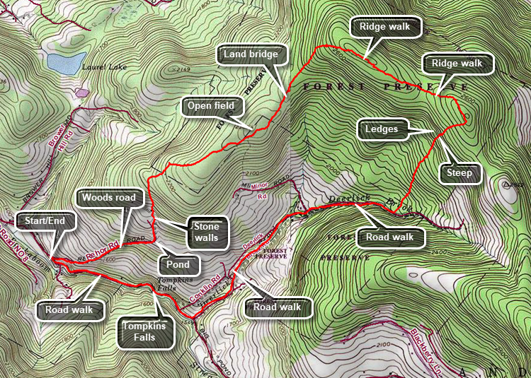
Caution: This hike is a bushwhack and has no marked trails. The hike can be shortened by parking a car on Deerlick Brook Road near the intersection with Minor Rd.) From the intersection of Barkaboom Rd and Beaverkill Road in Lew Beach, drive 4.2 miles passing Deerlick Brook Road on the right and Tompkins Falls on the left. Rehor Road is unmarked but has a gate and several DEP signs. Park on the side of the road but do not block the gate. Follow Rehor Road as it climbs up a hill. The road is wide and, although abandoned, seems to be maintained. The first .65 miles of the road climbs at about 12% which is not difficult but does get the blood flowing. The general direction is east and slightly northeast. At .65 miles the road turns 90 degrees to the left and there is a small pond on the right. Follow the road as it continues uphill making a slight turn to the right. At .8 miles There is a left turn in the road and some interesting stone walls. Turn right off the trail to continue north working your way up the hill. There is a stone wall going up the hill with a road beside it. Followed the road using the principle of "go up". The road levels and seems to end in an open spot. Head northeast through several stands of briars. Head toward higher ground at the top of another small hill. Continue northeast toward even higher and pass through some more prickers. Bear a little to the right for a route that has fewer briars and eventually leads to an open field at the top of a subpeak! There are no real views but the open field is surprising and looks as if someone must have been clearing it as the trees have not been able to reclaim the area. Near the top of the hill is a small structure that has collapsed. Walk toward a stand of evergreen trees to the northeast. Head out on a woods road but bear to the left as the road starts down the hill. Continue to the northeast through an open patch and up to the top of the ridge. Walk along a "bridge" of land that falls off on both sides. Enter the woods and walk uphill toward the top of the west-east ridge. Watch for several different rock formations that are interesting. Continue to the top of the ridge which is rather flat and at around 2.4 miles turn ESE to follow the ridge. The walking is mostly through open hardwood forest and easier than the briar patches you encountered earlier. Hit a high point of a little over 2660 feet and then descend off the ridge before ascending to another bump. At 3.25 miles turn southeast and continue to the highest point on this part of the ridge. There were some nice views to the north but it was impossible to get any good pictures. Continue to the highest point on the bump and then head down to Deerlick Brook Road. Turn south-southwest and start down a steep slope that averages 18%. Along the way there is an impressive set of ledges and rock outcrops. Continue down the hill until and you will hear water and see the road. Work your way around some springs that cause wet areas and are the source of some small streams. Continue to hike out to the road crossing some small streams. On the road turn right and head west and then southwest following the road. Passed Minor Road and and continue 1.5 miles to Barkaboom Road. At Barkaboom Road turn right and walk west-northwest toward your car. Pass Tompkins Falls and continue back to your car on the right at the beginning of Rehor Road.
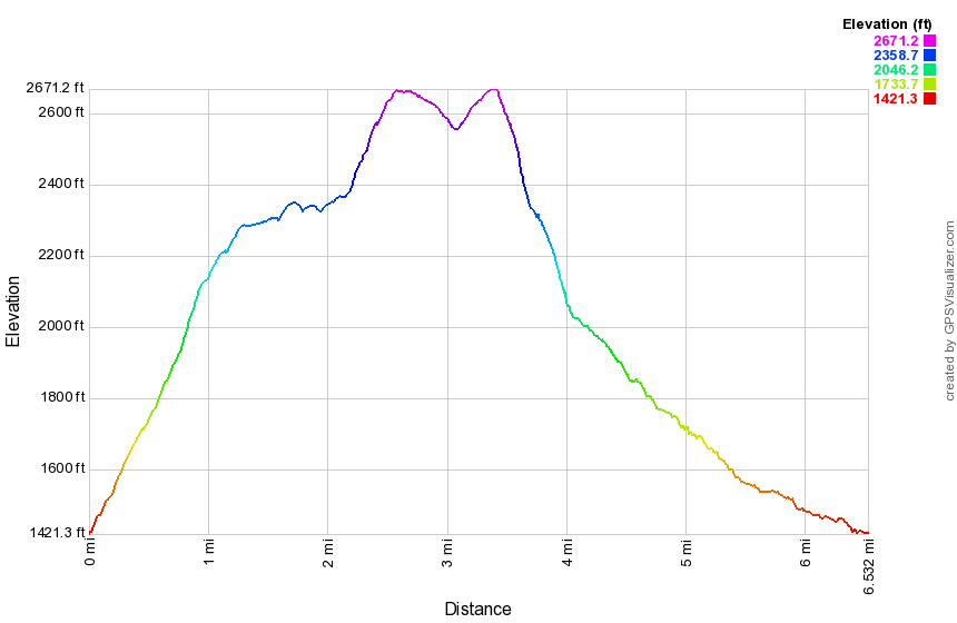 (The image below shows the profile of the loop hiking route. Remember that all vertical profiles are
relative!)
(The image below shows the profile of the loop hiking route. Remember that all vertical profiles are
relative!)
Rehor Road Parcel (Short Loop)
| Quick Look | ||||
|---|---|---|---|---|
| Difficulty | Round trip | Total climb | Internet Maps | |
| 2.3 mi. | 997 ft. | AllTrails | ||
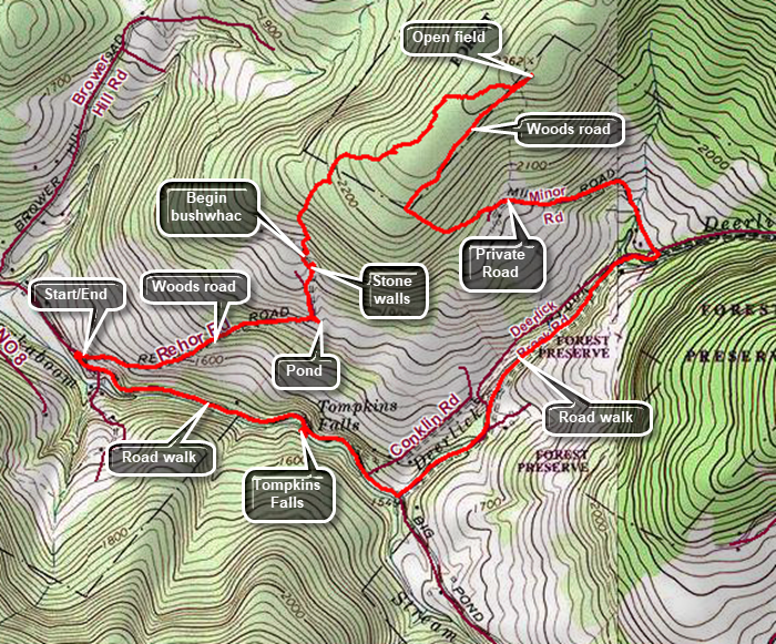
Caution: This hike is a bushwhack and has no marked trails. The route shown crosses private property. Be sure to obtain permission BEFORE you hike! From the intersection of Barkaboom Rd and Beaverkill Road in Lew Beach, drive 4.2 miles passing Deerlick Brook Road on the right and Tompkins Falls on the left. Rehor Road is unmarked but has a gate and several DEP signs. Park on the side of the road but do not block the gate. Follow Rehor Road as it climbs up a hill. The road is wide and, although abandoned, seems to be maintained. The first .65 miles of the road climbs at about 12% which is not difficult but does get the blood flowing. The general direction is east and slightly northeast. At .65 miles the road turns 90 degrees to the left and there is a small pond on the right. Follow the road as it continues uphill making a slight turn to the right. At .8 miles There is a left turn in the road and some interesting stone walls. Turn right off the trail to continue north working your way up the hill. There is a stone wall going up the hill with a road beside it. Followed the road using the principle of "go up". The road levels and seems to end in an open spot. Head northeast through several stands of briars. Head toward higher ground at the top of another small hill. Continue northeast toward even higher and pass through some more prickers. Bear a little to the right for a route that has fewer briars and eventually leads to an open field at the top of a subpeak! There are no real views but the open field is surprising and looks as if someone must have been clearing it as the trees have not been able to reclaim the area. Near the top of the hill was a small structure that has collapsed. When you are done looking around, head down the hill to the southwest following a woods road. The road is easy to follow and continues to head southwest. At 2.3 miles the road abruptly turns left and continues more steeply downhill. At the private gravel road at 2.8 miles turn left and walk down Minor Road to Deerlick Brook Road. At 3.1 miles turn right and walk downhill on Deerlick Brook Road to Barkaboom Road. Turn right to start back to the car. After .3 miles, Tompkins Falls will be on the left. Continue on Barkaboom Road to your car.
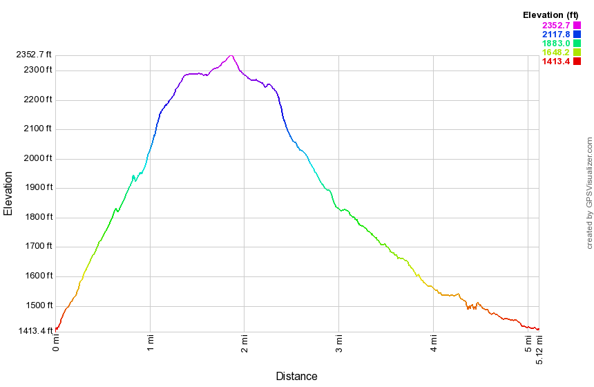 (The image below shows the profile of the loop hiking route. Remember that all vertical profiles are
relative!)
(The image below shows the profile of the loop hiking route. Remember that all vertical profiles are
relative!)
Roarback Brook and Vinegar Hill
| Quick Look | ||||
|---|---|---|---|---|
| Difficulty | Round trip | Total climb | Internet Maps | |
| 3.2 mi. | 770 ft. | AllTrails | ||
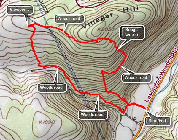
Caution: This hike is a bushwhack and has no marked trails. There is private property in the area so make sure you plan accordingly. The description here is general and is only one possibility. From Route 28 in Shandaken drive north on Route 42 passing Spruceton Road on the right. Watch for the small parking area on the left. Park in the lot and follow the path that is mowed through the grass behind the kiosk. Follow this path for about .2 miles. Turn right here on a woods road that parallels Roarback Brook. The road goes up hill and then levels off. At .9 miles the road ends in a field where you can walk down to the brook. Walk another 200 feet to a rocky area with a stone wall. Turn due north here and walk north to about 1.1 miles to a stone wall that borders a field. Walk along the stone wall on the woods side to avoid the briars in the field. At the top of the hill find the right-of-way for the powerline and a road that will lead you to a nice lookout if you turn left. The viewpoint is at least 270 degrees and show all of Beech ridge to the west. Turn around a look for a road that enters the woods. Follow the road making sure to take the left fork at all intersections. The roads end south of the summit of Vinegar Hill which is on private property. From here had southeast. You will pass through an area where trees have been cut and left on the ground. This is by far the most difficult part of the bushwhack. You should run into a woods road which will take you southeast briefly. As soon as the road turns to the right and starts uphill head south. You should meet the route you used to walk in. Turn left and walk back out to the parking lot.
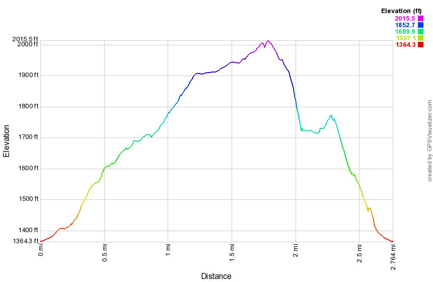 (The image below shows the profile of the loop hiking route. Remember that all vertical profiles are relative!)
Rochester Hollow
| Quick Look | ||||
|---|---|---|---|---|
| Difficulty | Round trip | Total climb | Internet Maps | |
| 3.9 mi. | 1100 ft. | AllTrails | ||
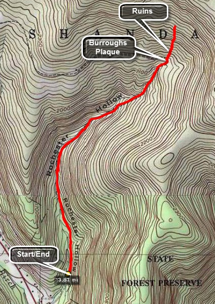
From Route 28 between Big Indian and Highmont look for Matayas Road. The road just west of this road is the access road to Rochester Hollow. Turn north and go to the end of the road to the parking area. This is a particularly popular spot during winter when people use it for cross country skiing and snowshoeing. To start the hike simply begin to walk up the wide woods road. The road parallels a brook. Watch along the way for some stone columns. At 1.7 miles the road turns sharply west. Walk straight ahead into the woods to find some interesting ruins. When you have finished exploring, return the way you came.

(The image above shows the profile of the hike. Remember that all vertical profiles are relative!)
Rochester Hollow Loop
| Quick Look | ||||
|---|---|---|---|---|
| Difficulty | Round trip | Total climb | Internet Maps | |
| 6.2 mi. | 1262 ft. | AllTrails | ||
_map.png)
From Route 28 between Big Indian and Highmont look for Matayas Road. The road just west of this road is the access road to Rochester Hollow. Turn north and go to the end of the road to the parking area. This is a particularly popular spot during winter when people use it for cross country skiing and snowshoeing. To start the hike simply begin to walk up the wide woods road. The road parallels a brook. Watch along the way for some stone columns. At 1.7 miles the road turns sharply west. Walk straight ahead into the woods to find some interesting ruins. When you have finished exploring, continue on around the bend and look for a monument to John Burroughs on the right. Follow the trail around and out to Rose Mountain Road. You will pass a lean-to on the right. A short stretch of this trail passes through PRIVATE PROPERTY so make sure you obtain permission to hike here. If you cannot obtain permission, turn around and retrace your route back to the car. Once you make the left turn onto Rose Mountain Road it is about 1.4 miles down to Route 28 where you will turn left. Walk .6 miles back to the access road and another .3 miles back to the parking area.
_gra.png)
(The image below shows the profile of the hike. Remember that all vertical profiles are relative!)
Rock Rift Fire Tower
| Quick Look | ||||
|---|---|---|---|---|
| Difficulty | Round trip | Total climb | Internet Maps | |
| 3.9 mi. | 1300 ft. | AllTrails | ||
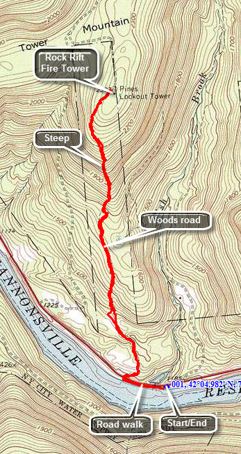 Take exit 87A on the Quickway, State Route 17, and watch for signs for Route 268 North. Drive to the end of Route 268 where it meets Route 10 and turn right. Drive about 1.2 miles and park in the boat launch on the south side of the road across from Fish Brook Road. If you are coming from the west on Route 10 watch for the signs for Route 268 and then follow these directions. From the east on Route 10 drive about 10 miles from Walton passing the parking area on the south side of the road. Continue to the boat launch area and park there. Walk west on Route 10 for about .2 miles crossing over Fish Brook. Watch for a woods road on the north side of the road that heads up the hill. The road is the old access road to the tower and sits on a narrow strip of land purchased by the Conservation Department for that purpose. This land is now part of the Cannonsville Watershed and is owned by New York City. It was recently opened to hikers and the Finger Lakes Trail Conference has done a nice job of moving the trail from road walks to woods walks wherever possible. Be sure to avoid private property! Walk from the parking area west about .25 miles and watch for a woods road on the right. This trail is considered a spur trail and is marked in blue but there are presently no signs on Route 10. The blue trail leads up through a meadow and, after a short distance, meets the main trail which is blazed in white. Continue to follow the white blazes straight ahead. The first 1.25 miles and the last .2 miles of this route are gently sloped. The half mile in between averages a 25% grade with some spots being even steeper! From the tower reverse your steps back to the car.
(The map on the right shows the parking area and the hiking route in an out and back and anticlockwise direction.)
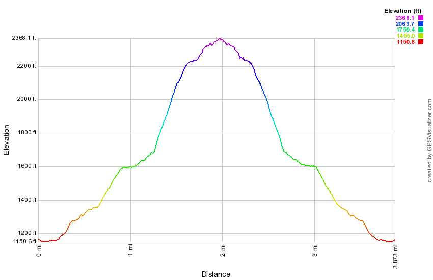 (The image at the left shows the profile of the hike. Remember that all vertical profiles are relative!)
Rock Rift Fire Tower (Apex)
| Quick Look | ||||
|---|---|---|---|---|
| Difficulty | Round trip | Total climb | Internet Maps | |
| 5.3 mi. | 1205 ft. | AllTrails | ||
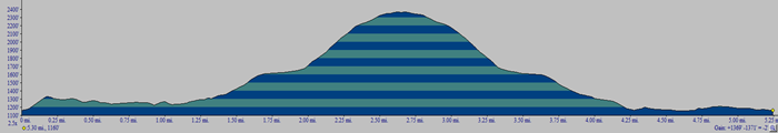 Take exit 87A on the Quickway, State Route 17, and watch for signs for Route 268 North. Drive to the end of Route 268 where it meets Route 10 and turn left into the parking lot. Cross the road and turn left and walk north on Route 10 a very short distance to the first section of guardrail. This is where the trail starts! The beginning of the trail is rather steep but it soon levels off and begins to descend a little. The trail rolls through some gullies and is sometimes hard to follow. At .85 miles the trail crosses a road and then enters a field where the trail is usually mowed with stake in the middle with a marker. Finally at 1.2 miles it turns left onto the woods road that once acted as an access road to the tower. The climb to the tower is steep in places but the crew who constructed the trail built in a few switchbacks to help. Over the next 1.5 miles you will be headed due north gaining a total of over 1400 feet from the parking area. The difference in elevation from the point where you turned onto the woods road is over a 1000 feet and several ascents are more than a 25% grade. At 2.7 miles you will be at the base of the tower. The bottom flight of stairs has been removed from the tower to discourage anyone from ascending and the cab is in disrepair. There is a plan to restore the tower which would be a wonderful project. To return retrace your route back to the point where you turned onto the trail north to the tower. Continue straight ahead and walk down to Route 10. Turn right and walk the shoulder of the road for 1 mile back to the parking area.
(The map on the right shows the parking area and the hiking route in an out and back and anticlockwise direction.)
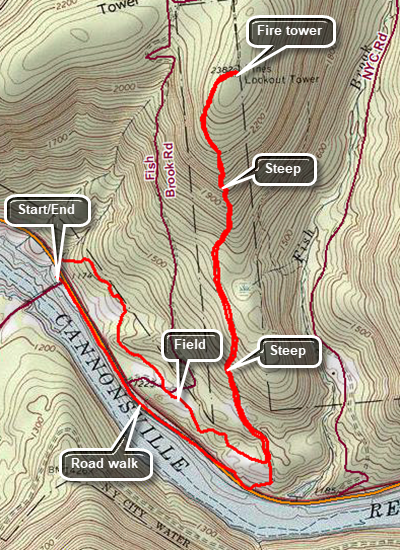 (The image at the left shows the profile of the hike. Remember that all vertical profiles are relative!)
Rock Rift Fire Tower Loop
| Quick Look | ||||
|---|---|---|---|---|
| Difficulty | Round trip | Total climb | Internet Maps | |
| 6.7 mi. | 1750 ft. | AllTrails | ||
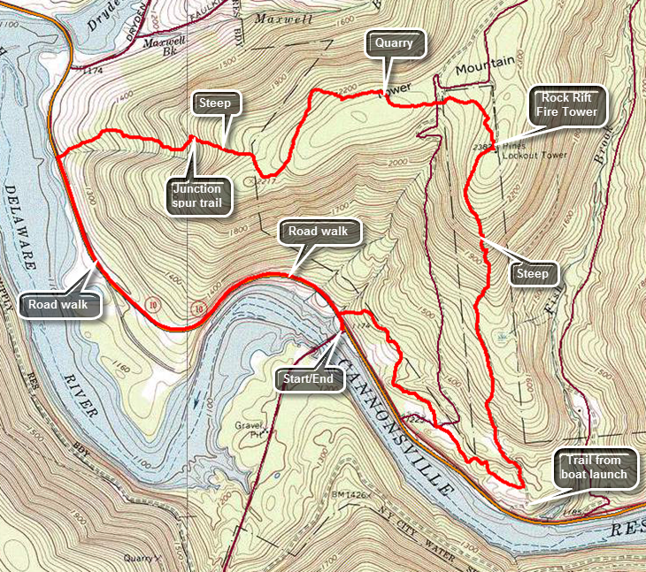 Take exit 87A on the Quickway, State Route 17, and turn right at the end of the exit. Turn left on Route 268 North. Drive to the end of Route 268 where it meets Route 10 and turn left into the parking lot. Cross the road and turn left and walk north n Route 10 a very short distance to the first section of guardrail. This is where the trail starts! The beginning of the trail is rather steep but it soon levels off and begins to descend a little. The trail rolls through some gullies and finally at 1.25 miles turns left onto the woods road that once acted as an access road to the tower. The climb to the tower is steep in places but the crew who constructed the trail built in a few switchbacks to help. Over the next 1.5 miles you will be headed due north gaining a total of over 1400 feet from the parking area. The difference in elevation from the point where you turned onto the woods road is over a 1000 feet and several ascents are more than a 25% grade. At 2.8 miles you will be at the base of the tower. The bottom flights of stairs have been removed from the tower to discourage anyone from ascending and the cab is in disrepair. There is a plan to restore the tower which would be a wonderful project. The next part of the trail heads passed the tower and starts to descend. Although the trail generally loses elevation there are times when it climbs again. At about 3.1 miles the trail joins a dirt road and follows it to a bluestone quarry at 3.4 miles. Stone is still being cut here but it is not in operation every day. Continue on the road through the other side of the quarry. Soon there is a turn to the right which may not marked but is pretty obvious. Continue to follow various woods roads for the most part. Occasionally the trail will cut through the woods to get to the next road. At 3.7 miles the trail heads south instead of west and remains on then ridge where the elevation is still over 2100 feet. At 4.2 miles the trail again turns west and begins a steep descent toward Faulkner Road. Over the next .7 miles you will lose 750 feet of elevation for an average grade of 25%. When you reach the junction with the previous trail, turned left on the "old" trail at 4.9 miles and follow the blue blazes downhill for another .2 miles to Route 10. Turn left on Route 10 and start walking south and east on the wide shoulders. The walk back to the car is only 1.6 miles.
(The map on the right shows the parking area and the hiking route in an out and back and anticlockwise direction.)
 (The image at the left shows the profile of the hike. Remember that all vertical profiles are relative!)
Romer Mt: Long Path from Lane Street
| Quick Look | ||||
|---|---|---|---|---|
| Difficulty | Round trip | Total climb | Internet Maps | |
| 7.4 mi. | 1960 ft. | AllTrails | ||
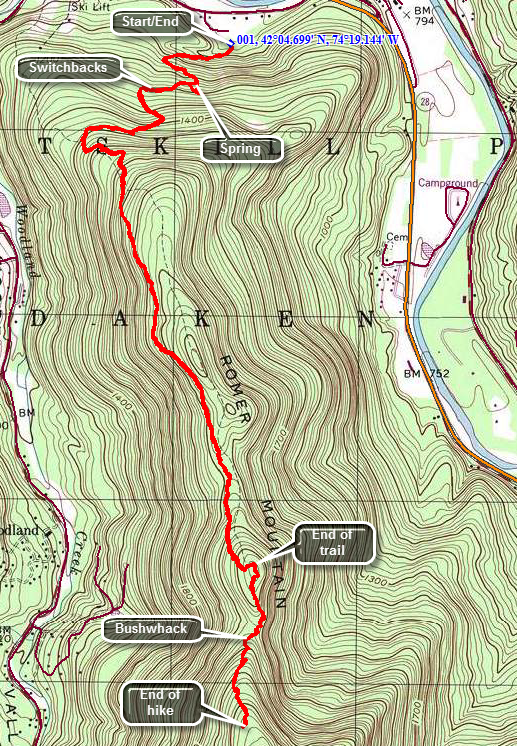
Turn onto Woodland Valley Road from Route 28 west of Phoenicia . After crossing the bridge over the Esopus Creek turn left on High Street even though there may be no sign. Watch for Lane Street on your right after about .5 miles. Turn right on Lane Street and drive to the end and make a right to cross over a small stream. Park in the parking area. This trail was created to move the Long Path from a road walk which was all the way from Tremper Mountain to Woodland Valley Campgrounds to a trail hike. The trail ascends the shoulder of Romer Mountain and then stays on the ridge over Mount Pleasant and Cross Mountain. It joins the trail to Wittenberg just south of the trail junction with the trail to the Terrace Mountain lean-to. It is best hiked with a car spot so that you can hike all the way from one end to the other rather than turning around somewhere in the middle or hiking over 15 miles. The trail ascends the shoulder of Romer Mountain using a series of switchbacks. There aren't many views along the way but the walk is pleasant. At the beginning of the summer in 2013 the trail crews have finished about 3 miles from Lane Street and have started at the other end. The projected completion is in the fall of 2013.
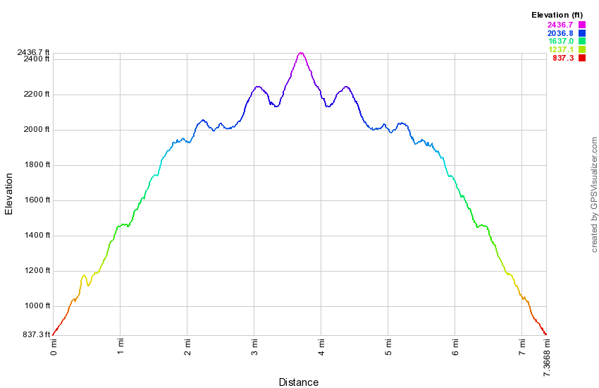
(The image below shows the profile of the out and back hike. Remember that all vertical profiles are relative!)
Romer Mt: Long Path from Woodland Valley to Lane Street
| Quick Look | ||||
|---|---|---|---|---|
| Difficulty | Round trip | Total climb | Internet Maps | |
| 11.2 mi. | 2805 ft. | AllTrails | ||
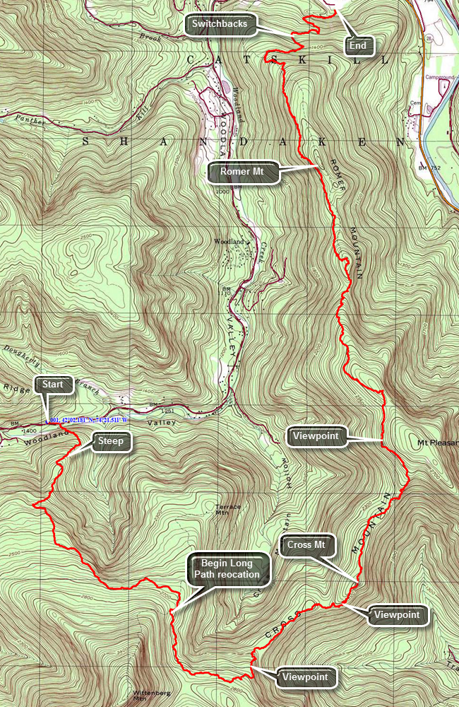
This hike requires a car spot or a drop off as the one-way distance is 11.2 miles! Turn onto Woodland Valley Road from Route 28 west of Phoenicia . After crossing the bridge over the Esopus Creek turn left on High Street even though there may be no sign. Watch for Lane Street on your right after about .5 miles. Turn right on Lane Street and drive to the end and make a right to cross over a small stream. Park one car in the parking area. Drive back on Woodland valley Road to the Woodland Valley Campgrounds. Park another car in the lot here and pay the parking fee at the booth or have someone drop you at the lot. Walk across the road and through some campsites to find the beginning of the trail on a ridge that crosses a stream. The first mile of trail from the bridge gains 920 feet at an almost 18% grade. The trail continues to ascend for another .75 miles before leveling off some. Once the trail levels off it has only a few ups and downs until the junction with the trail to Terrace Mountain at 2.5 miles. Turn right at this junction and start toward Wittenberg. The new trail is about .2 miles further along the main trail on the left at 2.7 miles. Turn left onto the new trail which has blue markers indicating that it is an extension of the Pine Hill - West Branch Trail. There is also an official Long Path marker as well.The surface of the trail is smooth and flat at the beginning but changes to rocky and back to smooth any number of times. At 3.5 miles you may see a path that leads to the site of the camp the trail crew used when they stayed in the woods to work on the trail! At 3.5 miles descend the first staircase which is very nicely constructed. Remember that the trail crew members were working only with hand tools and the stones and rocks available around them! Walk along the edge of a dropoff and at 3.7 miles you will come upon an open rock face with beautiful views to the north and east. Turn to my left to see the imposing bulk of Wittenberg looking down at you. To the north are the mountains of the Devil's Path. The views are spectacular! Continue on your way down the rock face and descend for the next quarter mile. You are actually still on a ridge and lose only about 250 feet. Watch to your right for possible lookouts. At 4.75 miles you will start to ascend Cross Mountain. There is a limited lookout on the right with some views of the Ashokan Reservoir. A few hundred feet further along there is another, better viewpoint. If you climb a little more and there is a third lookout with the best views of all. Get back on the main trail and continue over the top of Cross Mountain and then down the other side. You will skirt the summit of Mount Pleasant at about 6.5 miles into the hike. There is another great lookout on the left of the trail with an almost 180 degree field of view. Only the view to the north is partially blocked. From the lookout there is a drop of about 600 feet to the 8 mile point where there is a slight climb over an unnamed bump. Once you are over the top of Romer Mountain there is less than 3 miles to the car and it is all downhill. Near the bottom, a series of switchbacks turns a quarter mile hike into almost of mile of trail!
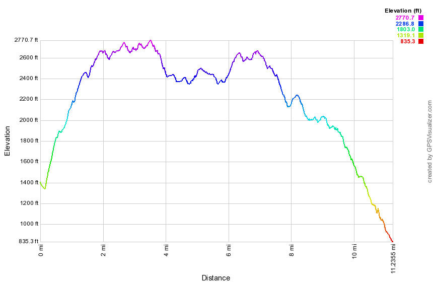
(The image below shows the profile of the out and back hike. Remember that all vertical profiles are relative!)
Round Top: Livingston Manor Lower Trail
| Quick Look | ||||
|---|---|---|---|---|
| Difficulty | Round trip | Total climb | Internet Maps | |
| .6 mi. | 190 ft. | AllTrails | ||
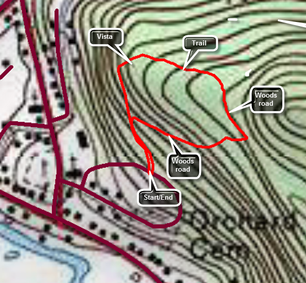
This trail is entirely sited on land owned by the Town of Rockland. There is lower loop trail blazed with yellow paint and a steeper, upper loop to the summit of Round Top blazed in blue paint.
Park in Livingston Manor and walk to Orchard street which is a side street off Rock Avenue. The trail starts at the top of the hill behind the Presbyterian Church. The most direct route to the top is the road on the left of the cemetery but this is also the steepest. Walking straight up Orchard Street into the cemetery and following the road to the highest point is not as steep. The entrance to the trail is marked by the traditional triangle of yellow paint blazes. Walk into the forest along an old woods road. At the trail junction you may walk straight ahead up a rather steep but short hill. At the top of the hill there is a short spur trail to the left which leads to a rock ledge. This lookout gives a nice view over the hamlet of Livingston Manor including the Livingston Manor school. After enjoying the view you may simply walk back down the hill or continue on around the loop which consists of a short stretch of new trail and woods roads that lead back to the first trail junction. Along the way there are some interesting rock ledges. At the beginning of the hike you may also turn right at the junction and walk the loop around to the viewpoint. This way is not as steep.
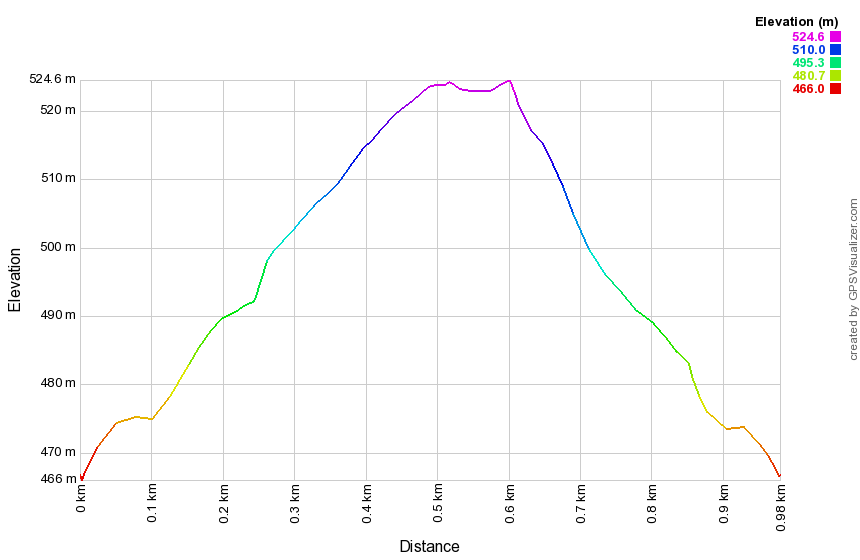
(The image below shows the profile of the out and back hike. Remember that all vertical profiles are relative!)
Round Top: Livingston Manor Upper Trail
| Quick Look | ||||
|---|---|---|---|---|
| Difficulty | Round trip | Total climb | Internet Maps | |
| .7 mi. | 285 ft. | AllTrails | ||
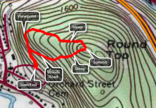
This trail is entirely sited on land owned by the Town of Rockland. There is lower loop trail blazed with yellow paint and a steeper, upper loop to the summit of Round Top blazed in blue paint.
Park in Livingston Manor and walk to Orchard street which is a side street off Rock Avenue. The trail starts at the top of the hill behind the Presbyterian Church. The most direct route to the top is the road on the left of the cemetery but this is also the steepest. Walking straight up Orchard Street into the cemetery and following the road to the highest point is not as steep. The entrance to the trail is marked by the traditional triangle of yellow paint blazes. Walk into the forest along an old woods road. At the trail junction walk straight ahead up a rather steep but short hill. At the top of the hill there is a short spur trail to the left which leads to a rock ledge. This lookout gives a nice view over the hamlet of Livingston Manor including the Livingston Manor school. After enjoying the view continue on the yellow trail as it wanders through the forest and up a mostly gentle grade to a trail junction with the blue blazed upper trail. Continue straight ahead on the blue trail up the steep ascent to the summit of Round Top. Follow the blue trail across the summit and won the other side where the blue trail meets the yellow trail. Continue straight ahead to follow the yellow trail down to a woods road that leads back to the first trail junction. Turn left and walk back out to the trailhead.
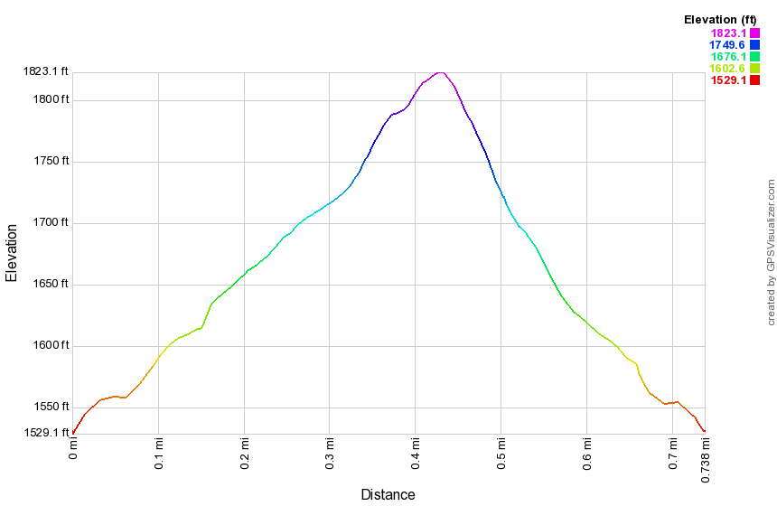
(The image below shows the profile of the out and back hike. Remember that all vertical profiles are relative!)
Round Top: Figure 8
| Quick Look | ||||
|---|---|---|---|---|
| Difficulty | Round trip | Total climb | Internet Maps | |
| 1.7 mi.(from trailhead) | 520 ft. (from trailhead) | AllTrails | ||
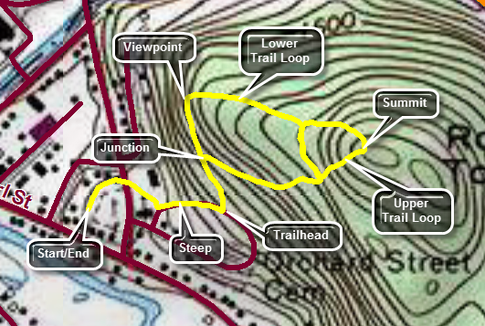
This trail is entirely sited on land owned by the Town of Rockland. There is lower loop trail blazed with yellow paint and a steeper, upper loop to the summit of Round Top blazed in blue paint.
Park in Livingston Manor and walk to Orchard Street which is a side street off Rock Avenue. The trail starts at the top of the hill behind the Presbyterian Church. The most direct route to the top is the road on the left of the cemetery but this is also the steepest. Walking straight up Orchard Street into the cemetery and following the road to the highest point is not as steep. The entrance to the trail is marked by the traditional triangle of yellow paint blazes. Walk into the forest along an old woods road. At the trail junction walk straight ahead up a rather steep but short hill. At the top of the hill there is a short spur trail to the left which leads to a rock ledge. Be careful on this spur trail as there is a "crack" you must cross. This lookout gives a nice view over the hamlet of Livingston Manor including the Livingston Manor school. After enjoying the view go back to the trail and head away from the viewpoint on a slight uphill following the trail as it makes a sharp right turn. After a short distance, the yellow trail makes a right turn and heads down. Turn left here into the woods and you should see a triangle of blue paint blazes which marks the beginning fate upper trail. Follow the blue blazes up the hill. The trail turns right at the top of the hill and then left. Continue to follow the blazes across the summit to the point where the trail heads back down to the lower trail. Turn left on the lower trail and walk back to the sharp right turn. Turn right and walk down the woods road to the first trail junction. You have now walked a figure 8. Turn around and walk back up the woods road to the sharp left turn. Turn left on the yellow trail and walk a short distance to a sharp left turn. Turn right into the woods and follow the blue blazes up the hill to the summit of Round Top. At the top of the hill follow the ribbons to the right turn and then the left turn. Follow the blue blazes back down to the lower trail. Turn right on the lower trail and walk a short distance to a sharp left turn. Turn left and follow the lower trail to the viewpoint. Turn left and walk back down the hill to the first trail junction. You have now walked another figure 8 in reverse. Continue straight ahead to the trailhead. Walk back to where you parked your car
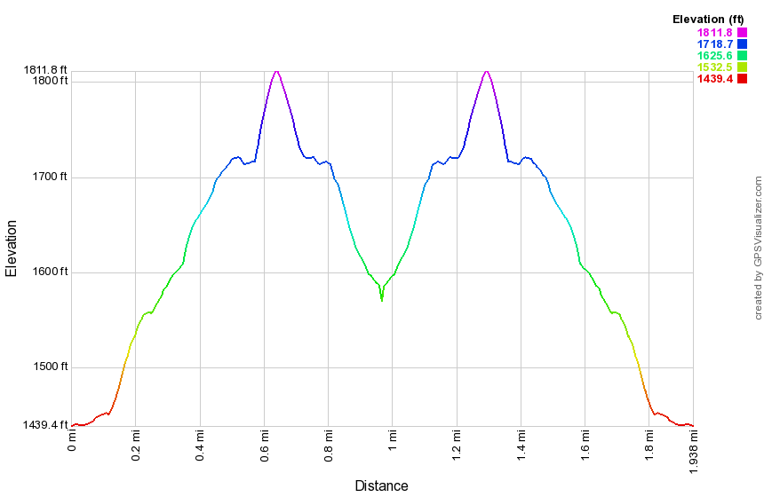
(The image below shows the profile of the out and back hike. Remember that all vertical profiles are relative!)
Russell Brook Bushwhack
| Quick Look | ||||
|---|---|---|---|---|
| Difficulty | Round trip | Total climb | Internet Maps | |
| 3.6 mi. | 1035 ft. | AllTrails | ||
_map.png) This is one of our favorite trails when we just want to hike. It has several variations for distance and
difficulty. Like most trails, hiking one way is different than hiking in the other direction. We have
take this route more than a dozen times this season and it is interesting to watch the changing
seasons. It is unfortunate that Russell Brook Road is closed due to the frequent floods that have
washed out the road.
This is one of our favorite trails when we just want to hike. It has several variations for distance and
difficulty. Like most trails, hiking one way is different than hiking in the other direction. We have
take this route more than a dozen times this season and it is interesting to watch the changing
seasons. It is unfortunate that Russell Brook Road is closed due to the frequent floods that have
washed out the road.
Turn left on Morton Hill Road on Route 206 just after the Rockland Flats. Bear right up Morton Hill
Road until you see a parking area on the left near the sign indicates Russell Brook Road is closed.
Park here and hike down Russell Brook Road .3 miles to a gated snowmobile trail on the right. Turn here an walk along the snowmobile trail until the trail turns left at .6 miles. You may turn left an follow the snowmobile trail up and over the ridge and then down to the pond. Continue straight ahead to begin a bushwhack that parallels Russell Brook in a northeast direction. At about 1 mile find a place to cross the stream and head north and then northwest and west to climb over a hill. The way is steep in places with over a 23% grade. From the top of the hill head west to get down to Cable's Lake. You may find several different woods roads in this area which will make the descent easier. Once on the trail turn left and head back on the trail to the main trailhead on Russell Brook Road. Walk up Russell Brook Road to get back to the parking area on Morton Hill Road.
_gra.png) (The image below shows the profile of the hike. Remember that all vertical profiles are relative!)
(The image below shows the profile of the hike. Remember that all vertical profiles are relative!)
Samuel's Point
| Quick Look | ||||
|---|---|---|---|---|
| Difficulty | Round trip | Total climb | Internet Maps | |
| 4.7 mi. | 2135 ft. | AllTrails | ||
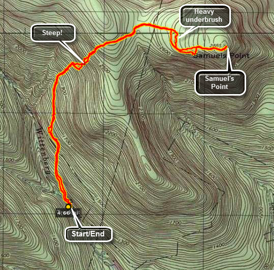
From Grahamsville, turn onto Route 52A near the TriValley School. Stay on the road until the hamlet of Sundown where the road turns left. Bear to the right on Peekamoose Rd. and continue on the road looking for Moonhaw Rd. on the left. From Route 28, turn west on Route 28A and then head south. Turn right and head west on Watson Hollow Road, the road that goes to Peekamoose and Sundown. Watch for Moonhaw Road on the right after about mile. Turn onto Moonhaw Rd. and drive to the end. Park on the right just before the gates to the private driveway.
Since this is a bushwhack all the way your route may vary. From the parking area, cross Wittenberg Brook and turn left to walk parallel to the brook on a woods road. If you have the right woods road, you should be able to walk north for about 1 miles before heading to the east and UP the steep side of the mountain. As you climb try to steer toward the col between Samuel's Point to the east an the hill to the west. Once in the col, turn east toward Samuel's Point which is only .5 miles away. As you start to get into heavy stands of laurel, cut around them and head south as they are too thick to get through easily. Walk around the laurel and start to head up toward the highest point you can see which is Samuel's Point. Many of the views of the Ashokan Reservoir are bloat by trees but you can walk around to find some views between them. Walk to the edge of the ledges and then head north to walk counterclockwise around the edge. You may get some nice views from here. When you are done, retrace your steps back to the car.
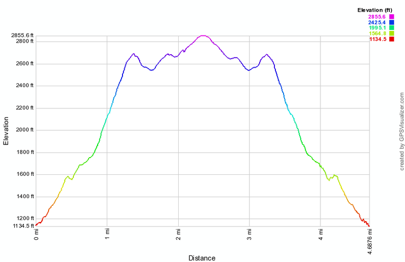 (The image at the left shows the profile of the hike. Remember that all vertical profiles are relative!)
Segar Trail
| Quick Look | ||||
|---|---|---|---|---|
| Difficulty | Round trip | Total climb | Internet Maps | |
| 6.3 mi. | 1560 ft. | AllTrails | ||
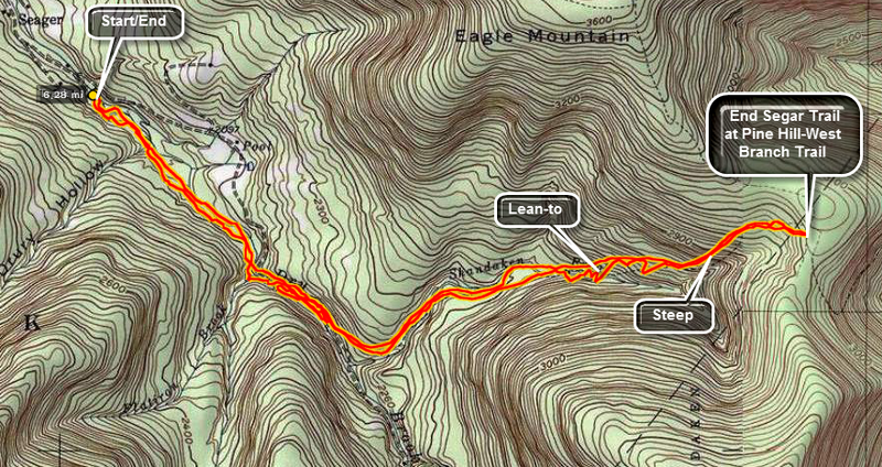 Finding this trail head can be challenging depending on your approach. The easiest way is to go to
Arkville on Rt. 28. Turn south onto Dry Brook Road. Take this road ALL the way to the dead end and
park at the trail head. Get on the yellow trail and follow it carefully. Pay attention to the yellow
trail markers and the signs. Several old logging roads intersect the trails and can mislead you if
you are not paying attention. This trail also runs through private property. Be sure to respect
the rights of the property owners! There are at least four stream crossing that can prove difficult
if not impossible when the water is high. Be prepared to wade, get wet or turn back! Nettles during
the spring and summer are plentiful but can be avoided. From this trail it is possible to approach
Doubletop, the highest peak in the Catskills without a trail, from several directions. The trail
intersects the Pine Hill-West Branch Trail at its highest point. Turning left leads to Eagle after
about 1 mile. Turning right takes you to Big Indian. Remember that the trail DOES NOT go to the
top of Big Indian. The actual summit is about .25 miles north of the highest point on the trail.
Finding this trail head can be challenging depending on your approach. The easiest way is to go to
Arkville on Rt. 28. Turn south onto Dry Brook Road. Take this road ALL the way to the dead end and
park at the trail head. Get on the yellow trail and follow it carefully. Pay attention to the yellow
trail markers and the signs. Several old logging roads intersect the trails and can mislead you if
you are not paying attention. This trail also runs through private property. Be sure to respect
the rights of the property owners! There are at least four stream crossing that can prove difficult
if not impossible when the water is high. Be prepared to wade, get wet or turn back! Nettles during
the spring and summer are plentiful but can be avoided. From this trail it is possible to approach
Doubletop, the highest peak in the Catskills without a trail, from several directions. The trail
intersects the Pine Hill-West Branch Trail at its highest point. Turning left leads to Eagle after
about 1 mile. Turning right takes you to Big Indian. Remember that the trail DOES NOT go to the
top of Big Indian. The actual summit is about .25 miles north of the highest point on the trail.
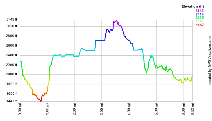 (The image at the left shows the profile of the hike. Remember that all vertical profiles are
relative!)
(The image at the left shows the profile of the hike. Remember that all vertical profiles are
relative!)
Shavertown Parcel
| Quick Look | ||||
|---|---|---|---|---|
| Difficulty | Round trip | Total climb | Internet Maps | |
| 4.7 mi. | 1050 ft. | AllTrails | ||
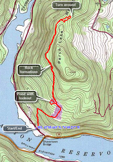 Drive to the north end of the bridge that crosses the Pepacton Reservoir. Head northwest of BWS Road #4 which is also County Route 1 and is sometimes know as the Tremperskill Road. The trailhead is just .15 miles up this road on the right. You may park off the road on the left or at the boat launch at the end of the bridge. Cross the road to begin your hike. The first .25 miles of the trail climbs 200 feet as it heads directly north and up the side of Perch Lake Mountain. Soon the trail turns right on an old access road and continues to climb through the forest for another .25 miles. You will break out into a field and the trail levels a little. Along this part of the trail you may see some meteorological instruments with solar panels for power. The trail now turns northeast and descends to the edge of a small pond at .85 miles. In the summer, the pond may have both pink and white water lilies growing in it as well as cattails around the edge. Walk around the pond on the west side to an outstanding lookout over the Pepacton. Continue around the pond and walk back to the trail that you came in on. Turned left at the sign that marks the turn for the extra 1.5 miles. This trail follows another woods road and gains a little over 200 feet in the next .5 miles. Watch for trail markers carefully! At around 1.5 miles into the hike the trail drops to the left off the woods road to travel through an area with large boulders. Many are covered by interesting mosses and lichens. Once the trail rejoins the road it remains pretty flat for the next .8 miles. The trail begins to turn around the mountain heading a little to the east. Follow the trail markers carefully and stay on the trail as the DEP land is surrounded by private property! The trail makes a little loop and then comes back to the trail you came in on. Follow this trail back the way you came to the car.
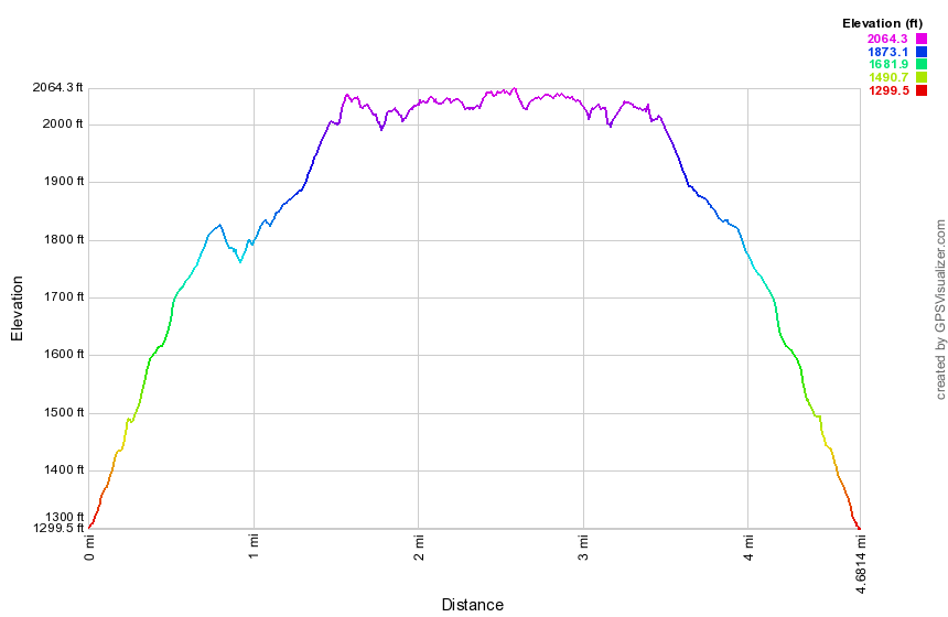 (The image at the left shows the profile of the hike. Remember that all vertical profiles are
relative!)
(The image at the left shows the profile of the hike. Remember that all vertical profiles are
relative!)
Shavertown Trails (newest)
| Quick Look | ||||
|---|---|---|---|---|
| Difficulty | Round trip | Total climb | Internet Maps | |
| 3.3 mi. | 1030 ft. | AllTrails | ||
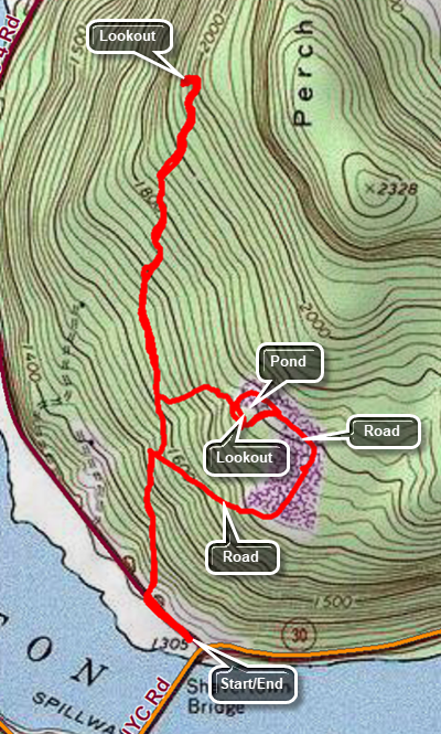 Note: Logging north of Snake Pond and west of PerchLake Mountain have closed the CMC trail in that area. The CMC has created a new trail that heads north off the Snake Pond loop and provides a beautiful lookout over the Pepacton Reservoir and the Tremperskill Valley.
Drive to the north end of the bridge that crosses the Pepacton Reservoir. Turn left and park in the lot. Start your hike by turning left on the road which is BWS Road #4 or County Route 1 or the Tremperskill Road. The trailhead is just .15 miles up this road on the right. Cross the road to begin your hike. The first .25 miles of the trail climbs 200 feet as it heads directly north and up the side of Perch Lake Mountain. At .4 miles the trail comes to a woods road and continues directly across that road. In .1 miles the trail to the Tremperskill lookout turns to the left. Follow this trail as it begins a climb to the lookout. The trail, at times, follows old woods roads and begins to seriously ascend at .7 miles. Over the next .5 miles the trail gains 345 feet averaging a 14% grade with some short sections as much as 22%. At the top of the climb the trail turns west and descends slightly to the lookout. When you are done enjoying the view, retrace your steps back to where this section of trail began. Turn left and walk uphill .2 miles to a bench just below Snake Pond. There is a nice view from this area but there is a better view from the shores of the pond. Walk up to the shores of the pond and gaze west to the Pepacton. Continue your hike by walking around the pond and up the gravel road. The gravel road continues down through a field where there are some meteorological instruments. The trail then enters the woods on the woods road and continues downhill for a total of .5 miles from the pond. Turn left on the trail that brought you up from the road. Walk down the trail to the road, turn left and walk back to the parking area.
Note: Logging north of Snake Pond and west of PerchLake Mountain have closed the CMC trail in that area. The CMC has created a new trail that heads north off the Snake Pond loop and provides a beautiful lookout over the Pepacton Reservoir and the Tremperskill Valley.
Drive to the north end of the bridge that crosses the Pepacton Reservoir. Turn left and park in the lot. Start your hike by turning left on the road which is BWS Road #4 or County Route 1 or the Tremperskill Road. The trailhead is just .15 miles up this road on the right. Cross the road to begin your hike. The first .25 miles of the trail climbs 200 feet as it heads directly north and up the side of Perch Lake Mountain. At .4 miles the trail comes to a woods road and continues directly across that road. In .1 miles the trail to the Tremperskill lookout turns to the left. Follow this trail as it begins a climb to the lookout. The trail, at times, follows old woods roads and begins to seriously ascend at .7 miles. Over the next .5 miles the trail gains 345 feet averaging a 14% grade with some short sections as much as 22%. At the top of the climb the trail turns west and descends slightly to the lookout. When you are done enjoying the view, retrace your steps back to where this section of trail began. Turn left and walk uphill .2 miles to a bench just below Snake Pond. There is a nice view from this area but there is a better view from the shores of the pond. Walk up to the shores of the pond and gaze west to the Pepacton. Continue your hike by walking around the pond and up the gravel road. The gravel road continues down through a field where there are some meteorological instruments. The trail then enters the woods on the woods road and continues downhill for a total of .5 miles from the pond. Turn left on the trail that brought you up from the road. Walk down the trail to the road, turn left and walk back to the parking area.
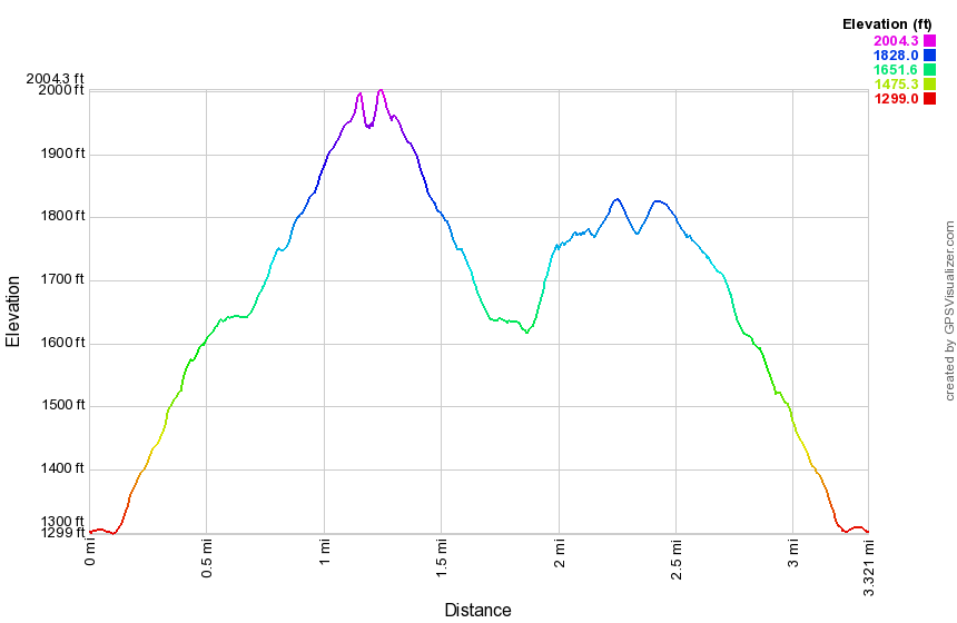 (The image at the left shows the profile of the hike. Remember that all vertical profiles are
relative!)
(The image at the left shows the profile of the hike. Remember that all vertical profiles are
relative!)
Shavertown Trail
| Quick Look | ||||
|---|---|---|---|---|
| Difficulty | Round trip | Total climb | Internet Maps | |
| 1.6 mi. | 540 ft. | AllTrails | ||
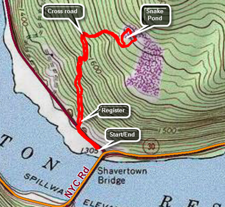 Drive to the north end of the bridge that crosses the Pepacton Reservoir. Head northwest of BWS Road #4 which is also County Route 1 and is sometimes know as the Tremperskill Road. Turn into the small parking area on the left just after the turn. The trailhead is just a few hundred feet further up this road on the right. Cross the road to begin your hike. There is a trail register at the beginning of the trail with some trail maps from the Catskill Mountain Club. The first .25 miles of the trail climbs 200 feet as it heads directly north and up the side of Perch Lake Mountain. Soon the trail meets an old access road where the old trail used to turn right and follow the road. The new trail continues on the other side of the road. climb up the bank and follow the trail blazes as the trail winds through several switchbacks up to Snake Pond. The initial forest is pine tree but they quickly give way to open hardwood forest. There are several wet areas to cross but these are made easier by stepping stones. Be careful when it is wet as the stones may be slippery. The trail comes out of the forest just below the pond where the is a nice view of the Pepacton Reservoir. Follow the trail up the hill and then turn left over a little footbridge as you walk to the shores of the pond. The view of the reservoir is better from here and you can also view the pond. The pond has some fish and plenty of frogs. There are reeds and rushes around the shore which support a population of redwing blackbirds. Walk around the pond clockwise crossing the overflow at the head end on another bridge. Continue around the pond until you are back where you started at the viewpoint over the reservoir. Follow the trail back the way you came to the car.
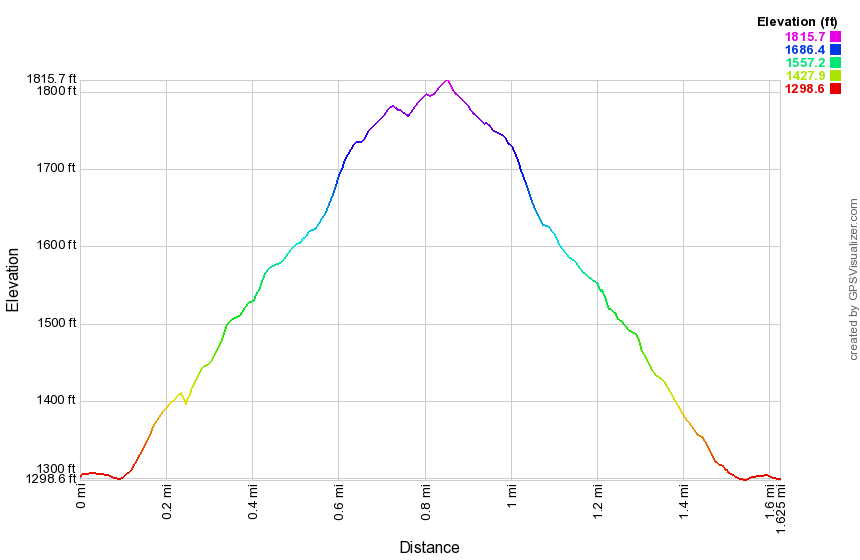 (The image at the left shows the profile of the hike. Remember that all vertical profiles are
relative!)
(The image at the left shows the profile of the hike. Remember that all vertical profiles are
relative!)
Ski Plattekill
| Quick Look | ||||
|---|---|---|---|---|
| Difficulty | Round trip | Total climb | Internet Maps | |
| 3.2 mi. | 1230 ft. | AllTrails | ||
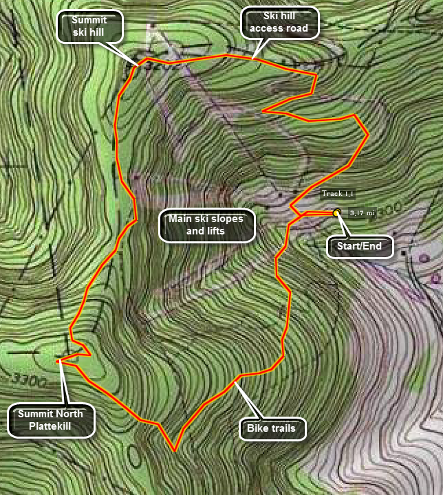 Walking the trails at the Ski Plattekill ski hills is interesting. The view is great and even in the summer the hill is used for downhill mountain biking.
Head north from Margaretville on Route 30 through Halcottsville. Watch for signs for Ski Plattekill turn west off Route 30 and follow Upper Meeker Hollow Road until Lower Meeker Hollow Road bears left. Continue on Lower Meeker Hollow Road until you are at the ski center, Park in the parking lot and go to the office to check in. The people at the office are very polite and usually offer a map of the hill and suggestions on where to hike. One way to start is to head up the beginners hill on the left as you walk out the back of the lodge. Take the Overlook Trail toward North PlattekillTry to avoid going too high up the slope as you will hit some rather steep ski runs. The map from the ski hill only shows the ski runs at not the extensive network of bike trails. The bike trails toward North Plattekill are truly impressive! They are steep and rocky with many jumps. Some have padded trees. Continue to walk UP and head for the highest point on North Plattekill. Watch for good views as you climb. When you get near the highest point, you may have to go off trail to find the exact location. You may return the way you came but it is better to walk across the top of the ski hill and descend by the Powder Puff Trail on the other side. In this way you can look down many of the ski runs and chair lifts to get the best views. This route also climbs the second highest point on the slopes. The Plunge has some nice views but it may not be too clear how to get across the top of the rest of the hill. Keep walking on trails, paths or bushwhack your own way to the central slopes area with the Blockbuster. The views are magnificent from here since it is a steep run and the hill falls away quickly. In addition, there is no lift to mar the view. Start down the Powder Puff Trail which is long but very gentle. At one point, as the slope turns, the steep main slopes will be in front of you. Follow this path back to the office and the parking area.
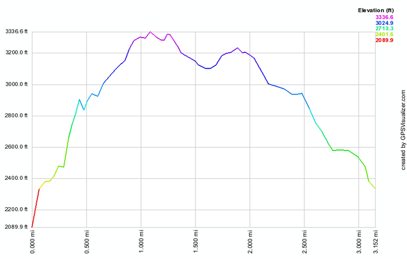 (The image at the left shows the profile of the hike. Remember that all vertical profiles are relative!)
Sonoma Falls
| Quick Look | ||||
|---|---|---|---|---|
| Difficulty | Round trip | Total climb | Internet Maps | |
| 2.0 mi. | 150 ft. | |||
Finding this hidden gem is easy but just knowing it is there is HARD! I have lived in Livingston Manor and did not know how beautiful these falls were until a recent visit! The area recently changed hands and the new owners have opened a small store and will eventually have a cider press in operation. Behind the store is a series of falls with a rustic pathway along the stream to the top.
Exit State Route 17 (The Quickway), soon to be I86 at exit 97 for Morsston. If you are heading west turn left off the exit and go back under the main road. Take a left and then your first right. Turn right at the next road and pass over a small bridge. The dead end road to the falls is the next left. For those traveling east, take a right off the exit and then take your next left. Follow the directions for those traveling west.
Sullivan County High Point: Quick Lake - Flynn Trails![]()
![]()
| Quick Look | ||||
|---|---|---|---|---|
| Difficulty | Round trip | Total climb | Internet Maps | |
| 7.8 mi. | 1316 ft. | AllTrails | ||
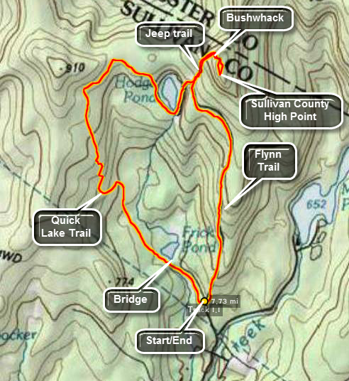 The area around Frick Pond, Hodge Pond and Quick Lake is covered with trails. There are numerous
possibilities for short of long hikes. The area is "relatively" flat and there are no "views".
There is, however, some beautiful scenery.
The area around Frick Pond, Hodge Pond and Quick Lake is covered with trails. There are numerous
possibilities for short of long hikes. The area is "relatively" flat and there are no "views".
There is, however, some beautiful scenery.
Take DeBruce Road from Livingston Manor for about six miles then turn left on Mongaup Rd. Where the road
splits bear left on Beech Mountain Rd. and park in the parking lot on the left. Find the blue-blazed
Flynn Trail and follow it for 1.7 miles to the junction with the yellow-blazed Big Rock Trail which goes
to the left. Continue straight on The Flynn Trail for less than half a mile. Take the jeep trail that goes
to the right as the Flynn Trail turns left toward Hodge Pond. Stay on this trail as it winds its way up
the mountain for a little more than .5 miles. At this point the trail flattens out and then disappears.
Strike off into the woods heading UP. Look for old jeep trails or herd paths to aid your ascent. Wander
around at the top of this mountain until you think you have hit the high point. Much of the area seems to
be the same elevation and there is no marker. This is informally called Beech Mountain and the highest point seems to be on the eastern part of the plateau.
Head back down the mountain until you hit the jeep trail.
From here you can retrace your steps back to the parking area. If you want to do a loop, take a right
on the jeep trail about half way down which will take you to the outlet of Hodge Pond. Pick up the
Flynn Trail and stay on it for a mile. Here the trail ends. Turn left on the red marked Quick Lake Trail.
Stay on this trail for 3.1 miles and it will take you passed Frick Pond back to the parking area.
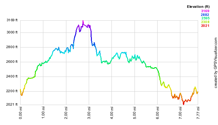 (The image at the left shows the profile of the hike. Remember that all vertical profiles are
relative!)
(The image at the left shows the profile of the hike. Remember that all vertical profiles are
relative!)
Tanbark Trail (Phoenicia)
| Quick Look | ||||
|---|---|---|---|---|
| Difficulty | Round trip | Total climb | Internet Maps | |
| 2.3 mi. | 798 ft. | AllTrails | ||
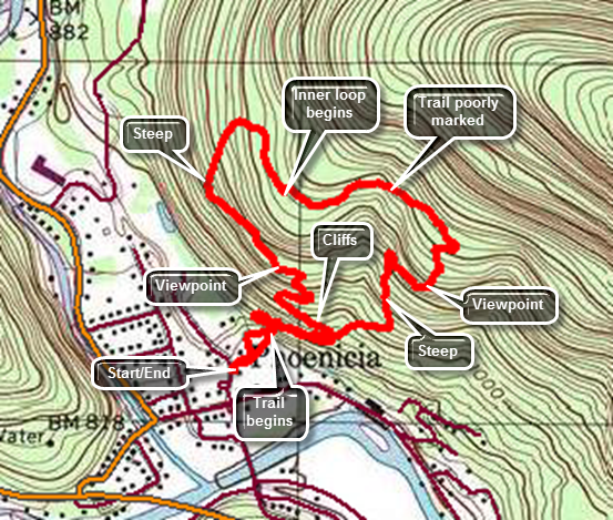 From Route 28 drive down the main street of Phoenicia watching for a sign for the post office on Ava Maria Mount. Turn left and park just passed the post office on the right side of the street. Walk to the short access road to Parrish Field. Walk straight across the field to a bridge and a sign explaining the trail system. Crossed the bridge and find three bright blue blazes on a tree. Pass between two rocks and immediately turn to the left. DO NOT go straight up the hill unless you like climbing a 40% grade. This turn is NOT well marked. Follow the trail as it goes through a switchback and climbs to the base of some impressive cliffs. The trail is narrow and rough but it is fun to walk below the cliffs. At about .25 miles the trail splits since it is a loop. A sign states that the designers intended hikers to go left so follow the suggestion. The trail now is wider but is still a good climb. At about .5 miles the trail levels off and you arrive at a viewpoint over Phoenicia below. The viewpoint is somewhat blocked by the leaves and has grown up since the trail was constructed. From this viewpoint the trail heads northwest and then swings to the north as it loops round the high ground on the right. The trail begins to descend briefly and then turns again to start north climbing a 20% grade on a rocky woods road. Along the way there are several paths and woods roads so be careful to follow the blazes. Just passed a mile the trail splits again. To the right is a shorter and less strenuous loop without an additional viewpoint. Stay left to hike the longer loop which has another lookout. From this point on the trail is not as well maintained and is poorly marked in places. There were several blowdowns which obscure the correct path. At 1.5 miles the trail turns south and you begin a long descent. At 1.6 miles there is another lookout. The trail narrows again and the descent becomes steeper exceeding 20%. The steep path may have a covering of leaves over loose dirt and rock. At 2 miles you will complete the loop and should turn left to follow the trail back to the base of the cliffs. Continue to follow it along the base of the cliffs. The trail is very narrow and often is slanted down the hill. Continue down through the switchback to where you started and walk across the field to your car.
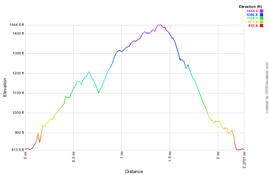 (The image at the left shows the profile of the hike. Remember that all vertical profiles are
relative!)
(The image at the left shows the profile of the hike. Remember that all vertical profiles are
relative!)
Terrace Mountain (Woodland Valley)
| Quick Look | ||||
|---|---|---|---|---|
| Difficulty | Round trip | Total climb | Internet Maps | |
| 6.8 mi. | 2070 ft. | AllTrails | ||
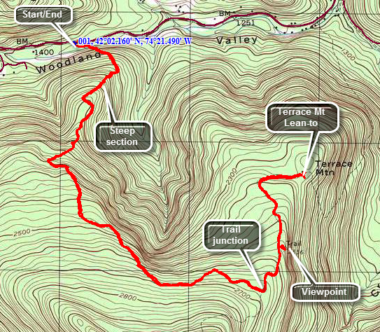 Park at the Woodland Valley Campsites on Woodland Valley Road being sure to pay the parking fee during the season. Head across the road to the bridge that crosses the creek. Be ready for an immediate climb as you make your way up the trail to Wittenberg Mountain. Over the next 1.9 miles from the bridge you will gain almost 1400 feet before the trail begins to level off. Even after the trail is no longer climbing continuously there will be several ups and downs. At 2.5 miles you will be at the junction with the trail to Terrace Mountain and a lean-to to the left. The trail to Terrace Mountain starts out as a pleasant walk through some hardwoods on an open trail. At about 2.7 miles there is a path to the right of the trail. This path leads to a large open rock face which offers some nice views to the northwest. The shelf of rock is quite large and you can walk to the east to find a large stone fireplace and "chairs". You may also walk along the edge of the rock face and get some more limited views which are better in the late fall or winter. After this path, the trail crosses some open rock and was poorly marked except for some cairns. The forest changes to evergreen trees as you descend. The rest of the walk to the lean-to is about .6 miles but drops over 200 feet. The forest changes back to hardwood until the trail enters a cleared area with the lean-to on the right. The lean-to is minimal but in good shape. The trail stops at the lean-to but once continued on to the Woodland Valley Road. When you are done exploring, retrace your route back to the Woodland valley parking area.
 (The image at the left shows the profile of the hike. Remember that all vertical profiles are
relative!)
(The image at the left shows the profile of the hike. Remember that all vertical profiles are
relative!)
Ticetonyk Mountain (DEC)
| Quick Look | ||||
|---|---|---|---|---|
| Difficulty | Round trip | Total climb | Internet Maps | |
| 3.4 mi. | 1350 ft. | AllTrails | ||
 From the intersection of Routes 28A and 28 near Boiceville drive south for .4 miles and turn left on DeSilva Road. Turn left at the end of the road and then turn right on Bostock Mountain Road. After 1.4 miles turn left on Peck Road. Drive 1.2 miles to a small pulloff on the left side of the road. The only sign is a small one in this "parking area" that explains the acquisition of Ticetenyk Mountain. The entire hike is a bushwhack although there are some woods roads and paths to follow. The first part of the hike is along a narrow access corridor of state land that is bordered by private property on both sides. Take the woods road that heads to the left and up a steep hill right out of parking area. Follow the state forest signs and the yellow blazes for about .5 miles and find a woods road that ascends steeply along the western shoulder of the mountain's ridge. Watch for nice views of the Shokan Reservoir which are easier to get in season's with fewer leaves. After about .75 miles you should be at the highest point on the road. The road continues northwest and start down onto private property. Turn off the road into the woods to the right and climb a steep hill. Continue to hike up and to the northeast until about 1.4 miles. Look for the highest point on the summit plateau and you may find the rock with the USGS benchmark. Walk down off the summit to the east or southeast and walk to the edge of the summit plateau. Walk counterclockwise until you find a viewpoint facing east. There will be wide open views and a large rock with many initials and symbols. Walk back to the summit and head west. The viewpoints on the west are mostly blocked by trees but are worth the visit. When you are done, follow your path back to your car.
 (The image at the left shows the profile of the hike. Remember that all vertical profiles are
relative!)
(The image at the left shows the profile of the hike. Remember that all vertical profiles are
relative!)
Ticetonyk Mountain (DEP)
| Quick Look | ||||
|---|---|---|---|---|
| Difficulty | Round trip | Total climb | Internet Maps | |
| 3.4 mi. | 1350 ft. | AllTrails | ||
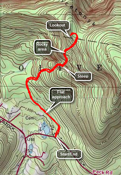 From the intersection of Routes 28A and 28 near Boiceville turn north near Onteora High School on Upper Boiceville Road. At the top of the hill follow the road as it veers to the right. After .75 miles, turn left on Bostock Road. Follow Bostock Road for 1.45 miles and then turn left on Peck Road. After a quarter mile, the parking area will be on your left. Caution: The lot will hold only or 5 cars and the land around it is private property. The trail is well marked with blue markers labeled DEP and CMC. Much of the hike is on an old woods road that goes up the mountain. The first part of the hike for about .65 miles is almost flat and heads first northeast and then northwest. The trail passes the YMCA camp which is on the left. At .65 miles the trail turns to the northeast and begins a strenuous climb. Over the nest .7 miles the trail gains 750 feet with an average grade of 21% before leveling slightly near the top of the climb. The trail is generally in good condition with a few rocky areas especially just before the top. The trail can be slippery when wet and when there are leaves on the trail. This would be an even more challenging trip with ice and snow on the trail. At 1.3 miles a sign points back to the parking area but the best is yet to come. Continue to walk on the trail until it turns left and descends slightly to the lookout. The view is to the west and south where the Ashokan Reservoir is visible. There are several other paths but most are blocked by some branches. When you are done simply turn around and retrace your steps back to the parking area.
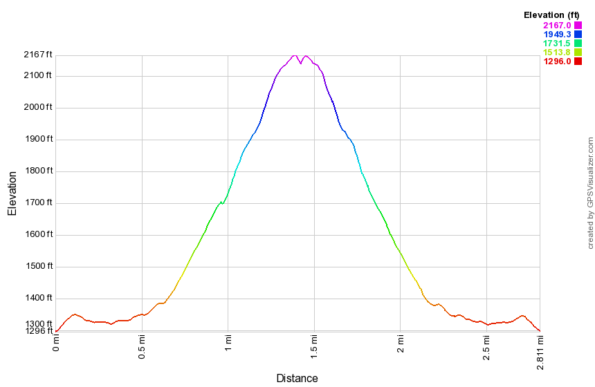 (The image at the left shows the profile of the hike. Remember that all vertical profiles are relative!)
Tremper Mountain: Rt. 40, Phoenicia
| Quick Look | ||||
|---|---|---|---|---|
| Difficulty | Round trip | Total climb | Internet Maps | |
| 6.1 mi. | 2100 ft. | AllTrails | ||
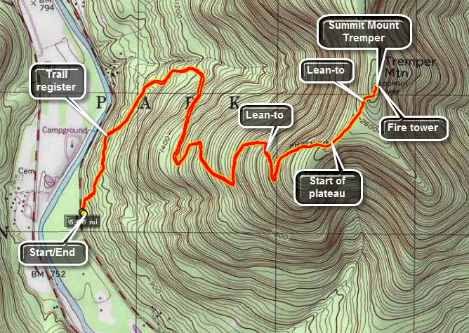 The Tremper Mountain Fire Tower is believed to be the oldest of the reconstructed fire towers in
The Catskills. It was originally constructed elsewhere in 1917 and then moved to its present location.
The trail is mostly along an old road to the summit. It has many switchbacks which make the route
Not as steep as it might be but also add length to the distance. Views of the surrounding mountains
are easily has had from the fire tower.
The Tremper Mountain Fire Tower is believed to be the oldest of the reconstructed fire towers in
The Catskills. It was originally constructed elsewhere in 1917 and then moved to its present location.
The trail is mostly along an old road to the summit. It has many switchbacks which make the route
Not as steep as it might be but also add length to the distance. Views of the surrounding mountains
are easily has had from the fire tower.
From Rt. 28 turn at the sign that indicates the village of Phoenicia. Continue straight through town until the sign for Rt. 40. Continue of Rt. 40 for about 3/4 of a mile. Pass the first parking area on your right. Park at the next parking area on the left. This area has a sign for the Tremper Mountain Fire Tower. Walk over three bridges and up a hill on the stone steps. Don't be surprised at the lack of a trail register at this point. The register is a little over a quarter mile on the trail. From here follow the well-marked red Phoenicia trail to the tower. The trail is an old road to the tower. It has many switchbacks which makes the incline quiet easy but lengthens the hike. It is possible to cut some of the switchbacks or bushwhack the entire way. BE CAREFUL! There are reports of timber rattlesnakes in this area!
The trail eventually reaches a plateau and after a short hike and a short climb you will be at the fire tower. This tower is surrounded by trees until you get near the top. The views are nice but not as interesting as the ones from Overlook, Balsam or Hunter on a nice day. Retrace your trail and you will be back at your car.
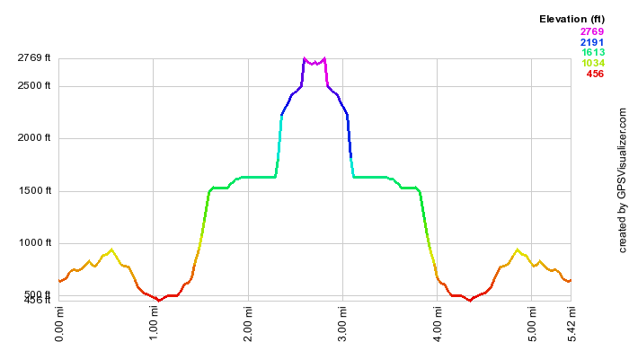 (The image at the left shows the profile of the hike. Remember that all vertical profiles are
relative!)
(The image at the left shows the profile of the hike. Remember that all vertical profiles are
relative!)
Trout and Around Mud Pond
| Quick Look | ||||
|---|---|---|---|---|
| Difficulty | Round trip | Total climb | Internet Maps | |
| 6.9 mi. | 1264 ft. | AllTrails | ||
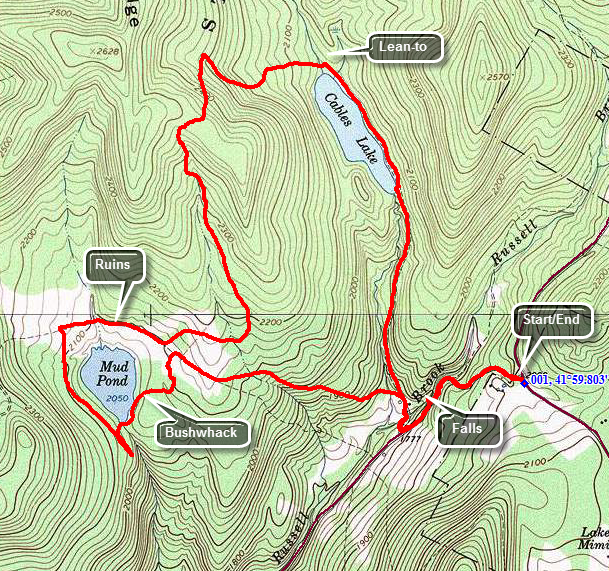 This is one of our favorite trails when we just want to hike. It has several variations for distance and
difficulty. Like most trails, hiking one way is different than hiking in the other direction. We have
take this route more than a dozen times this season and it is interesting to watch the changing
seasons. It is unfortunate that Russell Brook Road is closed due to the frequent floods that have
washed out the road.
This is one of our favorite trails when we just want to hike. It has several variations for distance and
difficulty. Like most trails, hiking one way is different than hiking in the other direction. We have
take this route more than a dozen times this season and it is interesting to watch the changing
seasons. It is unfortunate that Russell Brook Road is closed due to the frequent floods that have
washed out the road.
Turn left on Morton Hill Road on Route 206 just after the Rockland Flats. Bear right up Morton Hill
Road until you see a parking area on the left near the sign indicates Russell Brook Road is closed.
Park here on the side of the road and hike down Russell Brook Road .5 miles to the actual trail head. Go over the bridge and
look to your right to see a beautiful waterfall. Explore this area if you like. Back on the trail you
may go to the left or right. Go to the right and walk another 1.5 miles to the head of Trout Pond. The
trail is a gentle uphill all the way with the last quarter mile along the edge of the lake. At the
head of the lake the trail branches right to Campbell Brook. Bear left but do not go up the hill to the
lean-to since this is a dead end. The trail ascends around the other side of Trout Pond with a moderate
climb to almost 2500 feet on Cherry Ridge. You now walk down to Mud Pond. The total distance from the
lean-to is about 1.7 miles.
At this point you reach a T in the trail. Left goes directly back to the trailhead covering a little over 1 mile plus the half mile back to the car. Turning right takes you around Mud Pond and to the lower trail head on Russell Brook Road. The distance is 2 miles to the lower trail head and another 1.7 miles back to the car. If you can make the distance around Mud Pond there are some interesting things to see. Several old stone foundations can be seen around Mud Pond. A beaver pond can be found on the backside of the pond but there isn't much evidence of activity. As you hike from the lower trail head to the parking area, you can see the devastation the floods have brought to the road. In several places it is hard to tell road from stream!
Turn right here and walk on the wide trail around Mud Pond. You can see the pond to your left most of the time. When the snowmobile trail splits off to the right be sure to stay left. At about .8 miles from the last trail junction watch for a trail or path that leads down to the pond. Walk over the dam and around the pond. This is a bushwhack and you may have to fight through some thick brush. As you circle the pond head northeast and you will intersect the woods road that leads back to the trail register near the start of the hike. Depending on where you intersect the trail it is about .9 miles. From the trail register retrace your route up Russell Brook Road to your car
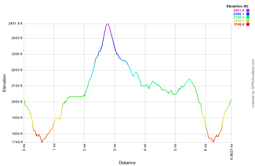 (The image at the left shows the profile of the hike.)
Trout and Mud Pond: Bushwhack Loop
| Quick Look | ||||
|---|---|---|---|---|
| Difficulty | Round trip | Total climb | Internet Maps | |
| 5.8 mi. | 1520 ft. | AllTrails | ||
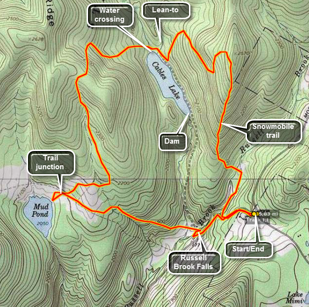 This is one of our favorite trails when we just want to hike. It has several variations for distance and
difficulty. Like most trails, hiking one way is different than hiking in the other direction. We have
take this route more than a dozen times this season and it is interesting to watch the changing
seasons. It is unfortunate that Russell Brook Road is closed due to the frequent floods that have
washed out the road.
This is one of our favorite trails when we just want to hike. It has several variations for distance and
difficulty. Like most trails, hiking one way is different than hiking in the other direction. We have
take this route more than a dozen times this season and it is interesting to watch the changing
seasons. It is unfortunate that Russell Brook Road is closed due to the frequent floods that have
washed out the road.
Turn left on Morton Hill Road on Route 206 just after the Rockland flats. Bear right up Morton Hill
Road until you see a parking area on the left near the sign indicates Russell Brook Road is closed.
Park here and hike down Russell Brook Road .25 miles to the first camping area on the left. Across from he camping area is a gated trail. What is now a snowmobile trail probably follows one of the haul roads built by the Treyz Acid Wood Factory in the early 20th century. This trail is overgrown and in need of maintenance and am not sure it has seen a snowmobile in some time! From the time you get on the trail it ascends for about 1.2 miles to the top of a ridge. For the next .8 miles the trail goes through some switchbacks in a descent west to the trail around Trout Pond. When you intersect the trail turn right and walk a short distance to the lean-tos and the inlet end of the pond. Here the trail branches right to Campbell Brook. Bear left but do not go up the hill to the lean-to since this is a dead end. The trail ascends around the other side of Trout Pond with a moderate climb to almost 2500 feet on Cherry Ridge at 3 miles into the hike. You now walk down the other side to Mud Pond.
At this point you reach a T in the trail as the hiking trail meets a snowmobile trail. Turn right and look for a path down to the shores of Mud Pond. This infrequently visited location has lots of wildlife in and around the pond. Between the shore of the pond and the woods road that serves as hiking and snowmobile trail, there are the ruins of several buildings. Walk back up to the woods road and turn right to get started back to your car. Over the next mile the trail ascends briefly and then drops to the lowest point as you cross the bridge over the outlet to Trout Pond. Turn right at the next trail junction and head out to Russell Brook Road and the lower trailhead parking. As you cross the bridge, look to your left to see Russell Brook Falls. The falls has historical significance so walk over to it if you have the time. It is usually possible to get down into the stream bed and take pictures of the falls without a problem. The stonework is part of two dams used to regulate water flow to an electric generating waterwheel downstream near what is now the Russell Brook Campsite. Once on the road you have an additional .5 miles back up Russell Brook Road to your car.
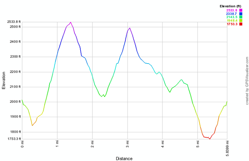 (The image at the left shows the profile of the hike.)
Trout Pond: Complete Trout and Mud Pond Loop
| Quick Look | ||||
|---|---|---|---|---|
| Difficulty | Round trip | Total climb | Internet Maps | |
| 7.6 mi. | 1317 ft. | AllTrails | ||
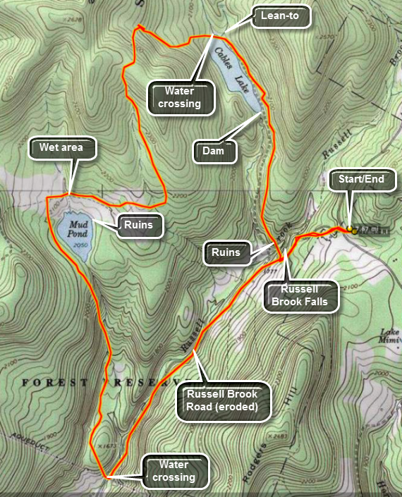 This is one of our favorite trails when we just want to hike. It has several variations for distance and
difficulty. Like most trails, hiking one way is different than hiking in the other direction. We have
take this route more than a dozen times this season and it is interesting to watch the changing
seasons. It is unfortunate that Russell Brook Road is closed due to the frequent floods that have
washed out the road.
This is one of our favorite trails when we just want to hike. It has several variations for distance and
difficulty. Like most trails, hiking one way is different than hiking in the other direction. We have
take this route more than a dozen times this season and it is interesting to watch the changing
seasons. It is unfortunate that Russell Brook Road is closed due to the frequent floods that have
washed out the road.
Turn left on Morton Hill Road on Route 206 just after the Rockland flats. Bear right up Morton Hill
Road until you see a parking area on the left near the sign indicates Russell Brook Road is closed.
Park here and hike down Russell Brook Road .5 miles to the actual trail head. Go over the bridge and look to your right to see a beautiful waterfall. Explore this area if you like. Back on the trail you may go to the left or right. Go to the right and walk another 1.5 miles to the head of Trout Pond. The trail is a gentle uphill all the way with the last quarter mile along the edge of the lake. At the head of the lake the trail branches right to Campbell Brook. Bear left but do not go up the hill to the lean-to since this is a dead end. The trail ascends around the other side of Trout Pond with a moderate climb to almost 2500 feet on Cherry Ridge. You now walk down to Mud Pond. The total distance from the lean-to is about 1.7 miles.
At this point you reach a T in the trail as the hiking trail meets a snowmobile trail. Left goes directly back to the trailhead covering a little over 1 mile plus the half mile back to the car. Turn right to start around Mud Pond. The trail follows the shore of Mud Pond until at 4 miles it turns almost 90 degrees to the south. A snowmobile trail continues straight ahead. This section of the trail can be very wet even when there has been no rain for some time. The trail now follows a stream out of Mud Pond and begins a long and sometimes steep descent of 530 feet over 1.1 miles. At one point you will pass by a beaver pond which often has interesting species of wildlife in and around it. The trail meets Russell Brook Road where you should turn left to walk up the road or what is left of it! In a few hundred feet is the toughest obstacle. You must cross Russell Brook at this point. You may be able to shimmy across a log, tiptoe across stepping stones or just get your feet wet. On the other side there is usually enough road left to walk along it in most places. You should be prepared to wade again or walk up a steep bank to get back to the lower parking area. The total walk up from the "ford" is 1.5 miles plus an additional .5 miles back up Russell Brook Road to your car.
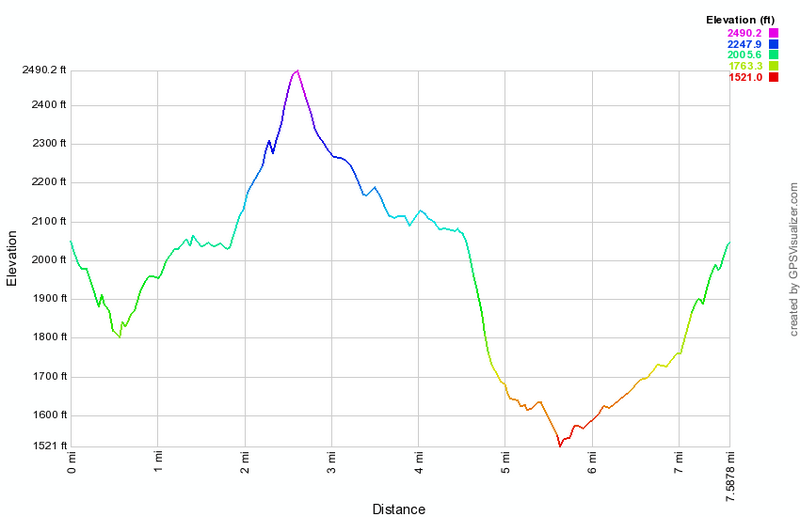 (The image at the left shows the profile of the hike.)
Trout and Mud Pond: Cooks Falls Loop
| Quick Look | ||||
|---|---|---|---|---|
| Difficulty | Round trip | Total climb | Internet Maps | |
| 10.9 mi. | 1872 ft. | AllTrails | ||
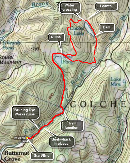 This is one of our favorite trails when we just want to hike. It has several variations for distance and
difficulty. Like most trails, hiking one way is different than hiking in the other direction. We have
take this route more than a dozen times this season and it is interesting to watch the changing
seasons. It is unfortunate that Russell Brook Road is closed due to the frequent floods that have
washed out the road.
This is one of our favorite trails when we just want to hike. It has several variations for distance and
difficulty. Like most trails, hiking one way is different than hiking in the other direction. We have
take this route more than a dozen times this season and it is interesting to watch the changing
seasons. It is unfortunate that Russell Brook Road is closed due to the frequent floods that have
washed out the road.
Take route 17, the Quickway, to the Cooks Falls exit. Get off at the exit and turn right onto Russell Brook Road. Drive passed the Russell Brook Campsites to the small parking lot at the end of the road. The road ends here and your hike begins. Just passed the STOP sign and pile of dirt that signal the end of the road, the road drops away and Russell Brook starts. The brook has eroded the road and is too wide to cross unless it has been VERY dry. If you look ahead, you may be able to see where the road is still intact and from that point on it may be in good shape. The only way to get to that point is to bushwhack and the easiest route is up the hill on the right side of the parking area. Go up the bank and walk along the bank wherever you can find flatter area to avoid sidehilling the whole way. Find a place to descend where you have to cross as little water as possible, If you are fortunate, you will find the road in good condition for some time with parts of the stream on either side or to one side or the other. At one point there is a bridge which seems to be a culvert with metal guard rails. You may also the old foundations from the Hans Bruning Dye Works which produced much of the khaki dye for World War I uniforms. As you continue your hike you may have to negotiate several stream crossings and walk over large stones left from the stream erosion. Numerous blowdowns also may also force us to change directions. At 1.4 miles the trail heads up to the left toward Mud Pond. Turn left here. The trail to Mud Pond is about 2 miles long with the first mile climbing rather steadily. After this, the trail levels some. At about 3 miles the trail turns sharply east while a snowmobile trail heads north. Stay on the trail as it wraps around Mud Pond to the junction with the trail to Trout Pond at 3.5 miles. Turn left to go to Trout Pond.
The trail to Trout Pond ascends to near the top of Cherry Ridge over the next 1.2 miles. After the climb to Cherry Ridge, the next .7 miles of trail descends to the inlet end of Trout Pond. Follow the trail around the shores of Trout Pond to the outlet end and the dam at 5.9 miles. The trail now starts to descend to the area of Russell Brook Falls and loses about 250 feet over the next .75 miles. At the trail junction turn right to start your loop back to Mud Pond. You will cross a bridge and pass by a popular campsite of questionable legality. The trail immediately begins to climb and gains 360 feet over .65 miles. From here the trail descends to the Mud Pond trail junction where you will start your trip back along the same path you used to get there. At 9.5 miles you should be back at Russell Brook and Russell Brook Road. Walk back to your car along this path.
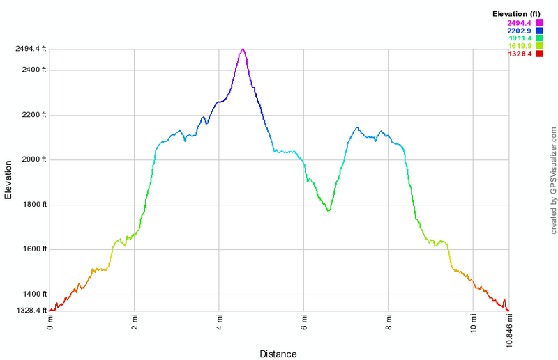 (The image at the left shows the profile of the hike. Remember that all vertical profiles are relative!)
Trout Pond: Bushwhack Loop
| Quick Look | ||||
|---|---|---|---|---|
| Difficulty | Round trip | Total climb | Internet Maps | |
| 4.2 mi. | 782 ft. | AllTrails | ||
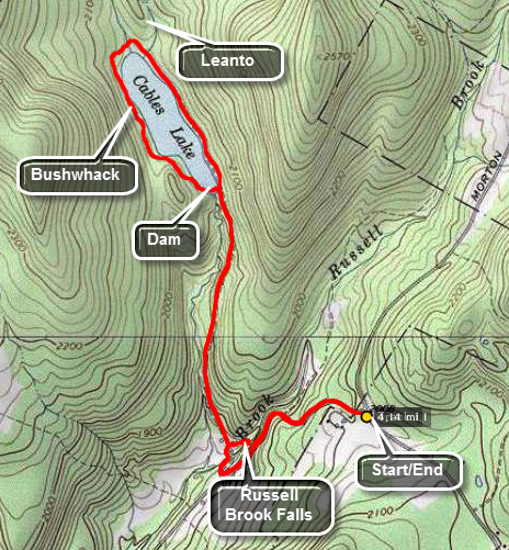 This is one of our favorite trails when we just want to hike. It has several variations for distance and
difficulty. Like most trails, hiking one way is different than hiking in the other direction. We have
take this route more than a dozen times this season and it is interesting to watch the changing
seasons. It is unfortunate that Russell Brook Road is closed due to the frequent floods that have
washed out the road.
This is one of our favorite trails when we just want to hike. It has several variations for distance and
difficulty. Like most trails, hiking one way is different than hiking in the other direction. We have
take this route more than a dozen times this season and it is interesting to watch the changing
seasons. It is unfortunate that Russell Brook Road is closed due to the frequent floods that have
washed out the road.
Turn left on Morton Hill Road on Route 206 just after the Rockland flats. Bear right up Morton Hill
Road until you see a parking area on the left near the sign indicates Russell Brook Road is closed.
Park here and hike down Russell Brook Road .5 miles to the actual trail head. Go over the bridge and look to your right to see a beautiful waterfall. Explore this historical area if you like. Back on the trail you may go to the left or right. Go to the right and walk another 1.5 miles to the head of Trout Pond. The trail is a gentle uphill all the way with the last quarter mile along the edge of the lake. Along the way you may want to stop at the dam at the outlet end of the pond. There are some nice views this end depending on the light. At the head of the lake the trail branches right to Campbell Brook. Bear left on a short spur trail up the hill to the lean-to. This section of trail dead ends here so now you must begin to bushwhack. The easiest route from a navigational standpoint is to stay near the shore of the pond. As you walk around the pond you may encounter some dense laurel stands and some old campsites and fir rings. Eventually you will some to the far side of the dam. Cross the dam here being careful not to slip as you walk across the spillway! Walk out to the trail and turn right to walk back down to the area of the falls. As you come to the bridge across Russell Brook, look to your left to see Russell Brook Falls. The falls has historical significance so walk over to it if you have the time. It is usually possible to get down into the stream bed and take pictures of the falls without a problem. The stonework is part of two dams used to regulate water flow to an electric generating waterwheel downstream near what is now the Russell Brook Campsite. Walk back to the trail and out to the lower trailhead. Once on the road you have an additional .5 miles back up Russell Brook Road to your car.
 (The image at the left shows the profile of the hike.)
Trout Pond: Campbell Brook and Morton Hill Road Loop
| Quick Look | ||||
|---|---|---|---|---|
| Difficulty | Round trip | Total climb | Internet Maps | |
| 7.1 mi. | 1237 ft. | AllTrails | ||
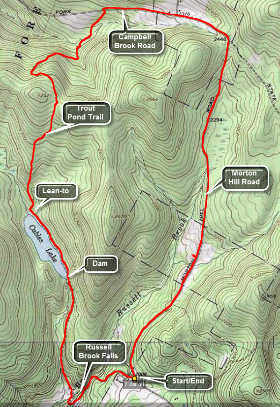 This is one of our favorite trails when we just want to hike. It has several variations for distance and
difficulty. Like most trails, hiking one way is different than hiking in the other direction. We have
take this route more than a dozen times this season and it is interesting to watch the changing
seasons. It is unfortunate that Russell Brook Road is closed due to the frequent floods that have
washed out the road.
This is one of our favorite trails when we just want to hike. It has several variations for distance and
difficulty. Like most trails, hiking one way is different than hiking in the other direction. We have
take this route more than a dozen times this season and it is interesting to watch the changing
seasons. It is unfortunate that Russell Brook Road is closed due to the frequent floods that have
washed out the road.
Turn left on Morton Hill Road on Route 206 just after the Rockland flats. Bear right up Morton Hill
Road until you see a parking area on the left near the sign indicates Russell Brook Road is closed.
Park here and hike down Russell Brook Road .5 miles to the actual trail head. Go over the bridge and look to your right to see a beautiful waterfall. Explore this area if you like. Back on the trail you may go to the left or right. Go to the right and walk another 1.5 miles to the head of Trout Pond. The trail is a gentle uphill all the way with the last quarter mile along the edge of the lake. At the head of the lake the trail branches right to Campbell Brook. Turn right to stay on the Trout Pond Trail. The first .8 miles of this part of the trail is all uphill and rises about 450 feet to the top of a hill. The trail is not used much and would be completely grow in except for the fact that it also acts as a snowmobile trail. At one point, near the top, another snowmobile trail marked "21" heads off to the right. Stayed to left on the blue blazed hiking trail. From here the trail descends to an area where it crosses two brooks on bridges. After that, it ascends slightly to meet Campbell Brook Road. At Campbell Brook Road turn right on Campbell Brook Road. Walk the road until it meets Morton Hill Road. For about .9 miles Campbell Brook Road and Morton Hill Road ascend a hill. After that, the next 2.4 miles is all downhill back to your car.
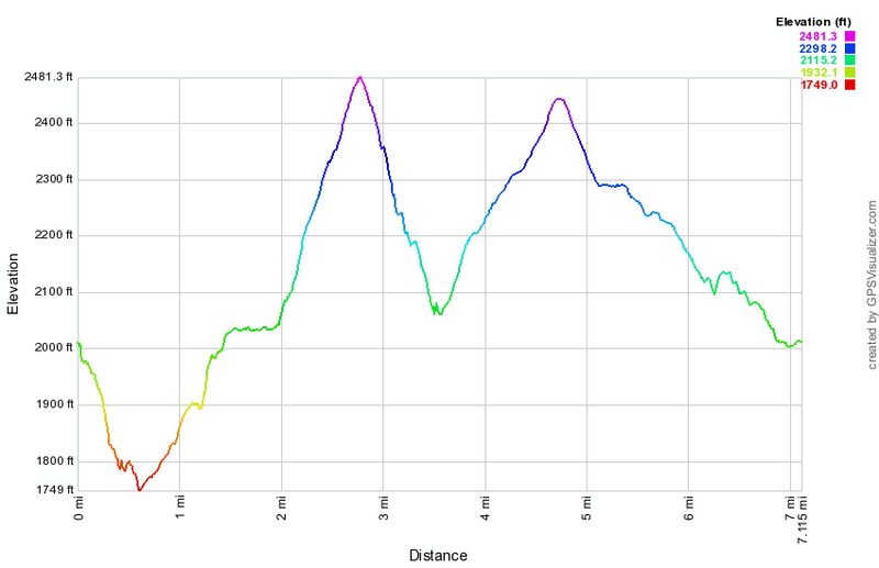 (The image at the left shows the profile of the hike. Remember that all vertical profiles are relative!)
Trout Pond: Campbell Brook and Morton Hill Road Loop
| Quick Look | ||||
|---|---|---|---|---|
| Difficulty | Round trip | Total climb | Internet Maps | |
| 8.5 mi. | 1710 ft. | AllTrails | ||
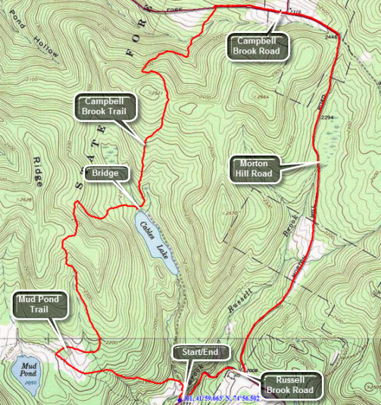 This is one of our favorite trails when we just want to hike. It has several variations for distance and
difficulty. Like most trails, hiking one way is different than hiking in the other direction. We have
take this route more than a dozen times this season and it is interesting to watch the changing
seasons. It is unfortunate that Russell Brook Road is closed due to the frequent floods that have
washed out the road.
This is one of our favorite trails when we just want to hike. It has several variations for distance and
difficulty. Like most trails, hiking one way is different than hiking in the other direction. We have
take this route more than a dozen times this season and it is interesting to watch the changing
seasons. It is unfortunate that Russell Brook Road is closed due to the frequent floods that have
washed out the road.
Turn left on Morton Hill Road on Route 206 just after the Rockland flats. Bear right up Morton Hill
Road until you see a parking area on the left. Turn left and drive down Russell Brook Road to the lower parking area. If Russell Brook Road is closed, be sure to park on the side of the road at the intersection of Morton Hill Road and Russell Brook Road as the parking spot there is on private land.
Park and hike down the woods road to the bridge over Russell Brook. Go over the bridge and look to your right to see a beautiful waterfall. Explore this area if you like. Back on the trail you may go to the left or right. Go to the left and walk up a hill gaining about 400 feet in .8 miles. At the top of the hill descend slightly to a trail junction. Turn right on the blue blazed Mud Pond Trail and hike a mile to the highest point on the hike on the shoulder of Cherry Ridge. Descend .8 miles from this high point to the bridge at the inlet end of Trout Pond. There are two lean-tos in this area which are popular places to camp. As the trail begins to turn to the right around the pond, turn left on the Campbell Brook Trail. You will now hike .8 miles and 430 vertical feet up and the same amount down over a small ridge. At 4.75 miles you will emerge on Campbell Brook Road. Turn right and hike a mile to the intersection with Moron Hill Road. Continue straight ahead on Morton Hill Road and up a small Hill. From the top of the hill walk 2.3 miles north on the road back to the junction with Russell Brook Road. You will lose almost 500 feet along the way. Turn right on Russell Brook Road and hike .5 miles back to the car.
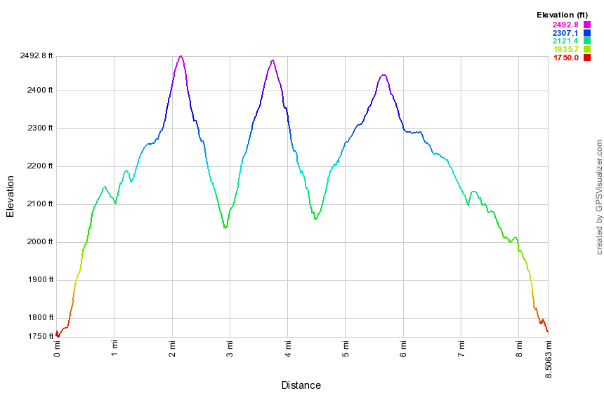 (The image at the left shows the profile of the hike. Remember that all vertical profiles are relative!)
Trout Pond: Campbell Brook and Morton Hill Road Loop (long upper parking)
| Quick Look | ||||
|---|---|---|---|---|
| Difficulty | Round trip | Total climb | Internet Maps | |
| 8.6 mi. | 1680 ft. | AllTrails | ||
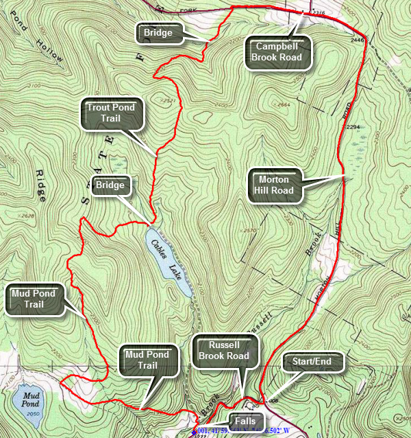 This is one of our favorite trails when we just want to hike. It has several variations for distance and difficulty. Like most trails, hiking one way is different than hiking in the other direction. We have taken this route a dozens of times and it is interesting to watch the changing seasons. It is unfortunate that Russell Brook Road is closed due to the frequent floods that have washed out the road.
Turn left on Morton Hill Road on Route 206 just after the Rockland flats. Bear right up Morton Hill Road until you see a parking area on the left. Turn around and park on the side of the road. DO NOT park in the lot as it is on private property!
Hike down Russell Brook Road watching for a viewpoint over the upper falls on the right side of the road. Stopping at this lookout is wroth a few minutes. Continue down the road to the lower parking area and walk to the woods road that is part of the trail. Turn right on the woods road and walk across the bridge on Russell Brook. Watch for a path on the right that leads to the lower falls. Follow the path to the falls and work your way down to the streambed if you wish. Walk back out the path to the main trail and turn right. Turn left at the trail junction just after the trail register and walk up a hill gaining about 400 feet in .8 miles. At the top of the hill descend slightly to a trail junction. Turn right on the blue blazed Mud Pond Trail and hike a mile to the highest point on the hike on the shoulder of Cherry Ridge. Descend .8 miles from this high point to the bridge at the inlet end of Trout Pond. There are two lean-tos in this area which are popular places to camp. As the trail begins to turn to the right around the pond, turn left on the Trout Pond Trail. You will now hike .8 miles and 430 vertical feet up and the same amount down over a small ridge. At 5.4 miles you will emerge on Campbell Brook Road. Turn right and hike .5 miles to the intersection with Morton Hill Road. Continue straight ahead on Morton Hill Road and up a small hill. From the top of the hill walk 2.3 miles north on the road back to the junction with Russell Brook Road and your car. You will lose almost 500 feet along the way.
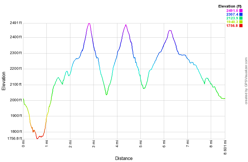 (The image at the left shows the profile of the hike. Remember that all vertical profiles are relative!)
Trout Pond: Campbell Mountain and Morton Hill Road Loop
| Quick Look | ||||
|---|---|---|---|---|
| Difficulty | Round trip | Total climb | Internet Maps | |
| 8.9 mi. | 1679 ft. | AllTrails | ||
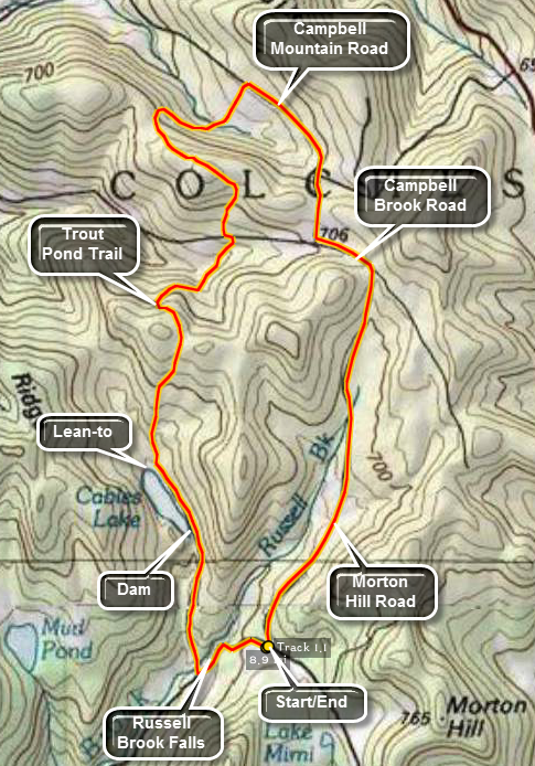 This is one of our favorite trails when we just want to hike. It has several variations for distance and
difficulty. Like most trails, hiking one way is different than hiking in the other direction. We have
take this route more than a dozen times this season and it is interesting to watch the changing
seasons. It is unfortunate that Russell Brook Road is closed due to the frequent floods that have
washed out the road.
This is one of our favorite trails when we just want to hike. It has several variations for distance and
difficulty. Like most trails, hiking one way is different than hiking in the other direction. We have
take this route more than a dozen times this season and it is interesting to watch the changing
seasons. It is unfortunate that Russell Brook Road is closed due to the frequent floods that have
washed out the road.
Turn left on Morton Hill Road on Route 206 just after the Rockland flats. Bear right up Morton Hill
Road until you see a parking area on the left near the sign indicates Russell Brook Road is closed.
Park here and hike down Russell Brook Road .5 miles to the actual trail head. Go over the bridge and look to your right to see a beautiful waterfall. Explore this area if you like. Back on the trail you may go to the left or right. Go to the right and walk another 1.5 miles to the head of Trout Pond. The trail is a gentle uphill all the way with the last quarter mile along the edge of the lake. At the head of the lake the trail branches right to Campbell Brook. Turn right to stay on the Trout Pond Trail. The first .8 miles of this part of the trail is all uphill and rises about 450 feet to the top of a hill. The trail is not used much and would be completely grow in except for the fact that it also acts as a snowmobile trail. At one point, near the top, another snowmobile trail marked "21" heads off to the right. Stayed to left on the blue blazed hiking trail. From here the trail descends to an area where it crosses two brooks on bridges. After that, it ascends slightly to meet Campbell Brook Road at about 3.5 miles into your hike. Cross Campbell Brook Road to stay on the Trout Pond Trail. Over the next.6 miles the trail ascends a hill and then for the next.85 miles it descends until you arrive at Campbell Mountain Road about 5.2 miles into your hike. Turn right on the road and walk 1.1 miles to Campbell Brook Road. Turn left and walk .4 miles to Morton Hill Road where you turn right. After that, walk 2.3 miles downhill back to your car.
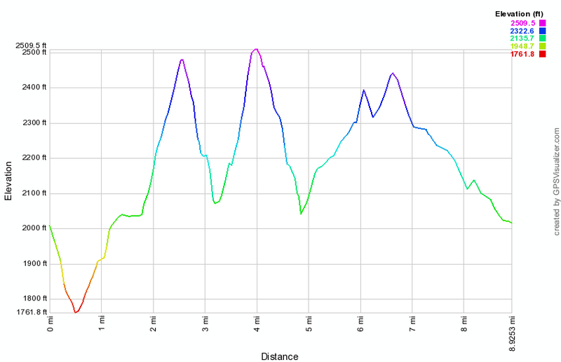 (The image at the left shows the profile of the hike. Remember that all vertical profiles are relative!)
Trout Pond: Clockwise Loop from Morton Hill Road
| Quick Look | ||||
|---|---|---|---|---|
| Difficulty | Round trip | Total climb | Internet Maps | |
| 6.0 mi. | 1237 ft. | AllTrails | ||
_map.png) This is one of our favorite trails when we just want to hike. It has several variations for distance and
difficulty. Like most trails, hiking one way is different than hiking in the other direction. We have
take this route more than a dozen times this season and it is interesting to watch the changing
seasons. It is unfortunate that Russell Brook Road is closed due to the frequent floods that have
washed out the road.
This is one of our favorite trails when we just want to hike. It has several variations for distance and
difficulty. Like most trails, hiking one way is different than hiking in the other direction. We have
take this route more than a dozen times this season and it is interesting to watch the changing
seasons. It is unfortunate that Russell Brook Road is closed due to the frequent floods that have
washed out the road.
Turn left on Morton Hill Road on Route 206 just after the Rockland Flats. Bear right up Morton Hill
Road until you see a parking area on the left near the sign indicates Russell Brook Road is closed.
Park here and hike down Russell Brook Road .5 miles to the actual trail head. Go over the bridge and look to your right to see a beautiful waterfall. Explore this area if you like. Back on the trail you may go to the left or right. Go to the left and start to walk up a rather steep hill toward Mud Pond. After about 2 miles you will be at a trail junction. You may walk straight ahead and then turn left into the woods and walk down to the shore of Mud Pond. Turn right onto the trail that heads over the shoulder of Cherry Ridge to Trout Pond (Cable's Lake). At about 3 miles you will be at the highest point on the hike from which the trail drops down to the lake. At 3.9 miles there is a bridge across the inlet stream for the pond. A trail up and to the right leads to a lean-to while another lean-to is a hundred feet ahead on the left. Continue around the pond on the wide, flat woods road until you get to the outlet end of the lake. From here the trail continues to the trail junction near the false where you started your loop. Retrace your route back to the car
_gra.png) (The image at the left shows the profile of the hike. Remember that all vertical profiles are relative!)
(The image at the left shows the profile of the hike. Remember that all vertical profiles are relative!)
Mud Pond and Trout Pond: Clockwise Loop from Morton Hill Road
| Quick Look | ||||
|---|---|---|---|---|
| Difficulty | Round trip | Total climb | Internet Maps | |
| 7.9 mi. | 1424 ft. | AllTrails | ||
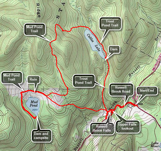 This is one of our favorite trails when we just want to hike. It has several variations for distance and difficulty. Like most trails, hiking one way is different than hiking in the other direction. We have taken this route dozens of times and it is interesting to watch the changing seasons. It is unfortunate that Russell Brook Road is closed after the lower parking area due to the frequent floods that have washed out the road.
Get off Sate Route 17 at exit 94 Roscoe. Get on Route 206 heading north from Roscoe toward Downsville. Turn left on Morton Hill Road on Route 206 just after the Roscoe Nursing Home. Bear right up Morton Hill Road until you see a parking area on the left near the sign indicating Russell Brook Road is closed.
Turn around and park on the side of the road just passed the parking area. What looks like a parking area is private property! Hike down Russell Brook Road .5 miles to the actual trail head. Along the way is a path to a lookout over the upper falls. This is worth visiting. From the lower parking area walk down the woods road and go over the bridge. Look to your right to see a beautiful waterfall which may be hidden ny the vegetation. To get to the falls walk a little farther and make a right on an informal path just after the robust stand of Japanese knotweed. Walk on the paths that parallel the stream until a path leads down to the streambed. Use caution as this path is short but steep. When you are done at the base of the falls, retrace your steps toward the main trail but turn right up the hill on another informal path to a beautiful area above the upper and lower falls. There is a somewhat "sketchy" path down to the area in front of the upper falls which is very special. When you are done exploring, retrace your steps to the main trail. Turn right and in a short distance is the trail register and a trail junction. Go to the left and start to walk up a rather steep hill toward Mud Pond. At 2.1 miles into the hike you will be at a trail junction. Walk straight ahead on the Mud Pond Trail which is also a snowmobile trail. You can see Mud Pond through the trees to your left. Continue to walk passing some foundations and stone structures on your left. This trail can be very muddy! Continue to hike until you have passed two designated campsites. At the third campsite, about 2.9 miles into the hike, turn left and walk down to the campsite which is at the dam across the outlet end of the pond. Enjoy the view of the pond. When you are done, retrace your steps back to the trail junction where the Mud Pond Trails turns left. Turn left onto the trail that heads over the shoulder of Cherry Ridge to Trout Pond (Cable's Lake). This trail also can be wet at times. This trail climbs for 1.25 miles to the highest point on the hike at 5.1 miles. From here the trail turns east and drops down to the lake. At 5.9 miles there is a bridge across the inlet stream for the pond. A trail up and to the right leads to a lean-to while another lean-to is a hundred feet ahead on the left. Continue around the pond on the wide, flat woods road until you get to the outlet end of the lake. From here the trail continues to descend to the trail junction near the point where you started your loop. Retrace your route back to the lower parking area and then walk up Russell Brook Road to the car
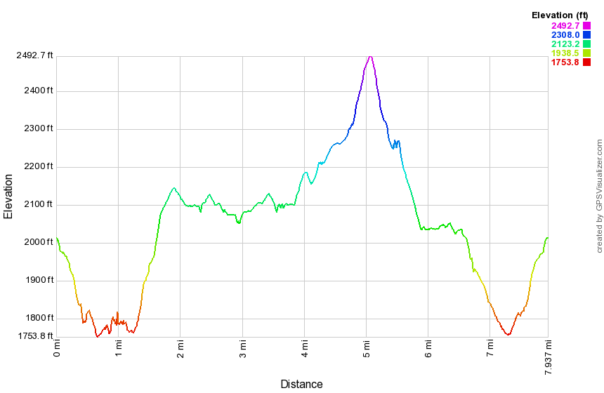 (The image at the left shows the profile of the hike. Remember that all vertical profiles are relative!)
Trout Pond: Counterclockwise Loop from Morton Hill Road
| Quick Look | ||||
|---|---|---|---|---|
| Difficulty | Round trip | Total climb | Internet Maps | |
| 5.1 mi. | 1031 ft. | AllTrails | ||
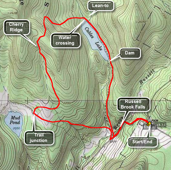 This is one of our favorite trails when we just want to hike. It has several variations for distance and
difficulty. Like most trails, hiking one way is different than hiking in the other direction. We have
take this route more than a dozen times this season and it is interesting to watch the changing
seasons. It is unfortunate that Russell Brook Road is closed due to the frequent floods that have
washed out the road.
This is one of our favorite trails when we just want to hike. It has several variations for distance and
difficulty. Like most trails, hiking one way is different than hiking in the other direction. We have
take this route more than a dozen times this season and it is interesting to watch the changing
seasons. It is unfortunate that Russell Brook Road is closed due to the frequent floods that have
washed out the road.
Turn left on Morton Hill Road on Route 206 just after the Rockland Flats. Bear right up Morton Hill
Road until you see a parking area on the left near the sign indicates Russell Brook Road is closed.
Park here and hike down Russell Brook Road .5 miles to the actual trail head. Go over the bridge and look to your right to see a beautiful waterfall. Explore this area if you like. Back on the trail you may go to the left or right. Go to the right and walk another 1.5 miles to the head of Trout Pond. The trail is a gentle uphill all the way with the last quarter mile along the edge of the lake. At the head of the lake the trail branches right to Campbell Brook. Bear left but do not go up the hill to the lean-to since this is a dead end. The trail ascends around the other side of Trout Pond with a moderate climb to almost 2500 feet on Cherry Ridge. You now walk down to Mud Pond. The total distance from the lean-to is about 1.7 miles.
At this point you reach a T in the trail. Left goes directly back to the trailhead covering a little over 1 mile plus the half mile back to the car. Turning right takes you around Mud Pond and to the lower trail head on Russell Brook Road. The distance is 2 miles to the lower trail head and another 1.7 miles back to the car. If you can make the distance around Mud Pond there are some interesting things to see. Several old stone foundations can be seen around Mud Pond. A beaver pond can be found on the backside of the pond but there isn't much evidence of activity. As you hike from the lower trail head to the parking area, you can see the devastation the floods have brought to the road. In several places it is hard to tell road from stream!
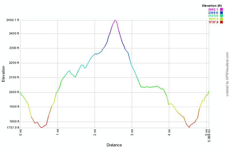 (The image at the left shows the profile of the hike. Remember that all vertical profiles are relative!)
Trout Pond: Counterclockwise Loop from Morton Hill Road (with Mud Pond)
| Quick Look | ||||
|---|---|---|---|---|
| Difficulty | Round trip | Total climb | Internet Maps | |
| 5.9 mi. | 1160 ft. | AllTrails | ||
 This is one of our favorite trails when we just want to hike. It has several variations for distance and difficulty. Like most trails, hiking one way is different than hiking in the other direction. We have taken this route more than a dozen times this season and it is interesting to watch the changing seasons. It is unfortunate that Russell Brook Road is closed due to the frequent floods that have washed out the road.
Turn left on Morton Hill Road on Route 206 just after the Rockland Flats. Bear right up Morton Hill Road until you see a parking area on the left near the sign indicates Russell Brook Road is closed.
Park here on the side of the road. DO NOT park in the large parking area s it is private property. Hike down Russell Brook Road .5 miles to the actual trail head. Along the way watch for the upper falls of Russell Brook Falls on the right. You may walk carefully down the bank to a viewpoint. From the lower parking area turn right and walk down the woods and cross the bridge. If you look to your right you may catch a glimpse of the lower falls of Russell Brook Falls. Continue on the road and watch for a path on the right just after the large stand of Japanese knotweed. Turn right here and follow the path toward the falls. You may view the falls from the path or carefully work your way down the bank to stand in the stream bed. Work your way back out to the main trail and turn right. Walk another 1.5 miles on a gentle uphill grade to the outlet end of Trout Pond. Walk over to the "beach" to get a good view to the north of the whole pond. Walk another quarter mile along the edge of the lake to the inlet end of the lake. Turn left to cross the bridge. Notice the lean-to on the right. There is another straight ahead on a spur trail that runs uphill. You may want to walk out to the left to the edge of the pond. Back on the main trail bear to the right and do not go up the hill to the lean-to since this is a dead end. The trail ascends around the other side of Trout Pond with a climb to almost 2500 feet on Cherry Ridge. At 2.9 miles you will be at the highest point on the hike and ready to start a descent toward Mud Pond. You will reach a T in the trail. Turn right and walk about 500 feet watching for a path on the right down to Mud Pond. Walk down to the shores of the pond quietly as there is often wildlife in the area. Walk back up to the main trail and turn right continuing slightly uphill. After a short ascent the trail begin to descend again to the area near the falls. The walk back to the trail register is .7 miles and the loss ion elevation is about 400 feet. Pass by large camping area on the left and over a bridge that spans the outlet stream from Trout Pond. Turn right and pass by the register. Walk back over the bridge that crosses Russell Brook and up to the lower parking area. Your car is .5 miles away with an scent of about 225 feet.
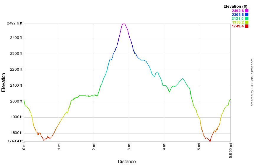 (The image shows the profile of the hike. Remember that all vertical profiles are relative!)
Trout Pond: Lower Parking Clockwise
| Quick Look | ||||
|---|---|---|---|---|
| Difficulty | Round trip | Total climb | Internet Maps | |
| 4.4 mi. | 885 ft. | AllTrails | ||
_map.png) This is one of our favorite trails when we just want to hike. It has several variations for distance and difficulty. Like most trails, hiking one way is different than hiking in the other direction. We have taken this route more than a dozen times this year and it is interesting to watch the changing seasons. It is unfortunate that Russell Brook Road is closed due to the frequent floods that have washed out the road.
This is one of our favorite trails when we just want to hike. It has several variations for distance and difficulty. Like most trails, hiking one way is different than hiking in the other direction. We have taken this route more than a dozen times this year and it is interesting to watch the changing seasons. It is unfortunate that Russell Brook Road is closed due to the frequent floods that have washed out the road.
Turn left on Morton Hill Road on Route 206 just after the Rockland Flats. Bear right up Morton Hill Road until you see Russell Brook Road on the left. The road is a "seasonal maintenance" road so you travel at your own risk. If the road is not navigable, you may park on the side of Morton Hill Road. DO NOT park in the open space at the intersection as this is private property.
From the lower parking area walk down to the wide woods road that is the Trout Pond Trail. Cross the bridge over Russell Brook and walk by a large stand of Japanese knotweed on the right of the trail. Continue on to the first trail junction near the trail register. Turn left and start a climb toward Mud Pond. The climb to the highest point is 370 feet in .7 miles. Descend slightly to the next trail junction and turn right to start a climb to the highest point of the trail on the shoulder of Cherry Ridge. The trail gains 410 feet over 1.1 miles as the trail heads north. After the highest point on the hike, the trail begins to descend toward Trout Pond. At 2.24 miles the trail heads east and continues to descend to Trout Pond. In .7 miles the trail descends 460 feet to the bridge at the inlet end of Trout Pond. Cross the bridge and turn right at the next trail junction to hike a flat section of trail along the east side of the pond. This section of trail is about .6 miles and leads to the outlet end of the pond that has a nice view of the pond. The next .7 miles of trail descends a total of 270 feet back to the first trail junction where there is a trail register. From here, follow the trail .2 miles back to your car with a stop at the falls if you wish.
_gra.png) (The image shows the profile of the hike. Remember that all vertical profiles are relative!)
(The image shows the profile of the hike. Remember that all vertical profiles are relative!)
Trout Pond: Lower Parking Counterclockwise
| Quick Look | ||||
|---|---|---|---|---|
| Difficulty | Round trip | Total climb | Internet Maps | |
| 4.4 mi. | 960 ft. | AllTrails | ||
_map.png) This is one of our favorite trails when we just want to hike. It has several variations for distance and difficulty. Like most trails, hiking one way is different than hiking in the other direction. We have taken this route more than a dozen times this year and it is interesting to watch the changing seasons. It is unfortunate that Russell Brook Road is closed due to the frequent floods that have washed out the road.
This is one of our favorite trails when we just want to hike. It has several variations for distance and difficulty. Like most trails, hiking one way is different than hiking in the other direction. We have taken this route more than a dozen times this year and it is interesting to watch the changing seasons. It is unfortunate that Russell Brook Road is closed due to the frequent floods that have washed out the road.
Turn left on Morton Hill Road on Route 206 just after the Rockland flats. Bear right up Morton Hill Road until you see Russell Brook Road on the left. The road is a "seasonal maintenance" road so you travel at your own risk. If the road is not navigable, you may park on the side of Morton Hill Road. DO NOT park in the open space at the intersection as this is private property.
From the lower parking area walk down to the wide woods road that is the Trout Pond Trail. Cross the bridge over Russell Brook and walk by a large stand of Japanese knotweed on the right of the trail. Continue on to the first trail junction near the trail register. Continue straight ahead at the trail junction toward Trout Pond. The trail is a gentle uphill and passes a path on the left that accesses one of the designated camping areas. Soon you will be at the outlet end of Trout Pond. You may stop a while to enjoy the view from the "beach". Continue on the main trail and walk the flat woods road toward the inlet end of the pond. There are two lean-tos in this area. One is near the trail junction and another on a spur trail to the west of the bridge. At the trail junction near the lower leanto turn left on the blue blazed Mud Pond Trail which climbs the shoulder of Cherry Ridge. From the bridge at the inlet the trail climbs 430 feet over the next .75 miles. The trail heads west from the inlet until turning sharply south at around 2 miles. The highest point on the trail is at 2.2 miles after which most of the rest of the hike is downhill. At 3.3 miles the trail has descended 450 feet from Cherry Ridge to the snowmobile trail near Mud Pond. Turn left here to head east and downhill back toward the parking area. The trail drops another 380 feet over the next .7 miles back to the trail junction. At the trail junction turn right and walk until you see an informal path of the left which leads to the falls. Turn left and walk out to the falls on the informal path descending to the stream bed if you like. Return to the main trail and walk up to the parking area.
_gra.png) (The image shows the profile of the hike. Remember that all vertical profiles are relative!)
(The image shows the profile of the hike. Remember that all vertical profiles are relative!)
Trout Pond: Morton Hill to Route 206 Loop
| Quick Look | ||||
|---|---|---|---|---|
| Difficulty | Round trip | Total climb | Internet Maps | |
| 12.4 mi. | 2406 ft. | AllTrails | ||
This is one of our favorite trails when we just want to hike. It has several variations for distance and
difficulty. Like most trails, hiking one way is different than hiking in the other direction. We have
take this route more than a dozen times this season and it is interesting to watch the changing
seasons. It is unfortunate that Russell Brook Road is closed due to the frequent floods that have
washed out the road.
Turn left on Morton Hill Road on Route 206 just after the Rockland flats. Bear right up Morton Hill
Road until you see a parking area on the left near the sign indicates Russell Brook Road is closed.
Park here and hike down Russell Brook Road .5 miles to the actual trail head. Go over the bridge and look to your right to see a beautiful waterfall. Explore this area if you like. Back on the trail you may go to the left or right. Go to the right and walk another 1.5 miles to the head of Trout Pond. The trail is a gentle uphill all the way with the last quarter mile along the edge of the lake. At the head of the lake the trail branches right to Campbell Brook. Turn right to stay on the Trout Pond Trail. The first .8 miles of this part of the trail is all uphill and rises about 450 feet to the top of a hill. The trail is not used much and would be completely grow in except for the fact that it also acts as a snowmobile trail. At one point, near the top, another snowmobile trail marked "21" heads off to the right. Stayed to left on the blue blazed hiking trail. From here the trail descends to an area where it crosses two brooks on bridges. After that, it ascends slightly to meet Campbell Brook Road at about 3.5 miles into your hike. Cross Campbell Brook Road to stay on the Trout Pond Trail. Over the next.6 miles the trail ascends a hill and then for the next.85 miles it descends until you arrive at Campbell Mountain Road about 5.2 miles into your hike. Cross Campbell Mountain Road and pick up the blue Campbell Mountain Trail. Walk 2 miles up and over Campbell Mountain and then down the other side. The descent has several switchbacks, a lean-to along the way and several water crossings on bridges. When you arrive at Route 206, turn right and walk .7 miles up the hill to Jug Tavern Road. Turn right here and walk 1.5 miles to Campbell Mountain Road. Turn left and walk .4 miles to Campbell Brook Road. Turn left and walk .4 miles to Morton Hill Road where you turn right. After that, walk 2.3 miles downhill back to your car.
(The image at the left shows the profile of the hike. Remember that all vertical profiles are relative!)
Trout Pond: Out and Back
| Quick Look | ||||
|---|---|---|---|---|
| Difficulty | Round trip | Total climb | Internet Maps | |
| 3.0 mi. | 385 ft. | AllTrails | ||
 This is one of our favorite trails when we just want to hike. It has several variations for distance and difficulty. Like most trails, hiking one way is different than hiking in the other direction. We have take this route more than a dozen times this season and it is interesting to watch the changing seasons. It is unfortunate that Russell Brook Road is closed due to the frequent floods that have
washed out the road.
This is one of our favorite trails when we just want to hike. It has several variations for distance and difficulty. Like most trails, hiking one way is different than hiking in the other direction. We have take this route more than a dozen times this season and it is interesting to watch the changing seasons. It is unfortunate that Russell Brook Road is closed due to the frequent floods that have
washed out the road.
From Roscoe head north on Route 206 toward Downsville. Turn left on Morton Hill Road off Route 206 just after the Rockland Flats. Bear right up Morton Hill Road until you see a parking area on the left near the sign indicates Russell Brook Road has "Limited Maintenance". Drive carefully down Russell Brook Road and park at the lot at the end of the road where there is a kiosk.
Walk down the road and turn right just passed the kiosk. Walk down the wide woods road to the bridge over Russell Brook. Cross the bridge and continue on the main trail watching for a path to the right just passed a large stand of Japanese knotweed. Turn right here and follow the path that leads toward the lower waterfall. This path continues to a viewpoint over the lower falls. Before you get to the view point turn right and work your way down the bank to the streambed. You will be directly in front of Russell Brook Falls. After taking in the beauty of the falls walk back up the bank and out to the main trail. Turn right on the main trail and walk to the trail register and a trail junction just passed it. Stay right on the blue-blazed Trout Pond Trail which ascends very gently to the outlet of Trout Pond at .9 miles. You may want to walk to the left of the trail at the outlet and visit the �beach� and the dam. There is a nice view of the entire pond from this location. Continue on the main trail for just over .5 miles to the bridge over the inlet of Trout Pond. There is also a nice view from the bridge or the shore at this end. You have now hiked a total of 1.6 miles. Turn around and retrace your steps to the parking area skipping a second trip to the falls on the way back.
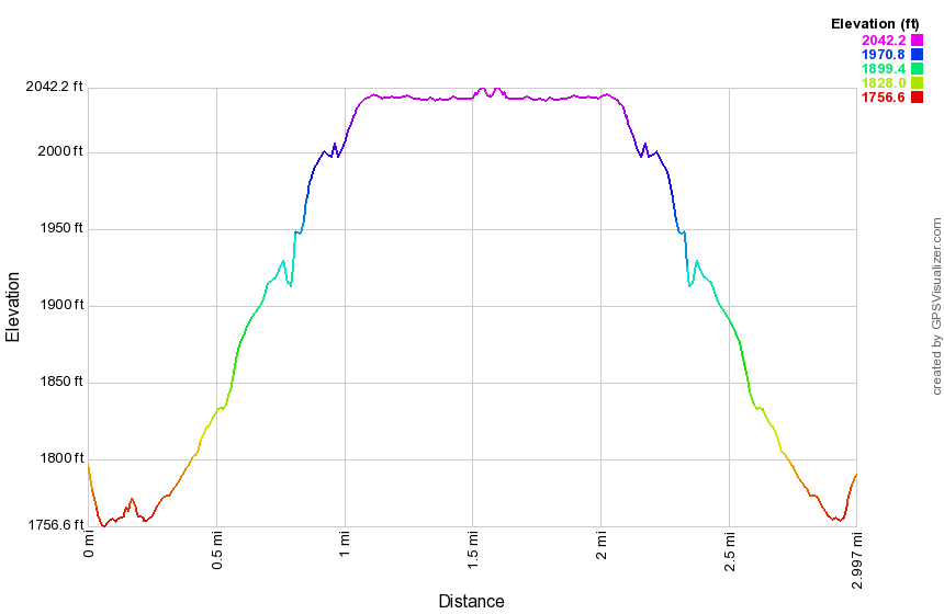 (The image at the left shows the profile of the hike. Remember that all vertical profiles are relative!)
Trout Pond: Russell Brook Falls
| Quick Look | ||||
|---|---|---|---|---|
| Difficulty | Round trip | Total climb | Internet Maps | |
| 0.3 mi. | 385 ft. | AllTrails | ||
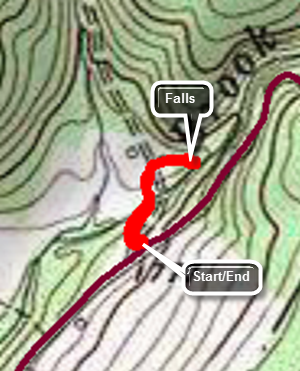 This is one of our favorite trails when we just want to hike. It has several variations for distance and difficulty. Like most trails, hiking one way is different than hiking in the other direction. We have take this route more than a dozen times this season and it is interesting to watch the changing seasons. It is unfortunate that Russell Brook Road is closed due to the frequent floods that have
washed out the road.
This is one of our favorite trails when we just want to hike. It has several variations for distance and difficulty. Like most trails, hiking one way is different than hiking in the other direction. We have take this route more than a dozen times this season and it is interesting to watch the changing seasons. It is unfortunate that Russell Brook Road is closed due to the frequent floods that have
washed out the road.
From Roscoe head north on Route 206 toward Downsville. Turn left on Morton Hill Road off Route 206 just after the Rockland Flats. Bear right up Morton Hill Road until you see a parking area on the left near the sign indicates Russell Brook Road has "Limited Maintenance". Drive carefully down Russell Brook Road and park at the lot at the end of the road where there is a kiosk.
Walk down the road and turn right just passed the kiosk. Walk down the wide woods road to the bridge over Russell Brook. Cross the bridge and continue on the main trail watching for a path to the right just passed a large stand of Japanese knotweed. Turn right here and follow the path that leads toward the lower waterfall. This path continues to a viewpoint over the lower falls. Before you get to the view point turn right and work your way down the bank to the streambed. You will be directly in front of Russell Brook Falls. After taking in the beauty of the falls walk back up the bank and out to the main trail. Turn left and retrace your route back to your car.
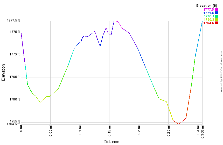 (The image at the left shows the profile of the hike. Remember that all vertical profiles are relative!)
Tunis and Vly Ponds from Quaker Clearing
| Quick Look | ||||
|---|---|---|---|---|
| Difficulty | Round trip | Total climb | Internet Maps | |
| 5.4 mi. | 880 ft. | AllTrails | ||
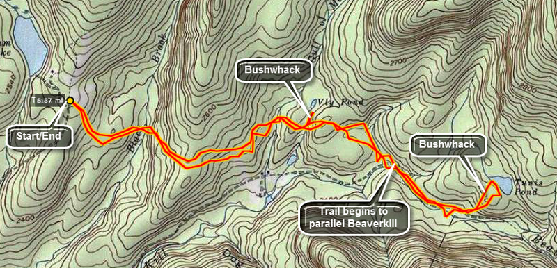 These two small ponds require a bushwhack off the Hardenburgh-Neversink Trail but are well worth the effort.
Park in the Balsam Lake parking area at the end of the Beaverkill Road. The beginning of the trail starts in the upper right corner of the parking area. It passes through a field of ferns and is pretty overgrown but there are some nice views of Balsam Lake Mountain. The register is placed just at the end of the field as the forest begins. Once in the woods, the trail is wide and easy to hike. It descends for about .5 miles to Black Brook and crosses on a bridge. A brief ascent and another descent brings you to the bridge across the Gulf of Mexico Brook at 1.1 miles. A very brief ascent and descent leads to Vly Brook which you can usually step across. At this point Vly Pond is less than .25 miles away. Head out along the creek and until you came to signs of beaver activity. Walk to the edge of the pond where you may be able to walk across the dam if you so desire. Walking around the pond anticlockwise means pushing through some thick balsam and walking over some slick rocks. The reward is a nice view with a few high rocks to stand on. Behind the pond are Balsam Lake and Graham Mountains. Head back out to the main trail and turn left to continue to Tunis Pond. From Vly Pond another ascent and descent brings you to a well-used woods road at 2.0 miles. The trail turns left onto the road and starts to follow the Beaverkill. After walking along the road for about .5 miles, choose a spot to head off into the woods since the road/trail does not lead directly to Tunis Pond. The woods aren't too think and it is only about .25 miles to get to the pond. The walk is uphill since Tunis Pond is said to be the highest named pond in the Catskills! The pond is beautiful and seldom visited. You may walk along the shore in either direction but be prepared for wet, swampy conditions. Toward the lower end of the pond there may be a large beaver house near the middle of the pond. When you are done, head up into the woods and away from the pond. Within only a few minutes and about .3 miles you should be back on the road. Turn right and retrace your route to the car.
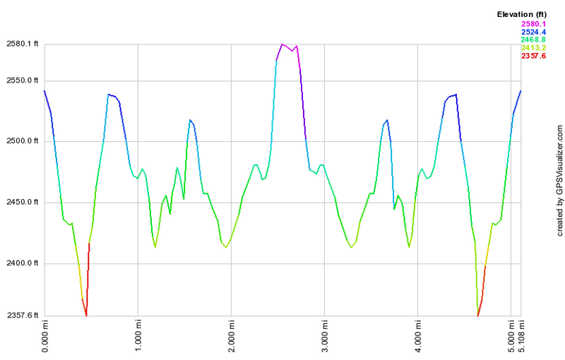 (The image at the left shows the profile of the hike. Remember that all vertical profiles are relative!)
Tunis Pond From Black Bear Road
| Quick Look | ||||
|---|---|---|---|---|
| Difficulty | Round trip | Total climb | Internet Maps | |
| 7.1 mi. | 650 ft. | AllTrails | ||
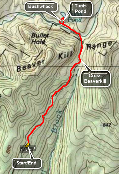 This small pond requires a bushwhack off the Hardenburgh-Neversink Trail but is well worth the effort. It is one of the highest bodies of water in the Catskills. This route is an out and back starting at the end of Black Bear Road. The trail has been eroded in places by streams and crossing can be interesting during periods of higher water.
Park at the end of Black Bear Road (Wild Meadow Road) in the snowplow turnaround as long as there is no snow! Walk down the road which serves as the beginning of the yellow Neversink Hardenburgh Trail in this area. Walk by the hunting camp and continue on the trail on the other side. The trail can be very wet in places. Cross over a brook and head up a little gaining some elevation. The Fall Brook lean-to is about 1.7 miles into the hike. After passing the lean-to, a swampy area appeared on the right of the trail which leads into a series of beaver ponds and beaver meadows. Doubletop Mountain is in the background. This area is the headwaters of Fall Brook which runs south and the Beaverkill which runs north and west. The trail parallels the Beaverkill for a short distance and then ENDS at the edge of the stream. You should be able to pick up the yellow trail markers ahead. The stream has simply eroded away the trail so you will have to find your own way around by bushwhacking up the bank and then back down to the trail. When you reach the point where the trail crosses the stream, you will find no bridge to safely cross. There is one slightly further downstream but it appears to be on private property. You can cross here by wading, rock hopping or looking for a convenient log bridge. Once across pick up the trail on the other side. It is very narrow in several places as it clings to the bank of the stream and in at least one place all but disappears. Only a short distance from the crossing, the trail opens into a little clearing and a very nice bridge cross the stream! Continue down the woods road until you are near Tunis Pond which is on the right side of the trail. You cannot see the pond from the trail so use you navigational and maps skills to plan a short bushwhack. Head to the right of the trail through the woods and climb a little hill to get to Tunis Pond. The climb can be steep but it is short. When you arrive on the shore of the pond you may want to take pictures of this beautiful and secluded place. Walk along the shore in either direction. When you can tear yourself away, head almost directly south and down the hill which is a direct line to the main trail. Turn left on the main trail and retrace your route to the car.
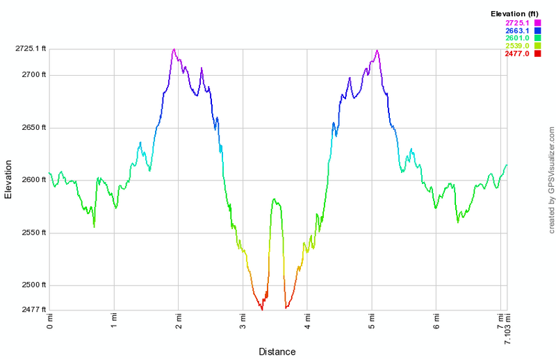 (The image at the left shows the profile of the hike. Remember that all vertical profiles are relative!)
Tusten Mountain Loop (Clockwise)
| Quick Look | ||||
|---|---|---|---|---|
| Difficulty | Round trip | Total climb | Internet Maps | |
| 3.1 mi. | 640 ft. | AllTrails | ||
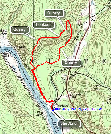 Crawford Road leads to the trailhead and is located 10 miles north of Barryville and 5 miles south or Narrowsburg on State Route 97. Turn onto Crawford Road to head toward the Delaware River. Just down the hill watch for the sign board on the right. Park here to begin your hike.
Walk parallel to the river on Tusten Road which is only open to vehicle traffic from April to December. In about .2 miles you will cross a stone arch bridge. Follow the red TMR (Ten Mile River) and yellow (Scouting symbol) blazes along Tusten Road until a sign points to the trail that begins on the right at about .7 miles. Along the way you will notice a lean-to and tent camping area. There is also a quarry, the first of many, on the right side of the road. As soon as you turn into the woods you will find the register box fro the trail. You will have to make a choice of turning left or continuing straight ahead. The trail to the left is somewhat steeper but neither is too really hard. Turn left at the register box and hike to about 1.1 miles. You will gain most of your elevation to this point. Watch for another quarry on the left in the woods as the trail start to level. At about 1.2 miles you should come across a sign that points to the lookout which is just ahead after a short climb. From the lookout you can see the Delaware River in the distance. Continue on the trail and down the other side of the hill. There will be various mall quarries along the way. At about 1.4 miles there will be a large pile of stone on the left from a quarry further up the hill. At the base of a short descent will be another quarry on the right. Here you will again have to choose the steeper trail to the right or the more gradual trail to the left. Turn left and the trail will continue north briefly and then make a 180 degree turn to the south to head back to the trailhead. Along the way you will notice DEC signs that mark the area on the right as "Restricted". At about 2 miles the ""steep" trail will come in from the right. You can follow this trail to the right as it will take you to the largest quarry on the trail. Continue on the main trail back to the register box at 2.5 miles. Turn left and walk south along Tusten road for .6 miles to get back to the parking area.
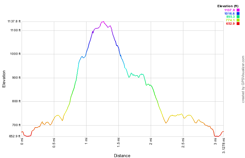 (The image at the left shows the profile of the hike. Remember that all vertical profiles are relative!)
Tusten Mountain Loop (Counterclockwise)
| Quick Look | ||||
|---|---|---|---|---|
| Difficulty | Round trip | Total climb | Internet Maps | |
| 3.0 mi. | 620 ft. | AllTrails | ||
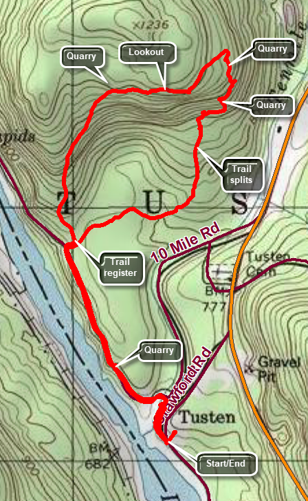 Crawford Road which leads to the trailhead is located 10 miles north of Barryville and 5 miles south or Narrowsburg on State Route 97. Turn onto Crawford Road to head toward the Delaware River. Just down the hill watch for the sign board on the right. Park here to begin your hike.
Walk parallel to the river on Tusten Road which is only open to vehicle traffic from April to December. In about .2 miles you will cross a stone arch bridge. Follow the red TMR (Ten Mile River) and yellow (Scouting symbol) blazes along Tusten Road until a sign points to the trail that begins on the right at about .6 miles. Along the way you will notice a lean-to and tent camping area on the left just after the bridge and another tent camping area further along on the right. There is also a quarry, the first of many, on the right side of the road. As soon as you turn into the woods you will find the register box for the trail. You will have to make a choice of turning left or continuing straight ahead. The trail to the left is somewhat steeper but neither is too hard. Turn right at the register box and hike about 1.2 miles to the point where the trail splits again. The trail to this point is relatively flat passing through an evergreen forest. There is also a small bridge over a stream. At the split in the trail, bear left on the yellow trail and begin to gain elevation. As the trail heads due north you will notice a mound of rock on the right side of the trail. This is the castoff stone from the quarries. Climb the hill as the trail turns right to the top of the pile of stones. On the left side of the trail is one of the quarries which is an extended cut along some cliffs. Walk straight ahead and then turn left following the trail up the hill at about 1.5 miles. Walk to the top of the steep but short climb where the trail turns left. The trail gains a little more elevation and then flattens as it follows the edge of the mountain. Some views are available through the trees but better views are available at the highest point on the trail. Continue heading due west until you come to the last short, steep climb to the highest point on the trail. The lookout here gives an expansive view down to the river and the hills beyond. Continue on the trail along the edge of the summit plateau. At about 1.9 miles, the trail turns to the left and starts to descend to the southwest. The trail widens as it joins a woods road. The descent may go quickly until you are back at the register box. Turn right to walk out to the woods road. Turn left to follow the road and your initial path to get back to your car.
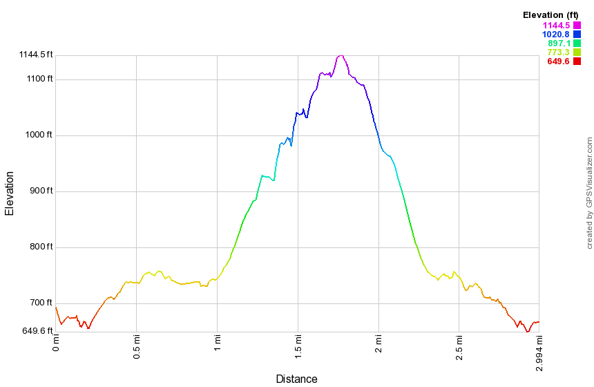 (The image at the left shows the profile of the hike. Remember that all vertical profiles are relative!)
Van Wyck Lower Crash
| Quick Look | ||||
|---|---|---|---|---|
| Difficulty | Round trip | Total climb | Internet Maps | |
| 3.5 mi | 1280 ft | AllTrails | ||
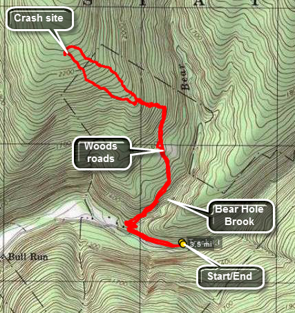
Park at the parking lot for Peekamoose and walk towards Sundown to Bear Hole Brook to begin your bushwhack. As you walk up the bank you will find a woods road that heads generally northeast and then due north. This IS a bushwhack and your route could vary greatly but it is usually easier to hike a road or trail even if it is not the most direct route. After about .8 miles head northwest for another .7 miles. To locate the crash you will have to wander around a lot in the area or use the GPS coordinates to find it. The crash is a Korean War era jet. These planes were basically an aluminum tube wrapped around an engine. the Front part of the fuselage is destroyed but the rear is in pretty good shape. The "stars and bars" marking is still evident. The wings sheared off as the plane hit the trees and can be found a distance from the main wreck. When you are finished, you can look for the upper crash of a civilian Cessna or return to your car.
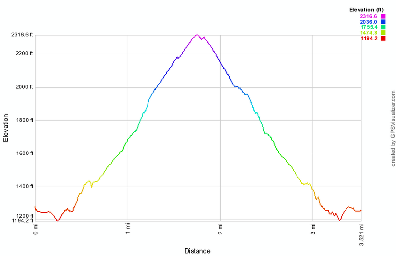
(The image above shows the profile of the hike. Remember that all vertical profiles are relative!)
Vernooy Kill Falls: From Cherrytown Road
| Quick Look | ||||
|---|---|---|---|---|
| Difficulty | Round trip | Total climb | Internet Maps | |
| 3.4 mi | 800 ft | AllTrails | ||
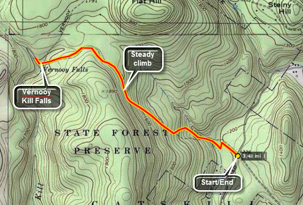 From Route 209 near Kerhonkson, turn onto Ulster County 3. After 1.3 miles turn left onto Cherrytown Road. Drive about
3.5 miles and turn left onto Upper Cherrytown Road. Once on Upper Cherrytown, go 3.1 miles until you see the
state trail head sign on the right. Park and walk across the road to get on the trail. The trail is marked with blue
blazes, snowmobile markers and the occasional aqua blazes of the Long Path. Walk 1.8 miles on this trail until
you are at the bridge at the base of the falls. The falls are more of a set of rapids and cataracts than one
continuous drop of water. Walk upstream on either side to take in all the beauty of the various "steps" to the
falls. There is no formal trail but you will have no trouble finding your way. Near the bridge are the ruins of a
mill built by the Vernooy family that first owned the land. Standing on the rocks in the middle of the stream offers
a great view of the bridge and many of the different steps to the falls. It also offers a good opportunity to fall
in so be careful. After exploring, return to your car the same way you came.
From Route 209 near Kerhonkson, turn onto Ulster County 3. After 1.3 miles turn left onto Cherrytown Road. Drive about
3.5 miles and turn left onto Upper Cherrytown Road. Once on Upper Cherrytown, go 3.1 miles until you see the
state trail head sign on the right. Park and walk across the road to get on the trail. The trail is marked with blue
blazes, snowmobile markers and the occasional aqua blazes of the Long Path. Walk 1.8 miles on this trail until
you are at the bridge at the base of the falls. The falls are more of a set of rapids and cataracts than one
continuous drop of water. Walk upstream on either side to take in all the beauty of the various "steps" to the
falls. There is no formal trail but you will have no trouble finding your way. Near the bridge are the ruins of a
mill built by the Vernooy family that first owned the land. Standing on the rocks in the middle of the stream offers
a great view of the bridge and many of the different steps to the falls. It also offers a good opportunity to fall
in so be careful. After exploring, return to your car the same way you came.
 (The image at the left shows the profile of the hike. Remember that all vertical profiles are
relative!)
(The image at the left shows the profile of the hike. Remember that all vertical profiles are
relative!)
Vernooy Kill Falls: Greenville Loop
| Quick Look | ||||
|---|---|---|---|---|
| Difficulty | Round trip | Total climb | Internet Maps | |
| 7.0 mi | 735 ft | AllTrails | ||
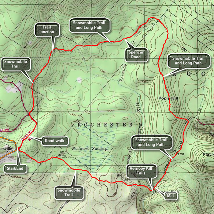 From Route 55 in Grahamsville, turn north onto Route 55A. When Route 55A turns right, continue straight ahead on Sundown Road. In Sundown, cross the bridge and turn right on Greenville Road. Continue up this road to the top of the hill where the road flattens. Turn left on Dymond Road and park in the pulloff on the left. Cross the road to get on the snowmobile trail that heads 1.8 miles to Vernooy Kill Falls. The trail may not be well maintained and can be wet and muddy in spots. There are also areas where the brush closes in on the trail. Some large blowdowns may block the rail and you will have to crawl under them, jump over them or walk around them. The trails rolls up and down a little but predominantly is a descent as the falls are the lowest point on the trail. Cross the Vernooy Kill on the bridge. It is worth spending some time at the falls as they are interesting. The falls are more of a set of rapids and cataracts than one continuous drop of water. Walk upstream on either side to take in all the beauty of the various "steps" to the falls. There is no formal trail but you will have no trouble finding your way. Just downstream from the bridge are the ruins of a mill built by the Vernooy family that first owned the land. Standing on the rocks in the middle of the stream offers a great view of the bridge and many of the different steps to the falls. It also offers a good opportunity to fall in so be careful. After exploring, look for the blazes for the Long Path and the sign for Pople Hill. The Long Path is aligned here with a snowmobile trail that climbs a little and levels off. After .9 miles or at 2.9 miles from the beginning, the snowmobile trail continues straight ahead. Turn left and follow the blazes for the Long Path as it climbs Pople Hill. The climb is not steep and it is short. After this, the trail continues north rolling some although the overall result is a loss of elevation. At 4 miles the trail meets Spencer Road which is unmaintained in the winter. Turn left and walk along the road heading north and then west continuing to descend to 4.7 miles when the ascent begins. At 5.7 miles there are a group of signs indicating that the Long Path turns to the right. Continue to follow Spencer Road until in intersects Dymond Road at 6.6 miles. Turn left on Dymond Road which is paved and maintained. Walk downhill and the uphill for .5 miles to your car.
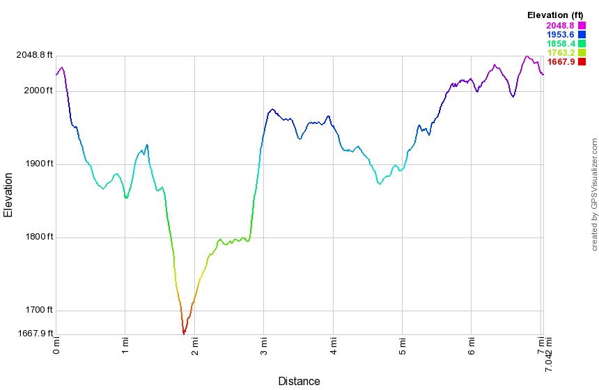 (The image at the left shows the profile of the hike. Remember that all vertical profiles are
relative!)
(The image at the left shows the profile of the hike. Remember that all vertical profiles are
relative!)
Vernooy Kill Falls: From Peekamoose
| Quick Look | ||||
|---|---|---|---|---|
| Difficulty | Round trip | Total climb | Internet Maps | |
| 9.5 mi | 1695 ft | AllTrails | ||
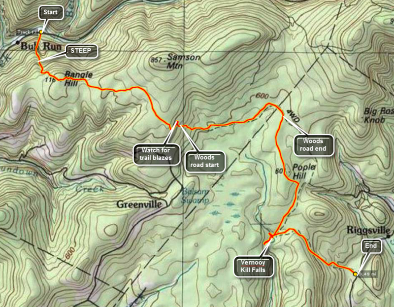 Turn onto Route 52A near the TriValley School. Stay on the road until the hamlet of Sundown where the road turns left. Bear to the left on Peekamoose Rd. and continue on the road until parking areas begin to show up on the left. Watch for a brown and yellow sign on the right for the Long Path toward Cherrytown Road. There is a small parking area opposite the start of this trail. The next parking area on the left is the Upper Peekamoose Parking Area and is much larger. Of course, you may also reach this area by turning onto Peekamoose Road off Route 28A, the road that runs along the south side of the Ashokan Reservoir. Once you are on the trail there is a climb of over 1100 feet in the first mile to the top of Bangle Hill. As you walk up the trail look over your left shoulder for a view of Peekamoose Mountain. There is a small set of ledges near the top of Bangle hill but they are VERY small. From the top of Bangle Hill the trail turns east and descends for some distance until ascending to the highest point just south of Samson Mountain after about 2.4 miles. Turning north hear there is a short, about .6 mile, bushwhack to the top of Samson Mountain. The trail continues to descend and opens up to a wide woods road. At mile 3.2 the trail turns heard to the right off the road. If you continue ahead on the woods road, there is a small stone shed and evidence of other foundations and stone walls.
The trail continues to descends through spruce and hardwood groves until it meets Spencer Road at 3.5 miles. Turn left on the road and walk about 1.3 miles east and northeast until mile 4.8. The trail markers are few and far between but do NOT worry about missing the turn to the right back into the woods and off the road. The trail is well marked but the walk along the road seems long. The trail turns almost due south and descends some until a slight climb to the top of Popel Hill at mile 6.0. Watch for a "witness sign" to your right and a USGS marker apparently in the middle of nowhere. From here the trail turns a little to the southeast before continue south to the falls at mile 7.2. The falls are more of a set of rapids and cataracts than one continuous drop of water. Walk upstream on either side to take in all the beauty of the various "steps" to the falls. There is no formal trail but you will have no trouble finding your way. Near the bridge are the ruins of a mill built by the Vernooy family that first owned the land. Standing on the rocks in the middle of the stream offers a great view of the bridge and many of the different steps to the falls. It also offers a good opportunity to fall in so be careful. After exploring the area of the falls, get back on the trail. You may now hike the 7 miles back to your car or hike out to Cherrytown Road where you had the foresight to park another car for the shuttle. From the falls the trail heads east and then southeast but always descends until you reach the parking area at about mile 9.0.
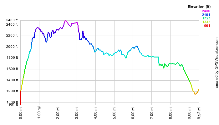 (The image at the left shows the profile of the hike. Remember that all vertical profiles are
relative!)
(The image at the left shows the profile of the hike. Remember that all vertical profiles are
relative!)
Walnut Mt Park: 3 Tiers
| Quick Look | ||||
|---|---|---|---|---|
| Difficulty | Round trip | Total climb | Internet Maps | |
| 4.1 mi | 750 ft | AllTrails | ||
_map.png) Take Route 55 out of Liberty south toward Swan Lake. The road will make a sweeping left turn near the Achieve Nursing Home. Watch for Walnut Mt Road on the right about .6 miles after this sweeping left turn. Turn right onto the road and drive to the end to park. If the gates or closed or you may be hiking after the gates will be closed, park in one of the two areas just outside the gates. During the spring, summer and fall there may be trail amps at the building by the baseball field. You may also obtain maps from Town of Liberty Parks and Recreation on Many Street in Liberty. Walk up the road between the playground and picnic area toward the water tower. Turn right onto the red A1 trail that heads right and up into the woods. Continue on this trail until the junction with the green A4 and follow the A4 by bearing left. At the junction with the red A1 trail turn bear left to follow the red A1 trail. When the red A1 trail branches, turn right as it heads west and north. The red A1 trail eventually turns east and arrives back at the junction with the green A4. You will have completed the lower loop around the mountain and hikes about 1.7 miles. Continue around the mountain again on the green A4 trail by turning right. This time when you arrive at the junction with the A1 trail stay to the right to follow the A4 south until it makes and almost 180 degree turn to head around the mountain. Continue to follow the A4 north and then east as it starts to swing around the summit. On the north side turn right on a bike path as you start to walk down a hill. This will take you toward the summit and a path around the summit plateau. As you approach the rock ledges, look for a path that winds around the summit plateau. Turn right to follow the path in a counterclockwise direction. On the east side of the mountain a bike trail leads up to the summit plateau. It is marked by a sign warning riders that it is an expert trail. Walk up to the summit plateau and turn right to make a counterclockwise loop. You will find a well-constructed "bridge" over a jumble of rocks. The path continues around the edge of the summit until it leads back to the east side where you came up. Walk back down to the white A5 trail and turn right and descended to the green A4 trail. Turn left on the A4 and then right on the A1 which will bring you back to the open field where the A1 splits. Head left on the A1 and back down toward the car. You may want to walk around the filed below the baseball diamond. Walnut Mountain is the site of a Civil War reenactment every summer and you can see some of the split trail fences and gun emplacements.
Take Route 55 out of Liberty south toward Swan Lake. The road will make a sweeping left turn near the Achieve Nursing Home. Watch for Walnut Mt Road on the right about .6 miles after this sweeping left turn. Turn right onto the road and drive to the end to park. If the gates or closed or you may be hiking after the gates will be closed, park in one of the two areas just outside the gates. During the spring, summer and fall there may be trail amps at the building by the baseball field. You may also obtain maps from Town of Liberty Parks and Recreation on Many Street in Liberty. Walk up the road between the playground and picnic area toward the water tower. Turn right onto the red A1 trail that heads right and up into the woods. Continue on this trail until the junction with the green A4 and follow the A4 by bearing left. At the junction with the red A1 trail turn bear left to follow the red A1 trail. When the red A1 trail branches, turn right as it heads west and north. The red A1 trail eventually turns east and arrives back at the junction with the green A4. You will have completed the lower loop around the mountain and hikes about 1.7 miles. Continue around the mountain again on the green A4 trail by turning right. This time when you arrive at the junction with the A1 trail stay to the right to follow the A4 south until it makes and almost 180 degree turn to head around the mountain. Continue to follow the A4 north and then east as it starts to swing around the summit. On the north side turn right on a bike path as you start to walk down a hill. This will take you toward the summit and a path around the summit plateau. As you approach the rock ledges, look for a path that winds around the summit plateau. Turn right to follow the path in a counterclockwise direction. On the east side of the mountain a bike trail leads up to the summit plateau. It is marked by a sign warning riders that it is an expert trail. Walk up to the summit plateau and turn right to make a counterclockwise loop. You will find a well-constructed "bridge" over a jumble of rocks. The path continues around the edge of the summit until it leads back to the east side where you came up. Walk back down to the white A5 trail and turn right and descended to the green A4 trail. Turn left on the A4 and then right on the A1 which will bring you back to the open field where the A1 splits. Head left on the A1 and back down toward the car. You may want to walk around the filed below the baseball diamond. Walnut Mountain is the site of a Civil War reenactment every summer and you can see some of the split trail fences and gun emplacements.
(The map above shows the parking area and the hiking route as a loop.)
_gra.png) (The image at the left shows the profile of the hike. Remember that all vertical profiles are relative!)
(The image at the left shows the profile of the hike. Remember that all vertical profiles are relative!)
Walnut Mt Park: All Trails
| Quick Look | ||||
|---|---|---|---|---|
| Difficulty | Round trip | Total climb | Internet Maps | |
| 5.5 mi | 950 ft | AllTrails | ||
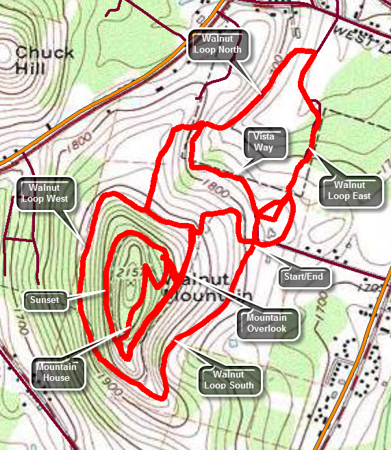 Take Route 55 out of Liberty south toward Swan Lake. The road will make a sweeping left turn near the Achieve Nursing Home. Watch for Walnut Mt Road on the right about .6 miles after this sweeping left turn. Turn right onto the road and drive to the end to park. If the gates or closed or you may be hiking after the gates will be closed, park in one of the two areas just outside the gates. During the spring, summer and fall there may be trail maps at the building by the baseball field. You may also obtain maps from Town of Liberty Parks and Recreation on Many Street in Liberty. Walk from the parking area passed the ballfield to the north to pick up the Walnut Loop East. Watch for the kiosk on the other side of the "field". Walk on the wide trail north toward the West Lake Street parking area. As you approach the parking area, turn left onto the Walnut Loop North and start heading back to the south. This trail starts climbing almost immediately and over the .7 miles to the junction with the Walnut Loop West the trail gains a little over 280 feet. At trail junction turn right on the Walnut Loop West which soon turns south on the west side of the mountain. At about 1.6 miles the trail begins a steep little uphill for about .2 miles to the lower set of picnic tables. Continued passed the tables to get on the Walnut Loop South. Walk down the hill to the area of the old quarry and the new disk golf course. Once in the parking area head down the access road to the beginning of the Walnut Loop East and followed it to where you entered the woods at the beginning of the hike. At this point you have hiked a total of 2.6 miles. Walk back up through the field to the parking area to get to the rest of the trails. From the lower end of the parking area get on the Vista Way heading north. This trail is a little over .3 miles and ends at the Walnut Loop North. Turn left and walk back toward the mountain. This time when you get to the Walnut Loop West turn left and walk down to the Mountain Overlook Trail. Turn right to head south. After .4 miles you'll be at the upper picnic tables and the lookout. Make a hard right onto the Sunset Trail and stay on it as it swung around the west side of the mountain a little higher up than the Walnut Loop West. Continue to follow the Sunset Trail until it starts to descend and the Mountain House Trail turns off to the right. Follow this trail up over the mountain through a switchback and then down to the Sunset Trail near the overlook. Turn left and head back down the Mountain Overlook Trail toward the parking area. At the junction with the Sunset Trail, shoot up to the junction with the Mountain House Trail to say you have covered all the trails. Return to the Mountain House Trail and follow it all the way back to the car.
(The map above shows the parking area and the hiking route as a loop.)
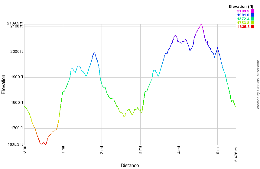 (The image at the left shows the profile of the hike. Remember that all vertical profiles are relative!)
Walnut Mt Park: Main Parking
| Quick Look | ||||
|---|---|---|---|---|
| Difficulty | Round trip | Total climb | Internet Maps | |
| 3.8 mi | 600 ft | AllTrails | ||
_map.png) Walnut Mountain Park is owned and maintained by the Town of Liberty in Sullivan County, NY. It has ball fields, picnic areas and a network of hiking and mountain biking trails. Maps Amy be available at the park or from Parks and Recreation in the Village of Liberty near the Liberty Elementary School on Main St. To get to the main parking area head south from Liberty on Route 55 toward Swan Lake. Watch for the signs for the park on the right. Turn in and drive to the main parking area. To describe a particular route is probably useless since you can pick your own. The hiking trails are labeled A1 to A5 and are crossed by numerous bike trails marked with colored ribbons. The red A1 trail starts at the main parking area, goes up the hill passed the water tank and then encircles the base of the mountain. The green A4 trail branches from the A1 on the south side of the mountain and circles the summit before leading you up to a spot near the summit. There are paths that head over the summit but there is no view and the summit is a scratchy pricker path. The white A5 trail also forms part of the loop around the summit. You can use the handy bike trails to get between areas also. The orange A2 trail branches from the A1 trail not too far from the parking area and eventually leads to the West Lake Street parking area. The trail makes a 90 degrees right turn along the way which is not well marked. The A2 trail comes back up from that parking area to a spot just below the baseball field. The yellow A3 trail starts at the north end of the main parking area and connects to the A2 trail. You can use any combination of trails to create a longer or shorter hike.
Walnut Mountain Park is owned and maintained by the Town of Liberty in Sullivan County, NY. It has ball fields, picnic areas and a network of hiking and mountain biking trails. Maps Amy be available at the park or from Parks and Recreation in the Village of Liberty near the Liberty Elementary School on Main St. To get to the main parking area head south from Liberty on Route 55 toward Swan Lake. Watch for the signs for the park on the right. Turn in and drive to the main parking area. To describe a particular route is probably useless since you can pick your own. The hiking trails are labeled A1 to A5 and are crossed by numerous bike trails marked with colored ribbons. The red A1 trail starts at the main parking area, goes up the hill passed the water tank and then encircles the base of the mountain. The green A4 trail branches from the A1 on the south side of the mountain and circles the summit before leading you up to a spot near the summit. There are paths that head over the summit but there is no view and the summit is a scratchy pricker path. The white A5 trail also forms part of the loop around the summit. You can use the handy bike trails to get between areas also. The orange A2 trail branches from the A1 trail not too far from the parking area and eventually leads to the West Lake Street parking area. The trail makes a 90 degrees right turn along the way which is not well marked. The A2 trail comes back up from that parking area to a spot just below the baseball field. The yellow A3 trail starts at the north end of the main parking area and connects to the A2 trail. You can use any combination of trails to create a longer or shorter hike.
(The map above shows the parking area and the hiking route as a loop.)
_gra.png) (The image at the left shows the profile of the hike. Remember that all vertical profiles are relative!)
(The image at the left shows the profile of the hike. Remember that all vertical profiles are relative!)
Walnut Mt Park: Trail 3
| Quick Look | ||||
|---|---|---|---|---|
| Difficulty | Round trip | Total climb | Internet Maps | |
| 4.1 mi | 715 ft | AllTrails | ||
_map.png) Walnut Mountain Park is owned and maintained by the Town of Liberty in Sullivan County, NY. It has ball fields, picnic areas and a network of hiking and mountain biking trails. Maps Amy be available at the park or from Parks and Recreation in the Village of Liberty near the Liberty Elementary School on Main St. To get to the main parking area head south from Liberty on Route 55 toward Swan Lake. Watch for the signs for the park on the right. Turn in and drive to the main parking area. To describe a particular route is probably useless since you can pick your own. The hiking trails are labeled A1 to A5 and are crossed by numerous bike trails marked with colored ribbons. The red A1 trail starts at the main parking area, goes up the hill passed the water tank and then encircles the base of the mountain. The green A4 trail branches from the A1 on the south side of the mountain and circles the summit before leading you up to a spot near the summit. There are paths that head over the summit but there is no view and the summit is a scratchy pricker path. The white A5 trail also forms part of the loop around the summit. You can use the handy bike trails to get between areas also. The orange A2 trail branches from the A1 trail not too far from the parking area and eventually leads to the West Lake Street parking area. The trail makes a 90 degrees right turn along the way which is not well marked. The A2 trail comes back up from that parking area to a spot just below the baseball field. The yellow A3 trail starts at the north end of the main parking area and connects to the A2 trail. You can use any combination of trails to create a longer or shorter hike.
Walnut Mountain Park is owned and maintained by the Town of Liberty in Sullivan County, NY. It has ball fields, picnic areas and a network of hiking and mountain biking trails. Maps Amy be available at the park or from Parks and Recreation in the Village of Liberty near the Liberty Elementary School on Main St. To get to the main parking area head south from Liberty on Route 55 toward Swan Lake. Watch for the signs for the park on the right. Turn in and drive to the main parking area. To describe a particular route is probably useless since you can pick your own. The hiking trails are labeled A1 to A5 and are crossed by numerous bike trails marked with colored ribbons. The red A1 trail starts at the main parking area, goes up the hill passed the water tank and then encircles the base of the mountain. The green A4 trail branches from the A1 on the south side of the mountain and circles the summit before leading you up to a spot near the summit. There are paths that head over the summit but there is no view and the summit is a scratchy pricker path. The white A5 trail also forms part of the loop around the summit. You can use the handy bike trails to get between areas also. The orange A2 trail branches from the A1 trail not too far from the parking area and eventually leads to the West Lake Street parking area. The trail makes a 90 degrees right turn along the way which is not well marked. The A2 trail comes back up from that parking area to a spot just below the baseball field. The yellow A3 trail starts at the north end of the main parking area and connects to the A2 trail. You can use any combination of trails to create a longer or shorter hike.
_gra.png) (The image below shows the profile of the hike. Remember that all vertical profiles are relative!)
(The image below shows the profile of the hike. Remember that all vertical profiles are relative!)
Walnut Mt Park: West Lake Street Parking
| Quick Look | ||||
|---|---|---|---|---|
| Difficulty | Round trip | Total climb | Internet Maps | |
| 4.4 mi | 790 ft | AllTrails | ||
_map.png) Walnut Mountain Park is owned and maintained by the Town of Liberty in Sullivan County, NY. It has ball fields, picnic areas and a network of hiking and mountain biking trails. Maps Amy be available at the park or from Parks and Recreation in the Village of Liberty near the Liberty Elementary School on Main St. To get to the main parking area head south from Liberty on Route 55 toward Swan Lake. Watch for the signs for the park on the right. Turn in and drive to the main parking area. To describe a particular route is probably useless since you can pick your own. The hiking trails are labeled A1 to A5 and are crossed by numerous bike trails marked with colored ribbons. The red A1 trail starts at the main parking area, goes up the hill passed the water tank and then encircles the base of the mountain. The green A4 trail branches from the A1 on the south side of the mountain and circles the summit before leading you up to a spot near the summit. There are paths that head over the summit but there is no view and the summit is a scratchy pricker path. The white A5 trail also forms part of the loop around the summit. You can use the handy bike trails to get between areas also. The orange A2 trail branches from the A1 trail not too far from the parking area and eventually leads to the West Lake Street parking area. The trail makes a 90 degrees right turn along the way which is not well marked. The A2 trail comes back up from that parking area to a spot just below the baseball field. The yellow A3 trail starts at the north end of the main parking area and connects to the A2 trail. You can use any combination of trails to create a longer or shorter hike.
Walnut Mountain Park is owned and maintained by the Town of Liberty in Sullivan County, NY. It has ball fields, picnic areas and a network of hiking and mountain biking trails. Maps Amy be available at the park or from Parks and Recreation in the Village of Liberty near the Liberty Elementary School on Main St. To get to the main parking area head south from Liberty on Route 55 toward Swan Lake. Watch for the signs for the park on the right. Turn in and drive to the main parking area. To describe a particular route is probably useless since you can pick your own. The hiking trails are labeled A1 to A5 and are crossed by numerous bike trails marked with colored ribbons. The red A1 trail starts at the main parking area, goes up the hill passed the water tank and then encircles the base of the mountain. The green A4 trail branches from the A1 on the south side of the mountain and circles the summit before leading you up to a spot near the summit. There are paths that head over the summit but there is no view and the summit is a scratchy pricker path. The white A5 trail also forms part of the loop around the summit. You can use the handy bike trails to get between areas also. The orange A2 trail branches from the A1 trail not too far from the parking area and eventually leads to the West Lake Street parking area. The trail makes a 90 degrees right turn along the way which is not well marked. The A2 trail comes back up from that parking area to a spot just below the baseball field. The yellow A3 trail starts at the north end of the main parking area and connects to the A2 trail. You can use any combination of trails to create a longer or shorter hike.
_gra.png) (The image at the left shows the profile of the hike. Remember that all vertical profiles are relative!)
(The image at the left shows the profile of the hike. Remember that all vertical profiles are relative!)
Waneta Lake Loop
| Quick Look | ||||
|---|---|---|---|---|
| Difficulty | Round trip | Total climb | Internet Maps | |
| 1.3 mi | 110ft | AllTrails | ||
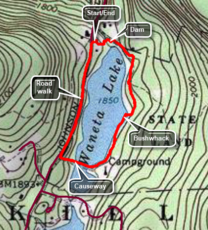 Waneta Lake is a small lake on the Bevaerkill Road just outside of Livingston Manor. It is handicap accessible for fishing and is also used for boating. There are no trails but the bushwhack around the lake is rewarding if short. From Livingston Manor drive north and west on Old Route 17 toward Roscoe. Turn right n the Beaverkill Road and drive 3.1 miles to the parking area for Waneta Lake on the right. Pull into the parking area and park. Begin your hike by walking over to the dam where you can a view of the lake. Walk down the bank downstream of the dam and find some stone to cross to the other side. Walk up the bank and find a nice clearing which has an even better view of the lake. Continue to walk around the east side if the lake on a road until the road turns sharply left. At this point begin to bushwhack by walking through the open woods following the shore of the lake. You may see some yellow DECD trail markers but the trail has not been used or maintained in many years. As you continue you may find a path along the lake shore that seems to be built up from stones. Eventually you may come across one or more fire rings and small "camps. Watch for a path that leads down to the lake and wraps around the southern end. This path passes over a man-made causeway that separates the main part of the lake on the right from a smaller section on the left, Walk out to Beaverkill Road, turn right, and walk the road for .5 miles back to the parking area.
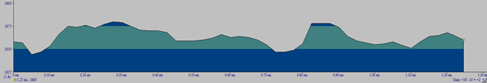 (The image at the left shows the profile of the hike. Remember that all vertical profiles are relative!)
Willow Trail to Mount Tremper
| Quick Look | ||||
|---|---|---|---|---|
| Difficulty | Round trip | Total climb | Internet Maps | |
| 9.5 mi | 2310 ft | AllTrails | ||
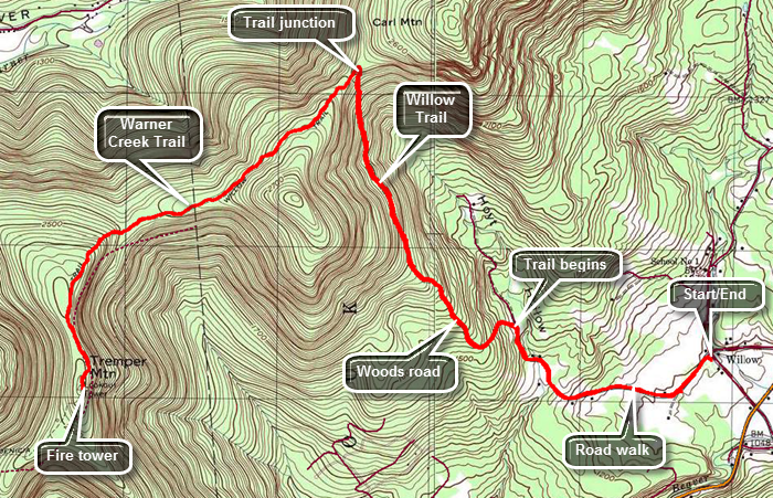 Turn off Route 28 onto the main street in Phoenicia. Continue on Main Street which becomes Route 40 and passes the main parking area for Mount Tremper. At the intersection with Route 212 turn left and drive to VanWagner Road on the left. Turned left on VanWagner Road to get to the small hamlet of Willow. Along the way you will pass the Woodstock Farm Animal Sanctuary on the left. Just passed this is the intersection with Jessup Road which leads to the Willow Trail. On the corner is the Willow Post Office where you will park since there is no parking near the actual trailhead. The post office appears to be a construction trailer with a zip code sign! To begin your hike walk up Jessup Road for about 1.1 miles passing the end of the public road along the way. Turn left onto the woods road that is the first part of the trail. The trail climbs from the post office but after the turn into the woods it begins to ascend more steeply. The grade averages about 15% until it levels off at 2 miles. Along the way the route transitions from the woods road to a trail that, in some cases, hangs right on the edge of the hill. It becomes rocky and the footing can be difficult especially in wet weather. At the two mile mark the trail elevation has increased from about 1100 feet to almost 2100 feet. Along the way you may get some views of the mountains and valleys to the north and east. After a quarter mile of relatively flat walking, the trail again begins to ascend gaining another 400 feet to the trail junction with the Warner Creek Trail at 2.7 miles. At the trail junction turn left to follow the Warner Creek Trail to Mount Tremper where it ends at the fire tower. The turn is more than 90 degrees and changes the direction of travel from north to west by southwest. Initially the trail ascends some but at 3.2 miles it starts a descent to avoid sidehilling along an unnamed bump before Mount Tremper. At 4 miles another climb begins as the trail turns south and heads toward the fire tower. Over the next .85 miles you will reach a sort of summit plateau and negotiate a short descent before climbing again to reach the tower. The last ascent is about 365 feet. The Warner Creek Trail ends at the tower. To complete the out and back hike simply turn around and follow your route back to the car.
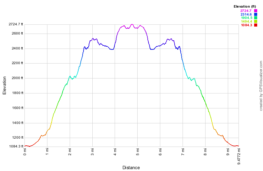 (The image above shows the profile of the hike. Remember that all vertical profiles are relative!)
Winter Clove: Rips Rock
| Quick Look | ||||
|---|---|---|---|---|
| Difficulty | Round trip | Total climb | Internet Maps | |
| 5.3 mi | 1218 ft | AllTrails | ||
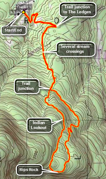 From State Route 32 north of Palenville turn west on County Route 31 Hearts Content Road just north of the Friar Tuck Inn. Turn southwest on Winter Clove Road and stay on Winter Clove Road all the way to the end. Park at the Winter Clove Inn. This is a PRIVATE resort and all the trails start on PRIVATE property. Go to the front desk in the main building and ring the bell. Ask politely if you may park and hike. The Inn will even allow you to take the descriptions they have of their trails.
This hike starts by heading out across the field from the parking area by the building across from the Inn. There will be a sign listing some of the trails available one of which is Rips Rock. Cross the field an enter the trees. A sign will point to the left off the road/trail that you are on. Follow the "Hiking Trails" sign and cross the bridge. The trail will now parallel the creek briefly before turning right up the hill and passing through a switchback or two. The trail marking are a mixture of signs. red and blue paint blotches, red and blue metal tags and orange or pink ribbons. As the trail opens into the next field walk along the right hand side of the field and reenter the trees on the trail or woods road. Shortly the trail will split and you should follow the signs that point right to Rips Rock. Soon the trail heads east and away from the brook through a field and passes by a lean-to. At about .6 miles a trail turns east toward "The Ledges" but you should continue on the trail you are on, first west and then south. You will cross several small streams of running water some of which are on the trail. At .9 miles another sign points to a spur trail to "Lost Pond". Around 1.2 miles another spur trail heads to "Lost Bridge" and just beyond that point is a short trail to the left to a campsite. At 1.5 miles you have the choice of turning left to the "Lower Rips Trail" or continuing on the same trail. Continue on the trail without turning and walk parallel to a small brook that has cut a deep gorge between and into the surrounding rock. At 1.7 miles cut across this brook. The trail begins to level a little and at 2.1 miles you will arrive at an opening in the trees that looks to the east toward the Hudson River. You are walking on the edge of an escarpment but there is another, higher ridge of rock to our right. From this point on the trail is poorly marked as the paint blazes end and only some faded ribbons mark the way. From the Indian Lookout the trail is level but at first but then begins to drop to a small stream not shown on the map. It continues to head south and follows the stream up a hill. The trail is not well-used. At 2.4 miles a significant gorge appears and the trail swings left or southeast and ascends another small hill. It hugs the edge of the top of the hill where several views open up of the opposite side of the hollow where there are interesting rock formations. You may have to slide down a slippery rock and duck under some brush but the reward is a beautiful, expansive lookout toward the east and southeast. A small sign declares "Rips Rock 1,809 feet". The deep chasm immediately to the south is formed by Stony Brook and is sometimes called Rip Van Winkle Hollow. Be careful walking along the narrow trail at the edge of the cliff. Wet rocks and overgrown brush tend to push you dangerously close to the edge. The views just keep getting better until the trail heads left into the woods. The trail leads roughly around the top of the hill and makes a short, steep descent between and over some rocks. The trail now changes character becoming wide and well-used. Continue to descend and pass through a few switchbacks. The trail continues to parallel the one you used on the ascent but at a lower elevation. Once you reach the junction with the trail you used earlier turn right and simply follow your early route in reverse back to the car.
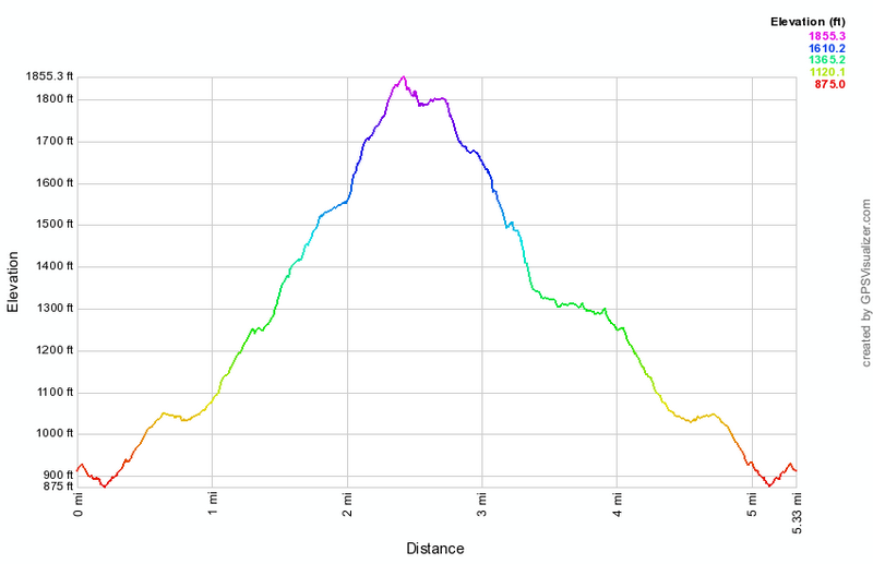 (The image at the left shows the profile of the hike. Remember that all vertical profiles are relative!)
Winter Clove: Rips Rock, Lost Pond, Ledges
| Quick Look | ||||
|---|---|---|---|---|
| Difficulty | Round trip | Total climb | Internet Maps | |
| 6.2 mi | 1207 ft | AllTrails | ||
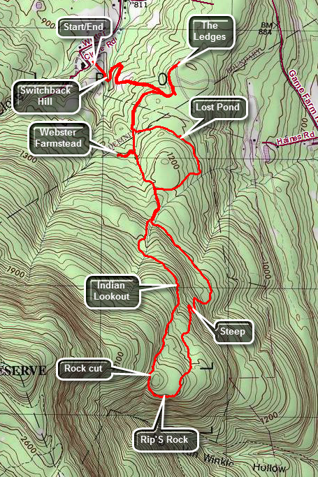 From State Route 32 north of Palenville turn west or left on County Route 31 Hearts Content Road. Turn southwest or left on Winter Clove Road and drive about 1 mile until the road makes a sharp left. Turn left to follow the road all the way to the end. Drive passed the main building of the Winter Clove Inn and park behind the building on the left. This is a PRIVATE resort and all the trails start on PRIVATE property. Go to the front desk in the main building and ring the bell. Ask politely if you may park and hike. The Inn will even allow you to take the descriptions they have of their trails.
This hike starts by heading out across the field from the parking area by the building across from the Inn. There will be a sign listing some of the trails available one of which is Rips Rock. Cross the field an enter the trees. A sign will point to the left off the road/trail that you are on. Follow the "Hiking Trails" sign and cross the bridge. The trail will now parallel the creek briefly before turning right up the hill and passing through a switchback or two. The trail marking are a mixture of signs. red and blue paint blotches, red and blue metal tags and orange or pink ribbons. As the trail opens into the next field walk along the right hand side of the field and reenter the trees on the trail or woods road. Shortly the trail will split and you should follow the signs that point right to Rips Rock. Soon the trail heads east and away from the brook and at about .6 miles a trail turns east toward "The Ledges" but you should continue on the trail you are on. The trail turns west through a field and passes by a warming hut. At about .7 miles the trail turns south an parallels a stream on the right. You may cross several small streams of running water some of which are on the trail. At .9 miles another sign points to a spur trail to "Lost Pond" but you will continue on the main trail. Around 1.2 miles another spur trail heads West or to the right and leads to the Webster farmstead. Turner and walk a short distance to the foundation that marks all that remains of a prominent family in the area. Turn around and walk back to the main trail which now ascends a hill still heading south. At 1.4 miles you have the choice of turning left to the "Lower Rips Trail" or continuing on the same trail. Continue on the trail without turning and walk parallel to a small brook that has cut a deep gorge between and into the surrounding rock. At 1.7 miles cut across this brook. The trail begins to level a little and at 2.0 miles you will arrive at "Indian Lookout", an opening in the trees that looks to the east toward the Hudson River. You are walking on the edge of an escarpment but there is another, higher ridge of rock to our right. From this point on the trail continues to be marked with paint blazes. From Indian Lookout the trail is level at first but then begins to drop to a small stream not shown on the map. It continues to head south and follows the stream up a hill. The trail is seems not to be well-used and there may not be much of a tramway to follow. At 2.4 miles a significant gorge appears and the trail swings left or southeast and ascends another small hill. It hugs the edge of the top of the hill where several views open up of the opposite side of the hollow where there are interesting rock formations. You may have to slide down a slippery rock and duck under some brush but the reward is a beautiful, expansive lookout toward the east and southeast. A small sign at about 2.7 miles declares "Rips Rock 1,809 feet". The deep chasm immediately to the south is formed by Stony Brook and is sometimes called Rip Van Winkle Hollow. Be careful walking along the narrow trail at the edge of the cliff. Wet rocks and overgrown brush tend to push you dangerously close to the edge. The views just keep getting better until the trail heads left into the woods. The trail leads roughly around the top of the hill and makes a short, steep descent between and over some rocks. The trail now changes character becoming wide and well-used. Continue to descend and pass through a few switchbacks. The trail continues to parallel the one you used on the ascent but at a lower elevation. Once you reach the junction with the trail you used earlier turn right and start to follow your early route until at 4.15 miles you reach the turnoff for "lost Pond" on the right. Turn here and follow this trail as it loops around first east and then north and then east again. Watch for the paint blazes as the trail may be hard to spot otherwise. At about 4.6 miles you will notice a clearing to the right of the trail. This was once a pond but in now completely dry and this "Lost". At 4.9 miles you will be back at the main trail. Turn right and continue to follow the trail you were on earlier to 5.25 miles where the main trail turns sharply left. Turn right and follow a short trail out to a dirt road. Turn left on the road and walk north to a dead end avoiding the left fork on the road which heads downhill. To the west on your right is the Great Wall of Manitou consisting of North Mountain, Stoppel Point and the Blackhead Range. When you are ready walk back to the path on the dirt road and follow the main trail back down Switchback Hill and across the field to your car.
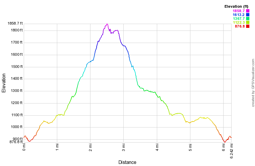 (The image at the left shows the profile of the hike. Remember that all vertical profiles are relative!)
Winter Clove: Stoppel Point
| Quick Look | ||||
|---|---|---|---|---|
| Difficulty | Round trip | Total climb | Internet Maps | |
| 6.6 mi | 2762 ft | AllTrails | ||
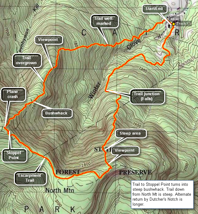 From State Route 32 north of Palenville turn west on County Route 31 Hearts Content Road just north of the Friar Tuck Inn. Turn southwest on Winter Clove Road and stay on Winter Clove Road all the way to the end. Park at the Winter Clove Inn. This is a PRIVATE resort and all the trails start on PRIVATE property. Go to the front desk in the main building and ring the bell. Ask politely if you may park and hike. The Inn will even allow you to take the descriptions they have of their trails.
This hike starts by going past the gazebo on the back lawn of the Inn, crossing the dirt road and walking down to the covered bridge across the stream. Below the bridge is Artist Falls, a destination in itself. Continue across the bridge on the trail and do not turn right on Lovers Loop or left to the Venus Bath. Straight ahead lies the trail you want to Stoppel Point or the Yankee Smith Trail. The further you go the less well defined and marked the trail becomes. At 1.4 miles the trail turns south from its easterly course and continues to gain elevation .At about 1.7 miles the trail flattens some and wanders near the edge of the cliff. From here there are some ices views. Walk back into the woods and pick up the trail if you can. At some point you will have to give up on the trail and navigate your way up over steep terrain and through rocky ledges to Stoppel Point. Most routes seem to come out near the plane crash on the trail. At times, if you look back over your shoulder you may see blazes more easily. Turn left on the trail and walk about .2 miles to the lookout at StoppelPoint. Descend on the trail for about 1.35 miles passing the summit of North Mountain on your right. Watch for a faint path that turns to the left that goes over a large boulder. This trail leads down to Winter Clove and once you find it is better marked than the trail up. From the Escarpment Trail the path leads down to the trail to Winter Clove Falls. At times the descent is steep but there are some views along the way. At about 5 miles the trail turns west from its northerly heading. At 5.2 miles the path intersects the Falls Trail. Turn right and follow the marked trails back to the parking area over the next 1.4 miles.
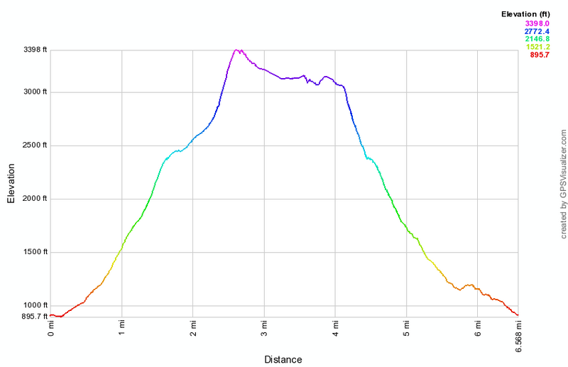 (The image at the left shows the profile of the hike. Remember that all vertical profiles are relative!)
Winter Clove: The Ledges
| Quick Look | ||||
|---|---|---|---|---|
| Difficulty | Round trip | Total climb | Internet Maps | |
| 1.7 mi | 260 ft | AllTrails | ||
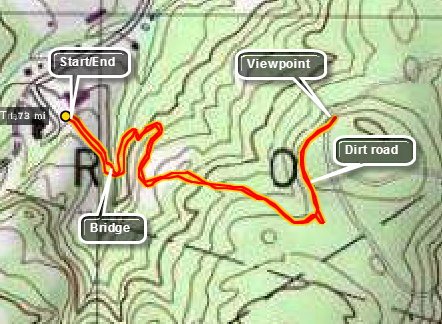 From State Route 32 north of Palenville turn west on County Route 31 Hearts Content Road just north of the Friar Tuck Inn. Turn southwest on Winter Clove Road and stay on Winter Clove Road all the way to the end. Park at the Winter Clove Inn. This is a PRIVATE resort and all the trails start on PRIVATE property. Go to the front desk in the main building and ring the bell. Ask politely if you may park and hike. The INN will even allow you to take the descriptions they have of their trails.
This hike starts by heading out across the field from the parking area by the building across from the Inn. There will be a sign listing some of the trails available one of which is The Ledges. Cross the field an enter the trees. A sign will point to the left off the road/trail that you are on. Follow the "Hiking Trails" sign and cross the bridge. The trail will now parallel the creek briefly before turning right up the hill and passing through a switchback or two. The trail marking are a mixture of signs. red and blue paint blotches, red and blue metal tags and orange or pink ribbons. As the trail opens into the next field walk along the right hand side of the field and reenter the trees on the trail or woods road. Shortly the trail will split and you should follow the signs that point left to The Ledges. The trail will meet a dirt road where you should turn to the left. Follow the dirt road to the end without turning down the hill. The Ledges are at the top of the hill and offer a nice, but low angle view, of the valley. Winter Clove Inn is down to the left. The Great Wall of Manitou is to the left right behind the trail you came up. The distance from the Inn to the Ledges is under one mile. Retrace your path to return to your car.
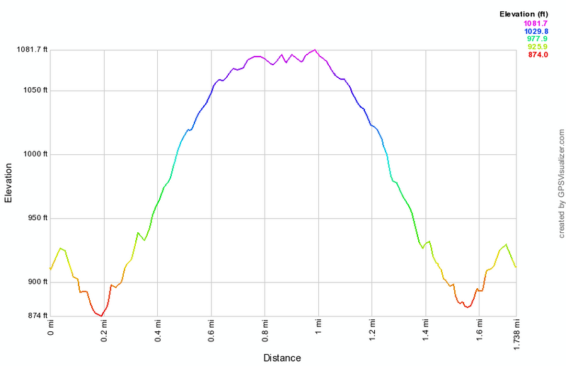 (The image at the left shows the profile of the hike. Remember that all vertical profiles are relative!)
Winter Clove: Venus Bath
| Quick Look | ||||
|---|---|---|---|---|
| Difficulty | Round trip | Total climb | Internet Maps | |
| 1.4 mi | 280 ft | AllTrails | ||
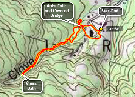 From State Route 32 north of Palenville turn west on County Route 31 Hearts Content Road just north of the Friar Tuck Inn. Turn southwest on Winter Clove Road and stay on Winter Clove Road all the way to the end. Park at the Winter Clove Inn. This is a PRIVATE resort and all the trails start on PRIVATE property. Go to the front desk in the main building and ring the bell. Ask politely if you may park and hike. The Inn will even allow you to take the descriptions they have of their trails.
This hike starts by going past the gazebo on the back lawn of the Inn, crossing the dirt road and walking down to the covered bridge across the stream. Below the bridge is Artist Falls, a destination in itself. The falls forms directly under the bridge but there is a path to the pool at the base of the falls. From this path go back up to the bridge and continue across the bridge on the trail. Do not turn right on Lovers Loop but left to the Venus Bath. for a walk up Kiskatom Brook. There are several interesting rapids along the way. At .45 miles you will pass a footbridge to the other side. Continue on the trail along the creek. At about .8 miles of hiking you will arrive at the Venus Bath. Here a small set of rapids and waterfalls have carved a natural "bath" in the rock. Start back to the car on the same trail but cross the footbridge to the other side. The walk back to the car is only .6 miles.
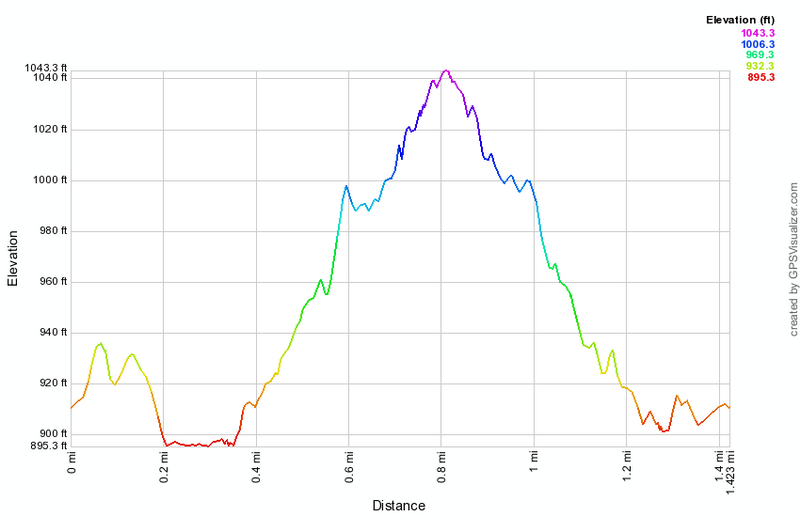 (The image at the left shows the profile of the hike. Remember that all vertical profiles are relative!)
Winter Clove: Winter Clove Falls and Escarpment Loop
| Quick Look | ||||
|---|---|---|---|---|
| Difficulty | Round trip | Total climb | Internet Maps | |
| 12.1 mi | 3642 ft | AllTrails | ||
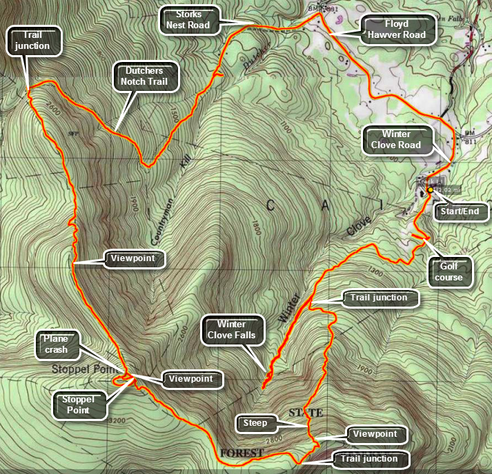 From State Route 32 north of Palenville turn west on County Route 31 Hearts Content Road just north of the Friar Tuck Inn. Turn southwest on Winter Clove Road and stay on Winter Clove Road all the way to the end. Park at the Winter Clove Inn. This is a PRIVATE resort and all the trails start on PRIVATE property. Go to the front desk in the main building and ring the bell. Ask politely if you may park and hike. The INN will even allow you to take the descriptions they have of their trails.
This hike starts by heading out across the field from the parking area by the building across from the Inn. As you walk back toward the Inn there will be a building on the left. Walk up the path next to the building and then up the gravel/dirt road that runs alongside the golf course. When the road splits, take the up branch to the left and walk up to another part of the course. Walk across the course, avoiding the greens, toward the upper left corner of the open space. You are looking for the SIXTH TEE. Pass through some trees and cross two small bridges. Walk down the fairway and take the first trail to your right. Walk up a small hill and then into a field or clearing. Walk along the left side of the field and look on the left for an old sign that says Webster's Pass. Turn left here and walk along an old road. A sign on the right says North Point and Winter Clove Falls. Turn right here at about .6 miles into the hike. From here the trail climbs a little and then starts downhill, At about .8 miles the trail turns to the left at a sign again designating North Point and Winter Clove Falls. From here the trail climbs steadily using old woods roads until at 1.35 miles it splits. Bear to the right toward Winter Clove Falls. Along the way you may hear the roar of the water of a creek to your right and, at times, you may see the water forming small drops and rapids along the way. At 1.65 miles the trail descends a little and crosses an old creek bed with several downed trees. From this point on the trail markers are scarce and a little faded but continue to follow the creek bed.You will keep getting closer to the creek and should see glimpses of the falls ahead. The trail climbs steeply at this point to the top of the falls. There is a view along the clove out into the valley toward the Hudson but how could the view is depends on the lighting and the amount of haze. The falls has two major drops and the water volume controls how impressive they will be. You can carefully work my way down the north bank to the area between the two drops. This is not easy but it does allow you to get a view of the upper drop head-on. Work your way back to the top of the falls. At this point it is worth spending some time bushwhacking further up the stream to some more falls. How far you get on this bushwhack depends on the water level and your own desires. Headed back down the stream and down the trail you came up. Several paths lead down to the stream below the falls but all were very steep. Head back down the trail to where it split at about 2.75 into the hike. Turn right and start up the trail toward North Point. The trail is steep in most places and steeper in others. It is clear this is "the road less traveled" as there is little evidence of use and many of the paint blazes are very faded. At about 3.0 miles the trail turns left and starts an ascent that is about a mile long and gains over 1300'. Parts of the trail follow old roads up the mountain. In other places the trail leaves the roads to take even steeper ascents. Near the top the angle is at least 45 degrees! On the way up the trail you can see the Blackhead Range to the right but the view is obscured by the trees. At around 3.9 miles you will we skirt some cliffs. On top there is one rock that offers an unobstructed view of the mountains. The trail is ill-defined toward the top but at about 4.0 miles into the hike you should hit the Escarpment Trail at 3100 feet slightly northeast of North Mountain. There is a nice viewpoint over North South Lake at this point. Turn right on the trail which is relatively heading toward Stoppel Point. At Stoppel Point you should be about 5.4 miles into the hike and one option is to return the way you came. Continue on the Escarpment Trail and watch for a viewpoint on the left side on the trail toward KHP and Round Top. Continue on to the plane crash. There is a "trail" from the plane crash down a ridge to the Winter Clove Inn but it is hard to find and overgrown. Continue on the Escarpment Trail to the Dutcher Notch Trail. On the way you will pass by Milt's Lookout at about 6.6 miles. From the lookout it is a 600 foot drop over the next 1.1 miles to the Dutcher Notch Trail and the last part of the descent was steep. The Dutcher Notch Trail follows a road that was the main connection between the farms in the Jewett Valley and the markets near the Hudson in Catskill and Cairo. The road was sited at the lowest point in the Wall of Manitou. Since the wagons could not ascend or descend directly due to the elevation gain over a short distance the road on the east side had to have a sweeping switchback. The trail stars slightly to the east but then turns southeast nearly paralleling the escarpment. It is interesting to walk down this trail below the escarpment where you were earlier. The road is so eroded in places that the trail travels along the high bank often on stone walls. After about a mile and 770 feet of descent the trail swings toward the northeast and continues to descend. It begins to follow a stream bed and enters private property with an easement. Continue on the trail as it passed across the lawn of a private residence and through a locked gate onto paved road at about 9.7 miles. After about .5 miles on Storks Nest Road turn right on Floyd Hawver Road. Hike a little more than 1.1 miles on Hawver Road before turning right on Winter Clove Road. After walking .5 miles on Winter Clove Road you will be back at the Inn and your car.
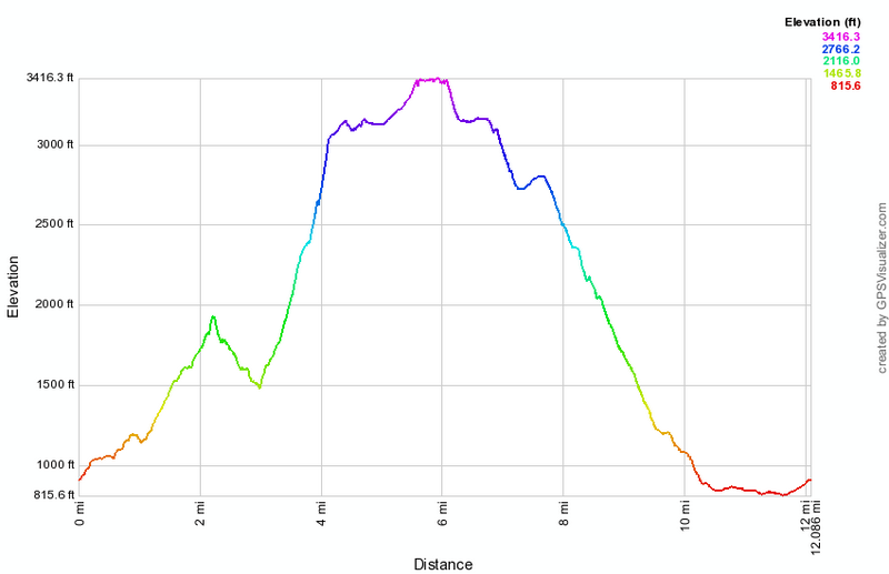 (The image at the left shows the profile of the hike. Remember that all vertical profiles are relative!)
Winter Clove: Yankee Smith and Lover's Loop
| Quick Look | ||||
|---|---|---|---|---|
| Difficulty | Round trip | Total climb | Internet Maps | |
| 4.1 mi | 720 ft | AllTrails | ||
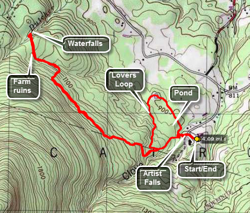 From State Route 32 north of Palenville turn west on County Route 31 Hearts Content Road just north of the Friar Tuck Inn. Turn southwest on Winter Clove Road and stay on Winter Clove Road all the way to the end. Park at the Winter Clove Inn. This is a PRIVATE resort and all the trails start on PRIVATE property. Go to the front desk in the main building and ring the bell. Ask politely if you may park and hike. The Inn will even allow you to take the descriptions they have of their trails.
This hike starts by going past the gazebo on the back lawn of the Inn, crossing the dirt road and walking down to the covered bridge across the stream. Below the bridge is Artist Falls, a destination in itself. Continue across the bridge on the trail and do not turn right on Lovers Loop but continue on the trail marked Yankee Smith. This trail leads to an area of stone walls that were built around the time of the American Revolution. The trail is blazed with red paint and is relatively easy to follow. It makes some twists and turns along the way. The first mile is a steady ascent followed by a drop. At 1.25 miles the trail begins to drop and some stone walls appear. Watch closely for the blazes and continue to follow them until about 1.5 miles where a smiley face on a tree announces the end of the trail. In the area is an impressive network of stone walls. The walls are on either side of a lane formed by more stone walls. Follow the lane which continues for several hundred feet before joining a woods road. Continue straight ahead through the forest and down an embankment to a stream with a nice waterfall. Sheba and I bushwhacked down the hill to the creek. Climb back up the hill to the road and return to the lane. Hike back down the lane and pick up the trail back at the "smiley face". The trail is blazed in blue for the return trip. At 3.0 miles into the hike you will be at a trail junction with the Stoppel Point Trail. Continue straight heading back toward Winter Clove Inn. At 3.1 miles turn left on the Lovers Loop trail and head north toward the pond. You will arrived at the small pond at 3.6 miles. Continue around the loop and you will end up back near Artist Falls. Continue back to your car.
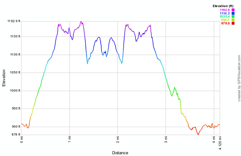 (The image at the left shows the profile of the hike. Remember that all vertical profiles are relative!)
Woodpecker and Millbrook Ridges
| Quick Look | ||||
|---|---|---|---|---|
| Difficulty | Round trip | Total climb | Internet Maps | |
| 7.5 mi. | 2000 ft. | AllTrails | ||
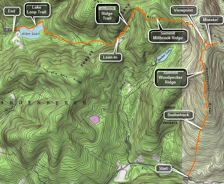
Woodpecker Ridge is one of the more western CHH peaks located in the Town of Hardenburgh in Ulster County. It is only accessible by bushwhacking. One way to hike this peak is to hike the Millbrook Ridge Trail that runs between Alder Lake and Balsam Lake Mountain. The high point on the ridge is less than a mile from where the Millbrook Ridge Trail passes by Woodpecker Ridge Another route is to park at the trailhead for the Mongaup Hardenburgh Trail and cross the road. From Livingston Manor (Exit 96 from I86) drive north and west on Old Route 17. Turn right on Beaverkill Road and continue on this road through the hamlets of Lew Beach and Turnwood. Watch for the road sign for Alder Creek Road on your left. Drive to the end of the road and turn right into the access road for Alder Lake. Park one car in the lot here. Drive back out to the Beaverkill Road and turn left to continue north. Watch for a sign for Cradle Rock Ridge on the right. Continue passed this sign until you see a small parking area for the beginning of the trail on your right. Park here and walk down the trail to the Beaverkill. Take some pictures of the suspension bridge over the river here. Return to your car, cross the road and enter the woods.
Head UP and almost due north for a little over two miles. The woods are mostly open with only a few rocky areas. Once the terrain flattens out it is a long walk to the highest point. There may be some viewpoints for Balsam Lake Mountain on the eastern side of the summit plateau. A little clearing opens up on top of the plateau. Continue due north until about 2.7 miles where you should hit the Millbrook Ridge trail. The MOST IMPORTANT thing to remember is to stay on the high ground of the ridge. Dropping off the ridge means you will simply have to regain that lost elevation. Turn left or west on the Millbrook ridge Trail. As you walk along the trail watch carefully for the marking as they sometimes are hard to spot. After a short distance there will be a lookout right on the trail. Below the lookout is Beecher Lake which has a Buddhist Monastery on its shores. There are also nice views of the surrounding hills. Continue your walk passing through a Col and climbing to the highest point on Millbrook Ridge at just under 4 miles into the hike. The elevation here is around 3470 feet leaving it 30 feet short of a Catskill 35. From here the trip to Alder Lake is all downhill with two minor bumps. At 5.25 miles there is a lean-to which looks out over a beaver meadow. This is a nice place to stop for a break before the final push to Alder Lake. Continue down the trail until you near Alder Lake and intersect the loop trail at 6.6 miles. Turn right and head around the lake to your car.
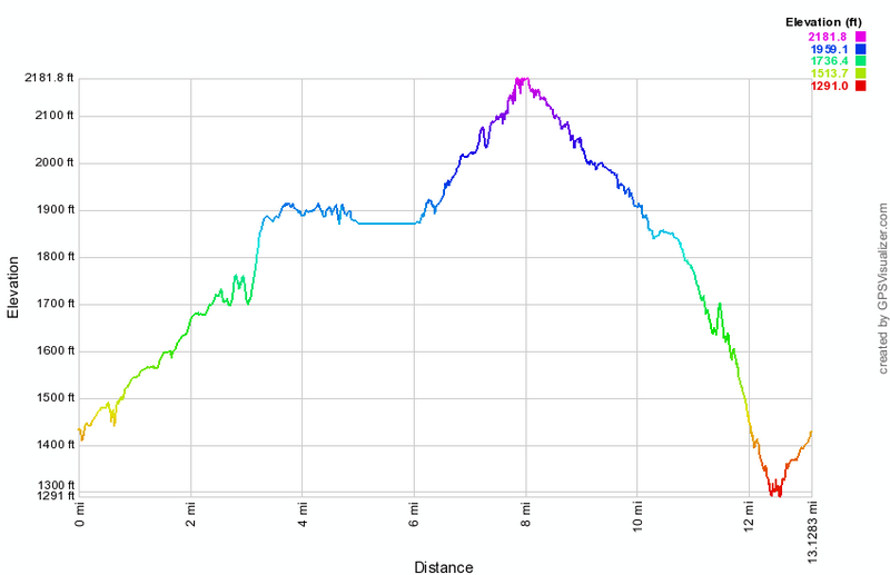 (The image shows the vertical profile of the entire one way hiking route.)