
What You Missed
Fall 2013
Fall 2013
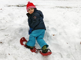 On Friday, December 20th I went to the local hiking store, Morgan Outdoors, to buy our grandson Bryce a pair of snowshoes. He had watched a television show about snowshoeing and decided he wanted a pair. I bought him a pair of MSR Tykes which are real snowshoes much like the adult Denali snowshoes. I brought them home just as it started to rain but Bryce REALLY wanted to go outside to try out HIS snowshoes.
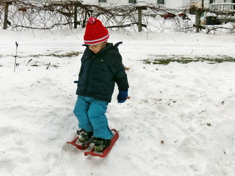 They were a little bit big for his feet but we went out. I was surprised it didn't take him long to get used to walking in them! He walked all around the back yard and managed to walk up and down the piles of snow without too many problems. It was hard to get him back inside. Next time we have snow we will be going for a hike beyond the bounds of the backyard.
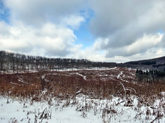
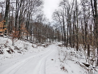
On Thursday, December 19th, I decided to head across the street and snowshoe on Round Top at about 10:30 AM. I wanted to get this in before the warmer weather and rain this weekend destroyed the snow! It was ion the high twenties when Sheila and I walked across the street. We headed up the hill by the cemetery and I was surprised that there were no sled or toboggan tracks on the hill! I guess it is a sign of the times. At the top of the hill we turned right into the woods and found more snow than at the bottom of the hill. We followed then tracks that we had made a few days earlier as we climbed the hill and then took a right onto a woods road. We followed one road and then another until we, passed by the quarry and descended the hill right after it. We continued to follow our earlier route and climbed the next hill which is even a little higher than Round Top. On the other side we descended steeply which was fun. The snow was much more compact than the light powder we had walked through the last time. In fact, the snow was beginning to collect on the bottom of my boots and snowshoes. Soon we were making the turn to head back to town. After a walk along a flat area, we were back in the area where a left turn would take us back to the route we had followed out. We turned right to follow to get back to our original path and to avoid some private property where I did not have permission to hike. We followed our path back to the trail out to the cemetery. It was a short walk down the hill to the church and across the street to the house. We were done at about 11:50 AM having hiked 3.1 miles in a hour and 50 minutes.
On Sunday, December 15th, church was canceled after a late fall snowstorm dropped about 10 inches of snow on Livingston Manor. I spent the morning shoveling our walks and driveway. I headed over to the church to find nothing plowed! I shoveled all the walks and then returned home to call some people to see if I could find someone to plow. I asked Cindy if she wanted to go out to snowshoe immediately but she was busy so we decided to put it off until the afternoon. Around 1:00 PM we began to get ready and then headed across the street to hike a route on Round Top. The wind had come up which made my doubt my choice of light layers but I warmed up as soon as we started to snowshoe. Sheila could not have been happier even if she was belly deep in the snow! Her preferred means of movements was to take long 3 to 4 foot leaps through the snow! Her coat had grown out for the winter probably due to the Husky in her. After hiking across the field by the church, we headed up the steep hill by the cemetery. Sheila was ahead of us and turned left on the trail into the woods even though we had not been there since May. The snow was unbroken and had a slight frozen crust on top. The sky was overcast and it looked like some more snow might be on the way. Shortly after entering the woods we turned right to continue our ascent. We eventually passed by the short access road to the quarry and the summit of Round Top. After a short descent, we continued on some woods roads and ascended the next hill which seems to be slightly higher than Round Top. Cindy was having some trouble breathing so we slowed our pace some except for Sheila. From the top of the hill the trail descends steeply down the other side. I enjoy the steep descents since it can be almost like skiing. I picked the tips of my snowshoes up and glided down the hill. Cindy was a little less confident and took the slow but sure approach down the hill. After a short, flat area there was another descent and then the trail began to turn to the left to circle back towards town. This part of the hike was almost flat and we made better time. We arrived at a T where a left would take us back the way we came. A right turn would also return us to our starting point but would be longer and require a significant climb. I asked Cindy which way she wanted to go and she chose to turn left. After a short walk, we were back on our path and we reversed our route to get back to the church. The final descent down the hill to the church was fun. By now the sun was out but it was till in the mid 20's. We spent about 2 hours walking around 3 miles. I did not take my pack or camera and didn't see any shots that made me regret the decision.
![]()
![]()
![]()
![]() On Friday, December 13th I wanted to get out hiking somewhere after almost a week of other commitments and brutally cold weather. I decided to head for Frick and Hodge Ponds as the area is close and usually has some snow. I waited until Karl and Bryce arrived so that I could eat with them and give the temperature a chance to get into the double digits. As we left Livingston Manor a little after 11:00 AM the temperature was still in the low teens and the roads were passable but icy in spots. We arrived at the parking area to find no cars. There was a pretty good breeze blowing which made me want to get on the trail right away. I had not completely solidified our route in my head but knew I wanted to walk down to the new bridge at the outlet to Frick Pond and get a view of Flynn's Point and the other higher elevations. There were some footprints on the trail as we headed out the trail to Frick Pond. Most of the trail was frozen with a covering of snow but there were some spots of open water. I dropped my pack at the bridge and took a few pictures. It was obvious that at the higher elevations the trees were covered with ice and frozen snow and I made sure I took some shots. I thought we might head back and take the Logger's Loop to the Quick Lake Trail and then head to Hodge and to the lookout over Hodge near Flynn's Point. As I put my pack back on, Sheila ran across the bridge and out the Quick Lake Trail and I decided to follow her lead even though this is the route we most often take. The hike to Iron Wheel Junction went quickly and we turned left to stay on the Quick Lake Trail. There were some tracks on the Quick Lake Trail which appeared to be from ATVs rather than snowmobiles. There was 2 to 3 inches of snow on the trail but I could not tell when the tracks were made. The sun was peeking through the clouds which made me feel better but did little to warm the air. As we walked the Quick Lake Trail, Sheila looked intently up the trail, alerted and came back to me. I could not see what she was looking at but in minute I heard the sound of engines coming toward us. The first ATV passed us with the rider waving "Hello". The second machine slowed and then stopped. The rider explained that they were replacing signs and that they were having trouble with the first machine. He said, "That's a really pretty dog!", which made me feel good. We parted going our separate ways.
On Friday, December 13th I wanted to get out hiking somewhere after almost a week of other commitments and brutally cold weather. I decided to head for Frick and Hodge Ponds as the area is close and usually has some snow. I waited until Karl and Bryce arrived so that I could eat with them and give the temperature a chance to get into the double digits. As we left Livingston Manor a little after 11:00 AM the temperature was still in the low teens and the roads were passable but icy in spots. We arrived at the parking area to find no cars. There was a pretty good breeze blowing which made me want to get on the trail right away. I had not completely solidified our route in my head but knew I wanted to walk down to the new bridge at the outlet to Frick Pond and get a view of Flynn's Point and the other higher elevations. There were some footprints on the trail as we headed out the trail to Frick Pond. Most of the trail was frozen with a covering of snow but there were some spots of open water. I dropped my pack at the bridge and took a few pictures. It was obvious that at the higher elevations the trees were covered with ice and frozen snow and I made sure I took some shots. I thought we might head back and take the Logger's Loop to the Quick Lake Trail and then head to Hodge and to the lookout over Hodge near Flynn's Point. As I put my pack back on, Sheila ran across the bridge and out the Quick Lake Trail and I decided to follow her lead even though this is the route we most often take. The hike to Iron Wheel Junction went quickly and we turned left to stay on the Quick Lake Trail. There were some tracks on the Quick Lake Trail which appeared to be from ATVs rather than snowmobiles. There was 2 to 3 inches of snow on the trail but I could not tell when the tracks were made. The sun was peeking through the clouds which made me feel better but did little to warm the air. As we walked the Quick Lake Trail, Sheila looked intently up the trail, alerted and came back to me. I could not see what she was looking at but in minute I heard the sound of engines coming toward us. The first ATV passed us with the rider waving "Hello". The second machine slowed and then stopped. The rider explained that they were replacing signs and that they were having trouble with the first machine. He said, "That's a really pretty dog!", which made me feel good. We parted going our separate ways.
 Sheila and I continued on the Quick Lake Trail and soon ran into the area where all the trees were covered in ice and frozen snow. I stopped to take a few pictures before we continued on to Junkyard junction. We arrived at 12:45 PM after hiking a little over 3 miles. We turned right and walked the Flynn trail to near the shore of Hodge Pond where I chose to turn left and walk the jeep trail around the back of the pond. I walked down to the shore to take some pictures of the pond and the ice covered trees and bushes. As we continued to walk around the pond on the jeep trail, we came to the point where we could continue down to the outlet of the pond or turn left up a hill. I decided to turn left and walk up the hill to the woods road near the old Boy Scout camp. When we hit the road, I decided that we would not visit the Hodge Pond lookout as it was already late and I was concerned that Sheila might be getting cold. We turn right and walked out to the Flynn Trail and stayed on it to the junction with the Big Rock Trail where we arrived at 1:20 PM after 4.7 miles of hiking. The rest of the hike was all downhill on the Flynn Trail to the parking area.We did hear the ATVs one more time and it sounded like they were headed over the snowmobile trail to Mongaup Pond. We continued down the Flynn Trail without incident and were back at the car by 2:00 PM having hiked 6.4 miles in just over 2.5 hours. At times on the hike I regretted not bringing snowshoes or spikes to get a little more traction on the trail. Hopefully, a predicted snowstorm will dump 6 inches to a foot of new snow on the trails!
![]()
![]()
![]()
![]()
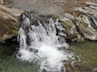
![]() On Saturday, December 7th, I wanted to return to Westkill where I spread the ashes of my hiking companion Sheba. Sheba, a German Shepherd-Collie mix kept me company on virtually every hike for six years. She was a good friend and a great trail dog who saved my hide more than once. In the spring of 2012 she was diagnosed with Lyme Disease which made her lame in both her hips. This made it more and more difficult for her to even get around the house. I will always miss her and I think of her on every hike I take. On one hike she jumped up on a rock at the Buck Ridge Lookouts on Westkill. I had a framed canvas made of the picture to hang on the wall of my study. Cindy agreed to go with me and Sheila, of course, was happy to get out. Sheila is only two years old and is a very different dog compared to Sheba. She is becoming a great trail dog and hiking companion. It had snowed overnight and some of the roads were in poor shape so we waited until later in the morning to leave. By the time we left Livingston Manor it was about 9:40 AM and the temperature had risen to the high 20's. I had pulled out the Salomon B52 insulated and put the Microspikes in my pack. We also brought along two pairs of snowshoes and decided we would make that decision at the trailhead. I decided to drive through Roscoe and pick up Route 30 around the Pepacton Reservoir since I thought these roads would be the best. I was right and the driving was pretty easy to Route 28. We headed east on 28 and took Route 42 north in Shandaken. Even the Spruceton Road was in good shape and we arrived at the trailhead a little after 11:00 AM> It was about 26 degrees with a stiff wind blowing. There were two cars in the Hunter lot but no others as we got ready to head out. We decided not to wear or take the snowshoes and that we would wait to put on the spikes. We set off up the woods road for the .85 mile hike to Diamond Notch Falls. I had heard that the footbridge had been replaced which makes crossing the stream much easier. Jumping from icy rock to icy rock is an exciting way to start a hike! I took a few quick pictures but decided to save pictures of the falls for the return trip. I knew we had started lad and that the hike is more difficult than some. We turned right to get on the Devil's Path which ascends the mountain. The climb began almost immediately and I was reminded that I always forget that the hike is not an easy one. The hike up to the ridge is mostly on the north side of the mountain and there was a few inches of snow on the ground. The snow didn't increase too much in depth as we ascended but the ice on the rocks became a problem. Sheila was doing her usual run back and forth on the trail with occasional side excursions.
On Saturday, December 7th, I wanted to return to Westkill where I spread the ashes of my hiking companion Sheba. Sheba, a German Shepherd-Collie mix kept me company on virtually every hike for six years. She was a good friend and a great trail dog who saved my hide more than once. In the spring of 2012 she was diagnosed with Lyme Disease which made her lame in both her hips. This made it more and more difficult for her to even get around the house. I will always miss her and I think of her on every hike I take. On one hike she jumped up on a rock at the Buck Ridge Lookouts on Westkill. I had a framed canvas made of the picture to hang on the wall of my study. Cindy agreed to go with me and Sheila, of course, was happy to get out. Sheila is only two years old and is a very different dog compared to Sheba. She is becoming a great trail dog and hiking companion. It had snowed overnight and some of the roads were in poor shape so we waited until later in the morning to leave. By the time we left Livingston Manor it was about 9:40 AM and the temperature had risen to the high 20's. I had pulled out the Salomon B52 insulated and put the Microspikes in my pack. We also brought along two pairs of snowshoes and decided we would make that decision at the trailhead. I decided to drive through Roscoe and pick up Route 30 around the Pepacton Reservoir since I thought these roads would be the best. I was right and the driving was pretty easy to Route 28. We headed east on 28 and took Route 42 north in Shandaken. Even the Spruceton Road was in good shape and we arrived at the trailhead a little after 11:00 AM> It was about 26 degrees with a stiff wind blowing. There were two cars in the Hunter lot but no others as we got ready to head out. We decided not to wear or take the snowshoes and that we would wait to put on the spikes. We set off up the woods road for the .85 mile hike to Diamond Notch Falls. I had heard that the footbridge had been replaced which makes crossing the stream much easier. Jumping from icy rock to icy rock is an exciting way to start a hike! I took a few quick pictures but decided to save pictures of the falls for the return trip. I knew we had started lad and that the hike is more difficult than some. We turned right to get on the Devil's Path which ascends the mountain. The climb began almost immediately and I was reminded that I always forget that the hike is not an easy one. The hike up to the ridge is mostly on the north side of the mountain and there was a few inches of snow on the ground. The snow didn't increase too much in depth as we ascended but the ice on the rocks became a problem. Sheila was doing her usual run back and forth on the trail with occasional side excursions.
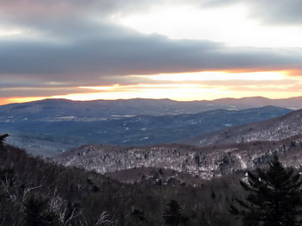
 At about 1.5 miles the trail begins to travel along the side of a hill. The indentation is slight and the rocks were all very icy. We decided to stop of r a few minutes to put on Microspikes. This was a good decision and allowed us to make better time and to do it safely. We kept them on to the summit and all the way back to the car! We walked and talked and the hike went more quickly than if I had been alone. There is one spot that is usually a sheet of ice and when we go there we found it was not as intimidating as it can be later in the season. The mile climb from just after the falls to where the trail begins to level averages a 20% grade and can be very tiring in winter. Once we got to the more level part there were still some small climbs and a few descents but the going was easier. From that point to Buck Ridge and the summit is still well over a mile. We passed the rock overhand just below the 3500 foot sign. We were then at the area where the trail turns almost due west and levels off slightly. Around 1:00 PM I began to think about how much farther we had to go and how much time we had remaining. Cindy voiced the same concern and we picked up the pace. We continued on our way and were soon at the base of the final ascent. When we reached Buck Ridge, I continued on to the summit practically running to get there and back. Hiking to the summit of Westkill is a short trip but serves no purpose other than to allow a hiker to claim they got to the summit. The real attraction of Westkill is the Buck Ridge Lookouts. Back at the lookouts I took off my pack and got out the camera. It was an absolutely perfect day! I took pictures from the lookout on the south side including some of Sheila. We walked over to the north side and I took some pictures from there. The trees have started to block the view and I did not want to stand on the snow and ice-covered boulder. Even Sheila resisted jumping up on the boulder. I was a little sad at this point but happy we had done the hike to Sheba's final resting place.
 Cindy and I got a drink and gave Sheila one. We both had snacks and shared some with Sheila. It was 1:30 PM and time for us to be starting back down the mountain. I did not want to hike out by headlamp and I did want to stop in the area of the falls. We kept a quick pace on the way down without stopping. We continued down the trail and I thought we might meet some other hikers but none appeared. We crossed the bridge at the falls and I negotiated the short but steep drop to the base of the falls. The stream has actually changed its course slightly and now flows more on the northeast rather than southwest side of the bed. After taking these photographs, I climbed back up the bank to trail and caught up with Cindy and Sheila. The walk back to the car went quickly. There were several other spots worthy of some pictures but it was l the and the light was limited. It was not much warmer than when we had started and as the sun started to set it felt even colder. We were back in the parking area at 3:35 PM having covered 6.4 miles in 4 hours and 15 minutes with plenty of time allowed for photography. The total ascent was 2104 feet. I was tired but glad we had made the trip.
![]()
![]()
![]() On Tuesday, December 3rd, I wanted to get out again even if the hike was short and near home. Rifle season for whitetails was still open and I had to be at track practice so the choices were limited. Since I had recently visited both the area around Trout Pond and Frick and Hodge Ponds, I decided to go to Long Pond and hike the big loop. Sheila was ready to go as we left the house a little after 9:00 AM. The weather seemed warm at about 31 degrees but I still dressed for winter. I wore my new favorite boot, the Asolo Powermatic 200 GV, which is overkill for a short dayhike but fits me perfectly. We parked just before 9:30 AM and got right to hiking. I chose to walk up Flugertown Road to hike in the direction opposite to the one I normally take. The first part of the hike is virtually flat but then starts to climb very gently for some distance. The final descent back to the parking area is the steepest part the of the hike. I put Sheila on her leash for the first .5 miles on the paved portion of Flugertown Road. Once we were on the unpaved, dirt road, I let her off the leash. Sheila was good about staying on the road which is important to me especially during hunting season. The road was shaded by the trees and had been traveled by vehicles headed to some hunting camps. This combination created a thick layer of ice which made walking along the road difficult in places. I contemplated putting on by spikes but decided to walk carefully along the edges of the road and on the snow covered parts. This worked out well enough and we were soon passing by the Willowemoc-Hardenburgh Trail on the left and the trail on the right that creates a short loop to Long Pond. At this point there was a car and a tent at one of the small campsites but we did not see any people. We continued on to the point where Flugertown Road turns into Basily Road and heads over a small hill and down to the Peters Hunting Club. The hunting club has a private bridge over the creek and at one point denied access to hikers. The bridge is now open and the snowmobile trail passes over it so I have hiked it many times. I was glad to find that there were cars at the camp because I wanted explicit permission to hike across their land. I leashed Sheila to a tree and knocked on the door of the camp. A gentleman motioned me in and I introduced myself. When I asked for permission to hike, he freely gave it and even pointed out where the road was. I went back to Sheila and we headed on around the loop. It was 10:25 Am and we had covered 2.65 miles.
On Tuesday, December 3rd, I wanted to get out again even if the hike was short and near home. Rifle season for whitetails was still open and I had to be at track practice so the choices were limited. Since I had recently visited both the area around Trout Pond and Frick and Hodge Ponds, I decided to go to Long Pond and hike the big loop. Sheila was ready to go as we left the house a little after 9:00 AM. The weather seemed warm at about 31 degrees but I still dressed for winter. I wore my new favorite boot, the Asolo Powermatic 200 GV, which is overkill for a short dayhike but fits me perfectly. We parked just before 9:30 AM and got right to hiking. I chose to walk up Flugertown Road to hike in the direction opposite to the one I normally take. The first part of the hike is virtually flat but then starts to climb very gently for some distance. The final descent back to the parking area is the steepest part the of the hike. I put Sheila on her leash for the first .5 miles on the paved portion of Flugertown Road. Once we were on the unpaved, dirt road, I let her off the leash. Sheila was good about staying on the road which is important to me especially during hunting season. The road was shaded by the trees and had been traveled by vehicles headed to some hunting camps. This combination created a thick layer of ice which made walking along the road difficult in places. I contemplated putting on by spikes but decided to walk carefully along the edges of the road and on the snow covered parts. This worked out well enough and we were soon passing by the Willowemoc-Hardenburgh Trail on the left and the trail on the right that creates a short loop to Long Pond. At this point there was a car and a tent at one of the small campsites but we did not see any people. We continued on to the point where Flugertown Road turns into Basily Road and heads over a small hill and down to the Peters Hunting Club. The hunting club has a private bridge over the creek and at one point denied access to hikers. The bridge is now open and the snowmobile trail passes over it so I have hiked it many times. I was glad to find that there were cars at the camp because I wanted explicit permission to hike across their land. I leashed Sheila to a tree and knocked on the door of the camp. A gentleman motioned me in and I introduced myself. When I asked for permission to hike, he freely gave it and even pointed out where the road was. I went back to Sheila and we headed on around the loop. It was 10:25 Am and we had covered 2.65 miles.
We crossed the outlet to the beaver pond on the small footbridge. The dam to the pond had been opened up and the water was flowing freely. From that point the road began to ascend slightly and was again covered in ice. I did my best to hug the sides of the road or the center where I could get some traction. The skies were completely overcast and there were few opportunities for taking any pictures. This didn't bother me too much as I was more interested in just hiking. Soon we were approaching the point were we would turn right onto the trail back to Long Pond. Sheila came back to me and began to whine a little. This is her way of announcing that there are people ahead he the trail. I looked up to see several hunters in blaze orange headed away from us toward another hunting camp. I kept Sheila on her leash1 until we made the turn onto the trail and the hunters were gone. Surprisingly, the trail was almost devoid of snow but fairly form to walk on. There was evidence that there had been some ATV activity in the area and there were small "ponds" in several places. We walked along the trail ands Sheila did a good job of staying close. We passed the trail to the lean-to at 11:00 AM about 4.3 miles into the hike. It wasn't long before we were at the spur trail down to the shore of Long Pond. I decided to bypass this visit and continue to hike back to the car. The last part of the hike went quickly as we descended the hill back to the parking area. We were back at the car by 11:40 AM having covered 6 miles in 2 hours and 10 minutes.
![]()
![]()
![]()
![]()
![]() On Monday, December 2nd I wanted to get in a hike close to home and decided to visit Trout Pond. The area around Trout and Mud Ponds is a favorite of mine but I had not been there in some time. I didn't know what to expect as far as trail conditions and the volume of water at the falls since it had been rather wet lately. I got myself dressed and had to deal with Sheila who immediately knew we were going hiking. She tends to stick close to make sure I know she wants to go. By the time we left the house at 9:20 AM the temperature was in the mid 30's and there were snow flurries in the air. We arrived at the parking area at about 9:35 AM and I parked on the side of the road as the perking lot is private property. We immediately started our hike down Russell Brook Road which was covered in ice. I actually considered putting on my spikes it was so slippery. In addition, the flurries were much heavier than at home. I managed to walk on the side of the road where there was some slow that allowed a little traction. When we reached the viewpoint over the upper falls, I had to stop to take a few shots despite the fact that I have many pictures from the same spot. There was a large volume of water going over the falls and the snow on the ground and in the air created an interesting effect. We walked down to the lower parking area which was empty but ice covered. From there we headed down to the bridge over Russell Brook. We crossed the bridge and I decided to leave the lower falls for later. At the split in the trail we headed right to do the loop in a counterclockwise direction as I had gone in the opposite direction last time. There was snow and ice on the trail in some places but other spots were soft and muddy. We set a fast pace up the trail toward Trout Pond and as we approached I was surprised to see that there was ice covering most of the pond. The only open area I could see was near the spillway and the near shore. Sheila immediately ran out onto the ice and broke through in one spot! I didn't have to yell at her as even she must have realized the water was cold! I took some pictures of the scenery with the ice on the pond but the sky was totally overcast which was not ideal. We headed back to the main trail and walked up to the inlet end of the pond. The trail had some very wet spots along the way. We walked to the upper end of the pond and found no one at the lean-tos. I decided that it was not worth taking pictures and continued over the bridge and up the trail toward Cherry Ridge. As we began to ascend, the trail began to be covered in snow and ice with more in the surrounding woods. This area also had a more northerly and westerly exposure. The snow and ice continued to the top of the rise and then dissipated some on the other side. We continued to run into some areas with snow but also walked around some water and mud. Soon we were at the junction with the snowmobile trail that runs passed Mud Pond. We turned left and climbed a little before descending back to the register box. I decided to walk over to the falls and from there we walked down into the stream bed. The water was pretty high leaving a smaller area at the base of the falls. I took some pictures and played with my camera adjustments some. We walked back up the bank and out to the main trail From there we walked back out to the lower parking area and then up the road to the car. The walk up the icy road actually seemed easier than the walk down. There was a half inch or new snow fallen on the road. We were back at the car at 12:05 PM having covered 5.6 miles in 2.5 hours.
On Monday, December 2nd I wanted to get in a hike close to home and decided to visit Trout Pond. The area around Trout and Mud Ponds is a favorite of mine but I had not been there in some time. I didn't know what to expect as far as trail conditions and the volume of water at the falls since it had been rather wet lately. I got myself dressed and had to deal with Sheila who immediately knew we were going hiking. She tends to stick close to make sure I know she wants to go. By the time we left the house at 9:20 AM the temperature was in the mid 30's and there were snow flurries in the air. We arrived at the parking area at about 9:35 AM and I parked on the side of the road as the perking lot is private property. We immediately started our hike down Russell Brook Road which was covered in ice. I actually considered putting on my spikes it was so slippery. In addition, the flurries were much heavier than at home. I managed to walk on the side of the road where there was some slow that allowed a little traction. When we reached the viewpoint over the upper falls, I had to stop to take a few shots despite the fact that I have many pictures from the same spot. There was a large volume of water going over the falls and the snow on the ground and in the air created an interesting effect. We walked down to the lower parking area which was empty but ice covered. From there we headed down to the bridge over Russell Brook. We crossed the bridge and I decided to leave the lower falls for later. At the split in the trail we headed right to do the loop in a counterclockwise direction as I had gone in the opposite direction last time. There was snow and ice on the trail in some places but other spots were soft and muddy. We set a fast pace up the trail toward Trout Pond and as we approached I was surprised to see that there was ice covering most of the pond. The only open area I could see was near the spillway and the near shore. Sheila immediately ran out onto the ice and broke through in one spot! I didn't have to yell at her as even she must have realized the water was cold! I took some pictures of the scenery with the ice on the pond but the sky was totally overcast which was not ideal. We headed back to the main trail and walked up to the inlet end of the pond. The trail had some very wet spots along the way. We walked to the upper end of the pond and found no one at the lean-tos. I decided that it was not worth taking pictures and continued over the bridge and up the trail toward Cherry Ridge. As we began to ascend, the trail began to be covered in snow and ice with more in the surrounding woods. This area also had a more northerly and westerly exposure. The snow and ice continued to the top of the rise and then dissipated some on the other side. We continued to run into some areas with snow but also walked around some water and mud. Soon we were at the junction with the snowmobile trail that runs passed Mud Pond. We turned left and climbed a little before descending back to the register box. I decided to walk over to the falls and from there we walked down into the stream bed. The water was pretty high leaving a smaller area at the base of the falls. I took some pictures and played with my camera adjustments some. We walked back up the bank and out to the main trail From there we walked back out to the lower parking area and then up the road to the car. The walk up the icy road actually seemed easier than the walk down. There was a half inch or new snow fallen on the road. We were back at the car at 12:05 PM having covered 5.6 miles in 2.5 hours.
![]()
![]()
![]()
![]() On Friday, November 29th I had thought about hiking to Big Indian and Eagle from the Segar trailhead. Brad and Krista were at the house for Thanksgiving and we didn't get out of the house until after 10:30 AM. I decided it was too late to mount an attack on two 35s and changed the plan. I headed for Bear Spring WMA with the thought of hiking the loop on the east ridge from Route 206. We drove through Roscoe and Downsville and then up Bear Spring Mountain to the parking area on Route 206 just before the top. I parked at about 11:20 AM with only one other car in the lot. Bear Spring is hunted heavily so I had made sure Sheila had on a blaze orange vest and her electronic collar. We headed out the wide woods road marked on the map as Wilson Hollow Road and immediately we were at the first clear-cut area. The sky was dark and overcast with a few flakes of snow in the air. The sun peeked out from behind the clouds at times. As we hiked along the road next to the clear-cut area, I stopped several times to take some pictures. At 1.3 miles we passed Trail 11 that goes down to Launt Pond. The hiking seemed to go quickly as Brad and I walked and talked and soon we passed the woods road down to the East Trout Brook Road parking. Just after that at 2.3 miles we arrived at the spot where the trail continues straight ahead or turns right. I decided we would turn right and walk the edge of the field and down the McCoy Hill cutoff trail. This walk was easy as it descends almost 500 feet in .8 miles to the lowest point on the hike.
On Friday, November 29th I had thought about hiking to Big Indian and Eagle from the Segar trailhead. Brad and Krista were at the house for Thanksgiving and we didn't get out of the house until after 10:30 AM. I decided it was too late to mount an attack on two 35s and changed the plan. I headed for Bear Spring WMA with the thought of hiking the loop on the east ridge from Route 206. We drove through Roscoe and Downsville and then up Bear Spring Mountain to the parking area on Route 206 just before the top. I parked at about 11:20 AM with only one other car in the lot. Bear Spring is hunted heavily so I had made sure Sheila had on a blaze orange vest and her electronic collar. We headed out the wide woods road marked on the map as Wilson Hollow Road and immediately we were at the first clear-cut area. The sky was dark and overcast with a few flakes of snow in the air. The sun peeked out from behind the clouds at times. As we hiked along the road next to the clear-cut area, I stopped several times to take some pictures. At 1.3 miles we passed Trail 11 that goes down to Launt Pond. The hiking seemed to go quickly as Brad and I walked and talked and soon we passed the woods road down to the East Trout Brook Road parking. Just after that at 2.3 miles we arrived at the spot where the trail continues straight ahead or turns right. I decided we would turn right and walk the edge of the field and down the McCoy Hill cutoff trail. This walk was easy as it descends almost 500 feet in .8 miles to the lowest point on the hike.
 On the way down the trail we stopped once to take some pictures of the valley below. The lighting was difficult and I was not sure the pictures would be much good. At the bottom of the descent we turned left to start to loop around and back up to the ridge. Of course, the payment for a descent is an ascent back to the ridge. In just about a mile we had to regain the elevation we had lost on the way down. We found some ATV tracks which followed the trail and then turned around and headed back. From the turn around point boot tracks continued on up the trail. We also passed a sign on a snowmobile trail to the right that said "Downsville". We continued to walk the woods road We had been walking east but at 4.2 miles the trail turned northwest to circle the summit of a hill on our left and head back toward the parking area. From the point of the turn back to the trail junction where we had turned right was about 1.15 miles. When we arrived back at the junction, we knew exactly how far we had to go to get back! The hike back along Wilson Hollow road was 2.2 miles but it seemed to pass quickly as most was downhill. We stopped again at the clear-cut area so that I could take a few shots. We were back at the car by 3:25 PM having covered 7.6 miles in under 2.5 hours with a little over 1000 feet of climb.
![]()
![]()
![]()
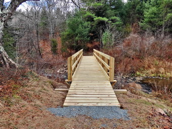
![]() On Saturday, November 23rd I wanted to get out hiking somewhere! A series of commitments and a bad cold had kept me out of the woods for almost two weeks except for a short hike in Vermont! Cindy and I decided to head for Frick and Hodge Ponds as the area is close and lightly hunted. We also wanted to see if the bridge across the outlet of Frick Pond had been finished. We didn't hurry to start early as we knew any hunters would be out of the woods by 10:00 AM or so. When we arrived at 10:00 AM at the parking area, I thought we might have misjudged as there was a pickup with a camper and two other trucks. One of the trucks seemed to have a cook stove on the tailgate with a backwoods chef creating a culinary treat. We parked and were hiking out the Quick Lake Trail to Frick Pond almost immediately. Sheila was so excited she could hardly contain herself. The previous hikes we had taken were on the Finger Lakes Trail and were mostly on roads. Sheila had been on her leash on these hikes and had not been able to run free for some time. I was surprised at how well behaved she was when I asked her to stay close and on the trail. The day was cool with the temperature in the low 20's. The forecast for Sundays was for even lower temperatures. As we hiked out toward the pond it was obvious there had been more rain than I had thought. The trails were pretty wet with some standing water and mud. When we got to the Frick Pond we found the new bridge completed and the old one gone. The new bridge is well-constructed with three steel I-beams as the base. We stopped to take some pictures. I took some shots of the new bridge and some of the pond. The lighting was interesting and I thought I took some nice pictures. We continued on around the pond and stayed on the Quick Lake Trail to Iron Wheel Junction.
On Saturday, November 23rd I wanted to get out hiking somewhere! A series of commitments and a bad cold had kept me out of the woods for almost two weeks except for a short hike in Vermont! Cindy and I decided to head for Frick and Hodge Ponds as the area is close and lightly hunted. We also wanted to see if the bridge across the outlet of Frick Pond had been finished. We didn't hurry to start early as we knew any hunters would be out of the woods by 10:00 AM or so. When we arrived at 10:00 AM at the parking area, I thought we might have misjudged as there was a pickup with a camper and two other trucks. One of the trucks seemed to have a cook stove on the tailgate with a backwoods chef creating a culinary treat. We parked and were hiking out the Quick Lake Trail to Frick Pond almost immediately. Sheila was so excited she could hardly contain herself. The previous hikes we had taken were on the Finger Lakes Trail and were mostly on roads. Sheila had been on her leash on these hikes and had not been able to run free for some time. I was surprised at how well behaved she was when I asked her to stay close and on the trail. The day was cool with the temperature in the low 20's. The forecast for Sundays was for even lower temperatures. As we hiked out toward the pond it was obvious there had been more rain than I had thought. The trails were pretty wet with some standing water and mud. When we got to the Frick Pond we found the new bridge completed and the old one gone. The new bridge is well-constructed with three steel I-beams as the base. We stopped to take some pictures. I took some shots of the new bridge and some of the pond. The lighting was interesting and I thought I took some nice pictures. We continued on around the pond and stayed on the Quick Lake Trail to Iron Wheel Junction.
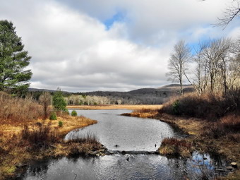 We arrived at the trail junction at about 10:35 AM and 1.5 miles into the hike. We turned left on the Quick Lake Trail and headed toward Junkyard Junction and the Flynn Trail. I expected to see some hunters in this area but there were none visible. The trail was wet but we could walk around most spots. The sun kept coming out from behind the clouds only to disappear again. We walk and talked and watched the of enjoy herself. At 11:05 AM we had hiked 2.7 miles are made the right turn onto the Flynn Trail at Junkyard Junction. There was no snow along the trail but there were some wet spots. I was feeling good for not having hiked in so long and Cindy seemed to be having fun. I proposed we hike to the lookout over Hodge Pond but we agreed to defer the decision until we were at the turn. When we were near Hodge Pond, we turned left to take the jeep trail around the back of the pond. I walked down to the shore to take some shots. The sun was behind the clouds but provided a lot of light. I took pictures of the pod and some of the reflections which. I hoped the unusual lighting would make interesting pictures. We continued around the pond and reached the junction to the lookout. Cindy did not want to hike any more than we had in store to get back to the car and I assented. We hiked down to Hodge Pond where I took a few more pictures before getting back he the Flynn Trail. The hike up the Flynn Trail from Hodge Pond seemed easier and shorter than usual and we were soon on the level part that leads to the junction with the Big Rock trail. We came to the junction at 12:05 PM after hiking 5 miles. From the junction to the car was all downhill on the Flynn Trail. We arrived back he the car at 12:45 PM to find no other vehicles in the parking lot. We had covered 6.7 miles in 2 hours and 50 minutes.
![]() Beer Hunt Google Map
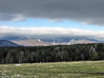
On Wednesday, November 13th and Thursday, November 14th, my son Karl and I headed for Vermont. When he first proposed the trip, I was happy that Karl wanted to get away and do a few hikes in the Green Mountains. Karl explained to me that the trip wasn't so much about hiking but about searching for the elusive Heady Topper and other Vermont craft beers. We left Livingston Manor at around 4:30 PM on Wednesday to drive the 264 miles to Warren, VT so that we would be ready for beer hunting on Thursday. Our Route included Rt 209 to Kingston and then the Thruway and Northway to Rt 149 around Queensbury. From there is was Rt 4 northeast to Rutland and Rt 100 north to Warren. We made good time and arrived at about 9:45 PM. We were both tired and turned in early to get some sleep for the "Big Day". We awoke before 6:00 AM and decided to go to a lookout where Karl had been before. We drove north on Rt 100 and then west and up a mountain on Rt 17. As we climbed on the road we passed Mad River Ski Area. We began to notice that there was more and more snow at the higher elevations. The parking area at Appalachian Gap was covered in several inches of snow. The predicted temperature wit the wind chill was about 10 degrees and although it was cold it did not seem to be that cold. We walked to where the trail met the road and immediately saw a problem. The trail was only moderately steep but was covered in snow and ice. I knew that I would forget something in the rush to leave on Wednesday and what I forgot were the hiking spikes. The plan had been to hike to the Molly Stark Balcony which was only 1.3 miles and offered a good view of Camel's Hump and other points of interest. We decided to try at least part of the hike even without the traction devices. The first part of the trail was a little discouraging but we worked through the worst areas and were soon at the viewpoint which was only about .15 miles from the road! The sun had just risen but was behind some clouds. The yellow and orange glow was beautiful and the view of the valleys and mountains was great. I took some pictures before we headed back to the main trail. The view had inspired us and we decided to go a little further before heading back to the room. We walked to near the summit of Baby Stark where the trail started to descend into a col. There were a few more icy spots and a lot more snow. We decided at this point to turn around. On the way back we stopped at the same lookout and got slightly different views. We worked our way back down to the road without too many problems. I took some shots from the parking area. As we were ready to leave another cat pulled up and we talked to the two young men. They were preparing to hike with skis and skins in the opposite direction on the Long Trail. Once they were at the top of the mountain they would ski down to another vehicle at the base of the mountain. We wished them well and parted.
Beer Hunt Google Map
On Wednesday, November 13th and Thursday, November 14th, my son Karl and I headed for Vermont. When he first proposed the trip, I was happy that Karl wanted to get away and do a few hikes in the Green Mountains. Karl explained to me that the trip wasn't so much about hiking but about searching for the elusive Heady Topper and other Vermont craft beers. We left Livingston Manor at around 4:30 PM on Wednesday to drive the 264 miles to Warren, VT so that we would be ready for beer hunting on Thursday. Our Route included Rt 209 to Kingston and then the Thruway and Northway to Rt 149 around Queensbury. From there is was Rt 4 northeast to Rutland and Rt 100 north to Warren. We made good time and arrived at about 9:45 PM. We were both tired and turned in early to get some sleep for the "Big Day". We awoke before 6:00 AM and decided to go to a lookout where Karl had been before. We drove north on Rt 100 and then west and up a mountain on Rt 17. As we climbed on the road we passed Mad River Ski Area. We began to notice that there was more and more snow at the higher elevations. The parking area at Appalachian Gap was covered in several inches of snow. The predicted temperature wit the wind chill was about 10 degrees and although it was cold it did not seem to be that cold. We walked to where the trail met the road and immediately saw a problem. The trail was only moderately steep but was covered in snow and ice. I knew that I would forget something in the rush to leave on Wednesday and what I forgot were the hiking spikes. The plan had been to hike to the Molly Stark Balcony which was only 1.3 miles and offered a good view of Camel's Hump and other points of interest. We decided to try at least part of the hike even without the traction devices. The first part of the trail was a little discouraging but we worked through the worst areas and were soon at the viewpoint which was only about .15 miles from the road! The sun had just risen but was behind some clouds. The yellow and orange glow was beautiful and the view of the valleys and mountains was great. I took some pictures before we headed back to the main trail. The view had inspired us and we decided to go a little further before heading back to the room. We walked to near the summit of Baby Stark where the trail started to descend into a col. There were a few more icy spots and a lot more snow. We decided at this point to turn around. On the way back we stopped at the same lookout and got slightly different views. We worked our way back down to the road without too many problems. I took some shots from the parking area. As we were ready to leave another cat pulled up and we talked to the two young men. They were preparing to hike with skis and skins in the opposite direction on the Long Trail. Once they were at the top of the mountain they would ski down to another vehicle at the base of the mountain. We wished them well and parted.
 When we were at the junction with Rt 100 we turned left to visit a couple of stores in Waitsfield. One store was out of Heady Topper and the other seemed to have some but was closed until later in the day. We went back to the room to shower and have breakfast and then headed to East Warren. We headed to the East Warren Community Market where we scored a 4 pack of Heady Topper. From there we went into Warren to stop at The Warren Store for the delivery of Lawson's Finest Liquids. Here we each got two bottles of Imperial Maple Stout and Hopzilla Double IPA. Karl also picked up several other bottles. We met one couple from Allentown, PA who had driven all night to get to Warren. It made me feel a little better. Outside there was a small creek that ran beside the store. I took some pictures and then we were ready to continue the journey at about 10:30 AM. Our next destination was Hill Farmstead Brewery near Greensboro, VT.
 We drove northeast on Rt 100 and Rt 100B and then east on Rt 2 to Montpelier. We spent a few minutes in the state capitol so that I could photograph the capitol building. We also stopped at another store to investigate the beer offerings. Karl bought something and then we headed toward Rt 14 northeast to Greensboro Bend. We found the dirt road to the brewery without too much trouble and the 65 miles from Warren seemed to go pretty quickly. This brewery sells almost all of their beers in 750 ml or 2L growlers which means the beer has a more limited lifetime. While we waited on line, we tasted 4 different 2 oz samplers. The beer is very popular and soon the Allentown couple showed up. The d�cor in the room was non-existent but the brewery is expanding its facility. We both purchased a 2L growler of Everett, a robust porter, a 2L growler of Abler, a double IPA, and a 75ml growler of Double Citra bought bottles of Arthur, a saison. Karl also purchased several other bottles. It was 1:20 PM when we left Hill Farmstead to head to Brimfield, MA and the Treehouse Brewery which was about 235 miles away.
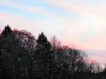 We headed out the back roads to I91 south. Along the way, in some small town, we were surprised to see a cow walk to the middle of the road and stop. After a few minutes, she wandered on. We stopped at a Thai food restaurant in St. Johnsbury and had an excellent meal that revived us some he the push on to Treehouse. The sunset was absolutely spectacular so I pulled over to take a few pictures. We soon hit I90 and I drove east toward our destination and away from home. Again, we had little trouble finding the brewery with the help of the GPS. It must have been around 6:00 PM when we turned in our order. I got a 750 ml growler of That's What She Said, a milk stout, and a 750ml growler of SAP, an IPA. As we left we decided two things. First, we would take I84 back to Middletown and then the Quickway home. Second, we would get some miles of the 210 mile trip under our belt before eating. We stopped at a mall somewhere between Hartford and Danbury and ate at a Chipotle Grill. I really liked their Burritos. Karl spied a Trader Joe's so we stopped to...check out the beer offerings. After getting back on I84 we drove and did not stop until I dropped Karl off at his house and then drove the rest of the way home. It was over 700 miles of driving in two days but I had a much better time than I thought I would. Unfortunately, I may now be hooked. Sometimes the taste of the beer, which is very good, is almost secondary to the quest!
![]()
![]()
![]()
![]() On Tuesday, November 11th, I decided I wanted to hike the last section of the Finger Lakes Trail from map 20. This part of the Finger Lakes Trail starts on Carson Road northwest of Marathon and passes through Blodgett Mills and then Hoxie Gorge as it heads east. There is a lot of road walking and some of the private land is closed in the fall for hunting which adds to the road walks. The final section I had to do was from Baker Schoolhouse Road to Telephone Road and, of course, back. I calculated the total distance to be about 13 miles with a downhill at the beginning and an uphill near the end. The hike along Telephone Road was also an uphill followed by a downhill on the return. The rest of the route appeared to be almost flat. I decided that I would hike back using a slightly different route just for some variety. When I woke up in the morning the temperature was in the high 20's although it was forecast to rise into the low to mid 40's. There was supposed to be a 15 mph wind so I decided to dress warmly wearing my Mammut Hoody and Mountain Hardwear Winter Wander pants for the first time. I also put on an Icebreaker 200 top. I had been having some problem with my feet walking in hiking boots on the road so I thought perhaps wearing my Salomon trail runners would help. I left Livingston Manor at about 7:40 AM and drove north and west on Route 17 to Binghamton and then north on I81 to Whitney Point. From there I took Routes 26 and 41 to Baker Schoolhouse Rd. I parked where the trail enters the forest at 9:45 AM and got started right away. The trail through the forest is closed after one mile so we headed east on Baker Schoolhouse Road toward Route 41. The road is a back road but there was quite a bit of traffic. The first .8 miles was slightly uphill while the final 1.5 miles was downhill. We turned left on Route 41 and headed north on the wide shoulders. The next 3 miles were almost flat and the road was very straight. I found looking ahead to be discouraging since all I could see was road! The skies were completely overcast and from the beginning of the hike it looked as if it was going to rain or that it was near sundown or both. By 11:15 AM we had walked 5.2 miles to the junction of Route 41 and Telephone Road near Solon. Five plus miles in 1.5 hours seemed pretty fast to me!
On Tuesday, November 11th, I decided I wanted to hike the last section of the Finger Lakes Trail from map 20. This part of the Finger Lakes Trail starts on Carson Road northwest of Marathon and passes through Blodgett Mills and then Hoxie Gorge as it heads east. There is a lot of road walking and some of the private land is closed in the fall for hunting which adds to the road walks. The final section I had to do was from Baker Schoolhouse Road to Telephone Road and, of course, back. I calculated the total distance to be about 13 miles with a downhill at the beginning and an uphill near the end. The hike along Telephone Road was also an uphill followed by a downhill on the return. The rest of the route appeared to be almost flat. I decided that I would hike back using a slightly different route just for some variety. When I woke up in the morning the temperature was in the high 20's although it was forecast to rise into the low to mid 40's. There was supposed to be a 15 mph wind so I decided to dress warmly wearing my Mammut Hoody and Mountain Hardwear Winter Wander pants for the first time. I also put on an Icebreaker 200 top. I had been having some problem with my feet walking in hiking boots on the road so I thought perhaps wearing my Salomon trail runners would help. I left Livingston Manor at about 7:40 AM and drove north and west on Route 17 to Binghamton and then north on I81 to Whitney Point. From there I took Routes 26 and 41 to Baker Schoolhouse Rd. I parked where the trail enters the forest at 9:45 AM and got started right away. The trail through the forest is closed after one mile so we headed east on Baker Schoolhouse Road toward Route 41. The road is a back road but there was quite a bit of traffic. The first .8 miles was slightly uphill while the final 1.5 miles was downhill. We turned left on Route 41 and headed north on the wide shoulders. The next 3 miles were almost flat and the road was very straight. I found looking ahead to be discouraging since all I could see was road! The skies were completely overcast and from the beginning of the hike it looked as if it was going to rain or that it was near sundown or both. By 11:15 AM we had walked 5.2 miles to the junction of Route 41 and Telephone Road near Solon. Five plus miles in 1.5 hours seemed pretty fast to me!
When we turned right onto Telephone Road we walked uphill for about .7 miles where the road leveled and then started to go downhill a little for the next .8 miles to the point where the trail entered the woods. We walked into the woods a little to ensure that we had covered the entire route and then turned around to start back. Along the way I noticed an annoying sting on one of the toes on my right foot. I chose a spot to stop and removed my shoe to find one toe had been attacked by the nail on another. A piece of tape solved the problem and we moved on. At the intersection we continued straight ahead through Solon on Route 41 to start a loop rather than a simple out and back. In Solon we passed by the Hathaway House which was built in 1844 by Major-General Samuel Gilbert Hathaway, the manor house was the hub of his eight thousand acre estate as well as his political career. The mansion looks as it did for more than 150 years. The General built well with walls of stone 2 feet thick. Today it is a catering house. From the intersection it was another 1.8 miles along straight and flat Route 41 to Stillwell Road. We made the left and immediately started another climb which lasted for about .6 miles until the road leveled and then started to descend to the intersection with the McGraw Marathon Road. We made a left and hiked only about a quarter mile before turning left again on Baker Schoolhouse Road. This was familiar territory and we quickly hiked a little more than a mile uphill back to the car. We were back at 1:45 PM having hiked 12.8 miles in just under 4 hours with 13 minutes of stopped time. I was surprised to find that the overall elevation gain was 1250 feet.
![]()
![]()
![]()
![]()
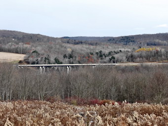
![]() On Saturday, November 9th, I decided I wanted to hike one of the final two sections of the Finger Lakes Trail from map 20. This part of the Finger Lakes Trail starts on Carson Road northwest of Marathon and passes through Blodgett Mills and then Hoxie Gorge as it heads east. There is a lot of road walking and some of the private land is closed in the fall for hunting which adds to the road walks. I decided to hike from West River Road to Hoxie Gorge Road to fill in that missing piece. The temperature when we left Livingston Manor at around 7:30 AM was only in the low 30's but was predicted to rise to almost 50 degrees. The skies were overcast and I only saw the sun once or twice on the drive. We stopped once on the way as I drove north and west on Route 17 and then north on I81 to Marathon. In Marathon I took Route 11 north and then Route 392 west. After a very short distance on 392 I turned north on West River Road. The road was dirt and gravel with some large potholes. I drove slowly along the river and the railroad tracks until I arrived at the place we had left off on a previous hike. I parked the car on the side of the road and we were out and hiking at 9:30 AM. The first part of the hike up to Stafford Road was uphill but not very steep and short. A few hundred feet later I looked to my right and saw the Hoxie Gorge Bridge on I81. It was so close it looked like I could touch it since it was only about .3 miles away. The problem was that the terrain between us and the bridge was private land and would require crossing a railroad track and a very wide, deep and fast flowing river! We continued to hike north along West River Road toward Blodgett Mills. Starting at about one mile into the hike the next 1.6 miles were all downhill to the right turn in Blodgett Mills. The road was a back road with very little traffic. It was lined with a combination of nice, comfortable homes that alternated with trailers and shanties. One thing everyone seemed to have in common was that they owned one or more dogs. I was surprised to find that all of the dogs were tied up or inside! In Blodgett Mills we turned right and walked down the street and across the railroad tracks to the bridge over the Tioughnioga River. I thought about taking pictures but decided to wait until the return trip.
On Saturday, November 9th, I decided I wanted to hike one of the final two sections of the Finger Lakes Trail from map 20. This part of the Finger Lakes Trail starts on Carson Road northwest of Marathon and passes through Blodgett Mills and then Hoxie Gorge as it heads east. There is a lot of road walking and some of the private land is closed in the fall for hunting which adds to the road walks. I decided to hike from West River Road to Hoxie Gorge Road to fill in that missing piece. The temperature when we left Livingston Manor at around 7:30 AM was only in the low 30's but was predicted to rise to almost 50 degrees. The skies were overcast and I only saw the sun once or twice on the drive. We stopped once on the way as I drove north and west on Route 17 and then north on I81 to Marathon. In Marathon I took Route 11 north and then Route 392 west. After a very short distance on 392 I turned north on West River Road. The road was dirt and gravel with some large potholes. I drove slowly along the river and the railroad tracks until I arrived at the place we had left off on a previous hike. I parked the car on the side of the road and we were out and hiking at 9:30 AM. The first part of the hike up to Stafford Road was uphill but not very steep and short. A few hundred feet later I looked to my right and saw the Hoxie Gorge Bridge on I81. It was so close it looked like I could touch it since it was only about .3 miles away. The problem was that the terrain between us and the bridge was private land and would require crossing a railroad track and a very wide, deep and fast flowing river! We continued to hike north along West River Road toward Blodgett Mills. Starting at about one mile into the hike the next 1.6 miles were all downhill to the right turn in Blodgett Mills. The road was a back road with very little traffic. It was lined with a combination of nice, comfortable homes that alternated with trailers and shanties. One thing everyone seemed to have in common was that they owned one or more dogs. I was surprised to find that all of the dogs were tied up or inside! In Blodgett Mills we turned right and walked down the street and across the railroad tracks to the bridge over the Tioughnioga River. I thought about taking pictures but decided to wait until the return trip.
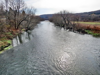
 We turned right and walked south on Route 11 which luckily had a wide shoulder. It was a little over 2 miles to Hoxie Gorge Road and we made it by 11:10 AM. We turned left and walked as far as the bridge supports before turning around to start the trip back. This was strictly an out and back walk which meant I knew exactly what we were in for. We walked the 2 miles back to the river bridge where we stopped so that I could take some pictures. There was just a hint of sun breaking through the clouds as I took some shots of the rain swollen river. We continued up the street, crossing the tracks and making the left onto West River Road. After a short walk along the road, I heard a sound which could only be a train. I could barely she the tracks but the engine and the first few cars were bright yellow. We continued to walk and the train continued to pass by for what seemed a long time. After the train passed, the walk continued without much happening until we were near Stafford Road. I stopped to take some pictures of the Hoxie Gorge Bridge which wasn't easy as the landowner had an assortment of junk strewn across his land. After taking some shots, we continued down the road and back to the car. We were back at the car by 12:50 PM having covered 10 miles in 3 hours and 15 minutes. The overall elevation gain was only 780 feet!
![]()
![]()
![]()
![]()
![]() On Tuesday, November 5th, I decided I wanted to hike a section of the Finger Lakes Trail from map 20. This part of the Finger Lakes Trail starts on Carson Road northwest of Marathon and passes through Blodgett Mills and then Hoxie Gorge as it heads east. There is a lot of road walking and some of the private land is closed in the fall for hunting which adds to the road walks. I wanted to get in some trail hiking along with the almost mandatory road walking. I decided to head for Hoxie Gorge and park at the intersection of Route 11. We could then hike through Hoxie Gorge State Forest on the trails before taking to the roads to hike to Baker Schoolhouse State Forest on the roads. We left Livingston Manor just after 7:30 AM under overcast skies. The temperature was warmer than the day before hovering in the high 30's. After one stop in Marathon, we arrived at the intersection of Route 11 and Hoxie Gorge Road at 9:30 AM. A possible parking area was marked as a turnaround with no parking so I parked on the side of Hoxie Gorge Road almost directly under the I-81 Hoxie Gorge Bridge. The bridge is high and quite impressive. The skies were beginning to clear, the sun was peeking out and there were some puffy clouds in the sky as we started our hike at 9:35 AM. After a short walk, the road split and we stayed to the left on Hoxie Gorge Road which is a dead end. A little farther along the road entered part of the gorge as the walls of the gorge rise on either side of the road. The road had been repaved recently but it was obvious that this small stream must swell when it rains as there was considerable damage to the road. We stopped so that I could take some pictures before continuing on the hike. The road began to gain some elevation but at various places the stream was visible and there were several indications of its power when filled. At about .9 miles the Finger Lakes Trail left the road to the right and began to parallel the stream. SUNY Cortland has a "campus" on this road where they do environmental studies and their trail are marked with yellow markers. They also have number on the markers which must correspond to the types of trees and bushes. The Finger Lakes Trail continued to follow the stream as we hiked. It would drop down to the stream and then veer away from it. Several times I stopped to take pictures of the stream and surrounding gorge. The trail met the Cortland trail in several places.
On Tuesday, November 5th, I decided I wanted to hike a section of the Finger Lakes Trail from map 20. This part of the Finger Lakes Trail starts on Carson Road northwest of Marathon and passes through Blodgett Mills and then Hoxie Gorge as it heads east. There is a lot of road walking and some of the private land is closed in the fall for hunting which adds to the road walks. I wanted to get in some trail hiking along with the almost mandatory road walking. I decided to head for Hoxie Gorge and park at the intersection of Route 11. We could then hike through Hoxie Gorge State Forest on the trails before taking to the roads to hike to Baker Schoolhouse State Forest on the roads. We left Livingston Manor just after 7:30 AM under overcast skies. The temperature was warmer than the day before hovering in the high 30's. After one stop in Marathon, we arrived at the intersection of Route 11 and Hoxie Gorge Road at 9:30 AM. A possible parking area was marked as a turnaround with no parking so I parked on the side of Hoxie Gorge Road almost directly under the I-81 Hoxie Gorge Bridge. The bridge is high and quite impressive. The skies were beginning to clear, the sun was peeking out and there were some puffy clouds in the sky as we started our hike at 9:35 AM. After a short walk, the road split and we stayed to the left on Hoxie Gorge Road which is a dead end. A little farther along the road entered part of the gorge as the walls of the gorge rise on either side of the road. The road had been repaved recently but it was obvious that this small stream must swell when it rains as there was considerable damage to the road. We stopped so that I could take some pictures before continuing on the hike. The road began to gain some elevation but at various places the stream was visible and there were several indications of its power when filled. At about .9 miles the Finger Lakes Trail left the road to the right and began to parallel the stream. SUNY Cortland has a "campus" on this road where they do environmental studies and their trail are marked with yellow markers. They also have number on the markers which must correspond to the types of trees and bushes. The Finger Lakes Trail continued to follow the stream as we hiked. It would drop down to the stream and then veer away from it. Several times I stopped to take pictures of the stream and surrounding gorge. The trail met the Cortland trail in several places.
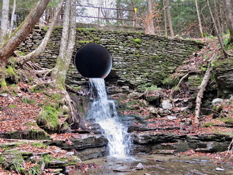 At around 1.4 miles the trail came to a spot where a bridge crossed one stream and water poured out of a culvert beneath it in a sort of waterfall. I stopped to take some pictures as the gorge in this area was pretty. From this point on the trail followed the Cortland trail for a while and crossed several small tributaries. There was a good amount of walking up and down especially when crossing these small streams. The forest began to transition from evergreens to hardwoods as the trail headed generally east and northeast. I knew that the trail was closed at a certain spot for hunting and hoped there would be a sign marking that point. At 2.6 miles we were walking through some brush and weeds on the edge of a field. When we came out on a woods road, I had the feeling that the closed part of the trail would be near. We walked north a little then northeast and then turned almost due east when we came to the edge of a corn field. The corn was still standing and covered many acres. As we walked along the south edge of the field we came to a spot where the trail made a 90 degree turn to the left at about 3.3 miles. A sign explained that the trail was closed at this point for hunting and that we should take the roads to bypass this section. I stopped for a minute to get a drink and a snack and to put my poles in my pack. Walking the roads with Sheila on a leash means that keeping the poles in my pack is easier than trying to carry them. As we walked toward the road we came across a nice viewpoint over the corn fields and surrounding countryside. The sky was now blue with some interesting clouds scattered across it. I took several shots before walking down to Stone Road and turning left. We headed northeast on Stone Road for about .4 miles where the name changed to Atkins Road and Underwood Hill Road went off to the left. We continued to walk another .75 miles mostly downhill to the McGraw Marathon Road. We turned left to head north passing several small farms on the way. One farm had a pair of beautiful Palomino horses in the field. It was .5 miles to our right turn onto Baker Schoolhouse Road.
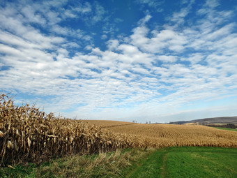 Once on this road I wasn't sure how far we had to go or what would mark the end of our hike. We were at the six mile mark and there were no roads to use as shortcut on the way back. After .9 miles, the Finger Lakes Trail cut off the road to the left which was a surprise to me. The newest map I had indicated the trail no longer went this way but continued on the roads. I decided to turn around at this point as there was a spot to park along the side of the road where I could start the next section of the Finger Lakes Trail and I felt a round trip of 12.5 was enough. As we turned around I noticed that the bottom of my right foot was beginning to hurt but we continued on. The road walk seemed to go quickly and we were soon ready to turn up into the fields. The wind had started to blow and the skies were now becoming overcast. It was dark enough that I checked the time only to find out it was about 1:00 PM. We walked up into the fields and back along the edge into the woods. I found a log and stopped to examine my right foot. I found a rather larger blister in the same area as a previous hike and taped it. Surprisingly the tape brought relief and we continued on our way. The return hike was uneventful and I did not stop to take any pictures. When we got to the yellow marked Cortland trails, I decided to simply follow them out to the road. This was a nice alternative and the trails were a little better maintained than the Finger Lakes Trail. We broke out onto Hoxie Gorge Road just above where we had entered the woods. It was 2:15 PM and we were 11.2 miles into our hike. We walked downhill and through the gorge on the road. When we got back to the car, I took a picture of the bridge before starting the drive back home .We were back at the car at 2:35 PM having hiked 12.2 miles in 5 hours with an 1830 foot elevation gain.
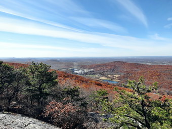
![]()
![]()
![]()
![]()
![]() On Monday, November 4th I decided I wanted to hike somewhere in Orange County or to the south since Cindy and I had noticed some color could still be found in that direction. We talked about hiking around the Basha Kill but decided that Schunemunk Mountain near Washington might be a better choice. I thought it might be nice to hike from the HilMar Lodge area as we had never come in from that trailhead. I knew that the Long Path had been rerouted in 2012 but that the trail had been reblazed as the Western Ridge Trail. Cindy needed to prepare breakfast for our son Karl and she didn't want to get started too early hoping to avoid the coldest part of the day. The temperature at 6:00 AM was 17 degrees at our house! We arrived in the area at about 11:20 AM and pulled into the HilMar Lodge so that I could reads the map and find the trailhead. As I was looking at the map a woman came out to the car. She explained that the trailhead used to be on their property but that some hikers shied away from hiking passed a private residence. She pointed to a small parking area a few hundred feet down the road. I thank her and drove over and parked in the small lot with a sign "Hiker Parking". From the car I could see the three blazes that indicated the beginning of the trail and we were out and hiking by 11:30 AM. The temperature had come up some but it was still a bit chilly as we started out with a covering of frost still on the grass. The first part of the trail started out with a very gentle slope and meandered through the hardwood forest at the base of the ridge. It started heading southeast and then turned to the east. The trail became steeper as we climbed to the ridge but several switchbacks helped. At about a mile the trail turned almost due south and ascended to the ridge where the Barton Swamp Trail ascends from the area between the two ridges. By 12:10 PM we had walked 1.25 miles are were on the northern end of the western ridge. The total ascent to this point was 970 feet.
On Monday, November 4th I decided I wanted to hike somewhere in Orange County or to the south since Cindy and I had noticed some color could still be found in that direction. We talked about hiking around the Basha Kill but decided that Schunemunk Mountain near Washington might be a better choice. I thought it might be nice to hike from the HilMar Lodge area as we had never come in from that trailhead. I knew that the Long Path had been rerouted in 2012 but that the trail had been reblazed as the Western Ridge Trail. Cindy needed to prepare breakfast for our son Karl and she didn't want to get started too early hoping to avoid the coldest part of the day. The temperature at 6:00 AM was 17 degrees at our house! We arrived in the area at about 11:20 AM and pulled into the HilMar Lodge so that I could reads the map and find the trailhead. As I was looking at the map a woman came out to the car. She explained that the trailhead used to be on their property but that some hikers shied away from hiking passed a private residence. She pointed to a small parking area a few hundred feet down the road. I thank her and drove over and parked in the small lot with a sign "Hiker Parking". From the car I could see the three blazes that indicated the beginning of the trail and we were out and hiking by 11:30 AM. The temperature had come up some but it was still a bit chilly as we started out with a covering of frost still on the grass. The first part of the trail started out with a very gentle slope and meandered through the hardwood forest at the base of the ridge. It started heading southeast and then turned to the east. The trail became steeper as we climbed to the ridge but several switchbacks helped. At about a mile the trail turned almost due south and ascended to the ridge where the Barton Swamp Trail ascends from the area between the two ridges. By 12:10 PM we had walked 1.25 miles are were on the northern end of the western ridge. The total ascent to this point was 970 feet.
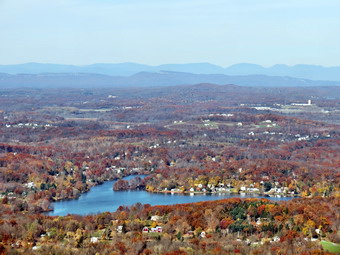 The walk along the western ridge is about 1.3 miles. Much of the time we hiked on slabs of conglomerate smoothed by glacial action. In other places the trail had us balancing on a ridge of the same rock. The trees are mostly dwarf pines shaped by their exposure to the winds on the ridge. Most of the time it was clear that we were on a ridge since we could see both sides of it. To the east we could see the eastern ridge and to the west we could see the flatlands of orange county. At 1.6 miles into the hike there was a viewpoint that gave a spectacular view to the west. The near view was of the flat land of Orange County which was once farms but is slowly changing to housing. In the distance to the west and north were the peaks of the Catskills. At the base of the ridge on the west is a large sand and gravel pit. We stopped to take some pictures and were happy to see some color still left on the trees. We continued to walk along the ridge to another viewpoint at 2.2 miles. I took some more pictures from this lookout but the view was much the same as from the other. We began to encounter familiar terrain in the form of a large enhance of open rock with only a few trees. The trail seemed to descend along this rock face and soon I saw the blue blazes of the trail I knew would take us down to the area between the ridges and then up to the eastern ridge. The descent was short but tricky and soon we were on the red Barton Swamp Trail that runs the length of the area between the two ridges. We turned right and walked a short distance until the two trails split and followed the blue trail up to the eastern ridge. This ascent was considerably longer than the descent since the eastern ridge is higher. There were many places where we had to scramble up the rocks and some where we even had to throw our poles up ahead of us. In .3 miles we gained 275 feet to where the trail moderated some on the ridge.
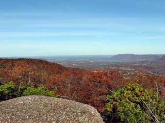 At the top of the ridge we met the Jessup Trail which was marked with its own yellow blazes. It also had the aqua blazes of the Long Path and signs designating it as part of the Highlands Trail. We turned left and within a few hundred feet we were standing on the highest point on either ridge at 1664 feet. This is also the highest point in Orange County. We continued on the main trail for about 500 feet more and came across the spur trail to the left that leads to the Megaliths. These are huge masses of rock that have split from the main rock of the ridge. The walk out to the megaliths was short. I took some pictures of the various rocks themselves while Cindy rested and Sheila bounded from one to the other. I climbed onto the highest rock and took some more pictures of the landscape. It was now 2:00 PM and we knew we had to keep moving. We walked back up to the main trail to head north on the eastern ridge. The rest of the hike would be downhill except for the climb from the area between the ridges back up to the western ridge. At 3.8 miles we passed the junction with the Dark Hollow Trail and at 4.6 miles we were at the junction with the Sweet Clover Trail. We stayed on the Jessup Trail as it worked its way north and started to descend the north end of the ridge. From several viewpoints we could see the Hudson River and the Newburgh Beacon Bridge. At 5.3 miles we had descended to the area between the ridges where the Jessup Trail continued off to the right. We followed the red Barton Swamp Trail as it climbed 200 feet in .25 miles to the eastern ridge. Within a few hundred feet we were back at the junction with the Western Ridge Trail that would take us back to the car. The descent back to the car was slower than we would have liked as a thick carpet of fallen leaves over loose rocks made a quick descent too dangerous. We were back at the car at 4:05 PM having covered 6.8 miles in 4 hours and 40 minutes with a total elevation gain of 1853 feet. I was surprised at how the walk along the smooth rock had tired me out. We decided to stop at EL Bandido in Middletown on the way home as neither of us felt like cooking.
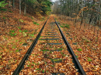
![]()
![]()
![]()
![]()
![]() On Wednesday, October 30th, I decided I wanted to take advantage of the last nice day of the week and hike somewhere I had not been before. As the number of trails I have not hiked in the Catskills decreases, I have the urge to make sure that I have hiked every mile of every trail! I decided I had enough time to drive to Pine Hill and hike the Cathedral Glen Trail to Belleayre and then return by the Pine Hill West Branch Trail. I left Livingston Manor before 8:30 AM with a light rain falling. I followed the route Google Maps had suggested by taking the Beaverkill and Barkaboom Roads to Route 30 around the Pepacton Reservoir. Route 30 took me to Route 28 where I turned east and head toward Pine Hill. Either the rain had abated or I had driven out of it. I turned off Route 28 onto Elm St and then made a right on Main St. The next street was Bonnie View Avenue where I turned left, passed Mill ST and made a left on Station Road. At the top of the hill was the area suggested on the NYNJTC map for parking. There was a small pulloff on the north side of the street so I turned around and parked there. This was the area of the old railroad station and the tracks still crossed a small bridge to the east. We arrived at 9:30 AM under slightly overcast skies but at least it wasn't raining. It seemed warmer than in Livingston Manor but I decided to keep my bottom baselayer and softshell jacket on. We walked west on Station Road and headed left into some weeds where the road went down the hill to the right. After a few feet, we were on the railroad tracks which was quite interesting. The tracks were complete with ties underneath and stretch for some distance ahead. The rails were bolted together by three massive bolts and nuts and nailed to the tracks with large spikes. I stopped to take pictures of the tracks in the distance and up close. As we continued to walk along the tracks, the sun broke out and seemed like it would stick around. Walking along the tracks wasn't easy as the exposed ties were slippery and made the walk "uneven". I wasn't quite sure where to turn but the map description said about half a mile. After half a mile the blue markers along the tracks stopped and a sign clearly showed that the trail turned sharply into the woods on the left. We followed the blue markers into the woods.
On Wednesday, October 30th, I decided I wanted to take advantage of the last nice day of the week and hike somewhere I had not been before. As the number of trails I have not hiked in the Catskills decreases, I have the urge to make sure that I have hiked every mile of every trail! I decided I had enough time to drive to Pine Hill and hike the Cathedral Glen Trail to Belleayre and then return by the Pine Hill West Branch Trail. I left Livingston Manor before 8:30 AM with a light rain falling. I followed the route Google Maps had suggested by taking the Beaverkill and Barkaboom Roads to Route 30 around the Pepacton Reservoir. Route 30 took me to Route 28 where I turned east and head toward Pine Hill. Either the rain had abated or I had driven out of it. I turned off Route 28 onto Elm St and then made a right on Main St. The next street was Bonnie View Avenue where I turned left, passed Mill ST and made a left on Station Road. At the top of the hill was the area suggested on the NYNJTC map for parking. There was a small pulloff on the north side of the street so I turned around and parked there. This was the area of the old railroad station and the tracks still crossed a small bridge to the east. We arrived at 9:30 AM under slightly overcast skies but at least it wasn't raining. It seemed warmer than in Livingston Manor but I decided to keep my bottom baselayer and softshell jacket on. We walked west on Station Road and headed left into some weeds where the road went down the hill to the right. After a few feet, we were on the railroad tracks which was quite interesting. The tracks were complete with ties underneath and stretch for some distance ahead. The rails were bolted together by three massive bolts and nuts and nailed to the tracks with large spikes. I stopped to take pictures of the tracks in the distance and up close. As we continued to walk along the tracks, the sun broke out and seemed like it would stick around. Walking along the tracks wasn't easy as the exposed ties were slippery and made the walk "uneven". I wasn't quite sure where to turn but the map description said about half a mile. After half a mile the blue markers along the tracks stopped and a sign clearly showed that the trail turned sharply into the woods on the left. We followed the blue markers into the woods.
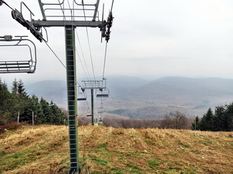 For the next 1.1 miles the trail climbed 770 feet heading mostly NNE and up toward the ridge. Most of the trail in this area was marked and was obvious. The first part of the trail passed through large evergreen trees and paralleled Cathedral Brook. The sun seemed to have slipped behind some clouds but the walk was still nice. If I had had more time, I would have walked down the bank to the brook to explore. At one point Sheila loosed a round stone that began to roll down the banks toward the brook below. When she noticed the movement, she chased after the stone as if it were alive! The stone eventually came to rest and, after a few sniffs, Sheila returned to the trail. At around 1.7 miles the trail met the Cathedral Brook ski trail from Belleayre. We walked across a flat clearing and then started up the ski slope. The brush and weeds on the slope had been cut and I could make out the faint hiking trail that meandered up the slope. There were some blazes on the trees on the left side of the slope but I wasn't sure when they would head off the slope. The climb was very steep in places and just steep in others. At about 2.1 miles the trail cut to the left into the woods and the turn was well marked. I had wondered why the trail simply didn't follow the ski slope to the top but one look ahead as I made the turn answered that question! The ski slope from the turn to the top of the ridge was even steeper and looked almost like a vertical wall. The trail to the ridge was only about a quarter mile but was not a pleasant experience. This trail section was poorly marked and appeared little used. The trail had many rolling rocks that threatened to cause havoc at any moment. Several obvious old blowdowns had not been cleared and hikers had simply rerouted the trail around them. At 10:50 AM we reached the Belleayre Ridge Trail after hiking about 2.4 miles. It was obvious that the sun would not be revisiting any time soon and that a heavy mist, fog or haze had settled on the mountain and the surrounding valleys. Despite this I decided to walk the .75 miles out to the Sunset Lodge.
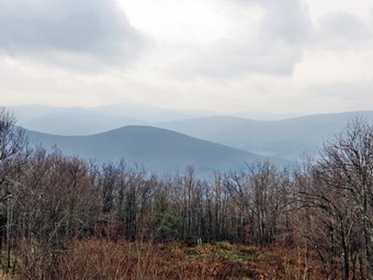 We turned right on the ridge trail and hiked out toward the lodge and the first chair lift. On the way we passed one of the two lean-tos on the ridge. In the area of the first chair lift, I took a few pictures to the north but the overcast and fog made getting any good shots impossible. I photographed the lift, the first aid hut and the lodge before walking over to the lodge. There was no one around anywhere on the ridge. I took a few shots from the porch to the south and west. It was dark and the wind was starting to blow and I realized that I did not want to get caught in a cold rain. We walked back to the ridge trail and started back toward the trail junction. At the junction with the Cathedral Glen Trail we continued on the Ridge Trail until it met the blue Pine Hill West Branch Trail on the eastern summit of Belleayre which is marked with a USGS marker. We continued our hike by heading west on the Pine Hill West Branch Trail and dropping over 500 feet in the next .65 miles. The trail was well-maintained and about halfway down we passed the other lean-to. At about 4.65 miles we were at the junction with the Lost Clove Trail where we stayed to the left on the Pine Hill West Branch Trail. This part of the trail was new to me and I immediately ran into another trail junction that was not on the map. A trail to the right had a sign that said Belleayre Beach and seemed more used than the trail straight ahead. I could see no blue markers but guessed I should continue straight ahead. I picked up blue markers in a short distance and began to descend the trail. As we descended the trail hung onto the side of the mountain rather than heading straight down. The sun began to come out which annoyed me a little until I remembered that the alternative was a drenching rain! The trail began to get wider and soon looked a lot like a road passable by a four wheel drive vehicle which made me wonder about the origin of the road.
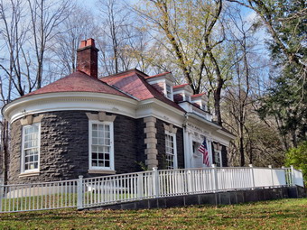 At 5.6 miles into the hike the trail ended at Woodchuck Hollow Road. A sign clearly showed a turn to the left to descend the road but to our right was a gate to a private residence. The road continued our descent and at one point made a hairpin turn before coming to another gate. The land to the left of the road had many stonewalls and a stream paralleling the road. A stonewall that seemed to be a retaining wall ran along the stream. We came to an old wrought iron gate on the right side of the road with a driveway that headed up the hill. All of this added to my curiosity about the history of the area. The road eventually ended at Station Road where I could see our car. I took a few minutes to check out the trestle and train tracks and to take some pictures. We walked back to the car and I checked that map. I was surprised to see that the Pine Hill West Branch Trail actually started at Route 28. I decided I wanted to be able to say I had done the whole trail! I kept Sheila on her leash and we headed back out to route 28 using the streets we had driven to get to the beginning of the hike. The distance out to Route 28 was only about .7 miles but I was anxious to complete it since I felt time was growing short. We turned around at Route 28 and headed back to Station Road. Along the way I noticed an interesting stone building on Elm Street. I stopped to take some pictures and found out that it was the library and was on the National Historic Registry. The ends of the rectangular building were round the and the stone work was beautiful. We headed back up to Station Road arriving at 1:00 PM. We had covered 8 miles in 3.5 hours with a vertical gain of 2110 feet.
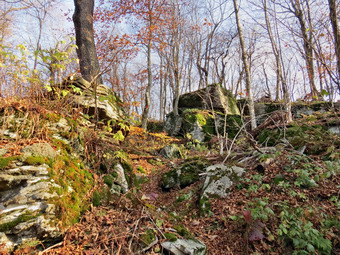
![]()
![]()
![]()
![]() On Tuesday, October 29th I agree to hike somewhere local with Lisa. She suggested Mary Smith Hill from Berry Brook Road. I wouldn't normally hike this short of a hike but I had been out the previous couple of days so I agreed. I was also happy to have the company as Sheila is so often roaming off the trail following game trails. I picked Lisa up at her house on the Beaverkill Road and drove to the Covered Bridge Road. We crossed the Beaverkill Covered Bridge and then made a right on Berry Brook Road. About 3.7 miles after the turn I pulled into the parking area on the right side of the road. It was 9:15 AM and we got right on the trail. I had worn a baselayer under my pants and a light softshell jacket. The temperature was probably already too warm for this setup but I decided to leave them on. The first .6 miles of the trail are pretty steep gaining a little over 500 feet. The surface has some loose rock and on this day that was covered by a layer of slippery leaves. As we climbed we could look back over our shoulders for a nice view which was available since there were almost no leaves on the trees. After climbing to the top of the first, unnamed hill we descended a little before starting up Mary Smith Hill. At .9 miles the trail makes a sharp right turn swinging from ENE to SE and then ascending Mary Smith Hill. Along the way Lisa noticed some interesting rock formations. We also walked through several areas where we had to pass between or climb over large rocks. Just before the top of Mary Smith Hill we stopped at a lookout which has a limited view to the south. I took pictures although there was a bit of haze.
On Tuesday, October 29th I agree to hike somewhere local with Lisa. She suggested Mary Smith Hill from Berry Brook Road. I wouldn't normally hike this short of a hike but I had been out the previous couple of days so I agreed. I was also happy to have the company as Sheila is so often roaming off the trail following game trails. I picked Lisa up at her house on the Beaverkill Road and drove to the Covered Bridge Road. We crossed the Beaverkill Covered Bridge and then made a right on Berry Brook Road. About 3.7 miles after the turn I pulled into the parking area on the right side of the road. It was 9:15 AM and we got right on the trail. I had worn a baselayer under my pants and a light softshell jacket. The temperature was probably already too warm for this setup but I decided to leave them on. The first .6 miles of the trail are pretty steep gaining a little over 500 feet. The surface has some loose rock and on this day that was covered by a layer of slippery leaves. As we climbed we could look back over our shoulders for a nice view which was available since there were almost no leaves on the trees. After climbing to the top of the first, unnamed hill we descended a little before starting up Mary Smith Hill. At .9 miles the trail makes a sharp right turn swinging from ENE to SE and then ascending Mary Smith Hill. Along the way Lisa noticed some interesting rock formations. We also walked through several areas where we had to pass between or climb over large rocks. Just before the top of Mary Smith Hill we stopped at a lookout which has a limited view to the south. I took pictures although there was a bit of haze.
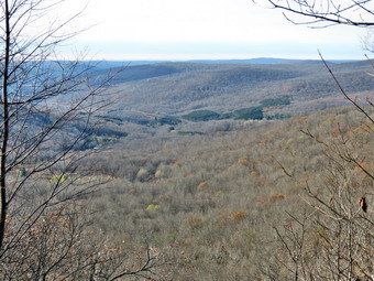 Lisa wanted to continue a little farther along the trail to the top of the next unnamed hill. Neither of us was enthusiastic about dropping to Mary Smith Hill Road and then turning round to immediately reclimb it. We dropped from the top of Mary Smith hill into a small col and then began to climb some. The trail wandered up and down over the next 1.4 miles and gained about 340 feet to the top of a hill that is over 100 feet taller than Mary Smith Hill. We decided to go a little farther looking fro another lookout. As we started to descend off the hill we decided to turn around. The trip back seemed to go quickly although we stopped several times to take pictures of interesting rocks and trees. We were back at the parking area by 12:20 PM having hiked 4.6 miles in 3 hours with a 1256 foot vertical gain.
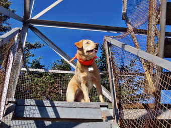
![]()
![]()
![]()
![]()
![]() On Monday, October 28th I wanted to hike another Catskill 3500 foot peak after hiking Windham on Saturday. That hike reminded me of the challenge and satisfaction of hiking these peaks! When I woke up in the morning, I decided to go to Balsam Lake Mt as it is close. I thought about hiking to Graham but it was a little early to call the caretaker and I don't ever hike without permission. I decided that after hiking the mountain I might head out to Vly Pond and Tunis Pond on the Hardenburgh-Neversink Trail. When I checked the temperature in Livingston Manor it was just about feeling so I decided to wear a baselayer under my pants since I assumed it would be cooler at the trailhead and on the mountain. The drive to Little Pond on the Beaverkill Road seemed short but the drive on up to the trailhead seemed to take longer than ever. We arrived at 9:30 AM and got right on the trail. I though there might be some snow in the parking area or on the trail but none was to be found. As we started the hike I decided to let my body dictate the pace rather than my mind. My body was definitely calling for a slightly slower pace! By 9:50 AM we had hiked the .85 miles to the first trail junction and turned left to go up the mountain. Although I knew that we were climbing, the walk up the steep side of the mountain didn't seem too hard are to take very long. I looked back over my shoulder several times and there was an interesting view since the leaves were almost completely gone. The trail flattened a little and we passed the spur trail to the lean-to. After this we started the final climb to the summit plateau. I noticed at this point that there were few if any leaves on the trail. I had no explanation but it was nice not to have to deal with a slippery layer of leaves under foot. We passed the spring and hiked the last steep section. As we began to walk through the "balsam tunnel" on the way to the tower I noticed a dusting of snow on the ground in the shade. I took a few pictures at several spots before continuing to the tower clearing.
On Monday, October 28th I wanted to hike another Catskill 3500 foot peak after hiking Windham on Saturday. That hike reminded me of the challenge and satisfaction of hiking these peaks! When I woke up in the morning, I decided to go to Balsam Lake Mt as it is close. I thought about hiking to Graham but it was a little early to call the caretaker and I don't ever hike without permission. I decided that after hiking the mountain I might head out to Vly Pond and Tunis Pond on the Hardenburgh-Neversink Trail. When I checked the temperature in Livingston Manor it was just about feeling so I decided to wear a baselayer under my pants since I assumed it would be cooler at the trailhead and on the mountain. The drive to Little Pond on the Beaverkill Road seemed short but the drive on up to the trailhead seemed to take longer than ever. We arrived at 9:30 AM and got right on the trail. I though there might be some snow in the parking area or on the trail but none was to be found. As we started the hike I decided to let my body dictate the pace rather than my mind. My body was definitely calling for a slightly slower pace! By 9:50 AM we had hiked the .85 miles to the first trail junction and turned left to go up the mountain. Although I knew that we were climbing, the walk up the steep side of the mountain didn't seem too hard are to take very long. I looked back over my shoulder several times and there was an interesting view since the leaves were almost completely gone. The trail flattened a little and we passed the spur trail to the lean-to. After this we started the final climb to the summit plateau. I noticed at this point that there were few if any leaves on the trail. I had no explanation but it was nice not to have to deal with a slippery layer of leaves under foot. We passed the spring and hiked the last steep section. As we began to walk through the "balsam tunnel" on the way to the tower I noticed a dusting of snow on the ground in the shade. I took a few pictures at several spots before continuing to the tower clearing.
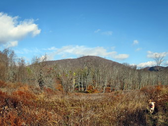 At the clearing I dropped my pack at the edge to take some pictures of the tower against the blue sky. I also took a shot of the s the on the old foundation to the right of the trail. We walked over to the picnic table and I dropped my pack so that I could climb the tower. The wind was noticeable and I knew it would be blowing harder once I cleared the treeline. As I started up the tower steps, Sheila was right behind me. Sheila is much more willing to climb the steps than Sheba ever was. I told here to stay and continued up the steps. Soon I was on the landing just below he cab and was surprised the wind didn't seem too bad. I took quite a few pictures even though there was a haze and the lighting was not very good. I climbed down the tower, grabbed my pack and we started down the Millbrook side of the mountain. On the way down the trail there was even more snow than on the other side. I took a few pictures and continued on down. At one point I thought about the woman with a broken ankle I had found on the trail several years ago and I promptly...fell! I landed on my back with my pack as a cushion and only stretched a few muscle. I did non-lethal my right pole had a bend in the bottom section. I tried straightening it and did a pretty good job as most of the bend disappeared and I could easily collapse the pole. At the trail junction we turned right to head back to the parking area and I winced a little to have to skip Graham. The trip back went quickly and we were back at the car by 11:40 AM having covere4d 4.3 miles. I still had some time so Sheila and I headed out the trail to Vly Pond.
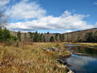 As soon as we were on the trail, I stopped in the field to take some pictures of Balsam Lake Mountain. The light was nice and there was at times some color on the mountain. After taking a few shots I noticed that the camera was set for "fisheye" and it took me a few moments to discover that I had simply turned the selector dial one setting too far! We continued on the trail as it descended to a bridge across Black Brook at 4.75 miles. The trail was in poor shape with a lot of blowdown. In places there were only a few markers and the two combined made finding the trail tricky although I had hiked it many times. We ascended from Black Brook and climbed a little hill before crossing a road and descending to the bridge across Gulf of Mexico Brook at 5.6 miles. A little climb and .2 miles brought us to the outlet brook from Vly Pond and we turned upstream to the left and hiked along the stream to the pond. The water was low and there was a lot of black pond so I "cautioned" Sheila to sit by my pack. I took pictures of the pond with Graham and Doubletop in the background. The pond had some interesting colors and the sun was behind me. After several sots, I packed up the camera and we headed back on the same trail to the car. Up until this return trip I had been taking it easy but I now wanted to get back. We were back at the car by 1:10 PM having covered 7.5 miles in 3 hours and 45 minutes with a vertical gain of 1820 feet.
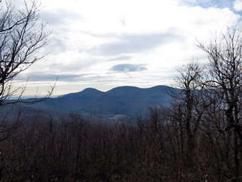
![]()
![]()
![]()
![]()
![]() On Saturday, October 26th I had planned to go to Marathon to hike the Finger Lakes Trail from Hoxie Gorge State Forest east for an 11 mile round trip. I checked the weather report which called fro rain by 3:00 PM. I looked at the radar which seemed to indicate a much earlier band of showers. Even if the showers held off the day was supposed to be cloudy. I decided I was not willing to again hike along roads in the rain just to complete a section of the Finger Lakes Trail. I remembered that I had wanted to hike to Windham High Peak from Route 23 using the Elm Ridge Trail for some time. This was the only approach to Windham I had not tried. It was the only bit of the Escarpment Trail that I had hot hike and one of the few section of the trails in the Catskills that I had not visited. When I checked the weather there was a suggestion of sun in the morning with showers arriving much later. The radar seemed to confirm this which cemented my decision. I was awake early since I had anticipated an early start for the long hike near Marathon. I so no reason to deal so I was out of the house before 7:30 AM. The temperature was below freezing so I had donned a baselayer of Icebreaker 200 under my pants. I also decided to wear a heavier shirt and put on a light softshell jacket. I drove out the DeBruce Road to the Frost Valley Road. I turned left on the Frost Valley Road and drove passed the YMCA camp and the parking for Big Indian, Slide Mountain and Giant Ledge. Each parking area had a few cars and hikers preparing to get on their way. I stopped in Big Indian at the convenience store and had one of the best egg sandwiches I have ever had. From there it was Route 28 to Route 42 north to Lexington. I took Route 23A east toward Hunter and turned north on Route 296 and followed it all the way north to Route 23 in Windham. I turned east on Route 23 and started to look for the trailhead parking. Since I had not been on this part of the trail before, I was unsure where the parking area was located. I pulled into one trailhead to find it was a set of trails created by the village of Windham and was relatively short. I got back on Route 23 and eventually found the trailhead parking on the north side of the road near Cross Road. The distance from the Route 296 junction was about 2.5 miles. It was 9:00 AM and a few cars were already parked in the lot. The temperature was below freezing and a breeze was blowing but the sun was out. We walked across the road and got on the trail to begin the hike.
On Saturday, October 26th I had planned to go to Marathon to hike the Finger Lakes Trail from Hoxie Gorge State Forest east for an 11 mile round trip. I checked the weather report which called fro rain by 3:00 PM. I looked at the radar which seemed to indicate a much earlier band of showers. Even if the showers held off the day was supposed to be cloudy. I decided I was not willing to again hike along roads in the rain just to complete a section of the Finger Lakes Trail. I remembered that I had wanted to hike to Windham High Peak from Route 23 using the Elm Ridge Trail for some time. This was the only approach to Windham I had not tried. It was the only bit of the Escarpment Trail that I had hot hike and one of the few section of the trails in the Catskills that I had not visited. When I checked the weather there was a suggestion of sun in the morning with showers arriving much later. The radar seemed to confirm this which cemented my decision. I was awake early since I had anticipated an early start for the long hike near Marathon. I so no reason to deal so I was out of the house before 7:30 AM. The temperature was below freezing so I had donned a baselayer of Icebreaker 200 under my pants. I also decided to wear a heavier shirt and put on a light softshell jacket. I drove out the DeBruce Road to the Frost Valley Road. I turned left on the Frost Valley Road and drove passed the YMCA camp and the parking for Big Indian, Slide Mountain and Giant Ledge. Each parking area had a few cars and hikers preparing to get on their way. I stopped in Big Indian at the convenience store and had one of the best egg sandwiches I have ever had. From there it was Route 28 to Route 42 north to Lexington. I took Route 23A east toward Hunter and turned north on Route 296 and followed it all the way north to Route 23 in Windham. I turned east on Route 23 and started to look for the trailhead parking. Since I had not been on this part of the trail before, I was unsure where the parking area was located. I pulled into one trailhead to find it was a set of trails created by the village of Windham and was relatively short. I got back on Route 23 and eventually found the trailhead parking on the north side of the road near Cross Road. The distance from the Route 296 junction was about 2.5 miles. It was 9:00 AM and a few cars were already parked in the lot. The temperature was below freezing and a breeze was blowing but the sun was out. We walked across the road and got on the trail to begin the hike.
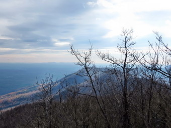 The first part of the trail to the trail junction was interesting as it first passed through a low area with several bridges and walkways. Near the trail register was a DEC signboard. Just passed this the trail split with the blue Escarpment Trail continuing straight ahead. To the left were some red trails which are part of the Elm Ridge Multiuse Area. These trails are used by hikers who do not want to climb the mountain but are also used extensively by mountain bikers. The walk started to gain some elevation and went through a series of switchbacks starting at .85 miles as it climbed the shoulder of Elm Ridge. At around 1.4 miles we were at the trail junction with the trail from Peck Road. From this point e the trail was familiar but pleasant as I had not been on it in some time. The hardwoods gave way to evergreens and we walked over the exposed roots of the trees before passing through some more hard woods. The next section of evergreens had more exposed roots to negotiate and a series of half logs that formed a bridge over areas that can be wet. The trail was very dry and the half logs are old and tip easily. It seems that most hikers avoid the logs as a path was prominent to the side. After climbing for a while the trial heads south a little at 2.5 miles and then turns east and eventually northeast for the final ascent to the top of Windham. There are some steep areas along the way but they are short. At 10:35 AM we had hiked 3.3 miles and were on the relatively flat spine that passes over Windham High Point.
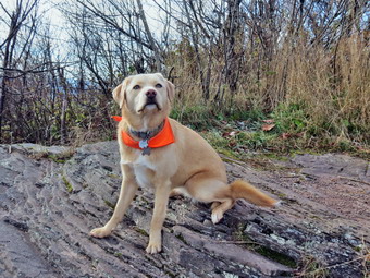 We stopped at the first lookout that faces south toward the Blackhead Range. The sun hung over the mountains and they were shrouded in a haze. I took some pictures of this iconic view and thought I should remember to do the hike later in the day when the sun would be at a different angle and the haze might be gone. I passed by the next lookout to the north knowing that the final viewpoint had the best views in that direction. As we approached the high point, we heard voices and I put Sheila on her leash. We met two women who had hiked up from Route 23. They were members of the Adirondack Mountain Club from near Albany and had hiked in from Burnt Knob with their club on another occasion. They were taking a rest and Sheila was interested in their food so we passed by to the viewpoint. There was a haze hanging over the valley and I could not see Albany this time. The view ROM this lookout is extensive and seems to reach on forever. I took some pictures despite the haze since the sun at least was not a factor in this direction. Soon it was time to head back down. We passed the two women again and I decided to stop at the other north-facing lookout. I took a picture of the heavy layer of frost still on the ground and a few more pictures of the countryside before heading back down the main trail. Since there aren't too many steep areas the descent went quickly. We met one couple hiking up from Route 23 on the descent before the trail junction. We met another couple after we turned at the trail junction. They had also come in from Route 23 which seems to be a popular way to hike the mountain. As we approached the multiuse trails we met more and more people beginning to hike. We crossed Route 23 and were back at the car at 12:30 PM having covered 7.3 miles in under 3.5 hours with a total ascent of 1860 feet.
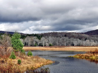
![]()
![]()
![]()
![]() On Thursday, October 24th I wanted to get in a local hike and decided to return to Frick Pond to see what progress had been made on the bridge by the DEC crew. The overnight temperatures had dipped into the high 20's and I considered wearing a baselayer under my pants. In the end I knew I would warm up quickly as I hiked and did not wear a baselayer. I did wear a light softshell jacket for the first time since the spring! I got my equipment and put an eager Sheila in the car to drive to Frock Pond. We arrived at 10:50 AM and were out on the trail immediately. The DEC pickup and trailer were in the lot so I knew work would be going on at the bridge. I had been going over various routes in my head but decided to wait until we got to the bridge to decide. The temperature was just at freezing as we left the parking area but a vigorous pace helped warm me up right away. I put Sheila on her leash as we approached the bridge and began to hear voices. I was not surprised that it was the same two workers but I was surprised that more work had not been done. The long stringers had been place on top of the steel I-beams but in a week only a few boards had been placed across them. The workers must have read my mind because they informed me that one of them had been in Florida for several days and that the other had been called away to work on another project. I stopped and talked to them for a few minutes, took some pictures and continued the hike. At the next trail junction I decided on the simplest course which was to continue on around on the Quick Lake Trail with a return down the Flynn Trail. I thought about visiting the Hodge Pond lookout but decided to wait until I got there to decide. The skies were overcast and very dark in some places but blue in others. This kept changing as we hiked. I have done this hike several times lately and this time it seemed to go quickly. We reached Ironwheel Junction 1.5 miles into the hike at 11:25 AM and made Junkyard Junction 3.1 miles into the hike at 11:55 AM.
On Thursday, October 24th I wanted to get in a local hike and decided to return to Frick Pond to see what progress had been made on the bridge by the DEC crew. The overnight temperatures had dipped into the high 20's and I considered wearing a baselayer under my pants. In the end I knew I would warm up quickly as I hiked and did not wear a baselayer. I did wear a light softshell jacket for the first time since the spring! I got my equipment and put an eager Sheila in the car to drive to Frock Pond. We arrived at 10:50 AM and were out on the trail immediately. The DEC pickup and trailer were in the lot so I knew work would be going on at the bridge. I had been going over various routes in my head but decided to wait until we got to the bridge to decide. The temperature was just at freezing as we left the parking area but a vigorous pace helped warm me up right away. I put Sheila on her leash as we approached the bridge and began to hear voices. I was not surprised that it was the same two workers but I was surprised that more work had not been done. The long stringers had been place on top of the steel I-beams but in a week only a few boards had been placed across them. The workers must have read my mind because they informed me that one of them had been in Florida for several days and that the other had been called away to work on another project. I stopped and talked to them for a few minutes, took some pictures and continued the hike. At the next trail junction I decided on the simplest course which was to continue on around on the Quick Lake Trail with a return down the Flynn Trail. I thought about visiting the Hodge Pond lookout but decided to wait until I got there to decide. The skies were overcast and very dark in some places but blue in others. This kept changing as we hiked. I have done this hike several times lately and this time it seemed to go quickly. We reached Ironwheel Junction 1.5 miles into the hike at 11:25 AM and made Junkyard Junction 3.1 miles into the hike at 11:55 AM.
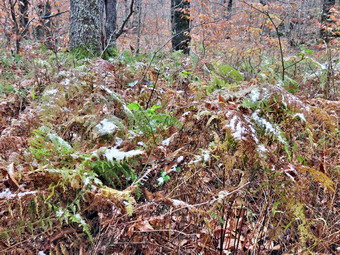 When we made the turn onto the Flynn Trail I noticed that there was snow on some of the weeds and shrubs along the trail. I had been hoping for an inch or two on the ground but this was the next best thing. I took some pictures before continuing on the Flynn Trail to the jeep trail around the back of the pond. At the head end of the pond I stopped to take a few pictures and noticed that the sky seemed to be getting darker and that the wind has picking up. I wouldn't have minded hiking in a snow shower but a cold rain would have been difficult. I decided to walk around the pond to the outlet and then take the Flynn Trail back to the car. We stopped briefly at the other end of the pond and I took some pictures of the ominous key and dark clouds. I didn't want to wait too long so we quickly headed up the Flynn Trail. As we walked the sky conditions kept changing. At one point the blue skies became prominent and I almost changed my course and headed to the lookout. As soon as I started to toy with that idea, the skies grew dark again and I decided heading back to the car was the smartest idea. By 12:35 PM we had hiked 5 miles and were at the top of the Flynn Trail at the junction with the Big Rock Trail. The rest of the trip was all downhill to the car. This section always seems to take longer than I remember but on this day it seemed to pass quickly. We were back a take car at 1:05 PM having hiked 6.7 miles and a little less than 1000 vertical feet in 2 hours and 15 minutes.
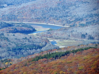
![]()
![]()
![]()
![]() On Monday, October 21st I was anxious to hike again after an enjoyable time on Sunday. Cindy wanted to go along so we picked Dry Brook Ridge from Hill Road to the Penguin Rocks viewpoint. The day was cold as we left Livingston Manor and started up the BeaverkillRoad toward the Pepacton Reservoir. We took the Barkaboom Road and BWS roads to Margaretville and then got on Southside and Huckleberry to get to Hill Road. We arrived at the trailhead at 9:45 AM and it wasn't long before we were on the trail, hiking through the red pine plantation. The first 1.9 miles of the hike is on a woods road that gains about 1150 feet passing through only a few switchbacks along the way. The trail passes through areas of evergreens and hardwoods and can be a very pleasant walk. In this case all the briars had been beaten back and some had been killed by the frosts. The pines are mostly red pines planted as "plantations" by the CCC. The trail levels off and then travels another .4 miles to the junction with the trail along the ridge. We were at the junction at 10:50 AM after hiking the 2.3 miles from the trailhead. We turned right and began to walk along the ridge. The walk is mostly flat with a few more short but steeps ascent as it approaches the lookouts. With the leaves off the trees it was very obvious that we were on a ridge and that the land fell away on both sides.
On Monday, October 21st I was anxious to hike again after an enjoyable time on Sunday. Cindy wanted to go along so we picked Dry Brook Ridge from Hill Road to the Penguin Rocks viewpoint. The day was cold as we left Livingston Manor and started up the BeaverkillRoad toward the Pepacton Reservoir. We took the Barkaboom Road and BWS roads to Margaretville and then got on Southside and Huckleberry to get to Hill Road. We arrived at the trailhead at 9:45 AM and it wasn't long before we were on the trail, hiking through the red pine plantation. The first 1.9 miles of the hike is on a woods road that gains about 1150 feet passing through only a few switchbacks along the way. The trail passes through areas of evergreens and hardwoods and can be a very pleasant walk. In this case all the briars had been beaten back and some had been killed by the frosts. The pines are mostly red pines planted as "plantations" by the CCC. The trail levels off and then travels another .4 miles to the junction with the trail along the ridge. We were at the junction at 10:50 AM after hiking the 2.3 miles from the trailhead. We turned right and began to walk along the ridge. The walk is mostly flat with a few more short but steeps ascent as it approaches the lookouts. With the leaves off the trees it was very obvious that we were on a ridge and that the land fell away on both sides.
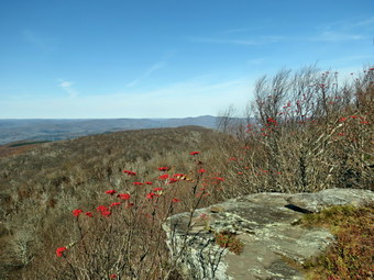 The trail along the ridge along the ridge wanders from one side to the other over about a mile and gains around 300 feet. Most places were dry with a few soft spots. We both remembered how hard this hike can be in the winter especially when the snow is not broken and is often over two feet deep! Some of the short, steep places are "exciting" to go up and to go down. As we walked along the ridge I zipped up my top and jacket as the wind cut through the trees and lowered the temperature. By 11:2) AM we had hiked the 3.3 miles to the viewpoint. I dropped my pack and walked out on the open rock face to take some pictures. There wasn't much color left as most trees had dropped their leaves and a persistent haze hung over the mountains and invaded the valleys. It was pretty easy to see the Pepacton Reservoir and it was very low. I took a few shots of the bushes with red berries that surround the rocks. I also snapped some pictures of the landscape which was interesting even devoid of color. The wind was even more fierce in the open so we quickly retreated and began the hike back to the car. We took our time on the steep little descent on the ridge and then made up some time on the rest of the hike back. We were back at the car by 1:00 PM having covered 6.6 miles in 3 hours and 10 minutes with an ascent of 1160 feet. The trip up had taken and hour and 40 minutes but we cut 10 minutes off of that time on the descent.
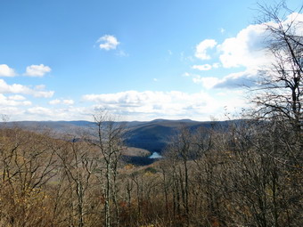
![]()
![]()
![]()
![]() On Sunday, October 20th I wanted to get in a local hike after church. I was ready to go by 1:00 PM and decided to go to Big Pond and hike to Cabot Mt. The trailhead is relatively close and the hike has some easy spots but some challenging ones also. I drove up the Beaverkill Road with Sheila in the back seat more than ready to hike anywhere. We arrived at Big Pond at 1:15 PM to find a few cars parked in the lot. We crossed the road and got on the red Touch-Me-Not Trail to hike over the hill toward Cabot Mt. The trail starts with a nice little ascent to get the heart pumping and then levels off some. I was surprised to find the trails quite dry but happy that all the nettles had been hit hard by the recent frosts at night! Over the first mile we gained 770 feet to the shoulder of Touch-Me-Not Mountain where the trail starts a descent. Just before the high point we met two other hikers taking a rest. We continued to the junction with blue Campground Trail where we kept to the right on the Touch-Me-Not trail and continued our descent. We could hear the other hikers behind us as we reached a trail junction at 1.6 miles. The sign said "Beaverkill Vista .5 miles". We continued straight ahead on the red trail to climb up Cabot Mountain. Sheila was all over the place looking for chipmunks, squirrels and, most of all, birds! We walked about a quarter mile to the base of Cabot Mountain. The nettles here were completely brown having been killed by the frost and this me the approach much easier. The climb up Cabot is less just less than 500 feet but the horizontal distance is only .4 miles. The average grade is 22% with some areas over 30%. At around .5 miles, which was on one of the ascents, I began looking for the "Beaverkill Vista". Any place that looked likely was block by trees and the views were poor despite the almost total lack of leaves. Either the vista had existed and had grown up over the years or the distance was incorrect and the sign referred to the vista over Little Pond from near the summit. We reached the top of the climb and hiked a short distance to the lookout. I dropped my pack and took some pictures. There wasn't much color left on the trees as there weren't many leaves left on the trees. There was also a haze still hanging around. The best pictures from this viewpoint were probably those of the white, puffy clouds in the sky. After taking some shots, I picked up my pack and we reversed our course back down the mountain.
On Sunday, October 20th I wanted to get in a local hike after church. I was ready to go by 1:00 PM and decided to go to Big Pond and hike to Cabot Mt. The trailhead is relatively close and the hike has some easy spots but some challenging ones also. I drove up the Beaverkill Road with Sheila in the back seat more than ready to hike anywhere. We arrived at Big Pond at 1:15 PM to find a few cars parked in the lot. We crossed the road and got on the red Touch-Me-Not Trail to hike over the hill toward Cabot Mt. The trail starts with a nice little ascent to get the heart pumping and then levels off some. I was surprised to find the trails quite dry but happy that all the nettles had been hit hard by the recent frosts at night! Over the first mile we gained 770 feet to the shoulder of Touch-Me-Not Mountain where the trail starts a descent. Just before the high point we met two other hikers taking a rest. We continued to the junction with blue Campground Trail where we kept to the right on the Touch-Me-Not trail and continued our descent. We could hear the other hikers behind us as we reached a trail junction at 1.6 miles. The sign said "Beaverkill Vista .5 miles". We continued straight ahead on the red trail to climb up Cabot Mountain. Sheila was all over the place looking for chipmunks, squirrels and, most of all, birds! We walked about a quarter mile to the base of Cabot Mountain. The nettles here were completely brown having been killed by the frost and this me the approach much easier. The climb up Cabot is less just less than 500 feet but the horizontal distance is only .4 miles. The average grade is 22% with some areas over 30%. At around .5 miles, which was on one of the ascents, I began looking for the "Beaverkill Vista". Any place that looked likely was block by trees and the views were poor despite the almost total lack of leaves. Either the vista had existed and had grown up over the years or the distance was incorrect and the sign referred to the vista over Little Pond from near the summit. We reached the top of the climb and hiked a short distance to the lookout. I dropped my pack and took some pictures. There wasn't much color left on the trees as there weren't many leaves left on the trees. There was also a haze still hanging around. The best pictures from this viewpoint were probably those of the white, puffy clouds in the sky. After taking some shots, I picked up my pack and we reversed our course back down the mountain.
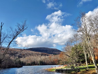 On the way down the first descent, I stopped to take some pictures of a few isolated trees which had retained their colorful leaves. We continued to the steeper part of the descent where I passed again to take some pictures of the massive rocks on the side of the trail. I was shooting back toward the sun and did not expect the pictures would be too impressive. When we got to the trail junction, we turned right on the yellow Little Pond Trail and walked a short distance to an open field. The field was once part of a farm and the foundation of the house is still present. We stopped again so that I could take some pictures of the surrounding hills and valleys which still had some color. We continued on down the trail an encountered a few small "streams" but the trail was otherwise dry. By 3:25 PM we had hiked 4 miles and had arrived at the loop trail around Little Pond. I took advantage of a privy that was still open taking Sheila in with me. As I emerged I startled three walkers going by the outhouse. Sheila and I walked around he far side of the pond stopping once so that I could take pictures of Touch-Me-Not Mountain on the other side of the pond. We continued around the pond and passed the other walkers again before stopping at the bridge over the outlet stream. I took a few pictures of the pond and Cabot Mountain before deciding to walk down the access road and back to the car on Barkaboom Road. I considered taking the trail back up Touch-Me-Not but in the end chose the road route. As we walked out passed the gatehouse on the road, I heard two thuds ahead as if someone had thrown rocks onto the road. Within a short distance, Sheila and I both spots two chipmunks in the road. One chipmunk was lying on its back while the other was upright but appeared dazed. I let Sheila approach and the chipmunk did not move. I believe the two chipmunks were fighting over some acorns and fell off the branches above! Sheila was unhappy that I would not let her get to the chipmunks but she got over it as we headed down the road. The walk to Barkaboom Road is about .9 miles and when we reached the road we turned left and walked another .6 miles back to the car. I put Sheila in the car and walked to the shore of Big Pond to take a few pictures. We had walked 6.1 miles in just under 3 hours with an elevation gain of 1535 feet.
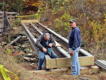
![]()
![]()
![]()
![]() On Wednesday, October 16th I wanted to get in a hike before cross country practice. Cindy was willing to go if we stayed close to home so we agreed to go to Frick and Hodge Ponds to hike and inspect the progress on the new bridge. The last time I was at Frick Pond the old bridge had been moved downstream slightly and three new steel I-beams had been installed where the old bridge had been. We arrived in the parking area at 10:35 AM and immediately started toward Frick Pond on the Quick Lake Trail. The skies were overcast and it looked like it might rain but I began to feel warm in just a light windbreaker. When we arrived at the bridge two workers from the DEC region in New Paltz were working on the bridge. They were starting to attach the decking. We stopped so that I could take some pictures and so that we could talk to the workers. They explain that the I-beams were placed and the old bridge moved with only a backhoe! They were very knowledgeable about what they were doing and had helped install several other new bridges in the region. After I took a few shots, we were off around the pond. We stopped several times so that I could take some more pictures. By 11:20 AM we had hiked the 1.6 miles to Iron Wheel Junction where we turned left to stay on the Quick Lake Trail. From Iron Wheel junction to Junkyard Junction is about 1.6 miles with an elevation gain of about 600 feet. The climb is noticeable but not steep. The skies stayed cloudy but the temperature was warm as we turned right on the Flynn Trail to head toward Hodge Pond. When we reached the next junction, we decided to walk around the back of Hodge Pond on the jeep trail.
On Wednesday, October 16th I wanted to get in a hike before cross country practice. Cindy was willing to go if we stayed close to home so we agreed to go to Frick and Hodge Ponds to hike and inspect the progress on the new bridge. The last time I was at Frick Pond the old bridge had been moved downstream slightly and three new steel I-beams had been installed where the old bridge had been. We arrived in the parking area at 10:35 AM and immediately started toward Frick Pond on the Quick Lake Trail. The skies were overcast and it looked like it might rain but I began to feel warm in just a light windbreaker. When we arrived at the bridge two workers from the DEC region in New Paltz were working on the bridge. They were starting to attach the decking. We stopped so that I could take some pictures and so that we could talk to the workers. They explain that the I-beams were placed and the old bridge moved with only a backhoe! They were very knowledgeable about what they were doing and had helped install several other new bridges in the region. After I took a few shots, we were off around the pond. We stopped several times so that I could take some more pictures. By 11:20 AM we had hiked the 1.6 miles to Iron Wheel Junction where we turned left to stay on the Quick Lake Trail. From Iron Wheel junction to Junkyard Junction is about 1.6 miles with an elevation gain of about 600 feet. The climb is noticeable but not steep. The skies stayed cloudy but the temperature was warm as we turned right on the Flynn Trail to head toward Hodge Pond. When we reached the next junction, we decided to walk around the back of Hodge Pond on the jeep trail.
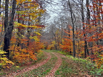 At the upper end of the pond Sheila and I walked down to the water. I took some pictures of the pond and surrounding trees. The most colorful leaves were already off the trees and the skies gave the scene a gloomy appearance. I threw a stick into the pond several times for Sheila to retrieve. We got back on the jeep trail and caught up to Cindy. We decided to take a left at the next junction and hike to the woods road that meets the Flynn Trail at the top of the hill above Hodge Pond. This route avoids dropping to the outlet of the pond only to have to climb back up. Once we were on the woods road we knew the walk was either flat or down the entire way back to the car. We turned left on the Flynn Trail and hiked to the junction with the Big Rock Trail where we arrived at 12:45 PM after hiking 4.75 miles. We continued straight ahead on the Flynn Trail as it began the 1.7 mile descent to the parking area. The descent is over 600 feet which makes a nice end to the hike. We were back at the car by 1:20 PM having covered 6.5 miles in 2 hours and 45 minutes with a total ascent of around 1000 feet.
![]()
![]()
![]()
![]() On Monday, October 14th, I decided I wanted to hike the beginning of the next section of the Finger Lakes Trail which was map 20. This part of the Finger Lakes Trail starts on Carson Road northwest of Marathon and passes through Blodgett Mills and then Hoxie Gorge as it heads east. There is a lot of road walking and some of the private land is closed in the fall for hunting which adds to the road walks. I had not initially planned to hike on Columbus Day as the weather report was for rain. The report changed to cloudy skies so I decided to drive the hour and 45 minutes to hike. I thought we might get as far as Blodgett Mills which was about 16 miles round trip but I knew I could settle for reaching West River Road for a 10 mile hike. We left Livingston Manor under cloudy skies and as I drove north and west on Route 17 we saw some patches of clearing skies. However, the farther north we went the worse the weather appeared. As I drove north on I-81 it began to sprinkle some. By the time I got off at the Marathon exit it was raining steadily. From Marathon I headed north on Route 11 and then west on Route 392. After about 4 miles on Rote 392 I turned right on Carson Road and found the sign for the Finger Lakes Trail where it crossed Carson Road. I pulled off the road as far as I could and parked at about 9:15 AM. At this point it was pouring and I knew that even if it stopped the chances were it could start up again at some point on the hike. I looked at the radar and it seemed that the line of showers was passing. By 9:30 AM the rain had abated enough that I decided I had driven almost two hours and had to hike! I put on my DryQ Elite jacket from Mountain Hardware, released Sheila from the car and head out on the Finger Lakes Trail through Tuller Hill State Forest. I left my camera behind as I did not want to get it wet and thought there would be little chance tom take pictures. I hoped we would not run into anything that I really wanted to photograph! The trail headed north through some hardwoods and climbed a little hill before descending down the other side. Around .85 miles the trail turned east and continued to descend. At 1.45 miles we hit the edge of a stream called Neal Brook and passed the Woodchuck Hollow lean-to where the trail turned again to head north. For the next mile the trail followed the brook north climbing a little until, at 2.5 miles, it turned east and shortly thereafter crossed the Cortland Nine Road.
On Monday, October 14th, I decided I wanted to hike the beginning of the next section of the Finger Lakes Trail which was map 20. This part of the Finger Lakes Trail starts on Carson Road northwest of Marathon and passes through Blodgett Mills and then Hoxie Gorge as it heads east. There is a lot of road walking and some of the private land is closed in the fall for hunting which adds to the road walks. I had not initially planned to hike on Columbus Day as the weather report was for rain. The report changed to cloudy skies so I decided to drive the hour and 45 minutes to hike. I thought we might get as far as Blodgett Mills which was about 16 miles round trip but I knew I could settle for reaching West River Road for a 10 mile hike. We left Livingston Manor under cloudy skies and as I drove north and west on Route 17 we saw some patches of clearing skies. However, the farther north we went the worse the weather appeared. As I drove north on I-81 it began to sprinkle some. By the time I got off at the Marathon exit it was raining steadily. From Marathon I headed north on Route 11 and then west on Route 392. After about 4 miles on Rote 392 I turned right on Carson Road and found the sign for the Finger Lakes Trail where it crossed Carson Road. I pulled off the road as far as I could and parked at about 9:15 AM. At this point it was pouring and I knew that even if it stopped the chances were it could start up again at some point on the hike. I looked at the radar and it seemed that the line of showers was passing. By 9:30 AM the rain had abated enough that I decided I had driven almost two hours and had to hike! I put on my DryQ Elite jacket from Mountain Hardware, released Sheila from the car and head out on the Finger Lakes Trail through Tuller Hill State Forest. I left my camera behind as I did not want to get it wet and thought there would be little chance tom take pictures. I hoped we would not run into anything that I really wanted to photograph! The trail headed north through some hardwoods and climbed a little hill before descending down the other side. Around .85 miles the trail turned east and continued to descend. At 1.45 miles we hit the edge of a stream called Neal Brook and passed the Woodchuck Hollow lean-to where the trail turned again to head north. For the next mile the trail followed the brook north climbing a little until, at 2.5 miles, it turned east and shortly thereafter crossed the Cortland Nine Road.
It had continued to rain lightly for most of the hike this far. The soil in the area has a large percentage of clay and was covered by a layer of wet leaves. This made for a very slippery surface and more than once I found myself struggling to keep my balance! Some of the little stream crossings had descents that were very steep and equally challenging climbs out of the stream bed on the other side. After crossing the road, the trail continued to ascend but was now headed east. At 3.1 miles we turned north toward Snyder Hill which was not much of a climb. At 3.8 miles we came to a cleared spot at the upper end of Pipeline Road. I had to look closely to spot the blazes to the right. In general, the trail had been well-blazed and this continued for most of the hike. Many of the blazes had been recently repainted and the trail was also well-maintained. We continued to descend a little heading northeast until we crossed Snyder Hill Road at 4.25 miles. The trail turned northwest and paralleled the road before heading northeast and crossing a brook. From this point on it was easy to hear the traffic on I-81. The map description mentioned views of the Hoxie Gorge Bridge but the mist was so heavy this was not possible. We approached a field, walked along the edge and then returned to the woods to walk parallel to another stream. The blazes here were a little confusing but I was able to spot their general direction. The trail continued to descend as we approached West River Road and even passed through the backyard of a private residence. We reached West River Road at 11:45 AM after covering 5.4 miles. The weather was still miserable and I was soaked from the "breathable" rain gear.
I decided that I did not want to walk north on West River Road for over 2.5 miles to Blodgett Mills just to turn around and walk back again. I looked at the map and decided to return to the car by way of the roads. The trail had not offered anything interesting enough to draw me back! We hiked northwest on West River Road for about .3 miles gaining elevation as we went. We turned left on Stafford Road and hiked another .4 miles to Snyder Hill Road. We stopped along Stafford Road so that I could stow my poles and get a snack. Sheila is becoming very good at pulling uphill and then easing off on the downhill sections. I had hoped that the 2.3 mile trip south on Snyder Hill road would be mostly downhill but I was wrong. We hit two small hills along the way but they seemed easy and we were keeping a good pace. At 8.5 miles Snyder Hill Road veered to the left but we continued straight ahead on Carson Road. There were several nice farms along the way, some interesting private residences and evidence of some logging operations. Carson Road eventually made a 90 degree turn to the right and we were soon back at the car. When I took off my jacket, I decided to change my shirt which was completely soaked proving that "breathable" rainwear at any price is a joke! We had hiked 9.7 miles in 3 hours and 45 minutes with a total ascent of 1850 feet. It was only 1:15 PM which meant we were able to get home at a reasonable hour. As I drove south from Binghamton, the skies were clear and blue with sun and white puffy clouds. The roads were dry indicating that the day had been vary pleasant in some part of the Southern Tier and to the south!
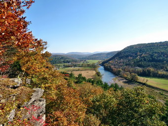
![]()
![]()
![]()
![]() -->
On Sunday, October 13th after hiking Vromans Nose, Cindy headed south to Pratts Rock in Prattsville east of Grand Gorge. We arrived at the parking area just east of Prattsville on Route 23 just before 3:00 PM to find only one other car in the lot. We started up the trails at 2:55 PM and were soon walking passed the first bench carved into the rock. Just behind the bench we could see some of the carvings much higher up on the cliffs. We decided to bypass the trail that goes to the base of the cliffs and continued to walk west and up the trail that goes to the top of the cliffs. The trail is a little steep in spots and is highly eroded since it is a popular destination. We were soon at the the of the cliffs taking in the view of the sparkling Batavia Kill below. There were no other hikers in sight so I took quite a few pictures of the valley below. The sun angle was again not very advantageous but I did get some nice shots. We continued to walk up to the next set of lookouts which are more to the east. The angle of the sun was better here so I took some more shots of the stream below, the valley and the hills beyond. To the northeast a high mountain was visible and I was pretty sure it was Huntersfield Mountain which is on the CHH list. I took some more pictures including a few of Cindy and Sheila. We headed back down the trail and found a shortcut to the trail that runs just below the cliffs. This was a tricky little descent but brought us out just below the carvings. Some more people appeared and I waited until they were out of the way to take some pictures of the rock carvings. When I was done with my photography, we descended the trail back to the car. We were at the car by 3:45 PM after covering the short hike of about a mile. We were ready to head home at this point after a nice day.
-->
On Sunday, October 13th after hiking Vromans Nose, Cindy headed south to Pratts Rock in Prattsville east of Grand Gorge. We arrived at the parking area just east of Prattsville on Route 23 just before 3:00 PM to find only one other car in the lot. We started up the trails at 2:55 PM and were soon walking passed the first bench carved into the rock. Just behind the bench we could see some of the carvings much higher up on the cliffs. We decided to bypass the trail that goes to the base of the cliffs and continued to walk west and up the trail that goes to the top of the cliffs. The trail is a little steep in spots and is highly eroded since it is a popular destination. We were soon at the the of the cliffs taking in the view of the sparkling Batavia Kill below. There were no other hikers in sight so I took quite a few pictures of the valley below. The sun angle was again not very advantageous but I did get some nice shots. We continued to walk up to the next set of lookouts which are more to the east. The angle of the sun was better here so I took some more shots of the stream below, the valley and the hills beyond. To the northeast a high mountain was visible and I was pretty sure it was Huntersfield Mountain which is on the CHH list. I took some more pictures including a few of Cindy and Sheila. We headed back down the trail and found a shortcut to the trail that runs just below the cliffs. This was a tricky little descent but brought us out just below the carvings. Some more people appeared and I waited until they were out of the way to take some pictures of the rock carvings. When I was done with my photography, we descended the trail back to the car. We were at the car by 3:45 PM after covering the short hike of about a mile. We were ready to head home at this point after a nice day.
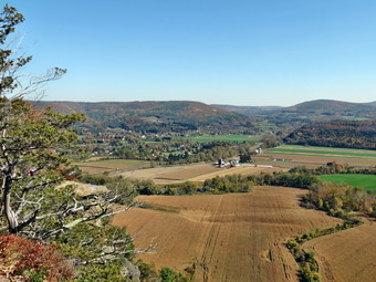
![]()
![]()
![]()
![]() On Sunday, October 13th I asked Cindy if she would like to hike after church and she agreed. We decided to head north to Vromans Nose and Pratts Rock as we had not visited either in some time. We got ready right after church and headed to Roscoe to take Route 30 to Margaretville. We stayed on Route 30 all the way to Middleburgh where we turned left on West Middleburgh Road. It was a nice day and when we arrived at the parking area, it was almost full. As a car pulled out, I pulled in and parked. We were a little hesitant to take Sheila out with so many people but we put her on her leash and headed up the trail at 1:15 PM. The trail rises from the Schoharie Plain to a high rock outcrop about 440 feet high. This doesn't seem like a significant elevation but everything else around it is very flat. As we neared the top, we stopped and I took pictures. We walked along a little farther and I took some more pictures. Most of these shots were to the south and the sun angle made shooting difficult. Taking shots to the west produced some better pictures. As we neared the east end, I took some shots to the, east and to the southeast. Across tower the Middleburgh Cliffs rise almost as high as Vromans Nose. The land below is all farmland and there were fields that were plowed and some still green with grass. I also photographed the cliffs and some of the talus below. There were dozens of people at the top and Sheila was having a tough time containing herself. We headed down the east side of the outcrop and made it down the steep but short descent without a mishap. The fallen leaves made the trail "slippery" in spots but we were back at the car by 2:15 PM having spent about an hour walking the 1.6 mile route. We debated where to head next and in the end decided to stick to the original plan and got to Pratts Rock in Prattsville east of Grand Gorge.
On Sunday, October 13th I asked Cindy if she would like to hike after church and she agreed. We decided to head north to Vromans Nose and Pratts Rock as we had not visited either in some time. We got ready right after church and headed to Roscoe to take Route 30 to Margaretville. We stayed on Route 30 all the way to Middleburgh where we turned left on West Middleburgh Road. It was a nice day and when we arrived at the parking area, it was almost full. As a car pulled out, I pulled in and parked. We were a little hesitant to take Sheila out with so many people but we put her on her leash and headed up the trail at 1:15 PM. The trail rises from the Schoharie Plain to a high rock outcrop about 440 feet high. This doesn't seem like a significant elevation but everything else around it is very flat. As we neared the top, we stopped and I took pictures. We walked along a little farther and I took some more pictures. Most of these shots were to the south and the sun angle made shooting difficult. Taking shots to the west produced some better pictures. As we neared the east end, I took some shots to the, east and to the southeast. Across tower the Middleburgh Cliffs rise almost as high as Vromans Nose. The land below is all farmland and there were fields that were plowed and some still green with grass. I also photographed the cliffs and some of the talus below. There were dozens of people at the top and Sheila was having a tough time containing herself. We headed down the east side of the outcrop and made it down the steep but short descent without a mishap. The fallen leaves made the trail "slippery" in spots but we were back at the car by 2:15 PM having spent about an hour walking the 1.6 mile route. We debated where to head next and in the end decided to stick to the original plan and got to Pratts Rock in Prattsville east of Grand Gorge.
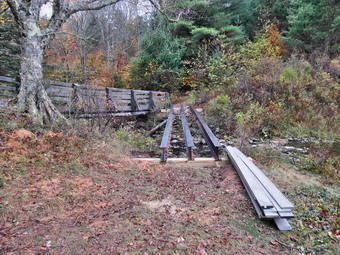
![]()
![]()
![]()
![]() On Thursday, October 10th I needed to get out on a hike close to home. I decided to take Sheila and go to the Frick Pond area to hike up the Flynn Trail and then take the snowmobile trails to Mongaup Pond. The road walk back from Mongaup would add miles but be quick which is what I needed. We arrived at the Frick Pond parking area at 9:30 AM. When I told Sheila to "Go!" , she started out the Quick Lake Trail toward Frick and I decided to follow. I reasoned that taking the Big Rock Trail up the hill would be a good workout and be slightly longer than my original plan. As we headed out on the wide woods road that is the first part of the Quick Lake Trail, I noticed some wide, deep tire track. I realized I had not seen the steel I-beams in the parking area and that work might have begun on the bridge at the outlet end of Frick Pond. When we got to the trail junction, we stayed to the left on the Quick Lake Trail rather than right on the Loggers Loop. When we got to the pond, my suspicions were confirmed as three I-beams were now in the same place as the old bridge used to be. Even more interesting was the fact that the old bridge had been located just slightly downstream in the area of the old dam. I assume that a crane was used to place the new beams and that the same crane was employed to lift and relocated the old bridge. I thought this was a nice touch and very considerate of hikers! I stopped to take a few pictures before crossing the old bridge and starting around the pond. The new plan was to walk the trail around the back of the pond and then use the Big Rock Trail to climb the hill to the Flynn Trail. I debated doing a bigger loop on the Quick Lake Trail to Hodge Pond but didn't think I had enough time. The walk around the pond was uneventful and we were at Times Square before 10:00 AM having covered 1.2 miles. We continued straight ahead up the Big Rock Trail.
On Thursday, October 10th I needed to get out on a hike close to home. I decided to take Sheila and go to the Frick Pond area to hike up the Flynn Trail and then take the snowmobile trails to Mongaup Pond. The road walk back from Mongaup would add miles but be quick which is what I needed. We arrived at the Frick Pond parking area at 9:30 AM. When I told Sheila to "Go!" , she started out the Quick Lake Trail toward Frick and I decided to follow. I reasoned that taking the Big Rock Trail up the hill would be a good workout and be slightly longer than my original plan. As we headed out on the wide woods road that is the first part of the Quick Lake Trail, I noticed some wide, deep tire track. I realized I had not seen the steel I-beams in the parking area and that work might have begun on the bridge at the outlet end of Frick Pond. When we got to the trail junction, we stayed to the left on the Quick Lake Trail rather than right on the Loggers Loop. When we got to the pond, my suspicions were confirmed as three I-beams were now in the same place as the old bridge used to be. Even more interesting was the fact that the old bridge had been located just slightly downstream in the area of the old dam. I assume that a crane was used to place the new beams and that the same crane was employed to lift and relocated the old bridge. I thought this was a nice touch and very considerate of hikers! I stopped to take a few pictures before crossing the old bridge and starting around the pond. The new plan was to walk the trail around the back of the pond and then use the Big Rock Trail to climb the hill to the Flynn Trail. I debated doing a bigger loop on the Quick Lake Trail to Hodge Pond but didn't think I had enough time. The walk around the pond was uneventful and we were at Times Square before 10:00 AM having covered 1.2 miles. We continued straight ahead up the Big Rock Trail.
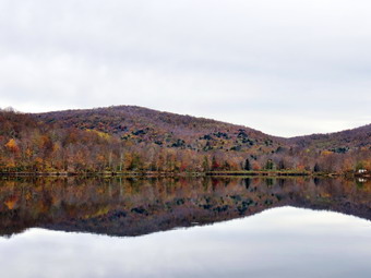 The Big Rock Trail can seem pretty steep at times but on this day it felt shorter and easier than usual. We stopped at the junction with the Flynn Trail so that I could remove my jacket and gaiters. I also took the opportunity to tape the back of my left ankle. The stop was brief and we continued straight ahead on the snowmobile trail to the top of the hill. From Times Square to the top of the hill is 1.3 miles and gains 730 feet to an elevation of 2880 feet. From the top of the hill it is less than a mile directly to the pond but the trail takes some twists and turns be first heading south, then east and north before finally turning southeast and south to the edge of Mongaup Pond. The descent is rocky and the leaves fallen on top of the rocks made things a little tricky. The back of my left ankle still was bothering me and I was not sure if I was getting a blister from the socks, the new Asolo Powermatic boots or a combination. I stopped and changed from the Darn Tough socks to a pair of Teko socks and had no more problems. We continued down to the loop road around the pond. As we were approaching the road, Sheila came back to me acting "nervous". I looked up to see a couple and their dog hiking toward us. Sheila used to run ahead to meet people and other dogs but now has trained herself to come to me. We stopped so that I could talk to the couple and the dogs could get acquainted. They were from Hyde Park and had been in the area before. I made some suggestions about hiking and then we parted. As we continued walking, I realized they were probably camping at Mongaup which was still open. Once we reached the road, we turned right to head toward the entrance to the park. I checked my GPS and found it was "frozen" and would not respond to any of the buttons. I solved the problem by removing a battery and then putting it back in. I hope this is a one-time problem. After a short distance, I turned to the left to walk to the shore of the pond to take some pictures. As I got my camera out, I told Sheila to sit by my pack. I took a few pictures of what remained of the fall leaf colors. Sheila apparently was bored so she came down to wade in the pond...with her leash still attached! The pond was completely still allowing perfect reflections of the trees and hills surrounding it. We got back on the road and walked to the observation deck where we stopped so that I could take a few more shots. Once back on the road, I decided we need to speed up our hike and Sheila certainly agreed. We walked passed he entrance to the park and out the road to the intersection with Beech Mountain Road. We turned right and in .3 miles we were back at the car. A pickup with a trailer was in the lot with a "State" license plate. I assumed that this was the crew working he the bridge and I intend to check back to see their progress. We were back by 12:15 PM having covered 7 miles in 2 hours and 45 minutes with 1070 feet of ascent.
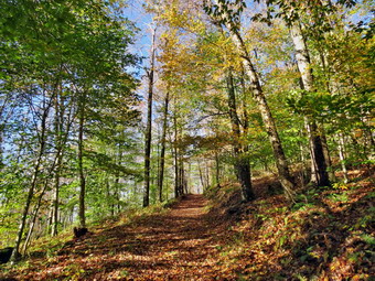
![]()
![]()
![]()
![]() On Tuesday, October 8th I was ready to hike again after a weekend of bad weather and various commitments. I knew I had to be back early for an away cross country meet so I decided to state close to home and hike at Trout Pond. I decided to do a variation I had not tried before by hiking from the Russell Brook parking area around Trout Pond and then taking the Campbell Brook Trail to Campbell Brook Road. I would hike out Campbell Brook Road to Morton Hill Road and then back to the car. As I was driving up the Quickway from Livingston Manor to Roscoe I could see that the recent rain and wind had brought down most of the leaves that had changed color. The hillsides shows only a few spots of color among the evergreens. The drive down Russell Brook Road was interesting as the rain had eroded some of the dirt and gravel and I had to move several large branches. I parked at 9:00 AM and we got right out on the trail. I was surprised that the stream wasn't higher since it had rained the day before. I decided to keep hiking and make as few stops on the way out as possible since I wasn't sure exactly how far the hike would be and how long it would take me. At the first trail junction we kept left to walk up the hill toward Mud Pond. The walk up the hill is about .8 miles and gains 400 feet. This isn't really steep but it does get the blood flowing right away. Along the way I stopped to take a few pictures of the rail as there was an interesting combination of leaves fallen on the trail and green leaves still on the trees. From the top of the hill we descended slightly and then turned right to go north along the west side of Trout Pond. I stopped at one spot to take some shots where there were no leaves on the trees at all and then continued. Over the next 1.2 miles we gained another 400 feet to the highest pot on the hike on the shoulder of Cherry Ridge. From that point the trail descends 450 feet over .8 miles to the bridge at the inlet of Trout Pond. I stopped briefly to take a few pictures of the pond with the water twinkling in the sun. There was virtually no color left in the trees around the pond. As we turned left on he Campbell Brook trail I was trying to decide if that was a good decision given my afternoon commitment and the fact that I didn't know exactly how far I had to go!
On Tuesday, October 8th I was ready to hike again after a weekend of bad weather and various commitments. I knew I had to be back early for an away cross country meet so I decided to state close to home and hike at Trout Pond. I decided to do a variation I had not tried before by hiking from the Russell Brook parking area around Trout Pond and then taking the Campbell Brook Trail to Campbell Brook Road. I would hike out Campbell Brook Road to Morton Hill Road and then back to the car. As I was driving up the Quickway from Livingston Manor to Roscoe I could see that the recent rain and wind had brought down most of the leaves that had changed color. The hillsides shows only a few spots of color among the evergreens. The drive down Russell Brook Road was interesting as the rain had eroded some of the dirt and gravel and I had to move several large branches. I parked at 9:00 AM and we got right out on the trail. I was surprised that the stream wasn't higher since it had rained the day before. I decided to keep hiking and make as few stops on the way out as possible since I wasn't sure exactly how far the hike would be and how long it would take me. At the first trail junction we kept left to walk up the hill toward Mud Pond. The walk up the hill is about .8 miles and gains 400 feet. This isn't really steep but it does get the blood flowing right away. Along the way I stopped to take a few pictures of the rail as there was an interesting combination of leaves fallen on the trail and green leaves still on the trees. From the top of the hill we descended slightly and then turned right to go north along the west side of Trout Pond. I stopped at one spot to take some shots where there were no leaves on the trees at all and then continued. Over the next 1.2 miles we gained another 400 feet to the highest pot on the hike on the shoulder of Cherry Ridge. From that point the trail descends 450 feet over .8 miles to the bridge at the inlet of Trout Pond. I stopped briefly to take a few pictures of the pond with the water twinkling in the sun. There was virtually no color left in the trees around the pond. As we turned left on he Campbell Brook trail I was trying to decide if that was a good decision given my afternoon commitment and the fact that I didn't know exactly how far I had to go!
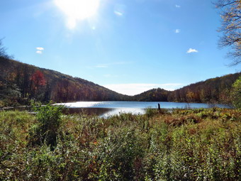 From the lean-tos the trail rises 435 feet over .8 miles to the Col between two hills and then descends the same amount over the same distance. At 10:55 we had walked about 4.75 miles and were on Campbell Brook Road. At this point I was confident we would get back in plenty of time and I could relax a little and enjoy the walk more. I removed my jacket as I was already overheated and put Sheila on her leash for the road walk. Campbell Brook Road climbs a little to the intersection with Morton Hill Road. After that intersection, Morton Hill Road is downhill or flat the rest of the way. Along Morton Hill Road I was surprised that several vehicles passed us. There wasn't too much to look at as the leaves were mostly down off the trees but the walk was very pleasant. I did stop again to take a few pictures of the road since there was still some color on the trees in a few places. The walk on Morton Hill Road was about 2.3 miles but took us only 42 minutes! We turned left on Russell Brook Road and walked down the road and back to the car. I took a look at the falls and decided that although they were nice they were not spectacular enough to warrant a visit this time. We were back at the car at noon having covered 8.5 miles in 3 hours with 1700 feet of ascent.
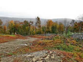
![]()
![]()
![]()
![]() On Friday, October 4th I had planned to head to Marathon to hike a section of map 20 of the Finger Lakes Trail. I thought that my obsession had been quenched but as I looked at the next map it was rekindled. I particularly wanted to hike the section from Route 11 through Hoxie Gorge State Forest. When I looked at the weather report Friday morning, the forecast was for showers and thunderstorms to pass through Marathon on and off all day. The radar revealed that some of these storms could be strong. I decided to amend my plans and head back to Bear Spring for a 8 to 10 mile route. As I drove away from Livingston Manor and headed north on Route 206 I decided to park at the main parking area at the beginning of West Trout Brook Road. From the parking area we would hike south on the road to the trail than runs south on the central ridge at Bear Spring. From there we would take trail 4 down to Middle Pond. At Middle Pond we would take the McCoy Hill Cutoff Trail to Wilson Hollow Road and walk back to the car. I wanted to get an early start since the forecast included showers for Walton but not until 2:00 PM and I knew that we would be done before then. I parked in the lot just before 8:30 AM and we immediately got started. I put Sheila on her leash as the first part of the hike was on West Trout Creek Road. The air was warm and humid but I kept on a light windbreaker. I had chosen to wear a new pair of Asolo Powermatic boots since I felt they would most likely be waterproof. The damp road surface showed there had been rain overnight and that combined with a heavy dew meant some wet trails! As we walked down the road, I kept looking for the place where the trail cuts off to the left. I thought I had missed it but at 1 mile the trailhead appeared on the left. We turned onto the trail and walked along the wide and wet trail toward Fork Mountain. We walked over several small bumps in the trail and at 2.5 miles we passed to the east of the summit of Fork Mountain. I had been feeling a little twinge on the back of my right heel. I stopped and removed my boot and sock but didn't see or feel anything. I applied several strips of tape and put my boot sock and boot back on. This seemed to 'cure" the problem.
On Friday, October 4th I had planned to head to Marathon to hike a section of map 20 of the Finger Lakes Trail. I thought that my obsession had been quenched but as I looked at the next map it was rekindled. I particularly wanted to hike the section from Route 11 through Hoxie Gorge State Forest. When I looked at the weather report Friday morning, the forecast was for showers and thunderstorms to pass through Marathon on and off all day. The radar revealed that some of these storms could be strong. I decided to amend my plans and head back to Bear Spring for a 8 to 10 mile route. As I drove away from Livingston Manor and headed north on Route 206 I decided to park at the main parking area at the beginning of West Trout Brook Road. From the parking area we would hike south on the road to the trail than runs south on the central ridge at Bear Spring. From there we would take trail 4 down to Middle Pond. At Middle Pond we would take the McCoy Hill Cutoff Trail to Wilson Hollow Road and walk back to the car. I wanted to get an early start since the forecast included showers for Walton but not until 2:00 PM and I knew that we would be done before then. I parked in the lot just before 8:30 AM and we immediately got started. I put Sheila on her leash as the first part of the hike was on West Trout Creek Road. The air was warm and humid but I kept on a light windbreaker. I had chosen to wear a new pair of Asolo Powermatic boots since I felt they would most likely be waterproof. The damp road surface showed there had been rain overnight and that combined with a heavy dew meant some wet trails! As we walked down the road, I kept looking for the place where the trail cuts off to the left. I thought I had missed it but at 1 mile the trailhead appeared on the left. We turned onto the trail and walked along the wide and wet trail toward Fork Mountain. We walked over several small bumps in the trail and at 2.5 miles we passed to the east of the summit of Fork Mountain. I had been feeling a little twinge on the back of my right heel. I stopped and removed my boot and sock but didn't see or feel anything. I applied several strips of tape and put my boot sock and boot back on. This seemed to 'cure" the problem.
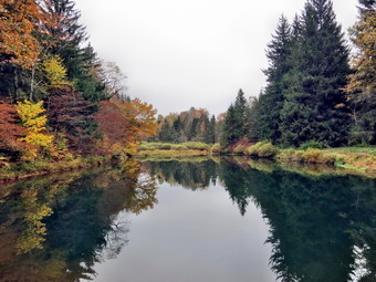 From the area near Fork Mountain the trail started to descend a little until 3.4 miles when we came to the junction with Trail 4. We turned right and started the almost one mile descent to East Trout Brook Road. The descent was tricky because it is steep and there were some slippery leaves on the path. To my surprise we encountered two new clear cut areas on the right of the trail. The first actually spanned the trail and made following the blazes difficult. Whoever did the logging was not very careful to clean up and some trees blocked parts of the trail. I chose to stay to the left and follow the blue blazes down but any of the paths would have eventually brought us to the same place. Eventually the trail returned to the smooth but steep surface I remembered. A little farther along another clear cut area appeared on the right of the trail. This opened a nice viewpoint down the valley and across to the central ridge. I have not been able to find anyone who can explain the need for this logging or how it fits into a management plan. By 10:15 AM we had hiked 4.4 miles and were crossing the dam at the outlet end of Middle Pond. There was one vehicle in the roadside parking area with a logo for Hawk Mountain Outfitters which is a registered guide service in Trout Creek. We stopped at the pond for a moment and I took a few shots before heading up the trail toward the ridge. It had been a while since I had hiked at Bear Spring and some things just didn't seem familiar. It wasn't long before we were at a fork in the trail and we stayed left to take the McCoy Hill Cutoff to McCoy Field. There was a limited view from just above the junction but I chose to walk to the top of the hill before stopping for more pictures. On the way up the hill Sheila came back to me with a "worried" look. I looked up to see a hunter and his Weimaraner. I put Sheila on her leash but the two dogs seemed to hit it off immediately. I talked to the hunter and we agreed that it was a nice day but that Thursday was far better. We went our separate ways and I stopped to take some pictures from the top of the hill just before entering the woods.
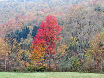 As we began to walk up the hill on the trail to the top of the ridge, it began to sprinkle. A little farther on the rain began and I decided to put on my DryQ rain jacket. Normally putting on my rain jacket stops the rain but it did not work this time. The rain came down harder until we reached Wilson Hollow Road along the top of the eastern ridge. Once we made the turn onto the woods road, the rain abated and within a few minutes it all but stopped. I was wet but happy when the sun started to peek out from behind the clouds. In about 1 mile or at 6.7 miles into the hike, trail 11 came in from the left signaling we were close to the clear cut near Route 206. In about .5 miles we were at the clear the and the sun was shining through the clouds to reveal some of the color we had seen the day before. I decided to keep walking as the color on Thursday was better and I did not want to get caught in the rain gain. A we neared Route 206, we turned left on the trail and stayed right at the fork at the top of the hill. At 8.5 miles we crossed East Trout Brook Road and ascended the trail to a field. After crossing the field, it was a short walk back to the parking area. We were back at the car at 12:)5 PM having hiked 9 mile in 3 hours and 40 minutes. The total elevation gain was 1445 feet. Upon arriving home, I removed my boots and socks and found a rather large blister on the back of my right heel. I was glad I had stopped to tape the heel which certainly prevented a more serious situation.
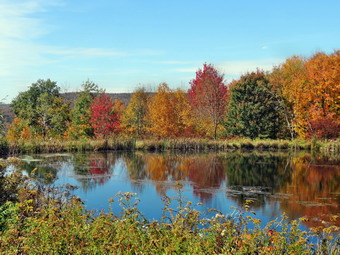
![]()
![]()
![]()
![]()
![]() On Thursday, October 3rd, I decided to cut short a visit to Bear Spring and hike to the pond on the Shavertown Parcel. I wanted to see what fall colors were present at the pond and from the viewpoint over the Pepacton Reservoir. The trip to Bear Spring had been very worthwhile with beautiful and brilliant fall colors in several places. On the way out of Downsville, I stopped at the dam to take some pictures of the reservoir and the village of Downsville in the valley below. I followed Route 30 over the bridge and turned left on the BWS road. I parked the car near the trailhead at 12:20 PM under bright blue skies and we crossed the road to get on the trail. The trail was slightly harder to walk this time as there was a layer of slippery leaves on top. We set a quick pace and made the turn onto the woods road is only 8 minutes. We continued to keep up the pace adhere was nothing I wanted to see on the way. We arrived at the pond at 12:45 PM. I stopped on the road as we approached the pond since the col the of the trees around the pond were so beautiful and I wanted to get some pictures. After taking some shots, I kept my camera out and walked down to the pond to take a few more pictures. We walked to the lookout over then reservoir. The colors around the water were a little less spectacular than those around the pond but I took pictures anyway. While I was photographing, Sheila was jumping into the pond, running around and then repeating the process. We walked around the pond as I took a few more shots back toward the road we had walked in on. Sheila again jumped in the water and I took a few pictures of her trying to retrieve a log! We continued to walk around the pond and were soon back at the road and on the way back to the car. We were back at the car by 1:15 PM having completed the 1.9 mile hikes in around 45 minutes with plenty of time for photography. I decided to return by way of the Barkaboom Road. On the drive I stopped at a spot that always has nice color and an interesting barn. I also stopped at Big Pond where I have always found good colors in the fall. Big Pond was not as nice as it has been in some years but was well worth the stop.
On Thursday, October 3rd, I decided to cut short a visit to Bear Spring and hike to the pond on the Shavertown Parcel. I wanted to see what fall colors were present at the pond and from the viewpoint over the Pepacton Reservoir. The trip to Bear Spring had been very worthwhile with beautiful and brilliant fall colors in several places. On the way out of Downsville, I stopped at the dam to take some pictures of the reservoir and the village of Downsville in the valley below. I followed Route 30 over the bridge and turned left on the BWS road. I parked the car near the trailhead at 12:20 PM under bright blue skies and we crossed the road to get on the trail. The trail was slightly harder to walk this time as there was a layer of slippery leaves on top. We set a quick pace and made the turn onto the woods road is only 8 minutes. We continued to keep up the pace adhere was nothing I wanted to see on the way. We arrived at the pond at 12:45 PM. I stopped on the road as we approached the pond since the col the of the trees around the pond were so beautiful and I wanted to get some pictures. After taking some shots, I kept my camera out and walked down to the pond to take a few more pictures. We walked to the lookout over then reservoir. The colors around the water were a little less spectacular than those around the pond but I took pictures anyway. While I was photographing, Sheila was jumping into the pond, running around and then repeating the process. We walked around the pond as I took a few more shots back toward the road we had walked in on. Sheila again jumped in the water and I took a few pictures of her trying to retrieve a log! We continued to walk around the pond and were soon back at the road and on the way back to the car. We were back at the car by 1:15 PM having completed the 1.9 mile hikes in around 45 minutes with plenty of time for photography. I decided to return by way of the Barkaboom Road. On the drive I stopped at a spot that always has nice color and an interesting barn. I also stopped at Big Pond where I have always found good colors in the fall. Big Pond was not as nice as it has been in some years but was well worth the stop.
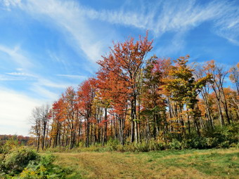
![]()
![]()
![]()
![]()
![]() On Thursday, October 3rd, I decided I wanted to hike somewhere where there would be a good chance of finding some "fall color". Around Livingston Manor the leaves were changing but the brilliant colors were spotty. In addition, it appeared that the leaves might fall off the trees before any brilliant colors were present. The forecast of rain over the weekend convinced me that I should look for fall color before it was gone! I remembered that I had usually found nice colors at Bear Spring Mountain Wildlife Management Area and decided to head to Walton to see what colors I could find. My plan was to wait until late morning until the fog had cleared to make the trip so it was just before 10:30 AM when I arrived at the big parking area on Route 206. The pulloff is just before the turn for East Trout Creek Road on the left side of Route 206. I parked and we were ready to hike by 10:25 AM. We started by walking up the shoulder of Route 206 and then turning left on Wilson Hollow Road. This is a woods road that runs the length of the eastern ridge at Bear Spring. It is wide and well-maintained for use but horses and snowmobiles. This, of course, means it makes a good hiking trail as well. As soon as we started hiking on the road we were at the clear cut area on the left that runs about .5 miles along the road. I was happy that I was right about the colors! The trees a long the road were beautiful against a bright blue sky streak with white clouds. Looking east toward Route 206 and Starkweather Hill, I could see an abundance of brilliant colors. I took out my camera and began to take pictures. I took a few pictures, walked a short distance and took a few more pictures. This continued for the length of the clear cut area as the views got better the further I walked. Walton was still covered in a layer of fog so I took a few pictures. It took almost 25 minutes to walk the .7 miles to the end of the clear cut. We continued along Wilson Hollow Road. It was my plan to take Trail 11 down to Launt Pond and then to hike back to the trails. I planned to walk to Middle Pond and then up the trails to the eastern ridge and back to the car.
On Thursday, October 3rd, I decided I wanted to hike somewhere where there would be a good chance of finding some "fall color". Around Livingston Manor the leaves were changing but the brilliant colors were spotty. In addition, it appeared that the leaves might fall off the trees before any brilliant colors were present. The forecast of rain over the weekend convinced me that I should look for fall color before it was gone! I remembered that I had usually found nice colors at Bear Spring Mountain Wildlife Management Area and decided to head to Walton to see what colors I could find. My plan was to wait until late morning until the fog had cleared to make the trip so it was just before 10:30 AM when I arrived at the big parking area on Route 206. The pulloff is just before the turn for East Trout Creek Road on the left side of Route 206. I parked and we were ready to hike by 10:25 AM. We started by walking up the shoulder of Route 206 and then turning left on Wilson Hollow Road. This is a woods road that runs the length of the eastern ridge at Bear Spring. It is wide and well-maintained for use but horses and snowmobiles. This, of course, means it makes a good hiking trail as well. As soon as we started hiking on the road we were at the clear cut area on the left that runs about .5 miles along the road. I was happy that I was right about the colors! The trees a long the road were beautiful against a bright blue sky streak with white clouds. Looking east toward Route 206 and Starkweather Hill, I could see an abundance of brilliant colors. I took out my camera and began to take pictures. I took a few pictures, walked a short distance and took a few more pictures. This continued for the length of the clear cut area as the views got better the further I walked. Walton was still covered in a layer of fog so I took a few pictures. It took almost 25 minutes to walk the .7 miles to the end of the clear cut. We continued along Wilson Hollow Road. It was my plan to take Trail 11 down to Launt Pond and then to hike back to the trails. I planned to walk to Middle Pond and then up the trails to the eastern ridge and back to the car.
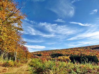 As we walked along the woods road, I was sure I had somehow missed the trail on the right as I had done before. At about 1.3 miles the trail appeared on the right just before an uphill. We turned onto Trail 11 and headed down to East Trout Creek Road about .7 miles away. hen we arrived at the road, we turned right and headed up to Launt Pond. The walk was only .3 miles but was a little longer than I remembered. On the way I began to think that I would like to visit the pond on the Shavertown parcel to see what color changes had occurred there. We turned left at Launt Pond and walked to the dam. I was surprised to find the gate and the bathrooms still open. I dropped my pack and took out the camera. The leaves here were not as nice as they had been in previous years but I still snapped a few shots. At this point I decided to cut this hike short so that I could include the pond at Shavertown. We walked back out to the road and walked north for about a mile. Just before the intersection with Route 206 we turned right on the trail and hiked the .6 miles over the hill to Wilson Hollow Road. From there we turned left, hiked out to Route 206 and back to the car. It was noon and the 4 mile hike had taken and hour and 35 minutes with only 630 feet of ascent. I drove out of the parking area and headed towards Downsville.
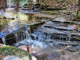
![]()
![]()
![]()
![]()
![]()
![]() On Monday, September 30th, I decided I wanted to hike the last section of the Finger Lakes Trail map 26 from Case Road to Bainbridge. WARNING: This part of the Finger Lakes Trail is so poorly marked that I suggest anyone wanting to hike it use the highwater bypass until the trail conference corrects the problem. Upon reaching Case Road simply turn right and walk down to Route 206. Turn left on Route 206 and hike into Bainbridge. The maps shown in the above links and on the Trails page are for the corrected route! The round trip seemed to be about 5 to 6 miles depending on the approach so Cindy said she would like to go along also. As we were about to leave at 7:30 AM and ambulance call came in and I responded. The call delayed our departure until just after 9:00 AM. We headed up the Quickway to Roscoe and then took Route 206 through Downsville and Walton right to Bainbridge. I parked at the municipal parking lot and we were ready to hike at 10:30 AM. My plan was to hike west on Route 206 to Case Road, a distance of about 1.6 miles. We would then hike north on Case Road for about .3 miles to the beginning of the section of trail. The trail section was about 1.5 miles and would put us back on Route 206 less than a mile from the car. We walked through Bainbridge on the sidewalks and then used the shoulder of Route 206 to continue the hike. The shoulders in this area were really narrow and the traffic was rather heavy. We decided to change our plans and walk out on the trail and then back on the trail to try to avoid the roads as much as possible. At about .7 mile we turned off the road and onto the trail at the "Welcome to Bainbridge" sign. The trail led us down a short, steep trail to Newton Brook. I knew from a previous exploration that the brook would not be a problem to cross. We stopped for a few minutes to explore the streambed and take some pictures. The stream had cut a rather deep chasm through the sedimentary rock although the trickle of water on this day made it hard to believe. After exploring and taking some pictures, we crossed the stream and followed the Finger Lakes Trail as it ascended the far bank of then stream. As the trail ascended the far bank, it went through a series of short switchbacks to make the climb a little easier. At about 1 mile into the hike the trail turned hit an old woods road where we turned right. The road eventually became highly eroded until about 1.25 miles when it flattened some and the surface became more even.
On Monday, September 30th, I decided I wanted to hike the last section of the Finger Lakes Trail map 26 from Case Road to Bainbridge. WARNING: This part of the Finger Lakes Trail is so poorly marked that I suggest anyone wanting to hike it use the highwater bypass until the trail conference corrects the problem. Upon reaching Case Road simply turn right and walk down to Route 206. Turn left on Route 206 and hike into Bainbridge. The maps shown in the above links and on the Trails page are for the corrected route! The round trip seemed to be about 5 to 6 miles depending on the approach so Cindy said she would like to go along also. As we were about to leave at 7:30 AM and ambulance call came in and I responded. The call delayed our departure until just after 9:00 AM. We headed up the Quickway to Roscoe and then took Route 206 through Downsville and Walton right to Bainbridge. I parked at the municipal parking lot and we were ready to hike at 10:30 AM. My plan was to hike west on Route 206 to Case Road, a distance of about 1.6 miles. We would then hike north on Case Road for about .3 miles to the beginning of the section of trail. The trail section was about 1.5 miles and would put us back on Route 206 less than a mile from the car. We walked through Bainbridge on the sidewalks and then used the shoulder of Route 206 to continue the hike. The shoulders in this area were really narrow and the traffic was rather heavy. We decided to change our plans and walk out on the trail and then back on the trail to try to avoid the roads as much as possible. At about .7 mile we turned off the road and onto the trail at the "Welcome to Bainbridge" sign. The trail led us down a short, steep trail to Newton Brook. I knew from a previous exploration that the brook would not be a problem to cross. We stopped for a few minutes to explore the streambed and take some pictures. The stream had cut a rather deep chasm through the sedimentary rock although the trickle of water on this day made it hard to believe. After exploring and taking some pictures, we crossed the stream and followed the Finger Lakes Trail as it ascended the far bank of then stream. As the trail ascended the far bank, it went through a series of short switchbacks to make the climb a little easier. At about 1 mile into the hike the trail turned hit an old woods road where we turned right. The road eventually became highly eroded until about 1.25 miles when it flattened some and the surface became more even.
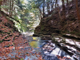 At a little over 1.5 miles we left the trees and entered a meadow which is where our problems began. There were no blazes at all to mark the trail. Just after entering the meadow there was a spilt in the trail. We followed the right fork which was more prominent and began heading north following this path. At around 1.8 miles we passed through some trees into another meadow still looking for blazes. We entered the trees again at 2 miles but could find no blazes. In the woods there were several different woods roads. We finally gave up and walked back to the point where we had first entered the meadow and tried the left fork in the path. We walked down this fork until we got to some trees and turned around since there were still no blazes! We decided to walk back to the car, drive to Case Road and try hiking in from that end. It was 11:45 AM and we had hiked 2.7 miles. We were frustrated and could not believe that the Finger Lakes Trail would be so poorly marked that it was impossible to find! We retraced our steps on the trail back to Newton Brook and back to Route 206. We turned left on Route 206 and walked back to Bainbridge. We were back at the car at 12:25 PM after hiking 4.2 miles. I drove to Case Road and tried to find a place to park. Eventually I stopped at a machine shop and asked if we could park on their property. I parked and we walked won the road to the start of the trail which was well marked. We were confident we would be able to walk in from this end and connect to the part of the trail we had already hiked. Shortly after walking into the trail joined a woods road and we were able to follow that for some distance. There were few blazes along the road which had many areas of deep mud churned up by ATVs. The blazes disappeared AGAIN at about .75 miles and we chose to continue to follow the woods road.
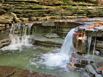 When I looked at my GPS, it seemed that the woods road was headed directly north toward the point where we had turned around on the previous attempt at hiking in from the other end earlier in the day. I had noticed a woods road headed south from that point and assumed that was what we were following. We walked another .3 miles north and at 1.1 miles my suspicions were confirmed as we ended up in the same spot we had been earlier. We knew we were not on the Finger Lakes Trail and our frustration continued to grow. It seemed incredible that the Finger Lakes Trail Conference would be so irresponsible as to allow a section of trail to become so poorly marked that it was impossible to find from either end! We turned around and followed our path back toward Case Road looking for white blazes all the time. At about 1.4 miles into our journey or .75 miles from Case Road we found a blaze on the woods road. Sheila turned into the woods to the east and we followed her as we picked up more blazes. This was the trail we were supposed to follow! There was no indication in the blazing that there was a turn and the blaze that marked where we were to go was hidden! This is not the way to mark a trail for other to follow. We walked along then trail which quickly dropped down to Newton Brook and the ascended the other side on a wood road. I could see a meadow ahead and it was obviously the one that we had wandered around in earlier in the day. The blazes turned to the right just before the meadow as the trail stated in the woods and skirted the meadow. Just as we were about to connect to our path from earlier in the day the blazes...disappeared! The trail was blocked by several trees across the path and no blazes were visible. I walked through the blowdown and then followed a track through the weeds to the last blaze we had seen the we had hiked in from the other end earlier. I was glad that we had finally completed this section of trail but very disappointed at the effort it took. We hike to enjoy the scenery and to relax not to be annoyed and frustrated! We turned around and hiked back out to Case Road. Cindy turned right to go get the car while Sheila and I turned left and walked down Case Road to where we had left off the last time we had hiked in the area. This last short walk completed map 26. It was 1:55 PM and we had hiked a total of 7.2 miles in about 3 hours and 20 minutes. Much of this was unnecessary and caused by poor trail marking and lack of trail maintenance.
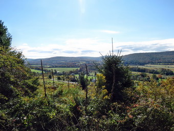
![]()
![]()
![]()
![]()
![]() On Friday, September 27th, I decided to hike a section of the Finger Lakes Trail from Bainbridge toward Masonville. I planned to turn around at Butts Road where the map indicated there was parking available. This section of the trail is closed from October 1st to December 31st by the private landowner for hunting season and I wanted to complete the section so that I would not have to wait until January! I left Livingston Manor at about 7:30 AM and drove through heavy for most of the trip. I followed Route 206 through Downsville and Walton right into Bainbridge. I parked in the municipal park the and the old train station and was ready to hike by 8:45 AM. One of the reasons I had left this section until fall was that it has a relatively long road walk and I wanted some cooler weather. I got my wish as the temperature was still in the low to mid 40's when we left the parking area. The first part of the hike consisted of walking through the streets of Bainbridge and over the Susquehanna River to the traffic circle. We walked out he other side of the circle and continued on Route 206 back toward Walton. We walked under I88 and followed the directions on the map which stated that the trail would cut off to the left just after a yellow house on the right. After almost a mile from the start, I saw a sign for the Finger Lakes Trail on the left. The trail took us through a field and then began to ascend a hill. The grass was very wet from a heavy dew and there was still a dense fog. Initially my boots withstood the constant drenching but soon my feet were wet either from the boots leaking or, more likely, from moisture wicking down my socks from my pants! We passed a trail register as we climbed the hill. At about 1.25 miles we came to a power line right-of-way where the trail all but disappeared. We pushed our way through head-high goldenrod and wrestled with some nasty thorns. I was about to give up and look for another way when we came to an access road to the power lines and the vegetation diminished. There were few marking along the way and I followed the map description hoping I was going the right way! It was a miserable experience! At about 1.6 miles we came to the top of the climb near a hill labeled "Camel's Hump". The trail followed an access road which cut under some of the power lines and then paralleled another. The map description indicated there was a nice view of the river valley and the Sidney Airport but all I could see was the heavy fog. I could hear the traffic on I88 as we followed the access road under the power lines. The trail again entered a grassy area and my drenching continued. We started to descend a little and then, at 2.3 miles just as the map had described, the trail turned south and began to ascend.
On Friday, September 27th, I decided to hike a section of the Finger Lakes Trail from Bainbridge toward Masonville. I planned to turn around at Butts Road where the map indicated there was parking available. This section of the trail is closed from October 1st to December 31st by the private landowner for hunting season and I wanted to complete the section so that I would not have to wait until January! I left Livingston Manor at about 7:30 AM and drove through heavy for most of the trip. I followed Route 206 through Downsville and Walton right into Bainbridge. I parked in the municipal park the and the old train station and was ready to hike by 8:45 AM. One of the reasons I had left this section until fall was that it has a relatively long road walk and I wanted some cooler weather. I got my wish as the temperature was still in the low to mid 40's when we left the parking area. The first part of the hike consisted of walking through the streets of Bainbridge and over the Susquehanna River to the traffic circle. We walked out he other side of the circle and continued on Route 206 back toward Walton. We walked under I88 and followed the directions on the map which stated that the trail would cut off to the left just after a yellow house on the right. After almost a mile from the start, I saw a sign for the Finger Lakes Trail on the left. The trail took us through a field and then began to ascend a hill. The grass was very wet from a heavy dew and there was still a dense fog. Initially my boots withstood the constant drenching but soon my feet were wet either from the boots leaking or, more likely, from moisture wicking down my socks from my pants! We passed a trail register as we climbed the hill. At about 1.25 miles we came to a power line right-of-way where the trail all but disappeared. We pushed our way through head-high goldenrod and wrestled with some nasty thorns. I was about to give up and look for another way when we came to an access road to the power lines and the vegetation diminished. There were few marking along the way and I followed the map description hoping I was going the right way! It was a miserable experience! At about 1.6 miles we came to the top of the climb near a hill labeled "Camel's Hump". The trail followed an access road which cut under some of the power lines and then paralleled another. The map description indicated there was a nice view of the river valley and the Sidney Airport but all I could see was the heavy fog. I could hear the traffic on I88 as we followed the access road under the power lines. The trail again entered a grassy area and my drenching continued. We started to descend a little and then, at 2.3 miles just as the map had described, the trail turned south and began to ascend.
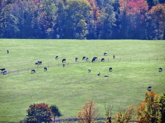 The map description mentioned that this part of the trail was "highly eroded" which turned out to be an understatement. After a gentle beginning the trail deteriorated into a streambed with steep banks. I tried walking on a narrow path along the high banks but both side were undercut and the path kept collapsing. I finally gave up and simply walked he the streambed. After .85 miles and a gain of 450 feet the trail leveled off and became a woods road. The road headed due east toward Neff hill Road with a few small ascent and descents. At about 4 miles into the hike we were on Neff Hill Road where we turned right. The rest of the hike would be all on roads! We walked up a small hill and the started a descent to Highland Acres Road at 4.7 miles. A brief uphill walk brought us to a right turn on Houck Road Extension. The next turn was a left on Houck Road. Over the next 1.2 miles we dropped about 400 feet to Butts Road. Along the way there were some nice views of the countryside and I stopped to take some pictures. There was still a faint haze on the hills and the ;eaves in this area were not as brilliant as some. One at Butts Road I had a decision to make. I knew that I was not going to return by the trail. Turning right would take us out to Route 206 which we could hike back to Bainbridge for an 11 to 12 mile hike. This would still leave a short section from Case Road to Bainbridge and the section from Butts Road to Masonville and back. Turning left would take us to Masonville where we could pick up Route 206 and hike back to Bainbridge from there. My feet were "not happy" and I was not sure of how much mileage then trip to Masonville would add but estimated it would be from 15 to 16 miles total. The wise choice was to turn right for the shorter trip but I chose to turn left and head into Masonville. As we hiked out Butts Road to Route 8 I though about how good Sheila was being on her leash and how that made the trip easier.
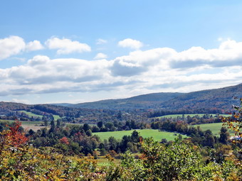 At route 8 we turned right to head toward Masonville which was 1.2 miles away. The traffic on this main road was heavy and everyone seemed to be in a hurry. As we approached Masonville, we turned right on Church Street and walked to the footbridge over Masonville Creek. It was noon so we stopped for a minute to get a drink and a snack. My feet were aching so I removed my wet socks and put on a pair of dry ones. My feet were soaked and looked sore! The new socks seemed to help a little but I should have stopped earlier! I knew we still had some walking to do so we walked to the end of Church Street and turned right on Route 206 and headed back to Bainbridge. The walk along Route 206 was in some ways better than I had anticipated. The traffic was lighter than I thought it might be and the shoulders were wide in most places. I tried to concentrate on anything that would take my mid off my feet! At 11.6 miles we were at the intersection of Butts Road and Route 206 and it was clear that taking the longer route had added almost 5 miles to the hike. The rest of the hike back to Bainbridge was mostly downhill. There were some nice views along the way but I was most interested in continuing forward. At 15.1 miles we were at the point where the trail had cut into the field much earlier in the day. I knew then it was about a mile back to the car. We arrived in the parking area at 2:30 PM which was very close to the time I had estimated. We had covered 16.1 miles in 5 hours and 45 minutes keeping a moving speed of 3 mph overall. I was happy to be off my feet but knew I would have to walk one more time before returning home. No trip to Bainbridge can be complete without a stop at the Pine Ridge Grocery just north of town on Route 206. This Mennonite run store has very high prices but stock some unique items. I was able to walk across the parking area and shop but it was a little painful. I inspected my feet when we got home but didn't see anything amiss. It wasn't until later in the evening that I could see a large blister on the ball of each foot! I think I learned an important lesson about keeping my feet dry and making sure my shoes are laced tight enough to discourage slippage!
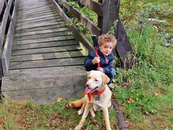
![]()
![]()
![]()
![]()
![]() On Thursday, September 26th, Cindy and I decided to hike with Bryce. We chose Frick Pond as the hike around the pond seemed like an appropriate distance. After feeding Karl and Bryce breakfast we got Bryce and Sheila in the car along with my pack and headed out the Debruce Road. Bryce insisted on having a hiking pole so I shortened one to a length that seemed to suit him. We arrived at 10:35 AM in the parking area on Beech Mountain Road and headed out on the Quick Lake Trail toward the pond. We had to explain to Bryce to lift his feet and to slow down a little as he was more than ready to run down the trail. The trail to the pond can be wet but was only damp in a few places. We were soon at the bridge at the outlet end of Frick Pond. The leaves round the pond had started to change and we stopped so that Cindy and I could both take pictures. After taking a few shots of the pond surrounded by the fall colors, I took some pictures of Cindy, Bryce and Sheila at the bridge. We headed on around the pond and stayed right at the trail junction so that we could walk around the pond. Bryce was very interested in the boardwalks or "long bridges" on the back side of the pond. He kept up a good pace and we were at Times Square by 11:20 AM. Bryce was willing to attack the Big Rock hill but we decided to turn right and head back to the car. The return trip on the Logger's Loop Trail alternated between bright green leaves with blue skies and some trees that were well into their fall colors. When we got back to the junction with the Quick Lake Trail, we turned left and headed back to the car. By this time Bryce was a little tired but he walked all the way back to the car. We hiked 2.2 miles around the pond in about 1.5 hours. Bryce took a short nap on the way home but awoke ready to play when we arrived back home.
On Thursday, September 26th, Cindy and I decided to hike with Bryce. We chose Frick Pond as the hike around the pond seemed like an appropriate distance. After feeding Karl and Bryce breakfast we got Bryce and Sheila in the car along with my pack and headed out the Debruce Road. Bryce insisted on having a hiking pole so I shortened one to a length that seemed to suit him. We arrived at 10:35 AM in the parking area on Beech Mountain Road and headed out on the Quick Lake Trail toward the pond. We had to explain to Bryce to lift his feet and to slow down a little as he was more than ready to run down the trail. The trail to the pond can be wet but was only damp in a few places. We were soon at the bridge at the outlet end of Frick Pond. The leaves round the pond had started to change and we stopped so that Cindy and I could both take pictures. After taking a few shots of the pond surrounded by the fall colors, I took some pictures of Cindy, Bryce and Sheila at the bridge. We headed on around the pond and stayed right at the trail junction so that we could walk around the pond. Bryce was very interested in the boardwalks or "long bridges" on the back side of the pond. He kept up a good pace and we were at Times Square by 11:20 AM. Bryce was willing to attack the Big Rock hill but we decided to turn right and head back to the car. The return trip on the Logger's Loop Trail alternated between bright green leaves with blue skies and some trees that were well into their fall colors. When we got back to the junction with the Quick Lake Trail, we turned left and headed back to the car. By this time Bryce was a little tired but he walked all the way back to the car. We hiked 2.2 miles around the pond in about 1.5 hours. Bryce took a short nap on the way home but awoke ready to play when we arrived back home.
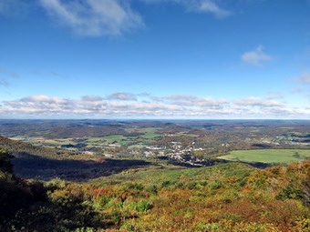
![]()
![]()
![]()
![]()
![]() On Monday, September 23rd, I decided I wanted to take some pictures from Mount Utsayantha near Stamford after hiking Bald Mountain in the same area. We got in the car and I drove into town from Archibald Field. I drove up Tower Mountain Road and turned left at the top onto Tower Road. This is the dirt and gravel access road to the top of Mount Utsayantha. I had decided to drive to the top to take pictures from the fire tower and then simply go home. The road was in decent shape as there is a small park at the top, an education center and several communications towers. I parked at the top at about 10:30 AM and left Sheila in the car as I climbed the tower. As I climbed above the treetops the stiff wind that was blowing became more noticeable. My hands were cold on the metal rails of the tower. I was surprised to find the cab of the tower open. I took some pictures from the landing just below the cab. I climbed up to the top and took some more pictures. It is a challenge to take pictures that include all the wonderful views and avoid the communications towers and wires! Since it was still early, I changed my plans as I descended the tower. I decided to release the hound so that we could hike from the top of the mountain to the bottom and back up. I thought this might be interesting since I had always hiked in the opposite direction. Sheila was happy to be out of the car as I stepped to the bench in front of the Churchill Education Center to take some more pictures. From this viewpoint the village of Stamford is visible with valleys in the foreground and mountains behind. After I took a few shots, we started down the access road. Our next stop was a lookout to the north and east just below the summit. There is a small wooden platform that at some point was used as a launching point for hang gliding. The fall colors were just as nice from this mountain as from Bald Mountain and I took a few more shots. A little farther down the road is a lookout to the east and south toward Churchill Mountain. I again stopped to photograph before returning to the road and heading down the mountain to the southwest. It didn't take long before we were at the end of the access road. We turned around and headed back to the top. I was surprised that the trip back up seemed much easier than I had remembered. We covered 2.1 miles in 45 minutes with a 680 foot ascent on the way back.
On Monday, September 23rd, I decided I wanted to take some pictures from Mount Utsayantha near Stamford after hiking Bald Mountain in the same area. We got in the car and I drove into town from Archibald Field. I drove up Tower Mountain Road and turned left at the top onto Tower Road. This is the dirt and gravel access road to the top of Mount Utsayantha. I had decided to drive to the top to take pictures from the fire tower and then simply go home. The road was in decent shape as there is a small park at the top, an education center and several communications towers. I parked at the top at about 10:30 AM and left Sheila in the car as I climbed the tower. As I climbed above the treetops the stiff wind that was blowing became more noticeable. My hands were cold on the metal rails of the tower. I was surprised to find the cab of the tower open. I took some pictures from the landing just below the cab. I climbed up to the top and took some more pictures. It is a challenge to take pictures that include all the wonderful views and avoid the communications towers and wires! Since it was still early, I changed my plans as I descended the tower. I decided to release the hound so that we could hike from the top of the mountain to the bottom and back up. I thought this might be interesting since I had always hiked in the opposite direction. Sheila was happy to be out of the car as I stepped to the bench in front of the Churchill Education Center to take some more pictures. From this viewpoint the village of Stamford is visible with valleys in the foreground and mountains behind. After I took a few shots, we started down the access road. Our next stop was a lookout to the north and east just below the summit. There is a small wooden platform that at some point was used as a launching point for hang gliding. The fall colors were just as nice from this mountain as from Bald Mountain and I took a few more shots. A little farther down the road is a lookout to the east and south toward Churchill Mountain. I again stopped to photograph before returning to the road and heading down the mountain to the southwest. It didn't take long before we were at the end of the access road. We turned around and headed back to the top. I was surprised that the trip back up seemed much easier than I had remembered. We covered 2.1 miles in 45 minutes with a 680 foot ascent on the way back.
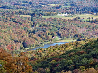
![]()
![]()
![]()
![]()
![]() On Monday, September 23rd, I decided I wanted to try to find the beginnings of the fall color change before it was too late. The leaves around Sullivan County had started to change but the colors were not bright and the areas were limited. For the last few years the leaves have been dull and have been blown off the trees by wind and rain before completing the color change. It has been hard to find any areas of brilliant colors. I decided I had time to head for Bald Mountain near Stamford in Delaware County to see if the leaves there were any brighter than those around Livingston Manor. I had not hiked this mountain before and had gotten the idea from a Lark in the Park description. The mountain was supposed to have many marked trails but no maps. In addition, the viewer the top was described as "270 degrees". The day of the Lark in the Park trip was not good for me and the description stated it would be around 8 miles in 6 hours! I usually aim for 3 miles per hour or so and did not think I could enjoy this leisurely pace. I debated what route to take but as I left Livingston Manor just before 7:30 AM I decided to follow the car GPS. The route given was up the Beaverkill Road and passed Little Pond to Route 30 on the Pepacton Reservoir. From here the directions took us through Andes, Bovina, Hobart and South Kortright on small but well-maintained back roads. I noticed that as soon as we entered Delaware County that more leaves had changed colors and that the colors were brighter! If I had not been under some pressure to finish the hike and get back to coach, I would have stopped several times to take pictures. The route we took was shorter than any other I could have planned and we were soon on Route 10 passing through Stamford. It was easy to find Archibald Field and I pulled in to park just after 8:30 AM. The mountain itself was not visible from the parking area but I knew the route would be to the east and up!
On Monday, September 23rd, I decided I wanted to try to find the beginnings of the fall color change before it was too late. The leaves around Sullivan County had started to change but the colors were not bright and the areas were limited. For the last few years the leaves have been dull and have been blown off the trees by wind and rain before completing the color change. It has been hard to find any areas of brilliant colors. I decided I had time to head for Bald Mountain near Stamford in Delaware County to see if the leaves there were any brighter than those around Livingston Manor. I had not hiked this mountain before and had gotten the idea from a Lark in the Park description. The mountain was supposed to have many marked trails but no maps. In addition, the viewer the top was described as "270 degrees". The day of the Lark in the Park trip was not good for me and the description stated it would be around 8 miles in 6 hours! I usually aim for 3 miles per hour or so and did not think I could enjoy this leisurely pace. I debated what route to take but as I left Livingston Manor just before 7:30 AM I decided to follow the car GPS. The route given was up the Beaverkill Road and passed Little Pond to Route 30 on the Pepacton Reservoir. From here the directions took us through Andes, Bovina, Hobart and South Kortright on small but well-maintained back roads. I noticed that as soon as we entered Delaware County that more leaves had changed colors and that the colors were brighter! If I had not been under some pressure to finish the hike and get back to coach, I would have stopped several times to take pictures. The route we took was shorter than any other I could have planned and we were soon on Route 10 passing through Stamford. It was easy to find Archibald Field and I pulled in to park just after 8:30 AM. The mountain itself was not visible from the parking area but I knew the route would be to the east and up!
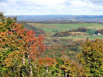 As we started our hike the temperature was still in the 40's and I kept on my light windbreaker to start the hike. Sheila and I started to the east on a dirt road that ran along the south side of the field. The road became a woods road and cross a footbridge over a stream as it entered the forest. We continued east for about .85 miles passing several other trails. As promised the trails were marked in various ways but the markings meant little without a map to follow. I am sure there are many different ways to get to the top of the mountain and the route I chose was purposely not the shortest. At the .85 mile marked the road we were on met another road and I decided to turn northeast until about the 1.2 mile mark. At that junction we turned south to 1.4 miles and then headed southeast. We continued to walk around the summit on the south but then took a trail that switchbacked toward the summit. At 2 miles we finally turned east again and made the final ascent to the top. Just before the summit we stopped at a viewpoint so that I could take some pictures. As we approached the top I could see some buildings and then the remains of some chair lifts. The description of the mountain had not included the fact that it was a former ski area. The views from the top were excellent to the north and spanned at least 180 degrees. By walking round I could choose to include the ski lifts in the pictures or avoid them completely. The fall colors were more prominent in some areas than others but they were very bright in some areas. I took quite a few pictures before deciding to head back to the car. I had decided that since the views from this mountain were good the ones from Mount Utsayantha on the other side of town should be just as good! On the way back I knew I needed to go west and down but chose several different paths to get us there. Eventually we hit the woods road we had come in on and walked it back to the car. The temperature was rising into the low 60's. We had covered 4.5 miles in 1 hour and 45 minutes with about 950 feet of ascent. I hope that someone creates maps of the area as they would greatly enhance the experience.
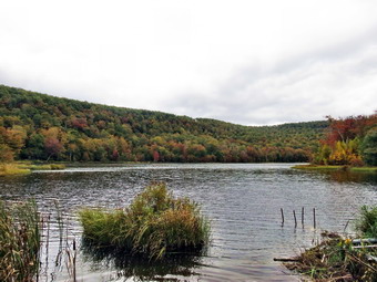
![]()
![]()
![]()
![]()
![]() On Sunday, September 22nd, I decided to take a quick, local hike after church. The forecast called for rain by 2:00 PM and it was already afternoon when as I got started. I got me gear and an excited Sheila into the car and headed up the Beaverkill Road. I turned left on the Covered Bridge Road and continued over the Beaverkill Covered Bridge to Berry Brook Road where I turned right. It wasn't long before the sign for Huggins Lake appeared on the right. I turned right and drove up the access road to the parking area. We got out of the car and were on hit the trail at 12:40 PM. The temperature was cool enough that I left on the light windbreaker I wore over a longsleeved hiking shirt. The sky was bright blue and sunny in places but looking in a different direction showed darker clouds. The sky kept changing as we started up the woods road. As soon as we started to hike, I noticed that the road surface seemed a little smoother and had no weeds and hardly any grass. The last time I had hiked in May of this year the trail was somewhat overgrown and there were some very large blowdowns across the trail. It was obvious that the DEC had been working on the trail with a brush hog and perhaps a front end loader. The first 1.25 miles of the trail is all uphill and gains over 600 feet as it winds its way northeast and then southeast toward the lake. All the blowdowns had been cleared which showed what the DEC can do. After we got to the top of the hill, we started the descent to the lake. This part of the trail is about .6 miles long and was completely cleared of the weeds and brush that had covered it in May.
On Sunday, September 22nd, I decided to take a quick, local hike after church. The forecast called for rain by 2:00 PM and it was already afternoon when as I got started. I got me gear and an excited Sheila into the car and headed up the Beaverkill Road. I turned left on the Covered Bridge Road and continued over the Beaverkill Covered Bridge to Berry Brook Road where I turned right. It wasn't long before the sign for Huggins Lake appeared on the right. I turned right and drove up the access road to the parking area. We got out of the car and were on hit the trail at 12:40 PM. The temperature was cool enough that I left on the light windbreaker I wore over a longsleeved hiking shirt. The sky was bright blue and sunny in places but looking in a different direction showed darker clouds. The sky kept changing as we started up the woods road. As soon as we started to hike, I noticed that the road surface seemed a little smoother and had no weeds and hardly any grass. The last time I had hiked in May of this year the trail was somewhat overgrown and there were some very large blowdowns across the trail. It was obvious that the DEC had been working on the trail with a brush hog and perhaps a front end loader. The first 1.25 miles of the trail is all uphill and gains over 600 feet as it winds its way northeast and then southeast toward the lake. All the blowdowns had been cleared which showed what the DEC can do. After we got to the top of the hill, we started the descent to the lake. This part of the trail is about .6 miles long and was completely cleared of the weeds and brush that had covered it in May.
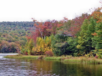 At 1.65 miles the trail turned sharply north and mad the final descent to the lake at 1.9 miles. It was 1:20 PM when we reached the lake and I dropped my pack to take some pictures. I noticed that the leaves had begun to change color and there were some bright spots around the water. Unfortunately, the sky was overcast at this point without any blue or defined clouds. I took some pictures and then turned my attention to throwing a stick for Sheila. After a few throws, I decided to head back to avoid getting wet should the predicted showers materialize. We head up the trail from the lake. By the time we had walked a little over half a mile to the top of the hill the skies were blue again! I thought about returning to the lake but decided to wait for another day when the fall colors would be more pronounced. Within a few minutes the sky had again become overcast and I was glad I had made my decision to return to the car. The trip back down the hill went quickly and we were back at the car by 2:00 PM having covered 3.8 miles in 1 hour and 20 minutes. I was surprised to find we had spent less than 5 minutes stopped at the lake! We headed home and found that the showers never did materialize. I think the fall color change will be early this year. I hope that the colors will be more widespread and vivid than last year.