
What You Missed
Spring 2014
Spring 2014
![]()
![]()
![]()
![]()
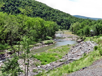
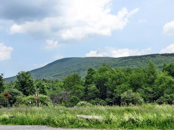
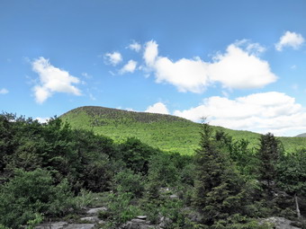
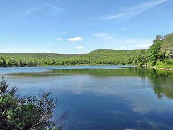
![]() On Friday, June 20th I was ready to hike again and was trying to decide between going north or south. To the north I wanted to complete the section of the Long Path from Route 10 to Barlow's Notch. In New Jersey there were sections of the AT from Waywayanda Mountain to just beyond the New York border. In the end I decided to head north and complete the Long Path section and perhaps hike a small part of the next section. I left Livingston Manor at about 9:15 AM and headed to Windham by driving up the Beaverkill Road to the Barkaboom Road and the taking Route 30 to Route 28. In Margaretville I headed north again on Route 30 to Roxbury and Grand Gorge. In Grand Gorge I took Route 23 through Prattsville to Windham. Along the way I noticed a rather large falls that I had never seen before and thought I might stop on the way back. As I got into Windham, I found Route 21 and took it north to Route 10. The road began to climb and not very far north of the intersection, near the top of the hill, there was a pulloff on the right. The trail was not well marked but the section heading toward Barlow's Notch was just south of the pulloff. I got my gear ready, put on some insect repellant and Sheila and I were on the trail by 9:45 AM. The first .7 miles of trail descended through some hardwoods and then was flat until we got to the junction of Cunningham and Sutton Roads. All the way along I was thinking that this meant the end of the hike would be uphill back to the car! We walked across the road intersection and picked up the trail on the other side. It started out on an old road but quick turned right into the forest and Over the next 1.2 miles we gained over 850 feet as we walked east of the summit of Mount Nebo in a generally south or southeast direction. We started to ascend Mount Hayden by sidehilling around the west shoulder and passing the summit. I was beginning to think the trail would not pass over the summit but then it turned sharply east and we climbed the final 125 feet to the top. There were no viewpoints along the way. There were some places where views might be available when the leaves are off the trees.
On Friday, June 20th I was ready to hike again and was trying to decide between going north or south. To the north I wanted to complete the section of the Long Path from Route 10 to Barlow's Notch. In New Jersey there were sections of the AT from Waywayanda Mountain to just beyond the New York border. In the end I decided to head north and complete the Long Path section and perhaps hike a small part of the next section. I left Livingston Manor at about 9:15 AM and headed to Windham by driving up the Beaverkill Road to the Barkaboom Road and the taking Route 30 to Route 28. In Margaretville I headed north again on Route 30 to Roxbury and Grand Gorge. In Grand Gorge I took Route 23 through Prattsville to Windham. Along the way I noticed a rather large falls that I had never seen before and thought I might stop on the way back. As I got into Windham, I found Route 21 and took it north to Route 10. The road began to climb and not very far north of the intersection, near the top of the hill, there was a pulloff on the right. The trail was not well marked but the section heading toward Barlow's Notch was just south of the pulloff. I got my gear ready, put on some insect repellant and Sheila and I were on the trail by 9:45 AM. The first .7 miles of trail descended through some hardwoods and then was flat until we got to the junction of Cunningham and Sutton Roads. All the way along I was thinking that this meant the end of the hike would be uphill back to the car! We walked across the road intersection and picked up the trail on the other side. It started out on an old road but quick turned right into the forest and Over the next 1.2 miles we gained over 850 feet as we walked east of the summit of Mount Nebo in a generally south or southeast direction. We started to ascend Mount Hayden by sidehilling around the west shoulder and passing the summit. I was beginning to think the trail would not pass over the summit but then it turned sharply east and we climbed the final 125 feet to the top. There were no viewpoints along the way. There were some places where views might be available when the leaves are off the trees.
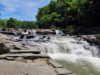 The summit of Mount Hayden was 2.1 miles into the hike and we arrived at about 10:55 AM. Along the way the trail blazes were few and far between in some critical places. Near the summit of Hayden the blazes seemed to just stop. I look every way I could but could not see another blaze. Sheila kept heading to the right and I had to call her back several times. I finally followed her and found that she knew where the trail was headed! There was a right turn down the mountain despite any blazes indicating it! Over the next mile we headed first east and then southeast on a one mile descent to Barlow Notch. We lost 675 feet and walked through some steep sections and some switchbacks. Near the bottom of the descent we came out onto a woods road which was actually marked on the map and GPS. We continued on the trail as I was trying to find the Sutton plaque on the left side of the trail. As we walked I got the feeling that we must have passed the plaque as the forest was beginning to look familiar. We turned around and I found the plaque right where it was a few days before about 3.1 miles from the car. We continued on the trail back toward the car. I was surprised that the initial climb up Mount Hayden seemed pretty easy. By the time we were back at Cunningham Road and climbing the last .7 miles to Route 10 the ascent seemed a little more challenging. We were back at the car at 1:05 PM after hiking 6.2 miles in 3 hours and 20 minutes. The vertical gain was 2030 feet. I debated hiking on the other side of Route 10 toward the summit of Mount Pisgah and actually headed in that direction. I decided against it sine I knew once I was up there I would want to continue the hike. I knew I could not do another 8 to 10 miles and decided to save it for another day. On the way back I stopped at Red Falls and parked the car along the side of the road. I walked down the guardrail until I could get a good look at the falls and took a few shots. On the way back to the car I noticed a trail into the woods and I followed it down to the falls. I was able to walk along the rock ledges than make up the falls. I took some pictures from this vantage point before returning to the car.
![]()
![]()
![]()
![]()
![]() On Tuesday, June 17th I was ready to hike again after an 8 mile effort in northern New Jersey the day before. I thought I might visit the noteworthy Catskills as I expected slightly lower temperatures and not too many insects. I decided to fill in some sections of the Long Path north of Windham. Sheila and I would be making the trip by ourselves as Cindy was tired from the day before. I wanted to hike from Windham to Greene County Route 10 but the one-way distance is 7.5 miles over three different mountains. I did not think I would be able to handle 15 miles so I decided to hike about halfway and turn around at Barlow Notch. This part of the Long Path climbs the shoulder of Ginseng Mountain to Jennie Notch. The trail then loops around the summit and drops significantly to Barlow Notch. These notches have historical significance as they were the routes used by early engineers to build roads in the mountains. Roads through the notches weren't easy to construct but it was much easier that trying to go up and over the summit of even the lower peaks. I wanted to get an early start but slept a little later than I had planned due to two ambulance calls during the night. Sheila and I left Livingston Manor around 8:15 AM and headed out DeBruce Rd to the Frost Valley Road. The Frost Valley Road has been stripped of blacktop and is in the process of being repaved. I knew this but what I didn't know was that a new culvert was being installed near the YMCA camp. The workers were kind enough to let me through after only about a two minute wait. From Route 28 in Shandaken I took Route 42 North to Lexington. The road had reopened some time ago after being closed by a landslide. The new slide was just north of the massive slide than clocked the road the last time. I made good time to Windham and turned right on Route 23 to get to the Elm Ridge parking area. I parked at 9:40 AM and we got ready to hike right away. There were no other cars in the lot which was okay with me. One look at the car thermometer and I could see it was going to be a hot day. The temperature was already in the mid-70's by the time we left the parking area. We walked over to Cross Road, walked across the road and picked up the Long Path which had blue plastic discs as well as the aqua blazes of the Long Path. It was immediately clear that I had not only been wrong about the temperature but also about the insects. A cloud of small flies immediately surrounded by head despite the Herbal Armor I had applied. I was wearing a long-sleeved shirt as I often do but had thought I might change because of the heat. I decided to keep it on to help deal with the insects!
On Tuesday, June 17th I was ready to hike again after an 8 mile effort in northern New Jersey the day before. I thought I might visit the noteworthy Catskills as I expected slightly lower temperatures and not too many insects. I decided to fill in some sections of the Long Path north of Windham. Sheila and I would be making the trip by ourselves as Cindy was tired from the day before. I wanted to hike from Windham to Greene County Route 10 but the one-way distance is 7.5 miles over three different mountains. I did not think I would be able to handle 15 miles so I decided to hike about halfway and turn around at Barlow Notch. This part of the Long Path climbs the shoulder of Ginseng Mountain to Jennie Notch. The trail then loops around the summit and drops significantly to Barlow Notch. These notches have historical significance as they were the routes used by early engineers to build roads in the mountains. Roads through the notches weren't easy to construct but it was much easier that trying to go up and over the summit of even the lower peaks. I wanted to get an early start but slept a little later than I had planned due to two ambulance calls during the night. Sheila and I left Livingston Manor around 8:15 AM and headed out DeBruce Rd to the Frost Valley Road. The Frost Valley Road has been stripped of blacktop and is in the process of being repaved. I knew this but what I didn't know was that a new culvert was being installed near the YMCA camp. The workers were kind enough to let me through after only about a two minute wait. From Route 28 in Shandaken I took Route 42 North to Lexington. The road had reopened some time ago after being closed by a landslide. The new slide was just north of the massive slide than clocked the road the last time. I made good time to Windham and turned right on Route 23 to get to the Elm Ridge parking area. I parked at 9:40 AM and we got ready to hike right away. There were no other cars in the lot which was okay with me. One look at the car thermometer and I could see it was going to be a hot day. The temperature was already in the mid-70's by the time we left the parking area. We walked over to Cross Road, walked across the road and picked up the Long Path which had blue plastic discs as well as the aqua blazes of the Long Path. It was immediately clear that I had not only been wrong about the temperature but also about the insects. A cloud of small flies immediately surrounded by head despite the Herbal Armor I had applied. I was wearing a long-sleeved shirt as I often do but had thought I might change because of the heat. I decided to keep it on to help deal with the insects!
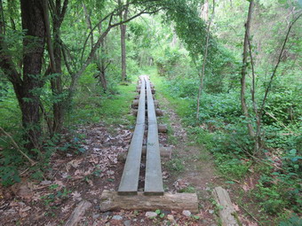
 The first .33 miles was pretty flat and actually paralleled Route 23. The problem was that the trail was not well-maintained and was overgrown. In addition, it was very damp and wet in some places which seemed to attract even more insects. From that point the trail turned north and began to rise but only slightly. Walking through the evergreens reminded me a little of some of the places over on Windham High Peak. At .75 miles we came out of the woods and crossed Old Road to Jennie Notch Road. The trail followed Jennie Notch Road to where it dead ended. There was a small pond or lake on the right with a mountain behind it and I thought I might take some shots on the way back. I had hoped that the insects would abate once we were out on the road but they actually seemed to increase in number. I was serious considering turning around somewhere between 2 and 3 miles! The paved road soon turned to dirt and then ended at about 1.3 miles where there was an open gate. The road actually continued as a grassy lane which was easy to follow even though the blazes were few and far between. Initially the grade of the road was gradual. It was obvious that the road had been important and built up with a shale base at some point. We passed a small pond on the left with some very limited views through the trees. Walking in the woods was cool compared to the times we broke out into the open. Starting at 1.8 mikes the grade increased until we reached Jennie Notch at about 2.4 miles. Along the way I could see some cliffs on the left which defined part of Ginseng Mountain. There had been several switchbacks along the way but at the Notch the trail turned to the left more than 90 degrees. We began to head up the mountain and soon the grade was 30% or more! This didn't last very long and between 2.6 and 2.8 miles we sidehilled along the north shoulder of Ginseng Mountain. The trail leveled a little at the top and then started to descend. I questioned whether or not I really wanted to descend to Barlow's Notch but the insects had decreased so I stuck with my original plan. It was 11:00 AM as we began our descent. The Long Path in this area was overgrown with low briars and nettles and there were several blowdowns. I felt very isolated and far from civilization.
 Over the first half mile we lost about 260 feet from the highest point on the hike. We were walking along a ridge with no real views. I could see sky on either side of the trail as the ridge was not very wide. After the descent, we gained some elevation and then started the drop to Barlow's Notch. On the descent I looked to my right which was generally to the east and got the best view of the day. I took a few shots before continuing down to Notch through several steep places. We hit the Notch at about 3.9 miles but continued to walk a little farther to a small memorial plaque to local resident Donald Sutton. It was 11:40 AM and we had dropped 530 feet from the top of Ginseng Mountain and were now ready to get it back. We got a drink and then started back up. I was surprised that I felt as fresh as I did and the climb seemed to go faster than the descent. We reached the high point at 12:20 PM and I knew that the return trip was now all downhill or flat. We negotiated the steep descent top Jennie Notch without much problem and from that point on it was a quick 1.2 mile walk back to Jennie Notch Road. On the way back down the road the insects reappeared and I decided to walk the roads back rather than take the trail through the woods. We stopped along Jennie Notch Road just before the intersection with Old Road and I took some shots of the pond and the mountains behind it. At the intersection we turned right on Old Road, walked down to Cross Road and followed it back to the parking area. The distance on the roads was a little longer but the time was quicker. We were back in the parking area at 1:40 PM having covered 8.2 miles and climbing 1864 feet in just under 4 hours. I considered trying to find the point where the Long Path crosses Greene County 10 but decided to drive home and wait for another day.
![]()
![]()
![]()
![]()
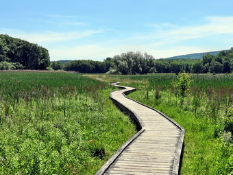
![]() On Monday, June 16th I was ready to hike again after almost a week off. Last week had several rainy days. On Friday we made a trip to Pennsylvania sine our daughter gave birth to her first child on Saturday. We were back by Sunday but I was preaching and it was Father's Day! I knew that I would have to pick a hike that had some special interest to entice Cindy to go along. This was especially true since the forecast called for temperatures in the 80's! I asked her if she would like to hike a section of the AT in Vernon Township in northern New Jersey. This section included the popular Pochuck Boardwalk and suspension bridge. The idea must have piqued her interest as she agreed to go. The drive is surprisingly short at a little over an hour. We left Livingston Manor at about 8:45 AM and took Route 17 south and east to the exit for Florida. In only a little while the turn for Pulaski highway came up on the right so we turned and then followed the signs to Pine Island. From Pine Island we headed south on Route 517 and then made a right on Route 565. When we passed the Vernon Township High School I knew we were close. We drove passed the point where the AT crossed the road. I turned around and found the spot with a pulloff just big enough for two or three cars. No one else was parked so we got ready and headed out on the trail just before 10:00 AM. It was already in the high 60's but I kept on the long-sleeved shirt. We had both put on a liberal covering of Herbal Armor but the insects did not seem to be swarming as I had expected. I thought to myself that this would not be the case by the time we got to the boardwalk across the swamp!
On Monday, June 16th I was ready to hike again after almost a week off. Last week had several rainy days. On Friday we made a trip to Pennsylvania sine our daughter gave birth to her first child on Saturday. We were back by Sunday but I was preaching and it was Father's Day! I knew that I would have to pick a hike that had some special interest to entice Cindy to go along. This was especially true since the forecast called for temperatures in the 80's! I asked her if she would like to hike a section of the AT in Vernon Township in northern New Jersey. This section included the popular Pochuck Boardwalk and suspension bridge. The idea must have piqued her interest as she agreed to go. The drive is surprisingly short at a little over an hour. We left Livingston Manor at about 8:45 AM and took Route 17 south and east to the exit for Florida. In only a little while the turn for Pulaski highway came up on the right so we turned and then followed the signs to Pine Island. From Pine Island we headed south on Route 517 and then made a right on Route 565. When we passed the Vernon Township High School I knew we were close. We drove passed the point where the AT crossed the road. I turned around and found the spot with a pulloff just big enough for two or three cars. No one else was parked so we got ready and headed out on the trail just before 10:00 AM. It was already in the high 60's but I kept on the long-sleeved shirt. We had both put on a liberal covering of Herbal Armor but the insects did not seem to be swarming as I had expected. I thought to myself that this would not be the case by the time we got to the boardwalk across the swamp!
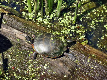 The first .9 miles of trail headed southeast through some hardwood forest. We gained a little elevation and then lost it as we passed by Vernon Township High School. Along the way we could hear students on the athletic fields and we crossed several paths or ATV tracks. We met a couple who were coming from Highland Lakes and were clearly equipped for camping. This would be the first of many people we would meet during the day. The young lady mentioned that the boardwalk was impressive but that it hurt her feet. We were never able to discern the season for this comment! After gaining the top of a small hill, we went on a continuous descent for the next .7 miles losing 385 feet to where the trail crossed Route 517. As we reached the road it was clear that the comment about the boardwalk being popular were correct. There were at least half a dozen cars parked along the road with people starting out on the boardwalk or returning from a stroll. We crossed the road and Cindy got my camera so that I could take some pictures as we started the boardwalk. The boardwalk is an impressive feat as it is a sturdy structure that crosses Pochuck Marsh and Pochuck Creek. It stretches about a mile and has a suspension bridge that spans the creek. The boardwalk is two to three feet above the level of the marsh and is supported by steel pipes driven into the underlying strata. Occasional steel cables tether the structure in place. The vegetation along the edges of the walk has been trimmed back in all places where it is possible. As we started out I took some shots and then continued to take more along the way. We met many people coming and going. What was very surprising was the lack on insects along almost the entire length of the boardwalk and the hike in general! The day was getting warmer and we stopped for some drinks along the way. The boardwalk stopped when it entered the woods and then began on the other side. As we walked passed some trees near the edge of the swamp a red-winged blackbird flew into a tree. I got one good shot of this bird as it sang its song. At about 2 miles it took a sharp bend and crossed some water on a footbridge. We looked down to see a turtle sunning itself on a log. I took some pictures before we continued on.
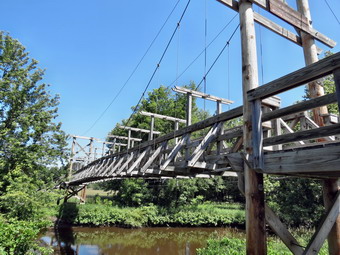 At 2.3 miles we approached Pochuck Creek and could see the suspension bridge. This is a truly remarkable structure which stands at least 15 feet above the level of the creek. It is well-anchored on both ends and has sturdy cables which hold the deck in place. I took pictures as we approached and then some from the boardwalk just before we walked up the steps to cross. From the top of the steps I took some shots of the span across to the other side and after crossing I snapped a few more. We continued along the boardwalk until it entered the woods on the other side of the swamp. The trail remained flat and crossed a small stream on a bridge and then crossed Waywayanda Creek on a larger bridge. We came to a path which looked like a rail trail and crossed it to pick up the AT on the other side. I was watching for Canal Road as I knew we had to cross it at some point. I looked at the GPS and found that the trail we had crossed was Canal Road and I knew it would not be long before we were at the turnaround point on Route 94. There were some more wet areas which we crossed on the puncheons provided. At 3.7 miles we crossed the Conrail tracks. Stiles were provided to cross the fencing that was on either side of the tracks but the parade of hikers has pushed the fence aside making them unnecessary. On the other side of the tracks was an open field with Route 94 just beyond. The field was pretty wet and puncheons stretched across it almost to the road. On the other side of the road was Waywayanda Mountain and I took a few pictures as we continued on to the highway. When we reached the road, we crossed and walked to the parking area where we had hiked Waywayanda more than four years ago! We walked to the sign board and had a snack and a drink before starting back. It was noon and it was very warm and humid and both Cindy and Sheila seemed to be feeling the heat more than I was. The walk back seemed to go quickly as we knew where we were going and stopped fewer times. At one point I looked down to see a large snake on the path. I got a good look at its tail and saw no rattles. The snake didn't seem to be too concerned but I encouraged it to move along as I did not want Sheila to injure it. In several spots I allowed Sheila to jump into the muddy water of the marsh to cool herself. The walk across the boardwalk was especially hot and we passed at Route 517 in the shade before continuing on. It was 1:15 PM as we entered the woods again about 6.25 miles into the hike. The woods were cooler and we were soon on the last stretch of trail back to the car. We were back by 2:15 PM having covered 7.7 miles in just over 4 hours. I was surprised to find that the total1 vertical gain had been more than 1000 feet since the route seemed almost flat to me.
![]()
![]()
![]()
![]()
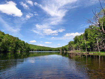
![]() On Tuesday, June 10th I asked Cindy if she would like to take a walk and she agreed. We both had late afternoon commitments so we knew we would have to stay close to home. In addition, the weather forecast was unsettled and indicated possible showers or thunderstorms after noon. We got started shortly after Karl left the house and arrived at the Frick Pond parking area by 10:30 AM. Sheila was more than ready to get going. It was just under 70 degrees but the humidity was high. I decided to wear a long-sleeved shirt while Cindy chose a short-sleeved one. The ground seemed much damper than in Livingston Manor and we thought there might be some insects around so we covered exposed areas of skin with Herbal Armor. Soon we were on the trail toward Frick Pond. The trail was very wet and I pointed out the tire tracks left by an inconsiderate pickup truck owner. The last time I was in the area someone had driven a truck to Frick Pond and parked it on the side of the trail. This, of course, is against state law and good judgment but the owner didn't seem to care. We walked down to the pond and crossed the bridge over the outlet. Fog or low-lying clouds hung over the trees on the other side of the pond. There were quite a few mosquitoes around but the repellent seemed to be keeping them away. I decided that this was not a good day for photography and we quickly started to hike again. At the next trail junction we headed left to stay on the Quick Lake Trail. We were keeping a pretty steady pace as we headed for Iron Wheel Junction. Sheba was running around us following game trails and chasing a few chipmunks and squirrels. At one point she started to run through a stand of ferns that had already grown rather tall. Her body disappeared and all that was visible was her head as it broke through the top of the ferns. I considered taking a video but did not. This was a decision that I regret. When we arrived at Iron Wheel Junction, Cindy turned right on the Logger's Loop but I suggested we head up to Hodge Pond. She agreed and we turned left on the Quick Lake Trail at 11:15 Am after hiking about 1.5 miles.
On Tuesday, June 10th I asked Cindy if she would like to take a walk and she agreed. We both had late afternoon commitments so we knew we would have to stay close to home. In addition, the weather forecast was unsettled and indicated possible showers or thunderstorms after noon. We got started shortly after Karl left the house and arrived at the Frick Pond parking area by 10:30 AM. Sheila was more than ready to get going. It was just under 70 degrees but the humidity was high. I decided to wear a long-sleeved shirt while Cindy chose a short-sleeved one. The ground seemed much damper than in Livingston Manor and we thought there might be some insects around so we covered exposed areas of skin with Herbal Armor. Soon we were on the trail toward Frick Pond. The trail was very wet and I pointed out the tire tracks left by an inconsiderate pickup truck owner. The last time I was in the area someone had driven a truck to Frick Pond and parked it on the side of the trail. This, of course, is against state law and good judgment but the owner didn't seem to care. We walked down to the pond and crossed the bridge over the outlet. Fog or low-lying clouds hung over the trees on the other side of the pond. There were quite a few mosquitoes around but the repellent seemed to be keeping them away. I decided that this was not a good day for photography and we quickly started to hike again. At the next trail junction we headed left to stay on the Quick Lake Trail. We were keeping a pretty steady pace as we headed for Iron Wheel Junction. Sheba was running around us following game trails and chasing a few chipmunks and squirrels. At one point she started to run through a stand of ferns that had already grown rather tall. Her body disappeared and all that was visible was her head as it broke through the top of the ferns. I considered taking a video but did not. This was a decision that I regret. When we arrived at Iron Wheel Junction, Cindy turned right on the Logger's Loop but I suggested we head up to Hodge Pond. She agreed and we turned left on the Quick Lake Trail at 11:15 Am after hiking about 1.5 miles.
At this point the trail becomes more uphill and Cindy was slowing down a little. I slowed my pace and noticed an increase in the number of mosquitoes which were really annoying. We continued on our way up the trail and arrived at Junkyard Junction. At this intersection, the Quick Lake Trail bears to the left and continues on to Quick Lake. We turned right and headed across the Flynn Trail toward Hodge Pond. The Flynn Trail is usually damp but today it was wet! There were pools of water on the trail since it is an old logging road and the lowest point around. Where there were no pools of water, the grass and brush was very wet. My pants were now soaked almost to the knees and I could feel the moisture creeping into my shoes. We turned down the Flynn Trail toward the pond when we got to the gate. We reached the shores of the pond at 12:10 PM about 3.7 miles into the hike. I turned left to follow the jeep trail around the back of the pond. The sky was still overcast and some dark clouds were moving in. On the other side of the pond I turned up the hill toward the ruins of the Beech Mountain Boy Scout Camp. Cindy questioned my decision and I told her this way always seemed shorter to me. The climb up this trail is steeper than the trail from the outlet of Hodge Pond but it is also shorter! When we got to the top of the hill, we turned right to head back toward the Flynn Trail. Once we were back at the Flynn Trail, we turned left and we both knew it was a straight shot back to the car. We both noticed that the mosquitoes were now almost unbearable. There were a lot of them and they were hungry! We set a fast pace to the junction with the Big Rock Trail where we arrived at 12:30 PM after covering 4.4 miles. We had about 1.7 miles to go to get back to the car. The grass on the Flynn Trail was thick, high and saturated with water. Soon my shoes were completely soaked and felt as if they were filled with water. It is possible that water had been wicked into my shoes through my socks but I blame the shoes. It doesn't seem to matter what "waterproof" material manufacturers use since none of them really work! I wasn't really noticing me wet feet since I was wildly swinging my arms trying to KILL mosquitoes. We were back at the car by 1:10 PM having spent about 2.5 hours hiking 6.4 miles.
![]()
![]()
![]()
![]()
![]() On Saturday, June 7th I wanted to get in a hike on National Trails Day. I knew that the NYNJTC was opening the new Long Path relocation over Romer Mountain and had an "event" planned at 11:00 AM. I had no interest in being part of the "event" but wanted to hike the entire trail from end to end. The trail itself is advertised as 9.5 miles and to get to the trailhead on the Woodland Valley end takes a 2.7 mile hike. I knew that I could not hike over 12 miles in one direction and then turn around and hike back to the car! I contacted Smiley's Taxi which serves the area but they could not guarantee that they would have a car on Saturday morning and they said they would not transport a dog anyway! I crossed them off my list of "hiker friendly" businesses and thought about alternate plans. My son Karl agreed to help me out and we set a meeting at 7:30 AM at the store on the corner of Route 47 and Route 28 in Big Indian. I got up early and put my gear and my dog in the car and headed for the rendezvous. When Karl arrived with Bryce, my grandson, in the backseat, he followed me to Lane Street in Phoenicia where I wanted to leave my car. When we pulled in to the parking area, there were cones with signs asking no one to park there because there was going to be an "event". I thought it ironic that the parking lot was closed on the day the trail was to open! I understood and decided to park a little bit down from the parking lot at a wide spot on Lane Street. I put Sheila in the truck and my gear in the bed another hopped in for the ride to Woodland Valley. When we got to the parking area there were quite a few cars already there but only a few hikers in the lot. I put on my gear and put Sheila and her leash to head out on the trail at 8:30 AM. We worked our way through the occupied campsites and crossed the team on the bridge. I often wonder whether the first mile of the trail to Wittenberg discourages some would-be hikers. The first mile of trail from the bridge gains 920 feet at an almost 18% grade. The trail continues to ascend for another .75 miles before leveling off some. Along the way I met a few people coming down off the mountain and passed a few people headed up. Once the trail levels off it is pretty boring until the junction with the trail to Terrace Mountain at 2.5 miles.
On Saturday, June 7th I wanted to get in a hike on National Trails Day. I knew that the NYNJTC was opening the new Long Path relocation over Romer Mountain and had an "event" planned at 11:00 AM. I had no interest in being part of the "event" but wanted to hike the entire trail from end to end. The trail itself is advertised as 9.5 miles and to get to the trailhead on the Woodland Valley end takes a 2.7 mile hike. I knew that I could not hike over 12 miles in one direction and then turn around and hike back to the car! I contacted Smiley's Taxi which serves the area but they could not guarantee that they would have a car on Saturday morning and they said they would not transport a dog anyway! I crossed them off my list of "hiker friendly" businesses and thought about alternate plans. My son Karl agreed to help me out and we set a meeting at 7:30 AM at the store on the corner of Route 47 and Route 28 in Big Indian. I got up early and put my gear and my dog in the car and headed for the rendezvous. When Karl arrived with Bryce, my grandson, in the backseat, he followed me to Lane Street in Phoenicia where I wanted to leave my car. When we pulled in to the parking area, there were cones with signs asking no one to park there because there was going to be an "event". I thought it ironic that the parking lot was closed on the day the trail was to open! I understood and decided to park a little bit down from the parking lot at a wide spot on Lane Street. I put Sheila in the truck and my gear in the bed another hopped in for the ride to Woodland Valley. When we got to the parking area there were quite a few cars already there but only a few hikers in the lot. I put on my gear and put Sheila and her leash to head out on the trail at 8:30 AM. We worked our way through the occupied campsites and crossed the team on the bridge. I often wonder whether the first mile of the trail to Wittenberg discourages some would-be hikers. The first mile of trail from the bridge gains 920 feet at an almost 18% grade. The trail continues to ascend for another .75 miles before leveling off some. Along the way I met a few people coming down off the mountain and passed a few people headed up. Once the trail levels off it is pretty boring until the junction with the trail to Terrace Mountain at 2.5 miles.
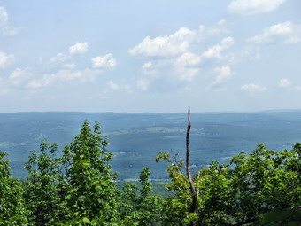
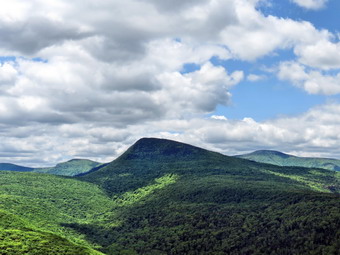
 We turned right at this junction and started toward Wittenberg. I kept looking for the sign for the new trail but it was a little farther than I remembered. At 2.7 miles the trail appeared on the left. It was very obvious but had no sign or markers indicating that is was there. In fact, it had some branches across the trail which usually indicate that a path is the wrong way! I was surprised but turned left onto the new trail. Blue markers indicated that it was an extension of the Pine Hill - West Branch trail and there was also an official Long Path marker as well. As we walked I noted that the surface was much smoother and the trail was more groomed than when I had hiked supplies in to the trail crew last fall. Somewhere along the way Sheila alerted and I put her on her leash. Four members of the crew that had worked so long to create this masterpiece were walking toward us. They were hiking supplies and equipment out while the "event" was going on at the other end of the trail. This was the second and bigger irony of the day! We stopped to talk and they proudly told me that the first lookout was just passed their camp and that I should also take note of the staircase they had built! I thanked them and we continued on our separate ways. At 3.5 miles we passed by the path that led to the trail crew camp. At 3.5 miles we descended the first staircase which was very nicely constructed. I reminded myself that these trail crew members were working only with hand tools and the stones and rocks available around them! We walked along the edge of a dropoff and at 3.7 miles came upon an open rock face with beautiful views to the north and east. Turning to my left I saw the imposing bulk of Wittenberg looking down at me. To the north I could see the mountain of the Devil's Path. The views were spectacular and the day was adequate for taking pictures. I took all the shots I wanted and then we continued on our way. For the next quarter mile the trail descended and I wondered how much of what we lost we would have to gain again. We were actually still on a ridge and lost only about 250 feet. At one point I stepped off the trail to the right and found a nice lookout from which I took a few more pictures.
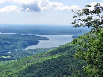
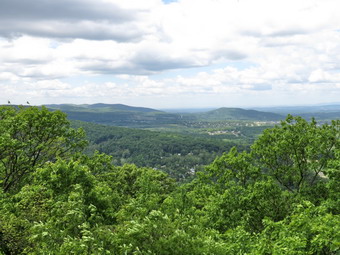
 At 11:15 Am we had hiked 4.75 miles are were starting ascend Cross Mountain. There was a limited lookout on the right with some views of the Ashokan Reservoir. I took some shots and we moved on. A few hundred feet further along there was another, better viewpoint and we stopped so I could take a few pictures. We climbed a little more and there was a third lookout with the best views of all. We stopped and I took photographs of the reservoir and su1rrounding hills. We got back on the main trail and continued over the top of Cross Mountain and then down the other side. The day was warm and the sun was bright. I was glad I had brought along my Camelbak bladder with three liters of water rather than the Sigg bottles I had been using. Around 12:10 PM we were skirting the summit of Mount Pleasant at about 6.5 miles into the hike. There was another great lookout on the left of the trail with an almost 180 degree field of view. Only the view to the north was partially blocked. I took what was to be my last set of pictures and Sheila and I shared a drink and a snack. As we prepared to depart to young men came hiking up the trail from Phoenicia. They had parked at Woodland Valley and were hiking back to their car. They had left before the "event" began. We talked for a moment and the went our separate ways. They would be the first of many groups of people I would meet on the rest of the hike. I was careful to keep Sheila "with" and to restrain her as others approached. If the group was large, I put her on her leash and she was good for the most part. From the lookout there was a drop of about 600 feet to the 8 mile point where there was a slight climb over an unnamed bump. Things began to look familiar as we approached Romer Mountain as I had hiked this section of trail in the fall. The trail at that point was only cleared to the top of Romer Mountain with the rest only marked with flags. At one point a solo hiker approached pushing a measuring wheel ahead of him. I knew this was David White but he said "Hello" to me before I could greet him. We talked briefly and then continued our hikes. At another point I met a couple who have a house on Campbell Brook Road near Roscoe and we talked for a moment. Once we got to the top of Romer Mountain I knew it was less than 3 miles to the car. I met a few more people coming up the trail and passed several groups on the way down. I was moving pretty fast at this point to stay ahead of others and because I simply wanted to be done. Near the bottom, a series of switchbacks turned a quarter mile hike into almost of mile of trail! We were back at the car by 2:30 PM having hiked 11.2 miles in almost exactly 6 hours. We had climbed 2805 feet but descended 3370 feet on our one way journey. I was happy with the time since we had stopped to take pictures and talk so many times!
![]()
![]()
![]()
![]()
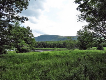
![]() On Sunday, June 1st I wanted to get in a hike on the first day of June. After church I hung around the house for awhile and then decided to go to Trout Pond as the day was so nice. As I drove up Morton Hill Road toward Trout Pond two cars slowed and pulled over to the side of the road. They appeared to be looking for something so I stopped to ask if I could help. They asked about Trout Pond and I told them it was just ahead. I continued on my way and parked on the side of the road at the intersection with Russell Brook Road. I got my pack and poles and leashed Sheila to start down Russell Brook Road. The weather was warm and I decided only to wear a short-sleeved shirt. I soon let Sheila off her leash and she stayed close by as we walked down to the overlook above the upper falls. I had not decided not to stop but the light was hitting the water in a way that attracted me so we walked down the bank. I took a few shots before returning to the road. As we approached the lower parking area I could see several cars but no people. I told Sheila to stay close as we walked down the road to the bridge that crosses Russell Brook. I decided to hike counterclockwise this time just to add some variety. As we walked up the road toward the pond, I thought about perhaps walking the big loop around both ponds. There were two problem with this plan. Crossing Russell Brook at the lower end can be a problem as there is no bridge and the water is cold. I thought I could solve this problem. The second problem is that the road back to the parking area is so washed out there is nowhere to walk in many places. A good deal of sidehilling and rock jumping is required and I didn't think I wanted to handle that. There had been campers at the spot along Russell Brook Road and at the campsite on the trail to Mud Pond but I expected to see more people hiking the trails. We did not meet anyone on the way up the road to Trout Pond although the campsite to the left of the trail just before the pond was occupied. We stopped at the outlet end and I took some pictures. I threw sticks a couple times so that Sheila could get a swim and then we were back on the trail.
On Sunday, June 1st I wanted to get in a hike on the first day of June. After church I hung around the house for awhile and then decided to go to Trout Pond as the day was so nice. As I drove up Morton Hill Road toward Trout Pond two cars slowed and pulled over to the side of the road. They appeared to be looking for something so I stopped to ask if I could help. They asked about Trout Pond and I told them it was just ahead. I continued on my way and parked on the side of the road at the intersection with Russell Brook Road. I got my pack and poles and leashed Sheila to start down Russell Brook Road. The weather was warm and I decided only to wear a short-sleeved shirt. I soon let Sheila off her leash and she stayed close by as we walked down to the overlook above the upper falls. I had not decided not to stop but the light was hitting the water in a way that attracted me so we walked down the bank. I took a few shots before returning to the road. As we approached the lower parking area I could see several cars but no people. I told Sheila to stay close as we walked down the road to the bridge that crosses Russell Brook. I decided to hike counterclockwise this time just to add some variety. As we walked up the road toward the pond, I thought about perhaps walking the big loop around both ponds. There were two problem with this plan. Crossing Russell Brook at the lower end can be a problem as there is no bridge and the water is cold. I thought I could solve this problem. The second problem is that the road back to the parking area is so washed out there is nowhere to walk in many places. A good deal of sidehilling and rock jumping is required and I didn't think I wanted to handle that. There had been campers at the spot along Russell Brook Road and at the campsite on the trail to Mud Pond but I expected to see more people hiking the trails. We did not meet anyone on the way up the road to Trout Pond although the campsite to the left of the trail just before the pond was occupied. We stopped at the outlet end and I took some pictures. I threw sticks a couple times so that Sheila could get a swim and then we were back on the trail.
 The campsite on the right just before the lean-tos was being used but both lean-tos appeared empty. The trails were pretty dry given the recent rain. I decided not to stop to take pictures at the inlet bridge and we continued on the trail up Cherry Ridge. The trails continued to be dry even in post that are always wet. The day remained warm but not too hot and the sunny weather made hiking very pleasant. After about an hour we hit the high point on the trail at about 2.8 miles and then started down the other side. I began to think it would be nice to hike out to the outlet end of Mud Pond to take some pictures as I had only been there a few times. This would prolong the hike which is what I wanted. We were at the trail junction by 1:45 PM and we turned right to go around Mud Pond. The walk around Mud Pond was drier than I ever remember with only a few muddy spots. The walk was longer than I remembered and I missed the side trail down to the pond. After a slight course correction, we walked down to the dam at the outlet end and I dropped my pack to get out my camera. I took some pictures and then had the idea that we could bushwhack around the pond to get back to the main trail. We started around the pond and ran into some pretty thick brush. There did seem to be some paths left by others and eventually we worked our way back to the main trail just south of the intersection. We turned right on the trail and walked back down the hill to the register box. The rest of the hike went quickly with Sheila pulling me up the hill from the lower parking area! We hiked 6.9 miles in 2 hours and 45 minutes gaining about 1240 feet in elevation over the entire hike.
![]()
![]()
![]()
![]()
![]() On Saturday, May 31st I wanted to get away from Livingston Manor and hike in a different area. I had been thinking about completing the parts of the AT in New York that I had not hiked. I decided to hike on the east side of the Hudson to continue my completion of the AT. I checked my previous hikes and saw that I could hike from the top of Shenandoah Mountain along Hosner and Stormville Mountains to Route 52. The distance seemed to be about 9 miles and I knew I would not want to double that on the hike back to the car. I called my son, Kurt, who lives in the area and he agreed to pick me up at the end of the hike and give me a ride back to the car. I got my gear ready and headed south on Route 17 at about 9:00 AM. I had planned a much earlier departure but a late night ambulance call required I get some sleep in the morning! From Route 17 I took I84 east to the Newburgh-Beacon Bridge. I then took the Taconic State Parkway south to the Miller Hill exit. I turned right off the exit and then left on Hortontown Road. I was looking for Long Hill Road and hoping that it continued to the spot where the AT crossed. This was not obvious on most maps. I turned right on Long Hill Road which as appropriately named and drove up hill until the road made a ship right and turned to a dirt road. I was wondering if I was going the right way but soon passed under some powerlines and found the parking area on the right side of the trail at the apex of the road. There were several cars already parked in the small lot but I squeezed into a space, got me gear, put Sheila on her leash and headed out on the trail at 10:30 AM. It was mid 60's so I decided to wear a short-sleeved shirt and a light jacket. I had packed my rain jacket even though there were no thunderstorms predicted until 7:00 PM. I knew that we would be hiking quickly and only stopping if there were really good views. Our first job was to hike to the top of Shenandoah Mountain where we had been on a previous hike but from the opposite direction. The mountain's summit is 1280 feet but we were starting at 1030 feet so I knew the climb would be an easy one. The beginning of the hike was along a dusty, well-traveled path. The trail was ascending but it has hardly noticeable. Soon the grade get even easier and we entered an area where it ran through high brush. It was like being in a maze. There were trail blazes in places but there were also side trails and the markings could have been more numerous. We rounded a corner and came out onto an open rock face which I recognized from the previous hike as the summit of Shenandoah Mountain. It was just 10:50 Am and we had only hiked .4 miles! If I had known Long Hill Road was so close I would have hiked through to it the last time we were at the summit. I took a few pictures and noticed the setting was much the same as before. We turned around and hiked back to the car where I picked up my cell phone. I check for service and had five bars!
On Saturday, May 31st I wanted to get away from Livingston Manor and hike in a different area. I had been thinking about completing the parts of the AT in New York that I had not hiked. I decided to hike on the east side of the Hudson to continue my completion of the AT. I checked my previous hikes and saw that I could hike from the top of Shenandoah Mountain along Hosner and Stormville Mountains to Route 52. The distance seemed to be about 9 miles and I knew I would not want to double that on the hike back to the car. I called my son, Kurt, who lives in the area and he agreed to pick me up at the end of the hike and give me a ride back to the car. I got my gear ready and headed south on Route 17 at about 9:00 AM. I had planned a much earlier departure but a late night ambulance call required I get some sleep in the morning! From Route 17 I took I84 east to the Newburgh-Beacon Bridge. I then took the Taconic State Parkway south to the Miller Hill exit. I turned right off the exit and then left on Hortontown Road. I was looking for Long Hill Road and hoping that it continued to the spot where the AT crossed. This was not obvious on most maps. I turned right on Long Hill Road which as appropriately named and drove up hill until the road made a ship right and turned to a dirt road. I was wondering if I was going the right way but soon passed under some powerlines and found the parking area on the right side of the trail at the apex of the road. There were several cars already parked in the small lot but I squeezed into a space, got me gear, put Sheila on her leash and headed out on the trail at 10:30 AM. It was mid 60's so I decided to wear a short-sleeved shirt and a light jacket. I had packed my rain jacket even though there were no thunderstorms predicted until 7:00 PM. I knew that we would be hiking quickly and only stopping if there were really good views. Our first job was to hike to the top of Shenandoah Mountain where we had been on a previous hike but from the opposite direction. The mountain's summit is 1280 feet but we were starting at 1030 feet so I knew the climb would be an easy one. The beginning of the hike was along a dusty, well-traveled path. The trail was ascending but it has hardly noticeable. Soon the grade get even easier and we entered an area where it ran through high brush. It was like being in a maze. There were trail blazes in places but there were also side trails and the markings could have been more numerous. We rounded a corner and came out onto an open rock face which I recognized from the previous hike as the summit of Shenandoah Mountain. It was just 10:50 Am and we had only hiked .4 miles! If I had known Long Hill Road was so close I would have hiked through to it the last time we were at the summit. I took a few pictures and noticed the setting was much the same as before. We turned around and hiked back to the car where I picked up my cell phone. I check for service and had five bars!
 We now headed north on the AT to complete the section which ends at the Taconic State Parkway. Once we got to the end of that section we could begin the walk along Hosner Mountain to Route 52 where I hoped we would be picked up for a ride back to the car. Just as I started on the trail a couple and their dog were going toward Shenandoah Mountain. I asked them about the trail and they said it was easy to follow. From Long Hill Road the trail descended with only a few small ascents along the way. There were no real views but the weather was warm and the walk pleasant. At 1.4 miles we broke out of the woods onto a power line right-of-way. The trail quickly re-entered the woods still heading downhill but turning more to the northeast. Along the way we met two young men headed south to Bear Mountain from North Adams, Massachusetts. One was from the area near Bear Mountain but his friend was from Utah. I asked them about Hosner Mountain and they said "It wasn't too bad." At 2.7 miles the trail started a steep descent to the lowest point on the hike at 370 feet. We crossed a stream and then another on bridges before ascending toward Hortontown Road at 3.25 miles. This area of the trail had several stretches of puncheons used to cross wet ground. The ground was very dry which made the small foot bridges seem out of place. Just before the road a nice hiker's cabin was just off the trail to the right. This was no lean-to or shelter but a full-fledged "cabin" enclosed on three sides to match the regulations for AT shelters. The privy was on the left side of the trail and I imagined this would be a welcome stop for those hiking long distances on the AT. We crossed the road and the climbed for about .25 miles before crossing under the Taconic Parkway on Miller Hill Road. Just after the parkway, we turned left on Rock Ledge Road. The trail almost immediately turned right into the woods and we stopped for a drink. I replaced my GPS batteries and put the unit back on my pack. We headed up rather steep grade and walked for about .15 miles until I noticed my GPS unit was not on my pack! We headed back down the trail to the point where we had stopped but I did not find the unit. I hefted my pack and noticed that my "lost" GPS unit was imply a little too high on my shoulder strap! We turned around and continued the hike.
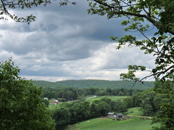 For the next mile or so the trail gained about 500 feet in elevation as it followed along the western shoulder of the Hosner Mountain ridge. A blue trail headed down the mountain at one point but I had no indication of where it went. Eventually the trail leveled off a little with only a few ups and downs. Just before passing by the summit of Hosner Mountain at 5.4 miles, there was a very nice lookout to the left of the trail looking west and north. There were mountains in the background and plowed farmland below. Several small villages dotted the landscape. We stopped so that I could take pictures and then continued on our way. At 6.3 miles the trail began to descend and as we started this descent there was another small lookout on the right of the trail to the east and south. I called Kurt to see if he was prepared to pick me up and had surprisingly good service. For the next .7 miles the trail lost about 460 feet of elevation and traveled over some slick rocks. Somewhere along the way the rain began to fall but it was fairly light and the sky looked as if it would clear. We crossed Hosner Mountain Road 7 miles into the hike. Just after the road we crossed another stream on a bridge and then began to climb! The rain began to come down much harder so I stowed my electronics in a plastic bag and put on my rain jacket. This is usually enough to stop the rain but not this time. Over the next .65 miles we gain about 450 feet as the trail skirted the summit of Stormville Mountain. There were MANY short switchbacks which cut the steepness of the ascent but became annoying after a while. This was not a really steep or long ascent but I was a little tired and the rain was still coming down. The expensive Mountain Hardwear Plasmic Jacket was disappointing. It is supposed to breathe well and does not have any venting. It is no better than any other jacket that I have. It does not breathe and I was soaked in sweat! After a brief descent there was another ascent before the descent to Route 52 where we arrived at 2:55 PM. We waited until my son Karl came to pick us up and take us back to the car. We covered 8.5 miles in 4 hours and 20 minutes with about 2330 feet of ascent and over 2500 feet of descent!
![]()
![]()
![]()
![]() On Tuesday, May 27th I decided to get in some hiking close to home as I had track practice in the afternoon. I was tired of the same loops around Frick and Hodge Ponds and Trout Pond so I decided to park on Route 206 north of Roscoe and hike the Campbell Mountain Trail. My plan was to hike the trail out and return on the roads. These roads are almost devoid of traffic except for the last half mile on Route 206. I got my gear and put an anxious Sheila in the back seat before heading out. We arrived at the pulloff on Route 206 at 10:50 AM and got on the trail immediately. After a few hundred feet on the trail, I released Sheila from her leash and she seemed to enjoy this immensely. When hiking the AT or the more populated trails, I usually keep her on her leash a good part of the time. She behaves well on her leash but prefers the freedom of following her nose even though she usually doesn't range very far. The first part of the trail descends to a small stream and this part has pretty wet. We crossed the stream on a bridge and almost immediately started the climb up Campbell Mountain. The trail is never very steep but gaining over 700 feet in a little more than a mile gets the heart pumping. At about 1.3 miles we passed the spur trail to the lean-to and continued the climb. At 1.6 miles a snowmobile trail branched off to the right. This is also the new route for the Finger Lakes Trail which my wife and I had hiked last summer. I was sure there had been a sign, trail blazes and a register box when we hiked it but I saw none of those this time. We made good time to the top of the mountain averaging 2.7 mph even up the hill. I decided I would stick with the original plan and we continued over the mountain and descended the other side.
On Tuesday, May 27th I decided to get in some hiking close to home as I had track practice in the afternoon. I was tired of the same loops around Frick and Hodge Ponds and Trout Pond so I decided to park on Route 206 north of Roscoe and hike the Campbell Mountain Trail. My plan was to hike the trail out and return on the roads. These roads are almost devoid of traffic except for the last half mile on Route 206. I got my gear and put an anxious Sheila in the back seat before heading out. We arrived at the pulloff on Route 206 at 10:50 AM and got on the trail immediately. After a few hundred feet on the trail, I released Sheila from her leash and she seemed to enjoy this immensely. When hiking the AT or the more populated trails, I usually keep her on her leash a good part of the time. She behaves well on her leash but prefers the freedom of following her nose even though she usually doesn't range very far. The first part of the trail descends to a small stream and this part has pretty wet. We crossed the stream on a bridge and almost immediately started the climb up Campbell Mountain. The trail is never very steep but gaining over 700 feet in a little more than a mile gets the heart pumping. At about 1.3 miles we passed the spur trail to the lean-to and continued the climb. At 1.6 miles a snowmobile trail branched off to the right. This is also the new route for the Finger Lakes Trail which my wife and I had hiked last summer. I was sure there had been a sign, trail blazes and a register box when we hiked it but I saw none of those this time. We made good time to the top of the mountain averaging 2.7 mph even up the hill. I decided I would stick with the original plan and we continued over the mountain and descended the other side.
The temperature seemed to be in the high 70's and it was humid but I did not notice too many insects. I did notice that the nettles were beginning to flourish in the wetter and sunnier places. We hit Campbell Mountain Road at about 11:40 AM after hiking 2.4 miles. I thought about continuing on the trail to Campbell Brook Road but did not feel comfortable with my limited time. We turned left and hiked slightly uphill toward the intersection with Jug Tavern Road. It didn't take long for us to hike the .7 miles to the intersection where we turned left and continued our hike toward Route 206. There are a few hunting cabins and second homes along the road and several permanent dwellings. We kept up the quick pace. At one point a lone turkey crossed the road which real got Sheila's attention! We made the 1.5 miles or so in good time and turned left on Route 206 to complete the loop. It was less than a mile back to the car and we arrived at 12:40 PM. We had covered 5.5 miles in under 2 hours. The hike was not long or difficult but fit easily into my schedule.
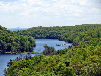
![]()
![]()
![]()
![]()
![]() On Sunday, May 25th I wanted to get away from Livingston Manor and hike in a different area. I had been thinking about completing the parts of the AT in New York that I had not hiked. I decided to hike on the east side of the Hudson to continue my completion of the AT. I checked my previous hikes and saw that I could hike from Canopus Lake on Route 301 to the top of Shenandoah Mountain which, at 1280 feet, was supposed to have a nice view. The roundtrip distance looked seemed to be about 8 miles. Cindy decided she was not feeling well enough to go so I packed up quickly after returning from church but didn't get on the road until about 11:15 AM. I headed south on Route 17 to I84 east and took I84 to the Newburgh-Beacon Bridge. I then took exit 13 off I84 following Route 9 south for 6.5 miles to Route 301. I turned left on Route 301, drove 4.6 miles to Canopus Lake. The lake is very popular and there were already a lot of cars parked on the shoulder of Route 301. Fortunately, the road is wide here and I was able to find a spot to park. It was ready in the low 70's so I decided to wear a short-sleeved shirt and no jacket. I did pack a light windbreaker and my rain jacket since there were some thunderstorms predicted for around 5:00 PM. After getting soaked the day before, I had no desire to repeat the experience nor did I want top get caught in the woods in a thunderstorm! I knew that we would be hiking quickly and only stopping if there were really good views. WI got my gear ready and put Sheila on her leash as we headed across the road at 12:45b PM. I soon let Sheila off her leash as there were fewer hikers on the trail than I expected. We did meet quite a few groups but each time I either put Sheila on her leash or got a firm hold on her collar. The trail was very rocky at the beginning and ascended and then descended quite a bit. In the first .5 miles we gained over 200 feet and then lost most of it again before gaining it back. I kept looking for views of Canopus Lake but there were only brief views through the trees. I began to wonder if there would be any views at all. At about 2.0 miles we turned right sharply and began to climb on a switchback. At the top was a rock outcropping with a nice view of the lake and the beach. There was also a group of six people so I leashed Sheila to a tree in the shade. I dropped my pack and got took some pictures. Someone in the group asked me to take some pictures of the group with the backdrop of the lake. I used a camera and cell phone to take some shots. After a drink and a snack, Sheila and I headed out on the trail as the group turned around to head back. At this point I noticed I had only brought one water bottle. I questioned my poor planning and whether this was enough water to get me through.
On Sunday, May 25th I wanted to get away from Livingston Manor and hike in a different area. I had been thinking about completing the parts of the AT in New York that I had not hiked. I decided to hike on the east side of the Hudson to continue my completion of the AT. I checked my previous hikes and saw that I could hike from Canopus Lake on Route 301 to the top of Shenandoah Mountain which, at 1280 feet, was supposed to have a nice view. The roundtrip distance looked seemed to be about 8 miles. Cindy decided she was not feeling well enough to go so I packed up quickly after returning from church but didn't get on the road until about 11:15 AM. I headed south on Route 17 to I84 east and took I84 to the Newburgh-Beacon Bridge. I then took exit 13 off I84 following Route 9 south for 6.5 miles to Route 301. I turned left on Route 301, drove 4.6 miles to Canopus Lake. The lake is very popular and there were already a lot of cars parked on the shoulder of Route 301. Fortunately, the road is wide here and I was able to find a spot to park. It was ready in the low 70's so I decided to wear a short-sleeved shirt and no jacket. I did pack a light windbreaker and my rain jacket since there were some thunderstorms predicted for around 5:00 PM. After getting soaked the day before, I had no desire to repeat the experience nor did I want top get caught in the woods in a thunderstorm! I knew that we would be hiking quickly and only stopping if there were really good views. WI got my gear ready and put Sheila on her leash as we headed across the road at 12:45b PM. I soon let Sheila off her leash as there were fewer hikers on the trail than I expected. We did meet quite a few groups but each time I either put Sheila on her leash or got a firm hold on her collar. The trail was very rocky at the beginning and ascended and then descended quite a bit. In the first .5 miles we gained over 200 feet and then lost most of it again before gaining it back. I kept looking for views of Canopus Lake but there were only brief views through the trees. I began to wonder if there would be any views at all. At about 2.0 miles we turned right sharply and began to climb on a switchback. At the top was a rock outcropping with a nice view of the lake and the beach. There was also a group of six people so I leashed Sheila to a tree in the shade. I dropped my pack and got took some pictures. Someone in the group asked me to take some pictures of the group with the backdrop of the lake. I used a camera and cell phone to take some shots. After a drink and a snack, Sheila and I headed out on the trail as the group turned around to head back. At this point I noticed I had only brought one water bottle. I questioned my poor planning and whether this was enough water to get me through.
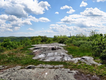 Just a little farther along the trail there was a lookout to the north and west. I stopped to take a few shots. In the distance I could see some mountains through the haze and it seemed that they could have been the Catskills. At about 2.85 miles we had dropped some elevation and I could hear traffic on a road even more distinctly than on the rest of the hike. The traffic was on the Taconic State Parkway. At this point the trail started to follow a woods road and the surface became smoother and easier to walk. We increased our pace as the trail began to climb gently toward what I believed was Shenandoah Mountain. Along the way I could see hiker ahead and I put Sheila on the leash. It was a family group that had stopped to rest in the middle of the trail. As I approached they said "Hello" but showed no signs of moving out of the way. I left the trail to get around them and they seemed not to notice what they were doing! A little farther along I met two women coming toward me who were setting a rapid pace. We exchanged brief greetings and continued in opposite directions. We continued to follow the trail NNE until it finally broke out onto an open rock face at almost exactly 4 miles. I walked a little farther on the trail but it began to descend toward Long Hill Road. I found a USGS marker at the top and decided this was where we would turn around. I dropped my pack to take some pictures including one of the marker and a US flag painted on the rocks. I took a long drink and hoped I would have enough water to make it back without cramping. We turned around at 2:50 PM and I hoped the skies would stay clear and blue!
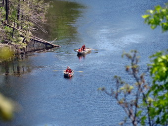 The trip back seemed to go faster but my GPS said we were keeping about the same pace as on the way out. The difference would be that I did not intend to stop. At one point I looked up to see a hiker coming and Sheila ran up to him barking. I apologized and discussed the matter with Sheila. We decided that she would need to wear her training collar until she learns not to scare other hikers when I cannot get her on her leash! We continued then hike back and the constant up and down coupled with the rough, rocky trail began to wear me down a little. I had thought on the drive to Canopus Lake about calling my son Kurt so that he could pick me up at the end of the trail and give me a ride back to the car. This way I could hike 8 miles and get 8 miles of trail rather than hike 8 miles and get 4 miles of trail! Unfortunately, the next time I thought about it we were already 2 miles out. We continued to meet people on the way back and Sheila was good for the most part. We did run into the first mosquitoes of the season which reminded me to always put on some repellant. At 4:45 we crossed Route 301 and walked a little further on the shoulder to make sure we connected with our previous hike. We walked back to the car and got ready to depart. A young man and woman were looking for a ride to Cold Spring and I agreed to take them at least part of the way. I introduced the young man to Sheila and she had no objections to him riding in the back seat. The pair and taken Metro North to Cold Spring from the city and were returning tired after two days. She was from British Columbia and he was from France. We had a nice conversation as I took them at the way to Cold Spring and dropped them near the station. I took Route 9D south to the bear Mountain Bridge and returned home from there. We had hiked 8 miles in just over 4 hours with several stops for photography. The total vertical gain was only about 1600 feet and there were no difficult climbs.
![]()
![]()
![]()
![]()
![]() On Saturday, May 24th Jeff Senterman was at Morgan Outdoors to talk about the new Willowemoc Trail Crew. Jeff is the supervisor for all Catskill trails for the NYNJTC. About six people showed up on this busy weekend and Jeff explained the use of the different crews and how the trail crew will operate. The trail crew will be able to do trail maintenance and repair in all areas of the Willowemoc Wild Forest which includes, among other areas, Frick and Hodge Ponds and Mud and Trout Ponds. After the presentation, we were scheduled to meet at Frick Pond to do a loop and assess some of the work that needed to be done. I was the first one to the parking area and found there were already four cars parked there which was a record. The rest of the group arrived a little after noon and we started out to Frick Pond where the plan was, apparently, to stop and eat lunch. I had decided that I would walk a, loop of the pond and then rejoin the group for the rest of the hike. The hike to Frick Pond was very...leisurely as Jeff pointed out some work we had done and answered some questions. We noticed that there seemed to be fresh ruts on the woods road to the pond. We finally arrived at the first trail junction where we would head left to the pond. I immediately spotted a pickup truck a short distance up the Loggers Loop Trail. I walked over to the truck but no one was round. I got the license plate number make and model. We all marveled that someone would be so inconsiderate! I suggested to Jeff that the first thing that had to be done was to put a log across the woods road or install a gate. Any work a trail crew does could be undone in an instant by one pickup track! I walked down to the pond and threw a stick in for Sheila and waited for the rest of the group to arrive. When they did appear they were discussing whether or not they could make it around the pond or whether they would just turn around AFTER eating lunch! At this point I excused myself and Sheila and I headed out on the Quick Lake Trail to begin a loop. The clouds were starting to roll in and I wondered if the rain would hold off until we were done.
On Saturday, May 24th Jeff Senterman was at Morgan Outdoors to talk about the new Willowemoc Trail Crew. Jeff is the supervisor for all Catskill trails for the NYNJTC. About six people showed up on this busy weekend and Jeff explained the use of the different crews and how the trail crew will operate. The trail crew will be able to do trail maintenance and repair in all areas of the Willowemoc Wild Forest which includes, among other areas, Frick and Hodge Ponds and Mud and Trout Ponds. After the presentation, we were scheduled to meet at Frick Pond to do a loop and assess some of the work that needed to be done. I was the first one to the parking area and found there were already four cars parked there which was a record. The rest of the group arrived a little after noon and we started out to Frick Pond where the plan was, apparently, to stop and eat lunch. I had decided that I would walk a, loop of the pond and then rejoin the group for the rest of the hike. The hike to Frick Pond was very...leisurely as Jeff pointed out some work we had done and answered some questions. We noticed that there seemed to be fresh ruts on the woods road to the pond. We finally arrived at the first trail junction where we would head left to the pond. I immediately spotted a pickup truck a short distance up the Loggers Loop Trail. I walked over to the truck but no one was round. I got the license plate number make and model. We all marveled that someone would be so inconsiderate! I suggested to Jeff that the first thing that had to be done was to put a log across the woods road or install a gate. Any work a trail crew does could be undone in an instant by one pickup track! I walked down to the pond and threw a stick in for Sheila and waited for the rest of the group to arrive. When they did appear they were discussing whether or not they could make it around the pond or whether they would just turn around AFTER eating lunch! At this point I excused myself and Sheila and I headed out on the Quick Lake Trail to begin a loop. The clouds were starting to roll in and I wondered if the rain would hold off until we were done.
We got to at Iron Wheel Junction quickly and turned left to take the Quick Lake Trail to Junkyard Junction. The skies were looking more ominous now as we ascended the Quick Lake Trail which was already wet in many spots. Soon I could hear drops of rain and looked up to see we were headed in the direction of some very black clouds. I put on my rain jacket and decided to continue hoping that the rain would be brief and that we could walk out of it. My hopes did not come true! The rain began in earnest and I was glad I had put the camera and GPS in a plastic bag in my pack. The rain gear actually kept me pretty dry and it was a cool rain so sweat was not as much of a problem as it had been in the past. The rain continued until my pants, shoes and pack were drenched. We turned right on the Flynn Trail at Junkyard Junction and found the trails were pools of water. The rain did let up some and I thought "At least there was no lightning!" at this point there was a loud clap of thunder but there was only one. We were soon at the gate where we followed the trail down to Hodge Pond. The rain had let up some and I decided to take the quickest way back which was to stay on the Flynn Trail. As we entered the clearing at the outlet end of Hodge Pond, three hikers approached from the other direction. We exchanged greetings and lament about the weather. I considered warning them about lightning but decided they could decide for themselves. A light rain continued as we ascended the Flynn Trail and walked to the junction with the Big Rock Trail. There wasn't much rain as we walked the last 1.7 miles down the Flynn Trail and back to the car. I was completely soaked but still had a good time. We covered 6.6 miles in about 3 hours which I thought was a good pace considering the slow start and the heavy downpour!
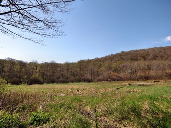
![]()
![]()
![]()
![]()
![]() On Tuesday, May 20th, I had planned to do a hike with a friend somewhere close to home. We both had tight schedules fro the day as we decided to Alder lake and hike to the Beaver Meadow Lena-to. I picked her up at her house at about 8:30 AM and we headed toward Turnwood and Alder Creek Road. I parked in the Alder Lake parking area at 8:40 AM and we started our hike almost immediately. There were no other cars in the lot. The temperature was in the 60's with a slight breeze. We headed down to the left of the "lawn" toward the trail around the left side of the lake. My friend almost immediately announced that she wanted to "speed hike". I told her I did not want to go too fast but she took off ahead of me anyway. This continued on and off for the rest of the hike. I was sorry she did not want to hike with me as I very frequently hike alone and would have liked to have a conversation! Sheila was happy to be out and kept me company as we hiked on the very muddy trail around the lake. We crossed the bridges and at about .8 miles turned left to head toward the lean-to on the Millbrook Ridge Trail. The trail was wet and muddy in many places and there were both old and new blowdowns to contend with. For the next 1.5 miles the trail climbs and then levels off several times. The elevation gain is several hundred feet but the grade is never more than 12% and averages around 6%. There isn't too much to see along the way but this day was very pleasant. I enjoyed the sounds and sights of Alder Creek as it flows parallel to the trail much of the way. As we neared the lean-to we passed by a series of beaver meadows until we arrived at the lean-to.
On Tuesday, May 20th, I had planned to do a hike with a friend somewhere close to home. We both had tight schedules fro the day as we decided to Alder lake and hike to the Beaver Meadow Lena-to. I picked her up at her house at about 8:30 AM and we headed toward Turnwood and Alder Creek Road. I parked in the Alder Lake parking area at 8:40 AM and we started our hike almost immediately. There were no other cars in the lot. The temperature was in the 60's with a slight breeze. We headed down to the left of the "lawn" toward the trail around the left side of the lake. My friend almost immediately announced that she wanted to "speed hike". I told her I did not want to go too fast but she took off ahead of me anyway. This continued on and off for the rest of the hike. I was sorry she did not want to hike with me as I very frequently hike alone and would have liked to have a conversation! Sheila was happy to be out and kept me company as we hiked on the very muddy trail around the lake. We crossed the bridges and at about .8 miles turned left to head toward the lean-to on the Millbrook Ridge Trail. The trail was wet and muddy in many places and there were both old and new blowdowns to contend with. For the next 1.5 miles the trail climbs and then levels off several times. The elevation gain is several hundred feet but the grade is never more than 12% and averages around 6%. There isn't too much to see along the way but this day was very pleasant. I enjoyed the sounds and sights of Alder Creek as it flows parallel to the trail much of the way. As we neared the lean-to we passed by a series of beaver meadows until we arrived at the lean-to.
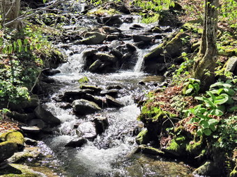 We walked down to the lean-to and I dropped my pack and got out the camera. It had taken less than an hour to get to the beaver meadow. I walked out to the edge of the beaver meadow and took pictures of the blue sky with white puffy clouds contrasted against the green beaver meadow. I decided to hike a short distance along the trail to the next beaver meadow. When we got there I took some pictures before going back to the trail and hiking back to the lean-to. As we approached the lean-to, I noticed some whitetail deer had come down to the meadow. Sheila noticed them to but did not chase them. I put Sheila on her leash and again dropped my pack at the lean-to to take a few more pictures. I picked up my pack and we headed back down the trail. I stopped in several places and walked down to the creek to take some pictures of the water as it sparkled in the sun. We were soon at the loop trail around Alder lake where we turned right to retrace our path back to the car. At one point there was an opening in the trees and I couldn't resist taking some shot across the lake of Cradle Rock Ridge. We continued back to the "lawn" near the dam at the outlet end of the lake. I stopped to take a few final shots and then we headed back to the car. We were back at 10:45 AM having covered 4.8 miles in just over 2 hours. The total elevation gain was just under 700 feet.
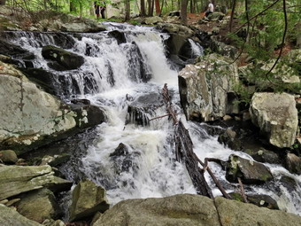
![]()
![]()
![]()
![]()
![]() On Sunday, May 18th I wanted to get away from Livingston Manor and hike in a different area. I had been thinking about completing the parts of the AT in New York that I had not hiked. I decided to hike on the east side of the Hudson to continue my completion of the AT. I checked my previous hikes and saw that I could hike from Dennytown Rd in Fahnestock State Park north to the Canopus Lake on Route 301. The roundtrip distance looked seemed to be between 6 and 8 miles. Cindy decided she wanted to go with me so we packed up quickly after returning from church and headed south on Route 17 to I84 east. I took I84 to the Newburgh-Beacon Bridge and then took exit 13 off I84 following Route 9 south for 6.5 miles to Route 301. I turned left on Route 301, drove 2.6 miles and turned right on Dennytown Rd. We passed the first parking area on the left near Sunk Mine Rd. and parked at the second where the At crossed the road. I had no trouble finding the lot this time. There were several other vehicles parked and some hikers were entering the woods while others were coming out. I had not anticipated much activity and wondered if Sheila would have to be on her leash much of the time. We parked at 12:45 PM and I put Sheila on her leash so that we could get started immediately. We entered the woods on the AT to start the hike. After a short distance, it was obvious there were no other hikers on the trail so I let Sheila go. She ranged up and won the trail some but didn't go too far and came back when called. We walked to the top of a low ridge and then down the other side. Along the way we did meet a young couple eating lunch perched on a large boulder. At 1.4 miles we crossed Sunk Mine Road and picked up the trail just on the other side. At 1.6 mile we had to cross a small stream that drained a beaver pond. The stream was a little high and we took our time finding the best place to cross. A group of hikers was crossing in the most obvious place so we walked off the trail and downstream where I found a small waterfall. I took a few pictures giving the others time to cross. As I was about to put the camera back in the pack, I noticed a round stone with a hole in the middle. I took pictures of the millstone before stowing the camera and crossing the stream. We inspected the beaver pond but there didn't seem to be any recent activity. Downstream from the pond was a huge marsh covered in reeds. There were many of these along the way.
On Sunday, May 18th I wanted to get away from Livingston Manor and hike in a different area. I had been thinking about completing the parts of the AT in New York that I had not hiked. I decided to hike on the east side of the Hudson to continue my completion of the AT. I checked my previous hikes and saw that I could hike from Dennytown Rd in Fahnestock State Park north to the Canopus Lake on Route 301. The roundtrip distance looked seemed to be between 6 and 8 miles. Cindy decided she wanted to go with me so we packed up quickly after returning from church and headed south on Route 17 to I84 east. I took I84 to the Newburgh-Beacon Bridge and then took exit 13 off I84 following Route 9 south for 6.5 miles to Route 301. I turned left on Route 301, drove 2.6 miles and turned right on Dennytown Rd. We passed the first parking area on the left near Sunk Mine Rd. and parked at the second where the At crossed the road. I had no trouble finding the lot this time. There were several other vehicles parked and some hikers were entering the woods while others were coming out. I had not anticipated much activity and wondered if Sheila would have to be on her leash much of the time. We parked at 12:45 PM and I put Sheila on her leash so that we could get started immediately. We entered the woods on the AT to start the hike. After a short distance, it was obvious there were no other hikers on the trail so I let Sheila go. She ranged up and won the trail some but didn't go too far and came back when called. We walked to the top of a low ridge and then down the other side. Along the way we did meet a young couple eating lunch perched on a large boulder. At 1.4 miles we crossed Sunk Mine Road and picked up the trail just on the other side. At 1.6 mile we had to cross a small stream that drained a beaver pond. The stream was a little high and we took our time finding the best place to cross. A group of hikers was crossing in the most obvious place so we walked off the trail and downstream where I found a small waterfall. I took a few pictures giving the others time to cross. As I was about to put the camera back in the pack, I noticed a round stone with a hole in the middle. I took pictures of the millstone before stowing the camera and crossing the stream. We inspected the beaver pond but there didn't seem to be any recent activity. Downstream from the pond was a huge marsh covered in reeds. There were many of these along the way.
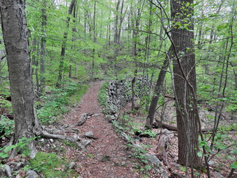 At 2.7 miles we had just finished a slight ascent on the AT and come to a junction with the Three Lakes Trail. A young woman approached us from the left Andre stopped to speak to her for a moment before continuing on our separate ways. Cindy and I agreed that it might be more interesting to take the Three Lakes Trail back since the AT in this area was not very special. As we continued on the AT we found that we were walking on a sort of raised causeway supported by stonework. This continued for almost a mile. The trail did not seem wide enough to ever have been a road and we wondered at the origin of such an elaborate effort. At 3.6 miles we arrived at Route 301 and Canopus Lake. There were quite a few cars at various pullouts along the roadway. I crossed the road to take a few pictures and then rejoined Cindy and Sheila on the other side. We walked northeast on what appeared to be the old road for less than a quarter mile where we found the Three Lakes Trail. We turned right and started south on the trail and almost immediately met the woman we had talked to previously. This time I asked her if she had seen amine since the map indicated the Phillips Mine was right along the trail. She said she had not seen anything and I was disappointed as I like to discover and explore this aspect of history. We again parted heading in different directions. Within a few hundred feet we found a long teach on the right side of the trail which was obviously the Phillips Mine. Many of these mines are simple pits or trenches and they can be hard to spot unless you know what you are looking for. We explored some and I took a few pictures. We got back on the main trail and walked a short distance and ran into another larger trench and a tailings pile. It was obvious that the trail had been constructed after the trench was abandoned. I took a few more pictures before we continued on.
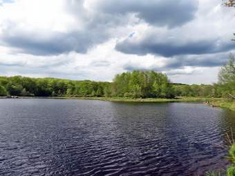 At 4.6 miles we turned west just after passing a large marsh. This trail was lower than the At and passed through more bottomland rather than staying1 on a ridge. At 4.9 miles we descended to a small stream and met another hiker coming our way. Crossing the stream was easy but Sheila stopped to take a swim. We started to ascend a ridge on a switchback and met some more hikers. Sheila was being good about not barking or straining at her leash! At 5.3 miles we were at the cairn that marked the trail junction and we continued straight ahead on the Three Lakes Trail. At 5.5 miles we passed by another lake and I stopped briefly to take a few pictures. The trail continued without much elevation change and with a much flatter surface than the AT. At 6.7 miles the trail came to the shores of the third lake where I, again, stopped to take a few shots. Just below the lake the trail crossed the outlet stream. There was no bridge and the water was a little high. We looked for another place to cross and, finding none, returned to the trail crossing. Sheila bounded across surprising a couple of hikers on the other side. Cindy and I worked our way across on some logs and stones. At 7 mile we were back at Sunk Mine Road where we turned right and walked uphill for about a tenth of mile before turning south into the woods for the last stretch of trail back to the car. Our insect repellant had worn off and some small flies buzzed around. The final part of the trail was slightly uphill and along a small stream and another large marsh. Eventually we crossed the stream and passed by and old stone structure which I remembered from the previous hike. It was a short walk through a meadow and back to the parking area. We were back at 4:50 PM having covered 7.9 miles in just over 4 hours. The total vertical gain was about 1440 feet. After the hike, we met Aimee, Kurt and Ariana at the Maya Caf� in Fishkill for a delicious dinner.
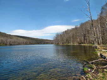
![]()
![]()
![]()
![]() On Monday, May 12th, I decided I wanted get out and do a hike close to home and Cindy wanted to go too. We decided to go to Trout Pond since we had not been there recently wand wanted to see how the recent rainfall had impacted the falls. We were in no real hurry to get started so we arrived at the top of Russell Brook Road at about 10:15 AM and parked on the side of Morton Hill Road. I noticed a U-Haul truck at the illegal camping area just down the road and put Sheila on her leash before starting out. We had driven through a massive hatch on the way but the bugs didn't seem too bad so we got started right away. I wore a light windbreaker and it was immediately clear I would have to remove it since the temperature was already in the 70's. As we passed the truck, an older man struck up a conversation giving us advice about the area. I didn't want to be impolite and tell him we hiked this route at least once every two weeks! We continued on down Russell Brook Road to the overlook of the falls. We were both surprised that there was not as much water as we had thought there would be in the stream. We continued to the lower parking area and then got on the woods road that crosses the brook. At the trail junction just after the register we turned to the left to climb the steeper hill toward Mud Pond. The trail was rather dry with only a few wet spots and the ascent went quickly. The sun was out and I stopped to remove my jacket as it was very warm. We reached the top of the hill and started down the other side. Sheila alerted and I looked up to see a hiker coming our way. The hiker was another older man who was apparently enjoying the warm weather as he was not wearing a shirt! We said "hello" and continued to the next trail junction where we turned right to start over the shoulder of Cherry Ridge to Trout Pond.
On Monday, May 12th, I decided I wanted get out and do a hike close to home and Cindy wanted to go too. We decided to go to Trout Pond since we had not been there recently wand wanted to see how the recent rainfall had impacted the falls. We were in no real hurry to get started so we arrived at the top of Russell Brook Road at about 10:15 AM and parked on the side of Morton Hill Road. I noticed a U-Haul truck at the illegal camping area just down the road and put Sheila on her leash before starting out. We had driven through a massive hatch on the way but the bugs didn't seem too bad so we got started right away. I wore a light windbreaker and it was immediately clear I would have to remove it since the temperature was already in the 70's. As we passed the truck, an older man struck up a conversation giving us advice about the area. I didn't want to be impolite and tell him we hiked this route at least once every two weeks! We continued on down Russell Brook Road to the overlook of the falls. We were both surprised that there was not as much water as we had thought there would be in the stream. We continued to the lower parking area and then got on the woods road that crosses the brook. At the trail junction just after the register we turned to the left to climb the steeper hill toward Mud Pond. The trail was rather dry with only a few wet spots and the ascent went quickly. The sun was out and I stopped to remove my jacket as it was very warm. We reached the top of the hill and started down the other side. Sheila alerted and I looked up to see a hiker coming our way. The hiker was another older man who was apparently enjoying the warm weather as he was not wearing a shirt! We said "hello" and continued to the next trail junction where we turned right to start over the shoulder of Cherry Ridge to Trout Pond.
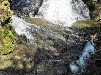 The ascent continued for the next 1.2 miles until at 2.8 miles into the hike we were at the highest point and ready to start the descent to Trout Pond. The trail remained relatively dry and easy to negotiate. We descended the rest of the way to Trout Pond and stopped at the inlet. The skies were not the best for photography but I took some pictures of the pond before continuing on. We continued on the main trail toward the outlet of the pond. Along the way I noticed a large rock on the shoreline that I had not seen before. I walked out to the rock and took some pictures of the pond from a perspective I had not used before. I also threw a stick into the water to let Sheila get some time swimming which she loves! As we approached the lower end of the pond I looked at the time and decided to bypass a stop and continue on to finish the hike. We were soon back at the register box. Just passed the box I noticed two hikers approaching with a small King Charles spaniel. I put Sheila on her leash but the other hikers made no effort to leash there dog or even to control it. I am always surprised when others are so inconsiderate! We continued on to the parking area and then finished with the hike up Russell Brook Road back to the car, We arrived back at 12:45 PM having covered 5.5 miles and 1100 vertical feet in 2.5 hours.
![]()
![]()
![]()
![]()
![]() On Saturday, May 10th I wanted to get in a longer hike and thought about getting away from Livingston Manor to do it. I looked at the weather forecast and the best scenario still called for showers wherever I wanted to go. I was not willing to travel a long distance to hike in poor weather. In addition, our grandson Bryce had slept over and he is a very active child. His parents stopped by to pick him up in the morning and we had coffee and breakfast together. Sometime after 19:00 Am I decided I still wanted to hike and decided to head to Frick Pond to do it. On the way up DeBruce Road I ran into a hatch and knew the insects at the ponds might be a problem. I had not decided on an exact route as I got out of the car and applied a liberal coating of Herbal Armor. This bug repellant is one of the better alternatives to DEET which is highly toxic and can react adversely with synthetic materials. Sheila was ready to go and we crossed the road to head up the Flynn Trail at about 11:15 AM. The skies were cloudy and a haze hung over much of the scenery. We kept a quick pace up the Flynn Trail and arrived at the junction with the Big Rock Trail at 11:50 AM having hiked the 1.7 miles in only 35 minutes! We stopped for a minute so that I could remove the light jacket I had worn. I was glad my wife had convinced me to wear a short-sleeved shirt since it was over 70 degrees at the time. As we headed toward Hodge Pond on the Flynn Trail, I decided we would lengthen our trip by visiting the Lookout over the pond near the Sullivan County highpoint. At the next junction we veered to the right following a woods road to the area near the old Beech Mountain Boy Scout Camp. We continued straight ahead as the woods road ascended the hill. Some new tire tracks were clear and it appeared a pickup truck had driven in from Shin Creek Road in Lew Beach. This part of the road was damp and I was surprised that there wasn't more water on the trails after the recent rain. After hiking about 2.6 miles, we made a sharp right off the road and followed the very clear but unmarked trail to the lookout. Our destination was only about .25 miles ahead and we covered that distance quickly. The trail was wet in places but we easily walked around the dampest places. One quick look from the viewpoint confirmed that it was not a day to take pictures. I didn't even get out my camera before we turned around and headed back down the mountain.
On Saturday, May 10th I wanted to get in a longer hike and thought about getting away from Livingston Manor to do it. I looked at the weather forecast and the best scenario still called for showers wherever I wanted to go. I was not willing to travel a long distance to hike in poor weather. In addition, our grandson Bryce had slept over and he is a very active child. His parents stopped by to pick him up in the morning and we had coffee and breakfast together. Sometime after 19:00 Am I decided I still wanted to hike and decided to head to Frick Pond to do it. On the way up DeBruce Road I ran into a hatch and knew the insects at the ponds might be a problem. I had not decided on an exact route as I got out of the car and applied a liberal coating of Herbal Armor. This bug repellant is one of the better alternatives to DEET which is highly toxic and can react adversely with synthetic materials. Sheila was ready to go and we crossed the road to head up the Flynn Trail at about 11:15 AM. The skies were cloudy and a haze hung over much of the scenery. We kept a quick pace up the Flynn Trail and arrived at the junction with the Big Rock Trail at 11:50 AM having hiked the 1.7 miles in only 35 minutes! We stopped for a minute so that I could remove the light jacket I had worn. I was glad my wife had convinced me to wear a short-sleeved shirt since it was over 70 degrees at the time. As we headed toward Hodge Pond on the Flynn Trail, I decided we would lengthen our trip by visiting the Lookout over the pond near the Sullivan County highpoint. At the next junction we veered to the right following a woods road to the area near the old Beech Mountain Boy Scout Camp. We continued straight ahead as the woods road ascended the hill. Some new tire tracks were clear and it appeared a pickup truck had driven in from Shin Creek Road in Lew Beach. This part of the road was damp and I was surprised that there wasn't more water on the trails after the recent rain. After hiking about 2.6 miles, we made a sharp right off the road and followed the very clear but unmarked trail to the lookout. Our destination was only about .25 miles ahead and we covered that distance quickly. The trail was wet in places but we easily walked around the dampest places. One quick look from the viewpoint confirmed that it was not a day to take pictures. I didn't even get out my camera before we turned around and headed back down the mountain.
When we arrived back at the area near the remains of the boy scout camp, we turned right and followed the woods road down to the jeep trail that goes around the back of Hodge Pond. We took the next right to get back on the Flynn Trail heading for Junkyard Junction. The trails were relatively clear of any new obstructions and we made good time to the gate at the top of the hill. At this point the Flynn Trail flattens out and this is where we finally found where all the rain had accumulated. The Flynn Trail in this area seemed to be one long bog interrupted by small pools. Walking on the side of the trail helped in some places but it did slow us down some. At 12:50 PM we had finally hiked the 4.7 miles to Junkyard Junction where the Flynn Trail ends at the Quick Lake Trail. We turned left to head down the hill and back toward the parking area. The first part of the Quick Lake Trail rolls a little and it also was wet in spots. As we began to descend the trail became drier for the moist part. I began to hear gunfire to the west and tried to judge the type of gun. At times the firing was so fast I thought there may have been more than one weapon firing! It seemed to be a small caliber rifle or a handgun. We continued our hike but I was uneasy as I did not know the source of the shooting or the direction. When we reached Iron Wheel Junction at 6.3 miles, we turned right to stay on the Quick Lake trail back to Frick Pond. This trail was also wet in spots but these places were easier to avoid. We were soon crossing the bridge at the outlet to Frick Pond. I had considered other possible ways to extend the hike but had some things to do at home. We continued back to the parking area and the car. I was surprised to find five vehicles parked in the main lot as I had seen no other hikers along the entire route. We were back at the car at 2:00 PM having covered 7.7 miles in 2 hours and 45 minutes with a total elevation gain of just under 1300 feet. As I drove home a heavy burst of rain hit making me glad I had decided to end the hike when I did.
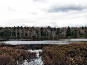
![]()
![]()
![]()
![]()
![]() On Tuesday, May 6th I had arranged to hike with Lisa from Morgan Outdoors, the local hiking store in Livingston Manor. Lisa arrived at my house just after 9:00 AM and we headed for the new section of rail trail that had opened last year in Parksville. Lisa is sponsoring a trail running shoe trying event long the trail in the bear future and wanted to assess the trail. We parked in the large, paved parking area near the Methodist Church and walked toward Main Street. At the four-way intersection we walked across the street and to the right where we picked up the start of the rail trail. There are no special signs or any kiosk marking the trail but it is easy to spot. I had Sheila on her leash until we were a little farther along the trail. The section of trail we walked was very flat with a relatively hard packed surface. It was damp in places but it was still a pleasant walk. The first part of the trail follows Little Coddington Brook until it empties into and becomes part of the Little Beaverkill. At one point about .5 miles in we passed by an area of waterfalls and rapids and I was sorry I had left my pack and camera behind. Our hike ended at a small bridge constructed over an area that was too narrow for safe passage. As I looked over the side of the bridge, I spotted a rather large chunk of ice that remained from the winter! We walked back to the car and headed up the Cooley Road to our second destination, Long Pond, where we had decided to hike the long loop.
On Tuesday, May 6th I had arranged to hike with Lisa from Morgan Outdoors, the local hiking store in Livingston Manor. Lisa arrived at my house just after 9:00 AM and we headed for the new section of rail trail that had opened last year in Parksville. Lisa is sponsoring a trail running shoe trying event long the trail in the bear future and wanted to assess the trail. We parked in the large, paved parking area near the Methodist Church and walked toward Main Street. At the four-way intersection we walked across the street and to the right where we picked up the start of the rail trail. There are no special signs or any kiosk marking the trail but it is easy to spot. I had Sheila on her leash until we were a little farther along the trail. The section of trail we walked was very flat with a relatively hard packed surface. It was damp in places but it was still a pleasant walk. The first part of the trail follows Little Coddington Brook until it empties into and becomes part of the Little Beaverkill. At one point about .5 miles in we passed by an area of waterfalls and rapids and I was sorry I had left my pack and camera behind. Our hike ended at a small bridge constructed over an area that was too narrow for safe passage. As I looked over the side of the bridge, I spotted a rather large chunk of ice that remained from the winter! We walked back to the car and headed up the Cooley Road to our second destination, Long Pond, where we had decided to hike the long loop.
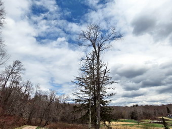 We arrived at the Long Pond parking area on Flugertown Road at about 10:30 AM and got on the trail almost immediately. The first .6 miles of the trail has a 320 foot elevation gain which really got us warmed up for the rest of the hike. The trail was wet in many places but the worst spots were easy to avoid. We kept up a quick pace and were soon at the spur trail that goes down to the western side of the pond. We walked down the trail and stopped to take a few pictures. The conditions were not ideal but I took a few shots anyway. Soon we were back on the main trail where we turned right at the first trail junction to begin the big loop. By 11:40 AM we had hiked 2.5 miles and were passing by the spur trail to the Long Pond lean-to. The trail continued to be wet in places and some spots were very muddy. At one point Lisa alerted me to a porcupine ahead in the woods to the right of the trail. I immediately put Sheila on her leash and looked ahead into the woods. I informed Lisa that the porcupine was a bear cub running back and forth. A closer look showed TWO bear cubs playing with each other! The cubs climbed quickly up a tree before I could get a picture. We decided to make some noise and quickly pass by the area. This proved successful as we never saw the mother of the cubs. The trail soon led to a woods road where we turned left and followed it to the junction with Basily Road. We continued to bear left and to follow the dirt road toward the Peters Hunting Camp. We crossed the small stream on the footbridge and I stopped to take a few pictures. We passed by the hunting camp and used their bridge to cross the larger stream and continue on Basily Road. I stopped to take a few pictures after which we set a quick pace back to the car. The road went from dirt to packed gravel and eventually became paved. Along the way the name changes to Flugertown Road. We made good time on the paved road arriving back at the car at 1:00 PM. We had hiked the 6.0 mile loop in 2 hours and 25 minutes. The fact that the total elevation gain is only 600 feet helped!
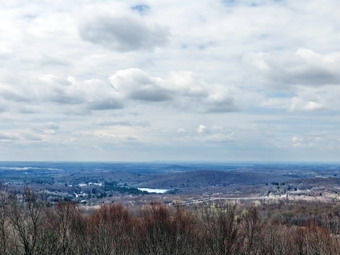
![]() On Saturday, May 3rd I wanted to go somewhere locally to hike We talked about various options and then settled on Walnut Mountain in Liberty. We had not been there in some time and the trails allow many different possibilities for creating your own adventure. We weren't in a great hurry but parked at lot on West Lake Street at about 10:20 AM. There were two other cars in the lot but I knew there would probably be more activity at the main parking area which was closer to the playground and ball fields. We headed southwest on the A2 trail which turned out to be very wet in places. It also showed some use by a pickup truck or other wheeled vehicle which helped the water to collect! The local bike club has done extensive work creating trails in the park and their work was evident as well-constructed and well-marked bike trails crossed our path. When the A2 trail met the main A1 trail we followed the A1 to the right or south as it began a climb along the shoulder of the mountain. We eventually ended up at a picnic table with a nice view. We were able to pick out the old Stevensville Hotel
On Saturday, May 3rd I wanted to go somewhere locally to hike We talked about various options and then settled on Walnut Mountain in Liberty. We had not been there in some time and the trails allow many different possibilities for creating your own adventure. We weren't in a great hurry but parked at lot on West Lake Street at about 10:20 AM. There were two other cars in the lot but I knew there would probably be more activity at the main parking area which was closer to the playground and ball fields. We headed southwest on the A2 trail which turned out to be very wet in places. It also showed some use by a pickup truck or other wheeled vehicle which helped the water to collect! The local bike club has done extensive work creating trails in the park and their work was evident as well-constructed and well-marked bike trails crossed our path. When the A2 trail met the main A1 trail we followed the A1 to the right or south as it began a climb along the shoulder of the mountain. We eventually ended up at a picnic table with a nice view. We were able to pick out the old Stevensville Hotel
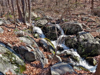
![]()
![]()
![]()
![]()
![]() On Friday, May 2nd I wanted to get away from Livingston Manor and hike in a different area. I had been thinking about completing the parts of the AT in New York that I had not hiked. I decided to hike on the east side of the Hudson to continue my completion of the AT. I checked my previous hikes and saw that I could hike from Dennytown Rd in Fahnestock State Park south to the Old Albany Post Road where I had stopped on a previous hike. The The forecast for the day was for partly sunny skies with temperatures in the high 60's. There was some wind in the forecast but no rain was predicted. I wanted to be done as early as possible to get home to see my and I headed out rather early as this was a longer drive than usual. We left Livingston Manor before 8:00 AM and headed down the Quickway. I took I84 to the Newburgh-Beacon Bridge and then took exit 13 off I84 following Route 9 south for 6.5 miles to Route 301. I turned left on Route 301, drove 2.6 miles and turned right on Dennytown Rd. From here I had a slight problem finding the correct parking lot. This was all my fault as I was following the GPS in the car rather than looking at the road. I found the first parking area on the left near Sunk Mine Rd. I then passed the correct parking area on the left where the AT crosses. I turned around an easily saw it on the way back. The parking area is large with a trailhead sign and several stone buildings. I parked at 9:20 AM and we were on the trail shortly thereafter. We crossed the road under partly cloudy skies and began our walk by descending slightly and then climbing to a ridge. This rolling terrain is typical in this area. The trail was very wet in several places with some areas resembling a stream bed. There were also spots that had pooled water and required a detour. At 1.5 miles the trail turned sharply to the north which bothered me a little. Soon it approached a small stream and began to follow the stream south again. At one point we stopped so that I could take some pictures of a small waterfall.
On Friday, May 2nd I wanted to get away from Livingston Manor and hike in a different area. I had been thinking about completing the parts of the AT in New York that I had not hiked. I decided to hike on the east side of the Hudson to continue my completion of the AT. I checked my previous hikes and saw that I could hike from Dennytown Rd in Fahnestock State Park south to the Old Albany Post Road where I had stopped on a previous hike. The The forecast for the day was for partly sunny skies with temperatures in the high 60's. There was some wind in the forecast but no rain was predicted. I wanted to be done as early as possible to get home to see my and I headed out rather early as this was a longer drive than usual. We left Livingston Manor before 8:00 AM and headed down the Quickway. I took I84 to the Newburgh-Beacon Bridge and then took exit 13 off I84 following Route 9 south for 6.5 miles to Route 301. I turned left on Route 301, drove 2.6 miles and turned right on Dennytown Rd. From here I had a slight problem finding the correct parking lot. This was all my fault as I was following the GPS in the car rather than looking at the road. I found the first parking area on the left near Sunk Mine Rd. I then passed the correct parking area on the left where the AT crosses. I turned around an easily saw it on the way back. The parking area is large with a trailhead sign and several stone buildings. I parked at 9:20 AM and we were on the trail shortly thereafter. We crossed the road under partly cloudy skies and began our walk by descending slightly and then climbing to a ridge. This rolling terrain is typical in this area. The trail was very wet in several places with some areas resembling a stream bed. There were also spots that had pooled water and required a detour. At 1.5 miles the trail turned sharply to the north which bothered me a little. Soon it approached a small stream and began to follow the stream south again. At one point we stopped so that I could take some pictures of a small waterfall.
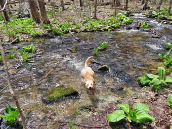 Eventually the trail headed due south and we continued to descend albeit with a few moderate ascent along the way. At 2.7 miles we crossed South Highland Road. Along the way we passed three hikers traveling north. We exchanged pleasantries and I was happy that Sheila did not bark or strain too much at her leash. The hikers had southern accents and after we passed each other I began to wonder if they were hiking the entire AT from south to north. Although I knew it was early in the AT hiking season, This question bothered me for some time. We continued to head south and continued to descend and I thought about hiking back to the car and an almost all uphill stretch! At 11:00 AM we crossed Canopus Hill Road at 3.7 miles and descended to Canopus Creek. Just before the creek, we found another hiker sitting on a rock. We stopped a minute to rest and chat. Sheila was again civil. The hiker was headed from the Bear Mountain Bridge north on the AT and planned to spend several days hiking and camping. He had met the hikers with the southern accents and found they were from Kentucky but were section hiking. He did tell me that there was at least one hiker who had started the AT in February in Georgia and was now north of our position! I vowed to find his journal online as the conditions at times must have been...challenging. Crossing Canopus Creek was not easy as the water was high and there was no bridge. I hopped from rocks to rock to log while Sheila simply waded and swam across.
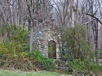 In front of us now was Canopus Hill and while the hike to the top was only about .7 miles the elevation gain was over 400 feet with a 15% grade. None of this really bothered me except for the fact that the skies were beginning to cloud over and the wind was picking up. I had believed the forecast and left my rain gear at home. I did not relish getting wet but decided not to give up on completing this section of the AT. We forged up the hill without any problems although some of the blazes were clearly wrong! One directed us to the left as the trail turned right! When we got to the top of the hill, there was an open spot but no real viewpoint. The star on the NYNJTC maps was a little further along on the descent and we continued to walk. As so often happens, no lookout appeared and probably had been obscured by trees over the years. The descent on the other side was steep and rocky but the elevation loss was not as great as the gain on the other side. At 4.7 miles we had descended the road and were very near the Old Albany Post Road. Unfortunately, the trail paralleled the road for another .6 miles before crossing one more swampy area. We crossed Chapman Road and the Old Albany Post Road and arrived at the spot where I had stopped on the previous hike. At this point the skies had cleared and the sun was peeking through. This significantly improved my spirits. We took a short break for a snack and water and turned around to begin the return hike at 11:50 AM. The hike back was uneventful and seemed to go quickly. When we got to the top of Canopus Hill, Sheila began to run back and forth on the trail like a maniac but this is normal for her! We crossed the creek without incident and stopped so that I could take some pictures of the sparkling water and very green vegetation. We crossed the road and began the last three miles of hiking gaining about 1000 feet in the process. It was much easier than I thought. I stopped twice to take pictures of the stone walls in the area. I had noticed these on the way out since they were extensive and much wider than usual. I thought about the purpose of the walls and how they indicate what was now forest had since been open farms. We were back at the car by 2:30 PM having covered 10.5 miles in 5 hours and 10 minutes which was further than I had planned. In the process we gained a little over 2500 feet. Once we were at the car I put Sheila in the back seat and got out my camera. I took a few pictures of the small "shed" by the parking area and then walked to the shell of another stone building. The Three Lakes Trail passed right by this structure. The stonework was beautiful and I tried to guess its function and what it looked like just after it was constructed.
![]()
![]()
![]()
![]()
![]() On Friday, April 25th I wanted to get away from Livingston Manor and hike in a different area. I had been thinking about completing the parts of the AT in New York that I had not hiked. I decided to hike on the east side of the Hudson to continue my completion of the AT. I checked my previous hikes and saw that I could hike from the White Rocks near Canada Hill east and north toward Defiance Hill and the Old Albany Post Road. The problem was that the White Rocks are not near a trailhead. After consulting the maps, I decided that I could park oat an area called Graymoor that had a parking area right on the AT. I wanted to be done as early as possible to get home to see my and I headed out rather early as this was a longer drive than usual. We left Livingston Manor before 8:00 AM and headed down the Quickway. I took I84 to the Newburgh-Beacon Bridge and then used Route 9D to go south to Garrison where I followed Route 403 southeast to Route 9. At Route 9 I tuned left and shortly after turned right onto Old West Point Road. A short distance up the road I found Graymoor Road and turned right. Graymoor, it turns out, is a Franciscan monastery and retreat. I found the AT almost immediately but did not find anything that looked like parking. I talked to two women walking the grounds and they told me that everyone parks near the AT on the grassy shoulder. I went back to the At, parked and we were on the trail by 9:20 AM heading southwest to follow the AT to the White Rocks area. We descended for about .3 miles and then walked another .2 miles where we crossed Route 9 and Route 403. After crossing the roads, there was a sign board or kiosk and then a long elevated walkway across a marshy area. We then began to climb for the next .5 miles to a trail junction that looked familiar. Along the way we walked on a fairly wide and well-maintained woods road along a small stream.
On Friday, April 25th I wanted to get away from Livingston Manor and hike in a different area. I had been thinking about completing the parts of the AT in New York that I had not hiked. I decided to hike on the east side of the Hudson to continue my completion of the AT. I checked my previous hikes and saw that I could hike from the White Rocks near Canada Hill east and north toward Defiance Hill and the Old Albany Post Road. The problem was that the White Rocks are not near a trailhead. After consulting the maps, I decided that I could park oat an area called Graymoor that had a parking area right on the AT. I wanted to be done as early as possible to get home to see my and I headed out rather early as this was a longer drive than usual. We left Livingston Manor before 8:00 AM and headed down the Quickway. I took I84 to the Newburgh-Beacon Bridge and then used Route 9D to go south to Garrison where I followed Route 403 southeast to Route 9. At Route 9 I tuned left and shortly after turned right onto Old West Point Road. A short distance up the road I found Graymoor Road and turned right. Graymoor, it turns out, is a Franciscan monastery and retreat. I found the AT almost immediately but did not find anything that looked like parking. I talked to two women walking the grounds and they told me that everyone parks near the AT on the grassy shoulder. I went back to the At, parked and we were on the trail by 9:20 AM heading southwest to follow the AT to the White Rocks area. We descended for about .3 miles and then walked another .2 miles where we crossed Route 9 and Route 403. After crossing the roads, there was a sign board or kiosk and then a long elevated walkway across a marshy area. We then began to climb for the next .5 miles to a trail junction that looked familiar. Along the way we walked on a fairly wide and well-maintained woods road along a small stream.
 At the trail junction I decided to turn left and stay on the AT to the top of the ridge. I did this for two reasons: I wasn't sure that I had hiked this before and the map indicated a viewpoint at the top. The climb wasn't long or steep but it was long and steep enough! At 1.4 miles we were at the top of the ridge where we turned left to stay on the AT. Over the next .1 or so miles we walked out to the edge of the ridge to try to find viewpoints. There were places that may have been viewpoints when the maps were published but were now blocked by trees. We turned back and followed our path back to the car. I stopped at the road crossing to take some pictures of the walkway and then continued back to the car. We were back at the car by 10:50 AM after hiking 2.75 miles. We crossed the road and picked up the AT again on the other side. The trail crossed the Old West Point Road and descended to a swampy area before starting to climb again. I began to notice there were quite a few insects swarming around my head but these seemed to clear as we climbed away from the lower, wet areas. The trail headed northeast and at 3.9 miles there was a trail to the right that ascended Little Fort Hill. I could see a stone wall near the top and thought there might be part of a Revolutionary War fort left. We climbed the short trail and found a stone wall which surrounded a small "park". At one end was a small shrine labeled "Virgen Misionera Madre de los Immigrantes"! I took a few pictures before turning around to descend the spur trail.
 We turned right on the AT and continued our hike out to the northeast. At 4.9 miles another spur trail turned off to the left to ascend Denning Hill. We turned and followed the trail looking for a viewpoint marked on the map. There was a rock ledge near the end of the trail but, like so many others, the view was obscured by the trees. On the way back down I decided to walk a little farther up another hill but still could find no lookout. We returned to the main trail and turned left to continue to the northeast. I decided at this point that the Old Albany Post Road would be our turn around point. We passed by Fort Defiance Hill on our left. At 5.5 miles we were on top of a ridge and the trail turned sharply to the right and started down. It was finally sinking in that we would have to drop almost 450 feet to reach the road. I decided that wasn't an overwhelming distance and we started down. Almost immediately we came across the best viewpoint of the day. There was an open rock face with an unobstructed view to the south and east. Of course, there wasn't much to see except trees and the sky was a hazy monotone. We continued to follow the trail down until it leveled off. The trail surface was mostly jagged rocks and then it began to climb again! I checked the map to find that the trail had several spots where it climbed along the shoulder of the ridge before the final descent to the road. We continued following the trail and finally reached the road at 12:40 PM after hiking 6.3 miles. We didn't spend much time but turned around and began the trek back to the car. It was very warm and I wasn't looking forward to the hike back up to the ridge. Fortunately, the ascent seemed to go quickly and we were soon turning left to head southwest toward the car. As we got closer to Graymoor I noticed the sounding of a carillon that chimed the hour and then played familiar hymns. I was glad when we walked to the final hill to the car. It was 2:15 PM and we had covered 9.1 miles in 4 hours and 50 minutes. The total vertical gain was about 2400 feet. I decided my next hike would start to fill in the AT from the Old Albany Post Road to the New York border.
![]()
![]()
![]()
![]()
![]() On Monday, April 21st I wanted to get away from Livingston Manor and hike in a different area. I had been thinking about completing the parts of the AT in New York that I had not hiked. I decided to hike in Harriman again starting at the Tiorati Circle parking area and making a loop out on the AT to the Lemon Squeezer and then back on the Long Path. It seemed that the route would be a little over 5 miles round trip. Cindy agreed to go with me since the weather forecast was for a sunny day with highs in the upper 60's. I had track practice until 10:00 AM so we got a late start leaving just before 11:00 AM. We took the Quickway to Harriman and then the Long Mountain Parkway to the Long Mountain traffic circle. From there we took Seven Lakes Drive to the Tiorati Circle and parked at the parking just off Arden Valley Road. This is the same road that Cindy and I used to park at the Elk Pen the previous Saturday. It was around 12:05 PM when we left the parking area walking west on the blue blazed Lake Tiorati Trail just off the road. We followed that for about .3 miles to the junction with the AT where we turned left. We immediately passed by a new steel water storage tank on the right and the old cement and wooden cistern on the left. The trail began to climb to the top of the Fingerboard Mountain Ridge. The trail generally ascended and we hit 1375 feet at the highest point which was a little more than 400 feet higher than the parking area. There was a lot of sun and the temperature began to rise as we hiked. We could see Lake Tiorati below and the view was quite good through the trees which were still devoid of leaves. Unfortunately, there was never a good enough vantage point to take pictures. The trail surface was typical for Harriman with areas of open rock faces alternating with jumbles of rocks and a few clear areas between! At one point we stopped and I took some pictures of the numerous glacial erratics that litter the park. There were three small but interesting "pink" boulders in one area which my wife pronounced to be "pinks schist".
On Monday, April 21st I wanted to get away from Livingston Manor and hike in a different area. I had been thinking about completing the parts of the AT in New York that I had not hiked. I decided to hike in Harriman again starting at the Tiorati Circle parking area and making a loop out on the AT to the Lemon Squeezer and then back on the Long Path. It seemed that the route would be a little over 5 miles round trip. Cindy agreed to go with me since the weather forecast was for a sunny day with highs in the upper 60's. I had track practice until 10:00 AM so we got a late start leaving just before 11:00 AM. We took the Quickway to Harriman and then the Long Mountain Parkway to the Long Mountain traffic circle. From there we took Seven Lakes Drive to the Tiorati Circle and parked at the parking just off Arden Valley Road. This is the same road that Cindy and I used to park at the Elk Pen the previous Saturday. It was around 12:05 PM when we left the parking area walking west on the blue blazed Lake Tiorati Trail just off the road. We followed that for about .3 miles to the junction with the AT where we turned left. We immediately passed by a new steel water storage tank on the right and the old cement and wooden cistern on the left. The trail began to climb to the top of the Fingerboard Mountain Ridge. The trail generally ascended and we hit 1375 feet at the highest point which was a little more than 400 feet higher than the parking area. There was a lot of sun and the temperature began to rise as we hiked. We could see Lake Tiorati below and the view was quite good through the trees which were still devoid of leaves. Unfortunately, there was never a good enough vantage point to take pictures. The trail surface was typical for Harriman with areas of open rock faces alternating with jumbles of rocks and a few clear areas between! At one point we stopped and I took some pictures of the numerous glacial erratics that litter the park. There were three small but interesting "pink" boulders in one area which my wife pronounced to be "pinks schist".
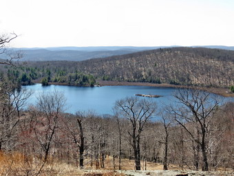 At 1.3 miles we were at the highest point of the ridge at which point we dropped almost all the elevation we had gained as we hiked downhill to Surebridge Brook. We crossed the brook and then realized we had lost he AT blazes. We recrossed the brook and followed the AT southwest along the brook. We almost immediately began to pick up the tailings piles from the Greenwood Mine. The Harriman area is full of iron mines that date back as far as the period of the American Revolution. Some are just small pits while others like the Greenwood Mine are much bigger. Most of the Greenwood Mine is now underwater but we stopped and I took some pictures of the main adit and the tailings. I remembered that there is another large adit up on the hillside but we chose to simply continue our hike. We continued on the AT until it crossed the brook at 2.2 miles. We ascended a small hill and then walked back down the other side to the junction with the Long Path at 3 miles. We continued on the AT and began the steepest climb of the day to the top of Island Pond Mountain. As we descended the other side we stopped for a drink and a snack. Some hikers were camping on the edge of the mountain looking southeast. This view was mostly of trees and more trees. We walked passed them and the off the trail to the northeast. We found a nice lookout that had a beautiful view of Island Pond. I knew we would probably not get to Island Pond so I took some pictures from above which was a view I had not had before. We walked back to the trail and down the other side of the mountain to the area of the Lemon Squeezer.
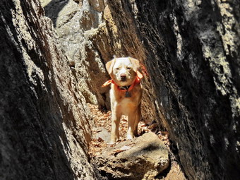 The Lemon Squeezer on the AT in Harriman is one of at least four that I know of and each is different and interesting in its own right. We arrived at the point on the AT where there is a sheer drop of at least 10 feet with few handholds. Sheila kept looking for a way down and we were afraid she would try jumping so we all headed down a different route marked by a sign saying "Easy Way"! From there Sheila and I headed into the Squeezer which is a narrow slot that you have to walk through. Cindy decided to go around while I stopped to take a few pictures. We came out on the other side and met Cindy. I made sure to walk a few feet further on the AT to be sure I made the connection with previous routes. We then decided to walk a little to the east and then pick up the Long Path north back to the trail junction. This was one of the few pieces of the Long Path that I had not hiked in the area. Once we turned north the Long Path followed the "low road" next to a wetland on the right. At 3:00 PM and 4.5 miles we were at the trail junction and continued straight ahead on the Long Path. For the next 2.1 miles we struggled over some of the rockiest terrain we had hiked in some time. Along the way we hiked up and down at least three hills. Nothing was very steep or very high but the constant hike over the rocks began to become uncomfortable. Finally at 6.6 miles we hit the Arden Valley Road. Walking on the flat, hard surface was a pleasure even though we had to walk uphill! When we reached the point where the AT crosses, I decided to simply stay on the road and walk back to the car. This was the more direct and easier route. We were back at the car by 4:15 PM having hiked 7.1 miles in 4 hours and five minutes with an elevation gain of about 1700 feet. We agreed it was enough for one day. On the way home we stopped in Middletown at Outback and had a nice dinner!
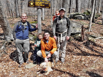
![]() On Saturday, April 19th there was a baby shower for my daughter Krista. This left the men free to "bond" after completing a few morning preparations for the shower. By the time we got the group together it was about 1:00 PM when we headed out to Alder Lake. Our group included myself, sons Karl and Kurt, son-in-law Brad, grandsons Bryce and Luke and Sheila, the only female allowed. Bryce just celebrated his third birthday and was eager to hike. Luke is only 1 year old and was going to ride in a carrier on Karl's back. We drove up the Beaverkill Road and turned left onto the Alder Lake Road. The road was in surprisingly good condition after the winter and the access road to Alder Lake was also well maintained. As we pulled into the parking area, we found several other cars present and I found I had forgotten Sheila's leash as we were riding in Karl's car! Brad came through with a length of paracord and a carabiner which acted as an effective leash. As we walked out to the "lawn", we passed several people with suitcases! We guessed they had been camping but we really weren't sure! We stopped briefly at the remains of the Coykendall mansion. This once beautiful structure had fallen into disrepair and the state burned it several years ago. All that remains is the stonework. Bryce was full of energy and Luke seemed to be enjoying the ride so we headed to the right, walked over the concrete dam and started around Alder Lake counterclockwise. I intended to avoid the campers on the other side until the trip back. The trail around the lake has a few ups and won but has few obstructions and is easy walking. There are a few bridges which Bryce found interesting. The day was warm and sunny and it was pleasant to be out with the family. As we approached Alder Creek at the upper end of the lake, I could see the old bridge had been replaced by the now familiar double steel I-beam bridge. The old bridge had been washed away in a storm and was useless and an eyesore. We stopped at the bridge to take a few pictures. A little further along the trail, the Millbrook Ridge Trail heads toward Balsam Lake Mountain. We stopped at the trail sing and I took several group pictures. We continued our walk along the lake and passed by a father and son fishing. I walked down to the lake with Bryce and we threw sticks into the lake for Sheila to retrieve while I took some pictures. Back on the main trail Bryce asked to be carried. I distracted him and we began to race and to look at interesting things along the way. Bryce was still racing when we got back to the parking area! The hike was about 1.7 miles and took around an hour. This is a very short hike for me but it was the best hike I have taken in some time!
On Saturday, April 19th there was a baby shower for my daughter Krista. This left the men free to "bond" after completing a few morning preparations for the shower. By the time we got the group together it was about 1:00 PM when we headed out to Alder Lake. Our group included myself, sons Karl and Kurt, son-in-law Brad, grandsons Bryce and Luke and Sheila, the only female allowed. Bryce just celebrated his third birthday and was eager to hike. Luke is only 1 year old and was going to ride in a carrier on Karl's back. We drove up the Beaverkill Road and turned left onto the Alder Lake Road. The road was in surprisingly good condition after the winter and the access road to Alder Lake was also well maintained. As we pulled into the parking area, we found several other cars present and I found I had forgotten Sheila's leash as we were riding in Karl's car! Brad came through with a length of paracord and a carabiner which acted as an effective leash. As we walked out to the "lawn", we passed several people with suitcases! We guessed they had been camping but we really weren't sure! We stopped briefly at the remains of the Coykendall mansion. This once beautiful structure had fallen into disrepair and the state burned it several years ago. All that remains is the stonework. Bryce was full of energy and Luke seemed to be enjoying the ride so we headed to the right, walked over the concrete dam and started around Alder Lake counterclockwise. I intended to avoid the campers on the other side until the trip back. The trail around the lake has a few ups and won but has few obstructions and is easy walking. There are a few bridges which Bryce found interesting. The day was warm and sunny and it was pleasant to be out with the family. As we approached Alder Creek at the upper end of the lake, I could see the old bridge had been replaced by the now familiar double steel I-beam bridge. The old bridge had been washed away in a storm and was useless and an eyesore. We stopped at the bridge to take a few pictures. A little further along the trail, the Millbrook Ridge Trail heads toward Balsam Lake Mountain. We stopped at the trail sing and I took several group pictures. We continued our walk along the lake and passed by a father and son fishing. I walked down to the lake with Bryce and we threw sticks into the lake for Sheila to retrieve while I took some pictures. Back on the main trail Bryce asked to be carried. I distracted him and we began to race and to look at interesting things along the way. Bryce was still racing when we got back to the parking area! The hike was about 1.7 miles and took around an hour. This is a very short hike for me but it was the best hike I have taken in some time!
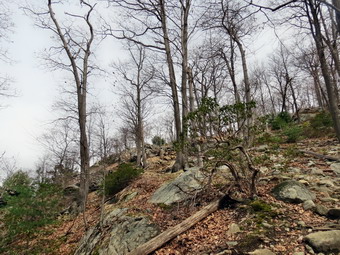
![]()
![]()
![]()
![]()
![]() On Friday, April 18th my son-in-law, Brad, and I wanted to get away from Livingston Manor and hike in a different area. I had been thinking about completing the parts of the AT in New York that I had not hiked. I suggested we hike a loop from the Anthony Wayne Recreation Area which would cover a small piece of the AT that I had never hiked. It seemed that the route would be about 6 miles round trip and Brad agreed. The weather forecast was for a partly sunny day with high in the low 50's. There was quite a bit of haze in Livingston Manor but we left just after 8:30 AM anticipating better conditions at Harriman. We took the Quickway to Harriman and then the Long Mountain Parkway to the Long Mountain traffic circle. From there we took the Palisades Parkway one exit south to the Anthony Wayne Recreation Area. On the way to the parking area we looked for the trail marking but could not find any. We arrived in the parking area at about 9:40 AM to find the huge lot almost empty with only a few cars parked. It was in the low 40's with a strong breeze blowing and I was glad I had worm my Mammut Hoody instead of just a light windbreaker. From the car we walked back to the bridge over the parkway where we began to see white marking for the Anthony Wayne Trail. The trail soon cut right or north into the woods and we followed it as it gained some elevation to about .6 miles. I knew we were looking for the blue blazed 1779 trail which would take us south to the section of AT I wanted to hike. After we hit the highest point we descended the other side of the hill and were getting very close to Route 6. I knew that we did not want to cross this road but we had not seen another trail! We reversed our route and within about 500 feet found the correct trail. The blazes were faded and were almost impossible to see coming from the other direction. Over the next mile or so the trail kept gaining some elevation but really seemed quite flat. Brad and I talked while Sheila roamed the trail. At 2.1 miles the trail began to descend and at about 2.4 miles we were at the junction with the AT where we turned left. Just after turning I noticed a hiker coming up the trail behind us and another approaching from in front. I pout Sheila on her leash and continued on the AT. We said "Hello" as we passed the other hiker but got no response!
On Friday, April 18th my son-in-law, Brad, and I wanted to get away from Livingston Manor and hike in a different area. I had been thinking about completing the parts of the AT in New York that I had not hiked. I suggested we hike a loop from the Anthony Wayne Recreation Area which would cover a small piece of the AT that I had never hiked. It seemed that the route would be about 6 miles round trip and Brad agreed. The weather forecast was for a partly sunny day with high in the low 50's. There was quite a bit of haze in Livingston Manor but we left just after 8:30 AM anticipating better conditions at Harriman. We took the Quickway to Harriman and then the Long Mountain Parkway to the Long Mountain traffic circle. From there we took the Palisades Parkway one exit south to the Anthony Wayne Recreation Area. On the way to the parking area we looked for the trail marking but could not find any. We arrived in the parking area at about 9:40 AM to find the huge lot almost empty with only a few cars parked. It was in the low 40's with a strong breeze blowing and I was glad I had worm my Mammut Hoody instead of just a light windbreaker. From the car we walked back to the bridge over the parkway where we began to see white marking for the Anthony Wayne Trail. The trail soon cut right or north into the woods and we followed it as it gained some elevation to about .6 miles. I knew we were looking for the blue blazed 1779 trail which would take us south to the section of AT I wanted to hike. After we hit the highest point we descended the other side of the hill and were getting very close to Route 6. I knew that we did not want to cross this road but we had not seen another trail! We reversed our route and within about 500 feet found the correct trail. The blazes were faded and were almost impossible to see coming from the other direction. Over the next mile or so the trail kept gaining some elevation but really seemed quite flat. Brad and I talked while Sheila roamed the trail. At 2.1 miles the trail began to descend and at about 2.4 miles we were at the junction with the AT where we turned left. Just after turning I noticed a hiker coming up the trail behind us and another approaching from in front. I pout Sheila on her leash and continued on the AT. We said "Hello" as we passed the other hiker but got no response!
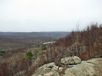 The trail now descended until it crossed the Palisades Parkway. We crossed the southbound lanes being careful to watch for the heavy traffic. After a short walk across the wooded median, we crossed the northbound lanes and were back in the woods. We continued to lose elevation until about 3 miles when the trail began to ascend the West Mountain ridge. The ascent would be about 600 feet in the next .7 miles. Some parts of the trail were steeper than others but there were several switchbacks to help make the trip easier if not shorter. As we started to climb one section we met a couple coming off the ridge with their English Springer puppy, our first dog of the day. Brad and I continued up the climb until we were near the top of the ridge. The forecast for partly sunny was proving NOT to be correct as a heavy haze hung over the countryside. The sky was a gray monotone with very little blue and no clouds which made for poor conditions for pictures. I was disappointed! As we neared the top of the ridge we lost the AT markings briefly but soon found them as the trail followed the edge of the ridge. We turned north and followed the AT which is also marked with blue blazes in this area for the Timp-Torne Trail. If it had been a nicer day, I would have suggested we walk south to the West Mountain Shelter which offers a great view toward the south on the Hudson River. On a good day the New York City skyline is clearly visible. As we hiked north along the ridge, there were many views to the west and several opportunities to get a view east as well. The views to the west were mostly of forest but the views to the east and north included a few peeks at the river and Bear Mountain. As we hiked north the Perkins Tower on Bear Mountain became more and more prominent. I took a few pictures but knew that most were not worth the time. At one lookout we met a woman hiking with her two Golden Retrievers. We stopped to talk for a time and the older dog laid down in the shade. The younger dog had a GPS tracker on and I decided I would look at one for Sheila.
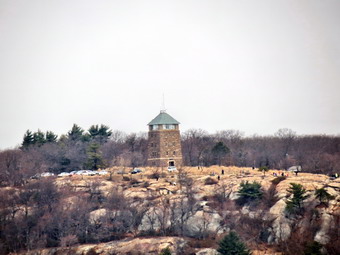 We continued north and the trail was familiar as I had been on the Timp-Torne trail before. We were losing elevation and at about 4.5 miles the AT headed to the right and we stayed to the left on the blue trail. We met another couple with two dogs. They were hounds of some kinds and one was older and one younger. Both were outfitted with packs. We talked to the couple for a minute and then continued to hike. As we continued farther and farther north, I began to look for the trail that would head west and down off the ridge to the parking. at one point we found a well-worn path and decided to follow it down. The path began to become less distinct another virtually disappeared. We decided to go back to the ridge and stay on the blue trail north. At one point the trail became very narrow requiring us to slip between some rocks. In another spot we had to descend over an open rock face. We heard some voices below and I could see another trail intersecting the Time-Torne Trail. When we got to the junction, the trail was marked with a red F which indicated the Fawn Trail back to the Anthony Wayne Recreation Area. We followed this trail as it continued down off the ridge. Along the way we met four people with a small but energetic black puppy. Eventually the trail crossed some of the woods roads associated with the park and within a few minutes we were back at the road that leaves the park. We crossed the road and walked over to the car. It was 1:05 PM and we had covered 5.9 miles in three hours and 24 minutes. The total vertical climb was about 1530 feet and most of this was on the climb up to the West Mountain Ridge. As our reward, we decided to stop in Middletown at El Bandido for lunch.
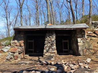
![]()
![]()
![]()
![]()
![]() On Thursday, April 17th I wanted to get away from Livingston Manor and hike in a different area. I had been thinking about completing the parts of the AT in New York that I had not hiked. I decided to hike in Harriman again starting at the Tiorati Circle parking area and making a loop out on the AT to the Brine shelter and then back on the Ramapo-Dunderberg Trail. It seemed that the route would be a little over 6 miles round trip. The weather forecast was for a sunny day with high in the low 60's. I left Livingston Manor just after 8:30 AM and took the Quickway to Harriman and then the Long Mountain Parkway to the Long Mountain traffic circle. From there I took Seven Lakes Drive to the Tiorati Circle and parked at the parking just off Arden Valley Road. This is the same road that Cindy and I used to park at the Elk Pen the previous Saturday. It was around 9:45 AM when Sheila and I left the parking area walking west on Arden Valley Road. Within a few hundred feet I found the blue blazed Lake Tiorati Trail just off the road and we followed that for about .3 miles to the junction with the AT where we turned right. The trail crossed Arden Valley Road and then headed into the woods. The trail undulated a bit but then descended and at about 1 mile the Ramapo-Dunderberg Trail headed off to the right. We stayed on the AT and headed northeast along the shoulder of the Stockbridge Ridge. At 1.75 miles we began a drop of about 300 feet until we crossed Seven Lakes Drive at 2.5 miles.
On Thursday, April 17th I wanted to get away from Livingston Manor and hike in a different area. I had been thinking about completing the parts of the AT in New York that I had not hiked. I decided to hike in Harriman again starting at the Tiorati Circle parking area and making a loop out on the AT to the Brine shelter and then back on the Ramapo-Dunderberg Trail. It seemed that the route would be a little over 6 miles round trip. The weather forecast was for a sunny day with high in the low 60's. I left Livingston Manor just after 8:30 AM and took the Quickway to Harriman and then the Long Mountain Parkway to the Long Mountain traffic circle. From there I took Seven Lakes Drive to the Tiorati Circle and parked at the parking just off Arden Valley Road. This is the same road that Cindy and I used to park at the Elk Pen the previous Saturday. It was around 9:45 AM when Sheila and I left the parking area walking west on Arden Valley Road. Within a few hundred feet I found the blue blazed Lake Tiorati Trail just off the road and we followed that for about .3 miles to the junction with the AT where we turned right. The trail crossed Arden Valley Road and then headed into the woods. The trail undulated a bit but then descended and at about 1 mile the Ramapo-Dunderberg Trail headed off to the right. We stayed on the AT and headed northeast along the shoulder of the Stockbridge Ridge. At 1.75 miles we began a drop of about 300 feet until we crossed Seven Lakes Drive at 2.5 miles.
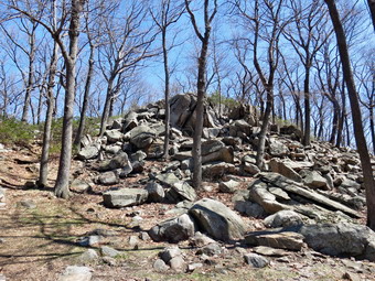 From the road the trail continued on a woods road but the AT markings were very faded compared to the bright white on the western side. After a short distance on the woods road, the trail cut into the woods heading south then southeast. At 3.5 miles we had regained the 300 feet we had dropped on the other side of the road. At 3.7 miles the Ramapo-Dunderberg Trail turned right as we continued on the AT to the left. The trail gained a little elevation and then began to drop. I thought we were near the William Brien Shelter and it soon appeared just ahead at 4.4 miles. It was 11:40 AM so we stopped so that I could get some pictures. I had a quick drink and a snack and then started back to the trail junction. I had my head down as I climbed the small hill when Sheila started to bark. I looked up to see a startled hiker menaced by Sheila. Sheila was only scared but that was no excuse to interrupt this young man's pleasant hike. Fortunately, he was not bothered too much by Sheila's lack of manners. We talked for a while and I found out he was from Brooklyn and does not own a car. He took the train to the Tuxedo railroad station and was hiking east to the Bear Mountain Bridge. His intention was to hike to a train station on the east side of the river to get back to the city. He needed AAA batteries for his headlamp and I was sorry that I had none as I would have offered them freely as an atonement for Sheila's "attack". We parted heading in opposite directions.
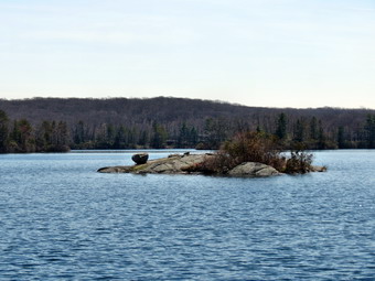 At 5.2 miles we were back at the trail junction with the Ramapo-Dunderberg Trail and we headed left to use a different trail to return. At this point I had thoughts of returning to near Tiorati and then hiking another 5 mile section to the south. The trail meandered up and down and generally headed WSW. At 6.1 miles it headed north and then east before crossing Seven Lakes Drive at 6.8 miles. The hike was becoming longer than I thought it would be but we were soon back on the AT heading west toward Arden Valley Road. The .75 miles back to the road was all uphill and although it was not steep it convinced me to head back to the cart. We cross the road turned left shortly after to take the Tiorati Trail back to the car. We were back at the car by 1:30 PM having covered 8.2 miles in 3 hours and 45 minutes. The elevation gain was a modest 1650 feet but I felt each one of them. I took some pictures of Lake Tiorati from the roadside before heading home.

![]()
![]()
![]()
![]()
![]() On Saturday, April 12th Cindy and I wanted to get away from Livingston Manor and hike in a different area. I had been thinking about completing the parts of the AT in New York that I had not hiked. I suggested we hike from the Elk Pen parking area in Harriman State Park To Little Dam Lake. It seemed that the route would be about 6 miles round trip and Cindy agreed. The weather forecast was fro a clear sunny day with high in the low 70's. There was quite a bit of fog in Livingston Manor and it took us some time to get going. Eventually we made it out of the house and started the long drive down the Quickway to Harriman. From the Harriman exit we took Route 17 south toward Suffern. We kept an eye out fro Arden Valley Road on the left but missed it the first time. I turned around and found the road easily on the way back. The parking area was almost full but I found a spot and we were on the trail by 10:55 AM. It was already warm and I regretted brining only one water bottle! We headed northwest on Arden Valley Road and crossed the Thruway and railroad on the road bridge. We soon crossed Route 17 and picked up the white blazes of the AT on the other side. We walked a short distance through open woods and then started up a set of steps on a hillside. A sign gave the distances to some points along the AT. The distance to Little Dam Lake was given as 2.8 miles which confirmed by estimate of about 6 miles for the hike. Within a short distance we were confronted with impressive stone cliffs which we would have to work our way up. The AT had several switchbacks but the climb averaged 27%! This part of the trail is labeled on the NYNJTC maps as Agony Grind and the name seemed fitting! As we completed one steep section we came upon a rock shelf with a nice view. A lone hiker was relaxing on the rock and we stopped to talk. He told us he had been with a "meetup" group but was unable to make the climb ahead. I took a few pictures and then we continued in our way. By the top of the "Grind" we had ascended over 530 feet in less than .4 miles. The ground leveled a little at the top and we started to make better time. I forgot how challenging hiking in Harriman can be even without any big mountains. We were constantly walking over jagged rocks or along bare rock faces. The oak leaves in some places made getting a footing difficult.
On Saturday, April 12th Cindy and I wanted to get away from Livingston Manor and hike in a different area. I had been thinking about completing the parts of the AT in New York that I had not hiked. I suggested we hike from the Elk Pen parking area in Harriman State Park To Little Dam Lake. It seemed that the route would be about 6 miles round trip and Cindy agreed. The weather forecast was fro a clear sunny day with high in the low 70's. There was quite a bit of fog in Livingston Manor and it took us some time to get going. Eventually we made it out of the house and started the long drive down the Quickway to Harriman. From the Harriman exit we took Route 17 south toward Suffern. We kept an eye out fro Arden Valley Road on the left but missed it the first time. I turned around and found the road easily on the way back. The parking area was almost full but I found a spot and we were on the trail by 10:55 AM. It was already warm and I regretted brining only one water bottle! We headed northwest on Arden Valley Road and crossed the Thruway and railroad on the road bridge. We soon crossed Route 17 and picked up the white blazes of the AT on the other side. We walked a short distance through open woods and then started up a set of steps on a hillside. A sign gave the distances to some points along the AT. The distance to Little Dam Lake was given as 2.8 miles which confirmed by estimate of about 6 miles for the hike. Within a short distance we were confronted with impressive stone cliffs which we would have to work our way up. The AT had several switchbacks but the climb averaged 27%! This part of the trail is labeled on the NYNJTC maps as Agony Grind and the name seemed fitting! As we completed one steep section we came upon a rock shelf with a nice view. A lone hiker was relaxing on the rock and we stopped to talk. He told us he had been with a "meetup" group but was unable to make the climb ahead. I took a few pictures and then we continued in our way. By the top of the "Grind" we had ascended over 530 feet in less than .4 miles. The ground leveled a little at the top and we started to make better time. I forgot how challenging hiking in Harriman can be even without any big mountains. We were constantly walking over jagged rocks or along bare rock faces. The oak leaves in some places made getting a footing difficult.
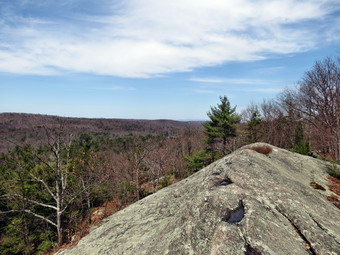 We descended slightly and then climbed up to the top of another hill which was higher than the first. We passed through some dwarf pines and stopped a minute to get a drink and a snack just as the noon whistle blew. It was obvious that we did not have enough water but I wanted to push on a little farther before calling it quits. At this point we had covered only 1.25 miles which was slow going even considering the ascents we had tackled. We continued our journey by descending from the top of the hill and then climbing another. Along the way we met about half of the "meetup" group coming back. They had turned around less than half a mile ahead. They told us pert of their group had continued on to see if they could find some water. Cindy and I continued our hike and met the rest of the group on the next hill. They had a friendly dog with them and Sheila exchanged greetings before we went our separate ways. At 1.8 miles we were at the top of a hill and ready to descend to cross the Orange Turnpike. We descended to the road and turned left to pick up the AT about 200 feet south. We entered the woods and were confronted by another hill. Just before the ascent we found a cooler with three gallon jugs of water by the side of the trail. A "trail angel" named John had left apples and bananas and other snacks as well as the water. We were very grateful and filled up on water and an apple. We climbed to the top of the last hill before the lake and found a shelter constructed by John. Cindy was not sure she wanted to descend to the lake but I could tell it wasn't too far. We both hiked down the hill and found that the AT continued along the northern shore of Little Dam Lake and then southwest along the western shore to the point I had visited before. Cindy decided to wait while Sheila and I hiked as fast as possible to the turn around point.
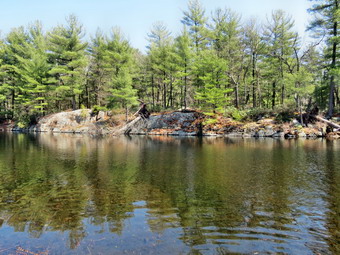 While Cindy found a nice rock on which to relax, Sheila and I continued on the trail at an increased pace. I wanted to stop several times to take pictures but we stayed moving. I thought I might stop on the way back if I thought I had the time. As we were traveling along the shore Sheila alerted and I looked up to spot a trail runner coming toward us. We exchanged brief greetings as we passed. We walked a little farther and Sheila again perked up. I looked ahead to find a large chocolate lab coming our way. I grabbed Sheila but the other dog was not on a leash. Fortunately, the dogs seemed to get along OK and the owners of Sampson appeared quickly. I asked them about the bridge which was by destination. They told me that it had been removed and replaced with large stepping stones as it was damaged in one of the storms. It was only a short distance my destination. The others crossed the brook on the stones while Sheila and Sampson enjoyed a quick swim. I took some pictures before turning around to head back to Cindy. On the way back I did take the time to stop for a few pictures. As we rounded the north end of the lake Sheila raced ahead. When I called for her she did not come back immediately and then I heard Cindy's voice. We were all soon together and headed back to the car. I was about 2:00 PM and we knew it would not be an easy hike back. Cindy did seem refreshed by her rest and we were up the first hill very quickly. As we descended toward Orange Turnpike, we stopped again to refill with water. From that point on we set a steady pace and the hike seemed to go quickly for the most part. Consulting the GPS revealed that the Elk Pen and Little Dam Lake were at the same elevation so the amount of ascent was the same for both parts of the hike. The hardest part were the steep descents especially Agony Grind. We crossed Route 17 and hiked back to the parking area. Cindy and Sheila headed to the car while I hiked through a field on the AT to a point I had visited before to make the "connection". I hiked back to the car and arrived at 4:05 PM. We had hiked 6.8 miles in 5 hour and 15 minutes with over an hour of stopped time for rest and pictures. Even though I thought I had taken in enough water I was still dehydrated. The 70 degree day was definitely a change from previous hikes!
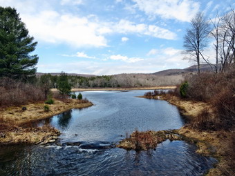
![]() On Friday, April 11th, Lisa had asked me to be available to hike with a journalist and photographer from the Swedish magazine Vagabond. They were doing an article on the Catskills and wanted to take a short hike that had some interesting views. Fredrik, the journalist, and Pontus, the photographer, were a little late but they both seemed like nice fellows. I met them at Morgan Outdoors and found Lisa could not accompany us. Pontus was feeling a little ill and some rain was in the forecast. We decided a quick trip to Frick Pond and Mongaup Falls would offer the best views for the shortest distance. I drove my car to Frick Pond with the other two in their rental car behind me. Sheila had been invited along and for the most part behaved well. As we hiked out to the pond, Fredrik asked all kinds of questions related to hiking in the Catskills and my own personal background. Pontus took hundreds of pictures of Sheila and I hiking along the trails. When we got to the pond, we found that almost all the ice was gone. It was a warm day with temperatures in the sixties but the water was still ice cold. This did not seem to bother Sheila as she dove in and swam around. I threw some stick and both Pontus and I took some pictures. We decided to head back to the car and then stop at Mongaup Falls for some pictures.
On Friday, April 11th, Lisa had asked me to be available to hike with a journalist and photographer from the Swedish magazine Vagabond. They were doing an article on the Catskills and wanted to take a short hike that had some interesting views. Fredrik, the journalist, and Pontus, the photographer, were a little late but they both seemed like nice fellows. I met them at Morgan Outdoors and found Lisa could not accompany us. Pontus was feeling a little ill and some rain was in the forecast. We decided a quick trip to Frick Pond and Mongaup Falls would offer the best views for the shortest distance. I drove my car to Frick Pond with the other two in their rental car behind me. Sheila had been invited along and for the most part behaved well. As we hiked out to the pond, Fredrik asked all kinds of questions related to hiking in the Catskills and my own personal background. Pontus took hundreds of pictures of Sheila and I hiking along the trails. When we got to the pond, we found that almost all the ice was gone. It was a warm day with temperatures in the sixties but the water was still ice cold. This did not seem to bother Sheila as she dove in and swam around. I threw some stick and both Pontus and I took some pictures. We decided to head back to the car and then stop at Mongaup Falls for some pictures.
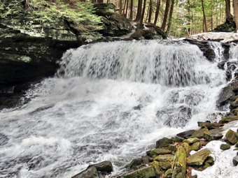 We drive down to Mongaup Pond Road and parked near the intersection to walk down to the falls. I decided to leave my pack behind and just take the camera. As we walked down the woods road to the little "bridge" over the stream we found it was covered in a thick layer of ice. We got across but it was an adventure. The walk to the falls was pretty easy but we again found a thick layer of ice surrounding the top of the falls. I took some pictures of the upper falls and then tried to find a place to take pictures of the lower drop. I had wanted to get down into the stream bed and regretted leaving my pack with my spikes behind in the car! I could not find a good vantage point for pictures and finally gave up. We returned to the cars where I said "goodbye" to Fredrik and Pontus. As they drove away I shouldered my pack and walked back down the path to the falls. Just before the bridge I donned my spikes which made walking across a snap. When I got to the falls, I took off my pack and got out the camera. I was easily able to walk all around on the ice sheet with perfect traction. I took many shots of the lower falls and the decided to try to get down into the stream bed. Descending to the level of the stream was not easy but soon I was at the bottom of the falls which me an unobstructed view of the falling water. The volume of the falls was greater than I had ever seen it. I had been to the area several times during the summer when the water flow was not much more than that of a garden hose! After taking some pictures, I climbed back up, put on my pack, collected Sheila and returned to the car. I drove to Morgan Outdoors to have a few words with Lisa. I decided to call Cindy to see if she wanted to bring Bryce to the Brandenburg Bakery which was new in town. We met there for a late lunch at around 2 o'clock. There were still a few people eating and the selection had been reduced by a busy lunch hour. We had to wait awhile to get some food but it was well worth the time. The coffee was very good and the food delicious. I will be going back earlier next time to try some of the other selections.
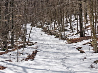
![]()
![]()
![]()
![]()
![]() On Wednesday, April 9th, I called Lisa about hiking and we agreed to do something close to home and quick. We settled on Huggins Lake. I had not been there since the early fall since the parking area is not plowed and I don't like to park along the narrow road. Lisa arrived at my house on Schedule at 10:00 Am and we headed up the Beaverkill Road and then across the covered bridge to Berry Brook Road. From There it was only a short drive to the Huggins Lake parking lot. There was a berm of ice and snow across thee entrance but I decided to take the chance and it was no problem. The parking area was devoid of snow and one look up the trail showed no snow there either. I kept my spikes in the pack but was are they wouldn't be needed. We started up the trail at 10:30 AM. The temperature was cool but warming rapidly making me think that I should have warn a lighter pair of pants and jacket. The sky was bright blue with some clouds. As we started to climb more and the trail a little to the east, we encountered quite a bit of snow on the part of the trail facing west. We walked around some of it and through the snow in other parts. I had not worn insulated boots but they did not seem to be necessary. After we hit the highest point we continued down toward the pond with snowy areas and bare trail alternating. After the final left turn down to the pond the trail was covered in several inches of snow.
On Wednesday, April 9th, I called Lisa about hiking and we agreed to do something close to home and quick. We settled on Huggins Lake. I had not been there since the early fall since the parking area is not plowed and I don't like to park along the narrow road. Lisa arrived at my house on Schedule at 10:00 Am and we headed up the Beaverkill Road and then across the covered bridge to Berry Brook Road. From There it was only a short drive to the Huggins Lake parking lot. There was a berm of ice and snow across thee entrance but I decided to take the chance and it was no problem. The parking area was devoid of snow and one look up the trail showed no snow there either. I kept my spikes in the pack but was are they wouldn't be needed. We started up the trail at 10:30 AM. The temperature was cool but warming rapidly making me think that I should have warn a lighter pair of pants and jacket. The sky was bright blue with some clouds. As we started to climb more and the trail a little to the east, we encountered quite a bit of snow on the part of the trail facing west. We walked around some of it and through the snow in other parts. I had not worn insulated boots but they did not seem to be necessary. After we hit the highest point we continued down toward the pond with snowy areas and bare trail alternating. After the final left turn down to the pond the trail was covered in several inches of snow.
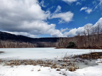 When we got to the pond the open areas around it showed little snow cover. The ice near the dam was melting back but the rest of the pond was still covered. I dropped my pack to take some pictures. Lisa to some close-up shots of the cattails. I focused on taking pictures of the blue sky and clouds contrasted with the trees and the frozen pond. I also was able to get some pictures of the scenery reflected in the open water near the dam. After taking our photographs, we started back up the snowy trail back to the car. The walk back seemed to go quickly since we did not stop to take any pictures on the way out. We were back at the car by 12:25 PM having covered 3.8 miles in 1 hour and 50 minutes. The total ascent was around 920 feet making it almost flat for a Catskills hike!
On Monday, April 7th, I planned to take a rather long hike somewhere and was ready to start early to finish before track practice. As often happens, an ambulance call derailed these plans. By the time I got back I didn't have time to travel very far and to hike so I decided to make a loop over Round Top. Sheila and I headed across the street at about 11:30 AM. I had decided not to take any traction devices as I could see no snow or ice at all on the hillsides. The day was warmer than any had been in some time and just walking up the cemetery hill worked up quite a sweat. I had decided not to wear my pack and the freedom was welcomed. At the top of the hill we turned left into the woods and shortly after that right onto another woods road. There was no snow anywhere and I began to think this would be the first hike where I could report "No Snow". We followed our usual route up the hill and passed the quarry. We descended the hill without actually getting to the summit of Round Top and at the fork in the trail I decided to head to the left to reverse our usual route. At this point we ran into quite a bit of snow! Some was easy to avoid and the rest we just walked through. Some areas had some pooled water and I took some care to avoid breaking through into puddles that were deeper than the height of my boots. We rounded the hill after Round Top and then started the steep climb to the top of that hill. The steepest part faced south and east so there was no snow to impede our progress. At the summit we again ran into snow and it remained with us until we completed the loop and turned left to start back toward the cemetery. We spent a little over an hour hiking a little more than two miles which was much better than staying in the house all day!
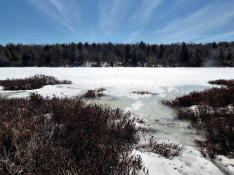
![]()
![]()
![]()
![]()
![]() On Tuesday, April 1st Cindy and I wanted to get out and hike close to home before I had to go to track practice. I had been to the Frick Pond and Trout Pond areas recently so I asked Cindy if she would like to go to Long Pond. The skies were blue with white clouds and the day was sunny. By the time we left the house it was in the mid 50's with no wind. We finally got Sheila in the car and were on the road just before 10:30 AM. When we arrived at the parking area, we found it plowed with almost now snow. We looked at the trail and saw that there was snow and ice covering it and made the decision to wear our spikes. We left the parking area at 10:45 AM and crossed the bridge on the snowmobile and hiking trail. In most places the trail was covering with several inches of snow and there was ice on top of that. Some areas had flowing water under the snow which made hiking difficult as it caused us to break through the crust. In some places the trail was bare. Over the first .7 miles the trail gains about 370 feet in elevation. This is certainly not the kind of climb that is found on many 3500 foot peaks but it is enough to start to warmup. By the time we got to the top of the climb, I was ready to open up the pitzips on my Mammut Hoody and the front zippers on my shirts. Sheila was happy to be out and was running up and down the trail and following some animal trails into the woods. The walk to the spur trail to the pond went quickly and by 11:15 AM we were on the shore of Long Pond. The path to the edge of the pond was very muddy and I was afraid Sheila would be unable to resist. I left Sheila with Cindy while I took some pictures of the pond and then Cindy and I revered roles so she could get some shots. After taking some pictures, we returned to the main trail.
On Tuesday, April 1st Cindy and I wanted to get out and hike close to home before I had to go to track practice. I had been to the Frick Pond and Trout Pond areas recently so I asked Cindy if she would like to go to Long Pond. The skies were blue with white clouds and the day was sunny. By the time we left the house it was in the mid 50's with no wind. We finally got Sheila in the car and were on the road just before 10:30 AM. When we arrived at the parking area, we found it plowed with almost now snow. We looked at the trail and saw that there was snow and ice covering it and made the decision to wear our spikes. We left the parking area at 10:45 AM and crossed the bridge on the snowmobile and hiking trail. In most places the trail was covering with several inches of snow and there was ice on top of that. Some areas had flowing water under the snow which made hiking difficult as it caused us to break through the crust. In some places the trail was bare. Over the first .7 miles the trail gains about 370 feet in elevation. This is certainly not the kind of climb that is found on many 3500 foot peaks but it is enough to start to warmup. By the time we got to the top of the climb, I was ready to open up the pitzips on my Mammut Hoody and the front zippers on my shirts. Sheila was happy to be out and was running up and down the trail and following some animal trails into the woods. The walk to the spur trail to the pond went quickly and by 11:15 AM we were on the shore of Long Pond. The path to the edge of the pond was very muddy and I was afraid Sheila would be unable to resist. I left Sheila with Cindy while I took some pictures of the pond and then Cindy and I revered roles so she could get some shots. After taking some pictures, we returned to the main trail.
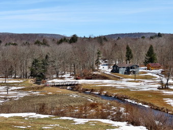 When we got to the first trail junction, we turned right and headed out toward the trail to the lean-to. I was going to put Sheila back on her leash as there are several areas that are usually very wet but these areas were frozen so that there was no problem. We passed the lean-to spur trail and continued to keep a fast pace. As we were approaching the woods road where we would turn left to start the loop back, Cindy asked me when we were going to get to the lean-to. She was pleasantly surprised when I pointed out we had passed it some time ago. The hike at this point was relatively flat and the walk went quickly. By noon we had walked 2.5 miles and were at the woods road that forms the next part of the loop. The walk on the woods road was a little tricky at times as there was a lot of ice. By 12:20 PM we had walked 3.4 miles when we arrived at the small stream that crosses the road from a beaver pond. We crossed the stream on a small bridge and walked by the Peters Hunting Camp to cross the bridge over another stream. I stopped to take a few pictures and heard the noise of an approaching helicopter. Cindy spotted it the helicopter coming over the treetops before I did. The first was followed by two more. I could see that they were military and that they were double rotor "heavy lifters". I took some pictures as they passed by almost directly overhead. We continued on to Basily Road which was still covered in ice. Eventually the road became Flugertown Road but it was still icy until we hit the point where the town maintenance begins. Along the way we enjoyed the sunny skies and the light as it was reflected off the water in Willowemoc Creek. From this point on Flugertown Road is paved and our walk went very quickly. We were back at the car by 1:20 M having covered 6.0 miles and 600 vertical feet in 2 hours and 20 minutes.
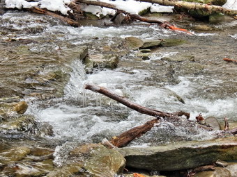
![]()
![]()
![]()
![]() On Monday, March 31st, I decided I wanted get out and do a hike on the last day of March. I had not hiked for almost a week and Sheila and I were to hit the trails. Sunday night and Monday morning had brought some sleet and freezing rain so I waited some time before heading for Roscoe and Morton Hill Road. I wanted to hike around Trout Pond and visit Russell Brook Falls since there had been significant rainfall and melting over the weekend. I thought the falls might be flowing rather well and at this time offer the water is usually clear instead of muddy. It was almost 11:00 AM when I parked at the side of Morton Hill Road near the intersection with Russell Brook Road. Russell Brook Road seemed to be plowed but I could see that it was a sheet of ice. I decided to wear my spikes and put them on at the car before heading out on the hike. This decision proved to be a good one as the road was every bit as icy as it looked. We walked down the road and as we approached the falls I could tell from the volume that the water was high. I started to walk down the bank to the lookout over the upper falls and almost immediately questioned my decision. The path was covered in thick ice and even with the spikes it looked dangerous. I made it down to the viewpoint it had trouble finding a spot to put my equipment as it was so slippery. I did get my camera out and was able to get some good pictures before attempting to get back up the bank. Once we were back on the road we headed down to the lower lot which was plowed. From here we walked down to the bridge and crossed Russell too. I decided to walk over to the falls and again had an interesting time getting down the bank to the stream bed. The usual path was just too icy so I found an alternate approach. I knew that I had hundreds of pictures of the falls but couldn't help taking a few more. Getting back up to the path above wasn't as difficult as I thought it would be and we were soon at the first trail, junction. We headed to the left as I wanted to climb the steeper trail toward Mud Pond first.
On Monday, March 31st, I decided I wanted get out and do a hike on the last day of March. I had not hiked for almost a week and Sheila and I were to hit the trails. Sunday night and Monday morning had brought some sleet and freezing rain so I waited some time before heading for Roscoe and Morton Hill Road. I wanted to hike around Trout Pond and visit Russell Brook Falls since there had been significant rainfall and melting over the weekend. I thought the falls might be flowing rather well and at this time offer the water is usually clear instead of muddy. It was almost 11:00 AM when I parked at the side of Morton Hill Road near the intersection with Russell Brook Road. Russell Brook Road seemed to be plowed but I could see that it was a sheet of ice. I decided to wear my spikes and put them on at the car before heading out on the hike. This decision proved to be a good one as the road was every bit as icy as it looked. We walked down the road and as we approached the falls I could tell from the volume that the water was high. I started to walk down the bank to the lookout over the upper falls and almost immediately questioned my decision. The path was covered in thick ice and even with the spikes it looked dangerous. I made it down to the viewpoint it had trouble finding a spot to put my equipment as it was so slippery. I did get my camera out and was able to get some good pictures before attempting to get back up the bank. Once we were back on the road we headed down to the lower lot which was plowed. From here we walked down to the bridge and crossed Russell too. I decided to walk over to the falls and again had an interesting time getting down the bank to the stream bed. The usual path was just too icy so I found an alternate approach. I knew that I had hundreds of pictures of the falls but couldn't help taking a few more. Getting back up to the path above wasn't as difficult as I thought it would be and we were soon at the first trail, junction. We headed to the left as I wanted to climb the steeper trail toward Mud Pond first.
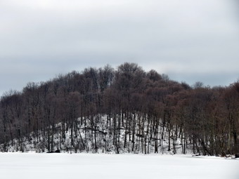 The ascent wasn't too bad but it was very icy. Small streams of water undercut the ice and I paid careful attention to where I was stepping to avoid constantly breaking through the crust. I passed at the top of the hill to take a few pictures of then trail wand woods which were totally covered in snow. The scene was so different than at the lower elevations which were almost completely devoid of snow. We walked down to the next trail junction and turned right to take the trail over the shoulder of Cherry Ridge to Trout Pond. The trail was well packed by snowmobiles in most places. There was running water under the hard crust along much of the trail up to teeniest point. This made walking difficult as I kept breaking through the snow. Sheila had no problems and was running all over following game trails. I had to go off trail in several spots to avoid the running water. At about 2.8 miles near the highest point on the trail the trees were covered in ice. I took some pictures but the beauty was hard to capture with the camera. We descended the rest of the way to Trout Pond and stopped at the inlet. The skies were now overcast and getting darker. I took some pictures of the pond and noticed that the edges of the ice were starting to melt. We continued on the main trail toward the outlet of the pond. As we approached the lower end of the pond I looked at the time and decided to bypass a stop and continue on to finish the hike. We were soon back at the register box. We continued on to the parking area and then finished with the hike up Russell Brook Road back to the car, We arrived back at 1:15 PM having covered 5.6 miles and 1160 vertical feet in 2.5 hours.
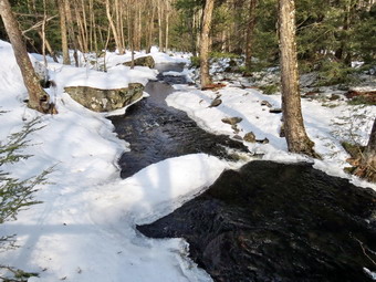
![]()
![]()
![]()
![]()
![]() On Tuesday, March 25th Lisa wanted to go hiking somewhere. We discussed the area around Campbell Brook but I suggested the Neversink Unique Area. I had been there recently and hiked to Denton and High Falls but missed Mullet Brook Falls. I wanted to see these falls in the winter as I suspected they would be interesting. I agreed to meet Lisa downtown at her store at 9:00 AM. I got my gear and Sheila in the car and headed downtown to pick up Lisa at 9:00 AM. I put both spikes an snowshoes in the car but was pretty sure I would wear the snowshoes as the spikes had not proved adequate on my last trip. We arrived at the trailhead at the end of Katrina Falls Road just after 9:30 AM. We inspected the trail and although it seemed firm and the temperature was in the twenties, I decided to wear the snowshoes and Lisa agreed. We were on the trail by 9:40 AM with Sheila leading the way. There was less snow than the week before and the trail seemed a little smoother. At the first trail junction we turned left to parallel the river and soon crossed Wolf Brook on the small bridge. We ascended a small hill and then headed left at the next trail junction. This part of the trail was not broken at all but the snow was firm enough that we could stay on top. Over the next .9 miles we ascended about 400 feet heading first south and then east. Parts of the trail were completely bare and we had to walk on the snow beside the rail. At the top of the hill we stayed on the main trail as it turned to the right or south. At this trail junction a left turn leads out to the parking area at the Wolf Brook Multiple Use Area. I knew the rest of the hike was downhill except for the ascent back up the spur trail that went down to Mullet Brook Falls. We headed south and at 1.65 miles crossed Mullet Brook on a wooden bridge. The area was completely covered in snow and the brook was frozen inflames. we stopped to take some pictures. I took some shots of the brook and of the snow that lingered in the woods. Just after the bridge the trail turned west and headed toward the Neversink River still descending.
On Tuesday, March 25th Lisa wanted to go hiking somewhere. We discussed the area around Campbell Brook but I suggested the Neversink Unique Area. I had been there recently and hiked to Denton and High Falls but missed Mullet Brook Falls. I wanted to see these falls in the winter as I suspected they would be interesting. I agreed to meet Lisa downtown at her store at 9:00 AM. I got my gear and Sheila in the car and headed downtown to pick up Lisa at 9:00 AM. I put both spikes an snowshoes in the car but was pretty sure I would wear the snowshoes as the spikes had not proved adequate on my last trip. We arrived at the trailhead at the end of Katrina Falls Road just after 9:30 AM. We inspected the trail and although it seemed firm and the temperature was in the twenties, I decided to wear the snowshoes and Lisa agreed. We were on the trail by 9:40 AM with Sheila leading the way. There was less snow than the week before and the trail seemed a little smoother. At the first trail junction we turned left to parallel the river and soon crossed Wolf Brook on the small bridge. We ascended a small hill and then headed left at the next trail junction. This part of the trail was not broken at all but the snow was firm enough that we could stay on top. Over the next .9 miles we ascended about 400 feet heading first south and then east. Parts of the trail were completely bare and we had to walk on the snow beside the rail. At the top of the hill we stayed on the main trail as it turned to the right or south. At this trail junction a left turn leads out to the parking area at the Wolf Brook Multiple Use Area. I knew the rest of the hike was downhill except for the ascent back up the spur trail that went down to Mullet Brook Falls. We headed south and at 1.65 miles crossed Mullet Brook on a wooden bridge. The area was completely covered in snow and the brook was frozen inflames. we stopped to take some pictures. I took some shots of the brook and of the snow that lingered in the woods. Just after the bridge the trail turned west and headed toward the Neversink River still descending.
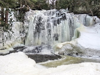 As we headed down the trail I somehow got a little ahead of Lisa. At 2.3 miles I turned right on the yellow spur trail to Mullet Brook Falls. I walked a short distance and then waited for Lisa. When she did not appear, I walked back to the main trail and shouted. After several shouts I heard a faint reply that seemed to be ahead on the main trail. I guessed that Lisa had missed the turn and was pretty far ahead now. I decided to take a quick trip down to the falls but did not relish being separated from a hiking partner. The trip to the falls was less than .2 miles and Sheila and I did it quickly. The falls were beautiful! I was afraid the sun would be directly behind the falls and it was but the cloud cover dimmed the brightness. The falls was partially frozen with the trees and rocks covered in frozen spray. I drop my pack and got out the camera. I took a few shots from the bank and then walked out onto the ice covered rocks in the middle of the stream. From the rocks I got a head-on view of the falls and took several pictures of the falls and some downstream. I moved to the side of the falls and took some more shots before going back to my pack, stowing the camera and hiking back t the main trail. I was happy I had visited the falls but now was anxious to catch up to Lisa. We made good time down to the junction with the trail to High Falls. We passed the cutoff to Denton falls and I hoped she had not gone in that direction. The snow was so hard I was having trouble picking up tracks. We crossed Mullet Brook again and continued on the trail. Soon Lisa came into view and I was relieved we were back together. We set a good pace back toward the car. Being able to carry on a conversation made the walk go much more quickly. We stopped at the register box and Lisa signed in. The last uphill was unwelcome but not too difficult. We were back at the car by noon having hiked 4.1 miles and 1000 feet of elevation gain in 2 hours and 18 minutes.
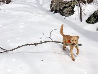
![]()
![]()
![]()
![]()
![]() On Friday, March 21st, I was ready to get in the first hike of the spring even though there was still over a foot of snow on the ground in many places! I decided to return to Frick Pond to hike up the Flynn Trail and down the Quick Lake Trail back to Frick Pond. I put my gear including the snowshoes in the trunk and got a very eager Sheila into the back seat. On my last hike in the area I had only worm spikes. As the day warmed, the snow became soft and the spikes were useless as I sunk into the snow. I had already decided I would wear the snowshoes! We arrived at 11:05 AM to find two other car in the lot. I put on my snowshoes and we crossed the road to get on the Flynn Trail. There was still quite a bit of snow. We made the turn up the wide woods road that is the Flynn Trail and immediately ran into the chopped up mess caused by inexperienced snowshoes walking side by side. In fresh snow this is not a problem but the willy-nilly tracks in the hard snow made walking difficult. We set a good pace on the ascent and I could just pick out a set of cross country ski tracks. I could not tell how old they were but they seemed pretty fresh. Within a short time Sheila alerted and I could see the skier ahead on the trail. I had not brought Sheila's leash because we so seldom see anybody on the trails. I used the loop on one of my poles to control her as we approached the skier. I said hello and we conversed for a short time before I moved passed him. I figured I could ascend much faster but that he might have me on the downhills! By 11:50 AM we had made the 1.7 uphill miles to the junction with the Big Rock Trail. At this point I found dropped my pack and took out the camera. I found a large branch and threw it for Sheila. As she retrieved it, I took pictures hoping to get one that looked like she was clearing the trail.
On Friday, March 21st, I was ready to get in the first hike of the spring even though there was still over a foot of snow on the ground in many places! I decided to return to Frick Pond to hike up the Flynn Trail and down the Quick Lake Trail back to Frick Pond. I put my gear including the snowshoes in the trunk and got a very eager Sheila into the back seat. On my last hike in the area I had only worm spikes. As the day warmed, the snow became soft and the spikes were useless as I sunk into the snow. I had already decided I would wear the snowshoes! We arrived at 11:05 AM to find two other car in the lot. I put on my snowshoes and we crossed the road to get on the Flynn Trail. There was still quite a bit of snow. We made the turn up the wide woods road that is the Flynn Trail and immediately ran into the chopped up mess caused by inexperienced snowshoes walking side by side. In fresh snow this is not a problem but the willy-nilly tracks in the hard snow made walking difficult. We set a good pace on the ascent and I could just pick out a set of cross country ski tracks. I could not tell how old they were but they seemed pretty fresh. Within a short time Sheila alerted and I could see the skier ahead on the trail. I had not brought Sheila's leash because we so seldom see anybody on the trails. I used the loop on one of my poles to control her as we approached the skier. I said hello and we conversed for a short time before I moved passed him. I figured I could ascend much faster but that he might have me on the downhills! By 11:50 AM we had made the 1.7 uphill miles to the junction with the Big Rock Trail. At this point I found dropped my pack and took out the camera. I found a large branch and threw it for Sheila. As she retrieved it, I took pictures hoping to get one that looked like she was clearing the trail.
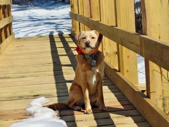 After a few of these, I noticed the skier approaching so I packed up and we headed toward Hodge Pond. After a few minutes, I looked back to find the skier followed the same route. I didn't want Sheila to bother him so at the next trail junction we headed right since I thought he might go down to Hodge Pond directly. We headed toward the cabins that were part of the old Beach Mountain Boy Scout camp and then turned right to descend toward the pond. At the next opportunity, we turned right to head around the back of the pond on the old jeep trail. At one point I headed down to the shore of the pond. I took some pictures of the pond which was still completely covered in ice. The sky was blue with plenty of white, puffy clouds. As we got back on the main trail, I noticed I was beginning to sink into the snow as it softened in the warm sunlight. The air temperature had not risen much but I was glad I had the snowshoes. We made a right on the Flynn Trail, walked up to the gate and headed toward Junkyard Junction. The snow on this part of the Flynn Trail was also soft and at least 18 inches keep along the entire way. At junkyard Junction, we turned left on the Quick Lake Trail to descend toward Iron Wheel Junction. This part of the hike went quickly and would have been even faster except for the soft snow. At 1:15 PM we had hiked 4.9 miles and had arrived at Iron Wheel Junction where we turned right to stay on the Quick Lake trail. The snow was still soft after the turn. I had broken a path on the trail earlier in the month but there was no evidence of this. Soon I found a harder ridge of snow and I could stay on top as long as I followed that ridge. We were soon at the bridge over the outlet to Frick Pond. We stopped and I took some pictures of the bridge and Sheila as well as shots of the pond. We continued on the Quick Lake trail back to the car. We were back in the parking lot at 2:00 PM after hiking 6.4 miles and 1000 vertical feet in 2 hours and 52 minutes.