
What You Missed
Winter 2011-2012
Winter 2011-2012
![]()
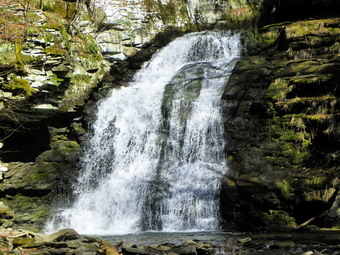
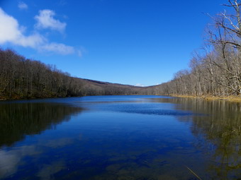
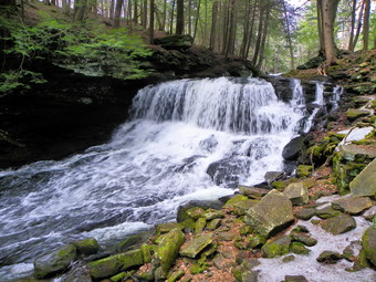
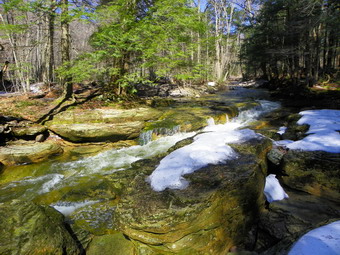
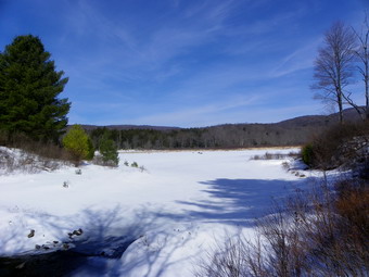
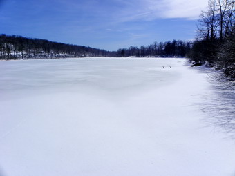
![]() On Tuesday, March 20th, my friend Kevin wanted to go for a local hike. Since Kevin had never been to Trout Pond and it was his first hike of the year, I decided that would be a good introductory hike since it has relatively gentle grades but many things to see. Kevin arrived at the house a little later than we had anticipated and without his camera. We got into my car and I drove to Morton Hill Road parking at the junction with Russell Brook Road. The day was sunny and warm with a blue sky and some puffy white clouds. We started down the road at about 1:10 PM. When we reached the area of the upper falls Kevin was surprised at how pretty they were. I dropped down the bank to take a few shots and the we walked down to the lower parking area. When we got near the bridge, Kevin suggested that we walk along the near side of the stream to a viewpoint for the falls. We did this and examined the old dam while we were there. The dam helped control the flow of water for a power generation waterwheel downstream near what is now the Russell Brook Campgrounds. I took pictures of the falls which had more volume than I expected. Back on the main trail we decided to head up to the lake first before we decided whether to hike out and back or do a loop. By 1:50 PM we had hiked the 1.6 miles to the outlet end of Trout Pond. We stopped and I took pictures of the lake and sky. Kevin spotted some salamanders and I took some photographs surprised at how clearly I could see the amphibians through the water. We decided to do the loop hike and walked along the lake to the lean-tos at the upper end. After a brief stop, we continued on the trail up Cherry Ridge.
On Tuesday, March 20th, my friend Kevin wanted to go for a local hike. Since Kevin had never been to Trout Pond and it was his first hike of the year, I decided that would be a good introductory hike since it has relatively gentle grades but many things to see. Kevin arrived at the house a little later than we had anticipated and without his camera. We got into my car and I drove to Morton Hill Road parking at the junction with Russell Brook Road. The day was sunny and warm with a blue sky and some puffy white clouds. We started down the road at about 1:10 PM. When we reached the area of the upper falls Kevin was surprised at how pretty they were. I dropped down the bank to take a few shots and the we walked down to the lower parking area. When we got near the bridge, Kevin suggested that we walk along the near side of the stream to a viewpoint for the falls. We did this and examined the old dam while we were there. The dam helped control the flow of water for a power generation waterwheel downstream near what is now the Russell Brook Campgrounds. I took pictures of the falls which had more volume than I expected. Back on the main trail we decided to head up to the lake first before we decided whether to hike out and back or do a loop. By 1:50 PM we had hiked the 1.6 miles to the outlet end of Trout Pond. We stopped and I took pictures of the lake and sky. Kevin spotted some salamanders and I took some photographs surprised at how clearly I could see the amphibians through the water. We decided to do the loop hike and walked along the lake to the lean-tos at the upper end. After a brief stop, we continued on the trail up Cherry Ridge.
 The hike around the pond has few viewpoints of any notes but on this day the sun through the trees was particularly pretty and Kevin seemed to enjoy the walk. Having someone to talk to made the hike go even quicker than it normally does. By 3:00 PM we had hiked 4 miles and were at the woods road that runs passed Mud Pond. We turned left to head back to the falls and then to the car. The trail remained mostly dry with only a few muddy patches. Walking down the hill to the trail junction seemed easy. When we got to the last bridge just before the trail junction, we found a tent pitched at the campsite. There was no sign of the occupants and we passed by. The walk uphill to the car can be a little tiring but this too went quickly. We arrived at the parking area at 3:35 PM having taken under 2.5 hours to hike 5.6 miles.
![]()
![]() On Monday, March 19th, Cindy and I wanted to take the dogs somewhere after I returned from track practice at noon. We talked about a route and decided to return to Mongaup Pond and do the falls loop in reverse. We also decided to do the bigger version of the loop by cutting out the bushwhack shortcut and staying on the snowmobile and hiking trails. By the time I got home at noon, the temperature was already in the high 60's so I hunted down a pair of lighter summer hiking pants. Cindy and I both put on short sleeved shirts and light jackets knowing we would probably remove the jackets if the temperatures at the trailhead was as warm as in town. I parked at the corner of Fish Hatchery Road and Beech Mountain Road and we were on the trail just before 1:00 PM without our jackets as it was very warm. Besides the exercise in the beautiful weather our objective was to let Sheila off the leash on this hike to see if she would stay with us and come when called. We walked down to the stream and then started up the hill to the first junction. The trail was wet but there was no snow or ice and it looked much different than a few weeks before. At the first junction we turned right to head towards the Mongaup Pond campgrounds. The snowmobile trail rolls a bit but generally gains elevation on its way to Mongaup. Since it is relatively flat, there were pools of water and small muddy spots along the way. At about 1.6 miles we began to notice ledges our right and a swampy area on the left. The trail became much better in this area with numerous small rivulets coming down from the ledges. This was the area we had bushwhacked on our last hike to save some distance over the bigger loop we were attempting this time. We walked around the wettest parts as best we could and entered "uncharted territory". At 1:45 PM, about 2 miles into the hike, we came to a junction and turned left to walk out to the campgrounds. This allowed us to get a snack and a drink and take a breather. The weather was MUCH warmer than it had been and the warmer weather places different demands on the body. After a short break, we went back to the trail junction and continued straight ahead on the snowmobile trail.
On Monday, March 19th, Cindy and I wanted to take the dogs somewhere after I returned from track practice at noon. We talked about a route and decided to return to Mongaup Pond and do the falls loop in reverse. We also decided to do the bigger version of the loop by cutting out the bushwhack shortcut and staying on the snowmobile and hiking trails. By the time I got home at noon, the temperature was already in the high 60's so I hunted down a pair of lighter summer hiking pants. Cindy and I both put on short sleeved shirts and light jackets knowing we would probably remove the jackets if the temperatures at the trailhead was as warm as in town. I parked at the corner of Fish Hatchery Road and Beech Mountain Road and we were on the trail just before 1:00 PM without our jackets as it was very warm. Besides the exercise in the beautiful weather our objective was to let Sheila off the leash on this hike to see if she would stay with us and come when called. We walked down to the stream and then started up the hill to the first junction. The trail was wet but there was no snow or ice and it looked much different than a few weeks before. At the first junction we turned right to head towards the Mongaup Pond campgrounds. The snowmobile trail rolls a bit but generally gains elevation on its way to Mongaup. Since it is relatively flat, there were pools of water and small muddy spots along the way. At about 1.6 miles we began to notice ledges our right and a swampy area on the left. The trail became much better in this area with numerous small rivulets coming down from the ledges. This was the area we had bushwhacked on our last hike to save some distance over the bigger loop we were attempting this time. We walked around the wettest parts as best we could and entered "uncharted territory". At 1:45 PM, about 2 miles into the hike, we came to a junction and turned left to walk out to the campgrounds. This allowed us to get a snack and a drink and take a breather. The weather was MUCH warmer than it had been and the warmer weather places different demands on the body. After a short break, we went back to the trail junction and continued straight ahead on the snowmobile trail.
 I had never been on this section of the snowmobile trail as I usually come from the other direction. We were looking for the yellow Mongaup Willowemoc Trail which was a right and would start our return trip. The snowmobile trail continued to be wet and muddy in places but most could be avoided. At 2.9 miles we found the right turn onto the trail. I remembered that this trail climbed a hike but forgot that it is a rather long climb! The good part was that the wet areas diminished with only a few areas of running water. We decided to allow Sheila to go "off leash". At first, she acted as if there was something wrong staying close to me as if she wanted to be back on the leash. Eventually she got used to the freedom but for the most part stayed on the trail and came when she was called. This pleased me since my arms were weary from her straining at the leash. The drawback was that her enthusiasm included periodic "attacks" on Sheba who only wants to hike in peace! We also found out along the way that Sheila likes water but LOVES to jump into muddy pits and dig! Our next objective was a right turn onto a snowmobile trail just before Butternut Junction. This would lead us toward the woods road that would take us back to the car. The first .7 miles of the trail were all ascent and by 3.6 miles we were at the highest point on the trail. Now we would have to descend to get to the trail junction. Over the next .6 miles we descended to the junction reaching a lower elevation than where the trail began. We made the right turn and started another climb which would lead to the highest point on the hike.
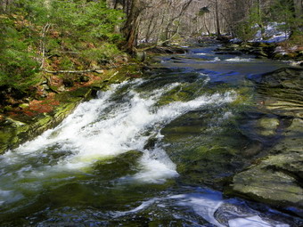
 We headed southwest on the snowmobile trail and at 4.9 miles crossed a bridge over a small stream where I had bushwhacked to a bog with Mike Kudish. Sheila stood on the bridge looking at the water. We continued on and up making a right turn at about 5.2 miles and reaching the highest point at around 5.4 miles. Cindy and I were both glad that the rest of the hike was either flat or downhill as the warm weather was tiring. At 5.8 miles there were ledges on the right and we both recognized this as the area where we had bushwhacked down to the lower trail on our previous trek. The trail had been dry for some time with only a few muddy spots. I remembered that from this point back to the woods road there were some flat areas that might have some puddles or muddy spots. We managed to avoid most of these spots. We came across an open clearing which we both though was near the road but we were wrong. I took some pictures especially of the cloud formations and we continued to hike through the clearing that was near the road. We hit the road at 4:15 PM about 7.2 miles into the hike. The walk down the road was painful for me as it is very rocky and eroded and I did not have poles. Fortunately, the distance was shorten than I remembered and 7.7 miles we hit the junction where we had started the hike earlier in the day. We walked a short distance down the hill where Sheba and I turned left to go down to the falls and Sheila and Cindy returned to the car. The water volume over the falls was a little higher than in the past. I took some pictures of the upper falls and then decided to work my way down to the base of the lower falls. I was surprised to see a lot of ice along the narrow path! I had to walk over some slippery rocks covered with water from the falls before approaching the ice. I had left my pack at the to of the falls so spikes were not an option! I slipped a little on the way down and thought briefly about how I would get back up. At the bottom of the falls I took pictures and then walked to a better vantage point and took some more. Returning to the top of the falls was challenging but easier than I thought it might be. I did have to place my left boot on a ledge where the running water almost came over the top but I avoided that. Sheba and I walked back to the car and arrived at 4:45 PM. We had covered 8.2 miles in under 4 hours in very warm weather. On the way home the two dogs rode together in the back seat with Sheila stretched out across it and Sheba occupying a corner.
![]()
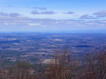
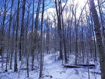
![]() On Saturday, March 17th, I was looking forward to hiking Lone and Rocky with a group of hikers Connie had put together. I had the shortest trip and was the first to arrive parking in the Denning lot at about 8:15 AM. There was only one car in the lot and it was not occupied. I was surprised that the skies were so clear at the trailhead as Livingston Manor had been buried underachieve think layer of fog. Shortly, Steve and Fran arrived and parked. A few minutes Later Connie arrived with Edna, Al, Mike, Margaret, and Julie making nine hikers in all. Some other cars pulled up but they were going on a hike to Table and Peekamoose on a 3500 club hike which turned out to have only four people! Once we were all gathered, we started our hike at 8:45 AM by walking the wide woods road to the trail to Table Mountain. We had decided a as group that snowshoes would not be needed but all of us carried some form of spikes in case they became necessary. We kept up a good pace led by Mike and made the turn at 9:15 AM after hiking 1.2 miles. It was fun being with a group of people and talking to them about their background and hiking experiences. The woods road had some ice but it was easy to walk round it and spikes were not needed. After turning onto the Table Peekamoose Trail we walked to the Neversink River and crossed on the bridges. The first bridge still showed heavy damage from the hurricanes in the fall. The crib on the near side was all but destroyed with all the rock washed away. The ramp up to the bridge had been reconstructed indicating that the state feels that the bridge is safe. As we walked across the bridge did feel solid. The second, two log bridge, was not damaged by the flooding ion the fall and was free from ice so the crossing was easy. We stopped at the end of the bridge to adjust our layering. I had already opened all my pitzips and was only wearing a light short sleeved shirt underneath. I took off the Mammut hoody and long sleeved shirt exchanging them for a short sleeved OR Sequence and a light OR Avido wind shell.
On Saturday, March 17th, I was looking forward to hiking Lone and Rocky with a group of hikers Connie had put together. I had the shortest trip and was the first to arrive parking in the Denning lot at about 8:15 AM. There was only one car in the lot and it was not occupied. I was surprised that the skies were so clear at the trailhead as Livingston Manor had been buried underachieve think layer of fog. Shortly, Steve and Fran arrived and parked. A few minutes Later Connie arrived with Edna, Al, Mike, Margaret, and Julie making nine hikers in all. Some other cars pulled up but they were going on a hike to Table and Peekamoose on a 3500 club hike which turned out to have only four people! Once we were all gathered, we started our hike at 8:45 AM by walking the wide woods road to the trail to Table Mountain. We had decided a as group that snowshoes would not be needed but all of us carried some form of spikes in case they became necessary. We kept up a good pace led by Mike and made the turn at 9:15 AM after hiking 1.2 miles. It was fun being with a group of people and talking to them about their background and hiking experiences. The woods road had some ice but it was easy to walk round it and spikes were not needed. After turning onto the Table Peekamoose Trail we walked to the Neversink River and crossed on the bridges. The first bridge still showed heavy damage from the hurricanes in the fall. The crib on the near side was all but destroyed with all the rock washed away. The ramp up to the bridge had been reconstructed indicating that the state feels that the bridge is safe. As we walked across the bridge did feel solid. The second, two log bridge, was not damaged by the flooding ion the fall and was free from ice so the crossing was easy. We stopped at the end of the bridge to adjust our layering. I had already opened all my pitzips and was only wearing a light short sleeved shirt underneath. I took off the Mammut hoody and long sleeved shirt exchanging them for a short sleeved OR Sequence and a light OR Avido wind shell.
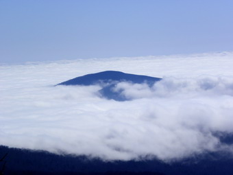
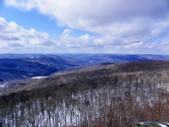
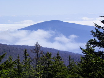 Shortly after crossing the second bridge we turned left to parallel the river. There was a cairn marking the beginning of the Fisherman's Path but it really was not necessary as the path is pretty obvious. The path wanders but stays pretty close to the river. Parts of the trail were very muddy and there was some ice along the way. We finally decided to don our spikes as a slip into the mud would definitely have diminished our enjoyment of the day. We crossed the river twice as the path on the south side of the river runs into steep cliffs along that side. The water was swiftly flowing but was surprisingly low for this time of year. I thought the recent rain would have made the water level higher but the lack of significant snow probably accounted for the lower levels. At about 2.4 miles, we crossed over Donovan Brook and continued on the path. I had always paralleled the brook's drainage when ascending to Lone but Mike chose to go a little further to about 2.6 miles before cutting uphill. After a short and steep ascent up a little creek bed we continued toward the summit of Lone. Even on the uphills we were making good time and made several short stops for breathers and to take pictures. One stop was a rock outcropping with a nice overhang and some limited views back to Slide Mountain. The route followed a spine and we just kept going up and east-southeast through relatively open woods. The route soon leveled off and a pretty well defined path lead to the canister. We arrived at about 11:20 AM after hiking about 4 miles. I walked out to the viewpoint and was treated to an unusual sight. The low-lying clouds obscured most of the valley below but several mountain peaks pushed up through the clouds. I took several pictures and then walked a path along the cliffs. I was hoping to find another view but none developed so I went back to get my pack and walked to the canister. We all signed in and then got a drink and a bite to eat.
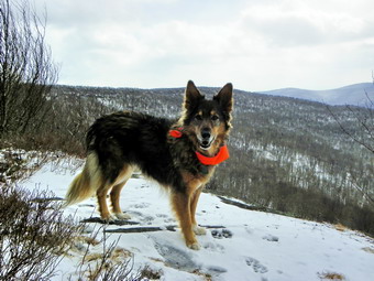
 As we left Lone and headed to Rocky, some of us knew what we were in for and others were about to find out! The land between Lone and Rocky is covered in thick balsam fir and other trees. We started out by heading down through some ledges and a little to the south to make sure we stayed on the bridge of land between the two peaks. Once we were sure we were on the bridge, we headed east northeast. The climb is not steep especially since Rocky is the lowest of the 3500 foot peaks but the going was tough. I eventually found a "corridor" and stayed on it most of the way to the summit. The corridor would appear and disappear but it did make the going a little easier. Margaret was finishing her first round on Rocky so with about .25 miles to go she took over navigation and led us to the canister. As we approached we began to hear voices. At the canister we found two hikers from Newburgh who were hiking Lone, Rocky Balsam Cap and Friday. Their car was the one that was parked at Denning when I arrived. They had done the Burroughs Range on Friday and had camped out overnight. I again walked around looking for a viewpoint even though I had never found one before. This time I walked south from the canister along a path and then to the edge of a ledge. There were good views to the south which were similar to the ones from Lone but also included clearer views of some peaks. I took pictures and then walked back to the canister where other were signing in and taking pictures while congratulating Margaret. We had arrived at 12:45 PM after hiking about 5.25 miles. We left Rocky at 1:00 PM knowing that the rest of the way was mostly downhill but required about a 5 mile walk to get back to the car.
 We followed a path from the canister briefly and then started down the mountain headed north and then north northwest. We soon hit the drainage of a tributary of the Never sink and followed that down to the main river at about 6.1 miles. From here it was simply a matter of following the Fisherman's Path back to the point we had turned up Lone and then back to the parking area. We had to cross the river twice more on the way and the path was wet in some spots. We continued to keep our spikes on as there was ice in some areas. The river crossing were manageable but my Asolo TPS 520 seem to always allow my feet to get wet. I have tried everything including hot Sno-Seal and nothing seems to work. The river crossings required stepping in the water while trying to avoid allowing that water over the top of the boot. Fortunately, the day was warm with the temperature hovering in the high 50's or low 60's and my wet were damp but not soaked. The walk down the Neversink to the point we had departed the path for Lone was about 1.75 miles. On our walk there were several places that I stopped to take pictures. The river is beautiful in this area with many flat rocks and rapids where the water flows through narrow channels cut over thousands of years. After walking 8 miles, we were back at our turnoff spot at around 3:00 PM. From that point we still had another mile and two river crossings before we reached the trail back to the parking area. Everything was now familiar so we talked freely as we walked. Once on the trail there was still another 1.5 miles back to the cars. On the way back I mentioned the sign that marked the eastern terminus of the Finger Lakes Trail. On June 2nd, National Trails Day, the Finger Lakes Trails Conference has scheduled section hikes along all 576 miles of the trail. We arrived back at the parking area at 4:00 PM having covered 10.5 miles in 7 hours and 15 minutes. This included 7 miles of bushwhacking and 2165 feet of elevation gain!
![]()
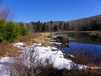
![]() On Wednesday, March 14th, Lisa and I wanted to go somewhere close to Livingston Manor so I suggested a hike from the Balsam Lake Mountain parking area on the Beaverkill Road to Vly and Tunis Ponds. Sheba and I met Lisa at her store downtown and I drove to the end of the Beaverkill Road to park in the lot there. We got going at about 9:25 AM with warm weather and clear skies. The very first part of the trail has a nice view of Balsam Lake Mountain so I took a few shots before we even were up to speed. After the pictures, shouldered my pack and we got going. The was a little snow in the woods and some snow and ice on the trail. We walked and talked and were soon crossing Black Brook on the bridge around .5 miles into the hike. We climbed the hill moving away from the brook and continued along the trail toward the next brook. At 1.4 miles we again descended to cross a bridge. This time it was the bridge over Gulf of Mexico Brook. A few hundred feet on the other side of this crossing we turned left into the woods and bushwhacked along another stream to Vly Pond. We came out by the beaver dam in a rather deep snow bank. The water level was a little low and there were no signs of beaver activity. We stopped a the pond for a snack. I took pictures of the pond and some of the surrounding mountains. The sky was a deep blue which contrasted with the drab surroundings.
On Wednesday, March 14th, Lisa and I wanted to go somewhere close to Livingston Manor so I suggested a hike from the Balsam Lake Mountain parking area on the Beaverkill Road to Vly and Tunis Ponds. Sheba and I met Lisa at her store downtown and I drove to the end of the Beaverkill Road to park in the lot there. We got going at about 9:25 AM with warm weather and clear skies. The very first part of the trail has a nice view of Balsam Lake Mountain so I took a few shots before we even were up to speed. After the pictures, shouldered my pack and we got going. The was a little snow in the woods and some snow and ice on the trail. We walked and talked and were soon crossing Black Brook on the bridge around .5 miles into the hike. We climbed the hill moving away from the brook and continued along the trail toward the next brook. At 1.4 miles we again descended to cross a bridge. This time it was the bridge over Gulf of Mexico Brook. A few hundred feet on the other side of this crossing we turned left into the woods and bushwhacked along another stream to Vly Pond. We came out by the beaver dam in a rather deep snow bank. The water level was a little low and there were no signs of beaver activity. We stopped a the pond for a snack. I took pictures of the pond and some of the surrounding mountains. The sky was a deep blue which contrasted with the drab surroundings.
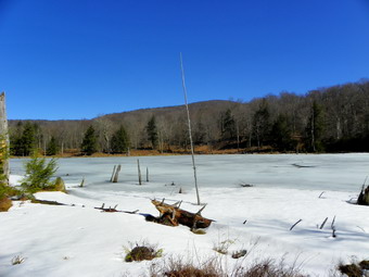 We left Vly Pond at about 10:30 Am and headed back to the main trail. We turned left on the trail to head for Tunis Pond. At 2.4 miles we hit the road that parallels the Beaverkill and turned left toward the pond. The river was very cloudy with what looked like a lot of silt. The road showed signs of vehicle tracks. In places the road was still covered by layers of ice and snow. Not too far upstream we found a large slide that had come down into the stream. The stream was busy eroding away the slide and this was what was making the water cloudy. Upstream from the slide the water was very clear. The sun was out and the light danced off the water. We walked about .4 miles from the turn off the trail and at about 2.75 miles into the hike we turned left to head northeast and up toward the pond. We hiked about .2 miles and arrived at the shore of Tunis Pond at around 11:20 AM. We had to work around some blowdowns but otherwise it was a short bushwhack. In contrast to Vly Pond, Tunis Pond was covered in ice. I took pictures of the pond and the surrounding hills. Again, we saw no signs of beaver activity around the pond. We turned around and followed our route back to the car leaving out the bushwhack to Vly Pond this time. When we got to the Beaverkill, we stopped briefly to take some pictures of the sun on the clear water as it rippled over the rocks. We were back a the car by 1:00 PM having covered 5.7 miles in 3.5 hours.
On Tuesday, March 13th, I took Sheila and Sheba and headed for Round Top behind our church with the intention of hiking along the ridge from the Orchard Street Cemetery to the Agudas Achim Cemetery near Exit 97 on the Quickway. We hiked up the road on the edge of the cemetery and turned left on the trail through the woods. At the junction of the two woods road, I found that the deer head from a previous hike was gone but both dogs did seem interested in that spot. We stayed on the woods road and continued down the hill after the turn to the quarry. From that point we followed the woods road as it passed by some high ledges and steep hills on the right. There were only a few damp spots along the way. Eventually the road turned to the right and uphill. At this point we turned to the left as headed downhill slightly still staying on the little ridge that goes toward the Quickway. This route heads southeast and passes through a nice grove of evergreens and over a few small streams. Eventually it becomes parallel to the highway. We dropped off the path a little to avoid a patch of barberries and roses before heading uphill and then dropping down to cross another stream or two. After about 2 miles we began the final climb up a hill to the woods road that goes near the Jewish cemetery. To get back we turned around and retraced our path following Sheba most of the way. Sheila was a little boisterous on the leash but is getting better. When we reached the woods road where we turned southeast we went to the left and then right up the hill. The climb is rather steep and leads to the top of the unnamed hill that is south of Round Top. We continued over the hill and down the other side. We headed back passed the quarry and turned down through the woods to hit the road back to the trail to the cemetery. We continued back to the church and across the street to the house. We hiked 4.4 miles in about 2 hours.
![]()
![]() On Saturday, March 10th, Jim Kennard wanted to get in one more CHH peak before returning to Rochester. We agreed to meet at the Batavia Kill parking area and hike Burnt Knob AND Acra Point so that he could add TWO more to his CHH completed list. We agreed to meet at 10:00 AM which is a little late for me but it turned out to be a good time as I had two ambulance calls during the night! As I left Livingston Manor at about 8:15 AM, a snow squall was in progress but it disappeared as I drove out the DeBruce Road. On Route 47 there were four cars parked at Biscuit Brook. four cars at Slide Mountain and none at Panther! I wondered where everyone was on this beautiful day. The temperature was holding at about 22 degrees on the car thermometer but the sky was blue with some fleecy white clouds. I decided to drive up Route 42 from Shandaken as the bridge over the Westkill that washed out in the hurricanes was supposed to be repaired. A small group of hikers was at the Halcott parking area getting ready to start a hike. The slide on Route 42 seemed even more impressive in the winter. The bridge had been replaced with a new modern road bridge instead of the old one with the steel superstructure. I finally made it to Maplecrest and turned right on Big Hollow Road. The road was in good shape until the bus turn around. From that point to the Parking area was very icy as was the parking area itself. I was surprised to find room in the lot at 9:45 AM with only about five cars. I knew that a meetup group was supposed to be hiking the Blackhead Range and I though they were starting at 9:00 AM. I watched one car slip around the lot and hoped I would get out OK at the end of the hike. I recognized Jim's car as he parked and went over to say hello to him and Connie and Edna, two experienced hikers from Saugerties. We decided to put on spikes right away and as I headed back to my car a parade of cars began to pull up. A few took the remaining spots but the rest turned around and parked on the side of the road. We left the parking area at 10:10 AM and headed down the road a little to start on the red blazed Black Dome Trail.
On Saturday, March 10th, Jim Kennard wanted to get in one more CHH peak before returning to Rochester. We agreed to meet at the Batavia Kill parking area and hike Burnt Knob AND Acra Point so that he could add TWO more to his CHH completed list. We agreed to meet at 10:00 AM which is a little late for me but it turned out to be a good time as I had two ambulance calls during the night! As I left Livingston Manor at about 8:15 AM, a snow squall was in progress but it disappeared as I drove out the DeBruce Road. On Route 47 there were four cars parked at Biscuit Brook. four cars at Slide Mountain and none at Panther! I wondered where everyone was on this beautiful day. The temperature was holding at about 22 degrees on the car thermometer but the sky was blue with some fleecy white clouds. I decided to drive up Route 42 from Shandaken as the bridge over the Westkill that washed out in the hurricanes was supposed to be repaired. A small group of hikers was at the Halcott parking area getting ready to start a hike. The slide on Route 42 seemed even more impressive in the winter. The bridge had been replaced with a new modern road bridge instead of the old one with the steel superstructure. I finally made it to Maplecrest and turned right on Big Hollow Road. The road was in good shape until the bus turn around. From that point to the Parking area was very icy as was the parking area itself. I was surprised to find room in the lot at 9:45 AM with only about five cars. I knew that a meetup group was supposed to be hiking the Blackhead Range and I though they were starting at 9:00 AM. I watched one car slip around the lot and hoped I would get out OK at the end of the hike. I recognized Jim's car as he parked and went over to say hello to him and Connie and Edna, two experienced hikers from Saugerties. We decided to put on spikes right away and as I headed back to my car a parade of cars began to pull up. A few took the remaining spots but the rest turned around and parked on the side of the road. We left the parking area at 10:10 AM and headed down the road a little to start on the red blazed Black Dome Trail.
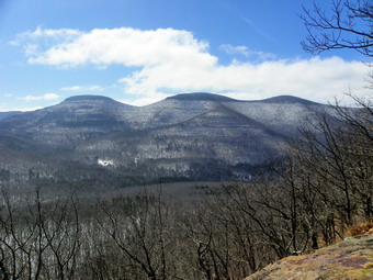
 The new bridge made crossing the Batavia Kill easy and the small tributary was no problem. The trail was very icy and I was glad we had decided to wear the spikes. I had been a little cold at the trail head with a slight breeze blowing but the slightest exertion warmed me up. I unzipped the front sippers on all layers and the pitzips on the Mammut hoody which was enough for the moment. We walked and talked and gained about 600 feet over the first mile to the blue Escarpment Trail. There was still only a little snow and some ice on the trail. I suggested we turn left and do Burnt Knob first. Burnt Knob has more bushwhacking and doing Acra Point second would allow us to decide to do an out and back or a loop. As we started up to Burnt Knob the trail had only a light coating of snow and a few icy patches. The trail did get steeper as we ascended and it switched from an eastern exposure to a northern one as it wraps around the back of the hill. As soon as the exposure changed, there was several inches of snow on the trail/ We made the turn at the switchback and admired the view to the north. Soon we were facing east toward Acra Point and the view in that direction was also good. I took a few pictures and removed my midlayer before making the last climb and walking to the viewpoint facing the Blackhead Range. The view to the south was very clear and the only drawback was that the sun was very bright. We dropped our packs and stayed at the lookout for a few minutes to take pictures. We then turned our attentions to the bushwhack up to the highest point on Burnt Knob, We decided to ascend directly across from the lookout and then walk along the ridge to the west to find the high point. There was about a foot of snow at the top and it was less consolidated than on the trail. We found a small viewpoint to the north a I took some more pictures before walking west. About 1.75 miles into the hike around 11:25 AM, we hit what seemed to all of us like the highest point. We stayed for a minute and then decided to take the shortest and steepest path back to the trail. Heading southwest and walking about 520 feet and dropping 125 feet brought us to the trail. Now it was on to Acra Point.
 Descending to the Col went quickly and soon we were walking up the trail to Acra Point. The trail was steep but had a couple of switchbacks and the trip isn't long. From the Col to the viewpoint was less than .3 miles and represented a vertical gain of about 220 feet. We walked out to the viewpoint at 12:10 PM to find another spectacular set of views. We decided to stay for lunch. I took pictures of the Blackhead Range, Burnt Knob and Arizona, a swell as , some shot down the valley. While we were relaxing, three dogs showed up and were soon followed by their people. One of the people was Robert Moses who leads hikes for, among other groups, the Andes Hikers. We talked for a while and then they moved on. Soon it was our time to get back on the trail and search out the high point further up the trail. From the viewpoint it was an easy walk of about .5 miles and 160 feet up to the highest point just off the trail. I suggested we do the loop rather than head back the way we had come and the others readily agreed. There was quite a bit of snow on the trail from the highest point to the junction with the Batavia Kill Trail. The other group had gone to the high point and turned around so the only footprints were those of a smaller group that had come over from Windham earlier in the day. It had been some time since I had hiked this trail and it was longer than I remembered. At times there were limited views to our right and up ahead we could see Blackhead getting closer and closer. After 1.7 miles from the high point, we were at the trail junction and turned right to go back to the parking area. The next section of trail was very narrow and had some very icy patches which required some attention to foot placement. The walk to the lean-to seemed short. At the lean-to we found packs and other equipment sitting in front of and in the lean-to with no one around. From the lean-to we headed down the Batavia Kill Trail. Several spots had large ice flows and the amount of debris still strewn around from the fall flooding was remarkable. As we neared the parking area, the icy patches all but disappeared and I decided to remove my spikes. We ran into several more icy stretches after that and I almost put the spikes back on! We were back at the cars by 2:30 PM having hiked 6.5 miles in 4 hours and 15 minutes. After negotiating the ice in the parking lot, I drove to Tannersville for a quick meal at Pancho Villa's before returning home.
![]()
![]() On Friday, March 9th, Jim Kennard and I had agreed to meet in Margaretville to hike to the high point on Dry Brook Ridge so that he could check off another summit on his CHH list. As I left Livingston Manor with Sheba the temperature was in the high 20's but the wind made it feel much colder. The drive around the Pepacton Reservoir was uneventful and I arrived in Margaretville early so I headed to the trail head to check out the conditions and then to the Hess station for gas. Hill Road was well plowed as was the trailhead and a glanced the trail showed little or no snow. I pulled into the parking lot across from the Foodtown at about 9:55 AM and Jim was waiting for me. We decided to drive both cars to the trailhead parking since it was Friday and few others would be hiking. After arriving at the trail head, we got our gear ready and walked across the road to begin our hike at 10:20 AM. We discussed bringing snowshoes and decided against it. Snowshoes would not be necessary at the beginning of the hike and we did not want to carry them on the chance we might come across some snow. The trail is an old woods road and it is wide and well-maintained as it passes through a red pine plantation planted by the CCC. The first .5 miles is a sustained climb of about 450 feet which is never very steep but really gets the blood circulating and allows you to get warmed up. As the trail leveled I unzipped some zippers to allow some cooling ventilation. The higher we went the more snow we found and much of it was freshly fallen. It covered the trees and laid a light blanket on the trail. We took some pictures as we ascended and somewhere along the way I took off my mid layer even though the temperature was right around freezing. On the trail we were protected from the wind on the hiking was really heating me up.
On Friday, March 9th, Jim Kennard and I had agreed to meet in Margaretville to hike to the high point on Dry Brook Ridge so that he could check off another summit on his CHH list. As I left Livingston Manor with Sheba the temperature was in the high 20's but the wind made it feel much colder. The drive around the Pepacton Reservoir was uneventful and I arrived in Margaretville early so I headed to the trail head to check out the conditions and then to the Hess station for gas. Hill Road was well plowed as was the trailhead and a glanced the trail showed little or no snow. I pulled into the parking lot across from the Foodtown at about 9:55 AM and Jim was waiting for me. We decided to drive both cars to the trailhead parking since it was Friday and few others would be hiking. After arriving at the trail head, we got our gear ready and walked across the road to begin our hike at 10:20 AM. We discussed bringing snowshoes and decided against it. Snowshoes would not be necessary at the beginning of the hike and we did not want to carry them on the chance we might come across some snow. The trail is an old woods road and it is wide and well-maintained as it passes through a red pine plantation planted by the CCC. The first .5 miles is a sustained climb of about 450 feet which is never very steep but really gets the blood circulating and allows you to get warmed up. As the trail leveled I unzipped some zippers to allow some cooling ventilation. The higher we went the more snow we found and much of it was freshly fallen. It covered the trees and laid a light blanket on the trail. We took some pictures as we ascended and somewhere along the way I took off my mid layer even though the temperature was right around freezing. On the trail we were protected from the wind on the hiking was really heating me up.
 At 1.9 miles the trail leveled off and the snow depth began to increase to 6 to 8 inches with a few deeper spots. The snow was hard and we were not sinking in most places and the decision against the snow shoes seemed to be correct but I knew that the ridge often had more snow. At 11:40 AM we hit the trail junction about 2.25 miles into the hike. We paused for a drink and a snack. As we turned right to head toward the lookouts and the high point it became clear that the ridge had LESS snow than we had just come through, in fact, there was only a dusting of new snow over hard packed older snow and ice. The walk along the ridge to the lookouts is about a mile and gains only 270 feet. There were a few icy patches that were especially noticeable on some of the short but steep ascents. We could hear the wind blowing but we were protected for most of the hike. The trail on the ridge is more of a trail than a road and it winds back and forth as it approaches the viewpoint. At 12:15 PM we arrived at the viewpoint and I dropped my pack and got out the camera. One look out at the Pepacton Reservoir and the surrounding hills told me that this was one of the best views I had ever experienced from this lookout. The reservoir was clearly visible and the sun, while bright, was not interfering with taking some good shots. I walked out onto the rocks being careful not to slip as there was some ice. I took some shots and used Jim's camera to take some of him and Sheba. The wind was still blowing and I was getting cold so we took some final looks and some final pictures and got back on the trail to the high point. We walked another .5 miles on the trail and gained another 100 feet of elevation before we decided to walk to the left of the trail and up into the woods.
 After we made the turn into the woods the snow got much deeper approaching a foot in most places. The walk was a gentle incline and we were soon on an almost flat area typical of many CHH peaks. We found a high spot but then I noticed a higher point a little further on. After walking only .1 miles and gaining another 35 feet we claimed the summit at 12:45 PM. We stopped for a bite to eat but I began to get cold and we didn't wait very long. We decided to walk straight out to the trail rather than retrace our wanderings and we were soon on the trail back to the cars. It was at this point that we noticed that the skies were no longer sunny but overcast and beginning to get dark. At one open viewpoint I took a few shots and noticed that snow appeared to be approaching. In only a few minutes there were flakes around us as we moved quickly along the trail. Jim had put his spikes on at the high point but I stubbornly slipped and slid along without mine through to harrowing little descents. On the final descent I gave in and was glad that I did. We hit the trail junction and turned left onto the Huckleberry Loop trail. The short walk along the flatter part of the trail quickly gave way to the sustained descent and down went a lot faster than up. Along the way the snow stopped and there was some sun but this quickly changed back to snow showers. This happened several times as we made our way through the hardwoods up top into the pines farther down the slope. Much of the light covering of snow had melted away in the direct sunlight while we were up on the ridge. We stopped once or twice to take pictures but otherwise kept up a good pace. We arrived back at the car at 2:50 PM covering 7.7 miles in 4.5 hours including all the stops for pictures both short and long. I had planned on stopping to take pictures of the reservoir or some waterfalls on the way back but the skies remained cloudy so I headed home by way of the Barkaboom Road.
On Thursday, March 8th, I took Sheila for some exercise on the Round Top behind our church in Livingston Manor! Sheba seemed a little sore after 18 mile sin two days so I gave her the day off. As we started across the street it looked like all the snow had disappeared from the hillside behind the church. I let Sheila have her way and sniff every leaf in site which made the hike last a little longer. After climbing up to the top of the cemetery hill we turned left onto the trail and there was no snow in sight. We turned right on the "low road" and headed up the hill with Sheila straining to go faster than I could possibly go. As we turned left to go up the hill we ran into several inches of wet snow. This continued to the top of the hill where I decided to turn left to complete the short loop. I was beginning to feel the effects of the two days of hiking just like Sheba! We walked through the snow on the woods road for a little while and then turned left into the woods to complete the loop. At the lookout we again turned left and walked down the hill to complete the loop and walk back to the house. It was only about two miles in an hour but it felt good to get out in the warm weather.
![]()
![]() On Wednesday, March 7th Jim Kennard and I had agreed to hike Hodge Pond and Mongaup Mountains as a part of Jim's pursuit of the CHH. He was driving down from Rochester and would stop in Livingston Manor where we would depart for the hike. Jim made good time on his drive and actually arrived before the 10:00 AM appointed time. I was ready to go so we put all our gear and Sheba in my car and headed for the parking area at Frick Pond. Our gear included snowshoes so that we could make a decision at the trailhead about wearing them, carrying them or leaving them in the car. We got to the parking area just before 10:00 AM to find several inches of snow on the ground. Some snow had melted and the rest was pretty hard and I was leaning toward leaving the snowshoes in the car as I did not want to carry them especially on a bushwhack. In the end I decided we would wear them with the though that we could stash them along the way if they were not needed and adjust our route so that we could pick them up on the way back. We shoved off at 10:10 AM and walked out to the register box on the woods road that is the start of the Quick Lake Trail. The woods road was covered in snow which was an indication that taking the snowshoes was a good idea since this area is wet and often devoid of snow. We stopped briefly at the bridge at the outlet of Frick Pond so that We could take pictures and then continued on the Quick Lake Trail. Both Jim and I were getting warm so we opened the zippers and took off a layer. We negotiated the blowdown on the way to Iron Wheel Junction and arrived there after hiking 1.5 miles in an hour. We turned left to stay on the Quick Lake trail and followed some snowmobile tracks which made walking over the snow easier.
On Wednesday, March 7th Jim Kennard and I had agreed to hike Hodge Pond and Mongaup Mountains as a part of Jim's pursuit of the CHH. He was driving down from Rochester and would stop in Livingston Manor where we would depart for the hike. Jim made good time on his drive and actually arrived before the 10:00 AM appointed time. I was ready to go so we put all our gear and Sheba in my car and headed for the parking area at Frick Pond. Our gear included snowshoes so that we could make a decision at the trailhead about wearing them, carrying them or leaving them in the car. We got to the parking area just before 10:00 AM to find several inches of snow on the ground. Some snow had melted and the rest was pretty hard and I was leaning toward leaving the snowshoes in the car as I did not want to carry them especially on a bushwhack. In the end I decided we would wear them with the though that we could stash them along the way if they were not needed and adjust our route so that we could pick them up on the way back. We shoved off at 10:10 AM and walked out to the register box on the woods road that is the start of the Quick Lake Trail. The woods road was covered in snow which was an indication that taking the snowshoes was a good idea since this area is wet and often devoid of snow. We stopped briefly at the bridge at the outlet of Frick Pond so that We could take pictures and then continued on the Quick Lake Trail. Both Jim and I were getting warm so we opened the zippers and took off a layer. We negotiated the blowdown on the way to Iron Wheel Junction and arrived there after hiking 1.5 miles in an hour. We turned left to stay on the Quick Lake trail and followed some snowmobile tracks which made walking over the snow easier.
 The Quick Lake trail heads north from the trail junction and after a while heads northeast to meet the Flynn Trail at Junkyard Junction. Hodge Pond Mountain lies to the northwest so we simply had to pick a point to jump of the trail and head up. At 2.7 miles into the hike the trail turned northeast so we headed off into the woods towards the northwest. The slope was gentle at first and then became steeper with a few small ledges to work around. The route this time was a little different from the one I used last time and seemed more open. After about .3 miles we had gained 250 feet and were still headed up. Our compass bearing and maps indicated we should turn a little more north and even northeast so we did and continued up for another .1 miles gaining another 50 feet. At this point we wandered around a little and found what we though was the highest spot. We stopped briefly for a drink and snack and the headed northeast at about 12:15 PM to get back to the trail. At the top of the mountain there was at least 10 inches of snow in most places so the snowshoes made the going easier. Over the next .4 miles we dropped about 250 feet watching for the Quick Lake trail all the time. I knew it was doubtful that anybody had hiked the trail lately and I did not know about snowmobile traffic. I wanted to make sure we did not overshoot the poorly marked trail. I need not have worried as the trail appeared right were I knew it would be and was easy to spot as there had been several sleds on it recently. We turned right on the trail to head fro Junkyard Junction which was only .3 miles away.
 On the Flynn Trail we continued straight ahead as we continued to find a significant amount of snow. The plan was to walk down the Flynn Trail to Hodge Pond, around the back of the pond and up the woods road to the top of the hill near Beech Mountain. We walked across the flat Flynn Trail and then descended to the pond stopping at about 4.5 miles to take some pictures before continuing on around. The walk from the back of the pond up the woods road seemed long and although not steep it was a little taxing. We stopped several times before cresting the hill and heading down the other side. At 5.5 miles the woods road turned to the east and we turned to the right into the woods heading almost due north. This part of the hike is somewhat unique as there is a narrow ridge of land that runs along a sharp drop off. By hiking along this ridge we got nice views of the valleys and hills beyond. There were a few spots that allowed limited views and we did spot some ski slopes to the south and east. I could not figure out whether these slopes were maintained or not and was at a loss to say where they might be located. Along the way we came across a fairly fresh snowmobile track and used it at times since it seemed to be headed in our direction. The walk was pleasant given the views and there were only a few places where we had to work through some brush. As we approached the final ascent, we followed snowmobile track until it was clear that it bypassed the top of the mountain. At about 6.2 miles we turned up the hill and made a steep but short ascent after which the land leveled off but continued to rise. We followed the rise until we could find no more higher ground and stopped at our summit for something to eat and drink. It was 2:45 and we still had to hike back to the car. We started out by following our tracks back down to the snowmobile track.
 We decided to follow the snowmobile track back to the woods road and this proved to be a good choice. The return trip to the woods road went quickly and once on the road we kept up the pace. Going down the hill was definitely easier than the trip up! On the way down we stopped at a nice viewpoint and took a few shots. At the road down to Hodge Pond we continued straight ahead to the Flynn Trail and turned left. By 4:00 PM we were 8.4 miles into the hike and had arrived at the junction with the Big Rock Trail. The Flynn Trail had snowmobile tracks in both directions even though signs clearly state it is off limits. The tracks did make walking a little easier as we began the walk down the Flynn Trail. By this time we were all a little tired and kept up a good pace to get back to the car as soon as possible. The Flynn Trail is mostly a descent with a few flatter spots. The trail was still covered in snow and we had come across no bare spots at all in our hike. When we got to the gate, we turned into the woods to finish the hike on the Flynn Trail. We were back at the car at 4:40 PM having covered 10.1 miles and gaining 2000 vertical feet in 6.5 hours. This time was about the same as the last time I had done the hike in the spring without snow and snowshoes! I knew that I needed to take a day off and Jim was not sure what he would do the next day.
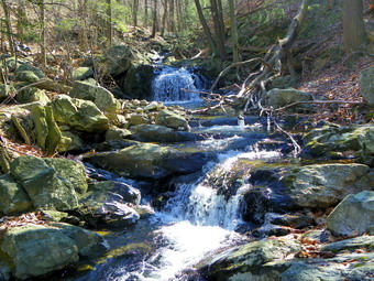
![]()
![]() On Tuesday, March 6th Karl met Cindy and I at our house and we headed to Black Rock Forest where we were to meet Kurt to go on a hike. Karl rough his dog, Maggie, but we elected to give both our dogs a rest. When I gave Kurt directions from Lagrangeville, he said that the area sounded familiar especially the part about the narrow tunnel under Route 9W! He said that he had hunted in Black Rock Forest in the fall and knew how to get to the area. Cindy wasn't so sure about going through the tunnel and didn't remember the experience although we had been there before! When we arrived at 10:00 AM. Kurt was already waiting and we started hiking soon after. Black Rock Forest has a myriad of trails and woods roads so it is easy to tailor a rote as long as you have a map. We started out on the red Duggan Trail from the parking area and turned left on the blue Reservoir Trail crossing the brook on Ben's Bridge. The trail parallels the small stream which has cut a fairly deep path down from the Upper Reservoir. I stopped several times and carefully worked my way down the steep bank to take pictures. Maggie accompanied me on these excursions but the rest of the party stayed on the trail. When we got to the top of the hill near the education center the trail leveled off and we briefly picked up the yellow Stillman Trail. This trail heads up over Mount Misery so we turned right on White Oak Road and took a short cut back to the trail after it passed over the hill. We turned right on the Stillman Trail and walked to the Aleck Meadow Reservoir. We stopped to take some pictures here. The water had only a skim of ice near shore and there was no snow to be seen anywhere. By this time the temperature was in the 40's. '
On Tuesday, March 6th Karl met Cindy and I at our house and we headed to Black Rock Forest where we were to meet Kurt to go on a hike. Karl rough his dog, Maggie, but we elected to give both our dogs a rest. When I gave Kurt directions from Lagrangeville, he said that the area sounded familiar especially the part about the narrow tunnel under Route 9W! He said that he had hunted in Black Rock Forest in the fall and knew how to get to the area. Cindy wasn't so sure about going through the tunnel and didn't remember the experience although we had been there before! When we arrived at 10:00 AM. Kurt was already waiting and we started hiking soon after. Black Rock Forest has a myriad of trails and woods roads so it is easy to tailor a rote as long as you have a map. We started out on the red Duggan Trail from the parking area and turned left on the blue Reservoir Trail crossing the brook on Ben's Bridge. The trail parallels the small stream which has cut a fairly deep path down from the Upper Reservoir. I stopped several times and carefully worked my way down the steep bank to take pictures. Maggie accompanied me on these excursions but the rest of the party stayed on the trail. When we got to the top of the hill near the education center the trail leveled off and we briefly picked up the yellow Stillman Trail. This trail heads up over Mount Misery so we turned right on White Oak Road and took a short cut back to the trail after it passed over the hill. We turned right on the Stillman Trail and walked to the Aleck Meadow Reservoir. We stopped to take some pictures here. The water had only a skim of ice near shore and there was no snow to be seen anywhere. By this time the temperature was in the 40's. '
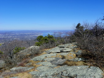 We followed the Stillman Trail as it dropped below the dam and the started up to Black Rock. The .5 mile walk from the dam to the top of Black Rock gained about 390 feet but was well worth the walk. When we reached the top, the views were spectacular. There was none of the haze that normally blacks part of the view and the sky was blue with a few clouds. To the right was the Hudson River. Straight ahead we could see the Moodna Viaduct. As we took some pictures, we heard voices coming from below and soon a group of students and their teachers were climbing up to the viewpoint. I talked to one of the chaperones and found out the students were from a Montessori school in Manhattan and were starting a beaver dam project. Black Rock was about 2.25 miles into our hike and we left to continue our walk at about 11:40 AM. The descent from Black Rock is steep but short and the trail was pretty flat after that to the area know as Two Gates. We continued on the Stillman Trail through Two Gates and headed toward Split Rock. It was about a mile to Split Rock and we gained about 240 feet. The view from Split Rock was pretty clear except for very far away. The sun did interfere a little with the photography. We could see the New York skyline but it was hard to get any good pictures. We spent a few minutes at the viewpoint before heading down the Split Rock trail to the area between Sutherland and Sphagnum Ponds. Just to the right of the trail is a big, open pit which could have been a mine or a quarry. I took some pictures and then we got on the Chatfield Road to circle Tamarack Pond and visit the Chatfield Stone House.
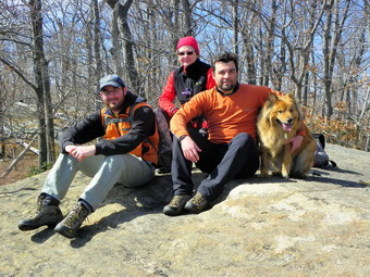 As we hiked around the pond, I walked out to an opening to take a few pictures. The fire tower was clearly visible and helped us keep our bearings as we circled around to the house. We arrived at the house at 1:00 PM after a 1.3 mile walk from the lookout which was about 5 miles into the hike. We found a different group of students at the house. The house was open and the students were carrying wood to make a fire. After I took some pictures of the house we walked up the road and turned right to walked to Arthur's Pond on the White Oak Trail. We stopped at the pond and took some shots before walking across the outlet stream just below the dam. We followed the White Oak Trail from the pond to where it ended on the road south of Aleck Meadow Reservoir. We walked on White Oak Road to the Upper Reservoir where we stopped briefly to take some pictures. From there we walked down Reservoir Road, passed the education center and back to the car at the parking lot. Along the way we stopped twice, once at the Mailey's Mill Bridge and another time at a viewpoint looking north from the road. We were back at the car by 2:00 PM having covered 7.5 miles in 4 hours total time. This was about the length in miles and time I had planned. We had enough time to stop at El Bandido in Middletown for a meal and for me to get home for my spring coaches meeting.
![]() On Sunday, March 4th, I had thought Cindy might like to go somewhere to snowshoe. I though that Kelly Hollow might be a good spot to take the dogs even though the ride is somewhat long for the length of the hike. When we got home from church, Cindy declined the offer so I headed to Roscoe to go to Kelly Hollow. As I got to Roscoe I thought about the long drive and the many places we could go to hike. I decided to go to Trout Pond again as it was close and is familiar ground. The parking area at the junction of Morton Hill and Russell Brook Roads was not plowed so I parked along the road. I had worm my new Columbia Bugaboot Plus boots and had with me my new Atlas Aspect snowshoes. The boots were actually TOO warm for the conditions but I was trying to evaluate them. They are my regular size 9 but seem a little large which I hope is a concession to wearing heavier socks. They boots are the highest I have coming up over the ankle even further than my Salomon Nytros. The reflective threads than Columbia uses and the Thinsulate insulation combine to make a warm boot. I was anxious to try the snowshoes but was disappointed to see that they look a lot like the MSR Lightning Ascents right down to the bindings. Atlas has good bindings on their snowshoes but decided to copy the WORST feature of the MSR snowshoes by using the same type of binding. They did keep their "spring loaded" feature which keeps the back of the snow shoe from dropping too much when lifted. This is handy especially when bush whacking but they tend to through snow up the back of the leg. I had not worn gaiters since I knew we would be on trails with a hard crust. We parked just before noon and left on the hike as soon as I got my snowshoes on.
On Sunday, March 4th, I had thought Cindy might like to go somewhere to snowshoe. I though that Kelly Hollow might be a good spot to take the dogs even though the ride is somewhat long for the length of the hike. When we got home from church, Cindy declined the offer so I headed to Roscoe to go to Kelly Hollow. As I got to Roscoe I thought about the long drive and the many places we could go to hike. I decided to go to Trout Pond again as it was close and is familiar ground. The parking area at the junction of Morton Hill and Russell Brook Roads was not plowed so I parked along the road. I had worm my new Columbia Bugaboot Plus boots and had with me my new Atlas Aspect snowshoes. The boots were actually TOO warm for the conditions but I was trying to evaluate them. They are my regular size 9 but seem a little large which I hope is a concession to wearing heavier socks. They boots are the highest I have coming up over the ankle even further than my Salomon Nytros. The reflective threads than Columbia uses and the Thinsulate insulation combine to make a warm boot. I was anxious to try the snowshoes but was disappointed to see that they look a lot like the MSR Lightning Ascents right down to the bindings. Atlas has good bindings on their snowshoes but decided to copy the WORST feature of the MSR snowshoes by using the same type of binding. They did keep their "spring loaded" feature which keeps the back of the snow shoe from dropping too much when lifted. This is handy especially when bush whacking but they tend to through snow up the back of the leg. I had not worn gaiters since I knew we would be on trails with a hard crust. We parked just before noon and left on the hike as soon as I got my snowshoes on.
Shelia was ready to go and I tried to curb her enthusiasm as she likes to pull me along. We walked down the road which was not plowed and showed no tracks except for snowmobiles. As we got to the upper camping area. I decided that I did not want to repeat the usual loops. When I first came to Trout Pond in 2005, I was hiking with my daughter and had no idea where I was going. We took the first trail we came to which was a snowmobile trail that gained some elevation before dropping down to the lake. I remembered that it was overgrown and poorly marked but was also a fun hike. I decided I wanted to see if I could repeat that route. The dogs and I turned in on the snowmobile trail and had a very pleasant walk along Russell Brook. The trail was clear and there were a few snowmobile blazes. At about .6 miles into the hike the trail all but disappeared and there were no blazes. I decided to continue along the east side of Russell Brook and then turn west when an opportunity presented itself. The woods were pretty open as we walked along the high bank of the brook. At about a mile I figured we were headed too far to the east and decided to cross the brook and head west. I found a more gentle slope down to the stream and up the other side. The crossing went well but there was a lot of blowdown to negotiate on the other side. Once through the blowdown, I took a compass bearing and decided we needed to head more to the northwest. The maps showed a higher hill in that direction and it was more toward the pond. Soon I could confirm the "higher hill" and it was not only high but VERY steep with significant ledges. We headed right for the hill and climbed the first steep step through some blowdown and old pricker canes. Sheila actually led the way quite nicely and we were soon at the base of the ledges. Heading due west was not a possibility as that was the direction of the steepest ledges. Heading north or south would skirt the ledges and lead to a gentler ascent. I decided to head north and off we went. After a brief walk on flatter ground, I saw an opportunity to pick our way up the hill and took it. This required some sidehilling and some steeper ascents through some blowdown and more pricker canes. After about 1.6 miles and an hour of hiking we were at the top of the hill.
I had hoped for a view of the pond from the top of this high (2600 ft) hill but there wasn't one. There were some nice views of the surrounding hills and ridges and it seemed we were as high as any of them. From up there was only one way to go and that was down. I headed almost due west and dropped over 300 feet in the next .25 miles. Most of this was a steep descent through ledges but there always seemed to be a path down through them. After the .25 mile descent we abruptly ran across a snowmobile trail. I had thought this might happen as the Trout Pond side of the hill has several snowmobile trails that follow the old bark roads from the Treyz company. The Treyz company operated a large acid factory at the foot of Russell Brook and they logged the area for the raw materials they needed. The snowmobile trail that I hoped to hit runs down to the lake about halfway between the two ends. The one that we did find headed back toward the outlet but I was glad to have some easier hiking for awhile. At 2.2 miles we hit the main trail around Trout Pond. By this time my shoulders were aching from Sheila pulling on the leash and the bushwhack had been a good workout. My feet were a little sore in the new boots and I decided I did not have to walk around the loop one more time. We turned left and headed back to the car via the lower parking area. The uphill walk on Russell Brook Road was a good workout. We were back at the car by 2:10 PM having covered 3.6 miles in just over 2 hours. When I got home, I loaded the track from my GPS into the computer to compare it to the track from 2005. I found that we should have crossed the brook at the point where the trail "disappeared" which would have allowed a more gentle approach to the hill and a descent to the lake.
![]()
![]() On Friday, March 2nd, I wanted to hike a 3500 foot mountain and make every effort to find one that had enough snow to make snowshoes a necessity. Past experience had shown me that Balsam Lake Mountain gets and keeps a lot of snow since it is the westernmost Catskill 3500 peak. We had been having an odd mix of snow and sleet and rain during the week but this day seemed to have little precipitation forecast. I took my snowshoes with me although the conditions in the valley seemed to indicate I might not need them. As I drove out of Livingston Manor some rain and freezing rain was hitting the windshield but the roads were clear. The further I drove up the Beaverkill Road, the more snow and ice there was on the trees. I wondered about the condition of the road and parking areas since the deterioration of the road has made getting a snowplow passed the Quill Gordon Lodge difficult. I was surprised to find the road in good shape with only a little ice and the Cradle Rock and Mongaup Hardenburgh parking lots were both plowed. The amount of snow along the road and in the forest continued to increase as I approached the trail head as did the ice and frozen snow on the trees. When we arrived at the Balsam Lake parking area, it two was plowed and I had no trouble parking. We got started right away and I decided that snowshoes would be the best idea. There was a heavy haze hanging around which obscured most views. On the way passed the trail register, I walked out into the field and took a few pictures of the field and the trees covered in ice. As usual, I had overdressed and was warm almost immediately. We had to walk over three large trees across the trail before arriving at the turn up the mountain. We stopped at this point so that I could take some pictures and remove my midlayer. Sheba seemed to be in good shape and was willing to lead but I held her back so that she could walk in my tracks.
On Friday, March 2nd, I wanted to hike a 3500 foot mountain and make every effort to find one that had enough snow to make snowshoes a necessity. Past experience had shown me that Balsam Lake Mountain gets and keeps a lot of snow since it is the westernmost Catskill 3500 peak. We had been having an odd mix of snow and sleet and rain during the week but this day seemed to have little precipitation forecast. I took my snowshoes with me although the conditions in the valley seemed to indicate I might not need them. As I drove out of Livingston Manor some rain and freezing rain was hitting the windshield but the roads were clear. The further I drove up the Beaverkill Road, the more snow and ice there was on the trees. I wondered about the condition of the road and parking areas since the deterioration of the road has made getting a snowplow passed the Quill Gordon Lodge difficult. I was surprised to find the road in good shape with only a little ice and the Cradle Rock and Mongaup Hardenburgh parking lots were both plowed. The amount of snow along the road and in the forest continued to increase as I approached the trail head as did the ice and frozen snow on the trees. When we arrived at the Balsam Lake parking area, it two was plowed and I had no trouble parking. We got started right away and I decided that snowshoes would be the best idea. There was a heavy haze hanging around which obscured most views. On the way passed the trail register, I walked out into the field and took a few pictures of the field and the trees covered in ice. As usual, I had overdressed and was warm almost immediately. We had to walk over three large trees across the trail before arriving at the turn up the mountain. We stopped at this point so that I could take some pictures and remove my midlayer. Sheba seemed to be in good shape and was willing to lead but I held her back so that she could walk in my tracks.
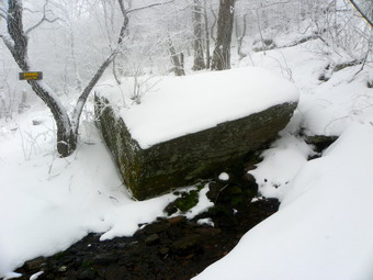 As we started up the mountain, I engaged the heel lifters on my Tubbs Alp Flex snowshoes. They make the strain on the calves less pronounced and are not high enough to cause an imbalance. The higher we climbed the more snow and ice was present and I was glad I had the snowshoes. The fog continued to hang around so the views which are limited to begin with were nonexistent. I stopped a few times to take pictures. We passed the 3500 foot sign after 1.25 miles and an hour of hiking. Soon after this we came to the spring and then climbed the last short section to the summit plateau. I took some more pictures of the trail and close-ups of the trees. The walk to the tower was interesting as always since the snow got deeper and there was a lot hanging on the evergreens. I took some pictures of the spruce tunnel and then we were at the tower. The drifts in the clearing were almost two feet high and the wind was whipping around. The tower was encased in ice and frozen snow which should have made it clear to me to stay off or to switch from snowshoes to spikes. I took off my snowshoes and grabbed my camera to ascend the tower. Even before I got above the treeline the wind velocity increased. I stopped at one of the landings and took some pictures before deciding to head back down. I immediately remembered that down is always more harrowing than up but I got to the base with only one slip. There was no reasons to hang around at the cold and windy summit so we headed back down the other side of the mountain
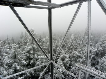 Descending in the still light powder was a blast. I picked up the tips of the snowshoes and was able to ski down the steeper parts with Sheba right behind. I was having so much fun that I did not notice the couple headed up the trail until we were almost on top of them. They had come down from Binghamton for the day and were parked the Millbrook lot. We chatted for a minute as they admired Sheba and then we headed in opposite directions. having a broken trail was nice but that ended at the trail junction. Sheba and I turned right to complete the loop and head back to the car. We were back into fresh snow but the going was much easier than when all the rock are exposed. The fog continued to be with us but the sun shown through several times. I was not cold at all despite having just and underlayer and softshell on top. We hiked back to the trail junction quickly and then kept the pace back to the car. We were back by 12:50 having covered 4.3 miles in 2 hours and 40 minutes including a lot of time stopped for pictures.
On Wednesday, February 29th, Sheba seemed a little lame from the recent hikes and cold weather. I decided to take Sheila out alone over Round Top to see if she could follow our regular path. I intended to do the shortest route possible just to get out as the weather was raw and felt much colder than the 36 degrees on the thermometer. We headed up the hill behind the church and entered the woods with Sheila eager to smell all the smells with her nose buried in the snow. When we got to the first junction, she immediately turned in the correct direction and headed up the woods road. Net turn, same result. Sheila seemed to want to do the longer route as she turned away from home at the next junction. We walked passed the quarry and won to the next set of roads. My intention was to cut off the upper part of the loop but the dog had different ideas. Sheila flawlessly followed our route UP the hill and down the other side where she turned to make the top part of the loop. Soon we were headed back toward town along the woods road that we always use. The temperature seemed a little warmer which may have been due to the fact that we were protected from the wind. I was wearing a new pair of Columbia Bugaboot Plus boots. Initially, I had decided that they were not very warm as my feet seemed a little cold. They were also larger than most size 9s. As we hiked I noticed that my feet began to warm up and were getting mighty toasty. I don't know whether this was the Thinsulate or reflective threads that Columbia uses. The size issue may be due to the fact that there is a little extra room for heavier socks. I followed Sheila as she navigated the route along the ledges and down to the woods road above the Quickway. She led me to the next woods road and turned to head toward the clearing overlooking the Exit 96 exchange. We turned left on the woods road, walked a few hundred feet and then cut up through the woods. This was the hardest part and the biggest test for the dog since there is no trail to follow. Sheila cut up through the woods and over the hill ending up right at the lookout and the trail back down to complete our loop. I am not sure how much I influenced her but Sheila seemed to know where she was going. Now I have to work on getting her off the leash!
![]() On Monday, February 27th, it was time to get Sheila out for a workout so I decided to head over to Frick Pond. Cindy said she would go so we agreed on the Logger's Loop as a good section. What I didn't tell Cindy was I held out the option of heading up the Big Rock Trail and down the Flynn Trail when we got to Times Square! We arrived at the parking area at about 1:15 PM, put on our snowshoes and got on the trail. There was one other vehicle present which was surprising as no one else seems to frequent this area especially during the week. We headed out to Frick Pond on the Quick Lake Trail and stayed on the trail across the outlet bridge. I decided not to take any pictures unless there were exceptional views. I cannot use poles with Sheila on the leash and she was in rare form after not being out for the weekend! The footprints we were following split right after the bridge with some following the trail and others appearing to head down along the outlet stream. We continued up the Quick Lake Trail in about 4 inches of snow and temperatures in the low 40's. It seemed really warm and the snow was a little slushy but was not clumping on the snowshoes. The trail is becoming almost impassable due to the amount of blowdown and I am surprised the DEC has not cleared it since the trail is so popular. We arrived at Iron Wheel Junction at about 2:10 PM and made the right turn onto the Logger's Loop Trail. The trail was packed by snowmobiles and was easier walking than the Quick Lake Trail. The Logger's Loop is mostly downhill and the hike went quickly. Sheila did NOT seem to be tiring as she dragged me along on the leash. At times she would stop to pick up a stick or log or to bury her nose in the snow to smell some scent. By 2:45 PM we were at Times Square and I asked Cindy if she wanted to go up Big Rock Trail. She was tired and politely declined my offer as we continued straight ahead on the Logger's Loop back to the area of Frick Pond. Once we made the left on the Quick Lake Trail it was a short walk back to the car. We covered the 3.7 miles hike in 1 hour and 45 minutes under cloudy skies but warm temperatures.
On Monday, February 27th, it was time to get Sheila out for a workout so I decided to head over to Frick Pond. Cindy said she would go so we agreed on the Logger's Loop as a good section. What I didn't tell Cindy was I held out the option of heading up the Big Rock Trail and down the Flynn Trail when we got to Times Square! We arrived at the parking area at about 1:15 PM, put on our snowshoes and got on the trail. There was one other vehicle present which was surprising as no one else seems to frequent this area especially during the week. We headed out to Frick Pond on the Quick Lake Trail and stayed on the trail across the outlet bridge. I decided not to take any pictures unless there were exceptional views. I cannot use poles with Sheila on the leash and she was in rare form after not being out for the weekend! The footprints we were following split right after the bridge with some following the trail and others appearing to head down along the outlet stream. We continued up the Quick Lake Trail in about 4 inches of snow and temperatures in the low 40's. It seemed really warm and the snow was a little slushy but was not clumping on the snowshoes. The trail is becoming almost impassable due to the amount of blowdown and I am surprised the DEC has not cleared it since the trail is so popular. We arrived at Iron Wheel Junction at about 2:10 PM and made the right turn onto the Logger's Loop Trail. The trail was packed by snowmobiles and was easier walking than the Quick Lake Trail. The Logger's Loop is mostly downhill and the hike went quickly. Sheila did NOT seem to be tiring as she dragged me along on the leash. At times she would stop to pick up a stick or log or to bury her nose in the snow to smell some scent. By 2:45 PM we were at Times Square and I asked Cindy if she wanted to go up Big Rock Trail. She was tired and politely declined my offer as we continued straight ahead on the Logger's Loop back to the area of Frick Pond. Once we made the left on the Quick Lake Trail it was a short walk back to the car. We covered the 3.7 miles hike in 1 hour and 45 minutes under cloudy skies but warm temperatures.
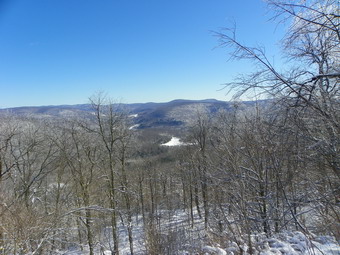
![]()
![]() On Sunday, February 26th, I had agreed to meet Lisa after church to go for a hike. She emailed me Sunday morning to suggest Cabot Mountain from Beech Hill and to tell me two other people, Andrea and Jeff, would be coming along. After church, we stopped at Lisa's store to use a gift certificate. While we were there the fire siren sounded and I was called to a two car MVA which I though would surely derail the hiking plans. We found only one injury and other corps members covered the call so that I could go hiking. I actually arrived back at Lisa's at noon when we had arranged to meet. We stowed her gear in my car and started for the Beech Hill parking area. Our plan was to take snowshoes ad spikes and make a decision at the trail head. We arrived at about 12:20 PM and had to wait only a few minutes for the other two hikers. There was enough snow at the trail head to warrant snowshoes but I wondered what we would find on the southern exposure of the trail. We were hiking by about 12:35 PM and the lower part of the trail did seem to have more snow than rocks. The trail to the ridge is pretty steep and the snowshoes gave us a good grip as we ascended and the snow got deeper. After the first .25 miles the trail ascends 570 feet in the next .5 miles at an average 24% grade. We took our time with a few stops along the way.
On Sunday, February 26th, I had agreed to meet Lisa after church to go for a hike. She emailed me Sunday morning to suggest Cabot Mountain from Beech Hill and to tell me two other people, Andrea and Jeff, would be coming along. After church, we stopped at Lisa's store to use a gift certificate. While we were there the fire siren sounded and I was called to a two car MVA which I though would surely derail the hiking plans. We found only one injury and other corps members covered the call so that I could go hiking. I actually arrived back at Lisa's at noon when we had arranged to meet. We stowed her gear in my car and started for the Beech Hill parking area. Our plan was to take snowshoes ad spikes and make a decision at the trail head. We arrived at about 12:20 PM and had to wait only a few minutes for the other two hikers. There was enough snow at the trail head to warrant snowshoes but I wondered what we would find on the southern exposure of the trail. We were hiking by about 12:35 PM and the lower part of the trail did seem to have more snow than rocks. The trail to the ridge is pretty steep and the snowshoes gave us a good grip as we ascended and the snow got deeper. After the first .25 miles the trail ascends 570 feet in the next .5 miles at an average 24% grade. We took our time with a few stops along the way.
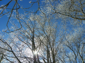 BY 1:35 PM we had hiked 1.4 miles and had just made the last ascent. I went ahead just to make sure that the lookout was just around the corner where I thought it was. I found the viewpoint and headed back to get the other three hikers. Jeff and Andrea decided to turn around at that point but Lisa walked to the lookout with me. The view was the best I have seen. It was clear with just the right amount of snow cover. Little Pond was clearly visible below and the hills beyond looked so close that it seemed you could reach out and touch them! I took some pictures of the scenery and some other shots of the ice on the trees. This area always seems to have frozen snow or ice on the trees and, in this case, the sun was shining through to give an added dimension. After taking our pictures Lisa and I headed back making the downhill trip very quickly. When we got to the last downhill, we found more snow had melted and I trouble avoiding the rocks. I took the snowshoes off as soon as I could which made the last part of the hike much easier. We covered 3.2 miles in 2 hours and 15 minutes. The time out was about 1 hour and 15 minutes but we made it back in 45 minutes!
On Friday, February 24th, I awoke to find at least 5 inches of freshly fallen snow on my lawn. The temperature was right at 32 degrees so I knew that the snow might not be around for very long and it was beginning to mist. I wanted to get Sheila out for a workout so I decided to head over to Round Top and hike a shorter version of our now customary route. I found the shoulder strap to my camera case so that I could take some pictures without dragging the pack along. I got dressed and pulled out my Crescent Moon Gold snowshoes. The last time I was one snow shoes was In October of last year for the Halloween weekend storm! Since I still hike with Sheila on a leash, I could not take poles and I knew I would get a good leg workout without being able to use much upper body. As we started out I could tell by the consistency of the snow it was getting heavier and more compact than when I had shoveled the walk earlier in the morning. We headed across the street and up the hill to where the trail over Round Top starts. Going up the steep hill was more difficult without poles but Sheila provided some pulling power. I am trying to discourage her straining at the leash but in this case it helped. We stopped at the top of the hill just before going into the woods so that I could get some pictures of the snow-covered town below and the surrounding hills. Sheila sat quietly on her leash. We turned into the woods and I had to avoid the low hanging branches that threatened to dump snow down my back. I decided to turn up the woods road and do the gentle ascent up the hill. When we left the house, I had planned to do the very short loop but now I decided to go a little farther and up through the quarry. Along the way we stopped a few times so that I could take pictures of the snow and the trees. At the quarry I took some more shots before heading out the other side on the woods road that goes up the hill. We stopped in the clearing near the top of the hill and I took some more pictures before following Sheba back toward the area where we began the hike. The descent is short but steep in places and I missed using my poles for balance. As we were coming down the hill the fire siren sounded and I hoped I had not missed an ambulance call. We continued to follow Sheba down to the lookout over town. The viewpoint has become obstructed by young, fast growing trees so the view is not as clear as it once was. From the lookout we headed down the path to complete the circular route. We must have hiked a little less than 3 miles in a little more than an hour.
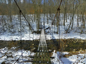
![]()
![]() On Wednesday, February 22nd, Jim and I decided we would return to the Beaverkill area to hike the Mongaup Hardenburgh Trail to Willowemoc and Sand Pond Mountains. I had already hiked these when I completed the CHH list but Jim was now ready to take them on. I had a basketball game later in the day so I though the 6+ mile out and back a better choice than the other pairs of CHH peaks in my area. I decided that the out and back route would be the best for our limited time since a loop was too long and a through hike would quire spotting two cars at points that are very far apart. When Jim arrived at my house, we put all our gear in my car with Sheba in the back seat and headed for the Beaverkill area. We arrived in the parking area just after 10:00 AM and were on the trail by 10:15 AM. The air temperature was in the high 30's and was forecast to rise during the day. We walked own to the suspension bridge over the Beaverkill and stopped to take some pictures of this interesting structure. The bridge consists of two towers at either end constructed of steel beams. The wooden decking is placed longitudinally on the bridge rather than crossways. The decking is suspended from several steel cables strung between the towers. The bridge sways considerably as you walk across it but I stopped to get a few spots from mid span. I am never too happy about walking across the bridge but Sheba was really reluctant. In water weather she simply wades across the stream but I was afraid the water was too cold to let her wade on this day especially at the very beginning of the hike. We crossed the bridge and started up the ascent to the ridge. There was a pretty good layer of snow with ice underneath in many places. We immediately recognized several sets of boot prints and what looked like dog prints on the trail. In most places these were easy to discern but some drifting snow obscured them in other spots. Jim mentioned that Heather might have been on this trail a day or two earlier and we vowed to check the register on the way back. From the bridge the trail gains 750 feet over .7 miles at about a 20% grade. This is much steeper than Woodpecker Ridge on the other side of the road and it is noticeable as you quickly rise to the level of that ridge. Slipping on the snow and ice made the ascent a little tiring but we made pretty good time.
On Wednesday, February 22nd, Jim and I decided we would return to the Beaverkill area to hike the Mongaup Hardenburgh Trail to Willowemoc and Sand Pond Mountains. I had already hiked these when I completed the CHH list but Jim was now ready to take them on. I had a basketball game later in the day so I though the 6+ mile out and back a better choice than the other pairs of CHH peaks in my area. I decided that the out and back route would be the best for our limited time since a loop was too long and a through hike would quire spotting two cars at points that are very far apart. When Jim arrived at my house, we put all our gear in my car with Sheba in the back seat and headed for the Beaverkill area. We arrived in the parking area just after 10:00 AM and were on the trail by 10:15 AM. The air temperature was in the high 30's and was forecast to rise during the day. We walked own to the suspension bridge over the Beaverkill and stopped to take some pictures of this interesting structure. The bridge consists of two towers at either end constructed of steel beams. The wooden decking is placed longitudinally on the bridge rather than crossways. The decking is suspended from several steel cables strung between the towers. The bridge sways considerably as you walk across it but I stopped to get a few spots from mid span. I am never too happy about walking across the bridge but Sheba was really reluctant. In water weather she simply wades across the stream but I was afraid the water was too cold to let her wade on this day especially at the very beginning of the hike. We crossed the bridge and started up the ascent to the ridge. There was a pretty good layer of snow with ice underneath in many places. We immediately recognized several sets of boot prints and what looked like dog prints on the trail. In most places these were easy to discern but some drifting snow obscured them in other spots. Jim mentioned that Heather might have been on this trail a day or two earlier and we vowed to check the register on the way back. From the bridge the trail gains 750 feet over .7 miles at about a 20% grade. This is much steeper than Woodpecker Ridge on the other side of the road and it is noticeable as you quickly rise to the level of that ridge. Slipping on the snow and ice made the ascent a little tiring but we made pretty good time.
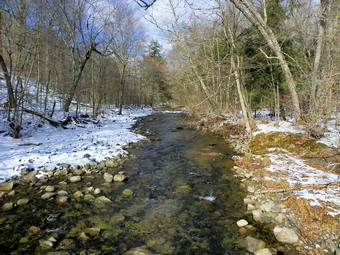 Over the next mile the trail gains about 250 feet as it flattens some and then climbs once again. The higher we went the more solid the snow became and the deeper it was. At 11:50 AM we were 2 miles into the hike and near the top of Willowemoc Mountain. To our right the ground rose slightly and the tracks we had been following veered off in that direction. We walked off the trail through the open woods to an elevation just over 3200 feet and claimed victory! There wasn't much to see at the "summit" so we walked out to the trail and headed toward Sand Pond Mountain. Two things happened at this point. First, I realized that my first basketball game was at 4:00 PM not 5:30 PM. I considered the timeline for the rest of the hike and simply decided we would do it as fast as possible. I knew that the next peak was just over a mile away and did not want to "miss" it. Second, as we walked the trail descended more than I remembered AND the snow depth went from 2 to 4 inches to 10 to 12 inches. As we dropped elevation, I thought about having to regain it on the way back. The full meaning of "out and back" came to me! Over the next .8 miles we dropped over 400 feet. the walk was peaceful except for our "heavy breathing". There were several areas where ice was hidden under the snow making walking a little tricky. At some points the trail was poorly marked. The footprints we had been following had stopped on Willowemoc Mountain. By 12:15 PM we were 2.9 miles into the hike and the trail was mostly level. Off to the right of the trail we could see a set of ledges and higher ground which I knew was Sand Pond Mountain. We headed in that direction as I wondered how we would make it up through the steep ledges. The ledges weren't actually a problem as I picked a line that offered a good route to the top of the ridge. I could see a higher spot a little more to the southwest so we walked in that direction. There was a small cairn and we judged the highest spot to be just passed it. It was 12:30 PM and it had taken us about 2 hours and 15 minutes to hike the 3.33 miles out. I hoped the back part would be even faster!
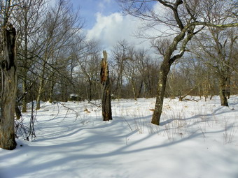 We took a little time at the summit to get a snack and a drink and then started back down at 12:40 PM following the path we had made on the way out. The walk down Sand Pond was easy as was the walk over to the base of the climb up Willowemoc. The ascent to the top of Willowemoc had four separate spots that seemed to be the top of the climb. The temperatures had increased and the snow was even slipperier than on the way out. I took a few shots of the snow o0n the trail near the top of the climb. By 1:25 PM we were 4.6 miles into the hike and at the top of Willowemoc Mountain. The hike to the top of the last descent went quickly as we pushed the pace. We did have to be careful in a few places to avoid the ice under the snow. On the final descent I slipped and slid on the first part until a particularly steep and icy section made me decide to put on my spikes. I had to give up on the poorly designed Yak Xtremes so I donned the MicroSpikes I was carrying. They went on quickly and picked up enormous clumps of snow just as quickly. The snow was just the right temperature to form clumps on the spikes. I tried knocking off the clumps as I approached the iciest spots. The clumps of snow actually seemed to add some traction on the parts that had snow alone. We finally made it to the bridge and scooted across to the car. It was 2:30 PM which meant we had covered the 6.6 mile hike and 1850 feet of climbing in 4 hours and 15 minutes. I had just enough time to get home , take a shower, and head off to my basketball games.
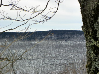
![]()
![]() On Tuesday, February 21st, Jim and I decided we would go to the Beaverkill area to hike Woodpecker and Millbrook Ridges. My plan also included Cradle Rock Ridge if we had enough time. I had already hiked these when I completed the CHH list but Jim was now ready to take them on. Jim was driving to Livingston Manor directly from Rochester so he did not arrive until about 10:00 AM. I loaded Sheba and my equipment into my car and led the way up the Beaverkill Road. We parked my car at Alder Lake and getting into the parking area was tricky. The temperature was around 30 degrees and the snow and ice on the road were slippery. Once I transferred Sheba and my equipment to Jim's car, we headed for the parking area near Balsam Lake Mountain. At around 11:00 AM we pulled into the parking area which is the trail head for the Mongaup Hardenburgh Trail. By 11:10 AM we had crossed the road and entered the woods to begin the bushwhack to Woodpecker Ridge. We headed almost due north and up. I knew from previous experience this would get us to the area of the highest point and that we could adjust after this. The woods were mostly open which made the going pretty easy with the overall grade being about 12% although some areas came close to 20%. After 2.2 miles of hiking we found the highest spot around at over 3400 feet. It looked a lot like the place I had been several times before so we claimed victory. As we walked around we found another clearing and a lookout that gave us a view of the Balsam Lake Mountain fire tower. I remembered that the last time I was on the ridge I was with Karl and we went to the fire tower and then down to the Balsam Lake Mountain trailhead. From there we walked the road back to the car. We had dropped off the ridge too much by heading to the east and won. To get back to the Millbrook Ridge Trail we had to gain elevation. Since Jim and I were going to head in the opposite direction toward Alder Lake, I headed down and to the west to find the trail. As we started out the wind came up a little and some snow fell. We also found that the snow depth increased to over a foot in some places. I again got off the ridge too quickly and found we were headed directly art Beecher Lake. I corrected by heading toward the north again and had to gain some elevation. Once we were back up, I looked around for the trail as we hiked across flat ground and eventually found it.
On Tuesday, February 21st, Jim and I decided we would go to the Beaverkill area to hike Woodpecker and Millbrook Ridges. My plan also included Cradle Rock Ridge if we had enough time. I had already hiked these when I completed the CHH list but Jim was now ready to take them on. Jim was driving to Livingston Manor directly from Rochester so he did not arrive until about 10:00 AM. I loaded Sheba and my equipment into my car and led the way up the Beaverkill Road. We parked my car at Alder Lake and getting into the parking area was tricky. The temperature was around 30 degrees and the snow and ice on the road were slippery. Once I transferred Sheba and my equipment to Jim's car, we headed for the parking area near Balsam Lake Mountain. At around 11:00 AM we pulled into the parking area which is the trail head for the Mongaup Hardenburgh Trail. By 11:10 AM we had crossed the road and entered the woods to begin the bushwhack to Woodpecker Ridge. We headed almost due north and up. I knew from previous experience this would get us to the area of the highest point and that we could adjust after this. The woods were mostly open which made the going pretty easy with the overall grade being about 12% although some areas came close to 20%. After 2.2 miles of hiking we found the highest spot around at over 3400 feet. It looked a lot like the place I had been several times before so we claimed victory. As we walked around we found another clearing and a lookout that gave us a view of the Balsam Lake Mountain fire tower. I remembered that the last time I was on the ridge I was with Karl and we went to the fire tower and then down to the Balsam Lake Mountain trailhead. From there we walked the road back to the car. We had dropped off the ridge too much by heading to the east and won. To get back to the Millbrook Ridge Trail we had to gain elevation. Since Jim and I were going to head in the opposite direction toward Alder Lake, I headed down and to the west to find the trail. As we started out the wind came up a little and some snow fell. We also found that the snow depth increased to over a foot in some places. I again got off the ridge too quickly and found we were headed directly art Beecher Lake. I corrected by heading toward the north again and had to gain some elevation. Once we were back up, I looked around for the trail as we hiked across flat ground and eventually found it.
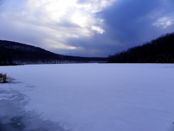 Once on the trail we picked up the pace but I caught a glimpse of the fire tower and it was in the WRONG PLACE! I knew immediately that I had turned right or east instead of left or west on the trail! I was so happy to find the trail that I had not paid attention to what I was doing! The mistake was only about .25 miles but in that distance we had dropped over 100 feet! I was a little embarrassed as I apologized to Jim and we turned around and headed back in the right direction. Within about .15 miles of where we hit the trail, we came to the lookout over Beecher Lake and the Zen Monastery. We stopped to take some pictures and noticed how black the sky had become. It was just after 2:00 PM as we started on the trail to Alder Lake. Although we had only hiked 3.25 miles it seemed much longer! Because of the time and the exertion I doubted we would make Cradle Rock Ridge. The walk along Millbrook Ridge to Alder Lake always seems longer than I remember. This is true even though I have done the hike many times. About .5 miles from the lookout, we hit a low point and started up to the highest point on Millbrook Ridge. The climb was covered in snow and there was some ice which made everything more difficult. Sheba led the way but I had to clean the ice out of here paws several times. Over the .6 mile climb we gained about 350 feet to the highest point on Millbrook Ridge which is just under 3500 feet. We knew as we started down that the rest of the 1 hike was downhill or flat and in celebration I slipped and fell on an icy patch. We made it down to flatter ground and hiked along until we came to the beaver meadows and the Beaver Meadow lean-to. We stopped at the lean-to at 3:40 PM and got a drink and took some pictures. The lean-to was in good shape with some pots and pans ready to go. We were about 5.6 miles into the hike with a distance still to go to the car and we decided at this point to save Cradle Rock for another day. Back on the main trail, the snow was only a few inches and we made good time to Alder lake. At the lake we turned right to go around the lake to the parking area. We stopped on the lawn of the Coykendall House. I took pictures of the lake and the surrounding hills and then walked up to take pictures of the stonework that remains from the mansion. We were back at the car by 4:50 PM but still had to go back to Jim's car. We had covered 8 miles and over 2000 feet of ascent in 5 hours and 40 minutes. I wondered how ready I would be for another hike the next day!
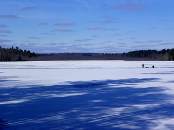
![]()
![]() On Sunday, February 19th, I decided I wanted to hike somewhere after church where I could take Sheila for a workout. I called Karl to see if he would like to hike the Rocky Run Road and the area around Lake Superior. The Rocky Run Road is part of the old Newburgh-Cochecton Turnpike and was an important means of transport in its day. The road was established in 1801 and connected the Hudson and Delaware Rivers. He agreed and I headed out to his house in Bethel after church. Just before noon we walked down along the property line toward the Indian Field Road. I had forgotten the GPS but did have my camera. We had three dogs with us which made for an interesting walk. We passed by the log cabin built by my Uncle Jim. It was sad to see the roof caving in and the doors wide open. I spent many happy days there when I was growing up playing nickel and dime poker and listening to the men tell hunting stories. Once on the road we turned left and headed toward Indian Field. It was a short walk to the Rocky Run Road which forms the boundary between the state land of Lake Superior Park and the private land of the Indian Filed Club. My plan was to walk to near the end of the trail and then back and maybe take some time to walk toward Lake Superior. My father and I spent a lot of time ice fishing on Lake Superior and would go almost every weekend during the winter. We walked out to near the end of the road talking as we went and then turned around. On the way back we decided to hike up to the ridge on our left to see what we could see. There was a large cleared area at the top but we could not see the lake so we walked back toward the trail and continued a little farther. We tried walking off the trail a little farther on and were able to hike right down to the shore of the lake across from the swimming area. I took some pictures of the lake and then we continued down the shore of the stream that connects the lake to a pond. I took a few more pictures before we headed across the field to retrace our path home. We were out for a little over two hours and covered a little over 4 miles. I again thought it would be a great idea to create blazed trails a round the lake since many informal paths already exist.
On Sunday, February 19th, I decided I wanted to hike somewhere after church where I could take Sheila for a workout. I called Karl to see if he would like to hike the Rocky Run Road and the area around Lake Superior. The Rocky Run Road is part of the old Newburgh-Cochecton Turnpike and was an important means of transport in its day. The road was established in 1801 and connected the Hudson and Delaware Rivers. He agreed and I headed out to his house in Bethel after church. Just before noon we walked down along the property line toward the Indian Field Road. I had forgotten the GPS but did have my camera. We had three dogs with us which made for an interesting walk. We passed by the log cabin built by my Uncle Jim. It was sad to see the roof caving in and the doors wide open. I spent many happy days there when I was growing up playing nickel and dime poker and listening to the men tell hunting stories. Once on the road we turned left and headed toward Indian Field. It was a short walk to the Rocky Run Road which forms the boundary between the state land of Lake Superior Park and the private land of the Indian Filed Club. My plan was to walk to near the end of the trail and then back and maybe take some time to walk toward Lake Superior. My father and I spent a lot of time ice fishing on Lake Superior and would go almost every weekend during the winter. We walked out to near the end of the road talking as we went and then turned around. On the way back we decided to hike up to the ridge on our left to see what we could see. There was a large cleared area at the top but we could not see the lake so we walked back toward the trail and continued a little farther. We tried walking off the trail a little farther on and were able to hike right down to the shore of the lake across from the swimming area. I took some pictures of the lake and then we continued down the shore of the stream that connects the lake to a pond. I took a few more pictures before we headed across the field to retrace our path home. We were out for a little over two hours and covered a little over 4 miles. I again thought it would be a great idea to create blazed trails a round the lake since many informal paths already exist.
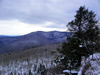
![]()
![]() On Saturday, February 18th, I wanted to hike Panther Mountain from Route 47 at the trail head for Giant Ledge. I had been up to Giant Ledge recently but had not hiked to Panther in over a year. A hiker had sent me an e-mail that questioned the distance I had posted for this hike (5.2 miles) and, after looking at the maps, I tended to agree. I did not have a recent track from my Garmin GPSMap 60CSx which is more accurate than my old Magellan models. I packed up my gear but did not take snowshoes as I did not think they would be needed. Sheba jumped in the car and we were off under brightening skies. We arrived at the trail head at around 9:30 AM to find a few cars already there. As we crossed the road, we found several inches of new snow on the trail and I wondered if I had made a mistake by not bringing the snowshoes. I was surprised to find that a fine new bridge was in place over the creek to replace the one washed away in the floods. 1The trail from the road to the turn up to Giant Ledge had a lot of icy patches but the ice was hidden by the snow. I probably should have put on my spikes but I was able to judged by the route the other hikers had taken and my their slips. Along the way we met one couple coming down from hiking Giant Ledge. The hike from the turn to Giant Ledge went quickly and the amount of snow did not increase. In fact, some of the southern exposures had almost no snow. We arrived at Giant Ledge at about 10:20 AM covering the 1,5 mile ascent in about 50 minutes. We stopped at one lookout so that I could take some pictures and then continued on toward Panther. The skies that had been bright and sunny were now cloudy with several ominous, darker patches. I wondered if the storm that was supposed to arrive in the afternoon was coming early!
On Saturday, February 18th, I wanted to hike Panther Mountain from Route 47 at the trail head for Giant Ledge. I had been up to Giant Ledge recently but had not hiked to Panther in over a year. A hiker had sent me an e-mail that questioned the distance I had posted for this hike (5.2 miles) and, after looking at the maps, I tended to agree. I did not have a recent track from my Garmin GPSMap 60CSx which is more accurate than my old Magellan models. I packed up my gear but did not take snowshoes as I did not think they would be needed. Sheba jumped in the car and we were off under brightening skies. We arrived at the trail head at around 9:30 AM to find a few cars already there. As we crossed the road, we found several inches of new snow on the trail and I wondered if I had made a mistake by not bringing the snowshoes. I was surprised to find that a fine new bridge was in place over the creek to replace the one washed away in the floods. 1The trail from the road to the turn up to Giant Ledge had a lot of icy patches but the ice was hidden by the snow. I probably should have put on my spikes but I was able to judged by the route the other hikers had taken and my their slips. Along the way we met one couple coming down from hiking Giant Ledge. The hike from the turn to Giant Ledge went quickly and the amount of snow did not increase. In fact, some of the southern exposures had almost no snow. We arrived at Giant Ledge at about 10:20 AM covering the 1,5 mile ascent in about 50 minutes. We stopped at one lookout so that I could take some pictures and then continued on toward Panther. The skies that had been bright and sunny were now cloudy with several ominous, darker patches. I wondered if the storm that was supposed to arrive in the afternoon was coming early!
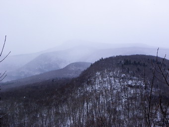 The ascent of Panther is not too difficult and is one of the few sections of trails that always takes LESS time than I remember. As we descended Giant Ledge to the col, the ice began to be more and more of a problem. I decided it was time to put on the spikes and I donned my Yak Xtremes. I had been having mixed results with these but was willing to give them another chance. There were a few steep spots on the ascent but the spikes helped make them easier. As we neared the top of the climb the skies grew even cloudier. We stopped a the lookout over Giant Ledge and the Burroughs range. I could see the snow squall coming toward us and quickly got out the camera. The snow moved over the mountains and the covered Giant Ledge. Soon it was snow in on us! After taking the pictures we continued on toward the summit and met a couple descending from the peak. We said "Hello" and they both commented on the beautiful hiking dog I had with me. As we approached the summit, Sheba came back to me and I heard voices. The two hikers were a father and his 13 year old son who were working on the 3500 list. The father had hike many as a boy and now was starting in again with his son. We talked for awhile and then headed in opposite directions. We hit the peak around 11:30 AM and got a snack and drink. I took a few pictures but it was difficult as the snow had followed us. We stopped a the high rock viewpoint where the story was the same. I decided just to head back as quickly as possible. On the descent we met the first of a lot of hikers we would meet on the way down. Three women were coming up the steeper ascent and we talked for a few minutes. Somewhere just before Giant Ledge we met the father and son and hiked with them for a while before continuing on through the Col. Giant Ledge has quite a few people so we just continued hiking down the trail. At various intervals we met a total of perhaps 30 people and three dogs. The snow had passed and the sun was out making conditions pleasant but almost too warm. We were back at the now full parking area by 1:15 PM having covered the 6.3 mile hike in 3 hours 45 minutes. When I got home, I sent and e-mail to thank the person who had pointed out the mistake on this site and proponent corrected the error.
On Wednesday, February 15th, I wanted to get Sheila out for a workout so I decided to head over to Round Top and hike our now customary route in the opposite direction. I had two reasons for trying the reverse route. I wanted some variety and I wanted to see if Sheba could follow the route in the reverse direction. We hiked up to the lookout over Livingston Manor and then down to the woods road with Sheba leading the way with no problem. From there we followed the road out to near the Quickway and then along some ledges to another woods road. Sheila seemed better behaved on the leash but was still full of energy! Sheba led us along this road but walked right by the area where we normally come down the hill. I was willing to follow her as I wanted to see where the road went. I "forgave" her "mistake" as there is really nothing to mark the area of this turn. We seemed to be walking pretty far and I began to look for a way to get up to the ridge As if she was reading my mind, Sheba suddenly made a right and led us up another woods road to the ridge. She continued walking with a purpose and I followed her as we were headed in the right direction to get back to the house. As we were walking I began to notice that things looked familiar. We were on the woods road that we always use to come down the hill after Round Top. We walked to the top of the hill and followed Sheba as she completed the reverse loop passed the quarry and back to the house! We spent about two hours on the 4+ mile route and I learned that Sheba is a special dog!
![]()
![]() On Monday, February 13th, Cindy and I decided to take the dogs for a hike. We try to find different places when we can so I chose to park near Mongaup Falls on Fish Hatchery Road and hike the road there to see where it goes. We parked at 12:15 PM and got to hiking almost immediately. The temperature was in the mid 30's and there was a breeze but quite a bit of sunlight. The first part of the road had some snow and then the snow disappeared to leave only leaves! Crossing the "bridge" we picked up ice again and it was icy for a good part of the rest of the hike on the woods road. Cindy had on her Stabilicers but I simply walked with Sheila on the side of the road or in the woods. In less than half a mile we were at a junction with a trail to the left. This trail is a snowmobile trail which leads to Loop B at the Monger Campgrounds. We decided to stay on the road to see were it took us. After about a mile of hiking we hit Terwilliger Road at the top of Porcupine Ridge. We knew that turning right would take us out to the Brown Settlement Road and that to road to the left was a dead end. We decided to turn back and take a snowmobile trail we had just passed to see where it would take us. In the hustle and bustle of leaving I had left my map behind. I assumed that the snowmobile trail would connect to the others snowmobile and hiking trails east of Mongaup Pond but I did not know the distance. My basketball games at Liberty were an hour earlier and I needed to make sure we were back by no later than 3:30 PM. As we came back down the road, we turned right on the trail and headed northeast. The trail descended some at the beginning and started a gradual uphill.
On Monday, February 13th, Cindy and I decided to take the dogs for a hike. We try to find different places when we can so I chose to park near Mongaup Falls on Fish Hatchery Road and hike the road there to see where it goes. We parked at 12:15 PM and got to hiking almost immediately. The temperature was in the mid 30's and there was a breeze but quite a bit of sunlight. The first part of the road had some snow and then the snow disappeared to leave only leaves! Crossing the "bridge" we picked up ice again and it was icy for a good part of the rest of the hike on the woods road. Cindy had on her Stabilicers but I simply walked with Sheila on the side of the road or in the woods. In less than half a mile we were at a junction with a trail to the left. This trail is a snowmobile trail which leads to Loop B at the Monger Campgrounds. We decided to stay on the road to see were it took us. After about a mile of hiking we hit Terwilliger Road at the top of Porcupine Ridge. We knew that turning right would take us out to the Brown Settlement Road and that to road to the left was a dead end. We decided to turn back and take a snowmobile trail we had just passed to see where it would take us. In the hustle and bustle of leaving I had left my map behind. I assumed that the snowmobile trail would connect to the others snowmobile and hiking trails east of Mongaup Pond but I did not know the distance. My basketball games at Liberty were an hour earlier and I needed to make sure we were back by no later than 3:30 PM. As we came back down the road, we turned right on the trail and headed northeast. The trail descended some at the beginning and started a gradual uphill.
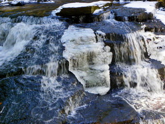 The woods road or snowmobile trail was covered by snow in most places and there was some ice but it wasn't very steep so there were no problems. At about 2.5 miles the trail seemed to turn more to the northeast when I wanted to headed down toward Mongaup Pond. I had my GPS but that only showed where we had been and the direction we were going. A map would have been most helpful but, as I said, I left that home! Our choices were to turn around or see if we could bushwhack down to the pond and find a trail, snowmobile trail or road. Mongaup Pond is surrounded by steep ledges and the GPS seemed to indicate that we would encounter some of these no matter how we chose to go toward the pond. Still, we both decided on taking the adventuresome route so we turned off the trail and headed northwest and up over the ledges. The up part only lasted a short while before we were dropping down toward the pond. There were some steeper descents interspersed with falter areas. Sheba was doing a great job of picking a route. Sheila was staring at her leash trying to sniff every inch of ground we passed over. Taking a walk with Sheila on a leash adds a whole new dimension to the workout! Over the next .4 miles we dropped 425 Feet with some pretty steep and icy spots. At the bottom of our descent we hit a snowmobile trail which seemed to head northeast and southwest. We decided to turn left to see if it headed back to the area near the falls. This trail did head directly southwest and over a few low hills for about 1.2 miles until at about 4.2 miles we hit the trail from earlier in the area of the falls. We walked down the trail and then took a left to head along the creek out to the falls. I stopped to take a few pictures of the upper falls. The ice around the lower falls made trying to get down to the stream bed too dangerous. After a few more pictures, we went back to the car. The 4.7 miles hike took us about 2.5 hours. When I looked at my maps at home I found that the snowmobile trail that we had been on that headed northeast did intersect the Mongaup Willowemoc Trail. Taking that route would have added 2.4 miles to the hike.
![]()
![]() On Friday, February 10th, I decided that I needed to get Sheila out for some exercise. We had already been to many of my favorite spots that are close to home so I decided to head to Huggins Lake. The Huggins Lake trail head is on the Berry Brook Road a few miles after the turn to the Beaverkill Covered Bridge. It is pretty close to home and offers a 4 miles round trip hike with some elevation gain and a nice small lake or pond at the end. We arrived in the icy parking area at about 1:40 PM. The trail is a wide woods road all the way to the lake and I didn't know what to expect as far as trail conditions were concerned. It was in the high 30's when we arrived with a stiff breeze blowing. Once out of the parking area the snow and ice were gone and we hiked up the hill. The trail rises 650 feet over the first 1.3 miles to a maximum elevation of 2530 feet. As we hiked the trail the conditions changed from bare trail to patches of snow and ice to all packed snow and back again. Once we started down from the highest point, the trail has a northern exposure and we ran into several inches of hard packed snow as we descended to the lake. The lake is about 400 feet above the trail head. We covered the 1.9 miles in about 50 minutes. We stopped on the shores of the lake so that I could take some pictures. The day was a little "bleak" without much sun and there was no blue sky. I tried to find a path around the lake but none was obvious so we started back to the car by retracing our path. I did take a few pictures on the way out to show the varying trail conditions. We were back at the car by 3:25 PM having covered the 4 mile hike in 1 hour and 43 minutes.
On Friday, February 10th, I decided that I needed to get Sheila out for some exercise. We had already been to many of my favorite spots that are close to home so I decided to head to Huggins Lake. The Huggins Lake trail head is on the Berry Brook Road a few miles after the turn to the Beaverkill Covered Bridge. It is pretty close to home and offers a 4 miles round trip hike with some elevation gain and a nice small lake or pond at the end. We arrived in the icy parking area at about 1:40 PM. The trail is a wide woods road all the way to the lake and I didn't know what to expect as far as trail conditions were concerned. It was in the high 30's when we arrived with a stiff breeze blowing. Once out of the parking area the snow and ice were gone and we hiked up the hill. The trail rises 650 feet over the first 1.3 miles to a maximum elevation of 2530 feet. As we hiked the trail the conditions changed from bare trail to patches of snow and ice to all packed snow and back again. Once we started down from the highest point, the trail has a northern exposure and we ran into several inches of hard packed snow as we descended to the lake. The lake is about 400 feet above the trail head. We covered the 1.9 miles in about 50 minutes. We stopped on the shores of the lake so that I could take some pictures. The day was a little "bleak" without much sun and there was no blue sky. I tried to find a path around the lake but none was obvious so we started back to the car by retracing our path. I did take a few pictures on the way out to show the varying trail conditions. We were back at the car by 3:25 PM having covered the 4 mile hike in 1 hour and 43 minutes.
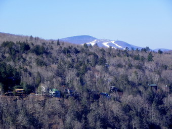
![]()
![]() On Thursday, February 9th, I finally got to take the hike to North South Lake that I had planned and scrapped several times. I had no commitments for the day and so was free to hike as much as I wanted and I intended to take advantage of that fact. My plan was to park on Scutt Road and hike the Escarpment Trail from there all the way to North Point. I did plan to hike down to the Palenville Lookout and then return to the Escarpment Trail. From North Point I planned to return by the Mary's Glen Trail to the Rock Shelter Trail to get back to the car. I estimated the distance was about 15 miles which seemed long but I knew there were several "bailout" options along the way. The drive to the trail head went smoothly except for the temporary "bridge" on Route 47. This is sill a makeshift affair and is very rutted from the traffic. It looks as if the construction workers have continued to work on the bridge and may be ready to begin placing steel on the new, permanent structure. We left Livingston Manor a little after 8"00 AM and arrived a the Scott Road parking area at 9:3 Am. This was a quicker trip than I had anticipated and we were on the trail almost immediately. There were no other cars in the lot and I anticipated a day with few encounters with other hikers. The temperature was still cool especially in the shade despite the forecast for sun and a high in the low 40's. As we started out on the Escarpment Trail there were several areas that were covered in ice but they were relatively easy to bypass. We crossed the two railroad grades and crossed Spruce Creek on the footbridge. Just after the bridge we came to the junction with the Scott Road Trail and turned right down a woods road to stay on the blue blazed Escarpment Trail. The icy conditions were even worse here and I began to wonder how bad it would get. Walking along the edge of a cliff on an icy trail is not my idea of "fun".
On Thursday, February 9th, I finally got to take the hike to North South Lake that I had planned and scrapped several times. I had no commitments for the day and so was free to hike as much as I wanted and I intended to take advantage of that fact. My plan was to park on Scutt Road and hike the Escarpment Trail from there all the way to North Point. I did plan to hike down to the Palenville Lookout and then return to the Escarpment Trail. From North Point I planned to return by the Mary's Glen Trail to the Rock Shelter Trail to get back to the car. I estimated the distance was about 15 miles which seemed long but I knew there were several "bailout" options along the way. The drive to the trail head went smoothly except for the temporary "bridge" on Route 47. This is sill a makeshift affair and is very rutted from the traffic. It looks as if the construction workers have continued to work on the bridge and may be ready to begin placing steel on the new, permanent structure. We left Livingston Manor a little after 8"00 AM and arrived a the Scott Road parking area at 9:3 Am. This was a quicker trip than I had anticipated and we were on the trail almost immediately. There were no other cars in the lot and I anticipated a day with few encounters with other hikers. The temperature was still cool especially in the shade despite the forecast for sun and a high in the low 40's. As we started out on the Escarpment Trail there were several areas that were covered in ice but they were relatively easy to bypass. We crossed the two railroad grades and crossed Spruce Creek on the footbridge. Just after the bridge we came to the junction with the Scott Road Trail and turned right down a woods road to stay on the blue blazed Escarpment Trail. The icy conditions were even worse here and I began to wonder how bad it would get. Walking along the edge of a cliff on an icy trail is not my idea of "fun".
 As we walked down the trail the icy patches came and went as we worked our way around them. Just after the second bridge, we stopped at the remains of a dam on the creek. I carefully worked my way over the icy trail down to the creek bed to take some pictures of the stone dam and the creek. Back up on the trail the ice let up as we headed for the Layman Memorial. The trail to the memorial is downhill which could have been difficult had there been much ice. The trail was almost completely free of ice and we stopped briefly at the monument dedicated to a fire fighter who died in 1900 fighting a forest fire in the area. The trail from the monument ascend back up to the escarpment and we ran into a serious ice flow on the way. The constant freezing and thawing has produced some monumental ice flows on the trail. In this case it was impossible to just walk along the side of the trail so Sheba and I climbed a steep bank to outflank the ice. I took some pictures not realizing that this was only the beginning! After this first icy stretch, we were able to ascend without much problem to the area where the Escarpment Trail flattens some. It had been several years since I had taken this route and I had forgotten how beautiful and breathtaking the views can be. There are several famous named spots along the way but there are other, smaller lookouts that are just as nice. We passed the yellow shortcut trail at 10:40 AM about 1.75 miles into the hike. Shortly after this we arrived at Sunset Rock and then Inspiration Point. Along the way I had warmed up and removed my jacket and switched to a lighter pair of gloves and a lighter hat. The view from the trail is to the south and the sun was just beginning to make taking pictures difficult. Despite this I could look up the Clove and see the Hunter Mountain Ski Area behind the houses of Twilight {ark. The houses seem to hand on the side of the mountain and they must have spectacular views. Of course, Kaaterskill High peak and Round Top are visible across the way. I could also see several stream drainages as they snaked there way down the mountain. From Inspiration Point I got my first look at the Hudson River.
 At 11:15 AM we arrived at the junction with the horse trail that leads down to the Palenville Lookout and the Harding Road Trail. We continued straight ahead on the horse trail to go down to the lookout. Fortunately, there was only one really icy spot and we successfully worked our way around it. The descent to the lookout is steep in places and is a drop of about 440 feet. The hiking distance is 1.7 miles from the junction one way and so it represents a considerable part of the hike. As we approached the area of the lookout I wondered if anyone had ever tried to hike directly from the lookout back up to the upper trail. The distance would be about 500 feet rather than about a mile on the trail. I actually considered hiking up to the area of the cliffs just to see what it looked like but decided to save that for another day. I suspected that the route would be near vertical in places and then any possible route for me would not be good for Sheba. By 12:15 PM we were at the first lookout about 4.7 miles into the hike. I took pictures from this viewpoint and then we walked to the second lookout which has a better view of Palenville and the Hudson. This lookout also has the remains of a foundation and "furniture" constructed from bluestone. I took pictures and we had a drink a some lunch. I also removed my gaiters and long underwear at this point. We turned around and retraced our route up the steep trail to the junction with the Escarpment Trail to continue our adventure. From the junction the Escarpment Trail heads more "inland" to the area of the site of the Kaaterskill Hotel. The trail has been rerouted in this area due to erosion but is well marked. At the top of a short climb the trail flattens and the walking becomes the easiest on the entire route.
 After a brief detour from the escarpment, the trail returns to the edge of the cliffs making a large bend to pass Split Rock and Boulder Rock. Just before Split rock, I noticed a large boulder on top of an even large outcrop of rock. The boulder seemed to be just balanced on top and I was surprised I had never noticed it before. We passed the area known as Split Rock where several large slabs of bedrock have split off from the main mass of bedrock. We arrived at Boulder Rock and stopped for a few pictures of the large erratic perched on the edge of the escarpment. I also took some pictures of the Hudson and the valley but there was a lot of haze hanging low. Our net stop was the site of the Catskill Mountain House but the short descent was not easy! The trail was covered in ice most of the way with only a few bare patches. Sheba kept going off trail to avoid the ice and I managed to work around it for awhile. Eventually, I realized how foolish this was and I donned by Xtremes. From that point on I just looked for the thickest ice and the rest of the way down to the open field we easy. We stopped at the open field that was once the site of the Catskill Mountain House. I took pictures of the open space with a few well constructed benches. I also photographed the view and tried to imagine the hotel and its clientele at the height of its popularity. We started own the trail and access road and the ice all but disappeared. I removed my spikes and walked a few hundred feet before wishing that I had left them on. As we approached the North Lake parking area, the road turned to solid ice and even the sides were icy. By 12:20 PM we were at the North Lake parking area with 8.6 miles behind us. I knew that making North Point would be a challenge but I thought we might try.
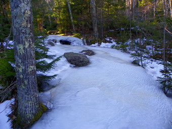 The trail from the lake toward Artist Rock had a few icy spots and is steep in places but we made good time. We stopped briefly at Artist Rock to take in the views. We had met no other hikers and I have to admit I prefer being able to take in the sights without tripping over others! From Artist Rock we continued on the trail toward the spur trail that leads up to Lookout Rock and Sunset Rock North. The trail passes by the rock outcroppings that "support" the lookouts. In the past, I have often climbed up through the rocks to take the "shortcut" to these viewpoints but I deiced to stay on the trail. The rock in this area is a conglomerate constructed of large sediments with a weak cement. The rocks break part to leave "sand" on the trail. As we approached the area of the spur trail, the main trail became very icy as it passed into the shade of some evergreens. The ice continued as we turned onto the spur trail and I considered using spikes again. We walked out to Sunset Rock which overlooks the lakes. Unfortunately, the angle of the sun made getting decent photographs almost impossible. In addition, the clouds had started to roll in. After a brief pause, we worked our way along the escarpment and I took a few pictures before returning to the trail. I donned my spikes to handle the ice on the spur trail and the ice I knew lay ahead on the main trail. Just after our turn onto the Escarpment Trail there was a short, steep ascent which looked bare from the bottom so I removed the spikes. As we climbed up, I wished that I had left the spikes on. At the top of the climb there was a narrow section of trail with a rock wall on the left and a drop-off on the right. I put my spikes back on and started out across the ice holding Sheba by the collar. The ice only grew worse as we approached Newman's Ledge. The trail was covered in ice and passed the ledge there was a long ascent to the area of Badman Cave.
 Sections of the trail to Badman Cave were covered in ice flows more than 1o inches thick! The flatter portions were bad enough but the ascents were downright scary. Sheba managed to work her way through the brush but I relied on my spikes to get over the ice. At 3:40 PM we arrived at Badman cave and the junction with the Rock Shelter Trail. We had hiked 10.6 miles and I knew that the extra 2 miles to North Point might be difficult. One look at the Escarpment Trail passed Barman Cave convinced me that we would not make the trip on this day. The trail gets steeper after the cave and for as far as I could see it was covered in thick ice. After taking a few shots at the cave, we turned onto the red blazed Rock Shelter Trail. This was the quickest way back to the car but I knew that the trail was usually wet and might be icy. There were a few muddy spots and some icy ones but the walk was realtor easy and almost all downhill. Along the way I found a small waterfall that I had not seen before. The water had frozen to form some beautiful structures with following water behind them. In another section of the trail water flowed over some ledges to form small "falls" that had frozen. I took a few pictures and then we headed back to the car as fast as possible. We were back at the car by 4:45 PM having covered 12.5 miles in 7 hours and 10 minutes! There was one other car in the lot when I pulled out.
On Wednesday, February 8th, Lisa called around 8:30 AM to see if we could hike somewhere close since she had to be back at her store for an 11:30 AM meeting. We agreed to head up over Round Top where she had not been before. We headed up the hill behind the cemetery and took the woods road up to the quarry. The quarry was almost free from snow and we could see more than I had been able to see before. After walking around the quarry, we walked back down to the woods road and followed the route that has become our customary walk lately. We hiked up the higher hill after Round Top and then down the woods road on the other side. We continued to circle around the hill until we descended to the woods road that headed back toward town and that parallels the Quickway. Once we were at the clearing overlooking the exit 96 interchange we headed up the hill on a diagonal route to avoid the steeper cliffs farther down the road. Sheba led us up and over the hill to the lookout over town. From the viewpoint we walked back down the path to the place where we had turned earlier. We walked a little over 3 miles in a little under two hours which fit our schedules and gave both dogs a workout.
![]()
![]() On Monday, February 6th, Cindy and I decided to take the dogs on a hike to Trout Pond for some exercise. Sheila still has to be on a leash which makes hiking a challenge for me without poles and with an "enthusiastic" canine. We arrived at the parking area at the junction of Morton Hill Road and Russell Brook Road at about 11:00 AM. We always park in the lot and walk down the road rather than driving down to the lower parking area. We like the walk and the road can be rough and washed out or icy depending on the season. The parking area was a sheet of ice so we suspected the road would not be much better. As we started down the road, we saw that we were right as the road surface was very icy. I found that Cindy had not brought any traction devices so we had to be carefully we walked down to the falls. In some places the water had run under the pine needles and leaves to form a very icy layer. When we were opposite the upper falls, I decided to walk down the steep bank to get a better look. Without poles this was a challenge but I was able to find a route that had little or no ice. I actually dropped own behind the upper falls and the remains of the dam where I had not been before. I took some pictures and then walked around to the front of the dam. I took a few more shots and then decided it would be safest to go back up to the road. I rejoined Cindy and Sheila and we decided to walk down to the bridge through the woods rather can follow the icy road and path. Soon we were at the bridge where we found a narrow path without ice. We walked over to the falls and I worked my way down into the stream bed. I have taken so many pictures of these falls that it is hard to find a new shot. On this day the falls were running on the left side but water had, at some point, overflowed on the right side and formed a mirror image of the falls in ice. I took pictures and then we started up the trail. We decided that it might be easier to walk up the steep side if it was icy so we started to the left toward Mud Pond.
On Monday, February 6th, Cindy and I decided to take the dogs on a hike to Trout Pond for some exercise. Sheila still has to be on a leash which makes hiking a challenge for me without poles and with an "enthusiastic" canine. We arrived at the parking area at the junction of Morton Hill Road and Russell Brook Road at about 11:00 AM. We always park in the lot and walk down the road rather than driving down to the lower parking area. We like the walk and the road can be rough and washed out or icy depending on the season. The parking area was a sheet of ice so we suspected the road would not be much better. As we started down the road, we saw that we were right as the road surface was very icy. I found that Cindy had not brought any traction devices so we had to be carefully we walked down to the falls. In some places the water had run under the pine needles and leaves to form a very icy layer. When we were opposite the upper falls, I decided to walk down the steep bank to get a better look. Without poles this was a challenge but I was able to find a route that had little or no ice. I actually dropped own behind the upper falls and the remains of the dam where I had not been before. I took some pictures and then walked around to the front of the dam. I took a few more shots and then decided it would be safest to go back up to the road. I rejoined Cindy and Sheila and we decided to walk down to the bridge through the woods rather can follow the icy road and path. Soon we were at the bridge where we found a narrow path without ice. We walked over to the falls and I worked my way down into the stream bed. I have taken so many pictures of these falls that it is hard to find a new shot. On this day the falls were running on the left side but water had, at some point, overflowed on the right side and formed a mirror image of the falls in ice. I took pictures and then we started up the trail. We decided that it might be easier to walk up the steep side if it was icy so we started to the left toward Mud Pond.
 We found the woods road to Mud Pond completely devoid of any snow or ice. It was a little muddy in spots but looked like a day in late fall. As we crested the hill we began to run into a few inches of hard snow and some ice. We walked through the woods down to Mud Pond where I took a few pictures. Sheba then led us on an easier route back up to the trail over Cherry ridge to Trout Pond. It as 12:30 PM and we had covered 2.25 miles. The trail over Cherry Ridge was covered in snow most of the way. In most places the snow "gave" enough to be able to get a good footing and we walked along without much problem. We were at the new bridge over the inlet to Trout Pond at 1:15 PM about 4.15 miles into the hike. From the bridge we walked the wide woods road along the shore of the pond stopping at the outlet end. Some enterprising beavers were keeping the water level up by maintaining a dam across the spillway of the pond. We continued on down the road to the area of the falls and then walked up the hill through the woods the way we had come down. Walking up the road to the car was tricky as the ice had started to melt and was covered with a thin coating of water that made it even slipperier. We were back at the car at 2:00 PM having covered 6 miles in 3 hours.
![]()
![]() On Saturday, February 4th, I had planned to go to North South Lake and hike the LONG distance loop around the entire area including the entire escarpment and North Point. I had planned to do this earlier in the week but the plan had not worked out. Once again a late night ambulance call left me a little tired and I was not sure I wanted to make the long trip to North South Lake. I settled on hiking the Ashokan High Point loop with a possible side trip to Little Ashokan. It had been my intention to go there during the week since I had not been there in over a year. I knew that the flooding from Hurricanes Irene and Lee had damaged the roads in the area but I did not know whether or not the trails had been effected. As I was driving from Sundown toward Peekamoose I noticed a pickup truck ahead of me. I knew that the road leads to West Shokan but I also knew that not that many people drive all the way through. As we approached the parking area, the driver signaled to pull into the lot where no other cars were parked. It was just before 10:00 AM when we parked and as we got out of our vehicles we introduced ourselves. It turned out Pat is a long time area resident like myself and I asked if he wanted to hike together. Pat said that he had just started hiking the trails in the Catskills and would like some company. We crossed the road to the pickup the trail. I noticed that the bridge over the creek was new indicating that it had been washed away in the flooding. The trail on the other side had also been slightly relocated to the register box but after that point it seemed in good shape. We signed in and started up the trail. We kept a pretty good pace as we walked and talked and soon we were both too warm. When we stopped, I took off my midlayer leaving me with a light OR Sequence and my Mammut Hoody. Throughout the day I alternated between using my gloves and hat and taking them off. The temperature was in the mid 30's but there was no wind and it seemed warmer. The hike to the turn up to the High Point is along an old woods road and is always longer than I remember. This day the hike went quicker as it always does when you have someone to talk to. For most of the 2.8 miles there was little or no ice but that change as we approached the turn. We were able to walk on the side of the trail and avoid putting on spikes. Along the way we crossed the stream which had changed its path since the flooding.
On Saturday, February 4th, I had planned to go to North South Lake and hike the LONG distance loop around the entire area including the entire escarpment and North Point. I had planned to do this earlier in the week but the plan had not worked out. Once again a late night ambulance call left me a little tired and I was not sure I wanted to make the long trip to North South Lake. I settled on hiking the Ashokan High Point loop with a possible side trip to Little Ashokan. It had been my intention to go there during the week since I had not been there in over a year. I knew that the flooding from Hurricanes Irene and Lee had damaged the roads in the area but I did not know whether or not the trails had been effected. As I was driving from Sundown toward Peekamoose I noticed a pickup truck ahead of me. I knew that the road leads to West Shokan but I also knew that not that many people drive all the way through. As we approached the parking area, the driver signaled to pull into the lot where no other cars were parked. It was just before 10:00 AM when we parked and as we got out of our vehicles we introduced ourselves. It turned out Pat is a long time area resident like myself and I asked if he wanted to hike together. Pat said that he had just started hiking the trails in the Catskills and would like some company. We crossed the road to the pickup the trail. I noticed that the bridge over the creek was new indicating that it had been washed away in the flooding. The trail on the other side had also been slightly relocated to the register box but after that point it seemed in good shape. We signed in and started up the trail. We kept a pretty good pace as we walked and talked and soon we were both too warm. When we stopped, I took off my midlayer leaving me with a light OR Sequence and my Mammut Hoody. Throughout the day I alternated between using my gloves and hat and taking them off. The temperature was in the mid 30's but there was no wind and it seemed warmer. The hike to the turn up to the High Point is along an old woods road and is always longer than I remember. This day the hike went quicker as it always does when you have someone to talk to. For most of the 2.8 miles there was little or no ice but that change as we approached the turn. We were able to walk on the side of the trail and avoid putting on spikes. Along the way we crossed the stream which had changed its path since the flooding.
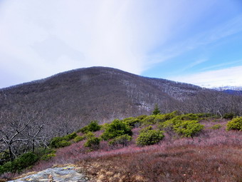 After making the turn, the ice continued on the trail where people had been walking and I knew it would be a miserable hike to the top with the slippery conditions. The trail to the left also seemed to be pretty icy so we continued straight ahead. Almost immediately the ice disappeared and the trail was clear most of the way to the top with only a few patches. The trail to the High point has at least three "false summits". This means that you can be fooled into thinking you are at the top but it also means that the trail goes up and then levels to give you a break. At about 3.1 miles into the hike a path leads off to the right and we followed it. There didn't seem to be a viewpoint and the path started to descend pretty rapidly so we turned around. We continued to push up the short climbs and were soon just below the top. We stopped briefly to take in the view back toward Little Rocky and Mombaccus before continuing on to the top. The vies of the ridge were pretty clear but we could see that the valleys were hazy. It was just before noon when we hit the High Point about 3.8 miles into the hike. We stopped to take in the limited views and took some pictures. There is a USGS benchmark on the rock and there were three anchor bolts one rock over. The bolts aren't too big and are spaced to suggest and small structure. I asked Pat if he wanted to go to Little Ashokan and he was game so we started in that direction. There was some snow and ice on the path toward Little Ashokan and the ground was frozen and slippery. I started in the lead but at some point Pat took over and found appropriate paths down through the ledges and up through the brush to the top of Little Ashokan. When we looked back at the High Point, we both confessed that it had not seemed that high as we came down. The distance is less than half a mile but the drop to the lowest point is almost 400 feet before the climb to Little Ashokan. The trip out took us about 20 minutes.
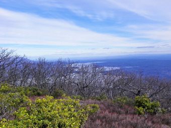 I was surprised at the view from Little Ashokan as it was even better than I had remembered! The views back to the High Point and over to the Mombaccus-Little Rocky ridge were clear. Even the views into the valley had gotten better and seemed to go forever. Even the tower at Mohonk was visible in the distance. I have looked several times for a completely clear view of the Ashokan Reservoir but have not been able to find one. Since there were no leaves on the trees, the views of the reservoir were pretty good and I took several shots. We walked down to the edge of Little Ashokan and walked around for some time. Eventually, after getting some lunch and a drink we started back to the High Point. I followed Pat most of the way as he picked a slightly different and better route back. When we arrived, there were two hikers at the High Point. We said "Hello" but they didn't seem to be too interested in talking. Pat and I walked along the trail to the viewpoint toward the west and north. We continued to the open fields a little further on. The vies of the Burroughs Range were gorgeous! The colors of the shrubs, mountains and sky combined with the lighting for an opportunity for some really nice pictures. Pat also found a small "window" that offered a view of the reservoir. I asked him if he wanted to do the loop rather than just go back the way we had come and he agreed. As we started out the trail was again icy but soon cleared. We descended through mostly open hardwood which contrasted with the dense shrubbery on the way up. Pat spotted a plastic container someone had left in the hollow of a tree and went to investigate. What he found was a geocache from Catskills Live! We signed the book and I left two fresh AA batteries but took nothing.
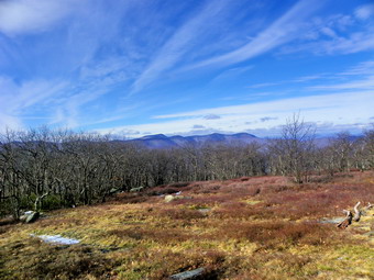 For about .8 miles the trail heads northwest and mostly descends. Along the way there were one or two minor ascents. The problem was that each ascent was very icy! As we had before, we simply dug in with our boots or walked off trail a little. At about 5.7 miles the trail turned southwest and then mostly south back to the trail junction. Along the way there were several stone cairns. Some seemed to simply mark the trail while several were at the beginning of paths that lead down the slope. I had followed at least one of these on previous trips and it didn't seem to go anywhere. We continued for another 1.5 miles to the trail junction. The last part of this section is a little steep and descends over rocks. We avoided some of this by walking on either side of the trail. We arrived at the trail junction at 2:45 PM about 7.2 miles into the hike. We quickly passed through the icy section and then walked back toward the trail head. By this time I was little tired and the trip back would have tedious without the company of another hiker. We hiked the last 2.7 miles back to the parking area and along the way ran into one other hiker with his dog. We arrived in the parking area a few minutes before 4:00 PM having covered just under 10 miles in 5 hours and 45 minutes. The skies were getting more overcast as we bid each other goodbye. I had thought about stopping at some of the waterfalls but decided I just wanted to get home.
![]() On Thursday, February 2nd, I didn't have much time to hike but knew I had to get out to exercise Sheila. We had already been to Frick Pond so I decided to go to Long Pond and do the short loop to the trail junction and back on Flugertown Road. The temperature was in the high 30's with almost no wind but it was very overcast and dreary. I did not plan to take many pictures because of the conditions and because it would only slow us down. We arrived at the parking area on Flugertown Road at about 10:45 AM to find almost a solid sheet of ice. I was able to negotiate the slippery conditions which did not seem to bother the dogs and we headed across the bridge and up the hill. The hill up from the parking area was also very icy and I had to walk off the trail in several spots. In one or two places even the sides of the trail were icy! Once we hit the to of the hill there wasn't much ice and only a little snow cover. We passed by the side trail to Long Pond as the skies were still overcast. At 11:25 AM we had hiked 1.3 miles and were at the junction for the trail out to Flugertown Road and back to the car. I wasn't tired and the dogs both looked fresh so I decided to go to the lean-to and then turn around just to get some more distance. The side trail to the lean-to was only another .4 miles and at that point I decided to skip the lean-to and complete the "big loop". We pushed on with Sheba staying out in front and an enthusiastic Sheila straining at the leash. Around 11:50 AM we had hiked about 2.4 miles and were at the junction with the woods road that headed back to the parking area. This is where our adventure really began. The road was a sheet of hard, wet, slick ice! After slipping and sliding a short distance, I stopped and put on my spikes. After that, things were MUCH better!
On Thursday, February 2nd, I didn't have much time to hike but knew I had to get out to exercise Sheila. We had already been to Frick Pond so I decided to go to Long Pond and do the short loop to the trail junction and back on Flugertown Road. The temperature was in the high 30's with almost no wind but it was very overcast and dreary. I did not plan to take many pictures because of the conditions and because it would only slow us down. We arrived at the parking area on Flugertown Road at about 10:45 AM to find almost a solid sheet of ice. I was able to negotiate the slippery conditions which did not seem to bother the dogs and we headed across the bridge and up the hill. The hill up from the parking area was also very icy and I had to walk off the trail in several spots. In one or two places even the sides of the trail were icy! Once we hit the to of the hill there wasn't much ice and only a little snow cover. We passed by the side trail to Long Pond as the skies were still overcast. At 11:25 AM we had hiked 1.3 miles and were at the junction for the trail out to Flugertown Road and back to the car. I wasn't tired and the dogs both looked fresh so I decided to go to the lean-to and then turn around just to get some more distance. The side trail to the lean-to was only another .4 miles and at that point I decided to skip the lean-to and complete the "big loop". We pushed on with Sheba staying out in front and an enthusiastic Sheila straining at the leash. Around 11:50 AM we had hiked about 2.4 miles and were at the junction with the woods road that headed back to the parking area. This is where our adventure really began. The road was a sheet of hard, wet, slick ice! After slipping and sliding a short distance, I stopped and put on my spikes. After that, things were MUCH better!
We hiked along the icy road with the dogs having problems getting footing on the ice. Sheba walked on the side of the road in the snow but I had trouble convincing Sheila to do the same. She actually seemed to be enjoying the trip down the ice. We arrived at the small bridge over the beaver pond and on the other side I noticed a sign. Last time I had crossed the land near the hunting camp I noticed that the snowmobile trail markers went across the private bridge and the gates were open and one was gone. This time a sign ask for "respect for property owner rights" and several posts with trail blazes marked a path to the bridge. I am glad the property owners have given permission for others to use their land. I hope all users respect the owners property so that the permission continues. The road continued to be icy as we hiked back on Basily and then Flugertown Road. These roads are seasonally maintained and may be plowed but only by property owners or camp members. By 12:50 PM we had hiked about 5.4 miles and we came to the section of Flugertown Road that is maintained. I took off my spikes and we walked the rest of the way back to the car. Just before the parking area three deer crossed the road. As usually, Sheba ignored them but Sheila gave an indication that she found them interesting. We were back at the car by 1:00 PM having covered 6 miles in just over 2 hours!
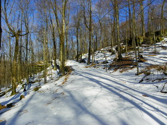
![]()
![]() On Tuesday, January 31st, I had planned to go to North South Lake and hike a LONG distance loop around the entire area including the entire escarpment and North Point. I had some chores to get done in the morning but thought I might still get out in time to do the hike. Cindy was not enthusiastic about such a long ride so we decided on Ashokan High Point instead. As we were getting dressed our new puppy, Sheila, began to get excited about going on a hike. It took her only twice to associate our hiking clothing with a wonderful time outdoors. She is a mixture of yellow, Labrador retriever, Husky and boxer. This combination means she is VERY energetic and LOVES the outdoors especially snow! We had not planned to take her to Ashokan as it is long and hilly enough that I would like to use poles. Sheila still needs be on a leash so we changed plans AGAIN and decided to do the long loop at Frick and Hodge Ponds with both dogs. The weather forecast was for a beautiful day and I wanted more views than this hike would provide but was willing to sacrifice them for the companionship. We arrived at the parking area just after 10:00 AM with beautiful blue skies with some clouds and plenty of sun. The temperature was in the high 30's or low 40's but a breeze made it seems a little cooler. We got started as soon as we could by crossing the road and heading up the Flynn Trail toward Hodge Pond. There was only a thin layer of wet and melting snow near the beginning of the trail but as we climbed the Flynn Trail the snow became deeper and was more "crunchy". Throughout the hike the snow was never deep enough to require snowshoes but they would have made hiking parts of the route easier. At about .9 miles into the hike I was admiring the ledges to the right of the rail. As I looked up into the woods, I saw some laid up stone. The stone that I saw looked more like the support for a road than a some wall so we decided to walk up the hill to see what it was. We found a very nice woods road that I had 1 never seen before and turned left to head toward the clearing near the top of the Flynn Trail. The road stretched behind us for some distance and I will investigate where it goes in that direction on another day. The road very quickly hit a high point and then went right back to the Flynn Trail. This was disappointing but we decided to follow the trail rather than bushwhack to the clearing. Sheila was doing fine except for the fact that she continued to pull on the leash as she followed Sheba. She is bigger now and I am trying to teach her to walk without pulling and to come when called so that I can let her off the leash.
On Tuesday, January 31st, I had planned to go to North South Lake and hike a LONG distance loop around the entire area including the entire escarpment and North Point. I had some chores to get done in the morning but thought I might still get out in time to do the hike. Cindy was not enthusiastic about such a long ride so we decided on Ashokan High Point instead. As we were getting dressed our new puppy, Sheila, began to get excited about going on a hike. It took her only twice to associate our hiking clothing with a wonderful time outdoors. She is a mixture of yellow, Labrador retriever, Husky and boxer. This combination means she is VERY energetic and LOVES the outdoors especially snow! We had not planned to take her to Ashokan as it is long and hilly enough that I would like to use poles. Sheila still needs be on a leash so we changed plans AGAIN and decided to do the long loop at Frick and Hodge Ponds with both dogs. The weather forecast was for a beautiful day and I wanted more views than this hike would provide but was willing to sacrifice them for the companionship. We arrived at the parking area just after 10:00 AM with beautiful blue skies with some clouds and plenty of sun. The temperature was in the high 30's or low 40's but a breeze made it seems a little cooler. We got started as soon as we could by crossing the road and heading up the Flynn Trail toward Hodge Pond. There was only a thin layer of wet and melting snow near the beginning of the trail but as we climbed the Flynn Trail the snow became deeper and was more "crunchy". Throughout the hike the snow was never deep enough to require snowshoes but they would have made hiking parts of the route easier. At about .9 miles into the hike I was admiring the ledges to the right of the rail. As I looked up into the woods, I saw some laid up stone. The stone that I saw looked more like the support for a road than a some wall so we decided to walk up the hill to see what it was. We found a very nice woods road that I had 1 never seen before and turned left to head toward the clearing near the top of the Flynn Trail. The road stretched behind us for some distance and I will investigate where it goes in that direction on another day. The road very quickly hit a high point and then went right back to the Flynn Trail. This was disappointing but we decided to follow the trail rather than bushwhack to the clearing. Sheila was doing fine except for the fact that she continued to pull on the leash as she followed Sheba. She is bigger now and I am trying to teach her to walk without pulling and to come when called so that I can let her off the leash.
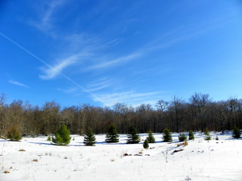 At about 1.2 miles we came to the road that leads to the clearing and instead of following it we just walked up the bank into the woods and directly to the clearing. The white snow, green trees and blue skies made a pretty pictures. The wind was blowing some and I cooled down as I took some pictures. I had opened up most of the zippers on my Mammut hoody and my shirts as I was very warm while moving, We got back on the Flynn Trail and were soon at the junction with the Big Rock Trail. We continued straight ahead top go down to Hodge Pond. Sheila wanted to run and I obliged her for as long as I could. As we entered the clearing at Hodge Pond the wind picked up but almost seemed warm as the sun was out and the air temperature had risen. This also meant that the snow was beginning to melt making is wetter and not as firm to walk on. There were a few deeper drifts near the pond as we approached the shore. I took some pictures and we got a drink before heading around the back of the pond on the old jeep trail. I did not stop to take pictures from the head end of the lake as the sun was at the wrong angle. We hit the Flynn Trail on the other side at 11:45 AM about 3.2 miles into the hike or not quite half way. There is some blowdown on this part of the Flynn Trail but we were able to avoid it without much problem and were soon on the flatter portion of the trail headed toward Junkyard Junction. There was some snow on the trail but much of it was open with some very wet areas which were only partially frozen. This was the wettest and hardest part of the trail to walk. At Junkyard Junction we turned left and started down the Quick Lake Trail toward Iron Wheel Junction.
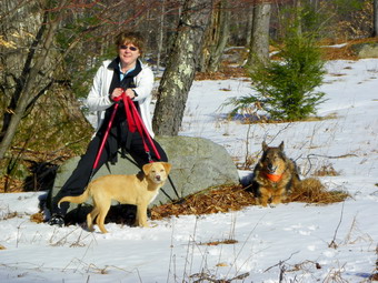 The upper part of the Quick Lake Trail was packed by snowmobiles but as the snow volume has decreased the trail has turned to ice. The lower we got on the trail the more open it was with little or no snow. By 12:40 PM we were at Iron Wheel junction about 5.3 miles into the hike. Sheila was beginning to whine but I think it was more out of the "boredom" of being on the leash as she was still pulling me along most of the time. The trail from Iron Wheel down had not had any snowmobile traffic but still alternated between snow and open ground. After crossing a little stream, we ran into the blowdown that has been there for some time. We simply walked around it as we have been doing but it certainly would be nice if the powers that be would get it cleared! The final piece of trail down to Frick Pond was open and very wet in places. We arrived at the bridge across the outlet at 1:05 PM 6.3 miles into the hike. We stopped on the bridge and I took some pictures. Frick Pond was most open unlike Hodge Pond that was completely frozen. After taking pictures, we headed back to the car. The last part of the trail along the woods road was very open and wet. We arrived back at the parking area at 1:20 PM having covered 6.9 miles in 3 hours and 15 minutes.
On Monday, January 30th, I didn't have much time to hike but knew I had to get out after a busy Sunday. Sheila also needed the exercise so we headed across the street to Round Top. This time we headed up the woods road passed the quarry and continued on. We took the woods roads to the second peak on the ridge with me following Sheba all the time. Sheila loved being out and I had a hard time holding her back. There was a thin layer of fresh snow on the trail which covered some very icy patches underneath. At the top of the second hill, he turned around and retraced our steps down. At the end of the descent I told Sheba to take us home and I followed her to the quarry. We turned up into the quarry and then followed road and path to the top of Round Top. At this point I wanted to head back rather than do any more loops. I gave Sheba the command to take us back home and she took off. I was interested to see where she would go as we had not used this route for a year. Sheba led us down the hill on almost the same route we have always used. Once we hit the woods road at the bottom, she turned in the correct direction and then turned back into the woods right where we always turn. She followed another woods road and I thought she was off course until she made another turn and we were right where we always end up to head home. If anyone has an explanation of this behavior, which Sheba regularly repeats, please e-mail me. We walked about 4 miles in 1.5 hours which was a relaxing but challenging workout.
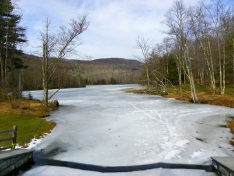
![]()
![]() On Saturday, January 28th, Karl was available to hike but we had not decided where we were going when he arrived in Livingston Manor at 8:30 AM. We knew that it was the Catskill 3500 Club's Winter Weekend and that at least one other group had a hike planned. It might have been interesting to hook up with one of these groups but we chose to go somewhere that others probably would not go. Karl asked about the trails at Little Pond that he remembered from picnicking there when he was younger, much younger. I proposed a hike that I had been wanting to do for some time. We would park one car at the Mary Smith Hill parking area on Berry Brook Road and then drive to the Little Pond State Campgrounds to hike back to the other car. I added up the mileage from the NYNJTC maps and it look to be right around 9 miles. This was definitely a route that required a car shuttle. By the time I got ready and did a few chores, we got a later start than I would have liked. (This seems to be a theme!) We drove with our dogs to the Mary Smith Hill parking area where I parked my car. The parking area was a sheet of ice. Sheba and I got in Karl's car and we headed out to Route 30 where we turned right and headed around the Pepacton Reservoir. We took the Barkaboom Road to get to the Little Pond Campgrounds. When we arrived at the access road, the gate was closed which we knew would be the case. We parked in a spot away from the gate with two pickup trucks. We suspected that the owners were probably ice fishing on Little Pond. By now it was 10:20 AM and it was time we got hiking. The sun was out and the temperature was right around 30 degrees. It seemed warmer than the temperature indicated as long as the wind was not blowing. Both Maggie and Sheba were ready to go and bounded ahead of us up the bare road. At the pond we stopped so that I could take some pictures from the bridge over the outlet. It was odd to see the brown and green around the campgrounds with ice on the pond and snow on the hills. We walked around the right side of the pond to the upper end. We found some people ice fishing and talked to them briefly before continuing on to the yellow Little Pond Trail. We took a right on the trail and started the first climb of the day.
On Saturday, January 28th, Karl was available to hike but we had not decided where we were going when he arrived in Livingston Manor at 8:30 AM. We knew that it was the Catskill 3500 Club's Winter Weekend and that at least one other group had a hike planned. It might have been interesting to hook up with one of these groups but we chose to go somewhere that others probably would not go. Karl asked about the trails at Little Pond that he remembered from picnicking there when he was younger, much younger. I proposed a hike that I had been wanting to do for some time. We would park one car at the Mary Smith Hill parking area on Berry Brook Road and then drive to the Little Pond State Campgrounds to hike back to the other car. I added up the mileage from the NYNJTC maps and it look to be right around 9 miles. This was definitely a route that required a car shuttle. By the time I got ready and did a few chores, we got a later start than I would have liked. (This seems to be a theme!) We drove with our dogs to the Mary Smith Hill parking area where I parked my car. The parking area was a sheet of ice. Sheba and I got in Karl's car and we headed out to Route 30 where we turned right and headed around the Pepacton Reservoir. We took the Barkaboom Road to get to the Little Pond Campgrounds. When we arrived at the access road, the gate was closed which we knew would be the case. We parked in a spot away from the gate with two pickup trucks. We suspected that the owners were probably ice fishing on Little Pond. By now it was 10:20 AM and it was time we got hiking. The sun was out and the temperature was right around 30 degrees. It seemed warmer than the temperature indicated as long as the wind was not blowing. Both Maggie and Sheba were ready to go and bounded ahead of us up the bare road. At the pond we stopped so that I could take some pictures from the bridge over the outlet. It was odd to see the brown and green around the campgrounds with ice on the pond and snow on the hills. We walked around the right side of the pond to the upper end. We found some people ice fishing and talked to them briefly before continuing on to the yellow Little Pond Trail. We took a right on the trail and started the first climb of the day.
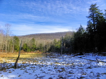 The trail was very wet standing and running water. The first part of the trail parallels a small stream and the water in the brook made a pleasant sound. We began to run into more snow as we gained elevation. Throughout the day we would see bare ground, packed snow, ice and looser snow. Much of this depended on whether or not anyone had walked the trail lately, the elevation and the exposure of the terrain. We walked through the tall pines which are Karl's favorite and were soon at the viewpoint near the top of the Little Pond Trail. I took pictures of the pond there and some more shots of the surrounding hills before we moved on. There is the foundation of an old house in this area and we both agreed that this would be a beautiful spot to have a house although the access would be difficult! At the junction with the red Touch-Me-Not Trail we turned left to climb Cabot Mountain. There was more snow and the trail was not well marked as it is not that popular. Soon we were at the bottom of the climb up Cabot Mountain. In the spring, summer and fall this climb is punctuated by nettles and prickers. In the winter, there is usually a lot of snow or, as in this case, a layer of thick ice. We started up by walking on the side of the trail where there was less ice. At some point I suggested putting on spikes but Karl did not want to and I stubbornly would not put them on unless he did! We struggled to the top of the first climb, walked a short distance on flatter ground and then started up the next climb. Eventually we ran out of "up" and were on the flat part of the trail that winds across the top of Cabot. By 12:20 PM we had hiked 3.6 miles and were standing at the viewpoint over Little Pond. The lighting was not good for photography and there was a he that would persist for the rest of the day. We had already gained 1150 feet from the car with the 480 feet over the last .5 miles on the climb up Cabot. The average grade in this climb is 25%! Both Karl and I were cold standing in the wind on the viewpoint. We had long ago dropped a layer since we were warm when on the move. After a few pictures, we moved away ROM the exposed area, got a drink and some lunch and continued on our way. It began to occur to both of us that we needed to keep moving and that this hike was by no means easy.
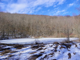 We walked across the flat area on Cabot and then began the first descent. The trail was icy in most places and we finally decided to put on the spike. Karl used MicroSpikes and I put on the Yak Xtremes. This made the descent so much easier that I regretted not using them earlier. After the first short descent, we walked across another flat area and then began the long, steep descent to Beech Hill Road. Some of this descent was bare but much had ice and hard packed snow. Toward the bottom the trail was bare and we removed our traction devices. From the highest point on Cabot Mountain we had hiked 1.25 miles and dropped 700 feet! It was 1:15 PM and we had hiked 4.7 miles. We turned right and walked .2 miles on Beech Hill Road before turn left on a private road. The private road turned into a sheet of ice and the left turn up the trail was steep and seemed impossible without traction. I found a woods road which was not as steep and we walked up that and then bushwhacked a short distance over to the trail. The trail was bare and wet in many places but there was enough ice to make it treacherous. After walking off trail to avoid the ice, we finally decided to put on the spikes which made everything much easier! We were now on the Middle Mountain Trail and climbing up Beech Hill. Throughout the hike we would climb to the "top" of a hill only to find that it was a false summit and there was more climbing to do. The walk up Beech Hill was like this with a little rise just before the actual summit. We walked about .6 miles from the private road to the summit of Beech Hill and gained about 460 feet along the way. Now it was time to descend Beech Hill so that we could ascend Middle Mountain! It was about .7 miles between the two summits but we dropped 150 feet and then climbed 280 feet to get to the top of Middle Mountain. It was now 2:20 PM and we had hiked 6.25 miles in 4 hours!
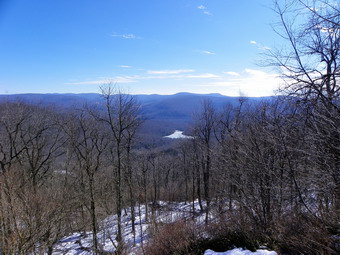 The next part of the hike was the descent down Middle Mountain to parking area on Mary Smith Hill Road. I remembered this as being a nasty section of trail which was poorly marked. There is at least one very wet area which passed through a drainage. The descent was every bit as "interesting" as I remembered with icy patches and areas we tried to avoid even with spikes. The drainage was one of those areas but there was an easier way down which it seemed others had used. The descent down Middle Mountain was about 1 mile and we dropped 730 feet to the parking area. The road was covered in snow since it is one of the roads with "Seasonal Maintenance". Both Karl and I were a little tired at this point. We had removed our spikes toward the end of the descent since the trail WA almost bare at the lower elevations. I had noticed a problem with the Yak Xtremes which is potentially serious design flaw. The back spike plate came off my heel and rode up the back of my boot more than once on the descents. There is no chain to hold the front and back spike plates together so this can easily happens. I like Yak's version of the spikes in many ways but this is a problem I will be referring to them. I will let you know how it turns out. At 3:00 PM we were ready to start the last section of the trail having already hiked 7.25 miles. From the signs on Mary Smith Hill Road this last section would be LONGER than the Middle Mountain section. It was also clear that the hike would be well over 10 miles instead of the 9 miles I had calculated!
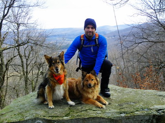 I have hiked the sections of this route several times and I have to admit I did not remember them as being difficult. Perhaps this is my poor memory or it is the fact that hiking a single section is much easier than putting them all together! We had removed our spikes and the first few hundred feet of the Mary Smith Hill Trail did not make them necessary. After this, we put them back on as the trail went back to packed snow and ice. Over the first .4 miles the trail averaged a 24% grade gaining 480 feet in .4 miles. We contort to climb to near the top of this unnamed hill that is higher than Mary Smith Hill. The trail actually never hits the top of this hill but travels along the north shoulder but still gets above 2900 feet. The summit of the hill is well over 2900 feet making it almost as high as Cabot and middle Mountains! From the high point we descended a little over 250 feet over the next mile to the base of Mary Smith Hill which was our last major climb. We were a little tired at this point but knew we were near the end. We began our climb and at about 9.3 miles stopped at the Middle Mountain Lookout. The views here are nice but it was getting late in the day and there wasn't much light. The lack of light, the haze and the general bleak landscape made photography difficult. I did get one picture of Karl looking a little tired! We hit the highest point of 2700 feet on Mary Smith Hill at 4:20 PM about 9.4 miles into the hike and already more than my estimated distance. I knew that it was all downhill from the top but that the descent had some tricky places. The trail down had several blowdowns and the last descent is narrow. This narrow part was steep and had patches of ice. I breathed a sigh of relief when we hit the bottom because I knew that we were less than .25 miles from the parking area. We were back at my car by 5:00 PM having covered 10.4 miles in 6.5 hours. We had to drive over to Little Pond to Karl's car and then back to Livingston Manor. I arrived back at my house at 6:00 PM. I now realize that this is an interesting trail system that connects points as far away as Round Pond to the area around Trout Pond.
On Thursday, January 26th, the weather report was for a mixture of snow, sleet and freezing rain. I decided to cancel a trip to Syracuse and stay home to see what developed. Sheila had not been out on a walk/hike in several days so we headed out over Round Top at about 11:00 AM. We started the way we always do by walking to the top of the cemetery hill and turning left on the path into the woods. This time we continued straight ahead up the hill to the lookout over the town. From here we skirted the ledges and then walked toward the high point of Round Top. Instead walking to the top I decided to walk below the ledges. We did this for a while and as we did I noticed I had started to snow. Sheba took the lead and found a woods road we had used the last time we were on Round Top. She led us to the road that ascends the next hill and turned to go up the hill. My intention was to hike to the top and turn around but Sheba had other ideas. She continued over the top of the hill and found a woods road down that I had not seen before. We followed the steep road to a flat area where the road again descended toward Old Route 17 and the flats. We turned left and started around the ledges and soon found another woods road we had used before. We passed the area where we had cut toward the Quickway the last time and were soon at the place where we had cut up the hill earlier. I watched to see what Sheba would do. Sheba did not start back up the hill but followed our route from the last hike in reverse. We ascended a small hill and passed the quarry on a path. Sheba cut down to another road precisely where we had come up the last time. Soon we were back on the path to the cemetery and then back to the house. Since it was close to 1:00 PM, we had been out for about 2 hours. We had hiked almost continually so my estimate was right around 4 miles covered.
![]()
![]() On Tuesday, January 24th, I wanted to go for a relatively long hike but did not want to deal with the trail conditions in the Catskills. A heavy rainfall on top of snow and ice on a warm day did not seem to me to be ideal hiking conditions! I decided to head farther south where there had not been as much snow and ice. I thought that Storm King Mountain would be a good destination since I would only have to deal with the wet trails. Also, I had not been there for some time and I expected the temperature there to be in the mid to high 40's. I looked at my maps and decided to park on Route 9W at the trail head for the Bobcat Trail since I had never used this approach before. As often happens. an ambulance call came in just as I was getting ready but the patient decided to go by car after we responded. I got started a little later than I wanted and, even so, the skies were still overcast in Livingston Manor. I was hoping for some sun and blue skies to be able to take some pictures on the hike! When we left at just passed 8:30 AM I calculated that we should be at the trail head and ready to go at around 10:00 AM or even a little earlier. As we traveled south and east on Route 17, the skies cleared and the sun came out. The thermometer on my car slowly crept over 40 degrees. I took the turn toward West Point and got on Route 9W north toward Newburgh. The road is narrow and there are few places to pull off or turn around. As I drove passed the trailhead, I knew I would have some distance to go before I could turn around and then would have to turn around AGAIN to get back to the trailhead! It is a mistake I will never make again but we were soon parked and out of the car. We actually were on the trail just a few minutes after 10:00 AM which made me happy. The temperature was about 45 degrees but the wind made it seem colder. I kept my softshell on as well as light gloves and a hat. The Bobcat Trail descends from the Route 9W parking area to a junction with the blue blazed Howell Trail that ascends to North Point. I was surprised to find some snow and quite a bit of ice on the trail. This situation was to repeat itself for the rest of the day. Any trail or surface with a northern exposure was covered in ice and this made some of the hiking very tricky!
On Tuesday, January 24th, I wanted to go for a relatively long hike but did not want to deal with the trail conditions in the Catskills. A heavy rainfall on top of snow and ice on a warm day did not seem to me to be ideal hiking conditions! I decided to head farther south where there had not been as much snow and ice. I thought that Storm King Mountain would be a good destination since I would only have to deal with the wet trails. Also, I had not been there for some time and I expected the temperature there to be in the mid to high 40's. I looked at my maps and decided to park on Route 9W at the trail head for the Bobcat Trail since I had never used this approach before. As often happens. an ambulance call came in just as I was getting ready but the patient decided to go by car after we responded. I got started a little later than I wanted and, even so, the skies were still overcast in Livingston Manor. I was hoping for some sun and blue skies to be able to take some pictures on the hike! When we left at just passed 8:30 AM I calculated that we should be at the trail head and ready to go at around 10:00 AM or even a little earlier. As we traveled south and east on Route 17, the skies cleared and the sun came out. The thermometer on my car slowly crept over 40 degrees. I took the turn toward West Point and got on Route 9W north toward Newburgh. The road is narrow and there are few places to pull off or turn around. As I drove passed the trailhead, I knew I would have some distance to go before I could turn around and then would have to turn around AGAIN to get back to the trailhead! It is a mistake I will never make again but we were soon parked and out of the car. We actually were on the trail just a few minutes after 10:00 AM which made me happy. The temperature was about 45 degrees but the wind made it seem colder. I kept my softshell on as well as light gloves and a hat. The Bobcat Trail descends from the Route 9W parking area to a junction with the blue blazed Howell Trail that ascends to North Point. I was surprised to find some snow and quite a bit of ice on the trail. This situation was to repeat itself for the rest of the day. Any trail or surface with a northern exposure was covered in ice and this made some of the hiking very tricky!
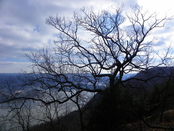 The Bobcat Trail is a little over a quarter mile long and ends at a junction with the Howell Trail. We turned right just passed the junction to climb up and over North Point. On the way up and at the top I stopped to take pictures. The contrast in colors was remarkable and there was little or none of the haze that usually hangs over the river. There was only a small amount of snow remaining on top. I took pictures of Storm King and the upper Route 9W parking area. I got some particularly good vies and pictures of the Storm King Highway and other places toward the north. The pictures show how the Storm King Highway really DOES hang on the edge of the mountain! The trail makes a right turn after North Point and heads southeast until it again rises to a point higher than North Point. After this the trail again turns northeast and descends a ridge line toward the river. From this ridge there are views down to the river and across the river to the Hudson Highlands especially to Mount Taurus and Little Stony Point. We walked along this ridge for .65 miles until we were on a lookout on a cliff right above the river. We were about 1.7 miles into the hike and ready to start the decent down to the Storm King Highway. I took some pictures to the south and across the river before starting the descent. As soon as we started the descent, I realized that the trail was facing north and all the rocks were covered in ice. From the lookout down to Pitching Point the trail drops over 500 feet in .4 miles with an average grade of over 20%. The ice was not thick enough in most places to make a traction aid worthwhile but the descent was certainly "interesting"! At several point along the way I took some pictures but many views are only partial and blocked by trees or shrubs. At the bottom of the steep descent the trail turns sharply to the left. We turned to the right and walked a short distance out to Pitching Point. The views here are actually not as good as from the top but it is interesting to look at the highway less than 300 feet away and almost straight down! We went back to the main trail and walked about .4 miles downhill to the Storm King Highway. The trail ends/begins at a parking area near Stillman Springs. The Storm King land was donated to the Palisades Interstate Park Commission by the Stillman family in 1922 and there is an inscription near a spring that commerce this AC. I took a few pictures before we started out again by walking along the highway to the north and then immediately picking up the white blazed Stillman Spring Trail. It was 11:55 AM and we were 2.5 miles into the hike and 850 feet lower than our starting point.
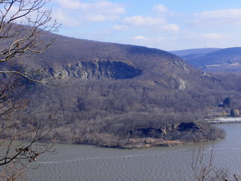 The Stillman Trail starts at the highway and heads west and southwest back toward the Howell Trail. Along its .7 mile length it gains over 400 feet. I was watching for the short Crossover Trail but was surprised when we arrived at the Howell Trail without spotting the other trail. The blazes on the Crossover Trail have been painted over but I usually use it as it is a more direct route. When we reached the Howell Trail we turned right to head toward "The Clove", the low point between North Point and Storm King. The Clove has two different streams running through it and they were as high as I have seen them but still easy to cross. At 3.45 miles we were at the bottom and ready to start the climb up toward Storm King. The trail rises 550 feet in .5 miles to a junction wit the white Bypass Trail. I decided to turn right on the Bypass Trail as it has some nice views to the south which you cannot get from the summit of the mountain. My plan was to take the Bypass Trail To the yellow Stillman Trail and follow that around the north side of the Mountain just to add some miles. From there we would return to the summit of the mountain and then back the way we came through "The Clove". The walk along the Bypass Trail presents some very nice views and there are several opportunities to take alternate routes which visit different viewpoints. I avoided most of these since the best lookout is at the junction of the Bypass Trail and the Stillman Trail. When we reached that lookout, we walked up to a large open rock and I took off the pack and got out the camera. A couple on the next rock over were the only people we had seen all day. From spot I took pictures to the south and east and some of the mountain behind us. I thought about what route we would take from this point and decided to stay with the original plan. We started out on the Stillman Trail around the north side of the mountain.
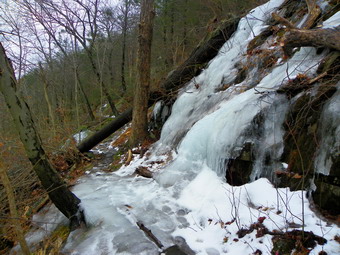 As we started out on the trail we ran in to a little ice and snow but nothing too severe. A little further along there were several patches of ice that could be avoided by walking along side the trail. In another spot hikers had formed a little path on the outside of the trail which went around a larger patch of ice. From this point on the trail really hangs on the side of the mountain with a steep drop to the north and little room on the other side to avoid the ice. The constant thawing and freeing had produced beautiful ice flows...beautiful that is if you didn't have to walk over them. I continued to bare boot it for a while but I was slipping and sliding on the ice and the patches were getting larger so that they occupied the width of the trail and were pretty long. I decided to put on my Yak Xtremes and this was a good decision. Of course, the ice flows alternated with bare ground but having the traction made all the difference. We came to the bridge and it was surprisingly clear and in good shape. I took some pictures of the bridge and we continued our hike. After the bridge, there was little ice so I took the Yaks off but kept them handy. From the lookout to the junction with the Bluebird Trail is only .9 miles but it took us almost 50 minutes! We turned left on the Bluebird Trail which regains in .5 miles the 480 feet lost on the way down the Stillman Trail. There are numerous switchbacks on the trail but it is still a good climb. All the way down the Stillman Trail the skies seemed to grow more cloudy and the wind whipped up some. Once we came around from the north side of the mountain the conditions improved but it was still more overcast than earlier in the day. At the trail junction we turned left of the Stillman Trail to head over the summit of Storm King. This .7 mile section is relatively flat but does gain almost 100 feet to the summit before dropping back down to the junction with the Bypass Trail. I stopped several times to take pictures to the north. When we came to the last viewpoint, I remembered that it was the only one really worth the stop since it is much more open than the others. By 2:40 PM we had traveled 6.5 miles and were ready to head back to the car. Our moving pace was about 2.0 mph but our overall speed was only 1.5 mph due to the numerous stops!
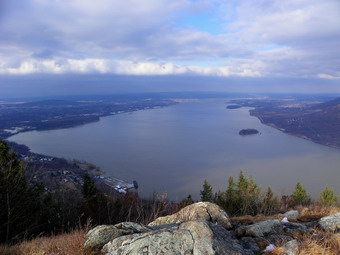 The return to the car was uneventful as there are few viewpoints and I kept the camera in the pack. We dropped down the Bypass Trail to the junction with the Howell Trail and then continued down through "The Clove". Once we were at the junction with the Stillman Springs Trail we simply continued on the Howell Trail back to the junction with the Bobcat Trail just before the Howell Trail climbs North Point. Some of the ice had melted on the Bobcat Trail so getting back to the car was a little easier than I expected. It was only .8 miles from the Stillman Springs junction to the car and it seemed to go quickly. Along the way we met two hikers walking toward us on the Howell Trail. This part of the hike was as muddy as any part had been except maybe the trip through "The Clove". We were back at the car by 3:40 PM having covered 8.4 "interesting" miles in about 5.5 hours. There are two more ways to access Storm King Mountain and both are from Mountain Road near the Storm King School. I think I will try these sometime in the near future.
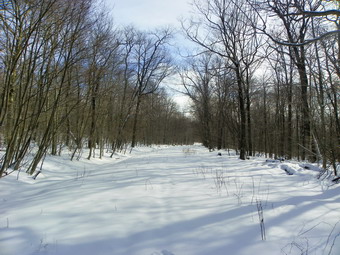
![]()
![]() On Sunday, January 22nd, I wanted to go on a hike after church to take advantage of the fresh snow. I especially wanted to do this as the forecast was calling for freezing rain and rain on Monday with temperatures in the 40's. My preference for winter is snow and more snow. Snow should not melt until late March! I didn't want to go over Round Top one more time so I decided to take both dogs and go to Frick Pond. Cindy was not interested in hiking on this day so I had to put the new puppy, Sheila. in the front seat by herself. Sheila was reluctant to even get in the car and once in the front seat sat until we left the driveway and then laid down for the rest of the trip. When I walked out of the house, I walked back in and put on a thin baselayer as it seemed very cold out. The temperature was about 25 degrees but the wind was blowing. When we arrived in the parking area just after noon, the car thermometer read 22 degrees and the wind was blustery. I got out first and put on my pack and snowshoes before letting the dogs out. I was again hiking without poles and I knew that some of the uphills would be more tiring than usual. I had not yet decided on the exact route and thought I would see how we were doing at various points. I did not want to get too far out and find that Sheila was finally at her limit. When we reached Frick Pond, I took a close look at the scene and =decided I had numerous pictures already. We didn't stop but continued over the bridge at the outlet. As Sheila walked across the bridge for the first time her long legs went through the spaces between the boards several times. Her reaction was comical but she made it across in good shape. When we got to the junction with the trail around the back of Frick, Sheba turned right to go around the pond and I followed her. We would go to Times Square and then up the Big Rock Trail to the junction with the Flynn Trail. At that point we could simply go back to the car or go to Hodge Pond first before walking back to the parking area. As we walked around the back of the pond, we were in the shade and the wind seemed to penetrate the woods. I was a little cold but kept going. As we approached Times Square I could hear and then see snowmobiles. Several machines were coming down the Big Rock Trail and turning up the Logger's Loop. We hit Times Square at about 12:40 PM at about 1.2 miles into the hike. We continued straight ahead up the Big Rock Trail.
On Sunday, January 22nd, I wanted to go on a hike after church to take advantage of the fresh snow. I especially wanted to do this as the forecast was calling for freezing rain and rain on Monday with temperatures in the 40's. My preference for winter is snow and more snow. Snow should not melt until late March! I didn't want to go over Round Top one more time so I decided to take both dogs and go to Frick Pond. Cindy was not interested in hiking on this day so I had to put the new puppy, Sheila. in the front seat by herself. Sheila was reluctant to even get in the car and once in the front seat sat until we left the driveway and then laid down for the rest of the trip. When I walked out of the house, I walked back in and put on a thin baselayer as it seemed very cold out. The temperature was about 25 degrees but the wind was blowing. When we arrived in the parking area just after noon, the car thermometer read 22 degrees and the wind was blustery. I got out first and put on my pack and snowshoes before letting the dogs out. I was again hiking without poles and I knew that some of the uphills would be more tiring than usual. I had not yet decided on the exact route and thought I would see how we were doing at various points. I did not want to get too far out and find that Sheila was finally at her limit. When we reached Frick Pond, I took a close look at the scene and =decided I had numerous pictures already. We didn't stop but continued over the bridge at the outlet. As Sheila walked across the bridge for the first time her long legs went through the spaces between the boards several times. Her reaction was comical but she made it across in good shape. When we got to the junction with the trail around the back of Frick, Sheba turned right to go around the pond and I followed her. We would go to Times Square and then up the Big Rock Trail to the junction with the Flynn Trail. At that point we could simply go back to the car or go to Hodge Pond first before walking back to the parking area. As we walked around the back of the pond, we were in the shade and the wind seemed to penetrate the woods. I was a little cold but kept going. As we approached Times Square I could hear and then see snowmobiles. Several machines were coming down the Big Rock Trail and turning up the Logger's Loop. We hit Times Square at about 12:40 PM at about 1.2 miles into the hike. We continued straight ahead up the Big Rock Trail.
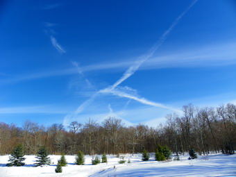 The Big Rock Trail was packed by snowmobiles and was a little easier to walk than the snow we had just come through. I did notice that Sheila was not pulling on the leash as much and wanted to walk in the snow by the side of the trail. I was a little disappointed that she had chosen this moment to start to behave on the leash as I WA scouting on her to give a little pull up the hills on the Big Rock Trail. From Times Square to the Flynn Trail junction the Big Rock Trail rises 625 feet. This doesn't sound like much but it certainly wore on me after awhile. Not being able to use poles really gave my legs a I kept listening for the snowmobiles but they never returned while we were on the trail. By 1:15 PM we had walked 2.25 miles and were at the junction with the Flynn Trail. The first thing I noticed was that there were snowmobile tracks on the Flynn Trail in the direction of Hodge Pond. The tracks went right by the sign that said "Snowmobiles Prohibited". I took some pictures of the blue skies and pristine snow on the Flynn Trail. I decided that hiking to Hodge Pond did not interest me so we turned right to head down the Flynn Trail to the car. This return trip always seems longer than the 1.7 miles that is posted which is the correct distance. The trail is pretty but has no views. I decide to stop at the clearing we had found earlier in the year. The clearing is usually wet with bog-like conditions and the type of plants you find in that environment. We climbed the steep bank and walked the short distance to the clearing. I took pictures since the scene was quite serene. Blue skies with a few clouds hung over the snow covered ground with green trees poking up here and there. After taking in the scene, we headed back to the Flynn Trail and continued back down to the car. We arrived in the parking area at 2:10 PM having covered 4.1 miles in just over 2 hours. I was surprised that we were able to keep this pace given the snowy conditions and the hills. Sheila seemed ready for more so next time we may try a 6 mile round trip.
On Saturday, January 21st, we woke up to a fresh snowfall of about 4 inches in town. The snow was light as I found out when I shoveled all the walks and part of the driveway! After finding out that a church event was canceled, I suggested to Cindy that we take both dogs and repeat the loop that I had done on Thursday. She agreed and we started our hike right from our house. This time we wore snowshoes as they would give us better traction and are just fun to use. I could not use poles since I had Sheila on her leash and I wondered how that would effect my snowshoeing as I had never gone without poles. I took the GPS with me this time to record the route but decided it was too difficult to take the camera since that would require a pack. We started just after 11:00 AM by walking across the road and up the hill behind our church to the Orchard Street Cemetery. Near the top of the hill, we turned left on a trail into the woods. A little ways up the trail we turned right on an old woods road that climbs passed some very nice ledges on the left. We continued on this road bearing slightly left and up hill until we encountered another road. The route leveled some at that point and we soon were in the area of the quarry. We continued passed the quarry and down always trying to stay on the roads. This time I took a slightly different route that would allow us to make a shorter route if anyone was tired. When we had to make a decision, we all seemed willing to do the longer route so we headed up the second small hill that tops out at just under 1900 feet. We continued over the top of that hill and I chose a slightly different line than the last time. The route from Thursday was just too steep so I ,picked a better lien and we were soon on level ground with another descent ahead of us. Sheba and I found the road that led down to another road that we could follow back. The descent was tricky with some rocks and brush still poking out from under the covering of snow. At the bottom we turned left and headed west paralleling the Quickway on our right. We could not see the road but could easily hear traffic. The road we were on passed below some interesting ledges and then headed up a little hill to another road. Here, as on Thursday, we turned right and walked down to a little clearing before walking along the base of some cliffs. From that point we followed our tracks down to a road that runs just above the highway and followed that to the clearing that overlooks the Livingston Manor interchange. On Thursday, the dogs and I followed a woods road toward town and then climbed a rather steep route to the lookout. I knew that this would not be possible on snowshoes so we headed up the hill almost immediately. Sheba took the lead and seemed to know where she was going so we followed her. We had not been on this part of the route since last year but Sheba led us directly to the lookout! From here we walked down the woods road to where we had turned earlier and continued back to the house. We were back by 1:00 PM having covered 3 miles in just under 2 hours. Sheila did not seem tired or cold and looked like she could do a few more miles.
On Thursday, January 19th, I wanted to get in a short hike before going to school to do some work and time the basketball games. I decided to hike up Round Top behind our church again. My plan was to use the same route as before and pass by the quarry. I thought to extend the hike by ascending the hill beyond Round Top and going down the other side before turning back. Eventually I would like to hike this whole ridge out to Morrston. I was going to take the GPS but somehow I left it at home. The dogs and I started just after 11:00 AM by walking across the road and up the hill behind our church to the Orchard Street Cemetery. The hill was all ice and I chose to walk in on the side as I had no traction on my boots. Near the top of the hill, we turned left on a trail into the woods. A little ways up the trail we turned right on an old woods road that climbs passed some very nice ledges on the left. We continued on this road bearing slightly left and up hill until we encountered another road. The route leveled some at that point and we soon were in the area of the quarry. We continued passed the quarry and down always trying to stay on the roads. Eventually we came to a junction and turned left. After a short walk I recognized the road that climbs the hill beyond so we turned right and headed up hill that tops out at just under 1900 feet. We continued over the top of that hill and I looked for a route down through the rocks and brush to the flatter area below. I found a challenging route and Sheila pulling on the leash made it even more exciting. Once on the flatter area below, we walked to the edge to find another descent. We walked along the edge until we found a road down the hill which we followed almost to the end before heading off the road to the north and west. At the bottom we turned left and headed west paralleling the Quickway on our right. We could not see the road but could easily hear traffic. The road we were on passed below some interesting ledges and then headed up a little hill to another road. Here we turned right and walked down to a little clearing before walking along the base of some cliffs. From that point we walked down the hill to a road that runs just above the highway and followed that to the clearing that overlooks the Livingston Manor interchange. We followed that road as we had before until we got to an area where we could climb the hill on the left. This time we went up the hill but stayed more to the right. Before us was a steep set of ledges but I could see a line through them. This would have been an easy climb but the ice and snow on the ground and rocks made it tricky especially without my poles. When we got almost to the top, we passed around a large outcrop only to find another steep and challenging climb to the top. Sheba took the lead and seemed to know where she was going so we followed her. She led us right to the lookout and back down the hill to the cemetery. From there it was a short walk home. We were back by 12:30 PM and I vowed next time to take the GPS. Sheila did not seem tired or cold and looked like she could do more next time.
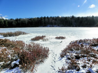
![]()
![]() On Wednesday, January 18th, I was planning on hiking somewhere with Lisa the owner of the local hiking store, Morgan Outdoors. When I got up, the temperature was barely double digits and the wind, as forecast, was howling. I almost hoped that Lisa wouldn't call but she did at about 9:00 AM. We agreed to meet at her store around 10:00 AM and go to hike at Long Pond off Willowemoc Road. This hike is fairly flat compared to the 35s and doesn't have too many views or other points of interest. What is does have is nice open trails that follow woods roads and most are protected from the wind. When we arrived at the parking area off Flugertown Road, the temperature had risen to the twenties but the wind was still blowing. We were hiking by 10:30 AM and moved into the woods and out of the wind. Most of the elevation gain is in the first .7 miles with a climb of 360 feet. This is just enough to warm up and was welcome on this cold day. Lisa and I walked at talked and at about 1 mile turned right to go down the short spur trail to Long Pond. I took off my pack and got pout the camera to take some pictures of the iced over pond. The sun was shining brightly but there were clouds in the sky. We walked back up to the main trail and continued on to about 1.4 miles where there is a trail junction. The trail to the left goes back out to Flugertown Road and the back to the parking area and is a very short hike. Lisa agreed we wanted something a little longer so returned right to continue out and around the big loop which I knew was about 6 miles. After the junction the trail has several almost permanent "puddles" but these were frozen over. At 1.8 miles we came to the trail to the lean-to but decided to stay on the main trail as the site of the lean-to is secluded but not very scenic. We continued to follow the trail along the woods road. As we did the wind again started to blow and it began to snow lightly.
On Wednesday, January 18th, I was planning on hiking somewhere with Lisa the owner of the local hiking store, Morgan Outdoors. When I got up, the temperature was barely double digits and the wind, as forecast, was howling. I almost hoped that Lisa wouldn't call but she did at about 9:00 AM. We agreed to meet at her store around 10:00 AM and go to hike at Long Pond off Willowemoc Road. This hike is fairly flat compared to the 35s and doesn't have too many views or other points of interest. What is does have is nice open trails that follow woods roads and most are protected from the wind. When we arrived at the parking area off Flugertown Road, the temperature had risen to the twenties but the wind was still blowing. We were hiking by 10:30 AM and moved into the woods and out of the wind. Most of the elevation gain is in the first .7 miles with a climb of 360 feet. This is just enough to warm up and was welcome on this cold day. Lisa and I walked at talked and at about 1 mile turned right to go down the short spur trail to Long Pond. I took off my pack and got pout the camera to take some pictures of the iced over pond. The sun was shining brightly but there were clouds in the sky. We walked back up to the main trail and continued on to about 1.4 miles where there is a trail junction. The trail to the left goes back out to Flugertown Road and the back to the parking area and is a very short hike. Lisa agreed we wanted something a little longer so returned right to continue out and around the big loop which I knew was about 6 miles. After the junction the trail has several almost permanent "puddles" but these were frozen over. At 1.8 miles we came to the trail to the lean-to but decided to stay on the main trail as the site of the lean-to is secluded but not very scenic. We continued to follow the trail along the woods road. As we did the wind again started to blow and it began to snow lightly.
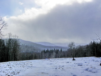 At 2.5 mules the trail ends at a road where I always turn left. I have wondered several times what is to the right on the road and we decided to head briefly in that direction. Within several hundred feet the road opened into a field with some views of the hills beyond. I took some pictures even though it was snowing. It appeared that the road continued but we did not want to adventure fiscal on this day. On most maps the road is shown as ending after a short distance but the maps do not show what is at the end! We retraced our steps back to the point where we had turned and continued on the road toward the junction with Basily Roads, about 3 miles into the hike. We were at the junction with Basily Road at about noon and from there the hike was downhill until, at about 3.6 miles, we were at the beaver pond. The small footbridge that was installed makes the crossing easy and we stopped to take a few pictures. Immediately after the crossing are "No Trespassing" signs but the land owners allow hikers to cross their property. In the past, the private bridge was closed and hikers had to ford a stream that is rather wide and deep at most times. The gates on the bridge were now gone and the markers indicated that the snowmobile trail passed over the bridge. We followed the markers and were soon on the road which turns from Basily to Flugertown somewhere along the way. The wind had died down a little and the snow had almost stopped. As we walked the road paralleled a stream and we could see and hear it as it flowed along. The road was very icy and required that we walk on the snow along the sides. At 4.6 miles we were in the vicinity of the trail to Mongaup Pond. The road at this point is still "seasonal maintenance" and so was not plowed and not sanded. We did some vehicle tracks which did not look too old. Eventually we came to the last house on the road where the maintenance ends and from this point on the walk was easy as we left the ice and snow behind. We were back at the car by 1:10 PM having covered 6.2 miles in just over 2.5 hours.
On Monday, January 16th, I knew I had to get out of the house even if I only took a short walk. I hadn't hiked since last Wednesday due to job and family commitment and some poor weather. When I got up in the morning, the temperature on the back porch read 0 degrees! I knew I would have to wait a while since my plan was to take both dogs on a walk around the hill behind our church in Livingston Manor. Most people call this hill Round Top and a few can remember when it had few trees and did look very round. Just after noon we headed out the door. Sheila, the new puppy, is not quite 4 months old and we are still training her. I kept her on a leash the whole time since she sometimes would rather play than come when called. We headed up the road to the top of the cemetery and then struck off into the woods. The temperature was now around 20 degrees and there was some sun. I had layered so that I was a little cold since I knew Sheila had a lot of energy and running with her would warm me up. After several hundred feet and a short climb we turned right on a woods road which we followed further than we had on previous walks. The road flattened out some and when it came up I took a turn to the left. My intent was to walk a big loop and incorporate some of the snowshoe paths I had used before. At the top of a small rise was a flatter open area that I recognized as a quarry. I knew the had been a quarry on the hill and both my sons had visited it when they were kids. I had missed it on all my previous walks since I had misunderstood its location. We passed through the quarry and followed the road as it continued on around the top of the hill. We eventually cut through the woods to the top of the hill where I recognized some landmarks from my snowshoeing adventures. I had been concerned that Sheila might be cold as she has a short coat compared to Sheba but she seemed to be going strong. We headed down the hill toward the Quickway way slipping and sliding as an enthusiastic Sheila pulled me along. Just before the lower woods road we usually use, we turned left and headed along the side of the hill to pick up the road further along. The road leads to a clearing that overlooks Exit 96. I took a peek and then decided to continue to follow the road which descends gently for some distance. As we walked it became clear that we would drop down into town behind a private residence. I decided to make a sharp left to head up the hill to the lookout over the two and then back to my house. The problem was that this area has many ledges and cliffs and the rest is very steep. We worked our way up to the top and Sheila and I followed Sheba who led us to the exact place I was headed. From there it was a short walk back down to the cemetery and back to the house. The dogs and I had a great time. I hope I can train Sheila to come when called so that I can take her on longer hikes without a leash.
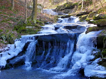
![]()
![]() On Wednesday, January 11th, I was planning on staying home to get some work done after a 9 mile adventure the day before. At about 9:00 AM Lisa, the owner of the local hiking store, called me to ask if I was going anywhere. I decided a short walk might no be so bad and suggested Kelly Hollow. This is a longer ride than Frick Pond of Trout Pond but is a little "newer". Lisa agreed and we met at her store at 10:00 AM. I drove to ward Downsville on Route 26 and then turned left top take Route 30 and the New York City roads to Millbrook Road. We had to wait for a city road crew to finish some work before we could make the turn. We parked at Kelly Hollow at around 10:45 PM. As we got ready to get on the trail I noticed a privy near the parking area that I had not seen before. This one was handicap accessible and was indeed new. As we headed into the woods, I decided to head out on the east branch of the loop and make the complete "circle" around the beaver pond and back on the west branch. We walked and talked keeping a good pace as we went. Lisa noticed some of the "features" that I had seen before and I pointed out others. I also spotted some things I had no seen before like interesting stone walls. There was a lot of accumulated ice in the stream but we initially resisted the impulse to work our way down to the stream bed. The trail follows a woods road and rises continuously toward the pond. For a good part of the way it parallels the stream and, on the east branch, passes through sections of very tall pine trees. At one point we noticed some waterfalls and rapids below. These were above the bridge and were not ones that I had photographed last time. The bank was very steep so we walked a little further to a [point of land just above the last waterfall. Here a path led down to the falls and then continued precariously along the brook. I followed the path and stopped several times to take pictures. When I was done, Sheba and I climbed the VERY steep bank to get back to Lisa and continue on the main trail.
On Wednesday, January 11th, I was planning on staying home to get some work done after a 9 mile adventure the day before. At about 9:00 AM Lisa, the owner of the local hiking store, called me to ask if I was going anywhere. I decided a short walk might no be so bad and suggested Kelly Hollow. This is a longer ride than Frick Pond of Trout Pond but is a little "newer". Lisa agreed and we met at her store at 10:00 AM. I drove to ward Downsville on Route 26 and then turned left top take Route 30 and the New York City roads to Millbrook Road. We had to wait for a city road crew to finish some work before we could make the turn. We parked at Kelly Hollow at around 10:45 PM. As we got ready to get on the trail I noticed a privy near the parking area that I had not seen before. This one was handicap accessible and was indeed new. As we headed into the woods, I decided to head out on the east branch of the loop and make the complete "circle" around the beaver pond and back on the west branch. We walked and talked keeping a good pace as we went. Lisa noticed some of the "features" that I had seen before and I pointed out others. I also spotted some things I had no seen before like interesting stone walls. There was a lot of accumulated ice in the stream but we initially resisted the impulse to work our way down to the stream bed. The trail follows a woods road and rises continuously toward the pond. For a good part of the way it parallels the stream and, on the east branch, passes through sections of very tall pine trees. At one point we noticed some waterfalls and rapids below. These were above the bridge and were not ones that I had photographed last time. The bank was very steep so we walked a little further to a [point of land just above the last waterfall. Here a path led down to the falls and then continued precariously along the brook. I followed the path and stopped several times to take pictures. When I was done, Sheba and I climbed the VERY steep bank to get back to Lisa and continue on the main trail.
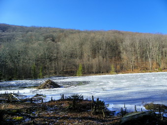 The trail takes some interesting twists and turns as it heads south and then west. As it heads west to the beaver pond it skirts a hill and heads northwest and then southwest to get around it. We arrived at the beaver pond and paused a moment by the lean-to before walking to the shore of the pond. The pond was almost completely covered in ice with only a little open water near the beaver lodge. At the sore of the pond, I stopped to take some pictures of the pond and the lodge before continuing on around. We headed back toward the parking area on the west branch of the trail. The trail descends the whole way through mostly hardwood groves. It comes near the stream in several paces but the bank is steep and hard to negotiate. In one spot there was a huge ice flow covering the while trail but it was easy to avoid. As we neared the road, the cemetery came into view and we walked over to examine some of the markers. The last date on any stone was 2006. Many of the markers are very old dating back to the Civil War or before and many are simple slabs of stone. The simple markers that are engraved are getting harder to read as they have weathered over the years. After spend a few minutes at the cemetery, Lisa and I walked out to the road and back to the parking are. The 4 mile hike had taken 2 hours with plenty of time for side excursions and pictures.
![]() On Tuesday, January 10th, I wanted to hike another 35 but I wanted the closest one I could find. I decided to check out Big Indian from Route 47 as had not been there since May 2007! The route is not one of my favorites as it is a long slog without any really good views. I thought I might include Fir in the hike but that depended on the weather and my hiking speed. The forecast was for cloudy skies in the morning with temperatures rising to almost 40 degrees and sunnier skies. I wasn't sure about the water crossing of Biscuit Brook but I knew the road was passable from previous trips. The problem with this water crossing is that you must hike about 2 miles to find out whether or not you can cross. I have turned back in the past when I felt the crossing might result in me getting wet. It is one of the few places where I wish the DEC would install a bridge! Sheba and I arrived at the trailhead at about 9:30 AM to find no other cars in the lot. We were ready to hike and started across the road almost immediately. The first part of the trail starts to the northeast but then quickly shift northwest and starts to climb 400 feet in .65 miles to the top of a ridge. From here the trail follows an old woods road along the Frost valley property line. The road parallels Biscuit Creek and I could hear the noise of the water in the creek making doubt whether or not we would be able to cross the stream. Over the next 1.5 miles we dropped about 130 feet to the water crossing at 2.1 miles.The water was not very high and some well placed rocks formed stepping stones across the stream. On our way to the water crossing we had found a few muddy places but the mud was mostly frozen. We had also crossed several small stream which had eroded there courses more deeply since the hurricanes last fall. The streams were partly frozen and the footing a little tricky. Just before the water crossing we passed the lean-to but did not visit. The trail after the lean-to was not marked and it took me a minute to recognize the correct path. I have noticed that many of the trails need a few new markers and have not been blazed in some time. After the water crossing, we walked between to parts of the creek until gaining the far bank.
On Tuesday, January 10th, I wanted to hike another 35 but I wanted the closest one I could find. I decided to check out Big Indian from Route 47 as had not been there since May 2007! The route is not one of my favorites as it is a long slog without any really good views. I thought I might include Fir in the hike but that depended on the weather and my hiking speed. The forecast was for cloudy skies in the morning with temperatures rising to almost 40 degrees and sunnier skies. I wasn't sure about the water crossing of Biscuit Brook but I knew the road was passable from previous trips. The problem with this water crossing is that you must hike about 2 miles to find out whether or not you can cross. I have turned back in the past when I felt the crossing might result in me getting wet. It is one of the few places where I wish the DEC would install a bridge! Sheba and I arrived at the trailhead at about 9:30 AM to find no other cars in the lot. We were ready to hike and started across the road almost immediately. The first part of the trail starts to the northeast but then quickly shift northwest and starts to climb 400 feet in .65 miles to the top of a ridge. From here the trail follows an old woods road along the Frost valley property line. The road parallels Biscuit Creek and I could hear the noise of the water in the creek making doubt whether or not we would be able to cross the stream. Over the next 1.5 miles we dropped about 130 feet to the water crossing at 2.1 miles.The water was not very high and some well placed rocks formed stepping stones across the stream. On our way to the water crossing we had found a few muddy places but the mud was mostly frozen. We had also crossed several small stream which had eroded there courses more deeply since the hurricanes last fall. The streams were partly frozen and the footing a little tricky. Just before the water crossing we passed the lean-to but did not visit. The trail after the lean-to was not marked and it took me a minute to recognize the correct path. I have noticed that many of the trails need a few new markers and have not been blazed in some time. After the water crossing, we walked between to parts of the creek until gaining the far bank.
For the next 1.5 miles the trail is always climbing with some areas being steeper than others. The trail initially continues to parallel the stream with some spectacular views down into the gorge cut by the water. Eventually it northwest away from the stream but continues to run into other, smaller streams. At one point the sun came out briefly and then went behind some increasingly thick clouds. The wind started to come up and I began to get hit in the face with icy pellets. This would let up and then start in again. We were finally at the last climb before the trail levels off. The trail here is narrow and sort of sidehills for a distance with a major switchback. The snow and ice increased and I( put on my Yak Xtremes since a slip would be nasty. We worked our way through the switchback to the plateau. I remembered that this was the area where I had turned west and headed off to Doubletop more than once. That hike is about 1.7 miles of difficult bushwhack! Once on the plateau I was going to take off my traction but decided that there was still enough snow to leave them on. We passed the 3500 foot sign and a cairn marking a path to the west that looked like it might go to Doubletop. Now all we had to do was find a path to the summit of Big Indian. I remembered that the best path was just after a rise in the trail and just before it started to drop. As we walked I saw several sets of footprints turning right off the trail toward the summit. I resisted the urge to follow and in less than .5 miles found a more pronounced path marked by a cairn. The .15 mile bushwhack to the top went quickly and the path led directly to the canister. It was just before noon and the skies were completely overcast. The wind was blowing and ice and snow were falling. At this point I had to decide whether to return on the trail or strike out for Fir. The footprints I had been following headed off in the direction of Fir and seemed to be calling. The hike to Fir is along the Catskill Divide which separates the Delaware and Hudson watersheds. The hike can be relatively easy IF you stay on the divide and it adds only about 1.5 miles to the hike. The problem is that it is all bushwhack with a tricky descent on the other side. I reluctantly decided to come back another time when I was not pressed by an evening commitment. We turned around and followed our route back to the main trail. Once on the main trail we headed back the way we had come. On the icy descent I looked down to see that one chain on the Yaks was "broken". When I took the Yaks off after the descent, I found that the split link chain had...split. Later, at home, I made the repair but wondered if this design would result in further failures. The water cross on the way back were no problem and we kept up a good pace. We arrived back at the car at 2:1 PM having taken 4 hours and 40 minutes for the 9 mile hike.
![]()
![]()
![]() On Saturday, January 7th, I wanted to do a LONG hike but one that was mostly walking on trails without having to worry about ice flows and the like. I decided to head to the east of the Hudson and hike from the park in Beacon to the summits of both Mount Beacons and then along Scofield and Fishkill Ridges. This was a hike I had done before but I knew I could reverse it or throw in another wrinkle. I like hiking with by wife and asked her if she wanted top come along. I explained that there were some great views but cautioned that there were some steep climbs. Cindy agree and I immediately started to plan how to shorten the hike to 6 or 7 miles. I decided that the easiest way was to eliminate Fishkill Ridge which was not a big sacrifice since the views are much the same as from other places on the route. When we arrived at the parking area for the small park on Route 9D in Beacon we found it almost filled with cars. There weren't too many people around the lot so we assumed they must all be hiking somewhere. I knew that many people hike up to the site of the casino ruins on North Beacon and then return without going too much further. We set out soon after parking and I decided to leash Sheba at least until we could determine how many people and how many dogs were hiking. As we neared the steps, I pointed out to Cindy the tracks that still ran up the mountain to the area of the casino site. These racks are the remains of the Otis Elevated Railway that used donkey engines to haul passengers cars from the base of the mountain up to the casino. Next to the tracks are a set of metal steps that allow visitors to walk up to the first set of trails. This area is very steep and the dirt is unstable. The steps went quickly and we took a brief rest at the top before continuing. The steps end at about ,3 miles after gaining less than 200 feet. The roads and trails from that point continue the ascent of almost 1000 feet to the casino site. There are some switchbacks to cut into the steep ascent but it is still a 20% grade or more in most places.
On Saturday, January 7th, I wanted to do a LONG hike but one that was mostly walking on trails without having to worry about ice flows and the like. I decided to head to the east of the Hudson and hike from the park in Beacon to the summits of both Mount Beacons and then along Scofield and Fishkill Ridges. This was a hike I had done before but I knew I could reverse it or throw in another wrinkle. I like hiking with by wife and asked her if she wanted top come along. I explained that there were some great views but cautioned that there were some steep climbs. Cindy agree and I immediately started to plan how to shorten the hike to 6 or 7 miles. I decided that the easiest way was to eliminate Fishkill Ridge which was not a big sacrifice since the views are much the same as from other places on the route. When we arrived at the parking area for the small park on Route 9D in Beacon we found it almost filled with cars. There weren't too many people around the lot so we assumed they must all be hiking somewhere. I knew that many people hike up to the site of the casino ruins on North Beacon and then return without going too much further. We set out soon after parking and I decided to leash Sheba at least until we could determine how many people and how many dogs were hiking. As we neared the steps, I pointed out to Cindy the tracks that still ran up the mountain to the area of the casino site. These racks are the remains of the Otis Elevated Railway that used donkey engines to haul passengers cars from the base of the mountain up to the casino. Next to the tracks are a set of metal steps that allow visitors to walk up to the first set of trails. This area is very steep and the dirt is unstable. The steps went quickly and we took a brief rest at the top before continuing. The steps end at about ,3 miles after gaining less than 200 feet. The roads and trails from that point continue the ascent of almost 1000 feet to the casino site. There are some switchbacks to cut into the steep ascent but it is still a 20% grade or more in most places.
![]() On our way up to the top, we met several people coming down. A few seemed to be out for a walk but others were trail runners! All said "Hi" as they passed. We did encounter a few patches of ice with one more significant one near the top but we worked around all of them. We met one dog on the way down. I didn't stop at some of the informal paths that lead to viewpoints as I knew the view from the top was best. Soon we were at the last steep, short climb but I walked off the trail to the right and toward a red brick ruin. This is the remains of the building that housed the engines that pulled the passenger cars to the top. I walked up to the building and looked down to the bottom of the mountain. The tracks and cables are still visible. Also, inside the shell of the building there is still some equipment. We took pictures from several angles although the bright sunlight did not make this easy. After we were done with the building, we walked over to the flat area where the casino was once located. There is very little to indicate anything was ever built here. I took pictures of a few of the foundations before turning my attention to the view from the completely open viewpoint. The river was a little hazy but the view seems to go on forever. We could look north and south on the river, as well as, some distance to the west. I took many pictures from several different spots but didn't think they would come out very well. There were three other hikers at the top but I couldn't tell whether they had hiked a loop, were going to hike a loop or were satisfied with the trip up from the parking area. After taking our pictures, we headed on the trail toward South Beacon Mountain and the fire tower. This is a wide woods road that is rocky but easy to follow. There was some ice and some muddy spots as we hiked. At one point we heard the roar of engines and looked up to see three ATVs headed our way. I was surprised since I thought the trails were for hiking only! They slowed down to pass us as they went out to the lookout. We continued the hike and were almost at the right turn toward the tower on the ridge when they ATVs were back headed in the same direction we were going! We never saw them again but we HEARD them almost the entire day. I won't say that they spoiled the hike but they added nothing to the experience!
On our way up to the top, we met several people coming down. A few seemed to be out for a walk but others were trail runners! All said "Hi" as they passed. We did encounter a few patches of ice with one more significant one near the top but we worked around all of them. We met one dog on the way down. I didn't stop at some of the informal paths that lead to viewpoints as I knew the view from the top was best. Soon we were at the last steep, short climb but I walked off the trail to the right and toward a red brick ruin. This is the remains of the building that housed the engines that pulled the passenger cars to the top. I walked up to the building and looked down to the bottom of the mountain. The tracks and cables are still visible. Also, inside the shell of the building there is still some equipment. We took pictures from several angles although the bright sunlight did not make this easy. After we were done with the building, we walked over to the flat area where the casino was once located. There is very little to indicate anything was ever built here. I took pictures of a few of the foundations before turning my attention to the view from the completely open viewpoint. The river was a little hazy but the view seems to go on forever. We could look north and south on the river, as well as, some distance to the west. I took many pictures from several different spots but didn't think they would come out very well. There were three other hikers at the top but I couldn't tell whether they had hiked a loop, were going to hike a loop or were satisfied with the trip up from the parking area. After taking our pictures, we headed on the trail toward South Beacon Mountain and the fire tower. This is a wide woods road that is rocky but easy to follow. There was some ice and some muddy spots as we hiked. At one point we heard the roar of engines and looked up to see three ATVs headed our way. I was surprised since I thought the trails were for hiking only! They slowed down to pass us as they went out to the lookout. We continued the hike and were almost at the right turn toward the tower on the ridge when they ATVs were back headed in the same direction we were going! We never saw them again but we HEARD them almost the entire day. I won't say that they spoiled the hike but they added nothing to the experience!
![]() After making the turn, I watched for the trail up to the tower as I remember getting a little turned around last time. Within about .25 miles there was a wide road on the right which headed to the top but no markings. I thought this was pro ably the road marked on the map and it was as good a way as any to go up. Two hikers coming down the road confirmed my suspicions. The road had some large expanses of bare rock and I thought this might be interesting when the snow and ice really hits! The distance to the top is only .2 miles and just before the summit we stopped at a nice lookout. I took some pictures of the tower up ahead and a few over to Scofield Ridge. The views in this direction were a little less hazy than toward the river. We arrived at the tower at the summit just before noon after hiking a little over 2 miles. We took pictures from the open rock and then I decided to climb the tower. As I started up the steps I ran into a chain locked across the access. I could easily have stepped over the chain but remembered that the view from the top was not much better than from the bottom. In addition, although I think the tower is safe, climbing it in a stiff breeze is...exciting. We didn't stay too long at the top as the meaning of wind chill was really evident. We retraced our path back to the main trail and turned right. We ran into a little trouble here as the trails are not well marked but we soon found our way to the yellow/white trail up to and across the ridge. Another blue trail also cut up to the ridge but it did not look "official" and seemed to cut off a few of the lookouts. I remembered the trail as relatively flat but I was WRONG! There are actually four separate ascents and descents. None of these are very long or hard but together can be a little tiring. There are a few viewpoints along the way and we stopped a few times to take pictures. I did remember that the hike along the ridge seemed to take longer than I thought it should.
After making the turn, I watched for the trail up to the tower as I remember getting a little turned around last time. Within about .25 miles there was a wide road on the right which headed to the top but no markings. I thought this was pro ably the road marked on the map and it was as good a way as any to go up. Two hikers coming down the road confirmed my suspicions. The road had some large expanses of bare rock and I thought this might be interesting when the snow and ice really hits! The distance to the top is only .2 miles and just before the summit we stopped at a nice lookout. I took some pictures of the tower up ahead and a few over to Scofield Ridge. The views in this direction were a little less hazy than toward the river. We arrived at the tower at the summit just before noon after hiking a little over 2 miles. We took pictures from the open rock and then I decided to climb the tower. As I started up the steps I ran into a chain locked across the access. I could easily have stepped over the chain but remembered that the view from the top was not much better than from the bottom. In addition, although I think the tower is safe, climbing it in a stiff breeze is...exciting. We didn't stay too long at the top as the meaning of wind chill was really evident. We retraced our path back to the main trail and turned right. We ran into a little trouble here as the trails are not well marked but we soon found our way to the yellow/white trail up to and across the ridge. Another blue trail also cut up to the ridge but it did not look "official" and seemed to cut off a few of the lookouts. I remembered the trail as relatively flat but I was WRONG! There are actually four separate ascents and descents. None of these are very long or hard but together can be a little tiring. There are a few viewpoints along the way and we stopped a few times to take pictures. I did remember that the hike along the ridge seemed to take longer than I thought it should.
![]() By 1:20 PM we had hiked 4 miles are were at the descent off the ridge that would lead to Dozer Junction and the trail over Lambs Hill. We dropped about 300 feet in elevation over the next .4 miles, found the next trail and then gained about 300 feet back to the top of Lambs Hill. On the way up we passed through Dozer Junction and made a left right after the bulldozer to climb Lams Hill. At the very top of Lambs Hill there is a limited view. As we started down the other side of the hill a clear spot opened up without any trees to Bo the view. We could see Beacon laid out below and the bridge from Beacon to Newburgh on the other side. The views over the Hudson had cleared some since the morning. We could also see the Beacon Reservoir perched in the hills beyond us to the south. There was a short, steep descent down Lambs Hill to an area with nice stone walls and then another short ascent. From that point the trail drops almost 800 feet over .8 miles. It crosses the access road for the reservoir and then parallels a stream as it the stream works its way down the mountain. We caught up to another couple that allowed us to pass. The trail had no snow or ice but was narrow and very muddy in spots. At one point I spied the waterfall on the stream that is the outlet to the reservoir. I stopped at the base of the falls before crossing the stream and once on the other side to take pictures. Then falls was frozen in places with water running in other spots. As we descended the trail a young man carrying a mountain bike came up the trail. I thought this was strange as the trails are "hiking only". We continued to walk down to the point where we would have to cut up over a hill back to the parking area. Suddenly Cindy yelled "Watch out!" I turned around to find the mountain biker coming full speed down the path toward Sheba and myself. I do not know how he missed us! He was not supposed to be on this trail! He did not have a bell or any sounding device! He was not smart enough or considerate enough to even yell to announce his presence! I was glad we did not see him again as I felt a rather nasty discussion might have ensued.
By 1:20 PM we had hiked 4 miles are were at the descent off the ridge that would lead to Dozer Junction and the trail over Lambs Hill. We dropped about 300 feet in elevation over the next .4 miles, found the next trail and then gained about 300 feet back to the top of Lambs Hill. On the way up we passed through Dozer Junction and made a left right after the bulldozer to climb Lams Hill. At the very top of Lambs Hill there is a limited view. As we started down the other side of the hill a clear spot opened up without any trees to Bo the view. We could see Beacon laid out below and the bridge from Beacon to Newburgh on the other side. The views over the Hudson had cleared some since the morning. We could also see the Beacon Reservoir perched in the hills beyond us to the south. There was a short, steep descent down Lambs Hill to an area with nice stone walls and then another short ascent. From that point the trail drops almost 800 feet over .8 miles. It crosses the access road for the reservoir and then parallels a stream as it the stream works its way down the mountain. We caught up to another couple that allowed us to pass. The trail had no snow or ice but was narrow and very muddy in spots. At one point I spied the waterfall on the stream that is the outlet to the reservoir. I stopped at the base of the falls before crossing the stream and once on the other side to take pictures. Then falls was frozen in places with water running in other spots. As we descended the trail a young man carrying a mountain bike came up the trail. I thought this was strange as the trails are "hiking only". We continued to walk down to the point where we would have to cut up over a hill back to the parking area. Suddenly Cindy yelled "Watch out!" I turned around to find the mountain biker coming full speed down the path toward Sheba and myself. I do not know how he missed us! He was not supposed to be on this trail! He did not have a bell or any sounding device! He was not smart enough or considerate enough to even yell to announce his presence! I was glad we did not see him again as I felt a rather nasty discussion might have ensued.
![]() When we hit the yellow trail, we turned left and started to climb again around the side of a hill. Next was short ascent followed by another descent. The trail was more clearly marked this time and I knew we were headed back to the top of the steps which led back to the parking area. The trail follows along the side of the mountain and cannot descend due to the private property below. We made one final short climb to the trail that leads down to the steps and then walked down the steps and back to the car. We had covered 7.3 miles in just under 5 hours. The surprising fact was that we had climbed a total of 2580 feet! I was more tired than I thought I would be and Cindy and Sheba were also glad to be done. We headed north on Route 9D to Wappinger's Falls to meet Kurt and Aimee at the Caf� Maya for a Mexican supper!
When we hit the yellow trail, we turned left and started to climb again around the side of a hill. Next was short ascent followed by another descent. The trail was more clearly marked this time and I knew we were headed back to the top of the steps which led back to the parking area. The trail follows along the side of the mountain and cannot descend due to the private property below. We made one final short climb to the trail that leads down to the steps and then walked down the steps and back to the car. We had covered 7.3 miles in just under 5 hours. The surprising fact was that we had climbed a total of 2580 feet! I was more tired than I thought I would be and Cindy and Sheba were also glad to be done. We headed north on Route 9D to Wappinger's Falls to meet Kurt and Aimee at the Caf� Maya for a Mexican supper!
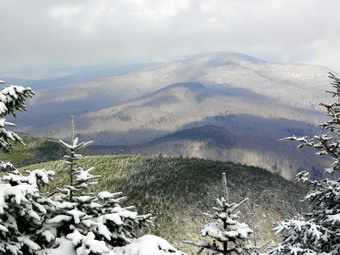
![]()
![]() On Thursday, January 5th, I wanted to hike another 35 but I wanted the closest one I could find. I also wanted a rather straightforward hike without any bushwhacking or "detours" as I had a commitment in the afternoon. I decide to check out Slide from Route 47 as had not been that way in some time. I wasn't sure about the water crossing but I knew the road was passable from previous trips. Sheba and I arrived at the trailhead at about 10:30 AM to find two other cars in the lot. I checked the water crossing and found the water level was low and that the water was mostly frozen. There was some ice is the parking area but no snow. We got started right away with the temperature hovering in the mid to high 20's. The forecast indicated this would rise but I knew that the temperatures at higher elevations are always lower. I had decided not to rush the ascent but keep a nice steady pace. We hit the woods road at the top of the first climb and had to avoid only a few icy spots to get there. Along the road to the right tune up Slide were a few more posts but they were no problem. Even after making the turn there were only small patches of ice but the snow slowly began to increase from a dusting to a consistent cover. I could see two sets of foot prints with one looking a little older than the other. As we started the steeper climb toward the 3500 foot level, the patches of ice and packed snow began to increase. I stopped to get a drink and noticed a hiker a little bit ahead of us. The hiker was also stopped and we continued up the slope until we met him. I said "hello" as we passed and noticed he was younger and that he was well equipped. Being somewhat competitive, I sped up a little so that we could stay ahead of him. The ice increased and I thought about putting on some traction. After 3500 feet the trees had a slight icy or frosty covering and there was a "breeze". Although hiking always keeps me warm. I was a little cool on this hike.
On Thursday, January 5th, I wanted to hike another 35 but I wanted the closest one I could find. I also wanted a rather straightforward hike without any bushwhacking or "detours" as I had a commitment in the afternoon. I decide to check out Slide from Route 47 as had not been that way in some time. I wasn't sure about the water crossing but I knew the road was passable from previous trips. Sheba and I arrived at the trailhead at about 10:30 AM to find two other cars in the lot. I checked the water crossing and found the water level was low and that the water was mostly frozen. There was some ice is the parking area but no snow. We got started right away with the temperature hovering in the mid to high 20's. The forecast indicated this would rise but I knew that the temperatures at higher elevations are always lower. I had decided not to rush the ascent but keep a nice steady pace. We hit the woods road at the top of the first climb and had to avoid only a few icy spots to get there. Along the road to the right tune up Slide were a few more posts but they were no problem. Even after making the turn there were only small patches of ice but the snow slowly began to increase from a dusting to a consistent cover. I could see two sets of foot prints with one looking a little older than the other. As we started the steeper climb toward the 3500 foot level, the patches of ice and packed snow began to increase. I stopped to get a drink and noticed a hiker a little bit ahead of us. The hiker was also stopped and we continued up the slope until we met him. I said "hello" as we passed and noticed he was younger and that he was well equipped. Being somewhat competitive, I sped up a little so that we could stay ahead of him. The ice increased and I thought about putting on some traction. After 3500 feet the trees had a slight icy or frosty covering and there was a "breeze". Although hiking always keeps me warm. I was a little cool on this hike.
 Somewhere along the way, the other hiker caught up and we started to hike together. He was from Connecticut and had never hiked Slide before. We walked at talked and he said he wanted to summit and then return by the Curtiss-Ormsbee Trail. We were soon at the junction and I pointed it out to him. We continued together to the lookout on the right side of the trail. Despite the cloudy conditions, Giant Ledge and Panther were clearly visible. We both took off our packs to get a drink and to take some pictures. At first I declined the offer of hot tea but then accepted. The warm tea was much appreciated as my water was VERY cold. We shouldered our packs and walked to the summit where I pointed out the remaining anchors for the old tower. We walked to the viewpoint and stopped for more pictures at about noon. The Ashokan Reservoir, Cornell and Wittenberg were visible through the trees. The lighting was interesting so I took some more pictures. I then suggested we go down toward the spring to see what viewpoints were open. We started down but ran into slippery conditions with packed snow and ice right near the top. I didn't want to put on traction only to have to take it off and knew the conditions down would be more challenging. We returned to the top and walked back on the trail together to the junction. It was getting a little colder as we parted company and Sheba and I headed down the main trail. We had not met any other hikers and I assumed the others had camped overnight somewhere. As I headed back down I met two different pairs of hikers at different points headed up. I made it down the iciest spots without any spikes and after that the trip was an easy one. We were back at the car just after 1:30 PM having Aiken just over hours for the 5.5 miles hike.
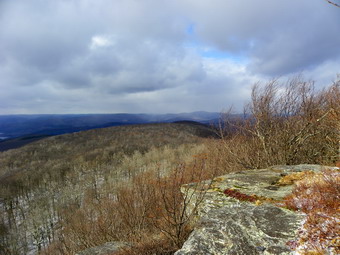
![]()
![]() On Monday, January 2nd, Cindy and I decided to get in the first hike of the New Year before the bitter cold weather arrived on Tuesday. Dry Brook Ridge sounded like a good idea since it was about the right length and difficulty. In addition, the hike from Hill Road has a nice view at the end. We arrived at the Hill, Road trail head just before 10:30 AM and started hiking a few minutes later. When we left the car, the temperature was in the low 30's with a stiff breeze and very little sun. The trail up through the pines is a wide woods road and there was very little snow. The trees are red pine that were planted as a CCC project. They are very sty aright and very tall. As we hiked through the switchbacks, the wind began to pick up and was howling through the crown of the forest. Many of the trees were bending back and forth and creaking as they did. This was a little eerie and a little scary but we decided we would continue. The higher we went the more snow we encountered on the trail. The snow made the hike even more beautiful and never got deep enough to hinder our progress. By 11:30 AM we had climbed to the ridge and the trail flattened to the trail junction with the trails from Margaretville and German Hollow. At the trail junction we had hiked 2.3 miles and gained 1140 feet in elevation in 1 hour and 15 minutes. The sign pointing back to the Hill Road parking area gave the distance as 1.7 miles which is clearly wrong! We didn't stop at the junction but turned right to continue toward the lookouts. It was 11:45 AM.
On Monday, January 2nd, Cindy and I decided to get in the first hike of the New Year before the bitter cold weather arrived on Tuesday. Dry Brook Ridge sounded like a good idea since it was about the right length and difficulty. In addition, the hike from Hill Road has a nice view at the end. We arrived at the Hill, Road trail head just before 10:30 AM and started hiking a few minutes later. When we left the car, the temperature was in the low 30's with a stiff breeze and very little sun. The trail up through the pines is a wide woods road and there was very little snow. The trees are red pine that were planted as a CCC project. They are very sty aright and very tall. As we hiked through the switchbacks, the wind began to pick up and was howling through the crown of the forest. Many of the trees were bending back and forth and creaking as they did. This was a little eerie and a little scary but we decided we would continue. The higher we went the more snow we encountered on the trail. The snow made the hike even more beautiful and never got deep enough to hinder our progress. By 11:30 AM we had climbed to the ridge and the trail flattened to the trail junction with the trails from Margaretville and German Hollow. At the trail junction we had hiked 2.3 miles and gained 1140 feet in elevation in 1 hour and 15 minutes. The sign pointing back to the Hill Road parking area gave the distance as 1.7 miles which is clearly wrong! We didn't stop at the junction but turned right to continue toward the lookouts. It was 11:45 AM.
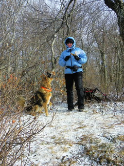 As we made the turn, I noticed the sign that stated that Ploutz Road was 3.5 miles from the junction. This seemed too far to me until I realized the distance was being measured down to the parking area and not to the trail junction! Ploutz Road was the trail head I had tried on Saturday and found that it was not easily accessible, at least with my car. The actual distance to the lookouts is about a mile and gains anther 235 feet in elevation in several short climbs. The trail was now covered in snow and was icy in spots while other places were soft and muddy. The wind continued to pick up in intensity until it was constant with no gusts. We arrived at the lookouts at 12:25 PM. Cindy estimated the temperature to be in the LOW 20's and the wind was at least 30 mph. The result was that my hands when exposed to take pictures were very cold as was my face. We only spent a few minutes on the expose lookout. This was long enough for me to take a short video to record the noise of the wind and a few still shots. We retreated to what cover we could find in the brush to get a drink and some lunch before starting back. On the return trip to the trail junction. some of the short descents were pretty slick. We were at the junction by 1:05 PM where we got another drink before turning left and heading back to the car. On the way down I debated taking some pictures but was more interested in getting back to the car. The trip down went quickly and we were treated to the sound of the wind in the trees. We were back at the car just after 2:00 PM having covered 6.6 miles in 3 hours and 35 minutes.
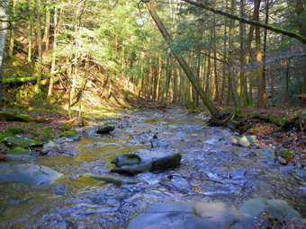
![]()
![]() On Saturday, December 31st, I was ready to get in the last hike of 2011. I decided to hike Dry Brook Ridge from Hill Road. I thought I might even do the whole Huckleberry Loop but thought better of it when I looked at my notes and found it to be at least 12 miles! I headed for Hill Road and was about to pass by Millbrook Road when I decide to check out the Ploutz Road trail head. This is a shorter hike and I thought I might get Kelly Hollow in as well. I was concerned about the condition of Ploutz Road but it looked pretty good as I made the left turn and headed up the road. The dirt road was wet and muddy but smooth without obstructions until the last farm on the road. After the "seasonal maintenance" sign the roads was rutted and eroded with rocks and branches. I went as far as the first culvert and then back all the way out. I felt it was too late to go to Hill Road so I drove to Kelly Hollow. When I arrived, there were already four cars parked in the small lot and I had to squeeze in so I didn't block anybody. After the teens and twenties on Thursday the 45 degree weather seemed particularly warm. It was just after 12:30 PM as Sheba and I headed to the left up the more eastern trail toward the beaver pond. I intended to hike up the trail to the "short loop" crossover. We would take the crossover to the other side but head up to the pond and then come back down the other side and take the crossover again to do sort of a figure 8 just to get some mileage. The trail crossed a small stream and then passed through a gate as it followed an old woods road. The road was wide without obstructions but it was very rocky and very wet. Within a short distance, Sheba saw two hikers coming toward us with their dogs. One dog was pulling at the leash and was generally...energetic. The other dog was the second biggest dog I had ever seen out hiking. I asked the owner the breed and he said it was a "Leonberger". I later found that these are European mountain dogs bred to look like lions. They did a good job! After only .3 miles a road head down toward the stream. It was not the marked trail I was looking for but my new plan was to go down to the stream and bushwhack up toward the pond. I had seen some waterfalls and, as always, was intrigued.
On Saturday, December 31st, I was ready to get in the last hike of 2011. I decided to hike Dry Brook Ridge from Hill Road. I thought I might even do the whole Huckleberry Loop but thought better of it when I looked at my notes and found it to be at least 12 miles! I headed for Hill Road and was about to pass by Millbrook Road when I decide to check out the Ploutz Road trail head. This is a shorter hike and I thought I might get Kelly Hollow in as well. I was concerned about the condition of Ploutz Road but it looked pretty good as I made the left turn and headed up the road. The dirt road was wet and muddy but smooth without obstructions until the last farm on the road. After the "seasonal maintenance" sign the roads was rutted and eroded with rocks and branches. I went as far as the first culvert and then back all the way out. I felt it was too late to go to Hill Road so I drove to Kelly Hollow. When I arrived, there were already four cars parked in the small lot and I had to squeeze in so I didn't block anybody. After the teens and twenties on Thursday the 45 degree weather seemed particularly warm. It was just after 12:30 PM as Sheba and I headed to the left up the more eastern trail toward the beaver pond. I intended to hike up the trail to the "short loop" crossover. We would take the crossover to the other side but head up to the pond and then come back down the other side and take the crossover again to do sort of a figure 8 just to get some mileage. The trail crossed a small stream and then passed through a gate as it followed an old woods road. The road was wide without obstructions but it was very rocky and very wet. Within a short distance, Sheba saw two hikers coming toward us with their dogs. One dog was pulling at the leash and was generally...energetic. The other dog was the second biggest dog I had ever seen out hiking. I asked the owner the breed and he said it was a "Leonberger". I later found that these are European mountain dogs bred to look like lions. They did a good job! After only .3 miles a road head down toward the stream. It was not the marked trail I was looking for but my new plan was to go down to the stream and bushwhack up toward the pond. I had seen some waterfalls and, as always, was intrigued.
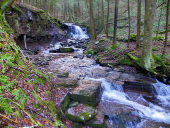 When we got down to the stream bed, we found paths on both sides of the stream. I would have crossed to the other side but the water was a little wider and faster than I would like. I decided to walk up the near side. We walked along the stream and I took some pictures as we went. In some places the path was almost blocked by trees and debris but we found a way around in each case. At about .8 miles, I could see a falls ahead and one on a small tributary to the left. We walked across the stream which was smaller now and then over to the tributary. I took some shots before walking a little further upstream to make sure there were no more falls. We walked back to the main stream where there was a lower, smaller drop and an upper, higher drop. I took some pictures from below and then climbed the bank to take more shots from above. Shortly after this we found the new bridge across the stream that is part of the short loop. We took the trail up to the western branch of the main trail and started southwest and then south toward the beaver pond. The trail gains some elevation as it goes and along the way we met four or five more hikers and two dogs. Soon we were at the beaver pond and I took a few pictures. The pond had a covering of ice at the outlet but the inlet was open. One beaver lodge was on the opposite shore. There were many signs of beaver activity including many fresh-cut trees and new material added to the dam. As we rounded the pond, we heard some voices and met another group of people at the lean-to. We greeted each other and Sheba and I passed by. I had been told that the privy by the lean-to had been vandalized but it seemed in good shape! We headed down the trail toward the parking area looking for the crossover trail to make the figure 8. As we walked I noticed that despite the "hollow" in the name, there was quiet a nice view to the west of the hills beyond. On the right a hill or ridge rose from the trail. I decided to do some climbing for the extra exercise and the possibility of a view. We were only about 2 miles into the hike at this point.
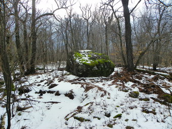 Down low on the trail there was no snow but I could see some in the woods ahead as we climbed. I could see a grove of trees ahead and the sun angle seemed to indicate that we were almost at the top. Boy was I wrong! Every time we seemed to be at the top of the climb, the ground would flatten briefly and then there was another hill or set of ledges in front of us. Some of the woods were open but we did push through some thick brush at times. I must say the Mammut wool top I wore handled the bushwhacking nicely without snags or pulls. We kept running into more snow but I really wanted to get to the top. As time wore on I decided to find out where we were headed and how far we still had to go. I got out the map, my compass and GPS. I found we were headed to Millbrook Ridge to a point with an elevation of about 3150 feet. The total distance was a little over a mile but the elevation gain was 1050 feet! We pushed on and soon were at the top of the ridge. I found what I thought I would find...nothing. There was nothing but a big boulder at what I though was the highest point around. The highest point on the ridge is about 1.2 miles to the west where it tops out at about 3460 feet. I had no desire to go there as I had hiked that area several times and the sun was now obscured by dark clouds. After a few pictures, a snack and a drink, Sheba and I headed back. At first I though Sheba was not following our path back since I did not see my footprints in the snow. After I admonished her, I found that she had simply chosen an easier and more direct route that headed in the right direction. She did this several more times as we made our way down the mountain. We ended up at EXACTLY the same location where we had started up. The trip down seemed much faster than the trip up but was only shorter by about 8 minutes. Back on the main trail we turned right and headed back to the car. The trail crossed the stream again and then passed through several groves of large evergreen trees. Along the way we met four more hikers and their dog. I decided to head directly back to the car as the prediction of rain showers seemed to be coming true. We were back at the car 3:40 PM having covered 5.6 miles in 3 hours. As we left the parking area a light rain began to fall.
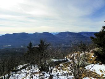
![]()
![]() On Thursday, December 29th, I had planned to hike with Jim Kennard as he finished his Winter 35s on Kaaterskill High Peak. The plan was to meet at 9:00 AM at the Gillespie Road parking area and bushwhack over Roundtop and then to Kaaterskill to finish his winter list. When I woke up in the early morning, the thermometer was registering in the single digits and I started to find ways to convince myself not to go. In the end I decided to make the trip but leave Sheba at home. Sheba goes ALMOST everywhere with me on hikes but I felt that the weather might be a little too cold in this case. It was supposed to warm up during the day but I had a felling that it would not get out of the 20s on the mountain. Meeting someone at a specific time got me out of the house early and as I drove toward Frost Valley the temperature on my car thermometer began to slowly climb. As I drove up Route 214 from Phoenicia toward Hunter. it began to drop again! I was concerned about being able to get to the parking area as Gillespie Road is a dirt Road and not maintained during the winter. As I drove out Platte Clove Road and turned onto Clum Hill Road it was clear that there was less snow in this area than at home. I made the right onto Gillespie and found it almost clear of snow with only a few ice patches. The road WAS rough but I made it to the parking are to find two other cars neither of which were Jim's. Jim arrived shortly with Connie from Saugerties and Andy from New York City. After getting acquainted, we got hiking to stay warm since the temperature was back to single digits. We headed northeast on a woods road and then continued to bushwhack in that direction for a total of .6 miles and a gain of 450 feet to the snowmobile trail. Here we turned right and stayed on the trail for a short distance before again heading into the woods to the northeast and up for about .2 miles. Jim had a track recorded in his GPS that he wanted to follow so at this point we turned southeast to head toward Round Top and to stay on a ridge line. We stayed on the ridge to about .54 miles and then turned directly south toward Round Top. At this point our route got much steeper. I fell that I am able to pick a good line on bushwhacks but Connie was also able to choose a good line so we took turns. We had to work our way around and through some cliffs until, at 1.8 miles overall, we were at the highest point we could find on Round Top. It was 10:50 AM and we had gained about 1150 feet to an elevation of just under 3500 feet.
On Thursday, December 29th, I had planned to hike with Jim Kennard as he finished his Winter 35s on Kaaterskill High Peak. The plan was to meet at 9:00 AM at the Gillespie Road parking area and bushwhack over Roundtop and then to Kaaterskill to finish his winter list. When I woke up in the early morning, the thermometer was registering in the single digits and I started to find ways to convince myself not to go. In the end I decided to make the trip but leave Sheba at home. Sheba goes ALMOST everywhere with me on hikes but I felt that the weather might be a little too cold in this case. It was supposed to warm up during the day but I had a felling that it would not get out of the 20s on the mountain. Meeting someone at a specific time got me out of the house early and as I drove toward Frost Valley the temperature on my car thermometer began to slowly climb. As I drove up Route 214 from Phoenicia toward Hunter. it began to drop again! I was concerned about being able to get to the parking area as Gillespie Road is a dirt Road and not maintained during the winter. As I drove out Platte Clove Road and turned onto Clum Hill Road it was clear that there was less snow in this area than at home. I made the right onto Gillespie and found it almost clear of snow with only a few ice patches. The road WAS rough but I made it to the parking are to find two other cars neither of which were Jim's. Jim arrived shortly with Connie from Saugerties and Andy from New York City. After getting acquainted, we got hiking to stay warm since the temperature was back to single digits. We headed northeast on a woods road and then continued to bushwhack in that direction for a total of .6 miles and a gain of 450 feet to the snowmobile trail. Here we turned right and stayed on the trail for a short distance before again heading into the woods to the northeast and up for about .2 miles. Jim had a track recorded in his GPS that he wanted to follow so at this point we turned southeast to head toward Round Top and to stay on a ridge line. We stayed on the ridge to about .54 miles and then turned directly south toward Round Top. At this point our route got much steeper. I fell that I am able to pick a good line on bushwhacks but Connie was also able to choose a good line so we took turns. We had to work our way around and through some cliffs until, at 1.8 miles overall, we were at the highest point we could find on Round Top. It was 10:50 AM and we had gained about 1150 feet to an elevation of just under 3500 feet.
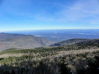 After taking some group pictures on Round Top Connie and I wanted to head directly southeast toward Kaaterskill as we had both done before. Jim wanted to follow the GPS track and some suggestions he had found on a website and it was his hike. We followed our rout back down heading north. Once we got to a flat spot, we decided not to drop any more elevation and headed around Round Top in a clockwise direction. As we came to a point just southeast of where we had been on the summit, we spotted the land bridge to Kaaterskill AND a set of footprints headed in that direction. We followed the bridge and the footprints down through some small ledges and into the col between the two peaks. After about .4 miles, we began to climb up Kaaterskill. At points this was a steep hike through ledges but it was pleasant as we knew we were nearing our goal. We hiked another .7 miles and gained about 450 feet until we hit the path to Hurricane Ledge where we turned left to the summit. We arrived at 12:40 in the clearing that marks the summit. We took pictures and then I decided to go to Hurricane Ledge which the others decided to forgo. I headed off to the Ledges and had to skirt some substantial ice flows on the way. The views from the Ledges were nice and I took some pictures before heading back to the summit. The others had decided to head to east to find the lookout in that direction. I had tried this before and always found only limited views. I headed in their direction along a path and continued on as they were standing at one viewpoint. I followed the path to a point where it started to descend steeply and then walked toward what looked like an opening. I found a small viewpoint with excellent views to the east. There was only room for one person but the views were great. I took pictures and called for the others to come to the sound of my voice. We all had a look and then headed back to the summit. At this point we had to decided whether to bushwhack back the way we had come or descend the herd path to the north and head back on the snowmobile trail.
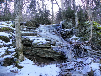 We decided on the descent to the north on the heard path but knew it had the potential to be very icy. We all put on our traction devices before heading down. The ice I remembered from a few weeks before was even more pronounced with many sections of the path looking like a river of ice. I had no problems getting traction with the Yak Xtremes on the ice but found some even better going in the snow alongside the path. After a few slips and slides we were on the snowmobile trail where we turned left to head back to the parking area. the ,5 miles descent drops almost 700 feet and averages over a 25% grade! The snowmobile trail is virtually flat but has many areas that are rutted and muddy from illegal ATV use! It was tricky to walk then next 1.8 miles avoiding these areas. This walk also seems long and has little in the way of vies. We were able to see a ridge to our left which was where we had been on the way out. Eventually the snowmobile trail turns to the left where another trail heads out to Cortina Valley. We made this turn and headed into the woods shortly after to bushwhack back to the car. We headed to the southwest for the next .6 miles finding our path from earlier in the day and dropping another 400 feet. We arrived back in the parking area at 4:10 PM having covered 6.7 miles in 7 hours and 15 minutes. The other cars were gone and we never saw any other hikers the whole day. Jim had a bottle of sparkling wine and we took some time to celebrate his accomplishment. Jim has now finished the 35s and the 35s in winter so the CHH list will be next. I look forward to hiking some of these with him and hooking up with Connie on some more adventures!
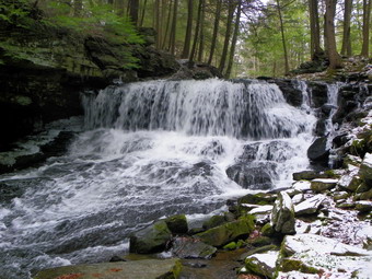
![]() On Tuesday, December 27th, I was a little tired from the nearly 14 mile hike. I also had some chores to do around the house in the morning. I did not plan on hiking since I had planned to hike with Jim at least one of the next two days as he completed his winter 35's. When I got home at around 11:00 AM, my sister-in-law and niece were at the house and wanted to go for a short hike. I normally am not enthusiastic about anything under 6 miles but this day was an exception. We decided to go to Frick Pond and hike around the back of the pond and visit the Mange falls afterward. We took both dogs. This was Sheila's first hike other than walls around the block and the hill near our house. 'We arrived at the parking area just before noon and started out toward Frick Pond on the Quick lake Trail. The trail was wet but Sheila was good about avoiding the deepest water. The only problem was that she wanted to sniff EVERYTHING. The Lab in her gives her a great nose and I had to keep "encouraging" her to come along. When she did decide to get going, it was all I could do to keep up with her as she ran using her long legs. We stopped briefly at the pond under graying and overcast skies. The boardwalks around the back of the pond were not as slippery as I thought they might be but I did not have poles as I was "managing" the puppy on a leash. At Times Square I voted to continue up the Big Rock Trail to the Flynn Trail. I outvoted 3 to 1 and we continued around the pond and back to the car. As we left the parking area to drive down to the pulloff for the falls, a little precipitation began to hit the windshield. We parked and walked down to the falls which had a good flow of water. I took some pictures as the rain increased. Working my way down to the stream bed was tricky as there was a lot of ice and frozen spray on the rocks. We headed back to the car as more rain began to fall. A nice excursion for the day after a long adventure.
On Tuesday, December 27th, I was a little tired from the nearly 14 mile hike. I also had some chores to do around the house in the morning. I did not plan on hiking since I had planned to hike with Jim at least one of the next two days as he completed his winter 35's. When I got home at around 11:00 AM, my sister-in-law and niece were at the house and wanted to go for a short hike. I normally am not enthusiastic about anything under 6 miles but this day was an exception. We decided to go to Frick Pond and hike around the back of the pond and visit the Mange falls afterward. We took both dogs. This was Sheila's first hike other than walls around the block and the hill near our house. 'We arrived at the parking area just before noon and started out toward Frick Pond on the Quick lake Trail. The trail was wet but Sheila was good about avoiding the deepest water. The only problem was that she wanted to sniff EVERYTHING. The Lab in her gives her a great nose and I had to keep "encouraging" her to come along. When she did decide to get going, it was all I could do to keep up with her as she ran using her long legs. We stopped briefly at the pond under graying and overcast skies. The boardwalks around the back of the pond were not as slippery as I thought they might be but I did not have poles as I was "managing" the puppy on a leash. At Times Square I voted to continue up the Big Rock Trail to the Flynn Trail. I outvoted 3 to 1 and we continued around the pond and back to the car. As we left the parking area to drive down to the pulloff for the falls, a little precipitation began to hit the windshield. We parked and walked down to the falls which had a good flow of water. I took some pictures as the rain increased. Working my way down to the stream bed was tricky as there was a lot of ice and frozen spray on the rocks. We headed back to the car as more rain began to fall. A nice excursion for the day after a long adventure.
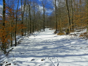
![]()
![]() On Monday, December 26th, I decided to hike somewhere near home. Later in the week I was going to hike some 3500 foot peaks with my friend Jim Kennard who was finishing his Catskill 3500 winter peaks so a "flatter" hike with some distance would be fine. I needed to get some exercise after the calories I loaded on during the holiday weekend. I decided to go to the area of the Frick Pond and hike to Quick Lake. This was a hike that I had wanted to do for some time but every time I started it something seemed to get in the way. I waited around the house while for the weather to clear as the forecast was for partly sunny skies. At about 10:30 AM I decided that I would not wait any longer and I drove to Frick Pond. On the drive, the thermometer in my car showed that the temperature was dropping. By the time we parked it was about 10:15 AM the temperature was 30 degrees with a stiff breeze blowing. Some of the wind gusts were up to 20 miles per hour. As I left the car I was a little bit cold but I knew that I would warm up as I hiked. I almost turned back because the wind was making the trees creak but I decided to continue anyway. We hiked out The Quick Lake Trail to Frick Pond. The wind off the pond was even stronger at the outlet bridge and since I had taken pictures there so many times before, I decided to simply continue without stopping. The Quick Lake Trail has a lot of blow-down on it which totally blocks many areas. Hikers are beginning to alter the path of the trail to avoid these areas which should be cleared. We made good time to Iron Wheel Junction covering the first 1.5 miles in just over 30 minutes. We turned left to stay on the Quick Lake Trail and started up toward Junkyard Junction. Shortly after the turn onto the Quick Lake Trail we made another left on the snowmobile trail toward Quick Lake. I had decided to use a combination of the Quick Lake Trail and the snowmobile trail to get the most direct route to Quick Lake. I estimated that the total round trip distance would be between 13 and 15 miles and due to our late start I needed to minimize the distance.
On Monday, December 26th, I decided to hike somewhere near home. Later in the week I was going to hike some 3500 foot peaks with my friend Jim Kennard who was finishing his Catskill 3500 winter peaks so a "flatter" hike with some distance would be fine. I needed to get some exercise after the calories I loaded on during the holiday weekend. I decided to go to the area of the Frick Pond and hike to Quick Lake. This was a hike that I had wanted to do for some time but every time I started it something seemed to get in the way. I waited around the house while for the weather to clear as the forecast was for partly sunny skies. At about 10:30 AM I decided that I would not wait any longer and I drove to Frick Pond. On the drive, the thermometer in my car showed that the temperature was dropping. By the time we parked it was about 10:15 AM the temperature was 30 degrees with a stiff breeze blowing. Some of the wind gusts were up to 20 miles per hour. As I left the car I was a little bit cold but I knew that I would warm up as I hiked. I almost turned back because the wind was making the trees creak but I decided to continue anyway. We hiked out The Quick Lake Trail to Frick Pond. The wind off the pond was even stronger at the outlet bridge and since I had taken pictures there so many times before, I decided to simply continue without stopping. The Quick Lake Trail has a lot of blow-down on it which totally blocks many areas. Hikers are beginning to alter the path of the trail to avoid these areas which should be cleared. We made good time to Iron Wheel Junction covering the first 1.5 miles in just over 30 minutes. We turned left to stay on the Quick Lake Trail and started up toward Junkyard Junction. Shortly after the turn onto the Quick Lake Trail we made another left on the snowmobile trail toward Quick Lake. I had decided to use a combination of the Quick Lake Trail and the snowmobile trail to get the most direct route to Quick Lake. I estimated that the total round trip distance would be between 13 and 15 miles and due to our late start I needed to minimize the distance.
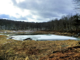 The snowmobile trail gains almost 400 feet in a little more than a half mile before making a right turn and losing as much elevation in the next .7 miles. There are several switchbacks in the trail but eventually we made it to Coyote Junction after passing over the highest spot on the hike at 2745 feet. At Coyote Junction the snowmobile trail meets the Quick Lake Trail. It was 12:00 PM and we had hiked about 4.4 miles. We took a left on the Quick Lake Trail and headed toward Bobcat Junction. My intention was to us both of the trails to take the quickest path to Quick Lake. The trail rises and falls some along the way until it arrives at Bobcat Junction. Since the Quick Lake Trail and the snowmobile trail diverge at these three junctions there is an opportunity to "loop" at each junction. At Bobcat Junction we continued straight ahead on the Quick Lake Trail as the snowmobile trail headed a little to the north. We headed toward Quick Lake and arrived at Flatrock Junction where the snowmobile trail turns left and makes a more direct route to the lake than the Quick Lake Trail which heads north first. in the mile from Bobcat to Flatrock we had dropped 235 feet in elevation. The map on the back of the NYNJTC maps that show the Frick Pond area are not topo maps and I had not realized the drop in elevation would be quite so dramatic and I was about to get another surprise. At Flatrock Junction we took a left and headed down toward Quick Lake on the snowmobile trail. As we descended the snow on the trail all but disappeared and soon Quick Lake came into view. The lake is pretty small and not very remarkable. It is very secluded and has a nice lean-to on the shore. It was 12:50 PM and we had hiked 6.9 miles. From Flatrock Junction we had dropped another 400 feet.
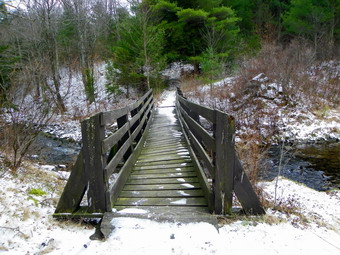 We stopped for a few moments to get lunch and a drink and for me to take some pictures. As we got ready to leave, I was a little concerned about the time and the distance we had to hike to return to the car. If we had gotten an earlier start, I might have followed some of the loops in the trail but now I just wanted to make sure we were back before I had to test my headlamp! I have decided to take exactly the same route back since I knew exactly where I was going and so did Sheba. It was simply a matter of following Sheba and my footprints in any areas where I might miss a turn. We tackled the 600 foot elevation gain without a problem and were soon on the ridge. On the way up I noticed Sheba looking off into the woods several times. I tried to see what she saw but it wasn't until the third time that I caught sight of two coyotes in the woods on some rock ledges. I knew that many wild animals see you and that you never see them but the sight certainly buried me along! By 2:00 PM we had passed through Coyote Junction and were back at the highest point of the hike about 9.6 miles into the hike. From here it is downhill for the next mile with a drop of over 300 feet. Unfortunately, there was one more hill to climb and over the next .7 miles we regained most of that 2300 feet! From that point it WAS all downhill to Junkyard Junction, Frick Pond and the parking area. Just before Junkyard Junction we met a solo hiker headed out as we were headed in. We said "Hello" but I did not ask where he was going. We arrived at the car at 3:40 PM covering 13.7 miles in 5 hours and 20 minutes for an average speed of around 3 mph! What surprised me was the up and down nature of the hike led to a total elevation gain of 2400 feet. As we left the parking area the skies were getting ever darker and some precipitation was hitting the windshield.
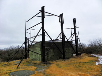
![]()
![]() On Thursday, December 22nd, I wanted to hike another 35 but I wanted the closest one I could find. I was surprised when I looked at my grid to find Graham available. I had several projects that kept me busy in the morning so we didn't get to the trailhead until 11:55 AM. One other car from New Jersey was in the lot as we started the hike. I had dressed for the 46 degree weather in town but it seemed much cooler in the parking lot. I knew that as we hiked I would get warmer. The forecast had called for partly sunny and the sun had peaked through the complete overcast once on the drive up the Beaverkill Road. As we hiked it was overcast with some pretty dark clouds. I wondered if the forecast for a 20% chance of showers would come true. It took us less than 20 minutes to hike to the first trail junction. Instead of turning left up to Balsam Lake Mountain, we continued straight ahead on the woods road to climb Graham. I had not gone this way in some time and the elevation gain was slightly more than I remembered. By 12:40 we were at the turn onto the herd path for Graham which meant we had covered over 2 miles in 40 minutes! The herd path looked at first as if someone had cleared it but that was not the case. For the first 1.1 miles on this path the trail is level or drops until the climb up Graham starts. I knew the trail would be wet since we had rain the night before. The trail was VERY wet with running water in many places and pools of water and mud in others. There is always blowdown on the path as it is not a maintained trail. By 1:00 PM we had covered slightly over 3 miles to the base of Graham Mountain. From here the trail starts to climb. There are no rock scrambles and the climb is steeper in places than others but overall the hike is long but fairly easy. There were more and more icy patches the higher we got and an increasing number of areas of snow especially off the trail.
On Thursday, December 22nd, I wanted to hike another 35 but I wanted the closest one I could find. I was surprised when I looked at my grid to find Graham available. I had several projects that kept me busy in the morning so we didn't get to the trailhead until 11:55 AM. One other car from New Jersey was in the lot as we started the hike. I had dressed for the 46 degree weather in town but it seemed much cooler in the parking lot. I knew that as we hiked I would get warmer. The forecast had called for partly sunny and the sun had peaked through the complete overcast once on the drive up the Beaverkill Road. As we hiked it was overcast with some pretty dark clouds. I wondered if the forecast for a 20% chance of showers would come true. It took us less than 20 minutes to hike to the first trail junction. Instead of turning left up to Balsam Lake Mountain, we continued straight ahead on the woods road to climb Graham. I had not gone this way in some time and the elevation gain was slightly more than I remembered. By 12:40 we were at the turn onto the herd path for Graham which meant we had covered over 2 miles in 40 minutes! The herd path looked at first as if someone had cleared it but that was not the case. For the first 1.1 miles on this path the trail is level or drops until the climb up Graham starts. I knew the trail would be wet since we had rain the night before. The trail was VERY wet with running water in many places and pools of water and mud in others. There is always blowdown on the path as it is not a maintained trail. By 1:00 PM we had covered slightly over 3 miles to the base of Graham Mountain. From here the trail starts to climb. There are no rock scrambles and the climb is steeper in places than others but overall the hike is long but fairly easy. There were more and more icy patches the higher we got and an increasing number of areas of snow especially off the trail.
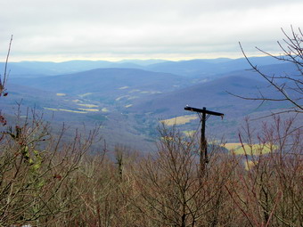 As we started up the final section of the trail two hikers approached from Graham. They had hiked Balsam Lake Mountain and then Graham. We talked briefly and they said they had gotten some views from the fire tower earlier when there was some sun. We continued in opposite directions and the rest of the climb to the top went quickly. We passed by the lookout on the left and ran into some more ice and patches of packed snow. As we approached the top the brush closed in on the trail but soon we were on the summit. It was not quite 1:30 PM and we had covered 3.95 miles. I took a few pictures but the view is mostly blocked by brush and the sky was overcast. The tower was clearly visible. We got a drink and a snack and I noticed I was getting cold. I decided not to visit the lookout at the summit since it would be wet and not offer much in the way of views. We headed down the mountain stopping at the lookout on the way down to take a few shots. About .35 miles from the summit the path turns to the right. At this point I noticed that a path also leads to the left. I had never noticed this before so we walked down that path into a large clearing. It seemed that the path continued on the other side and there was a lot of open woods. We didn't have the time to explore on this day but I will go back to wander around this area in the future. By 2:25 PM we had hiked 5.9 miles and were back at the main trail. We turned left and hiked toward the parking area. At the junction with the trail up Balsam Lake I stopped to consider climbing that mountain also. I decided that it was late and the views would not be good. In addition, the sky was getting much darker and I did not want to get wet with cold rain. We kept a quick as we hiked back to the parking area although descending over the numerous rolling stones on the upper part of the trail was tricky. We were back at the car by 3:10 PM having covered 7.9 miles in 3 hours and 15 minutes.