
What You Missed
Spring 2016
Spring 2016
![]()
![]()
![]()
![]()
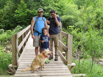
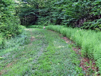
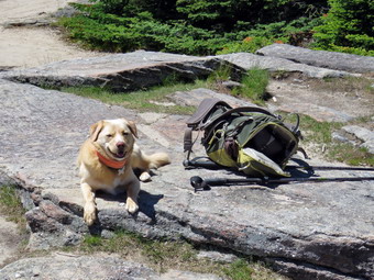
![]() On Sunday, June 19th, I had been told that we were taking a father's Day hike after church. We gathered at the house after church and waited for everyone to arrive. By 2:00 PM everyone was ready and I drove out the DevRuce Road with Karl, Kurt, Bryce and, of course, Sheila. I turned left in DeBruce on the Mongaup Pond Road and then stayed left on Beech Mountain Road when the road spilt. I parked in the smaller parking where there was only one other car. We started out on the Quick Lake Trail at 2:30 PM. The temperature was in the 80's and I was glad I had chosen a light top and pants! As soon as we made it to the woods road we turned left by the register to walk toward Frick Pond. I kept Bryce busy since otherwise he starts to ask "Are we almost done?" At Gravestone junction we turned left to stay on the Quick Lake Trail and walk down to the bridge at the outlet of Frick Pond. The scene was pretty as always and I took a few shots of the pond from the bridge. Both my sons commented the low level of the pond. I had the rest of the group stand by the bridge and I took a few pictures before we headed out on the Quick Lake Trail. At the next trail junction I stayed left on the Quick Lake Trail and Karl was quick to complain that we would miss the wooden walkways around the back of Frick Pond which is his favorite part of the trail. We continued the way I was going but I made a note that we would return that way from Times Square. We walked the relatively flat part of the trail through the "Spruce Tunnel" and crossed the small stream which was much drier than it had been less than a week before.
On Sunday, June 19th, I had been told that we were taking a father's Day hike after church. We gathered at the house after church and waited for everyone to arrive. By 2:00 PM everyone was ready and I drove out the DevRuce Road with Karl, Kurt, Bryce and, of course, Sheila. I turned left in DeBruce on the Mongaup Pond Road and then stayed left on Beech Mountain Road when the road spilt. I parked in the smaller parking where there was only one other car. We started out on the Quick Lake Trail at 2:30 PM. The temperature was in the 80's and I was glad I had chosen a light top and pants! As soon as we made it to the woods road we turned left by the register to walk toward Frick Pond. I kept Bryce busy since otherwise he starts to ask "Are we almost done?" At Gravestone junction we turned left to stay on the Quick Lake Trail and walk down to the bridge at the outlet of Frick Pond. The scene was pretty as always and I took a few shots of the pond from the bridge. Both my sons commented the low level of the pond. I had the rest of the group stand by the bridge and I took a few pictures before we headed out on the Quick Lake Trail. At the next trail junction I stayed left on the Quick Lake Trail and Karl was quick to complain that we would miss the wooden walkways around the back of Frick Pond which is his favorite part of the trail. We continued the way I was going but I made a note that we would return that way from Times Square. We walked the relatively flat part of the trail through the "Spruce Tunnel" and crossed the small stream which was much drier than it had been less than a week before.
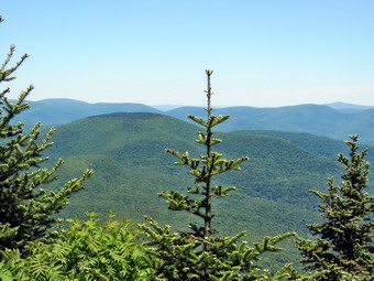
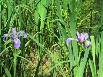 We walked up hill and at 1.5 miles arrived at Iron Wheel Junction. I told Bryce the name and he immediately spotted the iron wheels that give the junction its name. We turned right on the yellow-blazed Logger's Loop which started to climb a little. Everything was very green but the grass was not very damp. At 1.9 miles the trail started to swing east to start the loop back. At this point the trail is mostly downhill and the walking went more quickly. Along the way we stopped at an area on the ;EDT side of the trail that usually has quite a bit of water forming a small pond. There didn't seem to be much water but a flash of color caught my eye. I walked off the trail to the damp area and found less than a dozen wild irises growing in the area. They were a beautiful purple and I TKO a few shots before walking back out to the main trail. We continued downhill to Times Square where we turned right on the yellow-blazed Big Rock Trail. Bryce was saying he was tired but a little distraction proved he still had some "hike" left in him. We crossed two wooden bridges and watched the small trout in the water below. After that we continued on the main trail under some large evergreen trees and over the remaining walkways. They were dry on this day but when they are shaded and damp they are very slippery! As we got back to the Quick Lake trail we turned left to follow it back to the car. We again crossed the bridge at the outlet to Frick Pond and then continued up the hill. We walked the largely level trail back to Gravestone Junction and then followed the woods road and trail back to the parking area. We had hiked 3.8 miles in 1 hour and 45 minutes which was actually a good pace. The elevation gain was about 415 feet.
![]()
![]()
![]()
![]()
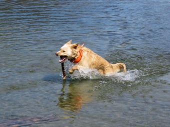
![]() On Saturday, June 18th, I had planned to hike locally but longer than some of the hikes I had been taking. I decided to hike at Trout Brook but to do a loop that was at least 7 miles long including a walk along Campbell Brook Road and Morton Hill Road. Cindy decided she wanted to go with us so we did some early morning work and then left Livingston Manor just after 10:30 Am to head toward Roscoe on Route 17. Sheila was happy since she was getting used to the increased number of hikes. I got off the Quickies at exit 4 and headed north on Route 206 through Roscoe and across the Rockland Flats.Just after entering Delaware County, I turned left on Morton Hill Road and drove to Russell Brook Road. I turned left here and drive carefully down the dirt road to park at the lower parking area. There were bald a dozen cars already parked when we arrived at 11:00 AM. We were both wearing light, summer hiking gear since the temperature was already in the high 70's and the forecast called for even higher temperatures by the afternoon. We got right on the trail and walked down the woods road to the bridge across Russell Brook below the falls. We both remarked at what a "nice" comeback the Japanese knotted had made considering that a month ago it was dry and lifeless. The plants were very green and very much alive and I took a few shots to confirm this. We could here people at the falls as we hiked up the trail toward Trout Pond passing the register at the trail junction. The trail was dry and in good shape and we kept a fast pace up the trail. S we approached the outlet end of Trout Pond I could see someone in the water and when we arrived I said "Hello" to the young woman. Sheila wanted to make friends but I discouraged her and threw a stick for her to retrieve. I took few pictures of the pond but the sky was missing the puffy white clouds that I like in the background. After a few minutes, we departed and continued toward the lean-tos at the upper end of the pond. The main trail was as dry as it had been lately and we made good time.
On Saturday, June 18th, I had planned to hike locally but longer than some of the hikes I had been taking. I decided to hike at Trout Brook but to do a loop that was at least 7 miles long including a walk along Campbell Brook Road and Morton Hill Road. Cindy decided she wanted to go with us so we did some early morning work and then left Livingston Manor just after 10:30 Am to head toward Roscoe on Route 17. Sheila was happy since she was getting used to the increased number of hikes. I got off the Quickies at exit 4 and headed north on Route 206 through Roscoe and across the Rockland Flats.Just after entering Delaware County, I turned left on Morton Hill Road and drove to Russell Brook Road. I turned left here and drive carefully down the dirt road to park at the lower parking area. There were bald a dozen cars already parked when we arrived at 11:00 AM. We were both wearing light, summer hiking gear since the temperature was already in the high 70's and the forecast called for even higher temperatures by the afternoon. We got right on the trail and walked down the woods road to the bridge across Russell Brook below the falls. We both remarked at what a "nice" comeback the Japanese knotted had made considering that a month ago it was dry and lifeless. The plants were very green and very much alive and I took a few shots to confirm this. We could here people at the falls as we hiked up the trail toward Trout Pond passing the register at the trail junction. The trail was dry and in good shape and we kept a fast pace up the trail. S we approached the outlet end of Trout Pond I could see someone in the water and when we arrived I said "Hello" to the young woman. Sheila wanted to make friends but I discouraged her and threw a stick for her to retrieve. I took few pictures of the pond but the sky was missing the puffy white clouds that I like in the background. After a few minutes, we departed and continued toward the lean-tos at the upper end of the pond. The main trail was as dry as it had been lately and we made good time.
 When we arrived at the lower lean-to, I was surprised to find it unoccupied. We continued to the right of the lean-to and started to ascend the Campbell Brook Trail toward Campbell Brook Road. This trail was obviously less used than the trails round the pond and had a little more ascent than I remembered. Over the next .75 miles we gained 420 feet to the highest point on the hike at 2470 feet which was an average of a 10.5% grade. Near the top of the climb a snowmobile trail heads off to the right but I wanted to make sure we got in over 6 miles so we continued to the left on the Campbell Brook Trail. We immediately began to descend which was easier than the ascent but there were some eroded spots along the trail and a few blowdowns to make it interesting. In the next .75 miles we lost most of the elation we had gained at about the same grade and at 2.9 miles we crossed and recrossed Campbell Brook on two good bridges. We began a slight ascent until we hit Campbell Brook Road at 3.2 miles. We stopped to get a drink and a snack and so that I could stow my poles and put Sheila on her leash for the road walk. As we were getting ready to leave, two young hiker approached from the west on the road and eked about a water fall. We told them it was a little over 3 miles down the trail and they happily set off. As we started walking east on Campbell Brook Road we speculated on where they had parked and how far they planned to walk since they did not have overnight gear. We walked along the road in the shade unit there were no more trees and as we broke out into the sun the difference was noticeable. At 3.7 miles Campbell Brook Road made a left but we continued straight ahead on Morton Hill Road. The road continued to ascend until at 4.1 miles the road turned sharply south and started a long descent. There wasn't much to see along the road although the walk was pleasant. I had hoped to see some herons in one of the ponds but the water level was low and none were present. We contused south on Morton Hill Road until we again entered the shade of the trees and turned right on Russell Brook Road at 6.4 miles. The walk on Russell Brook Road was all downhill and went quickly. I looked at the upper falls and decided that despite the noise there was not enough water to warrant a visit. At 2:00 Pm we were back in the parking lot where a few more cars had been added. We had hiked 7 miles in 2 hours and 55 minutes with an average speed of 2.4 mph and an elevation gain of 1163 feet.
![]()
![]()
![]()
![]()
![]() On Friday, June 17th, I had planned to hike some peaks on the Devil's Path since my hike at Slide Mountain had gone son well. I have been hiking mostly flat hikes and my aerobic capacity is down but my hike on Slide made me want to hike some more 3500 foot peaks! Lisa called me the night before and asked we are happy to I was doing on Friday as she wanted me to check out the trails around Frick Pond. The DEC was supposed to have mowed the Logger's Loop from Gravestone Junction to Times Square and then up the Big Rock Trail and back down the Flynn Trail. This is all in preparation for a visit from some state officials the following weekend. I told her of my plans and she said she would walk it on Sunday. When I got up in the morning, I decided I would go to Frick Pond to check to see if the work had been done and then hike a long loop over and around Mongaup Pond to at least get in some miles! I was up relatively early in the morning and saw no reason to wait around as the temperature was in the high 50's but was supposed to rise throughout the day. I got my gear ready wearing a light long-sleeved top and light, summer hiking pants. Sheila was happy to be going anywhere as we headed out DeBruce Road. I turned left in Debruce on the Mongaup Pond Road and then stayed left on Beech Mo9unatin Road when the road spilt. I parked in the smaller parking area and noticed the grass was not mowed. I assumed the work had NOT been done as promised and that I was wasting a day! There was a pickup with a camper in the larger lot and I could hear people talking as we started out on the Quick Lake Trail at 8:50 AM. As soon as we made it to the woods road and turned left by the register, I could see the tracks from a tractor in the mud and hoped that meant the mowing on the trails had been done. The trail to Gravestone Junction was wet and a little muddy and there were several spots where I could see that the tractor had sunk into the mud. At Gravestone Junction it was obvious that the DEC had mowed down to the Frick Pond bridge and had also mowed the Logger's Loop toward Times Square. I took a few pictures and then we turned right to walk the Logger's Loop to Times Square. The mowing made walking much easier and I stopped to take a few shots. At Times Square it was wet and muddy and there were tractor tire tracks all over the place. I could see that they had turned up the Big Rock Trail and that the sea of ferns had been cut down. Again, I took a few shots before we turned right to take the Big Rock Trail up to the junction with the Flynn Trail. It was obvious the temperature had increased and that combined with the uphill walk had me sweating. We kept a good pace up the hill which is about 1.1 miles and gains 600 feet. At the Flynn Trail the mower had turned right to mow the Flynn Trail back toward the parking area. I was convinced that the job had been completed and decided to head over the snowmobile trail to Mongaup Pond.
On Friday, June 17th, I had planned to hike some peaks on the Devil's Path since my hike at Slide Mountain had gone son well. I have been hiking mostly flat hikes and my aerobic capacity is down but my hike on Slide made me want to hike some more 3500 foot peaks! Lisa called me the night before and asked we are happy to I was doing on Friday as she wanted me to check out the trails around Frick Pond. The DEC was supposed to have mowed the Logger's Loop from Gravestone Junction to Times Square and then up the Big Rock Trail and back down the Flynn Trail. This is all in preparation for a visit from some state officials the following weekend. I told her of my plans and she said she would walk it on Sunday. When I got up in the morning, I decided I would go to Frick Pond to check to see if the work had been done and then hike a long loop over and around Mongaup Pond to at least get in some miles! I was up relatively early in the morning and saw no reason to wait around as the temperature was in the high 50's but was supposed to rise throughout the day. I got my gear ready wearing a light long-sleeved top and light, summer hiking pants. Sheila was happy to be going anywhere as we headed out DeBruce Road. I turned left in Debruce on the Mongaup Pond Road and then stayed left on Beech Mo9unatin Road when the road spilt. I parked in the smaller parking area and noticed the grass was not mowed. I assumed the work had NOT been done as promised and that I was wasting a day! There was a pickup with a camper in the larger lot and I could hear people talking as we started out on the Quick Lake Trail at 8:50 AM. As soon as we made it to the woods road and turned left by the register, I could see the tracks from a tractor in the mud and hoped that meant the mowing on the trails had been done. The trail to Gravestone Junction was wet and a little muddy and there were several spots where I could see that the tractor had sunk into the mud. At Gravestone Junction it was obvious that the DEC had mowed down to the Frick Pond bridge and had also mowed the Logger's Loop toward Times Square. I took a few pictures and then we turned right to walk the Logger's Loop to Times Square. The mowing made walking much easier and I stopped to take a few shots. At Times Square it was wet and muddy and there were tractor tire tracks all over the place. I could see that they had turned up the Big Rock Trail and that the sea of ferns had been cut down. Again, I took a few shots before we turned right to take the Big Rock Trail up to the junction with the Flynn Trail. It was obvious the temperature had increased and that combined with the uphill walk had me sweating. We kept a good pace up the hill which is about 1.1 miles and gains 600 feet. At the Flynn Trail the mower had turned right to mow the Flynn Trail back toward the parking area. I was convinced that the job had been completed and decided to head over the snowmobile trail to Mongaup Pond.
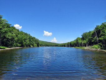
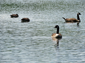
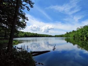 The first part of the snowmobile trail gains some elevation to a high point. This trail had not been mowed so we had to walk through several stand of ferns and grass. I was surprised when I looked down at my boots to find them relatively dry! So far there hadn't been much too see along the trails and this continued all the way to Mongaup Pond. This didn't mean that the hike was boring or that I didn't enjoy myself. Everything was green and the sky was a nice blue with lots of puffy white clouds. The 2.25 mile walk to Mongaup Pond went quickly especially after we crested the hill and hiked almost 2 miles down will. We arrived at the loop road at 10:45 Am after hiking about 4.3 miles. I put Sheila on her leash although there didn't seem to be anyone around and we turned left to walk the road to the blue Mongaup Hardenburgh Trail. After a short distance a sign appeared on the left and we turned left to follow the trail north around the upper part of the pond. As we walked, I could see a number of geese on the pond and hoped I could get some pictures as we drew closer. At the upper end of the pond, we walked down to the shore where I removed my pack and got out the camera. I took some pictures of the blue water and green trees around the lake with a brilliant blue sky overhead with towering white clouds. I was also able to zoom in on the geese and even get some pictures of them with their heads underwater to feed. As we got back on the trail the Mongaup Hardenburgh Trail turned slightly left to head north toward Hardenburgh and the Beaverkill Road. We stayed on the path around the pond which was also a snowmobile trail. We walked about half a mile on a slight uphill to the junction with the yellow. Mongaup Willowemoc Trail. This trail started out pretty flat which surprised me as I remembered it as being more hilly. I didn't have to worry since in a very short distance we walked up a hill and then down the other side. This part of the trail was almost completely dry but it was rocky in spots which always make walking more difficult. At 6.5 miles we came to Butternut Junction where the Mongaup Willowemoc Trail continues southeast to Willowemoc. We turned right on the snowmobile trail which is named the Azeala Loop. It heads mostly southwest and back toward the Mongaup Road. I knew this trail meandered back and forth and was fairly long. I had hiked it before but nothing really seemed familiar which may be due to the total lack of distinguishing features!
 We kept hiking as the trail turn one way and then the other until we finally got to an area covered in low ferns with some other much larger clumps. I seemed to remember this was near the end of the trail. We stopped and I took a few shots and the we continued on. We had walked up a hill and won the other side. When we got to another fern glen, I knew the end of this part of the trail was near but, I found, not as near as I thought. After hiking 2.9 miles from Butternut Junction we arrived at a woods road that had once been a public road between the Mongaup Road and Terwilliger Road. We turned right and began hiking downhill for the next .8 miles. Downhill should be fun and relaxing but numerous rocks and washouts along the trail made this downhill harder. Along the way a female ruffed grouse began her "injured dance" to draw Sheila way from her chicks. Sheila plunged into the woods and I waited to see what would happen. I called her back and this time she came back "empty". In the past, she has brought back grouse alive and I have had to explain to her how e have a "catch and release" policy! As we Mongaup Creek, I could hear the waterfalls and debated whether or not to visit. When we got to the small bridge across the creek, I looked at the water volume and decided to head back to the car. I put Sheila on her leash as we walked out to the road and up Beech Mountain Road back to the car. We arrived back in the parking area at 1:45 PM after hiking 10.6 miles and gaining 1922 feet of elevation. The temperature was in the mid 70's. We had seen no other hikers for the entire walk!
![]()
![]()
![]()
![]()
![]() On Tuesday, June 14th, I planned to do a longer hike on the Devil's Path until a morning ambulance call changed my plans. When I returned home at 10:00 AM, I still had the whole day ahead of me but I wanted to get back early to spend time with Mt grandson, Bryce. I had not hiked in a week as I was preparing an athlete for the state track championships which occurred on Friday and Saturday. Since I had not hiked a 3500 foot peak in some time and had not been to Slide Mountain in 10 months, I decided that would be my destination. As I started to get ready Sheila was very excited and indicated she didn't care where we went as long as we got out of the house. I headed out the DeBrice Road at about 10:15 AM and drove passed Round Pond and down to Route 47. I turned left and drove toward Frost Valley. After passing the YMCA camp, which had a brand new entrance, I watched for the parking area for Slide Mountain. I pulled in just before 10:45 AM and found three cars in the lot. We got on the trail right away. I had worn a light windbreaker but I could feel the temperature was already rising and knew I wouldn't wear it for long especially once we started to climb. Starting out on the main trail we immediately crossed the Neversink River. The "river" in this case was completely dry without a drop of water. This has happened before but always surprises me since in the spring it may be impossible to cross without getting wet! The other small streams had some water but the volume was way down as we headed up to the woods road. In just less than half a mile we turned right on the woods road and hiked passed the first piped spring which was barely running. At .7 miles we turned left and started up the main trail to Slide Mountain which, according to the sign, was 2 miles away. The trailhead for Slide has a relatively high elevation so although it is the highest peak in the Catskills the elevation gain and grade are relatively modest. I was really feeling the gain inclination since I had been doing flat hikes on smooth trails. Sheila alerted and a pair of hikers passed us. We said "Hello" as we passed and commented on the beautiful weather. By the time we reached the designated campsite at 1.2 miles the grade was getting steeper and I was still feeling the effects of the ascent and the rocky trail. We kept a good pace up the trail as we approached the 3500 foot sign at 1.4 miles where the trail is at its steepest. The spring on the right had some water in it since I could hear Sheila getting a drink. Sheila alerted again and I put her on her leash as we approached another pair of hikers stopped on the trail. We stopped and we started a conversation. I found out they were both from New Jersey and had hike some places that I had hiked. They had started at Woodland Valley and stayed overnight between Cornell and Slide. They were on their way to Giant Ledge and then back to Woodland Valley. We wished each other a good hike and continued in opposite directions. The sky was bright blue with only a few clouds and the sun was out. I was glad I had ditched the windbreaker earlier! At 1.7 miles the trail started to level some and was covered with fine quartz sand. The Catskills including Slide Mountain are a plateau that was once under an ocean and have been pushed up to form what are called mountains.
On Tuesday, June 14th, I planned to do a longer hike on the Devil's Path until a morning ambulance call changed my plans. When I returned home at 10:00 AM, I still had the whole day ahead of me but I wanted to get back early to spend time with Mt grandson, Bryce. I had not hiked in a week as I was preparing an athlete for the state track championships which occurred on Friday and Saturday. Since I had not hiked a 3500 foot peak in some time and had not been to Slide Mountain in 10 months, I decided that would be my destination. As I started to get ready Sheila was very excited and indicated she didn't care where we went as long as we got out of the house. I headed out the DeBrice Road at about 10:15 AM and drove passed Round Pond and down to Route 47. I turned left and drove toward Frost Valley. After passing the YMCA camp, which had a brand new entrance, I watched for the parking area for Slide Mountain. I pulled in just before 10:45 AM and found three cars in the lot. We got on the trail right away. I had worn a light windbreaker but I could feel the temperature was already rising and knew I wouldn't wear it for long especially once we started to climb. Starting out on the main trail we immediately crossed the Neversink River. The "river" in this case was completely dry without a drop of water. This has happened before but always surprises me since in the spring it may be impossible to cross without getting wet! The other small streams had some water but the volume was way down as we headed up to the woods road. In just less than half a mile we turned right on the woods road and hiked passed the first piped spring which was barely running. At .7 miles we turned left and started up the main trail to Slide Mountain which, according to the sign, was 2 miles away. The trailhead for Slide has a relatively high elevation so although it is the highest peak in the Catskills the elevation gain and grade are relatively modest. I was really feeling the gain inclination since I had been doing flat hikes on smooth trails. Sheila alerted and a pair of hikers passed us. We said "Hello" as we passed and commented on the beautiful weather. By the time we reached the designated campsite at 1.2 miles the grade was getting steeper and I was still feeling the effects of the ascent and the rocky trail. We kept a good pace up the trail as we approached the 3500 foot sign at 1.4 miles where the trail is at its steepest. The spring on the right had some water in it since I could hear Sheila getting a drink. Sheila alerted again and I put her on her leash as we approached another pair of hikers stopped on the trail. We stopped and we started a conversation. I found out they were both from New Jersey and had hike some places that I had hiked. They had started at Woodland Valley and stayed overnight between Cornell and Slide. They were on their way to Giant Ledge and then back to Woodland Valley. We wished each other a good hike and continued in opposite directions. The sky was bright blue with only a few clouds and the sun was out. I was glad I had ditched the windbreaker earlier! At 1.7 miles the trail started to level some and was covered with fine quartz sand. The Catskills including Slide Mountain are a plateau that was once under an ocean and have been pushed up to form what are called mountains.
 We continued up the trail and I began to notice that some of the blowdowns had been cleared from the trail. There were still quiet a few trees leaning over the trail which I do not think is a good situation. Some trees were low and had branches cut in such a way that the remaining pieces formed "spears" that pointed downward. I imagine some taller hikers may have had problems with these. Soon the trail leveled again as we had done most of the climbing. At 2 miles we passed the Curtis-Ormsbee Trail as it came in from the left from the Denning trailhead. The trail leveled some here and I enjoyed walking along the path strewn with pine needles. Soon we were approaching the last climb and at 2.6 miles we were at the viewpoint toward Panther and Giant Ledge. I decided to hike to the summit and stop at the viewpoint on the way back. Based on the number of cars in the lot and the people coming down the mountain, I judged that the summit would be empty. We passed by the highest point on Slide where a cement block marks the location where a fire tower once stood and continued to the rock outcropping to find it deserted. It was 12:15 PM and we had covered 2.7 miles. I made sure I hydrated although I wasn't very thirsty. I tried to take a few pictures of the Ashokan Reservoir, Cornell and Wittenberg and found the views were more open than the last time I had been at the top. There was a haze hanging over the far peaks but I still took a few pictures. I decided not to go down to the spring as I wanted to get home to play with Bryce. We turned around and headed back on the trail after I took a few shots of Sheila.
 We continued down to viewpoint and walked out onto the rock outcrop. This viewpoint was also more open than it had been and I could see Giant Ledge and Panther to the left and Cornell and Wittenberg on the right. I took a few shots and then got a snack and a drink. Sheila walk over to the trail and gave a "Woof" which scared a young man hiking passed the lookout. I said "Hi" and he continued on toward the summit. We turned right on the main trail and headed back down the mountain. I had hoped to make quick work of the descent but some knee pain slowed me down some. I always hike with poles even when it seems I don't need the. On this hike I was very glad I had them with me. Sheila decided that she would dash madly up and own the trail for no reason other than sheer joy! We passed the 3500 foot sign and continued down the trail. On the ascent I thought there seemed to be less rolling rocks than I remembered but they were all there on the descent. Sheila alerted as we neared the bottom of the descent I put her on her leash for a few minutes. A family of three approached and we exchanged quick greetings. We turned right on the woods road and then left on the trail that leads back to the parking area. This last part of the trail seemed very rocky but we made good time back to the river bed. I could again hear people in the parking area so I put Sheila on her leash. We crossed the dry river bed and I pout Sheila in the car. I got out my camera and followed a family of four down to the river bed. I took a few shots of the dry river bed. As I was leaving the father asked me if I thought the two young children could make the summit. I suspected the answer was "No" but I told him to hike as far as they could. I retired to the car at 1:45 PM. We had covered 5.3 miles in 3 hours with 1800 feet of elevation gain. I rather enjoyed the climb and think I will do another peak soon!
![]()
![]()
![]()
![]() On Tuesday, June 7th I decided to get in some hiking close to home as I had track practice in the afternoon. Lisa had contacted me about hiking at Huggins Lake but I countered with a suggestion to hike the Campbell Mountain Trail from Route 206. She agreed to meet me at my house at 9:00 AM to do the hike. My plan was to hike the trail out and return on the roads since this is about the same distance as hiking out and back on the trail. These roads are almost devoid of traffic except for the last half mile on Route 206. I got my gear ready and put it and Sheila in the car and waited for Lisa who appeared on time. I drove north and west on State Route 17 exiting at exit 94. I drive through Roscoe and Rockland on Route 206 and drove toward Downsville until we arrived at the pulloff on Route 206 just before 9:30 AM. The temperature was in the mid-60's but it was overcast with a slight breeze which made it feel cool. I had on a light pair of summer pants but wore a light windbreaker over a double layer on top. We got on the trail immediately and noticed that there was a lot of high grass which was VERY wet. . After a few hundred feet on the trail, I released Sheila from her leash and she seemed to enjoy this immensely. The first part of the trail descends to a small stream passing by some stone foundations on the left side of the trail. This part has pretty wet with some running water from the showers the night before. We crossed the stream on a bridge and almost immediately started the climb up Campbell Mountain. The trail is never very steep but gaining over 700 feet in a little more than a mile gets the heart pumping. This part of the trail was drier with less grass but it is also highly eroded in places with some blowdowns. We removed several branches and small trees as we walked. At about 1.3 miles we passed the spur trail to the lean-to and continued the climb. At 1.6 miles a snowmobile trail branched off to the right. This is also the new route for the Finger Lakes Trail. When I hiked this route the last time, I was sure there had been a sign, trail blazes and a register box when we hiked it but I saw none of those this time. We made good time to the top of the mountain averaging 2.6 mph even up the hill. We decided we would stick with the original plan and we continued over the mountain and descended the other side.
On Tuesday, June 7th I decided to get in some hiking close to home as I had track practice in the afternoon. Lisa had contacted me about hiking at Huggins Lake but I countered with a suggestion to hike the Campbell Mountain Trail from Route 206. She agreed to meet me at my house at 9:00 AM to do the hike. My plan was to hike the trail out and return on the roads since this is about the same distance as hiking out and back on the trail. These roads are almost devoid of traffic except for the last half mile on Route 206. I got my gear ready and put it and Sheila in the car and waited for Lisa who appeared on time. I drove north and west on State Route 17 exiting at exit 94. I drive through Roscoe and Rockland on Route 206 and drove toward Downsville until we arrived at the pulloff on Route 206 just before 9:30 AM. The temperature was in the mid-60's but it was overcast with a slight breeze which made it feel cool. I had on a light pair of summer pants but wore a light windbreaker over a double layer on top. We got on the trail immediately and noticed that there was a lot of high grass which was VERY wet. . After a few hundred feet on the trail, I released Sheila from her leash and she seemed to enjoy this immensely. The first part of the trail descends to a small stream passing by some stone foundations on the left side of the trail. This part has pretty wet with some running water from the showers the night before. We crossed the stream on a bridge and almost immediately started the climb up Campbell Mountain. The trail is never very steep but gaining over 700 feet in a little more than a mile gets the heart pumping. This part of the trail was drier with less grass but it is also highly eroded in places with some blowdowns. We removed several branches and small trees as we walked. At about 1.3 miles we passed the spur trail to the lean-to and continued the climb. At 1.6 miles a snowmobile trail branched off to the right. This is also the new route for the Finger Lakes Trail. When I hiked this route the last time, I was sure there had been a sign, trail blazes and a register box when we hiked it but I saw none of those this time. We made good time to the top of the mountain averaging 2.6 mph even up the hill. We decided we would stick with the original plan and we continued over the mountain and descended the other side.
The temperature seemed to be rising at times and cooling at others but I had long ago shed my jacket! I did notice that the nettles were beginning to flourish in the wetter and sunnier places. We hit Campbell Mountain Road at about 10:40 AM after hiking 2.3 miles. We turned left and hiked slightly uphill toward the intersection with Jug Tavern Road. It didn't take long for us to hike the .7 miles to the intersection and the dirt road seemed almost like a trail with only one car passing us. At the intersection we turned left and continued our hike toward Route 206. There are a few hunting cabins and second homes along the road and several permanent dwellings. One new home was being constructed and the builders were actively working to complete it. We did stop at one small pond hoping to see some wildlife like a blue heron but nothing presented itself. We kept up the quick pace which was enhanced since I had put Sheila on her leash and she was trotting along very quickly. We made the 1.5 miles or so in good time and turned left on Route 206 to complete the loop. It was less than a mile back to the car and we arrived at 11:40 AM. We had covered 5.3 miles in 2 hours and 11 minutes. The elevation gain was 10:20 AM and the hike was not long or difficult but fit easily into our busy schedule.
![]()
![]()
![]()
![]()
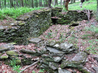
![]() On Saturday, June 4th I was committed to a hike sponsored by Morgan Outdoors to celebrate National Trails Day. The hike was scheduled to be a one way hike from Alder Lake to Big Pond which is about 3.5 miles. I decided that I would arrive, park at Big Pond and then hike to Alder Lake where I would wait for the others to arrive. The hike was not scheduled to start until 2:00 PM so I knew I would have plenty of time if I arrived at Big Pond by noon. I planned to clear some of the nettles and briars from the path on the way to Alder Lake to make the hike back easier for those doing the one way version. I got some chores done in the morning and then got my gear and Sheila into the car a little after 11:30 AM. I headed out of town on Old Rt 17 and then turned north on the Beaverkill Road and headed toward Lew Beach. I drove through the hamlet of Lew Beach and continued on to Turnwood. As the Beaverkill Road made a turn to the right, I continued straight ahead on Barkaboom Road toward Big Pond. After less than a mile, I turned right into the upper parking area for Big Pond and parked my car next to several others that were already there. It was already in the 70's and the humidity was high as Sheila and I started out the trail toward Alder Lake. Although the trail has several ups and downs, it is sited so that it travels around the higher ridges in the area and sticks to the lower spots on the shoulders of those ridges. Just after the start of the hike, we began to ascend along a woods road where there were a few blowdowns that would have to be cleared on another day. We continued to walk uphill through a pine forest. The trail had been worked on the previous fall after years of neglect and was in good shape and well-marked. Some nettles and briars were starting to encroach on the trail and I beat them back with my walking poles which seemed pretty effective. There were a few large blowdowns that were easily avoided or easy to climb over. I did run across one small tree across the trail which as at waist height and I decided to try my new LT Wright Overland Machete. Although a machete is not really meant to chop wood, I thought I would give it a try. The blade is very sharp and I had no problem hacking through the trunk after which I removed it from the trail. At about a mile we began to descend on another woods road to an area that was once a small pond but is now mostly wetlands. Along the way I noted the many stonewalls and a few foundations in the area. At 1.75 miles we were at the small stream bed that connects two different wetland areas. In April the stream had enough water to produce small waterfalls but now it was completely dry! We crossed the stream and began to ascend to the shoulder of another ridge from the low wetlands. I continued to whack some nettles but wanted to make sure I was at Alder Lake on time. At 2.2 miles the trail turned right heading east toward Alder Lake. Shortly after that we began to descend for .6 miles to Alder Creek. On the descent we heard some hikers behind us and I was determined they would not pass us! There was some water in Alder Creek but much less than in April. We crossed Alder Creek Road just as a convoy of cars was turning onto the Alder Lake access road. We continued toward the lake on the access road and arrived at the parking area just after 1:30 AM.
On Saturday, June 4th I was committed to a hike sponsored by Morgan Outdoors to celebrate National Trails Day. The hike was scheduled to be a one way hike from Alder Lake to Big Pond which is about 3.5 miles. I decided that I would arrive, park at Big Pond and then hike to Alder Lake where I would wait for the others to arrive. The hike was not scheduled to start until 2:00 PM so I knew I would have plenty of time if I arrived at Big Pond by noon. I planned to clear some of the nettles and briars from the path on the way to Alder Lake to make the hike back easier for those doing the one way version. I got some chores done in the morning and then got my gear and Sheila into the car a little after 11:30 AM. I headed out of town on Old Rt 17 and then turned north on the Beaverkill Road and headed toward Lew Beach. I drove through the hamlet of Lew Beach and continued on to Turnwood. As the Beaverkill Road made a turn to the right, I continued straight ahead on Barkaboom Road toward Big Pond. After less than a mile, I turned right into the upper parking area for Big Pond and parked my car next to several others that were already there. It was already in the 70's and the humidity was high as Sheila and I started out the trail toward Alder Lake. Although the trail has several ups and downs, it is sited so that it travels around the higher ridges in the area and sticks to the lower spots on the shoulders of those ridges. Just after the start of the hike, we began to ascend along a woods road where there were a few blowdowns that would have to be cleared on another day. We continued to walk uphill through a pine forest. The trail had been worked on the previous fall after years of neglect and was in good shape and well-marked. Some nettles and briars were starting to encroach on the trail and I beat them back with my walking poles which seemed pretty effective. There were a few large blowdowns that were easily avoided or easy to climb over. I did run across one small tree across the trail which as at waist height and I decided to try my new LT Wright Overland Machete. Although a machete is not really meant to chop wood, I thought I would give it a try. The blade is very sharp and I had no problem hacking through the trunk after which I removed it from the trail. At about a mile we began to descend on another woods road to an area that was once a small pond but is now mostly wetlands. Along the way I noted the many stonewalls and a few foundations in the area. At 1.75 miles we were at the small stream bed that connects two different wetland areas. In April the stream had enough water to produce small waterfalls but now it was completely dry! We crossed the stream and began to ascend to the shoulder of another ridge from the low wetlands. I continued to whack some nettles but wanted to make sure I was at Alder Lake on time. At 2.2 miles the trail turned right heading east toward Alder Lake. Shortly after that we began to descend for .6 miles to Alder Creek. On the descent we heard some hikers behind us and I was determined they would not pass us! There was some water in Alder Creek but much less than in April. We crossed Alder Creek Road just as a convoy of cars was turning onto the Alder Lake access road. We continued toward the lake on the access road and arrived at the parking area just after 1:30 AM.
 I decided to hike down toward the lake to take some pictures. We hiked down to the "lawn" in front of the remains of the Coykendall Mansion and found the same pile of wood spoiling the view. The picnic tables were out but the grass was not mowed. Repeated pleas to the forester for Region 3 have gone unanswered. A bigger problem was the chain link fence surrounding two excavators working on the dam. The dam had always looked pretty sturdy and secure but something made the state decide to reconstruct or repair it! The water level in the lake was low and a large family was allowing their children to through rocks by the shore. I dropped my pack and got out the camera to take a few shots before heading back up to the parking area. I did see that there was still a path that led over the dam to allow hikers to complete the 1.5 mile hike around the lake and to access the campsites on the southern shore of the lake easily. In the parking lot, I sat on a rock and got a drink and gave Sheila one also. Sheila seemed very warm so I decided to walk down to the creek so she could cool off. We walked down the bank passing the spring on the way. Sheila went down to the creek but simply walked along the rocks and seemed reluctant to dive in. After a few moments, I called her back and we walked back to the parking area and continued to wait for the other hikers from the Morgan Outdoors group to show up. Cars began to pull in just before 2:00 PM. I walked over to greet the occupants and said hello to Rick Roberts and Bob Moses who had several other people with them. Rick is the president of the Catskill Mountain Club and the Finger Lakes Trail Conference trail supervisor for the Catskill region. He has been instrumental in moving the FLT off local roads by constructing new trails that are located on DEP land. Bob Moses maintains trails and is an avid hiker leading hikes for several different organizations. We talked for a while and when no other hikers appeared we began our hike to Big Pond. Rick had brought his two beagles, Scout and Teddy, and they were getting acquainted with Sheila. I kept Sheila on her leash until we crossed Alder Creek Road and the stream. I let her off the leash and she spent a few moments playing with the other dogs but seemed largely uninterested. She spent most of the rest of the hike close to me on the trail. At 4.6 miles we followed the trail as it turned left and began to descend to the wetlands area. We stopped at the dry stream bed at 5 miles to get a drink and a snack. After a short rest, we began to ascend the woods road. We stopped to take a closer look at the stone walls in the area and a foundation that I had not seen before. We continued to walk along the trail negotiating a few very muddy areas. Bob and I stopped to cut a branch that was blocking part of the trail using his Silky saw which made short work of the blowdown. We caught up to the others and continued along the trail passing through an area that had been devastated by gypsy moths and tent caterpillars many years ago. At 5.7 miles we followed the trail as it turned to head west toward Big Pond and started our descent. We walked through the pine forest and followed the woods road down toward the pond. We arrived at the parking area at 4:00 PM which was a perfect time for me. I had covered 6.7 miles in 3 hours and 15 minutes discounting the time I spent waiting for the other hikers. The total elevation gain was 1530 feet.
![]()
![]()
![]()
![]()
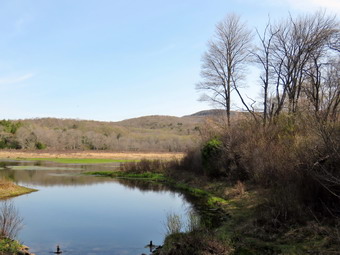
![]() On Wednesday, June 1st Sheila and I were ready to get out of the house after a busy Memorial Day weekend had kept us out of the woods. I got my gear in the car and tried to contain an ecstatic Sheila as I drove out the DeBruce Road toward Frick Pond. I had thought about going somewhere else but I wanted to try using the Avenza app on my iPhone to follow a map of the big loop around Frick and Hodge Ponds. I had created this map myself from a track I had from my GPS and it appeared in the app when I opened it up on my phone. I wanted to see if it would perform like other maps I had downloaded and allow me to follow my progress along the track as I hiked. After about 6 miles, I turned left on the Mongaup Pond and stayed left on Beech Mountain Road at the fork. There was one car in the parking area as I pulled in at just before 10:00 AM. I got my gear ready to go and headed out the Quick Lake Trail toward Frick Pond. The day was warm with the temperature at about 64 degrees and the bugs were out so I applied some insect repellant as a precaution. I wore a light pair of hiking pants and just a single layer long-sleeved shirt. We hiked out to the trail register and turned left to stay on the Quick Lake Trail as it follows a woods road. The trail was wet and muddy but these spots were easily avoided. We turned left at Gravestone Junction to follow the Quick Lake Trail to the bridge over the outlet of Frick Pond. I checked the Avenza app and it was working beautifully! As we made the turn at Gravestone Junction, we heard voices chime from the Logger's Loop to the right. I looked at saw a man and a woman hiking and the man had a small child in a backpack. When we crossed the bridge, I took a quick look at the view and decided it was not worth taking pictures since I have hundreds from this location. (The pictures posted here are from a previous trip in about the same conditions.) At the next junction with the Big Rock Trail, we stayed to the left on the Quick Lake Trail. We kept a quick pace as we hiked the Quick Lake Trail toward Iron Wheel Junction even though we had to work our way around several wet and muddy areas. We crossed the small stream in the forest Which is drier every time we hike the loop and as we continued I removed a few branches from the trail. There was one blowdown in the clearing just after the small stream and I knew I would have to return to remove it. At Iron Wheel Junction, we turned left to stay on the Quick Lake Trail toward Junkyard Junction. The walk is all uphill but the grade is only slight to moderate. This part of the trail was mostly dry but badly eroded by running water. We passed some of the blowdowns that I had cleared with various other people and it made me feel good to see the work. Sheila was ranging far and wide to explore the opportunities to chase small, furry creatures. At one point I looked up and saw a streak of dark brown or black move through the trees ahead of us. It was too small to be a bear so I suspected a weasel or fisher. I put Sheila on her leash and we moved passed the area without seeing any animals. After walking 3.1 miles, we arrived at Junkyard Junction at 11:15 AM.
On Wednesday, June 1st Sheila and I were ready to get out of the house after a busy Memorial Day weekend had kept us out of the woods. I got my gear in the car and tried to contain an ecstatic Sheila as I drove out the DeBruce Road toward Frick Pond. I had thought about going somewhere else but I wanted to try using the Avenza app on my iPhone to follow a map of the big loop around Frick and Hodge Ponds. I had created this map myself from a track I had from my GPS and it appeared in the app when I opened it up on my phone. I wanted to see if it would perform like other maps I had downloaded and allow me to follow my progress along the track as I hiked. After about 6 miles, I turned left on the Mongaup Pond and stayed left on Beech Mountain Road at the fork. There was one car in the parking area as I pulled in at just before 10:00 AM. I got my gear ready to go and headed out the Quick Lake Trail toward Frick Pond. The day was warm with the temperature at about 64 degrees and the bugs were out so I applied some insect repellant as a precaution. I wore a light pair of hiking pants and just a single layer long-sleeved shirt. We hiked out to the trail register and turned left to stay on the Quick Lake Trail as it follows a woods road. The trail was wet and muddy but these spots were easily avoided. We turned left at Gravestone Junction to follow the Quick Lake Trail to the bridge over the outlet of Frick Pond. I checked the Avenza app and it was working beautifully! As we made the turn at Gravestone Junction, we heard voices chime from the Logger's Loop to the right. I looked at saw a man and a woman hiking and the man had a small child in a backpack. When we crossed the bridge, I took a quick look at the view and decided it was not worth taking pictures since I have hundreds from this location. (The pictures posted here are from a previous trip in about the same conditions.) At the next junction with the Big Rock Trail, we stayed to the left on the Quick Lake Trail. We kept a quick pace as we hiked the Quick Lake Trail toward Iron Wheel Junction even though we had to work our way around several wet and muddy areas. We crossed the small stream in the forest Which is drier every time we hike the loop and as we continued I removed a few branches from the trail. There was one blowdown in the clearing just after the small stream and I knew I would have to return to remove it. At Iron Wheel Junction, we turned left to stay on the Quick Lake Trail toward Junkyard Junction. The walk is all uphill but the grade is only slight to moderate. This part of the trail was mostly dry but badly eroded by running water. We passed some of the blowdowns that I had cleared with various other people and it made me feel good to see the work. Sheila was ranging far and wide to explore the opportunities to chase small, furry creatures. At one point I looked up and saw a streak of dark brown or black move through the trees ahead of us. It was too small to be a bear so I suspected a weasel or fisher. I put Sheila on her leash and we moved passed the area without seeing any animals. After walking 3.1 miles, we arrived at Junkyard Junction at 11:15 AM.
 We turned right at the junction onto the Flynn Trail which is relatively flat at this point. The trail had some wet and muddy spots but most were drying up. They are all lower than the ground surrounding them so it is hard to get them to drain. There isn't much to see along the Flynn Trail so we kept up a quick pace. At the gate we followed the trail to the right and down toward the shore of Hodge Pond. As we neared the pond we turned right to stay on the Quick Lake Trail to the outlet of Hodge Pond. The woods road was rutted and had some water but the muddiest spots were easily avoided. We were soon at the outlet end of Hodge Pond. We turned right and headed toward the opening in the woods where the Flynn Trail follows another woods road. We started up the hill staying on the Flynn Trail and the walk up the hill seemed to go very quickly. Soon we were on the flat part of the Flynn Trail headed toward the junction with the Big Rock Trail. This section of the trail all the way back to the parking area was once an extension of Beech Mountain Road that was paved and led to the Beech Mountain Boy Scout Camp. In some areas the pavement is still visible under the grass and moss that has covered it. We continued on the Flynn Trail passing through the gate and walking on to the trail junction with the Big Rock Trail and the snowmobile trail that comes over from Mongaup Pond. We didn't stop at the trail junction but I quickly checked the cell phone app as we kept walking on the Flynn Trail. The app was functioning perfectly. Since the map is downloaded to true phone and the position is determined by GPS satellite, there is no need for a phone signal to use the phone to navigate. I did notice that the battery was draining more quickly than I had hoped. From this high point on in the hike, the trail descends 1.7 miles to the parking area. We kept up a fast pace on the descent but this final section seemed to drag a little. It is downhill but there isn't much to see and it is very familiar. We continued on the trail and soon were headed down the hill to the gate where we turned left to stay on then Flynn Trail. We walked down the short section of trail I had refurbished and then hiked through the woods back to the parking area. It was 12:25 PM when we returned. We had covered 6.3 miles in 2 hours and 20 minutes. The elevation gain was a modest 910 feet.
![]()
![]()
![]()
![]()
![]() On Saturday, May 28th I wanted to hike somewhere with Sheila and son-in-law Brad. I was still tired from 12 hours of track meet the day before and slept a little later than usual. There were thunderstorms predicted by 2:00 PM so I decided to again go to Frick Pond since it was near and would probably less populated on the busy weekend. I thought we might hike the Flynn Trail to the Hodge Pond Lookout and then hike back using the Flynn Trail and Quick Lake trails since I was looking for a longer hike. Brad and I got our gear in the car and put an excited Sheila in the back seat as I drove out the DeBruce Road toward Frick Pond. After about 6 miles, I turned left on the Mongaup Pond and stayed left on Beech Mountain Road at the fork. There a few cars in the parking area as I pulled in at just after 10:00 AM. As I was getting my gear ready to go, a mountain biker stopped to ask about the trails. I directed him up the Flynn Trail and over the snowmobile trail to Mongaup Pond where he was staying. We crossed the road and headed out on the Flynn Trail toward Hodge Pond. Once we hit the wide woods road that is the Flynn Trail, we noticed that the grass has pretty ugh and very wet with dew. The temperature was already in the 70's and I was glad I had worm a single layer and light, summer hiking pants. Brad and I walked and talked as we hiked up the long hill toward the junction with the Big Rock Trail at 1.7 miles into the hike. The sun was out and there were white, puffy clouds in the sky and there was no indication of any impending rain. It only took us 40 minutes to reach the first trail junction where we continued straight ahead on the Flynn Trail. After walking the relatively for a long time part of the trail through the gate, we arrived at the pout where the Flynn Trail bears left down to Hodge Pond. We turned right on a woods road to hike toward the lookout over the pond. The woods road we were walking on was once Beech Mountain Road leading to the Beech Mountain Boy Scout Camp. After a short walk, a trail turned off to the left to go down to the pond. We continued straight ahead and then passed the left turn toward the area of the camp. We started up the road that leads to the lookout. The grade became steeper as we climbed the hill and at about 2.6 miles the road made a sharp turn to the right. We stopped so that I could take some pictures from a small viewpoint and then continued on the road. As the road made another sharp turn, this time to the left, we turned right into the woods on another woods road. The trail to the lookout is relatively flat and at 2.8 miles we arrived at the flat Rick that allows a view of the pond. I was supplied to see that there actually was a good view down to Hodge Pond since the last time I had visited the view was blocked. I took some shots including one of Brad and Sheila. We got a drink and then started hiking again.
On Saturday, May 28th I wanted to hike somewhere with Sheila and son-in-law Brad. I was still tired from 12 hours of track meet the day before and slept a little later than usual. There were thunderstorms predicted by 2:00 PM so I decided to again go to Frick Pond since it was near and would probably less populated on the busy weekend. I thought we might hike the Flynn Trail to the Hodge Pond Lookout and then hike back using the Flynn Trail and Quick Lake trails since I was looking for a longer hike. Brad and I got our gear in the car and put an excited Sheila in the back seat as I drove out the DeBruce Road toward Frick Pond. After about 6 miles, I turned left on the Mongaup Pond and stayed left on Beech Mountain Road at the fork. There a few cars in the parking area as I pulled in at just after 10:00 AM. As I was getting my gear ready to go, a mountain biker stopped to ask about the trails. I directed him up the Flynn Trail and over the snowmobile trail to Mongaup Pond where he was staying. We crossed the road and headed out on the Flynn Trail toward Hodge Pond. Once we hit the wide woods road that is the Flynn Trail, we noticed that the grass has pretty ugh and very wet with dew. The temperature was already in the 70's and I was glad I had worm a single layer and light, summer hiking pants. Brad and I walked and talked as we hiked up the long hill toward the junction with the Big Rock Trail at 1.7 miles into the hike. The sun was out and there were white, puffy clouds in the sky and there was no indication of any impending rain. It only took us 40 minutes to reach the first trail junction where we continued straight ahead on the Flynn Trail. After walking the relatively for a long time part of the trail through the gate, we arrived at the pout where the Flynn Trail bears left down to Hodge Pond. We turned right on a woods road to hike toward the lookout over the pond. The woods road we were walking on was once Beech Mountain Road leading to the Beech Mountain Boy Scout Camp. After a short walk, a trail turned off to the left to go down to the pond. We continued straight ahead and then passed the left turn toward the area of the camp. We started up the road that leads to the lookout. The grade became steeper as we climbed the hill and at about 2.6 miles the road made a sharp turn to the right. We stopped so that I could take some pictures from a small viewpoint and then continued on the road. As the road made another sharp turn, this time to the left, we turned right into the woods on another woods road. The trail to the lookout is relatively flat and at 2.8 miles we arrived at the flat Rick that allows a view of the pond. I was supplied to see that there actually was a good view down to Hodge Pond since the last time I had visited the view was blocked. I took some shots including one of Brad and Sheila. We got a drink and then started hiking again.
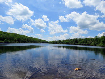 We turned right and continued the hike by following the woods road as it circled Flynn's Point on Beech Mountain. This higher spot to our left is the highest point in Sullivan County at 3118 feet. We continued to circle Beech Mountain until we got back to the road where we turned left and walked back down the hill to the turn down to Hodge Pond. We turned right at 4 miles and walked down toward the pond and as we neared the shore we turned right on the jeep road that goes around the upper end of the pond. When we came to an opening on the left, we walked won to the shore so I could take some pictures. Sheila jumped into the water but did not swim after the two ducks that were already there! I got out my camera and took pictures of the ducks, Sheila and the pond. The trees were very green and the water very blue and all was peaceful. The sky was a beautiful blue with puffy white clouds. After I took a few pictures we returned to the trail and continued hiking around the pond. At the next trail junction, we turned right to again hike up the blue-blazed Flynn Trail. It had gotten much warmer and I was beginning to feel the effects of the heat and humidity. We hiked up the hill and pass through the gate where the Flynn Trail turns to the left. This part of the trail is flat and often muddy. On this day there were a few soft spots but we saw almost no water or deep mud. At 5 miles we arrived at Junkyard Junction where the Flynn Trail ends. We turned left on the red blazed Quick Lake Trail to start back toward the parking area. Our hike back to the car would be mostly downhill which I thought was a good thing. Having someone to talk to on a hike does make the time pass more quickly especially on a trail which is so familiar and does not have exciting lookouts. At 6.6 miles we were at Iron Wheel Junction which is marked by...a set of iron wagon wheels. The Yellow blazed Logger's Loop continues straight ahead so we turned right to stay on the Quick Lake Trail. We did find a few muddy spots along this trail as we hiked towed Frick Pond. The small stream just before the "spruce tunnel" had much less water than the last time I had visited. Sheila found a way to swim for a minute before we continued toward the pond. We passed the junction with the yellow blazed Big Rock Trail on the left and arrived at the bridge across the outlet of Frick Pond at 7.5 miles. We stopped a moment and I took a few pictures of the pond which looked much like all the others that I have taken from this location. I reshouldered my pack and we walked up the hill to Gravestone Junction where we continued straight ahead toward the parking lot. We met two hikers coming toward us and I put Sheila on her leash. The walk to the parking area seemed quick as we continued to follow the Quick Lake Trail passed the register. When we arrived back at the parking area the smaller lot was full and there were several cars in the larger lot. It was 1:40 Pm and we had hiked 8.1 miles in 3 hours and 25 minutes. Along the way we had gained 1330 feet.
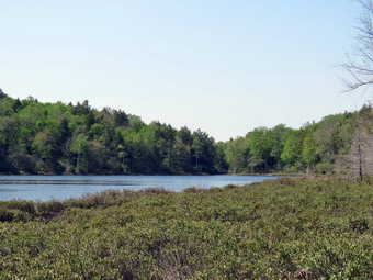
![]()
![]()
![]()
![]()
![]() On Wednesday, May 25th I wanted to get in a hike close to home before track practice in the afternoon but I wanted a longer hike than then two previous days. Since I had been at Trout Pond and Frick Pond recently, I decided to go to Long Pond and create a hike I had never done before. My intention was to hike a figure 8 loop to extend the mileage and take in some spots I had not visited in some time. I wanted to walk as fast as I could and only take a few pictures along the way. I got Sheila in the car with my gear and headed out DeBruce Road for about 8 miles to Flugertown Road where I made a left. I parked in the lot a short distance up the road on the right. It was 10:30 AM and the temperature was already in the 70's. I decided not to wear a jacket and was glad I had worn a lighter top and summer weight pants. We started our hike at 10:30 AM by walking over the bridge and up the hill. The first .6 miles gains about 350 feet to the highest point on the hike. It isn't very steep but does act as a nice warm-up! The trail was not very wet but there were a few muddy spots that we walked around. At 1.1 miles we were at the spur trail that leads down to the shore of Long Pond. We turned right and walked down to the shore of the pond where I sternly warned Sheila to "Stay"! I walked down to the shore to take some pictures. The pond is not very picturesque but I too a few shots anyway. What was remarkable was the variety of sounds around the pond. I could easily distinguish the song of the red wing blackbirds and the chirping of the bullfrogs. I took a picture of a blackbird in a tree but could not see the wings. Later inspection of the pictures showed a red and yellow patch on the wind. My eye caught some movement in the pond along the shore. I couldn't see what it was but I zoomed in a took a few shots. When I got home, I was surprise to see a large bullfrog sitting on a rock with his throat fully expanded! I turned to my pack and we headed out to the main trail where we turned right to continue our hike. At the first trail junction at 1.3 miles, we turned left to hike out to the rod as part of the figure 8 I had planned.
On Wednesday, May 25th I wanted to get in a hike close to home before track practice in the afternoon but I wanted a longer hike than then two previous days. Since I had been at Trout Pond and Frick Pond recently, I decided to go to Long Pond and create a hike I had never done before. My intention was to hike a figure 8 loop to extend the mileage and take in some spots I had not visited in some time. I wanted to walk as fast as I could and only take a few pictures along the way. I got Sheila in the car with my gear and headed out DeBruce Road for about 8 miles to Flugertown Road where I made a left. I parked in the lot a short distance up the road on the right. It was 10:30 AM and the temperature was already in the 70's. I decided not to wear a jacket and was glad I had worn a lighter top and summer weight pants. We started our hike at 10:30 AM by walking over the bridge and up the hill. The first .6 miles gains about 350 feet to the highest point on the hike. It isn't very steep but does act as a nice warm-up! The trail was not very wet but there were a few muddy spots that we walked around. At 1.1 miles we were at the spur trail that leads down to the shore of Long Pond. We turned right and walked down to the shore of the pond where I sternly warned Sheila to "Stay"! I walked down to the shore to take some pictures. The pond is not very picturesque but I too a few shots anyway. What was remarkable was the variety of sounds around the pond. I could easily distinguish the song of the red wing blackbirds and the chirping of the bullfrogs. I took a picture of a blackbird in a tree but could not see the wings. Later inspection of the pictures showed a red and yellow patch on the wind. My eye caught some movement in the pond along the shore. I couldn't see what it was but I zoomed in a took a few shots. When I got home, I was surprise to see a large bullfrog sitting on a rock with his throat fully expanded! I turned to my pack and we headed out to the main trail where we turned right to continue our hike. At the first trail junction at 1.3 miles, we turned left to hike out to the rod as part of the figure 8 I had planned.
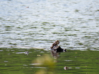 This part of the trail is relatively flat and there were some large muddy areas along the way. At 1.6 miles the trail began to descend to cross a long bridge across the stream. I decided to leave the photography for later and paused briefly to allow Sheila to get a drink and swim. We continued on the trail crossing another ridge and arriving at Flugertown Road at 2.0 miles. We turned right and began to hike toward Basily Road. Along the way there were two campsites set up and I out Sheila on her leash as we passed. We continued along the road as it went from pavement to dirt. We gained a little elevation along the road until we broke out of the woods near the Peter's Hunting Camp. We stopped for a moment and I took a few pictures of the valley before continuing on the road. When we arrived at the private bridge, the gate was closed but I had permission to cross so we did and walked along the edge of the tilled ground at the camp toward the beaver pond. The beavers had been at work and the road was more of a stream. Sheila had no problem walking through the water and I managed to stay dry by using the small footbridge. We stopped so that I could take a few pictures of the road and the beaver pond. The break didn't last long as we continued on the road to finish the upper loop. The road continued to gain elevation and at 3.6 miles we stayed to the right as Basily Road headed left to Wild Meadow Road. Shortly after this we turned right into the woods on the snowmobile and hiking trail. This part of the trail is pretty flat which means that standing water causes some muddy areas. All of the mud was easily avoided and at 4.6 miles we passed the spur trail on the left to the lean-to.
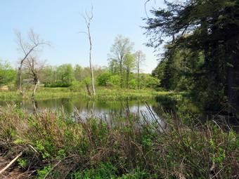 We continued on the main trail passing areas where we had to avoid some mud. At 5.0 miles we were back at the first trail junction where we had started the figure 8 earlier. We turned right and again followed the trail toward Flugertown Road. This time when we arrived at the bridges, I took some pictures and allowed Sheila to have a longer swim. I got a drink and then we continued out to the road where we turned left to head back to the car. Along the way several cars from the campsites passed us. A little further along a pickup truck came towed us and stopped. I recognized a custodian from the highs cool who had retired several years before I did. We talked about the time we spent together at the school and what had transpired Since. He is the caretaker for the Peter's Hunting Camp and I asked him about hiking across their land. He assured me as others have that it is permissible to hike as long as hikers stay on the trail. We parted ways but I kept Sheila on her leash as we walked the flat and hard packed road. Soon we were on the well paved road and were heading back to the car. As we turned left into the parking area, we found a group of young people standing in the parking lot talking. There was no sign of their transportation but they had hiking and camping gear. We had hiked 7.2 miles in 2 hours and 50 minutes with an elevation gain of 760 feet. This indicates a pretty flat hike!
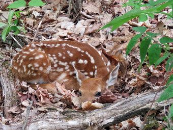
![]()
![]()
![]()
![]()
![]() On Tuesday, May 24th I agree to hike somewhere local with Lisa. She suggested Mary Smith Hill from Berry Brook Road. I wouldn't normally hike this short of a hike but I had been out the previous day and planned to hike the next day so I agreed. I was also happy to have the company as Sheila is so often roaming off the trail following game trails. I picked Lisa up at her house on the Beaverkill Road at around 9:00 AM and drove to the Covered Bridge Road. The Beaverkill Covered Bridge is being renovated so I turned left on Craigie Claire Road and crossed on the iron bridge. I made a right on Berry Brook Road and drove passed the Covered Bridge Road. After about more 3.7 miles I pulled into the parking area on the right side of the road. It was 9:25 AM as we got right on the trail. I had worn a light pair of hiking pants and a single layer under a light windbreaker as the temperatures were forecast to reach into the high 70's. The bugs were already out so I applied some spray to keep them at bay. The first .6 miles of the trail are pretty steep gaining a little over 500 feet. The surface has some loose rock and on this day that was covered by a layer of slippery leaves. As we climbed we could look back over our shoulders for a view which was partially obscured by the new leaves on the trees. At around .3 miles we heard a bleating noise and I looked back to see that Sheila had found a fawn lying in the leaves by the trail. I called Sheila and she reluctantly came. I think she wanted to play with the fawn! The fawn lay motionless as I took some pictures from the side and then went around to the front and took a few more. I also used this opportunity to get a drink and shed my windbreaker. We continued to climb the hill where some of the grades are over 20%. After climbing to the top of the first, unnamed hill we descended a little before starting up Mary Smith Hill. At .9 miles the trail makes a sharp right turn swinging from ENE to SE and then ascends Mary Smith Hill. Along the way Lisa noticed some interesting rock formations. We also walked through several areas where we had to pass between or climb over large rocks.
On Tuesday, May 24th I agree to hike somewhere local with Lisa. She suggested Mary Smith Hill from Berry Brook Road. I wouldn't normally hike this short of a hike but I had been out the previous day and planned to hike the next day so I agreed. I was also happy to have the company as Sheila is so often roaming off the trail following game trails. I picked Lisa up at her house on the Beaverkill Road at around 9:00 AM and drove to the Covered Bridge Road. The Beaverkill Covered Bridge is being renovated so I turned left on Craigie Claire Road and crossed on the iron bridge. I made a right on Berry Brook Road and drove passed the Covered Bridge Road. After about more 3.7 miles I pulled into the parking area on the right side of the road. It was 9:25 AM as we got right on the trail. I had worn a light pair of hiking pants and a single layer under a light windbreaker as the temperatures were forecast to reach into the high 70's. The bugs were already out so I applied some spray to keep them at bay. The first .6 miles of the trail are pretty steep gaining a little over 500 feet. The surface has some loose rock and on this day that was covered by a layer of slippery leaves. As we climbed we could look back over our shoulders for a view which was partially obscured by the new leaves on the trees. At around .3 miles we heard a bleating noise and I looked back to see that Sheila had found a fawn lying in the leaves by the trail. I called Sheila and she reluctantly came. I think she wanted to play with the fawn! The fawn lay motionless as I took some pictures from the side and then went around to the front and took a few more. I also used this opportunity to get a drink and shed my windbreaker. We continued to climb the hill where some of the grades are over 20%. After climbing to the top of the first, unnamed hill we descended a little before starting up Mary Smith Hill. At .9 miles the trail makes a sharp right turn swinging from ENE to SE and then ascends Mary Smith Hill. Along the way Lisa noticed some interesting rock formations. We also walked through several areas where we had to pass between or climb over large rocks.
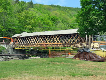 Just before the top of Mary Smith Hill we stopped at a lookout which has a limited view to the south. I climbed down to get a better view but like many lookouts in the Catskills this one is slowly being blocked as trees grow up. I took pictures although there was a bit of haze. At this point I was fresh enough to continue but we decided to start back which was Ok with me as I had a lot of work to accomplish. I had initially though about hiking to Mary Smith Hill Road but the climb had been tiring and the pull of work at home helped make my decision. The trip back seemed to go quickly although we stopped several times to take pictures of interesting rocks and trees. We were also careful on some of the descents as the dry soil and loose rock covered by leaves was challenging. We noticed that the fawn we had seen mealier was gone. We were back at the parking area by 11:20 AM having hiked 2.4 miles in 1 hour and 55 minutes with a 675 foot vertical gain. When we arrived back in the parking area we noticed a front end loader and a pile of railroad ties across the road on state land. There was no indication of their planned use. On the way back we stopped to see the renovations on the Beaverkill Covered Bridge. The siding has been stripped off the bridge and work is being done to reinforce the roadway. The approach on the Beaverkill side has been redesigned to be more gentle. The complete date is mi-fall of 2016.
![]()
![]()
![]()
![]()
![]() On Monday, May 23rd Sheila and I were ready to get out of the house after a week of track and family commitments had kept us out of the woods. I got my gear in the car and tried to contain an ecstatic Sheila as I drove out the DeBruce Road toward Frick Pond. After about 6 miles, I turned left on the Mongaup Pond and stayed left on Beech Mountain Road at the fork. There were no cars in the parking area as I pulled in at just before 8:00 AM. I got my gear ready to go and headed out the Quick Lake Trail toward Frick Pond. The day was warm and the bugs were out so I applied some insect repellant as a precaution. I wore a light pair of hiking pants and a light windbreaker over a single layer. We hiked out to the trail register and turned left to stay on the Quick Lake Trail as it follows a woods road. The trail was wet and muddy but these spots were easily avoided. We turned left at Gravestone Junction to follow the Quick Lake Trail to the bridge over the outlet of Frick Pond. When we crossed the bridge, I took a quick look at the view and decided it was not worth taking pictures since I have hundreds from this location. At the next junction with the Big Rock Trail, we stayed to the left on the Quick Lake Trail. We kept a quick pace as we hiked the Quick Lake Trail toward Iron Wheel Junction even though we had to work our way around several wet and muddy areas. We crossed the small stream in the forest and as we continued I removed a few branches from the trail. There was one blowdown in the clearing just after the small stream and I knew I would have to return to remove it. At Iron Wheel Junction, we turned left to stay on the Quick Lake Trail toward Junkyard Junction. The walk is all uphill but the grade is only slight to moderate. This part of the trail was mostly dry but badly eroded by running water. We passed some of the blowdowns that I had cleared with various other people and it made me feel good to see the work.After walking 3.1 miles, we arrived at Junkyard Junction at 9:15 AM.
On Monday, May 23rd Sheila and I were ready to get out of the house after a week of track and family commitments had kept us out of the woods. I got my gear in the car and tried to contain an ecstatic Sheila as I drove out the DeBruce Road toward Frick Pond. After about 6 miles, I turned left on the Mongaup Pond and stayed left on Beech Mountain Road at the fork. There were no cars in the parking area as I pulled in at just before 8:00 AM. I got my gear ready to go and headed out the Quick Lake Trail toward Frick Pond. The day was warm and the bugs were out so I applied some insect repellant as a precaution. I wore a light pair of hiking pants and a light windbreaker over a single layer. We hiked out to the trail register and turned left to stay on the Quick Lake Trail as it follows a woods road. The trail was wet and muddy but these spots were easily avoided. We turned left at Gravestone Junction to follow the Quick Lake Trail to the bridge over the outlet of Frick Pond. When we crossed the bridge, I took a quick look at the view and decided it was not worth taking pictures since I have hundreds from this location. At the next junction with the Big Rock Trail, we stayed to the left on the Quick Lake Trail. We kept a quick pace as we hiked the Quick Lake Trail toward Iron Wheel Junction even though we had to work our way around several wet and muddy areas. We crossed the small stream in the forest and as we continued I removed a few branches from the trail. There was one blowdown in the clearing just after the small stream and I knew I would have to return to remove it. At Iron Wheel Junction, we turned left to stay on the Quick Lake Trail toward Junkyard Junction. The walk is all uphill but the grade is only slight to moderate. This part of the trail was mostly dry but badly eroded by running water. We passed some of the blowdowns that I had cleared with various other people and it made me feel good to see the work.After walking 3.1 miles, we arrived at Junkyard Junction at 9:15 AM.
We turned right at the junction onto the Flynn Trail which is relatively flat at this point. The trail had MANY wet and muddy spots but they are all lower than the ground surrounding them so it is hard to get them to drain. The trail was drier than the last time we had hiked it. There isn't much to see along the Flynn Trail so we kept up a quick pace. At the gate we followed the trail to the right and down toward the shore of Hodge Pond. As we neared the pond we turned right to stay on the Quick Lake Trail to the outlet of Hodge Pond. The woods road was rutted and had some water but the muddiest spots were easily avoided. We were soon at the outlet end of Hodge Pond. We turned right and headed toward the opening in the woods where the Flynn Trail follows another woods road. We started up the hill staying on the Flynn Trail and the walk up the hill seemed to go very quickly. Soon we were on the flat part of the Flynn Trail headed toward the junction with the Big Rock Trail. This section of the trail all the way back to the parking area was once an extension of Beech Mountain Road that was paved and led to the Beech Mountain Boy Scout Camp. In some areas the pavement is still visible under the grass and moss that has covered it. We continued on the Flynn Trail passing through the gate and walking on to the trail junction with the Big Rock Trail and the snowmobile trail that comes over from Mongaup Pond. We didn't stop at the trail junction but kept walking on the Flynn Trail. From this high point on the hike, the trail descends 1.7 miles to the parking area. We kept up a fast pace on the descent but this final section seemed to drag a little. It is downhill but there isn't much to see and it is very familiar. We continued on the trail and soon were headed down the hill to the gate where we turned left to stay on then Flynn Trail. A dog from the cabin approached us but soon last interest. I dislike dog owners who will not or cannot control their pets! We walked down the short section of trail I had refurbished and then hiked through the woods back to the parking area. It was 10:30 AM when we returned. We had covered 6.4 miles in 2 hours and 30 minutes. The elevation gain was a modest 910 feet.
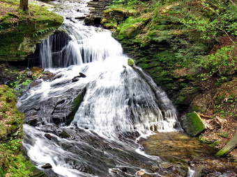
![]()
![]()
![]()
![]()
![]() On Tuesday, May 17th I knew that I had to get in a hike despite having to leave for a track meet in the afternoon. I decided to head to Trout Pond and hike the big loop in a counterclockwise direction. I was more interested in the exercise and just getting out than taking pictures or seeing something new. Sheila was happy as usual as I got dressed and put my gear in the car. The temperature was still cool and hanging right around 50 degrees. I knew it would get warmer so I wore a single layer with my Mammut hood and my MH Winter Wander pants. I headed north on Route 17 and the took Route 206 from Roscoe toward Downsville. Just after entering Delaware County, I turned left on Morton Hill Roadand rove to the intersection with Russell Brook Road, I turned around and parked on the side of the road to avoid parking in the large open space which is marked as private property. The temperature had already risen when I parked at 9:25 AM and immediately started the hike. Sheila was ready to go as always and as we started down the road. As we walked down the road, the stream was making a lot of noise so I expected the falls to have a good volume. Sheila disappeared for a moment and I realized there was a pickup truck parked at the upper designated campsite and that Sheila was "investigating" the campsite! I called her back and we continued our hike. As we passed the lookout over the falls, I decided to take a few pictures although I had not planned to stop. I took a few shots and then experimented with the shutter speed to get the soft quality of the water flowing over the rocks. Back on the road, We headed down to the lower parking area and found no cars in the lot. We walked down to the main trail and then across the bridge over Russell Brook. The knotweed that we had trimmed back was completely dead and shriveled. We walked to the register box and headed up to Trout Pond.
On Tuesday, May 17th I knew that I had to get in a hike despite having to leave for a track meet in the afternoon. I decided to head to Trout Pond and hike the big loop in a counterclockwise direction. I was more interested in the exercise and just getting out than taking pictures or seeing something new. Sheila was happy as usual as I got dressed and put my gear in the car. The temperature was still cool and hanging right around 50 degrees. I knew it would get warmer so I wore a single layer with my Mammut hood and my MH Winter Wander pants. I headed north on Route 17 and the took Route 206 from Roscoe toward Downsville. Just after entering Delaware County, I turned left on Morton Hill Roadand rove to the intersection with Russell Brook Road, I turned around and parked on the side of the road to avoid parking in the large open space which is marked as private property. The temperature had already risen when I parked at 9:25 AM and immediately started the hike. Sheila was ready to go as always and as we started down the road. As we walked down the road, the stream was making a lot of noise so I expected the falls to have a good volume. Sheila disappeared for a moment and I realized there was a pickup truck parked at the upper designated campsite and that Sheila was "investigating" the campsite! I called her back and we continued our hike. As we passed the lookout over the falls, I decided to take a few pictures although I had not planned to stop. I took a few shots and then experimented with the shutter speed to get the soft quality of the water flowing over the rocks. Back on the road, We headed down to the lower parking area and found no cars in the lot. We walked down to the main trail and then across the bridge over Russell Brook. The knotweed that we had trimmed back was completely dead and shriveled. We walked to the register box and headed up to Trout Pond.
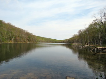 The trail still had some running water in places but it was mostly dry under foot. The sky was still overcast but the sun was peaking through adhere were a few blue spots and just a slight breeze. At the pond, I took off my pack and got out the camera. The water level seemed a little higher but there was still no water running over the outlet of the dam. I took a few pictures of the pond but the sky was not the best for photography. I decide to throw a stick into the pond so that Sheila could swim to retrieve it. Sheila seemed to be excited so I threw the stick and she jumped in but after a few moments she jumped right out! I tried it again with a larger stick and she did the same thing. She started running around like crazy as she often does when she is excited or cold! I concluded she had decided it was a little to cold for swimming! I packed up and we continued up the trail toward the head end of the pond. The lean-tos were not occupied and the view from the inlet end of the lake was less than ordinary. We continued our walk on the main trail and started the ascent up the shoulder of Cherry Ridge. As we started to climb Cherry Ridge one of the blowdowns I had found last time had been cut and removed from the trail making me think someone had done some trail maintenance. Along the way were several large blowdowns which we could not clear without an axe and saw. There were a few branches down which I picked up and moved to the side of the trail. Since I have begun to do trail maintenance, I always think how much easier it would be if everyone who hiked would just pick up a branch here and there. We made a slight turn to the south and began to climb some more. Sheila was roaming the brush near the trail and seemed to always be on a scent trail. We hit the high point on the hike and started down the other side. There was quite a bit of water on the trail both standing and running making the conditions muddy. I continued to find blowdowns and branches on the trail. After a short ascent to the "forest of numerous small trees", we walked down to the woods road and snowmobile trail and turned left to complete our loop. The descent to the trail junction was wet in many spots. As we walked down the will the skies continued to grow darker and the wind came up. By the time we were half way down it was raining very lightly and I hoped it would not get any harder. We passed the large campsite on the left at the bottom of the hill and walked back to the trail junction where we turned right to walk back to the lower parking area. I decided not to visit the lower falls due to the hour and the rain. There was one car in the lot and the occupants were looking at the maps at the trail kiosk. I offered my assistance but they assured me they were "OK". We walked up the road back to our car. At the upper campsite an older man was in the pickup and he asked us where we had hiked. I recognized him from a hike last year at about the same time! We arrived at 11:40 AM. We had hiked 5.5 miles in 2 hours and 15 minutes gaining 1110 feet.
![]()
![]()
![]()
![]()
![]() On Thursday, May 12th Sheila and I were ready to get out of the house after TWO WEEKS of heavy rain and track commitments had kept us out of the woods. I got my gear in the car and tried to contain an ecstatic Sheila as I drove out the DeBruce Road toward Frick Pond. After about 6 miles, I turned left on the Mongaup Pond and stayed left on Beech Mountain Road at the fork. There were no cars in the parking area as I pulled in at just before 9:00 AM. I got my gear ready to go and headed out the Quick Lake Trail toward Frick Pond. The day was warm and the bugs were out so I applied some insect repellant as a precaution. I wore a light pair of hiking pants and a light windbreaker over a single layer. We hiked out to the trail register and turned left to stay on the Quick Lake Trail as it follows a woods road. The trail was very wet and muddy but these spots were easily avoided. We turned left at Gravestone Junction to follow the Quick Lake Trail to the bridge over the outlet of Frick Pond. When we crossed the bridge, I took a quick look at the view and decided to take a few shots even though I have hundreds from this location. At the next junction with the Big Rock Trail, we stayed to the left on the Quick Lake Trail. We kept a quick pace as we hiked the Quick Lake Trail toward Iron Wheel Junction even though we had to work our way around several wet and muddy areas. We crossed the small stream in the forest and as we continued I removed a few branches from the trail. At Iron Wheel Junction, we turned left to stay on the Quick Lake Trail toward Junkyard Junction. The walk is all uphill but the grade is only slight to moderate. This part of the trail was also wet but it drains better than the flat areas lower down. We passed some of the blowdowns that I had cleared with various other people and it made me feel good to see the work. At one point we did find a small tree across the trail and I made note that it would require a return trip with an axe and saw. After walking 3.1 miles, we arrived at Junkyard Junction at 10:05 AM.
On Thursday, May 12th Sheila and I were ready to get out of the house after TWO WEEKS of heavy rain and track commitments had kept us out of the woods. I got my gear in the car and tried to contain an ecstatic Sheila as I drove out the DeBruce Road toward Frick Pond. After about 6 miles, I turned left on the Mongaup Pond and stayed left on Beech Mountain Road at the fork. There were no cars in the parking area as I pulled in at just before 9:00 AM. I got my gear ready to go and headed out the Quick Lake Trail toward Frick Pond. The day was warm and the bugs were out so I applied some insect repellant as a precaution. I wore a light pair of hiking pants and a light windbreaker over a single layer. We hiked out to the trail register and turned left to stay on the Quick Lake Trail as it follows a woods road. The trail was very wet and muddy but these spots were easily avoided. We turned left at Gravestone Junction to follow the Quick Lake Trail to the bridge over the outlet of Frick Pond. When we crossed the bridge, I took a quick look at the view and decided to take a few shots even though I have hundreds from this location. At the next junction with the Big Rock Trail, we stayed to the left on the Quick Lake Trail. We kept a quick pace as we hiked the Quick Lake Trail toward Iron Wheel Junction even though we had to work our way around several wet and muddy areas. We crossed the small stream in the forest and as we continued I removed a few branches from the trail. At Iron Wheel Junction, we turned left to stay on the Quick Lake Trail toward Junkyard Junction. The walk is all uphill but the grade is only slight to moderate. This part of the trail was also wet but it drains better than the flat areas lower down. We passed some of the blowdowns that I had cleared with various other people and it made me feel good to see the work. At one point we did find a small tree across the trail and I made note that it would require a return trip with an axe and saw. After walking 3.1 miles, we arrived at Junkyard Junction at 10:05 AM.
We turned right at the junction onto the Flynn Trail which is relatively flat at this point. The trail had MANY wet and muddy spots but they are all lower than the ground surrounding them so it is hard to get them to drain. There isn't much to see along the Flynn Trail so we kept up a quick pace. At the gate we followed the trail to the right and down toward the shore of Hodge Pond. As we neared the pond we turned right to stay on the Quick Lake Trail to the outlet of Hodge Pond. The woods road was rutted and had some water but the muddiest spots were easily avoided. We were soon at the outlet end of Hodge Pond. I decided to go to the shore of the pond and take a few pictures. Sheila immediately went into the water so I decided to throw a stick and let her get in a good swim. I threw the stick, she swam to retrieve it and I took pictures for several minutes. We turned around and headed toward the opening in the woods where the Flynn Trail follows another woods road. We started up the hill staying on the Flynn Trail and the walk up the hill seemed to go very quickly. Soon we were on the flat part of the Flynn Trail headed toward the junction with the Big Rock Trail. This section of the trail all the way back to the parking area was once an extension of Beech Mountain Road that was paved and led to the Beech Mountain Boy Scout Camp. In some areas the pavement is still visible under the grass and moss that has covered it. We continued on the Flynn Trail passing through the gate and walking on to the trail junction with the Big Rock Trail and the snowmobile trail that comes over from Mongaup Pond. We didn't stop at the trail junction but kept walking on the Flynn Trail. From this high point on the hike, the trail descends 1.7 miles to the parking area. We kept up a fast pace on the descent but this final section seemed to drag a little. It is downhill but there isn't much to see and it is very familiar. We continued on the trail and soon were headed down the hill to the gate where we turned left to stay on then Flynn Trail. We walked down the short section of trail I had refurbished and then hiked through the woods back to the parking area. It was 11:30 AM when we returned. We had covered 6.4 miles in 2 hours and 35 minutes. The elevation gain was a modest 910 feet.
![]()
![]()
![]()
![]()
![]() On Friday, April 29th I had not planned to hike since the forecast called for rain on and off all day. By 10:00 AM no rain had fallen and the forecast showed it holding off until 3:00 PM. I decided to get out and do a quick hike and chose Frick and Hodge Ponds as my destination. I had not hiked UP the Flynn Trail to Hodge Pond in some time and made that my intended route. Sheila was eager to get going as I put my gear in the trunk and opened the backdoor for her. The temperature was in the low 50's but there was a slight breeze and a bite to the air. I wore my MH Winter Wander pants and my Mammut hoody over a single layer top. BY the time I drove out the DeBruce Road and up the Mongaup Road to the trailhead, it was already 11:40 AM. There was one other car in the parking area as we crossed the road and started up the Flynn Trail. The sky was overcast and the air felt damp but despite this I warmed up quickly and was soon opening the zippers on my hoody. I kept a quick pace with Sheila riving out ahead kicking up a few birds as we hiked. By 12:20 PM we had hiked 1.7 miles to the junction with the Big Rock Trail. We continued straight ahead staying on the Flynn Trail heading toward Hodge Pond. We passed through the gate and were soon at the next trail junction where we stayed to the left to stay on the Flynn Trail to Hodge Pond. As we approached the pond, I looked at the scene and decided it was the kind of dreary that does not photograph well and continued passed the shores of the pond without stopping. To this point the trail had been relatively dry but as we continued on the west side of Hodge Pond the Flynn Trail began to be muddy. As we walked along the western shore, we turned left to stay on the Flynn Trail and began a slight up hill to the gate where the trail turns to the left.
On Friday, April 29th I had not planned to hike since the forecast called for rain on and off all day. By 10:00 AM no rain had fallen and the forecast showed it holding off until 3:00 PM. I decided to get out and do a quick hike and chose Frick and Hodge Ponds as my destination. I had not hiked UP the Flynn Trail to Hodge Pond in some time and made that my intended route. Sheila was eager to get going as I put my gear in the trunk and opened the backdoor for her. The temperature was in the low 50's but there was a slight breeze and a bite to the air. I wore my MH Winter Wander pants and my Mammut hoody over a single layer top. BY the time I drove out the DeBruce Road and up the Mongaup Road to the trailhead, it was already 11:40 AM. There was one other car in the parking area as we crossed the road and started up the Flynn Trail. The sky was overcast and the air felt damp but despite this I warmed up quickly and was soon opening the zippers on my hoody. I kept a quick pace with Sheila riving out ahead kicking up a few birds as we hiked. By 12:20 PM we had hiked 1.7 miles to the junction with the Big Rock Trail. We continued straight ahead staying on the Flynn Trail heading toward Hodge Pond. We passed through the gate and were soon at the next trail junction where we stayed to the left to stay on the Flynn Trail to Hodge Pond. As we approached the pond, I looked at the scene and decided it was the kind of dreary that does not photograph well and continued passed the shores of the pond without stopping. To this point the trail had been relatively dry but as we continued on the west side of Hodge Pond the Flynn Trail began to be muddy. As we walked along the western shore, we turned left to stay on the Flynn Trail and began a slight up hill to the gate where the trail turns to the left.
This part of the Flynn Trail is pretty flat and the trail is often the lowest point which allows water to collect with nowhere to go. The rain earlier in the week had made the trail wet and I had to walk around several wet and muddy areas. I noticed that Sheila simply walked through them! We arrived at Junkyard Junction at 12:50 PM about 3.25 miles into the hike. From here the rest of the hike is primarily downhill with a few small hills along the way. We turned left on the red Quick Lake Trail and found it was also wet and muddy in spots. Some section of the trail are washed out leaving a lot of rocks behind and making the downhill hiking not as much fun as it could be. There wasn't much to see so we hiked quickly passing the junction with the snowmobile trail. We arrived at Iron Wheel Junction at 1:25 PM after hiking 4.8 miles. We turned right to stay on the Quick Lake Trail since the yellow Logger's Loop continued straight ahead. The trail continued to be muddy but we made good time as we crossed the little stream in the woods and continued toward Frick Pond. We passed the junction with the Big Rock Trail that goes around the north end of Frick Pond and walked to the bridge across the outlet of the pond. I decided not to stop but to keep walking as I had felt a few drops of rain. We continued back on the Quick Lake Trail to the trail register. Along the way I was pleased to see that the ditching that we had done during our trail maintenance work was draining much of the water off the trail. At the trail register we turned right and continued on the Quick Lake Trail back to the car. The lot was empty when we arrived at 2:00 PM. We had hiked 6.3 miles in 2 hours and 15 minutes with only 4 minutes of stopped time and an elevation gain of 910 feet.
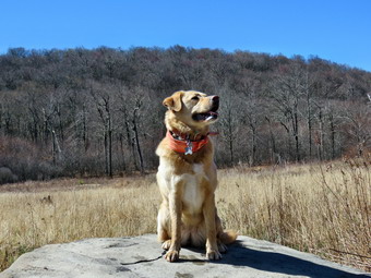
![]()
![]()
![]()
![]()
![]() On Wednesday, April 27th, I had planned to do a hike with a friend somewhere close to home. We both had tight schedules for the day as we decided to go to Alder Lake and hike to the Beaver Meadow Lean-to. I picked her up at her house at about 9:00 AM and we headed toward Turnwood and Alder Creek Road. I parked in the Alder Lake parking area at (:20 AM and we started our hike almost immediately. There was a large van parked in the lot and the register indicated four hikers from New York City had signed in. The temperature was in the mid 40's with a slight breeze but the sun was shining brightly. I had decided to go back to my MH Winter Wander pants and the baselayer and Icebreaker light wool top I had worn lost of the winter. We headed down to the left of the "lawn" toward the trail around the left side of the lake. The pile of logs that had adorned the lawn was still present despite my pleas to the Region 3 forester to have them removed. I am not sure what crew placed them there but they ruin the view and prevent adequate maintenance of the lawn which is a shame for such a beautiful and well-used space. There was also a construction trailer setup by the remains of the Coykendall mansion. It seems a contractor has been hired to work on the dam and spillway. I noticed that there was also a roll of chain link fence near the spillway and I could only guess how this may be employed! I took a few pictures of Alder Lake with the sun sparkling off the water before picking up my pack and heading out on the trail. We kept up a good pace stopping once so that I could take a picture of some interesting algae blooms in the water near the first bridge. Sheila was happy to be out and was running around investigating the various campsites along the way. The trail was pretty dry with only a few muddy spots along the way. We crossed the bridges and at about .8 miles and turned left to head toward the lean-to on the Millbrook Ridge Trail. The trail had several blowdowns along the way but some had been cut rasher recently with a chainsaw while others were untouched. There did not see a pattern as to why some were cleared and others left uncut. As we walked, we could here Alder Creek to the right of us and see the sun sparkling off the water. I stopped at the first beaver meadow to take a few pictures while my friend decided not to wait and walked on ahead. After taking a few shots, I got back on the main trail and caught up as she had stopped at a small beaver pond on the right side of the trail. We walked into the woods to investigate and found a dam that did not seem to have any new sticks added to it. There was also the beginnings of a lodge which had not been completed. I took a few pictures and then we walked back to the main trail. For the next 1.5 miles the trail climbs and then levels off several times. The elevation gain is several hundred feet but the grade is never more than 12% and averages around 6%. At some point my hiking companion decide we were going too slow and went ahead of me and started to pull away. This continued for the rest of the hike to the lean-to and I decided I would hike at my own pace and enjoy the walk. I was sorry she did not want to hike with me as I very frequently hike alone and would have liked to have a conversation! There isn't too much to see along the way but this day was very pleasant. I enjoyed the sounds and sights of Alder Creek as it flows parallel to the trail much of the way. At one point there was a large blowdown across the trail which would have been easy to clear with a chainsaw but nothing had been touched. I ducked under some large branches and squeezed through an opening. The trail in this area was very wet and I had to find ways to avoid the mud. Soon I arrived at the lean-to to and I dropped my pack to walk down the path to the beaver meadow with my camera.
On Wednesday, April 27th, I had planned to do a hike with a friend somewhere close to home. We both had tight schedules for the day as we decided to go to Alder Lake and hike to the Beaver Meadow Lean-to. I picked her up at her house at about 9:00 AM and we headed toward Turnwood and Alder Creek Road. I parked in the Alder Lake parking area at (:20 AM and we started our hike almost immediately. There was a large van parked in the lot and the register indicated four hikers from New York City had signed in. The temperature was in the mid 40's with a slight breeze but the sun was shining brightly. I had decided to go back to my MH Winter Wander pants and the baselayer and Icebreaker light wool top I had worn lost of the winter. We headed down to the left of the "lawn" toward the trail around the left side of the lake. The pile of logs that had adorned the lawn was still present despite my pleas to the Region 3 forester to have them removed. I am not sure what crew placed them there but they ruin the view and prevent adequate maintenance of the lawn which is a shame for such a beautiful and well-used space. There was also a construction trailer setup by the remains of the Coykendall mansion. It seems a contractor has been hired to work on the dam and spillway. I noticed that there was also a roll of chain link fence near the spillway and I could only guess how this may be employed! I took a few pictures of Alder Lake with the sun sparkling off the water before picking up my pack and heading out on the trail. We kept up a good pace stopping once so that I could take a picture of some interesting algae blooms in the water near the first bridge. Sheila was happy to be out and was running around investigating the various campsites along the way. The trail was pretty dry with only a few muddy spots along the way. We crossed the bridges and at about .8 miles and turned left to head toward the lean-to on the Millbrook Ridge Trail. The trail had several blowdowns along the way but some had been cut rasher recently with a chainsaw while others were untouched. There did not see a pattern as to why some were cleared and others left uncut. As we walked, we could here Alder Creek to the right of us and see the sun sparkling off the water. I stopped at the first beaver meadow to take a few pictures while my friend decided not to wait and walked on ahead. After taking a few shots, I got back on the main trail and caught up as she had stopped at a small beaver pond on the right side of the trail. We walked into the woods to investigate and found a dam that did not seem to have any new sticks added to it. There was also the beginnings of a lodge which had not been completed. I took a few pictures and then we walked back to the main trail. For the next 1.5 miles the trail climbs and then levels off several times. The elevation gain is several hundred feet but the grade is never more than 12% and averages around 6%. At some point my hiking companion decide we were going too slow and went ahead of me and started to pull away. This continued for the rest of the hike to the lean-to and I decided I would hike at my own pace and enjoy the walk. I was sorry she did not want to hike with me as I very frequently hike alone and would have liked to have a conversation! There isn't too much to see along the way but this day was very pleasant. I enjoyed the sounds and sights of Alder Creek as it flows parallel to the trail much of the way. At one point there was a large blowdown across the trail which would have been easy to clear with a chainsaw but nothing had been touched. I ducked under some large branches and squeezed through an opening. The trail in this area was very wet and I had to find ways to avoid the mud. Soon I arrived at the lean-to to and I dropped my pack to walk down the path to the beaver meadow with my camera.
 It had taken about an hour an 15 minutes to get to the beaver meadow. I walked out to the edge of the beaver meadow and took pictures of the blue sky which had no clouds to add contrast. I looked for some wildlife but everything was quiet. My friend decided to sit on a rock and eat a snack while I returned to my pack at the lean-to to get mine. I got a drink and ate a bar and waited while she relaxed and took some pictures. Eventually we were ready to leave and walked back to the main trail taking a few minutes to visit the spring which was running nicely. We walked together for a while and then I headed down the bank to Alder Creek to take a few pictures while my friend walked ahead. I eventually caught up with her and we walked together along the trail following the yellow blazes. At one point I noticed that the blazes took us on a detour around the large tree that blocked the trail. The detour was clear on the way back but had been poorly marked on the way out. We continued along the trail to the loop trail around the lake. We turned left to visit he bridge over Alder Creek and I took a few shots of the bridge and the creek before we turned around to retrace our steps back to the parking area. I decided to walk down to the shore of the lake to take a few pictures and when I returned my friend was nowhere to be seen. Sheila and I continued on the trail and I soon spotted some hikers up ahead. I spotted some pink and assumed my friend was hiking with them. When I caught up to the three hikers, I found one was wearing something pink but my friend was not with them. I put Sheila on her leash and they moved to one side of the trail so that we could pass. They had larger packs and camping gear and we said a "Hello" as I passed by. When we got back to the lawn, I dropped my pack and took some pictures of the pile of logs and the chain link fence. We walked over to the dam and I took some more pictures of the lake and of Cradle Rock Ridge on the east side of Alder Lake. I also took some pictures of the spillway and the creek below the dam. The brush and some trees along the creek had been cleared to make it more open but the brush and trees were left piled near the dam in an unsightly pile. As I walked back to my pack I could see my friend approaching and we waited for her. We walked back to the parking area to find the other three hikers ready to leave and two other vehicles parked in the lot. We were back at 12:10 PM having covered 4.8 miles in 2 hours and 45 minutes total time. The total elevation gain was just under 700 feet.
![]()
![]()
![]()
![]()
![]() On Monday, April 25th I wanted to hike a little longer and a little farther away from home since I did not have track practice in the afternoon. Cindy wanted to go so I was looking for a relatively flat area which would have some appeal for both of us. I proposed heading to the Appalachian Trail in New Jersey just south of Pine Island, NY. I had ended a section at the Walkill National Wildlife Refuge and I thought Cindy might like this area. My plan was to hike from where I had left off to the northwest along the NY-NJ border for about 4 miles and then hike back. We could stop of the wildlife refuge after the hike. We left Livingston Manor just before 9:00 AM and headed down State Route 17 toward Middletown. Sheila was remarkably animated despite the fact we had hike the day before. I headed west on I84 and took exit 3E to get on County Rt 12. We continued to follow the back roads to Oil City Road and at this point I recognized the area. We found a parking area just before the road crossed Walkill River and decided to park there to begin the hike. We got out of the car to get ready and Sheila began to explore along a fence with some tall grass. When I called her back to the car, I found a tick and brushed it off immediately. After a second look, I found at least a dozen more and promptly got rid of them. Cindy and I talked it over and decided we would not be comfortable hiking with so many ticks around. I don't know whether this was just a bad spot or a bad day but we decided to leave. We headed to Warwick to the Craft Beer Cellar where I made a couple of purchases and then headed out to State Route 17 to start home. In the car we discussed hiking options. We felt the Basha Kill area might have the same problem with ticks. There was a massive forest fire at Sam's Point and Minnewaska State Park was closed. I came up with the idea of hiking the loop at the Neversink Unique area from the Wolf Lake parking area to get a different perspective. I had hiked out that way but had never hiked in. We agreed on the plan and crossed our fingers that the tick problem would not be as bad! I took the Rock Hill exit and drove down Katrina Falls Road until I saw the Dead End sign. I turned left on Wolf Lake Road and after a short distance found the access road to the parking area. There was a nice parking area near the road but I decided I wanted to drive through the gate to the parking area further up the hill. The gravel road was washed out in several places and the ride was bumpy but we arrived at the parking area at 11:35 AM. Most of the area was occupied by a huge pile of gravel which I hoped would be used on the road. I parked and we were on the trail by 11:40 AM.
On Monday, April 25th I wanted to hike a little longer and a little farther away from home since I did not have track practice in the afternoon. Cindy wanted to go so I was looking for a relatively flat area which would have some appeal for both of us. I proposed heading to the Appalachian Trail in New Jersey just south of Pine Island, NY. I had ended a section at the Walkill National Wildlife Refuge and I thought Cindy might like this area. My plan was to hike from where I had left off to the northwest along the NY-NJ border for about 4 miles and then hike back. We could stop of the wildlife refuge after the hike. We left Livingston Manor just before 9:00 AM and headed down State Route 17 toward Middletown. Sheila was remarkably animated despite the fact we had hike the day before. I headed west on I84 and took exit 3E to get on County Rt 12. We continued to follow the back roads to Oil City Road and at this point I recognized the area. We found a parking area just before the road crossed Walkill River and decided to park there to begin the hike. We got out of the car to get ready and Sheila began to explore along a fence with some tall grass. When I called her back to the car, I found a tick and brushed it off immediately. After a second look, I found at least a dozen more and promptly got rid of them. Cindy and I talked it over and decided we would not be comfortable hiking with so many ticks around. I don't know whether this was just a bad spot or a bad day but we decided to leave. We headed to Warwick to the Craft Beer Cellar where I made a couple of purchases and then headed out to State Route 17 to start home. In the car we discussed hiking options. We felt the Basha Kill area might have the same problem with ticks. There was a massive forest fire at Sam's Point and Minnewaska State Park was closed. I came up with the idea of hiking the loop at the Neversink Unique area from the Wolf Lake parking area to get a different perspective. I had hiked out that way but had never hiked in. We agreed on the plan and crossed our fingers that the tick problem would not be as bad! I took the Rock Hill exit and drove down Katrina Falls Road until I saw the Dead End sign. I turned left on Wolf Lake Road and after a short distance found the access road to the parking area. There was a nice parking area near the road but I decided I wanted to drive through the gate to the parking area further up the hill. The gravel road was washed out in several places and the ride was bumpy but we arrived at the parking area at 11:35 AM. Most of the area was occupied by a huge pile of gravel which I hoped would be used on the road. I parked and we were on the trail by 11:40 AM.
 The temperature was now almost 60 degrees so I left my Mammut hoody in the car and went without a jacket. I did have a light windbreaker in my pack if I needed it later. We walked behind the gravel pile and found the yellow blazed trail that leads to the main trail loop. Now that I have started to do trail maintenance, I notice trail conditions and the first thing I noticed was a large tree down across the beginning of the trail. We continued on the yellow trail finding a few more blowdowns and finding that the trail needed to be pruned to make hiking easier. The hike in on the side trail was only .6 miles and it was downhill. I kept wondering if we were going the right way since nothing looked familiar but soon we arrived at the red trail where we decided to turn left. We knew that we would have to walk uphill to the car at the end of the hike so it didn't much matter which way we turned. We walked along the trail finding a few blowdowns here and there and some muddy areas. At .7 miles we crossed the upper bridge over Mullet Brook and then followed the trail as it made a sharp right turn and headed downhill. We could hear the brook falling over the stony streambed as we hiked the trail. At 1.25 miles we came to the yellow blazed spur trail to Mullet Brook Falls and turned right to visit this attraction. The spur trail is less than .2 miles and we were soon at the base of the falls. I dropped my pack, got out the camera and walked carefully over the rocks at the base of the falls to get a good position directly in front of them. I took some pictures although the sky was a flat grey without a hint of blue or white clouds. I got Sheila to pose for a few shots and then headed back to Cindy who was enjoying a rest on a rock. I got a drink and a bar and then we headed back out to the main trail. We turned right and walked downhill to the junction where the red trail meets the blue trail at 1.6 miles. The blue trail stretches from the Katrina Falls parking area all the way south to High Falls where it ends. Future plans may included blazing this trail farther south along existing woods roads to reach the southern part of the Neversink Unique Area. We turned right on the blue trail and then almost immediately turned left on the yellow spur trail to Denton Falls.
 The trail was in pretty good shape and it looked as if some new markers had been added. As we reached the beginning of the steepest descent Cindy decided to wait on a rock while Sheila and I continued down to the river . The trail is about .3 miles long but over that length it loses 175 feet to the lowest point on the hike at the Neversink River. As we got to the river, I gave Sheila the command to stay with me as I took my pack off and got out my camera. The water was flowing nicely over the falls and a fisherman was standing in the river just above the falls. I worked my way down to the rocks just below the falls and started to take some pictures. I managed to get a few of the fisherman casting before returning to my pack. Sheila and I walked up the bank and headed up the trail. As we walked along, I allowed Sheila to run ahead to where Cindy was sitting. We headed back up the yellow trail to the blue trail where we turned left to continue around the loop. We came to the lower bridge across Mullet Brook and found it had deteriorated even more than the last time I had been on this hike. It is a shame that the bridge has gotten to this point and I hope the plans for its replacement will go forward. We continued to hike the blue trail and both of us commented that we were still descending! The trail was mostly dry as were the surrounding woods. At 2.9 miles we came to the trail junction where the blue trail bends to the left and the red trail begins. We turned right on the red trail knowing we were now headed back to the car but also knowing the trip would be all uphill! The trail took us south and then at about 3.4 miles turned to the east. At 3.8 miles we came to the trail junction with the yellow trail to the Wolf Lake parking area and our car. We had gained over 400 feet in .9 miles. The climb was never steep but it was continuous. We turned left on the yellow trail and continued to climb back toward the parking area. We gained another 140 feet over the half mile back to the car. We arrived at the parking area at 2:00 PM having hiked 4.3 miles in 2 hours and 20 minutes with about 15 minutes stopped for pictures. I honestly thought we had set a quicker pace but in any case we had great fun. When we got home, I found one tick on Sheila and was not sure whether is was from new Jersey or New York!
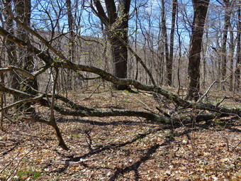
![]()
![]()
![]()
![]()
![]() On Sunday, April 24th I wanted to get in a local hike after church. I asked Cindy if she wanted to go do some trail work on the TouchMeNot Trail From Big Pond to Cabot Mountain and she agreed. I maintain the TouchMeNotTrail from Big Pond to Beech Hill Road for the Finger Lakes Trail Conference. We had worked on the section from Big Pond to the junction with the Campground Trail and on the section from Beech Hill to where the trail levels off on the Cabot Mountain plateau. The only section of the trail remaining was the middle section and I knew there were a few blowdowns to clear. We left Livingston Manor before 1:00 PM and headed up the Beaverkill Road with an excited Sheila in the back seat. Even though the temperature was using into the high 50's I chose to wear my Mammut hoody since it was lots of zippers to dump heat and extra pockets I could use for trail markers. We arrived in the parking area by Big Pond just before 1:15 PM and I was surprised that there were no other cars parked. Big Pond is a popular place but it no one wanted to visit on this day. I had my Fiskars axe which I carry when hiking longer distances since it is harp but light with a hollow handle. I also had brought my Silky curbed saw, a hammer, red trail markers and nails. We crossed the road and got on the red Touch-Me-Not Trail to hike over the hill toward Cabot Mt. The trail starts with a nice little ascent to get the heart pumping and then levels off some. I was surprised to find the trails quite dry and we set a very fast pace. There were no additional blowdowns and we admired the job we had done marking the trail. We are always careful to make the markers visible but not to place them too closely. Over the first mile we gained 770 feet to the shoulder of Touch-Me-Not Mountain where the trail starts a descent. We continued to the junction with blue Campground Trail where we kept to the right on the Touch-Me-Not Trail and continued our descent. Along the way we started to place a few trail markers here and there to replace ones that were on trees that had fallen or were faded or missing. Some areas were well-marked and others had no markers at all. We ran across several large trees across the trail but they were old and had been there for some time. We decided to leave them as they were easy to step over. We did remove one blowdown across the trail early on and removed some brush along the trail to widen it. Soon we came across the lowdown I had seen on the last hike that I knew had to be cleared. This was a rather larger mess that all but blocked the trail. I WA able to use the saw to cut it into manageable pieces and we removed it rather quickly. Further on there was a section of trail that had been rerouted to avoid some brush that was blocking the trail. I cut the brush and removed a few old and rotten logs. I placed them across the rerouted trail to block it and marked the original trail correctly. After about 1.6 miles we arrived at the junction with the yellow Little Pond Trail on the left.
On Sunday, April 24th I wanted to get in a local hike after church. I asked Cindy if she wanted to go do some trail work on the TouchMeNot Trail From Big Pond to Cabot Mountain and she agreed. I maintain the TouchMeNotTrail from Big Pond to Beech Hill Road for the Finger Lakes Trail Conference. We had worked on the section from Big Pond to the junction with the Campground Trail and on the section from Beech Hill to where the trail levels off on the Cabot Mountain plateau. The only section of the trail remaining was the middle section and I knew there were a few blowdowns to clear. We left Livingston Manor before 1:00 PM and headed up the Beaverkill Road with an excited Sheila in the back seat. Even though the temperature was using into the high 50's I chose to wear my Mammut hoody since it was lots of zippers to dump heat and extra pockets I could use for trail markers. We arrived in the parking area by Big Pond just before 1:15 PM and I was surprised that there were no other cars parked. Big Pond is a popular place but it no one wanted to visit on this day. I had my Fiskars axe which I carry when hiking longer distances since it is harp but light with a hollow handle. I also had brought my Silky curbed saw, a hammer, red trail markers and nails. We crossed the road and got on the red Touch-Me-Not Trail to hike over the hill toward Cabot Mt. The trail starts with a nice little ascent to get the heart pumping and then levels off some. I was surprised to find the trails quite dry and we set a very fast pace. There were no additional blowdowns and we admired the job we had done marking the trail. We are always careful to make the markers visible but not to place them too closely. Over the first mile we gained 770 feet to the shoulder of Touch-Me-Not Mountain where the trail starts a descent. We continued to the junction with blue Campground Trail where we kept to the right on the Touch-Me-Not Trail and continued our descent. Along the way we started to place a few trail markers here and there to replace ones that were on trees that had fallen or were faded or missing. Some areas were well-marked and others had no markers at all. We ran across several large trees across the trail but they were old and had been there for some time. We decided to leave them as they were easy to step over. We did remove one blowdown across the trail early on and removed some brush along the trail to widen it. Soon we came across the lowdown I had seen on the last hike that I knew had to be cleared. This was a rather larger mess that all but blocked the trail. I WA able to use the saw to cut it into manageable pieces and we removed it rather quickly. Further on there was a section of trail that had been rerouted to avoid some brush that was blocking the trail. I cut the brush and removed a few old and rotten logs. I placed them across the rerouted trail to block it and marked the original trail correctly. After about 1.6 miles we arrived at the junction with the yellow Little Pond Trail on the left.
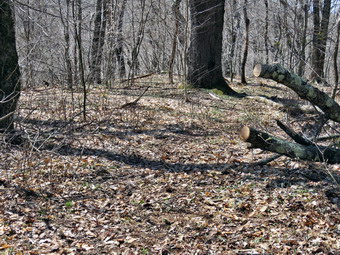 We continued straight ahead on the red trail toward Cabot Mountain. Sheila was all over the place looking for chipmunks, squirrels and, most of all, birds! We placed some markers along the trail and removed a few old logs that were on the trail. As the trail swung to the left, we placed a few more markers and I cut some brush. Just as we started up Cabot Mountain, we came to the last blowdown I intended to clear. It was a good sized log that lay across the trail and made negotiating the trail difficult. I decided to use the saw to make a cut on the end toward the top. This went better than I had expected as the wood was soft and the weight of the top helped finish the cut. I then moved closer to the end of the tree near the roots and found a place on the other side of the trail to make a cut. This time it took a little longer and I had to be careful not to hit any stones or dig into the dirt with the saw. The cut eventually went through the log and I was left with a rather large section to move off the trail. Fortunately, I was able to pivot the section and gravity helped me get it off the trail. It was now after 4:00 PM and we knew it was time to head back. We retraced our steps to the junction with the Little Pond Trail and decided to turn left and return on that trail by going to Little Pond and then following the campground access road and Barkaboom Road back to the car. This was slightly longer than staying on the Touch-Me-Not Trail but I had done it before and it was easier. There were a couple of trees across the trail but we did not have time to cut them. We were soon in the pone field on the Little Pond Trail that acts as a nice lookout over the valley below. I stopped to take a few pictures of the scenery and the old foundation before we continued down the trail. We turned off the woods and stayed on the trail that would take us down to Little Pond. Along the way we came to what is usually a beaver meadow but found it transformed back into a beaver pond. I stopped to take a few shots and then moved downstream to take a few pictures of the beaver dam. We did not see and freshly cut stick and there was no lodge in the small pound that had formed behind the dam. We continued down to the loop trail and turned left to start toward the gatehouse. We crossed a bridge and were immediately confronted by a very large blowdown of two trees across the road. I knew that the DEC staff could easily clear them with a chainsaw. We continued around Little Pond and stopped once so that I could take some pictures. As we neared the bathhouses, we saw two men I assumed were DEC workers which I thought was strange since it was Sunday. They were actually two fishermen seeing what they could catch even though the campgrounds were closed! I put Sheila on her leash and we walked out to the gatehouse and down the access road to Barkaboom Road. We turned left on Barkaboom Road and began the .6 mile uphill hike back to the car. We were back at about 5:15 PM having spent 4 hours hiking around 5.5 miles with a lot of time for trail maintenance and photography!
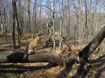
![]()
![]()
![]()
![]()
![]() On Wednesday, April 20th, I planned to hike with Lisa somewhere local to get some exercise but also to get back in time for me to set up for a home track meet. I deiced to ask her if she wanted to hike from Big Pond to Cabot Mountain and back. I texted her the night before and she agreed that I should pick her up at her house at 9:00 AM. The reason I chose the route was because it was short but had some elevation gain. I also wanted to check the section of trail from the top of Touch-Me-Not Mountain to Cabot Mountain for proper trail marker placement and to see how much maintenance work needed to be done. I maintain the trail from Big Pond to Beech Hill Road for the Finger Lakes Trail Conference and had placed new markers from Big Pond to the junction with the campground trail on one end and from Beech Hill Road to Cabot Mountain on the other end. I picked Lisa up at the appointed time with Sheba eagerly riding in the backseat and drove up the Beaverkill Road. The sun was bright and starred to increase the temperature from the mid 30's in the early morning to the 50's by the time we started the hike. At the junction with Barkaboom Road I turned left on Barkaboom Road and drove a short distance to the parking area by Big Pond. We parked at 9:10 Am and were ready to hike almost immediately. Because of the early cool weather, I decided to wear my MH Winter Wander pants but did not wear a baselayer. I wore my Mammut hoody over a single layer Mammut top but brought along a lighter windbreaker. We crossed the road and started up the trail stopping for Lisa to sign us into the trail register. We continued up the trail at a good pace and I pointed out the trail markers Cindy and I had placed. I also showed Lisa some of the blowdowns we had cleared. The trail starts rising right from the road and continues to gain elevation for just over one mile to the highest point on Tocuh-Me-Not Mountain gaining almost 800 feet along the way. As we climbed I also showed Lisa where I had cut back prickers and brush last year with the power scythe. Lisa and I talked about various trail projects we are working on as we made the ascent. Just passed the highest point we stopped at the large tree that has split three ways with one trunk crossing the trail and the other hanging over it precariously. I took some pictures and then we continued to the trail junction with the Campground Trail. We stayed to the right on the Touch-Me-Not Trail and I began to evaluate the trail markers and the need for trail maintenance. I had cut out this section of trail with hedge trimmers and loppers last year and it was still in good shape. We did find a few large trees down across the trail but it was easy to walk around or step over most of them. There was one tree with multiple branches across the trail and I decided I would return to get this with axe and saw on another day. We continued out descent to about 1.6 miles where the trail meets the Little Pond Loop Trail. Along the way we had lost about 300 feet as we passed through several different rock formations.
On Wednesday, April 20th, I planned to hike with Lisa somewhere local to get some exercise but also to get back in time for me to set up for a home track meet. I deiced to ask her if she wanted to hike from Big Pond to Cabot Mountain and back. I texted her the night before and she agreed that I should pick her up at her house at 9:00 AM. The reason I chose the route was because it was short but had some elevation gain. I also wanted to check the section of trail from the top of Touch-Me-Not Mountain to Cabot Mountain for proper trail marker placement and to see how much maintenance work needed to be done. I maintain the trail from Big Pond to Beech Hill Road for the Finger Lakes Trail Conference and had placed new markers from Big Pond to the junction with the campground trail on one end and from Beech Hill Road to Cabot Mountain on the other end. I picked Lisa up at the appointed time with Sheba eagerly riding in the backseat and drove up the Beaverkill Road. The sun was bright and starred to increase the temperature from the mid 30's in the early morning to the 50's by the time we started the hike. At the junction with Barkaboom Road I turned left on Barkaboom Road and drove a short distance to the parking area by Big Pond. We parked at 9:10 Am and were ready to hike almost immediately. Because of the early cool weather, I decided to wear my MH Winter Wander pants but did not wear a baselayer. I wore my Mammut hoody over a single layer Mammut top but brought along a lighter windbreaker. We crossed the road and started up the trail stopping for Lisa to sign us into the trail register. We continued up the trail at a good pace and I pointed out the trail markers Cindy and I had placed. I also showed Lisa some of the blowdowns we had cleared. The trail starts rising right from the road and continues to gain elevation for just over one mile to the highest point on Tocuh-Me-Not Mountain gaining almost 800 feet along the way. As we climbed I also showed Lisa where I had cut back prickers and brush last year with the power scythe. Lisa and I talked about various trail projects we are working on as we made the ascent. Just passed the highest point we stopped at the large tree that has split three ways with one trunk crossing the trail and the other hanging over it precariously. I took some pictures and then we continued to the trail junction with the Campground Trail. We stayed to the right on the Touch-Me-Not Trail and I began to evaluate the trail markers and the need for trail maintenance. I had cut out this section of trail with hedge trimmers and loppers last year and it was still in good shape. We did find a few large trees down across the trail but it was easy to walk around or step over most of them. There was one tree with multiple branches across the trail and I decided I would return to get this with axe and saw on another day. We continued out descent to about 1.6 miles where the trail meets the Little Pond Loop Trail. Along the way we had lost about 300 feet as we passed through several different rock formations.
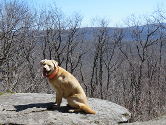 At the junction we continued straight ahead on the Touch-Me-Not Trail preparing for our climb up Cabot Mountain. So far the trail marking had been adequate with only a few new markers needed a few spots. We walked along a fairly flat section of trail toward Cabot Mountain clearing a few branches and small tree trunks along the way. At 1.8 miles the trail turned a little to the left and started the ascent up Cabot Mountain. There were a few blowdowns along the way but the nettles which are the bane of the trail section had still not sprouted. Because of this the trail was much easier to negotiate and we were soon climbing the steep section passed and through several different rock formations. I forgot that there are several parts to the climb and each is tricky in its own way. I took a few pictures on the way up. Over the next .4 miles the trail gains 470 feet of elevation at an average grade of 24%. Lisa and I were both happy when we climbed the last section to the flat plateau and walked to the Beaverkill Vista at 2.2 miles. We stopped here and I took my pack off and got out the camera. I took a few shots of Sheila on the viewpoint and then stepped out there to see what I could see. I always think the view from here will be great but I am usually disappointed! The sky was hazy and there were now puffy white loud for contrast. I took a few shots of Little Pond below and a few of the trees and the ledges. We had a quick drink and a snack before I packed up and we headed back on the trail. Descending Cabot Mountain wasn't as easy as it could be. There is a lot of loose dirt and rock on the steepest parts and this is covered in some slippery leaves. As we descended one section, we watched a pair of yellow-bellied sapsuckers chase each other around in what appeared to be a mating ritual. We hit the trail junction with the Little Pond Trail and continued up through the rocks heading toward Touch-Me-Not Mountain. We stopped where the trail passed between some rocks and I took a few shots with Sheila before we continued to the trail junction with the Campground Trail. We stayed on the main trail passing by the triple trunks before starting the decent to the car. The last mile seems to go very quickly as it is all downhill but at a grade that allowed us to keep a good pace. We arrived back at the car at 12:30 PM. I took a few minutes to walk over and take some pictures of Big Pond before returning to the car for the drive home. We had hiked 4.4 miles in 3 hours and 25 minutes with an elevation gain of 1635 feet.
![]() On Sunday, April 18th, I was committed to a trail maintenance trip to Frick Pond after church. We met at Morgan Outdoors in Livingston Manor for an initial introduction before heading off to the trails. Doug Senterman, NYNJTC Catskill Program Coordinator, was on hand to speak briefly about the trail conference and volunteer trail maintenance. All of the 378 miles of trails in the Catskills and many hundreds of miles of trail elsewhere in New York state are maintained by volunteers working for the trail conference that is responsible for a particular area. We headed out the Debruce Road a little after 1:30 PM and arrived just before 2:00 PM to start our work. The ten participants were divided into two groups. Doug and Lisa took one group out on the Quick Lake Trail to work on some drainage problems. I took three people with me to cut one tree that had blown down near the beginning of the Flynn Trail. It was a gorgeous day with temperatures in the high 60's when we started. We walked to the blowdown and decided we could cut it in one spot and then move it off the trail. I grabbed the saw and Glen and I made short work of the medium sized trunk. Lynn and I moved the tree off the trail and out of the way of hikers. Of course, I took pictures before and after our efforts to document our work. We returned to the car where I exchanged my Council Tools Velvicut felling axe for the smaller and lighter Fiskar's axe. We then walked out the Quick Lake trail at the back of the larger parking area. It wasn't long before we came to a slightly larger paper birch across the trail. I took my before pictures of the tree and the other workers and then we got to work. We decided to cut it in two places to make the removal easier. We cut the top on one side of the trail and then went to work on the thicker part of the trunk on the other side. T prevent the saw binding we used felling wedges but Lynn and Janice were a great help as they sat on the other end of the tree causing it to lift off the ground! I took my after pictures and we continued out to the trail register where we found the rest of the group hard at work. They were working to open up some trenches to allow the water to drain off the trail. The trenches become clogged with leaves and other debris which needs to be cleared at least twice a year. We talked for a few minutes and then moved on down the trail as we intended to walk the big loop to Hodge Pond to inspect the trail in that direction. We walked and we talked and soon came to the bridge over the outlet of Frick Pond. I gave the others a running commentary about the areas they had never visited before. I also took a few pictures of the pond before we continued on the trail. We passed the waterhole or mudpit just after the bridge and I hoped the other crew could get some work done on it before the end of the day. We continued on the Quick Lake Trail clearing a few loose branches as we went. Lynn and Glen had completed the Catskill 35's and were starting to work on the CMC all-Trails patch. They also let me know that they used this website often to plan hikes that they have done. This made me feel good!
On Sunday, April 18th, I was committed to a trail maintenance trip to Frick Pond after church. We met at Morgan Outdoors in Livingston Manor for an initial introduction before heading off to the trails. Doug Senterman, NYNJTC Catskill Program Coordinator, was on hand to speak briefly about the trail conference and volunteer trail maintenance. All of the 378 miles of trails in the Catskills and many hundreds of miles of trail elsewhere in New York state are maintained by volunteers working for the trail conference that is responsible for a particular area. We headed out the Debruce Road a little after 1:30 PM and arrived just before 2:00 PM to start our work. The ten participants were divided into two groups. Doug and Lisa took one group out on the Quick Lake Trail to work on some drainage problems. I took three people with me to cut one tree that had blown down near the beginning of the Flynn Trail. It was a gorgeous day with temperatures in the high 60's when we started. We walked to the blowdown and decided we could cut it in one spot and then move it off the trail. I grabbed the saw and Glen and I made short work of the medium sized trunk. Lynn and I moved the tree off the trail and out of the way of hikers. Of course, I took pictures before and after our efforts to document our work. We returned to the car where I exchanged my Council Tools Velvicut felling axe for the smaller and lighter Fiskar's axe. We then walked out the Quick Lake trail at the back of the larger parking area. It wasn't long before we came to a slightly larger paper birch across the trail. I took my before pictures of the tree and the other workers and then we got to work. We decided to cut it in two places to make the removal easier. We cut the top on one side of the trail and then went to work on the thicker part of the trunk on the other side. T prevent the saw binding we used felling wedges but Lynn and Janice were a great help as they sat on the other end of the tree causing it to lift off the ground! I took my after pictures and we continued out to the trail register where we found the rest of the group hard at work. They were working to open up some trenches to allow the water to drain off the trail. The trenches become clogged with leaves and other debris which needs to be cleared at least twice a year. We talked for a few minutes and then moved on down the trail as we intended to walk the big loop to Hodge Pond to inspect the trail in that direction. We walked and we talked and soon came to the bridge over the outlet of Frick Pond. I gave the others a running commentary about the areas they had never visited before. I also took a few pictures of the pond before we continued on the trail. We passed the waterhole or mudpit just after the bridge and I hoped the other crew could get some work done on it before the end of the day. We continued on the Quick Lake Trail clearing a few loose branches as we went. Lynn and Glen had completed the Catskill 35's and were starting to work on the CMC all-Trails patch. They also let me know that they used this website often to plan hikes that they have done. This made me feel good!
 We walked uphill toward Iron Wheel Junction noticing that it was really warm and sunny. We stopped to look at one large branch that was hung up and hanging over the trail but could not see a way to safely remove it. At Iron Wheel Junction Glen and Lynn were ready to continue on the big loop up the Quick Lake Trail to Hodge Pond. Janice and I decided to turn right on the Logger's Loop for a shorter hike and to investigate the condition of the trail. I was pretty sure we wouldn't find anything since I had been over the trail within the previous week. Splitting up allowed me to talk to Janice and the walk went quickly until we came to a small tree down across the trail that had not been there before. I made one cut and we moved it off the trail. As we continued we climbed the last small hill and then descended to Times Square. As we approached the trail junction we met a young couple and their two dogs coming down the Big Rock Trail from Hodge pond where they had been fishing. I was impressed that both dogs were on leashes and both were well-behaved. We said "Hello" and I helped direct them as they decided to go around the back of Frick Pond to get back to their car. I decided we should go the same way so that I could show Janice the wooden walkways around the back of the pond. We set off ahead of the other couple and they gave us some room which was very courteous. We continued our walk looking at some of the wet and muddy areas and trying to determine how they might be remediated. We walked over the bridges over two of the inlets and saw some trout swimming in the deeper pools. We walked across the walkways and I pointed some of the places where pilings needed to be replaced and decking needed to be nailed down. As we came to the end of the "spruce tunnel", we found a large tree across the trail. I decided to cut enough off so we could move one piece out of the way and leave the rest for another day. I used the axe to section the tree and had a little trouble since the wood was filled with pitch. I finished the cut and we moved the smaller piece out of the way. Janice then suggested that we might be able to roll and slide the other piece so that it was not in the trail. I was skeptical but we were able to roll it out of the way and block it so that it would not roll back onto the trail. As we finished the work, the couple with the dogs came walking by and I couldn't help but think that they would have been an asset in moving the blowdown. We continued on around the pond and met the other crew. They were doing a great job working on the mudpit by draining the water downhill toward the pond. We talked to them for a few minutes and then I proudly showed Doug the large cherry tree that Cindy and I had sectioned with axe and hand saw and moved off the bridge. Janice and I then walked back across the bridge and took the Quick Lake Trail back to the car. I was very pleased with the drainage work the other crew had done as it was already allowing the water to flow off the trail. It was about 4:30 PM when we got back to the parking area. Glen and Lynn had not come back but I knew they were experienced hikers and did not worry about them . I was upset that I found a crack in my windscreen that started at a stone bruise on the passenger's side! I was surprised that this incident did NOT negate all the good feelings about the great work we had done in only 2.5 hours!
![]()
![]()
![]()
![]()
![]() On Tuesday, April 14th, I wanted to go on a hike close to home. I decided to go to Frick Pond to hike a route and scout out some work for the trail maintenance session on Sunday, April 17th. I was ready to leave the house just after 8:30 AM and Sheila was more than happy to hike two days in a row. I drove out the DebRuce Road and the turned left on Mongaup Pond Road to get to the trailhead for Frick Pond. We arrived in the lot at 8:45 AM and got ready to hike and found no other cars in the lot. The temperature was in the high 30's but it was warming up fast and I was hoping the day would be as nice as the day before! I decided to walk out the Quick Lake Trail and headed out the back of the larger parking area. There was one larger tree across the trail before the register but it looked like it could be cleared with axe and saw. We turned left at the register on the woods road that leads to Frick Pond. The trail here was very wet with some standing and some running water. I decided that this could be remedied by clearing some of the existing channels of leaves and debris. Adding some extra channels would help divert the water from the trail. We stayed left at Gravestone Junction and walked down to the bridge over the outlet of Frick Pond. We stopped at the bridge so I could take a few pictures even though I have many from this location. On this day the sun was still not high enough to illuminate he whole pond so part was in darkness while the rest was in sunlight. We continued along the west side of the pond and found the low spot there filled with water. I made a note that the trail crew could open some drainage for this spot and add a few stepping stone to attack the problem two different ways. At the next trail junction with the Big Rock Trail we turned right on the Big Rock Trail to go to Times Square. There was a culvert that had worked its way almost above ground and I contemplated the various solutions to this problem. The wooden walkways were a little slippery and some boards needed to be nailed down. I took few pictures before continuing around the pond. There were some areas that were wet and muddy and could use some added drainage and a few stones. We stopped at Times Square to see what we thought could be done to alleviate the water problem there. The area was very wet band it was clear the water was running downhill from the Logger's Loop Weber there appeared to be several "springs" on the trail. We continued straight ahead on the Big Rock Trail UP the hill since I thought getting a little aerobic climbing in would be a good idea!
On Tuesday, April 14th, I wanted to go on a hike close to home. I decided to go to Frick Pond to hike a route and scout out some work for the trail maintenance session on Sunday, April 17th. I was ready to leave the house just after 8:30 AM and Sheila was more than happy to hike two days in a row. I drove out the DebRuce Road and the turned left on Mongaup Pond Road to get to the trailhead for Frick Pond. We arrived in the lot at 8:45 AM and got ready to hike and found no other cars in the lot. The temperature was in the high 30's but it was warming up fast and I was hoping the day would be as nice as the day before! I decided to walk out the Quick Lake Trail and headed out the back of the larger parking area. There was one larger tree across the trail before the register but it looked like it could be cleared with axe and saw. We turned left at the register on the woods road that leads to Frick Pond. The trail here was very wet with some standing and some running water. I decided that this could be remedied by clearing some of the existing channels of leaves and debris. Adding some extra channels would help divert the water from the trail. We stayed left at Gravestone Junction and walked down to the bridge over the outlet of Frick Pond. We stopped at the bridge so I could take a few pictures even though I have many from this location. On this day the sun was still not high enough to illuminate he whole pond so part was in darkness while the rest was in sunlight. We continued along the west side of the pond and found the low spot there filled with water. I made a note that the trail crew could open some drainage for this spot and add a few stepping stone to attack the problem two different ways. At the next trail junction with the Big Rock Trail we turned right on the Big Rock Trail to go to Times Square. There was a culvert that had worked its way almost above ground and I contemplated the various solutions to this problem. The wooden walkways were a little slippery and some boards needed to be nailed down. I took few pictures before continuing around the pond. There were some areas that were wet and muddy and could use some added drainage and a few stones. We stopped at Times Square to see what we thought could be done to alleviate the water problem there. The area was very wet band it was clear the water was running downhill from the Logger's Loop Weber there appeared to be several "springs" on the trail. We continued straight ahead on the Big Rock Trail UP the hill since I thought getting a little aerobic climbing in would be a good idea!
 From Times Square to the Flynn Trail junction the Big Rock Trail rises 625 feet in 1.1 miles. This doesn't sound like much but it always seems to be a little farther and a little longer than I remember. On this day it seemed I was actually prepared fro the trip and kept a pretty good pace as we ascended the hill stopping only to clear a few branches along the way. There were no major blowdowns on the Big Rock trail and by 10:05 AM we had walked 2.3 miles and were at the junction with the Flynn Trail. We turned right to head down the Flynn Trail to the car. This return trip always seems longer than the 1.7 miles that is posted which is the correct distance. The trail is pretty but has no views. I thought about stopping at the clearing but decided that decided not to do so. The clearing is interesting as much of it has a layer a sphagnum moss over bedrock. This moss is usually found in areas with a much deeper and richer subsoil. A small road curves up to the clearing but no one has been able to tell me why the area was cleared. Walking across the clearing and through the woods is interesting since there is a series of ledges that rims Mongaup Pond. There are numerous ways to negotiate these ledges and access the loop road at the state campgrounds. As we walked down the Flynn Trail, we passed many point were I had cleared blowdowns from the trail. There were not additional blowdowns until we made the left turn just before the gate to follow the trail through the woods. There was one tree trunk across the trail which could be removed by saw and axe. We continued on the Flynn Trail back down to the car finding there was now one other car parked in the bigger lot. We arrived in the parking area at 10:45 AM having covered 4.0 miles in 1 hour and 50 minutes with an elevation gain of 680 feet. On the way back home I decided to stop at Mongaup Falls so I turned left at the intersection and parked in the small area on the right side of the road. I took my pack but left the poles behind as we walked back to the road that does down to the outlet stream from Mongaup Pond. We crossed the small bridge and worked our way downstream parallel to the stream bed. I noticed that the small gorge was quite pretty but I also noticed that some visitors apparently considered that broken glass added something to the scene. Once we got to the falls I took off my pack and got out the camera. I took some pictures of the upper falls from the side of the stream and then worked my way down to the base of the falls on the narrow path beside them. There was still some snow in the shade and a very large ice flow that must have been gigantic during the winter! I took some more shots of the falls from slightly downstream and then worked my way down to the stream bed. I stood on a rock in the stream bed to take some still shots and a video of the falls from directly in front. After finishing my photography, I climbed out of the gorge and shouldered my pack for the short walk back to the car. I stooped for a few shots of the gorge from the bridge and then walked directly back to the car.
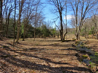
![]()
![]()
![]()
![]()
![]() On Wednesday, April 13th, I wanted to go for a hike on a beautiful day and got in contact with Lisa from Morgan Outdoors in Livingston Manor the night before. After debating some possible routes, we decided to hike from Alder lake to Big Pond and back. This trail had been a problem in the past but a group from the Catskill Mountain Club had worked on it last fall. We wanted to see the work they had done and make sure we could follow the blazes in both directions. I picked Lisa up at her house since it is on the way and we started toward Alder lake just a little after 9:00 AM. Sheila was happy to be hiking and greeted Lisa enthusiastically. I drove up the Beaverkill Road through Lew Beach and Turnwood. I turned left on Alder Creek Road and drove toward the entrance to Alder Lake. As we neared the end of Alder Creek Road, we watched for the blazes on the left side of the road where the trail crosses the road. We found them at the end of the road just before the entrance to the Cross Mountain Hunting Camp. I turned right and parked on the side of the road just outside the gate which was open. The road into Alder Lake looked a little soft and rough and this was the next best place to park. We got our gear out of the car and started our hike at 9:30 AM by walking down the road to where the trail entered the woods. The first obstacle was crossing Alder Creek which was a little high from the rain during the week. We walked upstream a little and found a narrow spot with some stones to step on. We crossed and started to hike along a broad woods road which was marked with red blazes. The sun was out although it was initially cool. The sun on the leaves left over from the fall and the warmth of the rays set a perfect tone. Over the next half mile we gained about 300 feet climbing to the shoulder of a ridge. The trail was easy to follow and we had a great time talking about various projects we had planned. We noticed that there were posted signs on either side of the state land. From the ridge we started to descend on the same woods road to a small stream. The descent was almost a mirror image of the ascent as we dropped about 300 feet in half a mile. As we approached the stream, the trail markers indicated a slight turn to the west off the woods road and across the stream. The woods had been very open but there was a very large open area just below the stream crossing. I took some pictures of the area and of the stream. I even took a short video of the water flowing over some mossy rocks but the image did not do the scene justice. I walked down the woods road to see where it went and quickly found posted signs so I returned to the stream crossing.
On Wednesday, April 13th, I wanted to go for a hike on a beautiful day and got in contact with Lisa from Morgan Outdoors in Livingston Manor the night before. After debating some possible routes, we decided to hike from Alder lake to Big Pond and back. This trail had been a problem in the past but a group from the Catskill Mountain Club had worked on it last fall. We wanted to see the work they had done and make sure we could follow the blazes in both directions. I picked Lisa up at her house since it is on the way and we started toward Alder lake just a little after 9:00 AM. Sheila was happy to be hiking and greeted Lisa enthusiastically. I drove up the Beaverkill Road through Lew Beach and Turnwood. I turned left on Alder Creek Road and drove toward the entrance to Alder Lake. As we neared the end of Alder Creek Road, we watched for the blazes on the left side of the road where the trail crosses the road. We found them at the end of the road just before the entrance to the Cross Mountain Hunting Camp. I turned right and parked on the side of the road just outside the gate which was open. The road into Alder Lake looked a little soft and rough and this was the next best place to park. We got our gear out of the car and started our hike at 9:30 AM by walking down the road to where the trail entered the woods. The first obstacle was crossing Alder Creek which was a little high from the rain during the week. We walked upstream a little and found a narrow spot with some stones to step on. We crossed and started to hike along a broad woods road which was marked with red blazes. The sun was out although it was initially cool. The sun on the leaves left over from the fall and the warmth of the rays set a perfect tone. Over the next half mile we gained about 300 feet climbing to the shoulder of a ridge. The trail was easy to follow and we had a great time talking about various projects we had planned. We noticed that there were posted signs on either side of the state land. From the ridge we started to descend on the same woods road to a small stream. The descent was almost a mirror image of the ascent as we dropped about 300 feet in half a mile. As we approached the stream, the trail markers indicated a slight turn to the west off the woods road and across the stream. The woods had been very open but there was a very large open area just below the stream crossing. I took some pictures of the area and of the stream. I even took a short video of the water flowing over some mossy rocks but the image did not do the scene justice. I walked down the woods road to see where it went and quickly found posted signs so I returned to the stream crossing.
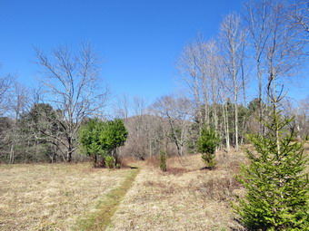 We crossed the stream and found that the trail began to follow another well-defined woods road. We also found that we were again climbing to the shoulder of another ridge. In another half a mile we regained 200 feet and at 1.8 miles the trail turned to the west heading directly toward Big Pond. Along the way we began to find some very large trees across the trail which we could navigate but which could be removed. At 2 miles we began a .75 mile descent losing over 400 feet as we headed toward Big Pond. Lisa and I had been debating which body of water was at a lower elevation and this answered our question! As we approached Big Pond, We passed through a nice stand of evergreen trees and the trail made a few turns. This was the area where it had been hard to find the trail but the work by the CMC crew solved the problem. As we approached the upper perking area at Big Pond, we noticed a stone retaining wall on the right side of the trail. The front of the wall was only 18 inches high but one side was about 3 feet and had a pipe coming out of it. We speculated about its origins but in the end it remained a mystery. We hiked out to the parking area and Lisa signed the register before we turned around to start back at 11:20 AM. The hike had taken a little longer than I planned so I wanted to get back as quickly as possible. We set a good pace on the way back stopping only occasionally for a picture or two. On the walk back we began to notice an extensive network of stone walls in the area which we had simply not seen on the way out. The walls were on both sides of the trail and, in some places, the trail crossed the walls. I have always been impressed by the work it took to collect the stones and the skill needed to turn them into stone walls that have stood for so many years! We were soon back at the initial stream crossing and the short walk back to the car. By the time we returned at 1:00 PM I was very warm as the temperature had risen into the low 50's and the sun's rays were more direct. It had been a beautiful day to hike and the out and back allowed us to see different aspects of the trail. We had hiked 5.9 miles in 3.5 hours with plenty of time for pictures and exploring.
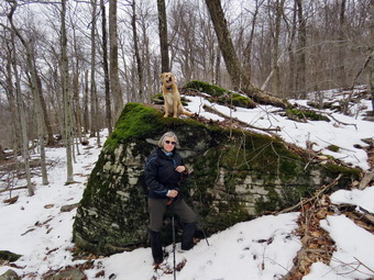
![]()
![]()
![]()
![]()
![]() On Saturday, April 9th, I attended a presentation entitled "Tick Talk" at Morgan Outdoors in Livingston Manor. The talk centered on Lyme disease and other tick bourne diseases and how to prevent them. The presenter from the Sullivan County health department did a great job. Afterwards I did a few errands and waited for the snow to fall. The snow did not seem to be coming ski I asked Cindy if she wanted to go to Cabot Mountain to place some trail markers and assess the trail conditions. She said "Yes" so we got our gear in the car along with Sheila and started for Lew Beach on the Beaverkill Road. Just outside of Lew Beach I turned left on Beach Hill Road and continued 2.6 miles to the trailhead for Cabot Mountain. I had decided not to wear base layer at all and when we got out of the car I thought I might regret the decision. The temperature was 35 degrees and a wind was blowing. There was some snow at the trailhead and the trail right from the beginning was wet. I made sure I had hammer, nails and red markers as well as my Silky saw. I knew that the trail was poorly marked in places but hoped I had enough markers to get the job done. We started out on the woods road at 1:25 PM. We immediately found one tree across the trail which made me wonder how many more there would be. The tree was large but I judged it could be removed with axe and saw. As we started through the woods the lower trail was very wet with standing water in some areas and running water in others. The water was pretty easy to avoid. We also found that the markers for the trail were either missing or so faded they were impossible to see. I knew from the beginning I would not have enough markers to finish the join and was annoyed. We worked our way up the trail removing useless markers when possible and replacing them. We placed a few new markers but tried to space them at optimal distance to conserve what we had. At .25 miles the trail began to climb and over the next .5 miles we gained 580 feet with the grade averaging 21%. We found one more tree down across the trail rather early on the slope and that was the last one. Some areas would need some lopping but the rest of the trail seemed to be in good shape. We ran out of markers as we approached the top of the steepest section and I knew I would have to return to complete the job. We stopped by a large rock and I took some picture of Cindy and Sheila. I also took a few pictures of the woods which showed several inches of snow!
On Saturday, April 9th, I attended a presentation entitled "Tick Talk" at Morgan Outdoors in Livingston Manor. The talk centered on Lyme disease and other tick bourne diseases and how to prevent them. The presenter from the Sullivan County health department did a great job. Afterwards I did a few errands and waited for the snow to fall. The snow did not seem to be coming ski I asked Cindy if she wanted to go to Cabot Mountain to place some trail markers and assess the trail conditions. She said "Yes" so we got our gear in the car along with Sheila and started for Lew Beach on the Beaverkill Road. Just outside of Lew Beach I turned left on Beach Hill Road and continued 2.6 miles to the trailhead for Cabot Mountain. I had decided not to wear base layer at all and when we got out of the car I thought I might regret the decision. The temperature was 35 degrees and a wind was blowing. There was some snow at the trailhead and the trail right from the beginning was wet. I made sure I had hammer, nails and red markers as well as my Silky saw. I knew that the trail was poorly marked in places but hoped I had enough markers to get the job done. We started out on the woods road at 1:25 PM. We immediately found one tree across the trail which made me wonder how many more there would be. The tree was large but I judged it could be removed with axe and saw. As we started through the woods the lower trail was very wet with standing water in some areas and running water in others. The water was pretty easy to avoid. We also found that the markers for the trail were either missing or so faded they were impossible to see. I knew from the beginning I would not have enough markers to finish the join and was annoyed. We worked our way up the trail removing useless markers when possible and replacing them. We placed a few new markers but tried to space them at optimal distance to conserve what we had. At .25 miles the trail began to climb and over the next .5 miles we gained 580 feet with the grade averaging 21%. We found one more tree down across the trail rather early on the slope and that was the last one. Some areas would need some lopping but the rest of the trail seemed to be in good shape. We ran out of markers as we approached the top of the steepest section and I knew I would have to return to complete the job. We stopped by a large rock and I took some picture of Cindy and Sheila. I also took a few pictures of the woods which showed several inches of snow!
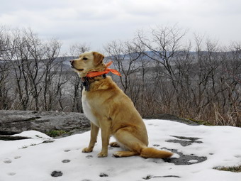 By the time we got to the top of the climb the trail turned from northeast to almost east. At times the trail was barely distinguishable as there were few markers and the trail bed was covered by snow. The further we went and the higher we climbed, the more snow we found. There were places where the snow was 10 inches deep and the average depth as about 6 inches. At .75 miles the trail flattened and then began to roll with a few ups and downs. This continued until about 1.25 miles where the final climb to Cabot Mountain began. At about 1 mile the trail had turned southeast and began to follow the edge of the mountain. Cindy did not care whether or not she got to the lookout over Little Pond so I went ahead at a very fast pace. It was hard to keep Sheila with me as she constant wanted to double back to Cindy. We continued up to the summit at 1.4 miles and then descended slightly to the viewpoint at a little over 1.5 miles. I dropped my pack and took some pictures of Sheila on the lookout. I stepped over to the lookout and took shots of Little Pond and some of the mountains in the other direction. I got a quick drink and the shouldered my pack to head back at 3:00 PM. Sheila and I kept a quicker pace than on the way up in an effort to get to Cindy. I was not sure if she was waiting or had turned around to go back. I kept calling to Sheila to stagy with me but at one point she did not come back. I hurried ahead and found she had caught up with Cindy who had waited and then started back. The way back was quicker for the most part but there were some tricky descent that were slippery from the snow or mud. We did notice the lack of markers on the way back! We were back by 3:45 PM. We had spent 2 hours and 15 minutes on the 3 mile hike including the time it took us to place markers and for me to take pictures. The vertical gain was just under 894 feet. It had taken an hour and a half to go up but only 45 minutes to come down. Part of this was explained by the fact that we placed trail markers on the way out. On the way back home I stopped to take some pictures of the mountain ridges from Beech Hill Road.
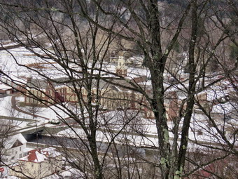
![]() On Wednesday, April 6th, Lisa contacted me to take a short hike on Round Top, a hill just across the street from my house. The responsibility for maintaining the cemetery had been transferred from the cemetery association to the Town of Rockland. Along with the transfer of the actual cemetery came some acreage including forest land on Round Top. Lisa and I wanted to see if we could scout a route for a trail that would take in a little of this land and the viewpoint that overlooks Livingston Manor. We met at the church at 9:00 AM and started up the steep, paved road to the top of the cemetery. There was almost no snow on the ground until we turned left into the woods. As soon as we made the turn by a set of four stones steps, we were walking through several inches of snow. We walked along a woods road, ducked under agree across the trail and then turned right on another woods road. We walked up the road passing some impressive cliffs on the left until another road cut up to the left. We followed this for a short distance and then turned left on yet another road. We walked on this briefly and then turned left through the brush to head out to the viewpoint. We were trying to be careful to avoid the private property that abuts the town land. There were no signs posting the land but there were some ribbons and we tried to stay on the correct side of them. We walked out toward the ledges and then to the viewpoint. As with many viewpoints, the trees have grown up to block much of the view but on this day we could see the buildings in town since there were no leaves on true trees. I took a few photographs and then we turned to start back down to the car on another convene woods road. Lisa noticed a tree growing on top of a large rock and we took some shots. It did not take us long to get back to the tree we ducked under earlier. We walked out to the cemetery and stopped to take a few pictures before walking down the hill to the parking area. We had walked about a mile in a little over and hour but took time to survey possible trail routes. We discussed the possibilities for trails in this area and others. It was a very enjoyable and productive hike.
On Wednesday, April 6th, Lisa contacted me to take a short hike on Round Top, a hill just across the street from my house. The responsibility for maintaining the cemetery had been transferred from the cemetery association to the Town of Rockland. Along with the transfer of the actual cemetery came some acreage including forest land on Round Top. Lisa and I wanted to see if we could scout a route for a trail that would take in a little of this land and the viewpoint that overlooks Livingston Manor. We met at the church at 9:00 AM and started up the steep, paved road to the top of the cemetery. There was almost no snow on the ground until we turned left into the woods. As soon as we made the turn by a set of four stones steps, we were walking through several inches of snow. We walked along a woods road, ducked under agree across the trail and then turned right on another woods road. We walked up the road passing some impressive cliffs on the left until another road cut up to the left. We followed this for a short distance and then turned left on yet another road. We walked on this briefly and then turned left through the brush to head out to the viewpoint. We were trying to be careful to avoid the private property that abuts the town land. There were no signs posting the land but there were some ribbons and we tried to stay on the correct side of them. We walked out toward the ledges and then to the viewpoint. As with many viewpoints, the trees have grown up to block much of the view but on this day we could see the buildings in town since there were no leaves on true trees. I took a few photographs and then we turned to start back down to the car on another convene woods road. Lisa noticed a tree growing on top of a large rock and we took some shots. It did not take us long to get back to the tree we ducked under earlier. We walked out to the cemetery and stopped to take a few pictures before walking down the hill to the parking area. We had walked about a mile in a little over and hour but took time to survey possible trail routes. We discussed the possibilities for trails in this area and others. It was a very enjoyable and productive hike.
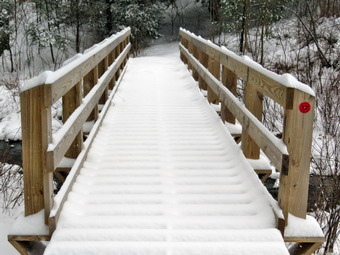
![]()
![]()
![]()
![]()
![]() On Monday, April 4th, an early spring snowstorm had dropped 4 inches of new snow overnight adding to the 4 inches that had fallen the night before. All of the schools in the county were closed which seemed like a good idea given the road conditions. I had been on an ambulance call in the early morning and all the roads including State Route 17 were horrendous. Cindy and I waited until the road crews had a chance to clear most of the snow and hoped the backboards had gotten some attention. My plan was to go to Frick Pond and hike the big loop around Frick and Hodge Ponds. Cindy countered my suggesting we try using our snowshoes. We had not been able to use them even once during the winter in the Catskills due to the lack of snow and now we were contemplating using them in the spring! The only time I got to use snowshoes was when I traveled to Ringwood, NJ after one stir had dumped almost two feet along the coast. We got our gear and Sheila in the car and left Livingston Manor a little after 10:30 AM. I drove out the DeBruce Road which was well cleared and then turned left on the Mongaup Pond Road to head toward the Frick Pond trailhead. This road had been plowed but was still covered in a layer of snow. As I drove up the road the snow began to fall. I stayed to the left where the road spilt and headed up Beech Mountain Road to the trailhead. This road had been plowed once and was covered in snow and snow continued to fall as I parked. We got out our snowshoes and put them on. Cindy War a pair of Atlas Electra 12's and I brought my TSL Symbioz. I had decided to go back to wearing winter gear as the temperature was 26 degrees and I still felt a little chilly as we prepared to hike. I had on tights under my MH Winter Wander pants. ON top I wore a baselayer under an Icebreaker wool top and over this I had my trusty Mammut hoody. I wore my Salomon B52 boots and also had on a light hat and gloves. We left the parking area and headed down the woods road toward the register rather than fight the rocks on the first section of the Quick Lake Trail. I thought about going up the Flynn Trail but Cindy had other ideas so I followed her. I was not enthusiastic about hiking the Quick Lake trail from the register to Frick Pond twice since there are a lot of rock and some water but once we got going it wasn't too bad. We stopped ice so that I could take some pictures of the pristine snow on the trail. I was happy no one had gotten there before us as we stayed to the left at Gravestone Junction and walked down the hill to Frick Pond. By the time we got to the pond, it snowfall was heavy and had changed from icy pellets to flakes. I took a few pictures of the bridge which had fresh snowed piled on it. From the bridge I took some pictures of the pond and of Flynn's Point on Beech Mountain which was almost obscured by the falling snow. As we continued on the Quick Lake trail, we found a small drift at the end of the bridge.
On Monday, April 4th, an early spring snowstorm had dropped 4 inches of new snow overnight adding to the 4 inches that had fallen the night before. All of the schools in the county were closed which seemed like a good idea given the road conditions. I had been on an ambulance call in the early morning and all the roads including State Route 17 were horrendous. Cindy and I waited until the road crews had a chance to clear most of the snow and hoped the backboards had gotten some attention. My plan was to go to Frick Pond and hike the big loop around Frick and Hodge Ponds. Cindy countered my suggesting we try using our snowshoes. We had not been able to use them even once during the winter in the Catskills due to the lack of snow and now we were contemplating using them in the spring! The only time I got to use snowshoes was when I traveled to Ringwood, NJ after one stir had dumped almost two feet along the coast. We got our gear and Sheila in the car and left Livingston Manor a little after 10:30 AM. I drove out the DeBruce Road which was well cleared and then turned left on the Mongaup Pond Road to head toward the Frick Pond trailhead. This road had been plowed but was still covered in a layer of snow. As I drove up the road the snow began to fall. I stayed to the left where the road spilt and headed up Beech Mountain Road to the trailhead. This road had been plowed once and was covered in snow and snow continued to fall as I parked. We got out our snowshoes and put them on. Cindy War a pair of Atlas Electra 12's and I brought my TSL Symbioz. I had decided to go back to wearing winter gear as the temperature was 26 degrees and I still felt a little chilly as we prepared to hike. I had on tights under my MH Winter Wander pants. ON top I wore a baselayer under an Icebreaker wool top and over this I had my trusty Mammut hoody. I wore my Salomon B52 boots and also had on a light hat and gloves. We left the parking area and headed down the woods road toward the register rather than fight the rocks on the first section of the Quick Lake Trail. I thought about going up the Flynn Trail but Cindy had other ideas so I followed her. I was not enthusiastic about hiking the Quick Lake trail from the register to Frick Pond twice since there are a lot of rock and some water but once we got going it wasn't too bad. We stopped ice so that I could take some pictures of the pristine snow on the trail. I was happy no one had gotten there before us as we stayed to the left at Gravestone Junction and walked down the hill to Frick Pond. By the time we got to the pond, it snowfall was heavy and had changed from icy pellets to flakes. I took a few pictures of the bridge which had fresh snowed piled on it. From the bridge I took some pictures of the pond and of Flynn's Point on Beech Mountain which was almost obscured by the falling snow. As we continued on the Quick Lake trail, we found a small drift at the end of the bridge.
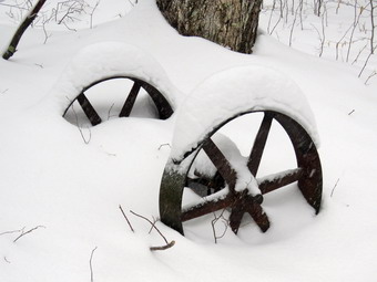 At the next trail junction we stayed to the left to follow the Quick Lake Trail through the "Spruce Tunnel" to Iron Wheel Junction. I could definitely feel that I was working harder on the snowshoes than I would have wearing only boots but it was fun. We stopped in the "Spruce Tunnel" where I took a few shots and then crossed the small stream to continue up to Iron Wheel Junction. Working hard on snowshoes tends to magnify even the slightest uphill and the trail to the junction is all uphill. When we arrived at Iron Wheel Junction, we stopped and I took a few photographs of the area. We were both getting tired so we decided to turn right on the Logger's Loop to head for Times Square. The sign told us that Times Square was about 1.2 miles away but I knew that we would go through a series of ups and downs along the way before hitting the highest point at 1.8 miles. I was struggling a little as we walked along the trail and found that taking exaggerated, high steps seemed to help some. Once we hit the high point it was all downhill to Times Square but the downhill did not feel as good as I expected. At Times Square we continued straight ahead staying on the Logger's Loop. I knew this trail had a slight uphill but I wanted a good GPS track of the whole Logger's Loop. All along our hike we had been noticing the areas where we had cleared blowdowns. We also noted that the new trail markers we had put up on all the trails were clearly visible even through the snow. Some places on the Logger's Loop were a little wet and the small "bridge" we had built helped us easily get across one of those areas. When we crested the small hill and stared down to Gravestone Junction I was very happy and my legs felt a little better. At Gravestone Junction we turned left on the Quick Lake Trail and began the walk back to the car. It seemed that there were more wet areas on the trail and we suspected that the temperate had increased some since we began the hike. I had been having some issues with snow clumping on my shoes and now Cindy was experiencing the same problem. The snow was lighter but we found that our tracks were almost completely filled in. We were back at the car at 1:15 PM having taken 2 hours and 20 minutes to hike 3.6 miles with an elevation gain of only 386 feet. As we drove back to town the snow intensified. In town the flakes were huge and I took a few pictures when we arrived home.
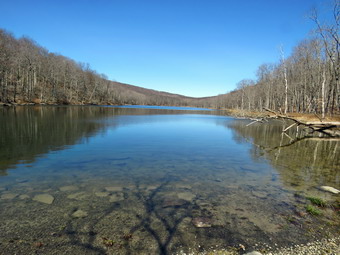
![]()
![]()
![]()
![]()
![]() On Wednesday, March 30th, I decided I wanted get out and do a hike close to home since the weather was nice and the rest of the following days were looking wet or cold. I decided to go to Trout Pond since it is close and offers some nice views and since I had been to Frick Pond so many times in the last few weeks. I had some things to take care of in the morning so I didn't get out of Livingston Manor until after 10:00 AM. I put my gear in the trunk and an overjoyed Sheila in the back seat and headed to Roscoe on State Route 17. I got on Route 206 and followed it across the Delaware County line to Morton Hill Road. After a left turn on Morton Hill Road, I drove to the intersection with Russell Brook Road. I turned around and parked on the side of the road to avoid the parking area which is private. We began our hike down Russell Brook Road at 10:30 AM. The air still seemed cool to me so I wore my Mammut Hoody, a hat and light gloves. I still had on my MH Winter Wander pants but decided I did not need tights underneath. I wore a long-sleeved crew neck Mammut shirt which is a little heavier than some I have but I did not want to wear a baselayer. We continued on down Russell Brook Road to the overlook of the falls. There was some water in the stream and the upper falls did not have the volume I thought it might after some rain during the week. I decided not to stop for pictures on the way out and we continued down toward the parking area. There were two cars parked in the lower lot. We got on the woods road that goes down to the bridge that crosses the brook. I decided not to walk to the falls and continued on the main trail to the register. At the trail junction just after the register we turned to the left to climb the steeper hill toward Mud Pond. The trail was drier than I expected with only a few areas of mud. The sun was out and as soon as we started to climb the hill, I stopped to open up the zippers on my hoody. The ascent went quickly and I was glad to see there were no new blowdowns on this part of the trail. We reached the top of the hill at 11:05 AM after hiking 1.4 miles. The woods road had some ruts from a vehicle that appeared to be a pickup truck but none were new. The only access is through the locked gate at the lower parking area which made the tracks somewhat of a mystery. At 1.6 miles we made a right to follow the trail up to the shoulder of Cherry Ridge.
On Wednesday, March 30th, I decided I wanted get out and do a hike close to home since the weather was nice and the rest of the following days were looking wet or cold. I decided to go to Trout Pond since it is close and offers some nice views and since I had been to Frick Pond so many times in the last few weeks. I had some things to take care of in the morning so I didn't get out of Livingston Manor until after 10:00 AM. I put my gear in the trunk and an overjoyed Sheila in the back seat and headed to Roscoe on State Route 17. I got on Route 206 and followed it across the Delaware County line to Morton Hill Road. After a left turn on Morton Hill Road, I drove to the intersection with Russell Brook Road. I turned around and parked on the side of the road to avoid the parking area which is private. We began our hike down Russell Brook Road at 10:30 AM. The air still seemed cool to me so I wore my Mammut Hoody, a hat and light gloves. I still had on my MH Winter Wander pants but decided I did not need tights underneath. I wore a long-sleeved crew neck Mammut shirt which is a little heavier than some I have but I did not want to wear a baselayer. We continued on down Russell Brook Road to the overlook of the falls. There was some water in the stream and the upper falls did not have the volume I thought it might after some rain during the week. I decided not to stop for pictures on the way out and we continued down toward the parking area. There were two cars parked in the lower lot. We got on the woods road that goes down to the bridge that crosses the brook. I decided not to walk to the falls and continued on the main trail to the register. At the trail junction just after the register we turned to the left to climb the steeper hill toward Mud Pond. The trail was drier than I expected with only a few areas of mud. The sun was out and as soon as we started to climb the hill, I stopped to open up the zippers on my hoody. The ascent went quickly and I was glad to see there were no new blowdowns on this part of the trail. We reached the top of the hill at 11:05 AM after hiking 1.4 miles. The woods road had some ruts from a vehicle that appeared to be a pickup truck but none were new. The only access is through the locked gate at the lower parking area which made the tracks somewhat of a mystery. At 1.6 miles we made a right to follow the trail up to the shoulder of Cherry Ridge.
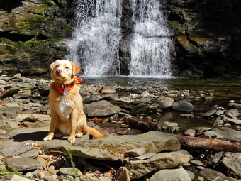 This trail was also drier than I expect and there was none of the running water I usually encounter. We avoided a few muddy areas and crossed a few small streams. At one point Sheila alerted and I looked up to see alone male hiker headed our way. I put Sheila on her leash and stepped off the trail to let the other hiker go by. We said "Hello" but quickly continued in our opposite directions. The ascent continued for the next 1.2 miles until at 2.7 miles into the hike when we were at the highest point and ready to start the descent to Trout Pond. We had hiked the southern exposure and there was absolutely no ice or snow on the trail or in the woods. There were a few small branches across the trail and some large pieces that I was able to remove without tools. As we descended toward Trout Pond there were two major blowdowns that would require an axe and saw to clear. I also found a few flakes of snow and crystals of ice underneath a log and hidden from the sun. The trail remained dry as we approached the bridge at the inlet end of the pond. I decided to stop and take some pictures even though there was nothing remarkable about the scene. We continued on the main trail toward the outlet of the pond and the trail remained dry and firm. At the lower end of the pond I again stopped to take pictures of a scene I had photographed many times! I decided to throw a stick for Sheila and she readily entered the water to swim and retrieve it. After doing this several times and taking some pictures, I decided it was time to continue. Sheila got out of the water, shook herself off and began her mad dash around and around. It seems this is part joy and part an effort to warm herself up! It was obvious that the pond was very low as the water was not even lapping at the outlet dam. The hike from the outlet to the trail junction is all downhill and really did go quickly. As we passed the designated campsite area on the right of the trail, I could see that two hikers had set up camp and had a small fire burning. By 12:30 PM we had hiked 4.7 mikes and were back at the trail junction and register box. I decided that I wanted to walk over to the falls and we turned left on the path to the falls. There was one tree down across the path but it was easy to step over. We walked up the path toward the lower falls and then down the bank to the streambed. I was again surprised at the low volume of the stream despite the recent rain. I took a few quick pictures of thralls including a few with Sheila. We walked back up the bank and out to the main trail to continue our hike back to the car. There were now three cars in the lot but I did not see any of the owners. As we walked up the road back to the car, I stopped at the overlook and decided to walk down to take a few shots of the upper falls. As I started down two of the cars from the lot drove slowly up the road. I wondered where the owners had been since it only took me a few minutes to hike up the road! I took my pictures and then we returned to the road and finished with the hike up Russell Brook Road back to the car. We arrived back at 1:00 PM having covered 5.5 miles and 1120 vertical feet in 2 hours and 30 minutes.
![]()
![]()
![]()
![]()
![]() On Saturday, March 26th, I wanted to hike a 3500 foot peak and decided on Balsam Lake Mountain. Brad agreed to go with me but had not brought hiking clothing. Having more than enough hiking gear to outfit a small expedition, I quickly found some gear and we got ready to go. The temperature was supposed to rise into the mid to high 50's so I wore no baselayers and only a light top. I did put on my Winter Wander pants and my Mammut hoody. I was wondering how the Beaverkill Road had fared but decided the only way to find out was to go there. We left Livingston Manor at 10:00 AM and drove toward Roscoe on Old Rt 17 before turning right on the Beaverkill Road. The sky was almost cloudless as we drove through Lew Beach although the temperature was only reading in the high 30s's! We passed the Buddhist monastery which was as far as Brad had been on the road. There were a few places where the road had narrowed even further than the last time I had been to Balsam Lake Mountain and at least one spot where the bank had collapsed onto the road. We arrived at the parking area and found two other cars already in the lot. The temperature had risen into the mid 40's and it seemed even warmer in the sun. We were on the trail at 11:30 AM heading toward the first trail junction where we intended to turn left and hike up the steep side of the mountain. As we walked up the trail I noticed several trees hanging over the trail and although they seemed safe I would prefer that they were gone. There were also a few across the trail that had been partially cleared but some more work needs to be done. We made the trail junction at .9 miles by 12:00 PM and turned left up the mountain without stopping. This first part of the trail is a gentle climb but I was already feeling the affects of not hiking very much and of not hiking any serious mountains! Over the next half mile the trail gains about 750 feet before leveling off which means an average of around a 28% grade! It is a pleasure to hike with Brad as we both are interested in volunteer EMS. I decided to take it easy on the climb and we stopped several times so that I could catch my breath.
On Saturday, March 26th, I wanted to hike a 3500 foot peak and decided on Balsam Lake Mountain. Brad agreed to go with me but had not brought hiking clothing. Having more than enough hiking gear to outfit a small expedition, I quickly found some gear and we got ready to go. The temperature was supposed to rise into the mid to high 50's so I wore no baselayers and only a light top. I did put on my Winter Wander pants and my Mammut hoody. I was wondering how the Beaverkill Road had fared but decided the only way to find out was to go there. We left Livingston Manor at 10:00 AM and drove toward Roscoe on Old Rt 17 before turning right on the Beaverkill Road. The sky was almost cloudless as we drove through Lew Beach although the temperature was only reading in the high 30s's! We passed the Buddhist monastery which was as far as Brad had been on the road. There were a few places where the road had narrowed even further than the last time I had been to Balsam Lake Mountain and at least one spot where the bank had collapsed onto the road. We arrived at the parking area and found two other cars already in the lot. The temperature had risen into the mid 40's and it seemed even warmer in the sun. We were on the trail at 11:30 AM heading toward the first trail junction where we intended to turn left and hike up the steep side of the mountain. As we walked up the trail I noticed several trees hanging over the trail and although they seemed safe I would prefer that they were gone. There were also a few across the trail that had been partially cleared but some more work needs to be done. We made the trail junction at .9 miles by 12:00 PM and turned left up the mountain without stopping. This first part of the trail is a gentle climb but I was already feeling the affects of not hiking very much and of not hiking any serious mountains! Over the next half mile the trail gains about 750 feet before leveling off which means an average of around a 28% grade! It is a pleasure to hike with Brad as we both are interested in volunteer EMS. I decided to take it easy on the climb and we stopped several times so that I could catch my breath.
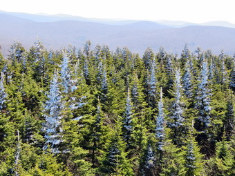 Despite the grade, the hike seemed to go pretty quickly and we were soon passing the spur trail to the lean-to and the spring. We passed the 3500 foot sign and ewer soon at the spring. We walked up the stone steps to the summit plateau and continued on toward the fire tower. The trail was frozen in most places and as we passed through a shaded area, Brad spotted some snow on the ground. It isn't unusual to have snow on this mountain in March but the mildness of the winter made this seem surprising. As we approached the tower, we could hear voices. We arrived at the tower clearing at 12:35 PM after hiking 1.7 miles and found about half a dozen people. I tied Sheila to a small sapling and then noticed the hoarfrost and snow on the trees. I spoke to some of the hikers who were seated on the picnic table and then got out my camera. I took some pictures of the snow on the trees and then Brad and I started to climb the tower. Sheila started making a fuss but quieted when I spoke to her. The steps on the tower were wet and there seemed to be water dripping from above. As we climbed we found snow and ice on the treads and snow and ice on the screening on the tower. When we arrived at the landing just below the cab, we looked out to see that the trees had snow and ice on one side and none on the other. It was unusual and I took pictures of the trees and of the snow on the tower. As we started to climb down, we heard a pack of dogs in the woods below. The sound they were making indicated they were on the track of some animal. When we got to the base of the tower, they seemed closer. One of the hikers said they had been on the trail on the Millbrook side when they had ascended the trail. I thought about going back the way we came but decided to complete the loop as planned. Brad and I headed down the trail passed the cabin at about 12:50 PM. Not very far along we found a group of men on the trail simply standing around. We could still hear the dogs and I asked tem if they knew who owned them. One man replied that they belonged to the group. I expressed surprise that they were running loose since it was against the law. He assured me that it WAS legal. Of course, he was wrong. I saw no reason to debate a point when I knew I was right so we continued down the trail.
 Walking down the mountain seemed MUCH easier than the climb up the other side. Soon we were approaching the junction with the trail that connects Millbrook Road to the Beaverkill Road. There is a gate at the bottom of the trail and just after this gate I saw...a pickup truck parked on the trail! I really had to look twice since this was the first time I had ever seen this. The trail is NOT open to motorized vehicles and no one should be parking here! We looked at the truck which had a "dog" and NRA sticker. Immediately we knew that this truck belonged to the group who were illegally running the pack of dogs. I am always annoyed when I meet people who feel that the rules do not apply to them. People like this give hikers a bad name! I have come to accept that there is no way to change these ignorant people except by reporting tem to the authorities. Brad and I turned right at the trail junction to start back toward the car. The trail is a little rough to begin with but it is a descent. It appeared as if someone had been clearing the trail which made the hiking much easier. We arrived at the first trail junction and continued on toward the car by retracing our steps. On the way back we met a few people hiking up the mountain. We were back in the parking area at 2:00 PM after hiking 4.3 miles and climbing 1200 feet in elevation. I was happy to have hiked a 3500 foot peak but it made me realize I need to hike a few more!
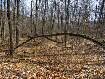
![]() On Thursday, March 24th I planned to do some trail maintenance on The part of the TouchMeNot Trail that runs west from Big Pond to TouchMeNot Mountain. I maintain this trail from Big Pond to Beech Hill Road for the Finger Lakes Trail Conference. The Catskill trail supervisor had emailed me that some hikers felt the trail could use a few more blazes. Cindy agreed to go with me which makes trail maintenance and marking much easier. We left Livingston Manor around 10:30 AM with Sheila in the backseat ready to hike anywhere we stopped! I took my Fiskars trimming axe and my smaller Silky saw plus some felling wedges. I also brought a hammer, galvanized roofing nails and the red markers needed to blaze the trail. We arrived at Big Pond just before 11:00 AM and parked in the lot. I got my gear ready to go and we crossed the road to start up the trail. My plan was to place and replace markers on the way up noting any blowdowns that would have to be removed. On our way back we would make sure the blazes were visible in that direction. I also planned to remove a few blowdowns and document the rest for removal at another time. We started up the trail noting that the blazes were easy to spot for some distance since the trail is initially sited on a wide woods road. Just after the register box there was a rather large tree trunk hanging over the trail and supported none too well on the other side. We continued to walk and found a tree bowed over the trail with another supported on top of it. These were in the same position the last time I walked the trail and now I knew it was time to deal with them. We continued up the trail adding and replacing markers as needed. The first half of the trail was pretty well marked but the farther we went the more sparse the markers became. Some were on trees that had fallen, others had faded or fallen off while still others were just missing. At around .6 mules the trail began to get steeper and we had to watch carefully for markers. This is also the area that I had the hardest time clearing of nettles and briars last year. These were pretty much under control as it was early in the spring. We did find a few more blowdowns of various sizes. By about 12:15 Pm we had gotten to the highest point on the trail and walked across a flat area and then down a little to the junction with the Campground Trail. Just before the junction there was a tree that had spilt in three directions. One large truck was across the trail while another was suspend over the top of the trail. We walked to the trail junction where we had a drink and a bar before turning around to start back at 12:20 PM.
On Thursday, March 24th I planned to do some trail maintenance on The part of the TouchMeNot Trail that runs west from Big Pond to TouchMeNot Mountain. I maintain this trail from Big Pond to Beech Hill Road for the Finger Lakes Trail Conference. The Catskill trail supervisor had emailed me that some hikers felt the trail could use a few more blazes. Cindy agreed to go with me which makes trail maintenance and marking much easier. We left Livingston Manor around 10:30 AM with Sheila in the backseat ready to hike anywhere we stopped! I took my Fiskars trimming axe and my smaller Silky saw plus some felling wedges. I also brought a hammer, galvanized roofing nails and the red markers needed to blaze the trail. We arrived at Big Pond just before 11:00 AM and parked in the lot. I got my gear ready to go and we crossed the road to start up the trail. My plan was to place and replace markers on the way up noting any blowdowns that would have to be removed. On our way back we would make sure the blazes were visible in that direction. I also planned to remove a few blowdowns and document the rest for removal at another time. We started up the trail noting that the blazes were easy to spot for some distance since the trail is initially sited on a wide woods road. Just after the register box there was a rather large tree trunk hanging over the trail and supported none too well on the other side. We continued to walk and found a tree bowed over the trail with another supported on top of it. These were in the same position the last time I walked the trail and now I knew it was time to deal with them. We continued up the trail adding and replacing markers as needed. The first half of the trail was pretty well marked but the farther we went the more sparse the markers became. Some were on trees that had fallen, others had faded or fallen off while still others were just missing. At around .6 mules the trail began to get steeper and we had to watch carefully for markers. This is also the area that I had the hardest time clearing of nettles and briars last year. These were pretty much under control as it was early in the spring. We did find a few more blowdowns of various sizes. By about 12:15 Pm we had gotten to the highest point on the trail and walked across a flat area and then down a little to the junction with the Campground Trail. Just before the junction there was a tree that had spilt in three directions. One large truck was across the trail while another was suspend over the top of the trail. We walked to the trail junction where we had a drink and a bar before turning around to start back at 12:20 PM.
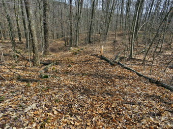 We stopped at the "triple threat" tree and I took a few shots. This was one I decided to leave for later as it would take some time to remove it and I felt I needed a bigger felling axe and a bigger saw. We continued down the trail watching for the blazes in the return direction. We found several placed where the markers were not clear and placed a few to make the way clear. We ran into a small blowdown which was in the trail and I decided to remove it for aesthetic reasons. I easily sawed through the branch and then cut it again to remove the pieces to the side of the trail. A little farther along there was another larger and livelier trunk that I decided to leave. After taking a few shots we moved on to another rotten tree that lay across the trail. This one was almost broken through in one spot so I only had to cut it in one place. I sued the axe this time to cut through the trunk so that Cindy and I could pull it off the trail. As we walked down the mountain Sheila began to alert as if there was someone on the trail ahead. We heard voices but they seemed pretty far away. We found two more good sized logs that were easy to step over and I decided to leave them for another day. Just after the second blowdown we were coming down to the flatter area and spotted two men below sitting on some rocks. I put Sheila on her leash as we approached and we stopped to talk. The two hikers were coming from Alder Lake and were headed for Little Pond where they expected to camp overnight. I suggested the open meadow on the Little Pond Trail as a nice place to spend the night. They would be hiking through to Beech Hill Road where their second car was parked. Cindy and I continued along removing one more small blowdown on the way before arriving at the place where one tree was bent over the trail with another lying on top of it. We both surveyed the situation since it was unclear how much pressure was on the bent tree and how it would react when the pressure was released. I decided to cut the larger tree off the one that was bent over. I cut most of the way through with the saw but had to finish with the axe. When the weight was released the other tree hardly moved. We cleared the tree I had cut and I turned my attention to the bent tree. I decided to use the axe to cut the truck near the ground. I was very careful as I made the cuts since I was still unsure what forces might be released. As it happened, the tree was relatively easy to cut and simply fell over as I made the last cut. I used the axe to chop through the upper portion and Cindy and I then removed all the pieces. After taking a few shots, we returned to the car at 2:30 PM.
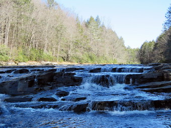
![]()
![]()
![]()
![]()
![]() On Tuesday, March 22nd I planned to hike with my friend Nery who had contacted me the day before. It was his day off from work and college and I was more than pleased to have someone as a hiking companion. I had thought about going to Storm King or Harriman but decided to go to the Neversink Unique Area as it is much closer and Nery had never been there. My plan was to hike to Denton Falls and then walk down to High Falls before doubling back to visit Mullet Brook Falls on the way back. It had been some time since I had been down to High Falls and I was looking forward to the longer route. I got Sheila and my gear in the car and left Livingston Manor at about 8:35 AM to head to Liberty to pick up Nery at his house. I arrived a little before 9:00 AM and Nery soon appeared with his new dog, Laila. She is a cute terrier and pit bull mix that Nery "rescued". She let me pet her but then started to bark at me as Nery put her back in the house. Nery got in the car and I let Sheila get acquainted with him before we headed toward Rock Hill. I drove south and east on Route 17 to Rock Hill and took Katrina Falls Road all the way to the end. I parked in the lot just before 9:30 AM and there were no other cars in the lot. The temperature was 34 degrees but there was no breeze to make it feel colder. We had gotten a slight dusting of snow and as we set off down the woods road, we noticed that there was a little snow still on the trail. We also noticed that the larger blowdowns that had been across the trail had all been cleared. At the first trail junction we turned left to stay on the main trail. As we neared the small bridge that crosses Wolf Brook, we could hear the water rushing in the stream but the large patches of ice that had been there a couple of weeks earlier were gone. We headed up the small hill to the junction where the main trail splits and stayed to the right to head to the lower bridge across Mullet Brook. When we came to the bridge, I warned Nery to be careful as the bridge's condition continues to deteriorate. We crossed the bridge without a problem and walked up the hill to the spur trail to Denton Falls. I might have skipped this if I was alone since I had been there recently but I wanted to give Nery the full tour! As we walked the trail down to the river, we kept up a steady stream of conversation which made the walk go much quicker. The trail was in good shape and there was only a little frozen mud in a few places. Over the quarter mile to the river we dropped about 170 feet in elevation. There was quite a bit of water in the river but there was very little ice on the rocks. We walked along the rocks and I removed my pack to get out the camera. I took some pictures but was disappointed that the sky was a flat blue without very many puffy white clouds. After taking a few more shots, I shouldered my pack and we began the walk back up to the main trail.
On Tuesday, March 22nd I planned to hike with my friend Nery who had contacted me the day before. It was his day off from work and college and I was more than pleased to have someone as a hiking companion. I had thought about going to Storm King or Harriman but decided to go to the Neversink Unique Area as it is much closer and Nery had never been there. My plan was to hike to Denton Falls and then walk down to High Falls before doubling back to visit Mullet Brook Falls on the way back. It had been some time since I had been down to High Falls and I was looking forward to the longer route. I got Sheila and my gear in the car and left Livingston Manor at about 8:35 AM to head to Liberty to pick up Nery at his house. I arrived a little before 9:00 AM and Nery soon appeared with his new dog, Laila. She is a cute terrier and pit bull mix that Nery "rescued". She let me pet her but then started to bark at me as Nery put her back in the house. Nery got in the car and I let Sheila get acquainted with him before we headed toward Rock Hill. I drove south and east on Route 17 to Rock Hill and took Katrina Falls Road all the way to the end. I parked in the lot just before 9:30 AM and there were no other cars in the lot. The temperature was 34 degrees but there was no breeze to make it feel colder. We had gotten a slight dusting of snow and as we set off down the woods road, we noticed that there was a little snow still on the trail. We also noticed that the larger blowdowns that had been across the trail had all been cleared. At the first trail junction we turned left to stay on the main trail. As we neared the small bridge that crosses Wolf Brook, we could hear the water rushing in the stream but the large patches of ice that had been there a couple of weeks earlier were gone. We headed up the small hill to the junction where the main trail splits and stayed to the right to head to the lower bridge across Mullet Brook. When we came to the bridge, I warned Nery to be careful as the bridge's condition continues to deteriorate. We crossed the bridge without a problem and walked up the hill to the spur trail to Denton Falls. I might have skipped this if I was alone since I had been there recently but I wanted to give Nery the full tour! As we walked the trail down to the river, we kept up a steady stream of conversation which made the walk go much quicker. The trail was in good shape and there was only a little frozen mud in a few places. Over the quarter mile to the river we dropped about 170 feet in elevation. There was quite a bit of water in the river but there was very little ice on the rocks. We walked along the rocks and I removed my pack to get out the camera. I took some pictures but was disappointed that the sky was a flat blue without very many puffy white clouds. After taking a few more shots, I shouldered my pack and we began the walk back up to the main trail.
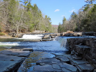 When we got back up to the main trail, we turned right and walked a short distance before bearing right again to walk the trail to High Falls. It is almost a two mile walk to High Falls and the trail isn't very interesting so I was glad Nery was along. Initially the trail descends but then starts and ascent until it reaches a high point at 2.6 miles where the elation is almost 1300 feet. From Here the trail begins to descend and in 1.3 miles it loses almost 500 feet to the level of the river. As we made our final approach we could hear the water and see the falls. As we walked out onto the rocks near the falls there was only a little ice and we were able to walk to the rocks below the falls. This allowed my to get shots upriver and almost directly at the face of the falls. I was surprised at how different High Falls was than Denton Falls since in my mind they are very much the same. High Falls is only a little higher but the river is wider at this point and there are two distantly different sections to the falls. I took several pictures of the falls and some shots downstream. I even took a picture of Sheila posed next to Nery! We had been drinking along the way and now I got out a bar that we shared. As we started the walk back I could feel that my "up" muscles were getting tired. By 12:45 PM we had walked 5.85 miles and were back at the trail junction just above Denton falls. We turned right to start the loop back to the car. In about a tenth of a mile we came to the spur trail to Mullet Brook falls on the left. We turned and found another hiker coming toward us with his dog on a leash. I put Sheila on her leash and walked back out to the main trail to allow the other hiker to pass. Sheila and his dog seemed to get along so we let then say 'Hello' before heading our separate ways.
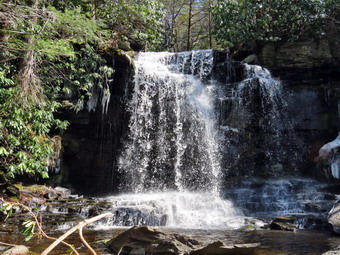 We walked the spur trail down to Mullet Brook Falls. The last time I visited, I had slipped on a rock and ended up face down but without serious injury. This time I dropped my pack, got out the camera and walked over the rocks to the area in front of the falls. The sun was a little high and I was worried about sunspots in the pictures. I took pictures of the falls head on and then took some of the lower part of the falls and the pool at the base. I repositioned myself to the right side of the falls and took a few more shots from a different angle. I walked back to my pack, packed up and we headed back out to the main trail. We turned left to continue our loop back to the car. We were still ascending as we walked and I noticed how tired my legs had become. At 6.8 miles we again were crossing Mullet Brook but this time on the upper bridge which is in better shape than the lower. A little further on we hit the highest point on the hike at 1473 feet and then began our descent. Over the next the next .9 miles we lost 430 feet in elevation. Soon we were at the trail junction where we turned right to complete the loop and retrace our steps back to the care. We crossed the small bridge over Wolf Brook and then began the last uphill part of the hike. The last half mile back to the car is all uphill and although the grade is only 7% I was glad when we were in the parking lot. It was 2:20 PM and we had hiked 8.4 miles in 4 hours and 50 minutes. The elevation gain was 1840 feet.
On Monday, March 21st, I was in the mood to hike after two weeks of a nasty cold! I had thought about going a little farther away but an early morning ambulance call changed my mind. When I got home, I suggested to Cindy that we go to Trout Pond and she agreed. Once Sheila found out we were going she was beside herself. Sheila really doesn't care where we go as long as we get out. We got our gear and Sheila in the car and left Livingston Manor just before 10:00 AM heading north and west on State Route 17 toward Roscoe. I got off at the Roscoe exit and followed Route 206 toward Downsville. Just after the Rockland Flats I turned left on Morton Hill Road and drove up the hill to the junction with Russell Brook Road. I turned around and parked on the side of the road near the intersection. I avoided parking in the lot there as it is on private property. We started our hike at 10:15 AM by walking down Russell Brook Road. The temperature was in the mid 30's but a wind was blowing that made it seem colder. I had worn my Mammut hoody and layers on the top but had decided not to wear a baselayer under my MH Winter Wander pants. I was sorry I made this decision. I did start to warm up as we walked down the road. I decided I was tired of the same old loop and that we would try to follow the snowmobile trails up and over the ridge on the eastern side of Trout Pond. I knew the trails were not maintained and poorly marked but I had followed them before. Some of the trails are sited on the old woods roads used to haul trees for the wood alcohol factories that used to be around Butternut Grove just north of Roscoe. We turned right onto the snowmobile trail opposite the first campsite and walked passed the metal gate. The trail was much wider and easier to follow than I remembered and I was optimistic that we would be able to follow the trail. At about .65 miles the snowmobile trail crossed a stream but the water was a little too high so we walked upstream until we could cross. We spotted what looked like a woods road and began to follow it instead of walking back to the point where the trail had crossed the stream. We angle our way toward the top of the ridge even though I knew we probably weren't far enough along to find the snowmobile trail over the top. At just under a mile we picked up snowmobile markers again and turned right to follow the trail as it headed north and up.
The snowmobile trail had not been cut out in some time and we began to lose any markers. We decided to continue to head north but to stay off the very crest of the ridge and walk a little to the west of it so that we were between the pond and the ridge. I knew that there were some pretty steep cliff bands but wanted to be ready to cut down to the trail around the pond since the slope becomes more manageable farther north. At about 1.4 miles we hit the snowmobile trail and I knew turning left would take us down to the pond. For some reasons Cindy wanted to turn right and head farther north and up! We turned right and followed the snowmobile markers and very soon we lost them and the trail. Cindy decide we should climb up and over the ridge and head out to Morton Hill Road! We headed due east and in .2 miles gained about 120 feet to the top of the ridge. I was definitely out of shape and having trouble breathing from the cold since it seemed much longer and steeper than it was although the elevation of the ridge at the highest point was 2540 feet. We continued east and started down from the highest point fighting through some pretty thick brush in spots. At 2.1 miles we began to find some woods roads and were able to follow them south and east. The roads brought us down the ridge to cross Russell Brook at 2.4 miles. Somewhere along the way I had seen the yellow blazes that mark state land and although I had seen no POSTED signs, I was pretty sure we were on private property. After crossing the brook we headed southeast toward the road and crossed another arm of Russell Brook which had cut a pretty deep channel in the hill. Once up the other side, we walked through a field of prickers and out to the road. I put away my poles and put Sheila on her leash. We turned right to head south along Morton Hill Road back to the car. The walk along the road was less than a lie and went very quickly. I had not been looking at my GPS and was surprised to find that the whole hike was less than 4 miles as it seemed much longer! We were back at the car at 12:30 PM having hiked 3.4 miles in 2 hours and 15 minutes. The vertical gain was 875 feet but felt like much more!