
Mount Tammany
| Quick Look | |||||
|---|---|---|---|---|---|
| Difficulty | Round trip | Total climb | Location | Elevation | Internet Maps |
| 3.14 mi | 1254 ft | N40.9723 W75.1057 Warren | 1549 ft | AllTrails | |
 Heed the warning signs about poisonous snakes. There ARE both copperheads and rattlesnakes in this part of the Water Gap. During warm weather you may find them sunny themselves on the rocks and open trails!
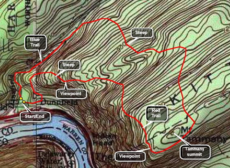
Take I80 east from Pennsylvania into New Jersey. Get off at the exit for the Delaware Water Gap visitor's Center. Follow the road under I80 and make a left and then a right into the Dunnfield Creek parking area for Mount Tammany. Go to the north end of the parking area and pick up the At to the north and then east. When the AT branches to the right bear left on the green Dunnfield Creek Trail. At Dunnfield Falls turn right onto the Blue Dot Trail which ascends to the Mt. Tammany ridge. The trail is rocky and steep in places. Once at the top follow the trail southwest passed the summit of Mount Tammany and to an outstanding lookout southwest to Mount Minsi and in both directions up and down the Water Gap. The Red Dot Trail starts at this point and descends back to the parking lot. The descent is steep in places and very rocky. On the way down the Red Dot Trail there is at least one more excellent lookout that gives a view of Mount Tammany. Continue on the Red Dot Trail Back to the car.
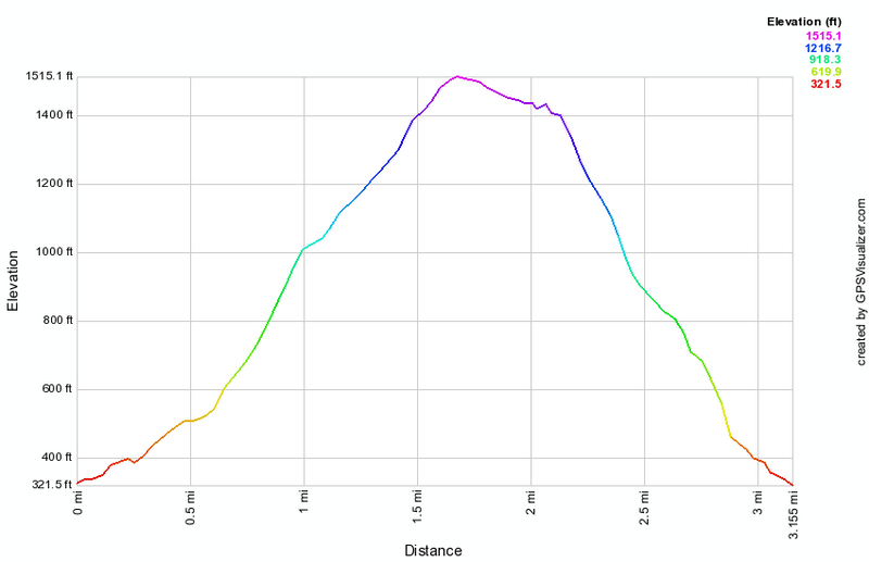 (The image at the left shows the profile of the hike. Remember that all vertical profiles are
relative!)
(The image at the left shows the profile of the hike. Remember that all vertical profiles are
relative!)