
Sunrise Mountain
| Quick Look | |||||
|---|---|---|---|---|---|
| Difficulty | Round trip | Total climb | Location | Elevation | Internet Maps |
| 9.57 mi | 1584 ft | N41.2180 W74.7206 Sussex | 1653 ft | AllTrails | |
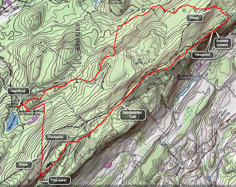
Take Rt 206 south from Milford, PA and watch for signs for Stokes State Forest on the left. Turn left on Coursen Road and drive to the parking area near Stony Lake. Look for the signs for the green blazed Tower Trail and follow them carefully as there are MANY trails in the area and the network can be confusing. The Tower trail turns south almost immediately and heads up to the Kittatinny Ridge and the Normanook or Culver Lake Fire Tower. The trail is steep in places but the view from the tower is worth it. The tower is on the At and the AT leads northeast along the ridge to the summit of Sunrise Mountain. The walk is about 3.5 miles but is almost flat. There is a pavilion on top of Sunrise and the views are great. There may be quite a few people there since you can drive almost to the top. Walk passed the pavilion and turn left on the brown and red blazed Cartwright Trail. After about 1.0 miles this trail ends as it joins the red blazed Swenson Trail which you will follow all the way back to the parking area. Watch the trail blazes carefully as there are many marked and unmarked trails in this area. You will walk about 3.25 miles on this trail and its woods roads until you are back at Stony Lake.
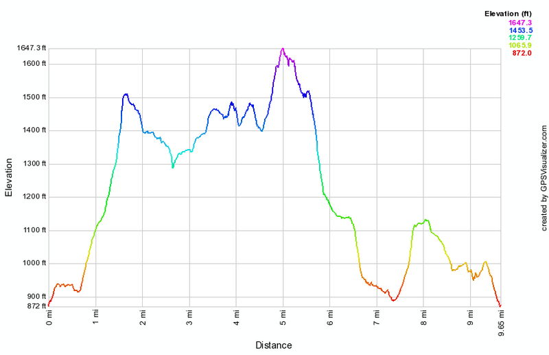 (The image at the left shows the profile of the hike. Remember that all vertical profiles are relative!)