
Mount Fairway
| Quick Look | |||||
|---|---|---|---|---|---|
| Difficulty | Round trip | Total climb | Location | Elevation | Internet Maps |
| 2.43 mi | 600 ft | N40.7803 W75.0020 Warren | 1080 ft | AllTrails | |
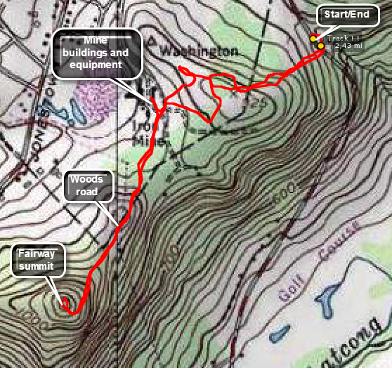 Take Route 46 to Route 31 south to Oxford. Find Mine Hill Road and park on the right side at a pulloff just after the highest point. Head up the woods road and to the southwest. You will find several fenced mine adits along the way and may run across some building belonging to the mining operation. You may also find roads that head in the correct direction but make sure you are always heading southwest toward the high point. After about 1.2 miles you should get to the highest point. Head back in the same general direction following the roads when they go in the right direction. Visit some of the building and adits if you like but be sure to obey all POSTED signs.
(The map at the right shows the parking area and the out and back hiking route.)
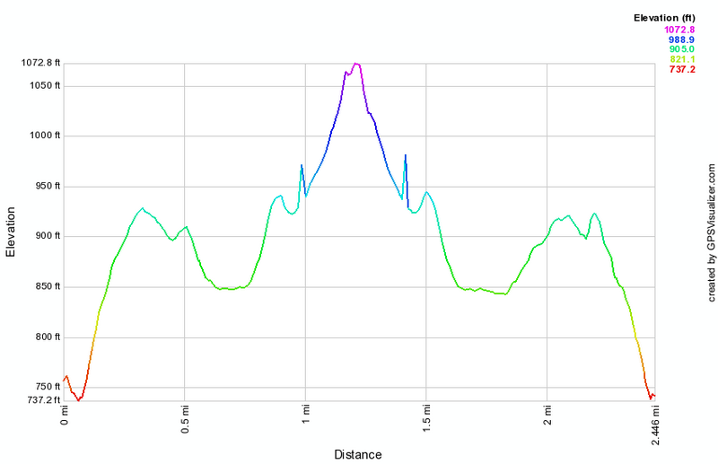
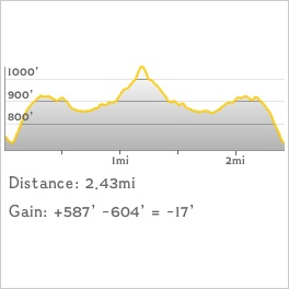 (The image at the left shows the profile of the hike. Remember that all vertical profiles are relative!)
 (The image at the left shows the profile of the hike. Remember that all vertical profiles are relative!)