
County House Mountain
| Quick Look | |||||
|---|---|---|---|---|---|
| Difficulty | Round trip | Total climb | Location | Elevation | Internet Maps |
| 6.13 mi | 1159 ft | N40.8076 W74.959 Warren | 1142 ft | AllTrails | |
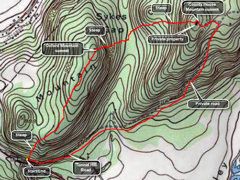 It may be hard to climb County House WITHOUT climbing Oxford first. In any case, it is a good idea to get done with them at the same time.
Park on the side of Tunnel Hill Road off Route 31 outside of Oxford, NJ. Cross the road and find a place to walk up the steep bank into the woods. Walk .8 miles toward the northeast to the summit of Oxford Mountain. This can be a difficult bushwhack with rocky areas and, in the spring and summer, a lot of prickers and thorns of various types. Once at the top you may turn around and retrace your steps or continue on to County House Mountain. To get to County House descend to Sykes Gap from Oxford by walking east or slightly northeast. Be careful descending as the way is steep and there are numerous large rocks under foot. The rocks seem tailor-made to roll ankle or trap a leg. There are also lots of prickers and thick brush in the spring and summer! This continues down into Sykes Gap but lets up nice you start the steep climb up County House. The summit of this mountain has a house and private property but I did not see any POSTED signs. I actually walked out into the back yard and met the property owner. He gave me permission to walk down his driveway and the down the private Jost Drive to Tunnel Hill Road. From Oxford to County House was only .8 miles but it seemed much longer. The walk Down Jost Drive to Tunnel Hill was 1.35 miles and then it was only .25 miles to the car. Once on Tunnel Hill I turned left and walked back to the car. If you see POSTED signs or the landowner is not home you will have to walk back over Oxford by retracing your route or try walking out through Sykes Gap. Faced with those choices I might wait until late fall or winter to try these two.
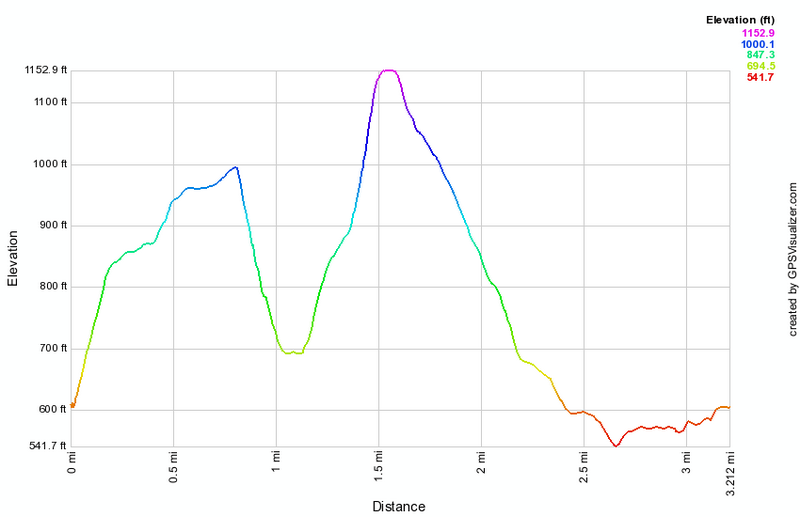 (The image at the left shows the profile of the hike. Remember that all vertical profiles are relative!)