
Buck Mountain (Kinnelon)
| Quick Look | |||||
|---|---|---|---|---|---|
| Difficulty | Round trip | Total climb | Location | Elevation | Internet Maps |
| 2.05 mi | 620 ft | N41.0205 W74.4178 Morris | 1060 ft | AllTrails | |
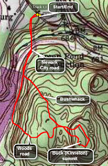 The actual peak is on public land but getting there legally, without crossing private land, can be a problem. Some park at the lot near Route 23 and walk down the railroad tracks to cross the river and start the bushwhack. This can be dangerous!
Another way, the one that worked for me, is to get permission to park in a private driveway at the of Winnebago Road. I also found a Newark Water Supply employee who said he didn't see a problem with just hiking down Winnebago Road. This wasn't exactly permission but I took it as an indication that no one was too concerned. Walk down Winnebago Road and across the Pequannock River on the road bridge. The gorge below is quite interesting. Walk to the area of the Charlottesburg Reservoir dam and turn left up into the woods to begin the bushwhack. Be sure you know the location of the summit since there are several high point between the reservoir and the true high point that could fool you, On the way out and on the way back you may run into some woods roads that take you in approximately the correct direction. The choice is yours. From the dam it is about .7 miles to the high point which has no view. The northern point of the ridge does have a view and is worth the visit. Work your way back to Winnebago Road and then back to your car.
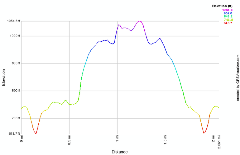 (The image at the left shows the profile of the hike. Remember that all vertical profiles are
relative!)
(The image at the left shows the profile of the hike. Remember that all vertical profiles are
relative!)