
Boulder Pine Mountain
| Quick Look | |||||
|---|---|---|---|---|---|
| Difficulty | Round trip | Total climb | Location | Elevation | Internet Maps |
| 3.43 mi | 500 ft | N41.1445 W74.4249 Passaic | 1420 ft | AllTrails | |
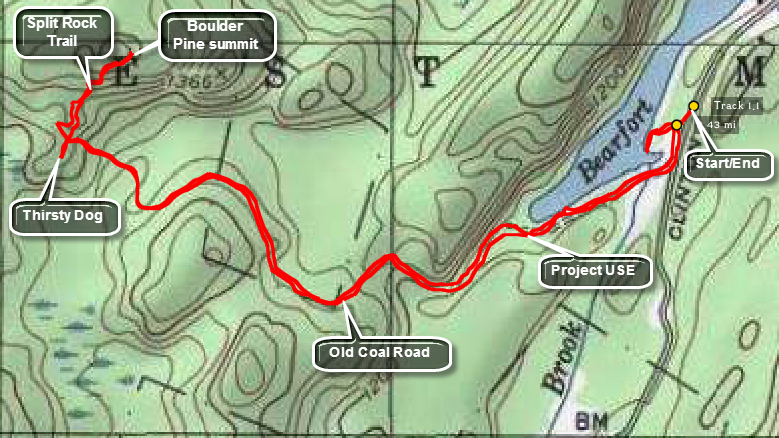 Park at the P7 parking area on Clinton Road near Bearfort Waters. This area is owned by the City of Newark Water Supply and they require a parking permit. The area is patrolled so go to their headquarters on Echo Lake Road and buy a yearly permit. Walk south on Clinton Road to the next driveway on the right for Project USE. Follow the driveway to the camp where you will see the camp buildings and the aerial high lines and zip lines. Continue to walk on the trail as it makes along and continuous ascent for until about 1.5 miles. At this point the high point will be to the right of the trail or north-northeast of your location. You may bushwhack or look for the Split Rock Trail created by Project USE. It will be marked with a yellow on brown sign. Follow the trail or your compass to the north and slightly east as you walk between and over some rocky areas. Ascend a slab of bedrock to the flat summit and look straight ahead to a large boulder with a pine tree next to it at about 1.75 miles. Return the way you came.
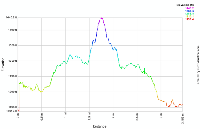 (The image at the left shows the profile of the hike. Remember that all vertical profiles are relative!)