
Mount Arlington
| Quick Look | |||||
|---|---|---|---|---|---|
| Difficulty | Round trip | Total climb | Location | Elevation | Internet Maps |
| 2.71 mi | 575 ft | N40.9157 W74.6282 Morris | 1220 ft | AllTrails | |
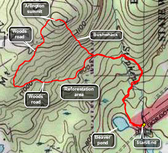 Park at the end of Gordon Road off of Berkshire Valley Road which runs north from I80. Follow the trail into the woods passed a small pond. There is private land in the area so be sure not to trespass! You may be able to follow roads and trails to the top as I did but a bushwhack will shorten the distance considerably and may better avoid the private lands. After about .75 miles, you will come across and area that was clear cut and is now growing back. From here begin to bushwhack to the northwest for about .3 miles. Some parts are a little steep but the distance is short. Reverse your path to get back to the car.
(The map at the right shows the parking area and the hiking route in a clockwise direction.)
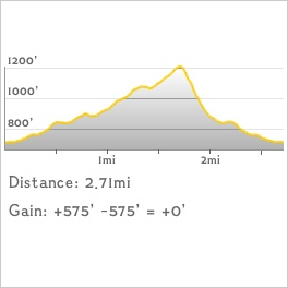 (The image at the left shows the profile of the hike. Remember that all vertical profiles are
relative!)
(The image at the left shows the profile of the hike. Remember that all vertical profiles are
relative!)
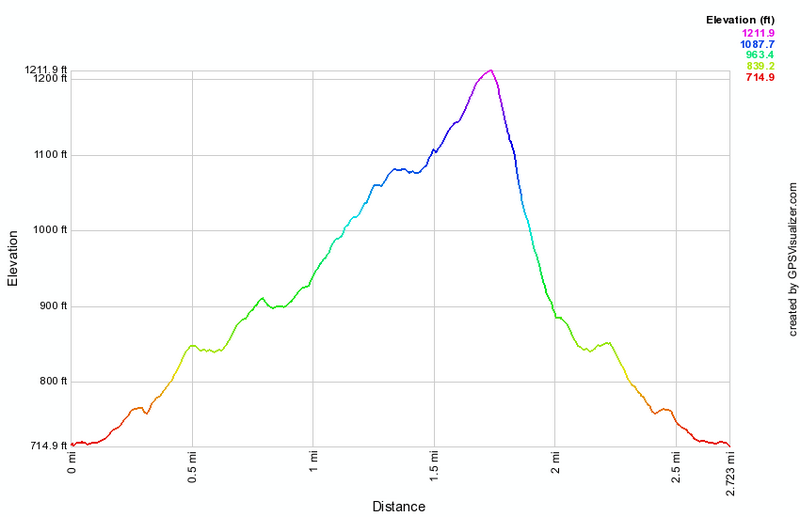 (The image at the left shows the profile of the hike. Remember that all vertical profiles are
relative!)
(The image at the left shows the profile of the hike. Remember that all vertical profiles are
relative!)