
What You Missed
Winter 2017-2018
Winter 2017-2018
![]()
![]()
![]()
![]()
![]() On Wednesday, March 21st, I wanted to get in the first hike of the spring but realized that Spring starts on March 22nd according to the Catskill 3500 Club whose lead I follow. I had been thinking of going to Frick Pond when I got a text from Lisa suggesting we hike on Round Top. I texted her back suggesting Frick Pond and she agreed. The possibility of snow had caused all the schools in the county to announce and early closing and I had to pick my grandchildren up at 11:30 AM from pre-school. I told Lisa I would meet her at her shop downtown at 12:30 PM. My plan was to ascend the Flynn Trail and then get the long descent on the Big Rock Trail. The temperature at 12:15 PM was in the low 30's as I was about to get dressed and I knew that snowshoeing always makes me very warm. I decided not to put on tights under my Columbia Omniheat pants. I wore a Mammut pullover over my long-sleeved baselayer. I put on my Mammut Ultimate Hoody which I wear most of the time. I chose my Tubbs Alp Flex VTR snowshoes which are a little smaller than some and have the BOA binding system. I knew I wouldn't need the flotation since the trails were pretty well packed even though the snow depth was still over a foot. The BOA system uses a dial to tighten a thin but strong wire and seems to evenly tighten the binding around my foot. Sheila was crazed as usual even though we had been out the day before. I drove downtown just before 12:30 PM and met Lisa at her shop. I explained my plan which she liked so we put her gear in my car. Sheila gave her a lavish greeting from the back seat as we left Livingston Manor to head out the Debruce Road. There was no hint of snow although the skies were completely overcast. At six miles I turned left onto Mongaup Pond Road which had some snow on it but had been plowed and well sanded. Where the road split I stayed left on Beech Mountain Road and parked in the small lot which was plowed. There were no cars in the lot and no tracks indicating anyone had been there recently. I set my electronics and we put on our snowshoes. We crossed the road at 12:55 PM to start up the Flynn Trail. The temperature was still right around 30 degrees so the snow was crunchy underfoot and was not clumping on the snowshoes. Lisa had chosen to bring her Crescent Moon snowshoes which are good on flat and rolling terrain. They have some of the best bindings and a teardrop shape. The beginning of the Flynn rail was a little puzzling as a tree had fallen across the middle of the trail. We decided to go "low" around the tree which I put on my list for trail maintenance. Lisa stopped to sign in at the trail register but I continued on the trail. I found that I was warm as long as I was moving but felt cool as son as I stopped. I hoped that I had not dressed too lightly! The first part of the Flynn Trail through the woods is narrow but I was having no trouble overlapping the smaller snowshoes. Once we made the right turn into the woods road the going was easier. There was an obvious snowshoe trail that appeared to be coming toward us and an additional track from a cross country skier! The snowshoes appeared to be quite long and the old style with a woven deck. There are some makers who are no producing these snowshoes again as custom or semi-custom models. I tried to get Sheila to follow the track but she kept going off exploring animal trails along the way. Eventually she dropped in behind me spending most of her time following my track. The snow was pretty hard and crunchy but following the previous snowshoe track was not as easy as I had hoped.
On Wednesday, March 21st, I wanted to get in the first hike of the spring but realized that Spring starts on March 22nd according to the Catskill 3500 Club whose lead I follow. I had been thinking of going to Frick Pond when I got a text from Lisa suggesting we hike on Round Top. I texted her back suggesting Frick Pond and she agreed. The possibility of snow had caused all the schools in the county to announce and early closing and I had to pick my grandchildren up at 11:30 AM from pre-school. I told Lisa I would meet her at her shop downtown at 12:30 PM. My plan was to ascend the Flynn Trail and then get the long descent on the Big Rock Trail. The temperature at 12:15 PM was in the low 30's as I was about to get dressed and I knew that snowshoeing always makes me very warm. I decided not to put on tights under my Columbia Omniheat pants. I wore a Mammut pullover over my long-sleeved baselayer. I put on my Mammut Ultimate Hoody which I wear most of the time. I chose my Tubbs Alp Flex VTR snowshoes which are a little smaller than some and have the BOA binding system. I knew I wouldn't need the flotation since the trails were pretty well packed even though the snow depth was still over a foot. The BOA system uses a dial to tighten a thin but strong wire and seems to evenly tighten the binding around my foot. Sheila was crazed as usual even though we had been out the day before. I drove downtown just before 12:30 PM and met Lisa at her shop. I explained my plan which she liked so we put her gear in my car. Sheila gave her a lavish greeting from the back seat as we left Livingston Manor to head out the Debruce Road. There was no hint of snow although the skies were completely overcast. At six miles I turned left onto Mongaup Pond Road which had some snow on it but had been plowed and well sanded. Where the road split I stayed left on Beech Mountain Road and parked in the small lot which was plowed. There were no cars in the lot and no tracks indicating anyone had been there recently. I set my electronics and we put on our snowshoes. We crossed the road at 12:55 PM to start up the Flynn Trail. The temperature was still right around 30 degrees so the snow was crunchy underfoot and was not clumping on the snowshoes. Lisa had chosen to bring her Crescent Moon snowshoes which are good on flat and rolling terrain. They have some of the best bindings and a teardrop shape. The beginning of the Flynn rail was a little puzzling as a tree had fallen across the middle of the trail. We decided to go "low" around the tree which I put on my list for trail maintenance. Lisa stopped to sign in at the trail register but I continued on the trail. I found that I was warm as long as I was moving but felt cool as son as I stopped. I hoped that I had not dressed too lightly! The first part of the Flynn Trail through the woods is narrow but I was having no trouble overlapping the smaller snowshoes. Once we made the right turn into the woods road the going was easier. There was an obvious snowshoe trail that appeared to be coming toward us and an additional track from a cross country skier! The snowshoes appeared to be quite long and the old style with a woven deck. There are some makers who are no producing these snowshoes again as custom or semi-custom models. I tried to get Sheila to follow the track but she kept going off exploring animal trails along the way. Eventually she dropped in behind me spending most of her time following my track. The snow was pretty hard and crunchy but following the previous snowshoe track was not as easy as I had hoped.
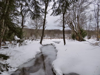
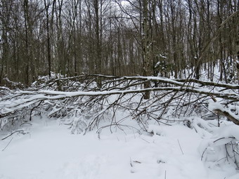
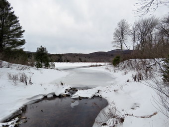 Despite the "warm" temperatures I felt no desire to open zippers and dump heat. We did stop once or twice so that I could take some pictures. We ran across one VERY large hemlock across the trail which will be a challenge to remove with an ax and saw! The walk with snowshoes is definitely more of a workout than without. As we gained some elevation, the snow got deeper until there was a foot to 18 inches in most spots and drifts up to 2 feet. I was surprised that there was still so much snow on the trails. .We continued up the Flynn Trail toward the junction with the Big Rock Trail. I was feeling pretty good at first but as we approached the trail junction I could feel some soreness in my hips from the content up and down motion with the extra weight. We were taking our time stopping to talk at point but by 2:20 PM we were finally at the trail junction with the Big Rock Trail. It had taken almost an hour and 30 minutes to walk the 1.7 miles from the parking area. The snow on the Big Rock Trail was well-packed by snowmobiles which Lisa decried but I celebrated. I knew that the downhill on the packed trail would go fast! At the trail junction we turned left to go down the Big Rock trail to Times Square. I was sure I didn't have any more "ups" left in me but the descent felt great. The trip down the Big Rock Trail went quickly and seemed shorter than usual. In several places, where large trees had fallen across the trail the snowmobile club had completely removed them. There are three places where the trail drops quickly and then levels off. The last place brought us right to Times Square where the Logger's Loop and Big Rock Trail cross. Sheila was having a great time and did not seem to be bothered in any way by the snow or temperature. She kept going off the trail to follow animals tracks but returned quickly when I called. It was 2:50 PM when we continued straight ahead at Times Square to go around the back of Frick Pond. We had made the 1.2 mile descent in 30 minutes for a speed of 2.4 mph! Here the snow showed some snowshoe tracks that were several days old or older and the trail was worn in. The hike around the pond is a favorite and is one promoted by Lisa at Morgan Outdoors in Livingston Manor. Some of the hikers had not been careful to follow the others who had gone before them and some had worn boots instead of snowshoes. Farthest reasons the trail was haphazard and a little hard to follow. As we approached the bridges and wooden walkways there were some nice views of the upper reaches of Frick Pond. I dropped my pack and took out my camera to get some pictures of the stream that flows under the bridge and the wetlands. The wooden walkways were covered so much snow it was hard to tell where they were located. We continued to walk until we came to the junction with the Quick Lake Trail. Here we turned left and headed for the bridge across the outlet of Frick Pond. We stopped briefly at the bridge and I took a few pictures of the pond and Flynn's Point. I also took one of Sheila posed on the bridge. We walked up the hill to Gravestone Junction to head back to the parking area and I felt even this short uphill in my legs. The trail was well covered in snow But there were many areas where there was ice and some where snow and water had mixed and frozen. It wasn't pretty but we made it to the trail register without any problems. At the register Lisa signed us out and we turned right to walk the rest of the Quick Lake Trail back to the parking area. As we approached the parking lot, the trail disappeared and there were several different tracks left by hikers. There were no markers and several trees and bushes across the trail. We found our way to the lot and back to the car but this area will require some maintenance. We were back at 3:40 PM having covered 4.1 miles in 2 hours and 45 minutes with an elevation gain of 680 feet.
![]()
![]()
![]()
![]() On Tuesday, March 20th I wanted to get out on a hike but didn't have much time to spend. There had been a few "warm" days in a row with cold nights so I expected the snow on Round Top to by pretty hard especially on the packed trails. I decided just to head across the street and hike on Round Top. Sheila seemed thrilled at the decision and couldn't wait to get going. I had a few things to do first and wee did not get started until 11:00 AM. The temperature was in the low 30's as I started to get dressed. As I got dressed I decided to put on a pair of tights under my Columbia Omniheat pants even though I knew I would probably be warm once I started hiking. I also put on a light, long-sleeved baselayer under my Mammut crew neck shirt. I put on my Mammut Ultimate hoody and wore a hat and a pair of gloves. I donned my Salomon B52 boots but decided I did not need gaiters. Sheila would not leave my side as I was getting ready as she wanted to make sure she was going too! I stepped out onto the back porch, put on my microspikes and headed out the slippery driveway at 11:20 AM. We crossed the street with Sheila on her leash and walked to the back of the church where I released Sheila from her leash. There was some snow that had drifted over our track in the field and I was sinking in more than I would have liked. The drifts in back of the church were still pretty high. There was only 2 or 3 inches of snow on the cemetery hill where the wind had blown it away. We began the ascent of the steepest hill behind the church. The hill is short but really gets the circulation pumping and is the steepest and longest climb on the "trail". When we got to the top of the hill, we started out on the trail by turning left at the trailhead. I continued to sink into the snow which was not as form as I had hoped. I knew I should have worn snowshoes but decided to continue. When we arrived at the large blowdown blocking the trail, I turned right into the woods and up the hill toward the trail that leads up from the first trail junction. My track from earlier trips was still visible and easy to follow. When we hit the trail, we turned right and continued up the trail.
On Tuesday, March 20th I wanted to get out on a hike but didn't have much time to spend. There had been a few "warm" days in a row with cold nights so I expected the snow on Round Top to by pretty hard especially on the packed trails. I decided just to head across the street and hike on Round Top. Sheila seemed thrilled at the decision and couldn't wait to get going. I had a few things to do first and wee did not get started until 11:00 AM. The temperature was in the low 30's as I started to get dressed. As I got dressed I decided to put on a pair of tights under my Columbia Omniheat pants even though I knew I would probably be warm once I started hiking. I also put on a light, long-sleeved baselayer under my Mammut crew neck shirt. I put on my Mammut Ultimate hoody and wore a hat and a pair of gloves. I donned my Salomon B52 boots but decided I did not need gaiters. Sheila would not leave my side as I was getting ready as she wanted to make sure she was going too! I stepped out onto the back porch, put on my microspikes and headed out the slippery driveway at 11:20 AM. We crossed the street with Sheila on her leash and walked to the back of the church where I released Sheila from her leash. There was some snow that had drifted over our track in the field and I was sinking in more than I would have liked. The drifts in back of the church were still pretty high. There was only 2 or 3 inches of snow on the cemetery hill where the wind had blown it away. We began the ascent of the steepest hill behind the church. The hill is short but really gets the circulation pumping and is the steepest and longest climb on the "trail". When we got to the top of the hill, we started out on the trail by turning left at the trailhead. I continued to sink into the snow which was not as form as I had hoped. I knew I should have worn snowshoes but decided to continue. When we arrived at the large blowdown blocking the trail, I turned right into the woods and up the hill toward the trail that leads up from the first trail junction. My track from earlier trips was still visible and easy to follow. When we hit the trail, we turned right and continued up the trail.
Walking in the soft snow added a level of difficulty to the hike but I did not feel I was damaging the trail too much. As I walked, I removed a few loose branches from the trail and tried to free some of the trees that were still bent over. I followed the blazes for the yellow trail up to the trail junction. I turned left at the trail junction and followed the yellow rail along the base of Round Top. The trail was pretty open as I had done some maintenance to remove the blowdowns. At the next trail junction, we turned right on the blue trail and headed up the steepest hill to the summit of Round Top. The microspikes were better than bare boots but the snow was pretty deep so they were not digging in enough to prevent me from slipping. On the summit we followed the trail even though there were still some branches blocking the way. The trip down the other side went quickly even though I was not able to get a glide with the microspikes. At the yellow trail we turned right and then left at the next trail junction to head down to the lookout. At the lookout we turned left and descended the hill to the first trail unction. This hill had a little less snow than elsewhere as it is most exposed to the sun. I was tired but knew I needed at least an hour of exercise. We turned around and headed back up the hill to the lookout. We turned right at the top following the yellow trail on the long, gentle climb to the junction with the blue trail. We turned right and followed the yellow trail along the base of Round Top to the next junction. Here we turned left and followed the blue trail to the summit. Once again we braved the branches in the trail to cross the summit. On the steep descent to the yellow trail I had to watch my footing as I couldn't really get a glide and the microspikes were not giving me enough traction. We turned left on the yellow trail and then right at the next trail junction. It was enjoyable following the old woods road back down toward the first trail junction. When we came to the path I had made up from the trailhead, we turned left and walked back out to the cemetery. From there we descended the hill and walked across the field to the driveway and home. We had spent a little over an hour walking a little more than 2 miles. The walk was a good workout even though I feel I could do it blindfolded!
![]()
![]()
![]()
![]()
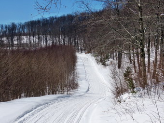
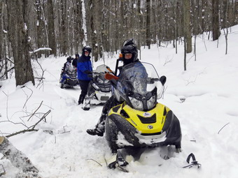
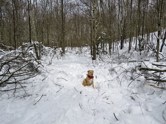
![]() On Saturday, March 17th I had a men's breakfast at the church at 8:00 AM. I got up at 6:30 AM and found the temperature was in the teens! I went to church to help set up for the breakfast and while doing so received a text from JP, a friend, asking if we were going snowshoeing after the breakfast. I answered that I was going but wanted to return home first. I called Cindy and she wanted to go and we decided on Bear Spring WMA between Downsville and Walton. I called JP and told him we would meet him at 10:15 AM at the diner and then drive to Bear Spring. As we were getting ready Sheila knew something was "up" and stayed close to me as I got dressed and got the gear together. I had picked Bear Spring since I knew there would be snow and that the area was used by snowmobiles. This would allow us to wear snowshoes but we could walk on packed trails without slogging through deep snow and breaking our own trail! The temperature was still in the high 20's so I decided to dress warmly. As I got dressed I decided to put on a pair of tights under my Columbia Omniheat pants. I also put on a light, long-sleeved baselayer under my Mammut crew neck shirt. I put on my Mammut Ultimate hoody and wore a hat and a pair of gloves. I donned my Salomon B52 boots and put on gaiters just in case. Both Cindy and I chose our Tubbs Alp Flex VTR snowshoes. They are a little smaller than some but have the BOA binding system. The BOA system uses a dial to tighten a thin but strong wire and seems to evenly tighten the binding around the foot. There is a strap around the back which is easily adjustable. They have a superior grip and televators for walking up steep hills. We got all our gear in the car and I drove to the diner to meet JP. When we arrived, he was already there so we leaded north on State Route 17 to Roscoe. From There we took Route 206 toward Downsville. At the Pepacton Reservoir, we trend left to head towards Downsville. There seemed to be plenty of snow on the hills as we passed through Downsville and headed up the mountain toward Walton. I had planned to park at pulloff on the side of the road but it was not plowed. We continued on up the hill and turned left on West Trout Brook Road. At the top of the hill there is a parking lot and on this day it was almost full of trucks with snowmobile trailers. Fortunately there were a few spots free and we were able to park without blocking anybody. We immediately got out of our cars and got our gear ready. I set my Suunto Traverse GPS watch and my Garmin GPSmap 64st handheld unit. We put on our snowshoes and headed southeast on a trail that parallels Route 206. The snow was well-packed by the snowmobiles and we kept listening for them so that we could clear the trail. My experience with snowmobiles has been very good as they are usually courteous and slow down as they pass. We followed the track heading down to East Trout Brook Road. We crossed the road and stayed to the left as the trail branched and began to climb a hill. At the next T junction we turned left and headed down to the wide woods road. This was the road that we would have walked in on had we parked at the pulloff that was not plowed. We turned right onto the woods road and followed it for at least half a mile along an old clear cut. The clear cut area had at one time been a good place to get view down the valley but it has now grown up and views are few. Several snowmobiles passed us as we walked. I stopped to take a few pictures of the trail under sunny skies. Eventually we entered the woods again but stayed on the wide woods road.
On Saturday, March 17th I had a men's breakfast at the church at 8:00 AM. I got up at 6:30 AM and found the temperature was in the teens! I went to church to help set up for the breakfast and while doing so received a text from JP, a friend, asking if we were going snowshoeing after the breakfast. I answered that I was going but wanted to return home first. I called Cindy and she wanted to go and we decided on Bear Spring WMA between Downsville and Walton. I called JP and told him we would meet him at 10:15 AM at the diner and then drive to Bear Spring. As we were getting ready Sheila knew something was "up" and stayed close to me as I got dressed and got the gear together. I had picked Bear Spring since I knew there would be snow and that the area was used by snowmobiles. This would allow us to wear snowshoes but we could walk on packed trails without slogging through deep snow and breaking our own trail! The temperature was still in the high 20's so I decided to dress warmly. As I got dressed I decided to put on a pair of tights under my Columbia Omniheat pants. I also put on a light, long-sleeved baselayer under my Mammut crew neck shirt. I put on my Mammut Ultimate hoody and wore a hat and a pair of gloves. I donned my Salomon B52 boots and put on gaiters just in case. Both Cindy and I chose our Tubbs Alp Flex VTR snowshoes. They are a little smaller than some but have the BOA binding system. The BOA system uses a dial to tighten a thin but strong wire and seems to evenly tighten the binding around the foot. There is a strap around the back which is easily adjustable. They have a superior grip and televators for walking up steep hills. We got all our gear in the car and I drove to the diner to meet JP. When we arrived, he was already there so we leaded north on State Route 17 to Roscoe. From There we took Route 206 toward Downsville. At the Pepacton Reservoir, we trend left to head towards Downsville. There seemed to be plenty of snow on the hills as we passed through Downsville and headed up the mountain toward Walton. I had planned to park at pulloff on the side of the road but it was not plowed. We continued on up the hill and turned left on West Trout Brook Road. At the top of the hill there is a parking lot and on this day it was almost full of trucks with snowmobile trailers. Fortunately there were a few spots free and we were able to park without blocking anybody. We immediately got out of our cars and got our gear ready. I set my Suunto Traverse GPS watch and my Garmin GPSmap 64st handheld unit. We put on our snowshoes and headed southeast on a trail that parallels Route 206. The snow was well-packed by the snowmobiles and we kept listening for them so that we could clear the trail. My experience with snowmobiles has been very good as they are usually courteous and slow down as they pass. We followed the track heading down to East Trout Brook Road. We crossed the road and stayed to the left as the trail branched and began to climb a hill. At the next T junction we turned left and headed down to the wide woods road. This was the road that we would have walked in on had we parked at the pulloff that was not plowed. We turned right onto the woods road and followed it for at least half a mile along an old clear cut. The clear cut area had at one time been a good place to get view down the valley but it has now grown up and views are few. Several snowmobiles passed us as we walked. I stopped to take a few pictures of the trail under sunny skies. Eventually we entered the woods again but stayed on the wide woods road.
 We walked and talked which made the walking go quicker. I had thought we would do a big loop of a least 7 miles but I could see I that Sheila and I were the only ones who wanted to do that. I told Cindy and JP we would hike to the point where the snowmobile trail went down to East Trout Brook Road at Launt Pond. We would stow our snowshoes and then walk the road back to Route 206 and then to the car. We could then retrieve our snowshoes by driving to where we had left them. At around 2.2 miles we began to climb a hill. I was fresh and pushed myself up the hill. When I turned around, I noticed my companions were lagging so I slowed my pace to allow them to catch up. At 2.85 miles I came to the turn down to Launt Pond and stopped to wait for Cindy and JP. After waiting 5 minutes I walked back in the direction I had come from but did not see the. I didn't know what had happened by I suspected they had turned back. It as a tough decision but I turned around and started down toward Launt Pond. I set a very quick pace and was not happy that I did not know what had happened. The trail makes nearly a 180 degree turn and parallels the upper woods road that we had come in on for almost a mile. Sheila was with me and kept looking up toward the other trail and whining. I don't know how she knew that Cindy and JP were on the upper trail! The descent went quickly as it is all downhill and because I pushed the pace. At 4.1 miles we arrived at the parking area on East Trout Brook Road just south of Launt Pond. From our highest point on the ridge we had descended 650 feet in 1.5 miles. I stowed my snowshoes in a snow bank before Sheila and I walked out to the road and turned right to head north. I put Sheila on her leash and she still had enough energy to help pull me up the hill. We passed by Launt Pond and continued along the road under a bright and warm sun. I was till wondering where Cindy and JP were and ran some scenarios through my head. The hike to Route 206 was 1.2 miles which was longer than I though but the elevation gain was only 370 feet. Rather than walk back to the car on the trail, I decide to stay on the road. We walked out to Route 206 and turned left to walk the half mile back to West Trout Brook road. We turned left on walked up the hill to the car. Cindy and JP were not there. I wrote Cindy and note and started back out on the trail with bare boots to see if I could find them. The trail was firm so I wasn't sinking in very much. I walked across the field heading toward East Trout Brook Road but did not see them coming toward me. I entered the woods and continued on the trail praying I would meet them soon. Just before the road I heard voices and then saw them hiking toward me. I was relieved as we turned around and hiked back to the cars. It was 2:00 Pm and I had hiked 6.7 miles in 3 hours with an elevation gain of 1133 feet. The pace was faster than I had thought but the downhill to Launt Pond and subsequent road walk had certainly helped. I was tired from my adventure! I drove out to Route 206 and turned right and then right again on East trout Brook Road. I drove to Launt Pond and parked on the side of the road. I walked out to the pond to take some pictures and the returned to the car. I drove down to the parking area to retrieve my snowshoes which were right where I had left them.
![]()
![]()
![]()
![]()
![]() On Thursday, March 15th I wanted to get out to hike on snowshoes while there was still snow remaining in the woods. I decided just to head across the street and hike on Round Top again as it is close and I Just wanted the exercise. Sheila seemed thrilled at the decision and couldn't wait to get going I had a few things to do first and I did not get start getting until 11:00 AM. The temperature was in the high 20's as I started to get dressed. As I got dressed I decided to put on a pair of tights under my Columbia Omniheat pants. I also put on a light, long-sleeved baselayer under my Mammut crew neck shirt. I put on my Mammut Ultimate hoody and wore a hat and a pair of gloves. I donned my Salomon B52 boots and put on gaiters just in case. Sheila would not leave my side as I was getting ready as she wanted to make sure she was going too! I stepped out onto the back porch, put on my snowshoes and headed out the slippery driveway at 11:20 AM. I chose my Tubbs Alp Flex VTR snowshoes. They are a little smaller than some but have the BOA binding system. The BOA system uses a dial to tighten a thin but strong wire and seems to evenly tighten the binding around the foot. We crossed the street with Sheila on her leash and walked to the back of the church. There was some fresh snow in the field mostly from the drifting that a stiff breeze had caused. The drifts in back of the church were still pretty high. There was only 2 or 3 inches of snow on the cemetery hill where the wind had blown it away. We began the ascent of the steepest hill behind the church. The hill is short but really gets the circulation pumping and is the steepest and longest climb on the "trail". Sheila helped me along by pulling me up the hill. When we got to the top of the hill, we started out on the trail by turning left at the trailhead. As soon as we entered the trees I released Sheila from her leash. When we arrived at the large blowdown blocking the trail, I turned right into the woods and up the hill toward the trail that leads up from the first trail junction. Our track from the day before were still very visible and easy to follow. When we hit the trail, we turned right and continued up the trail which follows an old woods road. Sheila was happy to be going out in the snow as she loves to run and jump through it. She is mostly Yellow Lab but also has some Siberian Husky. Her longer coat keeps her warm in all but the coldest weather.
On Thursday, March 15th I wanted to get out to hike on snowshoes while there was still snow remaining in the woods. I decided just to head across the street and hike on Round Top again as it is close and I Just wanted the exercise. Sheila seemed thrilled at the decision and couldn't wait to get going I had a few things to do first and I did not get start getting until 11:00 AM. The temperature was in the high 20's as I started to get dressed. As I got dressed I decided to put on a pair of tights under my Columbia Omniheat pants. I also put on a light, long-sleeved baselayer under my Mammut crew neck shirt. I put on my Mammut Ultimate hoody and wore a hat and a pair of gloves. I donned my Salomon B52 boots and put on gaiters just in case. Sheila would not leave my side as I was getting ready as she wanted to make sure she was going too! I stepped out onto the back porch, put on my snowshoes and headed out the slippery driveway at 11:20 AM. I chose my Tubbs Alp Flex VTR snowshoes. They are a little smaller than some but have the BOA binding system. The BOA system uses a dial to tighten a thin but strong wire and seems to evenly tighten the binding around the foot. We crossed the street with Sheila on her leash and walked to the back of the church. There was some fresh snow in the field mostly from the drifting that a stiff breeze had caused. The drifts in back of the church were still pretty high. There was only 2 or 3 inches of snow on the cemetery hill where the wind had blown it away. We began the ascent of the steepest hill behind the church. The hill is short but really gets the circulation pumping and is the steepest and longest climb on the "trail". Sheila helped me along by pulling me up the hill. When we got to the top of the hill, we started out on the trail by turning left at the trailhead. As soon as we entered the trees I released Sheila from her leash. When we arrived at the large blowdown blocking the trail, I turned right into the woods and up the hill toward the trail that leads up from the first trail junction. Our track from the day before were still very visible and easy to follow. When we hit the trail, we turned right and continued up the trail which follows an old woods road. Sheila was happy to be going out in the snow as she loves to run and jump through it. She is mostly Yellow Lab but also has some Siberian Husky. Her longer coat keeps her warm in all but the coldest weather.
We continued to follow the woods road to the next trail junction with the upper blue trail. Rather than do figure 8s I decided to contuse straight up the hill to the summit and do a big loop. Climbing wasn't very difficult except for the occasional branch across the trail At the summit we followed the trail through a section that I had not yet cleared of branches. The snow had weighed down some beaches and pinned them to the ground almost blocking the trail. We continued over the summit and won the other side. I was able to lift the tips of my snowshoes and glide down the hill. The glide was pretty fast and at least once it was faster than I would have liked! When we reached the lower yellow trail we turned right and followed the trail down the gentle hill to the viewpoint. Here we turned left and continued down the trail to the first trail junction. I was undecided what to do next but thought it would be a good idea to break out all the trails for others who might like to use the trails. Sheila and I turned around and headed back up the steep hill to the lookout. We turned right to follow the yellow trail uphill through the woods through the junction with the blue trail. This time w turned right and followed the yellow trail along the base of the Round Top summit. The trail was easy to break even though there was some new snow. The branches I had cleared earlier had not come back onto the trail. At the next trial junction we turned right to follow the yellow trail back down the hill. When we came to the point where we had entered the trail, we continued to walk straight ahead back to the first trail junction. This was the only part of the trail we had "missed" and I wanted to make sure I could saw we had packed all the trails. We turned around and headed back up the hill until we cut into the woods to follow our track back down to the trail and then out to the trailhead. We walked down the cemetery hill which was now bathed in bright sunlight. At the church we turned right and walked back across the field which was a little easier since we had already packed the trail. We crossed the street and walked back down the driveway to our house. We were home at about 1:00 PM after spending almost and hour and a half walking about two miles.
![]()
![]()
![]()
![]() On Wednesday, March 14th I wanted to get out on a hike but didn't have much time to spend. I knew there was some fresh snow from the storm on Tuesday and wanted to take advantage of it with spring a little more than a week away. I decided just to head across the street and hike on Round Top. Sheila seemed thrilled at the decision and couldn't wait to get going I had a few things to do first and wee did not get started until 11:00 AM. The temperature was in the high 20's as I started to get dressed. Looking over at Round Top convinced me to wear snowshoes and I knew I would get warm. As I got dressed I decided to put on a pair of tights under my Columbia Omniheat pants. I also put on a light, short-sleeved baselayer under my Mammut crew neck shirt. I put on my Mammut Ultimate hoody and wore a hat and a pair of gloves. I donned my Salomon B52 boots and put on gaiters just in case. Sheila would not leave my side as I was getting ready as she wanted to make sure she was going too! I stepped out onto the back porch, put on my snowshoes and headed out the slippery driveway at 11:20 AM. I chose my Tubbs Alp Flex VTR snowshoes. They are a little smaller than some but have the BOA binding system. The BOA system uses a dial to tighten a thin but strong wire and seems to evenly tighten the binding around the foot. We crossed the street with Sheila on her leash and walked to the back of the church. There was more fresh snow in the field than I had expected and the drifts in back of the church were still pretty high. There was only 2 or 3 inches of snow on the cemetery hill where the wind had blown it away. I knew the snowshoes would grip the snow and would give me an additional workout. We began the ascent of the steepest hill behind the church. The hill is short but really gets the circulation pumping and is the steepest and longest climb on the "trail". Sheila helped me along by pulling me up the hill. When we got to the top of the hill, we started out on the trail by turning left at the trailhead. As soon as we entered the trees I released Sheila from her leash. When we arrived at the large blowdown blocking the trail, I turned right into the woods and up the hill toward the trail that leads up from the first trail junction. Our track from earlier in the week was still visible and easy to follow. When we hit the trail, we turned right and continued up the trail.
On Wednesday, March 14th I wanted to get out on a hike but didn't have much time to spend. I knew there was some fresh snow from the storm on Tuesday and wanted to take advantage of it with spring a little more than a week away. I decided just to head across the street and hike on Round Top. Sheila seemed thrilled at the decision and couldn't wait to get going I had a few things to do first and wee did not get started until 11:00 AM. The temperature was in the high 20's as I started to get dressed. Looking over at Round Top convinced me to wear snowshoes and I knew I would get warm. As I got dressed I decided to put on a pair of tights under my Columbia Omniheat pants. I also put on a light, short-sleeved baselayer under my Mammut crew neck shirt. I put on my Mammut Ultimate hoody and wore a hat and a pair of gloves. I donned my Salomon B52 boots and put on gaiters just in case. Sheila would not leave my side as I was getting ready as she wanted to make sure she was going too! I stepped out onto the back porch, put on my snowshoes and headed out the slippery driveway at 11:20 AM. I chose my Tubbs Alp Flex VTR snowshoes. They are a little smaller than some but have the BOA binding system. The BOA system uses a dial to tighten a thin but strong wire and seems to evenly tighten the binding around the foot. We crossed the street with Sheila on her leash and walked to the back of the church. There was more fresh snow in the field than I had expected and the drifts in back of the church were still pretty high. There was only 2 or 3 inches of snow on the cemetery hill where the wind had blown it away. I knew the snowshoes would grip the snow and would give me an additional workout. We began the ascent of the steepest hill behind the church. The hill is short but really gets the circulation pumping and is the steepest and longest climb on the "trail". Sheila helped me along by pulling me up the hill. When we got to the top of the hill, we started out on the trail by turning left at the trailhead. As soon as we entered the trees I released Sheila from her leash. When we arrived at the large blowdown blocking the trail, I turned right into the woods and up the hill toward the trail that leads up from the first trail junction. Our track from earlier in the week was still visible and easy to follow. When we hit the trail, we turned right and continued up the trail.
Walking through the four inches of new snow was fun but added a level of difficulty to the hike. As I walked, I removed a few loose branches from the trail and tried to free some of the trees that were still bent over. I followed the blazes for the yellow trail up to the trail junction. I turned left at the trail junction and followed the yellow rail along the base of Round Top. The trail was pretty open as I had done some maintenance to remove the blowdowns. At the next trail junction, we turned right on the blue trail and headed up the steepest hill to the summit of Round Top. On the summit we followed the trail even though there were still some branches blocking the way. The trip down the other side went quickly even though I was not able to get much of a glide. At the yellow trail we turned right and then left at the next trail junction to headed down to the lookout. At the lookout we turned left and descended the hill to the first trail unction. This hill had a little less snow than elsewhere as it is most exposed to the sun. I was tired but knew I needed at least an hour of exercise. We turned around and headed back up the hill to the lookout. We turned right at the top following the yellow trail on the long, gentle climb to the junction with the blue trail. We turned right and followed the yellow trail along the base of Round Top to the next junction. Here we turned left and followed the blue trail to the summit. Once again we braved the branches in the trail to cross the summit. On the steep descent to the yellow trail I was able to get a great glide almost all the way from the top to the trail junction. We turned left on the yellow trail and the right at the next trail junction. It was enjoyable following the old woods road back down toward the first trail junction. When we came to the path I had made up from the trailhead, we turned left and walked back out to the cemetery. From there we descended the hill and walked across the field to the driveway and home. We had spent a little over an hour walking a little more than 2 miles. The walk was a good workout even though I feel I could do it blindfolded!
![]()
![]()
![]()
![]()
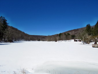
![]() On Saturday, March 10th I was ready to go out for a hike before the temperature rose and made the snow too "clumpy". I also knew that the snow might disappear any day with warmer weather and rain! I wanted to get in a longer hike that was Not on Round top across from my driveway and decided to go to Frick Pond to hike a route. When I awoke in the morning the temperature was just above 20 degrees so I was not too eager to get a very early start. I did a few things around the house and then decided to get going before the snow got too soft. I asked Cindy of she wanted to go and she agreed. I did not have to ask Sheila as she is always ready to hike. Because the temperature was only in the high 20's , I decided to wear my Mammut hoody and warmer Columbia Titanium pants with tights underneath. On top I chose a long-sleeved baselayer under a Mammut pullover. The hoody has lots of zippers to help regulate temperature and I knew I could always take it off if I got too warm. I wore a heavier hat and gloves and out on my Salomon B52 winter boots and OR Crocodile gaiters to deal with the deep snow. Cindy and I got all our gear ready including our snowshoes which we knew we would have to use due to the deep snow that had fallen during the week. We both chose our Tubbs Alp Flex VTR snowshoes. They are a little smaller than some but have the BOA binding system. The BOA system uses a dial to tighten a thin but strong wire and seems to evenly tighten the binding around the foot. Sheila was happy to be going anywhere and crouched in the back seat with her head on the console. Just after 10:30 AM we headed out the DeBruce Road. After about 6 miles, I turned left on Mongaup Pond Road and stayed left where the road split falling Beech Mountain Road to the trailhead. By the time we had arrived at the parking area, the was 28 degrees but a stiff breeze made it feel cooler. The lot had been plowed once but new snow had accumulated. There were no other cars in the lot and there were no tracks. A quick inspection of the trails showed that no one had been out on them since the last snowfall on Wednesday. I like breaking trail in untouched snow but it is very tiring! We put our snowshoes and headed out to the woods road to the Quick Lake Trail at 10:45 AM. The snow was deep and had some water underneath which I tried to avoid since it causes snow to stick to the bottom of the snowshoes. We passed the trail register and heading toward Frick Pond. I could see that there were a lot of branches that had been weighed down by the snow and were leaning onto the trail. We had to try to avoid these branches and the places where there was water on the trail. At Gravestone Junction we turned right to get on the yellow Logger's Loop heading toward Times Square.
On Saturday, March 10th I was ready to go out for a hike before the temperature rose and made the snow too "clumpy". I also knew that the snow might disappear any day with warmer weather and rain! I wanted to get in a longer hike that was Not on Round top across from my driveway and decided to go to Frick Pond to hike a route. When I awoke in the morning the temperature was just above 20 degrees so I was not too eager to get a very early start. I did a few things around the house and then decided to get going before the snow got too soft. I asked Cindy of she wanted to go and she agreed. I did not have to ask Sheila as she is always ready to hike. Because the temperature was only in the high 20's , I decided to wear my Mammut hoody and warmer Columbia Titanium pants with tights underneath. On top I chose a long-sleeved baselayer under a Mammut pullover. The hoody has lots of zippers to help regulate temperature and I knew I could always take it off if I got too warm. I wore a heavier hat and gloves and out on my Salomon B52 winter boots and OR Crocodile gaiters to deal with the deep snow. Cindy and I got all our gear ready including our snowshoes which we knew we would have to use due to the deep snow that had fallen during the week. We both chose our Tubbs Alp Flex VTR snowshoes. They are a little smaller than some but have the BOA binding system. The BOA system uses a dial to tighten a thin but strong wire and seems to evenly tighten the binding around the foot. Sheila was happy to be going anywhere and crouched in the back seat with her head on the console. Just after 10:30 AM we headed out the DeBruce Road. After about 6 miles, I turned left on Mongaup Pond Road and stayed left where the road split falling Beech Mountain Road to the trailhead. By the time we had arrived at the parking area, the was 28 degrees but a stiff breeze made it feel cooler. The lot had been plowed once but new snow had accumulated. There were no other cars in the lot and there were no tracks. A quick inspection of the trails showed that no one had been out on them since the last snowfall on Wednesday. I like breaking trail in untouched snow but it is very tiring! We put our snowshoes and headed out to the woods road to the Quick Lake Trail at 10:45 AM. The snow was deep and had some water underneath which I tried to avoid since it causes snow to stick to the bottom of the snowshoes. We passed the trail register and heading toward Frick Pond. I could see that there were a lot of branches that had been weighed down by the snow and were leaning onto the trail. We had to try to avoid these branches and the places where there was water on the trail. At Gravestone Junction we turned right to get on the yellow Logger's Loop heading toward Times Square.
 I stopped once or twice to take pictures and a short rest as walking through the drifted snow was hard work. there were several large trees down across the trail and I knew we would have work to do to clear the trail in the spring. We walked around the blowdowns and headed downhill toward Times Square. I did not know what to expect at Times Square knowing that if the Logger's Loop was not packed by snowmobiles we probably could not hike it for the whole length! At Times Square we found that the trail had been packed by snowmobiles and that three machines were stopped ahead on the Logger's Loop. I could hear a chainsaw stunning and thought were probably members of The Sullivan County Trails Association. This is group that enjoys riding snowmobiles and keep all the trails they use free of blowdowns and blockages. This is a great help for hikers as they are allowed to use chainsaws which saves a lot of time on larger trees. As we approached the group, I introduced myself and found that This was Mike Barkley, president of the association, and his crew. We talked for a while and then decided to continue. The snowmobiles left first further packing the trail. We began to climb uphill but the walk was much easier on the packed trail. We had both walked through some slush which now attracted snow to the bottom of the snowshoes. We had to clear our snowshoes several times before we could walk comfortably. The trail was well packed by snowmobiles and almost immediately we could hear some machines coming from the direction of Mongaup Pond. Sheila ran right over to me and we all walked off the trail. As the machines approached and saw us, they slowed down to a crawl. We waved as they passed us and accelerated. Some people complain about the smell of the exhaust but it has never really bothered me. I realized that to me it smells like the exhaust from chainsaws which brings back a lot of good memories from when I was logging with my father 50 years ago. We continued our hike as the trail continued to rise and then flattened a little. Several times along the way we moved to the side of the trail to allow more snowmobiles to pass. It was a pleasure to walk on the packed trail and we were soon at Iron Wheel Junction. I stopped to take a few pictures of the contrast between the packed snowmobile trail and the fresh and untouched snow on the Quick Lake Trail. We turned left at the junction and headed back toward Frick Pond on the Quick Lake Trail.
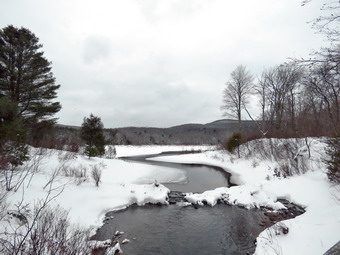 As we started out on the Quick Lake Trail, I was breaking trail through about 6 inches of new snow that was piled on top of over a foot that had fallen in a previous storm. Occasionally I would break through the snow underneath which made the going even tougher. We stopped for a drink and a bar. As we were stopped, it started to snow! I took some pictures of the track we were leaving and the untouched snow ahead. The consistency of the snow and the air temperature combined to give the snow and almost "silky" feel. Some of the snow stuck to our snowshoes but it wasn't too bad. The trail is slightly downhill which was good since I was getting more tired by the minute. We came to the small stream in the woods which had a little too much water to cross on the rail. We walked upstream a little and found a narrower spot but still had to get our snowshoes wet! Immediately the snow began to stick to the bottom of the snowshoes and it took us several times to get it cleaned off. Walking through the "spruce tunnel" was not easy as there were several new blowdowns and many branches heavy with snow hanging down in the trail. Eventually we walked out the other side. The snow was deeper here and I developed a routine of counting steps to take my mind off the difficulty of the task. There were a few wet spots but we avoided them and finally arrived at the junction with the Big Rock Trail. I had hoped that someone had made a track here but the snow was pristine. We turned right to follow the Quick Lake Trail to the bridge across the outlet of Frick Pond. The snow had rifted to a depth of 2 feet in some paces but the drifts were firm which allowed us to stay on top of the. I stopped at the bridge despite the fact that I have taken hundreds of pictures from it. I took a few shots of the bridge with snow on it and some of Cindy and Sheila and a large drift at the western end of the bridge. I also took shots of the pond and Flynn's Point. The snow was still coming down but did not obscure the scene. I packed up and we continued up the hill and back to Gravestone Junction. The small hill was all I could handle as my leg muscles were shot. At Gravestone Junction we continued out the Quick Lake Trail and back to the car. Along the way it became obvious that several other hikers had been on the trail with snowshoes. Most of the way they had stayed in the track Cindy and I had started but at times deviated or walked side-by-side. We arrived at the car at 1:55 PM having hike 3.8 miles in 3 hours and 10 minutes with an elevation gain of 390 feet. I was glad to be back at the car and sitting down!
![]()
![]()
![]()
![]()
![]() On Monday, March 5th I wanted to get out to hike before the 18 inches of snow that had fallen on Friday disappeared as had happened with other snowfalls. I wanted to go across the street to Round Top and hike the complete lower trail to see if it was blocked in any way by trees and bushes heavy with snow. When Cindy and I had hiked on Saturday, we had found several blowdowns that we had to walk around. I wanted to get started early before the temperature rose above freezing and made the snow soft. Under these conditions the snow often clings to the snow shoes forming clumps and making the experience less than enjoyable. As it happened it was after 10:00 AM before I was ready to go. It was around 30 degrees but actually felt warmer. I did not bother with tights under my Columbia Omniheat Pants but put on a baselayer on top under my Mammut pullover. As always I put on my Mammut Ultimate hoody and wore a hat and gloves. I wore my Salomon B52 winter boots and put on OR Crocodile gaiters to deal with the deep snow. I wore my Tubbs Alp Flex VTR snowshoes. They are a little smaller than some and have the BOA binding system. I knew I wouldn't need the flotation since the snow depth was only 6 to 10 inches. The BOA system uses a dial to tighten a thin but strong wire and seems to evenly tighten the binding around the foot. Sheila was happy to be going out in the snow as she loves to run and jump through it. She is mostly Yellow Lab but also has some Siberian Husky. Her longer coat keeps her warm in all but the coldest weather. We went outside, I put on my snowshoes and put Sheila on her leash. I decided to leave my pack home since I had taken quite a few pictures on Saturday right after the snowfall. We headed out the driveway at 10:15 AM and crossed the street. Once in the field, I released Sheila from her leash. I followed the faint trail we had made with the snowshoes on our last hike and was surprised that the packed track supported me quite well. This made walking much easier. A few forays off the packed track convinced me to stay on the track. We walked through the field next to the church with some effort and then started the walk up the steep but short cemetery hill. The snow on the road up the hill had drifted away so only a few inches remained until we got to the top of the hill. There were several tracks down the hill which showed that someone had been enjoying a slide down the hill on the snow. I was glad toy see this since often there are no tracks after it snows as kids tend to stay inside and use their electronic devices too much! Much of the snow that had piled up on the branches of the trees had fallen off due to the slightly warmer weather and the wind. We turned left and entered the trail stepping around one small blowdown across the trail. We worked our way around some bushes in the trail and I looked ahead to see a massive set of trees blocking the trail. Three or four large trunks had fallen from high to low across the trail completely blocking passage. I walked off the trail to the right to bypass the blowdown on the uphill side following the track we had made on Saturday. The bank was steep as I headed up toward the yellow trail. This was the trail that we normally take by turning right at the first trail junction. It wasn't long before we hit the trail where I turned left toward the trail junction. At the trail junction I turned right and we headed up to the lookout.
On Monday, March 5th I wanted to get out to hike before the 18 inches of snow that had fallen on Friday disappeared as had happened with other snowfalls. I wanted to go across the street to Round Top and hike the complete lower trail to see if it was blocked in any way by trees and bushes heavy with snow. When Cindy and I had hiked on Saturday, we had found several blowdowns that we had to walk around. I wanted to get started early before the temperature rose above freezing and made the snow soft. Under these conditions the snow often clings to the snow shoes forming clumps and making the experience less than enjoyable. As it happened it was after 10:00 AM before I was ready to go. It was around 30 degrees but actually felt warmer. I did not bother with tights under my Columbia Omniheat Pants but put on a baselayer on top under my Mammut pullover. As always I put on my Mammut Ultimate hoody and wore a hat and gloves. I wore my Salomon B52 winter boots and put on OR Crocodile gaiters to deal with the deep snow. I wore my Tubbs Alp Flex VTR snowshoes. They are a little smaller than some and have the BOA binding system. I knew I wouldn't need the flotation since the snow depth was only 6 to 10 inches. The BOA system uses a dial to tighten a thin but strong wire and seems to evenly tighten the binding around the foot. Sheila was happy to be going out in the snow as she loves to run and jump through it. She is mostly Yellow Lab but also has some Siberian Husky. Her longer coat keeps her warm in all but the coldest weather. We went outside, I put on my snowshoes and put Sheila on her leash. I decided to leave my pack home since I had taken quite a few pictures on Saturday right after the snowfall. We headed out the driveway at 10:15 AM and crossed the street. Once in the field, I released Sheila from her leash. I followed the faint trail we had made with the snowshoes on our last hike and was surprised that the packed track supported me quite well. This made walking much easier. A few forays off the packed track convinced me to stay on the track. We walked through the field next to the church with some effort and then started the walk up the steep but short cemetery hill. The snow on the road up the hill had drifted away so only a few inches remained until we got to the top of the hill. There were several tracks down the hill which showed that someone had been enjoying a slide down the hill on the snow. I was glad toy see this since often there are no tracks after it snows as kids tend to stay inside and use their electronic devices too much! Much of the snow that had piled up on the branches of the trees had fallen off due to the slightly warmer weather and the wind. We turned left and entered the trail stepping around one small blowdown across the trail. We worked our way around some bushes in the trail and I looked ahead to see a massive set of trees blocking the trail. Three or four large trunks had fallen from high to low across the trail completely blocking passage. I walked off the trail to the right to bypass the blowdown on the uphill side following the track we had made on Saturday. The bank was steep as I headed up toward the yellow trail. This was the trail that we normally take by turning right at the first trail junction. It wasn't long before we hit the trail where I turned left toward the trail junction. At the trail junction I turned right and we headed up to the lookout.
 The blazes on the trees were much more evident than they had been on Saturday when the blown snow covered most of them. At the lookout I took a quick peek and the town and the school below. We turned right following the trail through the woods toward the junction with the blue upper trail. I continued to follow the track that Cindy and I had packed and had no problem sinking further into the snow. Where I could I widen the track a little on made sure to step on and snow in the track that was not packed. When we came to the junction, we turned right on the lower yellow trail which was still covered in unbroken snow. Walking on the unbroken snow was more difficult than in the packed track. There were quite a few bushes and small trees leaning over into the trail. We came to a spot where a rather large tree blocked the trail so I walked around it to the right. Back on the trail I continued toward the next junction and found another spot where a tree was down across the trail. This one I was able to step over with a little difficulty. When we arrived at the next trail junction, we turned right to stay on the lower yellow trail. I wanted to walk this trail since I had lost it coming from the other direction on Saturday and wanted to see why. Not very far down the trail we came to an area where the trail passes between some bushes and small thorn apple trees. These had been loaded with snow and as a result were leaning over completely blocking the trail. I walked around the blockage and got back on the trail. At this point I knew what I wanted to do. I decided to go back to the house, get my hand saws and clear these obstructions. We followed the trail and woods road back to where we had entered the trail from below and turned left. I followed my track back to the trailhead. We walked down the hill, across the field to our driveway and back to the house. I grabbed my pack and added my two Silky saws although I knew the KatanaBoy would be overkill for the jobs I had planned.
 Sheila and I walked back across the street, across the field and up the hill to the trailhead. I noticed that walking with the pack was more difficult than without it. We turned left into the woods on the trail and followed the track we had made before to the yellow trail. Once at the yellow trail we turned right and followed the trail to the left turn up the hill. We came to the area where the trail was blocked. I put down my pack and got out my camera to take some "before" pictures. After taking the pictures, I got out my smaller Silky saw and cut each of the small trees and bushes. After cutting each tree or bush, I pulled it aside and out of the way. I found that snowshoes do not turn quickly and that it is impossible to backup with them on. I almost took them off while working but decided to keep them on and modify how I worked. I had to be careful working with the thorn apple since they are aptly named! It wasn't long before I had cleared the area. I took some "after" pictures and then picked up my gear and continued up the trail. At the trail junction I turned left and followed the yellow trail to the next blockage. I took pictures of the blowdown and then took out my saw to begin the process of clearing. The cutting was easy but dragging away the branches was harder. Many of the branches were still covered in snow and moving them was difficult. Eventually I finished cutting and dragging away all the branches. I took some pictures and then picked up my gear to move a short distance down the trail to the last blowdown. I repeated my process of clearing the area. I took "before" pictures and then got out my smaller saw. I carefully removed any smaller branches that were in the way and then started on the larger branches. I cut each branch and dragged them out of the way. Some branches I cut twice which made it easier to maneuver them off the trail. Even though this was the largest blowdown, clearing it went quickly. I took some "after" pictures and then picked up my gear to continue the hike. I was able to clear a few small branches from the trail. At the trail junction we turned left to follow the yellow trail downhill toward the lookout. At the lookout we turned left and walked down the steep section of the trail toward the first trail junction. It was nearing noon and it was clear to me that the temperature had risen as the snow was changing consistency. At the first trail junction, we turned left and walked up the trail to where we had entered earlier. We turned right and walked back down toward the trailhead. Near the trailhead, I stopped one more time to lift a small tree out of the way. I also cut and removed a small tree trunk that was across the trail. We walked out to the trailhead and won the cemetery hill. The skies which had been blue were now a little overcast as we crossed the field by the church. We walked down the driveway to the house arriving home at 12:45 PM. We had spent a total of 2 and a half hours hiking and clearing the trails for others to enjoy.
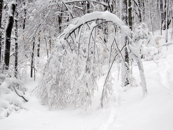
![]()
![]()
![]()
![]()
![]() On Saturday, March 3rd I wanted to get out to hike in the 18 inches of snow that had fallen on Friday. The snow started early Friday morning and just kept coming! Initially it was heavy and wet but became "drier" and fluffier later in the day. At times the snow fell at around 2 inches and hour. I waited around all day for our ambulance corps to be called to motorcycle accidents but, thankfully, no calls came. We didn't get a call until the snow almost stopped and that was for a medical condition. On Saturday morning it was still below freezing and I knew I had to get out in snowshoes. I knew that the back roads would be in poor condition and that the railheads would not be plowed. Cindy and I decided to head across the street and hike a loop on Round Top. By the time we got ready to go it was after 11:00 AM. It was around 30 degrees but actually felt warmer. I did not bother with tights under my Columbia Omniheat Pants but put on a baselayer on top under my Mammut pullover. As always I put Mon my Mammut Ultimate hoody and wore a hat and gloves. I wore my Salomon B52 winter boots and put on OR Crocodile gaiters to deal with the deep snow. Both Cindy and I wore our Tubbs Alp Flex VTR snowshoes. They are a little smaller than some and have the BOA binding system. I knew I wouldn't need the flotation since the snow depth was only 6 to 10 inches. The BOA system uses a dial to tighten a thin but strong wire and seems to evenly tighten the binding around the foot. Sheila was happy to be going out in the snow as she loves to run and jump through it. She is mostly Yellow Lab but also has some Siberian Husky. Her longer coat keeps her warm in all but the coldest weather. We went outside, put on our snowshoes and I put Sheila on her leash. We headed out the driveway at 11:30 AM and crossed the street. Once in the field, I released Sheila from her leash. The snow was very deep and the walking difficult especially where the snow had drifted. We walked through the field next to the church with some effort and then started the walk up the steep but short cemetery hill. The snow on the road up the hill had drifted away so only a few inches remained until we got to the top of the hill. On the way up we stopped once so that I could take a few pictures. We stopped again at the top of the hill near the trailhead so I could take some more shots. The sky was still dark and the town was covered in snow. The snow had piled up on the branches of the trees and everything was pristine and beautiful. We turned left and entered the trail and I took more pictures of the bushes and trees bending to the ground under the weight of the snow. I could see one new blowdown across the trail. We worked our way around some bushes in the trail and I looked ahead to see a massive set of trees blocking the trail. Three or four large trunks had fallen from high to low across the trail completely blocking passage. I took a few pictures and tried to decide if there was any chance I could clear the blowdown with y hand tools. Cindy and I decided to walk off the trail to the right and bypass the blowdown on the uphill side. The bank was steep and as I headed up I could see we could not immediately cut back down to the trail. I decided to keep walking uphill until I hit the yellow trail. This would be the trail that we normally take by turning right at the first trail junction. It wasn't long before we hit the trail and turned right to start the loop. The snow was untouched and the trees were still covered in snow. I again took pictures before continuing up the hill.
On Saturday, March 3rd I wanted to get out to hike in the 18 inches of snow that had fallen on Friday. The snow started early Friday morning and just kept coming! Initially it was heavy and wet but became "drier" and fluffier later in the day. At times the snow fell at around 2 inches and hour. I waited around all day for our ambulance corps to be called to motorcycle accidents but, thankfully, no calls came. We didn't get a call until the snow almost stopped and that was for a medical condition. On Saturday morning it was still below freezing and I knew I had to get out in snowshoes. I knew that the back roads would be in poor condition and that the railheads would not be plowed. Cindy and I decided to head across the street and hike a loop on Round Top. By the time we got ready to go it was after 11:00 AM. It was around 30 degrees but actually felt warmer. I did not bother with tights under my Columbia Omniheat Pants but put on a baselayer on top under my Mammut pullover. As always I put Mon my Mammut Ultimate hoody and wore a hat and gloves. I wore my Salomon B52 winter boots and put on OR Crocodile gaiters to deal with the deep snow. Both Cindy and I wore our Tubbs Alp Flex VTR snowshoes. They are a little smaller than some and have the BOA binding system. I knew I wouldn't need the flotation since the snow depth was only 6 to 10 inches. The BOA system uses a dial to tighten a thin but strong wire and seems to evenly tighten the binding around the foot. Sheila was happy to be going out in the snow as she loves to run and jump through it. She is mostly Yellow Lab but also has some Siberian Husky. Her longer coat keeps her warm in all but the coldest weather. We went outside, put on our snowshoes and I put Sheila on her leash. We headed out the driveway at 11:30 AM and crossed the street. Once in the field, I released Sheila from her leash. The snow was very deep and the walking difficult especially where the snow had drifted. We walked through the field next to the church with some effort and then started the walk up the steep but short cemetery hill. The snow on the road up the hill had drifted away so only a few inches remained until we got to the top of the hill. On the way up we stopped once so that I could take a few pictures. We stopped again at the top of the hill near the trailhead so I could take some more shots. The sky was still dark and the town was covered in snow. The snow had piled up on the branches of the trees and everything was pristine and beautiful. We turned left and entered the trail and I took more pictures of the bushes and trees bending to the ground under the weight of the snow. I could see one new blowdown across the trail. We worked our way around some bushes in the trail and I looked ahead to see a massive set of trees blocking the trail. Three or four large trunks had fallen from high to low across the trail completely blocking passage. I took a few pictures and tried to decide if there was any chance I could clear the blowdown with y hand tools. Cindy and I decided to walk off the trail to the right and bypass the blowdown on the uphill side. The bank was steep and as I headed up I could see we could not immediately cut back down to the trail. I decided to keep walking uphill until I hit the yellow trail. This would be the trail that we normally take by turning right at the first trail junction. It wasn't long before we hit the trail and turned right to start the loop. The snow was untouched and the trees were still covered in snow. I again took pictures before continuing up the hill.
 We could barely see the blazes on the trees and when it came time to turn left up the hill, I could not pick out the actual trail. All of the bushes were weighed down with the snow and made things look so different. I wasn't too concerned as I knew we would eventually hit the trail. We walked uphill through the deep snow and I eventually found the yellow trail near the junction with the blue or upper trail. I waited for Cindy and then I headed up the blue trail toward the summit. Somehow I convinced Cindy that this was a good idea and we ascended the hill toward the summit. I could just make out the blue blazes in some places but the trail looked very different. When we reached the place where the trail turns right near the summit, I could see that it was blocked by low hanging bushes. I continued straight ahead walking through an area that is normally thick brush. The walking was easy as all the bushes were weighed down with snow. We regained the blue trail and headed across the summit to start the descent. On the descent I was able to lift the tips of my snowshoes and get a pretty good glide down the hill. It wasn't long before we were at the bottom of the hill at the junction with the yellow trail. We turned right and followed the yellow trail toward the lookout. There was still a lot of snow on the trail but we were walking slightly downhill. When we got to the lookout, I decided to walk from the upper level to the lower to get the best view of the town and school. I reached the lower level of the lookout and dropped my pack to get out my camera. I took a few pictures of Cindy and Sheila posed on the upper level of the lookout. I turned my attention to the view from the lookout and took several shots of the school, the town and the hills beyond. I put the camera away and started to walk out the lower spur trail. I came to the point where there is gap in the path that must be crossed. The snow here had drifted over the trail and I was not comfortable crossing that gap. I turned around and walked back to the upper level the way I had come down. We walked down the yellow trail to the first trail junction. On this descent we were again able to glide down the hill to the trail junction. Here we turned left and started to ascend the easier trail looking for where we had come up to the trail from below. We eventually found where we had joined the trail and turned right to descend back to the trailhead avoiding the enormous blowdown that blocked the trail. We walked out to the trailhead and then down the hill to the church. We walked back across the field which was a little easier since we had already packed the trail. We crossed the street and walked back down the driveway to our house. We were home at about 1:00 PM after spending almost and hour and a half walking about a mile. I was ready to do lore but was also more tired than I thought I would be!
![]()
![]()
![]()
![]()
![]() On Wednesday, February 28th, I wanted to go for a hike on a beautiful day with the forecast for sunny skies and highs in the 50's! Lisa from Morgan Outdoors in Livingston Manor had contacted me the night before and asked about going for a hike and I thought the walk from Alder Lake to Big Pond and back would be nice. We wanted to survey the condition of the trail to see what work would have to be done in the spring. I have adopted this section of tail for the FLTC and did several days worth of work last spring. When I got up in the morning, the temperature was only 25 degrees but the sun was out. I decided to dress warmly despite the forecast. I elected to put on a full baselayer with tights under my Columbia Omniheat pants and a long-sleeved top under a Mammut pullover. I always wear my Mammut Ultimate hoody and I put on a heavier hat and gloves. I knew we would not need snowshoes and I also decided against gaiters. I wore my Keen Glarus hiking boots since I did not feel I would need insulation but I did put my spikes in the pack. Just before 8:00 AM I put my gear in the trunk and Sheila in the backseat. Sheila was obviously happy to go as I drove out Old Route 17 to the Beaverkill Road. I turned right and drove up Johnson Mountain to Lisa's house arriving at exactly 8:00 AM. Lisa was ready to go and and we started toward Alder Lake under sunny skies. Sheila was happy to be hiking and greeted Lisa enthusiastically. I drove up the Beaverkill Road through Lew Beach and Turnwood. I turned left on Alder Creek Road and drove toward the entrance to Alder Lake. As we neared the end of Alder Creek Road, I turned right and found the gate to Alder Lake closed. I backed up and turned around to park on the side of the road near the creek just before the entrance to the Cross Mountain Hunting Camp. We got our gear out of the car and started our hike at 8:20 AM with the thermometer on the car reading 28 degrees. We could hear the water in the reek and it sounded high! We walked down the bank to the creek which was running with a good volume and looked for a good place to cross. I walked upstream a little and found a narrow spot with some stones to step on. We crossed and started to hike along a broad woods road which was marked with red blazes. The sun was out although it was still cool. The sun on the leaves left over from the fall and the warmth of the rays set a perfect tone. Over the next half mile we gained about 300 feet climbing to the shoulder of a ridge. The trail was easy to follow and we had a great time talking about various projects we had planned. We noticed that there were posted signs on either side of the state land. From the ridge we started to descend on the same woods road to a small stream. The trail was wet and muddy in spots and there were many blowdowns across the trail. Some of the smaller branches we removed but others required a saw and an axe. A few were large enough the that a chainsaw might be the best answer. I was surprised since I had spent so much time on the trail last spring. At least there were no nettles or briars in this area. As we descended, we did come across one spot that was covered in snow. The descent was almost a mirror image of the ascent as we dropped about 300 feet in half a mile. Just before the stream crossing, I stopped to take some shots of a beaver meadow with a ridge behind it. As we approached the stream, the trail markers indicated a slight turn to the west off the woods road and across the stream. The woods had been very open but there was a very large open area just below the stream crossing. I took some pictures of the area and of the stream.
On Wednesday, February 28th, I wanted to go for a hike on a beautiful day with the forecast for sunny skies and highs in the 50's! Lisa from Morgan Outdoors in Livingston Manor had contacted me the night before and asked about going for a hike and I thought the walk from Alder Lake to Big Pond and back would be nice. We wanted to survey the condition of the trail to see what work would have to be done in the spring. I have adopted this section of tail for the FLTC and did several days worth of work last spring. When I got up in the morning, the temperature was only 25 degrees but the sun was out. I decided to dress warmly despite the forecast. I elected to put on a full baselayer with tights under my Columbia Omniheat pants and a long-sleeved top under a Mammut pullover. I always wear my Mammut Ultimate hoody and I put on a heavier hat and gloves. I knew we would not need snowshoes and I also decided against gaiters. I wore my Keen Glarus hiking boots since I did not feel I would need insulation but I did put my spikes in the pack. Just before 8:00 AM I put my gear in the trunk and Sheila in the backseat. Sheila was obviously happy to go as I drove out Old Route 17 to the Beaverkill Road. I turned right and drove up Johnson Mountain to Lisa's house arriving at exactly 8:00 AM. Lisa was ready to go and and we started toward Alder Lake under sunny skies. Sheila was happy to be hiking and greeted Lisa enthusiastically. I drove up the Beaverkill Road through Lew Beach and Turnwood. I turned left on Alder Creek Road and drove toward the entrance to Alder Lake. As we neared the end of Alder Creek Road, I turned right and found the gate to Alder Lake closed. I backed up and turned around to park on the side of the road near the creek just before the entrance to the Cross Mountain Hunting Camp. We got our gear out of the car and started our hike at 8:20 AM with the thermometer on the car reading 28 degrees. We could hear the water in the reek and it sounded high! We walked down the bank to the creek which was running with a good volume and looked for a good place to cross. I walked upstream a little and found a narrow spot with some stones to step on. We crossed and started to hike along a broad woods road which was marked with red blazes. The sun was out although it was still cool. The sun on the leaves left over from the fall and the warmth of the rays set a perfect tone. Over the next half mile we gained about 300 feet climbing to the shoulder of a ridge. The trail was easy to follow and we had a great time talking about various projects we had planned. We noticed that there were posted signs on either side of the state land. From the ridge we started to descend on the same woods road to a small stream. The trail was wet and muddy in spots and there were many blowdowns across the trail. Some of the smaller branches we removed but others required a saw and an axe. A few were large enough the that a chainsaw might be the best answer. I was surprised since I had spent so much time on the trail last spring. At least there were no nettles or briars in this area. As we descended, we did come across one spot that was covered in snow. The descent was almost a mirror image of the ascent as we dropped about 300 feet in half a mile. Just before the stream crossing, I stopped to take some shots of a beaver meadow with a ridge behind it. As we approached the stream, the trail markers indicated a slight turn to the west off the woods road and across the stream. The woods had been very open but there was a very large open area just below the stream crossing. I took some pictures of the area and of the stream.
 We crossed the stream and found that the trail began to follow another well-defined woods road. We also found that we were again climbing to the shoulder of another ridge. There were extensive stone walls in this area which hearkened back to a time when the land was farmed. There were also two foundations which could have been houses or farm buildings. As we topped the hill and the trail began to flatten, we came to Ana area that is always wet and muddy. This day was no exception but we were able to work around the mud without too much bother. The trail stayed muddy for some time. In a little more than half a mile we regained 200 feet and at 1.8 miles the trail turned to the west heading directly toward Big Pond. Along the way we began to find some very large trees across the trail which we could navigate but which could be removed. On a short ascent we came to the area where I had spent some time last spring cutting a sea of briars that had all but obstructed the trail. Some prickers were beginning to encroach on the trail and I knew I would need to do some work in the spring to keep it open. We reached the top of a small hill where the trail began to descend and due to Lisa's time constraints we decided to turn around. I knew we would not get to Big Pond and did not want to descend the hill just to turn around and walk back up it. We had been hiking about and hour and a quarter and thought we had made about 2 miles. We turned around and set a good pace on the way back stopping only occasionally for a picture or two. On the walk back we began to realize the stone walls in the area formed an extensive network which we had simply not seen on the way out. The walls were on both sides of the trail and, in some places, the trail crossed the walls. I have always been impressed by the work it took to collect the stones and the skill needed to turn them into stone walls that have stood for so many years! We were soon back at the initial stream crossing and we knew it was a short walk back to the car with only one ascent. All along the ay we had been hearing the "honks" of geese and seeing huge V's flying overhead. One V was completely white except for a few blacker birds. Other V's were almost completely dark. By the time we returned to the car 10:50 AM I was very warm as the temperature had risen into the high 40's and the sun's rays were more direct. It had been a beautiful day to hike and the out and back allowed us to see different aspects of the trail. We had hiked 4.1 miles in 2.5 hours and a vertical gain of only 930 feet. We had plenty of time for pictures and exploring this interesting area.
![]()
![]()
![]()
![]()
![]() On Monday, February 26th, I had some time to hike on what was forecast to be a beautiful, sunny day with highs near 50 degrees. I have about a two week break from track practice as we transition from indoor track to spring track which gives me most of the day to hike and make up for a very poor showing in February! I decided to wait until later in the day to get started as the morning was foggy with an overcast sky.
I got my gear together and got dressed to leave the house at just before 11:00 AM so that I could begin a hike from Hill Road near Margaretville to the Penguin Rocks lookout on Dry Brook Ridge. It was already in the high 30's and I knew it would get warmer as I hiked. I also did not expect much snow along the route due to the recent warm weather and rain. I decided I did not need tights underneath my Colombia Titanium Omniheat pants. On top I had a light synthetic baselayer with a my Mammut crew neck shirt on top. As always I had my Mammut Hoody as my top layer. I wore a hat and gloves as I could always take them off if I was too warm but could not put them on if I did not have them with me! I knew I would not need snowshoes but I put my Microspikes in my pack just in case I needed some traction. I decided not to wear gaiters or insulated boots. I put on my Keen Glarus hiking boots which are all leather and reasonably war,. All the while I was getting ready, Sheila was hovering around me making sure I did not forget her. When I left the house, the skies were still overcast and there was a little breeze which out a bite in the air. I wanted to avoid the back roads as much as possible as they are in poor shape so I headed toward Roscoe on State Rout 17. I got off at the Roscoe exit and headed north toward Downsville on Route 206. The road was in good shape and I was soon at the Pepacton Reservoir. Here I turned right onto Route 30 which was also in good shape. At the Shavertown Bridge I turned right on BWS 8 and followed it until it became BWS 9. Where the road changed to BWS 10 at the intersection with Barkaboom Road, I turned left. I followed BWS 10 until it changed to Southside Road just outside Margaretville. I continued on Southside Road to Huckleberry Brook Road where I turned right. Shortly after the turn I turned left on Hill Road and 1.3 miles to the parking pulloff on the right. The temperature was 40 degrees when I parked and there was a breeze blowing. The skies were now blue with some bright sun. There was also no snow in sight on the road or in the woods. We crossed the road and began our hike at 11:40 AM. The first part of the hike is a nice wide trail that ascends through a red pine plantation. The ascent continues for about 1.9 miles when the trail levels off after gaining 1130 feet. I began to warm up immediately because of the climb and also found I was a little winded from the lack of hiking. As we walked, there were several blowdowns across the trail from near the bottom until the trail leveled. Two were very large and probably require the trail to be rerouted around them while the others could be removed. It was also obvious that there had been a lot of rain on the trail as there were huge piles of pine needles in several spots. The trail had drained nicely and was almost dry. The sun through the pines was beautiful and it seemed very warm. I stopped to take some pictures of the red pines in an area where there was a dusting of snow on the ground. I also took this opportunity to open the zippers on my hoody and took down the hood. After passing through the pines, we entered a predominantly hardwood forest before passing again through some pines. Sheila seemed to delight in racing away from me through the snow and then careening headlong back toward me. There were a lot of animal tracks along the trail and some crossing it and Sheila was busy investigating these tracks. After 1.9 miles, the trail leveled off and turned almost 90 degrees from northeast to southeast. There was a few inches of hardened snow on the ground although most of the trail was pretty clear. We walked across a flat area dipping down a little to the junction with the blue Dry Brook Ridge Trail at 2.3 miles. We stopped and I got a much needed drink and a bar. I also took some pictures of the snow on the trail.
On Monday, February 26th, I had some time to hike on what was forecast to be a beautiful, sunny day with highs near 50 degrees. I have about a two week break from track practice as we transition from indoor track to spring track which gives me most of the day to hike and make up for a very poor showing in February! I decided to wait until later in the day to get started as the morning was foggy with an overcast sky.
I got my gear together and got dressed to leave the house at just before 11:00 AM so that I could begin a hike from Hill Road near Margaretville to the Penguin Rocks lookout on Dry Brook Ridge. It was already in the high 30's and I knew it would get warmer as I hiked. I also did not expect much snow along the route due to the recent warm weather and rain. I decided I did not need tights underneath my Colombia Titanium Omniheat pants. On top I had a light synthetic baselayer with a my Mammut crew neck shirt on top. As always I had my Mammut Hoody as my top layer. I wore a hat and gloves as I could always take them off if I was too warm but could not put them on if I did not have them with me! I knew I would not need snowshoes but I put my Microspikes in my pack just in case I needed some traction. I decided not to wear gaiters or insulated boots. I put on my Keen Glarus hiking boots which are all leather and reasonably war,. All the while I was getting ready, Sheila was hovering around me making sure I did not forget her. When I left the house, the skies were still overcast and there was a little breeze which out a bite in the air. I wanted to avoid the back roads as much as possible as they are in poor shape so I headed toward Roscoe on State Rout 17. I got off at the Roscoe exit and headed north toward Downsville on Route 206. The road was in good shape and I was soon at the Pepacton Reservoir. Here I turned right onto Route 30 which was also in good shape. At the Shavertown Bridge I turned right on BWS 8 and followed it until it became BWS 9. Where the road changed to BWS 10 at the intersection with Barkaboom Road, I turned left. I followed BWS 10 until it changed to Southside Road just outside Margaretville. I continued on Southside Road to Huckleberry Brook Road where I turned right. Shortly after the turn I turned left on Hill Road and 1.3 miles to the parking pulloff on the right. The temperature was 40 degrees when I parked and there was a breeze blowing. The skies were now blue with some bright sun. There was also no snow in sight on the road or in the woods. We crossed the road and began our hike at 11:40 AM. The first part of the hike is a nice wide trail that ascends through a red pine plantation. The ascent continues for about 1.9 miles when the trail levels off after gaining 1130 feet. I began to warm up immediately because of the climb and also found I was a little winded from the lack of hiking. As we walked, there were several blowdowns across the trail from near the bottom until the trail leveled. Two were very large and probably require the trail to be rerouted around them while the others could be removed. It was also obvious that there had been a lot of rain on the trail as there were huge piles of pine needles in several spots. The trail had drained nicely and was almost dry. The sun through the pines was beautiful and it seemed very warm. I stopped to take some pictures of the red pines in an area where there was a dusting of snow on the ground. I also took this opportunity to open the zippers on my hoody and took down the hood. After passing through the pines, we entered a predominantly hardwood forest before passing again through some pines. Sheila seemed to delight in racing away from me through the snow and then careening headlong back toward me. There were a lot of animal tracks along the trail and some crossing it and Sheila was busy investigating these tracks. After 1.9 miles, the trail leveled off and turned almost 90 degrees from northeast to southeast. There was a few inches of hardened snow on the ground although most of the trail was pretty clear. We walked across a flat area dipping down a little to the junction with the blue Dry Brook Ridge Trail at 2.3 miles. We stopped and I got a much needed drink and a bar. I also took some pictures of the snow on the trail.
 As we turned right on this trail, I noticed the sign that said the Hill Road parking was 1.7 miles away. I had to laugh! I expect distances to vary some but .5 miles is a pretty big gap. The trail along the ridge follows the edge until about 2.7 miles where it veers away and heads a little to the east and northeast. Initially the trail ascends a small bump and then descends the other side before leveling off for a while. The level area of the trail was very wet with standing water and I had to negotiate my way around this area. This would continue to be a problem for most of the rest of the way to the lookouts. The first small ascent was very icy across almost all the trail and I almost put on my spikes but was able to get some traction in the snow at the side of the trail. The two or three other short ascents along the way were exposed to the sun and almost bare of snow. We were soon climbing the last of three short ascents to the area of the lookout. The total elevation gain from the trail junction to the lookouts is 285 feet. From 2.95 miles to the lookout the trail gain is just under 200 feet in elevation and begins to follow the edge of the escarpment turning almost due south. The snow actually all but disappeared as we continued along the trail. When we arrived at the viewpoint at 1:35 PM, the wind was blowing slightly making it seem a little colder than the air temperature. The open rocks that make up the viewpoint were completely bare so I dropped my packed and walked out onto the viewpoint. The sky was blue not very interesting with only a very few puffy clouds. The Pepacton Reservoir was clearly visible and the view showed the low volume of water. Without much snow or any leaves on the trees, the scene was rather bleak. I did take some pictures including a few of Sheila posed on the rocks. I got a drink and then started the walk back to the car which was all flat or downhill. The trip back to the trail junction went more quickly than I had expected but avoiding the small ponds along the way was annoying. I made it down the small, icy hill just before the trail junction without a problem. We didn't bother to stop again at the trail junction but simply turned left to head back down the trail to the parking area. The trip down always seems to go quickly but on this day it seemed longer than usual. We arrived back at the car at 3:15 PM. We had hiked 6.5 miles in 3 hours and 40 minutes with an elevation gain of 1635 feet. The trip down was only about 15 minutes shorter than the trip up. I decided to use the same route home that I had used on the way out so good. I had planned to stop to take some pictures of the reservoir but I was just too tired to do that and drove straight home.
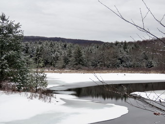
![]()
![]()
![]()
![]()
![]() On Friday, February 23rd I got a call at 6:00 AM to cover for the middle school nurse which I reluctantly agreed to despite the fact that it killed my plans to go for a longer hike. At 6:03 AM I got another call announcing school was closed due to the impending ice storm which was to arrive by 11:00 AM. I figured this was a message to get out and hike early to be back before the storm hit. I decided to go to Frick Pond and hike some loop there that I had not done in some time. As I got my gear together Sheila seemed to be in complete agreement with my decision as she followed my around as I was dressing. Although the thermometer read right around freezing, the moisture in the air and a slight breeze made it feel much colder. I elected to put on a full baselayer with tights under my Columbia Omniheat pants and a long-sleeved top under a Mammut pullover. L always wear my Mammut Ultimate hoody and I put on a heavier hat and gloves. My plan was to hike the Quick Lake Trail to Iron Wheel Junction. From here we would hike the Logger's Loop to Times Square an then ascend the Big Rock Trail to The Flynn Trail to get back to the car. There had been some snow the day before but the rain and warm weather during the week had destroyed the snow that was there making snow shoes unnecessary. I put my spikes in my pack not knowing whether there would be enough is to warrant their use. Sheila was happy to be going anywhere and crouched in the back seat with her head on the console. I drove out DeBruce Road just after 8:00 AM and after 6 miles I turned left on Mongaup Road. Where the road splits I stayed left on Beech Mountain Road and parked in the smaller lot at 8:20 AM. It didn't take us long to walk the woods road out to the Quick Lake Trail to start our hike. There was frozen snow on many of the trees so I took a few pictures. As we started to hike the temperature was only 28 degrees and I felt a chill despite my layers. The trail had some very wet snow and areas of water that had to be avoided. On the way to the register box it was obvious the wind had brought down a lot of smaller branches and some larger branches. The woods road out to Frick Pond was also very wet with some exposed areas of standing and running water. There was still some ice which I avoided as it covered water beneath it and was often not strong enough to support my weight. We stayed left at Graveyard Junction to stay on the Quick Lake Trail. When we arrived at the bridge across the outlet, I decided to stop and take pictures despite the fact that I have hundreds from this location. The ground was still covered by snow and the trees had a coating of frozen snow which gave the scene some interest. The water level in the pond was high and the ice was partly melted. The sky was completely overcast and it looked like a storm might be moving in. I took some shots and then we continued on around the pond. We stayed left at the trail junction to stay on the Quick Lake Trail and found that there was still plenty of water in this area which I avoided. There were more branches along the trail and I cleared as many as I could. We continued on our hike passing through the "Spruce Tunnel". The small stream through the woods was running freely and was very high. Sheila simply jumped across but I walked upstream a little to a narrower and more shallow area to cross. I took some pictures here of the stream and the snow on the trails. By 9:15 AM we had walked the 1.5 miles to Iron Wheel Junction. At the trail junction I decided it would be a good idea to turn left and walk the entire big loop up to Hodge Pond. We did turn in that direction but after a short distance I noticed that there was rain and ice falling from the sky and decided to go back to my original plan. We turned around and headed out on the Logger's Loop Trail.
On Friday, February 23rd I got a call at 6:00 AM to cover for the middle school nurse which I reluctantly agreed to despite the fact that it killed my plans to go for a longer hike. At 6:03 AM I got another call announcing school was closed due to the impending ice storm which was to arrive by 11:00 AM. I figured this was a message to get out and hike early to be back before the storm hit. I decided to go to Frick Pond and hike some loop there that I had not done in some time. As I got my gear together Sheila seemed to be in complete agreement with my decision as she followed my around as I was dressing. Although the thermometer read right around freezing, the moisture in the air and a slight breeze made it feel much colder. I elected to put on a full baselayer with tights under my Columbia Omniheat pants and a long-sleeved top under a Mammut pullover. L always wear my Mammut Ultimate hoody and I put on a heavier hat and gloves. My plan was to hike the Quick Lake Trail to Iron Wheel Junction. From here we would hike the Logger's Loop to Times Square an then ascend the Big Rock Trail to The Flynn Trail to get back to the car. There had been some snow the day before but the rain and warm weather during the week had destroyed the snow that was there making snow shoes unnecessary. I put my spikes in my pack not knowing whether there would be enough is to warrant their use. Sheila was happy to be going anywhere and crouched in the back seat with her head on the console. I drove out DeBruce Road just after 8:00 AM and after 6 miles I turned left on Mongaup Road. Where the road splits I stayed left on Beech Mountain Road and parked in the smaller lot at 8:20 AM. It didn't take us long to walk the woods road out to the Quick Lake Trail to start our hike. There was frozen snow on many of the trees so I took a few pictures. As we started to hike the temperature was only 28 degrees and I felt a chill despite my layers. The trail had some very wet snow and areas of water that had to be avoided. On the way to the register box it was obvious the wind had brought down a lot of smaller branches and some larger branches. The woods road out to Frick Pond was also very wet with some exposed areas of standing and running water. There was still some ice which I avoided as it covered water beneath it and was often not strong enough to support my weight. We stayed left at Graveyard Junction to stay on the Quick Lake Trail. When we arrived at the bridge across the outlet, I decided to stop and take pictures despite the fact that I have hundreds from this location. The ground was still covered by snow and the trees had a coating of frozen snow which gave the scene some interest. The water level in the pond was high and the ice was partly melted. The sky was completely overcast and it looked like a storm might be moving in. I took some shots and then we continued on around the pond. We stayed left at the trail junction to stay on the Quick Lake Trail and found that there was still plenty of water in this area which I avoided. There were more branches along the trail and I cleared as many as I could. We continued on our hike passing through the "Spruce Tunnel". The small stream through the woods was running freely and was very high. Sheila simply jumped across but I walked upstream a little to a narrower and more shallow area to cross. I took some pictures here of the stream and the snow on the trails. By 9:15 AM we had walked the 1.5 miles to Iron Wheel Junction. At the trail junction I decided it would be a good idea to turn left and walk the entire big loop up to Hodge Pond. We did turn in that direction but after a short distance I noticed that there was rain and ice falling from the sky and decided to go back to my original plan. We turned around and headed out on the Logger's Loop Trail.
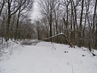 The Logger's Loop is mostly downhill in this direction and we made good time but encountered some more blowdowns along the way. This trail didn't have quite as much water but did have a little more snow. The rain wasn't falling heavily but it was steady. I knew it should have bothered me but I was so glad to be out I hardly noticed. Just before starting the descent to Times Square, we stopped at a small pond on the left side of the trail so that I could take some pictures. This pond is seasonal but has been growing in size for several years. It was surrounded by trees with a coating of snow which added some interest to an otherwise bleak scene. By 9:45 AM we were at Times Square and about 2.7 miles into the hike. The rain was coming in spurts, starting and stopping but I knew the forecast was for it to continue and get more steady. I considered simply walking the Logger's Loop back to Gravestone Junction as I could see a blowdown I wanted to inspect. In the end I opted to stick to the original plan and get a little more distance and difficulty by hiking up the Big Rock Trail. We turned left to start up the Big Rock Trail which gains 600 feet to the Flynn Trail over 1.1 miles. The average grade is only 10% but the route has three different climbs and can seem long. We set a pretty fast pace on the climb and I found that although my heart rate was elevated I felt good. Not very far up the trail we encountered a very large tree that had been across the trail. The snowmobile club had cleared this earlier in the season and I had done some finishing work with axe and saw. I knew that there was another large blowdown further up the trail which had not been cleared the last time I passed through. I had seen snowmobiles coming down the trail on another occasion and knew it had probably been removed. When we got to the blowdown, I found the snowmobile club had been at work cutting the blowdown and removing it from the trail. The diameter of the one trunk was at least three feet but it was rotten and hollow. I stopped to take a few shots but then noticed that the rain was starting again so we moved on quickly. We reached the Flynn Trail at 10:30 AM after hiking 3.9 miles and we immediately turned right and began the descent back to the car. The snow still covered the trail but there were areas where water had overflowed the ditch along the side of the road. There were a few large branches on or near the trail and there was one large blowdown a little further along which looked a lot like the one that I had spotted on the Logger's Loop. Sheila was still excited at this point and was running up the trail and back to me. She was taking a few excursions off the trail to follow animal tracks but was pretty close so I let her explore. She started to grab some rather large branches so I picked up a stick and threw it several times for here to retrieve. The trip down the Flynn Trail went quickly and my muscles were glad I was going down! We soon arrived at the gate that blocks Beech Mountain Road. We turned left to stay on the Flynn Trail as it continues through the woods to avoid the private property around the cabin. Some hikers cannot read the signs and have annoyed the property owner by trespassing! We continued down to the parking area on the trail. We were back at 11:05 AM having covered 5.7 miles in 2 hours and 45 minutes with a vertical gain of 955 feet.
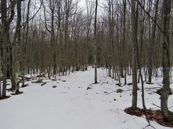
![]()
![]()
![]()
![]()
![]() On Saturday, February 17th, I was ready to get out for a slightly longer hike that was NOT on Round Top! My son-in-law, Brad, was up for the weekend and I was sure he would want to go along. I did not get back from a track meet the night before Until 1:00 AM and wanted to sleep in the next morning. I was able to stay in bed to almost 9:00 AM and get a little extra sleep. When I got up I ate breakfast and asked Brad if he wanted to go for a hike and he agreed. We waited until a little after noon to get ready to go. The temperature on the back porch was just above freezing so I decided not to wear tights under my Columbia Omniheat pants. I did put on a long-sleeved baselayer underneath my Mammut crew top. I decided to wear my Keen Glarus boots as I did not expected much snow and they hike better than any of my winter boots. I also did not think I would need gaiters either due to the lack of snow. To finish off I put on my Mammut Ultimate hoody, a hat and a pair of gloves. I decided that snowshoes would not be appropriate but we took along a pair of Microspikes for both Brad and I. We left Livingston Manor at about 12:45 PM under overcast skies but with a temperatures just above freezing. Brad and I put our gear in the trunk and an overjoyed Sheila in the back seat as we headed to Roscoe on State Route 17. I got on Route 206 and followed it across the Delaware County line to Morton Hill Road. After a left turn on Morton Hill Road, I drove to the intersection with Russell Brook Road. I turned around and parked on the side of the road to avoid the parking area which is private. Unfortunately, there was one car parked in the private lot! We began our hike down Russell Brook Road at 1:05 PM. The temperature was 28 degrees and there was more snow than I had anticipated. The road was also very icy but Brad and I decided to try to avoid the ice by walking on the snow. The road became even icier as we passed the overlook over the upper falls. I could see that there was about the same amount of water in the stream as the last time I had visited and that the bank was covered in ice. I decided I would not visit either falls and would concentrate more on hiking. We continued down toward the parking area where there were no cars but more and more ice. We decided to take the time to put on our Microspikes before we got on the woods road that goes down to the bridge that crosses the brook. We continue on the main trail to the register. At the trail junction just after the register we turned to the left to climb the steeper hill toward Mud Pond. The trail continued to have a few inches of snow with ice beneath making getting a good foot plant important. There were some occasional branches on the trail which we picked up and moved off the trail. The skies remained overcast but I was surprised at the snow and ice on the trail since this area is exposed to direct sunlight much of the time. I was having a little trouble on the ascent as it is steep and we were moving fast. This winter has been a disaster for my hiking between the extreme cold one week and then the rain the next. On the ascent we took a few breaks but it went quickly and I was glad to see there were no major blowdowns on this part of the trail
On Saturday, February 17th, I was ready to get out for a slightly longer hike that was NOT on Round Top! My son-in-law, Brad, was up for the weekend and I was sure he would want to go along. I did not get back from a track meet the night before Until 1:00 AM and wanted to sleep in the next morning. I was able to stay in bed to almost 9:00 AM and get a little extra sleep. When I got up I ate breakfast and asked Brad if he wanted to go for a hike and he agreed. We waited until a little after noon to get ready to go. The temperature on the back porch was just above freezing so I decided not to wear tights under my Columbia Omniheat pants. I did put on a long-sleeved baselayer underneath my Mammut crew top. I decided to wear my Keen Glarus boots as I did not expected much snow and they hike better than any of my winter boots. I also did not think I would need gaiters either due to the lack of snow. To finish off I put on my Mammut Ultimate hoody, a hat and a pair of gloves. I decided that snowshoes would not be appropriate but we took along a pair of Microspikes for both Brad and I. We left Livingston Manor at about 12:45 PM under overcast skies but with a temperatures just above freezing. Brad and I put our gear in the trunk and an overjoyed Sheila in the back seat as we headed to Roscoe on State Route 17. I got on Route 206 and followed it across the Delaware County line to Morton Hill Road. After a left turn on Morton Hill Road, I drove to the intersection with Russell Brook Road. I turned around and parked on the side of the road to avoid the parking area which is private. Unfortunately, there was one car parked in the private lot! We began our hike down Russell Brook Road at 1:05 PM. The temperature was 28 degrees and there was more snow than I had anticipated. The road was also very icy but Brad and I decided to try to avoid the ice by walking on the snow. The road became even icier as we passed the overlook over the upper falls. I could see that there was about the same amount of water in the stream as the last time I had visited and that the bank was covered in ice. I decided I would not visit either falls and would concentrate more on hiking. We continued down toward the parking area where there were no cars but more and more ice. We decided to take the time to put on our Microspikes before we got on the woods road that goes down to the bridge that crosses the brook. We continue on the main trail to the register. At the trail junction just after the register we turned to the left to climb the steeper hill toward Mud Pond. The trail continued to have a few inches of snow with ice beneath making getting a good foot plant important. There were some occasional branches on the trail which we picked up and moved off the trail. The skies remained overcast but I was surprised at the snow and ice on the trail since this area is exposed to direct sunlight much of the time. I was having a little trouble on the ascent as it is steep and we were moving fast. This winter has been a disaster for my hiking between the extreme cold one week and then the rain the next. On the ascent we took a few breaks but it went quickly and I was glad to see there were no major blowdowns on this part of the trail
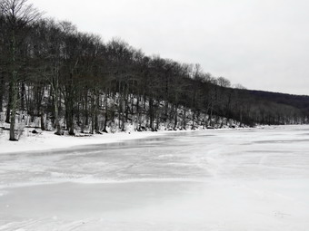 . We reached the top of the hill and walked down the wide woods road to the next trail junction at 1.6 miles. The trail continued to be icy and covered in snow. We made a right to follow the trail up to the shoulder of Cherry Ridge. This trail was also covered in snow but only about two inches of it. We continued to remove branches but there were no major blockages. After passing through an area with many small diameter trees, we started a short descent. The ascent continued for the next 1.2 miles until at 2.7 miles into the hike when we were at the highest point and ready to start the descent to Trout Pond. I had found the climb tiring but fulfilling and knew the descent would be easier. As we descended toward Trout Pond there were some major blowdowns that would require an axe and saw to clear. The trail remained covered in snow and ice but this covered many of the rocks and actually made descending easier. As we approached the bridge at the inlet end of the pond, I decided to stop and take some pictures. I stopped on the bridge and was hit by a blast of wind which convinced me to move on! We continued on the main trail toward the outlet of the pond over the snow and ice covered trail. Along the way Sheila alerted and I saw a group of young men headed out onto the pond from the inlet end. They seemed to be having a good time sliding on the ice and brad and I both hoped there was enough ice to support them. At the lower end of the pond we stopped so that I could take some pictures of a scene I had photographed many times! The sky was still very overcast and I only took a few shots including one of Sheila. The hike from the outlet to the trail junction is all downhill and we were able to make pretty good time despite the slippery conditions. On the way down the trail Sheila alerted and we saw another young couple coming toward us. I put Sheila on her leash as we passed and said a quick "Hello". I released Sheila and we continued down the trail toward the register. By 3:20 PM we had hiked 4.7 miles and were back at the trail junction and register box. I decided that I did not want to walk over to the falls since I had been there recently. We walked out to the parking area to continue our hike back to the car. As we walked up the road back to the car, I did not stop at the overlook over the upper falls but continued up the road. We continued up the road and back to the car. Another car was parking in the pulloff which is on private property and clearly posted. It is thoughtless people like these that cause problems for other hikers! We arrived back at 3:40 PM having covered 5.4 miles and 1105 vertical feet in 2 hours and 35 minutes. The temperature was still 28 degrees.
![]()
![]()
![]()
![]() On Tuesday, February 13th I wanted to get out on a hike but didn't have much time to spend. I knew the conditions would be poor after the warm weather and rain had eliminated most of the lovely snow that had fallen only a week earlier. I decided just to head across the street and hike on Round Top. Sheila seemed thrilled at the division and couldn't wait to get going I had a few things to do first and wee did not get started until 11:30 AM. The temperature was much cooler than the day before and was in the high 20's as I started to get dressed. Looking over at Round Top convinced me to wear snowshoes and I knew I would get warm. As I got dressed I decided to forego a baselayer on the bottom but put on a light, short-sleeved baselayer under my Mammut crew neck shirt. I pit on my Mammut Ultimate hoody and wore a hat and a pair of gloves. I donned my Salomon B52 boots and put on gaiters just in case. Sheila would not leave my side as I was getting ready as she wanted to make sure she was going too! I stepped out onto the back porch, put on my snowshoes and headed out the slippery driveway at 11:45 AM. The temperature was 28 degrees as we crossed the street with Sheila on her leash and walked to the back of the church. I could immediately see that snowshoes were not necessary and spikes would have been a better call. There was only 2 or 3 inches of snow and it was frozen completely in most places. I knew the snowshoes would also grip the snow and would give me an additional workout. We began the ascent of the steepest hill behind the church. The hill is short but really gets the circulation pumping and is the steepest and longest climb on the "trail". Sheila helped me along by pulling me up the hill. When we got to the top of the hill, we started out on the trail by turning left at the trailhead. As soon as we entered the trees I released Sheila from her leash. At the first trail junction we continued straight ahead to walk the steeper path to the viewpoint. At the lookout we turned to the right and we continued our hike on the yellow lower trail.
On Tuesday, February 13th I wanted to get out on a hike but didn't have much time to spend. I knew the conditions would be poor after the warm weather and rain had eliminated most of the lovely snow that had fallen only a week earlier. I decided just to head across the street and hike on Round Top. Sheila seemed thrilled at the division and couldn't wait to get going I had a few things to do first and wee did not get started until 11:30 AM. The temperature was much cooler than the day before and was in the high 20's as I started to get dressed. Looking over at Round Top convinced me to wear snowshoes and I knew I would get warm. As I got dressed I decided to forego a baselayer on the bottom but put on a light, short-sleeved baselayer under my Mammut crew neck shirt. I pit on my Mammut Ultimate hoody and wore a hat and a pair of gloves. I donned my Salomon B52 boots and put on gaiters just in case. Sheila would not leave my side as I was getting ready as she wanted to make sure she was going too! I stepped out onto the back porch, put on my snowshoes and headed out the slippery driveway at 11:45 AM. The temperature was 28 degrees as we crossed the street with Sheila on her leash and walked to the back of the church. I could immediately see that snowshoes were not necessary and spikes would have been a better call. There was only 2 or 3 inches of snow and it was frozen completely in most places. I knew the snowshoes would also grip the snow and would give me an additional workout. We began the ascent of the steepest hill behind the church. The hill is short but really gets the circulation pumping and is the steepest and longest climb on the "trail". Sheila helped me along by pulling me up the hill. When we got to the top of the hill, we started out on the trail by turning left at the trailhead. As soon as we entered the trees I released Sheila from her leash. At the first trail junction we continued straight ahead to walk the steeper path to the viewpoint. At the lookout we turned to the right and we continued our hike on the yellow lower trail.
We followed the trail and started the gentle climb through the woods which had two or three inches of packed and snow. When we reached the next trail junction, we stayed to the right to follow the lower trail around the base of Round Top to the next junction. At this junction we turned left and started up to the summit of Round Top on the steeper blue trail. The snowshoes definitely made the going easier although they are better suited for looser, fluffy snow. We walked across the summit of Round Top and down the other side which is also a little steep. Again, the snowshoes helped in the descent but I was wishing there was more snow. When we got to the yellow trail, we turned left to follow it to the second trail junction. This time we turned right and followed the yellow trail back to the very first trail junction to complete a figure 8. Sheila and I turned around and retraced our steps taking the more gentle path this time. When the yellow trail turned left, we followed it to the next trail junction where we turned right and headed up the blue trail to the summit. We walked over the top and down the other side to the yellow trail again. I was beginning to get bored and my time was limited as we turned right and followed the trail along the base of Round Top. Where the yellow trail turned left, we continued to follow the trail to the left and down to the lookout. From the lookout we walked down hill to the first trail junction. I decided it was time to head home so we continued straight out to the trailhead. I was a little depressed to think that the beautiful snow would soon be gone but knew it was still winter and more would be on the way. Sheila did not seem to be bothered by the cold at all and had been well-behaved staying with me most of the time. At the trailhead, I put Sheila on her leash and we walked down the cemetery hill and across the field to our driveway. It was after 12:45 PM and we had hiked a little under 2 miles in 1 hour and 15 minutes. It must have been a good workout as I was tired after so many days without an activity.
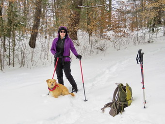
![]()
![]()
![]()
![]()
![]() On Friday, February 9th, I wanted to get out for a snowshoe hike since the forecast for the next two days included warmer temperatures and rain! I decided to go back to Frock Pond and do a different loop than Lisa and I had done earlier in the week. Cindy agreed to go along and after doing a few things around the house we dressed and got our gear together. It was still only 19 ogres as we were getting ready to go at 10:30 AM but there was little or no wind. I knew that snowshoeing always makes me very warm. I put on tights and wore a Mammut pullover over my baselayer. I put on my Mammut Ultimate Hoody which I wear most of the time. I chose my Tubbs Alp Flex VTR snowshoes which are a little smaller than some and have the BOA binding system. I knew I wouldn't need the flotation since the snow depth was only 6 to 10 inches. The BOA system uses a dial to tighten a thin but strong wire and seems to evenly tighten the binding around my foot. Cindy also decided to wear her version of the same snowshoe. Sheila was more crazed than usual even though we had been out a few days before. We left Livingston Manor just after 10:45 AM to head out the Debruce Road. The road had some icy spots but for the most part was well plowed. At six miles I turned left onto Mongaup Pond Road which had some snow on it but had been plowed and well sanded. Where the road split I stayed left on Beech Mountain Road. The smaller lot had not been plowed at all so I parked in the larger lot which was plowed. There were no cars in the lot and no tracks indicating anyone had been there recently. I set my electronics and we put on our snowshoes. We headed out the back of the parking area on the Quick Lake Trail. The snow was deep in spots and snowshoes worked well although they may not have been necessary. I immediately noticed that the snow had a frozen upper crust which made walking more difficult. The snowshoe would break through, go down into the snow and then have to be pulled back up through the crust. I knew it would be tiring work if we had to break trail the whole way. At the trail register we turned left onto the wide woods road that leads to Frick Pond. I could see some depressions to indicate our tracks from a few days before but they were very faint. We stayed left at Gravestone Junction to walk down to the pond. At the bridge, I put my pack down and got out my camera and took pictures of the pond and Flynn's Point. Some snow was falling and Flynn's Point was almost obscured. I took a few shots of Cindy And Sheila before packing up to move on. We walked across the bridge and around the west edge of the pond. At the next trail junction I had intended to stay to the left on the Quick Lake Trail, hike to Iron Wheel Junction and then take the Logger's Loop back. Listening to Cindy, I turned right to get on the yellow-blazed Big Rock Trail and headed around the back of Frick Pond. After passing over the wooden walkways we came to a bridge where there was a god view of the wetlands at the head of the pond. I took some pictures of the snow-covered walkways. We headed toward Time Square knowing that a single lop around the pond would not be enough exercise. I thought about reversing the loop to break the trail for the next people that might want to use it.
On Friday, February 9th, I wanted to get out for a snowshoe hike since the forecast for the next two days included warmer temperatures and rain! I decided to go back to Frock Pond and do a different loop than Lisa and I had done earlier in the week. Cindy agreed to go along and after doing a few things around the house we dressed and got our gear together. It was still only 19 ogres as we were getting ready to go at 10:30 AM but there was little or no wind. I knew that snowshoeing always makes me very warm. I put on tights and wore a Mammut pullover over my baselayer. I put on my Mammut Ultimate Hoody which I wear most of the time. I chose my Tubbs Alp Flex VTR snowshoes which are a little smaller than some and have the BOA binding system. I knew I wouldn't need the flotation since the snow depth was only 6 to 10 inches. The BOA system uses a dial to tighten a thin but strong wire and seems to evenly tighten the binding around my foot. Cindy also decided to wear her version of the same snowshoe. Sheila was more crazed than usual even though we had been out a few days before. We left Livingston Manor just after 10:45 AM to head out the Debruce Road. The road had some icy spots but for the most part was well plowed. At six miles I turned left onto Mongaup Pond Road which had some snow on it but had been plowed and well sanded. Where the road split I stayed left on Beech Mountain Road. The smaller lot had not been plowed at all so I parked in the larger lot which was plowed. There were no cars in the lot and no tracks indicating anyone had been there recently. I set my electronics and we put on our snowshoes. We headed out the back of the parking area on the Quick Lake Trail. The snow was deep in spots and snowshoes worked well although they may not have been necessary. I immediately noticed that the snow had a frozen upper crust which made walking more difficult. The snowshoe would break through, go down into the snow and then have to be pulled back up through the crust. I knew it would be tiring work if we had to break trail the whole way. At the trail register we turned left onto the wide woods road that leads to Frick Pond. I could see some depressions to indicate our tracks from a few days before but they were very faint. We stayed left at Gravestone Junction to walk down to the pond. At the bridge, I put my pack down and got out my camera and took pictures of the pond and Flynn's Point. Some snow was falling and Flynn's Point was almost obscured. I took a few shots of Cindy And Sheila before packing up to move on. We walked across the bridge and around the west edge of the pond. At the next trail junction I had intended to stay to the left on the Quick Lake Trail, hike to Iron Wheel Junction and then take the Logger's Loop back. Listening to Cindy, I turned right to get on the yellow-blazed Big Rock Trail and headed around the back of Frick Pond. After passing over the wooden walkways we came to a bridge where there was a god view of the wetlands at the head of the pond. I took some pictures of the snow-covered walkways. We headed toward Time Square knowing that a single lop around the pond would not be enough exercise. I thought about reversing the loop to break the trail for the next people that might want to use it.
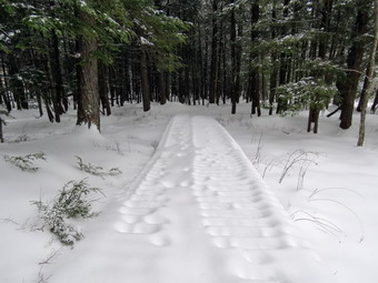 At Times Square we were surprised to see snowmobile tracks coming down the Big Rock Trail and turning onto the Logger's Loop. Walking on the packed snow is much easier than breaking trail so we both agreed to turn left on the Logger's Loop knowing the trail would be packed all the way to Iron Wheel Junction. From there it would be a short trip breaking trail downhill back to Frick Pond. The trail, ascends a bit and then levels off. As the trail leveled we began to hear the sound of snowmobiles coming down the Big Rock Trail toward us. I wondered if the snowmobile club had cleared the larger blowdown on the Big Rock Trail or if somehow the snowmobilers had worked around them. As they got nearer, I took Sheila by the collar and we stepped off the trail. Within minutes three machines came toward us and slowed down as they passed. The riders waved but I was pretty sure they were not acquaintances or they would have stopped. We continued on the Logger's Loop toward Iron Wheel Junction appreciating the nicely packed trail. Soon we were at the trail junction where we turned left on the Quick Lake Trail to head back to Frick Pond. Walking downhill toward the little stream in the woods was easier than walking uphill or even on flat sections. However, the hiking was not easy as we had to contend with the crusty snow again. I noticed that for most of the hike Sheila had elected to stay between us walking in the broken trail. When we walked under trees where the snow was softer, she would take a few moments to wander off following her nose. When we arrived at the stream through the woods, I elected to walk upstream to cross as I did not want to chance stepping in the water and have snow frozen to my snowshoes for the rest of the hike. Cindy elected to cross the stream in the most direct way. When I got back to the main trail. I waited for her to pick herself up out of the snow and rejoin me. As we walked through the "spruce tunnel", the snow lacked the crust and the walking was much easier. When we exited, the trees the crusty snow started in again and my legs let me know we would be finishing soon! We arrived at the junction with the Big Rock Trail and continued straight ahead. Soon we were back at the bridge over the outlet to Frick Pond where it was clear the snow had increased in intensity. We did not stopped but crossed the bridge and walked up the hill to follow the Quick Lake Trail back to the register. At Gravestone Junction we found new tracks from someone with snowshoes who had headed out on the Logger's Loop. We walked the woods road back out to register and I noticed the snowshoer must have been a novice as they had made a new track rather than improve the one we had already laid down. Many beginners do this without thinking but it is a shame sine improving the existing track is always the best idea. At the register we turned right to follow the Quick Lake Trail back out to the car. We arrived back at 1:35 PM after hiking 3.9 miles in 2 and a half hours. The overall elevation gain was a modest 375 feet. Despite the length of the hike my legs felt as if they had gotten and adequate workout.
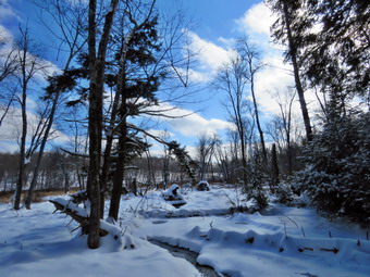
![]()
![]()
![]()
![]()
![]() On Tuesday, February 6th, the snow had finally built up to a depth where using snowshoes would be possible although they were probably not necessary. I had not hiked in a week and that was a short hike on Round Top. When Lisa called the night before, we decided to meet at 10:00 AM at my house and go to Frick Pond. My plan was to ascend the Flynn Trail and then get the long descent on the Big Rock Trail. Unfortunately, I had an ambulance call in the middle of the night and was tired in the morning. I almost called to cancel but decided I needed to get out to hike! I did a few things around the hose and then got my equipment ready. The temperature was approaching 20 degrees when I was about to get dressed and I knew that snowshoeing always makes me very warm. I put on tights and wore a Mammut pullover over my baselayer. I put on my Mammut Ultimate Hoody which I wear most of the time. I chose my Tubbs Alp Flex VTR snowshoes which are a little smaller than some and have the BOA binding system. I knew I wouldn't need the flotation since the snow depth was only 6 to 8 inches. The BOA system uses a dial to tighten a thin but strong wire and seems to evenly tighten the binding around my foot. Sheila was more crazed than usual as it had been so long since we had been out. Lisa arrived and Sheila gave her a lavish greeting from the back seat. We left Livingston Manor just after 10:00 AM to head out the Debruce Road. It had snowed a little in the morning but Debruce Road was clear. At six miles I turned left onto Mongaup Pond Road which had some snow on it but had been plowed and well sanded. Where the road split I stayed left on Beech Mountain Road and parked in the small lot which was plowed. There were no cars in the lot and no tracks indicating anyone had been there recently. I set my electronics and we put on our snowshoes. I took a few pictures of the trailhead and the road before we crossed the road at 10:30 AM to start up the Flynn Trail. The temperature was still right around 20 degrees so the snow was crunchy underfoot and was not clumping on the snowshoes. Lisa had chosen to use my Crescent Moon snowshoes which are good on flat and rolling terrain. They have some of the best bindings and a teardrop shape. Lisa stopped to sign in at the trail register but I continued on the trail. I found that I was warm as long as I was moving but felt cool as son as I stopped. I hoped that I had not dressed too lightly! The first part of the Flynn Trail through the woods is narrow but I was having no trouble overlapping the smaller snowshoes. Once we made the right turn into the woods road the going was easier. There were no tracks at all in the fresh snow other than those made my various animals including Sheila as she bounded ahead joyfully. I tried to get her to make a nice straight path up the trail but she kept getting sidetracked following various tracks. It is surprising how much easier it is to move even in the shallow trail made by a small dog. Before we had gone half a mile I had stopped to open some zippers and dump some heat. The walk with snowshoes is definitely more of a workout than without. As long as we were stopped I took a few pictures of the unbroken snow on the trail. As we gained some elevation, the snow got deeper until there was almost 8 inches.
On Tuesday, February 6th, the snow had finally built up to a depth where using snowshoes would be possible although they were probably not necessary. I had not hiked in a week and that was a short hike on Round Top. When Lisa called the night before, we decided to meet at 10:00 AM at my house and go to Frick Pond. My plan was to ascend the Flynn Trail and then get the long descent on the Big Rock Trail. Unfortunately, I had an ambulance call in the middle of the night and was tired in the morning. I almost called to cancel but decided I needed to get out to hike! I did a few things around the hose and then got my equipment ready. The temperature was approaching 20 degrees when I was about to get dressed and I knew that snowshoeing always makes me very warm. I put on tights and wore a Mammut pullover over my baselayer. I put on my Mammut Ultimate Hoody which I wear most of the time. I chose my Tubbs Alp Flex VTR snowshoes which are a little smaller than some and have the BOA binding system. I knew I wouldn't need the flotation since the snow depth was only 6 to 8 inches. The BOA system uses a dial to tighten a thin but strong wire and seems to evenly tighten the binding around my foot. Sheila was more crazed than usual as it had been so long since we had been out. Lisa arrived and Sheila gave her a lavish greeting from the back seat. We left Livingston Manor just after 10:00 AM to head out the Debruce Road. It had snowed a little in the morning but Debruce Road was clear. At six miles I turned left onto Mongaup Pond Road which had some snow on it but had been plowed and well sanded. Where the road split I stayed left on Beech Mountain Road and parked in the small lot which was plowed. There were no cars in the lot and no tracks indicating anyone had been there recently. I set my electronics and we put on our snowshoes. I took a few pictures of the trailhead and the road before we crossed the road at 10:30 AM to start up the Flynn Trail. The temperature was still right around 20 degrees so the snow was crunchy underfoot and was not clumping on the snowshoes. Lisa had chosen to use my Crescent Moon snowshoes which are good on flat and rolling terrain. They have some of the best bindings and a teardrop shape. Lisa stopped to sign in at the trail register but I continued on the trail. I found that I was warm as long as I was moving but felt cool as son as I stopped. I hoped that I had not dressed too lightly! The first part of the Flynn Trail through the woods is narrow but I was having no trouble overlapping the smaller snowshoes. Once we made the right turn into the woods road the going was easier. There were no tracks at all in the fresh snow other than those made my various animals including Sheila as she bounded ahead joyfully. I tried to get her to make a nice straight path up the trail but she kept getting sidetracked following various tracks. It is surprising how much easier it is to move even in the shallow trail made by a small dog. Before we had gone half a mile I had stopped to open some zippers and dump some heat. The walk with snowshoes is definitely more of a workout than without. As long as we were stopped I took a few pictures of the unbroken snow on the trail. As we gained some elevation, the snow got deeper until there was almost 8 inches.
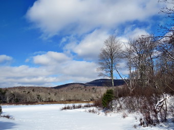 We continued up the Flynn Trail toward the junction with the Big Rock Trail. I was feeling pretty good at first but as we approached the trail junction I could feel some soreness on the inside of my thighs. This always happens for the first few times I snowshoe but then goes away as I snowshoe more. This winter I had only been out twice before and had not had time to get in shape! At 11:50 AM we were at the trail junction with the Big Rock Trail. It had taken just about an hour and 15 minutes to walk the 1.7 miles from the parking area. The snow on the Big Rock Trail was unbroken as we turned to start the long descent. At the trail junction we turned left to go down the Big Rock trail to Times Square. I was sure I didn't have any more "ups" left in me but the descent felt great. I like descending on snowshoes since, at times, you can almost ski down. The trail was completely unbroken and there was at least 8 inches of snow in most places. The trip down the Big Rock Trail went quickly although it seemed a little longer than usual. In several places, large trees had fallen across the trail and had not yet been cleared by the snowmobile club. I took a few pictures and then we continued our walk. There are three places where the trail drops quickly and then levels off. The last place brought us right to Times Square where the Logger's Loop and Big Rock Trail cross. Sheila was having a great time and did not seem to be bothered in any way by the snow or temperature. She kept going off the trail to follow animals tracks but returned quickly when I called. We continued straight ahead at Times square to go around the back of Frick Pond. Here the snow showed some snowshoe tracks that were several days old. The hike around the pond is a favorite and is one promoted by Lisa at Morgan Outdoors in Livingston Manor. The snow on the trail was packed a little from the traffic but fresh snow had fallen on top of them. Once we approached the bridges and wooden walkways the snow was deeper and we stopped so that I could again take a few shots. The skies which had been overcast were clearing to blue with some clouds. The wooden walkways were covered in snow that was deeper than anywhere else. Some snow had fallen through the opening between the boards and this formed an interesting pattern. We continued to walk until we came to the junction with the Quick Lake Trail. Here we turned left and headed for the bridge across the outlet of Frick Pond. We stopped briefly at the bridge and I took a few pictures of the pond and Flynn's Point. We walked up the hill to Gravestone Junction to head back to the parking area and I felt even this short uphill in my legs. The trail was well covered in snow with only a few spots where there was some water. We were back at 1:15 PM having covered 3.9 miles in 2 hours and 40 minutes with an elevation gain of 680 feet.
![]()
![]()
![]()
![]() On Tuesday, January 30th I decided I needed to get out for a walk despite the limited amount of time available. I had hiked with Cindy at Long Pond on Sunday but knew that the rest of my week would be busy. I decided we would go up on Round Top and do some figure 8's or loops. We waited until the snow and wind abated and got ready to go just before noon. As I got dressed I decided to wear a baselayer top and bottom and to wear a heavier Patagonia wool top under my Mammut Ultimate hoody. as the temperatures was in the teens and the wind was still blowing. I wore a heavier hat and a pair of gloves. I donned my Salomon B52 boots which are a little wider than the Nytros and put on OR Crocodile gaiters. I decided that there was not enough snow to wear snowshoes and I did not want to take my pack so I could not bring my spikes. Sheila, as usual, would not leave my side as I was getting ready as she wanted to make sure she was going too! We stepped out onto the back porch and headed out the driveway, which was slipperier than I thought, at 12:05 PM. The temperature was 20 degrees but the wind was blowing as we crossed the street with Sheila on her leash and walked to the back of the church. We began the ascent of the steepest hill behind the church. The hill is short but really gets the circulation pumping and is the steepest and longest climb on the "trail". Sheila helped me along by pulling me up the hill. When we got to the top of the hill, we started out on the trail by turning left at the trailhead. As soon as we entered the trees I released Sheila from her leash and she began to run around enjoying the snow. At the first trail junction we continued straight ahead to walk the steeper path to the viewpoint.
On Tuesday, January 30th I decided I needed to get out for a walk despite the limited amount of time available. I had hiked with Cindy at Long Pond on Sunday but knew that the rest of my week would be busy. I decided we would go up on Round Top and do some figure 8's or loops. We waited until the snow and wind abated and got ready to go just before noon. As I got dressed I decided to wear a baselayer top and bottom and to wear a heavier Patagonia wool top under my Mammut Ultimate hoody. as the temperatures was in the teens and the wind was still blowing. I wore a heavier hat and a pair of gloves. I donned my Salomon B52 boots which are a little wider than the Nytros and put on OR Crocodile gaiters. I decided that there was not enough snow to wear snowshoes and I did not want to take my pack so I could not bring my spikes. Sheila, as usual, would not leave my side as I was getting ready as she wanted to make sure she was going too! We stepped out onto the back porch and headed out the driveway, which was slipperier than I thought, at 12:05 PM. The temperature was 20 degrees but the wind was blowing as we crossed the street with Sheila on her leash and walked to the back of the church. We began the ascent of the steepest hill behind the church. The hill is short but really gets the circulation pumping and is the steepest and longest climb on the "trail". Sheila helped me along by pulling me up the hill. When we got to the top of the hill, we started out on the trail by turning left at the trailhead. As soon as we entered the trees I released Sheila from her leash and she began to run around enjoying the snow. At the first trail junction we continued straight ahead to walk the steeper path to the viewpoint.
As we approached the lookout, I had a good view down into town as we turned to the right to continue our hike on the yellow lower trail. We followed the trail and started the gentle climb through the woods which had few inches of snow. When we reached the next trail junction, we continued straight ahead on the blue rail toward the summit of Round Top. This trail is a little steep and it was slippery. I stayed to the side of the trail keeping one foot on the rougher surface at the side of the trail. We walked to the top and followed the trail across the summit and down the other side. The descent was tricky as the trail was packed and icy. When we reached the yellow trail, I decided to try a new variation so we turned right and followed the yellow trail along the base of Round Top and then back down to the lookout. We followed the trail to the left and walked back down to the first trail junction. This made sort of a lollipop with the upper blue loop forming the main body and the repeated part the stick. I was a little tired but I knew we would have to do another. This time we turned left and headed up the woods road which is the gentler approach. At the trail junction we continued straight ahead toward the summit of Round Top. We followed the blue trail across the summit and won the other side. The descent is steeper and required me to carefully plant my feet. When we reached the yellow trail, we turned left and followed it along the base of Round Top. At the trail junction we turned right to follow the yellow trail along the old woods road and back to the first trail junction. We had been out for over an hour so I decided to tune left and head back out to the trailhead. We walked won the cemetery hill to the church where I put Sheila on her leash. We traversed the field and crossed the street. After a short walk down the driveway we were home. We had covered a little over 2 miles in just over an hour. A short trip but better than none!
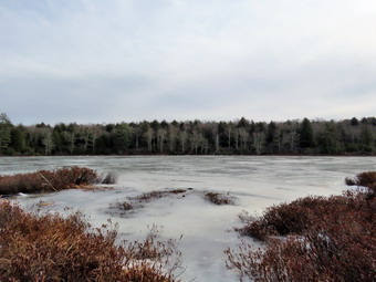
![]()
![]()
![]()
![]()
![]() On Sunday, January28th I was trying to decide whether or not I would go for a hike after church. I was a little tired an a lot lazy and had almost decided to stay home. As we drove home from church, the cloudy skies began to clear and Cindy asked me if I intended to go hiking. I told her that if she wanted to go I would go. I suggested we head for Long Pond to do a sort of figure 8 which is about 7.2 miles. I knew the late start would limit our options but felt that the trails would be largely free of ice due to the recent rains and high temperatures. We had Laos not been to long Pond in some time. When we got home and said the word hike, Sheila immediately indicated it was a good idea. Cindy got some lunch and we both got dressed and put our gear together. I decided to only wear a very light baselayer n top with a lighter Mammut pullover. I did wear my Mammut Ultimate hoody and Columbia Omniheat pants. I opted to wear a regular pair of hiking boots rather than winter boots. My Keen Glarus boots are a great fit and more comfortable than any insulated winter boots I have. I also decided to use a pair of Leki Khumbu with external locks as my Leki graphite poles have twist locks which are unreliable. Every hike when I have used these poles they have shortened despite my best efforts to keep them tight! When we left the house at about 12:50 PM the skies were partly sunny and the temperature was 45 degrees which is warm for late January in the Catskills. I got Sheila in the car and we put our gear in the trunk and headed out DeBruce Road for about 8 miles to Flugertown Road where I made a left. I parked in the lot a short distance up the road on the right where we found no cars. Sheila had not hiked in two days and she was ready to go when we got to the parking lot. There was some snow where the lot had been plowed and a little ice on the trail but Cindy and I elected to carry our spikes rather than put them on immediately. I set my GarminGPS and we started out on the trail at 1:15 PM. Right from the start the trail was wet and somewhat muddy and we walked to the side in several places to avoid the icy spots. The first .6 miles gains about 350 feet to the highest point on the hike. It isn't very steep but does act as a nice warm-up! We had to be careful to avoid the ice which wasn't easy in some spots. Once the trail leveled it was easier walking but the partly frozen ground would occasionally give way under our feet. At 1.1 miles we were at the spur trail that leads down to the shore of Long Pond. We turned right and went down to the pond so that I could take some pictures. At the shores of the pond I dropped my pack and got out my camera to take some pictures. Sheila tried to follow me through the mud but we discouraged her. The skies were very blue and the pond was frozen over but the scene was pretty bleak. I took a few shots anyway before going back to my pack. We returned to the main trail and arrived at the first trail junction. My plan had been to turn left here to do a figure 8 walk but with the amount of ice and water I decided to simply do a big loop in a counterclockwise direction. This would allow us to walk back on the roads which are at least flat. We turned right at the junction at 1.3 miles. We found plenty of ice in spots and the frozen ground continued to be a problem but the walking was relatively easy. By 2:10 PM we had walked 1.8 miles and were passing the spur trail to the lean-to.
On Sunday, January28th I was trying to decide whether or not I would go for a hike after church. I was a little tired an a lot lazy and had almost decided to stay home. As we drove home from church, the cloudy skies began to clear and Cindy asked me if I intended to go hiking. I told her that if she wanted to go I would go. I suggested we head for Long Pond to do a sort of figure 8 which is about 7.2 miles. I knew the late start would limit our options but felt that the trails would be largely free of ice due to the recent rains and high temperatures. We had Laos not been to long Pond in some time. When we got home and said the word hike, Sheila immediately indicated it was a good idea. Cindy got some lunch and we both got dressed and put our gear together. I decided to only wear a very light baselayer n top with a lighter Mammut pullover. I did wear my Mammut Ultimate hoody and Columbia Omniheat pants. I opted to wear a regular pair of hiking boots rather than winter boots. My Keen Glarus boots are a great fit and more comfortable than any insulated winter boots I have. I also decided to use a pair of Leki Khumbu with external locks as my Leki graphite poles have twist locks which are unreliable. Every hike when I have used these poles they have shortened despite my best efforts to keep them tight! When we left the house at about 12:50 PM the skies were partly sunny and the temperature was 45 degrees which is warm for late January in the Catskills. I got Sheila in the car and we put our gear in the trunk and headed out DeBruce Road for about 8 miles to Flugertown Road where I made a left. I parked in the lot a short distance up the road on the right where we found no cars. Sheila had not hiked in two days and she was ready to go when we got to the parking lot. There was some snow where the lot had been plowed and a little ice on the trail but Cindy and I elected to carry our spikes rather than put them on immediately. I set my GarminGPS and we started out on the trail at 1:15 PM. Right from the start the trail was wet and somewhat muddy and we walked to the side in several places to avoid the icy spots. The first .6 miles gains about 350 feet to the highest point on the hike. It isn't very steep but does act as a nice warm-up! We had to be careful to avoid the ice which wasn't easy in some spots. Once the trail leveled it was easier walking but the partly frozen ground would occasionally give way under our feet. At 1.1 miles we were at the spur trail that leads down to the shore of Long Pond. We turned right and went down to the pond so that I could take some pictures. At the shores of the pond I dropped my pack and got out my camera to take some pictures. Sheila tried to follow me through the mud but we discouraged her. The skies were very blue and the pond was frozen over but the scene was pretty bleak. I took a few shots anyway before going back to my pack. We returned to the main trail and arrived at the first trail junction. My plan had been to turn left here to do a figure 8 walk but with the amount of ice and water I decided to simply do a big loop in a counterclockwise direction. This would allow us to walk back on the roads which are at least flat. We turned right at the junction at 1.3 miles. We found plenty of ice in spots and the frozen ground continued to be a problem but the walking was relatively easy. By 2:10 PM we had walked 1.8 miles and were passing the spur trail to the lean-to.
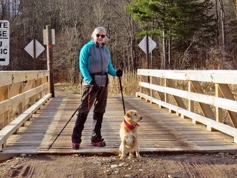 After passing the trail to the lean-to, the ice disappeared and we could hardly see any snow. There isn't much to see on this section of trail but we kept busy by avoiding the icy and wet spots. We continued on the main trail to the point where it intersects a woods road at 2.6 miles. We turned left on the woods road and found it to be very wet with icy patches. I was glad the ground was still partly frozen or this would have been a muddy mess. We followed the road until the intersection with Basily Road at 2.85 miles where we continued on Basily Road by bearing left. This section of road was very icy and for a while we tried walking on the sides where there was less ice. We finally came to a point where there was a downhill stretch completely covered over in ice and we agreed to stop on put on spikes. After donning my spikes, I took a pictures of a massive ice flow across the road. The ice continued for some time and then abated. We decided that as long as we were walking on soft ground we would keep the spikes on. As we approached the Peters Hunting Camp, I got ready to put Sheila on her leash. The area near the footbridge across the outlet to the beaver pond had freely flowing water and the bridge seemed to be almost superfluous with weeds growing around it. The bridge is starting to show its age and is not in good shape. I stopped to take some pictures of the beaver pond before we continued on the trail. As I looked over toward the private bridge over the creek, I noosed that it looked new. The old bridge was beginning to show its age and I knew the hunting camp would have to replace it eventually. We continued on the main trail to the bridge and found that it was all new and well-constructed. I took some pictures of it and a few pictures of the stream from it. We crossed the bridge to continue the trip back to the car. The ford downstream of the bridge looked like it had been getting a lot of use by vehicles but the water can be a little deep and wide for foot traffic. As we started up the little hill from the hunting camp, the ice returned so we were glad we had left our spikes on. I took a few shots of the valley which looked peaceful with the nice skies behind it. From this point on the ice returned and there was a significant amount of snow in the woods. I stopped to take a few shots and then we continued our hike. At one point I heard what sounded like a truck coming toward us but it was hard to hear above the noise of the creek. A red pickup truck approached us and I grabbed Sheila as the driver slowed as he passed. We kept a fast pace even thought was icy and eventually the road became paved. We stopped to remove our spikes and then continued down the road toward the car. As we approached the road bridge over the creek we could see quite a few trees had been gnawed down by beavers. There was a small dam just downstream of the bridge which was impounding a larger amount of water. I took out my camera and photographed the dam and the areas where the beavers had cut down trees. After a short stop, we started back for the car and on the way the red pickup passed us once again. We walked quickly down the road back to the parking area without meeting anyone else. We were back at the car at 4:10 PM having hiked 6.0 miles in 2 hours and 55 minutes with 20 minutes of stopped time. The elevation gain was only about 545 feet most of which was at the beginning of the hike.
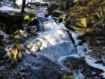
![]()
![]()
![]()
![]()
![]() On Thursday, January 25th I Wanted to get in a longer hike where there was a waterfall that might have been augmented by the recent rain and melting snow. I decided to hike the Trout Pond loop so that I could visit Russell Brook Falls. When I awoke at 6:30 AM the air temperature was in the single digits with a slight breeze and I really wanted to crawl back into a warm bed. I decided to wait a little while and do some chores around town. Just before 10:00 AM I decided I did not want to wait any longer and began to get dressed and out my gear together. I put on a baselayer top and bottom and wore a heavier Patagonia wool top. I put on my Columbia Omniheat pants and, as always, a Mammut Ultimate hoody. I wore a heavier hat and loves and packed a pair of mitts just in case. I knew I would not need snowshoes but put a pair of spikes in my pack. I also decided to put on a pair of winter boots settling on my Salomon B-52 which are a little wider than some. Sheila was ready to go and stayed close so that I would not forget her. I put my pack in the trunk and Sheila in the backseat and headed for Roscoe on the Quickway a little before 10:00 AM. I drove out the Rockland Flats on Route 206. Just after the Roscoe Nursing Home I turned left on Morton Hill Road and followed it for 3 miles to the intersection with Russell Brook Road. I turned around and parked on the side of the road avoiding the private parking area. When I opened the car door, I was hit my a blast of cold air. I checked the car thermometer and found that it was only 14 degrees and that there was a stiff breeze. I knew the solution was to get moving so I grabbed my poles, set the GPS and started down Russell Brook Road. After only a few feet, I could tell I would need the spikes. I picked a spot on the side of the road and sat to put them on as I find it easier than trying to balance on one leg. Once the spikes were on I was confident that they would do the trick and walked down the road on the ice. It was so cold that the ice was very firm and the spikes made a lot of noise as they bit into the ice. The forecast was for cloudy skies but there was plenty of blue and the sun was out as we continued down the road. I listened for the sound of the water in the brook and heard a good amount of noise. When we came to the viewpoint over the upper falls, I could see there was a large volume of water going over the falls so I headed down the bank to a viewpoint. I put down my pack and got out the camera. When I took off my gloves, it was clear that it was still very cold! I took some shots of the falls with different settings and was glad that the bight seemed good. There were no cars in the lot but the gate was open to allow snowmobiles access to the trails. We continued down the road and crossed the bridge over Russell Brook. I found that the Japanese knotweed appeared completely dead but knew it would be back next spring. We continued on the road turning right on the path to the falls. We walked over to the path down the bank to the streambed and carefully descended to the brook. The falls were flowing nicely and there was another "falls" of frozen water to the right of the flowing water. I got out my camera and took some pictures of the falls and then posed Sheila sitting just in front of the falls. After Sheila walked away, I took a few more pictures before putting away the camera and walking back out to the main trail. At the trail junction just after the register we continued straight ahead to walk up to Trout Pond. The trail was almost bare in some spots where it had good exposure to the sun but once we were under the trees I was glad I kept the spikes on. When we arrived at the pond, we walked to the left to the "beach" at the outlet end of the pond. The water level was high and the pond was completely frozen over. The skies were very blue so I knew I had to take some pictures. I took some panoramic pictures and then zoomed in on different parts of the scene. Sheila decided to walk out on the thin ice which, fortunately, supported her weight. I took some pictures of her before stowing the camera to continue the hike.
On Thursday, January 25th I Wanted to get in a longer hike where there was a waterfall that might have been augmented by the recent rain and melting snow. I decided to hike the Trout Pond loop so that I could visit Russell Brook Falls. When I awoke at 6:30 AM the air temperature was in the single digits with a slight breeze and I really wanted to crawl back into a warm bed. I decided to wait a little while and do some chores around town. Just before 10:00 AM I decided I did not want to wait any longer and began to get dressed and out my gear together. I put on a baselayer top and bottom and wore a heavier Patagonia wool top. I put on my Columbia Omniheat pants and, as always, a Mammut Ultimate hoody. I wore a heavier hat and loves and packed a pair of mitts just in case. I knew I would not need snowshoes but put a pair of spikes in my pack. I also decided to put on a pair of winter boots settling on my Salomon B-52 which are a little wider than some. Sheila was ready to go and stayed close so that I would not forget her. I put my pack in the trunk and Sheila in the backseat and headed for Roscoe on the Quickway a little before 10:00 AM. I drove out the Rockland Flats on Route 206. Just after the Roscoe Nursing Home I turned left on Morton Hill Road and followed it for 3 miles to the intersection with Russell Brook Road. I turned around and parked on the side of the road avoiding the private parking area. When I opened the car door, I was hit my a blast of cold air. I checked the car thermometer and found that it was only 14 degrees and that there was a stiff breeze. I knew the solution was to get moving so I grabbed my poles, set the GPS and started down Russell Brook Road. After only a few feet, I could tell I would need the spikes. I picked a spot on the side of the road and sat to put them on as I find it easier than trying to balance on one leg. Once the spikes were on I was confident that they would do the trick and walked down the road on the ice. It was so cold that the ice was very firm and the spikes made a lot of noise as they bit into the ice. The forecast was for cloudy skies but there was plenty of blue and the sun was out as we continued down the road. I listened for the sound of the water in the brook and heard a good amount of noise. When we came to the viewpoint over the upper falls, I could see there was a large volume of water going over the falls so I headed down the bank to a viewpoint. I put down my pack and got out the camera. When I took off my gloves, it was clear that it was still very cold! I took some shots of the falls with different settings and was glad that the bight seemed good. There were no cars in the lot but the gate was open to allow snowmobiles access to the trails. We continued down the road and crossed the bridge over Russell Brook. I found that the Japanese knotweed appeared completely dead but knew it would be back next spring. We continued on the road turning right on the path to the falls. We walked over to the path down the bank to the streambed and carefully descended to the brook. The falls were flowing nicely and there was another "falls" of frozen water to the right of the flowing water. I got out my camera and took some pictures of the falls and then posed Sheila sitting just in front of the falls. After Sheila walked away, I took a few more pictures before putting away the camera and walking back out to the main trail. At the trail junction just after the register we continued straight ahead to walk up to Trout Pond. The trail was almost bare in some spots where it had good exposure to the sun but once we were under the trees I was glad I kept the spikes on. When we arrived at the pond, we walked to the left to the "beach" at the outlet end of the pond. The water level was high and the pond was completely frozen over. The skies were very blue so I knew I had to take some pictures. I took some panoramic pictures and then zoomed in on different parts of the scene. Sheila decided to walk out on the thin ice which, fortunately, supported her weight. I took some pictures of her before stowing the camera to continue the hike.
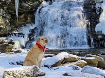 We continued on the main trail on the east side of Trout Pond walking toward the inlet end and the lean-tos. The trail continued to be very icy but there were a few spots of open water to be avoided. I was beginning to get warm even though the climb is very gentle and the air temperature was still low with a breeze. I had thought we might turn around at the pond but I was in a good mood and warm enough to continue on the loop. We passed by the first lean-to and crossed the bridge over the inlet stream. I took a look at the scene and decided I did not want to take pictures. We turned right to follow the trail up Cherry Ridge. As we hiked I found it satisfying to look at the many places where I had cleared branches and blowdowns from the trail. There were some new branches on the trail and several small blowdowns I was able to clear by moving them to the side of the trail. There was ice and the trail and on the rocks and I paid careful attention to where I put my feet. The spikes work well on thick layers of ice but don't help as much with thin layers of ice on rocks. Soon we were at the highest point on Cherry Ridge and starting down the other side. I anticipated that the trail would have less ice with the southern exposure but the trail continued to be frozen. There were some places that had open water and I walked off trail several times to avoid it. Sheila was having a great time and never did anything to hint that she was uncomfortable in the cold. Soon at the woods road and snowmobile trail that runs by Mud Pond. We turned left and start the short walk uphill on a sheet of ice. At the top of the hill we began the long descent back to the trail junction where we had started. The descent lasts for .7 miles and drops 385 feet to a bridge that crosses the outlet stream from Trout Pond. This part of the trail was the first place where it was clear that the sun had beaten back the ice a little. There were still many icy spots so I left the spikes on as we crossed the bridge over the outlet stream from the pond. At the junction we turned right and headed back out to the lower parking area. Sometimes the walk back up Russell Brook Road seems long and tedious but I was still feeling fresh and the spikes gave me the confidence to push the pace. We started up the road and soon arrived back at the car. It was 1:05 PM when we arrived back at the car after hiking 5.6 miles in 2 hours and 40 minutes with a 1130 foot total ascent. The temperature on the car thermometer was 18 degrees but I was satisfied with the hike and had not noticed the cold.
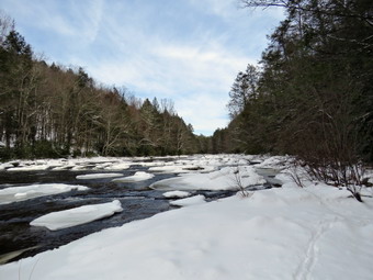
![]()
![]()
![]()
![]()
![]() On Saturday, January 20th, the weather forecast was for a beautiful sunny day with highs reaching into the high 30's or near I . I wanted to do a hike close to home but NOT on Round Top or at Frick Pond. These are my "go to" places and I had gone to the too often over the previous few weeks. I thought the Neversink Unique Area might be interesting an mentioned it to Cindy. She looked at me a little strangely and said she had been thinking the same thing! We knew that the rising temperatures would make the snow unsuitable for using snowshoes by the afternoon so we tried to get out early. As we got our gear together, Sheila watched us carefully to be sure we couldn't "forget" her. Even though the temperatures were supposed to rise it was still cool in the morning so I put on a full baselayer but opted for a lighter Mammut crew top under my Mammut Ultimate Hoody. I also wore a warmer hat and gloves. I decided to swift to my older Salomon b52 boot as they are wider than the Nytros. We bother decided gaiters were a good idea and wore our OR Crocodiles which have a plastic strap that goes underneath the boot. It is surpassing how important that strap can be as many other gaiters have a cloth string that ties under the boot which collects snow making for a very uncomfortable experience as the snow builds up. We both took our Tubbs AlpFlex VTR snowshoes which are smaller than some others we have but have bindings with a boa system and are easy to get on and off. We left home at 10:05 AM. Sheila seemed very happy that all of us were going somewhere as she was very alert in the back seat. I got on Route 17 and started for Rock Hill. I got off the Quickway at exit 109 and turned right on Katrina Falls Road to drive to the end of the road. I parked at 10:25 AM in the small parking area where there were no other cars. I walked over to the trail and found it was packed by previous snowshoes and that the snow depth was only a few inches. Cindy and I decided that snowshoes would not be needed. She put on her spikes but I decided to carry mine in my pack. I set my GPS and we started down the woods road toward the river intending to hike the loop to Denton and Mullet Falls. I thought that the recent cold weather might have left some ice on the river and that Mullet Falls might be frozen. Both of these would be interesting for photography and I was hoping for good light for some shots. Sheila was certainly anxious to get going as both she and I prefer several hikes a week! The temperature was in the mid 20's and the breeze made it seem a little colder. As we walked down the hill passed the trail register, we both were satisfied we had made he right decision by leaving the snowshoes behind. The snow covered the many rocks usually found on the trail and made walking easier as we kept a quick pace. We turned left at the bottom of the hill to stay on the main trail and came to the small bridge over Wolf Brook. The water was pretty high and much of it was frozen so I had to stop to take a few pictures. The condition of the bridge continues to deteriorate and soon will be impassable. The trail after the bridge was frozen and there was no open water to negotiate. At the top of the next small hill, we stayed to the right to hike the loop counterclockwise hitting Denton Falls on the Neversink first and then the falls on Mullet Brook.
On Saturday, January 20th, the weather forecast was for a beautiful sunny day with highs reaching into the high 30's or near I . I wanted to do a hike close to home but NOT on Round Top or at Frick Pond. These are my "go to" places and I had gone to the too often over the previous few weeks. I thought the Neversink Unique Area might be interesting an mentioned it to Cindy. She looked at me a little strangely and said she had been thinking the same thing! We knew that the rising temperatures would make the snow unsuitable for using snowshoes by the afternoon so we tried to get out early. As we got our gear together, Sheila watched us carefully to be sure we couldn't "forget" her. Even though the temperatures were supposed to rise it was still cool in the morning so I put on a full baselayer but opted for a lighter Mammut crew top under my Mammut Ultimate Hoody. I also wore a warmer hat and gloves. I decided to swift to my older Salomon b52 boot as they are wider than the Nytros. We bother decided gaiters were a good idea and wore our OR Crocodiles which have a plastic strap that goes underneath the boot. It is surpassing how important that strap can be as many other gaiters have a cloth string that ties under the boot which collects snow making for a very uncomfortable experience as the snow builds up. We both took our Tubbs AlpFlex VTR snowshoes which are smaller than some others we have but have bindings with a boa system and are easy to get on and off. We left home at 10:05 AM. Sheila seemed very happy that all of us were going somewhere as she was very alert in the back seat. I got on Route 17 and started for Rock Hill. I got off the Quickway at exit 109 and turned right on Katrina Falls Road to drive to the end of the road. I parked at 10:25 AM in the small parking area where there were no other cars. I walked over to the trail and found it was packed by previous snowshoes and that the snow depth was only a few inches. Cindy and I decided that snowshoes would not be needed. She put on her spikes but I decided to carry mine in my pack. I set my GPS and we started down the woods road toward the river intending to hike the loop to Denton and Mullet Falls. I thought that the recent cold weather might have left some ice on the river and that Mullet Falls might be frozen. Both of these would be interesting for photography and I was hoping for good light for some shots. Sheila was certainly anxious to get going as both she and I prefer several hikes a week! The temperature was in the mid 20's and the breeze made it seem a little colder. As we walked down the hill passed the trail register, we both were satisfied we had made he right decision by leaving the snowshoes behind. The snow covered the many rocks usually found on the trail and made walking easier as we kept a quick pace. We turned left at the bottom of the hill to stay on the main trail and came to the small bridge over Wolf Brook. The water was pretty high and much of it was frozen so I had to stop to take a few pictures. The condition of the bridge continues to deteriorate and soon will be impassable. The trail after the bridge was frozen and there was no open water to negotiate. At the top of the next small hill, we stayed to the right to hike the loop counterclockwise hitting Denton Falls on the Neversink first and then the falls on Mullet Brook.
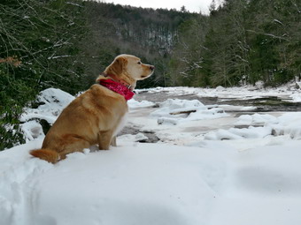 The snowshoers had gone straight ahead and the path we were taking was unbroken snow. This didn't seem like a problem as there were only a few inches but Cindy found that her spikes became useless as they developed huge clumps of snow. She removed them and stored them in my pack and we moved on. It seemed like it took longer than usual for us to arrive at the lower bridge over Mullet Brook. Walking on the snow meant a certain amount of slipping and sliding and the snow underfoot was uncomfortable at times. The bridge has been replaced with a new one that has a pair of steel I-beams as its main support and should last a long time. We stopped and I took a few pictures of the bridge and the frozen stream. I also posed Cindy and Sheila for a couple of shots. Cindy was not enthusiastic about hiking down the hill to the river and back but it was one of my "requirements" for this hike. At 1.4 miles we turned right following the yellow spur trail blazes downhill toward Denton Falls. The trail down to the falls is not well marked but we have been there many times and were able to pick up the blazes. As the trail began a steeper descent, Cindy announced that she would wait for us rather than go down to the river. I knew it wouldn't take us to long so Sheila and I continued. The descent was a little scary in places as the trail had both ice and snow and the spikes I had in my pack had proved to be ineffective. I slipped and slid down the trail until I was at the final descent to the river which was the trickiest part. After hiking 1.65 miles, we were at the rocks near the edge of Denton Falls which were covered in ice and snow. The river was flowing nicely and there were large chucks of ice and frozen areas in several places. I dropped my pack and started to take some pictures. Upstream the sky was bright blue with white clouds which contrasted to the view downstream which was largely overcast. Sheila seemed smart enough not to try to jump into the fast-moving water and frigid water. I was not able to walk along the rocks to get below the falls sine it was very slippery. I soon realized that we were walking on huge chunks of ice that had been pushed onto shore! I took quite a few pictures of the falls and some both upstream and downstream. The falls are hardly three feet high but the volume of water and the ice made the trip worthwhile. Sheila even posed for a few shots sitting on a rock by the falls. We headed back up the spur trail to the main trail which was made difficult by the snow which was getting slipperier as it melted. We rejoined Cindy and walked back to the trail junction and we turned right on the main trail and then left at the fork. The trail to the right leads to High Falls and I knew this would not be a good idea since it would add four miles of unbroken trail to our hike!
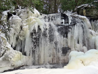 After a brief walk uphill, we turned left onto the short trail down to Mullet Brook Falls which did have some older snowshoe tracks which had come from the other direction. I was excited to see what Mullet Brook Falls might look like and soon they came into sight, I was pleased to find that the waterfall was encased in ice although it was a little brown. The water comes from a large swamp further upstream and is full of tannins which give it a brown color. I dropped my pack where the trail ended and grabbed my camera to take some pictures. The problem was that the route to the area in front of the falls was also encased in ice! I worked my way across the frozen stream hoping the ice would not break. I then carefully climbed on the rocks which were covered in ice and snow. Sheila had already run ahead and was cavorting on the icy rocks. I took some shots of the stream and the n turned my attention to the falls. The lighting was good so I took quite a few pictures of the falls and the pool below. There was a lot of ice which I knew would soon be gone with temperatures rising into the 40's early in the week. Eventually it was time to leave. I worked my way down the icy rocks and across the frozen stream without incident. I put away my camera and shouldered my pack to head back out the spur trail. We walked back out to the main trail and turned left to complete the loop. As we climbed we noticed the rocky ledges to our right and I thought about exploring them at some time in the future. The uphill walk in the snow was tiring but we were both glad the track was somewhat broken. It was clear the temperature was rising as the snow continued to get softer. Soon we crossed over the upper bridge spanning Mullet Brook. I stopped on the bridge to show Cindy the beginning of the large swamp on the right. From the bridge the trail is flat or downhill for some time. After a brief walk we were at a trail junction. Walking straight ahead on the trail leads to the Wolf Lake Multiple Use Area. We turned left and began to descend off the ridge. As we started to walk downhill, we met two young men hiking toward us and I held Sheila's collar to allow them to pass. As we hiked downhill, there were several areas of the trail that had plodded leaving large expanses of ice behind. We walked downhill for some time and eventually came to the trail junction near the bridge over Wolf Creek where we had started the loop earlier. We continued to walk straight ahead to return to the parking area. Once on the other side of the brook we made the right turn on the woods road back to the car. We were enthusiastic about the uphill walk back to the car made harder by the snow on the trail. We arrived at the parking area at 1:30 PM having hiked 4.7 miles in 2 hours and 55 minutes including the stops at the two falls. The vertical gain was only about 990 feet. We were both tired and thinking about making a stop for food on the way home.
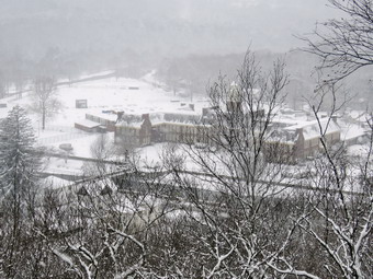
![]()
![]()
![]()
![]()
![]() On Wednesday, January 17th school was closed for the second day in a row as several inches of snow made the roads very slick in the morning. I wanted to get out to hike and take some pictures of the trees covered in snow but did not want to chance driving the back roads which would be the last to be plowed. Cindy and I decided we would go up on Round Top and do some figure 8's or loops. We waited until the snow and wind abated and got ready to go just before noon. As I got dressed I decided to wear a baselayer top and bottom and to wear a heavier Patagonia wool top under my Mammut Ultimate hoody. I wore a heavier hat and a pair of gloves. I donned my Salomon Nytro boots and put on OR Crocodile gaiters. Cindy and I decided that it had snowed enough to wear snowshoes even if they weren't exactly needed. She put on her Tubbs AlpFlex VTRs while I opted for my Crescent Moon Gold snowshoes. They are wider and longer than others I have and are good for breaking trail when I am not doing any "technical" hiking. Sheila, as usual, would not leave my side as I was getting ready as she wanted to make sure she was going too! We stepped out onto the back porch, put on our snowshoes and headed out the slippery driveway at 12:05 PM. I had my pack on as it is the only easy way to carry my camera. The temperature was 23 degrees but the wind was blowing as we crossed the street with Sheila on her leash and walked to the back of the church. I though about taking some pictures but decided to wait at least until we got to the hill. We did stop before climbing the hill behind the church so that I could take some pictures of the new and unbroken snow. We began the ascent of the steepest hill behind the church. The hill is short but really gets the circulation pumping and is the steepest and longest climb on the "trail". Sheila helped me along by pulling me up the hill which was a little harder to climb with the snowshoes. When we got to the top of the hill, we stopped and I took a variety of shots of the snow covered cemetery and town. We started out on the trail by turning left at the trailhead. As soon as we entered the trees I released Sheila from her leash and she began to run around enjoying the snow. At the first trail junction we continued straight ahead to walk the steeper path to the viewpoint.
On Wednesday, January 17th school was closed for the second day in a row as several inches of snow made the roads very slick in the morning. I wanted to get out to hike and take some pictures of the trees covered in snow but did not want to chance driving the back roads which would be the last to be plowed. Cindy and I decided we would go up on Round Top and do some figure 8's or loops. We waited until the snow and wind abated and got ready to go just before noon. As I got dressed I decided to wear a baselayer top and bottom and to wear a heavier Patagonia wool top under my Mammut Ultimate hoody. I wore a heavier hat and a pair of gloves. I donned my Salomon Nytro boots and put on OR Crocodile gaiters. Cindy and I decided that it had snowed enough to wear snowshoes even if they weren't exactly needed. She put on her Tubbs AlpFlex VTRs while I opted for my Crescent Moon Gold snowshoes. They are wider and longer than others I have and are good for breaking trail when I am not doing any "technical" hiking. Sheila, as usual, would not leave my side as I was getting ready as she wanted to make sure she was going too! We stepped out onto the back porch, put on our snowshoes and headed out the slippery driveway at 12:05 PM. I had my pack on as it is the only easy way to carry my camera. The temperature was 23 degrees but the wind was blowing as we crossed the street with Sheila on her leash and walked to the back of the church. I though about taking some pictures but decided to wait at least until we got to the hill. We did stop before climbing the hill behind the church so that I could take some pictures of the new and unbroken snow. We began the ascent of the steepest hill behind the church. The hill is short but really gets the circulation pumping and is the steepest and longest climb on the "trail". Sheila helped me along by pulling me up the hill which was a little harder to climb with the snowshoes. When we got to the top of the hill, we stopped and I took a variety of shots of the snow covered cemetery and town. We started out on the trail by turning left at the trailhead. As soon as we entered the trees I released Sheila from her leash and she began to run around enjoying the snow. At the first trail junction we continued straight ahead to walk the steeper path to the viewpoint.
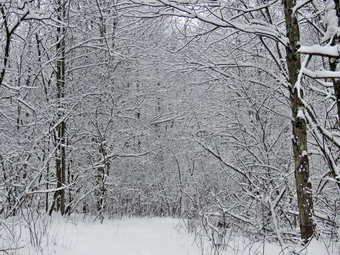 As we approached the lookout, I turned to the left and walked out to the lower rock ledges which give a clearer view of the school and downtown. I took out my camera and took off my gloves. I took a few quick shots including some of Cindy and Sheila on the upper ledge. I put my camera back in the pack and put my gloves back on. In the short time I had bare hands they became very cold! I climbed to the upper ledge and we turned to the right and to continue our hike on the yellow lower trail. We followed the trail and started the gentle climb through the woods which had five or six inches of new and unbroken snow. When we reached the next trail junction, we stayed to the right to follow the lower trail around the base of Round Top to the next junction. We stopped for a few minutes so that I could again photograph the pristine snow on the branches and on the trail. At the next junction we turned left and started up to the summit of Round Top on the steeper blue trail. The snowshoes definitely gave us good traction but the climb was not easy. We walked across the summit of Round Top and down the other side which is also a little steep. We were able to get some glide on the steeper part of the hill but found we kept hitting rocks and roots as the snow was not that deep. When we got to the yellow trail, we turned left to follow it to the second trail junction. This time we turned right and followed the yellow trail back to the very first trail junction to complete a figure 8. At the trail junction I persuaded Cindy to do another figure 8 so we turned around and retraced our steps taking the more gentle path this time. When the yellow trail turned left, we followed it to the next trail junction were we turned right and headed up the blue trail to the summit. We walked over the top and down the other side gliding where we could to the yellow trail again. We turned right and followed the trail along the base of Round Top. Where the yellow trail turned left, we continued to follow the trail to the left and down to the lookout. From the lookout we walked an glided down hill to the first trail junction. We continued straight out to the trailhead. Sheila did not seem to be bothered by the cold at all and had been well-behaved except for a few longer forays off the trail following animal tracks. At the trailhead, I put Sheila on her leash and we walked down the cemetery hill and across the field to our driveway. It was after 1:45 PM and we had hiked a little under 2 miles in an hour and 45 minutes. It must have been a good workout as I was tired.
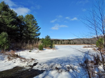
![]()
![]()
![]()
![]()
![]() the On Monday, January 15th I had the day off for Martin Luther King Day and wanted to get in a longer hike after too many days of inactivity and hiking only on Round Top. I decided to go to Frick Pond and found that this would be the FIRST hike of the winter at someplace other than Round Top! My plan was to wait until the temperature was in the teens and then go to Frick Pond and hike the loop in a clockwise direction. At 7:00 AM it was still 8 degrees out so I delayed my departure until after 11:00 AM. After doing a few chores around the house, I began to get my gear together which made Sheila watch me very closely. Even though we had been out on Saturday, I think she had the idea that this would be a longer hike as I was getting my pack ready. When I was ready to leave the temperature was only in the high teens but the sun was shining. As I stepped outside I found the sun was negated by the presence of a stiff breeze. I had on a full baselayer under my Columbia Omniheat pants and a heavier Patagonia wool top. I wore my Mammut hoody and Salomon Nytro insulated boots. I also wore a heavier hat and gloves and packed a pair of mitts just in case. I put my Microspikes in my pack hoping I could walk around the ice patches rather than wear them the whole time. I got my gear and Sheila in the car and headed out the DeBruce Road. After 6 miles, at Mongaup Pond Road, I turned left and continued to follow the road bearing left onto Beech Mountain Road at the fork. When we arrived in the parking area there was one other car parked in the small lot. Sheila was acting as if she hadn't hiked in a month as she ran around and headed for the trail. The temperature was 18 degrees and the constant breeze blowing made it seem colder. I got my gear ready to go and set my GPS. The skies were blue with only a few white clouds and the sun was shining brightly as we headed out the path to the register on Quick Lake Trail at 11:40 AM. The Quick Lake Trail from the start was covered in thick ice! I should have given up immediately and put on my spikes but I stubbornly decided to walk on the side of the trail following some other foolish hikers. I made it to Gravestone Junction without too much trouble and we turned left to head down to Frick Pond. The water level in the pond was a little higher than it had been and there was a pretty solid looking sheet of ice over the whole pond. I had thought I would not stop to take pictures but I couldn't resist the blue sky and icy pond. After taking a few shots, I put the camera in the pack and we continued on the Quick Lake Trail around the pond bearing left at the next trail junction to stay on the red trail. This part of the trail was also very icy in most places and even the parts with less ice were tricky as a thin layer of snow hid the ice. It was hard to find a place to get good footing without stepping on ice or in some water or mud. We were setting a fast pace despite the slippery conditions and soon came to the "pine promenade" and the little stream through the woods. The water level in the stream was higher than it had been in some time and I had to walk upstream to cross without getting wet. I stopped to take a few pictures before we continued on the trail toward Iron Wheel Junction. I did remove a few loose sticks along the way but left a larger blowdown which would require a saw. Just before the junction there was a large branch and a pile of smaller ones on the trail. These branches had been hung up for some time and had finally come down in the strong winds. We arrived at Iron Wheel Junction at 1.6 miles.
the On Monday, January 15th I had the day off for Martin Luther King Day and wanted to get in a longer hike after too many days of inactivity and hiking only on Round Top. I decided to go to Frick Pond and found that this would be the FIRST hike of the winter at someplace other than Round Top! My plan was to wait until the temperature was in the teens and then go to Frick Pond and hike the loop in a clockwise direction. At 7:00 AM it was still 8 degrees out so I delayed my departure until after 11:00 AM. After doing a few chores around the house, I began to get my gear together which made Sheila watch me very closely. Even though we had been out on Saturday, I think she had the idea that this would be a longer hike as I was getting my pack ready. When I was ready to leave the temperature was only in the high teens but the sun was shining. As I stepped outside I found the sun was negated by the presence of a stiff breeze. I had on a full baselayer under my Columbia Omniheat pants and a heavier Patagonia wool top. I wore my Mammut hoody and Salomon Nytro insulated boots. I also wore a heavier hat and gloves and packed a pair of mitts just in case. I put my Microspikes in my pack hoping I could walk around the ice patches rather than wear them the whole time. I got my gear and Sheila in the car and headed out the DeBruce Road. After 6 miles, at Mongaup Pond Road, I turned left and continued to follow the road bearing left onto Beech Mountain Road at the fork. When we arrived in the parking area there was one other car parked in the small lot. Sheila was acting as if she hadn't hiked in a month as she ran around and headed for the trail. The temperature was 18 degrees and the constant breeze blowing made it seem colder. I got my gear ready to go and set my GPS. The skies were blue with only a few white clouds and the sun was shining brightly as we headed out the path to the register on Quick Lake Trail at 11:40 AM. The Quick Lake Trail from the start was covered in thick ice! I should have given up immediately and put on my spikes but I stubbornly decided to walk on the side of the trail following some other foolish hikers. I made it to Gravestone Junction without too much trouble and we turned left to head down to Frick Pond. The water level in the pond was a little higher than it had been and there was a pretty solid looking sheet of ice over the whole pond. I had thought I would not stop to take pictures but I couldn't resist the blue sky and icy pond. After taking a few shots, I put the camera in the pack and we continued on the Quick Lake Trail around the pond bearing left at the next trail junction to stay on the red trail. This part of the trail was also very icy in most places and even the parts with less ice were tricky as a thin layer of snow hid the ice. It was hard to find a place to get good footing without stepping on ice or in some water or mud. We were setting a fast pace despite the slippery conditions and soon came to the "pine promenade" and the little stream through the woods. The water level in the stream was higher than it had been in some time and I had to walk upstream to cross without getting wet. I stopped to take a few pictures before we continued on the trail toward Iron Wheel Junction. I did remove a few loose sticks along the way but left a larger blowdown which would require a saw. Just before the junction there was a large branch and a pile of smaller ones on the trail. These branches had been hung up for some time and had finally come down in the strong winds. We arrived at Iron Wheel Junction at 1.6 miles.
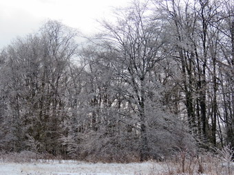 We turned left on the Quick Lake Trail and started the long uphill climb toward Junkyard Junction. The trail continued to be icy from the heavy rains and quick freeze at the end of the week. There were signs that once again the hard rain had produced small streams that had run down the trail. We were headed for Junkyard Junction at 3.2 miles. With no one to talk to I was lost in my own thoughts as Sheila followed a few game trails. As we walked the clouds in the sky increased and the wind picked up a little. We turned right onto the blue Flynn Trail which is almost flat. It too was icy and wet in places. There were no major blowdowns but I continued to remove branches that littered the trail. When we got to the gate, we turned right to stay on the trail and head down toward Hodge Pond. At 3.75 miles the Flynn Trail heads right and I followed it toward the outlet end of Hodge Pond. I continued to be stubborn and refused to stop to put on my spikes even though there were vast expanses of ice all along the trail. The trail broke out into a field which we crossed and continued to follow the Flynn Trail toward the outlet of the pond. Just as the trail again Brooke out into the open field at the lower end of the pond, I noticed that the trees were covered in ice. The sunlight sparkled off the trees and I knew I needed some pictures. We walked through the clearing at the outlet end of the pond almost to the shore where I dropped my pack and got out my camera. I took shots of the pond with the blue skies an d clouds. Many of the trees around the pond were covered in ice and I tried to capture their beauty. Before packing up, I got out a bar and put it in an inner pocket to soften. I packed up and walked back to the Flynn Trail to the point where it re-enters the woods. The snow always drifts here and I could see several drifts. When I got to them, I was surprised since they were as hard as a rock. As we entered the woods, I looked back and saw the trees encased in ice and the blue pond. I couldn't resist a few more pictures. We started the climb up the hill and I was feeling quite fresh and concentrated on using my poles to help set a quick pace up the hill. At the top of the hill we stayed to the right to continue on the Flynn Trail. A left turn follows a woods road out to what remains of the Beech Mountain Boy Scout Camp. The Flynn Trail is relatively flat to the junction with the Big Rock Trail at 4.5 miles and there was less ice on this section. We continued straight through the junction with the Big Rock Trail to follow the Flynn Trail back to the car. I expected the walk back downhill to go quickly and that there would be less ice to contend with on this section of trail. I was wrong! In several places, the water had overflowed the "ditch" at the side of the trail or the watercourse was blocked by ice. The water found its way onto the trail and there were large sections that showed erosion. The water had frozen into large sheets of ice making the descent interesting. We walked as quickly as I could with Sheila leading the way. Sheila has built-in crampons and a nice warm coat. I was worried about her paws in the low temperatures but she did not seem bothered at all. As we approached the gate on the woods road, we turned left to avoid the private property around the cabin and to stay on the trail. This trail had also acted as a streambed during the heavy rains and was covered in ice for the first half. We finished our walk and were back at the car by 2:30 PM. We had covered 6.4 miles in 2 hours and 50 minutes with an elevation gain of 950 feet. It still seemed cold as the temperature was only 19 degrees with some wind.
![]()
![]()
![]()
![]() On Saturday, January 13th I knew I had to get out after almost a week of ridiculous weather. The beginning of the week had been cold but by Friday the temperature was 58 degrees! The temperature dropped 40 degrees overnight and everything turned to ice with a coating of snow to make the sidewalk and roads even slipperier. I knew I couldn't go too far from home as the roads were still icy even at noon. I was still getting over a cold and did not want to overexert myself. Around 1:00 PM the temperature was in the low 20's and I asked Cindy if she wanted to go across the street to hike on Round Top. She agreed and we started to get ready. I decided on tights underneath my Columbia Omniheat pants and a heavier Patagonia wool top with a baselayer. Sheila seemed to agree that hiking was a good idea as she kept "hinting" that she wanted to go outside. I wore my Mammut Ultimate hoody and a pair of Salomon Nytro boots. Cindy decided to wear her Microspikes but I stubbornly went with bare boots. Sheila was happy to finally be outside as I put her on her leash to walk across the street at 1:35 PM. We walked through the field next to the church and walked up the steep but short cemetery hill with Sheila giving me a little help as she pulled me up the hill. The wind made it seem much colder than it was. We turned left and entered the trail where I released Sheila from her leash. I immediately noticed that it seemed much warmer out of the wind. At the first trail junction Sheila continued straight ahead up the steeper slope to the lookout and I followed her. At the lookout I caught a quick glimpse of town and everything looked a little bleak. We followed the lower yellow trail as it started toward Round Top. At the trail junction we continued straight ahead on the upper blue trail which goes over the summit of Round Top. I had to walk on the side of the trail since the part of the trail that was packed was now icy. Cindy had no problem as she had worn spikes. We walked over the summit and down the other side with me descending carefully on the icy trail. At the bottom of the hill we continued straight ahead on the lower yellow trail as it followed a woods road back to the first trail junction. We turned around and started back up the woods road following the yellow trail until we were at the junction with the upper blue trail. We continued straight ahead and over the summit of Round Top. The descent down the ether side was the most difficult part of the hike as the trail is steeper and negotiating the icy spots was more tricky. At the junction with the yellow trail we continued straight ahead and walked down to the lookout. We continued to follow the yellow trail and turned left at the lookout to walk down to the first trail junction. Cindy was ready to go home but Sheila and I wanted to stay out a little longer. As Cindy headed off to the trailhead, Sheila and I turned around and walked back up to the lookout and followed the yellow trail to the next junction. This time we turned to the right to follow the lower trail along the base of Round Top. At the next junction we turned right again and followed the lower trail back to the first junction. Once again we turned around and reversed the lower loop until we were once again deciding from the lookout to the first trail junction. This time we continued straight ahead and walked out to the trailhead. We walked down the cemetery hill with the sun shining brightly and the wind blowing. At the base of the hill I put Sheila on her leash and we walked back across the field next to the church to our driveway. We arrived back at the house just before 3:00 PM having spent 1 hour and 25 minutes walking a little less than 3 miles.
On Saturday, January 13th I knew I had to get out after almost a week of ridiculous weather. The beginning of the week had been cold but by Friday the temperature was 58 degrees! The temperature dropped 40 degrees overnight and everything turned to ice with a coating of snow to make the sidewalk and roads even slipperier. I knew I couldn't go too far from home as the roads were still icy even at noon. I was still getting over a cold and did not want to overexert myself. Around 1:00 PM the temperature was in the low 20's and I asked Cindy if she wanted to go across the street to hike on Round Top. She agreed and we started to get ready. I decided on tights underneath my Columbia Omniheat pants and a heavier Patagonia wool top with a baselayer. Sheila seemed to agree that hiking was a good idea as she kept "hinting" that she wanted to go outside. I wore my Mammut Ultimate hoody and a pair of Salomon Nytro boots. Cindy decided to wear her Microspikes but I stubbornly went with bare boots. Sheila was happy to finally be outside as I put her on her leash to walk across the street at 1:35 PM. We walked through the field next to the church and walked up the steep but short cemetery hill with Sheila giving me a little help as she pulled me up the hill. The wind made it seem much colder than it was. We turned left and entered the trail where I released Sheila from her leash. I immediately noticed that it seemed much warmer out of the wind. At the first trail junction Sheila continued straight ahead up the steeper slope to the lookout and I followed her. At the lookout I caught a quick glimpse of town and everything looked a little bleak. We followed the lower yellow trail as it started toward Round Top. At the trail junction we continued straight ahead on the upper blue trail which goes over the summit of Round Top. I had to walk on the side of the trail since the part of the trail that was packed was now icy. Cindy had no problem as she had worn spikes. We walked over the summit and down the other side with me descending carefully on the icy trail. At the bottom of the hill we continued straight ahead on the lower yellow trail as it followed a woods road back to the first trail junction. We turned around and started back up the woods road following the yellow trail until we were at the junction with the upper blue trail. We continued straight ahead and over the summit of Round Top. The descent down the ether side was the most difficult part of the hike as the trail is steeper and negotiating the icy spots was more tricky. At the junction with the yellow trail we continued straight ahead and walked down to the lookout. We continued to follow the yellow trail and turned left at the lookout to walk down to the first trail junction. Cindy was ready to go home but Sheila and I wanted to stay out a little longer. As Cindy headed off to the trailhead, Sheila and I turned around and walked back up to the lookout and followed the yellow trail to the next junction. This time we turned to the right to follow the lower trail along the base of Round Top. At the next junction we turned right again and followed the lower trail back to the first junction. Once again we turned around and reversed the lower loop until we were once again deciding from the lookout to the first trail junction. This time we continued straight ahead and walked out to the trailhead. We walked down the cemetery hill with the sun shining brightly and the wind blowing. At the base of the hill I put Sheila on her leash and we walked back across the field next to the church to our driveway. We arrived back at the house just before 3:00 PM having spent 1 hour and 25 minutes walking a little less than 3 miles.
![]()
![]()
![]()
![]() On Monday, January 8th I planned to finally get out on my first hike of 2018. It had been more than a week without a hike but with good reason. I had a cold AND the wind chill temperatures had been well below zero for many days in a row. In addition, Our ambulance corps had been responding to quite a few calls. Even though I had track practice in the afternoon, I planned to go to Frick Pond and get in a 6 mile hike since the temperature was in the high teens and climbing. I made my plans the night before and went to sleep thinking about hiking until phone call woke me up at 6:00 AM. Despite my plans I was needed as a substitute for the middle school nurse for two days! Its not what I wanted to do and I knew Sheila would be wondering why we weren't going out wanted to get out but there are very few people who can substitute for the nurse. I wasn't happy as I got dressed and headed off to school. The day went pretty quickly and some light snow began to fall after noon. An announcement was made indicating after school activities were canceled which I knew meant I could go home early. I began to think that I could get a quick hike in on Round Top before dark! I drove home arriving at about 3:30 PM and asked Cindy if she wanted to go. She has also had a cold but decided she wanted to get out in the "Warm" weather. As I got dressed I decided to forego a baselayer and to wear a lighter Mammut crew neck shirt under my Mammut Ultimate hoody. I wore a hat and a pair of gloves. I donned my Salomon Nytro boots but left the gaiters at home. Cindy and I decided that it had not snowed enough to wear snowshoes but that MicroSpikes would be a good idea. Sheila would not leave my side as I was getting ready as she wanted to make sure she was going too! We stepped out onto the back porch, put on our spikes and headed out the slippery driveway at 3:45 AM. The temperature was 23 degrees as we crossed the street with Sheila on her leash and walked to the back of the church. We began the ascent of the steepest hill behind the church. The hill is short but really gets the circulation pumping and is the steepest and longest climb on the "trail". Sheila helped me along by pulling me up the hill. When we got to the top of the hill, we started out on the trail by turning left at the trailhead. As soon as we entered the trees I released Sheila from her leash. At the first trail junction we continued straight ahead to walk the steeper path to the viewpoint. At the lookout we turned to the right and we continued our hike on the yellow lower trail.
On Monday, January 8th I planned to finally get out on my first hike of 2018. It had been more than a week without a hike but with good reason. I had a cold AND the wind chill temperatures had been well below zero for many days in a row. In addition, Our ambulance corps had been responding to quite a few calls. Even though I had track practice in the afternoon, I planned to go to Frick Pond and get in a 6 mile hike since the temperature was in the high teens and climbing. I made my plans the night before and went to sleep thinking about hiking until phone call woke me up at 6:00 AM. Despite my plans I was needed as a substitute for the middle school nurse for two days! Its not what I wanted to do and I knew Sheila would be wondering why we weren't going out wanted to get out but there are very few people who can substitute for the nurse. I wasn't happy as I got dressed and headed off to school. The day went pretty quickly and some light snow began to fall after noon. An announcement was made indicating after school activities were canceled which I knew meant I could go home early. I began to think that I could get a quick hike in on Round Top before dark! I drove home arriving at about 3:30 PM and asked Cindy if she wanted to go. She has also had a cold but decided she wanted to get out in the "Warm" weather. As I got dressed I decided to forego a baselayer and to wear a lighter Mammut crew neck shirt under my Mammut Ultimate hoody. I wore a hat and a pair of gloves. I donned my Salomon Nytro boots but left the gaiters at home. Cindy and I decided that it had not snowed enough to wear snowshoes but that MicroSpikes would be a good idea. Sheila would not leave my side as I was getting ready as she wanted to make sure she was going too! We stepped out onto the back porch, put on our spikes and headed out the slippery driveway at 3:45 AM. The temperature was 23 degrees as we crossed the street with Sheila on her leash and walked to the back of the church. We began the ascent of the steepest hill behind the church. The hill is short but really gets the circulation pumping and is the steepest and longest climb on the "trail". Sheila helped me along by pulling me up the hill. When we got to the top of the hill, we started out on the trail by turning left at the trailhead. As soon as we entered the trees I released Sheila from her leash. At the first trail junction we continued straight ahead to walk the steeper path to the viewpoint. At the lookout we turned to the right and we continued our hike on the yellow lower trail.
We followed the trail and started the gentle climb through the woods which had four or five inches of new and unbroken snow. When we reached the next trail junction, we stayed to the right to follow the lower trail around the base of Round Top to the next junction. At this junction we turned left and started up to the summit of Round Top on the steeper blue trail. The spikes definitely made the going easier although they are better suited for ice or firmly packed snow. We walked across the summit of Round Top and down the other side which is also a little steep. Again, the spikes helped in the descent but I was still able to get a little glide. When we got to the yellow trail, we turned left to follow it to the second trail junction. This time we turned right and followed the yellow trail back to the very first trail junction to complete a figure 8. At the trail junction Cindy decided to go home as the cool air was bothering her cold. Sheila and I turned around and retraced our steps taking the more gentle path this time. When the yellow trail turned left, we followed it to the next trail junction were we turned right and headed up the blue trail to the summit. We walked over the top and down the other side to the yellow trail again. It was beginning to get very dark as we turned right and followed the trail along the base of Round Top. Where the yellow trail turned left, we continued to follow the trail to the left and down to the lookout. From the lookout we walked down hill to the first trail junction. We continued straight out to the trailhead. I was a little depressed to think that the 40+ degree weather later in the week would eliminate all the beautiful snow! Sheila did not seem to be bothered by the cold at all and had been well-behaved staying with me most of the time. At the trailhead, I put Sheila on her leash and we walked down the cemetery hill and across the field to our driveway. It was after 5:00 PM and we had hiked a little under 2 miles in 1 hour and 15 minutes. It must have been a good workout as I was tired after so many days without an activity.
![]()
![]()
![]()
![]() On Friday, December 29th the temperature when I got up at 6:30 AM was 4 degrees with a breeze making the wind-chill well below zero. This had been true for several days in a row and I was tired of staying inside. Sheila seemed to agree with me as she kept "hinting" that she wanted to go outside. I decided to wait a little hoping that the temperature might rise. By 11:30 the temperature did rise to about 10 degrees! I would take Sheila and go across the street to hike on Round Top. I am getting bored hiking there but it gave us the best opportunity to hike close to home and to come home if it was too cold. I put on a full baselayer under my Columbia Omniheat pants and a heavier Patagonia wool top. I wore my Mammut Ultimate hoody and a pair of Salomon Nytro boots with Microspikes. Sheila was happy to finally et outside as I put her on her leash to walk across the street at 11:50 AM. We walked through the field next to the church and walked up the steep but short cemetery hill with Sheila giving me a little help as she pulled me up the hill. We turned left and entered the trail where I released Sheila from her leash. At the first trail junction Sheila turned right to head up the more gentle slope and I followed her. Where the trail split at the next junction I followed Sheila as she went straight up the hill on the blue trail toward the summit of Round Top. I was surprised that I was not very cold and was actually starting to sweat as we climbed the short but steep hill to the summit. We crossed over the top and started down the other side. I was glad I had on the Microspikes as it was steep and slippery as this side is out of the sun. I also noticed a slight breeze was making my exposed face cold. As I inhaled, I noticed that the air was very cold as my chest was cool. At the trail junction we continued straight ahead on the yellow trail toward the viewpoint. At the viewpoint we turned left and walked down the hill back to the first trail junction. We immediately turned around and started back up the hill. Sheila was very eager and bounded ahead of me. This time we repeated the big loop we had just done but in reverse. As always we needed up back at the first trail junction. We again turned around and walked back up the more gentle slope toward the junction with the upper blue trail. At this junction we turned left on the lower yellow trail to execute a small loop. We continued to follow the yellow trail along the base of Round Top and down to the viewpoint. After turning left and walking downhill, we were back at the first trail junction. We turned around for one last time and walked a small loop in reverse. This time when we arrived at the first trail junction, we turned left and walked out to the trailhead. We walked down the cemetery hill with the sun shining brightly. At the base of the hill I put Sheila on her leash and we walked back across the field next to the church to our driveway. We arrived back at the house at 1:10 PM having spent 1 hour and 20 minutes walking a little less than 3 miles.
On Friday, December 29th the temperature when I got up at 6:30 AM was 4 degrees with a breeze making the wind-chill well below zero. This had been true for several days in a row and I was tired of staying inside. Sheila seemed to agree with me as she kept "hinting" that she wanted to go outside. I decided to wait a little hoping that the temperature might rise. By 11:30 the temperature did rise to about 10 degrees! I would take Sheila and go across the street to hike on Round Top. I am getting bored hiking there but it gave us the best opportunity to hike close to home and to come home if it was too cold. I put on a full baselayer under my Columbia Omniheat pants and a heavier Patagonia wool top. I wore my Mammut Ultimate hoody and a pair of Salomon Nytro boots with Microspikes. Sheila was happy to finally et outside as I put her on her leash to walk across the street at 11:50 AM. We walked through the field next to the church and walked up the steep but short cemetery hill with Sheila giving me a little help as she pulled me up the hill. We turned left and entered the trail where I released Sheila from her leash. At the first trail junction Sheila turned right to head up the more gentle slope and I followed her. Where the trail split at the next junction I followed Sheila as she went straight up the hill on the blue trail toward the summit of Round Top. I was surprised that I was not very cold and was actually starting to sweat as we climbed the short but steep hill to the summit. We crossed over the top and started down the other side. I was glad I had on the Microspikes as it was steep and slippery as this side is out of the sun. I also noticed a slight breeze was making my exposed face cold. As I inhaled, I noticed that the air was very cold as my chest was cool. At the trail junction we continued straight ahead on the yellow trail toward the viewpoint. At the viewpoint we turned left and walked down the hill back to the first trail junction. We immediately turned around and started back up the hill. Sheila was very eager and bounded ahead of me. This time we repeated the big loop we had just done but in reverse. As always we needed up back at the first trail junction. We again turned around and walked back up the more gentle slope toward the junction with the upper blue trail. At this junction we turned left on the lower yellow trail to execute a small loop. We continued to follow the yellow trail along the base of Round Top and down to the viewpoint. After turning left and walking downhill, we were back at the first trail junction. We turned around for one last time and walked a small loop in reverse. This time when we arrived at the first trail junction, we turned left and walked out to the trailhead. We walked down the cemetery hill with the sun shining brightly. At the base of the hill I put Sheila on her leash and we walked back across the field next to the church to our driveway. We arrived back at the house at 1:10 PM having spent 1 hour and 20 minutes walking a little less than 3 miles.
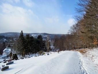
![]()
![]()
![]()
![]()
![]() On Tuesday, December 26th I wanted to get out to hike but the temperature was 14 degrees at 11:00 AM with a breeze blowing dropping the wind-chill to the single digits. I didn't know how Sheila would fare so I decided to go across the street to hike on Round Top. I knew we could get there and back quickly and could lengthen or shorten our hike easily. Cindy decided she would go along despite the cold so we started to get dressed. I put on a baselayer and decided to wear a heavier Patagonia wool top underneath my Mammut Ultimate hoody. I also took a heavier hat and wore a pair of warm mitts. I donned my Salomon Nytro boots and wore high gaiters. Cindy and i decided that it had not snowed enough to wear snowshoes but that MicroSPikes would be a good idea. Sheila would not leave my side as I was getting ready as she wanted to make sure she was going too! I decided to take my pack along as a way to carry my camera. We stepped out onto the back porch, put on our spikes and headed out the slippery driveway at 11:15 AM. We crossed the street with Sheila on her leash and walked to the back of the church. We began the ascent of the steepest hill behind the church. The hill is short but really gets the circulation pumping and is the steepest and longest climb on the "trail". Sheila helped me along by pulling me up the hill. When we got to the top of the hill, I paused to take a few pictures of the town covered in snow. We started out on the trail by turning left at the trailhead. As soon as we entered the trees I released Sheila from her leash. At the first trail junction we continued straight ahead to walk the steeper path to the viewpoint. At the lookout I turned to the left on the spur trail and walked out to the lower viewpoint that has the best view of the school. I took several pictures including a couple of Cindy and Sheila on the upper lookout. I walked up to the upper lookout and we continued our hike on the yellow lower trail.
On Tuesday, December 26th I wanted to get out to hike but the temperature was 14 degrees at 11:00 AM with a breeze blowing dropping the wind-chill to the single digits. I didn't know how Sheila would fare so I decided to go across the street to hike on Round Top. I knew we could get there and back quickly and could lengthen or shorten our hike easily. Cindy decided she would go along despite the cold so we started to get dressed. I put on a baselayer and decided to wear a heavier Patagonia wool top underneath my Mammut Ultimate hoody. I also took a heavier hat and wore a pair of warm mitts. I donned my Salomon Nytro boots and wore high gaiters. Cindy and i decided that it had not snowed enough to wear snowshoes but that MicroSPikes would be a good idea. Sheila would not leave my side as I was getting ready as she wanted to make sure she was going too! I decided to take my pack along as a way to carry my camera. We stepped out onto the back porch, put on our spikes and headed out the slippery driveway at 11:15 AM. We crossed the street with Sheila on her leash and walked to the back of the church. We began the ascent of the steepest hill behind the church. The hill is short but really gets the circulation pumping and is the steepest and longest climb on the "trail". Sheila helped me along by pulling me up the hill. When we got to the top of the hill, I paused to take a few pictures of the town covered in snow. We started out on the trail by turning left at the trailhead. As soon as we entered the trees I released Sheila from her leash. At the first trail junction we continued straight ahead to walk the steeper path to the viewpoint. At the lookout I turned to the left on the spur trail and walked out to the lower viewpoint that has the best view of the school. I took several pictures including a couple of Cindy and Sheila on the upper lookout. I walked up to the upper lookout and we continued our hike on the yellow lower trail.
 We followed the trail and started the gentle climb through the woods which had two or three inches of new and unbroken snow. When we reached the next trail junction, we stayed to the right to follow the lower trail around the base of Round Top to the next junction. At this junction we turned left and started up to the summit of Round Top on the steeper blue trail. The spikes definitely made the going easier although they are better suited for ice or firmly packed snow. We walked across the summit of Round Top and down the other side which is also a little steep. Again, the spikes helped in the descent which had been very icy on my previous trip. When we got to the yellow trail, we turned left to follow it to the second trail junction. This time we turned right and followed the yellow trail back to the very first trail junction to complete a figure 8. At the trail junction we turned around and retraced our steps taking the more gentle path this time. When the yellow trail turned left, we followed it to the next trail junction were we turned right and headed up the blue trail to the summit. We walked over the top and down the other side to the yellow trail again. We turned right and followed the trail along the base of Round Top. Where the yellow trail turned left, I stopped to take a few shots of the trails in all directions. We continued to follow the trail to the left and down to the lookout. From the lookout we walked down hill to the first trail junction. Cindy was tired at this point and I was a little bored so we continued straight out to the trailhead. Sheila did not seem to be bothered by the cold at all and had been well-behaved staying with me most of the time. At the trailhead, I put Sheila on her leash and we walked down the cemetery hill and across the field to our driveway. It was 12:30 PM and we had hiked a little over 2 miles in 1 hour and 15 minutes. It must have been a good workout as I was tired.
![]()
![]()
![]()
![]() On Sunday, December 24th I knew I needed to get out after several days of substituting for the school nurse and some horrendous weather. In addition, the forecast for the coming week included snow and then temperatures with highs in the teens! After returning from church, Cindy decided to meet some of her family for lunch so I decided to simply head across the street to Round Top and do some figure 8's just for the exercise. This would be the first hike of the winter season and also a hike on Christmas Eve day. When we started down the driveway at 1:10 PM the temperature was in the high 30's which almost seemed warm. I did not put on a baselayer top or bottom but did take a hat and a pair of light gloves. Sheila was so happy to get out she kept winning and barking at me as I put her on her leash to walk down the driveway and across the street. We crossed the street with Sheila on her leash and walked to the back of the church. We began the ascent of the steepest hill behind the church. The hill is short but really gets the circulation pumping and is the steepest and longest climb on the "trail". Sheila helped me along by pulling me up the hill. When we got to the top of the hill, we started out on the trail by turning left at the trailhead. As soon as we entered the trees I released Sheila from her leash. At the first trail junction Sheila turned right so i followed her to start up the more gradual side of the hill. At the next junction Sheila continued straight ahead on the blue trail to the top of the hill so I again followed her toward the summit. I was surprised that there was still some snow on the trail. We had rain for most of Saturday but the temperatures were just above freezing so some of the snow did not melt. we walked over the top of the hill which did not have much shoe and then down the other side. The descent is the steepest on the trail and it was covered in snow and was a little tricky to negotiate. I was disappointed to find many ATV tracks criss-crossing the hiking trail. People developed the habit of going wherever they want without permission and breaking that bad habit may be almost impossible. At the next trail junction at the bottom of the hill we continued straight ahead on the yellow trail to walk down to the lookout. There was a good view of town but I had seen it before and did not linger. We continued down the hill to the first trail junction. Wee immediately turned around and walked back up the hill to walk the same route but in reverse. Climbing the steeper section of the trail seemed easier than descending it. Once we were again at the first trail junction we turned around and started back up the more gentle slope. This time we did a figure 8 by turning left at the next trail junctions and taking the lower yellow trail along the base of Round Top. At the next junction we trend right and took the blue trail up to the top and back down to the yellow trail. We turned right and followed the yellow trail back to the viewpoint and back down to the first trail junction. When we reached the starting point, we turned around and did another Figure 8 by reversing the route we had just completed. When we finally were back at the first trail junction we turned left and walked back out to the trailhead. I put Sheila on her leash as we turned right and walk back down to the church and across the field to our driveway. We were back at the house at 2:45 PM after hiking 3.1 miles in 1.5 hours with a vertical gain of 1080 feet.
On Sunday, December 24th I knew I needed to get out after several days of substituting for the school nurse and some horrendous weather. In addition, the forecast for the coming week included snow and then temperatures with highs in the teens! After returning from church, Cindy decided to meet some of her family for lunch so I decided to simply head across the street to Round Top and do some figure 8's just for the exercise. This would be the first hike of the winter season and also a hike on Christmas Eve day. When we started down the driveway at 1:10 PM the temperature was in the high 30's which almost seemed warm. I did not put on a baselayer top or bottom but did take a hat and a pair of light gloves. Sheila was so happy to get out she kept winning and barking at me as I put her on her leash to walk down the driveway and across the street. We crossed the street with Sheila on her leash and walked to the back of the church. We began the ascent of the steepest hill behind the church. The hill is short but really gets the circulation pumping and is the steepest and longest climb on the "trail". Sheila helped me along by pulling me up the hill. When we got to the top of the hill, we started out on the trail by turning left at the trailhead. As soon as we entered the trees I released Sheila from her leash. At the first trail junction Sheila turned right so i followed her to start up the more gradual side of the hill. At the next junction Sheila continued straight ahead on the blue trail to the top of the hill so I again followed her toward the summit. I was surprised that there was still some snow on the trail. We had rain for most of Saturday but the temperatures were just above freezing so some of the snow did not melt. we walked over the top of the hill which did not have much shoe and then down the other side. The descent is the steepest on the trail and it was covered in snow and was a little tricky to negotiate. I was disappointed to find many ATV tracks criss-crossing the hiking trail. People developed the habit of going wherever they want without permission and breaking that bad habit may be almost impossible. At the next trail junction at the bottom of the hill we continued straight ahead on the yellow trail to walk down to the lookout. There was a good view of town but I had seen it before and did not linger. We continued down the hill to the first trail junction. Wee immediately turned around and walked back up the hill to walk the same route but in reverse. Climbing the steeper section of the trail seemed easier than descending it. Once we were again at the first trail junction we turned around and started back up the more gentle slope. This time we did a figure 8 by turning left at the next trail junctions and taking the lower yellow trail along the base of Round Top. At the next junction we trend right and took the blue trail up to the top and back down to the yellow trail. We turned right and followed the yellow trail back to the viewpoint and back down to the first trail junction. When we reached the starting point, we turned around and did another Figure 8 by reversing the route we had just completed. When we finally were back at the first trail junction we turned left and walked back out to the trailhead. I put Sheila on her leash as we turned right and walk back down to the church and across the field to our driveway. We were back at the house at 2:45 PM after hiking 3.1 miles in 1.5 hours with a vertical gain of 1080 feet.