
What You Missed
Winter 2015-2016
Winter 2015-2016
![]()
![]()
![]()
![]()
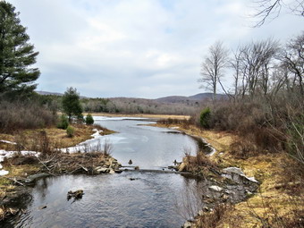
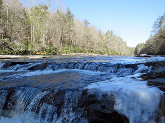
![]() On Saturday, March 12th, I had decided to take a little longer and more difficult hike. I had settled on going north to hike a 35 like Hunter or south to hike in northern New Jersey. I had planned several times to go to Wawayanda State Park in northern New Jersey just south of Warwick, NY but had been turned back by weather. In the end I decided to visit the park as it had some iron mines I had not yet visited. There is also a section of the AT that runs through the park and I could not remember hiking it either. I checked my records and found that I had hiked this section with Kurt the year before. We hiked from near Surprise Lake to the Pinwheel Vista which is the most memorable point on that section of the AT. I woke early and despite my efforts to get a little more sleep I could not. I decided to get an early start so I got my gear ready much to the delight of Sheila. I knew it would be warm for the hike but I donned my Winter Wander pants and my Mammut Hoody. Under the hoody I had a baselayer and a light wool top. I don't know what I was thinking! We left Livingston Manor a little before 8:30 AM and I headed south and east on Route 17 to exit 124. From here I took Route 17A and Route 94 through Florida to Warwick. I continued through Warwick on Route 94 and turned left on the Warwick Turnpike not far outside of town. After 15 miles, We arrived at the park where I turned right onto the access road. I parked near the office which was closed and surveyed the area to find the blue Hoeferlin Trail that passes by the iron mines. I found the trail and we were hiking at 9:45 AM. There were only a few cars in the lot and no hikers were leaving when we were so I let Sheila roam a little off her leash. The trail was an almost flat woods road that headed north paralleling the Warwick Turnpike. After only a short distance, we met two hikers coming toward us and I said a quick "Hello" as we passed. I had the printed NYNJTC Northern Jersey 2009 trail map with me but was also using the Avenza app on my iPhone. At .25 miles we crossed the AT and continued north. At .45 miles we were in the vicinity of the first iron mine which was unnamed on the map. We walked off the trail to the right and I began to find depressions in then ground. The depressions had piles of rock next to them which are the "tailing" from these explorations. I found a few bigger pits and was pleased to be seeing a part of history. When the United States was first forming and well into the 19th century the only source of iron or implements made from iron was from other countries. This was expensive and, sometimes, an unreliable source. The hills of northern New Jersey and what is now Harriman State Park in New York, as well as some other locations, proved to be a good source of iron until the mid to late 19th century. After I took some pictures, we walked back out to the trail and continued north.
On Saturday, March 12th, I had decided to take a little longer and more difficult hike. I had settled on going north to hike a 35 like Hunter or south to hike in northern New Jersey. I had planned several times to go to Wawayanda State Park in northern New Jersey just south of Warwick, NY but had been turned back by weather. In the end I decided to visit the park as it had some iron mines I had not yet visited. There is also a section of the AT that runs through the park and I could not remember hiking it either. I checked my records and found that I had hiked this section with Kurt the year before. We hiked from near Surprise Lake to the Pinwheel Vista which is the most memorable point on that section of the AT. I woke early and despite my efforts to get a little more sleep I could not. I decided to get an early start so I got my gear ready much to the delight of Sheila. I knew it would be warm for the hike but I donned my Winter Wander pants and my Mammut Hoody. Under the hoody I had a baselayer and a light wool top. I don't know what I was thinking! We left Livingston Manor a little before 8:30 AM and I headed south and east on Route 17 to exit 124. From here I took Route 17A and Route 94 through Florida to Warwick. I continued through Warwick on Route 94 and turned left on the Warwick Turnpike not far outside of town. After 15 miles, We arrived at the park where I turned right onto the access road. I parked near the office which was closed and surveyed the area to find the blue Hoeferlin Trail that passes by the iron mines. I found the trail and we were hiking at 9:45 AM. There were only a few cars in the lot and no hikers were leaving when we were so I let Sheila roam a little off her leash. The trail was an almost flat woods road that headed north paralleling the Warwick Turnpike. After only a short distance, we met two hikers coming toward us and I said a quick "Hello" as we passed. I had the printed NYNJTC Northern Jersey 2009 trail map with me but was also using the Avenza app on my iPhone. At .25 miles we crossed the AT and continued north. At .45 miles we were in the vicinity of the first iron mine which was unnamed on the map. We walked off the trail to the right and I began to find depressions in then ground. The depressions had piles of rock next to them which are the "tailing" from these explorations. I found a few bigger pits and was pleased to be seeing a part of history. When the United States was first forming and well into the 19th century the only source of iron or implements made from iron was from other countries. This was expensive and, sometimes, an unreliable source. The hills of northern New Jersey and what is now Harriman State Park in New York, as well as some other locations, proved to be a good source of iron until the mid to late 19th century. After I took some pictures, we walked back out to the trail and continued north.
 Within a short distance, the trail intersected a gravel road where we kept to the right to continue our trek north tow the Green and Wawayanda Mines. We met a couple hiking toward us and I put Sheila on her leash as they had two large German Shepherds. They did not bother to leash their dogs but, fortunately, they were friendly. We talked briefly before continuing in opposite direction. Almost immediately, Sheila and I both noticed some mountain bikers headed our way. Sheila was good and the bikers asked me the way to the office. I told them and we continued on. From the maps I knew that the green mine was located at about 1 mile along the trail where the Hoeferlin Trail turns sharply to the left. The mine is on the other side of a creek and swamp so I didn't know how accessible it would be. When we arrived at the turn we crossed the creek on a bridge and had easy access to the ridge to the east of the trail. We walked off into the woods and began a slight ascent to the top of the ridge. I immediately began to see a few small depressions but nothing more dramatic than the previous "mine". We walked south along the ridge and I saw ahead some fencing. The fencing surrounded a deeper pit with a collapsed adit. It was hard to tell how deep the mine had been but the tailing next to it indicated it may have been rather large. Some paths continued along the ridge and I found another area where the bank had been cut away. A little further south there was another fenced area. This one was much more interesting as the fence was metal and surrounded a deep shaft with laid up stone sides. The adit was filled with water but I drop a rock in and it sank quickly into the murky water. The light was actually too bright to get very good pictures and the fence spoiled the view. I was able to put my camera over the fence and use the screen viewfinder to frame several good shots. After investigating a few more pits we headed back north to the point where we turned off the road. Where the Hoeferlin Trail headed west, we continued north on the old Wawayanda Road looking for a gate where we would again head off the road to the east to the Wawayanda Mine. After walking less than a quarter mile I began to see paths to the right and piles of we are happy to looked like tailings. The road had no gate so we doubled back and turned east about 1.2 miles from the office. We found I woods road that ran to an area that had been cleared and to a bank that seemed to have been mined. I took a few pictures and then we continued up and over the bank still heading east. I found three or four more pits above the bank and took pictures but was disappointed that they were not very deep. I picked up my gear and we headed a little to the north where I enticed a water filled pit ahead and to the right. I dropped my gear and took the camera to take a few pictures. As I returned I noticed another area with a deep cleft in the one bank and an adit cut into the other. The adit was obviously collapsed but the amount of tailings and the work done in the area convinced me that it was significant. I took many shots before returning to my pack. We investigate another area a little further north and east across a small stream. There were a few small pits here. I decided I wanted to return to the main trail and head toward Wawayanda Lake and the Wawayanda Furnace.
 We walked south to the junction with the Hoeferlin Trail and turned west to follow the trail northwest to the blue Iron Mountain Trail. At 2.4 miles we turned left on the Iron Mountain Trail which was another wide and well-maintained gravel road. The day was getting warmer and I stopped to open all my zippers and get a drink. I had only brought one liter of water which, given my tendency to dehydrate and cramp, was not a good idea. I had been noticing the veritable cacophony of noise coming from all the swampy areas but it was very noticeable along this trail. The spring "peepers" were out in force but here were several different pitches and volumes! We continued along the road crossing the At again at 3.4 miles. At 4.6 miles we came to one of the park roads and crossed it heading for the boat launch on Wawaynada Lake. As we were headed toward the lake we met a father and son both were carrying fly rods. I wondered about the fishing regulations as trout season in New York does not open until April 1. We walked up a small hill and across the parking area at the boat launch to the shores of the lake. I dropped my pack and got out the camera to take some photographs. I knew we were only seeing part of a much larger lake but the part we were seeing was beautiful. The water was very blue and I only wished there are a few more puffy white clouds to break up the blue sky. The lake had several island, some small and some much larger. I also too a few captures of the canoes and paddleboats stacked on the beach as well as a few fishing boats. After finishing my photography, we headed around the end of the lake toward the dam on a pathway. At the dam it was not clear which way to go but we followed another pathway without crossing the dam. This brought us down a small hill to a junction. There was a large stone structure on the left side of the trail that was protected behind a chain link fence. Although the wooden roof had seen better days, the rest of the structure was well preserved. This was the Wawayanda Furnace which operated from the 1840's to well passed the Civil War. It processed raw iron ore from the surrounding mines turning it into pig iron which could them be formed into implements. I took off my pack, got out the camera and told Sheila to "Stay!" I took some time to walk around the furnace while taking pictures from several different angles. The history of the iron mining in the area has always interested me and this was a high point!
 From the furnace, we walked a little to the east to pick up the yellow Double Pond Trail. I had Sheila on her leash as there were quite a few people in the area. I decided to stow my poles as carrying them with the dog on the leash is not easy. We followed the paved Double Pond Trail as it wound passed several campsites and then immediately turned back into a trail after passing a gate. Since I saw no more walkers, I let Sheila off her leash but decided to leave my poles stowed. The trail was rocky and headed uphill a little and I debated getting out my poles. At 6.25 miles we were at the trail junction with the Cedar Swamp Trail. I had been sick and I also had not hiked as much as I had wanted during the winter. As a consequence of this and being overdressed, I was a little tired and thought I might simply skip the cedar swap. My GPS was in my pack and I had poised myself I would leave it there! I decided that seeing the Atlantic white cedar swap would be worth the effort so we turned right or south on the Cedar Swamp Trail. Reports said that the trail had a boardwalk that was not completed and that, at times, hikers would find the area to wet to continue. As we headed south we almost immediately ran into the boardwalk which seemed to be in good shape. It initially passed over a wide and open swamp which had a small stream in the middle. I stopped to take a few pictures before continuing on. I noticed s pile of materials that were obviously being used to construct the boardwalk. The boardwalk actually consisted of three tiers. The bottom tier was constructed of crosspieces made of a composite material. They were lighter than cement but heavier than wood and appeared to be built to resist the decay brought on by being immersed in water. On top of the composite crosspieces were wooden ones and on top of that the wooden decking. We walked along the boardwalk hemmed in by laurel in most places. I stopped at one point to get some pictures of the cedars and the boardwalk. There were still some icy patches hidden in the shade under the trees! The boardwalk was under repair in several areas but we were able to continue our walk avoiding some wet areas. Eventually the boardwalk ended and we continued to follow the trail until it ended at the green Banker Trail. The turn where was not completely obvious but I knew we needed to head east and then north so we turned left to follow the trail.
 The Banker Trail headed north along the eastern edge of the cedar swamp. It was a well constructed trail but had no real surprises or attractions. As we neared the Banker Road trailhead, Sheila noticed some movement off to the left and started into the woods after what she thought was an animals. I saw that it was a mountain biker and called her back. I put her on her leash and we continued on the trail until we Mt the biker. We passed by and found a red trail on the left which was not on my printed map. The new trail was on the newer map on my phone. The new Plymouth Lane Trail headed north to connect back to the Double Pond Trail. The trail avoided walking out to Banker Road and using it to get to another trailhead. I got out my GPS and found we were already ay 8.65 miles. The road walk would be quicker but I knew that I would take the trail!> We turned left and followed the new trail as it wound its way to the west and then headed north. This was the first trail that could have sued a few more blazes and being new was not well worn. I had no problem as I just followed Sheila who never has a problem picking up the trails. At 9.6 mile we hit the Double Pond Trail and turned right to walk to the beginning of the Hoeferlin Trail. The turn was not well marked but at this point I knew just where I wanted to go. We walked toward the parking area on Double Pond Road and turned left or north just before getting there. As sign marked the beginning of the blue Hoeferlin Trail and indicated the office was 1.8 miles away. This was a little more than I wanted to here but at least I knew how far we still had to go. As we started out on the trail it was very rocky which was definitely not what my feet had in mind! The trail headed due north and near the end there were a few small hills just to make the hike memorable. The distance was actually more like 1.6 miles. We arrived back at the car at 3:20 PM. We had hiked 11,4 miles in 5.5 hours with an overall average of 2 mph. I was surprised at the quick pace since we had stopped so many times for pictures and had wandered around exploring. The total elevation gain was 1134 feet but I don't remember much in the way of climbs. On the way home we stopped at the Craft Beer Cellar and Keller's Crisp Suds in Warwick. This craft beer store has a great variety and knowledgeable staff.
![]()
![]()
![]()
![]()
![]() On Tuesday, March 8th, Lisa and I had decided to go to the Neversink Unique Area to hike at about 9:00 AM. I had been there recently but Lisa wants to go and I was glad to have company. I was ready at 8:45 AM preparing to walk out the door when the ambulance pager sounded. I might have continued on my way but the call was an Echo response, the most serious, for a cardiac arrest from a drug overdose. I quickly texted Lisa and then headed down to the ambulance building. The rig was already pulled out and we were able to leave immediately. The short story is that the patient survived and we were back in town just after 10:30 AM. Lisa was still ready to hike so we changed our plans and decided to go to Frick Pond to hike a loop. Sheila, who had seemed depressed when I left the first time, was more than ready to go as I put my gear in the car. The temperature was already in the low 50's and I knew it would being increasing. I put on only a light top under my Mammut hoody and left the tights at home. I met Lisa in front of her business and we headed out the Debruce Road. We arrived at the trailhead for Frick Pond just before 11:00 AM and immediately headed out the Quick Lake Trail toward Frick Pond. The plan was to hike around the back of the pond on the Big Rock Trail to Times Square. From there we would continue on UP the Big Rock Trail to the Flynn Trail and then take it back to the car. As we got out of the car, it was obvious that it was too warm for a hat and gloves so I left them in the car. I had brought a light windbreaker but decided to wear my Mammut hoody as I knew I could open the zippers to dump some heat. We started out the Quick Lake trail from the larger parking lot and immediately encountered a tree across the trail. I knew there were several more and debated whether I could wait to remove them until the next trail crew work day. Lisa wrote our names in the register and then we headed out to Frick Pond along the wide woods road. The trail was wet and muddy in some places with only a few small patches of ice. We surveyed some areas where the small drainage ditches needed cleaning to help the water exit the trail. At Gravestone Junction we stayed left of the Quick lake trail to head down the hill to the bridge at the outlet end of Frick Pond. We stopped at the bridge to take a few pictures and then continued along the west side of the pond to the first junction with the Big Rock Trail. We turned right ion the Big Rock Trail to go to Times Square. There were a few muddy areas and the wooden walkways were a little slippery. We stopped at Times Square to see what we thought could be done to alleviate the water problem there before contusing straight ahead on the Big Rock Trail UP the hill.
On Tuesday, March 8th, Lisa and I had decided to go to the Neversink Unique Area to hike at about 9:00 AM. I had been there recently but Lisa wants to go and I was glad to have company. I was ready at 8:45 AM preparing to walk out the door when the ambulance pager sounded. I might have continued on my way but the call was an Echo response, the most serious, for a cardiac arrest from a drug overdose. I quickly texted Lisa and then headed down to the ambulance building. The rig was already pulled out and we were able to leave immediately. The short story is that the patient survived and we were back in town just after 10:30 AM. Lisa was still ready to hike so we changed our plans and decided to go to Frick Pond to hike a loop. Sheila, who had seemed depressed when I left the first time, was more than ready to go as I put my gear in the car. The temperature was already in the low 50's and I knew it would being increasing. I put on only a light top under my Mammut hoody and left the tights at home. I met Lisa in front of her business and we headed out the Debruce Road. We arrived at the trailhead for Frick Pond just before 11:00 AM and immediately headed out the Quick Lake Trail toward Frick Pond. The plan was to hike around the back of the pond on the Big Rock Trail to Times Square. From there we would continue on UP the Big Rock Trail to the Flynn Trail and then take it back to the car. As we got out of the car, it was obvious that it was too warm for a hat and gloves so I left them in the car. I had brought a light windbreaker but decided to wear my Mammut hoody as I knew I could open the zippers to dump some heat. We started out the Quick Lake trail from the larger parking lot and immediately encountered a tree across the trail. I knew there were several more and debated whether I could wait to remove them until the next trail crew work day. Lisa wrote our names in the register and then we headed out to Frick Pond along the wide woods road. The trail was wet and muddy in some places with only a few small patches of ice. We surveyed some areas where the small drainage ditches needed cleaning to help the water exit the trail. At Gravestone Junction we stayed left of the Quick lake trail to head down the hill to the bridge at the outlet end of Frick Pond. We stopped at the bridge to take a few pictures and then continued along the west side of the pond to the first junction with the Big Rock Trail. We turned right ion the Big Rock Trail to go to Times Square. There were a few muddy areas and the wooden walkways were a little slippery. We stopped at Times Square to see what we thought could be done to alleviate the water problem there before contusing straight ahead on the Big Rock Trail UP the hill.
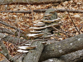 From Times Square to the Flynn Trail junction the Big Rock Trail rises 625 feet in 1.1 miles. This doesn't sound like much but it always seems to be a little farther and a little longer than I remember. Lisa and I both agreed to stop at intervals to catch our breath! We cleared a few branches as we walked and having someone to talk to made the walk go faster. By 12:20 PM we had walked 2.3 miles and were at the junction with the Flynn Trail. I took a few pictures on the way up the Big Rock Trail just to show that they were free of snow. I was able to get one pictures of some shelf fungus on a fallen tree that seemed to be particularly striking. We turned right to head down the Flynn Trail to the car. This return trip always seems longer than the 1.7 miles that is posted which is the correct distance. The trail is pretty but has no views. I thought about stopping at the clearing but decided that it was getting late and our first outdoor track practice was at 3:00 PM. The clearing is interesting as much of it has a layer a sphagnum moss over bedrock. This moss is usually found in areas with a much deeper and richer subsoil. A small road curves up to the clearing but no one has been able to tell me why the area was cleared. Walking across the clearing and through the woods is interesting since there is a series of ledges that rims Mongaup Pond. There are numerous ways to negotiate these ledges and access the loop road at the state campgrounds. We continued on the Flynn Trail back down to the car. We arrived in the parking area at 1:00 PM having covered 4.1 miles in 2 hours.
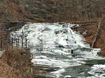
![]() On Saturday, March 5th, I was in Ithaca, NY for the New York State Indoor Track championships. The previous week had involved preparing for this meet and nursing a cold that just made me feel lousy! Since we did not have to be at the competition until after 1:00 PM, we decided to visit some waterfalls in the area. As I planned the visits the night before I was surprised at the number and quality of falls in the area! Within a 15 minute drive of our motel there were at least 10 waterfalls to visit. We left the motel a little after 10:00 AM headed for Cascadilla Falls at the lower end of the gorge that runs through the Cornell University campus. I was anxious to hike the gorge trail which despite being only half a mile long gains 400 feet in elevation and has several falls along the way. We parked at the corner of East Aurora and Linn street and walked over to the small park where the trail begins. I was crushed to see a sign that stated "Gorge Trail CLOSED for the winter"! We were able to walk to a good viewpoint for Cascadilla Falls but I REALLY wanted to hike the trail. My efforts were thwarted by a large wrought iron gate with a padlock. I wanted to take some pictures so I got out my iPhone 6 and snapped a fee w shots. I didn't think the camera was much different than on my old iPhone 4s and didn't give it a second thought. We decided next to drive to the Gun Hill area to take a look at Ithaca Falls. As we drove down Gun Hill we turned left at the bottom of the hill and found a small parking area. We walked down a path to the stream and then walked upstream to the falls. We were able to get pretty close to the base and I took some more pictures of the falls, the gorge and the ice on the trees near the stream. There were several signs that warned that the rocks in the area might be contaminated with lead from the now closed Ithaca Gun Factory. Above the falls was a tall brick smokestack which is about all that remains of this factory. We returned to the car and I started to look at a few pictures. As I scrolled through the pictures, I noticed that a few seemed to be videos even though I had not taken any. One of my athletes explained about "live" pictures on the iPhone and I realized I needed to read a little more about the camera.
On Saturday, March 5th, I was in Ithaca, NY for the New York State Indoor Track championships. The previous week had involved preparing for this meet and nursing a cold that just made me feel lousy! Since we did not have to be at the competition until after 1:00 PM, we decided to visit some waterfalls in the area. As I planned the visits the night before I was surprised at the number and quality of falls in the area! Within a 15 minute drive of our motel there were at least 10 waterfalls to visit. We left the motel a little after 10:00 AM headed for Cascadilla Falls at the lower end of the gorge that runs through the Cornell University campus. I was anxious to hike the gorge trail which despite being only half a mile long gains 400 feet in elevation and has several falls along the way. We parked at the corner of East Aurora and Linn street and walked over to the small park where the trail begins. I was crushed to see a sign that stated "Gorge Trail CLOSED for the winter"! We were able to walk to a good viewpoint for Cascadilla Falls but I REALLY wanted to hike the trail. My efforts were thwarted by a large wrought iron gate with a padlock. I wanted to take some pictures so I got out my iPhone 6 and snapped a fee w shots. I didn't think the camera was much different than on my old iPhone 4s and didn't give it a second thought. We decided next to drive to the Gun Hill area to take a look at Ithaca Falls. As we drove down Gun Hill we turned left at the bottom of the hill and found a small parking area. We walked down a path to the stream and then walked upstream to the falls. We were able to get pretty close to the base and I took some more pictures of the falls, the gorge and the ice on the trees near the stream. There were several signs that warned that the rocks in the area might be contaminated with lead from the now closed Ithaca Gun Factory. Above the falls was a tall brick smokestack which is about all that remains of this factory. We returned to the car and I started to look at a few pictures. As I scrolled through the pictures, I noticed that a few seemed to be videos even though I had not taken any. One of my athletes explained about "live" pictures on the iPhone and I realized I needed to read a little more about the camera.
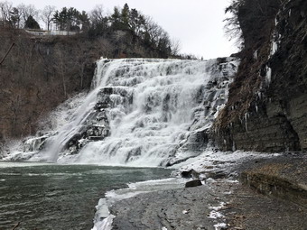 We still had some time left so I drove to Beebe Lake on the Cornell campus and parked in a lot so we could walk down to the footbridge that gave the best view of the dam and TripHammer Falls. The dam had been constructed to enhance the falls and provided waterpower to run a trip hammer. I walked out onto the bridge and took several pictures of the lake and then falls and a couple of the gorge downstream. We noticed that the bridge had high fences and nets below the walkway. Apparently, several students had tried to commit suicide by jumping into the gorge and some had succeeded! I pondered the pressures that would make young and intelligent students so desperate that they would try to end their lives. We returned to the car and drove along a road that paralleled the gorge. In less than a mile we found Fall Creek Road and turned left following the road to a small parking lot near a suspension bridge over the gorge. We walked out on the bridge to view the lower part of Triphammer Falls and the smaller Foaming Falls and the old powerhouse below. This bridge was pretty high up and was completely enclosed with fencing. Below the bridge and slightly downstream I could see people walking down a path to an area near the stream bed. We walked across the bridge and then followed the path down into the gorge. At the end of the path there was a nice view upstream of the falls and I again took pictures including a few where I sued the zoom. We followed the path back to the top and then turned right to head to the Stewart Avenue bridge to view the last of the three falls, Forest Falls. We walked to the middle of the bridge and I again took pictures and for some used the zoom. We continued to walk across the bridge. Turned right on Fall Creek Drive and were soon back at the car. When I arrived home after the meet, I eventually settled in and looked at the pictures. Most were quite good especially for a cell phone. The ones where I had used the zoom were of very poor quality and highly pixelated. I began to read some information on several sites about the camera. All sites warned against using the zoom at all since it is only a digital zoom and this causes poor quality pictures. After thinking about this for a moment, it made perfect sense. The suggestion was to take the pictures without the zoom and then crop and enlarge them. I also read about some other features of the camera like built in HDR, burst mode, the flash and :live" pictures. I downloaded a the HDR Pro X app which several sites suggested does a better job than the built in HDR. I definitely will try the iPhone camera again but I also know I will be using my Canon most of the time!
![]()
![]()
![]()
![]()
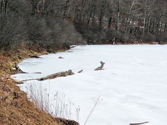
![]() On Sunday, Feb 28th, I asked Cindy if she would like to hike after church and she said "Yes". We decided to go to the Hodge Pond Lookout to see what the view looked like without the leaves on the trees. We had a meeting and a luncheon after church so we didn't get started until after 1:30 PM. I almost decided to put it off until Monday but Sheila seemed to be very excited about going and rain was in the forecast for Monday. The temperature at the house was pushing 50 degrees so I opted to forego a baselayer. We got our gear into them car, put Sheila in the backseat and headed off to the trailhead. We arrived just before 2:00 PM and found another group of hikers getting ready to start. They did not seem to be in any hurry and it appeared they had no idea where the trails were located. As they looked at the maps at the tailed, we crossed the road and headed up the Flynn Trail at 1:50 PM. I hoped they would not follow us since I had put Sheila on her leash and wanted to release her. When we turned right on the woods that is the beginning of the Flynn Trail, it was obvious they had gone in a different direction so I released Sheila and let her run. I immediately opened the zippers on my Mammut Hoody and took off my hat. It was now 50 degrees and the sun was shining. There was no snow on the trail but the ground was still frozen. We could hear the wind blowing through the tops of the trees but near the ground it was still. We set a fast pace up the Flynn Trail powered by the beautiful weather. The Flynn Trail is uphill all the way for the first 1.7 miles to the Big Rock Junction but this section seemed to go very quickly. We continued through the junction and just before the gate on the trail Sheila alerted. I could see other people ahead so I put her on the leash. Cindy told me it was a couple with their dog and that the dog was also leashed. We passed each other at the gate and said a quick "Hello". The other dog was a very large Rottweiler! We continued on the trail to the point where the Flynn Trail heads downhill to Hodge Pond. Here we turned to the right on a woods road and walked along the "high road" to the junction of some roads above the pond. At this junction a road turns left to go down to the pond. Just a little further on the road splits with the left fork passing by the old Beech Mountain Boy Scout Camp and ending up on Shin Creek Road in Lew Beach. We continued straight ahead to climb the road up the hill. The road was a little steeper than I remembered and a little longer but we kept our pace. The sun had started to melt some of the frozen ground creating some muddy spots but these were easily avoided.
On Sunday, Feb 28th, I asked Cindy if she would like to hike after church and she said "Yes". We decided to go to the Hodge Pond Lookout to see what the view looked like without the leaves on the trees. We had a meeting and a luncheon after church so we didn't get started until after 1:30 PM. I almost decided to put it off until Monday but Sheila seemed to be very excited about going and rain was in the forecast for Monday. The temperature at the house was pushing 50 degrees so I opted to forego a baselayer. We got our gear into them car, put Sheila in the backseat and headed off to the trailhead. We arrived just before 2:00 PM and found another group of hikers getting ready to start. They did not seem to be in any hurry and it appeared they had no idea where the trails were located. As they looked at the maps at the tailed, we crossed the road and headed up the Flynn Trail at 1:50 PM. I hoped they would not follow us since I had put Sheila on her leash and wanted to release her. When we turned right on the woods that is the beginning of the Flynn Trail, it was obvious they had gone in a different direction so I released Sheila and let her run. I immediately opened the zippers on my Mammut Hoody and took off my hat. It was now 50 degrees and the sun was shining. There was no snow on the trail but the ground was still frozen. We could hear the wind blowing through the tops of the trees but near the ground it was still. We set a fast pace up the Flynn Trail powered by the beautiful weather. The Flynn Trail is uphill all the way for the first 1.7 miles to the Big Rock Junction but this section seemed to go very quickly. We continued through the junction and just before the gate on the trail Sheila alerted. I could see other people ahead so I put her on the leash. Cindy told me it was a couple with their dog and that the dog was also leashed. We passed each other at the gate and said a quick "Hello". The other dog was a very large Rottweiler! We continued on the trail to the point where the Flynn Trail heads downhill to Hodge Pond. Here we turned to the right on a woods road and walked along the "high road" to the junction of some roads above the pond. At this junction a road turns left to go down to the pond. Just a little further on the road splits with the left fork passing by the old Beech Mountain Boy Scout Camp and ending up on Shin Creek Road in Lew Beach. We continued straight ahead to climb the road up the hill. The road was a little steeper than I remembered and a little longer but we kept our pace. The sun had started to melt some of the frozen ground creating some muddy spots but these were easily avoided.
 There were places where there was ice under a thin layer of snow and I thought about getting out my spikes several times. We solved the problem by walking carefully and keeping to the sides of the trail. We stopped briefly as the trail leveled at the old quarry and then continued our hike. We passed by a spring house on the right and at 2.6 miles and shortly after that we came to a lookout on the right. I stopped to take a few pictures before following the road which made a sharp right turn. Just after this the road turned to the left but another trail branched off to the right. We turned onto the trail on the right which was well defined but had a light coating of snow. After a slight incline, we walked to 2.9 miles over flat ground to the Hodge Pond Lookout. I dropped my pack and took some pictures of the pond below and the hills in the distance. The brush had been trimmed back affording a much better view of the pond. I asked Cindy to pose with Sheila on the rock that forms the lookout and I took several pictures. We grabbed a drink then continued on the trail as it circled around Flynn's Point and back to the woods road only slightly further along than where we had turned off. We turned left on the road and headed back down the hill. The trip down was a little more exciting than the trip up. The slippery spots seemed much slipperier on the way down! When we got to the base of the hill at the junction of the roads, we turned right and walked over to what is left of the buildings from the Boy Scout camp. I took some pictures before we headed back to the woods road. We walked out to the Flynn Trail and turned left and were soon at the junction with the Big Rock Trail at 4.6 miles. To give us a little variety, we turned right ion the Big Rock Trail and began a 1.1 mile descent to Times Square losing 590 feet of elevation along the way! As we walked down the trail, we stopped several time sot clear branches that had come down in the high winds the week before. At Times Square we continued straight ahead on the Big Rock trail as it passed around the "back" of Frick Pond. As we walked we noticed that the small streams that feed the pond were exceptionally full. We passed through the "spruce tunnel" and then walked over the wooden walkways heading toward the outlet of Frick Pond. Where the walkways were exposed to the sun they were fairly dry and easy to negotiate. At several points the walkways were slippery where they passed under the cover of the trees. We were soon at the junction with the Quick Lake Trail where we turned left. We crossed the bridge at the outlet of Frick Pond at 6.25 miles. Despite the fact that I have hundreds of pictures from the bridge, I stopped to take a few before continuing on the trail. I was surprised to find that the ice that had covered the hill up from the pond and a good part of the rest of the trail back to the parking area was now gone. We had to be careful as there were some wet and muddy areas that we avoided. When we came to the register box, we turned right and walked the trail back to the car. As we approached the parking area, we found a pickup truck with a couple getting ready to start their hike. It was 5:00 PM and they did not seem to be sure of where they were going! We had hiked 6.8 miles in just over 3 hours gaining 1275 feet along the way.
![]()
![]()
![]()
![]()
![]() On Monday, February 22nd I wanted to hike locally but did not want to return to the Frick Pond area AGAIN! I asked Cindy if she would like to go to the Neversink Unique Area and she said "Yes". I thought that the recent rain might have swollen both the Neversink River and Mullet Brook making Mullet Brook Falls and Denton Falls on the Neversink interesting. We left Livingston Manor a little after 9:00 AM and drove south and east on Route 17 to Rock Hill. I took Katrina Falls Road and drove all the way to the end, parking in the lot just before 9:30 AM. There were no other cars in the lot. The temperature was 28 degrees and there was a slight breeze which made it feel colder. When I turned on my GPS a warning told me the battery pack was low. I replaced the pack with AA batteries which seemed to work OK. My only complaint about the Garmin GPSmap 64st is that the battery pack is really only good for one hike! As we set off down the woods road, we noticed that there was no snow at all on the trail. We also noticed that the larger blowdowns that had been across the trail had all been cleared. At the first trail junction we turned left to stay on the main trail. As we neared the small bridge that crosses Wolf Brook, we could hear the water rushing in the stream and we could see a large patch of ice. I stopped to take a few pictures while Cindy put on her spikes. I did not bother to put on spikes so I hugged the edge of the trail where there was less ice and more dirt. We were soon across the ice and headed up the small hill to the junction where the main trail splits. I knew that there might be a problem with the lower bridge across Mullet Brook so we turned left to do the loop in a clockwise direction. This would allow us to visit both falls and retrace our route back to the car if we could not cross the lower bridge to form a loop. The trail started out flat but soon began to climb. Over the next .9 miles we gained almost 400 feet. The ascent was never steep but we maintained a good pace which elevated my heart rate and generated some body heat. At 1.6 miles we came to another trail junction. The trail to the left leads out to the Wolf Lake Multiple Use Area so we turned right to continue on the main trail which from this point on is mostly flat or downhill. After mailing the turn, we were headed south and soon crossed Mullet Brook on the upper bridge. The stream had a generous layer of ice over it attesting to the low temperatures the previous weekend. I stopped to take a few shots before continuing on the trail. At 1.8 miles we made another right turn causing us to head almost due west starting a long descent toward the Neversink Gorge.
On Monday, February 22nd I wanted to hike locally but did not want to return to the Frick Pond area AGAIN! I asked Cindy if she would like to go to the Neversink Unique Area and she said "Yes". I thought that the recent rain might have swollen both the Neversink River and Mullet Brook making Mullet Brook Falls and Denton Falls on the Neversink interesting. We left Livingston Manor a little after 9:00 AM and drove south and east on Route 17 to Rock Hill. I took Katrina Falls Road and drove all the way to the end, parking in the lot just before 9:30 AM. There were no other cars in the lot. The temperature was 28 degrees and there was a slight breeze which made it feel colder. When I turned on my GPS a warning told me the battery pack was low. I replaced the pack with AA batteries which seemed to work OK. My only complaint about the Garmin GPSmap 64st is that the battery pack is really only good for one hike! As we set off down the woods road, we noticed that there was no snow at all on the trail. We also noticed that the larger blowdowns that had been across the trail had all been cleared. At the first trail junction we turned left to stay on the main trail. As we neared the small bridge that crosses Wolf Brook, we could hear the water rushing in the stream and we could see a large patch of ice. I stopped to take a few pictures while Cindy put on her spikes. I did not bother to put on spikes so I hugged the edge of the trail where there was less ice and more dirt. We were soon across the ice and headed up the small hill to the junction where the main trail splits. I knew that there might be a problem with the lower bridge across Mullet Brook so we turned left to do the loop in a clockwise direction. This would allow us to visit both falls and retrace our route back to the car if we could not cross the lower bridge to form a loop. The trail started out flat but soon began to climb. Over the next .9 miles we gained almost 400 feet. The ascent was never steep but we maintained a good pace which elevated my heart rate and generated some body heat. At 1.6 miles we came to another trail junction. The trail to the left leads out to the Wolf Lake Multiple Use Area so we turned right to continue on the main trail which from this point on is mostly flat or downhill. After mailing the turn, we were headed south and soon crossed Mullet Brook on the upper bridge. The stream had a generous layer of ice over it attesting to the low temperatures the previous weekend. I stopped to take a few shots before continuing on the trail. At 1.8 miles we made another right turn causing us to head almost due west starting a long descent toward the Neversink Gorge.
 As we hiked I was watching for the short spur trail to the right which goes down to Mullet Brook Falls. It was a little farther along than I thought it was but at 2.25 miles we made the right turn and walked down to the falls. The falls were partly frozen and partly open creating the prefect opportunity to take pictures. I dropped my pack and poles and took out the camera. As I worked my way toward the falls, Cindy decided to take a break. I thought I was being carefully climbing over the rock and avoiding the ice. In my haste to get to a good vantage point I forgot how slippery the rocks can be when the mist from the falls freezes on them! I carefully placed my left foot on a rock and immediately found myself face down on the rocks. I somehow had the presence of mind to hold the NEW camera up so that it did not come to an untimely end. I carefully got up, found I had a few sore spots, and picked a better route to the rocks below and in front of the falls. I took pictures of the falls, the pool below and the ice on either side. I also took a few shots of the stream below the falls as it headed toward the Neversink. I took a video of the falls before looking for a safe way back to my pack. It was even harder working my way back to my pack but I did so without incident. I put the camera back in the pack and we headed back out to the main trail where we turned right. At 2.6 miles we arrived at the junction with the trail to the left that leads to High Falls. I was ready to add the extra 4 miles round trip to our hike but Cindy was not. We turned right and almost immediately turned left on the spur trail down to Denton falls on the Neversink. The trail was clear all the way to the falls as we hiked about .3 miles losing 180 feet. As we approached the river, we were careful to watch for slippery areas so that there would be no more falls.
 The rocks near the shore were clear of ice so I got out the camera and took some shots. I worked my way down toward the falls over some ice and found the path to the best viewpoint covered in solid ice. I thought about getting my spikes but decided to settle for some nice shots of the falls from where I was. I also took some pictures up and down the gorge and a few of Cindy and Sheila siting on a rock. I returned the camera to my pack and we started back up the hill to the main trail. At the top of the hill we turned left and headed for the lower bridge on Mullet Brook. When we got to the bridge, we found that it was still standing but had not been repaired. Despite my reports to the rangers and the forester nothing had been done to replace the cracked horizontal support on the downstream side. The bridge was sagging on that side and leaning downstream. A little emergency repair would have saved the bridge but I don't know what the plan is at this point. We did see some blue flagging downstream . I took a few pictures of the bridge and the stream before we continued our hike. The trail stayed flat for a long time and even descended a little as we passed the trail junction where we had started the loop earlier. At 4 miles we crossed the icy patch and the bridge over Wolf Brook. Just after that we made the right turn to head back UP to the car. We had commented on the way down that the last half mile of the hike was all uphill. On the way back Sheila alerted and we saw a young man and woman approaching. I put Sheila on her leash and we passed each other with a simple greeting. I left Sheila on her leash and we soon overtook a young man and his two children heading back to the parking area. One was in a backpack but the other was reluctantly walking up the hill. We were back at the car at noon having hiked 4.6 miles in 2 and a half hours. We gained about 980 feet along the way. This was certainly not the fastest I have hiked this route but it was very enjoyable.
![]()
![]()
![]()
![]()
![]() On Friday, February 19th I was ready to hike after 10 days of track meets and practices, family commitments and Bitterly cold weather! The President's Day weekend saw temperatures tying in the single digits with wind lowering the "feels like" temperature into the double digits below zero. Since I had to time basketball game in the evening, I decided to stay local and head to Hodge and Frick Ponds. Cindy was also in the mood to hike and Sheila was overjoyed to be going as we got ready at about 10:15 AM. The temperature was only 30 degrees so I dressed in layers and we left home heading out DeBruce Road. As we drove up Mongaup Road toward the trailhead, the temperature kept dropping until we reached the trailhead where it was 26 degrees. There wasn't much wind blowing as we started to hike and there was some sun peeking through the clouds. There was barely enough snow to cover the ground in places and much of the trail was bare as we crossed the road to get onto the Flynn Trail at 10:30 AM. I had not worn my insulated boots and hoped that my Vasque Taku boots would be warm enough and keep my feet dry. As we walked up the Flynn Trail the amount of snow began to increase and there was enough to make it look a little like winter! Sheila took full advantage by romping through the woods and sticking her nose under the snow when she could. We kept up a quick pace which quickly warmed us up while Sheila was even quicker. Since we had not been out for almost a week, Sheila was dashing up and down the trail. As we hiked I could see some blue in the skies but there were also a lot of clouds. The forecast was for a sunny morning with clouds moving in by the afternoon but that did not seem to be the case. We were at the junction with the Big Rock trail by 11:20 AM having covered the 1.7 miles in about 50 minutes. I was ready noticing a slight discomfort in my upper legs as the slipping and sliding on the snow and the days off took their toll.
On Friday, February 19th I was ready to hike after 10 days of track meets and practices, family commitments and Bitterly cold weather! The President's Day weekend saw temperatures tying in the single digits with wind lowering the "feels like" temperature into the double digits below zero. Since I had to time basketball game in the evening, I decided to stay local and head to Hodge and Frick Ponds. Cindy was also in the mood to hike and Sheila was overjoyed to be going as we got ready at about 10:15 AM. The temperature was only 30 degrees so I dressed in layers and we left home heading out DeBruce Road. As we drove up Mongaup Road toward the trailhead, the temperature kept dropping until we reached the trailhead where it was 26 degrees. There wasn't much wind blowing as we started to hike and there was some sun peeking through the clouds. There was barely enough snow to cover the ground in places and much of the trail was bare as we crossed the road to get onto the Flynn Trail at 10:30 AM. I had not worn my insulated boots and hoped that my Vasque Taku boots would be warm enough and keep my feet dry. As we walked up the Flynn Trail the amount of snow began to increase and there was enough to make it look a little like winter! Sheila took full advantage by romping through the woods and sticking her nose under the snow when she could. We kept up a quick pace which quickly warmed us up while Sheila was even quicker. Since we had not been out for almost a week, Sheila was dashing up and down the trail. As we hiked I could see some blue in the skies but there were also a lot of clouds. The forecast was for a sunny morning with clouds moving in by the afternoon but that did not seem to be the case. We were at the junction with the Big Rock trail by 11:20 AM having covered the 1.7 miles in about 50 minutes. I was ready noticing a slight discomfort in my upper legs as the slipping and sliding on the snow and the days off took their toll.
 We continued straight ahead on the Flynn Trail passing through the gate a little further on. At the point where the Flynn Trail heads down to Hodge Pond, I elected to bear to the right on the woods road toward the old Beech Mountain Boy Scout camp. At this point the trail was covered with snow and had been since the Big Rock Junction. Some of the snow was hard packed and some concealed ice making the footing tricky. Just before the remains of the cabins from the camp, we turned left to head down the woods road toward Hodge Pond. At the junction with the jeep trail, we turned right to head around the back of the pond. The pond was frozen completely across but I couldn't judged the thickness of the ice. We continued around the back of the pond. I looked at the sky and the overall scenery and decided I would like to take a few pictures of the pond. I walked down to the edge, removed my pack and got out the camera. I took a few shots as Sheila decided to test the ice! After replacing the camera in the pack, I joined Cindy back on the trail and we continued our hike. We turned right when we came to the Flynn Trail and walked up the Flynn Trail to the gate staying to the left to walk the trail out to Junkyard Junction. Here the trail was covered by a little more than an inch of snow. The trail was frozen and there were some very icy patches along the way. We began to come across some rather large branches and a sew small tree trunks across the trail. Most were frozen fast but a few kicks loosened them so that I could remove them from the trail. We arrived at Junkyard Junction at 12:10 PM about 3.3 miles into the hiked. We turned left on the Quick Lake Trail and began the descent to Ironwheel Junction. The trail remained solid and the amount of show varied from none to a couple of inches. We continued to removed branches and small trees from the trail as we hiked. As soon as we started to descend, we noticed that there was a lot of ice under the snow on the trail. The heavy rains had formed small streams down the trail and then the bitterly cold temperatures had frozen them solid! We had to be careful to walk in the side of the trails where there was more snow and less ice. Following Sheila helped as we could see where she slipped and avoid those places. When we came to Iron Wheel Junction, I could definitely feel the discomfort in my upper right leg. We turned right to stay on the Quick Lake Trail and to head toward Frick Pond. hen we came to the small stream in the woods, the water level was so high that we had to walk upstream to cross. Sheila on the other hand simply launched herself effortlessly across the water sera times. We crossed the stream and continued through the evergreen tunnel toward Frick Pond. The skies were almost completely overcast now and the breeze had picked up a little making the air temperature seem cooler. As we approached Frick Pond we crossed the two small bridges before arriving at the bridge across the outlet stream. We stooped so that I could take a few pictures and then continued back to the car. On the way back to the car, we found the trail was a solid sheet of ice where water had run down the trail and frozen. We knew that spikes would have made the walking easier but we both chose to hit the edge of the trail which got us back to the parking area safely. We were back at the car at 1:45 PM. We hiked 6.3 miles in 3 hours and 15 minutes with a 900 foot elevation gain.
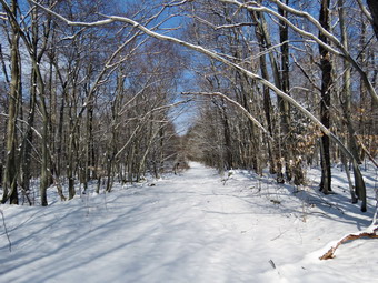
![]()
![]()
![]()
![]() On Tuesday, February 9th I had planned again planned to head to northern New Jersey to do a loop in Waywayanda State Park just south of Warwick. Once again snow fell making the roads slick and I decided to alter my plans and head for Frick and Hodge Ponds hoping to get there while the snow was untouched. By the time I finished some things I had to get done at home, it was after 11:00 Am before I left the house. I drove out the DeBruce Road to Mongaup Road and then stayed left where the road split to get tot the trailhead parking which had not been plowed. When we arrived at the trailhead there were no cars parked in the lot and the temperature was 24 degrees. The skies were blue and sunny with some white clouds and there was only a slight breeze blowing. I had brought with me my new camera, a Canon PowerShot SX60 HS, and my new GPS unit, a Garmin 64st. These are upgrades of the previous models and I hoped they would perform in much the same way. We headed out on the Quick Lake Trail at 11:25 AM and I immediately noticed that the few inches of snow covered some very slippery patches of ice! I had brought along my spikes but decided to see if I could avoid using them. I did stop to take a few picture of the newly fallen and pristine snow before continuing on the trail toward Frick Pond. We turned left at Gravestone Junction to follow the Quick Lake Trail to the bridge over the outlet of Frick Pond. When we crossed the bridge, I stopped to take a few pictures of the pond because it was such a beautiful sight. I took some pictures of the outlet stream which was running freely a few of the pond and several of Sheila and then packed up my camera. At the next junction with the Big Rock Trail, we stayed to the left on the Quick Lake Trail. We kept a quick pace as we hiked the Quick Lake Trail toward Iron Wheel Junction even though I had to work our way around several icy areas. We easily crossed the small stream in the forest but stopped several times to remove branches from the trail. At Iron Wheel Junction, I stopped to take a few more pictures and then turned left to take the longer loop to Hodge Pond. by way of the Quick Lake Trail toward Junkyard Junction. The walk is all uphill but the grade is only slight to moderate. As I walked, I watched Sheila follow animal tracks that crossed the trail. The further north we went and the more elevation we gained, the more snow was on the ground. We continued walking quickly and arrived at Junkyard Junction at 12:55 PM after hiking 3.1 miles.
On Tuesday, February 9th I had planned again planned to head to northern New Jersey to do a loop in Waywayanda State Park just south of Warwick. Once again snow fell making the roads slick and I decided to alter my plans and head for Frick and Hodge Ponds hoping to get there while the snow was untouched. By the time I finished some things I had to get done at home, it was after 11:00 Am before I left the house. I drove out the DeBruce Road to Mongaup Road and then stayed left where the road split to get tot the trailhead parking which had not been plowed. When we arrived at the trailhead there were no cars parked in the lot and the temperature was 24 degrees. The skies were blue and sunny with some white clouds and there was only a slight breeze blowing. I had brought with me my new camera, a Canon PowerShot SX60 HS, and my new GPS unit, a Garmin 64st. These are upgrades of the previous models and I hoped they would perform in much the same way. We headed out on the Quick Lake Trail at 11:25 AM and I immediately noticed that the few inches of snow covered some very slippery patches of ice! I had brought along my spikes but decided to see if I could avoid using them. I did stop to take a few picture of the newly fallen and pristine snow before continuing on the trail toward Frick Pond. We turned left at Gravestone Junction to follow the Quick Lake Trail to the bridge over the outlet of Frick Pond. When we crossed the bridge, I stopped to take a few pictures of the pond because it was such a beautiful sight. I took some pictures of the outlet stream which was running freely a few of the pond and several of Sheila and then packed up my camera. At the next junction with the Big Rock Trail, we stayed to the left on the Quick Lake Trail. We kept a quick pace as we hiked the Quick Lake Trail toward Iron Wheel Junction even though I had to work our way around several icy areas. We easily crossed the small stream in the forest but stopped several times to remove branches from the trail. At Iron Wheel Junction, I stopped to take a few more pictures and then turned left to take the longer loop to Hodge Pond. by way of the Quick Lake Trail toward Junkyard Junction. The walk is all uphill but the grade is only slight to moderate. As I walked, I watched Sheila follow animal tracks that crossed the trail. The further north we went and the more elevation we gained, the more snow was on the ground. We continued walking quickly and arrived at Junkyard Junction at 12:55 PM after hiking 3.1 miles.
 We turned right at the junction onto the Flynn Trail which is relatively flat at this point. The trail had several inches of snow which hid some icy spots and frozen mud. At the gate we followed the trail to the right and down toward the shore of Hodge Pond. As we neared the pond we turned right to stay on the Quick Lake Trail to the outlet of Hodge Pond. At this point I noticed some footprints which came from the direction of the outlet and headed around the back of the pond on the old jeep trail. I thought I might meet the other hiker if they had circled the pond. We were soon at the outlet end of Hodge Pond and I decided to go to the shore of the pond and take a few pictures. I removed my pack, got out the camera and took a few shots before picking up and starting back toward the Flynn Trail. We started up the hill staying on the Flynn Trail and the walk up the hill seemed to go very quickly. I was surprised at how fresh I felt walking up the long but gentle hill. Soon we were on the flat part of the Flynn Trail headed toward the junction with the Big Rock Trail. We continued on the Flynn Trail passing through the gate to the trail junction. We didn't stop at the trail junction but kept walking on The Flynn Trail. From this high point on the hike, the trail descends 1.7 miles to the parking area. We kept up a fast pace on the descent and found only a few inches of snow on most of the trail. We continued on the trail and soon were headed down the hill to the gate where we turned left to stay on then Flynn Trail. We walked down the short section of trail I had refurbished and then hiked through the woods back to the parking area. It was 2:15 PM when we returned. We had covered 6.4 miles in 2 hours and 45 minutes. The elevation gain was a modest 925 feet.The new electronic devices preformed well but I need to learn to use a few more of their features.
![]()
![]()
![]() On Friday, February 5th I had planned to head south to Waywayanda Park in northern New Jersey just south of Warwick, NY. When I woke up Friday morning schools were closing in the area and 2 to 4 inches of snow was expected. I don't have a problem hiking in snow but I didn't want to chance becoming involved in a motor vehicle accident just to hike in the area. Cindy suggested that we head north away from the snow and we decided to go the Bear Spring Wildlife Management Area where I had hiked on Tuesday. I thought we might start at Middle Pond on East Trout Brook Road and hike up to the ridge. We could then hike south on the ridge to Trail 12 which would take us down to the road again near the Horse Camp. We could then hike the trail or the road back to the car. When we left Livingston Manor just before 10:30 AM, the temperature was 30 degrees and the wind was blowing. The skies were cloudy but there was some blue and the sun was breaking through. We headed north and east on Route 17 to Roscoe and then drove through Roscoe and Downsville on Route 206. As I drove up Bear Spring Mountain I watched for East Trout Brook Road on the left. I turned left and drove 2.2 miles south passing Launt Pond on the right and parking at Middle Pond on the left. When we got out of the car, I noted that the temperature was 28 degrees and the wind was still brisk. We started our hike at 11:00 AM by hiking down to the dam across Middle Pond which also acts as a bridge across the brook. We continued straight ahead and almost immediately started to climb the hill toward the McCoy Hill Cutoff. The skies were overcast and there were no opportunities to take any pictures and this remained true throughout the day. At .7 miles we turned right where the trail split and started to head south while continuing to climb toward the ridge. The trail surface was very level and was still mostly frozen despite the rain the day before. I was glad we were climbing since it was warming me up! At 1.2 miles the trail split again and we turned right to continue east and southeast. It had been a long time since I had been on this trail and I had only hiked it twice. Cindy pointed out that although the trail was pretty and easy to hike one piece looked a lot like the next. At times I thought something was familiar and at other times it looked all new!
On Friday, February 5th I had planned to head south to Waywayanda Park in northern New Jersey just south of Warwick, NY. When I woke up Friday morning schools were closing in the area and 2 to 4 inches of snow was expected. I don't have a problem hiking in snow but I didn't want to chance becoming involved in a motor vehicle accident just to hike in the area. Cindy suggested that we head north away from the snow and we decided to go the Bear Spring Wildlife Management Area where I had hiked on Tuesday. I thought we might start at Middle Pond on East Trout Brook Road and hike up to the ridge. We could then hike south on the ridge to Trail 12 which would take us down to the road again near the Horse Camp. We could then hike the trail or the road back to the car. When we left Livingston Manor just before 10:30 AM, the temperature was 30 degrees and the wind was blowing. The skies were cloudy but there was some blue and the sun was breaking through. We headed north and east on Route 17 to Roscoe and then drove through Roscoe and Downsville on Route 206. As I drove up Bear Spring Mountain I watched for East Trout Brook Road on the left. I turned left and drove 2.2 miles south passing Launt Pond on the right and parking at Middle Pond on the left. When we got out of the car, I noted that the temperature was 28 degrees and the wind was still brisk. We started our hike at 11:00 AM by hiking down to the dam across Middle Pond which also acts as a bridge across the brook. We continued straight ahead and almost immediately started to climb the hill toward the McCoy Hill Cutoff. The skies were overcast and there were no opportunities to take any pictures and this remained true throughout the day. At .7 miles we turned right where the trail split and started to head south while continuing to climb toward the ridge. The trail surface was very level and was still mostly frozen despite the rain the day before. I was glad we were climbing since it was warming me up! At 1.2 miles the trail split again and we turned right to continue east and southeast. It had been a long time since I had been on this trail and I had only hiked it twice. Cindy pointed out that although the trail was pretty and easy to hike one piece looked a lot like the next. At times I thought something was familiar and at other times it looked all new!
At 1.4 mile we followed the trail as it turned south and began to snake along the ridge. At his point there was a "Danger! Keep Out!" sign which I did not remember seeing before. The trail at this point start down off the ridge and I hoped we were not going to be led off course. After descending for a short distance, the trail again headed up the ridge and slightly to the east which did not make me happy. At 2.1 miles we were still headed mostly south when we hit the highest point on the hike at 2300 feet. I knew we had to turn to the west at some point and I kept thinking it should be soon! After the high point, we started to descend and head southwest which made me feel a little better. At 2.5 mile we picked up Finger Lakes Trail blazes which I knew was a good sign as I had hiked the Finger Lakes Trail in this area and I knew it came up from East Trout Brook Road. We hiked up the hill in front of us and at 2.85 miles started a descent but we were still headed south. The trail began to look more familiar and at 3.2 miles we turned sharply right or to the west and began a .75 mile descent to East Trout Brook losing 625 feet in the process. Most of the trail down was old woods road or new logging road so the walk was pretty easy. We started to parallel a small stream which I recognized. Sheila alerted at one point and I called her back to me. I couldn't see or hear anything ahead and Sheila eventually gave up. At 4 miles we were in the field near East Trout Brook. I knew that we could turn right onto the trail and hike back to the car but I also knew that the trail would be very wet. I suspected that crossing East Tout Brook would be difficult as its volume was high because of the rain. I walked ahead toward the small pond near the road and was surprised to see that the bridge near the dam had been replaced. I had no trouble convincing Cindy that we should just walk back to the car on the road. I stowed my poles in my pack and put Sheila on her leash. We set a quick pace walking the 1.7 miles back to the car gaining 300 feet in the process. As we got to the car, the wind again kicked up making us glad that we were back. It was 2:00 PM and we had hiked 5.8 miles in three hours with an elevation gain of 1270 feet.
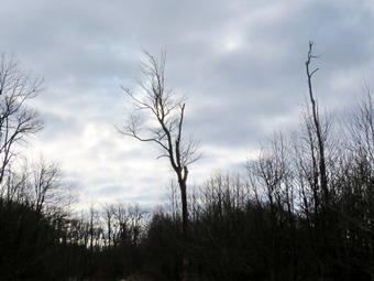
![]()
![]()
![]()
![]() On Tuesday, February 2nd I wanted to get out for the first hike of February. I was tired of the Frick Pond and Trout Pond areas so I decided to head to Bear Spring Wildlife Management Area between Downsville and Walton. The forecast for the day was for sunny skies and highs in the mid 40's but when I left Livingston Manor at 8:30 AM it was 25 degrees with a completely overcast sky. I drove north and east on Route 17 to Roscoe and then drove through Roscoe and Downsville on Route 206. As I drove up Bear Spring Mountain I watched for the large parking area on the left which would allow access to the trails on the eastern ridge of the WMA. I parked at 9:00 AM and was on the trail soon after. The temperature was still in the low 20's with a slight breeze. I had decided there wouldn't be much snow and had traded in my Salomon B-52 snow boots for a pair of Vasque Taku hiking boots. We headed out the wide woods road marked on the map as Wilson Hollow Road and immediately we were at the first clear-cut area. The sky was dark and overcast so I decided to forego taking any pictures until later. As we walked along the road and approached the eatable to the wooded area of the trail, I decided that the trees against the dark sky were interesting enough for a few shots. After taking some pictures, I put the camera back in my pack and we continued along the trail. As we entered the woods there was still some snow on the ground and the trail was frozen solid. There was some evidence that an ATV or snowmobile had been on the trail and I also saw a few boot prints. The sun began peeking out from behind the clouds at times and I stopped to take a few more shots. At 1.3 miles we passed Trail 11 that goes down to Launt Pond. The hiking seemed to go quickly as I walked and soon we passed the woods road down to the East Trout Brook Road parking. Just after that at 2.3 miles we arrived at the spot where the trail continues straight ahead or turns right. I decided we would turn right and walk the edge of the field and down the McCoy Hill cutoff trail. This walk was easy as it descends almost 500 feet in .8 miles to the lowest point on the hike.
On Tuesday, February 2nd I wanted to get out for the first hike of February. I was tired of the Frick Pond and Trout Pond areas so I decided to head to Bear Spring Wildlife Management Area between Downsville and Walton. The forecast for the day was for sunny skies and highs in the mid 40's but when I left Livingston Manor at 8:30 AM it was 25 degrees with a completely overcast sky. I drove north and east on Route 17 to Roscoe and then drove through Roscoe and Downsville on Route 206. As I drove up Bear Spring Mountain I watched for the large parking area on the left which would allow access to the trails on the eastern ridge of the WMA. I parked at 9:00 AM and was on the trail soon after. The temperature was still in the low 20's with a slight breeze. I had decided there wouldn't be much snow and had traded in my Salomon B-52 snow boots for a pair of Vasque Taku hiking boots. We headed out the wide woods road marked on the map as Wilson Hollow Road and immediately we were at the first clear-cut area. The sky was dark and overcast so I decided to forego taking any pictures until later. As we walked along the road and approached the eatable to the wooded area of the trail, I decided that the trees against the dark sky were interesting enough for a few shots. After taking some pictures, I put the camera back in my pack and we continued along the trail. As we entered the woods there was still some snow on the ground and the trail was frozen solid. There was some evidence that an ATV or snowmobile had been on the trail and I also saw a few boot prints. The sun began peeking out from behind the clouds at times and I stopped to take a few more shots. At 1.3 miles we passed Trail 11 that goes down to Launt Pond. The hiking seemed to go quickly as I walked and soon we passed the woods road down to the East Trout Brook Road parking. Just after that at 2.3 miles we arrived at the spot where the trail continues straight ahead or turns right. I decided we would turn right and walk the edge of the field and down the McCoy Hill cutoff trail. This walk was easy as it descends almost 500 feet in .8 miles to the lowest point on the hike.
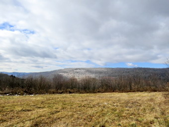 On the way down the trail we stopped once to take some pictures of the valley below and the ridges beyond. The lighting was difficult and I was not sure the pictures would be much good. At the bottom of the descent we turned left to start to loop around and back up to the ridge. Just before we made the turn, I again stopped to take a few pictures. Of course, the payment for a descent is an ascent back to the ridge. In just about a mile we had to regain the elevation we had lost on the way down. The climb wasn't as bad as I remembered and went quickly. The pain I had in my right hip disappeared as we hiked. We regained the elevation and began to circle around back to where we had turned off into the field. Along the way we passed a sign on a snowmobile trail to the right that said "Downsville". We continued to walk the woods road finding it covered with a thin layer of hard snow and some frozen mud in spots. We had been walking east but at 4.2 miles the trail turned northwest to circle the summit of a hill on our left and head back toward the parking area. From the point of the turn back to the trail junction where we had turned right was about 1.15 miles. When we arrived back at the junction, we knew exactly how far we had to go to get back! The hike back along Wilson Hollow road was 2.2 miles but it seemed to pass quickly as most was downhill. We stopped again at the clear-cut area so that I could take a few shots. As we were walking out Sheila alerted and I could see some people in the woods ahead. I pit Sheila on her leash and walked toward them. A father and his young son had a fire going and they were cooking meal. He offered me a hot dog for my dog but I declined. I didn't think it was legal or wise to start a fire. When we arrived at Route 206 I found a car parked blocking the woods road and decided that the person just wasn't very aware of what was proper. We were back at the car by 12:00 PM having covered 7.6 miles in 3 hours with a 1050 foot climb.
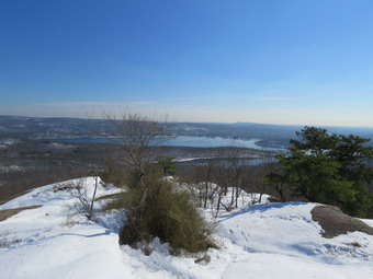
![]()
![]()
![]()
![]() On Wednesday, January 27th I wanted to snowshoe somewhere! Since the Catskills had no snow, I decided to head for northern New Jersey where the last storm dumped some snow. I thought Norvin Green State Forest would be a nice place to visit since I had not been there for some time. The use Google maps to find the best route which took me down Route 17 to exit 124 and then through Warwick to West Milford on some back roads. It was not the route I had used before but it looked like the shortest way. I left Livingston Manor just before 9:00 AM and the GPS in the car indicated the same route as Google maps with an arrival time of 10:25 AM. As I passed through Warwick there was no snow but further along as I entered New Jersey I began to see some accumulation. Waywayanda Park had almost enough snow but I stuck to my plan and continued on until I turned onto Snake Den Road. I arrived at the parking area just outside the New Weis Education Center at right around 10:25 AM. The lot was empty and there didn't seem to be much activity at the Center. There was about 6 to 8 inches of snow on the ground and the temperature was 33 degrees. When I got out of the car, I noticed a breeze which chilled me just a little. I decided there was enough snow to use my Tubbs Alp Flex snowshoes even though the were certainly not needed. The snowshoes went on quickly which was good since Sheila was clamoring to get out of the car. I was ready by 10:30 AM so I put Sheila on her leash and we headed out toward the trails. We followed the signs indicating "Hikers with dogs" for the most part as we crossed Blue Mine Brook on a small bridge. We followed the green Otter Hole Trail passed the closed Highlands Pool. This is a natural pool on the brook which is fed by the stream. It has Ben "developed" and is a popular swimming area during the warmer season. I stopped for a moment to take a few pictures of the snow and thought how ironic it was that I had to travel from the Catskills to New Jersey to find snow. After the pool we stayed to the left to continued on the trail through the woods. The trail is rocky and several people had hiked it without snowshoes. This meant that my steps were uneven and I was often off balanced which put extra strain on my legs which were certainly not accustomed to being on snowshoes. At .45 miles we crossed the extension of Snake Den Road and continued straight ahead on the blue HB trail toward the Wyanokie High Point.
On Wednesday, January 27th I wanted to snowshoe somewhere! Since the Catskills had no snow, I decided to head for northern New Jersey where the last storm dumped some snow. I thought Norvin Green State Forest would be a nice place to visit since I had not been there for some time. The use Google maps to find the best route which took me down Route 17 to exit 124 and then through Warwick to West Milford on some back roads. It was not the route I had used before but it looked like the shortest way. I left Livingston Manor just before 9:00 AM and the GPS in the car indicated the same route as Google maps with an arrival time of 10:25 AM. As I passed through Warwick there was no snow but further along as I entered New Jersey I began to see some accumulation. Waywayanda Park had almost enough snow but I stuck to my plan and continued on until I turned onto Snake Den Road. I arrived at the parking area just outside the New Weis Education Center at right around 10:25 AM. The lot was empty and there didn't seem to be much activity at the Center. There was about 6 to 8 inches of snow on the ground and the temperature was 33 degrees. When I got out of the car, I noticed a breeze which chilled me just a little. I decided there was enough snow to use my Tubbs Alp Flex snowshoes even though the were certainly not needed. The snowshoes went on quickly which was good since Sheila was clamoring to get out of the car. I was ready by 10:30 AM so I put Sheila on her leash and we headed out toward the trails. We followed the signs indicating "Hikers with dogs" for the most part as we crossed Blue Mine Brook on a small bridge. We followed the green Otter Hole Trail passed the closed Highlands Pool. This is a natural pool on the brook which is fed by the stream. It has Ben "developed" and is a popular swimming area during the warmer season. I stopped for a moment to take a few pictures of the snow and thought how ironic it was that I had to travel from the Catskills to New Jersey to find snow. After the pool we stayed to the left to continued on the trail through the woods. The trail is rocky and several people had hiked it without snowshoes. This meant that my steps were uneven and I was often off balanced which put extra strain on my legs which were certainly not accustomed to being on snowshoes. At .45 miles we crossed the extension of Snake Den Road and continued straight ahead on the blue HB trail toward the Wyanokie High Point.
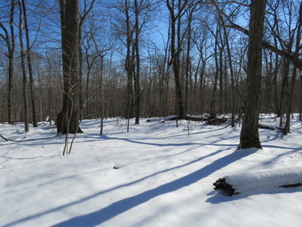 The trail to this point had been ascending but very gently. As soon as we got on the blue trail, we began a more serious ascent with a grade approaching 15%. This is not that steep but I began to feel it in my leg muscles as we began to scramble over rocks on the narrower parts of the trail. I had not been on this specific trail before and parts of it were not well marked but there was one set of tracks from a hiker that I could follow. We ascended to a nice viewpoint where I stopped to take some pictures. I was pretty sure we were not at the high point which my GPS and iPhone confirmed. We continued to follow the trail and the tracks of the hiker. The snow depth increased as we gained elevation until there were spots that had at least 18 inches. There were several lookouts along the way but I stayed on the trail knowing the view from the High Point were best. I kept wondering if each new lookout was the High Point until we descended a little and I saw I huge, rocky mass ahead of us. We walked the trail to the base and found a sign labeled "High Point". There wasn't much snow on the trail here and I almost removed my snowshoes but in the end kept them on and ascended over some open rocks to the High Point. The view was beautiful and largely open in all directions. I took off my pack and took pictures of the snow-covered hills. I also took some shots of the Wanaque Reservoir. After spending some minutes enjoying the sun and the views, I noticed I was beginning to get cold as the breeze had picked up. I had to make a decision about where to go next. I felt the route over Yoo-Hoo Point and Carris Hill would be too much for the first time out on snowshoes. Walking downhill or on the flats seemed to be no problem but the uphill portions were beginning to bother my hip flexors. I decided to take the red WCI Trail down off the High Point and then decided at the bottom whether I would visit the mines or head directly back to the car. The tracks I had been following ended at the High Point so I needed to find the trail on my own. The red trail was aligned with the Highlands Trail so I assumed I would have no problem finding it. I was wrong. I headed east toward the reservoir and down the hill. I could find no blazes so I consulted the Avenza app on my iPhone which showed my I was right on the trail. I continued along and soon found some faded blazes leading down the hill. There were two major problems with the blazes. Many of the paint marks had been placed on the rocks which were now under the snow. The blazes on the trees were old and faded and some were poorly placed. This problem continued throughout the descent off the High Point with me spending a lot of time trying to find the trail. Fortunately, Sheila was often able to detect the trail when I could not.
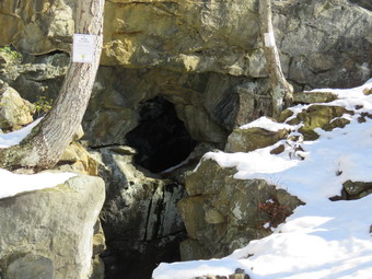 By 1.9 miles we had completed the descent from the High Point and the red trail made a sharp turn to the right. We followed the trail passing by a white trail on the right. Soon a yellow trail appeared on the left which I knew was the quickest way back to the car. I decided to continue straight ahead on the red trail which would lead us to the Blue Mine. At 2.25 miles we crossed a stream on a small bridge and turned right to visit the Blue Mine which is one of the numerous abandoned iron mines found in northern New Jersey. I took a few pictures of the entrance to the mine as the mine itself is mostly underwater. I picked up my pack and we headed north on the yellow and red trails. Where the trail spilt, we stayed to the right on the yellow trail and at 2.6 miles turned left on the orange trail which lead to the Roomy Mine. The walk to the Roomy Mine at 2.8 miles was just slightly uphill and I could feel my legs rebelling. Signs outside the Roomy Mine warned hikers to stay out of the mine to protect the bats which hibernate there. I took a few pictures from the outside and then we continued along on the orange trail. I knew that the trail that lead directly out to the Weis Center had been closed by the landowner so I carefully followed the orange trail as it led out to the yellow Mine Trail. As we approached the yellow trail Sheila and I noticed a hiker ahead of us on the yellow trail. He continued on his way and we never got close enough to say "Hello". We turned right on the yellow trail at 3.1 miles and descended slightly to cross a small brook. From this point the yellow trail began to ascend a small hill. The uphill was only a 13% grade and lasted for about .3 miles but I felt every step. I had tried to drink along the way but felt as though I was not hydrated properly. At the top of the hill we crossed a stream with a small waterfall and then turned right onto the blue trail where we picked up our tracks from earlier in the day. We descended the hill to snow-covered Snake Den Road and continued on the green Otter Hole Trail we had used earlier in the day. We heard voices ahead so I put Sheila on her leash as we walked down the trail along the brook and passed the Highlands Pool. We followed our tracks back to the car arriving in the parking area at 2:00 PM. We had covered 4.4 miles in 3 hours and 25 minutes with an elevation gain of 1053 feet. Our overall speed was an unimpressive 1.2 mph! I was happy to be leaving even though we had good time. On the way home I pulled over to drink some water as I began to have cramps in my legs! This happens every time I fail to hydrate properly but apparently I am a slow learner!
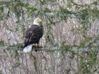
![]()
![]()
![]()
![]()
![]() On Wednesday, January 27th I wanted to get in a hike close to home before track practice in the afternoon. Since I had been at Trout Pond and Frick Pond recently, I decided to go to Long Pond and do the big loop in a counterclockwise direction. I wanted to walk as fast as I could and only take a few pictures along the way. I got Sheila in the car with my gear and headed out DeBruce Road for about 8 miles to Flugertown Road where I made a left. I parked in the lot a short distance up the road on the right. The temperature was in the low 30's when I parked at and the skies were overcast. I had not brought snowshoes as I knew they would not be necessary but I had brought my spikes. This turned out to be a good idea as the parking area was icy and I could see the trail up the hill was in much the same shape. A slight breeze made things even cooler as we started our hike at 10:15 AM by walking over the bridge and up the hill. The first .6 miles gains about 350 feet to the highest point on the hike. It isn't very steep but does act as a nice warm-up! Along the way I noticed that the trees that had been across the trail had been cut and removed. The trail was very icy going up the hill but the ice almost disappeared under the trees. I could see ahead that the trail remained icy in spots so I kept my spikes on. At 1.1 miles we were at the spur trail that leads down to the shore of Long Pond. I decided I would rather hike quickly and I knew that Long Pond doesn't have much to offer especially on a day with overcast skies. We stayed on the main trail and turned right at the first trail junction. By 10:55 AM we had walked 1.7 miles and were passing the spur trail to the lean-to.
On Wednesday, January 27th I wanted to get in a hike close to home before track practice in the afternoon. Since I had been at Trout Pond and Frick Pond recently, I decided to go to Long Pond and do the big loop in a counterclockwise direction. I wanted to walk as fast as I could and only take a few pictures along the way. I got Sheila in the car with my gear and headed out DeBruce Road for about 8 miles to Flugertown Road where I made a left. I parked in the lot a short distance up the road on the right. The temperature was in the low 30's when I parked at and the skies were overcast. I had not brought snowshoes as I knew they would not be necessary but I had brought my spikes. This turned out to be a good idea as the parking area was icy and I could see the trail up the hill was in much the same shape. A slight breeze made things even cooler as we started our hike at 10:15 AM by walking over the bridge and up the hill. The first .6 miles gains about 350 feet to the highest point on the hike. It isn't very steep but does act as a nice warm-up! Along the way I noticed that the trees that had been across the trail had been cut and removed. The trail was very icy going up the hill but the ice almost disappeared under the trees. I could see ahead that the trail remained icy in spots so I kept my spikes on. At 1.1 miles we were at the spur trail that leads down to the shore of Long Pond. I decided I would rather hike quickly and I knew that Long Pond doesn't have much to offer especially on a day with overcast skies. We stayed on the main trail and turned right at the first trail junction. By 10:55 AM we had walked 1.7 miles and were passing the spur trail to the lean-to.
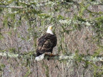 After passing the trail to the lean-to, we picked up the pace and continued on the main trail to the point where it intersected a woods road at 2.5 miles. We turned left and followed the road until the intersection with Basily Road at 2.85 miles. The roads were icy and seemed to have been traveled by snowmobiles and ATVS. We continued on Basily Road by bearing to the left. As we approached the Peters Hunting Camp, I got ready to put Sheila on her leash. The area near the footbridge across the outlet to the beaver pond was flooded and pretty muddy. We crossed the small bridge and started to walk toward the larger bridge near the hunting camp. I noticed some large birds flying around the skies over the camp and soon recognized them as bald eagles. One male eagle landed in a tree across the stream and just perched on a branch. I got out the camera and was able to get a series of pictures at extreme zoom. I wondered if the focus would be accepted since I was zoomed in so far but the results were very good when I looked at the pictures on my computer. The eagle seems to pose for some time with his back to me and then turned around for some frontal shots. Eventually he flew away down the stream and I packed up so that we could continue hiking. After crossing the bridge and walking up the hill, I stopped again to take some pictures of the valley since some blue skies were now visible. The roads continued to be very icy as Basily Road changed to Flugertown Road. Eventually the road became paved and there was no ice or snow. I took off my spikes and we walked quickly down the road back to the parking area. At 12:30 PM we were back at the car having hiked 5.9 miles in 2 hours and 15 minutes. The elevation gain was only about 650 feet most of which was at the beginning of the hike.
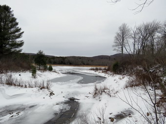
![]()
![]()
![]()
![]() On Saturday, January 23rd Cindy and I had planned to snowshoe at Frick and Hodge Ponds with members of the church if the predicted snowfall did not make the roads impassable. By late morning it was obvious we were going to get little if any snow. Only Ed and Robin had expressed an interest in joint us, so I called them to see if they wanted to hike. I knew from a trip two days before that there wasn't enough snow to use snowshoes. Fortunately they were ready to hike and we agreed to meet at our house at 12:30 PM. Ed and Robin arrived on time and we drove out the DeBruce Road to Mongaup Road. When we arrived at the trailhead there were no cars parked in the lot and the temperature was 26 degrees. The skies were almost completely overcast with a slight breeze blowing. I had brought with me my new camera, a Canon PowerShot SX60 HS, and my new GPS unit, a Garmin 64st. These are upgrades of the previous models and I hoped they would perform in much the same way. We headed out on the Quick Lake Trail at 12:55 PM since I though that route would offer the greatest number of options. It was fun to hike with other people especially those who had not been in the area before. We found the conditions much the same as I had on Thursday with icy patches on the trail covered by a light coating of snow. We turned left at Gravestone Junction to follow the Quick Lake Trail to the bridge over the outlet of Frick Pond. When we crossed the bridge, I took a quick look at the view and decided to take a few shots mostly to test out the new camera. I pointed out Beech Mountain across Frick Pond to Ed and Robin. I took some pictures of the outlet stream which was running freely. As I packed up my camera, I noticed that the wind blowing off the pond was making me really cold! At the next junction with the Big Rock Trail, we stayed to the left on the Quick Lake Trail. We kept a quick pace as we hiked the Quick Lake Trail toward Iron Wheel Junction even though we had to work our way around several icy areas. We easily crossed the small stream in the forest but stopped several times to remove branches from the trail. At Iron Wheel Junction, we had a decision to make about the length of the hike. I wanted to take the longer loop to Hodge Pond as I knew Cindy could also make that distance. Ed and Robin seemed amenable so we turned left to stay on the Quick Lake Trail toward Junkyard Junction. The walk is all uphill but the grade is only slight to moderate. As we walked, we talked which made the trip seem much shorter. The further north we went and the more elevation we gained, the more snow was on the ground. We continued walking quickly and arrived at Junkyard Junction at 2:30 PM after hiking 3.1 miles.
On Saturday, January 23rd Cindy and I had planned to snowshoe at Frick and Hodge Ponds with members of the church if the predicted snowfall did not make the roads impassable. By late morning it was obvious we were going to get little if any snow. Only Ed and Robin had expressed an interest in joint us, so I called them to see if they wanted to hike. I knew from a trip two days before that there wasn't enough snow to use snowshoes. Fortunately they were ready to hike and we agreed to meet at our house at 12:30 PM. Ed and Robin arrived on time and we drove out the DeBruce Road to Mongaup Road. When we arrived at the trailhead there were no cars parked in the lot and the temperature was 26 degrees. The skies were almost completely overcast with a slight breeze blowing. I had brought with me my new camera, a Canon PowerShot SX60 HS, and my new GPS unit, a Garmin 64st. These are upgrades of the previous models and I hoped they would perform in much the same way. We headed out on the Quick Lake Trail at 12:55 PM since I though that route would offer the greatest number of options. It was fun to hike with other people especially those who had not been in the area before. We found the conditions much the same as I had on Thursday with icy patches on the trail covered by a light coating of snow. We turned left at Gravestone Junction to follow the Quick Lake Trail to the bridge over the outlet of Frick Pond. When we crossed the bridge, I took a quick look at the view and decided to take a few shots mostly to test out the new camera. I pointed out Beech Mountain across Frick Pond to Ed and Robin. I took some pictures of the outlet stream which was running freely. As I packed up my camera, I noticed that the wind blowing off the pond was making me really cold! At the next junction with the Big Rock Trail, we stayed to the left on the Quick Lake Trail. We kept a quick pace as we hiked the Quick Lake Trail toward Iron Wheel Junction even though we had to work our way around several icy areas. We easily crossed the small stream in the forest but stopped several times to remove branches from the trail. At Iron Wheel Junction, we had a decision to make about the length of the hike. I wanted to take the longer loop to Hodge Pond as I knew Cindy could also make that distance. Ed and Robin seemed amenable so we turned left to stay on the Quick Lake Trail toward Junkyard Junction. The walk is all uphill but the grade is only slight to moderate. As we walked, we talked which made the trip seem much shorter. The further north we went and the more elevation we gained, the more snow was on the ground. We continued walking quickly and arrived at Junkyard Junction at 2:30 PM after hiking 3.1 miles.
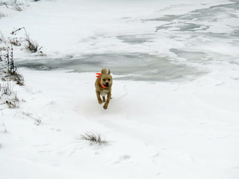 We turned right at the junction onto the Flynn Trail which is relatively flat at this point. The trail had several inches of snow which hid some icy spots and frozen mud. At the gate we followed the trail to the right and down toward the shore of Hodge Pond. As we neared the pond we turned right to stay on the Quick Lake Trail to the outlet of Hodge Pond. The woods road was rutted and had some water but the muddiest spots were easily avoided. We were soon at the outlet end of Hodge Pond. I decided to go to the shore of the pond and take a few pictures and found some snow drifts. As I removed my pack and got out the camera the wind picked up as it came across the pond and I only took a few shots before picking up and starting back toward the Flynn Trail. The rest of the group had started up the Flynn Trail in an effort to stay out of the wind. I ran to catch up to them and found at least four inches of snow where the trail again enters the woods. We started up the hill staying on the Flynn Trail and the walk up the hill seemed to go very quickly. Soon we were on the flat part of the Flynn Trail headed toward the junction with the Big Rock Trail. We continued on the Flynn Trail passing through the gate to the trail junction. We didn't stop at the trail junction but kept walking on The Flynn Trail. From this high point on the hike, the trail descends 1.7 miles to the parking area. We kept up a fast pace on the descent and found three to four inches of snow on most of the trail. As we started across one for a long time area, Sheila alerted and we looked up to see another hiker coming toward us with his dog. I had forgotten to bring Sheila's leash so I grabbed her to allow the other hiker to pass by. This hiker did not have his dog on a leash and did not apparently see the need to hold onto his dog! After a few growls, I extended my hiking poles and encouraged the other dog to move along. We continued on the trail and soon were headed down the hill to the gate where we turned left to stay on then Flynn Trail. We walked down the short section of trail I had refurbished and then hiked through the woods back to the parking area. It was 4:00 PM when we returned. We had covered 6.4 miles in 3 hours and 5 minutes. The elevation gain was a modest 910 feet. It was a great day to be out with friends and we hope to repeat the experience soon! The new electronic devices preformed well but I need to learn to use a few more of their features.
![]()
![]()
![]() On Thursday, January 21st, I knew that I had to get out for a hike after a week of various commitments and extremely cold weather! Every time I left the house Sheila would smell my clothes and then go lay down on the couch. She was ready to get out and run! I decided to go to Frick Pond as I had to make a few stops before going to school to time a wrestling match. After completing various chores around the house, I got Sheila in the car and headed for Frick Pond sometime after 10:00 AM. In Livingston Manor the sun was out but the temperature was in the low 20's. I decided to wear a warm outfit including tights under my Winter Wander pants and a long-sleeved baselayer with a light wool top. As I drove out DebRuce Road the temperature seemed to drop and there was snow on the road. By the time I got to the Frick Pond parking area the temperature was 18 degrees and there was more than a dusting of snow with a stiff breeze. The skies were very partly cloudy with the sun peeking through in spots. We started out the Quick Lake Trail toward Frick Pond at 10:20 AM and found that the trail was icy in spots. When we got to the bridge at the outlet of Frick Pond the wind had picked up. I looked at the scene and decided it was not worth stopping to take pictures. Although we had been hiking for some minutes which usually warms me up, I was glad to have worn the warmer layers and felt no need to open any zippers. We continued on around the pond and stayed left on the Quick Lake Trail at the next junction. The trail continued to be wet in spots with a thin layer of ice over some muddy spots. I noticed that someone had very recently been over the trail on an ATV. Several spots on the trail had ruts from the ATV wheels. Motorized vehicles are prohibited on these trails and I was annoyed that some inconsiderate person was ruining the work we had done this summer. The tracks were so fresh I thought I might meet the rider at some point! We crossed the small stream in the woods and headed up to Iron Wheel Junction. At the junction the ATV tracks turned left on the Quick Lake Trail. I decided that we would turn right on the Logger's Loop. We started on the Logger's Loop for Times Square and the sun began to peek out from under the clouds. The sunlight reflected and refracted off the large snow and ice crystals on the pristine and unbroken snow on the trail. I knew that there was no way to capture the beauty so I just enjoyed the moment. Soon we were at Tomes Square and I considered the various options. I decided to simply continue on the Logger's Loop back to Gravestone Junction. We walked uphill and crossed the "bridge" I had helped build during the summer of trail maintenance. Older ATV tracks were visible under the snow. As we broke out of the woods and headed to Gravestone Junction, the sun came out and the skies were blue. We continued to the junction and turned left on the Quick Lake Trail to head back to the car. We arrived back at the car at 11:45 AM having hiked 3.6 miles in an hour and 25 minutes. At the car the temperature was only 21 degrees with a breeze blowing. I realized that being sheltered by the trees and the trails had made a big difference in the perceived temperature on the hike.
On Thursday, January 21st, I knew that I had to get out for a hike after a week of various commitments and extremely cold weather! Every time I left the house Sheila would smell my clothes and then go lay down on the couch. She was ready to get out and run! I decided to go to Frick Pond as I had to make a few stops before going to school to time a wrestling match. After completing various chores around the house, I got Sheila in the car and headed for Frick Pond sometime after 10:00 AM. In Livingston Manor the sun was out but the temperature was in the low 20's. I decided to wear a warm outfit including tights under my Winter Wander pants and a long-sleeved baselayer with a light wool top. As I drove out DebRuce Road the temperature seemed to drop and there was snow on the road. By the time I got to the Frick Pond parking area the temperature was 18 degrees and there was more than a dusting of snow with a stiff breeze. The skies were very partly cloudy with the sun peeking through in spots. We started out the Quick Lake Trail toward Frick Pond at 10:20 AM and found that the trail was icy in spots. When we got to the bridge at the outlet of Frick Pond the wind had picked up. I looked at the scene and decided it was not worth stopping to take pictures. Although we had been hiking for some minutes which usually warms me up, I was glad to have worn the warmer layers and felt no need to open any zippers. We continued on around the pond and stayed left on the Quick Lake Trail at the next junction. The trail continued to be wet in spots with a thin layer of ice over some muddy spots. I noticed that someone had very recently been over the trail on an ATV. Several spots on the trail had ruts from the ATV wheels. Motorized vehicles are prohibited on these trails and I was annoyed that some inconsiderate person was ruining the work we had done this summer. The tracks were so fresh I thought I might meet the rider at some point! We crossed the small stream in the woods and headed up to Iron Wheel Junction. At the junction the ATV tracks turned left on the Quick Lake Trail. I decided that we would turn right on the Logger's Loop. We started on the Logger's Loop for Times Square and the sun began to peek out from under the clouds. The sunlight reflected and refracted off the large snow and ice crystals on the pristine and unbroken snow on the trail. I knew that there was no way to capture the beauty so I just enjoyed the moment. Soon we were at Tomes Square and I considered the various options. I decided to simply continue on the Logger's Loop back to Gravestone Junction. We walked uphill and crossed the "bridge" I had helped build during the summer of trail maintenance. Older ATV tracks were visible under the snow. As we broke out of the woods and headed to Gravestone Junction, the sun came out and the skies were blue. We continued to the junction and turned left on the Quick Lake Trail to head back to the car. We arrived back at the car at 11:45 AM having hiked 3.6 miles in an hour and 25 minutes. At the car the temperature was only 21 degrees with a breeze blowing. I realized that being sheltered by the trees and the trails had made a big difference in the perceived temperature on the hike.
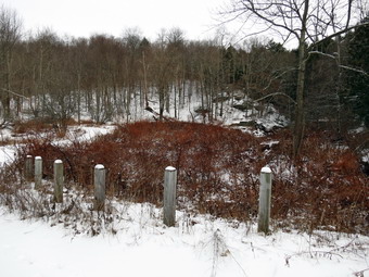
![]()
![]()
![]()
![]()
![]() On Friday, January 15th I knew that I had to get in a hike despite having to leave for a track meet in the afternoon. The cold and rainy weather coupled with track practice and other responsibilities had severely hampered my hiking. I suggested to Cindy that we go to Trout Pond and she agreed. As we were getting ready Sheila kept running between us as if to make sure we did not forget her. We got our gear including spikes in the car and left Livingston Manor with an ecstatic Sheila in the back seat at about 10:45 AM. We were looking forward to seeing if Russell Brook Falls had a higher volume of water after the rain during the week. We headed north on Route 17 to Roscoe and took Route 206 toward Downsville but turned left onto Morton Hill Road just after the Roscoe Nursing Home. When we got to the intersection with Russell Brook Road, I turned around and parked on the side of the road to avoid parking in the large open space which is marked as private property. There was a little more than an inch of snow on the ground and no one had been down Russell Brook Road. Sheila was ready to go as always and we started down the road at 11:05 AM. The temperature was just below freezing and the skies overcast when we started so I opted leave the zips on my Mammut Hoody zipped. As we walked down the road, the stream was making a lot of noise. The road was slippery in spots with icy patches under the snow. As we passed the lookout over the falls, I was not impressed by the amount of water so I decided not to take any pictures or visit the falls on this trip. We headed down the road to the lower parking area and found no cars in the lot. We walked down to the main trail and then across the bridge over Russell Brook. The knotweed that we had trimmed back a few weeks was completely dead and shriveled. We walked to the register box and headed up to Trout Pond. After slipping several times, Cindy put on her spikes while I opted to watch carefully for the ice.
On Friday, January 15th I knew that I had to get in a hike despite having to leave for a track meet in the afternoon. The cold and rainy weather coupled with track practice and other responsibilities had severely hampered my hiking. I suggested to Cindy that we go to Trout Pond and she agreed. As we were getting ready Sheila kept running between us as if to make sure we did not forget her. We got our gear including spikes in the car and left Livingston Manor with an ecstatic Sheila in the back seat at about 10:45 AM. We were looking forward to seeing if Russell Brook Falls had a higher volume of water after the rain during the week. We headed north on Route 17 to Roscoe and took Route 206 toward Downsville but turned left onto Morton Hill Road just after the Roscoe Nursing Home. When we got to the intersection with Russell Brook Road, I turned around and parked on the side of the road to avoid parking in the large open space which is marked as private property. There was a little more than an inch of snow on the ground and no one had been down Russell Brook Road. Sheila was ready to go as always and we started down the road at 11:05 AM. The temperature was just below freezing and the skies overcast when we started so I opted leave the zips on my Mammut Hoody zipped. As we walked down the road, the stream was making a lot of noise. The road was slippery in spots with icy patches under the snow. As we passed the lookout over the falls, I was not impressed by the amount of water so I decided not to take any pictures or visit the falls on this trip. We headed down the road to the lower parking area and found no cars in the lot. We walked down to the main trail and then across the bridge over Russell Brook. The knotweed that we had trimmed back a few weeks was completely dead and shriveled. We walked to the register box and headed up to Trout Pond. After slipping several times, Cindy put on her spikes while I opted to watch carefully for the ice.
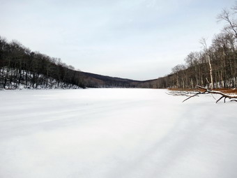 The trail still had some running water in places but it was mostly hard frozen The sky was still overcast with little or no sun and there was a slight breeze. At the pond, I took off my pack and got out the camera. The water level was still low with the shore being at least four feet from the outlet of the dam. The pond was completely covered with ice but it was hard to judge how thick it was. Apparently it was thick enough to support a forty pound dog as I soon saw Sheila walking on the ice! I took some shots of the pond against the clouds and made sure I got a few pictures of the shore. I packed up and we continued up the trail toward the head end of the pond. Just before the small bridge, I walked to the shore and took a few more shots. The sky was still mostly covered in clouds and the sky was flat and lifeless. The trees without their leaves and the dark sky made a few shots look almost black and white. We didn't stay too long before getting back on the main trail and starting toward the upper end of the pond. As we approached the lower lean-to, we saw that there were some campers in it and they also had a dog. I looked around and spotted tracks on the Campbell Mountain Trail which I assumed was the route they had used. I decided to skip taking pictures from the bridge and we continued our walk on the main trail. As we started to climb Cherry Ridge one of the blowdowns I had found last time had been cut and removed from the trail making me think someone had done some trail maintenance. Along the way were several large blowdowns which we could not clear without an axe and saw. We made a slight turn to the south and began to climb more but the ascent seemed to go slowly because of the snow and ice on the trail. Sheila was roaming the brush near the trail and seemed to always be on a scent trail. We hit the high point on the hike and started down the other side. There wasn't much water on the trail and most of it was frozen anyway. After a short ascent to the "forest of numerous small trees", we walked down to the woods road and snowmobile trail and turned left to complete our loop. The descent to the trail junction was a little tricky as there was still snow and some patches of ice underneath. We passed the large campsite on the left at the bottom of the hill and walked back to the trail junction where we turned right to walk back to the lower parking area. There were still no cars in the lot. We walked up the road back to our car arriving at 2:00 PM. We had hiked 5.5 miles in 2 hours and 50 minutes gaining 1110 feet.
![]()
![]()
![]()
![]() On Friday, January 8th I was ready to hike after almost a week of work, track meets and practices and lousy weather! Since I had to time basketball game in the evening, I decided to stay local and head to Hodge and Frick Ponds. Sheila was overjoyed to be going as I got ready at about 11:30 AM. The temperature was only 35 degrees so I dressed in layers and we left home heading out DeBruce Road. As I drove up Mongaup Road toward the trailhead, the temperature kept dropping and the amount of snow on the ground increased. When I parked at the trailhead, there was a nice layer of snow on the ground and the temperature was right at the freezing mark. There was also a slight wind blowing and some moisture in the air making the air feel colder. We crossed the road and started up the Flynn Trail at 11:50 AM. I had not worn my insulated boots and hoped that my Vasque Taku boots would be warm enough and keep my feet dry. Walking up the Flynn Trail with layer of snow on the ground was beautiful and Sheila took full advantage by romping through the woods. It was nice to be able to let her run a little since all big game seasons were over. I kept up a quick pace and quickly warmed up while Sheila was even quicker. Since we had not been out for almost a week, Sheila was dashing up and down the trail. As we hiked I could see some blue in the skies but there were also a lot of clouds. We were at the junction with the Big Rock trail by 12:30 PM having covered the 1.7 miles in about 40 minutes.
On Friday, January 8th I was ready to hike after almost a week of work, track meets and practices and lousy weather! Since I had to time basketball game in the evening, I decided to stay local and head to Hodge and Frick Ponds. Sheila was overjoyed to be going as I got ready at about 11:30 AM. The temperature was only 35 degrees so I dressed in layers and we left home heading out DeBruce Road. As I drove up Mongaup Road toward the trailhead, the temperature kept dropping and the amount of snow on the ground increased. When I parked at the trailhead, there was a nice layer of snow on the ground and the temperature was right at the freezing mark. There was also a slight wind blowing and some moisture in the air making the air feel colder. We crossed the road and started up the Flynn Trail at 11:50 AM. I had not worn my insulated boots and hoped that my Vasque Taku boots would be warm enough and keep my feet dry. Walking up the Flynn Trail with layer of snow on the ground was beautiful and Sheila took full advantage by romping through the woods. It was nice to be able to let her run a little since all big game seasons were over. I kept up a quick pace and quickly warmed up while Sheila was even quicker. Since we had not been out for almost a week, Sheila was dashing up and down the trail. As we hiked I could see some blue in the skies but there were also a lot of clouds. We were at the junction with the Big Rock trail by 12:30 PM having covered the 1.7 miles in about 40 minutes.
We continued straight ahead on the Flynn Trail passing through the gate a little further on. At the point where the Flynn Trail heads down to Hodge Pond, I elected to bear to the right on the woods road toward the old Beech Mountain Boy Scout camp. Just before the remains of the cabins from the camp, we turned left to head down the woods road toward Hodge Pond, At the junction with the jeep trail, we turned right to head around the back of the pond. The pond was frozen completely across but I couldn't judged the thickness of the ice. We continued around the back of the pond. I looked at the sky and the overall scenery and decided I would rather keep hiking than stop and take pictures. We turned right when we came to the Flynn Trail and walked up the Flynn Trail to the gate staying to the left to walk the trail out to Junkyard Junction. Here the trail was covered by a little more than an inch of snow. The trail was frozen and there were some very icy patches along the way. We arrived at the junction at 1:05 PM about 3.3 miles into the hiked. We turned left on the Quick Lake Trail and began the descent to Ironwheel Junction. The trail remained solid but there was a little less snow on the trail as we descended. When we came to the junction, we turned right to stay on the Quick Lake Trail and to head toward Frick Pond. We crossed the small stream in the woods and there was less water flowing than when Cindy and I had been there a little over a week before. On our way down the Quick Lake Trail we ran into several; new blowdowns which I will have to return to clear. As we approached Frick Pond we crossed the two small bridges before arriving at the bridge across the outlet stream. The scene was dreary and I was not in the mod to take pictures so we just kept walking. On the way back to the car, we found the trail was a solid sheet of ice where water had run down the trail and frozen. I knew that spikes would have come in handy but I had failed to follow my own advice and bring them. I walked around the icy sheet while Sheila negotiated it with no problem. We headed back to the car arriving at 2:15 PM. We hiked 6.3 miles in 2 hours and 20 minutes with a 905 foot elevation gain.
![]()
![]()
![]()
![]() On Saturday, January 2nd the forecast called for cool temperatures in the Catskills and north with a good chance of snow showers. Kurt was at the house and we decided to go south to Harriman to hike where there was little chance of snow and where it would be warmer. I suggested a hike over Almost Perpendicular to Claudius Smith's Den as I thought these two points would interest Kurt. We got up late after a long family gathering on New Year's Day and did leave Livingston Manor until after 9:00 AM. I decided to take the Quickway to Route 6 and get on Seven Lakes Drive at the traffic circle. From a previous trip I knew we would drive almost the entire length of Seven Lakes Drive before turning right on Johnstown Road just after the Reeves Center. When we got to the Reeves Education Center, the parking lots on both sides of the road were full and cars were parking along the road. I hoped that the circle at the end of Johnstown Road would still have some spots available. Johnstown Road is also posted as Rockland County 97. I drove to the end of the road to the traffic circle at the end and pulled off to the side to park. A few other cars were parked and we were ready to start our hike at 10:40 AM. The temperature was just above freezing as we set out and there was only a hint of some blue in the sky. We walked back toward the road looking for the blue disc trail which turns up the hill to the northwest just before entering the traffic circle. The first part runs along the access road for maintenance of the gas pipeline. The trail then cuts into the woods and parallels the pipeline briefly before heading more northwest. After about .5 miles of hiking a relatively slight grade we came to a steep portion of the trail which was the start of Almost Perpendicular. This section was about .25 miles at a 21% grade. The name may intimidate but it is far from the steepest climb I have done. On the way up I stopped to take a few shots of Sheila at the top of the climb waiting for us and then a few of Kurt and Sheila. As we were getting ready to start again, we heard a group of hikers approaching from ahead of us. They came to the steep descent and started down so we waited for about a dozen of them to pass before we continued on to he top of the climb. At .8 miles we again stopped so that I could take some pictures of the scenery from the top. I decided to put this on the list of places to revisit when the weather was clearer and there was some color to the trees.
On Saturday, January 2nd the forecast called for cool temperatures in the Catskills and north with a good chance of snow showers. Kurt was at the house and we decided to go south to Harriman to hike where there was little chance of snow and where it would be warmer. I suggested a hike over Almost Perpendicular to Claudius Smith's Den as I thought these two points would interest Kurt. We got up late after a long family gathering on New Year's Day and did leave Livingston Manor until after 9:00 AM. I decided to take the Quickway to Route 6 and get on Seven Lakes Drive at the traffic circle. From a previous trip I knew we would drive almost the entire length of Seven Lakes Drive before turning right on Johnstown Road just after the Reeves Center. When we got to the Reeves Education Center, the parking lots on both sides of the road were full and cars were parking along the road. I hoped that the circle at the end of Johnstown Road would still have some spots available. Johnstown Road is also posted as Rockland County 97. I drove to the end of the road to the traffic circle at the end and pulled off to the side to park. A few other cars were parked and we were ready to start our hike at 10:40 AM. The temperature was just above freezing as we set out and there was only a hint of some blue in the sky. We walked back toward the road looking for the blue disc trail which turns up the hill to the northwest just before entering the traffic circle. The first part runs along the access road for maintenance of the gas pipeline. The trail then cuts into the woods and parallels the pipeline briefly before heading more northwest. After about .5 miles of hiking a relatively slight grade we came to a steep portion of the trail which was the start of Almost Perpendicular. This section was about .25 miles at a 21% grade. The name may intimidate but it is far from the steepest climb I have done. On the way up I stopped to take a few shots of Sheila at the top of the climb waiting for us and then a few of Kurt and Sheila. As we were getting ready to start again, we heard a group of hikers approaching from ahead of us. They came to the steep descent and started down so we waited for about a dozen of them to pass before we continued on to he top of the climb. At .8 miles we again stopped so that I could take some pictures of the scenery from the top. I decided to put this on the list of places to revisit when the weather was clearer and there was some color to the trees.
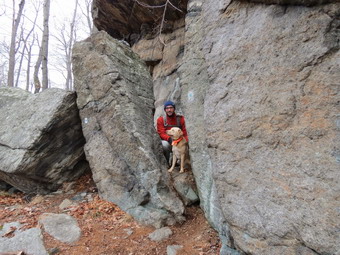 We continued our hike down from the viewpoint into a little "valley" surrounded by several high rock formations. The trail then ascended Pound Mountain and then descended again as it approached Elbow Brush. We stopped at Elbow Brush where I took some pictures of a narrow passage between the bedrock and a piece that has pulled away over the years. I took a picture of Sheila and Kurt as they squeezed through this narrow gap. This area can be avoided in one of several ways but it is interesting and not all that narrow. Just passed this point there was a jumble of rocks with some places to walk through. It wasn't exactly a cave but was interesting. We stopped again so that I could take a few more pictures. The sky was still almost completely overcast but the temperature had gone top slightly and I opened the zippers on my Mammut Hoody. As we hiked we met a lone hiker coming toward us but she informed us there was a group behind her. We waited at the side of the trail with Sheila until a group of about 20 people on an AMC hike passed us! We continued to hike to the junction with the Tuxedo Mount Ivy Trail which runs roughly east-west and it took me a minute to find the blue disc trail which proceeded straight ahead and directly up the rock face to another viewpoint. We climbed up to the viewpoint at 2.1 miles and stopped so that I could take some shots. Just across on the next hill I could see Smith's Rock which was used as a "lookout" for the Smith gang. After I took my photographs, we went back to the trail junction and took the red Tuxedo Mt Ivy trail west along the cliffs to the "den". It was less than a few hundred feet until an opening appeared on the right of the trail. We were able to walk into this "cave" and make our way to the other side. It was cool and I stopped to take some pictures from both entrances. Back on the trail we walked to the base of the cliff and found the rest of the den in the form of a rock overhang. There was a large group of hikers here and they were cooking over an pen fire. The food smelled good but the idea of an open fire distressed me. There was a fire pit and chair set up and I imagined Claudius Smith and his men gathered around the fire. Smith was raised in Brookhaven on Long Island but his family moved to Smith' Clove (Monroe) in the early 1740's. His family was well-respected and when war broke out many became Loyalists. Claudius led a band of men who defended the Loyalists in Orange County and attacked the rebels. Eventually he became so notorious that Governor George Clinton offered a $1200 reward for his capture. Claudius Smith was hanged in Goshen, NY in 1779 as were two of his sons.
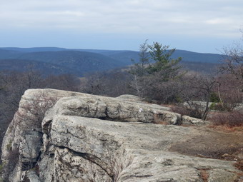 After inspecting the den and several rocks and rock formations, we walked over to a large rock that appeared to have primitive petroglyphs painted on it. The scene depicted hunters with weapons attacking some animal with a series of trees in the background. My impressions was that closer inspection would reveal a modern nature to the work. It was already 12:15 PM so Kurt and I decided to follow the Tuxedo Mount Ivy Trail west to the Ramapo Dunderberg trail. It was a short hike and we soon turned left to head south on the RD Trail at 2.6 miles. The Ramapo Dunderberg Trail headed southwest and after a short climb began a .6 mile descent losing almost 400 feet in elevation. This did not make me happy as I knew we would have to regain some of that elevation on the way back to the car. As we approached the point where the trail joined some streets in Tuxedo Park, we met two hikers with their dog. This was the third or forth dog of the day but Sheila had been good with all of them. Before the trail got to the streets, we turned left the e white blazed Kakiat Trail. We immediately started an ascent that gained about 180 feet. Along ten way we crossed several small streams and walked through and area with many large blowdowns. After we gained some elevation, we immediately descended the other side. At 4.5 miles we descended a little and followed the trail as it turned east along a well defined woods road. When we got to 4.75 miles, we met the blue disc trail we had used earlier in the morning but we decided to continue on the white trail. The trail stayed relatively flat as we crossed seared streams and wet areas but the blazes became hard to find. Soon we were approaching Seven Lakes drive and the rail turned right on an old road. We followed the trail out to the circle at the end of Johnstown Road. We were back at the car at 2:35 PM having hiked 5.7 miles in 3 hours and 55 minutes. Our elevation gain was 1305 feet.
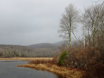
![]()
![]()
![]()
![]() On Thursday, December 31st Cindy and I decided to go to Frick and Hodge Ponds for our last hike of 2015. This is fitting since we have spent so much time during the last year hiking and doing tail maintenance here. We had some things to take care of in the morning so we did not leave the house until just before noon. By the time we got Sheila and our gear in the car, the sun was shining at the temperature was in the high 30's. We headed out the DeBruce Road to Mongaup Road. When we arrived at the trailhead there were no cars parked in the lot and the temperature had dropped to 31 degrees. There was some sun where we were but some dark clouds could be seen in the northwest. As we got ready to start our hike, I decided to keep on my Mammut Hoody and was glad I had worn a baselayer under my MH Winter Wander pants. We headed out on the Quick Lake Trail at 12:15 PM and turned left at Gravestone Junction to follow the Quick Lake Trail to the bridge over the outlet of Frick Pond. The Quick Lake trail was as wet as it had been all year all the way to Gravestone Junction. When we crossed the bridge, I took a quick look at the view and decided to take a few shots as it looked like it was snowing at Hodge Pond and on Beech Mountain. I took some pictures of the outlet stream which was running freely. As I packed up my camera, I noticed that the wind blowing off the pond was making me really cold! At the next junction with the Big Rock Trail, we stayed to the left on the Quick Lake Trail. We kept a quick pace as we hiked the Quick Lake Trail toward Iron Wheel Junction even though we had to work our way around large puddles and some running water. I started to warm up as I hiked and opened the zippers on my hoody to let some heat escape. We stopped several times to remove some large branches and one tree trunk that had come down in the recent wind and ice. At Iron Wheel Junction, we turned left to stay on the Quick Lake Trail toward Junkyard Junction. The walk is all uphill but the grade is only slight to moderate. As we walked, a fine snow began to fall and it increased in intensity the farther north we went. We continued walking quickly and arrived at Junkyard Junction at 1:45 PM after hiking 3.1 miles.
On Thursday, December 31st Cindy and I decided to go to Frick and Hodge Ponds for our last hike of 2015. This is fitting since we have spent so much time during the last year hiking and doing tail maintenance here. We had some things to take care of in the morning so we did not leave the house until just before noon. By the time we got Sheila and our gear in the car, the sun was shining at the temperature was in the high 30's. We headed out the DeBruce Road to Mongaup Road. When we arrived at the trailhead there were no cars parked in the lot and the temperature had dropped to 31 degrees. There was some sun where we were but some dark clouds could be seen in the northwest. As we got ready to start our hike, I decided to keep on my Mammut Hoody and was glad I had worn a baselayer under my MH Winter Wander pants. We headed out on the Quick Lake Trail at 12:15 PM and turned left at Gravestone Junction to follow the Quick Lake Trail to the bridge over the outlet of Frick Pond. The Quick Lake trail was as wet as it had been all year all the way to Gravestone Junction. When we crossed the bridge, I took a quick look at the view and decided to take a few shots as it looked like it was snowing at Hodge Pond and on Beech Mountain. I took some pictures of the outlet stream which was running freely. As I packed up my camera, I noticed that the wind blowing off the pond was making me really cold! At the next junction with the Big Rock Trail, we stayed to the left on the Quick Lake Trail. We kept a quick pace as we hiked the Quick Lake Trail toward Iron Wheel Junction even though we had to work our way around large puddles and some running water. I started to warm up as I hiked and opened the zippers on my hoody to let some heat escape. We stopped several times to remove some large branches and one tree trunk that had come down in the recent wind and ice. At Iron Wheel Junction, we turned left to stay on the Quick Lake Trail toward Junkyard Junction. The walk is all uphill but the grade is only slight to moderate. As we walked, a fine snow began to fall and it increased in intensity the farther north we went. We continued walking quickly and arrived at Junkyard Junction at 1:45 PM after hiking 3.1 miles.
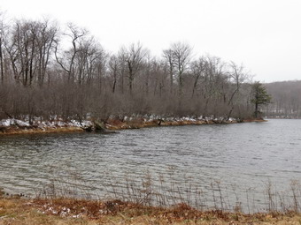 We turned right at the junction onto the Flynn Trail which is relatively flat at this point. The trail was wet and icy in spots where there is exposed bedrock. The snow continued to fall but remained very fine. At the gate we followed the trail to the right and down toward the shore of Hodge Pond. As we neared the pond we turned right to stay on the Quick Lake Trail to the outlet of Hodge Pond. The woods road was rutted and had some water but the muddiest spots were easily avoided. We were soon at the outlet end of Hodge Pond. I decided to go to the shore of the pond and take a few pictures since the snow continued to fall and the scene was the definition of "bleak". Cindy started up the Flynn Trail in an effort to stay out of the wind. After taking a few pictures, I headed after her. We started up the hill staying on the Flynn Trail and the walk up the hill seemed to go very quickly. Soon we were on the flat part of the Flynn Trail headed toward the junction with the Big Rock Trail. We continued on the Flynn Trail passing through the gate to the trail junction. We didn't stop at the trail junction but kept walking on The Flynn Trail. From this high point on the hike, the trail descends 1.7 miles to the parking area. We kept up a fast pace on the descent which seemed to drag just a little. The day had grown colder since we had departed the trailhead, the wind was still blowing and snow was still falling. Soon we were headed down the hill to the gate where we turned left to stay on then Flynn Trail. We walked down the short section of trail I had refurbished and then hiked through the woods back to the parking area. It was 3:15 PM when we returned. We had covered 6.4 miles in 3 hours. The elevation gain was a modest 910 feet.
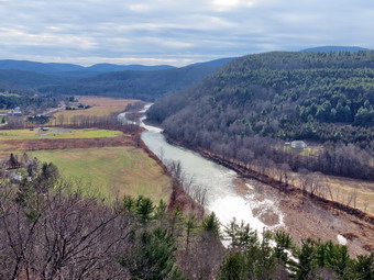
![]()
![]()
![]()
![]() On Saturday December 26th we left Vromans Nose and headed south on Route 30. In Grand Gorge I turned left on Route 23 and took it through Prattsville. We traveled east on Route 23 to the other side of town and parked in the Pratt Rock parking area on the left side of the road. There were a few other cars parked in the lot. The skies were still gray but there were areas of blue and a few distinguishable clouds. We started our hike at 12:45 PM by walking through the picnic area to the far end where we started up the trail. As we approached the far end of the picnic area we met a few adults and several enthusiastic young boys returning from their hike! When we arrived at the trail junction, I chose to stay to the left rather than head directly to the carvings on the face of the cliff. We ascended the trail that leads to the overlook and I put Sheila on her leash so that she could again help pull me up the steep hill. I had decided to leave my poles in the car and was sorry that I did so. We were soon at the overlook and the situation was much the same as on Vroman's Nose. Brad took hold of Sheila's leash so that I could drop my pack and take some pictures. The sky was still mostly gray but I took a few shots anyway including a couple of Brad and Sheila. I stopped to take some pictures along the Schoharie Creek and of the farms below the viewpoint. We picked up and moved to the next lookout which gave me slightly different views so I stopped to take a few more shots. After putting away the camera, we headed up the hill where I intended to make a loop by walking the path on the other side of the cliffs down to the carvings. When we reached the turn, I pointed out the "caves" to Brad and the path that leads along more of the escarpment. We made a turn to the right and started down the steep and eroded path that leads to the lower cliff face and the rock carvings.
On Saturday December 26th we left Vromans Nose and headed south on Route 30. In Grand Gorge I turned left on Route 23 and took it through Prattsville. We traveled east on Route 23 to the other side of town and parked in the Pratt Rock parking area on the left side of the road. There were a few other cars parked in the lot. The skies were still gray but there were areas of blue and a few distinguishable clouds. We started our hike at 12:45 PM by walking through the picnic area to the far end where we started up the trail. As we approached the far end of the picnic area we met a few adults and several enthusiastic young boys returning from their hike! When we arrived at the trail junction, I chose to stay to the left rather than head directly to the carvings on the face of the cliff. We ascended the trail that leads to the overlook and I put Sheila on her leash so that she could again help pull me up the steep hill. I had decided to leave my poles in the car and was sorry that I did so. We were soon at the overlook and the situation was much the same as on Vroman's Nose. Brad took hold of Sheila's leash so that I could drop my pack and take some pictures. The sky was still mostly gray but I took a few shots anyway including a couple of Brad and Sheila. I stopped to take some pictures along the Schoharie Creek and of the farms below the viewpoint. We picked up and moved to the next lookout which gave me slightly different views so I stopped to take a few more shots. After putting away the camera, we headed up the hill where I intended to make a loop by walking the path on the other side of the cliffs down to the carvings. When we reached the turn, I pointed out the "caves" to Brad and the path that leads along more of the escarpment. We made a turn to the right and started down the steep and eroded path that leads to the lower cliff face and the rock carvings.
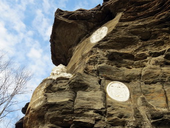 As we started down the path, I found dry dust and loose talus with a few leaves sprinkled in. I immediately wished I had stowed my poles in my pack for this descent. Fortunately, there were enough roots and trees to garb onto to help in the descent. I stopped once or twice to take pictures of the towering cliffs. Brad and I carefully examined the face of the cliffs and found some interesting formations which must be the result of weathering of the rock. In some places there were holes similar to the ones woodpeckers make in trees. In other places there were larger and deeper holes and some columns. This is probably due to the varying hardness and solubility of the rock but I am not sure whether wind or water is the primary agent of erosion. Soon we had finished the descent and were at the area of the stone carvings. I took pictures of the carvings. They had appeared to by whiter and brighter from below but up close it was clear they had not been whitewashed for some time. We made our way down the path which switchbacked back down to the main path. At the main trail we turned left and worked our way back through the picnic area to the car. We were back by 1:00 PM having hiked 1.0 miles in 45 minutes with an elevation gain of 360 feet.
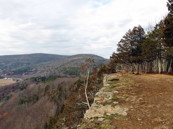
![]()
![]()
![]()
![]() On Saturday, December 26 I knew that I had to get out for a hike after another week of fighting a cold and preparation for the Christmas holiday. There was a 40% chance of rain for Livingston Manor but the forecast called for almost no chance of rain farther north. I decided to go to Vroman's Nose and Pratt Rock. Brad and Krista were at our house for Christmas and Brad wanted to go along. Sheila was very happy to be getting out so we packed our gear and got ready to go. The temperatures were forecast to be in the low 50's so I dressed accordingly but threw in a rain jacket just in case. We left Livingston Manor just at 9:00 AM and headed up the Beaverkill Road to the Barkaboom Road. At the end of the road I turned right on BWS 10 and took it to Route 28 in Margaretville. We turned right and then left to follow Route 30 through Margaretville, Roxbury, Grand Gorge and North Blenheim. Just outside of Middleburgh I turned left on Mill Valley Road. Less than a mile up the road I parked in the Vromans Nose parking lot on the left side of the road. I was surprised to see that the association that maintains the area had increased the parking lot to more than double its size! There were a few other cars in the lot when we left to start our hike at 10:30 AM. Some people left just ahead of us so I left my poles in the car and put Sheila on her leash. As we walked through the open field that leads to the trails, we found the trail to the right was closed without any explanation. We turned to the left and to hike the steeper side first which would allow us to return on the gentle side. As we turned onto the yellow blazed trail I noted that it did not seem familiar and I questioned whether or not I was on the correct path but I soon realized it was just that I was traveling in a direction I had only taken once before. My intention was to continue on the yellow path all the way to the top passing the Long Path as we went. We came to a blue trail at .2 miles that turned to the left and decided to follow it. This trail flattened out at .3 miles and then began to climb at .6 miles where it joined the route of the trail that used to come up from the parking area. A sign at this point indicated that the lower trail had been closed for "natural reforestation". From .6 miles to .8 miles we climbed the trail to the top of "The Nose" with a grade of a little less than 20%. We passed a few people climbing the trail and others headed down after a visit to the top. One couple had a 17 month old yellow lab which was already the size of Sheila.
On Saturday, December 26 I knew that I had to get out for a hike after another week of fighting a cold and preparation for the Christmas holiday. There was a 40% chance of rain for Livingston Manor but the forecast called for almost no chance of rain farther north. I decided to go to Vroman's Nose and Pratt Rock. Brad and Krista were at our house for Christmas and Brad wanted to go along. Sheila was very happy to be getting out so we packed our gear and got ready to go. The temperatures were forecast to be in the low 50's so I dressed accordingly but threw in a rain jacket just in case. We left Livingston Manor just at 9:00 AM and headed up the Beaverkill Road to the Barkaboom Road. At the end of the road I turned right on BWS 10 and took it to Route 28 in Margaretville. We turned right and then left to follow Route 30 through Margaretville, Roxbury, Grand Gorge and North Blenheim. Just outside of Middleburgh I turned left on Mill Valley Road. Less than a mile up the road I parked in the Vromans Nose parking lot on the left side of the road. I was surprised to see that the association that maintains the area had increased the parking lot to more than double its size! There were a few other cars in the lot when we left to start our hike at 10:30 AM. Some people left just ahead of us so I left my poles in the car and put Sheila on her leash. As we walked through the open field that leads to the trails, we found the trail to the right was closed without any explanation. We turned to the left and to hike the steeper side first which would allow us to return on the gentle side. As we turned onto the yellow blazed trail I noted that it did not seem familiar and I questioned whether or not I was on the correct path but I soon realized it was just that I was traveling in a direction I had only taken once before. My intention was to continue on the yellow path all the way to the top passing the Long Path as we went. We came to a blue trail at .2 miles that turned to the left and decided to follow it. This trail flattened out at .3 miles and then began to climb at .6 miles where it joined the route of the trail that used to come up from the parking area. A sign at this point indicated that the lower trail had been closed for "natural reforestation". From .6 miles to .8 miles we climbed the trail to the top of "The Nose" with a grade of a little less than 20%. We passed a few people climbing the trail and others headed down after a visit to the top. One couple had a 17 month old yellow lab which was already the size of Sheila.
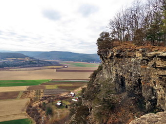 Soon we arrived at the top. I decided to bypass a few of the lookouts along the way as the view is better from the top. Once on the summit I dropped my pack and got out the camera as Brad took over holding Sheila's leash. I was a little disappointed as the sky was overcast and a prominent haze hung over the Catskills in the distance. I still took some pictures concentrating on the bare farmland below with alternating patches of green and brown. I also took some shots along the edge of the cliffs. Vromans Nose has an elevation of about 1220 feet above sea level which makes it about 500 feet higher than the surrounding plain. It isn't very high but it gives a great view of the plain below and the peaks both near and far. We continued our hike by walking along the edge of the cliff. We stopped at the far end of the cliffs where I again took some more shots concentrating on the hills to the north and the bends in the Schoharie Creek below. I again took some pictures along the cliffs before we picked up and started the descent. The descent starts out a little steep and slippery but soon become a wide path with a gentler slope. On the way down we found an orange path leading to the left. I did not remember this trail and the marker that said "New Trail" told me why. We turned left at 1.2 miles. This trail was almost completely flat and paralleled the lower and upper trails for about .4 miles. At 1.6 miles the trail met the trail we had used to ascend earlier and we turned right to return to the parking area. We were back at the car 11:35 AM having hiked 2.2 miles in 1 hour and 5 minutes with an elevation gain of 560 feet. We got in the car and drove back to Grand Gorge to take Route 23 to Prattsville and Pratt Rock.