
What You Missed
Winter 2014 - 2015
Winter 2014 - 2015
![]()
![]()
![]()
![]()
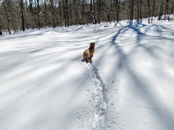
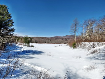
![]() On Thursday, March 19th I wanted to get out for what would be the last winter hike of the season. Of course, the Catskills have a way of prolonging winter and several inches of snow was in the forecast for Friday. I had decided to head for Big Pond for a hike to Little Pond and back. I had several possibilities to complete this loop including staying on the trails, walking back on the roads and making a side trip to Cabot Mountain. I expected the temperature to be low in the morning but when I awoke the thermometer had a single digit reading and the wind was blowing. I delayed my start leaving Livingston Manor just before 10:00 AM when the temperature had crept into the upper teens. Sheila seemed more than ready to go when we arrived at the Big Pond parking area. I had thought I might only need spikes since I thought that the trail would be well-packed and I did not expect the temperature to rise that much. I got out of the car and walked across the road to check the trail and found that I could find no evidence that any body had used it at all! I let Sheila out of the car and put on my snowshoes as the wind whipped across Big Pond and the temperature hovered around 16 degrees. We crossed the road at 10:15 AM and started up the hill trying to follow the blazes on the trees. I checked the register box and found the last entry was a forest ranger fro9m Stamford on November 10th! The first part of the trail is an old woods road and it is pretty easy to follow. I was glad I had opted for some heavier clothes and my mittens. Sheila was running all over the place on the pristine snow as I trudged up the trail. I was able to stay on top of the snow in most places only sinking in when walking over brush hidden beneath the snow.
On Thursday, March 19th I wanted to get out for what would be the last winter hike of the season. Of course, the Catskills have a way of prolonging winter and several inches of snow was in the forecast for Friday. I had decided to head for Big Pond for a hike to Little Pond and back. I had several possibilities to complete this loop including staying on the trails, walking back on the roads and making a side trip to Cabot Mountain. I expected the temperature to be low in the morning but when I awoke the thermometer had a single digit reading and the wind was blowing. I delayed my start leaving Livingston Manor just before 10:00 AM when the temperature had crept into the upper teens. Sheila seemed more than ready to go when we arrived at the Big Pond parking area. I had thought I might only need spikes since I thought that the trail would be well-packed and I did not expect the temperature to rise that much. I got out of the car and walked across the road to check the trail and found that I could find no evidence that any body had used it at all! I let Sheila out of the car and put on my snowshoes as the wind whipped across Big Pond and the temperature hovered around 16 degrees. We crossed the road at 10:15 AM and started up the hill trying to follow the blazes on the trees. I checked the register box and found the last entry was a forest ranger fro9m Stamford on November 10th! The first part of the trail is an old woods road and it is pretty easy to follow. I was glad I had opted for some heavier clothes and my mittens. Sheila was running all over the place on the pristine snow as I trudged up the trail. I was able to stay on top of the snow in most places only sinking in when walking over brush hidden beneath the snow.
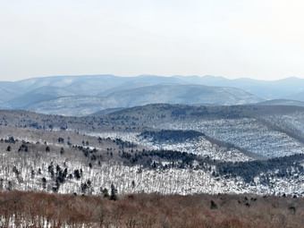
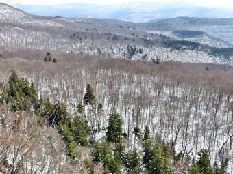
 The first mile of the trail gains about 775 feet with an average grade of 15%. Some places are almost flat which means there are a few steeper places. I began to notice that the blazing of the trail was extremely poor. Most blazes were placed too far apart. Some were very old and faded with others grown into the trees. A few were placed on the side of the tree meaning they were not visible from either direction on the trail. None of the turns were properly marked. I had to stop and stare several times to find a marker and in other places simply continued in what I thought was the correct direction. Several times I just followed Sheila who seems to be able to find the right direction no matter what. In a few places the trail travels along the side of the hill and this made for some tricky footing. By 11:10 AM we had hiked a mile to the highest point on the trail on the shoulder of Touch-Me-Not Mountain. After a slight descent we turned right on the yellow loop trail around Little Pond.The loop trail is very popular with campers during the season and I hoped it would be better marked than the trail from Big Pond. This trail, in fact, not as well marked as the other and I wandered around several times eventually following Sheila. At 1.6 miles we had finally descended some interesting rock formations and had arrived at the cutoff to Cabot Mountain. I decided not to attempt the steep ascent of Cabot and we continued our hike by bearing left to stay on the loop trail. At 1.8 miles we arrived in the clearing that acts as a viewpoint. It is hard to see Little Pond from this lookout since the trees have grown up. This is a place that holds many memories as we hiked the loop many times when I was younger. We stop and I got out the camera to take pictures of the snowy hills and the blue sky. I also took a few shots of the small foundation of a long-forgotten homestead cabin. We continued to walk out a woods road from the clearing now heading south and in a few hundred feet turned left to head south to the northern shore of Little Pond. The snow was still firm enough to walk on top but the sun was starting to warm the upper layers. The snow began to clump on the bottom of the snowshoes and I began to break through in several places as we approached the road around the pond.
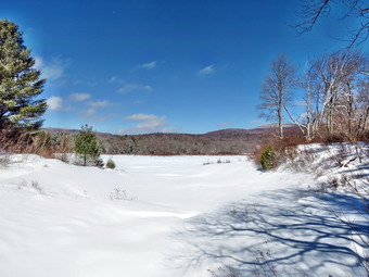
 At the pond we turned right to walk around the western shore of Little Pond. There were some old snowshoe tracks indicating at least one person had listed the area over the winter. We stopped at the boat launch area and I took some photos of Touch-Me-Not Mountain. I also took a few shots of a lone bench that looked like it was waiting for warmer weather. As we walked along the road, I began to see picnic tables leaning on the fireplaces at the campsites. I stopped to take a few pictures before we turned left to head for the bridge at the outlet of Little Pond. We crossed the bridge and I dropped my pack to take a few last pictures. Although the sun was out, the wind was howling down the pond and my fingers grew cold as I spent only a few minutes getting some shots. I put my camera away, donned my mittens and shouldered the pack. We walked over to the parking area and found that it and the road had been plowed. We walked out to the gatehouse and I decided to take off the snowshoes and walk the rest of the way on the road. I thought for a moment about completing the loop on the trail but this meant a steep climb on deteriorating snow. I got out a bungee cord and did my best to strap my snowshoes to the pack. The TSL Symbioz bindings are some of the best I found but they do not lie flat. I also had brought only one bungee so in the end the snowshoes just sort of hung off the back of my pack. We walked a little less than a mile down to Barkaboom Road and turned left to hike up the road back to Big Pond. I put Sheila on her leash but in the .6 mile hike back to the car there was no traffic. We were back at the car at the car at 12:55 PM having hiked 4.8 miles in 2 hours and 35 minutes. The elevation gain was about 1000 feet. I put Sheila in the car and stowed my gear except for the camera. I walked down to the shore of Big Pond and took a few pictures before heading back to the car.
![]()
![]()
![]()
![]()
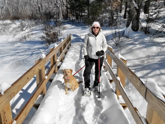
![]() On Sunday, March 15th we had the kickoff meeting of the Willowemoc Trail Crew at Morgan Outdoors in Livingston Manor. The kickoff was postponed from March 1st due to inclement weather but 20 people showed up for a short meeting and a snowshoe adventure at Frick Pond. The trail crew was formed to help maintain and improve the trails that have been adopted by the NYNJTC in the Willowemoc Wild Forest and the Delaware Wild Forest. This includes the trails around Frick, Hodge, Mongaup and Long Ponds. It also encompasses the area of Trout and Mud Ponds and Huggins Lake. These two areas are in different DEC regions but both have trails that need maintenance. Most of the 349.3 miles of trails in the Catskill [park are maintained by volunteers and volunteer trail crews. The meeting started promptly at 1:00 PM with a short presentation and the introduction of two special guest. Heather Rolland represented the NYNJTC and Ian Dunn, the DEC Region 3 land manager, was also present. Maintaining and improving trails is a cooperative venture between the DEC, NYNJTC and the volunteers in the field. The brief presentation was followed by a question and answer period. Following some refreshments Lisa Lyons outfitted anyone lacked snowshoes and wanted to hike. She generously waived the rental fee and gave instructions on how to work the bindings. At about 1:40 PM we headed out to Frick Pond and parked in the two lots. The weather kept changing from sunny to overcast but the one constant was a howling wind gusting to over 20 mph. Everyone got their snowshoes on and we headed out the Quick Lake Trail toward Frick Pond. I took the lead while Heather stayed with some of the novice snowshoers.
On Sunday, March 15th we had the kickoff meeting of the Willowemoc Trail Crew at Morgan Outdoors in Livingston Manor. The kickoff was postponed from March 1st due to inclement weather but 20 people showed up for a short meeting and a snowshoe adventure at Frick Pond. The trail crew was formed to help maintain and improve the trails that have been adopted by the NYNJTC in the Willowemoc Wild Forest and the Delaware Wild Forest. This includes the trails around Frick, Hodge, Mongaup and Long Ponds. It also encompasses the area of Trout and Mud Ponds and Huggins Lake. These two areas are in different DEC regions but both have trails that need maintenance. Most of the 349.3 miles of trails in the Catskill [park are maintained by volunteers and volunteer trail crews. The meeting started promptly at 1:00 PM with a short presentation and the introduction of two special guest. Heather Rolland represented the NYNJTC and Ian Dunn, the DEC Region 3 land manager, was also present. Maintaining and improving trails is a cooperative venture between the DEC, NYNJTC and the volunteers in the field. The brief presentation was followed by a question and answer period. Following some refreshments Lisa Lyons outfitted anyone lacked snowshoes and wanted to hike. She generously waived the rental fee and gave instructions on how to work the bindings. At about 1:40 PM we headed out to Frick Pond and parked in the two lots. The weather kept changing from sunny to overcast but the one constant was a howling wind gusting to over 20 mph. Everyone got their snowshoes on and we headed out the Quick Lake Trail toward Frick Pond. I took the lead while Heather stayed with some of the novice snowshoers.
 The trail was still well-packed which made walking easier and even though the pace was slow I was still warm. The temperature was above freezing but the wind made it feel much cooler. We stopped at Gravestone Junction and again at the bridge across the outlet of Frick Pond to allow the group to stay together. From the bridge we headed around the west side of the pond crossing the two small footbridges. At the trail junction we strayed to the right to hike around back of Frick Pond. Despite the wind the hike was enjoyable and I was pleased to be with a group as I hike only with Sheila much of the time. Sheila for her part was well-behaved although I had to remind her that not everyone wants to share their snowshoes with her. By 3:00 PM we had made our way to Times Square covering 1.2 miles. The group had definitely split into two sections. As the first section consolidated at Times Square, I gave them instructions on how to get back to the parking area and turned around to see how the others were doing. I walked back on the trail around the back of Frick Pond and quickly found the rest of the group minus a few who had turned around early in the hike. I explained that it was shorter to continue around the pond and we hiked to Times Square. After a short break we started in again and I traded places with Heather and Ian sending them ahead with the more experienced snowshoers. We climbed the small hill on the Logger's Loop heading toward Gravestone Junction. We were able to stay on top of the drifts but the wind blowing across the pond was fierce. We made the left onto the Quick Lake Trail and hiked back to the trail register. We made a right and headed back to the parking area arriving at 4:00 PM. We covered 2.2 miles in about 2 hours. This was certainly not my normal pace but I thoroughly enjoyed being with a group. I am anxious to set the work dates for the trail crew and see how many projects we can undertake and how much good work we can accomplish.
![]()
![]()
![]()
![]()
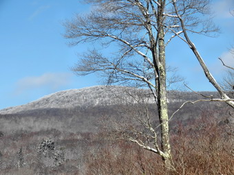
![]() On Friday, March 13th, I had planned to hike Balsam Lake Mountain from the Millbrook side since it had been along time since I had hiked a 3500 foot peak. I knew I would be getting a late start as we had an active shooter drill at Livingston Manor schools from 7:30 AM to 12:30 PM. The drill went well and was over by 9:30 Am which was a pleasant surprise since I could now start my hike earlier. As soon as we got back to the building, we got an ambulance call in Roscoe. I was still back home before I had planned so I called Cindy who was shopping and she agreed to hurry home so that we could go. We were just heading out the door at 12:30 PM when the pager again went off for another call in Roscoe. There was no other EMT available so I responded knowing that it would mean changing plans to a much shorter local hike! When I got home at 2:00 PM, I decided we should try Balsam Lake as I had headlamps and the weather was warm. Cindy and I got our gear and put an excited Sheila in the backseat. We headed up the Quickway and took Route 206 towards Downsville. I took a right on Route 30 and then took the BWS roads to Millbrook Road. I drove passed Kelly Hollow and soon after pulled into the parking lot that serves Balsam Lake Mountain and Dry Brook Ridge. By the time we strapped on our snowshoes and started the hike by crossing the road it as 3:15 PM and I wondered whether I had made the right choice. The snow was form underfoot and it looked like the trail had been well-used. Unlike the climb from the Beaverkill Road which starts out almost flat, the ascent from Millbrook starts with an uphill gaining over 200 feet in the first half mile. As we hiked, I stuck my pole into the snow off the trail and found over two feet. Sheila kept following animal tracks off the trail and then having to bound through the heavy snow to get back. We were making good time by keeping a fast pace but it was making me a little tired.
On Friday, March 13th, I had planned to hike Balsam Lake Mountain from the Millbrook side since it had been along time since I had hiked a 3500 foot peak. I knew I would be getting a late start as we had an active shooter drill at Livingston Manor schools from 7:30 AM to 12:30 PM. The drill went well and was over by 9:30 Am which was a pleasant surprise since I could now start my hike earlier. As soon as we got back to the building, we got an ambulance call in Roscoe. I was still back home before I had planned so I called Cindy who was shopping and she agreed to hurry home so that we could go. We were just heading out the door at 12:30 PM when the pager again went off for another call in Roscoe. There was no other EMT available so I responded knowing that it would mean changing plans to a much shorter local hike! When I got home at 2:00 PM, I decided we should try Balsam Lake as I had headlamps and the weather was warm. Cindy and I got our gear and put an excited Sheila in the backseat. We headed up the Quickway and took Route 206 towards Downsville. I took a right on Route 30 and then took the BWS roads to Millbrook Road. I drove passed Kelly Hollow and soon after pulled into the parking lot that serves Balsam Lake Mountain and Dry Brook Ridge. By the time we strapped on our snowshoes and started the hike by crossing the road it as 3:15 PM and I wondered whether I had made the right choice. The snow was form underfoot and it looked like the trail had been well-used. Unlike the climb from the Beaverkill Road which starts out almost flat, the ascent from Millbrook starts with an uphill gaining over 200 feet in the first half mile. As we hiked, I stuck my pole into the snow off the trail and found over two feet. Sheila kept following animal tracks off the trail and then having to bound through the heavy snow to get back. We were making good time by keeping a fast pace but it was making me a little tired.
 At .8 miles we began a switchback which eventually brought us to a flatter area at about 1.25 miles. I had not hiked from this direction many times but it seemed longer than I remembered. The tradeoff between the two starts is that the Beaverkill start is flat for some time and then has a steep climb. The hike from the Millbrook side climbs from the beginning but is not as steep as from the Beaverkill Road. Along the way there were some interesting rocks including some that had been eroded so that there were only a few "pillars" left separating some layers. At 2.1 miles we came to the turnoff to the left for Graham and I knew the trail to the summit of Balsam Lake was just ahead. The trail to Graham looked well-used. At 2.3 miles we turned right and started up the trail to the fire tower. Just after the start of the trail there is a metal gate. The top of the gate was even with the top of the snow. I had kept my camera in my pack as I wanted to keep moving but I had to have a picture of the gate. I took one of the gate alone and then took one with Sheila before packing up again to move on. As we started up the mountain, I pushed the televators on my TSL Symbioz �lite snowshoes down. They ready do make an ascent easier by taking the strain off the calf muscles. On these snowshoes they are so easy to use that I put them up and down several times. The climb alternates between steeper and more level sections and we were making good time on both. At one point I noticed that by following the tracks of other hikers we had lost the trail blazes. We continued to follow the tracks and were soon back on the trail. by 4:45 PM we had hiked just under 3 miles and were in the clearing with the fire tower. The top of the picnic table was even with the top of the snow and I took a few pictures before heading to the tower.
 As I began to ascend the tower, I noticed that the skies had already begun to cloud over as the storm predicted for Saturday was beginning to roll in. The winds that were not noticeable at ground level were certainly noticeable as I climbed to just below the cab. I could hear Cindy calling Sheila who has no problem following me up the steps of the fire towers! I too pictures in all directions. Although the skies were not ideal, it was nice to get some views of the hills and valleys. Balsam Lake is the westernmost 3500 foot peak and most of the other peaks are visible from it. I took few shots through the tower and a few more of the steps on the way down. The steps were clear of ice and snow but the landings were still tricky. Before putting the camera away, I took a few pictures of the tower. We started back down at 5:00 PM and I said to Cindy I thought it would take us about an hour and 15 minutes about 15 minutes less than the ascent. The sun was still pretty high in the sky as we began a fast-paced return trip to the car. We were setting a good pace down the mountain to the left turn onto the trail back to Millbrook Road. There were a few short ascents along the way but otherwise we kept moving quickly. It felt good to move fast over the snow and in a few spots I was almost running, We passed through the switchback which signaled to me that we were almost back to the car. Soon we were crossing the road and walking through the lot back to the car. We were back at 6:15 PM with light to spare. We had hiked 5.9 miles in 3 hours with a 1280 foot elevation gain. Although this is not a difficult hike I was pleased with our pace and glad we had decided to do the hike.
![]()
![]()
![]()
![]()
![]() On Wednesday, March 11th Lisa wanted to get out for a hike. We agreed to wait until the morning to make a decision since it was supposed to rain overnight. When I woke up at 6:00 AM, there was still some drizzle in the air but by 8:00 AM it had stopped. This meant it would be possible to attempt a hike but the snow conditions might be questionable due to the rain and increasing temperature. I contacted Lisa and we agreed to meet downtown at 10:15 AM. We left Livingston Manor and headed out the DeBruce Road to Fish Hatchery Road. I turned left and drove toward Mongaup Pond turning left on Beech Mountain Road at the fork. I parked in the smaller lot and immediately could see that it was icy. After some equipment malfunctions, we got started on our hike by walking to the larger lot and out the back on the Quick Lake Trail at 10:40 AM. The snow had softened on the well-packed trail which meant we were sinking in some with each step. Lisa seemed to enjoy this. I did not! Sheila was all over the place even venturing off the trail to follow some animal scent. When we came to Gravestone Junction, Lisa expressed a desire to go around the pond. I suggested we go to the right on the Logger's Loop first as I was not sure how deeply we would sink into the deep drifts. We turned right and started the walk to Times Square. Fortunately the drifts seemed to support our weight as we did not sink any more deeply than in other places. As we were hiking toward Times Square, we could hear snowmobiles in the distance. I wondered at them being there during the week but assumed they had read the forecast and were trying to get a few more rides in before more snow disappeared. At Times Square we turned left and followed the path around the back of the pond and over the wooden causeways. Except for the broken trail and a few animals tracks the snow was still a smooth blanket over the ground. It wasn't long before we were at the junction with the Quick Lake Trail where we turned left to head for the outlet of Frick Pond. As we crossed the bridge, there was plenty of sunlight and the pond was beautiful. I did not get out my camera as I have hundreds of pictures of the same scene. We walked up the hill to the right of the bridge and were soon back at Gravestone Junction. From there we followed our route back to the car. We were back at 12:10 PM having covered 2.2 miles in 1.5 hours. The temperature was in the high 40's and may have hit 50 later in the day.
On Wednesday, March 11th Lisa wanted to get out for a hike. We agreed to wait until the morning to make a decision since it was supposed to rain overnight. When I woke up at 6:00 AM, there was still some drizzle in the air but by 8:00 AM it had stopped. This meant it would be possible to attempt a hike but the snow conditions might be questionable due to the rain and increasing temperature. I contacted Lisa and we agreed to meet downtown at 10:15 AM. We left Livingston Manor and headed out the DeBruce Road to Fish Hatchery Road. I turned left and drove toward Mongaup Pond turning left on Beech Mountain Road at the fork. I parked in the smaller lot and immediately could see that it was icy. After some equipment malfunctions, we got started on our hike by walking to the larger lot and out the back on the Quick Lake Trail at 10:40 AM. The snow had softened on the well-packed trail which meant we were sinking in some with each step. Lisa seemed to enjoy this. I did not! Sheila was all over the place even venturing off the trail to follow some animal scent. When we came to Gravestone Junction, Lisa expressed a desire to go around the pond. I suggested we go to the right on the Logger's Loop first as I was not sure how deeply we would sink into the deep drifts. We turned right and started the walk to Times Square. Fortunately the drifts seemed to support our weight as we did not sink any more deeply than in other places. As we were hiking toward Times Square, we could hear snowmobiles in the distance. I wondered at them being there during the week but assumed they had read the forecast and were trying to get a few more rides in before more snow disappeared. At Times Square we turned left and followed the path around the back of the pond and over the wooden causeways. Except for the broken trail and a few animals tracks the snow was still a smooth blanket over the ground. It wasn't long before we were at the junction with the Quick Lake Trail where we turned left to head for the outlet of Frick Pond. As we crossed the bridge, there was plenty of sunlight and the pond was beautiful. I did not get out my camera as I have hundreds of pictures of the same scene. We walked up the hill to the right of the bridge and were soon back at Gravestone Junction. From there we followed our route back to the car. We were back at 12:10 PM having covered 2.2 miles in 1.5 hours. The temperature was in the high 40's and may have hit 50 later in the day.
![]()
![]()
![]()
![]()
![]() On Tuesday, March 10th I wanted to get in a hike somewhere before the warmer weather and rain completely ruined the snow. I was tired of Frick Pond and decided to head to Giant Ledge and, possibly, to Panther Mountain as well. Sheila, as always, was ready to go as I loaded up my equipment and headed out of Livingston Manor at about 8:45 AM. The temperature was still in the teens but the forecast was for highs in the low 40's. The farther I drove along DeBruce Road the worse the road conditions became. The road was full of potholes in some places, covered in water in others and gad a layer of ice and snow from Willowemoc to Round Pond. Once I turned left onto the Frost Valley Road, the conditions improved although there were still a fair number of potholes and a lot of dust. There were no cars parked at Biscuit Brook and only one in the Slide Mountain parking area. When we arrived at the bid bend in Route 47, there were no cars in the parking area for Giant Ledge and Panther. The temperature was about 20 degrees at the trailhead. The parking area was very icy so I immediately put on my TSL Symbioz elite snowshoes, shouldered my pack and led Sheila across the road on her leash. As we started out on the trail, I noticed that it was very firmly packed but chopped up in spots from barebooters. By the time we got to the trail register, I decided that I would not need the snowshoes and opted for wearing only spikes if they were needed. We walked back to the car and I put my snowshoes in the trunk and we crossed the road again to restart the hike at 9:15 AM. By the time I got to the bridge, I decided I would don my Microspikes. The trail wasn't that slippery yet but I knew that it would be quicker to walk along with some traction than try to avoid the icy areas. Once I got my spikes on, it was much easier going and I did not sink into the trail surface at all. As I climbed over the normally rocky areas, I was reminded that many of the Catskill trails are easier to hike with a few feet of snow on the ground! Within about 30 minutes we had hiked the .75 miles to the trail junction. I have made this in 15 minutes under ideal conditions but I wasn't in any real hurry on this day. The trail straight ahead would take us to Woodland Valley but we made a left turn to go to Giant ledge and Panther.
On Tuesday, March 10th I wanted to get in a hike somewhere before the warmer weather and rain completely ruined the snow. I was tired of Frick Pond and decided to head to Giant Ledge and, possibly, to Panther Mountain as well. Sheila, as always, was ready to go as I loaded up my equipment and headed out of Livingston Manor at about 8:45 AM. The temperature was still in the teens but the forecast was for highs in the low 40's. The farther I drove along DeBruce Road the worse the road conditions became. The road was full of potholes in some places, covered in water in others and gad a layer of ice and snow from Willowemoc to Round Pond. Once I turned left onto the Frost Valley Road, the conditions improved although there were still a fair number of potholes and a lot of dust. There were no cars parked at Biscuit Brook and only one in the Slide Mountain parking area. When we arrived at the bid bend in Route 47, there were no cars in the parking area for Giant Ledge and Panther. The temperature was about 20 degrees at the trailhead. The parking area was very icy so I immediately put on my TSL Symbioz elite snowshoes, shouldered my pack and led Sheila across the road on her leash. As we started out on the trail, I noticed that it was very firmly packed but chopped up in spots from barebooters. By the time we got to the trail register, I decided that I would not need the snowshoes and opted for wearing only spikes if they were needed. We walked back to the car and I put my snowshoes in the trunk and we crossed the road again to restart the hike at 9:15 AM. By the time I got to the bridge, I decided I would don my Microspikes. The trail wasn't that slippery yet but I knew that it would be quicker to walk along with some traction than try to avoid the icy areas. Once I got my spikes on, it was much easier going and I did not sink into the trail surface at all. As I climbed over the normally rocky areas, I was reminded that many of the Catskill trails are easier to hike with a few feet of snow on the ground! Within about 30 minutes we had hiked the .75 miles to the trail junction. I have made this in 15 minutes under ideal conditions but I wasn't in any real hurry on this day. The trail straight ahead would take us to Woodland Valley but we made a left turn to go to Giant ledge and Panther.
 The next .3 miles or so was almost flat and the snow on the trail was well consolidated so we made good time. I struck my pole down to the ground just off terrain and was surprised to find much less snow than in the area around Frick Pond. Soon we began the climb up to Giant Ledge passing the sign for the spring on the way. As we gained elevation I was reminded of the difference between the flat hikes I had been doing and even this moderate climb! We started the final climb up to the Giant Ledge plateau finding only one spot that was icy and required a little work. I was surprised at how quickly this last part went and before I knew it we were at the top. Sheila was ranging well ahead of me the whole way and seemed to be enjoying the climb. It often seems to me that up, down and flat are all the same to her as she ranges far headed and then comes roaring back to me only to repeat the process. We walked across the trail and down to the first lookout. I realized that it had been some time since I was on Giant Ledge and I got the camera out to take some pictures. The views were not the best with bright sun and a hazy sky. Still, I found some views were better than none and I always marvel at the beauty God has created when I look out over the mountains and valleys. I picked up my pack and we walked to the second viewpoint but the scenes were much the same. At the third lookout, I took a few more pictures. At this point I decided that I had too many things to do for the rest of the day and I would not enjoy the hike to Panther. It was 10:20 AM when we turned around after hiking about 1.7 miles. We started back down from the Ledge and despite a little slipping and sliding the trip back seemed to go quickly. As the day was getting warmer, the snow began to clump on my spikes making them almost useless unless I cleared them frequently. Anyone observing the hike back might have thought I was a little crazy as I was frequently kicking trees and stomping on rocks in an effort to clear my spikes. We crossed the road and arrived back at the car by 11:10 AM making the return trip about 10 minutes quicker. We covered 3.3 miles in 1 hour and 55 minutes with an ascent of about 1090 feet. The temperature at the car was about 40 degrees which was 20 degrees higher than when we began the hike!
![]()
![]()
![]()
![]()
![]() On Sunday, March 8th I wanted to get out and snowshoe after 10 days of a bad cold and a teaching stint at Liberty High School. Sheila was showing the effects of not being out and sniffing my cloths every time I left the house! I preached in the two churches on the other side of the county and did not get home until just before 1:00 PM. I asked Cindy if she wanted to go to Frick Pond as I did not want to go too far my first time out after being sick. She agreed and we got dressed and put our gear in the car. Sheila could hardly contain herself and ran back and forth between us as we got ready trying to make sure we were really going. I drove out DeBruce Road and turned left on Fish Hatchery Road to go to Frick Pond. When we arrived at the parking areas, there were already three cars in the smaller lot so I parked in the larger lot which was empty. There was a large group getting ready to leave and we tried to get on the trail before them. As it turned out, they started out on the trail just before we did. They seemed to be beginners and were trying to snowshoe without poles. They also had a small but noisy dog on a leash. We followed them from the parking area to the trail register as they moved slowly on the packed trail. They stopped at the register and we took the opportunity to walk around them. We headed out to the pond and in a short distance met a young couple coming toward us. Each of them had a baby in a backpack. It seemed that it was good they were heading back as the babies were getting a little cranky. The trail was pretty well packed as the walking was easy as we approached the junction with the Logger's Loop. We decided to turn right on the Logger's Loop to avoid the larger group behind us. We assumed they would be heading left to Frick Pond. The problem was that the Logger's Loop was not broken since the last storm had dropped about six inches of snow and sleet. As I started out on the trail, I could barely see the trail we had broken weeks earlier. Apparently what I could find was good enough as we did not sink very deeply. It helped that the snow drifting off the pond forms very compact and solid drifts. We were soon headed down the trail to Times Square where the Logger's Loop was well-packed by snowmobiles. Walking on the packed trail was a pleasure as we continued to head northwest on the Logger's Loop. The trail is a little uphill at the start and we soon heard snowmobiles approaching from the north. Two machines went by but slowed down as they passed us. We walked a short distance and heard snowmobiles again. This time 6 or 8 went by and I was afraid we would be plagued for the next mile. Fortunately, that was the last group we encountered. The rest of the hike to Iron Wheel Junction went quickly and we arrived at 2:35 PM after hiking 2 miles. We had made the big turn on the Logger's Loop and we were now headed south to complete the loop. We looked at the Quick Lake Trail that leads back to Frick Pond and saw that it was also unbroken. We started out on the trail and I found the heavy, crusted snow made breaking trail much more tiring than in powder. My snowshoes tended to break through and then slip under the crust which made lifting them more difficult. This continued until we were finally at the junction with the trail around Frick Pond. This trail was well broken and we turned right to head toward the bridge at the outlet of Frick Pond. As we crossed the bridge, the wind picked up and we could not see any tracks from the large group we had met in the parking lot. I looked around to see if there were any pictures I wanted to take but decided nothing was very different than my other trips in February. We turned right and hiked up the hill just after the bridge. We made good time walking back to the car on the broken trail. When we arrived back at the car, the other cars were missing from the lot. It was 3:30 PM and we had spent 2 hours hiking 3.7 miles with about a 450 foot elevation gain.
On Sunday, March 8th I wanted to get out and snowshoe after 10 days of a bad cold and a teaching stint at Liberty High School. Sheila was showing the effects of not being out and sniffing my cloths every time I left the house! I preached in the two churches on the other side of the county and did not get home until just before 1:00 PM. I asked Cindy if she wanted to go to Frick Pond as I did not want to go too far my first time out after being sick. She agreed and we got dressed and put our gear in the car. Sheila could hardly contain herself and ran back and forth between us as we got ready trying to make sure we were really going. I drove out DeBruce Road and turned left on Fish Hatchery Road to go to Frick Pond. When we arrived at the parking areas, there were already three cars in the smaller lot so I parked in the larger lot which was empty. There was a large group getting ready to leave and we tried to get on the trail before them. As it turned out, they started out on the trail just before we did. They seemed to be beginners and were trying to snowshoe without poles. They also had a small but noisy dog on a leash. We followed them from the parking area to the trail register as they moved slowly on the packed trail. They stopped at the register and we took the opportunity to walk around them. We headed out to the pond and in a short distance met a young couple coming toward us. Each of them had a baby in a backpack. It seemed that it was good they were heading back as the babies were getting a little cranky. The trail was pretty well packed as the walking was easy as we approached the junction with the Logger's Loop. We decided to turn right on the Logger's Loop to avoid the larger group behind us. We assumed they would be heading left to Frick Pond. The problem was that the Logger's Loop was not broken since the last storm had dropped about six inches of snow and sleet. As I started out on the trail, I could barely see the trail we had broken weeks earlier. Apparently what I could find was good enough as we did not sink very deeply. It helped that the snow drifting off the pond forms very compact and solid drifts. We were soon headed down the trail to Times Square where the Logger's Loop was well-packed by snowmobiles. Walking on the packed trail was a pleasure as we continued to head northwest on the Logger's Loop. The trail is a little uphill at the start and we soon heard snowmobiles approaching from the north. Two machines went by but slowed down as they passed us. We walked a short distance and heard snowmobiles again. This time 6 or 8 went by and I was afraid we would be plagued for the next mile. Fortunately, that was the last group we encountered. The rest of the hike to Iron Wheel Junction went quickly and we arrived at 2:35 PM after hiking 2 miles. We had made the big turn on the Logger's Loop and we were now headed south to complete the loop. We looked at the Quick Lake Trail that leads back to Frick Pond and saw that it was also unbroken. We started out on the trail and I found the heavy, crusted snow made breaking trail much more tiring than in powder. My snowshoes tended to break through and then slip under the crust which made lifting them more difficult. This continued until we were finally at the junction with the trail around Frick Pond. This trail was well broken and we turned right to head toward the bridge at the outlet of Frick Pond. As we crossed the bridge, the wind picked up and we could not see any tracks from the large group we had met in the parking lot. I looked around to see if there were any pictures I wanted to take but decided nothing was very different than my other trips in February. We turned right and hiked up the hill just after the bridge. We made good time walking back to the car on the broken trail. When we arrived back at the car, the other cars were missing from the lot. It was 3:30 PM and we had spent 2 hours hiking 3.7 miles with about a 450 foot elevation gain.
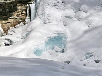
![]() On Tuesday, February 25th I had planned to go hiking at Trout Pond with Lisa at about 10:00 AM. We decided to delay in the hopes that the temperature would reach into the double digits. Just before I was ready to head out the ambulance pager went off and delayed the hike by about 2 hours. I called Lisa when I got back and she was still willing to get in a short hike so I threw my gear in the car and went downtown to pick her up and her shop. I decided not to take Sheila as the temperature was barely into the teens. She was disappointed and was I but I knew it was the right de3cisison. I wanted to get the hike1 in since I was about to start teaching biology at Liberty High School for about two weeks and knew I would have limited times to hike. We headed up the Quickway to Roscoe and then out Route 206 on the Rockland Flats. Just after the Roscoe Nursing Home, I turned left on Morton Hill Road and drove to the intersection with Russell Brook Road. There was very little space to park on the side of the road but I found a spot. We put on our snowshoes and started down the road toward the falls. I was cold as we started out but soon warmed up even though the trail was packed by snowmobile traffic and the going easier than breaking trail in fresh snow. As we walked down the road we listened for the sounds of water in the stream but heard almost none. We decided to go to the viewpoint over the upper falls. The snow here was deeper and not broken but we don't have too much trouble sliding down. The falls were completely frozen and I too a few pictures before we climbed back up to the road. A little farther down Lisa wanted to go off trail and bushwhack down to the bridge. We followed the trail she had made on an earlier trip and were soon crossing Russell Brook. We walked a little farther and then turned right to follow a path to the falls. The path was broken until the point where I wanted to go down to the stream bed. We decided to break our own path and again slid down to the streambed. The lower falls was completely frozen as was the water downstream from the falls. The ice at one spot on the falls was so thick that it was a sapphire color. I took quite a few shots at the falls. I took some pictures looking downstream and a few of Lisa by the falls. Climbing up the bank from the falls was a little difficult but we both made it taking slightly different routes. We walked over to the trail register, signed in and then headed back to the car. I had a little more time but Lisa had a meeting she could not miss. We stayed on the trail back to the lower parking area and then walked up the road to the car. We covered only 1.4 miles on our 1 hour hike but it was definitely better than staying home!
On Tuesday, February 25th I had planned to go hiking at Trout Pond with Lisa at about 10:00 AM. We decided to delay in the hopes that the temperature would reach into the double digits. Just before I was ready to head out the ambulance pager went off and delayed the hike by about 2 hours. I called Lisa when I got back and she was still willing to get in a short hike so I threw my gear in the car and went downtown to pick her up and her shop. I decided not to take Sheila as the temperature was barely into the teens. She was disappointed and was I but I knew it was the right de3cisison. I wanted to get the hike1 in since I was about to start teaching biology at Liberty High School for about two weeks and knew I would have limited times to hike. We headed up the Quickway to Roscoe and then out Route 206 on the Rockland Flats. Just after the Roscoe Nursing Home, I turned left on Morton Hill Road and drove to the intersection with Russell Brook Road. There was very little space to park on the side of the road but I found a spot. We put on our snowshoes and started down the road toward the falls. I was cold as we started out but soon warmed up even though the trail was packed by snowmobile traffic and the going easier than breaking trail in fresh snow. As we walked down the road we listened for the sounds of water in the stream but heard almost none. We decided to go to the viewpoint over the upper falls. The snow here was deeper and not broken but we don't have too much trouble sliding down. The falls were completely frozen and I too a few pictures before we climbed back up to the road. A little farther down Lisa wanted to go off trail and bushwhack down to the bridge. We followed the trail she had made on an earlier trip and were soon crossing Russell Brook. We walked a little farther and then turned right to follow a path to the falls. The path was broken until the point where I wanted to go down to the stream bed. We decided to break our own path and again slid down to the streambed. The lower falls was completely frozen as was the water downstream from the falls. The ice at one spot on the falls was so thick that it was a sapphire color. I took quite a few shots at the falls. I took some pictures looking downstream and a few of Lisa by the falls. Climbing up the bank from the falls was a little difficult but we both made it taking slightly different routes. We walked over to the trail register, signed in and then headed back to the car. I had a little more time but Lisa had a meeting she could not miss. We stayed on the trail back to the lower parking area and then walked up the road to the car. We covered only 1.4 miles on our 1 hour hike but it was definitely better than staying home!
![]()
![]()
![]()
![]() On Sunday, February 22nd the temperatures finally rose into the low 30's and the sun came out in full force. After church my wife and I decided to head to Frick Pond to do some snowshoeing. I had planned on doing a longer route somewhere but the ambulance had been busy I didn't get much sleep the night before. In addition, the recent snow made traveling the back roads interesting and we could not be sure what parking areas would be plowed. It may seem that returning again and again to the same area is monotonous but each hike is different. On this hike having Cindy with me would be very nice and the sunny skies were a welcome change. We got dressed and put our gear in the car leaving the house just before 11:30 AM. Sheila seemed particularly stoked as we headed up the DeBruce Road. As we turned onto Fish Hatchery Road, we noticed a "Poker Run" sign and knew that the snowmobilers would be out in force! I parked in the smaller parking area which was plowed and we quickly got our snowshoes on to start the hike at 11:45 AM. The storm the night before had left about 4 inches of new powder on the trail as we abated out the Quick Lake Trail to Frick Pond. The higher temperatures and direct sunlight were already starting to soften the snow and I knew that clumping could be a problem. I had broken most of the trail on the route I expected we would take which made hiking much easier than slogging through the more than 2 feet of snow. At the junction with the Loggers Loop Trail I noted that there was a faint trail in that direction. Sheila had decided to stay behind me and in front of Cindy most of the time as we headed left toward the pond. I began to get warm despite the temperature but not as warm as on some trips so I just opened my front zipper to dump some heat. We headed left to go down to the bridge across the outlet of Frick Pond. When we got to the bridge, the skies were bright and sunny and I decided to stop to take a few pictures of the pond. As I looked up at Flynn's Point, I could see it was covered in snow and appeared to have some frozen snow or ice on the trees. I took a picture of Cindy and Sheila on the bridge and then we continued along the trail. There was a snowdrift at the end of the bridge and another gigantic one in the creek downstream of the bridge. Getting over the snowdrift at the end of the bridge was not easy but we were soon on our way to the next trail junction.
On Sunday, February 22nd the temperatures finally rose into the low 30's and the sun came out in full force. After church my wife and I decided to head to Frick Pond to do some snowshoeing. I had planned on doing a longer route somewhere but the ambulance had been busy I didn't get much sleep the night before. In addition, the recent snow made traveling the back roads interesting and we could not be sure what parking areas would be plowed. It may seem that returning again and again to the same area is monotonous but each hike is different. On this hike having Cindy with me would be very nice and the sunny skies were a welcome change. We got dressed and put our gear in the car leaving the house just before 11:30 AM. Sheila seemed particularly stoked as we headed up the DeBruce Road. As we turned onto Fish Hatchery Road, we noticed a "Poker Run" sign and knew that the snowmobilers would be out in force! I parked in the smaller parking area which was plowed and we quickly got our snowshoes on to start the hike at 11:45 AM. The storm the night before had left about 4 inches of new powder on the trail as we abated out the Quick Lake Trail to Frick Pond. The higher temperatures and direct sunlight were already starting to soften the snow and I knew that clumping could be a problem. I had broken most of the trail on the route I expected we would take which made hiking much easier than slogging through the more than 2 feet of snow. At the junction with the Loggers Loop Trail I noted that there was a faint trail in that direction. Sheila had decided to stay behind me and in front of Cindy most of the time as we headed left toward the pond. I began to get warm despite the temperature but not as warm as on some trips so I just opened my front zipper to dump some heat. We headed left to go down to the bridge across the outlet of Frick Pond. When we got to the bridge, the skies were bright and sunny and I decided to stop to take a few pictures of the pond. As I looked up at Flynn's Point, I could see it was covered in snow and appeared to have some frozen snow or ice on the trees. I took a picture of Cindy and Sheila on the bridge and then we continued along the trail. There was a snowdrift at the end of the bridge and another gigantic one in the creek downstream of the bridge. Getting over the snowdrift at the end of the bridge was not easy but we were soon on our way to the next trail junction.
 When we arrived at the junction of the Quick Lake Trail and the trail around the pond, we headed to the left following the route I had broken out on a previous hike. The trail was also well-broken around the back of the pond and over the wooden causeways with just the new snow to walk through. I did notice that some of the snowshoers seemed a little inexperienced since they were walking side by side rather than single file. Walking single file conserves energy and allows one person to break the trail while the others walk behind to further break through the snow and pack the trail. Trading off positions make the going easier. We continued on the Quick Lake Trail crossing the small stream and heading toward Iron Wheel Junction. The trail is slightly uphill and the clumping snow made the going a little more difficult than I expected. We arrived at Iron Wheel junction at 12:50 PM after hiking 1.5 miles. The Loggers Loop Trail to the right was pretty well packed by snowmobiles but was not quite as hard as it had been on previous hikes. We turned right and I put Sheila on her leash as we could hear the sound of machines in both directions. As we walked, we stepped off the trail several times to allow snowmobiles to go by. All of the riders were courteous and slowed down as they passed us. At one point a group of machines stopped and a friend of ours took off his helmet. We had a brief conversation before heading in opposite directions. Cindy and I were both1 glad to be descending the small hill on the Loggers Loop to Times Square so that we no longer had to worry about the snowmobiles. We arrived there at 1:30 PM about 2.75 miles into the hike. At this point he had to decide whether to continue on the Loggers Loop or to turn right and walk around the back of Frick Pond. The trail around the pond was broken out and looked inviting while the Loggers Loop and only a faint depression from where I had broken it more than a week before. For this reason Cindy chose...the Loggers Loop.
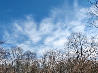 We started out with me following the faint trail I had made which worked out well since we were only sinking about 8 inches into the snow. As we started up the small hill, I lost the trail since there were so many drifts. I began to sink much deeper into the snow with required to lift my feet even higher to take the next step. The sun was still out and the temperatures were now above freezing so the snow seemed much "heavier" than before. It was a real battle but we were soon on the more level ground at the top of the hill. Here we found enormous drifts of snow that had come in off Frick Pond and they were much deeper than anything we had encountered so far. Fortunately, many of the drifts were consolidated enough that we could walk on top of them without sinking in! Soon the Quick Lake Trail was in sight and I was glad we had almost completed the loop. I started down off one of the drifts and sank almost to be waist in the unconsolidated snow on the lee side of the drift. I fought my way out while advising Cindy to stay on top of the drifts. We entered the open area just before the trail junction and I stopped to take a few final photos. The sky was blue with wispy white clouds in all directions. The sun sparkled off the snow which shoed no signs of a trail or even animal tracks. After taking a few shots, I put the camera in my pack and we walked to the trail junction where we turned left to go back to the parking area. When we were near the paring area, we heard voices and found two women ready to head out for a short snowshoe. They had rented snowshoes from Morgan Outdoors and were ready to get started. We told them what trails were broken and suggested they leave the tails to their MSR shoes in the car. They were without poles which both Cindy and I feel are essential to a snowshoe hike! It was 2:20 PM and we had covered 3.8 miles in 2 hours and 35 minutes with 20 minutes of stopped time and only 400 feet of elevation gain. This seemed like a short distance but our muscles told us otherwise!
![]()
![]()
![]()
![]()
![]() On Wednesday, February 18th I had planned to go back to Frick Pond and hike around the back of Frick Pond and then around the Loggers Loop to Iron Wheel Junction. From there I wanted to hike down the Quick Lake Trail through the fresh snow breaking the trail to the small stream where I had left off the day before. When the ambulance pager went off at 7:00 AM the temperature was -13 degrees and I knew that I probably wouldn't get to hike! After the call, I eventually went to a friend's house to outfit him with my older Tubbs 30 inch snowshoes. As I started home from his house, I found that the temperature had risen to 15 above and the sun was shining. I decided to try the hike after all and went home to change into my hiking clothes. I got my gear into the car along with Sheila and headed to Frick Pond around 11:15 AM. Sheila was almost frantic with anticipation as I drove up Fish Hatchery Road! When we arrived at the parking area, both the pulloff and the lot were plowed leaving room for at least 10 cars. On this day no one else was around so I put on my TSL Symbioz Elite snowshoes and started out on the Quick Lake Trail toward Frick Pond at 11:30 AM. The temperature was only 17 degrees and I was a little concerned about Sheila being too cold especially on her feet. As we headed out on the trail, there was at least 24 inches of snow but the trail was broken starting at the parking lot from my efforts the day before and several other hikers before me. The broken trail continued as we made the left onto the woods road that leads out to Frick Pond. At the junction with the Loggers Loop Trail I noted that there was no broken trail in that direction. Sheila was ahead of me on the trail trotting along and occasionally bounding through the snow following an animal trail! I began to get warm despite the temperature but not as warm as on some trips so I just opened my front zipper to dump some heat. We headed left to go down to the bridge across the outlet of Frick Pond. When we got to the bridge, the skies were bright and sunny but I decided to continue the hike and take pictures on the return trip. There was a snowdrift at the end of the bridge and another gigantic one in the creek downstream of the bridge both of which I had seen the day before. Getting over the snowdrift at the end of the bridge was not easy but we were soon on our way to the next trail junction.
On Wednesday, February 18th I had planned to go back to Frick Pond and hike around the back of Frick Pond and then around the Loggers Loop to Iron Wheel Junction. From there I wanted to hike down the Quick Lake Trail through the fresh snow breaking the trail to the small stream where I had left off the day before. When the ambulance pager went off at 7:00 AM the temperature was -13 degrees and I knew that I probably wouldn't get to hike! After the call, I eventually went to a friend's house to outfit him with my older Tubbs 30 inch snowshoes. As I started home from his house, I found that the temperature had risen to 15 above and the sun was shining. I decided to try the hike after all and went home to change into my hiking clothes. I got my gear into the car along with Sheila and headed to Frick Pond around 11:15 AM. Sheila was almost frantic with anticipation as I drove up Fish Hatchery Road! When we arrived at the parking area, both the pulloff and the lot were plowed leaving room for at least 10 cars. On this day no one else was around so I put on my TSL Symbioz Elite snowshoes and started out on the Quick Lake Trail toward Frick Pond at 11:30 AM. The temperature was only 17 degrees and I was a little concerned about Sheila being too cold especially on her feet. As we headed out on the trail, there was at least 24 inches of snow but the trail was broken starting at the parking lot from my efforts the day before and several other hikers before me. The broken trail continued as we made the left onto the woods road that leads out to Frick Pond. At the junction with the Loggers Loop Trail I noted that there was no broken trail in that direction. Sheila was ahead of me on the trail trotting along and occasionally bounding through the snow following an animal trail! I began to get warm despite the temperature but not as warm as on some trips so I just opened my front zipper to dump some heat. We headed left to go down to the bridge across the outlet of Frick Pond. When we got to the bridge, the skies were bright and sunny but I decided to continue the hike and take pictures on the return trip. There was a snowdrift at the end of the bridge and another gigantic one in the creek downstream of the bridge both of which I had seen the day before. Getting over the snowdrift at the end of the bridge was not easy but we were soon on our way to the next trail junction.
 When we arrived at the junction of the Quick Lake Trail and the trail around the pond, we headed to the right following the route many of the other hikers had taken. The trail was well-broken around the back of the pond and over the wooden causeways. I did notice that some of the snowshoers seemed a little inexperienced since they were walking side by side rather than single file. Walking single file conserves energy and allows one person to break the trail while the others walk behind to further break through the snow and pack the trail. Trading off positions make the going easier. We continued on around the pond to Times Square where I was glad to find the Loggers Loop completely packed by snowmobiles from Times Square to Iron Wheel Junction. We turned left and started uphill for .85 miles gaining about 185 feet. The slope was very gentle and the packed trail allowed us to move quickly. I stopped at Times Square to take some pictures and again along the way to take a few more shots of the snowy woods and some rocky cliffs. By 12:30 PM we had walked 2.4 miles and were at Iron Wheel Junction. We turned left onto the Quick Lake Trail and immediately were breaking Trail through 24 inches of snow. The route was downhill but the snow was deep and required an effort to break the trail. Sheila dashed out ahead and actually broke the trail for me! I think the effect was partly psychological but it was nice to have her in the lead. As we approached an open area, We stopped and I took a few pictures. As I put my pack on, Sheila and I both heard the voices of approaching hikers. We started to hike and met two women on snowshoes heading toward us. One of the women was Deanna, a volunteer who maintains the trail around Frick Pond. We chatted briefly and I invited her to the season's first meeting of the Willowemoc Trail Crew at Morgan outdoors on March 1st. We headed our separate ways and the going was made easier as Sheila and I used the trail the had broken to get to the small stream where we had turned around the day before. From there the walk was even easier as Sheila and I had broken the trail and the two women had further compacted it. By 1:10 PM we had walked 3.3 miles and were again crossing the bridge at Frick Pond. We stopped briefly so that I could take a few pictures and then continued back to the car. We arrived back at the car at 1:30 PM having hiked 3.9 miles in almost exactly 2 hours. Our pace of right around 2 mph surprised me since the conditions were challenging although the vertical gain was only 400 feet. The forecast for Friday was for VERY cold temperatures and windfalls hitting 0 below zero so I was glad to get in a hike. The temperature had risen to about 23 degrees meaning there had been a 36 degree increase since my ambulance call in the early morning.
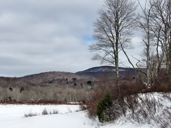
![]() On Tuesday, February 17th I wanted to get out and snowshoe in some real snow after a week on staying inside due to the extreme cold and poor road conditions. When I woke up, the temperature was -6 degrees but it started to rise slightly as the morning wore on. I waited until the temperature rose into the high teens and then got my gear into the car along with Sheila and headed to Frick Pond around 11:15 AM. Sheila was almost frantic with anticipation as I drove up Fish Hatchery Road! When we arrived at the parking area, both the pulloff and the lot were plowed leaving room for at least 10 cars. On this day no one else was around so I put on my TSL Symbioz Elite snowshoes and started out on the Quick Lake Trail toward Frick Pond at 11:30 AM. The temperature was only 17 degrees and I was a little concerned about Sheila being too cold especially on her feet. I thought we might hike the Loggers Loop heading up the Quick Lake Trail to Iron Wheel Junction first and then from there over to Times Square and back. I was pretty sure the Loggers Loop would be packed by snowmobile traffic which would make the going easier. As we headed out on the trail, there was at least 24 inches of snow but a trail was broken starting at the parking lot. This was the trail that I broke on an earlier trip but had been used more recently by other hikers. The broken trail continued as we made the left onto the woods road that leads out to Frick Pond. At the junction with the Loggers Loop Trail I noted that there was no broken trail over the Loggers Loop. Sheila was ahead of me on the trail trotting along and occasionally bounding through the snow following an animal trail! I began to get warm despite the temperature but not as warm as on some trips so I just opened my front zipper to dump some heat. We headed left to go down to the bridge across the outlet of Frick Pond. When we got to the bridge, the skies were cloudy and Frick Pond was completed frozen over. There was also a snowdrift at the end of the bridge and another gigantic one in the creek downstream of the bridge. I dropped my pack and took out the camera to get some shots of the pond and the snowdrifts. The wind was blowing a little so I quickly finished my photography and got moving again.
On Tuesday, February 17th I wanted to get out and snowshoe in some real snow after a week on staying inside due to the extreme cold and poor road conditions. When I woke up, the temperature was -6 degrees but it started to rise slightly as the morning wore on. I waited until the temperature rose into the high teens and then got my gear into the car along with Sheila and headed to Frick Pond around 11:15 AM. Sheila was almost frantic with anticipation as I drove up Fish Hatchery Road! When we arrived at the parking area, both the pulloff and the lot were plowed leaving room for at least 10 cars. On this day no one else was around so I put on my TSL Symbioz Elite snowshoes and started out on the Quick Lake Trail toward Frick Pond at 11:30 AM. The temperature was only 17 degrees and I was a little concerned about Sheila being too cold especially on her feet. I thought we might hike the Loggers Loop heading up the Quick Lake Trail to Iron Wheel Junction first and then from there over to Times Square and back. I was pretty sure the Loggers Loop would be packed by snowmobile traffic which would make the going easier. As we headed out on the trail, there was at least 24 inches of snow but a trail was broken starting at the parking lot. This was the trail that I broke on an earlier trip but had been used more recently by other hikers. The broken trail continued as we made the left onto the woods road that leads out to Frick Pond. At the junction with the Loggers Loop Trail I noted that there was no broken trail over the Loggers Loop. Sheila was ahead of me on the trail trotting along and occasionally bounding through the snow following an animal trail! I began to get warm despite the temperature but not as warm as on some trips so I just opened my front zipper to dump some heat. We headed left to go down to the bridge across the outlet of Frick Pond. When we got to the bridge, the skies were cloudy and Frick Pond was completed frozen over. There was also a snowdrift at the end of the bridge and another gigantic one in the creek downstream of the bridge. I dropped my pack and took out the camera to get some shots of the pond and the snowdrifts. The wind was blowing a little so I quickly finished my photography and got moving again.
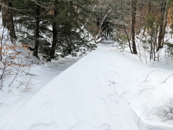 Getting over the snowdrift at the end of the bridge was not easy but we were soon on our way to the next trail junction. When we arrived at the junction of the Quick Lake Trail and the trail around the pond, it was obvious that the other hikers had stayed to the right around the pond. The Quick Lake Trail was completely unbroken although I could see a faint track buried under the snow. I decided that we would stay to the right and try to break the trail to the Loggers Loop Trail at Iron Wheel Junction. I hoped that the Loggers Loop would be packed by snowmobiles and we could use it to return to Times Square. As we started out, Sheila led the way through about two feet of powdery snow. She would bound ahead and the trail she broke seemed to help. The trail from Frick Pond is slightly uphill but under most conditions this is not noticeable. The deep snow and slight uphill began to take their toll as first Sheila and then I became increasingly more tired. Sheila dropped behind me which made breaking trail by myself much harder. I hoped when I got under the spruce trees that the snow would not be as deep but the drifts there were just as bad as out in the open. As we approached the small stream on the trail, I decided that was as far as we would go on this day. Iron Wheel Junction was only .3 miles ahead but I knew I could not be sure that it was packed. Having to break another 1.5 miles of trail was out of the question. When we got to the stream, I took a few pictures and then turned around. The walk back was easier as the trail was broken out a little. We were back at the car at 1:10 PM having hiked 2.3 miles in 1 hour and 35 minutes with a vertical gain of only 225 feet. I was tired enough that I knew I had made the correct decision to turn back. My plan for the next hike was to hike to Frick Pond and around the back to Times Square. If the Loggers Loop was packed, we could hike it to Times Square and then break the trail to the stream where we had turned around.
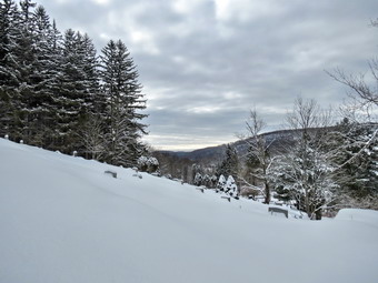
![]() On Tuesday, February 10th I knew I wanted to get in a snowshoe hike after another snowstorm had dropped several more inches of snow on Livingston Manor. I had stayed home Monday because the roads were bad and so that I could cover ambulance calls. By Tuesday morning the roads were mostly cleared and I though I would take Sheila to Frick Pond for an outing on the fresh snow. I got my gear and Sheila into the car and headed toward Frick Pond just before 9:00 AM. DeBrice Road was not in good shape with snow and ice still on the road and some more snow drifting in some places. When I made the left onto Fish Hatchery Road the situation was worse but the road was passable. When we arrived at the parking areas for Frick Pond, I was disappointed to find the they had not been plowed. I probably could have parked in the smaller pullout but did not want to get stuck or block the snowplows when they came. I turned the car around and headed back home. Sheila was quite distressed and made her feelings known all the way back to town! I decided to park at the church and hike the same route on Round Top that we had hiked on Saturday. I felt that, although I had limited time, the trail had been broken out and would be easier and quicker to hike. I parked at the church and we were hiking by 9:35 AM. The loop avoids the private property of an owner who had made it clear that they do not want others on their land. I again wore my new TSL Symbioz �lite snowshoes since I have been very impressed with then so far. I think I will have to schedule a hike to steeper terrain to see how well they grip on more extreme ascents. We walked behind the church and headed up the steep hill to the top of the cemetery following the track from several days before which was still well broken out. Although the temperature was barely 20 degrees the sun was out and I stopped to take a few pictures from the top of the hill before heading into the woods. We turned left and headed into the woods following a woods road as it ascended the hill. At the first junction, we turned right and continued to follow another road passed some cliffs. It was much easier going since the track was broken but there was a least four inches of new snow which made things feel "fresh". We continued on our usual route up the hill staying a little to the left and hitting another woods road. We turned right and continued to follow the woods road passing the road that goes left to the quarry. After heading down a slight hill we stayed a little to the left to head toward the next hill after Round Top which is actually about 50 feet higher. At this point I thought I might do the loop in reverse but I looked at the time and decided to ascend the hill and then come back down without doing the loop. As we began the ascent, I lowered the televators on my snowshoes to reduce the strain on my calves. Once at the top of the hill, I turned around to retrace my steps but just didn't feel right. I passed for a moment, considered the time I had and decided to complete the loop. I lifted the tips on my snowshoes and was able to "ski" down the slope on the other side with just the right amount of abandon and control. Before the descent, I lifted the televators and was happy they came down very easily, stayed put throughout the ascent and were easy to flip back up out of the way. We followed the woods road as it looped around the hill to the left back to the point where we had started the ascent. We followed our well-broken path back to the cemetery and then glided down the hill to the church parking area. I was back at the car at 11:15 AM having hiked about 2.6 miles in 1 hour and 40 minutes.
On Tuesday, February 10th I knew I wanted to get in a snowshoe hike after another snowstorm had dropped several more inches of snow on Livingston Manor. I had stayed home Monday because the roads were bad and so that I could cover ambulance calls. By Tuesday morning the roads were mostly cleared and I though I would take Sheila to Frick Pond for an outing on the fresh snow. I got my gear and Sheila into the car and headed toward Frick Pond just before 9:00 AM. DeBrice Road was not in good shape with snow and ice still on the road and some more snow drifting in some places. When I made the left onto Fish Hatchery Road the situation was worse but the road was passable. When we arrived at the parking areas for Frick Pond, I was disappointed to find the they had not been plowed. I probably could have parked in the smaller pullout but did not want to get stuck or block the snowplows when they came. I turned the car around and headed back home. Sheila was quite distressed and made her feelings known all the way back to town! I decided to park at the church and hike the same route on Round Top that we had hiked on Saturday. I felt that, although I had limited time, the trail had been broken out and would be easier and quicker to hike. I parked at the church and we were hiking by 9:35 AM. The loop avoids the private property of an owner who had made it clear that they do not want others on their land. I again wore my new TSL Symbioz �lite snowshoes since I have been very impressed with then so far. I think I will have to schedule a hike to steeper terrain to see how well they grip on more extreme ascents. We walked behind the church and headed up the steep hill to the top of the cemetery following the track from several days before which was still well broken out. Although the temperature was barely 20 degrees the sun was out and I stopped to take a few pictures from the top of the hill before heading into the woods. We turned left and headed into the woods following a woods road as it ascended the hill. At the first junction, we turned right and continued to follow another road passed some cliffs. It was much easier going since the track was broken but there was a least four inches of new snow which made things feel "fresh". We continued on our usual route up the hill staying a little to the left and hitting another woods road. We turned right and continued to follow the woods road passing the road that goes left to the quarry. After heading down a slight hill we stayed a little to the left to head toward the next hill after Round Top which is actually about 50 feet higher. At this point I thought I might do the loop in reverse but I looked at the time and decided to ascend the hill and then come back down without doing the loop. As we began the ascent, I lowered the televators on my snowshoes to reduce the strain on my calves. Once at the top of the hill, I turned around to retrace my steps but just didn't feel right. I passed for a moment, considered the time I had and decided to complete the loop. I lifted the tips on my snowshoes and was able to "ski" down the slope on the other side with just the right amount of abandon and control. Before the descent, I lifted the televators and was happy they came down very easily, stayed put throughout the ascent and were easy to flip back up out of the way. We followed the woods road as it looped around the hill to the left back to the point where we had started the ascent. We followed our well-broken path back to the cemetery and then glided down the hill to the church parking area. I was back at the car at 11:15 AM having hiked about 2.6 miles in 1 hour and 40 minutes.
On Saturday, February 7th I knew I wanted to get in a snowshoe hike before the next big snowstorm hit Livingston Manor. I had planned to go to Frick Pond but discovered that a few people wanted to hike on Round Top. The appointed time for the hike was 11:00 AM by which time the temperature had climbed from single digits to the upper 20's. Cindy and I put on our gear and headed across the street to the church parking lot. We met a small group of people there and started up the hill behind our church to do a loop. I knew we would have to avoid the private property of an owner who had made it clear that they did not want others on their land. I was anxious to continue to evaluate my new TSL Symbioz �lite snowshoes in the snow. So far they had proven to have good traction and great bindings. There was another dog in then group but she and Sheila seemed to get along well. We walked behind the church and headed up the steep hill to the top of the cemetery. Our track from several days before was still well broken out and we followed some of the younger members of the group. We stopped to take a picture of the group and then headed into the woods following a woods road as it ascended the hill. At the first junction, we turned right and continued to follow another road passed some cliffs. It was much easier going since the track was broken and others were hiking ahead of us. We continued on our usual route up the hill staying a little to the left and hitting another woods road. We turned right and continued to follow the woods road passing the road that goes left to the quarry. After heading down a slight hill we stayed a little to the left to ascend the next hill after Round Top which is actually about 50 feet higher. As we began the ascent, I lowered the elevators on my snowshoes to reduce the strain on my calves. I lifted the tips on my snowshoes and was able to "ski" down the slow with just the right amount of abandon and control. They came down very easily and stayed put throughout the ascent. Near the top of the climb Cindy decided to turn around and follow our route back to the house. I kept Sheila with me and the rest of the group continued across the top of the hill and down the other side. I lowered the snowshoe elevators with no problem. We followed the woods road as it looped around the hill back to the point where we had started the ascent. We followed our well-broken path back to the cemetery and then glided down the hill to the church parking area. I was back at the house just after 1:00 PM having hiked about 3 miles in 2 hours.
![]()
![]()
![]()
![]()
![]() On Thursday, February 5th I wanted to get out and snowshoe in some real snow! When I woke up, the temperature below 0 degrees but started to rise slightly as the morning wore on. I didn't want to wait too long so I got my gear into the car along with Sheila and headed to Frick Pond just before 9:00 AM. When we arrived at the parking area, both the pulloff and the lot were plowed leaving room for at least 10 cars. On this day no one else was around so I out on my TSL Symbioz Elite snowshoes and started out on the Quick Lake Trail toward Frick Pond at 9:15 AM. The temperature was only 15 degrees and I was a little concerned about Sheila being too cold especially her feet. I had decided to hike the loop around Frick Pond which is only about 2 miles. I felt this was a good compromise and would allow us to get some exercise without succumbing to the cold! As we headed out on the trail, there was 12 to 18 inches of snow which as completely pristine and unbroken. The going was a little tough but the snowshoes performed well. Sheila was ahead of me bounding through the snow and the track she made was almost as good as another snowshoer breaking trail! Within minutes I was warm despite the temperature and the increasing wind. The wind had been blowing at the trailhead but now was approaching 15 to 20 mph and the trees were creaking ominously. When we got to the trail register, the trail along the woods road had been broken out by someone on snowshoes which made the going easier. I was grateful since I had somehow forgotten to put on my gaiters. The Mountain Hardwear Winter Wander pants have a drawstring at the cuff and pulling that tight kept out all the snow. At the trail junction with the yellow Loggers Loop Trail, I decided to go right and do the loop around the pond anticlockwise. Unfortunately, the trail was not broken as we headed out on the Loggers Loop and the snow had drifted to over 24 inches. Sheila was still bounding along ahead of me but would occasionally take a break by following in my tracks. The skies were so blue that I stopped to take a few pictures of the snow covered landscape against the blue skies with white clouds. The sun was out and made the day seem warmer than it was. I do not often walk this loop anticlockwise and was surprised that it was a little uphill and a little longer than I thought. Soon we were walking downhill toward Times Square although it was still some work hiking through the drifts. At 10:00 AM we arrived at Times Square after hiking almost exactly one mile. I was tired but felt great and thought about doing the complete Loggers Loop or turning up the Big Rock Trail. In the end I decided to stick to the plan despite that fact that Friday and Saturday were forecast to be much colder. We turned left and headed around the back of Frick Pond on a trail partially broken by wildlife. We crossed the two small bridges and entered the evergreen groves where there was quite a bit less snow on the ground. I stopped to take a few pictures under the trees and then stopped again to take some shots as we approached the longer sections of boardwalk. As we continued on toward the outlet of Frick Pond, I noticed the wind had picked up, the sun had disappeared and there was a snow squall in progress. Near the bridge, we again picked up the broken trail as the previous hiker had apparently walked part way around the pond and then reversed his course. We stopped at the bridge where I took a few more shots before heading back to the car. We were back at 10:45 AM having hiked 2.2 miles in 1.5 hours with only about 200 feet of elevation gain. The temperature had risen to 18 degrees and the sun was out again.
On Thursday, February 5th I wanted to get out and snowshoe in some real snow! When I woke up, the temperature below 0 degrees but started to rise slightly as the morning wore on. I didn't want to wait too long so I got my gear into the car along with Sheila and headed to Frick Pond just before 9:00 AM. When we arrived at the parking area, both the pulloff and the lot were plowed leaving room for at least 10 cars. On this day no one else was around so I out on my TSL Symbioz Elite snowshoes and started out on the Quick Lake Trail toward Frick Pond at 9:15 AM. The temperature was only 15 degrees and I was a little concerned about Sheila being too cold especially her feet. I had decided to hike the loop around Frick Pond which is only about 2 miles. I felt this was a good compromise and would allow us to get some exercise without succumbing to the cold! As we headed out on the trail, there was 12 to 18 inches of snow which as completely pristine and unbroken. The going was a little tough but the snowshoes performed well. Sheila was ahead of me bounding through the snow and the track she made was almost as good as another snowshoer breaking trail! Within minutes I was warm despite the temperature and the increasing wind. The wind had been blowing at the trailhead but now was approaching 15 to 20 mph and the trees were creaking ominously. When we got to the trail register, the trail along the woods road had been broken out by someone on snowshoes which made the going easier. I was grateful since I had somehow forgotten to put on my gaiters. The Mountain Hardwear Winter Wander pants have a drawstring at the cuff and pulling that tight kept out all the snow. At the trail junction with the yellow Loggers Loop Trail, I decided to go right and do the loop around the pond anticlockwise. Unfortunately, the trail was not broken as we headed out on the Loggers Loop and the snow had drifted to over 24 inches. Sheila was still bounding along ahead of me but would occasionally take a break by following in my tracks. The skies were so blue that I stopped to take a few pictures of the snow covered landscape against the blue skies with white clouds. The sun was out and made the day seem warmer than it was. I do not often walk this loop anticlockwise and was surprised that it was a little uphill and a little longer than I thought. Soon we were walking downhill toward Times Square although it was still some work hiking through the drifts. At 10:00 AM we arrived at Times Square after hiking almost exactly one mile. I was tired but felt great and thought about doing the complete Loggers Loop or turning up the Big Rock Trail. In the end I decided to stick to the plan despite that fact that Friday and Saturday were forecast to be much colder. We turned left and headed around the back of Frick Pond on a trail partially broken by wildlife. We crossed the two small bridges and entered the evergreen groves where there was quite a bit less snow on the ground. I stopped to take a few pictures under the trees and then stopped again to take some shots as we approached the longer sections of boardwalk. As we continued on toward the outlet of Frick Pond, I noticed the wind had picked up, the sun had disappeared and there was a snow squall in progress. Near the bridge, we again picked up the broken trail as the previous hiker had apparently walked part way around the pond and then reversed his course. We stopped at the bridge where I took a few more shots before heading back to the car. We were back at 10:45 AM having hiked 2.2 miles in 1.5 hours with only about 200 feet of elevation gain. The temperature had risen to 18 degrees and the sun was out again.
![]() On Wednesday, February 4th I had wanted to get out of the house after a storm on Monday had dumped a foot of snow on Livingston Manor with another 3 inches added overnight on Tuesday. The temperature all morning was below 20 degrees which is a little cold for Sheila's feet so I delayed leaving until almost noon. By the time I was ready to go out I only had time for a quick, local hike. I decided to snowshoe up the hill behind our church and do a short loop on Round Top. I knew I would have to avoid the private property of an owner who had made it clear that they did not want others on their land. I was anxious to try out by new TSL Symbioz �lite snowshoes in the snow. I had worn them on Sunday at Mohonk but there was not enough snow to really test them out. Just before noon I put on the snowshoes and headed across the street. Sheila seemed ready to go as she bounded through the snow which was most times halfway up her body. We walked behind the church and headed up the steep hill to the top of the cemetery. Someone else had been out on snowshoes so I followed their track to the top of the hill. I stopped to take some pictures of Livingston Manor and the hills beyond. After putting the camera away, we headed into the woods and followed a woods road as it ascended the hill. We turned right and continued to follow another road passed some cliffs. It was not easy going but the snowshoes performed well. The TSL's flotation matched most of the other modern snowshoes I own. What separates these snowshoes is the binding which lock my feet and particularly my heels in place. I like the fact that my heels always hit at the same spot on the snowshoe. I stopped for a moment with Sheila ahead of me up the hill. I got out my camera and set it for video. I called Sheila and started recording as she came toward me wit the video lasting about 10 seconds. We continued on our usual route up the hill to another woods road. Instead of going for a longer loop, I decided to turn around and take a shorter route back. As we walked along the top of the cliffs, I wandered a little off course and started to see the State Route 17 through the trees. I adjusted my direction and we were soon at the lookout over Livingston Manor. This spot is now overgrown with trees so I decided not to take pictures. We headed down the hill through at least 15 inches of snow and connected to our previous path. We followed the path back to the cemetery and won to the church. We crossed the road and were back at the house by 1:00 PM.
On Wednesday, February 4th I had wanted to get out of the house after a storm on Monday had dumped a foot of snow on Livingston Manor with another 3 inches added overnight on Tuesday. The temperature all morning was below 20 degrees which is a little cold for Sheila's feet so I delayed leaving until almost noon. By the time I was ready to go out I only had time for a quick, local hike. I decided to snowshoe up the hill behind our church and do a short loop on Round Top. I knew I would have to avoid the private property of an owner who had made it clear that they did not want others on their land. I was anxious to try out by new TSL Symbioz �lite snowshoes in the snow. I had worn them on Sunday at Mohonk but there was not enough snow to really test them out. Just before noon I put on the snowshoes and headed across the street. Sheila seemed ready to go as she bounded through the snow which was most times halfway up her body. We walked behind the church and headed up the steep hill to the top of the cemetery. Someone else had been out on snowshoes so I followed their track to the top of the hill. I stopped to take some pictures of Livingston Manor and the hills beyond. After putting the camera away, we headed into the woods and followed a woods road as it ascended the hill. We turned right and continued to follow another road passed some cliffs. It was not easy going but the snowshoes performed well. The TSL's flotation matched most of the other modern snowshoes I own. What separates these snowshoes is the binding which lock my feet and particularly my heels in place. I like the fact that my heels always hit at the same spot on the snowshoe. I stopped for a moment with Sheila ahead of me up the hill. I got out my camera and set it for video. I called Sheila and started recording as she came toward me wit the video lasting about 10 seconds. We continued on our usual route up the hill to another woods road. Instead of going for a longer loop, I decided to turn around and take a shorter route back. As we walked along the top of the cliffs, I wandered a little off course and started to see the State Route 17 through the trees. I adjusted my direction and we were soon at the lookout over Livingston Manor. This spot is now overgrown with trees so I decided not to take pictures. We headed down the hill through at least 15 inches of snow and connected to our previous path. We followed the path back to the cemetery and won to the church. We crossed the road and were back at the house by 1:00 PM.
![]()
![]()
![]()
![]()
![]() On Sunday, February 1st I had wanted to get out of the house after a weak of brutally cold weather and ice. The blizzard that was supposed to drop a foot of snow had fizzled out leaving only a few inches of snow. I suggested to Cindy that we go to the Mohonk Preserve after church to hike a section of the SRT that would connect two other sections I had already completed. My plan was to start at the Coxing trailhead and hike north to the spot wand I had turned around on our previous hike. I estimated it would be a little over 5 miles. I hoped that more snow had fallen in the Gunks and that I could try out my new TSL Symbioz �lite snowshoes. Although sunny skies were predicted, the sky was predominately overcast as we left church. The temperature was in the low 20's and there was a slight breeze. Cindy announced that she would be staying home so I quickly got my gear together, put Sheila in the car and headed out of Livingston Manor at a little before 11:30 AM. I drove east on Route 17 heading to Liberty. From Liberty I took Route 52 to Ellenville and got on Route 209 north toward Kingston. After a few miles, I made a right on Route 44/55 heading over the mountain toward New Paltz. We passed the main entrance to Minnewaska Park and continued until Trapps Road appeared on the left just after the Minnewaska park office. The road was rough but clear. When I got to Clove Road, I turned left and drove down to the Coxing Trailhead. There were no cars parked and I noticed that there was a soon on the gate that warned about blocking the entrance. I parked as far over to the left as possible leaving room for emergency vehicle access. I got out of the car and walked across the road to the trail to evaluate the amount of snow. I was disappointed to find that there wasn't much more snow than in Livingston Manor and it had been trampled down by other hikers. I decided there was enough snow and ice to wear the snowshoes for traction if not for flotation. I put on the snowshoes which I had previously adjusted and readjusted them. I let a very impatient Sheila out of that car and immediately put her on her leash to cross the road at 12:15 PM. After crossing the road, we walked down the wide Old Minnewaska Trail toward the bridge over the Coxing Kill. There were some children playing near the bridge so I kept Sheila on her leash until we were well passed the stream.
On Sunday, February 1st I had wanted to get out of the house after a weak of brutally cold weather and ice. The blizzard that was supposed to drop a foot of snow had fizzled out leaving only a few inches of snow. I suggested to Cindy that we go to the Mohonk Preserve after church to hike a section of the SRT that would connect two other sections I had already completed. My plan was to start at the Coxing trailhead and hike north to the spot wand I had turned around on our previous hike. I estimated it would be a little over 5 miles. I hoped that more snow had fallen in the Gunks and that I could try out my new TSL Symbioz �lite snowshoes. Although sunny skies were predicted, the sky was predominately overcast as we left church. The temperature was in the low 20's and there was a slight breeze. Cindy announced that she would be staying home so I quickly got my gear together, put Sheila in the car and headed out of Livingston Manor at a little before 11:30 AM. I drove east on Route 17 heading to Liberty. From Liberty I took Route 52 to Ellenville and got on Route 209 north toward Kingston. After a few miles, I made a right on Route 44/55 heading over the mountain toward New Paltz. We passed the main entrance to Minnewaska Park and continued until Trapps Road appeared on the left just after the Minnewaska park office. The road was rough but clear. When I got to Clove Road, I turned left and drove down to the Coxing Trailhead. There were no cars parked and I noticed that there was a soon on the gate that warned about blocking the entrance. I parked as far over to the left as possible leaving room for emergency vehicle access. I got out of the car and walked across the road to the trail to evaluate the amount of snow. I was disappointed to find that there wasn't much more snow than in Livingston Manor and it had been trampled down by other hikers. I decided there was enough snow and ice to wear the snowshoes for traction if not for flotation. I put on the snowshoes which I had previously adjusted and readjusted them. I let a very impatient Sheila out of that car and immediately put her on her leash to cross the road at 12:15 PM. After crossing the road, we walked down the wide Old Minnewaska Trail toward the bridge over the Coxing Kill. There were some children playing near the bridge so I kept Sheila on her leash until we were well passed the stream.
 The weather was completely different than in Livingston Manor with bright blue skies and puffy white clouds. There was plenty of sun and the temperature at the car was about 33 degrees. I had dressed in layers more appropriate for the mid 20's and I was soon opening zippers to dump some heat. There was not much snow on the trail but the snowshoes helped give me traction on the ice. I was immediately impressed by the binding on the TSL snowshoes which were comfortable but held my feet firmly in place. They are a little narrower than some that I have and I am anxious to try them in deeper snow. The Old Minnewaska Trail ascends gently from the Coxing Trailhead and in a few areas rolls down and then up. At about .7 miles we came to the site where a bridge once spanned a stream. There isn't much of a stream left and the bridge no longer exists. We descended the bank and then ascended the other side. Soon some views to the north and west appeared to the left of the trail although there were trees in the way. I had been here before and turned around. Soon we were passing what I recognized as the "big tree" where I had ended a previous hike. From this point on the we were covering new territory. A view open views presented themselves but I decided I wanted to reach my destination and would take pictures on the way back. At about 2 miles we came to a sign indicating that the Old Minnewaska Trail continued straight ahead and the Undivided Lot Trail turned to the left. We headed left and I immediately found that the trail was now more trail than woods road. We immediately began to descend over rock outcroppings some of which were barely covered with snow. I winced each time I heard the teeth on the snowshoes scrape the rock! We lost about 150 feet of elevation until we were at the base of a cliff band. I looked at the trail blazes and I could see that they followed a route that ascended along and through the cliffs. As we started to climb, I debated removing the snowshoes as the amount of snow decreased to almost nothing. In the end I kept them on as I was following snowshoes tracks left by another hiker.
 The climb began at about 2.4 miles and was only 80 feet of vertical gain. The problem was the lack of snow and the fact that it was a 25% grade. Soon we were at the top and I could see a stone chimney ahead. We walked to the chimney and then passed it so that I could be sure I connected the two sections of trail. We turned around and walked to the chimney were I dropped my pack. I took some pictures of the chimney and got a drink. I noticed that the skies had become overcast and that there was little sun left. The wind has also picked up and I was getting cooled off. I pulled up some zippers and shouldered my pack to begin the return trip at 1:30 PM. I was not looking forward to the descent of the cliffs but it went better than I had thought. Once we were back on more level ground, I found a lookout and took some pictures of much the same view as the previous hike. A little farther along I found another viewpoint that was even less obstructed and took a few more shots. After this, I decided to keep the camera in the bag and get back to the car. At 3.1 miles we were back at the trail junction where we turned right to get on the Old Minnewaska Trail. The trail ascended briefly before beginning the long descent toward the trailhead. The skies grew ever darker and I began to expect that the storm that was predicted was coming early. At 5 miles we were back at the bridge over the Coxing Kill. I walked across the bridge and a little downstream to take a few shots of the bridge and the frozen stream. Back on the main trail I walked over to the kiosk and read some of the information about the Smiley family and the ecology of the Coxing Kill. We walked back to the car where we arrived at 3:00 PM having hiked 5.2 miles in 2 hours and 45 minutes with a total ascent of about 900 feet.
![]()
![]()
![]()
![]()
![]() On Friday, January 23rd I had wanted to go to the Mohonk Preserve as I had purchased a membership for my wife and I on my last hike. I also wanted to hike another piece of the Shawangunk Ridge Trail from the Spring Farm Trailhead toward the point where I had turned around on them last hike on the Old Minnewaska Trail. Cindy wanted to go with us and we were in no real hurry to get started as the temperature was supposed to rise throughout the day. We left Livingston Manor shortly after 10:00 AM with our spikes in my pack but without snowshoes. I knew from my hike on Monday that there would be ice but very little snow. I drove east on Route 17 heading to Liberty. From Liberty I took Route 52 to Ellenville and got on Route 209 north toward Kingston. After a few miles, I made a right on Route 44/55 heading over the mountain toward New Paltz. We passed the main entrance to Minnewaska Park and continued through the hairpin turn to the junction with Route 299. We turned left here and drove toward New Paltz turning left on Springtown road and then left onto Mountain Rest Road. Mountain Rest Road eventually becomes Mohonk road and we continued on it passing the entrance to the Mohonk Mountain House. After about a mile I turned right on Upper Knolls Road at the sign for the Spring Farm Trailhead and at the point where the main road made a sweeping turn to the left. We pulled up to the small gatehouse and showed our passes. After a short conversation with the attendant, I parked in the parking lot where there was only one car present. We decided to take our spike with us rather than put them on. There was a slight breeze blowing and the temperature had not yet risen into the 30's. We walked back toward the gatehouse and started out Upper Knolls Road to begin our hike at 11:30 AM. Just passed the gatehouse, we turned right onto the Chapel Trail which took us through a field to the woods.
On Friday, January 23rd I had wanted to go to the Mohonk Preserve as I had purchased a membership for my wife and I on my last hike. I also wanted to hike another piece of the Shawangunk Ridge Trail from the Spring Farm Trailhead toward the point where I had turned around on them last hike on the Old Minnewaska Trail. Cindy wanted to go with us and we were in no real hurry to get started as the temperature was supposed to rise throughout the day. We left Livingston Manor shortly after 10:00 AM with our spikes in my pack but without snowshoes. I knew from my hike on Monday that there would be ice but very little snow. I drove east on Route 17 heading to Liberty. From Liberty I took Route 52 to Ellenville and got on Route 209 north toward Kingston. After a few miles, I made a right on Route 44/55 heading over the mountain toward New Paltz. We passed the main entrance to Minnewaska Park and continued through the hairpin turn to the junction with Route 299. We turned left here and drove toward New Paltz turning left on Springtown road and then left onto Mountain Rest Road. Mountain Rest Road eventually becomes Mohonk road and we continued on it passing the entrance to the Mohonk Mountain House. After about a mile I turned right on Upper Knolls Road at the sign for the Spring Farm Trailhead and at the point where the main road made a sweeping turn to the left. We pulled up to the small gatehouse and showed our passes. After a short conversation with the attendant, I parked in the parking lot where there was only one car present. We decided to take our spike with us rather than put them on. There was a slight breeze blowing and the temperature had not yet risen into the 30's. We walked back toward the gatehouse and started out Upper Knolls Road to begin our hike at 11:30 AM. Just passed the gatehouse, we turned right onto the Chapel Trail which took us through a field to the woods.
 After a very short distance in the woods, it became clear that the trail was too icy to hike without spikes and we stopped to put ours on. Almost immediately after this we descended an icy slope to a stream and then climbed back up the other side. The trail climbed briefly and then started another descent which was also very icy. After walking through some woods, the trail passed close to a field with some horses and I leashed Sheila in as she wanted to go play with them. As we walked along an elevated walkway, another couple came walking toward us with there small dog. The dog was unleashed and the owners were unconcerned that this is very rude! We said "Hello" as we passed. We ascended a small hill, crossed a powerline right-of-way and came to a road. I had looked at the map previously and thought we should turn right at the road. We turned and started to walk on the shoulder but the further we got the more I knew something was wrong was we were walking north instead of south. I looked at the map and found I had not noticed ether were two roads to cross! We turned around and walked south on the road to where we had started and then crossed to the other side and picked up the trail. The blazes on the trail were faded in most spots and turns were not clearly marked. After a short walk downhill we arrived at Clove Road where we turned right and walked west to a small parking area. There were NO BLAZES or signs at the parking area. Some tracks headed up toward a building while some entered the woods west of the parking area but NO BLAZES were present. Cindy walked into the woods and I continued west on the road until I found the triangle of blazes that announced the start of the Undivided Lot Trail. Cindy and Sheila walked around and up the trail to meet me and we all began our walk along this trail. Almost immediately we encountered a "river of ice" that looked as if it was flowing down the path. There were other boot prints that skirted this glacier but Cindy and I both simply walked over the ice confident in our Microspikes. Sheila also did not seem to care about the ice. We continued to ascend and to periodically come across icy patches interspersed with crunchy snow and bare spots. Soon the red blazed Stokes Trail headed off to the left but we stayed to the right. At 2.3 miles the trail came very close to the edge of the ridge and we had a good view to the northwest. We stopped and I took a few pictures before we moved on. As is often the case, there was a better lookout a few hundred feet further along although it required a short walk on a path to the right to get there. This time I took off my pack and took some more pictures. We each ate half a Bear Tracks Papa Bear Bar and then returned to the main trail to continue our walk toward the southwest.
 At 3.1 miles we began a descent and I knew by looking at the time and the distance that we would have to turn around soon. I had not marked the spot I where I had stopped on the previous hike and wondered whether we were 2 miles or half a mile away! I decided we would hike until the two hour or four mile mark whichever came first so at 3.5 miles we started the steepest ascent of the day. Actually, the ascent was not that steep but it was icy and seemed to hang on the edge of the ridge with a steep dropoff on the right side. The trail started to level off at the top and Sheila and I went ahead of Cindy to get to the four mile mark. As we approached the turn around point I spotted a chimney to the left of the trail and what looked like a skating rink which I assumed was the flooded foundation. I knew I could remember this spot when I came back one more time to fill in the gap between my last two hikes! Sheila and I turned around an walked back to Cindy who was coming toward us. We turned around and started back. I knew that the return trip on the Undivided Lot Trail was mostly downhill and that we would not be stopping at the lookouts. This would make the "back" go faster than the "out"! We did stop once near the end of the Undivided Lot Trail so that I could take pictures of Cindy standing on the ice flow and one of the ice flow itself. Once at the road we turned right, walked a short distance and then turned left on the Chapel Trail. We walked up a short hill to Mohonk Road and walked across the road to stay on the trail. I asked Cindy how far she thought it was back to the car and she said "About a quarter mile". I knew that the distance was closer to a mile and that there were several icy uphills to negotiate. I did not find the uphill stretches too taxing and knew I had at least another three miles in me. When we got to Upper Knolls Road we removed our spikes and walked back to the car. It was 3:10 PM and the attendant was gone. At least half a dozen cars were parked in the upper part of the lot. I knew there was a lookout there but decided to save it for another day. We had hiked 7.3 total miles which could have been more like 6.2 without the mistakes in navigation. The hike had last 3 hours and 42 minutes with almost half an hour of stopped time. We had ascended 1610 feet. As we drove back to Route 299, we but decided we would stop at the Mountain Brauhaus if it was open. We had a great lunch after a rewarding hike. At home my GPS software showed that we were only .9 miles short of the point where I had turned around on my previous hike!
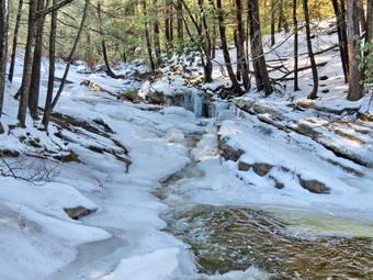
![]()
![]()
![]()
![]()
![]() On Monday, January 19th I had planned to go snowshoeing with a small group of people from the Liberty Schools. Unfortunately, the rain on Sunday had been m are extensive than I had thought it would be and I knew the snow around Frick Pond would not still be conducive to snowshoes. I also wanted to go somewhere that might have less snow which meant either Orange or Ulster counties. There was still a lot of ice around Livingston Manor so I decided to go to Minnewaska to hike a part of the Shawangunk Ridge Trail that I had not done. My plan was to park at the Coxing Trailhead on Clove Road and hike the Old Minnewaska Trail perhaps as far as the Spring Farm Trailhead near Mohonk. I knew this trail was relatively flat and straight. I got Sheila in the car and left Livingston Manor at about 9:00 AM heading to Liberty on Route 17. From Liberty I took Route 52 to Ellenville and got on Route 209 north toward Kingston. After a few miles, I made a right on Route 44/55 heading over the mountain toward New Paltz. After passing the main entrance to Minnewaska Park I continued past the park office on the left and turned left onto Trapps Road. The road appeared icy and I did know whether it would get better or worse. I changed plans and drove back to the park office and parked in the parking area. I immediately saw that the Red Loop Trail out of the parking area was a sheet of ice. I checked in at the office and paid the $8 parking fee. Back at the car I released Sheila but put her on her leash. I donned my Microspikes and the rest of my equipment and we headed out on the trail. There was a breeze blowing but the temperature was in the high 30's making it feel warm compared to the previous week! The trail was flat for the first few hundred feet and then began to drop toward the Peters Kill. It was very icy but the Microspikes were just the thing and there was some snow beside the trail which made walking easier. At about .3 miles Sheila walked off the traitor the left toward he Peters Kill. Called her back but saw she was following a path that others had taken down to the stream. We walked down to the stream and found that there was a good deal of ice along with the flowing water. I dropped my pack and got out the camera and took pictures of the beautiful stream. When I was done, I shouldered my pack and we continued down to the point where Red Loop Trail headed back up to the parking area.
On Monday, January 19th I had planned to go snowshoeing with a small group of people from the Liberty Schools. Unfortunately, the rain on Sunday had been m are extensive than I had thought it would be and I knew the snow around Frick Pond would not still be conducive to snowshoes. I also wanted to go somewhere that might have less snow which meant either Orange or Ulster counties. There was still a lot of ice around Livingston Manor so I decided to go to Minnewaska to hike a part of the Shawangunk Ridge Trail that I had not done. My plan was to park at the Coxing Trailhead on Clove Road and hike the Old Minnewaska Trail perhaps as far as the Spring Farm Trailhead near Mohonk. I knew this trail was relatively flat and straight. I got Sheila in the car and left Livingston Manor at about 9:00 AM heading to Liberty on Route 17. From Liberty I took Route 52 to Ellenville and got on Route 209 north toward Kingston. After a few miles, I made a right on Route 44/55 heading over the mountain toward New Paltz. After passing the main entrance to Minnewaska Park I continued past the park office on the left and turned left onto Trapps Road. The road appeared icy and I did know whether it would get better or worse. I changed plans and drove back to the park office and parked in the parking area. I immediately saw that the Red Loop Trail out of the parking area was a sheet of ice. I checked in at the office and paid the $8 parking fee. Back at the car I released Sheila but put her on her leash. I donned my Microspikes and the rest of my equipment and we headed out on the trail. There was a breeze blowing but the temperature was in the high 30's making it feel warm compared to the previous week! The trail was flat for the first few hundred feet and then began to drop toward the Peters Kill. It was very icy but the Microspikes were just the thing and there was some snow beside the trail which made walking easier. At about .3 miles Sheila walked off the traitor the left toward he Peters Kill. Called her back but saw she was following a path that others had taken down to the stream. We walked down to the stream and found that there was a good deal of ice along with the flowing water. I dropped my pack and got out the camera and took pictures of the beautiful stream. When I was done, I shouldered my pack and we continued down to the point where Red Loop Trail headed back up to the parking area.
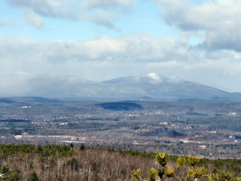 We picked up a yellow connector trail here and walked down to the blue High Peters Kill Trail. The SRT is co-aligned with this trail and I had been on the trail from Jenny Lane to the bridge that we were no approaching. When the yellow trail ended at the High Peters Kill Trail, I decided to turn left and walk down to the bridge. I took a few pictures of the bridge and several more from it before turning around and walking the other way. I was now walking a trail I had never been on before and this is always exciting for me. Sheila for her part seemed completely "healed". She had been licking her paws and seemed to have trouble with the icy snow at Frick Pond on our last hike. Now she was running ahead and then coming back to me and seemed to be having a great time. As we walked, I had to stop to open up the pit zips and front zipper on my Mammut Hoody as the sun had come out. Of course, the sunshine was starting to melt the ice and the trail putting a thin coating of water on top of the ice. As we started out on the High Peters Kill Trail we had hiked about .75 miles but had lost over 350 feet in elevation. At this point we began to climb toward Dickie Barre, one of the premier rock climbing areas. For the next .25 miles we climbed the icy trail gaining about 370 feet and averaging over a 21% grade. The trail was icy all the way with some steep dropouts on the right. I could see a nice view on the right side of the trail but could not get a clear view through the trees until a series of icy ledges at just over 1 miles. We walked to the right off the trail and finally found a place that I could put down the pack and take out the camera. The ledges were very icy and Sheila was making me nervous as she wanted to walk right to the edge. The views were spectacular to the south, east and west. To the west and east were some of the cliffs in the area that draw rock climbers to the area. Behind the cliffs on the right or to the west snowcapped mountains rose into the low hanging clouds. I took quite a few pictures before putting the camera away. We headed back to the main trail, and followed it around to the north side of the hill without actually hitting the top. At 1.3 miles we hit our maximum elevation of 1270 feet as we passed between higher areas to both the left and right. At this point we began to descend an icy trail toward the Coxing Trailhead.
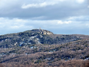 At 1.3 miles we began the descent heading south to about 1.6 miles where the trail turned northeast and east. Everything was covered in ice including the stone steps that formed part of the descent. At one point I looked up to see a medium sized boxer running at us! Sheila wanted to play and the other dog seemed friendly but I immediately called Sheila and put her on her leash. The owner of the other dog eventually showed up but showed no signs of being able to control his dog or that he was even concerned. He was just another irresponsible dog owner that gives us all a bad name. He said he was coming from the Coxing Trailhead and that the roads to it were "Fine"> I knew this was not the case but thought I might check it out when I got there. As we talked two more dogs appeared and started to harass his dog and Sheila. Again, the owners eventually appeared and showed no concern for courtesy or park regulations. I let them pass and waited a few minutes before continuing. We were soon at the trailhead after hiking about 2.4 difficult miles and dropping 590 feet from our highest point to what would be our lowest point. It was only 11:55 AM so I decided to hike a little farther to check out the Old Minnewaska Trail. Signs reminded me that we were entering the Mohonk Preserve and I resolved to purchase a membership when I finished the hike. We crossed the road and picked up the trail which was icy but relatively flat compared to what we had just hiked. Within a couple hundred feet we were at a bridge over the Coxing Kill. There were signs in the area explaining the contributions of the Smiley family and one denoting the foundation of the Enderly house. I stopped at the bridge and took a few pictures of the water as it flowed through a narrow sot in the rocks.
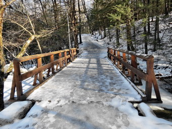 I picked up the pack and we continued east northeast until about 4 miles. The hike was uneventful as the trail was now mostly covered in snow with some bare patches. On the left or to the north I could see some mountains but couldn't get much of a view until just before we turned around. At 12:30 PM we started back and I did stop once to take a few pictures. On the way back we met one hiker coming toward us as we exchanged greetings as we passed. As we neared the bridge I caught sight of a party of eight people that seemed to be a family group with children. One woman asked if they were on the Old Minnewaska Trail and I confirmed that they were. At 1:05 PM we were at the road again after1 hiking 5.5 miles. I collapsed my poles to store them in my pack and put Sheila on her leash as we turned left on Clove Road. I kept my spikes on as the side of the road was still very icy. The roads were not "Fine" as one hiker had said but they were passable to the Coxing Trailhead. As we walked on Clove Road I heard the Coxing Kill on the right side of the road. We crossed over and walked to where I could get my last shots of the day. We continued up Clove Road to the intersection with Trapps Road where we turned right. When we got to Route 44/55, we stopped and I took off my spikes and stored them in my pack. We turned right to walk about .3 miles the main road back to the parking area arriving at 1:45 PM. As I drove out of the parking area, I turned left to drive toward New Paltz. I stopped at the Mohonk preserve Visitor center and paid for a year's membership for myself and my wife. I think the $75 cost will be well worth being able to park and hike at any time and at any place within the preserve. We had hiked 7.2 miles in 3 hours and 45 minutes with a vertical gain of 1460 feet. We stopped for over 30 minutes for pictures and to enjoy the spectacular views.
![]()
![]()
![]() On Friday, January 16th, I wanted to get out one snowshoes again after my first snowshoe hike the day before. The temperature was rising and stood at about 28 degrees when we left Livingston Manor at 10:20 AM. After a brief stop at the post office, I drove up DeBruce Road and turned left on Fish Hatchery Road to go to the Frick Pond parking area. It had been overcast in Livingston Manor but the skies became blue with white clouds the further I drove. I parked at 10:40 Am and we were on the trail shortly after. The temperature as we got out of the car was about 26 degrees which was about 10 degrees warmer than the day before. I heard a noise that really did sound like an approaching train. The wind had picked up and was making me feel pretty cold as I put on my snowshoes. I briefly thought about getting back in the car but decided there were enough options to make hiking possible. My plan was to hike the loop I had done the day before in reverse by hiking out to Frick Pond and then using the Quick Lake Trail to get to Iron Wheel junction. From there we would take the Logger's Loop to Times Square and climb the Big Rock Trail to the Flynn Trail and descend the long downhill to the car. We began by hiking out to Frick Pond on the wide woods road and crossing the outlet to Frick Pond on the bridge. At the nest trail junction we stayed left on the Quick Lake Trail following our tracks from the day before. By now the skies had started to become cloudy again although the wind seemed to have died down. I noticed that Sheila was walking behind me and seemed to be bothered by her feet. I didn't know whether it was the cold or the irritation of the hard crust but I immediately decided to simply do the Logger's Loop and return. We continued up the Quick Lake Trail to Iron Wheel Junction and arrived there at 11:20 AM after hiking 1.5 miles most of which was uphill. As we turned right onto the Logger's Loop snow began to fall and as we walked it snowed harder. At one point the snow began to pile up on my jacket and Sheila was covered in a white robe. After a while the snow stopped and the sun came back out. The 1.2 mil Loggers Loop starts out with a slight uphill but then levels off and descends to Times Square. About halfway along the trail, Sheila alerted and I could hear snowmobiles approaching. Three machines came up the trail slowing as they passed us with each rider waiving "Hello". There seemed to be enough snow so that the machines were not churning up dirt. The smell of gasoline only lasted a few seconds and we had a well-broken path to follow the rest of the way to the trail junction. We arrived at Times Square at 11:50 AM having covered about 2.7 miles. We continued straight ahead on the Loggers Loop which had which had a little more of an uphill than I remembered. Soon we were back at the first trail junction where we turned left to complete the lollipop hike back to the car. We were back at 12:15 PM having covered 3.7 miles in 1 hour and 30 minutes with about 400 feet of elevation gain.
On Friday, January 16th, I wanted to get out one snowshoes again after my first snowshoe hike the day before. The temperature was rising and stood at about 28 degrees when we left Livingston Manor at 10:20 AM. After a brief stop at the post office, I drove up DeBruce Road and turned left on Fish Hatchery Road to go to the Frick Pond parking area. It had been overcast in Livingston Manor but the skies became blue with white clouds the further I drove. I parked at 10:40 Am and we were on the trail shortly after. The temperature as we got out of the car was about 26 degrees which was about 10 degrees warmer than the day before. I heard a noise that really did sound like an approaching train. The wind had picked up and was making me feel pretty cold as I put on my snowshoes. I briefly thought about getting back in the car but decided there were enough options to make hiking possible. My plan was to hike the loop I had done the day before in reverse by hiking out to Frick Pond and then using the Quick Lake Trail to get to Iron Wheel junction. From there we would take the Logger's Loop to Times Square and climb the Big Rock Trail to the Flynn Trail and descend the long downhill to the car. We began by hiking out to Frick Pond on the wide woods road and crossing the outlet to Frick Pond on the bridge. At the nest trail junction we stayed left on the Quick Lake Trail following our tracks from the day before. By now the skies had started to become cloudy again although the wind seemed to have died down. I noticed that Sheila was walking behind me and seemed to be bothered by her feet. I didn't know whether it was the cold or the irritation of the hard crust but I immediately decided to simply do the Logger's Loop and return. We continued up the Quick Lake Trail to Iron Wheel Junction and arrived there at 11:20 AM after hiking 1.5 miles most of which was uphill. As we turned right onto the Logger's Loop snow began to fall and as we walked it snowed harder. At one point the snow began to pile up on my jacket and Sheila was covered in a white robe. After a while the snow stopped and the sun came back out. The 1.2 mil Loggers Loop starts out with a slight uphill but then levels off and descends to Times Square. About halfway along the trail, Sheila alerted and I could hear snowmobiles approaching. Three machines came up the trail slowing as they passed us with each rider waiving "Hello". There seemed to be enough snow so that the machines were not churning up dirt. The smell of gasoline only lasted a few seconds and we had a well-broken path to follow the rest of the way to the trail junction. We arrived at Times Square at 11:50 AM having covered about 2.7 miles. We continued straight ahead on the Loggers Loop which had which had a little more of an uphill than I remembered. Soon we were back at the first trail junction where we turned left to complete the lollipop hike back to the car. We were back at 12:15 PM having covered 3.7 miles in 1 hour and 30 minutes with about 400 feet of elevation gain.
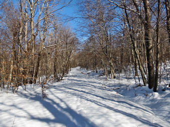
![]()
![]()
![]()
![]() On Thursday, January 15th, I thought there might be enough snow to try snowshoeing at Frick Pond. Although the temperature was barely into the double digits, I decided to at least try. After a few morning chores, I got my equipment and Sheila into the car and headed out the DeBruce Road to Frick Pond. I decided I want to wait to use my new TSL Symbioz snowshoes until there was deeper snow. I chose to bring my Tubbs Flex Alp snowshoes which have quickly become a favorite out of the eight pairs that I own. By the time I parked just before 10:15 AM the temperature had risen to the high teens and I thought it might even break 20 degrees at some point! There was no wind and the sun was peaking through the clouds. We crossed the road at 10:15 Am and Sheila immediately started barking at the DEC employee replacing the trail register! As we started up the trail, I knew it would be a good day. Snowshoes were definitely not necessary but, then again, they provided traction and FUN! As we got to the woods road that ascends the hill, I noticed one of my expensive Leki carbon poles needed to be adjusted. I spent several minutes trying to get the internal lock to grip. Eventually I pulled the lower section to the extreme of its travel and gave it a few twists. This seemed to do the trick and after 5 minutes we continued. I stopped by Morgan Outdoors on the way home and Lisa confirmed this is a known problem. The trip up the is all uphill for 1.7 miles but it seemed to go quickly and I was happy I had the snowshoes. I did stop at one point to take a few pictures of the sun sparkling off the snow. We were at the junction with the Big Rock Trail at 11:15 AM at which point we turned left to descend the rather steep hill. The descent was a welcome relief from the 1.7 mile climb on the Flynn Trail. I could almost slide and glide my way down despite the fact that there was only a few inches of snow on the ground. The Flex Alps have a hard plastic deck and are a little noisy on crusted snow but I could hear the sound of approaching snowmobiles coming down the Big Rock Trail. As the machines came into view, the turned out to be two six-wheelers with DEC workers who were clearing the trails. They stopped there machines and Sheila greeted them by barking ferociously. As we talked Sheila warmed a little. I asked that they cut out some specific blowdowns on hiking trails that were a little big for a hand saw. They started their machines and headed towards Times Square as we followed at a slower pace. Soon the machines were coming back up the hill and I waved as they passed. I checked my watch and saw it was noon at the workers said they had somewhere else to go in the afternoon.
On Thursday, January 15th, I thought there might be enough snow to try snowshoeing at Frick Pond. Although the temperature was barely into the double digits, I decided to at least try. After a few morning chores, I got my equipment and Sheila into the car and headed out the DeBruce Road to Frick Pond. I decided I want to wait to use my new TSL Symbioz snowshoes until there was deeper snow. I chose to bring my Tubbs Flex Alp snowshoes which have quickly become a favorite out of the eight pairs that I own. By the time I parked just before 10:15 AM the temperature had risen to the high teens and I thought it might even break 20 degrees at some point! There was no wind and the sun was peaking through the clouds. We crossed the road at 10:15 Am and Sheila immediately started barking at the DEC employee replacing the trail register! As we started up the trail, I knew it would be a good day. Snowshoes were definitely not necessary but, then again, they provided traction and FUN! As we got to the woods road that ascends the hill, I noticed one of my expensive Leki carbon poles needed to be adjusted. I spent several minutes trying to get the internal lock to grip. Eventually I pulled the lower section to the extreme of its travel and gave it a few twists. This seemed to do the trick and after 5 minutes we continued. I stopped by Morgan Outdoors on the way home and Lisa confirmed this is a known problem. The trip up the is all uphill for 1.7 miles but it seemed to go quickly and I was happy I had the snowshoes. I did stop at one point to take a few pictures of the sun sparkling off the snow. We were at the junction with the Big Rock Trail at 11:15 AM at which point we turned left to descend the rather steep hill. The descent was a welcome relief from the 1.7 mile climb on the Flynn Trail. I could almost slide and glide my way down despite the fact that there was only a few inches of snow on the ground. The Flex Alps have a hard plastic deck and are a little noisy on crusted snow but I could hear the sound of approaching snowmobiles coming down the Big Rock Trail. As the machines came into view, the turned out to be two six-wheelers with DEC workers who were clearing the trails. They stopped there machines and Sheila greeted them by barking ferociously. As we talked Sheila warmed a little. I asked that they cut out some specific blowdowns on hiking trails that were a little big for a hand saw. They started their machines and headed towards Times Square as we followed at a slower pace. Soon the machines were coming back up the hill and I waved as they passed. I checked my watch and saw it was noon at the workers said they had somewhere else to go in the afternoon.
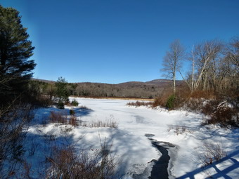 We reached Times Square and turned right to started up the Loggers Loop toward Iron Wheel Junction. We had dropped over 600 feet from the highest point on the Flynn Trail and I knew there would be some climbing on the Loggers Loop. There was no trail broken on the Loggers Loop as the machines had turned around at Times Square. The short initial climb went quickly and the trail soon leveled off and passed by a small "pond" on the right. I again stopped to take a few pictures before continuing. I noticed that Sheila was following me and seemed not to be as animated as usual. I did not know if her feet were too cold or she was bothered by the crust on the snow. We reached Iron Wheel Junction at 12:20 PM after hiking 4 miles. We turned left here on the Quick Lake Trail to head back to Frick Pond. The trail has a gentle downward slope and the going was easier than it had been. Passing under the pines after crossing the small brook is always magical to me especially since I helped clear out some massive blowdowns that blocked the trail in this area. We continued along Frick Pond to the outlet bridge where I stopped for a few more shots despite the fact that I already have hundreds of pictures from this spot. After a short break, we continued back to the car. We were back at the parking area by 1:00 PM having covered 5.5 miles in 2 hours and 45 minutes with 970 feet of elevation gain. The temperature had risen to about 23 degrees.
![]()
![]()
![]() On Sunday, January 11th I wanted to get out hiking somewhere after a week of brutally cold weather. The combination of temperatures in the teens and high winds had combined to make conditions almost too dangerous to hike. I always take Sheila with me and it was just too cold to stay out for very long. After we got home from church, we decided that even though the sun had not appeared as forecasted we would still try to get out on the relatively "warm" twenty degree day. Cindy decided she wanted to hike and that Frick and Hodge Ponds were a good a place as any. By the time we got all our gear and decided what to wear, it was already almost 12:00 PM. Sheila was beside herself with anticipation as we drove up the DeRuce Road. We parked just after noon and were hiking by 12:10 PM. We had decided to leave the snowshoes at home but I had put a set of Microspikes for each of us in my pack. As we headed out toward Frick Pond on the Quick Lake Trail I was surprised that there were no tracks in the snow. Once we made the turn onto the woods road thatched toward the pond, we did find some tracks. AS we hiked along, I spotted another dog coming our way. Sheila is good about coming back to me when she sees people on the trail but can't resist say "Hi!" to other dogs. Fortunately, this dog was friendly and we stopped and talked to the owner who told us his dog was part Anatolian Shepherd. We continued on to the pond and crossed the bridge at the outlet. The overcast skies did not present a favorable opportunity for photography so I decided to concentrate on the hike and keep the camera in the pack. There was barely two inches of snow and the ice we had encountered so far was easily avoided. At the next junction the majority of the tracks headed right and around Frick Pond. We took the turn to the left to stay on the Quick Lake Trail. The hike to Iron Wheel Junction was uneventful except for the fact I began to notice that I was slipping a little with each step. We reached Iron Wheel Junction at 1:00 PM after hiking 1.5 miles. There were no snowmobile tracks on the trail nor did I expect any with the amount of snow. We turned left to stay on the Quick Lake Trail with our next destination being Junkyard Junction near Hodge Pond. The walk to Junkyard Junction seemed to go slowly with Cindy lagging behind on the long uphill climb. I was feeling pretty good except for some soreness in my quads and inner thighs. The trail is never very steep and under other conditions handle seems like an ascent. On this day with the snow and ice it was more difficult. We finally made Junkyard Junction at 2:00 PM about 3.1 miles into the hike. We turned right to pick up the Flynn Trail to Hodge Pond.
On Sunday, January 11th I wanted to get out hiking somewhere after a week of brutally cold weather. The combination of temperatures in the teens and high winds had combined to make conditions almost too dangerous to hike. I always take Sheila with me and it was just too cold to stay out for very long. After we got home from church, we decided that even though the sun had not appeared as forecasted we would still try to get out on the relatively "warm" twenty degree day. Cindy decided she wanted to hike and that Frick and Hodge Ponds were a good a place as any. By the time we got all our gear and decided what to wear, it was already almost 12:00 PM. Sheila was beside herself with anticipation as we drove up the DeRuce Road. We parked just after noon and were hiking by 12:10 PM. We had decided to leave the snowshoes at home but I had put a set of Microspikes for each of us in my pack. As we headed out toward Frick Pond on the Quick Lake Trail I was surprised that there were no tracks in the snow. Once we made the turn onto the woods road thatched toward the pond, we did find some tracks. AS we hiked along, I spotted another dog coming our way. Sheila is good about coming back to me when she sees people on the trail but can't resist say "Hi!" to other dogs. Fortunately, this dog was friendly and we stopped and talked to the owner who told us his dog was part Anatolian Shepherd. We continued on to the pond and crossed the bridge at the outlet. The overcast skies did not present a favorable opportunity for photography so I decided to concentrate on the hike and keep the camera in the pack. There was barely two inches of snow and the ice we had encountered so far was easily avoided. At the next junction the majority of the tracks headed right and around Frick Pond. We took the turn to the left to stay on the Quick Lake Trail. The hike to Iron Wheel Junction was uneventful except for the fact I began to notice that I was slipping a little with each step. We reached Iron Wheel Junction at 1:00 PM after hiking 1.5 miles. There were no snowmobile tracks on the trail nor did I expect any with the amount of snow. We turned left to stay on the Quick Lake Trail with our next destination being Junkyard Junction near Hodge Pond. The walk to Junkyard Junction seemed to go slowly with Cindy lagging behind on the long uphill climb. I was feeling pretty good except for some soreness in my quads and inner thighs. The trail is never very steep and under other conditions handle seems like an ascent. On this day with the snow and ice it was more difficult. We finally made Junkyard Junction at 2:00 PM about 3.1 miles into the hike. We turned right to pick up the Flynn Trail to Hodge Pond.
My muscles were very sore no but walking flat on the Flynn Trail seemed easier. The Flynn Trail often has more snow than other places in the area but on this day there was never more than three inches. There were some very icy places and several spots where we broke through ice that had formed over marshy areas. This, of course, made hiking a little more difficult. As we descended to the trail around Hodge Pond, we had to decided whether to go left or right. The trail to the right is shorter but requires a long although shallow climb from Hodge Pond. We stayed to the left and walked around the back of the pond on the old jeep trail. We turned up the hill at the next junction and started the shorter but steeper climb. My sore muscles were not happy with this decision but modifying my stride and stretching seemed to help. We paused at the top of the hill to get a drink and a snack before turning right to get back to the Flynn Trail. Once on the Flynn Trail we continued toward the junction with the Big Rock Trail. Sheila was having a great deal of fun running up and down the trail and then following game trails into the woods. She also was grabbing onto some very large branches and pulling them along until she found the next one. At 2:45 PM we had hiked 4.7 miles to the junction with the Big Rock Trail. Now it was Cindy's turn to pull ahead as she really likes the downhills. My legs were very tired and even going downhill was a strain. We continued straight ahead aiming for the parking area at the bottom of the Flynn Trail. We encountered several blowdowns including one with a well-worn path around it to the right. It seemed this tree must have been there for some time! The walk down the Flynn Trail always seems long to me and on this day it took forever! At the gate we turned left to stay on the Flynn Trail to the parking area. We arrived back in the parking area at 3:35 PM having covered 6.7 miles in 3 hours and 25 minutes with an elevation gain of 950 feet. This was more than an hour longer than a typical hike under better conditions!
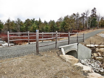
![]()
![]()
![]()
![]()
![]() On Friday, January 2nd Cindy and I planned to do a hike near Ellenville and then a visit to Aroma Thyme for a meal. Aroma Thyme is in Ellenville on Canal Street. It has a good selection of beers and an interesting menu. It is not an inexpensive place to eat but the atmosphere is interesting and the food quite different than other places. When I awoke on Friday there was some lake effect snow falling and the temperature was in the low 20's with a stiff breeze. I had track practice until 11:00 AM and we agreed to make our final decision when I got home. When I arrived home, I found Cindy was not feeling well and had decided not to go. I was disappointed but knew Sheila was ready to hike. I thought about just hiking close to home at Frick Pond but in the end decided to go to Minnewaska to hike a loop from Jenny Lane. This would allow me to "fill in" some parts of the Shawangunk Ridge Trail that I was missing. Sheila and I had tried this hike in July but turned back when we encountered a rattlesnake. I got Sheila in the car and left Livingston Manor at about 11:30 AM heading to Liberty on Route 17. From Liberty I took Route 52 to Ellenville and got on Route 209 north toward Kingston. After a few miles, I made a right on Route 44/55 heading over the mountain toward New Paltz. In just under 5 miles I turned left into the Jenny Lane parking area. I had been concerned that I might have trouble getting a spot to park as it was so late in the day but there were no other cars in the lot. The temperature was in the mid 30's and there was some sun peaking through the puffy white clouds in a blue sky as we left the lot at 12:30 PM to begin our hike. I had somehow left my light gloves home and was forced to where a pair of heavy mittens I had in my pack. We turned left at the road and walked a few hundred feet south to turn right on the Jenny Lane Trail on the wet side of the road. I had put Sheila on her leash to walk the road but now released her and told her to follow me. I knew that the low temperatures meant that the rattlesnakes would be in their den but I was still cautious. My intention was to hike the Jenny Lane trail to the end and then take the Rainbow Falls Trail to Castle Point. From there we would return on the Huckleberry Run Trail to the Jenny Lane Trail back to the car or take the Mossy Glen Trail to the lower parking area at Minnewaska and then walk the road back to the car. I was concerned about finishing before dark and knew we would have to keep moving. I also knew the moon was almost full and that I had a headlamp if I needed it.
On Friday, January 2nd Cindy and I planned to do a hike near Ellenville and then a visit to Aroma Thyme for a meal. Aroma Thyme is in Ellenville on Canal Street. It has a good selection of beers and an interesting menu. It is not an inexpensive place to eat but the atmosphere is interesting and the food quite different than other places. When I awoke on Friday there was some lake effect snow falling and the temperature was in the low 20's with a stiff breeze. I had track practice until 11:00 AM and we agreed to make our final decision when I got home. When I arrived home, I found Cindy was not feeling well and had decided not to go. I was disappointed but knew Sheila was ready to hike. I thought about just hiking close to home at Frick Pond but in the end decided to go to Minnewaska to hike a loop from Jenny Lane. This would allow me to "fill in" some parts of the Shawangunk Ridge Trail that I was missing. Sheila and I had tried this hike in July but turned back when we encountered a rattlesnake. I got Sheila in the car and left Livingston Manor at about 11:30 AM heading to Liberty on Route 17. From Liberty I took Route 52 to Ellenville and got on Route 209 north toward Kingston. After a few miles, I made a right on Route 44/55 heading over the mountain toward New Paltz. In just under 5 miles I turned left into the Jenny Lane parking area. I had been concerned that I might have trouble getting a spot to park as it was so late in the day but there were no other cars in the lot. The temperature was in the mid 30's and there was some sun peaking through the puffy white clouds in a blue sky as we left the lot at 12:30 PM to begin our hike. I had somehow left my light gloves home and was forced to where a pair of heavy mittens I had in my pack. We turned left at the road and walked a few hundred feet south to turn right on the Jenny Lane Trail on the wet side of the road. I had put Sheila on her leash to walk the road but now released her and told her to follow me. I knew that the low temperatures meant that the rattlesnakes would be in their den but I was still cautious. My intention was to hike the Jenny Lane trail to the end and then take the Rainbow Falls Trail to Castle Point. From there we would return on the Huckleberry Run Trail to the Jenny Lane Trail back to the car or take the Mossy Glen Trail to the lower parking area at Minnewaska and then walk the road back to the car. I was concerned about finishing before dark and knew we would have to keep moving. I also knew the moon was almost full and that I had a headlamp if I needed it.
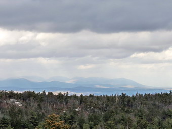 The walk along the Jenny Lane Trail was generally pleasant even though there were no major viewpoints. The walk was made more pleasant as someone had cut back the brush and done other trail maintenance. The only blowdown was almost at the end of the trail and looked very new. I stopped rather early and took a few pictures of the twisted pines in an area that had been burned more than once. We also stopped at a place near the highest point on the trail since I wanted to take some pictures of the trees against the blue skies with white clouds. I also could see down to the Peters Kill below. Near this high point we also started to walk more on exposed rock and there were a few icy spots which I tried to avoid. I had taken off my mitts and unzipped the pit zips on my jackets since I was warm when we were moving. We walked the west of the way to the end of the trail at 2.8 miles and turned right on the Lower Awosting Carriageway. I was happy to see the causeway over the Peters Kill had been repaired. We stopped and I took a few pictures of the area including some of the stream. Just after the bridge the trail, again turned left into the woods and quickly began ascending again. I remembered that I had been turned back on this trail by the ice on the rock faces and one time by the volume of water flowing in the outlet stream from Lake Awosting. As we gained some elevation there did seem to be more ice on the rocks but I could work around it and I did have spikes in my pack. At the stream the problem was not the volume of water but the ice. I worked my way to the stream and across without my spikes but I probably should have used them. We continued to climb walking over open rock and As I looked behind me I was treated to an excellent view of the Catskills. The light was just right so I got out the camera to take a few shots before continuing to the top of the climb. At the highpoint there were even better views so I took a few more shots.
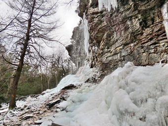 We followed the trail as it wound its way down the other side of the ridge toward Rainbow Falls. Along the way a viewpoint in the other direction caught my attention and there were some more pictures. Soon we were at the descent down to Rainbow Falls. I remembered coming up the trail before and maybe even descending once but it was much steeper than I remembered and the ice on the rocks proved an additional challenge. It took a few minutes but I was soon down and met Sheila who was waiting for me. It was only a short walk to Rainbow Falls. The scene was better than I had hoped even though the volume of water over the falls was low. There were icicles hanging off the cliff and a heap of ice below then falls. I took out my camera and snapped many pictures of the scene. Especially interesting were a few I took of the trail blaze indicating the route of the trail which was covered in ice. We worked our way down to the trail but avoided then ice and were soon walking up to the Upper Awosting Carriageway. It was 2:30 PM when we hit the carriageway and we had walked about 3.9 miles. I decided to continue with my original plan so we walked across then road and stayed on the Rainbow Falls Trail as it headed toward Litchfield Ledge and on tom Castle Point. Shortly after starting up the trail there was another nice viewpoint that was covered in ice. I found a bare spot and got out the camera to take some pictures of the cliffs with the Catskills behind them. I usually do not worry about Sheila's penchant for walking near the edge of the dropoffs but the ice made me very nervous and I had to call her back several times. We continued to gain elevation until at 4.7 mile we were at Litchfield Ledge which had some more nice views requiring me to get out the camera again. A little further along was another nice view. This time the view was on the cliffs that make up the Battlement Terrace and Castle Point. The sun was hitting the cliffs making for some interesting shots. We continued along the trail until it ended at the Castle Point Carriageway where we turned left and headed up the hill toward Castle Point.
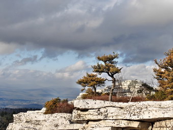 The carriageway was easy walking and we were soon at the point where the trail is sited along the edge of the cliffs giving ever better views from the Battlement Terrace to Castle Point. Since I knew the views were best from Castle Point I resisted the temptation to stop at every other lookout. I did notice that we were more exposed on the open rocks and that the breeze had picked up making the temperature seem colder. We were soon at the point were the Huckleberry Run Trail started on the left but I continued to walk the few hundred feet up to Castle Point. The views were not spectacular due to the fact that the clouds were now obscuring the sun. I did take quiet a few pictures of Hamilton Point, Gertrude's Nose and the valley below. As we were about to leave, another hiker came up the carriageway. I said "Hello" to the only person we would see for the whole day! We had hiked 5.6 miles as we started out on the Huckleberry Run Trail and it was already 3:30 PM. I knew that it would be getting dark as we were hiking back to the car. I though the trail was all downhill but I was wrong as we made a few short ascents before heading down to the Upper Awosting Carriageway. The trail was generally well marked but I was mostly watching Sheila as she was able to pick out the trail despite the various twists and turns. The walk down to the carriageway didn't have any viewpoints so we were able to make some time. The trip was a little longer than expected at about 1.6 miles.
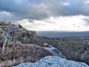 We crossed the carriageway and the trail began to really lose some elevation as we began to lose daylight. As we descended, I was hoping that the bridge across the Peters Kill had been repaired as I wanted to use the Lower Awosting Carriageway to return rather than the Mossy Glen Trail. When we got to the turnoff for the Mossy Glen trail, we continued straight ahead over open rock down to the stream. I initially did not see the bridge but it appeared a little downstream of where I expected. The bridge was a single large log which had been squared off and had hand rails added. It seemed very study and we crossed with now problem. I took my last pictures of the day and we headed up to the Lower Awosting Carriageway. We turned right and headed toward the parking area. We had hiked 7.5 miles and it was 4:20 PM. The sun was going down but the full moon was out. We set a fast pace along the carriageway and arrived at the deserted parking area at 4:45 PM after hiking 9 miles. I stowed my poles and put Sheila on her leash. We walked out to the road and turned left to walk the shoulder back to Jenny Lane. It was now dark but the oncoming headlights and the moon supplied enough light to see. The shoulder was wide enough in mist spots that we could stay well out of the way of oncoming cars. The road walk was less than a mile and we were back at the car a few minutes after 5:00 PM.Psomewhere along the way my GPS had changed to the "dark" display! We had hiked 10 miles in 4.5 hours with almost 40 minutes of stopped time for pictures! I drove directly home without stopping as I did not feel like visiting Aroma Thyme without Cindy!
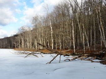
![]()
![]()
![]()
![]()
![]() On Wednesday, December 31st Cindy and I decided to take our last hike of 2014 at Trout Pond. We thought this appropriate as it is a place we often visit. We were in no big hurry to start especially since the temperature was still in the high teens at 9:00 AM with a slight breeze blowing. We got dressed and headed down to the post office at about 10:00 Am and then drove to Roscoe with Sheila anxiously waiting in the backseat. I drove through Roscoe and headed toward Morton Hill Road just outside of Roscoe. I made the left and drove to the intersection with Russell Brook Road. I turned around and parked on the shoulder of Morton Hill Road as the parking area is on private property. I decided to wear mittens Cindy and I also stuffed our Microspikes in the pack. We were hiking down Russell Brook Road by 10:25 AM. The skies were blue with some clouds and sun which seemed ideal for a few pictures although I didn't know if I wanted to take my hands out of the mittens! As we walked down the road to the lower parking area, I could hear the water rushing down the brook. I stopped briefly at the viewpoint to the upper falls but decided to take pictures of the falls on the way back. We walked down to the lower parking area but there were no vehicles in the lot. We continued down the wide snowmobile trail and woods road and crossed Russell Brook on the bridge. The knotweed was all dead but it continues to expand its area. There had been some ice on the road on the way down and Cindy had slipped a little but staying on the gravel and direct made all the difference. We walked to the split in the trail and stayed to the right to hike the loop in an anticlockwise direction. I was a little concerned about Cindy as she had chosen to wear her brand new Asolo Styngers on the hike! There was water on the trail and a few muddy areas but most were at least partially frozen. We set a fast pace up the trail toward Trout Pond and as we approached we could see there was ice covering all of the pond except the part near the spillway. The level of the pond was higher than when I had visited the last time. We stopped so that I could take some pictures of the scenery with the ice on the pond. The clouds against the blue sky with the bright sun made taking pictures a little tricky. Sheila ran near the waters edge and got a drink and venture started out onto the thin ice.
On Wednesday, December 31st Cindy and I decided to take our last hike of 2014 at Trout Pond. We thought this appropriate as it is a place we often visit. We were in no big hurry to start especially since the temperature was still in the high teens at 9:00 AM with a slight breeze blowing. We got dressed and headed down to the post office at about 10:00 Am and then drove to Roscoe with Sheila anxiously waiting in the backseat. I drove through Roscoe and headed toward Morton Hill Road just outside of Roscoe. I made the left and drove to the intersection with Russell Brook Road. I turned around and parked on the shoulder of Morton Hill Road as the parking area is on private property. I decided to wear mittens Cindy and I also stuffed our Microspikes in the pack. We were hiking down Russell Brook Road by 10:25 AM. The skies were blue with some clouds and sun which seemed ideal for a few pictures although I didn't know if I wanted to take my hands out of the mittens! As we walked down the road to the lower parking area, I could hear the water rushing down the brook. I stopped briefly at the viewpoint to the upper falls but decided to take pictures of the falls on the way back. We walked down to the lower parking area but there were no vehicles in the lot. We continued down the wide snowmobile trail and woods road and crossed Russell Brook on the bridge. The knotweed was all dead but it continues to expand its area. There had been some ice on the road on the way down and Cindy had slipped a little but staying on the gravel and direct made all the difference. We walked to the split in the trail and stayed to the right to hike the loop in an anticlockwise direction. I was a little concerned about Cindy as she had chosen to wear her brand new Asolo Styngers on the hike! There was water on the trail and a few muddy areas but most were at least partially frozen. We set a fast pace up the trail toward Trout Pond and as we approached we could see there was ice covering all of the pond except the part near the spillway. The level of the pond was higher than when I had visited the last time. We stopped so that I could take some pictures of the scenery with the ice on the pond. The clouds against the blue sky with the bright sun made taking pictures a little tricky. Sheila ran near the waters edge and got a drink and venture started out onto the thin ice.
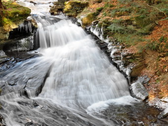 We headed back to the main trail and walked up to the inlet end of the pond. Before crossing the bridge, we walked down to the shore and I took a few more shots of the pond. We crossed the bridge and headed up toward Cherry Ridge about 2 miles into the hike. We set a fast pace of about 2.7 miles per hour and the 2 miles hike from Trout Pond to Mud Pond seemed to go very quickly. At one point Cindy asked me if the high point was about half way and I looked at my GPS unit. It was off and would not turn on. I had checked the batteries at the house and they seemed Ok but I suspected that the cold had made them less effective. The trail continued to be wet especially when compared to how dry the woods had been all summer. We turned left and found more wet spots with frozen mud on the snowmobile trail as we climbed a little before descending. The descent back toward the trail register went quickly and as we were descending Cindy pointed out a good-sized body of water that I had not seen before. We decided to bushwhack down the hill to investigate. The woods were pretty open and we were soon on the shore of a rather large beaver pond. There were many trees felled by the beavers along the shores and a large house on the far shore of the pond. I took some pictures and afterward we headed along the stream to bushwhack back up to the main trail. The walk along the stream was interesting and we had to jump over two smaller tributaries to get back to the trail. I wanted to go to the lower falls even though I had been there many times before. Cindy chose to sit and rest. Sheila and I visited the lower falls and I took a few shots of the snow covered ground and the icicles next to the falls as well as the falls themselves. We reunited with Cindy and all three of us started back up the trail to the parking area and then back up the road to the car. On the way back up Russell Brook Road, we stopped at the viewpoint over the upper falls. The water was clear and looked very cold as I snapped a few shots of the upper falls. From there we walked back out to the road and to the car. We were back at the car at 1:30 PM having covered a little over 6 miles in 3 hours with a gain of about 1100 vertical feet.
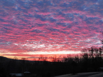
![]()
![]()
![]()
![]()
![]() On Saturday, December 27th I was ready to get out after a week of poor weather and a joyous Christmas celebration. I had planned to do this hike on Friday but I was exhausted and decided I wanted to enjoy the moment. The hike I planned was the section of the Long Path from Fort Lee, New Jersey to the New York Border which is section 1 of the Long Path. This would complete the Long Path for me and allow me to become one of the less than 150 people who are End to Enders. This section is a little over 12 miles so I knew I would need a ride. The Nyack Car Service transported Sheila and I on our hike of section 2 and said they could do the same for this section. The forecast for the area for Saturday was for partly sunny skies with temperatures in the low 50's. Friday night I got a text from my son Karl saying that he would like to go Saturday morning. I got my equipment and Sheila into the car at about 7:00 AM and headed to Bethel to pick up Karl. The temperature was only 26 degrees so I dressed in my 26 degree outfit. On the way I had to stop to take pictures of the magnificent sunrise. The reds, purples and yellows were some of the best I had ever seen! When I arrived in Bethel, I played with the grandchildren while Karl got ready. We got in the car and immediately Sheila made a scene by lavishing "love" on Karl. We were headed out at about 7:45 AM taking Route 17B to Monticello. I chose the easiest route by driving down Route 17 to Harriman where I picked up the Thruway south. I knew I wanted exit 11 and expected some heavy traffic as this exit is near the Palisades Center Shopping Mall. After getting off the exit I turned left on Route 59 and the right on Route 9W not far down the road. We headed south on Route 9W passing through Palisades and turning left onto Ludlow Lane at the state border. I asked the attendant in the gatehouse of the Lamont-Doherty Observatory where I could park. He indicated I could park on the shoulder of Route 9W just north of the bus stop. I parked the car and called the car service. It took a little longer than I had expected but by 9:35 AM the driver had arrived and we piled into the car. We headed south on Route 9W with the driver asking if I knew how to get where I wanted to go! After a few missed turns, we were finally headed south on Route 505. We arrived at the Fort Lee Historical Park and just after 10:00 AM and were on the trail less than 10 minutes later.
On Saturday, December 27th I was ready to get out after a week of poor weather and a joyous Christmas celebration. I had planned to do this hike on Friday but I was exhausted and decided I wanted to enjoy the moment. The hike I planned was the section of the Long Path from Fort Lee, New Jersey to the New York Border which is section 1 of the Long Path. This would complete the Long Path for me and allow me to become one of the less than 150 people who are End to Enders. This section is a little over 12 miles so I knew I would need a ride. The Nyack Car Service transported Sheila and I on our hike of section 2 and said they could do the same for this section. The forecast for the area for Saturday was for partly sunny skies with temperatures in the low 50's. Friday night I got a text from my son Karl saying that he would like to go Saturday morning. I got my equipment and Sheila into the car at about 7:00 AM and headed to Bethel to pick up Karl. The temperature was only 26 degrees so I dressed in my 26 degree outfit. On the way I had to stop to take pictures of the magnificent sunrise. The reds, purples and yellows were some of the best I had ever seen! When I arrived in Bethel, I played with the grandchildren while Karl got ready. We got in the car and immediately Sheila made a scene by lavishing "love" on Karl. We were headed out at about 7:45 AM taking Route 17B to Monticello. I chose the easiest route by driving down Route 17 to Harriman where I picked up the Thruway south. I knew I wanted exit 11 and expected some heavy traffic as this exit is near the Palisades Center Shopping Mall. After getting off the exit I turned left on Route 59 and the right on Route 9W not far down the road. We headed south on Route 9W passing through Palisades and turning left onto Ludlow Lane at the state border. I asked the attendant in the gatehouse of the Lamont-Doherty Observatory where I could park. He indicated I could park on the shoulder of Route 9W just north of the bus stop. I parked the car and called the car service. It took a little longer than I had expected but by 9:35 AM the driver had arrived and we piled into the car. We headed south on Route 9W with the driver asking if I knew how to get where I wanted to go! After a few missed turns, we were finally headed south on Route 505. We arrived at the Fort Lee Historical Park and just after 10:00 AM and were on the trail less than 10 minutes later.
 The first part of the trail goes out to Route 505 where it heads north and passes under I95. Right after this it goes up a set of stairs on the right and then crosses another road on a pedestrian bridge. From here the Long Path passes through a wooded strip of land that is for the most part sandwiched between the Palisades Parkway on the west and the escarpment and Hudson River on the east. Almost as soon as we were on the trail, at about .5 miles, I noticed a side trail that went out to a viewpoint. We walked out and I took pictures of the George Washington Bridge and the city skyline. Karl agreed to manage the dog while I held onto my camera. We walked a little farther and came across another lookout where I took some more pictures. At the base of the cliff there was what looked like a park and I took some pictures of it and the impressive Palisades cliffs. This general pattern repeated itself many times and I learned to be a little discriminating and not take the same pictures from different viewpoints. At .8 miles blue and white trail blazes marked the Carpenter's Trail to the right that leads to the Shore Trail. At about 1.6 miles we could see an iron fence ahead of us. The Long Path blazes directed us to the left around Allison Park. We walked passed the entrance to the park which was open. We knew we had a long hike still to go so we decided not to explore the park. I took a few pictures and we continued on our way. We walked along the access road to the park and then on a narrow strip of land near the parkway and in front of St. Peter's College at about 2.1 miles. After passing the college, we walked out to another viewpoint where I took a few pictures before we continued on the main trail. At 2.5 miles we descended some steps to East Palisades Avenue, turned right and then almost immediately left to cross the road. The aqua blazes took us up some steps and then onto the trail along the edge of the cliffs. We again had nice views to the east side of the Hudson. At about 3.1 miles the Long Path turned left but I noticed what looked like a nice viewpoint straight ahead. We walked on an marked trail to the top of High Tom and had some great views. After returning to the Long Path we continued and again had some great views at about 3.5 miles at the Rockefeller Lookout. Many of these viewpoints had very similar views and I tried to avoid taking too may pictures.
 At 4.6 miles we again came to another viewpoint, Clinton Point, opposite East Clinton Avenue. After another viewpoint, we encountered a fence at 5.1 miles. We continued to walk along the fence until we crossed a stream and a road at 5.4 miles. As we crossed the road, a car pulled up to a gate, an occupant unlocked the gate and the car passed through. I looked on my map to find that this was the Greenbrook Sanctuary which is a private sanctuary that preserves areas of forest and habitats that were once common in the area. We continued on the Long Path dipping twice to cross streams. At 6.25 miles a red trail, the Huyler's Landing Trail left the Long Path to the right and headed down to the Shore Path. We continued straight ahead on the Long Path which again ran along the cliffs. At about 6.75 miles we reached the Alpine Lookout which has several different viewpoints. We stopped at the largest one near the top of a short hill and I took a few pictures up and down the river. We continued along a stone wall and the entered the woods again. We seemed to be on an old paved surface again and we walked by several stone walls and some foundations. We continued walking along the trail with the parkway on the left and glimpses of the cliffs and river on the right. At 8.35 miles we descended a hill to the Alpine Access Road bordered by a stone wall. The trail turned right and passed through a tunnel under the road. On the other side the trail began to ascend a very rocky trail as it headed toward the headquarters for the New Jersey section of the Palisades Interstate Park. We stopped in front of the buildings to get a drink and share a snack. I took a few pictures and then we continued through the parking area to pick up the trail. As we continued our hike we passed through hardwood and evergreen forests always keeping an eye out for another interesting viewpoint.
 At 9.3 miles I saw a path to the right which had a short bridge out to a rock outcrop. I walked across the ridge and out onto the rocks and got some more nice views of the river. I walked back to the main trail and we continued north. Over the next mile or so the trail followed some dirt and gravel roads while other paths crossed the trail. We watched the aqua blazes carefully and had no trouble staying on the Long Path. At 10.7 miles we came to a clearing with a small "castle". This is a monument to the New Jersey Federation of Women's Clubs which played a big part in preserving lands on the Palisades. We had encountered several dogs along the way. One was a 3 month old shepherd-husky mix that was well-trained and very friendly. At the monument we met two VERY large dogs both of which were also very friendly. There owners told us they were giant Schnauzers and they lived up to their names! We stopped at the monument which also had another good lookout. I took some pictures of the monument and of the river. We all climb the stairs to the top of the monument although there were no better views from the top. We walked back down and continued on the Long Path by descending some stone steps. We passed a blue and white trail, the Forest View Trail which descended to the Shore Trail. At 11.2 miles we crossed the access road to the State Line Lookout. There are many ski trails in the area but the aqua blazes were always very prominent. We continued to follow the blazes until at 11.7 miles we were just behind the State Line Lookout snack bar. The trail turned left here but we walked out to this very large viewpoint. The views were good so I got out the camera to take a few shots. We walked back to the trail and followed it as it wound its way back to the old access road. We heard a great commotion as we came out of the woods. We finally saw an osprey in a tree as it took wind down towards the river. We walked along the road until the trail turned to the right into the woods again.
 At this point Karl and I were getting a little tired but is seemed the hardest part of the hike was yet to come. At 12.4 miles we came to a chain link fence that marks the state border. The Long Path turned right here and began to descend a set of stone steps which were steep at times and covered in leaves. We turned left and passed through a gate into New York continuing to descend on the steps. At 12.8 miles we finished the descent and crossed a small stream on a bridge. A white trail to the right led down to the Peanut Leap Cascade and the remnants of Lawrence Gardens. It was already 3:25 PM or we would have both voted to make this short side trip. I have already planned to go back to take in some of the sights we missed. We met a young woman at the trail junction who was confused about which way she should go. She explained that she parked her car at the Alpine Lookout and I showed her that she should follow the Long Path. I knew she had about 6 miles to hike and had no hope of reaching her car before dark! It reminded me of how poorly prepared some people are when the y go out to hike. We continued on the trail which was very wet in these lower spots. We met several groups of people still hiking out on the trail even though the hour was late. The trail headed up a hill and we were soon back on Ludlow Lane. Two more cars had parked on the side of the road where we were parked. It was 3:25 PM when I looked at my GPS. We had hiked 13.5 miles in 5 hours and 25 minutes with an elevation gain of 1265 feet. I had finished the Long Path! We decided to celebrate by visiting the Peekskill Brewery. We took the Palisades Parkway to the Bear Mountain Bridge and then followed the "got Path" into Peekskill. The food and beer were good even if the price was a little steep!