
What You Missed
Winter 2008-2009
Winter 2008-2009
![]()
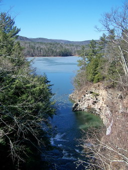
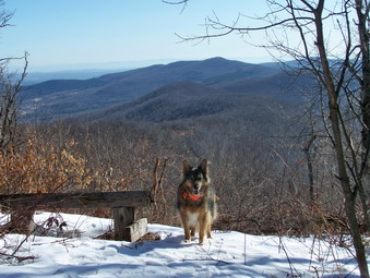
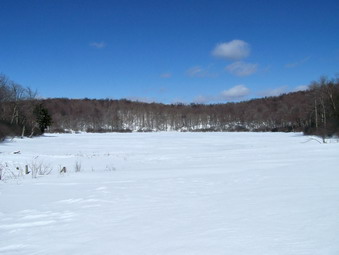
![]() On Saturday, Mar 21st it was a short drive from Mine Kill Falls north on Route 30 to Vroman's Nose outside Middleburgh. As we approached Vroman's Nose was VERY apparent as it rises 700 feet from the flat Schoharie Plain. I stopped along the road and took some pictures at about 12:45 PM before following the signs that directed me to turn left on Mill Valley Road. In minutes we were at the parking area and saw other people for the first time. Sheba and I got out of the car and prepared to hike while several other people started ahead of us. The first part of the trail ascended a hill through a field which was very wet and muddy. I had left my poles behind and almost returned for them! As the trail entered the woods, it split and the choice was to got left or right. I decided to go right and ascend the longer but shallower route and descend the steeper trail. Soon we were passing the group ahead of us. The trail continued to be very wet and muddy until we reached the trail, register.
On Saturday, Mar 21st it was a short drive from Mine Kill Falls north on Route 30 to Vroman's Nose outside Middleburgh. As we approached Vroman's Nose was VERY apparent as it rises 700 feet from the flat Schoharie Plain. I stopped along the road and took some pictures at about 12:45 PM before following the signs that directed me to turn left on Mill Valley Road. In minutes we were at the parking area and saw other people for the first time. Sheba and I got out of the car and prepared to hike while several other people started ahead of us. The first part of the trail ascended a hill through a field which was very wet and muddy. I had left my poles behind and almost returned for them! As the trail entered the woods, it split and the choice was to got left or right. I decided to go right and ascend the longer but shallower route and descend the steeper trail. Soon we were passing the group ahead of us. The trail continued to be very wet and muddy until we reached the trail, register.
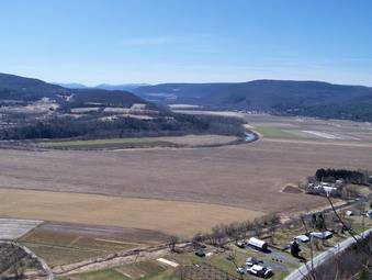
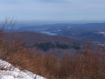
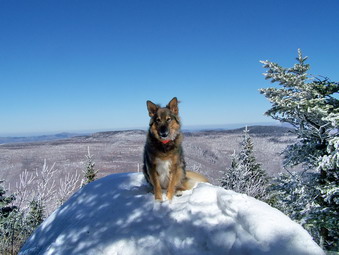
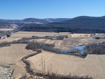 I signed in at the register and stopped at the viewpoint just passed the register. The views were amazing and I took some pictures even though I suspected the ones from the top would be better. I also took some pictures of the trail before ascending to the top. On top the view is breath taking! Anything anyone can tell you or write cannot describe just how good this experience is! You can look down at the houses and farms below you or to the south out across the flat plain to the mountains beyond. The meandering Schoharie Creek cuts through the plain. Orchards and neat, rectangular fields divide the flat land. As you walk you can see to the west. Further along the view changed to the east and the cliff if the Helderberg Escarpment. I had to be careful as I walked along the cliff edge. I was so enthralled by the views I had to make an effort not to misstep. After taking in as much as we could, we headed down the steeper east side of the trail and back to the car. We were back in the parking area shortly after 1:30 PM and headed home. We arrived before 4:00 PM. The driving distance to Vroman's Nose was about 80 miles which is much shorter than it looks on the maps. The whole trip was well worth the drive.
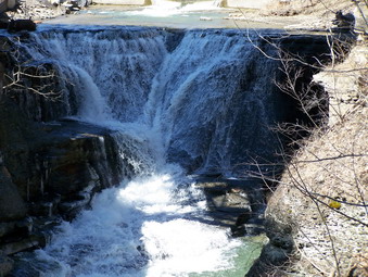
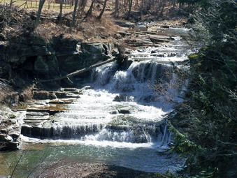
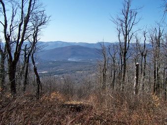
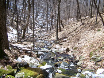
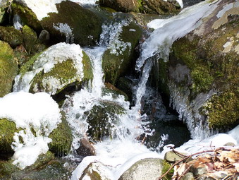
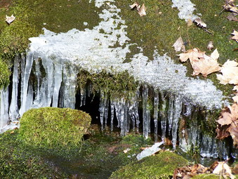
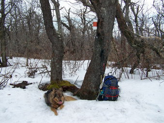
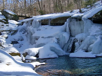
![]() On Saturday, Mar 21st it was a short drive from Manor Kill Falls north on Route 30 to Mine Kill Falls. A parking area on the right accommodates quite a few cars but we were the only ones present on this beautiful day. Cindy and I had been here before once while returning from Thacher Park but the parking area closes at 3:00 PM. We arrived and parked at about 12;00 PM and immediately followed the path to what was marked as a "scenic overlook". A series of well constructed steps leads down to several platforms that overlook the falls. I was disappointed since one view was spoiled by construction on the road bridge and obvious concrete chutes to direct the water. The lower platform gives a more natural view but it is from on top looking down at the falls. I did take some pictures before heading back up the steps. One of these pictures caught a small rainbow formed by some spray. To the left the Long Path leads down a broad open trail toward the Mine Kill. Sheba and I walked down the path for a ways and then turned left into the woods to "bushwhack" toward the falls. It turned out that this was unnecessary since the Long Path meandered in that direction anyway.
On Saturday, Mar 21st it was a short drive from Manor Kill Falls north on Route 30 to Mine Kill Falls. A parking area on the right accommodates quite a few cars but we were the only ones present on this beautiful day. Cindy and I had been here before once while returning from Thacher Park but the parking area closes at 3:00 PM. We arrived and parked at about 12;00 PM and immediately followed the path to what was marked as a "scenic overlook". A series of well constructed steps leads down to several platforms that overlook the falls. I was disappointed since one view was spoiled by construction on the road bridge and obvious concrete chutes to direct the water. The lower platform gives a more natural view but it is from on top looking down at the falls. I did take some pictures before heading back up the steps. One of these pictures caught a small rainbow formed by some spray. To the left the Long Path leads down a broad open trail toward the Mine Kill. Sheba and I walked down the path for a ways and then turned left into the woods to "bushwhack" toward the falls. It turned out that this was unnecessary since the Long Path meandered in that direction anyway.
 The Long Path leads down to the pool at the base of the falls. The water was high and the falls were small but roaring. The water in the pool was very green. The sunlight illuminated the water rushing from the narrow slit in the rocks cut by the kill. I took many pictures of the falls and surrounding high cliffs from different angles. I shot a few pictures down the stream to show the large cliffs that the stream has cut over the years. Sheba and I walked around a bit and then returned the whole way on the Long Path. This is a short but steep little hike. The rewards are well worth the effort. We got back in the car and headed north on Route 30 toward Middleburgh and Vroman's Nose.
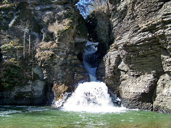
![]() On Saturday, Mar 21st Sheba and I left Huntersfield Mountain and headed back toward Prattsville. We took Route 7 which follows the east side of the Schoharie Reservoir. The views through the trees are intermittent but pretty. By 11:35 AM we arrived at the bridge over the Manor Kill which empties into the reservoir. I was not sure how to get pictures of the falls but parked at the side of the road and walked out onto the bridge. I took pictures upstream toward the upper falls and took some of the kill as it went under the bridge. I walked to the other side of the bridge and took pictures of the reservoir and the lower falls. Much of the lower falls is hidden by the bridge and the trees but the views out to the reservoir are excellent.
On Saturday, Mar 21st Sheba and I left Huntersfield Mountain and headed back toward Prattsville. We took Route 7 which follows the east side of the Schoharie Reservoir. The views through the trees are intermittent but pretty. By 11:35 AM we arrived at the bridge over the Manor Kill which empties into the reservoir. I was not sure how to get pictures of the falls but parked at the side of the road and walked out onto the bridge. I took pictures upstream toward the upper falls and took some of the kill as it went under the bridge. I walked to the other side of the bridge and took pictures of the reservoir and the lower falls. Much of the lower falls is hidden by the bridge and the trees but the views out to the reservoir are excellent.
 There was a break in the fence by the car and I decided to walk along high banks of the kill below the falls. I was hoping to get some pictures of the lower falls without being questioned as to my motives by the DEP police! The banks here are straight down and very high. I was only able to get some pictures through the trees. There were several possible ways to descend into the ravine but I did not know if there were any ways to ascend. I thought that having to be rescued would ruin the day! After taking what pictures I could, I returned to the car and headed for Route 30 north toward Blenheim an Mine Kills Falls.
![]()
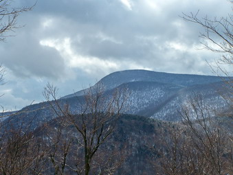
![]() On Saturday, Mar 21st I had initially planned to hike the Beaverkill and High Falls Ridge with several others as a part of the CHH. When the others had a change of plans I thought I might do these on my own since I already had permission from a friend to cross private property. I also thought about getting in one or two more winter and March peaks. In the end I decided on a plan that might get me back to Livingston Manor in time to represent my ambulance corps at another local corps 40th anniversary dinner. I planned to get up early, leave home early and hike Huntersfield Mountain, visit Manor Kill and Mine kill Falls and end by climbing Vroman's Nose. Two weeks before I had been on Bearpen looking at Huntersfield and it looked very interesting. I knew it was accessible by the Long Path and that it was the highest point on the Long Path outside the Catskill Park blue line. Descriptions I had read made the views sound beautiful. Sheba and I left Livingston Manor just after 6:30 AM and headed toward Roscoe where we picked up Route 206 toward the Pepacton Reservoir. From here we headed toward Margaretville where we picked up Route 30 north to Grand Gorge and then Route 23 to Prattsville. This is where things got tricky since I failed to bring an adequate map and had only written directions. I turned onto Washington Street which soon became Route 10. We drove up and through some impressive mountains as I looked for a Y in the road. Soon There was the Y and I turned left on Route 11 which turned into Marv Rion Road. A right on Huntersfield Road took me straight toward the mountain and a DEAD END! I was at a snow plow turn around but then noticed a dirt road that looked in good condition. After a short trip down the dirt road a sign announcing Huntersfield Forest appeared. I turned around and parked along the side of the road next to the aqua blazes of the Long Path. It was barely 8:30 AM and the trip had not taken as long as I thought.
On Saturday, Mar 21st I had initially planned to hike the Beaverkill and High Falls Ridge with several others as a part of the CHH. When the others had a change of plans I thought I might do these on my own since I already had permission from a friend to cross private property. I also thought about getting in one or two more winter and March peaks. In the end I decided on a plan that might get me back to Livingston Manor in time to represent my ambulance corps at another local corps 40th anniversary dinner. I planned to get up early, leave home early and hike Huntersfield Mountain, visit Manor Kill and Mine kill Falls and end by climbing Vroman's Nose. Two weeks before I had been on Bearpen looking at Huntersfield and it looked very interesting. I knew it was accessible by the Long Path and that it was the highest point on the Long Path outside the Catskill Park blue line. Descriptions I had read made the views sound beautiful. Sheba and I left Livingston Manor just after 6:30 AM and headed toward Roscoe where we picked up Route 206 toward the Pepacton Reservoir. From here we headed toward Margaretville where we picked up Route 30 north to Grand Gorge and then Route 23 to Prattsville. This is where things got tricky since I failed to bring an adequate map and had only written directions. I turned onto Washington Street which soon became Route 10. We drove up and through some impressive mountains as I looked for a Y in the road. Soon There was the Y and I turned left on Route 11 which turned into Marv Rion Road. A right on Huntersfield Road took me straight toward the mountain and a DEAD END! I was at a snow plow turn around but then noticed a dirt road that looked in good condition. After a short trip down the dirt road a sign announcing Huntersfield Forest appeared. I turned around and parked along the side of the road next to the aqua blazes of the Long Path. It was barely 8:30 AM and the trip had not taken as long as I thought.
 Sheba and I started out immediately with the air temperature barely 20 degrees which was much colder than the forecast had predicted! My Icebreaker layers and 66 North fleece kept me plenty warm. I packed my Stabilicers but left the snowshoes in the car. I was trying out a new pair of Leki Thermolite poles which are much like my other pair. These have a softer grip and a slight angle to the handle. If anything, they are lighter than the Super Makalus. The first part of the trail paralleled a small stream and then crossed it. The trail did not appear to be much used with a few branches here and there. Without the blazes and Sheba it might have been hard to tell where the trail was. The trail was wet and soft in places but there was no snow. In a very short distance we turned left onto a woods road and entered a red pine plantation. The thought crossed my mind that bushwhacking a direct route would be quicker but I decided to stay on the Long Path to respect property rights and the environment. The trees were very tall and the road well defined. Shortly we ran into an area with MANY large trees and branches across the trail. Rather than attempt to remove these the trail had been "officially" rerouted and blazed around the blowdown.
 Soon the trail turned right into the woods and began to ascend a ridge line toward the summit. The walking was relatively easy with only a few patches of ice and snow along the way. At one point I thought I saw a viewpoint to the right and walked over to take a look. There was a nice view to the north and I took some pictures of the mountains in that direction. As we hiked up the trail there were many good views through the trees but none that offered photographic opportunities. All along the way I looked for other viewpoints but none seemed evident and the reports I had read said that some were available from points on the summit. We passed several rock outcroppings and ledges and intersected at least one woods road. Somewhere above 3000 feet the ground was covered with several inches of frozen snow and ice. Snowshoes were not necessary but I almost took out the Stabilicers.
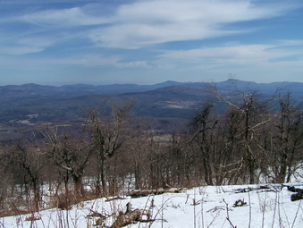
 Soon we were on the flat and wooded summit of the mountain and continued to walk over the top. A yellow trail came in from the right but we continued on the long path to the sign pointing to the lean-to. We turned toward the lean-to and almost immediately came across a bench marking a viewpoint to the east. We stopped so that I could take some pictures toward the Ashland Pinnacle and Richmond Mountain. We returned to the trail and were at the lean-to in only a few minutes. The view here was to the south into the heart of the Catskills. The mountains of the Devil's Path were clearly visible but Slide Mountain in the distance dominated the view. From here it looked more impressive than ever. I took several pictures but we didn't stay too long as we were on a tight schedule. On the way back we walked down the Long Path to the east. I was looking for another viewpoint and almost decided to continue at least to the Pinnacle. I finally decided to stick with my plan and leave the rest of the range for another time.
 On the way back to the summit I discovered the USGS benchmark. We walked down the yellow trail for a short distance but found no obvious lookouts. Back on the Long Path we simply started a quick descent back to the car. We were back just before 11:00 AM having completed a little under 5 miles in 2.5 hours. Some of this time went into taking pictures and "exploring". An the Huntersfield Road I stopped to take some more pictures of the mountains to the south which were impressive even from the lower elevation. Several year round houses on this road has SPECTACULAR views! I drove back to Prattsville heading for Manor Kill Falls.
![]()
![]() On Saturday, Mar 14th I head for Shaft Road off Route 42 north from Shandaken to hike Mount Sherrill. I had been thinking about this all week since I had never been up this way but had come in from North Dome. I planned to head up to the Col between Balsam (one of many in the Catskills) and Sherrill by paralleling one of the streams that flows down from the ridge connecting the two mountains. As I drove toward my destination I half hoped that someone else would be there since bushwhacking alone makes me a little nervous. This is particularly true in the winter and when I have not been in the area before. When I arrived at 9:35 there was one car in the parking area but no one was in the car. Sheba and I got ready quickly and shoved off. The temperature was still in the 30's but had been climbing since I left the house. The forecast called for highs near 50 with partly cloudy skies all day. I had a light Haglofs Spider softshell on over my Icebreaker base and mid layers. Since much of the snow has gone, I have switched back to my Asolo TPS 520 boots. I did wear a baselayer under my Mountain Hardwear Winter Wander pants. I packed my Stabilicers and had my MSR Lightning Ascent snowshoes attached to my pack. We walked up the access road to the Catskill Aqueduct shaft all the way to the shaft and then headed up the hill after I took a quick bearing. Our adventure had begun!
On Saturday, Mar 14th I head for Shaft Road off Route 42 north from Shandaken to hike Mount Sherrill. I had been thinking about this all week since I had never been up this way but had come in from North Dome. I planned to head up to the Col between Balsam (one of many in the Catskills) and Sherrill by paralleling one of the streams that flows down from the ridge connecting the two mountains. As I drove toward my destination I half hoped that someone else would be there since bushwhacking alone makes me a little nervous. This is particularly true in the winter and when I have not been in the area before. When I arrived at 9:35 there was one car in the parking area but no one was in the car. Sheba and I got ready quickly and shoved off. The temperature was still in the 30's but had been climbing since I left the house. The forecast called for highs near 50 with partly cloudy skies all day. I had a light Haglofs Spider softshell on over my Icebreaker base and mid layers. Since much of the snow has gone, I have switched back to my Asolo TPS 520 boots. I did wear a baselayer under my Mountain Hardwear Winter Wander pants. I packed my Stabilicers and had my MSR Lightning Ascent snowshoes attached to my pack. We walked up the access road to the Catskill Aqueduct shaft all the way to the shaft and then headed up the hill after I took a quick bearing. Our adventure had begun!
 As we ascended the first hill, an old woods road took off in the direction we were going so we followed it. There appeared to be ATV tracks along the road. The road led through and old stone wall and paralleled the stream. As we continued we would lose the road and then gain it again in different places. Much of it was overgrown and the bushwhacking soon began in earnest. There was little or no snow so I could not follow the tracks of previous hikers and I had no idea whether or not this was the customary route. By paralleling the stream we were headed for the Col as I had planned. I was surprised at the deep ravine that the seemingly small stream had cut over the years. On the opposite side I could see that the ascent would be too steep and there was much more snow. At some point I realized that I was only about half a mile or so from a Balsam Mountain that was on the Catskill Hundred Highest list. I decided that I would make this my first peak on that list that I had specifically hiked for that reason. (Imagine how I felt when several people pointed out that this Mountain is too close to Sherrill to be on the list!) I also though that since it wasn't a 35 it couldn't be that hard. Boy was I wrong!
 My sense of direction usually isn't as good as it could be but when I kept checking my GPS it showed me I was headed directly for the highest spot on the mountain. The terrain got steeper and I found a drainage area that went up the mountain. Soon the hike was more of a climb until I began to see VERY steep ground leading to the base of some nasty looking cliffs and ledges. No one has ever accused me of taking the easy way so I headed directly for the ledges. As I approached I could see several breaks in the cliffs and although the climb was steep Sheba and I were soon on top. Unfortunately, this was NOT the highest spot of the ridge and the brush was getting thicker. After several more climbs and some really challenging boulder fields we were approaching what was marked as the highest point on my GPS. Sure enough, there was a boulder with a rock cairn on top to mark the summit. Sheba immediately jumped up on the boulder and sat next to the cairn for some pictures. After a drink and a snack, we walked around the top looking for a viewpoint. There were some views but none that were unobstructed enough to take pictures. Also, for a mountain named Balsam, there weren't many evergreen trees at the top! I took a bearing to Sherrill and consulted the map. We headed southwest toward the Col and a narrow "bridge" of land between the two peaks.
 This part of the hike alternated between relatively open but snowy areas followed by more dense brush. Again, I kept my bearings and reorienting myself after each time I had to stray off course to avoid impenetrable areas. As we neared Sherrill, I looked at the map and decided to head slightly north to avoid the steeper climbs and ledges on the west and south side of Sherrill. This worked out nicely and the hike to the summit wasn't too steep although there were still some challenging spots. Near the top I began to see old footprints but couldn't find the canister. I followed the footprints until they started down and then turned around to see were they went. This lead me toward the canister whose red color made it easier to spot. I signed in and got a drink and gave Sheba one. We both had a snack as I contemplated my next move. The distance to North Dome is about 1.25 miles and has some steep ledges. Once on North Dome the choice would be to head out the Devil's Path for a LONG road walk back to the car or to go back to Sherrill and try to find a way down. Since I had never, attempted to come off Sherrill to the south, I wasn't sure how that would go. In the end I believe I made the best decision which was to save North Dome for another time. After walking around the top looking for a view, I took a southwest bearing and Sheba and I started down. At this point I was still bare booting but quickly decided to put on the Stabilicers. The melting and freezing on the south side had turned the snow to ice in many places!
 The descent wasn't too steep in most places and I made note that this was the way I would go if I did NOT want to hike Balsam again. I wasn't sure whether to try a totally new route or to head back to the path I had used on the outward journey. I decided to head a little more west and rejoin my previous route. I tried to stay far enough north to avoid descending the steep drainage of the stream but in the end drifted a little too far south. The descent into and back out of the ravine was steep but manageable and we stopped by the stream to take a few pictures. Soon we were back on our path from earlier in the day. Sheba had stayed with me most of the way out since she had no way to know which way we were going. Now that we were back on our previous path, Sheba led the way never straying from our route. Near the end I walked down to the stream to see if I could take some pictures of the impressive ravine. No photo opportunities presented themselves but I did notice a woods road on the other side of the stream and a stone wall along the stream in places. We walked back to the aqueduct shaft and then out to the car. We arrived back at the car around 2:15 PM making our hike of just over 5 miles a little short of 5 hours over very rough and challenging terrain.
![]()
![]() On Saturday, Mar 7th I decided to hit the 35's again by hiking Bearpen and Vly. I had only done these peaks once but remembered that the view from Bearpen to the north can be quite nice. Vly has no real view but I remember it as an easy hike. These two peaks lie outside the Catskill Park blue line and are surrounded by private property. Most of the summit of Bearpen now belongs to the state but some "posted" signs are still evident. Since the peaks are off the map north of Fleischmanns I hoped I could remember how to get there. Last time I spent some time on Johnson Hollow Road which is NOT the way to go. Sheba and I started from Manor at about 8:30 AM. I decided to go passed the Pepacton Reservoir on Route 30 and the east on Route 28 to Fleischmanns. From here I turned north on Lake street. Lake Street is named for Lake Switzerland which is now nothing more than a field with a stream running through it. I continued on Route 37, the Halcott Road. until it became Greene County 3. I followed this road and made only one wrong turn before arriving at the "parking area". Actually, I turned around in the snow plow turnaround and parked just below the "Private Property" sign on the right. We were out of the car and ready to go by 9:42 AM. The temperature was hovering around 50 degrees and there was only a little snow in the area. I packed by Stabilicers in the pack and strapped my MSR Lightning Ascents onto the pack. I thought that the warm temperatures might loosen the snow and create conditions best handled by snowshoes. I had on my two wool layers with a light REI Momentum jacket over them. This jacket breathes well but adds a little warmth. Its smooth exterior repels some water and doesn't snag on brush
On Saturday, Mar 7th I decided to hit the 35's again by hiking Bearpen and Vly. I had only done these peaks once but remembered that the view from Bearpen to the north can be quite nice. Vly has no real view but I remember it as an easy hike. These two peaks lie outside the Catskill Park blue line and are surrounded by private property. Most of the summit of Bearpen now belongs to the state but some "posted" signs are still evident. Since the peaks are off the map north of Fleischmanns I hoped I could remember how to get there. Last time I spent some time on Johnson Hollow Road which is NOT the way to go. Sheba and I started from Manor at about 8:30 AM. I decided to go passed the Pepacton Reservoir on Route 30 and the east on Route 28 to Fleischmanns. From here I turned north on Lake street. Lake Street is named for Lake Switzerland which is now nothing more than a field with a stream running through it. I continued on Route 37, the Halcott Road. until it became Greene County 3. I followed this road and made only one wrong turn before arriving at the "parking area". Actually, I turned around in the snow plow turnaround and parked just below the "Private Property" sign on the right. We were out of the car and ready to go by 9:42 AM. The temperature was hovering around 50 degrees and there was only a little snow in the area. I packed by Stabilicers in the pack and strapped my MSR Lightning Ascents onto the pack. I thought that the warm temperatures might loosen the snow and create conditions best handled by snowshoes. I had on my two wool layers with a light REI Momentum jacket over them. This jacket breathes well but adds a little warmth. Its smooth exterior repels some water and doesn't snag on brush
 Route 3 continues up the hill but all maintenance stops at the snow plow turn around. From this point on the road was mostly ice with snow or bare areas on the shoulders. The ice was from the melting snow which had been packed by snowmobiles. I decided to walk the shoulder rather than take time to put on the Stabilicers. As we walked up the road more there seemed to be more snow in the woods. I did not remember that the walk to the top of the hill is almost a mile long. We arrived pretty quickly at the hunting shack that marks the turn off for both Vly, to the right, and Bearpen, to the left. I had decided to hike Bearpen first since cloudy weather with rain was forecast for later. At this point the sky was completely clear and the sun was out. I was feeling warm but the track I was going to take was packed snow so I didn't want to stop to change. As I walked down the woods road I remembered my last hike when I spent a lot of time trying to find the Bearpen summit marked on the map. I was wiser this time! The Bearpen on the map is the Delaware County high point but NOT the highest point on Bearpen Mountain. This point is to the east of the marked point and is in Greene County. We stayed on the snowmobile packed woods roads fro some time as they wound their way up the mountain in the general direction of what I thought was the highest point. At one point I headed off into the woods to climb to a higher elevation and from here I could see our destination. Along the way I decided that the snowshoes would work better on my feet than on my pack! I also took off my midlayer Icebreaker 260 since I was getting very warm. Even in the woods there were snowmobile trails and we stuck to them most of the time. I cut up a steep little hill again and then followed a trail before making a final turn up into the woods. From here we bushwhacked until I saw the "edge" of the mountain ahead.
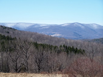
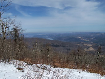
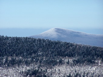
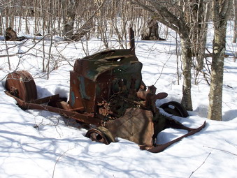 The view from here was beautiful and we stopped for a drink and a snack. I took pictures of the valley below and the mountain in the distance. The sky had a few clouds to add some interest and contrast. Some haze was hanging on the mountains but the view was still great. To the north and lightly west I could see the Schoharie Reservoir. Huntersfield Mountain was directly north and further east I could see Windham and a hint of the Blacks. We got back on the snowmobile trail and soon arrived at the abandoned ski slopes on Bearpen. An old truck that was used to power the ski tow was still present. I took some more pictures and wandered around to make sure I hit the highest point on the mountain. I decided to follow the snowmobile trail back to avoid pushing my way through the brush. I thought it probably led back to the point where I had started the bushwhack. With less than a quarter mile I found the point where my tracks cut up into the woods. We followed the snowmobile trail and reversed out path back to the hunting shack. Here we crossed the road to begin the climb up Vly. Coming down Bearpen I had looked across to Vly and it looked harder than I remembered.
 The hike up Vly began as a pretty easy "follow the herd path" situation. I was surprised that the tracks in the snow were so undefined. Sheba was able to pick up the trail and follow it quite easily. I have learned that following the trail of a previous hiker MAY be a good idea but only if that person knew where they were going. After a short climb the path levels some and winds its way through the woods to the base of the main mountain. In the areas of the steepest climbs the snow was loose and getting a foothold was difficult even with the grip of the MSRs. Sometimes the snow would let loose from the underlying ground and a slide was inevitable. In other areas, the snow was packed but has started to melt leaving ice behind. These areas always seemed to be in the steepest spots as we ascended the ledges. The further up the mountain we went the steeper it got and the more ledges we had to go up and over. The path we were following did seem to pick its way through these ledges but that didn't make things easy!
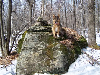
 We eventually made it up through the ledges and, after a short uphill walk, were on the relatively flat area at the top of the mountain. We followed the path which led directly to the canister. We stopped for a snack and a drink and I took some pictures of Sheba at the canister. I walked around to look for a viewpoint but each possible lookout is blocked by too many trees. The eye can see back to Bearpen and to much of the surrounding area but the camera cannot. After our break, we retraced our path down the mountain which went much faster than the ascent. As we were making our way down we met a couple, Jay and his wife Tally. They were hiking up Vly without benefit of snowshoes. Jay said they hadn't been out for some time and we discussed the route to the top and the fact that Bearpen is MUCH easier. As we continued down the mountain I could see that they were having trouble by the deep footprints they left behind! Soon Sheba and I were back a the road. The ice was mostly slush now but I decided to leave my snowshoes on for the mile walk down the road and back to the car. We arrived at the car just before 2:00 PM having taken a little over 4 hours for the 8 mile hike.
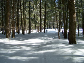
![]() On Monday, Mar 2nd school was closed for an early March snowstorm. The roads and streets did look bad but I didn't want to stay inside all day. At about 11:15 I decided the weather wasn't going to get any better and got ready to snowshoe at Frick Pond. I decided that the 15 degree temperature and 15 mph wind would make conditions difficult. I thought I would try my new Backcountry Fleece Tights under my AFRC Primo Pants for added warmth. I also donned my Marmot Genesis Jacket since it has a hood. I put on two layers of Icebreaker wool under this and was ready to go. I drove VERY cautiously out the DeBruce Road toward the turn to Frick Pond. The road had been plowed and sanded and was in relatively good shape if you were driving carefully. Fish Hatchery Road had also been cleaned and as I headed up the road I caught up with the snowplow doing the work. At the split in the road the plow went right toward Mongaup Pond and I turned left to the Frick parking area. This part of the road had NOT been plowed. We parked at about 11:45 and immediately set out for Frick Pond. The car said the air temperature was 12 degrees and the wind sounded a little like a freight train.
On Monday, Mar 2nd school was closed for an early March snowstorm. The roads and streets did look bad but I didn't want to stay inside all day. At about 11:15 I decided the weather wasn't going to get any better and got ready to snowshoe at Frick Pond. I decided that the 15 degree temperature and 15 mph wind would make conditions difficult. I thought I would try my new Backcountry Fleece Tights under my AFRC Primo Pants for added warmth. I also donned my Marmot Genesis Jacket since it has a hood. I put on two layers of Icebreaker wool under this and was ready to go. I drove VERY cautiously out the DeBruce Road toward the turn to Frick Pond. The road had been plowed and sanded and was in relatively good shape if you were driving carefully. Fish Hatchery Road had also been cleaned and as I headed up the road I caught up with the snowplow doing the work. At the split in the road the plow went right toward Mongaup Pond and I turned left to the Frick parking area. This part of the road had NOT been plowed. We parked at about 11:45 and immediately set out for Frick Pond. The car said the air temperature was 12 degrees and the wind sounded a little like a freight train.
The trail to Frick Pond had about 3 or 4 inches of fresh powder on top of a hard packed base. There was still plenty of snow underneath despite the rain and warmer temperatures of last week. At Frick Pond Sheba went left toward the pond and I followed her. As we approached the pond the wind hit us square in the face and we quickly walked across the bride to seek some shelter. Most of the snow from the pond was deposited by the wind in drifts at the other end of the bridge! As we headed around the pond, we were sheltered from the wind by the trees. After a short time we arrived at Times Square. I still had a lot of energy and Sheba seemed to be OK so I decided to climb the Big Rock trail to the Flynn Trail. As we climbed the Big Rock Trail I remembered that I ALWAYS underestimate the distance and elevation gain on this route. The trail was packed by snowmobiles with 4 or 5 inches of powder on top. The snow was now coming down so hard I just concentrated on walking in the track Sheba was laying down. Sheba slowed down some and waited so that I could always keep her in sight! The wind was blowing hard and we were more exposed on this trail. I did appreciate the fleecy tights and the Genesis jacket and layers worked VERY well. In fact, as we climbed I stopped to open the pit zips as I was actually getting too warm.
It didn't take us too long to reach the junction with the Flynn Trail. Here we turned right and headed down the trail and back to the car. The forest rangers had been on the trail with their sleds but I could barely pick out the track as the snow fell and drifted over the trail. I did stop to close the pit zips since the wind was at my back and descending uses a LOT less energy that climbing. Sheba kept getting covered in snow and shaking it off. I found that snow was getting BEHIND my glasses and that metal frames will freeze to your eyebrows. The Flynn Trail always seems long but soon the gate was in sight. We stayed on the trail by turning left at the gate and returning to the car. We were gone about and hour and a half and there was over and inch of new snow on the car.
![]()
![]() On Saturday, Feb 28th I decided to finish the month by bagging one or two more 3500's. I decided to head for Westkill and then do SW Hunter if I had anything left. The roads were icy starting with the DeBruce Road and continuing on the Frost Valley Road passed Slide. There were a few cars parked at Biscuit Brook, Slide and Panther. The roads improved as we neared Big Indian and stayed pretty good until the last part of the road to the Westkill parking area. When we arrived another hiker was getting ready to depart. We said hello and found we "knew" each other from the ADK High Peaks Forum. We decided to hike together. The air temperature was in the mid-twenties and there was no wind. I packed my Stabilicers IN my pack and attached my MSR Lightning Ascent snowshoes TO my pack with bungee cords. I didn't know whether I would need either but decided to be prepared. We shoved off at 10:45 AM and kept a good pace as we headed for the Falls. ON the way wee passed three people and a small, short-haired dog by the West Kill. The falls were frozen and very pretty but I decided to let the "get to your destination" first rule supersede the "take the picture while its there" rule. We walked over the bridge and turned right onto the Devil's Path and started the climb UP Westkill
On Saturday, Feb 28th I decided to finish the month by bagging one or two more 3500's. I decided to head for Westkill and then do SW Hunter if I had anything left. The roads were icy starting with the DeBruce Road and continuing on the Frost Valley Road passed Slide. There were a few cars parked at Biscuit Brook, Slide and Panther. The roads improved as we neared Big Indian and stayed pretty good until the last part of the road to the Westkill parking area. When we arrived another hiker was getting ready to depart. We said hello and found we "knew" each other from the ADK High Peaks Forum. We decided to hike together. The air temperature was in the mid-twenties and there was no wind. I packed my Stabilicers IN my pack and attached my MSR Lightning Ascent snowshoes TO my pack with bungee cords. I didn't know whether I would need either but decided to be prepared. We shoved off at 10:45 AM and kept a good pace as we headed for the Falls. ON the way wee passed three people and a small, short-haired dog by the West Kill. The falls were frozen and very pretty but I decided to let the "get to your destination" first rule supersede the "take the picture while its there" rule. We walked over the bridge and turned right onto the Devil's Path and started the climb UP Westkill
 For some reason I always underestimate Westkill! It is true that it does not have many steep ledges to climb over and the rock scrambles are few. It is a pretty long hike for a single mountain and there ARE some tricky areas. Along the way my companion stopped to stretch and encourage Sheba and I to continue. I though twice but in the end decided he meant it and we headed off. I was still barebooting it without any trouble and without postholing. Somewhere around 2700 to 300 feet the snow got deeper and the direct sunlight loosened it so that I started to sink in AND needed the extra traction. The next stretch of trail involved some sidehilling and I was glad I had put on the snowshoes. Pretty soon we arrived at a steep climb through some rocks which, in winter, is often covered by a thick layer of ice. The ice was there but covered by a layer of granular, frozen snow. The MSR snowshoes are GREAT for gripping and traction even if the bindings leave something to be desired! I scrambled up after Sheba and we were soon passing the "cave" and the 3500 foot sign. There were several large blowdowns along the way which force the hiker to get VERY low or walk around them. It seemed to me that the temperature had dropped but we were protected from the wind by the trees. The trail levels some and then descends before the ascent to the Buck Ridge Lookouts. Just as we began the ascent we met three hikers coming down the trail toward us. I said hello but did not ask whether they were hiking through from Mink Hollow or were doing and out and back like myself. I had been following some track but could not tell exactly how old they were.
 Soon Sheba and I were making the final assault on the climb to the lookouts. When we got there, I was surprised to find the sky quite clear and very blue. I also noticed that the wind was blowing but was more focused on the final short hike to the summit. Within minutes we were at the sign and cairn marking the top. I always hike a ;little further since my GPS indicate a higher elevation further along the trail and it seems to me you do gain a little elevation in this direction. We turned around and headed back to Buck Ridge to take in the view and take some pictures. I removed my pack and got out the camera and realized that I was cold AND the wind was at least 20 mph. We walked over to the lookout to the north. Sheba immediately jumped up an "her" rock so that I could take some pictures. After a few shots, she looked at me as if to say "Can I get down now?" I took a few more distance shots and then some close ups of the ice and snow on the trees. The other side of the lookout has more to see and I took many photographs from different angles. After putting the camera away, we retreated to the cover of some trees to get a drink and a snack before heading down.
 I was happy to be headed back and won out of the wind. After descending from the lookouts we met the hiker from the parking lot. He had switched to snowshoes and was headed for the summit. He said that the last time he was on Westkill he broke trail in deep snow as far as the lookouts and could go no farther. He was back to claim his prize! As we continued on the trail we met two more groups of hikers ascending and all were wearing snowshoes. I kept mine on the entire way back since they actually make descending easier and make the load on the back lighter. At the falls I decided to work my way down to the base to take some pictures. The direct rays of the sun had melted the snow on the path down to the falls making descending difficult. I left my pack begin at the top and just took the camera. I did get some very nice photographs. When it came time to climb back up, I had a tough go with the melted snow! Back on the trail we moved quickly over the last mile on were back at the car by 2:45 PM. We covered the 6.5 miles in 4 hours with time out for pictures on the lookouts and at the falls. The conditions in the valley had not changed! This is a good example of how conditions at the trailhead may not reflect the conditions on the summit!
![]()
![]() On Saturday, Feb 21st I wasn't sure where I wanted to hike but I WAS sure I wanted a break from the 35's. Climbing peaks is fun but sometimes I just want to go out and walk and enjoy myself without a monumental challenge. I though I might go south to Harriman if Cindy wanted to go but she had some work to do and decided to stay at home. I didn't feel like driving a long way without her so I took Sheba and headed for Frick and Hodge Ponds. I was thinking a quick snowshoe for some exercise and then back home. It didn't quite turn out that way. We arrived at the parking area at 9:20 AM and it was immediately obvious that this area got more snow than we did in town on Wednesday night! When we got out of the car the temperature was in the low 20's but a wind was howling. I out on my gear and got on the trail to take advantage of the shelter of the trees. The trails around these two ponds offer a HUGE number of variations and in the winter even more. Some trails are dual use for snowmobiles and hiking and are usually packed an easier to snowshoe while others are hiking only. My intention was to hike to Frick Pond, go around the back of the pond to Times Square, take the Logger's Loop to the Quick Lake Trail, turn onto the Flynn Trail at Junkyard Junction, take the Flynn Trail to Hodge pond and the to the junction with the Big Rock Trail. At Big Rock I could continue on the Flynn Trail or use the Big Rock Trail to get back to Times Square.
On Saturday, Feb 21st I wasn't sure where I wanted to hike but I WAS sure I wanted a break from the 35's. Climbing peaks is fun but sometimes I just want to go out and walk and enjoy myself without a monumental challenge. I though I might go south to Harriman if Cindy wanted to go but she had some work to do and decided to stay at home. I didn't feel like driving a long way without her so I took Sheba and headed for Frick and Hodge Ponds. I was thinking a quick snowshoe for some exercise and then back home. It didn't quite turn out that way. We arrived at the parking area at 9:20 AM and it was immediately obvious that this area got more snow than we did in town on Wednesday night! When we got out of the car the temperature was in the low 20's but a wind was howling. I out on my gear and got on the trail to take advantage of the shelter of the trees. The trails around these two ponds offer a HUGE number of variations and in the winter even more. Some trails are dual use for snowmobiles and hiking and are usually packed an easier to snowshoe while others are hiking only. My intention was to hike to Frick Pond, go around the back of the pond to Times Square, take the Logger's Loop to the Quick Lake Trail, turn onto the Flynn Trail at Junkyard Junction, take the Flynn Trail to Hodge pond and the to the junction with the Big Rock Trail. At Big Rock I could continue on the Flynn Trail or use the Big Rock Trail to get back to Times Square.
 As we started on the trail it was clear some ignorant hikers had walked toward Frick Pond without snowshoes. The trail had postholes starting right at the parking area. Fortunately, the snow was still powder and I was able to walk over their mistake without too much trouble! As we approached Frick Pond the wind picked up and there were deep drifts on either side of the bridge. I elected not to stop for pictures because of the wind and because I have taken the same pictures of Frick MANY times. Apparently the bareboot hikers had turned back at the bridge since there was unbroken snow on the other side. There was A LOT of unbroken snow on the other side. As we walked around the back of Frick Pond the snow was 6 to 8 inches deep and totally untouched. The air temperature was rising with the sunny skies and the day was beautiful. We soon arrived at Times Square and turned left to go up the Logger's Loop Trail. The trail was packed by snowmobiles but none had passed this day.
 Walking on the snowmobile trail was much easier than breaking trail through the powder and we made good time up the Wagon Wheel Junction. UP is the important word here since the Logger's Loop ascends for about 1.2 miles to the trail junction. There are no noticeable hills just a constant ascent. At Wagon Wheel I thought about turning left on the Quick Lake Trail to cut the hike short. The trail was completely unbroken and Sheba continued straight ahead so I followed. The Quick Lake trail to Junkyard Junction is another 1.5 miles of packed snowmobile trail that ascends the entire way. We were passed by two sleds at one point and I wondered why more people weren't taking advantage of the wonderful day. At Junkyard Junction we turned right onto the Flynn Trail. I don't know why but the Flynn Trail seems to have MORE SNOW than any other place around. This day there was no less than 8 inches in most places with drifts of new snow up to 18 inches. Most of the time we were breaking trail through 10 to 12 inches of new powder! Soon the gate on the Flynn Trail appeared signaling a turn to the right to Hodge Pond. The last part of the trail to the pond was also covered in deep powder.
 We stopped a the pond for a drink and a snack and for me to take some pictures. The wind was blowing across the pond from the north and we were cooling off quickly. After only a short stop, we continued on the Flynn Trail toward the Big Rock junction. The area near the pond and for some distance up the trail was covered by deep drifted new powder. As we walked I realized that not only was I tired but that I had pulled some muscles in my upper right leg. The deep powder and the uphill hike from Hodge Pond was discouraging. If I stopped to rest, my leg would tighten up but if I didn't it would start to cramp. Once we got through with the ascent and were on more level ground the walking was easier but the snow was just as deep. All I could think of was hitting the trail junction and walking DOWN the Flynn Trail. The Flynn Trail is NOT a snowmobile trail but the forest rangers often use it to patrol and their sleds and I knew the trail would be packed for an easy descent. As we approached the trail junction, I noticed two sleds stopped and I greeted them as we approached. I looked ahead and got a real surprise! This was NOT the good kind of surprise! The Flynn Trail glistened with completely unbroken fresh powder. I looked down the packed Big Rock Trail and considered that route for a moment. We took the Flynn Trail instead since it is much shorter. The snow on the trail was at least 12 inches in most places with significantly higher drifts in places. Descending made my leg feel better but the trail rolls some in several places. After about 1.5 miles of descent the ranger cabin came into view. I decided to stay on the trail through the woods so that I could say we broke the ENTIRE Flynn Trail! We were back at the car by 1:05 PM having covered the 6 mile hike in 3 hours and 45 minutes.
![]()
![]() On Thursday, Feb 19th I decided to hike Panther from the old logging road at the north end of Winnisook Lake. The night before the weather forecasters missed AGAIN! One to 3 inches of snow became 4 to 6 inches and the roads were in poor shape. I took the Outlander with 4-wheel drive and started for Frost Valley. Driving slow and carefully we got to Winnisook and parked on the side of the road at about 9:45 AM. The air temperature was in the low 30's but a stiff breeze was blowing. I decided to try out my new Mountain Hardwear Torch jacket. This model is light with a minimal lining but has Windstopper and is water resistant. Due to the amount of snow I wore my Atlas 12 snowshoes. We got started right away. Immediately I noticed that the snow was sticky which made walking more difficult. The breeze continued to blow but the air temperature remained in the mid 30's with some periods of sun. After a short distance, I stowed the jacket in my pack and put on OR Powerstretch gloves. After about 1.3 miles we were at the trail junction for Giant Ledge and Woodland Valley. We continued on the trail toward Giant Ledge and Panther.
On Thursday, Feb 19th I decided to hike Panther from the old logging road at the north end of Winnisook Lake. The night before the weather forecasters missed AGAIN! One to 3 inches of snow became 4 to 6 inches and the roads were in poor shape. I took the Outlander with 4-wheel drive and started for Frost Valley. Driving slow and carefully we got to Winnisook and parked on the side of the road at about 9:45 AM. The air temperature was in the low 30's but a stiff breeze was blowing. I decided to try out my new Mountain Hardwear Torch jacket. This model is light with a minimal lining but has Windstopper and is water resistant. Due to the amount of snow I wore my Atlas 12 snowshoes. We got started right away. Immediately I noticed that the snow was sticky which made walking more difficult. The breeze continued to blow but the air temperature remained in the mid 30's with some periods of sun. After a short distance, I stowed the jacket in my pack and put on OR Powerstretch gloves. After about 1.3 miles we were at the trail junction for Giant Ledge and Woodland Valley. We continued on the trail toward Giant Ledge and Panther.
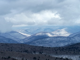 The trail to the Ledges starts out almost flat but soon starts to climb. The snowshoes worked well especially on the ice patches underneath the snow. We stopped just after the spring at the lookout toward Slide. The mountain was veiled in fog, clouds and snow. As I took pictures the scene changed so that there was sunshine on the mountain. We continued up the trail and I had little trouble negotiating the rock ledges up to Giant Ledge. Sheba never has any trouble. We stopped at one viewpoint and I took some pictures. Most of the mountains were covered in fog or clouds but there was quite a variety of views. Panther looked like it was covered in ice and snow and black clouds hung over the summit. The trail along the Ledges is pretty flat with a number of viewpoints. It then descends into the Col between the Ledges and Panther. The descent had several icy places and at least one spot that required a "jump" down. The snow in the Col was deep in places and drifted in others. The hike up Panther has several steep climbs followed by flat areas. Several of these had large icy patches hidden by the freshly fallen snow. I followed Sheba's lead up the slopes which was always the easiest that could be found. Soon we were at the top the last real climb and on the way to the summit.
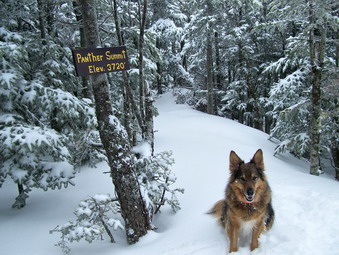 By the time we were approaching the summit I was beginning to get tired from the snow constantly sticking to my snowshoes. I was glad the return trip was mostly down! By the time we reached the summit it was snowing and the valley and hills visible from the Panther lookout were barely visible. The trees at the summit were covered with ice and snow making a beautiful scene. After taking some pictures and getting a snack, we turned around to retrace our path. The descent down Panther was pretty easy except for the icy areas and we were soon in the Col. I had worried about the climb back up to the Ledges but the ascent was easier than the descent. The snow had intensified and was now mixed with some sleet. The views from Giant Ledge were all obscured by the snow. The descent down from Giant Ledge was fast as was the hike to the trail junction. We returned along the old logging road as the snow continued to increase. The temperature was dropping and the wind was increasing. Somehow the snow was STILL sticky to the snowshoes. This part of the hike went VERY slowly! We finished the 6 mile hike just passed 2:00 PM taking about 4 hours and 15 minutes.
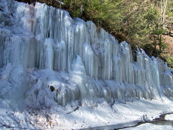
![]()
![]() On Tuesday, Feb 17th I decided to go to Kaaterskill Falls in the afternoon after hiking Twin and Indian Head. The Falls are so popular going there on a weekend is impossible but Tuesday seemed like a good day to visit. I expected that the Falls would be impressive in winter and should be at least partly frozen. We parked just after 3:00 PM and were one of only two or three cars in the lot. I lightened my pack and stowed the Stabilicers for the walk down the shoulder of Route 23C to the trailhead. This walk is dangerous since there is little shoulder. As we approached the falls I could see that Bastion Falls was a mass of ice and I knew that the hike would be worth the trouble. As I stepped over the guardrail I nearly skipped and fell. This encouraged me to immediately don the Stabilicers. I let Sheba off her leash and went down near the creek to photograph some aspects of the falls. When we went back up to the trail, I could see that it was a river of ice. Even with the traction on my feet, I felt uncomfortable for the entire hike! In some places we went off the trail to avoid the ice and get a better look at the creek. A short way up the trail we met a couple who were off trail taking some pictures. They had hiking boots on but no traction. I wondered how far they would get
On Tuesday, Feb 17th I decided to go to Kaaterskill Falls in the afternoon after hiking Twin and Indian Head. The Falls are so popular going there on a weekend is impossible but Tuesday seemed like a good day to visit. I expected that the Falls would be impressive in winter and should be at least partly frozen. We parked just after 3:00 PM and were one of only two or three cars in the lot. I lightened my pack and stowed the Stabilicers for the walk down the shoulder of Route 23C to the trailhead. This walk is dangerous since there is little shoulder. As we approached the falls I could see that Bastion Falls was a mass of ice and I knew that the hike would be worth the trouble. As I stepped over the guardrail I nearly skipped and fell. This encouraged me to immediately don the Stabilicers. I let Sheba off her leash and went down near the creek to photograph some aspects of the falls. When we went back up to the trail, I could see that it was a river of ice. Even with the traction on my feet, I felt uncomfortable for the entire hike! In some places we went off the trail to avoid the ice and get a better look at the creek. A short way up the trail we met a couple who were off trail taking some pictures. They had hiking boots on but no traction. I wondered how far they would get
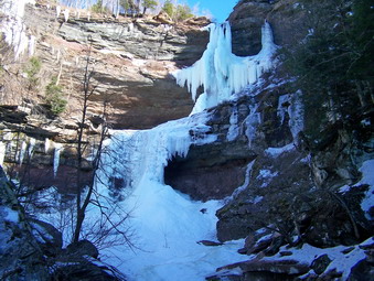 At this point I spotted some massive ice formations hanging on the opposite side of the creek. We went down to investigate and I took several pictures. I knew that this meant that Kaaterskill Falls should be very rewarding! We continued along the trail working our way carefully up and toward the falls. Just as I began to hear the falls we passed a couple in jeans and sneakers. I didn't know what to say. Just after that we walked out onto the viewing area for the falls at the base of the lower cataract. The lower and upper falls were frozen but some water was passing over them making the scene that much more beautiful. I took pictures from every angle and zoom hoping that a few could communicate the beauty that I saw. The couple is sneakers slid in as we were leaving. Sheba and I tried to climb up to the amphitheater between the falls and did make it part of the way up with great effort. At this point I could see that we would eventually meet walls of ice and we turned around. On our way back we met another group of hikers headed for the falls with hiking clothing but no foot traction. Another group was just leaving the area of Bastion Falls having seen the icy trail and wisely deciding not to attempt it.
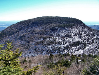
![]()
![]() On Tuesday, Feb 17th I again wanted to bag some more Catskill peaks and decided to head to Prediger Road to hike Twin and Indian Head. The weather prediction was about the same as the day before with temperatures expected to rise into the mid 30's. We arrived at about 10:00 AM and parked on Prediger Road. We were the only car there an I expected we would not see many other hikers. Based on my experience the day before I decided NOT to carry my snowshoes since I had not needed them on Monday. I did put on my Stabilicers since they had worked so well the day before. I expected the trails to Twin and Indian Head to be much like the Blacks; packed snow and ice. This time I wore my wool layers but opted for a Westcomb Nova Fleece on top. The temperature was actually a few degrees colder when we started and a slight breeze was blowing. Whoever plows Prediger Road had piled ALL the snow across the access road making the start of the hike a little treacherous. The road into the new parking area is now wide and level and the new parking area is large. The trail register has been moved to where the trail begins from the parking area. I don't know whether this parking area will ever be maintained during the winter but it should be ready for the spring.
On Tuesday, Feb 17th I again wanted to bag some more Catskill peaks and decided to head to Prediger Road to hike Twin and Indian Head. The weather prediction was about the same as the day before with temperatures expected to rise into the mid 30's. We arrived at about 10:00 AM and parked on Prediger Road. We were the only car there an I expected we would not see many other hikers. Based on my experience the day before I decided NOT to carry my snowshoes since I had not needed them on Monday. I did put on my Stabilicers since they had worked so well the day before. I expected the trails to Twin and Indian Head to be much like the Blacks; packed snow and ice. This time I wore my wool layers but opted for a Westcomb Nova Fleece on top. The temperature was actually a few degrees colder when we started and a slight breeze was blowing. Whoever plows Prediger Road had piled ALL the snow across the access road making the start of the hike a little treacherous. The road into the new parking area is now wide and level and the new parking area is large. The trail register has been moved to where the trail begins from the parking area. I don't know whether this parking area will ever be maintained during the winter but it should be ready for the spring.
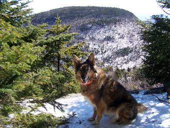 We headed up the Devil's Path until the junction with the jimmy Dolan Notch Trail and turned right onto this trail to go to the Notch. The Devil's Path up the eastern side of Indian Head can be difficult due to the constant melting and refreezing. I have had to turn back on at least one occasion and use full crampons on others! The Jimmy Dolan Trail winds back and forth through the forest for no really good reason that I can determine. The elevation gain is moderate initially until the last .3 or .4 miles and then the trail gets really steep. The going was pretty easy with a few slippery areas. I was reminded of one time last year when Sheba and I arrived to find over a foot of unbroken snow at the trailhead which slowly increased to several feet at the Notch. Breaking trail by myself in that mess was one of the hardest hikes I have ever done! This day was easy by comparison. On the steepest part of the trail to the Notch there was some postholing and evidence of slipping a sliding. When will people learn that they should come prepared for the conditions ON the mountains NOT AT the trailhead? At the Notch we stopped briefly for a drink and a snack and then turn right on the Devil's Path to ascend Twin. The double peak of Twin is harder than the .4 miles to the top of Indian Head and I wanted to finish it first. In addition, Twin is one of my favorite peaks.
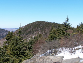 The start of the hike was remarkably similar to Black Dome the day before since the sun had melted some of the snow and the south and eastern sides of the mountain. As the trail curled back to the north side the packed snow and ice returned. In several places the piles of snow made getting up and over some of the rock formations a little EASIER but in many other places the footing was almost nonexistent. Climbing required careful foot and pole placement and paying attention to where the next step would take you. We finally got passed the hardest parts of the climb and arrived at the small viewpoint on the eastern side of Twin. We stopped so that I could take some pictures of Indian Head and the surrounding hills and valleys. The fire tower and TV/radio antennae on Overlook Mountain were clearly visible. We returned to the narrow trail that winds its way to the summit of the eastern peak. This trail leads directly to the open rock ledges that provide one of the nicest views in the Catskills.
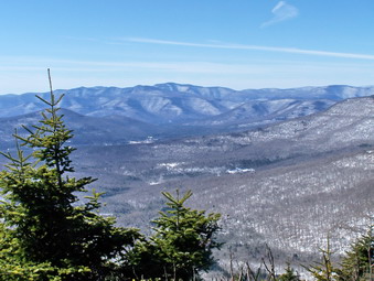 Each time I visit the viewpoint on the eastern peak of Twin I am impressed by the wide open view. On a clear day like this one the view seems to stretch forever. To the east Overlook Mountain can be seen while further in the background is the Hudson River. To the west is the higher, western peak of Twin, Sugarloaf and Plateau are clearly visible. The far peaks always have a strange blue-purple color and today the sky was a bright blue. I took MANY pictures before we were back on the trail to the western peak. As we walked I caught a glimpse of our destination. The hike is not trivial but did not take us very long. We were standing on the western viewpoint in about 15 or 20 minutes! The view from here is not much different but the angles and relationships change. After a few pictures, we retraced our path down into the Col between the two peaks and across the eastern viewpoint. Soon we were sliding down the trail to Jimmy Dolan Notch. We still had not seen any other hikers and I was not too surprised.
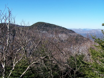 The summit of Indian Head is only about .5 miles from the gap and the trail starts out rather gently. There was quiet a bit of postholing along the way but this day the trail was still very packed and icy in spots. There are no really good lookouts on the climb up Indian Head but I though I might stop on the way back to get a shot or two of Twin. On the climb the snow was melted down to bare rock or dirt in several places. We reached the top of the plateau that forms Indian Head and continued to walk toward the summit. This required negotiating two tricky spots that were very icy. In one spot the ice had poured over a boulder an across the entire trail. The Stabilicers and poles helped as did grabbing on to some trees. In the other spot the hiker must pull himself up between two rocks and here there was a river of ice. We passed by the summit and headed down the other side. I wanted to see if I could get to the viewpoint that overlooks the Catskill Community and Kaaterskill High Peak. Eventually we got to an area I recognized and knew that going down would be dangerous and that the return would require crampons. The only other alternative would be to continue down the eastern side of Indian Head which was not in my plans. We turned around and continued back to Jimmy Dolan Notch. On the way I took several pictures of Twin on the descent of Indian Head. The descent from Jimmy Dolan went quickly but the walk along the lower part of the trail seemed to take forever. Less than a mile from the car we met a pair of hikers just starting out. I imagine they were not going far since it was already 2:00 PM. We got back to the car at about 2:15 covering the 6 miles in just over 4 hours. It was then that I decided to visit Kaaterskill Falls.
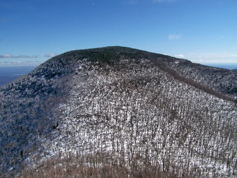
![]()
![]() On Monday, Feb 16th I wanted to get in a longer hike AND "bag" some 2500 foot peaks. The best way to do this is to choose a "group" that can be done in one day. Since I was free all day, I decided to head north to Big Hollow Road and hike all three Blacks. As usual I got a later start than expected and was at the parking area around 10:30 AM. The turn around was plowed but I chose to park behind another car on the right side of the road. There wasn't much snow on the road to the summer parking area but there WAS a lot of ice! My first decisions involved what to wear and whether or not to take my snowshoes. I decided on my "go to" Mountain Hardwear Windstopper jacket over my Icebreaker wool tops. I have been wearing the insulated Salomon B-52 boots lately even when not snowshoeing. They are warm and offer adequate support for hiking. I decided to wear my Stabilicers to combat the ice that started right at the beginning of the hike and to carry my Atlas 12 snowshoes. I was surprised that they attached to the Marmot Vapor 30 pack with a couple of bungee cords and without any problems. The only problem was that when I shouldered the pack I noticed the extra weight immediately. When Sheba and I started the air temperature was only in the mid-20's and a slight breeze was blowing
On Monday, Feb 16th I wanted to get in a longer hike AND "bag" some 2500 foot peaks. The best way to do this is to choose a "group" that can be done in one day. Since I was free all day, I decided to head north to Big Hollow Road and hike all three Blacks. As usual I got a later start than expected and was at the parking area around 10:30 AM. The turn around was plowed but I chose to park behind another car on the right side of the road. There wasn't much snow on the road to the summer parking area but there WAS a lot of ice! My first decisions involved what to wear and whether or not to take my snowshoes. I decided on my "go to" Mountain Hardwear Windstopper jacket over my Icebreaker wool tops. I have been wearing the insulated Salomon B-52 boots lately even when not snowshoeing. They are warm and offer adequate support for hiking. I decided to wear my Stabilicers to combat the ice that started right at the beginning of the hike and to carry my Atlas 12 snowshoes. I was surprised that they attached to the Marmot Vapor 30 pack with a couple of bungee cords and without any problems. The only problem was that when I shouldered the pack I noticed the extra weight immediately. When Sheba and I started the air temperature was only in the mid-20's and a slight breeze was blowing
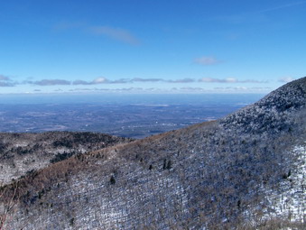 As we started up the Black Dome Trail the snow and ice thinned under the trees and more bare rock appeared. As I walked I looked at the creek that was frozen over and quite beautiful. Before I knew it I looked down and saw I was walking over a flow of solid ice! The flow was about 20 feet long and spanned the entire trail and I was already in the middle of it. I have a begun to wear and like the Stabilicers more and more. This experience convinced me that they are great for what they where made for. I still want to try MicroSpikes if I ever find them on sale. We crossed the first bridge and then the second and were soon at the trail junction. I chose to head directly up to Lockwood Gap and hike Black Dome and Thomas Cole first. I planned to then head back to the Gap and hike Blackhead and finally to return using the Black Dome Trail. Getting two peaks out of the way for less than two peaks effort usually improves my mood. Shortly after making the turn, I decided I was too warm and removed my jacket. I was hoping that the two Icebreaker tops would be enough and they were more than up to the task. At one point I looked down to see droplets of water on my chest and abdomen. I was still feeling warm and dry. Talk about wicking! I also noticed that the pack which had seemed heavy with the snowshoes no longer bothered me. I had a feeling I would not need them since the trail was VERY well-packed snow but I felt "prepared".
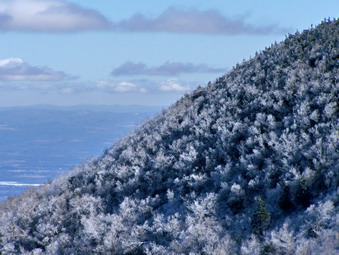 The trail to Lockwood Gap was very familiar and Sheba and I made good time. As the trail begins the approach to the mountains and the actual climb it begins a series of switchbacks. The first view of the two mountains always impresses me. In particular, turning toward Blackhead and looking up is a daunting sight. I often look up at the mountains I am about to climb and wonder if it is even possible. From the peaks I look down and wonder just how I got up there. For me, this is the attraction in hiking these mountains! Soon we were at Lockwood Gap and we turned right to head up Black Dome. The trail was now more on the south and east side of the mountain and the snow was beginning to melt. This unconsolidated snow made hiking the slope difficult. I almost changed to snowshoes but, after one turn, the snow all but disappeared for a stretch and then the trail wound its way around to the north and west. Soon we were back on hard packed snow and ice. A few places climbing up the steeper parts of Black Dome and over the ledges were challenging but we were soon over them. Near the top we stopped so that I could take some pictures from the viewpoint facing east toward Blackhead and the Black Dome valley. The sky was very clear and the very blue. The air was not warm but there was little wind and the day was nearly perfect.
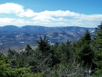 A short walk brought us to the summit and the rock ledge that acts as a viewpoint. The views from here were also beautiful stretching far and wide. We got a snack and a drink and I took many pictures at different angles and zooms. We then got back on the trail and headed for Thomas Cole. It was clear that fewer people had passed this way but the trail was still packed. The descent when quickly and I regretted that, although glimpses of Thomas Cole can be seen through the trees, there was no point where pictures of the mountain we were approaching could be taken. Although the hike to Thomas Cole is not very eventful it is not necessarily easy. This day ALL the short climbs were covered in hard packed snow and ice making the ascent and subsequent descent all the more interesting. We summited and then turned around and retraced our steps toward Black Dome and down to Lockwood Gap. An the descent of Black Dome we met a solo hiker coming up. We talked for a minute and then he said that I looked familiar and asked about this website. I assume he meant that Sheba looked familiar since there are far more pictures of her on the site. He asked to take a picture of Sheba before we parted company. Soon we were making the descent to the Gap with only a few minor difficulties.
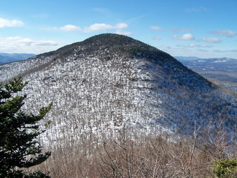 We continued straight ahead on the Blackhead trail up Blackhead Mountain. This is a fairly short climb with some steep areas. A few postholes had been present along the trail but they were particularly annoying in this area. The trail alternated between ice, packed snow and bare rock. We continued the ascent passed the various viewpoints as I intended to stop on the return trip. We quickly gained the top of the mountain and walked to the junction with the Escarpment Trail on the other end. There we found a young man and woman pouring over the map. We said hello and they started toward Lockwood Gap. After a few pictures, we retraced our path in the same direction. We caught up to the pair at the first lookout where I stopped to take some pictures toward Black Dome. The couple had stayed in the Batavia Kill lean-to the night before. They had ascended the east slope of Blackhead which they described as difficult. After taking my pictures, Sheba and I headed down to the Gap and back down the Black Dome trail. The northern side of the mountain was a little chilly where the sun was blocked by the mountains but we descended quickly. We were back at the car by about 2:15. We had covered the 7 mile hike in about 3,5 hours which is just as fast as during any other season!
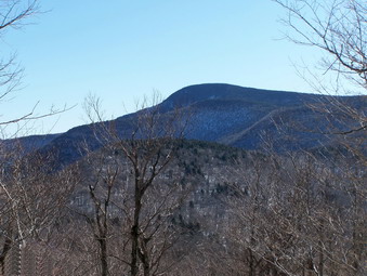
![]()
![]() On Sunday, Feb 15th Cindy and I decided to try again and headed for Giant Ledge after church. Cindy has been here many times before and was confident she could make the round trip. I decided we would not need snowshoes since this trail is popular and would be well packed. We did take our Stabilicers since several places along the trail are often VERY icy. There are also many rocky areas which make snowshoeing difficult unless there has been considerable fresh snow. As we passed Winnisook Lake we had the bright idea that we should use the old logging road that start just after the northern end of the lake. This road avoids all the rocky climbs and meets at the trail junction of the trail to Woodland Valley and the trail to Giant Ledge and Panther. This was a MISTAKE.
On Sunday, Feb 15th Cindy and I decided to try again and headed for Giant Ledge after church. Cindy has been here many times before and was confident she could make the round trip. I decided we would not need snowshoes since this trail is popular and would be well packed. We did take our Stabilicers since several places along the trail are often VERY icy. There are also many rocky areas which make snowshoeing difficult unless there has been considerable fresh snow. As we passed Winnisook Lake we had the bright idea that we should use the old logging road that start just after the northern end of the lake. This road avoids all the rocky climbs and meets at the trail junction of the trail to Woodland Valley and the trail to Giant Ledge and Panther. This was a MISTAKE.
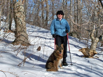 Everything started out OK as we made our way along the road which was covered with a thick crust over several inches of snow. Not many people use this route and only one snowshoe track was obvious. I broke through the crust once or twice but it didn't seem to be too serious. The further we went however, the weaker the crust got and the deeper the snow underneath became! Shortly, I was breaking through on every step and regretted not being prepared with snowshoes. I decided I had had enough since I did not know how much farther we had to go. Postholing is too difficult and I did not want to ruin the trail for anyone else. We reluctantly turned around and headed back to the car short of our goal for the second day in a row!
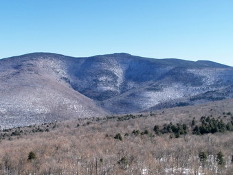 When we got back to the car I tentatively suggested that we go to the main trailhead and try the hike as I had originally planned. I was surprised when Cindy agreed saying she didn't want to leave without getting in a hike. We went down to the main parking area which was almost full and immediately set out on the trail at about 1:00 PM. The trail WAS very well packed and WAS icy in several places. The Stabilicers and poles helped a great deal and we kept a pretty good pace to the trail junction. Cindy was a little winded when we got to the junction and I had to keep moving so I got a little ahead on the trail to Giant Ledge. I stopped and waited and soon Cindy was headed my way with another hiker. Christine had recently moved up from Philadelphia and was eager to hike the Catskill 35's and get her patch. She was headed for Panther and was moving with the speed of youth. We talked and walked together for some time and then let her get on her way. We stopped at the lookout to Slide just after the spring and took some pictures before continuing. Soon we were at the first climb over the rock ledges to Giant Ledge.
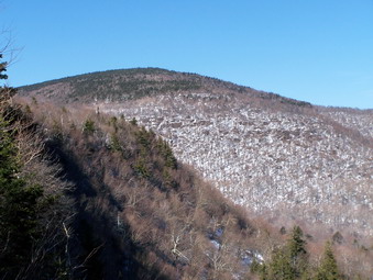 Christine had stopped to talk to a couple who were returning from Giant Ledge. We also stopped and chatted briefly about the 3500 Club and the different peaks. Christine was interested in the trailed and untrailed peaks. We decided to continue on up to the Ledges and said goodbye to the other three. The climb up over the rocks was tricky in places but we were soon at the top. On the way up we met several hikers coming back down. After a short walk, we arrived at the first viewpoint. The rocks were a sheet of ice so Cindy and Sheba stayed back while I took some very nice pictures of Panther and the Burroughs Range. The sky was as clear as I have ever seen it and was a beautiful shade of blue. We decided to return at this point and headed back down. Cindy said she had not seen Christine and I wondered if she had decided to turn around. As we descended the rock ledges we passed several other hikers. At the base of the climb Christine was just saying goodbye to the other couple and beginning to ascend. We said hello as she passed. It was about 2:30 PM by now and I wondered if she had any idea how long it might take to get to Panther and back. She was dressed in a cotton sweatshirt and denim jeans. The only traction she had was a set of broken Yaks. We both hoped she would make it out before dark!
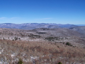 Cindy and I continued our descent and passed several more people on the way. Cindy may not ascend as fast As I do but she certainly keeps up on the descent! It had taken us over an hour to get up to Giant Ledge and just about an hour to get down. In several places our descent was sort of a controlled slide. Momentum helps as long as you can stop when you must. We covered some of the worst ice flows by simply skirting them or descending over them quickly. We were back at the car in just about two hours. This plus the initial aborted attempt made an acceptable outing for the day.
On Saturday, Feb 14th I asked my wife, Cindy, if she would like to hike somewhere. I wanted to get started on a week of 35's during my winter break from school. She chose Peekamoose from the Peekamoose Road trailhead. This hike is not very steep but it is long so I knew we would probably not be able to include Table also. We arrived at the trailhead and parked at about 11:00 AM along with only a few other cars. We decided to wear snowshoes since I had no reliable reports of the conditions near the summit. The air temperature was in the high 20's and began to rise to just above freezing as we walked. The trail was well packed as we did not need the snowshoes. We soon left the logging road and began to walk the trail which was also well-packed and wide open. As soon as we began to climb Cindy fell back and was simply not having a good day. Climbing up through the rock ledges was difficult and just short of Reconnoiter Rock Cindy had had enough. I was disappointed in missing the summit and not even being able to get to the first landmark but was happy we had gotten out together. We returned to the car after hiking for about 2.5 hours.
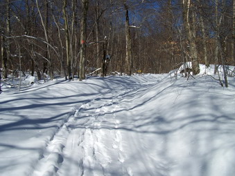
![]()
![]() On Wednesday, Feb 4th there was a half day conference at school. I took the day off for a family commitment that did not materialize so I decided to hike instead! I decided to go snowshoeing at Frick Pond again due to the fact that it was close and I had to be in Liberty for some basketball games in the evening. By the time we were all ready to go it was late morning and we parked at about 9:30 AM. The temperature was still in the single digits and a 20 mph wind was blowing! Sheba and I started off on Flynn Trail toward Hodge Pond. The trail showed some evidence of use but there were several inches of snow over old tracks, some of which were ours from Saturday! The trail is closed to snowmobiles but the forest rangers often use it to patrol on their sleds. Walking on these tracks was easier than stepping off to the side. I tried leaving the path several times only to since a foot through the crust and into the powder underneath. We walked quickly and made good time to the junction with the Big Rock Trail. The Flynn Trail is a continuous uphill for almost 1.5 miles but is never steep. At the trail junction Sheba and I continued straight ahead on the Flynn Trail toward Hodge Pond.
On Wednesday, Feb 4th there was a half day conference at school. I took the day off for a family commitment that did not materialize so I decided to hike instead! I decided to go snowshoeing at Frick Pond again due to the fact that it was close and I had to be in Liberty for some basketball games in the evening. By the time we were all ready to go it was late morning and we parked at about 9:30 AM. The temperature was still in the single digits and a 20 mph wind was blowing! Sheba and I started off on Flynn Trail toward Hodge Pond. The trail showed some evidence of use but there were several inches of snow over old tracks, some of which were ours from Saturday! The trail is closed to snowmobiles but the forest rangers often use it to patrol on their sleds. Walking on these tracks was easier than stepping off to the side. I tried leaving the path several times only to since a foot through the crust and into the powder underneath. We walked quickly and made good time to the junction with the Big Rock Trail. The Flynn Trail is a continuous uphill for almost 1.5 miles but is never steep. At the trail junction Sheba and I continued straight ahead on the Flynn Trail toward Hodge Pond.
 This part of the trail had not been used by snowmobiles or snowshoers in some time. I did find what looked like ski tracks and followed them. This made the walk easier than it could have been. As we began the descent to Hodge Pond I saw some postholing. It almost look as if the skier had removed his skis and walked for a short distance. The ski tracks picked up again heading toward the pond but I lost them as the snow had drifted. At times the snowshoeing consisted of the now all too familiar stepping, breaking through the crust and sinking in to some depth. Trying to lift your foot again meant getting the snowshoe caught on the crust and our progress was slow. As we neared the pond the wind picked up in intensity and the wind chill made the temperature well below zero! The snow had drifted and walking became that much harder. At the pond I had intended to take pictures but the view was one I had seen too many times before and I did not want to stop. I briefly thought about turning around as the Flynn Trail to the left looked completely unbroken. I decided to press ahead. This was a decision I almost regretted later!
 The Flynn Trail WAS completely unbroken with deep and drifted snow anywhere there was an open spot. The icy crust and drifted snow was able to support my weight in many places but in others I would break through! Going was VERY slow around the other side of the pond. At this point I was able to pick up some of the tracks we had laid down the last time we were on the trail. There had been a lot of snow and ice since them and the fact that we had been on the path seemed to make little difference! The Flynn Trail turns left away from the pond and starts a short and shallow climb at this point. I never realized what a challenge this little hill could be until this day. Finally we arrived a the gate but this didn't make much difference. Ahead of us lay more unused trail to break alone! We stopped for a drink and a snack before continuing. At this point there was no question about going ahead since turning around was MUCH longer and almost as difficult.
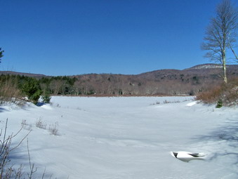 We slowly made our way along the trail with me trying to follow some of our tracks from the last trek. We would walk and then rest until we finally reached Junkyard Junction where the Flynn Trail ends at the Quick Lake Trail. The BEST part about this was that the Quick lake Trail is a snowmobile trail. Although it didn't show very recent use the snow was packed with only a few inches of powder on top. Sheba immediately took the lead and my own spirits lifted. We made great time along the packed trail as we descended toward Wagon Wheel Junction. The walk did seem longer than I remembered but was MUCH easier than the unbroken trail we left behind! We arrived at the junction with the Logger's Loop Trail and I had to make a decision. The Logger's Loop was packed snowmobile trail but longer than the Quick Lake route back to Frick Pond. Examination of the Quick Lake Trail showed little use and I worried about how hard it would be to break trail. As I was pondering, Sheba made the choice by turning right onto the Quick Lake Trail. There was a LOT of new snow and ice but the path we had used before was visible. Following this path was easier than breaking completely new trail. As I crossed the one small brook on the trail I sank deeper than I thought I should. As I pulled my snowshoe up I noticed I had broken through to the running water below. I waited for the feeling of cold water to engulf my foot but that never happened. I had immersed my foot just short of the top if my boot and the B52's are waterproof! We continued on our way and were soon at the pond. Here the wind was blowing but not as hard and the temperature had risen a degree or two. I stopped to take some pictures. On the way back to the parking area we were able to follow a well broken path the entire way. We finished the 6 miles in 3.5 hours and were both tired from the effort.
On Tuesday, Feb 3rd some snow and ice were predicted so the school cancelled all after school activities. I called home to see if Cindy wanted to snowshoe and she said OKAY. I hurried home right after school and Sheba, Cindy and I started up the hill behind the church by 2:30 PM to hike up Round Top. The temperature was cool but there wasn't much wind as we climbed the access road to the cemetery and turned left into the woods. We were soon on the familiar path to the top of the Round Top Ridge. Since we had been on the same trail just the day before it was packed and our tracks were clearly visible. We made good time to the top of the first hill where we decided to go straight ahead to follow the path to the next hill. We planned to go to the top of the next hill and then backtrack completely. Since we had been on this path the day before it was easier walking than then but was still harder than the packed path we had just left. There was still a lot of unconsolidated snow and icy patches. We made pretty good time despite the difficulties but Cindy was getting tired on the climb up the second hill. Sheba and I went ahead to the top and then picked Cindy up on our return. Going back was a little easier but some of the downhills were difficult. Cindy took one nasty spill on a descent that left here with a nice bruise on her thigh from the hard crust. We completed the route in about two hours.
On Monday, Feb 2nd I had games in the evening but decided to come home early to "treat" myself to some outdoor exercise before returning to school. Sheba and I started up the hill behind the church by 2:30 PM to hike up Round Top. The temperature was cool but there wasn't much wind as we climbed the access road to the cemetery and turned left into the woods. We were soon on the familiar path to the top of the Round top Ridge. Since we had been on the same trail several times before it was packed with only a few inches of snow on top and we made good time. At the top of the first hill I decided to go straight ahead to the next hill rather than turn left and go down through the woods. My plan was to go to the top of the next hill and then backtrack completely. We had not done this part of the route in some time and not since the last major snow and ice event. The entire walk was one of stepping into 10 to 18 inches of snow, breaking through the crust and sinking down, lifting the snowshoe to repeat the process OVER and OVER. This was hard work but good exercise and we made pretty good time despite the difficulties. At the top of the second hill we hiked to the top and then immediately turned around. Going back was a little easier and we completed the route in less than two hours.
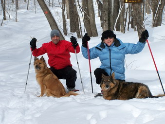
![]()
![]() On Saturday, Jan 31st I had planned to "bag" some peaks I needed for January perhaps meeting a group that was doing the Blacks from Barnum Road. Late in the week I found my son and his wife would be in town and the plans changed. He had a limited amount of time to spend hiking in the morning so we decided to go snowshoeing at Frick Pond. By the time we were all ready to go it was late morning and we parked at about 10:00 AM. The temperature was still in the teens and a 20 mph wind was blowing! We started off on the Logger's Loop trail toward Frick Pond. Our group consisted of me, my wife, my son Karl, my dog Sheba and his dog Maggie. The trail was untouched since Wednesday's snow and ice event. Where I had hiked on the weekend the trail was somewhat packed. In other places there was at least 18 inches of snow. There was a hard crust everywhere. Snowshoeing consisted of stepping, breaking through the crust and sinking in to some depth. Trying to lift your foot again meant getting the snowshoe caught on the crust and our progress was slow.
On Saturday, Jan 31st I had planned to "bag" some peaks I needed for January perhaps meeting a group that was doing the Blacks from Barnum Road. Late in the week I found my son and his wife would be in town and the plans changed. He had a limited amount of time to spend hiking in the morning so we decided to go snowshoeing at Frick Pond. By the time we were all ready to go it was late morning and we parked at about 10:00 AM. The temperature was still in the teens and a 20 mph wind was blowing! We started off on the Logger's Loop trail toward Frick Pond. Our group consisted of me, my wife, my son Karl, my dog Sheba and his dog Maggie. The trail was untouched since Wednesday's snow and ice event. Where I had hiked on the weekend the trail was somewhat packed. In other places there was at least 18 inches of snow. There was a hard crust everywhere. Snowshoeing consisted of stepping, breaking through the crust and sinking in to some depth. Trying to lift your foot again meant getting the snowshoe caught on the crust and our progress was slow.
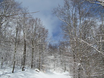 At the trail junction we continued right on the Logger's Loop Trail toward Times Square. The snow always drifts in this area and walking was difficult. At Times Square we stopped for some pictures and then decided to climb the Big Rock Trail. Although this trail ascends for over a mile it was packed by snowmobile traffic making the actual stepping easier. We warmed as we climbed and only stopped briefly for pictures. In about 1.5 hours we were at the junction with the Flynn Trail. We decided that heading back to the car was the best option. Karl had someplace to be and both dogs were having trouble with ice balls on their feet. Even though the Flynn Trail is a constant descent it seemed long. The temperature had not risen and the wind was still blowing. The forest rangers had been on the trail with their sleds. The trail is closed to snowmobiles. Soon the cabin was in sight and we followed the Flynn Trail to the left as it circles through the woods and to the parking area. A little over 3 miles took us about 2 hours.
On Wednesday, Jan 28th school was closed due to snowfall that continued through the morning. The prediction of sleet and freezing rain also helped school officials make their decision! Sheba and I went across the street and snowshoed our usual route over Round Top. Where Cindy and I had walked last weekend the snow was packed with a 3 to 5 inch layer of new snow. In several places I varied the route slightly and had to wade through at least 18 inches. I wore a new REI Momentum jacket. It is very light and stretchy and breathes extremely well. It was prefect for snowshoeing although I could have worm one less layer of wool under it! We got home at about 12:15. At 1:00 PM We were meeting a friend at the church to snowshoe the same route. The snow had changed to sleet and freezing rain but we went anyway! We followed the same route and had a good time. The temperature was much warmer and I wore only my Sherpa Raaj over a light top. This combination was perfect.
![]() On Sunday, Jan 25th Cindy and I decided to go to Trout Pond to hike after church. We got a late start and didn't arrive at the parking area until 1:30 PM. It was clear that snowmobiles had packed the trail so we did not wear our snowshoes. Cindy put on her Stabilicers and I stowed mine in my pack and we were off. The trail was well packed as we walked down Russell Brook Road and over the bridge near the falls. At the split in the trail we headed left to climb the hill to Mud Pond first. This hill is rather long but not too steep. The snow here was also well packed and the hiking was relatively easy. We soon crested the hill and got to the turn off toward Trout Pond. The trail was blocked with yellow ribbon to prevent snowmobiles from using it. I assumed there were some downed trees so we turned and started up the trail. I asked Cindy if she thought we had enough time and she said we did. The trail had 3 to 5 inches of unpacked snow on top of the snowmobile track...initially. The trail ascends Cherry Ridge gently but continuously. As we continued the snow on top of the track got deeper and the packed track became less consolidated. Walking became MUCH more difficult and, in some areas, a misstep meant sinking up to our knees. There were areas along the way that showed extensive new blowdowns especially on the descent on the other side of the ridge. Crossing the Trout Pond inlet was no problem and we were soon back on the packed snowmobile trail headed for the falls and then the parking area. We completed the hike by 4:30 PM which wasn't bad for almost 6 miles and the less-than-perfect conditions.
On Sunday, Jan 25th Cindy and I decided to go to Trout Pond to hike after church. We got a late start and didn't arrive at the parking area until 1:30 PM. It was clear that snowmobiles had packed the trail so we did not wear our snowshoes. Cindy put on her Stabilicers and I stowed mine in my pack and we were off. The trail was well packed as we walked down Russell Brook Road and over the bridge near the falls. At the split in the trail we headed left to climb the hill to Mud Pond first. This hill is rather long but not too steep. The snow here was also well packed and the hiking was relatively easy. We soon crested the hill and got to the turn off toward Trout Pond. The trail was blocked with yellow ribbon to prevent snowmobiles from using it. I assumed there were some downed trees so we turned and started up the trail. I asked Cindy if she thought we had enough time and she said we did. The trail had 3 to 5 inches of unpacked snow on top of the snowmobile track...initially. The trail ascends Cherry Ridge gently but continuously. As we continued the snow on top of the track got deeper and the packed track became less consolidated. Walking became MUCH more difficult and, in some areas, a misstep meant sinking up to our knees. There were areas along the way that showed extensive new blowdowns especially on the descent on the other side of the ridge. Crossing the Trout Pond inlet was no problem and we were soon back on the packed snowmobile trail headed for the falls and then the parking area. We completed the hike by 4:30 PM which wasn't bad for almost 6 miles and the less-than-perfect conditions.
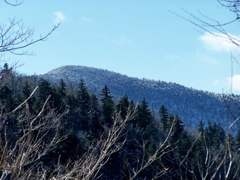
![]()
![]() On Saturday, Jan 24th the temperature was well below zero when Cindy and I got up. I did some chores and when I got back home we decided to go to the Spruceton trailhead and hike Hunter Mountain. The roads were in good shape but we went by way of the Pepacton Reservoir and Margaretville since Cindy likes this route better than the Frost Valley Road. We finally arrived at the trailhead about noon. There were several other cars parked even though the temperature was still in the single digits and a breeze was blowing. I had worn my Mountain Hardwear Windstopper Tech Jacket which is my "go to" jacket since it is light but blocks ALL wind. The pit zips on this jacket are also handy. Under this I worm a light Patagonia Wool and an Icebreaker 320 Zip top. As soon as I stepped out of the car I was cold and considered putting on another layer but decided to wait. Cindy and I donned our snowshoes and started out. As soon as we hit the trail it was clear that snowshoes would probably NOT be necessary. The trail was well traveled and packed. The slight thaw and refreezing of the snow also made the trail pretty easy to negotiate. We went back to the car and Took off our snowshoes. Cindy put on her Stabilicers and I packed mine and we started off again.
On Saturday, Jan 24th the temperature was well below zero when Cindy and I got up. I did some chores and when I got back home we decided to go to the Spruceton trailhead and hike Hunter Mountain. The roads were in good shape but we went by way of the Pepacton Reservoir and Margaretville since Cindy likes this route better than the Frost Valley Road. We finally arrived at the trailhead about noon. There were several other cars parked even though the temperature was still in the single digits and a breeze was blowing. I had worn my Mountain Hardwear Windstopper Tech Jacket which is my "go to" jacket since it is light but blocks ALL wind. The pit zips on this jacket are also handy. Under this I worm a light Patagonia Wool and an Icebreaker 320 Zip top. As soon as I stepped out of the car I was cold and considered putting on another layer but decided to wait. Cindy and I donned our snowshoes and started out. As soon as we hit the trail it was clear that snowshoes would probably NOT be necessary. The trail was well traveled and packed. The slight thaw and refreezing of the snow also made the trail pretty easy to negotiate. We went back to the car and Took off our snowshoes. Cindy put on her Stabilicers and I packed mine and we started off again.
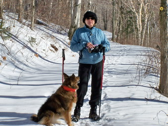 The going was pretty easy but it is uphill all the way. We crossed the new bridge and passed came to the hairpin turn. It did not look like many people had tried Rusk from this point since the last storm. As we began to climb the long shallow grade up to the trail junction, I got warmer and warmer. Where I had wanted to add a layer at the car I now was thinking of taking one off. I settled for opening the pit zips and main zipper on my jacket and unzipping both of my other layers. The sun had come out but the air temperature had not gone up much. Most of the heat was just from the work hiking the path. A group of four passed us on there way down. One was wearing snowshoes and the others full crampons. I hoped we had the right equipment since conditions on the top of the 35's are often VERY different from those at the trailhead. As we walked we could look to the right and see Westkill in the distance. Soon we made the trail junction and turned right to start the real climb. The sign said 1100 feet in 1.7 miles. Cindy does not like UP but holds her own on FLAT and often get ahead of me on DOWN. At the spring I asked her if she wanted to turn back but she decided to press on. I was glad.
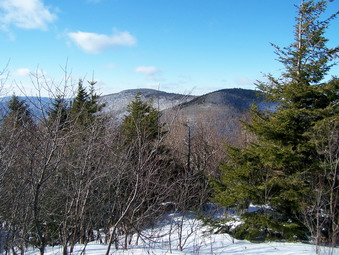 The trail approaching the spring is often treacherous since the overflow from the spring floods the trail and freezes. This day there was a lot of snow coverage and no sign on the ice flow. I wanted to take some pictures of the frozen spring but it too was covered in snow. We stopped just passed the spring and the 3500 foot sign at the one viewpoint. I took some pictures of Rusk and some over toward Westkill. The trees are growing quickly and this viewpoint is almost obscured. We met a couple descending. I was going to ask where they had come from since she was wearing a helmet and he had plastic mountaineering boots on. Both carried ice axes! A little further on near the turn to the Colonel's Chair we met another hiker. As we continued up the mountain the air temperature continued to drop. There was more and more snow and ice on the trees but the trail was still well packed. Most areas of the trail were beautiful with some forming near tunnels as the branches bent under the weight of the ice and snow. I took some pictures as we went since the sunlight shining on the ice and through the snowy branches made a nice scene. I became concerned that it was getting late in the day and the last part of the trail is pretty steep. We continued on and were soon at the clearing with the tower and the cabin.
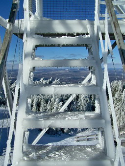 The trees were covered with snow and ice so that the green of the needles on the branches could hardly be seen! The clearing was covered with ice some of which stuck up in shards with the sun glinting off them. The air temperature was MUCH colder and there was a stiff wind of 20 to 30 mph blowing. There were two other groups present, one on the tower and one at the cabin. I took some pictures of the clearing, the trees and the tower. I removed my pack, took out the camera and headed toward the tower. It was VERY icy and Stabilicers would have been a good idea! As a climbed above the trees the wind velocity increased and the wind chill made for a very cold climb. I got about 2/3 of the way up and decided that pictures from that level would have to be good enough. Unfortunately, I had forgotten to bring a light pair of gloves so I had to remove my Black Diamonds and use the camera bare-handed. I took pictures of the trees below, the mountains in the distance and the icy steps of the tower. By this time I was having trouble feeling my hands and Cindy and Sheba were freezing. I descended carefully, put the camera away, and donned my pack. We immediately started down the trail at a rapid pace.
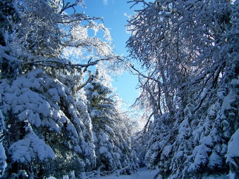 On the first part of the descent we almost ran down the mountain using our poles to steady us. Falling in any other season might mean bashing your knee into a rock but the snow acts as a cushion and it made us more willing to descend quickly. I began to get warm again but Cindy's hands were still cold. I gave her my Gordini mittens which seemed to do the trick. We continued to rapidly descend without stopping much along the way. Cindy lead most of the way until the trail junction where I went ahead. Soon we were at the hairpin turn and were moving along Hunter Brook. The sight of the gate near the parking area was welcome and we were soon back at the car. We arrived back just before 4:00 PM as it began to get darker and colder. It had taken us at least 2.5 hours to ascend but less than 1.5 hours to come down. Overall it was less than 4 hours to cover almost 7 miles in winter conditions plus the stops!
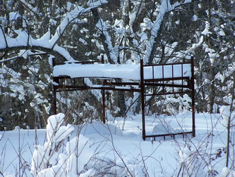
![]()
![]() On Monday, Jan 19th I was off from school but Cindy had to work. After taking her car for a "checkup", I decided to take Sheba and try snowshoeing in the freshly fallen powder at Frick and Hodge ponds. We arrived in the parking area just before noon. The roads were surprisingly well cleared and the smaller parking area was cleared. I planned to go to Frick Pond, around the back of the pond and then up the Big Rock Trail to the Flynn Trail. I like climbing the Big Rock hill since it is a good workout! From the very start it was clear that no one had been in the area since the snowstorm on Sunday had dropped 6 to 10 inches of new snow. Breaking trail by yourself under these conditions can be quite challenging. The sun was out and was glistening off the snow. Tree were bent slightly under the weight of the snow. The skies were bright blue. In short, the scene was beautiful. We soon arrived at Frick Pond and I took quite a few pictures even though they were much the same as several times before.
On Monday, Jan 19th I was off from school but Cindy had to work. After taking her car for a "checkup", I decided to take Sheba and try snowshoeing in the freshly fallen powder at Frick and Hodge ponds. We arrived in the parking area just before noon. The roads were surprisingly well cleared and the smaller parking area was cleared. I planned to go to Frick Pond, around the back of the pond and then up the Big Rock Trail to the Flynn Trail. I like climbing the Big Rock hill since it is a good workout! From the very start it was clear that no one had been in the area since the snowstorm on Sunday had dropped 6 to 10 inches of new snow. Breaking trail by yourself under these conditions can be quite challenging. The sun was out and was glistening off the snow. Tree were bent slightly under the weight of the snow. The skies were bright blue. In short, the scene was beautiful. We soon arrived at Frick Pond and I took quite a few pictures even though they were much the same as several times before.
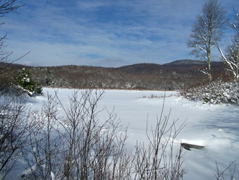 We crossed the bridge and head around the left side of the pond. As we approached the trail junction, I heard the sound of snowmobiles in the distance and was reminded that many of the trail, including Big Rock, were "multi-use". I decided to head to the left up the Quick Lake Trail to avoid the snowmobiles as much as possible. I actually don't object to the machines as they "groom" the trails nicely for snowshoeing but I just didn't want to meet one coming straight for me! The Quick Lake Trail is a continuous uphill slog that is never very steep. As we walked the snow seemed to get deeper and deeper until we were easily walking through 18 inches of unbroken powder! This was made more interesting by areas were very large trees had fallen across the path. These trees were relatively new as I had been through on this trail not long before. I suspect the last ice storm was too much for some of these fallen trees! We finally made it to Iron Wheel Junction where the Quick Lake Trail meets the Logger's Loop Trail. These trails are open to snowmobiles and were already well packed. I decided to stay on the Quick Lake Trail and listen for the snowmobiles.
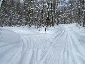 Hiking on the packed snowmobile trail was a welcome break from breaking trail through the deep powder. The Crescent Moon Gold 10's do a good job but none of the new style snowshoes really float the way the old fashioned ones used to. On the other hand the new shoes are more maneuverable and easier to walk in! We continued up the Quick Lake Trail encountering several small hills on the way. I began to hear the approaching sound of snowmobiles and cleared to the side as they came by. Soon we were at Junkyard Junction where we turned right on the blue Flynn Trail. This trail was completely untouched with at least 18 inches of snow. The trail is mostly flat but I must admit I was tired by this time! Sheba, who had been leading for some time, was now content to follow in the trail I was breaking. We went slowly stopping occasionally to rest and get a drink. I was not going to repeat my last experience when I failed to drink enough and was laid low by muscle cramps after returning home. Finally, the gate across the Flynn Trail appeared and we cut to the right to follow the trail down to the pond. Even after reaching the pond there is a rather long walk around the edge and through a field to the clearing at the outlet end of the pond. When we arrived, I took some pictures. I also noted that despite my hope that someone had at least broken the trail to the pond, the snow lay untouched!
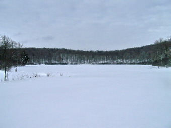 The Flynn Trail from Hodge Pond is an uphill climb until it levels off near the top. The snow was deep and each step was an effort. I started setting "goals" and counting steps as a way to motivate myself. After the trail leveled, the gate soon appeared and I knew we were near the junction with the Big Rock Trail. At this junction both trails descend. The Big Rock Trail was well packed by snowmobiles but I decided to continue on the Flynn Trail so that I could say we walked the entire trail. Going DOWN was considerably easier and the distance seemed shorter than when Cindy and I had come UP the trail the week before! As we neared the cabin we stayed on the trail by cutting to the left and were back at the car by 3:30 PM covering about 6 miles in 3.5 hours. It felt good to be done with a challenging outing.
On Sunday, Jan 18th a snowstorm had dumped about 8 inches of NEW snow on top of what we already had. Church was cancelled for the second week in a row but the Livingston Manor Ice Carnival was scheduled to go on. Cindy and I decided to get out despite the fact it was still snowing. We took Sheba and headed across the road to hike up and around Round Top. As we crossed the road into the field near the church, it was obvious that the snow as deep. Behind the church we climbed to the top of the cemetery hill that looks over the town. The snow was still falling lightly and the view was beautiful! At the top of the hill we cut into the woods to the left and walked up to another lookout over town. From here we turned right and began the climb up to an old woods road. This walk is not too steep but a total bushwhack through brush covered in snow. On the woods road we made a left and then a sharp right to cut UP to the highest point. This IS a pretty steep climb in spots but we made it without much trouble. We walked across the top of the ridge and decided to keep the hike short. We turned left and started a LONG descent to a path that looks down on State Route 17, the Quickway. Descending was fun as lifting the tips allows a glide down the hill. Losing your balance or getting a show stuck in hidden brush or rocks makes the descent less enjoyable!
When we hit the path overlooking the road we turned left. Views of the Quickway sowed it was still covered in snow and slush. A few truck were passing but not much else. We walked along the path for a short distance and then cut left into the woods and started an ascent. I STILL have trouble remembering to ascend only a SHORT distance before turning right on a path or woods road. We ascended too far but this allowed us to enjoy the descent to the correct path that I finally found. We walked out to the field that overlooks the Exit 96 ramps. They too were snow covered from here we walk a short distance and then turned left up into the woods and began to climb back to the level where we started. Soon we were descending back to the cemetery hill and then back to the church and home. We were out for less than 2 hours but had a good time!
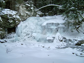
![]()
![]() On Saturday, Jan 17th it was still VERY cold but I decided to head for Trout Pond for a short snowshoe. I suspected that the recent cold weather would have had an interesting effect on the falls on Russell Brook and I was anxious to take pictures! Cindy declined the offer so Sheba and I got in the car and headed to Roscoe. The roads were snowy but passable and we arrived at the parking area round 1:30 PM. The parking area was NOT plowed so I pulled into the snow bank along side the road. Sheba and I got going immediately to stay war. Russell Brook road was unplowed but well packed by snowmobiles and the walk down to the falls went quickly. As we crossed the bridge across Russell Brook I could see that the falls appeared to be at least partly frozen. Leaving the packed trail Sheba and I slogged through the deeper snow to the path that runs alongside the brook to the falls. When I could clearly see the falls it was obvious that they were frozen solid! Some water WA running underneath the ice but it was heard to see. The falls looked as if someone had taken a stop-action photograph freezing them in time. Of course. the effect was due to a different kind of freezing. I made my way down to the stream bed carefully and took MANY pictures of the falls including the frozen pool at the base and the ice covering the stream. When I was done, I climbed back out of the stream bed, not an easy task, and headed back to the main trail.
On Saturday, Jan 17th it was still VERY cold but I decided to head for Trout Pond for a short snowshoe. I suspected that the recent cold weather would have had an interesting effect on the falls on Russell Brook and I was anxious to take pictures! Cindy declined the offer so Sheba and I got in the car and headed to Roscoe. The roads were snowy but passable and we arrived at the parking area round 1:30 PM. The parking area was NOT plowed so I pulled into the snow bank along side the road. Sheba and I got going immediately to stay war. Russell Brook road was unplowed but well packed by snowmobiles and the walk down to the falls went quickly. As we crossed the bridge across Russell Brook I could see that the falls appeared to be at least partly frozen. Leaving the packed trail Sheba and I slogged through the deeper snow to the path that runs alongside the brook to the falls. When I could clearly see the falls it was obvious that they were frozen solid! Some water WA running underneath the ice but it was heard to see. The falls looked as if someone had taken a stop-action photograph freezing them in time. Of course. the effect was due to a different kind of freezing. I made my way down to the stream bed carefully and took MANY pictures of the falls including the frozen pool at the base and the ice covering the stream. When I was done, I climbed back out of the stream bed, not an easy task, and headed back to the main trail.
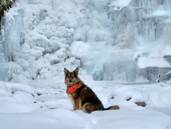 Sheba and I continued our walk up the trail toward Trout Pond. I did not hear any snowmobiles but kept listening. We arrived at Trout Pond quickly and I decided to head for the inlet before deciding how we would return and before stopping to take pictures. As we approached the lean-tos Sheba let me know someone was up ahead. There were four snowmobiles. Two local riders, an ECON officer and a Forest Ranger. We chatted for a few minutes and I continued to the inlet stream to take a few pictures. By now the sky was clouded over and the landscape had a "bleak" look. I decided that hiking around the pond of the trail toward Mud Pond might be too long since it is still getting dark early. We turned around to retrace our path to the car. On the way back we stopped at the outlet end of Trout Pond just long enough for me to take some pictures. As we continued on the trail, I could hear the engine of and approaching snowmobile. Soon both local riders from the head end of the lake passed us. When we reached the bridge we continued straight ahead up the steep hill to the parking area and then back to the car. We were back just before 4:00 PM and daylight was already fading!
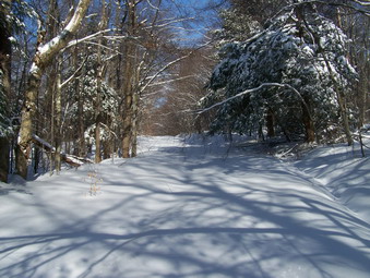
![]()
![]() On Sunday, Jan 11th the last remnants of a snow storm were just clearing Livingston Manor. The total new snow accumulations were about 6 inches in town. Cindy and I waited until we though the back roads would be plowed and then headed to Frick Pond to snowshoe. The roads were not in good but reasonable shape and part of the parking area at Frick Pond was plowed. We arrived at about 12:30 PM. The temperature was hovering around 20 degrees but a stiff wind was blowing when we got out of the car. I was afraid I might be chilly but decided to pack another layer rather than wear it. Snow shoeing can be VERY aerobic so I thought I would see how warm I felt after some activity. We quickly got our shoes on and crossed the road to start up the Flynn Trail. After climbing the snow bank, I promptly face planted on the other side. I was fine but it must have looked bad since Cindy seemed concerned! There was a little more snow on top of a hard crust with more snow underneath. The snowshoes allowed us to stay on top of the crust but I could feel it give occasionally. I broke trail as we climbed the Flynn Trail. The trail is not steep in any places but it is 1.7 miles of continuous uphill without a break. The snow was completely unbroken; fresh powder without any human tracks, only animals. We finally spotted the signs for the junction with the Big Rock Trail.
On Sunday, Jan 11th the last remnants of a snow storm were just clearing Livingston Manor. The total new snow accumulations were about 6 inches in town. Cindy and I waited until we though the back roads would be plowed and then headed to Frick Pond to snowshoe. The roads were not in good but reasonable shape and part of the parking area at Frick Pond was plowed. We arrived at about 12:30 PM. The temperature was hovering around 20 degrees but a stiff wind was blowing when we got out of the car. I was afraid I might be chilly but decided to pack another layer rather than wear it. Snow shoeing can be VERY aerobic so I thought I would see how warm I felt after some activity. We quickly got our shoes on and crossed the road to start up the Flynn Trail. After climbing the snow bank, I promptly face planted on the other side. I was fine but it must have looked bad since Cindy seemed concerned! There was a little more snow on top of a hard crust with more snow underneath. The snowshoes allowed us to stay on top of the crust but I could feel it give occasionally. I broke trail as we climbed the Flynn Trail. The trail is not steep in any places but it is 1.7 miles of continuous uphill without a break. The snow was completely unbroken; fresh powder without any human tracks, only animals. We finally spotted the signs for the junction with the Big Rock Trail.
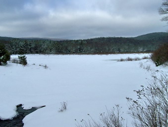 At this junction the Flynn Trail continues straight ahead to Hodge Pond and a snowmobile trail heads over the mountain to Mongaup Pond. I was a little surprised to see no evidence of snow mobile tracks! My plan was to turn left on Big Rock and head down to Times Square. The "down" part was GREAT. Some parts of the Big Rock Trail are flat or even a little uphill but most is DOWN. Leaning back on the snowshoes and lifting the tips almost feels like skiing. We moved quickly down the trail and were soon at Times Square. From here a path continues straight ahead around Frick Pond. The Logger's Loop Trail crosses here. taking a right ascends to the Quick Lake or Flynn Trails. I thought when we began that we might continue straight ahead here and go around the back of the pond but BOTH of use were a little tired. We turned left and Head toward Frick Pond on the Logger's Loop Trail. This trail is flat in places but has a few slight ascents. At this point in the hike these small hills seemed MUCH taller. For some reason the snow in this area had also drifted to at least a foot making the going that much more difficult. At the junction by Frick Pond I headed down to the pond to take a few pictures and then quickly returned to the trail back to the car. Even the last, short walk to the car seemed to take longer than ever. Climbing the last few steps to the parking area used the last bit of energy I had. The Crescent Moon Gold 10 shows performed well. The bindings are the best and the slightly larger shoe works well for breaking trail and in deeper snow. On the mountains I will still use the MSR Lightning Ascent or the Atlas 12's! We were back at the car by 2:45 PM covering a little over 4 miles in around 3 hours.
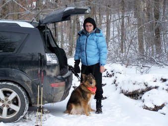
![]()
![]() On Saturday, Jan 10th Cindy and I headed for Balsam Lake Mountain early in the morning. We knew a major storm was forecast for later in the day and wanted to get in a short hike before the roads became too dangerous. Tom and Laurie Rankin were planning on opening the tower and the cabin for the weekend. I wondered if they would brave the forecast! The Beaverkill Road was snow covered but passable although some spots were definitely one lane. When we left home the air temperature was 7 degrees. On the way to the trailhead the temperature continued to drop. When we parked, the temperature had reached 0 degrees although there was No wind. The parking area was not plowed but the turnaround was open. we were the ONLY car present so we got out and got ready to hike. While we were readying ourselves, another pickup pulled up with three people from Long Island and their Jack Russell. They were camping at Big Pond and though climbing a mountain would be a good idea. Cindy made the call to wear only Stabilicers and not snowshoes and we were off. There really wasn't too much snow, maybe 2 to 4 inches, and we were making good time heading for the turnoff up the mountain. When I looked back Cindy was keeping the others company as they hiked slowly behind the dogs and myself. I stopped at the turn to remove a layer. I was wearing my Montbell Thermawrap over two wool layer with a Mountain Hardwear Synchro on top. This was the first time I wore the AFRC Snow Pants and they were just warm enough. I stowed the Montbell and Cindy caught up. the others turned back before reaching the turn. Their little jack Russell seemed game but it was really cold for a small dog.
On Saturday, Jan 10th Cindy and I headed for Balsam Lake Mountain early in the morning. We knew a major storm was forecast for later in the day and wanted to get in a short hike before the roads became too dangerous. Tom and Laurie Rankin were planning on opening the tower and the cabin for the weekend. I wondered if they would brave the forecast! The Beaverkill Road was snow covered but passable although some spots were definitely one lane. When we left home the air temperature was 7 degrees. On the way to the trailhead the temperature continued to drop. When we parked, the temperature had reached 0 degrees although there was No wind. The parking area was not plowed but the turnaround was open. we were the ONLY car present so we got out and got ready to hike. While we were readying ourselves, another pickup pulled up with three people from Long Island and their Jack Russell. They were camping at Big Pond and though climbing a mountain would be a good idea. Cindy made the call to wear only Stabilicers and not snowshoes and we were off. There really wasn't too much snow, maybe 2 to 4 inches, and we were making good time heading for the turnoff up the mountain. When I looked back Cindy was keeping the others company as they hiked slowly behind the dogs and myself. I stopped at the turn to remove a layer. I was wearing my Montbell Thermawrap over two wool layer with a Mountain Hardwear Synchro on top. This was the first time I wore the AFRC Snow Pants and they were just warm enough. I stowed the Montbell and Cindy caught up. the others turned back before reaching the turn. Their little jack Russell seemed game but it was really cold for a small dog.
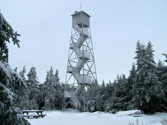 We made the turn and started up the mountain. We had considered Graham but with the impending storm we planned to go up to the tower and return the same way. Cindy was having little trouble since she was wearing her Stabilicers where as I kept mine in the pack. Having poles really helped. The climbed was slippery at times and there did seem to be a track under a thin coating of snow. Off the track there was deeper snow but the amount of snow itself never became and issue. We moved pretty quickly up the mountain following Sheba until the area of just below the spring and the 3500 foot sign. From hear to the more level area near the top there was more ice and walking was more difficult. We finally made the climb to just above the spring and the trail leveled. There was still not much snow but the scenery was BEAUTIFUL. Snow and ice had collected on the trees forming a shimmering pattern. Walking through the spruce was like walking through a tunnel. Soon we broke out into the clearing at the top. The tower was absolutely encased in ice. I took some pictures and then we walked over to the picnic table and I got ready to climb the tower and take some pictures.
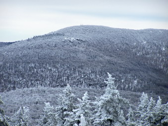 As I was approaching the tower I heard a noise in the direction of the cabin. I went to investigate and to my surprise found Tom and Laurie Rankin. They had just arrived from the Millbrook trailhead and were preparing the cabin for an overnight stay. I called to Cindy and we introduced ourselves all around. We help Tom and Laurie get some windows opened and talked for a short time. Sheba was pestering us to continue our hike and we did want to get done well before the storm hit. I went back out and CAREFULLY climbed the tower. The views were varied and beautiful and were made all the more interesting by the icy covering on the tower. The ruins on Graham were clearly visible despite the gathering clouds. Even on the tower there was little wind but it was obvious that the temperature had dropped as we climbed. I returned to ground level and we headed back down the mountain. I took some pictures in the spruce tunnel and then stored the camera. We planned to make a quick descent with only the Stabilicers and poles to aid us. As we passed the spring, Laurie was getting water and we said a final goodbye. We really did make QUICK work of the descent and the hike back to the car. We had started at 9:30 AM and were finished by noon including the layover at the cabin. The temperature had risen into the double digits as we drove back down the Beaverkill Road but it was not snowing. We could see ahead of us clouds and what looked like snowfall. As we approached Lew Beach we ran into light snow and by the time we were back in Manor the snowfall had increased. It was a short 3 or 4 mile trip in a short time but well worth the time.
![]()
![]() On Saturday, Jan 3rd Cindy agreed to go hiking with us but did not want to hike a 35. In addition to this, the Catskills had been hit by some lake effect snow and, after Friday, I wasn't sure how the roads would be. I suggested that we go to Harriman and hike something with some "landmarks" and she agreed. I wanted to hike the Long Path from Lake Askoti to The Big Hill Shelter and then take the Suffern-Bear Mountain Trail to Gate Hill Rd. I thought this might be a little too far so I decided we would park at St. John's in the Wilderness Church and hike to the ORAK Mansion ruins and back. I had never been on these trails in this area but I knew from some guidebooks that there were some interesting points along this route. The Big Hill Shelter marks the junction of the Long Path and SBM Trails. Jackie Jones Mountain has a fire tower and, along with Rockhouse Mountain, is the highest point in Rockland County. The ORAK Mansion was built in 1923 by an executive of the company that produced Karo Syrup. Although the mansion was torn down, many of the stone walls and foundations remain. We got a late start but were on Lake Welch Drive by 10:15 AM. We found the turn to the church and I noted that Lake Welch Drive was CLOSED just after this road. A park police car was in the church parking lot and the officer conformed that it was OK to park. The church is primarily constructed of stone and is really beautiful. It has an external bell over the main entrance and an interesting cemetery on the grounds.
On Saturday, Jan 3rd Cindy agreed to go hiking with us but did not want to hike a 35. In addition to this, the Catskills had been hit by some lake effect snow and, after Friday, I wasn't sure how the roads would be. I suggested that we go to Harriman and hike something with some "landmarks" and she agreed. I wanted to hike the Long Path from Lake Askoti to The Big Hill Shelter and then take the Suffern-Bear Mountain Trail to Gate Hill Rd. I thought this might be a little too far so I decided we would park at St. John's in the Wilderness Church and hike to the ORAK Mansion ruins and back. I had never been on these trails in this area but I knew from some guidebooks that there were some interesting points along this route. The Big Hill Shelter marks the junction of the Long Path and SBM Trails. Jackie Jones Mountain has a fire tower and, along with Rockhouse Mountain, is the highest point in Rockland County. The ORAK Mansion was built in 1923 by an executive of the company that produced Karo Syrup. Although the mansion was torn down, many of the stone walls and foundations remain. We got a late start but were on Lake Welch Drive by 10:15 AM. We found the turn to the church and I noted that Lake Welch Drive was CLOSED just after this road. A park police car was in the church parking lot and the officer conformed that it was OK to park. The church is primarily constructed of stone and is really beautiful. It has an external bell over the main entrance and an interesting cemetery on the grounds.
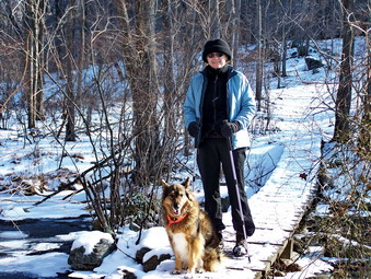 When we got out of the car the air temperature was colder than I had expected and the WIND was well over the 10 mph in the forecast. I wore my Eider Highstretch jacket over my wool layers and wondered if that would be enough to keep me warm. The new Black Diamond Verglas gloves are very warm and have a great grip to them. There was more snow on the ground than I had expected since I had expected NONE. The two to four inches of snow would not be a problem except where it covered icy or slippery leaves! I had put on my low gaiters and had again chosen my Asolo TPS 520 boots. Cindy immediately donned her Stabilicers while I chose to leave mine in the pack. We walked back down the road to Lake Welch drive. As we approached the intersection with the trail at least two groups of hikers with six or so in each group were making there way up the trail. We turned left on to the Long Path and were off on our hike. As soon as we got into the woods and out of the wind, the temperature seemed to rise and I was warm. The sun peaked through the clouds and everything seemed almost ideal for a hike!
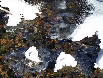 The trail varies from trail to wider and open woods roads. The initial part rolls up and down some hills. After .35 miles from the trail junction, the trail turns sharply right and a woods road goes off to the left. The road seems to be marked as a shortcut on the map that leads to the church. We turned right and began to ascend a small hill. The trail then descended through a swampy area and across Beaver Pond Brook on a small bridge or causeway. After this area the trail began an ascent that passed through a stand of red pines. These trees were tall and straight and looked as if they may have been planted. Evidence of a homestead lends support to this idea, The trail made another turn to the left at about 1 mile and then paralleled the Old Turnpike or Pine Meadow Road. Could the name come from the stand of pines we passed? These criss-crossing trails and roads are typical of Harriman Park. Along the way we caught up to and passed the second group of hikers we had seen at the start of the hike. The trail continued to roll but basically ascend until taking a right at about 1.5 miles and crossing the road. The road had many tracks on it indicating people use these unmarked trails as well as the marked ones to enjoy the park. The Long Path continued a short ascent to Big Hill at about 1.75 miles. The first group of hikers we had seen earlier had started a fire and were cooking lunch at the shelter.
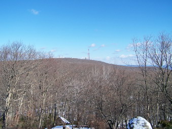 At Big Hill the SBM Trail from the southwest and the trail run concurrently as they descend the northeast face of Big Hill. The descent was icy over open rock. Cindy had little trouble with her Stabilicers while I chose to walk in the grass and brush beside the trail. Just after the turn we got a good view of Jackie Jones Mountain and the towers. The communications towers dominate the view until you look carefully and see the old fire tower. This tower is to the left of the others and is almost hidden by the high trees! The towers seem far away and much higher than your viewpoint. We descended and crossed a small brook. In this areas the Long Path bears to the right and follows a woods road. We stayed on the SBM Trail and headed left At about 2.0 miles we began the ascent up Jackie Jones Mountain which lasted for almost a mile. We were glad to see that the tower is in pretty good shape and can be climbed although the cab at the top is closed.
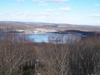 As I began to climb the tower I noticed that the wind began to pick up. This is typical of all the towers I have climbed since as you climb you get above the tree tops that break the wind. I continued on up toward the cab and the wind got stronger. At the level below the cab I stopped to take some pictures. At this point I was glad I was holding onto the superstructure of the tower. Several gusts of wind of at least 50 mph hit me and would have pushed me down the stairs if I had not had a firm grip. The view was gorgeous and I took some pictures before descending the tower. I was grateful to be making a controlled descent! Cindy had decided that sitting at the base of the tower and eating a snack was a better idea. I am not sure I disagreed. We took a short break and then continued on the trail toward the ORAK ruins which I estimated were no more than .5 miles away. We passed by the communications complex which was truly impressive with a paved access road. Just after the towers we stopped at a lookout marked on the map. Like so many of these viewpoints this one was somewhat blocked by trees and I was glad I had gotten some pictures from the tower. The trail continued to descend and I think we both made note that we would be walking back UP this hill on the return journey.
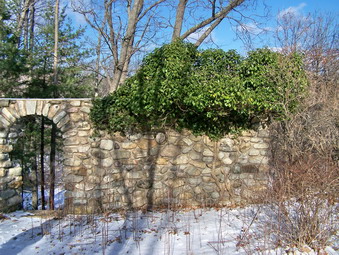 Soon we began to see some stone structures which we assumed marked the ruins. They were not very impressive and I hoped that we extra walk would be more rewarding. The trail soon took a left down a paved "driveway" but we walked straight ahead to examine some rock walls. To our left was a large stone wall with an arch and small round windows. I believe we were standing in what was once the dining or living room of the mansion. When we walked over to the archway, we could see more stone foundations below us. The complex was quiet large like many of those constructed in the early part of the 20th century. We walked down the driveway and marveled at the curving rock wall that we had just seen from above. I stopped and took pictures of the stonework of the foundations. A little further on was a gatehouse still intact. The rest of the buildings had been torn down or I am sure they would still be standing. We visited several other outbuildings and then returned to the trail to begin the trip back. The trip back seemed to go VERY quickly! Cindy in particular seems to gain an extra step on the way back. Many of the ascents actually seemed easier than the ascents in the same area on the way out. We were soon at the Big Hill shelter then the bridge and the church. We were back by 3:30 PM taking about 5 hours to cover almost 7 miles. I wondered at the apparent slow pace but then recalled the extensive time we took to explore along the way!
As we struck out Sheba was more than ready to go after being in the house for several days straight. As we headed up the wide woods road, I wondered if the bridge over Hunter Brook would be finished. Trying to cross the brook with icy rocks was not the way I wanted to start the hike. In addition, Sheba almost always walks THROUGH the water and then complains about ice balls between her pads! I shouldn't have worried about the bridge since it is snowmobile season and the bridge is a necessity! It was finished and showed the typical sturdy construction the DEC has been sponsoring lately. As we neared the hairpin turn up Hunter I began to think about bushwhacking Rusk. I normally stay away from solo winter bushwhacks but though that I could "cheat" by following another hiker's route id there was one. There were several good reasons NOT top do this since I had gotten a late start and the weather was questionable! At the turn there were in fact footprints and I could not resist and Sheba and I turn left and crossed the brook. We immediately started the climb along the drainage as we had before and then followed the route the other hiker had taken. There were several steep spots and several icy spots and several steep and icy spots. The path we were following seemed to deflect more to the west than I normally do but I was committed to following it. I remembered that the last time we approached Rusk we ran into some difficult ledges and some nearly impassable blow down. I was hoping this route would avoid most of these problems.
As we hiked Sheba did NOT want to stay on the path laid down by the previous hiker. At first I though she was just being difficult. Soon I realized she was veering more to the east in an attempt to follow the route we "normally" take! I am not sure how she knows this but it is not the first time. I had not yet put on my Stabilicers which made hiking that much more difficult. The route continued north and west and crossed several drainages until it finally leveled some. I finally gave up and put on my Stabilicers which made the next part of the hike easier. It was taking a LONG time to cover ground and the wind and snow had started again. Any views of the surrounding mountains showed snow squalls and dark skies. The next part of the hike continued up the mountain over, around and through old blown down and brambles until we reached a first set of ledges. The previous hiker avoided the steepest, most direct route but did find a way up through these rocks. The trail again leveled and again worked its way up through some more ledges by circling further around the mountain. I was getting TIRED! Hiking solo allows no opportunity for banter and supportive comments from hiking partners. We finally made the summit and began to look for the canister. I had a rough idea of where I would find it and soon I was signing in. I almost decided to take the more direct route or try for the saddle between Rusk and Hunter. It had taken 2 hours to go about 1.5 miles up. In the end I opted to follow our path back knowing that down would be quicker.
On the way down Sheba followed our ascent path to the step until near the very end. The descent was quicker and I was upright most of the time. In a few places I used a gracefully glissade to navigate steep spots. It did seem that the forest would grab my pole or attempt to poke me in the eye whenever possible. Near the end of the descent I caught "the wall" and followed it and a set of footprints to the brook crossing. It was after 2:00 PM and I decided I was mentally and physically spent. Getting up to Hunter and back down would take me too long and I would not enjoy it so we headed back to the car. We were back at the car by 2:30 PM. It took us 3 hours to cover just over 3 miles! That was divided into 2 hours up and 1 hour down. I never took my camera out of my pack due to the cold, time constraints and lack of significant views. I once again was humbled by the 3500 foot mountains!
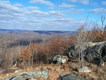
![]()
![]() On Monday, Dec 29th I decided to return to the southern part of Harriman Park to hike the Ramapo Torne and the Russian Bear. The night before Kurt called to ask what I was doing on Monday and we decided to hike together. The weather forecast was for temperatures in the mid 40's and light winds. I didn't know what conditions to expect on the trails. I thought that the warm weather would probably have taken care of the snow but that the trails might be wet. Kurt and I met at the Reeves Brook Visitor's Center at about 9:00 AM. Kurt changed into the clothes I brought and we were ready to go. We were one of three or four cars parked in the lot and a pair of hikers started just ahead of us. As we were getting ready to go the wind began to blow stiffly and I started to get COLD. I put on my Haglof's Spider to block the wind. This was my FOURTH layer over Icebreaker base and midlayers and an Outdoor Research Specter jacket. I knew that this would probably be too much but it seemed right at the time! I had on my Mountain Hardwear Winter Wander pants but regretted not wearing a baselayer under them! We walked to the back right corner of the parking area and caught the red Pine Meadow Trail for a short distance before turning left on the blue Seven Hills Trail. This trail immediately started an ascent up a hill and I began to warm up.
On Monday, Dec 29th I decided to return to the southern part of Harriman Park to hike the Ramapo Torne and the Russian Bear. The night before Kurt called to ask what I was doing on Monday and we decided to hike together. The weather forecast was for temperatures in the mid 40's and light winds. I didn't know what conditions to expect on the trails. I thought that the warm weather would probably have taken care of the snow but that the trails might be wet. Kurt and I met at the Reeves Brook Visitor's Center at about 9:00 AM. Kurt changed into the clothes I brought and we were ready to go. We were one of three or four cars parked in the lot and a pair of hikers started just ahead of us. As we were getting ready to go the wind began to blow stiffly and I started to get COLD. I put on my Haglof's Spider to block the wind. This was my FOURTH layer over Icebreaker base and midlayers and an Outdoor Research Specter jacket. I knew that this would probably be too much but it seemed right at the time! I had on my Mountain Hardwear Winter Wander pants but regretted not wearing a baselayer under them! We walked to the back right corner of the parking area and caught the red Pine Meadow Trail for a short distance before turning left on the blue Seven Hills Trail. This trail immediately started an ascent up a hill and I began to warm up.
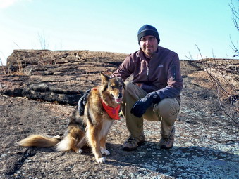 We continued on the trail and soon saw the pair of hikers that had left before us. We were setting a rapid pace and soon passed them. We quickly made the trail junction with the orange HTS Trail and turned right as the map SEEMED to indicate. I removed my outer jacket and stowed it before crossing the first of several streams. We followed the trail which descended some and followed an old woods road. Soon the blazes disappeared and we back tracked to find the turn we had missed. It was pretty well marked with a double blaze and I cairn which we had missed as we talked. We crossed another stream and started our ascent up the Torne. Just as we did this we were surprised by another person behind us. He was on a rather serious trail RUN up the Torne and we let him pass. As we ascended, I again grew warm and removed my Specter jacket leaving only the two wool layers. I though he wool might not block enough wind but I was REALLY warm. We climbed the trail as it wound its way up the hill next to the Torne. The massive and impressive rock walls of the Torne were on our left. Soon we arrived at a left hand turn signaling a rather steep climb upwards. We all made it OK and the view from on top was amazing. As I looked around I noticed we were NOT at the top and that there was another rock crag to climb. We had lost the orange trail and climbing the rock face would be difficult if not impossible. We walked along the base of the crag and soon found the orange trail on the left as it ascended the rocks before us. The trail was steep in places and we had to negotiate over and around some rather large boulders. The view from on top was amazing but as I looked around I saw ANOTHER, smaller rocky crag. We followed the orange trail to the very top if the Torne.
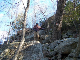 The views from this final summit were great and almost 360 degrees. The problem was that many of the views included the Thruway and interchange, power lines and power plants and other industrial facilities. In the other direction there were views unbroken of...trees. Looking to the south east the outline of the Manhattan skyline was clearly visible. The sun coming from the east made photographing the site difficult but it WAS there. I walked along the orange trail on the top of the Torne taking some pictures while Kurt stayed with the pack at the original ascent. It was our intention to return the way we had come and then continue our hike to see other sites. The orange trail seemed to lead down off the Torne but I decided to stick with our original plan. Consulting the map and GPS at this point would have been a good idea! I returned to where Kurt was and we worked our way back down the Torne and returned to the junction with the blue Seven Hills Trail. We were looking for a turn onto the orange HTS Trail which would take us to the Russian Bear. The orange trail came up MUCH sooner than we expected and I was a little confused. Fortunately, a pair of hikers came along walking toward us on the orange trail. They told us that the orange trail here led back up to the Ramapo Torne! The old map that was using did NOT have the newly blazed trails marked on it. When I consulted the GPS, it was clear that we were only a short distance from where I had stopped walking down the orange trail on top of the Torne! This would have been the quickest way to get to our current location but I didn't regret our "detour".
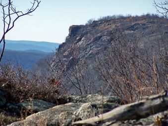 We got back on the trail toward the Bear. This trail is marked in both orange and blue since the two trails run concurrently for a short distance. Soon the blue trail branched to the left and we continued on the orange trail to the right out onto an open rock face. From here the Torne behind us and the Russian Bear ahead of us were clearly visible. The trail on the other hand was NOT well marked but Kurt found it as it descended to a small stream before climbing up to the Bear. The climb starts out gently with a LARGE rock outcropping to the left and a smaller one to the right. There is supposed to be a formation that looks like a bear but perhaps things have shifted over time or my imagination is not too good. The trail turns left slightly and then more sharply as a set of stone steps leads up to the top. The view from the top is good especially of the craggy face of the Torne. The sun was in the wrong position for good pictures but the view was fine. We continued on the orange trail for only a short distance before turning right on the black Raccoon Brook Hills Trail.
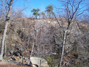 This trail descended slightly and then followed the edge of a rather high cliff. This cliff looked over a small "valley" below and was in the correct location for a formation known as The Pulpit. The first time you hike an area it is hard to know all the trails and features. The trail began a steep descent to the area below. Looking back at the cliff we had just been on it DID look like a high Pulpit dominating the area below. The trail turned left and continued to descend and then ascend slightly until it ended at the blue Seven Hills Trail. We turned left and walked a short distance to where the blue trail began a descent. This point allowed an unobstructed view of the Torne from the other side. The view from the Bear was actually more interesting! Again, the sun was coming from behind the Torne making photography difficult. We retraced our path to the trail junction and continued on the blue trail until its junction with the white Reeves meadow Trail. We turned left here and began what seemed like a long walk back to the parking area.
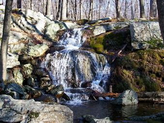 The initial part of the white trail rolled some up and down small hills and then began a steady descent to Seven Lakes Drive. Along the way the trail paralleled a small stream (Reeves Brook?) which had several small but pretty cascades. Eventually the trail opened to a wider woods road which descended to meet the red Pine Meadow Trail. A quick left and a short walk brought us back to the cars. We had covered 6.5 miles in 5 hours which surprised me since our pace had been FAST. I realized that all the long stops at the various features along the way had eaten up a lot of time. Harriman Park has NUMEROUS interconnected trails both marked and unmarked. It also has informal paths and woods roads throughout. When going into the area for the first time, my advice is to carry an up-to-date map and look at it often. A GPS unit may also aid your navigation through the maze of trails. I was very surprised that the trails had little or no snow but were relatively dry. This was only a mile south of where we had encountered quite a bit on snow a few days before. Wherever the melting snow went I was glad it had not pooled on the trails!
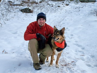
![]()
![]() On Friday, Dec 26th all the kids were home for the holidays and we decided to go for a hike. Karl, Kathleen, Kurt and I plus two dogs, Maggie and Sheba, were ready to go. Heading south seemed like a good idea to avoid the "weird" weather conditions in the Catskills. The weather had been alternating from snow, the ice to rain and I was unsure of the conditions on the peaks. I decided to plan a hike in the southern part of Harriman Park. My plan loosely involved parking near Lake Sebago and hiking to the Ramapo Torne and back. We got a later start than I wanted, as usual, and were in the parking lot by 9:45 AM. The parking lot is the one for the boat launch at Lake Sebago. The first thing that was VERY noticeable was that there was almost as much snow in Harriman as in the Catskills! I had NOT anticipated this development but it did not change my plans. The temperature was still in the high twenties but was predicted to rise throughout the day. I decided to take my poles as I regretted NOT having them on several hikes earlier. We walked out the ICY driveway, across Seven Lakes Drive and to the start of the Seven Hills Trail marked by three blue on white blazes.
On Friday, Dec 26th all the kids were home for the holidays and we decided to go for a hike. Karl, Kathleen, Kurt and I plus two dogs, Maggie and Sheba, were ready to go. Heading south seemed like a good idea to avoid the "weird" weather conditions in the Catskills. The weather had been alternating from snow, the ice to rain and I was unsure of the conditions on the peaks. I decided to plan a hike in the southern part of Harriman Park. My plan loosely involved parking near Lake Sebago and hiking to the Ramapo Torne and back. We got a later start than I wanted, as usual, and were in the parking lot by 9:45 AM. The parking lot is the one for the boat launch at Lake Sebago. The first thing that was VERY noticeable was that there was almost as much snow in Harriman as in the Catskills! I had NOT anticipated this development but it did not change my plans. The temperature was still in the high twenties but was predicted to rise throughout the day. I decided to take my poles as I regretted NOT having them on several hikes earlier. We walked out the ICY driveway, across Seven Lakes Drive and to the start of the Seven Hills Trail marked by three blue on white blazes.
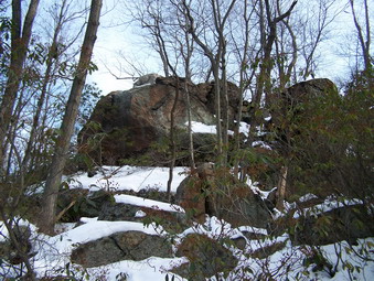 The trail began an ascent almost as it climbed the southern shoulder of Conklin Mountain. The poles were certainly helpful but foot traction was not necessary as long as you watch where and how you stepped. At one point we descended briefly and crossed a small stream. The dogs got a drink and ran back and forth across the stream. At one point Sheba picked a slightly different route, hit a deeper spot, and went at least chest deep in cold water. Fortunately, she has a thick undercoat and only her outer coat got wet. I watched her for a while and she did not seem to be cold. As we ascended again the trail left the woods road and turned sharply right. I continued on the road for a short distance and then turned on a path to the left. We walked to an open area that had been used for camping. In front of us was a brick structure. It was perhaps 10 feet tall, 8 feet wide and 6 feet deep. It was built into the hillside and had some openings on the front. The best suggestion I have heard so far is that it was a kiln of some sort. We retraced our path to where the trail turned off and turned into the woods ion the OPPOSITE direction. Here a large rock outcropping rose impressively. We made our way to the top of the outcropping to see Monitor Rock. This is a glacial erratic that was named for a copy of the Christian Science Monitor found under it when it was discovered. After taking pictures, we returned to the trail junction and began to follow the trail.
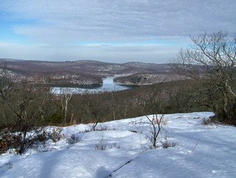 The trail descended slightly and then began an ascent of the Diamond Mountain Ridge. The first lookout gave an unobstructed view of Lake Sebago below and hills beyond. Shortly after this we passed a LARGE glacial erratic with a crack on one side. This has been fancifully named the "Cracked Diamond" for its appearance and location. Soon the blue trail met the orange HTS Trail on the right. The trails ran concurrently for a short distance along an open rock face. The trail began to descend a rather steep and icy route and then it leveled slightly and the orange trail branched off to the right. We stayed on the blue trail as it approached a large boulder on an open rock face. The views from this boulder revealed a vast expanse of forest below with only hints of other features in the distance. From here the trail began a SHARP descent which was difficult at times and icy in places. We finally reached Pine Meadow Brook which seemed wide and I wondered if we would be able to cross. I wanted to visit the "caves" on the Raccoon Brook Hills Trail that had been found to have Native American artifacts in them and so turned left.
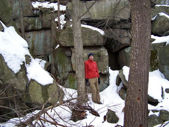 We walked along and toward the creek on a trail marked in red, white and blue. Fortunately a bridge crossed the deepest part of the creek, After crossing this somewhat dilapidated structure the trail separated and we followed the white blazes of the Kakiat Trail as they turned left and began a slight ascent. The snow got deeper and I consulted the others who agreed to continue to the "caves" and then retrace our path to the area of the bridge. As we hiked I was in the lead with the dogs and Kurt was close behind. In a very short distance the three black marks announced the beginning of the Raccoon Brook Hills Trail and we turned left. The trail immediately became hard to follow as the blazes were few. Ahead of us on a slight descent was a massive rock outcropping with some very obvious "caves" or rock shelters at the base. Kurt and I crossed several small streams and wet areas and approached the shelters. We found several small sheltered areas and some larger ones. We both had no trouble imagining native people using these for protection from the elements in all seasons, I noticed that Karl and Kathleen had not arrived yet and gave a yell. I heard an answering cry but could not determine what was said or its exact origin. After exploring for a few more minutes and taking pictures, I became concerned that the other two had not yet appeared. Kurt and I returned to the Kakiat Trail to find that their footprints continued on passed the turn off. I picked up my pace to almost a jog and yelled ahead. When I got an answer, I yelled for them to turn back but could STILL not make out the response. Fortunately, in only a few minutes I caught up to Karl and Kathleen and we headed back on The Kakiat Trail to the area where we had crossed the stream on the bridge.
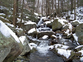 We now made our way westward on the red Pine Meadow Trail until the orange HTS crossed it after a short walk. We turned right and crossed a bridge over Pine Meadow Brook and turned to the left to Kakiat Trail. I had decided to stay "low" to avoid the climb over Halfway Mountain or back over Diamond Mountain. This would make it easier for everyone and allow us to stroll along a stream back to Lake Sebago. Just after turning off the bridge we came to the Cascade of Slid. The water was following freely and the cascade over the rocks was very beautiful. I took some pictures before we continued along the Kakiat Trail. Soon the Stony Brook Trail came in from the right and we turned on this yellow trail and followed it northeast along the brook. The trail was well marked for the most part and followed the brook which had a good volume of water. Stony Brook is the outlet for Lake Sebago. As the yellow trail ended we continued north on the HTS Trail which briefly meets the red Tuxedo Mt Ivy Trail. We stopped a the base of the dam for Lake Sebago before walking up to Seven Lake Drive. Areas along the lake are marked as private so we simply walked the road back to the car. We had covered the 6 miles in a little over 4 hours leaving plenty of time to stop and explore. The weather remained cold enough that I never considered removing and layers but was also never cold.
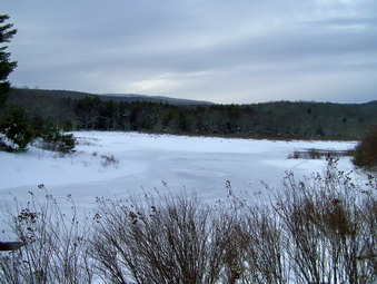
![]()
![]() On Tuesday, Dec 23rd I got home from school and decided to take Sheba snowshoeing. It was already late but I got some gear together, dressed and started for Frick Pond. We didn't pull into the parking area until 3:15 PM so I planned to Hike to Frick and then "play it by ear". The weather prediction for the rest of the week was lousy so I wanted go as far as I could before it got dark. There was about 8 inches of snow on average on the trail to Frick and we made the pond in about 15 minutes. I stopped and took some pictures even though the scene was bleak. The sun was already sinking low in the sky! We headed across the bridge to go around the right side of Frick. Many of the branches hung low with snow. The Wooden walkways were snow covered but I had no problems negotiating them with snowshoes. Soon we had rounded the pond and I saw Times Square ahead. This took only another 15 to 20 minutes. At his point I had to decide whether to turn right and head back to the pond and then the car or to continue straight ahead and use the Big Rock Trail to get to the Flynn Trail and then head back. Even though it was beginning to get a little dark I chose the longer route. I had a headlamp and my GPS dog with me!
On Tuesday, Dec 23rd I got home from school and decided to take Sheba snowshoeing. It was already late but I got some gear together, dressed and started for Frick Pond. We didn't pull into the parking area until 3:15 PM so I planned to Hike to Frick and then "play it by ear". The weather prediction for the rest of the week was lousy so I wanted go as far as I could before it got dark. There was about 8 inches of snow on average on the trail to Frick and we made the pond in about 15 minutes. I stopped and took some pictures even though the scene was bleak. The sun was already sinking low in the sky! We headed across the bridge to go around the right side of Frick. Many of the branches hung low with snow. The Wooden walkways were snow covered but I had no problems negotiating them with snowshoes. Soon we had rounded the pond and I saw Times Square ahead. This took only another 15 to 20 minutes. At his point I had to decide whether to turn right and head back to the pond and then the car or to continue straight ahead and use the Big Rock Trail to get to the Flynn Trail and then head back. Even though it was beginning to get a little dark I chose the longer route. I had a headlamp and my GPS dog with me!
 The Big Rock Trail is a joint use trail and the snowmobiles had it nicely packed. This is a good thing since the trail immediately starts with a big climb and continues UP until it joins the Flynn Trail after more than a mile. We had encountered some slushy areas along the way so Sheba has having some ice balling issues but otherwise things were good! I stopped a few times to clean off Sheba's feet and to take a breather. Soon we faced the last hill and were up and over it. Just after this climb I saw signs of the Flynn Trail ahead. I debated putting on my headlamp but it wasn't quite dark and I hoped to get back before I needed it. It was now getting much darker and, since the sun had set, colder. The Flynn Trail is off limits to snowmobiles but the forest rangers sometimes use it and there was a slight track broken out. This was good since I was tired after the climb. The track and the fact that the trail all downhill let us set a fast pace. Near the end of the trail there were several large trees bent over. I assumed this was evidence of the ice we had two weeks before. As we approached the cabin near the end of the trail, I noticed that the lights were on. I decided to walk the Flynn Trail to the end rather than walking across the property by the cabin. This part of the trail was COMPLETELY unbroken with 12 inches of snow in most places. Sheba led the way and followed the trail precisely until we passed the register box and walked up to the car. It was 5:00 PM and now dark. We had spent and hour and 45 minutes covering a tough route.
On Sunday, Dec 21st I decided to brave the blowing snow and take a short snowshoe hike as my first of the winter. I wanted to try out some gear including the Crescent Moon Gold 10 shoes. I decided to dress in Icebreaker 150 and Icebreaker 320 for my baselayer and midlayer and cover that with an Outdoor Research Mithril Stormshell. Under my Mountain Hardwear Winter Wander pants I wore a pair of PolarMax midweight tights. I got out my Salomon B52 boots since they are warm and waterproof. I chose my new Black Diamond Verglas gloves. Sheba and I headed out the door and were almost driven back by the blast. The snowshoes went on easily and we headed down the driveway to hike on the hills behind the church. I did not take a pack or camera since I did not plan to be out for very long.
We headed up the first hill by the cemetery and I was wondering why the new snowshoes kept banging together. After a while I got the proper stance and proper rhythm and the snowshoes were fine. The only other tracks in the woods were old human tracks or new animal tracks we turned into the woods near the top of the hill since I intended to do the route that we always do. The snow was deep enough to make using the snowshoes fun but they were not real necessary. Soon we had reach the first ridge and were climbing the hill to its highest point. I was feeling pretty good at the top and so decided to lengthen the trip a little as we continued over the ridge, down the other side and up the next big hill. I was able to lift the tips a little on the downhills to get some glide. We hit a woods road and followed it before cutting into the woods to find the woods road to the top of the hill. We continued up this road as it winds its way to the top.
We turned around and followed our trail back but followed the woods road most of the way before picking up our track through the forest. Back at the top of the first hill we turned east and head downhill toward the Quickway. This involves a series of two or three fairly steep downhills which I negotiated cleanly. Sheba meanwhile was having a GREAT time leading the way! We walked parallel to the Quickway for some time. There were cars on the road but it was FAR from clean of the snow and ice. After a short walk we cut into the woods and began our ascent over the hill. I always seem to miss the turn I should take but always make my way back. This time I missed it by a lot and was soon walking in "new" territory. I wanted to keep the hike long and Sheba seemed to keep wanting to go over the hill. I continued to walk until I got to a set of ledges and steep downhills and then I decided to follow the dog. Sheba was happy to lead and I to follow her. It seemed at times she had a plan and at other times like she was wandering. I began to wonder if she knew where she was going and then I looked down to see our tracks from earlier. Sheba had led us back to the same spot we started from an hour before.
I am happy to say that all the gear worked well and I like the Crescent Moon shoes very much. The Mithril shell is warm but completely water and wind proof. My right foot was initially cold in the boots but the B52s warm up quickly and the felling soon went away. We were out for about and hour and a half which was long for the first snowshoe hike of the season. I can say that I was tired the next day.