
What You Missed
Winter 2007-2008
Winter 2007-2008
![]()
![]() On Saturday, March 15th I wanted to hike the trail that will be part of an extreme running event on April 12th. The event includes 50 mile, 50K and 10K versions and I am contemplating the idea of trying the 10K. I had been thinking about this all week and was glad that Saturday dawned wet but without any major snow coverage. I knew that Bear Mountain would be warmer so I donned my Mountain Hardwear Winter Wander pants but without a baselayer. On top I had my now favorite PolarMax Expedition zip top and a light OR Sequence zip. I put on my Marmot Oracle light jacket. A packed some rain gear and the Stabilicers just in case along with a warmer top. I wore light stretch and an Mountain Hardwear Microdome but packed a slightly warmer set. Cindy said she did not want to go so as son as I was ready I got Sheba in the car and we were off.
On Saturday, March 15th I wanted to hike the trail that will be part of an extreme running event on April 12th. The event includes 50 mile, 50K and 10K versions and I am contemplating the idea of trying the 10K. I had been thinking about this all week and was glad that Saturday dawned wet but without any major snow coverage. I knew that Bear Mountain would be warmer so I donned my Mountain Hardwear Winter Wander pants but without a baselayer. On top I had my now favorite PolarMax Expedition zip top and a light OR Sequence zip. I put on my Marmot Oracle light jacket. A packed some rain gear and the Stabilicers just in case along with a warmer top. I wore light stretch and an Mountain Hardwear Microdome but packed a slightly warmer set. Cindy said she did not want to go so as son as I was ready I got Sheba in the car and we were off.
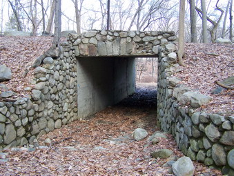
 We got started later than I had hoped so we parked at Bear Mountain at about 10:50. When I got out of the car I was surprised that the temperature seemed colder than I expected and there was a stiff breeze. I decided to keep my jacket on. The sun was out but it was still cloudy and overcast. There wasn't even a hint of snow or ice so I decided on leaving the poles in the car. Sheba and I walked to the tunnel under Perkins Drive and then threw the other tunnel and onto the 1777E trail. My intention was to walk the trail quickly to see how long it would take to gauge whether or not I could finish the 10K in under two hours. The race course follows the 177E and 1777 trails through Doodletown, turns left at the Ramapo-Dunderberg trail, heads up and over Bald Mountain, down the Cornell Mine trail to 9W, back up to the 1777E trail and back to the start.
 The trail was very wet in places as we began and this would continue through most of the day. Fortunately the first half of the trail is mostly road and it is wide enough to avoid the stream on the path in most places. At the entrance to the second tunnel was a sign with a map of Doodletown. Each historical site is numbered and labeled and most are referenced by these numbers in several books on the settlement. Each major historical site has a number in near it and an explanation of the site. Many have drawings of the building which once stood there. As we walked along the path, we came to the junction of the 177 trail and the Cornell Mine Trail. We would be returning on the Cornell Mine Trail so we turned right on the 1777 Trail. In just a short distance a sign pointing to the left indicated a waterfall and swimming hole. My resolve to walk the trail quickly broke!
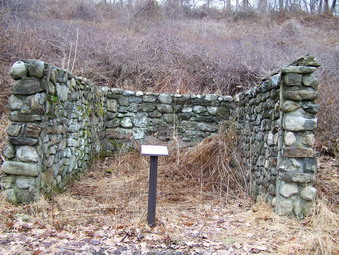
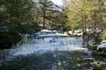
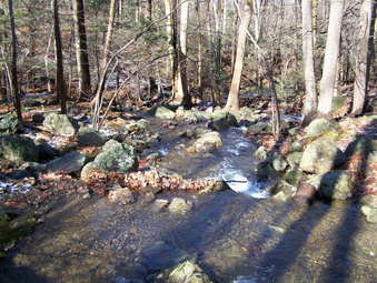
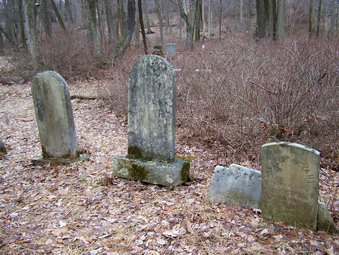 The path down to the waterfall led to a little bridge and continued on up a hill. Beneath the bridge on the downstream side was a small waterfall. Upstream were a few rapids. The sound of the water and the visual effect were beautiful. Below the falls is a deep pool that was used as a swimming hole when the settlement was present. I decided to walk back up the path and get on the 1777 Trail. Along this trail the markers and descriptions of the Doodletown settlement continued at different intervals. The foundations and stone steps of many of the homes are still visible. Some sites have only a sign and no stonework to mark their existence. There is a man-made pond on the left across from the site of the old schoolhouse. Several cemeteries are present and we stopped at the Herbert/Weyant cemetery. These two families were very prominent in the settlement and some of the grave markers bear dates in the early 1800's.
 After climbing a small hill, I read the signs which explain that the main settlement ended and only a few houses could be found beyond that point. The road ends at this point and a rougher trail begins. The trail was wet on this day but was still in good shape. Eventually the 1777 Trail intersects the Ramapo-Dunderberg Trail where we turned left. This trail immediately becomes narrow and ascends over a rocky outcropping before beginning to descend into an open hardwood forest. I wondered about crossing the small stream but the water level was relatively low and "stepping stones" made crossing easy. The trail ascends from here as it starts to wind its way up Bald Mountain. The route we took is certainly the long way around but makes the climb manageable since this side of the mountain is MUCH less steep than the other.
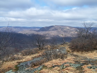
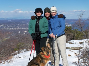
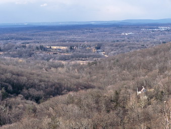
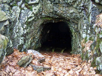 We climbed up toward the top of Bald Mountain taking in some of the views near the top. The trail winds through some rocks and there is a final, short but steep attempt just before the summit. The summit has open views to the north up the Hudson River with the Bear Mountain Bridge almost directly below. On this day the sun had just come out to provide interesting lighting for photography. After taking some pictures, I decided to try to find the Cornell Mine. I had looked halfheartedly before but had done some reading and research since the last time. I dropped directly down off the summit heading north and started to look for piles of tailings from the mine. Soon I saw what I was looking for but the "mine" was only an open pit and I knew there was more. I continued on down the slope toward another pile of mine debris. Within a few hundred feet was an opening directly into the rock of the mountain. The adit was only three or four feet tall and was filled with a foot or two of water. I took some pictures and then we headed across the face of the mountain to pick up the R-D Trail.
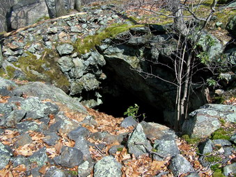 Once on the R-D Trail I was careful to watch for the junction with the Cornell Mine Trail which comes up rather quickly. When this blue trail branched off to the left, we took it and started to descend. This is the MOST torturous part of the trail with steep areas and many rocks just waiting for a misstep. Many of the rocks were wet and covered with leaves which added to the excitement. In one are a large patch of ice covered the trail but was easily bypassed. This will be the most difficult portion of the race both physically and mentally. The trail descends steadily and then begins to level out at the bottom of the mountain. The walking became easier and the sun came out from behind the clouds. As we approached a junction with a woods road I consulted my map and noticed a notation for the Edison Mine. the location was quite near on top of a small hill. I started in the general direction, rounded a large rock and began to notice the now familiar tailings. The mine waste appeared to be coming from the top of the hill so I took a route in that direction. As I walked across the top of the hill, I noticed a depression and then a hole ahead. The hole was not just and open pit but another shaft that penetrated the underlying rock. The Edison Mine entrance also seemed to be blocked but I took some pictures and decided I would read more about both mines.
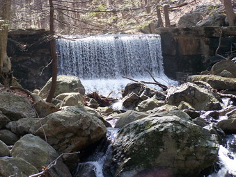 We walked over the hill and back to the trail and continued toward the highway less than a mile away. I was familiar with the trail since I had hiked here before. Just before the junction with the road we took a detour down to the stream nearby. There was a small waterfall and several areas where the water was rushing through the rocks. A little further downstream was a dam. I took quite a few pictures and then we went back up the hill to the main trail. As we approached the road we stopped one more time by the stream and I took more pictures. We walked out to the road and proceeded only about a hundred feet back toward Bear Mountain before turning left back onto the trail. The trail immediately ascends Gray's Hill which was once part of the King's Road and the Albany Road. This hill is near the end of the race and will pose an interesting challenge for tired runners. Further on up the hill the trail abruptly turns right and passes through some brushy areas. This part of the trail was VERY wet with some areas being impossible to bypass. Shortly we were back on the 1777E Trail where we had started. From here we backtracked to the car and arrived at about 3:15. We covered a little over 6 miles in 3 hours and 15 minutes. The hike gave me no idea whether or not I can finish the race in two hours but it sure was fun!
![]()
![]() On Sunday, March 9th I wanted to get out of town. We spent most of Friday night, Saturday and Saturday night preparing for flooding and praying that it wouldn't happen. It didn't although the rivers ran fairly high. After church on Sunday, we decided to get out and go somewhere despite the gusting winds. I decided to go to a "falls" somewhere since I thought the volume of water might make some nice pictures. We had only been to Vernooy Kill Falls once and that was in warmer weather. We quickly dressed and I put my cameras in the car. I decided that a pack was not necessary for the 4 mile hike. We threw in our poles, Stabilicers and snowshoes since it wasn't clear what combination we would need.
On Sunday, March 9th I wanted to get out of town. We spent most of Friday night, Saturday and Saturday night preparing for flooding and praying that it wouldn't happen. It didn't although the rivers ran fairly high. After church on Sunday, we decided to get out and go somewhere despite the gusting winds. I decided to go to a "falls" somewhere since I thought the volume of water might make some nice pictures. We had only been to Vernooy Kill Falls once and that was in warmer weather. We quickly dressed and I put my cameras in the car. I decided that a pack was not necessary for the 4 mile hike. We threw in our poles, Stabilicers and snowshoes since it wasn't clear what combination we would need.
 Finding the trailhead is not easy since most site gives the WRONG directions. We got a little turned around but were out of the car and on the trail just before 2:00 PM. To get to the parking area turn onto Ulster County Route 3 just north of Kerhonksen on State Route 209. This is marked as Sampsonville Road. Go 1.3 miles and turn onto Cherrytown Road on the left. After 3.5 miles, turn left onto Upper Cherrytown Road. The trailhead is about 1.5 miles on the right with the trail starting just across the road on the left. The parking area is marked by the standard yellow on brown sign. We decided to take the poles and wear the Stabilicers. Once on the trail it became clear that we would be alternating between packed snow from the snowmobiles and open trail were the snow had melted or been washed away by the rain. The trail was VERY wet with standing water in some places and running streams in others.
 Our first problem came after less than half a mile. A stream that is normally barely a trickle blocked our way. I went upstream and found nothing. Cindy and Sheba went downstream and things looked more promising. I found a place to jump across but Cindy was a little unsure. We threw some rocks in the stream and built a nice set of stepping stones. After crossing, we made our way back to the trail. Fortunately, the next stream HAD a bridge which was lucky since it was so high we could not have crossed. I did not remember that the trail had so much elevation gain and I do not have a map of the area. We were on a blue trail that was also marked for snowmobiles. I expected to see the aqua blazes of the Long Path since it follows this route but none were to be found. My GPS did seem to indicate we were headed in the correct direction. After a steady upward climb, the trail leveled some. This meant we went from avoiding running water to trying to find ways around large standing pools. I began to wonder if we were on the right trail and then things began to look familiar.
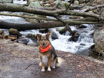
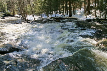
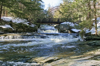
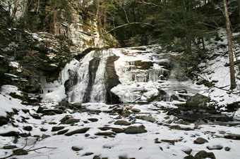
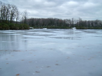
 We arrived at the falls to find another stream to cross which was relatively easy. There was an enormous volume of water going over the falls and under the bridge. I broke out my Canon and started taking pictures from the bridge. I then went down below the bridge and found a rocky ledge to stand on to take pictures of the water coming under the bridge and some other pictures downstream. I worked my way back to the bridge and the upstream along the banks. There are several different levels to the falls and I was able to find a place to take pictures of each one. Near the very top the creek levels off and after taking a few shots I went back to the bridge. Cindy had decided to take a short rest at the bridge. I put the DSLR away and got out the Kodak and took a few short videos of the falls before heading back.
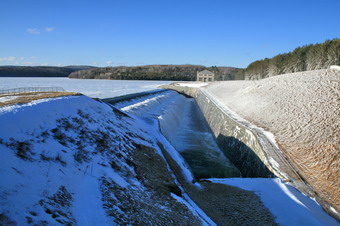 The trip back was VERY FAST. We were tired. We knew where we were going and most of the walk was downhill. We were back by 4:15 PM after covering just under 4 miles. I had intended to go to Stony Kill Falls on the way back but it was a little too late. On the way back through Neversink, we did stop at the Neversink Dam to take pictures. On the way out I had noticed a lot of water going over the spillway. There was so much water that the mist covered the windshield as we drove passed. I walked down the road to take some shots and the wind off the reservoir was VERY strong. I took as many shots as I could before my fingers were numb. Back in the car I decided to park ON the dam and take a few photos of the reservoir which was still solidly frozen. After these shots, I decided to get back in the car, thaw my hands and head home!
![]()
![]() On Sunday, March 2nd I wanted to get out and "try" the new snow that had fallen on Friday and Saturday. Both my wife and I were feeling a little ill with colds but we decided to go out after church anyway. After lunch, we put our snowshoes and Sheba in the car and headed for Frick Pond. Our intention was to hike up to Frick and then use the Quick Lake Trail to go to Hodge. We would use the Flynn Trail to return. This was basically the same hike I did on Tuesday but in reverse. We got started at about 12:15 from the parking area.
On Sunday, March 2nd I wanted to get out and "try" the new snow that had fallen on Friday and Saturday. Both my wife and I were feeling a little ill with colds but we decided to go out after church anyway. After lunch, we put our snowshoes and Sheba in the car and headed for Frick Pond. Our intention was to hike up to Frick and then use the Quick Lake Trail to go to Hodge. We would use the Flynn Trail to return. This was basically the same hike I did on Tuesday but in reverse. We got started at about 12:15 from the parking area.
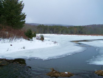
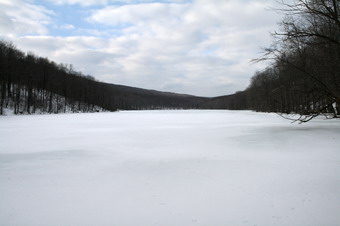
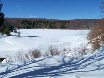 The first thing we noticed was there was MUCH MORE snow on the trails than in Livingston Manor. Also, none of the trail had been broken so we were the first to break trail. The snow was up to 12 inches deep as we approached Frick Pond where there were drifts almost 3 feet high! I took some pictures at the pond and then headed over the outlet bridge to pick up the Quick Lake Trail. There seemed to be even MORE snow on this trail and nothing was broken. It was a real struggle particularly on the slightly uphill portions. I encouraged Sheba to go up ahead of us but she was very content to stay behind me on the broken trail.
 By the time we reached the junction with the Logger's Loop Trail I was pretty sure Cindy wanted to return to the car and I didn't disagree. We turned right on Logger's Loop to head for Times Square. This trail is open to snowmobilers and skiers and was well-packed. The walking here was a pleasure and much quicker than in the unpacked snow. We walked at a good pace to Times Square. The Logger's Loop from here goes back to Frick but is closed to snowmobiles. We were back to slogging through about half a mile of two foot snow with no broken trail. Breaking through the 3 foot drifts was a adventure. Soon we were back at Frick Pond and our broken trail from earlier. From here it was relatively easy to return to the car. We did only a few miles in a little under 3 hours but all of it was difficult.
On Tuesday, February 26th the forecast called for more snow and then a wintery mix and even rain! School went on a two hour delay and then closed and hour later. I decided that even though it wasn't snowing at 10:00 AM that there was plenty of snow for snow shoeing. I greased up Sheba's paws, grabbed my Atlas 1225 and headed for Hodge and Frick ponds. The roads were in good shape and we were on the Flynn Trail by 10:15 AM. I had decided to go up the Flynn Trail, around Hodge and then work my way back passed Frick in some way. The variety of trails make a variety of routes possible.
The first part of the Flynn Trail in the woods was unbroken with at least 10 inches of snow varying from loose powder to a pretty thick crust. Sheba was able to walk on top of the crust in places. Just passed the cabin and the gate the snow thinned. It looked as if several people had barebooted it up the trail leaving rough holes and general mayhem in their wake. I was warm wearing my Patagonia R4 over my UnderArmor. The wind would start to blow and make it cooler and then would die down. About halfway up the Flynn Trail I remembered how different snowshoeing is from hiking! The snow got deeper, the boot tracks ended AND it began to snow. The snow would continue for the rest of the hike and was heavy at times driven by a stiff wind.
We continued straight ahead toward Hodge Pond at the junction with the Big Rock Trail and the snowmobile trail to Mongaup Pond. The snow from this point on was 10 to 12 inches deep and was just plain work to slog through. I looked around for Sheba who is normally out ahead. She was directly behind me following my broken trail. The dog is NOT stupid! I had decided to go directly to Hodge and then continue down the Flynn Trail to the Quick Lake Trail. Any thought of lengthening the journey was put to rest by the driving snow and the deep snow already on the ground. Eventually the trail became packed by snowmobiles and the walking was MUCH easier. The snow was still blowing and I was beginning to get wet.
AT the junction with the Logger's Loop Trail I had to make a decision. Logger's Loop is open to snowmobiles and the snow was packed which made walking much easier. The Quick Lake Trail was COMPLETELY unbroken with deep, powdery snow. The Logger's Loop Trail is at least half a mile longer so I opted for the Quick Lake Trail. After only a few hundred meters I began to winder about my choice. As we walked along the snow and the ground got deeper and the snow in the air continued to blow. This part of the trail back to Frick was longer than I remembered especially under the conditions. The trail was completely unbroken AND very poorly marked.
I was VERY glad to see the ice on Frick Pond. We cut down to the trail at the edge of the pond and worked our way around to the bridge over the outlet. From here it is only about half a mile back to the parking area. I was VERY GLAD to see the car. I was wet and tired. We had covered about 5 miles in 3 hours which did not disappoint me.
On Saturday, February 23rd the snow had finally stopped leaving between 10 and 12 inches of powdery goodness behind. Cindy and I decided to take Sheba and snowshoe on Round Top since none of the roads looked to be in very good shape. We followed the same route Sheba and I had taken the day before.
On Friday, February 22nd there was already 6 to 8 inches of snow on the ground when I decided to go across from my house and snowshoe with Sheba on Round Top. I wore my OR Mithral shell to ward off the snow falling from the skies and the trees. Underneath I wore my PolarMax AND a light Mountain Hardwear fleece since it seemed cold. When will I ever learn? Snowshoeing is even MORE aerobic than hiking and I get warm very quickly! The Salomon B-52 boots are great and I again wore my new Atlas 1225 snowshoes. There were a few cars on the street but we saw no one else as we headed up the road to the cemetery and the trail we usually use to snowshoe. After climbing all the way to the top of the first hill, I decided to continue down the other side and up to the top of the next rise. We followed some of the old woods roads and were soon on top of the second hill. At this point we turned around and followed our tracks back to the top of the first hill. Following our tracks wasn't always easy since it was snowing so hard the tracks were starting to fill in! We then descended down several "steps" to the trail that runs parallel to the Quickway. We continued on this trail until it started to descend and then I followed Sheba up through the woods to another road. This track took us to the clearing that overlooks the Exit 96 exchange. There wasn't much of a view since the snow was coming down even harder! We cut back into the woods, up a hill and then back to where we started. A few miles in over an hour.
![]()
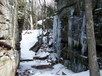
![]() On Thursday, February 21st I wanted to do Slide Mountain since February is one of the few months that I had not climbed it. The roads were a mess but passable after the recent ice and snow. Sheba and I got to the trailhead off the Frost Valley Road at about 10:00 AM. I was worried about the amount of water in the Neversink and a quick inspection confirmed my fears. I walked upstream at least a quarter mile and could not find a place I felt comfortable crossing. There was a LOT of water flowing under and over the ice. I went back to the car top break the news to Sheba. Not one to be thwarted too easily, I headed to Claryville and the trailhead at Denning. This road was exceptionally well maintained and was plowed all the way to the trailhead. Even the trailhead parking was plowed. There was a car and a school bus in the parking area but no signs of people.
On Thursday, February 21st I wanted to do Slide Mountain since February is one of the few months that I had not climbed it. The roads were a mess but passable after the recent ice and snow. Sheba and I got to the trailhead off the Frost Valley Road at about 10:00 AM. I was worried about the amount of water in the Neversink and a quick inspection confirmed my fears. I walked upstream at least a quarter mile and could not find a place I felt comfortable crossing. There was a LOT of water flowing under and over the ice. I went back to the car top break the news to Sheba. Not one to be thwarted too easily, I headed to Claryville and the trailhead at Denning. This road was exceptionally well maintained and was plowed all the way to the trailhead. Even the trailhead parking was plowed. There was a car and a school bus in the parking area but no signs of people.
 I got out of the car to check the trail and quickly determined that snowshoes would not be appropriate at the beginning of the hike. The trail was mostly packed snow and ice so I decided to wear my new Stabilicers and use my Leki poles. The question was whether or not to carry my snowshoes. I decided against this hoping I would not be sorry near the top of the mountain. Sheba and I got started at about 10:45 AM and the choice of Stabilicers seemed to be a good one. They offer just the right amount of grip and add almost no weight. Best of all, once attached, you can just forget about them. We walked quickly and were soon at the cutoff for Table Mountain. We continued on toward the Curtis-Ormsbee Trail. The Phoenicia-East Branch Trail was icy in many spots but with some running water. In places where the sun could get to the trail there was almost no snow. The higher we hiked and the closer to the CO Trail the more snow was present.
 When we turned on to the CO Trail I wondered if I would regret not packing the snowshoes. There was a lot more snow and I was sinking in at various spots. Shortly the trail began to ascends through some rocks which would have required removing the snowshoes anyway. From this point on the trail alternated between a few stretches of snow and some rocky climbs. The day was clear so views from the lookout were very nice. As we got near the top of the CO Trail there was more ice on the trail. This required some careful foot placements despite the Stabilicers and the poles. We son arrived at the Burroughs Trail to the top of Slide. It is still about three-quarters of a mile to the top.
 As we walked the Burroughs Trail it seemed that the temperature had dropped. I bypassed the lookout of the left in an effort to get to the top. The views from the top were limited by the trees as always but the views were crystal clear without any haze. I took some pictures and we got a quick snack before turning around and heading back down the trail. We stopped at the lookout to take a few pictures. Further down the trail we turned left on the CO Trail to head back toward the car. Going down was easier than going up except in the icy areas. The Stabilicers do NOT dig in the same way that crampons do but they are far easier to use. We were back at the car by 4:00 PM covering almost 10 miles in a little over 5 hours.
![]()
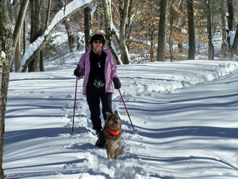
![]() On Tuesday, February 19th I was just starting to get over the cold I had for the entire weekend. My wife, Cindy, and her friend usually walk in the morning so I suggested snowshoeing at Frick Pond. They though that sounded good so we picked up Kathy and parked on the Beech Mountain Road at about 9:15 AM. I hadn't really decided what route to take and I knew I should take it easy. There was enough snow to make the snowshoes worthwhile but not enough to make them mandatory. We headed out to Frick Pond and went down to the pond to take some pictures. Just as we arrived I could see a snow squall coming across the pond. Soon it was snowing all around us. This made photography difficult.
On Tuesday, February 19th I was just starting to get over the cold I had for the entire weekend. My wife, Cindy, and her friend usually walk in the morning so I suggested snowshoeing at Frick Pond. They though that sounded good so we picked up Kathy and parked on the Beech Mountain Road at about 9:15 AM. I hadn't really decided what route to take and I knew I should take it easy. There was enough snow to make the snowshoes worthwhile but not enough to make them mandatory. We headed out to Frick Pond and went down to the pond to take some pictures. Just as we arrived I could see a snow squall coming across the pond. Soon it was snowing all around us. This made photography difficult.
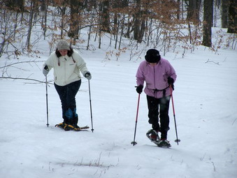 We decided to hike out to Times Square and then up the Big Rock Trail to the Flynn Trail. This was my suggestion and it was probably NOT a good one for my first time out of the house in three days. We quickly got to Times Square and headed up the Big Rock Trail. The snow was packed here since it is also a snowmobile trail. This trail always fools me since there is MUCH more uphill than I ever count on. In fact, the last climb is the toughest. Eventually we were at the top of the Big Rock Trail. I usually like to walk down to Hodge Pond but was not disappointed when I was out voted. The walk down the Flynn Trail was long but uneventful. We were out for about 5 miles and a little over 2 hours.
On Tuesday, February 12th school was closed early just after noon due to the impending snow and ice storm. I got home and decided to try out my new Atlas 1225 snowshoes up at Frick and Hodge Ponds. This are has a variety of loops with varying difficulty. Just as I was ready to leave the ambulance pager changed my plans. When I got back from the call, it was 3:00 PM and the storm had already started. I decided to go across the street from my house and snowshoe a loop up on Round Top. Sheba and I completed a few miles in an hour and got back home as the storm was intensifying.
![]()
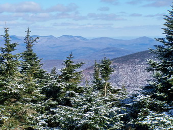
![]() On Sunday, February 10th Karl and Kathleen were up from Virginia and available to hike. We had thought about a snowshoe trip to Frick and Hodge but decided to go south to the Black Rock Forest. I was so impressed with this area the last time that I wanted to share it with others. We didn't get on the road until after 9:00 AM and as we headed south to the Black Rock Forest the weather changed with each mile. We knew that the temperatures would drop and the wind would increase by the afternoon.We headed down Route 17 to Monroe where we got on Route 6. We turned onto Route 293 to head toward West Point and then drove north on 9W toward Newburgh. As we passed the parking area for Storm King I watched for Mountain Road on the right. We turned at the sign for the storm King School and made a sharp right to approach the tunnel that allows Reservoir Road to pass under 9W. The tunnel is so narrow only one car will fit through and barely at that. This time we had the Outlander which is slightly wider and a lot higher than my Eclipse! We continued straight up the hill following the Black Rock Forest signs and parked in the parking area on the right. This parking area allows access to the Duggan Trail or to the upper part of Reservoir Road which is closed to public access. This road leads to the education center for the Black Rock Forest.
On Sunday, February 10th Karl and Kathleen were up from Virginia and available to hike. We had thought about a snowshoe trip to Frick and Hodge but decided to go south to the Black Rock Forest. I was so impressed with this area the last time that I wanted to share it with others. We didn't get on the road until after 9:00 AM and as we headed south to the Black Rock Forest the weather changed with each mile. We knew that the temperatures would drop and the wind would increase by the afternoon.We headed down Route 17 to Monroe where we got on Route 6. We turned onto Route 293 to head toward West Point and then drove north on 9W toward Newburgh. As we passed the parking area for Storm King I watched for Mountain Road on the right. We turned at the sign for the storm King School and made a sharp right to approach the tunnel that allows Reservoir Road to pass under 9W. The tunnel is so narrow only one car will fit through and barely at that. This time we had the Outlander which is slightly wider and a lot higher than my Eclipse! We continued straight up the hill following the Black Rock Forest signs and parked in the parking area on the right. This parking area allows access to the Duggan Trail or to the upper part of Reservoir Road which is closed to public access. This road leads to the education center for the Black Rock Forest.
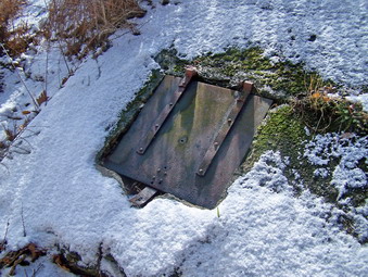 We got on the red marked Duggan Trail and followed it as it dipped downward into a nice hardwood forest. In about half a mile this trail meets the blue marked Reservoir Trail and we turned left here. Almost immediately there was a small bridge marked Ben's Bridge to cross over the stream that is the outlet for the Upper Reservoir. I took some pictures of the bridge and the stream. We continued on the blue trail which parallels the stream and climbs some toward the Education Center. The stream was several very nice little "waterfalls" along the way and the recent rains added to the stream volume. At the top of the hill I could see the education center on the other side of the stream. We took a right on the yellow Stillman trail but only stayed on it for a few hundred feet. This trail leads up Mount Misery and I wanted to save that for last. Instead we turned onto White Oak Road and headed on it toward the Aleck Meadow Reservoir. Just before the reservoir the trail turns right into the woods to the shores of the reservoir. I took some pictures and we then walked to the right along the shore to the spillway. Just after the bridge over the outlet stream we noticed a steel "trap door" on the left. There was no lock on the door and opening it revealed a shaft with a ladder. The shaft was filled with water at the bottom and its use remains a mystery.
 We continued on the yellow Stillman Trail as it headed up to Black Rock. The climb was briefly steep but the trails can be confusing. The view from Black Rock was amazing as were the winds which gusted up to 30 mph! The fire tower was visible in the southwest and there were expansive views to the north and east. The Moodna Viaduct was visible straight ahead. I took a few pictures since the day was much clearer than the last time I did the hike. We headed down off Black Rock on the steep natural stone steps that lead down the other side. These were covered with snow and ice which made paying attention to each foot placement critical. We continued on the Stillman Trail to a junction that illustrates how confusing the trail and roads in this area can be. At this junction there are two roads, two gates and two trails. BOTH trails (Stillman and Sackett) are marked with yellow. We had to turn right and walk a few feet and then immediately turn left to STAY ON the Stillman Trail.
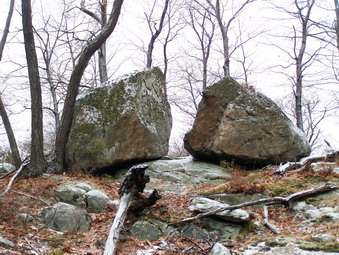
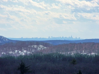 The Stillman Trail passes a ridge on the right and ascends slightly until some bodies of water begin to appear on the left. These are Sphagnum and Sutherland Ponds. The view from the Stillman Trail is largely blocked but I knew that we would soon have a better view. Along the Stillman Trail there are often ridges of rock on the left or right. This is typical of the region where you are either walking beside, on top of or over these rocky outcroppings. We continued to walk on the Stillman Trail until the trail markers for the Split Rock Trail appeared on the left. Almost immediately Split Rock appeared. All along this trail are viewpoints of Sutherland Pond directly to the south and Sphagnum Pond to the southeast. This day the view was so clear we could see the skyline of New York City to the south! The trail eventually descends to an area between the two ponds where it meets Chatfield Road. Just before it meets the road there is a LARGE pit on the right of the trail. This is obviously man-made and I wondered if it was an iron mine. The other three people on the hike began to make noises about the length of the hike. I told them that Eagle Cliff had very nice views but they declined my offer.
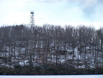 We continued straight ahead between the ponds on the road which ascended slightly and I decided to shorten the hike my staying on the road. The road wraps around Tamarack Pond and at one point a spur trail branches to the shore of the pond on the left. I stopped to take some pictures and the fire tower was very clearly visible on the opposite shore. The road continued around to the left and ended up at the Chatfield Stone House. We stopped for a minute to inspect the house. I would like to return when it is open to look inside the house. After a few minutes we continued on up the Continental Road and then took a right on the White Oak Trail. We crossed the outlet of Arthur Pond and then stayed on the trail until it ended at White Oak Road. Several areas descended over rock faces covered in snow. Most places had enough grip to prevent slipping but it made the short walk tricky.
 At White Oak Road we turned right and continued on the road back to the Aleck Meadow Reservoir. The rest of the group voted to avoid Mount Misery and I consented. By now the wind was even stronger and I Remember the descent from Mount Misery as steep and tricky even without the snow. I chose to stay on the road and walk to the Upper Reservoir. From here we followed the road down to the Center. We stopped briefly at the bridges in front of the Center before continuing on down toward the car. The views from the road were better today and I took some pictures. Just before reaching the we met the only other hiker we had seen on the day. As we approached he said "You're the Catskill Hiker aren't you? I read your website all the time!" I was quiet flattered until I realized there are almost NO pictures of me on the site. I think he must have recognized Sheba! I am sorry I did not get his name or ask him how we knew who I was. We got back to the car after four hours of hiking 6.8 miles. The meal at El Bandido in Middletown was good as always!
![]()
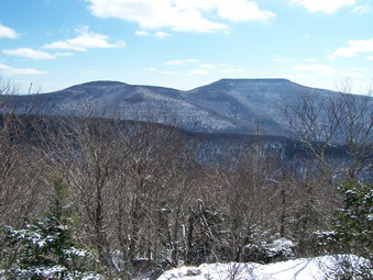
![]() On Saturday, February 9th I wanted to "bag" Balsam Lake Mountain since February is the only month I had not climbed this peak. I wasn't sure whether or not I wanted to do Graham. Cindy didn't want to go so I put Sheba in the car and headed out. The weather report called for snow showers but the skies in town were only cloudy. Also, in Livingston Manor there was almost no snow! As I drove up the Beaverkill Road, it became obvious that the change in elevation meant more snow. By the time I was in Turnwood there was A LOT more snow! The roads were well-maintained until just before the monastery. At this point there was snow and ice on the roads and they were rutted in places. I was happy that I had put snow tires on the Eclipse as I ventured up the last part of the road and parked at the trailhead. The parking area was plowed but there were several inches of new snow over hard packed snow and ice.
On Saturday, February 9th I wanted to "bag" Balsam Lake Mountain since February is the only month I had not climbed this peak. I wasn't sure whether or not I wanted to do Graham. Cindy didn't want to go so I put Sheba in the car and headed out. The weather report called for snow showers but the skies in town were only cloudy. Also, in Livingston Manor there was almost no snow! As I drove up the Beaverkill Road, it became obvious that the change in elevation meant more snow. By the time I was in Turnwood there was A LOT more snow! The roads were well-maintained until just before the monastery. At this point there was snow and ice on the roads and they were rutted in places. I was happy that I had put snow tires on the Eclipse as I ventured up the last part of the road and parked at the trailhead. The parking area was plowed but there were several inches of new snow over hard packed snow and ice.
 I was wearing the PolarMax Expedition as a baselayer since this has become my new favorite. As a midlayer I had on an OR Sequence. On top I wore a Marmot Firelight Fleece jacket. I choose to wear my Asolo Fugitive boots without any traction devices. I took my Leki poles and packed my new Stabilicers. By the time we reached the turn up the mountain, I was ready to ditch the jacket and did so. The breeze had picked up some and light snow was falling. I knew once I got underway I would be warmer. As we climbed I watched where Sheba slipped and avoided those places. Near the top by the spring there were some slippery spots with much of the ice hidden under the new snow. The snow was falling harder and a smart person would have just put on the Stabilicers. I am not that smart!
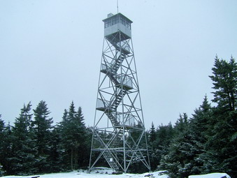
 By the time we reached the tower, the snow was falling harder and the wind had picked up. I took a few pictures but did not bother going up the tower. I took off the Sequence and put the Marmot Firelight back on. Going down the other side was fast but I had to pay attention for icy areas. I had decided to climb Graham another day making up several different excuses. Near the bottom I met four people from the Albany ADK chapter. Two of them I had seen before on hikes. We talked for a minute and they said they were doing Balsam Lake first and then Graham. I took this as a challenge and decided to do Graham. I was glad I had put the jacket on since the snow and wind had both increased. At the Dry Brook Trail I turned left and walked toward the herd path to Graham. This path is now VERY obvious.
 The way to Graham can be tedious. It is usually wet and overgrown. In the summer nettles and water and blowdowns can make the trail hard to follow. On this day the water was mostly frozen but in most places traction was present. I followed a set of foot prints which helped keep me on track. The ADK group had told me that another couple might be up ahead. The tracks became more obscured by falling and blowing snow as we went further up the trail. The hiking went quickly and soon Sheba indicated something ahead. Coming down the trail were the couple who had made the tracks. We stopped to talk and then moved on in opposite directions. We weren't far from the top and made it in just a few minutes. We didn't stay long! The wind was really blowing and more snow was falling. I gave Sheba a snack and grabbed my sandwich. After a few pictures, we stared back down. About halfway down the trail we met the ADK group again. They were now all wearing MSR snowshoes. They seemed to be happy with the choice and they do offer excellent traction. Just a little farther on I met three more hikers who had parked at the Millbrook trailhead. After a brief conversation, we continued the hike.
 Sheba and I were soon back at the Dry Brook Trail where we turned left and started back to the car. The Dry Brook Trail is getting washed out and is very narrow in some areas. Footing can be tricky during the other three seasons! With snow on top of ice, this trail was downright...exciting! I used the poles to steady myself and to avoid slipping over the edge. This part of the hike also went quickly and we were soon back at the turn up the mountain. In 15 minutes we were back a the car. We had completed just under 8 miles in four hours.
![]()
![]() On Sunday, February 3rd I wanted to experiment with my Cannon EOS XTi. I have the regular "kit" lens and a 75-300 mm telephoto lens. The bag I have is a nice LowePro but its hard for me to carry it and my pack at the same time. Because of this, I still carry my point-and-shoot Kodak 650 on most hikes. I though it might be nice to go to the falls on Russell Brook near Trout Pond to take some pictures and maybe even go up to the lake. Cindy and Sheba both were interested so we headed to Roscoe after our annual church meeting. The skies were mostly overcast with some sun as we parked along the road at the top of Russell Brook Road.
On Sunday, February 3rd I wanted to experiment with my Cannon EOS XTi. I have the regular "kit" lens and a 75-300 mm telephoto lens. The bag I have is a nice LowePro but its hard for me to carry it and my pack at the same time. Because of this, I still carry my point-and-shoot Kodak 650 on most hikes. I though it might be nice to go to the falls on Russell Brook near Trout Pond to take some pictures and maybe even go up to the lake. Cindy and Sheba both were interested so we headed to Roscoe after our annual church meeting. The skies were mostly overcast with some sun as we parked along the road at the top of Russell Brook Road.
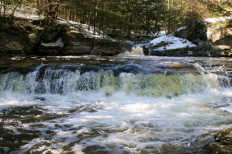
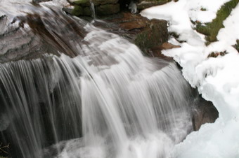
 Cindy chose to wear crampons but I brought my MSR Lightening Ascent snowshoes. Neither were really necessary at the beginning of the hike as the higher temperatures had begun to melt the snow and there wasn't much ice. I did feel a little cool since I did not wear a jacket but I warmed up as we got underway. Cindy had nothing but trouble with the crampons and eventually removed them. We walked down the road and then across the bridge on Russell Brook. We then walked along the left side of the brook to just below the falls. Sheba and I then descended to the bed of the brook so that I could take pictures of the brook and the falls. The snowshoes came in handy here! There wasn't as much water as I though there might be but there was ice on both sides of the falls which made for some interesting shots.
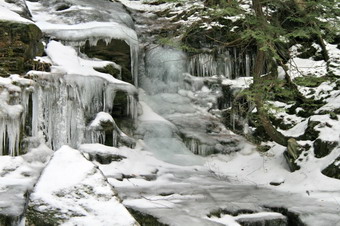
 When I finished at the lower falls, I worked my way back up to the trail and then to the path that leads to the upper falls. The descent to the upper falls was much too icy to attempt. I stood above the falls on the bank and took some shots of the flowing water and ice formations. When I had finished, we decided to go up to the near end of the lake. As we ascended the trail to the lake it was clear at least one hiker with MSR snowshoes and one dog without any snowshoes had preceded us.
 The lake was still completely covered with a layer of ice. The only open water was a small amount near the beaver dam at the outlet. I took some pictures of the lake and used the telephoto to zoom in on the inlet. There was very little color except for the bright blue sky so the pictures look a little "flat". I walked down to the stream bed below the outlet and shot some pictures toward the dam. The ice frozen on the spillway was interesting. We returned to the main path and hiked back to the car.
![]()
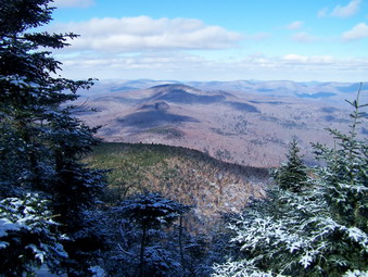
![]() On Saturday, February 2nd I decided to head south again to avoid the ice that had fallen in most of the Catskills. I would have liked to have seen the ice on the trees but the back roads were nearly impassable in some places. Cindy and I prepared for weather that was likely to be warmer than Livingston Manor and that would get warmer throughout the day. We grabbed Sheba and headed back to Seven Lakes Drive in Harriman to hike to the Hogencamp mine and over Pine Swamp Mountain. We parked near lakes Askoti and Skanatati to begin the hike. The wind was brisk near the lakes but several cars were already parked. The loop I had planned would intersect some of the trails I had used a couple of weeks earlier. We also noticed as we got on the Long Path that there was quite a bit of ice. We didn't really know at this point what we were in for!
On Saturday, February 2nd I decided to head south again to avoid the ice that had fallen in most of the Catskills. I would have liked to have seen the ice on the trees but the back roads were nearly impassable in some places. Cindy and I prepared for weather that was likely to be warmer than Livingston Manor and that would get warmer throughout the day. We grabbed Sheba and headed back to Seven Lakes Drive in Harriman to hike to the Hogencamp mine and over Pine Swamp Mountain. We parked near lakes Askoti and Skanatati to begin the hike. The wind was brisk near the lakes but several cars were already parked. The loop I had planned would intersect some of the trails I had used a couple of weeks earlier. We also noticed as we got on the Long Path that there was quite a bit of ice. We didn't really know at this point what we were in for!
 The Long Path continues around the Lake Skanatati to reveal that the lake has several different parts and is bigger than it looked from the road. I stopped to take a few pictures and we continued on. The trail was slippery in places and MANY areas were wet from the rain and melting snow and ice. The Long Path heads mostly west and the turns north and begins to climb. After a little more than a mile we were walking up an icy portion of the path to its juncture with the Yellow Dunning Trail. Before turning west on the Dunning Trail we continued north on the Long path toward Cape Horn. There are very impressive and massive rocks formations in this area and the trail winds its way up. A small stream was overflowing with water that turned the trail into a rivulet. In this area there is evidence of mining activity. We continued up the trail until it leveled off near two twin glacial erratics and then returned to the Dunning Trail Junction. We followed the Dunning Trail west and then south. In this area there are obvious piles of tailings from iron mines. This is the Hogencamp Mine as detailed in the Harriman Trails books and on ironminers.com. I want to return to this area when there is less ice and less water. Some of the mine adits are visible when the water in low and the open pits are easier to see.
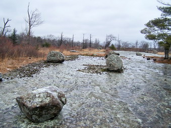 The Dunning Trail heads west for a short distance and then turns abruptly north. At this point there is a flat area that affords a nice view of Little Long Pond. We stopped to take a rest and get a snack. I took some pictures of the pond. Hiking over the ice was slowing us considerably and is taxing mentally as well as physically. There were some places that had solid ice and others were the ice looked like wet spots but was very slick. After a short hike north and a gain in elevation we arrived at Bowling Rocks. Here the open rock face is flat and looks like an immense bowling alley. There are many medium sized boulder scattered around the area. All that is missing are the pins.
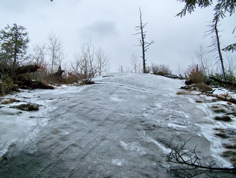 From here the Dunning Trail heads west again and in under half a mile we were at the Bald Rocks and the junction with the Ramapo-Dunderberg Trail. I had intended to lengthen the hike by continuing on the Dunning Trail to the White Bar Trail headed north. This was just to add some length to the hike. We decided that the shorter distance was balanced by the increased difficulty of hiking over the icy rocks. We turned right on the RD Trail and headed north toward Ship Rock and the Lichen Trail. Much of the Rd in this area consists of open rocks faces. Some of these rock faces are flat but many are titled up or down. We crossed the flatter portions and began to climb slightly using the snow and the edge of the rock faces to gain traction. When we were over the top, we looked down at a long stretch of open rock face covered by SOLID ice! There was no way to safely get down this part of the trail but I though I could find a way to work around it. Sheba had other ideas! She had been here before and knew which way the trail was supposed to go. Before Cindy or I could say anything she started down the icy patch of rock. Even her doggy four paw traction was no match for the ice. She scrabbled around and then slide about 30 feet to the bottom of the icy rock face. She wasn't hurt but seemed very surprised. Since she was down at the bottom, Cindy and I decided to find a way down and we did even if it wasn't easy.
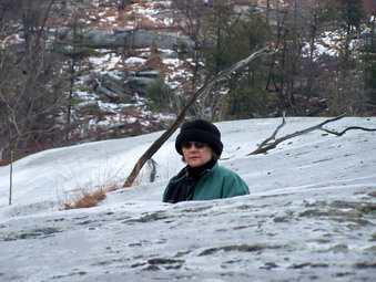 At the bottom of there is a small stream but the log bridge was clear without any ice. The same could not be said of the ascent up the other side. There was plenty of ice and some areas where using two hands is a must. This leads to another HUGE area of open and slanted rock. The RD goes over the top and passed Ship Rock. I went to the top and decided there was no way to get down the other side. We skirted the rocky area and got over to the Lichen Trail. The first part of the Lichen Trail was tricky but we were able to bypass the worse places. The top of the trail was a nice lookout down to Island Pond. I was surprised that this area did not have much ice. Descending the other side was another story! We again had to contend with a long stretch of solid ice over bare rock. THIS time Sheba stayed close as I bushwhacked to the red Arden-Surebridge Trail.
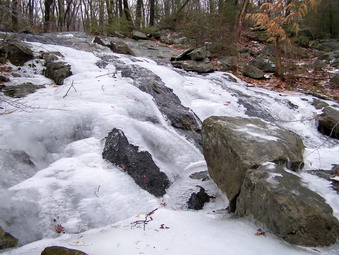 I had turned left and this junction the last time so this time we turned right and headed east towards Times Square. This part of the trail was relatively flat but covered with water and ice. Shortly we arrived at Times Square where four trails and a woods road meet. We continued on the ASB Trail east. This part of the trail had some ups and downs but nothing to extreme. Any wet or icy parts could be avoided and we were soon at the junction with the Dunning Trail. Here a stream comes down off the higher ground and empties into Pine Swamp. The rain and runoff had increased the stream volume but several stepping stones made the crossing possible. I stopped and took many pictures as the water cascaded over the rocks and ice. Later I read that just south of this are on the Dunning Trail are the remains of the Pine Swamp Mine. The adit to this mine is still open and there is a large stope inside. I will return here in warmer, drier weather with the proper equipment to explore.
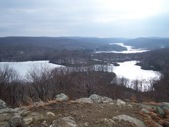 Passed this area the trail begins to ascend as it heads east. After about half a mile the trail suddenly turns south and starts to climb up Pine Swamp Mountain. The climb is only .2 miles and not very steep. There was much more snow in this area but much less ice. Just after the top of the mountain on a slight descent the lakes came into view. I stopped to take a few pictures and then continued on. Within only several hundred feet, the view clears and the lakes are clearly visible below. Directly south is lake Skanatati and just beyond the two part of Lake Kanawauke. Around to the left Lake Askoti is partly visible with Little Long Pond on the extreme right. Although it was cloudy and overcast on this day, the views were beautiful. This area is easily accessible from the parking area below and I could see our car clearly.
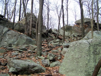 After taking MANY pictures we started DOWN the other side of the mountain to the parking lot. This was the steepest are we had been in all day. There was some ice and one descent through some boulders required some rock scrambling and careful planning. Back a the car I got out my new Canon EOS XTi and took some pictures before heading to El Bandido in Middletown to eat. We covered only 5.5 miles in 5 hours but I thought the hike was "challenging" to say the least.
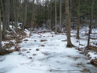
![]()
![]() On Saturday, January 26th I wanted to do a hike I had read about after searching for hikes on trails.com. The authors of an excerpted trail guide suggested hiking a portion of the Appalachian Trail that has a waterfall, three major hills and views of several different bodies of water. Even though the hike is and out-and-back I decided to try it since The waterfall sounded nice at the 10 mile distance was what I was looking for. After visiting the local transfer station, Sheba and I got on the road a little later than I wanted. We drove down the Quickway, got off at the Florida exit and took Route 17A through Warwick to Greenwood Lake. I was looking for Orange County Route 5 which is also called Dutch Hollow Road, Mountain Lakes Road or just Lakes Road. In Greenwood Lake I continued on 17A and up the hill on the other side. At some point I knew I had missed my turn so I pulled over to check the map. I turned around at drove back to the junction of 17A and Route 210. Here I turned right on Lakes Road which I should have done as I came down the hill into Greenwood Lake on 17A. A few miles up the road I passed a power line right-of-way and entered the town of Chester. Another quick map check told me I had just passed the at so I turned around and parked in a pullout by the side of the road. I looked around to find the AT and came to the conclusion it was just up the road passed the power lines. I got the packed on, leashed Sheba and walked up the road. Just passed the power lines we turned into the woods. I checked by watch and found it was just 10:30 AM. The adventure had begun.
On Saturday, January 26th I wanted to do a hike I had read about after searching for hikes on trails.com. The authors of an excerpted trail guide suggested hiking a portion of the Appalachian Trail that has a waterfall, three major hills and views of several different bodies of water. Even though the hike is and out-and-back I decided to try it since The waterfall sounded nice at the 10 mile distance was what I was looking for. After visiting the local transfer station, Sheba and I got on the road a little later than I wanted. We drove down the Quickway, got off at the Florida exit and took Route 17A through Warwick to Greenwood Lake. I was looking for Orange County Route 5 which is also called Dutch Hollow Road, Mountain Lakes Road or just Lakes Road. In Greenwood Lake I continued on 17A and up the hill on the other side. At some point I knew I had missed my turn so I pulled over to check the map. I turned around at drove back to the junction of 17A and Route 210. Here I turned right on Lakes Road which I should have done as I came down the hill into Greenwood Lake on 17A. A few miles up the road I passed a power line right-of-way and entered the town of Chester. Another quick map check told me I had just passed the at so I turned around and parked in a pullout by the side of the road. I looked around to find the AT and came to the conclusion it was just up the road passed the power lines. I got the packed on, leashed Sheba and walked up the road. Just passed the power lines we turned into the woods. I checked by watch and found it was just 10:30 AM. The adventure had begun.
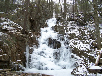 The trail passes over a small bridge and comes to a flat area where Trout Brook spreads out over a wide area. The brook isn't very deep and was completed frozen over. Wet feet this day would not be a problem but slipping on the ice was. The trail hugs Trout Brook until it comes to a rocky area where the brook comes down off a ridge less than .25 miles from the beginning of the trail. This is Fitzgerald Falls. The falls were shrouded in a cloak of ice and the roar of the water was muted as the volume was reduced and the ice acted as a natural sound barrier. We stopped so that I could take some pictures and the continued up the trail to the right of the falls. This ascent was one of many for the day. Most were short but steep or longer but more gently sloped. There were a lot of them! Many also had ice flows that made going up AND down them tricky. We stopped again on the trail next to the brook to take more pictures including some looking downstream above the falls. At this point I had to remove my down jacket since I had already become overheated despite the mid-20's temperatures! I finished the hike in my PolarMax Survival top with only an REI Sahara Long Sleeve top over it. There was almost no wind the whole day which made the light dress possible.
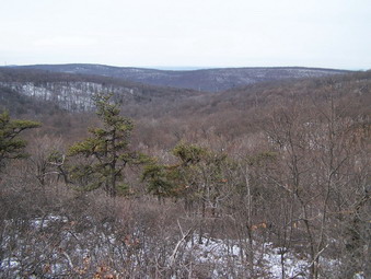 We continued to follow the AT as it slowly ascended through the forest. The white blazes were new and plentiful in some areas and sparse and old in others. Avoiding blowdowns and icy patches sometimes made following the trail difficult. Whenever I had any doubts I consulted Sheba who was usually able to pint out which way we should go. On the lower portion of the ascent we crossed Trout Brook or its small tributaries six times! Finally, after about 1.3 miles more of hiking we ascended to a small ridge where the blue Highlands Trail turns south. We continued east on the AT but not before I signed in at an AT trail register. Hiking parts of the AT is always special for me when I think about what it represents. I don't know if I will ever attempt to hike the entire trail but it is a personal goal that I often think about. We walked out on the Highlands Trail a few hundred feet to take some pictures and then returned to the register. and continued east on the AT.
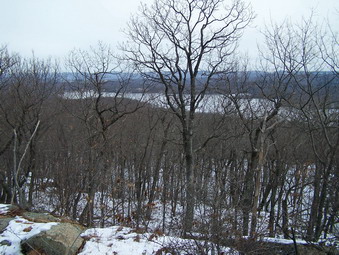 The trail continued along the ridge for a while and then descended before climbing again up to the Mombasha High Point overlooking Mombasha Lake. In .75 miles we were standing on a nice lookout that showed a road and some houses below us. There were no significant landmarks and the far hills were shrouded in a haze on this very cloudy day. A few hundred feet more along the trail brought us to an area that revealed Mombasha Lake below us. The view was obscured by tree but the lake was clearly visible. We shared a drink and a snack before starting the .75 mile descent to Route 91. This descent was steep at times and I began to think about the return trip. Parts of the trail were icy and other parts were very poorly marked. I followed Sheba and we were soon in an area where the trail intersected many woods roads and other trails. We crossed a small stream and began a slight ascent to the road. This area must be very wet at times since a boardwalk started just after the stream and continued almost to the road. We passed by a small frozen pond and were soon at the edge of Route 91. I though maybe some others would be parked here to hike. There really isn't any parking area and there is barely enough room to park one or two cars. So far we had seen no other hikers so we crossed the road and continued our hike.
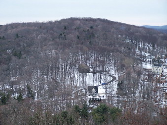 The trail from the road proceed over what looks like an old stonewall before widening and following several woods roads. Mombasha Lake is visible on the left. We made several stream crossing before ascending the shoulder of Buchanan Mountain about .85 miles from the road. This was another ascent that was not very steep or even very high but went through and over several rocky areas. At this point it was around 1;00 PM and I was beginning to worry about completing the hike and getting back before dark. We descended the other side of the mountain and entered a small ravine with a high wall or ridge of rock in front of us after hiking only .4 miles from Buchanan. I thought we might be walking down the ravine to the road near Little Dam Lake but I was wrong! The trail clearly went up and over this wall of rock. I figured it was only another .4 miles to East Mombasha Road and the climb over the ridge couldn't be that difficult. Wrong again!
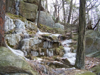 At the bottom of this climb a rather large tree blocked the path. I climbed up the rock scramble and then down to get back on the path. A little farther up the main path was filled with ice so I went around to the right under another tress. In a few more feet the path was again a solid mass of ice. Using my poles and a handy tree branch I was able to pull myself up and around the ice. The rest of the ascent was easy but I wondered about the return trip. On the other side there was a descent that was steep in places. In .4 miles we were at the East Mombasha Road but not yet to the lake. We crossed the road and continued on the AT to a small bridge. I dropped my pack, took some pictures and continued a little farther on the AT to get some pictures of the lake. It was 1:30 PM and time to turn around just as I had planned. I hoped to return a little quicker since I had taken most of the pictures I wanted on the way out.
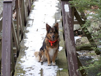 On the way back we hardly stopped at all. The sun had begun to peek through the clouds but the temperature was about the same. The icy descent was not too much of a problem and I found a quicker way down that was obvious from above. I WAS beginning to get tired. The authors of the trail guide had proved to be correct. The constant up and down of the trail can take its toll. We didn't seem to be moving too much quicker than on the way out. I also remember why I avoid out-and-back hikes! By 4:00 PM we were back a the falls and by 4:15 PM had returned to the car. We spent almost 6 hours hiking 9.8 miles. My GPS software reported almost 2400 feet of climbing despite the fact that no climb was over 700 feet!
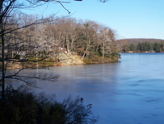
![]()
![]() On Monday, January 21st I wanted to do a longer hike in the Harriman Park area. I did some research and decided to do a loop that would start on Route 106 and take me to Black Rock Mountain, Ship Rock, the Lemon Squeezer, Elk Pen and back over Green Pond Mountain through the Valley of Boulders and back to Route 106. I calculated this to be between 9 and 11 miles. The distance would not be a problem but the weather was another story. The temperature at my house in the morning was 6 degrees with a windchill of 10 below. The temperatures were not predicted to rise above the mid 20's with gusts of wind up to 20 mph. I decided that I had the proper clothing and equipment so I would try the hike. I greased up Sheba's feet to protect them. Sheba and I got in the car and headed down the Quickway to Long Mountain Parkway. At the traffic circle I took Seven Lakes Drive. This is a BEAUTIFUL drive in itself with very little traffic and pristine lakes along the way. We went through the Tiorati Circle and to the Kanawauke Circle. Here I took Route 106 passed Lake Kanawauke and Little Long Pond. Just after Little Long Pond I found the parking area on the right side of the road and parked the car.
On Monday, January 21st I wanted to do a longer hike in the Harriman Park area. I did some research and decided to do a loop that would start on Route 106 and take me to Black Rock Mountain, Ship Rock, the Lemon Squeezer, Elk Pen and back over Green Pond Mountain through the Valley of Boulders and back to Route 106. I calculated this to be between 9 and 11 miles. The distance would not be a problem but the weather was another story. The temperature at my house in the morning was 6 degrees with a windchill of 10 below. The temperatures were not predicted to rise above the mid 20's with gusts of wind up to 20 mph. I decided that I had the proper clothing and equipment so I would try the hike. I greased up Sheba's feet to protect them. Sheba and I got in the car and headed down the Quickway to Long Mountain Parkway. At the traffic circle I took Seven Lakes Drive. This is a BEAUTIFUL drive in itself with very little traffic and pristine lakes along the way. We went through the Tiorati Circle and to the Kanawauke Circle. Here I took Route 106 passed Lake Kanawauke and Little Long Pond. Just after Little Long Pond I found the parking area on the right side of the road and parked the car.
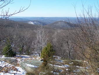 I got out of the car to investigate where the actual trail might start since we had never been there before. After looking around, I could not find the start of the trail. I consulted the map which seemed to indicate the trail started just down the road. I look toward the general area and saw the red trail markers of the Ramapo-Dunderberg. I got Sheba out of the car, got the GPS working and shouldered my pack. I was cold despite my warm clothing so we got going right away. As we walked the first part of the trail I was impressed by the massive rocks and rock formations on both sides of the trail. Soon we were climbing around, over and through these formations to reach the first lookout. Although this open shelf of rock has no name it offers some nice views both near and far. From what I could see at this point the area reminded me a little of the Dunderberg Mountains with open stretches of rock and burned over areas. At this point two other hikers appeared. They were a little confused about the trails so I helped out. They were the only two people we saw all day! I began to get cold taking pictures so we found our way back to the RD and continued toward Black Rock Mountain.
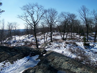 The view from Black Rock Mountain was nice but no better than from the previous lookout. We stopped for a short time but the wind really picked up so we picked up and moved on toward Bald Rocks. Approaching Bald rocks there were some nice viewpoints so I took some pictures. I also took pictures of some unusual striations in some of the bedrock and some glacial erratics. Much of the walking alternated between open rock slabs and more protected areas of forest. Many of the areas were covered with ice and snow especially noticeable on the ascents and descents. I was glad to have my poles with me but wished I had some traction for me feet other than full crampons. After walking down a little "hill", we took a right on the yellow Dunning Trail. I was looking for the Bald Rocks. We walked a little ways and then I decided to head back. On the way back I noticed an unmarked but traveled side trail and followed it to Bald Rocks. This was the area I had just come through on the RD Trail. I guess I wasn't impressed!
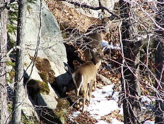 We continued on the RD down a particularly steep but short icy patch. From the bottom of this hill we hiked up an enormous bare sheet of rock which gave nice views in all directions. At his point Sheba "alerted" but I had not heard any voices. I looked carefully to see two white tailed deer carefully picking their way passed a large rock down to a frozen pond. I took some pictures of the deer and the pond and Sheba. We continued down the RD for several hundred feet until Ship Rock came into view. This is a large glacial erratic that looks like the prow of a ship sailing into...a grove of trees. After I took pictures, I decided to alter my original plan and return to the top of the rock slabs and pick up the Lichen Trail. The trails in this area are numerous and intertwined. Some books indicated a trip over to Times Square, a junction of many different trails, was worthwhile. Other books touted the view from points on the Lichen Trail. I decided to opt for the views and take the Lichen Trail.
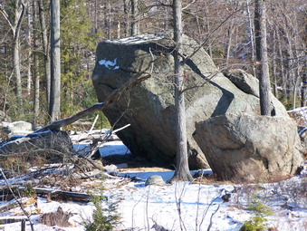 The Lichen Trail wound its way across some open rock and through some grass covered with snow to another open rock area. Several times I "lost" the trail only to find it again. Painting markings on the rocks seems like a good idea until the marks are covered with several inches of ice and snow! Further on the Lichen Trail descends from the rock outcroppings, wraps around them and then leads to...more rock outcroppings and ridges. There is a nice lookout over a small pond and views of the surrounding area. We continued on down to the junction with the Arden-Surebridge Mountain Trail where we turned left at about noon. We were headed toward the Lemon Squeezer along this trail which is also part of the Long Path. Along this short section of trail many different rails enter and branch off. With a map, it is confusing. Without a map, a first-time hiker in the area would be lucky to find their way. First, the Bottle Cap leaves to the right. In just a few hundred feet the Long Path turns right and heads north. At this same junction the White Bar trail comes in from the left. We passed through this area and arrived at the lemon Squeezer. This is a series of narrow passages between rock walls. The trail passes by this area but we explored the Squeezer and then continued on to join the white blazed Appalachian Trail. There is something about walking the AT that stirs the imagination.
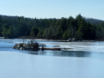 The AT passes by Island Pond. There are several rock ledges that look over the pond but none offer a clear view. I was disappointed because from what I could see the pond was very pretty. We continued walking as the AT descended into a flat area near the pond. We were able to walk over to a rocky prominence that gave an unrestricted view of the pond. It was beautiful and I rook several pictures of the pond, an island near the middle, the shoreline and the high hill overlooking the pond where I had been earlier. We had some lunch hear and I removed my middle layer since I was very warm even standing still. I put my camera in my jacket pocket to make it more accessible and we headed back to the AT. The trail descended to a bridge across the out let of the pond. Here some stone work lined the stream. Other stones formed what looked like an old dam. The AT now took us UP and over the shoulder of Green Pond Mountain. None of the climbing was too steep but I began to hear traffic as we went down the other side. I climbed a rock outcrop to get a better look and saw a road with cars and trucks. The map showed that this was the Thruway. We had walked from Route 106 all the way over the to the Elk Pen near Route 87!
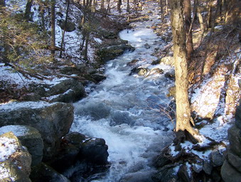 As we descended the AT, we turned left on the Arden-Surebridge Trail which, a this point, runs along the surface of the Arden Road which was once called Harriman's Flat Road. When the A-B trail went left into the woods we continued straight on the Arden Road and Stained Brook Trail. When this trail turned left, we crossed a bridge over Stahahe Brook and stayed on the Arden road. I stopped at the bridge to take some pictures. The water was swirling in interesting patterns over the rocks and ice in the brook. After I took pictures, we continued on the Arden Road which parallels the Thruway. I was glad I was walking and not hurrying along in a car or truck. We hiked down this old road until a small monument appeared on the left side of the road. The monument is hard to read and does not photograph well. It was erected by the Harrimans and reads "Showing the advantages of building flat roads in hilly country" referring to the Arden Road. Just after this monument the white marked Nurian Trail crosses the Thruway and heads back up Green Pond Mountain. This was the way I intended to get back to the car so we turned left on the Nurian trail.
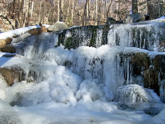 The first thing the Nurian Trail does is climb back up and over Green Pond Mountain. This climb is neither very steep nor is the change in elevation too great. At this point in the hike it did seem like a challenging part of the hike. After reaching the top of the Green Pond Mountain ridge, the trail then descends to meet the Stahahe Brook Trail. At this point we turned right and crossed Stahahe Brook on a double bridge and ascended yet another ridge before dropping down into the Valley of Boulders. Things area has an impressive number and variety of boulders strewn along a small stream coming down off the ridge. The trail crosses as a narrow point in the stream where we were able to step across a few stones. I stopped to take some pictures of the boulders and the water flowing over and around some ice formations. The trail ascends rather steeply on the other sides but does switch back and forth several times. At one point there are some very large boulders and rock formations that the trail passes through as it once again rises to a rocky spine.
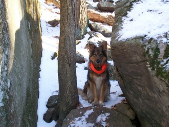 At one point the yellow Dunning Trail breaks off from the Nurian Trail and then recrosses it later. In between these point The Nurian Trail passes by tiny Green Pond. Just after this the Nurian Trail crosses Island Pond Road which is an old woods road to Island Pond. It then continues southwest to join the RD. I had originally planned to take this route but it would retrace part of our earlier hike. At the Island Pond I decided to bear right and follow the road out to Route 106 and walk the road back to the car making a completely new loop. Walking on the woods road was easy and we were soon on the paved road. The walk back to the car was longer than I though but allowed me to discover several other parking areas along the way. At the end of Island Pond Road there is room for only a few cars. Just a little further to the east there is a large parking lot on the south or west side of the road. This lot can be used to start the hike we went on or to start hiking on the White Bar Trail toward Car Pond Mountain. Further east on Route 106 are two more pull off areas on the north or east side of the road. These are small with the largest being opposite the trailhead for the Victory Trail on the south side of the road. This trail can be used to access Tom Jones and Parker Cabin Mountains. Back at the car by 3:30 PM we had covered 9.5 miles in 5 hours with many stops for pictures. On the way home on Seven Lakes drive, I stooped at lake Tiorati to take some pictures.
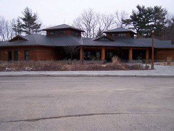
![]()
![]() On Saturday, January 19th I wanted to do a hike at Sterling Forest. I had been reading about the area and both my wife and I remember going there when it was the privately owned Sterling Forest Gardens. Sterling Forest is a success story in which a large development was beaten back by the determined efforts of a consortium of groups and people who wanted to preserve the natural beauty of the area. Today the Sterling Forest State Park encompasses nearly 20,000 acres of land. Cindy and I packed up the car, got Sheba loaded and drove through Florida, Warwick and Greenwood Lake. This in itself was interesting since I had never taken this route. We turned south on Long Meadow Road and bypassed the Visitor's Center in favor of a parking area about 1.5 miles further down the road. This may have been the first of many mistakes! We parked on the road at about 10:15 AM since the "seasonal parking" area was closed.
On Saturday, January 19th I wanted to do a hike at Sterling Forest. I had been reading about the area and both my wife and I remember going there when it was the privately owned Sterling Forest Gardens. Sterling Forest is a success story in which a large development was beaten back by the determined efforts of a consortium of groups and people who wanted to preserve the natural beauty of the area. Today the Sterling Forest State Park encompasses nearly 20,000 acres of land. Cindy and I packed up the car, got Sheba loaded and drove through Florida, Warwick and Greenwood Lake. This in itself was interesting since I had never taken this route. We turned south on Long Meadow Road and bypassed the Visitor's Center in favor of a parking area about 1.5 miles further down the road. This may have been the first of many mistakes! We parked on the road at about 10:15 AM since the "seasonal parking" area was closed.
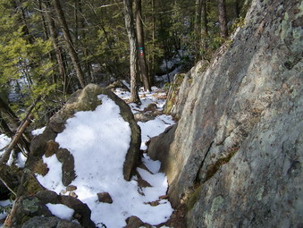 As we were walking up the road, a trail or woods road presented itself on the left. It seemed to be marked with the red on white blaze that we were searching for so we turned. In retrospect, the marking were simply a request to "STAY OUT" but we didn't see it that way at the time. As we continued walking on the various roads that honeycomb the area, we did not see ANY blazes or markers of any kind. This should have been a big hint but my wife said we should be adventuresome and I didn't disagree. It seemed that we wanted to go north and all the trails ran slightly west or south! Finally, I saw the fire tower to our left and I thought our problems were over. I was wrong!
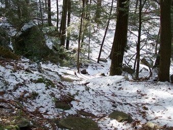 Shortly we came to the blue Sterling Ridge trail and turned right toward where I thought the fire tower was. We descended a slippery slope to a small stream and crossed on some icy rocks. On the other side we ascended another slope and stopped. Both of us were convinced from the inadequate map that we had that we were headed the wrong way! We turned around and walked back down the slippery slope, across the stream and up the other side. We continued on the blue trail and came to a rocky outcropping that offered a limited view. The trail descended the other side of this outcropping along a narrow ledge so we followed it. We descended and walked along the trail to a point where the trail crossed a woods road. The sign said "Fire Tower .5 miles" is the OPPOSITE direction, the way we had come! Undaunted we continued and ascended to another ridge. At this point I noticed that we were walking TOWARD the sun in a generally southerly direction. Next stop, New Jersey! To confirm this a hiker was walking toward us with his dogs. We talked and he said he was coming FROM GREENWOOD LAKE which was definitely NOT the direction we want. We turned around.
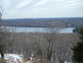 We walked down the hill back to the woods road. We walked UP the steep rock ledge and back to the point we had first found the trail. We walked back down the slippery slope to the stream and across the icy rocks. We walked back up the slope to the point we had turned around but this time we kept walking. The trail ascended more steeply at times but soon we were on another ridge. We continued to walk until we broke into a clearing where there was a ... fire tower. I stopped to take some pictures of the tower and noted the red trail coming up a wide woods road. This was the trail we SHOULD have been on from the start. We walked over to the tower and found it was closed. Not only was it closed but a gate barred the way from ascending the tower to even get a view. Could things get any worse? Just wait!
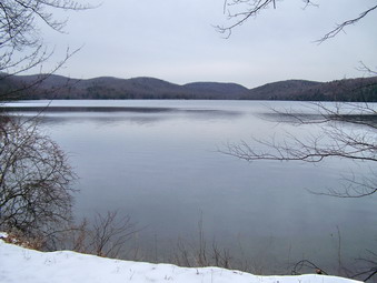 We decided to continue on the Sterling Ridge Trail to its end and to complete a loop along Sterling Lake. There wasn't much to see from the Ridge Trail until we came to a spot overlooking Sterling Lake. This was a beautiful lookout so we stopped. I took some pictures and we had some lunch. I began to cool off so we picked up and continued. It was getting a little late in the day and although the walking wasn't hard it was long. We crossed the orange trail and decided to keep going. At some point I looked at the map and realized that the Ridge Trail ended at Route 17A and THEN looped back to the lake. This was quite a distance but we were too far into the hike to turn around. When the Sterling Ridge Trail ended we turned right onto the yellow Sterling Valley Trail which headed toward the lake after making some interesting twists and turns. This trail eventually dumped us onto the Sterling Lake Loop Trail which runs right along the shore of the lake. The views are very pretty and I envy the people who have private residences in this beautiful area
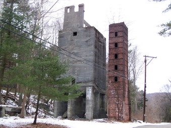 We decided to take a quick side trip to the visitors center and then return to the car. Just before the blue trail turns left to cut across the Sterling lake outlet we noticed a large brick, stone and cement structure on the right. This was obviously the remnants of some industrial facility but it was quite old. From reading about the early history of this area I knew that the entire park was dotted with old iron mines. These buildings were the remains of the Sterling Forge and Furnace. Here iron ore mined in the area was turned into iron and made into useful products. After taking some pictures we walked a little farther and then turned left into the trees. The little bridge across the Sterling lake outlet provides views of the lake to the left and the stream from the lake to the right/ Downstream is another building that was part of the iron smelting and forging operation in the area. After walking through the woods, we arrived at the Visitor's Center which is dedicated to the former US Senator from New Jersey, Frank Lautenberg. Preserving Sterling Forest in its pristine conditions required the action of many private groups and individuals, two states and the Federal government. It was getting late so we decided not to stop at the center. We walked out to the road and took a left.
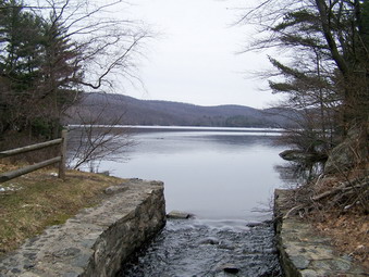 After walking up the road, we turned right onto the blue trail. We walked along this trail for a short distance when one look at my GPS showed me we had again chosen incorrectly. We walked back out to the road and turned right up the hill. Wrong again. Continuing in this direction WOULD have gotten us to Long Meadow Road but we would have been at least 1.5 miles from the car. We turned around and walked back down the road passed the Visitor's Center looking for a white trail (Lakeville Trail) that would meet the red Tower trail back to the car. This time we finally found the trail on the right but I was not at all confident that it was the way to go. We did turn onto the trail and looking back we had been on the white trail while walking the road but no markers were present. Not very far down the Lakeville Trail there were ruins from some of the buildings that were once Lakeville. A little beyond we found the place where the red trail cut right into the forest. This was the trail we SHOULD have taken in the morning! We continued straight ahead on the road and the red trail toward the seasonal parking and the car on Long Meadow Road. At one point a swamp covered the road with water but only a couple of inches. We walked through the seasonal parking area and just a little passed this point was the woods road where we had made our first mistake that morning. We finished our 9.5 miles hike in 5.5 hours and were glad to be back at the car.
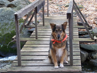
![]()
![]() On Sunday, January 13th I wanted to do the other hike I had planned and Cindy was tired from the day before. This time I was on the road by 7:45 and headed south to the Black Rock Forest. I had read many trail guides and had the basic idea of what I wanted to do. I knew that the hike would be around 10 miles but had no idea what the trail conditions or difficulty would be like. Several of the trail guides described the hiking in minutes which is totally useless since everyone hikes at a different speed. I took my trusty Kodak Z650 since I didn't want to carry the bulkier Canon Rebel Xti. Sheba and I headed down Route 17 to Monroe where we got on Route 6. We turned onto Route 293 to head toward West Point and then drove north on 9W toward Newburgh. As we passed the parking area for Storm King I watched for Mountain Road on the right. We turned at the sign for the storm King School and made a sharp right to approach the tunnel that allows Reservoir Road to pass under 9W. This was the first of many surprises! The tunnel is so narrow only one car will fit through and barely at that. We continued straight up the hill following the Black Rock Forest signs and parked in the parking area on the right. This parking area allows access to the Duggan Trail or to the upper part of Reservoir Road which is closed to public access. This road leads to the education center for the Black Rock Forest.
On Sunday, January 13th I wanted to do the other hike I had planned and Cindy was tired from the day before. This time I was on the road by 7:45 and headed south to the Black Rock Forest. I had read many trail guides and had the basic idea of what I wanted to do. I knew that the hike would be around 10 miles but had no idea what the trail conditions or difficulty would be like. Several of the trail guides described the hiking in minutes which is totally useless since everyone hikes at a different speed. I took my trusty Kodak Z650 since I didn't want to carry the bulkier Canon Rebel Xti. Sheba and I headed down Route 17 to Monroe where we got on Route 6. We turned onto Route 293 to head toward West Point and then drove north on 9W toward Newburgh. As we passed the parking area for Storm King I watched for Mountain Road on the right. We turned at the sign for the storm King School and made a sharp right to approach the tunnel that allows Reservoir Road to pass under 9W. This was the first of many surprises! The tunnel is so narrow only one car will fit through and barely at that. We continued straight up the hill following the Black Rock Forest signs and parked in the parking area on the right. This parking area allows access to the Duggan Trail or to the upper part of Reservoir Road which is closed to public access. This road leads to the education center for the Black Rock Forest.
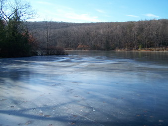 We got on the red marked Duggan Trail and followed it as it dipped downward into a nice hardwood forest. In about half a mile this trail meets the blue marked Reservoir Trail and we turned left here. Almost immediately there was a small bridge marked Ben's Bridge to cross over the stream that is the outlet for the Upper Reservoir. I stopped to remove my jacket and warmer hat and gloves. I also took some pictures of the bridge and the stream. I am experimenting with the manual settings on the camera to see what effects I can get. We continued on the blue trail which parallels the stream and climbs some toward the Education Center. Several times we stopped so that I could descend the bank to get nearer to the stream to take pictures. Sheba was very helpful in "pulling" me back up the bank sine I had her on a leash at this point. The stream was several very nice little "waterfalls" along the way. At the top of the hill I could see the education center on the other side of the stream. We took a right on the yellow Stillman trail but only stayed on it for a few hundred feet. This trail leads up Mount Misery and I wanted to save that for last. Instead we turned onto White Oak Road and headed on it toward the Aleck Meadow Reservoir. Instead of getting back on the trail near the reservoir we continued to a little road with a gate. Turning right here brought us to the shores of the reservoir. Although there was no snow, it had rained and the air temperature was warm, the reservoir was still frozen. I took some pictures and then walked to the right along the shore to the dam and spillway. I again experimented with the camera and then got back on the Stillman Trail.
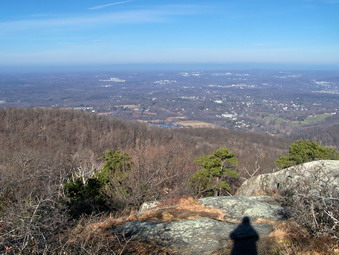 We continued on the yellow Stillman Trail as it headed up to Black Rock. The climb was briefly steep but the trails can be confusing. The view from Black Rock was amazing. The fire tower was visible in the southwest and there were expansive views to the north and east. I took a lot of pictures before heading down off Black Rock. It took a minute to find the steep natural stone steps that lead down the other side. We continued on the Stillman Trail to a junction that illustrates how confusing the trail and roads in this area can be. At this junction there are two roads, two gates and two trails. BOTH trails (Stillman and Sackett) are marked with yellow. We had to turn right and walk a few feet and then immediately turn left to STAY ON the Stillman Trail. Some guide books suggested using the Sackett and Compartment Trails but I decided to stay on the Stillman.
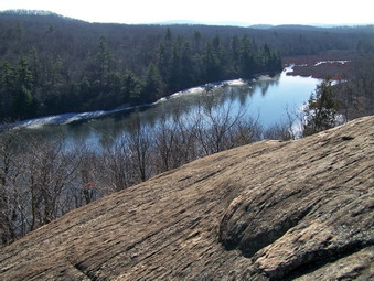 The Stillman Trail passes through some dense thickets of laurel until some bodies of water begin to appear on the left. These are Sphagnum and Sutherland Ponds. The view from the Stillman Trail is largely blocked but I knew that we would soon have a better view. Along the Stillman Trail there are often ridges of rock on the left or right. This is typical of the region where you are either walking beside, on top of or over these rocky outcroppings. We continued to walk on the Stillman Trail and I began to wonder whether or not I had walked by the white marked Split Rock Trail. After descending a little the trail markers came up on the left and we turned onto the Split Rock Trail. Almost immediately Split Rock appeared. All along this trail are viewpoints of Sutherland Pond directly to the south and Sphagnum Pond to the southeast. The trail eventually descends to an area between the two ponds where it meets Chatfield Road.
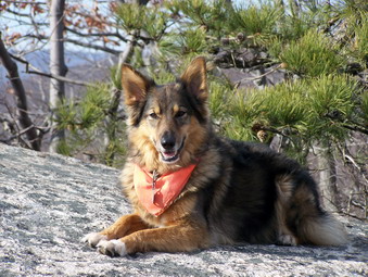 We continued straight ahead between the ponds on the road which ascended slightly. We turned right unto the little used yellow marked Secor Trail. This trail wends its way upward through dense laurel and resembled a small stream as water cascaded down the trail. The trail breaks out into an area that ascends several stone outcrops. After about a quarter mile this trail ends at the Chatfield Trail where we turned right and followed the blue markers. This trail passes through several wet and boggy areas. The trail is bordered by some VERY IMPRESSIVE high rock ridges and outcrops. After crossing as mall stream the trail meets the Scenic trail which is marked in white. We turned left and started to look for the blue spur trail to Eagle Cliff. The guide books said that this was a spot too good to miss. We easily found the trail and within moments were at Eagle Cliff. The guide books were right! From this lookout there are views to the west south and east. Most prominent in the foreground are Jim's Pond and Wilkin's Pond. I found it is possible to climb to the top of the large round boulder here to get an even better view.
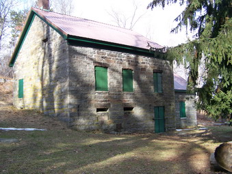 We arrived at Eagle Cliff around noon and as we left the wind began to blow and the skies clouded over. I assumed that this meant the storm front predicted was approaching and I began to plan how to finish the hike. We took the red Rut Trail as it descends through a crack in the rocks (a rut?) and followed it to the yellow Stropel Trail which leads back to the Scenic Trail. We turned right onto the Scenic Trail and began to look for the short blue Spur Trail to Spy Rock. Spy Rock is the highest point in the park at 1461 feet. I missed the yellow Ledge Trail but found the Spy Rock Trail which led us to Spy Rock after only several hundred feet. Spy Rock may be the highest point in the park but the views are disappointing. The entire area is surrounded by trees and the views are poor. We returned to the Scenic Trail and headed southeast and then east. As we approached Continental Road I had to make a decision about what route to take for the rest of the hike.
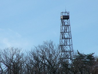 I wanted to see the Chatfield Stone House on the shores of Arthur's Pond so we turned left on Continental Road and walked up to the site. The stone house is very interesting as is the outbuilding. There is a protuberance on the side of the house where the kitchen is located. I will have to read more about this interesting structure. The view of Arthur's Pond from here is beautiful. I had intended to Walk up the road to White Oak Road and over Mount Misery and back to the car. However, as I took pictures at the house the sun came out again and I decided to complete the circuit I had originally planned. Just north of the house we took a right off Continental Road onto White Oak Trail which leads down to Arthur's Pond. This is another beautiful little man-made pond and the trail actually goes across the cement textured spillway. I walked onto the dam to take some picture of the length of the pond before turning right onto the yellow Tower Vue Trail. This trail follows the eastern shore of Arthur's Pond and, true to its name, offers a nice view of the fire tower above the Chatfield Stone House. The trail rises and falls offering some views of the pond through the tress until it rejoins the white Scenic Trail at its extreme southern end.
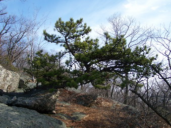 We turned left on the Scenic Trail which, at this point, runs along with Bog Meadow Road. When the trail turned off the road to the right so did we. The trail here is poorly marked as are many of the trails in the Black Rock Forest. Some have newly painted blazes closely spaced and are hard to miss. Other trails have infrequent and faded blazes making hiking a little more of an adventure. We traveled south for a while and I noticed that there was a large, steep hill on my left. This was Rattlesnake Hill and although not very high it was impressive. The trail wraps around the hills to find a more gentle ascent. We were soon headed north and then northeast. The view from Rattlesnake Hill was good especially to the west and south. Bog Meadow Pond was clearly visible. Several other viewpoints were available as we headed toward our next destination, Hill of Pines. Again the approach to Hill of Pines made the task look daunting but a the last minute the trail switchbacks around the steepest areas to reach the summit. The views from the top were not too impressive and there has a singular lack of pine trees! We descended Hill of Pines, crossed the blue Swamp Trail and rejoined the yellow Stillman Trail at the base of Mount Misery.
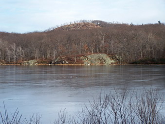 Mount Misery is not the highest point in the park but the climb may be the steepest and the descent the hardest. As we approached the top, I noticed there were a few people ahead. This seemed unusual only because we had seen few other people on the trails. These three hikers had their dog with them. I said a quick "Hello" and moved on to the next rock outcrop. The view from Mount Misery is nice taking in scenery to the north and west. The views repeat those that we had seen earlier from other viewpoints. Descending Mount Misery was not easy as it is steep and there are many slippery leaves. When we reached the I decided to stay on the road. This made the walking easier and allowed us to visit the Upper Reservoir. We stayed on White Oak Road until the reservoir where I stopped to take some pictures. We then turned left onto Reservoir Road which led us down to the Education center and back to the parking area. Along the way we paused at the bridge in front of the Education Center to take some pictures of the bridge and stream. We finished just about 11 miles of hiking at around 3:15 PM. It had taken 6 hours to do the whole hike but that included many stops to view the scenery and take pictures. The many different trails and roads afford an opportunity to tailor a hike for hikers of an level in this not-to-be-missed environment.
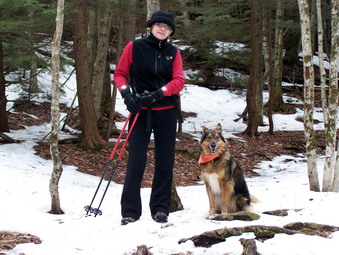
![]()
![]() On Saturday, January 12th I had planned to either go to the Black Rock Forest or to North South Lake to the Palenville Lookout. My wife Cindy had been sick and said the night before she wasn't much interested in hiking. On Saturday morning she felt better and decided to go. She chose to go north to North South lake so we loaded up the car with our Gear and Sheba and headed off. We took our poles but left the snowshoes and crampons behind. We got started a little later than I had hoped and parked a the Schutt Road lot at about 11:15. I had read several trail guides that suggested other trails for access to the Palenville Lookout but we are familiar with this parking area and the trails around North South Lake.
On Saturday, January 12th I had planned to either go to the Black Rock Forest or to North South Lake to the Palenville Lookout. My wife Cindy had been sick and said the night before she wasn't much interested in hiking. On Saturday morning she felt better and decided to go. She chose to go north to North South lake so we loaded up the car with our Gear and Sheba and headed off. We took our poles but left the snowshoes and crampons behind. We got started a little later than I had hoped and parked a the Schutt Road lot at about 11:15. I had read several trail guides that suggested other trails for access to the Palenville Lookout but we are familiar with this parking area and the trails around North South Lake.
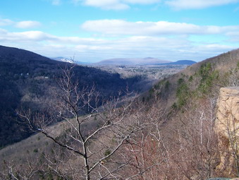 We started out on the blue marked Escarpment Trail from the parking area. There was little or no snow but some areas were wet and slippery. By the time we crossed the bridge over the outlet from South Lake the trail became VERY icy. I wanted to stay on the Escarpment Trail but made the "mistake" of going uphill on the red Schutt Road Trail. This cut out a portion of the hike I had planned to do, mainly the Layman Monument. After struggling up the icy hill, we turned right on an unnamed yellow marked trail that led back to the Escarpment Trail just west of Sunset Rock. The views from the Escarpment Trail were great and those from Sunset Rock even better. We continued on the short distance to Inspiration Point. From this viewpoint the Hudson River is just visible to the east and the slopes of hunter Mountain can be seen to the west. After taking some pictures, we continued on the Escarpment Trail.
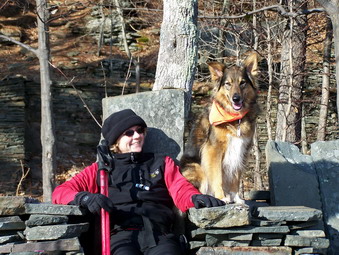 We came to the trail junction where the Escarpment Trail swings northwest with the Long Path and the Harding road Trail continues straight with a horse trail. We went straight ahead here into uncharted territory for us. The Harding Road Trail makes a sharp 180 degree turn in a short distance. We continued on the horse trail along the edge of Kaaterskill Clove. This trail heads northeast at first and then turns southeast before heading due north. After a short distance the horse trail turns southeast and goes down a short but steep descent. We found this difficult since there were many slippery leaves and loose dirt and stones to contend with. At the bottom of this hill we turned right and headed south toward the Palenville Lookout. After descending a short hill and some steps we were there. Some old stone foundations and laid stone walls were present along with some stone chairs. These reminded us a lot of those on Sugarloaf. They must be fairly old since at least one tree has grown up through them. The views from here were the best we had all day and arguably the best in the area. Palenville lies directly below the lookout and most of the town is clearly visible. The Hudson River lies just beyond to the east and southeast. The river is just far enough away and the haze just heavy enough to make taking pictures a disappointment. Cindy sat for awhile as Sheba and I explored along the ledges. I took many pictures in all direction. We had lunch and then started back up to the point where we had made the final right turn.
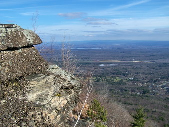 At this point we decided not to retrace our path but to continue north-northeast on the horse trail. The trail parallels the escarpment but at a lower elevation. As we walked and the afternoon wore on this decision began to bother me! Several places on the trail were under water and we had to bushwhack around them. Cindy seemed less concerned than I so we continued on. My GPS showed my we had passed the site of the old Catskill mountain House on the escarpment above but I had seen no trail, marked or unmarked, that led upward. Finally, we crossed the power lines which follow the old railroad grade and are marked on my map. I thought this way up looked steep so we continued on. I was looking for an unmarked trail up to the escarpment but was NOT finding one. Shortly a wide snowmobile trail hooked off to the left and upward and I decided to try this route since it seemed to be marked on the map. This trail was a GREAT choice since it led up to a spot near the railroad grade and up to the picnic and beach area at the eastern end of North Lake.
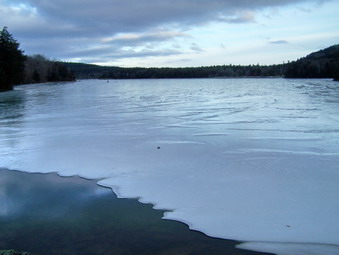 From this point we made a quick visit to the open field that was once the site of the Catskill mountain House. I had planned to return on the trails but it was getting late. The sun had started to get low in the sky and the clouds were moving in. We decided to return by way of the park roads. This was till quite a long walk and the roads themselves were snow and ice covered in most places. The park is closed so most of the roads are not maintained! Eventually we came down across the western end of South Lake. The light was just right to illuminate the lake with a soft blue glow. I stopped to take some pictures including a few of a fisherman out on the ice! We then hurried back to the gatehouse and the parking area. I wanted to get my new camera an experiment with a few shots. Cindy thought this was a fine idea as long as she could stay in the car. I took a few pictures with the 17-85mm "kit" lens and thought how bringing the telephoto lens would have been a good idea. We left the park and headed toward Pancho Villa's in Tannersville at about 4:15 PM. On the way I noticed the beautiful colors of the sunset. I decided to drive up to Onteora Park near the stone church. I stopped there and took some pictures of the Devil's Path, the sunset and the church. We drove back to Tannersville and had a great meal of Mexican food. The salsa and chips here are EXCELLENT. We had covered about 8 miles in about 4 and a half hours. We stopped to take pictures and enjoy the view quite often which made for a GREAT day.
On Sunday, January 6th I decided to try out the Crescent Moon snowshoes that Lisa at Morgan Outdoors offered me. I had intended to go to Trout Pond but got a late start. I settled for going up behind the Presbyterian Church on Round Top. This was really just a test of the new snowshoes but I decided to try walking to the next hike to the next hill which I had never done. The temperatures had risen into the high 30's with 40's predicted. I wore a waterproof Marmot Precip thinking that wet snow might be falling from the trees. I found that all the snow had already come down and I quickly discarded the jacket and wore only my PolarMax Expedition top. I wore by Salomon B52 boots which are leather but waterproof. I tried my new REI Schoeller Dynamic pants over the Mountain Hardwear ThermaDry tights.
The Crescent Moon Gold Series 9 shoes are some of the nicest looking shoes around with a good binding system. I hiked the same route I had done before but added the next hill for a longer hike. The triple crampons sunk into the snow and but in well. The shows are light and the binding puts almost no pressure on the feet. It was almost like I wasn't wearing snowshoes at all. They also allowed enough glide to descent under control and stop when necessary. We spent about two hours hiking and exploring.
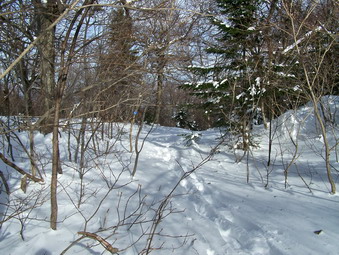
![]()
![]() On Saturday, January 5th I decided I wanted to try a real snowshoe challenge. I had been snowshoeing around my school grounds which has some good hills but I wanted more. I had put out an open invitation to other staff members during the week but no one was interested in this weekend. I decided that I would go and attempt Twin and Indian Head from Prediger Road. I had considered Hunter but I had done that hike before. Hunter is a long but relatively easy snowshoe. I thought Twin and Indian Head would be more of a challenge. As it turned out I was right! I was concerned that the roads might be a problem but my Eclipse with the new Blizzak tires is pretty good in the snow. DeBruce Road had some snow in places but Route 47 was clear all the way to Big Indian. I did get behind someone in a SUV who must had been admiring the scenery. They drove 30 mph ALL the way from the DeBruce Road turn to Big Indian! The rest of the roads up to Tannersville were clear. Platte Clove Road out to Prediger Road was in good shape and even Prediger was well plowed. The problem was that the parking on Prediger Road is even more limited now that the snow has fallen.
On Saturday, January 5th I decided I wanted to try a real snowshoe challenge. I had been snowshoeing around my school grounds which has some good hills but I wanted more. I had put out an open invitation to other staff members during the week but no one was interested in this weekend. I decided that I would go and attempt Twin and Indian Head from Prediger Road. I had considered Hunter but I had done that hike before. Hunter is a long but relatively easy snowshoe. I thought Twin and Indian Head would be more of a challenge. As it turned out I was right! I was concerned that the roads might be a problem but my Eclipse with the new Blizzak tires is pretty good in the snow. DeBruce Road had some snow in places but Route 47 was clear all the way to Big Indian. I did get behind someone in a SUV who must had been admiring the scenery. They drove 30 mph ALL the way from the DeBruce Road turn to Big Indian! The rest of the roads up to Tannersville were clear. Platte Clove Road out to Prediger Road was in good shape and even Prediger was well plowed. The problem was that the parking on Prediger Road is even more limited now that the snow has fallen.
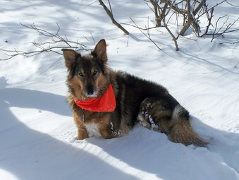 Sheba and I parked at around 9:30 and were ready to hike. I had both my snowshoes and crampons with me since I didn't know what I would need. As I got out of the car to inspect the trailhead the homeowner was there. I asked it where I was parked was Ok and we discussed hiking and the new parking lot that is being cleared. When I got a look at the trail, the choice was clear. There was 8 to 10 inches of UNBROKEN snow on the trail. I returned to the car to put on my MSR Lightning Ascent snowshoes. I left the crampons in the although I was pretty sure I would not use them. The day was much warmer than recent days with temperatures in the high twenties and predictions for high thirties by the end of the day. I wore my PolarMax Expedition under an REI Sahara shirt with only my Mountain Hardwear Zoetic Jacket on top for wind breaking. I wore the Asolo TPS 520 since they are comfortable and almost waterproof. I wore my Mountain Hardwear Winter Wander pants with their ThermaDry tights underneath. These pants are gathered at the ankle but I wore gaiters anyway.
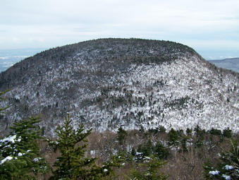 After signing in at the trail register, Sheba and I continued on up the trail until The trail splits into the Devil's Path and The jimmy Dolan Notch Trail. We took the Notch Trail and immediately had to cross a small stream. Due to the recent cold weather the stream was frozen over and proved easy to cross. At this point the snowshoeing was fairly easy with the depth staying at 8 to 12 inches. The further we progressed up the trail the more likely we were to find areas where there were rocks under the stone and narrow areas where running water has cut the trail. The Jimmy Dolan Notch Trail is one of my least favorite trail in any season. Whenever there is water, it follows the trail turning it into a stream that is more to be avoided than followed. As the trail began a steeper ascent to the col the snow began to get deeper and drifted. Some of these areas are more open and less protected by trees. The combination of the steep trail with rocks underneath and the deeper snow made the going VERY difficult. Some of the drifts were nearly three feet deep and hard. Sheba could not make any headway out front and had to follow in the trail I was breaking!
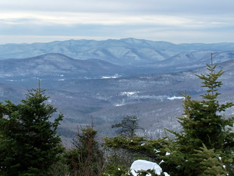 More than one time I thought about giving up or only going to the col but we pushed on. Just before the Col the trail levels a little and we pushed on for the last few hundred feet to the junction with the Devil's Path. Here we took a break and got a drink and a snack. I decided to try Twin since I really like the view from the top. We collected our gear and turned right on the Devil's Path. The ascent was EXTREMELY CHALLENGING. There are only a few areas of level round punctuated by steep areas and some that require pulling yourself up over rocks and around trees. This can be difficult when you can see where you are climbing and can get a good grip. It proved to be almost impossible, at times, with the ice and snow covering everything. I had to use a V technique in some places. In others I had to kick steps into the show either straight ahead or parallel to the mountain. At several points there are nice views of Indian Head. In most places we just kept hiking but I did stop at one lookout to take some pictures.
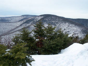 The further we went the deeper the now became until the drifts were over 3 feet on the trail to the rock shelf that is the eastern summit. We stopped here to take some pictures before heading to the western peak of Twin which is the higher one. The trail between the two summits had drifts of snow in places and was covered in ice in others. The trees were laden with ice and snow in spots. This pulled them down into the trail which made the going tough at times. By the time we reached the western summit I was not interested in pictures so we just turned around an returned the way we had come. The descent was as interesting as I had thought it would be. I was never scared on the way up the mountain just tired. On the way down there are areas where a mistake could be ... unfortunate. In all but a few areas I was able to telemark on the snowshoes or perform an elegant glissade. Several times I was all but out of control. All in all descending was much faster than going up.
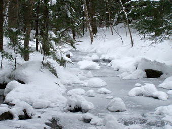 Back at the Col I noted that Indian Head was only .5 miles. I remember, though, that most of this is UP! We headed up to the top of Indian Head. There seemed to be less snow than on twin but the steepness and extra ice made up for this. I was so tired I probably should not have tried this but it was so close. Once at the top I didn't continue on to the lookout over Platte Clove but just turned around and slid toward the Col. The descent from the Col seemed to take a long time but it also went quickly. Again, the Jimmy Dolan Notch Trail proved to be a problem because of the rocks. At times, I got up a good rhythm and a nice telemark only to encounter areas with rocks underneath the snow and narrow areas. The trail is such that just as you plant a pole in what you think is a solid base, the pole sinks through into a hollow below the snow. I was glad to be back down the trail to the more level areas near the bottom. We crossed over the stream and I stopped to take some pictures this time. We were back at the car by 3:00 PM. It ha taken 5.5 hours to cover the 7+ miles. This was one of the MOST DIFFICULT physical things I have done in some time.
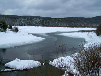
![]()
![]() On Monday, December 31st around noon, I decided to again try to get to Frick Pond to snowshoe. This time the Mongaup Road was plowed although there was still quite a bit of snow on the surface. Even Beach Mountain Road up to the Frick Pond parking area had been cleared as well as the parking area itself. Sheba and I were on the trail and headed for the pond around 12:50 PM. No one else had been on the trail and I took a few pictures of the untouched snow on the trail. There were several areas of open water along the way which tend to be a problem. Stepping in water causes snow to cling to the bottom of the snowshoes which makes walking MORE difficult. At the trail junction we went left and down to the pond. I took several pictures of the pond and the hills around it and of the bridge across the outlet. We continued on around the pond. I decided to take the shorter path and stayed on the Logger's Loop Trail around the pond. I was already beginning to feel the effects of the earlier trip on Round Top and the difficulty of breaking all the new trail.
On Monday, December 31st around noon, I decided to again try to get to Frick Pond to snowshoe. This time the Mongaup Road was plowed although there was still quite a bit of snow on the surface. Even Beach Mountain Road up to the Frick Pond parking area had been cleared as well as the parking area itself. Sheba and I were on the trail and headed for the pond around 12:50 PM. No one else had been on the trail and I took a few pictures of the untouched snow on the trail. There were several areas of open water along the way which tend to be a problem. Stepping in water causes snow to cling to the bottom of the snowshoes which makes walking MORE difficult. At the trail junction we went left and down to the pond. I took several pictures of the pond and the hills around it and of the bridge across the outlet. We continued on around the pond. I decided to take the shorter path and stayed on the Logger's Loop Trail around the pond. I was already beginning to feel the effects of the earlier trip on Round Top and the difficulty of breaking all the new trail.
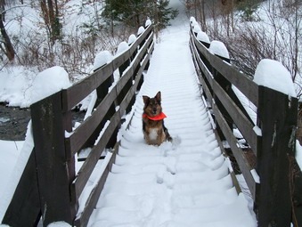 The Logger's Loop seemed to go by quickly and we were soon at Times Square. From here I decided I needed a little more exercise so we went straight ahead UP the Big Rock Trail. I remembered that this trail ascends UP to the Flynn Trail but I forgot how much it ascends! On the way up the first hill I heard a commotion and looked up to see a LARGE red-tailed hawk take off. It was tool ate to get out the camera so I just marveled a the beauty and grace of this bird. It seemed like the Big Rock Trail would never end. It also seemed that the hills went on forever. Along the way I remembered that I had NEVER been on this trail in fresh snow! Every other time I had hiked here, the snowmobiles had packed the trail prior to my snowshoeing. I made a note to myself that breaking a total of over SIX MILES of trail in new powder was "challenging".
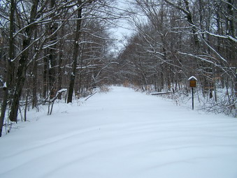 When we reached the Flynn Trail I decided that I would apply the rule I always use. If you are tired and think you might be too tired to take a particular route DON'T. I knew I COULD make it to Hodge Pond and back but that I was too tired to make it fun. We stopped to take some pictures and get a much needed drink. We then turned right to hike the 1.7 miles back to the parking area. As we descended the trail, I knew that I had made the right choice. I was VERY tired even going down hill and was glad to be back at the car at about 4:00 PM. Covering over four miles in fresh powder was enough for me this day.
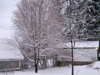
![]() On Monday, December 31st we awoke to about eight inches of freshly fallen powder! I knew that my plans to head for Westkill or the Blacks would have to be put on hold. My plan was to shovel off the walk and parts of the driveway and then head out DeBruce Road toward Frick Pond. I wanted to try the new Bridgestone Blizzak tires I had put on the car on Saturday. I love my Mitsubishi Eclipse but the wide sport tires are useless in the snow. Around 9:00 AM Sheba and I got in the car and headed out. The roads were passable but certainly not in great condition. The car handled unbelievably well with the new tires! When we reached the Mongaup Pond Road it became clear that Plan B would have to be implemented. The road was untouched with only a few tread marks. We headed back home. My plan was to hike Round Top in the morning and then return to do Frick in the afternoon.
On Monday, December 31st we awoke to about eight inches of freshly fallen powder! I knew that my plans to head for Westkill or the Blacks would have to be put on hold. My plan was to shovel off the walk and parts of the driveway and then head out DeBruce Road toward Frick Pond. I wanted to try the new Bridgestone Blizzak tires I had put on the car on Saturday. I love my Mitsubishi Eclipse but the wide sport tires are useless in the snow. Around 9:00 AM Sheba and I got in the car and headed out. The roads were passable but certainly not in great condition. The car handled unbelievably well with the new tires! When we reached the Mongaup Pond Road it became clear that Plan B would have to be implemented. The road was untouched with only a few tread marks. We headed back home. My plan was to hike Round Top in the morning and then return to do Frick in the afternoon.
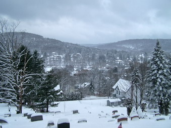 We parked at home and I immediately put on the snowshoes an headed down the driveway. We crossed the street and head up the hill behind the church. No one had been out and the snow was untouched and beautiful. Sheba led the way to the top of the cemetery hill where we stopped so that I could take some pictures. The sky was still overcast with little sunlight. The snow did make the town and the surrounding hills look beautiful. We headed into the woods to begin our loop on Round Top. I thought about reversing the hike but there are several areas that I like to descend on the snowshoes so we followed our usual course. I was aware of how aerobic snowshoeing can be and how warm I get. because of this I wore my Marmot Firelight fleece jacket over only my Under Armour CoolGear. My only concern was that this jacket doesn't block much wind. As we climbed up to the top of the ridge I stopped to open the front zipper and the pitzips as I was very warm. Breaking new trail in 8 inches of snow is hard work.
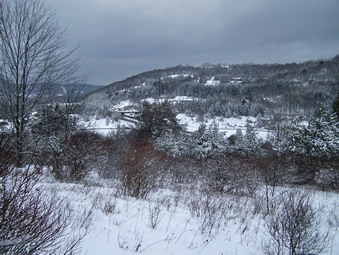 At the top of the ridge we walked on the flatter ground to our customary point of descent and started down. We stopped once to take a few photos and then continued down to the "trail" that parallels the Quickway. The road through the trees looked clear and traffic was traveling normally. After a few hundred feet on the trail we cut up into the woods. I was aware that I always go too high and then have to descend but I ended up doing it again anyway! At this point I began to follow Sheba who somehow had a better idea of where we should go. We ended up in the field that overlooks Exit 96. We stopped so that I could take some pictures and the followed our regular route back to the viewpoint over town. From here we retraced our path to the cemetery and back home. We had been out for about 1.5 hours but I knew I could use a break.
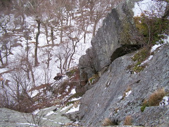
![]() On Sunday, December 30th I decided to hike somewhere near after church. I decided that Panther was the next closest mountain after Slide and Balsam Lake so I headed there right after church. I was concerned about the roads but after a few miles it became clear that they were in good shape. My next concern was the condition of the trail. I knew from previous trips that areas of the trail could be very icy especially after the rain a few days before. Some areas of trail up to Giant Ledge had major ice flows in the past. In addition, The trail from the Ledges up to Panther often had significant snow cover. I decided to wear my YakTrax Pro and to pack my Lightning Ascent snowshoes. I wore my Solo TPS 520 boots since they are comfortable, waterproof and can easily adapt to the Yaks or the snowshoes. I wore my new REI Slickrock pants and put on gaiters since these pants are rather loose at the bottom. I decided to wear my North Face Apex jacket since it is warm but lighter than others that I have.
On Sunday, December 30th I decided to hike somewhere near after church. I decided that Panther was the next closest mountain after Slide and Balsam Lake so I headed there right after church. I was concerned about the roads but after a few miles it became clear that they were in good shape. My next concern was the condition of the trail. I knew from previous trips that areas of the trail could be very icy especially after the rain a few days before. Some areas of trail up to Giant Ledge had major ice flows in the past. In addition, The trail from the Ledges up to Panther often had significant snow cover. I decided to wear my YakTrax Pro and to pack my Lightning Ascent snowshoes. I wore my Solo TPS 520 boots since they are comfortable, waterproof and can easily adapt to the Yaks or the snowshoes. I wore my new REI Slickrock pants and put on gaiters since these pants are rather loose at the bottom. I decided to wear my North Face Apex jacket since it is warm but lighter than others that I have.
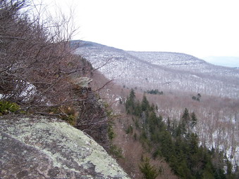 We arrived at the parking area right around noon to find it almost filled with cars. I got everything ready including attaching the snowshoes to my North Face Hotshot pack and we were off. I signed in at the registry and noted the number of people ahead of us. As we hiked I remembered that the trail up to the Ledges was not as easy as I always think. There are four or five short ascents up to the area where you turn left to go up to the Ledges. The trail here continues straight on to Woodland Valley. After the turn, the trail ascends again in steps to the Ledges. If became clear that although there were many icy spots, there were no major ice flows or any areas that would be close to impassable. We made the trail junction in a little over 20 minutes which is good since we usually do it in 15 minutes in ideal conditions. It was at this point that I removed my jacket and stowed it in the pack. Climbing over ice and packed snow is VERY aerobic especially when you are going up a 3500. As we climbed toward the Ledges we met two young men on the way down and came across a young couple taking a breather alongside the trail. I assumed they were coming back and asked about the conditions up ahead. They said that they were headed toward Panther and I wished them luck. We had caught and passed them even though they had started well before us.
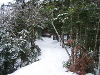 As we approached the first viewpoint on Giant Ledge I could first hear and then see a party of four or five people already there. They were load and the area was already crowded so I headed on to the next lookout. We stopped at this viewpoint and one other so that I could take some pictures. The couple we had met did catch up with use but they stopped as we were leaving. We continued on the trail and met a young man ascending solo from the Col. we chatted for a minute and he said that the trail was slippery in places but that the snow was hard all the way to the summit. He also told me that there were several groups ahead of us. Descending into the col was tricky in places since it was slippery and the number of hikers had made some areas very smooth. The col was calm with almost no wind which is unusual. On the way up to the summit ridge I met two people coming down followed by a group of three. The last group was older, my age at least, but well-equipped and wearing 12 point crampons. Somewhere along the way my Yaks began to give out. First a strap broke on the right one and then on the left. The left Yak kept riding up over the toe of the boot. They still were offering some traction but I considered removing them several times.
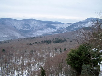 Several places on the ascent to Panther were pretty icy and I was glad I had my Leki poles for support and balance. After negotiating these spots, we were soon on the ridge. The trail levels here but continues to ascend toward the summit. We had passed the 3500 foot sign on the way up. The snow WAS hard packed and the snowshoes unnecessary. I did begin to wish I had stowed my crampons though! We finally were at the lookout that marks the highest point on the mountain. We stopped briefly so that I could take pictures. I got out a sandwich, gave Sheba some dog bones and took a drink. There was a slight breeze and the temperature was lower at the summit was I began to feel cold. We turned around and headed back down the mountain. I was looking for the young couple that had been behind us and since I did not see them I assumed they had turned back. Negotiating the descent on the slippery icy and snow with broken Yaks took at lot of attention. At one point I looked up to see the couple headed up toward us! I though it was a little late and that darkness was a concern. I told them it was less than a mile and hoped they would hurry to get back down before sunset.
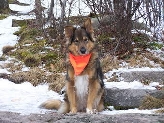 If descending into the Col was interesting, ascending out of it to Giant Ledge was also a challenge. Back at the Ledges we stopped again so that I could snap a few more pictures. We visited the lookout we had skipped before since it offers a good view of the entire Burroughs Range including Slide. From this point we picked up our speed as we descended to the trail junction and then back to the parking area. The biggest problem was not the icy on the trail but the useless and broken Yaks on my feet. As I signed out of at the register another young woman showed up. She had started ahead of us and continued over Panther to the lookouts on the other side. We talked for a few minutes before returning to the parking area. It was right around 4:00 PM so we had taken almost 4 hours to cover a little more than six miles.
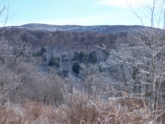
![]()
![]() On Wednesday, December 26th I decided to hike Balsam Lake Mountain since it is close to home and December was only one of two months when I had not hike this peak. We left the house at about 9:15 AM since I was concerned about the condition of the back roads leading to the trailhead. My worries were unfounded since the roads were clear with only a few wet and icy patches. Even the parking area at the trailhead was plowed and almost bare. I looked around at the beginning of the trails and decided to bring the wear the snowshoes I had brought. I assumed the hike would be much like the one up Slide on Monday with some bare spots and others where the snowshoes would at least provide needed traction. It seemed to me that the day was colder so I wore my new Mountain Hardwear Traverse Trifecta Jacket on top of a light long sleeved top over my PolarMax Expedition top. I wore my Mountain Hardwear Winter Wander pants with Mountain Hardwear ThermaDry tights. My new Salomon 52 boots and MSR Lightning Ascent snowshoes completed my attire. I carried my old North Face Hot Shot pack with bungee cords to hold the snowshoes if I decided not to wear them.
On Wednesday, December 26th I decided to hike Balsam Lake Mountain since it is close to home and December was only one of two months when I had not hike this peak. We left the house at about 9:15 AM since I was concerned about the condition of the back roads leading to the trailhead. My worries were unfounded since the roads were clear with only a few wet and icy patches. Even the parking area at the trailhead was plowed and almost bare. I looked around at the beginning of the trails and decided to bring the wear the snowshoes I had brought. I assumed the hike would be much like the one up Slide on Monday with some bare spots and others where the snowshoes would at least provide needed traction. It seemed to me that the day was colder so I wore my new Mountain Hardwear Traverse Trifecta Jacket on top of a light long sleeved top over my PolarMax Expedition top. I wore my Mountain Hardwear Winter Wander pants with Mountain Hardwear ThermaDry tights. My new Salomon 52 boots and MSR Lightning Ascent snowshoes completed my attire. I carried my old North Face Hot Shot pack with bungee cords to hold the snowshoes if I decided not to wear them.
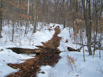 As we hiked passed the register I signed in and then we continued up the trail. Soon it became clear that my predictions about trail conditions were right on. There were large expanses of the trail that were clear of any snow or ice. I kept the snowshoes on but had an awkward time trying to walk on the snow that lined the sides of the trail. By the time we were ready to turn up the steep side of the mountain, it was obvious that the jacket was much too warm over the other clothing. The air was still without even a breeze so I took the jacket off and stowed it in my pack. It compressed nicely and fit easily. By this time there seemed to be enough snow to warrant using the snowshoes so we turned and headed up the mountain.
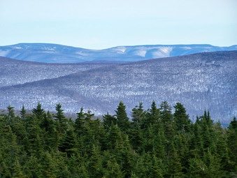 There were several new blowdowns across the trail in some areas and at least one hiker had postholed their way to the top. These holes are very annoying and I wish others would come prepared with proper equipment! In several spots I took rather long detours around these areas. I did not break through the hard crust but the shoes acted as suitable traction which I really needed in some spots. As we approached the spring the trail grew steeper and I appreciated having the traction on the almost impenetrable crust. I had worried about negotiating the steps after the spring but they were no problem and we were soon at the top of the climb. We continued on passed the Millbrook Ridge Trail and were soon at the fire tower. It had taken about an hour and a half. I was tired enough to dismiss the idea of including Graham on this trip!
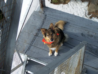 At the tower I took off my pack and took some pictures of Sheba before climbing to the top of the tower. The steps were clear of any ice or snow but a strong breeze was blowing. I stopped on the landing below the cab and took some pictures. The breeze chilled me some so I retreated to the ground where I put the snowshoes and pack back on and headed down the other side of the mountain. The shallower side actually had more snow but it too was packed with a VERY hard crust. Some other snowshoes tracks were barely visible and I was glad I had mine to prevent me from sliding all the way down the trail. We turned right onto the Dry Brook Trail and headed back toward the parking area. Some spots on this trail continue to become more narrow requiring putting one foot directly ahead of the other. Snowshoes do NOT work well under these conditions. I spent a lot of exhausting time trying to walk on the snow on the side hill along the trail. We made it back to the car in about an hour tired but happy to have covered a little under 5 miles in less than 3 hours.
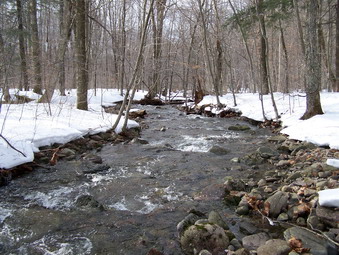
![]()
![]() On Monday, December 24th Karl and I decided to hike Slide Mountain as early as possible so that we could get back and finish some things for Christmas Eve. It had rained for a good part of Sunday with temperatures in the high 40's but it had dropped overnight into the high twenties. I was worried about the roads but they were clear as we headed out DeBruce Road and then on toward Frost Valley. As we were riding along the Frost Valley Road, we noticed that The Neversink was flowing pretty high with the rain and melting snow from the day before. We parked at about 9:15 and went to scout out the river. There was only one other car in the parking lot. It was impossible to cross at the main trail but Karl found a spot further upstream that was narrow and spanned by a log.
On Monday, December 24th Karl and I decided to hike Slide Mountain as early as possible so that we could get back and finish some things for Christmas Eve. It had rained for a good part of Sunday with temperatures in the high 40's but it had dropped overnight into the high twenties. I was worried about the roads but they were clear as we headed out DeBruce Road and then on toward Frost Valley. As we were riding along the Frost Valley Road, we noticed that The Neversink was flowing pretty high with the rain and melting snow from the day before. We parked at about 9:15 and went to scout out the river. There was only one other car in the parking lot. It was impossible to cross at the main trail but Karl found a spot further upstream that was narrow and spanned by a log.
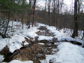 After crossing the Neversink, we put on our snowshoes since there was definitely enough snow. We knew they probably would not be necessary to stay on top of the snow since it was very crusty but they would be good for traction. We had to cross another small stream almost immediately. This crossing is usually very easy but the creek was swollen and we had to walk upstream a little to cross. We quickly made our way up to the main trail where a problem became obvious. The rain and warm weather had eliminated much of the snow in some areas and other places were rife with flowing water. We decided to keep the snowshoes on until we started the ascent and then make a decision.
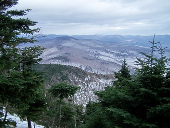 The beginning of the ascent wasn't much better since there was a LOT of water running off the mountain. We tried to go around the open areas and stay on the snow. This wasn't easy in some places. As we continued to ascend the sun appeared and we were getting so warm that we opened our jackets to vent some heat. After a certain point, the water and open spots disappeared and a thin layer of snow and ice covered everything. This actually makes hiking easier compared to the other seasons when you have to deal with the jumble of rocks that litter the trail. The higher we went the harder the wind blew and the colder it seemed. We went passed the C0 Trail and continued on toward the summit.
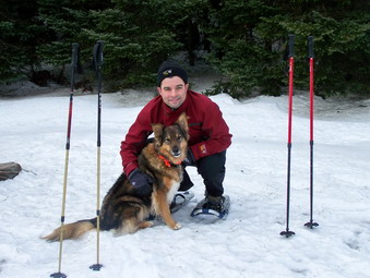 Karl remarked that from the CO Trail to the top was longer than he remembered and I agree that it ALWAYS seems that way to me! Finally we were at the lookout on the right of the trail which also means we were near the top. We continued on and passed the actual summit. Around the corner we stopped on the clearing that offers some views of the surrounding landscape. In the summer our best time was just under and hour. This trip had taken about 1.5 hours! I took some pictures of Karl and Sheba, the Ashokan, Cornell and Wittenberg. The landscape in winter is bleak without much color but is still beautiful. At this point the wind was howling and Karl and I both noticed we were cold. We turned around and got off the exposed rock and quickly hiked back to the lookout. We stopped and I took a few pictures before continuing on down the trail.
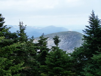 Descending on snowshoes seemed very quick and means that you do not have to be careful about all the rocks. The open areas on the trail near the bottom also seemed to go by more quickly. Soon we were turning on the trail back to the parking area. The first stream crossing was no problem. We left our snowshoes on to cross the log. They are a little more cumbersome than boots but also offer some traction. Once across without mishap, we just walk directly to the car but not before I took some more pictures of the high water. It took less than 4 hours to make the 6 mile round trip hike. On the way back we stopped at the falls on the Frost valley Road to take some pictures of the falls and the river.