
What You Missed
Summer 2015
Summer 2015
![]()
![]()
![]()
![]()
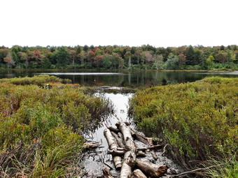
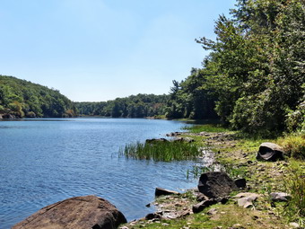
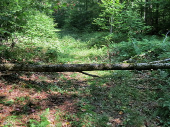
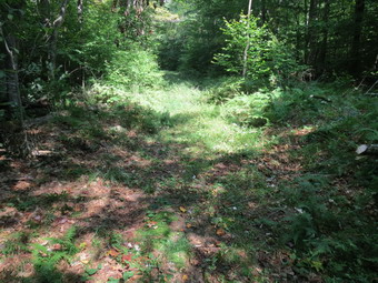
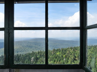
![]() On Monday, September 21st I wanted to get in a hike close to home and Cindy agreed to accompany me. Whenever I have cross country practice in the afternoon, I can't bring myself to travel too far or to hike too long as I feel my commitment to coach. I knew this probably would be the last hike of the summer and the trees were already beginning to change especially on the hills. Cindy and I decided to go to Long Pond and do the big loop in a counterclockwise direction. I wanted to walk as fast as we could but take a few pictures along the way. I got Sheila in the car with my gear and headed out DeBruce Road for about 8 miles to Flugertown Road where I made a left. I parked in the lot a short distance up the road on the right. The day had started out with a low of 41 degrees at 6:15 AM but it was now warming up and the temperature was well above 60 degrees. There was some sun but the skies were mostly cloudy and a slight breeze was blowing. It felt like autumn as we left the parking area at 10:45 AM to hike up the snowmobile trail. The first .6 miles gains about 350 feet to the highest point on the hike. It isn't very steep but does act as a nice warm-up! As we were ascending we began to hear gunshots in the distance. After a few moments, I concluded that someone was sighting in a rifle and soon we heard no more reports. Along the way we saw that several trees that had been across the trail had been cut and removed while a few others were still partly blocking the trail. There were also some tracks which looked like they were made by a small tractor which might have been the snowmobile club preparing the trail for winter. The trail was dry in most places but there were a few patches of mud. At 1.1 miles we were at the spur trail that leads down to the shore of Long Pond. We turned right and walked down to the pond. I leashed Sheila to a log since I knew the edge of the pond would be muddy and walked to the edge of the water to take some pictures of the pond. The leaves were beginning to change but were generally dull. The overcast sky with no blue patches and no clouds made for mediocre pictures. We walked back up to the main trail and turned right continuing to set a fast pace. At the first trail junction we turned right to take the longer route. By 11:35 AM we had walked 1.8 miles and were passing the spur trail to the lean-to.
On Monday, September 21st I wanted to get in a hike close to home and Cindy agreed to accompany me. Whenever I have cross country practice in the afternoon, I can't bring myself to travel too far or to hike too long as I feel my commitment to coach. I knew this probably would be the last hike of the summer and the trees were already beginning to change especially on the hills. Cindy and I decided to go to Long Pond and do the big loop in a counterclockwise direction. I wanted to walk as fast as we could but take a few pictures along the way. I got Sheila in the car with my gear and headed out DeBruce Road for about 8 miles to Flugertown Road where I made a left. I parked in the lot a short distance up the road on the right. The day had started out with a low of 41 degrees at 6:15 AM but it was now warming up and the temperature was well above 60 degrees. There was some sun but the skies were mostly cloudy and a slight breeze was blowing. It felt like autumn as we left the parking area at 10:45 AM to hike up the snowmobile trail. The first .6 miles gains about 350 feet to the highest point on the hike. It isn't very steep but does act as a nice warm-up! As we were ascending we began to hear gunshots in the distance. After a few moments, I concluded that someone was sighting in a rifle and soon we heard no more reports. Along the way we saw that several trees that had been across the trail had been cut and removed while a few others were still partly blocking the trail. There were also some tracks which looked like they were made by a small tractor which might have been the snowmobile club preparing the trail for winter. The trail was dry in most places but there were a few patches of mud. At 1.1 miles we were at the spur trail that leads down to the shore of Long Pond. We turned right and walked down to the pond. I leashed Sheila to a log since I knew the edge of the pond would be muddy and walked to the edge of the water to take some pictures of the pond. The leaves were beginning to change but were generally dull. The overcast sky with no blue patches and no clouds made for mediocre pictures. We walked back up to the main trail and turned right continuing to set a fast pace. At the first trail junction we turned right to take the longer route. By 11:35 AM we had walked 1.8 miles and were passing the spur trail to the lean-to.
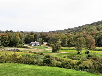 After passing the trail to the lean-to, we picked up the pace and continued on the main trail to the point where it intersected a woods road at 2.5 miles. We turned left and followed the road until the intersection with Basily Road at 2.85 miles. We continued on Basily Road by bearing to the left. There were actually a few puddles on the road and a few of the streams were at least running. Sheila jumped into one to get a drink and to get wet. As we approached the Peters Hunting Camp, I got ready to put Sheila on her leash. The area near the footbridge across the outlet to the beaver pond was flooded and pretty muddy. We made it to the small bridge and stopped so that I could take a few pictures. Cindy pointed out that two eagles had taken flight as we approached and were now circling high in the sky. As we headed toward the bridge across the creek and came into site of the camp, there were no cars present. The camp was surrounded by several stands of corn which had not yet been harvested! We continued across the bridge and up the small hill that overlooks the camp. We stopped and I took some pictures on the camp in the valley and the hills surrounding it. The leaves were showing the first sign of color changes but were dull. We both hoped that they would grow brighter as the season progressed. As we started in again, I knew that the rest of the hike was on road that turned from gravel to pavement. There were also not many more places to take pictures so I knew it would be a quick trip back. Along the way Sheila again took a dip which always invigorates her! Once we got to the paved road, I put Sheila on her leash as we headed back to the car. At 1:15 PM we were back at the parking area having hiked 6 miles in 2 hours and 30 minutes. The elevation gain was only about 600 feet most of which was at the beginning of the hike.
![]()
![]()
![]()
![]()
![]() On Friday, September 18th, I didn't schedule cross country practice and wanted to do a hike a little farther away from home. I decided to head for Black Rock Forest and hike a loop over Black Rock that I had done before. I didn't feel like spending all day but thought a nice 6 mile walk would be fine. I knew that the Black Rock Forest had just been turned over to New York state to become part of Storm King but I didn't expect any real changes. I got my gear together put it in the trunk and an enthusiastic Sheila in the back seat. We left Livingston Manor at about 8:30 AM and I headed to Middletown on Route 17. From here I went east on I84 to Newburgh where I turned south on Route 9W heading toward Cornwall. As I drove south, I started to think about using a route that, at least partly, I had not hiked before. I remembered that the maps showed a trail starting on Route 9W and following an abandoned road marked "Peck's Road". I began to look for this parking area and found it about a mile south of Angola Road. I pulled over and parked in the lot where there were two other cars. I made sure to keep Sheila on her leash as I got ready. When I left the house it was 52 degrees but now the temperature was in the mid 60's with bright sun. I left my light jacket behind and was sorry I had when long sleeves and not even packed a short sleeved shirt! We started our hike at 10:10 AM by starting out on Peck's Road which had a gravel surface and was in great shape. For the first .6 miles we stayed on the road which had a very gradual uphill grade. When we reached the water filtration plant, the Black Rock Hollow Trail turned right into the woods following and old woods road. The woods road was rocky and eroded in places but the trail was sited to avoid the worst spots. Everything was very dry and some of the leaves were already beginning to change. Over the next .9 miles we gained almost 600 feet and while the grade was only 12% some parts seemed much steeper. At 1.5 miles we were at the junction with the yellow Stillman Trail and we turned right to head toward Black Rock. I considered walking down to the Aleck Meadow Reservoir but decided I could probably visit it if I wanted to on the way back.
On Friday, September 18th, I didn't schedule cross country practice and wanted to do a hike a little farther away from home. I decided to head for Black Rock Forest and hike a loop over Black Rock that I had done before. I didn't feel like spending all day but thought a nice 6 mile walk would be fine. I knew that the Black Rock Forest had just been turned over to New York state to become part of Storm King but I didn't expect any real changes. I got my gear together put it in the trunk and an enthusiastic Sheila in the back seat. We left Livingston Manor at about 8:30 AM and I headed to Middletown on Route 17. From here I went east on I84 to Newburgh where I turned south on Route 9W heading toward Cornwall. As I drove south, I started to think about using a route that, at least partly, I had not hiked before. I remembered that the maps showed a trail starting on Route 9W and following an abandoned road marked "Peck's Road". I began to look for this parking area and found it about a mile south of Angola Road. I pulled over and parked in the lot where there were two other cars. I made sure to keep Sheila on her leash as I got ready. When I left the house it was 52 degrees but now the temperature was in the mid 60's with bright sun. I left my light jacket behind and was sorry I had when long sleeves and not even packed a short sleeved shirt! We started our hike at 10:10 AM by starting out on Peck's Road which had a gravel surface and was in great shape. For the first .6 miles we stayed on the road which had a very gradual uphill grade. When we reached the water filtration plant, the Black Rock Hollow Trail turned right into the woods following and old woods road. The woods road was rocky and eroded in places but the trail was sited to avoid the worst spots. Everything was very dry and some of the leaves were already beginning to change. Over the next .9 miles we gained almost 600 feet and while the grade was only 12% some parts seemed much steeper. At 1.5 miles we were at the junction with the yellow Stillman Trail and we turned right to head toward Black Rock. I considered walking down to the Aleck Meadow Reservoir but decided I could probably visit it if I wanted to on the way back.
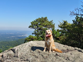
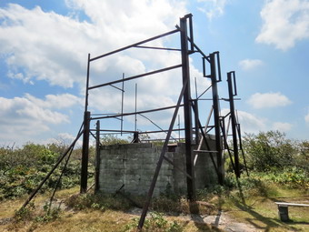
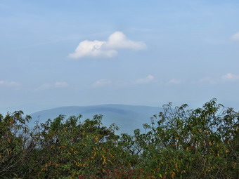
 As we walked on the Stillman Trail, Sheila alerted and I could see we were catching up to another hiker. I put Sheila on her leash as we overtook a woman in front of us. We said "Hello" and she explained she wanted to get back to the Peck's Road parking area but thought she had taken a wrong turn. I told her she should have turned right back at the trail junction and gave her explicit instructions on what to do. She did not have a map and although she was dressed appropriately did not seem to have a pack or any water! Black Rock Forest has many trails and roads. A map is essential to being able to navigate your way around this interesting but confusing maze. We continued following the Stillman Trail northwest toward Black Rock. By the time we hit the highest point on Black Rock we had gained another 260 feet in the .3 miles from the trail junction. The view from Black Rock is more than 180 degrees to the south, west and north. Looking southwest I could see a fire tower which is just a shell and closed to the public. To the northwest the Schunnemunk Ridge was prominent and I could see the Moodna Viaduct just below it. The viaduct was opened in 1909 and is still the longest and highest railroad trestle east of the Mississippi River! To the north I could see the Hudson River and the Newburgh-Beacon Bridge. Of course, I dropped my pack and got out the camera to take some pictures. The haze limited some shots but I still thought I got some good ones. After getting a drink and a snack, we started down the other side of Black Rock. As we made the steep descent, I saw the black deposits that give the rock its name. The descent isn't long but the first part is very steep. I have done this in the winter and spikes are almost a must if there is any ice or snow. I began to think about how far I wanted to hike and what routes we could take. I decided that at the next junction we would take a left on Continental Road and hike until we passed the white oak tree.
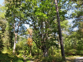
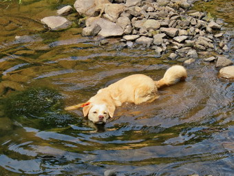
 At 2.3 miles we made the turn onto Continental Road and hiked along the well groomed surface until we reached the white oak tree at 2.6 miles. This tree is a very large white oak that still seems to be in pretty good condition. We stopped so that I could take a few pictures and then continued on a few hundred feet where we turned left on the White Oak Trail to Arthur's Pond. Before I reached the shore, Sheila was already swimming and really seemed to be enjoying herself. I took my pack off and got the camera out again to take some pictures of the pond. We continued on the trail which crosses just below the spillway of the pond. I wondered how high the water would be since I have seen it high enough to make crossing tricky. On this day the only water in the spillway was from a hose leading down from near the top of the dam. After crossing the spillway, we followed the White Oak Trail as it headed into the woods to the left. The trail came to an end on White Oak Road. We turned right on the road and followed it as it passed along the shore of Aleck Meadow Reservoir. We continued to follow the road as I looked for a place to turn off to visit the reservoir. I missed the turn and soon we were headed toward the Upper Reservoir. We stopped on the shores so that I could take a few pictures and to watch a young lady through a ball into the water for her dog to retrieve. Apparently she believed the "No Swimming" signs only applied to people! I decided to walk down Reservoir Road to the Mailey's Mill Bridge near the researcher center. At 4.5 miles we were at the bridge and we crossed over to the blue Reservoir Trail after I took some pictures of the bridge. The stream that had once powered the mill was almost dry as we crossed over it on Ben's Bridge. We continued on the trail to 5.25 miles where we passed the water filtration plant and turned right on Peck's Road. From there it was only .6 miles downhill to the car where we arrived at 12:55 PM. What I had thought might be too short a hike turned into a nice walk and allowed me to get home to take care of some work. We had hiked 5.8 miles in 2 hours and 40 minutes with a vertical gain of 1180 feet.
![]()
![]()
![]()
![]()
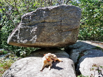
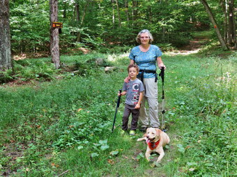
![]() On Wednesday, September 16th, Lisa wanted to go for a hike and was free until about 1:00 PM. We talked about places to go and decided to hike near Peekamoose from the Peekamoose Road. I suggested hiking to the lower plane crash on Van Wyck and researched the coordinates although I had been there several times. Lisa arrived at my house just after 9:00 AM. We put our gear in the trunk of my car and Sheila in the backseat and started down the Quickway to Liberty. From Liberty I took Route 55 toward Grahamsville where I turned left on Route 55A just after the TriValley school. I followed 55A to Sundown Road and in Sundown took the Peekamoose Road north about 3 miles to the main parking area used to hike to Peekamoose Mountain. I found that I had left the coordinates for the plane crash at my house and that Lisa was more comfortable hiking the trail anyway. At 10:00 Am we started up the trail knowing with Reconnoiter Rock as our objective. I had worn a light jacket on top of a long-sleeved shirt but quickly ditched it in the car as the temperature was rising rapidly. I also left behind the hat and gloves! The trail to Reconnoiter Rock is simply up all the way. In the first .2 miles to the register box we gained 180 feet with an average 18% grade. This is a quick way to get warmed up fast. The trail moderates some after that as it follows a woods road until turning off and continuing through the woods. Lisa and I both noticed how open the woods are in this area which makes it easy to walk off trail. The trail alternates between relatively flat spots and several much steeper sections which wind there way through rocky outcrops. As we climbed, we could get a glimpse of the valley below and the mountains beyond. At one time there were some viewpoints just off then trail but these have grown in so that the best viewpoint is the one above Reconnoiter Rock just before the final climb to the summit of Peekamoose. We knew we should be turning around at about 11:00 AM but by that time we were not quite at our goal. We elected to keep walking and at 11:20 Am we finally arrived at Reconnoiter Rock. The rock is a large glacial erratic balanced on some bedrock. There was once a view but it has been eliminated as the trees have grown up. I dropped my pack and took some pictures of the rock and some more with Sheila posed by it. I also took a few pictures of Lisa holding a ProBar near the rock. At 11:30 Am we started our descent back to the car. Going down was definitely easier but not easy especially in some of the steeper places. We did stop once so that I could take a picture of a tree across the trail. The tree is huge so it has been left in place. A step has been but in the lower trunk and another notch has been cut in the upper trunk to allow for some headroom as hikers pass. We set a quick pace down the mountain arriving back at the car at 12:40 PM. We were both surprised that the return trip was only 10 minutes shorter than the ascent. We had covered 4.5 miles in 2 hours and 40 minutes with a vertical gain of 1690 feet. Although we did not summit a mountain we had a good hike in almost ideal weather.
On Wednesday, September 16th, Lisa wanted to go for a hike and was free until about 1:00 PM. We talked about places to go and decided to hike near Peekamoose from the Peekamoose Road. I suggested hiking to the lower plane crash on Van Wyck and researched the coordinates although I had been there several times. Lisa arrived at my house just after 9:00 AM. We put our gear in the trunk of my car and Sheila in the backseat and started down the Quickway to Liberty. From Liberty I took Route 55 toward Grahamsville where I turned left on Route 55A just after the TriValley school. I followed 55A to Sundown Road and in Sundown took the Peekamoose Road north about 3 miles to the main parking area used to hike to Peekamoose Mountain. I found that I had left the coordinates for the plane crash at my house and that Lisa was more comfortable hiking the trail anyway. At 10:00 Am we started up the trail knowing with Reconnoiter Rock as our objective. I had worn a light jacket on top of a long-sleeved shirt but quickly ditched it in the car as the temperature was rising rapidly. I also left behind the hat and gloves! The trail to Reconnoiter Rock is simply up all the way. In the first .2 miles to the register box we gained 180 feet with an average 18% grade. This is a quick way to get warmed up fast. The trail moderates some after that as it follows a woods road until turning off and continuing through the woods. Lisa and I both noticed how open the woods are in this area which makes it easy to walk off trail. The trail alternates between relatively flat spots and several much steeper sections which wind there way through rocky outcrops. As we climbed, we could get a glimpse of the valley below and the mountains beyond. At one time there were some viewpoints just off then trail but these have grown in so that the best viewpoint is the one above Reconnoiter Rock just before the final climb to the summit of Peekamoose. We knew we should be turning around at about 11:00 AM but by that time we were not quite at our goal. We elected to keep walking and at 11:20 Am we finally arrived at Reconnoiter Rock. The rock is a large glacial erratic balanced on some bedrock. There was once a view but it has been eliminated as the trees have grown up. I dropped my pack and took some pictures of the rock and some more with Sheila posed by it. I also took a few pictures of Lisa holding a ProBar near the rock. At 11:30 Am we started our descent back to the car. Going down was definitely easier but not easy especially in some of the steeper places. We did stop once so that I could take a picture of a tree across the trail. The tree is huge so it has been left in place. A step has been but in the lower trunk and another notch has been cut in the upper trunk to allow for some headroom as hikers pass. We set a quick pace down the mountain arriving back at the car at 12:40 PM. We were both surprised that the return trip was only 10 minutes shorter than the ascent. We had covered 4.5 miles in 2 hours and 40 minutes with a vertical gain of 1690 feet. Although we did not summit a mountain we had a good hike in almost ideal weather.
![]()
![]()
![]()
![]() On Monday, September 14th, Karl arrived in Livingston manor ready to hike at about 10:00 AM. We had planned to do Table and Peekamoose from Denning but dinner plans put a damper on that trip. We talked about Dry Brook or Millbrook Ridge but decided to head to Balsam Lake Mountain as it is one of Karl's favorite hikes. When I looked at the temperature on the back porch it was just 55 degrees and I knew it would be cooler at the trailhead. Karl wore shorts and a longsleeved short! I had on pants, a longsleeved shirt and a light jacket. I also packed a light hat and gloves. We put our gear and Sheila in the car and left Livingston Manor a little after 10:30 AM and headed up the Beaverkill Road. The forecast was for partly sunny skies with temperatures rising into the mid to high 60's. As we continued on the road I saw no sun and the temperature was dipping lower the farther north we went. The sky was completely covered in clouds and there was a light mist or drizzle falling. After we passed the Buddhist monastery, we came upon a Town of Hardenburgh road crew trimming some trees. They had the road blocked with equipment and brush they had clear since they probably did not expect many cars. They quickly cleared the road and allowed us to pass. We arrived at the parking area and found two other cars already in the lot. The drizzle had let up and we knew that we would be going up the mountain so that we could always turn around and head down if any serious rain started. I left my camera in the car hoping to protect it from the rain and thinking I would not get many chances to take pictures. The temperature was only 50 degrees and I decided to wear my light hat to begin the hike. We were on the trail at 11:15 AM heading toward the first trail junction where we intended to turn left and hike up the steep side of the mountain. As we walked up the trail I noticed several trees hanging over the trail and although they seemed safe I would prefer that they were gone. There were also a few across the trail that had been partially cleared but some more work needs to be done. We made the trail junction at .9 miles by 11:35 AM and turned left up the mountain without stopping. Over the next half mile the trail gains about 750 feet before leveling off which means an average of around a 28% grade! The rocks were wet an it required some attention not to slip on the ascent. It is a pleasure to hike with Karl as he can more than match my pace and can converse on an topic. I began to hear what I thought were voices ahead and soon we could see a couple who had paused to rest on a rock. I put Sheila on her leash and handed it to Karl. As we passed we said "Hello" and made some comments about the weather.
On Monday, September 14th, Karl arrived in Livingston manor ready to hike at about 10:00 AM. We had planned to do Table and Peekamoose from Denning but dinner plans put a damper on that trip. We talked about Dry Brook or Millbrook Ridge but decided to head to Balsam Lake Mountain as it is one of Karl's favorite hikes. When I looked at the temperature on the back porch it was just 55 degrees and I knew it would be cooler at the trailhead. Karl wore shorts and a longsleeved short! I had on pants, a longsleeved shirt and a light jacket. I also packed a light hat and gloves. We put our gear and Sheila in the car and left Livingston Manor a little after 10:30 AM and headed up the Beaverkill Road. The forecast was for partly sunny skies with temperatures rising into the mid to high 60's. As we continued on the road I saw no sun and the temperature was dipping lower the farther north we went. The sky was completely covered in clouds and there was a light mist or drizzle falling. After we passed the Buddhist monastery, we came upon a Town of Hardenburgh road crew trimming some trees. They had the road blocked with equipment and brush they had clear since they probably did not expect many cars. They quickly cleared the road and allowed us to pass. We arrived at the parking area and found two other cars already in the lot. The drizzle had let up and we knew that we would be going up the mountain so that we could always turn around and head down if any serious rain started. I left my camera in the car hoping to protect it from the rain and thinking I would not get many chances to take pictures. The temperature was only 50 degrees and I decided to wear my light hat to begin the hike. We were on the trail at 11:15 AM heading toward the first trail junction where we intended to turn left and hike up the steep side of the mountain. As we walked up the trail I noticed several trees hanging over the trail and although they seemed safe I would prefer that they were gone. There were also a few across the trail that had been partially cleared but some more work needs to be done. We made the trail junction at .9 miles by 11:35 AM and turned left up the mountain without stopping. Over the next half mile the trail gains about 750 feet before leveling off which means an average of around a 28% grade! The rocks were wet an it required some attention not to slip on the ascent. It is a pleasure to hike with Karl as he can more than match my pace and can converse on an topic. I began to hear what I thought were voices ahead and soon we could see a couple who had paused to rest on a rock. I put Sheila on her leash and handed it to Karl. As we passed we said "Hello" and made some comments about the weather.
Despite the grade, the hike seemed to go quickly and we were soon passing the spur trail to the lean-to and the spring. As we approached the 3500 foot sign we met another young couple hiking down the mountain with their dog. We leashed Sheila and passed them. We talked for a few minutes and they told us they had climbed Graham and the Balsam Lake and were headed back to the parking area. They told us that there was a steady wind blowing at the top and that they had spoken to someone who had seen a mother bear with cubs. I related my bear experiences from a recent hike in the same area and we went our separate ways. We walked up the stone steps to the summit plateau and continued on toward the fire tower. The trail was wetter near the spring and damp the whole way. We arrived at the tower clearing at 12:10 PM after hiking 1.7 miles. It seemed as if we were in a cloud as the mist kept blowing by us. I knew there would be no views from the tower and a steady wind was blowing making us just a little cool. We turned right and began the walk down the Millbrook side of the mountain. We were glad the slop was more gentle on the Millbrook side as the combination of loose dirt and wet rocks was slippery in places. There was still no rain falling but the wind was bringing down some water that had collected on the leaves. It didn't take us long before we were at the gate and then at the trail junction. We turned right to head back to the parking area. The trail was wet and the rocks slippery so we were careful to pick good foot placements. Along the way were several trees across the trail a few of which looked new. We set a good pace and were soon passing the trail junction where we had turned up the mountain earlier. We were back at the car at 1:30 PM and talked about hiking to Vly Pond. We decided to head back home since the weather was still poor. We had hiked 4.3 miles in 2 hours and 10 minutes gaining 1230 feet in the process. The temperature at the car was only 55 degrees and the sky was still completely 1covered with clouds. On the way home the skies began to clear and the sun came out causing the temperature to rise into the low 60's.
![]()
![]()
![]()
![]()
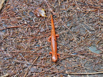
![]() On Friday, September 11th, I wanted to do a hike close to home with Cindy. This was the first year that I had not been asked to participate in a September 11th program and it felt good to be able to think about the day without having to relive it. I had been prepared to respond immediately with an ambulance crew but we were not called until the beginning of October to assist in the recovery effort. It was still a shock to see the devastation and it is not something I will ever forget. Cindy and I got a late start but we put or gear and Sheila in the car and started for Rock Hill where we were going to hike in the Neversink Unique Area. When we arrived just after 11:00 Am there was only one car at the trailhead. As we got ready to hike we found that the rocks and leaves were damp from the rain the previous day. We started down the woods road toward the river at 11:01 AM intending to hike the loop to Denton and Mullet Falls and perhaps through in the out and back to High Falls. I thought that the recent rain might have augmented the waterfalls making them more interesting. Sheila was certainly anxious to get going as both she and I prefer several hikes a week! The temperature was in the low 60's and it was more humid than we had expected. I wore a light long-sleeved top and was wearing my Zamberlan lower hikers which have become my "go to" show. As we walked down the hill passed the trail register, there was one large blowdown across the trail. It was pretty high up so that I could walk under it but I did not think it was well-supported. I thought this should be removed before it comes down by itself! We turned left at the bottom of the hill to stay on the main trail and came to the small bridge over Wolf Brook. The water was not as high as I had thought it might be and I decided to continue on without taking any pictures. At the top of the next small hill, we stayed to the right to hike the loop counterclockwise hitting Denton Falls on the Neversink first and then the falls on Mullet Brook. As we walk down the trail, I saw a red salamander sunning itself in an open part of the trail. It looked like a red eft but was larger with a slightly different body shape. It did not seem to want to move so I took a picture and we moved on. Soon we were crossing the lower bridge on Mullet Brook where the water was, again, lower than I expected. I knew that the bridge was in disrepair and wasn't surprised to find nothing had been done to repair it. The DEC insists that it is the entity that must repair and construct bridges but doesn't have enough people to get the job done. This bridge has a broken main support beam which needs to be repaired before it collapses and must be completely replaced. There were the remnants of caution tape draped on the bridge and it looked like they had been strung across the opening at one point. The bridge was in worse shape than the last time I had hiked in the area. As we crossed we had to hand onto the handrails due to the slant of the bridge deck and the slippery boards. At 1.4 miles we turned right following the yellow spur trail blazes downhill to Denton Falls.
On Friday, September 11th, I wanted to do a hike close to home with Cindy. This was the first year that I had not been asked to participate in a September 11th program and it felt good to be able to think about the day without having to relive it. I had been prepared to respond immediately with an ambulance crew but we were not called until the beginning of October to assist in the recovery effort. It was still a shock to see the devastation and it is not something I will ever forget. Cindy and I got a late start but we put or gear and Sheila in the car and started for Rock Hill where we were going to hike in the Neversink Unique Area. When we arrived just after 11:00 Am there was only one car at the trailhead. As we got ready to hike we found that the rocks and leaves were damp from the rain the previous day. We started down the woods road toward the river at 11:01 AM intending to hike the loop to Denton and Mullet Falls and perhaps through in the out and back to High Falls. I thought that the recent rain might have augmented the waterfalls making them more interesting. Sheila was certainly anxious to get going as both she and I prefer several hikes a week! The temperature was in the low 60's and it was more humid than we had expected. I wore a light long-sleeved top and was wearing my Zamberlan lower hikers which have become my "go to" show. As we walked down the hill passed the trail register, there was one large blowdown across the trail. It was pretty high up so that I could walk under it but I did not think it was well-supported. I thought this should be removed before it comes down by itself! We turned left at the bottom of the hill to stay on the main trail and came to the small bridge over Wolf Brook. The water was not as high as I had thought it might be and I decided to continue on without taking any pictures. At the top of the next small hill, we stayed to the right to hike the loop counterclockwise hitting Denton Falls on the Neversink first and then the falls on Mullet Brook. As we walk down the trail, I saw a red salamander sunning itself in an open part of the trail. It looked like a red eft but was larger with a slightly different body shape. It did not seem to want to move so I took a picture and we moved on. Soon we were crossing the lower bridge on Mullet Brook where the water was, again, lower than I expected. I knew that the bridge was in disrepair and wasn't surprised to find nothing had been done to repair it. The DEC insists that it is the entity that must repair and construct bridges but doesn't have enough people to get the job done. This bridge has a broken main support beam which needs to be repaired before it collapses and must be completely replaced. There were the remnants of caution tape draped on the bridge and it looked like they had been strung across the opening at one point. The bridge was in worse shape than the last time I had hiked in the area. As we crossed we had to hand onto the handrails due to the slant of the bridge deck and the slippery boards. At 1.4 miles we turned right following the yellow spur trail blazes downhill to Denton Falls.
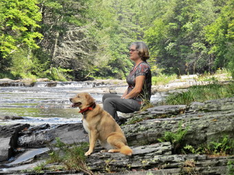 The trail down to the falls is poorly marked and hikers trying to follow it have created new paths which compounds the problem. After hiking 1.65 miles, we were at the rocks near the edge of Denton Falls. The river wasn't as high as I thought it might be but I dropped my pack and started to take some pictures. I noticed that Sheila seemed prepared to jump in and swim to the other side so I discouraged her emphatically. I was able to walk along the rocks to get just below the falls. I took quite a few pictures of the falls and some both upstream and downstream. The lighting and the clouds in the sky were better than during my last trip. Cindy sat on a rock and I was able to get a few "candid" pictures of her and Sheila. The falls are hardly three feet high but the volume of water made the trip worthwhile. We headed back up the trail to the main trail and turned right. At the trail junction I asked Cindy if she wanted to hike down to High Falls which adds about 4 miles round trip to the hike. She declined the offer so we kept to the left to start the loop. After a brief walk uphill, we turned left onto the short trail down to Mullet Brook Falls. The trail has no sign and could be easily missed. In fact, there is signage anywhere! I saw a total of only three yellow blazes on our way down to the falls and on the way back. When the falls came into sight, it was much like the rest of the trip. There was enough water to make it interesting but far less than I had hoped for. I dropped my pack and got out the camera. After a few initial shots, I walked onto the pile of rocks just down from the base of the falls. I had to be careful as the rocks were covered with moss and were wet from the rain and spray from the falls. I took pictures of the falls but the pool that is normally at the bottom was missing! In fact, it was hard to find any flow in the stream below the falls. Eventually it was time to leave and we started back. On the way out to the main trail we met a couple hiking toward us. It was there first time in the area and we answered some of their questions before moving on. We walked back out to the main trail and turned left to complete the loop. As we climbed we noticed the rocky ledges to our right. Soon we crossed over the upper bridge spanning Mullet Brook. After a brief walk we were at a trail junction. Walking straight ahead on the trail leads to the Wolf Lake Multiple Use Area. We turned left and began to descend off the ridge. We hiked downhill for some time and eventually came to the trail junction just above the bridge over Wolf Creek. I thought about taking a few pictures of Wolf Brook but decided to keep moving as it was not that interesting. Once on the other side of the brook we made the right turn on the woods road back to the car and kept a quick pace until we arrived at the parking area at 1:50 PM. We hiked 4.6 miles in just over 2 hours and 35 minutes including the stops at the two falls. The vertical gain was only about 950 feet. The car that had been parked was gone and three more were now in the lot.
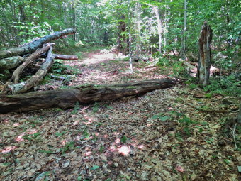
![]() On Wednesday, September 9th, I decided to return to the Frick and Hodge Pond area to hike and maybe to do a little trail maintenance. The last time I had hiked the Quick Lake Trail I noticed a few blowdowns that needed to be cleared but I left that as I was headed for a major blockage that needed attention. I deiced to take one of my Silky saws and my Fiskars axe to clear anything I found on the trail. I put my gear and Sheila in the car and then headed out the DeBruce Road to Frick Pond. I parked at 9:45 AM and found a DEC employee weed whacking the parking area. Sheila and I started out immediately by walking out the back of the larger parking area on the Quick Lake Trail. We turned left on the woods road toward Frick Pond and kept a quick pace crossing the outlet bridge. I did not stop to take pictures as I already have many from this viewpoint and I had limited time. We stayed left at the first trail junction to stay on the Quick Lake Trail. Just after the trail junction, I found several large branches in the path and several trees leaning over the trail. I cleared the branches and took down the two trees. After clearing everything, we continued on the trail and I continued to remove a branch here and there until just before Iron Wheel Junction. There was a rather large tree encroaching on the trail and I took some time to clear it before continuing to hike. After 1.5 miles, we were at Iron Wheel Junction and I considered my options. I knew there wasn't much more to do on the Quick Lake Trail so I decided to turn right on the Logger's Loop as I had not been on that trail in some time. The day was warm but we were keeping a quick pace. I did notice that carrying the axe and not using my poles made the trek noticeably more difficult. I cleared several smaller branches from the trail and then found a larger one to remove. This branch had broken off and had one end stuck in the ground and the other caught in the tree. Without thinking I grabbed the end stuck in the ground and pulled. The branch came loose and crashed to the ground breaking into several pieces. I realized that if it had not broken it would have bounced up and hit me in the face! I decided to be a bit more careful!
On Wednesday, September 9th, I decided to return to the Frick and Hodge Pond area to hike and maybe to do a little trail maintenance. The last time I had hiked the Quick Lake Trail I noticed a few blowdowns that needed to be cleared but I left that as I was headed for a major blockage that needed attention. I deiced to take one of my Silky saws and my Fiskars axe to clear anything I found on the trail. I put my gear and Sheila in the car and then headed out the DeBruce Road to Frick Pond. I parked at 9:45 AM and found a DEC employee weed whacking the parking area. Sheila and I started out immediately by walking out the back of the larger parking area on the Quick Lake Trail. We turned left on the woods road toward Frick Pond and kept a quick pace crossing the outlet bridge. I did not stop to take pictures as I already have many from this viewpoint and I had limited time. We stayed left at the first trail junction to stay on the Quick Lake Trail. Just after the trail junction, I found several large branches in the path and several trees leaning over the trail. I cleared the branches and took down the two trees. After clearing everything, we continued on the trail and I continued to remove a branch here and there until just before Iron Wheel Junction. There was a rather large tree encroaching on the trail and I took some time to clear it before continuing to hike. After 1.5 miles, we were at Iron Wheel Junction and I considered my options. I knew there wasn't much more to do on the Quick Lake Trail so I decided to turn right on the Logger's Loop as I had not been on that trail in some time. The day was warm but we were keeping a quick pace. I did notice that carrying the axe and not using my poles made the trek noticeably more difficult. I cleared several smaller branches from the trail and then found a larger one to remove. This branch had broken off and had one end stuck in the ground and the other caught in the tree. Without thinking I grabbed the end stuck in the ground and pulled. The branch came loose and crashed to the ground breaking into several pieces. I realized that if it had not broken it would have bounced up and hit me in the face! I decided to be a bit more careful!
 We continued to hike without finding many more branches on the trail until we turned south towards Times Square. When I looked ahead I could see a new blowdown blocking the trail. The tree appeared to be about 10 inches in diameter at the butt end. When we arrived at the spot, I found it was a beech tree and I decided to remove it. I dropped my pack and took few before pictures. I used my axe to clear a few small limbs and then some of the larger ones at the top. Pulling these larger limbs out of the way proved more challenging than making the cuts. My intention was to cut the trunk of the tree in two places and then move it out of the way. I made the first cut near the top of the tree and quickly was through the wood. At this point I noticed that the other end did not seem to be attached. Picked up the end I had cut and was able to pivot it off the trail. After taking a few "after", I picked up my pack and we continued down the Logger's Loop to Times Square. At this four-way junction we continued straight ahead on the Logger's Loop heading toward Gravestone Junction. The trail is slightly uphill but we were pretty fresh and were soon passing by the spot where the Willowemoc Trail Crew had put a "bridge" over a muddy spot. This spot was dry like most of the rest of the trail. We arrived at Gravestone Junction and turned left to head back to the car. We were back in the parking area at 11:45 AM having spent about 2 hours hiking 3.8 miles and doing the trail maintenance work.
![]()
![]()
![]()
![]() On Monday, September 7th, I wanted to do a challenging hike close to home. I had been involved with planning and executing a 5K race on Sunday had taken a few days off from hiking. Both Sheila and I were ready to get out on a day that was forecast to have clear skies with highs in the high 80's. I decided to hike to Graham Mountain and maybe through Balsam Lake Mountain in ion the return trip. Graham Mountain is on private property. Make sure you call the caretaker to get permission before hiking. I was getting my gear together when the ambulance pager went off and I knew our trip would be delayed as I responded to the call. When we arrived at the scene, the patient refused our care and we returned to base. When I got home I finished getting my gear together, changed into my hiking clothes and put Sheila in the car. We left Livingston Manor a little before 9:45 AM and headed up the Beaverkill Road. It wasn't long before I got behind a slow moving car and it became obvious the driver did not know where they were going. I kept wishing they would pull over so that I could tell them how to get to their destination. They finally turned left onto the Barkaboom Road as I stayed on the main road and headed for the Balsam Lake Mountain trailhead. As I continued along the road, I ran into two more slow moving cars. I hoped they would turn off but they just kept going! I followed them both to the trailhead parking where they both parked and seemed to be getting ready to hike. One car parked in such a way as to block at least three parking spaces but he didn't seem to get the idea when I parked the correct way. As I got out of the car and got ready to hike, I talked to both groups and they said they were headed to the fire tower. I put Sheila on her leash and got right on the trail by 10:20 AM making sure I was ahead of the others. Sheila and I didn't hurry but we kept a good pace making the first trail junction in about 20 minutes. We continued straight ahead on the trail toward the Millbrook trailhead. I was surprised to see that the trail had not been maintained in some time with branches, briars and nettles encroaching in some places. We kept our pace but I did not remember that the mile of trail between the two trail junctions gains over 400 feet of elevation. It was warm and humid and I was glad I had worn short sleeves. I had again worn my Zamberlan light hikers which are quickly becoming my "go to" shoe. As we hiked Sheila ran ahead and started into the woods. I heard a noise that indicated an animal bigger than a chipmunk and called her back to me. As we passed the area where she had started into the woods, I looked to my left and saw a bear cub only 40 feet from the trail. Beyond the cub another 60 feet was another, larger bear which I assumed to be the mother! I started making noise as the mother stood up and sniffed the air. Sheila barked and the cub began to run toward the mother who waited briefly and then...got down on all fours and headed down the steep dropoff to Black Brook with the cub right behind. Sheila and I headed up the trail as fast as we could go.
On Monday, September 7th, I wanted to do a challenging hike close to home. I had been involved with planning and executing a 5K race on Sunday had taken a few days off from hiking. Both Sheila and I were ready to get out on a day that was forecast to have clear skies with highs in the high 80's. I decided to hike to Graham Mountain and maybe through Balsam Lake Mountain in ion the return trip. Graham Mountain is on private property. Make sure you call the caretaker to get permission before hiking. I was getting my gear together when the ambulance pager went off and I knew our trip would be delayed as I responded to the call. When we arrived at the scene, the patient refused our care and we returned to base. When I got home I finished getting my gear together, changed into my hiking clothes and put Sheila in the car. We left Livingston Manor a little before 9:45 AM and headed up the Beaverkill Road. It wasn't long before I got behind a slow moving car and it became obvious the driver did not know where they were going. I kept wishing they would pull over so that I could tell them how to get to their destination. They finally turned left onto the Barkaboom Road as I stayed on the main road and headed for the Balsam Lake Mountain trailhead. As I continued along the road, I ran into two more slow moving cars. I hoped they would turn off but they just kept going! I followed them both to the trailhead parking where they both parked and seemed to be getting ready to hike. One car parked in such a way as to block at least three parking spaces but he didn't seem to get the idea when I parked the correct way. As I got out of the car and got ready to hike, I talked to both groups and they said they were headed to the fire tower. I put Sheila on her leash and got right on the trail by 10:20 AM making sure I was ahead of the others. Sheila and I didn't hurry but we kept a good pace making the first trail junction in about 20 minutes. We continued straight ahead on the trail toward the Millbrook trailhead. I was surprised to see that the trail had not been maintained in some time with branches, briars and nettles encroaching in some places. We kept our pace but I did not remember that the mile of trail between the two trail junctions gains over 400 feet of elevation. It was warm and humid and I was glad I had worn short sleeves. I had again worn my Zamberlan light hikers which are quickly becoming my "go to" shoe. As we hiked Sheila ran ahead and started into the woods. I heard a noise that indicated an animal bigger than a chipmunk and called her back to me. As we passed the area where she had started into the woods, I looked to my left and saw a bear cub only 40 feet from the trail. Beyond the cub another 60 feet was another, larger bear which I assumed to be the mother! I started making noise as the mother stood up and sniffed the air. Sheila barked and the cub began to run toward the mother who waited briefly and then...got down on all fours and headed down the steep dropoff to Black Brook with the cub right behind. Sheila and I headed up the trail as fast as we could go.
 By 11:05 AM we had hiked 1.8 miles and were at the second trail junction with the trail that goes up to the fire tower. We passed by and headed for the right turn onto the herd path that goes to Graham Mountain. The herd path has become more of a trail over the years and it even seems that someone is clearing some of the blowdowns, nettles and briars along the way. I meant to ask the caretaker about this but forgot. When we reached the herd path, it was in very good shape and it did appear that someone had beaten back most of the nettles to clear the path. For the first 1.15 miles the heard path heads almost due east and is flat or even descends some. It is rocky in places and has some blowdowns which are easily walked around. At 3.2 miles into the hike we reached the base of the final climb up Graham as the herd path heads a little more toward the southeast. The distance to the summit from here is only .8 miles but gains over 600 feet in elevation. There are a few switchbacks along he way which help make the grade only 15%. As we were walking up the path, Sheila alerted and I saw a couple headed down toward us. As they passed we said "Hello" and talked about the beautiful weather. We continued in our separate directions and by 12:05 PM we had hiked the 3.95 miles to the summit. I dropped my pack to get a drink and a protein bar. I also took out the camera to take a few pictures. The views are now mostly blocked by the vegetation but I took some pictures of the ruins at the top. I also took a few pictures of Balsam Lake Mountain where the tower was barely visible. There was still a lot of haze in the air so we didn't stay long but headed back down the mountain. We did stop at the lookout to the north but this is now completely block by trees. The trip down seemed to go fast and by 1:15 PM we had hiked 6.1 miles and were back at the junction with the trail that heads up to the fire tower. I decided we would extend our hike a little so we turned right and started the ascent to the tower.
 Since the trail junction is already more than 400 feet above the lower trail junction, ether is less climbing to do. As we headed up the trail, a couple came hiking down toward us and I recognized them as the couple we had net on Graham. They were parked at the Millbrook trailhead and were headed back in that direction. Sheila and I kept hiking and soon I could hear some noise from the area of the tower. I knew the towers are open on the weekends during the summer and hoped the volunteers had stayed around for one more day. When we came to the clearing, there were tow volunteers that I recognized as Tom and Laurie Rankin. There were also half a dozen hikers sitting at the picnic table or standing around talking. I leashed Sheila to a tree since there was another dog present and grabbed my camera. I said "Hello" to Tom and Laurie and then headed for the cab of the tower. I took some pictures from the cab and then dropped down to a lower landing to take a few more. Once on the ground I spent a few minutes talking to Laurie until some more hikers started to arrive from both directions. I said "Goodbye" and Sheila and I started down the steep side on the mountain. The first section wasn't too bad but at 7.1 miles we started the steeper descent passed the spring. As we started down, another group was coming up so I pulled Sheila to the side to let them pass. They mentioned they had seen a bear on the way up so I began to make some noise as we headed down. Sheila got a drink at the spring and we continued down passing one more couple coming up. The hike down to the trail junction was only about .5 miles but the loss in elevation is almost 700 feet among for an average grade of over 25%! The trail was damp near the spring but was dry most of the rest of the way making slipping a real problem. Once back on the main trail we turned right and headed back to the car. We met one more woman and her dog and I cautioned her about the bear sightings. We were back at the car at 2:45 PM having hiked 8.5 miles in 4 hours and 25 minutes with a stop at the fire tower. The vertical gain was 2240 feet. I was surprised that the detour to Balsam Lake Mountain had only lengthen the trip by about .6 miles. It did increase the ascending by over 500 feet.
![]()
![]()
![]()
![]()
![]() On Thursday, September 3rd I had planned to hike to Graham Mountain with a return trip by way of Balsam Lake Mountain. When my grandson Bryce arrived early I decided to ask him if he would like to go for a hike. His enthusiastic "Yes!" convinced me that we all should go to Frick Pond and hike up the Flynn Trail and down the Big Rock Trail. At Times Square we could hike the Logger's Loop back to the Quick Lake trail and the parking area. Sheila was ready to go ay any time and Cindy got herself dressed as we left Livingston Manor at 10:20 AM. After driving out the DeVruce Road and up the Mongaup Pond Road we arrived at the Frick pond trailhead parking area at 10:35 Am and got ready to hike. We crossed the road and started out by hiking up the Flynn Trail toward the junction with the Big Rock Trail. The day was warm but not too humid with a slight breeze blowing. We allowed Bryce to set the pace and he did a good job. Hiking with four year old Bryce is almost like hiking with another adult. Bryce notices everything and has lots of questions but also contributes to the discussion. At one point he showed us a tree that he thought was a paper birch and explained his reasoning. He was absolutely correct. We came across some coyote scat which he correctly identified and then made a series howls and yelps that made Sheila turn her head. We also found out that Sheila will listen to his command most of the time. As we walked up the long ascent, we did begin to hear some comments like "When will we be there?" We told Bryce it was a little longer and then distracted him until we had hike the 1.7 miles to the junction with the Big Rock Trail. It was 11:40 Am and we stopped to get a drink, have a snack and take a few pictures.
On Thursday, September 3rd I had planned to hike to Graham Mountain with a return trip by way of Balsam Lake Mountain. When my grandson Bryce arrived early I decided to ask him if he would like to go for a hike. His enthusiastic "Yes!" convinced me that we all should go to Frick Pond and hike up the Flynn Trail and down the Big Rock Trail. At Times Square we could hike the Logger's Loop back to the Quick Lake trail and the parking area. Sheila was ready to go ay any time and Cindy got herself dressed as we left Livingston Manor at 10:20 AM. After driving out the DeVruce Road and up the Mongaup Pond Road we arrived at the Frick pond trailhead parking area at 10:35 Am and got ready to hike. We crossed the road and started out by hiking up the Flynn Trail toward the junction with the Big Rock Trail. The day was warm but not too humid with a slight breeze blowing. We allowed Bryce to set the pace and he did a good job. Hiking with four year old Bryce is almost like hiking with another adult. Bryce notices everything and has lots of questions but also contributes to the discussion. At one point he showed us a tree that he thought was a paper birch and explained his reasoning. He was absolutely correct. We came across some coyote scat which he correctly identified and then made a series howls and yelps that made Sheila turn her head. We also found out that Sheila will listen to his command most of the time. As we walked up the long ascent, we did begin to hear some comments like "When will we be there?" We told Bryce it was a little longer and then distracted him until we had hike the 1.7 miles to the junction with the Big Rock Trail. It was 11:40 Am and we stopped to get a drink, have a snack and take a few pictures.
 We turned left on the Big Rock Trail and began the descent to Times Square. We all liked the descent and we found that Bryce stopped frequently to clear branches from the trail. We talked and walked so that I hardly knew where we were or how long it was taking. At 12:15 PM we arrived at Times Square after hiking 2.9 miles. We turned left on the Logger's Loop and headed back toward Gravestone Junction. This is a slight uphill but I kept telling Bryce to look for the mud pit and the "bridge" we had constructed over it. We came to the mud pit which was dry as a bone and walked over the saplings and stones placed so that the mud could be crossed in wetter times. From Here it was a short walk to the Quick Lake Trail. Cindy And Bryce turned left to head back to the car while I turned right to take Sheila down to the pond. When we arrived at the outlet, Sheila went into the water to get a drink and to get herself wet. We stayed only for a few minutes so that I could take some pictures and then started back to join Cindy and Bryce. We set a fast pace and finally caught up with them. We all walked back to the car together arriving at 12:50 PM having hiked 4 miles in 2 hours and 15 minutes with a 720 foot elevation gain. Bryce had a good time and said he would like to hike again. He had a nice nap on the way back to the house.
![]() On Tuesday, September 1st, I decided to return to the Frick and Hodge Pond area to eliminate one large blowdown that had been blocking the trail for some time. I used this opportunity to try out my new Hults Bruks axe which I had purchased some time ago but had not had a chance to use. When I picked up the axe I noticed that the handle was not completely smooth. The bit also was not quite as sharp as some of my other axes and had a slight burr but I knew this would wear off after several swings. I put my gear and Sheila in the car and then headed out the DeBruce Road to Frick Pond. As I turned onto the Beech Mountain Road, I found that a road crew had scarped the road and then used a roller to pack it. This made a slightly smoother surface which will erode away in the first heavy rain! I parked at 10:30 AM and we started our immediately by walking out the back of the larger parking area on the Quick Lake Trail. The tree I wanted to clear was on the Flynn Trail near Hodge Pond so we had to walk almost four miles to get there. We turned right on the woods road toward Frick Pond and kept a quick pace crossing the outlet bridge. I did not stop to take pictures as I already 1have many from this viewpoint and the blowdown was my main objective. We stayed left at the first trail junction to stay on the Quick Lake Trail. After 1.5 miles, we were at Iron Wheel Junction where we turned left to continue on the Quick lake Trail. The day was warm but we were keeping a quick pace. I did notice that carrying the axe and not using my poles made the trek noticeably more difficult. By 11:45 we had hiked the 3.1 miles to Junkyard Junction where we turned right on the Flynn Trail. Everything had been very dry with only a few damp places along the way. I had noticed quite a few new branches down or across the trail. Those branches that were loose I cleared but I left some of the others for the next trip. We walked east along the Flynn Trail until we got to the gate and then walked a little farther to the blowdown I wanted to clear. At 11:55 AM I leashed Sheila to a tree, put down my pack and took a few pictures of the area.
On Tuesday, September 1st, I decided to return to the Frick and Hodge Pond area to eliminate one large blowdown that had been blocking the trail for some time. I used this opportunity to try out my new Hults Bruks axe which I had purchased some time ago but had not had a chance to use. When I picked up the axe I noticed that the handle was not completely smooth. The bit also was not quite as sharp as some of my other axes and had a slight burr but I knew this would wear off after several swings. I put my gear and Sheila in the car and then headed out the DeBruce Road to Frick Pond. As I turned onto the Beech Mountain Road, I found that a road crew had scarped the road and then used a roller to pack it. This made a slightly smoother surface which will erode away in the first heavy rain! I parked at 10:30 AM and we started our immediately by walking out the back of the larger parking area on the Quick Lake Trail. The tree I wanted to clear was on the Flynn Trail near Hodge Pond so we had to walk almost four miles to get there. We turned right on the woods road toward Frick Pond and kept a quick pace crossing the outlet bridge. I did not stop to take pictures as I already 1have many from this viewpoint and the blowdown was my main objective. We stayed left at the first trail junction to stay on the Quick Lake Trail. After 1.5 miles, we were at Iron Wheel Junction where we turned left to continue on the Quick lake Trail. The day was warm but we were keeping a quick pace. I did notice that carrying the axe and not using my poles made the trek noticeably more difficult. By 11:45 we had hiked the 3.1 miles to Junkyard Junction where we turned right on the Flynn Trail. Everything had been very dry with only a few damp places along the way. I had noticed quite a few new branches down or across the trail. Those branches that were loose I cleared but I left some of the others for the next trip. We walked east along the Flynn Trail until we got to the gate and then walked a little farther to the blowdown I wanted to clear. At 11:55 AM I leashed Sheila to a tree, put down my pack and took a few pictures of the area.
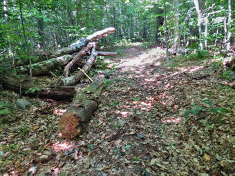 The blowdown was old and somewhat decayed which actually made cutting it harder since new wood takes the axe much better. I chose to cut the top of the tree first near the edge of the trail. It was tiring work but it went pretty quickly and soon I was able to lift a portion of the top and flip it off the trail. I now turned my attention to the other end of the tree trunk which was on the other side of the trail. Where I really wanted to cut there was a knot which restricted my ability to get the right width on my V. I started to cut and noticed that my V was much too narrow. I widened the V as I went but it was still narrow. This meant that as I got to the bottom of the cut I had to use brute force to cut directly down through the last inches. Eventually I broke through and had a large section of trunk still in the middle of the trail. This section was heavier than I thought and there was no way I could lift it by myself. I was able to pivot and roll it to one side of the trail but I didn't like the fact that it still block a portion. I decided to pivot and roll it to the other side which I did with the help of a tree branch I used as a lever. Finally the work was done and at 12:40 PM we started down the Flynn Trail again after spending about 45 minutes clearing the blowdown. I had almost emptied a liter of water and now I ate a protein bar. Where the jeep trail turned to the left around the back of Hodge Pond, we stayed to the right on the Flynn Trail and soon arrived at the clearing t the outlet end of Hodge Ppond.I thought Sheila might need a drink and a swim so we walked over to the pond. Sheila immediately dove in an started to splash around. I picked up a stick and threw it several times until I felt it was time to leave. We turned around and walked up the Flynn Trail toward the junction with the Big Rock Trail. The hill on the trail up from Hodge did not seem as long as it normally does. By 1:10 Pm we had hiked 4.75 miles and had arrived at the junction with the Big Rock Trail. We continued straight ahead and walked downhill toward the parking area. The descent was welcome and the trip seemed to go more quickly than usual. We arrived back at the car at 1:50 PM having hiked 6.5 miles in 3 hours and 20 minutes with an elevation gain of 920 feet.
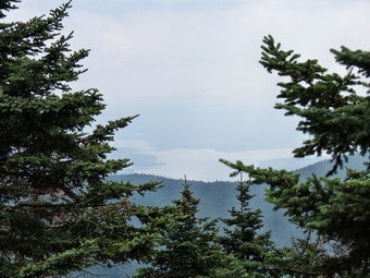
![]()
![]()
![]()
![]() On Monday, August 31st, I wanted to do a challenging hike close to home. I had been doing long but relatively flat hikes on the Finger Lakes Trail for most of the summer and want to try climbing a Catskill 3500 foot peak. I had recently hiked Breakneck Ridge without a problem so I thought I might take on Slide Mountain as it is close to my house and I had not been up the main trail in over 3 years! I waited until a little later in the morning hoping the haze that was still hanging around would burn off. I got Sheila in the car along with my gear and we headed out DeBruce Road to the Frost Valley Road where I turned left. Soon we were passing by Frost Valley and then the Biscuit Brook parking area. At 10:15 we arrived at the Slide Mountain parking area to find two other cars parked there. We began our hike at 10:25 AM by starting out on the main trail which immediately crosses the Neversink River. The "river" in this case was completely dry without a drop of water. This has happened before but always surprises me since in the spring it may be impossible to cross without getting wet! The other small streams were also dry as we headed up to the woods road. We did meet one hiker coming back down the trail and we said each said "hello" as we passed. In just less than half a mile we turned right on the woods road and hiked passed the first piped spring which was barely running. At .7 miles we turned left and started up the main trail to Slide Mountain which, according to the sign, was 2 miles away. The trailhead for Slide has a relatively high elevation so although it is the highest peak in the Catskills the elevation gain and grade are relatively modest. By the time we reached the designated campsite at 1.2 miles the grade was getting steeper and I was anxious to see how my Zamberlan light hikers would hold up on the dry but rocky trail. We kept a good pace up the trail passing the 3500 foot sign at 1.4 miles where the trail is at its steepest. The sky was starting to cloud over a little and I was concerned even though no rain was in the forecast. At 1.7 miles the trail started to level some and was covered with fine quartz sand. The Catskills including Slide Mountain are a plateau that was once under an ocean and have been pushed up to form what are called mountains.
On Monday, August 31st, I wanted to do a challenging hike close to home. I had been doing long but relatively flat hikes on the Finger Lakes Trail for most of the summer and want to try climbing a Catskill 3500 foot peak. I had recently hiked Breakneck Ridge without a problem so I thought I might take on Slide Mountain as it is close to my house and I had not been up the main trail in over 3 years! I waited until a little later in the morning hoping the haze that was still hanging around would burn off. I got Sheila in the car along with my gear and we headed out DeBruce Road to the Frost Valley Road where I turned left. Soon we were passing by Frost Valley and then the Biscuit Brook parking area. At 10:15 we arrived at the Slide Mountain parking area to find two other cars parked there. We began our hike at 10:25 AM by starting out on the main trail which immediately crosses the Neversink River. The "river" in this case was completely dry without a drop of water. This has happened before but always surprises me since in the spring it may be impossible to cross without getting wet! The other small streams were also dry as we headed up to the woods road. We did meet one hiker coming back down the trail and we said each said "hello" as we passed. In just less than half a mile we turned right on the woods road and hiked passed the first piped spring which was barely running. At .7 miles we turned left and started up the main trail to Slide Mountain which, according to the sign, was 2 miles away. The trailhead for Slide has a relatively high elevation so although it is the highest peak in the Catskills the elevation gain and grade are relatively modest. By the time we reached the designated campsite at 1.2 miles the grade was getting steeper and I was anxious to see how my Zamberlan light hikers would hold up on the dry but rocky trail. We kept a good pace up the trail passing the 3500 foot sign at 1.4 miles where the trail is at its steepest. The sky was starting to cloud over a little and I was concerned even though no rain was in the forecast. At 1.7 miles the trail started to level some and was covered with fine quartz sand. The Catskills including Slide Mountain are a plateau that was once under an ocean and have been pushed up to form what are called mountains.
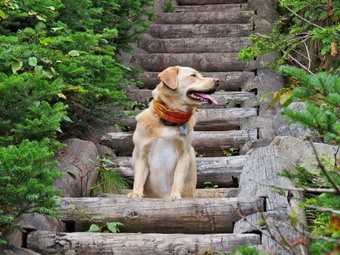 We continued up the trail and I began to notice that there were many more trees blown down than I remembered. There were quiet a few trees leaning over the trail which I do not think is a good situation. Some trees were low and had branches cut in such a way that the remaining pieces formed "spears" that pointed downward. I imagine some taller hikers may have had problems with these. Soon the trail level again as we had done most of the climbing. At 2 miles we passed the Curtis-Ormsbee Trail as it came in from the left from the Denning trailhead. The trail leveled some here and I enjoyed walking along the path strewn with pine needles. Soon we were approaching the last climb and at 2.6 miles we were at the viewpoint toward Panther and Giant Ledge. I should say "former" viewpoint as the trees have grown up in three years to obscure most of the view. Even if the viewpoint had been open, the haze still covered most of the peaks and valleys. Based on the number of cars in the lot and the people coming down the mountain, I judged that the summit would be empty. We passed by the highest point on Slide and continued to the rock outcropping to find it deserted. It was just before noon and we had covered 2.7 miles. I made sure I hydrated although I wasn't very thirsty. I tried to take a few pictures of the Ashokan Reservoir, Cornell and Wittenberg but the trees and the haze effectively prevented any good shots. I decided to go down to the spring as I wanted to get some pictures of Sheila on the ladders which was one of Sheba's best spots. We walked around the rock outcropping and started down toward the spring. There were more trees down in this area. I really wasn't surprised that Sheila handled the descent without any problems. Since I was slower, she kept climbing back up to "encourage" me!
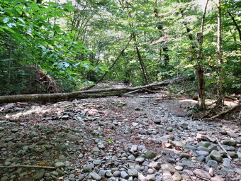 We continued down to the spring eventually getting to the wooden ladders. The ladders have not been repaired or maintained in some time and really could use some work. I decided to take pictures on the way back up and so we descended until we were at the spring. Sheila went ahead of me and I could here her getting a drink and playing in the water. The spring was running pretty well and the rocks around were wet and green with moss. I took a few pictures and then we started back up the ladders. I took a few pictures on Sheila on the ladders and the tried to take pictures from the ladders toward Cornell. This was at one time a good place to take pictures but the view is now all but gone. I did find a spot where I could take a few captures through the trees and we stopped at one of the illegal campsites farther up which had some views. We were soon back at the summit and we simply continued back down the main trail. The Zambian shoes were working well as they are light on my feet and give me enough support on rocky terrain. We passed the 2500 foot sign and continued down the trail until Sheila alerted. I put her on her leash for a few minutes but could not see anybody ahead so I released her. Soon I could see two hikers ahead of us descending the mountain. We were catching up to them so I put Sheila back on her leash. As we approached they courteously stepped aside to let us pass. We continued down to the woods road and turned right and then left to take the main trail back to the car. We stopped in the river bed so that I could get some pictures and then went back to the car by 2:00 PM. We had covered 5.8 miles in 3.5 hours with 2250 feet of elevation gain. I rather enjoyed the climb and think I will do another peak soon!
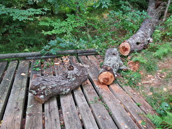
![]() On Sunday, August 30th, Cindy and I decided to go for a short hike after church since the weather was so beautiful. I was still thinking about the cherry tree and suggested we go to hike around Frick Pond again and stop to take care of the cherry tree on the way. Cindy agreed and we left Livingston Manor after church to arrive at the parking area at 11:15 AM. We were surprised to see several horse trailers taking up most of the spaces in the lot. I have nothing against horses and their owners except for the fact that the owners do not clean up after their animals. A hiking trail littered with horse manure and flies does not give horses on the trails a good name! We walked out toward Frick Pond on the Quick Lake Trail passing several spots that had clear evidence that horses had passed by on the trail. We crossed the bridge over the outlet and walked to the second footbridge with the remains of the cherry tree. My plan was to cut it in half so that I could move both halves out of the way by myself. This time I had decided to bring along my Council Tools Velvicut axe which is a full-sized American felling axe with a heavier bit and a slimmer handle. I thought this job would be ideal as I could swing the axe freely and get the power it needs to cut efficiently. When I started my cut I noticed a know on the other side of the trunk so I adjusted a little and again got the V too narrow. The Velvicut axe is a beast that requires a full swing to get the best cut. The fact that the axe is the heaviest I own means that it is more tiring to use. I continued to chop making some good chips fly. I rolled the log to make the cutting easier and considered using my saw toward the end. I stayed with the axe and soon had two pieces where there was once one! I put the axe away and then started to flip and roll the pieces out of the way. The wood was very dense and each piece was heavier than I thought it would be. I got both pieces moved next to the remaining trunk of the tree which was off the trail. After a brief cleanup, we continued our hike around the pond. At Ties Square we turned right and walked the Loggers' Loop back to Gravestone Junction where we turned left on the Quick Lake Trail to walk back to the car. The trailers were all still in the parking area and we had not seen horses or riders on our hike.
On Sunday, August 30th, Cindy and I decided to go for a short hike after church since the weather was so beautiful. I was still thinking about the cherry tree and suggested we go to hike around Frick Pond again and stop to take care of the cherry tree on the way. Cindy agreed and we left Livingston Manor after church to arrive at the parking area at 11:15 AM. We were surprised to see several horse trailers taking up most of the spaces in the lot. I have nothing against horses and their owners except for the fact that the owners do not clean up after their animals. A hiking trail littered with horse manure and flies does not give horses on the trails a good name! We walked out toward Frick Pond on the Quick Lake Trail passing several spots that had clear evidence that horses had passed by on the trail. We crossed the bridge over the outlet and walked to the second footbridge with the remains of the cherry tree. My plan was to cut it in half so that I could move both halves out of the way by myself. This time I had decided to bring along my Council Tools Velvicut axe which is a full-sized American felling axe with a heavier bit and a slimmer handle. I thought this job would be ideal as I could swing the axe freely and get the power it needs to cut efficiently. When I started my cut I noticed a know on the other side of the trunk so I adjusted a little and again got the V too narrow. The Velvicut axe is a beast that requires a full swing to get the best cut. The fact that the axe is the heaviest I own means that it is more tiring to use. I continued to chop making some good chips fly. I rolled the log to make the cutting easier and considered using my saw toward the end. I stayed with the axe and soon had two pieces where there was once one! I put the axe away and then started to flip and roll the pieces out of the way. The wood was very dense and each piece was heavier than I thought it would be. I got both pieces moved next to the remaining trunk of the tree which was off the trail. After a brief cleanup, we continued our hike around the pond. At Ties Square we turned right and walked the Loggers' Loop back to Gravestone Junction where we turned left on the Quick Lake Trail to walk back to the car. The trailers were all still in the parking area and we had not seen horses or riders on our hike.
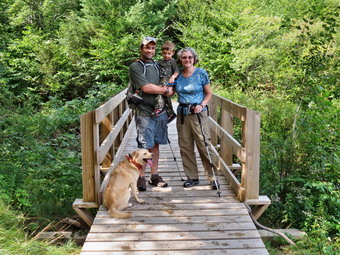
![]() On Saturday, August 29th, Karl brought Luke to the house and we all decided to go hike around Frick Pond. I took an my Wetterlings Forest Axe so that I could do some maintenance after the hike. We took our time getting to Frick Pond arriving a little after 10:30 AM to find no other cars in the lot. We got ready to hike right away and started out the Quick Lake Trail toward Frick Pond. Luke was alternating between walking and running and seemed very happy. We were soon on the woods road that goes out to the pond. We walked down the hill to the pond and stopped a minute for me to take some pictures of everybody gathered on the bridge. As we started around the pond, I pointed out the large cherry tree that was still partly on the last bridge. Karl remarked that it would take some time to cut it with and axe. We continued around the back of the pond admiring the tall green pine trees and the needles under foot. Luke was busy pointing out the "yellow trail markers" identifying each one as we passed them. At Times Square we turned right to start back to the car on the Logger's Loop. We walked across the stepping stones and logs that the DeBruce DEC campers had helped me place over one wet spot. As we continued, I spotted another dead tree standing by itself. I asked Cindy and Karl to continue back to the cars and I would be home shortly. I tied Sheila to a tree so she would not follow and then proceeded to fell the tree. I measured three axe lengths and sectioned the tree. I got two more lengths to span the marshy area and dragged the sections to that spot. I decided to leave them there to be placed on another trip. I returned to where I had felled the tree and cleaned up before continuing around the pond. I was really impressed at how well the Wetterlings axe worked for me. I had honed it to a very sharp edge and the lighter bit allowed me to develop more speed. Also, the more elliptical handle meant it was easier to control. I decided that I would take a few swings at the big cherry tree that Cindy and I had worked on. I knew it would be hard to cut through the large trunk but I thought I could at least get it started. Sheila and I walked over the bridge again and stopped at the last footbridge. I tied Sheila to a log and got to work. I tried to make the cut as wide as the diameter of the tree but came up a little short. I knew once I started that I was going to make it all the way through! Due to the slightly narrow V, the last few chops were difficult and I regretted not bringing a saw since that would have been an easier way to finish. I made the last few swings to sever that bark, took some pictures of my work and got ready to leave. I could have rolled the piece I cut off over the bridge and out of the way but did not want to roll it into the little stream below. I thought I would return with one or two other people to flip the trunk out of the way or roll it across the trail to the other side.
On Saturday, August 29th, Karl brought Luke to the house and we all decided to go hike around Frick Pond. I took an my Wetterlings Forest Axe so that I could do some maintenance after the hike. We took our time getting to Frick Pond arriving a little after 10:30 AM to find no other cars in the lot. We got ready to hike right away and started out the Quick Lake Trail toward Frick Pond. Luke was alternating between walking and running and seemed very happy. We were soon on the woods road that goes out to the pond. We walked down the hill to the pond and stopped a minute for me to take some pictures of everybody gathered on the bridge. As we started around the pond, I pointed out the large cherry tree that was still partly on the last bridge. Karl remarked that it would take some time to cut it with and axe. We continued around the back of the pond admiring the tall green pine trees and the needles under foot. Luke was busy pointing out the "yellow trail markers" identifying each one as we passed them. At Times Square we turned right to start back to the car on the Logger's Loop. We walked across the stepping stones and logs that the DeBruce DEC campers had helped me place over one wet spot. As we continued, I spotted another dead tree standing by itself. I asked Cindy and Karl to continue back to the cars and I would be home shortly. I tied Sheila to a tree so she would not follow and then proceeded to fell the tree. I measured three axe lengths and sectioned the tree. I got two more lengths to span the marshy area and dragged the sections to that spot. I decided to leave them there to be placed on another trip. I returned to where I had felled the tree and cleaned up before continuing around the pond. I was really impressed at how well the Wetterlings axe worked for me. I had honed it to a very sharp edge and the lighter bit allowed me to develop more speed. Also, the more elliptical handle meant it was easier to control. I decided that I would take a few swings at the big cherry tree that Cindy and I had worked on. I knew it would be hard to cut through the large trunk but I thought I could at least get it started. Sheila and I walked over the bridge again and stopped at the last footbridge. I tied Sheila to a log and got to work. I tried to make the cut as wide as the diameter of the tree but came up a little short. I knew once I started that I was going to make it all the way through! Due to the slightly narrow V, the last few chops were difficult and I regretted not bringing a saw since that would have been an easier way to finish. I made the last few swings to sever that bark, took some pictures of my work and got ready to leave. I could have rolled the piece I cut off over the bridge and out of the way but did not want to roll it into the little stream below. I thought I would return with one or two other people to flip the trunk out of the way or roll it across the trail to the other side.
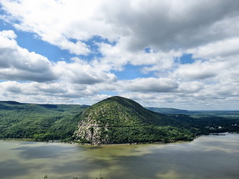
![]()
![]()
![]()
![]() On Thursday, August 27th the weather forecast was for partly cloudy day with temperatures in the mid to high 70's. The humidity was forecast to be lower than it had been and it sounded like a PERFECT day for hiking. I decided to take Sheila and head for the Eastern Hudson Highlands and Breakneck Ridge. This is one of the most popular trails in that area and rapidly fills with people especially on the weekends which was why it is almost mandatory to go there during the week. I tried to get out of the house early but didn't leave until just before 9:00 AM. I knew that there was construction on I84 so I decided to take the Mid-Hudson bridge to Poughkeepsie and then head south on Route 9 and 9D. This added about half an hour to the trip but I thought it might be worth not having to wait in traffic. I headed through Ellenville on Route 52 and the turned right of Route 44/55 to go through New Paltz. When we left Livingston Manor, the sky fog was just lifting and the sky was almost cloudless but hazy. We crossed the Mid-Hudson Bridge and headed south on Route 9 and the picked up Route 9D. After crossing I84 things began to look familiar and we arrived at the Breakneck Ridge parking lot to find only a few cars parked. As I pulled in the parking area, I noticed that farther up the road toward the trailhead there were cars parked along the side of the road. These were people that were about to hike one of he most difficult routes in the area and were too lazy to park in the designated lot and walk an extra quarter mile! It was 11:00 AM when I got my gear out of the car and put Sheila on her leash to start our hike. It was warm but there was a nice breeze blowing and the humidity seemed low despite being right on the Hudson River. We walked south along the shoulder of the road for about a quarter mile to the trailhead and then crossed the road again to get on the trail. There were a few people hanging out by their car right at the trailhead and I wanted to get ahead of them so we set a good pace up the trail to the first lookout. As we started up there were two women coming down toward us which is unusual as most people do not descend the trail but do a loop of some kind. I noticed that the trail was very dry and eroded from the thousands of people that hike the route. There were several signs that warned of the difficulty of the hike and most hikers seemed to be well-prepared for the journey. I was glad I had chosen my new Zamberlan low hikers since they are lighter and I felt they would grip the dry rocks well. We did not stop at the first lookout since there isn't much to see and there is a lot of broken glass on the ground.
On Thursday, August 27th the weather forecast was for partly cloudy day with temperatures in the mid to high 70's. The humidity was forecast to be lower than it had been and it sounded like a PERFECT day for hiking. I decided to take Sheila and head for the Eastern Hudson Highlands and Breakneck Ridge. This is one of the most popular trails in that area and rapidly fills with people especially on the weekends which was why it is almost mandatory to go there during the week. I tried to get out of the house early but didn't leave until just before 9:00 AM. I knew that there was construction on I84 so I decided to take the Mid-Hudson bridge to Poughkeepsie and then head south on Route 9 and 9D. This added about half an hour to the trip but I thought it might be worth not having to wait in traffic. I headed through Ellenville on Route 52 and the turned right of Route 44/55 to go through New Paltz. When we left Livingston Manor, the sky fog was just lifting and the sky was almost cloudless but hazy. We crossed the Mid-Hudson Bridge and headed south on Route 9 and the picked up Route 9D. After crossing I84 things began to look familiar and we arrived at the Breakneck Ridge parking lot to find only a few cars parked. As I pulled in the parking area, I noticed that farther up the road toward the trailhead there were cars parked along the side of the road. These were people that were about to hike one of he most difficult routes in the area and were too lazy to park in the designated lot and walk an extra quarter mile! It was 11:00 AM when I got my gear out of the car and put Sheila on her leash to start our hike. It was warm but there was a nice breeze blowing and the humidity seemed low despite being right on the Hudson River. We walked south along the shoulder of the road for about a quarter mile to the trailhead and then crossed the road again to get on the trail. There were a few people hanging out by their car right at the trailhead and I wanted to get ahead of them so we set a good pace up the trail to the first lookout. As we started up there were two women coming down toward us which is unusual as most people do not descend the trail but do a loop of some kind. I noticed that the trail was very dry and eroded from the thousands of people that hike the route. There were several signs that warned of the difficulty of the hike and most hikers seemed to be well-prepared for the journey. I was glad I had chosen my new Zamberlan low hikers since they are lighter and I felt they would grip the dry rocks well. We did not stop at the first lookout since there isn't much to see and there is a lot of broken glass on the ground.
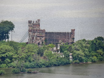 I let Sheila off her leash as we started the steepest part of the climb and noticed she had no problem negotiating the rocky terrain. I did see that she was constantly checking out the best route and choosing the easiest path. She had no problem scrambling or jumping up the more difficult routes but always chose the path of least resistance when she could. As we climbed I saw that a group of four hikers was catching up to us so we walked off the main trail to a small viewpoint and let them pass. I decided to wait to take some pictures until we gained some more elevation but the views of the river and across the water were beautiful. Back on the main trail another hiker or two caught and passed us but I was taking it easy since I knew the difficulty of the hike I wanted to do. My plan was to hike the white Breakneck Ridge Trail for about 3.2 miles and then turn around to hike the second 3.2 miles on the yellow Wilkinson Memorial Trail. We continued on the main trail passing one of the hikers who had gone by us. In the first .4 miles from the trailhead we gained 700 feet with and average grade of 33%. I began to stop at some of the lookouts which were designated by small, green, rectangular signs. The Hudson River was laid out below us! Across the river was the imposing prominence of Storm King Mountain. Further north was Bannerman Island with the castle and warehouse ruins. Downriver the Military Academy at West Point was just visible. The far shore was occupied by marinas and oil storage tanks. Nearby hills and far away mountains were spread throughout the view. I took pictures of everything but was more controlled than on previous hikes. I did make sure I got a few pictures of Sheila along the way. She was being very well-behaved and listening to all my commands. Several people commented on how well she hike and listened to me. Along the way I met a father and daughter from Cornwall who were hiking with their new puppy. The girl kept her dog on a leash which I knew must have been difficult. The dog looked like a husky but was light brown with darker brown markings. They told me it was a Siberian husky-Pomeranian mix!
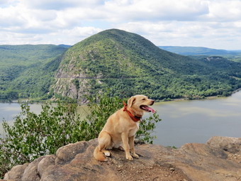 As we continued on the trail, I took a bypass route that avoided a climb over a stretch of exposed rock with few handholds. I knew Sheila could probably make this but did not want to take the chance. The bypass route was pretty well marked but all I had to do was follow Sheila. The father and daughter followed behind me as we worked our way to this route which I had never tried before. We also avoided a nasty climb over a huge boulder with a mean first step! I stopped again to take pictures after negotiating a walk along some open rock which slanted downward. I wondered how Sheila would do until I realized she was waiting up ahead for me. This would be repeated throughout the hike. The very last big climb on the ridge follows a narrow trail that leads to an open rock face which is slanted but with almost no handholds. As we approached the area, I noticed another bypass marked "Easier ascent" to the left. I decided it would be nice to take a route I had not tried. The path was easier but not easy! At one point the other dog came running up the trail and I thought the owners were right behind. Almost immediately I heard them calling and saw that the of had slipped her harness and was running free. I knew they were afraid she would go somewhere she was not supposed to and allowed Sheila to go after her and "make friends". As soon as they made contact I called Sheila back knowing the other dog would follow. As they returned, I held onto the other dog until the grateful owners could retrieve her. Soon we were at the top of the major climbs and at the last designated lookout. After taking a few more pictures, I tried to get Sheila to drink from my hands or from some water poured into a depression on he rock. She would do neither so we continued on our way.
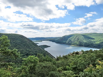 I thought after the major climbs we were done acceding but I apparently forgot that there are several more ascents and descents along the way. None of these are as difficult as the initial climb but they can be over 20% both up and down. The constant ups and downs add to the difficulty of the hike and the satisfaction of the accomplishment. Along the route are three "bailout" trails that allow a shorter route than the one I had planned. After less than a mile, we had passed the Undercliff trail on the right that connects to the Brook Trail leading back to Route 9D. We had continued on the white blazed Breakneck Ridge Trail until at 1.7 miles the red blazes of the Breakneck Trail Bypass appeared on the left. This is the second cutoff and leads to the Wilkinson Memorial Trail and back down to the river. I decided to continue on the Breakneck Ridge Trail. Immediately after this point there is another ascent and a steep descent on the other side. After this, there is a viewpoint on the right side of the trail that looks down on Lake Surprise. I stopped to take some pictures of the lake which looks private and had some very expensive house around the shore. We began to descend and just before 2 miles came to the blue blazed Notch Trail. This trail runs concurrently with the white Breakneck ridge trail to the northeast and eventually ends up on Route 9D over a mile north of the Breakneck Ridge parking area. To the right the trail heads south and then east toward Mount Taurus. We stayed to the left to remain on the Breakneck Ridge Trail which still had a few more ups and downs. The trail remained dry and very rocky as it had been since the beginning. At 3.2 miles the white and blue trails split and we turned left to follow the blue trail for only a few hundred feet until the yellow blazed Wilkinson Memorial Trail appeared on the left. We turned here at 1:40 PM and started our 3.2 mile trek back to the car.
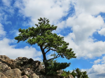 Many of the trails in the area are poorly marked and are crisscrossed by unmarked trails and woods roads. it is EXTREMELY important to know your route or have maps. Both would be a good idea and a GPS can also help! Since cellphone reception is good in the area, the Avenza app with PDF maps would work well also. This app shows the actual trails and your position on them. The Wilkinson Memorial Trail was very poorly blazed with many different paths cutting across it. Many of the major turns were not indicated and the blazes after these turns were also scarce. This is a shame since the trail are so popular. I was glad Sheila was along since she seemed to be able to follow the trail. We initially started a short climb on the trail which had my legs protesting. I knew there was a final climb over Sugarloaf Mountain and I was not looking forward to that ascent. By 4 miles e were on a descent that would last for about .8 miles until the climb up Sugarloaf. At 4.2 miles we came to one of those unmarked turns and I followed Sheila to the left and down to Wades Brook. The brook was almost dry but I was glad Sheila found some water and was able to get a drink and cool herself in the pool. I had to look twice but found that the trail crossed the brook and then paralleled it for some time. Sugarloaf Mountain offers the last spectacular views of the Hudson River and we began the ascent at 4.7 miles. The elevation gain is only 230 feet and the trail lops to the north for a more moderate approach making the average grade about 13%. The views along the trail aren't as good as the ones from the top or from Breakneck Ridge itself. We reached the top of the mountain at 5.2 miles and stopped so that I could take a few more pictures. The views north to the Newburgh-Beacon Bridge and Dennings Point were well worth the stop. I also took pictures of two interesting trees perch on the summit. I checked my watch and found it was almost 3 o'clock which meant we needed to get moving so that I had enough time for a shower before cross country practice!
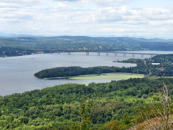 As we started to leave the summit and walk the trail down the mountain, I remembered that THIS was the steep descent I had been thinking about. From the top of the mountain we would have to lose over 900 feet back to Route 9D! The trail descends SHARPLY from this point with several difficult areas beginning right at the top where I had to slide along a slab of rock. I had noticed along the way that much of the rock has been eroded and polished by the huge number of hikers that use the route. In the first .4 miles the descent averaged over 20%. The trail was dry and there were many lose rocks along the way which made keeping a good pace almost impossible. As we descended we came to a fork in the trail. There was no turn indicated but at least the blazes were clear as we stayed to the left. The lower portion of the trail is a little easier as the switchbacks and the meandering nature of the trail help keep the descent manageable. The loose, dry earth and loose talus capped by acorns and a few dead leaves made keeping my footing a difficult task. Sheila, of course, had no problem and alternated running back and forth with waiting for me. Toward the end we followed the trail into a streambed and then had to ascend out of it. Just one more challenge for my tired legs. At about 5.7 miles the Breakneck Bypass Trail joined on the left. From this point on the trail seemed more like a narrow woods road and the surface was well packed. Soon glimpses of the road and the river could be seen through the trees and the trail suddenly ended at 9D less than a quarter mile from the parking area. We turned left on the road and walked on the shoulder back to the car. The hike was the more challenging than I remember and certainly one of the hardest six+ miles I had ever done. It was 3:35 PM when we got back to the car. 6.5 miles in 4.5 hours with an elevation gain of 2220 feet.
![]() On Wednesday, August 26th, I decided I wanted to go to Trout Pond to do some trail maintenance. Cindy and I had been there on Monday and found that the Japanese knotweed was starting to encroach on the main trail near the falls. The path to the falls was overrun with grass and weeds and there were a few blowdowns on the trail to Mud Pond. I put out a call for trail volunteers but everybody seemed to already have plans for the day except for Lisa. I met Lisa downtown at 12:20 PM and we headed to Roscoe and then on Route 206 to Morton Hill Road. At the junction with RussellBbrook Road I turned left and continued down to the lower parking area. I usually park at the top and walk down the road but on this trip we had equipment to carry and wanted to get to work as soon as possible. We walked down to the stream and across the bridge to begin work at a little after 12:30 PM. Lisa said she would work on the knotweed so I took a newly purchased grass whip and headed for the weed-choked path. My initial efforts were not too impressive until I remembered to strike the plants almost at ground level to better cut the stems. After that, I cut an impressive path in a short period of time. I noticed some branches having low over the path and retrieved my Silky saw from my pack and cut the branches so they no longer blocked the path. To vary my work, I checked on Lisa and helped her clear some of the knotweed she had cut. I got my new Wetterlings axe and headed for the small blowdown just passed the trail register. With only a few blows I dispatched the sapling and then moved it to the sides of the trail. I went back to the path where I had cut the weeds and started to remove them by placing them out of sight. I had meant to bring a rake to do this job but had to settle for using the weed whip. I checked back on Lisa after I had removed most of the cut weeds and she had done a great job of trimming back the knotweed and removing the cut branches. There was one more blowdown across the path to the falls which I attacked with my axe. I really loved the way this tool felt in my hands and the ease with which I could limb trees or section large trunks. I cut away all but the largest trunk and called it good around 2:00 PM which was Lisa's deadline for returning. At some point I hit a rock with the new axe which was very painful for me as it put a slight burr on the toe. This gave me an opportunity to try my honing skills at home. I was able to remove the bur with the coarse side of the stone and then hone the whole edge further with the fine side. The result was a perfect edge which was slightly sharper than it had been!
On Wednesday, August 26th, I decided I wanted to go to Trout Pond to do some trail maintenance. Cindy and I had been there on Monday and found that the Japanese knotweed was starting to encroach on the main trail near the falls. The path to the falls was overrun with grass and weeds and there were a few blowdowns on the trail to Mud Pond. I put out a call for trail volunteers but everybody seemed to already have plans for the day except for Lisa. I met Lisa downtown at 12:20 PM and we headed to Roscoe and then on Route 206 to Morton Hill Road. At the junction with RussellBbrook Road I turned left and continued down to the lower parking area. I usually park at the top and walk down the road but on this trip we had equipment to carry and wanted to get to work as soon as possible. We walked down to the stream and across the bridge to begin work at a little after 12:30 PM. Lisa said she would work on the knotweed so I took a newly purchased grass whip and headed for the weed-choked path. My initial efforts were not too impressive until I remembered to strike the plants almost at ground level to better cut the stems. After that, I cut an impressive path in a short period of time. I noticed some branches having low over the path and retrieved my Silky saw from my pack and cut the branches so they no longer blocked the path. To vary my work, I checked on Lisa and helped her clear some of the knotweed she had cut. I got my new Wetterlings axe and headed for the small blowdown just passed the trail register. With only a few blows I dispatched the sapling and then moved it to the sides of the trail. I went back to the path where I had cut the weeds and started to remove them by placing them out of sight. I had meant to bring a rake to do this job but had to settle for using the weed whip. I checked back on Lisa after I had removed most of the cut weeds and she had done a great job of trimming back the knotweed and removing the cut branches. There was one more blowdown across the path to the falls which I attacked with my axe. I really loved the way this tool felt in my hands and the ease with which I could limb trees or section large trunks. I cut away all but the largest trunk and called it good around 2:00 PM which was Lisa's deadline for returning. At some point I hit a rock with the new axe which was very painful for me as it put a slight burr on the toe. This gave me an opportunity to try my honing skills at home. I was able to remove the bur with the coarse side of the stone and then hone the whole edge further with the fine side. The result was a perfect edge which was slightly sharper than it had been!
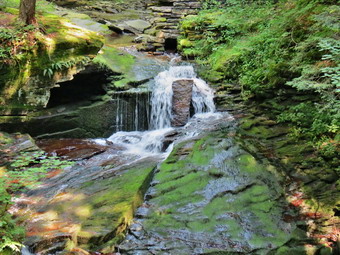
![]()
![]()
![]()
![]() On Monday, August 24th, I decided I wanted get out and do a hike close to home and Cindy wanted to go too. We decided to go to Trout Pond since we had not been there recently and wanted to see if there was any trail maintenance that needed to be done. We were in no real hurry to get started so we arrived at the top of Russell Brook Road at about 10:45 AM and parked on the side of Morton Hill Road. We got started right away be walking down Russell Brook Road. The temperature was in the low 70's with moderate humidity. I wore a long-sleeved shirt as I often do since it takes care of the bugs and the sun. I also had decided to wear a pair of Keen hiking boots instead of low hikers as the trail can be very muddy in spots. We continued on down Russell Brook Road to the overlook of the falls. There was not much water in the stream and the upper falls was just trickle but this exposed the mossy rock underneath. I took some pictures and the we continued to the lower parking area. There were several cars parked in the lot as we got on the woods road that crosses the brook. As we crossed the bridge we found the Japanese knotweed in full bloom with some of it encroaching on the path. We turned right after the knotted to walk to the falls and noticed a tent set up just up the trail in a spot not designated for camping. We walked over to the falls and dropped down into the streambed. I took few pictures of the falls while Sheila place din the water. I took a few more photographs of her in front of the falls and then we worked our way back to the main trail. I out Sheila on her leash until we passed the tent. At the trail junction just after the register we turned to the left to climb the steeper hill toward Mud Pond. There was a small tree across the trail which I could not move without cutting it. The trail was rather dry with only a few wet spots and the ascent went quickly. The sun was out and it was getting warmer but there was a slight breeze blowing. We reached the top of the hill at 11:45 AM after hiking 1.5 miles and started down the other side. At about 1.7 miles we made a right to follow the trail up to the shoulder of Cherry Ridge. We kept hiking but made a short stop so that I could take some pictures of ferns along the trail and of an interesting area where there are many small saplings.
On Monday, August 24th, I decided I wanted get out and do a hike close to home and Cindy wanted to go too. We decided to go to Trout Pond since we had not been there recently and wanted to see if there was any trail maintenance that needed to be done. We were in no real hurry to get started so we arrived at the top of Russell Brook Road at about 10:45 AM and parked on the side of Morton Hill Road. We got started right away be walking down Russell Brook Road. The temperature was in the low 70's with moderate humidity. I wore a long-sleeved shirt as I often do since it takes care of the bugs and the sun. I also had decided to wear a pair of Keen hiking boots instead of low hikers as the trail can be very muddy in spots. We continued on down Russell Brook Road to the overlook of the falls. There was not much water in the stream and the upper falls was just trickle but this exposed the mossy rock underneath. I took some pictures and the we continued to the lower parking area. There were several cars parked in the lot as we got on the woods road that crosses the brook. As we crossed the bridge we found the Japanese knotweed in full bloom with some of it encroaching on the path. We turned right after the knotted to walk to the falls and noticed a tent set up just up the trail in a spot not designated for camping. We walked over to the falls and dropped down into the streambed. I took few pictures of the falls while Sheila place din the water. I took a few more photographs of her in front of the falls and then we worked our way back to the main trail. I out Sheila on her leash until we passed the tent. At the trail junction just after the register we turned to the left to climb the steeper hill toward Mud Pond. There was a small tree across the trail which I could not move without cutting it. The trail was rather dry with only a few wet spots and the ascent went quickly. The sun was out and it was getting warmer but there was a slight breeze blowing. We reached the top of the hill at 11:45 AM after hiking 1.5 miles and started down the other side. At about 1.7 miles we made a right to follow the trail up to the shoulder of Cherry Ridge. We kept hiking but made a short stop so that I could take some pictures of ferns along the trail and of an interesting area where there are many small saplings.
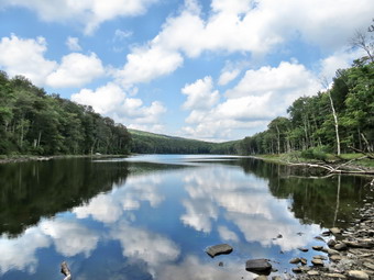 The ascent continued for the next 1.2 miles until at 2.8 miles into the hike when we were at the highest point and ready to start the descent to Trout Pond. The trail remained relatively dry and easy to negotiate even in spots than can be muddy or have running water at other times of the year. We descended the rest of the way to Trout Pond and stopped at the inlet. I was surprised that no one was camped in either lean-to. The skies were bright blue with puffy clouds. Some of the clouds we white but some were beginning to get dark although no rain was predicted. I walked out to a peninsula which usually is under water. I threw a stick for Sheila to retrieve and she immediately swam to get it. I took pictures of her as she repeated this several times. I also took some shots of the pond with the trees and clouds reflected in the still water. before continuing on. We continued on the main trail toward the outlet of the pond. Along the way I the rail remained almost dry which was much more peasant than trying to negotiate the mud that is often present. As we approached the lower end of the pond I looked at the skies and almost bypassed this stop. We did stop at the outlet end so that I could take a few more shots. It was obvious that the pond was very low as the water was not even lapping at the outlet dam. The hike from the outlet to the trail junction is all downhill and really did go quickly. We were soon back at the register box where we continued on the main trail to the parking area. We finished with the hike up Russell Brook Road back to the car. We arrived back at 1:45 PM having covered 5.6 miles and 1132 vertical feet in 2 hours and 50 minutes. On the way back home we stopped on the Rockland flats at Northern Farmhouse Pasta. They produce their own all-organic pastas and raviolis using locally sourced products. They sell the pasta in the store and are now open Friday and Saturday night from 5:00 Pm to 9:00 PM with a limited menu.

![]()
![]()
![]()
![]()
![]() On Saturday, August 22nd I suggested to Cindy that we go to Sam's Point to hike as we had not been there in some time. I had been hiking elsewhere and the area had been closed as the ownership changed hands from Open Spaces Institute to New York State. Sam's Point Preserve is now part of Minnewaska State Park. Cindy agreed but suggested we start early as it is a popular hiking destination particularly on the weekend. My intention was to hike to Sam's Point and then down the road toward the Ice caves. I wanted to avoid the ice caves and head toward Verkeerder Kill Falls. I knew the traffic to the falls would be lighter than that around Lake Maratanza and the Ice Caves. I planned to cross the falls and then hike to High Point. We would return by way of the carriage path and loop road. We left Livingston Manor just before 9:00 AM and headed through Liberty to Ellenville. Sheila was excited to get out as it had been several days since our last hike! We continued on Route 52 toward Pine Bush and turned left at the top of the mountain Cragsmoor Road. In Cragsmoor I stayed to the right adjourned right on Sam's Point Road. Soon we were at the parking area and were surprised to see that nothing had changed. There were already a larger number of cars parked in the lot with more coming in behind us. I paid the $10 parking fee at the Conservation Center and we started our hike at 9:45 PM with Sheila on her leash and my poles in my pack. I had decided to again wear my Zamberlan low hikers as I expected a relatively dry hike without too much mud. The low and light shoes are beginning to be my favorite shoes for this type of hike. I was anxious to see how they would perform on the rocky trails. The temperatures was in the high 60's with relatively low humidity and a slight breeze. We turned right at the first trail junction to take the loop road up to Sam's Point. There was a large group of young people behind us who were enjoying themselves by making a lot of noise. We wanted to stay ahead of them so we set a quick pace. On the way up to Sam's Point I took some pictures of the cliffs and then stopped at the lower viewpoint. There was little haze and at that point I knew this would be a slow hike with a lot of time for pictures. The green of the vegetation and the blue of the sky was complemented by a lot of interesting, puffy, white clouds. I also took some pictures of Sheila and Cindy before continuing up the road. We took the short spur to the Point and found no one there. I was surprised to see that the rock wall had been removed! I never felt the need for the wall and the view is more open without it but I wondered why the took the time to remove it. There was also a new wooden bridge over the large gap between the two parts of the viewpoint. Even though I have taken pictures from here many times, I took them again and tried to get a new perspective. I captured some shots of the viewpoint and then some along the escarpment cliffs as well as some of the distant scenery. I also snapped a few of Cindy Next to the large glacial erratic.
On Saturday, August 22nd I suggested to Cindy that we go to Sam's Point to hike as we had not been there in some time. I had been hiking elsewhere and the area had been closed as the ownership changed hands from Open Spaces Institute to New York State. Sam's Point Preserve is now part of Minnewaska State Park. Cindy agreed but suggested we start early as it is a popular hiking destination particularly on the weekend. My intention was to hike to Sam's Point and then down the road toward the Ice caves. I wanted to avoid the ice caves and head toward Verkeerder Kill Falls. I knew the traffic to the falls would be lighter than that around Lake Maratanza and the Ice Caves. I planned to cross the falls and then hike to High Point. We would return by way of the carriage path and loop road. We left Livingston Manor just before 9:00 AM and headed through Liberty to Ellenville. Sheila was excited to get out as it had been several days since our last hike! We continued on Route 52 toward Pine Bush and turned left at the top of the mountain Cragsmoor Road. In Cragsmoor I stayed to the right adjourned right on Sam's Point Road. Soon we were at the parking area and were surprised to see that nothing had changed. There were already a larger number of cars parked in the lot with more coming in behind us. I paid the $10 parking fee at the Conservation Center and we started our hike at 9:45 PM with Sheila on her leash and my poles in my pack. I had decided to again wear my Zamberlan low hikers as I expected a relatively dry hike without too much mud. The low and light shoes are beginning to be my favorite shoes for this type of hike. I was anxious to see how they would perform on the rocky trails. The temperatures was in the high 60's with relatively low humidity and a slight breeze. We turned right at the first trail junction to take the loop road up to Sam's Point. There was a large group of young people behind us who were enjoying themselves by making a lot of noise. We wanted to stay ahead of them so we set a quick pace. On the way up to Sam's Point I took some pictures of the cliffs and then stopped at the lower viewpoint. There was little haze and at that point I knew this would be a slow hike with a lot of time for pictures. The green of the vegetation and the blue of the sky was complemented by a lot of interesting, puffy, white clouds. I also took some pictures of Sheila and Cindy before continuing up the road. We took the short spur to the Point and found no one there. I was surprised to see that the rock wall had been removed! I never felt the need for the wall and the view is more open without it but I wondered why the took the time to remove it. There was also a new wooden bridge over the large gap between the two parts of the viewpoint. Even though I have taken pictures from here many times, I took them again and tried to get a new perspective. I captured some shots of the viewpoint and then some along the escarpment cliffs as well as some of the distant scenery. I also snapped a few of Cindy Next to the large glacial erratic.
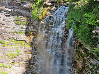 Back on the main trail we headed toward the turn off to the ice caves on the loop road. After turning right, we walked down the side road a short distance passing a few people on the way and turning left onto the trail down to Verkeerderkill Falls. This trail is rocky and often quite wet but on this day it was dry the entire length with only a few wet spots. The trail was newly trimmed and most of the encroaching blueberry bushes and a few scrub pines were cut back to open up the trail. Along the first part there was a sea of low blueberry bushes with an occasional dwarf pine. I took some photographs and included some of the clouds for good measure. I stopped to take a few long range shots of Lake Awosting and a few of Sheila posed on a rock. At one point the trail passes through a stand of hardwood trees and the forest floor was covered in ferns. This required some more pictures! Most of the rest of the trail to the falls is rocky and passes through dwarf pines. We met a few people coming back from the falls and were passed by members of a Boy Scout troop headed toward the falls. The trail is always longer than I remember but we finally got to the falls at 11:15 AM after 3 miles of hiking 1.8 miles of which were on the trail. We stopped on the near side of the falls and I walked out to the viewpoint. There wasn't a lot of water going over the falls but there was more than I had expected and it was certainly worth some pictures. I took some pictures and noticed some people on the other side. Crossing the stream was no problem and we were soon on the other side. The far side of the stream offers more unobstructed views of the falls and the pool below. I took pictures of the falls and actually saw a small rainbow which photographed nicely. We didn't spend too much time at the falls as we had seen it before and more people were arriving. We headed out on the trail to continue our loop and to climb back up to the escarpment. The trail climbs steeply but for only a short distance but I decided that I would let Sheila offer her leash and get out my poles which I had kept in my pack since we started the hike. We stopped at the first viewpoint so that I could take some pictures, a theme that would recur frequently on the way to High Point. As we left the viewpoint, a pair of hikers turned onto the trail ahead of us. We never saw them again for the rest of the hike. At the trail junction with the path to Awosting, we turned left to continue along the escarpment. From the falls to High Point is about 2.3 miles. The trail passes along the edge of the cliffs with many wonderful views of the countryside. Sometimes the path dives into the dwarf pines only to emerge to more great views. I noticed the transmission towers opposite us across the gorge and knew we had some distance to go before we would pass by them on the way back. We stopped along the way for pictures of the scenery. I also took some shots of Sheila and Cindy. I took some pictures of Sheila alone which were very similar to ones I have of Sheba. I know that Sheila is very athletic but I was surprised at the ease with which she climbs the steep rock faces. She pauses at the bottom, scans the routes and then launches herself up and over without much effort at all. I had only brought two liters of water but there were two streams along the way which were flowing nicely and allowed Sheila to get a drink.
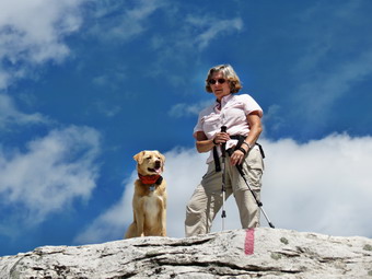 By 1:10 PM we had hiked 5.3 miles and were standing on High Point. I got out the camera to take some pictures. The Smiley Tower at Mohonk and the cliffs of Hamilton and Castle Point were clearly visible. To the north were the outlines of the Catskill high peaks. The two young men that had passed us on the way out were returning from the other direction and they stopped to talk. We discussed some hikes that I had done and they were contemplating. They headed off to complete their hike and Cindy and I got a drink and a snack before continuing as we knew we still had more than 3 miles to go. In a few minutes we were at the trail that leads down to the carriageway. We walked passed this turn off to the area where the fire tower once stood. This lookout gives an even better view to the north and more pictures were in order. We walked back to the trail down to the carriageway and soon were headed back to the parking lot. The sign at the top of the trail before descending says 2.4 miles to the center. The sign at the bottom gives 2.8 miles for the same trip and this is the correct information. I have often wondered why someone didn't proofread this more carefully! The walk back always seems long and today was no exception. The first 1.7 miles on the carriageway is slightly uphill and seems to go on forever. Along the way the path was very dry and many f the areas that are often boggy had no water. There was one pond with quite a bit of water and the area around the spur trail to Indian Rock was damp. We decided not to go out to Indian Rock and continued straight ahead to the loop road. At the loop road we turned right to head back to the parking area. I expected to meet a lot of people but we only met one woman walking her dog until we were almost back at the car. From the road we could coach a glimpse of Lake Maratanza but I decided not to go down to the shore to take pictures. As we approached the parking area we could see that it was overflowing and that attendants were stopping cars at the entrance. We were back at the car by 2:45 PM having hiked 8.8 miles in 5 hours. I counted this as a good pace given the amount of time we had stopped so that I could photograph.
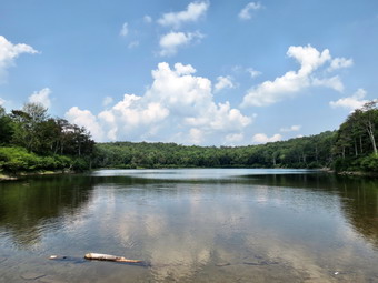
![]()
![]()
![]()
![]()
![]() On Tuesday, August 18th I wanted to get a quick hike in before track practice in the afternoon. I decided to go to Hodge and Frick Ponds to see if there were any new blowdowns on the Flynn and Quick Lake Trails since I had not walked the big loop in some time. Cindy decided to come with me so I got an axe and saw and the rest of my gear and we all headed out at 11:15 AM. When I walked out of the house, I turned round and went inside to change into a short sleeved shirt! It was both hot and humid out and I knew that thundershowers were a possibility but not until 4:00 PM. We arrived at the Frick Pond trailhead at 11:35 AM and crossed the road to get on the Flynn Trail. The sun was out but walking through the woods under the trees seemed cooler and there was a slight breeze. We walked through the woods and then made a right on the woods road that is the Flynn Trail. This was once the extension of Beech Mountain Road when it went all the way to the Beech Mountain Boy Scout Camp. As we walked up the Flynn Trail, we did not find any blowdowns but there were areas where some grass and weeds had started to overgrow the trail. By 12:20 PM we had hiked the 1.7 miles uphill to the junction with the Big Rock Trail. We continued straight ahead on the Flynn Trail heading for Hodge Pond. Along the way we admired the work we had done previously to clear the trail. As we walked down the hill to Hodge Pond Sheila ran ahead and jumped into the pond. She loves to get wet and to swim around. When we got to the pond, I picked up a stick and threw it into the pond so she could retrieve it. I did this several times and took pictures of her swimming and jumping out of the water. After a drink and a quick snack, I picked up my gear and we headed out on the Flynn Trail along the western shore of Hodge Pond. I knew there was still one big tree across the trail and wanted to see if I could clear it with my saw and axe. As we approached the large blowdown, I could see that it had been mostly cleared. All that was left in the trail was one large trunk which was easy to step over. It looked like a chainsaw had been used but who did the clearing remains a mystery to me. We walked up to the gate at the top of the trail and I dropped my pack and got out my tools. A tree had fallen across the trail some time ago and we had trimmed the branches and rerouted the trail around the blowdown. This had bothered me for some time and I wanted to see if I could remove what remained. I cleared some of the loose branches and then started to use my Fiskars X27 axe. The axe is lightweight with an integrated composite handle. I prefer one of my heavier felling axes but they are all much heavier and meant for felling large trees. I have also found that the Fiskars does cut well and is adequate for most jobs out on the trail. I spent about half an hour clearing the entire blowdown and cutting it back off the trail.
On Tuesday, August 18th I wanted to get a quick hike in before track practice in the afternoon. I decided to go to Hodge and Frick Ponds to see if there were any new blowdowns on the Flynn and Quick Lake Trails since I had not walked the big loop in some time. Cindy decided to come with me so I got an axe and saw and the rest of my gear and we all headed out at 11:15 AM. When I walked out of the house, I turned round and went inside to change into a short sleeved shirt! It was both hot and humid out and I knew that thundershowers were a possibility but not until 4:00 PM. We arrived at the Frick Pond trailhead at 11:35 AM and crossed the road to get on the Flynn Trail. The sun was out but walking through the woods under the trees seemed cooler and there was a slight breeze. We walked through the woods and then made a right on the woods road that is the Flynn Trail. This was once the extension of Beech Mountain Road when it went all the way to the Beech Mountain Boy Scout Camp. As we walked up the Flynn Trail, we did not find any blowdowns but there were areas where some grass and weeds had started to overgrow the trail. By 12:20 PM we had hiked the 1.7 miles uphill to the junction with the Big Rock Trail. We continued straight ahead on the Flynn Trail heading for Hodge Pond. Along the way we admired the work we had done previously to clear the trail. As we walked down the hill to Hodge Pond Sheila ran ahead and jumped into the pond. She loves to get wet and to swim around. When we got to the pond, I picked up a stick and threw it into the pond so she could retrieve it. I did this several times and took pictures of her swimming and jumping out of the water. After a drink and a quick snack, I picked up my gear and we headed out on the Flynn Trail along the western shore of Hodge Pond. I knew there was still one big tree across the trail and wanted to see if I could clear it with my saw and axe. As we approached the large blowdown, I could see that it had been mostly cleared. All that was left in the trail was one large trunk which was easy to step over. It looked like a chainsaw had been used but who did the clearing remains a mystery to me. We walked up to the gate at the top of the trail and I dropped my pack and got out my tools. A tree had fallen across the trail some time ago and we had trimmed the branches and rerouted the trail around the blowdown. This had bothered me for some time and I wanted to see if I could remove what remained. I cleared some of the loose branches and then started to use my Fiskars X27 axe. The axe is lightweight with an integrated composite handle. I prefer one of my heavier felling axes but they are all much heavier and meant for felling large trees. I have also found that the Fiskars does cut well and is adequate for most jobs out on the trail. I spent about half an hour clearing the entire blowdown and cutting it back off the trail.
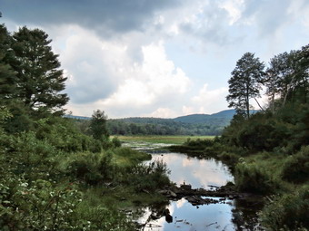 As we continued to hike out the Flynn Trail to Junkyard Junction, Cindy and I both noticed that the skies were growing a little darker in places but there was still plenty of sunshine. Sheila found some partridge to chase and she very nearly caught one. When we arrived at Junkyard Junction, we turned left on the Quick Lake Trail and started down the hill toward Iron Wheel Junction. Along the way I pointed out to Cindy the tree that Brad and I had felled as it was hanging over the trail. A little farther along there was a new trees across the trail. I thought I could move it without cutting but it proved to be too heavy. I got out the axe and made one cut through the 8 inch log. After making the cut I was able to lift and roll the log out of the way. By 2:35 PM we had walked the 5 miles to Iron Wheel Junction where we turned right to stay on the Quick Lake Trail. There were no more blockages on the trail. We crossed the small stream on the trail and found it was almost dry. Sheila took a quick dip in the one pool of water and we continued toward the bridge at Frick Pond with clouds gathering overhead. When we arrived at the bridge, the dark clouds were very evident as I took a few quick shots. Just as I put the camera back in the pack the rain began to fall. Cindy got out her rain jacket but I decided to try to Out run the rain as it looked like there were blue skies ahead. She was right and I was wrong! The rain was pouring down so hard that I paused under a tree to get out the pack cover. We hurried along the path as the thunder and lightning seemed very close. When we arrived at the car, the rain fell even harder. We had hiked 6.5 miles in 3.5 hours with several stops along the way to clear the trail and to take pictures. The vertical gain for the whole hike was only 920 feet. As we drove out the Mongaup Road, it seemed that it had rained very little there and the streets in Livingston Manor were not even wet!
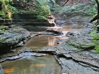
![]()
![]()
![]()
![]()
![]() On Sunday, August 16th, I wanted to get in another hike on the Finger Lakes Trail to complete map 15. Since the hike would be about 9 miles Cindy agreed to go with me. We would park in Watkins Glen and near the park entrance and hike through the village to Clute Park and then follow the trail to Burdett where we had been on our previous hike. Sheila was ready to go as we left the house a little after 6:30 AM. The fog was so heavy that it almost seemed to be raining but I knew that it would clear as the sun burned it off. I checked the weather forecast and found sunny skies but with temperatures in the high 80's and high humidity. The heat index was listed at 97 in the early afternoon which concerned me and was why I wanted to start as early as possible. As I drove north on State Route 17 the fog hung around until well after Binghamton and then began to lift as the temperature rose into the high 60's. I continued on Route 17 for 133 miles to exit 52B at Horseheads. From there it was 16.5 miles north on Route 14 to the park entrance. We pulled into the parking area for a small motel across from Watkins Glen and asked permission to park. We began our hike at about 8:50 AM by walking one block north on Route 14 to 10th Street. We turned right and walked one block to North Decatur Street. Here we made a left and walked six blocks north to Route 414 where we turned right. We took a moment to stop at Lafayette Park on the corner where there are two large stone blocks engraved with the words "Finger Lakes Trail" and "Catherine Valley Trail". From here we moved on and walked the remaining .6 miles to Clute Park on the southern shore of Seneca Lake. We walked down toward the shore watching for white blazes and soon picked them up. We continued to follow them east as they led us back out to Route 414. We crossed Seneca Lake Inlet on a road bridge and then continued to follow Route 414 as it turned north and started to climb away from the lake. We were looking for the blazes to indicate a turn to the right as the trail passes through Excelsior Glen. At 1.75 miles I noticed a Finger Lakes Trail post on the other side of the road almost hidden in the grass. There was no other indication that the trail turned at that point. We crossed the road and found the trail blazes and a register. The Finger Lakes Trail almost immediately turned right and started to climb. There were also numerous other trails that appeared to enter the glen following the stream. The trail began to climb steeply and we were soon at the base of some short cliffs. The layers of rock were so interesting that I stopped to take a few shots. As we continued to climb we noticed that the trail had not been cleared in some time and seemed far less popular than some of the other trails. I planted my foot on a root and immediately slipped and almost fell. I wondered if my new Zamberlan low hikers were up to the task but I did not slip again the entire day.
On Sunday, August 16th, I wanted to get in another hike on the Finger Lakes Trail to complete map 15. Since the hike would be about 9 miles Cindy agreed to go with me. We would park in Watkins Glen and near the park entrance and hike through the village to Clute Park and then follow the trail to Burdett where we had been on our previous hike. Sheila was ready to go as we left the house a little after 6:30 AM. The fog was so heavy that it almost seemed to be raining but I knew that it would clear as the sun burned it off. I checked the weather forecast and found sunny skies but with temperatures in the high 80's and high humidity. The heat index was listed at 97 in the early afternoon which concerned me and was why I wanted to start as early as possible. As I drove north on State Route 17 the fog hung around until well after Binghamton and then began to lift as the temperature rose into the high 60's. I continued on Route 17 for 133 miles to exit 52B at Horseheads. From there it was 16.5 miles north on Route 14 to the park entrance. We pulled into the parking area for a small motel across from Watkins Glen and asked permission to park. We began our hike at about 8:50 AM by walking one block north on Route 14 to 10th Street. We turned right and walked one block to North Decatur Street. Here we made a left and walked six blocks north to Route 414 where we turned right. We took a moment to stop at Lafayette Park on the corner where there are two large stone blocks engraved with the words "Finger Lakes Trail" and "Catherine Valley Trail". From here we moved on and walked the remaining .6 miles to Clute Park on the southern shore of Seneca Lake. We walked down toward the shore watching for white blazes and soon picked them up. We continued to follow them east as they led us back out to Route 414. We crossed Seneca Lake Inlet on a road bridge and then continued to follow Route 414 as it turned north and started to climb away from the lake. We were looking for the blazes to indicate a turn to the right as the trail passes through Excelsior Glen. At 1.75 miles I noticed a Finger Lakes Trail post on the other side of the road almost hidden in the grass. There was no other indication that the trail turned at that point. We crossed the road and found the trail blazes and a register. The Finger Lakes Trail almost immediately turned right and started to climb. There were also numerous other trails that appeared to enter the glen following the stream. The trail began to climb steeply and we were soon at the base of some short cliffs. The layers of rock were so interesting that I stopped to take a few shots. As we continued to climb we noticed that the trail had not been cleared in some time and seemed far less popular than some of the other trails. I planted my foot on a root and immediately slipped and almost fell. I wondered if my new Zamberlan low hikers were up to the task but I did not slip again the entire day.
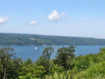 As we climbed the trail, both Cindy and I noticed that it was hot and humid. It was nice to be in the shade and even nicer to have a breeze blowing. The map description had mentioned avoiding the area during high water but Cindy and I did not see the reason for this. At about 2.3 miles we started to turn north and got closer to the creek. There were several small cascades which were really nice. Soon the trail descended to the streambed above one of the falls. The descent was a little steep and slippery but we made it across the stream with no problem. After this we understood the warning about times of high water! Sheila immediately ran up and down the stream slashing in the water. I stopped to take a few shots before joining Cindy on the other side. This time my Zamberlan low hikers did a great job and did not slip. The trail continued heading north out of the glen and the lack of maintenance became more evident. Where there were open areas weeds had overgrown the trail making hiking more difficult. There was a particular type of burr that all of us ran into and it was very effective sticking to everything! At 2.8 miles we came to Jolly Road where the blazes indicated a turn. Once again the blazes did not indicate the direction of the turn! Cindy and I were talking and having a good time as we turned right and began walking up the hill. After a very short distance, we noticed there were no blazes and I checked the map to find we were headed in the wrong direction. Of course, this was partly my fault for not checking the amp but mistakes like these could be avoided if the Finger Lakes Trail maintainers would use standard trail blazing protocols! We started heading northwest on Jolly Road and descended 190 feet before crossing Route 79. I hate losing elevation I have already gained and then having to gain it all over again! We crossed the road and picked up a short section of trail that descended to Middle Road. Middle Road is a dirt road that is situated between Route 414 and Route 79. It leads to Factory Street in Burdett and has very little traffic. So far we had not been able to get any good views of Seneca Lake. The walk along Middle Road provided those views in several different places. We eventually came to some shaded spots and even a small stream where Sheila could jump in to cool herself and get a drink!
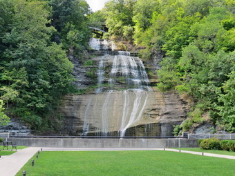 At 4.6 miles Middle Road turned to the east and started to parallel Hector Falls Creek. We could hear the water in the creek below and caught some glimpses of falls and cascades. Eventually Middle Road became Factory Street as we entered Burdett. At 5.2 miles we turned left onto Mill Street and immediately saw another falls on the creek. There was a steep path down to the falls but We did not know if it was private property. We walked to the end of Mill Street and crossed Route 79 to the firehouse and village hall. This was the turn around point and we needed to decide how we would get back to the car. Hiking down Route 79 was the most direct way but there would be little shade. Returning on Middle Road was an option but it was longer. We decided to return by Route 79 and at 11:25 AM we headed south using the sidewalks in Burdett and then the wide shoulder of the road. The walk started out slightly uphill and then became flat. At 6.2 miles we began a 1.25 mile descent dropping 530 feet to the area near the lake. We followed the trail back into the park and stopped in the shade. I took out the camera to take a few pictures of the lake and then we moved on to reverse our route through the streets back to the car. We were back at the car at 12:35 PM having hiked 9.1 miles in 4 hours with a vertical gain of 1075 feet. The temperature at the car was ion the high 80's and the humidity was oppressive. We decided to head back through Montour Falls and then over to the Ithaca Beer Company near Enfield Glen just south of Ithaca. I like their beers and the food was highly recommended. As we approached Montour Falls, I saw a sign for Shequaga Falls which I knew were supposed to be readily accessible from a North Genesee Street in town. As we drove along the street we noticed a small park on the right with the falls at the far end. I parked the car, got my camera and walked over to the park. I took several pictures of the water running over the rock an down into the stream below. I would like to return when there is more water but the falls were still very nice. We found the Ithaca Beer Company and it was packed. We decided to eat outside since it would be easier for me to go to the car and run the air conditioning to make sure Sheila stayed cool. I did this several times and despite the lack of shade the car stayed cool and Sheila had no problems. I tried a class of the seasonal Country Pumpkin and found it pleasant but without the pronounced pumpkin taste I had hoped for. Cindy and I both had burgers which were excellent. We also ordered hand cut French fries with three different sauces. These were also well worth the price as even the ketchup was made in the kitchen. I had a Flower Power with my munch. The service was little slow but we had a good time. We were soon on our way home and both of us thought that the drive seemed longer than usual.
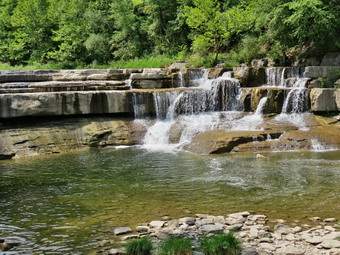
![]()
![]()
![]()
![]()
![]() On Friday, August 14th Cindy and I finished hiking Watkins Glen at 11:35 Am and headed over to Taughannock Falls State Park in Trumansburg on the western shore of Lake Cayuga. We followed the route that our car GPS gave us and ended up coming down Taughannock Falls Road, turning right on Route 89 and driving to the parking area on the right. Our entrance fee was waived as we had already been to another state park that day. We parked at 12:25 PM and started off walking out on the Gorge Trail. We decided to walk into the gorge and do that trail first since it was short and led right to the base of the 215 foot main falls. As we walked this trail several smaller falls appeared along the way and we stopped to take pictures. We were both impressed by the canyon that the stream had cut over the years. Equally interesting was the layer that acted as the stream bed. The rock layer showed "waves" in many places and in some areas we were walking on this layer as well. In many areas the different hardness of the rock layers was evident in their erosion patterns. The walk was pleasant and the air temperature was warm but not hot. There was a slight breeze blowing but the humidity was high. The clouds in the sky were growing darker and were high and billowing. There were quite a few people in the park but not as many as at Watkins Glen. The same disregard for the rules of the park were evident as people freely walked in the stream even allowing their dogs to swim in it despite the "Stay on the main trail" signs! The walk out was almost flat and we arrived at the bridge over the stream at the base of the falls by 12:50 PM after hiking about a mile. I took pictures from the bridge and then walked to the viewpoint at the end of the walkway and took a few more. The main falls are certainly high and there was enough water to make it interesting. I would like to return after a heavy rain or in early spring! We turned around to head back to the parking area.
On Friday, August 14th Cindy and I finished hiking Watkins Glen at 11:35 Am and headed over to Taughannock Falls State Park in Trumansburg on the western shore of Lake Cayuga. We followed the route that our car GPS gave us and ended up coming down Taughannock Falls Road, turning right on Route 89 and driving to the parking area on the right. Our entrance fee was waived as we had already been to another state park that day. We parked at 12:25 PM and started off walking out on the Gorge Trail. We decided to walk into the gorge and do that trail first since it was short and led right to the base of the 215 foot main falls. As we walked this trail several smaller falls appeared along the way and we stopped to take pictures. We were both impressed by the canyon that the stream had cut over the years. Equally interesting was the layer that acted as the stream bed. The rock layer showed "waves" in many places and in some areas we were walking on this layer as well. In many areas the different hardness of the rock layers was evident in their erosion patterns. The walk was pleasant and the air temperature was warm but not hot. There was a slight breeze blowing but the humidity was high. The clouds in the sky were growing darker and were high and billowing. There were quite a few people in the park but not as many as at Watkins Glen. The same disregard for the rules of the park were evident as people freely walked in the stream even allowing their dogs to swim in it despite the "Stay on the main trail" signs! The walk out was almost flat and we arrived at the bridge over the stream at the base of the falls by 12:50 PM after hiking about a mile. I took pictures from the bridge and then walked to the viewpoint at the end of the walkway and took a few more. The main falls are certainly high and there was enough water to make it interesting. I would like to return after a heavy rain or in early spring! We turned around to head back to the parking area.
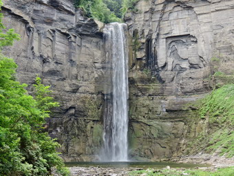 As we got back to the area near the beginning of the Gorge Trail, we decided to hike the South and North Rim Trails which would add about 2.5 miles to the mileage for the day. We turned right onto the South Rim Trail and started UP the stone steps. Getting up to the rim required quite a climb, of course and there were MANY stone steps along the way. I gave Cindy my poles which seemed to help her but climbing is not her favorite part of the hike. Once we were up on the rim, the trail did not climb as steeply but never did really level out. By the time we turned around at the far end of the gorge we had gained 550 feet from the parking area. On the way we passed through shaded groves of the hardwood and some evergreen trees. There were a few lookouts that gave interesting views of the canyon below and, eventually, of the falls itself. Soon we were nearing the upper reaches of the gorge and a new falls came into view. Here the gorge widened considerably and the different layers of rock were even more obvious. We were wondering how we would cross the gorge to get to the north rim but soon a bridge cam into view. It looked old and from the side it was clear that it had seen better days. Once we were on the bridge another falls, as impressive as the main falls in many ways, appeared on the left or southwest of the bridge. This falls also fell a long distance and the volume appeared to be as great as the main falls. A little further upstream we could see another bridge that routed traffic over the stream. As we walked along the main trail an occasional view of the gorge would appear but none were really remarkable.
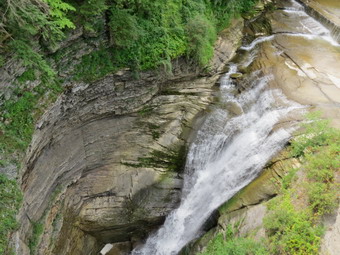 As we continued our walk, a nice view of the falls appeared through the trees so I took some pictures. The trail wound along the gorge and even joined the road for a brief time. Soon we approached the upper access to the park and the gorge. Here, those who wanted a quick view of the falls could simply park and walk down a flight of stone steps. I wanted to tell them what they were missing! This view of the falls was nice and was from a much greater distance than the Gorge Trail that we had done earlier. I took some photographs before we started back down the North Rim Trail to the car. Along the way I kept looking for a view down the gorge and out to Cayuga Lake. All the viewpoints were overgrown and the views obscured by trees and bushes, Finally a nice lookout offered a clear view of the lake, At another point we were able to look down to the bed of the stream at the bottom of the gorge and see people walking along the stream bed. They appeared very small even with the zoom. We continued down the trail stopping at several more viewpoints before descending the steps to the road a little north of the parking are. We walked the road back to the car crossing the stream on the small road bridge. We were back at the car just before 2:40 PM having taken 2 hours and 15 minutes to do the 5 mile hike. The elevation gain was 1060 feet. I was hungry and wanted to visit the Ithaca Brewery near Enfield Glen. They brew great beer and have good food available. Cindy said she was not hungry and I didn't want to eat alone so we returned home. I will get to visit the brewery on another hike!
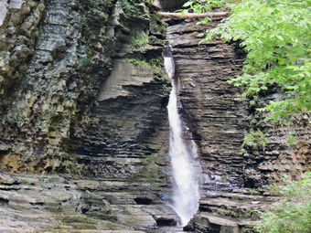
![]()
![]()
![]()
![]()
![]() On Friday, August 14th, I decided to go to Watkins Glen to hike the glen and take some pictures of the 19 waterfalls and cascades found there. I also thought I might hike part of the Finger Lakes Trail which passes south of the glen following the South Rim Trail in places. Cindy wanted to go also as we had not been there since our honeymoon over 40 years ago! It was also an opportunity to try out our new Mitsubishi Outlander which we had picked up the day before! Sadly, we had to leave Sheila home as dogs are not allowed on the trail through the gorge. Sheila was not happy! I had wanted to get started by 7:00 AM but we weren't out of the house until after 8:00 AM. The weather forecast was suggesting the possibility of thunderstorms by 4:00 PM and I knew we wanted to be done before that time. The route was very easy and shorter than I thought. We drove north and west on State Route 17 for 133 miles to exit 52B. From there it was 16.5 miles north on Route 14 to the park entrance. We pulled in just before 10:00 AM, paid our $8 fee and parked. As soon as the parking attendant told us that the parking fee would cover all other state parks for the day I began to think about where else we could go! There were already a lot of cars in the lot and we wanted to get going before more arrived. We were ready to head up the gorge by 10:05 AM and I began to take pictures right in the parking area. On many of my hikes on the Finger Lakes Trail I do not take pictures as there are no views and this was a refreshing change. I tried to keep a GPS track of then hike but it is impossible to get lost on the trails. The narrow nature of the gorge and several tunnels through the rock also interfere with the satellite signals for the GPS. I am not used to seeing many people on hikes and there were quite a few in the gorge already. Somehow we managed to get between large groups which limited our contact with other hikers. It is impossible to describe all the various cascades and features of the glen. It really is spectacular to see the depth the stream has cut over the years and the formations that have resulted. I took over a hundred pictures of the deep chasms, narrow channels and circular pools cut by the stream. In several places the trail takes the hiker underneath waterfalls and across the stream. The trail is wet in spots and can be slippery. I am always surprised at what people do and the way they act. "Appropriate footwear" to many means "flip-flop" sandals. Other people stand in the middle of the trail taking pictures. Looking down into the stream one can see water bottles littering the beautiful pools. Farther up the glen where the stream widens and the flow slows, parents allow their children to enter the water despite the signs warning not to do so.
On Friday, August 14th, I decided to go to Watkins Glen to hike the glen and take some pictures of the 19 waterfalls and cascades found there. I also thought I might hike part of the Finger Lakes Trail which passes south of the glen following the South Rim Trail in places. Cindy wanted to go also as we had not been there since our honeymoon over 40 years ago! It was also an opportunity to try out our new Mitsubishi Outlander which we had picked up the day before! Sadly, we had to leave Sheila home as dogs are not allowed on the trail through the gorge. Sheila was not happy! I had wanted to get started by 7:00 AM but we weren't out of the house until after 8:00 AM. The weather forecast was suggesting the possibility of thunderstorms by 4:00 PM and I knew we wanted to be done before that time. The route was very easy and shorter than I thought. We drove north and west on State Route 17 for 133 miles to exit 52B. From there it was 16.5 miles north on Route 14 to the park entrance. We pulled in just before 10:00 AM, paid our $8 fee and parked. As soon as the parking attendant told us that the parking fee would cover all other state parks for the day I began to think about where else we could go! There were already a lot of cars in the lot and we wanted to get going before more arrived. We were ready to head up the gorge by 10:05 AM and I began to take pictures right in the parking area. On many of my hikes on the Finger Lakes Trail I do not take pictures as there are no views and this was a refreshing change. I tried to keep a GPS track of then hike but it is impossible to get lost on the trails. The narrow nature of the gorge and several tunnels through the rock also interfere with the satellite signals for the GPS. I am not used to seeing many people on hikes and there were quite a few in the gorge already. Somehow we managed to get between large groups which limited our contact with other hikers. It is impossible to describe all the various cascades and features of the glen. It really is spectacular to see the depth the stream has cut over the years and the formations that have resulted. I took over a hundred pictures of the deep chasms, narrow channels and circular pools cut by the stream. In several places the trail takes the hiker underneath waterfalls and across the stream. The trail is wet in spots and can be slippery. I am always surprised at what people do and the way they act. "Appropriate footwear" to many means "flip-flop" sandals. Other people stand in the middle of the trail taking pictures. Looking down into the stream one can see water bottles littering the beautiful pools. Farther up the glen where the stream widens and the flow slows, parents allow their children to enter the water despite the signs warning not to do so.
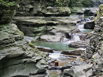 Almost as impressive as the forces of nature that formed the glen are the manmade structures that allow access. There are walkways cut into the glen and many are paved with some to make them smoother. There are over 800 stone steps from one end to the other which are challenging but easier than climbing without them. There are several bridges that pass across the stream and some are high in the air connecting the north and south rim. We were soon passing by Mile Point Bridge into the upper glen and by 11:00 Am we had climbed the last long set of steps to end the 1.25 mile hike. I had planned to trunk round at this point and walk back to Mile Point Bridge. From there we would cross the glen and hike part of the Finger Lakes Trail on the other side. I asked Cindy what she wanted to do and we decided to return by the easier Indian Trail along the north rim of the gorge and then head to Taughannock Falls State Park on the western shore of Cayuga Lake. We turned onto the Indian Trail and started the walk downhill back to Point Lookout at 2.2 miles. The Indian Trail ends here as it unsafe past this spot. We descended the steps to the Gorge Trail and return that way to the parking area. The return trip was MUCH faster than the trip out through the gorge since my camera remained in the pack. We were back at 11:35 have hike 2.4 miles in 1.5 hours with a 745 foot elevation gain. We were now ready to head to Cayuga Lake. I had decided to wear my new Zamberlan Airound GTX RR light hiking shoe. They were incredibly light on my feet and resisted the water in several spot on the hike since they have the Gortex Surround material in them. Besides being comfortable, they are a bright blue and very stylish!
![]()
![]()
![]()
![]()
![]() On Thursday, August 13th, I was ready to get out and hike after a week of family commitments and rainy days. I wanted to get in another hike on the Finger Lakes Trail. I decided to hike a section of trail on map 15 from the village of Burdett to Texas Hollow Road where I had left off on my last hike in the area. The "out" part of the hike appeared to be a around 9.5 miles one way which would make the round trip about 19 miles. This would be too far to hike but I noticed that to get "back" I could use the local roads to hike about 4 miles! This is because Finger Lakes Trail from Burdett heads north and loops through the Finger Lakes National Forest before coming south to Texas Hollow. When we left Livingston Manor at 6:30 AM the temperature was 55 degrees and there was a lot of fog in the valley. I checked the weather forecast and found sunny skies and temperatures in the mid 70's with no chance of rain. As I drove north on State Route 17 the fog hung around until Windsor and then began to lift as the temperature rose into the 60's. Just passed Binghamton the fog returned but began to clear the further I drove. I continued on Route 17 to exit 64 at Owego and headed north from there on Route 96 through Candor and Spencer. In Spencer I picked up Route 34 west to Van Ettan. Here I turned right onto Route 224 as Route 34 headed south. I followed Route 224 for 19.2 miles as it passed through Cayuta crossing Route 13. I drove through Odessa and just outside of Montour Falls turned north on Schuyler County Route 8. I followed Route 8 for a little more than 3 miles and then turned left onto Route 9 which took me to Route 79 after 1.2 miles. I turned right and was in Burnett after less than a mile. As I drove into the village, I noticed the fire department and village hall on the right. I pulled in and walked into the building to find a few firefighters. I asked them1 if I could park in the back and they said there was no problem. Later, I found that the post office was just around the corner and this is another good place to park. I got out my gear and applied a coating of insect repellant. We began our hike at 9:35 AM by walking north on Route 79 to the blinking light and then continuing north on Willow Street. At .65 miles Willow St continued on through a twin tunnel. One tunnel was for the road and the other for the stream that ran beside it. The tunnels were necessary because a railroad once ran over the road and perpendicular to it. We turned left or west on a farm lane before the tunnels which are impossible to miss. The lane was flat for a bit and then began to climb as it turned north. At the first split in the lane there were no blazes so I guessed left and began to walk up to a group of farm buildings. There were still no blazes to follow but at about a mile another "road" went off to the left and I turned on it hoping it was the railroad bed described on the map. We walked northwest for some time before I finally spotted a faint white blazes. The railroad bed was in poor shape with large ponds in places and very muddy areas which were hard to avoid. At one point I sank in mud which threatened to go over the top of my boots. I am usually happy to hike on railroad beds but this time I was thrilled when the trail turned off the bed at 1.5 miles and headed first northeast and then due north.
On Thursday, August 13th, I was ready to get out and hike after a week of family commitments and rainy days. I wanted to get in another hike on the Finger Lakes Trail. I decided to hike a section of trail on map 15 from the village of Burdett to Texas Hollow Road where I had left off on my last hike in the area. The "out" part of the hike appeared to be a around 9.5 miles one way which would make the round trip about 19 miles. This would be too far to hike but I noticed that to get "back" I could use the local roads to hike about 4 miles! This is because Finger Lakes Trail from Burdett heads north and loops through the Finger Lakes National Forest before coming south to Texas Hollow. When we left Livingston Manor at 6:30 AM the temperature was 55 degrees and there was a lot of fog in the valley. I checked the weather forecast and found sunny skies and temperatures in the mid 70's with no chance of rain. As I drove north on State Route 17 the fog hung around until Windsor and then began to lift as the temperature rose into the 60's. Just passed Binghamton the fog returned but began to clear the further I drove. I continued on Route 17 to exit 64 at Owego and headed north from there on Route 96 through Candor and Spencer. In Spencer I picked up Route 34 west to Van Ettan. Here I turned right onto Route 224 as Route 34 headed south. I followed Route 224 for 19.2 miles as it passed through Cayuta crossing Route 13. I drove through Odessa and just outside of Montour Falls turned north on Schuyler County Route 8. I followed Route 8 for a little more than 3 miles and then turned left onto Route 9 which took me to Route 79 after 1.2 miles. I turned right and was in Burnett after less than a mile. As I drove into the village, I noticed the fire department and village hall on the right. I pulled in and walked into the building to find a few firefighters. I asked them1 if I could park in the back and they said there was no problem. Later, I found that the post office was just around the corner and this is another good place to park. I got out my gear and applied a coating of insect repellant. We began our hike at 9:35 AM by walking north on Route 79 to the blinking light and then continuing north on Willow Street. At .65 miles Willow St continued on through a twin tunnel. One tunnel was for the road and the other for the stream that ran beside it. The tunnels were necessary because a railroad once ran over the road and perpendicular to it. We turned left or west on a farm lane before the tunnels which are impossible to miss. The lane was flat for a bit and then began to climb as it turned north. At the first split in the lane there were no blazes so I guessed left and began to walk up to a group of farm buildings. There were still no blazes to follow but at about a mile another "road" went off to the left and I turned on it hoping it was the railroad bed described on the map. We walked northwest for some time before I finally spotted a faint white blazes. The railroad bed was in poor shape with large ponds in places and very muddy areas which were hard to avoid. At one point I sank in mud which threatened to go over the top of my boots. I am usually happy to hike on railroad beds but this time I was thrilled when the trail turned off the bed at 1.5 miles and headed first northeast and then due north.
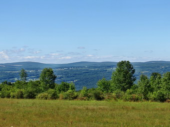 We entered the woods and immediately began to gain elevation on a well-marked and obvious trail. Soon we broke out of the woods and hiked through some abandoned vineyards. They must have been abandoned some time ago as there were very few grapes left and no structure. At 1.8 miles we turned left and began heading north to 2.2 miles where we made a right turn to the east. We walked along some fields with views of the Catharine Valley behind us and at 2.5 miles reached Slattery Hill Road. The description on the map mentioned "views to the north and west of Seneca Lake". I could see no lake so we walked north on Slattery Hill Road for .2 miles to the top of a hill but found no views. We returned to the Finger Lakes Trail and walked through some more fields and vineyards before entering the woods. We were now well within Finger Lakes National Forest. From the road we headed generally south with a few jogs to the east as we descended to Tug Hollow Creek. At 3.7 miles we crossed the creek twice and I began to wonder where the bridge described on the map was located. We walked along the creek as it became deeper and wider and at 3.85 miles crossed the narrow bridge. It had been constructed in 2005, washed out and rebuilt in 2006. After crossing the bridge, we continued straight ahead on the very obvious trail. After we had walked a couple hundred feet, I noticed there were no blazes. We walked back to the bridge and I found the blazes that indicated the trail turned right just after the bridge. We walked uphill and crossed Logan Road at 4.3 miles. On the other side of Logan Road was a "gate" and a small kiosk explain the Finger Lakes Trail. The forest from Logan Road to Burnt Hill Road was primarily hardwood and there were some very large trees along the way. The trail ascended from the road and followed s small stream on the right heading ENE to about 5 miles where it crossed the stream and began heading southeast. At 5.3 miles we descended some and crossed an impressive streambed that was almost dry. After a slight ascent we crossed Burnt Hill Road the first time at 5.5 miles. Although the map description and map indicated a turn to the right on the road, the trail entered the woods directly across from where we left the woods. We continued to ascend to 5.6 miles where we began a long descent. At this point the orange blazed Interlocken Trail came in from the north and a little farther on a side trail headed left to the Dunham lean-to. We continued on the trail heading almost due south losing elevation as we went. We began passing through more red pines and at 6.25 miles the trail turned west to head for Burnt Hills Road again. The forest became more open and the trail began to be overgrown. At one point I looked up to see an older woman sitting off to the right of the trail. I said "Hello" but got no response so Sheila and I fought our way out through the briars to the road. At 6.6 miles we turned left on Burnt Hill Road and continued to descend. It was 12:35 PM and we had been hiking for 3 hours and were still headed "out". The temperature was rising and the humidity seemed to follow. The walk down the road to Route 79 was pretty easy and at 7.5 miles we were there after dropping over 600 feet.
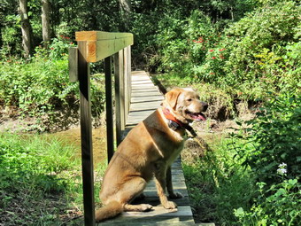 I knew that the route back would be much shorter but debated whether or not I wanted to hike another 3 miles "out" over a hill that had no views! We turned left and walked along Route 79 for .15 miles before turning right on South Hill Road. As I looked at the road, it was obvious how it got its name as it was all uphill. As often happens, looks are deceiving, and we only gained 90 feet in our .3 miles on the road. At 8 miles we turned left onto a farm lane. The turn was well marked and there were even some blazes on the trees that were to the left of us as we stayed on the north side of some fields while heading east. There were several roads that branched off to the left and at one point there was a blaze indicating a turn onto one of these roads. We turned and I quickly saw that there were no blazes and we were heading the wring way. I don't know why a turn was marked but it was very confusing. We continued to head east toward Texas Hollow Road going uphill to 8.3 where the trail turned south but continued to rise. The hardwoods forest around us were pleasant and there was a slight breeze. The trail continued to parallel Texas Hollow Road heading southeast but more than 300 feet above it with a steep drop off to the left. At 9.1 miles we were at and elevation of 1550 feet where the trail began to descend. At 9.25 miles the trail turned sharply and headed due north to Texas Hollow Road. There were several small switchbacks but the descent was very steep. As we approached the road I noticed a residence ahead and called Sheila to put her on her leash. As we passed the house the owner struck up a conversation. We talked pleasantly for a few moments before Sheila and I walked down his driveway to the road. We had dropped 300 feet in just over .3 miles for an average grade of over 17%. The trail crossed the road and then turned right to parallel the road for .35 miles to the access road that leads down to a pond. The trail was wet with several blowdowns and the insects were biting. Since there was nothing to Se, I would advise others to simply walk down the road. When we came to the access road, we turned right to walk up to Texas Hollow Road. Before we reached the road, I noticed a car park at the gate and the owner and his dog got out. The do was not on a leash and came down to "visit" us. The owner seemed unconcerned! I puts my poles away, got a drink and a snack, and pus Sheila on her leash so that we could start the "back" part of the hike. It was 2:05 PM and we had hiked 9.9 miles when we started north on Texas Hollow Road. The walk to Route 79 was 1.25 miles with a slight uphill at the beginning and then a slight descent. We turned left on Route 79 and began the 2.4 mile walk back to the car. The route was almost all downhill and we passed by some interesting houses, a cemetery and a horse stable. At the blinking light in town, we turned left and walked back to the firehouse. It was 3:15 PM and we had hiked 13.5 miles in 5 hours and 40 minutes with an elevation gain of 1960 feet.
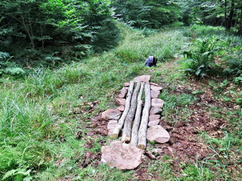
![]() On Thursday, August 6th, Lisa and I met a group of campers and counselors from the DeBruce DEC camp at the Frick Pond trailhead at 11:00 AM. Our purpose was to introduce the campers to the concept of volunteer trail maintenance and to do some actual trail maintenance tasks on the trail around Frick Pond. Although the weather forecast for earlier in the week hinted at showers the day turned out to be bright and sunny with temperatures in the 70's and low humidity. There was also a remarkable absence of annoying insects! One groups of campers arrived by van at 10:45 AM. While the van left to pick up the second group, Lisa and I introduced ourselves to the campers and counselors. When all the campers were at the trailhead, I spent a few minutes describing the trails in the Catskills and explaining that they are all maintained by volunteers. I talked about the tasks were going to perform and Lisa displayed a map of the area. We began our hike by walking out the Quick Lake trail to Gravestone Junction. The trail was drier than it had been in some time which made it hard to evaluate the ditching we had done on previous trips. When we arrived at Gravestone Junction, we divided the eight campers into three groups. Counselor Jimmy took one group to haul stones from the outlet stream of Frick Pond to the mud pit at the trail junction. They used a plastic toboggan to transport the stepping stones up the short hill from the stream to the mud pit. Lisa supervised campers who used "weed whackers" to clear grass and weeds from the junction back towards the parking area. Counselor Jordan and I took two campers to another wet spot on the Logger's Loop trail. Our objective was to add several lengths of wood to ones that had been already placed to expand a "bridge" over a muddy area. When we arrived, I went to find a tree that I could section while Jordan and the campers removed stones that were on either side of the existing wooden pieces. I used my new Gransfors felling axe for the job and felt it performed even better than the Council Tools Velvicut axe I had used last time. After I limbed and topped the tree, we carried it to the mud pit to measure it for length and to make the necessary cuts. Using my Silky saw, I cut the small tree into sections and we place the two new sections next to the ones that were already in position. We replaced the stones on either side of the logs to help stabilize them and inspected the work we had done. We had used natural materials to make a functional passage over the wet area. We returned to Gravestone Junction to see how the other groups were doing.
On Thursday, August 6th, Lisa and I met a group of campers and counselors from the DeBruce DEC camp at the Frick Pond trailhead at 11:00 AM. Our purpose was to introduce the campers to the concept of volunteer trail maintenance and to do some actual trail maintenance tasks on the trail around Frick Pond. Although the weather forecast for earlier in the week hinted at showers the day turned out to be bright and sunny with temperatures in the 70's and low humidity. There was also a remarkable absence of annoying insects! One groups of campers arrived by van at 10:45 AM. While the van left to pick up the second group, Lisa and I introduced ourselves to the campers and counselors. When all the campers were at the trailhead, I spent a few minutes describing the trails in the Catskills and explaining that they are all maintained by volunteers. I talked about the tasks were going to perform and Lisa displayed a map of the area. We began our hike by walking out the Quick Lake trail to Gravestone Junction. The trail was drier than it had been in some time which made it hard to evaluate the ditching we had done on previous trips. When we arrived at Gravestone Junction, we divided the eight campers into three groups. Counselor Jimmy took one group to haul stones from the outlet stream of Frick Pond to the mud pit at the trail junction. They used a plastic toboggan to transport the stepping stones up the short hill from the stream to the mud pit. Lisa supervised campers who used "weed whackers" to clear grass and weeds from the junction back towards the parking area. Counselor Jordan and I took two campers to another wet spot on the Logger's Loop trail. Our objective was to add several lengths of wood to ones that had been already placed to expand a "bridge" over a muddy area. When we arrived, I went to find a tree that I could section while Jordan and the campers removed stones that were on either side of the existing wooden pieces. I used my new Gransfors felling axe for the job and felt it performed even better than the Council Tools Velvicut axe I had used last time. After I limbed and topped the tree, we carried it to the mud pit to measure it for length and to make the necessary cuts. Using my Silky saw, I cut the small tree into sections and we place the two new sections next to the ones that were already in position. We replaced the stones on either side of the logs to help stabilize them and inspected the work we had done. We had used natural materials to make a functional passage over the wet area. We returned to Gravestone Junction to see how the other groups were doing.
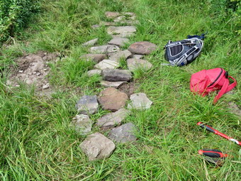 The group of campers using the weed whackers found that they were difficult to use to cut the light grass and weeds on the trail. The blades were not sharp enough and were better suited for cutting brush. This didn't stop the campers from trying and they were able to clear a section of trail despite the problems they had with the tools. The other group had done a good job of hauling stones up from the stream. We took some time to reposition the rocks that had already been placed and then used the new stones to expand the path both in width and length. It was hard to find exactly how to place the stones as the mud pit was almost completely dry. When the mud returns, the rocks will have to be shifted slightly but the work has well done. We walked down to the bridge at Frick pond where we enjoyed a light lunch and talked some about the area. It was pleasant to listen to the campers talk about their experiences hiking and camping. I felt that they had a real appreciation for the beauty that was around us and for the need for volunteers to help maintain the trails. After lunch, we hiked around Frick Pond using clippers to remove a few branches here and there. I pointed out the large cherry tree that had bee removed with just hand tools. As we continued through the evergreen trees and onto the walkways, we heard a distinctive "Ki-ki-kee" call of what Jordan identified as merlins. These are small, fierce falcons similar to kestrels that prey on other birds. There seemed to be quite a few in the treetops. We continued our hike around to Times Square where we turned right to complete the loop and head back to Gravestone Junction. As we hiked on the trail, the campers who had worked with me earlier in the day pointed out the work we had done to the group. At Gravestone Junction each camper picked up a tool to carry back to the parking area. When we arrived at my car, we loaded the tools and the campers all said "Thank you". I thanked them for the opportunity to work with them and for the work they had done. Counselors Jordan and Jimmy were outstanding in supervising the campers and pitching in to lead by example. This is a cooperative venture which I am sure we will repeat in the future!
![]()
![]()
![]()
![]()
![]() On Tuesday, August 4th, I wanted to get out for another hike on the Finger Lakes Trail. I decided to start map 15 by hiking the easternmost section. My requests for rides from volunteer car spotters went unanswered so I decided to park on Texas Hollow Road and hike to Gulf Road where I had left off last time. The hike appeared to be a little over 7 miles one way but there did not seem to be any convenient way to get back on local roads. I knew this meant over 14 miles on trails which would not be easy. When I got up at 5:30 AM the temperature was 52 degrees and there was a lot of fog in the valley. I checked the weather forecast and found sunny skies and temperatures in the mid 70's with a chance of thunderstorms around 4:00 PM. The forecast of storms did not make me happy but I wasn't going to let that ruin what I had planned. We left Livingston Manor at just after 6:00 AM and as I drove north on State Route 17 the fog hung around until Windsor and then began to lift as the temperature rose into the 60's. I continued on Route 17 to exit 64 at Owego and headed north from there on Route 96 through Candor and Spencer. In Spencer I picked up Route 34 west to Van Ettan. Here I turned right onto Route 224 as Route 34 headed south. I followed Route 224 for 16.4 miles as it passed through Cayuta crossing Route 13. In Odessa I turned right on Mill St and then left onto Brooklyn Terrace. At the top of the hill I continued straight ahead on Texas Hollow Road and was careful to stay to the left when the road split. I drove 5.4 miles to a gated access road that had a "Finger Lakes Trail" on the right. I parked on the right shoulder of the road before the access road. I got my gear ready and applied insect repellant. We began our hike at 8:45 AM by hiking down the gated access road to pick up the white blazes of the Finger Lakes Trail at the base of the road. There was a nice pond here and a wooden walkway that crossed over some very wet ground. As we crossed the walkway Sheila jumped and yelped and I saw several bees come up from under the walkway. I gave Sheila the "Up" command and we hurried across the bridge to the head of the pond without further incident. I stopped to take some pictures of the pond with some fog still hanging over the surface. We continued around the pond heading southeast and then south. As we walked I began to think about options for returning by another route to avoid the bees! I should have known that when you start hiking in a hollow there will be some climbing to get out of the hollow. None of the ascents were long or steep but over the first 1.4 miles we gained over 650 feet.
On Tuesday, August 4th, I wanted to get out for another hike on the Finger Lakes Trail. I decided to start map 15 by hiking the easternmost section. My requests for rides from volunteer car spotters went unanswered so I decided to park on Texas Hollow Road and hike to Gulf Road where I had left off last time. The hike appeared to be a little over 7 miles one way but there did not seem to be any convenient way to get back on local roads. I knew this meant over 14 miles on trails which would not be easy. When I got up at 5:30 AM the temperature was 52 degrees and there was a lot of fog in the valley. I checked the weather forecast and found sunny skies and temperatures in the mid 70's with a chance of thunderstorms around 4:00 PM. The forecast of storms did not make me happy but I wasn't going to let that ruin what I had planned. We left Livingston Manor at just after 6:00 AM and as I drove north on State Route 17 the fog hung around until Windsor and then began to lift as the temperature rose into the 60's. I continued on Route 17 to exit 64 at Owego and headed north from there on Route 96 through Candor and Spencer. In Spencer I picked up Route 34 west to Van Ettan. Here I turned right onto Route 224 as Route 34 headed south. I followed Route 224 for 16.4 miles as it passed through Cayuta crossing Route 13. In Odessa I turned right on Mill St and then left onto Brooklyn Terrace. At the top of the hill I continued straight ahead on Texas Hollow Road and was careful to stay to the left when the road split. I drove 5.4 miles to a gated access road that had a "Finger Lakes Trail" on the right. I parked on the right shoulder of the road before the access road. I got my gear ready and applied insect repellant. We began our hike at 8:45 AM by hiking down the gated access road to pick up the white blazes of the Finger Lakes Trail at the base of the road. There was a nice pond here and a wooden walkway that crossed over some very wet ground. As we crossed the walkway Sheila jumped and yelped and I saw several bees come up from under the walkway. I gave Sheila the "Up" command and we hurried across the bridge to the head of the pond without further incident. I stopped to take some pictures of the pond with some fog still hanging over the surface. We continued around the pond heading southeast and then south. As we walked I began to think about options for returning by another route to avoid the bees! I should have known that when you start hiking in a hollow there will be some climbing to get out of the hollow. None of the ascents were long or steep but over the first 1.4 miles we gained over 650 feet.
 The trail was easy to follow by the way it was worn in and by the blazing. The blazing was odd in places with the non-standard blaze over blaze to indicate a turn without the direction of the turn being clear. There were some turns indicated where there were none and several other turns went unmarked. We didn't have much trouble finding our way so they couldn't have been that bad! At 2.1 miles we crossed Newton Road which was dirt and gravel. We started heading east and ascended slightly before dropping to Steam Mill Road at 2.9 miles. Both crossings were offset but we had no problem finding where the trail reentered the woods. When we came out of the woods on Steam mill Road, we continued straight ahead on dirt and gravel Carly Road. We continued on the road as it turned right at the top of a small hill. At about 3.6 miles we stopped so that I could take a few pictures of the hills and valleys. The most prominent feature were the billowing, white clouds gathering to the north and west. We descended a little and then passed Hosenfeldt Road on the left. At the top of the next hill we turned right on Seneca Highlands which is a private road. There were signs that indicated that the area was used for motocross events and other motorsports. The road led to a private picnic area and pond with the Rogers Hill lean-to at 4.4 miles. We stopped so that I could take some pictures of the sky and clouds and of the pond an lean-to. We continued to follow the blazes as they led back out onto a dirt road that headed due south. This section of trail went on for about 1.7 miles turning slightly southeast near the end. The drop in elevation was gentle but when we reached Route 228 at 6.1 miles we had lost almost 500 feet. As we continued straight ahead on South Pine Road the Schuyler County Veterans Park was on the right. It is a small park but nicely designed to honor the county's veterans. I decided not to stop since I had a growing concern about the weather. We continued down the road until at 6.2 miles the trail turned right. For the next .9 miles we headed southeast along the wetlands adjacent to Cayuta Creek. The trail was wet in spots but was easily passable. When we reached Route 6, we turned left and walked to Gulf Road where we turned around at 7.2 miles.
 It was 11:35 AM when we turned around and the walk back went quickly. At the Veteran's Park, I decided we would walk back on the roads even though the distance would be longer by several miles. I couldn't face retracing the same route as there would be no surprises. In addition, I did not feel like facing the bees at the end of the hike. We turned left on Route 228 and followed it as it turned right at the next intersection to head toward Route 224 and Odessa. Over the next 2.25 miles we hiked downhill losing about 320 feet along the way. The shoulders were wide and the traffic sparse. Sheila looked hot so when we came to a substantial stream I let her off her leash. She happily ran down the bank to swim in the stream and get a drink. As we approached Route 224 and entered the Village of Odessa, I heard the sound of gunshots and it was obvious someone was shooting at targets. I questioned the legality of this as it certainly made me nervous! At Route 224 we turned right and hiked .4 miles into Odessa turning right on Mill St and then left on Brooklyn Terrace. At the top of the hill we continued straight ahead on Texas Hollow Road. I knew the distance to the car was about 5.4 miles. The very first part of the hike was a rather steep up followed by a short descent. After that the road climbed slightly until 15.6 miles with the last mile being a slight descent. I underestimated how boring hiking over 5 miles on the same road can be! As we hiked the skies began to get darker in some places but the sun was still shining in others. At 12.2 miles Newton Road branched off to the right and Texas Hollow road changed to dirt and gravel. Several cars passed us on the hike and none were courteous enough to slow down to minimize the dust! Near the end of then hike a light rain began to fall but only a few drops penetrated the leaves above. I was glad for the cover since it insulated us from the sun which was warm at times. I was glad when I could see the car. We were back at 2:30 PM having hiked 16.6 miles in 5 hours and 40 minutes with an elevation gain of 1700 feet.
![]()
![]()
![]()
![]() On Sunday, August 2nd, I wanted to get out for another hike on the Finger Lakes Trail. I decided to hike a section of map 16 from Route 6 and Gulf Road Boylan Road where I had left off on a previous hike. This was the first section on map 16 but the last one for me on this map. The distance out seemed to be 6.7 miles out on trails and I planned to use local roads to form a loop with the return portion being the same length or less. When I got up at 6:20 AM the temperature was 52 degrees and there was a lot of fog in the valley. We left Livingston Manor around 7:00 AM and as I drove north on State Route 17 the fog began to lift and the temperature rose into the low 60's. I continued on Route 17 to exit 64 at Owego and headed north from there on Route 96 through Candor and Spencer. In Spencer I picked up Route 34 west to Van Ettan. Here I turned right onto Route 224 as Route 34 headed south. I followed Route 224 for 14.7 miles as it passed through Cayuta crossing Route 13. When I was just short of 15 miles on Route 224, I turned right to head north on Route 10 for 1.6 miles to Route 6. I turned right on Route 6 and drove about a mile to Gulf Road. I parked on the shoulder of Route 6 just before Gulf Road. We started our hike at 9:35 AM by walking down Gulf Road. The storms at the end of June and the beginning of July had caused serious flooding in the area and washed out two bridges on the Finger Lakes Trail over Cayuta Creek. Notices on the website indicated that the creek might be crossed using the stones that had washed down. Since the first bridge was 1.75 miles from Gulf Road, I decided to take the alternate route on the orange blazed Van Lone Hill Trail. After a short distance on Gulf Road, the Finger Lakes Trail turned to the right to enter Cayuta Gulf. We stayed to the left on Gulf Road and began to climb Van Lone Hill on the dirt Road. The road was well-maintained and had several houses. Eventually the road came to a dead end but we continued to follow the orange blazes as they entered the woods. It was clear that the road had once continued over the hill. At .75 miles we reached the highest point on the trail at 1700 feet and immediately began to descend the other side. We began to walk along a deep creek bed that had only a trickle of water. The creek eventually crossed and the recrossed the road. From the amount of stones that were piled up it was obvious that this small creek had been filled to overflowing with a huge volume of water. At 1.6 miles we reached Schoolhouse Road heading due east. Although the road was dirt and gravel it was in good shape and we kept a rapid pace. After .6 miles, we came to Todd Road and turned right to start a slight descent. We crossed a tributary of Cayuta Creek which was almost dry. I began to think we might return to the car by way of the Cayuta Gulf! Todd Road began to ascend and I started to look for the point where the main Finger Lakes Trail crossed the road. This crossing was clearly marked and at 2.6 mile we turned left onto the trail as it passed through the woods on an old road.
On Sunday, August 2nd, I wanted to get out for another hike on the Finger Lakes Trail. I decided to hike a section of map 16 from Route 6 and Gulf Road Boylan Road where I had left off on a previous hike. This was the first section on map 16 but the last one for me on this map. The distance out seemed to be 6.7 miles out on trails and I planned to use local roads to form a loop with the return portion being the same length or less. When I got up at 6:20 AM the temperature was 52 degrees and there was a lot of fog in the valley. We left Livingston Manor around 7:00 AM and as I drove north on State Route 17 the fog began to lift and the temperature rose into the low 60's. I continued on Route 17 to exit 64 at Owego and headed north from there on Route 96 through Candor and Spencer. In Spencer I picked up Route 34 west to Van Ettan. Here I turned right onto Route 224 as Route 34 headed south. I followed Route 224 for 14.7 miles as it passed through Cayuta crossing Route 13. When I was just short of 15 miles on Route 224, I turned right to head north on Route 10 for 1.6 miles to Route 6. I turned right on Route 6 and drove about a mile to Gulf Road. I parked on the shoulder of Route 6 just before Gulf Road. We started our hike at 9:35 AM by walking down Gulf Road. The storms at the end of June and the beginning of July had caused serious flooding in the area and washed out two bridges on the Finger Lakes Trail over Cayuta Creek. Notices on the website indicated that the creek might be crossed using the stones that had washed down. Since the first bridge was 1.75 miles from Gulf Road, I decided to take the alternate route on the orange blazed Van Lone Hill Trail. After a short distance on Gulf Road, the Finger Lakes Trail turned to the right to enter Cayuta Gulf. We stayed to the left on Gulf Road and began to climb Van Lone Hill on the dirt Road. The road was well-maintained and had several houses. Eventually the road came to a dead end but we continued to follow the orange blazes as they entered the woods. It was clear that the road had once continued over the hill. At .75 miles we reached the highest point on the trail at 1700 feet and immediately began to descend the other side. We began to walk along a deep creek bed that had only a trickle of water. The creek eventually crossed and the recrossed the road. From the amount of stones that were piled up it was obvious that this small creek had been filled to overflowing with a huge volume of water. At 1.6 miles we reached Schoolhouse Road heading due east. Although the road was dirt and gravel it was in good shape and we kept a rapid pace. After .6 miles, we came to Todd Road and turned right to start a slight descent. We crossed a tributary of Cayuta Creek which was almost dry. I began to think we might return to the car by way of the Cayuta Gulf! Todd Road began to ascend and I started to look for the point where the main Finger Lakes Trail crossed the road. This crossing was clearly marked and at 2.6 mile we turned left onto the trail as it passed through the woods on an old road.
After entering the woods, the trail crossed several open areas with high grass and weeds. None of this was cleared at all and I got very wet in a short period of time. We were heading north and east and climbing some the whole way. At 3.25 miles we were on a well-established woods road heading due east. The blazes were few and far between but the road was very easy to follow. At about 3.8 miles there were several blowdowns on the trail and some very wet and muddy areas. After negotiating around this mess, I looked up to find some blazes. I could not find any ahead of us or behind us. I decided to go back to the last blaze. When I did this, I saw a turn marked on the left side of the trail on a small sapling which made it very hard to spot. This trail was much drier than the woods road and still kept us heading east. After crossing a small stream, I looked up to find a man and woman hiking toward us. As we passed we did :hello" and I asked them where they were coming from. They were parked on Black Oak Road and the woman told me they "had hiked the whole trail before" and were just out for a day hike. After we passed, I though about what she said and asked her what she meant by the "whole trail". She replied that they had hiked the entire Finger Lakes Trail AND all of the branch trails. I was VERY impressed! At 4.1 miles we crossed another dirt road and the trail started heading north. I began to understand that ALL the dirt roads in the Connecticut Hill Wildlife Management Area are called Connecticut Hill Road! We continued north on the trail and crossed Cabin Road at 4.4 miles. The trail rolled some but continued to gain elevation as we headed toward Boylan Road. At 5.9 miles we hit the highest point on the hike at 2014 feet and then started to descend toward the road. We came out into an open area that had recently been cut with a brush hog and there was no indication of where to go. I did find a narrow green strip across the open area so I decided to follow it and was happy to see that Sheila agreed. We came out on Boylan Road just to the west of the parking area so we turned right and walked east to where the trail reentered the woods. We stopped at this point to get a drink and a snack and so that I could plan our return route. I had given up on the idea of heading back through Cayuta Gulf since it would require repeating parts of the trail which I did not find appealing. I decided to head to the west and pick up Route 6 to take it south back to the car. The road I wanted to take ended abruptly on my printed map and then resumed with a little less than a mile gap. On my GPS the road was marked as continuous.
We walked west on Boylan Road and turned left where it intersected the next dirt road. After a few hundred feet we turned right on the road I hoped to take west to Route 6. The road had a gate that was shut and locked but looked in pretty good shape. We walked along the road for about .6 miles where, at 7.25 miles, the dirt road ended! From that point on we followed a woods road west as it passed through woods and then open fields. The track was pretty easy to follow but was badly rutted in many places. I had some fun since it was an adventure to see what we would find along the way. Soon the road became more consolidated and there were signs that some logging had been done in the area. We came to a stream where the had once been abridge. The stream was nearly dry and was no problem to cross. There was one deep pool near a culvert and Sheila coldness going for a swim. At about 8 miles we picked up a "maintained" dirt road again which was marked as Van Loon Road on both map and GPS. There were some houses on the road and we weren't far from Route 6 so I stowed my poles and put Sheila on her leash. At 8.8 miles we turned left on Route 6 and started south toward the car. I looked at the map and found we would be passing by the eastern shore of Cayuta Lake. I was hoping to get a few pictures but the road was farther from the lake than it appeared on the map and there were trees blocking the view. The walk along the road was better than I though it might be since there wasn't much traffic and there was plenty of shade. There was even a slight breeze blowing at times which made it feel cool even though I estimated that the temperature was nearing 80 degrees. The walk south on Route 6 was only 1.7 miles. We were back at the car by 1:45 PM having hiked 10.5 miles in 4 hours and 10 minutes gaining 1420 feet along the way. The thermometer in the car read 80 degrees.
![]() On Saturday, August 1st, I had scheduled another work day for the Willowemoc Trail Crew. I had three confirmed attendees who said they would be at the trailhead at 10:00 AM. Cindy and I got to the trailhead a little before 10:00 AM and soon after Avi arrived and then Randy. We completed our paperwork and since no one else showed up we started for Frick Pond. We were all surprised that the trail was so dry since we had been having some rain. It was impossible to tell how well our previous drainage efforts had worked without water on the trail. We continued toward the bridge and found the mud pit almost dry. The drainage we created here certainly helped and the stepping stones were still in place. Because it was so dry, the stones were wobbling a little but I did not see a solution to this problem. We headed toward the bridge and stopped a few minutes to take in this beautiful scene. We continued on around the pond finding more dry places where there had been mud. As we started across the wooden walkways we stopped to identify loose boards and to nail them down. We noticed that the center support in one section was much too low making it impossible to nail down the decking. On careful inspection we found the supports for this section collapsing and giving little support to the timbers to which the decking is nailed. We decided that this would require more work than we could do. We nailed down a few more boards but found that in many places the timber supports are rotting and would not hold the nails. We did some work on the last section to further stabilize what we had worked on during previous trips. Using rocks and some 4 by 4 supports we shored up the sagging section to make it more stable. I hope that the DEC will repair these walkways before the must be completely replaced. As we continued around the pond we trimmed a few low hanging branches. We skirted a few muddy spots using the paths other hikers had created.
On Saturday, August 1st, I had scheduled another work day for the Willowemoc Trail Crew. I had three confirmed attendees who said they would be at the trailhead at 10:00 AM. Cindy and I got to the trailhead a little before 10:00 AM and soon after Avi arrived and then Randy. We completed our paperwork and since no one else showed up we started for Frick Pond. We were all surprised that the trail was so dry since we had been having some rain. It was impossible to tell how well our previous drainage efforts had worked without water on the trail. We continued toward the bridge and found the mud pit almost dry. The drainage we created here certainly helped and the stepping stones were still in place. Because it was so dry, the stones were wobbling a little but I did not see a solution to this problem. We headed toward the bridge and stopped a few minutes to take in this beautiful scene. We continued on around the pond finding more dry places where there had been mud. As we started across the wooden walkways we stopped to identify loose boards and to nail them down. We noticed that the center support in one section was much too low making it impossible to nail down the decking. On careful inspection we found the supports for this section collapsing and giving little support to the timbers to which the decking is nailed. We decided that this would require more work than we could do. We nailed down a few more boards but found that in many places the timber supports are rotting and would not hold the nails. We did some work on the last section to further stabilize what we had worked on during previous trips. Using rocks and some 4 by 4 supports we shored up the sagging section to make it more stable. I hope that the DEC will repair these walkways before the must be completely replaced. As we continued around the pond we trimmed a few low hanging branches. We skirted a few muddy spots using the paths other hikers had created.
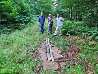 We stopped at two places on the Big Rock Trail just before Times Square to fill in some muddy spots with rocks. There was a ready supply of stones and Cindy did an expert job of supervising the placement of the stepping stones. Times Square was almost dry as we passed through so it was hard to assess the best course of action for this muddy area. We continued on around the pond on the Logger's Loop and continued to find most areas relatively dry and without mud. There was a lot of long grass and weeds in some areas. These will be cleared by the campers from the DEC conservation camp in the near future. We passed by several damp places but stopped at the one at the top of the hill. This spot was wet and muddy despite the fact that most others were dry. We decided to fill it in but initially could not find enough appropriate stones. I went to try out my new Council Tools Velvicut felling axe to section a small tree to produce logs sufficient to bridge the muddy area. I sued the axe and my Silky saw to section a small tree and got two good pieces 1to lay lengthwise across the area. By the time I was through Randy and Avi had found enough stones to place on both sides of the logs to stabilize them. We were happy with our work but I will return to this area to add another two sections of wood. We continued our walk back to the parking area. It was 12:30 PM and we had spent about 2 hours working on the trails. Our next outing may include some of the other trails in the area or perhaps a trip to Long Pond or Trout Pond.
![]()
![]()
![]()
![]() On Friday, July 31st, I wanted to get out for another hike on the Finger Lakes Trail. I decided to hike a section of map 16 from Boylan Road to Stevenson Forest Preserve on Trumble Corners Road where I had left off on a previous hike. The distance out seemed to be only 5.4 miles back and I planned to use local roads to form a loop with the return portion being the same length or less. When I got up at 6:10 AM the temperature was 56 degrees and there was a lot of fog in the valley. We left Livingston Manor at right around 6:30 AM and as I drove north on State Route 17 the fog began to lift and the temperature rose into the low 60's. I continued on Route 17 to exit 64 at Owego and headed north from there on Route 96 through Candor and Spencer. North of Spencer I picked up Newfield depot Road and followed it into Newfield where I picked up Trumbull Corners Road and continued to head west. Trumbull Corners Road changed to Blovsky Hill Road and then to Carter Creek Road. Somewhere along this route the paved road turned to gravel. I turned north on Lloyd Starkes Road and entered the Connecticut Hill Wildlife Management Area. This road was marked "Seasonal Maintenance" and as I started out I wondered whether or not I had made the right choice. The road proved to be rough but passable and when it ended I made a hard left onto Boylan Road. The road was dirt and gravel but inn pretty good shape until Hulford Road where there was another "Seasonal Maintenance" sign. Fortunately, the Finger Lakes Trail crossed the road just beyond the intersection. When we arrived just before 9:15 AM, I was surprised to find a car parked on the left side of the road taking up both parking places. There was a wide spot on the left shoulder so I pulled over and parked there. I applied some insect repellant and we began our hike at 9:15 Am by crossing the road and walking southwest on the road to enter the woods just passed the other parked car. Sheila was happy to be out again and was "up" the trail before I even noticed. The trail was very well marked and seemed well used also. It was also relatively dry and remained that way for most of the hike. We started by heading northeast and descending to Connecticut Hill Road which we reached at .7 miles. We crossed the road and turned right to walk east bit and then turned north into the woods again. At 1.3 miles we headed due north along a property line and the turned due west at 1.7 miles continuing to walk between private property and state land. At some point Sheila alerted and I looked up to see a group of 8 trail runners coming toward us. They said hello and made comments about the "cute dog". We continued uphill and northwest to cross Tower Road at 2 miles. At 2.2 miles we passed over the summit of Connecticut Hill which at 2100 feet is the highest1 spot on the Finger Lakes Trail for 40 miles around.
On Friday, July 31st, I wanted to get out for another hike on the Finger Lakes Trail. I decided to hike a section of map 16 from Boylan Road to Stevenson Forest Preserve on Trumble Corners Road where I had left off on a previous hike. The distance out seemed to be only 5.4 miles back and I planned to use local roads to form a loop with the return portion being the same length or less. When I got up at 6:10 AM the temperature was 56 degrees and there was a lot of fog in the valley. We left Livingston Manor at right around 6:30 AM and as I drove north on State Route 17 the fog began to lift and the temperature rose into the low 60's. I continued on Route 17 to exit 64 at Owego and headed north from there on Route 96 through Candor and Spencer. North of Spencer I picked up Newfield depot Road and followed it into Newfield where I picked up Trumbull Corners Road and continued to head west. Trumbull Corners Road changed to Blovsky Hill Road and then to Carter Creek Road. Somewhere along this route the paved road turned to gravel. I turned north on Lloyd Starkes Road and entered the Connecticut Hill Wildlife Management Area. This road was marked "Seasonal Maintenance" and as I started out I wondered whether or not I had made the right choice. The road proved to be rough but passable and when it ended I made a hard left onto Boylan Road. The road was dirt and gravel but inn pretty good shape until Hulford Road where there was another "Seasonal Maintenance" sign. Fortunately, the Finger Lakes Trail crossed the road just beyond the intersection. When we arrived just before 9:15 AM, I was surprised to find a car parked on the left side of the road taking up both parking places. There was a wide spot on the left shoulder so I pulled over and parked there. I applied some insect repellant and we began our hike at 9:15 Am by crossing the road and walking southwest on the road to enter the woods just passed the other parked car. Sheila was happy to be out again and was "up" the trail before I even noticed. The trail was very well marked and seemed well used also. It was also relatively dry and remained that way for most of the hike. We started by heading northeast and descending to Connecticut Hill Road which we reached at .7 miles. We crossed the road and turned right to walk east bit and then turned north into the woods again. At 1.3 miles we headed due north along a property line and the turned due west at 1.7 miles continuing to walk between private property and state land. At some point Sheila alerted and I looked up to see a group of 8 trail runners coming toward us. They said hello and made comments about the "cute dog". We continued uphill and northwest to cross Tower Road at 2 miles. At 2.2 miles we passed over the summit of Connecticut Hill which at 2100 feet is the highest1 spot on the Finger Lakes Trail for 40 miles around.
I knew that we would end up at about 1300 feet at Stevenson Forest Preserve meaning we would have to drop about 800 feet in elevation. This also meant the return trip would have some climbing to get back to the car at 1935 feet! From the top of the hill we headed northeast and continued to descend crossing Cayutaville Road at 2.75 miles. We turned right on the road and walked southeast briefly before reentering the woods and heading north toward Griffin Road. By the time we hit Griffin Road at 3.45 miles we had only dropped 290 feet. From here to Stevenson Forest Preserve the trail followed local roads so I stowed my poles and put Sheila on her leash. I got us both a drink and we turned right on the road to head east still descending. We followed Griffin Road east and then north to where it intersected Connecticut Hill Road at 4.1 miles. We continued north ion Connecticut Hill Road to 4.6 miles where Rumsey Hill Road turned right. We turned right and followed Rumsey Hill road east dropping 300 feet in .6 miles. At the intersection with Trumbull Corners Road we turned left and walked .35 miles to the parking area for Stevenson Forest Preserve. We were now at the lowest elevation on the hike at 1250 feet and the rest of the hike would be mostly uphill. I had planned to use some roads to the west of the trail to return but when I looked at the map I reconsidered. We walked back up Trumble Corners Road heading south and gaining some elevation. At 6.2 miles we followed the road as it made a left turn and followed it again at 6.5 miles when it made a right turn heading south. At 7.5 miles we turned right on Cayutaville Road and followed that only .1 miles uphill before bearing left on another version of Connecticut Hill Road. As we walked along this road a man came out to check his mailbox with his dog. Sheila greeted the dog and they got along well. I chatted for a minute with the gentleman and then headed on down the road. At 8.8 miles we came to the intersection of Lloyd Stakes Road and Boylan Road where we stayed to the left on Boylan Road. We had been walking on gravel and dirt roads for some time but Boylan road was a little rougher. As we walked I was surprised to see a vehicle with Tompkins County plates parked along the side of the road with no one around. After passing this car we began our last 250 feet of climbing. Along the way there was another car parked on the side of the road. This time I could see the driver in the woods and hear a beeping noise. I recognized that he was using metal detector. When I asked what he was looking for, he responded that there was an old foundation and he was looking for whatever he could find. We continued up the hill passing Hulford Road on the left and finally arriving at the car at 1:00 PM. The hike was shorter than I planned covering only 9.9 miles in 3 hours and 45 minutes. We had climbed 1480 feet which was less than on most hikes. I had tried to find some places to take pictures but although it was a pleasant walk there were no outstanding opportunities to take any shots. The temperature had risen to 74 degrees which was 14 degrees less than the hike a few days before. I briefly considered adding a few more miles but decided to save them for the next hike.
![]()
![]()
![]()
![]() On Tuesday, July 28th, I wanted to get out for another hike on the Finger Lakes Trail. I decided to hike a section of map 16 from Stevenson Forest Preserve on Trumble Corners Road to Rt 13 near Robert Treman State Park where I had left off on a previous hike. The distance of the hike was hard to judge precisely since a trail closing and a missing bridge forced two changes in the trail. Of course, the problem is that I usually have to hike both ways as I have no ride back from the end point. This means hiking, for example, hiking 12 miles to get a 6 mile section of trail. On many hikes I have used other trails of road walks to avoid a strict out-and-back which can be extremely boring! I was also concerned about the forecast for temperatures into the upper 80's and high humidity. When I got up the temperature was 62 degrees and there was a lot of fog in the valley. We left Livingston Manor at right around 6:30 AM and as I drove north on State Route 17 the fog began to lift and the temperature rose into the high 60's. I continued on Route 17 to exit 64 at Owego and headed north from there on Route 96 through Candor and Spencer. I began to think about the hiking conditions and decided that parking sooner meant I could hike sooner. I decided to park in the parking area off Route 13 where I had turned around on my last hike. Route 96 picks up the designation of Route 34 at some point and then merges with Route 13. As the roads all came together, I recognized the ending point of my last hike and turned left into the parking area on the east side of the road. When I opened the car door, I could feel the humidity which made me feel it was much hotter than the 70 degrees that was registering on my car thermometer. We started our hike at 8:55 AM by walking under the road bridge along Enfield Creek and following the white blazes through a flat and damp area with plenty of insects. I had put Sheila on her leash and left my poles collapsed in my pack until I knew the location of the trail and how many people we might meet. The trail crossed a park road and continued through some damp areas. I decided to let Sheila off her leash, get out my poles and apply a liberal amount of insect repellant! Soon we began to climb to the rim of the gorge cut by Enfield Creek. I don't know why it didn't occur to me that there would be a significant amount of elevation gain since I knew that Enfield Creek was the lowest point on the Finger Lakes Trail! At about a mile we came to the Sierra Shelter and I missed the turn that the trail takes just before the shelter. The turn was not marked but, fortunately, Sheila doesn't need the blazes. The next section of trail was overgrown and did not look like anyone had trimmed it in some time. I found this to be true in several places and was surprised since I though this would be a popular area to hike. At around 2 miles most of our climbing was done and we had gains about 630 feet since we left the car.
On Tuesday, July 28th, I wanted to get out for another hike on the Finger Lakes Trail. I decided to hike a section of map 16 from Stevenson Forest Preserve on Trumble Corners Road to Rt 13 near Robert Treman State Park where I had left off on a previous hike. The distance of the hike was hard to judge precisely since a trail closing and a missing bridge forced two changes in the trail. Of course, the problem is that I usually have to hike both ways as I have no ride back from the end point. This means hiking, for example, hiking 12 miles to get a 6 mile section of trail. On many hikes I have used other trails of road walks to avoid a strict out-and-back which can be extremely boring! I was also concerned about the forecast for temperatures into the upper 80's and high humidity. When I got up the temperature was 62 degrees and there was a lot of fog in the valley. We left Livingston Manor at right around 6:30 AM and as I drove north on State Route 17 the fog began to lift and the temperature rose into the high 60's. I continued on Route 17 to exit 64 at Owego and headed north from there on Route 96 through Candor and Spencer. I began to think about the hiking conditions and decided that parking sooner meant I could hike sooner. I decided to park in the parking area off Route 13 where I had turned around on my last hike. Route 96 picks up the designation of Route 34 at some point and then merges with Route 13. As the roads all came together, I recognized the ending point of my last hike and turned left into the parking area on the east side of the road. When I opened the car door, I could feel the humidity which made me feel it was much hotter than the 70 degrees that was registering on my car thermometer. We started our hike at 8:55 AM by walking under the road bridge along Enfield Creek and following the white blazes through a flat and damp area with plenty of insects. I had put Sheila on her leash and left my poles collapsed in my pack until I knew the location of the trail and how many people we might meet. The trail crossed a park road and continued through some damp areas. I decided to let Sheila off her leash, get out my poles and apply a liberal amount of insect repellant! Soon we began to climb to the rim of the gorge cut by Enfield Creek. I don't know why it didn't occur to me that there would be a significant amount of elevation gain since I knew that Enfield Creek was the lowest point on the Finger Lakes Trail! At about a mile we came to the Sierra Shelter and I missed the turn that the trail takes just before the shelter. The turn was not marked but, fortunately, Sheila doesn't need the blazes. The next section of trail was overgrown and did not look like anyone had trimmed it in some time. I found this to be true in several places and was surprised since I though this would be a popular area to hike. At around 2 miles most of our climbing was done and we had gains about 630 feet since we left the car.
I could hear the water in Enfield Creek as it flowed over various cascades and waterfalls and I regretted that I would not have enough time walk down to the trails that run along the gorge. In the woods it stilled seemed cool but the humidity was high. We walked west for some time through stands of red pine and some hardwood. The trail rolled some especially when we came to small tributaries of the main creek. At 2.25 miles we began to head northwest sticking to a route that parallel the creek but we were well above it and it was out of sight. At 2.9 miles started to head southwest joining park road briefly and then entering the forest again. We came to a Y in the trail where the main Finger Lakes Trail continued straight ahead toward the bridge of the Fish Kill. The bridge had been recently washed away so we stayed to the left and walked out to Butternut Creek Road. We turned right on this gravel road and walked first downhill and then uphill to 3.7 miles where the road joined Van Ostrand Road. Soon we turned right on Douglas Road and the stayed to the right on Stonehouse Road. This road took use north and uphill for about .7 miles to Woodard Road at 4.5 miles. We turned right and walked less than half a mile to where the Finger Lakes Trail crossed the road. The sign on the right side of the road announced the bridge was out but indicated it was only 3.5 miles back to where we had parked. We had already walked 5 miles so the detour had added about 1.5 miles to the hike. The roads we had been walking were all gravel and there was some shade. I was already noticing a significant difference between the sunny and shaded areas! We turned left into the woods and headed north and northwest generally following Enfield Creek. Parts of this section of trail had not been trimmed in some time especially those near the stream bed crossings. We were close to the creek but I could also hear the traffic on Route 327. At 5.9 miles the trail turned left and we started heading southwest toward Hines Road. We hit Hines Road at 6.35 miles and I saw it was 11:30 AM. I was happy with our pace but wasn't sure we could make it to Stevenson Forest and make it back during the hottest part of the day. We turned right on Hines Road and walked due north for a quarter mile to Rockwell Road. I decided to continue thinking we might turn around at the Rieman Woods bivouac area. We turned left on Rockwell Road and began to walk due west toward Potter Hill Road. I knew from the trail description that there should be a trail on the left at about .75 miles but I could not find it. This was the area where part of the trail had been closed by a landowner and it was only another .25 miles to Potter Hill Road. We stayed on Rockwell Road and turned left on Potter Hill Road. Just after the turn I could see where the trail entered the woods but I knew there was another crossing at the top of the hill. The road was steep but we only had to walk .15 miles before turning into right into the woods. I am not sure why the main trail goes to the bivouac area but we walked uphill to 7.75 miles where the trail made a sharp right to head back of to the road. The quarter mile hike back out to Potter Hill Road was all downhill.
We turned left on Potter Hill Road and began to walk north to Trumbull Corners Road. I was really beginning to feel the heat and humidity. The walk on Potter Hill Road was all downhill and was only .5 miles. I decided we would turn left and hike the loop through Stevenson Forest Preserve as I had originally planned. I knew this was risky but I planned to walk back on Route 327 which would cut the mileage and allow us to keep a pace of over 3 mph. We turned left on Trumbull Corners Road and walked slightly uphill until I saw the white blazes enter the woods just after we crossed a creek on a road bridge. We turned right into the woods and I immediately lost the blazes. Sheila had no problem finding the trail and we started to climb a steep pitch. The entire loop was less than a mile and was not very interesting save for the large hemlock trees. The map had a blue trail that was supposed to have a view. I found only a red trail and did not want to try any more distance as I estimated we were still about 6 miles from the car. When we came out into the parking area for the preserve we turned left and walked 2. miles back to where we entered the woods. We continued on Trumbull Corners Road passing the turn on Potter Hill Road and walking out to Route 327. We turned right on Route 327. We had started back at 1:15 PM and I knew we probably had about 2 more hours of hiking which meant we would still be out at the hottest part of the day. We were at an elevation of about 1100 feet and the car was at about 425 feet so I hoped the return route would be all downhill. I was wrong as there were several short climbs along the way. Both Sheila and I could feel the heat beating down on us. The humidity made it difficult for sweat to evaporate and cool me off. I allowed Sheila to get herself wet in every little stream we came across and we stopped several times in the shade so that we could get a drink. Finally at 13.4 miles there were no more climbs and our pace increased as we headed downhill to Route 13. We passed the entrance to Robert Treman Park and then walked out to Route 13 where we turned right. Crossing wasn't easy but soon we were heading south back to the car. We arrived at 3:00 PM having hiked 15.5 miles in a little over 6 hours with an elevation gain of 2130 feet. The car thermometer read 88 degrees!
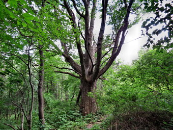
![]()
![]()
![]()
![]()
![]() On Saturday, July 25th, I wanted to get out for another hike on the Finger Lakes Trail. The last section of map 17 for me was the first section of the map running 7.3 miles from Route 13 near Ithaca to Comfort Road where I had started my last hike. Of course, the problem is that I usually have to hike both ways as I have no ride back from the end point. This means hiking, for example, hiking 12 miles to get a 6 mile section of trail. On many hikes I have used other trails of road walks to avoid a strict out-and-back which can be extremely boring! The problem with the section I chose was that there was some question about crossing the Cayuga Inlet right at the beginning of the hike. Flooding had deepened and widened the stream which might make it impassable. The railroad bridge over the stream is in use and is a privately owned structure. After thinking about the situation, I decided to park at Comfort Road and hike east to west. This way I could get in a good hike and decide what to do when I got to the stream. When I got up the temperature was 53 degrees and there was a lot of fog in the valley. I checked the weather forecast and found sunny skies and temperatures in the mid 70's with a chance of thunderstorms around 4:00 PM. The forecast of storms did not make me happy but I wasn't going to let that ruin what I had planned. We left Livingston Manor at 7:15 Am and as I drove north on State Route 17 the fog began to lift and the temperature rose into the 60's. I continued on Route 17 to exit 64 at Owego and headed north from there on Route 96 and Route 96B. After passing through Candor I began to look for Bald Hill Road which I found just after the "Welcome to Danby" sign. I turned left and continued for about .7 miles before making a right on Leib Road. At the end of Lieb Road I turned left on dirt and gravel Comfort Road. After only .2 miles I found the point where the Finger Lakes Trail joined the road from the west. I turned around and parked in a wide spot on the east side of the road. I got out my pack, took off my light jacket and put on some insect repellant. The temperature was 64 degrees with some sun and clouds in the sky. We started our hike at 8:55 AM by walking across the road to pick up the trail as it headed west from Comfort Road. The trail was initially wet and we descended to an abandoned road. After this, we followed a contour line without gaining or losing much elevation until the trail turned north at 2.4 miles. We dropped a little to Bruce Hill Road at 2.7 miles and turned left to briefly follow the road until turning into the woods again.
On Saturday, July 25th, I wanted to get out for another hike on the Finger Lakes Trail. The last section of map 17 for me was the first section of the map running 7.3 miles from Route 13 near Ithaca to Comfort Road where I had started my last hike. Of course, the problem is that I usually have to hike both ways as I have no ride back from the end point. This means hiking, for example, hiking 12 miles to get a 6 mile section of trail. On many hikes I have used other trails of road walks to avoid a strict out-and-back which can be extremely boring! The problem with the section I chose was that there was some question about crossing the Cayuga Inlet right at the beginning of the hike. Flooding had deepened and widened the stream which might make it impassable. The railroad bridge over the stream is in use and is a privately owned structure. After thinking about the situation, I decided to park at Comfort Road and hike east to west. This way I could get in a good hike and decide what to do when I got to the stream. When I got up the temperature was 53 degrees and there was a lot of fog in the valley. I checked the weather forecast and found sunny skies and temperatures in the mid 70's with a chance of thunderstorms around 4:00 PM. The forecast of storms did not make me happy but I wasn't going to let that ruin what I had planned. We left Livingston Manor at 7:15 Am and as I drove north on State Route 17 the fog began to lift and the temperature rose into the 60's. I continued on Route 17 to exit 64 at Owego and headed north from there on Route 96 and Route 96B. After passing through Candor I began to look for Bald Hill Road which I found just after the "Welcome to Danby" sign. I turned left and continued for about .7 miles before making a right on Leib Road. At the end of Lieb Road I turned left on dirt and gravel Comfort Road. After only .2 miles I found the point where the Finger Lakes Trail joined the road from the west. I turned around and parked in a wide spot on the east side of the road. I got out my pack, took off my light jacket and put on some insect repellant. The temperature was 64 degrees with some sun and clouds in the sky. We started our hike at 8:55 AM by walking across the road to pick up the trail as it headed west from Comfort Road. The trail was initially wet and we descended to an abandoned road. After this, we followed a contour line without gaining or losing much elevation until the trail turned north at 2.4 miles. We dropped a little to Bruce Hill Road at 2.7 miles and turned left to briefly follow the road until turning into the woods again.
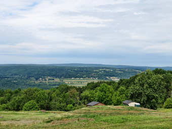 Shortly after entering the woods we came to a double tree trunk and a large tree beyond it. I stopped to take a few pictures before we continued on. After this we made a slight swing to the east to avoid a deep gully formed by a tributary to the Cayuga Inlet. We came out of the woods into a field and I could not see any blazes. Even after walking across the field there were none I could see. I knew We were headed in the right direction so I walked across another field and eventually found some blazes to follow. We again came out into a field and I spotted a blaze on a tree near the middle of the field. After that blaze, there were no others I could spot. I checked by compass and decided to follow the western edge of a field. As we continued, I spotted several old, faded white blazes. As we were about to enter the woods again, there was a nice view to the west. I stopped to take some shots and noticed the gathering clouds and darkening sky. It was still before noon so I felt we had some time yet before the rains came. We came to the edge of a field and crossed a road or driveway and found a woods road. This was the end of Town Line Road which was grass at this point. Our pace picked up as the path here was clear. At 4.25 miles we came to the intersection with Layen Road. Both Town Line Road and Layen Road were gravel covered at this point so I got out my poles and put Sheila on her leash. I though about walking back on the roads at that point and repositioning the car to minimize the chance of getting caught in a downpour. I decided to continue on Town Line Road to the next parking area and then turn back. Our pace picked up significantly as we hiked down Town Line Road since the surface was firm and we were losing elevation. There were nice views to the left but the clouds continued to get darker. The road was absolutely straight and we soon crossed West Jersey Hill Road and continued toward the next parking area. In 1.5 miles on Town Line road we lost 375 feet and arrived at a right turn where there was supposed to be parking. I didn't find any so we continued on the road until it crossed a bridge over Lick Brook and we came to the Sweedler Nature Preserve owned by the Finger Lakes Land Trust. From the bridge I could see a deep gorge cut by this little brook. I was too interested to turn back at this point and made the commitment to go as far as we could.
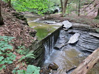 There were several cars parked at the Preserve as it is a popular destination and has several different trail. Just after the bridge we turned left at 5.9 miles to follow the Finger Lakes Trail down through the gorge. I stopped once or twice to take a few pictures and we met two men hiking up toward the road. There were several small falls and many interesting rock formations along the gorge. At 6.2 miles we came to the upper falls but I could not get a good angle to take pictures. Just after this the Finger Lakes Trail headed away from the gorge to take a slightly less steep route. The blue Lick Gorge Trail stayed to the left along the gorge. We turned right to follow the Finger Lakes Trail and I decided that we would come back on the blue trail if at all possible. At 6.3 miles a short spur trail connected the two trails and there was a large group of adults, children and dogs on that trail. We turned a little to the right here to follow the Finger Lakes Trail across a stream and to continue our descent along a spit of land that took us between Lick Brook on the left and another stream on the right. At 6.7 miles we made almost a 180 degree turn and headed down to Lick Brook again. The trail took us passed the bottom of the lower falls and I stopped to take a few shots but the falls didn't have much water and was largely hidden. We continued along the trail and overtook a young man hiking in front of us. I asked him about the crossing of Cayuga Inlet but he was also new to the area. When we got to the inlet, the water was much lower than I expected although it was wide. The evidence of flooding was obvious. Sheila had no problem making the crossing and I found a way that kept my equipment dry. This is the lowest point on the Finger Lakes Trail at about 425 feet! Since turning off the road and into the gorge area we had lost 650 feet and we were over 1100 feet lower than where the car was parked. On the other side we hiked out to a field and continued to follow the blazes to a large parking area on the east side of Route 13. I noticed that the blazes went under a bridge across Enfield Creek and we walked to the other side at which point I felt we had accomplished our mission. We turned around at 12:30 PM and headed back under dark skies.
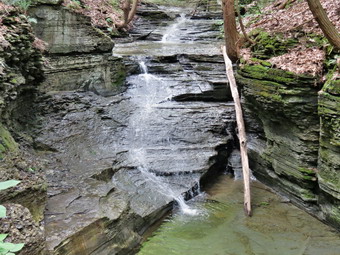 We caught up and passed two girls with a dog after crossing the creek and then met the large group of children and adults who were coming down the blue trail. We turned right and started to ascend the blue trail. I let Sheila off her leash and though about getting out my poles. The distance to where the blue trail met the Finger Lakes Trail and the slope leveled some was only .25 miles but in that distance we gained 350 feet for an average 24% slope. On the way up we met the two men from earlier in the hike. As the trail started to level out, I caught a glimpse of the upper falls through the leaves and took a few shots. We hurried up to the road where I put Sheila on her leash and turned right to start the road walk back. When we got to Town Line Road, I could see that it was more uphill than I thought but we kept our pace and were soon back at the intersection with Layen Road. Instead of taking the trail, we turned left and walked uphill on Layen Road. Our next turn was a right onto Jersey Hill Road and just after the turn a wind blew up and the rain started. I wasn't happy with the rain but really didn't want to think about a thunderstorm. I got out my rain jacket and stowed my electronics and wallet in a plastic bag. I also took out my pack cover for the first time to try it out. We were soon hiking again in a steady rain. The roads are very straight which makes the distances seem longer but we were soon passing Hilltop Road and I was looking for the turn onto Gunderman Road. There was some light in the skies and soon the rain slowed and then stopped. I took my hood down but left everything else the way it was. We turned onto Gunderman Road and were hiking toward Comfort Road when a light rain started again. We turned right onto Comfort Road and soon I could look ahead to see the junction with Lieb Road. Our car was only .2 miles away but up a small hill. We were back at the car by 2:45 PM having hiked 13.9 miles in 5 hours and 20 minutes with an elevation gain of 1984 feet. My pants were almost dry and the rain jacket had kept me drier than I thought it might.
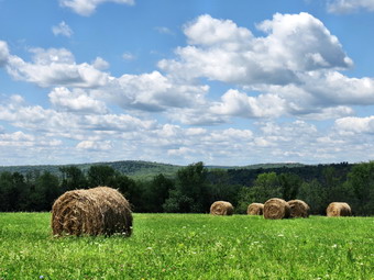
![]()
![]()
![]()
![]()
![]() On Thursday, July 23rd, I wanted to get out for another hike on my 63rd birthday. I decided I wanted return to the Finger Lakes Trail to the a section of map 17 which is the next map to the west of my completed sections. This section starts at the junction of Routes 96,13 and 34 near Ithaca and continues southeast for 19 miles to the intersection of Heisey Rd and Eastman Hill Rd northwest of Candor. Of course, the problem is that I usually have to hike both ways as I have no ride back from the end point. This means hiking, for example, hiking 12 miles to get a 6 mile section of trail. On many hikes I have used other trails of road walks to avoid a strict out-and-back which can be extremely boring! I checked the weather forecast when I got up found sunny skies and temperatures in the mid 70's with no chance of rain. I needed to return the power scythe to Al's Sport Shop in Downsville as Rick needed it on Friday. Since Al's opens at 6:00 AM, I got ready early and was leaving Livingston Manor at 6:15 AM. I had a little trouble convincing Sheila to leave that early but she was soon in the back seat. I took Route 206 to Downsville where I dropped off the power scythe and then took Route 30 back out the State Route 17. I decided to head for a six mile section of map 17 that is the next section on map 17 that I have not hiked. It seemed I could hike out on the trail starting at Comfort Road and ending at Fisher Settlement Rd where I had parked on my previous hike in the area. I could then use a combination of the trail and local roads to return. This time I continued on Route 17 to exit 64 at Owego and headed north from there on Route 96 and Route 96B. After passing through Candor I began to look for Bald Hill Road which I found just after the "Welcome to Danby" sign. I turned left and continued for about .7 miles before making a right on Leib Road. At the end of Lieb Road I turned left on dirt and gravel Comfort Road. After only .2 miles I found the point where the Finger Lakes Trail joined the road from the west. I turned around and parked in a wide spot on the east side of the road. I got out my pack, took off my light jacket and put Sheila on her leash. The temperature was 62 degrees with sunny skies and a slight breeze. We started our hike at 8:55 AM by walking south on Comfort Road for a mile. We passed one gentleman walking in the opposite direction and we both said "Hello". After a mile, we turned left into the woods at a clearly marked turn. A few feet into the woods I let Sheila off her leash, got out my poles and applied insect repellant. The trail was well-maintained and relatively dry as we headed and started to descend. We crossed Bald Hill Road at 1.4 miles and immediately re-entered the woods on the other side.
On Thursday, July 23rd, I wanted to get out for another hike on my 63rd birthday. I decided I wanted return to the Finger Lakes Trail to the a section of map 17 which is the next map to the west of my completed sections. This section starts at the junction of Routes 96,13 and 34 near Ithaca and continues southeast for 19 miles to the intersection of Heisey Rd and Eastman Hill Rd northwest of Candor. Of course, the problem is that I usually have to hike both ways as I have no ride back from the end point. This means hiking, for example, hiking 12 miles to get a 6 mile section of trail. On many hikes I have used other trails of road walks to avoid a strict out-and-back which can be extremely boring! I checked the weather forecast when I got up found sunny skies and temperatures in the mid 70's with no chance of rain. I needed to return the power scythe to Al's Sport Shop in Downsville as Rick needed it on Friday. Since Al's opens at 6:00 AM, I got ready early and was leaving Livingston Manor at 6:15 AM. I had a little trouble convincing Sheila to leave that early but she was soon in the back seat. I took Route 206 to Downsville where I dropped off the power scythe and then took Route 30 back out the State Route 17. I decided to head for a six mile section of map 17 that is the next section on map 17 that I have not hiked. It seemed I could hike out on the trail starting at Comfort Road and ending at Fisher Settlement Rd where I had parked on my previous hike in the area. I could then use a combination of the trail and local roads to return. This time I continued on Route 17 to exit 64 at Owego and headed north from there on Route 96 and Route 96B. After passing through Candor I began to look for Bald Hill Road which I found just after the "Welcome to Danby" sign. I turned left and continued for about .7 miles before making a right on Leib Road. At the end of Lieb Road I turned left on dirt and gravel Comfort Road. After only .2 miles I found the point where the Finger Lakes Trail joined the road from the west. I turned around and parked in a wide spot on the east side of the road. I got out my pack, took off my light jacket and put Sheila on her leash. The temperature was 62 degrees with sunny skies and a slight breeze. We started our hike at 8:55 AM by walking south on Comfort Road for a mile. We passed one gentleman walking in the opposite direction and we both said "Hello". After a mile, we turned left into the woods at a clearly marked turn. A few feet into the woods I let Sheila off her leash, got out my poles and applied insect repellant. The trail was well-maintained and relatively dry as we headed and started to descend. We crossed Bald Hill Road at 1.4 miles and immediately re-entered the woods on the other side.
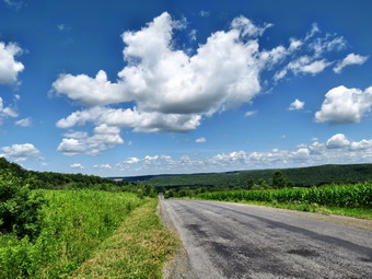 The trail passed through both hardwood and pine forests. There were several stands of red pine that had obviously been planted at some time. At 1.9 miles we approached the Chestnut lean-to and we could hear and see a large group camped there. I put Sheila on her leash so that she would not "visit" the group and we exchanged greetings as I walked by. Just after the lean-to the trail turned sharply right and came to a logging road. The road had been recently used by a skidder and I could not see the next white blazes. I started to walk on the road but noticed Sheila was slightly to the right in the woods. I followed her and found the trail! We continued to descend turning left onto a woods road as we approached Michigan Hollow Road. This area was a little wetter than where we had been walking but it was not very muddy. From Michigan Hollow Road, we continued heading south crossing washed-out Smiley Road and a small stream. The trail began to climb from 1290 feet at the road to 1630 feet at 4.1 miles where the trail turned east. On the way there were a few ups and downs. We crossed Hill Road at 4.2 miles and descended to a small stream that was almost dry. After a short ascent we crossed Curtis Road and 4.7 miles and again descended to a stream. This stream was wider and had a bridge. The stream must have been rerouted since the near end of the bridge was in the water. I used the bridge to cross while Sheila took the route through the stream. Her choice may have been better as the bridge did not seem stable. After crossing, I could not pick up any blazes so I turned to Sheila who was trotting off on the trail. Just after the stream, the trail turned northeast and then, at 5.3 miles, headed due east. We passed through some red pines while ascending and then began to descend to Fisher Settlement Road. Until this point the trail had been almost dry with a few muddy areas. As soon as we started to descend, we found the trail was very wet with deep muddy spots. These areas were hard to avoid since the trail was bordered by briars and wild roses. I was glad when we cam to the road at 5.9 miles. We turned right to walk to the beginning of the next section of trail. I decided we would walk the roads back to the car so I stowed my poles and put Sheila on her leash. After getting a drink and a snack, we started our return trip.
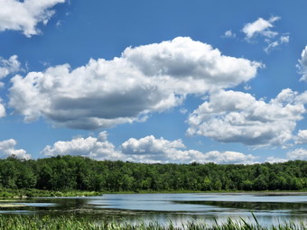 It wasn't clear to me the best route to take back to the car as there were several that seemed to be about the same distance. I decided to try to stay on some of the back roads instead of heading out to Route 96B with its fast-moving traffic. We walked out to South Danby Road and headed north to Hill Road which roughly parallels Route 96B. At 6.7 miles we turned left and started to ascend. I should have known what to expect from the name of the road! The walk to the next intersection was 1.2 miles and was pretty evenly divided between uphill and then downhill. At the intersection with Curtis Road I decided to turn right on Curtis Road and walk out to Route 96B. This seemed to be shorter than hiking to Michigan Hollow Road. We turned right on Curtis Road and found it also rolled some with an initial descent and then a short climb. At 8.6 miles I stopped to take a few pictures of some large round hay bales. The trees were green and the sky has blue with puffy white clouds. The road started to drop sharply at this point and there was a nice view of the valley below. I packed up the camera and we started the descent to Route 96B. At the road we turned left and walked a little over a mile to Bald Hill Road. We turned left and started to walk toward Leib Road. Before making the right turn, I stopped again to take a few shots at Jennings Pond which is part of Buttermilk Falls State Park. We continued our walk back to the car. As we turned left onto Comfort Road, I saw someone walking toward us and recognized him as the same man we had met much earlier. We greeted each other and continued in opposite directions. We were back at the car by 1:45 PM after hiking 12.3 miles in 4 hours and 50 minutes. Although the return trip was about a half mile longer it was more than 20 minutes faster even though I made several stops to take pictures.
![]()
![]()
![]()
![]()
![]() On Wednesday, July 22nd, I decided I wanted return to the Finger Lakes Trail my first section of map 17 which is the next map to the west of my completed sections. This section starts at the junction of Routes 96,13 and 34 near Ithaca and continues southeast for 19 miles to the intersection of Heisey Rd and Eastman Hill Rd northwest of Candor. Of course, the problem is that I usually have to hike both ways as I have no ride back from the end point. This means hiking, for example, hiking 12 miles to get a 6 mile section of trail. On many hikes I have used other trails of road walks to avoid a strict out-and-back which can be extremely boring! I checked the weather forecast when I got up found sunny skies and temperatures in the mid 70's with no chance of rain. I got ready and was leaving Livingston Manor at 7:30 AM. I decided to head for a six mile section of map 17 that is the last section on map 17 but the first one for me on this map. It seemed I could hike out on the trail starting at Fisher Settlement Road and ending at Heisey Rd where I had parked on my previous hike in the area. I could then use a combination of the trail and local roads to return. This time I took State Route 17 to exit 64 at Owego and headed north from there on Route 96 and Route 96B. After passing through Candor I began to look for South Danby Road on the right. I knew it wasn't too far passed were Heisey Road turns to the left off the main road. As I passed Heisey Road, I noticed two hikers heading southeast on Route 96B. They had large packs and I thought they were probably hiking a big section of the Finger Lakes Trail or perhaps the whole trail end-to-end. I though it was strange that they had bypassed Durfee Hill Road which was where the trail cut up to Heisey Road but I was sure they had their reasons. I found South Danby Road with no problem and turned left driving about 1.3 miles to Fisher Settlement Road. I turned right and drove another .3 miles to where the trail entered the woods on the left. I turned around and parked off the road on the grassy shoulder. I got out my pack, took off my light jacket, put on insect repellant, and got my poles ready. The temperature was 66 degrees with sunny skies and a slight breeze. We started our hike at 9:45 AM by into the woods on the trail heading generally east toward South Danby Road. We descended for .25 miles to South Danby Road and after crossing it began an ascent of about 300 feet over the next mile. At 1.3 miles the trail turned almost 90 degrees left and took us north toward Route 96B.
On Wednesday, July 22nd, I decided I wanted return to the Finger Lakes Trail my first section of map 17 which is the next map to the west of my completed sections. This section starts at the junction of Routes 96,13 and 34 near Ithaca and continues southeast for 19 miles to the intersection of Heisey Rd and Eastman Hill Rd northwest of Candor. Of course, the problem is that I usually have to hike both ways as I have no ride back from the end point. This means hiking, for example, hiking 12 miles to get a 6 mile section of trail. On many hikes I have used other trails of road walks to avoid a strict out-and-back which can be extremely boring! I checked the weather forecast when I got up found sunny skies and temperatures in the mid 70's with no chance of rain. I got ready and was leaving Livingston Manor at 7:30 AM. I decided to head for a six mile section of map 17 that is the last section on map 17 but the first one for me on this map. It seemed I could hike out on the trail starting at Fisher Settlement Road and ending at Heisey Rd where I had parked on my previous hike in the area. I could then use a combination of the trail and local roads to return. This time I took State Route 17 to exit 64 at Owego and headed north from there on Route 96 and Route 96B. After passing through Candor I began to look for South Danby Road on the right. I knew it wasn't too far passed were Heisey Road turns to the left off the main road. As I passed Heisey Road, I noticed two hikers heading southeast on Route 96B. They had large packs and I thought they were probably hiking a big section of the Finger Lakes Trail or perhaps the whole trail end-to-end. I though it was strange that they had bypassed Durfee Hill Road which was where the trail cut up to Heisey Road but I was sure they had their reasons. I found South Danby Road with no problem and turned left driving about 1.3 miles to Fisher Settlement Road. I turned right and drove another .3 miles to where the trail entered the woods on the left. I turned around and parked off the road on the grassy shoulder. I got out my pack, took off my light jacket, put on insect repellant, and got my poles ready. The temperature was 66 degrees with sunny skies and a slight breeze. We started our hike at 9:45 AM by into the woods on the trail heading generally east toward South Danby Road. We descended for .25 miles to South Danby Road and after crossing it began an ascent of about 300 feet over the next mile. At 1.3 miles the trail turned almost 90 degrees left and took us north toward Route 96B.
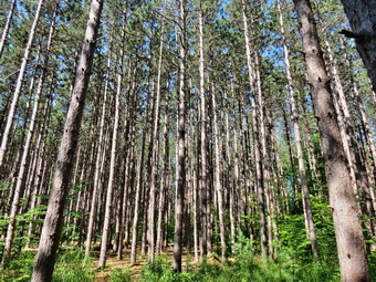 We descended slightly and then climbed to the highest point on the hike at 1760 feet at the 2 mile mark. Just after this the trail turned slightly to the left and a spur trail went to the Tamarack lean-to. I didn't see any activity there and decided not to visit. Several parts of the trail traveled through impressive stands of red pine that were obviously planted at one time. They were very tall and very regularly spaced and I took a few shots. Over the next mile to Route 96B we lost 560 feet heading north. There were some steep places and a few were slippery with mud. When we arrived at the road, I stopped to get a drink and take a couple of shots. I had Sheila on her leash for safety. A car approached and slowed and the driver asked if we were alright. She offered to give us a ride but I told her our plans and thanked her. Sheila and I crossed the road and picked up the trail as it turned right to parallel the road for .2 miles. The short section of trail ended at Durfee Hill Road and a sign post marked a turn. I follow the map and turned left to start the hike up Durfee Hill Road. Over the next .8 miles we gained about 430 feet in elevation. The road went from dirt and gravel to "Seasonal Maintenance" and I didn't see any white blazes until we got near the turn at the top. The next section of trail looked like it followed an old road from Durfee Hill Road, around a hill called Round Top and down to Heisey Road. The turn was right where it was supposed to be...and there was a sign that announced that the section of trail had been closed by the landowner. I thought I had checked the trail conditions on the Finger Lakes Trail Conference website but obviously had missed this change. I remembered the two hikers from earlier and knew why they had avoided Durfee Hill Road. I was annoyed at myself as we trekked back down the hill but I was also annoyed at the Finger Lakes Trail Conference for AGAIN selling me an inaccurate map. This change was made over a year ago and the map and GPX file had still not been changed! When we got back to Route 96B we turned left and walked along the shoulder for .2 miles to Heisey Road, I had debated whether to do this or not as I was under a time constraint but decided I would not be happy if I did not finish the hike.
 Over the next .5 miles we gained about 435 feet to the highest point on Heisey Road. The avenge grade was not even 14% but parts sure seemed steeper to me. I had Sheila on her leash and she did a good job of pulling me up the hill. I had avoided driving on Heisey Road on a previous hike but found the conditions good enough that a four-wheel drive vehicle with good ground clearance would be ok. He hiked won from the high point to the intersection with Eastman Hill Road. There was room to park one or two cars but the last part of Heisey Road was very washed out and would require some careful maneuvering in a vehicle. We turned around at 12:10 PM after hiking 5.8 miles. I knew the return trip would go faster without the error and because I was going to use the roads. When we got to Route 96B we turned right and walked 1.4 miles to South Danby Road. We turned left and walked uphill for 1.25 miles to Fisher Settlement Road. We turned right and walked the final .3 miles back to the car arriving at 1:30 PM. We had covered 9.6 miles in 3 hours and 40 minutes with an elevation gain of 1770 feet. The hike would have been only 8 miles without the mistake on Durfee Hill Road.
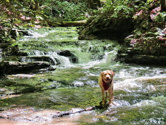
![]()
![]()
![]()
![]()
![]() On Monday, July 20th, I decided I wanted to hike a newly rerouted section of trail near Marathon. This section of trail used to head north on West River Road to Blodgett Mills and then south along Route 11 to Hoxie Gorge Road. This was necessitated because the Tioughnionga River flows between West River Road and Route 11 and there are a limited number of bridges. The new route travels south along West River Road to Route 392, crosses the river on a road bridge and then for only .7 miles. It then turns east onto Steve Russell Hill Road for 1.2 miles before cutting left into the woods. The rest of the trail flows a completely new route cut through Hoxie Gorge State Forest before joining the old trail near The Cornell property near Hoxie Gorge Road. The problem is that the whole section is over 10 miles making the round trip more than 20 miles which I do not feel comfortable doing in one day. I decided to break it into two section and had already hiked from West River Road to Steve Russell Hill Road a few days before. I tried to get out of Livingston Manor really early to hike in the cool of the morning and did succeed on leaving a little after 7:30 AM. As always Sheila was ready to go. The temperature when we left Livingston Manor was in the high 60's but was predicted to rise into the mid 80's. The skies sunny but a heavy fog hung in all the low-lying valleys for much of the drive. We stopped once on the way as I drove north and west on Route 17 and then north on I81 to Marathon. In Marathon I took Route 11 north for 3.5 miles to Steve Russell Hill Road on the right. I turned right onto this dirt and gravel road and passed under the high bridges for I81. I knew from the previous hike that where the road split I should continue straight ahead passing the "seasonal Maintenance" sign. What I did not know was whether or not I could make the .8 mile drive safely on a road with deep ruts and large rocks. I decided to try and was doing well until I encountered a tree that had just fallen across the road. I was able to get around it on the right but was reminded to bring along an axe next time. I have had trouble in the past finding where the Finger Lakes Trail crosses road or enters the woods. This time the spot was well marked and there was a wide spot on the left shoulder. I turned around and parked. When we got out of the car, I noticed that the temperature as already in the 70's and the humidity seemed higher than predicted. It had rained the night before and I could see that the vegetation was wet and assumed the trail would be also. Since there were a lot of insect already swarming, I applied insect repellant after taking off my light jacket. We entered the woods at 9:20 AM and immediately found a sign that warned about high porcupine activity. The sign suggested keeping dogs on a leash. I knew I could not use my poles and keep Sheila on a leash so I made sure here electronic collar was working. Unfortunately, I must have forgotten to turn it off after the last hike and it was not charged!
On Monday, July 20th, I decided I wanted to hike a newly rerouted section of trail near Marathon. This section of trail used to head north on West River Road to Blodgett Mills and then south along Route 11 to Hoxie Gorge Road. This was necessitated because the Tioughnionga River flows between West River Road and Route 11 and there are a limited number of bridges. The new route travels south along West River Road to Route 392, crosses the river on a road bridge and then for only .7 miles. It then turns east onto Steve Russell Hill Road for 1.2 miles before cutting left into the woods. The rest of the trail flows a completely new route cut through Hoxie Gorge State Forest before joining the old trail near The Cornell property near Hoxie Gorge Road. The problem is that the whole section is over 10 miles making the round trip more than 20 miles which I do not feel comfortable doing in one day. I decided to break it into two section and had already hiked from West River Road to Steve Russell Hill Road a few days before. I tried to get out of Livingston Manor really early to hike in the cool of the morning and did succeed on leaving a little after 7:30 AM. As always Sheila was ready to go. The temperature when we left Livingston Manor was in the high 60's but was predicted to rise into the mid 80's. The skies sunny but a heavy fog hung in all the low-lying valleys for much of the drive. We stopped once on the way as I drove north and west on Route 17 and then north on I81 to Marathon. In Marathon I took Route 11 north for 3.5 miles to Steve Russell Hill Road on the right. I turned right onto this dirt and gravel road and passed under the high bridges for I81. I knew from the previous hike that where the road split I should continue straight ahead passing the "seasonal Maintenance" sign. What I did not know was whether or not I could make the .8 mile drive safely on a road with deep ruts and large rocks. I decided to try and was doing well until I encountered a tree that had just fallen across the road. I was able to get around it on the right but was reminded to bring along an axe next time. I have had trouble in the past finding where the Finger Lakes Trail crosses road or enters the woods. This time the spot was well marked and there was a wide spot on the left shoulder. I turned around and parked. When we got out of the car, I noticed that the temperature as already in the 70's and the humidity seemed higher than predicted. It had rained the night before and I could see that the vegetation was wet and assumed the trail would be also. Since there were a lot of insect already swarming, I applied insect repellant after taking off my light jacket. We entered the woods at 9:20 AM and immediately found a sign that warned about high porcupine activity. The sign suggested keeping dogs on a leash. I knew I could not use my poles and keep Sheila on a leash so I made sure here electronic collar was working. Unfortunately, I must have forgotten to turn it off after the last hike and it was not charged!
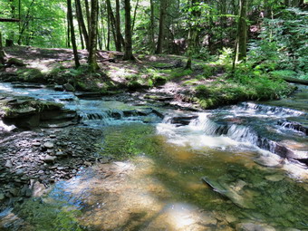 The trail initially dropped to a stream heading northwest. It was well-marked in most places but the surface on this day was slick and any descent was an adventure. At 1.2 miles the trail turned north and meander back and forth and up and down. At .8 miles we crossed a small stream on a bridge and came to a nice pond. I stopped to take some pictures and was surprised to find a healthy population of sunfish in the pond. After the pond he trail descended on some steps which were starting to come loose in the eroded soil. At 1.2 miles the trail turned north as we continued to cross small streams and make our way up, and down some hills. The traffic noise from I81 was obvious and at least once I could see the cars on the highway. Somewhere between 2 and 3 miles the blazing seemed to change for the worse. Some turns were not well-marked and the blazes became harder to spot and farther apart. At 3 miles we began an ascent of 350 feet and at 3.9 miles we picked up a woods road that led to a DEC dirt road. We walked along the road and hit the high point of the hike at 1770 feet 4.2 miles into the hike. From here the road descended to the Hoxie Gorge Freetown Road at 4.8 miles. The DEC road on the descent was part road and part river bed but was easier walking than the trail. We crossed the road to continue the hike to where the old trail used to come in from Hoxie Gorge Road. The trail was more of the same thing we had been hiking on with several small stream crossings and a generally muddy and slippery surface. Somewhere around 5.3 miles we came out onto a nice woods road and turned right to parallel a more substantial stream. As we walked along this road, I noticed several small cascades and thought about taking pictures on the way back. When I spotted a Cornell University Environmental sign, I knew we were close to our destination. We came to an area where a stream spread across the trail and the main Finger Lakes Trail turned right while a Cornell trail went left. The trail that went to the left used to be the main Finger Lakes Trail before the newest reroute. At this junction there was also an old stone bridge with a large culvert underneath it. I remembered the bridge and was surprised that it had deteriorated in two years.
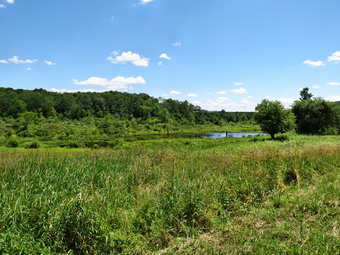 We turned around to head back but before we did I took some pictures of the bridge and the waterfall it created. On the way back I looked down into the gorge created by Hoxie Creek and saw a small cascade. I decided I wanted pictures so I went slip-sliding down the bank to the waters edge. The footing seemed extremely loose near the bottom and I noticed I had chosen a route that went through and old dump! I was concerned that some of the broken glass might cut Sheila's feet so I told her to stay away ROM that area. I dropped my pack at the edge of the creek and took a few pictures. I had not planned on how slippery the bank would be on the way back up but I used some handy trees to help me out. Sheila was standing at the top waiting for me. We stopped one more time at a point where two small creeks came together in miniature cascades. These stream form the headwaters of Hoxie Creek which flow north and then west into the Tioughnionga River. The hike back to Hoxie Gorge Freetown Road seemed to go quickly. At the road I got a drink and a snack as it was now 12:40 Pm and we had hiked 6.3 miles. I stowed by poles and put Sheila on her leash as I had decided to hike the local rods back to the car. We turned left and started to hike southeast along the road. I stopped in one spot to take some pictures of the green hills and blue sky with puffy clouds. There was also a field of cultivated blueberries and people were picking as we passed. At 8 miles we turned right on Merihew Road. It looked as if the road would ascend over a ridge but it skirted the ridge to my relief. I stopped again on this road to take a few shots of a wetlands. As we neared our final turn onto Steve Russell Hill Road a pit bull came out of a yard to greet us. I politely suggested he "Go home!" His owner came out to inform me that "He doesn't bite" and "He was just protecting the house". I reminded her that I was "on the road" and we continued our hike by turning right onto Steve Russell Hill Road to complete the loop. We walked uphill for about a quarter mile and as we did I picked up a Gerber folding knife lying by the side of the road. We walked downhill the final .7 miles to the car arriving back at 1:50 PM. We had hiked 9.8 miles in 4.5 hours with a vertical elevation gain of 1565 feet.
On Sunday, July 19th, I decided to head for Big Pond to do some trail maintenance on the Touch-Me-Not Trail from Big Pond to Little Pond. I recently adopted this trail for the Finger Lakes Trail Conference as it had not been maintained in a few years. This winter I hike the trail and lost the blazes several times when the trail was covered by deep snow. My intention is to clear the trail from Barkaboom Road to Beech Hill Road and then realize the sections that need it. I had already worked on the trail several weeks ago and had to remove several blowdowns before I could trim back the nettles and briars. By the time I got to the latter I was a little tired and was only able to trim the ones directly in the trail using my manual hedge trimmers. This time I was returning with a Stihl power Scythe on loan from the Finger Lakes Trail Conference. The Power Scythe is gas powered and has a cutting bar just less than 3 feet long! It cuts grass and weeds just fine but will also cut branches and brush! The drawback is that it weighs somewhere in the neighborhood of 15 pounds and requires a supply of gasoline. I knew this would be perfect for the work I had to do. I packed the essentials in an older pack and included a gallon of gas mixed with chainsaw oil. I disappointed Sheila by leaving her at home but the work I was doing was too dangerous to bring her along. I come to get to work early as the temperature was forecast to rise during the day. I drove up the Beaverkill Road and turned left onto the Barkaboom Road just before Turnwood. I drove to Big Pond and found several cars already there. After parking, I got out the power scythe, shouldered my pack and crossed the road to start my work. I had cleaned out a good part of the first part of the trail so I simply walked until I began to encounter some nettles. Already the power scythe seemed heavy! I dropped my tank, filled the gas tank and prayed it would start. I guess I need not have worried since it started right up and I got to work. I walked up the trail cutting on both sides as I went. The work seemed to go quickly and the power scythe seemed lighter in use. I got to the beginning of an ascent and stopped there. I left the power scythe and hiked back to get my pack. I was surprised how far I had come and as I hiked back up the trail, I decided I would try wearing the pack while working. I filled the gas tank again, stared it up and began cutting.
I was not easy to climb while carrying the power scythe and cut at the same time but I developed a technique. I had noticed when I stopped that I was a little hard of hearing and my hands would not stop tingling! I continued climbing and cutting nettles. They got more plentiful the higher I climbed although the trail was shaded and not particularly wet. I was careful to cut a wide swathe so that they would be less likely to grow back and block the trail again. I also cut back some brush, a few small trees and overhanging branches. At some point the nettles stopped and there wasn't too much to cut until the briars started. I attacked the briars as best I could but my arms were starting to get very tired. I noticed this more when I had to raise the tool to cut branches. The briars were harder to cut as they are thicker than nettles and tend to start farther back and hang out over the trail. In the end, they never had a chance. I though I would never get to the top of the ascent but eventually the ground leveled. I wanted to get to the trail junction as that was my goal and I remembered in needed some trimming. Of course, I ran out of gas at before getting there1 I decided to walk to the trail junction and refill the tank there. When I got to the junction, I filled the tank and took drank a lot of water. After starting the machine again, I cleared the junction and then began trimming on my way back to the car. I actually left the power scythe on for some time trimming a few things that I had missed on the way up. At one point I looked up to see a young man and woman hiking toward me in shorts. They said "hello" and asked about the distance to Cabot Mountain. I replied and suggested that shorts might not be the best choice for the nettles on the way to Cabot. When I got to the steeper descent, I shut down the power scythe and carried it the rest of the way. I WA sure it had gotten heavier and that it weighed more turn off than when cutting! I made it back to the car by 1:00 PM. I was glad since I was tired and there seemed to be thousands of small black flies on the trail on the way back!
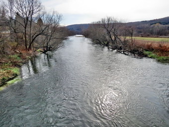
![]()
![]()
![]()
![]()
![]() On Saturday, July 18th, I decided I wanted to hike a newly rerouted section of trail near Marathon. This section of trail used to head north on West River Road to Blodgett Mills and then south along Route 11 to Hoxie Gorge Road. This was necessitated because the Tioughnionga River flows between West River Road and Route 11 and there are a limited number of bridges. The new route travels south along West River Road to Route 392, crosses the river on a road bridge and then for only .7 miles. It then turns east onto Steve Russell Hill Road for 1.2 miles before cutting left into the woods. The rest of the trail flows a completely new route cut through Hoxie Gorge State Forest before joining the old trail near The Cornell property near Hoxie Gorge Road. The problem is that the whole section is over 10 miles making the round trip more than 20 miles which I do not feel comfortable doing in one day. I decided to break it into two section and hike from West River Road to Steve Russell Hill Road first. I tried to get out of Livingston Manor really early to hike in the cool of the morning and did succeed on leaving by 8:30 AM. As always Sheila was ready to go. The temperature when we left Livingston Manor was only in the low 60's but was predicted to rise into the high 70's. The skies were overcast and I only saw the sun once or twice on the drive. We stopped once on the way as I drove north and west on Route 17 and then north on I81 to Marathon. In Marathon I took Route 11 north and then Route 392 west. After a very short distance on 392 I turned north on West River Road. The road was dirt and gravel with some large potholes. I drove slowly along the river and the railroad tracks until I arrived at the place we had left off on a previous hike where the trail meets the road and used to head north. I parked the car on the side of the road and found that I had left my GPS unit home. I knew I wouldn't need it for navigation but wanted to make sure I got a track of the hike. I decided that I could get a track by driving the route when I returned to hike the second section.
On Saturday, July 18th, I decided I wanted to hike a newly rerouted section of trail near Marathon. This section of trail used to head north on West River Road to Blodgett Mills and then south along Route 11 to Hoxie Gorge Road. This was necessitated because the Tioughnionga River flows between West River Road and Route 11 and there are a limited number of bridges. The new route travels south along West River Road to Route 392, crosses the river on a road bridge and then for only .7 miles. It then turns east onto Steve Russell Hill Road for 1.2 miles before cutting left into the woods. The rest of the trail flows a completely new route cut through Hoxie Gorge State Forest before joining the old trail near The Cornell property near Hoxie Gorge Road. The problem is that the whole section is over 10 miles making the round trip more than 20 miles which I do not feel comfortable doing in one day. I decided to break it into two section and hike from West River Road to Steve Russell Hill Road first. I tried to get out of Livingston Manor really early to hike in the cool of the morning and did succeed on leaving by 8:30 AM. As always Sheila was ready to go. The temperature when we left Livingston Manor was only in the low 60's but was predicted to rise into the high 70's. The skies were overcast and I only saw the sun once or twice on the drive. We stopped once on the way as I drove north and west on Route 17 and then north on I81 to Marathon. In Marathon I took Route 11 north and then Route 392 west. After a very short distance on 392 I turned north on West River Road. The road was dirt and gravel with some large potholes. I drove slowly along the river and the railroad tracks until I arrived at the place we had left off on a previous hike where the trail meets the road and used to head north. I parked the car on the side of the road and found that I had left my GPS unit home. I knew I wouldn't need it for navigation but wanted to make sure I got a track of the hike. I decided that I could get a track by driving the route when I returned to hike the second section.
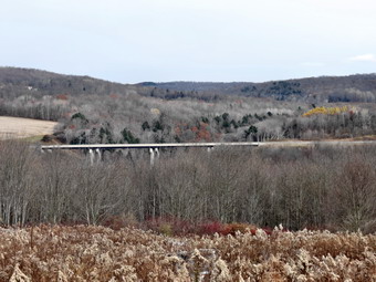 We were out and hiking at 9:30 AM heading south on West River Road to Route 392. The walk down West River Road was 3.9 miles paralleling the river and the railroad tracks all the way. There wasn't much to see as there are few houses. As we walked I kept watching the sky for signs of precipitation. At Route 392 we turned left and walked out to Route 11. Route 11 has a wide shoulder which is good since the traffic often appears to be exceeding the 55 MPH speed limit. We crossed the road and turned right to walk the .6 miles south to Steve Russell Hill Road. We turned left onto the road and began heading northeast passing under the high ridges for I81. Shortly after the bridges the road split with the better road headed right. We continued straight ahead toward Hoxie Gorge State Forest on a road marked as "Seasonal Maintenance". True to its name the road ascended about 340 feet over the next mile. I found myself wondering whether or not I could drive my car up the road. There were some serious gullies in the road and places where the center ridge was pretty high. When we got to 5.8 miles, I saw the FLT sign and white blazes going off to the left paralleling a stream. There was also a wide spot with room to park at least one car on the shoulder of the road. We turned around at a little passed 11:30 AM and started back down the road which went much faster than our ascent. We continued to retrace our route back to West River Road as I kept watching the sky. We were back at the car at 1:40 PM and stayed dry all the way. We had hiked 11.6 miles in just over 4 hours and had gained 740 feet in elevation.
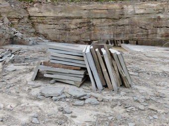
![]()
![]()
![]()
![]()
![]() On Friday, July 17th, I decided I wanted to hike the new section of the Finger Lakes Trail that starts at the Apex Bridge on the Cannonsville Reservoir and visits the Rock Rift Fire Tower. From the fire tower the trail heads west to join the existing trail near Faulkner Road. I had hike almost 10 miles the day before but was feeling good and wanted to do this hike. Sheila apparently was feeling good also as she ran around the house as I was getting ready! I got my gear and Sheila in the car and headed north and west on State Route 17 a little after 9:00 AM. I took exit 87 and followed Route 268 to the Apex Bridge over the Cannonsville Reservoir and turned left to drive north on Route 10. I was looking for the point where the trail crossed the road. I thought that to add some variety to the hike I would hike up the newest part of the trail to the fire tower since I had never been that way before. When I got to Dryden Brook Road, I knew I had gone too far. I turned around and tried to find where the trail crossed but gave up and went back to the bridge and parked in the large lot on the left. We got ready to start the hike by walking across the road and turning right. As we walked along the shoulder of the road, I kept looking for the trail but could not find it. We turned around to walk back toward the bridge. At 10:10 AM we passed the bridge and walked a very short distance north on Route 10 to the first section of guardrail. I found that this is where the trail starts! The beginning of the trail was rather steep but it soon leveled off and began to descend a little. The trail rolled through some gullies and finally at 1.25 miles turned left onto the woods road that once acted as an access road to the tower. I knew that the climb to the tower was steep in places but that the crew who had constructed the trail built in a few switchbacks to help. On this day the trail was pretty dry with only a few muddy spots here and there. What I did notice was that there were plenty of biting insects! Sheila and I climbed the familiar trail keeping a pretty steady pace despite the steep sections. The trail was pretty clean with only a few branches here and there. Over the next 1.5 miles we headed due north gaining a total of over 1400 feet from where we had parked. The difference in elevation from the pointed where we had turned onto the woods road was over a 1000 feet and several ascents were more than a 25% grade. By 11:45 AM we had hiked 2.8 miles are were at the base of the tower. I dropped my pack and got out the camera to take a few pictures. The bottom flights of stairs have been removed from the tower to discourage anyone from ascending and the cab is in disrepair. There is a plan to restore the tower which would be a wonderful project. When I stowed my camera, I got us a drink and a snack and spread insect repellant liberally.
On Friday, July 17th, I decided I wanted to hike the new section of the Finger Lakes Trail that starts at the Apex Bridge on the Cannonsville Reservoir and visits the Rock Rift Fire Tower. From the fire tower the trail heads west to join the existing trail near Faulkner Road. I had hike almost 10 miles the day before but was feeling good and wanted to do this hike. Sheila apparently was feeling good also as she ran around the house as I was getting ready! I got my gear and Sheila in the car and headed north and west on State Route 17 a little after 9:00 AM. I took exit 87 and followed Route 268 to the Apex Bridge over the Cannonsville Reservoir and turned left to drive north on Route 10. I was looking for the point where the trail crossed the road. I thought that to add some variety to the hike I would hike up the newest part of the trail to the fire tower since I had never been that way before. When I got to Dryden Brook Road, I knew I had gone too far. I turned around and tried to find where the trail crossed but gave up and went back to the bridge and parked in the large lot on the left. We got ready to start the hike by walking across the road and turning right. As we walked along the shoulder of the road, I kept looking for the trail but could not find it. We turned around to walk back toward the bridge. At 10:10 AM we passed the bridge and walked a very short distance north on Route 10 to the first section of guardrail. I found that this is where the trail starts! The beginning of the trail was rather steep but it soon leveled off and began to descend a little. The trail rolled through some gullies and finally at 1.25 miles turned left onto the woods road that once acted as an access road to the tower. I knew that the climb to the tower was steep in places but that the crew who had constructed the trail built in a few switchbacks to help. On this day the trail was pretty dry with only a few muddy spots here and there. What I did notice was that there were plenty of biting insects! Sheila and I climbed the familiar trail keeping a pretty steady pace despite the steep sections. The trail was pretty clean with only a few branches here and there. Over the next 1.5 miles we headed due north gaining a total of over 1400 feet from where we had parked. The difference in elevation from the pointed where we had turned onto the woods road was over a 1000 feet and several ascents were more than a 25% grade. By 11:45 AM we had hiked 2.8 miles are were at the base of the tower. I dropped my pack and got out the camera to take a few pictures. The bottom flights of stairs have been removed from the tower to discourage anyone from ascending and the cab is in disrepair. There is a plan to restore the tower which would be a wonderful project. When I stowed my camera, I got us a drink and a snack and spread insect repellant liberally.
 The next part of the trail was completely new to me as we headed passed the tower following the white blazes. The crew that painted the trail has done a great job using black arrows on a white background to indicate major turns. We started to descend and I assumed this would continue. I was wrong. although the trail generally lost elevation there were times when we were climbing some also. At about 3.1 miles we came out onto dirt road and followed the blazes to a bluestone quarry at 3.4 miles. Stone is still being cut here but there was no work being done on this day. I stopped to take a few shots and was impressed that the stone was being cut with saws which made smooth cuts into the rock. We continued on the road through the other side of the quarry. Soon there was a turn to the right which was not marked but pretty obvious. We continued to follow various woods roads for the most part. Occasionally the trail would cut through the woods to get to the next road. At 3.7 miles the trail headed south instead of west and I wondered when we would start a descent since we were still at over 2100 feet. At 4.2 miles the trail again turned west and began a steep descent toward Faulkner Road. Over the next .7 miles we lost 750 feet of elevation for an average grade of 25%. By the time we reached the junction with the previous trail, my toes were hurting. I decided that I had already walked the short distance out to Faulkner Road and did not need to do it again. We turned left on the "old" trail at 4.9 miles and walked downhill another .2 miles to Route 10. As we walked out onto the road, I turned to look at how the trail was marked. The markings were obvious and I couldn't figure out how I had missed them while driving! We turned left on Route 10 and started walking south and east on the wide shoulders. The temperature was considerably warmer in the open but the walk was only 1.6 miles which we covered in 30 minutes. We were back at the parking area at 1:35 PM having covered 6.7 miles in 3 hours and 20 minutes. I left Sheila in the car and walked out onto the Apex Bridge to take a few pictures before returning to the car.
![]()
![]()
![]()
![]()
![]() On Thursday, July 16th, I decided I wanted return to the Finger Lakes Trail to the first section of map 18 which is the next map to the west of my completed sections. This section starts at Heisey Road near Route 119 southeast of Ithaca and continues for over 23 miles to the intersection of Purvis Road and Route 38 just south of Dryden Lake . Of course, the problem is that I usually have to hike both ways as I have no ride back from the end point. This means hiking, for example, hiking 12 miles to get a 6 mile section of trail. On many hikes I have used other trails of road walks to avoid a strict out-and-back which can be extremely boring! I checked the weather forecast when I got up and sunny skies with lower humidity and temperatures with no chance of rain. By the time I started my hike at around 10:00 AM the temperature would be in the high 60's. I knew the trail might be wet from the rains the previous day but this is a fact of life during most of the summer. I decided to head for a five mile section of map 18 that is the first section on map 18 and the last one for me on this map. It seemed I could hike out on the trail starting at Heisey Road and ending at Braley Hill Rd where I had parked on my previous hike in the area. I could then use a combination of the trail and local roads to return. Sheila was more than ready to hike and I was surprised that she settled down for the long ride very quickly. We left Livingston Manor before 8:00 AM heading northwest on State Route 17 toward Binghamton. This time I continued on Route 17 to exit 64 at Owego and headed north from there on Route 96 and Route 96B. After passing through Candor I began to look for Eastman Hill Road since the parking area was at the intersection of Eastman Hill Road and Heisey Road. The map description indicated this could be a difficult place to park but I thought I would check it out. Just after Wilseyville Road I turned right on Eastman Hill and began to ascend this road which soon turned to dirt. After about half a mile it appeared that the road ended but then I saw the "Seasonal Maintenance" sign. Passed this point the road was almost as wide as my car and had deep gullies in the road. It seemed I would have to drive another half mile on this and I knew that would be a bad idea. I decided to return to Route 96B and try Heisey Road which was only 1.7 miles north. When I got to Heisey Road, I turned right and headed up the hill on a dirt surface. When I was about half a mile up the road I again ran into the "Seasonal Maintenance" sign. This time the road beyond this point was in better condition but I had no idea what would happen over the next half mile, if there would a place to park or whether or not I could turn around. I decided to head for Ridgeway Road which was the next place I could park. From here I could hike up to the beginning of the trail, retrace my route and then hike to Braley Hill Road. It was an alternative plan that I had in mind from the start and looked like the best option remaining. I drove back down Route 96B about 3 miles, took a left on Wilseyville Road and then another left on Coddington Road. After only 4 miles, I turned right on Ridgeway Road and parked on the wide shoulder. I got out my pack, took off my light jacket and put Sheila on her leash. We started our hike by walking back out to Route 96 B and turning right to head north at 10:35 AM.
On Thursday, July 16th, I decided I wanted return to the Finger Lakes Trail to the first section of map 18 which is the next map to the west of my completed sections. This section starts at Heisey Road near Route 119 southeast of Ithaca and continues for over 23 miles to the intersection of Purvis Road and Route 38 just south of Dryden Lake . Of course, the problem is that I usually have to hike both ways as I have no ride back from the end point. This means hiking, for example, hiking 12 miles to get a 6 mile section of trail. On many hikes I have used other trails of road walks to avoid a strict out-and-back which can be extremely boring! I checked the weather forecast when I got up and sunny skies with lower humidity and temperatures with no chance of rain. By the time I started my hike at around 10:00 AM the temperature would be in the high 60's. I knew the trail might be wet from the rains the previous day but this is a fact of life during most of the summer. I decided to head for a five mile section of map 18 that is the first section on map 18 and the last one for me on this map. It seemed I could hike out on the trail starting at Heisey Road and ending at Braley Hill Rd where I had parked on my previous hike in the area. I could then use a combination of the trail and local roads to return. Sheila was more than ready to hike and I was surprised that she settled down for the long ride very quickly. We left Livingston Manor before 8:00 AM heading northwest on State Route 17 toward Binghamton. This time I continued on Route 17 to exit 64 at Owego and headed north from there on Route 96 and Route 96B. After passing through Candor I began to look for Eastman Hill Road since the parking area was at the intersection of Eastman Hill Road and Heisey Road. The map description indicated this could be a difficult place to park but I thought I would check it out. Just after Wilseyville Road I turned right on Eastman Hill and began to ascend this road which soon turned to dirt. After about half a mile it appeared that the road ended but then I saw the "Seasonal Maintenance" sign. Passed this point the road was almost as wide as my car and had deep gullies in the road. It seemed I would have to drive another half mile on this and I knew that would be a bad idea. I decided to return to Route 96B and try Heisey Road which was only 1.7 miles north. When I got to Heisey Road, I turned right and headed up the hill on a dirt surface. When I was about half a mile up the road I again ran into the "Seasonal Maintenance" sign. This time the road beyond this point was in better condition but I had no idea what would happen over the next half mile, if there would a place to park or whether or not I could turn around. I decided to head for Ridgeway Road which was the next place I could park. From here I could hike up to the beginning of the trail, retrace my route and then hike to Braley Hill Road. It was an alternative plan that I had in mind from the start and looked like the best option remaining. I drove back down Route 96B about 3 miles, took a left on Wilseyville Road and then another left on Coddington Road. After only 4 miles, I turned right on Ridgeway Road and parked on the wide shoulder. I got out my pack, took off my light jacket and put Sheila on her leash. We started our hike by walking back out to Route 96 B and turning right to head north at 10:35 AM.
 At about .15 miles, I saw a turn marker and a woods road came up on the left almost immediately. We turned onto the road and as soon as we were in the woods I let Sheila off of her leash. After only a short distance, another woods road went off to the right but there was no marking to indicate which way to go. This had become the theme for map 18 as however is responsible for the trail maintenance does not know how to properly place blaze. I knew we had to go up to Heisey Road so I stayed to the left and picked the blazes up soon after. The trail began a steady climb at about a 15% grade over the next .25 miles. As we walked I looked ahead to spot the white blazes and at .42 miles I could not see any ahead. I peered into the darkness to no avail. To the left another woods road joined the one we were on and as I looked in that direction I saw the blazes. There was no indication of a turn so in less than half a mile there were two mistakes! after a short distance on this road, the trail made an abrupt turn to the right which we, of course, followed. The trail follows various woods roads of which there were many so I watched the blazes carefully. A viewpoint over the Willseyville Valley is marked on the map but there was no viewpoint there anymore. At 1.1 miles we were at the highest point on Eastman Hill having gained over 600 feet since leaving the car. So far the trail had been mostly dry and this continued as we started our descent toward Eastman Hill Road. All good things must come to an end so we began to encounter wet and muddy areas of the trail as we approached the road. The closer we got to the road the worse the conditions became. I began to watch Sheila to see how deep she was sinking into the mud. Along the last quarter mile before the road the mud would have been over the top of my boot in several places if I had failed to find good foot placements. At 1.45 miles we hit Eastman Hill Road which was little more than a path and turned left to walk to the intersection with Heisey Road. The sun was out and the skies blue with white clouds. We walked only about .1 miles before passing a gate and coming to the intersection. There was enough room to turn around and enough space for 1 or 2 cars. The ground looked firm enough and Heisey Road seemed to be in passable condition as far as I could see. Of course, I could not determine the conditions over the half mile back to where I had turned around. At this point we turned around, fought our way back through the mud and walked the 1.5 miles back to the car. We arrived at the car at 12:10 PM where we stopped to have a drink and a snack. I forgot how hard it was to come back to the car and then press on for the rest of the hike! After only a brief pause, we continued by walking northeast on Ridgeway Road for only a few hundred feet before turning right.
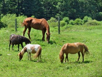 The trail entered a clearing which almost looked like a small park but turned left into the woods after only a few hundred feet. We began to follow a woods road but eventually the trail left the road and wound through the woods making a sharp right at about 3.5 miles. We were now descending slightly and heading southeast. At 3.85 miles we came to a flat railroad bed which was once part of the Lebanon Valley Railroad. We turned right and began to walk along the level bed between two wetlands. As I was looking for a place to take a few pictures, I saw Sheila jump up almost vertically ahead. At the same time a saw a rather large black snake slither toward the water. From what I could see the snake was 3 to 4 feet long and perhaps and inch and a half in diameter. Sheila seemed very skittish but none the worse for wear! We continued along the trail and I soon found an opening on the left that gave me access to a viewpoint for picture taking. I dropped my pack and slid down off trail over and old railroad rail to find a place to stand to take pictures. It was immediately apparent that I was standing on a beaver dam that clogged a large culvert between the two wetlands! The material I was standing on was not very solid but I got some great pictures. I was able to pull myself back up to the trail without getting wet. At 4.4 miles the blazes indicated a sharp left turn into the woods so we followed them to the edge of a corn field. I looked around but there were no blazes at all. It seemed to me that we needed to continue east to White Church Road so we walked along the north side of the cornfield toward the road. I don't much like walking through down as it is hard to get a view and the leaves are serrated. As we neared the road, I had to laugh as I found a single, faded blaze. We crossed the road and I put Sheila on her leash as requested by a sign. We again had to walk along the edge of a corn field without the aid of blazes. At 4.8 miles the trail curled around the back edge of the field and I could see the blazes indicating a left turn. We followed the trail as it crossed a stream on a wooden bridge. Sheila got a drink and immersed herself in the water before we continued on to a grassy clearing with white blazes on stakes. It was clear that the climb from here to Braley Hill Road would be about the same as the one we had made to Eastman Hill Road! The trail was sited on a woods road and we began to follow it as it climbed the hill heading almost due east. Several roads cut across the one we were on and the blazing could have been better but we found our way until about 5 miles. At this point I continued straight ahead for some distance since no turn was indicated. When I didn't see any markings, I turned back and found where the trail had turned without warning.
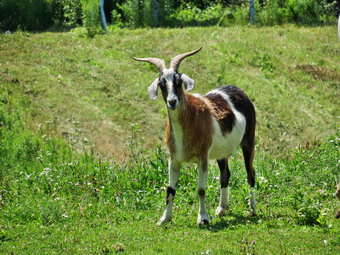 We continued to follow the trail encountering some wet spots near the top of the hill. At 5.75 miles we reached 1680 feet which was a climb of about 700 feet from White Church Road. I wasn't looking forward to the descent and subsequent ascent but we continued ahead. We dropped about 150 feet over the next .4 miles to Braley Hill Road. We had walked 6.2 miles when we turned around at 1:50 PM to head back to the car.We followed our path back to White Church Road where we turned right and headed north toward Ridgeway Road. The road gained a little elevation but the alternate path along open road was welcome. At one point I spotted some horses and ponies on the left and I dropped my pack to get out the camera. I took some shots and the realized one of the ponies had horns! I took a few shots of the lone goat in the field with the horses. I also took a few shots of the ridge line to the west which included Eastman Hill which we had ascended earlier in the day. After walking about 1.2 miles on the road, we turned left on Ridgeway Road at about 8.9 miles. I looked ahead and could see that the road descended to a low spot and then ascended again to the car. We started to walk down the hill and reached the low point which was the old railroad bed. I stopped to take a few shots of the surrounding hills which looked to be like glacial formations. When we started to walk again, we began to ascend to the car but it was actually less difficult than it had looked from the intersection. We were back at the car by 3:20 PM having hiked 9.9 miles in 4 hours and 40 minutes with an elevation gain of 1920 feet. I would suggest that most people do the hike this way as access to the parking the corner of Eastman Hill Road and Heisey Road could be a problem.
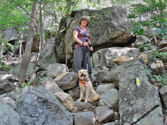
![]()
![]()
![]()
![]()
![]() On Monday, July 13th, I wanted to finish map 18 on the Finger Lakes Trail but the weather forecast called for showers near Ithaca. The forecast for Livingston Manor and the Catskills also mentioned showers. The forecast for Harriman showed bright and sunny skies so I decided to hike a loop over Pingyp Mountain. I had found this hike in the new NYNJTC book Circuit Hikes in Harriman by Don Weise. The route starts on Tiorati Brook Road and then uses the Suffern-Bear Mountain Trail to ascend Pingyp Mountain. After descending the other side the route uses the Red Cross and Beech Trails as well as Tiorati Brook Road to get back. I had mentioned this route to Cindy before and she had not seemed enthusiastic. On this day she said she wanted to go so we got our gear ready and loaded it into the a along with a thrilled Sheila and headed down the Quickway to Harriman. The traffic around the construction near Middletown held us up for a hike but we were soon on Route 6 heading over the mountain to the Palisades Parkway. We took the parkway south to Exit 16 and picked up Lake Welch Drive briefly and then got on Tiorati Brook Road. Not too far up the road I pulled over to park in a large roadside area on the left. As we got out of the car we noticed both the heat and the humidity with were both in the 80's! I was a little worried as I had brought only to liters of water but the hike was listed as only 7.1 miles. It was 10:45 Am by the time we started walking east on the road toward the parkway. The road is narrow with no shoulder and the cars move rather swiftly although we did not have any problems. I noticed we were walking downhill but knew we would be returning from the opposite direction. We continued on the road until it merged with Lake Welch Drive and then continued until we picked up the yellow blazes of the Suffern-Bear Mountain Trail at about .8 miles. The blazes were old and not very distinct but they led us over the southbound parkway to the northbound lanes. We could see the trail on the other side of the road and waited until there was a big gap in the traffic before crossing.
On Monday, July 13th, I wanted to finish map 18 on the Finger Lakes Trail but the weather forecast called for showers near Ithaca. The forecast for Livingston Manor and the Catskills also mentioned showers. The forecast for Harriman showed bright and sunny skies so I decided to hike a loop over Pingyp Mountain. I had found this hike in the new NYNJTC book Circuit Hikes in Harriman by Don Weise. The route starts on Tiorati Brook Road and then uses the Suffern-Bear Mountain Trail to ascend Pingyp Mountain. After descending the other side the route uses the Red Cross and Beech Trails as well as Tiorati Brook Road to get back. I had mentioned this route to Cindy before and she had not seemed enthusiastic. On this day she said she wanted to go so we got our gear ready and loaded it into the a along with a thrilled Sheila and headed down the Quickway to Harriman. The traffic around the construction near Middletown held us up for a hike but we were soon on Route 6 heading over the mountain to the Palisades Parkway. We took the parkway south to Exit 16 and picked up Lake Welch Drive briefly and then got on Tiorati Brook Road. Not too far up the road I pulled over to park in a large roadside area on the left. As we got out of the car we noticed both the heat and the humidity with were both in the 80's! I was a little worried as I had brought only to liters of water but the hike was listed as only 7.1 miles. It was 10:45 Am by the time we started walking east on the road toward the parkway. The road is narrow with no shoulder and the cars move rather swiftly although we did not have any problems. I noticed we were walking downhill but knew we would be returning from the opposite direction. We continued on the road until it merged with Lake Welch Drive and then continued until we picked up the yellow blazes of the Suffern-Bear Mountain Trail at about .8 miles. The blazes were old and not very distinct but they led us over the southbound parkway to the northbound lanes. We could see the trail on the other side of the road and waited until there was a big gap in the traffic before crossing.
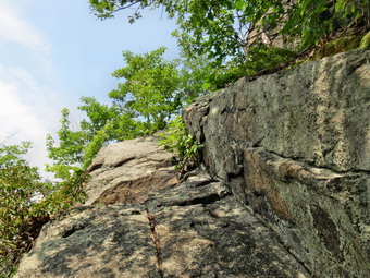 As soon as we crossed the road, we started to climb through some rocks and the temperature and humidity became more obvious. I let Sheila off her leash and got out my poles. I also took some pictures of Cindy and Sheila as we started up the mountain. The description of the hike in the book said that it may be the steepest hike in the park and I would agree! The description was also spot on when it described some "interesting" areas which require rock scrambling. As we got farther into the ascent the heat and humidity became more oppressive and were taking a toll on Cindy especially. We stopped a few times but tried to keep moving. Several times I stopped to take a few pictures of the trail but none do justice to how challenging it really is. On the climb from the parkway to the first place where the trail leveled was .2 miles and we gained 380 feet for a 35% average grade. I looked at the map and GPS and knew we were not at the top of the mountain. There were two more climbs. We passed by the memorial plaque to Harold Scutt who sited the trail in 1930 and died shortly thereafter in a plane crash. The second climb had an interesting steep slab of rock to negotiate while the third had a crevice to scramble up. The first step up the crevice was huge and required some upper body strength to make it up. After that, there was a winding trail that gained some elevation to the summit of the mountain. I was glad I had taken advantage of the views on the way up to snap some shots since the top was wooded. There was a heavy haze over the Hudson but a few of the shots were nice. Once over the top began to look for a shortcut back to the car. I knew that I had not brought enough water since I had only two liter bottles. I made mental note to get out my three liter Camelbak bladder for future hikes. I also knew that Cindy would not make the 7 mile loop as we were only at 1.7 miles at the summit.
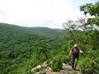 We started to descend the north side of the mountain. It was not as steep as the way we had come but reached over a 25% grade in places. At 2.1 miles the Suffern-Bear Mountain Trail reached the base of the mountain and turned right on a woods road marked "Pines" on the map. The road also ran left or west and seemed to head toward the parkway. It also paralleled a stream where Sheila could get a drink and cool off. We turned left here and followed the road which was not blazed but pretty easy to find. We had to detour several times as the road ran through low areas that are now marshes filled with impressive stand of phragmites. I stopped to take a few shots of these reeds. As we neared the parkway, the road became less distinct. I wanted to go a little south but Cindy wanted to head for the higher ground to the north. Once we were on the higher ground we had to push through some dense brush to reach...a deep stream. The stream was the reason I had wanted to head south but we found some stones to use to cross the water and scrambled up the steep bank on the other side to an open field next to the parkway. We walked south along the northbound lanes and then crossed to the wide, wooded median. We walked the median until we got to exit 16 and crossed to Lake Welch Drive. We followed lake Welch Drive and Tiorati Brook Road for .7 miles uphill back to the car. It was 1:30 Pm and we had covered 4.1 miles in 2 hours and 45 minutes. The total elevation gain was only 920 feet. I can honestly say it was the longest 4 miles I have hiked in a long time. We did stop in Middletown at El Bandido which helped to make the hard work seem almost fun!
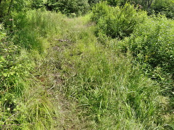
![]() On Sunday, July 12th, I had scheduled another work day for the Willowemoc Trail Crew. I had no confirmed attendees but hopped to have a few show up at the trailhead at 1:30 PM. I preached two church services in Livingston Manor and Roscoe and was home at 12:30 PM. I changed quickly, threw my gear in the car and went to pick up tools at Morgan Outdoors. I drove to the Frick Pond parking area and was there around 1:10 PM. I waited until 1:30 PM and when no one showed up I decided to spend an hour or so doing some trail work. I grabbed a shovel and a plastic toboggan as well as my pack and headed out the trail toward Frick Pond. The woods road to the pond was still wet and when I got to Gravestone Junction the "mud pit" was wetter and muddier than ever! I decided to take the toboggan down to the pond and see if it would be a good way to transport stepping stones from the pond and stream to the mud pit. As I walked down toward the pond, I found a man and woman and their three dogs. The dogs were beautiful and well-behaved but I did not recognize their breed. The man explained that they were Kleine Muensterlanders that are bred as hunting dogs and especially like the water. I can attest to their love of the water as that was all that really interested them. I walked down to the bridge and looked for some rocks that would make good stepping stones. I found four or five and loaded them in the toboggan and started to pull it up the hill. It wasn't easy but it did work well. I hauled the stones to the mud pit where I had dropped my pack and unloaded them. I thought I might dig out the pit some but that proved difficult so I went to get another load of stones. I again loaded up the toboggan and got ready to haul it up the hill. About that time Shawn appeared and helped me pull the load up the hill. We unloaded the stones and began to place them in the worst section of the mud pit.
On Sunday, July 12th, I had scheduled another work day for the Willowemoc Trail Crew. I had no confirmed attendees but hopped to have a few show up at the trailhead at 1:30 PM. I preached two church services in Livingston Manor and Roscoe and was home at 12:30 PM. I changed quickly, threw my gear in the car and went to pick up tools at Morgan Outdoors. I drove to the Frick Pond parking area and was there around 1:10 PM. I waited until 1:30 PM and when no one showed up I decided to spend an hour or so doing some trail work. I grabbed a shovel and a plastic toboggan as well as my pack and headed out the trail toward Frick Pond. The woods road to the pond was still wet and when I got to Gravestone Junction the "mud pit" was wetter and muddier than ever! I decided to take the toboggan down to the pond and see if it would be a good way to transport stepping stones from the pond and stream to the mud pit. As I walked down toward the pond, I found a man and woman and their three dogs. The dogs were beautiful and well-behaved but I did not recognize their breed. The man explained that they were Kleine Muensterlanders that are bred as hunting dogs and especially like the water. I can attest to their love of the water as that was all that really interested them. I walked down to the bridge and looked for some rocks that would make good stepping stones. I found four or five and loaded them in the toboggan and started to pull it up the hill. It wasn't easy but it did work well. I hauled the stones to the mud pit where I had dropped my pack and unloaded them. I thought I might dig out the pit some but that proved difficult so I went to get another load of stones. I again loaded up the toboggan and got ready to haul it up the hill. About that time Shawn appeared and helped me pull the load up the hill. We unloaded the stones and began to place them in the worst section of the mud pit.
 After placing some stones, Shawn suggested that we try to drain some of the water. I was skeptical but we cleared some of the weeds on the side toward the stream and found a low spot that was perfect. We used the shovel I had brought and Shawn's mattocks to make several ditches that allowed the water to drain. This was a great idea and made the stepping stones more effective! We decided we needed some more stones and went to get another load. Even the less muddy areas were deeper than they looked making larger stones the best choice. We looked in the stream and picked up a few rocks. and then began to look for stones in the remains of the old dam. We found some good candidates, loaded them up and started to pull them up the hill. Shawn took over pulling the toboggan and I carried one of the larger stones. We worked together to place the stones most effectively and tried to minimize their movement by shimming up those that were rocking. We also spent some of our time creating ditches to drain the water. We made one more trip to get stones. We made some final adjustments and decided to call it a day. I wanted to get back to Morgan Outdoors before 4:00 PM so that I could unload the tools. The work we were able to accomplish together surprised me and I was very satisfied with our efforts. Shawn was a pleasure to work with and had great ideas that moved the work along. The project may need some fine tuning and finishing touches but it definitely improved the area.
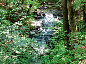
![]()
![]()
![]()
![]()
![]() On Friday, July 10th, I decided I wanted return to the Finger Lakes Trail to a section of map 18 which is the next map to the west of my completed sections. This section starts at Heisey Road near Route 119 southeast of Ithaca and continues for over 23 miles to the intersection of Purvis Road and Route 38 just south of Dryden Lake . Of course, the problem is that I usually have to hike both ways as I have no ride back from the end point. This means hiking, for example, hiking 12 miles to get a 6 mile section of trail. On many hikes I have used other trails of road walks to avoid a strict out-and-back which can be extremely boring! I checked the weather forecast when I got up and found partly sunny skies with no chance of rain. By the time I started my hike at around 10:00 AM the temperature would be in the low 70's. I knew trail might be wet from the rains the previous week but this is a fact of life during most of the summer. I decided to head for a five mile section of map 18 that was the next section west from the one I had already completed. It seemed I could hike out on the trail starting at Braley Hill Rd and ending at Old 76 Road where I had parked on my previous hike in the area. I could then use a combination of the trail and local roads to return. Sheila was more than ready to hike and I was surprised that she settled down for the long ride very quickly. We left Livingston Manor before 8:00 AM heading northwest on State Route 17 to Binghamton. From there I took I81 north to the Whitney Point exit, exit 8. The skies were sunny with a few clouds for most of the drive. I followed Route 79 west from Whitney Point toward Ithaca for a little over 20 miles and then turned left on Boiceville Road. After .6 miles I turned left on Central Chapel Road and then stayed to the right on Braley Hill Road after 2.6 miles. I knew the trail should cross at about 1.2 miles down the road and could locate the crossing from an old jeep trail that was on my map and GPS. I passed by the first big parking area which was marked for Shindagin Hollow Sate Forest. I had a feeling the trail should cross at the next parking area on the left but I could find no trail markers. I drove a little farther, saw no FLT markers, got out my handheld GPS unit and turned around. The GPS unit indicated the trail had to cross near the second parking area so I pulled over and parked. I walked north on the road but found nothing. I walked south and found where the Finger Lakes Trail crossed the road. It wasn't surprising that I missed it as the trail crossing was barely marked at all. I walked back to the car and got my gear ready and released Sheila from the captivity of the back seat. We left the car just after 10:45 AM heading south on Braley Hill Road for only 250 feet before turning left into the woods on the Finger Lakes Trail.
On Friday, July 10th, I decided I wanted return to the Finger Lakes Trail to a section of map 18 which is the next map to the west of my completed sections. This section starts at Heisey Road near Route 119 southeast of Ithaca and continues for over 23 miles to the intersection of Purvis Road and Route 38 just south of Dryden Lake . Of course, the problem is that I usually have to hike both ways as I have no ride back from the end point. This means hiking, for example, hiking 12 miles to get a 6 mile section of trail. On many hikes I have used other trails of road walks to avoid a strict out-and-back which can be extremely boring! I checked the weather forecast when I got up and found partly sunny skies with no chance of rain. By the time I started my hike at around 10:00 AM the temperature would be in the low 70's. I knew trail might be wet from the rains the previous week but this is a fact of life during most of the summer. I decided to head for a five mile section of map 18 that was the next section west from the one I had already completed. It seemed I could hike out on the trail starting at Braley Hill Rd and ending at Old 76 Road where I had parked on my previous hike in the area. I could then use a combination of the trail and local roads to return. Sheila was more than ready to hike and I was surprised that she settled down for the long ride very quickly. We left Livingston Manor before 8:00 AM heading northwest on State Route 17 to Binghamton. From there I took I81 north to the Whitney Point exit, exit 8. The skies were sunny with a few clouds for most of the drive. I followed Route 79 west from Whitney Point toward Ithaca for a little over 20 miles and then turned left on Boiceville Road. After .6 miles I turned left on Central Chapel Road and then stayed to the right on Braley Hill Road after 2.6 miles. I knew the trail should cross at about 1.2 miles down the road and could locate the crossing from an old jeep trail that was on my map and GPS. I passed by the first big parking area which was marked for Shindagin Hollow Sate Forest. I had a feeling the trail should cross at the next parking area on the left but I could find no trail markers. I drove a little farther, saw no FLT markers, got out my handheld GPS unit and turned around. The GPS unit indicated the trail had to cross near the second parking area so I pulled over and parked. I walked north on the road but found nothing. I walked south and found where the Finger Lakes Trail crossed the road. It wasn't surprising that I missed it as the trail crossing was barely marked at all. I walked back to the car and got my gear ready and released Sheila from the captivity of the back seat. We left the car just after 10:45 AM heading south on Braley Hill Road for only 250 feet before turning left into the woods on the Finger Lakes Trail.
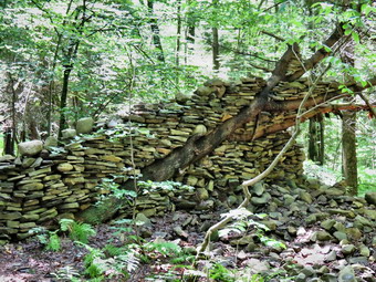 The trail descended slightly to cross two small streams and then a larger one at .2 miles where there was a bivouac area. There were some very muddy spots on the trail but they could be avoided or carefully negotiated. This continued throughout the hike to one degree or another. At .7 miles we crossed a jeep trail and I had to pause a moment since no blazes were visible on the other side. Sheila knew where she was going so I followed her directly across the road to stay on the trail. As we continued to descend, we came across an old foundation at .8 miles. I decided not to take pictures since they usually come out very green and are not very interesting. The trail made a sharp right after this and we began to parallel Shindagin Hollow Road some 200 feet above it with a steep dropoff to the left. At 1.5 miles we began to descend off the ridge to the road. We came to the road at 1.8 miles and this was the lowest spot on the hike at about 1180 feet. We turned left and walked about 500 feet up the road where we turned right and crossed the stream on a bridge. From here the trail began to ascend again on logging road. I was glad to have Sheila with me because several of the turns simply were not marked at all! At 2.5 miles we entered the area surrounding the Shindagin Hollow lean-to. The area was large including the lean-to, a privy and several fire rings. The trail passed in front of the lean-to and paralleled a stream. Just after the lean-to was a small cascade which was unexpected since it was not mentioned in the trail description. I stopped to take a few pictures before continuing on. The trail had been taking us north but now turned east and continued ascending to South Road. The nearer we got to the road the wetter and muddier the trail became. Along the way there were two interesting arrangements of stones. One was almost a stone wall incorporating a downed tree. The other was a large cairn. I took pictures of both before continuing on to South Road. We crossed the road and found a nice country lane which was wide and well-maintained and dry! At 3.4 miles we hit the highest point on then hike at almost 1800 feet and started a long descent toward Old 76 Road. Sheila alerted and I saw a young man coming toward us. He was local and out for a hike from his house on South Road to Old 76 Road and back. He informed me that the trail was muddy up ahead.
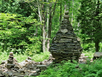 At 3.6 miles the country lane ended and the trail turned to the right and continued almost due east. We continued to descend and there were some muddy areas along the way. At 4.7 mile we crossed Boyer Creek on a bridge. Sheila decided to jump in and found there was a deep pool under the bridge where she could swim around some. We continued to head east and descend to Old 76 Road at 4.9 miles. We walked across the road to connect with the previous hike. I got a drink and a snack and we turned around at 1:20 PM to head back. My plan was to go back to South Road on the trail and then walk some local roads to avoid the mud and add some variety. Just after starting back I saw a sign posted on a tree and I stopped to read it. Imagine my surprise when I found that the section to the east from McGrath Road to Level Green Road was closed! This was the section I had hiked on Monday and thought was so poorly marked and maintained! I felt terrible about trespassing as I always try to respect property owners rights. I also thought it was foolish to post the sign where it was posted as there was no sign at the beginning of McGrath Road. The suggested route on local roads to avoid the closed section was very much the same route I used to return from the hike on Monday. The hike back to South Road on the trail seemed to go quickly. At 6.6 miles we turned right on South Road and hiked north .4 miles where we turned left on Gulf Creek Road. This was a dirt road with only one house near the beginning so as soon as we passed that house I let Sheila off her leash. As we hiked toward Shindagin Hollow Road we did meet one car. The road took use due west and then south for 1.7 miles to Shindagin Hollow Road. It also dropped over 500 feet which I knew we would have to regain to get to the car. I had though we might hike up then road to the jeep trail and use it to get back to the trail to the car. In the end, we turned left on the road and hiked back to where the trail headed back up the ridge retracing our route from earlier. This decision was based on taking a route I knew rather than exploring new one. We made three climbs to get back to Braley Hill Road with the first being the most sustained at 340 feet. I was getting a little tired but more from boredom than the physical effort of hiking. As we approached the car we turned right on a blue trail which brought us out to the road without walking through some muddy areas. We were back at the car at 4:00 Pm having hiked 10.5 miles in 5 hours and 10 minutes with a 2100 foot elevation gain. There is only one more section to the east to complete map 18!
On Tuesday, July 7th, I had scheduled a weekday trail maintenance session at Frick Pond. Only Judy replied to me that she could come but Lisa had two other people who said they might be interested. The weather report called for rain showers until 10:00 Am but hinted that the skies might clear after that. I arrived at the trailhead before 10:00 AM to find Judy waiting for me. We left the trailhead a little after the appointed time as no one else appeared to be coming. We had decided that since it wasn't raining we would try to get some work done on the water drainage on the woods road to Frick Pond. I had my pack with saw and axe but we carried a shovel and a pick. Judy and I stopped at several spots along the way and opened up a few clogged ditches and made some new ones. As we were working on one spots we heard voices and found Lisa and Avi approaching. We had not brought tools for them as we did not know they were coming so Lisa decided to go back to her car to grab a pair of loppers. She would work on the trimming the Flynn Trail from the road up as far as she could go. Avi stayed with us and we continued to create drainage ditches. We walked toward Frick Pond and I showed the other two crew members the mud pit at gravestone Junction. I described my plan to haul rocks up from the outlet stream to Frick Pond using piece of canvas. I hope to be able to try this on Sunday , July 12th for our next workday. We walked down to the pond and spotted many good choices for stepping stones. We decided to continue on around the pond to look at the walkways and see if we could shore up one or two to prevent the tipping that made them feel unsafe. On the way we created a ditch to drain another wet area. I also shod Lisa and Avi the large cherry tree Cindy and I had removed with hand tools. As we started around the pond we tried to fill in the gap on both sides of one of the culverts but could not find enough dirt to get the job done. When we got to the walkways we found them as slippery as ice. Ian Dunn, Region 3 Forester, had told me that metal screening applied to these bridges would violate the Dec plan for the wild forest. Avi took a video to illustrate the problem since something needs to be done before someone is seriously injured! We found the walkway that was tipping and brought some stones to prop it up. After digging a little under the walkway we were able to make it safe. Unfortunately, our efforts had lifted one section of walkway into its correct position but another section was no loner aligned. This left a step that I was afraid might trip people attempting to use the walkway. We dug out a space under the second section and place some more rocks with the help of a long lever to lift the walkway. Both sections are now aligned and we decided to head back to the car as the skies darkened again. The walkways will need some more repairs as sections have pulled part and many boards are loose. On the way back Avi remarked that the sections we had ditched looked drier. As we arrived at the parking area the rain began to fall and increased to a downpour. After getting drenched the day before I was glad we had made it back in time.
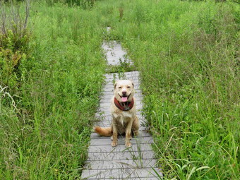
![]()
![]()
![]()
![]()
![]() On Monday, July 6th, I decided I wanted return to the Finger Lakes Trail to a section of map 18 which is the next map to the west of my completed sections. This section starts at Heisey Road near Route 119 southeast of Ithaca and continues for over 23 miles to the intersection of Purvis Road and Route 38 just south of Dryden Lake . Of course, the problem is that I usually have to hike both ways as I have no ride back from the end point. This means hiking, for example, hiking 12 miles to get a 6 mile section of trail. On many hikes I have used other trails of road walks to avoid a strict out-and-back which can be extremely boring! I checked the weather forecast when I got up and it continued to include partly sunny skies with no chance of rain. By the time I started my hike at around 10:00 AM the temperature would be in the low 70's. I knew trail might be wet from the rains the previous week but this is a fact of life during most of the summer. I decided to head for a six mile section of map 18 that was the next section west from the one I had already completed. It seemed I could hike out on the trail starting at Old 76 Road and ending at Route 79 near Robinson Hollow Road. I could then use local roads to return. Sheila was more than ready to hike and I was surprised that she settled down for the long ride very quickly. We left Livingston Manor before 8:00 AM heading northwest on State Route 17 to Binghamton. From there I took I81 north to the Whitney Point exit, exit 8. The skies were sunny with a few clouds for most of the drive. I followed Route 79 west from Whitney Point toward Ithaca for a little over 13 miles and then turned left on West Creek Road. Eventually this road became Old 76 Road in Speedsville. I started heading northwest watching for McGrath Road on the right. This was an abandoned road so I knew finding it might be difficult. After passing Weston Road, I began going very slowly but knew I had missed it when I got to Yaple Road. I turned around but didn't see it on the return trip. I almost gave up and decided to park at the other end but after turning around one more time I found where the trail crossed half way between Weston and Yaple Roads. It wasn't surprising that I missed it as there was no road and the trail crossing was barely marked at all. I pulled over and parked off the shoulder of the road and got ready to start the hike. Sheila was ready to go so we started up what remained of McGrath Road. I didn't know at the time that my difficulty finding the beginning of the trail would define the rest of the hike.
On Monday, July 6th, I decided I wanted return to the Finger Lakes Trail to a section of map 18 which is the next map to the west of my completed sections. This section starts at Heisey Road near Route 119 southeast of Ithaca and continues for over 23 miles to the intersection of Purvis Road and Route 38 just south of Dryden Lake . Of course, the problem is that I usually have to hike both ways as I have no ride back from the end point. This means hiking, for example, hiking 12 miles to get a 6 mile section of trail. On many hikes I have used other trails of road walks to avoid a strict out-and-back which can be extremely boring! I checked the weather forecast when I got up and it continued to include partly sunny skies with no chance of rain. By the time I started my hike at around 10:00 AM the temperature would be in the low 70's. I knew trail might be wet from the rains the previous week but this is a fact of life during most of the summer. I decided to head for a six mile section of map 18 that was the next section west from the one I had already completed. It seemed I could hike out on the trail starting at Old 76 Road and ending at Route 79 near Robinson Hollow Road. I could then use local roads to return. Sheila was more than ready to hike and I was surprised that she settled down for the long ride very quickly. We left Livingston Manor before 8:00 AM heading northwest on State Route 17 to Binghamton. From there I took I81 north to the Whitney Point exit, exit 8. The skies were sunny with a few clouds for most of the drive. I followed Route 79 west from Whitney Point toward Ithaca for a little over 13 miles and then turned left on West Creek Road. Eventually this road became Old 76 Road in Speedsville. I started heading northwest watching for McGrath Road on the right. This was an abandoned road so I knew finding it might be difficult. After passing Weston Road, I began going very slowly but knew I had missed it when I got to Yaple Road. I turned around but didn't see it on the return trip. I almost gave up and decided to park at the other end but after turning around one more time I found where the trail crossed half way between Weston and Yaple Roads. It wasn't surprising that I missed it as there was no road and the trail crossing was barely marked at all. I pulled over and parked off the shoulder of the road and got ready to start the hike. Sheila was ready to go so we started up what remained of McGrath Road. I didn't know at the time that my difficulty finding the beginning of the trail would define the rest of the hike.
CAUTION: I found after hiking this section of trail that the part from Old 76 Road to Level Green Road has been closed by the request of the landowner. There was no sign at the beginning of the trail but there is a sign on the other side of the road and the closure is posted on the FLTC website. I found out that it is a good idea to check the "Trail Conditions" section of this website for up-to-date closures and reroutes before hiking a section. Some of these are reflected on the maps and some are not! The new route follows Old 76 Road west to Yaple Road. Turn right on Yaple Road and hike north to Level Green Road. Turn right and hike southeast east on Level Green Road to the point where the trail crosses. Turn left onto the trail.
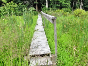 As we started on the trail, the first thing we found was a large blowdown blocking the beginning of the trail. There were also what looked like rose bushes that had overgrown this area. The trail was extremely wet and muddy. To add to the problems the blazes were few and far between and looked as if they had not been repainted in several years. Overall my impression was that this section of trail was virtually unmarked and completely unattained. The further we went the worse the situation became with muddy areas that threatened to swallow my boots completely. The only way I could get through some areas was to bushwhack along the forest at the edge of the trail. Finally, at about .45 miles we turned right onto a drier woods road and followed some blazes until...the blazes disappeared at .7 miles. I continued to walk along the road since the Finger Lakes Trail does not always put blazes up once you are on a woods road. When I didn't find any blazes, we walked back to the area Where I had lost them and I spent some time gazing into the forest. I finally spotted a blaze but found it hard to get to it because of all the briars. I tried to follow the blazes but lost them again and decided to walk on a path that roughly paralleled where I though the trail might be. Eventually the path turned the wrong way and I moved to the left and found some blazes. The trail continued to be wet and muddy which, by now, I had accepted as the rule for the day. At about .9 miles we came to a stream and the blazes again disappeared. There was no indication of a turn or any other trail markings. We fought our way through briars, weeds and brush and eventually found a path which I followed in desperation until I had to turn back to the stream. I said "Trail" to Sheila and she crossed the stream and started up a path on the other side. I followed her and found she was correct although there were no blazes that would have been visible from the other side. I was glad to have CPS (canine positioning system)! The trail now was rather obvious which was good since there were no blazes I could see. We entered an evergreen forest which I assume is part of Potato Hill State Forest. The trail here was drier and there were more blazes but it too showed little maintenance. I hoped that the improved trail would continue but that hope was soon dashed!
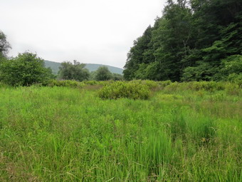 As we walked through the forest we were on some old logging roads which offered an obvious path but had some very deep mud pits. At just under 2 miles we crossed Level Green Road which at this point was a dirt road. I looked for the trail on the other side and found it but not without a little work. We continued to walk along wet and muddy trail gaining elevation slightly as we headed north. At 3.15 miles we neared Blackman Hill Road and walked parallel to it until crossing the road at 3.25 miles. The trail on the other side followed a short road or driveway and then entered a field of long grass. We followed the eastern edge of the field as directed and I was surprised to find what looked like a path made by other hikers. At the edge of the field there were no markers for the trail so I again began to look and found the trail a little to the east. The trail began to follow a well-defined logging road which made several twists and turns. It did have blazes but we were back to a trail that resembled one big mud pit. I tried to follow the blazes but it was hard to watch for them and avoid the mud at the same time. At 3.7 miles I continued to follow the woods road although I could see no blazes. We were headed in the right direction and I kept walking for about .4 miles. At that point the road was blocked by blowdowns and the other side didn't look very promising. I decided to turn around and walk out Blackman Hill Road and back to the car. As we approached the point where I had lost the blazes, I gazed to the right side of the trail and saw some white marks going through the woods. I was annoyed but decided I wanted to finish the trail. As we walked along the trail, I noticed it was almost parallel to the road I had been on! At 4.0 miles we began a descent that would end at Route 79. I was a little apprehensive since the directions indicated a "wet area" near Route 79. I wondered how much wetter the trail could get!
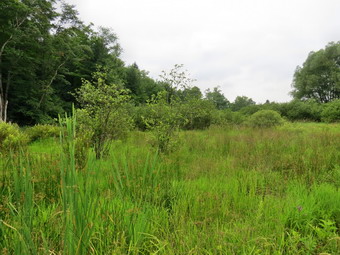 We were now descending on a woods road which became extremely wet but was a least well blazed. At 4.7 miles we began to walk along the bank of West Owego Creek but high above it. Our descent continued with a few short climbs along the way. The trail was barely etched into the side of the hill and I got the feeling few hikers use this part of the trail. At 5.5 miles we turned toward Route 79 and found the "wet area" mentioned in the description. There was a nice bridge and a walkway and it was one of the drier areas on the entire hike. This was the only spot I stopped to take a few pictures. We walked out to Route 79 where I stowed my poles and put Sheila on her leash. We turned left at 1:40 PM to walk to Level Green Road for the trip back. The skies were cloudy now and a few raindrops had fallen along the way. I was hoping Level Green Road lived up to its name. It was .85 miles to the turn and it seemed to go quickly. We turned left and I saw a long stretch of rather flat road ahead. I tried to walk with my head down since staring ahead at the long stretch of road was discouraging. By this time the skies were uniformly dark and I hoped we would escape the rain. From Route 79 to Blackman Hill Road was about 1.85 miles and there was, in fact, a slight ascent of about 200 feet. Unfortunately, just before we reached Blackman Hill Road the rain began as a few drops that turned into a steady rain. I decided to keep walking and the rain let up and then came down harder as we continued our hike. I stopped under a tree at one point and put my camera, cell phone and wallet in a plastic bag. At 8.3 miles we turned right on Yaple Road and continued to climb until the road began to descend to Old 76 Road at 9.4 miles. As we turned left onto Old 76 Road the rain stopped and the sun began to come out. I was pretty wet as was my pack! It was another .9 miles to the car but it seemed longer. It was 3:15 Pm and we had hiked 11.5 miles in just over 5 hours gaining about 1580 feet along the way. This was about 1.1 miles farther than we should have walked due to the poor trail markings! The trip out on the trail was 6.7 miles with the return on the roads being only 4.8 miles.
On Sunday, July 5th, I had thought I might go to Harriman after church but decided I did not want to get caught in the July 4th weekend traffic. I decided instead to go to Big Pond and do some trail maintenance on the Touch-Me-Not Trail. This trail is part of the Finger Lakes Trail and I recently volunteered to maintain it. This winter I had trouble finding the trail when it was covered in snow so cutting it out and reblazing it seemed like a good idea. Cindy did not want to go which I knew would make the work harder. I decided to take a chance and bring Sheila along. I hoped she would not get too bored if I had to stop to clear the trail. We arrived at the parking area at 12:15 PM to find it almost full. I parked the car and decided to take my Silky Sugowaza, a pair of hedge trimmers and my new Fiskars X27 axe. The axe is lightweight with an integrated composite handle. I prefer my Council Tools Velvicut but it is much heavier and meant for felling larger trees. I left my poles in the car since there is just so much I can carry! I put Sheila on her leash to cross the road but released her as soon as we started to climb up the trail to the register. My main goal was to clear the most heavily used portion of the trail which is part of the loop around Little Pond. To get there we had to walk a little over a mile of trail and gain 780 feet to Touch-Me-Not Mountain! As we approached the trail register, I found a small tree across the trail. It was time to try out the new axe and it performed well. I really like the Silky saws but there is something about an axe that makes me feel like I am really working in the woods. After pulling the pieces of the tree off the trial I returned the axe to my pack and got out the hedge trimmers. These aren't special in any way but they were doing a good job as I trimmed brush from the trail and even cut down a few small branches. It wasn't very long before we ran into a second tree across the trail. This one was more difficult to clear since it was hung up on another tree. It took a while to carefully clear each branch but I soon had everything the way I wanted it. There was one more blowdown where two trees were hung up on each other over the trail. I decided to leave it for another day secretly hoping the next wind would bring them down! We continued along the trail as I sued the trimmers to continue to cut brush and branches. We entered a wet area where I remembered that there were always a good crop of nettles. I was surprised to see that there weren't as many as I had expected and I used the trimmers to cut them back. I also had no problem following the trail although I did find there weren't as many blazes as there should be. As soon as we started to climb the mountain, there was an excellent crop of nettles. I was beginning to get tired using the trimmers over and over and wished for a grass whip or, better yet, a power scythe. I did trim back the nettles as much as I could. Further up the mountain the nettles ran out and the prickers started. It looked like some hikers had tried to clear some of these and I added my efforts top theirs. There continued to be a few minor blowdowns which I cleared by pulling them off the trail. Some were pretty old but I didn't like them underfoot to trip someone. As we crested the hill and started down to the trail junction I found an interesting sight. A tree non the trail with three trunks had split and each trunk had gone in a different direction. One lay across the trail but was easy to get over. One lay off the trail into the woods. The third was hung up over the trail which caused me some concern. I decided that this day was not the day to tackle this task and passed by it. Near the trail junction I did some trimming and tenured right to stay on the red Touch-Me-Not Trail. We had hiked this half mile section on Friday and I knew it needed a lot of trimming. By this time my wrists and arms were tired but I knew I would give it my best. For the next half mile I used the trimmers countless times to cut back briars, vines, brush and branches. As I approached the trail junction I knew that I would need to go back and do dome more clearing nut that I had made a good first step. At the trail junction we turned left to get on the Little Pond Trail since I had decided it was the easier way back. I put all the tools in my pack and started downhill. We passed through the clearing where a farm had once operated and passed by the pond also. At the next turn the trail was vary muddy but it felt good to be head down and back. As we approached the beaver pond, we met two young men headed up the trail. At the loop trail around the pond we turned left and followed the path to the main parking area. We followed the access road downhill to the Barkaboom Road where we turned left to get back to the Big Pond parking area. The last .6 miles was uphill but it didn't seem bad especially since Sheila pulled all the way! We were back at the car at about 5:00 PM meaning that we had hiked 4.7 miles in 4 hours and 45 minutes. Thus was easily my slowest pace ever but I had gotten a lot of work done. Sheila was very well-behaved on the whole hike. She investigate some game trails as I cleared blowdowns and trimmed brush but was near very far away.
![]()
![]()
![]()
![]()
![]() On Friday, July 3rd, I was tired from a 15 mile hike on the previous day. My son Karl had mentioned that a family hike on Friday might be nice. I called him early in the morning and he said they were headed tom our house and wanted to go to hike at Little Pond. I was not too enthusiastic about the choice since I knew the grandchildren would only be able to hike the flat trail around the pond. Bryce is 4 years old and I thought he might be able to hike the 3+ miles over Touch-Me-Not Mountain but I knew Luke and Lily, the 2 year old twins couldn't handle it. The family arrived and we ate some breakfast before heading to Little Pond State Campgrounds near Turn wood. We paid the $8 day use fee and parked in the lot where there were only two or three cars. We got ready for our "hike" with Karl and his wife both shouldering child carriers. We started along the near side of the pond on the paved walkway and the kids seemed to be doing fine with Luke running out ahead. At a little less than half a mile, we came to the left turn where the yellow Little Pond Trail splits with the left fork continuing on around the pond. I was a little surprised when we turned right to head up the mountain. There is an immediate, short climb and the trail had some very muddy areas. The trail parallels a creek and there was a new beaver dam near an old beaver meadow. The dam had created a pond and I stopped to take some pictures. We continued on the trail climbing toward the vista which is an open field. The trail passes through some pines and Bryce was leading the way, at times so far ahead we had to ask him to wait. Luke and Lily need to be carried a few times but they walked most of the way. At 1.1 miles we followed the trail as it turned left and began to enter the old field that was once a farming homestead. Bryce and I walked over to the pond on the left another back to the main trail. I pointed out the foundation of the old house on the right. A little farther along, I pulled out my camera to take a few pictures of the valley below. The rest of the "crew" had walked on a little farther to find some shade and a big rock where they could relax. When Bryce and I arrived, I got out the camera again and took some pictures. I thought perhaps Karl and Kathleen would want to turn around but we continued on the main trail to the intersection with the red Touch-Me-Not Trail.
On Friday, July 3rd, I was tired from a 15 mile hike on the previous day. My son Karl had mentioned that a family hike on Friday might be nice. I called him early in the morning and he said they were headed tom our house and wanted to go to hike at Little Pond. I was not too enthusiastic about the choice since I knew the grandchildren would only be able to hike the flat trail around the pond. Bryce is 4 years old and I thought he might be able to hike the 3+ miles over Touch-Me-Not Mountain but I knew Luke and Lily, the 2 year old twins couldn't handle it. The family arrived and we ate some breakfast before heading to Little Pond State Campgrounds near Turn wood. We paid the $8 day use fee and parked in the lot where there were only two or three cars. We got ready for our "hike" with Karl and his wife both shouldering child carriers. We started along the near side of the pond on the paved walkway and the kids seemed to be doing fine with Luke running out ahead. At a little less than half a mile, we came to the left turn where the yellow Little Pond Trail splits with the left fork continuing on around the pond. I was a little surprised when we turned right to head up the mountain. There is an immediate, short climb and the trail had some very muddy areas. The trail parallels a creek and there was a new beaver dam near an old beaver meadow. The dam had created a pond and I stopped to take some pictures. We continued on the trail climbing toward the vista which is an open field. The trail passes through some pines and Bryce was leading the way, at times so far ahead we had to ask him to wait. Luke and Lily need to be carried a few times but they walked most of the way. At 1.1 miles we followed the trail as it turned left and began to enter the old field that was once a farming homestead. Bryce and I walked over to the pond on the left another back to the main trail. I pointed out the foundation of the old house on the right. A little farther along, I pulled out my camera to take a few pictures of the valley below. The rest of the "crew" had walked on a little farther to find some shade and a big rock where they could relax. When Bryce and I arrived, I got out the camera again and took some pictures. I thought perhaps Karl and Kathleen would want to turn around but we continued on the main trail to the intersection with the red Touch-Me-Not Trail.
 When we got to he red trail, we turned right to begin our loop back. I have adopted this trail from Beech Hill Road to Big Pond and this trip gave me a chance to assess the need for maintenance. I concluded that the trail is in pretty good shape but needs a few blowdowns removed and some brush trimmed. It also needs some new blazes so I will schedule a maintenance trip very soon. Over the next .5 miles the trail gains 275 feet to the junction with the Campground Trail. This is not a steep climb unless you are 2 years old but Luke and Lily like to climb! Bryce was still leading and making good time no matter the terrain. On our way to the trail junction we met a group of twenty or so children headed in our direction. We passed by each other offering greetings in the process. By 12:50 PM we had hiked 2.2 miles are were at the trail junction with the blue Campground Trail. We stayed to the right on the blue trail to complete our loop back to the parking area. There was a slight ascent to our highest point at 2770 feet and then a long downhill. The descent is a little tricky since it is very steep in spots requiring some rock scrambling. The wet leaves and mud made this even more interesting. Bryce had no trouble negotiating the descent showing incredible agility and balance. Even Luke and Lily handled this part very well. The entire descent was .85 miles and dropped 775 feet. The average grade was about 18% but the trail levels a lot near the end. In the steepest spots the grade was over 25% for some distance. We were back at the picnic pavilion at 1:45 Pm having covered 3.3 miles in 2.5 hours with a vertical gain of 830 feet.
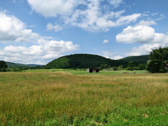
![]()
![]()
![]()
![]()
![]() On Thursday, July 2nd, I decided I wanted return to the Finger Lakes Trail to a section of map 18 which is the next map to the west of my completed sections. This section starts at Heisey Road near Route 119 southeast of Ithaca and continues for over 23 miles to the intersection of Purvis Road and Route 38 just south of Dryden Lake . Of course, the problem is that I usually have to hike both ways as I have no ride back from the end point. This means hiking, for example, hiking 12 miles to get a 6 mile section of trail. On many hikes I have used other trails of road walks to avoid a strict out-and-back which can be extremely boring! I checked the weather forecast when I got up and it continued to include partly sunny skies with no chance of rain. By the time I started my hike at around 10:00 AM the temperature was only supposed to be in the 60's. I knew trail might be wet from the rains earlier in the week but this is a fact of life during most of the summer. I decided to head for an eight mile section at the west end of map 20 from Route 79 to Purvis Road. It seemed I could hike out on the trail and then return on some roads. Sheila was more than ready to hike and I was surprised that she settled down for the long ride very quickly. We left Livingston Manor at 8:00 AM heading northwest on State Route 17 to Binghamton. From there I took I81 north to the Whitney Point exit, exit 8. The weather hand been fogy as I left Livingston Manor but it was now sunny and very pleasant as I followed Route 79 west from Whitney Point toward Ithaca. After about 16 miles, I passed Robinson Hollow Road on the right. After crossing over a creek, I pulled over to the right at a large snowplow turn around and parked my car. There were several others cars parked here and the sign indicated that parking was only prohibited during the snowy months. The drive had gone quickly so we were able to start hiking at 9:45 AM by starting east on Route 79 toward Robinson Hollow Road. I estimated the hike would be between 15 and 16 miles so I was anxious to get started. The walk on Route 79 was only .4 miles and went quickly except for the fact Sheila was pulling on her leash anticipating hours of hiking. We turned left on Robinson Hollow Road and I after a while I began to look for the left turn onto the trail. I wasn't sure where there turn was located but just after crossing a small bridge over a stream it came up on the left. The trail was mowed and well-maintained. As we started our climb up a woods road, I let Sheila off her leash and we started our real hiking. I was surprised that the trail was so dry given the rain that had fallen but that didn't last for long!
On Thursday, July 2nd, I decided I wanted return to the Finger Lakes Trail to a section of map 18 which is the next map to the west of my completed sections. This section starts at Heisey Road near Route 119 southeast of Ithaca and continues for over 23 miles to the intersection of Purvis Road and Route 38 just south of Dryden Lake . Of course, the problem is that I usually have to hike both ways as I have no ride back from the end point. This means hiking, for example, hiking 12 miles to get a 6 mile section of trail. On many hikes I have used other trails of road walks to avoid a strict out-and-back which can be extremely boring! I checked the weather forecast when I got up and it continued to include partly sunny skies with no chance of rain. By the time I started my hike at around 10:00 AM the temperature was only supposed to be in the 60's. I knew trail might be wet from the rains earlier in the week but this is a fact of life during most of the summer. I decided to head for an eight mile section at the west end of map 20 from Route 79 to Purvis Road. It seemed I could hike out on the trail and then return on some roads. Sheila was more than ready to hike and I was surprised that she settled down for the long ride very quickly. We left Livingston Manor at 8:00 AM heading northwest on State Route 17 to Binghamton. From there I took I81 north to the Whitney Point exit, exit 8. The weather hand been fogy as I left Livingston Manor but it was now sunny and very pleasant as I followed Route 79 west from Whitney Point toward Ithaca. After about 16 miles, I passed Robinson Hollow Road on the right. After crossing over a creek, I pulled over to the right at a large snowplow turn around and parked my car. There were several others cars parked here and the sign indicated that parking was only prohibited during the snowy months. The drive had gone quickly so we were able to start hiking at 9:45 AM by starting east on Route 79 toward Robinson Hollow Road. I estimated the hike would be between 15 and 16 miles so I was anxious to get started. The walk on Route 79 was only .4 miles and went quickly except for the fact Sheila was pulling on her leash anticipating hours of hiking. We turned left on Robinson Hollow Road and I after a while I began to look for the left turn onto the trail. I wasn't sure where there turn was located but just after crossing a small bridge over a stream it came up on the left. The trail was mowed and well-maintained. As we started our climb up a woods road, I let Sheila off her leash and we started our real hiking. I was surprised that the trail was so dry given the rain that had fallen but that didn't last for long!
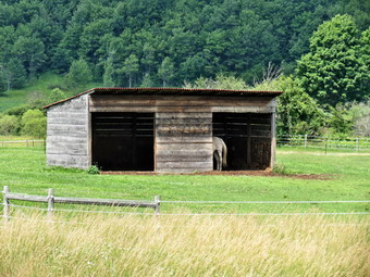 The trail immediately began to climb gaining 450 feet in the first .5 miles for a 15% grade. It also became very wet in spots with running water and mud. This became the theme for the rest of the trip on the trail. There were spots where the trail simply acted as a streambed and it was up to the hiker to try to work around it. Unlike some previous sections, the trail was well-marked in most spots and I didn't have to stop and guess where we should go next. After climbing, we dropped down to a stream bed and started crossing it several times. I don't know which was wetter the stream or the trail as it ram beside it. We continued to follow the stream until 2.4 miles climbing slightly as we went until we crossed it again heading mostly north. The trail seemed to be climbing at heading north with a few swings to avoid steep climbs or some other obstacles. At 3.7 miles we reached 1950 feet and began to descend to the Harford-Slaterville Road or Route 117. I had thought I might turn around at this point and walk the roads back to the car but the weather was great and I was still feeling fresh so I decided we would continue to the end of the section. We crossed the road to get back on the trail and continue north crossing another stream at about 4.8 miles. Then trail then takes us on an ascent to 2015 feet which is the highest point of the day. The trail here was not quite as wet and at the high point I could see a microwave facility to the right of the trail. We now began a slight descent to Star Stanton Hill Road which we hit at about 7.1 miles. I was surprised to find a washed out gully which did not resemble a road at all and wasn't even much of trail. I thought about turning around at this point but decided to finish out the hike to Purvis Road. It was about a mile on the trail to Route 38 and it was all downhill. Once we got to the main road, we turned right and then immediately left on Purvis Road. We walked to where I had parked on a previous hike and I considered the options for the return trip. It was about 1:30 PM and I knew the hike back up the hill would not be as easy as the hike down. There really weren't any other choices so Sheila and I turned around to return the way we had come.
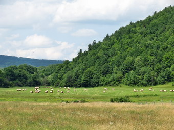 The hike up the hill did take longer than the walk down but was not as bad as I thought it might be. When we reached the point where the trail turned left off the "road", I decided we would return on the roads and continued straight ahead to try to find Canaan Road. The trail markings indicated this was a snowmobile trail but I was wondering how developed Canaan Road would be, if I could find it. We arrived at the point where the map showed the road and found signs pointing south with the label "Caroline 6 miles". Canaan Road is an abandoned town road which is now part of the Hammond Hill State Forest. I kept my poles out as we started to walk down the dirt and gravel road. The road was good enough that I could have driven it careful with my car. We were making good time and I was glad that the return trip would be downhill or flat. As we were walking south, we both noticed a sound from behind us. I turned around to find a pickup truck slowly making its way in our direction. It really was the last thing I expected to see! After the truck passed we continued our hike under clear and sunny skies. At 10.6 miles Red Man Run Road came in from the left. I had seen the truck turn here but knew we wanted to continue south on Canaan Road. The road was wet with puddles inflames but we negotiated around them until, in another half miles, we came to paved road. At this point I stowed my poles, got and drink and out Sheila on her leash. My feet were a little wet and I noticed that they were uncomfortable but we pressed on. At 11.7 miles we passed Luddington road on the left and continued downhill to 12.2 miles. Here we turned right on Harford Road or Route 29 and walked west to Flat Iron Road where we turned left at 12.8 miles. As we started down Flat Iron Road, I could see cars passing by on Route 79 in the distance. Route 79 was about a mile away but the road was so straight and flat I could see all the way to our next turn. This road was flanked by farms and on the right side by the Goetchius Wetland Preserve. This is an 80 acre preserve owned by the Finger Lakes Land Trust in Tompkins County. The wetlands drain both to the north and south. I wanted to stop but knew we had to keep moving. Once we hit Route 79, we turned left or east and started to hike the last mile back to the car. The road had wide shoulder which was fortunate since the traffic was traveling somewhat above speed limit! By this time my feet were telling me they would be glad when the hike was done! As we passed by one area, I noticed the farms with the hills as backdrop. The sky was very blue with puffy white clouds. I realized I had not taken any pictures since there were absolutely no views on the trail. I stopped and took some shots and then we continued toward the car. We were back at the parking area a little after 4:00 PM. There was a bust at the parking area with a sign that said "downtown". I assumed it was headed for downtown Ithaca which was why so many cars were parked in the lot. We had hiked 14.8 miles in 6 hours and 20 minutes with a vertical gain of 2370 feet.
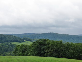
![]()
![]()
![]()
![]()
![]() On Monday, June 29th, I decided I wanted return to the Finger Lakes Trail to hike the middle section of map 19 which is the next map to the west of my completed sections. This section starts at the intersection of Purvis Road and Route 38 just south of Dryden Lake and continues for a little over 18 miles west to Carson Road to the beginning of map 20. Of course, the problem is that I usually have to hike both ways as I have no ride back from the end point. This means hiking, for example, hiking 12 miles to get a 6 mile section of trail. On many hikes I have used other trails of road walks to avoid a strict out-and-back which can be extremely boring! I checked the weather forecast when I got up and decided that it should be only cloudy and not raining by the time I started my hike at around 10:00 AM. Sheila was more than ready to hike and I was surprised that she settled down for the long ride very quickly. We left Livingston Manor at 8:00 AM heading northwest on State Route 17 to Binghamton. From there I took I81 north to the Marathon exit, exit 9. As I left Livingston Manor there was a light drizzle or heavy mist in the air. For the entire drive the precipitation alternated between drizzle and light rain. I stopped in Marathon to get gas and there was no rain which made me feel better. I decided to head west from Marathon on Route 221 and then take Babcock Hollow Road north to Bleck Road. I drove west on Route 221 for about 11 miles and turned right or north on Babcock Hollow Road. Bleck Road veered off to the right at about 1.8 miles and I drove about 1 mile to where the trail crossed the road. I turned around and parked near the crossing on the widest shoulder I could find! The temperature was still in the low 60's and when I got out of the car there was a light rain. I almost decided to come back another day but donned my OR Revel jacket. This jacket is made of Pertex which is highly water resistant but it is softer than most and has pit zips that go to the hem on both sides. There was a slight breeze which actually gave me a little chill. I could hear the creek running below and assumed the streams would be high from the rain. At least I wouldn't have to worry about insects. We started our hike at 10:05 AM by descending the steep bank on the near side of the road and heading west. Almost immediately we came to the creek which was high but did not have a bridge. I walked upstream to a narrower section to cross. When I reached the other side, I found slick mud and had a difficult time pulling myself up the bank. I worked my way downstream to the trail and continued. The trail was very wet and this continued throughout the day. There were standing pools of water, areas where the trail was more of a streambed and many areas of slick mud. There didn't seem to be many areas were maintainers had tried to provide drainage to allow the water to leave the trail. At about .5 miles we had ascended a hill and there was a view to the south. I took a few shots and then we continued to the Foxfire lean-to which was just beyond this point. I took a few shots of the new lean-to and then we continued on the main trail.
On Monday, June 29th, I decided I wanted return to the Finger Lakes Trail to hike the middle section of map 19 which is the next map to the west of my completed sections. This section starts at the intersection of Purvis Road and Route 38 just south of Dryden Lake and continues for a little over 18 miles west to Carson Road to the beginning of map 20. Of course, the problem is that I usually have to hike both ways as I have no ride back from the end point. This means hiking, for example, hiking 12 miles to get a 6 mile section of trail. On many hikes I have used other trails of road walks to avoid a strict out-and-back which can be extremely boring! I checked the weather forecast when I got up and decided that it should be only cloudy and not raining by the time I started my hike at around 10:00 AM. Sheila was more than ready to hike and I was surprised that she settled down for the long ride very quickly. We left Livingston Manor at 8:00 AM heading northwest on State Route 17 to Binghamton. From there I took I81 north to the Marathon exit, exit 9. As I left Livingston Manor there was a light drizzle or heavy mist in the air. For the entire drive the precipitation alternated between drizzle and light rain. I stopped in Marathon to get gas and there was no rain which made me feel better. I decided to head west from Marathon on Route 221 and then take Babcock Hollow Road north to Bleck Road. I drove west on Route 221 for about 11 miles and turned right or north on Babcock Hollow Road. Bleck Road veered off to the right at about 1.8 miles and I drove about 1 mile to where the trail crossed the road. I turned around and parked near the crossing on the widest shoulder I could find! The temperature was still in the low 60's and when I got out of the car there was a light rain. I almost decided to come back another day but donned my OR Revel jacket. This jacket is made of Pertex which is highly water resistant but it is softer than most and has pit zips that go to the hem on both sides. There was a slight breeze which actually gave me a little chill. I could hear the creek running below and assumed the streams would be high from the rain. At least I wouldn't have to worry about insects. We started our hike at 10:05 AM by descending the steep bank on the near side of the road and heading west. Almost immediately we came to the creek which was high but did not have a bridge. I walked upstream to a narrower section to cross. When I reached the other side, I found slick mud and had a difficult time pulling myself up the bank. I worked my way downstream to the trail and continued. The trail was very wet and this continued throughout the day. There were standing pools of water, areas where the trail was more of a streambed and many areas of slick mud. There didn't seem to be many areas were maintainers had tried to provide drainage to allow the water to leave the trail. At about .5 miles we had ascended a hill and there was a view to the south. I took a few shots and then we continued to the Foxfire lean-to which was just beyond this point. I took a few shots of the new lean-to and then we continued on the main trail.
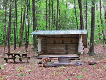 We descended a little just passed the lean-to over a very wet trail and then began an ascent to the top of a small hill. From there we descended 240 feet through some switchbacks to Babcock Hollow Road. This area was very muddy and the mud was slippery. As we approached the road, I put Sheila on her leash and crossed the ditch on a wooden walkway. I suddenly found myself horizontal as the wood was wet and very slippery. It was my only fall of the day. On the other side of the road we continued to descend to even wetter areas and another stream crossing which lacked a bridge. On the other side we began a 1 mile switchback as we headed toward Hilsinger Road. The direct route would only have been .2 miles but the elevation gain was 350 feet! sign just before the switchback warned that there were steep areas ahead that could be slippery when wet! I already knew this but the sign mentioned that there were ropes on the steepest parts. I did find 3 ropes but didn't use them as my poles were enough. Oddly these areas were not as slippery as some others I had encountered. We parallel Hilsigner Road for some time until at 2.5 miles we turned toward it and reached the road at 2.6 miles. It was barely a road at this point but I thought I might use it on the return trip to avoid the wet and muddy trail! From Hilsinger Road to our destination at Owego Hill Road was only .5 miles but we ended up hiking 1.25 miles of switchbacks to get there. This time there didn't seem to be any need for the wandering back and forth as the grade on the direct route was more than manageable! Along the way on the Finger Lakes Trail we had been passing several different side loops which were marked in different colors. At 3.65 miles we hit the highest point of the hike at 2032 feet on top of some unnamed hill. From here it was a descent to Owego Hill Road at 3.9 miles. It was 12:05 PM and we immediately turned around and began to retrace our steps back up the hill and then down through the switchbacks. The skies had cleared and there was some sun but I left on my jacket just in case. The trip seemed to be going quicker on the way back and we were soon crossing the stream to Hilsinger Road. I decided to stay on the trail and descend the steep switchbacks as it was the shortest distance. I used my poles wisely and had no problems getting back to Babcock Hill Road. I knew that some of the wettest trail ahead but I also knew that the trail was much shorter than hiking the roads. I carefully crossed the wooden bridge were I had fallen and we started to climb through the slipperiest mud. Once at the top we started our descent which seemed to go quickly. This time I crossed the stream near Bleck Road where the trail crossed. I used a downed tree as a handrail and had no problem crossing. We were back at the car at 2:05 PM having hike 7.7 miles in 4 hours with an elevation gain of 1585 feet. I was surprised that the trip out and back had taken the same amount of time since the trip back had seemed so much faster.
On Friday, June 26th, I met Ian Dunn, the DEC Region 3 Forester, at the Frick Pond trailhead at the end of Beech Mountain Road at 10:00 AM. When Sheila and I arrived Ian's truck was already parked and Ian was walking toward us. I had communicated some of the things we wanted to do at Frick Pond and Ian had responded to each point. Our goal is still to make the loop around the pond as accessible to novice hikers as possible. Ian had let me know that some of the changes we had proposed were not compatible with the DEC management plan for a wild forest. Ian and I decided to hike the loop to see what steps could be taken that are allowed under the plan. It had rained the day before so this was a perfect time to look at the water problems along the way. We walked out the Quick Lake Trail to the trail register where we turned left to head toward Frick Pond. The woods road was very wet and we both agreed that some ditching would help the problem. We stopped at Gravestone Junction and I showed Ian the sign that makes no sense at all. Ian agreed and took a picture to pass on so that a new sign that would help people understand destinations and differences. I showed Ian the wet area on the way to the pond. I had wanted to build a wooden walkway here but only the DEC is allowed to build so another solution is needed. Ian and I discussed stepping stones and corduroy to allow people to pass through this area without waterproof hiking boots. We continued across the bridge to the trail junction on the other side of the pond. Ian and I stayed to the right to take the Big Rock Trail around the back of the pond. We found one very wet area but hikers had already created a way to walk around this area. We agreed not to reroute the trail but to allow things to develop. We also found a culvert that had worked its way to the surface. Some dirt on either side will help make this easier to cross. I pointed out that some of the wooden causeways were loose and some were "floating" without a firm anchor. Ian said that it was permissible to nail down loose boards and use stones to support the always where water had eroded the ground beneath. As wee continued toward Times Square we found some wet areas that could be avoided by walking around them. These areas may be too low to drain but an attempt will be made to get rid of some of the water. We stopped at Times Square which was wet and muddy. Ian and I looked at the water draining from the Loggers Loop Trail and agreed that some ditching might direct the water to the culvert that runs under Times Square. Trimming some of the grass and weeds here would also help to direct people to the drier route. We turned right to follow the Loggers Loop Trail back to Gravestone Junction. We found several wet areas. These areas may benefit from some ditching or stepping stones or a combination of both. We walked back to the parking area and talked for some time. We parted company at about 11:30 AM. I found Ian to be very knowledgeable and willing to help. The information he gave me about trail maintenance in wild forest areas will be very useful.
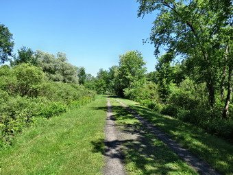
![]()
![]()
![]()
![]()
![]() On Monday, June 22nd, I decided I wanted return to the Finger Lakes Trail to hike the first section of map 19 which is the next map to the west of my completed sections. This section starts at the intersection of Purvis Road and Route 38 just south of Dryden Lake and continues for a little over 18 miles west to Carson Road to the beginning of map 20. Of course, the problem is that I usually have to hike both ways as I have no ride back from the end point. This means hiking, for example, hiking 12 miles to get a 6 mile section of trail. On many hikes I have used other trails of road walks to avoid a strict out-and-back which can be extremely boring! I decided to head west from Marathon on Route 221 and then go north on Route 38. Purvis Road is only 2.5 miles north of the intersection of Route 221 and Route 38. I planned to hike the trail to Owego Hill Road and then hike back on the local roads which seemed to offer a much shorter return route. My plans were almost derailed by an early morning ambulance call just after 6:00 AM but when I got home I decided to go anyway. Sheila was more than ready to hike and I was surprised that she settled down for the long ride very quickly. We left Livingston Manor around 8:30 AM heading northwest on State Route 17 to Binghamton. From there I took I81 north to the Marathon exit, exit 9. After a brief stop at a gas station, I took Route 221 west to the intersection with Route 38. After only 2.5 miles, I turned right on Purvis Road and park immediately on the widest part of the shoulder. I left my light jacket in the car as it was already 70 degrees and the forecast was for highs in the low 80's. I put Sheila on her leash and we began our hike at 10:35 AM by walking east on Purvis Road for .6 miles where we turned right on Willow Crossing. After crossing a road bridge, I saw a small parking area on the left. This was part of the Jim Schug Trail which is a rail trail. The Finger Lakes Trail uses a small part of the rail trail. We turned left onto the trail and found that it was absolutely flat and smooth and well maintained. I took a few pictures and then we continued our hike. We met a local hiker coming our way and I asked him about the "falls" on Cristina Creek. He replied that there weren't really any falls and eh, like me, had been fooled by the description. We continued in our separate directions. At 1.4 miles we were at Lake Road. The rail trail continued straight ahead but we turned right on Lake Road and hiked to 1.7 miles where the trail entered a field. A track was mowed between two houses and we followed it due east. In the field on the left was a beautiful, black stallion who looked young. He took an interest in us initially but then went to eating grass. I took a few shots and we then continued eastward toward a hill. The trail was wet and muddy in spots but easy to follow. Just before we started into the woods, I released Sheila from her leash. I also stopped to take a few pictures to the west. Dryden Lake was just visible but there were some nice, puffy, white clouds in the sky and the lighting was good. We continued our hike by entering the woods and starting our climb up the hill.
On Monday, June 22nd, I decided I wanted return to the Finger Lakes Trail to hike the first section of map 19 which is the next map to the west of my completed sections. This section starts at the intersection of Purvis Road and Route 38 just south of Dryden Lake and continues for a little over 18 miles west to Carson Road to the beginning of map 20. Of course, the problem is that I usually have to hike both ways as I have no ride back from the end point. This means hiking, for example, hiking 12 miles to get a 6 mile section of trail. On many hikes I have used other trails of road walks to avoid a strict out-and-back which can be extremely boring! I decided to head west from Marathon on Route 221 and then go north on Route 38. Purvis Road is only 2.5 miles north of the intersection of Route 221 and Route 38. I planned to hike the trail to Owego Hill Road and then hike back on the local roads which seemed to offer a much shorter return route. My plans were almost derailed by an early morning ambulance call just after 6:00 AM but when I got home I decided to go anyway. Sheila was more than ready to hike and I was surprised that she settled down for the long ride very quickly. We left Livingston Manor around 8:30 AM heading northwest on State Route 17 to Binghamton. From there I took I81 north to the Marathon exit, exit 9. After a brief stop at a gas station, I took Route 221 west to the intersection with Route 38. After only 2.5 miles, I turned right on Purvis Road and park immediately on the widest part of the shoulder. I left my light jacket in the car as it was already 70 degrees and the forecast was for highs in the low 80's. I put Sheila on her leash and we began our hike at 10:35 AM by walking east on Purvis Road for .6 miles where we turned right on Willow Crossing. After crossing a road bridge, I saw a small parking area on the left. This was part of the Jim Schug Trail which is a rail trail. The Finger Lakes Trail uses a small part of the rail trail. We turned left onto the trail and found that it was absolutely flat and smooth and well maintained. I took a few pictures and then we continued our hike. We met a local hiker coming our way and I asked him about the "falls" on Cristina Creek. He replied that there weren't really any falls and eh, like me, had been fooled by the description. We continued in our separate directions. At 1.4 miles we were at Lake Road. The rail trail continued straight ahead but we turned right on Lake Road and hiked to 1.7 miles where the trail entered a field. A track was mowed between two houses and we followed it due east. In the field on the left was a beautiful, black stallion who looked young. He took an interest in us initially but then went to eating grass. I took a few shots and we then continued eastward toward a hill. The trail was wet and muddy in spots but easy to follow. Just before we started into the woods, I released Sheila from her leash. I also stopped to take a few pictures to the west. Dryden Lake was just visible but there were some nice, puffy, white clouds in the sky and the lighting was good. We continued our hike by entering the woods and starting our climb up the hill.
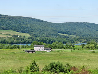 The trail up the hill had many switchbacks which made the path less steep but added to the distance. Not far into the woods was a very large oak tree with an Finger Lakes Trail register on one side. I took a few pictures of the tree and then noticed that biting insects were beginning to gather. We continue to the top of the hill heading generally eastward. I decided to skip the trail to the Field View but at 3.25 miles I looked off to the right and saw a potentially nice lookout. We walked through the woods to an opening and got a nice view of the hills opposite our location. I took a few shots and then we headed back to the main trail. As we continued to hike I noticed several things. There were signs indicating that the land we were traveling on was private and landowners had given permission for the Finger Lakes Trail Conference to use the land. I greatly appreciate the generosity of these landowners and hope other hikers respect their rights. The trail was extremely wet and muddy and I am sure the recent rains did not help. The trail was not as well marked as the eastern portion I had hiked the previous Friday. Blazes were few and far between and turns were not clearly marked. At 4.25 miles we walked out onto a power line right-of-way and there were no blazes to indicate which direction to take. The map seemed to indicate a right turn so I started in that direction. We came to a spot where there was a steep descent and I could see a swampy area at the bottom. I decided not to head down before I retraced my steps to see if I could find some blazes. We walked back on our route and I found the blazes I was looking for. There was no turn indicated and the next blazes on the trail were hidden. It was a case that if you knew where you were going there was no problem. I had a map, a GPS and a trail dog and still couldn't find the turn the first time! We followed the trail through some very wet areas as it descended the hill roughly paralleling the right-of-way. Eventually the trail crossed under the power line in the swampy area I had sought to avoid when looking down from above! We continued to follow the trail through many twists and turns and switchbacks headed east toward Daisy Hollow Road. The trail don't seem to exactly match my map. As we approached the road, the trail descended to a stream. There seemed to be only one way to go but the trail was highly eroded and there were no white blazes. We made it down to the stream, picked up some blazes, crossed the stream and arrived at Daisy Hollow Road. I got a drink and pout on some insect repellant as they were swarming and occasionally biting. I had to decide whether to turn back at this point or complete another two miles of trail. I decided for the longer hike and we turned left on Daisy Hollow Road to head north for about .6 miles.
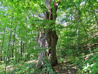 As we walked up the road with Sheila on her leash, I renamed the road Dog Hollow Road in my mind. Every house had at least one barking dog but Sheila chose to ignore them. Most were tied up, or in the house but a few were loose. At one point I looked around to find "Lassie" following us up the road. The dog's owner seemed a little annoyed that we were walking on the road and attracting her dog. A little further up the hill a pit bull-terrier mix ran out of a driveway and started barking. I yelled for the dog to "Go home!" and was answered by an owner who was irritated because I was yelling at his dog! In both cases I ignored the people since owners who do not take steps to keep their dogs out of the road are not reasonable people. At 5.75 miles we reentered the woods for what I thought would be about a 2 mile hike to Owego Hill Road. The trail continued heading east paralleling and intermittent stream. The insects by now were swarming and the repellant didn't seem to do very much to discourage them. At about 6.3 miles I followed the blazes out to a woods road and found...no more blazes anywhere. I walked up the woods road but found no markings. I surveyed the woods and could not see the hint of a trail or any blazes. The map indicate we should continue to parallel the stream but there we several. Sheila and I followed one stream but could not find anything. We crossed the stream and found paths but no blazes on the other side. I didn't want to end the hike in this way but it looked like there was no other choice! When we got back to the woods road, I decided to follow it a little further before turning back. With a few hundred feet, I saw a white blaze on the right and the trail. We followed the trail back to the last blaze I had seen. The trail came down to the stream and crossed it! The last blaze had not indicated a turn but rather showed hikers they should continue straight ahead! This is a MAJOR mistake which should be corrected since the lack of one blaze coast me 20 minutes and .5 miles of hiking and almost ended my hike.
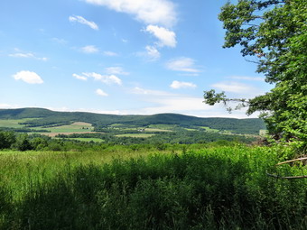 Once we found the trail, we continued to follow it east to 7.45 miles paralleling the stream and gaining some elevation. We followed the trail as it turned south and finally intersected Owego Hill Road at 7.9 miles. It was 2:30 PM as we turned right on the road to begin our trip back to the car. The road was definitely a "seasonal maintenance only" road and I decided that we would hike the middle section of map 19 from Bleck Road west since that was a nicely paved surface. I wasn't sure exactly how far the return trip would be but I was sure that it would be less than the 8 mile hike out. The fact that the road was almost a trail meant little relief from the insects but soon it opened up and the sun seemed to discourage them. At 9 miles the road turned west and was paved. We also picked up another dog at this point who followed us down the road. I decided to stow my poles and put Sheila on her leash. We walked to the next intersection and turned right on Adams Road. I was hoping that none of these roads had a serious ascent as we had found on previous hikes! Adams Road took us 1 mile west to Daisy Hollow Road where we turned left to head south. We walked down the road heading southwest for about .8 miles. We turned right on Willow Crossing and hiked .6 miles back to the entrance to the rail trail. Sheila seemed hot so I let her off her leash to go down to a stream to cool off and get a drink. We walked a few hundred feet to Purvis Road and turned left. It seemed very hot and the .6 miles back to the car seemed to take forever! We were back by 4:00 PM having hiked 11.7 miles in 5.5 hours. The elevation gain along the way was only about 1700 feet. At least a mile of the hike was unnecessary and was due to poorly marked trails. There is now a five mile section of trail between Owego Hill Road and Bleck Road to finish the map 19 section.