
What You Missed
Spring 2010
Spring 2010
![]()
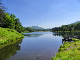
![]() On Sunday, June 20th we finished Pyramid Mountain and were ready to try another Morris County Park, Schooley's Mountain. We are getting so that we know many of the roads in New Jersey so finding this park was easier than we thought. Soon we were headed south on Route 206 toward Chester and Route 513 west. We arrived in Long Valley to find a beautiful small town. Aright onto Route 517 and a QUICK left onto Fairview Avenue put us minutes away from the Langdon Palmer Fishing Area parking and the trailhead for our next hike. We arrived at 2:15 PM and got ready to hike. By now the temperature was in the mid-90's with a humidity level approaching 80%! Occasionally a breeze would blow and cold things off just a little! As we entered the woods we immediately had to choose left or right. Most of the marked trail led to the left but we would return that way. We continued to the right on the unblazed Beeline Trail which made a gentle but steady ascent. Several woods roads and paths cut across the trail but we continued on the Beeline until the Grand Loop Trail. We continued straight ahead on this trail and continued to climb through green hardwood forest When we got to the Highland Cut Trail we turned left and headed southwest still climbing slightly until at about 1.3 miles into the hike we started to descend to the picnic area at George Lake.
On Sunday, June 20th we finished Pyramid Mountain and were ready to try another Morris County Park, Schooley's Mountain. We are getting so that we know many of the roads in New Jersey so finding this park was easier than we thought. Soon we were headed south on Route 206 toward Chester and Route 513 west. We arrived in Long Valley to find a beautiful small town. Aright onto Route 517 and a QUICK left onto Fairview Avenue put us minutes away from the Langdon Palmer Fishing Area parking and the trailhead for our next hike. We arrived at 2:15 PM and got ready to hike. By now the temperature was in the mid-90's with a humidity level approaching 80%! Occasionally a breeze would blow and cold things off just a little! As we entered the woods we immediately had to choose left or right. Most of the marked trail led to the left but we would return that way. We continued to the right on the unblazed Beeline Trail which made a gentle but steady ascent. Several woods roads and paths cut across the trail but we continued on the Beeline until the Grand Loop Trail. We continued straight ahead on this trail and continued to climb through green hardwood forest When we got to the Highland Cut Trail we turned left and headed southwest still climbing slightly until at about 1.3 miles into the hike we started to descend to the picnic area at George Lake.
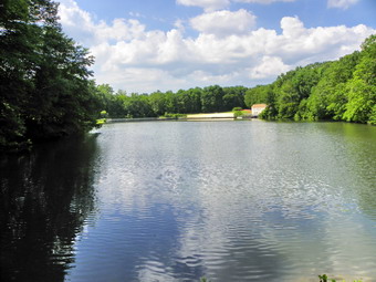
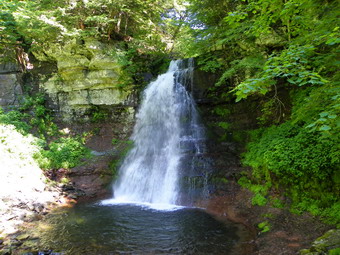
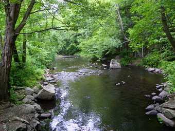
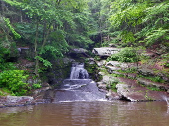
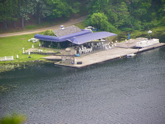
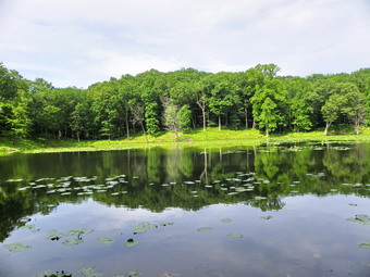
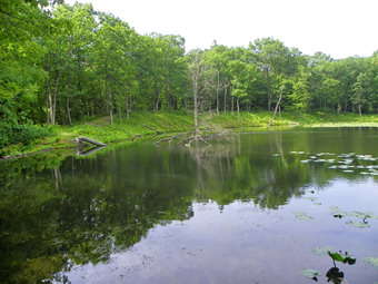
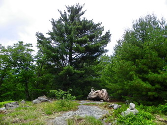
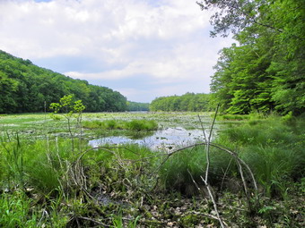
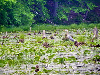
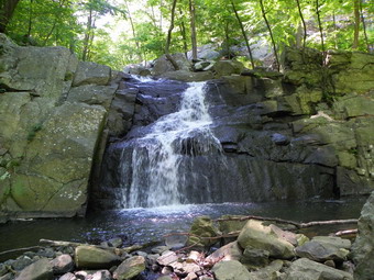 There were quite a few people at the picnic area and we headed toward the lake until we spotted the beach area which was closed. Perhaps cost cutting had something to do with the closure or maybe it was the goose population. From just left of the beach area a floating bridge crossed George Lake and we stopped to take pictures of the lake, the bridge and some wildlife before crossing. We walked south on the other side of the lake and back to the other side on the bridge over the dam. The Falling Water Trail paralleled Electric Brook and we stopped several times to take pictures until the trail descended steeply at the main falls. A family was already there and we stopped to talk. They asked questions about the trails and mentioned they had been in the Catskills several times. We wished each other a good day and went in opposite directions. We stopped to take many pictures of the falls which had an upper and lower half before continuing on to the south and west. The trail ascended a short hill and I knew we had arrived at the rock quarry. The area was larger than I thought it would be with many of the rocks showing drill holes and angles typical of quarried stone. I took some pictures before we descended the hill to pick up the Patriot's Path west back to the car. We were back at about 4:15 PM having taken 2 hours to cover the 3.2 miles with MANY stops for pictures.
![]()
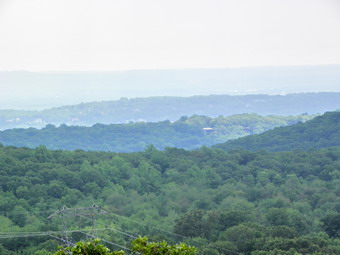
![]() On Sunday, June 20th Cindy wanted to do some hiking and Sheba was ready to go. Cindy is not thrilled with bushwhacking or high temperatures and humidity so the remaining NJ1K were out of the question! We decided to go to New Jersey to hike two of the excellent parks in the Morris County system. I am VERY impressed with what Morris County has done in creating a number of parks with something for everyone and then maintaining them. Our first stop was Pyramid Mountain Natural Historical Area near Boonton. We headed for Port Jervis again and picked up Route 23 over High Point and stayed on this road for the LONG trip to Route 511 south just after Kinnelon. This road is also Known as Boonton Avenue and it wasn't too long until we were at the parking area for the hike. When we arrived at 10:20 AM there were quite a few cars in the lot and I remembered this was supposed to be a popular destination. There weren't too many views but there were many interesting glacial formation with the most prominent being some glacial erratics. The temperatures were already in the high 80's with a humidity top match! As we started there were a few other people headed out on the blue Mennen Trail. These people quickly thinned out as they took paths to the lake or for a shorter hike. We crossed over Stony Brook on a bridge and immediately after bypassed a turn onto a yellow trail on the right. Further along a white trail came in from the left but we stayed on the blue trail. This trail followed alongside a power line right-of-way but stayed in the woods. We stopped at the junction of the Red Trail and Blue trail to adjust equipment before starting down the Red Trail. A hiker passed us and ask if we needed help but we thanked her and said "No".
On Sunday, June 20th Cindy wanted to do some hiking and Sheba was ready to go. Cindy is not thrilled with bushwhacking or high temperatures and humidity so the remaining NJ1K were out of the question! We decided to go to New Jersey to hike two of the excellent parks in the Morris County system. I am VERY impressed with what Morris County has done in creating a number of parks with something for everyone and then maintaining them. Our first stop was Pyramid Mountain Natural Historical Area near Boonton. We headed for Port Jervis again and picked up Route 23 over High Point and stayed on this road for the LONG trip to Route 511 south just after Kinnelon. This road is also Known as Boonton Avenue and it wasn't too long until we were at the parking area for the hike. When we arrived at 10:20 AM there were quite a few cars in the lot and I remembered this was supposed to be a popular destination. There weren't too many views but there were many interesting glacial formation with the most prominent being some glacial erratics. The temperatures were already in the high 80's with a humidity top match! As we started there were a few other people headed out on the blue Mennen Trail. These people quickly thinned out as they took paths to the lake or for a shorter hike. We crossed over Stony Brook on a bridge and immediately after bypassed a turn onto a yellow trail on the right. Further along a white trail came in from the left but we stayed on the blue trail. This trail followed alongside a power line right-of-way but stayed in the woods. We stopped at the junction of the Red Trail and Blue trail to adjust equipment before starting down the Red Trail. A hiker passed us and ask if we needed help but we thanked her and said "No".
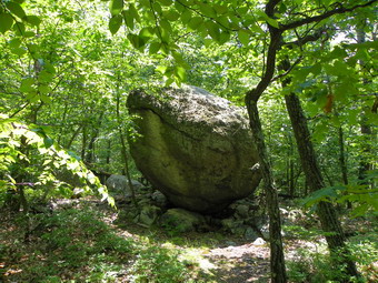
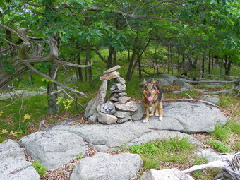
 After a short distance we crossed over Bear house Brook on a couple of planks and were at the junction with the White Trail. There are construction materials piled there for a new bridge but they seem to have been there for some time. We walked to the left on the White Trail and woods road looking for the ruins of the Morgan Place. We did find some foundations but not much else and the road seemed to be headed to the power line. We turned around and headed north on the White Trail looking for Bear Rock. As we approached the appointed place, only a few small erratics were present and we were disappointed. We walked a little further and found Bear Rock (Bare Rock). It was right at the junction of the White Trail that we were on and the Blue/White and Yellow trail on the right. It was truly huge and we stopped to take some shots before continuing on the Blue Trail again. This trail started by paralleling the brook and some low swampy areas and I have the insect bites to prove it. After walking north for a while we were at the junction with the Red Trail and turned right to head south almost 80 degrees from our previous heading. The trail parallel the base of a ridge with a lot of talus before turning east and climbing up to the top of that ridge! As the trail flattened we came across Whale Head, another glacial erratic. It was precariously perched or balanced and a diagonal crack at the top did make it look a little like a whale's head breaching the waves. We stopped and took pictures and got a drink before continuing the hike. Along the way we found an interesting rock that had fractured in a curve making it look man-made. After this point the trail rolled some but mostly descended to another formation.
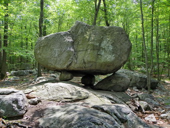
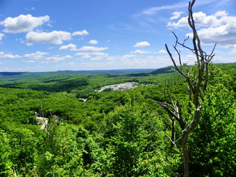
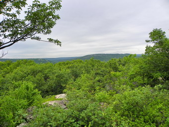
 Tripod Rock is a large erratic perched on top of three smaller stones. I had read descriptions and seen pictures but it was much more impressive in "person". Nearby are two other erratics that people have placed smaller rocks under to mimic Tripod Rock. There were a few people in the area and a few more arrived as we were taking pictures. All seemed to know something about the formation and all had a hard time believing it was all natural. After Tripod Rock it was mostly downhill as the trail went downhill AND there weren't many more formations. We passed trail coming in from the right. I walked up the path to what I thought was Lucy's Overlook. Either I had the wrong place or it, like many other viewpoints, has grown in. We were now back on the blue trail hiking along the shoulder of Pyramid Mountain. To the right was the summit but there didn't seem much reason to go up there. To the left there seemed to be some light indicating a viewpoint but one never seemed to open up. Soon we were at the southwestern end of Pyramid Mountain where the trail make a sharp right to descend steeply. Here a path led straight ahead and we took it to a limited viewpoint. As we walked back up the trail I noticed another viewpoint on the right just before the trail turned down the mountain. I walked out to this area and got some different and better pictures. From here we descended the mountain, steeply at times, and followed our original path back top the car. We were back just after 1:00 PM with the 5 mile hiking taking about 3 hours. After a brief rest, we consulted our maps for the best route to Schooley's Mountain County Park near Long Valley.
![]()
![]() On Saturday, June 19th the son on one of our friends was marrying the daughter of another friend at the Frost Valley YMCA camp. One of the activities before the wedding was a hike to High Falls on the Frost Valley property on Saturday morning at 9:45 AM. I left Sheba home since I did not know if her presence would be appreciated. Cindy does not ride well on the winding back roads so I was the only one going on the hike from our family. By 9:45 AM a few people had shown up and our guide, Eric, arrived. He were off just before 10:00 AM on what was billed as the long hike. I knew it would NOT be long so I asked if I could hike to High Falls with the group and then continue on my own. Eric said he didn't see why not and I was satisfied. We walked from the pavilion out passed the lake on the road side on the Lake Cole Trail and then around then end of the lake and over the bridge at the dam. Here we started to walk on the actual trail dubbed the Deer Run Trail. These trails are all well maintained and groomed with most debris removed. WE crossed the Line Shack Trail and continued on the yellow blazed High Falls Trail. Once we got to the blue Spring Ridge Trail, we followed an unmarked path down to the falls. We were there by about 10:35 AM. There is a nice wooden deck that offers a good view of the falls and I took some pictures before excusing myself to continue the hike on my own.
On Saturday, June 19th the son on one of our friends was marrying the daughter of another friend at the Frost Valley YMCA camp. One of the activities before the wedding was a hike to High Falls on the Frost Valley property on Saturday morning at 9:45 AM. I left Sheba home since I did not know if her presence would be appreciated. Cindy does not ride well on the winding back roads so I was the only one going on the hike from our family. By 9:45 AM a few people had shown up and our guide, Eric, arrived. He were off just before 10:00 AM on what was billed as the long hike. I knew it would NOT be long so I asked if I could hike to High Falls with the group and then continue on my own. Eric said he didn't see why not and I was satisfied. We walked from the pavilion out passed the lake on the road side on the Lake Cole Trail and then around then end of the lake and over the bridge at the dam. Here we started to walk on the actual trail dubbed the Deer Run Trail. These trails are all well maintained and groomed with most debris removed. WE crossed the Line Shack Trail and continued on the yellow blazed High Falls Trail. Once we got to the blue Spring Ridge Trail, we followed an unmarked path down to the falls. We were there by about 10:35 AM. There is a nice wooden deck that offers a good view of the falls and I took some pictures before excusing myself to continue the hike on my own.
 I walked back up the hill to the trail and took the blue Spring Ridge Trail northeast. When I reached the yellow Panhandle Trail, I took it to extend my hike as far as possible. I intended to take the trail furthest away from the main complex to do a complete perimeter hike of the upper trail system. All along the Spring Ridge and Panhandle Trail I could hear and usually see the High Falls Brook as it made its way to the falls. The Panhandle Trail climbed quite a bit and was much rougher than the well maintained trails nearer the main complex. It was mostly woods road but showed little maintenance or use. It was very wet in places and overgrown with ferns and grasses. At the Line Shack trail I turned left and then left again on the yellow Sunrise Trail. When the yellow trail met the blue Rocky Road Trail, I continued on blue. Somewhere along the way I came upon the Line Shack erected by a group in the late 20's! The Rocky Road was rocky and wet in many places. I continued to descend on it and got some nice views of the Wildcat Range across the river. Eventually the Rocky Road Trail met the red Perimeter Trail which I followed passed some yurts and the climbing tower and zip lines. This lead me back to the parking area by 11:45. I covered just under 5 miles in under 2 hours!
![]()
![]() On Wednesday, June 16th I drove out West Brook to Stonetown Road and then to the Greenwood Lake Turnpike. Just passed the Long Pond Ironworks I turned right onto East Shore Road. I was looking for a pronounced turn to the left of the road and a yellow gate on the right with a pull off across the road. This was much easier to find than I thought it would be. I pulled over and parked at about 2:15 PM. There was still some thunder but no rain so I decided to chance it. The bridge over the creek has seen better days but it supported us just fine. Just after crossing the bridge there seemed to be a path up through the woods so started climbing the rather steep hill heading north. Immediately some cliffs appeared in the direction I was going and it did not look like they would be easily scaled. We ran across a road up but more to the northwest. I decided to follow this and it led to a gentler ascent. After gaining quite a bit of elevation I turned northeast and began to encounter some high spots. Each time I found a high spot there was another higher one just ahead of me. There did seem to be a path and I followed this as I climbed over and then up to another high spot.
On Wednesday, June 16th I drove out West Brook to Stonetown Road and then to the Greenwood Lake Turnpike. Just passed the Long Pond Ironworks I turned right onto East Shore Road. I was looking for a pronounced turn to the left of the road and a yellow gate on the right with a pull off across the road. This was much easier to find than I thought it would be. I pulled over and parked at about 2:15 PM. There was still some thunder but no rain so I decided to chance it. The bridge over the creek has seen better days but it supported us just fine. Just after crossing the bridge there seemed to be a path up through the woods so started climbing the rather steep hill heading north. Immediately some cliffs appeared in the direction I was going and it did not look like they would be easily scaled. We ran across a road up but more to the northwest. I decided to follow this and it led to a gentler ascent. After gaining quite a bit of elevation I turned northeast and began to encounter some high spots. Each time I found a high spot there was another higher one just ahead of me. There did seem to be a path and I followed this as I climbed over and then up to another high spot.
 Eventually I saw ahead a large cairn and I knew we had arrived. We stopped briefly to take a few pictures and then several peals of thunder made me look for the best way back. I decided that going down steep ground is easier than going up and that most cliffs have some way down. I used my compass to get a roughly southeastern bearing and headed down in that direction. The lay of the land kept pushing me south but I figured that was OK. There were some very steep areas but each seemed to have a way down through them. Soon, I could see light ahead which I judged to be the swampy area that runs between Jennings and Big Beach. I knew that if this was true there would be a trail or road just at the base of the descent. It turned out I was correct and we turned right to head southwest back to the car. I think next time I will hike in from the Jennings Hollow trail or at least go up through the cliffs the way I came down. I stopped on the bridge to take a few pictures and then walked across the road to the car. It was right around 3:15 PM and the 1.5 mile hike had taken almost exactly one hour.
![]()
![]() On Wednesday, June 16th we parked along West Brook Road at about 11:45 AM and started out on a hike we had started before. The last time Cindy, Sheba and I hiked this I made the mistake of taking the wrong trail to the wrong summit of Long Hill near the northern end. It was a nice hike that day but long for Cindy. This time I was only interested in getting the peak so Sheba and I moved quickly without stopping. The thunder in the distance helped spur us along! Crossing the brook near the beginning of the trail was an adventure since it was a little high due to the recent rain. There was still some blowdown blocking the trail on the other side but we knew how to work around it. We went over Manaticut Point without stopping and stayed on the Hewitt Butler Trail when we got to the trail junction at 1.2 miles. This trail was not as nice as the trail we took before but at least I knew I was now headed in the right direction. After another mile I could see the power line right-of-way and soon the trail met and followed it to the highest point on Long Hill. I walked a little further looking for higher ground but the trail started to descend so we turned around and hurried back the way we came. Sheba and I can really move on trails when we aren't stopping for pictures so we finished the 5 mile hike in 2 hours, returning to the car 1:45 PM. It hadn't started to rain yet so I decided to drive the East Shore Road to at least find the parking spot for Jennings Mountain.
On Wednesday, June 16th we parked along West Brook Road at about 11:45 AM and started out on a hike we had started before. The last time Cindy, Sheba and I hiked this I made the mistake of taking the wrong trail to the wrong summit of Long Hill near the northern end. It was a nice hike that day but long for Cindy. This time I was only interested in getting the peak so Sheba and I moved quickly without stopping. The thunder in the distance helped spur us along! Crossing the brook near the beginning of the trail was an adventure since it was a little high due to the recent rain. There was still some blowdown blocking the trail on the other side but we knew how to work around it. We went over Manaticut Point without stopping and stayed on the Hewitt Butler Trail when we got to the trail junction at 1.2 miles. This trail was not as nice as the trail we took before but at least I knew I was now headed in the right direction. After another mile I could see the power line right-of-way and soon the trail met and followed it to the highest point on Long Hill. I walked a little further looking for higher ground but the trail started to descend so we turned around and hurried back the way we came. Sheba and I can really move on trails when we aren't stopping for pictures so we finished the 5 mile hike in 2 hours, returning to the car 1:45 PM. It hadn't started to rain yet so I decided to drive the East Shore Road to at least find the parking spot for Jennings Mountain.
![]()
![]() On Wednesday, June 16th we left Pochuck and headed south on Rt 565 to Rt 23. Route 23 is becoming very familiar to me and I knew just where we wanted to turn to go to Buck Mountain. The turn was right across from Echo Lake Road which heads north. I turned right and started to look for Winnebago Road. My intent was to drive down the road and park on the side to hike up Buck Mountain. When I got to the turn, the road was gated and the property posted as Property of the City of Newark. I didn't know if my watershed permit would allow me to hike here. I drove down the road and found an employee at one of the pumping stations who said he didn't think anyone would care or bother me. I decided to take a chance but asked the lady at the house across the road if I could park in her driveway. The gave me permission and we started at about 10:00 AM. We walked down the paved road and crossed the Pequannock River on a nice road bridge. The river has quite a gorge far below. As we walked up the road on some gravel another dog joined us. He and Sheba seemed to tolerate each other and he seemed to know where he was going. We continued on the road passed the Charlottesburg Reservoir Dam for a little bit. The road seemed to be heading too far to the south so I turned left into the woods and started climbing up. Headed roughly east. We gained some elevation and I kept seeing rock outcroppings ahead of me with each being higher than the other. I am used to having my GPS to pinpoint the exact location of the high points so I felt a little lost! After walking around on these rock outcroppings, I was ready to head back until I a view of some MUCH higher ground to the east. We descended a little, crossed a trail or road and then started steeply up through some pretty thick brush. Soon we were at the top on the north end of the ridge with some views to the north. After taking some pictures, I turned around and headed south on the ridge since I remembered that the high pint was in that direction. My choice was reinforced by the fact that I could see higher ground and there were some paths that led to what I eventually claimed as the summit.
On Wednesday, June 16th we left Pochuck and headed south on Rt 565 to Rt 23. Route 23 is becoming very familiar to me and I knew just where we wanted to turn to go to Buck Mountain. The turn was right across from Echo Lake Road which heads north. I turned right and started to look for Winnebago Road. My intent was to drive down the road and park on the side to hike up Buck Mountain. When I got to the turn, the road was gated and the property posted as Property of the City of Newark. I didn't know if my watershed permit would allow me to hike here. I drove down the road and found an employee at one of the pumping stations who said he didn't think anyone would care or bother me. I decided to take a chance but asked the lady at the house across the road if I could park in her driveway. The gave me permission and we started at about 10:00 AM. We walked down the paved road and crossed the Pequannock River on a nice road bridge. The river has quite a gorge far below. As we walked up the road on some gravel another dog joined us. He and Sheba seemed to tolerate each other and he seemed to know where he was going. We continued on the road passed the Charlottesburg Reservoir Dam for a little bit. The road seemed to be heading too far to the south so I turned left into the woods and started climbing up. Headed roughly east. We gained some elevation and I kept seeing rock outcroppings ahead of me with each being higher than the other. I am used to having my GPS to pinpoint the exact location of the high points so I felt a little lost! After walking around on these rock outcroppings, I was ready to head back until I a view of some MUCH higher ground to the east. We descended a little, crossed a trail or road and then started steeply up through some pretty thick brush. Soon we were at the top on the north end of the ridge with some views to the north. After taking some pictures, I turned around and headed south on the ridge since I remembered that the high pint was in that direction. My choice was reinforced by the fact that I could see higher ground and there were some paths that led to what I eventually claimed as the summit.
 To return I decided that I did not want to try to retrace my route up but would use a northwest compass bearing to guide me. We headed in that direction and DOWN whenever we could. At one point I ran into a road and I decided to walk that for a while. It seemed to be heading to much toward the north and I was about abandon it when I heard the roar of the water over the dam. A little to the west I could see the reservoir so I headed in that direction and walked down the hill to the dam. I took a few pictures and then returned to the bridge over the river where I took Some more. From there it was back to the car. The route was about 2.5 miles as close as I could figure and we were back at about 11:15 AM so it took only and hour and 15 minutes. I headed back to Route 23 and crossed it to take Echo Lake Road north to Macopin Road and then to West Brook Road to hike Long Hill again.
![]() On Wednesday, June 16th I took a day off from work since I had no assignment and headed to New Jersey to get some more NJ1K peaks. I had only 10 left and wanted to get the "north" done before planning a long day in the "south". I carefully planned a driving route to include Pochuck, Buck in Kinnelon, Long Hill and Jennings. I doubted I could get all of these in since I had been warned the first two could be problematic and the forecast was for thunderstorms. I had learned my lesson on Saturday and will, in the future, avoid torrential downpours as much as possible. I got an early start and headed down the Quickway to the Florida exit. Just before Florida I headed for Pine Island and from here took the proper roads to get to the intersection of Ft 65 and Tall Timbers Road. We arrived at about 8:15 AM which was when I found out I had left my GPS unit home. I use the GPS to help navigate and to record Mt routes to publish later. I was annoyed at myself but figured I could navigate with map and compass and then approximate my routes when I got home. Sheba and I headed off into the swampy area that lies between the parking area and the drier and open forest on the other side. At least one report warned about how thick this area was and how it might be nearly impassable given the rain we had over the previous few days. We found a pretty good route through the swampy area which was actually just damp and soon were on the other side in the forest.
On Wednesday, June 16th I took a day off from work since I had no assignment and headed to New Jersey to get some more NJ1K peaks. I had only 10 left and wanted to get the "north" done before planning a long day in the "south". I carefully planned a driving route to include Pochuck, Buck in Kinnelon, Long Hill and Jennings. I doubted I could get all of these in since I had been warned the first two could be problematic and the forecast was for thunderstorms. I had learned my lesson on Saturday and will, in the future, avoid torrential downpours as much as possible. I got an early start and headed down the Quickway to the Florida exit. Just before Florida I headed for Pine Island and from here took the proper roads to get to the intersection of Ft 65 and Tall Timbers Road. We arrived at about 8:15 AM which was when I found out I had left my GPS unit home. I use the GPS to help navigate and to record Mt routes to publish later. I was annoyed at myself but figured I could navigate with map and compass and then approximate my routes when I got home. Sheba and I headed off into the swampy area that lies between the parking area and the drier and open forest on the other side. At least one report warned about how thick this area was and how it might be nearly impassable given the rain we had over the previous few days. We found a pretty good route through the swampy area which was actually just damp and soon were on the other side in the forest.
I used my rule that says head UP and in the general direction of the intended target and this is what we did. The walking was pretty easy as we headed generally east. We hit a woods road that went up the mountain but headed a little more south than I wanted to go. Still, some pretty impressive cliffs lay between the road and the high point so I decided to follow the road around the "back" of the mountain. Soon a "path" appeared on the right and we headed up again steeply through some ferns and blowdown. This put us on the summit plateau where we walked around for a while until I felt we had hit all the possible high points. There wasn't much to see so I decided to head back down by heading northwest and over some of the steep cliffs we had seen before. Going down wasn't too bad as we found some breaks in the cliffs and we soon hit another woods road. This one headed too much to the north so we crossed it and soon regained our path from earlier. We followed the same general route back down through the open forest and across the swamp. We were back by 9:15 covering about 1.5 miles in the hour. The next stop was Buck Mountain in Kinnelon.
![]()
![]() On Sunday, June 13th I wanted to hike after church. I looked at the weather forecasts and south seemed the best direction so I looked at the area around the Delaware Water Gap. The forecast for Dingman's Ferry was for thunderstorms LATE in the afternoon. Cindy looked at the radar and confidently stated that we WOULD get wet. I chose to believe the professional forecasters instead of my wife. Boy was I wrong! We headed for Port Jervis, took I84 to Milford and the caught Route 6 to Milford and Route 209 to the Water Gap. We crossed the Dingman's Ferry bridge under cloudy, dark skies. On the other side we made all the turns necessary to get on the NPS road through the Water Gap. At first it was just sprinkling and then the rain came in buckets. I was still optimistic as we headed toward Millbrook Village since it hadn't rained in that area and the skies seemed brighter or so I thought. We parked at Millbrook Village and I enquired about the Orchard Trail. It starts right across the road from the parking area and we were out on the trail by 1:15 PM. The skies were dark and Cindy seemed resigned to getting drenched but I was still hoping for the best! We started up the Orchard Trail which is blazed in orange and is a little more of a climb than I thought it would be. Near the top are some open clearings but after a little more than a half mile the Orchard Trail ends and we started walking on a paved road designated the Hamilton Ridge Trail.
On Sunday, June 13th I wanted to hike after church. I looked at the weather forecasts and south seemed the best direction so I looked at the area around the Delaware Water Gap. The forecast for Dingman's Ferry was for thunderstorms LATE in the afternoon. Cindy looked at the radar and confidently stated that we WOULD get wet. I chose to believe the professional forecasters instead of my wife. Boy was I wrong! We headed for Port Jervis, took I84 to Milford and the caught Route 6 to Milford and Route 209 to the Water Gap. We crossed the Dingman's Ferry bridge under cloudy, dark skies. On the other side we made all the turns necessary to get on the NPS road through the Water Gap. At first it was just sprinkling and then the rain came in buckets. I was still optimistic as we headed toward Millbrook Village since it hadn't rained in that area and the skies seemed brighter or so I thought. We parked at Millbrook Village and I enquired about the Orchard Trail. It starts right across the road from the parking area and we were out on the trail by 1:15 PM. The skies were dark and Cindy seemed resigned to getting drenched but I was still hoping for the best! We started up the Orchard Trail which is blazed in orange and is a little more of a climb than I thought it would be. Near the top are some open clearings but after a little more than a half mile the Orchard Trail ends and we started walking on a paved road designated the Hamilton Ridge Trail.
 As we made the turn onto the road, we heard some thunder and a few raindrops began to fall. Cindy must have known what was coming since she stopped to put on her rain jacket AND pants. We continued along the Hamilton Ridge Trail for another .7 miles until the orange blazed Pioneer Trail appeared on the right. I stopped to put on my rain jacket (I did NOT bring pants.) and stowed the electronics in plastic bags. We headed down the Pioneer Trail as the rain increased. The trail headed down toward the river and after only about .2 miles it turned sharply left. A road led off to the right but I ignored it thinking a better view of the river might be ahead. This WAS the place to walk down to the bluffs overlooking the river and I may return when the weather is more friendly. The trail continued to twist and turn and came pretty close to the river over the next 1.25 miles. In places it looked like no one had been over the trail in some time as the grass was high and the bushes encroached on the it. In several places it was obvious that the land had been cleared but we did not investigate for old foundation or ruins. We crossed a power line right-of-way and then the rain started to come down in buckets. Just after the right-of-way the trail intersected another road and we walked right on the road toward the river. The road actually intercepted the power line and we decided to go no further. Back at the junction we headed the other way on the road with the rain still pouring down. At some point it is not possible to become wetter and I just walk through puddles and running water that I normally would avoid! After another mile on the trail/road we crossed Old Mine Road and walked over to the VanCampen's Glen Parking Area.
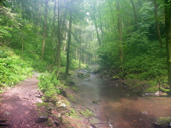
 The rain had nearly stopped as we entered the glen and I tried to clean my camera lens of raindrops and condensation. I took some pictures before getting the lens completely dry and some had interesting effects. A little further up the glen we stopped at a waterfall less than a half mile along the stream and I took some more pictures before climbing a steep bank and continuing the hike. The trail runs very close to the stream in some places and many areas were wet and slippery from the rain. After crossing abridge we approached another falls where some people had gathered to swim. A set of stairs took the trail to the area above the falls where the trail continued. The stream has cut deeply into the rock above this waterfall and we took a few picture and then headed up the bank on the trail. By this time my feet were thoroughly soaked and becoming uncomfortable. The trail intersected a road but signs pointed out the trail. At another road crossing there were no signs or blazes and the way ahead did not look traveled. We did go straight ahead and crossed the same power line as before. The trail became less distinct as the bushes closed in but someone had put down logs to help get through the swampy area and we soon found a bridge over the stream. The trail led through the Watergate Recreation Area which has a lake and a few ponds. As we waked out the access road, we picked up the path back to Millbrook Village and passed by the old Millbrook School No. 82. More buildings soon appeared and we walked out to the road and across it to the parking area. We finished at $;28 PM covering the 7.1 miles in 3 hours and 10 minutes. I was glad I had brought a change of clothes and that the restrooms at the Village were still unlocked!
![]()
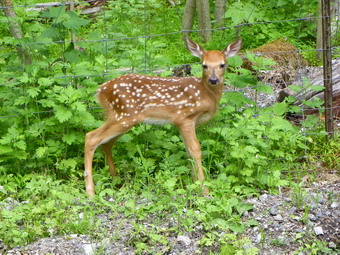
![]() On Saturday, June 5th we headed back north on Millbrook Avenue to Route 10 after hiking the Geurin Benchmark. I took Route 10 west and picked up I80 west and then Route 206 North. I wanted to check out the parking spot for Whitehall before heading east on Tamarack Road to Roseville Road and the Hudson Farms hike. I had to pass North Shore Road and turn around to come back. Just after turning onto North Shore off Route 2006 there was a small parking are on the right. A sign on a tree mentioned state forests so I gathered this would be the place to park for Whitehall. I knew I didn't have enough time before the group hike but knew that I would return later. I turned south of 206 and the left or east on Tamarack. Where Tamarack merged with Roseville, I turned left and soon began to notice the posted signs and fencing for the Hudson farms game preserve. At one of the small pull offs I noticed movements and saw a doe jump the fence. Her fawn could not get over the fence and was too big to get through it! I stopped to investigate and quickly took some pictures. The fawn was making a pitiful bleating sound and the doe was not happy either. I knew trying to pick up the fawn was a bad idea for many reasons. I was able to lift the fence in one spot and the fawn quickly darted right passed me and under the fence. I was happy that it had ended well. A little further down the road was a sign for Hudson Farms at Westby so I pulled into the driveway. It was just passed noon and no one else was around. A quick cell phone call to Jeff confirmed I was in the right spot and after only 5 minutes the rest of the group arrived. I was pleasantly surprised to find that Bill Maurer (Hoosier) was one of the hikers as I had not seen him for some time. After introductions we drove down one of the estate roads to the end by "wood Operations to park and begin our hike at about 12:20 PM.
On Saturday, June 5th we headed back north on Millbrook Avenue to Route 10 after hiking the Geurin Benchmark. I took Route 10 west and picked up I80 west and then Route 206 North. I wanted to check out the parking spot for Whitehall before heading east on Tamarack Road to Roseville Road and the Hudson Farms hike. I had to pass North Shore Road and turn around to come back. Just after turning onto North Shore off Route 2006 there was a small parking are on the right. A sign on a tree mentioned state forests so I gathered this would be the place to park for Whitehall. I knew I didn't have enough time before the group hike but knew that I would return later. I turned south of 206 and the left or east on Tamarack. Where Tamarack merged with Roseville, I turned left and soon began to notice the posted signs and fencing for the Hudson farms game preserve. At one of the small pull offs I noticed movements and saw a doe jump the fence. Her fawn could not get over the fence and was too big to get through it! I stopped to investigate and quickly took some pictures. The fawn was making a pitiful bleating sound and the doe was not happy either. I knew trying to pick up the fawn was a bad idea for many reasons. I was able to lift the fence in one spot and the fawn quickly darted right passed me and under the fence. I was happy that it had ended well. A little further down the road was a sign for Hudson Farms at Westby so I pulled into the driveway. It was just passed noon and no one else was around. A quick cell phone call to Jeff confirmed I was in the right spot and after only 5 minutes the rest of the group arrived. I was pleasantly surprised to find that Bill Maurer (Hoosier) was one of the hikers as I had not seen him for some time. After introductions we drove down one of the estate roads to the end by "wood Operations to park and begin our hike at about 12:20 PM.
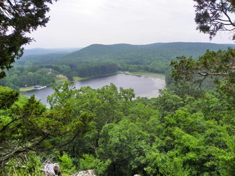 From looking at my GPS it seemed clear that a woods road ran right to the top of Wright Pond Cliffs. Although this was not the shortest way, I was sure it would be the quickest. We set out on the road which ran through some very green and open hardwood forest. On one side rose some cliffs that make up part of Westby Ridge which we would climb after Wright Pond. At one point we rounded a turn in the trail at watched at least tow bears running away and up through the woods. This is the picture of bears I like to see. We continued on the road taking the appropriate turns as they came. We headed south for about a mile and then east for another .3 miles before turning south again climbing gently as we went. The final .3 miles to the summit was somewhat steeper and, although the road meander, to the south. When we got near the summit, we had to step off the trail to the right to find the highest point. From here we actual continued south for about .15 miles to an open viewpoint over Wright Pond and Whitehall Hill. The far hills and valleys were hazy but Wright Pond could be seen easily. I took some pictures from the viewpoint and then worked my way down and to the left to another, more open lookout. Wright Pond is small but there is a large mansion or clubhouse on one shore with a small "marina" in front. It is a truly beautiful setting. After a short break, we retraced our path down Wright Ponds Cliffs to the col with Westby Ridge and started our bushwhack to the top.
 Climbing Westby Ridge was quite different but he woods were open and there seemed to be a path to follow. The bushwhack was rocky and had several short but steep climbs. After climbing one, we descended into a small ravine before the next climb. There was another "false summit" near the top on the left and before we made the final hike to the top. We looked for the highest point and the one we found seemed to match the GPS coordinates. It was only .4 miles and 15 minutes from the col. We talked about the route back. One choice was to retrace the path to the Col and take the woods road back. The other choice was to head directly northwest and hit the woods road closer to where we parked. The contour lines on the GPS seemed to indicate this way was steep and we wondered if that meant e would have to descend the cliffs we saw on the way in. In the end we decided on the shorter path and headed northwest. It was a steeper descent than the way up but there were no cliffs to be seen. Instead we crossed a small stream at the bottom and hit the woods road in 20 minutes and less than half a mile. From here it was only .2 miles to the cars. We did see two more fawns on the way out! We arrived back at the cars at 2:15 PM covering the 3.2 miles in about 2 hours with plenty of time for pictures. I thought about doing another peak but decided to wait for another time.
![]() On Saturday, June 5th after finishing Arlington, I drove back to Berkshire Valley Road and then to Route 15. I took 15 south to Dover and then tried to find Millbrook Avenue south to Randolph and Freedom Park to hike the Guerin Benchmark. I had some trouble finding then correct streets but soon found Route 10 and took it west until a sign for Millbrook Avenue appeared. Once on Millbrook it was easy to find Freedom Park. The small gravel parking area was filled as baseball and softball games were already being played at the large park across the street. I pulled into the larger parking area wondering if that was where I belonged. I found a parking spot right next to the sign that said Randolph Trails and we got going at about 10:20 AM. I followed the trail uphill and was looking for a fork to the right. I kept going until it was obvious I had somehow passed the turnoff. We turned back and I found the fork virtually at the beginning of the trail. DO NOT head uphill to the left. Enter the trails and then take the FIRST right up the hill on the gravel trail and toward the power line right-of-way. Just passed the right-of-way in the woods will be a path lined one each side with stones. It does not seem to be much used and could be missed so watch on your left. We turned here and walked through the woods to the rock outcropping with the USGS benchmark on it. We also walked to several other places that might be about the same height before turning around and following the same path back to the car. We were back by 10:50 AM with the 1 mile hike taking only 20 minutes after subtracting time for the initial detour.
On Saturday, June 5th after finishing Arlington, I drove back to Berkshire Valley Road and then to Route 15. I took 15 south to Dover and then tried to find Millbrook Avenue south to Randolph and Freedom Park to hike the Guerin Benchmark. I had some trouble finding then correct streets but soon found Route 10 and took it west until a sign for Millbrook Avenue appeared. Once on Millbrook it was easy to find Freedom Park. The small gravel parking area was filled as baseball and softball games were already being played at the large park across the street. I pulled into the larger parking area wondering if that was where I belonged. I found a parking spot right next to the sign that said Randolph Trails and we got going at about 10:20 AM. I followed the trail uphill and was looking for a fork to the right. I kept going until it was obvious I had somehow passed the turnoff. We turned back and I found the fork virtually at the beginning of the trail. DO NOT head uphill to the left. Enter the trails and then take the FIRST right up the hill on the gravel trail and toward the power line right-of-way. Just passed the right-of-way in the woods will be a path lined one each side with stones. It does not seem to be much used and could be missed so watch on your left. We turned here and walked through the woods to the rock outcropping with the USGS benchmark on it. We also walked to several other places that might be about the same height before turning around and following the same path back to the car. We were back by 10:50 AM with the 1 mile hike taking only 20 minutes after subtracting time for the initial detour.
![]()
![]() On Saturday, June 5th Jeff Bennett and Eric Koppel had secured permission to have an NJ1K hike on the land owned by Hudson Farms. Hudson Farms is a private game preserve and on their lands are Wright Pond Cliffs and Westby Ridge. Unfortunately, they were not enthusiastic about having Sheba come along. I almost decided not to go but relented since the opportunity only come a few times each year. The hike would be at 12:15 PM so I decided to get in a few peaks before then. I don't have too many peaks remaining and two groups are southwest of Hudson Farms and to the northeast. These would be too far away so I decided on something closer. Arlington, Guerin Benchmark and Whitehall all qualified. When I left Livingston Manor at 6:45 AM I was still undecided about the order but chose Arlington first since most people have made Guerin sound so easy! I again chose to take 206 south from Port Jervis but this time thought I would avoid the Matamoras and Milford traffic by taking 84 West. This worked out well as I took 206 South and the 15 South to catch Berkshire Valley Road. Once on this road I was looking for Gordon Lane. I kept looking for this small side street but knew I had missed it when I went under Route 80 and came to the end of Berkshire Valley Road. Fortunately, when I turned around I immediately found it next to the Berkshire Valley Fire Station. I drove to the end of the road and parked in a small lot at 8:40 AM. After getting my bearings, we headed out of the parking area on a woods road. It didn't seem that this road was headed in the right direction but I have learned to walk the trails and roads and bushwhack at the last possible moment.
On Saturday, June 5th Jeff Bennett and Eric Koppel had secured permission to have an NJ1K hike on the land owned by Hudson Farms. Hudson Farms is a private game preserve and on their lands are Wright Pond Cliffs and Westby Ridge. Unfortunately, they were not enthusiastic about having Sheba come along. I almost decided not to go but relented since the opportunity only come a few times each year. The hike would be at 12:15 PM so I decided to get in a few peaks before then. I don't have too many peaks remaining and two groups are southwest of Hudson Farms and to the northeast. These would be too far away so I decided on something closer. Arlington, Guerin Benchmark and Whitehall all qualified. When I left Livingston Manor at 6:45 AM I was still undecided about the order but chose Arlington first since most people have made Guerin sound so easy! I again chose to take 206 south from Port Jervis but this time thought I would avoid the Matamoras and Milford traffic by taking 84 West. This worked out well as I took 206 South and the 15 South to catch Berkshire Valley Road. Once on this road I was looking for Gordon Lane. I kept looking for this small side street but knew I had missed it when I went under Route 80 and came to the end of Berkshire Valley Road. Fortunately, when I turned around I immediately found it next to the Berkshire Valley Fire Station. I drove to the end of the road and parked in a small lot at 8:40 AM. After getting my bearings, we headed out of the parking area on a woods road. It didn't seem that this road was headed in the right direction but I have learned to walk the trails and roads and bushwhack at the last possible moment.
 We hiked passed a small pond with a beaver dam and lily pads and stuck to the road as it north and east AWAY from the summit of Arlington. At about a half mile into the hike, when I was about to start directly for the peak, the road turned toward the west and we continued to follow it. At about .75 miles, we walk up a little hill and found a clear cut area on the left. The sign explained that the trees were cut in an attempt to limit some of the pests destroying forests. At this point I probably should have just gone into the woods and headed up and north since the summit was in that direction. Instead, we stuck to the road as it went further west and away from the peak. At about 1.25 miles I had had enough and went off the trail bushwhacking northeast toward the summit. It wasn't long before we came across a trail that headed for the summit don't know whether this trail branched off the road we had been on or not. We stayed on this road until about 1.6 miles where the road continued north and west away from the peak. We turned into the woods to the east and hit the high point in a matter of minutes. From the summit, I decided NOT to return the way we came but to head southeast to intercept our route near the clear cut area. There were no views along the way so we headed down although I was a little worried about the steepness of the topography as shown on the GPS. The route was actually quite easy and we were soon back on our original path. We followed the trail back to the pond were we stopped so I could take some pictures before going back to the car. We were back at the car by 9:45 AM having taken just about an hour to cover the 2.75 miles. I decided to head south to the Guerin Benchmark before meeting the group to hike.
![]()
![]() On Monday, May 31st after finishing our first four peaks Sheba and I headed from Cobb Hill to Clinton Road and the P7 parking area to hike Boulder Pine Mountain. I was feel good since I had managed to buy a permit for the Pequannock Watershed the week before and knew I wouldn't be hassled with warning notices on my windshield. I parked at P7 near the northern end of Clinton Road at about 2:15 PM and went to look for the red blazed Old Coal Trail that would take us close to the summit of Boulder Pine. There were no blazes on any of the paths leading away from the lot so Sheba and I headed out on one that went straight out to Bearfort Waters. Bearfort Waters is a lake or pond or swamp depending on the water level and which area you are in. The path turned left at the water and headed along the shore which I knew was the right way to go. As we walked the trail grew less and less distinct and then ended near a swampy area. I looked across this area and saw three red blazes on the other side near Clinton Road. At that point the descriptions of the hike came back to me and I knew what we had to do. We walked back out to the car and south on Clinton Road for a few hundred feet before turning right on the access road for Project USE. This is also where the red blazes for the Old Coal Trail start. After a short walk we came to the Project USE buildings and the zip lines and high bridges they use for their activities. At this point the trail was poorly marked with only faint red paint blazes on a few trees. As we continued on the trail it narrowed in one area and then opened up. Somewhere in this area the blazes changed to placards with a red diamond on a white background and the label Old Coal Trail.
On Monday, May 31st after finishing our first four peaks Sheba and I headed from Cobb Hill to Clinton Road and the P7 parking area to hike Boulder Pine Mountain. I was feel good since I had managed to buy a permit for the Pequannock Watershed the week before and knew I wouldn't be hassled with warning notices on my windshield. I parked at P7 near the northern end of Clinton Road at about 2:15 PM and went to look for the red blazed Old Coal Trail that would take us close to the summit of Boulder Pine. There were no blazes on any of the paths leading away from the lot so Sheba and I headed out on one that went straight out to Bearfort Waters. Bearfort Waters is a lake or pond or swamp depending on the water level and which area you are in. The path turned left at the water and headed along the shore which I knew was the right way to go. As we walked the trail grew less and less distinct and then ended near a swampy area. I looked across this area and saw three red blazes on the other side near Clinton Road. At that point the descriptions of the hike came back to me and I knew what we had to do. We walked back out to the car and south on Clinton Road for a few hundred feet before turning right on the access road for Project USE. This is also where the red blazes for the Old Coal Trail start. After a short walk we came to the Project USE buildings and the zip lines and high bridges they use for their activities. At this point the trail was poorly marked with only faint red paint blazes on a few trees. As we continued on the trail it narrowed in one area and then opened up. Somewhere in this area the blazes changed to placards with a red diamond on a white background and the label Old Coal Trail.
 The skies continued to darken and I even heard some thunder. I wasn't going to give up at this point but I did increase the pace. The trail seemed to wander a lot in the general direction of the destination but I was wondering exactly when I would have to start to bushwhack. At one point the trail began to ascend but I noticed higher ground to the right. At the point where the "Thirsty Dog" signed appeared on the left, I checked the GPS and it seemed that we were going away from the highest ground. It was then that I decided to turn right and start to go overland and toward the high ground. We pushed through some laurel and descended a small hill and started up the other side. I ran across a path and turned right. We walked over some open rock with a few cairns to an open area that was quite flat. Ahead of us I saw a boulder and a pine and concluded we were in the right place. I took some pictures in the area and then started to return as rain again threatened. When we were back to the point we had come across the trail from the bushwhack, I decided to continue to follow the path. It crossed a small chasm on a interesting bridge made out of log and wire mesh and then forked just after that. We took the left fork and ended up on the main trail. The junction was labeled with a sign that said Split Rock.
 We turned left on the main trail and then came to the Thirsty Dog sign. Here we turned and walked down the path a little way top see where it went. The path stretched out into the distance and the skies were still dark so we headed back to the main trail and back to the car. We made the trip back very quickly. I stopped at the Project USE buildings to take some pictures of the cabins and the zip lines. I also walked off the trail to a clearing to take some shots of Bearfort Waters. As I was using the camera, a large bird that I thought to be a blue heron flew from one area to another making quite a racket. I took some pictures of the bird and then went back to the car. We were back at about 3:30 PM covering the 3.5 miles in 1 hour and 20 minutes.
![]() On Monday, May 31st after finishing our first three peaks Sheba and I headed from the Mahlon Dickerson Reservation to Cobb Hill. Finding the route to Cobb Hill proved to be the second most challenging aspect of the hike. After a few questionable turns, I found Berkshire Valley Road which led to Oak Ridge Road to Route 23. Once on Route 23 it was easy to find Green Pond Road and head south. What I wasn't sure of was how far I had to go. Eventually I saw signs for Marcella and then Timberbrook Road appeared on the left. A short distance up the road I found the chapel and cemetery and pull in to park. The GPS told me Cobb Hill was nearly due east of the car and we headed behind the church in that direction. As we skirted the church and crossed a dirt road, I looked up to see a black bear in the woods about 40 meters ahead. It looked at us and I made some noise. Other bears usually amble away but this one started to come toward us. I decided that returning to the car was the best choice. We turned around and started toward the car. I took a look behind and the bear was following, slow but sure! I put Sheba in the car and I jumped in only to have the bear come to within a few meters of the car before the horn convinced him to wander off. Apparently people in the area have been leaving garbage out and the bears have grown accustomed to people and the "food". I decided to try to drive around the Durham Road and climb Cobb Hill from the other side. As we drove in Durham Road I saw posted signs on the left side but none on the right. I tuned around and parked on the side of the road northeast of the hill. Sheba and I quickly entered the woods and almost ran up and then down the hill. We didn't see any bears at the top but there also wasn't much else to see so we hurried back and drove off. The 1 mile jaunt took less than 20 minutes. At 1:45 we headed for Route 23 to Clinton Road and P7 to hike Boulder Pine for the last peak of the day.
On Monday, May 31st after finishing our first three peaks Sheba and I headed from the Mahlon Dickerson Reservation to Cobb Hill. Finding the route to Cobb Hill proved to be the second most challenging aspect of the hike. After a few questionable turns, I found Berkshire Valley Road which led to Oak Ridge Road to Route 23. Once on Route 23 it was easy to find Green Pond Road and head south. What I wasn't sure of was how far I had to go. Eventually I saw signs for Marcella and then Timberbrook Road appeared on the left. A short distance up the road I found the chapel and cemetery and pull in to park. The GPS told me Cobb Hill was nearly due east of the car and we headed behind the church in that direction. As we skirted the church and crossed a dirt road, I looked up to see a black bear in the woods about 40 meters ahead. It looked at us and I made some noise. Other bears usually amble away but this one started to come toward us. I decided that returning to the car was the best choice. We turned around and started toward the car. I took a look behind and the bear was following, slow but sure! I put Sheba in the car and I jumped in only to have the bear come to within a few meters of the car before the horn convinced him to wander off. Apparently people in the area have been leaving garbage out and the bears have grown accustomed to people and the "food". I decided to try to drive around the Durham Road and climb Cobb Hill from the other side. As we drove in Durham Road I saw posted signs on the left side but none on the right. I tuned around and parked on the side of the road northeast of the hill. Sheba and I quickly entered the woods and almost ran up and then down the hill. We didn't see any bears at the top but there also wasn't much else to see so we hurried back and drove off. The 1 mile jaunt took less than 20 minutes. At 1:45 we headed for Route 23 to Clinton Road and P7 to hike Boulder Pine for the last peak of the day.
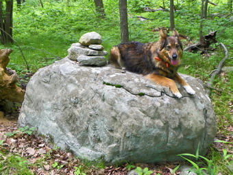
![]()
![]() On Monday, May 31st Sheba and I finished Bowling Green Mountain and returned to the junction with the Pine Swamp Trail. The trail network in the reservation is confusing even with the map provided at the kiosk. I debated walking the Cascades Trail just to see how it got its name but knew I was pressed for time. I decided to take the Pine Swamp Trail but to stay as far away from the swamps as possible since the insects were already biting! I tried following the trails and map as best as possible but became tired of checking the GPS so often and just kept walking. When I did check the GPS, I found I was headed in a direction that would not get me to the high point unless I made a turn. Fortunately, I was able to make that turn and ascend the trail to the high point. A sign on the trail marks the high point but the actual highest point is off the trail in the woods. Sheba and I did the usual wandering around to hit the highest point before returning to the trail and retracing our path back. When we got to the sign that said "RV Area" we headed in that direction. From the "RV Area" we bushwhacked over a small hill and back to the car. We covered a total of 6.8 miles for the entire hike in about 3 hours arriving back a the car by 12:35 PM. It was time to head to Cobb Hill.
On Monday, May 31st Sheba and I finished Bowling Green Mountain and returned to the junction with the Pine Swamp Trail. The trail network in the reservation is confusing even with the map provided at the kiosk. I debated walking the Cascades Trail just to see how it got its name but knew I was pressed for time. I decided to take the Pine Swamp Trail but to stay as far away from the swamps as possible since the insects were already biting! I tried following the trails and map as best as possible but became tired of checking the GPS so often and just kept walking. When I did check the GPS, I found I was headed in a direction that would not get me to the high point unless I made a turn. Fortunately, I was able to make that turn and ascend the trail to the high point. A sign on the trail marks the high point but the actual highest point is off the trail in the woods. Sheba and I did the usual wandering around to hit the highest point before returning to the trail and retracing our path back. When we got to the sign that said "RV Area" we headed in that direction. From the "RV Area" we bushwhacked over a small hill and back to the car. We covered a total of 6.8 miles for the entire hike in about 3 hours arriving back a the car by 12:35 PM. It was time to head to Cobb Hill.
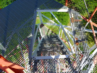
![]()
![]() On Monday, May 31st Sheba and I finished Morris Lake Mountain by 9:00 AM and then headed for the Mahlon Dickerson Reservation on Weldon Road. This was easy to find but harder to know where to park. I finally pulled into the picnic area just before the road went downhill passed the Snow Bowl. The parking area had only a few cars and I went to the kiosk to get a map. I had brought several maps with me and I figured that I was well prepared. We took the Highlands Trail and crossed Weldon Road to head for the Headley Overlook. This was a short walk and was easy to find. The views from the lookout were adequate but hazy. Lake Hopatcong could be seen in the distance. We returned to the car and took the Highlands Trail in the other direction through the picnic areas and passed the ball field. It was early but there didn't seem to be anyone using the park except for a few walkers and bikers. Soon we came to the junction with the Pine Swamp Trail which I intended to follow to the Morris County High Point. First, however, I wanted to do Bowling Green Mountain. We took a side trail to the right which led out to Weldon Road. We crossed and started along the dirt and gravel road that acts as an access road for the communications tower on Bowling green. Part of the Snow Bowl now has a dirt bike track which was quite active on this day.
On Monday, May 31st Sheba and I finished Morris Lake Mountain by 9:00 AM and then headed for the Mahlon Dickerson Reservation on Weldon Road. This was easy to find but harder to know where to park. I finally pulled into the picnic area just before the road went downhill passed the Snow Bowl. The parking area had only a few cars and I went to the kiosk to get a map. I had brought several maps with me and I figured that I was well prepared. We took the Highlands Trail and crossed Weldon Road to head for the Headley Overlook. This was a short walk and was easy to find. The views from the lookout were adequate but hazy. Lake Hopatcong could be seen in the distance. We returned to the car and took the Highlands Trail in the other direction through the picnic areas and passed the ball field. It was early but there didn't seem to be anyone using the park except for a few walkers and bikers. Soon we came to the junction with the Pine Swamp Trail which I intended to follow to the Morris County High Point. First, however, I wanted to do Bowling Green Mountain. We took a side trail to the right which led out to Weldon Road. We crossed and started along the dirt and gravel road that acts as an access road for the communications tower on Bowling green. Part of the Snow Bowl now has a dirt bike track which was quite active on this day.
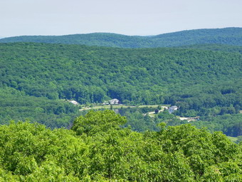 At the base of the mountain a gravel and dirt road begins and runs to the communications tower. Next to the road is a trail that seems to be used by hikers and bikers. Both of these are steep but the trail is under cover offering some protection from the sun. We started walking on the trail. A little more than half way up the road switchbacks to the right but the trail turns left and offers a quicker way to the top. We walked the trail coming out opposite the tower. We took a right on the access road and then walked by the tower to the highest point. We walked around a little to get the summit and then turned right a little on the road. There was the remains of a foundation which may have been for a tower. I decided to walk a little farther on the road to see if it might lead to the fire tower. The road seemed to run across the long, flat summit of Bowling Green and was headed in the correct direction for the tower. I could see on the GPS that a road ran up to the northeast end of the ridge and I thought this might be the access for the tower. As we reached the end of the ridge the trail met a road and I turned right. The Milton Fire Tower is one of the tallest in New Jersey but no one was manning the tower. I took some pictures of the tower and then climb all the way to the top to take some pictures from the tower. The views were good but there was a lot of green without many features to break it up. After taking some pictures, I climbed back down the tower and we retraced our route back to the communications tower and then back down the trail to the base of the mountain. From there we walked back across the Snow Bowl, crossed Weldon Road and walked back to the junction with the Pine Swamp Trail. Now it was on to the Morris County High Point.
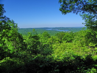
![]()
![]() On Monday, May 31st I wanted to go to New Jersey and get an early start on some more NJ1K peaks. Yes, I am "hooked"! I got up and 6:00 AM and got my equipment together. Once Sheba was in the car we headed to Port Jervis and then To Milford to take Route 206 south to Route 15. I wanted to hike Morris Lake Mountain first. I knew that many towns would have Memorial Day parades and wanted to avoid them as much as possible. I got off Route 15 in Sparta and promptly went the wrong way before turning around and heading into town. After a couple of turns, I was on Main Street and I knew the turn for glen Road would be a right. To make sure that I was correct I stopped at the local police station where they told me to go down one light and make a right. Less than a mile on Glen Road brought us to a sign for Sparta Glen Park and I turned left onto the park road. the park is indeed a small glen formed by a stream that meanders through it. It was already warm and humid as I drove to the third and last parking area on the paved road. I parked next to some picnic tables in a space big enough for tow or three cars and we started our bushwhack at about 8:15 AM. We whacked up the hill through some pretty thick blowdown until I saw a woman higher up on the hill looking down at us. She was walking quickly and I figured she must be on a trail. After bushwhacking just a little more, we ran across a nicely maintained trail.
On Monday, May 31st I wanted to go to New Jersey and get an early start on some more NJ1K peaks. Yes, I am "hooked"! I got up and 6:00 AM and got my equipment together. Once Sheba was in the car we headed to Port Jervis and then To Milford to take Route 206 south to Route 15. I wanted to hike Morris Lake Mountain first. I knew that many towns would have Memorial Day parades and wanted to avoid them as much as possible. I got off Route 15 in Sparta and promptly went the wrong way before turning around and heading into town. After a couple of turns, I was on Main Street and I knew the turn for glen Road would be a right. To make sure that I was correct I stopped at the local police station where they told me to go down one light and make a right. Less than a mile on Glen Road brought us to a sign for Sparta Glen Park and I turned left onto the park road. the park is indeed a small glen formed by a stream that meanders through it. It was already warm and humid as I drove to the third and last parking area on the paved road. I parked next to some picnic tables in a space big enough for tow or three cars and we started our bushwhack at about 8:15 AM. We whacked up the hill through some pretty thick blowdown until I saw a woman higher up on the hill looking down at us. She was walking quickly and I figured she must be on a trail. After bushwhacking just a little more, we ran across a nicely maintained trail.
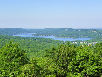 The trail ran both north and south and I knew we wanted to head south. I turned right and headed north since the trail seemed to be going UP in that direction. After only a short distance, a spur trail turned to the left and headed south toward the high point. This trail was a little more rugged but still easy to follow. Along the way to the high point were several interesting rock scrambles. There was also a nice viewpoint near the top with views of Lake Mohawk below. We continued on a wide woods road toward the high point which is on a rather flat summit plateau. I walked to the GPS coordinates and then walked around a little to make sure I hit the highest point. We turned around and retraced our route back to where we had started the bushwhack. We continued on the trail until a spur branched off to the left and led down to the road. We ended up just across from the second parking area on the right side of the road. We walked back up the road to the car and were there by 9:00 AM covering the 1.5 miles hike is about 45 minutes. It was time to move onto the Mahlon Dickerson Reservation and two more NJ1K peaks.
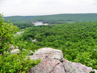
![]()
![]() On Friday, May 28th Karl and I had done Kanouse Mountain and were looking to put another peak or two under our belts. We decided that Newfoundland and Green Pond looked like a good pair to tackle. As we drove down Route 23 from Echo Lake Road and approached Green Pond Road Karl could see the three white blazes indicating the beginning of the Four Birds Trail across the railroad tracks but we could not find anywhere to park. We turned around and tried gain and this time turned into Green Pond Road and took the first right on Bigelow Road. The trailhead was at the end of the road with a small parking space for two or three cars. We parked and I changed into short sleeves after which we got started on the trail at just after 11:00 AM. The first part of the trail was refreshingly steep as we climbed to the ridge that makes up Newfoundland. In less than a mile we were passing by what appeared to be higher land on the right and we started to bushwhack to our right in a westerly direction. Soon we were at the highest point and the assigned GPS coordinates. From here we bushwhacked back down to the trail. We wanted to continue on until we were at the viewpoint know at White Pine Bluff since it was said to have the best views. Our intention was to go back to the car and drive to the next parking area to do Green Pond Mountain.
On Friday, May 28th Karl and I had done Kanouse Mountain and were looking to put another peak or two under our belts. We decided that Newfoundland and Green Pond looked like a good pair to tackle. As we drove down Route 23 from Echo Lake Road and approached Green Pond Road Karl could see the three white blazes indicating the beginning of the Four Birds Trail across the railroad tracks but we could not find anywhere to park. We turned around and tried gain and this time turned into Green Pond Road and took the first right on Bigelow Road. The trailhead was at the end of the road with a small parking space for two or three cars. We parked and I changed into short sleeves after which we got started on the trail at just after 11:00 AM. The first part of the trail was refreshingly steep as we climbed to the ridge that makes up Newfoundland. In less than a mile we were passing by what appeared to be higher land on the right and we started to bushwhack to our right in a westerly direction. Soon we were at the highest point and the assigned GPS coordinates. From here we bushwhacked back down to the trail. We wanted to continue on until we were at the viewpoint know at White Pine Bluff since it was said to have the best views. Our intention was to go back to the car and drive to the next parking area to do Green Pond Mountain.
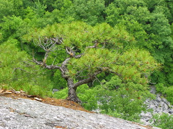 Within a very short amount of time we came upon a viewpoint that I recognized from other hiker's pictures as White Pine Bluff. Although the day was hazy, the views were beautiful and quite varied. Below was a large swampy area with many dead trees. Across the way on the next ridge were some structures but we could not figure out what they were. Several houses dotted the opposing ridge and we remarked about the views they must enjoy! Below the bluffs was a large amount of talus. I worked my way Down to a completely unobstructed viewpoint and took more pictures. There were some very interesting small pine trees growing out of cracks in the rock. Some laurel had also taken hold in this marginal environment. Above us we could hear the call of several different raptors and while we were there several large vultures took flight and land in the trees above. After taking many pictures, we discussed our options. Although Green Pond was at least two miles away and the last part was a bushwhack neither of us felt like going back to the car. We decided to stay on the Four Birds Trail as long as possible and the bushwhack to Green pond when we had to. Just after White Pine Bluffs the trail descended sharply. We knew we were looking for a sharp right hand turn to signal the beginning of our bushwhack but we were not sure how far we had to go.
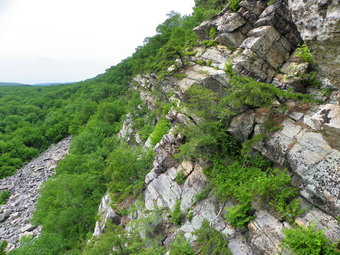 We walked the Four Birds Trail down through a low area and then began an ascent to another ridge which we reached after less than a mile. Along the way we crossed one small stream and many crisscrossing paths and roads. The Four Birds Trail in this area is "rugged". Karl described it as not so much a trail as some blazes somebody decided to put on a few trees! We hiked for about .5 miles along the ridge and had some nice but obstructed views as we went. At this point the trail started to descend and met a small power line right-of-way. We figured this was the sharp left turn that we did NOT want to take so we turned to our right and went up the right-of-way to the north. Just short of the height of land we turned southwest into the woods and began our bushwhack. At least we bushwhacked for several hundred feet to a wide woods road! The road took us right along the ridge for about a mile almost to the highest point. We stepped off the road and wandered around to find the GPS coordinates of the highest point and then we found what looked to us like the highest point! There was no view and after returning to the road we continued southwest until the land began to drop away and posted signs appeared. At this point we turned around and followed our route back to the car. On the return trip we stopped to talk to a hiker, the only person we had seen all day. We arrived at the car by 3:00 PM. The seven mile hike had taken 4 hours with a LOT of time reserved for photography. This may not be the quickest way to do these two peaks but we certainly enjoyed it!
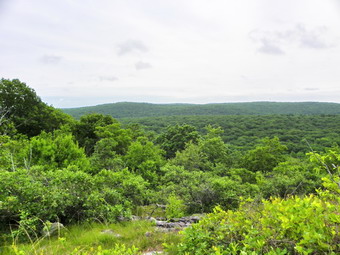
![]()
![]() On Friday, May 28th my son Karl was up from Virginia and we decided to again head for New Jersey to take on some NJ1K peaks. I also wanted to get a permit for the Pequannock Watershed since there were several peaks I still needed to hike in that area. We decided to go to Port Jervis to catch Route 23 and then head north on Echo Lake Road to the NWCDC office. We arrived at about 9:30 AM and I immediately went to the office to get the $12 permit. Things went smoothly and we decided as long as we were parked that we should take on Kanouse Mountain since it is so close to the NWCDC Headquarters. We were on the trail by 9:40 AM. The first part of the hike goes down the access road to the dam for Echo Lake and follows the Highlands Trail. Echo Lake is very beautiful and has an interesting stone "house" near the dam. I assume this structure built in 1926 controls the water flow and monitors water condition. There is a small picnic and camping area here and on the far shore two large yurts were set up. The day was warm and humid and the weather forecast include a chance of showers for the afternoon. Just after crossing the dam we decided to start our bushwhack by walking along the stream and then heading slightly south and west. We immediately ran into the boulder field described by others but it was easy to climb up through it and sidehill along it until we were near the col between Kanouse Mountain and the bump just north of it.
On Friday, May 28th my son Karl was up from Virginia and we decided to again head for New Jersey to take on some NJ1K peaks. I also wanted to get a permit for the Pequannock Watershed since there were several peaks I still needed to hike in that area. We decided to go to Port Jervis to catch Route 23 and then head north on Echo Lake Road to the NWCDC office. We arrived at about 9:30 AM and I immediately went to the office to get the $12 permit. Things went smoothly and we decided as long as we were parked that we should take on Kanouse Mountain since it is so close to the NWCDC Headquarters. We were on the trail by 9:40 AM. The first part of the hike goes down the access road to the dam for Echo Lake and follows the Highlands Trail. Echo Lake is very beautiful and has an interesting stone "house" near the dam. I assume this structure built in 1926 controls the water flow and monitors water condition. There is a small picnic and camping area here and on the far shore two large yurts were set up. The day was warm and humid and the weather forecast include a chance of showers for the afternoon. Just after crossing the dam we decided to start our bushwhack by walking along the stream and then heading slightly south and west. We immediately ran into the boulder field described by others but it was easy to climb up through it and sidehill along it until we were near the col between Kanouse Mountain and the bump just north of it.
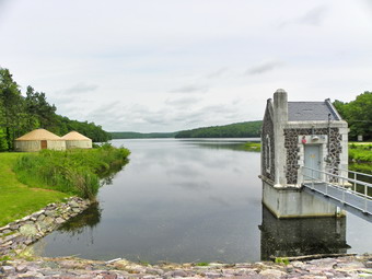 As we worked our way uphill to the col we ran into a wide woods road and turned south onto it. Along the way the road broke out into the open and allowed some nice views of the surrounding hills before heading back under cover. We continued on the road until a check of the GPS and the surrounding terrain indicated we were near the top of the hill. We turned off the road and walking through some brush to a rocky ridge that corresponded to the assigned GPS coordinates and appeared to be the highest land around. After hitting the high point, we came back down to the trail and headed south a little bit. Since the trail fell away, we reversed our course and headed back. I forgot that the southern end of Kanouse is said to have the best views and the metal star! Oh well, that will have to wait for next time. We followed the road back to where we came up to the Col and then went a little further. I didn't know where the road might go or if it would ever intersect the Highlands Trail. We bushwhacked down from the road and crossed over our original route to get down to flatter ground quicker. From that point we walked along the stream until we got back to Echo Lake. I took some pictures at this point and we were back at the car by 10:45 AM covering the 2 mile route in an hour. It was time to head to Green Pond Road to hike Newfoundland.
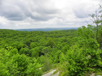
![]()
![]() On Sunday, May 23rd we left Dunker Mountain and headed toward Buck Mountain in the Wyanokies. My lack of an adequate New Jersey map really hurt this time as I ended up much too far east on Route 23. I turned around and was ready to just headed home when I came upon Echo Lake Road. I headed north on this and then took Macopin Road to Weaver Road to Otterhole Road. I parked at the main Otterhole parking area and got on the trail at about 2:35 PM. We took the blue Hewitt Butler Trail to the Otterhole where we crossed the brook on stones. Despite the name I have never seen an otter at this hole and the water is usually murky which does not make for pretty pictures. After crossing the stream, we headed north on the green Otterhole Trail and then took a left on the yellow Wyanokie Crest Trail. I had never been on this trail before and was surprised at the steepness of the trail. At first the trail was protected by trees but soon it broke out into an open area which offered some great views. This open rock face was steep with only a narrow ledge to help in the ascent and a crack to use to wedge your foot. At one point we stopped so that I could take pictures before we continued on. We ascended some more and stopped again so that I could use the camera from the higher viewpoint before diving back into the woods.
On Sunday, May 23rd we left Dunker Mountain and headed toward Buck Mountain in the Wyanokies. My lack of an adequate New Jersey map really hurt this time as I ended up much too far east on Route 23. I turned around and was ready to just headed home when I came upon Echo Lake Road. I headed north on this and then took Macopin Road to Weaver Road to Otterhole Road. I parked at the main Otterhole parking area and got on the trail at about 2:35 PM. We took the blue Hewitt Butler Trail to the Otterhole where we crossed the brook on stones. Despite the name I have never seen an otter at this hole and the water is usually murky which does not make for pretty pictures. After crossing the stream, we headed north on the green Otterhole Trail and then took a left on the yellow Wyanokie Crest Trail. I had never been on this trail before and was surprised at the steepness of the trail. At first the trail was protected by trees but soon it broke out into an open area which offered some great views. This open rock face was steep with only a narrow ledge to help in the ascent and a crack to use to wedge your foot. At one point we stopped so that I could take pictures before we continued on. We ascended some more and stopped again so that I could use the camera from the higher viewpoint before diving back into the woods.
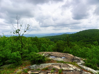 As we continued on the trail we again walked out onto an open rock ledge with some nice views. A young couple occupied the rock above us but they were too busy to say hello. After taking some pictures, we followed the trail as it descended slightly from the viewpoint and then began to climb again. Somewhere around 3:15 PM we were on the summit plateau. We had passed by some interesting rock formations along the way including one that appeared to offer shelter. We continued on the trail across the top until the trail started to descend. At this point I decided to turn back and we wandered around in the woods until we found the highest point which also roughly matched the GPS coordinates. We turned around and spent as little time as possible retracing the trail back to the parking area. We were back by 4:05 PM having taken about 1.5 hours to cover the 3 mile trek. We were ready to return home after putting five more NJ1K peaks under our belts for the day.
![]() On Sunday, May 23rd we left Mount Stockholm and headed north again on Route 23 to find the parking area for Dunker Mountain. After a little driving around, I realized that the parking area was right on the corner of Canistear Road near the railroad trestle. We parked at about 12:50 PM and immediately headed out on the Highlands Trail. I was not sure how close to the summit the Highlands Trail would take us but we continued to follow it up to a high point. I checked the GPS and found we were only on the first "bump". Another check showed that the coordinates that I had written down for Dunker were over a mile to the west! I quickly concluded that I had made a transcription error and that Dunker was actually slightly north and east of the hump we were on. We continued on the Highlands Trail down the other side and further north. When it was clear that we were too far north and the trail was not turning, we started our bushwhack to the east and up. Within a quarter of a mile of relatively easy bushwhacking we were wandering around at the top to find the highest spot. At about 1:15 PM or so I had enough so we started back bearing a little more south to hit the Highlands Trail nearer the bump. We were back at the car by 1:45 PM Vail covered a little over 1.5 miles in less than an hour. I decided there was still time to head for Buck Mountain in the Wyanokies.
On Sunday, May 23rd we left Mount Stockholm and headed north again on Route 23 to find the parking area for Dunker Mountain. After a little driving around, I realized that the parking area was right on the corner of Canistear Road near the railroad trestle. We parked at about 12:50 PM and immediately headed out on the Highlands Trail. I was not sure how close to the summit the Highlands Trail would take us but we continued to follow it up to a high point. I checked the GPS and found we were only on the first "bump". Another check showed that the coordinates that I had written down for Dunker were over a mile to the west! I quickly concluded that I had made a transcription error and that Dunker was actually slightly north and east of the hump we were on. We continued on the Highlands Trail down the other side and further north. When it was clear that we were too far north and the trail was not turning, we started our bushwhack to the east and up. Within a quarter of a mile of relatively easy bushwhacking we were wandering around at the top to find the highest spot. At about 1:15 PM or so I had enough so we started back bearing a little more south to hit the Highlands Trail nearer the bump. We were back at the car by 1:45 PM Vail covered a little over 1.5 miles in less than an hour. I decided there was still time to head for Buck Mountain in the Wyanokies.
![]() On Sunday, May 23rd we left the pull off by the side of Route 23 and headed just 1.5 miles north on Route 23 before heading east on Holland Mountain Road. A short way up the road I turned right on Rock Ledge Road and followed it through a confusing maze of streets until I came to a turn around in front of a house. The road continued as a dirt track and I could see the aqua blazes of the Highlands Trail ahead. I parked the car and knocked on the door of the house to ask if it was okay to park. The woman at the house said that it was okay so I got Sheba and started out on the dirt road following the blazes. A quick compass and GPS check showed that we needed to make a quick turn south and east. We headed into the woods and started a gentle climb to the high point on Mount Stockholm. I was careful to respect the privacy of the people whose backyards were adjacent to the public lands. The woods were fairly open and I found a couple of paths to follow. It was only a little more than .25 to the "summit" and it took us under 15 minutes. We did walk out to the clearing at the top before heading back to the car. Quick with no views or any remarkable features. Our next stop was also just down the road; Dunker Mountain.
On Sunday, May 23rd we left the pull off by the side of Route 23 and headed just 1.5 miles north on Route 23 before heading east on Holland Mountain Road. A short way up the road I turned right on Rock Ledge Road and followed it through a confusing maze of streets until I came to a turn around in front of a house. The road continued as a dirt track and I could see the aqua blazes of the Highlands Trail ahead. I parked the car and knocked on the door of the house to ask if it was okay to park. The woman at the house said that it was okay so I got Sheba and started out on the dirt road following the blazes. A quick compass and GPS check showed that we needed to make a quick turn south and east. We headed into the woods and started a gentle climb to the high point on Mount Stockholm. I was careful to respect the privacy of the people whose backyards were adjacent to the public lands. The woods were fairly open and I found a couple of paths to follow. It was only a little more than .25 to the "summit" and it took us under 15 minutes. We did walk out to the clearing at the top before heading back to the car. Quick with no views or any remarkable features. Our next stop was also just down the road; Dunker Mountain.
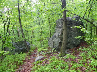
![]()
![]() On Sunday, May 23rd we left the Hamburg high point on Sand Pond Road and drove south on Route 23 to Mount Gerard. When I got close to the area of Gerard, I pulled over near a large stone arch on a side road to look at the maps of the area. My maps were limited and I again resolved to buy a New Jersey road map. I got back on Route 23 and drove a little too far. I narrowed down where I should park and parked at a small pull off on the east shoulder of Route 23. I immediately noticed a well defined path into the woods. When I turned on the GPS, it confirmed that we were indeed in the correct location. We parked at 1;20 AM and were on our way immediately. There was a path almost all the way to the summit plateau which we reached at 11:40 after a little more than a half mile walk. We wandered around until I was convinced we had hit the highest spot and then turned around to follow the same route back. We did pick up an even better path on the way back and were at the car by noon. It took only 40 minutes to cover the 1.1 mile distance. Unfortunately, no photographic opportunities presented themselves. Now it was off to Mount Stockholm.
On Sunday, May 23rd we left the Hamburg high point on Sand Pond Road and drove south on Route 23 to Mount Gerard. When I got close to the area of Gerard, I pulled over near a large stone arch on a side road to look at the maps of the area. My maps were limited and I again resolved to buy a New Jersey road map. I got back on Route 23 and drove a little too far. I narrowed down where I should park and parked at a small pull off on the east shoulder of Route 23. I immediately noticed a well defined path into the woods. When I turned on the GPS, it confirmed that we were indeed in the correct location. We parked at 1;20 AM and were on our way immediately. There was a path almost all the way to the summit plateau which we reached at 11:40 after a little more than a half mile walk. We wandered around until I was convinced we had hit the highest spot and then turned around to follow the same route back. We did pick up an even better path on the way back and were at the car by noon. It took only 40 minutes to cover the 1.1 mile distance. Unfortunately, no photographic opportunities presented themselves. Now it was off to Mount Stockholm.
![]()
![]() On Sunday, May 23rd I decided I needed a day to get away so I left early for New Jersey with Sheba. My initial plan was to hike Long Hill again to get the high point but I decided it was too soon. I wrote down the GPS coordinates for many of the peaks in north central New Jersey and concluded I should head for the Hamburg HP first. There were at least three other peaks in that area that we could visit although they would require a hike and a drive and then a hike and a drive. We got an early start and arrived at the described parking area on Sand Pond Road at about 8:30 AM. We headed east from the car through the woods and down a small embankment to cross the stream that is the outlet from Wildwood Lake. On the other side I found a woods road that headed east and slightly north. I kept the POSTED signs on my left to try to avoid private property and to stay in the state game management area. The road began to head too much to the east so we dropped off it and started to bushwhack through mostly open woods. After dropping down into a small swale we began to climb a slight rise. All along we could see Wildwood Lake to the left as we sidehilled to keep from climbing up and over a knob.
On Sunday, May 23rd I decided I needed a day to get away so I left early for New Jersey with Sheba. My initial plan was to hike Long Hill again to get the high point but I decided it was too soon. I wrote down the GPS coordinates for many of the peaks in north central New Jersey and concluded I should head for the Hamburg HP first. There were at least three other peaks in that area that we could visit although they would require a hike and a drive and then a hike and a drive. We got an early start and arrived at the described parking area on Sand Pond Road at about 8:30 AM. We headed east from the car through the woods and down a small embankment to cross the stream that is the outlet from Wildwood Lake. On the other side I found a woods road that headed east and slightly north. I kept the POSTED signs on my left to try to avoid private property and to stay in the state game management area. The road began to head too much to the east so we dropped off it and started to bushwhack through mostly open woods. After dropping down into a small swale we began to climb a slight rise. All along we could see Wildwood Lake to the left as we sidehilled to keep from climbing up and over a knob.
 As we began our ascent there was a lot of blowdown to work over and through and the wet vegetation grew thicker. I was getting totally soak and my feet were beginning to feel wet. At the top of the rise we gain caught another woods road and followed it until beginning another walk through the woods. I thought we might me on the highest point but a quick check of the GPS showed we needed to get to the top of the next hill. We descended the hill we were on, walked through a low area and then up the hill. There were several elevated areas on the summit plateau but I knew there was a rather larger cairn somewhere on the top. Sheba and I continued to search around. We finally found the cairn and then headed back. My goal was to avoid the thick stuff we had walked through before so we headed a little more south than our original route. After avoiding a swampy area, we walked over the rise we had avoided before and hit our path from earlier. We followed this route back to the car. We had covered 2.7 miles in two hours since we were back to the car by 10:15 AM. Mount Gerard was waiting just down Route 23.
![]()
![]() On Sunday, May 16th I convinced Cindy to come with me to New Jersey after church to hike Long Hill. The late start would be offset by the increasing length of the days. We started right after church and drove through Warwick and picked up the Warwick-Greenwood Lake Turnpike into Jersey. We have traveled this route MANY times. We took Stonetown Road to West Brook Road and drove pas the turn to Norvin Green State Forest on Snake Den Road. We parked near the Eagle's Nest hunting Camp at a small pull off on the side of the road at 12:40 PM. We immediately crossed the road and went over/under the guard rail to pick up the Hewitt Butler Trail. The trail led down to a creek and the crossing there was the first obstacle. The water was a little high, the stone were slippery and there was no bridge. The climb on the other side was steep with a couple of interesting scrambles over open rock faces. Soon we were at Manaticut Point which offered excellent views in several directions. The New York City skyline was visible but most distant views were very hazy. I took some pictures and we continued on. At some point I realized I had not brought my card with the GPS coordinates of Long Hill but one look at the map was enough to help me decide on our route. I though taking the Overlook Rock Trail would be best since it would give us views from West Brook Mountain and Overlook Rock.
On Sunday, May 16th I convinced Cindy to come with me to New Jersey after church to hike Long Hill. The late start would be offset by the increasing length of the days. We started right after church and drove through Warwick and picked up the Warwick-Greenwood Lake Turnpike into Jersey. We have traveled this route MANY times. We took Stonetown Road to West Brook Road and drove pas the turn to Norvin Green State Forest on Snake Den Road. We parked near the Eagle's Nest hunting Camp at a small pull off on the side of the road at 12:40 PM. We immediately crossed the road and went over/under the guard rail to pick up the Hewitt Butler Trail. The trail led down to a creek and the crossing there was the first obstacle. The water was a little high, the stone were slippery and there was no bridge. The climb on the other side was steep with a couple of interesting scrambles over open rock faces. Soon we were at Manaticut Point which offered excellent views in several directions. The New York City skyline was visible but most distant views were very hazy. I took some pictures and we continued on. At some point I realized I had not brought my card with the GPS coordinates of Long Hill but one look at the map was enough to help me decide on our route. I though taking the Overlook Rock Trail would be best since it would give us views from West Brook Mountain and Overlook Rock.
 After we were passed Manaticut Point the trail leveled a little and we walked passed a small, unnamed pond. This was clearly private property but it was beautiful and quite isolated. I caught a glimpse of something orange in the water and thought it was a buoy until it moved. The pond had several large koi in it but taking pictures without trespassing proved fruitless. As we hiked several unmarked paths and woods roads cut across the trail. There was one yellow blazed trail that was not on the map and it was hard to determine where it might go. The trail rolled some unto we got to the white blazed Overlook Rock Trail where we turned north and began to climb again. First it was the climb up West Brook Mountain where we got some good views. We walked along the ridge to Overlook Rock where the views were even better. From here the trail descended some and we crossed a small stream with a wet and swampy area to the right. We again ascended for another view before dropping down and then heading toward the power line right-of-way. We could hear ATVs on the right-of-way and it wasn't too far away. Soon we were crossing the power line and turning north on the Hewitt Butler Trail again. Cindy was getting tired so she turned around and took Sheba back toward the car while I headed for the high point!
 After leaving Cindy, I picked up the pace and almost jogged the trail. The trail turned into a wide woods road which made travel even easier. Soon the power line turned east and I continued north through some rocky areas. The trail became more of a trail and I hit a high point with a limited view. I continued down the other side but the trail dropped away so I turned around and declared victory. I hurried back along the trail to meet up with Cindy and Sheba who were waiting near the power line. The trip back seemed long especially since it was getting warmer and Cindy was getting more tired. We headed back to the car making the return crossing of the stream. We completed the 8.1 miles hike at 5:15 PM having spent about 4.5 hours hiking. We headed home tired but satisfied that one more NJ1K peak was out of the way. When I put the GPS track on Google maps, I was surprised and disappointed to find that the REAL high point of Long Hill was one the southern end of the ridge on the Hewitt Butler Trail. I had NOT come close to the high point of Long Hill at all! I would have to go back and get this one at some other time. I learned and important lesson and will never leave home with just a vague picture in my head. Maps, compass bearing and GPS coordinates are a must!
![]()
![]() On Friday, May 14th I had several late morning and afternoon appointments that necessitated taking a day off from work. I decided to get in some early morning exercise and took Sheba to Frick Pond to hike. We parked at the main parking area and I decided to hike up the Flynn Trail to Hodge as I had not been that way recently. The morning was foggy with a lot of moisture in the air and the threat of rain. Hiking up the Flynn Trail to Hodge was certainly different in the spring conditions compared to the last hike I had done in several feet of snow. It didn't take too long for us to get to Hodge and I was surprised that the water level was fairly low and that crossing the outlet would not be a problem. I decided to add a little length by hiking around Hodge and picking up the Flynn Trail on the other side. This part of the hike went quickly and we were soon around the other side of the pond and on the Flynn Trail to Junkyard Junction. Here we took the Quick Lake trail to the left and walked down to Iron Wheel Junction. I decided not to take the Logger's Loop to Times Square but continued on the Quick Lake Trail back to Frick Pond. There is still a lot of blowdown on this trail which requires some walkarounds. Soon we were at the outlet of Frick and I stopped to take a few pictures before heading back to the car. The trail back to the parking lot was, as usual, wet in many places with standing or running water. It was a fast hike and we avoided any rain.
On Friday, May 14th I had several late morning and afternoon appointments that necessitated taking a day off from work. I decided to get in some early morning exercise and took Sheba to Frick Pond to hike. We parked at the main parking area and I decided to hike up the Flynn Trail to Hodge as I had not been that way recently. The morning was foggy with a lot of moisture in the air and the threat of rain. Hiking up the Flynn Trail to Hodge was certainly different in the spring conditions compared to the last hike I had done in several feet of snow. It didn't take too long for us to get to Hodge and I was surprised that the water level was fairly low and that crossing the outlet would not be a problem. I decided to add a little length by hiking around Hodge and picking up the Flynn Trail on the other side. This part of the hike went quickly and we were soon around the other side of the pond and on the Flynn Trail to Junkyard Junction. Here we took the Quick Lake trail to the left and walked down to Iron Wheel Junction. I decided not to take the Logger's Loop to Times Square but continued on the Quick Lake Trail back to Frick Pond. There is still a lot of blowdown on this trail which requires some walkarounds. Soon we were at the outlet of Frick and I stopped to take a few pictures before heading back to the car. The trail back to the parking lot was, as usual, wet in many places with standing or running water. It was a fast hike and we avoided any rain.
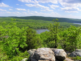
![]()
![]() On Saturday, May 8th after finishing Allamuchy and Allamuchy North, Cindy and I drove south on Route 517 to get on I80 east to Route 206 and Waterloo Road. We followed the signs for Waterloo Village and stopped by a trailhead for the Sussex Branch Trail to get a map of the Allamuchy Park. These maps are colorful but not very useful for hiking. We went south and west on Waterloo Road, passed the sign for the village and pulled off on the left side. We parked in a small field and crossed the road where we saw blazes for the Highlands Trail. We walked in a road and found another area suitable for parking but decided to leave the car where it was. Near the back right corner of the parking area we found the blazes fro the Highlands Trail and we headed off on this trail. The first part was very flat as it wound its way over a few small streams and skirted some high outcrops. Eventually it began to climb and we hit steeper slopes than we had seen all day. After about .8 miles it seemed to me that we were passing by the high point and that the Highlands Trail would not pass over the top. I decided to bushwhack northeast toward the high point. In less than .2 miles we hit the yellow trail and followed it to a point near the high point. From here we bushwhacked into the woods and wandered around until we were at the appointed coordinates with no higher spots to be seen.
On Saturday, May 8th after finishing Allamuchy and Allamuchy North, Cindy and I drove south on Route 517 to get on I80 east to Route 206 and Waterloo Road. We followed the signs for Waterloo Village and stopped by a trailhead for the Sussex Branch Trail to get a map of the Allamuchy Park. These maps are colorful but not very useful for hiking. We went south and west on Waterloo Road, passed the sign for the village and pulled off on the left side. We parked in a small field and crossed the road where we saw blazes for the Highlands Trail. We walked in a road and found another area suitable for parking but decided to leave the car where it was. Near the back right corner of the parking area we found the blazes fro the Highlands Trail and we headed off on this trail. The first part was very flat as it wound its way over a few small streams and skirted some high outcrops. Eventually it began to climb and we hit steeper slopes than we had seen all day. After about .8 miles it seemed to me that we were passing by the high point and that the Highlands Trail would not pass over the top. I decided to bushwhack northeast toward the high point. In less than .2 miles we hit the yellow trail and followed it to a point near the high point. From here we bushwhacked into the woods and wandered around until we were at the appointed coordinates with no higher spots to be seen.
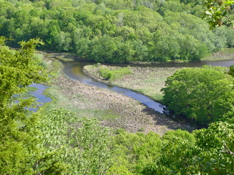 After taking a few pictures. we returned to the yellow trail. I knew that right would take us northwest AWAY from the car so we headed east and slightly south to see if the yellow trail would meet up with the Highlands Trail which would lead us back to the car. After a short walk the yellow trail made a sharp left while and unmarked trail continued straight ahead. We continued on the unmarked trail and walked up a small hill and found the Highlands Trail. A short distance down this trail brought us to the only viewpoint we had all day! It was a good one! The view point was cliff that looked out over the valley to the next ridge. Below were the small lakes and swamps that make up Waterloo Lakes. We took pictures and then returned to the Highlands Trail which we took back to the car. We were back as the wind began to blow even harder. The 2.5 mile hike had taken about 1.5 hours!
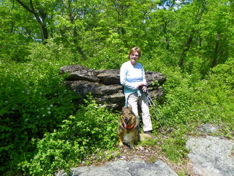
![]()
![]() On Saturday, May 8th it was raining hard in Livingston Manor. The forecast for north central New Jersey was for early thunderstorms and then clearing. We decided to take the chance so Cindy and I took Sheba and headed for Allamuchy State Park to climb Allamuchy, Allamuchy North and Waterloo. We went through Port Jervis, Matamoras and Milford and picked up Route 206 south into New Jersey. It is a long drive and I didn't really have a map. I had written some directions on a card. Somehow I missed Route 606 in Newton but found Route 603 in Andover. We headed south on 603 and picked up Route 517. We were looking for Stuyvesant Road in Allamuchy State Park. I had been warned it was hard to find but I wasn't prepared for the fact that there was NO road sign. Eventually we turned left on a dirt road and drove in. We ended up by a kiosk and sign that said Waterloo/517 Trail which is just what we were looking for. There were no maps at the kiosk and I had nothing else to go on except some trail reports from the NJ1K site. We took the white blazed Waterloo/517 trail from the parking area as it ascended along a woods road next to a small stream. Even at this level there were many unmarked trails and paths that branched off the main trail. Near the beginning the marked Switchback Trail went off to the right in a southerly direction. Without maps it was hard to tell where all the trails would lead!
On Saturday, May 8th it was raining hard in Livingston Manor. The forecast for north central New Jersey was for early thunderstorms and then clearing. We decided to take the chance so Cindy and I took Sheba and headed for Allamuchy State Park to climb Allamuchy, Allamuchy North and Waterloo. We went through Port Jervis, Matamoras and Milford and picked up Route 206 south into New Jersey. It is a long drive and I didn't really have a map. I had written some directions on a card. Somehow I missed Route 606 in Newton but found Route 603 in Andover. We headed south on 603 and picked up Route 517. We were looking for Stuyvesant Road in Allamuchy State Park. I had been warned it was hard to find but I wasn't prepared for the fact that there was NO road sign. Eventually we turned left on a dirt road and drove in. We ended up by a kiosk and sign that said Waterloo/517 Trail which is just what we were looking for. There were no maps at the kiosk and I had nothing else to go on except some trail reports from the NJ1K site. We took the white blazed Waterloo/517 trail from the parking area as it ascended along a woods road next to a small stream. Even at this level there were many unmarked trails and paths that branched off the main trail. Near the beginning the marked Switchback Trail went off to the right in a southerly direction. Without maps it was hard to tell where all the trails would lead!
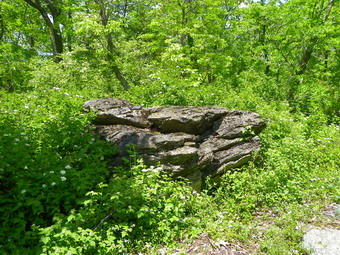 After about .8 miles the white trail turned to the left and the Ditch/cardiac trail marked in faded purple appeared on the right. I knew from the trail reports that we were on the right route. We turned on the purple trail and walked through some pleasant woods with MANY side trails and paths. Signs declaring "posted" and "Private Property, Patrolled" began to appear as the land to the left of the trail is part of a scout reservation. After about 1.2 miles the purple trail turns right off the woods road and starts to ascend Allamuchy Mountain. No parts of the trail are very steep but they may seem that way after the flat walk to get there. As we neared the top of the trail higher ground was on the right and I though I would have to bushwhack up to it to find the high point. We decided to stay on the trail and soon it began to climb to higher ground. When it leveled off a short path led to the right to a large, jagged boulder. The GPS coordinates seemed to match and there was no higher point around so we claimed the summit. There was no view from the top and did not appear to be any nearby. We could hear the traffic below on I80 but could not see it. After a few pictures, we turned around and headed back down the trail turning left on the woods road at the bottom.
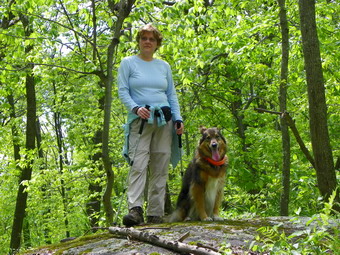 On the way out on the trail I had noticed an unmarked but well used trail that headed northeast and though it might be a way to get to Allamuchy North. On our way back down the trail, we met a mountain biker who tried to be helpful and thought that this might be a good way to go. We took the right across a small stream and continued on this trail to the east and north for a little over half a mile. At this point we were due west of the GPS coordinates fro the high point and I did not want to go nay farther north. Another unmarked trail turned to the right (east) and we started out on it only to find it led south. I decided it was time to bushwhack and I took a compass bearing for the summit. The walk was not difficult as we gained the ridge and as we walked we came across another trail marked in white. I was in favor of continuing the bushwhack but my wife though we should use the trail. We got on the trail which initially led down and east of the summit but soon climbed up and passed right by the high point. We climbed onto a rocky outcrop which matched the coordinates, looked around, saw no other high points and declared success. On the way back we followed the trail and then took another that I thought might head more directly for the car. This trail started to head too far north so we backtracked and followed Sheba back to the place we had originally started the bushwhack. From here we walked the trails back to the car. On the way we met the mountain biker again and then two young men on dirt bikes who had run out of gas. We suggested they try to get down 517 since there would probably be a gas station near I80. We were back at the car before 2:30 PM having covered over 6 miles in under 3 hours.
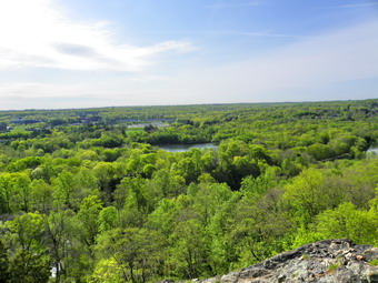
![]()
![]() On Friday, April 30th a family commitment I thought I had fell through. I decided to get to northern New Jersey to hike the four peaks in the Ramapos; Bald Mountain, Ilgenstein Rock, Rocky Mountain and Drag Hill. This seemed like a task I could accomplish given that the bushwhacks were short and the areas were connected by trails. I had Bill Maurer's trip reports and decided to "go for it". What I didn't pay attention to was any estimate of mileage for the complete loop. Sheba and I got an early start and took the easiest and quickest route; the Quickway to the Thruway to Route 17S and then 202. We parked in the parking area for the Ramapo Reservation at about 8:40 AM and, after I got my bearings, we headed out through the park at 8:45 AM. There were quite a few people walking in the park and quite a few of those had dogs. It was obvious these people were just out for a stroll on the beautiful grounds of the park. I wondered if it was obvious to them that I was ready for something more! We walked over the river on a bridge and then passed by Scarlet Oak Pond. The pond was very nice and to the west I could see the ridge we would soon be climbing. I decided to wait to take pictures until the return trip. I was anxious to get off the wide carriage road and onto the trails. At the end of the road around the pond we turned right and started to walk on the green Halifax Trail.
On Friday, April 30th a family commitment I thought I had fell through. I decided to get to northern New Jersey to hike the four peaks in the Ramapos; Bald Mountain, Ilgenstein Rock, Rocky Mountain and Drag Hill. This seemed like a task I could accomplish given that the bushwhacks were short and the areas were connected by trails. I had Bill Maurer's trip reports and decided to "go for it". What I didn't pay attention to was any estimate of mileage for the complete loop. Sheba and I got an early start and took the easiest and quickest route; the Quickway to the Thruway to Route 17S and then 202. We parked in the parking area for the Ramapo Reservation at about 8:40 AM and, after I got my bearings, we headed out through the park at 8:45 AM. There were quite a few people walking in the park and quite a few of those had dogs. It was obvious these people were just out for a stroll on the beautiful grounds of the park. I wondered if it was obvious to them that I was ready for something more! We walked over the river on a bridge and then passed by Scarlet Oak Pond. The pond was very nice and to the west I could see the ridge we would soon be climbing. I decided to wait to take pictures until the return trip. I was anxious to get off the wide carriage road and onto the trails. At the end of the road around the pond we turned right and started to walk on the green Halifax Trail.
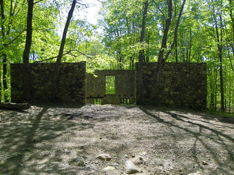 The first part of the Halifax Trail was on a woods road but it was far less populated than the roads around the pond. Soon we were on trail and climbing up the ridge. Not too far along is a nice, open viewpoint onto Scarlet Oak Pond and Lake Henry below. I stopped to take some pictures of these and the surrounding hills. The trail rises some more and at a little less than a mile it turns sharply left. If you walk straight ahead here, you can walk out to Hawk Rock. I decided that I already had some nice pictures and that this was close enough to the trailhead that I could visit it another time. The Halifax Trail then drops some before starting a long gentle climb. At around 3 miles there is an intersection with several woods roads and one that is paved. We took the first woods road even though I wasn't sure which one was correct. I knew we wanted to go north to Bald Mountain and the first road seemed correct. Soon we were walking along the road trying to avoid the large puddles that covered frequently on the trail. At one point a puddle had turned into a small pond and, at first, I wondered if we would get around it easily. We walked to the left of the puddle and soon found a damp but acceptable way to skirt the water. We passed by the Pierson Exploration where I found what looked like a few trenches but I was not sure whether or not this was the area of the mine. The trail turned right or east and I wondered if we were on the right path. Checking the map showed that this is what we were supposed to do and I was convinced we were OK. After another 1.3 miles I could see Bald Mountain rising to the left and there were several woods roads that appeared to offer access. Ahead I saw some ruins as marked on the map and went to investigate them. There were two large sets of stone walls built with rounded stones and mortar. Next to them was what appeared to be a grave site. I resolved to investigate the story of the ruins and the grace as soon as possible! Sheba and I walked up toward the second set of walls and then began to bushwhack up the mountain. We hit a woods road and followed it until we got to the access road for the transmission tower on the top of the mountain. It was only a short distance to the top and once there we wandered around until I was convinced we had hit all the highest spots. We started back down the road and I had intended to walk this back down to the ruins but Sheba had other ideas. She veered off the road and followed the path we had taken to the top. Somewhere along the way she caught the woods road I had intended to take back down and followed it back to the woods road. Returning to the Halifax Trail seemed to be much faster than the trip out and we were soon turning right of the Halifax Trail. It was here I remember looking at the GPS which read 6.5 miles and thinking this was going to be rather longer than I had thought.
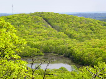 In less than half a mile the green trail made a hard right and headed north and west. We stayed on the blue trail and walked along the northern shore of Bear Swamp Lake. In a very short distance, we got on the yellow Hoeferlin Trail and immediately started to ascend the ridge in a northwest direction. Once on the ridge we walked south on the trail. I watched for the white trail on the right since it marked the area of the Butler Mine. When the trail appeared, we made the right and walked along it for a short distance. I found a path on the right down to some trenches but did not find much else. Back on the main trail we started to walk along the ridge toward the lookout at the other end marked as Ilgenstein Rock on my map. For some reason I checked my GPS and found we had already passed the designated coordinates fro the highest spot but not by much. We backtracked a small amount and then turned left or west into the woods. We got to the coordinates but I though I saw a higher spot and wander over to hit that spot also. There was absolutely no view from the top! Back on the trail we headed south for the lookout. After descending briefly into a col, we hiked up to an open rock ledge and I knew we had arrived. The open rock face offered good views to the east. Rocky Mountain and Drag Hill were clearly visible with the pipeline right-of-way splitting them. Below was Bear Swamp Lake. To the south I could see the distinctive outline of New York City. We stopped and I took pictures while Sheba rested in the shade. After a snack and a drink we headed down a white trail to the red Cannonball Trail marked with a white C on a red background. We turned left here and walked a short distance to the blue Shore Trail which crosses the dam at the outlet end of Bear Swamp Lake. We stopped at the dam and I took pictures of the lake with its deep blue waters and the surrounding green trees. Once across the dam we walked off into the woods and simply started to bushwhack up Rocky Mountain. Near the base of the mountain were some "ruins" with the accompanying junk. Shortly we were at the pipeline right-of-way. We crossed this and continued up toward the top of the mountain. We worked our way through some rocky ledges and to the rather flat summit. I found what I though might be a cairn, wandered around to hit a few other high spots and then walked to a rock ledge to the east. This ledge had few views now that the leaves are back on the trees. We returned to the high spots and walk a little north and west to hit the highest point of the pipeline on Rocky.
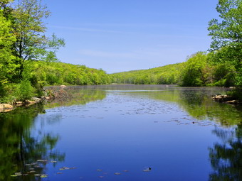 Walking the pipeline was not that much fun! It was open and easy to navigate but being open means that it was also open to the sun. The sun was bright and beating down and the air temperature was in the 80's. The rocks on the right-of-way were large and jagged and made the walking tough. We walked down Rocky into the col with Drag Hill. Near the bottom was a monitoring station for the pipeline. Ahead lay a short but steep and very rocky section of the pipeline that ascended Drag Hill. After taking some pictures, we went into full assault mode. I felt a continuous climb with no stops was the best idea and that's what we did. At the top of the pipeline we turned right or east and scrambled up some rocks looking for the highest spot. We wandered around to get the summit and then again headed north to get back on the open right of way. As we descended Drag Hill a larger monitoring station came into view. When we got to this station a road crossed the pipeline and headed east. The maps seemed to indicate that the road would intersect the White Trail in a short distance so we turned right and headed down the road. After an appropriate time I began to look for trail markers but did not see any. We walked out into the woods a little north of the trail and immediately found the trail. As we walked along the trail the blue and white Havemeyer Hollow Trail came in from the left. We continued on a made a right on the blue white Havemeyer Hollow Trail which headed a little southwest. When we crossed a woods road and descended to the blue Ridge trail we turned left. This was the area marked as a nickel mine on my maps. I saw little or no evidence of mining so we continued on the ridge trail looking for a path to the right which was supposed to lead to a viewpoint.
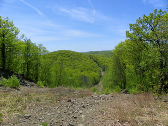 We arrived at the side trail and walked up to the rocky outcrop that acted as a lookout. There was not much to see since the leaves had come and the viewpoint was a little disappointing. Back on the blue trail we continued to descend back toward the parking area at the Ramapo Reservation. Once on the Silver Trail we I knew we were almost there. The outlet stream from Macmillan Reservoir had some since little cascades and falls but they were down in a ravine. Some side paths led to areas near the stream but I decided to leave that for another day! Back at Scarlet Oak Pond we ran into more people and lots of dogs! I stopped to take some pictures of the pond and then hurried back to the care. I was tired and my feet were hot. Sheba and I were both dry despite our efforts to keep drinking. We were back just before 3:00 PM logging 13.5 miles in 6 hours and 15 minutes. On the drive back I missed a turn onto 17 North and had to pull into a parking lot to turn around. One of the signs said "New York-New Jersey Trail Conference"! I stopped and talked to a very nice volunteer and bought the new Catskill map set!
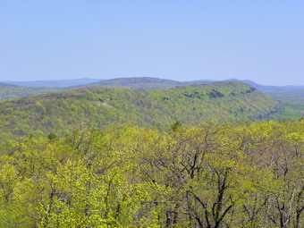
![]()
![]() On Friday, April 23rd I wanted to get in at least one more hike in the Kittatinnies before heading home. I had decided to hike to the Catfish Fire Tower but had not decided on the route I would take. My first plan was to hike the Coppermines Trail to the Tower and then hike back along the AT to Sunfish Pond and then back to the car. This was a rather long route that I had not hiked before and I was not sure how long it would take. I decided on a shorter route to Catfish starting where the AT crosses the Millbrook Road. I would hike the AT to the tower and then continue out along the ridge. At some point I would pick up the Rattlesnake Swamp Trail to make a loop. If I had time left after this I would use the Garvey Springs Trail to go to Sunfish Pond. After finishing the trip to Paradise Mountain, I drove to the small parking area for the hike to Catfish. We left the car at about 11:15 and followed the AT as it followed a wide woods road. At some point the AT leaves the road and begins to climb up to the ridge. It regains the road at least once and then leaves it for the final ascent to the top. It never gets very steep and it took us only about 20 minutes to reach the fire tower.
On Friday, April 23rd I wanted to get in at least one more hike in the Kittatinnies before heading home. I had decided to hike to the Catfish Fire Tower but had not decided on the route I would take. My first plan was to hike the Coppermines Trail to the Tower and then hike back along the AT to Sunfish Pond and then back to the car. This was a rather long route that I had not hiked before and I was not sure how long it would take. I decided on a shorter route to Catfish starting where the AT crosses the Millbrook Road. I would hike the AT to the tower and then continue out along the ridge. At some point I would pick up the Rattlesnake Swamp Trail to make a loop. If I had time left after this I would use the Garvey Springs Trail to go to Sunfish Pond. After finishing the trip to Paradise Mountain, I drove to the small parking area for the hike to Catfish. We left the car at about 11:15 and followed the AT as it followed a wide woods road. At some point the AT leaves the road and begins to climb up to the ridge. It regains the road at least once and then leaves it for the final ascent to the top. It never gets very steep and it took us only about 20 minutes to reach the fire tower.
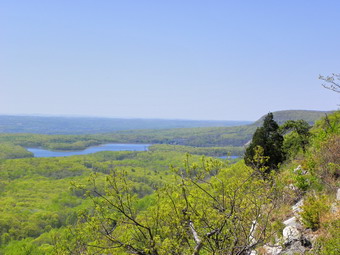 When we got to the fire tower there were two people on the bench near the tower. One of them greeted me by name. It was a track official that I had worked with the Saturday before. He was section hiking the AT with his son. We chatted for a while and then I started to climb the tower. The skies were sunny but there were enough clouds for contrast. The other two hikers departed leaving Sheba and I and the person in the tower as the only people left on top. I took pictures from several different heights and at many different angles. The wind was minimal and certainly not as strong as the gust that nearly tore me loose from the Culver Lake Tower! The views back toward Paradise were nice as were those further to the south. Some haze hung on the far peaks but it was otherwise a beautiful day. After I came down the tower, I walked around to make sure I had hit the summit and then continued south on the AT. There were several nice viewpoints along the way but none were more revealing than those from the tower. The ridge walk was easy and very relaxing. Soon we arrived at an open rock ledge that had an even better view to the south. The valley below seemed very close. We stopped and I took pictures. I was about to continue on to pick up the Rattlesnake Swamp Trail when I spotted a sign further up on the rock. I wanted to read the sign so I climbed up the rock. The sign said Rattlesnake Swamp Trail!
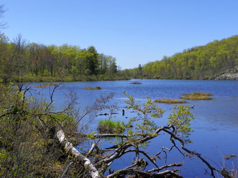 The trail started out by ascending over the ridge and then it started to drop down the other side. It was a pleasant walk without many views as we continued along. Soon the trail met an old woods road and seemed to follow it. We turn left or south but the blazes disappeared and it seemed south was the wrong way to go. I decided to give it a little more time and soon I saw the signs to turn right off the road and toward Catfish Pond. It seemed the trail would come close to the pond but I could never get a completely clear view from the trail. We bushwhacked down to the shoreline. The pond was a deep blue and was surrounded by very green trees and a few talus slopes. There was a small boat on the pond and what looked like several beaver homes. The scene was ideal and I took some pictures before going back up to the trail and continuing on. The trail ran beside a small stream and crossed it several times. None of the crossings were wide. In places the trail was damp and several spots were muddy. The further we went the large the swamp on the left became. Soon the trail ended as it intersected a woods road and we turned left. A few hundred feet down the road we were back at the junction with the AT. We walked the AT back to the car. The 5.1 mile hike had lasted about 2 hours and 15 minutes with plenty of time for pictures! We had a very nice hike and I had a little time left before I had to head home but not enough time for the hike to Sunfish Pond. I decided to check out the Coppermines Trail.
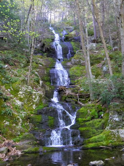
![]()
![]() On Friday, April 23rd I wanted to head to the Kittatinnies to Mount Paradise near Buttermilk Falls. Cindy and I had hiked this route last summer but it was clear to me that we had NOT hit the high point. We were close and I guess I could have claimed it but that really didn't suit me. My plan was to park at Buttermilk Falls and use the Buttermilk Falls Trail to go straight up the mountain to near the top and then bushwhack to the highest point. After a little trouble finding Mountain Road off the NPS Road, we arrived at the parking area for Buttermilk Falls and were on the trail by 8:55 AM. Mountain Road from the more southern end is unpaved and full of pot holes. I was glad I had the SUV since my car would have bottomed out several times! Buttermilk Falls had a little more water than last time and the light was better for photographs. There were also no other people present! I stopped and took several pictures before climbing the steps to the upper lookout. From the little bridge above the lookout the trail climbs sharply but then levels out a little while continuing to ascend. The weather was getting warmer and I got pretty warm especially when we broke out of the trees into an open clearing. I stopped to take my jacket off and then continued on the trail to the point where it reenters the trees and crosses a wide woods Road. We had followed the road to Hemlock Pond and Crater Lake last time but today I was just interested in getting to the high point of the mountain. We took a left off the road and continued on the blue Buttermilk Falls Trail.
On Friday, April 23rd I wanted to head to the Kittatinnies to Mount Paradise near Buttermilk Falls. Cindy and I had hiked this route last summer but it was clear to me that we had NOT hit the high point. We were close and I guess I could have claimed it but that really didn't suit me. My plan was to park at Buttermilk Falls and use the Buttermilk Falls Trail to go straight up the mountain to near the top and then bushwhack to the highest point. After a little trouble finding Mountain Road off the NPS Road, we arrived at the parking area for Buttermilk Falls and were on the trail by 8:55 AM. Mountain Road from the more southern end is unpaved and full of pot holes. I was glad I had the SUV since my car would have bottomed out several times! Buttermilk Falls had a little more water than last time and the light was better for photographs. There were also no other people present! I stopped and took several pictures before climbing the steps to the upper lookout. From the little bridge above the lookout the trail climbs sharply but then levels out a little while continuing to ascend. The weather was getting warmer and I got pretty warm especially when we broke out of the trees into an open clearing. I stopped to take my jacket off and then continued on the trail to the point where it reenters the trees and crosses a wide woods Road. We had followed the road to Hemlock Pond and Crater Lake last time but today I was just interested in getting to the high point of the mountain. We took a left off the road and continued on the blue Buttermilk Falls Trail.
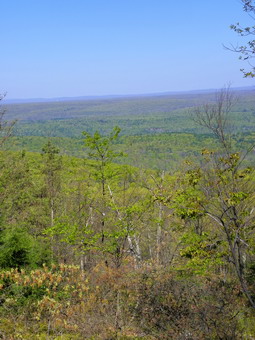 The trail from the woods road up is rather steep at times and passes over some open rock faces. There is one spot along the way that has a limited view but that's about it. When we hit the AT, we turned right and then almost immediately started to bushwhack east as the AT made a hard right turn. After a little rise, I could easily see higher ground ahead and a tower. Next to the transmission tower was a small building and, as we got closer, I could see there was a pickup truck next to it! I headed for an area just south of the tower and climbed to the top of a rocky spine. From here I could see a slightly higher point slightly north of the tower and we headed in that direction. When we arrived, there seemed to be a marker and the GPS coordinates and elevation matched. We were at the high point at 9:55 AM taking about an hour from parking to summit. To get back I used CPS and followed Sheba back to the AT and then the falls trail. We were back in the lot by 10:45 AM and ready to tackle Catfish Mountain next.
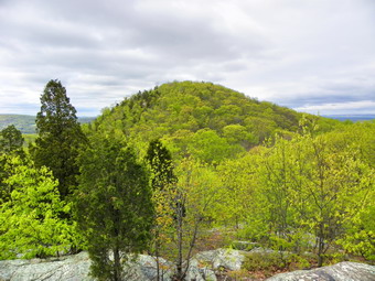
![]()
![]() On Sunday, April 18th I drove out of the parking area for Jenny Jump State Forest after finishing Jenny Jump #1 had #2. I passed the office to Fairview Road and turned right. At the T where Fairview ended I turned left onto Hope Road and began to watch for Mountain Lake Road on the right. I turned onto Mountain Lake Road and began to follow several cars that appeared to be together and headed in the same direction I was going. I though this just coincidence until they turned right on Lakeside just ahead of me and almost filled the parking lot where I was headed. The drive had taken less than 20 minutes! There was just enough room for me to park. They were obviously together and I wanted to get ahead of them on the trail. I said "hello" and then Sheba and I walked up the road slightly and off into the woods. I had no maps of this area except the one from the park office which was better than none but far from informative! The Mountain Lake Trail was in yellow on the map but some of the blazes on trees were blue. The trail headed north and then northwest and I knew I wanted to go southwest. I was tempted several times to just start to bushwhack but I knew that staying on the trail would be quicker. The map showed the trail passing over the summit but I suspected this was not correct. Soon the trail turned southwest and I began to see high ground on the left. My GPS confirmed I should go off the trail and I did. I thought I had found the highest point when I got to the top of a rocky out crop but then spotted another a few hundred feet away. I found this spot was slightly higher and I claimed the summit. From this point I knew it would be a bushwhack most of the way to the last peak. This area was crisscrossed by a network of paths, unblazed trails and woods roads. When we started down from the third summit an started for Jenny Jump #4, I had no idea how far exactly we had to go or how difficult it would be!
On Sunday, April 18th I drove out of the parking area for Jenny Jump State Forest after finishing Jenny Jump #1 had #2. I passed the office to Fairview Road and turned right. At the T where Fairview ended I turned left onto Hope Road and began to watch for Mountain Lake Road on the right. I turned onto Mountain Lake Road and began to follow several cars that appeared to be together and headed in the same direction I was going. I though this just coincidence until they turned right on Lakeside just ahead of me and almost filled the parking lot where I was headed. The drive had taken less than 20 minutes! There was just enough room for me to park. They were obviously together and I wanted to get ahead of them on the trail. I said "hello" and then Sheba and I walked up the road slightly and off into the woods. I had no maps of this area except the one from the park office which was better than none but far from informative! The Mountain Lake Trail was in yellow on the map but some of the blazes on trees were blue. The trail headed north and then northwest and I knew I wanted to go southwest. I was tempted several times to just start to bushwhack but I knew that staying on the trail would be quicker. The map showed the trail passing over the summit but I suspected this was not correct. Soon the trail turned southwest and I began to see high ground on the left. My GPS confirmed I should go off the trail and I did. I thought I had found the highest point when I got to the top of a rocky out crop but then spotted another a few hundred feet away. I found this spot was slightly higher and I claimed the summit. From this point I knew it would be a bushwhack most of the way to the last peak. This area was crisscrossed by a network of paths, unblazed trails and woods roads. When we started down from the third summit an started for Jenny Jump #4, I had no idea how far exactly we had to go or how difficult it would be!
 After coming off the summit of Jenny Jump #3, we headed in a generally west to southwest direction. One problem was the fact that I could not visualize the last summit and had to rely on compass bearings and GPS readings. We descended some and then ascended to a higher ridge slightly to the south but I could see higher ground ahead. We came down off the ridge and climbed as mall hill to a fire circle. It was clear this was NOT the summit which according to my GPS readings was quite a bit farther ahead. So we descended the hill, crossed a woods road and ran into a rather deep stream surrounded by a very swampy area. I knew I wasn't going to let this stop us but I didn't want to get wet and/or muddy if I could help it. We walked to the left along the stream and found a narrow area without the mud surrounding it and crossed easily. There was another ridge in front of us so we started to climb and ran into a woods road. We walked along the road for a while but it was going the wrong way and didn't show any signs of turning. We turned right and struck off into the woods and hit another road that seemed to lead to the high ground ahead. It did indeed take us to the top of a ridge where I spotted some higher ground just ahead off the road. Here there was collection of sticks on an old stump and the GPS coordinates matched exactly. There was no view so I told Sheba "Back" and followed here down to the stream where she picked the exact spot that we crossed and then avoided the swamp on the other side. I wanted to see if I could pick up the trail that had gone passed Jenny Jump #3 but turned to early and had to backtrack. Sheba was patient and guided me back to the area of the first peak where I found the trail. Soon we were back on the trail to the car. As we descended the Mountain Lake Trail, we ran into the group that had parked just before us. They seemed to be having a nature lesson. We were back at the car by 1:35 PM having covered the 5.2 miles of this hike in 2 hours and 45 minutes.
![]()
![]() On Sunday, April 18th I wanted to get in some exercise after a long track meet on Saturday. I was planning on hiking Catfish but decided to leave early and try to get all four peaks on Jenny Jump Ridge. I was out of the house by 6:50 AM and headed toward Port Jervis. The weather was cool, about 37 when I left home, and there was a threat of showers. I wore wool leggings and my new Cabela's Goretex Paclite rain jacket. I also packed several different layers in my pack and took some in the car. Google maps said the trip to Jenny Jump State Forest would take over 2 hours but we arrived in under two hours. I wasn't clear on exactly where to park but stopped at the office for a map. I couldn't find any one around, so I drove up the hill passed the office to the bathrooms. I parked in the small parking area and immediately saw the sign for the Summit Trail. I got my equipment ready and Sheba and I started up the trail.
On Sunday, April 18th I wanted to get in some exercise after a long track meet on Saturday. I was planning on hiking Catfish but decided to leave early and try to get all four peaks on Jenny Jump Ridge. I was out of the house by 6:50 AM and headed toward Port Jervis. The weather was cool, about 37 when I left home, and there was a threat of showers. I wore wool leggings and my new Cabela's Goretex Paclite rain jacket. I also packed several different layers in my pack and took some in the car. Google maps said the trip to Jenny Jump State Forest would take over 2 hours but we arrived in under two hours. I wasn't clear on exactly where to park but stopped at the office for a map. I couldn't find any one around, so I drove up the hill passed the office to the bathrooms. I parked in the small parking area and immediately saw the sign for the Summit Trail. I got my equipment ready and Sheba and I started up the trail.
 The first part of the trail was relatively flat but then began to gain some elevation as we neared the ridge. On the way up a view point opened on the right side of the trail but I decided to save that for the return trip. Further along on the flat top of the ridge, there was another viewpoint. The day was a little hazy but the views were good. It was starting to get much warmer and I took off my light jacket at this point before continuing along the ridge and dropping into a small depression or col before hiking up to the highest point at the end of the ridge. It was hard to find the correct spot and when I started back down the other side I retraced my steps and walked off the trail to find the high point. A pile of rocks (cairn) seemed to indicate that spot so I was satisfied I had found it and started back. I planned to return to the viewpoint I had bypassed before and bushwhack off that spot toward the second high point on the ridge. As I got nearer to this viewpoint, I noticed a nice view from the right side of the trail and walked across the ridge to find a nice lookout and a bench. The views from this side of the ridge were equally beautiful and I spent some time here taking pictures before continuing on to the next viewpoint.
 The lookout that I bypassed gave a nice view of Jenny Jump #2 which is a complete bushwhack. I took pictures and then started down the right side of the rocks that made up the viewpoint. It appeared that a few others had done the same as a small path wound its way down to the end of a woods road. From here Sheba and I headed UP the mountain looking for a natural pathway. It was steep and covered in blowdown but we kept finding ways to ascend. Near the top another view opened up to show the valley below and an operation processing either sawdust or sand. After a few pictures, I continued on up to the high point. The ground elevated some as we continued but the brush became harder to get through. I continued to consult my GPS and we were headed in the right direction. On the way to the high point we passed another hiker and his two dogs. I said "Hello" but he didn't seem to interested in conversation. It wasn't long before we tagged the high point and then started down. I decided to take a slightly different angle back to the car. We ran into some thick blowdown and several cliffs that were impossible to negotiate. Along the way I ALMOST ducked under a branch but hit my head. After a few more steps I felt something trickling down my scalp. I ran my hand through my hair and came back with quite a bit of blood. Within a little more than a minute this had stopped and we continued. Soon we were back down to the woods road which led us back to the parking area and the car. The 3 miles hike had lasted an hour and 45 minutes. It was time to drive to Lakeside Drive near Mountain Lake to hike Jenny Jump #3 and #4.
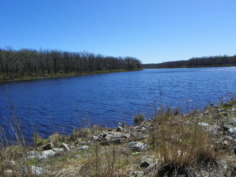
![]()
![]() On Saturday, April 10th I was pretty tired after our 10 mile 4 hour hike of Sunrise but it was only 2:15 PM. I decided to head over to High Point just to check out the trailheads and get ready to hike it next time. I though that I MIGHT be able to get it in this day but I would make that decision when I got there. I headed north on Route 206 looking for the High Point sign I had seen before or Clove Road which seemed the fastest way to get there. It turned out that both of these things occurred at the same time as the sign was pointing to Clove Road. I drove along Clove Road for a few miles and then turned right when it met Route 23. This road ascends High Point going over the top and down the other side. I thought I might go over the top and then turn left on Route 519, park where the AT crosses the road and then hike up the ridge from there. As I drove up the ridge on Route 23 a sign for the Steeny Kill boat launch area appeared on the left. I couldn't resist this so I pulled into the small parking lot to check it out. The trail crossed the launch area and passed by the lake. The lake was very beautiful with a cabin on the opposite shore. What attracted me most was that higher on the ridge I could see the High Point Monument. It didn't look that far away either horizontally or vertically and that was good enough for me! I went back to the car, let Sheba out and got my gear. We were hiking along the edge of the lake by 3:00 PM. My plan was to take the Steeny Kill Trail to the Monument Trail and follow that in a loop back to Steeny Kill. I took some pictures at the shore of the lake and then crossed the outlet on some large slabs of stone. Toward the end of the Steeny Kill Trail it began to ascend the ridge. After about .75 miles, we hit the Monument Trail and turned right to ascend the first part of the ridge. There were several switchbacks and some "stairs" along the way. The hardwood gave way to the typical scrub pine. Near the top of the ridge the monument came into view again and the trail flattened some. In .35 miles we were on the shores of Lake Marcia.
On Saturday, April 10th I was pretty tired after our 10 mile 4 hour hike of Sunrise but it was only 2:15 PM. I decided to head over to High Point just to check out the trailheads and get ready to hike it next time. I though that I MIGHT be able to get it in this day but I would make that decision when I got there. I headed north on Route 206 looking for the High Point sign I had seen before or Clove Road which seemed the fastest way to get there. It turned out that both of these things occurred at the same time as the sign was pointing to Clove Road. I drove along Clove Road for a few miles and then turned right when it met Route 23. This road ascends High Point going over the top and down the other side. I thought I might go over the top and then turn left on Route 519, park where the AT crosses the road and then hike up the ridge from there. As I drove up the ridge on Route 23 a sign for the Steeny Kill boat launch area appeared on the left. I couldn't resist this so I pulled into the small parking lot to check it out. The trail crossed the launch area and passed by the lake. The lake was very beautiful with a cabin on the opposite shore. What attracted me most was that higher on the ridge I could see the High Point Monument. It didn't look that far away either horizontally or vertically and that was good enough for me! I went back to the car, let Sheba out and got my gear. We were hiking along the edge of the lake by 3:00 PM. My plan was to take the Steeny Kill Trail to the Monument Trail and follow that in a loop back to Steeny Kill. I took some pictures at the shore of the lake and then crossed the outlet on some large slabs of stone. Toward the end of the Steeny Kill Trail it began to ascend the ridge. After about .75 miles, we hit the Monument Trail and turned right to ascend the first part of the ridge. There were several switchbacks and some "stairs" along the way. The hardwood gave way to the typical scrub pine. Near the top of the ridge the monument came into view again and the trail flattened some. In .35 miles we were on the shores of Lake Marcia.
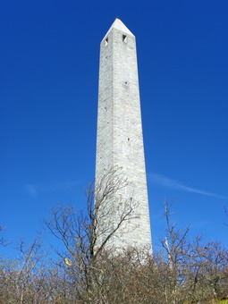 We stopped at the shore of the lake so that I could take some pictures and then I tried to determine where the trail was. I found that it followed the lake shore for a bit and then turned left and ascended. It then crossed and recrossed the road before heading UP to the monument. After only another .4 miles we were at the base of the monument and climbed the steps to get the best view. Below us Matamoras and Port Jervis were clearly visible on either side of the river. I took pictures and then walked to the other side of the monument where the countryside spread out for ever. The brown and gray of late winter and early spring was giving way to bright greens! I took pictures of the landscape and a few of the monument before we headed down to the rocky outcrop below the monument. I took more pictures from here before we got back on the trail. High Point is easily accessible by car and there were too many people around to really enjoy the view. We headed down the Monument Trail and passed the parking area. At the far end of the parking area we hopped back on the trail across the ridge. The trail at this point is marked for the Long Path and the Shawangunk Ridge Trail as well as the "local" Monument Trail. As we walked along the ridge I took several side paths to various lookouts but none were better than the views from the monument. This was a pretty walk with a constant descent. It was especially nice near the end of the ridge just before the trail turns to the left and starts to descend.
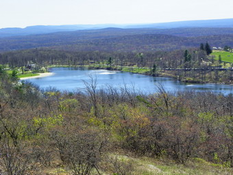 In about 1.5 miles from the monument the trail split with the SRT following a route through the Cedar Swamp and the monument trail crossing a bridge and skirting the swamp. I decided to continue on the Monument Trail since I had no idea whether or not the SRT was supported by boardwalks or bridges through the swamp. Due to the recent rains I thought the water in the swamp might be high and I did not want to have to backtrack. We were soon at the trail junction where the SRT came back out of the swamp and then where it continued down off the ridge and headed north away from the car. We continued on the Monument Trail and ran into several nice lookouts along the way. We met two hikers occupying one rock and had a brief conversation as I took a few shots. We continued on and ran into the Steeny Kill Trail and took it back to the car passing two more hikers by the lake. We were back at the car by 5:10 PM having covered 5.0 miles in just over 2 hours including several stops for pictures.
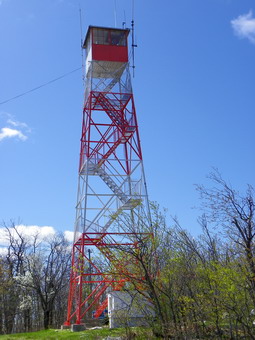
![]()
![]() On Saturday, April 10th I planned to head back to northern New Jersey to hike Ilgenstein Rock, Rocky and Drag Hill. These seemed like a good combination since they are close together. The last two are bushwhacks but they looked pretty straightforward. As I was getting ready Saturday morning I began to have second thoughts since I had been in this area so much recently. I changed plans and decided to try the two highest peaks in New Jersey, Sunrise and High point, in one day. This seemed ambitious but I though it was possible if I hiked quickly and didn't spend too much time in one spot. This would be my last Saturday for some time since invitational track meets start next Saturday! I had a few things to do in the morning so Sheba and I got a later start than I wanted but I knew it would be light until at least 7:00 PM. We started for the Delaware Water Gap to hike Sunrise from Stony Lake. This was easier to find than I though it might be and the trip was quicker than I remembered. On the way south on Route 206 I also saw a sign for High Point. We arrived at the main gate for Stokes State Forest and parked by Stony Lake at 10:15 AM. I had looked at all the different routes and trip reports on www.nj1k.org and decided to take the Tower Trail to Normanook Fire Tower and then hike the AT to the summit of Sunrise. The trails at the beginning were a little confusing since they all start at the parking area but soon we I had them sorted out and we were on the trail to the tower. It was still in the 40's when we started and I had put on light tights and two light layers of wool under a softshell jacket. It was cool enough at the start of the hike to wear a hat and light gloves. Once into the hike I removed the hat and gloves and began to open my jacket especially on the climb to the tower!
On Saturday, April 10th I planned to head back to northern New Jersey to hike Ilgenstein Rock, Rocky and Drag Hill. These seemed like a good combination since they are close together. The last two are bushwhacks but they looked pretty straightforward. As I was getting ready Saturday morning I began to have second thoughts since I had been in this area so much recently. I changed plans and decided to try the two highest peaks in New Jersey, Sunrise and High point, in one day. This seemed ambitious but I though it was possible if I hiked quickly and didn't spend too much time in one spot. This would be my last Saturday for some time since invitational track meets start next Saturday! I had a few things to do in the morning so Sheba and I got a later start than I wanted but I knew it would be light until at least 7:00 PM. We started for the Delaware Water Gap to hike Sunrise from Stony Lake. This was easier to find than I though it might be and the trip was quicker than I remembered. On the way south on Route 206 I also saw a sign for High Point. We arrived at the main gate for Stokes State Forest and parked by Stony Lake at 10:15 AM. I had looked at all the different routes and trip reports on www.nj1k.org and decided to take the Tower Trail to Normanook Fire Tower and then hike the AT to the summit of Sunrise. The trails at the beginning were a little confusing since they all start at the parking area but soon we I had them sorted out and we were on the trail to the tower. It was still in the 40's when we started and I had put on light tights and two light layers of wool under a softshell jacket. It was cool enough at the start of the hike to wear a hat and light gloves. Once into the hike I removed the hat and gloves and began to open my jacket especially on the climb to the tower!
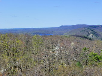 The Tower Trail crosses Sunrise Mountain Road at about 1.25 miles which we reached in under 30 minutes. This road passes across the top of the ridge and is one way to the north. There are several parking areas with the largest being less than a quarter mile from the summit of Sunrise. This makes the summit one of the most visited in New Jersey. From here the trail really starts to climb with several tricky rock scrambles over some VERY smooth boulders in places. On the way up I looked over my shoulder and saw some beautiful views. I was tempted to take some pictures but I knew the shots from the top would be better. On the way Up we met a man with his poodle coming down. Both our dogs behaved themselves and the other hiker said the views from the top were great but it was a little windy! We reached the 1572 foot summit at about 45 minutes into the hike which I thought was good for 1.65 miles. The views from the base of the tower were good and there was little haze. I could see Kittatinny Lake to the south. The wind was blowing making it colder than the actual air temperature. I decided to climb the tower to get the best views. There was a truck at the tower which led me to believe there was someone in the cab. I was not sure whether or not the tower was open to visitors but I wanted to take some pictures. As I climbed the tower the views became more and more spectacular. Kittatinny Lake was even more prominent as was Culver Lake on the west side of the ridge. I took pictures as I ascended. To the north I could clearly see the outline of Sunrise Mountain which looked HIGH and pretty far off! The wind was blowing and as I reached a certain level just below the cab a VERY strong gust came along. I had not noticed that I was now above the trees. I grabbed onto the tower which I believe prevented me from being blown down the stairs! By handing onto a tower support I was able to get a few more shots before realizing that my fingers were freezing! I CAREFULLY worked my way down the tower and back to Sheba waiting impatiently at the base. After a few more pictures and a quick snack we worked our way back to the AT and started north toward Sunrise Mountain.
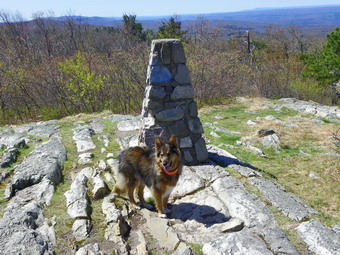 The Hike along the AT from Normanook to Sunrise is not flat but it is pretty close. The change in elevation between the two summits is only 61 feet with Sunrise being higher. At one point I dipped to 200 feet below Normanook but there was higher ground to the east. There are several brief rises along the way and a few limited views but none better than from the tower and the summit of Sunrise as I eventually found out. Sheba and I kept up a good pace and passed very close to the road at a couple of points. Soon we had covered the 3.4 miles between the peaks in only and hour and 15 minutes! As we climbed up to the summit, we discovered a group of about a dozen people already there. We talked a little but they were more interested in Sheba! I got the feeling they had driven to the top since someone made the comment that they were off to see High Point! Except for the pavilion at the top, the summit of Sunrise is very open with views in all directions. They day was very clear with some haze in the far distance. I took pictures in all directions including south toward Normanook, Kittatinny Lake and Culver Lake. Before leaving, we had a snack and I ditched the jacket in favor of a light Mountain Hardware long sleeved Wicked T over my Icebreaker 150 undershirt. I was a little cool in the wind at the top but knew I would warm up as we started to hike and descend out of the breeze.
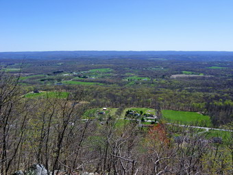 From the pavilion at the summit we continued on the At to the parking area which is on a spur road off of the "main" Sunrise Mountain Road. I got a little confused here but walking through the parking lot to the opposite end by the bathrooms allowed us to pick up the AT again. In less than a half mile from the summit the brown red blazes of the Cartwright trail appeared on the left and we followed them down the ridge. Actually the trail rolled a little and descended sharply over some open rock faces in one place. Within another half mile we were again crossing the Sunrise Mountain Road to pick up the trail. In a little less than a mile we were at the end of the Cartwright Trail and turned left onto the red blazed Swenson Trail. This trail was very wet in spot with mostly running water down the trail and, in places, streams to cross. None of this was much trouble, What was troublesome was the lack of sufficient blazes. In an area with so many crisscrossing trail, paths and roads, a few more blazes would be welcome. More than once I found myself questioning which way I should turn or if I should go straight ahead. The Swenson Trail was longer than I though but headed back south to our car at Stony Lake. It was about 3 miles back to the parking area and we arrived at 2:15 PM. I was pleased that we had covered a total of 9.8 miles in 4 hours with plenty of time for pictures along the way!
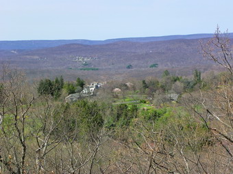
![]()
![]() On Saturday, April 3rd I headed from Hewitt to Ringwood to hike Mount Defiance. The Botanical Gardens were easier to find than I thought. As I drove up the hill to the first parking lot, PA, I was a little worried that someone would hassle me about bringing Sheba along. I parked at the end of the lot at about 12:30 PM and immediately saw a variety of people with a variety of dogs. I got out my equipment, put Sheba on her leash and started out. The "trail" through the botanical gardens was clearly marked with white blazes and followed some of the paved walkways in the gardens before turning left onto a dirt road. Soon the green blazes for the Halifax Trail up Mount Defiance appeared on the left and we started up. I was thinking about trying for Ilgenstein Rock, Rocky Mountain and Drag Hill if I had time. As we started up the trail a couple dressed in casual clothes was coming down the trail. They had made it halfway up and asked if I had ever climbed Defiance before. I said "No" and we continued on our separate ways. The Halifax Trail switches back and forth several times on the way up. The climb without the twists would not be steep but I believe the designers wanted as many people to be able to climb it as possible. I stopped once at a lookout and took a few shots before continuing on up. Near the top the green trail turned right but the high ground seemed to be on the left. From this point a red trail seemed to curl around the back of the mountain so I followed it. A high rocky cliff or prominence was on the left and on it sat two of the largest vultures I have ever seen.
On Saturday, April 3rd I headed from Hewitt to Ringwood to hike Mount Defiance. The Botanical Gardens were easier to find than I thought. As I drove up the hill to the first parking lot, PA, I was a little worried that someone would hassle me about bringing Sheba along. I parked at the end of the lot at about 12:30 PM and immediately saw a variety of people with a variety of dogs. I got out my equipment, put Sheba on her leash and started out. The "trail" through the botanical gardens was clearly marked with white blazes and followed some of the paved walkways in the gardens before turning left onto a dirt road. Soon the green blazes for the Halifax Trail up Mount Defiance appeared on the left and we started up. I was thinking about trying for Ilgenstein Rock, Rocky Mountain and Drag Hill if I had time. As we started up the trail a couple dressed in casual clothes was coming down the trail. They had made it halfway up and asked if I had ever climbed Defiance before. I said "No" and we continued on our separate ways. The Halifax Trail switches back and forth several times on the way up. The climb without the twists would not be steep but I believe the designers wanted as many people to be able to climb it as possible. I stopped once at a lookout and took a few shots before continuing on up. Near the top the green trail turned right but the high ground seemed to be on the left. From this point a red trail seemed to curl around the back of the mountain so I followed it. A high rocky cliff or prominence was on the left and on it sat two of the largest vultures I have ever seen.
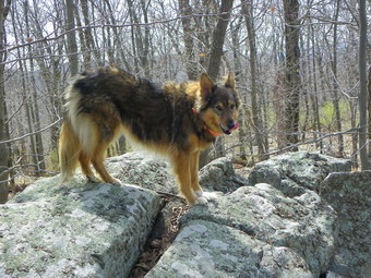 I followed Sheba as she stayed on the red trail which soon started to ascend the more shallow northeast side of the mount. Soon we were at the top and a climbed onto a rocky outcropping and looked around. Since I saw no other higher points, I felt I had gained the top and started to think about my next move. There was no real view from here so I wanted to see if there was another lookout. We descended the way we came and walked around the top of the plateau. Toward the southwest end there did seem to be a viewpoint So we headed that way. Two young men with their dogs were already there so I leashed Sheba as they did the same. I hooked Sheba's leash to a tree and she sat politely while I walked to the rocky shelf which was the viewpoint to take pictures. Soon the other hikers left and I took a few more pictures. It was not late but I was tired from my third day of hiking in a row. I knew that hiking the other hills would be at least two hours and perhaps more. Two were short bushwhacks but I had never attempted them. I decided to return to the gardens and inspect them before returning home. The other three could wait until another day!
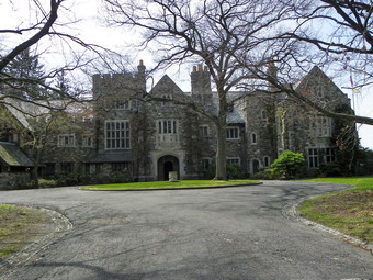 The New Jersey Botanical Gardens was once the private estate of Clarence McKenzie Lewis and has an extensive history. The Tudor style buildings were designed by American architect John Russell Pope. We ended up at the gatehouse and so started our "tour" from there. I took pictures of several smaller outbuildings but then came within site of the magnificent Skylands Manor. We walked around to the back of the building as I took pictures of the structure and the surrounding trees. The gardens would be worth a trip all by themselves especially when there are tours of the house! The flowering trees were in bloom and a koi pond was stocked just out side a beautiful, manicured lawn. There are other buildings and extensive grounds. The daffodils and forsythia were in full bloom but a few weeks should allow many more of the flowers to come into bloom. At this point I was tired and decided to go back to the car and head home. The total walk was about 3.1 miles and took only and hour and a half!
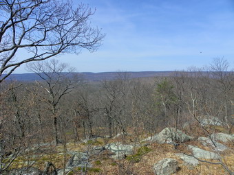
![]()
![]() On Saturday, April 3rd I drove back to northern New Jersey to grab a few more NJ1K peaks. This list is turning out to be very attractive but not as easy as it might sound to some. My plan was to hike Big Beach using the Sterling Ridge trail and then head over to Mount Defiance. Mount Defiance is in the Ringwood State Forest and one trailhead is at the New Jersey Botanical Gardens. Eric mentioned that these were worth a look. We arrived at Long Pond Ironworks at about 9:50 AM and were ready to go right away. I learned my lesson from previous hikes and wore short sleeves from the start. I didn't even bring a jacket with me. We headed out passed the furnaces at stayed on the Sterling Ridge and Highlands Trails instead of turning to the right on the yellow trail. The trail was in good shape at this point with only a little water. It starts fairly smooth nut then gets rocky further along. The trail parallels the Wanaque River for some time and I could hear the water as the river was VERY full. Soon the trail got wetter with pools of standing water in some places and swampy areas in others. I made a note where the yellow Jennings Hollow Trail branched off. Eric had mentioned hiking Jennings Mountain and the idea that I might do that mountain began to creep in.
On Saturday, April 3rd I drove back to northern New Jersey to grab a few more NJ1K peaks. This list is turning out to be very attractive but not as easy as it might sound to some. My plan was to hike Big Beach using the Sterling Ridge trail and then head over to Mount Defiance. Mount Defiance is in the Ringwood State Forest and one trailhead is at the New Jersey Botanical Gardens. Eric mentioned that these were worth a look. We arrived at Long Pond Ironworks at about 9:50 AM and were ready to go right away. I learned my lesson from previous hikes and wore short sleeves from the start. I didn't even bring a jacket with me. We headed out passed the furnaces at stayed on the Sterling Ridge and Highlands Trails instead of turning to the right on the yellow trail. The trail was in good shape at this point with only a little water. It starts fairly smooth nut then gets rocky further along. The trail parallels the Wanaque River for some time and I could hear the water as the river was VERY full. Soon the trail got wetter with pools of standing water in some places and swampy areas in others. I made a note where the yellow Jennings Hollow Trail branched off. Eric had mentioned hiking Jennings Mountain and the idea that I might do that mountain began to creep in.
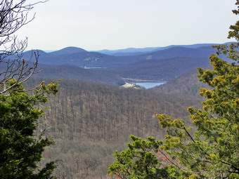 The trail began to climb a little more which was good since the flatter parts were pretty wet. Soon we were climbing Big Beach and I was looking for viewpoints. We worked our way up through some rocks and onto a rocky outcropping which had some views of the Wanaque Reservoir and Greenwood Lake in the opposite direction. I made note of this spot for pictures but I knew it would be hard for the camera to see much. The trail actually descended off this outcropping and then was flat for a little while before the last climb. Soon we were on the plateau that is the summit of Big Beach. It was 10;55 AM and I was surprised that it had taken only a little over an hour! I decided to walk to the state line which as about a quarter mile away. On the way back I walked over to several high rock outcrops and climbed each one to make sure I hit the highest point. On the way back I didn't follow the trail all the way but walked near the edge of the mountain looking for a viewpoint. I was actually trying to find the rocky cliffs that we had seen from Hasenclever the day before. I did find some limited views with the best ones being back at the southern end of the ridge as marked on the trail maps. I stopped to take some pictures at these places and then we continued back. I decided that I did not want to bushwhack Jennings on this day as the approach from the Jennings Hollow Trail on the east is very steep. I may try this sometime or approach from the south which is shorter and not as steep. We were back at the car before 12:15 PM completing the 5.5 mile hike in about 2.5 hours.
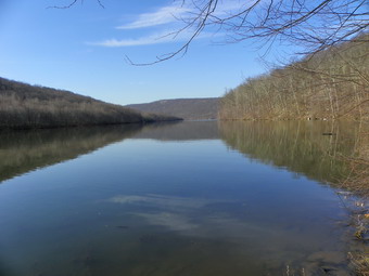
![]()
![]() On Friday, April 2nd I was in northern Jersey again to bushwhack Hope Mountain and Hasenclever Hill with Eric Koppel. Eric is the co-founder of the NJ1K club. Eric is a very fit, young hiker and I was a little wary of hiking with him especially after my long journey the previous day. I almost called to cancel but my feet felt a little better after resting overnight. Our plan was to park at the Long Pond Ironworks in Hewitt and bushwhack Hope Mountain and Hasenclever Hill with a possible trip up Big beach. I needed to leave no later than 3:00 PM due to a previous commitment. Eric was running a little late so I went across the road and did a short loop to the Whritenour Mine on the shores of the Wanaque Reservoir. Like many of the small iron mines in the area this one is not very impressive. I found three shallow pits with some tailings piles. Near the water was an indentation in the shore very near one of the pits. I do not know enough about the mine to speculate about this. The hike was a very short loop and soon I was back at the Long Pond Iron Works. Eric showed up and the adventure began. My job was to follow Eric as closely as possible. His plan was to follow the yellow Iron Trail until it passed near Hope Mountain and then bushwhack to the top of Hope. From Hope we would bushwhack to Hasenclever and then reevaluate our situation at that time.
On Friday, April 2nd I was in northern Jersey again to bushwhack Hope Mountain and Hasenclever Hill with Eric Koppel. Eric is the co-founder of the NJ1K club. Eric is a very fit, young hiker and I was a little wary of hiking with him especially after my long journey the previous day. I almost called to cancel but my feet felt a little better after resting overnight. Our plan was to park at the Long Pond Ironworks in Hewitt and bushwhack Hope Mountain and Hasenclever Hill with a possible trip up Big beach. I needed to leave no later than 3:00 PM due to a previous commitment. Eric was running a little late so I went across the road and did a short loop to the Whritenour Mine on the shores of the Wanaque Reservoir. Like many of the small iron mines in the area this one is not very impressive. I found three shallow pits with some tailings piles. Near the water was an indentation in the shore very near one of the pits. I do not know enough about the mine to speculate about this. The hike was a very short loop and soon I was back at the Long Pond Iron Works. Eric showed up and the adventure began. My job was to follow Eric as closely as possible. His plan was to follow the yellow Iron Trail until it passed near Hope Mountain and then bushwhack to the top of Hope. From Hope we would bushwhack to Hasenclever and then reevaluate our situation at that time.
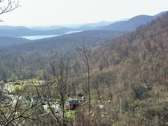 We found that many places along the trail were flooded with rather larger puddles of water and other places were simply muddy. A good part of the trail follows old woods roads but it turns off in places and it is important to pay attention. Eric is, I found, not only a hiker but a great source of information about the area and a keen observer of nature. While he was waiting for me to catch up, he had time to find snakes and amphibians and to discover many different plants. When it came time, we jumped off the trail and started the steep but short climb up Hope. After crossing a small stream, we walked up the side of the hill to a flat rock that acted as a decent lookout. I could see the Wanaque Reservoir and some interesting old buildings below. After taking some pictures, it was off to the summit. As we approach the summit, we heard a noise almost like a pig or bear grunting. It turned out to be a turkey but neither of us had heard a turkey make that kind of noise before! In a couple hundred feet we were at the top of Hope. The views were limited but Eric was able to point out the "Black Rock" viewpoint on Hasenclever Hill. The descent off the north side of Hope was a little steep and this bothered my feet much more than the climb up. Eric was ahead picking his way quickly down the slope. At the bottom, we hit an old woods road, walked on that briefly before starting the climb up Hasenclever.
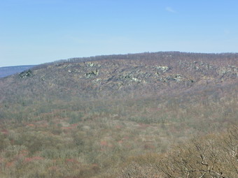 The initial part of the climb wasn't too steep and shortly Eric stopped at the biggest glacial erratic I had ever seen. We stopped to take some picture and for Eric to climb a tree to get a look a the top. The climb began to get steep but was pretty short. Near the summit there was another large erratic. The views from the top weren't very spectacular. We walked passed the signs indicating we were crossing into New York and continued to walk along the plateau. We descended some and then started the climb to the Black Rock viewpoint. The rock itself was interesting and had "carvings" going back to 1876. The views were nice although there was quite a bit of haze in the distance. Eric pointed out some of the hills and ridges around us including Big Beach to the west. There was quite a bit of garbage at the top and we picked up most of it. I commented to Eric about people hiking this far to litter. It was then that Eric chose to inform me that our route was the LONGEST one could take. A road on the New York side leads to very near the summit making this a popular spot. I decided that going for Big Beach would have to wait for another day. Eric chose a route along the state lines which would lead to Big Beach Road and then back to the yellow trail. On the way down we encountered two large black rat snakes. One slithered off rather quickly but the other stayed around for pictures. Eventually we worked our way down to the road through some swampy areas. As we walked a long the road, we came to an intersection. We chose right and walked only a short distance before finding the road impassable due to flooding. We started to return to the intersection and I consulted my GPS. It showed that continuing on the road would allow us to hit our path from earlier. Once we were back on the yellow trail we followed it back to the parking area. I'll admit I was tired! I had anticipated about a 6 mile walk. The GPS said that we had covered over 9.5 miles in just under 5 hours including the stops!
![]()
![]() On Thursday, April 1st my plans were to hike to the South Beacon fire tower from Breakneck Ridge. This is one of my favorite hikes on the east side of the Hudson River. I wanted to go to the fire tower since several postings of the ADKHighPeaks forum indicated that there might be new steps and landing on the tower! Wednesday night I began to think that I had done this hike several times and a different route might be more interesting. I decided to park in Beacon and hike to the site of the old casino and then to the fire tower. I then planned to hike Scofield Ridge and find the highest point in Putnam County. We parked at the parking area just off Route 9D in Beacon at about 9:30 AM with only one other car in the lot. The temperature was already almost 60 with predictions for highs in the mid 70's. I got my gear and we immediately started to walk up the road that leads into the small park by the lot. After a short walk, a long set of steep metal steps appear that lead up the steepest, lower part of North Beacon Mountain. As I was looking at the steps a woman walked by and we had a nice conversation about hiking poles. Next to the stairs are the remains of the incline railway that took passengers to the top of the mountain to the casino. Rusted steel rails and heavy cables are evidence of the railway and the ruins of a building near the base also indicate what was once there. I took some pictures and then we started up the mountain. We avoided the steps and hike the trail next to them. At the top of the steps, we stopped so that I could take some more pictures as the views were good. We didn't stay too long since I knew there would be better views from the top.
On Thursday, April 1st my plans were to hike to the South Beacon fire tower from Breakneck Ridge. This is one of my favorite hikes on the east side of the Hudson River. I wanted to go to the fire tower since several postings of the ADKHighPeaks forum indicated that there might be new steps and landing on the tower! Wednesday night I began to think that I had done this hike several times and a different route might be more interesting. I decided to park in Beacon and hike to the site of the old casino and then to the fire tower. I then planned to hike Scofield Ridge and find the highest point in Putnam County. We parked at the parking area just off Route 9D in Beacon at about 9:30 AM with only one other car in the lot. The temperature was already almost 60 with predictions for highs in the mid 70's. I got my gear and we immediately started to walk up the road that leads into the small park by the lot. After a short walk, a long set of steep metal steps appear that lead up the steepest, lower part of North Beacon Mountain. As I was looking at the steps a woman walked by and we had a nice conversation about hiking poles. Next to the stairs are the remains of the incline railway that took passengers to the top of the mountain to the casino. Rusted steel rails and heavy cables are evidence of the railway and the ruins of a building near the base also indicate what was once there. I took some pictures and then we started up the mountain. We avoided the steps and hike the trail next to them. At the top of the steps, we stopped so that I could take some more pictures as the views were good. We didn't stay too long since I knew there would be better views from the top.
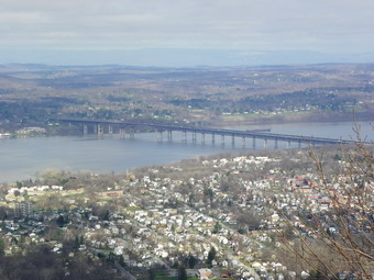 The "trail" now follows a series of woods roads that cut back and forth up the mountain to make the climb a little less steep. The markers on the trail are few and far between either because not many are placed or, more likely, because people remove them! As we neared the top a path led to the right and looked like it might offer some views. We walked down the path and found some views of the river and the city of Beacon. I took some shots but knew that the views from the top would surpass these. Near the top of the mountain the trail ahead was blocked by some blowdown but the building housing the machinery for the railway was easy to spot. I walked to the right of the trail and around to the front of the building. The brick building had several large wheels with cables attached and machinery inside which would pull the cars up the mountain. I took pictures of everything and then continued around the front of the building to the site of the casino. The casino site is now nothing more than a slab of concrete with a few signs of the foundation. This site does offer a wide open and unimpeded view of the City of Beacon and Newburgh on the other side of the river with the bridge between them. There was some haze hanging over the river but the views were nice and the temperatures were increasing. After some time to take in the views and shoot some pictures, we walked along the edge of the site and to the road that skirted the summit of North Beacon Mountain and headed for the ridge.
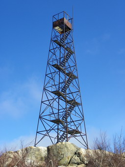 The walk to the ridge was only about .6 miles and on top we turned right toward the fire tower. The tower was in full view at this point and I stopped to take a picture. We continued on the trail which dropped a little and then started to ascend. I was not sure how well the trail to the tower would me marked but, after several false starts, I found the trail and started the climb. Soon we were on the last part of the trail and just over a ridge of rock the tower came into view. It was clear that some restoration had been done. It was also clear by the amount of broken glass and graffiti that this was still a popular place with the local riffraff. I took some pictures from the summit as the views were good and then decided to test the tower. The steps and landings were in place but were open metal grates which are not my favorites! In addition, the supports are still very rusty. I was sure they would support me but I found the experience disconcerting. I stopped just short of the cab which is nonexistent and looked around. The views were fantastic in all directions. I had not expected how much better the landscape looked from the tower as compared to the summit. I too a lot of pictures including one of Sheba far below and then got down off the tower. We spent a few more minutes on the summit and then headed back to the main trail where we continued toward Scofield Ridge.
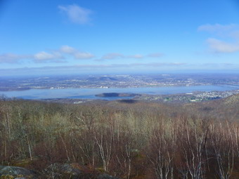 Somewhere on this ridge is the highest point in Putnam County. I spent some time walking the trail and bushwhacking to higher spots along the way. From what the "middle" bump on the ridge the Beacon Reservoir sparkled below. We continued to walk along the trail going up and down over the various high spots. Someone decided to mark the bumps with yellow X's although these marks are not always on the highest ground around. After walking 1.6 miles along the ridge, I am still not sure of the highest point. My GPS seemed to indicate that it was on the final, northern bump but I did have fun trying to find the highest spot. We descended the ridge and could take the trail over Lamb's hill and back to the car. After over 3 hours and over 5 miles of hiking this seemed like a good idea since it would take some time to get back to the car. Instead I decided to hike out along Fishkill Ridge and then back to the parking area. I did not realize at the time just how far this would be but I knew we had plenty of time and the weather was beautiful. As we started on the trail it was very wet and descended quite a bit. Fishkill Ridge rose sharply to the left and on the right was the shoulder of Scofield Ridge forming a deep ravine. In a few places the trail was narrow and required a short scramble over the rocks. Soon the trail widened and followed some old woods roads. There weren't many views but the walk was pleasant. In many areas elaborate stone walls paid homage to settlements now long gone. After a little more than a mile the trail began to ascend to the top of the ridge. We ran into some water on the trail but began to get some views although most were still blocked. Ahead I could see two other hikers on the trail and decided to try to catch up.
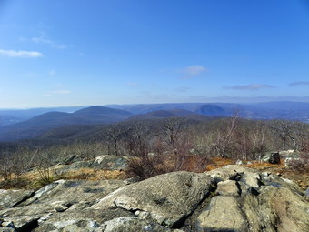 When Sheba and I caught the other two hikers we talked to them for some time. They had been on the ridge before and I asked about the views. They said that the views were yet to come from the top of the ridge. We started out ahead of them and stayed ahead until I stopped to take a few pictures. We traded spots with them on the trail until we got to a big rock that had a nice view of the valley below. We all stopped and I took some pictures and then started out. The other two stayed to rest and I never saw them again. They were right though about the views from the top of the ridge. For over a mile along the ridge there were outstanding views of the valleys below. There is a very interesting sand and gravel quarry on the east side of the ridge and all the details were visible form the top. Eventually we dropped down off the ridge and dropped down to Dozer Junction. At this trail junction there is a bulldozer a reminder of things past. We continued on the white Fishkill Ridge Trail to climb Lamb's Hill. At the top I stopped to take some pictures and then walked down the other side. Here was a viewpoint much better than the one at the top with good views of the river and the cities below. The descent down Lamb's Hill was steep and difficult but short. By this time my feet were pretty tired and descending is always harder for me than climbing.
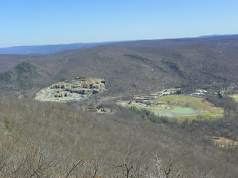 After climbing another, unnamed hill we began the descent in earnest. From this small hill it was almost 1200 vertical feet down to the car. At times the trail was very poorly marked. At one point we came to a road and saw some people walking up ahead. The trail blazes seemed to disappear completely and I searched for them until I saw a hiker coming through the woods and I spotted the blazes. He confirmed that we were on the right trail and we headed down toward a small stream. There was quite a bit of running water from the recent rains. We finally got to a small water fall formed by the outflow from the Beacon Reservoir. I took some pictures and we continued down until we had to cross the stream. At this point the trail ascended some and we followed it over a small hill. The blazes became less and less frequent but I finally found them as the trail ascended once again! The trail we were on finally merged with the trail from earlier that morning just above the steps down to the parking area. Back at the car I checked the GPS which showed a vertical gain of over 3600 feet! We had hiked almost 11 miles in 6.5 hours including all the stops!
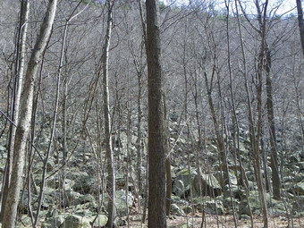
![]()
![]() On Saturday, March 27th Cindy and I headed for Waywayanda Mountain. We parked where the AT crosses Route 94 just south of the New York-New Jersey border. With features like "Stairway to Heaven" and "Pinwheel Vista", we expected and interesting hike. We were not disappointed. We arrived at the parking area at about 1:15 PM to find the AT lot full and quite a few cars parked in the "overflow" spaces nearby. We parked at got started right away. The first part of the hike runs over some well-worn rocks and heads toward a field. A short distance ahead an impressive ridge rises from the flat ground. It is just short of 1500 feet at its highest point but the starting elevation is under 500 feet! A rocky outcropping on the side of the ridge marks, I believe, the Pinwheel Vista, one of our objectives.The trail winds its way briefly through some trees at the base of the ridges. As we approached the ridge we could see an enormous jumble of rocks, some big and some small, at the base of the ridge. We took some pictures and then followed the At as it wound through the rocks at the base of the ridge before starting to ascend up the ridge. Climbing straight up might be impossible but the trail has many switchbacks and several areas where stone steps have been placed to make the going easier. We passed several sets of hikers going down and several going up. Sheba greeted some of the groups especially those with other dogs but mostly wanted to continue hiking. A little way up the trail is a ledge that gives a small taste of the views from the viewpoint near the top.
On Saturday, March 27th Cindy and I headed for Waywayanda Mountain. We parked where the AT crosses Route 94 just south of the New York-New Jersey border. With features like "Stairway to Heaven" and "Pinwheel Vista", we expected and interesting hike. We were not disappointed. We arrived at the parking area at about 1:15 PM to find the AT lot full and quite a few cars parked in the "overflow" spaces nearby. We parked at got started right away. The first part of the hike runs over some well-worn rocks and heads toward a field. A short distance ahead an impressive ridge rises from the flat ground. It is just short of 1500 feet at its highest point but the starting elevation is under 500 feet! A rocky outcropping on the side of the ridge marks, I believe, the Pinwheel Vista, one of our objectives.The trail winds its way briefly through some trees at the base of the ridges. As we approached the ridge we could see an enormous jumble of rocks, some big and some small, at the base of the ridge. We took some pictures and then followed the At as it wound through the rocks at the base of the ridge before starting to ascend up the ridge. Climbing straight up might be impossible but the trail has many switchbacks and several areas where stone steps have been placed to make the going easier. We passed several sets of hikers going down and several going up. Sheba greeted some of the groups especially those with other dogs but mostly wanted to continue hiking. A little way up the trail is a ledge that gives a small taste of the views from the viewpoint near the top.
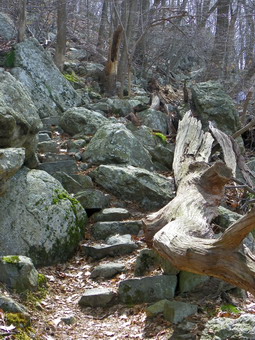 We continued on up the trail slowing at times and then picking up the pace. Near the top there was along switchback leading to some steeper stone stairs, the "stairway to Heaven". Once up this we walked a short distance and found a blue trail on the left which was not marked on the map so we went passed it! After another short climb, we were at a trail junction marked by a mailbox and a sign that said "Old AT Vista". We were still looking for the Pinwheel Vista so we continued on the AT. After a short walk, we started to descend. This didn't seem right so I pulled out the map. It was clear that the blue trail was the trail to the Pinwheel Vista and that the mailbox marked the path to the highest point on the ridge which I wanted to visit. We backtracked to the mailbox and turned south on a path marked faintly by blue blazes. We wandered along for some time until we saw higher ground to the right. We walked up to this area which opened into a flat clearing which appeared to be the highest point around. I was having trouble reconciling my GPS lat-long readings with those posted on the NJ1K site but the elevation was 1445 feet which was close to the posted 460. (later I solved the mystery! The posting were in straight decimal degrees and the GPS was set for degrees and decimal minutes! Close enough to seem correct but.. I don't think we were at the highest point so I will be going back soon. Important lesson learned!) We turned around and walked back to the trail junction, turned left an walked down to the blue trail. We turned right and were soon sharing the Pinwheel Vista with a few other hikers.
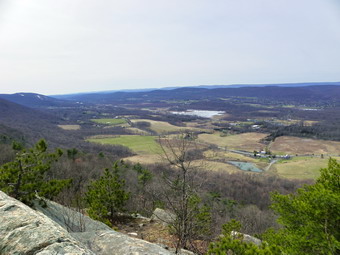 Is New Jersey ALWAYS hazy? The views from the lookout were nice but anything in the distance was obscured by haze! To the left we could see the still snowy slopes of the ski area once known as Vernon Valley/Great Gorge. The landscape this time of year is a little drab since, even in New Jersey, few trees or shrubs have started to bloom. I walked around the vista and took pictures from any angles before going back to Sheba and Cindy to snap their picture. We did walk a little further along the path that paralleled the vista but found no more views. Back on the main trail we started our descent. The hike down over the rocky trail was not easy. The rocks have little cushioning and the knowledge that a slip would be costly slowed us down some. We did meet several groups going up the trail to the vista and wished them a good day. Soon we were on the lower part of the trail and then among the rocks a the base of the ridge. The walk out to the car went quickly. The AT lot now had only a few cars. We were back just before 4:00 PM having covered 4 miles out hours and 45 minutes.
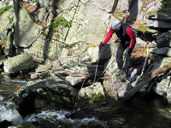
![]()
![]() On Saturday, March 27th Cindy and I again headed for northern New Jersey to work on the NJ1K list. The conditions when we arrived at 10:20 AM at the P4 parking area on Clinton Road were a little different than the week before. Instead of the low 70's the air temperatures were in the high 30's. This was a drop of 30+ degrees and it felt like it! There was no one else parked in the area which was good since the recent rains had left it soft and muddy and it is small to begin with. The signs said that we needed a permit which I did not know. I figured no one would bother us since we were hiking on the Highlands Trail. We got on our gear and headed out to Clinton Road where we turned left and walked up the road, walked over the road bridge, crossed the road and started our adventure on the aqua blazed Highlands Trail. The trail begins through some large hemlock trees and parallels Mossman's Brook for a distance. The trail begins to ascend to a ridge and along the way there were several large trees down across the trail. We walked over one ridge only to find another. This pattern would repeat several times along the hike. I could see that we were headed for a rather wide stream as we descended the small ridge and I did not see abridge. We could have made it across but fortunately the trail turned to parallel the stream and then crossed it on a very nice foot bridge. The are on the other side of the stream was very flat and showed obvious signs of recent flooding. I was glad the ground was relatively dry for our hike. Upstream was a small rapids so I took some pictures before we continued on.
On Saturday, March 27th Cindy and I again headed for northern New Jersey to work on the NJ1K list. The conditions when we arrived at 10:20 AM at the P4 parking area on Clinton Road were a little different than the week before. Instead of the low 70's the air temperatures were in the high 30's. This was a drop of 30+ degrees and it felt like it! There was no one else parked in the area which was good since the recent rains had left it soft and muddy and it is small to begin with. The signs said that we needed a permit which I did not know. I figured no one would bother us since we were hiking on the Highlands Trail. We got on our gear and headed out to Clinton Road where we turned left and walked up the road, walked over the road bridge, crossed the road and started our adventure on the aqua blazed Highlands Trail. The trail begins through some large hemlock trees and parallels Mossman's Brook for a distance. The trail begins to ascend to a ridge and along the way there were several large trees down across the trail. We walked over one ridge only to find another. This pattern would repeat several times along the hike. I could see that we were headed for a rather wide stream as we descended the small ridge and I did not see abridge. We could have made it across but fortunately the trail turned to parallel the stream and then crossed it on a very nice foot bridge. The are on the other side of the stream was very flat and showed obvious signs of recent flooding. I was glad the ground was relatively dry for our hike. Upstream was a small rapids so I took some pictures before we continued on.
 The trail wound its way through some woods and then seemed to follow a woods road for a short distance. We went up over another ridge and walked along it for a short distance before the trail went down the other side. This time the descent was along a rock wall and the trail narrowed considerably. The stream at the bottom was narrow but deep and fast-flowing and there was no bridge. When I got to the stream, I could see that it would be possible to cross by "rock-hopping" carefully. We did this and then continued on the trail as it ascended the nest ridge. Near the top of this ridge a blue trail headed off to the right. This trail cut across the ridge and went down the other side. It looked interesting and I thought we might come back that way. We stayed on the Highlands Tail and followed its aqua blazes as well as some new yellow blazes. There was no sign of a tower but we were walking through forest and could not see too much ahead. As we walked it became obvious that we were headed toward the end of the ridge we were on. The trail started to cut to the right and ascend a little. It was then that I saw a clearing ahead and the fire tower. The tower is painted red and white and stand on the highest point of the ridge in a clearing. We noticed a reflective "cross" on the ground that looked like it marked a helicopter landing zone! We took pictures of the tower and then walked over to see if we could walk up the steps.
 The tower is all metal and looks to be in good shape. The open metal grating that makes up the steps affords an almost unobstructed view to the ground! I was soon just below the cab and able to start taking pictures. There was some haze and the surrounding hills and valleys were somewhat drab. Cedar Pond to the west made the best subject so I took some pictures before climbing back down. Cindy made it up part way while Sheba stayed on the ground and waited impatiently for us. We ate a snack and the decided to return by a red/white blazed trail that went more along the top of the ridge. We stayed on this trail for a while until it met the blue trail from earlier. I turned left to check out the views from the ridge but there really weren't any. We headed down the blue trail to the Highlands Trail and back toward the parking area, As we approached the first stream crossing, Cindy took a rather bad fall on some slippery rocks. She banged up here left knee but we were able to repair the damage. We were back at the car by 12:40 PM having covered the 4.2 miles in 2.5 hours with time for the fire tower and photography. On our car I found a warning about parking and hiking without a permit. I will call for the permit regulations but I found the warning odd. There was no area code with the telephone number. I also thought to myself that the City of Newark has every right to require permits but that they might have better ways to spend their money!