
What You Missed
Spring 2009
Spring 2009
![]()
![]() On Sunday, June 14th I wanted to join a hike that Snickers had put together. We would meet at the Roaring Kill parking area and do a car shuttle to the end of Notch Inn Road to hike the "new" section of the Warner Creek Trail up Plateau. From there we would hike down the Devil's Path toward Sugarloaf with the option to hike out the Mink Hollow Trail to the car or go over Sugarloaf and out Pecoy Notch. The group that met at the parking area was larger than I though and included Bill, Judy, Dick, Joanne, Jay, Maria, Cindy, myself and two canine companions, Shiloh and Sheba. We worked out the car shuttle and Sheba and I got into Dick and Joanne's car along with Bill and Shiloh. Soon we were heading up Notch Inn Road which seemed better maintained than the last time my wife and I had been on it. The reason became clear when we saw the new home that was being built right next to the trail head. There wasn't too much room but we parked and got ready to hike. Soon we were on the old, eroded road that leads up to the trail cutoff.
On Sunday, June 14th I wanted to join a hike that Snickers had put together. We would meet at the Roaring Kill parking area and do a car shuttle to the end of Notch Inn Road to hike the "new" section of the Warner Creek Trail up Plateau. From there we would hike down the Devil's Path toward Sugarloaf with the option to hike out the Mink Hollow Trail to the car or go over Sugarloaf and out Pecoy Notch. The group that met at the parking area was larger than I though and included Bill, Judy, Dick, Joanne, Jay, Maria, Cindy, myself and two canine companions, Shiloh and Sheba. We worked out the car shuttle and Sheba and I got into Dick and Joanne's car along with Bill and Shiloh. Soon we were heading up Notch Inn Road which seemed better maintained than the last time my wife and I had been on it. The reason became clear when we saw the new home that was being built right next to the trail head. There wasn't too much room but we parked and got ready to hike. Soon we were on the old, eroded road that leads up to the trail cutoff.
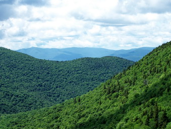
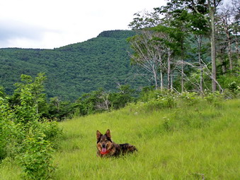
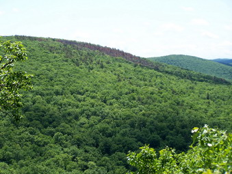
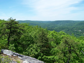
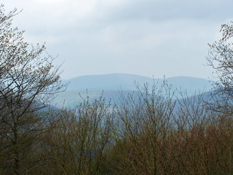
 The road is much better marked than the last time I hiked it but it is still littered with large rocks which are slippery when wet! The trail actually leaves the road in several places to avoid walking over some of these areas. The road is steeper than I remember but it is relatively short and is less than .5 miles we turned off the road to the left to follow the trail. The trail initially is flat or drops some before it begins a steady ascent of Plateau. Several points along the way are marked with yellow disks as opposed to the blue disks of the main trail. These side paths are labeled as vistas but most are blocked by the new leaves on the trees. The trail switches back and forth and then climbs over a 3400 foot unnamed "bump" before descending about 200 feet. After 1.75 miles on the trail the steep climb up Plateau begins in earnest. Somewhere around this point there is a viewpoint toward the south and east which gives a nice view of the surrounding mountains near and far. There are actually two lookouts and the second is the better since it gives a more open view
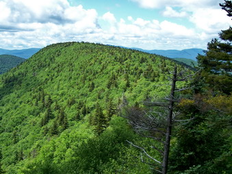
 The next part of the trail is a steep climb of about .35 miles up to the plateau of Plateau. Along this climb there is a yellow side trail that leads to a spring. At the top of this climb, the trail flattens some and passes through a dark and green pine forest. After .25 miles the trail ends at the junction with the Devil's Path. Here we turned right and headed for the viewpoint to Sugarloaf. The .4 mile walk is nearly flat with a few undulations before dropping to the large rocks that form the lookout. We stopped here to get a snack and take some pictures but didn't stop too long before continuing. The descent to Mink Hollow is VERY steep and slippery in may places. Even rocks that didn't look slick were! The .6 miles of descent drops almost 1200 feet until it flattens at the junction with the old Mink Hollow Trail and the trail to the lean-to. We continued straight ahead on the Devil's Path to the junction with the Mink Hollow trail. Here Jay and Maria decided to climb Sugarloaf and the rest of us turned to head back to the parking area.
 I have never liked the Mink Hollow Trail and this day was no exception! My usual complaint is that you have to go up to go down again. None of these climbs is long but several are steep. The trail is 2.5 miles back to the Roaring Kill parking area and always seems at least that long. Today the ENTIRE trail from the junction with the Devil's Path to just before the trailhead alternated between standing water, running water and deep mud! In most places there was no way to avoid the muck and mire! The dogs didn't seem to mind but I had no idea how I was going to clean and dry Sheba for the ride home! Most of the way back on this trail was spent trying to find the shallow areas and avoid falling on the damp and wickedly slippery rocks. Finally, the trail junction near the parking area appeared and we turned left to head to the cars. The hike was about 6.7 miles but took over 6 hours to do. Some of this time was spent in conversation but the rest was taken up by trying to avoid the mud pits on the Mink Hollow trail.
![]()
![]() On Saturday, June 13th I had plans to hike Friday and Balsam Cap from Moonhaw Road and visit the B25 plane crash in the area between the two mountains. I put this idea out on the forums and Chris (MtnBound) responded but added that he would like to try to continue through over Rocky, Lone, Table and Peekamoose. I didn't think I would be up for this adventure but we decided to meet at the Peekamoose trailhead. We dropped his car at Peekamoose and drove mine to the end of Moonhaw Road and parked. The idea was to hike Friday and then Balsam Cap. At the summit of Balsam Cap we could continue on or split and go our own ways. This was Chris' plan and it was a good one that met both our needs. We started up toward Friday and immediately hit a woods road which we continued to follow. As we strayed too far to the north we ducked into the woods and bushwhacked toward Friday. At first I led for a while and then Chris took over and did a good job navigating. He is 25 years my younger and in great shape but was willing to cut his pace to match mine. We followed a pretty well-define herd path and there were very few places where we had to push through. The ground was wet and the rocks and branches slippery from the rain the night before and I was trying to be cautious. Soon we picked up another road and arrived at the cabin.
On Saturday, June 13th I had plans to hike Friday and Balsam Cap from Moonhaw Road and visit the B25 plane crash in the area between the two mountains. I put this idea out on the forums and Chris (MtnBound) responded but added that he would like to try to continue through over Rocky, Lone, Table and Peekamoose. I didn't think I would be up for this adventure but we decided to meet at the Peekamoose trailhead. We dropped his car at Peekamoose and drove mine to the end of Moonhaw Road and parked. The idea was to hike Friday and then Balsam Cap. At the summit of Balsam Cap we could continue on or split and go our own ways. This was Chris' plan and it was a good one that met both our needs. We started up toward Friday and immediately hit a woods road which we continued to follow. As we strayed too far to the north we ducked into the woods and bushwhacked toward Friday. At first I led for a while and then Chris took over and did a good job navigating. He is 25 years my younger and in great shape but was willing to cut his pace to match mine. We followed a pretty well-define herd path and there were very few places where we had to push through. The ground was wet and the rocks and branches slippery from the rain the night before and I was trying to be cautious. Soon we picked up another road and arrived at the cabin.
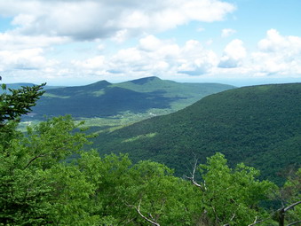
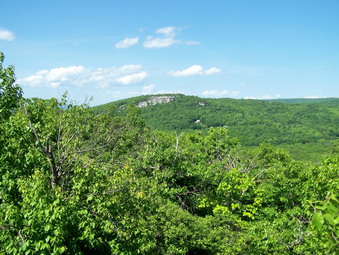
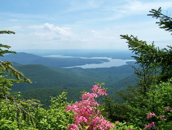 I had heard about the cabin but had never been able to find it! The views of the Ashokan, the surrounding hills and the valley below was stunning. Some clouds and fog hung over the scene and we stayed to take a few pictures. From the cabin we DID have to push through some bushes but soon found the herd path again and headed to a point just south of the Friday peak. The climb got steeper and the ground slicker as we approached Friday. Soon we hit some flatter ground and I saw the familiar cliff band of Friday before us. This looked a lot different than the last time I had come up! We walked along the cliff bands looking for a way up. Chris and Sheba found a place to ascend and we made our way up. Again we were confronted by more cliffs and again we found a way up. Soon we were at the top of the cliffs and on a herd path. This was the herd path that I could never find since I was always too far west. We followed the path and pushed through some brush as we continued toward the canister. Things began to look familiar and I checked my GPS. We were almost there and within a 100 feet we found it. The area looked very familiar but it became clear to me that I had always approached from farther north which I remember as being a lot more difficult. We signed in and then started back along the herd path toward Balsam Cap.
 The herd path took us to the Col between the two peaks where there was a small, cleared area and a fire ring. The herd path continued on, sometimes VERY prominent and at others times not so easy to find. We found it easier to stay near the edge of the ridge. Along the way we passed by some cliff bands which were impressive but not to be compared to the ones on Friday! As we got close to balsam Cap it seemed like we should cut up through the woods. We started to bushwhack up through the trees but decided to try going back to the herd path first. This was a good choice since the herd path soon cut up to the summit. It was steep but very easy to follow and we were soon on the summit. I remembered approximately where the canister was located and we walked right to it. We signed in and got a drink. At this point Chris wanted to Continue and I wanted to go back. We parted wishing each other a good day. I started back but somehow missed the herd path we took up but found another. It seemed to follow the higher road but I soon may my way down to the lower path we had followed to Balsam Cap. As I approached the Col I found there was a lower path that headed down and directly back toward our route up Friday. I had plenty of time so I decided to follow it.
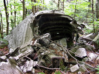 The path led down below some more cliffs and appeared to be heading directly across to our original route. At this point I decided to check my position against the coordinates I had for the location of the B25 crash. That's right, I hadn't entirely given up on this idea yet! I walked back along the herd path for less than .1 miles and my latitude was exact. Now it was a matter of walking DOWN to the wreck. The problem was that the terrain was VERY steep and that it was through a very damp (WET) drainage. I found out that .25 minutes of longitude is farther than one might think! Actually the distance was about .25 miles but the vertical drop was 500 feet! Finally, I could see the plane crash just down the hill from me. Initially, these wrecks are always eerie for me. The plane was the largest I have seen and it was spread over a large area. The forward part of the fuselage is largely intact. The star which was the marking of the Army Air Corps was faded but recognizable. Both engines or parts of them were present and one still had the propeller attached. I took many pictures and then began to plan the way back.
 The best way back was to walk uphill slightly and almost due north. I did not like the UPHILL part so I headed downhill slightly and more west northwest. I constantly had to remind myself to turn more toward the north. Eventually I was back on the path from earlier in the day and just followed Sheba as she followed the exact route. At the cabin we stopped for a few more pictures since the fog and clouds had burned off the reservoir. I continued to follow Sheba as we walked along the woods roads and bushwhacked in between them to get back to the road that led down to the parking area on Moonhaw Road. This route was much easier than any I had taken before and the hike is well worth the effort. It was less than 6 miles but took all of 7 hours!
![]()
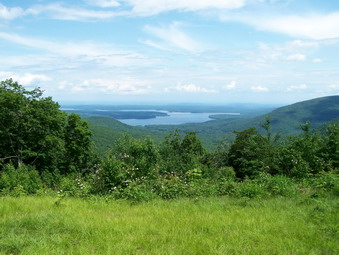
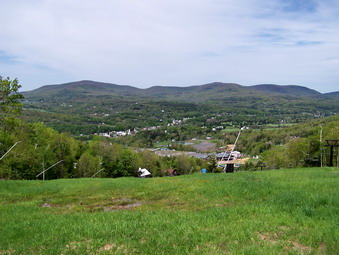
![]() On Saturday, June 6th Karl and Kathleen were up from Virginia and ready to hike. We had planned to do something long and decided on hiking the Shawangunk Ridge Trail between Wurtsboro and Ellenville. We got started a little late to allow the early morning fog and haze to clear. It was decided that we would park a car on Ft 2 near the trailhead on the way to Sam's Point and drove to the VFW in Wurtsboro to start the hike on that end. By the time we were ready to start it was already 10:45 AM. Cindy and I had hiked both ends of this route two weeks early but it was clear that there was a LOT of trail in between to cover. Reports put the distance at from 8 to 12 miles. We figured that at 2 miles per hour this would make a long hike but one we good all do. I was the only one carrying a pack but Karl did bring a bottle of water. I had packed 5 liters of water but was not sure that would be enough for all of us. I hoped there would be a few water sources along the way that at least the dogs could use. We started up the trail briskly and soon were on the highest part of the first stretch of ridge. From here there are views of the Basha Kill to the southwest and the Catskills to the north. The Wurtsboro Airport and the massive Kohl's Distribution Center dominate the valley below.
On Saturday, June 6th Karl and Kathleen were up from Virginia and ready to hike. We had planned to do something long and decided on hiking the Shawangunk Ridge Trail between Wurtsboro and Ellenville. We got started a little late to allow the early morning fog and haze to clear. It was decided that we would park a car on Ft 2 near the trailhead on the way to Sam's Point and drove to the VFW in Wurtsboro to start the hike on that end. By the time we were ready to start it was already 10:45 AM. Cindy and I had hiked both ends of this route two weeks early but it was clear that there was a LOT of trail in between to cover. Reports put the distance at from 8 to 12 miles. We figured that at 2 miles per hour this would make a long hike but one we good all do. I was the only one carrying a pack but Karl did bring a bottle of water. I had packed 5 liters of water but was not sure that would be enough for all of us. I hoped there would be a few water sources along the way that at least the dogs could use. We started up the trail briskly and soon were on the highest part of the first stretch of ridge. From here there are views of the Basha Kill to the southwest and the Catskills to the north. The Wurtsboro Airport and the massive Kohl's Distribution Center dominate the valley below.
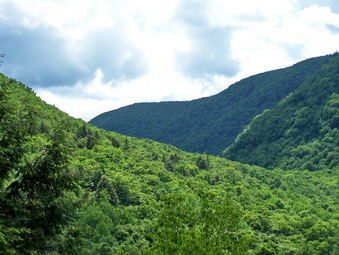
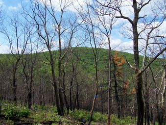
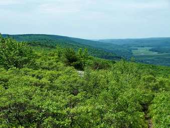
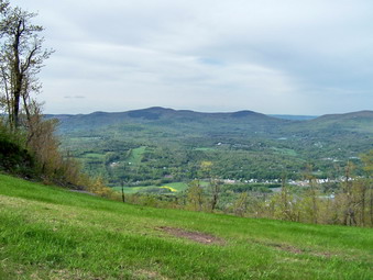
 We made quick work of this first part of the ridge and were soon descending the other side before starting up to the next ridge. A short but sometimes steep descent brought us to a small stream and the first area of burned forest. Early in the spring a fire swept across the ridge and I was interested to see what damage it had done. Soon we were walking through the burned area. In most places the fire had cleared out the underbrush but had only charred the trees. Green plants were starting to populate the ground in burned areas and most trees were sprouting leaves. From this burned ridge we could look back at the previous ridge we had walked and ahead to the next. The views of the Catskills and the ridge cross from us dominated the views.
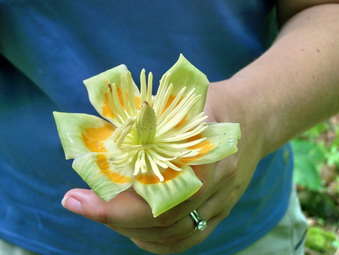 From this ridge we began a steep descent to the lowest point on our route except for the beginning. Soon we were in a pretty area with high ferns and a small stream. We rested briefly and as we were leaving I spotted some flowers on the ground. These flowers were NOT connected to any plant but looked as if they had fallen from somewhere. Karl and Kathleen said they looked like the flowers from a tulip tree. Kathleen and Karl soon identified the exact tree from the leaf pattern. Strange that this one tree was growing alone in this environment. We then began a LONG climb that would last almost 1.5 miles. The first part was very steep and after about.2 miles we were at the Roosa Gap Road. We crossed the road, stopped for a minute to get a snack and then continued the climb up the ridge.
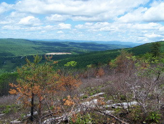
 As we climbed the ridge we could look back at the ridge we had just left. The burned area was very easy to see. In less than a mile the trail flattened somewhat but continued to rise and fall until we again began a descent at about 5 miles. In less than a mile we were at the bottom and ready to climb again, The ascent was steep in places and lasted fro about .5 miles. We again descended slightly but then began another .5 mile climb to the summit of our highest point on the trail. This part of the trail skirted the edge of the ridge before crossing over to the highest point. Along the way some interesting rock formations presented themselves. One rock tower that stood away from the edge of the cliff was very interesting. Along this part of the walk I began to find areas that looked familiar. As it turned out these areas just looked like the areas I had reached two weeks before. As we crossed to the top of the ridge, the rest of the party took a rest and I scouted ahead. I FINALLY found a fire circle high on the ridge that I recognized. We still had some distance to hike but at least we knew where we were.
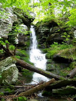
 From the highest point the trail dropped VERY steeply, losing 700 feet of elevation in about .5 miles. Some areas were under cover and some out in the open. Some areas were slippery pine needles over bare rock. Other areas had slippery oak leaves over bare rock. Other places had slippery moss on wet rocks. We descended to the woods road that is the old Route 52. The Long Path heads north from here as the road turns left. We picked up the yellow trail that leads UP to Route 52. This trail is less than 1 mile long and passed over a small stream with a waterfall. From that point there is a short but steep ascent to the main road. This would not be so tough but it was then end of a long hike. As we walked back to the car there were a half dozen hang gliders plying the air currents above the area. I took a few pictures and then climbed in the car after 9 miles and 5 and a half hours of hiking.
![]()
![]() On Saturday, May 30th I had planned to do some more CHH peaks and had settled on Van Wyck and Woodhull. My wife is not thrilled with bushwhacks so it was just Sheba and I who headed out. The forecast was for early clouds then clearing. The temperatures were supposed to be moderate, never rising above 70. I had never hiked these two mountains and when I looked at the maps the route from Denning seemed shorter and not as steep. I chose to start on the Peekamoose Road and climb Van Wyck first and then Woodhull. My plans after that were vague. Walking out the roads did not seem like a good idea since that would place me miles from my car. I had an idea from other bushwhacks that returning the same way would be uninteresting and too difficult. I thought perhaps I could go directly from the summit of Woodhull back to the car or perhaps head back to the Col between the two mountains and then strike out of the parking area. When we got on the Peekamoose Road I turned up Porcupine Road to see if I could find someone to ask for permission to hike. The summit of Woodhull is on private land and the route I might use to return had some private parcels. As I drove up Porcupine, the road got rougher and rougher and I was abut to give up when I spotted a car at one cabin. I stopped and "halloed" and immediately got an answer. I explained what I wanted to do and the gentleman said that it didn't see any reason why I couldn't and that walking wouldn't harm anything. I thanked him and drove back down to the Peekamoose Road. I went as far as the main parking area for the peaks and then turned around and parked at the small pull off next to Bear Hole Brook. It was 9:35 AM and Sheba and I were ready to go. We walked the path to the brook and I decided to take pictures on the way back.
On Saturday, May 30th I had planned to do some more CHH peaks and had settled on Van Wyck and Woodhull. My wife is not thrilled with bushwhacks so it was just Sheba and I who headed out. The forecast was for early clouds then clearing. The temperatures were supposed to be moderate, never rising above 70. I had never hiked these two mountains and when I looked at the maps the route from Denning seemed shorter and not as steep. I chose to start on the Peekamoose Road and climb Van Wyck first and then Woodhull. My plans after that were vague. Walking out the roads did not seem like a good idea since that would place me miles from my car. I had an idea from other bushwhacks that returning the same way would be uninteresting and too difficult. I thought perhaps I could go directly from the summit of Woodhull back to the car or perhaps head back to the Col between the two mountains and then strike out of the parking area. When we got on the Peekamoose Road I turned up Porcupine Road to see if I could find someone to ask for permission to hike. The summit of Woodhull is on private land and the route I might use to return had some private parcels. As I drove up Porcupine, the road got rougher and rougher and I was abut to give up when I spotted a car at one cabin. I stopped and "halloed" and immediately got an answer. I explained what I wanted to do and the gentleman said that it didn't see any reason why I couldn't and that walking wouldn't harm anything. I thanked him and drove back down to the Peekamoose Road. I went as far as the main parking area for the peaks and then turned around and parked at the small pull off next to Bear Hole Brook. It was 9:35 AM and Sheba and I were ready to go. We walked the path to the brook and I decided to take pictures on the way back.
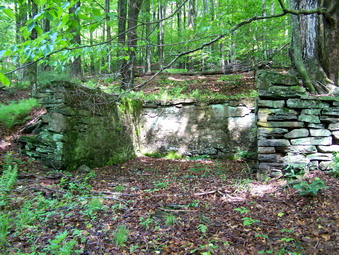
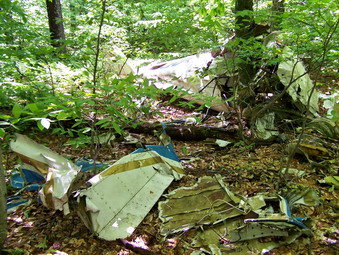 The contour lines on the topo map were pretty close together in this area and the terrain lived up to its billing. We climb the steep hill from the car along a path that others may have taken. Soon our route intersected a woods road and I decided to follow it for a while. The road followed the brook but did not drop into the drainage or gain the highest ground immediately. At one point the road flattened out and an old foundation appeared. I took some pictures and decided to leave the road and strike up through the woods. The woods were open here but there were some rock ledges to be negotiated. We continued to walk aiming for a "tongue" or ridge that was aligned with the summit. Once on this ridge the hike was nearly flat with just a gentle rise for about 1.5 miles. As we approached the area near the ascent to the summit a plane crash was visible to the left. We walked over and I took several pictures. I had not intended to search for the crash but did not want to pass it up. The contour lines on the map became VERY close together ahead but I didn't realize exactly what this meant!
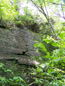
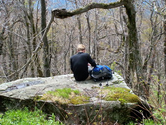
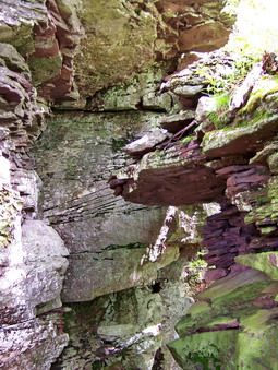 The trip up this part of Van Wyck was all but vertical in most spots. It was less than .2 miles but had me wondering if I would get up or have to turn around. Sheba was a great help finding a way up and then showing me the way to go. On the way up we found a rock overhang that could act as a shelter surrounded by some massive rock formations. There were many cliff and ledges to work around with narrow bands of dirt and vegetation in-between where we could get a foothold. At one point we walked out onto a large flat rock and got a nice view of the other hills and the surrounding valleys. Eventually we were at the top and, as always, wondering around to be sure we hit the highest ground. Some spots promised a view but they lied! We headed almost due west from the summit working along a tongue or ridge and trying to stay on the high ground without dropping off to the side. I knew this would be important since the path from Van Wyck to Woodhull lies on the Catskill Divide. A direct route would be south southwest but this would drop down off the divide and lose too much elevation that would have to be regained.
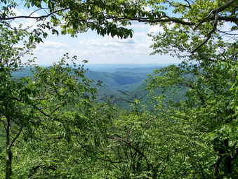 As we walked a path began to develop which appeared and disappeared at random. Whether this was an animal trail or evidence that people were hiking this route was unclear. After about .5 miles, we headed a little northwest to stay on the divide. We had lost some elevation continuously since we were heading for the Col between the two mountains. The divide is very narrow in some spots, so narrow that you can get the felling of walking along a narrow spine. I did find another lookout which had a nice view down the valley! In another .5 miles we headed southwest on the divide and soon we were in the Col between the two peaks. The next .5 miles was much steeper and I just headed up and around many of the small cliffs and ledges. As we arrived on the peak, we wandered around to find the high ground and I began to plan the next move. I ruled out returning using the same route since it was too difficult and too boring. I though about walking down to Porcupine Road and using the roads to return to the car. This would be entirely too long. I chose the third option which was to take a southeast bearing directly back to the car. The complication here was Stone Cabin Creek. I had no idea how hard it would be to cross this brook but I decided to find out when I got there.
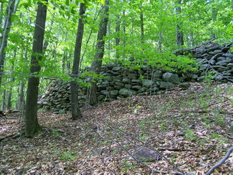 As we headed southeast off the summit of Woodhull, we ran into another woods road which I decided to follow. Soon we were at the upper part of Porcupine Road and we walked along the road briefly before cutting east into the woods. As we approached the brook, it was clear to me that describable to the brook and ascending again was out of the question. The drainage was entirely too steep. I decided to walk along the upper bank of the brook and follow it back to the Peekamoose Road. A short road walk would take use back to the car. As we walked along, we cam across a large stone foundation. Could this be the reason for the name Stone Cabin Brook? After about .75 miles we ran into a tributary of the main brook and walked down to it. We could have crossed here as it was not too steep but I decided to follow it down to the main stream. This in itself was challenging as I decided on the low route instead of staying up on the bank. This was slow going and involved a lot of side hill work! At the main stream I found a place to cross and only got a little water in the boots. We worked our way up a steep hillside and then found...a road.
 The road was wide and easy to follow as it ran along the creek. It was muddy in places with some small streams flowing across it. In a few more weeks the nettle crop will be flourishing but I was GLAD to have something easy to follow. We continued along this road for about 1.2 miles where it made an abrupt turn to the east to parallel the Rondout Creek. The creek was wide at this point and I did not want to wade across it. I decided to continue to follow the road back to the parking area or until in intersected our trail from earlier in the day. The problem was that the road began to climb and climb UP the shoulder of Van Wyck. I followed it for about .5 miles until I decided that I did not want to climb anymore. We began to descend and head directly for the car in a mostly southeast direction. This again required some side hill work which I was very tiring! Soon we were back down and on level ground and it was a very short walk to the car. It was 3:40 PM and we had covered about 9 miles in about 6 hours.
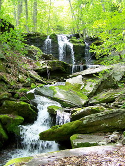
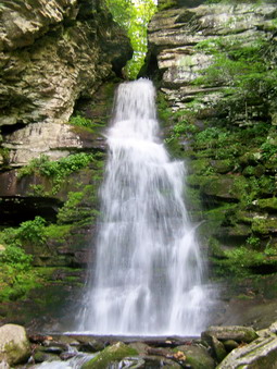 After dumping my gear at the car, Sheba and I walked the path to Stone Cabin Brook. The water was flowing nicely. I stopped and took several pictures. There is a stone wall that looks like it once went across the stream. Many of these streams had small mills but I do not know the history of this one. We walked back to the car and headed toward West Shokan to take a look at Buttermilk Falls. I parked the car and we walked to the falls. The falls, which can be almost dry in the summer, had a large volume of water flowing over it. I took pictures and Sheba got a drink. We walked up the stream and I walked out onto some slippery rocks to get better pictures. We walked back to the car and I walked out to the road bridge to take some shots from further away.
![]()
![]() On Monday, May 25th I had planned to do some more CHH peaks and had almost settled on Van Wyck and Woodhull. My wife is not thrilled with bushwhacks but WAS interested in hiking. I proposed a car spot hike of the Shawangunk Ridge Trail from Cragsmoor to Wurtsboro which is a little over 10 miles. Cindy wasn't sure she was up for this so we took one car with the intention of hiking one end and then the other. Cindy, Sheba and I arrived at the VFW building in Wurtsboro at 10:00 AM. A woods road goes straight out from the building but has no blazes. Just as the road starts some white blazes lead up the ridge. We started our hike up a short but rather steep hill until the white trail meets the blue blazed SRT. We signed in and turned left and began to follow the blue disks. The weather was warm and a little humid especially for May but not really bad. The leaves were out in full blocking some views but providing shade. The trail wanders up and down a little and switches back to make some of the steeper parts easier. It heads in a generally north and northeast direction through mostly hardwoods. As we neared the top of the ridge a few pitch pines appeared and some views started to unveil themselves.
On Monday, May 25th I had planned to do some more CHH peaks and had almost settled on Van Wyck and Woodhull. My wife is not thrilled with bushwhacks but WAS interested in hiking. I proposed a car spot hike of the Shawangunk Ridge Trail from Cragsmoor to Wurtsboro which is a little over 10 miles. Cindy wasn't sure she was up for this so we took one car with the intention of hiking one end and then the other. Cindy, Sheba and I arrived at the VFW building in Wurtsboro at 10:00 AM. A woods road goes straight out from the building but has no blazes. Just as the road starts some white blazes lead up the ridge. We started our hike up a short but rather steep hill until the white trail meets the blue blazed SRT. We signed in and turned left and began to follow the blue disks. The weather was warm and a little humid especially for May but not really bad. The leaves were out in full blocking some views but providing shade. The trail wanders up and down a little and switches back to make some of the steeper parts easier. It heads in a generally north and northeast direction through mostly hardwoods. As we neared the top of the ridge a few pitch pines appeared and some views started to unveil themselves.
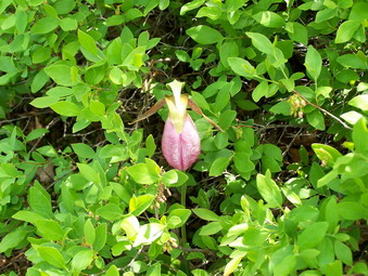
 The more we climbed the more the trail began to look like the rest of the Shawangunks. Pitch pines became more prevalent and the trail passed over open rock faces. There were more and more views of the valleys below. The airport was visible but the most noticeable building was the enormous Kohl's Distribution Center! Along the trail I spotted a Lady Slipper! There was only one and I was fortunate to see it where it was hiding. We continued along the trail as it started to descend and reenter the forest. When it became clear that there were no more views, we turned around and started back. We stopped several times to take pictures. From one vantage point we could see the peaks of the Catskills to the north beyond the lower, closer ridges. To the south we could see the Basha Kill wetlands. We retraced our path and were back a the car by 11:30 AM. We drove to Cragsmoor by way of Shawanga Lodge, Roosa Gap and Cox Roads. At the end of Cox Road we turned left on Route 52 toward Ellenville and parked at one of the viewpoints overlooking the Rondout Valley. We walked back up Route 52 for abut 300 meters and then turned right into the woods on a yellow blazed trail to hike another part of the SRT. We had hiked about 2.4 miles in 1.5 hours.
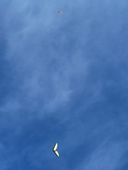
 After a short uphill the yellow trail levels and then descends, goes through a switchback and then parallels a small stream before crossing it. There is a small cascade at the crossing which was running nicely due to the recent rain. We stooped for a drink and some pictures an then followed the trail as it turned sharply left and ascended again to the ridge. The trail was flat for a short distance and then descended to an old woods road where it ended. Here we picked up the aqua blazes of the Long Path and continued to follow them down the woods road. THIS WAS A MISTAKE. Following the Long Path took us OFF the SRT and began leading north toward Ellenville. We finally realized are mistake and, although the hiking was nice, we turned back to the junction with the yellow trail. Lust after this junction the SRT and the Long Path south turn left and start up the ridge. Even after we started on this trail up to the ridge, I was not sure we were on the right trail. The trail was marked with the aqua blazes of the Long Path but lacked any blue discs to indicate the SRT. The trail ascended rather steeply and some nice views to the east and south started to appear. As I took some pictures Cindy pointed out a hang glider plying the updrafts and I soon spotted another.
 We continued up the trail as it went higher and higher toward the top of the ridge. Cindy was beginning to tire and I told her I would go up to the top of the ridge and then return. As I hiked quickly toward the top the blue discs finally appeared. The trail continued to ascend with several twists and turns and several more good viewpoints. The top seemed so close! Soon I broke out onto some open rocks and reached the top of the ridge. I was disappointed that I could not see over the top to the west but decided not to go any farther. There were some great views from the top of the ridge and I took a few pictures before turning around and hurrying back to join Cindy. We hiked back down the trail being careful not to slip on the pine needles and oak leaves! At the trail junction we got back on the yellow trail, followed it over the creek and back up through the switchbacks to the ridge. The final climb and the walk back down Route 52 seemed long and we were back at the car just after 2:30 PM. The 3.5 miles had taken about 2.5 hours with plenty of time for taking pictures.
![]()
![]() On Sunday, May 17th Sheba and I followed Hoosier into Windham where we waited for Snickers to arrive. After getting a snack at convenience store we headed up to the Windham Ski Center parking along the side of the road on Club Road. We started our hike by walking through a short tunnel and passing by a new house construction. The houses in this area are MAGNIFICENT with lots of wood and stonework. The views from these vacation homes are SPECTACULAR! We headed up one of the slopes in a generally southwest direction before turning southeast to follow a road across the base of the steeper ski slopes. It immediately became obvious that Cindy's idea to hike these two CHH peaks was a good one. The weather was nearly perfect and the views beautiful. We were soon following the road as it went through several switchbacks up the slopes. We even got to walk on the remnants of some snow on the slopes. We had decided to hike Cave first and then walk the ridge over to West Cave and then down the slopes back to the car.
On Sunday, May 17th Sheba and I followed Hoosier into Windham where we waited for Snickers to arrive. After getting a snack at convenience store we headed up to the Windham Ski Center parking along the side of the road on Club Road. We started our hike by walking through a short tunnel and passing by a new house construction. The houses in this area are MAGNIFICENT with lots of wood and stonework. The views from these vacation homes are SPECTACULAR! We headed up one of the slopes in a generally southwest direction before turning southeast to follow a road across the base of the steeper ski slopes. It immediately became obvious that Cindy's idea to hike these two CHH peaks was a good one. The weather was nearly perfect and the views beautiful. We were soon following the road as it went through several switchbacks up the slopes. We even got to walk on the remnants of some snow on the slopes. We had decided to hike Cave first and then walk the ridge over to West Cave and then down the slopes back to the car.
 Hoosier found the woods road that leads to Cave and we began to follow it. The road is hard to follow in places and we were soon fighting our way through some briars and brush but that is to be expected on a bushwhack. We picked up the road again and soon were at the highest point on Cave. We could see the ski lifts at the top of the slopes and headed in that direction. We were a little surprised to find another hiker at the top! The views from the slopes were great and we debated which mountain was Huntersfield and which was Richmond. I was reminded of the time several weeks before when Hermit and I were standing on Richmond taking pictures of Windham! It was then that I noticed my hands were VERY cold. The wind was blowing fiercely and I put on my gloves and hat. I wondered over to the eastern slopes and took more pictures before returning to the lift to pick up my pack. As soon as I joined Snickers and Hoosier on the path I was out of the win and much warmer.
 We followed the road the whole way back to where we entered the woods and then turned up the slopes. In less than half a mile we were on West Cave with MORE great views down the slopes into the valley and across to the next mountain range. We began walking northwest along the ridge on a road. This area of the ski slopes had primarily double black diamond trails which are very steep. Cindy did not want to descend these steep slopes and I must admit I saw her point. We continued to follow the road along the ridge until it began a more gentle descent down the mountain. A few twists and turns later and we were headed back toward our cars. We decided that a road walk would be acceptable and headed out to the streets. These roads were on my GPS maps and we easily found our way back to the place where we parked. On the way we got a close-up view of the homes along the way. We completed the 4.44 mile hike in under three hours. As a bonus we stopped at Cave Mountain Brewery in Windham for a beer and sandwich. I would recommend the oatmeal stout and the Cuban!
![]()
![]() On Sunday, May 17th Sheba and I headed for the parking area for Halcott on Route 42 between Shandaken and Lexington. The Swede had planned a traverse of North Dome Sherrill, Balsam, Sleeping Lion and Halcott. We were scheduled to start hiking at 9:00 AM but the group was not fully assembled until 9:30 AM. We decided to hike Sleeping Lion and the Halcott before crossing the road to take on the other three. Before the hike started Sheba and I walked up to the little waterfall by the parking area and I took some pictures. Venturing out into the creek above the falls, I almost ended my hike before it began. The moss was as slippery as ice and I almost fell. This would become a theme during the day. Finally we were ready to go. The group included Hermit, Snickers, The Swede, Oso, Hoosier and, of course, Sheba and myself. No other dogs showed up for the hike.
On Sunday, May 17th Sheba and I headed for the parking area for Halcott on Route 42 between Shandaken and Lexington. The Swede had planned a traverse of North Dome Sherrill, Balsam, Sleeping Lion and Halcott. We were scheduled to start hiking at 9:00 AM but the group was not fully assembled until 9:30 AM. We decided to hike Sleeping Lion and the Halcott before crossing the road to take on the other three. Before the hike started Sheba and I walked up to the little waterfall by the parking area and I took some pictures. Venturing out into the creek above the falls, I almost ended my hike before it began. The moss was as slippery as ice and I almost fell. This would become a theme during the day. Finally we were ready to go. The group included Hermit, Snickers, The Swede, Oso, Hoosier and, of course, Sheba and myself. No other dogs showed up for the hike.
 We started from the parking area with Hermit in the lead and headed along the stream for a little while. Soon we were hiking almost due north and UP as always. NO points along the route were particularly steep and much of the walk was open. We had to avoid a few ledges near the summit and headed a little northeast to gain the ridge and then walk up to the stop. There were some briars and the nettles were beginning to show themselves. After finding what looked like the highest point on Sleeping Lion, Ralph set a course southwest toward Halcott. The peak was visible much of the time through the trees and Ralph was dead on as we hit the ridge between the two peaks and never left it. The walk of just over a mile and a half seemed to go very quickly as we walked and talked. Soon we were near the summit of Halcott and then at the canister. We all signed in and took a break for a snack. The views from Halcott are all blocked by trees. They are the kind of views you get from many of these peaks. The eye can see interesting features through the trees but the camera cannot!
 From the top of Halcott we headed almost due east on a descent toward Route 42. We had decided to head back toward the parking area to avoid a stream crossing further downstream where the water might be too high to safely cross. Swede led the way down. The route was steeper than it looked on the map or on the GPS and much of it was through areas which were VERY wet and VERY slippery. Eric is a strong hiker and was barely in sight. After a few slips and slides, I decided to leave the group at the parking area. I did not feel safe traveling so quickly over this type of terrain. As we approached the parking area we came across a nice stream with a waterfall with several different levels. I stopped for some time to take pictures. Everything was so green from the recent rain and this area raised my spirits. I got the idea that I would drive back toward Frost Valley and stop at various places to take some pictures from the road. I crossed the stream and headed down toward the road. I saw several people from the group on the road but elected to walk further upstream toward the parking area before crossing. When I arrived at the parking area, I was surprised to find Snickers, Hermit and Hoosier at the cars. Ralph had company coming for dinner and Snickers and Hoosier had decided it was a little late to start up Sherrill and North Dome. However, it was too early to stop hiking. They had decided to go to Windham to hike Cave and West cave and invited me along. I readily agreed and followed Hoosier to Windham. We had finished the 4.3 mile FIRST part of the hike in about 4 hours.
![]()
![]() On Saturday, May 9th Hermit (Ralph Ryndak) was scheduled to complete is CHH on Hodge Pond and Mongaup Mountains. Snickers (Cindy) and I had talked about going to Breakneck Ridge but we decided to go with Ralph. This area was one of my favorites and I feel very at home in this area. The weather report grew worse as the week progressed until the forecast settled on possible showers in the morning and thunderstorms in the afternoon. Ralph decided to have a go at it any way. When I arrived at the Frick Pond parking area Snickers was already there and shortly Ralph, Joanne and Alan Via arrived. Sheba and Bookah seemed to hit it off right away. We thought some others might be coming but the weather forecast may have discouraged some. the plan was to hike the Quick Lake Trail to Frick and then follow it passed Iron Wheel Junction and toward the Flynn Trail at Junkyard Junction. Just before Junkyard we would head north by northwest into the woods and hit the Hodge Pond high point. From here we would head slightly northeast to pick up the jeep trail to the Flynn Trail at junkyard. To stay on the trails we would head down to Hodge and around the head end on the jeep trail before following the roads up to the Col between Beech Mountain and Mongaup. From here e would head west toward Mongaup on a bushwhack. I had done this approximate route earlier this year and knew it was long but not difficult. We waited until 9:00 AM and then got started.
On Saturday, May 9th Hermit (Ralph Ryndak) was scheduled to complete is CHH on Hodge Pond and Mongaup Mountains. Snickers (Cindy) and I had talked about going to Breakneck Ridge but we decided to go with Ralph. This area was one of my favorites and I feel very at home in this area. The weather report grew worse as the week progressed until the forecast settled on possible showers in the morning and thunderstorms in the afternoon. Ralph decided to have a go at it any way. When I arrived at the Frick Pond parking area Snickers was already there and shortly Ralph, Joanne and Alan Via arrived. Sheba and Bookah seemed to hit it off right away. We thought some others might be coming but the weather forecast may have discouraged some. the plan was to hike the Quick Lake Trail to Frick and then follow it passed Iron Wheel Junction and toward the Flynn Trail at Junkyard Junction. Just before Junkyard we would head north by northwest into the woods and hit the Hodge Pond high point. From here we would head slightly northeast to pick up the jeep trail to the Flynn Trail at junkyard. To stay on the trails we would head down to Hodge and around the head end on the jeep trail before following the roads up to the Col between Beech Mountain and Mongaup. From here e would head west toward Mongaup on a bushwhack. I had done this approximate route earlier this year and knew it was long but not difficult. We waited until 9:00 AM and then got started.
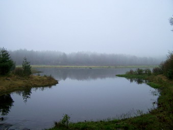
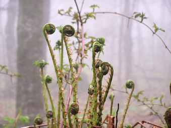 After signing at the register box, we began to walk toward Frick Pond on the Quick Lake Trail. It was clear that the trails would be wet from the downpour the night before. This section of trail looked like a stream in some places and a lake in others. We were soon at the pond and the other hikers were as impressed as I with its beauty. Today there was a blanket of haze and fog on the mountains and over the pond but this only added to the mystique of Frick Pond. We stopped to take pictures and then walked over the bridge to continue around the pond of the Quick Lake Trail. Even as we began to gain a little elevation from the pond the trail stayed soggy. As we walked through the hemlock grove, we had to avoid the blowdown left by winter storms and cross several small streams. At Iron Wheel Junction there were more pictures before we turned left to continue on the Quick Lake Trail. The trail began to climb as we headed toward Junkyard Junction. We passed the snowmobile trail to Quick Lake and began to consider where we would start the bushwhack. The rain had brought out the buds on the trees and many different wild flowers. We stopped to take some pictures of fiddleheads growing on a large mossy rock. There were also numerous trout lilies and trillium along the way. As we neared the top of the trail, we decided it was time to cut into the woods.
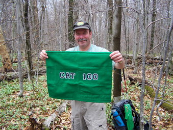 Bearing were taken and GPS units consulted and we headed generally northwest and UP. On the way toward the highest point we worked our way up and around several rock ledges and pushed through some brush. The woods were pretty open and becoming very green. We hit what looked liked a high point and consulted maps and GPS and found we needed to be a little further west. Within less than .2 miles we found what looked like a likely spot and Ralph mounted a stump to claim CHH 101. It was 11:00 AM and we decided to make haste toward Mongaup to avoid the thunderstorm predicted for the afternoon. From the high point we started down and toward the northeast to intersect the jeep trail that would lead us to Junkyard Junction and the Flynn Trail. We traversed this distance in a short time and were soon on the jeep road headed toward the Flynn Trail. At Junkyard we continued straight ahead on Flynn and down to the pond. At Hodge Pond we turned left to go around the back of the pond on the jeep road. We could hardly see any of the pond as we circled around. On the far side we turned left and at the top of the hill left again to walk the roads toward Mongaup.
 At the point where the road turns right to the old Beech Mountain Boy Scout Camp we decided to go straight ahead to bag the peak first. If weather permitted, we could take the side trip on the way back. We continued on the road stopping only at the spring house on the way for a drink. I pointed out a possible viewpoint where the road turns sharply to the right but it was completely obscured by the fog. I also indicated several path and trails that could be used to get to the Sullivan County high point on Beech Mountain. We so decided to leave this as a possibility for the return trip. As the road began to descend we decided to go off the road to the right. We waited until the road makes a hard right and then turned left into the woods. A path immediately became obvious and we followed it along a distinct line of ledges and cliffs. The land fell away to our right and some views could be had through the trees. We continued to follow the path as it skirted the highest point. Eventually we turned to our right and headed UP. On the flat summit we walked around until we finally decided we had the highest point. We stopped to take pictures of Ralph as he completed the CHH. Cindy had brought a beer to celebrate and Ralph's patch. Alan had the CHH banner for Ralph to sign. We didn't linger too long as the skies continued to darken and the black flies began to SWARM. We followed our path back to the road and the road back down to the junction with the road to the Boy Scout camp.
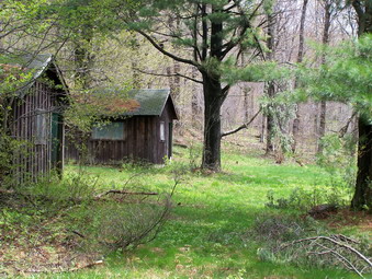 We turned right and walked the several hundred feet to the camp. We took some pictures before turning around and heading back toward Hodge Pond. While talking we missed the turn down to the pond. At the Flynn Trail I decided to turn right and head down to the pond since the weather was holding. We stopped a the pond to take pictures and Bookah jumped in to retrieve a stick. After a brief stay, we turned around and headed back up the Flynn Trail and continued to follow it to the junction with Big Rock. Here we decided to continue straight ahead on the Flynn Trail and back to the parking area. The trail here was damp but we did not have to contend with standing or running water as we did on the way out. We almost ran the last part of the trail to get away from the flies! We were back just after 3:00 PM having taken a little over 6 hours to cover the 10.2 miles!
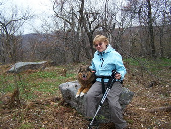
![]()
![]() On Sunday, May 3rd Cindy and I decided to hike after church. We headed out DeBruce Road with Sheba around noon and arrived at the Slide Mountain parking area at around 1:00 PM. Our intention was to hike Winnisook and Spruce for the CHH. The weather prediction was for partly sunny to partly cloudy skies with only a slight chance of rain. By the time we parked it was raining but not heavily. We immediately crossed Route 47 and entered the woods to the left of a small stream. The stream did not exist on the map but had a pretty good drainage and was flowing freely. As is my custom I headed in the general direction of the peak and started UP. The route I took alternated between light brush and more open areas and between gentle slopes and some pretty steep areas. Along the way we negotiated several ledges. I aimed for the area just to the west of Winnisook peak and soon we found ourselves in a little Col. At this point we turned more east and started up toward the summit. There were several impressive cliff bands but these were easily avoided by walking around the ends. As we ascended there were some views to the west and north but none were very open. At times Slide was visible but only to the eye and only through the trees.
On Sunday, May 3rd Cindy and I decided to hike after church. We headed out DeBruce Road with Sheba around noon and arrived at the Slide Mountain parking area at around 1:00 PM. Our intention was to hike Winnisook and Spruce for the CHH. The weather prediction was for partly sunny to partly cloudy skies with only a slight chance of rain. By the time we parked it was raining but not heavily. We immediately crossed Route 47 and entered the woods to the left of a small stream. The stream did not exist on the map but had a pretty good drainage and was flowing freely. As is my custom I headed in the general direction of the peak and started UP. The route I took alternated between light brush and more open areas and between gentle slopes and some pretty steep areas. Along the way we negotiated several ledges. I aimed for the area just to the west of Winnisook peak and soon we found ourselves in a little Col. At this point we turned more east and started up toward the summit. There were several impressive cliff bands but these were easily avoided by walking around the ends. As we ascended there were some views to the west and north but none were very open. At times Slide was visible but only to the eye and only through the trees.
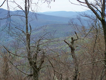 Soon we were on the summit plateau and I was wandering around looking for some viewpoint. I never did find one although there were several open areas. Once I ran into the posted signs we retraced our steps and rested in one of the open clearings. After a drink and snack and some pictures we headed back the way we came and then headed due west over a little knob. Here we found another nice open clearing. I then started southwest trying to stay on the high ground of the ridge. It seemed that no matter how hard I tried I kept straying one way or the other. Part of this was to avoid thicker areas of brush and some small ledges. Soon we were in the Col between the bump and Hemlock. Heading up Hemlock there were some rocky areas that made hiking more difficult and some thicker brush just before the summit. At the top of Hemlock Cindy though she was a little too tired to go to Spruce and then hike down to Route 47. I left Sheba with her and sprinted for Spruce. This was not easy going as I ran into some thick brush and some ledges! I also continued to have problems keeping the high ground. Once up on the summit I did a quick traverse and then reversed my trail, more or less, back to Hemlock. Cindy and Sheba were waiting although it took several calls to find them. We decided on the "short" route back to the car even though it looked steep.
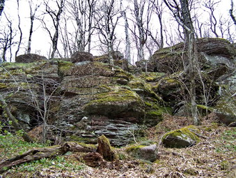 We retraced our route down Hemlock and then headed southeast directly toward the Slide parking area. The maps were right. There were several cliffs to climb down and several steep descents to negotiate. I liked these areas but Cindy was beginning to really flag. As she got tired it became more difficult to avoid the little slips and slides and each became more annoying. Soon we could see and hear the road. We crossed a little brook and emerged directly across from the parking area. The 4.5 mile hike had taken about 4.5 hours!
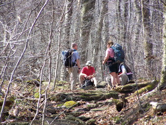
![]()
![]() On Sunday, Apr 26th I decided to join Snickers for her finish of the CHH on Wildcat Mountain. She had invited hikers to attend on the ADHHighPeaks forum and I had hiked with her several times. Hiking with Snickers is never dull and I was anxious to meet some of her friends. She had decided to meet at Biscuit Brook and do a car shuttle to the Slide Mountain PA. This route would cross the Neversink and follow the Phoenicia-East Branch Trail to the point where the Curtis-Ormsbee Trail starts up Slide. From here we would bushwhack the two Wildcat peaks and then head directly north to the Biscuit Brook Parking area crossing the Neversink again. I was concerned about the Neversink crossing so I got up extra early and was at the Slide PA by 8:00 AM. The water was lower than I expected at was easy enough to cross in several places. Sheba and I went back to the Biscuit Brook parking area and walked down to the river. Here the Neversink was MUCH wider, deeper and following more swiftly. I considered hiking in from Denning to meet the group but decided to stick around and do what everyone else did. To while away some time, Sheba and I crossed the road and hiked up the trail toward Big Indian. We walked up the first big hill and then returned to the parking area. Some people who were going Cindy were already there and we introduced or reintroduced ourselves. Cindy soon arrived and then the rest of the group was there just before 9:00 AM.
On Sunday, Apr 26th I decided to join Snickers for her finish of the CHH on Wildcat Mountain. She had invited hikers to attend on the ADHHighPeaks forum and I had hiked with her several times. Hiking with Snickers is never dull and I was anxious to meet some of her friends. She had decided to meet at Biscuit Brook and do a car shuttle to the Slide Mountain PA. This route would cross the Neversink and follow the Phoenicia-East Branch Trail to the point where the Curtis-Ormsbee Trail starts up Slide. From here we would bushwhack the two Wildcat peaks and then head directly north to the Biscuit Brook Parking area crossing the Neversink again. I was concerned about the Neversink crossing so I got up extra early and was at the Slide PA by 8:00 AM. The water was lower than I expected at was easy enough to cross in several places. Sheba and I went back to the Biscuit Brook parking area and walked down to the river. Here the Neversink was MUCH wider, deeper and following more swiftly. I considered hiking in from Denning to meet the group but decided to stick around and do what everyone else did. To while away some time, Sheba and I crossed the road and hiked up the trail toward Big Indian. We walked up the first big hill and then returned to the parking area. Some people who were going Cindy were already there and we introduced or reintroduced ourselves. Cindy soon arrived and then the rest of the group was there just before 9:00 AM.
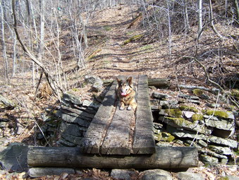 Besides Snickers, Sheba and the group included Doodles, AJTIV, Hoosier, Dick and Edelweiss. We all hopped in a few cars and drove the three miles to the Slide Mountain Parking area. As we were getting ready to depart, Moonray and Rachel joined us. Soon we were crossing the river and making our way up to the woods road that comes in from the Winnisook Club property. As we reached the trail that turns up Slide, I realized that I had never hiked the stretch of trail from that point to the Curtis-Ormsbee Trail. I was intrigued since I like to hike new places. This part of the trail grows narrow in a few places. It has a nice little brook with a bridge built on a solid stone foundation. A little further on the trail becomes a stream just before the CO Trail splits off. Several times along the way we stopped to keep the group together and to chat about the hike or others adventures. When we got to the "jump off" point, Hoosier took a bearing using map and compass and showed Joanne how it was done. Soon we were headed generally west and in my favorite direction, UP! We immediately had to negotiate some rather interesting ledges and cliffs. These were soon behind us and we were walking through a mixture of brush and open forest. Like so many of these peaks, potential viewpoints would appear on the edge of the mountain. Walking to these possible lookouts always proves futile since they offer views the eye can appreciate but the camera cannot capture.
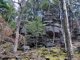 Up we went toward the eastern summit of Wildcat. Nothing look familiar to me until we got to an open patch at the summit. The first time I hiked these we came in from Denning. We all declared victory and after a brief rest started down into the Col between the peak and the next unnamed bump. We repeated this again to get over the next bump. Using GPS, compass, map, sun and good old fashioned hiking skills we managed to stay on the ridge rather than take a straight line for the west peak. Experience has shown that this is usually easier than losing and regaining elevation! After the last bump we ran into another significant band of cliffs. We walked along this band until a way down presented itself. In fact, different people took different routes all of which seemed to work. At one point I stepped on what looked like solid ground. It was NOT! What I stepped on was a layer of leaves covering a large crack between two rocks. My right leg went down into this hole and the pain was immediate. I pulled my leg out and made sure it was fully intact. Fortunately, I it was abraded and bruised but not enough to cause any real problem. I thought, "That is going to smart tomorrow morning!" After climbing down, it was right back up to start the ascent of the west peak.
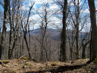 Along the way we noticed that the black flies were out and contrary to one comment they WERE biting. The weather was hot but not too humid with only an occasional breeze. We kept drinking and at each stop I would give Sheba water since we had encountered none since the CO Trail junction. Along the way we encountered a bog with sphagnum moss which was very interesting. We also ran across the hemlock grove which is deep and dark and surrounded by hardwoods. The temperature dropped noticeably as we entered but the flies followed us in! There were also several nice clearing with wild flowers beginning to show and unusual trees bent at odd angles. We kept looking for views but none seemed available. While we were resting, a member of our party went to look for a better viewpoint. As we got up to leave we noticed they were not back! We called with no answer so three of us went back to look for him. Even experienced hikers can fall off ledges! We did not find our friend and concluded that they had probably gone ahead of us. I was still unnerved as we left our resting place and headed for the western peak. There were several more small ledges to deal with an we again took a longer route to be sure we stayed on the high ground of the ridge. We walked and walked and called for our friend as we approached the last ascent to the summit plateau. Soon we heard a return call and were all glad we had found the "lost" hiker. Cindy took the lead to get to the summit first. We soon entered a little clearing and some declared victory. This may well have been the high point but I knew there was a boulder with a cairn a little further along the plateau. After a break for drinks and a snack, we headed in that direction since it was also the way we would descend back to the Biscuit Brook parking area.We found the boulder, took some pictures and then started down.
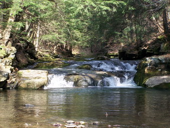 The trip down was very easy compared to the hike up. We headed almost due north. The slope was gentle in most places with only a few rocks to either skirt or descend. Within about a Nile the steeper drop to the river appeared. I was separated some from the group and was a little further east when I got to the river. Just to my right was a small waterfall with a wide, relatively shallow pool. I decided this might be a good place to cross but I wanted to rejoin the group. I hike downstream a little and soon saw them. A couple had crossed, a few were crossing and two more were getting ready. The place they chose looked a little too fast flowing for Sheba and me so back upstream we went! I took off my boots and shoes and rolled up my pants. I expected the water to be freezing. It was cold but felt good on by scratched and bruised legs. The pool was a little deeper than I though but I made it across, put my socks and shoes back on and headed downstream. I could not find the group so I headed up a small hill to Route 47. I was just east of the parking area and was there in only a few minutes. We all said goodbye and I left for home while the others arranged transport back to Slide. We covered a little over 6 miles in 7 hours! About half of this time was spent chatting, resting and taking pictures. This is not my usual pace but I found it a very enjoyable hike with a great group of people.
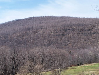
![]()
![]() On Sunday, Apr 19th Snickers and I hiked Mongaup Mountain in the morning. We finished just short of noon and headed back to Livingston Manor. We decided to hike Onteora Mountain since the weather was bright and clear and this peak was supposed to have a great view of the Devil's Path. I decided to stop at my house to see if Cindy (my wife) wanted to go. She decided to accompany us and we were soon on our way. The promise of eating at Pancho Villa's may have tipped the scales! We took DeBruce Road to 47 then to 28 and 42 North to Lexington. We turned right on 23 and passed through Hunter on the way to Tannersville. After obtaining permission to hike on this private land, we parked and began the hike. We crossed some open ground to get to the woods and then picked up an old woods road and some trails which helped in our ascent. The roads wound back and forth up the hillside and I eventually grew tired of the switchbacks. I decided on a more direct route up through the cliff band. I stayed far enough ahead of the ladies to avoid thrown projectiles.
On Sunday, Apr 19th Snickers and I hiked Mongaup Mountain in the morning. We finished just short of noon and headed back to Livingston Manor. We decided to hike Onteora Mountain since the weather was bright and clear and this peak was supposed to have a great view of the Devil's Path. I decided to stop at my house to see if Cindy (my wife) wanted to go. She decided to accompany us and we were soon on our way. The promise of eating at Pancho Villa's may have tipped the scales! We took DeBruce Road to 47 then to 28 and 42 North to Lexington. We turned right on 23 and passed through Hunter on the way to Tannersville. After obtaining permission to hike on this private land, we parked and began the hike. We crossed some open ground to get to the woods and then picked up an old woods road and some trails which helped in our ascent. The roads wound back and forth up the hillside and I eventually grew tired of the switchbacks. I decided on a more direct route up through the cliff band. I stayed far enough ahead of the ladies to avoid thrown projectiles.
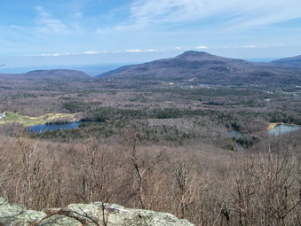 After climbing up through a major band of cliffs there was still more climbing to do. As we walked we found more "trails" which seemed to be freshly marked but were not in any way cleared. Some trails seemed very old and hardly used. Along the way there were also some old signs with broken letters. Some of these led to interesting interpretations of what they originally said. We also began to see posted signs for private property that we did not have permission to hike and we tried to steer away from them. Finally we could see only one rise ahead of us with some evergreens to mark the summit. After a short climb, we were at the highest point. We stopped and I took some pictures of the summit and began to explore for some viewpoints. Sadly, the peak did not live up to its billing and offered no views suitable for photography. I descended from the summit slightly to the next level down but no lookouts were obvious. I returned to the summit without taking any pictures! After getting a drink and giving Sheba a treat, we started to descend and chose a line that seemed to lead more directly toward our cars. As we descended, an area appeared ahead that seemed to offer a clear spot for viewing. I didn't get my hopes up as I have been disappointed before! When we arrived, there was a clear area atop a sheer drop. No trees blocked the view and I knew THIS was THE place!
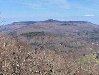 In front of us was an unobstructed view of the valley below. In the foreground was Onteora Lake, the fieldhouse and the golf course. It seemed that the view simply went on forever. From left to right the Blacks, Windham High Peak, Kaaterskill High Peak and Roundtop were laid out. Continuing around the entire eastern portion Devil's Path could be seen starting with Indian Head and ending with Plateau. The profiles of each peak were distinct and different. The Notch between Plateau and Hunter was there and even the eastern slopes of Hunter could be seen. Some of the lower peaks like Parker Mountain dotted the landscape giving character to the flatter features. This was one of the best views I have seen in the Catskills rivaling that from Twin, Wittenberg and the Palenville Lookout! I took a lot of pictures from many different angles and jumped down to the flat rock below just to get a different view. A short walk away was another viewpoint that revealed the snow-covered slopes of Hunter. This lookout was more overgrown with views only available through the trees. Soon it was time to go and we started to descend.
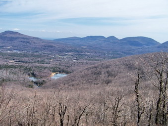 We consulted our maps, compass and GPS units as we lost elevation and found we were headed too far to the west. The terrain was steep with several cliff bands so we turned east to head along the top of the cliffs. Soon an opportunity came to descend and we took it. We still were trying to head east but were sure we would hit one of a number of roads or trails that were below us. Soon some marked trails and roads did appear. Some of the trails even had new signs to name them but most were overgrown and hard to follow. Soon we were descending on a well-defined woods road toward the lake. We turned left at the shore and started the walk clockwise around the lake. After crossing a swampy area, ascending little hill and walking through some forest, we were back on the open ground from earlier in the morning. I took a few more pictures and then we headed back to the cars. We had covered the 3.2 mile hike in three hours. The three of us decided to eat at Pancho Villa's in Tannersville. Cindy and I had only about a hour's ride home. Snickers on the other hand had a three hour trip ahead. After eating, we said goodbye knowing it was not the last hike we would be doing together.
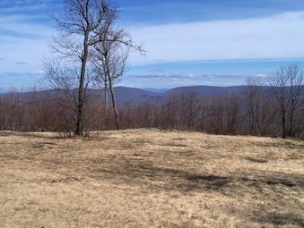
![]()
![]() On Sunday, Apr 19th I met Snickers at the Livingston Manor School to head for Shin Crick Road and a hike up Mongaup Mountain. I felt bad about bailing on her last Friday and wanted to make it up to her. Cindy needed only this peak and Wildcat to complete her CHH. We loaded my gear and Sheba into her car and headed up the Beaverkill Road to Lew Beach. In Lew beach we turned right onto Shin Creek Road. Along the road on the right hand side less than half a mile after the turn is a narrow ravine cut by Shin Creek. It is on the Irving Berlin Estate and I one day will get permission to explore this interesting area. We continue on the road until it turned to dirt and started to gain some elevation. When the DEC appeared on the right, we began to watch for the pull off or parking area on the right. Cindy parked the car and we took a bearing for Mongaup Mountain. We walked back up the road and then turn left into the woods and immediately began to gain some elevation to the ridge. There were a few steep areas and some with brush to push through but we were soon on a woods road with new flagging. We tried to stay on the state land but found it difficult since there are few posted signs in the woods and no state boundary markings. The road to the right went down and to the left it seemed to go out of our way. We decided on a more direct route!
On Sunday, Apr 19th I met Snickers at the Livingston Manor School to head for Shin Crick Road and a hike up Mongaup Mountain. I felt bad about bailing on her last Friday and wanted to make it up to her. Cindy needed only this peak and Wildcat to complete her CHH. We loaded my gear and Sheba into her car and headed up the Beaverkill Road to Lew Beach. In Lew beach we turned right onto Shin Creek Road. Along the road on the right hand side less than half a mile after the turn is a narrow ravine cut by Shin Creek. It is on the Irving Berlin Estate and I one day will get permission to explore this interesting area. We continue on the road until it turned to dirt and started to gain some elevation. When the DEC appeared on the right, we began to watch for the pull off or parking area on the right. Cindy parked the car and we took a bearing for Mongaup Mountain. We walked back up the road and then turn left into the woods and immediately began to gain some elevation to the ridge. There were a few steep areas and some with brush to push through but we were soon on a woods road with new flagging. We tried to stay on the state land but found it difficult since there are few posted signs in the woods and no state boundary markings. The road to the right went down and to the left it seemed to go out of our way. We decided on a more direct route!
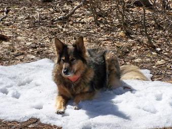 We walked UP again through some rocks and then into open hardwood forest. The rest of the hike consisted of alternating climbs over rocks, pushes through brush and open woods. There were few prickers to bar the way and overall the walk was easy. My approach is to head in the general direction you want to go and always UP. Occasionally I check my GPS or compass but generally my approach works. Like many of these CHH peaks there were not many lookouts and all were blocked by trees and brush. The weather continued to clear, the sun came out and both Cindy and I shed a layer of clothing. On many of these hikes I look ahead and see what I think is the summit plateau only to find higher ground ahead. This one was no different but soon there was no more high ground as we were on the peak. After wandering around for some time, we started back along our same path using CPS (canine positioning system). Sheba usually can follow the scent of our track up the peak and will take me back the way we came! We drifted a little north and into an open field. This was great since the field offered the viewpoint that we had been lacking. Near the edge of the field there was still some snow! We stopped and took pictures before continuing on our way.
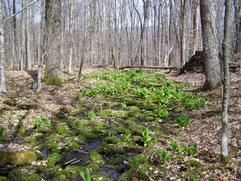 We followed a woods road down toward another field but then decided it went a little too far north and started back into the woods. Soon we intersected our previous path and continued to follow it for some time. I decided to head directly for the car to cut off a little distance. This worked well until I saw that we had lost a little too much elevation and needed to make a short but steep climb back up to the road. On the road a quick look to the left revealed Cindy's cat less than 100 feet away. The 3.5 mile hike took us about 3 hours including the time we stopped. As we drove back to Livingston Manor, we made plans to hike another peak. I had heard that Onteora Mountain was a nice peak with good views. The day was sunny and my only objection was the long drive to Tannersville.
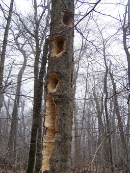
![]()
![]() On Saturday, Apr 11thmy son Karl was up from Virginia. Since the weather forecast was for clearing skies, we decided to head out for a hike. I needed to do Woodpecker Ridge for the CHH and it was the last peak in the Beaverkill area for me. We waited a little while but "clearing" did not seem evident so we headed out. We parked at the parking area for the Mongaup Hardenburgh Trail. My plan was to head almost directly north through the woods and then return by the same route to the car. Before starting the bushwhack, we headed down the trail to the Beaverkill where there is Avery interesting suspension bridge across the river. Karl had never seen the bridge and appreciated the robust construction but stayed on firm ground. Our dogs, Sheba and Maggie, decided to follow me out onto the span. After a few steps the open slat construction and the swaying of the bridge convinced them to return quickly to the bank. We walked back up to the car, got our equipment and headed into the woods around 10:30 AM.
On Saturday, Apr 11thmy son Karl was up from Virginia. Since the weather forecast was for clearing skies, we decided to head out for a hike. I needed to do Woodpecker Ridge for the CHH and it was the last peak in the Beaverkill area for me. We waited a little while but "clearing" did not seem evident so we headed out. We parked at the parking area for the Mongaup Hardenburgh Trail. My plan was to head almost directly north through the woods and then return by the same route to the car. Before starting the bushwhack, we headed down the trail to the Beaverkill where there is Avery interesting suspension bridge across the river. Karl had never seen the bridge and appreciated the robust construction but stayed on firm ground. Our dogs, Sheba and Maggie, decided to follow me out onto the span. After a few steps the open slat construction and the swaying of the bridge convinced them to return quickly to the bank. We walked back up to the car, got our equipment and headed into the woods around 10:30 AM.
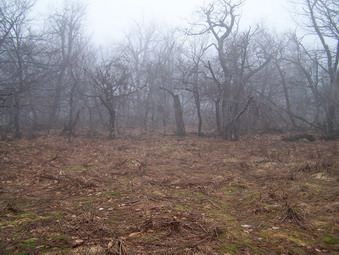 The woods are fairly open all the way up to the high point on the ridge. The ground was wet but the worst spots are easily avoided. We simply headed for the highest ground we could find and only check the GPS once or twice as we neared the top. Each time we were right on! There were a few small cliff bands and ledges which we, in most cases, decided to go through rather than skirt. The weather continued to be foggy but was warm. I was down to just a long-sleeved wool top within the first mile. There were very few places that looked like they would provide a viewpoint and we didn't try too hard since we knew the fog would obscure any views we did find. The walk was longer than I thought it might be with several "false alarms". We did see at least one place where the woodpeckers or perhaps porcupines had been at work. Soon we were on the summit plateau wandering around looking for the highest spot. As we headed further north we entered a rather large clearing. Fog hung heavy in this area and was near to the ground. It was very eerie, spooky with a supernatural feel. At this point we got the idea that we should change our route. We decided to continue north and pick up the Millbrook Ridge Trail and walk to Balsam Lake Mountain, down the trail to the parking area and then walk the road back to the car.
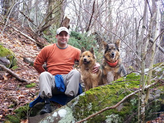 We started to walk north and immediately dropped off the ridge losing elevation. This seemed reasonable at the time since we knew we would have to lose some elevation between the two "peaks". Somehow we drifted a little too far to the east and lost too much elevation. We corrected this by turning northwest and then west and gaining more elevation. After a short steep climb to get back on the ridge we picked up the yellow Millbrook Ridge Trail and turned right or east toward Balsam Lake Mountain. The trail did not look well traveled and the markers were few and far between. We did get several views down to Balsam Lake but the trees and the fog made photography impossible. Near its end the trail avoids the direct route to the summit and switches back and forth once or twice until it hits the trail to the tower a little south of the summit. The climb is still fairly steep in several places. When we got to the red trail, we turned left or north and walked to the summit and the fire tower. I knew that the views would not be good but there was some clearing. The temperatures on the summit were cooler than anywhere else we had been and I put on my jacket to go up the tower.
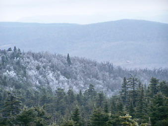 As I climbed the tower the air temperature dropped and the wind speed increased. A thin sheet of ice covered the steps and ice had formed in on the wire screening enclosing the stairs. The ice got thicker at each level. Since the tower was not manned, I stopped just below the cab and made sure I had good footing. I took a number of pictures of the landscape including the ice and snow frozen on one side of must of the fir trees! The combination of fog and dark skies and some sunshine made for interesting scenes. I also took some close ups of the ice on the screens. I carefully descended the tower and we headed back down the red trail. This trail had areas where there was still significant snow and ice but nothing that couldn't be carefully negotiated. By the time we hit the 3500 foot sign at the spring all the snow was gone and we all but ran down the mountain. At the turn another hiker was starting the ascent with his dog. We made the turn and hurried to the parking lot. The walk back on the road seemed long but we saw no cars or other hikers. The stream next to the road and the clearing skies made for pleasant conditions. I thoroughly enjoyed the day with my son and our two canine companions but I was glad to be back at the car by 3:30 PM. We covered 7.5 miles in about 5 hours. When I put the route on my GPS software and Google maps at home our error in dropping off Woodpecker Ridge to the east was obvious.
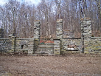
![]()
![]() On Friday, Apr 10th Cindy (Snickers) and I headed back down Cross Mountain Road after hiking Barkaboom Mountain to park at Alder lake. From Alder Lake we planned to hike around the lake to the south side and then tackle Cradle Rock Ridge. On our way down Cross Mountain Road we saw what appeared to be an old road supported by stone work in the woods parallel to Cross Mountain Road. Our biggest surprise was waiting at Alder Lake. As we parked and headed toward the lake we found the Coykendall Mansion had been dismantled! Although the mansion had been in great disrepair over the last few years, I was sorry the State decided to take it down rather than try to restore it. I was also surprised that I had heard NOTHING around Livingston Manor about this project! When we were there, much of the stonework still remained in place. The craftsmanship was so good that it almost looked new! I do not know whether or not the State plans to leave this in place or not. We took pictures of what remained and some of Alder Lake and the surrounding hills. I took a picture toward the southeast of our destination.
On Friday, Apr 10th Cindy (Snickers) and I headed back down Cross Mountain Road after hiking Barkaboom Mountain to park at Alder lake. From Alder Lake we planned to hike around the lake to the south side and then tackle Cradle Rock Ridge. On our way down Cross Mountain Road we saw what appeared to be an old road supported by stone work in the woods parallel to Cross Mountain Road. Our biggest surprise was waiting at Alder Lake. As we parked and headed toward the lake we found the Coykendall Mansion had been dismantled! Although the mansion had been in great disrepair over the last few years, I was sorry the State decided to take it down rather than try to restore it. I was also surprised that I had heard NOTHING around Livingston Manor about this project! When we were there, much of the stonework still remained in place. The craftsmanship was so good that it almost looked new! I do not know whether or not the State plans to leave this in place or not. We took pictures of what remained and some of Alder Lake and the surrounding hills. I took a picture toward the southeast of our destination.
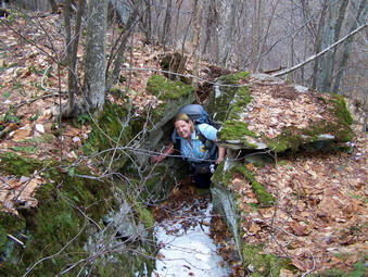 We crossed the dam and followed the trail around the lake counterclockwise. As the woods opened up we turned right and start UP the ridge. The forest was mostly open but there were a few places where we had to push through the brush and several steep climbs. Several times we ascended through rock ledges to what I thought might be the top but there was always another patch of higher ground further on. Once on the summit plateau we walked some distance to what seemed to be the highest spot. We didn't seem to find any really landmark and didn't spend much time on top before descending to the north. Not wanting to go back the same way we came we head down toward the brook that feeds Alder Lake. On the north slope we encountered some snow until we descended to a lower elevation where the woods were clear. The descent was steep and rocky in places and wet as we approached the brook. We paralleled the brook for a short distance and then found a place to cross. We immediately picked up the Millbrook Ridge trail back to the lake and then followed the loop trail counterclockwise back to the car. Near the inlet we met three other people walking but it seemed that they might only be going around the lake. Our route was about 3.5 miles and took us a little less than 3 hours to finish. At this point we had planned to go to Mongaup Mountain but I had a commitment for that night. Although it was early I "chickened out" and decided it was better to skip another peak. I felt bad bailing on Cindy but she said she would return. We did take some time to drive Shin Creek Road and scout out the place where we would park for our assault on Mongaup Mountain.
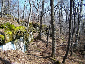
![]()
![]() On Friday, Apr 10th I planned to meet Cindy (Snickers) at the Livingston Manor school so that we could do several CHH peaks in the Beaverkill area. We met promptly and 8:00 AM and I transferred my gear and Sheba to Cindy's Jeep for a trip to Cross Mountain Road and a hike up Barkaboom Mountain. We headed toward Roscoe on Old Route 17 and turned right onto the Beaverkill Road. We passed through Lew Beach and Turnwood and then took a left onto Alder Creek Road. At the end of this road we turned left onto Cross Mountain Road. Cross Mountain Road is definitely "seasonal" and it may not quite have been its season yet! The road is barely one car wide in places and drops steeply on the western side. We continued on the road to its highest point. Here DEC signs appear and there is a pull off on the right big enough to squeeze in two cars. We check our maps and GPS units to confirm our location and then quickly crossed the road and followed a old woods road for a short distance. We turned right off the woods road and crossed a swampy area and began our ascent. There were several areas of prickers and brush. Some of the more open areas were very wet. Most of the walk, however, was fairly open woods.
On Friday, Apr 10th I planned to meet Cindy (Snickers) at the Livingston Manor school so that we could do several CHH peaks in the Beaverkill area. We met promptly and 8:00 AM and I transferred my gear and Sheba to Cindy's Jeep for a trip to Cross Mountain Road and a hike up Barkaboom Mountain. We headed toward Roscoe on Old Route 17 and turned right onto the Beaverkill Road. We passed through Lew Beach and Turnwood and then took a left onto Alder Creek Road. At the end of this road we turned left onto Cross Mountain Road. Cross Mountain Road is definitely "seasonal" and it may not quite have been its season yet! The road is barely one car wide in places and drops steeply on the western side. We continued on the road to its highest point. Here DEC signs appear and there is a pull off on the right big enough to squeeze in two cars. We check our maps and GPS units to confirm our location and then quickly crossed the road and followed a old woods road for a short distance. We turned right off the woods road and crossed a swampy area and began our ascent. There were several areas of prickers and brush. Some of the more open areas were very wet. Most of the walk, however, was fairly open woods.
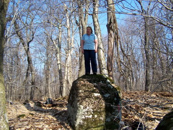 We reached the first level and followed along the top of some cliffs looking for a viewpoint. Each possible lookout was blocked by trees allowing only limited views with nothing really suitable for photography. We turned UP the mountain and found some impressive rock formations and worked our way up through them. We continued to walk UP over some rocks and over and through some brush. We reached the summit plateau and walked until we saw no more high ground. We found a big rock and declared our success. Cindy even climb up on the rock to stake her claim. On the way down we took a slightly different line to begin with and hit the top of a cliff band. We continued along the top of the cliffs looking for a viewpoint. We never found any views and soon were back to our original path as we descended we got off our original path and lost a little too much elevation. I decided we should regain some elevation and took us up a STEEP little climb to a woods road. Cindy's car was about 50 feet away! We took about 2 hours to do the 2 mile hike but much of this time was spent exploring! We got back in the car and headed back down Cross Mountain Road to Alder Lake.
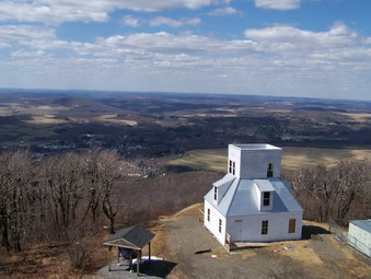
![]()
![]() On Thursday, Apr 9th I decided to drive to Stamford after hiking the Pisgahs. The weather was so beautiful I though I might get some nice pictures from the summit and fire tower on Mt. Utsayantha just outside of Stamford. I returned to Route 28 from Weaver Hollow Road and turned right toward Andes. After passing through Andes I turned right on Route 6 to Bovina Center and here picked up Route 5 North to Route 18 east into South Kortright. In South Kortright I took Route East and then north through Hobart and then to Stamford. In Stamford it was a quick right on Route 23 and then another onto Mountain Avenue which becomes Tower Mountain Road. This road really goes UP but the road up Mt. Utsayantha appears very quickly on the left. This sounds like a long drive but it went very quickly. The road looked like I could drive at least part of the way up it but I decided to park at the bottom by the sign and hike up. The road is in reasonably good condition and is only about 1 mile to the top. Sheba and I made short work of this easy ascent after several hours of bushwhacking in the morning!
On Thursday, Apr 9th I decided to drive to Stamford after hiking the Pisgahs. The weather was so beautiful I though I might get some nice pictures from the summit and fire tower on Mt. Utsayantha just outside of Stamford. I returned to Route 28 from Weaver Hollow Road and turned right toward Andes. After passing through Andes I turned right on Route 6 to Bovina Center and here picked up Route 5 North to Route 18 east into South Kortright. In South Kortright I took Route East and then north through Hobart and then to Stamford. In Stamford it was a quick right on Route 23 and then another onto Mountain Avenue which becomes Tower Mountain Road. This road really goes UP but the road up Mt. Utsayantha appears very quickly on the left. This sounds like a long drive but it went very quickly. The road looked like I could drive at least part of the way up it but I decided to park at the bottom by the sign and hike up. The road is in reasonably good condition and is only about 1 mile to the top. Sheba and I made short work of this easy ascent after several hours of bushwhacking in the morning!
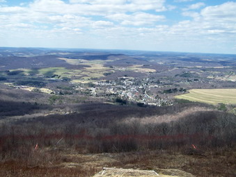 At the top where the road forks we stayed to the left to ascend to the main peak with the fire tower. The summit is occupied by the fire tower, several communications antennas and the Churchill Education Building. When we arrived a father and son were in their pickup truck just getting ready to leave. I dropped my pack a the base of the tower, gave Sheba some treats, grabbed my camera and started up. The cab appeared to be open but I was satisfied to stop at the level below to take in the 360 degree view allowed by the tower to the southwest Churchill was visible and I though I could see some of the old roads Ralph and I used when we went up the mountain the week before. To the northeast the village of Stamford was laid out with all the buildings clearly visible. The Moresville Range lay to the southeast and could be seen over the lower peak of Utsayantha. in the valleys below there were several different farms with large farmhouses, barns and outbuildings. I took many different pictures from several different angles before descending the tower. On the way down I was surprised to find Sheba several levels up the tower. She must have felt I spent too much time at the top since she seldom climbs up the open stairs.
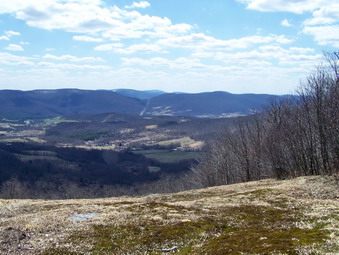 I took some pictures of the picnic areas and then headed over to the Churchill Building. In front of this building is an open lookout that affords a nice view of Stamford without climbing the tower. In some ways the village seems closer form this viewpoint. Sheba and I started back down the road and stopped at another lookout to the northeast. I took some more pictures of the mountains and the farms in the valleys. This lookout had a wooden "dock" but its purpose escaped me. At the fork in the road we went straight ahead to an open field and got another view toward McGregor Mountain and the Moresville Range. After a few more pictures, we quickly descended the road back to the car. We spent about 1.5 hours and the 2 mile hike with almost as much time for pictures as for walking!
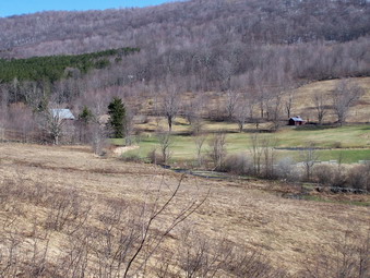
![]()
![]() On Thursday, Apr 9ththe weather report was for sun and warm temperatures. I decide to try a solo bushwhack on Little Pisgah and Mt. Pisgah. After I was finished, I thought I would then decide what to do next. I was nursing a slight calf muscle pull and did not want to do too much since I had promised to hike with Cindy (Snickers) on Friday. I knew that Hubbell Hill was close by in New Kingston but I though I might finally get to Utsayantha. I didn't push for an early start so we left Livingston Manor around 8:00 AM and headed to Roscoe and then Route 206 to the Pepacton Reservoir. Here we turned right and caught Route 30 to Route 28 North. We continued on to Andes until I saw as sign for the Bobcat Ski area. When I pulled into the parking area, everything seemed abandoned and there was no one to ask for permission to hike the mountain. I was satisfied that I had made the attempted and headed back down Route 30 and took Route 6 north toward New Kingston. I turned left onto Weaver Hollow Road. I was wondering if I would find the DEP parking area but I shouldn't have worried since it was very clearly marked on the left side of the road. We pulled in at just after 9:30 AM. I checked the map and GPS and we were off.
On Thursday, Apr 9ththe weather report was for sun and warm temperatures. I decide to try a solo bushwhack on Little Pisgah and Mt. Pisgah. After I was finished, I thought I would then decide what to do next. I was nursing a slight calf muscle pull and did not want to do too much since I had promised to hike with Cindy (Snickers) on Friday. I knew that Hubbell Hill was close by in New Kingston but I though I might finally get to Utsayantha. I didn't push for an early start so we left Livingston Manor around 8:00 AM and headed to Roscoe and then Route 206 to the Pepacton Reservoir. Here we turned right and caught Route 30 to Route 28 North. We continued on to Andes until I saw as sign for the Bobcat Ski area. When I pulled into the parking area, everything seemed abandoned and there was no one to ask for permission to hike the mountain. I was satisfied that I had made the attempted and headed back down Route 30 and took Route 6 north toward New Kingston. I turned left onto Weaver Hollow Road. I was wondering if I would find the DEP parking area but I shouldn't have worried since it was very clearly marked on the left side of the road. We pulled in at just after 9:30 AM. I checked the map and GPS and we were off.
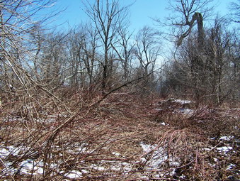 The hike started with a crossing of a small stream and some very wet and swampy ground at the far side of the field by the parking area at the base of the hill. From Here we walked up through an open field and I took some pictures of the surrounding scenery. The weather seemed to be following the prediction for clearing skies and a sunny day. The hike to the summit was somewhat uneventful but fairly steep with a few rock ledges to negotiate. We crossed what looked like several old woods roads and followed one for a while until it turned away from the summit. As we approached the summit the ground flatten some before the final push up a short hill to the top. To get to the summit we pushed through a thicket of prickers from the previous season. This would probably be a hike that all but the most hardy or foolish should avoid during the peak pricker season. There was nothing much to see at the top except the extensive pricker display so I contemplated my options. I could return to the car and rive or walk up the road toward Mount Pisgah or continue to hike over the that peak. I decided to try hiking and walked a little north until I could get a visual through the trees of Mount Pisgah. My destination was also marked on my GPS so I was confident I would have no trouble finding the summit.
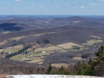 I dropped down off Little Pisgah but made sure not to lose too much elevation. The hike alternated between areas of prickers and relatively open forest. Soon I found an old woods road that seemed to head in the right direction. I followed this road for quite some time until it seemed as if it would bypass the summit. Just as I was about to turn right and bushwhack toward the summit another road branched to the right and seemed to head toward the summit ridge. I followed this road as it wound its way toward the top but eventually struck off to the left since it too seemed to be skirting the highest point on the mountain. There were a few short steep climbs and several areas of extensive pricker infestation. Soon we were on the summit plateau but not at the highest point. There was quite a bit of snow on top and I still had a good distance to the highest point and the ski slopes on the other side of the mountain. I also knew that I should be able to get some good views from the Bobcat ski slopes. I continued to head for the highest point on the mountain and ran across another road which was labeled on the GPS as Weaver Hollow Road. I found this amusing since the "road" was barely a trail. I did intend to use this path on my return trip. We soon gained what appeared to be the highest point on the mountain and then came across a road that led passed the communications tower at the top and down to the ski area.
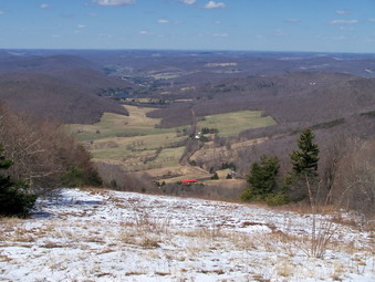 It was obvious from the condition of the lift and the buildings at the top of the mountain that the area had not been open at least for the previous season and perhaps fro several before that. This area never had snow-making equipment and had to rely on natural snowfall. I took some pictures of the buildings and equipment and then walked over to the tops of the slopes. The views were spectacular! With no trees to obscure the view and clear, sunny skies, the vista revealed the valley spread out below and the mountains in the distance seemed to go on forever! I took MANY pictures from one slope and then shifted to the next. We got a snack and something to drink before getting ready to go. I shot a few pictures of the T-bar lift and then we headed back the way we came. We picked up the path marked as a road and tried to follow it down the mountain. Eventually I gave up and just went down. We ran across a well-defined road and I consulted my GPS before turning left and following the road down passed some hunting camps and then seasonal homes. We still had not seen a single person anywhere on the hike! As we continued down the road, the houses began to have numbers and the road became hard-packed dirt and then pavement. The houses were small but looked expensive. Several new homes were under construction. The walk down the road seemed long and we eventually encountered a few cars and evidence of habitation. We returned to the car by 11;30 AM after covering 4.0 miles. We got in the car and I made the decision to head for Stamford to climb Utsayantha. I thought this the best choice since the sunny skies meant the views from the mountain and its fire tower would be great!
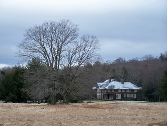
![]()
![]() On Tuesday, Apr 7thSheba and I met Bill Schermer at the Denning trailhead for a hike to the Wildcats. The weather forecast was for a 40% chance of rain or snow. As I drove to Denning there were some snow flurries and I hoped the rain would hold off. At the Denning trailhead the temperature was only 29 degrees and there was a stiff breeze blowing. Before Bill arrived I took some pictures of the house and barn at the end of Denning road. These structures belong to Frost Valley and the house has some interesting features. The sky was bleak and the whole scene had a certain appeal to me. When Bill arrived, we consulted the Venture Out map and decided to walk the trail or woods road as far as the first incursion of state land and then head up through the woods near Flat Brook. From that point the east peak of Wildcat seemed to be a pretty straight shot. Our objective was to tag both peaks of the Wildcats AND to stay on public land!
On Tuesday, Apr 7thSheba and I met Bill Schermer at the Denning trailhead for a hike to the Wildcats. The weather forecast was for a 40% chance of rain or snow. As I drove to Denning there were some snow flurries and I hoped the rain would hold off. At the Denning trailhead the temperature was only 29 degrees and there was a stiff breeze blowing. Before Bill arrived I took some pictures of the house and barn at the end of Denning road. These structures belong to Frost Valley and the house has some interesting features. The sky was bleak and the whole scene had a certain appeal to me. When Bill arrived, we consulted the Venture Out map and decided to walk the trail or woods road as far as the first incursion of state land and then head up through the woods near Flat Brook. From that point the east peak of Wildcat seemed to be a pretty straight shot. Our objective was to tag both peaks of the Wildcats AND to stay on public land!
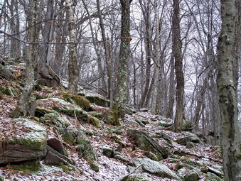 We followed our plan and when we arrived at the state boundary markers Bill took a compass bearing using the map. He is far better at this than I but I did have my GPS along to give us some guidance and to track our adventure. We headed north northeast and the hike, although a bushwhack, was through fairly open woods. It was too early for the prickers and nettles that often inhabit the Catskills especially where there are no trails but there seemed to be little evidence that they would be a problem later in the season. As we climbed higher, we kept a watch for any viewpoints. Several posts had mentioned lookouts but we could not find ANY. There were places where we could easily spot various mountains through the trees but none were open enough for good pictures. Every time we stopped Table seemed to be most prominent but we also spotted Woodhull, Van Wyck, Lone Rocky, Balsam Cap and Friday. Soon we were nearing the top of the east peak and knew we would just have to wander around to find the highest point. As we walked we spotted some ribbons on a few trees. Near the ribbons the brush and smaller trees had been obviously cut back. The cuts looked fairly recent as if they had been made during the fall. We walked to the highest spot we could find and saw a higher spot. After doing this several times we could find nothing higher and declared victory. This is where Bill's compass came in handy! He took a bearing which put us in exactly the OPPOSITE direction I though we would have to go. The GPS agreed and I never argue since I am most often WRONG!
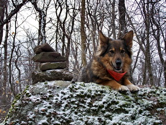 As we headed off on Bill's bearing and lost some elevation the ribbons and cuttings came back into view. We decided to follow these as long as they didn't take use too far out of the way. Soon we were climbing the "knob" between the two Wildcats. There were some interesting rocks formations so we took some pictures and then continued to follow the ribbons over the knob's north side. We would alternately regain this "trail". My best recollection is that this might be the proposed trail marked on several maps and is an extension of the Finger Lakes Trail. We seemed to be walking along a ridge or cliff band and not making much progress toward the west peak. I suggested we take a more direct route and we lost more elevation than we really wanted too by heading a little too far west instead of southwest. As we walked we spotted some higher ground and hit a ridge line that took us directly toward the area of the west peak. We made note to follow this path on our return. The walking was still very manageable with mostly open forest. As started to ascend there were a few rocky areas to negotiate. We kept looking for a viewpoint. Each time we saw something ahead and walked to it, the view was blocked by trees. Several times we thought we were at the highest point only to have another rise beckon us. We walked through several open "clearings" which seemed to have a lot a dead ferns. These areas must be beautiful in spring and summer. We finally hit the elevation that was given for the highest point on the west peak but just ahead was a big boulder that looked a little higher. We headed in that direction and found a rock cairn on top of the boulder. Again, we claimed victory! We took some pictures including ones with Sheba on top of the boulder and then contemplated the return trip.
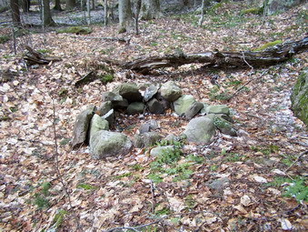 From the west peak of the Wildcats we agreed that a bearing of 110 or 120 degrees would put us back at our jump off point but would also take use through the drainage for Riley and Flat Brook. To avoid walking up and down through both of these we decided to stay a little north. As it turns put we probably should have stayed on the ridge line as the drainage for Riley Brook starts somewhat down the slope of the Wildcat ridge. After drifting a little too far north and losing some elevation, we turned south and regained the ridge line. We walked along the ridge for a while and then started down. What initially looked like cliffs too steep to descend turned out to be rather mild. We continued down and on a southeast heading missing Riley Brook completely. The first brook we did cross was a small feeder for Flat Brook. When we did cross Flat Brook it was rather easy to descend into the drainage, cross the brook and ascend the other side. We stayed between the brook and the high ground on our left until the ground began to rise and then we walked up onto the low ridge. Just as we turned there was a fire ring in the middle of the woods. We continued southeast as my GPS showed we would intersect either our original path or the trail back to the Denning PA. Soon we saw the state boundary markers and the POSTED signs for the Tyson Estate. We were within 20 feet of the point where we left the trail in the morning. We were back at the car at 3:30 PM having covered almost 7 miles in 6.5 hours!
![]() On Saturday, April 4th hiking did not seem possible. Friend and community leader Pat Casey died after a valiant fight against cancer and his funeral was in the morning. In the afternoon, I was going to be busy discovering the cause of the "sinkhole" in my backyard with the help of neighbor and his backhoe. In addition, the weather forecast was for periods of rain and SNOW with winds gusting to 40 mph. After my wife and I attended the funeral and returned home, I waited for my neighbor who called shortly after 1:00 PM telling me he would not be available until Sunday. The weather was every bit as bad as predicted but I thought a quick hike would be in order. I got my equipment ready and Sheba and I headed for Frick Pond. My intent was to hike to the Hodge Pond peak on the CHH list just off the Quick Lake Trail to the west and north of Hodge Pond. We parked at Frick just before 2:00 PM. Most of the precipitation here was sleet or snow and the wind was howling through the trees. The trail to Frick Pond alternated between running water, standing water and mud! This described the trail conditions for the rest of the day. At Frick we turned left, passed by the pond and crossed the bridge. It looked like it was snowing harder on the surrounding mountains and there was still a large pile of snow at the other end of the bridge. At the trail junction, we turned left to follow the Quick Lake Trail.
On Saturday, April 4th hiking did not seem possible. Friend and community leader Pat Casey died after a valiant fight against cancer and his funeral was in the morning. In the afternoon, I was going to be busy discovering the cause of the "sinkhole" in my backyard with the help of neighbor and his backhoe. In addition, the weather forecast was for periods of rain and SNOW with winds gusting to 40 mph. After my wife and I attended the funeral and returned home, I waited for my neighbor who called shortly after 1:00 PM telling me he would not be available until Sunday. The weather was every bit as bad as predicted but I thought a quick hike would be in order. I got my equipment ready and Sheba and I headed for Frick Pond. My intent was to hike to the Hodge Pond peak on the CHH list just off the Quick Lake Trail to the west and north of Hodge Pond. We parked at Frick just before 2:00 PM. Most of the precipitation here was sleet or snow and the wind was howling through the trees. The trail to Frick Pond alternated between running water, standing water and mud! This described the trail conditions for the rest of the day. At Frick we turned left, passed by the pond and crossed the bridge. It looked like it was snowing harder on the surrounding mountains and there was still a large pile of snow at the other end of the bridge. At the trail junction, we turned left to follow the Quick Lake Trail.
The Quick Lake Trail still had a lot of blowdown which required some workarounds. There were many places where walking through water was all but unavoidable. Several of the little streams were running high but didn't pose a real problem. At Iron Wheel Junction we turned left and stayed on the Quick Lake Trail. The trail continued to climb toward the high point I was looking for although I knew this point was NOT on the trail and would require a bushwhack. I briefly turned onto the snowmobile trail toward Quick Lake but decided it turned too much to the west. As we walked up the trail, I came to a point where the trail began to turn to the east and flatten. Here Sheba and I turned left or west into the woods and began our bushwhack. We worked our way through a low ridge of rocks and followed some animals paths to ascend a hill. I consulted the GPS and we turned almost directly north and ascended two more hills. At this point the snow was falling steadily and there was accumulated new snow on the ground and brush. I was glad I had on a water proof jacket. I wished my pants were also waterproof! We walked around a little to make sure we hit the highest point which I believe was near a small clearing with several flat rocks. Rather than backtrack I headed north and east and descended toward and old jeep and snowmobile trail. I drifted more to the east than I wanted but finally met the trail and turned right.
In a very short distance we were at Junkyard Junction and continued straight ahead on the Flynn Trail. This trail is mostly flat and was covered with water in many places. Just a few weeks ago I was on the Flynn Trail with snowshoes in 10 to 12 inches of snow! This time the gate at the end of the woods road came quickly and a sign with the word TRAIL pointed the way down to Hodge Pond. It was at this point I got the idea of attempting to bag Mongaup Mountain. I knew that the Mongaup Mountain marked on the GPS was NOT the highest Mongaup Mountain and that I would have to bushwhacked to the west and north. The wind driven snow was annoying but I was warm and the idea of getting two in one short day was irresistible. We continued straight ahead into what for us was uncharted territory. As we walked a little structure (cabin?) appeared on the right. I found some woods roads and followed them toward the area I knew was the highest point. When I ran out of road I continued in the same general direction until I came across a wide and well-maintained woods road. The choice here was to continue the bushwhack straight ahead or follow the road in the hopes it might go in the right direction. I followed the road.
I had a feeling that this road was a continuation of the one that branches off the Flynn Trail just before it descends to Hodge Pond. In a short distance several cabins appeared on the right, some big and some small. None of the building were in good repair and I suspected they might be part of the old Beech Mountain Boy Scout Camp. Just after the buildings the road forked. The right headed toward Hodge Pond so we turned left and headed UP. The road continued up the mountain with the marked Mongaup peak on the right. The high point I was looking for was ahead and to the left. We continued on the road but soon it turned to the east and started to descend away form our destination. Sheba and I turned north and a little east and headed toward our destination. We found some open trails and had to climb some of the elevation gain that we lost on the road. I was keeping up a VERY fast pace as it was 4:00 PM and I kept thinking that the smart move was to turn back. Some thick patches or brush and rocky areas slowed us down. I headed a little west as we approached the last climb since the east looked steeper on the GPS. It was getting harder to see many of the features ahead as the snow had picked up and was blowing pretty hard. Soon we were on top of the summit plateau. We wandered around some to make sure we hit the top. I knew that there were shorter ways to return than the way we came but I also knew I could return by backtracking. Back down we went with Sheba following our path precisely.
It was now just before 5:00 PM and I REALLY wanted to get back to the car! Back on the road we were able to up the pace and were passing by the road junction near the cabins in no time. We continued to follow the road and in a very short time were at the junction with the Flynn Trail. I knew we still had about 1.75 miles to go so we quickly turned left and were soon at the junction with the Big Rock Trail. From here the Flynn Trail is one long descent to the parking area with only a few flat spots. We were back at the car just before 6:00 PM with some light to spare! At home I downloaded my GPS track. I was surprised to find that we had hiked 8.6 miles in under 4 hours! I guess I travel faster without a camera! I was pleased that the track showed we had hit both of the summits and had completed two more peaks on the CHH list.
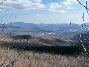
![]()
![]() On Saturday, Mar 28th Ralph Ryndak, Sheba and I left Stamford and headed back to Grand Gorge on Route 23. We continued through Grand Gorge to Prattsville and turned left onto Greene County Route 10. I was familiar with the road this far since I had just been at Huntersfield the week before. Where Route 10 and 11 split we stayed right on Route 10 and headed toward North Settlement. This was another beautiful drive with mountains on either side of the road. We were looking for Route 32C to turn north toward Richmond Mountain. I stopped once to consult with Ralph but we quickly determined that we need to continue on Route 10. Soon a likely crossroad revealed Route 32C and we turned left and began the familiar climb. At one point we got behind the mail truck delivering at 2:30 PM on a Saturday! I wondered just how far up the road people lived. Soon the mail truck turned around at a snow plow turn around. Ahead was a dirt road with the familiar SEASONAL MAINTENANCE sign. We decided that it was close enough to April 1st and that the road looked pretty good. We drove up the road looking for a parking area. Suddenly an enormous area with NO TREES appeared on our left. Just after this a trail register and aqua blazes came into view and we pulled over to park. We discussed the "clear cut" area we saw and thought we might investigate it after the hike. We got our packs and walked across the road to another dirt road that headed up through the forest.
On Saturday, Mar 28th Ralph Ryndak, Sheba and I left Stamford and headed back to Grand Gorge on Route 23. We continued through Grand Gorge to Prattsville and turned left onto Greene County Route 10. I was familiar with the road this far since I had just been at Huntersfield the week before. Where Route 10 and 11 split we stayed right on Route 10 and headed toward North Settlement. This was another beautiful drive with mountains on either side of the road. We were looking for Route 32C to turn north toward Richmond Mountain. I stopped once to consult with Ralph but we quickly determined that we need to continue on Route 10. Soon a likely crossroad revealed Route 32C and we turned left and began the familiar climb. At one point we got behind the mail truck delivering at 2:30 PM on a Saturday! I wondered just how far up the road people lived. Soon the mail truck turned around at a snow plow turn around. Ahead was a dirt road with the familiar SEASONAL MAINTENANCE sign. We decided that it was close enough to April 1st and that the road looked pretty good. We drove up the road looking for a parking area. Suddenly an enormous area with NO TREES appeared on our left. Just after this a trail register and aqua blazes came into view and we pulled over to park. We discussed the "clear cut" area we saw and thought we might investigate it after the hike. We got our packs and walked across the road to another dirt road that headed up through the forest.
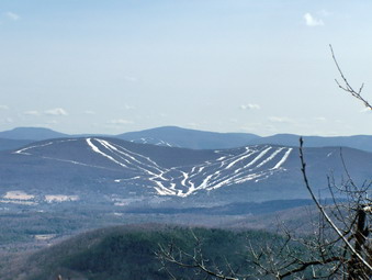 The aqua blazes of the Long Path followed the road and we passed a red shale bank that has now been blocked by large boulders. The road then passes through an evergreen forest that looks too regularly spaced to be natural. As we walked I was concerned that there was a mountain to our right that the road and Long Path were skirting. One look at the GPS confirmed that this was South Mountain and not our objective Richmond Mountain. In a short distance the road continued to the right and around South Mountain while the Long Path branched to the left. Ralph and I followed the Long Path even though it seemed to descend a bit and was blocked by significant blowdown. We continued on the Long Path since it was open and easy to follow at this point even though it did not seem to be ascending. Soon the trail began to curve to the right and gain some elevation. Eventually the road split and we followed the aqua blazes to the right as they headed toward Richmond. soon things became very confusing! Blue disks began to appear on some trees. At one point the Long Path appeared to turn left but more blazes could be seen to the right. We went right on part of the road only to find the blue discs and some aqua blazes veering up through the woods but without any trail that we could see. The GPS showed we had circled the mountain skirting the peak. To avoid anymore of this and since up seemed to be the correct direction, we turned right and headed up and to the southeast.
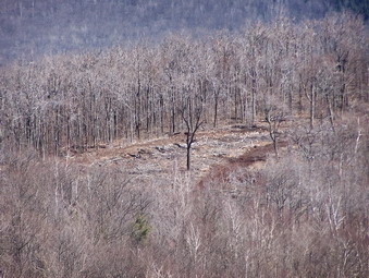 We found occasional markers but little evidence of the trail associated with them. The going became more difficult as the terrain grew steeper and we encountered the first snow of the day. There were just enough patches to make the going "interesting". We worked our way through some brambles and thick brush and had to negotiate some boulders. Soon the terrain leveled and we were at the highest point we could find. We claimed the summit and began to look for some viewpoint. We could see Windham Ski Center through the trees but pictures from the summit were impossible. We walked along the edge of the summit plateau and dropped some elevation and found a place to get a glimpse of the ski area. We took some pictures and continued down. We both felt that retracing our root was not the best idea. The GPS showed a road just below us marked as Coo Road but from where we were we would have to descend some steep cliffs. We continued on looking for a way down. As we continued to search a large rock signaled a viewpoint out over the valley. From this rock we could see Windham Ski Center with Hunter Mountain behind it. Further to the east the Three mountains in the Blackhead Range were clearly visible. There were also some nice views of the valley below with interesting lighting. We took some pictures before continuing our hike.
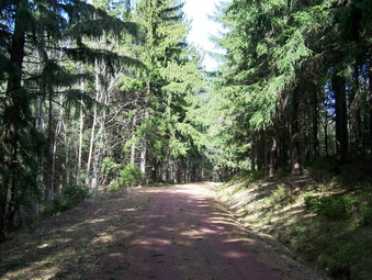 Soon the terrain began to slope downward rather than drop away and we headed down toward Coo Road. We walked through some hardware and then evergreen forests as we walked off the summit ridge and descended to the southwest toward the road. My fear is that we would find the road to be an overgrown mess but my gears were unfounded. As we approached the road it was clear that it was a hard packed dirt road in very good shape. I also realized that someone entering data for the GPS maps had never heard of the CCC. This road was actually the CCC Road marked on many amps. From here it was an easy walk along the road and we were soon back at the area where we had followed the Long Path to the left at the base of South Mountain. Next time I think I will follow the road and then bushwhack up the way we returned. This would be much more direct!
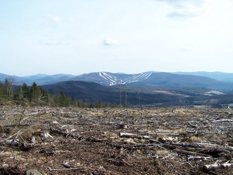 When we got back to our we ditched our packs, grabbed our cameras and headed toward the clear cut area along the Long path in the direction of the Ashland Pinnacle. It was clear that the timber had been cleared and was not the result of some natural disaster. Acres of trees were missing in one area. This area was separated from the next by a small stand of evergreens. We stopped and took pictures of the first area and of the mountains beyond. Ralph, Sheba and I walked to the next area. We took more pictures and tried to imagine why all these trees were cut. We walked out to the edge of the area and got a GREAT view of the valley below and more views of the ski areas and the Blacks. Finally, we turned around and went back to our cars. We said our good byes and headed in opposite directions. We covered a total of 3.5 Niles on this leg of our adventure!
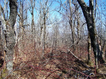
![]()
![]() On Saturday, Mar 28th Ralph Ryndak, Sheba and I left Red Kill Ridge and headed back to Denver we then went north on Route 36 before turning left on Route 8 which got us back to Route 30 headed north. These roads have some beautiful views. In the lower spots you are looking up at the mountains. As the road rises you can look down into the valleys and across at other mountain peaks. We passed through Roxbury and then turned west in Grand Gorge onto Route 23 toward Stamford. As we got into Stamford Mount Utsayantha was on our left and very obvious due to its elevation and numerous transmission towers on top. Just before getting into Stamford we turned left on Tower Road and headed UP! This was some climb and soon we passed the rutted dirt road that leads to Utsayantha. A little further down the road DEP signs appeared on the right and we again pulled over on the shoulder. The haze had cleared some and the sun was even brighter. The air temperature was up and the view was fantastic. Across the road Utsayantha was on our left with more mountains straight ahead and to the right. We took out our packs and got ready to bag another of the CHH.
On Saturday, Mar 28th Ralph Ryndak, Sheba and I left Red Kill Ridge and headed back to Denver we then went north on Route 36 before turning left on Route 8 which got us back to Route 30 headed north. These roads have some beautiful views. In the lower spots you are looking up at the mountains. As the road rises you can look down into the valleys and across at other mountain peaks. We passed through Roxbury and then turned west in Grand Gorge onto Route 23 toward Stamford. As we got into Stamford Mount Utsayantha was on our left and very obvious due to its elevation and numerous transmission towers on top. Just before getting into Stamford we turned left on Tower Road and headed UP! This was some climb and soon we passed the rutted dirt road that leads to Utsayantha. A little further down the road DEP signs appeared on the right and we again pulled over on the shoulder. The haze had cleared some and the sun was even brighter. The air temperature was up and the view was fantastic. Across the road Utsayantha was on our left with more mountains straight ahead and to the right. We took out our packs and got ready to bag another of the CHH.
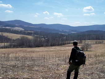 We again walked through some open fields on our way to the woods. We stopped to take in the view and a few pictures before continuing. The fields were wet and as we entered the woods we found a spring house. We wander up through the woods and eventually connected with a woods road that seemed to ascend the mountain. This road started to bend a little too far to the east and down but another branched to the right. This road was pretty steep with significant blowdown but headed directly north up the mountain. We continued on this road until it gave out and then fought through the brush and prickers toward what seemed to be the highest spot on the mountain. We stopped for a drink, a snack and some pictures before heading back. We searched in vain for some viewpoint. Each time we would approach a likely area there were too many trees blocking the view. For a while we followed our previous path exactly. At one point another avenue seemed to provide a more open descent so we followed a different line than on the way up. We ended up one field over from where we had started. We walk out to the road and back to our cars. Another 2 miles hike but another CHH in the bag. It was sill early in the day, right around noon, so Ralph and I looked at the map to see what else might be around. I sort of wanted to do Utsayantha while I was there but he already had that one and it is an easy hike I could do later. Ralph needed Huntersfield and Richmond. Since I had just done Huntersfield, we decided to try Richmond. This seemed like it would be easy since it is on the Long Path. We headed back down Tower Road to Stanford with me in the lead.
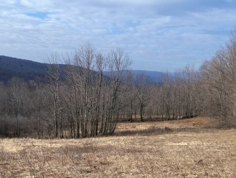
![]()
![]() On Saturday, Mar 28th I decided to make a conscious effort to hike some of the CHH peaks. I made a plea on the ADK forum for some companions but despite 40 people viewing the message there were no takers. Therefore, a plan began to develop to hike something I was sure was on state land and was close to home. I began looking at the Wildcats, Van Wyck and Woodhull or Spruce, Hemlock and Winnisook. Beaverkill Ridge and High Falls also crossed my mind since I have permission to hike those. Just before going to bed I sent a message to Ralph Ryndak (Hermit) to see what he might be doing. By the time I went to bed there was no response so I went to bed thinking about the choices I had. When I checked my email at 6:45 AM, there was a response from Ralph sent at about 5:30 AM. I thought I was an early riser. I took a chance and called him. Ralph was about ready to leave his house but graciously agreed to meet me in Margaretville to hike Red Kill and then Churchill. I got ready as fast as I could and we met at the appointed place. This was the first time I had met Ralph after hearing so much about him and reading his posts. I found him to be a very pleasant and knowledgeable hiking companion but lacking any of the superpowers I had attributed to him! We seemed pretty evenly matched in hiking abilities and disposition. I hope to hike with him many more times.
On Saturday, Mar 28th I decided to make a conscious effort to hike some of the CHH peaks. I made a plea on the ADK forum for some companions but despite 40 people viewing the message there were no takers. Therefore, a plan began to develop to hike something I was sure was on state land and was close to home. I began looking at the Wildcats, Van Wyck and Woodhull or Spruce, Hemlock and Winnisook. Beaverkill Ridge and High Falls also crossed my mind since I have permission to hike those. Just before going to bed I sent a message to Ralph Ryndak (Hermit) to see what he might be doing. By the time I went to bed there was no response so I went to bed thinking about the choices I had. When I checked my email at 6:45 AM, there was a response from Ralph sent at about 5:30 AM. I thought I was an early riser. I took a chance and called him. Ralph was about ready to leave his house but graciously agreed to meet me in Margaretville to hike Red Kill and then Churchill. I got ready as fast as I could and we met at the appointed place. This was the first time I had met Ralph after hearing so much about him and reading his posts. I found him to be a very pleasant and knowledgeable hiking companion but lacking any of the superpowers I had attributed to him! We seemed pretty evenly matched in hiking abilities and disposition. I hope to hike with him many more times.
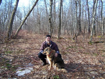 We left Margaretville and traveled north on Route 30 to Kelly Corners. Here we turned right on Route 36 with Ralph in the lead. Just as we turned a large bald eagle flew up from the Batavia Kill and perched on a branch. My camera was in the trunk and I didn't stop to take a picture but I knew that this was going to be a good day. We continue on to Denver and turned right on Dimmick Mountain Road. We continued on the road for a short distance before turning left on Red Kill Road. We drove slowly along this road looking for DEC or DEP signs not knowing exactly where we were headed. We found the DEP signs on the left side of the road and pulled of the shoulder of the road on the right. The air was already warming and a significant amount of haze hung in the air. My GPS came in handy to confirm that the mountain across the road was Red Kill Ridge. We crossed the road and began to walk through some open fields. Although the haze hung on the mountains and in the valleys the view was still pretty. We continued up through the wood which were open for the most part and found a woods road which we followed until we felt we should turn onto the ridge. This helped us to avoid some small cliff bands on the face of the mountain toward the road.
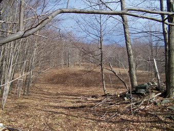 At this point we worked our way through areas of open forest, briar patches, blowdown and brush tangles and boulders to head toward the highest point on the northeast corner. Near the top we intersected some more roads and then wandered around to make sure we found the highest point. The actual summit had little to recommend it with no real views of any kind. Still, the hike had been quick and enjoyable. We headed out the way we came and the decided to follow one of the roads down. After a bit this road drifted more to the northeast than we want so we again bushwhacked in the general direction of our original route. This allowed us to avoid much of the thick mess on the top ridge and soon things began to look familiar. My GPS said we were back on our original path and we continued to follow it back down to the fields. On the way down we noticed the impressive stone walls. We agreed that this was a peak that might only be hiked as part of a list since it didn't offer much. We also agreed that the draw of the CHH list is to get off the beaten path and see some sites that might otherwise go unnoticed. We were back at the car in no time and had hiked less than 2 miles. We consulted the maps and decided on our route to Stamford and Churchill Mountain.