
What You Missed
Spring 2008
Spring 2008
![]()
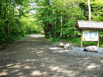
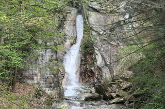
![]() On Sunday, June 8th the weather prediction again showed a 30% chance of thunderstorms in the afternoon. After our experience last week, this should have been a warning. Cindy was still recovering from the previous day so Sheba and I headed for Trout Pond. We arrived at 9:30 AM and started the hike right away. I felt we could be done hiking by the time the chance of thunderstorms became a real problem. In addition, I had promised Cindy that I would be home for a late lunch. We parked in the upper lot and began the walk down Russell Brook Road. As we took this short walk three cars passed us with camping gear. Two more were parked at the upper area and a few more down at the trailhead parking. Apparently Trout Pond has become even more popular! Russell Brook had some water flowing and the falls were making some noise but the flow was greatly diminished. At the trailhead parking, I was surprised to see no dirt pile blocking the road. It had been leveled and the road "extended" some distance.
On Sunday, June 8th the weather prediction again showed a 30% chance of thunderstorms in the afternoon. After our experience last week, this should have been a warning. Cindy was still recovering from the previous day so Sheba and I headed for Trout Pond. We arrived at 9:30 AM and started the hike right away. I felt we could be done hiking by the time the chance of thunderstorms became a real problem. In addition, I had promised Cindy that I would be home for a late lunch. We parked in the upper lot and began the walk down Russell Brook Road. As we took this short walk three cars passed us with camping gear. Two more were parked at the upper area and a few more down at the trailhead parking. Apparently Trout Pond has become even more popular! Russell Brook had some water flowing and the falls were making some noise but the flow was greatly diminished. At the trailhead parking, I was surprised to see no dirt pile blocking the road. It had been leveled and the road "extended" some distance.
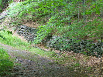
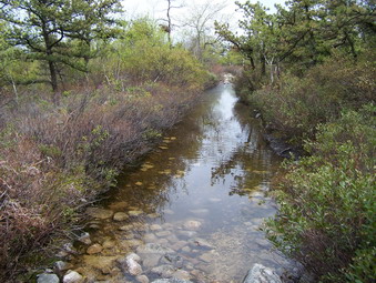
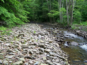 Sheba and I continued to walk down what was once Russell Brook Road. I almost expected that the road would be repaired but I found out that just a short distance beyond where the dirt pile had been erosion continued to eat away at the road. Walking down this wide trail seemed easy although it was hot and humid and there were A LOT of lies and biting insects. The brook was a little low and places that normally would be underwater were dry. We arrived at the site of the culvert crossing to find that the water was a little too deep to cross easily. We worked our way back upstream and each spot seemed to have some problem. I finally found a place where the water was fairly shallow and a tree spanned the deeper section. We crossed here and walked back to the culvert. The large number of rocks on the shore showed the power of the stream when it is flowing with high volume.
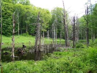 A few hundred feet after the culvert we turned right up the trail and crossed the power line right of way. From here there is a short climb followed by a walk through evergreen forest next to a swamp and a stagnant beaver pond. On the way I saw and photographed a lady slipper along the trail. After easily crossing a small creek we walked beside it for a little while. The trail is not much used and is poorly marked. Sharp eyes are needed to stay on the trail through the lush green grass. As I walked I thought it had started to rain and then I realized that it was "material" raining down from the caterpillars destroying the leaves above us. Shortly we began to climb a long and rather steep grade to Mud Pond. The footing was somewhat slippery due to condensation on the rocks and the nettles were just coming into their own. Several times I stopped to rest in the heat and high humidity. I began to feel like I would simply go straight back to the car from Mud Pond and forget the loop around Trout.
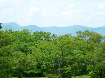
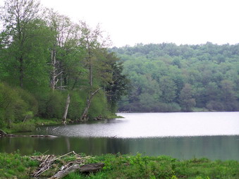
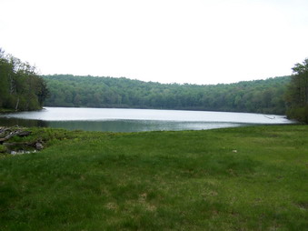
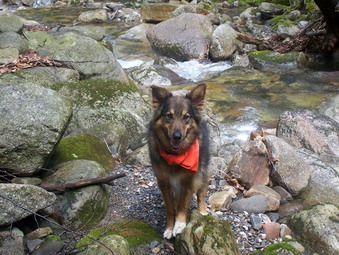
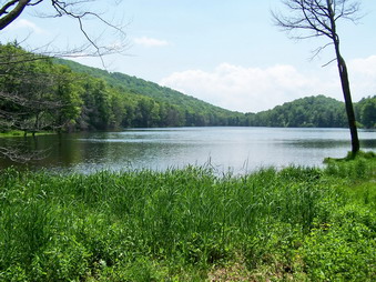 The trail eventually levels out near Mud Pond and we made a sharp right to continue to follow it around the pond. This area is usually very wet but this day it was only marshy in a few spots. As we hit the wide woods road we met two women hiking toward us. We said hello and continued on to the junction with the trail that loops around Trout Pond. I was feeling better so we stopped for a minute to get a drink and to change my socks. I decided to take the loop around Trout and off we went. This trail is a gentle incline all the way to the top of Cherry Ridge and then a slightly steeper descent to the inlet of Trout Pond. The walk up was not too difficult and the walk down seemed to go quickly. I stooped at the lean-to and the inlet of the pond to take some pictures. There was nothing too spectacular about the view but I photographed it anyway.
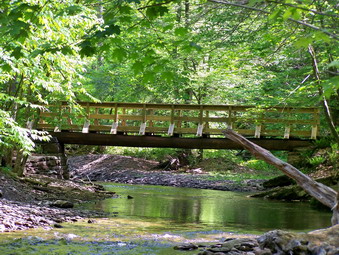
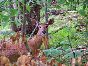 We continue on around the pond over relatively dry trail and stooped for a moment at the outlet to take some pictures. The rest of the trail is downhill to the falls and we made good time meeting two groups coming up the trail. Sheba alerted near the bottom of the trail. I looked into the woods and saw a deer right a the edge of the trail. Sheba and I continued on after I took pictures and walked across the bridge over Russell Brook below the falls. This was one day I did NOT stop to photograph the falls. Clouds were gathering, not much water was flowing and Cindy was waiting to go to lunch. We finished the 7.5 mile hike by 1:15 PM and headed back for Manor.
![]()
![]() On Saturday, June 7th the weather prediction showed a 30% chance of thunderstorms in the afternoon. After our experience last week, this should have been a warning. We were not deterred. Although we got a late start we arrived at a packed trail head parking area ready to hike. It was VERY hot with temperatures bumping into the low 90's and humidity above 80%. The drive to the trailhead passes by several camping areas on the Peekamoose Road. All of these were packed with cars. Along this stretch is Buttermilk Falls and several unnamed falls. They were running but it was obvious that despite the thunderstorms we had been having conditions were quite dry. We walked across the road and got on the trail at 11:00 AM.
On Saturday, June 7th the weather prediction showed a 30% chance of thunderstorms in the afternoon. After our experience last week, this should have been a warning. We were not deterred. Although we got a late start we arrived at a packed trail head parking area ready to hike. It was VERY hot with temperatures bumping into the low 90's and humidity above 80%. The drive to the trailhead passes by several camping areas on the Peekamoose Road. All of these were packed with cars. Along this stretch is Buttermilk Falls and several unnamed falls. They were running but it was obvious that despite the thunderstorms we had been having conditions were quite dry. We walked across the road and got on the trail at 11:00 AM.
 The first part of this hike follows Kanape Brook in a generally southeast direction. Sometimes the trail is close to the stream and other times it rises to overlook the water below. The stream gurgles or roars as water passes over rocks depending on the level of the water. The trail climbs but very gently as it passes through alternating evergreen and hardwood forests. After about 2.5 miles the trail turns left off the woods road and begins to narrow. Immediately after the turn you will notice trail markers on the left. This is the loop trail which most people use to return from the High Point. We stopped at the trail junction to put on some Ultrathon to repel the many biting insects and large black flies. It wasn't hard to notice the damage to the trees caused by the caterpillars. We were already tired not so much from the walk but the oppressive heat and humidity! I had chosen NOT to bring my 3 liter Camelbak simply to lighten the load. This meant we had only to liters of water. Fortunately, Sheba found lots of water along the way.
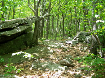
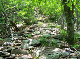 We began to climb the trail that begins to get steeper right away. Cindy lagged a little behind but I felt lethargic as well. There are several switchbacks along the trail. They moderate the climb but add distance. The trail ascends and the level several times and then comes to a series of steep climbs mixed with level areas. The trail is very clearly marked and stone "steps" have been created in some areas up the steeper climbs. Along the way we met two young men who were part of a crew participating in National trail Day. We thanked them for their work and I admired their youth! We continued on up several more short but steep climbs catching up with two other couples near the High Point. We knew we had arrived when we saw the USGS seal in the rock. This part of the trail is just under a mile. I also knew this was not the best view. I left Cindy and Sheba to rest in the shade and continued on with just my camera.
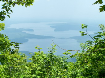
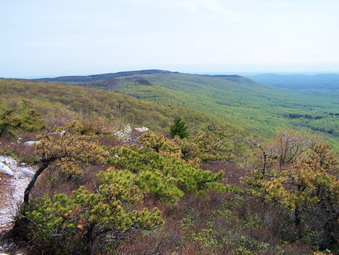
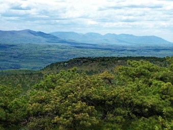
 A short spur to the left gave me a nice view of the Burroughs's Range but I knew better views were to come. After walking through two open areas I arrived at a third with the other two couples and a dog right behind. This third field gave me a great view of the Burroughs Range and I stooped to take a few pictures. I walked to the right passed a stone fireplace and benches and found an informal trail down through the brush to a ledge. This ledge provided a viewpoint for the Ashokan Reservoir and I called to the others to come take in the view. Some view is better than no view but the Ashokan was covered in a heavy hazy typical of the hot humid weather we were experiencing. After taking a few pictures, I returned to Sheba and Cindy and we got ready to continue the hike. We both decided that we would return the way we came. The other dog had gone on ahead and the skies had begun to coalesce indicating rain was on the way. We started down at a fast pace.
 As we hurried down the trail I couldn't help remember last Saturday when we were drenched at Hodge Pond. A LITTLE rain might cool us off but I didn't want to be soaked to the skin again. Far off flashes of lightening and the rumble of thunder kept our pace swift. On the way down we met at least three groups of people starting the trip up. They either were unaware of how severe storms can be or felt they were prepared in some way. We also beat the other two couples to the trail junction and did not see them again. As we were about .5 miles out it started to rain. The trees offered some protection and the rain would come hard for a few moments and then let up. By the time we got back to the car at 3;30 PM we were pretty wet but the rain had almost stopped. We had gone 7.3 miles in 4.5 hours with several stops along the way. We decided to take the Peekamoose Road out to 28A and then to 28. After stopping for some drinks we headed west on 28 until we got to the Big Indian Claryville Road. We took this back to Frost Valley and the to DeBruce Road and home.
![]()
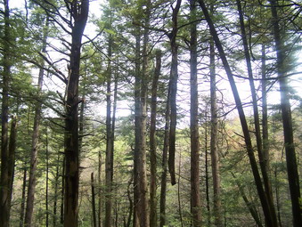
![]() On Sunday, June 1st the weather prediction showed a 30% chance of thunderstorms in the morning on one report and clear skies on another. This should have been a clue that the prediction was hard to make due to changing conditions. I decided to get up early and hike Slide Mountain. June was the only month I was missing for Slide. I figured as long as I was there I would also bag Cornell and Wittenberg. I had done this several times before. I intended to hike over to Wittenberg and then back the same way. This is challenging since it actually includes not three but five peaks! There were only a few cars in the lot when I arrived at 9:15 AM and the weather was just warm with a slight breeze. The sky that I could see was blue with some dark clouds. I always worry about crossing the Neversink especially when it has rained like the night before. The river was almost DRY! We had no trouble crossing nor did we have trouble with the small tributary on the trail. At the trail head we did meet a hiker returning from Slide. He was taking a break and getting ready to return to the top! It takes all kinds!
On Sunday, June 1st the weather prediction showed a 30% chance of thunderstorms in the morning on one report and clear skies on another. This should have been a clue that the prediction was hard to make due to changing conditions. I decided to get up early and hike Slide Mountain. June was the only month I was missing for Slide. I figured as long as I was there I would also bag Cornell and Wittenberg. I had done this several times before. I intended to hike over to Wittenberg and then back the same way. This is challenging since it actually includes not three but five peaks! There were only a few cars in the lot when I arrived at 9:15 AM and the weather was just warm with a slight breeze. The sky that I could see was blue with some dark clouds. I always worry about crossing the Neversink especially when it has rained like the night before. The river was almost DRY! We had no trouble crossing nor did we have trouble with the small tributary on the trail. At the trail head we did meet a hiker returning from Slide. He was taking a break and getting ready to return to the top! It takes all kinds!
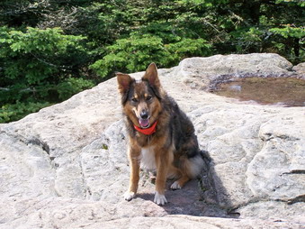
 Sheba and I set a quick pace up the mountain and passed the 3500 foot sign. The skies continued to become darker and any view of the other peaks sowed dark clouds hanging over them. We hurried to the top and made it by 10:15 AM. The sky had cleared and everything looked fine when we arrived. I took a few pictures and we got a snack and drink. In that short period of time the wind blew up again and dark clouds filled half the sky. I have been on the peaks in torrential rain storms with lightning strikes all around. This is not an enjoyable experience so I decided to return to the parking area. I had accomplished my primary goal and just didn't "feel" it. As we descended the sky would clear and then darken over and over. The wind continued to blow and the temperature dropped to the point that I contemplated donning light gloves. We got back at 11:30 AM covering the 5.5 miles in 2.5 hours.
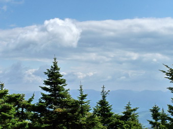
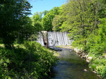
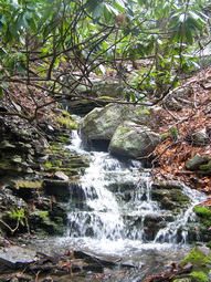
![]() On Saturday, May 31st the weather prediction was for occasional thunderstorms throughout the day. Around 8:30 AM the skies looked reasonably clear so Cindy and I decided to take a short hike to Hodge and Frick Ponds. I wanted to try out my new Alico boots which I must say are heavy but VERY comfortable. We left the parking area at about 9:00 AM taking the Flynn Trail toward Hodge Pond. At the junction with the Big Rock trail we stopped briefly and noted that the skies were still clear but with some clouds starting to move in. I took some pictures. We continued on toward Hodge and arrived shortly. The skies began to look more ominous but we had our rain jackets and decided to continue on the Flynn Trail to Frick Pond. This was the wrong decision!
On Saturday, May 31st the weather prediction was for occasional thunderstorms throughout the day. Around 8:30 AM the skies looked reasonably clear so Cindy and I decided to take a short hike to Hodge and Frick Ponds. I wanted to try out my new Alico boots which I must say are heavy but VERY comfortable. We left the parking area at about 9:00 AM taking the Flynn Trail toward Hodge Pond. At the junction with the Big Rock trail we stopped briefly and noted that the skies were still clear but with some clouds starting to move in. I took some pictures. We continued on toward Hodge and arrived shortly. The skies began to look more ominous but we had our rain jackets and decided to continue on the Flynn Trail to Frick Pond. This was the wrong decision!
 The rain started gently enough and Cindy put on her rain jacket. The rain did not let up and it began to come down in earnest. I got out my Marmot Oracle. Neither of us had rain pants. After a VERY short time, a downpour began complete with lightening and thunder! The jackets kept our upper bodies dry but the rain was running down our legs into our boots. I knew that this would quickly destroy the feet but we had no choice but to press on. At Iron Wheel Junction we turned right onto the Quick Lake Trail and headed toward Frick. The rain would, at times, let up briefly and then it would start to pour again. I could feel the water coming out of the TOP of my boots. The good part was that we didn't care where we walked since we were as wet as we could get. We arrived back at the car after 2.5 hours and 6 miles. It was a very pleasant sight after a very unpleasant hike.
![]()
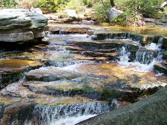
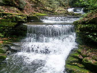
![]() On Monday, May 26th I was still tired and sore from the hike on Sunday with Karl. When Cindy said she was willing and ready to hike, Sheba and I were also ready! At our daughter's graduation from Bucknell, I had talked to some of the geology professors about hiking in Pennsylvania. They suggest Ricketts Glen State Park just west of Wilkes-Barre. Krista's boyfriend had also been there and confirmed the suggestion. This park is within 2.5 hours of our house. It's main attraction is a 7 mile loop through Ricketts Glen, Ganoga Glen and Glen Leigh. Along this trail there are 22 named waterfalls! The park almost became a national park until World War II curtailed the amount of money spent on parks. We left at about 7:30 AM and made good time until we got behind some slow traffic west of Dallas. After avoiding one memorial Day parade lineup we made it to the park by 10:00 AM. I had a map from a guide on trails.com which was fortunate since all the trail maps at the park had been taken. We started almost immediately along with several other large groups that we quickly outdistanced. Keeping Sheba on her leash most of the time was tedious but necessary and she behaved very nicely.
On Monday, May 26th I was still tired and sore from the hike on Sunday with Karl. When Cindy said she was willing and ready to hike, Sheba and I were also ready! At our daughter's graduation from Bucknell, I had talked to some of the geology professors about hiking in Pennsylvania. They suggest Ricketts Glen State Park just west of Wilkes-Barre. Krista's boyfriend had also been there and confirmed the suggestion. This park is within 2.5 hours of our house. It's main attraction is a 7 mile loop through Ricketts Glen, Ganoga Glen and Glen Leigh. Along this trail there are 22 named waterfalls! The park almost became a national park until World War II curtailed the amount of money spent on parks. We left at about 7:30 AM and made good time until we got behind some slow traffic west of Dallas. After avoiding one memorial Day parade lineup we made it to the park by 10:00 AM. I had a map from a guide on trails.com which was fortunate since all the trail maps at the park had been taken. We started almost immediately along with several other large groups that we quickly outdistanced. Keeping Sheba on her leash most of the time was tedious but necessary and she behaved very nicely.
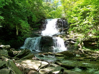
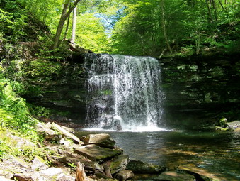 It is almost impossible to get lost on this trail. It is well-marked and the map I had was a help. We were seldom alone since this park is every bit as popular as I was led to believe. The first 1.5 miles is relatively flat and is a pleasant walk through both hardwood and evergreen forest. The trail crosses Kitchen Creek several times but always on sturdy bridges. In some places the trail is muddy from springs and this makes the trail slippery. At one point a "difficult" trail leads down to the bed of the creek while a "moderate" trail avoids this area. Both of these trails meet at the first falls. All the falls are named after Colonel Ricketts relatives or New York native American tribes. Colonel Ricketts commanded Battery F of the artillery at Gettysburg and is a respected hero of the battle and the war. Sometimes waterfalls are just waterfalls but we found each new falls to be exciting. Many are quite different from each other in height, width, how the water flows or the geological construction.
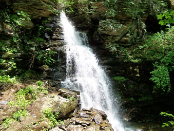
 After passing the first three falls, we arrived at Waters Meet. This is the area where Ganoga Glen and Glen Leigh meet. The trail splits here and hikers can follow either path to make the loop. My intention was to continue north into Ganoga Glen and to take the Highland Trail east to Glen Leigh passing through Midway Crevasse in the process. This is what we did. Many of the falls have small signs that name them and the distinction is quite clear on the map. Some of the signs are hidden and I missed some or the signs may have been missing. I took pictures at EVERY falls photographing some more than others. Near the top of Ganoga Glen is Ganoga Falls. At 94 feet this is the highest falls in the park. It is very impressive but I found other falls to be just as beautiful in their own way.
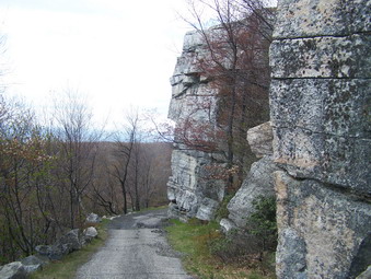
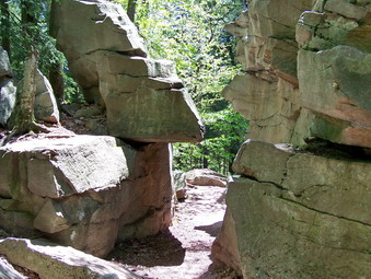 After about two hours, we were at the top of the glen and we turned right on the Highlands Trail. It was very quiet on this trail compared to the almost constant ROAR of water in the glen. We stopped briefly for a drink and a snack before continuing on to Midway Crevasse. At this point the trail passes through several VERY large blocks of sandstone before continuing on eastward toward Glen Leigh. As we turned southwest on the Glen Leigh Trail, I wondered if this side of the loop could compare in any way to the other. The answer is "Yes!" There are a similar number of falls on the Glen Leigh Trail with Huron being the highest at only 40 feet. These falls are very attractive in many ways. In addition, the feeling of being in a glen or gorge seemed more pronounced to me on the Glen Leigh side.
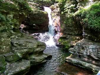
 The trail crosses back and forth over the creek several times but there are bridges at all of these crossings. I took a lot of time to photograph the falls even venturing out onto the rocks in the middle of the creek to set up the best shots. I also photographed the gorge walls and some interesting rock formations along the way. These formations make it clear that the creek cut the gorge over a LONG period of time and that the creek was rerouted several different times. The varying hardness of the rock layers cause interesting patterns as they erode at different rates. Soon we were back at Waters Meet and retracing our steps from the morning back to the parking area.
 As we approached the road, we decided to cross over to the other lot for a quick look at Adams Falls. This falls is closest to the road and, therefore, very popular. The falls forms at Kitchen Creek drops under Route 118. The initial drop is small but then another drop of about 40 feet occurs. This is Adams Falls. The creek has cut the bedrock several times to make interesting patterns in the area. The trail that descends along the creek shows how high the water once was. The Evergreen Trail is only about a mile long but it winds through some old growth timber with trees approaching 600 years old. we stopped briefly so that I could take some pictures and then crossed the road to get back to the car. The 7 mile hike had lasted about 4.5 hours and was all we had expected and MORE!
![]()
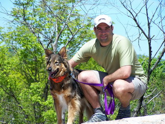
![]() On Sunday, May 25th I had not hiked for two weeks. My daughter's graduation and several track meets had seen to that. My son Karl was up from Virginia so we decided to take a hike together. I suggested the bushwhack of Friday and Balsam Cap. Karl suggested we steer away from off trail experiences so I countered by suggesting something in Bear Mountain or Harriman State Park. We decided to hike the Major Welch Trail to the top of Bear Mountain. After that, we planned to take the AT and 1777W Trails to The Torne and back along Popolopen Creek to the car. The weather seemed ideal with partly sunny to sunny conditions predicted. I really wanted to be on The Torne when the view was unobstructed by clouds or haze! We got an early start and parked in the Bear Mountain lot at about 10:00 AM. There were more cars than I expected and then we remembered it was the Memorial Day Weekend.
On Sunday, May 25th I had not hiked for two weeks. My daughter's graduation and several track meets had seen to that. My son Karl was up from Virginia so we decided to take a hike together. I suggested the bushwhack of Friday and Balsam Cap. Karl suggested we steer away from off trail experiences so I countered by suggesting something in Bear Mountain or Harriman State Park. We decided to hike the Major Welch Trail to the top of Bear Mountain. After that, we planned to take the AT and 1777W Trails to The Torne and back along Popolopen Creek to the car. The weather seemed ideal with partly sunny to sunny conditions predicted. I really wanted to be on The Torne when the view was unobstructed by clouds or haze! We got an early start and parked in the Bear Mountain lot at about 10:00 AM. There were more cars than I expected and then we remembered it was the Memorial Day Weekend.
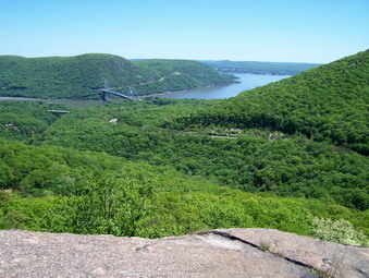
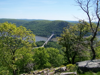 We immediately got started putting Sheba on her leash in the park. We started around Hessian lake on the "left" side following the red on white markers of the Major Welch Trail. Near the end of the lake we turned left up into the woods and immediately started to climb. I had on two long sleeved wool shirts which was two too many. We stopped so that I could change into short sleeves. Karl zipped off the bottom of his pants to make shorts. As we continued on the trail we passed several small groups of hikers going the other way and caught up with other groups heading in the same direction. The rock faces on the Major Welch were absolutely dry which made walking up them very easy. We crossed Perkins Drive and continued on up. We paused several times near and at the top to take in the view. There was almost no haze and the views of The Hudson River and the Bear Mountain Bridge were beautiful.
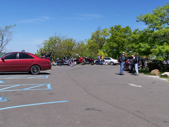
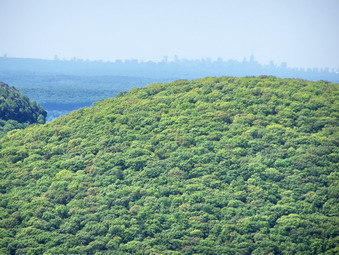 We hiked across the plateau at the top of the mountain, crossed Perkins again and headed for the tower. There were more people here than I had ever seen. Cars and motorcycles crowded the small lot at the top. Most people don't want to hike to the top but they sure don't mind driving! We walked out to the lookout and got another view of the river and the valleys and mountains beyond. The Manhattan skyline was clearly visible but some haze did make it a little "fuzzy". After taking some pictures, we walked around the tower and found the white blazes of the AT and descended quickly over the rocks and through the laurel to Perkins Drive. We kept following the AT along Perkins until it cut to the right into the woods. After another short stretch we crossed the main road into the park and walked until the junction with the 1777W trail just off the road.
 We followed this trail for a while without any incident until it entered a parking lot. Here we ran into trouble since we could not find any markers, We turned left and headed down a wide woods road which dead ended at a gravel pit. We cut up into the woods where we thought we might meet the trail. Finally, we made a circle and headed back to the parking lot. On more careful inspection, we found the trail obscured by the parked cars. The trail led directly across the parking lot and even had a sign to explain the significance of the Revolutionary War trails in the park. We continued along the trail through some forest and around some swampy areas. The trail eventually led to Route 9W where it crosses over Route 6. We walked along the road following the trail markers for less than half a mile until the blazes turned down dam access road to the left.
 This road led to a small reservoir and then became more rugged as it headed into the woods. We continued on the trail until a junction with some other roads and trails. The signs here were confusing and I had no experience on this trail. After heading in the WRONG direction again we quickly realized our mistake and turned around. We continued on the 1777W and Timp-Torne Trail headed toward The Torne. We walked through some quiet evergreen forests and things started to look familiar. I knew we were near the turn onto the trail that leads up to The Torne. Karl and I BOTH needed to get back for a family gathering but the "pull" of the Torne was too great! Soon the turn appeared and we went left down to Popolopen Creek. The creek here is fairly wide and must be forceful at times since an old bridge lies twisted upstream. The new footbridge is VERY solid and built to withstand the onslaught of the creek when it is high. Across the bridge we turned right onto a woods road and the quickly left to follow the trail up the hill. After a short walk, we crossed Mine Road and started the real climb up The Torne.
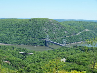
 From Mine Road the distance up The Torne is only .3 miles. This is lengthened some by the fact that the trail winds partly around the hill to ascend from the gentler side. There are several switchbacks to make the climb easier. After this, the trail ascends steeply over open rock faces and large blocks of rock. Some of these require a little agility and upper body strength. The rock was very dry but naturally "slippery" in places. I have been on the Torne in wet and partly icy conditions. This is NOT a good idea! On our way up, on the steepest section, we met a couple coming down. They were "impressed" with Sheba's ability to scramble up the sheer rock face. We paused at one of the viewpoints but not for long since the view from the top is SO good. Near the top a group of four young people were taking a break for lunch. We continued on to the top. The view was AMAZING with little haze to obscure the view up and own the Hudson. The Bear Mountain Bridge and Anthony's Nose were so clear that it seemed you could reach out and touch them. We ate some lunch, got a drink and took pictures before turning around to hurry down and back to the car.
 On the descent I began to feel the fatigue in my legs and the soreness of my feet. We following our path back to and across the bridge. Back on the trail above the bridge we turned left to follow the creek. We were moving fast all the time and stopped only once or twice. The dam and waterfalls on Popolopen Creek were obscured by trees and I dud not have time to work my way down into the creek bed. The trail led us to Route 9W which we crossed. From here we made our way to the Bear Mountain Bridge traffic circle and crossed Route 9W again to the Hessian Lake side. At this point Karl ran ahead to get some cold drinks from the machines as Sheba and I continued on the paved walkway around the lake. There were HUNDREDS of people picnicking, walking and playing games. Sheba was very well-behaved on her leash as we continued toward the Bear Mountain Inn. We met up with Karl on the lawn below the ice rink and continued back to the car. ALL the parking lots were now filled with some cars parked on the basketball courts and others along the road. We finished the 9 mile hike in about 5.5 hours. I was glad all of the people at the park were not on the trail!
![]()
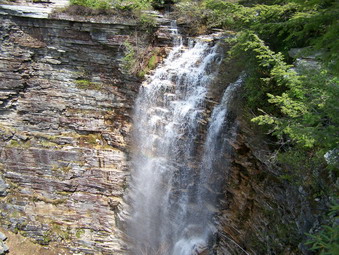
![]() On Saturday, May 10th Cindy and I decided to hike together. We chose to go to Sam's Point with the intention of hiking through to Awosting and back. Sheba and I had done this several times using different routes but Cindy had never tried it. She was anxious to try out her new Komperdell Trail Lite Titanal hiking poles. These poles seemed very light with foam grip handles and padded wrist straps. They have a twist lock mechanism. We attended to some early morning business and parked at the Conservation center at 10:15 and immediately got hiking. We set a quick pace hiking up passed the cutoff to the Sam's Point viewpoint on the loop road. At the Ice caves Road we turned right and then left onto the trail to Verkeerder Kill Falls. The weather was predicted to be cloudy with a chance of showers but the skies were largely clear as we hiked. The temperature was cool with a slight breeze at the beginning but I soon removed my light jacket and stowed it in the pack.
On Saturday, May 10th Cindy and I decided to hike together. We chose to go to Sam's Point with the intention of hiking through to Awosting and back. Sheba and I had done this several times using different routes but Cindy had never tried it. She was anxious to try out her new Komperdell Trail Lite Titanal hiking poles. These poles seemed very light with foam grip handles and padded wrist straps. They have a twist lock mechanism. We attended to some early morning business and parked at the Conservation center at 10:15 and immediately got hiking. We set a quick pace hiking up passed the cutoff to the Sam's Point viewpoint on the loop road. At the Ice caves Road we turned right and then left onto the trail to Verkeerder Kill Falls. The weather was predicted to be cloudy with a chance of showers but the skies were largely clear as we hiked. The temperature was cool with a slight breeze at the beginning but I soon removed my light jacket and stowed it in the pack.
 On the way to the falls we stopped several times to take in the views of the valleys below and the hills beyond. The escarpment was clearly visible as were several lakes in the distance. Several birds were riding the air currents. As we neared the falls I could hear the water and wondered if we would be able to cross the stream above the falls. There was no need to worry since there was a good volume of water but it was not high enough to even consider the crossing a problem. I took some pictures of the stream above the falls before continuing to the other side. We walked along the edge of the ravine and I took many pictures of the falls and the surrounding cliffs. I also took some pictures downstream. After this we picked up the Long Path again.
 After the falls the trail begins to climb gently and then steeply to the top of the escarpment that makes up a good part of the Sam's Point Preserve. At the top a trail turns to the left and works its way along the escarpment and then to High Point and back to the loop road. Our intention was to return this way after following the Long path to Awosting. At this point we turned right and continued to follow the aqua blazes. There are new blazes and ones that have been painted over. The area near Mud Pond was privately owned and hikers had permission to cross this private land. When the land owners withdrew this permission the Long Path had a gap. The Nature Conservancy has since bought the land and the Long Path now runs contiguously through this area.
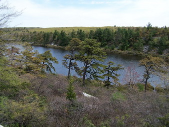 As we walked along, a small but pretty body of water suddenly appeared. This is Mud Pond. I am not sure how it got its name since it has never looked muddy to me. I took some pictures from the rocky outcrops above the pond and then we descended along the trail to the level of the pond. A path cuts through the thick laurel and several wooden walkways help to keep hikers out of the wetter areas when the water is high. The trail continued passed Mud Pond and over many open rock faces and spines. It begins to ascends slightly to the higher cliffs around Awosting. We finally came to an area we know well. Lake Awosting can be seen through the trees and several large boulders invited us to eat lunch. It was about 1:15 PM. After eating we decided NOT to retrace our steps but to follow the road around Awosting to the Smiley carriageway and use the Berrypickers Path to get back to Sam's Point.
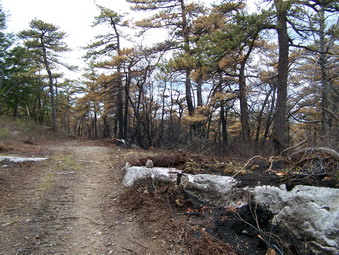 As we hiked around Awosting we were both concerned about the time. The parking area at Sam's point closes at 5:00 PM and we were pressing that limit by the route we took. To cut some time I decided we would bushwhack over the hill at Awosting to intersect the carriageway and save some time. This proved to be a poor idea since the laurel is thick and afterward I began to think that it was just about time for the rattlesnakes to be making an appearance. We finally hit the Smiley Carriageway and we were surprised to see that it had been bulldozed and widen significantly. On one side, the side toward Minnewaska, the trees were burned but on the other side there was no evidence of fire. It was clear that this road had been successfully used as a fire break to contain the forest fire that had burned the area only weeks before. As we hiked I wondered whether we should be in this area but we continued since we had not seen any signs.
 The carriageway had many wet areas and more than once we had to take short detours to avoid the worst spots. In several spots we stepped on what looked like solid ground only to find soft mud that threatened to go over the tops of our boots. We approached Fly Creek and found the water quite high. After find a way across we turned left and continued through and area that was once a narrow, rocky path. This had been enlarged to a wide road. After a little while longer, the fire break continued to the right while the carriageway turned to the left. We followed it to the left and toward Stony Kill. In this area my wife finally saw a sign that said RESTRICTED AREA. If you intend to hike in the Sam's Point, Awosting or Minnewaska area, call ahead or check at the gatehouses for trails that are closed or areas that are restricted. We continued across Stony Kill which had very little water in it at this high elevation. We followed the trail as it ascended some and became very rocky. This, at least. was familiar ground and had not been touched by the fire. Several places along the trail had standing water for 50 to 100 feet. Thankfully, these areas could be bypassed by carefully taking to the woods on either side.
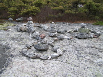 We kept looking for the Berrypicker's Path as we approached Napanoch Point. We had only been on the trail twice and I was afraid we had missed it. Soon we found the pots and pans and cairns that mark the start of the trail on the left of the carriageway. We started hiking this trail toward Sam's Point. By this time I was tired and so was Cindy! We hiked in relative silence but I kept thinking that the trail was longer than I had remembered it! There are several higher points on the path and the views were beautiful especially those of the Catskills. All along the trail people have set up rocks in cairns and fanciful designs. We passed by them quickly since we needed to get back to the car. This area has the typical pine barrens trees and rocky outcroppings and one area begins to look pretty much like the rest. We FINALLY reached the escarpment and the intersection with the High Point Trail. We stopped only briefly at the site of the old tower, took some pictures, got a drink and continued on down the hill to the Smiley Carriageway.
 It was 4:00 PM when we hit the carriageway and we still had about 3 miles to get back to the car. We set off at a furious pace despite being tired. My GPS had us between 3.2 and 4.5 miles per hour at most times. My feet hurt. My calves burned. My knees ached. Cindy, who usually tires before I do, seemed to be in better shape perhaps helped by the new poles. We made the Loop Road in record time and then set off for the parking area. We got to the Conservation Center at 4:50 PM having covered almost 3 miles in 45 minutes! There were still many cars in the lot and there seemed to be a "party" at the Center but we too tired to care. As we drove away, I realized we had covered over 13 miles in about 6.5 hours! This was one of the most taxing hikes I have done in some time. Next time I ant to start earlier and go all the way around Minnewaska and back!
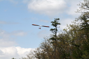
![]() On Sunday, May 4th I decided to hike the new South Gully Trail at Sam's Point that was described in the Trailwalker newsletter from the NYNJTC. After the hike, I decided to pull over on Route 52 as it descends the mountain into Ellenville. I wanted to take some pictures of the valley below and the mountains in the background. As I parked the car at the highest viewpoint and opened the door, a hang glider was less than thirty feet above me. By the time I got the camera out he had disappeared. I took some scenery shots and then the glider and a friend reappeared. I took some photographs and then got back in the car and headed for town.
On Sunday, May 4th I decided to hike the new South Gully Trail at Sam's Point that was described in the Trailwalker newsletter from the NYNJTC. After the hike, I decided to pull over on Route 52 as it descends the mountain into Ellenville. I wanted to take some pictures of the valley below and the mountains in the background. As I parked the car at the highest viewpoint and opened the door, a hang glider was less than thirty feet above me. By the time I got the camera out he had disappeared. I took some scenery shots and then the glider and a friend reappeared. I took some photographs and then got back in the car and headed for town.
 On the way up the mountain at the beginning of the day I had noticed a water fall on the left side of the road just as I started up the mountain. I parked near the road bridge, grabbed the camera and walked back to the bridge. This small falls is set back from the road at the head of a set of small rapids. It is not very high and the volume is not too great but it is beautiful! I took pictures from several angles and zooms before getting in the car and heading home.
![]()
![]() On Sunday, May 4th I decided to hike the new South Gully Trail at Sam's Point that was described in the Trailwalker newsletter from the NYNJTC. I got an early start from home but stopped on Berme road in Ellenville to visit the SunRay Tunnel before going up to Sam's Point. The weather was warm but with a lot of haze making the views less than spectacular on the way up Route 52. We parked a little after 10:00 AM and I went into the Conservation Center to buy a yearly pass. Parking once costs $7 while a pass for the whole year is $40. I go there often enough to more than pay for the pass and the Nature Conservancy is a worthwhile organization.
On Sunday, May 4th I decided to hike the new South Gully Trail at Sam's Point that was described in the Trailwalker newsletter from the NYNJTC. I got an early start from home but stopped on Berme road in Ellenville to visit the SunRay Tunnel before going up to Sam's Point. The weather was warm but with a lot of haze making the views less than spectacular on the way up Route 52. We parked a little after 10:00 AM and I went into the Conservation Center to buy a yearly pass. Parking once costs $7 while a pass for the whole year is $40. I go there often enough to more than pay for the pass and the Nature Conservancy is a worthwhile organization.
 He started hiking at about 10:30 AM by following the Sam's Point Loop Road to the right as it leaves the parking area. I was looking for the aqua blazes that mark the new South Gully Trail as part of the Long Path. At the first set of berrypickers' shacks I decided to head off the road to the left even though I did not see the markers. A wide woods road beckoned and I followed it until the lack of markers and the POSTED signs convinced me to go back to the road. We followed the road and as it began to rise more steeply just before the next set of shacks the blazes showed up. We turned to the left and followed the wide woods road passed the shacks.
 The trail began a gentle descent almost immediately through the woods. The blazes mark the trail very clearly which was good since the trail is VERY new and is not delineated on the forest floor. As the trail descends it winds through some beautiful open forest and passes by and over several small streams. As we walked, the haze began to clear as the sun came out. The sunlight sparkled as it was reflected off several of the small cascades that exist along the route. After about 1.5 miles the trail dropped to cross Gully Road. Up the road the markers were visible on the other side and we headed for them.
 The trail continues on through the forest and we walked through some open pine forest. The roaring of the stream below belied the fact that it was relatively small with a limited volume of water. We crossed and recrossed streams in several places but none of the crossings were even moderately difficult. In some places we walked upstream before crossing and in others downstream. The trail continued to drop as we headed toward Route 52. In several different places we walked off the trail to the right to investigate the stream and the various cascades. Near the end of the trail it ascends and then levels as it approaches the road. When we reached our goal, we took a break getting a drink and a snack before turning around to retrace our route.
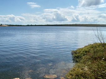 The 1400 foot climb back UP the trail was definitely more challenging than the descent. The journey up took less time, 1 hour compared to 1.5 hours, since I did not stop to take any pictures. When we got back to the loop road, I decided to lengthen the hike by turning left on the loop road and going around lake Maratanza. I would make my decision about going to Verkeerder Kill Falls when we got to the Ice Caves Road. The walk around the lake is fairly flat and on the remains of a paved road. This gave my legs a chance to rest. As we neared the lake it was obvious that it was filled to overflowing with and that water was streaming from the outlet. I took some pictures of the lake an surrounding shoreline before we moved on. We met quite a few people hiking around the lake and some had dogs. As we approached Ice Caves Road, I decided to save that trip for another day.
 Sheba and I stopped by the lookout at Sam's Point and then continued on the road back to the parking area. I took a few pictures from the lookout and some more of the rock formations below it. I was looking for a way to climb these rock formations from below without technical equipment. I think this is possible but it would wait for another day. I stopped by the Conservation Center to tell the attendant that I thought the new trail was great. We hiked for a total of 8.2 miles in about 4.5 hours!
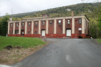
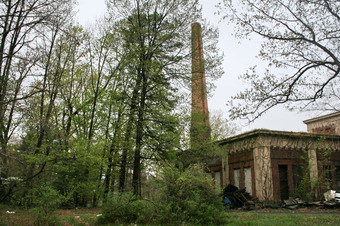
![]() On Sunday, May 4th I decided to hike the new South Gully Trail at Sam's Point that was described in the Trailwalker newsletter from the NYNJTC. Before that I though I thought would stop in Ellenville to investigate the SunRay Tunnel. I took Route 52 through Ellenville and turned left on Berme Road, the last turn in the village. There was a sign for the firehouse, parks and little league at the turn. A short distance down this road on the right is a large red brick building that was originally the Sunray Soda bottling plant. The building now has other tenants. SunRay used water from the SunRay Tunnel for their Pure Rock soda. The water was obtained from the Tunnel behind the bottling plant. The water comes from deep in the bedrock of the mountain and may be some of the purest water around. Whether the tunnel was originally construct for this purpose or as a mine is not completely clear.
On Sunday, May 4th I decided to hike the new South Gully Trail at Sam's Point that was described in the Trailwalker newsletter from the NYNJTC. Before that I though I thought would stop in Ellenville to investigate the SunRay Tunnel. I took Route 52 through Ellenville and turned left on Berme Road, the last turn in the village. There was a sign for the firehouse, parks and little league at the turn. A short distance down this road on the right is a large red brick building that was originally the Sunray Soda bottling plant. The building now has other tenants. SunRay used water from the SunRay Tunnel for their Pure Rock soda. The water was obtained from the Tunnel behind the bottling plant. The water comes from deep in the bedrock of the mountain and may be some of the purest water around. Whether the tunnel was originally construct for this purpose or as a mine is not completely clear.
 We parked at about 9:00 AM and I checked with an employee to see if it was Ok to park and walk to the tunnel. She said it was OK so Sheba and I started off into the woods. I had never been in this area before and was unsure of where the tunnel was. We walked directly in back of the building and up into the woods. I was looking for a stream that might come from the water in the tunnel. I found several small streams and a low concrete structure but no tunnel entrance. We headed on up the hill and found several crisscrossing woods roads but no tunnel. I decided to return to the parking area and try another direction. This time we headed north into the woods out of the parking area and after only a few hundred feet I could see a concrete walkway. We crossed a small stream and I could immediately see the entrance to the tunnel as shown in many photographs I had seen,
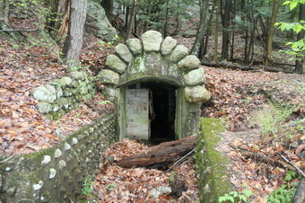 We walked over to the tunnel and found the entrance blocked by cinder blocks and a wooden door now demolished. The stone work around the entrance was quiet ornate and carefully constructed. It was VERY dark inside the tunnel and the water at the entrance was much too deep to think about entering the tunnel. I did take some pictures with the flash which illuminated the side of the tunnel. I plan to return with some real waders or boots and a powerful light. There was a good flow of water from the tunnel including some from a pipe at the entrance. I took many pictures of the tunnel and its surroundings.
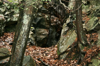 Farther up the hillside, behind the mine was a visible "scar" in the hillside. We walked up toward it and I could see the unmistakable "rusty" rocks indicating an iron mining exploration. The cleft in the hillside was perhaps 20 feet tall, six feet wide and ten feet into the rock. The bottom of the cleft was covered with leaves but it did not seem that the opening extended much farther into the hill. I took some pictures and then we headed back to the car to drive up to Sam's Point.
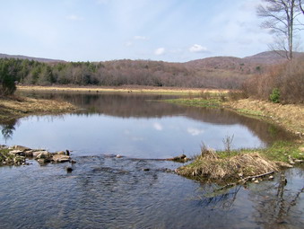
![]()
![]() On Sunday, April 27th I took two girls from the track team to a pentathlon meet. I was home fairly early and the weather was nice so Cindy and I decided to take a short walk. We put Sheba in the car and headed for Frick Pond. I wore my new Merrell Perimeter shoes which proved to be comfortable and more than up for the task. We parked at about 4:00 PM and immediately got on the trail to Frick Pond. The trail was wet in places but these areas were easily bypassed. We walked down to Frick Pond and I took some pictures before continuing on.
On Sunday, April 27th I took two girls from the track team to a pentathlon meet. I was home fairly early and the weather was nice so Cindy and I decided to take a short walk. We put Sheba in the car and headed for Frick Pond. I wore my new Merrell Perimeter shoes which proved to be comfortable and more than up for the task. We parked at about 4:00 PM and immediately got on the trail to Frick Pond. The trail was wet in places but these areas were easily bypassed. We walked down to Frick Pond and I took some pictures before continuing on.
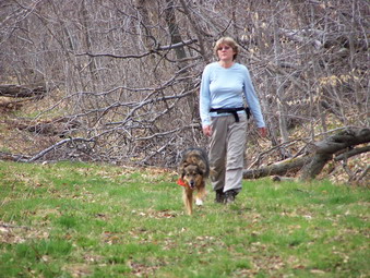 At the pond we decided to go around in a clockwise direction staying close to the pond. We were soon at Times Square. From here we decided to go up the Big Rock Trail to the intersection with the Flynn Trail. We climbed the seemingly endless Big Rock Trail without incident and without seeing anyone else. At the Flynn Trail we took a right and continued back down to the parking area. The four mile distance had taken about 2 hours to complete. Although it was not and all day affair the hike was a pleasant walk and far better than staying at home!
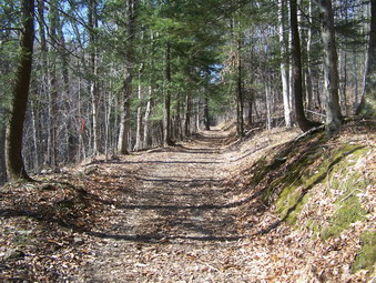
![]()
![]() On Tuesday, April 22th I got home from school early since we had a conference day and no track practice. The weather was sunny and in the 70's, a perfect day to take a short hike. When I asked Sheba if she wanted to go, she began the whine that she only uses for hiking. She reinforced this with a spin similar to a whirling dervish. I was now committed and decided to visit Trout Pond. The last time we were there we were surprised by some ice and snow and some VERY wet patches on the trail. I was interested to see how conditions had changed and if this areas was as dry as Slide had been. We parked on Morton Hill Road at about 4:30 PM and immediately started to hike.
On Tuesday, April 22th I got home from school early since we had a conference day and no track practice. The weather was sunny and in the 70's, a perfect day to take a short hike. When I asked Sheba if she wanted to go, she began the whine that she only uses for hiking. She reinforced this with a spin similar to a whirling dervish. I was now committed and decided to visit Trout Pond. The last time we were there we were surprised by some ice and snow and some VERY wet patches on the trail. I was interested to see how conditions had changed and if this areas was as dry as Slide had been. We parked on Morton Hill Road at about 4:30 PM and immediately started to hike.
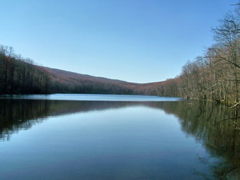 Russell Brook Road was bone dry and dusty. No other cars were parked on Morton Hill but there was one at the lower parking area. The falls on Russell Brook seemed to have a decent volume of water. I signed in at the register and decided to walk up to Trout Pond first and then to Mud Pond. The wide road up to Trout was dry with only a few wet spots. We quickly arrived at the outlet end of the pond. We stopped so I could get some pictures and Sheba could play in the water. The lighting and colors allowed some good shots. As we headed around the pond we met a couple from Orange County. We made the inlet in just about and hour. The inlet stream was easy to cross and we were quickly climbing Cherry Ridge.
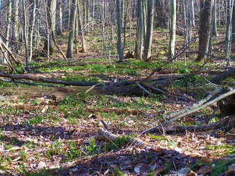 Even though the trail and forest seemed dry, green was beginning to show through as the predominant color. I also began to notice that every time I stopped I was swarmed by insects. Some of these were biting and the rest just annoying. I could hear frogs in the pond and some of the wetter spots in the woods. Sheba was really charged up running ahead of me and then circling behind. The walk seemed to go quickly as we continued the long climb up to the highest point on the hike. On the back side of the Trout Pond there were some wetter spots and the trail. There were also some pretty flowers in the trillium family growing along and on the trail.
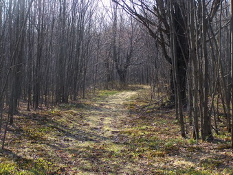 As we hit the highest spot on the trail, we entered the area where there are many small trees growing without any larger ones present. In the same area are several stone walls and stone foundations. Down by Mud Pond are more foundations indicating that this area was once cleared for farming. Like so many other places in our area nature has reclaimed what was once its own. The process of ecological succession restores the natural environment but it takes a LONG time to accomplish.
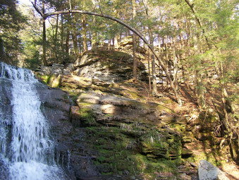 When we reached the woods road at the bottom of the trail we turned left to return to the parking area. If we had more time, I might have tried turning right and making the bigger loop around Mud Pond. This loop usually has several wet spots but I had a felling they might be only damp. This trail drops down to Russell Brook Road at the lower end and you can walk the road back to the parking area. This adds some mileage and means that you must cross Russell Brook. Depending on the height of the water this may be easy or almost impossible without getting very wet. I was not going to take a chance this time!
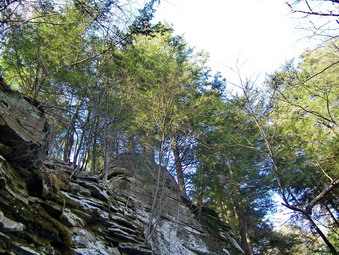 Upon returning to the register box we paid a visit to the falls. The falls don't seem to change much and the water volume was adequate. What does change is the lighting and the colors were particularly nice this time. I got very close to the falls and took several different shots. I also took some pictures looking straight up from the bottom of the falls toward the sky. The area cut by the falls isn't that deep but is somewhat impressive in the pictures. We walked back up the road completing the 4 mile loop in just under 2 hours.
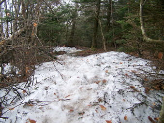
![]()
![]() On Sunday, April 20th I decided I needed to take a hike after along track meet on Saturday. The weather prediction was for partly cloudy or partly sunny skies. I decided to "bag" Slide and Cornell since I needed them for April. I woke up early in the morning and was unable to get back to sleep so I decided we would get an early start. When I asked Sheba if she wanted to Go HIKING she seemed to think I was trying to trick her. She KNEW Sunday was not a usual hiking day. After I got dressed and I put on her dayglo neckerchief she seemed more convinced and was ready to go. The skies in Livingston Manor were cloudy with no sun in sight. This is often true since we are in a valley. As we drove out DeBruce Road the conditions did not change. We arrived at the Slide parking area on Route 47 just before 8:00 AM and found only one other car. I didn't think this was strange since we were very early. I decided to leave my poles behind but left my Stabilicers in my pack. I had decided to wear the Asolo Fugitives since they are lighter and virtually waterproof. The temperature was cool with a slight breeze so I kept on the light Marmot Oracle jacket over my Smartwool long sleeve baselayer and Columbia Grid top.
On Sunday, April 20th I decided I needed to take a hike after along track meet on Saturday. The weather prediction was for partly cloudy or partly sunny skies. I decided to "bag" Slide and Cornell since I needed them for April. I woke up early in the morning and was unable to get back to sleep so I decided we would get an early start. When I asked Sheba if she wanted to Go HIKING she seemed to think I was trying to trick her. She KNEW Sunday was not a usual hiking day. After I got dressed and I put on her dayglo neckerchief she seemed more convinced and was ready to go. The skies in Livingston Manor were cloudy with no sun in sight. This is often true since we are in a valley. As we drove out DeBruce Road the conditions did not change. We arrived at the Slide parking area on Route 47 just before 8:00 AM and found only one other car. I didn't think this was strange since we were very early. I decided to leave my poles behind but left my Stabilicers in my pack. I had decided to wear the Asolo Fugitives since they are lighter and virtually waterproof. The temperature was cool with a slight breeze so I kept on the light Marmot Oracle jacket over my Smartwool long sleeve baselayer and Columbia Grid top.
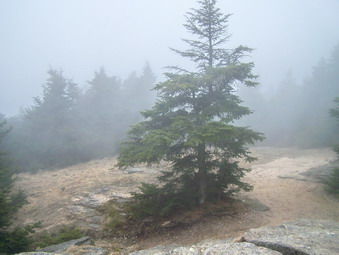 We walked down to the Neversink and found it was easy to cross on a few stepping stones. The water level was low and the condition of the trail as far as I could see was dry. We quickly ascended to where the trail meets a woods road and turns left. I was already warm so at this point I removed my jacket and stowed it in my pack. Sheba and I quickly walk the Phoenicia-East Branch Trail to the junction with the Wittenberg-Cornell-Slide Trail and turned left. As we walked up this trail the conditions seemed VERY dry with only a few damp spot and some running water. As we ascended higher it became obvious that we were IN a cloud. Just passed the 3500 foot sign was a small area of ice and snow, the first we had seen on the hike. At 3700 feet we rounded a bend and the trail turned into a ribbon of packed snow and ice. I tried to walk on the side of the trail but a few near falls suggested that I don the Stabilicers. These worked very well and we were soon on our way to the summit. Just after the summit we met a group of ten older Boy Scouts and their two leaders. We chatted for a moment and they advised that the descent on the other side of Slide was "challenging". Up until this point I had thought I might just return without trying Cornell but I was not very tired and Sheba seemed eager. The weather conditions had not improved, the summit was enshrouded in fog/cloud and NOTHING was visible from the Slide lookout.
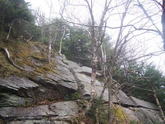 As we started down the other side of Slide the trail was clear but this change almost immediately. Packed ice and snow had accumulated on ALL of the more interesting rock scrambles making several impossible to use without some peril. We went off the trail and around the worst and carefully worked our way down the others. Even the ladders down to the spring had a coating! As we reached this point another group of five was coming up. They said that there was some snow further down but that it only lasted for a short distance and then the trail was clear until the final ascent up Cornell. Sheba and I continued down and passed through one area where there was at least 8 inches of snow for a short distance. The descent into the Col between the two mountains has three nice rock scrambles and each had some ice to make things more interesting. The middle one is the most difficult but did not prove too much of a problem descending. I wondered how easy the return trip would be.
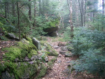 Once we got down into the col the trail flattened out and was much drier. I removed my Stabilicers and carried them as they had become very dirty. A few spots were damp and green became a dominant color. We walked quickly and as we approached Cornell the trail became MUCH wetter. There was standing water! There was mud! There was running water that turned the trail into a stream with small waterfalls. This was the Cornell trail I remembered. Soon ice and packed snow appeared but I resisted putting on the Stabilicers since I knew there were three or four rock scrambles ahead on the way to Cornell. I worked my way carefully around and over the ice. Sheba didn't seem to care. Sheba simply jumps up the rock scrambles and then waits for me to make my wait up.
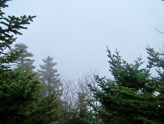 Soon we were at the point where we could look toward Slide and see...fog and clouds. We continued up the trail a short distance to the spur trail that turns right to the clearing for the Cornell viewpoint. At the viewpoint we look out toward Wittenberg and the Ashokan and saw...fog and clouds. We got a drink and I ate a bar since I was not really hungry. I gave Sheba some dogs biscuits which, of course, she never turns down. We turned around and began the trip back the way we had come. The descent was uneventful except for the areas of ice and snow and the wetter parts of the trail. The weather still had not changed and, at times, large droplets of water fell on me. I decided that the wind was blowing the water off the trees although rain was a distinct possibility. As we approached Slide we had to ascend the rock scrambles that we that descended earlier. This wasn't easy but it was not especially difficult either and we were soon back at the spring.
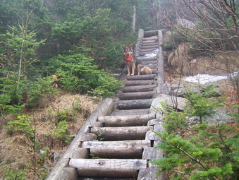 I took some pictures of the ladders on Slide and from the ladders toward Cornell. We then started to pick our way up through the ice covered rock scrambles to the top of Slide. We continue over the summit of Slide and I put the Stabilicers back on for the descent down the icy path. As we continued down the other side, I did not bother to stop at the lookout since nothing was visible. We began to meet people coming up Slide. A young couple and their dog, two older men trying to make their way back DOWN and then several groups of three to five people. Most of these hikers had poles but NONE had any traction devices on their feet. As I trotted down the trail with my Stabilicers I felt very superior but wondered if all of them would make it back down without a serious fall. At 3700 feet I again removed the Stabilicers and Sheba and I made a QUICK descent to the car. We were back before 1:30 PM covering 8 miles in just short of 5 and a half hours.
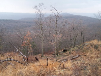
![]()
![]() On Saturday, April 12th the weather was MUCH nicer than had been predicted earlier in the week. The sun was shining and even early in the morning the temperatures were already in the 50's. I had though about doing the trail run at Bear Mountain but the registration closed before I made up my mind. Cindy and I decided to head south anyway and visit Little Tor and High Tor. Several people told me that this ridge in Rockland County had GREAT views. We started at little late and as we started to drive down the Palisades Parkway the weather deteriorated some. There was a heavy haze or fog in the air but the temperatures were warm so we decided to continue. We made only one wrong turn before finding the trail head and were on the trail at about 10:45 AM. There were signs warning about ticks and Lyme Disease. The entire trail is part of the Long Path and the aqua blazes are usually easy to follow.
On Saturday, April 12th the weather was MUCH nicer than had been predicted earlier in the week. The sun was shining and even early in the morning the temperatures were already in the 50's. I had though about doing the trail run at Bear Mountain but the registration closed before I made up my mind. Cindy and I decided to head south anyway and visit Little Tor and High Tor. Several people told me that this ridge in Rockland County had GREAT views. We started at little late and as we started to drive down the Palisades Parkway the weather deteriorated some. There was a heavy haze or fog in the air but the temperatures were warm so we decided to continue. We made only one wrong turn before finding the trail head and were on the trail at about 10:45 AM. There were signs warning about ticks and Lyme Disease. The entire trail is part of the Long Path and the aqua blazes are usually easy to follow.
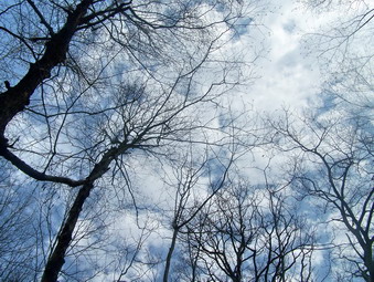 The hike began as we climbed up onto a ridge overlooking a heavily populated part of Rockland County below. The constant noise of vehicle traffic and the railroads was a contrast to the trees and rocks around us. We stopped several times to step off the trail and look below us. To the north were apartment buildings and shopping canters but to the right was a forest with only a few homes. Much of the view was blocked by the heavy haze that hung over the area. I hoped that the breeze would help disperse the haze and that the sun would "burn" it away. After less than a mile I removed the two light long-sleeved tops I had on, stowed them in my pack and put on a short-sleeved UnderArmor baselayer and an Arc'teryx wool top over that. I was glad I had decided to wear a pair of light "summer" pants as the temperatures climbed in the high 60's and lower 70's. I asked Cindy if she wanted to turn around and drive to a sunnier spot but we both decided to continue.
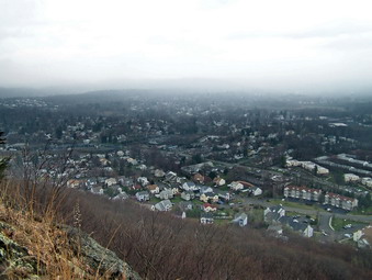 The trail wound its way back and forth and up and down slightly along the ridge but always in an easterly direction. After 1.75 miles the we descended to Route 33 which had a surprising amount of traffic. There was also plenty of parking for those that want to shorten the trip. This road is also the boundary between South Mountain County Park and High Tor State Park. After crossing the road, the rest of the trail becomes wide woods road. Part of the road is covered with chipped stones and the only rough parts are at the end as it approaches High Tor. This makes walking much easier and we quickly increased our pace. Shortly after crossing the road a power line right of way crosses the trail. Just after this point a path cuts back up to the left to a vantage point on the right of way. We walked to this point and the view would have been great...except for the persistent haze.
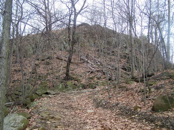 Within a mile, a woods road and wide path turn to the left away from the main trail. As we turned up this path, we could see a large rock formation ahead of us on the left. This is Little Tor. We walked up to the first lookout and were able to get some views through the haze. We continued up to the top of the rock outcrop and were rewarded with even better views in almost 360 degrees. The view was so nice even with the poor visibility that I know we will go back on a clearer day. After looking around and getting a drink and snack, we worked our way back down to the main trail. As we continued to walk, more and more large rock outcroppings presented themselves on both sides of the trail. Occasionally I would walk off the trail to the left. There were views but most were blocked by trees. Since we had not been on this hike before, I did not really know what High Tor looked like or how prominent it would be. Soon I knew I shouldn't have worried. Ahead on the trail was the outline of a massive rock formation. We had arrived at High Tor after walking about 1.25 miles from Little Tor.
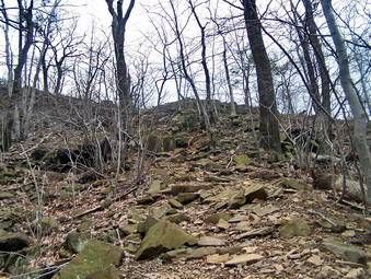 Looking at this imposing structure I wondered exactly how we would get to the top. The Long Path bends to the right and then turns abruptly left to ascend the Tor. The path is steep in places with a little rock scrambling but we had little trouble and were soon in an area where the trail levels and then ascends again. At the top a large, flat rock shelf gives a good view of the populated areas to the north and the wilder, forested areas to the west and south. The Hudson River lies just below. We could hear an umpire calling a softball game at a school below us. Just to the east of this flat spot is a higher area which is the true "summit" of High Tor. We walked over to the top of this rocky formation and were rewarded with a 360 degree view of everything around us. The haze had lifted slightly but clouds were starting to move in threatening a shower. I took quiet a few pictures and though how much better the pictures would be next time when the sun was shining and the skies clear.
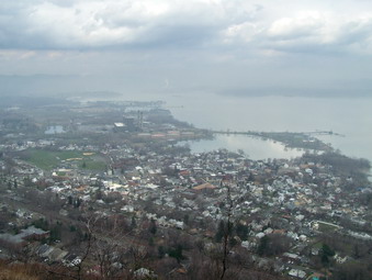 After taking in the view, we started back at a quicker pace energized by the idea that we were returning and motivated by the desire to stay dry. At Route 33 I decided to follow a woods road rather than the trail since walking the roads is faster. This worked out well since the road led to a microwave station we had passed on the trail on the way out. At the station we got back on the trail which remains wide for some time. The trip back did seem long which is what I have against out-and-back routes. With less than a mile to go it began to sprinkle and we redoubled our efforts. After we were in the car it started to rain and we were glad to be off the trail. We were back at 3:30 PM having covered about 8.5 miles in just under 5 hours.
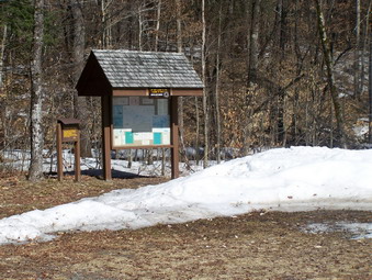
![]()
![]() On Sunday, April 6th I decided that the day was too nice to stay inside after church. Cindy was still tired from Saturday's adventure so Sheba and I headed for Long Pond. As we drove out DeBruce Road. I was surprised at the amount of snow that was still on the ground. Since I had been hiking to the south in Harriman Park the last few times, I had forgotten that spring had only just started! The parking area for Long Pond was cleared of all snow but there were snow banks on all sides. Only a pickup was in the parking area and Sheba and I got right on the trail. I had considered bringing my hiking poles just fro the upper body workout. As soon as I got on the trail I was sorry I didn't bring them AND the Stabilicers. Most parts of the trail were covered with ice or packed snow. The parts that were "clear" were WET with running or standing water. Only a few patches were damp and NONE were dry. We walked over or around the worst parts and were at the trail junction within half an hour. We stopped at Long Pond along the way and found it still completely covered in ice.
On Sunday, April 6th I decided that the day was too nice to stay inside after church. Cindy was still tired from Saturday's adventure so Sheba and I headed for Long Pond. As we drove out DeBruce Road. I was surprised at the amount of snow that was still on the ground. Since I had been hiking to the south in Harriman Park the last few times, I had forgotten that spring had only just started! The parking area for Long Pond was cleared of all snow but there were snow banks on all sides. Only a pickup was in the parking area and Sheba and I got right on the trail. I had considered bringing my hiking poles just fro the upper body workout. As soon as I got on the trail I was sorry I didn't bring them AND the Stabilicers. Most parts of the trail were covered with ice or packed snow. The parts that were "clear" were WET with running or standing water. Only a few patches were damp and NONE were dry. We walked over or around the worst parts and were at the trail junction within half an hour. We stopped at Long Pond along the way and found it still completely covered in ice.
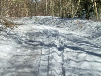 At the trail junction, I decided to turn right and walk up to the lean-to just to add some time to the hike. This part of the trail was about the same as the first or...WORSE. At one point stepped on an ice shelf that collapsed and my foot went into some rather deep water. Water entered over the top of my boot and soaked one foot. I briefly considered turning around at this point but decided to go on. Through the rest of the hike I could tell my foot was wet but the Rohner wool socks performed well and kept me warm. We walked to the lean-to, turned around and walked back to the trail junction. We did not retrace our route but started on the trail out Flugertown Road. This section of the trail was the worst with several large lakes along the way. As the trail descended to the bridge over the creek, it became so icy that Sheba was skipping and I found an alternate route.
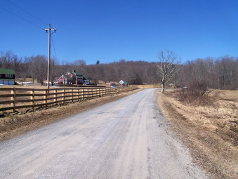 As I approached Flugertown Road I was surprised to see that it was not plowed. There was still 12 to 18 inches of snow on the road in most places. I suspected that the town had only plowed up to the last residence on the road. Sheba and I continued down the road. As we came out of the trees into the open the last house on the road appeared and there was absolutely no snow on the road and little in the field. We walked quickly back to the car. covering the loop in almost exactly 2 hours.
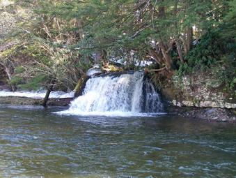 On the way home I stopped just before getting to DeBruce at the turn in the road. There is a small waterfall here that I always wanted to photograph. There was enough space to pull the car off the road. I hurried won to the falls and took some pictures of the falls and the surrounding area. It is small but very pretty.
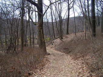
![]()
![]() On Saturday, April 5th I decided to return to Harriman to explore some of the trails that I had not hiked before. Several times when I had been on Bald Mountain I had seen the West Mountain shelter and decided I would like to visit it. The view OF the shelter is so clear that I though the view FROM the shelter would be equally good. I planned a loop from the Bear Mountain parking area over the Suffern-Bear Mountain Trail to West Mountain. To complete the loop I planned to use the Appalachian Trail to return to Bear Mountain and then to the parking area. I expected the weather to included some showers in the morning so I planned on starting a little later. Cindy decided she was feeling and decided to join us. When we started the drive form Livingston Manor the skies were overcast but it was not raining although the temperatures were in the upper 40's. As we drove the rain increased and I started to think about the rain gear I had brought and the pack cover I had forgotten! The showers stopped by the time we parked. The temperatures at Bear Mountain were in the mid to high 40's but as we got out of the car the wind picked up. I wondered about my decision to forgo a jacket for my Icebreaker 260 baselayer and my OR Specter fleece top.
On Saturday, April 5th I decided to return to Harriman to explore some of the trails that I had not hiked before. Several times when I had been on Bald Mountain I had seen the West Mountain shelter and decided I would like to visit it. The view OF the shelter is so clear that I though the view FROM the shelter would be equally good. I planned a loop from the Bear Mountain parking area over the Suffern-Bear Mountain Trail to West Mountain. To complete the loop I planned to use the Appalachian Trail to return to Bear Mountain and then to the parking area. I expected the weather to included some showers in the morning so I planned on starting a little later. Cindy decided she was feeling and decided to join us. When we started the drive form Livingston Manor the skies were overcast but it was not raining although the temperatures were in the upper 40's. As we drove the rain increased and I started to think about the rain gear I had brought and the pack cover I had forgotten! The showers stopped by the time we parked. The temperatures at Bear Mountain were in the mid to high 40's but as we got out of the car the wind picked up. I wondered about my decision to forgo a jacket for my Icebreaker 260 baselayer and my OR Specter fleece top.
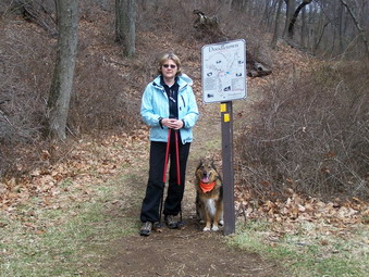 We walked toward the outdoor ice rink but turned left up the hill before it. At the top of the short, steep hill we turned left on a road which was also marked with the yellow blazes of the Suffern-Bear Mountain Trail and the white blazes of the Appalachian Trail. We follow these blazes as the trail curved first to the right and then to the left and descended over a small stream. The trails started a continuous ascent at this point and after only about .3 miles the AT turned to the right. We stayed on the SBM Trail which continued to ascend before descending to cross Seven Lakes Drive after about .45 miles. The trail almost immediately meets an old woods road which has areas of laid stone to support it. Near the junction with the trail is evidence of an old stone wall or foundation. Further up the road is another foundation on the right side of the trail. As we descended a small hill the trail abruptly met another wide path or road. I wasn't really paying attention to the map so I was surprised after about .6 miles to see a sign with a 4 and on the other side of the path the Doodletown map sign. This was the Doodletown Bridal Path which I had passed several weeks before. Some of the ruins marked and unmarked of Doodletown lie along this path. We turned right here and followed the yellow blazes and the path until they parted. We continued on the trail as it descended to Doodletown Brook after about .5 miles. We easily crossed the brook.
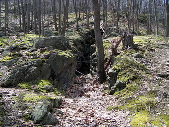 I knew that we were in the area of the Herbert Mine. My intention was to walk further up the path and then cut directly east to find the mine. Shortly after crossing the brook I noticed paths leading down across the brook and to the other side. I decided to follow them although I didn't see much of interested. Cindy and I crossed the brook and headed up the hillside. I noticed a pile of rock ahead and as I got closer I could see it was a pile of tailings. I climb the pile and found...NOTHING! This was disappointing until I look up to see an even larger pile just up the hillside. We started to walk up the hill and ran into a woods road that led directly to a large, flat work area. Several large piles of tailing were present and I could see the mine opening ahead and to the left. I went over to the main working which is a large, open cut and entered it. The trench is thirty or forty feet long and at least 20 feet high and the highest point. The far end is deeper and filled with water. From the impressive amount of mine waste it would seem that the mine extends farther underground.
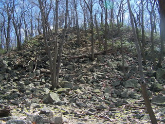 After taking MANY pictures, I walked up the hillside where Cindy was observing the mine from above. We continued on up and I wandered around looking for the other cuts and pits mentioned in the Lenik book. I didn't FIND anything but I did manage to LOSE Cindy. I "found" her down by the brook and we crossed back to the SBM Trail on the other side. The trail paralleled the brook for some time and was very rocky. There were some nice views of the stream but then the trail began to ascend through some laurel. Along the ascent there were some hints of the views I knew we would get from the top. Shortly we were presented with a large mound of stone. A quick inspection showed trail markers on a tree at the top so we began to climb. It was short but steep in places but afterward the trail opened into a field with some ore views. I suspected the best views were yet to come so we continued on through the field to the summit of West Mountain and the West Mountain Ridge.
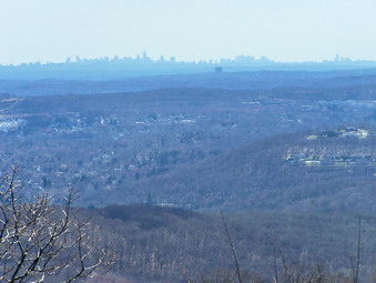 After a little more than 1 mile from the mine the SBM Trail intersected the blue blazed Timp-Torne Trail. We wanted to turn right to head toward Bear Mountain but first we wanted to visit the shelter. We turned left and within less than .1 miles we could see the shelter and the tents surrounding it. A Boy Scout troop from Mattituck on the north shore of Long Island was camped there. We talked to the boys and their leaders who had nice things to say about Sheba. The views from the shelter were spectacular and everything I had hoped for. Bald Mountain and The Timp were clearly visible along with some other hills. There was a nice view down to the Hudson River and the south end of Peekskill Bay. The outlines of some buildings could be seen in the distance on the horizon. Although it was hazy at that distance this was clearly the skyline of New York City. After taking pictures, we retraced our steps and followed the blue and yellow blazes as they ran concurrently along the ridge.
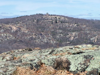 In less than .25 miles the SBM trail turned left and headed south and west. We stayed on the Timp-Torne Trail and in about the same distance the Appalachian Trail came in from the left. As we followed the trails along the ridge interesting views appeared on both sides. At one point a large parking lot appeared below on the left. I couldn't figure out what this was until I saw a structure. We had run several cross country races at Anthony Wayne State Park so I recognized the configuration of the grounds. Near the end of the ridge there are great views of the Hudson River and we could just see the Bear Mountain Bridge hidden in the surrounding hills. We could see the Perkins Tower on the top of Bear Mountain straight ahead of us. It looked so close but there I knew there was a significant descent and ascent before reaching it. At this point, after 1.15 miles, the trails split and the Timp-Torne Trail continued on north and slightly west toward The Torne. We stayed on the AT as it turned right and started a long descent. Along the way the red Fawn Trail branched to the left. After .6 miles the AT crossed Seven Lakes Drive. Just before this the 1777W Trail crossed the AT. I thought about turning right on this trail which leads back to the Suffern-Bear Mountain Trail which is an easier way to return to the parking area but I REALLY wanted to go to Bear Mountain!
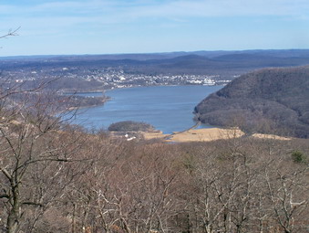 We crossed the road after waiting for some cyclists and then followed the AT as it ascended toward Perkins Memorial Drive. After several ups and downs and about .5 miles we were on Perkins Drive and walked the road for about .4 miles before following the trail as it cut back into the forest. Some of the views from Perkins Drive are nice. The trail starts the final ascent to the tower through a laurel thicket and then over some large, flat rock outcroppings. Several viewpoints occur along the way but none can match the views from the to so we continued on. There are several viewpoints along Perkins Drive which are quite nice. After about .5 miles of ascent, the Perkins Tower came into full view. The views from Bear Mountain were nice but I liked the ones from West Mountain better. The river and the city skyline could be seen. Bear Mountain is more talked about since Perkins Drive allows easier access than the trails to West Mountain. After taking photographs we started back down the AT. Down isn't always the easiest and we were all a little tired at this point
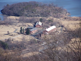 The AT descends to cross Perkins Drive and work its way through the picnic area before crossing the road a second time. We continued on down for about .4 miles until the trail meets and follows a road for .25 miles. There is a parking circle at the end of the road which is open when Perkins Drive is closed. We followed the trail as entered the woods and started down again for .4 miles before joining the SBM Trail. There were some nice views along the way but none better than from the top of the mountain and we were more interested in getting to the car! From the junction with the SBM Trail we retraced our steps from earlier in the morning and were back at the car in .3 miles. We had hiked almost 8 difficult miles in 6 hours with MANY stops along the way. for me the mine and the views made it all worthwhile. The temperatures never got above 60 but hovers the mid 50's. The sun was out and it was almost too bright and too warm.
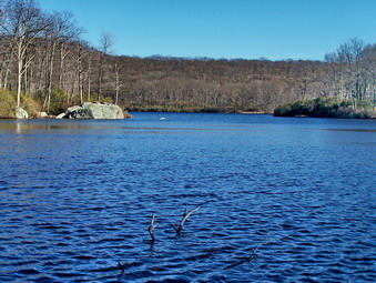
![]()
![]() On Saturday, March 29th I decided to return to Harriman to explore more of the iron mines. Do you see a pattern here? The Island Pond area has several mines that I had not visited and they are within a comfortable hiking distance of each other. Sheba and I got a late star due to an early ambulance call but were on the road by 9:45 AM. I was going to take Seven Lakes Drive to the Kauwanke Circle and then take Route 106. to the parking area near Island Pond Road. A short walk down this wide woods road leads to the Boston and Garfield Mines and a nice look at Island Pond. From here it is a matter of choosing route to the other two mines and back to the car. When I got to the traffic circle and tried to turn onto Route 106 a sign informed me that the road was open to local traffic only since a bridge was closed ahead. I didn't know exactly where the bridge was so I drove down the road. Unfortunately, the bridge was closed BEFORE the place where I wanted to park. I decided to go back and park at the Askoti-Skanatati parking area. This would make a longer hike but the weather was ideal. The sky was clear and the temperature was cool with a slight, gusting breeze.
On Saturday, March 29th I decided to return to Harriman to explore more of the iron mines. Do you see a pattern here? The Island Pond area has several mines that I had not visited and they are within a comfortable hiking distance of each other. Sheba and I got a late star due to an early ambulance call but were on the road by 9:45 AM. I was going to take Seven Lakes Drive to the Kauwanke Circle and then take Route 106. to the parking area near Island Pond Road. A short walk down this wide woods road leads to the Boston and Garfield Mines and a nice look at Island Pond. From here it is a matter of choosing route to the other two mines and back to the car. When I got to the traffic circle and tried to turn onto Route 106 a sign informed me that the road was open to local traffic only since a bridge was closed ahead. I didn't know exactly where the bridge was so I drove down the road. Unfortunately, the bridge was closed BEFORE the place where I wanted to park. I decided to go back and park at the Askoti-Skanatati parking area. This would make a longer hike but the weather was ideal. The sky was clear and the temperature was cool with a slight, gusting breeze.
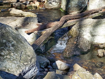 There were a number of cars in the parking area when we arrived at around 11:00 AM. A father and son team was getting ready to hike. Another group was also just getting under way. This was a group of boys and their "leaders" numbering about 20! They were loud and noisy and acting like ... teenage boys about to have a great, adventure filled day. I decided to get ready quickly and get ahead of them. The adults were busy consulting maps and compasses and did not seem to have a clear idea of where they were going. Sheba and I got on the Long Path by the lakes and quickly blew by them. We had been in this area so many times lately that I felt more like hiking quickly to my first objective, the Boston Mine, than stopping to take pictures. We were in high gear and headed for the Hogencamp Mine area when we ran into two women from Long Island. We stopped to talk a minute and then they continued on up the Long Path to cape Horn while Sheba and I turned left onto the Dunning Trail.
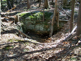 We passed by some of the trenches and cuts of the Hogencamp Mine on the right and some tailings piles on the left. The wide trail then ascends to a viewpoint over Little Long Pond. We did not stop but continued on up the hill to the Bowling Rocks and the Bald Rocks. At the top of the ridge near the Bald Rocks we continued straight ahead on the Dunning Trail, a section we had not hiked before. In only short distance the Dunning Trail met the White Bar Trail which is marked with a horizontal...white bar. The trail run concurrently for only a little while and then the Dunning Trail splits off to the right. We continued on the Dunning Trail and I started to look for the broad Island Pond Road. I had been on this road once before when hiking in the area but a little further south of this location. After a short distance I began to see signs of what could have been mining but nothing definite. We continued on until I decided to veer off into the woods. I almost immediately found tailings and two or three pits. This was the Boston Mine. Sheba and I wandered around the area inspecting the workings. I took pictures and then we headed north.
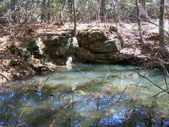 After walking through the woods for a few hundred feet, we came across the red triangle of the Arden-Surebridge Trail and turned left to again look for the Island Pond Road. Once we came to the road it was impossible to miss and we turned right on it to follow the trail. In a few hundred feet when the trail turned left, we continued straight ahead on the road. The map showed a fork in the road which appeared pretty quickly. We took the left fork to look for the Garfield Mine. The road ended in a jumble of laurel and I though I had missed the mine. We passed ahead into the brush and I almost immediately found a small pit and some tailing almost in the pond. Only a few feet from the pit was a longer and deeper trench filled with water. Success number two for the day! After taking some pictures, we retraced our steps to the fork and I decided to follow the right fork down to the pond. I hoped that the map was wrong and we could walk around the lake to cut off some mileage
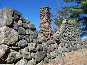 The right fork continued down to the shore of the pond and as we approached the shore the ruins of a stone structure appeared. It looked like it might have been a cabin or a boathouse. The wind was really whipping in off the pond and I was glad I had dressed warmly. Across the pond I could see other hikers on a rock lookout where I had been several weeks before. I took pictures of the stone ruins and several pictures of the pond before turning around and heading back to the road. As we walked Sheba and then I caught site on an animal on the road. It turned out to be a dog and her person hiking. We stopped and then walked together for a while. The hiker told me that the stone building was a "ranger station" that burned in the 60's. At the junction with the AS Trail Sheba and I turned left to follow this trail. The trail led us southeast and then northeast toward the Lemon Squeezer and a junction with the AT. At this point it was my intention to decide if I wanted to continue to find the other mines and what trail I would use.
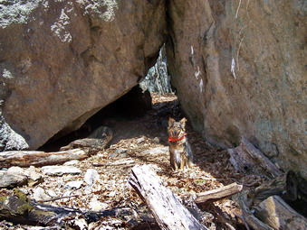 This section of the AS Trail seemed long with an initially steep ascent to a ridge. As it turned northward, the trail undulated up and down over several small hills. Eventually we met up with some others hikers just after making a right onto the AT. This was the area of the Lemon Squeezer. I had been through here before and was NOT impressed with the Lemon Squeezer. That was probably because I had been in a hurry and the trail I was on coming the other way did not actually go through the Lemon Squeezer. Coming from the other direction as I did on this day the Lemon Squeezer is much more impressive and Sheba and I took some time to inspect it long with the hikers we had met. After passing through a narrow opening formed by two rocks leaning against each other the trail continues up a narrow slot and then opens into a wider area. From here hikers may take the "easy way" or the "hard way". Some kids took the hard way and I had to show I could keep up with them. I got it on the second try. Sheba took the easy way since she lacks opposable thumbs! I took many pictures of the area and then returned to the opening where I had left my pack. The Appalachian Trail actually goes up through this area and I though I might use it to get to the other two mines. I decided against this and to take the Bottle Cap Trail instead.
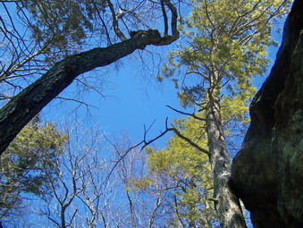 Sheba and I returned to the beginning of the Squeezer and walked a little further on down the AS Trail which is also the Long path at this point. Just before the Long Path turns left and the White bar goes right, we met the group of boys from the morning. The boys were a little more sedate but the leaders were still pouring over their maps and taking compass readings. We continued passed them and started up a hill where we met another group of hikers and their unleashed dogs. I allow Sheba to go without a leash until we spot other hikers. I then put her on a leash as a courtesy to others. I guess not all other hikers understand the rules since many allow their "friendly" dogs to come up and growl at Sheba and me! The Bottle Cap Trail is dotted on the map which means that is proposed and not really "official". It is marked with bottle caps of different types nailed to the trees. This was another trail I had never been on. It is not an easy trail since it ascends up and over Surebridge Mountain. I was looking for the area where this trail intersected the Surebridge Mine Road. This road connects the Greenwood and Surebridge Mines and leads south to Times Square and the trails back to the parking area.
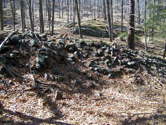 As we walked along it was not always clear where the trail went and I did not know how prominent the mine road would be. Several areas had cuts which looked like they could have been roads. After consulting the map, I was sure that we had to descend to a swampy area where we would find the road running north-south. It was getting late in the day and I wasn't sure whether there was time to visit both mines. After a quick descent off the ridge, we approached the swamp and the road became very obvious. It was wide and well constructed and a cairn of stones marked it as our objective. I looked at the map and saw that the Greenwood Mine appeared to be only .5 miles north and right along the road near where the AT intersects. I decided to "go for it". We picked up our pace on the road which descended slightly and ran along a small creek. Within minutes the white blazes of the AT appeared and we saw some other hikers. In that same area I began to notice tailings. We had arrived at the Greenwood Mine.
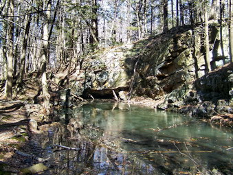 The first impression I got of the mine was the massive piles of tailings in all directions. Next to the trail on the right was a long water-filled cut that appeared to go underground at the north end. After I took some pictures we continued on the trail and found another smaller cut on the right, more piles of mine waste and another large cut. Here we turned up the hillside and found some laid stone which could have been a foundation. On the hillside was another cut which also appeared to go into the rock but was filled with water. Further up the mountain was still another trench. This was indeed an impressive operation and well worth the trip. We spent some time looking around and taking pictures before heading back south on the mine road to the area where the Bottle Cap Trail had met the road. We continued passed here on the road. I knew that the Surebridge Mine should be and on the left side of the trail.
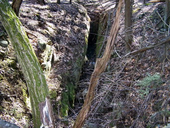 The first cut of the Surebridge Mine is just to the left of the trail and is not very impressive. It is now adjacent to a small swamp. I though I could hear some water underground but could find no opening. Although it was getting late, I decided to walk further into the woods to see if there were any more workings. I was glad that I did! I noticed many piles of tailing and each was associated with some type of mining activity. There were at least three trenches. two of them were deep and at least one seemed to lead underground. There were several exploratory pits. I found an impressive deep shaft at the eastern end of the area. The shaft was vertical but a "bend" at the bottom suggested that it might turn horizontally into the rock. Sheba and I worked our way back to the road and then hurried south on the road to the AS Trail. Here we turned left and were soon at Times Square. I decided to take the Long Path over to Cape Horn to the Hogencamp Mine. This put us back on the Trail we had come in on earlier that day. I took a few pictures at Hogencamp and then we hurried back toward the parking area.
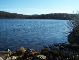 Along the way we stopped at the lake to take a few pictures on the beautiful blue water with the sun sinking low in the sky. As we returned so did the group of boys from earlier that day. We had covered over 11 miles which explain why my feet hurt! Our 5 and a half hour journey had proved rewarding but we were ready to return home. I find the search for the mines and their exploration an interesting objective.
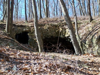
![]()
![]() On Tuesday, March 25th I decided to return to Harriman to explore more of the iron mines. There are several in the Island Pond and Surebridge Mountain area but I decided to start by parking at SilverMine Lake which has four mines within walking distance. I knew that I wanted to find the Cranberry Mine first since the description sounded interesting and it seemed fairly close to the parking area. We parked at about 9:30 AM and immediately began the walk down Seven Lakes Drive. The instructions said to walk .5 miles to just passed the closed comfort station. We turned at the brook just after the station and headed up through the woods looking for a road going east to west at about .3 miles from Seven Lakes Drive. There was no real trail but it was clear other hikers had taken roughly this path. The book was right on and the road was right where it was supposed to be. We turned left and in only a few minutes I saw the opening of the mine.
On Tuesday, March 25th I decided to return to Harriman to explore more of the iron mines. There are several in the Island Pond and Surebridge Mountain area but I decided to start by parking at SilverMine Lake which has four mines within walking distance. I knew that I wanted to find the Cranberry Mine first since the description sounded interesting and it seemed fairly close to the parking area. We parked at about 9:30 AM and immediately began the walk down Seven Lakes Drive. The instructions said to walk .5 miles to just passed the closed comfort station. We turned at the brook just after the station and headed up through the woods looking for a road going east to west at about .3 miles from Seven Lakes Drive. There was no real trail but it was clear other hikers had taken roughly this path. The book was right on and the road was right where it was supposed to be. We turned left and in only a few minutes I saw the opening of the mine.
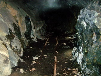 As we approached I could see a large, low opening and a smaller one on the left. I wondered what we would find since the book described an effort to wall up the opening to the mine with a stone wall and an iron door. The wall was intact but only the door frame remained. I took pictures of the entrance and then we went inside. It was very dark inside and neither Sheba nor I were too sure about entering. I took some flash pictures which illuminated some of the mine features including a single gauge rail on the floor of the mine. I put on my Tikka Plus headlamp and realized how inadequate it was for this purpose. We continued to walk into the mine for forty or fifty feet until the passage split. The one to the right looked like it ended with an air shaft. The one to the left seemed to continue on and is described as extending up to 100 feet. I decided to leave this for another day with some companions and a much brighter light. We exited the mine.
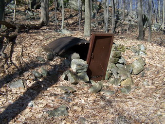 I followed the directions in the book and started to look for a small structure with an iron door and corrugated roof which is thought to be a powder magazine. It was just where it was supposed to be but was a little worse for wear. We backtracked toward the mine entrance but headed up the hillside to look for more mining features. I found another small pit and evidence of a road to the top of the hill. We explored the top of the hill which had no real views and then headed back down. On the way down I found another small trench with a large pile of tailings. On the way back toward the mine entrance I ran across the opening to the air shaft. We continued back to the mine opening and followed the stream back to the main road. We crossed the road and walked along the stream that forms the outlet of Silvermine Lake. A woods road here leads behind the comfort station to a bridge over the stream. The Silvermine Lake Road passes around the western shore of the lake and close to the dam at the outlet we stopped here so that I could take some pictures and then continued on up the road. In several places the road had been carefully fortified with stonework attesting to its permanence and importance. After a sharp left turn in the road I saw three other hikers approaching. We stopped to talk about the nearly ideal weather and the mines in the area. Sheba and I continued on to look for the Appalachian Trail which runs concurrently with the R-D Trail over Black Mountain. Black Mountain is the site of the Spanish Mine at the top and the Silver Mine on the rock face of the mountain.
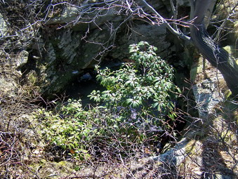 We turned off the road and onto the trail and immediately began a steep ascent. The trail flattened some and there were several lookouts over Silvermine Lake. After a few pictures we continued to the top of the mountain. Near the top I saw a path off to the left which seemed to go to the a cliff. I though this might be the way to the Silver Mine. As we reached the top of the mountain A nice view of the Hudson River presented itself. It was actually a little too hazy to get a good picture but it was a pleasant view. The Perkins Tower on Bear Mountain was also visible. To the left of the trail almost hidden in the tall grass was a tailings pile. I looked around and found a pit or shaft sunk into the mountain. Further up the hillside was another pit with some tailings. We stopped at a flat area to get a drink and eat a snack since it was around noon. After only a short break we headed back down the way we had come up.
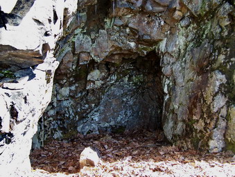 On the way down I was looking for the path to the Silver Mine. The book warned that the hiking could be difficult and the author was correct. A very narrow path with some very slippery leaves led along the rock face. I watched for tailings and soon found them on the slope below. Above the tailings the "mine" was clearly visible as an depression blasted into the solid rock of the mountain. The area was high but only several feet into the rock. I doubt that the miners were actually looking for silver but very little is known about the mine. After taking some pictures, we returned the way we had come and going back was no easier. At the junction with the road we stayed on the trail. I had decided to follow the Appalachian Trail to the Menomine Trail which would lead back to the Silvermine Lake parking area. From here I intended to walk through the parking area on the trail and to the Lewis Mine on the other side of Seven Lakes Drive.
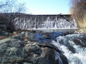 The Appalachian Trail section was longer than I expected but the weather was fine. After a while I looked own and saw a building in a clearing. We descended a rocky talus slope and found a building that was more than a lean-to and less than a cabin. It was well-constructed of stone with a shingled wooden roof. There were bunks bed frames with room for four people inside. We turned right and followed the Menomine Trail which seemed like a woods road. The trail descends and passes along some impressive rock formations. Much of the trail was wet and muddy but well-placed stepping stones helped. As the trail passed by the shore of the lake we stopped to take more photographs before continuing on to the Silvermine Lake parking area. To get across the stream that flows into the lake we walked through the parking lot and then followed the yellow trail markings to the far end of the picnic area. We crossed road that led to a large parking area which is now blocked off. The trail paralleled Seven Lakes Drive and eventually crossed it near Lake Nawahunta.
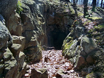 We stayed on the trail which is also a fire road until the trail went left around the lake. We followed the fire road to the right. Shortly tailings piles appeared and a cut in the hillside was visible. The cut which is the entrance to the Lewis Mine extends only a few feet into the rock and the tailings piles are small. We exited the cut and headed up to the top of the hill. I knew there wasn't going to be much more to the mine but I wanted to see what the view from the top looked like. We crossed a right-of-way with a few long unused poles. Some boulders marked the top of the hill but the view wasn't very spectacular. On the way down the hill I looked for other mining trenches but did not see any. At the fire road-trail junction we followed the trail around the end of the lake to take in the view. After that we backtracked along the fire road and found an old foundation which might be from a house of a storage building. After another look at the lake, we headed back out to Seven Lakes Drive and walked the road back to the car. It was 2:30 PM and time to return home after a nice 8 mile hike.
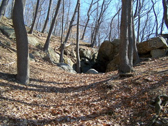
![]()
![]() On Monday, March 24th I decided to explore more of the iron mines in Harriman State Park. Cindy and I had passed by the Hogencamp Mine on a recent hike and the weekend before I ha d discovered the Cornell and Edison Mines. I knew that these mines had historic significance and was interested in their story. The book Iron Mine Trails by Edward J. Lenik and published by the NYNJ Trail Conference is the "bible" on this subject. For only $8.95 it mentions most of the mines, gives their history and location. Another good source is www.ironminers.com. I decided to start by parking at the Tiorati Circle and trying to find the Bradley Mine. Depending on my "luck", I also thought I might go to the Pine Swamp Mine and revisit the Hogencamp Mine now that I knew what I was looking for. Besides a large hole in the ground the mines are usually characterized by a telltale pile of waste rock called tailings. Most of this time this rock, not surprisingly, looks rusty.
On Monday, March 24th I decided to explore more of the iron mines in Harriman State Park. Cindy and I had passed by the Hogencamp Mine on a recent hike and the weekend before I ha d discovered the Cornell and Edison Mines. I knew that these mines had historic significance and was interested in their story. The book Iron Mine Trails by Edward J. Lenik and published by the NYNJ Trail Conference is the "bible" on this subject. For only $8.95 it mentions most of the mines, gives their history and location. Another good source is www.ironminers.com. I decided to start by parking at the Tiorati Circle and trying to find the Bradley Mine. Depending on my "luck", I also thought I might go to the Pine Swamp Mine and revisit the Hogencamp Mine now that I knew what I was looking for. Besides a large hole in the ground the mines are usually characterized by a telltale pile of waste rock called tailings. Most of this time this rock, not surprisingly, looks rusty.
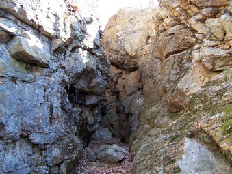 We parked at the Tiorati Circle at about 9:30 AM and started to hike up the Arden Road. This road is paved and an easy walk. It is not maintained during the winter and is closed to vehicle traffic. I didn't know exactly how far to walk or what to look for although the book described the mine as just off the road. After a slight downhill and at sharp left hand turn the Long Path crosses the road and I knew that I was near the area of the mine. We kept walking but I had no way of knowing whether we had passed the entrance. Soon a large outcropping of rock appeared on the right and informal trails seemed to lead upward. I continued on only a short distance until an obvious woods road cut back up the hill to the right. I followed the road an was soon rewarded by a trench cut in the rock and the reddish-yellow color.
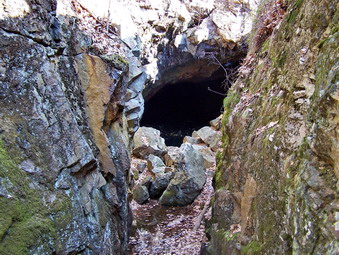 The trench was very impressive being about 5 feet wide and over twenty feet tall. We wound our way through the cut until a hole in the earth appeared ahead. This was the main entrance to the mine and it was filled with water. The area around the main entrance and into the mine was also very icy and pieces of ice were falling as the temperature warmed up. I went as far as I felt I safely could and took as many pictures as possible. Photographing the area was difficult due to the darkness inside and the bright sun outside. I was able to see an air shaft and decided to go up on the hillside to see what else I could find. The book described a banked structure which was though to be a storehouse or powder magazine. We worked our way out of the entrance and through the trench and started to climb the hillside.
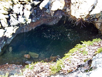 On the way up the hillside we stopped at and area overlooking the mine entrance and at the air shaft. Sheba and I walked up to the top of the hill and covered most of the hilltop. There were several other areas that showed some mining activity and one large, flat work area. There was also a nice view from on top. We came back down to near the air shaft and then walked diagonally along the hillside back to the road looking for mining structures. I couldn't find any. Back at the road I decided to try walking passed the road to see what I could find. We did this and then cut up onto the hillside. The only thing we saw was several deer and lots of rocks. After returning to the access road to the mine, I decided to return to the car. The walk back went quickly and we were at the car by 11:30 AM. I got back on Seven Lakes Drive and headed for the parking area near Lake Askoti and Skanatati. The drive was much shorter than I remembered.
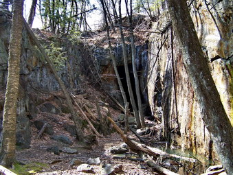 At the lakes there were already a few cars parked and Sheba and I were on the trail by noon. Had decided to use the Long Path to get to the Dunning Trail and to go to the Pine Swamp Mine first. This avoided a stream crossing that was difficult last time and would, I thought, be worse this time with the addition rain and runoff. The Long Path was wet in some spots but not too bad. A few small stream crossing offered enough stepping stones to get across with no problem. We met some children and adults near the lake, said hello, and continued on. The Long Path began to climb toward the area of the Hogencamp Mine. Just before this the Dunning Trail headed off to the right and we turned. I wasn't sure how far to go before looking for signs of the mine. I did know that if I got to a trail junction I had gone too far. I began to look for Pine Swamp on the right and mine tailings on the left. It didn't take long to find both. Since the trail passes by the mine, we turned left and walked up the hill where it looked like other people had walked. We entered a clearing with some spruce trees and then I saw the opening of the mine.
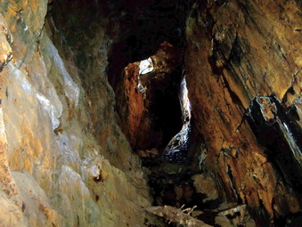 The approach to the mine entrance was flooded but we worked around it. The trench into the mine was no less impressive than at the Bradley Mine. The cut was wider but higher and the entrance much larger. The adit also slopes upwards so water in the mine would was not a problem. Inside the mine there was more light due to the larger opening and an air shaft near the upper end. Climbing upward through the mine was not easy due to the steep angle, wet rocks and ice. We climbed upward passed the air shaft to what looked like the end of the mine. I could not go any further since the rock was too slippery. I stopped to take pictures several times including some of the drill marks in the rock. After looking around, we carefully made our way back down and out the entrance. At this point, I decided to look around for more evidence of mining so we headed up the hillside.
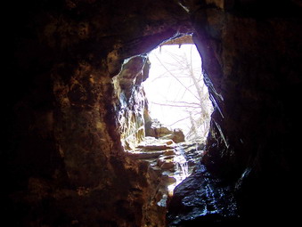 We came to the area of the air shaft and I stopped to take some pictures and then continued to the top of the hill. There were some nice views of the surrounding area including the Pine Swamp below. I did not want to descend to the trail to get to the Hogencamp Mine so we started across the hillside. This seemed like a good idea until we encountered several rocky strewn areas and areas where the forest lay on the ground. We continued on in the direction of Hogencamp Mountain and eventually ran into the Long Path which passes by the mountain and leads down to the mine. I decided to go to the top of the mountain to see what the view might reveal. We started on a direct route and were soon at the top. Here the Ramapo-Dunderberg Trail cuts across the mountain but I decided to descend again to the Long Path. I wanted to look for some of the building foundations and other features mentioned in the Lenik book. As we came down the trail I did find one stone wall but I could not spot anything else.
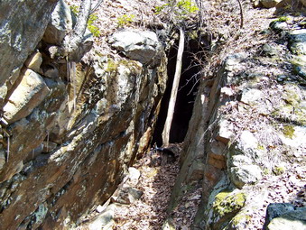 At the small falls, I met another hiker. We talked briefly about the wonderful weather and about hiking the Adirondacks. Since we were going in opposite directions we parted. Just after the small falls, I noticed a path down to the stream. As I descended I realized that Cindy and I had missed the mine the last time we hiked here. I found a cut through the rock that penetrated into the hillside under the trail for 10 to 15 feet. I took some pictures and then turned around to walk out. I saw several trenches that parallel the base of the hillsides. We walked through one and out onto the trail were there are several piles of tailings. There is also a pit filled with water with a vertical pipe. We walked back toward the hillside and I found another set of laid stone. We walked through several trenches and then up the steep slope to the top of the ridge. There was a limited view on top and I could find no more evidence of mining activity. From here we walked back to the Long Path and then down to the Dunning Trail completing that part of the loop. After talking to several other hikers, we headed back to the car. It was after 2:00 PM and I decided to come back another day to explore more of the mines. We had spent 5 hours walking over 7 miles.
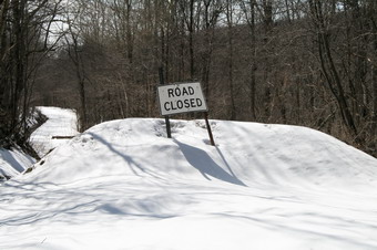
![]()
![]() On Saturday, March 22nd I wanted to take a short hike with family. Cindy was still sick and Kathleen was spending the day with her mother. I took Karl, Krista, Brad and, of course, Sheba to Trout Pond to do the loop. I also hoped to get some pictures of a large volume of water going over the falls so I took my Canon EOS Xti since the hike was short enough that a pack is not needed. There was some snow still in Livingston Manor where plows had left piles but nothing much elsewhere on the ground. As we drove up Morton Hill Road, it appeared there was a little MORE snow left than in town. The parking area was completely snowed in and there was a least 6 inches of packed and icy snow on Russell Brook Road. We parked along the road and carefully began to hike down to the falls.
On Saturday, March 22nd I wanted to take a short hike with family. Cindy was still sick and Kathleen was spending the day with her mother. I took Karl, Krista, Brad and, of course, Sheba to Trout Pond to do the loop. I also hoped to get some pictures of a large volume of water going over the falls so I took my Canon EOS Xti since the hike was short enough that a pack is not needed. There was some snow still in Livingston Manor where plows had left piles but nothing much elsewhere on the ground. As we drove up Morton Hill Road, it appeared there was a little MORE snow left than in town. The parking area was completely snowed in and there was a least 6 inches of packed and icy snow on Russell Brook Road. We parked along the road and carefully began to hike down to the falls.
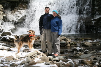 In some places the snow was completely melted and in others there was still quite a bit left. There was a good volume of water coming over the falls so I took some pictures. They turned out not to be much different than numerous others I had taken. We signed in at the register and decided to hike up the steeper hill to Mud Pond first. Part of the trail here, as in many other places, was wet and muddy without snow. We got up the hill, pausing a couple of times to enjoy the scenery. At Mud Pond we turned left and headed toward Trout Pond. The trail continued to vary from snow and ice covered to bare to wet and muddy. The uphill part to Trout Pond was a little longer than I remembered but having others along made it seem shorter.
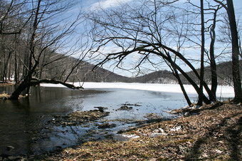 At the inlet the stream was higher than it had been but we walked upstream a short distance and found a place to cross. I took some pictures before trying to cross the stream. The trail on the other side was VERY wet and muddy in most places until we got to the outlet. We stopped for a moment to rest and take some photos before continuing on. At Russell Brook Road Karl and I sent Sheba home with Krista and Brad and we continued on down the road. I had intended to walk down to the "end" where I knew we could not cross the swollen stream. We only walked a short distance when it became obvious that the ice and snow would make the hiking difficult. In addition, the stream was not that interesting. Karl and I turned around and headed back. We covered a little over 4 miles in just over 2 hours.