
What You Missed
Fall 2017
Fall 2017
![]()
![]()
![]()
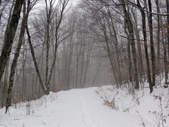
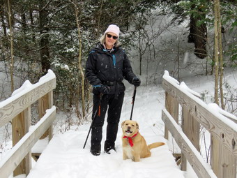
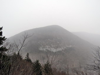
![]() On Monday, December 18th, I decided I needed to get out to hike with snowshoes even though they were probably not needed. The temperature was approaching 30 degrees when I woke up and I knew that overheating while snowshoeing was a possibility. I also knew that the snow tends to clump on snowshoes at this temperature which makes hiking much more difficult. Despite this I knew I wanted to get out and Sheila readily agreed by her antics. I convinced Cindy that we could take a short walk up the Flynn Trail and then take the long descent on the Big Rock Trail to Times Square. From there it is a relatively flat and short hike back to Frick Pond and out to the parking area. I did not put on tights and wore a lighter top over my baselayer. I did put on my Mammut Ultimate Hoody which I wear most of the time. I chose my Crescent Moon Gold snowshoes and I put Cindy' Tubbs Alpflex snowshoes in the car. We left Livingston Manor just before 10:30 AM and headed out the Debruce Road. It was snowing a little but Debruce Road was clear. At six miles I turned left onto Mongaup Pond Road which had some snow on it but had been plowed and well sanded. Where the road split I stayed left on Beech Mountain Road and parked in the small lot which was not plowed. From the tracks, it seemed like a one or two people had started up the Flynn Trail without snowshoes. I really couldn't blame them as the snow wasn't very deep. I set my electronics and we crossed the road at 10:45 AM to start up the Flynn Trail. The temperature had risen all the way up to 34 degrees which seemed warm. I had chosen to use my Crescent Moon Gold snowshoes which are good on flat and rolling terrain. They have some of the best bindings and a teardrop shape. The first part of the Flynn Trail through the woods is narrow and I was having a little trouble not overlapping the wider snowshoes. Once we made the right turn into the woods road the going was easier. We followed the boot tracks of the other hikers from a previous day. There wasn't much snow and the trail was bare in places where the sun had shown down. Before we had gone half a mile I had stopped to open some zippers and dump some heat. The walk with snowshoes is definitely more of a workout than without. As we gained some elevation, the snow got deeper until there was almost 8 inches. Since the snow was cold and the air was warm, fog was forming on the trail. I stopped to take some pictures. We continued up the Flynn Trail towed the junction with the Big Rock Trail. I was feeling pretty good and was setting a fast pace. I looked back and Cindy was pretty far behind so I slowed my pace and eventually stopped and waited for her. She was having more trouble with the snowshoes and the climb than I was. At 11:45 Am we were at the trail junction with the Big Rock Trail. It had taken just about an hour to walk the 1.7 miles from the parking area. This was actually a little faster than I thought we were moving.
On Monday, December 18th, I decided I needed to get out to hike with snowshoes even though they were probably not needed. The temperature was approaching 30 degrees when I woke up and I knew that overheating while snowshoeing was a possibility. I also knew that the snow tends to clump on snowshoes at this temperature which makes hiking much more difficult. Despite this I knew I wanted to get out and Sheila readily agreed by her antics. I convinced Cindy that we could take a short walk up the Flynn Trail and then take the long descent on the Big Rock Trail to Times Square. From there it is a relatively flat and short hike back to Frick Pond and out to the parking area. I did not put on tights and wore a lighter top over my baselayer. I did put on my Mammut Ultimate Hoody which I wear most of the time. I chose my Crescent Moon Gold snowshoes and I put Cindy' Tubbs Alpflex snowshoes in the car. We left Livingston Manor just before 10:30 AM and headed out the Debruce Road. It was snowing a little but Debruce Road was clear. At six miles I turned left onto Mongaup Pond Road which had some snow on it but had been plowed and well sanded. Where the road split I stayed left on Beech Mountain Road and parked in the small lot which was not plowed. From the tracks, it seemed like a one or two people had started up the Flynn Trail without snowshoes. I really couldn't blame them as the snow wasn't very deep. I set my electronics and we crossed the road at 10:45 AM to start up the Flynn Trail. The temperature had risen all the way up to 34 degrees which seemed warm. I had chosen to use my Crescent Moon Gold snowshoes which are good on flat and rolling terrain. They have some of the best bindings and a teardrop shape. The first part of the Flynn Trail through the woods is narrow and I was having a little trouble not overlapping the wider snowshoes. Once we made the right turn into the woods road the going was easier. We followed the boot tracks of the other hikers from a previous day. There wasn't much snow and the trail was bare in places where the sun had shown down. Before we had gone half a mile I had stopped to open some zippers and dump some heat. The walk with snowshoes is definitely more of a workout than without. As we gained some elevation, the snow got deeper until there was almost 8 inches. Since the snow was cold and the air was warm, fog was forming on the trail. I stopped to take some pictures. We continued up the Flynn Trail towed the junction with the Big Rock Trail. I was feeling pretty good and was setting a fast pace. I looked back and Cindy was pretty far behind so I slowed my pace and eventually stopped and waited for her. She was having more trouble with the snowshoes and the climb than I was. At 11:45 Am we were at the trail junction with the Big Rock Trail. It had taken just about an hour to walk the 1.7 miles from the parking area. This was actually a little faster than I thought we were moving.
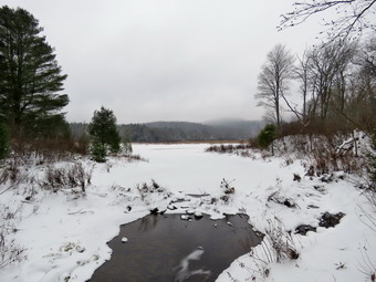 At the trail junction we turned left to go down the Big Rock trail to Times Square. Cindy was sure she didn't have any more "ups" left in her but I was still feeling good. I like descending on snowshoes since, at times, you can almost ski down. The trail was completely unbroken and there was at least 8 inches of snow in most places. The trip down the Big Rock Trail went quickly although it seemed a little longer than usual. There are three places where the trail drops quickly and then levels off. The last place brought us right to Times Square where the Logger's Loop and Big Rock Trail cross. Sheila was having a great time and did not seem to be bothered in any way by the snow or temperature. She kept going off the trail to follow animals tracks but returned quickly when I called. We continued straight ahead at Times square to go around the back of Frick Pond. The snow showed many different tracks as the hike around the pond is a favorite and is one promoted by Lisa at Morgan Outdoors in Livingston Manor. The snow on the trail was packed from the traffic and some rocks were showing through. Once we approached the bridges and wooden walkways the snow was deeper and we had no problems. Up until this point I had little or no snow clumping on my snowshoes but now this became a problem. The skies were overcast and the views of the pond were ordinary but I took some pictures anyway. The wooden walkways were covered in snow that was deeper than anywhere else. We continued to walk until we came to the junction with the Quick Lake Trail. Here we turned left and headed for the bridge across the outlet of Frick Pond. We stopped briefly at the bridge and I took a few pictures of the pond and Flynn's Point. It was almost invisible as it was shrouded in a cloud of fog. We walked up the hill to Gravestone Junction to head back to the parking area. The trail here had been well used and snow was absent in several places. We were back at 1:000 PM having covered 4 miles in 2 hours and 15 minutes with an elevation gain of 670 feet.
![]()
![]()
![]()
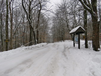
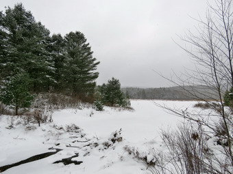
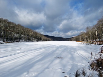
![]() On Saturday, December 16th the temperatures was in the low 20's and snow was falling lightly at home. I had last been out on Monday and then had a week of commitments and work as the school nurse. As Is started to get my gear ready, Sheila was glued to me to make sure I would not forget her. Cindy and I decided to head to Frick Pond to do a hike. My plan was to do the big loop but I knew that would depend on the conditions and Cindy. We decided we would not take snowshoes as there was only a few inches of light snow on the ground. It may seem that returning again and again to the same area is monotonous but each hike is different. On this hike having Cindy with me would be very nice even though the skies were cloudy and snow was falling. As we got dressed, I decided to put on tights underneath my Columbia Omniheat pants. On top I wore an Icebreaker light wool top over a baselayer with my Mammut hoody. I also wore a pair of heavier gloves and a hat. Both Cindy and I decided to where high gaiters. We put our gear in the car leaving the house at 10:15 AM. Sheila seemed particularly stoked as we headed up the DeBruce Road. I turned left onto Mongaup Pond Road after 6 miles. DeBruce Road was in pretty good shape but Mongaup Pond Road was covered in snow and a little slippery. It was also obvious that there was more snow on the ground and more snow falling. I parked in the smaller parking area which was not plowed. The temperature was just 20 degrees as I set my electronics and quickly got ready to start the hike at 10:35 AM. The snow was still falling and there was about 4 inches of snow on the woods road as we started out. At the register we picked up the Quick Lake Trail to Frick Pond. There did seem to be one track from someone hiking but it was not very recent. The trail was covered in snow but the ground was still soft underneath and there was some water to avoid. At Gravestone Junction where the Quick Lake trail and Loggers Loop meet we turned left to go down to Frick Pond. Sheila was racing around up and down the trail apparently unaffected by the cold or the snow! I began to get warm despite the temperature but not as warm as on some trips so I just opened my front zipper to dump some heat. When we got to the bridge, the skies were completely overcast and the snow was falling lightly but steadily. Flynn's Point was shrouded in snow and it seems it was snowing harder in that direction. I decided to stop to take a few pictures of the pond. I took several pictures and a picture of Cindy and Sheila on the bridge before we continued along the trail.
On Saturday, December 16th the temperatures was in the low 20's and snow was falling lightly at home. I had last been out on Monday and then had a week of commitments and work as the school nurse. As Is started to get my gear ready, Sheila was glued to me to make sure I would not forget her. Cindy and I decided to head to Frick Pond to do a hike. My plan was to do the big loop but I knew that would depend on the conditions and Cindy. We decided we would not take snowshoes as there was only a few inches of light snow on the ground. It may seem that returning again and again to the same area is monotonous but each hike is different. On this hike having Cindy with me would be very nice even though the skies were cloudy and snow was falling. As we got dressed, I decided to put on tights underneath my Columbia Omniheat pants. On top I wore an Icebreaker light wool top over a baselayer with my Mammut hoody. I also wore a pair of heavier gloves and a hat. Both Cindy and I decided to where high gaiters. We put our gear in the car leaving the house at 10:15 AM. Sheila seemed particularly stoked as we headed up the DeBruce Road. I turned left onto Mongaup Pond Road after 6 miles. DeBruce Road was in pretty good shape but Mongaup Pond Road was covered in snow and a little slippery. It was also obvious that there was more snow on the ground and more snow falling. I parked in the smaller parking area which was not plowed. The temperature was just 20 degrees as I set my electronics and quickly got ready to start the hike at 10:35 AM. The snow was still falling and there was about 4 inches of snow on the woods road as we started out. At the register we picked up the Quick Lake Trail to Frick Pond. There did seem to be one track from someone hiking but it was not very recent. The trail was covered in snow but the ground was still soft underneath and there was some water to avoid. At Gravestone Junction where the Quick Lake trail and Loggers Loop meet we turned left to go down to Frick Pond. Sheila was racing around up and down the trail apparently unaffected by the cold or the snow! I began to get warm despite the temperature but not as warm as on some trips so I just opened my front zipper to dump some heat. When we got to the bridge, the skies were completely overcast and the snow was falling lightly but steadily. Flynn's Point was shrouded in snow and it seems it was snowing harder in that direction. I decided to stop to take a few pictures of the pond. I took several pictures and a picture of Cindy and Sheila on the bridge before we continued along the trail.
 When we arrived at the junction of the Quick Lake Trail and the Big Rock Trail around the pond, we headed to the left on the Quick Lake Trail following the single track of footsteps now covered in snow. We continued on the Quick Lake Trail finding a small tree across the trail. I had not brought a saw and the trees would not move. A job for another day. We walked through the tunnel of evergreen trees and crossed the small stream. The stream was higher than I thought it might be but it was easy to cross with one foot in a shallow area. Sheila simply launched herself into the air with a jump that would have cleared a stream twice as wide. As we headed toward Iron Wheel Junction, the trail was slightly uphill and the deeper snow made the going a little more difficult than I expected. Cindy let me know that she was not prepared to hike the 6 mile loop. We arrived at Iron Wheel junction at 11:35 AM after hiking 1.5 miles. We turned right onto the Loggers Loop Trail which had no tracks but a nice layer of fresh snow. I knew that the DEC had been working to replace some culverts and had chosen the wettest time of the year to do the work. The last time I had hiked there were deep ruts all along the Loggers Loop and their efforts to improve the situation had actually resulted in severe damage to the trails. Several times as we were walking we had to avoid these ruts and in some cases we could not see them until we stepped into them. This kind of irresistible action could result in a hiker twisting and ankle or falling. I did take a few pictures along the way. I have to admit that I was glad to be descending the small hill on the Loggers Loop to Times Square as my thighs were beginning to feel the strain of hiking through the snow and stepping in the ruts. We arrived at Times Square at 12:15 PM about 2.7 miles into the hike. At this point he had to decide whether to continue on the Loggers Loop or to turn right and walk around the back of Frick Pond. I chose to stay on the Loggers Loop.
 We continued to have to deal with the deep ruts left by the DEC workers and this area seems to be the worst. From just passed Times Square the trail rises slightly for about .2 miles. Neither the distance nor the rise are really significant but my legs were a little sore at this point. Soon we were on the more level ground at the top of the hill and it wasn't far to the Quick Lake Trail. The skies showed some sun breaking through but were still overcast and the snow was still falling. I was glad we had almost completed the loop as we turned left at Gravestone Junction onto the Quick Lake Trail. There were no new boot prints so I did not expect to see any other hikers. We walked out the Quick Lake Trail and woods road to the parking area. As I expected there were no other cars in the lots. The snow had stopped and more sun was visible but the temperature was still in the twenties. It was 12:45 PM and we had covered 3.7 miles in 2 hours and 5 minutes with 15 minutes of stopped time. The elevation gain was only 400 feet. This seemed like a short distance but our muscles told us otherwise!
![]()
![]()
![]()
![]()
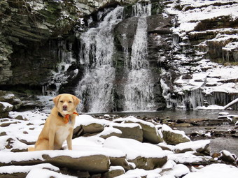
![]() On Monday, December 11th I planned to meet my brother-in-law, Jeff, to hike the Trout Pond loop. We agreed to meet at the Roscoe Diner at 9:00 AM since it is an easy place to find and meet. When I awoke at 6:30 AM the air temperature was 25 degrees with a slight breeze and I really wanted to crawl back into a warm bed. By 7:30 AM the temperature had dipped to 23 degrees which did not increase my enthusiasm. I knew that it would not be getting much warmer this winter and that I just needed to get out! I got my gear ready and made sure I had a set of spikes in my pack and another that Jeff could use. As I got dressed I put on a full baselayer including tights underneath my Columbia Omniheat pants. On top I decided to wear a medium weight Patagonia wool top. I wore a heavier hat and gloves putting a pair of mitts in my pack. I also decided to put on a pair of winter boots settling on my Salomon Nytros. I headed for Roscoe on the Quickway at 8:30 AM which was probably a little too early. I parked at the diner and waited for Jeff. When he arrived I wasn't sure how Sheila would react but Jeff has apparently become one of her "pack" as she greeted him in her overenthusiastic way. I suggested we ride ion my car as there is limited parking and Jeff agreed. I drove out the Rockland Flats on Route 206. Just after the Roscoe Nursing Home I turned left on Morton Hill Road and followed it for 3 miles to the intersection with Russell Brook Road. I turned around and parked on the side of the road avoiding the private parking area. We both remarked at the amount of snow which was from 3 to 5 inches. It was 9:20 AM when I set my electronics and we began our hike with the temperature still in the high 20's. I like the walk down Russell Brook Road and Sheila seemed to be having fun running ahead and coming back to us. The forecast was for cloudy skies but there was plenty of blue and a little sun as we continued down the road. I was surprised that the road did not seem icy and we were able to make good time. I listened for the sound of the water in the brook and heard some noise but not as much as I expected. When we came to the viewpoint over the upper falls, I could see there wasn't as much water going over the falls as I had hoped so we continued on the road down to the lower parking area. There were no cars in the lot but the gate was open to allow snowmobiles access to the trails. We continued down the road and crossed the bridge over Russell Brook. I found that the Japanese knotweed appeared completely dead but knew it would be back next spring. We continued on the road turning right on the path to the falls. We walked over to the path down the bank to the streambed and carefully descended to the brook. The falls were flowing nicely but I was disappointed there was no "frozen falls" to the right as there often is in winter. I got out my camera and took some pictures of the falls and then posed Sheila sitting just in front of the falls. After Sheila walked away, I took a few more pictures before putting away the camera and walking back out to the main trail. At the trail junction just after the register we continued straight ahead to walk up to Trout Pond. As we walked, Jeff and I talked about many things that we had in common including our churches and coaching high school sports. When we arrived at the pond, we walked to the left to the "beach" at the outlet end of the pond. The water level was a little lower than it had been but the lower end of the pond was covered with ice. The skies were very blue so I knew I had to take some pictures. I took some panoramic pictures and then zoomed in on very parts of the scene. Sheila decided to walk out on the thin ice which, fortunately, supported her weight.
On Monday, December 11th I planned to meet my brother-in-law, Jeff, to hike the Trout Pond loop. We agreed to meet at the Roscoe Diner at 9:00 AM since it is an easy place to find and meet. When I awoke at 6:30 AM the air temperature was 25 degrees with a slight breeze and I really wanted to crawl back into a warm bed. By 7:30 AM the temperature had dipped to 23 degrees which did not increase my enthusiasm. I knew that it would not be getting much warmer this winter and that I just needed to get out! I got my gear ready and made sure I had a set of spikes in my pack and another that Jeff could use. As I got dressed I put on a full baselayer including tights underneath my Columbia Omniheat pants. On top I decided to wear a medium weight Patagonia wool top. I wore a heavier hat and gloves putting a pair of mitts in my pack. I also decided to put on a pair of winter boots settling on my Salomon Nytros. I headed for Roscoe on the Quickway at 8:30 AM which was probably a little too early. I parked at the diner and waited for Jeff. When he arrived I wasn't sure how Sheila would react but Jeff has apparently become one of her "pack" as she greeted him in her overenthusiastic way. I suggested we ride ion my car as there is limited parking and Jeff agreed. I drove out the Rockland Flats on Route 206. Just after the Roscoe Nursing Home I turned left on Morton Hill Road and followed it for 3 miles to the intersection with Russell Brook Road. I turned around and parked on the side of the road avoiding the private parking area. We both remarked at the amount of snow which was from 3 to 5 inches. It was 9:20 AM when I set my electronics and we began our hike with the temperature still in the high 20's. I like the walk down Russell Brook Road and Sheila seemed to be having fun running ahead and coming back to us. The forecast was for cloudy skies but there was plenty of blue and a little sun as we continued down the road. I was surprised that the road did not seem icy and we were able to make good time. I listened for the sound of the water in the brook and heard some noise but not as much as I expected. When we came to the viewpoint over the upper falls, I could see there wasn't as much water going over the falls as I had hoped so we continued on the road down to the lower parking area. There were no cars in the lot but the gate was open to allow snowmobiles access to the trails. We continued down the road and crossed the bridge over Russell Brook. I found that the Japanese knotweed appeared completely dead but knew it would be back next spring. We continued on the road turning right on the path to the falls. We walked over to the path down the bank to the streambed and carefully descended to the brook. The falls were flowing nicely but I was disappointed there was no "frozen falls" to the right as there often is in winter. I got out my camera and took some pictures of the falls and then posed Sheila sitting just in front of the falls. After Sheila walked away, I took a few more pictures before putting away the camera and walking back out to the main trail. At the trail junction just after the register we continued straight ahead to walk up to Trout Pond. As we walked, Jeff and I talked about many things that we had in common including our churches and coaching high school sports. When we arrived at the pond, we walked to the left to the "beach" at the outlet end of the pond. The water level was a little lower than it had been but the lower end of the pond was covered with ice. The skies were very blue so I knew I had to take some pictures. I took some panoramic pictures and then zoomed in on very parts of the scene. Sheila decided to walk out on the thin ice which, fortunately, supported her weight.
 We continued on the main trail on the east side of Trout Pond walking toward the inlet end and the lean-tos. I told Jeff about some of the history or logging n the area for tanning and the wood alcohol industry. The trail continued to be covered in snow but there was not much ice. I was very warm even though the climb is very gentle. I opened all the sippers on my Mammut hoody to dump as much heat as possible. I also lowered the hood as the hat was warm enough. As usual, I had overdressed but I would rather that than be too cold. We stopped at the lower lean-to for a moment and I checked out the privy which was in reasonable condition. We stopped at the bridge over the inlet and I took a few shots before continuing on the trail. We turned right to follow the trail up Cherry Ridge. As we hiked I found it satisfying to look at the many places where I had cleared branches and blowdowns from the trail. There were some new branches on the trail and several small blowdowns we were able to clear by moving them to the side of the trail. There was even more snow on the trail in this area but it did not impede our hiking. The skies that had been all blue were now blue in one direction and dark and cloudy in another. Soon we were at the highest point on Cherry Ridge and starting down the other side. This part of the hike can drag sometimes but it seemed to go very fast with someone else along to talk to and we were soon at the woods road and snowmobile trail that runs by Mud Pond. We turned left and start the short walk uphill. At the top of the hill we began the long descent back to the trail junction where we had started. The descent lasts for .7 miles and drops 385 feet to a bridge that crosses the outlet stream from Trout Pond. At the junction we turned right and headed back out to the lower parking area. Sometimes the walk back up Russell Brook Road seems long and tedious but I was still feeling fresh and Jeff seemed to be doing just fine. We started up the road and soon arrived back at the car. It was 12:35 PM when we arrived back at the car after hiking 5.6 miles in 3 hours and 10 minutes with a 1120 foot total ascent. The temperature was still just below freezing. I drove Jeff back to his truck at the Roscoe Diner and we agreed to hike again as soon as possible.
![]()
![]()
![]()
![]()
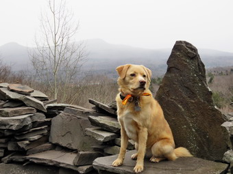
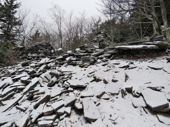
![]() On Saturday, December 9 I was committed to an all-day track meet at West Point. On Friday the meet was cancelled due to the forecast of snow and I was free to plan a hike. I decided I would try one again to go to the Blacks and asked Cindy if she would like to go. I was very disappointed when she said "NO!". We had been hiking together on Saturdays and, I thought, we had taken some very nice trips. I did a few quick chores around the house and was ready to leave by (;00 AM. It was only 25 degrees so I put on a full baselayer and wore my Columbia Omniheat pants. I wore a heavy Mammut pullover underneath my Mammut hoody. I wore light gloves and a hat but brought warmer gloves and mitts along as I did not expect the temperature to rise much during the day. I decided I would go to Sugarloaf which was a little closer than the Blacks. The forecast was for cloudy skies and light snow in the afternoon. My plan was to park at Roaring Kill and hike up the eastern side of Sugarloaf. After hiking over the summit and down the western slope to Mink Hollow, I could decide whether or not I wanted to try Plateau. We left Livingston Manor at 9:00 AM and Sheila seemed very happy to be getting out of the house. I headed out the DeBruce Road and turned left at the end onto Route 47 which passes by Frost Valley and the parking areas for Big Indian, Slide and Panther. There were a few cases in each lot. I turned right on Route 28 and decided to drive all the way to Phoenicia. I turned left on Route 214 and headed north through Chichester. At the end of Route 214 I turned right on Route 23A and then right onto Bloomer Road. When I got to Platte Clove Road I made another right and drove 3.3 miles to Dale Lane. I turned right and followed Dale Lane until it change to Roaring Kill Road where the surface was gravel. Shortly after that I turned left into the parking area and parked next to the only other car present. There was a slight wind blowing and the air seemed "raw" with an air temperature of 26 degrees. I set my electronics and we were on the trail by 10:00 AM. The first part of the trail to Pecoy Notch was frozen mud. After only .25 miles on the yellow Roaring Kill Trail we came to a trail junction. The blue Mink Hollow Trail turned right but we continued straight ahead on the blue Pecoy Notch Trail. I noted that having two different blue trails at the same junction is confusing! We continued on the trail ascending gently and began to run into evidences of bluestone quarrying. The trail flattened and then descended to Dibble Quarry at around .9 miles. Here visitors have built "furniture" and walls from the bluestone left lying around. I looked over toward Kaaterskill High Peak and Round Top and saw that they were enveloped in snow. So much for the forecast of snow in the afternoon! I knew this would not be good the snow would soon reach our location making the rocks slippery. It would mean the drive back home would also be interesting. I took pictures of the two mountains and then a few of Twin. I also took shots of the furniture. Sheila sat on one of the stone chairs and I took some photographs of her and the stonework before continuing. I knew that the beaver pond was not too far along and we arrived there at about 1.4 miles into the hike. There was no evidence the beavers had been at work recently. The pond was greatly reduced in size and was no on two smaller parts. I stopped to get some pictures. We walked to the area below the dam and had no problem crossing as the water level was so low. I stopped again to take a few more pictures of the pond and a few of Sugarloaf. The snow was now falling lightly and I put away the camera so we could continue on our way. We crossed a small stream and I took a few more pictures. As the snow fell, the rocks became slipperier and it was hard to see the patches of ice. Sheila was great help as I could see where she walked and either go the same way or avoid a questionable spot. From about 1.2 miles to 1.4 miles there was a steeper grade which led to a flat spot just before the trail ended at the red Devil's Path at Pecoy Notch at 1.9 miles. We made a right turn on the Devil's Path to continue up to the summit.
On Saturday, December 9 I was committed to an all-day track meet at West Point. On Friday the meet was cancelled due to the forecast of snow and I was free to plan a hike. I decided I would try one again to go to the Blacks and asked Cindy if she would like to go. I was very disappointed when she said "NO!". We had been hiking together on Saturdays and, I thought, we had taken some very nice trips. I did a few quick chores around the house and was ready to leave by (;00 AM. It was only 25 degrees so I put on a full baselayer and wore my Columbia Omniheat pants. I wore a heavy Mammut pullover underneath my Mammut hoody. I wore light gloves and a hat but brought warmer gloves and mitts along as I did not expect the temperature to rise much during the day. I decided I would go to Sugarloaf which was a little closer than the Blacks. The forecast was for cloudy skies and light snow in the afternoon. My plan was to park at Roaring Kill and hike up the eastern side of Sugarloaf. After hiking over the summit and down the western slope to Mink Hollow, I could decide whether or not I wanted to try Plateau. We left Livingston Manor at 9:00 AM and Sheila seemed very happy to be getting out of the house. I headed out the DeBruce Road and turned left at the end onto Route 47 which passes by Frost Valley and the parking areas for Big Indian, Slide and Panther. There were a few cases in each lot. I turned right on Route 28 and decided to drive all the way to Phoenicia. I turned left on Route 214 and headed north through Chichester. At the end of Route 214 I turned right on Route 23A and then right onto Bloomer Road. When I got to Platte Clove Road I made another right and drove 3.3 miles to Dale Lane. I turned right and followed Dale Lane until it change to Roaring Kill Road where the surface was gravel. Shortly after that I turned left into the parking area and parked next to the only other car present. There was a slight wind blowing and the air seemed "raw" with an air temperature of 26 degrees. I set my electronics and we were on the trail by 10:00 AM. The first part of the trail to Pecoy Notch was frozen mud. After only .25 miles on the yellow Roaring Kill Trail we came to a trail junction. The blue Mink Hollow Trail turned right but we continued straight ahead on the blue Pecoy Notch Trail. I noted that having two different blue trails at the same junction is confusing! We continued on the trail ascending gently and began to run into evidences of bluestone quarrying. The trail flattened and then descended to Dibble Quarry at around .9 miles. Here visitors have built "furniture" and walls from the bluestone left lying around. I looked over toward Kaaterskill High Peak and Round Top and saw that they were enveloped in snow. So much for the forecast of snow in the afternoon! I knew this would not be good the snow would soon reach our location making the rocks slippery. It would mean the drive back home would also be interesting. I took pictures of the two mountains and then a few of Twin. I also took shots of the furniture. Sheila sat on one of the stone chairs and I took some photographs of her and the stonework before continuing. I knew that the beaver pond was not too far along and we arrived there at about 1.4 miles into the hike. There was no evidence the beavers had been at work recently. The pond was greatly reduced in size and was no on two smaller parts. I stopped to get some pictures. We walked to the area below the dam and had no problem crossing as the water level was so low. I stopped again to take a few more pictures of the pond and a few of Sugarloaf. The snow was now falling lightly and I put away the camera so we could continue on our way. We crossed a small stream and I took a few more pictures. As the snow fell, the rocks became slipperier and it was hard to see the patches of ice. Sheila was great help as I could see where she walked and either go the same way or avoid a questionable spot. From about 1.2 miles to 1.4 miles there was a steeper grade which led to a flat spot just before the trail ended at the red Devil's Path at Pecoy Notch at 1.9 miles. We made a right turn on the Devil's Path to continue up to the summit.
 After making the turn, we began to encounter more than a thin layer of snow and ice on the rocks. This is due partly to elevation but also to the fact that the trail at this point has a northern exposure. As I was hiking along, I was being very careful to watch my footing and to watch where Sheila was going. I have had some interesting experiences on Sugarloaf. One winter I was hiking over a slab of ice with spikes. The ice was so hard I lost my footing and took a nasty fall. Fortunately, I was with other hikers and it was in an area where I could not slide very far! Another winter I did a solo ascent through several feet of snow. I remember that as I made the final approach to the summit I would take three steps forward and then slide back two! I am not sure how I finished that climb. I do remember that the return trip was much quicker. I was thinking of these things as we continued up some very steep rock scrambles which I knew would be worse on the way down. Just passed 2 miles we acme to a lookout toward Twin Mountain and I stopped to take a few pictures even though the snow was no falling more heavily. We went back to the main trail and started up the steepest part of the climb. There seemed to be less snow but more ice the farther up we went. Sugarloaf is one of the mountains that I always underestimate despite my checkered history on its slopes. I always think of it as a relatively easy hike and it is until the turn on the Devil's Path. After that turn, the next .5 miles average a 26% grade with some places being nearly vertical. Sheila was scampering ahead of me and doing a good job in most places of showing me a good line. Sheila and I continued through more steep places and until the trail leveled slightly as we approached the summit. We met no one on the way up as we passed the summit at about 3 miles. There was about an inch of snow in places and some ice but it was all manageable on the fairly level areas near the top. We started to head down the other side to make the loop but I noticed that going down was VERY slippery. Just a few hundred feet passed the summit is a spur trail to the left which gives views to the south but I was disappointed when we arrived as the views were mostly blocked by trees and obscured by the falling snow. Standing on the open stone ledge was very cold as the air temperature had dropped and the wind was blowing. At this point I decided we would abort the loop and return the way we had come. We headed back on the Devil's Path and across the summit to the descent. The increasing amount of snow made me think about every step I took and every foot placement I made.
 At the lookout toward Twin I noticed I could barely see the mountain. Just below this as I was trying to negotiate a downclimb, Sheila began to bark and advance on the trail. I called her back and saw another hiker coming up the mountain. I moved off to the side of the trail but he stopped for a moment. He was wearing Microspikes which I had avoided as they do not work well on rock. He said we had just come down Twin which I knew was a very steep descent. Hew was determined to continue his climb and passed us as we continued down. There were still a few more steep rock scrambles and I had a few close calls. By 1:45 PM we had hiked about 4.6 miles and were back at Pecoy Notch. We turned left off the Devil's Path to take the Pecoy Notch Trail back down the mountain. This trail is not as steep as the areas on the Devil's Path but the increasing amount of snow made the going slow. Eventually we crossed the small stream again and walked passed the beaver ponds. I stopped just Before Dibble's Quarry and took some pictures of the piles of bluestone and the areas where it had been quarried. At Dibble's Quarry we stopped again so that I could take pictures. This time the rocks were nearly covered in snow and Twin was barely visible. The valley below and Kaaterskill High Peak were completely invisible. I picked up my pack and we continued won the trail until Sheila alerted again. This tome two young men were hiking toward us. We said "Hello" and I warned them about the ascent of Sugarloaf. I have been a volunteer EMT for some time and think often in those terms. I hoped none of these hikers would take a fall! We continued down the Pecoy Notch Trail to the trail junction where we picked up the Roaring Kill Trail back to the car. We arrived at the car at 3:05 PM after hiking 6.1 miles in 5 hours. The elevation gain was 2100 feet. As I have said before, climbing the 35's can be a humbling experience. The trip back was very slippery in places even though the road crews had advanced warning of the storm. The trickiest part was driving up the hill by the Giant Ledge and Panther Mountain parking area and trying to allow for the inexperienced drivers without winter tires or all-wheel drive!
![]()
![]()
![]()
![]() On Thursday, December 7th my brother-in-law, Jeff, came to our house to do some "shopping". I have entirely too much hiking equipment and Jeff has recently decided to begin hiking. After picking out some boots and a set of poles, we decided we should check them out by going across the street to hike on Round Top. Jeff put on a new pair of boots and I got dressed to hike. The temperature was still in the high 30's so I wore my Mammut hoody since it has a lot of zippers to dump heat. Sheila was happy to go as I put her on her leash to walk across the street. We walked through the field next to the church and walked up the steep but short cemetery hill with Sheila giving me a little help as she pulled me up the hill. We turned left and entered the trail at about 10:15 AM. At the first trail junction Sheila turned right to head up the more gentle slope and we followed her. Where the trail split we continued to follow the yellow blazed lower trail which skirts the base of Round Top. At the next trail junction, we stayed on the yellow trail as it turned left. We walked down to the lookout over town and stopped for a few minutes to take in the view. We walked to the lower rock ledges to get a better look and then headed back to the main trail. We walked down the hill and back to the first trail junction. We turned around and headed back up to the lookout and followed the yellow trail to the trail junction. This time we continued straight ahead on the blue blazed upper trail which is a little steeper. We walked over the summit of Round Top and down the other side. At the trail junction we continued straight ahead on the lower trail and walked back to the first trail junction. At this point it was getting a little late so we turned left and headed out to the trailhead and down the cemetery hill to the church. We walked across the field and back to our driveway. It was about 11:30 AM and we had covered about 2 miles. What made the trip really worthwhile was that it allowed Jeff to "trail test" the boots which he found comfortable and supportive.
On Thursday, December 7th my brother-in-law, Jeff, came to our house to do some "shopping". I have entirely too much hiking equipment and Jeff has recently decided to begin hiking. After picking out some boots and a set of poles, we decided we should check them out by going across the street to hike on Round Top. Jeff put on a new pair of boots and I got dressed to hike. The temperature was still in the high 30's so I wore my Mammut hoody since it has a lot of zippers to dump heat. Sheila was happy to go as I put her on her leash to walk across the street. We walked through the field next to the church and walked up the steep but short cemetery hill with Sheila giving me a little help as she pulled me up the hill. We turned left and entered the trail at about 10:15 AM. At the first trail junction Sheila turned right to head up the more gentle slope and we followed her. Where the trail split we continued to follow the yellow blazed lower trail which skirts the base of Round Top. At the next trail junction, we stayed on the yellow trail as it turned left. We walked down to the lookout over town and stopped for a few minutes to take in the view. We walked to the lower rock ledges to get a better look and then headed back to the main trail. We walked down the hill and back to the first trail junction. We turned around and headed back up to the lookout and followed the yellow trail to the trail junction. This time we continued straight ahead on the blue blazed upper trail which is a little steeper. We walked over the summit of Round Top and down the other side. At the trail junction we continued straight ahead on the lower trail and walked back to the first trail junction. At this point it was getting a little late so we turned left and headed out to the trailhead and down the cemetery hill to the church. We walked across the field and back to our driveway. It was about 11:30 AM and we had covered about 2 miles. What made the trip really worthwhile was that it allowed Jeff to "trail test" the boots which he found comfortable and supportive.
![]()
![]()
![]()
![]() On Wednesday, December 6th I knew I needed to get out after several days of family commitments but I had to do it before my indoor track practice started. I decided to simply head across the street to Round Top and do some figure 8's just for the exercise. Sheila was happy to get out as we headed down the driveway and across the street for a hike on Round Top at about 10:00 AM. We crossed the street with Sheila on her leash and walked to the back of the church. We began the ascent of the steepest hill behind the church. The hill is short but really gets the circulation pumping and is the steepest and longest climb on the "trail". Sheila helped me along by pulling me up the hill. When we got to the top of the hill, we started out on the trail by turning left at the trailhead. As soon as we entered the trees I released Sheila from her leash. At the first trail junction we continued straight ahead to walk the steeper path to the viewpoint. At the lookout I noted that there was no garbage and everything was in order. We followed the trail to the right and started the gentle climb through the woods. When we reached the next trail junction, we stayed to the right to follow the lower trail around the base of Round Top to the next junction. At this junction we turned left and started up to the summit of Round Top on the steeper blue trail. We walked across the summit of Round Top and down the other side which is also a little steep. When we got to the yellow trail, we turned left to follow it to the second trail junction. This time we turned right and followed the yellow trail back to the very first trail junction. Just as we turned onto the woods road there was a small tree across the trail. It was long enough and heavy enough that I could not move it. I decided I would come back with a saw in the near future to remove it. At the trail junction we turned around and retraced our steps taking the more gentle path this time. When the yellow trail turned left, we followed it to the next trail junction were we turned right and headed up the blue trail to the summit. We walked over the top and down the other side to the yellow trail again. We turned right and followed the trail along the base of Round Top. Where the yellow trail turned left, we followed it to the left and down to the lookout. From the lookout we walked down hill to the first trail junction. My goad was to do four figure 8's. It takes me about 20 minutes to do one. We repeated the first two figure 8's with me taking time to think about various topics. Sheila was well-behaved and stayed with me most of the time except on the final round. She decided to go absolutely crazy and dash up and down the trail as she sometimes does. After finishing the last figure 8, we walked out to the trailhead. I put Sheila on her leash and we walked down the cemetery hill and across the field to our driveway. It was 11:45 AM and we had hiked about 3.3 miles in 1 hour and 45 minutes. It must have been a good workout as I was tired.
On Wednesday, December 6th I knew I needed to get out after several days of family commitments but I had to do it before my indoor track practice started. I decided to simply head across the street to Round Top and do some figure 8's just for the exercise. Sheila was happy to get out as we headed down the driveway and across the street for a hike on Round Top at about 10:00 AM. We crossed the street with Sheila on her leash and walked to the back of the church. We began the ascent of the steepest hill behind the church. The hill is short but really gets the circulation pumping and is the steepest and longest climb on the "trail". Sheila helped me along by pulling me up the hill. When we got to the top of the hill, we started out on the trail by turning left at the trailhead. As soon as we entered the trees I released Sheila from her leash. At the first trail junction we continued straight ahead to walk the steeper path to the viewpoint. At the lookout I noted that there was no garbage and everything was in order. We followed the trail to the right and started the gentle climb through the woods. When we reached the next trail junction, we stayed to the right to follow the lower trail around the base of Round Top to the next junction. At this junction we turned left and started up to the summit of Round Top on the steeper blue trail. We walked across the summit of Round Top and down the other side which is also a little steep. When we got to the yellow trail, we turned left to follow it to the second trail junction. This time we turned right and followed the yellow trail back to the very first trail junction. Just as we turned onto the woods road there was a small tree across the trail. It was long enough and heavy enough that I could not move it. I decided I would come back with a saw in the near future to remove it. At the trail junction we turned around and retraced our steps taking the more gentle path this time. When the yellow trail turned left, we followed it to the next trail junction were we turned right and headed up the blue trail to the summit. We walked over the top and down the other side to the yellow trail again. We turned right and followed the trail along the base of Round Top. Where the yellow trail turned left, we followed it to the left and down to the lookout. From the lookout we walked down hill to the first trail junction. My goad was to do four figure 8's. It takes me about 20 minutes to do one. We repeated the first two figure 8's with me taking time to think about various topics. Sheila was well-behaved and stayed with me most of the time except on the final round. She decided to go absolutely crazy and dash up and down the trail as she sometimes does. After finishing the last figure 8, we walked out to the trailhead. I put Sheila on her leash and we walked down the cemetery hill and across the field to our driveway. It was 11:45 AM and we had hiked about 3.3 miles in 1 hour and 45 minutes. It must have been a good workout as I was tired.
![]()
![]()
![]()
![]()
![]() On Saturday, December 2nd, I had planned to hike Balsam Lake Mountain from the Millbrook side wife my wife, Cindy, and her brother, Jeff. After reading some of my descriptions of hiking, Jeff decided he wanted to try hiking the Catskill 35's and maybe even all the trails in the Catskills. I though that hiking the more gentle trail from the Millbrook trailhead to the Balsam Lake Mountain firepower would be a good introduction to the 3500 foot peaks. We agreed to meet at the trailhead at 10:00 AM since he lives in Delhi and we were coming from Livingston Manor. On Thursday night Cindy got a text from Jeff saying he had a commitment on Saturday and would be unable to hike. I was disappointed but decided I would do the hike any way since it had been some time since I had hiked to Balsam Lake from the Millbrook side. When I got up in the morning it was only 23 degrees so I decided to wait a little before starting out. I asked Cindy if she would like to go and she agreed. Cindy and I got dressed and got our gear ready to go. It was still only 35 degrees at a little after 10:00 AM so I decided to wear tights and a baselayer on top> I wore my Columbia Omniheat pants and, as always, my Mammut hoody. We hadn't hiked in two days so Sheila was very excited as we put her in the backseat. We headed up the Quickway and took Route 206 towards Downsville. This route is a little longer than the Beaverkill Road but has less twists and turns. It seemed that every time we passed a spot where we had hiked before Sheila began to whine as if to say "Let's stop here!" I took a right on Route 30 when we reached the reservoir and then took the BWS roads to Millbrook Road. I drove passed Kelly Hollow and soon after pulled into the parking lot that serves Balsam Lake Mountain and Dry Brook Ridge. The lot was almost full with some people already parking on the road which was surprising. I found a spot that an earlier vehicle had vacated and managed to park in tight quarters. I set my electronics and we started the hike by crossing the road at 11:15 AM. I was still feeling the effects of a lingering cold but was happy to be out although I wished Jeff could have joined us. Unlike the climb from the Beaverkill Road which starts out almost flat, the ascent from Millbrook starts with an uphill gaining over 200 feet in the first half mile. Although the temperature was still only 27 degrees we both were comfortable at the beginning of the hike and began to warm up on the ascent. The trail is really a wide woods road which is passable by a high clearance vehicle. We were making good time by keeping a fast pace but it was making me a little tired.
On Saturday, December 2nd, I had planned to hike Balsam Lake Mountain from the Millbrook side wife my wife, Cindy, and her brother, Jeff. After reading some of my descriptions of hiking, Jeff decided he wanted to try hiking the Catskill 35's and maybe even all the trails in the Catskills. I though that hiking the more gentle trail from the Millbrook trailhead to the Balsam Lake Mountain firepower would be a good introduction to the 3500 foot peaks. We agreed to meet at the trailhead at 10:00 AM since he lives in Delhi and we were coming from Livingston Manor. On Thursday night Cindy got a text from Jeff saying he had a commitment on Saturday and would be unable to hike. I was disappointed but decided I would do the hike any way since it had been some time since I had hiked to Balsam Lake from the Millbrook side. When I got up in the morning it was only 23 degrees so I decided to wait a little before starting out. I asked Cindy if she would like to go and she agreed. Cindy and I got dressed and got our gear ready to go. It was still only 35 degrees at a little after 10:00 AM so I decided to wear tights and a baselayer on top> I wore my Columbia Omniheat pants and, as always, my Mammut hoody. We hadn't hiked in two days so Sheila was very excited as we put her in the backseat. We headed up the Quickway and took Route 206 towards Downsville. This route is a little longer than the Beaverkill Road but has less twists and turns. It seemed that every time we passed a spot where we had hiked before Sheila began to whine as if to say "Let's stop here!" I took a right on Route 30 when we reached the reservoir and then took the BWS roads to Millbrook Road. I drove passed Kelly Hollow and soon after pulled into the parking lot that serves Balsam Lake Mountain and Dry Brook Ridge. The lot was almost full with some people already parking on the road which was surprising. I found a spot that an earlier vehicle had vacated and managed to park in tight quarters. I set my electronics and we started the hike by crossing the road at 11:15 AM. I was still feeling the effects of a lingering cold but was happy to be out although I wished Jeff could have joined us. Unlike the climb from the Beaverkill Road which starts out almost flat, the ascent from Millbrook starts with an uphill gaining over 200 feet in the first half mile. Although the temperature was still only 27 degrees we both were comfortable at the beginning of the hike and began to warm up on the ascent. The trail is really a wide woods road which is passable by a high clearance vehicle. We were making good time by keeping a fast pace but it was making me a little tired.
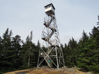 At .8 miles we began a switchback which eventually brought us to a flatter area at about 1.25 miles. I had not hiked from this direction many times but it seemed longer than I remembered. The tradeoff between the two starts is that the Beaverkill start is flat for some time and then has a steep climb. The hike from the Millbrook side climbs from the beginning but is not as steep as from the Beaverkill Road. Along the way there were some interesting rocks including some that had been eroded so that there were only a few "pillars" left separating some layers. There was some ice on the rocks and I stopped to take a picture and took one of Sheila licking the ice. The trail was icy in spots but it was easy to walk around it. The ice did remind me that packing spikes from now on would be a good idea! At 2.1 miles we came to the turnoff to the left for Graham and I knew the trail to the summit of Balsam Lake split off just ahead. My plan was to continue straight ahead and walk down to the steeper trail up the mountain. I like the challenge and this would allow us to make a sort of lollipop loop out of the hike. When we got to the point where the trail split, Cindy insisted on simply hiking to the top and then back out the way we had come. I was disappointed but knew there was no reason to argue. At 2.3 miles we turned right and started up the trail to the fire tower. Just after the start of the trail there is a metal gate. The climb alternates between steeper and more level sections and we were making good time on both. As we began the serious ascent, we met a group of three hikers coming down the mountain and heading back to Millbrook. They said there were some young people at the top and that there were bear tracks along the way. This did not surprise me as I have seen bear on the trail a number of times. As we continued up, we met a young man hiking down the trail and we said "Hello" as we passed. We continued on our scent and soon the trail flattened a little and we could see some old bear tracks in the ice. Several of the steeper ascents had ice and snow on them and we had to be careful as we negotiated our way around them. Soon I could see the cabin and hear voices. I put Sheila on her leash and just before the clearing I leashed her to a tree to keep her away from other people. There was a group of about a dozen young people at the summit clearing.
 It was 12:50 PM and we had hiked 3 miles. I put down my pack and got put my camera and began to ascend the tower. I noticed that the skies were still cloudy and as I climbed the wind picked up. The winds that were not noticeable at ground level were certainly noticeable as I climbed to just below the cab. I could hear Sheila barking and whining and if she was loose she would have no problem following me up the steps of the fire towers! I took pictures in all directions even though the skies were not ideal. It was nice to get some views of the hills and valleys. Balsam Lake is the westernmost 3500 foot peak and most of the other peaks are visible from it. I took few shots through the tower structure. Before putting the camera away, I took a few pictures of the tower from the ground. Before we started our return trip, I struck up a conversation with the young people. They were members of a hiking class from Binghamton University along with their instructor. They seemed to be having a good time and the instructor seemed very enthusiastic and knowledgeable. I asked them about the class and what hikes they do. Several members have taken Wilderness First Aid through SOLO. We started back down at 1:05 PM and I knew we probably would not be able to make good time because of the icy conditions. The sun was still pretty high in the sky as we began a careful descent of the icy path down to the Dry Brook Ridge Trail. Once we made the left turn onto the trail back to Millbrook Road we picked up the pace a little but we were really in no hurry. There were a few short ascents along the way but otherwise we kept moving quickly. We passed through the switchback which signaled to me that we were almost back to the car. Soon we were crossing the road and walking through the lot back to the car. We were back at 2:30 PM after hiking 6.0 miles in 3 hours and 15 minutes with a 1350 foot elevation gain. Although this is not a difficult hike I was pleased with our pace and glad we had decided to do the hike.
![]()
![]()
![]()
![]()
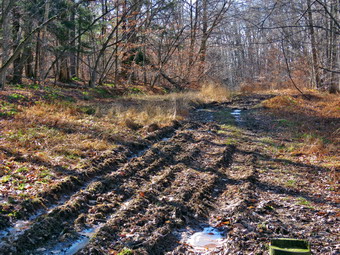
![]() On Wednesday, November 29th, I wanted to get in a longer hike but one not too far from home. I also wanted to stay in an area where there is not too much hunting and use well-established trails. I decided to go to Hodge and Frick Ponds and do a route I had not done before which would add a little mileage to my typical route. I had a few things to do around the house but eventually got my gear ready. The temperature on the back porch showed 52 degrees but I knew it would be colder at the trailhead. I donned my Columbia Omniheat pants but did not put on tights. I did wear a baselayer on top underneath a Mammut shirt and on top of that my Mammut Ultimate hoody. I made sure I had an orange hat and brought along a light pair of gloves. We had not been out in three days so Sheila was ready to go and kept an eye on me the whole time. We left Livingston Manor at 10:00 AM as I drove out the DeVRuce Road about 6 miles to Mongaup Pond Road. I turned left and drive to where the road split and stayed left on Beech Mountain Road. When we arrived at the trailhead parking at 10:15 AM there was one pickup truck in the small lot. I parked next to the truck and got ready to hike by setting my GPS devices. The temperature was 47 degrees so I put on my gloves and we headed out toward the trail register at 10:20 AM. The trail had deep ruts which seemed to be new and were far enough apart to be from a small truck. The trail was wet and muddy all the way to Gravestone Junction and the truck had really chewed up the trail. I intended do a figure 8 pattern so at the junction we turned right on the Loggers Loop. The ruts continued all the way to Times Square creating an ugly scene and destroying a good part of the trail. I began to think about the e-mail I would compose to the forester for the area again requesting a gate or a chain for the woods road leading from the parking to the Quick Lake Trail! The weather for hiking was almost ideal with blue skies and a few white, puffy clouds. The only drawback was the wind which was blowing all the time and producing some really big gusts. I kept hoping nothing would fall on us as we continued through Times Square on the Loggers Loop. There were quite a few branches on the trail and I removed them including a few larger ones that I had to take some time to drag off. I had hoped the ruts would end at Times Square and for a short distance it seemed like they did. The ground must have been harder as we climbed the Loggers Loop because within a shirt distance the ruts were back. At some point I started to notice that some work had been done around some of the culverts that cross the trail. The older metal culverts had been replaced by newer, plastic ones. I suspect that the DEC or a DEC contractor has been doing this work. If so, they picked a terrible time to work on the trails! The summer was very dry and the work could have been done without destroying the trails. I would have to say that the damage they have done is probably worse than the problems they are trying to correct!
On Wednesday, November 29th, I wanted to get in a longer hike but one not too far from home. I also wanted to stay in an area where there is not too much hunting and use well-established trails. I decided to go to Hodge and Frick Ponds and do a route I had not done before which would add a little mileage to my typical route. I had a few things to do around the house but eventually got my gear ready. The temperature on the back porch showed 52 degrees but I knew it would be colder at the trailhead. I donned my Columbia Omniheat pants but did not put on tights. I did wear a baselayer on top underneath a Mammut shirt and on top of that my Mammut Ultimate hoody. I made sure I had an orange hat and brought along a light pair of gloves. We had not been out in three days so Sheila was ready to go and kept an eye on me the whole time. We left Livingston Manor at 10:00 AM as I drove out the DeVRuce Road about 6 miles to Mongaup Pond Road. I turned left and drive to where the road split and stayed left on Beech Mountain Road. When we arrived at the trailhead parking at 10:15 AM there was one pickup truck in the small lot. I parked next to the truck and got ready to hike by setting my GPS devices. The temperature was 47 degrees so I put on my gloves and we headed out toward the trail register at 10:20 AM. The trail had deep ruts which seemed to be new and were far enough apart to be from a small truck. The trail was wet and muddy all the way to Gravestone Junction and the truck had really chewed up the trail. I intended do a figure 8 pattern so at the junction we turned right on the Loggers Loop. The ruts continued all the way to Times Square creating an ugly scene and destroying a good part of the trail. I began to think about the e-mail I would compose to the forester for the area again requesting a gate or a chain for the woods road leading from the parking to the Quick Lake Trail! The weather for hiking was almost ideal with blue skies and a few white, puffy clouds. The only drawback was the wind which was blowing all the time and producing some really big gusts. I kept hoping nothing would fall on us as we continued through Times Square on the Loggers Loop. There were quite a few branches on the trail and I removed them including a few larger ones that I had to take some time to drag off. I had hoped the ruts would end at Times Square and for a short distance it seemed like they did. The ground must have been harder as we climbed the Loggers Loop because within a shirt distance the ruts were back. At some point I started to notice that some work had been done around some of the culverts that cross the trail. The older metal culverts had been replaced by newer, plastic ones. I suspect that the DEC or a DEC contractor has been doing this work. If so, they picked a terrible time to work on the trails! The summer was very dry and the work could have been done without destroying the trails. I would have to say that the damage they have done is probably worse than the problems they are trying to correct!
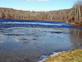 At 11:10 AM we had hiked 2.2 miles and were at Iron Wheel Junction. I felt very fresh and we were keeping a fast pace. We continued straight ahead on the Quick Lake Trail heading for Junkyard Junction and the Flynn Trail. I cleared a couple more blowdowns on the way up the Quick Lake Trail and removed numerous smaller branches. The distance between the two junctions is a little over 1.5 miles and the elevation gain is about 480 feet. This means the grade averages only about 5% but the ascent is noticeable and continuous most of the way. The weather remained beautiful and I was in a particularly good mood which made the hiking go rather quickly. By 11:45 AM we had hiked 3.7 miles to Junkyard Junction where we turned right into the Flynn Trail. The walk along the Flynn Trail was uneventful but pretty. There were some muddy spots which we avoided. When we reached Hodge Pond we turned left on the jeep road around the back of the pond. I wanted to get the maximum distance for the hike and I wanted to avoid the section of the Flynn Trail to the outlet of Hodge Pond as it has been very muddy. As we walked around the head end of Hodge I couldn't help but stop and walk down to the shore of the pond to take a few pictures. The sun was already high and to the south which made photographing tricky. I took some pictures, got a drink and a bar and then headed back to the trail which we followed down to the outlet end of the pond. Here we walked over to the shore so that I could take a few more pictures. I was surprised to hear a tinkling noise and to see the wind blowing a thin sheet of ice toward the outlet. The spices of ice were hitting each other and the shore to make the noise. The wind was blowing fiercely across the pond so I took my shots quickly and returned to my pack. We walked to the Flynn Trail and up the hill toward the junction with the Big Rock Trail. The hill can sometimes seem long and tiresome but I was still feeling very good. About halfway up the hill, Sheila alerted and I could see three hunters headed toward us. I put Sheila on her leash as the hunter approached and we said "Hello" as we passed. I was going to asked them if they knew they were on private property and not state land but decided against it.
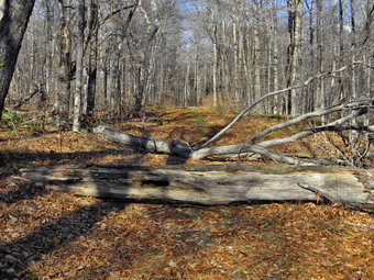 We continued to the top of the hill and walked the flat part of the trail to the junction with the Big Rock Trail. We turned right and started our walk down the Big Rock Trail. The sun was still out ad despite then wind I was warm. The trail had obviously carried a lot of water recently and there was a wide and deep ditch on the northern side. About two-thirds of the way down, we came across two very large tree trunks across the trail. I stopped to take a few pictures to document the blowdowns and to send to members of the snowmobile club who are allowed to use chainsaws. These trees could, of course, be removed by hand tools but it would be a real challenge. At 1:00 PM we arrived at Times Square again after hiking 5.7 miles. We continued straight ahead on the Big Rock trail which travels around the head end of Frick Pond and down the western side to the Quick Lake Trail. We walked over the wooden bridges and then the wooden walkways. The water was high in the small creeks. The walkways have needed work for some time and we have done we are happy to we could to shore them up with stones but they need some major work. The DEC does not seem concerned and it seems that their attitude is to wait until things break and then repair them rather than do preventative maintenance. We were soon at the end of the Big Rock Trail at the junction with the Quick Lake trail. We turned left to walk to the outlet of Frick Pond. We stopped at the bridge and I took a few pictures before the windchill made me retreat to my pack and don my gloves. We walked across the bridge and up the hill to Gravestone Junction. All that remained was to hike back out the short stretch of the Quick Lake Trail to the car. Just before the register, I looked up to see two hunters headed toward us. I leashed Sheila as we passed by wishing each other a "Good day". We were back at the car at 1:25 PM having hiked 7.7 miles in 3 Hours and 5 minutes with an elevation gain of 1100 feet. I was surprised that the distance wasn't over 8 miles. I was also surprised when I got home and plotted the "new" route only to find out I had done it before!
![]()
![]()
![]()
![]() On Saturday, November 25th I wanted to get out for a hike but had to do some chores in the morning. When I was done, I decided to head for Big Pond even though rain was forecast for 1:00 PM. I decided a short hike was better than none at all. Brad was willing to come along so we got dressed and got our gear ready to go. The temperature was only in the high 30's but it was very sunny and felt much warmer. It was hard to believe that rain was in the forecast! I wore my Mammut hoody and Columbia Omniheat pants but did not put on a baselayer as I thought I would be too warm. I had considered several possibilities to do a loop from Big Pond to Little Pond but realized this would depend on the weather we found as we hiked. We left Livingston Manor a little before 11:00 AM and headed north on Old Route 17. Just outside Livingston Manor I turned right on the Beaverkill Road and drove toward Lew Beach. The further we went the cloudier the sky became and the more likely the forecast of rain became. I drove through Lew Beach and turned left on the Barkaboom Road just before Turnwood. I turned left on the Barkaboom Road and drove to the parking area for Big Pond on the right. There were a few cars parked including one with the door hanging open! As we were getting ready to hike, a young couple came up to the car from Big Pond. They were staying at the North Branch Inn and wanted to know a little bit about the trails in the area. I gave them some information about hiking to Little Pond as I set my GPS. We crossed the road and headed up the trail at 11:20 AM. As we passed the register box, we could see several branches and tree trunks across the trail. I had not planned to do much clearing and had not packed any tools. Despite my intentions both Brad and I began to remove obstacles on the trail and this continued for the whole hike. As we were slowed by the work we were doing, the couple we had spoken to caught up with us. They asked a few more questions and then went on ahead. The first mile of the trail gains about 775 feet with an average grade of 15%. Some places are almost flat which means there are a few steeper places. I began to notice that the blazing of the trail was becoming intermittent due to the fact that several trees with blazes shad fallen. The DEC will no longer let volunteers put up the trail markers so the forester will have to come out to blaze the trail. We continued our hike up Touch-Me-Not Mountain under skies that were increasingly dark! We found a couple of new blowdowns that would require my big saw and an axe. We also found several that had been on the trail for some time despite my request to the FLTC to schedule a sawyer to help me remove them. In a few places the trail travels along the side of the hill and this made for some tricky footing. At the trail junction we had to make a decision and we chose to turn left and hike the Campground Trail down to Little Pond. This decision was influenced by the gathering clouds and a wind that blew up suddenly.
On Saturday, November 25th I wanted to get out for a hike but had to do some chores in the morning. When I was done, I decided to head for Big Pond even though rain was forecast for 1:00 PM. I decided a short hike was better than none at all. Brad was willing to come along so we got dressed and got our gear ready to go. The temperature was only in the high 30's but it was very sunny and felt much warmer. It was hard to believe that rain was in the forecast! I wore my Mammut hoody and Columbia Omniheat pants but did not put on a baselayer as I thought I would be too warm. I had considered several possibilities to do a loop from Big Pond to Little Pond but realized this would depend on the weather we found as we hiked. We left Livingston Manor a little before 11:00 AM and headed north on Old Route 17. Just outside Livingston Manor I turned right on the Beaverkill Road and drove toward Lew Beach. The further we went the cloudier the sky became and the more likely the forecast of rain became. I drove through Lew Beach and turned left on the Barkaboom Road just before Turnwood. I turned left on the Barkaboom Road and drove to the parking area for Big Pond on the right. There were a few cars parked including one with the door hanging open! As we were getting ready to hike, a young couple came up to the car from Big Pond. They were staying at the North Branch Inn and wanted to know a little bit about the trails in the area. I gave them some information about hiking to Little Pond as I set my GPS. We crossed the road and headed up the trail at 11:20 AM. As we passed the register box, we could see several branches and tree trunks across the trail. I had not planned to do much clearing and had not packed any tools. Despite my intentions both Brad and I began to remove obstacles on the trail and this continued for the whole hike. As we were slowed by the work we were doing, the couple we had spoken to caught up with us. They asked a few more questions and then went on ahead. The first mile of the trail gains about 775 feet with an average grade of 15%. Some places are almost flat which means there are a few steeper places. I began to notice that the blazing of the trail was becoming intermittent due to the fact that several trees with blazes shad fallen. The DEC will no longer let volunteers put up the trail markers so the forester will have to come out to blaze the trail. We continued our hike up Touch-Me-Not Mountain under skies that were increasingly dark! We found a couple of new blowdowns that would require my big saw and an axe. We also found several that had been on the trail for some time despite my request to the FLTC to schedule a sawyer to help me remove them. In a few places the trail travels along the side of the hill and this made for some tricky footing. At the trail junction we had to make a decision and we chose to turn left and hike the Campground Trail down to Little Pond. This decision was influenced by the gathering clouds and a wind that blew up suddenly.
The other hikers were taking a break at the junction as we made the left turn and started over the top of Touch-Me-Not Mountain. After a few moments, I looked back and saw them following us. I though that when we got to the campgrounds we could decide what route we would take as there were several possibilities for longer and shorter hikes. The Campground Trail is supposed to be maintained by the DEC but it looked as if no work had been done for some time. From the top of the mountain the trail drops 560 feet in .4 miles for an average grade of 26%. There are several areas where the descent is much steeper and the slippery oak leaves were not making the trip any easier. At some point I began to listen carefully and could hear the distinct sound raindrops hitting the leaves. We looked back several times but did not see the other hikers following us and wondered what had happened. The rain didn't keep up for very long and soon we were on the flatter part of the descent which led us out to the campgrounds just behind the main bathrooms. The skies were still dark and I did not feel like getting wet so we agreed to hike the roads back to the car. I was annoyed as I would have liked a longer hike but hoped we would get in about 4 miles anyway. The campgrounds are a little eerie when they are closed with no one around. We walked out the access road and passed the main entrance without seeing anyone at all. The walk out the access road is about .9 miles and is mostly downhill. We passed through the upper gate which was closed. There were four cars and trucks parked in a small pulloff near the gate and I knew these were hunters. We continued down to Barkaboom Road where we turned left and started the uphill walk back to the car. Having Sheila on her leash really helps as she pulls me up the hills quite nicely. Since there were no leaves on the trees we could get a good look at the stream that comes out of Big Pond. I looked down and saw an old foundation I had not seen before. A "ditch" led from upstream through the foundation to farther downstream. This is a good indication that this was mill of some type and the stream led through the millrace and, most likely, and undershot wheel. This is further supported by the dam on Big Pond that looks as if it had a series of boards to control the water level. The walk back to the car went quickly and we arrived back at the lot at 1:15 PM. We had hiked 4 miles in 1 hour and 55 minutes with a vertical gain of 1055 feet. I was disappointed that it had not rained and that we had cut our hike short anyway. Still, a short hike is better than no hike at all!
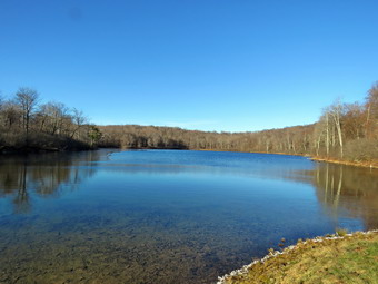
![]()
![]()
![]()
![]()
![]() On Friday, November 24th, I wanted to get in a hike instead of worrying about Black Friday! We did have some things to take acre of in the morning so we didn't get started until just before 1:00 PM. I asked Brad if she wanted to hike and he said "Yes" and we agreed to go to the Frick Pond area. This is our "go to" spot since it is close to home and there area number of different rails that can be combined into a variety of hikes. I decided against wearing tights underneath my pants but did wear my Mammut hoody since it has several different zippers to vent heat. I took a hat and light gloves since it was only 46 degrees when we left the house. Sheila acted as if she had not hiked in a month as she jumped into the back seat. We arrived at 1:15 PM to find the small lot filled with four cars. I parked in the larger lot which was empty. I checked the temperature and it was 42 degrees at the trailhead! I set my Garmin GPS and we crossed the road to get on the Flynn Trail. There was no breeze blowing and the sun was out which made for a pleasant walk. We did meet two hikers approaching with a dog on a leash and we said "Hello" as we passed. We made the right turn up the wide woods road that is the Flynn Trail and started up what was once the Beech Mountain Road. The grass was a little wet and there was some mud in places. It was obvious there had been some wind as we were constantly moving branches off the trail. In a few places I had to drop my poles and take a few minutes to lift larger obstacles off the trail. Sheila was having a great time following animal trails and running up and own the main trail. We set a good pace on the ascent but really did not hurry. By 2:00 PM we had made the 1.7 uphill miles to the junction with the Big Rock Trail. We continued on the Flynn Trail toward Hodge Pond. The skies were still sunny and the temperature was warm enough that I had to pen the sippers on my jacket. Hikes with Bard always go quickly as we have a lot in common since we both have experience in EMS.
On Friday, November 24th, I wanted to get in a hike instead of worrying about Black Friday! We did have some things to take acre of in the morning so we didn't get started until just before 1:00 PM. I asked Brad if she wanted to hike and he said "Yes" and we agreed to go to the Frick Pond area. This is our "go to" spot since it is close to home and there area number of different rails that can be combined into a variety of hikes. I decided against wearing tights underneath my pants but did wear my Mammut hoody since it has several different zippers to vent heat. I took a hat and light gloves since it was only 46 degrees when we left the house. Sheila acted as if she had not hiked in a month as she jumped into the back seat. We arrived at 1:15 PM to find the small lot filled with four cars. I parked in the larger lot which was empty. I checked the temperature and it was 42 degrees at the trailhead! I set my Garmin GPS and we crossed the road to get on the Flynn Trail. There was no breeze blowing and the sun was out which made for a pleasant walk. We did meet two hikers approaching with a dog on a leash and we said "Hello" as we passed. We made the right turn up the wide woods road that is the Flynn Trail and started up what was once the Beech Mountain Road. The grass was a little wet and there was some mud in places. It was obvious there had been some wind as we were constantly moving branches off the trail. In a few places I had to drop my poles and take a few minutes to lift larger obstacles off the trail. Sheila was having a great time following animal trails and running up and own the main trail. We set a good pace on the ascent but really did not hurry. By 2:00 PM we had made the 1.7 uphill miles to the junction with the Big Rock Trail. We continued on the Flynn Trail toward Hodge Pond. The skies were still sunny and the temperature was warm enough that I had to pen the sippers on my jacket. Hikes with Bard always go quickly as we have a lot in common since we both have experience in EMS.
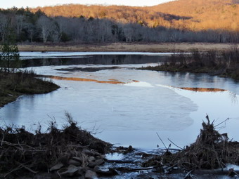 At the next trail junction we turned left to stay on the Flynn Trail toward Hodge. Pond. I had decided to stay on the Flynn Trail and Quick Lake Trail rather than take some of the other variations. When we reached the pond, we continued straight ahead and walked to the shore of Hodge Pond. There were very few clouds in the sky but there was a skim of ice on the pond. I decided to take a few pictures even though I have hundreds from this same spot. When I was done, we headed back to the Flynn Trail and followed it along the west side of the pond. The trail had been scrapped by OSI making it a muddy mess for some time but it was now slightly frozen so the mud was reduced. When the trail split, we headed left to stay on the Flynn Trail and walked uphill to the gate which marked the end of the OSI property. We headed toward Junkyard Junction on the Flynn Trail which was pretty wet with several muddy spots and some standing water. We cleared several larger branches and stopped to use the saw to clear one blowdown. At Junkyard Junction, we turned left on the Quick Lake Trail to descend toward Iron Wheel Junction. The trail continued to have wet and muddy spots but we could walk around them without problems. We did continue to pick up branches and clear a few larger blowdowns as we went. This part of the hike went a little more slowly than usual but by 3:25 PM we had hiked 4.9 miles and had arrived at Iron Wheel Junction. We turned right to stay on the Quick Lake Trail which was also wet and muddy in spots. We cleared one log that was lying on the trail and crossed the small stream in the woods. We walked through the "spruce tunnel" and cleared one more blowdown just before exiting. As we passed the junction with the Big Rock Trail two women approached from the opposite direction. We said "Hello" and I watched to see the route they were going to take as it was getting late. They chose to turn on they Big Rock Trail to hike around the pond which is the shortest hike they could take. We were soon at the bridge over the outlet to Frick Pond. We stopped and I took some pictures of the pond which was bathed in an orange glow from the setting sun. It seemed that the beaver dam had again been disturbed which annoyed me greatly. I have tried to alert the local ranger and the wildlife division but no one really seemed to care! I am still waiting for a report as to the reasons that someone thought they could destroy the dam! We continued up the hill on the Quick Lake Trail back to the car. We were back in the parking lot at 4:05 PM after hiking 6.5 miles and 920 vertical feet in 2 hours and 50 minutes. Only one car was in the lot when we left.
![]()
![]()
![]()
![]() On Wednesday, November 22nd I was ready to take a longer hike again after staying close to home for several hikes. The forecast for the day was for clouds and overcast for most of the day but when I got up there was a heavy mist bordering on rain. I was a little discouraged and decided I might not go out at all. By noon the weather was no better but I was itching to get out. It was still only 36 degrees outside so I dressed warmly with tights underneath my Columbia Omniheat pants. I also wore a long-sleeved baselayer underneath a top with my Mammut hoody over that. I did put on a blaze orange hat as it was rifle season in the area. Sheila seemed more than happy to be going out and by 12:30 Pm we were in the car with all my gear and ready to head out. After two quick stops in town I headed north on Route 17 to Roscoe and got off at exit 94. I headed out the Rockland Flats on Route 206 and just after entering Delaware County I turned left on Morton Hill Road. When I arrived at the intersection with Russell Brook Road, I found no cars parked in the private lot. The lot is clearly marked as private property and the owner does not like people to park there. I parked on the side of the road on the public right-of-way and as far off the pavement as possible. As soon as I parked, I could feel the breeze making me colder than the air temperature indicated. I had decided to hike from the intersection of Russell Brook Road and Morton Hill Road around Trout Pond and then take the Trout Pond Trail to Campbell Brook Road. I would hike out Campbell Brook Road to Morton Hill Road and then back to the car. I started down Russell Brook Road at 1:00 PM with a few snowflakes in the air. The small streams were flowing with water but I had decided I would do this hike as fast as possible without stopping to take pictures. As we approached the upper viewpoint over the falls I could hear the water roaring and looked down to see a large volume of water flowing over the falls. We continued down the road to the lower parking area where there was one pickup truck. We walked down the woods road and crossed the bridge on Russell Brook. When we reached the trail on the right to the lower falls, we simply continued on the main trail and at the first trail junction kept left to walk up the hill toward Mud Pond. The walk up the hill is about .8 miles and gains 400 feet. This isn't really steep but it does get the blood flowing right away. The first bridge over the stream was very slippery with water and some kind of slime. The walk up the hill was a little wet and muddy but it certainly warmed me up.
On Wednesday, November 22nd I was ready to take a longer hike again after staying close to home for several hikes. The forecast for the day was for clouds and overcast for most of the day but when I got up there was a heavy mist bordering on rain. I was a little discouraged and decided I might not go out at all. By noon the weather was no better but I was itching to get out. It was still only 36 degrees outside so I dressed warmly with tights underneath my Columbia Omniheat pants. I also wore a long-sleeved baselayer underneath a top with my Mammut hoody over that. I did put on a blaze orange hat as it was rifle season in the area. Sheila seemed more than happy to be going out and by 12:30 Pm we were in the car with all my gear and ready to head out. After two quick stops in town I headed north on Route 17 to Roscoe and got off at exit 94. I headed out the Rockland Flats on Route 206 and just after entering Delaware County I turned left on Morton Hill Road. When I arrived at the intersection with Russell Brook Road, I found no cars parked in the private lot. The lot is clearly marked as private property and the owner does not like people to park there. I parked on the side of the road on the public right-of-way and as far off the pavement as possible. As soon as I parked, I could feel the breeze making me colder than the air temperature indicated. I had decided to hike from the intersection of Russell Brook Road and Morton Hill Road around Trout Pond and then take the Trout Pond Trail to Campbell Brook Road. I would hike out Campbell Brook Road to Morton Hill Road and then back to the car. I started down Russell Brook Road at 1:00 PM with a few snowflakes in the air. The small streams were flowing with water but I had decided I would do this hike as fast as possible without stopping to take pictures. As we approached the upper viewpoint over the falls I could hear the water roaring and looked down to see a large volume of water flowing over the falls. We continued down the road to the lower parking area where there was one pickup truck. We walked down the woods road and crossed the bridge on Russell Brook. When we reached the trail on the right to the lower falls, we simply continued on the main trail and at the first trail junction kept left to walk up the hill toward Mud Pond. The walk up the hill is about .8 miles and gains 400 feet. This isn't really steep but it does get the blood flowing right away. The first bridge over the stream was very slippery with water and some kind of slime. The walk up the hill was a little wet and muddy but it certainly warmed me up.
From the top of the hill we descended slightly and then turned right to go north along the west side of Trout Pond. I kept watching for hunters along the rail but never saw any. As we hiked along the trail there were quite a few spots where there was water running across the trail or gathered in pools. The skies were still gloomy and the wind picked up. There were also quite a few flakes in the air. Over the next 1.2 miles we gained another 400 feet to the highest pot on the hike on the shoulder of Cherry Ridge. From that point the trail descends 450 feet over .8 miles to the bridge at the inlet of Trout Pond. I was careful as I walked over the bridge as it was also slippery. I now had to make a decision since I was already tired. I decide to stay with the original plan and we turned left on the Trout Pond Trail to start the hike toward Campbell Brook Road at 3.6 miles. From the lean-tos the trail rises 435 feet over .8 miles to the col between two hills to an elevation almost as great as the shoulder of Cherry Ridge. The trail was damp which made the leaves on the trail slippery. At the top of the hill I relied I had not had any water to drink so I stopped and downed about half a bottle. It was only 2:45 Pm but it was only getting darker. The wind had picked up again and the snow was falling a little more. I decided to continuing on the hiking trail farther than take the snowmobile trail which is a little shorter. The trail descends the same amount as we had just ascended over about the same distance. The descent is steep in places and was slippery. In addition, no trail maintenance has been done in years and we had to leave the trail several times. We crossed the bridge over a small stream and at 5.25 miles we were on Campbell Brook Road. The road was very muddy with a slick layer over frozen and pack dirt. I put Sheila on her leash for the road walk as we turned right on the road. Campbell Brook Road climbs a little to the intersection with Morton Hill Road. After that intersection, Morton Hill Road climbs some ore to the top of a small hill. After that point the road is downhill or flat the rest of the way. I was happy that we were on the road and could pick up our pace. Several vehicles passed us as we hiked on the road but none stopped. There wasn't too much to look at as the skies were overcast and the snow kept falling. At one point we heard dogs in the woods but soon found a pickup truck and I assumed the owner was running his dogs. I wondered whether that was legal during deer season. We set a quick pace with Sheila pulling me along at every opportunity as we returned to the parking area. The walk on Morton Hill Road was about 2.7 miles and took us 52 minutes! We were back at the car at 4:15 PM having covered 8.4 miles in 3 hours and 20 minutes with 1680 feet of ascent.
![]()
![]()
![]()
![]() On Tuesday, November 21st I had time to get in a hike before indoor track practice. Since I had some time, I had decided to take a longer hike at Frick Pond. Before we could get started, Cindy's phone stopped working and we were off to the local store where they were able to get it working rather quickly. By the time we got home, it was too late to go very far to hike. We decided to go across the street and hike on Round Top. We began to get ready around noon when the temperature was still in the low 40's. I wore my Mammut hoody since it has a lot of zippers to dump heat. Sheila was happy to go as I put her on her leash to walk across the street. We walked through the field next to the church and walked up the steep but short cemetery hill with Sheila giving me a little help as she pulled me up the hill. At the top of the hill I took a look back down to town and over to the surrounding hills but all was pretty bleak. I set my GPS to record the track and we entered the trail at 12:30 PM. At the first trail junction Sheila turned right to head up the ore gentle slope and we followed her. Where the trail split we continued straight ahead on the blue-blazed upper trail over the summit of Round Top. When we reached the top we continued down the other side and turned right onto the lower yellow-blazed trail. We followed the trail out to the lookout and turned left to continue down the hill to the first trail junction to complete a big loop. I wanted to hike a little more and convinced Cindy we should do at least one more loop. She reluctantly agreed and we turned around and headed back up to the lookout to do the big loop in the opposite direction. At the lookout we followed the yellow trail to the right and continued to where the trails split. We continued straight ahead on the blue trail to again cross over the summit of Round top. We followed the trail back down to the yellow trail and walked straight ahead and down the yellow trail to the first trail junction. Cindy was done at this point but I knew I wanted to get in at least an hour of hiking. Cindy started back out to the trailhead while Sheila and I turned around and headed back up the shallow climb on the yellow trail. It was hard to keep Sheila with me as she wanted to follow Cindy but soon we were headed over Round Top again. We finished the big loop exactly as we had done the first time and then did another in the opposite direction. After completely four big loops, we headed back out to the trailhead and down the cemetery hill to the church. We walked across the field and back to our driveway. It was about 1:30 PM and we had covered three miles which made the trip worthwhile.
On Tuesday, November 21st I had time to get in a hike before indoor track practice. Since I had some time, I had decided to take a longer hike at Frick Pond. Before we could get started, Cindy's phone stopped working and we were off to the local store where they were able to get it working rather quickly. By the time we got home, it was too late to go very far to hike. We decided to go across the street and hike on Round Top. We began to get ready around noon when the temperature was still in the low 40's. I wore my Mammut hoody since it has a lot of zippers to dump heat. Sheila was happy to go as I put her on her leash to walk across the street. We walked through the field next to the church and walked up the steep but short cemetery hill with Sheila giving me a little help as she pulled me up the hill. At the top of the hill I took a look back down to town and over to the surrounding hills but all was pretty bleak. I set my GPS to record the track and we entered the trail at 12:30 PM. At the first trail junction Sheila turned right to head up the ore gentle slope and we followed her. Where the trail split we continued straight ahead on the blue-blazed upper trail over the summit of Round Top. When we reached the top we continued down the other side and turned right onto the lower yellow-blazed trail. We followed the trail out to the lookout and turned left to continue down the hill to the first trail junction to complete a big loop. I wanted to hike a little more and convinced Cindy we should do at least one more loop. She reluctantly agreed and we turned around and headed back up to the lookout to do the big loop in the opposite direction. At the lookout we followed the yellow trail to the right and continued to where the trails split. We continued straight ahead on the blue trail to again cross over the summit of Round top. We followed the trail back down to the yellow trail and walked straight ahead and down the yellow trail to the first trail junction. Cindy was done at this point but I knew I wanted to get in at least an hour of hiking. Cindy started back out to the trailhead while Sheila and I turned around and headed back up the shallow climb on the yellow trail. It was hard to keep Sheila with me as she wanted to follow Cindy but soon we were headed over Round Top again. We finished the big loop exactly as we had done the first time and then did another in the opposite direction. After completely four big loops, we headed back out to the trailhead and down the cemetery hill to the church. We walked across the field and back to our driveway. It was about 1:30 PM and we had covered three miles which made the trip worthwhile.
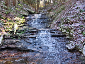
![]()
![]()
![]()
![]()
![]() On Friday, November 17th I had planned to go with Cindy to hike the Conklin Hill Loop and show her the waterfalls we had visited on Wednesday. I also wanted to hike to the upper waterfall which we had missed, pick a route around the blowdowns from Hurricane Sandy and hike the west bank of the small, unnamed brook we had followed back to the Willowemoc. I wanted to do this before the start of rifle hunting season in our area. I don't have a problem walking established trails during hunting season but bushwhacking during this time seems foolish. The loop starts at Willowemoc Covered Bridge and explores a part of the Willowemoc Wild Forest south of Willowemoc Road. The majority of this wild forest is to the north of the road and encompasses the area around Frick and Hodge Ponds and Long Pond. The smaller parcel south of Willowemoc Road has no trails but does have a few woods roads and informal paths to follow. When I got up at 7:00 AM the temperature was 30 degrees and I knew it might be colder where we are going. I put on a baselayer top and bottom and wore my Columbia Omniheat pants with the Mammut hoody. I made sure I wore a blaze orange hat and brought along light gloves. We got dressed and collected our gear to leave the house a little before 10:00 AM. From the caboose in Livingston Manor I drove out DebRuce Road 7.3 miles to Conklin Hill Road. I turned right and followed the road .4 miles passing through the covered bridge. There is a small parking area big enough for three cars just on the other side of the bridge and I parked there. The temperature was still in the low 30's and the wind was blowing making it seems colder. I set my GPS devices and we crossed the stream that runs parallel to Conklin Hill Road at !0:20 AM. We followed the path along the creek which was small but very pretty. This time I walked closer to the creek especially on the lower section to get a good look at the many rapids on the stream and a few small water falls. At about .5 miles we came to the largest water fall with the water dropping over a ledge that extends in both directions. I took a few pictures but the scene was much the same as the last time I hiked here. Just as we were about to walk around of the ledges on the left several rifle shots rang out. There is an old shooting range which the state has closed but not everyone has gotten the message or obeys the signs. The shooting stopped so we continued to hike around the rocks and up to the top of the falls. As we worked our way up the stream several more shots came from across the stream. I yelled a couple of times and the shooting completely stopped which actually surprised me! We continued walking south and upstream to about .75 miles where there are the abutments for an old bridge. From here we continued upstream heading south to the next waterfall which is about a quarter mile away. As we neared the quarter mile distance, I could see what I thought was the falls ahead but we had run out of room to hike along the creek. The banks were very steep so we walked back downstream slightly and then scaled the bank to a flatter area higher on the bank. As we neared the waterfall, the path became less distinct and we had to sidehill some to get a view. The falls was interesting as it was pretty high with The water flowing down over the rock. They layers in the sedimentary rock look like steps. The view was ok but I could not get any good pictures. I worked my way down the steep bank until I could stand in front of the falls. I took some pictures and then climbed back up the bank to where Cindy was waiting. On our way back we stayed high on the bank and found a much easier route back to the bridge abutments.
On Friday, November 17th I had planned to go with Cindy to hike the Conklin Hill Loop and show her the waterfalls we had visited on Wednesday. I also wanted to hike to the upper waterfall which we had missed, pick a route around the blowdowns from Hurricane Sandy and hike the west bank of the small, unnamed brook we had followed back to the Willowemoc. I wanted to do this before the start of rifle hunting season in our area. I don't have a problem walking established trails during hunting season but bushwhacking during this time seems foolish. The loop starts at Willowemoc Covered Bridge and explores a part of the Willowemoc Wild Forest south of Willowemoc Road. The majority of this wild forest is to the north of the road and encompasses the area around Frick and Hodge Ponds and Long Pond. The smaller parcel south of Willowemoc Road has no trails but does have a few woods roads and informal paths to follow. When I got up at 7:00 AM the temperature was 30 degrees and I knew it might be colder where we are going. I put on a baselayer top and bottom and wore my Columbia Omniheat pants with the Mammut hoody. I made sure I wore a blaze orange hat and brought along light gloves. We got dressed and collected our gear to leave the house a little before 10:00 AM. From the caboose in Livingston Manor I drove out DebRuce Road 7.3 miles to Conklin Hill Road. I turned right and followed the road .4 miles passing through the covered bridge. There is a small parking area big enough for three cars just on the other side of the bridge and I parked there. The temperature was still in the low 30's and the wind was blowing making it seems colder. I set my GPS devices and we crossed the stream that runs parallel to Conklin Hill Road at !0:20 AM. We followed the path along the creek which was small but very pretty. This time I walked closer to the creek especially on the lower section to get a good look at the many rapids on the stream and a few small water falls. At about .5 miles we came to the largest water fall with the water dropping over a ledge that extends in both directions. I took a few pictures but the scene was much the same as the last time I hiked here. Just as we were about to walk around of the ledges on the left several rifle shots rang out. There is an old shooting range which the state has closed but not everyone has gotten the message or obeys the signs. The shooting stopped so we continued to hike around the rocks and up to the top of the falls. As we worked our way up the stream several more shots came from across the stream. I yelled a couple of times and the shooting completely stopped which actually surprised me! We continued walking south and upstream to about .75 miles where there are the abutments for an old bridge. From here we continued upstream heading south to the next waterfall which is about a quarter mile away. As we neared the quarter mile distance, I could see what I thought was the falls ahead but we had run out of room to hike along the creek. The banks were very steep so we walked back downstream slightly and then scaled the bank to a flatter area higher on the bank. As we neared the waterfall, the path became less distinct and we had to sidehill some to get a view. The falls was interesting as it was pretty high with The water flowing down over the rock. They layers in the sedimentary rock look like steps. The view was ok but I could not get any good pictures. I worked my way down the steep bank until I could stand in front of the falls. I took some pictures and then climbed back up the bank to where Cindy was waiting. On our way back we stayed high on the bank and found a much easier route back to the bridge abutments.
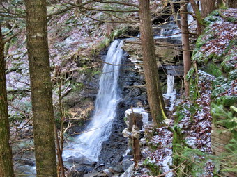 We turned right and started walking northeast through what was once a farm. I was hoping I could repeat the route we had taken on the previous hike but bushwhacks sometimes seem to have a mind of the their own. We came across the foundation of the farmhouse and I took some pictures which I had not done last time. As we left the farmhouse I took a route I hoped would lead us to the remains of the barn. My pathfinder abilities are good and soon we were at the barn a little farther up a slope. There were cement feed troughs with stalls for 16 cows. We continued to head northeast into the evergreen forest. The trees were tall, straight red pines planted by the CCC in the 1930's. As we wandered through the forest I was looking for the hill where the trees and been blown down. I thought I was a little too far to the south and corrected my route to head more to the north. Soon I could see the hill and we walked to the base and then worked our way around it through some thick brush. We also had to work our way over or around some trees that had blown down in the storms. In a short distance we descended a small hill and the ground leveled and we began to walk through a wetter area with beautiful moss. We had to work our way around some swampy areas until we turned north to follow another unnamed stream. This stream started out very small and we could easily cross and recross it. As we continued to walk north and downstream the volume of water began to grow. We were walking on the western side of the stream and at 2.1 miles we came to a rather impressive waterfall. This time I wanted to stay high on the western bank to see how this compared to the route we had taken last time along the lower eastern bank. We stopped at a vantage point to observe the falls and I took some pictures. The falls were clearly visible but I definitely preferred the view from the eastern bank where we could get right don to the falls. We continued to work our way down the western side of the stream and found the hiking much more difficult than on the other side. There were few more lookouts with good views to the stream and the ledges and cliffs on the eastern side. Several times we adjusted our route so that we could stay closer to the stream. It wasn't long before I could see the Willowemoc and it was clear we would have to descend off the higher bank down to the stream bed. This proved a little tricky but we were able to get down without too many problems. At 2.5 miles the stream ended at the Willowemoc Creek. We were able to walk along the creek bed for a while and found a nice area of exposed rock. We walked out on the rocks and I was able to take some shots up and down the creek. We returned to the area near the shore and continued to walk along the creek bed until in appeared we would run out of walking space. We headed up the bank to walk the path along the northern side of the Willowemoc. Some cabins and houses began to appear on the other side and the path along the stream was very clear in most places. At one point Sheila alerted and I saw a man standing in the woods. We said "Hello" and talked about the upcoming hunting season. We dropped won off the bank and continued along the flatter path along the creek. It was very pretty and the walking was easy. I took a look at my Suunto watch and could see we were closing the loop quickly. Soon we could see the covered bridge ahead across the stream. We came to the brook we had crossed earlier and walked up to our cars. It was hard to get an exact mileage as we had taken several "side trips" but the loop was about 3.5 miles with an elevation gain of 600 feet. It was 12:50 PM and we had taken 2 hours and 35 minutes to do the walk with about 35 minutes stopped for exploring.
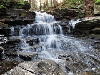
![]()
![]()
![]()
![]()
![]() On Wednesday, November 15th I had planned to go with Lisa and mutual friend Randy and a bushwhacking adventure starting at the Willowemoc Covered Bridge and exploring a part of the Willowemoc Wild Forest south of Willowemoc Road. The majority of this wild forest is to the north of the road and encompasses the area around Frick and Hodge Ponds and Long Pond. The smaller parcel south of Willowemoc Road has no trails but does have a few woods roads and informal paths to follow. Randy lives in the area and has explored it extensively so we planned to follow him. When I got up at 7:00 AM the temperature was 30 degrees and I knew it might be colder where we are going. I put on a baselayer top and bottom and wore my Columbia Omniheat pants with the Mammut hoody. I made sure I wore a blaze orange hat and brought along light gloves. I wasn't sure whether I should bring Sheila because of the hunting in the area but decided she should come with me. Sheila seemed to appealed my decision. I met Lisa at the caboose in Livingston Manor at 8:00 AM and we drove out DebRuce Road to Conklin Hill Road where we turned right and followed the road .4 miles passing through the covered bridge. There is a small parking area big enough for three cars just on the other side of the bridge and Randy was waiting there for us. We parked and got out of our cars to get acquainted. After talking briefly, I set my GPS devices and we crossed the stream that runs parallel to Conklin Hill Road at 8:25 AM. We followed the path along the creek which was small but very pretty. I took a few pictures as we continued south and southeast along the creek. There were many rapids on the stream and a few small water falls. At about .5 miles we came to the largest water fall with the water dropping over a ledge that extend in both directions. I took quite a few pictures including some of Sheila in front of the falls. I also took shots of the ledges as we worked our way to the left around the rocks and up to the top of the falls. We continued walking south and upstream to about .75 miles where Randy pointed out the abutments for an old bridge. He said there was another waterfalls about a quarter mile upstream but we turned left and started walking northeast through what was once a farm. We came across what looked like the foundation of the farmhouse and a little farther up a slope the remains of the barn. There were cement feed troughs with stalls for 16 cows. I took some pictures of the barn and then we continued to head northeast into an evergreen forest. The trees were tall and straight and I think they were red pines planted by the CCC in the 1930's. At 1.1 miles we hit the highest point on the hike on the shoulder of a hill. We walked uphill to a small lookout that gave a vantage point on the forest below. We could see that the trees on the hilltop had been flattened by the storms from Hurricane Sandy.
On Wednesday, November 15th I had planned to go with Lisa and mutual friend Randy and a bushwhacking adventure starting at the Willowemoc Covered Bridge and exploring a part of the Willowemoc Wild Forest south of Willowemoc Road. The majority of this wild forest is to the north of the road and encompasses the area around Frick and Hodge Ponds and Long Pond. The smaller parcel south of Willowemoc Road has no trails but does have a few woods roads and informal paths to follow. Randy lives in the area and has explored it extensively so we planned to follow him. When I got up at 7:00 AM the temperature was 30 degrees and I knew it might be colder where we are going. I put on a baselayer top and bottom and wore my Columbia Omniheat pants with the Mammut hoody. I made sure I wore a blaze orange hat and brought along light gloves. I wasn't sure whether I should bring Sheila because of the hunting in the area but decided she should come with me. Sheila seemed to appealed my decision. I met Lisa at the caboose in Livingston Manor at 8:00 AM and we drove out DebRuce Road to Conklin Hill Road where we turned right and followed the road .4 miles passing through the covered bridge. There is a small parking area big enough for three cars just on the other side of the bridge and Randy was waiting there for us. We parked and got out of our cars to get acquainted. After talking briefly, I set my GPS devices and we crossed the stream that runs parallel to Conklin Hill Road at 8:25 AM. We followed the path along the creek which was small but very pretty. I took a few pictures as we continued south and southeast along the creek. There were many rapids on the stream and a few small water falls. At about .5 miles we came to the largest water fall with the water dropping over a ledge that extend in both directions. I took quite a few pictures including some of Sheila in front of the falls. I also took shots of the ledges as we worked our way to the left around the rocks and up to the top of the falls. We continued walking south and upstream to about .75 miles where Randy pointed out the abutments for an old bridge. He said there was another waterfalls about a quarter mile upstream but we turned left and started walking northeast through what was once a farm. We came across what looked like the foundation of the farmhouse and a little farther up a slope the remains of the barn. There were cement feed troughs with stalls for 16 cows. I took some pictures of the barn and then we continued to head northeast into an evergreen forest. The trees were tall and straight and I think they were red pines planted by the CCC in the 1930's. At 1.1 miles we hit the highest point on the hike on the shoulder of a hill. We walked uphill to a small lookout that gave a vantage point on the forest below. We could see that the trees on the hilltop had been flattened by the storms from Hurricane Sandy.
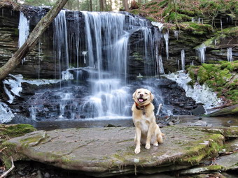 From this highpoint we began to descend through some dense brush and small trees. We also had to work our way over or around some trees that had blown down in the storms. In a short distance the ground leveled and we began to walk through a wetter area with beautiful moss until at 1.4 miles we turned north to follow another unnamed stream. This stream started out very small and we could easily cross and recross it. As we continued to walk north and downstream the volume of water began to grow. We had been walking on the western side of the stream but at 1.5 miles we came to a rather impressive waterfall. We crossed the top of the falls and then worked our way down the eastern side of the stream eventually getting down into the stream bed. It seemed that few people visited this area as there was no garbage strewn around. I took pictures of the falls and the cliffs around it. When I was done, we had to decide whether we were going to backtrack to the top of the falls and follow Randy's normal route or continue along the eastern bank of the creek. We decided to explore a different route and continued down the side we were on carefully picking a route along the stream that revealed several areas of cliffs and ledges. At 1.95 miles the stream ended at the Willowemoc Creek. We were able to walk along the creek bed for a while and found a nice area of exposed rock. We walked out on the rocks and I was able to take some shots up and down the creek. We returned to the area near the shore and continued to walk along the creek bed until in appeared we would run out of walking space. We headed up the bank to walk the path along the northern side of the Willowemoc. Some cabins and houses began to appear on the other side and the path along the stream was very clear in most places. It was very pretty and the walking was easy. I took a look at my Suunto watch and could see we were closing the loop quickly. Soon we could see the covered bridge ahead across the stream. We came to the brook we had crossed earlier and walked up to our cars. It was hard to get an exact mileage as we had taken several "side trips" but the loop was about 3.1 miles with an elevation gain of only 470 feet. It was 11:05 AM and we had taken 2 hours and 45 minutes to do the walk with more than 45 minutes stopped for exploring. I defiantly will return with Cindy to show her this beautiful space.
![]()
![]()
![]()
![]() On Monday, November 13th I had a day free without practice as cross country had finished on Saturday and indoor track was scheduled to begin on Tuesday. Lisa and I had been trying to get people to hike the new trails on Round Top so she scheduled some after school and lunchtime hikes to see if they would attract people. A walk was scheduled for noon but only three people had signed up. I decided that I had made a commitment to hike so I would keep it even though I doubted two of us would be needed. In the morning Lisa sent an e-mail indicating two of the people had cancelled which was even more frustrating. I began to get ready around 11:30 Am and Cindy agreed to go with me. The temperature was in the high 30's as we got ready to go so I wore my Mammut hoody since it has a lot of zippers to dump heat. Sheila was happy to go as I put her on her leash to walk across the street. We walked through the field next to the church arriving at exactly noon. We waited around but no one was in the parking lot and at 12:10 PM we decided to go hike on our own. We walked up the steep but short cemetery hill with Sheila giving me a little help as she pulled me up the hill. At the top of the hill I took a look back down to town and over to the surrounding hills but all was pretty bleak. Just as we were about to go into the forest Cindy spotted Lisa and another woman in the parking area. We waited as they walked up the road through the cemetery to the trailhead. The other woman had a dog on a leash and when they arrived we all said "Hello". Sheila and Pepper seemed to get along OK especially when they were both off their leashes. I set my GPS to record the trail and we finally entered the trail at 12:20 PM. At the first trail junction we continued straight ahead to the lookout. Lisa and the other hiker took a quick peak at the lookout and we then continued to follow the yellow trail. At the trail junction where the lower and upper trail split we continued to follow the yellow-blazed lower trail which is all that the other two hikers wanted to do. The trails were in good shape but there were some new branches on the trail which I removed. At the next trail junction we turned right and followed the woods road back down to the first trail junction. We turned left and walked out to the trailhead. Lisa and the other woman departed but I had no intention of hiking less than a mile so Cindy and I headed back into the woods. This time we turned right at the first trail junction and headed up the more gradual slope following the woods road and the yellow blazes. At the trail junction we continued straight ahead on the blue trail and worked our way up to the summit. The trail is short but steep. We walked over the summit and started down the other side. When we got to the yellow-blazed lower trail we turned right and walked down to the lookout. We continued to follow the yellow blazes down the hill and back to the first trail junction. We walked straight out to the trailhead. Cindy was finished for the day but I wanted to get in a little more hiking and wanted to record an accurate track of a single figure 8. Cindy walked down the cemetery hill while Sheila and I headed back into the forest. Sheila kept looking back as we separated but soon was running ahead of me. At the first trail junction we turned right again and walked the woods road up to the next junction where we turned left to follow the yellow trail around the base of Round Top. At the next junction we turned right and took the blue trail over the top of the hill and down the other side. When we came to the yellow trail, we turned right and followed the trail along the base of Round Top and won to the lookout. We walked down the hill and out to the trailhead. I now had a GPS track of the lower loop, upper loop and a figure 8. We had only walked 2.4 miles but I was a little bored so I decided to head home. By the time we were at he house we had hiked close to three miles. When I looked at the GPS track, I was surprised to see that even though we had walked the same trail repeatedly the tracks seemed to differ quite bit. I attributed this to the fact that the trails are short and cover a small area so when I zoom in on the tracks they seem not to overlap each other. I was able to separate out the three different routes we had taken.
On Monday, November 13th I had a day free without practice as cross country had finished on Saturday and indoor track was scheduled to begin on Tuesday. Lisa and I had been trying to get people to hike the new trails on Round Top so she scheduled some after school and lunchtime hikes to see if they would attract people. A walk was scheduled for noon but only three people had signed up. I decided that I had made a commitment to hike so I would keep it even though I doubted two of us would be needed. In the morning Lisa sent an e-mail indicating two of the people had cancelled which was even more frustrating. I began to get ready around 11:30 Am and Cindy agreed to go with me. The temperature was in the high 30's as we got ready to go so I wore my Mammut hoody since it has a lot of zippers to dump heat. Sheila was happy to go as I put her on her leash to walk across the street. We walked through the field next to the church arriving at exactly noon. We waited around but no one was in the parking lot and at 12:10 PM we decided to go hike on our own. We walked up the steep but short cemetery hill with Sheila giving me a little help as she pulled me up the hill. At the top of the hill I took a look back down to town and over to the surrounding hills but all was pretty bleak. Just as we were about to go into the forest Cindy spotted Lisa and another woman in the parking area. We waited as they walked up the road through the cemetery to the trailhead. The other woman had a dog on a leash and when they arrived we all said "Hello". Sheila and Pepper seemed to get along OK especially when they were both off their leashes. I set my GPS to record the trail and we finally entered the trail at 12:20 PM. At the first trail junction we continued straight ahead to the lookout. Lisa and the other hiker took a quick peak at the lookout and we then continued to follow the yellow trail. At the trail junction where the lower and upper trail split we continued to follow the yellow-blazed lower trail which is all that the other two hikers wanted to do. The trails were in good shape but there were some new branches on the trail which I removed. At the next trail junction we turned right and followed the woods road back down to the first trail junction. We turned left and walked out to the trailhead. Lisa and the other woman departed but I had no intention of hiking less than a mile so Cindy and I headed back into the woods. This time we turned right at the first trail junction and headed up the more gradual slope following the woods road and the yellow blazes. At the trail junction we continued straight ahead on the blue trail and worked our way up to the summit. The trail is short but steep. We walked over the summit and started down the other side. When we got to the yellow-blazed lower trail we turned right and walked down to the lookout. We continued to follow the yellow blazes down the hill and back to the first trail junction. We walked straight out to the trailhead. Cindy was finished for the day but I wanted to get in a little more hiking and wanted to record an accurate track of a single figure 8. Cindy walked down the cemetery hill while Sheila and I headed back into the forest. Sheila kept looking back as we separated but soon was running ahead of me. At the first trail junction we turned right again and walked the woods road up to the next junction where we turned left to follow the yellow trail around the base of Round Top. At the next junction we turned right and took the blue trail over the top of the hill and down the other side. When we came to the yellow trail, we turned right and followed the trail along the base of Round Top and won to the lookout. We walked down the hill and out to the trailhead. I now had a GPS track of the lower loop, upper loop and a figure 8. We had only walked 2.4 miles but I was a little bored so I decided to head home. By the time we were at he house we had hiked close to three miles. When I looked at the GPS track, I was surprised to see that even though we had walked the same trail repeatedly the tracks seemed to differ quite bit. I attributed this to the fact that the trails are short and cover a small area so when I zoom in on the tracks they seem not to overlap each other. I was able to separate out the three different routes we had taken.
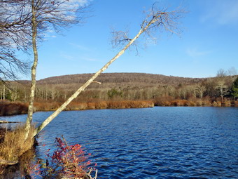
![]()
![]()
![]()
![]()
![]() On Sunday, November 12th I wanted to get in a hike after church since I did not know what the rest of the week might have in store. By the time got home from church it was well after noon so I knew we couldn't go far from home. Since we are back on standard time, it starts to get dark as early as 4:30 PM. I suggested to Cindy that we go to the Frick Pond trailhead and hike a loop to Mongaup Pond and use the roads to return as it would be a faster route back that way. She agreed and Sheila immediately sensed a hike was in the works. I had been at the state cross country championship on Friday and Saturday so Sheila had missed two days of hiking! We began to get our gear together which made Sheila watch us very closely. As we got ready to leave the house just before 1:00 PM, the temperature was only 37 degrees but the sun was shining. I wore my Mammut hoody over a heavier long-sleeved shirt and a light baselayer. I wore a pair of Columbia Omniheat pants which have become my favorite since Mountain Hardwear foolishly dropped their Winter Wander pants! I did wear a light hat and took a pair of gloves. We got our gear and Sheila in the car and headed out the DeBruce Road. After 6 miles, at Mongaup Pond Road, I turned left and continued to follow the road bearing left onto Beech Mountain Road at the fork. When we arrived in the parking area there were two other cars parked in the small lot. Sheila was acting as if she hadn't hiked in a month as she ran around and headed for the trail. The temperature was 34 degrees but the sun was shining. I got my gear ready to go and set my electronics. We headed across the road to get ion the Flynn Trail at 1:15 PM. The Flynn Trail was pretty dry without any snow but there was evidence that the rains from a few weeks before had caused small "rivers" on the trails. There were clearly areas where all the leaves had been swept away and deposited elsewhere. When we got to the woods road, we turned right and started to climb the Flynn Trail toward the junction with the Big Rock Trail. We set a pretty fast pace as the trail was in good shape. We did stop a few times to move larger branches out of the way and so that I could take a few pictures. It was hard to believe that the last time I hiked the trail it was covered in snow. IT didn't seem long at all until we were approaching the junction with the Big Rock Trail at 1.7 miles into the hike. By the time we were at the junction, we had already gained 600 feet and only had a little more elevation gain until we would start downhill. We turned right at the junction on the snowmobile trail and climbed another 120 feet to the highest point on the hike at a little over 1.9 miles.
On Sunday, November 12th I wanted to get in a hike after church since I did not know what the rest of the week might have in store. By the time got home from church it was well after noon so I knew we couldn't go far from home. Since we are back on standard time, it starts to get dark as early as 4:30 PM. I suggested to Cindy that we go to the Frick Pond trailhead and hike a loop to Mongaup Pond and use the roads to return as it would be a faster route back that way. She agreed and Sheila immediately sensed a hike was in the works. I had been at the state cross country championship on Friday and Saturday so Sheila had missed two days of hiking! We began to get our gear together which made Sheila watch us very closely. As we got ready to leave the house just before 1:00 PM, the temperature was only 37 degrees but the sun was shining. I wore my Mammut hoody over a heavier long-sleeved shirt and a light baselayer. I wore a pair of Columbia Omniheat pants which have become my favorite since Mountain Hardwear foolishly dropped their Winter Wander pants! I did wear a light hat and took a pair of gloves. We got our gear and Sheila in the car and headed out the DeBruce Road. After 6 miles, at Mongaup Pond Road, I turned left and continued to follow the road bearing left onto Beech Mountain Road at the fork. When we arrived in the parking area there were two other cars parked in the small lot. Sheila was acting as if she hadn't hiked in a month as she ran around and headed for the trail. The temperature was 34 degrees but the sun was shining. I got my gear ready to go and set my electronics. We headed across the road to get ion the Flynn Trail at 1:15 PM. The Flynn Trail was pretty dry without any snow but there was evidence that the rains from a few weeks before had caused small "rivers" on the trails. There were clearly areas where all the leaves had been swept away and deposited elsewhere. When we got to the woods road, we turned right and started to climb the Flynn Trail toward the junction with the Big Rock Trail. We set a pretty fast pace as the trail was in good shape. We did stop a few times to move larger branches out of the way and so that I could take a few pictures. It was hard to believe that the last time I hiked the trail it was covered in snow. IT didn't seem long at all until we were approaching the junction with the Big Rock Trail at 1.7 miles into the hike. By the time we were at the junction, we had already gained 600 feet and only had a little more elevation gain until we would start downhill. We turned right at the junction on the snowmobile trail and climbed another 120 feet to the highest point on the hike at a little over 1.9 miles.
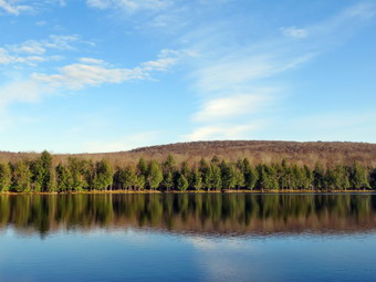 After hitting the high point, most of the rest of the hike was downhill. The Flynn Trail heads directly north from the trailhead but the snowmobile trail wanders first east, then south, the east, then north before finally heading southeast and south toward Mongaup Pond. As we descended from the high point we found more evidence that there had been a stream of water flowing down most of the trail. We also encountered some snow and I stopped to take some shots. We also found ice crystals protruding up from the dozen ground and I took a few more pictures. At 3.1 miles we followed the trail as it turned southeast and then east still descending toward the pond. We finally hot a woods road and the trail leveled out. Just before getting to the roads that run through the campground we passed by a swamp on the left and crossed a few small streams across the trail. When we got to the roads we turned right and walked out to the main loop road. Before turning right, I took a few pictures of the wetland in that area of the pond. We trend right and walked south on the loop road. After a short walk, I turned where I took off my pack and got out the camera. I took pictures of the pond from the shore including some of the surrounding hills. I stowed the camera and shouldered my pack to walk out to the loop road. After walking a little more than half a mile we came to the observation deck and found some people fishing. I took a few more pictures and then we continued on the loop road out to the entrance of the campground. We walked out the access road to begin the walk back to the car. We both noticed at5h t the sun had dipped low in the sky and it was getting a little darker and a little colder. The access road is easy to walk but is always longer than I remember. From the booth at the campground entrance to the intersection with Beech Mountain Road is only 1.1 miles but it seemed longer even though we pushed the pace. At the intersection we turned right and walked up the hill for .3 mils to the car. One car that had been in the lot was gone and the wiener of the other car, who appeared to be a hunter, was just getting ready to leave. It was 3:55 PM and we had spent 2 hours and 40 minutes hiking 6.4 miles for an overall average speed of 2.4 mph and a total climb of 960 feet.
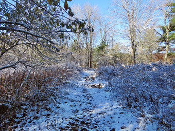
![]()
![]()
![]()
![]()
![]() On Wednesday, November 8th, I got up to find the trees covered in frozen snow with about 2 inches of snow on then ground. The temperature at 6:30 AM was 27 degrees. I was anxious to get out and take some pictures of the sunlight shiny off the snow-covered trees. As I was getting my equipment ready, the ambulance pager went off! This happens frequently and I have just accepted the fact that my life will be interrupted at inconvenient times. I called in and met my driver at the building. We headed out the DeBruce Road and found increasingly beautiful scenes. We returned from the call at about 10:30 AM and I was hoping that the snow would still be on the trees on Round Top so that I could hike there and take some pictures. Unfortunately the direct sunlight had melted most of the snow on Round Top so I decided to head to Frick Pond where I hoped there would be more snow and colder temperatures. I got dressed and assembled my gear with Sheila watching closely. I got Sheila in the back seat and headed out the DeBruce Road a little before 11:00 AM. There was much less snow on the trees than earlier but at least there was some left. After about 6 miles, I turned left on the Mongaup Pond Road and drove until the road split. I stayed to the left on the Beech Mountain Road and drove to the parking lot at the trailhead. There was already one car parked there and a couple was wandering round the lot. I got out of the car and the couple approached me for some information. They wanted to hike the "big loop" so I instructed them how to hike up the Flynn Trail and then take the Quick Lake Trail back to the parking area. It was 34 degrees at the trailhead and there was quite a bit of snow on the trees. I immediately took some pictures and then set my GPS. I was glad I had chosen to wear tights underneath my pants and had donned my Mammut hoody. At 11:10 AM we walked out the Quick Lake Trail toward Frick Pond. The trail was covered in snow and was also very wet from the rain that preceded the snow. There was plenty of mud that seemed to have been churned up my a vehicle. At Gravestone Junction we stayed left on the Quick lake Trail to head down the hill to the bridge at the outlet end of Frick Pond. The trail here was mostly shaded so there was still a good amount of snow left. I stopped to take a few pictures on the snow on the trail and on the trees. We stopped at the bridge to take a few pictures even though there wasn't much snow left on the trees. The pond was very blue and the trees around it were reflected in the water.
On Wednesday, November 8th, I got up to find the trees covered in frozen snow with about 2 inches of snow on then ground. The temperature at 6:30 AM was 27 degrees. I was anxious to get out and take some pictures of the sunlight shiny off the snow-covered trees. As I was getting my equipment ready, the ambulance pager went off! This happens frequently and I have just accepted the fact that my life will be interrupted at inconvenient times. I called in and met my driver at the building. We headed out the DeBruce Road and found increasingly beautiful scenes. We returned from the call at about 10:30 AM and I was hoping that the snow would still be on the trees on Round Top so that I could hike there and take some pictures. Unfortunately the direct sunlight had melted most of the snow on Round Top so I decided to head to Frick Pond where I hoped there would be more snow and colder temperatures. I got dressed and assembled my gear with Sheila watching closely. I got Sheila in the back seat and headed out the DeBruce Road a little before 11:00 AM. There was much less snow on the trees than earlier but at least there was some left. After about 6 miles, I turned left on the Mongaup Pond Road and drove until the road split. I stayed to the left on the Beech Mountain Road and drove to the parking lot at the trailhead. There was already one car parked there and a couple was wandering round the lot. I got out of the car and the couple approached me for some information. They wanted to hike the "big loop" so I instructed them how to hike up the Flynn Trail and then take the Quick Lake Trail back to the parking area. It was 34 degrees at the trailhead and there was quite a bit of snow on the trees. I immediately took some pictures and then set my GPS. I was glad I had chosen to wear tights underneath my pants and had donned my Mammut hoody. At 11:10 AM we walked out the Quick Lake Trail toward Frick Pond. The trail was covered in snow and was also very wet from the rain that preceded the snow. There was plenty of mud that seemed to have been churned up my a vehicle. At Gravestone Junction we stayed left on the Quick lake Trail to head down the hill to the bridge at the outlet end of Frick Pond. The trail here was mostly shaded so there was still a good amount of snow left. I stopped to take a few pictures on the snow on the trail and on the trees. We stopped at the bridge to take a few pictures even though there wasn't much snow left on the trees. The pond was very blue and the trees around it were reflected in the water.
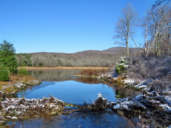 We continued along the west side of the pond to the first junction with the Big Rock Trail. We turned right on the Big Rock Trail to go to Times Square. There were a few muddy areas and the wooden walkways were a little slippery although most of the snow was gone. When we crossed the two small bridges, I stopped to take a few pictures before continuing to Times Square. We continued straight ahead on the Big Rock Trail up the hill. From Times Square to the Flynn Trail junction the Big Rock Trail rises 625 feet in 1.1 miles. This doesn't sound like much but it always seems to be a little farther and a little longer than I remember. I started to think about some issues that were on my mind and the walk seemed to go faster. I stopped several times to take pictures on the trail. A little less than half way up the trail I noticed a deep ditch along the side of the trail. A large amount of erosion had occurred and there were a lot of large stones that had washed down the trail. I found this strange until I remembered the flooding that had occurred in Livingston Manor several weeks ago. By 12:12 PM we had walked 2.2 miles and were at the junction with the Flynn Trail. I stopped to take a few pictures in all four directions at the trail junction. We turned right to head down the Flynn Trail to the car. This return trip always seems longer than the 1.7 miles that is posted which is the correct distance. The trail is pretty but has no views. There was still snow on the trail and I could see the boot tracks of the couple I had directed up the Flynn Trail. I thought about stopping at the clearing but decided that it was getting late. The clearing is interesting as much of it has a layer a sphagnum moss over bedrock. This moss is usually found in areas with a much deeper and richer subsoil. A small road curves up to the clearing but no one has been able to tell me why the area was cleared. Walking across the clearing and through the woods is interesting since there is a series of ledges that rims Mongaup Pond. There are numerous ways to negotiate these ledges and access the loop road at the state campgrounds. We continued on the Flynn Trail back down to the car staying to the left at the gate to avoid the private property around the cabin. We arrived in the parking area at 12:50 PM having covered 4.0 miles in 1 hour and 40 minutes with and elevation gain of 700 feet.
![]()
![]()
![]()
![]() On Monday, November 6th I had several different chores to accomplish around the house and needed to be at cross country practice by 2:00, PM. I decided the solution was to take Sheila across the street to hike on Round Top. I had not been there since the week before and I like to walk the trails frequently to make sure they are in good shape. The temperature was in the high 40's as I left the house at 12:35 PM. I wore my Mammut hoody since it has a lot of zippers to dump heat. Sheila was happy to go as I put her on her leash to walk across the street. We walked through the field next to the church and then up the steep but short cemetery hill. Sheila gave me a little help as she pulled me up the hill. At the top of the hill I took a look back down to town and over to the surrounding hills but all was pretty bleak. We turned left at the trailhead and walked into the woods on the trail. I immediately let Sheila off her leash but she stayed very close to me for the entire hike. At the first trail junction, Sheila continued straight ahead to the lookout which was fine with me as we had not been that way in some time. I took a quick peak at the lookout and then continued to follow the yellow trail. When the lower trail turned right Sheila continued straight ahead on the blue-blazed upper trail and I followed her lead. The trails were in good shape and we were soon at the summit. We continued over the summit and down the other side of the hill. At the trail junction We continued straight ahead and down the wide woods road to the first trail junction. We turned right and continued back up to the lookout and then on around the lower trail. When we got to the trail junction this time, we turned right to stay on the lower trail. At the next junction we turned right again to follow the yellow trail back to the first trail junction to complete the lower loop. Sheila seemed to want to head back home but I turned around and reversed the small loop we had just done. Once again we were back at the first trail junction and I turned left to do one more big loop over the summit of Round Top. Sheila reluctantly followed me. This time we continued straight out to the trailhead at the first junction. At the trailhead we turned right and I pout Sheila on her leash to go back to the house. When we arrived home it was 12:45 PM and we had spent an hour and 10 minutes hiking over 3 miles.
On Monday, November 6th I had several different chores to accomplish around the house and needed to be at cross country practice by 2:00, PM. I decided the solution was to take Sheila across the street to hike on Round Top. I had not been there since the week before and I like to walk the trails frequently to make sure they are in good shape. The temperature was in the high 40's as I left the house at 12:35 PM. I wore my Mammut hoody since it has a lot of zippers to dump heat. Sheila was happy to go as I put her on her leash to walk across the street. We walked through the field next to the church and then up the steep but short cemetery hill. Sheila gave me a little help as she pulled me up the hill. At the top of the hill I took a look back down to town and over to the surrounding hills but all was pretty bleak. We turned left at the trailhead and walked into the woods on the trail. I immediately let Sheila off her leash but she stayed very close to me for the entire hike. At the first trail junction, Sheila continued straight ahead to the lookout which was fine with me as we had not been that way in some time. I took a quick peak at the lookout and then continued to follow the yellow trail. When the lower trail turned right Sheila continued straight ahead on the blue-blazed upper trail and I followed her lead. The trails were in good shape and we were soon at the summit. We continued over the summit and down the other side of the hill. At the trail junction We continued straight ahead and down the wide woods road to the first trail junction. We turned right and continued back up to the lookout and then on around the lower trail. When we got to the trail junction this time, we turned right to stay on the lower trail. At the next junction we turned right again to follow the yellow trail back to the first trail junction to complete the lower loop. Sheila seemed to want to head back home but I turned around and reversed the small loop we had just done. Once again we were back at the first trail junction and I turned left to do one more big loop over the summit of Round Top. Sheila reluctantly followed me. This time we continued straight out to the trailhead at the first junction. At the trailhead we turned right and I pout Sheila on her leash to go back to the house. When we arrived home it was 12:45 PM and we had spent an hour and 10 minutes hiking over 3 miles.
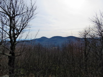
![]()
![]()
![]()
![]()
![]() On Saturday, November 4th I again planned to hike the Blacks. The previous Saturday I was headed in that direction but stopped to hike Westkill instead. I checked the weather report which called for a clear and cool day with some sun and no rain. As I was getting ready, Cindy decided she wanted to hike but did not want to do the Blacks. I suggested we head in that direction and hike Windham from Route 23. I had hiked this route before but Cindy had not. It seems like only a short time ago but my records showed it was four years before! It was 31 degrees when I got up at 7:30 Am but the temperature was supposed to rise during the day. As I dressed I put on tights under my pants and chose to wear my Mammut hoody. This outfit had been too warm on Westkill but I though this day might be cooler. I took along a light hat and gloves. Sheila was happy as always to hike and stayed near me as I dressed and packed my gear. We left Livingston Manor just before 9:00 AM as I drove out the DeBruce Road to the Frost Valley Road. I turned left on the Frost Valley Road and drove passed the YMCA camp and the parking for Big Indian, Slide Mountain and Giant Ledge. Each parking area already had quite few cars and hikers preparing to get on their way. I turned right on Route 28 in Big Indian and headed east to Route 42. I tuned left to head north to Lexington where I took Route 23A east toward Hunter. I turned north on Route 296 and followed it all the way north to Route 23 in Windham. I turned right or east on Route 23 and drove 2.5 miles to the parking area near on the left near Cross Road. I was surprised that the lot was almost full. I pulled in and found a parking space and noticed that many of the cars had bikes and bike racks attached. There are over 10 miles of trails on both sides of the road and the area has become very popular. I set my electronics and out Sheila on her leash. The temperature was 45 degrees when we crossed the road at 10:30 AM to begin our hike. The first part of the trail is interesting as it passes through a low area with several bridges and wooden walkways. Near the trail register was a DEC signboard. We were walking along the Escarpment Trail but there were several places where bike trails turned off the main trail. Just passed the register the trail split with the blue Escarpment Trail continuing straight ahead. To the left were some red trails which are part of the Elm Ridge Multiuse Area. These trails are used by hikers who do not want to climb the mountain but are also used extensively by mountain bikers. The walk started to gain some elevation and went through a series of switchbacks starting at .85 miles as it climbed the shoulder of Elm Ridge. I was already beginning to get warm so I opened all the zippers on my Mammut hoody and cooled off some. We had already met a few hikers coming back down the trail and we wondered if they had been to the summit already.
On Saturday, November 4th I again planned to hike the Blacks. The previous Saturday I was headed in that direction but stopped to hike Westkill instead. I checked the weather report which called for a clear and cool day with some sun and no rain. As I was getting ready, Cindy decided she wanted to hike but did not want to do the Blacks. I suggested we head in that direction and hike Windham from Route 23. I had hiked this route before but Cindy had not. It seems like only a short time ago but my records showed it was four years before! It was 31 degrees when I got up at 7:30 Am but the temperature was supposed to rise during the day. As I dressed I put on tights under my pants and chose to wear my Mammut hoody. This outfit had been too warm on Westkill but I though this day might be cooler. I took along a light hat and gloves. Sheila was happy as always to hike and stayed near me as I dressed and packed my gear. We left Livingston Manor just before 9:00 AM as I drove out the DeBruce Road to the Frost Valley Road. I turned left on the Frost Valley Road and drove passed the YMCA camp and the parking for Big Indian, Slide Mountain and Giant Ledge. Each parking area already had quite few cars and hikers preparing to get on their way. I turned right on Route 28 in Big Indian and headed east to Route 42. I tuned left to head north to Lexington where I took Route 23A east toward Hunter. I turned north on Route 296 and followed it all the way north to Route 23 in Windham. I turned right or east on Route 23 and drove 2.5 miles to the parking area near on the left near Cross Road. I was surprised that the lot was almost full. I pulled in and found a parking space and noticed that many of the cars had bikes and bike racks attached. There are over 10 miles of trails on both sides of the road and the area has become very popular. I set my electronics and out Sheila on her leash. The temperature was 45 degrees when we crossed the road at 10:30 AM to begin our hike. The first part of the trail is interesting as it passes through a low area with several bridges and wooden walkways. Near the trail register was a DEC signboard. We were walking along the Escarpment Trail but there were several places where bike trails turned off the main trail. Just passed the register the trail split with the blue Escarpment Trail continuing straight ahead. To the left were some red trails which are part of the Elm Ridge Multiuse Area. These trails are used by hikers who do not want to climb the mountain but are also used extensively by mountain bikers. The walk started to gain some elevation and went through a series of switchbacks starting at .85 miles as it climbed the shoulder of Elm Ridge. I was already beginning to get warm so I opened all the zippers on my Mammut hoody and cooled off some. We had already met a few hikers coming back down the trail and we wondered if they had been to the summit already.
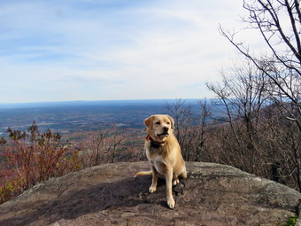 At around 1.4 miles we were at the trail junction with the trail from Peck Road. There were two women stopped near the junction and we passed them. From this point on the trail was familiar but pleasant as I had not been on it in some time. As we approached the lean-to, we could see it was occupied which is not unusual. As we passed a small dog ran out and did not listen to its owner calling. We "discouraged" it and the dog return the way it came. This was another example of inconsiderate owners! We climbed a little and found another group of hikers who were stopped perhaps waiting for the other two women. As we approached, one hiker began to continue up the trail. He stopped as others in the group spoke to him. We continued on the trail as the hardwoods gave way to evergreens and we walked over the exposed roots of the trees before passing through some more hard woods. The next section of evergreens had more exposed roots to negotiate and a series of half logs that formed a bridge over areas that can be wet. The trail was damp in places with a few middy spots. It seems that most hikers avoid the logs as a path was prominent to the side. After climbing for a while the trail leveled at 2.1 miles and stayed on contour for about .25 miles passing a stand of evergreens on the left. After this, the trail headed south a little at 2.5 miles and then turned east and eventually northeast for the final ascent to the top of Windham. Several more hikers and small groups came down the trail from the summit and soon we caught up to a pair of hikers and passed them. One other pair of hikers coming down had a beautiful, young German Shepherd and Sheila and the other dog greeted each other. We encountered a few steep areas along the way but they are short. Another couple began to catch up to us so we sped up a little until we were making the last scent to the summit plateau. At 12:35 PM we had hiked 3.3 miles and were on the relatively flat spine that passes over Windham High Point. We stopped at the first lookout that faces south toward the Blackhead Range. The sun hung over the mountains and they were shrouded in a haze. I took some pictures of this iconic view and thought I should remember to do the hike later in the day when the sun would be at a different angle and the haze might be gone.
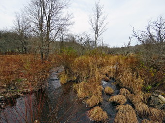 We walked back out to the main trail and to the lookout facing north even though the "main" lookout to the north has the best views in that direction. The view was truly expansive without many distinguishing features but I took some pictures anyway. There was actually some color in the leaves in the valley below. As we approached the high point, we heard voices and I put Sheila on her leash. We met two men sitting on a rock with an older German Shepherd which greeted Sheila. We continued on to the summit and then to the viewpoint to the north. The viewpoint did not have any other visitors and was more open than the previous one although the view was much the same. I could just make out the buildings in Albany through the haze. The view from this lookout is extensive and seems to reach out forever. I took some pictures despite the haze since the sun at least was not a factor in this direction. I also took some shots of Sheila sitting on the lookout and a few of Cindy and Sheila sitting on a rock. Soon it was time to head back down. We were surprised that the large group of hikers who were stopped near the lean-to had not appeared at the summit. We passed the two women we had passed earlier on the trail as they were relaxing on a rock at the side of the trail. We set a pretty fast pace going down the trail since there weren't too many steep areas. Once we passed these steeper areas and the trail was less rocky we were able to move even faster. We met several groups coming up the trail and a few lone hikers. We descended through the "forest of roots" and headed down to the lean-to. One of the hikers coming up the trail was a forest ranger. We stopped to talk to him about the volume of hikers, blowdowns on the trail, and the bike trails. We continued down the trail as the ranger headed over to the lean-to. At the junction with the trail from Peck Road, we met a group of mountain bikers but passed by them to stay on the Escarpment Trail. We continued down through the switchbacks and to the level trail that leads out to the road. I stopped at the last bridge to take a few pictures of the high water level in the wetland. We crossed the road and found there were still a number of cars in the lot and parked along Cross Road. We were back at the car at 2:50 PM having covered 7.1 miles in 4 hours and 20 minutes with a total ascent of 1900 feet.
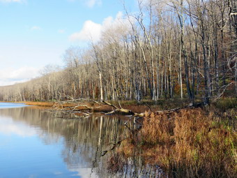
![]()
![]()
![]()
![]()
![]() On Tuesday, October 31st I had not decided if I wanted to get in a hike or do some pressing work around the house. Lisa emailed me the night before and asked if I would like to hike at Trout Pond. From Sunday night into Monday morning our area had over 4 inches of rain causing local flooding. I knew this would mean that Russell Brook would be higher than my last visit and that the falls might be nice. Lisa and I decided to meet at my house at 9:00 AM and then go to Trout Pond. While I was getting ready Sheila was on my heels the whole time sensing we would be going out. I knew the forecast was for cool weather and the temperature at the house was 31 degrees when I got up at 7:30 AM. I wore a double layer on top with a long sleeved shirt and then put on my Mammut hoody. I decided not to put on tights even though the Railriders Ecomesh pants are really too light for fall. Lisa arrived right at 9:00 Am and we left the house at 9:05 AM. I headed north and west on State Route 17 toward Roscoe getting off at exit 94. I headed north on Route 206 passing through Roscoe and then Rockland. Just after the Roscoe Nursing Home I turned left on Morton Hill Road and followed it for 3 miles to the intersection with Russell Brook Road. I turned around and parked on the side of the road avoiding the private parking area. It was 9:25 AM when I set my electronics and we began our hike. I like the walk down Russell Brook Road and Sheila seemed to be having fun running ahead and coming back to me. I listened for the sound of the water in the brook and it grew louder the farther we hiked. When we came to the viewpoint over the upper falls, the volume of the falls was as great as in the spring. I decided to walk down to take some pictures rather than wait for the walk back to make sure I got some good shots. I took pictures at several different zooms and with several camera settings. I packed up and walked back up to the road to join Lisa. We walked down to the lower parking area where there were no cars parked. We continued down the road and crossed the bridge over Russell Brook where we could see that the water was very high. We found that the Japanese knotweed was dying as it does during the late fall and winter months. We continued on the road and decided to visit the main falls on the way back. At the trail junction just after the register we continued straight ahead to walk up to Trout Pond. Within a short distance we came to a new blowdown across the trail which would require tools to remove. As we walked, Lisa told me she had only planned to go as far as the lean-tos and I told her I thought we would be doing the whole loop. The trail began to get very wet with some standing water and lots of small rivulets running down the trail. All of the small streams running across the trail were running nicely. When we arrived at the pond, we walked to the left to the "beach" at the outlet end of the pond. It was clear that the water level was much higher than it had been in some time and the water was within a foot of the spillway. Ten days earlier the distance from the spillway to the water was at least ten feet! The sky was very blue with some puffy white clouds and the water was completely still. There were some interesting reflections and some colors which made taking pictures a must. I took a number of pictures concentrating on the reflections and the patches of color in the remaining leaves. Sheila seemed consent with wading a little in the water without immersing her entire body.
On Tuesday, October 31st I had not decided if I wanted to get in a hike or do some pressing work around the house. Lisa emailed me the night before and asked if I would like to hike at Trout Pond. From Sunday night into Monday morning our area had over 4 inches of rain causing local flooding. I knew this would mean that Russell Brook would be higher than my last visit and that the falls might be nice. Lisa and I decided to meet at my house at 9:00 AM and then go to Trout Pond. While I was getting ready Sheila was on my heels the whole time sensing we would be going out. I knew the forecast was for cool weather and the temperature at the house was 31 degrees when I got up at 7:30 AM. I wore a double layer on top with a long sleeved shirt and then put on my Mammut hoody. I decided not to put on tights even though the Railriders Ecomesh pants are really too light for fall. Lisa arrived right at 9:00 Am and we left the house at 9:05 AM. I headed north and west on State Route 17 toward Roscoe getting off at exit 94. I headed north on Route 206 passing through Roscoe and then Rockland. Just after the Roscoe Nursing Home I turned left on Morton Hill Road and followed it for 3 miles to the intersection with Russell Brook Road. I turned around and parked on the side of the road avoiding the private parking area. It was 9:25 AM when I set my electronics and we began our hike. I like the walk down Russell Brook Road and Sheila seemed to be having fun running ahead and coming back to me. I listened for the sound of the water in the brook and it grew louder the farther we hiked. When we came to the viewpoint over the upper falls, the volume of the falls was as great as in the spring. I decided to walk down to take some pictures rather than wait for the walk back to make sure I got some good shots. I took pictures at several different zooms and with several camera settings. I packed up and walked back up to the road to join Lisa. We walked down to the lower parking area where there were no cars parked. We continued down the road and crossed the bridge over Russell Brook where we could see that the water was very high. We found that the Japanese knotweed was dying as it does during the late fall and winter months. We continued on the road and decided to visit the main falls on the way back. At the trail junction just after the register we continued straight ahead to walk up to Trout Pond. Within a short distance we came to a new blowdown across the trail which would require tools to remove. As we walked, Lisa told me she had only planned to go as far as the lean-tos and I told her I thought we would be doing the whole loop. The trail began to get very wet with some standing water and lots of small rivulets running down the trail. All of the small streams running across the trail were running nicely. When we arrived at the pond, we walked to the left to the "beach" at the outlet end of the pond. It was clear that the water level was much higher than it had been in some time and the water was within a foot of the spillway. Ten days earlier the distance from the spillway to the water was at least ten feet! The sky was very blue with some puffy white clouds and the water was completely still. There were some interesting reflections and some colors which made taking pictures a must. I took a number of pictures concentrating on the reflections and the patches of color in the remaining leaves. Sheila seemed consent with wading a little in the water without immersing her entire body.
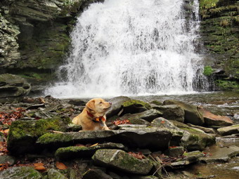 We continued on the main trail on the east side of Trout Pond walking toward the inlet end and the lean-tos. The trail continued to be very wet with pools of water we tried to avoid. There were numerous branches on the trail which we removed and some more blowdown from the storm on Sunday night. We stopped just before the lean-tos and walked to the shore where I took some pictures. We stopped at the bridge over the inlet and I took a few shots of the pond. This area was also very wet from the overflow from the inlet stream. This stream had been completely dry on my previous hike 10 days before. Lisa led the way as we turned right to follow the trail up Cherry Ridge. I was glad she chose to hike the loop rather than return the way we had come. As we hiked, I found it satisfying to look at the many places where I had cleared branches and blowdowns from the trail on my last trip. There were some new branches on the trail and several small blowdowns. Some blowdowns we were able to clear by moving the to the side of the trail and others would require an ax and saw. Soon we were at the highest point on Cherry Ridge and starting down the other side. This part of the trail was more like a stream with flowing water and several large pools. This part of the hike can drag sometimes but it seemed to go very fast as we talked most of the way. We paused at the "forest of many small trees" and then continued on to the woods road and snowmobile trail that runs by Mud Pond. Lisa wanted to visit Mud Pond so we turned right and walked about .1 miles before turning left and following a path down to the pond. When we arrived at the shore of the pond, the skies had become completely overcast and the scene was much more bleak than at Trout Pond. I took a few shots and then we turned around and headed back to the main trail. We walked back to the trail junction and then up the short hill before starting the long descent. At the top of the hill we began the long descent back to the rail junction where we had started. The descent lasts for .7 miles and drops 385 feet to a bridge that crosses the outlet stream from Trout Pond. The trail continued to be very wet but was not as muddy as I expected. We stopped at the bridge over the outlet stream from Trout Pound and I took a few pictures showing the high water. At the trail junction we turned right and headed back out toward the lower parking area. At the path to the falls we turned left and walked out toward the falls. We worked our way down the bank to the streambed. I took pictures of the falls using some different setting. I also shot a short video of the falls and the stream. Before packing up my camera I asked Sheila to pose in from of the falls. We walked back out to the main trail and walked to the lower parking lot. Sometimes the walk back up Russell Brook Road seems long and tedious but I was still feeling fresh and having someone to talk to is always nice. We continued to walk up the road and soon arrived back at the car. It was 12:35 PM when we arrived back at the car after hiking 6.0 miles in 3 hours and 10 minutes with a 1190 foot total ascent. The temperature was 49 degrees.
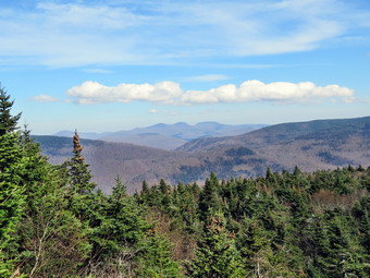
![]()
![]()
![]()
![]()
![]() On Saturday, October 28th, I was ready to do a more challenging hike than I can do when I have cross country practice in the afternoon. I had planned to go north and do the Blacks getting a start no later than 8:00 AM. I woke up a little later than I thought I might and asked Cody if she would like to go and She said she would. I knew that Sunday would be a washout due to a forecast of heavy rain and that I would be tied up as school nurse on Monday.The temperature in the morning was 33 degrees so we didn't hurry to get ready. I put on tights an wore my Mammut hoody as I do not like to be cold. I also took a light hat and gloves. Sheila was ecstatic to be going anywhere which is her usual state. We got everything in the car and pulled out of Livingston Manor a little after 9:00 AM. We headed out DeBruce Road and turned left on Route 47 at the end to head toward Big Indian and Route 28. There were a few cars at the Biscuit Brook parking area but the Slide Mountain parking area was beginning to fill up. By the time we passed the parking for Giant Ledge and Panther they were beginning to park along the road. As we passed these pots where we have hiked before Sheila would "moan" as if she was asking me if we could stop and hike. I turned right on Route 28 and then left on Route 42 to head toward Spruceton. On the way from Shandaken to Spruceton on Rt 42 there were even a few cars at the Halcott parking area. Along the way Cindy began hinting that Sheila didn't want to ride all the way to the Blacks! I decided that there might not be any parking when we got there and that Weskit would be a good substitute. I was also concerned that Cindy might not be able to handle Blackhead AND Black Dome in the same hike. Westkill is a special place for me as I spread the ashes of a previous hiking partner, Sheba, at the Buck Ridge lookouts. I turned right on the Spruceton Road and was glad that it had been paved nicely. Along the road we passed the Spruceton Inn which was gained a nice reputation and also the West Kill Brewery where I wanted to stop on the return trip. We were following a car that seemed to be looking for something and it continued ahead of us even when the road turned to dirt. The parking lot for Hunter was filled and when we arrived at the parking area for Westkill it was also packed. I decided to drive up the road to see if the smaller loot was also filled. When we arrived at the smaller lot, it was almost empty so I pulled in and parked. The signs warned that this was a snowplow turnaround but I was sure it would not be needed on this day. Several other cars pulled in right after us so we hurried to get ready. The temperature was 51 degrees and a stiff breeze was blowing so I was glad I had dressed warmly. I set my GPS, put Sheila on her leash and we headed out on the woods road toward Diamond Notch Falls at 10:25 AM. The trail was nearly dry with only a few wet spots but there was a good amount of water in the stream. The stream was making quite a noise and I was tempted to stop several times to take pictures. I decided to put this off until the return trip. There was a couple behind us that were dressed as if the falls was their destination. I could see a couple ahead of us and soon they came back to me to sake if they were on the trail to Westkill. I said "Yes" and gave them some suggestions about the hike.
On Saturday, October 28th, I was ready to do a more challenging hike than I can do when I have cross country practice in the afternoon. I had planned to go north and do the Blacks getting a start no later than 8:00 AM. I woke up a little later than I thought I might and asked Cody if she would like to go and She said she would. I knew that Sunday would be a washout due to a forecast of heavy rain and that I would be tied up as school nurse on Monday.The temperature in the morning was 33 degrees so we didn't hurry to get ready. I put on tights an wore my Mammut hoody as I do not like to be cold. I also took a light hat and gloves. Sheila was ecstatic to be going anywhere which is her usual state. We got everything in the car and pulled out of Livingston Manor a little after 9:00 AM. We headed out DeBruce Road and turned left on Route 47 at the end to head toward Big Indian and Route 28. There were a few cars at the Biscuit Brook parking area but the Slide Mountain parking area was beginning to fill up. By the time we passed the parking for Giant Ledge and Panther they were beginning to park along the road. As we passed these pots where we have hiked before Sheila would "moan" as if she was asking me if we could stop and hike. I turned right on Route 28 and then left on Route 42 to head toward Spruceton. On the way from Shandaken to Spruceton on Rt 42 there were even a few cars at the Halcott parking area. Along the way Cindy began hinting that Sheila didn't want to ride all the way to the Blacks! I decided that there might not be any parking when we got there and that Weskit would be a good substitute. I was also concerned that Cindy might not be able to handle Blackhead AND Black Dome in the same hike. Westkill is a special place for me as I spread the ashes of a previous hiking partner, Sheba, at the Buck Ridge lookouts. I turned right on the Spruceton Road and was glad that it had been paved nicely. Along the road we passed the Spruceton Inn which was gained a nice reputation and also the West Kill Brewery where I wanted to stop on the return trip. We were following a car that seemed to be looking for something and it continued ahead of us even when the road turned to dirt. The parking lot for Hunter was filled and when we arrived at the parking area for Westkill it was also packed. I decided to drive up the road to see if the smaller loot was also filled. When we arrived at the smaller lot, it was almost empty so I pulled in and parked. The signs warned that this was a snowplow turnaround but I was sure it would not be needed on this day. Several other cars pulled in right after us so we hurried to get ready. The temperature was 51 degrees and a stiff breeze was blowing so I was glad I had dressed warmly. I set my GPS, put Sheila on her leash and we headed out on the woods road toward Diamond Notch Falls at 10:25 AM. The trail was nearly dry with only a few wet spots but there was a good amount of water in the stream. The stream was making quite a noise and I was tempted to stop several times to take pictures. I decided to put this off until the return trip. There was a couple behind us that were dressed as if the falls was their destination. I could see a couple ahead of us and soon they came back to me to sake if they were on the trail to Westkill. I said "Yes" and gave them some suggestions about the hike.
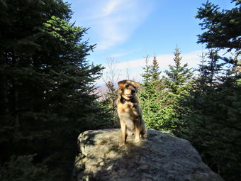 At the falls, we turned right on the Devil's Path and then right again at the end of the bridge. I was again tempted to take pictures but decided to wait until the trip back. As we continued to follow the trail it began to get steeper and wetter in spots which made it slipperier. The couple that had asked me some questions were just behind Cindy and were obvious faster than us so we let them pass and they soon were out of site. I was beginning to get very warm so I stopped to take off my hoody. At the same time I decided to take off my tights which I had only done one time before. After ditching these two items I felt light but was a little cold as I had built up a real sweat. As we continued the ascent, I began to remember that the ascent was long and steep in some places. We came to a section of trail that requires some side-hilling and is much more difficult when there is snow. As we continued to hike we met a few hikers and pairs of hikers coming back from the summit. It didn't take us long to get to the spot which is a near vertical climb. This is a short ascent but leads to a longer one. In the winter this is often a sheet of ice and can be exciting on the way up and the way down. Sheila scrambled up without much trouble and we followed making use of the roots as handholds and our poles. Once we passed this point there were still some steep areas to conquer. The mile climb from just after the falls to where the trail begins to level averages a 20% grade and can be very tiring. Once we got to the more level part there were still some small climbs and a few descents but the going was easier. From that point to Buck Ridge and the summit is still well over a mile. On our way to the rock overhang or "cave" we passed the 3500 foot sign. I could have sworn the sign used to be just above the overhand but I checked my GPS and the new placement seems more correct. We continued to meet a few hikers coming down the trail. There were a lot of branches on the trail, and no one seemed concerned about removing them so I did. In one spot a tree had fallen across the trail leaving the choice of crawling underneath or pushing through some dense brush on the sides.
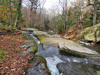 We were soon above the "cave" and after this the trail turns almost due west and levels off slightly. A hiker approached and I grabbed Sheila as I always do. We said "Hello" and he looked very familiar. He asked of I was alone and I indicated my wife was not far behind. He continued passed me but stopped to talk to Cindy for a few minutes. When Cindy caught up, she told me it was Mike Dwyer, the Aspirants Chairperson for the Catskill 3500 Club. He had thought I looked familiar and knew my name when Cindy told him. We finally came to the little descent before the final ascent to the Buck Ridge Lookouts. We worked our way down and were soon at the base of the final ascent. We climbed up to Buck Ridge arriving at 12:35 PM. It had taken us 2 hours and 10 minutes to hike 3 miles! So much for keeping a good pace. The couple that had gone ahead of us were relaxing at the lookouts. They were from Albany and had already been to the summit. I leashed Sheila to a tree and gave her a drink. Cindy and I also drank some water and Cindy got out a bar to eat. I decided to take some pictures before continuing on to the summit. I took a few shots from the lookouts toward the south but there was quite a bit of haze. There was some color left on the trees which was mostly yellow from the beeches. I released Sheila and we walked over to the lookout to the north where I had taken my favorite picture of Sheba. Sheila jumped up on the large boulder there but the view is almost completely blocked by trees now. I took a few shots and returned to where Cindy was sitting. I shouldered my pack and headed toward the summit just as a large group of hikers arrived. Hiking to the summit of Westkill is a short trip but serves no purpose other than to allow a hiker to claim they got to the summit. It is only about .1 miles and it took us about 15 minutes to get up and back to the lookouts. There is still a sign at the summit that says "Westkill Mt. Summit and a large stone cairn. When we got back to the lookouts, I rook one more picture of an interesting tree and then we started back down the trail from Buck Ridge at 12:55 PM.
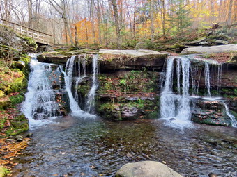 We tried to keep a quick pace on the way down without stopping but the going was not easy in some of the steeper spots. We met several individuals hikers, pairs and groups on the way up. One young lady had left the parking area just behind us but was just getting to the top as we were descending. We continued down the trail which was certainly easier than hiking up! We stopped for a few pictures at the rock overhand where we met two pairs of hikers coming up the trail. On the way down toward the vertical climb, I saw a hiker coming up the trail and one coming down behind us. The hiker who was descending was the young lady that had just passed us going up to the summit. It occurred to me then that she was not slow but had probably done Hunter and the Westkill! At one point I looked up to see a dog approaching without a leash. Sheila and the other dog approached each other and seemed to get along. As the other owners approached I called Sheila and they controlled their dog. The other dog was a beautiful red brown color and I asked about his breed. I was surprised to find out he was a Fox Red Labrador since I would have said he was a hound of some kind. I had never heard of this color variation but it was very striking. I was also surprised when the owner said he was only one year old as he was already much larger than Sheila. We continued down the trail and met no ore hikers coming up. Just before the bridge at the falls, I walked off the trail to the left and took some pictures of the bridge and the falls. I also took a shot of Cindy and Sheila on the bridge. I took a few more shot from the rocks under the bridge and then some more from the bridge. We crossed the bridge at the falls and Sheila and I negotiated the short but steep drop to the base of the falls. Sheila did not seem to be interested in a dip in the cold water. I took pictures of the falls with several different settings on the camera trying to get the soft, wispy effect that some people like. The stream has actually changed its course slightly and now flows more on the left rather than the right side of the bed. We climbed back up the bank to trail and continued back to the car. We did meet some more hikers coming up the trail but all looked as if they were only going to the falls. I stooped a couple of times to take some pictures of the smaller rapids along the way. Back at the car the temperature had risen to 60 degrees which was warmer than when we started. We were back in the parking area at 3:05 PM having covered 6.4 miles in 4 hours and 40 minutes with plenty of time allowed for photography. The total ascent was 2070 feet. I was tired but glad we had made the trip. On the way back, we stopped at the West Kill Brewery and found it was packed. We parked at the bottom of the hill and walked up to the brewery where there was an "event" happening. A lot of people were "hanging out" drinking beer and having a good time. They had some cheese boards and a wood-fired pizza oven. We got in line which is when I found out Cindy did not intend to have any beer. I was disappointed as I wanted to stay around for a little while and enjoy the happening. I did get a chocolate porter which was very good even though porters are not my favorite. I drank it down as we walked back to the car which was not what I had intended. I scrapped my plans to go to Pancho Villas or The Alamo and drove back to Livingston Manor for supper. There were still quite a few cars parked at the various trailheads on the way home taking advantage of the beautiful day.
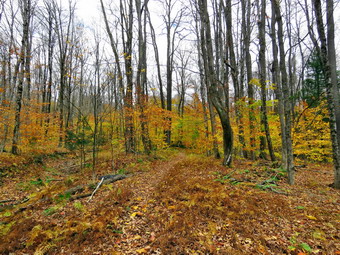
![]()
![]()
![]()
![]()
![]() On Thursday, October 26th I wanted to get in a hike after my early morning men's group at church and afternoon cross country practice. I decided I wanted to stay close to home and would go to Frick and Hodge Ponds for the exercise. My Plan was to hike the loop in a clockwise direction. After doing a few chores around the house, I began to get my gear together which made Sheila watch me very closely. We hadn't been out in a few days and she wasn't letting me out of her sight. When I was ready to leave at 10:00 AM the temperature was only in the high 40's. Despite this I decided to wear only abduct jacket as my Mammut hoody is very warm. I did wear a light hat and threw in a pair of gloves. I also packed a rain jacket as the bright blue skies had suddenly turned cloudy. I got my gear and Sheila in the car and headed out the DevRuce Road. After 6 miles, at Mongaup Pond Road, I turned left and continued to follow the road bearing left onto Beech Mountain Road at the fork. When we arrived in the parking area there was one other car parked in the small lot. Sheila was acting as if she hadn't hiked in a month as she ran around and headed for the trail. The temperature was 44 degrees and the constant breeze blowing, made me a little cool. I got my gear ready to go and set my GPS. The skies were still a little overcast as we headed out the path to the register on Quick Lake Trail at 10:20 AM. The Quick Lake Trail was wet and muddy from the hard rain the day before. At Gravestone Junction we turned left to head down to Frick Pond. The water level in the pond was a little higher than it had been and the beaver dam looked like it might be in the process of reconstruction. Someone had completely pulled out the beaver dam across the outlet stream sometime in the early fall. The sky had a little blue but the leaves were mostly gone from the trees except for the beeches. I decided to take few shots anyway as I almost always do. These shots showed a somewhat bleak picture with a few spots of color. We continued on the Quick Lake Trail around the pond bearing left at the next trail junction to stay on the red trail. This part of the trail was extremely wet and soggy from the rain. It was hared to find a place to get good footing without stepping in water or mud. We were setting a fast pace despite the water and soon came to the "pine promenade" and the little stream through the woods. The water level in the stream was higher than it had been in some time but was still easy to cross. I did remove a few sticks along the way and several larger blowdown. We arrived at Iron Wheel Junction at 1.6 miles.
On Thursday, October 26th I wanted to get in a hike after my early morning men's group at church and afternoon cross country practice. I decided I wanted to stay close to home and would go to Frick and Hodge Ponds for the exercise. My Plan was to hike the loop in a clockwise direction. After doing a few chores around the house, I began to get my gear together which made Sheila watch me very closely. We hadn't been out in a few days and she wasn't letting me out of her sight. When I was ready to leave at 10:00 AM the temperature was only in the high 40's. Despite this I decided to wear only abduct jacket as my Mammut hoody is very warm. I did wear a light hat and threw in a pair of gloves. I also packed a rain jacket as the bright blue skies had suddenly turned cloudy. I got my gear and Sheila in the car and headed out the DevRuce Road. After 6 miles, at Mongaup Pond Road, I turned left and continued to follow the road bearing left onto Beech Mountain Road at the fork. When we arrived in the parking area there was one other car parked in the small lot. Sheila was acting as if she hadn't hiked in a month as she ran around and headed for the trail. The temperature was 44 degrees and the constant breeze blowing, made me a little cool. I got my gear ready to go and set my GPS. The skies were still a little overcast as we headed out the path to the register on Quick Lake Trail at 10:20 AM. The Quick Lake Trail was wet and muddy from the hard rain the day before. At Gravestone Junction we turned left to head down to Frick Pond. The water level in the pond was a little higher than it had been and the beaver dam looked like it might be in the process of reconstruction. Someone had completely pulled out the beaver dam across the outlet stream sometime in the early fall. The sky had a little blue but the leaves were mostly gone from the trees except for the beeches. I decided to take few shots anyway as I almost always do. These shots showed a somewhat bleak picture with a few spots of color. We continued on the Quick Lake Trail around the pond bearing left at the next trail junction to stay on the red trail. This part of the trail was extremely wet and soggy from the rain. It was hared to find a place to get good footing without stepping in water or mud. We were setting a fast pace despite the water and soon came to the "pine promenade" and the little stream through the woods. The water level in the stream was higher than it had been in some time but was still easy to cross. I did remove a few sticks along the way and several larger blowdown. We arrived at Iron Wheel Junction at 1.6 miles.
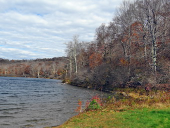 We turned left on the Quick Lake Trail and started the long uphill climb toward Junkyard Junction. The trail continued to be wet most of the way and showed signs that the hard rain had probably produced small streams that had eroded the trail. We were headed for Junkyard Junction at 3.2 miles. With no one to talk to I was lost in my own thoughts as Sheila followed a few game trails. The sun was starting to come through the clouds and I could see some blue. We turned right onto the blue Flynn Trail which is almost flat. It too was wet with some puddles and muddy areas. There were no major blowdowns but I continued to remove branches that littered the trail. When we got to the gate, we turned right to stay on the trail and head down toward Hodge Pond. At 3.75 miles the Flynn Trail heads right but I decided to turn left on the jeep trail around the head end of the pond. At the apex of the pond Sheila turned right and followed a path down to the shore and I followed. I took some shots of the pond since the this time the skies were beginning to show some blue and the clouds were interesting. I packed up and we went back to the trail to walk up the hill and then down to the field at the inlet end of the pond. When we came to the clearing at the outlet end of the pond, we walked over to the shore. I got out my camera again to take some pictures. The colors and Hodge Pond were just as muted as at Frick. As I was taking my last shots, a bald eagle began circling the pond and diving toward the surface. I took numerous pictures of elusive bird before packing up and walking back to the Flynn Trail to the point where it re-enters the woods. We started the climb up the hill and I was feeling quite fresh and concentrated on using my poles to help set a quick pace up the hill. At the top of the hill we stayed to the right to continue on the Flynn Trail. A left turn follows a woods road out to what remains of the Beech Mountain Boy Scout Camp. The Flynn Trail is relatively flat to the junction with the Big Rock Trail at 4.5 miles. Along the way, I saw to hikers coming toad us so I put Sheila on her leash. We said "Hello" as we passed and I let Sheila off her leash soon after. We continued straight through the junction with the Big Rock Trail to follow the Flynn Trail back to the car. The walk was pretty but had no remarkable views or features. We walked quickly and as we approached the gate on the woods road, we turned left to avoid the private property around the cabin and to stay on the trail. We finished our walk and were back at the car by 1:00 PM. We had covered 6.6 miles in 2 hours and with an elevation gain of 930 feet. It still seemed cool as the temperature was only 52 degrees.
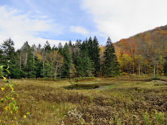
![]()
![]()
![]()
![]()
![]() On Sunday, October 22nd I wanted to get in a hike after church as the weather was warm and beautiful. When we got home I suggested we go to hike at Kelly Hollow as we had not been there in since January! The hike is only about 4 miles but there are some interesting sites including a stream that runs between the trail out and the trail back. There is also a beaver pond on the trail with a lean-to. We got Sheila and our gear in the car and headed toward Roscoe on Old Route 17 little after 1:00 PM. I turned right on the Beaverkill Road and drove through Lew Beach to Turnwood where I turned left on the Barkaboom Road. I drove to the end of the Barkaboom Road band turned right at the Pepacton Reservoir On BWS 9. After 4.5 miles, I turned right on Millbrook Road and continued 5.25 miles to the parking lot for Kelly Hollow on the right. We parked at 1:40 PM next to the only car in the lot. I took a moment to set my GPS before starting our hike at 1:45 PM by heading out on the trail marked with yellow XC skiing blazes. My plan was to walk the trail in a figure 8 which is something I had not done before. Just after the stream we came to a woods road and turned right heading south and ascending slightly. Along the way the trail was wet in spots which surprised us as everywhere else we had hiked was bone dry. Almost immediately we could see a couple ahead of us with two dogs on leashes. I put Sheila on her leash and we passed by the other hikers who had moved to the side of the trail. Their dogs were bigger than Sheila and very excited about meeting another dog. Shortly after this encounter we met another hiker who looked like he was a hunter scouting the area. At .5 miles we came to the cutoff to the right for the Short Loop hike. We turned right to walk down the cutoff trail to the bridge. I took some pictures before we crossed the ridge and headed up the trail to the main loop trail on the other side.
On Sunday, October 22nd I wanted to get in a hike after church as the weather was warm and beautiful. When we got home I suggested we go to hike at Kelly Hollow as we had not been there in since January! The hike is only about 4 miles but there are some interesting sites including a stream that runs between the trail out and the trail back. There is also a beaver pond on the trail with a lean-to. We got Sheila and our gear in the car and headed toward Roscoe on Old Route 17 little after 1:00 PM. I turned right on the Beaverkill Road and drove through Lew Beach to Turnwood where I turned left on the Barkaboom Road. I drove to the end of the Barkaboom Road band turned right at the Pepacton Reservoir On BWS 9. After 4.5 miles, I turned right on Millbrook Road and continued 5.25 miles to the parking lot for Kelly Hollow on the right. We parked at 1:40 PM next to the only car in the lot. I took a moment to set my GPS before starting our hike at 1:45 PM by heading out on the trail marked with yellow XC skiing blazes. My plan was to walk the trail in a figure 8 which is something I had not done before. Just after the stream we came to a woods road and turned right heading south and ascending slightly. Along the way the trail was wet in spots which surprised us as everywhere else we had hiked was bone dry. Almost immediately we could see a couple ahead of us with two dogs on leashes. I put Sheila on her leash and we passed by the other hikers who had moved to the side of the trail. Their dogs were bigger than Sheila and very excited about meeting another dog. Shortly after this encounter we met another hiker who looked like he was a hunter scouting the area. At .5 miles we came to the cutoff to the right for the Short Loop hike. We turned right to walk down the cutoff trail to the bridge. I took some pictures before we crossed the ridge and headed up the trail to the main loop trail on the other side.
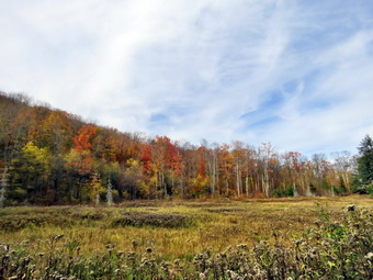 We turned left on the loop trail heading southwest and then south toward the beaver pond and lean-to. Over the nest .4 miles we gained about 300 feet for an 11% grade. Although this is not a steep climb it was more than I remembered. At 1.2 miles we were at the beaver pond which is quickly becoming a beaver meadow. There are no more beavers in the area and the pond is now a small puddle. There were some nice colors in the leaves remaining on the trees so I took some pictures before we continued around the pond. We stopped again on the other side and I took a few more pictures before continuing on to the lean-to in the woods. The lean-to was in good shape As was the privy but we had no reason to stop and continued on the trail now heading northeast and downhill. The trail made a turn so that we were heading southeast and we crossed a few bridges over small streams. At one point we started to walk through a grove of pines and I stopped to take a few shots including a couple straight up. At 1.75 miles we came to the spot where I had bushwhacked up to Millbrook Ridge to look down on Alder Lake. At 2.1 miles we made and almost 180 degree turn and started heading north. I noted that this would be a good place to try another bushwhack as it was only .7 miles to the trail that runs along Millbrook Ridge. We continued north on the trail still descending. At 2.75 miles we again came to the crossover trail and turned left to cross the middle of the figure 8. As we made the turn two more hikers appeared behind us on the main trail which was strange as we had not noticed them before. We crossed the bridge and walked up the hill on the other side to the main trail. This time we turned right and started to walk 1.1 miles back to the car. The day was very pleasant with a slight breeze blowing. This part of the trail was not well marked but the path was pretty obvious as it followed a woods road. At 3.6 miles we came to the Middletown Cemetery and found a couple with motorcycles enjoying a quiet moment. I decided not to take pictures of the cemetery so we continued out the access road to Millbrook Road. We trend right and walked the final .25 miles back to the car. It was 3:45 PM and we had spent 2 hours hiking 4 miles with an elevation gain of 660 feet. On the way back I decided to go over Cross Mountain Road which is a narrow dirt road that ends up at Alder Lake. I knew that the Town of Hardenburgh had worked on the road in the early summer. I don't know what they did to the road but it was still all dirt and still narrow. There were several stretches where two cars could not pass by each other so I was glad that there were no other cars on this 4 mile adventure!
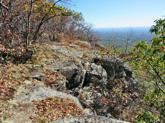
![]()
![]()
![]()
![]()
![]() On Friday, October 20th I asked Cindy if she would like to go to Winter Clove and hike some of the trails there and she agreed. I checked my records and we had not been there in almost seven years! Winter Clove is primarily a resort which offers room and board and various activities to those who stay there. It is located north of Palenville with the address being Round Top. The drawback for us is that this is around a two hour drive but I did want to hike some of the trails which are really interesting. Winter Clove has miles of hiking trails open to those who are paying guests but they allow non-guests to hike which is very generous. The trails included several nice lookouts and waterfalls. There is even a trail to North Point and Stoppel Point although not all the trails are well-marked or well maintained. We got our gear together and prepared to leave the house. I had created a map for the Avenza app on my iPhone from some GPS tracks from previous visits. The temperature was cool but seemed to be rising so I put on a light jacket and took along a light hat and gloves. I decided to follow the route suggested by Google maps so at 9:10 AM we left Livingston Manor with an excited Sheila in the backseat. I drove through Liberty on Route 52 to Woodbourne and on To Ellenville. In Ellenville I picked up Route 209 north to Kingston. From there I took the Thruway north to Saugerties where I got on Route 32 north. I began to doubt my recollection of the route but found Hearts Content Road just after the old Friar Tuck Inn. After a short drive, I made another left onto Winter Clove Road. From that point on there were small signs indicating the various resorts in this area and there are quite a few. We arrived at Winter Cove at about 11:10 AM. I got permission the night before so I didn't bother to visit the office although I should have picked up some maps as many of their signs are keyed to their maps. I checked out some signs, set my GPS and we started our hike at 11:10 AM. The temperature was in the high 40's when we started and it was getting warmer under sunny and cloudless skies. We followed the sign in the field just up from where we parked so we headed in that direction to begin our adventure. Just before we started out another hiker went out on the trails ahead of us. We saw him a few more times before we went our separate ways. He was the only person we would see all day!
On Friday, October 20th I asked Cindy if she would like to go to Winter Clove and hike some of the trails there and she agreed. I checked my records and we had not been there in almost seven years! Winter Clove is primarily a resort which offers room and board and various activities to those who stay there. It is located north of Palenville with the address being Round Top. The drawback for us is that this is around a two hour drive but I did want to hike some of the trails which are really interesting. Winter Clove has miles of hiking trails open to those who are paying guests but they allow non-guests to hike which is very generous. The trails included several nice lookouts and waterfalls. There is even a trail to North Point and Stoppel Point although not all the trails are well-marked or well maintained. We got our gear together and prepared to leave the house. I had created a map for the Avenza app on my iPhone from some GPS tracks from previous visits. The temperature was cool but seemed to be rising so I put on a light jacket and took along a light hat and gloves. I decided to follow the route suggested by Google maps so at 9:10 AM we left Livingston Manor with an excited Sheila in the backseat. I drove through Liberty on Route 52 to Woodbourne and on To Ellenville. In Ellenville I picked up Route 209 north to Kingston. From there I took the Thruway north to Saugerties where I got on Route 32 north. I began to doubt my recollection of the route but found Hearts Content Road just after the old Friar Tuck Inn. After a short drive, I made another left onto Winter Clove Road. From that point on there were small signs indicating the various resorts in this area and there are quite a few. We arrived at Winter Cove at about 11:10 AM. I got permission the night before so I didn't bother to visit the office although I should have picked up some maps as many of their signs are keyed to their maps. I checked out some signs, set my GPS and we started our hike at 11:10 AM. The temperature was in the high 40's when we started and it was getting warmer under sunny and cloudless skies. We followed the sign in the field just up from where we parked so we headed in that direction to begin our adventure. Just before we started out another hiker went out on the trails ahead of us. We saw him a few more times before we went our separate ways. He was the only person we would see all day!
 The neatly lettered sign mentioned Indian Lookout and Rips Rock which were the destinations that held the most interest for us. We continued through the field down to a creek and across a small bridge. There were many maples in this area and each had at least one pipe connected to them for the collection of sap. The trail went through a series of switchbacks as it climbed a moderate hill with other trails branching off along the way. Some newer rails looked like single track mountain bike trails and we avoided these. There were some signs to indicate where we were going and red and blue paint blazes were also present. Soon the trail headed east and away from the brook through a field and passed by a small warming hut for skiers.We had been climbing some but not steeply and at about .6 miles a trail continued east toward "The Ledges". I decided to save that for the return trip so we continued on the trail we were on, first west and then south. The trail were all very dry and I knew there was a forest fire alert posted. At one point we could see some elaborate stone work which lined the sides of a stream bed. At .9 miles another sign point to a spur trail to "Lost Pond" on the left but we stayed on the main trail. Around 1.2 miles another spur trail headed to "Lost Bridge" and just beyond that point was a short trail to the left to a campsite. Around this point we headed off the main trail to the west to check out the Webster Homestead. The family owned a large amount of farmland in the area and there was an interesting foundation not far off the main trail. After taking a few pictures we turned around and returned to the main trail. At 1.4 miles there was another sign pointing to The left to "Lost Pond" which made me think we might visit this attraction on the way back. At 1.6 miles we had the choice of turning left to the "Lower Rips Trail" or continuing on the trail we were on. We continued and walked parallel to a small brook that had cut a deep gorge between and into the surrounding rock. At 1.8 miles we cut across the streambed which had no water in it. I checked my GPS and the Avenza app and we were on the correct route to Rips Rock.
 We had been gaining elevation from the time we left the Webster Homestead aging some 500 feet until the trail began to level a little and at 2.2 miles we arrived at Indian Lookout. This was an opening in the trees that looked out to the east toward the Hudson River. The view was nice and, as always near the Hudson, a little hazy. There was still some color on some of the trees. We stopped for pictures, a drink and a snack. It was clear that we were walking the edge of an escarpment but there was another, higher ridge of rock to our right. To this point the trail was clear and looked used. From this point on the leaves appeared undisturbed but I could the red paint blazes to mark the trail and I had the track on my Avenza app. We continued to follow the paint blazes from the Indian Lookout. The trail was level at first but then began to drop to a small streambed continuing to head south. The trail headed up a hill and we gained some more elevation. At 2.5 miles the a significant gorge began to appear and the trail swung left or southeast and ascended another small hill. I stopped to take a few pictures of the gorge. The trail hugged the edge of the top of the hill and then several views opened up of the opposite side of the hollow. There were interesting rock formations and the sun behind the ridge made for some interesting lighting effects. We stopped to take a few pictures since we had finally found some color in the leaves! We also had some limited views out to the Hudson River.
 We slid down some slippery rocks and then ducked under and through some brush to find...a beautiful, expansive lookout toward the east and southeast. A small sign declared "Rips Rock 1,809 feet". The deep chasm immediately to the south is formed by Stony Brook and is sometimes called Rip Van Winkle Hollow. The sun pretty high in the sky and I adjusted my camera to avoid it as I took numerous shots up the clove and out over the wide expanse of the valley below. Even the drop down into the hollow offered some nice photographic opportunities. Since we stopped, I took many pictures of the ridge, the hollow and to the east toward the river. Walking along the trail at the edge of the cliff was...exciting. The slippery leaves and overgrown brush tended to push us dangerously close to the edge but we made it in good shape. The views just kept getting better! We stopped two more times to take additional pictures before following the trail into the woods. The trail led us roughly around the top of the hill and we thought it might simply connect to the trail we used on the way up. It did not. After a trip around the summit the trail made a short steep descent between and over some rocks. The steepness and the slippery leaves made for an interesting descent. When I got down, I asked Cindy to pause for a minute and pose with Sheila. After this point, the trail changed character totally becoming wide and well-used. We continued to descend and hit a few switchbacks. The trail continued to parallel the one we took up but at a lower elevation. It became clear this was the "lower" trail from earlier and at 4.0 miles we were back at the junction. We turned right and began to retrace our steps back toward Winter Clove Inn. At 4.1 miles we came to the sign for "lost Pond" and decided we would take this trail as we knew it connected back to the main trail farther along.
 At 4.6 miles I could see a large cleared area to the right of the trail which almost looked like a parking area. From the green cast of the ground I was convinced it was "Lost Pond. I took off my pack and got the camera to walk down and take a few pictures. As I started down to that area, Cindy yelled "Snake"! I cam back up to my pack and found a small snake coiled as if to strike. I took a few pictures and then used my hiking pole to challenge it. The snake did strike a few times and then slowly slithered off. I walked down to the cleared area to take a few pictures and the returned to my pack. We continued along the trail and at 4.9 miles we were back at the trail we had been on earlier. We turned right and followed the trail until 5.2 miles. At this point the main trail turned sharply left to head back to the car. We turned right to head toward the ledges. Within a short distance we came to a dirt road where we turned left. We walked along the road turning right at a fork and found "The Ledges". From this open lookout there is a great view of what some call "The Great Wall of Manitou" which, in part, includes the Blackhead Range. I took some pictures and then we turned around and followed the dirt road back to our turn. From here we simply retraced our path along the trails back to the field and the parking area. We were back at the car at 3:05 PM having hiked 6.7 miles in 3 hours and 55 minutes gaining a total of 1235 feet.
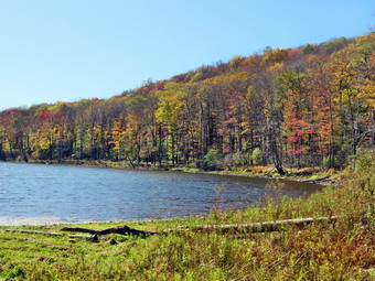
![]()
![]()
![]()
![]()
![]() On Thursday, October 19th, I was ready to get out for a hike after my 6:15 AM men's bible study at church. When I returned to Livingston Manor, I ate breakfast at Caf� 43 and returned home to do a few chores before heading out. I deiced I would go to Trout Pond since I had not bee there in some time and since it was close enough to get in a hike before cross country practice. When Sheila got wind of my plans, she started jumping around and could hardly contain herself even though we had hiked several times during the week. We left Livingston Manor at about 9:45 AM under sunny skies but with a temperatures just into the mid 40's. I put on my Mammut hoody and brought along gloves and a light hat. I had my gear in the trunk and an overjoyed Sheila in the back seat as we headed to Roscoe on State Route 17. I got on Route 206 and followed it across the Delaware County line to Morton Hill Road. After a left turn on Morton Hill Road, I drove to the intersection with Russell Brook Road. I turned around and parked on the side of the road to avoid the parking area which is private. We began our hike down Russell Brook Road at 10:10 AM. The temperature was 44 degrees so I decided to wear the Mammut Hoody but leave the hat and light gloves behind. We continued on down Russell Brook Road and found it very dry. I could hardly hear any water running in the brook beside the road. As we passed the overlook over the upper falls, I could see that there was almost no water in the stream and decided I would not visit either falls unless it was on the way back. We continued down toward the parking area where there were no cars and got on the woods road that goes down to the bridge that crosses the brook. The Japanese knotweed was in the process of dying and some was leaning over into the trail. We continue on the main trail to the register. At the trail junction just after the register we turned to the left to climb the steeper hill toward Mud Pond. The trail was very dry with almost no water or mud. The stream next to the trail had no water flowing. There were some occasional branches on the trail which I picked up and moved off the trail. The sun was out and as soon as we started to climb the hill, I stopped to open up the zippers on my hoody. The ascent went quickly and I was glad to see there were no major blowdowns on this part of the trail. We reached the top of the hill and walked down the wide woods road to the next trail junction at 1.6 miles. We made a right to follow the trail up to the shoulder of Cherry Ridge. This trail was also very dry with none of the water or mud that sometimes makes the hike difficult. There were several large branches and trucks across the trail. Most of these blowdowns seemed to be rotten and had broken up on impact. I was able to move most of them off the trail without a problem.
On Thursday, October 19th, I was ready to get out for a hike after my 6:15 AM men's bible study at church. When I returned to Livingston Manor, I ate breakfast at Caf� 43 and returned home to do a few chores before heading out. I deiced I would go to Trout Pond since I had not bee there in some time and since it was close enough to get in a hike before cross country practice. When Sheila got wind of my plans, she started jumping around and could hardly contain herself even though we had hiked several times during the week. We left Livingston Manor at about 9:45 AM under sunny skies but with a temperatures just into the mid 40's. I put on my Mammut hoody and brought along gloves and a light hat. I had my gear in the trunk and an overjoyed Sheila in the back seat as we headed to Roscoe on State Route 17. I got on Route 206 and followed it across the Delaware County line to Morton Hill Road. After a left turn on Morton Hill Road, I drove to the intersection with Russell Brook Road. I turned around and parked on the side of the road to avoid the parking area which is private. We began our hike down Russell Brook Road at 10:10 AM. The temperature was 44 degrees so I decided to wear the Mammut Hoody but leave the hat and light gloves behind. We continued on down Russell Brook Road and found it very dry. I could hardly hear any water running in the brook beside the road. As we passed the overlook over the upper falls, I could see that there was almost no water in the stream and decided I would not visit either falls unless it was on the way back. We continued down toward the parking area where there were no cars and got on the woods road that goes down to the bridge that crosses the brook. The Japanese knotweed was in the process of dying and some was leaning over into the trail. We continue on the main trail to the register. At the trail junction just after the register we turned to the left to climb the steeper hill toward Mud Pond. The trail was very dry with almost no water or mud. The stream next to the trail had no water flowing. There were some occasional branches on the trail which I picked up and moved off the trail. The sun was out and as soon as we started to climb the hill, I stopped to open up the zippers on my hoody. The ascent went quickly and I was glad to see there were no major blowdowns on this part of the trail. We reached the top of the hill and walked down the wide woods road to the next trail junction at 1.6 miles. We made a right to follow the trail up to the shoulder of Cherry Ridge. This trail was also very dry with none of the water or mud that sometimes makes the hike difficult. There were several large branches and trucks across the trail. Most of these blowdowns seemed to be rotten and had broken up on impact. I was able to move most of them off the trail without a problem.
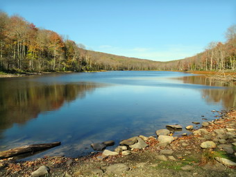 After passing through an area with many small diameter trees, we started a short descent with the trail remaining dry. The ascent continued for the next 1.2 miles until at 2.7 miles into the hike when we were at the highest point and ready to start the descent to Trout Pond. Along the way we had come across a few blowdowns which I removed or hiked around. As we descended toward Trout Pond there were three major blowdowns that would require an axe and saw to clear. The trail remained dry and a little slippery in places from the leaves. As we approached the bridge at the inlet end of the pond, I decided to stop and take some pictures. We walked out through the weeds to the shore and found the water level still very low. There wasn't much color in the leaves but I took some shots anyway. As we walked across the bridge, I noticed there was no water at all in the inlet stream! We continued on the main trail toward the outlet of the pond. The trail was till dry and the hiking was easy. Along the way Sheila alerted and I saw an older couple approaching us. I put Sheila on her leash and moved to the side of the trail but the male hiker insisted on approaching Sheila which did not make her happy. At the lower end of the pond I again stopped to take pictures of a scene I had photographed many times! The water level in the pond was very low and there were no once white clouds in the sky. The hike from the outlet to the trail junction is all downhill and we were able to make good time. On the way down we met a young couple. The woman was carrying a young child in a backpack carrier. We said "Hello" as we passed. By 12:10 PM we had hiked 4.7 miles and were back at the trail junction and register box. I decided that I did not want to walk over to the falls as I was a little short on time. We walked out to the parking area to continue our hike back to the car. There was only one car in the parking lot so I assumed one couple had parked on Morton Hill Road. As we walked up the road back to the car, I did not stop at the overlook over the upper falls but continued up the road. We continued up the road and back to the car. Another car was parking in the pulloff which is on private property and clearly posted. It is thoughtless people like these that cause problems for other hikers! We arrived back at 12:25 PM having covered 5.4 miles and 1105 vertical feet in 2 hours and 15 minutes. The temperature had risen to about 49 degrees as we left.
![]()
![]()
![]()
![]() On Wednesday, October 18th I had several different tasks to accomplish around the house and I also needed to leave early for an away cross country meet. I decided the solution was to take Sheila across the street to hike on Round Top. I had not been there since the week before and I like to walk the trails frequently to make sure they are in good shape. The temperature was in the low 50's as I left the house so I wore a light jacket. Sheila was happy to go as I put her on her leash to walk across the street at about 11:30 AM. We walked through the field next to the church and then up the steep but short cemetery hill. Sheila gave me a little help as she pulled me up the hill. At the top of the hill I took a look back down to town and over to the surrounding hills hoping to find a blotch of color somewhere. There were no colorful trees and had not been for the entire fall. Some other areas in the Catskills had some color but not Livingston Manor! We turned left at the trailhead and walked into the woods on the trail. I immediately let Sheila off her leash but she stayed very close to me for the entire hike. At the first trail junction, Sheila turned right and I followed her up the more gentle ascent. Where the lower trail turned left Sheila continued straight ahead on the blue-blazed upper trail and I followed her lead. The trails were in good shape and we were soon at the summit. We continued over the summit and down the other side of the hill. At the junction with the lower trail I found a large branch across the trail. I tried to move it in several ways but it would not budge. I decided we would complete our first loop, walk back to the house to get my saw and return to eliminate this obstacle. We turned right and walked the gentle downhill to the lookout. At the viewpoint we turned left and walked down the steep trail to the first trail junction. We walked out to the trailhead and then down the hill toward the church. I put Sheila on her leash and we walked to our driveway and back to the house. I picked up my smaller Silky saw and we headed back across the street and up the hill to the top of the cemetery. This time we continued straight ahead toward the lookout and then followed the rail to the junction with the blue trail where the tree was across the path. It took me only a few minutes to cut up the blowdown and pull it off the trail. We continued on the lower trail to the next trail junction where we turned right and headed down the lower trail to the first junction. I didn't want to keep carrying the saw so I placed it behind a tree. We turned right and started back up to the lookout where we turned right to follow the trail to the junction with the upper blue trail. We continued straight ahead on the blue trail over the summit ion the opposite direction from before. We walked won the other side to the trail junction and continued straight ahead on the yellow trail back to the first trail junction. At this point Sheila started to run out to the trailhead but I called her back as I turned around to start the final lower loop up the shallower grade. We followed the lower trail in a counterclockwise direction passing the lookout and descending back to the first trail junction. This time Sheila made a mad dash toward the trailhead and I followed her. We continued out to the trailhead and turned right. I put Sheila on her leash for the walk down the hill and back across the street to the house. It was 1:00 PM and we had spent an hour and a half hiking over 3 miles and doing a little trail work.
On Wednesday, October 18th I had several different tasks to accomplish around the house and I also needed to leave early for an away cross country meet. I decided the solution was to take Sheila across the street to hike on Round Top. I had not been there since the week before and I like to walk the trails frequently to make sure they are in good shape. The temperature was in the low 50's as I left the house so I wore a light jacket. Sheila was happy to go as I put her on her leash to walk across the street at about 11:30 AM. We walked through the field next to the church and then up the steep but short cemetery hill. Sheila gave me a little help as she pulled me up the hill. At the top of the hill I took a look back down to town and over to the surrounding hills hoping to find a blotch of color somewhere. There were no colorful trees and had not been for the entire fall. Some other areas in the Catskills had some color but not Livingston Manor! We turned left at the trailhead and walked into the woods on the trail. I immediately let Sheila off her leash but she stayed very close to me for the entire hike. At the first trail junction, Sheila turned right and I followed her up the more gentle ascent. Where the lower trail turned left Sheila continued straight ahead on the blue-blazed upper trail and I followed her lead. The trails were in good shape and we were soon at the summit. We continued over the summit and down the other side of the hill. At the junction with the lower trail I found a large branch across the trail. I tried to move it in several ways but it would not budge. I decided we would complete our first loop, walk back to the house to get my saw and return to eliminate this obstacle. We turned right and walked the gentle downhill to the lookout. At the viewpoint we turned left and walked down the steep trail to the first trail junction. We walked out to the trailhead and then down the hill toward the church. I put Sheila on her leash and we walked to our driveway and back to the house. I picked up my smaller Silky saw and we headed back across the street and up the hill to the top of the cemetery. This time we continued straight ahead toward the lookout and then followed the rail to the junction with the blue trail where the tree was across the path. It took me only a few minutes to cut up the blowdown and pull it off the trail. We continued on the lower trail to the next trail junction where we turned right and headed down the lower trail to the first junction. I didn't want to keep carrying the saw so I placed it behind a tree. We turned right and started back up to the lookout where we turned right to follow the trail to the junction with the upper blue trail. We continued straight ahead on the blue trail over the summit ion the opposite direction from before. We walked won the other side to the trail junction and continued straight ahead on the yellow trail back to the first trail junction. At this point Sheila started to run out to the trailhead but I called her back as I turned around to start the final lower loop up the shallower grade. We followed the lower trail in a counterclockwise direction passing the lookout and descending back to the first trail junction. This time Sheila made a mad dash toward the trailhead and I followed her. We continued out to the trailhead and turned right. I put Sheila on her leash for the walk down the hill and back across the street to the house. It was 1:00 PM and we had spent an hour and a half hiking over 3 miles and doing a little trail work.
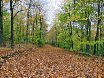
![]()
![]()
![]()
![]()
![]() On Monday, October 16th, I wanted to get in a hike after two days off for a cross country meet and obligations at church. I got up a little late and was in no hurry as the temperature was in the low 40's and the sky completely overcast. I asked Cindy if she wanted to hike and she said "Yes" and we agreed to go to the Frick Pond area. This is our "go to" spot since it is close to home and there area number of different rails that can be combined into a variety of hikes. I decided against wearing tights underneath my pants but did wear my Mammut hoody since it has several different zippers to vent heat. Cindy and I both took a hat a light gloves since it was only 48 degrees when we left the house at 10:10 AM. Sheila acted as if she had not hiked or a month as she jumped into the back seat. We arrived just before 10:30 AM to find no one else parked in the lots. I checked the temperature and it was 44 degrees at the trailhead! I set Garmin GPS and we crossed the road to get on the Flynn Trail. There was a slight breeze blowing which made it seem even cooler. We immediately noticed that there were still a few green leaves on some trees but not much color remained. Some of the leaves on the ground had some color but they had turned, stayed on the trees for a day or so and then fallen in the wind and rain. We made the turn up the wide woods road that is the Flynn Trail and started up what was once the Beech Mountain Road. The grass was a little wet and there was some mud in places. It was obvious there had been some wind as we were constantly moving branches off the trail. In a few places I had to drop my poles and take a few minutes to lift larger obstacles off the trail. Sheila was having a great time following animal trails and running up and own the main trail. We set a good pace on the ascent but really did not hurry. By 11:20 AM we had made the 1.7 uphill miles to the junction with the Big Rock Trail. We continued on the Flynn Trail toward Hodge Pond. The skies were still overcast and the breeze was still blowing. I was comfortable while we hiked but cool when we stopped.
On Monday, October 16th, I wanted to get in a hike after two days off for a cross country meet and obligations at church. I got up a little late and was in no hurry as the temperature was in the low 40's and the sky completely overcast. I asked Cindy if she wanted to hike and she said "Yes" and we agreed to go to the Frick Pond area. This is our "go to" spot since it is close to home and there area number of different rails that can be combined into a variety of hikes. I decided against wearing tights underneath my pants but did wear my Mammut hoody since it has several different zippers to vent heat. Cindy and I both took a hat a light gloves since it was only 48 degrees when we left the house at 10:10 AM. Sheila acted as if she had not hiked or a month as she jumped into the back seat. We arrived just before 10:30 AM to find no one else parked in the lots. I checked the temperature and it was 44 degrees at the trailhead! I set Garmin GPS and we crossed the road to get on the Flynn Trail. There was a slight breeze blowing which made it seem even cooler. We immediately noticed that there were still a few green leaves on some trees but not much color remained. Some of the leaves on the ground had some color but they had turned, stayed on the trees for a day or so and then fallen in the wind and rain. We made the turn up the wide woods road that is the Flynn Trail and started up what was once the Beech Mountain Road. The grass was a little wet and there was some mud in places. It was obvious there had been some wind as we were constantly moving branches off the trail. In a few places I had to drop my poles and take a few minutes to lift larger obstacles off the trail. Sheila was having a great time following animal trails and running up and own the main trail. We set a good pace on the ascent but really did not hurry. By 11:20 AM we had made the 1.7 uphill miles to the junction with the Big Rock Trail. We continued on the Flynn Trail toward Hodge Pond. The skies were still overcast and the breeze was still blowing. I was comfortable while we hiked but cool when we stopped.
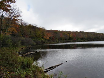 At the next trail junction we turned right off the Flynn Trail to take the wood road toward the old Beech Mountain Boy Scout Camp. We then turned left at the next trail junction to descend toward the pond. This trail had been scraped by OSI and had been a muddy mess. It was now covered in leaves and some grass was growing back which made the hiking easier. At the next opportunity, we turned right to head around the back of the pond on the old jeep trail. At one point we headed down to the shore of the pond. I took some pictures of the pond which were a little bleak since the trees didn't have many leaves and the skies were gray. Sheila waded in the pond and got a drink but did not want to swim in the cold water. We got back on the jeep trail and headed toward the junction with the Flynn Trail. We made a right on the Flynn Trail, walked up to the gate and headed toward Junkyard Junction. The Flynn Trail was pretty wet with several muddy spots and some standing water. At Junkyard Junction, we turned left on the Quick Lake Trail to descend toward Iron Wheel Junction. The trail continued to have wet and muddy spots but we could walk around them without problems. We did continue to pick up branches and clear a few larger blowdowns as we went. This part of the hike went a little more slowly than usual but by At 12:40 PM we had hiked 4.9 miles and had arrived at Iron Wheel Junction. We turned right to stay on the Quick Lake Trail which was also wet and muddy in spots. We crossed the small stream in the woods and then walked under the "spruce tunnel". We were soon at the bridge over the outlet to Frick Pond. We stopped and I took some pictures of the pond which were about as bleak as the ones at Hodge Pond. The breeze was now a wind and the light mist that had persisted throughout the day seemed to be turning to rain. It seemed that the never dam was partly rebuilt. I am still waiting for a report as to the reasons that someone thought they could destroy the dam! We continued up the hill on the Quick Lake trail back to the car. We were back in the parking lot at 1:15 PM after hiking 6.3 miles and 1000 vertical feet in 2 hours and 45 minutes. The temperature at the car had risen to 46 degrees but the windchill had to be well into the 30's!
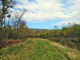
![]()
![]()
![]()
![]()
![]() On Friday, October 13th I wanted to get out for a longer hike after a week of XC races and practice and other commitments that had kept me out of the woods and away from hiking. I planned to hike in the northern Catskills perhaps at North South Lake or in the Blacks. I asked Cindy if she wanted to come along and she said she would like to but had to be back by 3:00 PM at the latest. Cindy likes to hike but 8 miles and 4 hours are about her limit and she is not thrilled with big elevation gains. I suggested we go to Bear Spring WMA where we had not been for some time and where I hoped we might get a glimpse of some elusive fall colors. When I got up in the morning the skies were completely overcast and the temperature was in the low 40's. I was in no hurry to start as I wanted the skies to clear so we delayed leaving until a little before 9:30 AM. I debated whether to wear tights underneath my pants but in the end decided they were not necessary. I did put on my Mammut hoody for the first time since the spring. This jacket is great for layering and has large pit zips on either side to dump heat. The hoody also fits nice in my pack if I need to take it off. We left Livingston Manor and headed north on State Route 17 to Roscoe. I got off at exit 94 and headed north on Route 206 through Roscoe and then Rockland. Just after entering Delaware County we ran into a paving project which delayed us for some time. Once we cleared the work zone I continued north on Route 206 to the Pepacton Reservoir where I turned left an drove through Downsville. I continued to follow Route 206 north toward Walton. Soon we were climbing Bear Spring Mountain and I noticed the skies were clearing and the temperature was in the high 40's. Just before the top of the mountain, I pulled off the road into large pulloff and parking area where we would begin our hike. I made sure Sheila was on her leash as the traffic on Route 206 in surprisingly heavy. I set my electronics and we began our hike at 10:20 AM by walking north on Route 206 and then turning into the woods to the left. Bear Spring WMA is a multiuse area but is primarily constructed for use by horses and snowmobiles. Since horse can cross streams more easily than hikers there are few bridges and hikers must take this into account. The area has its own way of marking trails which is not the usual method used on most hiking trails. A map of the trails is available online or by clicking here for those who has not hiked there before. Most of the trails are wide woods roads suitable for riding horses or snowmobiles. We headed south and then southeast on one of the these woods roads labeled on some maps as Wilson Hollow Road. To the left of this trail is a large clear cut area which was begun to grow up over the years. In the past there were some nice views from here across Route 206 to the opposite hillier but these views are now blocked. As we walked along the trail, we could immediately see that we were not going to find much in the way of bright leaf colors. I did stop to take some pictures of the trail and the colors that were present. We entered the woods and I took a few more shots before we continued on. The trail continued to head southeast and rolled a little up and own as it went. At 1.35 miles the trail began to climb some and a trail on the right headed down to the area of Launt Pond. We began to gain some elevation and at 1.95 mile another trail headed off to the right winding its way down to East Trout Brook Road south of Launt Pond. We continued straight ahead until at 2.2 miles the McCoy Hill Cutoff Trail appeared on the right. This was the trail we would use to form our loop as we were hiking a lollipop route. I decided we would continue straight ahead as I had not done the loop in that direction for some time.
On Friday, October 13th I wanted to get out for a longer hike after a week of XC races and practice and other commitments that had kept me out of the woods and away from hiking. I planned to hike in the northern Catskills perhaps at North South Lake or in the Blacks. I asked Cindy if she wanted to come along and she said she would like to but had to be back by 3:00 PM at the latest. Cindy likes to hike but 8 miles and 4 hours are about her limit and she is not thrilled with big elevation gains. I suggested we go to Bear Spring WMA where we had not been for some time and where I hoped we might get a glimpse of some elusive fall colors. When I got up in the morning the skies were completely overcast and the temperature was in the low 40's. I was in no hurry to start as I wanted the skies to clear so we delayed leaving until a little before 9:30 AM. I debated whether to wear tights underneath my pants but in the end decided they were not necessary. I did put on my Mammut hoody for the first time since the spring. This jacket is great for layering and has large pit zips on either side to dump heat. The hoody also fits nice in my pack if I need to take it off. We left Livingston Manor and headed north on State Route 17 to Roscoe. I got off at exit 94 and headed north on Route 206 through Roscoe and then Rockland. Just after entering Delaware County we ran into a paving project which delayed us for some time. Once we cleared the work zone I continued north on Route 206 to the Pepacton Reservoir where I turned left an drove through Downsville. I continued to follow Route 206 north toward Walton. Soon we were climbing Bear Spring Mountain and I noticed the skies were clearing and the temperature was in the high 40's. Just before the top of the mountain, I pulled off the road into large pulloff and parking area where we would begin our hike. I made sure Sheila was on her leash as the traffic on Route 206 in surprisingly heavy. I set my electronics and we began our hike at 10:20 AM by walking north on Route 206 and then turning into the woods to the left. Bear Spring WMA is a multiuse area but is primarily constructed for use by horses and snowmobiles. Since horse can cross streams more easily than hikers there are few bridges and hikers must take this into account. The area has its own way of marking trails which is not the usual method used on most hiking trails. A map of the trails is available online or by clicking here for those who has not hiked there before. Most of the trails are wide woods roads suitable for riding horses or snowmobiles. We headed south and then southeast on one of the these woods roads labeled on some maps as Wilson Hollow Road. To the left of this trail is a large clear cut area which was begun to grow up over the years. In the past there were some nice views from here across Route 206 to the opposite hillier but these views are now blocked. As we walked along the trail, we could immediately see that we were not going to find much in the way of bright leaf colors. I did stop to take some pictures of the trail and the colors that were present. We entered the woods and I took a few more shots before we continued on. The trail continued to head southeast and rolled a little up and own as it went. At 1.35 miles the trail began to climb some and a trail on the right headed down to the area of Launt Pond. We began to gain some elevation and at 1.95 mile another trail headed off to the right winding its way down to East Trout Brook Road south of Launt Pond. We continued straight ahead until at 2.2 miles the McCoy Hill Cutoff Trail appeared on the right. This was the trail we would use to form our loop as we were hiking a lollipop route. I decided we would continue straight ahead as I had not done the loop in that direction for some time.
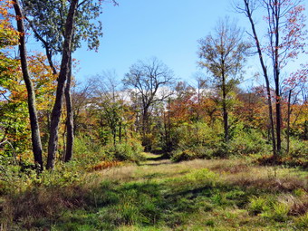 The trail had been almost dry to this point but now we began to run into muddy areas some of which extended across the trail. We lost some elevation and then gained some as the trail continued to head southeast. The temperature had increased and the sun had come out so I opened the pit zips on my jacket. At 3.35 miles we began a slight climb and shortly after this the trail turned west to start the loop back. At 3.6 miles we hit a high point just before a long descent. Cindy said she was beginning to get hungry and needed a drink so we stopped to eat a bar and drink some water. We didn't stay still for Avery long but I did take a moment to remove my jacket and stow it in the pack. The trail now began a long descent which we both knew meant a long ascent at some point. At 4.25 miles it turned north but continued to descend. Over less than a mile we lost 470 feet of elevation to about 4.5 miles where we came to a trail junction. To the left the trail descended to Middle Pond on East Trout Brook Road. We turned right to head north on the McCoy Hill Cutoff Trail back to Wilson Hollow Road to complete the loop. This was the lowest point on the trail and I knew the hill was a steady climb. We ascended for some time and then stopped in an open area where we could look over to the western ridge and across the valley. There wasn't much color and the skies were overcast but I took a few shots anyway. We continued up the hill trying to make good time and to avoid thinking about the ascent. At 5.4 mile we topped the hill and walked along the edge of a field to complete the loop. The ascent was only 465 feet over .8 miles for around a 10% grade. We turned left and started back toward the car retracing our route along Wilson Hollow Road. At one point Cindy pointed out a great cacophony to the right of the trail which we at first mistook for the wind in the dead leaves. After listening for a time, we came to the conclusion it was a large flock of birds which we could not see. We stood still for a few minutes and saw birds beginning to appear in the trees. After a few more minutes we continued on our way. I said something to Cindy and suddenly there was complete quite and the birds in the trees were gone! It was Friday the 13th! We continued along the trail talking as we went and were soon at the area of the clear cut. As we neared the road, I put Sheila back on her leash as we walked back to the car. We arrived back at the car at 1:45 Pm after hiking 7.6 miles in 3 hours and 20 minutes with a little over 20 minutes of stopped time. Our overall average was 2.2 miles per hour and we gained 1070 feet of elevation along the way.
![]() On Tuesday, October 10th I planned to go to Walnut Mountain to make sure the cross country course was in good shape and to mark it with white arrows for our home meet against TriValley and Livingston Manor later in the day. I had laid out the course last year and made sure it was exactly 5K which translates to 16,404.2 feet. When I arrived at 9:00 AM, I decided to mark the part of the course nearest the parking area so I walked to the far end of the parking lot and began top spray paint white arrows along the fence. I continued through the picnic grove and across the playground area to the East Trail toward the finish line. There were two large puddles on the course but I decided to allow the runners to choose to run through them or around. When I got to the varsity finish line, I painted it and then continued a little farther up the trail. I knew I needed to extend the modified course to get it to about 1.6 miles. Just as I started walking up the hill, I found a good place and marked a line. I walked back down to the car with an almost empty paint can. I picked up a new can of paint and headed up the Mountain Overlook Trail carrying a rake to remove leaves where I needed to put down arrows. I knew I was short of paint and so only marked intersections with and occasional "assurance" arrow along the way. I followed the wide carriageway as it wound up the hill. Where the Mountain Overlook Trail turned left, I painted and arrow to direct the runners straight ahead on a cut over path to the West Trail. Soon the North Trail came in from the right and I marked arrows to direct the runners straight ahead on the West Trail. The carriageway wound around the base of the mountain and I soon was at the spot where the cross country course turned left up a steep trail. I marked a very large arrow here and turned left to follow the course up the trail. Along the way I raked some leaves off the trail but knew I did not have the time or energy to rake 3 miles of leaves! I continued to the top of the hill where the course turns right on the Sunset Trail. I marked an arrow at the turn and shortly after painted a 2 to show the end of the second mile. The Sunset Trail is flat and wide with only a short hill at the end. As the trail clears the trees several other trails cross the course so I painted arrows to show the runners they should continue straight ahead. At the overlook I painted and arrow to show the runners they must turn left and continue back down the hill on the Mountain Overlook Trail. I continued downhill to the point where the Suet Trail comes in from the left and the course turns right down an unnamed trail. I painted an arrow showing a right turn after which the trail descends steeply down to a field where it heads to the left. I painted a few roots and rocks and continued to follow the trail back to the Mountain Overlook Trail where I turned right to retrace the course back down to the picnic area. Since I had already marked the course to the finish, I went back to the car with an empty paint can. I picked up a new can of paint and walked across the parking area to paint a starting line for the modified race. I painted the line and then walked down the hill and placed an X where I would later place a cone. I turned left and walked to the varsity starting line which I repainted. From that starting line I walked on a wide, mowed path to the point where the trail entered the woods. This part was all downhill but I did have to remove some branches that were on the trail. The course continued for some distance without turns so I sprayed a few assurance arrows to the next junction. Just before the parking area, I painted an arrow indicating a left turn and another just beyond it. I walked along the path cut through the high grasses and shrubs and found it in good shape. I broke off and beat back a few weeds and paint a few arrows along the way. I exited the open area and entered the trees where the course began to climb. After a short time and even longer and steeper hill lay straight ahead. I followed our course as it turned left on Vista Way and painted an arrow to show the turn. This trail is very narrow and does not get much use. The course follows the Vista Way as it turns left and crosses a small bridge. I raked the leaves aside and put a large arrow right at the turn. A short distance after the ridge I put down a 1 to indicate the end of the first mile. I continued along the Vista Way marking a few more arrows. Soon I was back at the parking area and my car. It was just after noon and I was done after 3 hours of work and well over three miles of walking.
On Tuesday, October 10th I planned to go to Walnut Mountain to make sure the cross country course was in good shape and to mark it with white arrows for our home meet against TriValley and Livingston Manor later in the day. I had laid out the course last year and made sure it was exactly 5K which translates to 16,404.2 feet. When I arrived at 9:00 AM, I decided to mark the part of the course nearest the parking area so I walked to the far end of the parking lot and began top spray paint white arrows along the fence. I continued through the picnic grove and across the playground area to the East Trail toward the finish line. There were two large puddles on the course but I decided to allow the runners to choose to run through them or around. When I got to the varsity finish line, I painted it and then continued a little farther up the trail. I knew I needed to extend the modified course to get it to about 1.6 miles. Just as I started walking up the hill, I found a good place and marked a line. I walked back down to the car with an almost empty paint can. I picked up a new can of paint and headed up the Mountain Overlook Trail carrying a rake to remove leaves where I needed to put down arrows. I knew I was short of paint and so only marked intersections with and occasional "assurance" arrow along the way. I followed the wide carriageway as it wound up the hill. Where the Mountain Overlook Trail turned left, I painted and arrow to direct the runners straight ahead on a cut over path to the West Trail. Soon the North Trail came in from the right and I marked arrows to direct the runners straight ahead on the West Trail. The carriageway wound around the base of the mountain and I soon was at the spot where the cross country course turned left up a steep trail. I marked a very large arrow here and turned left to follow the course up the trail. Along the way I raked some leaves off the trail but knew I did not have the time or energy to rake 3 miles of leaves! I continued to the top of the hill where the course turns right on the Sunset Trail. I marked an arrow at the turn and shortly after painted a 2 to show the end of the second mile. The Sunset Trail is flat and wide with only a short hill at the end. As the trail clears the trees several other trails cross the course so I painted arrows to show the runners they should continue straight ahead. At the overlook I painted and arrow to show the runners they must turn left and continue back down the hill on the Mountain Overlook Trail. I continued downhill to the point where the Suet Trail comes in from the left and the course turns right down an unnamed trail. I painted an arrow showing a right turn after which the trail descends steeply down to a field where it heads to the left. I painted a few roots and rocks and continued to follow the trail back to the Mountain Overlook Trail where I turned right to retrace the course back down to the picnic area. Since I had already marked the course to the finish, I went back to the car with an empty paint can. I picked up a new can of paint and walked across the parking area to paint a starting line for the modified race. I painted the line and then walked down the hill and placed an X where I would later place a cone. I turned left and walked to the varsity starting line which I repainted. From that starting line I walked on a wide, mowed path to the point where the trail entered the woods. This part was all downhill but I did have to remove some branches that were on the trail. The course continued for some distance without turns so I sprayed a few assurance arrows to the next junction. Just before the parking area, I painted an arrow indicating a left turn and another just beyond it. I walked along the path cut through the high grasses and shrubs and found it in good shape. I broke off and beat back a few weeds and paint a few arrows along the way. I exited the open area and entered the trees where the course began to climb. After a short time and even longer and steeper hill lay straight ahead. I followed our course as it turned left on Vista Way and painted an arrow to show the turn. This trail is very narrow and does not get much use. The course follows the Vista Way as it turns left and crosses a small bridge. I raked the leaves aside and put a large arrow right at the turn. A short distance after the ridge I put down a 1 to indicate the end of the first mile. I continued along the Vista Way marking a few more arrows. Soon I was back at the parking area and my car. It was just after noon and I was done after 3 hours of work and well over three miles of walking.
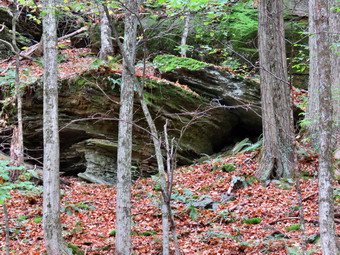
![]()
![]()
![]()
![]()
![]() On Saturday, October 7th I had planned to hike Dry Brook Ridge to the lookouts from Southside Drive in Margaretville. This would take me over Pakatakan Mountain which I remembered was a steep climb in several places. I planned to return by descending the German Hollow Trail and then walking the roads back to the car. From what I pieced together from previous trips, this would be about a 9 mile hike. When I went to bed Friday night, the forecast was somewhat unsettled but the chance of rain was out at less than 10%. When I awoke on Saturday morning the forecast had not really changed but there was some rain in the Southern Tier which I thought could reach Margaretville. I decided to take a chance and do the hike anyway despite the fact that I knew that the views from the lookouts would probably be hazy due to the overcast skies. I was looking for some pictures of fall leaves with some vibrant colors. Many of the leaves around Livingston Manor had already fallen from the trees without changing colors. I delayed leaving the house since it was so foggy but I eventually got my gear together and got dressed. I wore a light windbreaker and packed a rain jacket just in case. I decided to take my collapsible Leki Micro Vario poles which are light and easy to stow for the 3 mile road walk. Sheila was very excited since we had not hiked since Tuesday! We left Livingston Manor a little after 9:00 AM with a heavy fog still hanging near the ground. I drove north on Old Route 1& toward Roscoe and then turned right on the Beaverkill Road. I continued north on the Beaverkill Road through Lew Beach. Just outside Turnwood, I turned left on Barkaboom Road and continued up the hill passing Little Pond State Campgrounds and Big Pond. I continued over the hill and the turned right on BWS 9 heading toward Margaretville. BWS 9 changed to BWS 10 and the became Southside Drive as I approached Margaretville. I continued along Southside Drive until I passed Fair Street and a Dead End sign. Just a little farther down the road on the right was the trailhead with room to park a couple of cars on the other side of the road. I turned around and pulled my car off the road just across from the trailhead. I set my electronics including my Suunto Traverse watch and Garmin GPSmap 64st and decided to leave my light windbreaker behind as the temperature was already in the low 60's and the humidity was high. At 9:55 AM we crossed the road to begin our hike. The trail starts climbing immediately and over the first .65 miles gains 525 feet for an average of a 15% grade. This would be much steeper but for a series of switchbacks as the trail heads east along old woods roads. All along the trail are very impressive and interesting rock ledges and I stopped several times to take a few pictures. The shots really don't do these ledges justice as they loom over the trail and have numerous overhangs and "caves". The skies were still very cloudy but there were times when the sun would peek through. It SW very warm and humid and I was glad I had left my jacket in the car as I was working up quite a sweat without it!
On Saturday, October 7th I had planned to hike Dry Brook Ridge to the lookouts from Southside Drive in Margaretville. This would take me over Pakatakan Mountain which I remembered was a steep climb in several places. I planned to return by descending the German Hollow Trail and then walking the roads back to the car. From what I pieced together from previous trips, this would be about a 9 mile hike. When I went to bed Friday night, the forecast was somewhat unsettled but the chance of rain was out at less than 10%. When I awoke on Saturday morning the forecast had not really changed but there was some rain in the Southern Tier which I thought could reach Margaretville. I decided to take a chance and do the hike anyway despite the fact that I knew that the views from the lookouts would probably be hazy due to the overcast skies. I was looking for some pictures of fall leaves with some vibrant colors. Many of the leaves around Livingston Manor had already fallen from the trees without changing colors. I delayed leaving the house since it was so foggy but I eventually got my gear together and got dressed. I wore a light windbreaker and packed a rain jacket just in case. I decided to take my collapsible Leki Micro Vario poles which are light and easy to stow for the 3 mile road walk. Sheila was very excited since we had not hiked since Tuesday! We left Livingston Manor a little after 9:00 AM with a heavy fog still hanging near the ground. I drove north on Old Route 1& toward Roscoe and then turned right on the Beaverkill Road. I continued north on the Beaverkill Road through Lew Beach. Just outside Turnwood, I turned left on Barkaboom Road and continued up the hill passing Little Pond State Campgrounds and Big Pond. I continued over the hill and the turned right on BWS 9 heading toward Margaretville. BWS 9 changed to BWS 10 and the became Southside Drive as I approached Margaretville. I continued along Southside Drive until I passed Fair Street and a Dead End sign. Just a little farther down the road on the right was the trailhead with room to park a couple of cars on the other side of the road. I turned around and pulled my car off the road just across from the trailhead. I set my electronics including my Suunto Traverse watch and Garmin GPSmap 64st and decided to leave my light windbreaker behind as the temperature was already in the low 60's and the humidity was high. At 9:55 AM we crossed the road to begin our hike. The trail starts climbing immediately and over the first .65 miles gains 525 feet for an average of a 15% grade. This would be much steeper but for a series of switchbacks as the trail heads east along old woods roads. All along the trail are very impressive and interesting rock ledges and I stopped several times to take a few pictures. The shots really don't do these ledges justice as they loom over the trail and have numerous overhangs and "caves". The skies were still very cloudy but there were times when the sun would peek through. It SW very warm and humid and I was glad I had left my jacket in the car as I was working up quite a sweat without it!
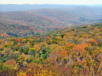 At .65 miles the trail turned south to travel along the west side of Pakatakan Mountain. At .75 miles the trail began to stay mostly on contour for a little while and then started to climb again but more gently. At 1.15 miles the trail turned east and began a steeper climb until 1.35 miles where it began to head north still climbing but more moderately. At 1.5 miles the trail leveled a little and then went through some turns which eventually resulted in us traveling southeast for some time starting at 1.8 miles. The wind had started to blow and it felt as if a storm was approaching but I was fully committed to my plan at this point. Despite the wind I was still warm as we continued climbing on the wide trail. The footing was a little difficult at times as the trail was covered in leaves which were wet from an overnight shower. The leaves did seem to have some color and I still hoped I could get some colorful pictures of fall foliage somewhere along the way. Along the way Sheila alerted to something behind us and I looked to see a hiker approaching. A man a few years younger than me was approaching quickly so I took hold of Sheila's collar and stepped to the side of the trail. As the hiker passed he thanked me and we wished each other a good day. We saw him once or twice more as we continued southeast on the trail. Just after 2 miles, we passed by the summit of Patatakan Mountain at around 2500 feet as the trail continued to rise toward Dry Brook Ridge. I knew that the German Hollow trail would be coming up soon and at 2.7 miles it appeared on the left. I began to wonder if my mileages were correct as the out-and-back mileage I had for this route was 7 miles to the lookouts and we were not even close to our destination. We passed by the trail junction continuing on the main trail toward the junction with the trail that ascends to the ridge from Hill Road. Not long after the German Hollow Trail junction was a sign that said "Lean-to" pointing to a new path. I decided not to make the side trip but as we continued on the trail I could see the lean-to. I did not realize that the German Hollow lean-to had been relocated so far away from its original site. This section of the trail is one of the most frustrating in the Catskills. We reached a high point at 3.2 miles and then began to descend on the trail which hugged the side of the hill. The trail had not been maintained in some time and the leaves covered many loose rocks. We lost 120 feet of elevation in the next .25 miles all the while pushing through briars and with me watching my footing. At the bottom of the descent the trail turned right heading south and in .15 miles we gained over 200 feet at a 26% grade. We were now at the trail junction with the trail that ascends from Hill Road.
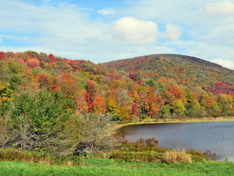 At the trail junction we had hiked 3.6 miles and it began to dawn on me that the GPS track I had for this approach only included getting to the trail junction and not the extra mile to the lookouts. The extra miles really didn't bother me as I felt pretty good but it did bother me that I was careless in my planning! The skies were still overcast and the wind was still blowing. We walked straight ahead to continue on the trail to the lookouts. The distance to the lookouts from the trail junction is only a mile with the first .7 miles being relatively flat. After that a series of short but steep climbs leads to the open rock face that makes up the lookouts. These climbs are not really very difficult except when using snowshoes in the winter! I expected that we might see the hiker we had met at the lookouts but no one was present when we arrived. I could only speculate the other hiker had continued on the ridge or taken a different path earlier in the hike. As I looked out from the viewpoint I was disappointed but not supplied that there was a haze hanging over the valley. I could see the Pepacton Reservoir but I knew pictures would be impossible. There were some nice autumn colors on the trees but the haze and the overcast skies made them seem dull. I did take a few shots hoping to get a couple of nice pictures. Sheila and I had a drink and I grabbed a bar to eat on the hike back. The wind was blowing harder and the skies looked at little darker as we started back at 12:10 PM. I negotiated the descents and then walked back on the falter trail to the trail junction. Descending the steep section of trail and sidehilling along the next section proved easier than I thought. Of course, after leaving the lookouts, the skies began to clear and the sun started to shine through. As I walked I began to debate whether I should continue back the way I had come or stick to my original plan of using the German Hollow Trail. S we approached the trail junction at 6.5 miles a few drops of rain began to fall which cemented my decision. We continued straight ahead to follow the main trail back the way we had come. The wide trails made it fairly easy to make good time. It wasn't very long before the rain began to fall in earnest. I was sure that if I got out my rain jacket and pack cover the rain would stop so I did just that. We got moving again and it wasn't long before the rain abated and then stopped. I decided to just keep going and opened the side zippers on my jacket to dump some heat. Descending the final steep parts of the trail back to the car proved interesting as the leaves were now wet but I made it back without actually falling. We were back at the car at 2:15 PM after hiking 9.3 miles in 4 hours and 20 minutes with an elevation gain of 2525 feet. On the way back home I stopped on the Barkaboom Road to rake some pictures and then again at Big Pond. I decided to head for Alder lake where I pulled into the parking area and quickly walked down to the lake. I took a few pictures and then headed back to the car. On the way back down Alder Creek Road, I stopped again to take a few shots near the Beaverkill Fish Hatchery.
![]()
![]()
![]()
![]() On Tuesday, October 3rd I had several different tasks to accomplish around the house and I also needed to leave early for an away cross country meet. I decided the solution was to take Sheila across the street to hike on Round Top. I had not been there since the official opening last Sunday and wanted to see if everything was Ok on the trails. Sheila was happy to go even though we had hiked the day before and I put her on her leash to walk across the street at about 11:30 AM. We walked through the field next to the church and then up the steep but short cemetery hill. Sheila have me a little help as she pulled me up the hill. We turned left at the trailhead and walked into the woods on the trail. I immediately let Sheila off her leash but she stayed very close to me for the entire hike. At the first trail junction, Sheila turned right and I followed her up the more gentle ascent. Where the lower trail turned left Sheila continued straight ahead on the blue-blazed upper trail and I followed her lead. The trails were in good shape and we were soon at the summit. We continued over the summit and down the other side of the hill. At the lower trail we turned right and walked the gentle downhill to the lookout. At the viewpoint we turned left and walked down the steep trail to the first trail junction. Sheila continued on toward the trailhead but I turned around and started back up the trail. Sheila followed and we began our second big loop in reverse. When we completed this one I turned around again to start another in the same direction as the first. Sheila was a little more reluctant to follow but did turns round to come with me. After completing this third loop, I thought about going home wanted to try one more. Sheila gave me a disgusted look but followed me for our fourth and final loop. Once we were back at the trail junction, we continued out to the trailhead. We turned right and I put Sheila on her leash for the walk down the hill and back across the street to the house. We had spent a little over and hour hiking 3 miles.
On Tuesday, October 3rd I had several different tasks to accomplish around the house and I also needed to leave early for an away cross country meet. I decided the solution was to take Sheila across the street to hike on Round Top. I had not been there since the official opening last Sunday and wanted to see if everything was Ok on the trails. Sheila was happy to go even though we had hiked the day before and I put her on her leash to walk across the street at about 11:30 AM. We walked through the field next to the church and then up the steep but short cemetery hill. Sheila have me a little help as she pulled me up the hill. We turned left at the trailhead and walked into the woods on the trail. I immediately let Sheila off her leash but she stayed very close to me for the entire hike. At the first trail junction, Sheila turned right and I followed her up the more gentle ascent. Where the lower trail turned left Sheila continued straight ahead on the blue-blazed upper trail and I followed her lead. The trails were in good shape and we were soon at the summit. We continued over the summit and down the other side of the hill. At the lower trail we turned right and walked the gentle downhill to the lookout. At the viewpoint we turned left and walked down the steep trail to the first trail junction. Sheila continued on toward the trailhead but I turned around and started back up the trail. Sheila followed and we began our second big loop in reverse. When we completed this one I turned around again to start another in the same direction as the first. Sheila was a little more reluctant to follow but did turns round to come with me. After completing this third loop, I thought about going home wanted to try one more. Sheila gave me a disgusted look but followed me for our fourth and final loop. Once we were back at the trail junction, we continued out to the trailhead. We turned right and I put Sheila on her leash for the walk down the hill and back across the street to the house. We had spent a little over and hour hiking 3 miles.
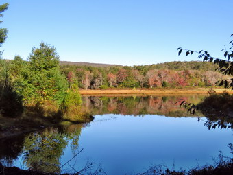
![]()
![]()
![]()
![]()
![]() On Monday, October 2nd I had thought about hiking on Dry Brook Ridge near Margaretville. I wanted to do a loop from Southside Drive to the Penguin Rocks and then back down the German Hollow Trail. I planned to return on the road to the car. Between the drive and the length of the hike I decided to put this off until a day when I did not have practice in the afternoon. I decided that I wanted to go for a hike closer to home and asked Cindy if she would like to go to Frick Pond. The big loop around Frick and Hodge Ponds has become my "go to" hike for a quick walk close to home. It was still in the high 30's and foggy at 8:30 AM so we were in no hurry to rush out the door. Sheila sniffed our clothes and immediately knew we were hiking. She began to run around the house bouncing against the furniture but always keeping a close eye on me. We put our gear in the car and an excited Sheila in the back seat and drove out the DeBruce Road at 9:15 AM. At Mongaup Pond Road I turned left and continued to follow the road bearing left onto Beech Mountain Road at the fork. When we arrived in the parking area there were no other cars parked. Sheila was acting as if she hadn't hiked in a month as she ran around and headed for the trail. The temperature was 41 degrees and I was a little cool as I got my gear ready to go. The skies were still a little overcast as we headed out the path to the register on Quick Lake Trail at 9:40 AM. The Quick Lake Trail was damp but not really wet and there were only a few muddy spots which were easy to avoid. At Gravestone Junction we turned left to head down to Frick Pond. The water level in the pond was low due to the fact that someone had completely pulled out the beaver dam across the outlet stream. It did seem that the beavers were beginning to rebuild the dam and the water level was a little higher. The sky had a little more blue but the leaves on the trees were still dull with almost none of the fall colors we had been expecting. Many of the trees seemed to have already dropped their leaves but I decided to take few shots anyway. I also took a few pictures of Cindy and Sheila on the bridge before we continued our hike. We continued on the Quick Lake Trail around the pond bearing left at the next trail junction to stay on the red trail. This part of the trail was drier than the last time I had walked the trail with almost no mud. We were setting a fast pace and soon came to the "pine promenade" and the little stream through the woods. This water level in the stream was very low compared to almost any other time since the spring. As we continued along the trail I removed some small branches and a few large ones until we arrived at Iron Wheel Junction at 1.6 miles.
On Monday, October 2nd I had thought about hiking on Dry Brook Ridge near Margaretville. I wanted to do a loop from Southside Drive to the Penguin Rocks and then back down the German Hollow Trail. I planned to return on the road to the car. Between the drive and the length of the hike I decided to put this off until a day when I did not have practice in the afternoon. I decided that I wanted to go for a hike closer to home and asked Cindy if she would like to go to Frick Pond. The big loop around Frick and Hodge Ponds has become my "go to" hike for a quick walk close to home. It was still in the high 30's and foggy at 8:30 AM so we were in no hurry to rush out the door. Sheila sniffed our clothes and immediately knew we were hiking. She began to run around the house bouncing against the furniture but always keeping a close eye on me. We put our gear in the car and an excited Sheila in the back seat and drove out the DeBruce Road at 9:15 AM. At Mongaup Pond Road I turned left and continued to follow the road bearing left onto Beech Mountain Road at the fork. When we arrived in the parking area there were no other cars parked. Sheila was acting as if she hadn't hiked in a month as she ran around and headed for the trail. The temperature was 41 degrees and I was a little cool as I got my gear ready to go. The skies were still a little overcast as we headed out the path to the register on Quick Lake Trail at 9:40 AM. The Quick Lake Trail was damp but not really wet and there were only a few muddy spots which were easy to avoid. At Gravestone Junction we turned left to head down to Frick Pond. The water level in the pond was low due to the fact that someone had completely pulled out the beaver dam across the outlet stream. It did seem that the beavers were beginning to rebuild the dam and the water level was a little higher. The sky had a little more blue but the leaves on the trees were still dull with almost none of the fall colors we had been expecting. Many of the trees seemed to have already dropped their leaves but I decided to take few shots anyway. I also took a few pictures of Cindy and Sheila on the bridge before we continued our hike. We continued on the Quick Lake Trail around the pond bearing left at the next trail junction to stay on the red trail. This part of the trail was drier than the last time I had walked the trail with almost no mud. We were setting a fast pace and soon came to the "pine promenade" and the little stream through the woods. This water level in the stream was very low compared to almost any other time since the spring. As we continued along the trail I removed some small branches and a few large ones until we arrived at Iron Wheel Junction at 1.6 miles.
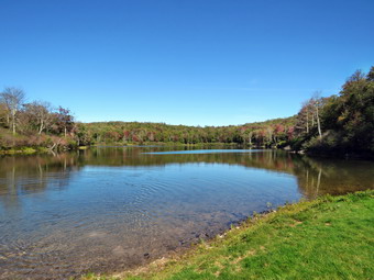 We turned left on the Quick Lake Trail and started the long uphill climb toward Junkyard Junction. The trail was almost dry all the way to Junkyard Junction at 3.2 miles. We walked and talked to make the uphill part go faster but we also remarked to each other that it is a long way to the junction. The sun was starting to come through the clouds but it was still playing hide and seek. We turned right onto the blue Flynn Trail which is almost flat. It too was only damp with a few spots of mud which were easily avoided. There were no major blowdowns but I continued to remove branches that littered the trail. When we got to the gate, we turned right to stay on the trail and head down toward Hodge Pond. At 3.75 miles the Flynn Trail heads right and we followed it toward the outlet end of Hodge Pond. This part of the Flynn Trail which is a woods road had been graded by OSI leaving bare dirt and quite a mess when it was wet. This time the dirt was covered in leaves and there was almost no water or mud. The field was still wet from the dew and after walking through it the trail again had been "improved" and still a little muddy. The open field is the spot where the mess hall and family camping area for the Beech Mountain Boy Scout Camp once stood. When we came to the clearing at the outlet end of the pond, we walked over to the shore. Cindy sat by the fire pit and ate a bar while I got out my camera to take some pictures. The colors and Hodge Pond were just as muted as at Frick. Sheila jumped into the water for a dip and a swim. I got a stick and threw it for her to retrieve and took some pictures of her in the water. I grabbed bar while stowing my camera and he got ready to complete the hike. We walked back to the Flynn Trail and followed if to the point where it re-enters the woods to climb up the hill. I was feeling quite fresh and concentrated on using my poles to help set a quick pace up the hill. At the top of the hill we stayed to the right to continue on the Flynn Trail. A left turn follows a woods road out to what remains of the Beech Mountain Boy Scout Camp. Just after the turn I pointed out to Cindy where I had finally removed a small tree that had been blocking the path. The Flynn Trail is relatively flat to the junction with the Big Rock Trail at 4.5 miles. We continued straight through this junction to follow the Flynn Trail back to the car. The walk was pretty but has no remarkable views or features and everything was still very green. We walked quickly and near the end of the trail Sheila alerted. We looked up to see a young couple coming toward us with a very small dog on a leash. I put Sheila on her leash and the dogs greeted each other. We wished the other hikers a good day and continued down the trail. As we approached the gate on the woods road, we turned left to avoid the private property around the cabin and to stay on the trail. We finished our walk and were back at the car by 12:45 PM. We had covered 6.4 miles in 3 hours with an elevation gain of 906 feet. It still seemed cool as the temperature had barely reached 50 degrees.
On Friday, September 29th I had hiked Giant Ledge including a bushwhack along the base of the ledges in the morning. In the afternoon I was scheduled to lead a hike for the staff of the Liberty schools. When I got back from the morning hike, I changed clothes so as not to offend anyone and headed for the main parking area at Walnut Mountain park. I parked at 3:20 PM and found one staff member already waiting for me. Just as I pulled in another car arrived with a staff member and her two small children. A few minutes afterwards another teacher arrived with her two high schoolers. I had hoped more people would attend but there were several conflicts and I had promised to do the walk again. I had brought along several sets of hiking poles and offered them to the staff members present. It was a little after 3:45 Pm when we walked down to the start of the cross country course on the Walnut Mountain East Trail on the third base side of the baseball field. It was a cool day and I had worn a light windbreaker in the morning but left it home for the afternoon hike. I was a little cool standings around but once we started walking I was OK. We went to the starting line and walked out the trail toward the West Lake Street parking area. The trail is downhill and there were a lot of leaves on the trail. As we approached the parking area we followed the course as it turned let onto the Walnut Mountain North Trail. This trail passes through and open area and had been overgrown with goldenrod and other weeds. I had cut it out and as we walked it was relatively clear. There were Dom nay leaves that it was hard to see the white arrows that marked the cross country course and I knew I would have to remark it for our home meet in two weeks. We started up the trail and then turned left on Vista Way. We continued to follow this narrow trail as it was crossed several times by single track bike trails and other paths. We followed it over a small bridge and onto a wood road that led us back to the parking area. The course is routed through the picnic area at about 1.25 miles into the course. No one chose to drop at this point so we all headed up the Mountain Overlook Trail which is one of the main trails on the mountain.
For a short distance this part of the course is run in both directions by the runners. There is little chance runners going out will meet runners coming back as the distance on the mountain is over a mile. We continued to the point where the Mountain Overlook Trail turned left. At this junction we continued straight ahead on the cross country course as it follows a connector trail to the Walnut Mountain North Trail. This trail follows an old carriageway around the back of the mountain and continues up a big hill to an overlook. Before the big uphill we followed the course as it turns left up a narrow and winding trail to the Sunset Trail. This trail was very overgrown and full of rocks and branches when my wife and I cut it out and cleared it before the XC season last year. The trail is rather steep and rough. At the top of this trail we turned right not the Sunset Trail which is another carriageway and is wide and flat. Near the end of the trail there is a little uphill that leads to a viewpoint over Swan Lake. There area also several other trails that cross the XC course in this area. Even though the course does not go to the lookout we took a side trip and got a nice view. We returned to the XC course and followed the Mountain Overlook Trail back toward the intersection where we had been earlier. Along the way we met several photography students from the high school along with their teacher. They took a few pictures of our group before we continued our walk. Before we got to the trail junctions we turned right and walked down a short steep hill following the cross country course. The course winds through a filed and passes a water tank before jointing the Mountain Overlook Trail. We turned right onto the Mountain Overlook trail and walked back down to the parking area. The cross country trail continues to the right through the playground and out the Walnut Mountain East Trail to the finish line. The group decided we did not need to finish the course. It was 5:00 PM and we had walked a little under 3 miles in 1.5 miles. Everyone thought the course and the walk were enjoyable and I will definitely lead another hike.
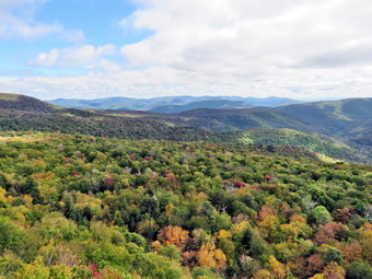
![]()
![]() On Friday, September 29th I was scheduled to lead a hike for the staff of the Liberty schools at 3:30 PM at Walnut Mountain. I wanted to get hike in before what I knew would be a modest walk in the afternoon. I considered Ashokan High Point but the drive coupled with the hike was cutting it too close for me. I settled on going to Giant Ledge to try to find some fall colors. I thought I might return by bushwhacking along the base of the cliffs which I had not done in some time. I got my gear together and got dressed with Sheila watching my every move she could be sure I did not leave without her. The temperature was only 44 degrees when we were ready to leave the house at 9:15 Am so I put on a light windbreaker on top of my normal double layer top. I headed out the Debruce Road and drove through DebRuce and Willowemoc to Route 47. I turned left on route 47 and drove passed the Frost Valley YMCA Camp. There were no cars at the Biscuit Brook parking area and only three at Slide. I drove by Winisook Lake and down the hill to the Giant Ledge parking area. There were four or five cars already parked when we arrive. The temperature was 48 degrees so I decided to keep my windbreaker on. I set my electronics and we crossed the road to start the hike at 10:10 AM. I had Sheila on her leash but let her off after we crossed the road. I immediately noticed that the trail was dry with only an few wet spots. The stream under the little bridge had only a small flow of water. I decided to count the ascents along the way to the first trail junction just for fun. As we climbed the third ascent Sheila alerted and I saw a man and woman descending the rocky trail very quickly. It lament looked like thee were trail running or racing! I held Sheila as they passed and then we continued our hike. Within a few minutes another couple went by and they also seemed to be in a hurry. After another short walk, we met another young man descending and he had a moment to converse before we went our opposite ways. We made good time without really hurrying making the trail junction by 10:35 AM after climbing the seventh rocky ascent. We turned left toward the ledges. As we walked the air seemed to be warming up as the sun was out but I decided to keep the jacket on. I though I could hear voices ahead but we did not encounter anyone. The trail was dry with virtually no water or muddy spots. The skies were blue with some clouds but as we hiked it seemed the clouds were closing in which I knew would not be good for photography from the ledges. We reached the first lookout and there were no other hikers so I took some pictures. I was disappointed because the leaves had only just begun to change colors in isolated spots. As I was taking these shots the sun came out and gave a completely different look to the landscape so I took some more pictures. I packed up the camera and we moved on by continuing along the trail. I passed up several ledges but stopped at one more to take a few more pictures. At the end of the plateau, we dropped down to the col between Giant Ledge and Panther. Even though I had hiked the route this summer, I had forgotten that this was a significant drop.
On Friday, September 29th I was scheduled to lead a hike for the staff of the Liberty schools at 3:30 PM at Walnut Mountain. I wanted to get hike in before what I knew would be a modest walk in the afternoon. I considered Ashokan High Point but the drive coupled with the hike was cutting it too close for me. I settled on going to Giant Ledge to try to find some fall colors. I thought I might return by bushwhacking along the base of the cliffs which I had not done in some time. I got my gear together and got dressed with Sheila watching my every move she could be sure I did not leave without her. The temperature was only 44 degrees when we were ready to leave the house at 9:15 Am so I put on a light windbreaker on top of my normal double layer top. I headed out the Debruce Road and drove through DebRuce and Willowemoc to Route 47. I turned left on route 47 and drove passed the Frost Valley YMCA Camp. There were no cars at the Biscuit Brook parking area and only three at Slide. I drove by Winisook Lake and down the hill to the Giant Ledge parking area. There were four or five cars already parked when we arrive. The temperature was 48 degrees so I decided to keep my windbreaker on. I set my electronics and we crossed the road to start the hike at 10:10 AM. I had Sheila on her leash but let her off after we crossed the road. I immediately noticed that the trail was dry with only an few wet spots. The stream under the little bridge had only a small flow of water. I decided to count the ascents along the way to the first trail junction just for fun. As we climbed the third ascent Sheila alerted and I saw a man and woman descending the rocky trail very quickly. It lament looked like thee were trail running or racing! I held Sheila as they passed and then we continued our hike. Within a few minutes another couple went by and they also seemed to be in a hurry. After another short walk, we met another young man descending and he had a moment to converse before we went our opposite ways. We made good time without really hurrying making the trail junction by 10:35 AM after climbing the seventh rocky ascent. We turned left toward the ledges. As we walked the air seemed to be warming up as the sun was out but I decided to keep the jacket on. I though I could hear voices ahead but we did not encounter anyone. The trail was dry with virtually no water or muddy spots. The skies were blue with some clouds but as we hiked it seemed the clouds were closing in which I knew would not be good for photography from the ledges. We reached the first lookout and there were no other hikers so I took some pictures. I was disappointed because the leaves had only just begun to change colors in isolated spots. As I was taking these shots the sun came out and gave a completely different look to the landscape so I took some more pictures. I packed up the camera and we moved on by continuing along the trail. I passed up several ledges but stopped at one more to take a few more pictures. At the end of the plateau, we dropped down to the col between Giant Ledge and Panther. Even though I had hiked the route this summer, I had forgotten that this was a significant drop.
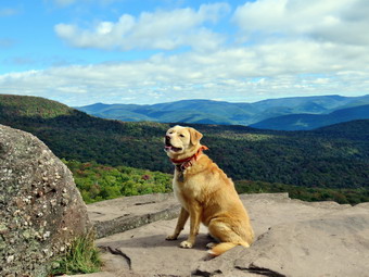 At about 2.1 miles we turned right or ENE and dropped about 150 feet from the trail to around 2875 feet of elevation. The descent wasn't too hard but it wasn't easier either. The trees and brush were definitely much thicker than the last time I hiked the route. Eventually we made it down to the broad flat area that runs along the base of the cliffs. This area was beautiful and much drier than I had ever seen it. We started to walk along the base of the cliffs heading south. There were large expanses of what is usually swamp with green moss. We walked along this area and dropped and gained elevation as we hiked. All the time the cliffs were to our right barely visible through the trees. I stopped to take pictures of some large trees and a few of some trees that had changed color. I also tried to get a view of the cliffs but didn't have much luck. The views from many mountains have disappeared over the years as the vegetation has grown and I think that also happened in this area. The views of the cliffs that had been pretty open were now hidden behind the trees.At times I would see what looked like a possible viewing spot and we would fight our way through the rocks and brush only to find there was no view. I looked at the time and decided I did not have the luxury of exploring but would return when the leaves were off the trees. We continued to hike parallel to the cliffs heading at first south and then southwest. We started to wrap around the cliffs to join the trail again but I got a little turned around. I consulted my compass and made the right decision. Just to make sure I consulted Sheila by saying "Back. Trail." When she headed in the direction I though I should go, I knew we were headed the right way. We intersected the trail much further away from the ledges' viewpoints than I thought we would. We were below the spring about a half mile from the trail junction. This was exactly the place I had come out on several previous hikes. We made a left turn and followed the trail to the junction. At the junction I saw a young man standing and before I could put Sheila on her leash she approached him. He had a dog on a leash and I apologized for my dog's lack of manners. We talked and he advised me his friends were just behind and they also had dogs. His friends were ascending the last rocky climb and all the dogs were pit bulls. The dogs were very well behaved and we talked for a little while. They were from the city and were up for the weekend to attend a wedding. We were talking about hiking to views and one young man said he had been to the Mount Tremper fire tower. We continued our opposite ways. On the way down one of the descents, I met two more young men with their dog. They were also in the area for a wedding and were from NYC. After a brief discussion we continued down the trail and back to the car. We were back at the car by 1:30 PM covering the 4.6 mile hike in 3 hours and 20 minutes. The total elevation gain was 1270 feet.
![]()
![]()
![]()
![]()
![]() On Wednesday, September 26th I knew I was going to hike somewhere but had really not worked it out when I got a text from Lisa saying she was available at 10:00 AM. She suggested Trout but I told her I had been there on Monday and countered with the ledges between the Flynn Trail and Mongaup Pond. She readily agreed and we agreed to meet at my house at 10:00 AM. I got some work done in the morning and then got ready to go.At 9:30 AM it was already almost 70 degrees but I stuck to my double layer outfit with a long-sleeved top suitable for bushwhacking. I was ping to find some color in the leaves around Mongaup Pond but was not optimistic since I had not found any color in other locations. Around Livingston Manor the leaves were falling but failing to display any bright colors. While I was getting ready Sheila was on my heels the whole time sensing we would be going out. Lisa arrived just after 10:00 AM and we left the house to drive out DeBruce Road for about 6 miles to Mongaup Pond Road. I turned left and drove to where the road split and stayed left on Beech Mountain Road. I parked in the small lot tat he trailhead and found no other cars present. I set my electronics and we started our hike by crossing the road at 10:25 AM. The trail was very dry as we hiked through the woods on the Flynn Trail to the woods road. We turned right on the woods road which was once an extension of Beech Mountain Road and started our climb. We kept up a quick pace talking as we walked until we came to the spot where there is a clearing a little off the trail on the right at 1.15 miles. We turned into the woods and walked a path up to the clearing. I took my pack off and got the camera to take some pictures of the clearing. No one seems to know eagerly why the clearing is there but some speculate the dirt was used to build the Beech Mountain Road up to the Boy Scout camp. The clearing has a thin layer of dirt over bedrock and is unusual since it supports a wide variety of plants. There is a thick layer of moss in most place and the moss represents several different species. The area is often quite wet but on this day it was very dry. I picked up my pack and walked easy toward the tree line trying to find a break where we could begin our bushwhack east to Mongaup Pond. I found a spot and we started walking through the mostly open woods heading east and slightly southeast.
On Wednesday, September 26th I knew I was going to hike somewhere but had really not worked it out when I got a text from Lisa saying she was available at 10:00 AM. She suggested Trout but I told her I had been there on Monday and countered with the ledges between the Flynn Trail and Mongaup Pond. She readily agreed and we agreed to meet at my house at 10:00 AM. I got some work done in the morning and then got ready to go.At 9:30 AM it was already almost 70 degrees but I stuck to my double layer outfit with a long-sleeved top suitable for bushwhacking. I was ping to find some color in the leaves around Mongaup Pond but was not optimistic since I had not found any color in other locations. Around Livingston Manor the leaves were falling but failing to display any bright colors. While I was getting ready Sheila was on my heels the whole time sensing we would be going out. Lisa arrived just after 10:00 AM and we left the house to drive out DeBruce Road for about 6 miles to Mongaup Pond Road. I turned left and drove to where the road split and stayed left on Beech Mountain Road. I parked in the small lot tat he trailhead and found no other cars present. I set my electronics and we started our hike by crossing the road at 10:25 AM. The trail was very dry as we hiked through the woods on the Flynn Trail to the woods road. We turned right on the woods road which was once an extension of Beech Mountain Road and started our climb. We kept up a quick pace talking as we walked until we came to the spot where there is a clearing a little off the trail on the right at 1.15 miles. We turned into the woods and walked a path up to the clearing. I took my pack off and got the camera to take some pictures of the clearing. No one seems to know eagerly why the clearing is there but some speculate the dirt was used to build the Beech Mountain Road up to the Boy Scout camp. The clearing has a thin layer of dirt over bedrock and is unusual since it supports a wide variety of plants. There is a thick layer of moss in most place and the moss represents several different species. The area is often quite wet but on this day it was very dry. I picked up my pack and walked easy toward the tree line trying to find a break where we could begin our bushwhack east to Mongaup Pond. I found a spot and we started walking through the mostly open woods heading east and slightly southeast.
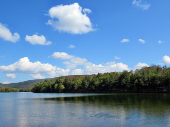 In less than a quarter mile from the clearing we me to the first series of ridges and found a path to descend through them. Just before I started down, I looked ahead and saw the water of Mongaup Pond ahead. I look at my GPS and we were only .25 miles away from the pond. I took a few shots of the rocks and then we continued to work our way down. The grade was pretty steep averaging about 18%. We worked our way down through another level and I took a few more pictures. We continued to descend and turn a little more to the southeast. At one point Lisa pointed out there was a nice overgrown woods road heading southeast so we started to follow it. The road paralleled a drainage which normally conducts water down toward the pond but was bone dry. Sooner than I though we were at the loop road around the pond. We wanted to make sure we visited the deck and boat launch which we thought were to our left We turned left and walked a short distance before we both came to the conclusion that we had turned the wrong way. We turned around and walked the road south and came to the deck within .3 miles of where we had exited the woods. I let Sheila off her leash to take a swim and get a drink. I walked out onto the deck and took some pictures of the pond. I was not surprised that all the leaves were still green although there appeared to be more leaves on the trees than in town. We continued our hike by walking along the shore until we were at the beach. I took some pictures of the deserted beach with the boats, canoes and kayaks. We wandered over to the bathrooms and met a couple from Chicago. Lisa gave them some advice on hiking and then we headed out Mongaup Road to complete our loop. The road walk went very quickly and didn't seem boring at all. We both noticed that the creek was quite far below the road level which is hard to notice from a car. After 1.1 miles we turned right on Beech Mountain Road and walked .3 miles back to the car. The temperature at the car had risen from 68 degrees when we started to 82 degrees. It was 12:30 PM and we had hiked 3.8 miles in two hours with a total elevation gain of 675 feet. When I checked the GPS track at home I found our bushwhack almost exactly followed the route I had taken before!
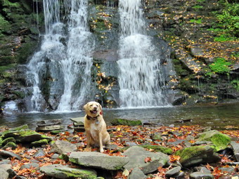
![]()
![]()
![]()
![]()
![]() On Monday, September 25th I decided I wanted to get in a hike close to home before cross country practice in the afternoon. A morning ambulance call further shortened my window for wing and convinced me that Trout Pond was a good option. I had not been to that area in some time and was still searching for some fall colors in the leaves. Around Livingston Manor the leaves were falling but failing to display any bright colors. While I was getting ready Sheila was on my heels the whole time sensing we would be going out. I knew the forecast was for warm weather but I wore a double layer anyway with a long sleeved shirt on top. We left the house at 9:50 AM and headed north and west on State Route 17 toward Roscoe. I got off at exit 94 and headed north on Route 206 passing through Roscoe and then Rockland. Just after the Roscoe Nursing Home I turned left on Morton Hill Road and followed it for 3 miles to the intersection with Russell Brook Road. I turned around and parked on the side of the road avoiding the private parking area. It was 10:10 AM when I set my electronics and we began our hike. I like the walk down Russell Brook Road and Sheila seemed to be having fun running ahead and coming back to me. I listened for the sound of the water in the brook but didn't hear very much. When we came to the viewpoint over the upper falls, I could see there wasn't much water going over the falls but decided to walk down to take some pictures anyway. I dropped my pack and got out the camera. I took some pictures of the upper falls and then packed up and walked back up to the road. We walked down to the lower parking area where there was one car parked. We continued down the road and crossed the bridge over Russell Brook. I found that some of the Japanese knotweed we had cut back was now leaning over into the trail. We continued on the road turning right on the path to the falls. We walked over to the path down the bank to the streambed and descended to the brook. There was very little water in the stream and very little water coming over the falls. Sheila immediately ran over to the small pool below the falls and jumped in to take a swim. I got out my camera and took some pictures of her in the water and some as she posed sitting just in front of the falls. After Sheila walked away, I took a few more pictures before putting away the camera and walking back out to the main trail. At the trail junction just after the register we continued straight ahead to walk up to Trout Pond. As we walked, I noticed that the trail was very dry with only a few damp spots along the way. All of the small streams running across the trail had disappeared. When we arrived at the pond, we walked to the left to the "beach" at the outlet end of the pond. It was clear that the water level was very low with the water at least ten feet from the outlet. I was disappointed that the leaves were only a dull and dusky green without any of the brilliant colors I had hoped to see. There were some interesting reflections and some colors so I decided to take a few pictures. After I took some pictures of the pond, I threw a stick into the water for Sheila to retrieve. She initially seemed a little reluctant to retrieve the stick but eventually swam out to get it. When she returned to the sore, she shook herself off and then began to dash around as I got ready to continue the hike.
On Monday, September 25th I decided I wanted to get in a hike close to home before cross country practice in the afternoon. A morning ambulance call further shortened my window for wing and convinced me that Trout Pond was a good option. I had not been to that area in some time and was still searching for some fall colors in the leaves. Around Livingston Manor the leaves were falling but failing to display any bright colors. While I was getting ready Sheila was on my heels the whole time sensing we would be going out. I knew the forecast was for warm weather but I wore a double layer anyway with a long sleeved shirt on top. We left the house at 9:50 AM and headed north and west on State Route 17 toward Roscoe. I got off at exit 94 and headed north on Route 206 passing through Roscoe and then Rockland. Just after the Roscoe Nursing Home I turned left on Morton Hill Road and followed it for 3 miles to the intersection with Russell Brook Road. I turned around and parked on the side of the road avoiding the private parking area. It was 10:10 AM when I set my electronics and we began our hike. I like the walk down Russell Brook Road and Sheila seemed to be having fun running ahead and coming back to me. I listened for the sound of the water in the brook but didn't hear very much. When we came to the viewpoint over the upper falls, I could see there wasn't much water going over the falls but decided to walk down to take some pictures anyway. I dropped my pack and got out the camera. I took some pictures of the upper falls and then packed up and walked back up to the road. We walked down to the lower parking area where there was one car parked. We continued down the road and crossed the bridge over Russell Brook. I found that some of the Japanese knotweed we had cut back was now leaning over into the trail. We continued on the road turning right on the path to the falls. We walked over to the path down the bank to the streambed and descended to the brook. There was very little water in the stream and very little water coming over the falls. Sheila immediately ran over to the small pool below the falls and jumped in to take a swim. I got out my camera and took some pictures of her in the water and some as she posed sitting just in front of the falls. After Sheila walked away, I took a few more pictures before putting away the camera and walking back out to the main trail. At the trail junction just after the register we continued straight ahead to walk up to Trout Pond. As we walked, I noticed that the trail was very dry with only a few damp spots along the way. All of the small streams running across the trail had disappeared. When we arrived at the pond, we walked to the left to the "beach" at the outlet end of the pond. It was clear that the water level was very low with the water at least ten feet from the outlet. I was disappointed that the leaves were only a dull and dusky green without any of the brilliant colors I had hoped to see. There were some interesting reflections and some colors so I decided to take a few pictures. After I took some pictures of the pond, I threw a stick into the water for Sheila to retrieve. She initially seemed a little reluctant to retrieve the stick but eventually swam out to get it. When she returned to the sore, she shook herself off and then began to dash around as I got ready to continue the hike.
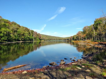 We continued on the main trail on the east side of Trout Pond walking toward the inlet end and the lean-tos. The trail continued to be dry which was surprising as it is usually very wet. I stopped at the bridge over the inlet and took a few shots before continuing on the trail. This area can also be wet from stream overflow but was bone dry on this day. We turned right to follow the trail up Cherry Ridge. As we hiked I found it satisfying to look at the many places where I had cleared branches and blowdowns from the trail on my last trip. There were some new branches on the trail and several small blowdowns I was able to clear by moving the to the side of the trail. Soon we were at the highest point on Cherry Ridge and starting down the other side. This part of the trail is often more like a stream but on this day there were only a few small pools and puddles at the side of the trail. This part of the hike can drag sometimes but it seemed to go very fast and we were soon at the woods road and snowmobile trail that runs by Mud Pond. We turned left and start the short walk uphill. At the top of the hill we began the long descent back to the trail junction where we had started. The descent lasts for .7 miles and drops 385 feet to a bridge that crosses the outlet stream from Trout Pond. At the junction we turned right and headed back out to the lower parking area. Sometimes the walk back up Russell Brook Road seems long and tedious but I was still felling fresh. The same car was still in the lot but we had not seen anyone on the hike. We started up the road and soon saw a woman walking toward us. I put Sheila on her leash and said "hi" to the other hiker as we passed. She did not look like she was dressed or equipped for a long hike. We continued to walk up the road and soon arrived back at the car. Unfortunately, the woman had decided to park on private property probably without even thinking or caring. The posted signs are quite prominent. It was 12:35 PM when we arrived back at the car after hiking 5.5 miles in 2 hours and 35 minutes with a 1120 foot total ascent. Throughout the hike I had noticed that I was feeling a little warm and had been sweating profusely. I assumed that I was warm because of my double layer but then I looked at the temperature display on my car which registered almost 90 degrees!
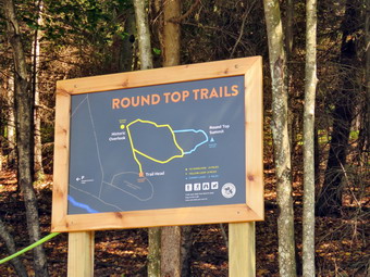
![]()
![]()
![]()
![]()
![]() On Sunday, September 24th I wanted to attend the "official" opening of the Round Top Trails in Livingston Manor. The plan was to meet on Round Top at 1:00 PM to have a brief ceremony and then hike the trails with the people attending the ceremony. After church, Cindy and I returned home and changed our clothes to hike. I explained to Sheila she could not go with us but that I would take her across the street to hike when the other people had left. It was over 80 degrees at the house when Cindy and I walked down the driveway to cross the street . I brought my pack so that I could carry my camera and a saw. I brought my hiking poles to prevent �sausage fingers�. We crossed the street and the field by the church and started up the hill to the top of the cemetery. As we passed through the parking area by the church two cars parked in the lots. I knew that Lisa was meeting a group of people in the municipal parking lot to walk up Pearl St. to the cemetery. I missed Sheila pulling me up the hill and noticed that it was really warm. We stopped at the top of the hill to wait for the others to arrive. There was a green ribbon across the trail and the sign was in place. The sign was very simple but very effective. The Sherwoods arrived shortly after us as did Kitty Vetter. We talked for some time waiting for the rest of the group to arrive. Soon we saw Lisa leading group of about a dozen people up the middle road in the cemetery. When they arrived, there was another period of waiting before Rockland Town Supervisor Rob Eggleton began his short presentation. During this time I spoke to Fred Fries who knows more about the history of the area than any person I have met. Rob called up Lisa Lyons, Helen Budrock and myself as people who had in some way, contributed to the creation of the trails. Rob explained briefly how the Town of Rockland acquired the land when the cemetery association could no longer maintain it and how the idea of a trail system came about. At the end of his presentation Lisa and I played tug-of-war with the ribbon until it toke signifying the official opening of the trails. People began to walk up the trail and I soon followed. Most people in the group seemed to want to climb to the lookout first so I follows them in that direction. At the lookout, Autumn, the reporter from the Sullivan County Democrat took some group pictures and asked some questions about the various people involved.
On Sunday, September 24th I wanted to attend the "official" opening of the Round Top Trails in Livingston Manor. The plan was to meet on Round Top at 1:00 PM to have a brief ceremony and then hike the trails with the people attending the ceremony. After church, Cindy and I returned home and changed our clothes to hike. I explained to Sheila she could not go with us but that I would take her across the street to hike when the other people had left. It was over 80 degrees at the house when Cindy and I walked down the driveway to cross the street . I brought my pack so that I could carry my camera and a saw. I brought my hiking poles to prevent �sausage fingers�. We crossed the street and the field by the church and started up the hill to the top of the cemetery. As we passed through the parking area by the church two cars parked in the lots. I knew that Lisa was meeting a group of people in the municipal parking lot to walk up Pearl St. to the cemetery. I missed Sheila pulling me up the hill and noticed that it was really warm. We stopped at the top of the hill to wait for the others to arrive. There was a green ribbon across the trail and the sign was in place. The sign was very simple but very effective. The Sherwoods arrived shortly after us as did Kitty Vetter. We talked for some time waiting for the rest of the group to arrive. Soon we saw Lisa leading group of about a dozen people up the middle road in the cemetery. When they arrived, there was another period of waiting before Rockland Town Supervisor Rob Eggleton began his short presentation. During this time I spoke to Fred Fries who knows more about the history of the area than any person I have met. Rob called up Lisa Lyons, Helen Budrock and myself as people who had in some way, contributed to the creation of the trails. Rob explained briefly how the Town of Rockland acquired the land when the cemetery association could no longer maintain it and how the idea of a trail system came about. At the end of his presentation Lisa and I played tug-of-war with the ribbon until it toke signifying the official opening of the trails. People began to walk up the trail and I soon followed. Most people in the group seemed to want to climb to the lookout first so I follows them in that direction. At the lookout, Autumn, the reporter from the Sullivan County Democrat took some group pictures and asked some questions about the various people involved.
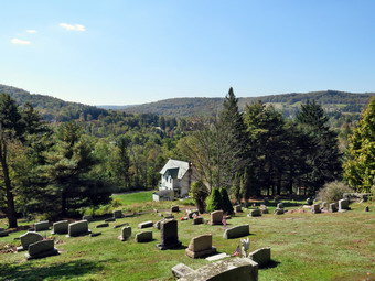 After a brief stop at the lookout, the hike continued around the yellow lower loop. Since I had brought along my Silky saw, I cut one small "trunk" that stood by the side of the trail before continuing up the trail. At the point where the trail split, some people decided to stay on the yellow trail while others chose to hike over the summit on the blue rail. I invited Autumn to come with me on the blue trail to get the full experience and she readily agreed. We hiked up to the summit of Round Top. Along the way I noticed that the white birch that had formed an arch over the trail now lay on the ground. The tree was quite sturdy which is why I had left it in place so I assumed someone had purposefully knocked it down. Further along another small sapling lay twisted on the side of the trail indicating that some had again vandalized the trail. It is disappointing to realize there are so many ignorant people in your twin who prefer destruction to construction! We continued over the top and down the other side. Autumn was impressed with the trail. I mentioned to her that the high school INTERACT Club had helped me layout the upper trail and had flagged it. We walked down to the yellow trail and continued to the first trail junction. From there we walked out to the trailhead. All of the people gathered seemed happy to have a short but beautiful trail system in their community. We walked down the cemetery hill and Cindy and I walked back to the house arriving at 2:15 PM.
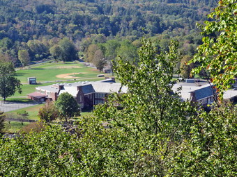 When we arrived home, Sheila barked at us from the upstairs window and then rushed down to meet us at the doer. She seemed to know where we had been. She could probably hear us talking on Round Top! It almost seemed she knew I had promised to take her out and she was ready to collect on that promise. I couldn't deny her since it was her sixth birthday! I got a quick drink and then we started out the driveway. I picked up Sheila's leash and used it as we crossed the street, walks through the field and sacred up the cemetery hill. Part way up the hill I let Sheila off the leash and used my poles to get up the hill. At the trailhead we turned left into the woods. There was a slight breeze which made the hot weather more bearable. At the first trail junction we turned right and started up the yellow trail. Where're yellow trail turned left, we continued straight ahead on the blue trail. The climb seems a little harder than before. As we hiked across the summit of Round Top, I stopped to cut a "stump" that remained in the middle of the trail. After that, we started down off the summit. When we came to the twisted sapling, I got out my saw and cut off flush with the ground and dragged it off the trail. We continued down the trail to the white birch. I removed one piece and then cut the remaining stump straight across, This made it look a little better and eliminated the sharp parts that had been sticking up. I then used the saw to cut the downed trunk into two pieces and maneuvered the piece across the trail to the side. I again thought about the kind of person that would do these things for the sole purpose of destroying something somebody else had created for the community. Sheila and I walked down the blue trail and turned right on the yellow trail. We followed it to the lookout where I took a few pictures and then Dow to the first trail junction. I was hot and tired but would have hiked some more. I gave Sheila the choice and she headed straight out to the trailhead. We turned right on the cemetery road and I put Sheila on her leash for the walk home. We were back at 3:00 PM having hiked about 2 miles and spent 3 hours on Round Top.
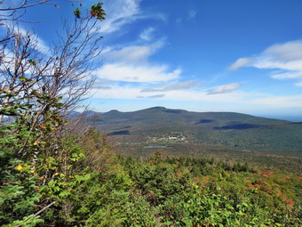
![]()
![]()
![]()
![]()
![]() On Friday, September 22nd, I decided that I wanted to return to the Catskill High Peaks for the first hike of the fall. I also wanted to hike some of the 35 peaks as I had the time and had not done one for some time. I decided to go to Tannersville to hike Indian Head and Twin from Prediger Road hiking up the east side of Indian Head and continuing over to Twin. I planned to return down the Jimmy Dolan Notch Trail, one of my least favorite trails in the Catskills. The weather forecast was for sunny skies with highs reaching into the 70's with no rain in the forecast. Around Livingston Manor the leaves were beginning to fall without really changing colors. The leaves still on the trees shoed non of the bright colors typical of fall in the Catskills. I dressed in my "summer" outfit but did not take even a light jacket as I knew the temperatures would warm quickly. I made sure I had two water bottles and I also took my Suunto Traverse watch to back up my Garmin handheld unit. Sheila was ready to go as she always is as we started out a little after 9:00 AM by driving out the DeBruce Road to Route 47. I turned left on Route 47 and drove by the Frost Valley YMCA Camp. There were no cars at the Biscuit brook raking area and only a few at Slide. The parking area at Giant Ledge was almost full and I wondered how many people I would encounter on Prediger Road. The drive was longer than I remembered and I kept getting behind drivers who wanted to o no more than 30 mph! When we reached Route 28, I turned right and then turned left on Route 42 north to Lexington in Shandaken. When I reached Route 23A, I turned right and drove through Hunter to Bloomer Road just outside Tannersville. I turned left on Plate Clove road and followed it 4.3 miles to Prediger Road where I turned right and rove to the end where there is a parking area at the trailhead. There were plenty of parking spaces but there were also quite a few cars already parked when I arrived at 10:40 AM. I set my electronics and Sheila and I were on the trail by 10:45 AM under sunny skies with the temperature in the high 60's. The first part of the Devil's Path from Prediger Road to the Old Overlook woods road is usually wet and muddy but on this day the trail was drier. There was some mud but it was drying out and the few really wet spots were easily avoided. Where the trail splits I stayed straight ahead on the red blazed Devil's Path. My plan was to return on the blue blazed Jimmy Dolman Notch Trail which turns to the right at this junction. I stopped at a small stone bridge to take the first pictures of the day before moving on. This first mile is deceptive as the grade is gentle but the climb is around 325 feet. As we approached the woods road, we both saw a trail runner who had come in from Platte Clove along the Old Overlook Road. I put Sheila on her leash but he took a quick drink and then was gone heading toward Overlook. At 1.6 miles we turned right on the old road. To the left a short distance is a nice stone quarry but I decided to skip it this time since I knew we had a long hike ahead of us. In only about 300 feet we turned right as the Devil's Path started its climb up Indian Head Mountain. I noted the sign that indicated another 1300 feet of climbing to the top. Sheila and I were making good time but I was not really trying to push it. I noticed I was a little tired and I was not surprised. I had hiked quite a bit over the summer but not on the High Peaks!
On Friday, September 22nd, I decided that I wanted to return to the Catskill High Peaks for the first hike of the fall. I also wanted to hike some of the 35 peaks as I had the time and had not done one for some time. I decided to go to Tannersville to hike Indian Head and Twin from Prediger Road hiking up the east side of Indian Head and continuing over to Twin. I planned to return down the Jimmy Dolan Notch Trail, one of my least favorite trails in the Catskills. The weather forecast was for sunny skies with highs reaching into the 70's with no rain in the forecast. Around Livingston Manor the leaves were beginning to fall without really changing colors. The leaves still on the trees shoed non of the bright colors typical of fall in the Catskills. I dressed in my "summer" outfit but did not take even a light jacket as I knew the temperatures would warm quickly. I made sure I had two water bottles and I also took my Suunto Traverse watch to back up my Garmin handheld unit. Sheila was ready to go as she always is as we started out a little after 9:00 AM by driving out the DeBruce Road to Route 47. I turned left on Route 47 and drove by the Frost Valley YMCA Camp. There were no cars at the Biscuit brook raking area and only a few at Slide. The parking area at Giant Ledge was almost full and I wondered how many people I would encounter on Prediger Road. The drive was longer than I remembered and I kept getting behind drivers who wanted to o no more than 30 mph! When we reached Route 28, I turned right and then turned left on Route 42 north to Lexington in Shandaken. When I reached Route 23A, I turned right and drove through Hunter to Bloomer Road just outside Tannersville. I turned left on Plate Clove road and followed it 4.3 miles to Prediger Road where I turned right and rove to the end where there is a parking area at the trailhead. There were plenty of parking spaces but there were also quite a few cars already parked when I arrived at 10:40 AM. I set my electronics and Sheila and I were on the trail by 10:45 AM under sunny skies with the temperature in the high 60's. The first part of the Devil's Path from Prediger Road to the Old Overlook woods road is usually wet and muddy but on this day the trail was drier. There was some mud but it was drying out and the few really wet spots were easily avoided. Where the trail splits I stayed straight ahead on the red blazed Devil's Path. My plan was to return on the blue blazed Jimmy Dolman Notch Trail which turns to the right at this junction. I stopped at a small stone bridge to take the first pictures of the day before moving on. This first mile is deceptive as the grade is gentle but the climb is around 325 feet. As we approached the woods road, we both saw a trail runner who had come in from Platte Clove along the Old Overlook Road. I put Sheila on her leash but he took a quick drink and then was gone heading toward Overlook. At 1.6 miles we turned right on the old road. To the left a short distance is a nice stone quarry but I decided to skip it this time since I knew we had a long hike ahead of us. In only about 300 feet we turned right as the Devil's Path started its climb up Indian Head Mountain. I noted the sign that indicated another 1300 feet of climbing to the top. Sheila and I were making good time but I was not really trying to push it. I noticed I was a little tired and I was not surprised. I had hiked quite a bit over the summer but not on the High Peaks!
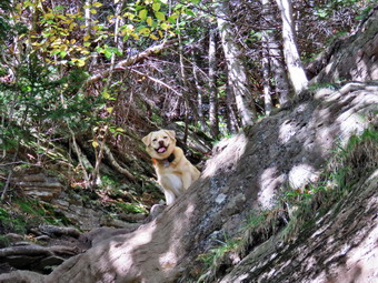 The trail was dry in most places with only a few muddy spots. I had Sheila off the leash most of the time which allowed me to use my poles. The trail ascends and levels several times while climbing toward the summit of Indian Head. The flatter portions were very a little muddy. I was looking forward to the lookouts on the east side of Indian Head and the view from the east peak of Twin but I knew there was a lot of to do to get there. By 12:30 PM AM we had hiked 2.8 miles and had 1370 feet of elevation under our belts. We stopped at the lookout so that I could take some pictures. There was a young couple at the viewpoint so I put Sheila on her leash. The couple volunteered to let us come and out and soon left to continue their hike. They most likely were descending since I did not see them at all again during the hike. From the lookout, the Catskill Community was clearly visible to the north with Kaaterskill High Peak and Round Top in the background. There was some color beginning to show in the leaves but not much. A little more to the east Plattekill Mountain blocked a clear view of the Hudson River. I did catch glimpses of the river and they were clearer than many other times I had been at this viewpoint. Further south, I found the fire tower on Overlook Mountain. I got out my camera and took quite a few shots. Before leaving I got a drink and a bar from my pack and also gave Sheila a drink. We moved on as I knew the hardest climbs were yet to come. A little after the lookout was the hardest climb of the day, an almost vertical section of rock face. I looked around for Sheila and found she had already made it to the top. I took a few shots of her. As I climbed this section grabbing onto roots and protruding rocks, I thought how easy it was for Sheila to climb the rocks. At the top of this climb was another nice lookout with slightly different views than the previous one. I took a few pictures and the continued on toward the summit. As we hit a more level section of the trail a young man came walking toward us listening to his "tunes". We said "Hi" and shortly after that we met another young man coming toward us. I began to wonder of it was a trend but we didn't see any more people for some time. Our next stop after a short distance was the lookout to the south from the east or false peak of Indian Head. After a few pictures, we walked down off the false peak and started the final ascent of Indian Head. The final obstacle was a narrow rock and root scramble with no other way around. I am not sure exactly how this spot has been modified but it is much easier to climb now than a few years ago! We climbed another steep pitch before the trail leveled off some. We continued to move along the trail until we hit the 3575 foot summit at 1:15 PM after hiking 3.8 miles and gaining about 1800 feet of elevation. It was the hardest 3.8 miles I had done in some time but I felt a sense of accomplishment. This sense of well-being began to fade as we started the steep resent into the col between Indian Head and Twin.
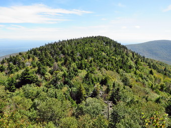 There was a small lookout near the summit of Indian Head but the views were not as good as from the other viewpoints. We did meet another woman hiking with her dog. I saw her coming and put Sheila on her leash. She immediately let me know her dog was not on a leash and was "friendly". I was annoyed that she didn't have the courtesy to restrain her dog. We began our descent to Jimmy Dolan Notch and I watched for the viewpoint toward Twin which had always given me good pictures in the past. The further we descended the bore I realized that there was no longer a spot to get this view and that it had probably been obscured by trees and bushes. Most of the trail on the descent was dry and I almost fell several times. The trail was steep and rocky and not very enjoyable in this direction dropping 400 feet in about a third of a mile for an average grade of 23%. There are no other hikers in the col so we immediately started up Twin. We scrambled up some rather steep pitches which I remember from winter hiking. These steeper areas are challenging when dry as everything is loose and rolls under foot. I lifted myself up through one spot and squeezed between a rock and a tree. Several other spots seemed to have developed alternate approaches created by hikers who did not want to attack the difficult scrambles head-on. In the winter and early spring these areas tend to accumulated impressive ice flows which make hiking an adventure! We stopped at the lookout toward Indian Head and I took some pictures of Twin and Overlook. The skies were clear and blue with some nice clouds. At 2:00 PM we broke out onto the rock ledges on the east peak of Twin after hiking 4.5 miles. This point is one of my favorite viewpoints in the Catskills and this day was no exception. The views to the east were not the best but those to the south and west made up for it. The only disappointment is that the trees are growing up to obscure the views which were once very open. I took a lot of shots especially toward the west peak of Twin and Sugarloaf. After my photography session, Sheila and I had a drink and a snack and I debated continuing to the west peak which is the one that actually counts. I decided I would not be happy if I did not "tag" the other peak and decided to "go for it" despite the fact I was tired and the time was getting late. We continued on toward the west and higher peak of Twin. The descent to the col was minimal, just over 100 feet, and the ascent not too rigorous. The views from the west peak were not as broad or as beautiful as from the east peak but there was a nice view of Sugarloaf. I took a quick look and then we turned around to begin the long hike back. I was not looking forward to the descent from Twin to the col or for the long, rocky trip down the Jimmy Dolan Notch Trail.
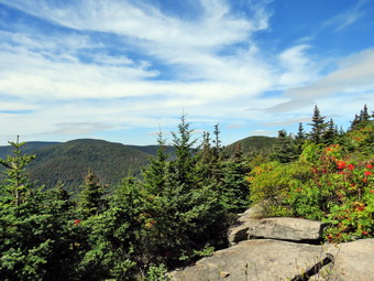 Other than the reclimb to the east peak I knew the rest of the way was downhill or flat. I also knew that we would have to descend Jimmy Dolan Notch which is one of the worst trails in the Catskills! When we got back to the east peak of Twin we had hiked about 1.2 miles between the peaks which took us just less than an hour. The descent down Twin was slow since negotiating the steep descents is no easier than negotiating the steep ascents. As we neared the col, I could see two hikers with what looked like fairly large packs getting ready to head down the Jimmy Dolan Notch Trail. When we got to the col, we turned left and headed down the trail but only got a glimpse of the other two hikers who were descending faster than I wanted to go. The first part of the trail is steep and rocky. At one point I looked ahead to see a tree down across the trail. I guess I was concentrating a little too much on the tree and not where I put my feet because I fell pretty hard. Fortunately, I landed on a pretty well padded part of my body and when I got up I was only a little sore. I squeeze through the blowdown and contused on the trail. A couple came up the trail toward us with there dog which, typically, was not on a leash. The woman said 'She is friendly and is just learning about the trails!' I thought to myself that the dog had a poor teacher. After the steep descent the trail gives way to roots and then rocks and roots. At times the trail would be hard to locate without the markers or without a skilled trail dog like Sheila. The trail made several twists and turns that I did not remember and seemed like it would never end. It was every bit as annoying as I remembered. As we approached the Prediger Road parking area, we stayed to the left a the trail junction where we had been many hours before on the hike out. The rest of the trail was pretty easy and we arrived in the parking area to find only a few remaining cars. It was 4:35 PM and we had spent 5 hours and 45 minutes hiking 8.4 miles with a total scent of 2590 feet.