
What You Missed
Fall 2014
Fall 2014
![]()
![]()
![]()
![]()
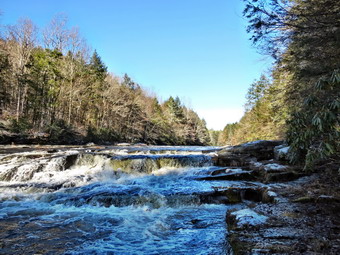
![]() On Saturday, December 20th I was ready to get out after a week of poor weather, coaching commitments and a stint as school nurse. I had planned to hike the section of the Long Path from the New Jersey Border to Nyack which is section 2 of the Long Path. This would leave only section 1 from Fort Lee, NJ to the New Jersey border for me to complete the Long Path. This section is a little over 10 miles so I knew I would need a ride. I called the Nyack Car Service and they said they could transport Sheila and I for about $20. It was about 23 degrees when we left Livingston Manor at around 7:00 AM. The forecast for the Nyack area was for temperatures in the 40's with some sun in the mid-morning and I dressed accordingly. I chose the easiest route by driving down Route 17 to Harriman where I picked up the Thruway south. I knew I wanted exit 11 and expected some heavy traffic as this exit is near the Palisades Center Shopping Mall. After getting off the exit I turned left on Route 59 and parked in a strip mall. I called the car service and they were there within 5 minutes. I explained where I wanted to go and we were off. The drive was only about 15 minutes south on Route 9W and we were there at 9:00 AM. The driver dropped us off and we were hiking by 9:05 AM. As we started out on the trail passed the gatehouse for the Lamont-Doherty Observatory, a group of cyclists sped by heading north on Route 9W. The New York Cycling Club has adopted this section of road and use it regularly for hill repeats! The first .7 miles of the trail headed downhill and parallel Route 9W passing through some hardwood forest and eventually meeting Route 9W. The traffic on 9W was consistent but the road had wide shoulders. We headed north on the road until 1.2 miles where we crossed to the parking area for Tallman State Park on the other side.
On Saturday, December 20th I was ready to get out after a week of poor weather, coaching commitments and a stint as school nurse. I had planned to hike the section of the Long Path from the New Jersey Border to Nyack which is section 2 of the Long Path. This would leave only section 1 from Fort Lee, NJ to the New Jersey border for me to complete the Long Path. This section is a little over 10 miles so I knew I would need a ride. I called the Nyack Car Service and they said they could transport Sheila and I for about $20. It was about 23 degrees when we left Livingston Manor at around 7:00 AM. The forecast for the Nyack area was for temperatures in the 40's with some sun in the mid-morning and I dressed accordingly. I chose the easiest route by driving down Route 17 to Harriman where I picked up the Thruway south. I knew I wanted exit 11 and expected some heavy traffic as this exit is near the Palisades Center Shopping Mall. After getting off the exit I turned left on Route 59 and parked in a strip mall. I called the car service and they were there within 5 minutes. I explained where I wanted to go and we were off. The drive was only about 15 minutes south on Route 9W and we were there at 9:00 AM. The driver dropped us off and we were hiking by 9:05 AM. As we started out on the trail passed the gatehouse for the Lamont-Doherty Observatory, a group of cyclists sped by heading north on Route 9W. The New York Cycling Club has adopted this section of road and use it regularly for hill repeats! The first .7 miles of the trail headed downhill and parallel Route 9W passing through some hardwood forest and eventually meeting Route 9W. The traffic on 9W was consistent but the road had wide shoulders. We headed north on the road until 1.2 miles where we crossed to the parking area for Tallman State Park on the other side.
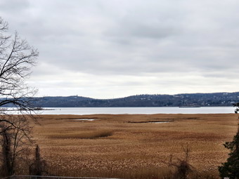
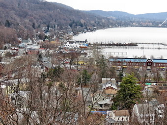
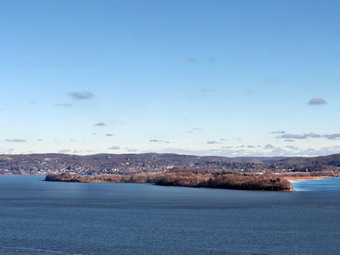
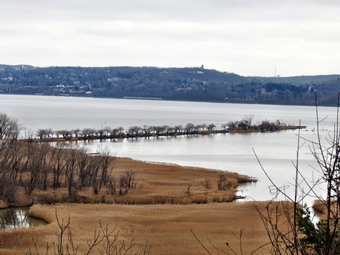 There were a few cars parked and we immediately met a woman walking her German Shepherd "puppy" back to the car. The trail began as a wide woods road and bike path with a firm surface which made it easy to walk. We were walking east and then turned north at 1.5 miles on what was more like a hiking trail. A young woman came running toward us from the other direction and I said "Hi!" as she passed. I got no response since, like so may people today, she had earphones on to shut out the rest of the world. For the next .5 miles we hiked along a raised walkway with lower wetlands on both sides. Some areas were just marshy while others had small ponds. At 2 miles we turned east again but soon started heading NNW walking along the edge of the escarpment. Looking to the right the Hudson River was visible and there were some views of the large Sparkill marsh below. Trees limited the photographic opportunities until we walked down a hill to an area with benches at about 2.9 miles. I took off my pack and got a drink before grabbing the camera. I took some pictures of the marsh and the river before sinning the pack to continue our journey. We walked up a paved walkway and then turned onto a trail to get to the plateau that makes up what is called Tallman Mountain. We walked passed the shelter at the top on a paved roadway to a lookout just north of the shelter. I found the name Tallman Mountain interesting since the maximum elevation is only 171 feet. I again dropped my pack to take some pictures from this less obstructed viewpoint. I could still see the marsh below but could now also view the Tappan Zee Bridge and the village of Piermont below. The skies were a uniform gray even though it was now 10:15 AM when the forecast had called for sun. The most interesting feature was a long spit of land that jutted out into the river from Piermont. This is the mile long Piermont pier that was a terminus for the Erie Railroad. It also served as a point for ferry service to Dobbs Ferry on the other side of the river .I thought about walking out on it but decided I wanted to make sure I finished the hike. We walked a little farther and I found another lookout that had views down into Piermont. After a few shots, we got back on the main trail and walked down a steep hill to the road.
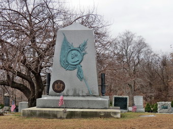
 We crossed Sparkill Creek on a bridge and started walking north on Piermont Avenue passing some small shops. The trail had been well-marked so far by aqua blazes and I soon noticed that they indicated a left turn onto a side street. We walked up Tate Street and near the top turned left up a set of stairs to Ash Street. At the corner across from us is the old Erie railroad station for Piermont. The building is over 100 years old but has been resided. We followed the blazes on Ash Street west to Piermont Place. We headed south on Piermont Place and then west on Crescent Road. Crescent Road was a dead end but the trail followed an old fire road at the end which we followed south and then west to Route 9W. We had been climbing since we left Piermont but the climb was not over. We turned right on Route 9W and then almost immediately left on Castle Road. We followed Castle Road for a short distance until the blazes indicated a right turn into the woods. As we turned I saw two mountain bikers coming down the hill so we stopped to give them the right-of-way. We continued on the trail passing through some woods but still climbing. The trail eventually took us to the roads that run through the Rockland County Cemetery where we turned right to ascend to the top of the hill through a switchback. As we followed the roads heading north along the escarpment, we passed by many impressive grave markers some of granite and many with bronze plaques. At 5 miles we came to the memorial for John C. Fremont. Fremont was a colorful figure who had a checkered career as an adventurer, politician, and military officer. I took a few pictures of the memorial and then looked for the viewpoint over the Hudson as indicated on the map. Since I could find no lookout, we continued to follow then road until the blazes indicated a turn to the right off the roads. The trail headed west and then north continuing to climb and leaving the Rockland County Cemetery land to cross property marked as "Military Reservation". The Long Path skirted the summit of Mount Nebo and then reached a high point at 585 feet on the shoulder of another unnamed hill. At about 5.75 mile an orange trail branched off to the right. The trail goes to Mount Nebo which was once the site of a Nike missile silo that protected New York City. It is now a recreation area.
 The trail started to descend through hardwood forests as it entered Clausland Mountain County Park. At 7 miles we crossed Clausland Mountain Road and entered Tackamack Town Park maintained by the Town of Orangetown. We headed northwest for about .25 miles to a small pond where we turned northeast and at 7.5 miles crossed Marisco Court to enter Blauvelt State Park. This was the first time on the hike that we had entered a forest with evergreen trees as the trail began to swing to the northeast. At about 8 miles we crossed over a low cement wall and turned to the right. I remembered the hike description mentioned an old firing range. We soon came across higher cement walls. These are the remains of a World War I firing range and target walls. The tunnels connecting the two still remain here underground. As we continued on our way we met several more mountain bikers. We began another ascent crossing a few streams along the way some with and some without bridges. At 8.8 miles we crossed North Tweed Boulevard and continued to climb to the highest point on the hike at about 625 feet. A star on the Mao indicated a viewpoint but there wasn't much to see. I did notice a large amount of broken glass on the rocks where inconsiderate people had found breaking bottles irresistible! We descended from this high point only to climb another and then another as we headed generally north toward Nyack. We left Blauvelt State Park as we crossed Bradley Hill Road at 9.8 miles, made a quick ascent and then started our last descent into town. We were now in Sean Hunter Ryan Memorial Park. Sean Hunter Ryan was a Rockland County resident who died with his climbing partner, Philip Otis, on Mount Rainier in 1995. The two young men were park rangers involved in a rescue mission under extremely dangerous conditions. They remain the only two rangers to die on a rescue mission on Rainier. I had been hearing fire sirens for some time but they we intermittent and did not sound like they were going to a fire. When we came to Waldron Avenue, I stowed my poles and put Sheila on her leash. As we walked down the street, I saw the reason for the sirens. The Nyack Fire Department had several engines visiting neighborhoods with "Santa" on board distributing small gifts to children. Sheila and I walked down to the traffic light and waited to cross a very busy Route 59. We were back at the car at 1:40 PM having covered 10.5 miles in 4 hours and 30 minutes.
![]()
![]()
![]()
![]()
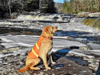
![]() On Saturday, December 13th I was ready to get out after a week of snow and ice and coaching commitments. I had planned to hike on Friday but the low temperatures coupled with the stiff breeze dissuaded me. An early morning ambulance call on Saturday made hiking more difficult as I was pretty tired. In addition, the temperature did not seem any warmer and the breeze was blowing harder than the day before! I ha almost decided to wait until after church on Sunday but decided I needed to get out! Sheila agreed wholeheartedly with this decision. I planned to hike a section of the Long Path from Landing Rd to High Tor. This is the second part of section 3 which is one of the last three sections I have to hike. I also wanted to continue up to High Tor since I had not hiked the first part of section 4. I also remembered that the last time I was at High Tor with my wife we could not see much due to the fog. I knew that there was the potential for some great views. The forecast for Nyack was calling for partly sunny skies with temperatures rising into the high 30's but winds averaging about 10 mph. I got ready dressing for twenty degree temperatures as we left Livingston Manor at 8:00 AM. I chose the easiest route by driving down Route 17 to Harriman where I picked up the Thruway south. I knew I wanted exit 12 and expected some heavy traffic as this is the exit for the Palisades Center Shopping Mall. After getting off the exit I headed north on Route 303 to Lake Road. I turned right and followed it to Route 9W. I crossed 9W to pick up Rockland Lake Road and drove around the southern tip of the lake and north along the eastern shore. Soon there was an intersection where I turned right onto Landing Road and parked in small lot which I recognized from a previous hike. It was 9;35 AM and the drive had give more quickly than I had anticipated. As I got out of the car the temperature was already in the mid 30's and there did not seem to be much of a breeze. I knew that I would probably be removing a layer of clothing and immediately took off the gaiters that I had worn. As I got Sheila out of the car, one hiker was beginning the section that we would hike while another couple began the walk down to the bike path with their dog. The skies were clear with few clouds and plenty of sun as we head out at 9:35 Am to begin our hike.
On Saturday, December 13th I was ready to get out after a week of snow and ice and coaching commitments. I had planned to hike on Friday but the low temperatures coupled with the stiff breeze dissuaded me. An early morning ambulance call on Saturday made hiking more difficult as I was pretty tired. In addition, the temperature did not seem any warmer and the breeze was blowing harder than the day before! I ha almost decided to wait until after church on Sunday but decided I needed to get out! Sheila agreed wholeheartedly with this decision. I planned to hike a section of the Long Path from Landing Rd to High Tor. This is the second part of section 3 which is one of the last three sections I have to hike. I also wanted to continue up to High Tor since I had not hiked the first part of section 4. I also remembered that the last time I was at High Tor with my wife we could not see much due to the fog. I knew that there was the potential for some great views. The forecast for Nyack was calling for partly sunny skies with temperatures rising into the high 30's but winds averaging about 10 mph. I got ready dressing for twenty degree temperatures as we left Livingston Manor at 8:00 AM. I chose the easiest route by driving down Route 17 to Harriman where I picked up the Thruway south. I knew I wanted exit 12 and expected some heavy traffic as this is the exit for the Palisades Center Shopping Mall. After getting off the exit I headed north on Route 303 to Lake Road. I turned right and followed it to Route 9W. I crossed 9W to pick up Rockland Lake Road and drove around the southern tip of the lake and north along the eastern shore. Soon there was an intersection where I turned right onto Landing Road and parked in small lot which I recognized from a previous hike. It was 9;35 AM and the drive had give more quickly than I had anticipated. As I got out of the car the temperature was already in the mid 30's and there did not seem to be much of a breeze. I knew that I would probably be removing a layer of clothing and immediately took off the gaiters that I had worn. As I got Sheila out of the car, one hiker was beginning the section that we would hike while another couple began the walk down to the bike path with their dog. The skies were clear with few clouds and plenty of sun as we head out at 9:35 Am to begin our hike.
 The trail immediately began a climb from the parking area as we passed by the Wells Family Cemetery. The cemetery has been abandoned although there were flags on some of the graves. I did some research but was not able to discover much about the family. As we continued to climb, we passed the hiker who had started before us. Sheila was eagerly pulling me up the hill on her leash and he commented about the "help" I was getting! Within about .25 miles we hit a high point but then immediately started down the other side. This pattern continued for 2.7 miles and really warmed me up. Very early on I stopped to removed my Icebreaker 260 midlayer leaving only a light Terramar baselayer under my Mammut Hoody. I thought I might be a little too cool but I wore this for the rest of the hike with the pitzips open on the Hoody and I was warm most of the time. I even considered removing the Icebreaker 200 tights I had on under my MH Winter Wander pants but in the end decided it was too much trouble. Along the ridge I was expecting to find some viewpoints since the maps I was using had "stars" and the trail description indicated lookouts. Almost all of the point that might have had views now had trees in the way. I tried walking off the trail several times but found only one spot that was acceptable. I did get some pictures of a tug pushing a barge downstream. I was not too bothered by the lack of views since I knew High Tor would have some great ones up and down the Hudson. At some point a trail runner passed us coming from Route 9W. He passed again in the opposite direction just as we were beginning our descent to Route 9W. At 2.7 miles we hit the highest point on the ridge and started down toward Lost Clove and Route 9W. On the way down we passed the white blazed Treason Trail on the right and I thought I might come back the same way to hike down to the bike path along the river. We descended to Route 9W and were at the small parking area at 11:10 AM after hiking 3.25 miles.
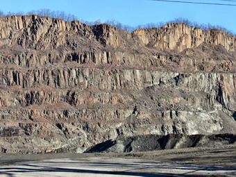
 At first it was not clear exactly where the Long Path went but I soon spotted blazes on the guardrail on the other side of the road. I put Sheila on her leash and stowed my poles in the pack. We crossed a busy Route 9W and continued our hike on Lost Clove Road. The road was closed at first as it began to pass by an enormous quarry owned by the Tilcon Corporation. The basalt that makes up most of the Palisades has been quarried here since 1920 and the operation is huge. Soon Last Clove Road became open to traffic and we turned right on Scratchup Road to get to Old Route 303 or the Haverstraw Road. I stopped at one of the gates to the quarry and took some pictures before continuing on. We turned left on Old Route 303 and started hiking west. The road had almost no shoulder and there seemed to be a lot of traffic. We only had to walk about a quarter mile until the blazes indicated a right turn into the woods to begin the assault on High Tor. I let Sheila off her leash and got my poles ready for hiking. The trail was very rocky and poorly blazed in a few spots. After an initial climb the trail leveled a little and then started a gentle ascent passing a house on the left as it made its way up toward the ridge. I was a little concerned about rattlesnakes and kept Sheila close by. We were now hiking almost directly north and at 5 miles descended a little to the junction with the spur trail to the left to High Tor Vineyards. We continued a little farther north and then followed the trail as it turned northwest to start the ascent up what is sometimes called South Mountain. The ascent here was a rock scramble and I could not find the aqua blazes of the Long Path anywhere on the rocks. Even when we reached the top the blazes were absent. We descended slightly before starting the final climb to the top of High Tor. I picked up the blazes again as we hiked the trail up the south side of the tor. Soon we were at the top with good views in all directions. From the summit I could see the Hudson just below us with the village of Haverstraw at the base of the tor. To the south was Deforest Lake in the foreground with several other lakes further away including Rockland Lake. I was a little cold at the top as the wind had picked up some. I started taking pictures including some of Sheila posing using the scenery as a background.
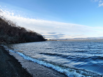 When I had finished my photography, we headed back the way we had come. It was 12:25 PM and we had already hiked 5.5 miles. At the foot of High Tor I found the aqua blazes heading off to the south shoulder of South Mountain. We followed the trail and found it to be much easier than the ascent. The entire walk back to the road seemed to go very quickly. Once on the roads we followed the same route to get back to Route 9W. We did meet one walker on Lost Clove Road but I was surprised we had not seen more people on a Saturday. When we arrived back at Route 9W, I decided we would walk an informal trail down to the bike path that runs along the river from Haverstraw to Nyack. We followed the path to the railroad tracks but I somehow missed the easiest way down to the bike path. We had to slip and slide our way down the steep bank from the tracks to the bike path below. Once on the bike path we turned right to walk south to the car. Within a short distance we came to a sign marking the spot where Benedict Arnold and John Andre discussed the betrayal of the fort at West Point. As we continued on the path a freight train roared by on the tracks with almost 100 tank cars. I was hoping to see it pass through the tunnel a little farther ahead but that was obscured by the trees. At 8.3 miles the maps marked some ruins so we walked down a path to the shores of the Hudson. The ruins there did not seem to be very old and weren't very interesting. All along the path were small stone buildings which looked like they may have been bathhouses or restrooms. We walked to the edge of the water where I took some pictures and Sheila played in the waves. After walking back up to the bike path, we headed south again. The path actually rolled some unlike the southern portion which was very flat. A bicyclist passed us and we met several other people along the way. Each time Sheila spotted them first and came to me Ti be put on her leash. We stopped two more times so that I could take a few shots of the cliffs above us. We finally walked up the hill to the spot were we had gotten on the bike path the last time. Here we turned right and walked up the hill to the parking area. It was 3:10 PM when we finished our 12 mile hike. I was surprised that the overall vertical gain was over 2600 feet. The drive home went smoothly despite the traffic.
![]()
![]()
![]()
![]()
![]() On Sunday, December 7th, I wanted to get out and hike since the weather forecast for the rest of the week indicated a mix of rain, ice and snow starting Tuesday and extending through Friday. It had been two years since I lost my best hiking companion, Sheba, to Lyme disease and I knew taking a hike with Sheila would make me feel better. Sheba was a little over 14 years old and had a very bad case of Lyme Disease diagnosed in the spring of 2012. She was still very alert but her hips had deteriorated to the point where she could hardly support herself. Knowing that there was only one way to eliminate her pain didn't make saying goodbye any easier. I will always miss her and always remember what great trail dog she was when she was healthy. Fortunately, Sheila, my new dog has proved to be a great companion at home and on the trails. I decided to go to the Neversink Unique area after church since there had been some rain recently and I wanted to check out the water falls. I thought I would have enough time to visit Denton falls and High Falls on the Neversink as well as the Falls on Mullet Brook. Cindy was still ill with a cold so she declined my offer to hike. Sheila and I didn't leave Livingston Manor until just before 11:30 AM. I drove to the Rock Hill exit on Route 17 and then took Katrina Falls Road south to the parking area at the dead end. I parked the car and we were hiking by noon. I was surprised to find a layer of ice in the parking area and a significant amount of snow on the woods road that is the beginning of the trail. There wasn't enough snow to wear snowshoes but I had brought my Microspikes just in case. I was a little sorry I had left my gaiters home but knew I could do without them. The sun was out and the temperature had risen to almost 40 degrees as we walked down toward the river. The wind that had been blowing in Livingston Manor was absent and I knew it wouldn't be long before I would be removing one of my layers on top. At the first trail junction we turned left to parallel the river on the blue trail. I could hear Wolf Brook long before we were at the foot bridge that crossed it. I stopped at the bridge to take a few pictures of the brook which was very high. I also took pictures of the snow covered trail and the bridge which seemed to have a few more holes than last time. I had already encountered several new blowdowns on the trail and made a note to contact one of the maintainers. We crossed the brook and headed up a small hill to the next trail junction with the red trail. I decided to bear to the right to parallel the river and stay on the blue trail thinking I would use the red trail to form a loop on the way back. The walk on the trail was pleasant enough but the amount of snow seemed to increase. I was already beginning to get warm and opened all the zippers on my Mammut Hoody. I could hear the Neversink roaring below. Soon we were approaching Mullet Brook but when we got to the bridge I deiced there was no reason to drop my pack to take pictures as there was nothing spectacular about the scene. We crossed the footbridge and arrived at the junction with the spur trail to Denton falls where we turned right and headed down to the Neversink.
On Sunday, December 7th, I wanted to get out and hike since the weather forecast for the rest of the week indicated a mix of rain, ice and snow starting Tuesday and extending through Friday. It had been two years since I lost my best hiking companion, Sheba, to Lyme disease and I knew taking a hike with Sheila would make me feel better. Sheba was a little over 14 years old and had a very bad case of Lyme Disease diagnosed in the spring of 2012. She was still very alert but her hips had deteriorated to the point where she could hardly support herself. Knowing that there was only one way to eliminate her pain didn't make saying goodbye any easier. I will always miss her and always remember what great trail dog she was when she was healthy. Fortunately, Sheila, my new dog has proved to be a great companion at home and on the trails. I decided to go to the Neversink Unique area after church since there had been some rain recently and I wanted to check out the water falls. I thought I would have enough time to visit Denton falls and High Falls on the Neversink as well as the Falls on Mullet Brook. Cindy was still ill with a cold so she declined my offer to hike. Sheila and I didn't leave Livingston Manor until just before 11:30 AM. I drove to the Rock Hill exit on Route 17 and then took Katrina Falls Road south to the parking area at the dead end. I parked the car and we were hiking by noon. I was surprised to find a layer of ice in the parking area and a significant amount of snow on the woods road that is the beginning of the trail. There wasn't enough snow to wear snowshoes but I had brought my Microspikes just in case. I was a little sorry I had left my gaiters home but knew I could do without them. The sun was out and the temperature had risen to almost 40 degrees as we walked down toward the river. The wind that had been blowing in Livingston Manor was absent and I knew it wouldn't be long before I would be removing one of my layers on top. At the first trail junction we turned left to parallel the river on the blue trail. I could hear Wolf Brook long before we were at the foot bridge that crossed it. I stopped at the bridge to take a few pictures of the brook which was very high. I also took pictures of the snow covered trail and the bridge which seemed to have a few more holes than last time. I had already encountered several new blowdowns on the trail and made a note to contact one of the maintainers. We crossed the brook and headed up a small hill to the next trail junction with the red trail. I decided to bear to the right to parallel the river and stay on the blue trail thinking I would use the red trail to form a loop on the way back. The walk on the trail was pleasant enough but the amount of snow seemed to increase. I was already beginning to get warm and opened all the zippers on my Mammut Hoody. I could hear the Neversink roaring below. Soon we were approaching Mullet Brook but when we got to the bridge I deiced there was no reason to drop my pack to take pictures as there was nothing spectacular about the scene. We crossed the footbridge and arrived at the junction with the spur trail to Denton falls where we turned right and headed down to the Neversink.
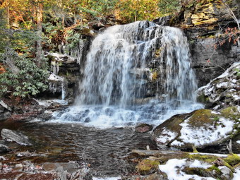
 The walk down to the falls is only about .25 miles but it was made more difficult by the slippery conditions. Using my poles helped some but I did slip several times. The problem was that the snow depth was inconsistent and snow was absent some places on the trail making the use of Microspikes impractical. We arrived at Denton Falls at 12:40 PM after hiking about 1.7 miles. As we negotiated the last short drop to the falls, I noticed a trout trying to swim up the falls close to shore! Before I could get my camera ready the fish was gone having made several unsuccessful attempts. I dropped my pack and waited fro several minutes but no fish appeared so I started to take some pictures of the falls. The water was high and looked very "clean" and the sun was at a good angle downstream with a bright blue sky. The only thing missing were a few puffy white clouds. We carefully walked down to the rock shelf below the falls and I took some more pictures. Sheila looked like she wanted to jump in but I discouraged her as the water was deep, flowing very fast and was ice cold. I shouldered my pack and we headed back up to the main trail. Somehow on the way up I lost the blazes and thought Sheila was off the trail. I headed downhill a little before realizing she was right and did not need blazes! At the blue trail we turned right to hike up a small hill to the next trail junction where we turned right to head down to High Falls. Within a short distance it became obvious no one had hiked this trail for some time. In places there was several inches of snow which made hiking over the rocks that much harder. Over the next 2.1 miles the trail descends and ascends some small hills as it parallels the river. Within the first .7 miles we ran into six blowdowns of various sizes. One section was close to the trail junction and had several large trees completely blocking the trail for 50 feet or more. This blockage had been there for some time and a rather obvious path was beginning to develop on the left. Parts of the trail where there was no snow were wet with a few small streams but they were easy to avoid or cross. The mountain laurel was heavy with snow and in many places was closing in on the trail. The walk seemed to take longer than I remembered and I knew it was at least the third time that I had hiked the trail when there was more snow than I expected! Eventually we were walking down to High Falls and the roar was very loud. We arrived at 1:50 PM at the edge of the water after hiking about 4.1 miles. We were able to walk carefully along the icy rocks to get to the rock shelves that are even with and below the falls. I dropped my pack and took out the camera. The sky was still a pretty blue but still lacked puffy clouds. I took a lot of pictures before being satisfied that I had photographed the falls and the river from every angle. I also recorded a video of the falls. We headed back up the trail to retrace our steps. The first 1.4 miles is all uphill and gains about 490 feet. There is nothing steep or very difficult about this part but the snow made it a little tougher than usual.
 At the trail junction we turned right to start the loop back and to visit Mullet Falls. The spur trail to Mullet Falls came up within a few hundred feet and we turned to the left and walked down to the falls. There was a good volume of water going over the falls but the rocks were very icy. It was impossible for me to get to the area directly in front of the falls so I took a few pictures and then walk to the right. From here I was able to get almost directly in front of the falling water to get some good shots. I noticed that Sheila had no trouble with the icy rocks and was bounding from one to the other without missing a beat. I walked back down to my pack and we were soon hiking back to the red trail where we made a left to walk up the hill. The walk to the footbridge over Mullet Brook seemed to take a long time and was more uphill than I remembered. We crossed the footbridge at 3:30 PM about 7.2 miles into the hike. The sun was beginning to dip low in the sky but I knew we had plenty of time to get out of the woods. The rest of the walk was flat or downhill for about 1 mile when we were back on the trail that heads to the parking area. Once we were back on the main trail it only took about 15 minutes to hike the .5 miles back to the car. As we ascended the last hill, I looked ahead and saw a black shape on the trail. I immediately thought "bear" but concluded it was a little too skinny and was moving a little too fast. I spotted the owner of the black dog and put Sheila on her leash as we passed. The owner and I briefly struck up a conversation before going in opposite directions. We arrived at the parking area at 4:15 PM having hiked 8.8 miles in 4 hours and 15 minutes and had climbed almost 2000 feet! I was surprised that this time matched other times I had hiked this route in much better conditions. As I drove home, it began to get dark very quickly.
![]()
![]()
![]()
![]()
![]() On Friday, December 5th I planned to hike a section of the Long Path from Nyack to Landing Rd. This is the first part of section 3 which is one of the last three sections I have to hike. When I awoke at 7:00 AM the temperature was 16 degrees and the weather forecast for Livingston Manor indicated snow and ice were on the way. The forecast for Nyack was calling for mostly cloudy skies with rain in the late afternoon. I decided to take my chances and attempt the hike despite the questionable weather. I got ready dressing for twenty degree temperatures as we left Livingston Manor at 8:00 AM. I chose the easiest route by driving down Route 17 to Harriman where I picked up the Thruway south. I knew I wanted exit 11 but forgot that it was the last exit before the Tappan Zee Bridge! The traffic was heavy but moving and we got to the exit at about 9:20 AM. I took a left at the end of the exit onto Route 59. I immediately pulled into a parking lot and parked just east of Mountainview Avenue. I put Sheila on her leash, stowed my poles in my pack and left the Microspikes in the car as we started our hiked at 9:30 AM. We walked west on Route 59 to Mountainview Avenue and turned right to head north. The bridge over I87 had a very narrow sidewalk but after that we were able to walk on sidewalks until the trail cut right into the wood at .3 miles. We began to walk through a strip of forested land that was bordered on either side by houses and apartment buildings. I have found that I am able to block out the noise of traffic and enjoy the woods despite the proximity of strip malls. The Long Path began to head east and at about .6 miles we were walking along Oak Hill Cemetery. I could see the Hudson River and Tappan Zee Bridge through the trees. The views were good but the trail description promised much better views to come. We followed the trail as it turned left and started up a hill to a water tank. The trail began to head north and then northwest rolling a little. At about 1.4 miles I could see Nyack High School below to the right. At this point the trail started a somewhat steep descent to Christian Herald road at 1.7 miles. We passed through a gate, turned right and found a sidewalk along the road. As we approached Nyack High School, Sheila signaled and I looked up to see a deer cross the road in front of us and head toward the school. We continued on the sidewalk passing the high school and the Ramah Jewish Day Camp on the way to the intersection with Route 9W.
On Friday, December 5th I planned to hike a section of the Long Path from Nyack to Landing Rd. This is the first part of section 3 which is one of the last three sections I have to hike. When I awoke at 7:00 AM the temperature was 16 degrees and the weather forecast for Livingston Manor indicated snow and ice were on the way. The forecast for Nyack was calling for mostly cloudy skies with rain in the late afternoon. I decided to take my chances and attempt the hike despite the questionable weather. I got ready dressing for twenty degree temperatures as we left Livingston Manor at 8:00 AM. I chose the easiest route by driving down Route 17 to Harriman where I picked up the Thruway south. I knew I wanted exit 11 but forgot that it was the last exit before the Tappan Zee Bridge! The traffic was heavy but moving and we got to the exit at about 9:20 AM. I took a left at the end of the exit onto Route 59. I immediately pulled into a parking lot and parked just east of Mountainview Avenue. I put Sheila on her leash, stowed my poles in my pack and left the Microspikes in the car as we started our hiked at 9:30 AM. We walked west on Route 59 to Mountainview Avenue and turned right to head north. The bridge over I87 had a very narrow sidewalk but after that we were able to walk on sidewalks until the trail cut right into the wood at .3 miles. We began to walk through a strip of forested land that was bordered on either side by houses and apartment buildings. I have found that I am able to block out the noise of traffic and enjoy the woods despite the proximity of strip malls. The Long Path began to head east and at about .6 miles we were walking along Oak Hill Cemetery. I could see the Hudson River and Tappan Zee Bridge through the trees. The views were good but the trail description promised much better views to come. We followed the trail as it turned left and started up a hill to a water tank. The trail began to head north and then northwest rolling a little. At about 1.4 miles I could see Nyack High School below to the right. At this point the trail started a somewhat steep descent to Christian Herald road at 1.7 miles. We passed through a gate, turned right and found a sidewalk along the road. As we approached Nyack High School, Sheila signaled and I looked up to see a deer cross the road in front of us and head toward the school. We continued on the sidewalk passing the high school and the Ramah Jewish Day Camp on the way to the intersection with Route 9W.
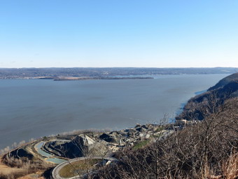
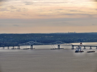
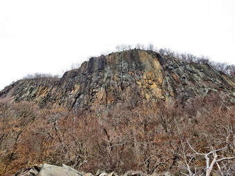
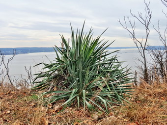 At 9W we had hiked 2.1 miles and we turned left to hike north .4 miles. There was no sidewalk but the shoulder was wide and we had no trouble. At 2.5 miles we crossed the road and passed through an opening in the guardrail. A short distance into the woods a white trail came in from the right. This was the Upper Nyack Trail which I intended to use to hike a loop on the way back. The Long Path continued on a wide woods road which paralleled Route 9W. The road was well constructed with stone laid up to support the road surface. The trail began to gain elevation as it headed northeast and away from 9W. At 2.8 miles we entered Rockland Lake State Park. As we followed the trail, there were a few lookouts but I decided to continue to the top of Hook Mountain. At 3.25 miles we reached the summit and the highest point on the hike. The views were spectacular even though the skies remained completely overcast. Of course the dominant view has the Hudson River to the east as well as the village of Nyack. I could see the Tappan Zee Bridge and the preliminary construction being done to create the new span. The Hudson is at its widest here and these views made that very clear. To the north was Rockland Lake. I took quite a few pictures despite the poor conditions all the while knowing that I would have to come back with Cindy on a better day. I also took a picture of a stuffed owl on a high pole! We walked down off the summit of Hook Mountain and then started up the next rise. Near the top we had some more nice views. I noticed a large spiky plant growing out in the open near the edge of the cliff. It was a succulent and seemed out of place all by itself. I walked to the edge of the cliff and found the drop REALLY breathtaking. I took some pictures before we continued on our way. At about 3.8 miles we started a descent down the west side of the ridge and we stayed on that side for some time.
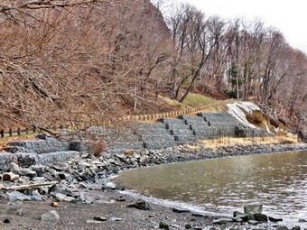 At 4 miles we began our final ascent and at 4.7 miles we were again on a high point with some views. The views were much the same as from the other lookouts and I was beginning to become concerned about the weather. More than once a few snowflakes had fallen as well as some sleet. It was brief but I knew I did not want to have a 6 mile return trip in the rain! We descended from the final high point to the west side of the ridge and were again on a wide woods road. To the left I could see Rockland Lake. The trail descended steeply at times with a few switchbacks as we headed toward Landing Road. The final part of this descent was over a very rocky area and brought us to two old foundations. I took a few pictures and we walked out to Landing Road. I was pleased to find a parking area there that I could use as a jumping off place for my next hike. There was also a sign that gave the history of the Knickerbocker Ice Company which used the pure waters of Rockland Lake for ice and was one of the largest companies in the area. We turned right on Landing Road at exactly noon and walked down the park road to the Shore Trail which is a bike path along the Hudson. I thought this would be a quicker way to return and would offer an alternative view of the Hudson. On the way we met one woman hiking toward us and we said "Hello" as we passed. I stopped several times to take pictures of the impressive cliffs that make up the Hook Mountain ridge. The bike path began as a paved road which led down to the waters edge. We walked out to a small picnic area and I took some pictures of the river, the bridge and the cliffs. After this the path was stone dust which is much softer on the feet. We met several people hiking toward us and one runner but no bicycles.
 At one point when we stopped so that I could take pictures, the woman we had initially met caught up to us. She stopped and asked some questions about hiking poles. I picked up my pack and we walked together as I answered her questions. Having someone to talk to made the hike go even quicker and at 7.4 miles we were at the Nyack Beach State Park parking area. My hiking companion generously offered to give us a ride. I thought about the offer for a moment but then declined as I wanted to pile on some miles. She did give me several alternate routes back to my car which I appreciated. Sheila and I continued our hike walking up the hill from the parking area and turning left on North Broadway to begin the Upper Nyack Trail. Almost immediately we turned right on Larchdale Avenue and walked passed the Marydell Faith and Life Center. Marydell was founded by the Sisters of Our Lady of Christian Doctrine to provide a place for disadvantaged youth during the summer. At the end of Larchdale we turned left on North Midland Avenue and after a few hundred feet followed the white blazes into the woods at 8 miles. The Upper Nyack Trail headed east for .4 miles and gained enough elevation to meet the Long Path near Route 9W. We turned left on 9W and headed back to the intersection with Christian Herald Road. We turned right at the intersection and walked back passed Nyack High School at 1:25 PM about 9 miles into the hike. The trail turned left into the woods just after the high school but I decided to continue on the road and try walking Mountainview Avenue back to the car. I knew that it was a winding road without sidewalks for a good part of the way but thought we would be OK. We made the left turn and started up the road. For the most part I had a good view of oncoming traffic and after a short climb we were able to walk on sidewalks. The return trip went much more quickly than it would have on the trail. At 10.6 miles we were back at the point where the Long Path turns into the woods. From here it was a short walk back to the car. We were back in the parking area just before 2:00 PM having hiked 10.8 miles in just under 4.5 hours. The elevation gain of 2070 feet surprised me a little as it was spread out over a good distance.
![]()
![]()
![]()
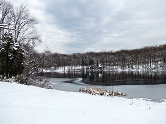
![]() On Thursday, December 4th I had almost decided to stay at home as I had planned a long hike for Friday. After hanging around the house and looking at a forecast of rain for Saturday, I decided to get out and do something just for some exercise. Family commitments had eaten up the beginning of the week and both Sheila and I were anxious to hike. The skies were overcast but and the air seemed raw despite the 30 degree temperature but that did not stop us. We arrived at the Frick Pond parking area at 10:30 AM and were immediately on the Quick Lake Trail to Frick Pond. I tried to resist overdressing and did not put on tights underneath my MH Winter Wander pants. I also wore only a single layer on top underneath my Mammut Hoody. As we started to hike I wondered about my choices as I was feeling a little cool! When we arrived at the bridge across the outlet, I decided not to stop and take any pictures as the skies were so overcast and flat. As we continued around the pond, we stayed left at the trail junction to stay on the Quick Lake Trail. There was a thin layer of snow and ice on the trail but not enough to warrant snowshoes or even Microspikes. By 11:05 AM we had walked the 1.5 miles to Iron Wheel Junction. At the trail junction we turned right on the Logger's Loop Trail. The Logger's Loop is mostly downhill in this direction and we made good time despite the layer of slippery stuff. By 11:25 AM we were at Times Square and about 2.7 miles into the hike.
On Thursday, December 4th I had almost decided to stay at home as I had planned a long hike for Friday. After hanging around the house and looking at a forecast of rain for Saturday, I decided to get out and do something just for some exercise. Family commitments had eaten up the beginning of the week and both Sheila and I were anxious to hike. The skies were overcast but and the air seemed raw despite the 30 degree temperature but that did not stop us. We arrived at the Frick Pond parking area at 10:30 AM and were immediately on the Quick Lake Trail to Frick Pond. I tried to resist overdressing and did not put on tights underneath my MH Winter Wander pants. I also wore only a single layer on top underneath my Mammut Hoody. As we started to hike I wondered about my choices as I was feeling a little cool! When we arrived at the bridge across the outlet, I decided not to stop and take any pictures as the skies were so overcast and flat. As we continued around the pond, we stayed left at the trail junction to stay on the Quick Lake Trail. There was a thin layer of snow and ice on the trail but not enough to warrant snowshoes or even Microspikes. By 11:05 AM we had walked the 1.5 miles to Iron Wheel Junction. At the trail junction we turned right on the Logger's Loop Trail. The Logger's Loop is mostly downhill in this direction and we made good time despite the layer of slippery stuff. By 11:25 AM we were at Times Square and about 2.7 miles into the hike.
At Times Square we turned left to start up the Big Rock Trail. From Times Square to The Flynn Trail is about 1.1 miles but the elevation gain is around 600 feet. The route has three different climbs with some flatter areas between them. I wasn't getting the pulling sensation in my upper left leg that I had on other hikes recently but we were setting a fast pace and the climb was a little tiring. We reached the Flynn Trail at 11:55 PM after hiking 3.85 miles. I thought I might make a loop down to Hodge Pond but I needed to get back home so that I could get to track practice on time. We turned right to walk down the Flynn Trail back to the parking area. There were at least three major blowdowns on the trail and I thought about taking a day to try out my new Silky saws and some of these trees. Sheila was still excited at this point and was running up the trail and back to me. She was taking a few excursions off the trail to follow animal tracks but was pretty close so I let her explore. She started to grab some rather large branches so I picked up a stick and threw it several times for here to retrieve. The trip down the Flynn Trail went quickly as we continued down to the parking area on the trail. We were back at 12:30 PM having covered 5.5 miles in 2 hours.
![]()
![]()
![]()
![]()
![]() On Saturday, November 29th I planned to hike a section of the Long Path from Mount Ivy to the Big Hill Shelter in Harriman State Park. I had already hiked the Tors so this hike would connect them to the rest of my LongPpath sections and leave only section 1 to 3 for me to complete the entire trail! I mentioned my plans to my son Kurt and he said he would be able to hike with me. This meant we could spot a car on Route 106 where the Suffern-Bear Mountain trail crosses the road. We could then drive to Mount Ivy and hike the Long Path to the Suffern bear Mountain Trail near the Big Hill Shelter. The rest of the hike would be only the Suffern Bear Mountain Trail back to Route 106. This would also allow us to pass by the Jackie Jones Fire Tower and the ORAK Mansion, two points of interest that I though Kurt would like. We agreed to meet at 9:00 AM but Kurt sent a text early in the morning asking to delay our rendezvous until 9:45 AM. The new plan would allow me to get there a little early to see if Route 106 and the parking area were plowed. Sheila and I left Livingston Manor at about 8:15 AM. I had put on extra layers as the temperature was still in the single digits! I drove down Route 17 toward Long Mountain Parkway and as I drove the temperature climbed. At the Long Mountain traffic circle I took the Palisades Parkway south to exit 15. As I passed the exit for Lake Welch Drive, I noticed it was unplowed and closed which made me wonder about Route 106. When I arrived at exit 15, I found Route 106 nicely plowed as I turned left off the exit. The road passed several very nice homes and when I came to the intersection with Route 98 I turned right. The parking area was only a short distance up the road on the left. The parking area was NOT plowed and was already beginning to fill up with cars. As I waited for Kurt two different Korean hiking groups arrived and another women's group was forming. Kurt arrived at around 10:10 AM and we quickly transferred my equipment and Sheila to his car. We drove back out to The Palisades Parkway and headed south to exit 13. We turned left on Route 202 and right at the next light onto Route 45. Just up the hill we pulled into the parking area for South Mountain County Park. The air temperature was still cool but I ditched my Mountain insulated jacket for my Mammut Hoody. We walked out to Route 45 and turned right at 10:25 AM to begin the hike.
On Saturday, November 29th I planned to hike a section of the Long Path from Mount Ivy to the Big Hill Shelter in Harriman State Park. I had already hiked the Tors so this hike would connect them to the rest of my LongPpath sections and leave only section 1 to 3 for me to complete the entire trail! I mentioned my plans to my son Kurt and he said he would be able to hike with me. This meant we could spot a car on Route 106 where the Suffern-Bear Mountain trail crosses the road. We could then drive to Mount Ivy and hike the Long Path to the Suffern bear Mountain Trail near the Big Hill Shelter. The rest of the hike would be only the Suffern Bear Mountain Trail back to Route 106. This would also allow us to pass by the Jackie Jones Fire Tower and the ORAK Mansion, two points of interest that I though Kurt would like. We agreed to meet at 9:00 AM but Kurt sent a text early in the morning asking to delay our rendezvous until 9:45 AM. The new plan would allow me to get there a little early to see if Route 106 and the parking area were plowed. Sheila and I left Livingston Manor at about 8:15 AM. I had put on extra layers as the temperature was still in the single digits! I drove down Route 17 toward Long Mountain Parkway and as I drove the temperature climbed. At the Long Mountain traffic circle I took the Palisades Parkway south to exit 15. As I passed the exit for Lake Welch Drive, I noticed it was unplowed and closed which made me wonder about Route 106. When I arrived at exit 15, I found Route 106 nicely plowed as I turned left off the exit. The road passed several very nice homes and when I came to the intersection with Route 98 I turned right. The parking area was only a short distance up the road on the left. The parking area was NOT plowed and was already beginning to fill up with cars. As I waited for Kurt two different Korean hiking groups arrived and another women's group was forming. Kurt arrived at around 10:10 AM and we quickly transferred my equipment and Sheila to his car. We drove back out to The Palisades Parkway and headed south to exit 13. We turned left on Route 202 and right at the next light onto Route 45. Just up the hill we pulled into the parking area for South Mountain County Park. The air temperature was still cool but I ditched my Mountain insulated jacket for my Mammut Hoody. We walked out to Route 45 and turned right at 10:25 AM to begin the hike.
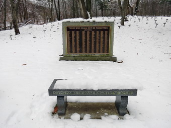 We walked down Route 45 to the traffic light and crossed Route 202 to the other side. The blazes took us under the parkway and then up a bank to the right. We walked through a short stretch of wood and then crossed the exit ramp to the parkway before we gain entered the woods. After a short walk along the shoulder of the road, we dropped down into the woods along the parkway. For the next 1.2 miles the trail took us through a narrow strip of woods along the parkway. At 1.65 miles we crossed a stream by walking along the edge of a "culvert" that took the stream under the parkway. At this point the trail began to turn to the northwest ascending the northern shoulder of Cheesecote Mountain. I took a moment to remove my Icebreaker Merino top leaving only a light baselayer under by softshell. Even with the pitzips wide open I was still working up a sweat! At about 2.4 miles we came out onto a road which skirted Cheesecote Pond. The trail soon entered the trees again on a woods road but we stopped on the shores of the pond. I took off my pack and got out the camera to take some shots of the pond with just a hint of blue sky. I also took a couple of pictures of Kurt and Sheila before packing up to continue the hike. As we walked farther north, it seemed like the snow was getting much deeper approaching 6 inches in spots. We descended the other side of the hill and headed down toward Call Hollow Road. At 3.5 miles we came across a cemetery that was marked on the map. There were very few gravestones with most plots being marked only by a small metal marker with a number. As we continued around the cemetery we found some stone benches in front of a monument with a bronze plaque inscribed with a list of names. The plaque had an inscription that read "Those Who Shall Not Be Forgotten". One of the stone benches bore the words "Giving Names to Souls Forgotten No Longer". I took a few pictures but Kurt and I were both stymied as to the meaning of the words. We walked out to Call Hollow Road along the access road to the cemetery and found a sign that read "The Letchworth Village Cemetery 1914-1967" which brought things into focus. Letchworth Village was a residential institution located in Rockland County built for the physically and mentally disabled of all ages from the newborn to the elderly. It was opened in 1911 and at its peak consisted of over 130 buildings spread out over many acres of land. Many of the residents were placed there by their families and forgotten.
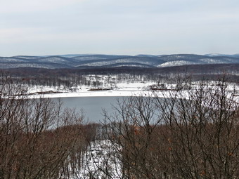 We turned left on Call Hollow Road and walked a few hundred up the road before turning right into the woods at 3.7 miles. We crossed a stream on a bridge and tried to follow the aqua blazes as best we could. The problem was that the blazes were few and some were covered by snow on the trees. At this point the footsteps of other hikers stopped and we were on our down breaking trail and finding the blazes. At 4.6 miles we broke out onto a woods road and met some of the Korean hikers. The blazes indicated a left turn so we turned left and followed the road. We did not see any blazes but this did not seem unusual. After a short distance I check the map on my cell phone and found we were not on the Long Path but were following Old Turnpike. At this point my cell phone shut off because of the cold and I started to use compass and paper maps. We walked back to the junction and found that the Long Path veered off into the woods. Soon we crossed a small stream and I found one blaze on the other side but could not see another. With no other indication of where to go we headed in the direction of the blaze and once we passed it we found another. From this point on the trail was poorly marked and the snow got deeper. We continued to ascend and at 5.7 miles came to a junction with the yellow blazed Suffern Bear Mountain Trail. The blazes here were not at all clear and we initially turned left. After a short distance and no blazes I pulled out the map and determined we were following an unblazed woods road south! We turned around, went back to the junction and continued straight ahead up a hill. Another check of the map showed we were headed up to the Big Hill shelter when we wanted to be on the trail heading northeast. We went back to the junction and found the yellow blazes.
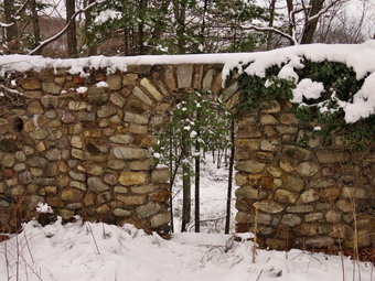 We followed the yellow blazes for the next .7 miles to the top of Jackie Jones Mountain. The trail had been well-packed by other hikers. Along the way we crossed a small stream and Pine Meadow Road. When we got to the fire tower, I took off my pack and grabbed the camera to ascend the tower and take some pictures. Kurt declined the invitation to join me on the climb pointing out the "rickety" nature of the tower. Sheila on the other hand wanted to follow me all the way up! As I climbed the steps I could begin to see Kurt's point. Several steps were missing and the landings had some holes in them. I climbed to just below the cab and took some pictures of the bleak but beautiful landscape around the tower. I tried to avoid taking pictures of the large communications complex just to the northeast of the fire tower! To the north of the tower was Lake Welch and farther to the east I could seen the Hudson. The missing steps were more noticeable on the way down and I don't know whether I would climb the tower again. We got back on the trail and negotiated several slippery areas until we came to the ruins of the ORAK Mansion at 7.5 miles. This mansion was built in 1923 by George Briggs Buchanan, a vice president of the Corn Products Refining Company, which manufactured Karo syrup. Orak is Karo spelled backwards. After Buchanan died in 1939, his heirs sold the mansion to the park, and it was demolished in 1973. We walked to the right off the trail and into the area that was once the dining room. Little remains except for a rock wall with a door and small round windows. Buchanan had the floor of the dining room built to sway like the deck of a ship and the round widows acted as portholes. I took some pictures before we returned to the trail. We walked down the hill passing the remains of the mansion, the servants quarters and the gatehouse. The trail soon met the access road for the communications complex and it was less than half a mile to Route 106. We turned right on the road and walked a few hundred feet back to the car. It was 3:30 PM and we had hiked 8.1 miles in 5 hours with a 1700 foot elevation gain. I thought this was a slow pace but we were stopped for over an hour and the snow really slowed us down. We drove back to Mount Ivy to Kurt's car and then decided to find a place to eat. We found a Mexican place, La Rancherita II, about a mile east on Route 202. The food was good and it was nice to relax before heading home.
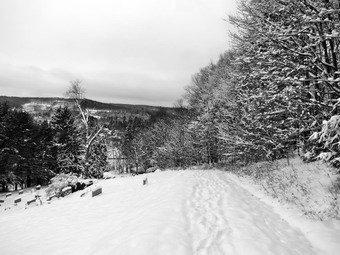
![]() On Thursday, November 27th the family was headed to Delhi for Thanksgiving. About 8 inches of snow had fallen on Wednesday and it looked very pretty on the trees. I decided to take a short walk on the hills behind our church before we headed out. The temperature was still in the high 20's and the sky showed only little blue. I got dressed and took my pack since it is the easiest way to carry my camera. Sheila was ready to go so we walked across the street and up the steep hill to the top of the cemetery. I stopped and dropped my pack to take some pictures of the town and the surrounding hills all of which were covered in snow. Sheila seemed to know where we were going and we were soon hiking through the woods . I was a little surprised to find we weren't the first to venture out as I saw boot print and dog prints in the snow. We came to a large blowdowns across our regular route and follow the other set of prints as they wound around it. As we walked through the woods, I stopped several times to take a few more shots and then put the camera away to concentrate on the beauty around us. We followed a route we often use but I decided to walk the flat part first and then climb the hills. There were some deep puddles of water which were almost completely frozen but we avoided them just in case. Soon we had made the turn and started back which meant we had a few pretty steep but short climbs. I had not worn any traction devices which would have made the climbs a little easier. I could have worn snowshoes since there was more snow in the woods and on the hills than around the house but they were not necessary. We descended the highest hill and rejoined our path from the outbound part of the hike. Sheila was right on the "trail" the entire time despite the fact that the others had turned around only a short way into the hike. We had started just before 9:00 AM and were back at the house by 10:30 AM after covering a few beautiful miles.
On Thursday, November 27th the family was headed to Delhi for Thanksgiving. About 8 inches of snow had fallen on Wednesday and it looked very pretty on the trees. I decided to take a short walk on the hills behind our church before we headed out. The temperature was still in the high 20's and the sky showed only little blue. I got dressed and took my pack since it is the easiest way to carry my camera. Sheila was ready to go so we walked across the street and up the steep hill to the top of the cemetery. I stopped and dropped my pack to take some pictures of the town and the surrounding hills all of which were covered in snow. Sheila seemed to know where we were going and we were soon hiking through the woods . I was a little surprised to find we weren't the first to venture out as I saw boot print and dog prints in the snow. We came to a large blowdowns across our regular route and follow the other set of prints as they wound around it. As we walked through the woods, I stopped several times to take a few more shots and then put the camera away to concentrate on the beauty around us. We followed a route we often use but I decided to walk the flat part first and then climb the hills. There were some deep puddles of water which were almost completely frozen but we avoided them just in case. Soon we had made the turn and started back which meant we had a few pretty steep but short climbs. I had not worn any traction devices which would have made the climbs a little easier. I could have worn snowshoes since there was more snow in the woods and on the hills than around the house but they were not necessary. We descended the highest hill and rejoined our path from the outbound part of the hike. Sheila was right on the "trail" the entire time despite the fact that the others had turned around only a short way into the hike. We had started just before 9:00 AM and were back at the house by 10:30 AM after covering a few beautiful miles.
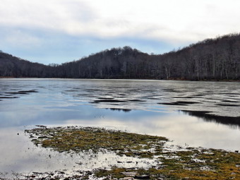
![]()
![]()
![]()
![]()
![]() On Tuesday, November 25th it was still overcast with some mist in the air after an overcast and showery day on Monday. I decided to hike locally as I had track practice in the afternoon. I decided that the rain might have increased the flow in local streams and that Russell Brook Falls would be a good place in to check this out. Sheila was happy to be getting out and rushed to the car! We left Livingston Manor at about 9:15 AM and headed toward Morton Hill Road just outside of Roscoe. I made the left and rove to the intersection with Russell Brook Road. I turned around and marked on the shoulder of Morton Hill Road as the parking area is on private property. We were hiking down Russell Brook Road by 9:35 AM and it already appeared that there would be some water in the streams. I had worn and orange jacket and put Sheila's orange bandana around her neck since I expected there might be some hunters in the area. As we walked down the road to the lower parking area, I could hear the water rushing down the brook. I stopped briefly at the viewpoint to the upper falls but decided to take pictures of the falls on the way back. We walked down to the lower parking area but there were no vehicles in the lot. We continued down the wide snowmobile trail and woods road and crossed Russell Brook on the bridge. The knotweed was all dead but it continues to expand its area.
On Tuesday, November 25th it was still overcast with some mist in the air after an overcast and showery day on Monday. I decided to hike locally as I had track practice in the afternoon. I decided that the rain might have increased the flow in local streams and that Russell Brook Falls would be a good place in to check this out. Sheila was happy to be getting out and rushed to the car! We left Livingston Manor at about 9:15 AM and headed toward Morton Hill Road just outside of Roscoe. I made the left and rove to the intersection with Russell Brook Road. I turned around and marked on the shoulder of Morton Hill Road as the parking area is on private property. We were hiking down Russell Brook Road by 9:35 AM and it already appeared that there would be some water in the streams. I had worn and orange jacket and put Sheila's orange bandana around her neck since I expected there might be some hunters in the area. As we walked down the road to the lower parking area, I could hear the water rushing down the brook. I stopped briefly at the viewpoint to the upper falls but decided to take pictures of the falls on the way back. We walked down to the lower parking area but there were no vehicles in the lot. We continued down the wide snowmobile trail and woods road and crossed Russell Brook on the bridge. The knotweed was all dead but it continues to expand its area.
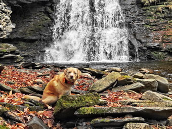 At the split in the trail we headed right to do the loop in a counterclockwise direction. There was water on the trail and a few muddy areas. We set a fast pace up the trail toward Trout Pond and as we approached we could see there was ice covering all of the pond except the part near the spillway. Despite the rain and the water in the streams, the level of the pond was still low. The day was still overcast but I still took some pictures of the scenery with the ice on the pond. Sheila ran near the waters edge and got a drink but did not venture into the cold water or out onto the thin ice. The sky was overcast but there was enough light to provide some interesting shots. We headed back to the main trail and walked up to the inlet end of the pond. Before crossing the bridge, we walked down to the shore and I took a few more shots of the pond and the bridges. It was 10:20 AM when we crossed the bridge and headed up toward Cherry Ridge about 2 miles into the hike. We set a fast pace of about 2.7 miles per hour and the 2 miles hike from Trout Pond to Mud Pond seemed to go very quickly. We did not see any hunters along the way. The trail continued to be wet especially when compared to how dry the woods had been all summer. We turned left and found more wet and muddy spots on the snowmobile trail as we climbed a little before descending. The descent back to the trail register went quickly and we were soon back to the area of the falls. We turned left and followed the path to the lower falls since I wanted to get some pictures from the streambed. There was a good volume of water coming over the falls and I took a few shots including some of Sheila. We walked back to the bank to the main trail and back to the lower parking area. On the way back up Russell Brook Road, we stopped at the viewpoint over the upper falls. The water was clear and looked very cold as I snapped a few shots of the upper falls. I also took several of the lower falls from above. From there we walked back out to the road and to the car. We were back at the car at 12:00 PM having covered 5.6 miles in 2 hours and 15 minutes with again of about 1100 vertical feet.
![]()
![]()
![]()
![]() On Monday, November 24th it was still overcast with some mist in the air after a good rain on Sunday. I had planned to hike from Hartley Road near Goshen to Mountain Road in Greenville to connect my sections of the Long Path in Orange County and Harriman with my sections to the north. This hike is a road walk all the way so I had called Alist Taxi the night before and asked the driver to pick me up at Mountain Road as I wanted to hike from east to west. I had been over the route in a car and measured the distance at about 14.5n miles which was about the same as the distance described on the website. I was surprised at how hilly it was especially in the western part. I knew that I didn't want to break it into two hikes and around trip of 28 miles was out of the question! I almost called the driver and cancelled but I decided that it was so warm, about 55 degrees in Livingston Manor, that even if I got wet it wouldn't be too bad. I also knew that there was worse weather ahead. Sheila and I got ready and left Livingston Manor at about 7:00 AM for our 8:30 AM pickup. We headed down Route 17 and I took exit 113 to get on Route 209 south toward Port Jervis. I drove south to the Guymard Turnpike and turned left to follow the winding road over the ridge to Mountain Road. I turned right on Mountain Road and drove 3 miles south to the trailhead on the right. I actually parked slightly south of the beginning of the trail as there was a pullout that could accommodate three or four cars. We arrived at 8:20 AM and the taxi was there just after 8:30 AM. He had taken I94 to Port Jervis and saved some time. We headed back to Hartley Road using most of the route we were going to hike back. The skies were dark and there were a few showers along the way. When we arrived at Hartley Road it was still overcast but the rain had stopped. Our driver dropped us and we started hiking north on Hartley road at almost exactly 9:00 AM. For the rest of the hike the skies stayed overcast and we experienced a few light showers but no major downpours. On a nicer day I might have taken some pictures as there was some interesting scenery and some historical landmarks. As it was, I kept my head down and hiked as fast as I could. Sheila, of course, was happy to be out and had no problem with the weather!
On Monday, November 24th it was still overcast with some mist in the air after a good rain on Sunday. I had planned to hike from Hartley Road near Goshen to Mountain Road in Greenville to connect my sections of the Long Path in Orange County and Harriman with my sections to the north. This hike is a road walk all the way so I had called Alist Taxi the night before and asked the driver to pick me up at Mountain Road as I wanted to hike from east to west. I had been over the route in a car and measured the distance at about 14.5n miles which was about the same as the distance described on the website. I was surprised at how hilly it was especially in the western part. I knew that I didn't want to break it into two hikes and around trip of 28 miles was out of the question! I almost called the driver and cancelled but I decided that it was so warm, about 55 degrees in Livingston Manor, that even if I got wet it wouldn't be too bad. I also knew that there was worse weather ahead. Sheila and I got ready and left Livingston Manor at about 7:00 AM for our 8:30 AM pickup. We headed down Route 17 and I took exit 113 to get on Route 209 south toward Port Jervis. I drove south to the Guymard Turnpike and turned left to follow the winding road over the ridge to Mountain Road. I turned right on Mountain Road and drove 3 miles south to the trailhead on the right. I actually parked slightly south of the beginning of the trail as there was a pullout that could accommodate three or four cars. We arrived at 8:20 AM and the taxi was there just after 8:30 AM. He had taken I94 to Port Jervis and saved some time. We headed back to Hartley Road using most of the route we were going to hike back. The skies were dark and there were a few showers along the way. When we arrived at Hartley Road it was still overcast but the rain had stopped. Our driver dropped us and we started hiking north on Hartley road at almost exactly 9:00 AM. For the rest of the hike the skies stayed overcast and we experienced a few light showers but no major downpours. On a nicer day I might have taken some pictures as there was some interesting scenery and some historical landmarks. As it was, I kept my head down and hiked as fast as I could. Sheila, of course, was happy to be out and had no problem with the weather!
At the end of Hartley Road we turned left on Echo Lake Road and headed west. After a short distance, we crossed over the Walkill River and the passed Echo Lake at .75 miles. At 1.2 miles I veered off the route because I was not paying attention and headed north on McVeigh Road. I quickly realized my mistake and turned left on CR 50 heading west. We passed by the Waywayanda Inn and at 2 miles crossed Route 6. I checked my watch and it was 9:40 AM which means we were keeping a fast pace. From this point on the road rolled some but overall we were gaining elevation most of the time. After Route 6, we crossed Denton Hill Road and stayed right on Ridgebury Road. The walk on Ridgebury Road was close to 3 miles to the intersection with Ridgebury Hill Road where we turned right at just over 5 miles. Along the way we had a few showers but they were light and short-lived. I actually missed the turn onto Ridgebury Hill Road which I realized when I could not find any aqua blazes. Despite the fact that it is a road walk the blazes were there and pretty easy to spot. We back tracked and headed north on Ridgebury Hill Road until it met Route 6 where we turned right. When I check the trail description, I found I had missed the turn onto Wilcox Road but that section is only about .2 miles anyway! We walked north on Route 6 for about .25 miles before turning left on McBride Road. At the end of McBride Road I checked my GPS and found we had hiked 7 miles and it was 11:00 AM. I was satisfied with the pace. We turned left on CR 49 and then almost immediately right on R. Hunter Road. Within a short distance R. Hunter Road became Mount Orange Road. The further west we hiked the more rural the area became and the more elevation we gained.
After about a mile Mount Orange Road turned sharply right and crossed over I84. We continued north and then west on Mount Orange Road until about 9.4 miles where the trail turned left onto Remey Road. Our walk on Remey Road was short as it soon met South Centerville Road that took us south and west to 10.1 miles. Here we continued straight ahead on Mullock Road which began a nice climb which I began to feel especially in my left knee! Houses were getting farther apart and we encountered very few cars. Mullock Road seemed to go on forever as we continued to gain elevation heading west toward Mountain Road. We crossed several roads on our way and even saw what looked like a very old cemetery along the way. At 13.9 miles we turned left onto Mountain Road and I knew we were almost done. The walk on Mullock Road was 3.8 miles and we had gained 520 feet. We covered the final .9 miles along Mountain Road and arrived back at the car at 1:35 PM. We had covered 14.8 miles in a little over 4.5 hours and gained a total of 1400 feet. The difference in elevation from beginning to end was 700 feet. I now have a short section from Lake Welch Road in Harriman to the Tors and then the final three sections from Fort Lee north to the Tors and I will be an "End-to-Ender"!
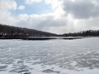
![]()
![]()
![]()
![]()
![]() On Friday, November 21st I was ready to hike after four days of filling in for the school nurse! I had considered going to Orange County to finish the Long Path sections there by hiking a 14 mile section from Hartley Road near Goshen to Mountain Road near Port Jervis. The forecast was for temperatures barely above freezing AND sustained winds of 10 to 20 miles per hour. I knew the road walk would be unprotected and opted to wait for the warmer temperatures predicted for the days before Thanksgiving. I asked Cindy if she would like to go to Frick Pond to hike and she agreed. This is one of our favorite places and I had not been there in some time. When I awoke at 6:00 AM the temperature was 16 degrees and there was a stiff breeze blowing. As the morning progressed the temperature rose slightly. We ate breakfast with our son Karl and then got dressed to head out for our hike. We arrived at the parking area at about 10:40 AM to find only a pickup parked in the lot. We got ready to hike and headed across the road to start up the Flynn Trail toward Hodge Pond. The air was cold and the breeze made it seem even colder. Being in the woods protected by the trees blunted the effects of the wind some. There was only a dusting of snow on the trail but the ground seemed well frozen. As we hiked up the Flynn Trail, we noticed quite a few trees that had fallen across the path. Some were very new but some had been there for awhile. We kept up a quick pace but Sheila was even quicker. Since we had not been out for almost a week, Sheila was dashing up and down the trail. As we hiked the blue skies all but disappeared and were replace by darker clouds. We were at the junction with the Big Rock trail by 11:25 AM having covered the 1.7 miles in about 40 minutes.
On Friday, November 21st I was ready to hike after four days of filling in for the school nurse! I had considered going to Orange County to finish the Long Path sections there by hiking a 14 mile section from Hartley Road near Goshen to Mountain Road near Port Jervis. The forecast was for temperatures barely above freezing AND sustained winds of 10 to 20 miles per hour. I knew the road walk would be unprotected and opted to wait for the warmer temperatures predicted for the days before Thanksgiving. I asked Cindy if she would like to go to Frick Pond to hike and she agreed. This is one of our favorite places and I had not been there in some time. When I awoke at 6:00 AM the temperature was 16 degrees and there was a stiff breeze blowing. As the morning progressed the temperature rose slightly. We ate breakfast with our son Karl and then got dressed to head out for our hike. We arrived at the parking area at about 10:40 AM to find only a pickup parked in the lot. We got ready to hike and headed across the road to start up the Flynn Trail toward Hodge Pond. The air was cold and the breeze made it seem even colder. Being in the woods protected by the trees blunted the effects of the wind some. There was only a dusting of snow on the trail but the ground seemed well frozen. As we hiked up the Flynn Trail, we noticed quite a few trees that had fallen across the path. Some were very new but some had been there for awhile. We kept up a quick pace but Sheila was even quicker. Since we had not been out for almost a week, Sheila was dashing up and down the trail. As we hiked the blue skies all but disappeared and were replace by darker clouds. We were at the junction with the Big Rock trail by 11:25 AM having covered the 1.7 miles in about 40 minutes.
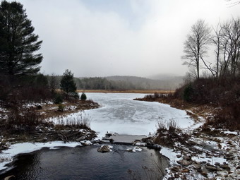 We continued straight ahead on the Flynn Trail passing through the gate a little further on. At the point where the Flynn Trail heads down to Hodge Pond, I elected to bear to the right on the woods road toward the old Beech Mountain Boy Scout camp. Just before the remains of the cabins from the camp, we turned left to head down the woods road toward Hodge Pond, At the junction with the jeep trail, we turned right to head around the back of the pond. The pond was frozen around the edges and I walked down to the shore to take a few pictures. We continued around the back of the pond and turned right when we came to the Flynn Trail. We walked up the Flynn Trail to the gate and stayed to the left to walk the trail out to Junkyard Junction. Here the trail was covered by a little more than an inch of snowed and some flakes were beginning to fall. The trail was frozen and there were some very icy patches along the way. We arrived at the junction at 12:10 PM about 3.3 miles into the hiked. We turned left on the Quick Lake Trail and began the descent to Ironwheel Junction. The trail remained solid but there was a little less snow on the trail as we descended. The snow from the sky, however, began to increase in intensity. When we came to the junction, we turned right to stay on the Quick Lake Trail and to head toward Frick Pond. We crossed the small stream across the trail and there was some water flowing. The last time Sheila and I had walked through the stream was dry! As we approached Frick Pond we crossed the two small bridges and found one still had a large tree across it. At the bridge1 across the outlet stream, we stopped so that I could take a few last pictures. Enough snow was now falling that Flynn's Point was almost obscured! We headed back to the car arriving at 1:30 PM. We hiked 6.4 miles in 2 hours and 50 minutes with a 930 foot elevation gain. We decided to reward ourselves with a late lunch at the Brandenburg Bakery in Livingston Manor!
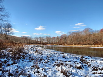
![]()
![]()
![]()
![]()
![]() On Saturday, November 15th I was ready to hike after three days of filling in for the school nurse! It was the first day of rifle season for deer and bear and it snowed some overnight. I stayed around to cover any morning ambulance calls and fortunately there were new. Cindy and I decided we would hike the new Ridgeview parcel from Mountain Road to the SRT. This would help me finish up some of the Long Path in Orange County. I knew that hunting was prohibited on this land which was also a plus. Cindy and I got ready to go making sure we wore some orange and that Sheila wore her orange vest. We headed down Route 17 at 10:45 AM and I took exit 113 to get on Route 209 south toward Port Jervis. The temperature was still below freezing but I expected it to rise during the day. I drove south to the Guymard Turnpike and turned left to follow the winding road over the ridge to Mountain Road. I turned right on Mountain Road and drove 3 miles south to the trailhead on the right. I actually parked slightly south of the beginning of the trail as there was a pullout that could accommodate three or four cars. We got out of the car, got our gear ready and began our hike at 11:45 AM. We walked through a break in the fence and onto a wide woods road and began a gentle climb for the next .4 miles. We passed a gravel pit on the right. The aqua blazes were sparse but were there when we needed them. After .4 miles we were on the shore of a small pond. A concrete dam impounded the water and a white blazed trail crossed the dam. We stopped and I took some pictures of the pond and the surrounding area. The distribution of snow was interesting. On the areas facing south there was little or no snow while the areas facing north were uniformly white. From the pond we continued on the Long Path heading first northeast and then northwest. The trail began a gentle descent.
On Saturday, November 15th I was ready to hike after three days of filling in for the school nurse! It was the first day of rifle season for deer and bear and it snowed some overnight. I stayed around to cover any morning ambulance calls and fortunately there were new. Cindy and I decided we would hike the new Ridgeview parcel from Mountain Road to the SRT. This would help me finish up some of the Long Path in Orange County. I knew that hunting was prohibited on this land which was also a plus. Cindy and I got ready to go making sure we wore some orange and that Sheila wore her orange vest. We headed down Route 17 at 10:45 AM and I took exit 113 to get on Route 209 south toward Port Jervis. The temperature was still below freezing but I expected it to rise during the day. I drove south to the Guymard Turnpike and turned left to follow the winding road over the ridge to Mountain Road. I turned right on Mountain Road and drove 3 miles south to the trailhead on the right. I actually parked slightly south of the beginning of the trail as there was a pullout that could accommodate three or four cars. We got out of the car, got our gear ready and began our hike at 11:45 AM. We walked through a break in the fence and onto a wide woods road and began a gentle climb for the next .4 miles. We passed a gravel pit on the right. The aqua blazes were sparse but were there when we needed them. After .4 miles we were on the shore of a small pond. A concrete dam impounded the water and a white blazed trail crossed the dam. We stopped and I took some pictures of the pond and the surrounding area. The distribution of snow was interesting. On the areas facing south there was little or no snow while the areas facing north were uniformly white. From the pond we continued on the Long Path heading first northeast and then northwest. The trail began a gentle descent.
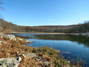 At .9 miles I walked down to the shores of another small pond and took a few shots. There was a skim of ice on most of the ponds and the marshy area around them was starting to freeze. Just after this pond we made a 90 degree turn to the left still following the Long Path. At 1.2 miles I again stopped to photograph yet another body of water. This one had a small beaver house on the shore but when we walked by it looked unused. We stopped again at the outlet to this pond and I took a few more shots. We found that this was the other end of the white trail and we decided we might take it on the way back. The Long Path then began to descend still following woods roads. Just passed the pond, we found spots of blood on the white snow. Although hunting is prohibited in the area, we knew that those prohibitions are not always respected. The blood trail continued and seemed to be at least an hour old. It seemed to both of us that an animal was being transported on an ATV along the trails. Over the next .7 miles the trail descended a little over 350 feet until it intersected the Shawangunk Ridge Trail. I "tagged" the SRT and then we turned around to head back to the car. It was 12:45 PM and we had hiked 2 miles. The ascent up the trail was not as strenuous as I had expected and at 2.7 miles we were back at the last pond. We turned right and started to follow the white trail. It also followed a road and from it we could see the Long Path as we were hiking parallel to it. We crossed a gas pipeline right-of-way and were soon back at the first pond we had visited. The white trail turn left here, passed over the dam and rejoined the Long Path. There were several other trails and roads in the area which I might have explored had it not been hunting season. We walked back down the woods road to Mountain Road and turned right to get back to the car. I was surprised to see we had hiked only 3.6 miles but when I looked at the map I could see the white trail was much shorter. We had been out for 1 hour and 45 minutes and the vertical gain for the hike was about 700 feet. Since it was well passed lunchtime, we decided we wanted to eat before returning home. Karl had mentioned Aroma Thyme in Ellenville and we decided to pay them a visit. It was easy to find the eatery on Canal Street. The food was eclectic but excellent. It was NOT cheap but the beer and cider selection was first rate.
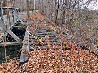
![]()
![]()
![]()
![]()
![]() On Tuesday, November 11th I wanted to continue to work on some sections of the Long Path in Orange County to connect my Harriman sections with those to the north. I had finished the section from Route 32 to Monroe on Monday. The next section was the Heritage Trail from Monroe to just northwest of Goshen. This is an 11.5 mile stretch of paved trail most of which lies on the old Erie railroad right-of-way. I did not want to break this into two hikes and I knew I could not do over 23 miles as an out and back. I found that Alist Taxi in Monroe would transport both me and my dog so I hatched a plan. I decided to park at the end at the Heritage Trail parking area on Hartley Road west of Goshen and have the taxi drop me off at the beginning of the trail in Monroe. I could then hike one-way from Monroe back to the car. I talked to the driver and we tentatively agreed to meet at 8:15 AM. Sheila and I left Livingston Manor just before 7:00 AM. I drove down Route 17 and encountered no traffic delays due to construction. I took the Fletcher Street exit, number 126, and followed Cheechunk Road about 1.7 miles west to Hartley Road. I turned left and found the Heritage Trail pulloff only a few hundred feet in on the right. The driver showed up at about 8"35 Am and drove me to Monroe. He dropped us off and we were hiking by 8:40 AM. The trail starting in Monroe is a hard paved surface which makes walking it very easy. Throughout our walk we met other people who were walking and running and some had their dogs with them. We also met people on bicycles and one gentleman riding a unicycle! Everyone we met seemed very respectful of the other people using the trail and I suspect that many use it several times a week. Within .75 miles we were passing under Route 17. Shortly after that there was a small cemetery nestled between the trees on the right side of the trail. It acted as a reminder that the area of Orange County has been settled for some time. There wasn't much indication that the trail we were on was once a railroad bed except where the trail crossed over another road. In several, places the tracks and original bridge were still intact and I took a few pictures. At about 1 miles we began to pass through farmlands. Although I could still hear the noise of traffic, the atmosphere was very rural. Around 2.5 miles we passed by Camp Laguardia but most of the building were hidden by the high bank on the left side of the trail. There was also some fencing at various points along the route.
On Tuesday, November 11th I wanted to continue to work on some sections of the Long Path in Orange County to connect my Harriman sections with those to the north. I had finished the section from Route 32 to Monroe on Monday. The next section was the Heritage Trail from Monroe to just northwest of Goshen. This is an 11.5 mile stretch of paved trail most of which lies on the old Erie railroad right-of-way. I did not want to break this into two hikes and I knew I could not do over 23 miles as an out and back. I found that Alist Taxi in Monroe would transport both me and my dog so I hatched a plan. I decided to park at the end at the Heritage Trail parking area on Hartley Road west of Goshen and have the taxi drop me off at the beginning of the trail in Monroe. I could then hike one-way from Monroe back to the car. I talked to the driver and we tentatively agreed to meet at 8:15 AM. Sheila and I left Livingston Manor just before 7:00 AM. I drove down Route 17 and encountered no traffic delays due to construction. I took the Fletcher Street exit, number 126, and followed Cheechunk Road about 1.7 miles west to Hartley Road. I turned left and found the Heritage Trail pulloff only a few hundred feet in on the right. The driver showed up at about 8"35 Am and drove me to Monroe. He dropped us off and we were hiking by 8:40 AM. The trail starting in Monroe is a hard paved surface which makes walking it very easy. Throughout our walk we met other people who were walking and running and some had their dogs with them. We also met people on bicycles and one gentleman riding a unicycle! Everyone we met seemed very respectful of the other people using the trail and I suspect that many use it several times a week. Within .75 miles we were passing under Route 17. Shortly after that there was a small cemetery nestled between the trees on the right side of the trail. It acted as a reminder that the area of Orange County has been settled for some time. There wasn't much indication that the trail we were on was once a railroad bed except where the trail crossed over another road. In several, places the tracks and original bridge were still intact and I took a few pictures. At about 1 miles we began to pass through farmlands. Although I could still hear the noise of traffic, the atmosphere was very rural. Around 2.5 miles we passed by Camp Laguardia but most of the building were hidden by the high bank on the left side of the trail. There was also some fencing at various points along the route.
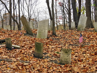 Around 3.8 miles I began to see the flat open fields of a black dirt region on the right or north of the trail. The views were not good enough to take pictures. I did stop to put my light jacket in my pack and to get us a drink. The temperature when we started was 42 degrees but by the time we got to Chester it had risen into the mid-50's and the sun was peeking through the overcast. We stopped at Greycourt on the outskirts of Chester where there were some railroad cars on a siding. I read the history of the area on a placard. I also took some pictures of the railroad cars and a nearby stone arch bridge. When we got into Chester, we stopped at the old railroad station so that I could take a few more pictures. The next section of trail was a little more than 4 mile walk to Goshen. There was a lot of farmland on both sides of the trail. There were also four three different marble benches dedicated to various people. We crossed several roads and in each case traffic stopped when we were in the cross walk. There was even a portable toilet at one intersection. When we reached Goshen it was about 11:10 AM and we had covered 8.5 miles as we turned right on St. James Place. As we approached a left turn onto South Church Street, I noticed that the street was blocked. We made the turn and found a Veteran's Day ceremony in progress. Although I wanted to keep going, I found I had to stop briefly to listen to the speakers. Sheila and I continued on South Church and then turned left on West Main. I wasn't sure exactly where the Heritage Trail resumed but I kept finding aqua blazes on poles and signs. My directions said the turn was about .5 miles from South Church and that it was across from a cemetery. I kept walking and wondering. I found that I need not have been concerned as the cemetery soon appeared on the left. It is very large and hard to miss and the Long Path was clearly marked with aqua blazes indicating a turn. We followed the blazes across the street and down a lane to the beginning of the last section of the Heritage Trail.
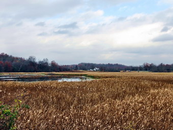 From the village of Goshen to its end on Hartley Road, the trail is "paved" with crushed stone or it is simply packed earth. There were far fewer people using this section. We passed under Route 17 at about 9.65 miles which was .2 miles further than on my description. The trail continued to be flat and straight. The predominant view on either side of the trail was as series of ponds and wetlands. Although the sky was still overcast with little sun, I still stopped to take a few pictures. There was one sign indicating that the Audubon Society maintained a bird sanctuary in the area. Sheila had been very good on her leash so I released her to give her some freedom. She stayed close to me and did not stray from the trail. We came across a final bench but this one had no dedication. I think this area would have been much more interesting if there was some sun an clouds in the sky. I sped up our pace a little bit to try to get back to the car by 12:15 PM. This was more out of boredom than necessity and I did hit my goal. We were back at the car at 12:15 PM having hiked 11.6 miles in 3 hours and 35 minutes. We had started at an elevation of 630 feet in Monroe and need on Hartley Road at 400 feet. The GPS showed an elevation gain along the way of 360 feet with a greater descent. I don't remember a single hill along the way!
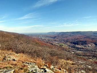
![]()
![]()
![]()
![]()
![]() On Monday, November 10th I wanted to work on some sections of the Long Path in Orange County to connect my Harriman sections with those to the north. I had finished the section from Turkey Lake on Route 6 to Route 32 in the Town of Woodbury on Saturday. The next section was from Route 32 near the Metro North trestle over Schunnemunk Mountain to the Heritage Trail in Monroe. I did not want to break this into two hikes and I knew I could not do over 18 miles as an out and back. I found that Alist Taxi in Monroe would transport both me and my dog so I hatched a plan. I decided to park at the end at the Heritage Trail parking area in Monroe and have the taxi drop me off by the trestle. I could then hike one-way from the trestle back to the car. I talked to the driver and we tentatively agreed to meet at 8:30 AM. The only catch was I did not know if I could get a spot in the lot. Sheila and I left Livingston Manor a little after 7:00 AM. I drove down Route 17 and encountered no traffic delays due to construction. I took the Museum Village Road exit, number 129, and found the Heritage Trail lot on the right just before the two commuter lots. I easily found a space and parked at 8:05 AM. I called the taxi to confirm and he said he would be there around 8:30 AM as agreed. He showed up at the appointed time and I got Sheila and my gear in his car. The driver knew where I wanted to go and he took some back roads that got use there in less than 20 minutes. As we talked he told me that he had recently started to hike. The car was clean and the driver was polite and knowledgeable. I plan to use him on my next hike along the Heritage Trail! He dropped us off at 8:45 AM and we started to hike almost immediately. The trail took us up some stone steps under the railroad trestle to the railroad tracks and right-of-way. I knew we had to walk about .4 miles along the tracks. The walking was not easy as the bed was made up of large angular stones. At some pint I looked on the other side of the tracks and saw there was a smooth surface on the other side. We cautiously crossed the tracks and the hiking was much easier. Unfortunately, our turn off the tracks came up almost immediately! We turned to the left off the tracks and started to walk on a woods road as I watched for a right turn into the woods. I looked up to see a large, black dog headed our way. He seemed pretty friendly and his owner was just behind. People who do not leash or control their dogs usually annoy me but I was sure the owner walked this trail frequently and never saw another hiker. At .8 miles the aqua blazes pointed to the right and we followed.
On Monday, November 10th I wanted to work on some sections of the Long Path in Orange County to connect my Harriman sections with those to the north. I had finished the section from Turkey Lake on Route 6 to Route 32 in the Town of Woodbury on Saturday. The next section was from Route 32 near the Metro North trestle over Schunnemunk Mountain to the Heritage Trail in Monroe. I did not want to break this into two hikes and I knew I could not do over 18 miles as an out and back. I found that Alist Taxi in Monroe would transport both me and my dog so I hatched a plan. I decided to park at the end at the Heritage Trail parking area in Monroe and have the taxi drop me off by the trestle. I could then hike one-way from the trestle back to the car. I talked to the driver and we tentatively agreed to meet at 8:30 AM. The only catch was I did not know if I could get a spot in the lot. Sheila and I left Livingston Manor a little after 7:00 AM. I drove down Route 17 and encountered no traffic delays due to construction. I took the Museum Village Road exit, number 129, and found the Heritage Trail lot on the right just before the two commuter lots. I easily found a space and parked at 8:05 AM. I called the taxi to confirm and he said he would be there around 8:30 AM as agreed. He showed up at the appointed time and I got Sheila and my gear in his car. The driver knew where I wanted to go and he took some back roads that got use there in less than 20 minutes. As we talked he told me that he had recently started to hike. The car was clean and the driver was polite and knowledgeable. I plan to use him on my next hike along the Heritage Trail! He dropped us off at 8:45 AM and we started to hike almost immediately. The trail took us up some stone steps under the railroad trestle to the railroad tracks and right-of-way. I knew we had to walk about .4 miles along the tracks. The walking was not easy as the bed was made up of large angular stones. At some pint I looked on the other side of the tracks and saw there was a smooth surface on the other side. We cautiously crossed the tracks and the hiking was much easier. Unfortunately, our turn off the tracks came up almost immediately! We turned to the left off the tracks and started to walk on a woods road as I watched for a right turn into the woods. I looked up to see a large, black dog headed our way. He seemed pretty friendly and his owner was just behind. People who do not leash or control their dogs usually annoy me but I was sure the owner walked this trail frequently and never saw another hiker. At .8 miles the aqua blazes pointed to the right and we followed.
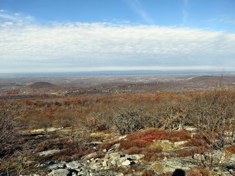 Just after the turn I stopped to let Sheila off her leash, get my poles ready for hiking and to change jackets. When I left Livingston Manor it was still below freezing, but it was much warmer in orange County. I decided to simply take off my Mammut Hoodie and rely on my Patagonia Capilene 3 to keep me warm. The trail now began an ascent that would end on the Schunnemunk Ridge some time later. We were headed generally northwest with some detours around cliffs and ledges. At 1.4 miles we stopped at a lookout dubbed Little Knob. There were some good views to the south and east. I wished for less haze and a few more clouds but I took some pictures anyway. As I turned around to climb back down to the main trail I saw what we would be climbing next. High Knob has an elevation of over 1300 feet. We had started at and elevation slightly below 500 feet. The trail now began to climb very steeply with some sections requiring me to grab onto a root or pull myself up over rocks. Sheila, of course, had no problem at all negotiating the steep trail. I stopped once or twice as the views were very nice to the west and north. The primary view in the foreground was Kiryas Joel, an ultraorthodox Jewish community. At 1.7 miles we were finally on top of High Knob and the views were breathtaking! I took some pictures but the real beauty was the expansive views in almost all directions. I don't usually feel like sitting down and taking in the views but I almost made an exception. We got back on the main trail and started down off High Knob. Was hoping we would not lose too much elevation. The trail was sited along the edge of High Knob and dropped only about 100 feet before starting to climb again to the ridges. At 10:45 AM we had hiked 2.75 miles and were at the junction with the yellow Jessup Trail on the main Schunnemunk Ridge. On our trip up the ridge several other paths and trails had crossed the long oath including the Woodbury Park Trail still marked with faint red blazes. We also crossed Dark Hollow Brook which was almost dry. The walk so far had been through hardwood forests with a predominance of oak trees. The slippery oak leaves and acorns made the hiking difficult. The trail was also very rocky but the rocks were hard to see due to the leaves. We passed a large conglomerate boulder and I stopped to take a few pictures.
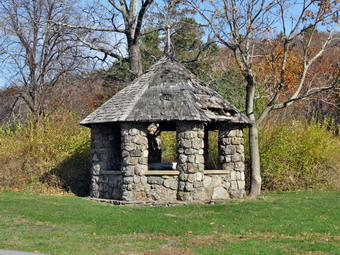 We turned left on the Jessup Trail being careful to avoid the orange blazed Western Ridge Trail. As we started out on the Jessup Trail I kept thinking that none of it really looked familiar and then realized I had never been this far west on Schunnemunk. Over the next 3.6 miles the trail headed southwest. Most of the time we were descending and any ascents were short. The trail was well-maintained and the further we hiked the more it looked like a woods road. We left the state park at about 3.4 miles and then passed an antennae park. From that point on there were very limited views to the east but excellent views to the west and north. The last viewpoint we stopped at had a picnic table and fire ring. The Catskills and Shawangunks were clearly visible and it was hard to take it all in. It was taking a little longer to hike this section than I anticipated so we continued along main trail. The yellow blazes were easy to follow but someone had added fluorescent green paint which was even more visible! At 6.4 miles we came to paved Seven Spring Road and turned right and then quickly left. A short walk brought us to a gate and Gonzaga Park. This park is being developed by Orange County. It was originally the site of the Seven Springs Mountain House in the early 1900's. It was a popular retreat for vacationers and later became the Gonzaga monastery and catholic retreat center. All that remains today the well enclosure, a large octagonal chapel once attached to the monastery and a smaller chapel in the woods. I took some pictures before putting my poles in my pack and Sheila on her leash. We walked down to the entrance to the park and crossed Seven Springs Mountain Road. I kept watching for the blazes to make a right turn into the woods which they eventually did at 7.1 miles. A few more blazes on the road would have been helpful. I thought the hike would be flat after this turn but there were still some small ups and downs as we headed for Route 208. As we neared the crossing the trail was blocked by a local construction company but it was easy to walk around the obstruction. There were many ell-constricted some walls in the area and some foundations from an old homestead very close to Route 208. We crossed the road at 7.8 miles and walked about .2 miles to the shores of Orange Rockland Lake. Along the way we negotiated a few ledges and one steep but short descent. When we got to the lake, we turned right to follow the shore around to Museum Village Road. The trail around the lake could use some maintenance but we were soon at the road where we turned left. We walked the final .4 miles back to the car arriving in the parking lot at 1:30 PM. We had hiked 8.7 miles in 4.5 hours with 40 minutes of stopped time. Our elevation gain was 1850 feet. I was glad to be able to hike one way without having to backtrack!
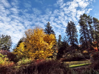
![]()
![]()
![]()
![]()
![]() On Saturday, November 8th I had decided to continue to work on the Long Path. I had recently done some hiking around Kerhonksen to connect the Long Path in the Catskills with the Long Path in the Shawangunks. It was now time to hike through Orange county to connect the Long Path in Harriman to the northern portions I had hiked. My wife and I had hiked from the Turkey Hill lake parking area to the intersection of Route 6 and Route 293. I thought I could park at Lake Massawippa, hike about half a mile to that intersection and then continue north to Route 32 in the Town of Woodbury. I estimated this would be close to 14 miles so I decided to get an early start. The forecast was for temperatures rising into the low 50's with partly sunny skies and a breeze. Sheila and I left Livingston Manor just after 7:00 AM. I took Route 17 south and east to Route 6, Long Mountain Parkway. After passing the intersection with Route 293 to West Point I watched for the Lake Massawippa parking and pulled into the lot just before 8:30 AM. I found a place to pull off and we were hiking by 8:30 AM. I had on my MH Winter Wander pants and my Mammut Hoodie. When we started out, this seemed reasonable as we were in the shade and it was cool. The first half mile of the hike was on the shoulder of Route 6 and even at an early hour there was traffic. Just passed the intersection with Route 293 Sheila and I made it across the road and walked into the woods. We found the trail immediately and began to follow it as it paralleled Route 6. I had the map, of the first three quarters of the hike on the Avenza app on my iPhone so I was sure I could find the trail as it worked its way through the local roads and trails. At .8 miles we came out to the shoulder of Route 6 and at about 1 mile we turned right and began a long downhill section.
On Saturday, November 8th I had decided to continue to work on the Long Path. I had recently done some hiking around Kerhonksen to connect the Long Path in the Catskills with the Long Path in the Shawangunks. It was now time to hike through Orange county to connect the Long Path in Harriman to the northern portions I had hiked. My wife and I had hiked from the Turkey Hill lake parking area to the intersection of Route 6 and Route 293. I thought I could park at Lake Massawippa, hike about half a mile to that intersection and then continue north to Route 32 in the Town of Woodbury. I estimated this would be close to 14 miles so I decided to get an early start. The forecast was for temperatures rising into the low 50's with partly sunny skies and a breeze. Sheila and I left Livingston Manor just after 7:00 AM. I took Route 17 south and east to Route 6, Long Mountain Parkway. After passing the intersection with Route 293 to West Point I watched for the Lake Massawippa parking and pulled into the lot just before 8:30 AM. I found a place to pull off and we were hiking by 8:30 AM. I had on my MH Winter Wander pants and my Mammut Hoodie. When we started out, this seemed reasonable as we were in the shade and it was cool. The first half mile of the hike was on the shoulder of Route 6 and even at an early hour there was traffic. Just passed the intersection with Route 293 Sheila and I made it across the road and walked into the woods. We found the trail immediately and began to follow it as it paralleled Route 6. I had the map, of the first three quarters of the hike on the Avenza app on my iPhone so I was sure I could find the trail as it worked its way through the local roads and trails. At .8 miles we came out to the shoulder of Route 6 and at about 1 mile we turned right and began a long downhill section.
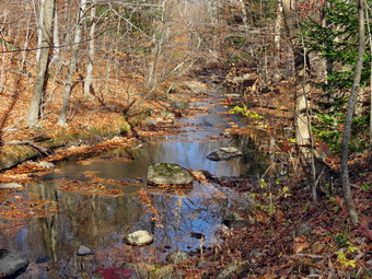 The downhill section started on a track or path. We passed through a gate in a fence and started hiking down an abandoned road heading north. It was strange walking along this abandoned road which seemed to be in rather good shape. At one point I could see the Woodbury Commons shopping center and Monroe-Woodbury High School. This road starts as Old Route 6 and then is marked as Estrada Road. At about 1.7 miles we reached a chain across the road and a turnaround. The descriptions I had gave this as a parking area but there were several "official" signs that said "No Parking"! We walked down Estrada Road following the aqua blazes. At one point the Avenza map seemed to indicate a different route than the blazes and I chose to follow the blazes. I did stop since to take a few pictures of several very bright trees against a blue and white sky. At 2.6 miles at the bottom of the hill we turned right on Abrams Road which ran parallel to the Thruway. There were a few cars but they weren't traveling too fast and gave us a wide berth. At 3.3 miles we turned right onto Smith Clove Road to walk about .6 miles northeast. It seemed like a much longer walk! The road had almost no shoulder at the beginning and there were a lot of cars moving very quickly. Very few drivers moved over and seemed to be oblivious to our presence. We passed by some very expensive houses and a large, well-maintained golf club. At 3.9 miles we paused at the corner of Pine Hill Road while I put on a lighter windbreaker and took some pictures of a stone gatehouse. We turned left on Pine Hill Road and walked .7 miles until we crossed over the Thruway. We continued to descend Pine Hill Road passing through an underpass under the Metro North tracks. At 4.9 miles the road turned left but we continued straight ahead onto a woods road.
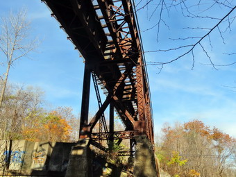 The woods road was wide and open and acts as a right-of-way for a gas pipeline. The road travels along Woodbury Creek and the trip was pretty. Except for the traffic noise from the Thruway the setting could be mistaken for anyplace in the Catskills. The road swung to the northeast and then back north for about 1.5 miles. It was very flat and did have a few puddles. At 6.45 miles we came to a railroad trestle and walked under it until we were near Woodbury Creek. Just after walking under the trestle, we turned right heading east and walked up a steep bank to a fence. We walked around the end of the fence and then walked along it for about .1 miles. The trail brought us out to the berm that runs along the shoulder of the Thruway. We walked north along the berm for a hundred feet and then turned left into the woods. We followed the aqua blazes over a fence and down a steep bank to Route 32. At the road we turned left, walked across a bridge over the creek and stopped just short of the trestle. I could see a "Long Path" sign and aqua blazes on the other side. This was our turnaround point and I did not want to cross Route 32 because of the traffic. We turned around at 11:00 AM after hiking 6.8 miles. We revered our course and set a fast pace back. At one point on the woods road, I saw Sheila had paused. She seemed to be interested in a "lump" on the trail. I quickly saw it was an opossum! I did not want her to investigate any further and called her to me. I took a few pictures and the opossum got underway in the opposite direction. The trip back seemed to go faster and the shoulders on the roads seemed to be wider on the way back. The walk back up hill from Abrams Road to Route 6 was not was difficult as I thought it might be. This section was 1.5 miles and gained 540 feet of elevation. When we got to Route 6, I decided to walk back on the road and to avoid the trail. Traffic had increased but we made all our crossing without a problem. We were back at the car at 1:15 PM having hiked 13.5 miles in 4 hours and 45 minutes gaining 1430 feet long the way.
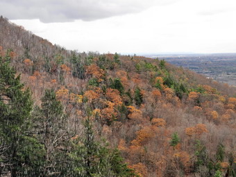
![]()
![]()
![]()
![]()
![]() On Friday, November 7th my son Karl and I had planned to go to Beer World in Kingston for a tasting of Samuel Adams Utopias. This high alcohol (29%) brew sells for about $240 a bottle but I was glad to be able to get in on this tasting. We were supposed to be in Kingston between 4:00 PM and 7:00 PM. Karl purposed that we hike somewhere first and suggested Thacher Park, a place where he had never hiked before. Cindy and I had hiked there during the summer but I was glad to return especially when I found out the Indian Ladder Trail would still be open. I checked the weather on Thursday and the forecast was calling for temperatures in the low 40's and rain showers throughout the day. Karl had hoped to get away early in the morning but could not so he arrived at my house around 9:15 AM and we left a little after 10:00 AM. We decided we would take our chances and stick to our plan and I knew we would have plenty of time to get in a nice hike. We headed up the Beaverkill Road to the Barkaboom Road. At the end of the road I turned right on BWS 10 and took it to Route 28 in Margaretville. We turned right and then left to follow Route 30 through Margaretville, Roxbury, Grand Gorge and North Blenheim. In Middleburgh I turned right to head east on Route 145 to Cotton Hill Road just outside of town. I turned left on Cotton Hill Road and drove 8.3 miles to Route 443, the Helderburg Trail. I turned left on Cotton Hill Road and drove 8.3 miles to Route 443, the Helderburg Trail. I made a right and drove about 6 miles to East Berne and made a left onto Route 157A. At 2.5 miles I continued straight ahead on Route 157 where Beaver Dam Road turns right. I drove until we were at the entrance to the park near the Indian Ladder Trails. When I turned in, we found there were no fees being collected which was a pleasant surprise. I parked and we got ready to hike. We were on the trail leading to the Indian Ladder Trail by 12:10 PM. It was still in the high 30's and there was a breeze! We walked down the trail to the Indian Ladders and then started to walk along the trail at the base of the cliffs. The skies were overcast and there wasn't very much sun or any distinguishable clouds. Just after we got on the trail, three pit bulls came walking toward us. They were not on a leash and although they seemed friendly I was annoyed. Soon the owners of the dogs came walking up assuring us they were friendly. They were as inconsiderate and oblivious as two dog owners could be! We continued our walk and I started to take pictures. I had not planned on taking many pictures but I could not resist. When we got to Mine Lot Falls, there was some water coming over the cliff which was not there when Cindy and I had visited. I took more pictures and we continued to walk. I had not formed a plan about the route we would take. I was just happy to be out hiking with my son.
On Friday, November 7th my son Karl and I had planned to go to Beer World in Kingston for a tasting of Samuel Adams Utopias. This high alcohol (29%) brew sells for about $240 a bottle but I was glad to be able to get in on this tasting. We were supposed to be in Kingston between 4:00 PM and 7:00 PM. Karl purposed that we hike somewhere first and suggested Thacher Park, a place where he had never hiked before. Cindy and I had hiked there during the summer but I was glad to return especially when I found out the Indian Ladder Trail would still be open. I checked the weather on Thursday and the forecast was calling for temperatures in the low 40's and rain showers throughout the day. Karl had hoped to get away early in the morning but could not so he arrived at my house around 9:15 AM and we left a little after 10:00 AM. We decided we would take our chances and stick to our plan and I knew we would have plenty of time to get in a nice hike. We headed up the Beaverkill Road to the Barkaboom Road. At the end of the road I turned right on BWS 10 and took it to Route 28 in Margaretville. We turned right and then left to follow Route 30 through Margaretville, Roxbury, Grand Gorge and North Blenheim. In Middleburgh I turned right to head east on Route 145 to Cotton Hill Road just outside of town. I turned left on Cotton Hill Road and drove 8.3 miles to Route 443, the Helderburg Trail. I turned left on Cotton Hill Road and drove 8.3 miles to Route 443, the Helderburg Trail. I made a right and drove about 6 miles to East Berne and made a left onto Route 157A. At 2.5 miles I continued straight ahead on Route 157 where Beaver Dam Road turns right. I drove until we were at the entrance to the park near the Indian Ladder Trails. When I turned in, we found there were no fees being collected which was a pleasant surprise. I parked and we got ready to hike. We were on the trail leading to the Indian Ladder Trail by 12:10 PM. It was still in the high 30's and there was a breeze! We walked down the trail to the Indian Ladders and then started to walk along the trail at the base of the cliffs. The skies were overcast and there wasn't very much sun or any distinguishable clouds. Just after we got on the trail, three pit bulls came walking toward us. They were not on a leash and although they seemed friendly I was annoyed. Soon the owners of the dogs came walking up assuring us they were friendly. They were as inconsiderate and oblivious as two dog owners could be! We continued our walk and I started to take pictures. I had not planned on taking many pictures but I could not resist. When we got to Mine Lot Falls, there was some water coming over the cliff which was not there when Cindy and I had visited. I took more pictures and we continued to walk. I had not formed a plan about the route we would take. I was just happy to be out hiking with my son.
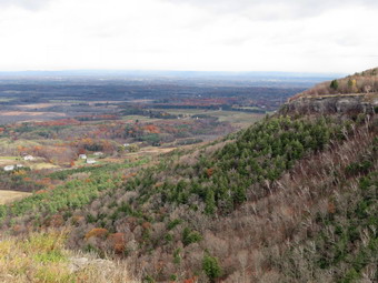 When we got to the end of the Indian Ladder Trail, we decided to continue on the trail that followed the escarpment. After a short walk, we came to the scenic overlook which had a nice view on this day. This resulted in more pictures. At the end of the parking area we walked along the edge of the woods and the picked up the trail along the escarpment again.We stopped in several places to take in the view and I, of course, continued to snap some pictures. It was interesting since we were walking along the edge and I could take pictures of were we had been or where we were going! Eventually we ran out of fence in an area I had visited before. The trail ended at a sheer dropoff that gave a nice view of some stone blocks separating from the main cliff. We headed back the way we had come after hiking about 1.7 miles. When we got to the end of the Indian Ladder Trail, we walked across the top to where we had started. We took the trail that continued in the opposite direction along the escarpment. This trail had a few viewpoints that looked down at the Indian Ladder Trail and some that looked out over the valley toward Albany. Some of the views were the same as from the other end of the escarpment but at a different angle and with different lighting. We continued to follow the trail along the fence until at about 3.8 miles we started to drop down a little. At this point it began to sleet and snow some but we decided to continue. The precipitation let up almost immediately and I was pretty sure we were near the Hailes Cave area. We emerged from the woods near the Hailes Cave picnic area where I took a few more pictures. We walked up to Hailes Cave Road and used it to walk back toward the car. The walk back seemed to go quickly and we were in the parking area at 2:30 PM after hiking 4.6 miles in 2 hours and 20 minutes with an elevation gain of 550 feet.
![]()
![]()
![]()
![]() On Wednesday, November 4th I wanted to complete the section of the Long Path between Berme Road and Riggsville. Riggsville is the name of the area on Upper Cherrytown Road where the Long Path enters the woods to head towards Vernooy Kill Falls. This section is 12.3 miles long and every mile is located on local roads. This meant Sheila would have to be on her leash for the entire hike! The previous day I had hiked 12.3 miles round trip from Lundy Quarry on Lundy Road near Cutler Road to the intersection of Cherrytown Road and Upper Cherrytown Road. This left only a 3 mile walk from the intersection to Riggsville to complete the section. I again got an early start leaving Livingston Manor before 7:00 AM! The temperature was in the mid-40's by the time I left and was forecast to rise into the low 50's. I had learned my lesson about overdressing from the day before and wore my lightest windbreaker. I took Route 17 to Liberty and then Route 52 from Liberty to Ellenville. In Ellenville I turned left on Route 209 and drove to Samsonville Road just east of Kerhonksen. I turned left to travel north on Samsonville road. After driving 1.25 miles and I turned left on Cherrytown Road. I continued on Cherrytown Road for 3.5 miles to the intersection with Upper Cherrytown Road. I had thought about parking in the pulloff here where people get water from spring or artesian well. I though better of this and decided to park in the forest access parking to the north in Riggsville. I turned left and followed Upper Cherrytown Road for 3 miles to the parking area on the right side of the road. We parked at 8:00 AM and got right to hiking. The skies were cloudy and it almost seemed like it would rain. When we left the car the temperature was already in the low 50's but a breeze made it seem cooler. I put Sheila on her leash and we set a fast pace heading south on the road. There wasn't much to see as we walked. I did notice that most of the "houses" were not occupied. Some were rundown while others were hunting cabins and still others were summer or second homes. There were a few that were very well constructed with well-maintained grounds. My overall impression was one of abandonment. It became obvious as we walked that we were going downhill even though the road rolled some. A few cars passed us and a logging truck went by but otherwise we were alone. We walked the 3 miles to the intersection in 51 minutes averaging 3.7 mph! We turned around at the intersection and started back to the car. The trip back was definitely uphill so I tried to push a little harder. We were back at the car at 9:47 AM which made the trip back a 53 minute affair. We had covered 6.1 miles in 1 hour and 43 minutes with a vertical gain of 597 feet. This was a 3.6 mph pace!
On Wednesday, November 4th I wanted to complete the section of the Long Path between Berme Road and Riggsville. Riggsville is the name of the area on Upper Cherrytown Road where the Long Path enters the woods to head towards Vernooy Kill Falls. This section is 12.3 miles long and every mile is located on local roads. This meant Sheila would have to be on her leash for the entire hike! The previous day I had hiked 12.3 miles round trip from Lundy Quarry on Lundy Road near Cutler Road to the intersection of Cherrytown Road and Upper Cherrytown Road. This left only a 3 mile walk from the intersection to Riggsville to complete the section. I again got an early start leaving Livingston Manor before 7:00 AM! The temperature was in the mid-40's by the time I left and was forecast to rise into the low 50's. I had learned my lesson about overdressing from the day before and wore my lightest windbreaker. I took Route 17 to Liberty and then Route 52 from Liberty to Ellenville. In Ellenville I turned left on Route 209 and drove to Samsonville Road just east of Kerhonksen. I turned left to travel north on Samsonville road. After driving 1.25 miles and I turned left on Cherrytown Road. I continued on Cherrytown Road for 3.5 miles to the intersection with Upper Cherrytown Road. I had thought about parking in the pulloff here where people get water from spring or artesian well. I though better of this and decided to park in the forest access parking to the north in Riggsville. I turned left and followed Upper Cherrytown Road for 3 miles to the parking area on the right side of the road. We parked at 8:00 AM and got right to hiking. The skies were cloudy and it almost seemed like it would rain. When we left the car the temperature was already in the low 50's but a breeze made it seem cooler. I put Sheila on her leash and we set a fast pace heading south on the road. There wasn't much to see as we walked. I did notice that most of the "houses" were not occupied. Some were rundown while others were hunting cabins and still others were summer or second homes. There were a few that were very well constructed with well-maintained grounds. My overall impression was one of abandonment. It became obvious as we walked that we were going downhill even though the road rolled some. A few cars passed us and a logging truck went by but otherwise we were alone. We walked the 3 miles to the intersection in 51 minutes averaging 3.7 mph! We turned around at the intersection and started back to the car. The trip back was definitely uphill so I tried to push a little harder. We were back at the car at 9:47 AM which made the trip back a 53 minute affair. We had covered 6.1 miles in 1 hour and 43 minutes with a vertical gain of 597 feet. This was a 3.6 mph pace!
![]()
![]()
![]()
![]() On Tuesday, November 4th I wanted to continue to work on the section of the Long Path between Berme Road and Riggsville. Riggsville is the name of the area on Upper Cherrytown Road where the Long Path enters the woods to head towards Vernooy Kill Falls. This section is 12.3 miles long and every mile is located on local roads. This meant Sheila would have to be on her leash for the entire hike! The previous day I had hiked from Berme Road to the Lundy Quarry on Lundy Road near Cutler Road. This cut 2.8 miles off the section. The problem is that I usually have to hike out and back which doubles the mileage for most sections. I again got an early start leaving Livingston Manor before 8:00 AM. The temperature was in the mid-40's by the time I left and was forecast to rise into the low 50's. I had learned my lesson about overdressing from the day before and wore my lightest windbreaker. I took Route 17 to Liberty and then Route 52 from Liberty to Ellenville. In Ellenville I turned left on Route 209 and drove to Lundy Road in Wawarsing. After turning left on Lundy Road it was only about 1.4 miles to the quarry. I parked on the right side of the road and we were walking at 8:55 AM. Lundy Road is a mixture of dirt and gravel and it winds through some nice evergreen forests for about .8 miles to the intersection with Rogues Harbor Road. The area feels remote so I was surprised that several trucks and cars passed us along the way. The walk was slightly uphill gaining about 230 feet. We turned right on Rogues Harbor Road which headed ENE. Within .3 miles, a high wooden fence appeared on the right. I check my maps and found that Lyon Lake was on the other side, which was confirmed by the numerous POSTED signs. Apparently this is a rather upscale and private club or community. As we passed one gate that was open, I could see that more land was being cleared. The fence extended for more than .5 miles or the entire length of the lake. After this the trail seemed flat but did roll some. The Town of Wawarsing was working on the road putting down dirt and gravel and then rolling it smooth. I don't know how this surface holds up to vehicle traffic but it makes a nice surface to walk on. I asked two of the workers if they knew the origin of the name Rogues Harbor but they had do idea.
On Tuesday, November 4th I wanted to continue to work on the section of the Long Path between Berme Road and Riggsville. Riggsville is the name of the area on Upper Cherrytown Road where the Long Path enters the woods to head towards Vernooy Kill Falls. This section is 12.3 miles long and every mile is located on local roads. This meant Sheila would have to be on her leash for the entire hike! The previous day I had hiked from Berme Road to the Lundy Quarry on Lundy Road near Cutler Road. This cut 2.8 miles off the section. The problem is that I usually have to hike out and back which doubles the mileage for most sections. I again got an early start leaving Livingston Manor before 8:00 AM. The temperature was in the mid-40's by the time I left and was forecast to rise into the low 50's. I had learned my lesson about overdressing from the day before and wore my lightest windbreaker. I took Route 17 to Liberty and then Route 52 from Liberty to Ellenville. In Ellenville I turned left on Route 209 and drove to Lundy Road in Wawarsing. After turning left on Lundy Road it was only about 1.4 miles to the quarry. I parked on the right side of the road and we were walking at 8:55 AM. Lundy Road is a mixture of dirt and gravel and it winds through some nice evergreen forests for about .8 miles to the intersection with Rogues Harbor Road. The area feels remote so I was surprised that several trucks and cars passed us along the way. The walk was slightly uphill gaining about 230 feet. We turned right on Rogues Harbor Road which headed ENE. Within .3 miles, a high wooden fence appeared on the right. I check my maps and found that Lyon Lake was on the other side, which was confirmed by the numerous POSTED signs. Apparently this is a rather upscale and private club or community. As we passed one gate that was open, I could see that more land was being cleared. The fence extended for more than .5 miles or the entire length of the lake. After this the trail seemed flat but did roll some. The Town of Wawarsing was working on the road putting down dirt and gravel and then rolling it smooth. I don't know how this surface holds up to vehicle traffic but it makes a nice surface to walk on. I asked two of the workers if they knew the origin of the name Rogues Harbor but they had do idea.
We walked on the shoulder passed the road work and start a slight climb to the intersection with Woodland Ridge Road. Along the way at 2.3 miles I spotted a sign that read "Turner Cemetery" and pointed south into the woods. I thought I might explore on the return trip. The road surface changed to pavement as we descended to Cherrytown Road at 3.7 miles. We turned left on paved Cherrytown Road and immediately started uphill although the ascent was not steep. The temperature had risen and I responded by removing my hat and gloves and opening the zippers on my top and jacket. I was still warm. From the turn onto Cherrytown Road we gained another 200 feet to the intersection with Mount Laurel Road where the road leveled. From Mount Laurel Road it was another 1.2 miles to the intersection with Upper Cherrytown Road. Along the way we saw many small farms many with horses. One farm had a horse, a donkey and a pony that were "hanging out" together. At the intersection we turned left on Upper Cherrytown Road and walked a short distance before turning around and starting the long hike back. It was 10:45 AM and we had hiked almost exactly 6 miles. The tightness behind my left knee seemed to have gone away but both feet were a little sore. The trip back seemed to go quickly as I tried to maintain an overall pace above 3 mph. When we were back on Rogues Harbor Road, we again encountered the road crew and it seemed they were making good progress. When we came to the "Turner Cemetery" sign, I decided to follow a path into the woods. After a short distance the path split and I had no idea which way to go. I abandoned the exploration and returned to the road. At 11.1 miles we turned left on Lundy Road and I knew we would soon be back at the car. We were back at 12:40 PM having covered 12 miles in 3 hours and 45 minutes. The vertical gain was 1232 feet. The remaining portion of this section is only 3 miles for a round trip of 6 miles.
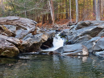
![]()
![]()
![]()
![]()
![]() On Monday, November 3rd I had just completed a hike on a new section of the Long Path from Berme Road near Ellenville to the Berrypickers Path in the Sam's Point Preserve. When we got back to the car, I still had some energy left and a slight tightness behind my left knee. If was only 12:30 PM so I decided we would hike part of the next Long Path section which extends over 11 miles from Berme Road to the parking area for Vernooy Kill Falls on Upper Cherrytown Road. I thought I would determine how far we would go depending on how my knee feet but knew we would probably end up at the quarry on Lundy Road since I could park there for the next hike. We crossed Berme Road and walked down the bank when I spotted a Long Path marker on the old D and H Canal towpath below. We followed the towpath as it paralleled Berme Road. The trail was filled with garbage and had not been maintained and I knew we would be returning on the road! At about .5 miles the towpath turned into Towpath Road which we followed as it crossed Port Ben Road. Towpath Road led back to Port Ben Road and crossed Rondout Creek on a very old metal bridge. Port Ben Road stretched out ahead of us and passed between two harvested corn fields. I stopped to take a few pictures including some of the fields and the bridge. We walked for .7 miles on Port Ben Road to the point were it ended on Route 209. Route 209 is a busy road but it had a sidewalk on our side so we turned right and walked a short distance to Lundy Road where we turned left. We were headed generally northwest as Lundy Road began a very gentle ascent following the Vernooy Kill. I could hear and see various rapids on the creek. Lundy Road very quickly turned to a gravel surface but there was almost no traffic.
On Monday, November 3rd I had just completed a hike on a new section of the Long Path from Berme Road near Ellenville to the Berrypickers Path in the Sam's Point Preserve. When we got back to the car, I still had some energy left and a slight tightness behind my left knee. If was only 12:30 PM so I decided we would hike part of the next Long Path section which extends over 11 miles from Berme Road to the parking area for Vernooy Kill Falls on Upper Cherrytown Road. I thought I would determine how far we would go depending on how my knee feet but knew we would probably end up at the quarry on Lundy Road since I could park there for the next hike. We crossed Berme Road and walked down the bank when I spotted a Long Path marker on the old D and H Canal towpath below. We followed the towpath as it paralleled Berme Road. The trail was filled with garbage and had not been maintained and I knew we would be returning on the road! At about .5 miles the towpath turned into Towpath Road which we followed as it crossed Port Ben Road. Towpath Road led back to Port Ben Road and crossed Rondout Creek on a very old metal bridge. Port Ben Road stretched out ahead of us and passed between two harvested corn fields. I stopped to take a few pictures including some of the fields and the bridge. We walked for .7 miles on Port Ben Road to the point were it ended on Route 209. Route 209 is a busy road but it had a sidewalk on our side so we turned right and walked a short distance to Lundy Road where we turned left. We were headed generally northwest as Lundy Road began a very gentle ascent following the Vernooy Kill. I could hear and see various rapids on the creek. Lundy Road very quickly turned to a gravel surface but there was almost no traffic.
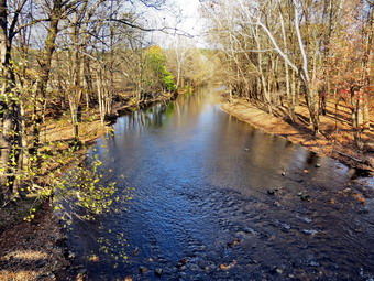 At 2.1 miles I noticed an interesting waterfall and stepped off the side of the road to investigate. The waterfall was caused by what looked like an old dam across the stream. A took few pictures and then we continued on the road. At 2.4 miles into the hike there was another small waterfall but I decided I wanted to continue on to the turnaround point. The road continued to gain some elevation and at 2.8 miles we passed Cutler Road on the left. The long range plans for the Long Path include taking the trail off Lundy Road at this point and continuing along the Vernooy Kill to the falls. I knew we were close to the quarry my the distance we had traveled and in only a few hundred feet it appeared on the right side of the road at 2.9 miles. I stopped to take a few pictures including close-ups of the drill marks. We turned around at this point and started back. At 3.5 miles we were again at the waterfall I had skipped previously. I stepped off the side of the road and took some pictures of the stream and the falls. The walk back seemed to go much more quickly since I knew where we were going. Once we were on Port Ben Road I did stop to take some pictures of the ridge which was now ahead of us. I also stopped on the metal bridge to take a few pictures of the Rondout Creek. Once we were over the bridge, we stayed to the left and followed Port Ben Road to Berme Road and used the road to walk back the car. We were back at 2:30 PM having hiked 5.8 miles in 2 hours and 10 minutes with a vertical gain of only 441 feet. The total for the day was 13.2 miles in just under 6 hours!
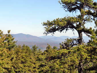
![]()
![]()
![]()
![]()
![]() On Monday, November 3rd I decided to continue to connect sections of the Long Path that I had already hiked. To avoid the ticks in the Harriman area, I planned on going to Berme Road near Ellenville to hike up to the Berrypickers Path at Sam's Point where I had hiked before. This is a new section as of June 2nd of this year and I wanted to see what it was like. Cindy did not want to go but I did take Sheila. I was a little nervous about taking her since there have been rattlesnakes seen in this area. I decided to keep her close to me and watch the trail closely as we hiked. I woke up early since daylight savings time had just ended. Rather than lay about in bed I decided to get an early start. We left Livingston Manor just before 8:00 AM and I took Route 52 from Liberty to Ellenville. Just before the road began its trip up the mountain, I turned left on Berme Road and drove about 4 miles to where the Long Path heads up the ridge. There was barely room to pull off the road and I was glad I was the only car present. As we left the car, the temperature was in the low 40's and there was a breeze blowing. It seemed cool to me so I had worn my MH Winter Wander pants and Mammut Hoody as well as a light hat and gloves. We were on the trail by 8:55 AM following the aqua blazes through hardwood forests consisting mostly of oak trees. The trail was pretty easy to follow as it used woods roads and was pretty well marked. At .7 miles we turned left on another woods road which is also marked as the Lower Mine Hole Trail coming up from Foordmore Road. The trail was rocky and the layer of oak leaves made it slippery underfoot. The trail was now heading south and still climbing toward the ridge. At about 1.4 miles the trail turned west to avoid some ledges and then turned south again. We were now at an elevation of about 1230 feet and suddenly the typical Sam's Point and Shawangunk vegetation appeared. We were now walking over open rock faces with scrub pine. The transition was sudden and stunning. I knew there was supposed to be at least one viewpoint along the way and I kept looking for it. At around 10:00 AM I just happened to look over my shoulder was knew I had found a lookout. I could see the valley below and the mountains of the Catskills beyond to the north. I stopped and dropped my pack to get out the camera. I took a few shots. I knew that the photographs would not be able to accurately represent the beauty of the scene. I was disappointed that there were almost no clouds in the sky but the hike is rather easy so I knew I could return whenever I wanted.
On Monday, November 3rd I decided to continue to connect sections of the Long Path that I had already hiked. To avoid the ticks in the Harriman area, I planned on going to Berme Road near Ellenville to hike up to the Berrypickers Path at Sam's Point where I had hiked before. This is a new section as of June 2nd of this year and I wanted to see what it was like. Cindy did not want to go but I did take Sheila. I was a little nervous about taking her since there have been rattlesnakes seen in this area. I decided to keep her close to me and watch the trail closely as we hiked. I woke up early since daylight savings time had just ended. Rather than lay about in bed I decided to get an early start. We left Livingston Manor just before 8:00 AM and I took Route 52 from Liberty to Ellenville. Just before the road began its trip up the mountain, I turned left on Berme Road and drove about 4 miles to where the Long Path heads up the ridge. There was barely room to pull off the road and I was glad I was the only car present. As we left the car, the temperature was in the low 40's and there was a breeze blowing. It seemed cool to me so I had worn my MH Winter Wander pants and Mammut Hoody as well as a light hat and gloves. We were on the trail by 8:55 AM following the aqua blazes through hardwood forests consisting mostly of oak trees. The trail was pretty easy to follow as it used woods roads and was pretty well marked. At .7 miles we turned left on another woods road which is also marked as the Lower Mine Hole Trail coming up from Foordmore Road. The trail was rocky and the layer of oak leaves made it slippery underfoot. The trail was now heading south and still climbing toward the ridge. At about 1.4 miles the trail turned west to avoid some ledges and then turned south again. We were now at an elevation of about 1230 feet and suddenly the typical Sam's Point and Shawangunk vegetation appeared. We were now walking over open rock faces with scrub pine. The transition was sudden and stunning. I knew there was supposed to be at least one viewpoint along the way and I kept looking for it. At around 10:00 AM I just happened to look over my shoulder was knew I had found a lookout. I could see the valley below and the mountains of the Catskills beyond to the north. I stopped and dropped my pack to get out the camera. I took a few shots. I knew that the photographs would not be able to accurately represent the beauty of the scene. I was disappointed that there were almost no clouds in the sky but the hike is rather easy so I knew I could return whenever I wanted.
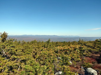 At this point I was keeping Sheila just behind me using the "With" command as I was still concerned about snakes. I picked up my pack and we continued along through the rocks and passed the scrub pines. I was keeping an eye out for the side trail on the right to Jacob's Ladder which I had though about visiting on our return trip. I was also watching for a path on the left to Panther Rock which was supposed to be a good lookout. After hiking some and finding no side trails, I took out my cell phone and took a look at the NYNJTC maps on the Avenza app. The map showed I had passed the Jacob's Ladder path but that the side trail to Panther rock was just ahead. I hike slowly keeping an eye out for the trail. I found this was unnecessary since when I arrived at the trail it was marked with a sign saying "Panther Rock" and was even blazed in white. It was only a few hundred feet out to Panther Rock but it was certainly worth the trip. We climbed up to Panther Rock and found the views were similar to the first viewpoint but they were unobstructed and more expansive. The conditions were not ideal but I took a few pictures before packing up and heading back to the Long Path. We continued heading southwest and climbing. Just after Panther Rock we descended a little and crossed a stream before climbing again. At 3.4 miles we hit the Smiley Carriageway where I decided to turn left and walk to the beginning of the Berrypickers Trail to make sure I overlapped my hikes. It was only about a quarter mile to the Berrypickers Path where we turned around and headed back down along the same path we had used on the way up. The hike up the ridge was 3.8 miles and had taken about 2 hours. The grade was not very steep and I hoped to make some time going down especially as I did not plan to stop. The oak pine needles and Oak leaves made things slippery in places as did the abundance of acorn under the leaves. I gave Sheila some freedom to explore once we hit the hardwood forests. Suddenly I heard a great whirring of wings as Sheila flushed a flock of turkeys out of the brush. Soon I could see Berme Road and we were back at the car at 12:20 PM after covering 7.4 miles in 3.5 hours with an elevation gain of 1895 feet. It was early and I decided to hike a little more despite a tightness behind my left knee. We started from the car and found the Long Path on the D and H Canal towpath. My plan was to hike part of the next section toward Vernooy Kill Falls on Upper Cherrytown Road.
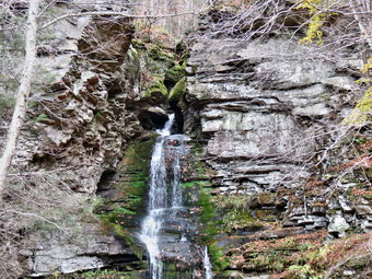
![]()
![]()
![]()
![]()
![]() On Thursday, October 30th I had finished short hikes in Phoenicia and Palenville. I had also hiked to Kaaterskill Falls and done a short hike in Platte Clove including a visit to the falls there. These hikes were so that I could connect portions of the Long Path that I had already hiked. From Platte Clove I drove back to Phoenicia and took Route 28 to Boiceville where I took Route 28A to Watson Hollow Road. Watson Hollow Road is the road that passes by Moonhaw Road and eventually becomes the Peekamoose Road. I followed this road to just before the parking area for Peekamoose and stopped at Buttermilk Falls. I grabbed my camera and walked to the road bridge to take a few pictures. I was disappointed to find the falls almost dry! I took a few shots but did not walk the short trail to the falls. I got back in the car and drove to the Peekamoose parking area where I parked. Sheila and I walked from the parking area to where the Long Path entered the woods to head over Bangle Hill to Vernooy Kill Falls. We turned around there and walked back to the car. On the way I took a look at Bear Hole Brook which has a nice cascade and found the volume greatly reduced. I decided not to take pictures and returned to the car at 3:40 PM to complete the last mile of the hikes for the day.
On Thursday, October 30th I had finished short hikes in Phoenicia and Palenville. I had also hiked to Kaaterskill Falls and done a short hike in Platte Clove including a visit to the falls there. These hikes were so that I could connect portions of the Long Path that I had already hiked. From Platte Clove I drove back to Phoenicia and took Route 28 to Boiceville where I took Route 28A to Watson Hollow Road. Watson Hollow Road is the road that passes by Moonhaw Road and eventually becomes the Peekamoose Road. I followed this road to just before the parking area for Peekamoose and stopped at Buttermilk Falls. I grabbed my camera and walked to the road bridge to take a few pictures. I was disappointed to find the falls almost dry! I took a few shots but did not walk the short trail to the falls. I got back in the car and drove to the Peekamoose parking area where I parked. Sheila and I walked from the parking area to where the Long Path entered the woods to head over Bangle Hill to Vernooy Kill Falls. We turned around there and walked back to the car. On the way I took a look at Bear Hole Brook which has a nice cascade and found the volume greatly reduced. I decided not to take pictures and returned to the car at 3:40 PM to complete the last mile of the hikes for the day.
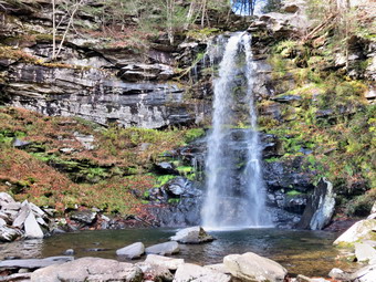
![]()
![]()
![]()
![]()
![]() On Thursday, October 30th I had finished a hike to Kaaterskill Falls from the bottom and from the top on Laurel House Road. I had already done hikes in Phoenicia and Palenville to connect portions of the Long Path that I had already hiked. From Laurel House Road I headed toward Tannersville and took Platte Clove road east. After passing Prediger Road, I parked at the Platte Clove Preserve where there was only one other car. It was 1:30 PM as Sheila and I walked east on Platte Clove Road toward the Kaaterskill High Peak parking area. This walk went quickly as we hiked up the access road, turned around and hiked back. Before going back to the car, we headed down the trail to Platte Clove Falls. The trail down is a little steep and on this day it was damp. When we got to the falls, I could see it was running with enough volume to make taking some pictures worthwhile. Sheila ran out into the stream to splash around and hop from rock to rock as I snapped a few shots. I took a few of the falls usi9ng different camera orientations and angles. I also took a few of Sheila with the falls in the background. As we started back, I considered bushwhacking to the top of the falls but decided to walk back up the trail instead. When we got to the cabin, we walked down the paths in back to the stream bank and out onto some rocks. The rock outcroppings gave an unobstructed view of the Old Mill falls. I took a few pictures of the falls and the kingpost bridge over the stream just above the falls. A young man walked by us on the path headed toward the top of Platte Clove Falls. As I packed up to leave, he walked back and struck up a conversation. He wanted to know about getting down to the base of the falls and hiking downstream. I told him about the path in front of the cabin but cautioned him about the dangers of hiking further than that by himself. We continued to talk about hiking in the Catskills. I learned he was from Schoharie and we talked about some of my hiking adventures this summer in that area. We parted and Sheila and I walked back to the cart. We had hiked only a mile but it had taken us 45 minutes due to the photography and the conversation. As I drove away I headed for Phoenicia. I decided to get to Peekamoose by driving to Boiceville and using Watson Hollow Road which becomes the Peekamoose Road.
On Thursday, October 30th I had finished a hike to Kaaterskill Falls from the bottom and from the top on Laurel House Road. I had already done hikes in Phoenicia and Palenville to connect portions of the Long Path that I had already hiked. From Laurel House Road I headed toward Tannersville and took Platte Clove road east. After passing Prediger Road, I parked at the Platte Clove Preserve where there was only one other car. It was 1:30 PM as Sheila and I walked east on Platte Clove Road toward the Kaaterskill High Peak parking area. This walk went quickly as we hiked up the access road, turned around and hiked back. Before going back to the car, we headed down the trail to Platte Clove Falls. The trail down is a little steep and on this day it was damp. When we got to the falls, I could see it was running with enough volume to make taking some pictures worthwhile. Sheila ran out into the stream to splash around and hop from rock to rock as I snapped a few shots. I took a few of the falls usi9ng different camera orientations and angles. I also took a few of Sheila with the falls in the background. As we started back, I considered bushwhacking to the top of the falls but decided to walk back up the trail instead. When we got to the cabin, we walked down the paths in back to the stream bank and out onto some rocks. The rock outcroppings gave an unobstructed view of the Old Mill falls. I took a few pictures of the falls and the kingpost bridge over the stream just above the falls. A young man walked by us on the path headed toward the top of Platte Clove Falls. As I packed up to leave, he walked back and struck up a conversation. He wanted to know about getting down to the base of the falls and hiking downstream. I told him about the path in front of the cabin but cautioned him about the dangers of hiking further than that by himself. We continued to talk about hiking in the Catskills. I learned he was from Schoharie and we talked about some of my hiking adventures this summer in that area. We parted and Sheila and I walked back to the cart. We had hiked only a mile but it had taken us 45 minutes due to the photography and the conversation. As I drove away I headed for Phoenicia. I decided to get to Peekamoose by driving to Boiceville and using Watson Hollow Road which becomes the Peekamoose Road.
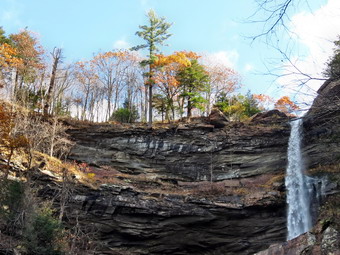
![]()
![]()
![]()
![]()
![]() On Thursday, October 30th I had finished hikes near Phoenicia and Palenville to connect sections of the Long Path that I had hiked before. I decided that I would visit Kaaterskill Falls since I had not been there for some time adhere seemed to be enough water to make it interesting. I pulled into the parking area at 11:50 AM to find only two other cars parked. I got Sheila on her leash and we started to descend the .25 miles to the falls trail. There has been much talk about improving the access to the falls but the only way to get there is to walk the very narrow shoulder of Route 23. I could see a group of five people starting up the trail and two others standing by the kiosk. I stopped at Bastion Falls and took a few pictures before heading up the trail. Trying to negotiate the steep and rough trail with an enthusiastic Sheila pulling me along was difficult. We walked off the trail so that I could get a few more shots of the upper part of Bastion Falls before continuing on the main trail. The main trail was as rough as ever and pretty wet in places. I let Sheila off her leash as much as possible. We overtook three people from the five person group and then the other two. We reached the lower falls at about 12:10 PM and saw the other two hikers taking pictures. There were additional signs warning of the dangers of the area and a new wooden fence across the path leading up towards the basin between the falls. I thought for a moment it actually looked like a handrail and seemed to invite inspection. I resisted that temptation and dropped my pack to get out the camera. I took quite a few pictures of both falls individually and together. It was a challenge as the sun was just beginning to brightly light the rim of the upper falls. I decided I would like to visit the upper falls from Laurel House Road.
On Thursday, October 30th I had finished hikes near Phoenicia and Palenville to connect sections of the Long Path that I had hiked before. I decided that I would visit Kaaterskill Falls since I had not been there for some time adhere seemed to be enough water to make it interesting. I pulled into the parking area at 11:50 AM to find only two other cars parked. I got Sheila on her leash and we started to descend the .25 miles to the falls trail. There has been much talk about improving the access to the falls but the only way to get there is to walk the very narrow shoulder of Route 23. I could see a group of five people starting up the trail and two others standing by the kiosk. I stopped at Bastion Falls and took a few pictures before heading up the trail. Trying to negotiate the steep and rough trail with an enthusiastic Sheila pulling me along was difficult. We walked off the trail so that I could get a few more shots of the upper part of Bastion Falls before continuing on the main trail. The main trail was as rough as ever and pretty wet in places. I let Sheila off her leash as much as possible. We overtook three people from the five person group and then the other two. We reached the lower falls at about 12:10 PM and saw the other two hikers taking pictures. There were additional signs warning of the dangers of the area and a new wooden fence across the path leading up towards the basin between the falls. I thought for a moment it actually looked like a handrail and seemed to invite inspection. I resisted that temptation and dropped my pack to get out the camera. I took quite a few pictures of both falls individually and together. It was a challenge as the sun was just beginning to brightly light the rim of the upper falls. I decided I would like to visit the upper falls from Laurel House Road.
 Sheila and I walked back down the trail without encountering anyone as the five person group was at the falls and the other two hikers were ahead of us. We made our way quickly down the trail and were back at Route 23A at 12:25 PM. It took us less than 5 minutes to get back to the car. I put Sheila in the car and then walked over to a lookout in the parking area. I didn't remember this viewpoint being so good! I took pictures down the clove where there was still some color in the leaves. After finishing with my photography, I got in the car and drove up Route 23A to the road to North South Lake campgrounds. Just before the entrance to the park I turned right on Laurel House Road and parked at the lot at the end to the road. There was one car parked already. A couple had their dog on a leash and their baby in a backpack. I noticed that there was a new sign at the trailhead so I put Sheila on her leash, grabbed my camera and walked over to the sign. The new trail was the rail trail that I had heard about and for a moment I had a desire to hike it! I decided to leave this for another time and we headed down the woods road to the top of the falls. As we approached the top of the falls, I saw another wooden fence which had been erected to try to prevent careless people from falling to their deaths. I found a good vantage point to take pictures and got many good shots of the top of the falls and the gorge below. Some of the best pictures were those looking out from the top of the falls to the west. Sheila and I headed back to the car as I still had two more short hikes to finish. The couple were still at the sign and as I passed they asked for some help. They were from Manhattan and were looking for the Escarpment Trail. I explained that they needed to go to the parking area on Schutt Road. I encouraged them to do that since the views would be nicer there than on the rail trail. We spent some time talking about others trails for other days. At some point in our conversation I noticed that our dogs were getting along well! We parted and I started to drive toward Platte Clove to hike from the Platte Clove Preserve to the Kaaterskill High Peak parking area. I knew that I would also visit Platte Clove Falls and Old Mill Falls as part of this hike
![]()
![]()
![]()
![]()
![]() On Thursday, October 30th I had finished a walk from the Mount Tremper parking area on Route 40 to Lane Street and back. I had several other short walks to connect portions of the Long Path that I had already hiked. From Phoenicia I headed north on Route 214 and then east on Route 23A through Hunter and Tannersville to Palenville. As I drove passed Kaaterskill Creek, I could see that there was a good volume of water going over Bastion Falls. I thought I might stop there on the way back even though it was not part of the Long Path. Road crews were paving some section of Route 23A as we approached Palenville but we were soon crossing the bridge at the bottom of the hill near Malden Avenue. I needed to hike from the end of the Harding Road Trail to Malden Avenue and had decided to park at the parking area on Whites Road. I pulled into the parking area at 10:30 AM and got ready to hike. It was still cool but the sun was coming out as we headed out on the yellow connector trail. The first .4 miles of trail were relatively flat but then we began to lose some elevation as we dropped to the junction with the Harding Road Trail. We turned left and dropped some more to the end of the Harding Road Trail at Route 23. There was a small parking area here with a sign board. We turned right on Route 23A and began to hike to Malden Avenue. The shoulders on Route 23A are very narrow and there did seem to be some traffic but most drivers were careful to slow down and move away from us as much as they could. It was only .35 miles to the turn and at around 1 mile we took a left on Malden Avenue. I decided to walk down the abandoned road to make sure I overlapped the hikes I had done before. I also wanted to get some pictures of the falls just downstream from the bridge. We walked down the rather wet trail and I stopped to take some pictures of the falls and the interesting stone walls and foundations. On the way back I also took some shots of the stone walls and stone formations along the trail. We retraced our steps back to the Harding Road Trail and began to ascend to the trail intersection. We turned right and started up the yellow trail. I must have been deep in thought as I missed the point where the yellow trail headed to the right. We continued up another unmarked woods road until I "woke up" and could find no trail markers. We hiked back down and I corrected my mistake as we headed back toward the car. If I had more time, I would have explored the woods roads more completely. As we were approaching the car, I noticed a quarry to the right of the trail. I knew that pictures would not really show the details but I took some anyway. We were back at the car at 11:30 AM having covered 2.5 miles in an hour with 370 feet of elevation gain. I drove down Whites Road and turned right on Route 23. As I headed up the hill, I knew that I had to stop at Kaaterskill Falls!
On Thursday, October 30th I had finished a walk from the Mount Tremper parking area on Route 40 to Lane Street and back. I had several other short walks to connect portions of the Long Path that I had already hiked. From Phoenicia I headed north on Route 214 and then east on Route 23A through Hunter and Tannersville to Palenville. As I drove passed Kaaterskill Creek, I could see that there was a good volume of water going over Bastion Falls. I thought I might stop there on the way back even though it was not part of the Long Path. Road crews were paving some section of Route 23A as we approached Palenville but we were soon crossing the bridge at the bottom of the hill near Malden Avenue. I needed to hike from the end of the Harding Road Trail to Malden Avenue and had decided to park at the parking area on Whites Road. I pulled into the parking area at 10:30 AM and got ready to hike. It was still cool but the sun was coming out as we headed out on the yellow connector trail. The first .4 miles of trail were relatively flat but then we began to lose some elevation as we dropped to the junction with the Harding Road Trail. We turned left and dropped some more to the end of the Harding Road Trail at Route 23. There was a small parking area here with a sign board. We turned right on Route 23A and began to hike to Malden Avenue. The shoulders on Route 23A are very narrow and there did seem to be some traffic but most drivers were careful to slow down and move away from us as much as they could. It was only .35 miles to the turn and at around 1 mile we took a left on Malden Avenue. I decided to walk down the abandoned road to make sure I overlapped the hikes I had done before. I also wanted to get some pictures of the falls just downstream from the bridge. We walked down the rather wet trail and I stopped to take some pictures of the falls and the interesting stone walls and foundations. On the way back I also took some shots of the stone walls and stone formations along the trail. We retraced our steps back to the Harding Road Trail and began to ascend to the trail intersection. We turned right and started up the yellow trail. I must have been deep in thought as I missed the point where the yellow trail headed to the right. We continued up another unmarked woods road until I "woke up" and could find no trail markers. We hiked back down and I corrected my mistake as we headed back toward the car. If I had more time, I would have explored the woods roads more completely. As we were approaching the car, I noticed a quarry to the right of the trail. I knew that pictures would not really show the details but I took some anyway. We were back at the car at 11:30 AM having covered 2.5 miles in an hour with 370 feet of elevation gain. I drove down Whites Road and turned right on Route 23. As I headed up the hill, I knew that I had to stop at Kaaterskill Falls!
![]()
![]()
![]()
![]()
![]() On Thursday, October 30th I had planned to hike several short sections of the Long Path that connected other sections I had already completed. Most of these were road walks. The first section I decided to do was from the Mount Tremper parking area on Route 40 to Lane Street in Phoenicia. This section follows Route 40 into Phoenicia and then uses streets in the hamlet to get to the Lane Street parking area for the new trail over Romer and Cross Mountains. I estimated the walk would be about 5 miles but was almost completely flat. Sheila and I left Livingston Manor early and I drove out the DeBruce Road to the Frost Valley Road. I took the Frost Valley Road to Route 28 where I turned right and drove to Phoenicia. After a left turn off Route 28, I followed Main Street and Route 40 to the parking area. It was about 8:00 AM when we left the car and starting walking back into town. The temperature was still in the low 40's and a slight breeze was blowing down the Esopus Creek. There seemed to be some color still present in the leaves on the trees near the creek but I decided to wait until we returned to take pictures. Traffic was light and we made good time walking into town. At 1.6 miles we turned left on Bridge Street and walked across the Esopus on a road bridge. Just after the bridge we turned right on High Street. At 2.2 miles we turned left onto Lane Street and walked to the parking area at the end. We immediately turned around and retraced our path to the parking area. On the way back we walked down to the Esopus which seemed to have more water in it than when I had seen it several weeks ago. The leaves on the trees did have some nice colors so I took a few shots before returning to the car. It was 9:45 AM and we had walked 4.9 miles in 1 hour and 45 minutes with an elevation gain of only 250 feet. I drove through Phoenicia and turned right to drive north on Route 214.
On Thursday, October 30th I had planned to hike several short sections of the Long Path that connected other sections I had already completed. Most of these were road walks. The first section I decided to do was from the Mount Tremper parking area on Route 40 to Lane Street in Phoenicia. This section follows Route 40 into Phoenicia and then uses streets in the hamlet to get to the Lane Street parking area for the new trail over Romer and Cross Mountains. I estimated the walk would be about 5 miles but was almost completely flat. Sheila and I left Livingston Manor early and I drove out the DeBruce Road to the Frost Valley Road. I took the Frost Valley Road to Route 28 where I turned right and drove to Phoenicia. After a left turn off Route 28, I followed Main Street and Route 40 to the parking area. It was about 8:00 AM when we left the car and starting walking back into town. The temperature was still in the low 40's and a slight breeze was blowing down the Esopus Creek. There seemed to be some color still present in the leaves on the trees near the creek but I decided to wait until we returned to take pictures. Traffic was light and we made good time walking into town. At 1.6 miles we turned left on Bridge Street and walked across the Esopus on a road bridge. Just after the bridge we turned right on High Street. At 2.2 miles we turned left onto Lane Street and walked to the parking area at the end. We immediately turned around and retraced our path to the parking area. On the way back we walked down to the Esopus which seemed to have more water in it than when I had seen it several weeks ago. The leaves on the trees did have some nice colors so I took a few shots before returning to the car. It was 9:45 AM and we had walked 4.9 miles in 1 hour and 45 minutes with an elevation gain of only 250 feet. I drove through Phoenicia and turned right to drive north on Route 214.
![]()
![]()
![]()
![]()
![]() On Tuesday, October 28th I had finished a hike from the Lake Tiorati Circle to the Hippo Rock and back. I was now ready to complete another Long Path section from Lake SkannatatI to St. John's Road. I pulled out of the parking area and headed southwest on Seven Lakes Drive. I drove 2.5 miles, turned into the parking area at Lake Skannatati and got ready to hike. I saw a path up the bank so I walked up the road at 11:40 AM to begin the hike. I walked a little farther southwest on Seven Lakes Drive and found the aqua blazes of Long Path on the left side of the road. I followed the blazes onto a gravel and cinder road but found they immediately veered to the right. The trail led to a woods road and I walked this for a short distance before the trail left the road and started a gentle climb. I crossed a right-of-way with a telephone cable and three stands of open wire. At .4 miles I hit the top of the hill and then dropped to Route 106 at .5 miles. I turned right on the road and walked a few hundred feet to the Long Path blazes on the left. A car was stopped and some young women were taking pictures of a particularly bright tree. The trail crossed what might be a marshy area on some thin slats nailed to some thin rails. I was headed south toward Lake Welch Drive and St. John's Road as the trail gained about 175 feet from 1 mile to 1.4 miles. Along the way I spotted a small foundation on the right side of the trail. The trail traveled over a flat area and then began the descent from the little ridge to Lake Welch Drive. With the road in sight I hit a woods road which was lined on either side by large boulders. I walked out to Lake Welch Drive and found the Long Path on the right side of St. John's Road. I walked along the trail for a few feet and then turned around.
On Tuesday, October 28th I had finished a hike from the Lake Tiorati Circle to the Hippo Rock and back. I was now ready to complete another Long Path section from Lake SkannatatI to St. John's Road. I pulled out of the parking area and headed southwest on Seven Lakes Drive. I drove 2.5 miles, turned into the parking area at Lake Skannatati and got ready to hike. I saw a path up the bank so I walked up the road at 11:40 AM to begin the hike. I walked a little farther southwest on Seven Lakes Drive and found the aqua blazes of Long Path on the left side of the road. I followed the blazes onto a gravel and cinder road but found they immediately veered to the right. The trail led to a woods road and I walked this for a short distance before the trail left the road and started a gentle climb. I crossed a right-of-way with a telephone cable and three stands of open wire. At .4 miles I hit the top of the hill and then dropped to Route 106 at .5 miles. I turned right on the road and walked a few hundred feet to the Long Path blazes on the left. A car was stopped and some young women were taking pictures of a particularly bright tree. The trail crossed what might be a marshy area on some thin slats nailed to some thin rails. I was headed south toward Lake Welch Drive and St. John's Road as the trail gained about 175 feet from 1 mile to 1.4 miles. Along the way I spotted a small foundation on the right side of the trail. The trail traveled over a flat area and then began the descent from the little ridge to Lake Welch Drive. With the road in sight I hit a woods road which was lined on either side by large boulders. I walked out to Lake Welch Drive and found the Long Path on the right side of St. John's Road. I walked along the trail for a few feet and then turned around.
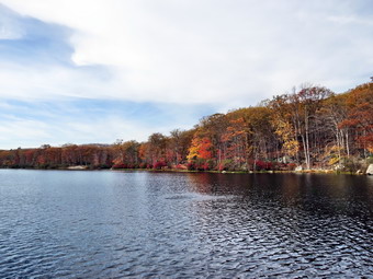 Further down St. John's Road is the St. John's in the Wilderness Church. It is a beautiful, old church with a rich history. Each year the church holds a special Palm Sunday service for hikers. I have never been inside but hope to attend services there this next year. The architecture from the outside is worth a visit. Once I had turned around and crossed Lake Welch Drive I stopped for a snack and to take a few pictures. After shouldering my pack, I began the return trip stopping to take pictures of the stone lined lane and the small foundation I had found on the way out. I also stopped at the right-of-way and took a picture of the open wire still attached by its insulators to the crossarm at the top of the pole. I followed the trail back down to Lake Askoti and walked to the edge of the lake. The sun had come out and I knew I could get some good pictures. The water was a sheet of glass without even a hint of ripples. I took a few shots and then walked out to the road. As I walked back toward the parking area, I saw that the aqua blazes were on the other side of the guard rail. I hopped over the rail and headed down to the parking area that way so that I could be sure I traversed ever foot of the Long Path. I stopped to take some pictures of Lake Skannatati. A couple had their two German shorthaired pointers at the lake and one was doing a nice job of retrieving a toy thrown into the water. I took a few shots wishing Sheila was with me! Back at the car I found I had hike 3.5 miles in 1 hour and 40 minutes with a vertical gain of only 555 feet.
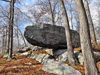
![]()
![]()
![]()
![]()
![]() On Tuesday, October 28th I had planned to hike some sections of the Long Path in Harriman Park that I had missed when I was hiking more in that area. There are so may trails in Harriman that it is easy to hike a parallel trail but miss the Long Path. In fact in many places I had hiked AT sections but missed a piece of the Long Path. My first objective has to hike from the Tiorati Circle to Hippo Rock and back. I decided to leave Sheila home as there are just too many ticks at this time of year in the park. I left Livingston Manor at a little after 8:00 AM and decided to take the most direct route down the Quickway to Route 6. I was taking a chance since there are several areas of construction along the way. I was delayed briefly in two places but otherwise the trip went quickly. I noticed the traffic was stop and go westbound and made a note of that for the return trip. Once I was at the traffic circle, I took Seven Lakes Drive toward the Tiorati Circle and pulled in just after 9:00 AM. The park police had Seven Lakes Drive closed off at the circle and I knew this might interfere with my plans for my second hike. I left the parking area at 9:15 AM and headed west and north on Arden Valley Road. After walking up and down the hill, I found the Long Path at the point where the road makes a sharp left. The aqua blazes were clear on both the rocks and trees. I turned right onto a wide woods road and walked passed a gate heading north and then north northeast. The walking was easy compared to the hike Cindy and I had done the day before. I stopped for a moment to change to a, light windbreaker and take off both the hat and gloves I had worn. The high for the day was forecast to be in the low 70's and it was already climbing. at 1 mile the trail turned to the north again and I walked over the top of a ridge and down the other side. The forest was all hardwoods and very open. As I came down off the first, small ridge I entered the area between tow ridges. It was very rocky as is typical of Harriman. I then began to climb up the Stockbridge Ridge to Stockbridge Mountain. The climb looks steep on the profile but was only about a 10% grade. I looked own at my GPS and found that it had turned off at some point. I turned it on expecting to have further problems but it was good for the rest of the day. At the top of the mountain was a flat, open area with a limited view and I decided to wait to take pictures on the way back. I was really missing Sheila but knew I had made the right decision.
On Tuesday, October 28th I had planned to hike some sections of the Long Path in Harriman Park that I had missed when I was hiking more in that area. There are so may trails in Harriman that it is easy to hike a parallel trail but miss the Long Path. In fact in many places I had hiked AT sections but missed a piece of the Long Path. My first objective has to hike from the Tiorati Circle to Hippo Rock and back. I decided to leave Sheila home as there are just too many ticks at this time of year in the park. I left Livingston Manor at a little after 8:00 AM and decided to take the most direct route down the Quickway to Route 6. I was taking a chance since there are several areas of construction along the way. I was delayed briefly in two places but otherwise the trip went quickly. I noticed the traffic was stop and go westbound and made a note of that for the return trip. Once I was at the traffic circle, I took Seven Lakes Drive toward the Tiorati Circle and pulled in just after 9:00 AM. The park police had Seven Lakes Drive closed off at the circle and I knew this might interfere with my plans for my second hike. I left the parking area at 9:15 AM and headed west and north on Arden Valley Road. After walking up and down the hill, I found the Long Path at the point where the road makes a sharp left. The aqua blazes were clear on both the rocks and trees. I turned right onto a wide woods road and walked passed a gate heading north and then north northeast. The walking was easy compared to the hike Cindy and I had done the day before. I stopped for a moment to change to a, light windbreaker and take off both the hat and gloves I had worn. The high for the day was forecast to be in the low 70's and it was already climbing. at 1 mile the trail turned to the north again and I walked over the top of a ridge and down the other side. The forest was all hardwoods and very open. As I came down off the first, small ridge I entered the area between tow ridges. It was very rocky as is typical of Harriman. I then began to climb up the Stockbridge Ridge to Stockbridge Mountain. The climb looks steep on the profile but was only about a 10% grade. I looked own at my GPS and found that it had turned off at some point. I turned it on expecting to have further problems but it was good for the rest of the day. At the top of the mountain was a flat, open area with a limited view and I decided to wait to take pictures on the way back. I was really missing Sheila but knew I had made the right decision.
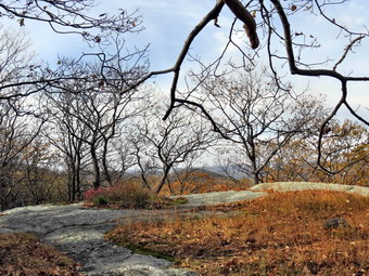 As I descended from Southbridge Mountain still heading north I had to negotiate an area that was wet and covered in moss. I looked up to see another hiker waiting for me to descend before starting up the trail. Once I was down, I stopped a minute to talk to him. He had started at Silvermine Lake and was doing a loop. We wished each other a pleasant day and continued in our opposite directions. As I continued north along the trail it rolled some and I wondered whether I would recognize Hippo Rock which is a large and precariously balanced glacial erratic. As I descended a hill at 2.5 miles the rock was directly ahead of me and was unmistakable. I stopped and took off my pack so that I could take some pictures. It was only 10:25 AM when I started the hike back to the car. I kept a good pace and stopped only once at Stockbridge Mountain to take a few shots. Just before the trail intersected Arden Valley Road, I met a young couple stopped on he trail I said "Hello" and they replied. I walked out to the road, turned left and quickly walked up and over the hill to the car. I put my pack in the truck and took the garbage I had collected on the trail to the nearest can. I saw that the police were no longer blocking the road and decided I would do another hike from Lake Skannatati to St. Johns Road. I had hiked 4.9 miles in 2 hours with a vertical gain of 1030 feet.
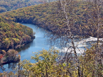
![]()
![]()
![]()
![]()
![]() On Monday, October 27th I had planned to hike a section of the Long Path in Harriman Park from the Turkey Hill parking area to Route 6 near the intersection with Route 293. The rest of this section extends up through Orange County to the village of Monroe and includes a lot of road walking. Cindy decided she wanted to come and I thought that would work since even though the hike would be about 8 miles the last few miles would be on the Route 6. We could not leave Livingston Manor until we spoke to our contractor so we didn't pull out of the driveway until around 10:00 AM. As I drove down Route 17 toward Harriman, we encountered construction near Bridgeville, Middletown and finally near Goshen. The first two locations simply slowed us down but the last brought traffic to a near standstill for almost 3 miles. One lane was blocked but we could not see why. As we approached Harriman, we saw a few workers creating expansion joints in the pavement! I took the exit for Route 6, drove passed the intersection with Route 293 to West Point and parked a few miles further along in the Turkey Hill parking area on the left side of Route 6. I remembered the area because I had hiked to the Raymond Torrey Memorial and around Turkey Hill Pond on one trip. There were a few other cars already parked as the walk around the pond is popular. We got our gear together and left the car at 11:25 AM and walked up to the point where the Long Path enters the woods. I had Sheila on her leash but released her once we were on the trail. As always she was happy to be out and started to explore but stayed near the trail. Initially the trail was wide and almost flat but soon we turned left and started to ascend to the Long Mountain Ridge. We began to walk over rougher trail and over open rock faces. We both commented that it would be hard to hike in the winter as we had encountered icy conditions in Harriman before. At .66 miles we had ascended to the top of our first ridge where we found the Torrey Memorial etched neatly in the rock. The views were expansive and there was some leaf color still to be seen. To the east in the distance the Perkins Tower at Bear Mountain was visible. Below the open viewpoint were the sparkling waters of Turkey Hill Pond. Slightly to the north of east was a large rock outcropping but I could not determine if it had a name from my maps or GPS. We took a few minutes to take pictures and then continued on the Long Path.
On Monday, October 27th I had planned to hike a section of the Long Path in Harriman Park from the Turkey Hill parking area to Route 6 near the intersection with Route 293. The rest of this section extends up through Orange County to the village of Monroe and includes a lot of road walking. Cindy decided she wanted to come and I thought that would work since even though the hike would be about 8 miles the last few miles would be on the Route 6. We could not leave Livingston Manor until we spoke to our contractor so we didn't pull out of the driveway until around 10:00 AM. As I drove down Route 17 toward Harriman, we encountered construction near Bridgeville, Middletown and finally near Goshen. The first two locations simply slowed us down but the last brought traffic to a near standstill for almost 3 miles. One lane was blocked but we could not see why. As we approached Harriman, we saw a few workers creating expansion joints in the pavement! I took the exit for Route 6, drove passed the intersection with Route 293 to West Point and parked a few miles further along in the Turkey Hill parking area on the left side of Route 6. I remembered the area because I had hiked to the Raymond Torrey Memorial and around Turkey Hill Pond on one trip. There were a few other cars already parked as the walk around the pond is popular. We got our gear together and left the car at 11:25 AM and walked up to the point where the Long Path enters the woods. I had Sheila on her leash but released her once we were on the trail. As always she was happy to be out and started to explore but stayed near the trail. Initially the trail was wide and almost flat but soon we turned left and started to ascend to the Long Mountain Ridge. We began to walk over rougher trail and over open rock faces. We both commented that it would be hard to hike in the winter as we had encountered icy conditions in Harriman before. At .66 miles we had ascended to the top of our first ridge where we found the Torrey Memorial etched neatly in the rock. The views were expansive and there was some leaf color still to be seen. To the east in the distance the Perkins Tower at Bear Mountain was visible. Below the open viewpoint were the sparkling waters of Turkey Hill Pond. Slightly to the north of east was a large rock outcropping but I could not determine if it had a name from my maps or GPS. We took a few minutes to take pictures and then continued on the Long Path.
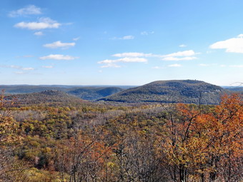 Over the next half mile we dropped 420 feet as the trail descended the steep side of the ridge. Several switchbacks moderated the grade but it still averaged 15%. The damp leaves over the slippery rocks made it impossible to make a quick descent. We could see we were headed down into the area between ridges and knew we would probably have to climb over the next ridge. At about a mile the well-worn track seemed to go straight ahead and I followed it briefly until I could not see any blazes. I looked back to find the blazes pointing in the opposite direction! We went back to the trail and could not find any blazes that indicated a turn. Near the bottom of the descent we crossed a stream by hopping from rock to rock which was easy as the water level was very low. There was a "bridge" present but it had seen better days. The construction consisted of two logs that were cut on site to span the stream. The "decking" was made of branches lashed to the logs with very old rope. I took a picture as it was so interesting. At 1.25 miles the trail turned to the left and started to travel due west on what looked like a right-of-way or woods road. On our right were signs indicating that the land was part of the West Point Military Reservation. We started an ascent of 470 feet over .66 miles. As we walked we discussed the fact that we seemed to be hiking farther than the GPS indicated. We both attributed this to the up and down nature of the hike and the inability to make any time on the descents. As we ascended this part of the trail we came across a rock outcropping where large cubical blocks of rocks were splitting off. I found this interesting and took a few shots before we moved on. At 1.9 miles we were at the top of Howell Mountain where we took a short break even though there were no views. The theme of the hike seemed to be climbing up and over ridges and as we began to descend from Howell Mountain we could see the next ridge. It looked imposing a very steep as we made our way down the equally steep descent.
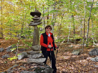 The descent from Howell Mountain was about 430 feet and had a few switchbacks to help where the slope was the steepest. I knew we would have to cross the outlet stream from Lake Massawippa and trip reports said that could be difficult at times. I knew that we would have no problem crossing as the water levels in all the other streams had been so low. We arrived at the stream and I could see that it might be more of a challenge when there was more water. There was no bridge but large stepping stones had been placed by a trail crew which helped in the crossing. The rock formations in the stream were so impressive that I took a few pictures before we continued on to our next ascent up the Brooks Mountain ridge. Hiking directly up the ridge would have meant gaining over 200 feet in about 400 feet! Fortunately the trail turned north to ascend on a shallower slope and then turned southwest in major switchback at about 2.8 miles. This took us onto a woods road that gently ascended the ridge until we reached the summit at 1080 feet. Although there were only limited views we stopped so that I could take a few shots. As we started to descend from the ridge I noticed a framed picture on a tree. The photograph showed a man and child with a dog. The short inscription seemed to indicate a memorial for the canine companion. This struck me as I still miss Sheba, my previous hiking partner, even though Sheila is a get trail dog. We descended off the ridge heading southwest until at 3.6 miles we met Route 293. Along the way the trail shifted direction turning to the northwest.
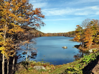 We walked up to the road passing a culvert that directs Popolopen Creek under the pavement. We crossed the road and were faced with another ascent up the Blackcap Mountain ridge. Blackcap Mountain has a maximum elevation of 1381 feet but the trail turns southwest at less than 1200 feet. We continued to walk through hardwood forest and began the climb up the ridge. At 4 miles and about 1180 feet the trail turned 90 degrees and headed southwest again along the base of the ridge. For about a mile the trail was straight as an arrow heading southwest toward Route 6. There were some ups and downs in the trail but nothing compared to the ridges we had encountered. The trail did not actually intersect Route 6 but as we neared the road it was easy to walk out to the pavement. I put Sheila on her leash and stowed my poles as we crossed Route 6 and eventually Route 293 as well. The traffic was very heavy but the shoulders were wide. Sheila walks well on the leash and set a rapid pace. At 5.6 miles we came to the point where the road passes between Lake Massawippa and Lake Te-Ata. The vies across Lake Massawippa on our side of the road were beautiful so we stopped so that I could take a few pictures of the lake. Once we started to walk again, we didn't stop until we reached the car. I was surprised that the hike out was 5 miles but the road walk back was only 2.2 miles. Despite the traffic, the road was a much better choice than trying to walk back on the trails! We had covered 7.2 miles in 4 hours and 15 minutes with a total elevation gain of 1887 feet.
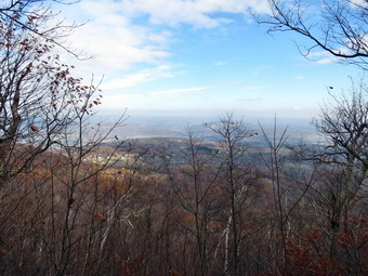
![]()
![]()
![]()
![]()
![]() On Saturday, October 25th I had planned to hike the section of the Long Path from Greene County Route 10 to South Mountain Road. This would connect the northern sections that I had completed this summer with those in the Catskills. The NYNJTC website put the distance at 7.1 miles which made an out and back right at the limit of what I though Sheila and I could do. My estimate of a loop using local roads was even longer. I asked Cindy if she would like to take two cars to do a car spot but she didn't seem very interested. It was cloudy and overcast when I woke up so I didn't hurry to get ready to go. Sheila and I left Livingston Manor at 8:25 AM and headed up the Beaverkill Road and then the Barkaboom Road to get to Route 28 in Margaretville. In Shandaken we headed north on Route 42 to Route 23A east toward Hunter. Just outside Hunter in turned north on Route 296 to take it north to Route 23 in Windham. I turned north on Route 21 and stayed on that road until it merged with Greene County Route 10. I pulled over to park on the side of the road after about .6 miles on Route 10. The skies were overcast and the temperature was still in the 40's. At 10:10 AM Sheila and I walked north on Route 10 for a short distance and then turned left into the woods. For the first .7 miles the trail wound its way up the eastern shoulder of on Mount Pisgah. A short distance from the road we ran up against a set of low cliffs but the trail turned right and then led us up through a gap in the rocks. Several times when I was looking straight ahead I prepared to assault the steep slope ahead only to find a switchback used an old woods road to ascend the mountain. At about .7 miles we started to walk along the northern shoulder of the mountain and I though maybe we would miss the summit. At .75 miles the trail turned to the left and start the climb to the summit of Mount Pisgah. Just at this point there was a limited viewpoint to the north. Even though the leaves were mostly off the trees it was not easy to get a good view or take photographs. We passed across the summit at about 1 mile but there was little to see as the summit was overgrown with pine trees. It was obvious that the trail is not heavily traveled but it was well-marked and Sheila had no trouble following it.
On Saturday, October 25th I had planned to hike the section of the Long Path from Greene County Route 10 to South Mountain Road. This would connect the northern sections that I had completed this summer with those in the Catskills. The NYNJTC website put the distance at 7.1 miles which made an out and back right at the limit of what I though Sheila and I could do. My estimate of a loop using local roads was even longer. I asked Cindy if she would like to take two cars to do a car spot but she didn't seem very interested. It was cloudy and overcast when I woke up so I didn't hurry to get ready to go. Sheila and I left Livingston Manor at 8:25 AM and headed up the Beaverkill Road and then the Barkaboom Road to get to Route 28 in Margaretville. In Shandaken we headed north on Route 42 to Route 23A east toward Hunter. Just outside Hunter in turned north on Route 296 to take it north to Route 23 in Windham. I turned north on Route 21 and stayed on that road until it merged with Greene County Route 10. I pulled over to park on the side of the road after about .6 miles on Route 10. The skies were overcast and the temperature was still in the 40's. At 10:10 AM Sheila and I walked north on Route 10 for a short distance and then turned left into the woods. For the first .7 miles the trail wound its way up the eastern shoulder of on Mount Pisgah. A short distance from the road we ran up against a set of low cliffs but the trail turned right and then led us up through a gap in the rocks. Several times when I was looking straight ahead I prepared to assault the steep slope ahead only to find a switchback used an old woods road to ascend the mountain. At about .7 miles we started to walk along the northern shoulder of the mountain and I though maybe we would miss the summit. At .75 miles the trail turned to the left and start the climb to the summit of Mount Pisgah. Just at this point there was a limited viewpoint to the north. Even though the leaves were mostly off the trees it was not easy to get a good view or take photographs. We passed across the summit at about 1 mile but there was little to see as the summit was overgrown with pine trees. It was obvious that the trail is not heavily traveled but it was well-marked and Sheila had no trouble following it.
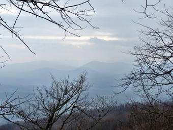 We now descended from the summit about 200 feet to a col and then began to climb to Richtmeyer Peak which is slightly higher than Mount Pisgah. Most of the forest here was hardwood with some evergreens mixed in. At 2.3 miles we crossed over the summit and just passed the top got a view to the south toward the Blackhead range. Again, the view was limited but at least there was a view. The day was still very hazy near the ground and the sky was overcast. I felt like we were walking through a cloud most of the time. We had been traveling west most of the hike but now shifted to the southwest as we headed off Richtmeyer and towards the northern peak of Richmond. At 2.65 miles we were at the highest point of the day at over 3100 feet and we continued southwest toward the main peak of Richmond. At 2.9 miles the trail turned west and became a little wet as we hugged the northern shoulder of Richmond. Somewhere around this area the blazes began to fade and become further apart. Of course, this happened just as the trail became harder to follow! I relied on Sheila who always seems to be able to find the trail. I had thought the Long Path went over the main peak of Richmond but I was wrong as we passed by the summit and at 3.1 miles the trail took us north on the start of a steep descent. In about a mile we lost 860 feet. This is not the steepest trail I have been on but the wet leaves on top of the trail made the footing interesting. We eventually hit a woods road and then Bluebird Road at 4.1 miles. We turned left on Bluebird Road but were on it for only about .2 miles when the Long Path turned right into the woods again. We initially followed a woods road which soon became a trail heading west. I knew that I would have to be careful at some point to stay on the relocated Long Path and not start out on the trail to Ashland Pinnacle.
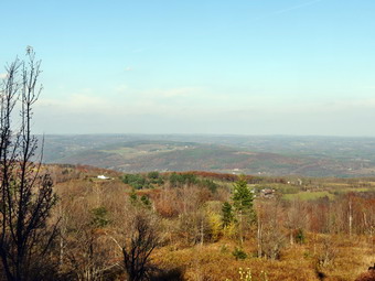 At 4.6 miles we began to ascend gently and the trail markers again were hard to follow. At 5 miles the trail turned south and began to ascend much more steeply on a 20% grade. We walked from hardwoods forests into what looked like a pine plantation. In .4 miles we gained 390 feet coming out into an open area at the top. The old route of the Long Path to Ashland Pinnacle and Huntersfield was ahead slightly to the right and marked in red. The Long Path turned right and started down a dirt road toward South Mountain Road. The road was in good enough condition that I think I could have driven it ion my car. There were sprightly colored trees along the way so I took a few pictures. The road took us west before turning north and in 1.4 miles we were at South Mountain Road. There were a few views to the north so I snapped some pictures. I decided that I would rather walk the roads to make a loop than hike back the way we had come. My GPS showed the hike out was under 7 miles and I hoped that the road walk would be about the same. We turned right on South Mountain Road to walk the 1.75 miles to Toles Hollow Road. Almost immediately I was presented with a nice view of the route I had just hiked on the right. I stopped to take a few pictures before we continued on our way. Just before our turn there were some views to the north and I again stopped to take some pictures. We turned left and walked downhill briefly before being confronted with a nice uphill to the Durham Road. We were 9 miles into the hike when we turned right onto the Durham Road to head east for about 2.5 miles to Route 10. The views to the north along this route were beautiful and several houses had unobstructed views. Along the way several dogs came out to bother us including one rather large pit bull. The owners apparently did not care much for their dogs or for the people they might bother on the roads! Over the 2.5 mile walk we hiked up over a "bump" but then descended down the other side. At 11.6 mile we turned right onto Route 10 for the final 1.2 mile walk back to the car. We had to gain some elevation and although it wasn't much I began to feel it. As we walked some nice views appeared to the east and I took the last pictures of the day. By 3:50 PM we were back at the car having hiked 12.8 miles in 5 hours and 40 minutes gaining about 2730 feet along the way. The hike back had been about 6.1 miles which was shorter than the hike out! I was pleasantly surprised by this and the road walk was certainly easier than returning on then trails.
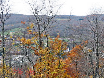
![]()
![]()
![]()
![]()
![]() On Monday, October 20th I had planned to get in a relatively long hike with my son Kurt. Kurt got a late start and did not get to Livingston Manor until after 10:00 AM. This altered my plans and I decided to go to Delhi to hike some trail on the hill behind the high school. I thought if we had enough time we could also go to Pratt Rock which I thought Kurt might enjoy. We left Livingston Manor a little before 11:00 AM and arrived in Delhi just before noon. We turned onto Route 28 south and drove to Sheldon Drive which is a left turn just before the school on the left. I drove to the end of Sheldon Drive and parked in one of the school lots. As we departed the car at 12:05 PM a group of students was just entering the woods. The beginning of the trail was not clearly marked from the parking area but we found it near the community garden. The entire trail system is marked with black arrows on a yellow background with no change in markers for the three different trails. As we started on the trail, I found that I had forgotten my GPS. Kurt ran back to the car to get it as I walked slowly up the trail. In a few minutes the group of students came walking toward me. They had been out for only about 15 minutes. Each one very politely said "Hello" as we passed. When Kurt returned with the GPS until we began to "attack" the trail in earnest. The trail climbs starting at the parking area but at about .4 miles we encountered a "wall". Over the next .3 miles we gained 455 feet making the average grade 28%! The trails are wide woods roads and there were only a few blowdowns but the steepness of the trails makes them a little beyond what I would suggest for beginners. The trail had begun by heading to the northeast but as it began to climb to the top of the ridge it turned to the south. We were walking through pleasant hardwood forests and at about .75 miles the trail leveled off briefly at the top of the ridge. We were on the Gribley Trail as we started a short but steep descent from one hilltop before a short but steep ascent to the next. Along the way we passed the Frightful Falls Trail on the right as it ascended from below. At 1.6 miles we were back on top of a hill and at the highest point on the hike. We had been looking for viewpoints but found none that were open. I did take some pictures through the trees and lamented the lack of a clear view.
On Monday, October 20th I had planned to get in a relatively long hike with my son Kurt. Kurt got a late start and did not get to Livingston Manor until after 10:00 AM. This altered my plans and I decided to go to Delhi to hike some trail on the hill behind the high school. I thought if we had enough time we could also go to Pratt Rock which I thought Kurt might enjoy. We left Livingston Manor a little before 11:00 AM and arrived in Delhi just before noon. We turned onto Route 28 south and drove to Sheldon Drive which is a left turn just before the school on the left. I drove to the end of Sheldon Drive and parked in one of the school lots. As we departed the car at 12:05 PM a group of students was just entering the woods. The beginning of the trail was not clearly marked from the parking area but we found it near the community garden. The entire trail system is marked with black arrows on a yellow background with no change in markers for the three different trails. As we started on the trail, I found that I had forgotten my GPS. Kurt ran back to the car to get it as I walked slowly up the trail. In a few minutes the group of students came walking toward me. They had been out for only about 15 minutes. Each one very politely said "Hello" as we passed. When Kurt returned with the GPS until we began to "attack" the trail in earnest. The trail climbs starting at the parking area but at about .4 miles we encountered a "wall". Over the next .3 miles we gained 455 feet making the average grade 28%! The trails are wide woods roads and there were only a few blowdowns but the steepness of the trails makes them a little beyond what I would suggest for beginners. The trail had begun by heading to the northeast but as it began to climb to the top of the ridge it turned to the south. We were walking through pleasant hardwood forests and at about .75 miles the trail leveled off briefly at the top of the ridge. We were on the Gribley Trail as we started a short but steep descent from one hilltop before a short but steep ascent to the next. Along the way we passed the Frightful Falls Trail on the right as it ascended from below. At 1.6 miles we were back on top of a hill and at the highest point on the hike. We had been looking for viewpoints but found none that were open. I did take some pictures through the trees and lamented the lack of a clear view.
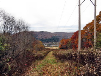 Almost immediately we again began to descend from the high point losing over 500 feet as we headed southwest off the ridge. At 2.3 miles we reached a power line right-of-way with some views down into the valley. Just before this area, we had passed a trail junction where, I believe, the Gribley Trail ends and the Bulldog Run Trail begins. The trails are marked with only one color so it is difficult to make these distinctions. From the right-of-way I took a few shots and then we continued to descend as the trail turned almost 180 degrees to head northeast. The trail paralleled Route 28 for some distance ascending as it progressed. At about 3 miles the Bulldog Run Trail turned off to the left as it headed down to Route 28 and the Immanuel Lutheran Church. We continued straight ahead on the Frightful Fall Trail which would take us back up to the ridge so that we could walk the Gribley Trail back to the car. The trail ascended the ridge heading east or northeast and gaining 285 feet in the process for an average 18% grade. At 3.5 miles we turned left on the Gribley Trail and noticed a bluestone quarry we had missed on the way out. The Gribley trail continued to ascend to the top of the ridge gaining another 170 feet. We walked across the top of the ridge and then started back down to the car. We found the descent of this steep area even more challenging than the ascent but we were soon back on more level ground and then back in the parking area. It was 2:40 PM and we had covered 4.6 miles in 2.5 hours with a vertical gain of 1590 feet. Kurt had to leave Livingston Manor by 5:30 PM and we still had a tree to cut up for firewood. We decided to leave Pratt Rock for another day as we headed home.
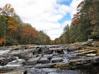
![]()
![]()
![]()
![]()
![]() On Sunday, October 19th I wanted to get out for a short, local hike after church. Cindy wanted to go and Sheila was definitely up for a hike after spending some time in her cage while we were at a wedding. In Livingston Manor it was raining with some snow mixed in so we decided to head south. We thought about Harriman and Bear Mountain but didn't want to drive that far. We settled on a trip to the Neversink Unique area in Rock Hill. As we drove down Route 17 the rain continued and there was more snow mixed with it. Below Monticello the precipitation let up but it was still windy and cool when we arrived at the end of Katrina Falls Road at 11:45 AM. There were two other cars parked in the small lot and we knew that they might be hunters. We got out our gear and got started right away by walking down the rocky woods road to the first trail junction. We stayed to the left as the trail to the right is a short spur trail that goes down to the river. We crossed the bridge over Wolf Creek and found that it, like many of the local streams, was nearly dry. At the next trail junction we stayed to the right to walk along the trail that parallels the river. The trail here is a wide woods road and is pretty easy to walk even though it is slightly uphill. As we walked along, we were both surprised at how much of the river we could see through the trees. We passed by another spur trails and crossed Mullet Brook on a bridge at 1.35 miles. The stream was also pretty dry and I thought about the times I had been there when the stream was a raging torrent! Just passed the bridge, after a slight uphill, we turned right on a yellow spur trail that goes down to Denton Falls. The trail was a little wet with some slippery areas particular where there were many pine needles. As we hiked I noticed that one of my poles seemed "soft". I inspected the tip of the pole and found it had broken off! I had paid over $100 for these new MSR Swift 3 poles and they had not lasted 2 months! I had never had this kind of failure with any other brand. I collapsed the pole, stowed it in my pack and continued the hike. Fortunately, Backcountry Edge will replace the poles for one year with no questions asked and with no cost to the customer other than the packing materials to send them back. We continued down to the falls and found that the Neversink was low compared to the other times we had been there. I maneuvered myself to get the best shots and too many pictures. The low water exposed the underlying rocks which was interesting. There were still some nice colors on the trees at the edge of the river. Sheila was busy hopping from rock to rock making it almost halfway across the river! After a short visit, we packed up and headed back up to the main trail. I found out that hiking with one pole is NOT what I prefer.
On Sunday, October 19th I wanted to get out for a short, local hike after church. Cindy wanted to go and Sheila was definitely up for a hike after spending some time in her cage while we were at a wedding. In Livingston Manor it was raining with some snow mixed in so we decided to head south. We thought about Harriman and Bear Mountain but didn't want to drive that far. We settled on a trip to the Neversink Unique area in Rock Hill. As we drove down Route 17 the rain continued and there was more snow mixed with it. Below Monticello the precipitation let up but it was still windy and cool when we arrived at the end of Katrina Falls Road at 11:45 AM. There were two other cars parked in the small lot and we knew that they might be hunters. We got out our gear and got started right away by walking down the rocky woods road to the first trail junction. We stayed to the left as the trail to the right is a short spur trail that goes down to the river. We crossed the bridge over Wolf Creek and found that it, like many of the local streams, was nearly dry. At the next trail junction we stayed to the right to walk along the trail that parallels the river. The trail here is a wide woods road and is pretty easy to walk even though it is slightly uphill. As we walked along, we were both surprised at how much of the river we could see through the trees. We passed by another spur trails and crossed Mullet Brook on a bridge at 1.35 miles. The stream was also pretty dry and I thought about the times I had been there when the stream was a raging torrent! Just passed the bridge, after a slight uphill, we turned right on a yellow spur trail that goes down to Denton Falls. The trail was a little wet with some slippery areas particular where there were many pine needles. As we hiked I noticed that one of my poles seemed "soft". I inspected the tip of the pole and found it had broken off! I had paid over $100 for these new MSR Swift 3 poles and they had not lasted 2 months! I had never had this kind of failure with any other brand. I collapsed the pole, stowed it in my pack and continued the hike. Fortunately, Backcountry Edge will replace the poles for one year with no questions asked and with no cost to the customer other than the packing materials to send them back. We continued down to the falls and found that the Neversink was low compared to the other times we had been there. I maneuvered myself to get the best shots and too many pictures. The low water exposed the underlying rocks which was interesting. There were still some nice colors on the trees at the edge of the river. Sheila was busy hopping from rock to rock making it almost halfway across the river! After a short visit, we packed up and headed back up to the main trail. I found out that hiking with one pole is NOT what I prefer.
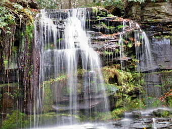 We headed back up the hill to the main trail and turned right. Within a few feet, we were at the next trail junction where we had to make a decision. The right fork would take us further down the river to High Falls which was over 2 miles away and would add over 4 miles to the hike. The left fork would allow us to complete the loop without the added distance. After a brief discussion, we both decided to skip High Falls as it is not much different than Denton Falls. We headed left to start to loop back to the parking area. After a short uphill of less than .1 miles, we turned left onto the yellow spur trail that leads to Mullet Brook Falls. We descended to the falls over the .15 mile trail. The falls did not have a large volume of water but were still interesting. I dropped my pack and walked out onto the rocks at the base of the falls to take some pictures. I took shots of the falls and a few downstream. I played with the angles and the light and the settings on my camera. After finishing my photography, I returned to my pack and we walked back to the main trail where we turned left to continue the loop. We walked uphill for the next .5 miles to where the trail levels some and then makes a sharp left turn. There were several others paths in the area so we were careful to follow the trail markers. At just less than 3 miles, we crossed Mullet Brook again on a bridge further upstream than the falls. At 3.1 miles the main trail turned to the left but we continued straight ahead on a yellow spur trail. After .5 miles, we arrived at a parking area near Wolf Lake. I had chosen this route for variety's sake. The road from the parking lot was absolutely straight as we walked north toward Wolf Lake Road. As I looked ahead on the road there was blue sky with some white clouds and some very nice fall colors in the leaves that remained. I took a few pictures and then we continued on our way. As we walked a powerline appeared from the east and turned north along the road. There were some nice colors on the trees bordering the right-of-way, so I took some pictures. As we approached Wolf Lake Road the access road we were on turned right to go to Wolf Lake. Cindy and I decided to continue on the right-of-way where we would have to cross a brook just before the road. Crossing the stream was no problem and we were soon on the road where we turned left and walked the .5 miles out to Katrina Falls road. We turned left and walked the final .7 miles to the car. We were back at 2:30 PM having covered 5.8 miles in 2 hours and 45 minutes with a surprising vertical gain of 1060 feet.
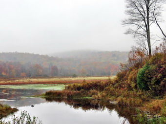
![]()
![]()
![]()
![]() On Monday, October 13th I wanted to get Sheila out for a little exercise on a short, local hike. The previous day Cindy and I had hiked the Willow Trail to Mount Tremper had left Sheila home as there are rattlesnakes present in the area. I didn't think it responsible to allow Sheila to roam where she might be injured and I knew none of us would enjoy a hike with Sheila on her leash for the whole time. When I got up in the morning, the skies were overcast and it looked like it might rain. I checked the forecast and the radar and it seemed the rain might wait until afternoon so I got Sheila in the car and headed for Frick Pond. On the way the heavy mist turned to a light rain which persisted as I parked at the Frick Pond lot. There was only one car in the lot when we pulled in at 11:05 AM but as we got ready to hike a pickup truck pulling an enormous camper came up the road. The driver attempted to back it into the larger lot. I waited until the third try and then ushered Sheila passed him as we started out on the trail to Frick Pond. I decided we could do some loops which would allow us to return to the car should the rain increase in strength. We headed left at the first trail junction to walk down to the bridge at the outlet of Frick Pond. As we approached the pond, we could both hear voices so I put Sheila on her leash. The voices were from a family with two young girls. I said "Hello" and took Sheila to the opposite side of the bridge. I had not intended to take any pictures but there was an interesting mist hanging over the pond. After taking a few shots, we headed around the pond. There was a huge tree fallen across the second small bridge which is big enough to require a chain saw or sharp ax. At the next junction, we stayed right to walk around the pond on the boardwalks. The walkways were rather dry and not as slippery as I expected. The last section of the walkway seemed to have detached from the other sections. The two streams that run into the pond were almost dry. We continued around the pond to Times Square where we turned left to take the Loggers Loop to Iron Wheel Junction. The loop is about 1.2 miles and gains a little over 200 feet going counterclockwise. As we hiked the rain began to come down a little harder but then let up. This was repeated several times. At the junction I had thought I might take the Quick Lake Trail to Hodge Pond but the rain had increased so we turned left to head back to Frick Pond. When we arrived at the small stream through the woods, we found it completely dried up. A little farther along we met another family of four hiking with their dog. We passed each other in opposite directions. Sheila and I passed over the bridge at Frick Pond in the opposite direction and were soon at the first trail junction. I had considered turning left to lengthen the hike but in the end decided to return to the car. We were back at the car by 12:30 PM having hiked 3.8 miles in just under 1.5 hours.
On Monday, October 13th I wanted to get Sheila out for a little exercise on a short, local hike. The previous day Cindy and I had hiked the Willow Trail to Mount Tremper had left Sheila home as there are rattlesnakes present in the area. I didn't think it responsible to allow Sheila to roam where she might be injured and I knew none of us would enjoy a hike with Sheila on her leash for the whole time. When I got up in the morning, the skies were overcast and it looked like it might rain. I checked the forecast and the radar and it seemed the rain might wait until afternoon so I got Sheila in the car and headed for Frick Pond. On the way the heavy mist turned to a light rain which persisted as I parked at the Frick Pond lot. There was only one car in the lot when we pulled in at 11:05 AM but as we got ready to hike a pickup truck pulling an enormous camper came up the road. The driver attempted to back it into the larger lot. I waited until the third try and then ushered Sheila passed him as we started out on the trail to Frick Pond. I decided we could do some loops which would allow us to return to the car should the rain increase in strength. We headed left at the first trail junction to walk down to the bridge at the outlet of Frick Pond. As we approached the pond, we could both hear voices so I put Sheila on her leash. The voices were from a family with two young girls. I said "Hello" and took Sheila to the opposite side of the bridge. I had not intended to take any pictures but there was an interesting mist hanging over the pond. After taking a few shots, we headed around the pond. There was a huge tree fallen across the second small bridge which is big enough to require a chain saw or sharp ax. At the next junction, we stayed right to walk around the pond on the boardwalks. The walkways were rather dry and not as slippery as I expected. The last section of the walkway seemed to have detached from the other sections. The two streams that run into the pond were almost dry. We continued around the pond to Times Square where we turned left to take the Loggers Loop to Iron Wheel Junction. The loop is about 1.2 miles and gains a little over 200 feet going counterclockwise. As we hiked the rain began to come down a little harder but then let up. This was repeated several times. At the junction I had thought I might take the Quick Lake Trail to Hodge Pond but the rain had increased so we turned left to head back to Frick Pond. When we arrived at the small stream through the woods, we found it completely dried up. A little farther along we met another family of four hiking with their dog. We passed each other in opposite directions. Sheila and I passed over the bridge at Frick Pond in the opposite direction and were soon at the first trail junction. I had considered turning left to lengthen the hike but in the end decided to return to the car. We were back at the car by 12:30 PM having hiked 3.8 miles in just under 1.5 hours.
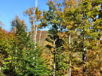
![]()
![]()
![]()
![]()
![]() On Sunday, October 12th I wanted to complete the Catskill Mountain Club's All Trails Challenge. I only needed to hike the Willow Trail to the Warner Creek Trail to complete the list the club has published. I told Cindy the hike would be at least 8 miles but she agreed to go with me. I had decided to leave Sheila home as I was worried about the rattlesnakes which can be present on Mount Tremper. Keeping Sheila on her leash for most of the hike would not satisfy either of us! Although I had hiked the Warner Creek Trail before, I thought it might be nice to hike to the Mount Tremper fire tower if time permitted. Time would be a problem since we could not leave until after church which we could not leave Livingston Manor until about 11:00 AM. We did leave at about that time and headed up the Beaverkill Road to the Barkaboom Road. Once we were at the Pepacton Reservoir, I took the BWS roads to Route 28 in Margaretville. We followed Route 28 to Phoenicia where we picked up Route 40 to Route 212. As we drove passed the main parking area for Mount Tremper, we could see that it was parked almost full. The day was bright and sunny with blue, almost cloudless skies. The temperature had been climbing but was still in the low 50's as we headed up Route 212 to VanWagner Road. We turned left on VanWagner Road to get to the small hamlet of Willow. Along the way we passed the Woodstock Farm Animal Sanctuary which obviously had an event going on. Just passed this was the intersection with Jessup Road which leads to the Willow Trail. On the corner was the Willow Post Office where I would have to park since there is no parking near the actual trailhead. The post office appears to be a construction trailer with a zip code sign! I turned left on Jessup Road and rove a little less than a mile up the road until it became private. I dropped Cindy off and then returned to the post office to park. I got out my gear and by 12:30 PM was hiking up Jessup Road at a quick pace. I didn't find Cindy where I had dropped her off so I continued up the road where I found her just short of the turnoff for the trail. I had hiked a little over a mile in less than 15 minutes! We hiked together to the beginning of the trail and at 1.1 miles turned left onto the woods road that was the first part of the trail.
On Sunday, October 12th I wanted to complete the Catskill Mountain Club's All Trails Challenge. I only needed to hike the Willow Trail to the Warner Creek Trail to complete the list the club has published. I told Cindy the hike would be at least 8 miles but she agreed to go with me. I had decided to leave Sheila home as I was worried about the rattlesnakes which can be present on Mount Tremper. Keeping Sheila on her leash for most of the hike would not satisfy either of us! Although I had hiked the Warner Creek Trail before, I thought it might be nice to hike to the Mount Tremper fire tower if time permitted. Time would be a problem since we could not leave until after church which we could not leave Livingston Manor until about 11:00 AM. We did leave at about that time and headed up the Beaverkill Road to the Barkaboom Road. Once we were at the Pepacton Reservoir, I took the BWS roads to Route 28 in Margaretville. We followed Route 28 to Phoenicia where we picked up Route 40 to Route 212. As we drove passed the main parking area for Mount Tremper, we could see that it was parked almost full. The day was bright and sunny with blue, almost cloudless skies. The temperature had been climbing but was still in the low 50's as we headed up Route 212 to VanWagner Road. We turned left on VanWagner Road to get to the small hamlet of Willow. Along the way we passed the Woodstock Farm Animal Sanctuary which obviously had an event going on. Just passed this was the intersection with Jessup Road which leads to the Willow Trail. On the corner was the Willow Post Office where I would have to park since there is no parking near the actual trailhead. The post office appears to be a construction trailer with a zip code sign! I turned left on Jessup Road and rove a little less than a mile up the road until it became private. I dropped Cindy off and then returned to the post office to park. I got out my gear and by 12:30 PM was hiking up Jessup Road at a quick pace. I didn't find Cindy where I had dropped her off so I continued up the road where I found her just short of the turnoff for the trail. I had hiked a little over a mile in less than 15 minutes! We hiked together to the beginning of the trail and at 1.1 miles turned left onto the woods road that was the first part of the trail.
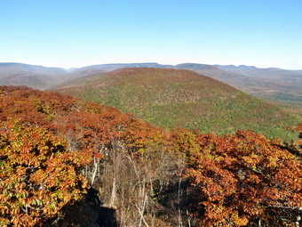 The trail had been climbing since I left the post office but after the turn it began to ascend more steeply. The grade averaged about 15% until it leveled off at 2 miles. Along the way the route transitioned from the woods road to a trail that, in some cases, hung right on the edge of the hill. It became rocky and the heavy cover of leaves made getting a good footing difficult. At the two mile mark our elevation had increased from about 1100 feet to almost 2100 feet. Along the way we kept getting "teaser" views of the mountains and valleys to the north and east. We did stop once or twice and I took some pictures through the trees. After a quarter mile of relatively flat walking, the trail again began to ascend gaining another 400 feet until we reached the trail junction with the Warner Creek Trail at 2.7 miles. Just before the junction we encountered two women who had passed Cindy while she was waiting for me. We said "Hello" but continued on our way. At the trail junction we turned left to follow the Warner Creek Trail to Mount Tremper where it ends at the fire tower. The turn was more than 90 degrees and changed our direction of travel from north to west by south west. Initially we ascended some but at 3.2 miles we started a descent to avoid sidehilling along an unnamed bump between us and Mount Tremper. I knew we had not quite finished our ascent and at 4 miles we began to climb again as the trail turned south and headed toward the fire tower. Over the next .85 miles we hit a sort of summit plateau, negotiated a short descent before climbing again to reach the tower. The last ascent was about 365 feet and I think it was about as much as either of us wanted to climb for the day.
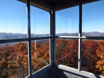 There were quite a few people at the tower which did not surprise us as we had seen all the cars parked along Route 40. The tower cab was open as this was the last weekend of the "season" for the tower steward volunteers. Cindy did not want to climb the tower but I waited my turn and was soon climbing through the narrow trapdoor into the cab. The views were good and actually better than I expected. There weren't too many spots of bright color left on the mountains or in the valleys. However, overall there was an attractive landscape. Part of the Ashokan was visible along with Cooper Lake. I took many pictures in all directions through both the open and closed windows of the cab. Some other hikers asked if I wanted them to take my picture and I declined. I did agree to their request for me to take their pictures. I spoke to the tower steward and thanked her for her work. She said that she had seen a bear near the tower this summer but had not seen any other "dangerous" species. I walked back down the tower and took a few pictures through the superstructure from the bottom. I also snapped some shots of the tower. Cindy and I had a drink and a snack and then started back the way we came for the walk back. It had taken us 2.5 hours to make the ascent and I hoped we could beat that time on the way down as we started back at about 3:10 PM. We quickly found that we would have trouble making time on the descent as the trail was steeper than it seem coming up and the leaves had dry earth underneath them. We made the trail junction by 4:20 PM having hiked the 21. miles from the tower in 1 hour and 10 minutes. We made the right turn and started down the trail. It was a difficult descent due, again, to the steepness of the trail and the slippery leaves. We were both glad when the trail gave way to the woods road and the walking became easier. At 8.4 miles we turned right onto Jessup Road to start the hike back to the post office where I had parked the car. Cindy decided to walk back with me as it was mostly downhill and the flat, firm surface of the road made walking a breeze. We arrived back at the car at 5:35 PM as the shadows were definitely lengthening. I had hiked 9.5 miles in just over 5 hours with a vertical ascent of 2310 feet. As we had passed through Phoenicia, the twin had seemed very busy but we decided to stop by the Alamo to see if we could get a meal. We were lucky enough to get a table. The empanadas were very good as was Cindy carne asada and my mole burrito.
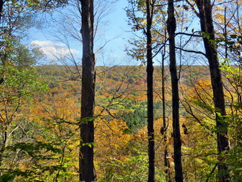
![]()
![]()
![]()
![]()
![]() On Friday, October 10th I wanted to get in a hike before leaving for my last tennis match. Cindy wanted to go along so we decided to go to Kelly Hollow near the Pepacton Reservoir. The hike is less than 4 miles but has a nice beaver pond and some waterfalls on the outlet stream. The morning was a little foggy so we delayed or departure until about 9:45 PM. We got Sheila and our gear in the car and headed to Roscoe on Route 17. Cindy likes to stay off the small back roads as much as possible so I took Route 206 to Route 30. At the Dunraven Bridge I stayed on the BWS roads passing the intersection with the Barkaboom Road. I a few miles I turned right on Millbrook Road and drove to the parking area for Kelly Hollow which is marked with the yellow on brown signs used in the Forest Preserve. There was I other car in the lot when we parked and we began our hike at about 10:20 AM. The morning was cool enough that I wore light gloves and windbreaker when we started out. The trail almost immediately splits and we headed to the left which leads to a wide woods road. The trail began to parallels a stream at about .3 miles heading south. At about .4 miles a trail branches to the right and forms a short loop. This stream usually has some nice waterfalls but there was hardly any water in it on this day. The trail passes through a mix of evergreens and hardwoods with higher land to the left and the stream on the right. At 1.1 miles we crossed a bridge over the stream although it was hardly necessary. To avoid climbing over the shoulder of a hill the trail turned north and eventually west. At 1.6 miles we came to the spot where I had at one time turned left and bushwhacked up to the top of Millbrook Ridge. From the top of the ridge it isn't far to Alder Lake!
On Friday, October 10th I wanted to get in a hike before leaving for my last tennis match. Cindy wanted to go along so we decided to go to Kelly Hollow near the Pepacton Reservoir. The hike is less than 4 miles but has a nice beaver pond and some waterfalls on the outlet stream. The morning was a little foggy so we delayed or departure until about 9:45 PM. We got Sheila and our gear in the car and headed to Roscoe on Route 17. Cindy likes to stay off the small back roads as much as possible so I took Route 206 to Route 30. At the Dunraven Bridge I stayed on the BWS roads passing the intersection with the Barkaboom Road. I a few miles I turned right on Millbrook Road and drove to the parking area for Kelly Hollow which is marked with the yellow on brown signs used in the Forest Preserve. There was I other car in the lot when we parked and we began our hike at about 10:20 AM. The morning was cool enough that I wore light gloves and windbreaker when we started out. The trail almost immediately splits and we headed to the left which leads to a wide woods road. The trail began to parallels a stream at about .3 miles heading south. At about .4 miles a trail branches to the right and forms a short loop. This stream usually has some nice waterfalls but there was hardly any water in it on this day. The trail passes through a mix of evergreens and hardwoods with higher land to the left and the stream on the right. At 1.1 miles we crossed a bridge over the stream although it was hardly necessary. To avoid climbing over the shoulder of a hill the trail turned north and eventually west. At 1.6 miles we came to the spot where I had at one time turned left and bushwhacked up to the top of Millbrook Ridge. From the top of the ridge it isn't far to Alder Lake!
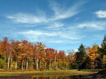 The trail turned around the hill and headed southwest as we approached the lean-to and beaver pond at the apex of the trail system. The lean-to and its privy were in good shape. We walked to the shore of the beaver pond and were surprised to see how low the water level had fallen. I expected the volume to be low but there was hardly any water. The edges of the pond were very dry and grassy indicating the condition had existed for some time. The beaver house was well above water and the beavers had abandoned the area. I took some pictures to document the conditions. The sky was blue with some white clouds and the trees around the pond were colorful. We walked a little around the pond and I took a few more shots before stowing the camera for the return trip. The trail around the pond eventually meets up with another woods road which leads back to the parking area. From the apex of the trail back to Millbrook Road is about 1.3 miles with the trail heading mostly north. It wanders a little to avoid some hills and is always parallel to a stream. At 2.7 miles we crossed another ridge and shortly after that the trail that forms the short loop. At 3.2 miles the woods road leads to a small cemetery which we had listed before. Some of the grave markers, especially the ones on the hill, are very old and it seems it has been a long time since it has been used for a burial. We decided to walk out the access road to Millbrook Road. Once at Millbrook Road, we turned right and walked .25 miles back to the car. It was 11:45 AM and we had completed the 3.6 mile hike in 1 hour and 25 minutes. The elevation gain was only 660 feet. I really wanted to do more but my time was limited.
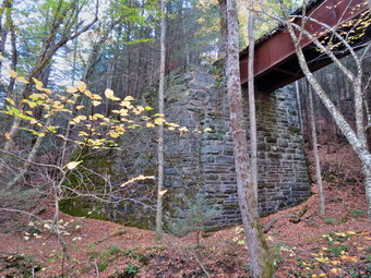
![]()
![]()
![]()
![]()
![]() On Thursday, October 9th I had planned to get out early but as often happens an ambulance call in the middle of the night disrupted my plans. I slept a little later than usual waking up at around 8:00 AM. I had tennis practice in the afternoon but still want to get in a short hike. I was on a quest to complete the Catskill Mountain Club All Trails Challenge. The club has published a list of all the marked trails in the Catskills and will award a patch and a T-shirt for anyone who has hiked all the trails. I filled in the dates that corresponded to when I had hiked these trails and found I was only a few trails short of completion. I had hiked several of the these trails recently and decided to hike the Giggle Hollow Trail in Pine Hill. Due to the late start I didn't arrive in Pine Hill until almost 10:00 AM. I was headed east on Route 28 and turned right onto Friendship Road at the Belleayre Beach sign. I drove to the covered bridge over Birch Creek only to find the gate closed even though the sign said it opened at 10:00 AM. I couldn't find a place to park so, after consulting my maps, I drove west on Route 28 to Pine Hill and into town. Eventually I got on Lake Street and drove to the end where the NYNJTC maps indicated there was another access road. I found only another closed gate! I drove back to the covered bridge and parked on the side of the road to begin the hike at about 10:15 AM. I put Sheila on her leash and turned on her training collar and then we walked across the covered bridge to try to get to the start of the trail. We walked up the access road but I could find no indication of the beginning of the trail system. I consulted my cell home with the Avenza app. It seemed to indicate that where the road turned right we should continue straight ahead to an area that had a pavilion. There were still no signs but I could see what looked like a trail ahead and then I saw the register box. There were also signs indicating distances to various points. The trail passed directly under railroad tracks that ran across a bridge. I stopped to take a few pictures and then started up the trail. Up was the most important word since for the next .9 miles the trail followed a woods roads to the southwest averaging a 20% grade. I guess this shouldn't have been a surprise since all the other routes to the Belleayre Ridge also have their steep spots.
On Thursday, October 9th I had planned to get out early but as often happens an ambulance call in the middle of the night disrupted my plans. I slept a little later than usual waking up at around 8:00 AM. I had tennis practice in the afternoon but still want to get in a short hike. I was on a quest to complete the Catskill Mountain Club All Trails Challenge. The club has published a list of all the marked trails in the Catskills and will award a patch and a T-shirt for anyone who has hiked all the trails. I filled in the dates that corresponded to when I had hiked these trails and found I was only a few trails short of completion. I had hiked several of the these trails recently and decided to hike the Giggle Hollow Trail in Pine Hill. Due to the late start I didn't arrive in Pine Hill until almost 10:00 AM. I was headed east on Route 28 and turned right onto Friendship Road at the Belleayre Beach sign. I drove to the covered bridge over Birch Creek only to find the gate closed even though the sign said it opened at 10:00 AM. I couldn't find a place to park so, after consulting my maps, I drove west on Route 28 to Pine Hill and into town. Eventually I got on Lake Street and drove to the end where the NYNJTC maps indicated there was another access road. I found only another closed gate! I drove back to the covered bridge and parked on the side of the road to begin the hike at about 10:15 AM. I put Sheila on her leash and turned on her training collar and then we walked across the covered bridge to try to get to the start of the trail. We walked up the access road but I could find no indication of the beginning of the trail system. I consulted my cell home with the Avenza app. It seemed to indicate that where the road turned right we should continue straight ahead to an area that had a pavilion. There were still no signs but I could see what looked like a trail ahead and then I saw the register box. There were also signs indicating distances to various points. The trail passed directly under railroad tracks that ran across a bridge. I stopped to take a few pictures and then started up the trail. Up was the most important word since for the next .9 miles the trail followed a woods roads to the southwest averaging a 20% grade. I guess this shouldn't have been a surprise since all the other routes to the Belleayre Ridge also have their steep spots.
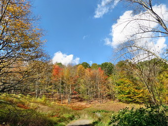 The trail is marked as unmaintained on the maps and I think that is a good description. The woods road was rocky and the layers of slippery leaves added to the difficulty of the climb. The blue trail markers were few and were often missing when another trail or road branched off. Several times I just followed Sheila as she is able to pick out the trails. There was quite a bit of blowdown on the trail. We navigated around or over the blockages of the trail but they certainly didn't add to the enjoyment of the experience. The day grew sunnier as we hiked and I took off my windbreaker and stowed it in my pack. I also took some pictures of the trail and some of the fall colors around us. At 1.1 miles the trail took a 90 degree turn to the left to head southeast. The trail continued to climb but at a gentler grade to 1.5 miles where it took a turn to the west. The grade now was more shallow and I knew we were getting near the junction with the Pine Hill West Branch Trail. After about .25 miles the trail opened up and we entered an area filled with briars. It was impossible to tell where the trail went and I could see no markers. After a couple of aborted attempts, I headed back down the trail to find a marker and start again. This time I followed Sheila and found a hidden marker. The last 100 feet of the trail were overgrown but we finally found the trail junction. It is a shame that these trails are not cared for the way they should be! I really wanted to hike to the ski slopes on Belleayre and take the Cathedral Glen trail back to Pine Hill but I didn't know if I would have enough time. Reluctantly, we turned right and headed down the Pine Hill West Branch Trail toward Pine Hill.
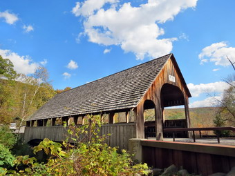 For the next .9 miles we followed the trail as it headed north and down the mountain. The footing was fairly good and I was familiar with the trail. At just passed 3 miles the trail met a dirt road and we turned left onto the road to follow it west as we continued our descent. At 3.4 miles the road turned to the northeast and at 3.7 miles we were on the paved road known As Woodchuck Hollow Road. I stopped at this point as there was a nice view ahead and some colorful trees to the left. After taking a few shots, we continued down the road which has some interesting attractions. At one point there is a gated road or driveway on the right complete with stone pillars. It has not been used for some time and I couldn't help but wonder what stories it held. We walked under the railroad bridge on Mill Street and I took a few pictures. We turned right on Bonnieview Avenue and then took another right onto Main Street. It was only a short walk down Main Street to Lake Street. At the end of Lake we walked passed the gate and onto the road that led back to Belleayre Beach. After a short walk the lake came into view and the scene was beautiful. The small lake had a white sand beach with a small building and bright leaves on all the trees. I stopped to take some pictures and then we continued around to the beach. As we walked down to the beach some geese were splashing in the water. I watched Sheila watch me and she did not chase the birds although knew she wanted to do so. I took some more pictures from the beach before we started across the parking lot to complete the loop. I was surprised when a car drove across the lot but assumed that meant that whoever was supposed to open the gate at the covered bridge was simply late. As we approached the bridge, I had to take a few more pictures from the hill above it. As we walk won to the bridge, we stopped again so that I could take some shots from the side. The car that had driven across the lot drove back across the bridge and locked the gate! We walked back to the car to finish our hike. It was 12:45 PM and we had covered 5.3 miles in 2.5 hours. The vertical gain was 1575 feet with 1450 feet of this being on the 2 mile climb from Belleayre Beach to the Pine Hill West Branch Trail junction.
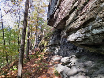
![]()
![]()
![]()
![]()
![]() On Monday, October 6th I had finished the loop trail around North South Lake and thought I had enough time for at least one more trail. We left North South Lake and I drove to Route 214 west of Tannersville. I turned left on Route 214 and drove to Phoenicia. The directions to get to Parrish Field and the amps were a little inaccurate. I found the best way was to drive down Main Street to Ava Maria Mount which is the street where the post office is located. I turned left here and parked just passed the post office on the side of the street. It seemed strange to me that there was no parking designated for the field. Sheila and I got out of the car and I put her on the leash. We started our hike at 9:50 AM by walking out to the field. There was no indication of any trails or where we should go. We walked around the edge of the field clockwise and found a bridge and a sign explaining the trail system. The start of the trail is directly across from the entrance to the park. We crossed the bridge and found three bright blue blazes on a tree. The problem was that after that no blazes were visible. We continued straight ahead following a very steep path up the hill toward a line of cliffs. The grade on this climb was 40% and I was pretty sure it wasn't the trail. The problem was compound by my choice to again leave my poles in the car. At the top of the climb I found blue blazes running along the base of the cliffs. We turned right but I promised myself I would investigate the real route on the way back! The trail was narrow and rough but it was fun to walk below the impressive cliffs. I took a few pictures but it was hard to get far enough back to get them in the frame. At about .25 miles the trail split since it is a loop. The sign sated that the designers intended hikers to go left so I followed the suggestion.
On Monday, October 6th I had finished the loop trail around North South Lake and thought I had enough time for at least one more trail. We left North South Lake and I drove to Route 214 west of Tannersville. I turned left on Route 214 and drove to Phoenicia. The directions to get to Parrish Field and the amps were a little inaccurate. I found the best way was to drive down Main Street to Ava Maria Mount which is the street where the post office is located. I turned left here and parked just passed the post office on the side of the street. It seemed strange to me that there was no parking designated for the field. Sheila and I got out of the car and I put her on the leash. We started our hike at 9:50 AM by walking out to the field. There was no indication of any trails or where we should go. We walked around the edge of the field clockwise and found a bridge and a sign explaining the trail system. The start of the trail is directly across from the entrance to the park. We crossed the bridge and found three bright blue blazes on a tree. The problem was that after that no blazes were visible. We continued straight ahead following a very steep path up the hill toward a line of cliffs. The grade on this climb was 40% and I was pretty sure it wasn't the trail. The problem was compound by my choice to again leave my poles in the car. At the top of the climb I found blue blazes running along the base of the cliffs. We turned right but I promised myself I would investigate the real route on the way back! The trail was narrow and rough but it was fun to walk below the impressive cliffs. I took a few pictures but it was hard to get far enough back to get them in the frame. At about .25 miles the trail split since it is a loop. The sign sated that the designers intended hikers to go left so I followed the suggestion.
 The trail now was wider but was still a good climb. At about .5 miles the trail leveled off and we arrived at a viewpoint over Phoenicia below us. The leaves here had not changed as much as some other places and the sun was at a bad angle but the views were still beautiful. I took some pictures and we continued the hike. The trail headed northwest and then swung to the north as it looped round the high ground on the right. The trail began to descend briefly and then turned again to start north climbing a 20% grade on a rocky woods road. Along the way there were several path and woods roads so we were careful to follow the blazes. Just passed a mile the trail split and we kept to the left to hike the longer loop which had another lookout. From this point on the trail was not as well maintained and was poorly marked in places. There were several blowdowns which obscured the correct path and the carpeting of leaves help disguise the trail. Several times I followed Sheila as she seemed to have no problem! As we walked along, another couple came hiking toward us. We had seen them at the beginning of the hike but they had gone in the opposite direction. The woman announced we had taken the easy way which was a little annoying. Her announcement also made me think that descending the trail without poles in the direction we were headed might be challenging. At 1.5 miles the trail turned south and we began a long descent. It wasn't too bad at first and at 1.6 miles we arrived at another lookout. We stopped here so that I could take some pictures and then continued on our way. The trail narrowed down again and the descent became steeper exceeding 20%. I grabbed a stout branch which game me some assistance as I slipped and slid my way down the steep path which had a covering of leaves over loose dirt and rock. At 2 miles we completed the loop and I check to see that there were no blazes to indicate the trail to the right. We followed the trail back to the base of the cliffs and continued to follow it passed the steep ascent we had used to get to the cliffs. The trail was very narrow and often slanted down the hill. I stopped to take a few shots of some interesting patterns of erosion and then headed down the trail. Near the end the trail did a little switchback to avoid too steep a grade. Soon we were back at the bridge where we had started. I looked back to check the blazes to see if I had missed them when we started out. There were NO BLAZES visible to indicate the turn at the beginning of the hike. Part of the problem is that the people who blazed the trail indicated turns by placing one blaze directly above another. The better way to mark turns is to pace the top blaze to the left or right to indicate the direction of the turn. Sheila and I walked directly across the field and were at the car at 11:15 AM. We had hiked 2.3 miles in 1 hour and 25 minutes with a vertical ascent of 800 feet. I was ready to hike some more but felt my time limitation would not allow me to enjoy a subsequent hike.
![]()
![]()
![]()
![]()
![]() On Monday, October 6th I had a tennis match to coach in the afternoon but I was on a quest to complete the Catskill Mountain Club All Trails Challenge. The club has published a list of all the marked trails in the Catskills and will award a patch and a T-shirt for anyone who has hiked all the trails. I filled in the dates that corresponded to when I had hiked these trails and found I was only a few trails short of completion. On Sunday I had hiked in the Bluestone State Forest near Kingston. There are two sets of trails in the area that area used for both hiking and mountain biking. I deiced to head to North South Lake to hike the loop trail around the lake which I had never done despite many hikes in the area. When I was finished with the loop trail, I thought I might have time to stop in Phoenicia to hike the Tanbark Trail. I knew I had to get an early start and was awake well before 6:00 AM. I actually left home at about 6:00 AM and decided to follow the Google Maps suggestion for a driving route. I drove up the Beaverkill Road to the Barkaboom Road. At the Pepacton Reservoir I turned right and followed the roads to Route 28 in Margaretville. I drove east on Route 28 to Phoenicia where I picked up Route 214 north to Route 23A. From the turn it was only a few miles to Haines Falls and the road to North South Lake campgrounds. I turned left onto the access road and the turned right on Schutt Road just before the park entrance. I didn't know of the park was still collecting fees and I was happy to hike a little extra to avoid paying. I parked and we were hiking by 7:35 AM. I decided to leave my poles in the car since I thought there might be people in the park and I might have to have her on a leash. This was a mistake since the poles are easily collapsible and the parts of the trail turned out to be rather rough. We crossed the road and started out on the blue Escarpment Trail. There were a lot of rock and roots to step around but the trail was dry. We crossed the old railroad bed and descended to cross two dry streams on bridges. At the trail junction we turned left on a ski trail and walked out to the loop road. We turned left and walked on the loop road down to the dam at the south end of South Lake. We stopped so that I could take some pictures as the sun was just rising over the lake. There were still some nice fall colors and I found that not as many of the leaves had fallen as at home.
On Monday, October 6th I had a tennis match to coach in the afternoon but I was on a quest to complete the Catskill Mountain Club All Trails Challenge. The club has published a list of all the marked trails in the Catskills and will award a patch and a T-shirt for anyone who has hiked all the trails. I filled in the dates that corresponded to when I had hiked these trails and found I was only a few trails short of completion. On Sunday I had hiked in the Bluestone State Forest near Kingston. There are two sets of trails in the area that area used for both hiking and mountain biking. I deiced to head to North South Lake to hike the loop trail around the lake which I had never done despite many hikes in the area. When I was finished with the loop trail, I thought I might have time to stop in Phoenicia to hike the Tanbark Trail. I knew I had to get an early start and was awake well before 6:00 AM. I actually left home at about 6:00 AM and decided to follow the Google Maps suggestion for a driving route. I drove up the Beaverkill Road to the Barkaboom Road. At the Pepacton Reservoir I turned right and followed the roads to Route 28 in Margaretville. I drove east on Route 28 to Phoenicia where I picked up Route 214 north to Route 23A. From the turn it was only a few miles to Haines Falls and the road to North South Lake campgrounds. I turned left onto the access road and the turned right on Schutt Road just before the park entrance. I didn't know of the park was still collecting fees and I was happy to hike a little extra to avoid paying. I parked and we were hiking by 7:35 AM. I decided to leave my poles in the car since I thought there might be people in the park and I might have to have her on a leash. This was a mistake since the poles are easily collapsible and the parts of the trail turned out to be rather rough. We crossed the road and started out on the blue Escarpment Trail. There were a lot of rock and roots to step around but the trail was dry. We crossed the old railroad bed and descended to cross two dry streams on bridges. At the trail junction we turned left on a ski trail and walked out to the loop road. We turned left and walked on the loop road down to the dam at the south end of South Lake. We stopped so that I could take some pictures as the sun was just rising over the lake. There were still some nice fall colors and I found that not as many of the leaves had fallen as at home.
 After taking some pictures, we walked to the right of the dam to get on the yellow trail. I had thought this trail would follow the rapids and be relatively flat but I was wrong! The trail is cut through the woods and there are many roots to trip up a hiker. I followed one of the normal paths down to the lake shore to take some pictures. The leaves were still very colorful and the sun striking them was stunning. We continued on the yellow trail until we got to the first beach near the north end of South Lake at 1.7 miles. We stopped again so that I could take some more shots. I knew this was cutting into the time I had to hike but I couldn't help myself! Following the trail through the beach areas and campsites was a little difficult at times but we were always able to find the way. Just .1 miles from the beach was a point of land that jutted out into the water. This was the area that separated the two lakes and we stopped again as I took more pictures. Back on the trail we followed a walkway or road along the shore of North Lake to the beach at North Lake at 2.2 miles. Once again the views were too nice to pass up and out came the camera again. We continued on around the lake and found that quite a few of the campsites were occupied. The sun was out and I stopped to change from my softshell to a light windbreaker. As we rounded North Lake a new set of view came into sight so I had to stop again to take some photographs. From 1.8 miles back to the dam at 3.5 miles the trail followed roads or paths. It was easy walking with very few ups or downs. As we were nearing the dam, a man was coming toward us with his dog on a leash. We stopped to talk and our two dogs seemed to get along well. His was a purebred Leonberger which as about a year and a half old. It was full of energy and he asked if I wanted my dog to play. I declined regretfully since I had a schedule to keep. I am sure Sheila would have enjoyed it! We walked back to the dam to complete the loop. At this point I decided to walk the loop road back to the entrance to the campgrounds and then to Schutt Road. This would be a little longer in distance but would take less time. The hike back from the dam was only about .75 miles and it went quickly even though it was mostly uphill. We were back at the car at 9:15 AM. We had hiked 4.2 miles in 1 hour and 40 minutes. My GPS recorded that we only stopped for 15 minutes but it seemed longer to me. I felt I had enough time left for one more hike so I headed for Phoenicia to hike the Tanbark Trail.
![]()
![]()
![]()
![]() On Sunday, October 5th I was on a quest to complete the Catskill Mountain Club All Trails Challenge. The club has published a list of all the marked trails in the Catskills and will award a patch and a T-shirt for anyone who has hiked all the trails. I filled in the dates that corresponded to when I had hiked these trails and found I was only a few trails short of completion. One area I had not hiked was the Bluestone State Forest near Kingston. There are two sets of trails in the area that area used for both hiking and mountain biking. There are three trail loops near Onteora Lake and another set of trails just east of Onteora Lake on Jockey Hill. After finishing the trails at Onteora Lake, I was ready to head to Jockey Hill at about 12:40 PM. I drove out to Route 28 and turned east toward Kingston. After consulting some maps, it was clear that the best route to Jockey Hill Road was to take Morey Hill Road north to Sawkill Road. Jockey Hill Road is only a short distance east on Sawkill Road. The drive was quick and I soon was on Jockey Hill Road headed south toward a dead end or cul-de-sac. When I arrived I found at least twenty cars with mountain bikes parked along the sides of the road. The road continued as a gravel road marked Woods Road (Private). I decided to park on the side of the road to begin the hike. I was disappointed there were son many mountain bikes as I knew I would have to be careful to avoid bikers on the trails. Sheila and I were ready to go at 1:00 PM so I began to hunt around for the trail blazes. I checked my iPhone Avenza app and found I was too far north to find the trails. I decided to walk down Woods Road to see if that was the correct direction. I had Sheila on her leash as we walked down the road. At about .25 miles I stopped to ask a homeowner about the trails and he told me to keep going about another .25 miles. Soon we were at a parking area which was obviously the one for the trails. We continued out the far end of the parking area where there was a gate and where I found yellow blazes. The Catskill Mountain Club listed both a yellow and blue trail in the area for a total of 4.2 miles but none of the maps had a blue trail and none of the mountain bikers had ever seen one. The trail followed the woods roads to about .7 miles or .15 miles from the lower parking area. Here the trail turned left into the woods.
On Sunday, October 5th I was on a quest to complete the Catskill Mountain Club All Trails Challenge. The club has published a list of all the marked trails in the Catskills and will award a patch and a T-shirt for anyone who has hiked all the trails. I filled in the dates that corresponded to when I had hiked these trails and found I was only a few trails short of completion. One area I had not hiked was the Bluestone State Forest near Kingston. There are two sets of trails in the area that area used for both hiking and mountain biking. There are three trail loops near Onteora Lake and another set of trails just east of Onteora Lake on Jockey Hill. After finishing the trails at Onteora Lake, I was ready to head to Jockey Hill at about 12:40 PM. I drove out to Route 28 and turned east toward Kingston. After consulting some maps, it was clear that the best route to Jockey Hill Road was to take Morey Hill Road north to Sawkill Road. Jockey Hill Road is only a short distance east on Sawkill Road. The drive was quick and I soon was on Jockey Hill Road headed south toward a dead end or cul-de-sac. When I arrived I found at least twenty cars with mountain bikes parked along the sides of the road. The road continued as a gravel road marked Woods Road (Private). I decided to park on the side of the road to begin the hike. I was disappointed there were son many mountain bikes as I knew I would have to be careful to avoid bikers on the trails. Sheila and I were ready to go at 1:00 PM so I began to hunt around for the trail blazes. I checked my iPhone Avenza app and found I was too far north to find the trails. I decided to walk down Woods Road to see if that was the correct direction. I had Sheila on her leash as we walked down the road. At about .25 miles I stopped to ask a homeowner about the trails and he told me to keep going about another .25 miles. Soon we were at a parking area which was obviously the one for the trails. We continued out the far end of the parking area where there was a gate and where I found yellow blazes. The Catskill Mountain Club listed both a yellow and blue trail in the area for a total of 4.2 miles but none of the maps had a blue trail and none of the mountain bikers had ever seen one. The trail followed the woods roads to about .7 miles or .15 miles from the lower parking area. Here the trail turned left into the woods.
The trail paralleled the road through mixed evergreen and hardwood forests for the next .65 miles rolling some but mostly descending. At 1.3 miles we turned left 90 degrees changing from southeast to northeast. We were hiking now mostly through hardwood forest and at 1.6 miles came to a spilt in the trail which was the start of the loop. Sheila and I stayed to the left and descended slightly before turning east at 2.0 miles and beginning a climb. The climb looks impressive on a contour profile but it lasted only to about 2.6 miles and gained just 175 feet! At this point the trail did a funny little loop to the north to avoid a rather steep descent over some rocks. Soon we were headed south to about 3.2 miles. At his point another trail or road went off to the left and I explored briefly. I kept looking for a blue trail but never found one! It is important to follow the blazes since there are many of these woods roads and paths that cross the blazed trail. We turned west first hiking northwest and then southwest to walk around a small private inholding. At 3.4 miles we hit our highest elevation at 600 feet. From here we began to descend until we were back at the start of the loop at 4.2 miles. We continued out on the trail until we hit the road at 4.5 miles. I realized that I missed a turn on the trail but decided to walk the road back for a different experience. It was about .75 miles back to the lower parking area and then another .5 miles back to the car. We arrived back at the car at 3:05 PM to find all of the mountain bikers gone! We had hiked 5.7 miles in 2 hours and 5 minutes. Subtracting the "extra" mile I walked from the place where I parked to the lower parking area results in a 4.7 mile hike which is more than the CMC has listed for the yellow and blue trails combined. I am confident I hit all the blazed trails in the area. There was still some daylight left but I was a little tired hiking almost 13 miles for the day on rocky trails. I decided to leave some of the other trails for another day.
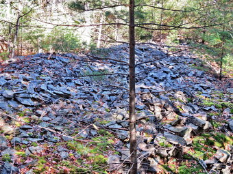
![]()
![]()
![]()
![]()
![]() On Sunday, October 5th I wanted to work on the Catskill Mountain Club All Trails Challenge. The club has published a list of all the marked trails in the Catskills and will award a patch and a T-shirt for anyone who has hiked all the trails. I filled in the dates that corresponded to when I had hiked these trails and found I was only a few trails short of completion. One area I had not hiked was the Bluestone State Forest near Kingston. There are two sets of trails in the area that area used for both hiking and mountain biking. There are three trail loops near Onteora Lake and another set of trails just east of Onteora Lake on Jockey Hill. I decided to head to that area on see if I could complete those trails. I left Livingston Manor at about 8:15 AM with a very excited Sheila in the back seat. The temperature overnight had gone down to just above freezing and it was still cool. I decided to follow the driving route suggested by Google Maps which directed me to take Route 52 through Woodbourne to Ellenville and then take Route 209 to Kingston. From Kingston the Bluestone state Forest is only a few miles west on Route 28. This is not normally the route I would use but it proved to be faster as it took only about 1.5 hours to get to my destination. The maps were a little unclear about exactly how to get to the parking area but I found the parking area and access road right off Route 28. I pulled in and was going to park in the lot but realized I could rive further on the access road. I drove down to the lower lot which had a few cars parked already. It was still cool as we began our hike at 9:45 AM. I had Sheila's training collar on her but I put her on her leash as there were several other dogs around. We headed out on the yellow trail which starts north on the west side of the lake. The first part of the trail has been made handicapped accessible and has a few picnic tables. The trail then shifts to a woods road which begins to get rocky pretty quickly. The red loop branches from the yellow loop and the blue loop branches from the red loop. My intention was to head left at each trail junction and to complete the loops in that order. At .7 miles the trail turned around the north end of the lake and changed from northeast to almost due south. Soon after that I realized I had missed the point where the yellow trail splits into a loop. I had continued to the left without ever spotting the trail junction. At .9 miles we came to the red trail junction and turned left to begin this loop.
On Sunday, October 5th I wanted to work on the Catskill Mountain Club All Trails Challenge. The club has published a list of all the marked trails in the Catskills and will award a patch and a T-shirt for anyone who has hiked all the trails. I filled in the dates that corresponded to when I had hiked these trails and found I was only a few trails short of completion. One area I had not hiked was the Bluestone State Forest near Kingston. There are two sets of trails in the area that area used for both hiking and mountain biking. There are three trail loops near Onteora Lake and another set of trails just east of Onteora Lake on Jockey Hill. I decided to head to that area on see if I could complete those trails. I left Livingston Manor at about 8:15 AM with a very excited Sheila in the back seat. The temperature overnight had gone down to just above freezing and it was still cool. I decided to follow the driving route suggested by Google Maps which directed me to take Route 52 through Woodbourne to Ellenville and then take Route 209 to Kingston. From Kingston the Bluestone state Forest is only a few miles west on Route 28. This is not normally the route I would use but it proved to be faster as it took only about 1.5 hours to get to my destination. The maps were a little unclear about exactly how to get to the parking area but I found the parking area and access road right off Route 28. I pulled in and was going to park in the lot but realized I could rive further on the access road. I drove down to the lower lot which had a few cars parked already. It was still cool as we began our hike at 9:45 AM. I had Sheila's training collar on her but I put her on her leash as there were several other dogs around. We headed out on the yellow trail which starts north on the west side of the lake. The first part of the trail has been made handicapped accessible and has a few picnic tables. The trail then shifts to a woods road which begins to get rocky pretty quickly. The red loop branches from the yellow loop and the blue loop branches from the red loop. My intention was to head left at each trail junction and to complete the loops in that order. At .7 miles the trail turned around the north end of the lake and changed from northeast to almost due south. Soon after that I realized I had missed the point where the yellow trail splits into a loop. I had continued to the left without ever spotting the trail junction. At .9 miles we came to the red trail junction and turned left to begin this loop.
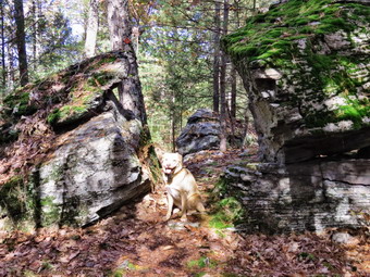 All three loops are "lollipops" with a "handle" that leads in to the loop and then back out again. At 1.3 miles we were at the point where the red loops starts and we headed left. The trail climbs from the point where the red trail starts and reaches the highest point on the hike at 1.6 miles. Along the way the trail has some ups and downs but only gains a little over 200 feet from the point where the yellow loops splits. There are no real views along the way but the trail passes through some boulders and is generally fun to hike. The blazes are spaced a little farther apart than usual but this may be because it is maintained by the mountain bike club and they move a little faster than hikers. About half way through the red loop we met the only mountain biker of the day. He was riding up a grade over some sharp stone and seemed to be putting out quite an effort. Sheila saw or heard him well before I did and came over to me whining. We moved off the trail until the biker could go by. We continued on the red loop which got considerably rockier and more narrow in some areas. There were a few blowdowns across the trail. Some were low enough to jump on a bike but I thought others would require dismounting. At 2 miles the red loop made a turn and we were again headed south climbing another hill. At 2.5 miles the blue trial was on the left and we turned to access that trail. The handle of this trail was the shortest and in about .15 miles the trail split to begin the loop. We stayed to the left immediately dropping about 100 feet as we headed north and east. At 3.1 miles the trail turned southeast to loop back to where the blue trail started and we gained the elevation we had lost. The blue trail was by far the rockiest of the three trails and had areas where even the not experienced mountain biker would have problems. Once we were back at the trail junction with the red trail it was hard to spot the red trail blazes. I turned left onto a well used trail and followed it briefly until I realized there were no markers. We retraced our path and I found the red blazes back at the trail junction. It felt good to have completed a loop and we continued on the red loop.
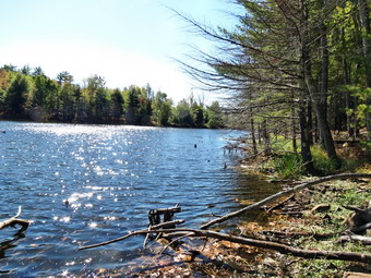 The red trail went east for about .25 miles to the point where the red trail had split. We turned left and followed the handle .4 miles southwest back to the yellow trail. The yellow trail took us southwest for about .6 miles to the shores of Pickerel Pond. This pond is more interesting than Onteora Lake so we stopped so that I could take some pictures and Sheila could have a swim. When I finished and started to pack up, Sheila decided to do her mad dash up and down the trails. The yellow trail followed the western shore of the pond for a short distance and then turned west at 5.3 miles to cross over to the eastern shore of Onteora Lake. Once on the shore of the lake the trail headed northeast for .7 miles back to the point where the yellow trail splits. The trail is sited on a ridge that runs along the eastern shore and does not offer many views. The trail rolls up and down a little and at one point passes between some rocks and up an incline. At 5.6 miles we turned left to head back to the parking area on the yellow trail retracing our path from earlier. As we made the turn at the head of the lake I stopped to take some pictures of one of the areas that showed obvious signs of bluestone quarrying. There had been many examples of this along the way but most were hard to photograph. As we returned to the car, we met a group of hikers with two dogs headed in the opposite direction. We stopped at one of the picnic areas and I took pictures of the lake before returning to the car. It was 12:35 PM and we had covered 7.1 miles in 2 hours and 45 minutes. It was time to move on to Jockey Hill.
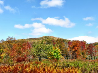
![]()
![]()
![]()
![]()
![]() On Friday, October 3rd, I was ready to get out again after some inclement weather and coaching commitments had kept me out of the woods for three days. I wanted to renew my efforts to find some fall colors before the rain forecast for Saturday brought even more of the leaves down! I decided to return to Balsam Lake Mountain as the colors had been good there on Monday but the skies had been gray and overcast. I was hoping for better conditions on Friday but the skies looked bleak when I woke up. There was a heavy fog in the valley and the skies did not look like they would be blue. I delayed until about 10:45 AM and then decided that a bad day out was better than a good day in the house. I got Sheila in the car and drove up the Beaverkill Road all the way to the very end. The further I drove the better the skies looked with some sun and expanses of blue with white clouds. At the intersection with the Barkaboom Road, It turned left and drove to Big Pond. I parked in the lot and walked down to the edge of the pond with my camera. I have been taking pictures from the same spots for over a week to see the progression as the leaves have changed color. This was by far the nicest day and I took some shots of the bright colors and beautiful sky. It didn't take long to get back on the road. We arrived in the parking area at about 11:25 AM to find no other cars present. By now the skies were blue with a few white clouds and some sun. We took a minute to walk out the trail toward Vly hat I could take some pictures of Balsam lake Mountain from the clearing. We walked back to the car to begin our hike at about 11:35 AM. The walk to the first trail junction seemed to again go quickly and we stopped briefly so that I could remove my light windbreaker for the climb to the fire tower. The trail was now covered in fallen leaves which made getting a good footing a little more difficult. We kept up a good pace and were soon passing by the spur trail to the lean-to. After a short climb, we passed the 3500 foot sign and the spring and reached the area where the trail levels. by 12:35 PM we had hiked the 1.7 miles to the tower clearing.
On Friday, October 3rd, I was ready to get out again after some inclement weather and coaching commitments had kept me out of the woods for three days. I wanted to renew my efforts to find some fall colors before the rain forecast for Saturday brought even more of the leaves down! I decided to return to Balsam Lake Mountain as the colors had been good there on Monday but the skies had been gray and overcast. I was hoping for better conditions on Friday but the skies looked bleak when I woke up. There was a heavy fog in the valley and the skies did not look like they would be blue. I delayed until about 10:45 AM and then decided that a bad day out was better than a good day in the house. I got Sheila in the car and drove up the Beaverkill Road all the way to the very end. The further I drove the better the skies looked with some sun and expanses of blue with white clouds. At the intersection with the Barkaboom Road, It turned left and drove to Big Pond. I parked in the lot and walked down to the edge of the pond with my camera. I have been taking pictures from the same spots for over a week to see the progression as the leaves have changed color. This was by far the nicest day and I took some shots of the bright colors and beautiful sky. It didn't take long to get back on the road. We arrived in the parking area at about 11:25 AM to find no other cars present. By now the skies were blue with a few white clouds and some sun. We took a minute to walk out the trail toward Vly hat I could take some pictures of Balsam lake Mountain from the clearing. We walked back to the car to begin our hike at about 11:35 AM. The walk to the first trail junction seemed to again go quickly and we stopped briefly so that I could remove my light windbreaker for the climb to the fire tower. The trail was now covered in fallen leaves which made getting a good footing a little more difficult. We kept up a good pace and were soon passing by the spur trail to the lean-to. After a short climb, we passed the 3500 foot sign and the spring and reached the area where the trail levels. by 12:35 PM we had hiked the 1.7 miles to the tower clearing.
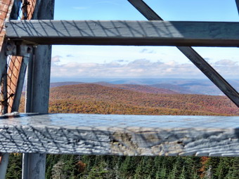 We walked over to the picnic table where I dropped my pack and got out the camera for the climb to the top of the tower. This is one of the few times I did not take pictures of the tower itself since they all seem to look the same. The sun was out but there were fewer clouds in the blue sky. As I climbed to the top of the tower, I told Sheila to stay below. I began to notice that there was a stiff breeze blowing which was especially noticeable after I cleared the treeline. After breaking a good sweat on the climb, I was a little cool. I stopped on the landing below the cab and surveyed the landscape. It seemed to me that the colors were not quite as good as on Monday but the blue, sunny skies made up for that. I took many pictures in different direction. I even took a few shots through the tower steps and some with the tower supports visible. I descended the steps, took a few pictures of the dog on the bottom landing and went back to the picnic table to gather my gear. We started down the Millbrook side of the mountain and I felt so good I began to think about hiking to Graham or to Vly and Tunis Ponds. The hike down was tricky as there was still loose dirt and slippery rocks but they were all covered by fresh leaves. Having my poles with me saved me more than once and we were soon at the bottom of the climb at the trail junction. I turned left and made the commitment to climb Graham. I had not been up Graham in some time but was anxious to see what the countryside looked like from some of the lookouts. The herd path is now very easy to spot but has grown in a little since the last time I was there. Once we started on the path, we lost a little over 150 feet in elevation as we descended the trail to Graham. At one point the path look so unfamiliar, that I thought I might have taken a wrong turn. I knew this was impossible since there are no turns to take and as soon as we began to climb things looked more familiar.
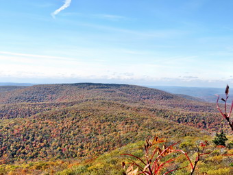 From the beginning of the climb it is about .75 miles to the summit of Graham with a gain of 650 feet. There are some steeper portions but the average grade is 15%. Along the way we passed by a large rock on the right side of the trail. I looked carefully and it seemed there might be view from the top of the rock. I followed a path to the rock and found a way to get on top. Sheila had no problem following me. Like many viewpoints this one had some bushes in the way but it was worth the detour. I took some pictures and then returned to the main trail. Our next stop was the viewpoint on the left side of the trail just below the summit. I found this with no problem but was surprised at how much the vegetation had grown up. Many of the views I remember were now blocked including the view of the telephone pole. The tower was at one time supplied with power and communications through lines that ran from pole to pole. I took a few pictures around and through the trees before completing the walk to the top of the mountain. The breeze was blowing across the summit and I headed for the other side of the clearing to walk through the brush to another lookout. I found the rock where I normally stand but the views ROM it were also blocked by some branches. I took what pictures I could including one that zoomed in on the fire tower. The tower looked very far away. We returned to the summit where I took a few pictures of the ruins and a few more of the landscape before starting the return trip. We left the summit at 2:15 PM after hiking about 5 miles. I estimated we had about 3.5 miles to go to get back to the car. Walking down the path back to the trail junction was not as easy as I had thought it would be and I had to pick my way carefully. The weather was still nice giving no indication of the rain that was supposed to be present the next day. We hot the trail junction at 3:10 PM and turned left to head back to the parking area. We had been over this trail on Monday so the trip back to the car was very familiar and went quickly. I looked for some views along the way but the leaves on the trees blocked any I could have found. As we neared the end of the trail, both Sheila and I could hear voices ahead. Two young men approached us and I grabbed Sheila as they passed. I said "Hello" but they seemed to be in a very animated conversation and barely acknowledged our presence. We were back at the car by 4:00 PM having hike 8.5 miles in 4 hours and 20 minutes which included almost 30 minutes of stopped time. The vertical gain was 2349 feet.
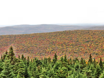
![]()
![]()
![]()
![]()
![]() On Monday, September 29th, I wanted to continue my quest to find some fall colors. I read a post on one of the hiking forums that Balsam Lake Mo9untain was "near peak" over the weekend so I decided to head there. The weather forecast had predicted high clouds with sunny skies but all I saw was an overcast as I left Livingston Manor around 9:00 AM. I hoped that the skies would clear and turn blue and there was some indication of this as I drove up the Beaverkill Road. Some places on the road had been repaired to make them easier to drive but after then Quill Gordon Lodge the road was pretty rough. We arrived in the parking area and started our hike at about 9:35 AM. There were no other cars in the lot and I wasn't surprised that we did not have any company. Although the skies were still overcast, the temperature was warm. I wore a light windbreaker but knew it would come off by the time we started the climb. There were some nice colors visible from the parking area and some blue skies to the east. Sheila and I headed up the trail keeping a quick pace. There were several trees hanging over the trail and although they seemed safe I would prefer that they were gone. We made the trail junction at .9 miles by 10:00 AM and stopped to get a drink and to let me stow my windbreaker. Over the next half mile the trail gains about 750 feet before leveling off which means an average of around a 28% grade! Despite the grade, the seemed to go quickly and we were soon passing the spur trail to the lean-to and the spring. We walked up the stone steps to the summit plateau and continued on toward the fire tower. The trail was dry except for one or two spots where it was a little muddy. There were some nice colors along the trail mixed in with the evergreens. We arrived at the tower clearing at 10:40 AM after hiking 1.7 miles. I took some pictures of the tower and then walked over to the picnic table to drop my pack.
On Monday, September 29th, I wanted to continue my quest to find some fall colors. I read a post on one of the hiking forums that Balsam Lake Mo9untain was "near peak" over the weekend so I decided to head there. The weather forecast had predicted high clouds with sunny skies but all I saw was an overcast as I left Livingston Manor around 9:00 AM. I hoped that the skies would clear and turn blue and there was some indication of this as I drove up the Beaverkill Road. Some places on the road had been repaired to make them easier to drive but after then Quill Gordon Lodge the road was pretty rough. We arrived in the parking area and started our hike at about 9:35 AM. There were no other cars in the lot and I wasn't surprised that we did not have any company. Although the skies were still overcast, the temperature was warm. I wore a light windbreaker but knew it would come off by the time we started the climb. There were some nice colors visible from the parking area and some blue skies to the east. Sheila and I headed up the trail keeping a quick pace. There were several trees hanging over the trail and although they seemed safe I would prefer that they were gone. We made the trail junction at .9 miles by 10:00 AM and stopped to get a drink and to let me stow my windbreaker. Over the next half mile the trail gains about 750 feet before leveling off which means an average of around a 28% grade! Despite the grade, the seemed to go quickly and we were soon passing the spur trail to the lean-to and the spring. We walked up the stone steps to the summit plateau and continued on toward the fire tower. The trail was dry except for one or two spots where it was a little muddy. There were some nice colors along the trail mixed in with the evergreens. We arrived at the tower clearing at 10:40 AM after hiking 1.7 miles. I took some pictures of the tower and then walked over to the picnic table to drop my pack.
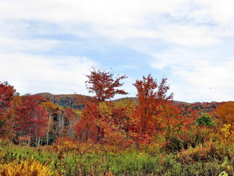 As I got ready to climb the tower, I realized I had left Sheila's leash in the car. Sheila has no fear of the steps on the tower or of heights so she tends to follow me up the towers. I directed her to stay on the ground so she only climbed to the second landing. As I climbed the tower the breeze picked up. Once I was on the landing below the cab I could see that the colors were very bright and that most of the trees had turned. The problem was that the sky was still overcast so the backdrop was not ideal. I did take quite a few pictures before heading back down to the ground. I took a few of Sheila on the tower and then headed back to my pack. At that moment another hiker approached from the Millbrook side and startled Sheila. Sheila started barking and ran toward the hiker who calmly waited for her to stop. I apologized and he was very understanding. We talked for a few minutes before heading in our different directions. Sheila and I started down the more gentle slope on the trail that passes by the cabin. The trail was dry and descending over the loose dirt and gravel was a challenge. It didn't take us long before we were at the gate and then at the trail junction. We turned right to head back to the parking area. As we walked, I could hear a rustling sound which was the leaves falling from the trees in a gentle breeze. The time to look for fall colors in this area is now! The first section of the trail was a little damp and the leaves over the mossy rocks made things interesting. We set a good pace and were soon passing the trail junction where we had turned up the mountain earlier. We continued on and as we entered the lower section of the trail I saw some nice colors off to the right. I took a few shots and then we headed back to the car. As we approached the parking area, I could hear voices and I saw a family of four getting ready to hike. Their license plate was from North Carolina and they asked some questions about the trail. After answering their questions, I put Sheila in the car and walked out the trail to Vly Pond with my camera. There were some very nice views of Balsam Lake Mountain and there was even some blue sky. I went back to the car to get ready to leave. We had hiked 4.3 miles in 2 hours gaining 1200 feet in the process. On the way home I too a detour to Big Pond and took some pictures. The colors there were even nicer than on the mountain. The reflections in the pond were beautiful. The only thing that was lacking was blue skies with puffy clouds!
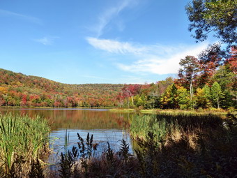
![]()
![]()
![]()
![]()
![]() On Sunday, September 28th I wanted to get out for a short, local hike after church. I was surprised when Cindy agreed to go as we had hiked a 35 the day before. We agreed to go to Huggins Lake as it is only about 4 miles and close to home. After church ended at 10:30 AM, we went home to get ready for the hike. We took our time as we were in no hurry. On the way to the hike we stopped in Roscoe at the farmer's market and the headed out Route 206 to Berry Brook Road. As we drove along Berry Brook Road, we could see the brook was very low in that area. At the intersection with the Covered Bridge Road there was a sign that stated the road was closed 6.5 miles ahead. I knew that was well beyond the Huggins Lake area so we continued and in a couple of miles turned right onto the access road to the parking area. As we had suspected we were the only car there and we were all happy we would not see as many people as we had see on Twin Mountain the day before! We began our hike by walking up the wide woods road at 11:50 AM. The trail is not marked on any map and I watched this time to see if I could spot any blazes. There were no blazes of any kind to indicate that the road is a hiking or snowmobile trail. The DEC has maintained the trail but I do not know to what end. I do know that I always think of this as an easy hike and am always surprised that the first part is all uphill. Over the first 1.25 miles the elevation gain is about 625 feet. This averages under a 10% grade but it seems like more. At the top of the hill we began to walk along some high ground that looks down on Huggins Lake. In the winter, the lake is clearly visible but the leaves hide it during the other seasons.
On Sunday, September 28th I wanted to get out for a short, local hike after church. I was surprised when Cindy agreed to go as we had hiked a 35 the day before. We agreed to go to Huggins Lake as it is only about 4 miles and close to home. After church ended at 10:30 AM, we went home to get ready for the hike. We took our time as we were in no hurry. On the way to the hike we stopped in Roscoe at the farmer's market and the headed out Route 206 to Berry Brook Road. As we drove along Berry Brook Road, we could see the brook was very low in that area. At the intersection with the Covered Bridge Road there was a sign that stated the road was closed 6.5 miles ahead. I knew that was well beyond the Huggins Lake area so we continued and in a couple of miles turned right onto the access road to the parking area. As we had suspected we were the only car there and we were all happy we would not see as many people as we had see on Twin Mountain the day before! We began our hike by walking up the wide woods road at 11:50 AM. The trail is not marked on any map and I watched this time to see if I could spot any blazes. There were no blazes of any kind to indicate that the road is a hiking or snowmobile trail. The DEC has maintained the trail but I do not know to what end. I do know that I always think of this as an easy hike and am always surprised that the first part is all uphill. Over the first 1.25 miles the elevation gain is about 625 feet. This averages under a 10% grade but it seems like more. At the top of the hill we began to walk along some high ground that looks down on Huggins Lake. In the winter, the lake is clearly visible but the leaves hide it during the other seasons.
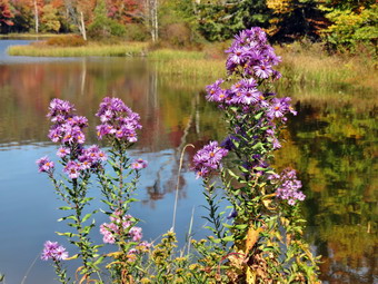 After the top of the hill, the trail descends gentle at first until at 1.7 miles it turns sharply left and drops a little more steeply to the shore of the lake. When we arrived at the lake, we could see that there were some colors present but they were not very bright. I dropped my pack and took some pictures. Some of the best colors were in the flowers and shrubs surrounding the pond. There were some nice reflections in the water and the sky was blue with a few clouds. Sheila decided to jump in for a swim and I picked up a stick to throw for her. I took some pictures of her in the water. When she was done swimming, she began to run back and forth like a maniac as she normally does. By the time she is done with these antics she is almost dry! I picked up my pack and we headed back up the trail. The only negative point about Huggins Lake is that there is only one trail and so there are no variations available. I have tried bushwhacking around the pond but the bushes get pretty thick. As we started down the hill, we began to hear gunfire which I identified as a shotgun. I am never happy about hearing shots when I am out hiking but they seemed to be located in one spot and gave me the idea that someone was target shooting. As we continued to descend, we met a family of four hiking up the hill. I had to hold on to Sheila as I had not brought her leash since I did not expect to see any other hikers! The gunfire continued as we approached the car and I was happy when we were all inside. We had hiked 3.8 miles in 1 hour and 45 minutes. As we left the parking area, I turned right to see why the road was closed. Eventually we came to another sign warning us that the bridge was out ahead. The signs were correct and the bridge was completely gone. We turned around and headed back to Livingston Manor by way of the Beaverkill Covered Bridge and Beaverkill Road.
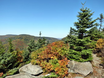
![]()
![]()
![]()
![]() On Saturday, September 27th, I wanted to look for some fall colors even though they didn't seem to be too prominent around Livingston Manor. I thought going farther north and gaining some elevation might help so I asked Cindy if she would like to go to Twin Mountain. She had never climbed Twin as I had always started with Indian Head and after one mountain Cindy was never in the mood for another! She agreed and I knew we should get started early as I felt others would have the same idea. As it was we got out of the house a little late and arrived at the Prediger Road parking area at 10:15 Am. The parking area was filling quickly and we were lucky to get one of the last legitimate parking spaces. We got started right away as there was a rather large number of people getting ready to start out. I suspected they might be a group so we hurried up the trail. The Jimmy Dolan Notch Trail is one of my least favorite trails in the Catskills due to the constant poor footing. There are roots and rocks and loose dirt the entire way to the col between Indian Head and Twin. As we were walking on the first part of the trail, we met a young woman carrying her baby in a sling across her chest. We said "Hello" and pushed on. I commented that it looked like she was out for a short walk and had not climbed a mountain. At .3 miles we crossed a stream that was almost dry. I had crossed this stream on other hikes and found it difficult not to get wet. This was also the point where we headed right on the Jimmy Dolan Notch Trail while the Devil's Path went left to the east side of Indian Head. At .5 miles an enormous tree completely blocked the trail. It must have been there for a while as hikers had made a path around it on the left. By this time we were well into the rocks and roots but had not yet begun to climb. A little after this we met two young boys, their father and an older man. They were parked in the middle of the trail and I had to leave the trail to walk around them so that Sheila would not bother the kids. Sheila can be very friendly and I usually keep her on a leash around other people. t 1.5 miles we began to climb over the rocks and over the next .6 miles we gained 580 feet to the notch. It was 11:30 Am and we had made 2.1 miles and 1120 feet of elevation gain. Of course, once you are in the col, there is still the climb to the peak. We turned right on the Devil's Path and started up the mountain. We had met relatively few people on the way up and I thought that many might have gone over to Indian Head first.
On Saturday, September 27th, I wanted to look for some fall colors even though they didn't seem to be too prominent around Livingston Manor. I thought going farther north and gaining some elevation might help so I asked Cindy if she would like to go to Twin Mountain. She had never climbed Twin as I had always started with Indian Head and after one mountain Cindy was never in the mood for another! She agreed and I knew we should get started early as I felt others would have the same idea. As it was we got out of the house a little late and arrived at the Prediger Road parking area at 10:15 Am. The parking area was filling quickly and we were lucky to get one of the last legitimate parking spaces. We got started right away as there was a rather large number of people getting ready to start out. I suspected they might be a group so we hurried up the trail. The Jimmy Dolan Notch Trail is one of my least favorite trails in the Catskills due to the constant poor footing. There are roots and rocks and loose dirt the entire way to the col between Indian Head and Twin. As we were walking on the first part of the trail, we met a young woman carrying her baby in a sling across her chest. We said "Hello" and pushed on. I commented that it looked like she was out for a short walk and had not climbed a mountain. At .3 miles we crossed a stream that was almost dry. I had crossed this stream on other hikes and found it difficult not to get wet. This was also the point where we headed right on the Jimmy Dolan Notch Trail while the Devil's Path went left to the east side of Indian Head. At .5 miles an enormous tree completely blocked the trail. It must have been there for a while as hikers had made a path around it on the left. By this time we were well into the rocks and roots but had not yet begun to climb. A little after this we met two young boys, their father and an older man. They were parked in the middle of the trail and I had to leave the trail to walk around them so that Sheila would not bother the kids. Sheila can be very friendly and I usually keep her on a leash around other people. t 1.5 miles we began to climb over the rocks and over the next .6 miles we gained 580 feet to the notch. It was 11:30 Am and we had made 2.1 miles and 1120 feet of elevation gain. Of course, once you are in the col, there is still the climb to the peak. We turned right on the Devil's Path and started up the mountain. We had met relatively few people on the way up and I thought that many might have gone over to Indian Head first.
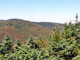 There are several very steep places on the climb to Twin and more than one requires some hand or hand to get up. Sheila does not have hands but she made all the climbs with no problem! After a few climbs we were approaching the viewpoint toward Indian Head and Cindy was ready for a rest. We stopped at the small break in the trees and I got my camera out. The falls colors weren't very prominent and a haze hung over the landscape. We got a drink and a snack and started out to finish the climb to the eastern peak of Twin. We broke out onto the open rocks that form one of the best viewpoints on the Catskills just after noon. Again, the colors were muted and there was some haze but the view was still nice. The best colors seemed to be on Sugarloaf and I took a few shots. We rested for about 10 minutes and three other hikers came up from the col. One continued on but the other two stopped to enjoy the view. After our rest, we headed for the west, and higher, peak of Twin. My plan was to hike down to Pecoy Notch and then walk the roads back to the car. This would be longer than an out and back but would avoid hiking the Jimmy Dolan Notch Trail twice! I also knew that there would be many more people going up and down that trail. The walk over to the west peak requires a drop of about 100 feet and then an ascent of around 150 feet. The distance, however, is only .7 miles. When we reached the west peak there were three people eating lunch. I walked out to the rock overhand and took some more pictures. We got a drink and I asked Cindy how she wanted to return to the car. I was disappointed that she chose to return way we came but I understood her reasoning. We started back at 12:40 Pm and immediately ran into several groups of hikers headed our way. As always, the choice of dress and footwear is always interesting! The trail was very dry which made it impossible to gain any speed on the descent. Careful foot and pole placement was required in many places to prevent a spill. We worked our way down having to wait as several groups came by us an their ascent. By 1:35 PM we were back at the col and turned left to head back down to the car. More people were coming up the trail and a few were descending. The climb down can be interesting but we soon hit the end of the steeper sections. The remaining part of the hike through the loose rocks, dirt and roots seemed to take forever. I was very glad when I could see the parking area ahead. There were many more cars in the lot and I counted over 40 total with a few empty spots. We were back at the car by 2:45 PM having covered 6.1 miles and 1850 feet of elevation gain in 4 hours and 20 minutes. As a reward we headed to Pancho Villa's in Tannersville for some good Mexican food!
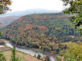
![]()
![]()
![]()
![]() On Thursday, September 25th I left Vromans Nose and headed south on Route 30. On the way to Grand Gorge I turned left on Route 990V and took it through Gilboa to West Conesville. Here I turned right on County Route 7 which follows the Schoharie Reservoir to PrattI turned left and traveled east on Route 23 to the other side of town and parked in Pratt Rock parking area on the left side of the road. There were no other cars parked in the lot. The skies were still gray and fall colors hard to find. We started our hike at 12:35 PM by walking through the picnic area to the far end where we started up the trail. When we arrived at the trail junction, I chose to stay to the left rather than head directly to the carvings on the face of the cliff. We ascended the trail that leads to the overlook and I put Sheila on her leash so that she could again help pull me up the steep hill. I had decided to leave my poles in the car and was sorry that I did so. We were soon at the overlook and the situation was much the same as On Vromans Nose. The sky was gray and the patches of color were sporadic. I stopped to take some pictures along the Batavia Kill and of the farms below the viewpoint. I picked up and moved to the next lookout which gave me slightly different views so I stopped to take a few more shots. After putting away the camera, we headed up the hill where I intended to make a loop by walking the path on the other side of the cliffs down to the carvings. As we neared the turn, I saw a path leading further up the hill. I was interested to see where it lead as I had never been in this direction. We headed further east below some low cliffs and then found a path to the top of them. A path continued to the east along an extended line of cliffs. There were several viewpoints and we stopped at one and I took a few more pictures. From this point on the trail grew fainter so I decided to bushwhack up to the highest point on the nearest ridge. We continued to the east and up the side of the ridge again picking our way through some low cliffs. Near the top of the ridge the brush began to get thick so we turned north and started down. I had seen a woods road extending to the east and north on the way out and decided to head for where I thought it would be.
On Thursday, September 25th I left Vromans Nose and headed south on Route 30. On the way to Grand Gorge I turned left on Route 990V and took it through Gilboa to West Conesville. Here I turned right on County Route 7 which follows the Schoharie Reservoir to PrattI turned left and traveled east on Route 23 to the other side of town and parked in Pratt Rock parking area on the left side of the road. There were no other cars parked in the lot. The skies were still gray and fall colors hard to find. We started our hike at 12:35 PM by walking through the picnic area to the far end where we started up the trail. When we arrived at the trail junction, I chose to stay to the left rather than head directly to the carvings on the face of the cliff. We ascended the trail that leads to the overlook and I put Sheila on her leash so that she could again help pull me up the steep hill. I had decided to leave my poles in the car and was sorry that I did so. We were soon at the overlook and the situation was much the same as On Vromans Nose. The sky was gray and the patches of color were sporadic. I stopped to take some pictures along the Batavia Kill and of the farms below the viewpoint. I picked up and moved to the next lookout which gave me slightly different views so I stopped to take a few more shots. After putting away the camera, we headed up the hill where I intended to make a loop by walking the path on the other side of the cliffs down to the carvings. As we neared the turn, I saw a path leading further up the hill. I was interested to see where it lead as I had never been in this direction. We headed further east below some low cliffs and then found a path to the top of them. A path continued to the east along an extended line of cliffs. There were several viewpoints and we stopped at one and I took a few more pictures. From this point on the trail grew fainter so I decided to bushwhack up to the highest point on the nearest ridge. We continued to the east and up the side of the ridge again picking our way through some low cliffs. Near the top of the ridge the brush began to get thick so we turned north and started down. I had seen a woods road extending to the east and north on the way out and decided to head for where I thought it would be.
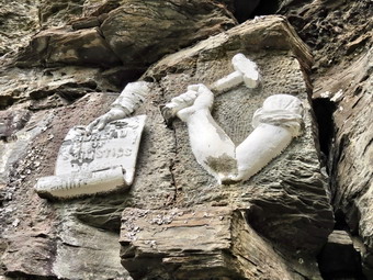 When we hit the road, we turned right heading north toward a power line indicated on my GPS. We descended slightly to the right-of-way and soon broke out into the open. In both directions along the right-of-way there were some nice patches of color. I took a few shots and then decided to turn right or east to ascend to the top of the ridge where I hoped I could get a good view. It was about a quarter mile to the top of the ridge and we gained about 300 feet. As we broke over the top, I saw that the right-of-way descended into a valley and then ascended another ridge. There was no stunning view but there were some of the brightest colors I had seen on the day. The power line towers blocked part of the few so we descended to the next tower and I took pictures of the trees on the next ridge as well as some of the mountains. We turned around and followed our route back down to where we had come out of the woods. We followed the woods road back to the path along the cliffs and to the point where the path led down to the carvings. As we started down the path, I found dry dust and loose talus with a few leaves sprinkled in. I immediately wished I had stowed my poles in my pack for this descent. Fortunately, there were enough roots and trees to garb onto to help in the descent. I stopped once or twice to take pictures of the towering cliffs. Soon we had finished the descent and were at the area of the stone carvings. I took pictures of the carvings and then we made our way down the path. At the main trail we turned left and worked our way back through the picnic area to the car. We were back by 2:15 PM having hiked 3.1 miles in 1 hour and 40 minutes with an elevation gain of 1100 feet.
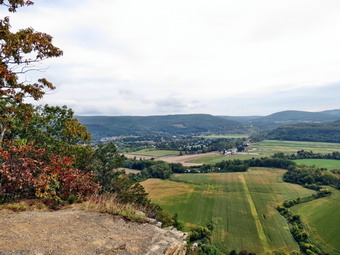
![]()
![]()
![]()
![]() On Thursday, October 13th I had planned a rather long hike on the Burroughs Range but the weather forecast changed to rain and clouds. I was looking for some fall colors as well as a hike so I decided to head north where the skies were forecast to be clearer. I considered Morgan Hill SF but I got a late start and headed for Vromans Nose in Middleburgh. We left Livingston Manor just after 9:50 AM and headed up the Beaverkill Road to the Barkaboom Road. At the end of the road I turned right on BWS 10 and took it to Route 28 in Margaretville. We turned right and then left to follow Route 30 through Margaretville, Roxbury, Grand Gorge and North Blenheim. Just outside of Middleburgh I turned left on Mill Valley Road. Less than a mile up the road I parked in the Vromans Nose parking lot on the left side of the road. There were tow other cars in the lot when Sheila and I left to start our hike at 11:20 AM. Unfortunately I had not seen very many brilliant colors on the drive through the Schoharie Valley and the skies were uniformly overcast without the contrast of blue sky! I had left my poles in the car as the hike is very short and I knew I might have to put Sheila on her leash. As we walked through the open field that leads to the trails, I decided we would walk to the left and hike the steeper side first. I had never done this but it seemed a better idea to go up the steep side and down the more gentle one. As we turned onto the yellow blazed trail I noted that it did not seem familiar and I questioned whether or not I was on the correct path. We soon came to the junction with the Long Path and I realized it was just that I was traveling in a direction I had never taken before.
On Thursday, October 13th I had planned a rather long hike on the Burroughs Range but the weather forecast changed to rain and clouds. I was looking for some fall colors as well as a hike so I decided to head north where the skies were forecast to be clearer. I considered Morgan Hill SF but I got a late start and headed for Vromans Nose in Middleburgh. We left Livingston Manor just after 9:50 AM and headed up the Beaverkill Road to the Barkaboom Road. At the end of the road I turned right on BWS 10 and took it to Route 28 in Margaretville. We turned right and then left to follow Route 30 through Margaretville, Roxbury, Grand Gorge and North Blenheim. Just outside of Middleburgh I turned left on Mill Valley Road. Less than a mile up the road I parked in the Vromans Nose parking lot on the left side of the road. There were tow other cars in the lot when Sheila and I left to start our hike at 11:20 AM. Unfortunately I had not seen very many brilliant colors on the drive through the Schoharie Valley and the skies were uniformly overcast without the contrast of blue sky! I had left my poles in the car as the hike is very short and I knew I might have to put Sheila on her leash. As we walked through the open field that leads to the trails, I decided we would walk to the left and hike the steeper side first. I had never done this but it seemed a better idea to go up the steep side and down the more gentle one. As we turned onto the yellow blazed trail I noted that it did not seem familiar and I questioned whether or not I was on the correct path. We soon came to the junction with the Long Path and I realized it was just that I was traveling in a direction I had never taken before.
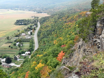 We started up the steep part of the trail and I put Sheila on her leash as her pulling helps me up these inclines. Along the way we met a couple with their dog and another young woman hiking alone. These encounters were brief as we continued up the trail. Over .4 miles the trail gains about 420 feet which is around a 21% grade. The dirt was very dry and had a smattering of leaves that interfered with traction. Soon we were at a lookout over the valley and the trail leveled quite a bit. We stopped so that I could take some pictures. I WA disappointed at the uniformly gray sky and lack of fall colors in most places. There were some splotches of color here and there and I took a few shots. Vromans Nose has an elevation of about 1220 feet above sea level which makes it about 500 feet higher than the surrounding plain. It isn't very high but it gives a great view of the plain below and the peaks both near and far. We continued our hike by walking along the edge of the cliff. We stopped two more times and I took some pictures of the colors on a nearby ridge. It seemed the higher elevations had the best colors. We met one more couple seated on one of the rock outcrops just before we started our descent. The descent starts out a little steep and slippery but soon become a wide path with a gentler slope. as we approached the parking area a family group was getting ready to hike. The five year old girl seemed to be the one with the most energy. We were back at the car by noon having hiked 1.5 miles in 41 minutes with an elevation gain of 520 feet. As we drove away I hoped that Pratt Rock had a little more to offer.
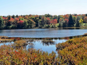
![]()
![]()
![]()
![]()
![]() On Tuesday, September 23rd I wanted to get in a rather long hike by starting early in the morning. As often happens, my plans were derailed by an early morning ambulance call/ By the time I got back, I had to settle for a shorter hike closer to home. It was the first day of autumn and the trees were already beginning to change especially on the hills. I decided to go to Long Pond and OD he big loop in a counterclockwise direction. I wanted to walk as fast as we could but take a few pictures along the way. I got Sheila in the car with my gear and headed out DeBruce Road fro about 8 miles to Flugertown Road where I made a left. I parked in the lot a short distance up the road on the right. The day was warm with some sun but a slight breeze blowing. It felt like autumn as we left the parking area at 11:45 AM to hike up the snowmobile trail. The first .6 miles gains about 350 feet to the highest point on the hike. It isn't very steep but does act as a nice warm-up! Along the way I saw that several trees that had been across the trail had been cut and removed. There were also some tracks which looked like they were made by a small tractor. I assumed this was the work of the snowmobile club preparing the trail for winter. At 1.1 miles we were at the spur trail that leads down to the shore of Long Pond. We turned right and walked down to the pond. I walked to the edge of the water and took some pictures of the pond and the falls colors around it. The leaves were beginning to change and the reds were particularly prominent. We walked back up to the main trail and continued to set a fast pace. At the first trail junction I debated cutting the hike short but decided to bear right and take the longer route. By 12:20 PM we had walked 1.8 miles and were passing the spur trail to the lean-to.
On Tuesday, September 23rd I wanted to get in a rather long hike by starting early in the morning. As often happens, my plans were derailed by an early morning ambulance call/ By the time I got back, I had to settle for a shorter hike closer to home. It was the first day of autumn and the trees were already beginning to change especially on the hills. I decided to go to Long Pond and OD he big loop in a counterclockwise direction. I wanted to walk as fast as we could but take a few pictures along the way. I got Sheila in the car with my gear and headed out DeBruce Road fro about 8 miles to Flugertown Road where I made a left. I parked in the lot a short distance up the road on the right. The day was warm with some sun but a slight breeze blowing. It felt like autumn as we left the parking area at 11:45 AM to hike up the snowmobile trail. The first .6 miles gains about 350 feet to the highest point on the hike. It isn't very steep but does act as a nice warm-up! Along the way I saw that several trees that had been across the trail had been cut and removed. There were also some tracks which looked like they were made by a small tractor. I assumed this was the work of the snowmobile club preparing the trail for winter. At 1.1 miles we were at the spur trail that leads down to the shore of Long Pond. We turned right and walked down to the pond. I walked to the edge of the water and took some pictures of the pond and the falls colors around it. The leaves were beginning to change and the reds were particularly prominent. We walked back up to the main trail and continued to set a fast pace. At the first trail junction I debated cutting the hike short but decided to bear right and take the longer route. By 12:20 PM we had walked 1.8 miles and were passing the spur trail to the lean-to.
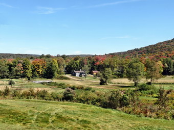 After passing the trail to the lean-to, we picked up the pace and continued on the main trail to the point where it intersected a woods road at 2.5 miles. We turned left and followed the road until the intersection with Basily Road at 2.85 miles. We continued on Basily Road by bearing to the left. I began to hear gunshots but could not determine whether they were ahead or behind us. At one point I was sure I heard them from both directions! As we approached the Peters Hunting Camp, I put Sheila on her leash. The area near the footbridge across the outlet to the beaver pond was flooded and pretty muddy. We made it to the small bridge and stopped so that I could take a few pictures. The shooting had stopped but I expected to see some cars at the camp. As we headed toward the bridge across the creek and came into site of the camp, there were no cars present. We continued across the bridge and up the small hill that overlooks the camp. At this point a car approached, heading toward the camp. I waved and they continued on their way. We stopped and I took some pictures on the camp in the valley and the hills surrounding it. The leaves were showing the first sign of color changes and were quite pretty. As we started in again, I knew that the rest of the hike was on road that turned from gravel to pavement. There were also not many more places to take pictures so I knew it would be a quick trip back. At 1:40 PM we were back at the parking area having hiked 6 miles in 1 hour and 50 minutes. The elevation gain was only about 600 feet most of which was at the beginning of the hike.