
What You Missed
Fall 2008
Fall 2008
![]()
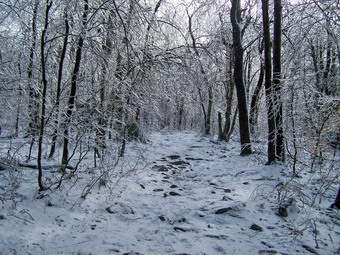
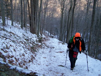
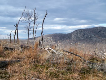
![]() On Saturday, Dec 13th I had planned to hike Slide and Panther with Sheba. When Cindy decided to go along, I decided to limit the hike to Panther. I was concerned that the recent rains had made the Neversink impassable at Slide. We left home just after 9:00 AM when the temperature was 18 degrees. The forecast was for temperatures in the mid to high 20's. Since it wasn't clear whether the area near Panther had gotten ice or snow we brought both our snowshoes and Stabilicers. DeBruce Road was reasonably clear until we started down the hill to the Frost Valley Road. Here the runoff from the side hill had taken a good part of the already narrow road and deposited it on the Frost Valley Road below. The DeBruce Road was limited to one lane but the debris had been cleared from the road below and we continued on. As we approached Slide, we noticed only one car in the lot and they appeared to be on the way out. Near Winnisook Lake the trees were covered in ice but there was little snow. The ice disappeared as we approached the Panther parking area but there was still no snow. However, the temperature had dropped to 10 degrees and there was a stiff breeze when we got out of the car. We decided NOT to wear or take the snowshoes. Cindy donned her Stabilicers and we were off.
On Saturday, Dec 13th I had planned to hike Slide and Panther with Sheba. When Cindy decided to go along, I decided to limit the hike to Panther. I was concerned that the recent rains had made the Neversink impassable at Slide. We left home just after 9:00 AM when the temperature was 18 degrees. The forecast was for temperatures in the mid to high 20's. Since it wasn't clear whether the area near Panther had gotten ice or snow we brought both our snowshoes and Stabilicers. DeBruce Road was reasonably clear until we started down the hill to the Frost Valley Road. Here the runoff from the side hill had taken a good part of the already narrow road and deposited it on the Frost Valley Road below. The DeBruce Road was limited to one lane but the debris had been cleared from the road below and we continued on. As we approached Slide, we noticed only one car in the lot and they appeared to be on the way out. Near Winnisook Lake the trees were covered in ice but there was little snow. The ice disappeared as we approached the Panther parking area but there was still no snow. However, the temperature had dropped to 10 degrees and there was a stiff breeze when we got out of the car. We decided NOT to wear or take the snowshoes. Cindy donned her Stabilicers and we were off.
 The trail was wet right from the beginning with running and standing water. There were also several large tress lying in the trail just after the register and more limbs further along the trail. We negotiated our way around these, crossed the bridge and made our way up the first hill. The trail to the trail junction has several steeper areas with more level areas in-between. These areas usually become major ice flows in the winter which are next to impossible to get over and are sometimes difficult to work around! On this day we had only one problem area and were easily able to work our way around it. I was having little problem using bare boots and the Stabilicers were working well for Cindy. As we gained elevation there was more and more ice on the trees. I decided to wait to take pictures since my hands were cold and I suspected there would be even more ice further along. Just before we made the turn toward Giant Ledge, we encountered a solo hiker. Just after the turn we were walking along when I looked up to see to hikers coming toward us. Snickers and Jay H greeted us. They were on their way back from Giant Ledge. We introduced ourselves all around and they informed us it was beautiful on Giant Ledge with lots of ice but little or no snow. We parted and Cindy and I hiked with great anticipation of what was to come.
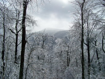
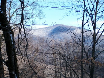
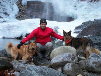
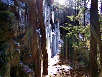
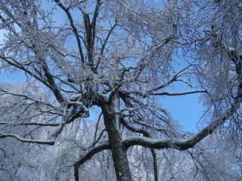 There was so MUCH ice on so MANY trees that it was hard to get through certain areas even on the trail. Frequently icy branches would break off and get into our jackets. Several times we had to work our way around overhangs. The trail was also very icy but I stubbornly refused to put on anything for traction. Just after the spring where the trail turns, I caught a wonderful view of Slide. It was framed by icy trees and the light was unusual I stopped and took pictures of the view, there trees and the trail. A little further along was the last big climb to the Ledges. We stopped here and I took some more pictures of iced trees at Cindy Suggestion. We then started the final ascent. I made it without putting on the Stabilicers and we were soon at the first lookout. The trees below were encased in ice and snow and the trees on the ledges had more ice than I have ever seen. As I stood taking pictures clouds began to move in and it started to snow lightly! I got some pretty good pictures before everything got obscured by the low clouds. We walked along the ledges stopping several times but the view was basically the same and the clouds and snow were increasing. As we neared the end of the Ledges and the beginning of the descent into the col between Ledges and Panther, I asked Cindy if she wanted to continue. She was in favor or returning to the car so we stopped and turned around. It had already taken us about an hour and a half and I thought this was the best decision.
 As we started back down the snow increased but then stopped as we back to the area near the spring. I took some more pictures but we kept a pretty good pace on the descent. Going down icy slopes is ALWAYS trickier than going up but we both made it almost unscathed. Cindy, the one WITH the Stabilicers, took the worst spill of the day and that wasn't too bad. We were back just after 2:30 PM using almost 4 hours to cover the 4 mile round trip. I was reminded how tough winter conditions can be and that extra time needs to be allowed to safely complete a hike.
![]()
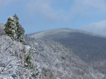
![]() On Saturday, Dec 6th I planned to go on a hike with a group I had met on the ADK High Peaks and Views From The Top forums. We had been emailing back and forth most of the week. The leader, Snickers, decided to do the section of the Long Path From Peekamoose over Bangle Hill to Vernooy Kill Falls. I was interested since I like these falls but had always come in from Upper Cherrytown Road which is a very short hike. I had not been on the section of the Long Path from Peekamoose but had heard that Bangle Hill was a good climb. Snickers decided to make it a car shuttle through hike starting at 9:00 AM in Peekamoose. I got up early and got dressed waiting for the ambulance call which usually spoils these attempts! The call never came and Sheba and I were on out way before 8:00 AM. We arrived in Peekamoose by 8:35 AM and didn't see anybody in the parking areas. I drove up to Buttermilk Falls and on the way back down saw a "new" car in the Peekamoose trailhead parking area. I stopped and introduced myself and found out this was the group I was looking for. We chatted until 9:00 AM and then headed for the small parking area at the beginning of the Long Path. The air temperature was in the mid-teens but there was little or no wind. The skies were partly cloudy as we started the hike UP Bangle Hill on the Long Path.
On Saturday, Dec 6th I planned to go on a hike with a group I had met on the ADK High Peaks and Views From The Top forums. We had been emailing back and forth most of the week. The leader, Snickers, decided to do the section of the Long Path From Peekamoose over Bangle Hill to Vernooy Kill Falls. I was interested since I like these falls but had always come in from Upper Cherrytown Road which is a very short hike. I had not been on the section of the Long Path from Peekamoose but had heard that Bangle Hill was a good climb. Snickers decided to make it a car shuttle through hike starting at 9:00 AM in Peekamoose. I got up early and got dressed waiting for the ambulance call which usually spoils these attempts! The call never came and Sheba and I were on out way before 8:00 AM. We arrived in Peekamoose by 8:35 AM and didn't see anybody in the parking areas. I drove up to Buttermilk Falls and on the way back down saw a "new" car in the Peekamoose trailhead parking area. I stopped and introduced myself and found out this was the group I was looking for. We chatted until 9:00 AM and then headed for the small parking area at the beginning of the Long Path. The air temperature was in the mid-teens but there was little or no wind. The skies were partly cloudy as we started the hike UP Bangle Hill on the Long Path.
 As we started up Bangle Hill it was obvious that the climb would be steep for some distance. It was also clear that most of it would be icy with only a few flat spots to "rest". The smart person would have put on Stabilicers. I was NOT smart! At several points the terrain did level somewhat just before starting the next climb! These pauses allowed us to look around at the beautiful views only partly obscured by the trees. Behind us and to our left was the clear outline of Peekamoose and at only point I snapped a picture in an opening through the trees. We finally reached the summit of Bangle Hill and a quick GPS check showed at total climb of over 1000 feet in a mile! We started to descend from Bangle Hill and headed in a more easterly direction for 1.5 miles as we climbed again to the highest point on the hike almost due south of Samson Mountain. This would have been a "relatively easy" .5 mile bushwhack but we decided to stick to our original plan.
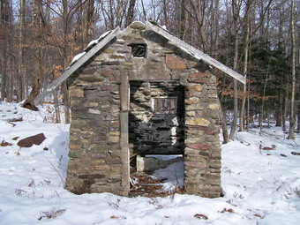 We continued to descend and in about 1 mile spotted an old stone "shed" standing in the middle of nowhere. We took some pictures and I did notice other foundations and stone walls in the area. We also noticed that we had run out of trail markers and began to search for them. Cindy and Bill found that we had passed our turn just a short distance back and we were soon back on the trail. Talking to the other members in our group I realized that although my fitness level was about the same as theirs my experience was not. Most of the other hikers were working on the winter 35's, had finished the 46's and were working on them in winter as well. Cindy mentioned the John Muir Trail, Bill had been to Mount St. Helen's and Dick and Jo were headed for Patagonia. I was the rookie! The trail began to pass through alternating hardwood and evergreen forest. Some of the groves of evergreens were dark and individual tree trunks truly ENORMOUS. After about .3 mile we arrived at Spencer Road and turned left and started to walk on the road. It was VERY icy and hard to walk on but I STILL refused to don my Stabilicers. The markers along the road were very few and far between making us wonder whether we had missed the turn off the road back onto the trail. After about 1.3 miles we found that we should not have worried since a very prominent set of signs directed us to turn right off the road back onto the trail.
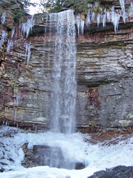
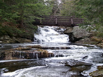 The trail now turned south and we walked along fairly open and flat trail for about a mile until we gained a little elevation to the top of Pople Hill. From here we began to walk downhill again. The falls was not marked on my GPS so I had no idea of exactly where we were headed although we seemed to be near the stream. It took a walk of another 1.2 miles until we descended to the falls. As usual the falls were beautiful and there was a good volume of water flowing. Fanciful ice formations highlighted the flowing water and I dropped my pack to get out the camera. I took some pictures from the bridge before Sheba and I worked our way downstream of the bridge to some rocks in the middle of the stream bed. Shooting upstream through the bridge is on of my favorite pictures. We walked back upstream passed the bridge and stopped several times along the way to walk onto the rocks along the edge to take pictures. The last viewpoint was icy but allows a nice view of a pool of water with a cascade into it. I also took some shot up and down stream. After this mission, I donned the pack again and Bill and I started to walk down the other side of the stream looking for another falls. Cindy joined us but we cut our search short as the time was growing late.
 After returning to the bridge, we began the walk downhill to the waiting cars on Cherrytown Road. The trail back is actually a wide woods road most of the way and I walked and talked with Jo for most of the last 1.6 miles. Jo is a retired teacher who likes to hike with here husband Dick and has a love for photography. She is particularly interested in macro photography and there were several opportunities for her to take pictures along the way. Some ice crystals shooting up through the frozen mud were one example of an opportunity. The last part of the hike went quickly and we were soon in Cindy's Car headed back to Peekamoose. We arrived as the sun was setting and I thanked everyone for a very enjoyable trip. He covered 9.6 miles in 7 hours but took a lot of time enjoying the surroundings.
![]()
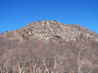
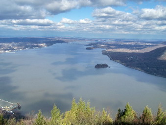
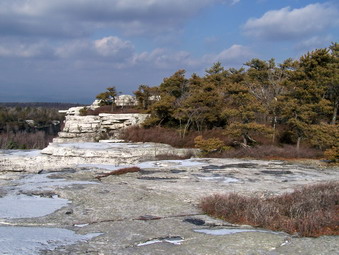
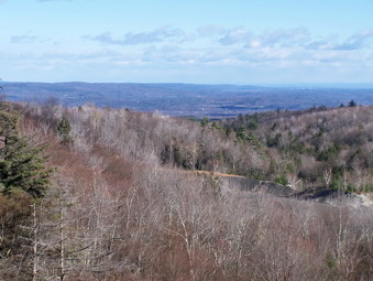
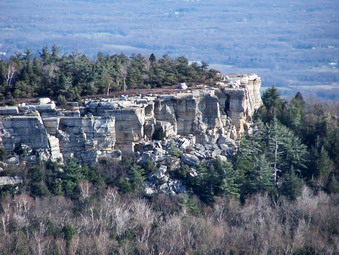
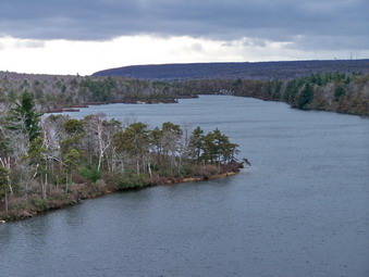
![]() On Saturday, Nov 29th I thought I might hike with a family group. They decided to do something else leaving me free to take Sheba anywhere I wanted. I had been hiking at Minnewaska to avoid the hunters in the Catskills and the ticks in Harriman. I decided "enough is enough" and headed for Storm King. I had not been in that area for over a year and anticipated a good hike. The weather prediction was for partly sunny skies, temperatures in the 40's and a light 10 mph wind. There was NO MENTION of precipitation. When we arrived at the parking area on Route 9W it looked like that prediction was right on. This would soon change! There were a few cars in the parking area and only one person with a dog so I assumed the others were out hiking somewhere. I tool some pictures across the river and of the rocky crag we were about to hike. I also took some over to North Point but the sunshine was so bright I was afraid they would not come out. This would soon change! Sheba and I got on the trail at 10:15 AM and made an energetic rush up the orange Butter Hill Trail.
On Saturday, Nov 29th I thought I might hike with a family group. They decided to do something else leaving me free to take Sheba anywhere I wanted. I had been hiking at Minnewaska to avoid the hunters in the Catskills and the ticks in Harriman. I decided "enough is enough" and headed for Storm King. I had not been in that area for over a year and anticipated a good hike. The weather prediction was for partly sunny skies, temperatures in the 40's and a light 10 mph wind. There was NO MENTION of precipitation. When we arrived at the parking area on Route 9W it looked like that prediction was right on. This would soon change! There were a few cars in the parking area and only one person with a dog so I assumed the others were out hiking somewhere. I tool some pictures across the river and of the rocky crag we were about to hike. I also took some over to North Point but the sunshine was so bright I was afraid they would not come out. This would soon change! Sheba and I got on the trail at 10:15 AM and made an energetic rush up the orange Butter Hill Trail.
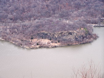
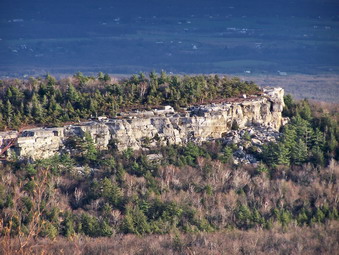
 Boterberg or Butter Hill is one of the early Dutch names for Storm King since it looked like a lump of butter. This name is still used for the western summit which actually is 40 feet higher at 1380 feet than Storm king itself! There were some nice views from Butter Hill and we paused for me to take pictures across the river to Little Stony Point, Mount Taurus and Breakneck Ridge. I also too some pictures to the north over Cornwall-on-Hudson. It was still sunny with a few clouds moving in. To get to the top of Butter Hill we turned right on the yellow Stillman Trail which led us to the summit. We continued over the top on the Stillman Trail and began to descend into the area between Butter Hill and Storm King. When we met the red and blue marked Bluebird Trail we turned left and began an interesting descent. There was only a little ice here and there but there were a LOT of slippery oak leaves. The Bluebird Trail descends steeply in places and there aren't many viewpoints. With the leaves off the trees there are several views of the river but none or very clear.
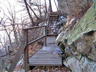 The Bluebird Trail ends with a junction with the Stillman Trail as it come up from Mountain Road in Cornwall. We turned right to walk along the edge of Storm King as the trail slowly ascends the mountain through a series of shallow grades and switchbacks. This trail is on the north side of the mountain and there were several areas of ice on the trail. These occurred where small spring or stream flowed across the trail and froze. We were able to work our way around them all but I made a mental note to remember to pack my Stabilicers. We were soon at the newly reconstructed Stillman Bridge. This wooden structure bridges a gap in the trail where there is no ground to speak of but a steep drop off near a vertical rock wall. Right after the bridge is an open wooden staircase. There was ice on the bridge as I carefully made my way across. Sheba was reluctant to cross the ice but did so with some coaxing. She would NOT climb the stairs but dove under the staircase and climbed up a steep slope. Just after the bridge a series of switchbacks announces the climb up Storm King is almost done.
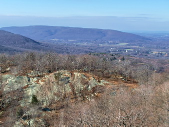
 On the way up the Stillman Trail several nice views can be had from a few lookouts. Near the top of the trail there are even more viewpoints as the trail passes by several open rock shelves. The only view that is blocked is to the north. We stopped here for me to take some more pictures. We met a group of three hikers from Cornwall near the top and another group of about a half dozen passed by. The skies were more cloudy and sunny at this point but that made taking pictures easier. I decided to continue on the Stillman Trail up over the top of Storm King so I could say we went over the top of the mountain and to take in some of the best views. I noticed that at the top of Storm King the wind had picked up. I took some interesting pictures before we continued down the other side of the mountain. We were soon at the junction with the blue Howell Trail that descends through The Clove and leads to North Point. We met a solo hiker here who asked for directions and headed back out to Route 9W. I decided that we had not been out for that long at that I wanted to do the entire loop over to North Point and Storm King Highway before going back to the car. North Point usually has nice views of Storm King and the areas across the river. As we headed down the blue Howell Trail, the skies became cloudy and the wind increased and I though for sure it would rain or snow by the time we were heading back to the car!
 There is NOTHING to see as you descend into The Clove. The trail is steep in places and was covered with those slippery oak leaves. Sheba has no problem and usually trots ahead and then waits patiently as if to say 'Can't you hurry up?' Soon we crossed the small stream that lies at the bottom of The Clove. Just before this crossing I saw the marking of the former Crossover Tail which are now painted over indicating the trail is officially closed. I have been on this trail before but it is now poorly marked. Just after the spring I saw the white marks of the Stillman Spring Trail on the left. This would be our return route if we made the whole loop. The Howell Trail starts to ascend out of the clove rather steeply but then moderates on an old woods road. After this the road ascends more steeply and the trail turns off to the left where it meets the Bobcat Trail. We followed the Howell Trail to the right and began the steep but short hike up to North Point. At North Point the wind was still blowing but the skies showed more areas of sun. We stooped so that I could remove my Ibex midlayer. I also took many pictures of Breakneck Ridge and Mount Taurus. The lighting was unusual at times and I realized that Storm King REALLY DOES look like a lump of butter!
 We continued down the Howell Trail off North Point and walked for a while without much to distract us. The trail starts to head due east towed the river and several nice viewpoints start to appear. These viewpoints are mostly to the south and east and views of West Point are possible. The trail begins to descend again very steeply as it heads down toward the river and the Storm King Highway. The last good lookout is Pitching Point which is less than 500 horizontal feet from the highway. The trail then winds its way away from the road and switches back several times before ending at Stillman Spring. A couple of hikers were parked a the spring putting away there equipment as we walked north a hundred feet on the highway before turning left back into the woods on the Stillman Spring Trail. This trail ascends right from the beginning but never steeply as it heads back to the Howell Trail just above the deepest part of The Clove. At the Howell Trail we turned right and hiked up out of the clove toward Storm King. The ascending on the slippery leaves was better than the descending but by this time I was tired. As the trail nears the area where it levels off near the top of the mountain, another trail turns left. This trail is marked in white but is shown as "proposed" on the maps. The maps also show the trail running directly west but it really runs southwest. This trail descend some before ascending and then descending again. The last few hundred feet is a steep climb back to the parking area on 9W. We covered about 7 miles in 4.5 hours with PLENTY of time for photographs. This is a herder hike than I remembered with a lot of up and down hiking throughout. The ascending distance is 2800 feet more than twice that of the hike at Minnewaska on Friday and 500 feet more than the 15 mile hike from last weekend!
![]()
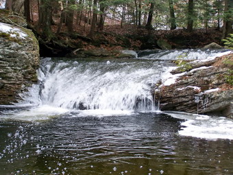
![]() On Friday, Nov 28nd it was Karl's turn to accompany me to Minnewaska. Everyone else had decided to go shopping on Black Friday so Karl and I took the two dogs, Sheba and Maggie and headed out to hike. Maggie always wants to "make friends" with Sheba but Sheba usually doesn't cooperate! Hiking, however, is a different story since both dogs enjoy being outside. I wanted to go to the base of Stony Kill Falls to take some pictures since it looked so beautiful the Saturday before. I thought for the main part of the hike we would somehow walk to Rainbow Falls and over Litchfield Ledge as I had never hiked there before. We turned right onto Minnewaska Trail off Route 44/55 and made an immediate left to head toward Shaft 3A Road, the parking area for Stony Kill Falls. We had only been there once but both of us remembered the turns and we were parked by about 9:30 AM just outside the gate. The temperatures was in the high twenties or low thirties but there didn't seem to be much wind. I had donned my North Face Apex Jacket with sheds moisture well. I had packed my Cloudveil Zorro jacket since the prediction was for a 40% chance of precipitation.
On Friday, Nov 28nd it was Karl's turn to accompany me to Minnewaska. Everyone else had decided to go shopping on Black Friday so Karl and I took the two dogs, Sheba and Maggie and headed out to hike. Maggie always wants to "make friends" with Sheba but Sheba usually doesn't cooperate! Hiking, however, is a different story since both dogs enjoy being outside. I wanted to go to the base of Stony Kill Falls to take some pictures since it looked so beautiful the Saturday before. I thought for the main part of the hike we would somehow walk to Rainbow Falls and over Litchfield Ledge as I had never hiked there before. We turned right onto Minnewaska Trail off Route 44/55 and made an immediate left to head toward Shaft 3A Road, the parking area for Stony Kill Falls. We had only been there once but both of us remembered the turns and we were parked by about 9:30 AM just outside the gate. The temperatures was in the high twenties or low thirties but there didn't seem to be much wind. I had donned my North Face Apex Jacket with sheds moisture well. I had packed my Cloudveil Zorro jacket since the prediction was for a 40% chance of precipitation.
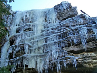
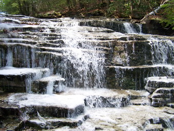
 We walked across the old sand and gravel quarry and passed the shaft access and helicopter pad. The water was too high to cross at the dam so we worked our way upstream and soon were able to cross to the other side. After a short walk, we could hear and then see the falls. There wasn't quite as much frozen spray on the rocks but it was still beautiful with a good volume. As we approached the falls the rocks were covered with ice making the going difficult and dangerous. I somehow worked my way to a point VERY close to the falls and began to take pictures. The angle was not the one I wanted and I knew that I wanted to be just slightly down stream and in the stream bed! I knew this would be tricky and I aborted my first attempt since the rocks were just TOO slippery. We walked downstream on the path and I soon found a place to cross and take pictures. From here we walked upstream in the stream bed and were somehow able to get to the pool just below the falls. The rocks were COVERED in ice but I was able to tale some nice pictures including ones of Karl and the two dogs. After this we crossed to the other side of the stream and I took some photos of the enormous icicles hanging down from the ledges. We walked back along an informal path and were back at the car by a little after 10:30 AM. We immediately headed for Minnewaska for the main part of our hike.
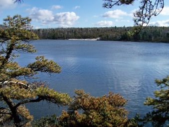
 We parked in the upper lot at Minnewaska in one of the few remaining spots and were on the trail by 11:00 AM. We decided to hike out on the Castle Point Carriageway and then use the Rainbow Falls Trail to cut over to the Upper Awosting Carriageway. After that, we weren't sure what our route would be. We had both dogs on leashes near the parking area but soon were able to release them as we headed down the carriageway. Both of them stayed near us with Maggie going out ahead and Sheba willing to walk between us. The walk out the carriageway went quickly and we didn't meet very many people. We did stop at Kempton ledge and a few of the other viewpoints but there was a haze in the air which obscured the views. The same was true of Castle Point itself but I did take a few pictures including some of Lake Awosting. The wind was pretty strong right at Castle Point so we didn't stay too long. We continued on the carriageway looking for the start of the Rainbow Falls Trail which seemed to be somewhere between Castle Point and the junction with the Hamilton Point Carriageway. When we reached this junction without finding the trail, we knew we had gone too far. We decided to go back up the carriageway and look for the trail on the left. On the way back up we spotted it just at the first big bend or switchback in the trail. It was no wonder we had missed it since there was no sign and only a single dab of aqua paint on a rock indicating the Long Path!
 We walked through some brush and then out onto some open rock. We were treated to a GREAT closeup view of Castle Point and the Castle Point Carriageway below it. The Talus slopes below the Point were impressive and obvious from this view. We continued to walk along the trail as several different viewpoints offered glimpses of the scenes below. The trail finally began to enter an area of evergreens which I recognized as the kind above the Upper Awosting Carriageway on Litchfield Ledge. Shortly we were at a view point that gave us a look at toward Rainbow Falls. I could see the area where Cindy and I had been standing two weeks earlier but the main falls is further down in the ravine. We walked further along the trail as it descended to the carriageway. Just before hitting the carriageway there were massive icicles covering the cliffs that support Litchfield Ledge. I took some pictures before hitting the carriageway and a few more afterward. At this point we weren't sure what we wanted to do but we headed toward Lake Awosting. At the Lake we made the decision to return to Lake Minnewaska, check the time at that point and decide what our next step would be. Both of us had things to do in the late afternoon.
 I have hiked the Upper Awosting Carriageway so many times that I know it VERY well. Karl and I walked and talked and were soon back at the beach at Minnewaska. By this time we had covered about 8.4 miles and it was a little before 3:00 PM. We decided to head back to the car after taking a look at the lake. When we got to the parking lot it was full with another row of cars parked down the middle of the lot! We covered 8.6 miles on this part of the hike in 4.5 hours. This distance added to the 1.5 miles we did early made us feel it was a good day!
![]()
![]() On Saturday, Nov 22nd the weather was COLD with an air temperature in teens and a stiff breeze blowing when I got up in the morning. I had planned to hike somewhere just for the exercise. I knew Cindy would not be interested because of the cold but I have plenty of gear and was anxious to try some out. I also was sure Sheba would be ready. I have hiked in hunting areas during deer season but it always makes me anxious. I decided to return to Minnewaska to hike the Lower Awosting Carriageway which I had never done before. My tentative plan was to get there when the park opened and hike a LONG one until about 3:00 PM. Hiking around both lakes with a detour here and there would fit the bill. We actually arrived BEFORE the gatehouse was open but were parked and ready to hike just after 9:00 AM. Since we were the first car into the park, the lot was empty. As I got ready to hike the wind came up and was blowing at least 20 mph on top of the below 20 degree air temperature. The Lower Awosting Carriageway is a relatively straight and wide road from the parking area to the lake. It is slightly uphill all the way and does get a little monotonous. I was lost in my own thoughts several times before realizing the beauty around me including Fly Creek on the left and the clouds above. A little over two miles into the hike I thought I heard something behind us and turned to see a mountain biker moving toward us. As he approached, he dismounted and said "Catskill Hiker! I know you." It was Tom Gallagher a hiker that I had met before in Black Rock Forest and who reads the website. He walked his mountain bike as we talked and we were soon at Lake Awosting. Tom decided to hike a loop with us before returning to his bike. He stowed the bike in the brush and we were ready to choose an objective.
On Saturday, Nov 22nd the weather was COLD with an air temperature in teens and a stiff breeze blowing when I got up in the morning. I had planned to hike somewhere just for the exercise. I knew Cindy would not be interested because of the cold but I have plenty of gear and was anxious to try some out. I also was sure Sheba would be ready. I have hiked in hunting areas during deer season but it always makes me anxious. I decided to return to Minnewaska to hike the Lower Awosting Carriageway which I had never done before. My tentative plan was to get there when the park opened and hike a LONG one until about 3:00 PM. Hiking around both lakes with a detour here and there would fit the bill. We actually arrived BEFORE the gatehouse was open but were parked and ready to hike just after 9:00 AM. Since we were the first car into the park, the lot was empty. As I got ready to hike the wind came up and was blowing at least 20 mph on top of the below 20 degree air temperature. The Lower Awosting Carriageway is a relatively straight and wide road from the parking area to the lake. It is slightly uphill all the way and does get a little monotonous. I was lost in my own thoughts several times before realizing the beauty around me including Fly Creek on the left and the clouds above. A little over two miles into the hike I thought I heard something behind us and turned to see a mountain biker moving toward us. As he approached, he dismounted and said "Catskill Hiker! I know you." It was Tom Gallagher a hiker that I had met before in Black Rock Forest and who reads the website. He walked his mountain bike as we talked and we were soon at Lake Awosting. Tom decided to hike a loop with us before returning to his bike. He stowed the bike in the brush and we were ready to choose an objective.
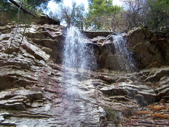
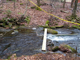
 Tom said he was considering hiking the Spruce Glen Trail and I countered with a suggestion that we hike to Stony Kill Falls. He agreed and we tuned right off the Awosting Trail just after the ranger station onto the Smiley Carriageway. The carriageway is now open after the fires earlier in the year. Some charred trunks are still visible but the area seems to be recovering. In less than a mile we arrived at Fly Creek, the outlet to Mud Pond. Although the water was higher than usual we soon found a way to cross. The Stony Kill Carriageway turns right immediately after the crossing and we turned and started to hike toward the falls. Neither of us had ever been on this trail before and we were not sure when the falls would appear. Hiking with somebody seemed to pass the time more quickly and within 1.25 miles we were at Stony Kill. There was only a small cascade over some rocks and I didn't know how far up or down the stream the actual falls might be. I could see quite a distance upstream and could not see any falls. We started to walk back the way we had come when I saw a path to the left along the bank of the kill. We followed that path which soon became much more obvious. Soon we were at another cascade just above a big drop off.
 We stopped to take some pictures. Tom used my camera to take a few rare pictures of Sheba and me against the cascade. I had taken my gloves off and immediately noticed how cold they were getting. We continued downstream and were rewarded with a few of Stony Kill Falls from the top! The view out over the valley from the top of the falls was beautiful but the real thrill was the falls themselves. Stony Kill Falls never has tremendous volume but it is pretty high. Looking down at the falls I could see the frozen spray covering the rocks and trees near the falls. Huge icicles hung in other places. From the top it was hard to get an angle to take pictures of the entire falls but some shots were really beautiful and spectacular. On the way back we cut up to the rode earlier than where we had come down and were soon back on the path. The walk back seemed quicker than the walk our. The only hitch was getting back across Fly Creek. The jump I had made early wasn't working for me on the way back. With a little investigation, we found another place slightly upstream to cross and were soon back at the trail around Awosting. Tom decided to make the trip around Awosting with me and then continue back to his bike while I head back to Minnewaska on the Hamilton Point Carriageway.
 At the lake we turned right an began to walk around the lake in a counterclockwise route. We stopped several times along the north side of the lake to take pictures from the elevated viewpoints along the way. I explained to Tom that I had never been around the lake this way since I usually come into the carriageway or leave it just after the end of the lake to get to the Long Path. We continued past that turnoff point and had several nice views of the lake from water level and stopped to take pictures. Soon we were at the "beach" which is really a LARGE slab of open rock that intersects the lake. We picked our way through this area since it was covered in ice! After another short hike we were at the point where Tom would continue around the lake to pick up his bike and I would turn right to continue toward Hamilton Point. The walk around the lake was almost two miles! After we parted, the walk to the Hamilton Point Carriageway seemed much shorter than the week before. This was only because I knew exactly where I was going.
 At the trail junction just below the Battlements, Sheba and I turned right onto the Hamilton Point Carriageway which has been closed to bikers and horses due to some storm damage. From the Lake to Hamilton Point was about a mile and is slightly uphill all the way. I noticed that this route is a little less traveled and a little more rustic than the one to Castle Point. As we approached Hamilton Point the wind really picked up. The sun was shining but the temperatures and the wind made it seems VERY cold. I stopped to take some pictures on the Point but did not get too close to the edge since the gusts were pushing me despite my stance. From Hamilton Point it is almost 3 miles back to the lake and Sheba and I kept up a good place. There are several lookouts along the way to the other side of Palmaghatt Ravine. The end of the escarpment on the other side is the end of Millbrook Ridge and Gertrude's Nose. As we walked along toward the best lookout, Echo Rock, it is obvious that the ravine continues to narrow toward the head end. We strolled past the cutoff to the Castle Point Carriageway but I decided to stick with my original plan to go directly to the lake. It was about 2:30 and I knew we would have plenty of time to go to the Awosting Falls before heading back to the car.
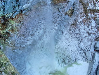
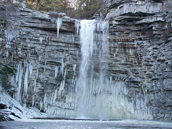 From the end of the lake it was only about .5 miles to the other end. Before walking up to the parking lot we turned left on the Sunset Scenic Carriageway which leads down the hill to the park entrance. I had never been on this trail and there were several nice viewpoints where I stopped to use the camera. After crossing the park roads, several times the trail ends up at the bridge across the Peters Kill at the park entrance. We turned right to walk the trail along the Peters Kill and down to the falls. There was quite a bit of water in the stream and we stopped so that I could take some pictures down toward the top of the falls and back upstream. I got pretty close to the edge of the falls but was careful because of the ice. I could see that the spray from the falls had coated several tress and most of the rocks in the basin below. Back on the trail we followed it as it wound its way to the bottom of the falls. The view from the base of the falls was as stunning as I had expected. The cliffs around the falls and many of the trees were coated in a white frosting of frozen mist. The water falling from the falls bounced up off the rocks, ice and water in the pool below. Chunks of ice littered the pool. I took pictures from many different angles and then walked slightly downstream and into the stream bed. This was the best, if not the safest angle, for photographing the falls. I took short video as well as still pictures to capture the dynamics of sight AND sound. After spending some time alone at the falls, Sheba and I hiked back up the trail, past the gatehouse, and down the access road to the parking area. At 3:30 PM, there were still only two other cars in the lot! My GPS read 13.8 miles! I was surprised because, although I was tired, it did not seem like the 6.5 hour was that long. When I put the track on the computer, it was actually a little OVER 15 miles! On the drive back, I thought about stopping to hike to the base of Stony Kill Falls but decided to leave that to another day.
![]()
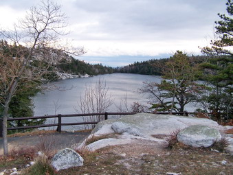
![]() On Sunday, Nov 16th the weather was cool with an air temperature in the high 30's and wind gusts up to 30 mph. Cindy and I decided NOT to brave the hunters around Livingston Manor so we headed to Minnewaska State Park where no hunting is allowed. We were in the parking lot and ready to hike by 12:30 PM. The wind was gusting and it was really cold in the parking area. We always put Sheba on a leash when we are around other hikers and other hiker's dogs. Apparently some dog owners believe that their dogs must "make friends" with other dogs. As we were getting ready to leave the car another hiker with his dog on a leash lead his dog over to Sheba without asking us! This was not the only inconsiderate dog owner on the day. We met at least two other groups who refused to call their dogs or leash them and who obviously had no control of their pets. Sheba, for her part, behaved well under the circumstances. So for all the inconsiderate dog owners out there "Put your pet on a leash and control them around other hikers and other dogs. Obey the rules that exist in most parks. Obey the rules of common courtesy!" Cindy and I left the Minnewaska parking area and headed down toward the lake and the Upper Awosting Carriageway.
On Sunday, Nov 16th the weather was cool with an air temperature in the high 30's and wind gusts up to 30 mph. Cindy and I decided NOT to brave the hunters around Livingston Manor so we headed to Minnewaska State Park where no hunting is allowed. We were in the parking lot and ready to hike by 12:30 PM. The wind was gusting and it was really cold in the parking area. We always put Sheba on a leash when we are around other hikers and other hiker's dogs. Apparently some dog owners believe that their dogs must "make friends" with other dogs. As we were getting ready to leave the car another hiker with his dog on a leash lead his dog over to Sheba without asking us! This was not the only inconsiderate dog owner on the day. We met at least two other groups who refused to call their dogs or leash them and who obviously had no control of their pets. Sheba, for her part, behaved well under the circumstances. So for all the inconsiderate dog owners out there "Put your pet on a leash and control them around other hikers and other dogs. Obey the rules that exist in most parks. Obey the rules of common courtesy!" Cindy and I left the Minnewaska parking area and headed down toward the lake and the Upper Awosting Carriageway.
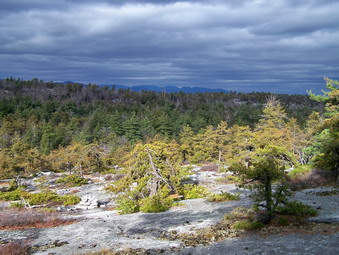 As we hiked out the Upper Awosting Carriageway, we noticed that every small stream and every ditch was full of running water. Places that were usually dry or just a trickle were torrents. We walked quickly on the carriageway for about 2.5 miles to Litchfield Ledge. At this point the Long Path crosses and we turned right and descended to head towards Rainbow Falls. We had to cross several small brooks on the way and they too were swollen beyond their normal volume. Rainbow Falls never has much volume but on this day there was more water coming over the ledge than I have seen before. I took many pictures of the two separate falls before following the Long Path along the base of the ledge. In a short distance the Long Path ascends the ledge quite steeply and the wet rocks added some challenge to this climb. At he top of the climb there was a nice view out over the scrub pines and open rock faces. Beyond this, in the background, were the outlines of the Catskills. The sky was very dark with only occasional rays of sunlight. A few snowflakes were in the air!
 We followed the Long Path along the ridge and down the other side as it descends across some open rock toward the Peters Kill. We intended to cross the Peters Kill and then turn left near Fly Brook and follow the trail to Lake Awosting. As we approached the Peters Kill we could hear the rushing water. Once at the stream we understood why it was so loud. The normally docile stream was a rushing torrent. It was impossible to cross safely where the trail went across so we bushwhacked up and down the stream. There was no place that seemed safe to cross. We decided to backtrack to the Upper Awosting Carriageway and head to Awosting that way. It didn't take us too long to get back once we had made the decision and we were soon on our way to the lake. It about .5 miles we were at the point where the trail splits to go around the lake. It had been our intention to walk around Awosting counterclockwise but time was now against us. We turned right to walk down to the lake. I took some pictures and then we headed back to the trail that follows the southeastern shore of the lake.
 We had never been on this side of the lake before and the trail rises quite a bit. There are several beautiful viewpoints that look out over the lake. We stopped at several so that I could take pictures. In between stops we walked VERY quickly. I was looking for the turn that would take us to the Castle Point Carriageway and back to the car but I did not know exactly where it was. Shortly a sign announced that it was .5 miles ahead and we could begin to see the rocky ledges that make up the Battlement and Castle Point. Within about 1 mile from the lake we were at the point where the Castle Point and Hamilton Point Carriageways meet. I usually follow the Long Path from the Hamilton Point to Castle Point Carriageways but the wet and windy conditions dictated a safer root on the Castle Point Carriageway. Shortly we were passing over the Battlement and were at Castle Point within .5 miles. On the way up it started to snow a little and the wind picked up. The sky was very dark especially in the east. At times, the sun would shine through. We stopped at the Battlements and Castle Point so that I could take pictures. Several gusts of wind on Castle Point were over 40 mph. Since it was already 3:30 PM and we did not know when the park closed, we decided to up our already fast paced to cover the last 3.5 miles!
 As we walked the carriageway, I stopped several times to tale pictures of Hamilton point, the ravine below, the opposing ledges and the valley. At one point the Smiley Tower at Mohonk was visible and illuminated with sunlight. In between photographic opportunities I scurried to keep up with Cindy. From Castle Point it was about 1.5 miles to Kempton Ledge. I walked out to the Ledge, took some pictures and the pressed on. We were familiar with the carriageway and made good time. As we approached the Minnewaska I stooped for a few pictures as Cindy and Sheba headed for the car. We were back at the car by 4:30 PM having covered almost 9 miles in 4 hours. The last 3.8 miles we made in 1 hour! A sign announced that the gates would close at 5:00 PM so we were actually a half hour early! There were only three other cars in the lot as we headed for home.
![]()
![]() On Tuesday, Nov 11th I was off from school due to the celebration of Veterans Day. When we woke up in the morning at 6:30 AM the temperature was in the high twenties but the forecast was for increasing temperatures and no precipitation. Cindy agreed to do Hunter from Spruceton after taking a walk with her friend. She was back by 9:00 AM but had changed her mind! I loaded up MY car with my gear and Sheba and started out. When I am with Sheba I like to do at least a double and thought about Wittenberg and Cornell or Plateau and Sugarloaf. As I drove toward Big Indian, I decided to stay with the plan of hiking Hunter and headed for the Spruceton parking area. I parked at 10:30 AM and immediately noticed a small amount of snow, an air temperature still in the low 30's and a stiff breeze. I had on a base layer of Icebreaker 150, a mid layer of Icebreaker 320 and a Mammut jacket on top. I wore a pair of silkweight PolarMax tights under my pants. I figured I would be too warm as soon as I hit any climb but could always remove something. I also had on a light pair of stretch gloves and a light hat. The Mammut medium is a little large for me but a small would be MUCH too small. It did fit well over the layers I had on. I packed my Stabilicers and decided to take my Leki poles.
On Tuesday, Nov 11th I was off from school due to the celebration of Veterans Day. When we woke up in the morning at 6:30 AM the temperature was in the high twenties but the forecast was for increasing temperatures and no precipitation. Cindy agreed to do Hunter from Spruceton after taking a walk with her friend. She was back by 9:00 AM but had changed her mind! I loaded up MY car with my gear and Sheba and started out. When I am with Sheba I like to do at least a double and thought about Wittenberg and Cornell or Plateau and Sugarloaf. As I drove toward Big Indian, I decided to stay with the plan of hiking Hunter and headed for the Spruceton parking area. I parked at 10:30 AM and immediately noticed a small amount of snow, an air temperature still in the low 30's and a stiff breeze. I had on a base layer of Icebreaker 150, a mid layer of Icebreaker 320 and a Mammut jacket on top. I wore a pair of silkweight PolarMax tights under my pants. I figured I would be too warm as soon as I hit any climb but could always remove something. I also had on a light pair of stretch gloves and a light hat. The Mammut medium is a little large for me but a small would be MUCH too small. It did fit well over the layers I had on. I packed my Stabilicers and decided to take my Leki poles.
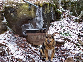 There was only one other car in the lot and one name in the register. Sheba and I started out at a fast pace on the wide woods road that is the start of the trail. With a short distance I was already building up heat and opening zippers to vent. Hunter Brook was flowing with some volume and as we approached the bridge I remembered a post that said the bridge was out! The post was correct and the bridge is still out with steel beams in pace but no decking. To the right of the bride a 2 by 6 has been thrown across the stream as a VERY temporary bridge. I walked across the board but Sheba jumped into the icy water. It doesn't seem to bother her. We were soon at the hairpin turn and starting the gentle but long climb to the turn up Hunter. Along the way I removed and packed the midlayer and was still quite warm. The Icebreaker 150 is extremely light but very warm! We arrived at the turn up Hunter where the trail leaves the woods road in about 40 minutes. A more distinct sprinkling of snow as evident. In some places the rocks were beginning to ice over. Many areas were wet and slippery. In the winter many areas of the trail develop significant amounts of ice that require hikers to work around them or use traction devices with caution.
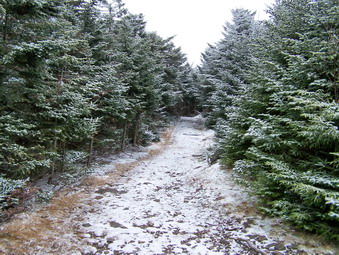 We were at the spring in under an hour. Sheba got a drink and I took pictures before we continued to the viewpoint near the site of the former John Robb lean-to. There wasn't much to see here as the trees have grown up to block the view and there was a lot of fog or haze lying low on the hills. We pushed on and passed the 3500 foot sign and then the turn to the Colonel's Chair. The trail levels somewhat after this and I am always fooled into thinking I am at the top. One look ahead and I could see more mountain and knew that I would have some more climbing to do before reaching the tower clearing. There was now snow and the trail and on the trees making the trail slippery but making the trees look like it was winter. Some areas of the trail were muddy but the mud was partly frozen. Puddles of water were frozen on top but some were quite deep and the ice layer was thin. I did not go out to the small viewpoint near the top since there was a frozen lake between the trail and the lookout. Sheba and I made the last push to the top and soon the tower and cabin were in sight.
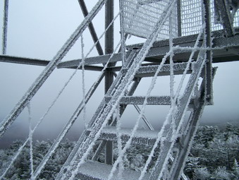 There wasn't even an inch of snow at the top but the tower and trees were covered with a rime frost and some snow. The scene was BEAUTIFUL and Sheba and I were alone. I took a lot of pictures from the ground and then carefully made my way up the tower. The railings and step were both slippery and the higher I went the more I noticed the wind. The Mammut jacket block virtually ALL the wind but an air temperature of 28 degrees and a thirty mile an hour wind is still COLD! At first there were no views as fog covered everything. I took pictures of the frost on the tower and some of the trees below. The wind cleared some of the fog away and I took pictures of the hills and valleys before it returned. I went back to ground level and Sheba and I had a drink and a snack. On the way up I had thought about doing Southwest Hunter but I was tired now and decided just to complete the loop back down to Westkill. As we started the loop there were many areas of mud and water on the trail. At the junction with the Becker Hollow trail I met a couple and their small white dog. We talked for a minute and another group appeared from the other direction. I was ready to leave and As I started out I inquired about the trail down. One member of the party told me the trail was in pretty good condition with a few wet spots. She also told me that Southwest Hunter was "a piece of cake". I thought about what she said on the way down. I had never found SW Hunter to be ease but though that they might have a better route and that I could follow their path.
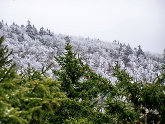 At the junction with the Devil's Path, Sheba and I turned right toward the Devil's Acre lean-to. We passed by, crossed the small stream and the railroad bed. I began to look for the side trail to SW Hunter but could only find short paths to camping areas. I decided to leave SW Hunter for another day! As I continued up the trail a little disappointed, I came to a VERY obvious path to the left. I decided that this might be the path to SW Hunter and it was early enough in the day to try it and see where it went. I had always cut up right after the lean-to near the railroad bed. I would run into swamps and thick balsam that made the hike miserable. The route I followed on this day was more than a path and less than a trail. My only reservation was that I did not know if I was following the right trail. My GPS seemed to indicate we were headed in the right direction so we continued on for some time. At one point the trail was blocked with branches and the boot prints and an unmistakable left UP the mountain. We followed this path which became very steep in some places. It soon leveled out and wandered through some balsam. After only a short walk, I noticed a clearing and the red canister. When I signed in I noticed that the names above mine included Tom and Laurie Rankin. I have read Tom's posts as a member of VFTT and have corresponded by e-mail. This was by far my easiest trip up SW Hunter and I would recommend the route to anyone.
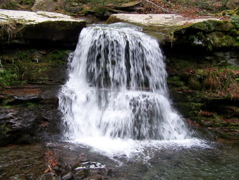 I knew that now it was just a matter of retracing our steps to the Devil's Path and hiking back out. On the way down I met a solo hiker going up. We had been to Rusk and I gathered he was the car in the lot when I parked. Soon we were back on the Devil's Path headed for Westkill. I do NOT like this trail in any way. For a descent it has too many places that go up. It has MANY rocks big and small. Much of it is a stream and large portions have standing water that expands to the size of a small pond. It does have a nice viewpoint to the left side of the trail I took some pictures of the valleys. Looking back toward SW Hunter the trees were covered with snow and frost which made a lovely sight! Sheba and I worked our way down the trail with me hating every minute. I heard a noise behind and looked back to see the solo hiker approaching. Sheba and I move pretty fast but this guy was really going! After what seemed like hours, we arrived at Diamond Notch Falls. We stopped and I took some pictures. There was a good volume of water from the recent rains. There was still a mile to go so Sheba and I headed back out to the Spruceton Road and back to the car. We finished the 8 mile loop in about 5 hours. This seemed slow to me but we made several stops and the conditions slowed us some.
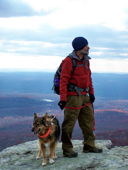
![]()
![]() On Sunday, Nov 9th the weather was cool but sunny and clear. Cindy and I decided to go to Sam's Point after church to visit Verkeerder Kill Falls and hike the escarpment loop. We suspected that the recent rains might have renewed the falls and we had not Ben there in some time. We parked at the Conservation Center by 12:00 PM and started up the right hand branch of Sam's Point Road to the Point and the Ice Caves. The temperature was just below 50 degrees and a stiff breeze was blowing. I had on an Icebreaker 150 base layer and Icebreaker 260 Zip top over that. I topped this off with a new Eider Highstretch jacket. The jacket proved to be just the right size and well-constructed. We stopped just below the Point to look out over the valley. There was still some haze and the sky was cloudy in places with bright sun in others. We got back on the main loop road and headed toward Ice Caves Road. From the Ice Caves Road we turned left on the trail to the falls.
On Sunday, Nov 9th the weather was cool but sunny and clear. Cindy and I decided to go to Sam's Point after church to visit Verkeerder Kill Falls and hike the escarpment loop. We suspected that the recent rains might have renewed the falls and we had not Ben there in some time. We parked at the Conservation Center by 12:00 PM and started up the right hand branch of Sam's Point Road to the Point and the Ice Caves. The temperature was just below 50 degrees and a stiff breeze was blowing. I had on an Icebreaker 150 base layer and Icebreaker 260 Zip top over that. I topped this off with a new Eider Highstretch jacket. The jacket proved to be just the right size and well-constructed. We stopped just below the Point to look out over the valley. There was still some haze and the sky was cloudy in places with bright sun in others. We got back on the main loop road and headed toward Ice Caves Road. From the Ice Caves Road we turned left on the trail to the falls.
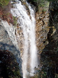 The trail to the falls is all downhill since the falls is the lowest point on the trail. The trail was also wet from the rain and had standing and running water in many places. The views from the trail were interesting because of the lighting. From one point Lake Awosting was clearly visible! The trail seemed long but we kept up a quick pace arriving at the falls by 1;20 PM. As we approached the falls, the sound of the falling waters greeted us. I walked out to the ledge that acts as a viewpoint from the north side of the falls. There was a good volume of water going over the falls and I took pictures of the falls, the gorge below and the valley to the west of the falls. I went back to the trail to attempt to cross to the other side. The first crossing was easy but the one over the main stream was a little more challenging. Falling into the stream so close to the falls could be dangerous. We actually had little trouble crossing and were soon at the viewpoint on the other side. Two pairs of hikers were already enjoying the view. I took the time to snap some more pictures before following one pair of hikers back up the main trail.
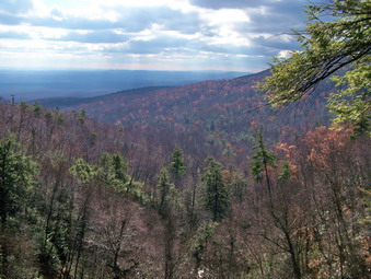 We hiked to the ascent up the escarpment and soon caught the others at the lookout at the top. The climb is much steeper than the descent to the falls as it occurs in a much shorter distance. We went on while the other hikers stayed to enjoy the view. I always like the hike along the escarpment. The views are beautiful and breathtaking as the trail is at the edge of the escarpment much of the time. As you hike you can look ahead at the rock outcroppings you WILL climb and back at the ones you HAVE climbed. In several spots the rocks were damp and slippery so we were careful even though we maintained a fast pace. As we neared High Point, the trail became wetter with several areas looking more like shallow lakes than trail! Soon we were at High Point with a 360 degree view. The weather had actually become more cloudy and the sky was darkening with what looked like the threat of rain. We hiked from High Point to the site of the old fire tower and I took some pictures.
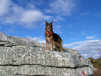 As we descended to the carriageway a sign reminded us that we still had 2.5 miles to go! The first part of the carriageway almost to the Indian Rock Trail is eroded and rocky in many places. This makes walking difficult. On this day there was a lot of mud and standing water in a number of places. When we hit the loop road, we had a little more than a mile to go and we picked up our pace. We were soon at the Center and had covered almost 8 miles in under 4 hours!
![]() On Saturday, Nov 8th the weather report was for showers on and off all day. The morning brought warm but damp weather with intermittent drizzle. Any plans I had to do a long hike were dashed but by 10:30 AM I decided that a short walk somewhere was needed. I convinced Cindy to go to Frick Pond for a some version of a loop hike there. We took our rain gear but the showers all but stopped on the drive to the parking area. We parked and took only a few minutes to get ready. By the time we were ready to start it was raining! I almost got in the car to head home but Cindy and Sheba seemed willing. We donned rain jackets and Cindy put on waterproof pants. I decided to try my OR Pack cover. The cover is pretty easy to put on but is a little large for a day pack! I had not brought the camera or GPS thinking that electronics and rain do not mix well. By 11:00 AM we were on the trail headed for Frick Pond.
On Saturday, Nov 8th the weather report was for showers on and off all day. The morning brought warm but damp weather with intermittent drizzle. Any plans I had to do a long hike were dashed but by 10:30 AM I decided that a short walk somewhere was needed. I convinced Cindy to go to Frick Pond for a some version of a loop hike there. We took our rain gear but the showers all but stopped on the drive to the parking area. We parked and took only a few minutes to get ready. By the time we were ready to start it was raining! I almost got in the car to head home but Cindy and Sheba seemed willing. We donned rain jackets and Cindy put on waterproof pants. I decided to try my OR Pack cover. The cover is pretty easy to put on but is a little large for a day pack! I had not brought the camera or GPS thinking that electronics and rain do not mix well. By 11:00 AM we were on the trail headed for Frick Pond.
The Quick Lake Trail out to Frick Pond was VERY wet with standing water in some places and running water in others. At one point I though my Asolo TPS 520 boots were leaking but my feet stayed dry the whole day. At the trail junction we turned right on the yellow Loggers Loop trail and hiked to Times Square. There are many possible choice with so many trails and we decided to follow the Loggers Loop back to the Quick Lake Trail and then decide, based on the weather, which way to go. At some point on the Loggers Loop the rain stopped and I put down my hood and opened the zipper on my Cloudveil Zorro LT jacket to vent some heat. At the junction with the Quick Lake Trail we decided to turn right and go the LONG way to Hodge Pond. At Junkyard Junction we turned right on the blue Flynn Trail that goes to Hodge Pond. At points along both trails I wondered if my memory of the route was correct since we seemed to be walking for a LONG time. When we arrived at Hodge, I concluded that the uphill walk in the drizzle and fog made the hike seem longer!
At Hodge we continued on the Flynn Trail be turning right toward the trail junction with the Big Rock Trail. Here we stayed on the Flynn Trail which run downhill all the way to the parking area. The rain began again and we "buttoned up" our rain gear. Sheba seemed unaffected but by this time was muddy and pretty wet. We arrived back at the car just before 2:00 PM having taken 3 hours to cover about 7 miles!
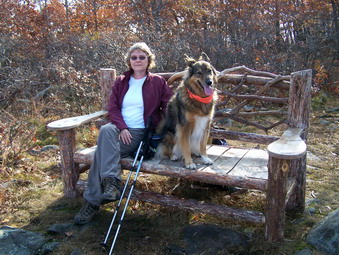
![]()
![]() On Tuesday, Nov 4th I had an early appointment in Goshen. All went well so Cindy and I decided to go hike Schunemunk. She had never been to the highest point in Orange County and the day looked like a good enough one to hike there. When we arrived at the trailhead near the Moodna Train Trestle the temperature was in the 50's but a slight breeze was blowing. I decided to keep on my Arc'teryx fleece for a while. Several other cars were already in the lot when we got there at 10:30 AM and we were on the "trail" by 10:40 AM. Cindy was impressed by the train trestle which IS more interesting in person than in pictures. We walked up the road and picked up the trail just short of the trestle. We stayed on the white trestle trail as it climbed the 1.1 miles to the crest of the western ridge. Along the way the trail alternates between steep areas and more level ones. In one place a short side trail leads to a viewpoint. A new bench at this lookout allows the hiker to take a break. The views were still very hazy but the temperature had increased and I removed the fleece. Back on the trail we arrived at the junction with the red Barton Swamp Trail.
On Tuesday, Nov 4th I had an early appointment in Goshen. All went well so Cindy and I decided to go hike Schunemunk. She had never been to the highest point in Orange County and the day looked like a good enough one to hike there. When we arrived at the trailhead near the Moodna Train Trestle the temperature was in the 50's but a slight breeze was blowing. I decided to keep on my Arc'teryx fleece for a while. Several other cars were already in the lot when we got there at 10:30 AM and we were on the "trail" by 10:40 AM. Cindy was impressed by the train trestle which IS more interesting in person than in pictures. We walked up the road and picked up the trail just short of the trestle. We stayed on the white trestle trail as it climbed the 1.1 miles to the crest of the western ridge. Along the way the trail alternates between steep areas and more level ones. In one place a short side trail leads to a viewpoint. A new bench at this lookout allows the hiker to take a break. The views were still very hazy but the temperature had increased and I removed the fleece. Back on the trail we arrived at the junction with the red Barton Swamp Trail.
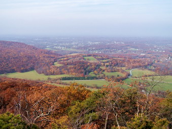 We turned left onto the red trail and enjoyed several viewpoints to the eastern ridge and to the northeast before descending to the area between the ridges. Baby Brook had some water flowing in it and Sheba got a drink as we crossed and picked up the yellow Jessup Trail to ascend to the eastern ridge. The trail immediately began to ascend over the characteristic slabs and outcropping of conglomerate. The vegetation was predominantly scrub pine similar to the Gunks. As the trail ascends views of the western ridge and to the east become more prevalent. The trail continues to ascend for some time before leveling somewhat. New views continue to appear but on this day many were still obscured by a haze that would not burn off. The trail starts to undulate and begin a series of excursions into hardwood stands slightly off the ridge before winding back to the edge of the ridge. In many places the trail forced us to hike along narrow rock crests or slanted rock faces. These were damp in many places and we had to be careful not to slip and fall.
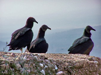 By about 1:00 PM we were nearing the Megaliths and I took the spur trail out toward these large blocks of rock. Descending across and open rock face that was damp I slipped for the third time. We entered the woods and quickly approached our goal. As we drew near I noticed a vulture had landed on one of the rocks and was intently staring at the valley below. I took a picture and then quietly continued on the trail. As I climbed onto the Megaliths I noticed three or four more vultures sitting on the rocks and looking at the valley. They didn't seem to be bothered by our presence So I took some pictures before sitting down to eat. The birds eventually all took off and began to soar over the valley. We ate lunch and decided to continue on around to return on the western ridge, Back on the main trail we walked the short distance to the Western Ridge trail and turned right on this blue marked trail.
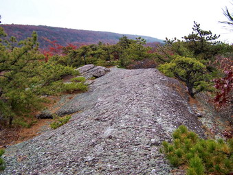 The Western Ridge Trail continued southwest briefly before turning due north and beginning a descent into Barton Swamp between the two ridges. The descent is steep and required us to walk along narrow parts of the trail and hop over some boulders. Some parts of the descent require rather long drops over large boulders. This is interesting when the rocks are dry. The dampness on the rocks and the wet leaves added a level of difficulty to this short but steep descent. We hit the Barton Swamp Trail and turned right top briefly follow both trails toward the swamp. In a short distance we followed the Western Ridge Trail as it ascended steeply to the Long Path at the top of the Western Ridge. This ridge is slightly lower in elevation so we did not have to ascend as far as we had descended. The Long Path along the Western Ridge was drier than the Jessup Trail on the Eastern Ridge. The trail does undulate some but less so than the Jessup Trail. The Long Path does wander back and forth across the ridge offering alternating views to the west and toward the Eastern Ridge. We were walking faster now and within 1.5 miles we arrived at the area where the Long Path descends the Western Ridge toward the Hil-Mar Lodge. We continued on the red Barton Swamp Trail until it met the white Trestle Trail.
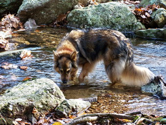 Once on the Trestle Trail we began to descend quickly as we reversed our steps from earlier in the day. The trail is rutted and eroded in paces. It is covered for almost its entire length by loose rocks which roll under foot. A layer of slippery leaves on top makes the descent a difficult one since the trail is steep in many places. Soon we were back on the road and walking toward our car at the trailhead. We arrived at about 3:15 PM making the 6.8 mile round trip in about 4.5 hours.
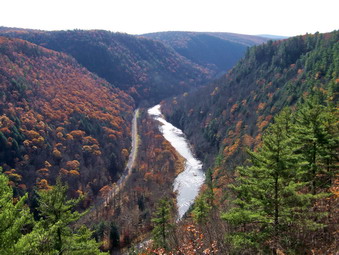
![]()
![]() On Sunday, Nov 2nd Brad and Krista arrived at the motel just before 8:00 AM. We had decided to hike part of the West Rim Trail that travels along the west rim of Pine Creek Gorge which is called the Grand canyon of Pennsylvania. Cindy and I had wanted to do this for some time but the trip requires an exceedingly early start or an overnight stay! The entire trail is over 30 miles long but I had decided on a section of about 7.5 miles described in a hiking guide. We decided to take two cars and do a shuttle. The trail route seemed straightforward but the book provided only a rudimentary map. We drove north on Route 15 to Mansfield and then east on Route 6 through Wellsboro to Ansonia. In Ansonia we turned south on Colton Road to enter Colton Point State Park. The drive to this point was on schedule taking about 1.5 hours. I was impressed with the scenic beauty driving north on Route 15. Initially there were still leaves on the trees and the runs over and next to several different streams. Further north the rock structures changed and the trees were devoid of leaves. Once we turned onto the park roads we had to slow down. Soon we were in Colton Point State Park and a roadside parking area beckoned. We stopped and walked across the road to get our first view of the gorge. It was SPECTACULAR. Even though some clouds and haze still hung in the air the deep canyon and the sparkling water below were beautiful. We stayed for a few minutes to take in the view and take some pictures before getting back in the cars.
On Sunday, Nov 2nd Brad and Krista arrived at the motel just before 8:00 AM. We had decided to hike part of the West Rim Trail that travels along the west rim of Pine Creek Gorge which is called the Grand canyon of Pennsylvania. Cindy and I had wanted to do this for some time but the trip requires an exceedingly early start or an overnight stay! The entire trail is over 30 miles long but I had decided on a section of about 7.5 miles described in a hiking guide. We decided to take two cars and do a shuttle. The trail route seemed straightforward but the book provided only a rudimentary map. We drove north on Route 15 to Mansfield and then east on Route 6 through Wellsboro to Ansonia. In Ansonia we turned south on Colton Road to enter Colton Point State Park. The drive to this point was on schedule taking about 1.5 hours. I was impressed with the scenic beauty driving north on Route 15. Initially there were still leaves on the trees and the runs over and next to several different streams. Further north the rock structures changed and the trees were devoid of leaves. Once we turned onto the park roads we had to slow down. Soon we were in Colton Point State Park and a roadside parking area beckoned. We stopped and walked across the road to get our first view of the gorge. It was SPECTACULAR. Even though some clouds and haze still hung in the air the deep canyon and the sparkling water below were beautiful. We stayed for a few minutes to take in the view and take some pictures before getting back in the cars.
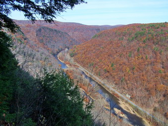 Once we passed the entrance to the state park, the road went to "improved dirt". We followed the directions in the hiking guide and after several switchback left turns we came to the place where we wanted to park one car. This was at the point of an almost 180 degree turn on Painter-Leetonia Road and was one trailhead for the Refuge Trail. We all got into one car and continued to work our way south for about another 5 miles to the road into the Bradley Wales Picnic Area. We soon arrived and park our car in the small parking lot. To our right, just where the hiking guide described, were the orange blazes of the West Rim Trail. We got started as soon as everyone donned their hiking gear. The air felt cold so I put on an Icebreaker 260 top over the long sleeved shirt I had on and my UnderArmor. I actually added my new Sherpa jacket on top and put on light gloves and a hat! I knew this wouldn't last too long but I had plenty of room in the pack. The trail started out on a road but soon made a quick left and started along the rim of the canyon.
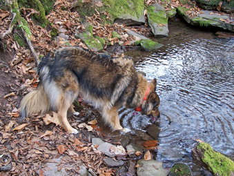 Almost immediately a set of stone pillars and metal pipes announced the first of many viewpoints on the trail. This one was as nice as the first that we had visited by car. We began a pattern of stopping, enjoying the view and taking pictures. Pine Creek was clearly visible on the Gorge floor and there seemed to be a "road" next to it. Brad informed us that this was once the Penn Central tracks and is now a rail trail. The trail runs the entire length of the Gorge for about 38 miles. I began to make plans to return and bike this trail! As we left the viewpoint we passed through pine trees and then entered hardwoods. The flora along the trail changes in this way and includes more open areas as well. The main part of the trail is fairly flat. Along the trail at varying intervals tributaries join the main stream. Some of these "runs" are quite steep and require a walk away from the gorge to a point were the banks are not as steep and can be safely negotiated. The first of these came at about .6 miles into the hike. This first was only a small bump in the trail but later detours would be more significant! At 1.4 miles into the hike Ice Break Run required us to make a more significant jog away from the gorge. Many of these runs are dry and none had enough water to make crossing difficult.
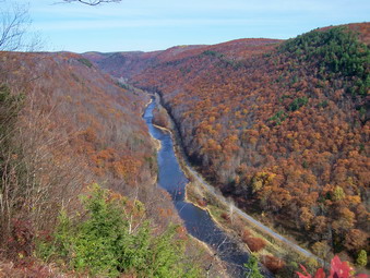 As we walked back from Ice Break Run the trail again came close to the canyon rim and offered another excellent viewpoint. Many of these views are much the same but the angles differed. The skies also began to clear and the light changed to offer different photographic opportunities. Somewhere along the way I shed the Icebreaker top but I did keep the jacket on for the whole trip. I ditched the gloves for most of the hike but alternated wearing my hat and storing it in a pocket. At 1.9 miles we began to work our way around Little Slate Run. This run is deep with steep sides and requires the greatest distance to get around. A small bridge at the head end allowed us to easily cross but was not really necessary. At the end of most of the runs blue trail lead out directly to Painter-Leetonia Road. We turned and started back toward the Gorge and were back near the rim at about 3.75 miles. even though we were on the rim there were few views as most were blocked by trees. After a short walk we crossed Tumbling Run and walked out to another viewpoint. We decided to wait to stop and eat lunch and took only a short break for pictures.
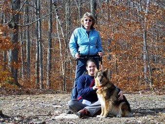 Almost immediately we started the walk around Horse Run. The guidebook warned of a rather steep descent and ascent but we didn't find it to be that challenging. As we came around Horse Run we were again on the rim at a viewpoint about 5 miles into the hike. We decided to move on to see if there was another lookout before stopping for lunch and a break. The trail began to descend into Burdic Run so we stopped in an evergreen grove for a break and some lunch. It was obvious that others had stopped here before as there was a small fire ring. Since we were under the tress without any sunlight, I began to get cold and encouraged the others to move on. We walked down and around Burdic Run and I began to look for the trail that would take us back to the rim. I found the map in the book confusing but decided to stay on the trail that ran along the rim of the gorge. We continued hiking for a while over relatively flat and open trail through a tunnel of pine trees. I expected to find a viewpoint out to Colton Point State Park but nonce came into view. Soon the orange blazes of the West Rim Trail turned left and that trail headed off to the west. Ahead there were blue blazes which I decided to follow. I knew that the blazes were blue at the Refuge Trail trailhead where the car was parked so I decided to follow them. Within minutes I could see an open area ahead and the glint of sun on glass. We had covered about 7.3 miles in about 4 hours.
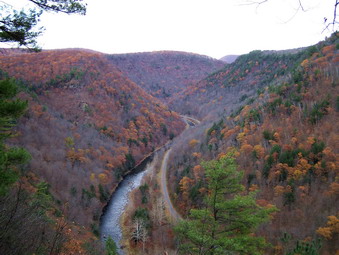 At this pint I was still hoping to find Barbour Rock on the way out of the park even though the light was fading and it was getting colder. We still had to drive back to Bradley Wales to get the other car which we did and then headed back out the way we came. We stopped at Colton Point Park and drove the short loop through the park. We stopped at a small parking area and got another look into the gorge almost due north. Back on the main road I found the trail to Barbour Rock on the way out. We stopped and I still wanted to hike the mile out and back despite the cold and impending darkness. I was persuaded to save this for the next trip which was the correct call.
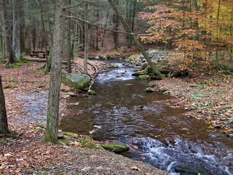
![]()
![]() On Saturday, Nov 1st Cindy and I decided to go to Lewisburg to exchange cars with Krista. We also decided to stay over and hike both days. I found that the Comfort Inn in New Columbia was "pet friendly" and made a reservation for Saturday night. As usual, we got a later start than anticipated on Saturday and did not arrive in Lewisburg until 11:30 AM. We picked up Brad and Krista and headed for the Loyalsock Trail over Smith's Knob. We headed north on I-180 toward Montoursville and then took State Route 87 north and east. After about 10 miles the trailhead for the Loyalsock trail appeared on the right and just passed it the turn onto Little Bear Creek Road. We turned and went up the road about .75 miles and parked in a pull-off by the side of the road. We started hiking at about 1:15 PM by walking back down the road a few hundred feet and turning right onto the trail which is marked with a distinctive yellow LT on a red can bottom. The trail IMMEDIATELY became quite steep which slowed some of the group. Sheba and I waited and walked slowly to enjoy the scenery. The weather, which was supposed to be only partly cloudy, was overcast and a little "dreary".
On Saturday, Nov 1st Cindy and I decided to go to Lewisburg to exchange cars with Krista. We also decided to stay over and hike both days. I found that the Comfort Inn in New Columbia was "pet friendly" and made a reservation for Saturday night. As usual, we got a later start than anticipated on Saturday and did not arrive in Lewisburg until 11:30 AM. We picked up Brad and Krista and headed for the Loyalsock Trail over Smith's Knob. We headed north on I-180 toward Montoursville and then took State Route 87 north and east. After about 10 miles the trailhead for the Loyalsock trail appeared on the right and just passed it the turn onto Little Bear Creek Road. We turned and went up the road about .75 miles and parked in a pull-off by the side of the road. We started hiking at about 1:15 PM by walking back down the road a few hundred feet and turning right onto the trail which is marked with a distinctive yellow LT on a red can bottom. The trail IMMEDIATELY became quite steep which slowed some of the group. Sheba and I waited and walked slowly to enjoy the scenery. The weather, which was supposed to be only partly cloudy, was overcast and a little "dreary".
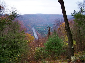 After the initial steep beginning the trail flattens some. It wanders through alternating areas of hardwood and evergreen. The trail parallels the rim of the slope and ascends again until at about .7 miles a viewpoint opens up. This is Helen's Window and offers a view directly down the Loyalsock Valley. The creek here is incredibly straight making it look more like a canal. The viewpoint has several large flat rocks and we took a short break to get a snack and some water. A white trail ascends to this point from Route 87 for those that want a shortcut to the view. We got back on the trail and continued a gentle ascent until the trail net an old woods road at about 1.3 miles. After a short and flat walk along this road the Loyalsock Trail took us left for the ascent up Smith's Knob. At this trail junction a trail with red X's on a yellow background marked the trail we would use to return.
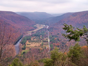 The ascent up Smith's Knob is short but VERY steep. It is eroded in places and the cover of damp leaves made the challenge even greater. After the steep ascent the trail continues to rise but much more gently. Near the top is a nice view to the south and east. I was initially disappointed since there was no other view from the highest point! We continued on over the Knob and started a gentle descent. Slightly to the left of the trail a viewpoint opened up and we walked over to this opening. An incredible view of the Loyalsock Valley and the Creek lay before us! There is a sheer drop from this point and no guardrail so we were very careful as we examined the views to the north and east. Some haze still hung over the mountains and the sky to the northeast was turning from gray to black. No rain was predicted but the wind began to come up and the temperature dropped. We had the option of returning the way we had come which was shorter than the loop I had planned. I was worried that we would not find the turn on the loop since I had never been in the area before, the map I had was totally inadequate and my GPS had gone "bananas". My experience with the GPS in "emergency" situations has not been good. Today the GPS would locate seven satellites one minute and none the next. The Track was all over the place. It didn't help that I had failed to load the topo maps for the area! Despite all the negatives we decided to continue since we did not want to descend the steep trail we had come up.
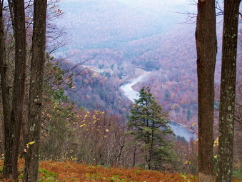 After starting the descent. I almost immediately wondered about the choice. The trail was steep and eroded and difficult to keep a good footing. It did switchback several times and finally leveled near the base of the knob. As we walked along I was looking for a sign for the DER lookout. Just after 2 miles a lookout opened up giving a nice view of Loyalsock Valley to the north and west. There was no sign but this had to be the lookout I was searching for! We continued to follow the trail which was partly on an old woods road before veering left into the woods. I was apprehensive about finding the red X trail but in less than .5 miles a sign sating "no horses" appeared and the red X markings were present. We turned right on this trail and it was immediately evident that it is not well traveled/ Old blowdowns lay across the trail in several places and the marking disappear in several others. After less than a mile of the trail met an woods road which is now being used for logging or some other purpose. On the left side of the road there is a wire mesh fence but no signs to indicate the purpose. At this point the sun came out and the weather cleared and the threat of rain all but disappeared.
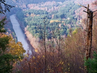 The road turned left while the trail continued a little to the right and then straight ahead. Soon we were back at the trail junction where we had turned left to ascend Smith's Knob earlier. We retraced our steps back down to Helen's Window and paused for a moment. The valley was now illuminated by sunlight but there was still some haziness to the view. The trip back down the slope to the car went quickly. We covered a little less than 5 miles in about 3 hours returning to the car by 4:15 PM.
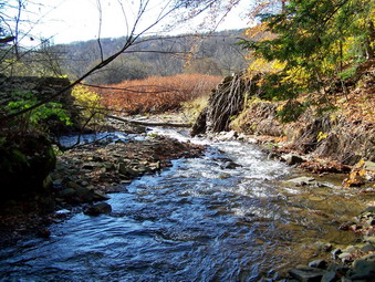
![]()
![]() On Sunday, Oct 26th Cindy and I decided to go back to Sam's point after church. It had rained almost all day on Saturday and we wanted to see what Verkeerder Kill Falls looked like after the rain. He intended to continue on the escarpment to High Point and back to the parking lot. The weather in the morning was foggy and cool but the fog had cleared and the sun was out by the time we left church. We headed for Sam's Point but immediately ran into trouble driving my daughter's car. By the time we got back home it was a little late to continue with our plans. We both did some "chores" but then decided the day was too nice to waste. We put Sheba in the car and headed for Trout Pond. This hike is close and also has a small waterfall. We parked at about 2:15 and immediately headed down Russell Brook Road. By the sounds coming from the brook, there seemed to be a large volume of water going over the falls.
On Sunday, Oct 26th Cindy and I decided to go back to Sam's point after church. It had rained almost all day on Saturday and we wanted to see what Verkeerder Kill Falls looked like after the rain. He intended to continue on the escarpment to High Point and back to the parking lot. The weather in the morning was foggy and cool but the fog had cleared and the sun was out by the time we left church. We headed for Sam's Point but immediately ran into trouble driving my daughter's car. By the time we got back home it was a little late to continue with our plans. We both did some "chores" but then decided the day was too nice to waste. We put Sheba in the car and headed for Trout Pond. This hike is close and also has a small waterfall. We parked at about 2:15 and immediately headed down Russell Brook Road. By the sounds coming from the brook, there seemed to be a large volume of water going over the falls.
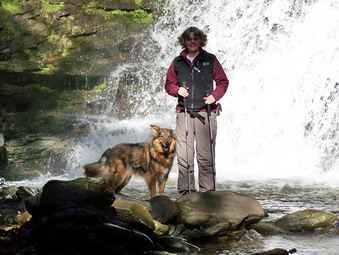 After crossing the bridge, we headed to the right off the trail and toward the falls. There WAS a lot of water going over the falls so we worked our way down into the stream bed to take some pictures. I took some pictures at different angles and included Cindy and Sheba in some of them. Sheba and I walked to the upper falls and went down to the stream bed again. I took several pictures of the large volume of fast-flowing water before returning back to the main trail. From the register we headed directly up to Trout Pond. The last few times we had done this hike we went the steeper way to Mud Pond first and this was a nice change. The trails were VERY WET in many places with standing and running water. The leaves were mostly off the trees and the views from the dam were "bleak"."
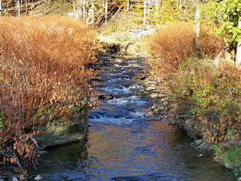 We hiked around Trout to the inlet and found a place to cross the inlet stream. The bridge here has not been replaced since it is not part of the SNOWMOBILE trail system! Walking up the trail from the pond was difficult due to the amount of water on the trail. A soon as we would clear one wet area, another one would appear. Some areas had over 6 inches of water pooled on the trail! We finally made it to the woods road at Mud Pond and turned left to go back toward the falls. This part of the hike is ALL downhill and went quickly. From the falls we retraced our path back up Russell Brook Road to the parking area on Morton Hill Road. We were back by 4:15 PM having covered a little over 4 miles.
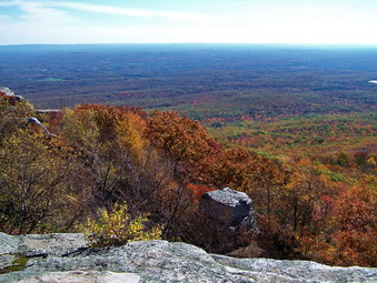
![]()
![]() On Sunday, Oct 19th Krista and Brad were visiting from Pennsylvania and wanted to do a short hike after church. Krista didn't want to hike any major mountains so we decided to go to Sam's Point. Neither of them had been to the Ice Caves so we headed there arriving just after noon. There were a LOT of cars in the parking area but we found a spot an were soon on our way. With a number of people in the area, we decided to put Sheba on her leash until we could see how many hikers were actually on the trails. From the conservation center we started up to the right on the carriageway that leads to Sam's Point. There were only a few people at the lookout so we enjoyed the view and I took some photos. The leaves were passed their peak but still pretty. As we were about to leave, three girls asked about the hiking options. They seemed to want to do a longer hike so I suggested the loop down to the falls and back along the escarpment to High Point.
On Sunday, Oct 19th Krista and Brad were visiting from Pennsylvania and wanted to do a short hike after church. Krista didn't want to hike any major mountains so we decided to go to Sam's Point. Neither of them had been to the Ice Caves so we headed there arriving just after noon. There were a LOT of cars in the parking area but we found a spot an were soon on our way. With a number of people in the area, we decided to put Sheba on her leash until we could see how many hikers were actually on the trails. From the conservation center we started up to the right on the carriageway that leads to Sam's Point. There were only a few people at the lookout so we enjoyed the view and I took some photos. The leaves were passed their peak but still pretty. As we were about to leave, three girls asked about the hiking options. They seemed to want to do a longer hike so I suggested the loop down to the falls and back along the escarpment to High Point.
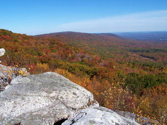 We left the lookout and headed toward the road down to the Ice Caves. We did let Sheba off her leash for a while but we kept meeting groups of people many of whom had dogs. As approached the Caves there was a large group ahead of us and one behind. I wanted to wait but others decided to stay between these two groups. As we descended the trail to the Caves, the group ahead was moving slowly while the group behind wanted to go faster. All this meant that things were crowded and it was hard to enjoy the impressive rock formations. I couldn't get any pictures since we were moving quickly and there were too many people constantly in view! Finally the group ahead asked us to pass. We did meet some other people in the Caves themselves but were soon through to the end of the trail. Sheba needed a little help on the ladders but otherwise behaved very well. At the end of the caves we stopped briefly on the rocky lookout. I took pictures of the escarpment and the valleys below. I also snapped a few of the rocks we were standing on and of the people walking below in the Caves.
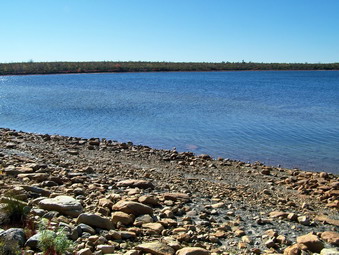 When we got back to the main loop road, we decided to turn right and go around Lake Maratanza to add a little length to the hike. This is easy walking since it is all on the road. I would have gone down to the falls and out to Indian Rock but Brad and Krista had limited time. The lake was very nearly full and had a beautiful deep blue color. As we circled around the other side I pointed out the berry picker's shacks and talked a little about the history of the place. I also indicated the location of the new South Gully Trail. We were back in the car before three o'clock after hiking a little more than 4 miles.
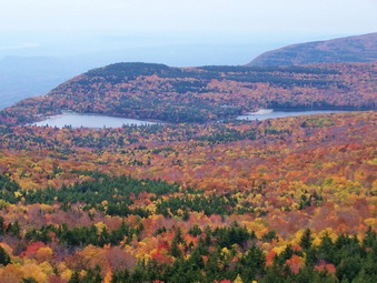
![]()
![]() On Monday, Oct 13th I decided to go to North South Lake near Haines Falls since this had been my destination several times before. I also wanted to see some of the last fall colors and knew that there are numerous places there to get great views. Sheba and I left a little later than I had planned but were still able to park at the Schutt Road parking area at 10:00 AM. I decided to hike the trails counterclockwise and headed up Schutt Road, crossed over the main park road and got on the Rock Shelter Trail toward North Point. This trail is one of my least favorite trails since it has numerous rocks that are almost always wet and slippery. This day there was a lot of water in places and mud in others. Sheba and I walked quickly and soon arrived at the Mary's Glen Trail where we turned north toward North Point. At the Escarpment Trail we turned left again toward North Point.
On Monday, Oct 13th I decided to go to North South Lake near Haines Falls since this had been my destination several times before. I also wanted to see some of the last fall colors and knew that there are numerous places there to get great views. Sheba and I left a little later than I had planned but were still able to park at the Schutt Road parking area at 10:00 AM. I decided to hike the trails counterclockwise and headed up Schutt Road, crossed over the main park road and got on the Rock Shelter Trail toward North Point. This trail is one of my least favorite trails since it has numerous rocks that are almost always wet and slippery. This day there was a lot of water in places and mud in others. Sheba and I walked quickly and soon arrived at the Mary's Glen Trail where we turned north toward North Point. At the Escarpment Trail we turned left again toward North Point.
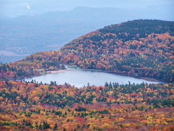 The trails up to this point gain little elevation and roll up and down. The Escarpment Trail begins to rise quickly as it gains elevation toward North Point and North Mountain. Soon we were climbing the last steep parts of the trail toward the Point over large blocks of rock which required me to get some good handholds and pull myself up. Sheba, on the other hand, just jumps up and down over these rocks. We were on North Point in less than an hour and spoke to several hikers before continuing on toward Stoppel Point. North Point has several different "levels" and most people only make it to the first one. This is a shame since the view is good from this lower lookout but is GREAT from the upper one! We stopped each time and, although, it was overcast, I got some nice pictures of the lakes and the fall leaf colors.
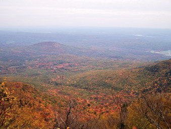 After North Point the trail continues over North Mountain toward Stoppel Point. Most of this part has no view and is not very exciting. The final approach to Stoppel Point has several steep but short climbs. We made Stoppel Point in less than two hours but I was disappointed to find that the clouds, fog and haze had closed in and the views were mostly blocked. We stopped for a snack and a drink. I did take some pictures before turning around and starting back down. I knew that if the conditions did not change, the hike would be good exercise but yield few pictures. On the way down through North Mountain and North Point we stopped briefly to assess the lighting conditions. Nothing much had changed from the time we went up so I took only a few more pictures before starting down off North Point.
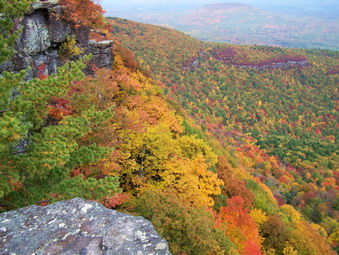 At the trail junction we continued ahead on the Escarpment Trail which is what I had intended. The descent can be steep at times and we lost a lot of elevation from North Point down to Newman's Ledge. Many of the points of interest at North South Lake are labeled with a sign to identify them. I took pictures from the Ledge and remembered the story about a hiker rappelling off the ledge with a rope about 20 feet too short! Back on the trail we headed for Lookout Point and Sunset Rock taking the side trail to get there. At this point there were quite a few people along the way. The views from here were good as the weather had lifted somewhat. I took several pictures from each location and snapped some of just the gorgeous leaf colors. We then went back to the main trail and headed toward Artist Rock. Artist Rock is a popular viewpoint and overlook but I don't think it is the nicest! We took some pictures here and then moved on down the trail toward the beach at the east end of South lake. We walked through the parking lot and up the road to the site of the Catskill Mountain House.
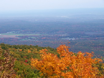 Whenever I stand on the former site of the Catskill Mountain House, I can imagine the views that greeted visitors each morning as they awoke. Many arrived by the cog railway from Palenville and others came by carriage. The site today still offers panoramic views of the Hudson River directly east and to the south and north. This day the views were a little limited by the haze hanging over the river. We stopped to get a drink and I gave Sheba a few bones as I took pictures. There were several brilliant trees just below the cliff edge and I snapped some photos of them. When we were done we walked across the filed and back to the Escarpment Trail to continue the hike. I was beginning to get tired and my feet were hurting some.
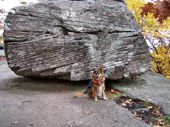 The trail ascends upward over some rocky and barren areas as it regains elevation to get to Boulder and Split Rocks. We hiked along and soon arrived at Boulder Rock. The views from here were much the same as from the other lookouts. I took some pictures before departing and walking to Split Rock. Split Rock is an impressive area where some of the bedrock has separated from the main structures. I didn't stop to take pictures as the hour was late and these formations do not change. The trail took us back up to the main Escarpment Trail and we continued along relatively flat terrain to a point near the site of the Kaaterskill House. here we turned left and descended for less than a mile to the area where the Escarpment Trail turns abruptly to the right. A horse trail goes left and we followed it toward the Palenville Lookout.
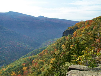 The horse trail is wide and descends slightly as the lookout is well below the main trail. I had only been there once with Cindy and was a little unsure of the route. The horse trails do not have many signs. We hiked for quite a while and in that time took one turn to the right when the trail branched. I was beginning to wonder if I had taken a wrong turn but soon the trail made a 180 degree turn to the right and began a steep descent. The trail here is eroded with loose dirt and rocks and it was also covered by a layer of leaves. I slipped and slid my way to the bottom. In a short distance, after crossing over several streams, the trail turns right or continues straight ahead. We turned right and headed toward the lookout as the scenery became more familiar to me. This hike was already a long one and this part was starting to drag. My feet were hurting and I decided to do something about it as soon as we reached the lookout.
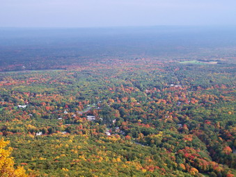 Finally, we walked through a clearing and then down the path to the lookout where a group was already present. We talked briefly. I began to take pictures as this is a classic view and the light was good. The village of Palenville is spread out below . Directly across from the lookout is Kaaterskill High Peak and Round Top. To the right are some views up Kaaterskill Clove. I sat down on the stone chairs and took off my shoes and socks. I applied some Spenco Blister material and put on a fresh pair of socks. Shortly after this we were on our way and my feet did feel better. I was now concerned about getting back to the car before dark. Several shortcuts were possible but I decided to simply walk faster.
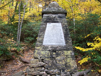 We hurried back up the horse trail which was a challenge for my tired legs. Back on the main trail we continued the fast pace stopping only briefly at Inspiration Point and Sunset Rock. The descent to the Layman Memorial was more difficult than I remembered as was the ascent on the other side! These areas are very rocky and hard to walk down and up. Soon we were on the familiar portion of the trail that comes up from Kaaterskill Falls and joins the Schutt Road Trail that leads back to the parking area. Even this part of the trail seemed longer. I kept watching the GPS as we approached the parking area and we finally arrived at 5:30 PM. A total of 15 miles in 7.5 hours. We had seen ALL there is to see at North South Lake and I had some good pictures to show for it!
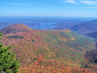
![]()
![]() On Sunday, Oct 12th I was still looking for the best autumn color I could find and thought we might hike at North South Lake. After church, we headed in that direction but I realized that the trip was long and we had a limited amount of time. I asked my wife what she wanted to do and mentioned that Wittenberg might be nice. Cindy said that would be a good idea since she had never hiked this peak. Wittenberg has one of the nicest views in the Catskills and I was sure she would not be disappointed. The only problem is that it is a 3500 and the round trip is close to 8 miles! We parked at the Woodland Valley campsites, paid our fee and were hiking by just after noon. The first part of this hike crosses a creek and them proceeds up a steep slope for about .5 miles to the trail register. From here the trail continues but is less steep. It immediately passes through evergreen stands and around and over rocks both large and small. It then levels some and wends its way through some ore evergreens and then hardwoods as it joins a woods road.
On Sunday, Oct 12th I was still looking for the best autumn color I could find and thought we might hike at North South Lake. After church, we headed in that direction but I realized that the trip was long and we had a limited amount of time. I asked my wife what she wanted to do and mentioned that Wittenberg might be nice. Cindy said that would be a good idea since she had never hiked this peak. Wittenberg has one of the nicest views in the Catskills and I was sure she would not be disappointed. The only problem is that it is a 3500 and the round trip is close to 8 miles! We parked at the Woodland Valley campsites, paid our fee and were hiking by just after noon. The first part of this hike crosses a creek and them proceeds up a steep slope for about .5 miles to the trail register. From here the trail continues but is less steep. It immediately passes through evergreen stands and around and over rocks both large and small. It then levels some and wends its way through some ore evergreens and then hardwoods as it joins a woods road.
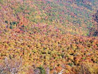 This road ascends very gently and then the trail makes an abrupt turn to the left. Several times along the way we passed people coming down off the summit AND groups headed up. We followed the trail on a steeper ascent now over and through some rocks until it leveled out some. The next part of the trail is the part I find most annoying. The trail skirts Wittenberg to get to the gentler slope on the other side. In doing so the trail rolls up and DOWN and loses some elevation. Eventually the trail branches left to Terrace Mountain. We turned right onto another old woods road to start the actual climb up Wittenberg. The trail switches back and forth and climbs several rather steep spots through rock ledges and outcroppings. The final stretch has many of these small obstacles before a long stretch of rocks that mark the final ascent. When we passed the 3500 foot sign I knew we were getting near the top. As soon as I could see we were almost at the summit, I let Cindy lead. As we broke out onto the broad rock outcropping that marks the summit, I could see Cindy was impressed
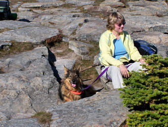 Quite a few people were gathered at the summit and this was not surprising. The weather was almost perfect with a slight breeze blowing. There were only a few clouds in the sky and there was almost no haze over the Ashokan. The autumn colors were beautiful and I started to take pictures. I snapped photographs of the reservoir and surrounding mountains at varying degrees of magnification. It was getting late since it had taken us about 2.5 hours to climb to the top. We gave the dog a snack and we got a drink before starting back. Several groups were debating whether to continue on to make a loop, to head back or camp. I discussed their options with them and then we headed down.
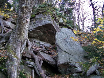 Down went MUCH faster than up although the descent was taxing on the joints especially the knees. There are also some places where you have to take care and slow down. We again passed groups also on the descent and a few still coming up. The trip down was quick and we made it in under two hours. The 8 hour, difficult hike had taken us about 4.5 hours including time for pictures. The view and the fall leaf colors were the bonus we were looking for.
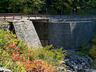
![]()
![]() On Thursday, Oct 9th I wanted to hike the Blacks in the northern Catskills. I needed them for October and I like the three-for-one hike. An early morning ambulance call cut two hours off my day. When I returned, I headed for the Devil's Path intending to hike Sugarloaf and Plateau. As I got closer, I decided I was more interested in hiking to Kaaterskill Falls. I had never hiked there since it is impossible to park on weekends since it is a very popular destination. When I pulled into the parking area, there were less than 10 cars. Sheba and I got out of the car and started down Route 23A toward the trailhead. This is the MOST DANGEROUS part of the hike since the road is narrow and there is only the shoulder to walk on. As we approached the trailhead. I took some pictures of the stone bridgework and then hurried to the safety of the trail.
On Thursday, Oct 9th I wanted to hike the Blacks in the northern Catskills. I needed them for October and I like the three-for-one hike. An early morning ambulance call cut two hours off my day. When I returned, I headed for the Devil's Path intending to hike Sugarloaf and Plateau. As I got closer, I decided I was more interested in hiking to Kaaterskill Falls. I had never hiked there since it is impossible to park on weekends since it is a very popular destination. When I pulled into the parking area, there were less than 10 cars. Sheba and I got out of the car and started down Route 23A toward the trailhead. This is the MOST DANGEROUS part of the hike since the road is narrow and there is only the shoulder to walk on. As we approached the trailhead. I took some pictures of the stone bridgework and then hurried to the safety of the trail.
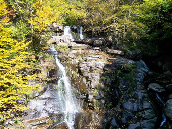 The water level was low as we stopped just after the bridge to take in the first falls. This is actually Bastion Falls NOT Kaaterskill Falls. I took many pictures from different angles before going back to the trail and continuing up the creek. We stopped several more times to take pictures and walked out into the stream bed a the top of the falls. The trail is eroded in many places from the heavy traffic making some hiking difficult. We were finally at the end of the trail near the base of the lower falls. We walked out and I was really amazed at what I saw. No description can truly do this scene justice. Even with the low water level, the sight is breathtaking. The total drop is over 200 feet with the lower falls being shorter but with a greater volume. Both parts of the falls are visible from the base of the lower falls. The water falling over the upper cascade seems to dissolve into a mist as it is blown by the wind. I took pictures from different angles and then walked along the stream bed to a point as near the pool at the bottom of the lower falls as possible.
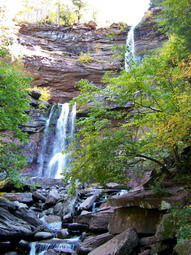 Although the trail ends at the lower falls, a path continues upward and Sheba and I began to scramble upward. We eventually reached a horizontal path that ran both left and right. We turned left to go toward the falls. Soon we were at the area in between the two falls. Here there is a wide open amphitheater as the water falls from the upper cascade to the rocks and a pool below. As the water gathers it then drains over the lower falls. I wanted to walk down into this area but the rocks were covered with water and several tries discouraged me from any further attempts. I was satisfied to snap many photographs from as many angles as I could. Sheba and I walked back to the area we had ascended to and continued on until another path led upward toward the top of the falls. This path is also steep and heavily eroded but we soon were at the top of the upper falls. The view from the top is truly breathtaking and dizzying. I walked along the edge to get some pictures of the falls. I also walked to the center of the stream bed to take some shots down the stream and out over the falls. It seemed to me that the view from the other side might be better but I could not find a place to safely cross.
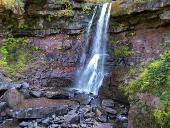 I decided to walk upstream to the road into North South Lake and then down the road to the Laurel House Road. I knew this would give me access to the other side of the falls. I then intended to walk back out to the road and walk the road back to the car. This would be a long walk I knew but would avoid trying to negotiate the steep path we had used to get to the top of the falls. From the top of the falls we walked along the stream bed until we found an old woods road which we followed. This road joins the trail that leads to the Schutt Road parking area. We walked up Schutt Road to the main road and turned left, walked the main road until we found Laurel House Road and then turned left. This road dead ends at a small parking area where another woods road leads to some paths near the top of the falls. Eventually we were at the top of the falls. The view WAS much better down Kaaterskill Clove. I took pictures and then we walked along the rim of the gorge on an informal path.
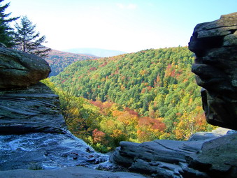 The path began to lead downward and I got the idea that we would follow it until we could get to the area between the falls. The path was steep in places and not always easy to follow. By the time We reached the creek, I realized that we had lost too much elevation and were below the base of the lower falls. I didn't feel like climbing back up and looked for a place to cross back to the other side. It seemed pointless to go all the way back up to the road and soon Sheba found a relatively safe way across the creek. We were able to cross and find the trail we had earlier hiked up. We walked down the trail back to Route 23A and carefully made our way back to the car. We had spent several hours walking about 3.5 miles but the sights made it well worth the trip
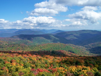
![]()
![]() On Sunday, Oct 5th I decided to go looking for some "fall color". Around Livingston Manor the leaves were changing but the colors were muted and not very brilliant. I thought maybe going a little further north might mean a little more color. I also wanted to "bag" a peak that I had not hiked in October. I couldn't start until after church so I decided to go to panther which is less than an hour from my house. The area around Giant Ledge and Panther is pretty accessible and usually has some nice views of the valleys below and the mountains in the distance. As I drove along Route 47 passed Frost Valley the sky seemed a little cloudy and I worried that clouds or a haze might obscure the views that I wanted. The parking area for Giant Ledge was beginning to fill when we arrived just after noon. Sheba and I were out and on the trail by 12:15 PM.
On Sunday, Oct 5th I decided to go looking for some "fall color". Around Livingston Manor the leaves were changing but the colors were muted and not very brilliant. I thought maybe going a little further north might mean a little more color. I also wanted to "bag" a peak that I had not hiked in October. I couldn't start until after church so I decided to go to panther which is less than an hour from my house. The area around Giant Ledge and Panther is pretty accessible and usually has some nice views of the valleys below and the mountains in the distance. As I drove along Route 47 passed Frost Valley the sky seemed a little cloudy and I worried that clouds or a haze might obscure the views that I wanted. The parking area for Giant Ledge was beginning to fill when we arrived just after noon. Sheba and I were out and on the trail by 12:15 PM.
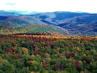 We had not hiked for several days so both the dog and I were ready to go. After signing the trail register, we took off at a rather accelerated pace! The trail was damp in some places and wet with running water in others. A cover of falling leaves made the footing even more precarious. As we worked our way up through the rocky ascents, we passed several groups coming back down the trail and overtook a couple headed up. We made the trail junction with the trail up to Giant Ledge in only 13 minutes! This is the first time I had gotten a side stitch while hiking. We turned right and continued the pace over the relatively flat part at the beginning of the trail. Our sped slowed somewhat as we began the climb to Giant Ledge but was still quick. We continued to meet groups going in both directions. In less than 40 minutes we were at the short spur trail that leads to the first lookout.
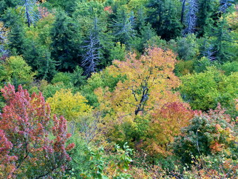 As we walked out onto the lookout several other people were present enjoying the view. The colors were more than I had hoped for! There was no haze to hide the wonderful display. The clouds cast a few shadows on the valley and hills but added interesting patterns to the scene. The Burroughs range was to the right and Panther could be seen to the left. I snapped MANY pictures from different angles as the light kept changing. Sheba and I left this lookout and stopped at least three more times. Each viewpoint had several people all of whom commented that Sheba was beautiful and moved so that I could get the best pictures. These people seemed content to enjoy the view from the Ledges but I wanted to move on to Panther and Sheba seemed willing. The distance to Panther is not very great and went quickly. We descended into the Col and then hurried up Panther. There were a few very wet spots along the way. As we finished ascending the steepest part, I noticed a short trail to the right that looked like it led to a lookout. We walked out this trail and the view was spectacular. Not only was the valley below laid out before us but the entire Burroughs Range was visible without any obstructions. I took pictures before we went back to the main trail.
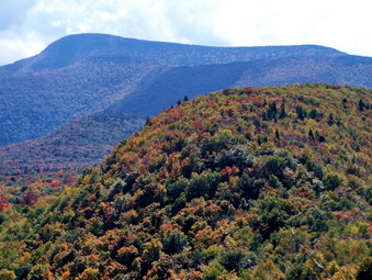 We continued on toward the summit and soon reached the flatter portion of the trail. As we passed by the big rock just before the summit, I noted that several people were enjoying the view from there. I had never found that view any better than from the summit, so Sheba and I continued on. We stopped at the summit for a snack and a drink and I took a few photos. As the trees grow up, the views from this lookout are becoming more limited. We started back but stopped at the rock outcropping to talk to the people. The three people present had come up from Fox Hollow. When I climbed to the top of the rock, I was surprised at how good the views were. Someone had cut down some of the trees and opened up a GREAT view! I have mixed feelings about this but I guess I believe that limited trimming is a good thing. I talked to the others for a while and one asked "Are you Ralph?" I admitted that I was and they said that they had been on my website. They complimented the content which always makes me feel good. After taking pictures, Sheba and I headed back to the Ledges. We met no other hikers on to way to Panther or on the return trip.
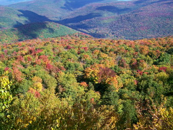 On the way back Sheba and I again stepped up the pace. We stopped for only a short time at Giant Ledge. I took a few more pictures since the light had changed and then we were off. Different groups of people were now enjoying the view and we met quite a few people still hiking up to the Ledges. Sheba and I almost ran down the trail to the junction and then back to the parking area. Despite stopping to take pictures AND talk we were back by 3:15 PM. We had covered the 6 miles in under 3 hours hiking time.
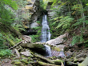
![]() On Tuesday, Sept 30th I hiked Peekamoose and Table in the morning and decided to explore Buttermilk Falls in the afternoon. I had read Russell Dunn's Catskill Region Waterfall Guide to pinpoint the location of the falls. This falls is the most popular of the six or seven falls along the Peekamoose Road. I had always though the falls were closer to the trailhead and on the opposite side of the road. In fact, the parking area is on the same side as the trailhead but almost exactly a mile up the road. A short trail leads to the base of the falls. Sheba and I hiked to the falls and I took a LOT of pictures from the base of the falls. I tried holding the camera horizontally and vertically and experimented with different shutter speeds. We were able to get right up to the base of the falls and see the little pool formed as the water cascades about 40 feet down the rocks. At this point we started to return to the car but I decided to climb to the top of the falls to get a different perspective.
On Tuesday, Sept 30th I hiked Peekamoose and Table in the morning and decided to explore Buttermilk Falls in the afternoon. I had read Russell Dunn's Catskill Region Waterfall Guide to pinpoint the location of the falls. This falls is the most popular of the six or seven falls along the Peekamoose Road. I had always though the falls were closer to the trailhead and on the opposite side of the road. In fact, the parking area is on the same side as the trailhead but almost exactly a mile up the road. A short trail leads to the base of the falls. Sheba and I hiked to the falls and I took a LOT of pictures from the base of the falls. I tried holding the camera horizontally and vertically and experimented with different shutter speeds. We were able to get right up to the base of the falls and see the little pool formed as the water cascades about 40 feet down the rocks. At this point we started to return to the car but I decided to climb to the top of the falls to get a different perspective.
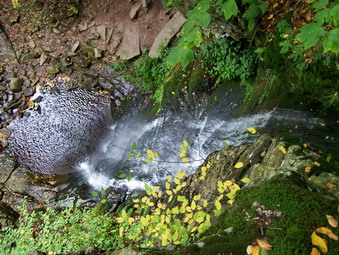 The climb to the top of the falls is STEEP and the "trail" is very eroded. At the top of the climb a trail winds passed the top of the falls along the stream. Just above the main falls several other cascades carry the water over the rocks. I am sure these would be more impressive after some rain! On the way back, we worked our way along the stream toward the top of the falls. The gorge cut by this stream is very impressive the closer you get to the falls. I stopped at the top of the falls to take some pictures almost straight down. A convenient tree allowed me to hold on while leaning out over the falls. Looking at the pictures afterward made me dizzy. On the way back to the car I tried to find an easier way down but was not completely successful.
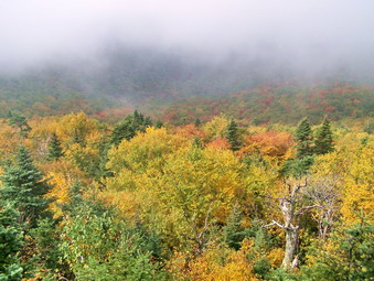
![]()
![]() On Tuesday, Sept 30th I wanted to end the summer season and the month of September by climbing a couple of 35's. School was closed for the Jewish New Year. The skies were cloudy and a heavy blanket of fog and haze hung over everything was Sheba and I left Livingston Manor and headed toward Grahamsville. I intended to get a two-for-one by hiking Peekamoose and then Table. This is an easy double which I had done earlier in the summer from the Denning trailhead. This time I hoped the skies would clear as predicted since there are some nice views from both mountains. Afterward I thought I might visit one or more of the half dozen waterfalls that can be found along the Peekamoose Road. I parked just after 9:00 AM and we immediately got on the trail. The temperature was cool and I was wearing and Icebreaker long sleeved wool shirt. I had packet a short sleeved version and well as a light jacket and by Marmot Precip. This time of year can throw a lot of different conditions at you in a short time particularly on the peaks.
On Tuesday, Sept 30th I wanted to end the summer season and the month of September by climbing a couple of 35's. School was closed for the Jewish New Year. The skies were cloudy and a heavy blanket of fog and haze hung over everything was Sheba and I left Livingston Manor and headed toward Grahamsville. I intended to get a two-for-one by hiking Peekamoose and then Table. This is an easy double which I had done earlier in the summer from the Denning trailhead. This time I hoped the skies would clear as predicted since there are some nice views from both mountains. Afterward I thought I might visit one or more of the half dozen waterfalls that can be found along the Peekamoose Road. I parked just after 9:00 AM and we immediately got on the trail. The temperature was cool and I was wearing and Icebreaker long sleeved wool shirt. I had packet a short sleeved version and well as a light jacket and by Marmot Precip. This time of year can throw a lot of different conditions at you in a short time particularly on the peaks.
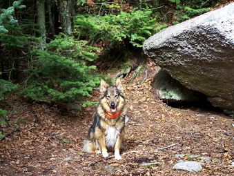 The first part of the hike is steep at first and then levels out. It follows and old woods road for about .8 miles before the trail leaves to the right as the road bears right. From this point on the trail alternates between relatively flat areas with steeper sections that ascend through rocky outcrops. This happens three or four times before the 3500 foot sign. One of these rocky areas has a precariously perched glacial erratic named Reconnoiter Rock. This rock balances on an outcrop and looks like it could not possibly stay where it is. The skies remained overcast and every viewpoint revealed mostly fog and clouds with only brief glimpses of the countryside. I had decided to push on to the top of Table before getting the camera out to take any pictures.
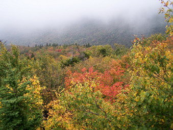 Soon we were at the 3500 foot sign and continued to press up the last steep section to the summit ridge of Peekamoose. The final climb is steep in areas and longer than I remembered. The viewpoints near the top were completely blocked by the fog and haze. Sheba and I continued across the flat ridge and finally reached the boulder that marks the top of Peekamoose. We continued on down the short but steep descent into the Col between the two peaks. Ascending to the Table summit ridge is not quite as steep but longer. Once on the ridge there is a long walk to the highest point on the mountain. My GPS shows the summit in a spot which is obviously LOWER than the actual peak but we did continue down the other side of Table just a short distance. A short spur trail leads off the main trail to the left to a small lookout with good views. The fog was beginning to clear as we arrived and we stopped for a drink. By the time We had a drink and I got the camera out, the fog was beginning to roll back in! I did get what turned out to be some good pictures before turning around for the return trip.
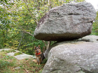 On the way back I took quite a few pictures along the trail. We stopped briefly at the top of Peekamoose and took a few pictures. There aren't any real viewpoint near the summit so we walked quickly across the summit ridge to the lookouts just before the descent. These viewpoints were still very foggy but I took some shots anyway. On the descent we met a couple from New Paltz hiking up the trail. We talked for a minute lamenting the limited views before continuing. We stopped at Reconnoiter Rock and I took a few pictures of the rock and of Sheba. From here we increased our pace almost jogging down the trail at times. When we turned onto the woods road again, we met another person hiking up the trail. He said he was trying to get in shape for hunting season. From his labored breathing after less than a mile of hiking I thought this was a good idea. It also reminded me that the woods become less inviting when hunters are present. We were back at the car before 1:30 PM covering almost 9 miles in a little over 4 hours.
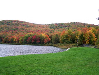
![]()
![]() On Sunday, Sept 28th the weather looked VERY questionable for the afternoon. Cindy and I decided to take Sheba and try a short hike at Alder Lake. The leaves were turning and Alder Lake usually showcases this seasonal change very well. We drove up Alder Creek Road and then turned into the access road to Alder Lake. The road is VERY rough and rutted! This area is so popular that I wish the DEC would do some maintenance to keep the road passable. We parked at just after 12:30 PM with only a few other cars in the lot. Sheba was crazed since she had not been out since last Sunday. We walked toward the lake to see what colors we could see. The leaves were the best I have seen around with some areas brighter than others.
On Sunday, Sept 28th the weather looked VERY questionable for the afternoon. Cindy and I decided to take Sheba and try a short hike at Alder Lake. The leaves were turning and Alder Lake usually showcases this seasonal change very well. We drove up Alder Creek Road and then turned into the access road to Alder Lake. The road is VERY rough and rutted! This area is so popular that I wish the DEC would do some maintenance to keep the road passable. We parked at just after 12:30 PM with only a few other cars in the lot. Sheba was crazed since she had not been out since last Sunday. We walked toward the lake to see what colors we could see. The leaves were the best I have seen around with some areas brighter than others.
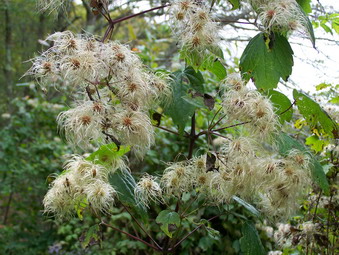 We headed left to walk around the lake and were treated to some even more colorful views. The sky was still dark and it was very warm and humid but no rain was falling. There was ample evidence that the bears had been feasting on berries in preparation for hibernation. As we neared the other end of the lake we decided to walk toward the beaver meadows on the Millbrook Ridge Trail. The nettles which are usually prevalent on the trail were almost gone even where the trail was wet. Most of the trail was damp making the footing on the rocks and roots difficult. Along the way we met four people hiking in the opposite direction. Two carried rifles reminding me that small game season was open and that big game season will soon follow. The hike has some elevation gain but not too much and we were making good time when we arrived at the first beaver meadow. After this there is a slight climb and a short walk to the lean-to and the two main beaver meadows.
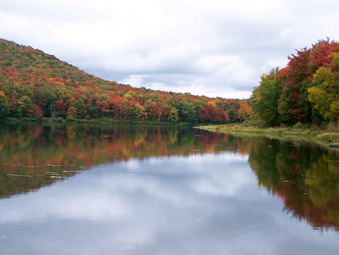 As we climbed the hill and headed toward the lean-to, a few drops of rain began to fall. Normally, I would have continued to our destination but this day I decided to be sensible. We turned around and started the hike back as the rain started to fall a little more heavily. We were under the leafy canopy and protected from some of the rain but what I thought was going to be a passing showers intensified. When we reached the lake, we both stopped and slipped on our Marmot Precip jackets. Normally, I resist putting on rain gear since NONE of it really breathes adequately but this rain was coming down pretty hard. We continued around the lake and back to the parking are in a steady rain. The hike took just about 2 hours for 4 miles and we were wet but it was much better than no hike at all.