
What You Missed
Fall 2007
Fall 2007
On Sunday, December 16th more bad weather struck in the form of a nor'easter. We got a lot less snow than was originally predicted but there was plenty of sleet and freezing rain. We had cancelled church on Saturday in anticipation of the mess on Sunday. My son Kurt was home so we decided to repeat the trip around Round Top. I didn't realized Kurt had never been on snowshoes before. He has been living in the South, mostly in Orlando, Florida so he hasn't had much of chance to have the experience. I let him use my Tubbs Trail Adventures 30's while I strapped on the MSR Lightning Ascents. I like both shoes but the Ascents are smaller and better suited for varied terrain. The weather was so awful that I didn't bother to take the camera at all! By the time we started to climb to the ridge we were being hit by a combination of rain, sleet and snow. We completed the route together but were glad to head home as the weather conditions continued to deteriorate.
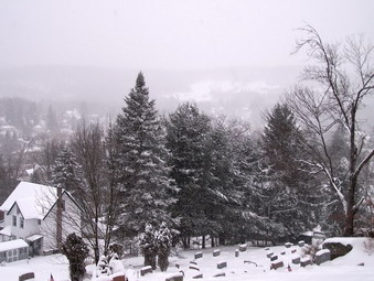
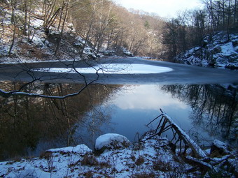
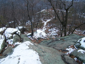
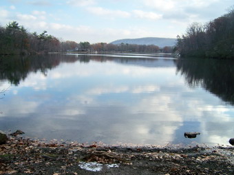
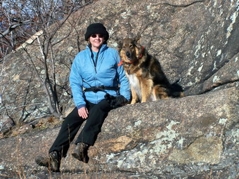
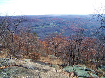
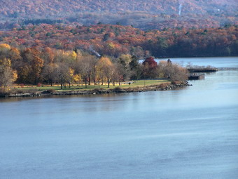
![]() On Thursday, December 13th we had our second snow day of the week and school was canceled! The weather was really to bad to travel anywhere. I spent the morning and early afternoon running ambulance calls on roads that were not really passable. In the middle of the afternoon there was a lull so I decided to put on the snowshoes and trek around the hill behind our church. Round Top offers a nice uphill to begin with and a good view of the town. After the uphill the terrain levels off along a ridge or plateau. There are really no well-defined trails but there are many old woods roads. There is also an old quarry near he top. Sheba and I hiked up the first hill, looked down on the town and then continued on up the hill. The day was cloudy with no sun and a haze hanging over most of the scenery. There was also a constant fall of light but wet snow. All of this made getting any pictures difficult.
On Thursday, December 13th we had our second snow day of the week and school was canceled! The weather was really to bad to travel anywhere. I spent the morning and early afternoon running ambulance calls on roads that were not really passable. In the middle of the afternoon there was a lull so I decided to put on the snowshoes and trek around the hill behind our church. Round Top offers a nice uphill to begin with and a good view of the town. After the uphill the terrain levels off along a ridge or plateau. There are really no well-defined trails but there are many old woods roads. There is also an old quarry near he top. Sheba and I hiked up the first hill, looked down on the town and then continued on up the hill. The day was cloudy with no sun and a haze hanging over most of the scenery. There was also a constant fall of light but wet snow. All of this made getting any pictures difficult.
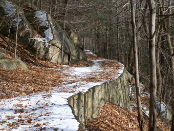
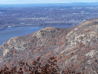
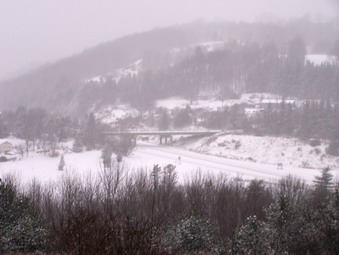 After walking across the top of the ridge we turned left and descended toward a woods road that runs parallel to State Route 17. The roadway looked like it was in horrible condition! I love descending on snowshoes. If you sit back a little on your heels it lifts the tips of the shows and you get a nice glide. We walked parallel to the Quickway until we got to the overlook where the Exit 96 interchange is visible. I tried some pictures from here and then we headed back up the hill to the viewpoint over the town. From here we retraced our path to the church and home.
![]()
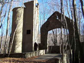
![]() On Saturday, December 8th I was undecided about where to hike. Rifle hunting season ends in the Catskills on Sunday but I have hiked during big game season before. I though about slide or Balsam Lake and other mountains since I could use some 3500's in December. Still, I wanted to go to somewhere I had not been before and decided to head toward Bear Mountain. I intended to hike to the Torne through Popolopen Gorge since I had recently been at The Timp. The trail that connects these two high points is the Timp-Torne Trail. As I approached the Bear Mountain parking area I was still uncertain since I was not sure of exactly where the Popolopen Gorge Trail began or how to get there.
On Saturday, December 8th I was undecided about where to hike. Rifle hunting season ends in the Catskills on Sunday but I have hiked during big game season before. I though about slide or Balsam Lake and other mountains since I could use some 3500's in December. Still, I wanted to go to somewhere I had not been before and decided to head toward Bear Mountain. I intended to hike to the Torne through Popolopen Gorge since I had recently been at The Timp. The trail that connects these two high points is the Timp-Torne Trail. As I approached the Bear Mountain parking area I was still uncertain since I was not sure of exactly where the Popolopen Gorge Trail began or how to get there.
 After we parked I decided to stay with the original plan which was to find the Popolopen Gorge Trail and hike up to The Torne. I was a little surprised at the amount of snow on the ground but I did not let that change my decision or stand in the way. We headed past the skating rink and down to the east side of Hessian Lake. We walked almost to the other end and then cut up a path to the toward the traffic circle. We quickly and carefully crossed the traffic circle and headed north where Route 9W heads out of the circle. In just a short walk, the three red on white marks for the P-G Trail appeared on a rock on the right shoulder of the road. Sheba and I headed off into the woods down a wide woods road. The predominant sound was the rushing of the water in the creek below. The gorge is wide and very deep at this point. Wider and deeper than can be accounted for by the present size of the creek.
 A little further down the path a dam holds back the creek and rock walls appear on either side. This looks like the remains of an old mill site with a millpond behind the dam. I walked out onto a vantage point above the creek but most of the views were still obstructed by trees and brush. I might have gone down into the gorge but the snow and ice suggested that I would have to wait until another day. Up the trail another viewpoint gave a better angle for pictures of the dam and the pond. Here the trail climbed a small hill before descending back down to the millpond. This became typical of the trail which would ascend and descend several times along the way. The views of the millpond were beautiful and I stopped again for pictures. The trail slowly climbed and angled away from the stream. The sounds of rushing water began to mix with the sounds of rushing cars. The trail comes within a few hundred feet of Route 6 in several places.
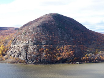
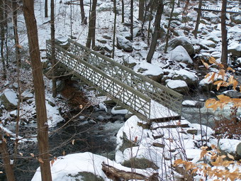 As we walked a rather impressive hill appeared in the distance to the right of the trail. This was The Torne, our eventual destination. Round and square access point to the West Point Aqueduct began to appear in the trail. Eventually the red trail we were on interested the blue marked Timp-Torne, 1777 and 1179 trails. A left here takes you toward Queensborough Lake and ends up at The Timp. We turned right to go down towards the creek. I wondered how we would get across as the water was high. A brand new steel footbridge was the answer to that problem. I took pictures of the bridge and then paused on the bridge to take a few upstream and downstream. We crossed over and ascended a small hill before turning right again on a wide woods road. This is typical of the entire park where trail and roads cross each other frequently. Most trails are well marked but a good map, compass and GPS always come in handy. After only a short distance the Timp-Torne Trail departs from the others and we turned right up a small hill. We crossed over Mine Road which is paved and picked up the trail on the other side.
 As we started up the trail I was surprised that the amount of snow actually decreased. The trail started to ascend gently and passed through a hardwood forest. Ahead of me I though I could catch glimpses of The Torne. Very quickly the forest fell away and the trail began to ascend STEEPLY over rock outcroppings and unprotected rock faces. Most of these were wet and many were covered by ice or snow. None had a way to work around the steeper sections. I began to question my decision but pressed on. At one point Sheba tried to ascend a 60 to 70 degree rock face but it was just too icy. I boosted her up where the blue marking went, put my camera away and tried to get myself up. This would have been less of a problem if the rock had been dry and offered any grip. As it was I had to use a lot of upper body strength to lift and pull myself over a rock lip onto the ledge above. The reward was some outstanding views of the valleys, hills and river below.
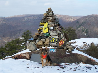 The trail continued to ascend with a few more steep areas but none as bad as the last. After an ascent there was always the reward of better and better views of a larger and larger area. Finally, we made it to some boulders at the top of the Torne and then walked to a stone cairn. Ours were the only footsteps in the snow at the top. We had been following some footsteps but they had turned back at the rock outcroppings near the bottom! The sign on the cairn explained that each rock of the chest high cairn had been carried from the bottom to the top in remembrance of members of the armed forces fighting for freedom abroad. There was also a simple plaque commemorating members of an OCS class at West Point who had died fighting. There were also many Boy Scout emblems since this is a popular hiking destination for scout troops. I took MANY pictures in all directions from the top. I was a little disappointed that the day was so overcast that I knew many of the pictures would not be good. However, this gave me an excuse to return on a better day.
 I had intended to stay on the Timp-Torne Trail as it descends a slightly different route down the Torne. There was too much snow for me to clearly spot the blazes on the rock AND it looked to me like the trail continued over a rather steep and VERY SNOWY portion of The Torne. I decided it was better to retrace the path we had used to come up the Torne although that one sot stuck in my mind. I should not have been worried. In this case, going down was easier than coming up. In places where I didn't want to chance falling from a standing position I used the glissade method of descent. After entering the woods at the bottom of The Torne, we met a couple on the ascent. They seemed fit and knowledgeable and had a map. They didn't have much equipment but were determined to descend the other trail. Sheba and I continued down, crossed over the road and turned left on the Timp-Torne-1777-179 Trail.
 As we walked along this trail, the first thing I noticed was the rock structure that supported parts of the trail. I had seen this rock "wall" from the other bank and wondered what it was. The trail rose and feel several times before intersecting with a road. The road had trail markers so we turned left and headed several hundred feet down the road where the markers again turned left into the woods. The trail headed downhill toward Brooks Lake. This area was opened as part of the park in 2005 and is used mostly be local residents for day use. Although the lake was pretty, I decided not to stay and we pressed on up the woods road to another road. We crossed the road and picked up the trail again as it began to descend toward the creek. We again encountered a road which we walked on until the trail appeared and veered off into the woods on the right. As we walked along this trail I saw signs for Fort Montgomery. I had toyed with the idea of climbing Bear Mountain before going home but it was getting late and the thought of visiting the Revolutionary War era fort interested me.
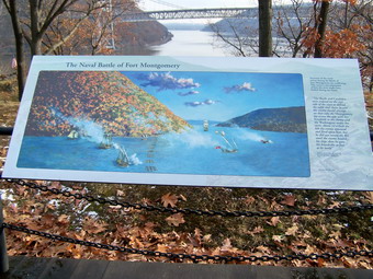 We walked up a side trail to the left to the Western Redoubt. Placards are placed throughout the fort to explain what remains which in most cases are only stone foundations. When we returned to the main trail we passed UNDER Route 9W and the Popolopen Creek Bridge. Shortly, we were at the Visitor's Center. I put Sheba on her leash and we walked around the grounds of the fort. The foundations of the barracks, guard house, powder magazine and necessaries are all visible. We visited the Northern Redoubt and then walked over to a raised wooden platform that explained the importance of the fort and its location. I took a picture of this placard and the realized that the view it was explaining also appeared in the picture! A replica of the original 32-pounder cannons is in place on the site of the Main Battery. As you stand next to the cannon it is clear the commanding view they had of the river below. From here the Bear Mountain Bridge and the narrow straits below can be seen.
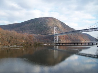 We walked back toward the Visitor's Center, behind it and down toward the creek. There was a nice sturdy suspension footbridge waiting to take us across the creek. At this time the sky had cleared some and there was sunlight on the bridges. The bear Mountain Bridge and Anthony's Nose were on out left. On our right was the smaller but closer Popolopen Creek Bridge. After taking some pictures we headed over to the over side and crossed another MUCH smaller bridge. The trail ascended to a point UNDER the Bear Mountain Bridge. I examined the structure of the bridge and looked across to the other shore. The trail from here goes through the zoo and museum where pets are not allowed! Sheba and I returned to the side trail which leads up to the toll plaza on the bridge. I wanted to walk to the middle of the bridge to take some pictures but the walkway was closed. Sheba and I headed west toward the traffic circle and Route 9W. We crossed 9W where we had done so earlier in the day and headed back down to Hessian lake.
 I decided to extend the hike just a little by walking all the way around the lake. The pathway is paved and rolls a little. I took some pictures of the lake and of the bridge as it came into view. We met several people walking around the lake. Near the parking lot end of the lake we encountered the ever-present flocks of resident geese. We finished the hike by walking up passed the ice rink We were back a the car by 3:00 PM. We had covered 6.6 miles in 5.5 hours with many stops for pictures.
![]()
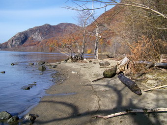
![]() On Saturday, December 1st I decided to return to Mount Taurus with my wife. I was so impressed by the beautiful views and the interesting extra "features" that I wanted to share them with someone else. I had offered to lead a hike of staff members from work but did not get any "takers". Their loss! Cindy and I dressed warmly since the temperature was in the twenties and the wind was howling when we left Livingston Manor. Sheba seems to always be "dressed" for the occasion! The weather prediction was for more of the same. We parked at 10:30 at the Little Stony Point parking area and crossed the road to get on the Washburn Trail. With my wife along, we move a little slower since she likes to investigate some areas that I bypass. This is a good thing since it allows us to see some things that I miss when Sheba and I are racing along.
On Saturday, December 1st I decided to return to Mount Taurus with my wife. I was so impressed by the beautiful views and the interesting extra "features" that I wanted to share them with someone else. I had offered to lead a hike of staff members from work but did not get any "takers". Their loss! Cindy and I dressed warmly since the temperature was in the twenties and the wind was howling when we left Livingston Manor. Sheba seems to always be "dressed" for the occasion! The weather prediction was for more of the same. We parked at 10:30 at the Little Stony Point parking area and crossed the road to get on the Washburn Trail. With my wife along, we move a little slower since she likes to investigate some areas that I bypass. This is a good thing since it allows us to see some things that I miss when Sheba and I are racing along.
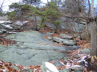
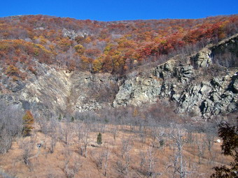
 Our first stop was the quarry a the top of the first hill on the Washburn. We walked into the quarry and looked around a little. There is some crushed stone which is too fine to be a natural phenomenon and we wondered why is was there. We returned to the trail and began the LONG trek that ends at the top of Mount Taurus. This hike has ALL the climbing near the beginning! We passed several viewpoints since I knew that the best one was just as the trail takes a sharp left into the woods away from the edge of the cliff. We arrived at this viewpoint to find Sheba already visiting with a mother and adult daughter who had stopped to rest and enjoy the views. We chatted with them for a few minutes while we took in the views. I took some pictures but had the same problem as last time. The sun was right in front of me making it difficult to take pictures down the river. I made a mental note to hike the trail in the opposite direction next time or arrive later in the day. The views south toward Cold Spring and West point are magnificent. A large hiking group arrived with a dog and we decided to get going. Sheba and the other dog said hello. Sheba is better with people than other dogs but this meeting seemed to go well!
 Back on the trail we climbed upward as the path turns into the woods and turns more toward the north. The climb is never very steep but there are some good climbs. The wind was howling even in the more protected areas. The wind chill must have been in the single digits at times despite the slightly warmer air temperature. As the trail continues it begins to run along the edge of an escarpment that gives nice views to the west and north. Storm King comes into view and the area around Pollepel Island and the Newburgh-Beacon Bridge becomes visible. The hiking group was behind us and was hiking a little faster but they were also stopping to rest more frequently than us. We crossed the Undercliff Trail near the top of a climb after which the trail levels for a short distance. Another hike with his dog caught and passed us and Sheba had another positive encounter. We ascended the next short climb and I got ready to take more pictures as I knew we were getting closer to the top of Mount Taurus and that there were some nice lookouts along the way.
 As we climbed I walked off the trail several times to the left and right to take some pictures. As we approached the top we stopped at a rocky ledge on the right of the trail which has a good view of Storm King. I used this backdrop and the large rock "cliff" there as a backdrop for some pictures. We then got back on the trail and made the final climb to the top of Mount Taurus. The maximum elevation of the hill is a little over 1400 feet but the views from the top are limited by the surrounding trees. Just as the trail begins to drop down the other side there is a short trail on the right to an open area. This area has nice views to the south. The main trail begins to descend from this point and there is NO MORE CLIMBING. There are several great viewpoints near the top but the wind was making simply standing still difficult and the wind chill was bitter. The Newburgh-Beacon Bridge can be seen between the summits of various low hills and Storm King is prominent on the other side of the river. The most impressive view is Breakneck Ridge. The beginning of the ridge on the river is hidden by the angle of the observation point. However, the three "humps" can easily be seen with the lower "cols" between them. To the right and further removed is the South Beacon Fire Tower.
 We stayed at these viewpoints for only a few minutes an then descended the trail to a find some protection from the wind. The trail follows an old access road which winds its way back and forth down the hill. After only a short distance, the trail leaves the road to the right and descends more or less straight down the hill. This makes the walk shorter and more direct but more difficult because of the increased pitch. The steeper areas, the frozen ground and ice patches and the numerous oak leaves make for a tricky descent in places. Near the bottom the Washburn Trail ends and the green Lone Star trail goes right to Nelsonville. We turned left on the blue Notch Trail which eventually leads to Breakneck Ridge just after the highest point! The Notch Trail continues to descend with the lowest point being Breakneck Brook. On the way the trail makes a SHARP left which I almost missed! As we continued our descent the trail became more like a road. It was wider and flatter with rock walls first on one side, then the other then both. We crossed the two-log bridge over a small creek near the bottom as were soon at the point where the Notch Trail turns right and the red marked Brook Trail starts and goes left. At this point we turned right to visit the ruins of the dairy farm only a few hundred feet up the trail.
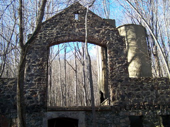 We walked around the dairy farm for some time going in and out of what remained. Cindy was very interested in each building. I took more picture from the outside and inside. The construction is stone and cement faced with glazed tile. Cindy noticed opening on the outside walls between the windows which seem to have ashes in them. The openings lead to "ducts" which go up through the walls. We were not sure what they were used for. As we were leaving several other hikers appeared to visit the same area. We got on the red Brook Trail which parallels Breakneck Brook and crosses over it on another log bridge. Further on down the trail, the yellow Undercliff Trail crosses the brook trail and there is a new bridge that takes the trail back across Breakneck Brook. Further down this trail is an old pump house, pipes and a small dam. The red Brook Trail continues on down to a parking area on Route 9D which is more than a mile above Little Stony Point. The blue Cornish Trail forks off to the left and leads down to the road at the parking area. We took this trail since it also passes by the ruins of the Cornish Estate and mansion.
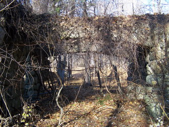 The Cornish Trail winds back and forth several times as it works its way down the hill. As it straightens out a large stone cistern appears on the right. As the trail continues it becomes paved and you are walking on the driveway and access roads to the old estate. The remains of the greenhouse come up on the right and just before this a road makes it way down to the lower part of the greenhouse. A long stone a cement retaining wall protects this long-abandoned road. A little beyond this is the main mansion house on the right. Ravaged by fire only the stone work remains and it is slowly being reclaimed by the vines and other vegetation that cover it. I walked off the driveway and down to the mansion while Cindy continued on to the main entrance and came down that way. I took some more pictures on the mansion including some from the "front". We also walked inside in several places to see what was left and I took some pictures there also. Cindy and I both wondered why such and obviously magnificent structure was left to decay in such a manner. After further investigations, we got back on the trail/driveway and walked almost a mile down to the gate on Route 9D. The road parallels the river and intriguing views occur as river, railroad and the west shore peek through the trees on the right. On the left are the impressive rock cliffs of Mount Taurus. At the gate we continued on the Cornish Trail back to the parking area. We did not stop at the car but continued on to Little Stony Point!
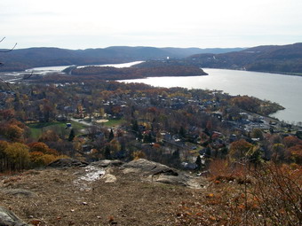
 Where the trail forks we turned right and headed for the beach! On the north edge of the point there is a beautiful sandy beach. Today the tide river was lower and a very obvious spit jutted out into the water a short distance up the beach. We decided to investigate and were soon standing on the spit, in the "middle" of the river looking back at the Point. I took some pictures but had to return rather quickly as the wind was blowing fiercely causing my hands to freeze. Back on the beach we continued our walk around the shore of the point in a counterclockwise direction. The sky was relatively clear and I took more pictures up and down the river and of the west shore. As we walked back to where we started we turned left to ascend to the high rock outcropping formed from the quarrying of Little Stony Point. The walk was short and well worth the views from the top. To the north Storm King, Pollepel Island, Breakneck Ridge and the Bridge can be seen. West Point and parts of Cold Spring can be seen to the south. After taking some pictures, we worked our way back to the car and headed for lunch at El Bandido in Middletown. We hiked almost 6 miles in 4.5 hours.
![]()
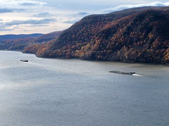
![]() On Wednesday, November 28th I decided to stay out of the Catskills and away from the hunters. I knew there was no hunting permitted in Harriman or Bear Mountain Parks so Sheba and I headed south in that direction. I had not been in the Harriman-Bear Mountain area for almost a year and wanted to try hiking Dunderberg again. The last time my wife and I had stopped short of the Timp and I wanted to get there this time. We parked at the trailhead parking off Route 9W at 9:35 AM and got started immediately. Experience is a WONDERFUL thing! last time we meandered around not knowing that the beginning of the trail is a few hundred feet further south and is not well marked! This time Sheba and I knew right where to go and picked up the blue marks of the Timp-Torne Trail along with the red circle on white that marks the Ramapo-Dunderberg Trail. The temperature was warmer than in Livingston Manor and the sky was only partly cloudy or partly sunny. The air temperature was just below 40 but a persistent breeze made it fell a little cooler. I wore my Mountain Hardwear Zoetic Jacket over a light OR Sequence shirt and my UnderArmor CoolGear. I wore my Mountain Hardwear HyperDry tights underneath my Campmor Trekmor pants. I wore my Asolo TPS 520's again with Dalhgren Alpaca socks and carried the Osprey Atmos 50 pack. A Mountain Hardwear Transition hat and Mountain Hardwear Powerstretch gloves complete my out fit.
On Wednesday, November 28th I decided to stay out of the Catskills and away from the hunters. I knew there was no hunting permitted in Harriman or Bear Mountain Parks so Sheba and I headed south in that direction. I had not been in the Harriman-Bear Mountain area for almost a year and wanted to try hiking Dunderberg again. The last time my wife and I had stopped short of the Timp and I wanted to get there this time. We parked at the trailhead parking off Route 9W at 9:35 AM and got started immediately. Experience is a WONDERFUL thing! last time we meandered around not knowing that the beginning of the trail is a few hundred feet further south and is not well marked! This time Sheba and I knew right where to go and picked up the blue marks of the Timp-Torne Trail along with the red circle on white that marks the Ramapo-Dunderberg Trail. The temperature was warmer than in Livingston Manor and the sky was only partly cloudy or partly sunny. The air temperature was just below 40 but a persistent breeze made it fell a little cooler. I wore my Mountain Hardwear Zoetic Jacket over a light OR Sequence shirt and my UnderArmor CoolGear. I wore my Mountain Hardwear HyperDry tights underneath my Campmor Trekmor pants. I wore my Asolo TPS 520's again with Dalhgren Alpaca socks and carried the Osprey Atmos 50 pack. A Mountain Hardwear Transition hat and Mountain Hardwear Powerstretch gloves complete my out fit.
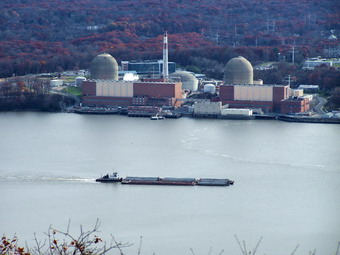
 The first part of the trail winds through a flat area infested by vines before starting to climb up to the Dunderberg Ridge. Shortly after the start of the climb a short, well constructed railroad tunnel appeared on the left. We took some pictures and then continued the climb up where the ridge levels off. Here the red Dunderberg-Ramapo Trail turns right while the blue Timp-Torne Trail goes left. We turned left and followed the blue trail. Once on the ridge the trail is either flat or consists of long, gently climbs or steep but short ascents. The blue blazes showed evidence that paint had recently been reapplied and they were easy to follow. Within a short distance views open up to the Indian Point Nuclear Plant and other industrial facilities along the river. It is also possible to look south but the sun shining off the water blocked most of this view. These views are also not as spectacular as the ones of the same area from higher on the ridge. The trail switches back and forth before turning and running west.
 At many points the trail runs over the bed of the Dunderberg Spiral Railway. This railway was to take tourists to a large hotel on the top of the ridge. The beds were graded and stone was spread. Two tunnel were started. One tunnel was finished. The other tunnel appears along the trail as a cave; started but never completed. Water flows through this dead-end tunnel and drips from the ceiling making an eerie sound. The railway was abandoned and only the graded bed, the tunnels and some stonework remain. After the tunnel, we crossed a small stream and continued to trek toward The Timp. After a short climb, we descended into an area where several trails cross. In fact, this entire area is criss-crossed by many different trails and roads. It is easy to become confused and take the wrong route which usually means a long, out of the way detour. We crossed over the 1777 trail and began to climb up The Timp.
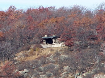
 Near the top of the climb a nice lookout offers views to the south and west. I though this was the very top of The Timp but I decided to go a little further and perhaps make a loop. After a short descent, we crossed over the red marked Ramapo-Dunderberg Trail. We made a quick left and then a right to stay on the blue Timp-Torne Trail. After another short climb, we were higher than before and an even more open viewpoint lay before us. The views to the south were still visible but more views to the west and north became obvious. On one of the mountains, a "cave" was almost visible. I took a picture and then zoomed in and discovered it was a lean-to/shelter. This is the AMC shelter on West Mountain. As we continued to walk around The Timp the views to the north became more prominent. Bear Mountain was visible on one side of the Hudson river with the Perkins Tower on top. Opposite bear Mountain was Anthony's Nose. The Bear Mountain Bridge and the Inn were easy to find. At this point the choices were to retrace our steps back to the Ramapo-Dunderberg Trail or to continue on down the mountain. We continued on to make a loop.
 The descent into a hollow between the Timp and another hills was steep at times but wandered back and forth to moderate the slope. At the bottom the blue Timp-Torne Trail followed an old road and then headed back up to the right toward the Torne some distance away. We walked up the road a little further and then turned left on the red marked Ramapo-Dunderberg Trail. As we continued on the trail, it began to loop around the base of The Timp. Several talus slopes decorated the sides of the Timp. Finally, the trail began to climb back up The Timp. This time the trail did NOT wind back and forth very much but headed directly Up the hill. This part of the trail was slippery with some frozen ground and piles of oak leaves. Finally, we crested the hill and were back at the location where the red and blue trails crossed. This time we went straight ahead on the red trail toward Bald Mountain.
 The Ramapo-Dunderberg Trail crosses the 1777 Trail, ascends slightly and then drops into a "valley" created by a small stream. From here the trail ascends consistently but not steeply up the slopes of Bald Mountain. The first open space on Bald Mountain offers interesting views mostly to the south and west. We continued on up the trail since I knew that there were much better views from the open rock ledges at the top. We went off the trail slightly to get the best views to the west and north. The area around Bear Mountain including Hessian Lake, The Bear Mountain Inn, The Bear Mountain Bridge, Anthony's Nose and Bear Mountain itself. The view continues north up the Hudson and is limited only be your eyesight and the haze on any particular day. After getting some pictures and eating lunch, we got back on the Ramapo-Dunderberg Trail and headed toward Dunderberg Mountain. As we descended the hill, I made a promise to myself that I would investigate the Cornell Mines at some point.
 The trail makes its way up to the highest point on the Dunderberg Ridge before undulating up and down. The overall effect is to lose some elevation on your way to the extreme eastern end of the ridge. After descending for a brief period, we ascended the short, steep trail to the highest point on the eastern summit. This area has been burned over several times leaving the charred and dead remains of trees in fantastically twisted profile on the mountain. By walking up some of the informal side trails to the left, more views to the north can be seen. These vary little from the views from Bald Mountain. As we descended, the Hudson River and Haverstraw Bay came into view through the trees. In a short distance the views became unobstructed and all of the river and bay were before us. Factories lay side-by-side with marinas and apartment buildings. The train rushes by and its tracks while barges ply the waters. I took MANY pictures of this area and then we continued on around and headed back to where we started in the morning.
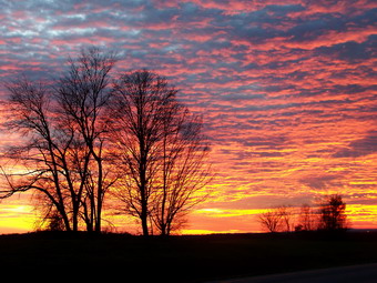 The final part of the trail follows one of the graded beds to a steeply graded bed that runs down to the base of the mountain. This incline would be too great for regular locomotives so the idea was to use stationary engines to pull the passengers cars up to the top of the mountain. We walked down this steeply graded incline made all the more difficult by the large rock fragments used to "pave" the bed. Finally we were back at the trail junction with the Timp-Torne Trail and we turned down the hill and walked back to the parking area. We had covered about 9 miles in 5 hours. On the return trip home on Route 84 the sunset was beautiful. I pulled over on the shoulder and took some pictures.
![]()
![]() On Saturday, November 24th I wanted a challenging hike somewhere where I had not been before. I had toyed with the idea of going to Mount Greylock. The drive is almost 4 hours and the hike is around 12 miles. Coupled with the fact that no one was available to accompany me and that I was tired from Breakneck Ridge the day before, I decided on a more conservative plan. I returned to the east side of the Hudson to hike Mount Taurus. The parking area is less than a mile south of Breakneck Ridge and the hike's description in the guidebooks and on line interested me. Most authors also suggested a hike around Little Stony Point. Sheba and I got a LATE start and parked just before 11:00 AM. The temperature was still in the upper 20's or lower 30's but there didn't seem to be any wind and the sky was a lot sunnier than the weather forecast. I wore much the same outfit as the day before with my new Columbia Titanium Ballistic jacket over a light OR Sequence shirt and by UnderArmor CoolGear. I wore my Mountain Hardwear HyperDry tights underneath my Mountain Hardwear Winter Wander pants. I wore my Solo TPS 520's again and carried the Osprey Atmos 50 pack.
On Saturday, November 24th I wanted a challenging hike somewhere where I had not been before. I had toyed with the idea of going to Mount Greylock. The drive is almost 4 hours and the hike is around 12 miles. Coupled with the fact that no one was available to accompany me and that I was tired from Breakneck Ridge the day before, I decided on a more conservative plan. I returned to the east side of the Hudson to hike Mount Taurus. The parking area is less than a mile south of Breakneck Ridge and the hike's description in the guidebooks and on line interested me. Most authors also suggested a hike around Little Stony Point. Sheba and I got a LATE start and parked just before 11:00 AM. The temperature was still in the upper 20's or lower 30's but there didn't seem to be any wind and the sky was a lot sunnier than the weather forecast. I wore much the same outfit as the day before with my new Columbia Titanium Ballistic jacket over a light OR Sequence shirt and by UnderArmor CoolGear. I wore my Mountain Hardwear HyperDry tights underneath my Mountain Hardwear Winter Wander pants. I wore my Solo TPS 520's again and carried the Osprey Atmos 50 pack.
 The parking area was beginning to fill with cars and people and at least one dog. Sheba and I decided to get going as quickly as possible to outdistance some of this traffic. The white blazed Washburn trail leaves the north end of the parking lot on the east side of Route 9D. It ascends up a moderate grade and Sheba and I hustled passed several people and groups that had a head start. The trail enters the quarry area after a short climb. We walked onto the floor of the quarry and took some pictures at various location. After this we returned to the trail at the point where it makes a hard right at the top of the hill. The Washburn Trail begins a slow climb up Mount Taurus from this point. Only a few areas are steep and there are a few level areas.
 Just as the trail climbs out of the quarry, views across the river and to the south begin to open up. At first the views are through the trees and aren't very clear. The higher we went the more open the trail became and the more unimpeded the viewpoints. Just before the trail makes a hard left and continues into the woods, several ledges afford beautiful views to the village of Stony Point below. The United States Military Academy at West Point is visible as are other sights to the south and east! The trail then turns into the woods and the views disappear for some time. The trail begins to skirt a ridge of rock as it makes its way up to the Mount Taurus ridge. Now views to the west and north became visible. The trail then turns north and climbs rather steeply for a distance with only a few glimpses of the scenery through the trees.
 We passed by the yellow blazed Undercliff Trail that starts on Breakneck Ridge and continued the climb toward Bull Hill. At several points along the way short side trails lead off the main trail. Sometimes these trail reveal excellent lookouts and sometimes not. There are several spots that have nice views to the north and west. There is one area at the extreme northeast part of the ridge that has a beautiful view to the south and east. From here the trail leads down the other side of Taurus following an old road for some time. The trail then leaves the road to the right and continues straight down the hill. Several times the trail crosses the road as the road switches back and forth several times. The green Nelsonville Trail branches off to the right where the Washburn Trail ends. We turned left onto the Notch trail and continued down to a wetlands area. The Notch Trail makes an abrupt left turn here and heads almost due west as it gently descends to Breakneck Brook. Signs of former settlements begin to appear in the form of wide woods road flanked by stone and by stone walls.
 We crossed Breakneck Brook on a small log bridge and came to the junction with the red Brook Trail. Before taking the Brook Trail, we turned right on the Notch Trail to investigate the ruins visible from the junction. On the right is an old garage but most of the buildings are the remains of a 19th century dairy farm. The barn and milking parlor are plainly visible. The main entrance to the barn has a silo on the left and is made of artistically laid up stone. Some rusting far machinery is scattered about. Several cisterns dot the property. A small pond is a little further up the trail with a LONG low cement dam holding back the water. We returned to the trail junction after a thorough investigation.
 The Brook Trail parallels Breakneck Brook and ends up on Route 9D about a mile north of Little Stony Point. After less than half a mile on the red trail, we turned left on the blue Cornish Trail. This trail winds its way down to the former Cornish estate and then down to the road on what was their very long paved driveway. After several switchbacks in the trail, a large cistern comes into view which supplied the estate with water. Next, on the right, is the frame of what appears to be a greenhouse. Further down the road on the right is the charred remains of the main house. The remaining stonework is covered by vines and vegetation which threaten to reclaim the property and which give the mansion an eerie appearance. We stopped to take some pictures and then continued our walk down the long driveway in sight of the river, the road and the railroad. When the driveway met Route 9D we continued on the trail to the parking area.
 Even though the parking lots were now full, I decided to investigate Little Stony Point. This cape which juts out into the Hudson was quarried extensively in the past. Now, a series of trail crisscross the point. We walked out to the river on one trail. There was a beautiful, sandy beach at our feet. The view was to the north and offered a different perspective than the one you get my looking down from the heights. Storm king, Pollepel Island and Breakneck Ridge were all visible. We walked toward the western end of the point on the beach and then walked up onto the trails. As we continued to walk around the edge of the point in a counterclockwise direction, I noticed two things: there are beautiful views to the south and there were people standing high on a rocky outcropping. I took some pictures of the views toward West Point and we continued on the trail looking for the access to the high outcropping.
 At one point we found a tunnel into the rock and I took a picture. without knowing much about the area I was not going to crawl into the tunnel. As we wrapped around back to our starting point, a trail turned to the left. We followed the trail as it climbed to the top of the outcropping. The view down to the point below was nice. Even better were the views up and down the Hudson. This area is not as elevated as Taurus, Storm King or Breakneck but has great views since it juts out into the river. After taking pictures and enjoying the view we returned to the car. The five 5.5 mile hike hand taken about a little over 4 hours with much of that time taken up by pictures and exploration.
![]()
![]() On Friday, November 23rd Karl was home for Thanksgiving so we decided to take a hike. The weather was COLD and windy. Big game season is in full swing in the Catskills. For these reasons we decided to go south to Storm King. Karl, Sheba and I left Livingston Manor shortly after 8:00 AM. The further south we went the warmer it became. There also was no snow. When I turned onto 219 to got toward West Point and 9W to Storm King, Karl and I both decided that Breakneck Ridge would be doable. I turned around and headed for the Bear Mountain Bridge. When we parked there were three cars by the tunnel and none on the shoulder of the road. We were the ONLY car in the parking lot! We were hiking by 9:35 AM south on 9D toward the tunnel.
On Friday, November 23rd Karl was home for Thanksgiving so we decided to take a hike. The weather was COLD and windy. Big game season is in full swing in the Catskills. For these reasons we decided to go south to Storm King. Karl, Sheba and I left Livingston Manor shortly after 8:00 AM. The further south we went the warmer it became. There also was no snow. When I turned onto 219 to got toward West Point and 9W to Storm King, Karl and I both decided that Breakneck Ridge would be doable. I turned around and headed for the Bear Mountain Bridge. When we parked there were three cars by the tunnel and none on the shoulder of the road. We were the ONLY car in the parking lot! We were hiking by 9:35 AM south on 9D toward the tunnel.
 At the tunnel we turned right and got on the trail. Karl had never been to Breakneck and I had only hiked there once. The day was cold and windy but CLEAR. In fact, it was the clearest of all the times I had been to this area. We took a quick look at Storm King on the west bank and Bannerman Castle on Pollepel Island. We walked up through the woods and began our assault on Breakneck. The climb seemed shorter this time and less daunting in some ways. It was definitely LESS CROWDED. We had the ascent all to ourselves except for one father and his two children. The one nearly vertical rock slab gave me more trouble this time than last but I took another line and made it up. The problem was a combination of slippery oak leaves and shoes with less "sticky" soles. Last time I wore my Merrell Mid Wraps but this time I chose my Asolo TPS 520. These are a little more insulated and I was worried about keeping my feet warm.
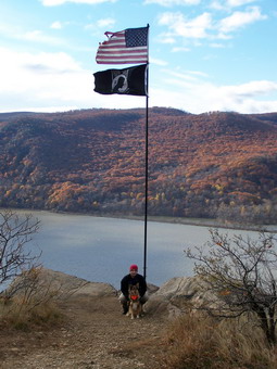 As we climbed we got quite warm. We stopped several places to take pictures and the wind would cool us down again. An American flag and POW-MIA flag has been installed on a rather permanent steel pole and one of the ledges. Sheba was ahead of us most of the time encouraging us to move more quickly. Do to the lack of other people I was able to try some of the more difficult lines I had avoided last time due to the crush of hikers! I had forgotten how many "false" summits there are until you are actually at the TOP of Breakneck Ridge! Just when it seems you are at the very top it becomes obvious that you are only at the top of that section. This happens SEVERAL times. In some cases, you actually descends slightly before ascending again. We passed by the junction of with the relatively new Undercliff Trail which is in one of the "cols" between these false peaks. This yellow marked trail starts on Breakneck Ridge and continues south over part of Mount Taurus. Finally we were on the ridge and took some time to walk around, take in all the various view and snap some pictures before continuing on.
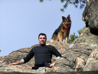 Once on the ridge the trail enters a wooded area and undulates slightly until it reaches a high point. Here the red marked Bypass Trail can be found on the left. This trail leads over the ridge and down to the Wilkinson Trail. As its name implies, it cuts miles off the entire loop for those that were most interested in getting to the top of the ridge and want to make their hike a loop. From here the trail descends some with several steep portions. The blue blazed Notch Trail heads off to the right and down the ridge. It meets the red marked Brook Trail which leads back to 9D about half a mile south of the parking area. Staying on the Notch Trail will take you to the Washburn Trail which starts at the Little Stony Point parking area. We stayed on the Breakneck Ridge Trail/Notch Trail for about 1.5 miles where the two trail split. We headed right on the Breakneck Ridge Trail and climbed the short hill to Sunset Point.
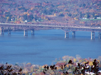 Sunset Point is marked by a wooden observation deck in the middle of nowhere! This is where I turned around last time. We took in the sights from the platform on this clear day with almost no haze. After this short break, we continued on the Breakneck Ridge Trail toward South Beacon Mountain. The trail winds back and forth and is very poorly marked in places. In about half a mile it meets the yellow blazed Wilkinson Memorial Trail. We turned right here on a wide woods road. After a VERY short distance the Breakneck Ridge Trails leaves the Wilkinson Trail to the left and heads UP the mountain. This climbs has its moments as it snakes its way up to the summit. Some areas are steep with rock scrambling. As we climbed up, the views began to reveal themselves. The climb is seemed longer than it should be as the trail levels and then starts upwards again. Soon the tower came into view and we made the last climb to the top.
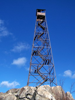 The first thing we noticed was that the tower is in VERY poor shape. The cabin roof is almost gone and there are no landings for the steps to the top. The views from the top are in ALL directions if you are willing to walk around the small summit. The day was so clear that New York City was visible to the south! The Newburgh Beacon Bridge can be seen but the Mid-Hudson Bridge in Poughkeepsie was also visible. As we were enjoying the view from the north part of the summit, we heard the noise of engines. Some ATV riders were up a trail to the top. We found this incredibly obnoxious and decided to leave quickly. The riders pulled up to the tower as we started our descent. They turned off their machines and cheered. I guess they were proud to have ridden their ATVs all the way to the top!
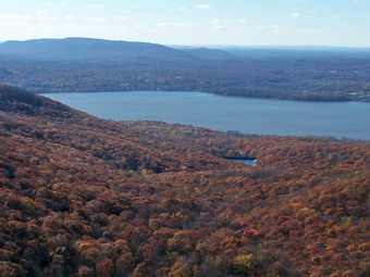 We retraced our steps back down the Breakneck ridge Trail to the Wilkinson Memorial Trail and stayed on this trail by bearing right at the trail junction. We descended until the point where this trail again meets the Notch Trail. Here we made a left to stay on the Wilkinson Trail as it parallels Breakneck Ridge. There are a few viewpoints but mostly the trail is a nice walk in the woods. We walked for over two miles descending slight and then more quickly to Cascade Brook. From here the trail parallels the brook for some distance before beginning the climb up Sugarloaf Mountain. We were tired at this point but knew that we were on the last part of the hike. This was a good thing since the time was getting on toward 3:00 PM and the sun was starting to sink lower in the sky. We stopped on Sugarloaf to take some pictures and then continued on.
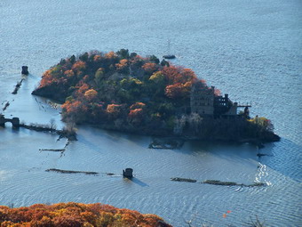 From Sugarloaf there is a steep but short descent followed by longer, more reasonable part back to Route 9D. The trail switches back and forth in several areas to keep the pitch moderate. About halfway down the Breakneck ridge Bypass Trail comes in from the left. At Route 9D we turned left to hike south for less than half a mile to the parking area. The 9 mile hike is one of the most rewarding and hardest in the area. It took us almost 6 and a half hours but this included MANY stops for pictures and several places where we took the most difficult rock scrambles possible!
![]() On Wednesday, November 21st I decided to take a short hike after work. We were out early for the holiday so I grabbed Sheba and headed for Trout and Mud Ponds. The weather was very foggy and in the low 50's which is warm for the third week of November. There was a slight chance of showers but I took my rain gear. I did not take my camera and was sorry I didn't. As we walked down Russell Brook Road passed the falls there was more water than I had seen since early spring. It was clear and white and plentiful. I may return Friday or Saturday to get a few pictures! I thought I might go up to Trout first and do the route counterclockwise. After signing in, I decided to go UP the hill to Mud first and we made the right hand turn.
On Wednesday, November 21st I decided to take a short hike after work. We were out early for the holiday so I grabbed Sheba and headed for Trout and Mud Ponds. The weather was very foggy and in the low 50's which is warm for the third week of November. There was a slight chance of showers but I took my rain gear. I did not take my camera and was sorry I didn't. As we walked down Russell Brook Road passed the falls there was more water than I had seen since early spring. It was clear and white and plentiful. I may return Friday or Saturday to get a few pictures! I thought I might go up to Trout first and do the route counterclockwise. After signing in, I decided to go UP the hill to Mud first and we made the right hand turn.
The bridge is finished and the trail is graded over the stream which originates at the outlet of Trout Pond. I was overdressed even though I was wearing no jacket. The North Face Glacier TKA 100 over the PolarMax Expedition Weight top was VERY warm. We climbed the hill up to the trail junction in under 30 minutes and turn right to start for Trout. At some point I contemplated walking over to Campbell Brook Road and then down Morton Hill. We walked along without seeing much of anything; no deer, no hunters. Crossing the inlet of Trout Pond proved a little more difficult due to the high water. It was already almost 3:00 PM and I decided to continue around Trout and leave Campbell brook for another time. The pond is so high in places along the trail that it will soon encroach on the trail! We walked back to the falls and the up the road to the car. A little more than 4 miles in a little less than 2 hours.
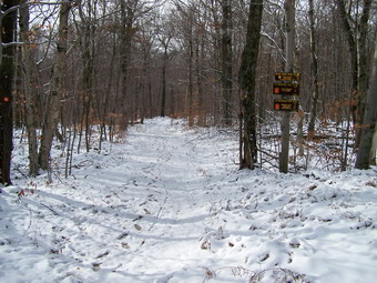
![]()
![]() On Sunday, November 18th I decided to take a short hike between church and the interfaith Thanksgiving service in the afternoon. Since deer hunting season was in full swing, Sheba and I both donned orange and headed for Hodge and Frick Ponds. The parking lot had several cars and a group of people who were obviously hunters. I don't mind sharing the woods as long as everyone behaves themselves! We got started at about noon on the Flynn Trail toward Hodge Pond.
On Sunday, November 18th I decided to take a short hike between church and the interfaith Thanksgiving service in the afternoon. Since deer hunting season was in full swing, Sheba and I both donned orange and headed for Hodge and Frick Ponds. The parking lot had several cars and a group of people who were obviously hunters. I don't mind sharing the woods as long as everyone behaves themselves! We got started at about noon on the Flynn Trail toward Hodge Pond.
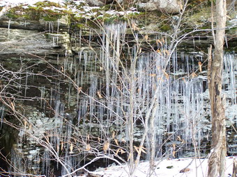 As we walked up the Flynn Trail we met several hunters, exchanged greetings and went on our way. The higher we went the more snow was on the ground. At the junction with the Big Rock Trail there was about 2 to 3 inches of snow still on the ground. We continued straight ahead toward Hodge Pond. Near the gate there was a drag trail with blood spots. Someone had bagged their deer. At Hodge Pond I stopped to take a few pictures and then took the trail to the right that goes around the back of the pond. This trail then rejoins the Flynn Trail and we followed the blue blazes to the Junkyard Junction. Here we turned left onto the red blazed Quick Lake trail.
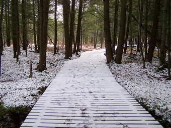 We continued on down the Quick lake Trail to Iron Wheel Junction where I decided to add some distance to the hike by turning left onto the yellow blazed Logger's Loop. I had not been on this trail in some time. It is a beautiful trail that climbs slightly and then descends to Times Square. At Times Square we turned right and followed the lower end of the Big Rock Trail back down to the Quick Lake Trail near Frick Pond. This part of the trail passes over a board walk which was covered with a sprinkling of snow. At the Quick Lake Trail we turned left and walk to the bridge at the out let of Frick Pond.
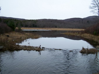 We stopped at Frick Pond for a few minutes so that I could get some pictures. The landscape was somewhat bleak without much color. The pond was very still but some water was running over the rocks and under the bridge due to the recent rainfall. After a short stop, we followed the Quick Lake Trail back out to the parking area. The hike covered about seven miles in 3 hours.
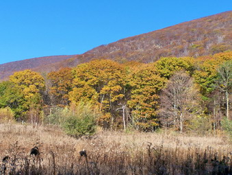
![]()
![]() On Sunday, November 11th we had hiked Bash Bish Falls and Alander Mountains in the morning. Somewhere along the way on that I hike I decided NOT to try another hike in the afternoon because of the early sunset, my unfamiliarity with the terrain and the fact that I WAS TIRED! I did decide to find the trail head for Brace Mountain so that I could easily go there next time. We left Bash Bish at about 1:15 PM and headed west on Falls Road until it meets with Route 22 South. From here I continued to Route 63 Undermountain Road. The road with the trail head had no name on the map but I knew when I reached White House Crossing road on the right I needed to turn around and take the next right. I took the right onto Deer Run Road and immediately began climbing toward a ridge of mountains ahead. I was surprised to see a group of cars parked at the small pull off and I turned around and pulled in behind one of the cars. It was about 2:00 PM and I decided to "go for it".
On Sunday, November 11th we had hiked Bash Bish Falls and Alander Mountains in the morning. Somewhere along the way on that I hike I decided NOT to try another hike in the afternoon because of the early sunset, my unfamiliarity with the terrain and the fact that I WAS TIRED! I did decide to find the trail head for Brace Mountain so that I could easily go there next time. We left Bash Bish at about 1:15 PM and headed west on Falls Road until it meets with Route 22 South. From here I continued to Route 63 Undermountain Road. The road with the trail head had no name on the map but I knew when I reached White House Crossing road on the right I needed to turn around and take the next right. I took the right onto Deer Run Road and immediately began climbing toward a ridge of mountains ahead. I was surprised to see a group of cars parked at the small pull off and I turned around and pulled in behind one of the cars. It was about 2:00 PM and I decided to "go for it".
 We got out of the car, got ready and started up a woods road. When the woods road ended, no trail was evident. I decided to go back to the road and ask someone where the trail started. A Korean woman readily pointed out the trail and gave me instructions. What she DID NOT tell me might have changed my mind! We headed up the trail through a field. The colors of the trees were beautiful as the trail turned into the woods and began a winding but gentle climb. This soon ended! The trail began to get steep and then it got steeper! It followed a small stream that had cut quite a gully down the side of the mountain over the years. The oak leaves seemed ankle deep and I knew they would make the return trip slow. Making good time was on my mind but I HAD to stop and take some pictures of the small falls formed as the water ran over the rock and the ice on the rocks near the top of the trail.
 The trail we were on was the same poorly marked South Taconic Trail that we had seen before. here the lack of markings became even more critical since finding the best way up was not always evident. I was very mindful of the shortness of the day even though the sun still seemed high in the sky. As the trail moved away from the stream, it began an ascent up a sheer rock face. The trail had several switch backs but many parts were simply up and over bare rock. Where the trail was a trail, it was very narrow. From this trail the views began to reveal themselves and they were as impressive as anything we had seen so far. Finally we were almost at the top of the ascent. As it leveled off we met some Korean hikers coming down and further on another couple who had some knowledge of the trail. They told be that it was at least on hour to the top of Brace Mountain and I calculated we had just enough time before dark. For a moment I thought, What if my calculations are wrong?"
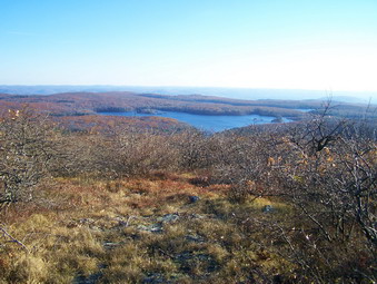 At the top of the climb, the trail advances over some open rock outcroppings and I stopped to take some pictures of the beautiful scene below. We continued on the trail making a few inadvertent detours due to the poor trail marking. We continued until we were at the top of South Brace Mountain. I looked around and saw a beautiful lake with a deep blue hue. The surrounding hills and valleys were made all the more beautiful as the sun began to get low in the sky. I took many pictures of the mountain surroundings and the views from the top. Quickly we headed down the trail toward Brace Mountain. We descended into a little Col between the two mountains and then the short hike up Brace.
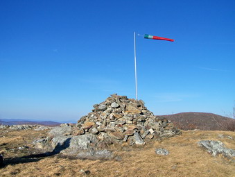 As we came to the top of Brace Mountain, I noticed a LARGE rock cairn with a permanent windsock attached. I also saw a group of young people approaching from the other side carrying a long "tube". Somehow I knew what they were up to. I asked the group leader if what they were doing involved jumping. She replied, "Oh no, that sounds dangerous! We are going to launch." Brace Mountain is one of the primary launch sites used by the Connecticut Hang Gliding Association and other hang glider enthusiasts. I really wanted to stay and see them launch. I thought about the awesome pictures! I also realized that they had come up the easy side and I had at least an hour to get back down the mountain. The trip down that gorge would not be easy and I did not want to try it by using a head lamp! We turned around and headed back.
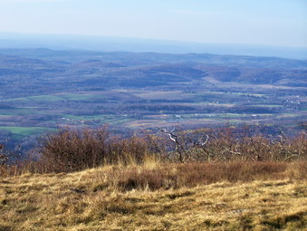 The trip down went smoothly until the descent down the gorge. The steep descent was far more challenging than the steep ascent. Near the top of the gorge Sheba took a side trail and I followed. We discovered another small waterfall. I took some pictures and then put the camera away to concentrate on the trail. Fortunately, the descent is only about half a mile but even after the trail moderates the leaves make you pay for a false step. As we cam out into the fields the sun was just about to set. The sun's rays fell on the oaks at the edge of the field at the base of the mountain in such a way that the color was unsurpassed. I got the camera out one more time and snapped a few shots. We were back at the car by 4:15 PM. It may have only been 3.5 miles in 2 hours but it was challenging and well worth the trip.
![]()
![]() On Sunday, November 11th I woke up early after a good rest from the hiking the day before. The motel was a small, privately owned establishment with VERY small rooms. The room smelled of smoke until I aired it out. Sheba didn't seem to know what was going on but soon calmed down. Great Barrington seemed to have an active nightlife but we settled into our room, watched some TV and rested. We were out of our room shortly after 7:00 AM and headed for Bash Bish Falls after I got a cup of coffee at Dunkin Donuts. Again, I had little trouble finding the parking area from the directions I had and we parked at about 8:30 AM. We were the only car in the lot. We immediately headed down the Bash Bish Falls Trail. I chose to wear the equivalent of the day before but kept the Zoetic ShirtJac on since the car thermometer read 24 degrees!
On Sunday, November 11th I woke up early after a good rest from the hiking the day before. The motel was a small, privately owned establishment with VERY small rooms. The room smelled of smoke until I aired it out. Sheba didn't seem to know what was going on but soon calmed down. Great Barrington seemed to have an active nightlife but we settled into our room, watched some TV and rested. We were out of our room shortly after 7:00 AM and headed for Bash Bish Falls after I got a cup of coffee at Dunkin Donuts. Again, I had little trouble finding the parking area from the directions I had and we parked at about 8:30 AM. We were the only car in the lot. We immediately headed down the Bash Bish Falls Trail. I chose to wear the equivalent of the day before but kept the Zoetic ShirtJac on since the car thermometer read 24 degrees!
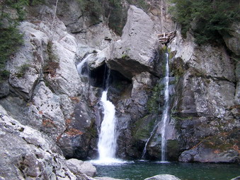 The trail down to the falls is steep at times and requires a carefully planned descent. At the base of the trail is an access road that leads to a railed area that overlooks the falls. This is another beautiful falls with plumes of water falling into a pool below. We stood right at the edge of the pool of deep, clear, cold water. I took pictures of the falls and pictures down the ravine cut by Bash Bish Creek. After staying a while we headed up the loop trail that joins the main Falls Trail near the top. At the parking lot is a massive rock out cropping and I chose to investigate this before heading down into the gorge.
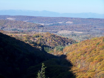 Getting up to the top of the outcropping was a challenge since it is steep and slippery and offers few hand or foot holds. By handing onto the guide wires and rails I made it to the top where Sheba was waiting. The short climb was definitely worth it. The entire outcropping is fenced in with good reason. There are dropoffs everywhere. The view from one end extends to the mountain across Falls Road. Another view is down the ravine cut over centuries by the creek and out to the surrounding valleys and hills. Directly across the ravine from the outcropping is another massive rock cliff. Walking along the railing offers a view down into the ravine and to the top of the falls. Walking around required care since the rock is polished and had a thin coating of water and some ice. Going outside the railings is forbidden and falling to your death can bring up to a $200 fine. I bet the views from the edge are spectacular if you know what I mean. After some time crawling around the outcropping, we retreated to the parking area and headed down the fire road into the gorge.
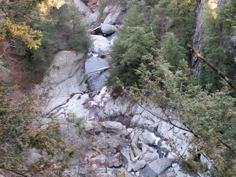 The fire road leads down into the gorge firmed by Bash Bish Creek. It is a pretty area on its own but we had to cross the creek to continue our hike. I looked up and down the creek to find the easiest place to cross. I am a little "wimpy" when it comes to crossing streams and was about to give up. I the realized that I was a couple hundred feet from the car with a complete supply of new clothing and footwear! I picked the best crossing and had NO TROUBLE getting across. On the other side the trail climbs steeply above the gorge. This climb is so steep that I had to make use of the rails and guide cables again as well as some handy roots and branches. The view from here is directly down into the gorge and down the gorge out to the valley. You can also look down to the observation area for the falls where we had been earlier. The trail moderated some but continued to climb. The difficulty in finding and staying on the trail is compounded by the numerous blowdowns, old and new. After a short but steep climb, we arrived at the junction with the South Taconic Trail on tuned south toward Alander mountain. This is the same South Taconic Trail we had used on Saturday and the marking here is just as poor as on the other end!
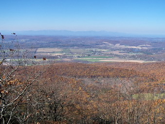 Since the first part of the trail is so steep, most of the climbing has been completed. The trail does continue to climb some until the ridge but after that levels off. It varies up and down some along the way with a slight climb at the end to the summit of Alander. As we reached the ridge we met two bow hunters coming back down from an early morning hunt. We continued on the trail over some rocky spines, through tunnels of mountain laurel and finally to an area of dwarfed pines. All along the way it was obvious we were on a ridge. Glimpses of dropoffs were evident on both sides as were the parallel ridges to the east and west. As we began to climb Alander, the trail opened up as it had the previous day and glorious views of the surrounding area appeared. As we walked from lookout to lookout the views just continued to get better. Several side trail branched off the main trail but we continued toward the summit. At the top are some signs that indicate various destinations and the remains of another tower. We met a family with their dog at the top. They had come up from the forest preserve headquarters and assured me that this was by far the easiest way to get to the top.
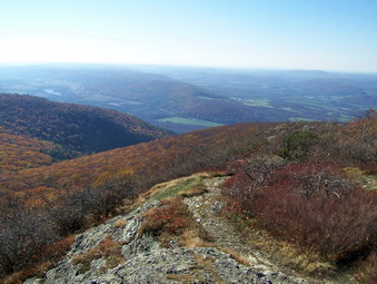 From the top of Alander the view to the south is stunning! Brace and South Brace Mountains are visible as well as Frissell Mountain, part of which forms the highest point in Connecticut. We continued on down the trail toward a rocky outcropping. Along the way we walked from one side of the ridge to the other to make sure we took in ALL the views. On the outcropping we stopped for me to take some pictures. Just below this outcropping is a small granite marker. This marks the New York-Massachusetts boundary line. It is also the highest point in Columbia County, New York. From here we retraced our steps back to the top. I decided that we would be too tired and the day would be too short to try another hike in the afternoon so we went to check out the AMC cabin just off the main trail. The cabin was Spartan but offered good shelter, bunk beds and a stove! No one was occupying the cabin so I took some pictures and we headed back to the parking area.
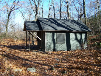 The trip back to the car was interesting. even though I knew what the views looked like walking toward them down Alander was impressive. The steep parts of the South Taconic and Bash Bish Gorge Trails were challenging since there was some snow and ice, loose rocks and a generous helping of oak leaves and pine needles. We arrived at the brook and got across without a problem. By this time there were several groups of people along the brook on both sides and the parking area was getting full. I decided that we would take the more southern route home and at least check out the trailhead for Brace Mountain on the way home. We were in the car at about 1:15 PM and had covered about 6 miles in 5 hours. Slower than usual but the views and the camera slow me down! I headed out Falls Road the Route 22 South and then Undermountain Rd.
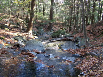
![]()
![]() On Saturday, November 10th I got up at 5:15 AM and finished packing my hiking gear and clothing for a weekend in the southern Berkshires. About two weeks before I got the idea that I would like to hike there and that it would take at least two days to do what I had planned. My wife's back was still hurting her and she was not up for this intense an experience. She also was slated to attend a wedding shower on Sunday. Sheba, on the other hand, had nothing planned so we left at 6:30 AM. I had even found a small motel that took pets! Of course, as luck would have it, the weekend that I planned to do this trip saw gas prices shoot through the roof and temperatures drop through the floor. When we were ready to leave there was three inches of snow on the ground but the roads were clear. None of this deterred us as we headed north to Catskill and crossed the Hudson on the Rip VanWinkle Bridge. I used Route 23 to get into Massachusetts and then Route 41 to head for Mount Everett and Mount Race in the Massachusetts Mount Washington State Forest.
On Saturday, November 10th I got up at 5:15 AM and finished packing my hiking gear and clothing for a weekend in the southern Berkshires. About two weeks before I got the idea that I would like to hike there and that it would take at least two days to do what I had planned. My wife's back was still hurting her and she was not up for this intense an experience. She also was slated to attend a wedding shower on Sunday. Sheba, on the other hand, had nothing planned so we left at 6:30 AM. I had even found a small motel that took pets! Of course, as luck would have it, the weekend that I planned to do this trip saw gas prices shoot through the roof and temperatures drop through the floor. When we were ready to leave there was three inches of snow on the ground but the roads were clear. None of this deterred us as we headed north to Catskill and crossed the Hudson on the Rip VanWinkle Bridge. I used Route 23 to get into Massachusetts and then Route 41 to head for Mount Everett and Mount Race in the Massachusetts Mount Washington State Forest.
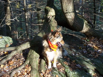 My plan was to hike these two mountains on Saturday. The descriptions seemed almost TOO GOOD to be true. Both mountains were purported to afford great views of the surrounding valleys and mountains. The view from Everett is more toward the north toward Mount Greylock and Vermont. From Race the southerly view takes in other mountains in the Berkshires and in Connecticut. Both offer views to the west into the New York Catskills and to the east. The trail between them in part of the Appalachian Trail. Race Brook Falls was described as beautiful with two different tiers. Everett has a mountain pond, Guilder Pond, on the north side. Both mountains have varied ecosystem with are unusual in that they support species normally found in warmer climates. Race Brook Falls Campsite is a primitive site near where the Race Brook falls Trail meets the AT. My only reservation was the caution that the trail crosses Race Brook which can be tricky. The crossing just below the upper falls gave me the most concern.
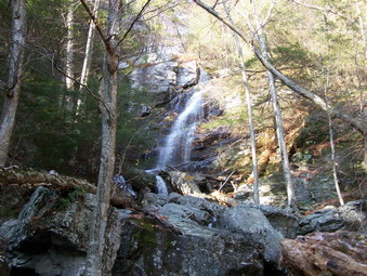 We found the parking area without any problems and parked at 9:15 AM. I was glad we were not any later since the area was small and was already only a few cars short of packed. An older couple was getting ready for a hike and started just before us. It seemed that another group was arriving and getting assembled so Sheba and I started immediately. The car thermometer read in the low 30's and predictions did not sound like the temperature would rise above 40. I had on a pair of Mountain Hardware Thermadry tights under my light Campmor Trekmor pants. On top I had my Under Armour Long Sleeve CoolGear and a Mountain Hardwear Powerstretch. The wind was not too bad and despite the temperature reading, it didn't seem too cold. I wore my lighter Mountain Hardwear Zoetic jacket instead of the heavier Mountain Hardwear Windstopper jacket. I decided that my Solo TPS 520 boots were the best choice even though they are heavy. These boots are warm and I have never had a problem with them leaking. Given the temperatures and the questionable stream crossing, I felt they were appropriate.
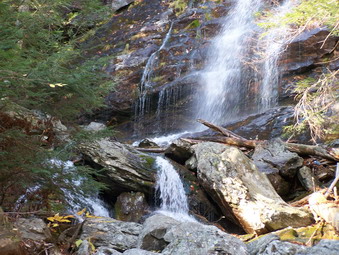 The first part of the trail ascends gently and does cross a small brook near the beginning of the trail. This crossing was no problem and we proceeded to follow Race Brook through a mixture of hardwood, softwood and mountain laurel. The trail was easy to follow and well-marked with blue paint triangles. We met the older couple along the trail. They were headed to Sage's Ravine to the south so that she could "connect" parts of the AT that she had already finished. Race Brook was easy to hear especially as we approached the lower falls. We took the side trail and began to descend to the base of the falls. This trail is steep at times and blocked by some large blowdowns. As I was to find out, Massachusetts believes that if "god put it there, God will take it away!" The falls had been visible through the trees but that view did not hint at the true beauty of the falls. We stood at the bottom of a waterfall that was at least 90 feet tall. The amount of water was not exceptionally high but there was enough water to give the feeling of how powerful and how delicate the falls can be. I took many pictures and then we headed back to the main trail. Along the way I shed the tights and my outer jacket. The air temperature had not changed much but the hiking was keeping me warm!
 Back on the main trail we head up to the upper falls. The trail began to increase in steepness and there was some snow present on the ground and on the laurel as we gained elevation. We crossed over several small streams. Near the upper part of the trail a double log bridge crosses a stream that I could jump across! As we approached the upper falls, I was hoping that we could cross and not have to abandon this hike! The upper falls are just as beautiful as the lower. They are not quite as high but falls over the rocks and into a small pool below. We easily crossed from rock to rock but I could see that the crossing could be difficult with higher water. The trail really began to increase in steepness as we approached the primitive campsite. We met up with the couple again and passed them. The campsite was deserted and we pressed on up a set of steps toward the junction with the at that would take us to the two mountains. The trail leveled some and soon we were on the South Taconic Trail which is also the AT. I decided to go to Everett first and then double back to Race.
 The first thing I noticed was that the South Taconic Trail is VERY POORLY MARKED. There are splotches of white paint haphazardly placed on some trees and rocks as you go. At some critical junctures with small side trails there are no markings. I was glad I had a map, a GPS and an excellent trail guide dog in Sheba! The walking was easy for a short distance and Mount Everett came into view. Although it is not a 3500, the view from the trail is quite impressive. Once at the base of Everett the climb is a "no-nonsense", continuous assault with few breaks. It proceeds upwards over bare rock covered by slippery oak leaves. Where there is dirt it is loose and slides. Adding a little water and some ice in spots made for and adventure filled hike. As we neared the top the varied ecosystems of Everett became obvious. Dwarf pines alternated with scrub oak. At one point I turned around on a rock outcrop and got an idea of the view I would see again and again from these mountains. There was Mount Race in the foreground surrounded by various mountains unknown to me and the valleys that separated them. The view seemed to extend as far as I could see and then some with mountains rising on the far horizon. I took some pictures and continued the short hike to the top.
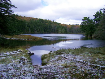 At he top of Everett are four anchors points which are all that remains of the Mount Washington Observation Tower. A little further on the trail to the other side we met another couple. As we talked I found out that he is a retired forest ranger from Catskill, New York and knew someone in Livingston Manor. Many of the people I met hiking were NOT from Massachusetts. Two more men appeared from the other side and we chatted a while before continuing on. I had decided to hike down to Guilder Pond since several books and the people I had net said it was nice. On the other side of the mountain was a nice large rock to climb on that gave a completely different, no less beautiful, set of views. After taking some pictures Sheba and I continued on DOWN the trail. What the other hikers had failed to mention was the fact that Guilder Pond is quite a descent. In addition, the north side of the mountain had a nice dusting of snow and was colder. The trail was slippery and at one point I had a choice of continuing down a steep, slippery portion of the trail or using the fire road. I met several people walking up from the parking area by the pond. They seemed cold and ill-equipped to do more than go to the top an back. I chose to use the road and we were soon at Guilder Pond. The pond was very pretty and worth the side trip as long as you are willing to climb back up to the summit of Everett!
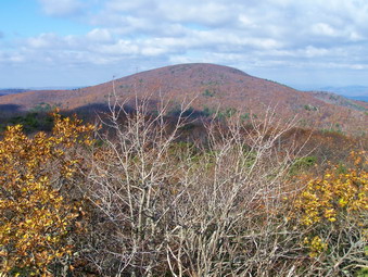 We climbed back up to the top and met the forest ranger and his wife. On the trail we also met the other group coming back down after a quick visit to the summit Sheba and I continued on and retraced our steps over the top of Everett and back down the other side. Down was every bit as challenging as up! I carefully made my way down while Sheba took advantage of four feet and nails to stay ahead of me. On the way down we met two women with several dogs but everyone including the dogs was friendly. We were soon back at the trail junction and ready to start the climb toward Mount Race. Here the initial climb was a little steep but soon began to alternate between short, steep areas and longer flatter areas. Several side trail looked like they led to lookouts but none did. I was beginning to wonder about the vaunted view from Race. Suddenly, we broke out into an open area with good views in all directions except directly south. Everett was very close and very impressive looking north. Beyond that another mountain looked and I assume that was Mount Greylock!
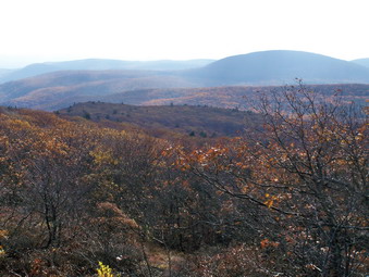 Sheba and I continued to walk up over the top. There are several false summits along the way but it is clear when you are at the highest point. We did not stop there as I had some good information that the views to the south from the southern shoulder of the mountain were nice. One guidebook said that there is a stone cairn at the true summit of the mountain. We did not find a cairn until we arrived at he southern end of the ridge and this is NOT the summit. Along the way we met two women with ANOTHER DOG! We also met the older couple returning from Sage's Ravine. The views from the southern part of the ridge are magnificent. Mountains, valleys and bodies of water are laid out below. I took many pictures before we turned around to head back. The trip back was uneventful. The snow had melted and the temperature was up but the leaves on the rocks still required careful attention to foot placement. At the campsite we met the women and three dogs we had seen on Everett. Further own we met a family from Brooklyn who had been to the lower falls. They had a VERY small dog with them but it seemed friendly. We talked and walked with them back to the parking area. The parking area was overfilled. As soon as we cleared our parking spot another car pulled in. It was about 3:00 PM and time to find our motel in Great Barrington. We had covered 9 miles in 5.5 hours. This had included MANY stops to talk and take pictures which were well worth the time.
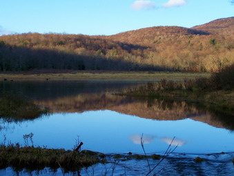
![]()
![]() On Tuesday, November 6th I decided I NEEDED to get in a quick hike after a TERRIBLE Sullivan County Teachers Conference Day. I got home and was ready to hike by 2:00 PM but had to go on an ambulance call. By the time I returned at 3:15 PM time was short but I decided I still wanted to get out. Cindy was home and we decided to take a walk around Frick Pond. Sheba was ready so we got in the car and headed out DeBruce Road. We parked at 3:45 PM and started out to Frick.
On Tuesday, November 6th I decided I NEEDED to get in a quick hike after a TERRIBLE Sullivan County Teachers Conference Day. I got home and was ready to hike by 2:00 PM but had to go on an ambulance call. By the time I returned at 3:15 PM time was short but I decided I still wanted to get out. Cindy was home and we decided to take a walk around Frick Pond. Sheba was ready so we got in the car and headed out DeBruce Road. We parked at 3:45 PM and started out to Frick.
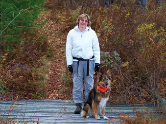 At Frick I took some pictures and then we went left around the pond. To keep the distance short we stayed on the loop trail around the pond. There is an interesting wooden walkway on his side of the pond that extends for some distance. We continued on around the pond and took a right at Times Square. This brought us right back to the pond and then the parking area. A short one hour 2.5 mile hike.
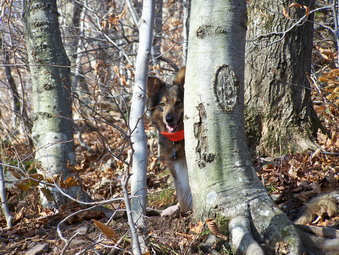
![]()
![]() On Thursday, November 1st I decided I NEEDED to get in a quick hike after school. It had been a while since I had done a 3500, so I decided to go to Balsam Lake Mountain with Sheba. We arrived in the parking area at 3:20 PM and got right to hiking. The temperature was a bit cooler at the trail head but I had packed a variety of clothing so I was ready! There was some color around us and on the mountain sides but most was muted. I still haven't seen the vibrant colors I would like. Without hurrying we made the turn up the steep side of Balsam Lake in 15 minutes. Sheba hadn't been out for a while so she was having a blast!
On Thursday, November 1st I decided I NEEDED to get in a quick hike after school. It had been a while since I had done a 3500, so I decided to go to Balsam Lake Mountain with Sheba. We arrived in the parking area at 3:20 PM and got right to hiking. The temperature was a bit cooler at the trail head but I had packed a variety of clothing so I was ready! There was some color around us and on the mountain sides but most was muted. I still haven't seen the vibrant colors I would like. Without hurrying we made the turn up the steep side of Balsam Lake in 15 minutes. Sheba hadn't been out for a while so she was having a blast!
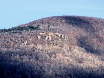 We hiked up the trail and I stopped several times to take some pictures through the now almost leafless trees. Sheba stopped for a drink at the spring and I snapped some photos. We continue on up to the tower. I climbed the steps while Sheba waited below. The wind was blowing and I was cold. I took a few moments to take some pictures. None of the views were spectacular. The rock ledges and the ruins on Graham were clearly visible. The color, or what passed for color this year, was largely gone leaving only the evergreens to break up the landscape. I climb down and shot some pictures straight up the tower before turning to hike the trail down the mountain.
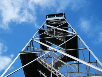 I took a few pictures of Graham and the surrounding hills while descending. We turned right at the bottom of the Balsam Lake Trail to return to the car on the Dry Brook Ridge Trail. The return trip was uneventful although I did take some photos and experimented with the sun filtering through the trees. The whole 4 miles trip took us less than 2 hours. I am sorry that as cross country season ends the clocks change and the darkness descends earlier.
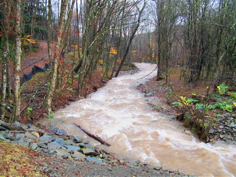
![]()
![]() On Saturday, October 27th it had been raining on and off for almost 24 hours when I decided to get out of the house. Around 3:00 PM the skies were clearing and the radar showed that a majority of the storm had passed. I decided to see how the rainfall had effected nearby streams. I though there was no better way to evaluate this than to head for Trout Pond and to get a look at Russell Brook. I intended to get some pictures of the falls and the to walk down Russell Brook Road to the "crossing". I anticipated turning around at this point. During the summer when the water was low getting across Russell Brook required some maneuvering to avoid getting soaked. I was pretty sure that the recent rains would have made this nearly impossible. I took the Endeavor so that I could drive down Russell Brook Road to the trailhead. I did just that and Sheba and I disembarked under cloudy shies. The roar of the water was obvious and I couldn't wait to get down to the brook and the falls!
On Saturday, October 27th it had been raining on and off for almost 24 hours when I decided to get out of the house. Around 3:00 PM the skies were clearing and the radar showed that a majority of the storm had passed. I decided to see how the rainfall had effected nearby streams. I though there was no better way to evaluate this than to head for Trout Pond and to get a look at Russell Brook. I intended to get some pictures of the falls and the to walk down Russell Brook Road to the "crossing". I anticipated turning around at this point. During the summer when the water was low getting across Russell Brook required some maneuvering to avoid getting soaked. I was pretty sure that the recent rains would have made this nearly impossible. I took the Endeavor so that I could drive down Russell Brook Road to the trailhead. I did just that and Sheba and I disembarked under cloudy shies. The roar of the water was obvious and I couldn't wait to get down to the brook and the falls!
 The water by the new bridge was turbid but spread out over a fairly wide area. As I looked up toward the falls, I could see the water was flowing much faster. I made a note to watch Sheba to doesn't always realize her limitations. We turned on the path toward the falls and I was careful to take my time since wet leaves on wet rocks can be a deadly combination! The amount of water coming over the falls was very impressive sending up a fine mist that drifted downstream. We made our way down to the stream bed where there was still some room to stand. I took pictures of the falls from several angles and then worked my way back up to the path. I found another short path leading up to the second level of the falls and started up.
 Getting down to the second level of the falls is a little tricky since the footing is not as good and you are MUCH closer to the water. I worked my way down carefully taking some pictures as I went. The water was a little muddy since it stirred up by the recent rain. I stopped at the bottom to take some pictures of the water and Sheba. We the made our way back out and headed for the second bridge over the outlet of Trout Pond. This bridge had been removed for replacement the last time I was at Trout. It has now been replaced with just some finishing work to do. The water here was relatively placid so I decided to go back to the parking area and walk down what is left of Russell Brook Road.
 Areas of Russell Brook road have been washed completely away but the last time I walked down it this summer it could be negotiated on foot. The first washout now has a little path along one side and we used it to continue on down the road. The water was high and moving quickly. Further down another washed out area proved more of a challenge. The high water had flooded one area completely covering what was left of the road. I almost turned around but Sheba ran up the bank and around this area so I followed her. The bank was wet and the footing far from secure but we only had to traverse a short distance and then drop back down onto the road. I kept taking pictures both up and down the stream until we arrived at the crossing near the Mud Pond trail head.
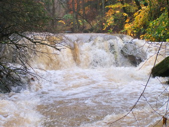 This crossing would have been virtually impossible without hip boots and even then the current would have been a problem. I cautioned Sheba to stay back and I took some pictures. At this point we turned back and went upstream again. The sky that had been showing clearing began to cloud up and a few rain drops fell. Along the way I noticed an interesting areas of rapids and took some more pictures there. By the time we were approaching the car the raindrops had turned into a sustained shower. I was glad to be back after walking about 3 miles in two hours. Much of this time was devoted to taking pictures.
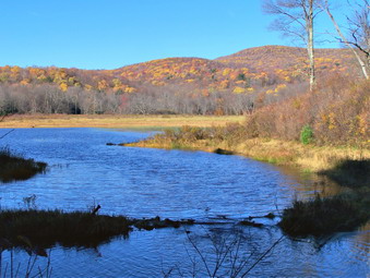
![]()
![]() On Thursday, October 25th I decided to get in a short walk after school. I had not been to Frick and Hodge Ponds for some time and hoped to get some fall pictures. I only planned a short hike so I didn't need much. When I got home, I grabbed Sheba and my pack and headed for Frick Pond. We parked and got going. There was some color along the way but mostly in yellows and oranges. The recent rain had brought many of the leaves down and the reds seemed nonexistent.
On Thursday, October 25th I decided to get in a short walk after school. I had not been to Frick and Hodge Ponds for some time and hoped to get some fall pictures. I only planned a short hike so I didn't need much. When I got home, I grabbed Sheba and my pack and headed for Frick Pond. We parked and got going. There was some color along the way but mostly in yellows and oranges. The recent rain had brought many of the leaves down and the reds seemed nonexistent.
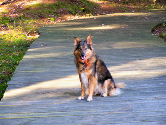 We stopped at Frick Pond to take some pictures. The scenery was beautiful as always but without the vibrant colors I had hoped for. I decided to take the trail that wraps closest to the pond. I had never taken this trail before since I am always looking for longer mileage. I was surprised to find a nice boardwalk extending for some distance on the trail. The boardwalk goes over some rather wet boggy areas on the way to Times Square. At Times Square we came upon a couple from the city. We said "hello" and they inquired about the Big Rock Trail to Hodge. I said that it was long and uphill most of the way. They decided to follow but Sheba and I easily outdistanced them.
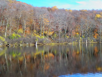 At Hodge we stopped again for pictures and the story was much the same as at Frick. Nice view but without too much color. At this point I decided to around the pond in a clockwise direction. The view from the other end was nice and I got some pictures of the trees reflected in the water. I watched for the couple we had met on the trail but did not see them. I was a little worried since they were an older couple. We returned to the junction of the Big Rock and Flynn Trails and headed down the Flynn Trail toward the parking area. About half way down we caught up with the couple. I guess they decided the hike up Big Rock was enough. We hike on back to the car to complete a short but worthwhile hike.
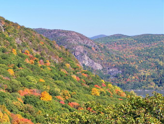
![]()
![]() On Sunday, October 21st I came home from church ready to take a short walk before refereeing a soccer game. I called the coach and found out there was no soccer game. I decided to take Cindy and Sheba to Storm King Mountain. We decided to get going right away since the drive is rather long. We packed some lunch but skipped our customary lunch trip to Peez Leweez! I hoped to see some nice fall colors and have a day with a minimum of haze. Well, one out of two isn't bad! We parked at the area on 9W where the orange trail heads UP to Storm King. The views were nice but there was little color to speak of. The leaves in this area have STILL not changed completely. However, there was only a small amount of haze in the distance and I anticipated some good pictures.
On Sunday, October 21st I came home from church ready to take a short walk before refereeing a soccer game. I called the coach and found out there was no soccer game. I decided to take Cindy and Sheba to Storm King Mountain. We decided to get going right away since the drive is rather long. We packed some lunch but skipped our customary lunch trip to Peez Leweez! I hoped to see some nice fall colors and have a day with a minimum of haze. Well, one out of two isn't bad! We parked at the area on 9W where the orange trail heads UP to Storm King. The views were nice but there was little color to speak of. The leaves in this area have STILL not changed completely. However, there was only a small amount of haze in the distance and I anticipated some good pictures.
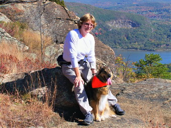 After parking, we took in some of the beautiful views from the parking area and then immediately headed for the orange trail. The weather was very warm and after a short walk I changed into a short sleeved shirt since I was quickly overheating. We made our way up the orange trail over the rather steep rock outcroppings and ledges to the yellow Stillman Trail. We again ascended over rocky terrain as this trail climbs to a point which is actually higher than the highest point the trail reaches on Storm King! We stopped briefly at the lookout over 9W and the parking area. This viewpoint also offers a clear view of North Point and the Hudson River to the south. We continued on the Stillman Trail passed the junction with the Bluebird and Howell Trails.
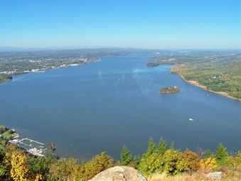 As we headed toward the lookouts on Storm King, we encountered a number of different groups of people. Some were hiking and others enjoying themselves in the sun on the warm rocks. It was getting pretty crowded so we passed by some of the groups and headed for the "main" lookout. There were fewer people at this lookout and we stopped to take in the view. I took some pictures and my wife seemed impressed by the scenery. The haze that normally blocks the view was minimal and we could see far passed the Newburgh-Beacon Bridge. After only a short time, other people began to arrive so we headed on down to the junction of the Stillman Trail and the white Bypass Trail. There is a nice lookout here and there were no people present. We took in the view and then continued to the end of the Bypass Trail.
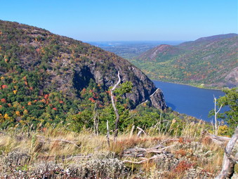 At the end of the Bypass Trail we turned left onto the blue Howell Trail and headed for North Point. This trail descends into The Clove and then ascends the other side to North Point. We passed by the now defunct Crossover Trail and the white Stillman Springs Trail. When we got to the junction with the Bobcat Trail we stayed on the Howell Trail as it turns left and ascends North Point. It was on this ascent that I noticed Cindy was lagging behind significantly. The weather was so warm that she was having trouble breathing. She was also wearing a relatively new pair of shoes with heavier socks than she had tried before. Her toes were crowded and she was beginning to feel lousy! We made it to "The Rock" at the top of North Point and stopped for a rest. The view was great and only a few other people were present.
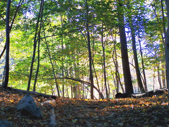 I decided we needed to return by the fastest route possible as we retraced our steps back down the Howell Trail. In retrospect, we probably should have gone out to 9W by the Bobcat Trail. I could have walked up 9W to get the car and Cindy could have rested. Instead we elected to hike the Howell Trail back through "The Clove". The down part is not good on aching toes but the up part is a killer when you are tired! We stopped several times to rest and finally got to the junction with the proposed, marked and now defunct trail/woods road leading back to the parking area. We turned left off the Howell trail and were soon back at the lot. The 4.5 mile hike had taken several hours with as much time spent stopping as hiking!
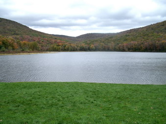
![]()
![]() On Sunday, October 14th I took Cindy, Krista, Brad (Krista's boyfriend) and, of course, Sheba to Alder Lake. After church we ate at Peez Leweez and then headed out. The weather was cloudy and overcast with rain threatening but not in the forecast. The access road into Alder Lake is sadly in need of repair. It is barely passable without an SUV with high clearance. We parked and walked passed the Coykendall House and onto the trail on the "left" side of the pond. I wanted to get at least as far as the Beaver Meadow lean-to to take some pictures. The walk around the lake was easy and we were quickly at the Millbrook Ridge Trail where we made a left.
On Sunday, October 14th I took Cindy, Krista, Brad (Krista's boyfriend) and, of course, Sheba to Alder Lake. After church we ate at Peez Leweez and then headed out. The weather was cloudy and overcast with rain threatening but not in the forecast. The access road into Alder Lake is sadly in need of repair. It is barely passable without an SUV with high clearance. We parked and walked passed the Coykendall House and onto the trail on the "left" side of the pond. I wanted to get at least as far as the Beaver Meadow lean-to to take some pictures. The walk around the lake was easy and we were quickly at the Millbrook Ridge Trail where we made a left.
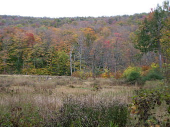 This trail climbs consistently toward Millbrook Ridge which, at its highest point, is just under 3500 feet! At times the climb can be a little taxing but the trail is in good shape. There was quite a bit of water in Alder Creek which contrasts with the situation all summer. The vegetation was a little wet but the frosts lately have done in the nettles and the path was pretty clear. After about a mile the first beaver meadow came into view and I took a few pictures. I had been taking pictures all along of the trail but none really were distinctive.
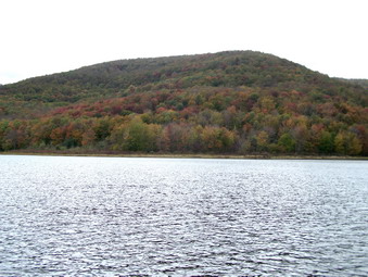 We stopped at the lean-to at the second beaver meadow and I took some more pictures. The rest of the group waited for me as Sheba and I walked up to the last beaver meadow. I had hoped to get some really good shots but they were only average. The leaves that had turned were not very brilliant in color and many had already fallen from the trees from the combination of wind and rain. The remaining leaves were still green. As I walked back to the lean-to, a light rain began to fall but only lasted a few minutes. We retraced our steps back to the loop trail around Alder Lake and turned left to circle the lake in the opposite direction.
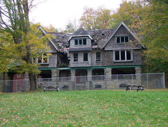 I had not been on this side of the lake for some time. In places large portions of the trail are washed out from the spring floods. We decided to stick close to the lake rather than follow the main loop trail. This path is a little more narrow than the main trail but affords better views of the lake. We crossed the dam and I went down below it to take some pictures. On the "lawn" I took some pictures of the Coykendall Mansion. This beautiful structure is crumbling and deteriorating more and more. There was some talk about restoration but the cost now would be prohibitive. We got in the car and returned to Livingston Manor after the short but fun 4 mile trek.
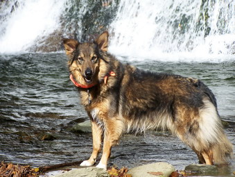
![]()
![]() On Saturday, October 13th I had a cross country meet in the morning as is usual during the fall. The meet started and ended early and I was home by 2:00 PM. It had rained some for the previous two day so I decided to check out the falls on Russell Brook. I also wanted to find some fall color. I didn't even have to change since I had worn some hiking clothes and waterproof boots to the meet! I got my pack and my dog and headed to Trout Pond. Things were a little wetter this time than last and I could hear the water cascading down Russell Brook and over the two tiers of the falls. Unfortunately, the colors weren't very spectacular and many of the leaves had fallen off the tress in the rain and wind of the previous two days.
On Saturday, October 13th I had a cross country meet in the morning as is usual during the fall. The meet started and ended early and I was home by 2:00 PM. It had rained some for the previous two day so I decided to check out the falls on Russell Brook. I also wanted to find some fall color. I didn't even have to change since I had worn some hiking clothes and waterproof boots to the meet! I got my pack and my dog and headed to Trout Pond. Things were a little wetter this time than last and I could hear the water cascading down Russell Brook and over the two tiers of the falls. Unfortunately, the colors weren't very spectacular and many of the leaves had fallen off the tress in the rain and wind of the previous two days.
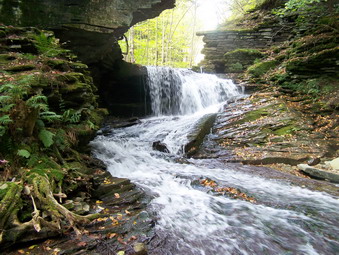 We did stop first at the falls and went down to the base to take some pictures. The amount of water had increased and I played with some different angles and effect. I did get some nice pictures including some of Sheba. After coming up from the falls, I decided to walk the far bank up to the upper tier of the falls. I had never been on this side of the brook and the view was nice. We descended into the area below the falls and I again took pictures. After a few minutes here, we returned to the main trail, signed into the register and started the hike around the loop turning left first to do the steeper part of the hike first.
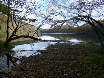 The area from the register box to the first bridge is torn up and the bridge is being replaced by what appears to be a MUCH more substantial structure. Since all this work is far beyond the needs of hikers, campers or even fishermen, I have to conclude that this is being done for the use of snowmobiles. It looks horrendous and I don't like the disruption of this beautiful natural setting! We continued through this area as quickly as possible and climbed the hill toward Mud Pond. At Mud Pond we walked through the woods down to the pond. There was nothing really spectacular abut the scenery but I took a few shots before retracing our steps and heading back to the main trail. Once on the trail we headed up toward Cherry Ridge and walked toward the upper end of Trout Pond.
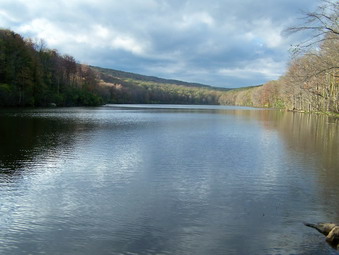 The inlet which was absolutely dry last time was flowing with water and the pond looked higher. Several groups were setting up camp on the other shore but the lean-tos were not occupied. I took some pictures and we continued on around the pond. At the outlet we stopped for a few minutes. I took some pictures and played WI the reflections of the trees on the shore in the water of the pond. The walk back to the register was uneventful as was the trek back UP to the car. We took a little more than two hours for the hike but that included MANY stops for photographs along the way.
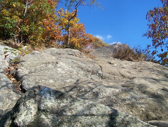
![]()
![]() On Monday, October 8th I led a group of Liberty staff members on a hike around Storm King Mountain. We met at Liberty and headed for Route 9W North from West Point. I had never done the hike from this parking area so I was not sure exactly where to park. I had seen the parking area from North Point when I looked down on it the last time I was at Storm King. I had no trouble finding the lot where we met another staff member. I had chosen this parking area since it is at a higher elevation and would require less vertical gain than coming from the Storm King Highway. The guidebooks said this was the easier route but EASIER is a relative word as we soon discovered!
On Monday, October 8th I led a group of Liberty staff members on a hike around Storm King Mountain. We met at Liberty and headed for Route 9W North from West Point. I had never done the hike from this parking area so I was not sure exactly where to park. I had seen the parking area from North Point when I looked down on it the last time I was at Storm King. I had no trouble finding the lot where we met another staff member. I had chosen this parking area since it is at a higher elevation and would require less vertical gain than coming from the Storm King Highway. The guidebooks said this was the easier route but EASIER is a relative word as we soon discovered!
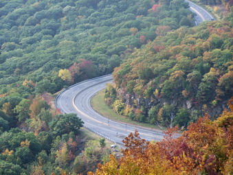 As soon as we got on the orange trail at the parking lot I knew we were in trouble. The trail climbs steeply for some distance. Some sections are across open rock faces while others have some areas that require some real scrambling. This is what I really like but its not for everybody! After leveling off, the trail again climbs until it meets the yellow blazed Stillman Trail. There are some nice lookouts along the way. We turned right on the Stillman Trail and climbed some more. Just after the trail junction is a beautiful lookout back over Route 9W and the parking area. This viewpoint also gives the first of many views of the Hudson, this one to the south. We stopped for some pictures and then continue on. We passed the junctions with the Bluebird and Howell Trails and stayed on the Stillman Trail.
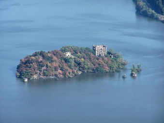 After a short distance, the views of the Hudson to the north appear. Each lookout seems better than the last until the final one which gives a wide-open view north toward the Newburgh-Beacon Bridge and beyond. Breakneck Ridge on the eastern side of the river was clearly visible as were Pollepel Island with Bannerman Castle and several marinas and towns laid out below. The views in the distance were somewhat obscured by a haze but were clearer than the last time I was on Storm King. I hoped for even better views in the afternoon. The rest of the group was impressed by what they saw and we stopped to take pictures before following the trail toward the southeast. At the junction with the Bypass Trail we followed the white markers as this seemed the quickest way back to the car.
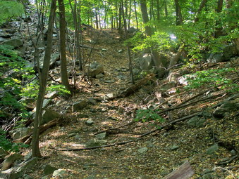 I intended to turn right on the Howell Trail and return to the Stillman Trail. From here we would descend the orange trail back to the parking lot. The thought of going back down the orange trail thrilled me but not everyone felt the same way. Somehow I missed the right turn onto the Howell Trail which I quickly realized when it took a pronounced turn to the left and DOWN. Directly ahead was a trail marked as "proposed" on the map. Marks on the trees indicated that the trail had been marked but that the marks had been painted over. We decided that we would try this trail since it was short. The markings were clear and the trail was wide. It led directly back to the parking lot with only a short climb at the end. I saw no reason not to use this trail and it is the EASIEST way by far to get to the top of Storm King. At the parking lot the rest of the group called it a day after an enjoyable two hours. Sheba and I had other ideas!
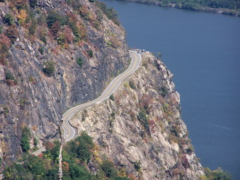 We retraced our steps on the "proposed" trail and were soon back at the junction with the blue marked Howell Trail. We turned right and descended into The Clove. We continued on the Howell Trail and reversed our route from the last trip by heading for North Point. As we walked the weather seemed to clear and the sun came out from behind the clouds. This had the advantage of burning off the haze but the temperature and humidity were more typical of August than October! The views from North Point were much clearer than the last time and I took a LOT of pictures. We continued on the Howell Trail to the south and then to the east toward Pitching Point. The views here were also nicer than the last trip. We soon descended to Storm King Highway, the lowest point on the hike.
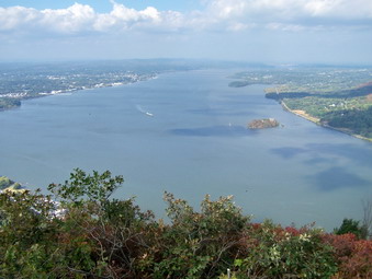 From here we picked up the Stillman Springs Trail and headed back to the Howell trail to complete the loop. As we walked I decided to try to find the Crossover Trail. This trail had been blazed in red but I noticed last time the blazes had been painted over. I found the trail and it was difficult to follow but not as hard as bushwhacking the Catskills! Along the way the trail passes by what probably is a pretty little pond when there is some water in it. The "pond" was no more than a grassy clearing in the woods. We turned right back on the Howell Trail and headed down into and then up out of The Clove. Although this climb is mild compared to a 3500, it still seems tiring to me. We turned right on the white Bypass Trail since I wanted to head back to the top of Storm King to see if the haze had cleared. After a quick walk to the Stillman Trail, a left turn and a slight ascent we were again on Storm King. The sun was out, the wind had come up and the views were MUCH clearer. We stopped and I took more pictures.
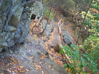 At this point I decided that I did NOT want to simply retrace our steps back to the car. I wanted to try a new route so we turned around at went back down the Stillman Trail and followed it as it looped north and then west. The trail descends through some pine trees as it hugs the north side of Storm King. The trail switchbacks several times and I knew it was important to find the red/blue marked Bluebird Trail. At one point we came to a bridge under construction on the trail. It seemed safe enough so we crossed but it was obvious more work was being done on it. After a few more switchbacks we came upon the Bluebird Trail. Before turning left on the trail, we turned right and headed down and old woods road. The map marked the area as "ruins" and I wanted to check it out. There were indeed ruins and I took some pictures.
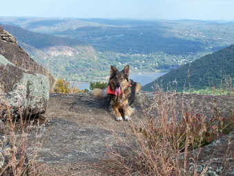 We headed back to the Bluebird Trail and started to climb. It should have been clear to me that we had descended for some distance on the Stillman Trail and would have to go back UP to the parking area. This trail was short but it did ascend steeply at times with several nice lookouts along the way. When we met the Stillman Trail AGAIN we turned right and headed down until the orange trail appeared on the left. Descending the steep orange trail was fun and we were soon back at the parking area. We covered a total of about 8 miles in 5 and a half hours. This is slow for us but included the time with our group and MANY stops for pictures.
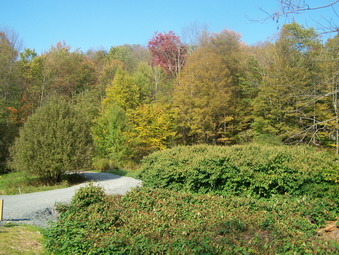
![]()
![]() On Friday, October 5th I had an opportunity to get in a short hike and I took it. I hadn't been to Trout Pond in some time so I went home changed, got my pack and Sheba and headed out. We parked at the upper parking lot on Morton Hill Road and started walking. I was looking for some good fall color but not much was evident. What was obvious was how dry everything was around us. The road was dusty with a layer of dead, dry leaves on top. There has been so little rain that the leaves are changing to very dull colors and then falling off the trees. I am not optimistic about ANY bright colors this fall but there is still some time to go.
On Friday, October 5th I had an opportunity to get in a short hike and I took it. I hadn't been to Trout Pond in some time so I went home changed, got my pack and Sheba and headed out. We parked at the upper parking lot on Morton Hill Road and started walking. I was looking for some good fall color but not much was evident. What was obvious was how dry everything was around us. The road was dusty with a layer of dead, dry leaves on top. There has been so little rain that the leaves are changing to very dull colors and then falling off the trees. I am not optimistic about ANY bright colors this fall but there is still some time to go.
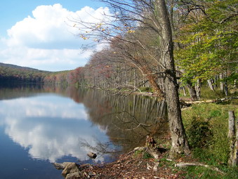 There seemed to be some water in Russell Brook and I decided to stop at the falls on the way back. I signed in at the trail head and started up toward Trout Pond. The DEC is apparently again sponsoring the "rape of Trout Pond"! The DEC or their contractor has run a bulldozer up the woods road/trail to the pond. This destroys and natural vegetation holding the dirt in place. It DOES make a nice, smooth track for snowmobiles. After doing the same thing last year, the spring rains washed away much of the loose earth leaving behind mostly rocks. There may be some reason for this but I have yet to find one! Trout Pond itself is low but the dam is still intact. There just hasn't been much rain
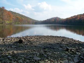 At the upper end of the lake the inlet is completely dry. The bridge here is still missing but hardly necessary at this time. I walked out from the inlet to an area that is usually several feet under water. After a short break, Sheba and I continued on around the trail to Mud Pond. This was uneventful but enjoyable. I took some pictures but none show how beautiful the trees can be given the right conditions. At Mud Pond we turned left to head back to the parking lot. The scars from a bulldozer were again evident. The grass was torn up and on some of the steeper slopes erosion was already present.
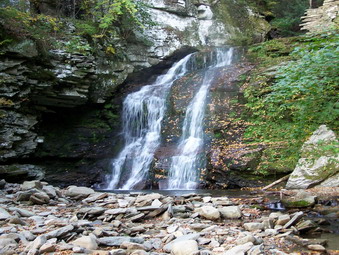 As we approached the camping area near the register, I could see a tent setup. No one was near and we continued on. The bridge across the small creek that serves as an outlet to the pond was ripped out! I assume that this will be replaced with a much larger structure capable of handling much larger snowmobiles. What a shame! We met a few people who looked like they might take advantage of the favorable weather predictions for the weekend. They were carrying camping gear. There was some water going over the falls and I experimented with some camera settings. I managed to take a video of the falls which would look better if I had tripod. We finished the 4 miles in about 2 hours which is our usual time for the hike.
![]()
![]() On Wednesday, Sept 26th I had some family affairs to attend to in the morning so I did not go to work. By noon my obligations had been completed and I decided not to "waste" the rest of the day. I pack up the pack and Sheba and headed for Storm King Mountain. When we had climbed Breakneck Ridge, the views of Storm King were dramatic and unavoidable. Most guide books call it "the signature hike of the Hudson Highlands" and I wanted to try it. Since I had not been there before, I knew finding the parking area could be a challenge. I took the Quickway to Long Mountain Parkway (Route 6) and the Route 293 toward West Point. At West Point I went straight ahead onto Storm King Highway. Cornwall in only about 4 miles from West Point so I knew the parking area must be around halfway. I pulled into the first lot but did not find the trail head. The second lot was just up the road, I parked on the right and found the beginning of the trail on the left almost immediately. There is a rock with an inscription dedicated to the Stillman Family that donated much of the land to the Palisades Interstate Park Commission to create the Storm King area. Sheba and I were on the trail by 1:05 PM.
On Wednesday, Sept 26th I had some family affairs to attend to in the morning so I did not go to work. By noon my obligations had been completed and I decided not to "waste" the rest of the day. I pack up the pack and Sheba and headed for Storm King Mountain. When we had climbed Breakneck Ridge, the views of Storm King were dramatic and unavoidable. Most guide books call it "the signature hike of the Hudson Highlands" and I wanted to try it. Since I had not been there before, I knew finding the parking area could be a challenge. I took the Quickway to Long Mountain Parkway (Route 6) and the Route 293 toward West Point. At West Point I went straight ahead onto Storm King Highway. Cornwall in only about 4 miles from West Point so I knew the parking area must be around halfway. I pulled into the first lot but did not find the trail head. The second lot was just up the road, I parked on the right and found the beginning of the trail on the left almost immediately. There is a rock with an inscription dedicated to the Stillman Family that donated much of the land to the Palisades Interstate Park Commission to create the Storm King area. Sheba and I were on the trail by 1:05 PM.
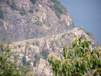 The initial part of the Howell Trail is a nice walk through the woods. Typical of this area, there is little undergrowth and the trail wanders at times and is not too well defined. After a short distance, the pitch of the trail increases along one of the many woods roads. The trail then makes a sharp right and ascends to some lookouts over the Hudson. Some parts of this climb are steep but some switchbacks and stone steps make the ascent easier. The viewpoints over the Hudson are the most amazing part of the hike. At each viewpoint I was sure that this was the best one and there could be none better. This continued until the very top of Storm King! The first major lookout is Pitching Point on the eastern shoulder of the Crow's Nest. From here you can look across the Hudson to Breakneck Ridge and the fire tower on South Beacon Mountain. Storm King Mountain is impressive. The highway winding around the mountain is clearly visible. The haze on this hot and humid day blocked even clear views of the Newburgh-Beacon Bridge but I am sure that on a clear day you can see well up the Hudson! I will surely return on a cool, clear autumn day. There are also views south toward west point. Bannerman Castle is clearly visible.
 From this area the trail drops some and then ascends to a burned over area that looks out over the river, Storm King and Route 9W. Standing on a rock here it was obvious to me that this was the area I had observed 35 minutes earlier from another vantage point. The weather was very warm with temperature nearing 90 and very humid. I gave Sheba a drink and a treat and made sure I drank continuously from my Camelbak. We continued on the Howell Trail down the hill in the direction of Route 9W. Near the bottom of the descent a white trail crosses as does an old woods road. We turned onto a woods road but I was careful to look for the blue blazes. After a short distance we met another hiker with his pit bull-dalmatian. He was returning early because his dog was overheating! I made a note that Sheba and I had endured tougher conditions this summer but I also stopped so that both of us could get a drink. The trail continued to descend toward The Clove and we followed it. I avoided turning on some of the marked and unmarked trails and roads that are prevalent in this area.
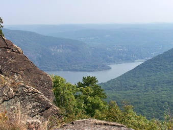 We reached what seemed to be the lowest point in The Clove where there was a small creek with a minute amount of water. From this point the trail climbed, many times steeply, toward Storm King mountain. The presence of switchbacks and stone steps helped mitigate some of the difficulty. After hiking through rocky fields and over boulders, the terrain change to more of a hardwood forest and the trail leveled some. At the last short climb we had caught up to and passed a group of Korean hikers. The scale of the maps for the Hudson Highlands is much different than the scale for the Catskill maps. I sometimes interpret them incorrectly usually thinking that I have a longer distance to hike when the distance is actually much shorter. We reached a wood clearing on the Howell Trail where the Koreans were taking a break and, after climbing to a lookout, we continued on the blue and yellow trail down the other trail. We stayed on this trail bearing left when the blue and red trail turned right. Soon we were at another magnificent lookout over the Hudson River, Route 9W and the surrounding hills. I took some MORE pictures and then continued down. On orange trail and a sign that said "9W Parking" were the first indication that I had gone TOO FAR. After confirming this on the map, Sheba and I returned to the area where the Koreans had rested. Sure enough! This was the point where the yellow Stillman Trail turned right to trace the outline of the summit of Storm King. We turned onto the trail. The "detour" had been worthwhile since the views were nice and I would suggest anyone take this side trip!
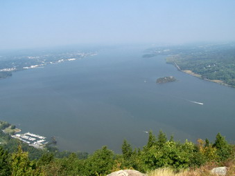 We were now on the Stillman Trail named for the family that donated so much of the land for this park. The trail skirts the summit of Storm King and offers view after view with each being more spectacular than the last. The best view is closet to the summit and offers and unimpeded view north toward the Newburgh-Beacon Bridge and beyond. On this day the haze all but obscured the bridge. Next time I will bring Cindy and pick a crisp, clear autumn day. The Stillman Trail continues south and then hooks back north so Sheba and I turned right at the most southerly end of this trail on the white marked Bypass Trail and headed back toward the blue marked Howell Trail. The Bypass Trail passes through some interesting rocky areas and has some views. At the Howell Trail we turned left and headed back DOWN into The Clove which we had come UP through some time before.
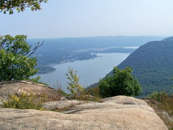 I thought about turning left on the red Crossover Trail but decided to continue south on Howell until the Stillman Springs Trail back to the parking area. This was just as well as the Crossover Trail blazes had been painted over indicating it was no longer available. We turned left on the white blazed Stillman Springs Trail and headed back to the car on a woods road. The trail continued downward through some nice forested areas until we were back on the Storm King Highway just north of the parking area. We had covered 6 miles in about 4 hours but this included MANY stops for pictures and drinks.