
Silver Hollow
| Quick Look - Silver Hollow from Notch Inn Road | |||||
|---|---|---|---|---|---|
| Difficulty | Round trip | Total climb | Location | Internet Maps | |
| 3.5 mi. | 1150 ft. | N42.12270 W74.22760 | AllTrails | ||
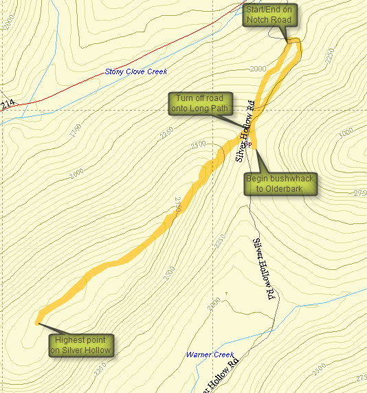
Silver Hollow is one of the CHH peaks that IS on public land and has a trail to the highest point. In fact, the trail is the Long Path. The trailhead is at the end of Notch Road off Route 214 north of Phoenecia and south of Hunter. Once you turn on the road continue to drive until the road begins to level off. You will see "Privately Maintained" signs at some point. Park in one of the pulloffs along the road BEFORE these signs. If you want to park at the small parking area at the dead end, make sure you get permission from the owner of the house at the end of the road. Be sure NOT to block the driveway of any of the private homes on the road. The first part of the trail heads up an old woods road which is highly eroded in places and may resemble a cross between a rock scramble and a stream. The trail has been routed around the worst of these areas. This trail was once part of the Long Path but the new Warner Creek Trail over Plateau has eliminated the need for a road walk along 214.
After about .5 miles turn right off the road onto the Long Path marked with aqua blazes. This trail also goes left and ascends to the Devil's Path on Plateau. The next .5 miles or so are a gradual climb up to the summit plateau of Silver Hollow. Once on the flat part at the top, the trail wanders back and forth but stays near the edge of the ridge. There are some views of Little Rocky (not the CHH peak) and Olderbark which are better when there is less vegetation on the trees. After around .5 miles, you will have crossed several "higher" spots of land any of which may be the highest spot on the ridge. I walked until I started to descend and the returned the way I came. Back on the road I started a bushwhack toward Olderbark but decided that since I could not get any visual I would try that peak from another trailhead.
| Quick Look - Willow Trail to Silver Hollow | |||
|---|---|---|---|
| Difficulty | Round trip | Total climb | Internet Maps |
| 11.5 mi | 4880 ft | AllTrails | |
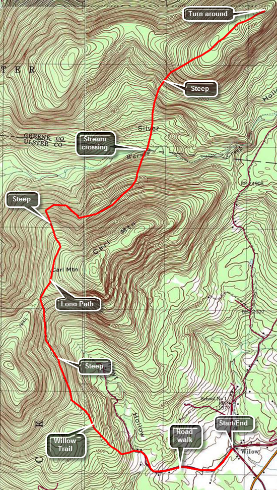 Turn off Route 28 onto the main street in Phoenicia. Continue on Main Street which becomes Route 40 and passes the main parking area for Mount Tremper. At the intersection with Route 212 turn left and drive to VanWagner Road on the left. Turned left on VanWagner Road to get to the small hamlet of Willow. Along the way you will pass the Woodstock Farm Animal Sanctuary on the left. Just passed this is the intersection with Jessup Road which leads to the Willow Trail. On the corner is the Willow Post Office where you will park since there is no parking near the actual trailhead. The post office appears to be a construction trailer with a zip code sign! To begin your hike walk up Jessup Road for about 1.1 miles passing the end of the public road along the way. Turn left onto the woods road that is the first part of the trail. The trail climbs from the post office but after the turn into the woods it begins to ascend more steeply. The grade averages about 15% until it levels off at 2 miles. Along the way the route transitions from the woods road to a trail that, in some cases, hangs right on the edge of the hill. It becomes rocky and the footing can be difficult especially in wet weather. At the two mile mark the trail elevation has increased from about 1100 feet to almost 2100 feet. Along the way you may get some views of the mountains and valleys to the north and east. After a quarter mile of relatively flat walking, the trail again begins to ascend gaining another 400 feet to the trail junction with the Warner Creek Trail at 2.7 miles. At the trail junction turn right to follow the Warner Creek Trail north toward Carl Mountain. At about 2.8 miles the trail begins to drop some as it negotiates a route that does not actually reach the summit of Carl Mountain. The trail descends off the slopes of Carl Mountain until at 4.25 miles it crosses Warner Creek. This can be a tricky crossing when the water is high. Continue on the trail as it begin an ascent up to the ridge. This ascent can be steep at times as it gains 1400 feet in less than a mile. Once the ascent is complete walk along the flat summit of Silver Notch until you are ready to turn around. To complete the out and back hike simply turn around and follow your route back to the car.
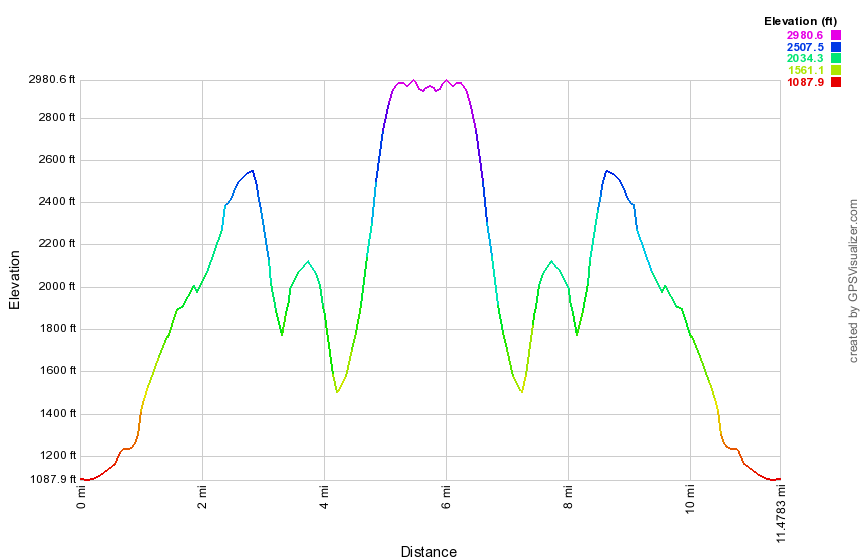
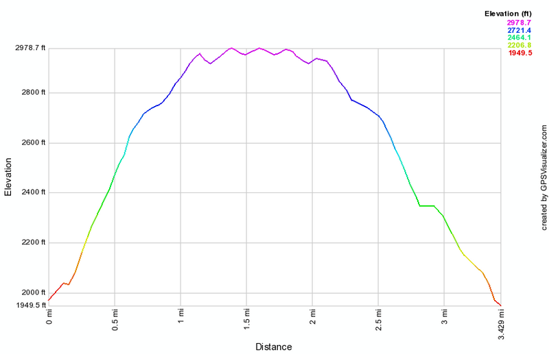
(The image shows the profile of the hike. Remember that all vertical profiles are relative!)