
Mount Hayden
| Quick Look - Mount Hayden | |||||
|---|---|---|---|---|---|
| Difficulty | Round trip | Total climb | Location | Internet Maps | |
| 4.2 mi. | 1330 ft | N 42.3586 W 74.2189 | AllTrails | ||
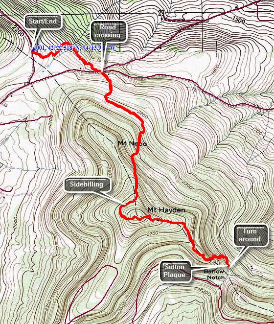 In the village of Windham find Route 21 north. Drive 4.5 miles north and turn right onto Route 10. Route 10 will make a sharp left up a hill. Park in the first pulloff on the right. The trail crosses just south of the pulloff. The first .7 miles of trail descends through some hardwoods and then is flat until the junction of Cunningham and Sutton Roads. Walk across the road intersection and pick up the trail on the other side. It starts out on an old road but quickly turns right into the forest and over the next 1.2 miles gains over 850 feet. The trail passes east of the summit of Mount Nebo in a generally south or southeast direction. You will start to ascend Mount Hayden by sidehilling around the west shoulder and passing the summit. The trail turns sharply east and climbs the final 125 feet to the top. There are no viewpoints along the way although there are some places where views might be available when the leaves are off the trees. The summit of Mount Hayden is 2.1 miles into the hike. Along some parts of the trail blazes are few and far between in some critical places.After summiting Mount Hayden, turn around a retrace your route back to the car.
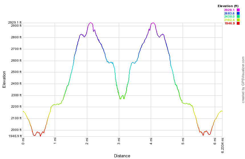 (The image at the left shows the profile of the hike. Remember that all vertical profiles are relative!)